Proceedings - Balai Penelitian Tanah
Proceedings - Balai Penelitian Tanah
Proceedings - Balai Penelitian Tanah

Create successful ePaper yourself
Turn your PDF publications into a flip-book with our unique Google optimized e-Paper software.
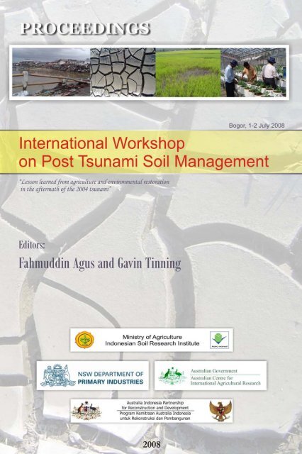
<strong>Proceedings</strong><br />
International Workshop on Post-tsunami<br />
Soil Management<br />
“Lessons learned for agriculture and environmental<br />
restoration in the aftermath of the 2004 tsunami”<br />
Bogor, Indonesia, 1-2 July 2008<br />
Editors:<br />
Fahmuddin Agus and Gavin Tinning
ii<br />
Citation:<br />
Agus F and Tinning G (Eds.). 2008. <strong>Proceedings</strong> International<br />
Workshop on Post-tsunami Soil Management, 1-2 July 2008. Cisarua,<br />
Bogor, Indonesia. Indonesian Agency for Agricultural Research and<br />
Development, Jakarta, Indonesia and New South Wales Department<br />
of Primary Industries, Wallongbar, NSW, Australia.<br />
This <strong>Proceedings</strong> has been produced with the financial assistance of<br />
the Australian Centre for International Agricultural Research (ACIAR).<br />
The contents of this document are the sole responsibility of each<br />
author and can under no circumstances be regarded as reflecting the<br />
position of ACIAR.<br />
Indonesian Soil Research Institute<br />
Jln. Ir. H. Juanda 98, Bogor 16123<br />
Indonesia<br />
Email: SoilRI@Indo.net.id<br />
http://balittanah.litbang.deptan.go.id<br />
New South Wales Department of Primary Industries<br />
Wallongbar, NSW<br />
Australia<br />
Design and lay out by Setiari Marwanto<br />
ISBN 978-602-8039-09-3<br />
International Workshop on Post Tsunami Soil Management, 1-2 July 2008 in Bogor, Indonesia
iii<br />
FOREWORD<br />
The active subduction zones between tectonic plates in the Asian<br />
region make coastal areas in the Indian and Pacific oceans vulnerable<br />
to earthquakes and tsunami events. The earthquake that occurred<br />
southwest of Banda Aceh on Sunday 26 December 2004 was the<br />
second largest instrumentally recorded earthquake in history and<br />
generated a large tsunami that killed 230,000 people on Indian Ocean<br />
coastlines, making it the single worst tsunami in history in terms of<br />
lives lost. Agricultural impacts of the tsunami included soil salinity,<br />
altered soil nutrient status, sediment deposits, and scouring and<br />
mixing of topsoil with tsunami debris.<br />
Since the tsunami, national and international organizations have<br />
undertaken research and development to restore agricultural land<br />
affected by the tsunami. The Indonesian Soil Research Institute (ISRI)<br />
and New South Wales Department of Primary Industries have jointly<br />
organized a workshop to compile lessons learned and experience<br />
in recovering agriculture and livelihood.<br />
We thank all the contributors, the participants and the organizers of<br />
this workshop.<br />
Dr. Gatot Irianto Sumardjo<br />
DG Indonesian Agency<br />
for Agricultural Research<br />
and Development<br />
Dr. Gamini Keertisinghe<br />
Program Coordinator<br />
Australian Centre for International<br />
Agricultural Research<br />
International Workshop on Post Tsunami Soil Management, 1-2 July 2008 in Bogor, Indonesia
iv<br />
OPENING REMARKS<br />
MINISTER OF AGRICULTURE OF THE REPUBLIC OF INDONESIA<br />
International workshop on post-tsunami soil<br />
management<br />
“Lessons learned for agricultural and environmental restoration<br />
in the aftermath of the 2004 tsunami”<br />
1-2 July 2008<br />
Safari Garden Hotel, Jln. Raya Puncak 601, Cisarua-Bogor, Indonesia<br />
Distinguished guests, Ladies and Gentlemen,<br />
On behalf of the Government of Indonesia, I would like to extend a<br />
warm welcome to all of you, especially to those who have been<br />
travelling from abroad, to actively participate in this International<br />
workshop on post-tsunami soil management.. Special thanks are<br />
addressed to Dr. Gamini Keertisinghe the Program Director from the<br />
Australian Centre for International Agricultural Research (ACIAR) for<br />
his commitment to support agricultural research collaboration between<br />
Australia and Indonesia. We thank Dr. Peter Slavich and his group<br />
from New South Wales Department of Primary Industries, Australia for<br />
the technical collaboration with researchers from the Indonesian<br />
Agency for Agricultural Research and Development (IAARD). The<br />
attendance of this workshop by national and international NGO’s as<br />
well as representatives from local government will balance out the<br />
discussion from the mere scientific perspectives to practical reality and<br />
thus we are grateful to their participation. All other elements –<br />
researchers and practitioners - who have allocated their time and<br />
resources to contribute to this important event are highly appreciated.<br />
International Workshop on Post Tsunami Soil Management, 1-2 July 2008 in Bogor, Indonesia
Ladies and Gentlemen,<br />
v<br />
We are situated on top of the active subduction zones of the Indian<br />
and Pacific oceans, an area vulnerable to earthquakes and tsunami.<br />
The earthquake that occurred in Aceh on Sunday 26 December 2004<br />
was the second largest in the recorded history. The gigantic tsunami<br />
that followed, took around 230,000 lives on Indian Ocean coastlines. It<br />
was the worst tsunami in history in terms of lives lost.<br />
The earthquake and tsunami devastated the livelihood of the<br />
survivors, severely damaged infrastructures, and altered soil physical,<br />
chemical and biological properties. Since the tsunami, national and<br />
international organizations have undertaken research and<br />
development to restore agricultural land affected by the tsunami.<br />
Results of collaborative research that the group of New South Wales<br />
Department of Primary Industries and Indonesian Agency for<br />
Agricultural Research and Development has been conducting, will<br />
hopefully be translated into action at the farmers’ level.<br />
We also recognize several research and development activities<br />
conducted by other organizations and universities since the Aceh<br />
tsunami. There are success stories from these efforts that are worth<br />
sharing to ensure that the scientific communities and related<br />
stakeholders in the tsunami prone areas are well informed about soil<br />
and environmental restoration science and management practices.<br />
Sharing the results of these research and development activities is<br />
important so that all countries vulnerable to tsunamis learn from each<br />
other and are better prepared in the future.<br />
Ladies and Gentlemen,<br />
The challenge in agricultural recovery does not stop at soil<br />
management systems. The challenge in agricultural development is a<br />
moving target. The local and provincial problems are influenced by the<br />
International Workshop on Post Tsunami Soil Management, 1-2 July 2008 in Bogor, Indonesia
vi<br />
dynamics of global development. One of the major challenges is the<br />
recent escalation of food prices due to the competition in land use<br />
between food crops and biofuel producing crops. The food scarcity<br />
and price increases have left us with no choice, but to reduce our<br />
dependence on international markets. Indonesia is determined to<br />
maintain rice self sufficiency, attain self sufficiency in corn and gain<br />
self sufficiency in soybean.<br />
Among food crop production, soybean has suffered most in the last<br />
two decades. This is indicated by a rapid decrease in harvested area<br />
from about 1.7 million ha in early 1990s to only about 0.55 million ha<br />
today. Low productivity and low price have been the most important<br />
discouraging factors in the past. With the sky-rocketing soybean price<br />
in the last few months, the momentum is there for the revitalization of<br />
soybean farming. This nationally important commodity will become<br />
popular again if we can develop technology to increase the yield from<br />
the current level of 1.25 t/ha to no less than 2 t/ha.<br />
Aceh used to be one of the most important soybean producing areas.<br />
This province will be the ideal case study area for soybean recovery.<br />
I would like to challenge the scientists under IAARD to meet the<br />
target of soybean yield increase to over 2 t/ha within the next 5 year<br />
period. Updating of the actual land use map to delineate potential<br />
areas, improved varieties, and improved soil and crop management<br />
systems will be the key areas for the future research on this subject.<br />
Continual collaboration between IAARD with other national and<br />
international organizations will be invaluable. I learn that collaborative<br />
research proposal is on the pipeline between New South Wales<br />
Department of Primary Industries and IAARD; within which, promotion<br />
of soybean production as part of a sustainable rice legume cropping<br />
system is an important subject. I do hope that ACIAR will continue its<br />
support for this collaboration.<br />
International Workshop on Post Tsunami Soil Management, 1-2 July 2008 in Bogor, Indonesia
Ladies and Gentlemen,<br />
vii<br />
The time for this workshop is very short, but the Cisarua-Puncak area<br />
offers fresh air to breath and beautiful sceneries. I hope you have<br />
some extra time to enjoy the surrounding before you rush to the<br />
airport.<br />
With the blessings of the Almighty Allah, I wish you a fruitful<br />
discussion and I hereby declare this International Workshop on Post<br />
Tsunami Soil Management to be officially open.<br />
Thank you.<br />
Dr. Iskandar Andi Nuhung<br />
Expert of the Ministry of Agriculture<br />
for The Indonesian Minister of Agriculture<br />
International Workshop on Post Tsunami Soil Management, 1-2 July 2008 in Bogor, Indonesia
viii<br />
SUMMARY<br />
International workshop on post-tsunami soil<br />
management<br />
“Lessons learned for agricultural and environmental restoration<br />
in the aftermath of the 2004 tsunami”<br />
1-2 July 2008<br />
Safari Garden Hotel, Jln. Raya Puncak 601, Cisarua-Bogor, Indonesia<br />
This Workshop was attended by 130 participants representing various<br />
national and international organizations, including Badan Rehabilitasi<br />
dan Rekonstruksi (BRR) Aceh dan Nias; Australian Centre for<br />
International Agricultural Research ACIAR); New South Wales<br />
Department of Primary Industries, Australia (NSW-DPI); International<br />
Centre for Research in Agroforestry (ICRAF), AustCare, Regional<br />
office of Asia and the Pacific Food and Agriculture Organization (RAP-<br />
FAO) of the UN; ETESP; Pan Eco, World Vegetable Centre; Taiwan;<br />
Universitas Syiah Kuala, Aceh; Bogor Agricultural University,<br />
Yokohama National University, Ghent University, Belgium;<br />
International NGOs, Regional Planning Board (BAPPEDA) of Aceh,<br />
Bireuen, Aceh Barat, West Sumatra and Bengkulu; Provincial and<br />
District-level Agricultural Offices; Research Centres and Institutes<br />
under the Indonesian Agency for Agricultural Research and<br />
Development; and various institutions under the Ministry of Agriculture<br />
of the Republic of Indonesia. The workshop has presented 5 keynote<br />
papers, 9 oral presentation, and 20 posters.<br />
The excellent presentations have highlighted the extent of<br />
seismological activity and the future risk from earthquake and<br />
tsunami in Indonesia and other regions of the world. We<br />
accept that there is a risk of future tsunamis, especially in the<br />
Indonesian region.<br />
The key to the success of any rehabilitation program is<br />
understanding the problem and knowing how to respond.<br />
The response to the 2004 tsunami involved an unprecedented<br />
international effort, illustrated by Dr Yuji’s presentation. This<br />
workshop focussed primarily on Aceh province. However the<br />
lessons from disaster recovery, soil research and remediation,<br />
crop rehabilitation, farmer-focussed activities and training and<br />
capacity building could be applied worldwide. Mr Mohan’s<br />
presentation from India highlighted that issues of tsunami<br />
International Workshop on Post Tsunami Soil Management, 1-2 July 2008 in Bogor, Indonesia
ix<br />
sediment, soil and water salinity and infrastructure damage<br />
were experienced in other parts of the region. Whilst this<br />
workshop was predominantly presentation and discussion of<br />
soil and crop rehabilitation methods and results, planning,<br />
coordination and communication are most important to a<br />
successful rehabilitation effort.<br />
The need for some form of guidelines to guide a possible<br />
future response to tsunami was highlighted. These guidelines<br />
would not be a prescriptive document but rather set out a<br />
process that should be followed for example<br />
Among the soil rehabilitation efforts that have been discussed<br />
included:<br />
Cleaning up of debris and sediments that cannot be<br />
incorporated into soil<br />
Assessment and rehabilitation of soil for the salinity, nutrient<br />
imbalance and physical property problems<br />
Assessment and repairment of irrigation and drainage<br />
infrastructure<br />
Value of salt tolerant crops<br />
In the Institutional Aspects the short term rehabilitation efforts<br />
included:<br />
Coordinate appropriate advice to NGOs and donors<br />
Establishment of income producing opportunities for farming<br />
community aimed at livelihood restoration and self-reliance<br />
Access to seed (quality) and varieties/planting material (tree<br />
crops as well)<br />
Training/capacity building<br />
While the long term efforts included:<br />
Transfer of technology and knowledge to farming community<br />
which is vitally important (results of research and experiences)<br />
Continuation of capacity building for farmers, extension staff<br />
and NGOs<br />
Transfer of technology and knowledge to farming community<br />
International Workshop on Post Tsunami Soil Management, 1-2 July 2008 in Bogor, Indonesia
x<br />
Expansion of program to non-affected areas for poverty<br />
reduction<br />
Increasing the involvement of farmers and local extension<br />
staff<br />
Support of women’s farming groups (including access to<br />
finance)<br />
Communicating the agronomic and ecological aspects of<br />
farming on existing as well as new agricultural areas<br />
(rehabilitation, improve farming system) and protection of<br />
natural ecosystems (especially for peat land, wetlands, forest)<br />
Given the important papers that have been presented and<br />
discussed, the committee invite all presenters to write the full<br />
papers to be published as the Workshop <strong>Proceedings</strong>. The authors<br />
are expected to submit the full papers by July 21.<br />
The joint committee of under the Indonesian Centre for Land<br />
Resources Research and Development and NSW-DPI appreciate<br />
all efforts and time of all participants and wishing all a safe and<br />
pleasant trip home.<br />
International Workshop on Post Tsunami Soil Management, 1-2 July 2008 in Bogor, Indonesia
xi<br />
TABLE OF CONTENTS<br />
FOREWORD ............................................................................................ iii<br />
OPENING REMARKS .............................................................................. iv<br />
SUMMARY ............................................................................................... ix<br />
TABLE OF CONTENTS ........................................................................... xi<br />
INDONESIA TSUNAMI EARLY WARNING SYSTEM (InaTEWS):<br />
CONCEPT AND IMPLEMENTATION .......................................................1<br />
PJ Prih Harjadi<br />
AGRICULTURAL IMPACTS IN TSUNAMI-AFFECTED AREAS:<br />
REGIONAL PERSPECTIVES .................................................................21<br />
Yuji Niino<br />
REHABILITATION OF TSUNAMI-AFFECTED AGRICULTURAL<br />
AREAS IN ACEH AND NIAS...................................................................33<br />
Yusya’ Abubakar and Hairul Basri<br />
MANAGING TSUNAMI-AFFECTED SOILS IN ACEH AND NIAS..........43<br />
Peter Slavich, T Iskandar, Achmad Rachman, Prama Yufdy, Hasil<br />
Sembiring<br />
DYNAMICS OF TSUNAMI-AFFECTED SOIL PROPERTIES………..…51<br />
Achmad Rachman, Subikse, Deddy Erfandi and Peter Slavich<br />
ENVIRONMENTAL RISKS OF FARMING ON PEAT LAND……...........65<br />
Fahmuddin Agus<br />
POST-TSUNAMI AGRICULTURE LIVELIHOOD RESTORATION.........75<br />
GM Chandra Mohan<br />
ACCELERATING LIVELIHOOD AND ENVIRONMENTAL<br />
RECOVERY IN ACEH AND NIAS THROUGH TREE CROPS...............89<br />
Laxman Joshi<br />
IMPLICATIONS OF SALINITY RESEARCH IN ACEH FOR<br />
INDONESIAN RICE GROWING .............................................................97<br />
Hasil Sembiring, Anischan Gani and T. Iskandar<br />
International Workshop on Post Tsunami Soil Management, 1-2 July 2008 in Bogor, Indonesia
xii<br />
PALAWIJA PRODUCTION IN TSUNAMI-AFFECTED SOILS IN<br />
THE PROVINCE OF NANGGROE ACEH DARUSSALAM ..................109<br />
Iskandar T and Chairunas<br />
INSTITUTIONAL DEVELOPMENT FOR POST-TSUNAMI AND<br />
POST-CONFLICT RECOVERY IN ACEH.............................................115<br />
Garry A Shea, Teuku Mahmud, Efendi Indris, Elly Kesumawati and<br />
Nursyidah<br />
SOIL SALINITY ASSESSMENT IN TSUNAMI-AFFECTED AREAS<br />
OF ACEH USING THE ELECTROMAGNETIC INDUCTION<br />
METHOD ...............................................................................................131<br />
Malem McLeod, Peter Slavich, Teuku Iskandar, Achmad Rachman,<br />
Craig Hunt, Irhas, Chairunas, Nasir Ali, Natalie Moore<br />
ASSESSMENT OF AGRICULTURAL CROPS SUITABILITY FOR<br />
POST-TSUNAMI CALAMITY ................................................................137<br />
Wahyunto, Sofyan Ritung, Wahyu Wahdini and Fahmuddin Agus<br />
TECHNICAL CAPACITY BUILDING AND RESEARCH SUPPORT<br />
FOR THE RECONSTRUCTION OF BRACKISHWATER<br />
AQUACULTURE PONDS IN ACEH......................................................153<br />
Jesmond Sammut, Tarunamulia, Akhmad Mustafa and Michael<br />
Rimmer<br />
DEVELOPING TECHNOLOGY FOR SOYBEAN IN TSUNAMI-<br />
AFFECTED LOWLANDS IN THE PROVINCE OF NANGGROE<br />
ACEH DARUSSALAM...........................................................................163<br />
Chairunas<br />
List of Participants……………………………………………….………….169<br />
International Workshop on Post Tsunami Soil Management, 1-2 July 2008 in Bogor, Indonesia
1<br />
Harjadi PJP<br />
INDONESIA TSUNAMI EARLY WARNING SYSTEM<br />
(InaTEWS): CONCEPT AND IMPLEMENTATION<br />
PJ Prih Harjadi<br />
Deputy Dir. Gen. for Data and Information System<br />
Meteorological and Geophysical Agency (BMG),<br />
Jl. Angkasa I No 2, Kemayoran, Jakarta<br />
Abstract<br />
Located in the very active seismic area, establishment of early<br />
warning system for tsunami is crucial for the coastal areas of<br />
Indonesia. This paper explains seismicity and tsunami record,<br />
information on tsunami occurrences and concept of inaTEWS, multi<br />
institutional tasks arrangement, multi national involvement, seismic<br />
network, tide gauge network, buoys, telecommunications system,<br />
dissemination sistem, and tsunami modeling.<br />
1. Background<br />
1.1. Seismicity and Tsunami Record<br />
Sumber: Badan Geologi<br />
Figure 1. Seismo-tectonic conditions of Indonesia<br />
Indonesia is located in a seismic active area due to the triple junction<br />
of three mega tectonic plates, namely: Eurasia plate, Indian Ocean–<br />
Australia plate and Pacific Ocean plate.Thousand of earthquakes are<br />
detected annually at which most of them are only by seismograph,<br />
some are strong and can be felt (70) and some are destructive (3).<br />
Some big submarine earthquakes generate tsunamis every 2 years.<br />
International Workshop on Post Tsunami Soil Management, 1-2 July 2008 in Bogor, Indonesia
2<br />
Harjadi PJP<br />
The earthquake of 26 December 2004 with a magnitude of 9.3<br />
generated a gigantic tsunami and killed more than 200.000 people in<br />
9 countries. In Aceh province, Indonesia more than 160.000 lives<br />
were lost.<br />
Figure 2. Seismicity map of Indonesia 1973-2007<br />
This tragedy was so painful that it was felt not only by the Indonesian<br />
people but also by most of the people around the world. Assistance<br />
came from all over the world to the affected countries, and alerted<br />
governments and scientists to consider the necessity of establishing<br />
tsunami early warning systems: IOTWS (Indian Ocean Tsunami<br />
Warning and Mitigation System). Once the IOTWS is established then<br />
the warning will alert people in the potentially affected areas to<br />
evacuate and move to higher ground to avoid tsunami waves. The<br />
Government of Indonesia supported by other countries especially<br />
Germany, France, China, Japan USA and international organization;<br />
UNESCO have committed to Establish InaTEWS (Indonesia Tsunami<br />
Early Warning System).<br />
International Workshop on Post Tsunami Soil Management, 1-2 July 2008 in Bogor, Indonesia
3<br />
Harjadi PJP<br />
Figure 3. Site distribution of destructive earthquakes and tsunami in the<br />
1991-2007 period<br />
1.2. Information on Tsunami Occurrences<br />
Indonesia has had a lot of tsunami experiences, if we just look since<br />
1992, there have been nine destructive tsunami events. Beginning<br />
with Flores tsunami in December 1992 the total casualties reached<br />
2000 people killed, followed by east Java tsunami 1994, Biak 1996,<br />
Sulawesi 1998, North Maluku 2000, gigantic tsunami Dec 2004 Aceh,<br />
Nias 2005, Buru island 2006, West-Central Java July 2006 and<br />
Bengkulu September 2007. With this record we can say that almost<br />
every 2 years Indonesia suffers from tsunamis generated by<br />
earthquakes. It can be noted that the severity of the tsunami is not<br />
always proportional to the magnitude of the earthquake, even though<br />
most of the earthquake source mechanisms showed thrusting fault.<br />
The last earthquake generated tsunami was Bengkulu earthquake<br />
with magnitude 8.0 on the Richter Scale (RS). This earthquake<br />
generated a tsunami with heights reached 4 metres on the Bengkulu<br />
coast. The tsunami was also recorded at Padang tide gauges 45<br />
minutes after the earthquake occurrence with maximum high of 0.8 m.<br />
This earthquake was the first one located by InaTEWS after upgrading<br />
the processing system which enables BMG to measure magnitudes<br />
up to 7.9 RS and the modification of issuing the warning from<br />
automatic processing to interactive processing. The work was done<br />
within 5 minutes of the earthquake’s origin time.<br />
International Workshop on Post Tsunami Soil Management, 1-2 July 2008 in Bogor, Indonesia
Source: Tsunami mailing list<br />
4<br />
Harjadi PJP<br />
Figure 4. Devastation of one Aceh area due to tsunami of 26 December<br />
2004<br />
2. Concept of InaTEWS<br />
The basic concept of the InaTEWS is based on the model proposed<br />
by the International Tsunami Information Centre (ITIC), which consists<br />
of 3 components namely: Operational, Capacity Building and<br />
Emergency Response and Mitigation. This concept is presented in the<br />
form of triangle.<br />
Source: Int’l Tsunami Information Center; March 2005<br />
Figure 5. The three integral components of tsunami warning and<br />
mitigation system<br />
International Workshop on Post Tsunami Soil Management, 1-2 July 2008 in Bogor, Indonesia
5<br />
Harjadi PJP<br />
The Operational component involves monitoring, data collection,<br />
processing, analyzing, preparing warning, issuing, and dissemination.<br />
Capacity Building involves modeling, research and development,<br />
training, education, engineering.<br />
Emergency response and mitigation involves public education,<br />
improvement of preparedness and awareness, emergency response,<br />
shelter and logistic preparation, drill etc.<br />
Figure 6. Institutions involved in the tsunami warning and mitigation<br />
system<br />
2.1. Multi institutional tasks arrangement<br />
The establishment of InaTEWS is a national program and<br />
implemented under the coordination of the State Ministry of Research<br />
and Technology and involving 16 national institutions : State Ministry<br />
of Research and Technology (Ristek), Ministry of National<br />
Development Planning (Bappenas), Ministry of Energy and Mineral<br />
Resources (ESDM), Ministry of Marine and Fishery Affairs (DKP),<br />
Ministry of Environment (LH), National Police (Polri), Meteorological<br />
and Geophysical Agency (BMG), National Coordinating Agency for<br />
Survey and Mapping (Bakosurtanal), Agency for Assessment and<br />
Application of Technology (BPPT), Indonesia Institute for Sciences<br />
(LIPI), National Institute for Space Aviation (LAPAN), Bandung<br />
Institute of Technology(ITB), Ministry of Communications and<br />
Information Technology (Kominfo), Ministry of Home Affairs<br />
(Depdagri), Ministry of Foreign Affairs (Deplu), National Coordinating<br />
Board for Disaster Management (BAKORNAS PB).<br />
International Workshop on Post Tsunami Soil Management, 1-2 July 2008 in Bogor, Indonesia
The key ministries/institutions are:<br />
6<br />
Harjadi PJP<br />
Ministry of Research and Technology (Ristek): InaTEWS is full with<br />
the application of high technology, started from high sensitive and<br />
reliable sensors up to the need of ICT for data and information<br />
transmission and processing system, human resources development<br />
and technology transfer. It is one of the roles of Ristek to adopt the<br />
technology of InaTEWS into the Indonesian culture.<br />
Meteorological and Geophysical Agency (BMG):<br />
BMG is responsible for the Seismic monitoring system, before the<br />
December 2004 event, BMG has already been operating 30<br />
geophysical stations stand alone and 5 regional centres equipped with<br />
27 remote seismic sensor.<br />
To accelerate the installations of broadband seismic sensors BMG set<br />
up most of the seismic sensors in BMG stations facilities, with basic<br />
consideration that tsunami will only be generated by strong<br />
earthquakes, for the first step most of seismic sensors are located in<br />
the meteorological and geophysical stations which are normally in the<br />
site not quiet enough for seismic sensors deployment, we will analyse<br />
the quality and it is possible that if the station quality under minimum<br />
requirement then it will be relocated accordingly. BMG is the Agency<br />
responsible for hosting the Operational Centre, which collects and<br />
process all seismic data, determines the earthquake locations,<br />
analyzes whether the earthquake is tsunamigenic, issues the<br />
earthquake information and tsunami warning, integrates other<br />
observation data for confirmation or cancellation of the warning.<br />
Figure 7. Multi-institutional task arrangements of the InaTEWS<br />
International Workshop on Post Tsunami Soil Management, 1-2 July 2008 in Bogor, Indonesia
7<br />
Harjadi PJP<br />
National Coordinating Agency for Survey and Mapping (Bakosurtanal)<br />
is responsible for installing and operating tide gauges and GPS<br />
networks. Before the December 2004 event, Bakosurtanal already<br />
operated 60 tide gauges stations (35 analogue and 25 digital) and a<br />
GPS network of 9 stations. The stations were not transferring data on<br />
real time. Both tide gauges and GPS data will now be sent to BMG on<br />
near real time base to enhance the accuracy of the warning.<br />
Agency for the Assessment and Application of Technology (BPPT) is<br />
responsible for the deployment and operational of buoys at which the<br />
data are transmitted to BMG and to BPPT. This Agency operates<br />
research vessels Baruna Jaya, which enable it to install, maintain, and<br />
relocate the buoys. BPPT is also responsible for run up tsunami<br />
modelling<br />
Indonesian Institute of Sciences (LIPI) is responsible for preparing<br />
modules for public awareness and preparedness. LIPI has conducted<br />
field work to inform local government and the community of the<br />
danger of impending earthquake generated tsunamis. This institute is<br />
also responsible to conduct research of the geo-science as well as the<br />
nature of tsunami.<br />
Ministry of Communication and Information Technology is responsible<br />
for all mass media and telecommunications providers, so its role is<br />
very important for the sending out warnings.<br />
Ministry of Home Affairs coordinates local governments’ program for<br />
public education; public awareness and preparedness.<br />
Institute Technology Bandung (ITB is responsible for preparing the<br />
tsunami data base that will be installed at the Situation Centre in<br />
BMG. As a university ITB will also responsible for the preparation and<br />
enhancement of the human resources.<br />
Operational Components of InaTEWS<br />
A. Monitoring System<br />
• Land Monitoring<br />
- Seismic (160 bbs, 500 acc)<br />
- GPS (40)<br />
• Sea Surface Monitoring<br />
- Buoys (22)<br />
- Tide Gauges (80)<br />
B. Processing System<br />
- Seismic 10 RC, 1 NC<br />
- Other: 1 Tide Gauges Center, 1 Buoys Center,<br />
1 GPS Center<br />
C. Telecommunication<br />
- Upstream (Data Collection)<br />
- Down stream (Dissemination)<br />
International Workshop on Post Tsunami Soil Management, 1-2 July 2008 in Bogor, Indonesia
Figure 8. Schematic diagram of data flows in InaTEWS<br />
2.2. Multi National Involvement<br />
8<br />
Harjadi PJP<br />
The establishment of InaTEWS is carried out by the government of<br />
Indonesia and supported strongly by donor countries, international<br />
organizations and NGOs. Assistance comes from among others:<br />
• Germany, through the GITEWS project, involves in<br />
developing part of all kind of monitoring system, situation<br />
centres, telecommunications, capacity building (human<br />
resources, research, local and institutional)<br />
• China through ICDN, involves part of seismic monitoring<br />
system,<br />
building<br />
situation centre, telecommunications, capacity<br />
• Japan, through real time JISNET, involves in part of seismic<br />
monitoring system. And through JICA involves in situation<br />
centre and capacity building<br />
• France, upgrading the existing seismic network and Tremors<br />
• USA, USAID through multi institutions involves in sea level<br />
monitoring, capacity building, conducting local, national and<br />
international workshop and visit.<br />
• USTDA in the form of Technical Assistance.<br />
International Workshop on Post Tsunami Soil Management, 1-2 July 2008 in Bogor, Indonesia
9<br />
Harjadi PJP<br />
• UNESCO, IOC, ITIC supports for infrastructure, Capacity<br />
Building, Technical Assistance.<br />
• IFRC, capacity building.<br />
Figure 9. InaTEWS Design<br />
2.3. Seismic Network<br />
When an earthquake occurs, a seismic signal will be transmitted and<br />
recorded by the network of seismometers. The signal is then sent via<br />
VSAT to the centres and is processed and analyzed by an on duty<br />
seismologist to produce earthquake source information. When the<br />
earthquake parameter fulfils the criteria to generate a tsunami, the<br />
tsunami warning will be issued. The signal detected by buoys arrives<br />
shortly afterwards, which can be used to confirm or cancel the<br />
warning.<br />
Seismic Network was designed consisting of 160 broadband<br />
seismometers, 500 accelerometers and will be group into 10 Regional<br />
Centers. The distance between sensors is in the order of 100 km so<br />
that in the first 3 minutes the earthquake’s source can be located after<br />
its occurrence in Indonesian territory.<br />
International Workshop on Post Tsunami Soil Management, 1-2 July 2008 in Bogor, Indonesia
Figure 10. Broadband seismic (160) and accelerometer (500)<br />
10<br />
2.4. Tide Gauge Network (Bakosurtanal)<br />
Harjadi PJP<br />
Bakosurtanal plans to install 80 Tide Gauges for the InaTEWS, up to<br />
present 9 tide gauges are already installed and the data transmitted<br />
near real time via GTS. The data that are already received in BMG<br />
Operational Center are 4 of 9 with 15 minutes delay. List of<br />
commitment from contributor appears at the table below.<br />
Figure 11. Indonesia real time sea level network<br />
Source: Bakosurtanal<br />
The 30 stations supported by the Government of Indonesia will be<br />
installed in 2007 using VSAT IP communications, which means the<br />
data will be available in real time to Bakosurtanal. The data will be<br />
sent to InaTEWS Centre in BMG using VPN and will be back up with<br />
VSAT. It is expected that the installation can be carried out as<br />
scheduled. The map of the network appears at the previous page<br />
under the Sea level network.<br />
International Workshop on Post Tsunami Soil Management, 1-2 July 2008 in Bogor, Indonesia
2.5. Buoys (BPPT)<br />
11<br />
Harjadi PJP<br />
Beginning 2006 BPPT has already reengineered buoy instruments.<br />
The buoys were tested as a dummy system and deployed in<br />
December at Sunda Strait. The system specification of the equipment,<br />
the operation mode and time schedule for operation appears below.<br />
The data will be sent to BPPT Center using Imarsat communications<br />
and will be sent directly to BMG using VPN and back up with VSAT<br />
IP. With this kind of communication it is expected that time delay will<br />
be negligible.<br />
The activities carried out in 2007 included the design and construction<br />
and installation of 3 Indonesian buoys, deployment of Dart buoys<br />
assisted by NOAA, redeployment of 2 German buoys and deployment<br />
of 2 German buoys.<br />
Figure 12. Buoy Array 2008<br />
Source: BPPT<br />
Figure 13. Indonesia tsunami early warning system<br />
Source: BPPT<br />
International Workshop on Post Tsunami Soil Management, 1-2 July 2008 in Bogor, Indonesia
Figure 14. Telecommunication system for data collection.<br />
12<br />
Harjadi PJP<br />
3. Telecommunications System<br />
The basic communication system for data collection is satellite base<br />
using VSAT system. For seismic data the communication system uses<br />
3 type of VSAT, namely:<br />
1. LIBRA system, Canadian Technology for 180<br />
2. Reftec system, American technology for 37<br />
3. CSM system, we just rent from CSM provider 15<br />
Some of tide gauges and GPS stations will use VSAT communication<br />
as well, but buoys will use other type of satellite base communication.<br />
Figure 15. The front view of the operational building<br />
International Workshop on Post Tsunami Soil Management, 1-2 July 2008 in Bogor, Indonesia
4. Situation Center<br />
13<br />
Harjadi PJP<br />
The Tsunami Warning Center (InaTWC) hosted by BMG will occupy a<br />
new building that was completed at the end of 2007. The building will<br />
host the InaTWC.<br />
Figure 16. Layout of control room<br />
Source: GITEWS<br />
The BMG Operational Center has installed a number of processing<br />
facilities from Germany, China, Japan (NIED), and France. The<br />
operational system for InaTEWS is German System SiscomP, since<br />
its real time automatic processing is providing satisfactory results. The<br />
system has just been updated which enables the Centre to calculate<br />
earthquake magnitude comparable to moment magnitude that is<br />
appropriate for tsunami warning. This system upgrade has already<br />
been tested during the last Earthquake generated tsunami (southern<br />
Sumatra close to Bengkulu). The magnitude issued for the warning<br />
was 7.9 which was same magnitude issued by PTWC and JMA few<br />
minutes later.<br />
At the Centre the so-called Decision Support System DSS will be<br />
installed. This system will integrate all monitoring information coming<br />
from seismic, GPS, buoys and tide gauges as well as the simulation<br />
system taken from the tsunami data base and geospatial data. The<br />
system will give recommendations to the manager on duty of the level<br />
of warning and the time that should be issued. DSS will be ready by<br />
end of 2008.<br />
International Workshop on Post Tsunami Soil Management, 1-2 July 2008 in Bogor, Indonesia
Figure 17. Logical overview of decision support system<br />
14<br />
Harjadi PJP<br />
The Decision Support System DSS is a tool for the manager in<br />
preparing the Tsunami Warning. The DSS is provided with the<br />
earthquake info, observation signal (seismic, buoys, tide gauge, GPS<br />
and the animation).<br />
The decision is in the hand of the manager, having considered<br />
information from the observation and simulation.<br />
Logical overview of DSS<br />
- At this time decision of earthquake generates tsunami only<br />
pursuant to earthquake magnitude and location.<br />
- The decision common so that require be assisting and detailing<br />
with various information, tsunami simulation and related data in a<br />
DSS system.<br />
- DSS consist of information receiver system; data and information<br />
received become a decision bargain and at the same time will<br />
deliver its product to dissemination network.<br />
- Visualizing all information at data and map assist operator to<br />
choose what news for certain area.<br />
International Workshop on Post Tsunami Soil Management, 1-2 July 2008 in Bogor, Indonesia
Figure 18. The decision support system of graphic user interface<br />
DSS-GUI (Graphic User Interface) with 4 screens<br />
15<br />
Harjadi PJP<br />
1. Perspective Situation;<br />
- Earthquake Parameter<br />
- Advising situation in disaster area before delivering warning to<br />
the area<br />
- Overview Modeling tsunami<br />
- Expectation from sea data monitoring<br />
2. Perspective Observation;<br />
- Real Time data from GPS, Tide Gauge, Buoy and seismic<br />
- Expectation information of deformation crustal, and<br />
tsunameter<br />
3. Perspective Decision;<br />
Offer type of warning created by the system to be evaluated by<br />
the officer before sending it out.<br />
4. Perspective Product;<br />
- Sound text warning of message and clarification<br />
- Confirmation and dissemination<br />
Situation Perspective<br />
- Less than 5 minute after earthquake, DSS map earthquake<br />
location along with tsunami simulation.<br />
International Workshop on Post Tsunami Soil Management, 1-2 July 2008 in Bogor, Indonesia
16<br />
Harjadi PJP<br />
- Dynamic timeline make a move according to time at under panel.<br />
Present time shown with red line and dynamic red contour also.<br />
Deadline 5 minute after earthquake given with special signs.<br />
Figure 19. Situation perspective after earthquake generated tsunami<br />
Observation Perspective<br />
- With GUI, operator can see time real data which enter, GPS, Tide<br />
Gauge, Buoy or seismic.<br />
- As according to situation there, hence displayed the condition of<br />
observation to determine action hereinafter, start from warning up<br />
to end of warning.<br />
Decision Perspective<br />
- Product from tsunami modelling in the form of is high of tsunami<br />
mapped according to impact which possibly will experience.<br />
- Standard wearied to determine warning type:<br />
• High of tsunami > 3 meter represent major tsunami<br />
• High of tsunami 3 meter represent warning<br />
• High of tsunami
Figure 20. Observation perspective<br />
Figure 21. Decision perspective<br />
17<br />
Harjadi PJP<br />
International Workshop on Post Tsunami Soil Management, 1-2 July 2008 in Bogor, Indonesia
5. Dissemination System<br />
Figure 22. Communication network for information dissemination<br />
18<br />
Harjadi PJP<br />
The current system of dissemination based on several ways, the<br />
earliest one and so far the most effective is still via sms through two<br />
main national provider namely Telkomsel and Indosat. The<br />
earthquake information sent out via specific number given by the<br />
providers and also long number of cellular phones to reach the<br />
addresses using other than the two mention providers.<br />
The five in one system of information which means that the receiving<br />
addresses that are having servers can act as the server in the<br />
InaTEWS center meaning that it can trigger alarm to warn the<br />
operator, send out the information via sms, automatic facsimile,<br />
website, and to convert the text message into voice message (the last<br />
mention is not yet in operation)<br />
This five and one system is sent out from BMG by several<br />
telecommunications system such as: VPN-MPLS, internet, RANET,<br />
leased channel, VSAT.<br />
Up to present the five in one system has been installed in 29<br />
locations.<br />
International Workshop on Post Tsunami Soil Management, 1-2 July 2008 in Bogor, Indonesia
Figure 23. Five in one information dissemination<br />
19<br />
Harjadi PJP<br />
The distribution of five in one was extensive due to the donation of<br />
NOAA USA i.e 150 Ranet receivers and 50 servers. The installation of<br />
159 RANET system has been done up to early 2008.<br />
Figure 24. RANET distribution<br />
Up to present 18 sirens had been installed and other 25 will be<br />
integrated to the existing. In short future more than 100 sirens will also<br />
be set up Indonesia wide following the existing BTS tower of GSM<br />
provider (Telkomsel).<br />
International Workshop on Post Tsunami Soil Management, 1-2 July 2008 in Bogor, Indonesia
Figure 24. Siren network<br />
6. Tsunami Modelling<br />
20<br />
Harjadi PJP<br />
Modelling for tsunami both for the need of quantitative database<br />
required for tsunami forecast and run up have been done for several<br />
areas. The total seismic sources are grouped into 14 regions which<br />
appear at the map below. Tsunami modeling has been done mainly<br />
on the areas south of Java Island, while the run up model especially<br />
for Bali Island.<br />
Figure 25. Tsunami time arrival and earthquake source regionalization<br />
International Workshop on Post Tsunami Soil Management, 1-2 July 2008 in Bogor, Indonesia
21<br />
Niino Y<br />
AGRICULTURAL IMPACTS IN TSUNAMI-AFFECTED<br />
AREAS: REGIONAL PERSPECTIVES<br />
Yuji Niino<br />
Land Management Officer<br />
FAO Regional Office for Asia and the Pacific<br />
Abstract<br />
Following the devastating tsunami on 26 December 2004, several<br />
projects were initiated to assess the damages to agricultural lands and<br />
to plan appropriate interventions which included activities such as<br />
rehabilitation of damaged agricultural lands and infrastructures,<br />
reclamation of salt-affected soils for resumption of crop production. To<br />
assess the present status of the rehabilitation activities and share<br />
experience and knowledge for development of future plans and<br />
strategies for the longer term rehabilitation and development of the<br />
agriculture sector, FAO assisted the affected countries identifying<br />
suitable interventions for longer term rehabilitation and reconstruction<br />
of the agriculture sector in a sustainable manner best suited to the<br />
local agro-ecological and socio-economic conditions. The assessment<br />
of the damage caused by the Tsunami to the agricultural lands and<br />
water resources was conducted to develop strategies to reclaim the<br />
land and water resources and to train agricultural staff in monitoring<br />
soil salinity and translating the results into practical advice to the<br />
farmers. Salinity was not a major problems restricting crop cultivation<br />
as it was only a temporarily nature, but the lack of experience and<br />
knowledge of how to cope and deal with salinity was a major<br />
impediment to speedy re-engagement in crop production.<br />
BACKGROUND<br />
Following the devastating tsunami on 26 December 2004, numerous<br />
international and national institutions and organizations were involved<br />
in assisting affected countries in resumption of agricultural activities<br />
and restoration of shattered livelihoods. Three months after the<br />
disaster, a regional workshop on salt-affected soils from seawater<br />
intrusion was organized by the FAO Regional Office for Asia and the<br />
Pacific, which provided an excellent opportunity for participants to<br />
share information, collectively assess initial findings related to<br />
rehabilitation needs and opportunities, share plans and proposals for<br />
future rehabilitation work, and develop mechanisms for collaboration<br />
and joint activities (FAO, 2005). Several projects were initiated to<br />
assess the damages to agricultural lands and to plan appropriate<br />
interventions which included activities such as rehabilitation of<br />
International Workshop on Post Tsunami Soil Management, 1-2 July 2008 in Bogor, Indonesia
22<br />
Niino Y<br />
damaged agricultural lands and infrastructures, and reclamation of<br />
salt-affected soils for resumption of crop production. One of the main<br />
challenges was to identify suitable interventions for longer-term<br />
rehabilitation and reconstruction of the agriculture sector in a<br />
sustainable manner best suited to the local agro-ecological and socioeconomic<br />
conditions. An integrated and participatory approach was<br />
needed to identify promising technologies that could be easily adopted<br />
by the farmers.<br />
COUNTRY OVERVIEW<br />
India<br />
In all four states, Andaman and Nicobar, Tamil Nadu, Andhra Pradesh<br />
and Kerala, the standing rice and plantation crops were significantly<br />
impacted upon. The extent of damage incurred due to the tsunami<br />
were over 11 000 ha of agriculture, horticultural and plantation crops<br />
and estimated losses was US$149.58 million.<br />
About 4 000 ha, 2/3 of the total area, of rice crop was lost or severely<br />
affected in Andaman and Nicobar Island (FAO, 2006a). Among the<br />
plantation crops areca nut, coconut and banana stands were severely<br />
affected. Seawater intrusion not only affected the standing crop but<br />
also resulted in the salinization of soils and water bodies. In some<br />
areas in the Andaman and Nicobar Islands land was permanently<br />
inundated and cannot be reclaimed.<br />
Immediate responses by both the Government and NGOs included<br />
the repair of dykes, spillways and irrigation canals; the analysis of soil<br />
samples to assess the extent of salinization; the clearing of debris<br />
from fields; scraping of surface salt from rice fields and plantation<br />
lands; the application of organic amendments to affected fields; the<br />
application gypsum to selected fields; the construction of check dams,<br />
ponds and the supply of pumps; the provision of farm implements and<br />
equipment to affected farmers; provision of emergency cash payouts<br />
to affected persons; the establishment of self-help groups within<br />
affected areas as a means of effecting the rehabilitation process;<br />
creation of awareness amongst farmers in the management of salinity;<br />
and the distribution of salt tolerant crop varieties.<br />
The rehabilitation process has had a major impact in returning the<br />
agricultural sector to its previous level of productivity. Whilst this<br />
sector was initially neglected in the overall recovery process, it has<br />
become evident that the agricultural sector was critical to the<br />
livelihoods of numerous coastal communities. Natural leaching and<br />
flushing of salts facilitated by abnormally high post-tsunami rainfall in<br />
some states and helped crop lands return to pre-tsunami production<br />
levels. The growing of crops such as sun-hemp and sesbania has<br />
been shown to be effective green-manures that can assist in the<br />
International Workshop on Post Tsunami Soil Management, 1-2 July 2008 in Bogor, Indonesia
23<br />
Niino Y<br />
rehabilitation of salt-affected lands along with traditional salt tolerant<br />
crop/vegetable varieties.<br />
Indonesia<br />
The impact of the tsunami was felt in ten districts in Nanggroe Aceh<br />
Darussalam (NAD) Province and two districts in North Sumatra (Nias<br />
Islands). Significant losses and negative impacts were incurred with<br />
respect to human resources, loss of land, livestock, office buildings,<br />
laboratories, housing complexes, and infrastructure. The estimated<br />
loss of productivity in the agriculture sector amounts to US$270 million<br />
with the quake and tsunami resulting in salinization and sedimentation<br />
of crop and plantation lands (FAO, 2006a). The estimated budget<br />
required for recovery amounted to US$397.6 million with focus on the<br />
rehabilitation of land in order to facilitate the recovery of economic<br />
activities for rural communities, rehabilitation of the capacity of<br />
agricultural support services (physical and human resources), and<br />
people empowerment and institutional development through technical<br />
and organizational support.<br />
The immediate activities included the rehabilitation of drainage,<br />
irrigation, and land (12,961 ha); the rehabilitation of 15,000 m 3 of farmroads;<br />
food and horticulture crops production resumed in 25,800 ha;<br />
compensation for losses of livestock totalling 7,745 animals;<br />
replanting the estate crops to cover 5,331 ha; replanting the palm oil<br />
on 4,950 ha; the procurement of agricultural machinery and tools<br />
(1,256 units); food security packages (4,000) to be distributed; and<br />
development of the capacity of agriculture organizations, farmer<br />
groups, and agricultural personnel (FAO, 2006a).<br />
The long-term rehabilitation programme focused on the rehabilitation<br />
of heavily affected paddy fields with an emphasis on the rebuilding of<br />
new paddy fields; the establishment of new farms to produce coconut<br />
and palm oil; the development of workshops for the servicing of<br />
agricultural machinery; the rebuilding of market facilities for livestock;<br />
the redevelopment of farmers organizations and extension workers;<br />
the redevelopment of agricultural education and training; the<br />
development of new suitable technologies appropriate for agroindustries;<br />
the development of market oriented activities through the<br />
establishment of agribusiness terminals; and establishing of business<br />
partners.<br />
The FAO assistance aimed at rapidly kick-starting basic agricultural<br />
activities through the supply of urgent agricultural inputs and the<br />
rehabilitation of basic farm infrastructure, thereby reducing<br />
dependency on food aid. In total, 23,000 farmers benefited from the<br />
distribution of seed. More than 15,500 farmers received vegetables<br />
and secondary crop seeds. In addition, estate crops were distributed<br />
to more than 5,000 beneficiaries.<br />
International Workshop on Post Tsunami Soil Management, 1-2 July 2008 in Bogor, Indonesia
Maldives<br />
24<br />
Niino Y<br />
Thirty-nine islands were damaged and nearly a third of the population,<br />
or 100 000 people, were affected. Fourteen islands were completely<br />
destroyed and had to be evacuated. Approximately 12,000 people<br />
were displaced from their islands, and another 8,500 temporarily<br />
relocated within their home island. It was estimated that the tsunami<br />
damaged field crops in 2,100 farms; destroyed home gardens and<br />
agricultural tools in 11,700 homesteads; and damaged more than<br />
700,000 fruit trees and 840,000 timber trees in inhabited islands. The<br />
damage to land and groundwater resources was severe in 35<br />
agricultural islands, and saline water intrusion affected 112 inhabited<br />
islands (FAO, 2006a).<br />
The geographical dispersion of the islands severely constrained the<br />
collection, collation and analysis of reliable data in a timely manner to<br />
inform the required immediate intervention responses of the<br />
Government and its supportive international development partners.<br />
The situation was further compounded by the lack of baseline data on<br />
the agricultural sector prior to the tsunami.<br />
In an effort to rehabilitate the agricultural sector, assistance focused<br />
on the replacement of basic production inputs to tsunami affected<br />
farmers and home gardeners; the strengthening of agricultural<br />
extension to facilitate the re-establishment of agriculture and<br />
horticulture; and the strengthening of agricultural institutional capacity.<br />
The main post-tsunami relief/recovery activities included the provision<br />
of a package of technical assistance through short-term<br />
consultants/experts, capacity building for farmers and MFAMR staff<br />
effected through training workshops and the distribution of<br />
replacement packages of agricultural assets (start-up agricultural kits<br />
comprising a range of selected inputs: seeds, seedlings, cuttings,<br />
fertilizer, compost and assorted implements).<br />
Myanmar<br />
The tsunami had a limited impact and was confined to areas of the<br />
Myanmar coastal zone. The Pyinsalu sub-township of Labutta<br />
Township was the worst affected area with 25 people losing their<br />
lives, more than 1,000 people left homeless and 289 houses totally<br />
destroyed. Four villages, namely Khar Pyat Thaung, Lay Yin Kwin,<br />
Kaingthaung and Aung Hlaing in the Pyinsalu sub-township were<br />
severely affected (FAO, 2005).<br />
The main goal of the assistance was to provide necessary assistance<br />
so as to resume the livelihoods of tsunami affected fishers and<br />
farmers with a focus on both the immediate and long-term. Farmers<br />
International Workshop on Post Tsunami Soil Management, 1-2 July 2008 in Bogor, Indonesia
25<br />
Niino Y<br />
who lost their crops, livestock assets and home gardens to the<br />
tsunami were provided with fertilizers, HYV seeds, OPV seeds of<br />
various crops including paddy, pulses (peas and beans), oilseed crops<br />
(sunflower) and different kinds of vegetable seeds (gourd, melon,<br />
squash, watercress, rosella, chilli, tomato, egg plants). Agricultural<br />
hand tools were also provided together with training activities that<br />
included home gardening and harvest management; field crop<br />
production and management technology; crop protection; and salinity<br />
mitigation approaches were undertaken.<br />
Sri Lanka<br />
Within the agricultural sector 7,843 families were affected by the<br />
tsunami with 3,646 ha of paddy and a further 488 ha of food<br />
crops/vegetables destroyed. More importantly, from a livelihoods and<br />
household food security perspective 27,710 home gardens were<br />
destroyed with significant loss to livestock (FAO, 2006a). Land and<br />
groundwater bodies were affected by salinity and a number of water<br />
storage facilities lost.<br />
The first priority of the relief effort focused on supporting farmers to<br />
resume their livelihoods. Activities in this respect included monitoring<br />
the degree of salinization in soils and waters; the distribution of seeds<br />
and fertilizers to farmers; establishment of vegetable, fruit and<br />
ornamental nurseries at the community level; distribution of hand tools<br />
and water pumps; the allocation of livestock to farmers that included<br />
poultry, cattle and goats; monitoring and rehabilitation of land affected<br />
by salt; and training workshops on improved farming techniques;<br />
animal husbandry; and food processing techniques and nutrition.<br />
In addition to the distribution of aid to beneficiaries, the FAO<br />
programme has been responsible for the successful introduction of<br />
salt tolerant varieties of paddy to salt-affected areas as an interim<br />
stage in the rehabilitation of these production systems; the<br />
introduction of improved agricultural practices; achievement of high<br />
crop yields even in the presence of elevated saline levels; promotion<br />
of water savings technologies; support to post-harvest technology;<br />
improved nutrition practices; introducing various approaches for the<br />
management of salinity issues; strengthening of laboratory facilities<br />
with respect to salinity assessment and monitoring; and the<br />
establishment of coordination mechanisms with other organizations<br />
and, of greatest importance, the return of farmers back to their lands.<br />
The degree of soil salinization was contingent on the period of<br />
inundation; dug wells remain saline even after the soil had been<br />
flushed of salts; land productivity as indicative of crop production has<br />
increased considerably, but still did not reached the levels of<br />
International Workshop on Post Tsunami Soil Management, 1-2 July 2008 in Bogor, Indonesia
26<br />
Niino Y<br />
productivity that were achieved prior to the tsunami; and the<br />
cultivation of sun hemp and its incorporation into the soil as a green<br />
manure showed to be an effective tool in reducing salinity. In addition,<br />
the application of large quantities of organic matter was demonstrated<br />
to improve the productivity of saline affected soils (FAO, 2008).<br />
Soil samples were collected to assess the degree of salinization and<br />
permanent monitoring sites established to assess the degree of<br />
remediation associated with the monsoon. There was clear evidence<br />
to indicate that significant leaching and flushing of salts occurred<br />
associated with natural rainfall. Field demonstration plots were<br />
established to evaluate different strategies and adoptable crop<br />
species. In addition, crop recommendations were made based on soil<br />
salinity levels. Damaged wells were reconstructed, by pumping out of<br />
saline waters where needed. Capacity building in salinity reclamation<br />
through the field and institutional training activities along with the<br />
establishment of crop demonstration plots in the field was also<br />
emphasized. The introduction of cowpea, sunflower, and vegetables<br />
was identified as a very effective strategy in enhancing existing<br />
production systems.<br />
Thailand<br />
The effects of the tsunami in Thailand were confined to coastal<br />
communities along the Andaman Sea. A total of 5,800 people died<br />
with 2,900 declared missing; 3,600 houses were destroyed and 412<br />
communities were affected. The worst affected Province was Phang-<br />
Nga where 4,225 people lost their lives and 4,394 households were<br />
affected by the disaster. Within the Province 957 ha of agricultural<br />
land was lost and 412 farmers were affected. Along with this, livestock<br />
were destroyed and natural resources (i.e. mangroves, beaches,<br />
corals and fresh water) were all negatively impacted.<br />
External agencies such as FAO provided coconut, oil palm and<br />
cashew nut seedlings for 94 ha. Similarly, gypsum, inorganic and<br />
organic fertilizers and vegetable seeds were supplied to farmers for<br />
rehabilitation and establishment of crops. Selected farmers were<br />
provided with inexpensive vegetable hydroponic kits and associated<br />
training. A key element in moving forward was the promotion of<br />
diversified production systems along with the establishment of<br />
markets.<br />
A soil salinity classification system was developed for the tsunami<br />
affected land based on high resolution satellite imageries and aerial<br />
photos and the attributes including present land use, type and extent<br />
of damage, salinity level, soil texture, and water table depth were<br />
developed (FAO, 2006b). Sedimentation was a significant factor in the<br />
International Workshop on Post Tsunami Soil Management, 1-2 July 2008 in Bogor, Indonesia
27<br />
Niino Y<br />
damage afflicting agricultural lands. Using a weighed scoring index<br />
based on the importance of the aforementioned attributes, affected<br />
fields were classified into zones and guidelines for the proposed<br />
rehabilitation of these lands. Findings from this study also indicated<br />
that most of the areas affected by salinity had decreased considerably<br />
compared to the initial assessment made immediately after the event.<br />
GIS based maps of the damaged areas along the Thailand coast were<br />
produced and were being used to target rehabilitation efforts.<br />
CONSTRAINTS FACED IN REHABILITATION OF AGRICULTURE<br />
Several constraints were experienced during the operation of<br />
emergency assistance in Agriculture sector (FAO, 2006a). These<br />
constraints include the followings:<br />
− Inadequate human resources within governments, lack of<br />
accurate data and planning, inadequate coordination systems,<br />
complex logistics, inadequate administrative mechanisms,<br />
unpredictable delivery schedules and other factors created<br />
difficulties in planning and organizing the activities.<br />
− Remoteness of the tsunami affected areas and damaged<br />
infrastructures made travelling and transportation in the<br />
affected areas for all activities difficult and delayed.<br />
− While the affected receive daily food allocations and supports<br />
such as from the WFP, resumption of livelihood activities of<br />
agriculture was lower priority.<br />
− No clear records of farmers and farm lands made the<br />
verification of beneficiaries of assistance difficult and delayed.<br />
− The problems experienced in delivery of agriculture inputs due<br />
to several causes are illustrated in below Figure 1.<br />
− Procurement of sufficient quantities of quality seed and<br />
planting material to re-establish crops and plantation, the<br />
availability of appropriate varieties of seed and planting<br />
material suited to the prevailing soil conditions, and availability<br />
of local organic composts/manures and inorganic fertilizers<br />
were the constraints commonly faced.<br />
− Poor road infrastructure affected transportation of relief<br />
supplies and impeded the rehabilitation process.<br />
− Inadequate availability of suitable earth moving equipment to<br />
remove debris from affected fields as the first phase in the<br />
rehabilitation process and to assist in the construction of<br />
dykes, water storage structures and roads hindered progress.<br />
International Workshop on Post Tsunami Soil Management, 1-2 July 2008 in Bogor, Indonesia
28<br />
Niino Y<br />
Figure 1. Problem analysis in the distribution of agricultural inputs in<br />
NAD, Indonesia<br />
− Incomplete agricultural packages delayed the cultivation of<br />
secondary crops and vegetables and predisposed crops to<br />
serious damage from livestock. In some cases, provided inputs<br />
such as seed, fertilizers and hand tractors were sold off to<br />
generate cash.<br />
− Soil fertility in most of the affected areas was low as the farmers<br />
could not afford to use chemical fertilizers and the availability of<br />
organic fertilizers was limited.<br />
− In some countries, farmers in the affected areas were not familiar<br />
with the growing of a second crop such as pulses and vegetables<br />
after paddy.<br />
− Security situation in some countries hindered access and<br />
activities.<br />
International Workshop on Post Tsunami Soil Management, 1-2 July 2008 in Bogor, Indonesia
29<br />
CONCLUSION AND RECOMMENDATIONS<br />
Niino Y<br />
The following lessons were learnt from experiences in the rehabilitation<br />
process.<br />
− Assessment of damage: A participatory needs assessment should<br />
be undertaken with the full involvement of farming communities<br />
before making decisions associated with the rehabilitation process.<br />
Parameters for assessment of damage that have been incurred<br />
and the proposed rehabilitation programmes need to be based on<br />
a transparent and scientific basis.<br />
− Variation in damages and intensity: The impact of the tsunami was<br />
not uniform throughout the affected areas. Differences in the extent<br />
of damages and the contrasting soil types that were affected call<br />
for different rehabilitation techniques and approaches. Hence a<br />
blanket approach should not be encouraged.<br />
− Coordination: There was a need to harmonize coordination<br />
between implementation agencies to avoid overlap of service<br />
provision, enhance the impact of these activities and improve the<br />
effectiveness of the rehabilitation process. Improved systems and<br />
mechanisms of coordination must be developed at the sub-district<br />
or village level to avoid overlapping of programmes or duplication<br />
of the same inputs.<br />
− Technical expertise: Mixed messages regarding the rehabilitation<br />
process were often experienced by farmers. Operational guidelines<br />
for rehabilitation need to be in local languages and made simple.<br />
− Targeting and policy: The rehabilitation programmes need to focus<br />
on the farmer working on the land who may not always be the<br />
owner of the land. Programmes need to be gender sensitive and<br />
provide opportunities for women to earn an income.<br />
Policies/programmes need to consider the food security<br />
requirements of the farmers’ families in order to ensure adequate<br />
dietary intake, enhanced health and reduced vulnerability.<br />
− Comprehensive approach: Since lands affected by the tsunami<br />
were contiguous, a comprehensive approach to reclamation from<br />
salinity should be undertaken that includes lands of larger farmers.<br />
Reclamation should be part of an integrated farming practice to<br />
include diversification, value addition, capacity building and<br />
linkages for more sustainable agriculture.<br />
− Need for coordination: In the context of several actors involved in<br />
rehabilitation, each with differing priorities, there is a possibility for<br />
gaps and overlaps. Geographical coordination, coupled with a<br />
consensual approach, helps to effect uniform reclamation.<br />
International Workshop on Post Tsunami Soil Management, 1-2 July 2008 in Bogor, Indonesia
30<br />
Niino Y<br />
− Role of information collection, trends analysis and dissemination:<br />
There was a need for the collection of information, trends analysis<br />
and dissemination as a means of influencing stakeholders.<br />
− The rehabilitation of damaged structures and agriculture/livestock<br />
services in general was inadequate. If it were adequately<br />
addressed, adverse environmental impacts could have been<br />
minimized and immediate employment opportunities in affected<br />
villages created.<br />
− Soil salinity was recognized as a significant problem in the affected<br />
areas, although there was noteworthy progress with respect to its<br />
mitigation. This was largely due to the positive impact of natural<br />
rainfall on leaching/flushing salts from the effective root zone.<br />
However, there was a need to continue monitoring this process as<br />
there is evidence to suggest that sodicity and crop nutritional<br />
imbalances were posing a problem in some areas.<br />
− Proper and effective drainage networks to be maintained to allow<br />
seawater to immediately drain from fields. Rehabilitation of<br />
irrigation/drainage canals occurred to a limited extent. In areas<br />
where leaching was not feasible due to a lack of adequate<br />
drainage, it was estimated to take more than a few years before<br />
reclamation would be completed.<br />
− The use of gypsum as a soil amendment should be targeted to<br />
specific situations where the reclamation process warrants the use<br />
of these materials to enhance structural stability of soils and to<br />
correct nutrient imbalances.<br />
− Farmers were encouraged to grow salt tolerant crop varieties in<br />
coastal regions wherever feasible.<br />
− The introduction of cowpea, sunflower, and vegetables was very<br />
effective strategy in enhancing existing production systems and<br />
their incomes. This approach to further enhancing current<br />
agricultural production should be encouraged and promoted along<br />
with the use of compost and organic fertilizer.<br />
Strategies effecting the overall development of a sustainable<br />
agricultural sector were deemed to include:<br />
− A systematic recovery process should be implemented. This<br />
would require a greater degree of cooperation between all<br />
parties.<br />
− Monitoring of feedback and follow-up activities.<br />
− Sustainable solutions should include vulnerability reduction of<br />
people dependent on agriculture, risk transfer and disaster<br />
preparedness.<br />
International Workshop on Post Tsunami Soil Management, 1-2 July 2008 in Bogor, Indonesia
31<br />
Niino Y<br />
− Income generation through integrated agriculture systems,<br />
agribusiness and agro-industry.<br />
− Marketing network arrangement and provision of market<br />
information.<br />
REFERENCES<br />
FAO. 2005. Report of the regional workshop on salt-affected soils<br />
from sea water intrusion: strategies for rehabilitation and<br />
management. RAP Publication 2005/11. FAO-RAP Bangkok,<br />
Thailand<br />
FAO. 2006a. Report of the regional workshop on rehabilitation of<br />
agriculture in tsunami affected areas: one and a half years<br />
later. RAP Publication 2006/17. FAO-RAP Bangkok, Thailand<br />
FAO. 2006b. Final report on tsunami related agricultural damage<br />
assessment in the southern part of Thailand: Ranong, Phang<br />
Nga, Phuket, Krabi, Trang and Satun Provinces. Emergency<br />
assistance to the affected farmers to restart agricultural<br />
production in southern Thailand (OSRO/THA/504/OCHA)<br />
FAO. 2008. Terminal report - Monitoring of Agricultural Lands and<br />
Groundwater in Districts Affected by Tsunami in Sri Lanka<br />
(GCP/SRL/053/CAN)<br />
International Workshop on Post Tsunami Soil Management, 1-2 July 2008 in Bogor, Indonesia
International Workshop on Post Tsunami Soil Management, 1-2 July 2008 in Bogor, Indonesia<br />
32
33<br />
Abubakar and Basri<br />
REHABILITATION OF TSUNAMI-AFFECTED<br />
AGRICULTURAL AREAS IN ACEH AND NIAS<br />
Yusya’ Abubakar and Hairul Basri<br />
Badan Rehabilitasi dan Rekonstruksi Aceh dan Nias<br />
Abstract<br />
The December 2004 tsunami caused great devastation to a wide<br />
area, including agricultural land along the east and west coasts of the<br />
Nanggroe Aceh Darussalam (NAD) Province, Indonesia. Tsunamidamaged<br />
agricultural land by can be classified into three groups; light,<br />
medium, and heavy damage. From 2005 to 2006, rehabilitation of<br />
agricultural land was focused on light to medium damaged land, with<br />
heavily damaged land to be rehabilitated later. Major problems<br />
encountered in the rehabilitation of agricultural land were thick<br />
sand/mud/silt deposits, high salinity levels, high SAR values, blocked<br />
drainage, damaged irrigation channels, and traumatised farmers.<br />
As the rehabilitation and reconstruction process proceeds, rice fields<br />
have been gradually cultivated by farmers. Rice productivity in<br />
rehabilitated fields along the east coast, considered a lightly damaged<br />
area, has reached 5 – 6 ton per hectare (average productivity in the<br />
area before tsunami was 4.5 ton per ha). Meanwhile, productivity of<br />
rice in the western coast, considered a heavily damaged area, is 3 – 4<br />
ton per hectare. Successful cultivation of most of the damaged<br />
agricultural land is due to strong efforts and commitment from all<br />
stakeholders involved in the rehabilitation such as the United Nations,<br />
NGOs, BRR and Local Government.<br />
From a soil chemistry point of view, most of the rice fields, particularly<br />
light and medium damaged land, do not have major problems<br />
anymore. Leaching processes have been due to both man-made<br />
process and natural leaching caused by rain. However, rehabilitation<br />
of heavily damaged land with sediment deeper then 30 cm (consist of<br />
mostly sand, mud and silt) has not yet been satisfactory rehabilitated,<br />
especially in the western coast. Drainage and irrigation channel that<br />
have not been fully cleared and reconstructed, have caused delays in<br />
a full recovery of heavily damaged agricultural land.<br />
Key words: Aceh rice field rehabilitation, tsunami-damaged agricultural<br />
land, rice field productivity, drainage and irrigation channel.<br />
International Workshop on Post Tsunami Soil Management, 1-2 July 2008 in Bogor, Indonesia
INTRODUCTION<br />
34<br />
Abubakar and Basri<br />
The December 26, 2004 earthquake and tsunami caused great impacts<br />
and change to the communities who live in coastal areas of Nanggroe<br />
Aceh Darussalam (NAD), including those who dependant on<br />
agriculture. The devastation included loos of life, damage to agricultural<br />
infrastructure, agricultural institutions, and agricultural supplies, and the<br />
marketing network.<br />
Data from the Rehabilitation and Reconstruction Blue Print shows that<br />
85,233 Ha of agricultural land was affected, consisting of 23,330 Ha rice<br />
field, 24,345 Ha dry land, and 37,558 Ha estate crops. Other damage<br />
include irrigation channels, agricultural machinary and loss of livestock<br />
and poultry (about 1.9 million heads).<br />
The most heavily damaged area is located in the western coastal<br />
districts of Aceh Besar, Aceh Jaya, Aceh Barat and Nagan Raya which<br />
are located in the western part of NAD. Damage to the eastern coastal<br />
districts of Pidie, Bireuen, Aceh Utara and Aceh Timur was not as<br />
severe.<br />
Three years after the tsunami the condition of damaged land has<br />
gradually changed. Field observations show that most of the light and<br />
medium damaged agriculutral land have been rehabilitated and used by<br />
farmers. However, the heaviest damaged land is not yet fully<br />
rehabilitated and has not been used optimally for cultivation.<br />
This paper is written to briefly describe post-tsunami rehabilitation and<br />
reconstruction of damaged agricultural land. The paper also shares<br />
experiences and obstacles faced in the field, and future actions to be<br />
considered to rehabilitate as yet unproductive land and promote<br />
livelihood activities.<br />
DAMAGE TO AGRICULTURAL LAND<br />
Tsunami-affected agricultural land can be divided into three categories,<br />
i.e. light damage, medium damage, and heavy damage. Light damage<br />
land identified by sediment of less than 10 cm thickness, no mud, no silt<br />
and no eroded land. Medium damage land identified by sediment<br />
between 10 and 20 cm thickness, less than 50 % debris and mud on the<br />
land, and some eroded land. Heavily damaged land identified by<br />
sediment greater than 20 cm, more than 50 % land covered by debris<br />
and mud, and heavy erosion. There is also agricultural land permanently<br />
lost due to the erosive forces of the tsunami.<br />
Damaged agricultural land located on the eastern coast of Aceh, fell into<br />
the light damage catagory. Districts that has lightly damaged land are<br />
listed in Table 1. Damaged agricultural land on the west coast was<br />
catagorised as light (class A), medium (class B) and heavy (class C), as<br />
listed in Table 2.<br />
International Workshop on Post Tsunami Soil Management, 1-2 July 2008 in Bogor, Indonesia
35<br />
Abubakar and Basri<br />
Table 1. Lightly damaged agricultural land in eastern coast of NAD<br />
No. District<br />
Damage to agricultural land<br />
Rice paddy Gardens Field<br />
ha<br />
1 Pidie 1,859 4,704 3,072<br />
2 Bireuen 2,118 2,750 567<br />
3 Aceh Utara 1,224 - 612<br />
4 Kota Lhokseumawe - - -<br />
5 Aceh Timur 2,119 - -<br />
Total 7,320 7,454 4,251<br />
Source : Bappenas (2005)<br />
Table 2 shows that most land damage on the west coast, fell into the<br />
medium damage catagory. The amount of light, medium and heavy<br />
damaged land in westen coastal area are 1,760 Ha, 5,615, Ha and<br />
1,285 Ha respectively. Some examples of damage classed as<br />
medium and heavy on the West Coast are shown in Figures 1 and 2.<br />
The thickness of sediment and debris are the main reasons for this<br />
classification. Distribution of sediment thickness on damaged land in<br />
several district can be seen in Table 3.<br />
Table 2. Level of land damage on west coast Aceh<br />
No District Sub District<br />
Damaged class/ha<br />
A B C<br />
Total<br />
1 Aceh Besar Peukan Bada 120 160 30 310<br />
Lhoknga 220 680 230 1,130<br />
Lhoong 490 500 210 1,200<br />
Baitussalam 100 250 120 470<br />
Subtotal 930 3,110<br />
Percent (%) 29.9 51.1 19.0 100.0<br />
2 Aceh Jaya Jaya 150 620 - 770<br />
Sampoinit - 140 180 320<br />
Teunom - 840 100 940<br />
Panga - 200 200<br />
Krueng Sabe - 260 260<br />
Subtotal 150 2,060 280 2,490<br />
Percent (%) 6.0 82.7 11.2 100.0<br />
3 Aceh Barat Meurebo 235 20 85 340<br />
Sama Tiga 370 890 330 1,590<br />
Arongan Lambalek 75 1,055 - 1,130<br />
Subtotal 680 1,965 415 3,060<br />
Percent (%) 22.2 64.2 13.6 100.0<br />
Grand Total 1,760 5,615 1,285 8,660<br />
Percent (%) 20.3 64.8 14.8 100.0<br />
Source : Anonymous (2006)<br />
A= Light damage; B=Medium damage; C=Heavy damage<br />
International Workshop on Post Tsunami Soil Management, 1-2 July 2008 in Bogor, Indonesia
36<br />
Abubakar and Basri<br />
Figure 1. Medium damage (Class B) showing extensive deposits of<br />
sediment at Lhoong, Aceh Besar, 2006<br />
Figure 2. Heavy damage (Class C) with sediment > 30 cm deep and<br />
extensive debris at Lhoong, Aceh Besar, 2006<br />
International Workshop on Post Tsunami Soil Management, 1-2 July 2008 in Bogor, Indonesia
37<br />
Abubakar and Basri<br />
Table 3. Thickness of sediment on damaged land on west coast Aceh<br />
No District Sub District<br />
Sediment thickness and<br />
size (ha)<br />
0-5 cm 6-20 cm 20-30 cm<br />
Total<br />
(ha)<br />
1 Aceh Besar Peukan Bada 120 160 30 310<br />
Lhoknga 220 580 230 1,130<br />
Lhoong 490 600 210 1,200<br />
Baitussalam 100 350 120 470<br />
Subtotal 930 1,690 490 3,110<br />
Percent (%) 29.9 54.3 15.8 100.0<br />
2 Aceh Jaya Jaya 150 620 - 770<br />
Sampoinit - 140 180 320<br />
Teunom - 940 - 940<br />
Panga - 200 200<br />
Krueng Sabe - 260 260<br />
Subtotal 150 2,160 180 2,490<br />
Percent (%) 6.0 86.7 7.2 100.0<br />
3 Aceh Barat Meurebo 235 105 - 340<br />
Sama Tiga 910 430 250 1,590<br />
Arongan Lambalek 330 500 300 1,130<br />
Subtotal 1,475 1,035 550 3,060<br />
Percent (%) 48.2 33.8 18.0 100.0<br />
Grand Total 2,555 4,885 1,220 8,660<br />
Percent (%) 29.5 56.4 14.1 100.0<br />
Source : Anonymous (2006)<br />
REHABILITATION OF AGRICULTURAL LAND<br />
In 2005-2006, BRR focused their activities on rehabilitation of<br />
agricultural land with light and medium damage. Most of this land has<br />
been recovered and is under cultivation. In 2007 and 2008, BRR<br />
(agriculture) together with other stakeholder (UNs and NGOs) started to<br />
rehabilitate agricultural land categorised as heavy damage.<br />
Rehabilitation activities completed by BRR (agriculture) together with<br />
the UN and NGOs include: (1) Cleaning of land by cash for work<br />
program, (2) providing seed, (3) providing fertilizer, (4) ploughing of<br />
land, (5) providing farm equipment and machinery, (6) rehabiltion of<br />
irrigation channel and drainage, and (7) sediment removal from heavily<br />
damaged land. The last two activities were started in 2007 and late<br />
2007/early 2008 respectively.<br />
All activities implemented by stakeholders and coordinated by BRR<br />
(agriculture) have showed good results in the field. In general, most of<br />
lightly-damaged agricultural land has been rehabilitated, recovered and<br />
brought back into livelihood activities for the villages. Field<br />
observations on the east coast of Aceh combined with reports from<br />
International Workshop on Post Tsunami Soil Management, 1-2 July 2008 in Bogor, Indonesia
38<br />
Abubakar and Basri<br />
extension agencies and farmers show that average rice field<br />
productivity range between 5 to 9 ton per hectare. (Before the tsunami,<br />
average rice productivity in Aceh is about 4.5 ton per hectare). On the<br />
other hand, observations and reports from the west coast indicate that<br />
most land catagorized as medium and heavy damage has yet to fully<br />
recover. Paddy field productivity is only 2.5 to 4 ton per hectare. This is<br />
mainly caused by (1) irrigation and drainage channels not yet<br />
functioning optimally, (2) ipaddy field in this area consist mostly of peat<br />
soil, (3) many fields are submerged under water for most of the year,<br />
and (4) post-tsunami, farmers motivation to cultivate their paddy field is<br />
still low.<br />
Up to now, BRR (Agricultural sector) has rehabilitated 46,489 Ha of<br />
agricultural land - 13,961 Ha paddy field, 2,450 Ha dry land, and 27,029<br />
Ha community plantation. Furthermore, agricultural land rehabilitation<br />
conducted by NGOs has rehabilitated about 25,661 Ha (based on<br />
NGOs report received by Data and Infornation Center, BRR). However,<br />
there is still a lack of detail on what kind of land has been cleared and<br />
what type of activities are involved in the rehabilitation process<br />
conducted by NGOs.<br />
Table 4. Paddy productivity on damaged land in eastern coast of NAD<br />
No. Subdistrict<br />
Class<br />
damage<br />
Productivity (ton/ha)<br />
2006 2007<br />
1 Tringgadeng Light 6.4 – 10.2 6.5 – 10.5<br />
2 Simpang Tiga Light 6.6 – 8.3 6.8 – 8.5<br />
3 Kembang Tanjong Light 6.6 – 7.0 6.9 – 7.2<br />
4 Pante Raja Light 6.0 – 6.4 6.2 – 6.7<br />
5 Meuredu Light 7.0 – 7.4 7.1 – 7.6<br />
6 Ulim Light 6.2 – 8.8 6.5 – 8.9<br />
7 Pidie Light 5.9 – 6.2 6.0 – 6.5<br />
8 Muara Tiga Light 6.4 – 7.0 6.5 – 7.2<br />
Source : BRR-food crops implementing agency report<br />
International Workshop on Post Tsunami Soil Management, 1-2 July 2008 in Bogor, Indonesia
39<br />
Abubakar and Basri<br />
Table 5. Paddy productivity on damaged land in western coast of NAD<br />
No. District Sub District<br />
Class<br />
damage<br />
Productivity (ton/ha)<br />
2006 2007<br />
1 Aceh Besar Peukan Bada Light 3.0 – 4.0 3.5 – 4.5<br />
Medium 2.5 – 3.0 3.0 – 4.0<br />
Lhoknga Light 3.0 – 3.7 4.0 – 4.5<br />
Medium nd 3.5 – 4.0<br />
Lhoong Light 3.0 – 3.5 3.5 – 4.2<br />
Medium nd 3.2 – 4.0<br />
Baitussalam Light 3.0 – 3.5 4.0 – 4.5<br />
Medium nd 3.0 – 4.0<br />
2 Aceh Jaya Jaya Light 2.0 – 3.5 3.5 – 3.7<br />
Medium nd 2.0 – 3.5<br />
Sampoinit Light 2.0 – 3.5 3.5 – 4.0<br />
Medium nd 2.0 – 3.5<br />
Teunom Light 3.6 – 4.0 4.0 – 4.3<br />
Medium nd 3.0 – 3.4<br />
Panga Light 3.5 – 4.0 3.7 – 4.2<br />
Medium nd 3.1 – 3.3<br />
Krueng Sabe Light 3.5 – 4.0 4.0 – 4.5<br />
Medium 2.0 – 3.0 3.0 – 3.5<br />
3 Aceh Barat Meurebo Light 2.0 – 2.5 3.5 – 4.5<br />
Medium nd 2.0 – 2.5<br />
Sama Tiga Light 2.0 – 2.5 2.5 – 3.0<br />
Medium nd 2.0 – 2.5<br />
Arongan Lambalek Light 2.0 – 2.5 2.5 – 3.0<br />
Medium nd nd<br />
Sources: Agriculture extension agency reports and estimation<br />
nd = no data<br />
CONSTRAINTS AND CHALLANGES<br />
Field observations in June 2008 showed that besides lightly damaged<br />
land, some of the medium damaged agricultural land in Aceh Besar<br />
has been recovered as potential rice field, such as in Lhoong Sub<br />
District, Aceh Besar (Figure 3).<br />
Damaged rice fields in Lhoong (mostly inceptisols - mineral soils),<br />
have been cultivated at least three times since 2006. Only some of<br />
medium damaged rice field in Aceh Barat and Nagan Raya has been<br />
rehabilitated and cultivated. Several constarints faced in rehabilitation<br />
of heavily damaged land in the western coastal areas are: (1) most<br />
rice field are on peat soil, (2) irrigation channels are still blocked, (3)<br />
weed regrowth (bak raboo) was very fast on peat soil, so that farmers<br />
needed extra efforts to clear the fields, and (4) in some areas irrigation<br />
channels are not available, so that the rice crop is completely<br />
dependant on rainfall.<br />
International Workshop on Post Tsunami Soil Management, 1-2 July 2008 in Bogor, Indonesia
40<br />
Abubakar and Basri<br />
Figure 3. Land returned to rice cropping in Lampisang, Lhoknga, Aceh<br />
Besar 2007<br />
From a soil chemistry point of view, rice fields categorised as light<br />
damage do not have salinity problems anymore. Leaching either<br />
conducted by purpose with irrigation or from rainfall has resulted in<br />
significant decrease in soil salinity and soil pH has recovered to about<br />
normal (6-7).<br />
The next step, suggested, to be taken is the rehabilitation of the<br />
remaining medium and heavy damage land in the west coast. The<br />
rehabilitation should be focused on reparation of drainage canals and<br />
removal of sediment, because these two important activities have not<br />
progressed satisfactory. Field observations showed that in peat soil and<br />
rain fed paddy field, rehabilitation of the drainage canals is crucial to<br />
agricultural recovery. Furthermore, the tsunami sediment also needs to<br />
be removed from the top soil surface, especially the sand, so that<br />
farmer can use and cultivate their paddy fields again. Several<br />
stakeholders, such as UNDP and other NGOs have started the removal<br />
of sediment from paddy fields on the west coast. We believe that these<br />
activities will be successful.<br />
Combating the regrowth of weeds on peat soil is a key obstacle to<br />
recommencing cultivation, this extra task has discouraged farmers<br />
and they have become hesitate to cultivate their land.<br />
International Workshop on Post Tsunami Soil Management, 1-2 July 2008 in Bogor, Indonesia
CONCLUSIONS<br />
41<br />
Abubakar and Basri<br />
Rehabilitation of damaged agricultural land has shown positive results.<br />
The work has been done individually by NGOs and also together by<br />
several stake holders such as BRR, UN, NGOs, and other stake<br />
holders.<br />
Most light and some medium damage agricultural land have been<br />
rehabilitated and cultivated with production ranged from about 2.5 to 4<br />
ton paddy per hectare on west coast, and 5-9 ton per hectare on the<br />
east coast.<br />
Some of heavy damage agricultural land that has been rehabilitated,<br />
has not progressed satisfactorily due to the thickness of the sediment<br />
and blocked drainage systems.<br />
It is recommended that the rehabilitation of agricultural land should be<br />
given a priority, especially for land catagorized as heavy damage.<br />
Rehabilitation should at least include clearance of drains, sediment<br />
removal, rebuild irrigation channels and intensive extension services.<br />
Finally, as production increases, a marketing institution and network<br />
need to be developed to optimise farmer incomes.<br />
REFERENCES<br />
Anonymous. 2006. Survei Klasifikasi Sedimen pada Lahan Rusak<br />
Sedang dan Berat Akibat Tsunami di Kabupaten Aceh Besar,<br />
Aceh Jaya dan Aceh Barat. Kerjasama Fakultas Pertanian<br />
Unsyiah dengan BRR NAD-Nias, Banda Aceh.<br />
Bappenas. 2005. Rencana Induk Rehabilitasi dan Rekonstruksi<br />
Masyarakat dan Wilayah Aceh Prov. NAD dan Nias Sumatera<br />
Utara, Jakarta.<br />
Satker BRR-Pertanian Tanaman Pangan, 2007. Laporan Produktivitas<br />
dan Produksi Padi dan Palawija. Penyuluh Pendamping-Satker<br />
BRR-PTP Prov. NAD, Banda Aceh.<br />
International Workshop on Post Tsunami Soil Management, 1-2 July 2008 in Bogor, Indonesia
International Workshop on Post Tsunami Soil Management, 1-2 July 2008 in Bogor, Indonesia<br />
42
43<br />
MANAGING TSUNAMI-AFFECTED SOILS<br />
IN ACEH AND NIAS<br />
Peter Slavich 1 , T Iskandar 2 , Achmad Rachman 3 ,<br />
Prama Yufdy 4 , Hasil Sembiring 5<br />
Slavich et al.<br />
1 NSW Department of Primary Industries (NSW DPI), Australia; 2 Aceh<br />
Assessment Institute for Agricultural Technology (BPTP NAD), Indonesia<br />
3 Indonesian Soil Research Institute (ISRI), Indonesia; 4 North Sumatra<br />
Assessment Institute for Agricultural Technology (BPTP SUMUT), Indonesia;<br />
5 Indonesian Rice Research Centre (IRRC), Indonesia<br />
Abstract<br />
The impacts of the earthquake and tsunami in NAD province and<br />
North Sumatra caused large changes to the landforms, soils and the<br />
hydrology of coastal floodplains used for agriculture. These changes<br />
include reductions in land elevation, opening of estuaries, erosion of<br />
beach sands, deposition of transported soils and marine sediments,<br />
and salinisation of soil and water resources. The extent of these<br />
changes was highly variable across the affected area which resulted<br />
in site specific effects on soil properties and crop production. This<br />
paper summarises the main tsunami impacts affecting soils and<br />
strategies to manage tsunami affected soils for cropping.<br />
INTRODUCTION<br />
The impacts of the earthquake and tsunami in NAD province and Nias<br />
on agricultural lands were most severe on the narrow coastal strip<br />
along the west coast of Sumatra. They were also wide spread on the<br />
coastal river floodplains of the east and west coasts. The impacts<br />
caused major changes to the hydrology of the floodplains, coastal<br />
wetlands and estuaries. The earthquake resulted in a reduction in land<br />
elevation along the west coast of Sumatra and east coast of Nias,<br />
causing previous coastal agricultural land to become submerged<br />
under the sea (Figure 1).<br />
The erosive forces of the tsunami opened estuaries, transferred beach<br />
sands and coastal acid sulphate soils inland and reshaped wetlands.<br />
The tsunami also deposited sediments from the sea floor on the land.<br />
These transported terrestrial and marine deposits blocked drainage<br />
and irrigation systems. The deposition of variable depths of sand, clay<br />
and peat materials (Figures 2-5) resulted in a more heterogeneous<br />
soil landscape. There was also significant salinisation of soils due to<br />
sea water inundation. The salinity impacts were most severe in low<br />
lands closest to the sea where landscape changes were greatest.<br />
International Workshop on Post Tsunami Soil Management, 1-2 July 2008 in Bogor, Indonesia
44<br />
Slavich et al.<br />
Figure 1. West coast of Sumatra showing submergence of land 14<br />
months after the earth quake<br />
Figure 2. Deposited sand, stones and gravel at Lhoong on west coast of<br />
Sumatra<br />
International Workshop on Post Tsunami Soil Management, 1-2 July 2008 in Bogor, Indonesia
45<br />
Slavich et al.<br />
Figure 3. Tsunami mud deposit in Banda Aceh at BPTP demonstration<br />
plots<br />
Figure 4. Iron oxide crust from oxidation of deposited sulfidic sediment<br />
International Workshop on Post Tsunami Soil Management, 1-2 July 2008 in Bogor, Indonesia
Figure 5. Peat deposited by tsunami (near Meulaboh)<br />
IMPACTS ON SOILS AND CROPS<br />
46<br />
Slavich et al.<br />
The effects on soils and crops in affected areas were very site specific<br />
and highly variable over small scales of distance (eg. hundreds of<br />
meters). Soil salinity after the tsunami was particularly spatially<br />
variable with levels depending on time of inundation, depth of marine<br />
deposit and site drainage capacity.<br />
Agricultural production losses in the year following the tsunami were<br />
associated with a combination of social and biophysical constraints.<br />
These included lack of farmer capacity and confidence, high soil<br />
salinity, waterlogging and flooding due to inadequate drainage and<br />
poor local seed quality. Farmers were often not living close to their<br />
farms and could not perform timely management. Production losses<br />
from high soil salinity could not be ameliorated in the first growing<br />
season after the tsunami. Rapid field soil salinity assessments using<br />
electro-magnetic induction (EM-38) were used to provide advice to<br />
farmers so they could avoid growing crops on the most saline land.<br />
Salinity reduction in alluvial floodplain soils used for rice was<br />
dependent on flushing of salts from shallow depths in the soil into<br />
surface waters using irrigation water or wet season rainfall and<br />
subsequent removal in surface drainage. Salts were more readily<br />
vertically leached from the rootzone in peat and sandy coastal soils if<br />
International Workshop on Post Tsunami Soil Management, 1-2 July 2008 in Bogor, Indonesia
47<br />
Slavich et al.<br />
they were not affected by tidal estuarine water. Areas affected by tidal<br />
inundation have remained too saline for crop production and are more<br />
suited to aquaculture.<br />
Monitoring of rootzone salinity using ground based electromagnetic<br />
induction technology (EM38) in conjunction with soil and water<br />
analysis over time provided useful information on the impact, location<br />
and recovery of agricultural soils in NAD province following the<br />
tsunami. Provision of necessary technical equipment and training of<br />
key personnel immediately following the tsunami was successful in<br />
providing insights into salt levels and movement at various sites and in<br />
advising farmers when salt levels were satisfactory for cropping.<br />
Classic stress responses of rice to salinity were observed. These<br />
included lack of grain filling with more severe effects observed in<br />
areas of rice paddies where water circulation was poor (i.e. lowest<br />
parts of the field) (Figure 6). This is because salt tends to be<br />
transported to low areas of rice fields and then concentrate through<br />
evaporation. The lack of rice grain filling also declined in subsequent<br />
seasons which would be expected as the salinity also decreased.<br />
Figure 6. Rice is low part of field was affected by salinity more severely<br />
and did not produce grain<br />
Some of the mud deposits were higher in phosphorous, iron and zinc<br />
than the underlying soil. However, the levels of micronutrients (Cu, Fe,<br />
Mn, Ni, and Zn) in soils affected by the tsunami were not consistently<br />
International Workshop on Post Tsunami Soil Management, 1-2 July 2008 in Bogor, Indonesia
48<br />
Slavich et al.<br />
higher than those which occurred in soils not affected. Some tsunami<br />
clay and organic deposits may have potential to provide additional<br />
nutrients suitable for crops. However, the potential benefits of these<br />
additional nutrients can not be realised until soil salinity declines and<br />
soil structure is adequate.<br />
Changes to drainage patterns at both field and landscape levels<br />
caused waterlogging and flooding losses to palawija crops in large<br />
areas (Figure 7). Production losses were also associated with lack of<br />
irrigation water in the dry season. Coastal peanut crops in very light<br />
sandy soils showed empty pods consistent with calcium deficiency<br />
and moisture stress during pod-fill. It is expected that the use of<br />
organic amendments in these soils will assist peanut production by<br />
improving soil water holding capacity and plant available calcium.<br />
Soybean variety evaluation conducted at Desa Baro successfully<br />
identified some new varieties with adaptation to production in NAD<br />
province and potentially higher yields than current local varieties.<br />
Figure 7. Water logged and salt affected peanuts in 2005<br />
CONCLUSIONS<br />
Agricultural land rehabilitation approaches need to be site specific and<br />
tailored to local conditions. It was not possible to make generalised<br />
“one size fits all” agricultural recommendations in assisting farmers<br />
restore their production systems. Besides social and economic<br />
recovery and access to crop inputs, the most critical and common<br />
International Workshop on Post Tsunami Soil Management, 1-2 July 2008 in Bogor, Indonesia
49<br />
Slavich et al.<br />
factors observed to be limiting crop establishment and production<br />
were: 1) drainage and 2) access to non-saline water for irrigation of<br />
crops and flushing salt from the soil profile. In many areas the<br />
provision of pumps would have assisted in the initial removal of saline<br />
water from fields where drainage had changed and saline water was<br />
trapped in the field.<br />
International Workshop on Post Tsunami Soil Management, 1-2 July 2008 in Bogor, Indonesia
International Workshop on Post Tsunami Soil Management, 1-2 July 2008 in Bogor, Indonesia<br />
50<br />
.
51<br />
DYNAMICS OF TSUNAMI-AFFECTED<br />
SOIL PROPERTIES<br />
Achmad Rachman 1 , I G. M. Subiksa 1 ,<br />
Deddy Erfandi 1 and Peter Slavich 2<br />
Rachman et al.<br />
1 Indonesia Soil Research Institute, Jl. Ir. H. Juanda 98 Bogor 16123<br />
Indonesia, 2 NSW Department of Primary Industries, 1243 Bruxner Highway,<br />
Wallongbar NSW 2477 Australia<br />
Abstract<br />
Seawater inundation after the tsunami on December 26, 2004<br />
changed the soil chemical properties of agricultural land along the<br />
coastal areas of Aceh, Indonesia. It was approximated that 90,000 ha<br />
of paddy fields, 25,000 ha of mixed gardens, and 90,000 ha of estate<br />
crops were inundated. The objective of this study was to study the<br />
changes in soil chemical properties on the selected areas affected by<br />
the tsunami and access constraints to crop performance. Twenty<br />
monitoring sites have been established to regularly assess soil<br />
chemical properties and crop performance. Crops which have been<br />
assessed include rice, corn, peanut, soybean, onion and chillies. At<br />
each site, composite soil samples were collected from 4 depths at 20<br />
cm interval for selected soil chemical analyses. The level of soil<br />
salinity in tsunami-affected areas appears to be related to the duration<br />
of inundation by the sea water and the permeability of the soils. Soils<br />
that were inundated for up to 6 days after the tsunami appear to be<br />
more saline compared to those inundated for only 1-3 days. In most<br />
areas, soil salinity has returned to normal levels within less than one<br />
year period especially in areas with relatively high rainfall, sandy soils<br />
or peat soils. However, in areas where lateral water flows are<br />
prevented by damaged drainage systems, salinity is still too high for<br />
most crops (ECe>4 dS/m). Where farmers had access to irrigation<br />
water, the vegetative growth of rice crops established after the<br />
tsunami appeared unaffected, but grain formation has been severely<br />
affected causing up to 50% yield loss. The lack of grain formation on<br />
rice and empty pod of peanut appeared to be related to high soil<br />
salinity that cause osmotic stress and nutritional imbalance. The low<br />
Ca/Mg and K/(Ca+Mg) ratios,
INTRODUCTION<br />
52<br />
Rachman et al.<br />
A massive earthquake on December, 26 th 2004 followed by a tsunami<br />
in Aceh has altered the soil physical, chemical, and biological<br />
properties of soil in the affected areas. The tsunami sent not only<br />
seawater but also mud from the sea floor and coastline to as far as 3-<br />
5 km inland. As the water receded, the materials sank and capped<br />
the soil surface with mud and debris. Shofiyati et al., (2005), based on<br />
their estimation using Landsat ETM images, reported that the total<br />
area in Aceh inundated by seawater is 120.295 ha of which Aceh<br />
Barat district had the largest affected area (18.947 ha) followed by<br />
Aceh Utara and Lhokseumawe (18.235 ha), Pidie (14.837 ha), Aceh<br />
Jaya (13.206), Aceh Besar (12.893 ha) and the smallest is Aceh<br />
Singkil (1.462 ha).<br />
The seawater composed of salt, mainly in the form of NaCl. Other<br />
forms include a combination of basic cations (K, Ca, and Mg) and<br />
sulfate, bicarbonate, and chlorine anions. The seawater that<br />
inundated the agricultural land, in some areas lasted for several days,<br />
had a chance to infiltrate into the soil profile and increased the salinity<br />
of soil. Soil salinity is an important growth-limiting factor for most nonhalophytic<br />
plants. Salts inhibit plant growth by osmotic stress,<br />
nutritional imbalance, and specific ion toxicity (Cornillon and Palloix,<br />
1997; Gunes et al., 1996). High levels of sodium on the exchange<br />
complex as indicated by the ESP (exchangeable sodium percentage)<br />
value greater than 15 may deteriorate soil structure, which in turn<br />
reduce plant growth (Ben-Hur et al., 1998).<br />
This paper reports the changes in soil chemical properties that<br />
occurred in the 3 years that followed the 2004 tsunami in Aceh. The<br />
properties of the tsunami mud are discussed and the changes are<br />
chemical properties interpreted in relation to likely limitations to crop<br />
production.<br />
MATERIALS AND METHODS<br />
Tsunami muds were sampled on 26-29 January 2005. Samples were<br />
collected from two transects eg Darussalam and Lhok Nga to<br />
represent dry land and paddy field dominated agriculture, respectively.<br />
On each transect, 5 sampling positions were selected based on<br />
distances from shoreline. For Darussalam transect, the distance from<br />
shoreline for each sampling position were 1, 2.5, 3.5, 4, and 4.5 km,<br />
whilst for Lhok Nga transect were 1, 2, 3,5, 4, and 5 km. From each<br />
sampling position, 2 composite soil samples were removed to<br />
represent the top soil (0 – 10 cm soil depth) and sub soil (10 – 20 cm<br />
soil depth). Soil samples were analyzed at the soil laboratory of<br />
Indonesian Soils Research Institute in Bogor. Soil salinity was<br />
International Workshop on Post Tsunami Soil Management, 1-2 July 2008 in Bogor, Indonesia
53<br />
Rachman et al.<br />
measured using the Electric Conductivity (EC) meter using a 1:5<br />
soil:water suspension then converted to ECe by multiplying the<br />
measured value with the conversion factor based on soil texture.<br />
Twenty permanent monitoring sites have been established at selected<br />
areas to assess the degree of leaching/flushing of salts from the<br />
effective root zone and to monitor the changes in selected soil<br />
chemical properties over time. The soil types mainly Entisols and<br />
Inceptisols with soil texture ranged from fine to coarse materials<br />
(Table 1). Entisols formed from marine sediments were found mainly<br />
on the coastal line both on the west and east coasts of Aceh, the<br />
Inceptisols lied mostly in areas further inland.<br />
Table 1. Soil types and texture of each monitoring sites<br />
No Site Soil types Soil Characteristics Land Use<br />
1. Seukeu 1 tropaquepts Deep-very deep; slightly acid, fine Rain fed rice<br />
and palawija<br />
2. Seukeu 2 tropaquepts Deep-very deep; slightly acid, fine Rain fed rice<br />
and palawija<br />
3. Tungoe halaquepts Very deep; neutral; fine Rain fed rice<br />
and palawija<br />
4. Raya tropopsamments Very deep; Neutral; medium-fine Rain fed rice<br />
and palawija<br />
5. Cot Lheu Rheng halaquepts Very deep; neutral; fine Rain fed rice<br />
6. Meuraksa tropaquepts Deep-very deep; slightly acid, fine Rain fed rice<br />
7. Panteraja halaquepts Very deep; neutral; medium-fine Rain fed rice<br />
and palawija<br />
8. Kuala Jeumpa fluvaquents Very deep; neutral; medium-fine Irrigated rice<br />
9. Batee Timoh tropaqueps Deep-very deep; slightly acid, fine Irrigated rice<br />
10. Cot<br />
tropaquepts Deep-very deep; slightly acid, Irrigated rice<br />
Geurendong<br />
medium -fine<br />
and vegetable<br />
11. Lapang Timu 1 tropopsamments Very deep; Neutral; medium-fine Rice<br />
Lapang Timu 2 tropopsamments Very deep; Neutral; medium-fine Rice<br />
12. Jangka fluvaquents Very deep; neutral; medium-fine Irrigated rice<br />
13. Teupin Keupula tropopsamments Very deep; Neutral; medium-fine Rice<br />
14. Meulik tropopsamments Very deep; Neutral; medium-fine Rice<br />
15. Nusa hydraquents Deep-very deep; neutral; coarse Palawija<br />
16. Miruk Taman eutropepts Very deep; neutral; medium Rice<br />
17. Suleue hydraquents Deep-very deep; neutral; coarse Rice<br />
18. Blang Kreung tropopsamments Very deep; Neutral; medium-fine Palawija<br />
19. Lampeudaya tropopsamments Very deep; Neutral; coarse-medium Palawija<br />
20. Peuneung eutropepts Very deep; neutral; medium-fine Palawija<br />
International Workshop on Post Tsunami Soil Management, 1-2 July 2008 in Bogor, Indonesia
54<br />
Rachman et al.<br />
Soil samplings for laboratory analyses were collected in September<br />
2005, June 2006, and October 2007 from each site. The soil analyses<br />
included texture, pH, EC1:5, C organic, base cation, and Cl were<br />
conducted based on the standard protocol of routine soil analyses<br />
(e.g. Jones et al., 1991). The EC1:5 values were then converted to<br />
ECe based on the procedure described by Slavich and Peterson<br />
(1993). Soil laboratory analysis of tsunami deposits (materials<br />
deposited on top of the soil after tsunami) and top soil (soil just<br />
beneath the tsunami mud) collected 4 weeks after tsunami were also<br />
conducted.<br />
RESULTS AND DISCUSSION<br />
Extent of deposited tsunami mud<br />
The tsunami mud sampled in January 2005 was found as far as 5 km<br />
inland from the sea. The thickness of the mud varied from 1 cm in the<br />
areas closer to the coastline to 25 cm in the areas closer to the end of<br />
the water path (Table 2). These materials have gray to light green<br />
color, high clay content (mostly >40%), medium to high organic<br />
carbon (2.82 – 4.11%, except for Tanjung site), high potential<br />
phosphate (300 – 1420 mg/kg) and available phosphate (>27 mg/kg<br />
P), high potential potassium (200 – 2560 mg/kg), and high<br />
exchangeable Ca, Mg, K, and Na. The ECe ranged from 19,8 dS/m in<br />
Mire Aceh Besar to 84,2 dS/m in Keneuneu Aceh Besar. These mud<br />
characteristics suggest that there is a potential for nutrient enrichment<br />
into the soil. However the muds were highly saline so the benefits of<br />
these nutrients would only become available once the soluble salts<br />
have been flushed from the field. Soil salinity is an important growthlimiting<br />
factor for most non-halophytic plants.<br />
Soil samples collected from a filed where paddy field dominated the<br />
landscape had higher salinity level as compared to a filed where dry<br />
land agriculture dominated the landscape (Figure 1). The paddy field<br />
tended to hold deposited mud inside the bunds, therefore, increased<br />
the chance to elevate soil salinity, while in the dry land, the heavy rain<br />
received after tsunami had washed off the salts in soils. In addition,<br />
results showed that top soils had more salt concentration that<br />
subsoils. The EC for the top soils had been elevated from
55<br />
Rachman et al.<br />
Table 2. Characteristics of deposited mud measured in Aceh Besar,<br />
January,2005<br />
Soil properties<br />
Lamcot<br />
Sites<br />
Keneuneu Lampineung Tanjung Mire<br />
Thicknes (cm) 10-20 15-25 15-25 2-5 2-5<br />
Sand (%) 53 26 12 47 6<br />
Clay (%) 8 43 42 25 42<br />
ECe (dS/m) 60.9 84.2 80.1 38.9 19.8<br />
Salt (ppm) 31,280 46,268 44,116 20,140 9,804<br />
pHH2O 7.4 7.8 7.7 7.7 8.1<br />
Organic C (%) 2.9 4.1 2.3 1.0 2.8<br />
P2O5(HCl) (g/kg) 520 550 930 300 1420<br />
K2O(HCl) (g/kg) 300 1330 2560 730 2470<br />
P2O5(Olsen) (ppm) 64 60 48 27 115<br />
Ca (cmol(+)/kg) 24.7 20.1 18.6 8.6 18.9<br />
Mg (cmol(+)/kg) 6.9 24.5 26.2 10.8 19.7<br />
K (cmol(+)/kg) 0.5 2.2 2.9 0.8 2.4<br />
Na (cmol(+)/kg) 13.6 59.7 56.9 18.9 13.8<br />
Further survey was conducted on July 2005 to measure the thickness<br />
of the mud remain on the ground 7 months after tsunami.<br />
Approximately around 42,000 ha in Aceh Barat, Aceh Jaya, Aceh<br />
Besar and Banda Aceh of land are still covered by tsunami mud. The<br />
thickness varied from place to place with the largest areas covered by<br />
mud was in Aceh Jaya followed by Aceh Besar and Banda Aceh<br />
(Figure 2). The progress of the recovery process including<br />
reestablishment of drainage channels has been a major contributor to<br />
the reduction of tsunami mud remains on the agricultural land.<br />
Changes in soil salinity<br />
Less than one year after tsunami, most sites monitored in Bireuen (6<br />
out of 7 sites) and Pidie (4 out of 7 sites) have returned to normal<br />
condition (Table 3), other sites still suffered from either high electrical<br />
conductivity or high sodium concentration. After 18 months more sites<br />
(15 out of 20 sites) returned to normal levels of salinity. However,<br />
there were some sites where salinity persisted for a longer period of<br />
time, which may affect crop productivity. The recovery process of soil<br />
from salinity appeared to be related to the thickness of mud deposited<br />
after tsunami and restored farm activities. The areas inundated by<br />
sea water for less than 3 days were left with a thin layer of tsunami<br />
mud (
56<br />
Rachman et al.<br />
mud was incorporated into the soil and small channels established<br />
between beds to flush out the soluble salts. Those practices have<br />
helped to restore soil into normal condition or low salinity.<br />
A<br />
B<br />
/m<br />
,<br />
d<br />
S<br />
C<br />
E<br />
il<br />
o<br />
S<br />
Soil EC, dS/m<br />
16<br />
14<br />
12<br />
10<br />
45<br />
40<br />
35<br />
30<br />
25<br />
20<br />
15<br />
10<br />
5<br />
0<br />
8<br />
6<br />
4<br />
2<br />
0<br />
1,00 2,50 3,50 4,00 4,50<br />
Distance from shore, km<br />
0 - 10 cm<br />
10 - 20 cm<br />
1.00 2.00 3.50 4.00 5.00<br />
Distance from shore, km<br />
0 - 10 cm<br />
10 - 20 cm<br />
Figure 1. The Electrical conductivity (ECe) of soil collected from (A)<br />
Darussalam and (B) Lhok Nga transects<br />
International Workshop on Post Tsunami Soil Management, 1-2 July 2008 in Bogor, Indonesia
57<br />
Rachman et al.<br />
Figure 2. Distribution of tsunami mud in Aceh Besar and Banda Aceh,<br />
July 2005<br />
Figures 3, 4 and 5 showed the ECe, concentration of Na and Cl - by<br />
soil depth at 6 selected sites eg. Cot Lheu Rheng (A), Seukeu (B),<br />
Panteraja (C), Tanjung (D), Nusa (E) and Lampineung (F). In general,<br />
the soluble salts at the surface soil has been reduced significantly<br />
both by natural flushing and leaching. Since there is no significant<br />
increase in the Cl - concentration at the deeper depths, we may<br />
conclude that the soluble salts reduction was mainly due to removal of<br />
salts in surface water after heavy rainfall as drainage system<br />
improved. However, some of the soluble salts have been leached<br />
downward to increase the ECe at the deeper depth to high level >5<br />
dS/m. The downward movement of soluble salt may have occurred<br />
mostly during the first week after tsunami where standing sea water<br />
lasted for 3 to 6 days. The downward movement would also have<br />
been driven by rainfall during the period.<br />
The high sodium concentration may have caused soil dispersion of<br />
soil colloids to enhance surface sealing and clog soil pores as they<br />
move down the profile during rainfall (Emerson dan Bakker, 1973).<br />
Increased surface sealing and soil density can cause a wide range of<br />
problems, such as delayed emergence due to lack of oxygen,<br />
waterlogging, runoff, and reduce microbial activities.<br />
International Workshop on Post Tsunami Soil Management, 1-2 July 2008 in Bogor, Indonesia
58<br />
Rachman et al.<br />
Table 3. Soil salinity of the monitoring sites at 9 and 18 months after<br />
tsunami<br />
Salinity<br />
class<br />
Normal<br />
pH
59<br />
Rachman et al.<br />
complex are dominated by Ca + , Mg + , and Na + with high concentration<br />
that brought by the tsunami mud. As the soluble salts were leached<br />
out, will likely to increase exchangeable sodium level, which in turn<br />
increases the pH.<br />
A<br />
Soil depth (cm)<br />
B<br />
Soil depth (cm)<br />
C<br />
Soil depth (cm)<br />
0<br />
20<br />
40<br />
60<br />
80<br />
100<br />
0 10<br />
ECe (dS/m)<br />
20 30 40<br />
0<br />
20<br />
40<br />
60<br />
80<br />
100<br />
0<br />
20<br />
40<br />
60<br />
80<br />
100<br />
ECe (dS/m)<br />
0 10 20 30 40 50 60 70 80<br />
ECe (dS/m)<br />
Sept 05<br />
Nov 05<br />
Oct 07<br />
Sept 05<br />
Nov 05<br />
Oct 07<br />
0 10 20 30 40<br />
Sept 05<br />
Nov 05<br />
Oct 07<br />
D<br />
Soil depth (cm)<br />
F<br />
Soil depth (cm)<br />
0<br />
20<br />
40<br />
60<br />
80<br />
100<br />
0<br />
20<br />
40<br />
60<br />
80<br />
100<br />
ECe (dS/m)<br />
0 10 20 30 40<br />
Sept 05<br />
Nov 05<br />
Oct 07<br />
0 10<br />
ECe (dS/m)<br />
20 30 40<br />
0<br />
0 10<br />
ECe (dS/m)<br />
20 30 40<br />
Sept 05<br />
Nov 05<br />
Oct 07<br />
Figure 3. Changes in ECe values over time (September 2005, November<br />
2005, and October 2007) by soil depth at (A). Cot Lheu Rheng,<br />
(B). Seukeu, (C). Panteraja, (D). Tanjung, (E). Nusa, and (F).<br />
Lampineung<br />
E<br />
Soil depth (cm)<br />
20<br />
40<br />
60<br />
80<br />
100<br />
Sept 05<br />
Nov 05<br />
Oct 07<br />
International Workshop on Post Tsunami Soil Management, 1-2 July 2008 in Bogor, Indonesia
A<br />
Soil depth (cm)<br />
B<br />
Soil depth (c m)<br />
C<br />
Soil depth (cm)<br />
0<br />
20<br />
40<br />
60<br />
80<br />
100<br />
Na (cmol<br />
0 2 4 6 8 10<br />
0<br />
+ /kg)<br />
20<br />
40<br />
60<br />
80<br />
100<br />
0<br />
20<br />
40<br />
60<br />
80<br />
100<br />
0 5<br />
Na (cmol<br />
10 15 20<br />
+ /kg)<br />
Sept 05<br />
Nov 05<br />
Oct 07<br />
Sept 05<br />
Nov 05<br />
Oct 07<br />
Na (cmol<br />
0 2 4 6 8 10<br />
+ /kg)<br />
Sept 05<br />
Nov 05<br />
Oct 07<br />
60<br />
Rachman et al.<br />
Figure 4. Changes in Na values over time (September 2005, November<br />
2005, and October 2007) by soil depth at (A). Cot Lheu Rheng,<br />
(B). Seukeu, (C) Panteraja, (D) Tanjung, (E) Nusa, and (F).<br />
Lampineung<br />
D<br />
Soil depth (cm)<br />
E<br />
Soil depth (cm)<br />
F<br />
Soil depth (cm)<br />
0<br />
20<br />
40<br />
60<br />
80<br />
100<br />
120<br />
Na (cmol + /kg)<br />
0 2 4 6 8 10<br />
0<br />
20<br />
40<br />
60<br />
80<br />
100<br />
0<br />
20<br />
40<br />
60<br />
80<br />
100<br />
Na (cmol + /kg)<br />
Sept 05<br />
Nov 05<br />
Oct 07<br />
0 2 4 6 8 10<br />
Na (cmol + /kg)<br />
Sept 05<br />
Nov 05<br />
Oct 07<br />
0 2 4 6 8 10<br />
Sept 05<br />
Nov 05<br />
Oct 07<br />
International Workshop on Post Tsunami Soil Management, 1-2 July 2008 in Bogor, Indonesia
Soil depth (cm)<br />
B<br />
Soil depth (cm)<br />
C<br />
A<br />
Soil depth ( cm)<br />
0<br />
20<br />
40<br />
60<br />
80<br />
100<br />
0<br />
20<br />
40<br />
60<br />
80<br />
100<br />
0<br />
20<br />
40<br />
60<br />
80<br />
100<br />
Cl (ppm)<br />
0 2000 4000 6000 8000 10000<br />
Cl (ppm)<br />
0 500 1000 1500 2000<br />
Cl (ppm)<br />
Sept 05<br />
Nov 05<br />
Oct 07<br />
Sept 05<br />
Nov 05<br />
Oct 07<br />
0 500 1000 1500 2000<br />
Sept 05<br />
Nov 05<br />
Oct 07<br />
61<br />
D<br />
Soil depth (cm)<br />
0<br />
20<br />
40<br />
60<br />
80<br />
100<br />
Cl (ppm)<br />
Rachman et al.<br />
0 500 1000 1500 2000<br />
Sept 05<br />
Nov 05<br />
Oct 07<br />
0 1000<br />
Cl (ppm)<br />
2000 3000 4000<br />
0<br />
Figure 5. Changes in Cl values over time (September 2005, November<br />
2005, and October 2007) by soil depth at (A). Cot Lheu Rheng,<br />
(B). Seukeu, (C) Panteraja, (D) Tanjung, (E) Nusa, and (F).<br />
Lampineung)<br />
E<br />
Soil depth (cm)<br />
F<br />
Soil depth (cm)<br />
20<br />
40<br />
60<br />
80<br />
100<br />
0<br />
20<br />
40<br />
60<br />
80<br />
100<br />
Cl (ppm)<br />
Sept 05<br />
Nov 05<br />
Oct 07<br />
0 1000 2000 3000 4000<br />
Sept 05<br />
Nov 05<br />
Oct 07<br />
International Workshop on Post Tsunami Soil Management, 1-2 July 2008 in Bogor, Indonesia
30<br />
20<br />
10<br />
0<br />
30<br />
20<br />
10<br />
0<br />
30<br />
20<br />
10<br />
0<br />
Aceh Besar and Banda Aceh<br />
6.8<br />
7.5<br />
6.1<br />
7.7<br />
Pidie<br />
6.3<br />
7.4<br />
0.8<br />
0.7<br />
1.0<br />
0.8<br />
15.7<br />
14.3<br />
13.7<br />
10.8<br />
62<br />
pH C Ca Mg K Na<br />
6.0<br />
7.3<br />
1.0<br />
1.1<br />
1.5<br />
1.1<br />
16.0<br />
10.2<br />
7.1<br />
5.7<br />
Soil Parameters<br />
11.5<br />
11.6<br />
12.7<br />
7.2<br />
7.3<br />
6.9<br />
7.1<br />
6.7<br />
0.33<br />
0.24<br />
0.20<br />
0.37<br />
0.23<br />
0.17<br />
Rachman et al.<br />
9 months after tsunami<br />
11 months after tsunami<br />
18 months after tsunami<br />
34 months after tsunami<br />
pH C Ca Mg K Na<br />
Bireun<br />
6.3<br />
5.8<br />
0.9<br />
1.1<br />
10.8<br />
Soil Parameters<br />
9.7<br />
7.8<br />
7.3<br />
0.35<br />
0.30<br />
2.37<br />
0.10<br />
1.72<br />
1.58<br />
5.08<br />
1.57<br />
9 months after tsunami<br />
11 months after tsunami<br />
18 months after tsunami<br />
34 months after tsunami<br />
pH C Ca Mg K Na<br />
Soil Parameters<br />
0.37<br />
3.11<br />
1.98<br />
0.81<br />
2.19<br />
11 months after tsunami<br />
18 months after tsunami<br />
Figure 6. Changes in selected soil chemical properties over time in<br />
Aceh Besar, Pidie, and Bireun Districs. Values indicate the<br />
mean value, and bars indicate the standard error of the mean.<br />
C is in %, Ca, Mg, K, and Na are in cmol(+)/kg<br />
Peanut and rice growers in Aceh Besar, Pidie, Bireuen and Aceh<br />
Barat reported that they have healthy-looking plants, but find that the<br />
pods are empty (called pops). There are two possible reasons for the<br />
International Workshop on Post Tsunami Soil Management, 1-2 July 2008 in Bogor, Indonesia<br />
0.58
63<br />
Rachman et al.<br />
empty pods. The first possible reason is the low ratio of calcium to<br />
magnesium (
64<br />
REFERENCES<br />
Rachman et al.<br />
Ben-Hur M, Agassi M, Keren R, and Zhang J. 1998. Compaction,<br />
aging and raindrop impact effect on hydraulic properties of<br />
saline and sodic Vertisols. Soil Scie. Soc. Am. J. 62:1377-<br />
1383.<br />
Cardon GE, Davis JG, Bauder TA, and Waskom RM. 2003. Managing<br />
Saline Soil. Colorado State University Cooperative Extension.<br />
7/03. no. 0.503 www.ext.colostate.edu.<br />
Emerson WW and Bakker AC. 1973. The comparative effects of<br />
exchangeable calcium, magnesium and sodium on some<br />
physical properties of red-brown earth subsoils: 2. The<br />
spontaneous dispersion of aggregates in water. Aut. J. Soil<br />
Res. 11:151-157.<br />
Franzen D. 2003. Managing Saline Soils in North Dakota. North<br />
Dakota State University, Fargo, ND 58105, SF-1087 (revised),<br />
www.ag.ndsu.nodak.edu<br />
Jones JB, Wolf B, Mills HA. 1991. Plant analysis handbook: A<br />
practical sampling, preparation, analysis and interpretation<br />
guide. Micro-Macro Publishing Inc.<br />
McLean EO. 1977. Contrasting concepts in soil test interpretation:<br />
sufficiency levels of available nutrient versus basic cation<br />
saturation ratios. In Peck et al. Soil testing : Correlating and<br />
interpreting the analytical results. American Society of<br />
Agronomy, Crop Science Society of America, and Soil<br />
Science Society of America Inc.<br />
Shofiyati R, Dimyati RD, Kristijono A, and Wahyunto. 2005. Tsunami<br />
effect in Nanggroe Aceh Darussalam and North Sumatra<br />
Provinces, Indonesia. Asian J. of Geoinformatics 5(3):100-<br />
111.<br />
Slavich PG and Petterson GH. 1993. Estimating the electrical<br />
conductivity of saturated paste extracts from 1: 5 soil : water<br />
suspensions and texture. Aust. J. Soil Res. 31:73-81<br />
International Workshop on Post Tsunami Soil Management, 1-2 July 2008 in Bogor, Indonesia
65<br />
ENVIRONMENTAL RISKS OF FARMING<br />
ON PEAT LAND<br />
Fahmuddin Agus<br />
Indonesian Soil Research Institute,<br />
Jln. Ir. H. Juanda 98, Bogor 16123, Indonesia<br />
Abstract<br />
Agus F<br />
Aceh is one of the provinces in Indonesia undergoing a rapid<br />
development that entails the conversion of forest lands, including the<br />
marginally suitable peat lands, to agriculture. The peat land of Aceh<br />
has an area of about 0.27 million ha and stores as much as 561<br />
million ton (Mt) of C or about 2000 t C ha -1 underground. Carbon<br />
stocks are preserved under the natural peat land forest. Once the peat<br />
forest is converted and drained, the carbon rich peat land contributes<br />
to green house gas (especially CO2) emissions through three<br />
processes: (i) burning of the tree biomass during land clearing, (ii)<br />
burning of peat layer during peat forest burning that often coincides<br />
with land clearing, and (iii) decomposition of peat because of<br />
drainage. Burning during the land clearing process can emit as much<br />
as 367 t CO2 ha -1 from the tree biomass and 275 t CO2 ha -1 from the<br />
burning of 15 cm of the peat layer. During crop cultivation, peat<br />
decomposition continues and its rate depends on the water table<br />
depth (as regulated by drainage depth) and on the farming practices.<br />
Plantation with a drainage depth of 60 cm may generate as much as<br />
55 t CO2 ha -1 yr -1 . About 90 cm peat subsides through burning during<br />
land clearing and decomposition during the 25 year oil palm<br />
cultivation. In addition, subsidence at the rate of 50 to 115 cm per 25<br />
year also occurs concomitantly during crop production due to peat<br />
compaction. In total, the subsidence reaches 135 to 200 cm within 25<br />
years - one cycle of oil palm production - leaving the surrounding<br />
areas very prone to flooding and droughts. This sustainability and<br />
environmental aspects of farming on peat land should be taken into<br />
account before making an economically based investment.<br />
INTRODUCTION<br />
The rapid agricultural development causes the utilization of marginally<br />
suitable land for agriculture, including the environmentally very fragile<br />
peat lands. In Riau, for example, about 57% (1,831,193 ha) of peat<br />
land forest has been lost during the last 25 year period (from 1982 to<br />
2007) (WWF, 2008). Similar or perhaps even a more rapid conversion<br />
of peat land to agriculture may happen in Aceh on the 0.27 million ha<br />
peat land due to the conducive security situation after the<br />
Independence Aceh Movement (GAM) ended and higher government<br />
priority on the economic development.<br />
International Workshop on Post Tsunami Soil Management, 1-2 July 2008 in Bogor, Indonesia
66<br />
Agus F<br />
Under the natural condition, peat land is a carbon sink by forming<br />
gradually the peat dome. From a peat core in Central Kalimantan, it<br />
was found that the time range of peat formation was between 24,000<br />
to 100 years before present for the peat layers between 9 to 1 m,<br />
respectively. The peat formation ranges from a fraction to 2-3 mm<br />
thick annually and in some years the formation may be negative<br />
because of prolong droughts (Rieley et al., 2008). When peat forest is<br />
cleared and drained, the oxidized layer decompose and emit a<br />
significant amount of CO2. The method of land clearing and the<br />
successive land use and management systems determine the rate of<br />
CO2 emissions. Land use such as paddy system which requires<br />
minimal drainage, likely emit minimal below ground carbon. Oil palm<br />
plantation with average drainage depth of 60 cm could emit as high as<br />
55 t CO2 per ha annually (Hooijer et al., 2006) and this translates to<br />
the peat loss of 30 mm year -1 (orders of magnitute faster than the<br />
peat formation).<br />
Besides contributing to atmospheric CO2, peat CO2 emissions also<br />
cause subsidence because of the peat mass loss. Simultaneously,<br />
subsidence also occur because of peat compaction resulted by peat<br />
draining. The two processes of subsidence (through emissions and<br />
compaction) lead to the area susceptibility to floods and droughts<br />
because peat can retain as high as 90% of water by volume.<br />
The impacts of peat forest clearing are of local and, at the same time,<br />
global significance, because:<br />
• Global warming threatens the survival and reduce productivity<br />
of existing fauna and flora<br />
• Extreme weather conditions resulted from global warming (high<br />
intensity rains and long droughts) are problematic globally and<br />
locally<br />
• Melting of glacier, causing disappearance of small islands and<br />
flooding in the low lying coastal areas; for which Indonesia is<br />
very vulnerable.<br />
• Loss of biodiversity<br />
This paper discusses the environmental consequences in terms of (i)<br />
processes and sources of CO2 emissions as peat land forest is<br />
converted to plantation and (ii) subsidence and sustainability as peat<br />
land is converted. Implications for policy are discussed in the<br />
concluding section.<br />
PEAT LAND DISTRIBUTION AND CARBON STOCK<br />
Peat land covers an estimated 240 million hectares worldwide. Some<br />
200 million hectares are situated in the boreal and temperate regions<br />
International Workshop on Post Tsunami Soil Management, 1-2 July 2008 in Bogor, Indonesia
67<br />
Agus F<br />
of North America, Europe and Asia. The rests are in the tropics and<br />
subtropics with the most prominent formations occurring in the coastal<br />
lowlands of Southeast Asia, with about 20 million hectares located in<br />
Indonesian archipelago (Driessen and Dudal, 1989).<br />
The area of peat land in Sumatra is 7.2 million ha and its below<br />
ground (excluding plant roots) carbon stock is 22,283 Mt (mega ton or<br />
million ton) or about 3,095 t C ha -1 on average. For comparison, peat<br />
land area in Kalimantan is about 5.77 million ha and contains about<br />
11,274 Mt below ground carbon or an average of about 1,954 t ha -1<br />
(Wahyunto et al., 2003 and 2004; Table 1). The coastal peat swamp<br />
on the west coast of Aceh covers a total area of circa 270,000 ha;<br />
meaning that every ha contains about 2000 t C (Table 1).<br />
Table 1. Area and below ground carbon stock of peat land in provinces<br />
in Sumatra, Kalimantan and Papua (Wahyunto et al., 2003; 2004;<br />
2007)<br />
Island/province<br />
Area<br />
(million ha)<br />
C stock<br />
(Mt)<br />
C Stock<br />
(t/ha)<br />
SUMATRA 7.200 22,283 3,095<br />
Aceh 0.274 561 2,047<br />
North Sumatra 0.325 561 1,726<br />
West Sumatra 0.210 508 2,419<br />
Bengkulu 0.063 92 1,460<br />
Riau 4.044 16,851 4,167<br />
Jambi 0.717 1,851 2,582<br />
Bangka Belitung 0.069 72 1,039<br />
South Sumatra 1.420 1,729 1,218<br />
Lampung 0.088 60 682<br />
KALIMANTAN 5.769 11,275 1,954<br />
PAPUA & PAPUA BARAT 8.0 3,623 454<br />
Carbon content of peat land per unit area that ranges from 450 to<br />
3000 t/ha (Table 1) is way above carbon content in the first 30 cm of<br />
mineral soils ranging from 30 in the degraded to 210 t/ha in Andisols.<br />
In addition, the above ground biomass of peat forests contains about<br />
200 t C/ha, although in the non peat forest it ranges from 250 to 300<br />
t/ha.<br />
International Workshop on Post Tsunami Soil Management, 1-2 July 2008 in Bogor, Indonesia
68<br />
CO2 EMISSIONS FROM PEAT LAND<br />
Agus F<br />
Peat emits CH4 and CO2 gases, but the proportion of CO2-e CH4, is<br />
much lower or even negligible compared to the amount of CO2 emitted<br />
(Jauhiainen, 2004). Therefore, only CO2 emissions are considered in<br />
this discussion.<br />
CO2 emissions from the peat land when forest is converted to<br />
agricultural land, can be described by Equation [1].<br />
E = Ea + Ebd + Ebc + Ebo - Sa..................................[1]<br />
The definition and assumptions associated with each term can be<br />
explained as follows:<br />
Ea is the emission from the above ground biomass burning. Ea is<br />
estimated based on the above ground C stock (t/ha) * 0.5 * 3.67. The<br />
factor of 0.5 is our assumption for the 50% burned plant biomass<br />
while the remaining 50% is assumed to be converted to timber<br />
products. This assumption applies for primary and secondary forest<br />
conversion. The 3.67 is the conversion factor from C to CO2 based on<br />
the atomic weight comparison. For peat forest we assume that the<br />
carbon stock is 200 t ha -1 (Rahayu et al., 2005).<br />
Ebd is the emissions from below ground peat burning during<br />
deforestation. Ebd = volume of peat burned (m 3 )* C density (t/m 3 )*3.67.<br />
The volume of peat burned can be estimated by the average depth of<br />
burned peat multiplied by the burned area. In this calculation we<br />
assume that the average depth of burned peat during deforestation is<br />
as deep as 15 cm as proposed by Hatano (2004) for normal year,<br />
although Page et al. (2002) suggested that the burning depth could be<br />
as deep as 50 cm during El Niño years. We justified the 15 cm burning<br />
because, during the dry season of 2006 (normal year) in East<br />
Kalimantan and Painan, West Sumatra we observed very patchy<br />
shallow (
International Workshop on Post Tsunami Soil Management, 1-2 July 2008 in Bogor, Indonesia<br />
69<br />
Agus F<br />
determining factor of the decomposition rate. Although uncertain of<br />
the accuracy, based on empirical relationship from green house gas<br />
emission research, Hooijer et al. (2006) suggested that the emissions<br />
rate increases 0.91 t CO2 ha -1 with one cm drainage depth increase.<br />
Our assumed values for the average drainage depths for<br />
vegetable/maize, paddy rice system, rubber and oil palm are 30, 10,<br />
20 and 60 cm, respectively.<br />
Sa is sequestration in the above ground plant biomass and this<br />
amount equals the time average above ground C stock in the<br />
alternative land use (t/ha)* 3.67. Oil palm and rubber sequestrate as<br />
much as 60 and 56 t C ha -1 (IPCC, 2003; Rogi 2002)<br />
Based on these assumptions Figure 1 shows annual average CO2<br />
emissions when peat forest is converted to various agricultural land<br />
uses. It must be understood that the Sa and Ebo components of the<br />
emissions occurred only during the land clearing process while the<br />
rest occurs during the cultivation stage.<br />
CO2 emissions (t/ha/yr)<br />
100.0<br />
80.0<br />
60.0<br />
40.0<br />
20.0<br />
0.0<br />
-20.0<br />
Sa<br />
Ebo<br />
Ebc<br />
Ebd<br />
Ea<br />
Maize/vegetable Paddy rice Rubber Oil palm<br />
Alternative land uses<br />
Figure 1. Annual average CO2 emissions estimates from peat forest<br />
conversion to various agricultural land uses. Time average<br />
was based on 25 year crop cycle(s)<br />
Vegetable production on peat soil emits the highest amount of CO2 and<br />
the highest contributor to the emissions is peat burning for soil fertility<br />
improvement. The area cultivated by each household for the traditional<br />
farming is only a couple of ha and scattered but this practice depletes<br />
the peat layer and causes subsidence and emissions. Peat<br />
decomposition from vegetable cultivation areas is also relatively high.<br />
Oil palm is believed to emit the highest amount of CO2 among estate<br />
crops due to the deep drainage. Our assumption of 60 cm average<br />
drainage depth may be considered as the lowest limit since in some
International Workshop on Post Tsunami Soil Management, 1-2 July 2008 in Bogor, Indonesia<br />
70<br />
Agus F<br />
places the primary drainage canal could be a couple of meter deep<br />
while the field tertiary canal is about 60 cm. However, systematic long<br />
terms data for the relationship of drainage depth and emission rate<br />
are lacking to verify the drainage depth and emission rate relationship<br />
as suggested by Hooijer et al. (2006).<br />
Rice paddy and rubber plantation systems require rather shallow<br />
drainage and accordingly lead to the lowest emissions. However rice<br />
yield on peat soil is usually low and unsustainable due to various<br />
nutrient deficiency and toxicity problems.<br />
PEAT SUBSIDENCE<br />
Peat subsidence occurs through two processes: compaction or<br />
shrinkage and the mass loss due to oxidation (peat decomposition<br />
and burning). Peat compaction occurs very rapidly immediately after<br />
the drainage canal is constructed and, after a few years of drainage, it<br />
stabilizes to two to 4.6 cm annually, depending on the drainage depth<br />
(Wösten, 1997). Peat oxidation depends on the rate of peat burning<br />
and peat decomposition. Figure 2 presents the result of sample<br />
calculation of subsidence due to oxidation. The sum of subsidence<br />
from compaction and oxidation could be around 2 m in 25 years under<br />
oil palm plantation and shallower for other land uses with shallower<br />
drainage. A two meter subsidence translates to about 1.8 m loss of<br />
the peat water retention capacity, causing the surrounding areas<br />
susceptible to floods in the rainy season and to droughts in the dry<br />
season.<br />
eat<br />
sidence<br />
associated<br />
with<br />
p<br />
oxidation (cm/25 yr)<br />
ub<br />
S<br />
120<br />
100<br />
80<br />
60<br />
40<br />
20<br />
0<br />
Maize/vegetable Paddy rice Rubber Oil palm<br />
Land use<br />
Figure 2. Estimated peat subsidence in 25 year period due to peat<br />
decomposition and peat burning. Additional subsidence due<br />
to compaction could be as high as 50 to 100 cm in 25 years
IMPLICATIONS<br />
71<br />
Agus F<br />
Land suitability, environmental and economic aspects should be taken<br />
into account when planning the development of peat forest into<br />
agriculture. The environmental aspect is perhaps the weakest<br />
consideration and tends to be overlooked when the economic<br />
incentives are high.<br />
In theory, peat land deeper than 2 m is unsuitable for plantation crops,<br />
but when there is mineral layer enrichment (that may be brought by<br />
floods) the 2-4 m depth is only marginally suitable (Djainudin et al.,<br />
2003). The deep peat is environmentally very important for water<br />
conservation. Its capacity to retain 90% of water from its total volume<br />
is vital for buffering the surrounding areas against floods and<br />
droughts. Floods and droughts also threaten the sustainability of<br />
agriculture in the converted areas. Moreover, the Presidential Decree<br />
(KEPPRES) No. 32/1990, stipulates that peat deeper than 3 meters<br />
must be conserved for environmental protection. Finally, the growing<br />
global issues (which is at the same time very relevant locally) of peat<br />
CO2 emissions as peat forest is converted should leave very weak<br />
justifications for peat forest conversion.<br />
In practice, however, little attention has been given to the suitability,<br />
environmental and regulatory barriers as demonstrated in the One<br />
Million ha Rice Mega Project and in many plantation concessions. The<br />
One Million ha Mega Project, for example failed to contribute to the<br />
food security and created serious hydrological, biodiversity and green<br />
house gas problems because of lack of planning. Many plantations<br />
have successfully contributed to the local and national economies,<br />
albeit with the sacrifice of the peat environmental functions. Economic<br />
and livelihood objectives usually prevail over other considerations.<br />
Learning from past experience, evaluation of the peat land suitability<br />
prior to their development is the key for the economic success. In<br />
areas where economic and livelihood pressures are very strong,<br />
deforestation may be unavoidable. The recent escalation in economic<br />
incentives for palm oil production and the complicated bureaucracy of<br />
the carbon trading mechanisms have increased the abatement and<br />
transaction costs of emission reduction. Our unpublished abatement<br />
cost estimates for avoiding peat land and non peat land forest<br />
conversions to oil palm plantation, were respectively over $6 and over<br />
$20 per ton of emitted CO2; the values unlikely reachable through the<br />
Reducing Emissions from Deforestation and Degradation (REDD)<br />
mechanism. Nevertheless, solving the environmental problems amid<br />
the shadow of the economic and livelihood prospects must continually<br />
be negotiated between the local people and the governments as well<br />
as the international community.<br />
International Workshop on Post Tsunami Soil Management, 1-2 July 2008 in Bogor, Indonesia
REFERENCES<br />
72<br />
Agus F<br />
Agus F, Suyanto, Wahyunto, and van Noordwijk M. 2007. Reducing<br />
emission from peat land deforestation and degradation:<br />
Carbon emission and opportunity costs. Paper presented in<br />
“International Symposium and Workshop on Tropical Peat<br />
land “Carbon – Climate - Human Interaction - Carbon pools,<br />
fire, mitigation, restoration, and Wise Use”, Yogyakarta,<br />
Indonesia, 27-29 August 2007.<br />
Chokkalingam U, Suyanto S, Permana RP, Kurniawan I, Mannes J,<br />
Darmawan A, Khususyiah N, and Susanto RH. 2007.<br />
Community fire use, resource change, and livelihood impacts:<br />
The downward spiral in the wetlands of southern Sumatra.<br />
Mitigation and Adaptation Strategies for Global Change<br />
12(1):75-100.<br />
Djaenudin D, Marwan H, Subagjo H, and Hidayat A. 2003. Petunjuk<br />
Teknis Evaluasi Lahan untuk Komoditas Pertanian (Manual<br />
for Land Suitability Evaluation of Agricultural Crops). <strong>Balai</strong><br />
<strong>Penelitian</strong> <strong>Tanah</strong>, Puslitbang <strong>Tanah</strong> dan Agroklimat Bogor (In<br />
Indonesian).<br />
Driessen PM and Dudal R. 1989. Lecture notes on geography,<br />
formation, properties and use of the major soils of the world.<br />
p. 93-103. Agricultural University, Wageningen and Katholiek<br />
Universiteit Leuven. Wageningen and Leuven.<br />
Hatano R, Tomoaki M, Untung D, Limin SH, and Syaiful A. 2004.<br />
Impact of agriculture and wild fire on CO2, CH4 and N2O<br />
emissions from tropical peat soil in Central Kalimantan,<br />
Indonesia: Necessity of Establishment of Inventory on Carbon<br />
Cycling in Tropical Peat land Ecosystems for Sustainable<br />
Agroproduction and Environmental Conservation. Report No.<br />
13574012, Field Science Center for Northern Biosphere,<br />
Hokkaido University, Sapporo, pp. 11-14.<br />
Hooijer A, Silvius M, Wösten H, and Page SE. 2006. Peat-CO2,<br />
Assessment of CO2 Emissions from drained peat lands in SE<br />
Asia. Delft Hydraulics report Q3943.<br />
IPCC (Intergovernmental Panel on Climate Change). 2006. IPCC<br />
Guidelines for National Greenhouse Gas Inventories, Volume<br />
IV, IPCC.<br />
IPCC. 2006. IPCC Guidelines for National Greenhouse Gas<br />
Inventories. H.S. Eggleston, L Buendia, K Miwa, T. Ngara<br />
and K Tanabe (eds.). The National Greenhouse Gas<br />
Inventories Programme, IGES Japan.<br />
Jauhiainen J, Vasander H, Jaya A, Takashi I, Heikkinen J and<br />
Martikinen P. 2004. Carbon balance in managed tropical peat<br />
in Central Kalimantan, Indonesia. In Wise Use of Peat lands -<br />
International Workshop on Post Tsunami Soil Management, 1-2 July 2008 in Bogor, Indonesia
73<br />
Agus F<br />
<strong>Proceedings</strong> of the 12th International Peat Congress, 06.-<br />
11.06.2004, Tampere, volume 1, Päivänen, J. (ed.),<br />
International Peat Society, Jyväskylä, Finlandia. pp. 653-659.<br />
Page SE, Siegert S, Rieley JO, Boehm H-DV, A Jaya, SH Limin.<br />
2002. The amount of carbon released from peat and forest<br />
fires in Indonesia during 1997, Nature 420 : 61-65.<br />
Rahayu S, Lusiana B, and van Noordwijk M. 2005. Above ground<br />
carbon stock assessment for various land use systems in<br />
Nunukan, East Kalimantan. pp. 21-34. In: Lusiana B, van<br />
Noordwijk M, and Rahayu S. (eds.) Carbon Stock Monitoring<br />
in Nunukan, East Kalimantan: A Spatial and Modelling<br />
Approach. World Agroforestry Centre, SE Asia, Bogor,<br />
Indonesia.<br />
Rieley JO, Wüst RAJ, Jauhiainen J, Page SE, Wösten H, Hooijer A,<br />
Siegert F, Limin SH, Vasander H and Stahlhut M. 2008.<br />
Tropical peat lands: carbon stores, carbon gas Emissions and<br />
contribution to climate change Processes. pp. 148-182 In M.<br />
Strack (Ed.) Peat lands and Climate Change. International<br />
Peat Society, Vapaudenkatu 12, 40100 Jyväskylä, Finland<br />
Tomich TP. 1999. Agricultural Intensification, Deforestation, and the<br />
Environment: Assessing Trade offs in Sumatra, Indonesia.<br />
<strong>Proceedings</strong> of the International Symposium “Land Use<br />
Change and Forest Management for Mitigation of Disaster<br />
and Impact of Climate Change”, Bogor, 19-20 October, 1999.<br />
pp. 1-27.<br />
Wahyunto and Subagjo, 2007. Map of Peat land Distribution Area and<br />
Carbon Content in Papua. Wetland International-Indonesia<br />
Program and Wildlife Habitat Canada (WHC).<br />
Wahyunto, Ritung S and Subagjo H. 2003. Map of Peat land<br />
Distribution Area and Carbon Content in Sumatra. Wetland<br />
International-Indonesia Program and Wildlife Habitat Canada<br />
(WHC).<br />
Wahyunto, Ritung S, Suparto and Subagjo H. 2004. Map of Peat land<br />
Distribution Area and Carbon Content in Kalimantan. Wetland<br />
International-Indonesia Program and Wildlife Habitat Canada<br />
(WHC).<br />
Wösten JHM, Ismail AB, and van Wijk ALM. 1997. Peat subsidence<br />
and its practical implications: a case study in Malaysia,<br />
Geoderma 78 : 25-36.<br />
Wösten JHM, van der Berg J, van Eijk P, Gevers GJM, Giesen WBJT,<br />
Hooijer A, Idris A, Leenman PH, Rais DS, Siderius C, Silvius<br />
MJ, Suryadiputra N, Wibisono IT. 2006. Interrelationships<br />
International Workshop on Post Tsunami Soil Management, 1-2 July 2008 in Bogor, Indonesia
74<br />
Agus F<br />
between hydrology and ecology in fire degraded tropical peat<br />
swamp forests, International Journal of Water Resources<br />
Development 22 : 157-174.<br />
WWF (World Wildlife Foundation) Indonesia. 2008. Deforestation,<br />
forest degradation, Biodiversity Loss and CO2 Emissions in<br />
Riau, Sumatra, Indonesia. WWF Indonesia Technical Report,<br />
Jakarta, Indonesia. 75 p.<br />
International Workshop on Post Tsunami Soil Management, 1-2 July 2008 in Bogor, Indonesia
75<br />
POST-TSUNAMI AGRICULTURE<br />
LIVELIHOOD RESTORATION<br />
NAGAPATTINAM, TAMIL NADU, S. INDIA:<br />
A DISTRICT-LEVEL CO-ORDINATION EFFORT<br />
GM Chandra Mohan<br />
NGO Co-ordination and Resource Centre (NCRC)/<br />
Bedroc For Concern Worldwide India<br />
Abstract<br />
Mohan GMC<br />
Nagapattinam, a coastal district in Tamil Nadu had the highest extent<br />
of agricultural land affected by tsunami in the Indian sub-continent<br />
totalling around 7,000 hectares which included all types of land. The<br />
government’s survey of damages and the package proposed for<br />
reclamation had its own limitations. At a time that NGOs and donors<br />
gave lesser priority to agricultural reclamation (early 2005), the NGO<br />
Co-ordination and Resource Centre – NCRC, took up the cause and<br />
reassessed the damages and evolved a comprehensive package of<br />
activities (with the active participation of all stakeholders). The<br />
damages and package were presented to the Disasters and<br />
Emergencies Committee (DEC) – a group of donor organizations<br />
which led to an understanding of the situation and their coming<br />
forward to support NGOs. NCRC conducted a series of workshops<br />
and meetings to improve NGOs understanding of agriculture and its<br />
importance and later played a key role in linking them with donors.<br />
A common shared understanding was developed among NGOs in<br />
terms of a uniform package and methodology and approach in<br />
implementation. The comprehensive package included three sets of<br />
activities, ‘immediate’ for desalination, ‘short-term’ for restoring soil<br />
fertility and ‘long-term’ for sustaining the farm in the long-run. A lot of<br />
advocacy effort was taken up with individual NGOs and their donor<br />
agencies to bring about commonality.<br />
Participatory area (village) allocation for the NGOs was completed in<br />
decentralized meetings in the presence of line departments and the<br />
farming community, ensuring working in contiguous areas. 23 NGOs<br />
implemented the common package across 42 revenue villages<br />
working with 297 Tsunami Farmers Self Help Groups (TFSHGs).<br />
Simultaneously, mass information dissemination about the package<br />
was done through printed brochures and local FM radio. NGO staff<br />
capacities were built through one-off training programmes. Effective<br />
implementation of activities was also ensured through direct<br />
monitoring visits and regular review meetings.<br />
International Workshop on Post Tsunami Soil Management, 1-2 July 2008 in Bogor, Indonesia
76<br />
Mohan GMC<br />
At the end of the season 2005-06, the comparison of soil test values<br />
of electrical conductivity (salinity) and pH (alkalinity) taken before and<br />
after clearly showed significant reduction in soil salinity. There was a<br />
marked increase in the soil fertility status in terms of soil organic<br />
carbon and other major nutrients. In spite of heavy rainfall and flood<br />
during the season, the crop yields especially paddy was 50 – 90% of<br />
the optimum in at least 30% of villages and up to 50% in close to 60%<br />
and this changed the earlier assumption of farmers that no crop would<br />
be possible for the three years after the tsunami.<br />
The successful first year’s reclamation effort is the result of joint efforts<br />
with the government complementing their work and package and<br />
reclamation of all tsunami affected lands and farmers (irrespective of<br />
type and category) through an effective participative co-ordination<br />
mechanism.<br />
In the second and third years, the focus has been on promoting<br />
farming systems approach duly integrating desalination measures and<br />
disaster proofing of agriculture working on off-farm drainage channels.<br />
Tsunami impacts<br />
The 2004 tsunami caused extensive damage in southern regions of<br />
India and Andaman and Nicobar islands affecting a total of 2,260 km.<br />
of coastline; the worst affected being Nagapattinam District in Tamil<br />
Nadu State. Apart from loss of lives, damages in fisheries sector and<br />
shelters, a large extent of agricultural land was affected by tsunami.<br />
NCRC and Concern Worldwide<br />
The NGO Coordination Centre was set up in early January 2005 for<br />
coordinating the efforts of approximately 500 NGOs involved in relief<br />
operations in Nagapattinam.. With the tapering off of the relief<br />
activities, this NGO Coordination Centre transformed itself into the<br />
NGO Coordination and Resource Centre (NCRC) taking on roles that<br />
evolved during the relief operations. The centre saw an emerging<br />
need for a mechanism to ensure the effectiveness of the different<br />
rehabilitation measures proposed in terms of equity and sustainability<br />
through ensuring meaningful exchange of communication between the<br />
planners and the affected communities, strengthening the sectoral<br />
knowledge and expertise and building a common vision and<br />
perspective.<br />
The support of Concern Worldwide India was in taking the agriculture<br />
cause into the Disasters and Emergencies Committee (DEC) initially<br />
and later supporting NCRC towards co-ordination costs and in the<br />
second and third years supporting the disaster proofing cause in full.<br />
International Workshop on Post Tsunami Soil Management, 1-2 July 2008 in Bogor, Indonesia
Nagapattinam Background<br />
Geographical Location:<br />
77<br />
Mohan GMC<br />
This District lies on the shores of the Bay of Bengal between Northern<br />
Latitude 10.7906 degrees and 79.8428 Degrees Eastern Longitude.<br />
The general geological formation of the district is plain and coastal.<br />
The Cauvery and its offshoots are the principal rivers.<br />
Meteorological Information:<br />
Temperature: The average maximum temperature for the district<br />
(from 1991 to 1996) as a whole is about 32.5 C and the average<br />
minimum temperature is 24.7 C.<br />
Rainfall: The Northeast monsoon, which starts in October and ends in<br />
December, contributes about 60- 75% of the total annual rainfall. The<br />
Southwest monsoon rains from June to September and from March to<br />
May accounts equally for the rest of the annual rainfall. The mean<br />
annual rainfall in the district is 1337 mm.<br />
Cyclone: Cyclonic storm brings havoc normally once in 3 or 4 years<br />
and heavy downpours during the Northeast monsoon leads to flooding<br />
of the district and damages field crops and soils.<br />
Crops: Cropped area accounts for about 65.53% of the total area.<br />
Paddy is the main crop of the district and is grown three times a year<br />
followed by groundnut. Mango, cashew and coconut are the important<br />
horticultural species in the district<br />
Soils: 88.71% of the soil is sandy coastal alluvium, followed by 6.57%<br />
of black soil.<br />
Irrigation: Chief sources of irrigation in the district are the rivers, a<br />
few rainfed tanks and wells. These tanks and wells occur mostly in the<br />
upland regions.<br />
1. I YEAR (2005-2006): CO-ORDINATION OF RECLAMATION<br />
INTERVENTIONS IN CROP MANAGEMENT<br />
1.1. Objective:<br />
The objective was to ensure reclamation of all tsunami affected<br />
agricultural lands in Nagapattinam district through NGOs<br />
complementing the government (department of agriculture) works<br />
irrespective of land ownership, type of farmers and type of lands.<br />
International Workshop on Post Tsunami Soil Management, 1-2 July 2008 in Bogor, Indonesia
1.2. Strategy:<br />
78<br />
Mohan GMC<br />
The strategy to ensure reclamation of agricultural lands included coordination<br />
of implementing NGOs with the active participation of<br />
Department of Agriculture and Farming Community in the process.<br />
Evolving a common and comprehensive reclamation package with the<br />
NGOs in a participatory manner, validating the package with the Line<br />
Departments and Farming Community and facilitation to ensure<br />
effective implementation of the package including donor support to the<br />
NGOs was planned. Policy advocacy with the NGOs and donor<br />
organizations to further strengthen the implementation process has<br />
been an important agenda. Dissemination of information to the<br />
farming community on the package further ensures education to the<br />
farmers. The capacity building programme to the NGO field staff and<br />
in turn to the farming community further strengthened the whole<br />
process.<br />
1.3. Assessment of damage by the Government:<br />
Two damage assessments one in January and another in March have<br />
been taken up by the Department of Agriculture. The primary source<br />
of information for these assessments has been the Village<br />
Administrative Officer (VAO) and the damages relate to the standing<br />
crop loss due to tsunami. One round of compensation for the loss of<br />
crop was provided by the Department of Agriculture to the farmers.<br />
The Department of Agriculture did take up soil testing processes along<br />
with the damage assessments. It was observed that the PH of soil has<br />
gone up and hence the alkalinity of the soil. There was an increase in<br />
the Electrical Conductivity (EC) and alkalinity of the soil.<br />
NCRC did organize few meetings between January and March with<br />
the NGOs to take stock of the situation in terms of damages primarily<br />
and to discuss on what could be done as reclamation in general.<br />
1.4. Processes:<br />
The need for reclamation was not felt immediately after the tsunami<br />
because of other immediate felt needs of the community more related<br />
to fisheries. It was only in April’05 that there was a strong realization<br />
to take up reclamation activities in agriculture.<br />
1.4.1. Damage assessment:<br />
Following the damage assessments made by the Government, a<br />
quick assessment was completed by NCRC revenue village-wise<br />
through Village Administrative Officers (VAOs) during April’05 on the<br />
different types of damages and the extent. As the figures varied<br />
International Workshop on Post Tsunami Soil Management, 1-2 July 2008 in Bogor, Indonesia
79<br />
Mohan GMC<br />
extensively in comparison with the government data, another intensive<br />
assessment of the damage was completed during June and July to<br />
get a relatively precise data. There were four sources of information<br />
during this damage assessment; the Self Help Groups (SHGs), the<br />
panchayat presidents, the VAOs and the individual farmers (during<br />
field visits).<br />
The initial government assessment implied a damage of 4657.47 ha.<br />
and the later revenue village-wise NCRC assessment during April’05<br />
reflected damage of around 5200 ha. All these assessments relate<br />
primarily to the area of standing crop loss. The second intensive<br />
assessment done by NCRC during June and July included the fallow<br />
and common lands too used for agricultural purpose by the farmers<br />
and hence the extent of damage (total area salinity-affected) doubled<br />
in many villages. 7000 ha in total were affected by salinity spread<br />
across 42 villages. The land area affected by sediment of sand or mud<br />
was 1367 ha.<br />
1.4.2. Damages:<br />
The damages in Agriculture found were as follows.<br />
On individual farmers’ lands:<br />
• Loss of standing crop<br />
• Sand / Mud sediments on agricultural land<br />
• Salinity of cultivable land<br />
• Silting of farm ponds<br />
On common lands:<br />
• Silting of common ponds<br />
• Silting of irrigation / drainage channels<br />
1.4.3. Comprehensive package development:<br />
From April to June, meetings were held regularly with NGOs to create<br />
interest among them for agricultural land reclamation on one side and<br />
to take stock of the situation on the other. In the meantime, few NGOs<br />
started working on the reclamation of agricultural lands. A<br />
comprehensive package for reclamation of affected lands evolved<br />
during June through a participatory discussion process with the NGOs<br />
and the package was sub-divided into three categories, immediate<br />
activities (all mechanical and engineering works before the season),<br />
short-term activities (measures taken up along the season) and longterm<br />
activities (measures taken up to ensure sustainability of farming<br />
in the long-run).<br />
International Workshop on Post Tsunami Soil Management, 1-2 July 2008 in Bogor, Indonesia
Immediate activities:<br />
On individual farmers’ lands:<br />
80<br />
Mohan GMC<br />
• Removal and transportation of sediments (if above 2 inches)<br />
• Deep Ploughing of the fields (up to a minimum of one foot<br />
depth)<br />
• Trenching around the fields (along the bunds)<br />
• Clearing farm ponds (mud as well as saline water)<br />
On common lands:<br />
• Clearing common ponds (mud as well as saline water)<br />
• Clearing irrigation / drainage channels (sand/mud)<br />
Short-term activities:<br />
• Green Manuring in-situ (before taking up the seasonal crop)<br />
• Growing of salt tolerant crop varieties<br />
• Application of required quantity of organic manure in the form<br />
of Farm Yard Manure/Compost/Vermi-compost as basal dose<br />
Long-term activities (desirable):<br />
• On-farm production of compost/vermi-compost (effective<br />
recycling of farm wastes)<br />
• On-farm production of biomass producing trees (on the bunds<br />
to cater to the needs of manure, fodder and fuel)<br />
• On-farm production of legume forage / fodder grasses (on the<br />
bunds)<br />
1.4.4. Facilitating Donor support to NGOs:<br />
As many of the NGOs needed funds for taking up the package, the<br />
costing for these was prepared. The damages, comprehensive<br />
package proposed and the costing related were presented in the<br />
Disasters and Emergencies Committee (DEC) meetings at Chennai<br />
twice. The first presentation happened with the first assessment data<br />
in June and the second presentation happened after the elaborate<br />
damage assessment in the field during July. A few donor<br />
organizations came forward for funding the NGOs and they were<br />
linked with promising NGOs.<br />
1.4.5. Co-ordination meetings with NGOs at district and taluk levels:<br />
A series of taluk-level meetings were held during July with the NGOs<br />
in order to get the willingness of NGOs to take up areas revenue<br />
village-wise and also to resolve conflicting situations between the<br />
International Workshop on Post Tsunami Soil Management, 1-2 July 2008 in Bogor, Indonesia
81<br />
Mohan GMC<br />
NGOs wherever there was an overlap already existing. These<br />
meetings went on well and in addition they also served the purpose of<br />
seeing the NGOs’ potential (in terms of personnel and funds) to take<br />
up more area on one side and building good rapport with them in the<br />
process. These were followed by few district level meetings in order to<br />
fill-in gaps in terms of area of coverage and to discuss on the package<br />
for a better common understanding during August.<br />
1.4.6. Facilitating Linkage with line departments:<br />
In the meantime, linkage with the Department of Agriculture and the<br />
Department of Horticulture have been strengthened and a joint<br />
workshop involving all the line departments and the panchayat<br />
presidents of the affected villages was organized in which the District<br />
Collector also participated. This workshop served for validating the<br />
comprehensive package with the community and to get the<br />
departmental plans presented. The Joint Director of Agriculture and<br />
the Assistant Director of Horticulture have been part of most of the<br />
district and taluk-level meetings organized henceforth.<br />
1.4.7. Facilitating Linkage of Departments, NGOs and Farming<br />
Community:<br />
A second series of taluk-level meetings in the respective taluks<br />
involving these two line departments (Agriculture and Horticulture),<br />
implementing NGOs, panchayat presidents and the Tsunami Farmers’<br />
Self Help Groups were organized during August. These were basically<br />
to introduce the NGOs to the community and vice versa, declaring the<br />
area to be covered by each of the NGOs revenue village-wise (after<br />
tallying varied assessments of the damages by different stakeholders<br />
and coming to a consensus) and to reiterate the activities covered in<br />
the package getting the feedback of the community.<br />
1.4.8. Co-ordination of Implementation of activities in the package:<br />
During September and October the concentration was on the<br />
implementation of “immediate” and “short-term activities” of the<br />
package in the field by the NGOs. 23 NGOs implemented the<br />
activities in the package across the 42 tsunami affected villages.<br />
Meetings were conducted more on a weekly basis to closely review<br />
the progress of work of these NGOs, to sort out issues if any and to<br />
discuss areas of concern like long-term activities, capacity building<br />
and research.<br />
International Workshop on Post Tsunami Soil Management, 1-2 July 2008 in Bogor, Indonesia
1.4.9. Advocacy:<br />
82<br />
Mohan GMC<br />
In the meantime, discussions were carried out with few donor<br />
organizations in order to facilitate NGOs to work with all client groups<br />
thus ensuring comprehensive coverage of all lands in the villages by<br />
the NGOs.<br />
Individual discussions with few NGOs have been taken up to make<br />
them realize the need to have flexibility in their methodologies to<br />
ensure timely implementation of activities on one side and to avoid<br />
conflicting situations with other NGOs working in the same village on<br />
the other. Few of the NGOs responded favourably.<br />
The Joint Director of Agriculture visited in person at regular intervals,<br />
and The District Collector and the Commissioner of Agriculture<br />
informed about the comprehensive package and NGOs intending to<br />
implement work.<br />
1.4.10. Capacity building:<br />
The capacities of NGO staff were built through periodical one-off<br />
training programmes. Focus has been given to the long-term activities<br />
in such trainings as they need more conviction as well as skills.<br />
Implementing NGOs in turn trained the farming communities of their<br />
respective working villages.<br />
1.4.11. Information Dissemination to farmers:<br />
A brochure detailing the activities in the proposed package both in the<br />
form of pictures as well as brief explanations in Tamil (the local<br />
vernacular language) has been prepared. This folder material has<br />
been given to all tsunami affected farmers in the district through the<br />
Village Information Centres (VICs) of NCRC. The brochure is basically<br />
meant for the farmers to serve as informative as well as educative<br />
material. These were also supplied to the NGOs and Department of<br />
Agriculture staff.<br />
A programme on radio done with All India Radio – Karaikal in Tamil on<br />
the damages in agriculture and reclamation measures in progress in<br />
the field (by the NGOs) has been broadcasted during October. This<br />
reiterated further the NGOs’ implementation work happening in<br />
different parts of the district.<br />
1.4.12. Data Collection and Triangulation:<br />
NCRC cross- checks information given by NGOs through extensive<br />
field visits and also responds to farmers’ and NGOs’ calls by visiting<br />
their places. The VICs of NCRC do collect field data on a fortnightly<br />
basis of the progress made in the implementation of activities by<br />
NGOs in their respective covered villages.<br />
International Workshop on Post Tsunami Soil Management, 1-2 July 2008 in Bogor, Indonesia
83<br />
Mohan GMC<br />
Between February’05 and April’06, NCRC facilitated a total of 44<br />
meetings which included discussions with NGOs, farming community<br />
and the line departments. District-level workshops, technical<br />
consultative meetings and capacity building programmes were also<br />
included in this list.<br />
The graph indicates that productivity has been coming down over<br />
years. During the disaster years, i.e. 2003-04 (drought), 2004-05<br />
(tsunami and flood) and 2005-06 (flood years), the proportion of<br />
habitation reporting 90% and above normal yield is close to nil. In<br />
fact, in the tsunami year, there has been complete crop loss due to<br />
lodging and salination, with about 50% of habitations reporting no<br />
yield at all. In the current year of 2005-06, the reported yield is far<br />
better (close to 30% registering 50-90% of the normal yield and close<br />
to 60% registering upto 50% of the normal yield) compared to other<br />
disaster years, the main reason could be the interventions by various<br />
agencies in these coastal districts after tsunami. This is the resultant<br />
yield in spite of heavy rainfall and floods during the season. The trend<br />
is similar in both dry and wet lands.<br />
The above graph shows major improvements in the soil quality in<br />
terms of reducing salinity (as shown in EC), with proportion of<br />
problematic samples coming down to 6% from 71% in July 05. But<br />
the pH values show some increase in proportion of samples moving<br />
‘towards alkalinity’ range after reclamation. This is an area to be<br />
probed further.<br />
1.5 Crop Yields:<br />
% of Habitations<br />
100%<br />
80%<br />
60%<br />
40%<br />
20%<br />
0%<br />
Crop-PADDY - Actual Yield to Normal Yield - Over 6 Years<br />
2000-01 Nor 2001-02 Nor 2002-03 Nor 2003-04 Dro 2004-05<br />
Fld,Tsu<br />
>90% of Normal Yield 50-90% of Normal Yield<br />
Up to 50% of Normal Yield No Yield<br />
2005-06 Fld<br />
International Workshop on Post Tsunami Soil Management, 1-2 July 2008 in Bogor, Indonesia
Yield in Kg per Acre<br />
Yield in Kg per Acre<br />
1000<br />
800<br />
600<br />
400<br />
200<br />
0<br />
1400<br />
1200<br />
1000<br />
800<br />
600<br />
400<br />
200<br />
84<br />
Average Paddy Yield - Dry Land - Over Years - Diff<br />
Categories<br />
Normal<br />
yield<br />
2000-<br />
01-Nor<br />
2001-<br />
02-Nor<br />
2002-<br />
03-Nor<br />
2003-<br />
04-Dro<br />
Med/ Lar Small Marginal<br />
2004-<br />
05-Tsu,<br />
Fld<br />
Average Paddy Yield - Wet Land - Over Years - Diff<br />
Categories<br />
0<br />
Normal<br />
yield<br />
2000-<br />
01-Nor<br />
2001-<br />
02-Nor<br />
2002-<br />
03-Nor<br />
2003-<br />
04-Dro<br />
Med/ Lar Small Marginal<br />
1.6. Effect on soil salinity and alkalinity:<br />
EC Levels - Comparison Betw een July 05 and<br />
May 06<br />
100%<br />
6%<br />
80%<br />
60%<br />
40%<br />
20%<br />
0%<br />
71%<br />
0%<br />
29%<br />
24%<br />
71%<br />
July 05 May 06<br />
Good Possession (EC3)<br />
2004-<br />
05-Tsu,<br />
Fld<br />
Mohan GMC<br />
2005-<br />
06-Fld<br />
2005-<br />
06-Fld<br />
pH Levels - Comparison Betw een July 05 and<br />
May 06<br />
100%<br />
80%<br />
0%<br />
24%<br />
12%<br />
60%<br />
40%<br />
20%<br />
0%<br />
47%<br />
29%<br />
65%<br />
24%<br />
0%<br />
July 05 May 06<br />
Acidic Neutral Tow ards Alkalinity Alkaline<br />
International Workshop on Post Tsunami Soil Management, 1-2 July 2008 in Bogor, Indonesia
1.7. Constraints:<br />
85<br />
Mohan GMC<br />
• The government’s own reclamation plans were limited in terms<br />
of activities. Among others, the on-farm reclamation activity<br />
included only the supply of green manure and saline tolerant<br />
crop seeds besides gypsum (calcium sulphate). The crop seeds<br />
supplied is also insufficient in terms of quantity and hence the<br />
NGOs have to supply the remaining quantum demanded. The<br />
Department of Agriculture has announced a reclamation<br />
package with a cost of Rs. 12,500/- per hectare (one hectare is<br />
10,000 square metres) for the affected lands spread over a<br />
period of three years. This was later changed to Rs. 15,000/-<br />
per hectare.<br />
• Some NGOs have their own ideologies and methodologies. In a<br />
disaster management situation like this, they are unable to be<br />
flexible even though this issue has been addressed in many<br />
meetings. Though some have favourably changed, this resulted<br />
in unnecessary comparison between two or more NGOs<br />
working in the same village by the farming community which<br />
further affected the process of implementation.<br />
• Some donors wanted the individual NGOs to work only with<br />
particular clientele group. In a situation where NGOs are<br />
supposed to work in a contiguous area in a village, this affected<br />
the implementation process.<br />
• The community’s demands are very high in certain villages and<br />
for NGOs, living up to these expectations is a challenging task.<br />
Participation of the farming community during the process of<br />
field implementation was rather poor.<br />
1.8. Significant achievements / Short-comings<br />
1.8.1. Achievements:<br />
• Creating interest in non-technical (non-agricultural) NGOs to<br />
come forward to implement agricultural reclamation plans.<br />
• Evolving the comprehensive package in a participatory way and<br />
making NGOs to comply with it.<br />
• Participatory allocation of area (revenue-village wise) for the<br />
NGOs<br />
• Sorting out issues between NGOs<br />
• Linking NGOs with donor organizations<br />
• Linking NGOs with the Department of Agriculture (and<br />
Department of Horticulture) and the Farming Community.<br />
International Workshop on Post Tsunami Soil Management, 1-2 July 2008 in Bogor, Indonesia
• Co-ordination of implementation of activities by the NGOs<br />
• Dissemination of information to the Community.<br />
1.8.2. Shortcomings:<br />
86<br />
Mohan GMC<br />
1.8.2.1. Monitoring: NCRC in the capacity of a coordinating and<br />
facilitating agency cannot strictly monitor officially the progress of<br />
work by the NGOs in the villages. This has only been done to<br />
some extent through need-based extensive field visits and data<br />
collection process from the fields by VICs.<br />
1.8.2.2. Long-term activities: Conviction on the part of NGO staff<br />
and farmers is required to take up biomass seedling plantation<br />
around the farms. Similarly, conviction as well as skill<br />
development is necessary to take up on-farm production of<br />
compost/vermi-compost. Though these two activities could sustain<br />
the soil fertility status of the farm in the long-run, ensuring<br />
implementation by NGOs and adoption of these activities by all<br />
farmers is a challenging task.<br />
1.8.2.3. Common activities: Many NGOs did not budget separately<br />
for the common works (clearing common ponds, irrigation/<br />
drainage channels) to be taken up in the villages initially. Though<br />
it has been agreed in the meetings that NGOs working in a<br />
particular village (singly or together) would take the responsibility<br />
of completing the common works, there were still uncompleted<br />
works at the end of the season.<br />
1.9. Learnings:<br />
• Approach for long-term sustainability needs to be<br />
comprehensive<br />
• All stakeholders need to be involved<br />
• Comprehensive coverage of damaged land ensures<br />
comprehensive coverage of communities<br />
• Communication and co-ordination is critical for successful<br />
rehabilitation and development<br />
• Building common understanding improves effectiveness and<br />
quality of processes<br />
• Constant monitoring of implementation is necessary for efficient<br />
implementation<br />
• Capacity building should also be comprehensive<br />
International Workshop on Post Tsunami Soil Management, 1-2 July 2008 in Bogor, Indonesia
87<br />
Mohan GMC<br />
The successful first year’s reclamation effort is the result of joint efforts<br />
with the government complementing their work and package and<br />
reclamation of all tsunami affected lands and farmers (irrespective of<br />
type and category) through an effective participative co-ordination<br />
mechanism.<br />
2. II YEAR (2006-2007): FROM CROP MANAGEMENT TO<br />
FARMING SYSTEMS MANAGEMENT<br />
Soil salinity, being a persistent problem of this area (through seepage,<br />
back water intrusion) needed a long-term management strategy.<br />
There were also fears of capillary rise of temporarily percolated salts<br />
during the following summer once the surface soils dried up. One of<br />
the most significant factors which can favourably change soil salinity<br />
considerably in the longer run is improved soil fertility status. Besides<br />
changing the salinity, the increased soil fertility also means<br />
improvement in the physical, chemical and biological properties of soil<br />
as well as crop productivity and farm income. Hence there was a<br />
definite need to continue the reclamation efforts to a limited extend in<br />
the second year simultaneously addressing the soil fertility.<br />
In the second season, it was envisaged that a set of simple farming<br />
systems should emerge in each of the farm. This means that the<br />
predominantly existing ‘crop’ system (field crops) should further be<br />
diversified, and the ‘tree’ system (biomass/horticulture/forestry) should<br />
be developed and the ‘livestock’ system should be strengthened and<br />
enlarged. Apart from these three systems proposed, other relevant<br />
site-specific farming systems (enterprises) were added upon needbased.<br />
Hence in the 2 nd season broad-basing the interventions on the<br />
farm took place keeping productivity and sustainability of the farm in<br />
the mind. Capacity building of the farming community and ensuring<br />
their participation in all the interventions taken up were the thrust<br />
areas. In a nutshell, the reclamation measures were integrated into<br />
the regular crop management practices along with further<br />
diversification of the farm leading to sustainability.<br />
Simultaneously, a four month study on ‘Understanding Vulnerabilities<br />
of Agricultural Communities to Frequent Disasters and their coping<br />
mechanisms’ was taken up and the findings of this study were<br />
presented in the ‘National Workshop on Disaster Preparedness in<br />
Agriculture’ organized by NCRC. This workshop helped not only to<br />
share experiences and learning about tsunamis, but also on managing<br />
floods, droughts and cyclone from elsewhere in India. Following this<br />
workshop, a six month ‘Study on coastal water bodies in<br />
Nagapattinam’ was completed to take stock off-farm drainage related<br />
problems related to salinity and floods.<br />
International Workshop on Post Tsunami Soil Management, 1-2 July 2008 in Bogor, Indonesia
3. III YEAR (2007-2008): DISASTER PROOFING OF<br />
AGRICULTURE<br />
88<br />
Mohan GMC<br />
A 14-month pilot implementation project on ‘Participatory Water<br />
Resource Management’ has been initiated in three river systems out<br />
of 14 rivers studied through Water User Associations formed. The<br />
objectives are safe disposal of flood water, containing back water<br />
salinity, improving water harvesting in water bodies and increasing the<br />
irrigation intensity and crop productivity.<br />
In the first season, management of soils for desalination and soil<br />
fertility enhancement was the focus and the object was to bring back<br />
tsunami affected lands into cultivation. In the second season (year) it<br />
was the management of farming systems integrating soil management<br />
and reclamation measures within with the object of ensuring<br />
sustainability of farms in the longer run. Disaster proofing of<br />
agriculture working on off-farm things addressing salinity, floods as<br />
well as drought was the key in the third season (year).<br />
REFERENCE<br />
NCRC (NGO Co-ordination and Resource Centre). 2006.<br />
Understanding Vulnerabilities of Agricultural Communities to<br />
Frequent Disasters and Coping Mechanisms - A sample study<br />
of tsunami affected agricultural villages in Nagapattinam district.<br />
NGO Co-ordination and Resouce Centre. Nagapattinam.<br />
International Workshop on Post Tsunami Soil Management, 1-2 July 2008 in Bogor, Indonesia
89<br />
Joshi L<br />
ACCELERATING LIVELIHOOD AND<br />
ENVIRONMENTAL RECOVERY IN ACEH AND NIAS<br />
THROUGH TREE CROPS<br />
Laxman JOSHI<br />
World Agroforestry Centre (ICRAF)<br />
P O Box 106, Bogor 16001, Indonesia<br />
Abstract<br />
Aceh remains one of the poorest provinces in Indonesia despite its<br />
rich natural resources. The 3-decade long political conflict, economic<br />
isolation, lack of technology and weak institutional setups are some of<br />
the reasons. The long political dispute between the government and<br />
the Free Aceh Movement (or GAM) killed nearly 15,000 people,<br />
displaced more than 35,000 households and caused serious damage<br />
and deterioration of infrastructure. The 2004 earthquake and tsunami<br />
thus occurred in a province that was already experiencing large-scale<br />
disaster, damage and poverty.<br />
There is much disparity in the poverty of people living in the coastal<br />
areas and those living further upland. About 54% of the people live<br />
inland and nearly 94% of them rely on agriculture compared to 55% in<br />
the coastal areas. On average 76% of total household income is<br />
based on agricultural activities and tree crops are the most important<br />
providing 60 to 78% of total household income. Rubber, cocoa, areca<br />
nuts, coffee, coconut and oil palm are important income generating<br />
tree crops. These tree crops are fundamental to the economic<br />
prosperity in Aceh and Nias. Many of the environmental problems in<br />
the post-disaster context cannot be solved through short-term<br />
measures and only through conservation oriented programs. A focus<br />
on “trees people want” and tree-based systems and how such forest<br />
and agroforest systems can be managed in a sustainable manner is a<br />
key to accelerating livelihood recovery and economic and<br />
environmental recovery in Aceh and Nias.<br />
Key words: natural disaster; conflict; tree crops; environment;<br />
economic development<br />
International Workshop on Post Tsunami Soil Management, 1-2 July 2008 in Bogor, Indonesia
INTRODUCTION<br />
90<br />
Joshi L<br />
Aceh remains one of the poorest provinces in Indonesia despite its<br />
rich natural resources. In fact, resource wealth is closely linked to the<br />
conflict that has affected Aceh for over three decades that killed nearly<br />
15,000 people and displaced more than 35,000 households. In most<br />
rural areas, infrastructure sustained serious damage and further<br />
deteriorated due to lack of security and access for development. This<br />
has resulted in a struggling economy, often with negative economic<br />
growth, low levels of public services delivery and some of the highest<br />
poverty levels in Indonesia. High GDP per capita in Aceh, primarily the<br />
result of the large gas and oil reserves on Aceh’s east coast, has not<br />
yielded lower poverty levels. The 2004 earthquake and tsunami thus<br />
occurred in a province that was already experiencing large-scale<br />
disaster and damage.<br />
Soon after the earthquake and Tsunami of December 2004,<br />
unprecedented amounts of aid money from international development<br />
agencies and governments were spent in big projects for<br />
reconstruction, rehabilitation and economic development. The narrow<br />
strips of coastal areas that were directly affected by the Tsunami<br />
waves remained the focus for most, if not all, projects. The posttsunami<br />
emergency and recovery activities and construction ‘boom’,<br />
however, are causing major problems to forest and other natural<br />
resources both in coastal and inland areas.<br />
Looking from the perspective of tsunami and poverty in Aceh, there<br />
are two distinct but overlapping groups of people (World Bank 2008).<br />
The ‘shocked’ group includes the people living along the coast and<br />
was directly or indirectly affected by the tsunami waves. Their assets,<br />
family members, livelihood options were damaged or destroyed. The<br />
second group of ‘structurally poor’ consists of inland inhabitants and<br />
victims of the long political dispute. Many of the ‘shocked’ retained<br />
certain productive capacities, such as their own education, that are in<br />
shorter supply among the ‘structurally poor’. Given the better existing<br />
infrastructure, diverse income sources, external support and aid<br />
concentration, the ‘shocked’ group are able to recover relatively<br />
quickly. The ‘structurally poor’ largely remained outside the domain of<br />
‘tsunami aid’ programs.<br />
Even prior to the Tsunami, the rural economy in both Aceh and Nias<br />
was largely dependent on tree crops such as rubber, cocoa, coconut.<br />
While the post-tsunami development support focused mainly on<br />
emergency relief and short term recovery, the development of tree<br />
crop sector, through promotion of appropriate technology, marketing<br />
and other institutional support can accelerate economic growth and<br />
help in livelihoods and environmental recovery in Aceh and Nias.<br />
International Workshop on Post Tsunami Soil Management, 1-2 July 2008 in Bogor, Indonesia
POVERTY AND TREE CROPS<br />
91<br />
Joshi L<br />
Poverty is predominantly a rural phenomenon (Table 1). A closer look<br />
at the poverty incidence in Aceh indicates a disparity between people<br />
living along the coastal areas and those living further upland. The<br />
upland or inland people suffered more from political isolation, conflict<br />
and fear; they are poor and disadvantaged.<br />
Table 1. Poverty incidence in Aceh and Indonesia, 2004 to 2006<br />
Year 2004 2005 2006<br />
Aceh Province 28.4 32.6 26.5<br />
Urban 17.6 20.4 14.7<br />
Rural 32.6 36.2 30.1<br />
Indonesia<br />
Source (World Bank 2008)<br />
16.7 16.0 17.8<br />
A study was conducted in June-August 2007 along coastal and upland<br />
areas in three locations - accessible East Aceh with strong conflict<br />
history, less accessible West Aceh with some conflict history, and the<br />
remote island of Nias with no conflict history. Primary data and<br />
secondary information were collected through household interviews,<br />
group appraisals and expert consultations from sample villages, both<br />
in coastal as well as inland areas. Data on deforestation were<br />
analyzed and comparisons were made between coastal and upland<br />
regions regarding livelihood strategies, land use household income,<br />
environmental damage after December 2004.<br />
About 54% of the district populations live inland and nearly 94% of<br />
these inland people rely on agriculture compared to 55% in the<br />
coastal areas. The proportion of households below the poverty line in<br />
all study sites is far higher than the national average (Table 1). In rural<br />
communities in the uplands of Aceh and Nias, agriculture is the basis<br />
of daily lives. In the inland average of 76% total income comes from<br />
agricultural activities and 21% from off-farm activities. Within<br />
agriculture tree crops form the predominant source providing up to<br />
78% of household income. Compared to coastal communities the<br />
upland people depend more on tree crops and other forest resources<br />
as there are fewer off-farm economic opportunities (Table 2). People<br />
living in the inland areas are far poorer than those living along the<br />
coastal regions.<br />
International Workshop on Post Tsunami Soil Management, 1-2 July 2008 in Bogor, Indonesia
92<br />
Joshi L<br />
Table 2. Contribution of different sources to household income (%) in<br />
coastal and inland areas in Aceh and Nias<br />
Source West<br />
Aceh<br />
Coastal area Inland area<br />
Pidie Nias West Aceh Pidie Nias<br />
Agriculture 87.0 56.3 75.9 79.6 64.3 79.0<br />
Food crop 4.1 0.3 20.8 8.7 25.4<br />
Tree crops 59.5 0.7 32.7 62.1 36.0 77.8<br />
Aquaculture 1.0 54.6 8.3<br />
Livestock 22.4 0.8 14.2 8.9 2.8 1.2<br />
Off-farm 12.2 41.7 13.4 18.4 35.6 14.5<br />
Other 0.8 2.0 10.8 2.0 0.1 6.5<br />
Remittance 0.8 2.0 1.3 2.0 0.1<br />
Aid programme 0.1 9.5 6.5<br />
Poverty incidence 0.4 0.4 0.7 0.5 0.7 0.7<br />
Source: Budidarsono et al. 2007.<br />
Among the tree crops rubber, cocoa and coconut are the most<br />
commonly grown tree crops in Aceh and Nias (Table 3). Rubber alone<br />
provides a large proportion of the total income of sample households<br />
in coastal and inland areas of both West Aceh and Nias. Cocoa is<br />
more important in Pidie. While coconut is common in all areas, its<br />
contribution to household income is significant only in the coastal area<br />
of Pidie. Areca nut is also important in the inland of Pidie, but less<br />
significant in other areas. Coffee and oil palm are also cultivated by<br />
farmers on a smaller scale.<br />
Table 3. Relative importance of tree crops based on total income of<br />
sample households<br />
Coastal area Inland area<br />
W Aceh<br />
N=31<br />
Pidie<br />
N=29<br />
Nias<br />
N=35<br />
W Aceh<br />
N=32<br />
Pidie<br />
N=31<br />
Nias<br />
N=34<br />
Rubber 97.8 - 85.5 43.2 - 93.3<br />
Cocoa 0.9 54.5 - 44.2 44.8 6.7<br />
Coconut 1.3 45.5 14.5 0.3 2.3<br />
Areca nut - - - 8.9 41.1 -<br />
Coffee - - - 2.4 11.7 -<br />
Oil palm - - - 1.1 - -<br />
Source: Budidarsono et. al. 2007.<br />
International Workshop on Post Tsunami Soil Management, 1-2 July 2008 in Bogor, Indonesia
93<br />
Joshi L<br />
The survey conducted in 2007 in the three locations in Aceh and Nias<br />
also produced a list of ‘tree species local people want’ (Table 4). Tree<br />
crops, particularly rubber and cocoa, were the most preferred except<br />
in Pidie. Pandanus species used for handicrafts is more wanted by<br />
local people in the coastal area in Pidie. Annual crops seem important<br />
only in the coastal area of West Aceh. The findings are not surprising<br />
and are consistent with the contribution of these to overall income<br />
sources (Table 2).<br />
Table 4. Tree species people want (% respondents)<br />
Coastal area Inland area<br />
W Aceh Pidie Nias W Aceh Pidie Nias<br />
Tree crops 61.3 52 66.7 93.8 90 65.7<br />
Clonal rubber 45.2 57.6 59.4 51.4<br />
Cocoa 6.5 9.1 31.3 77.4 14.3<br />
Coconut 6.5 13.8<br />
Oil palm 3.2 3.1 3.2<br />
Areca nut 9.7<br />
Pandanus 37.9<br />
Timber trees 3.2 3.4 24.2 34.3<br />
Fruit trees 6.9 3.2<br />
Annual crops 22.6 3.4 3.1 6.5<br />
No interest 12.9 34.5 9.1 3.1<br />
Source: Budidarsono et al. 2007.<br />
PRESSURE ON NATURAL RESOURCES<br />
During the ‘construction boom’ phase (for about 3 years following the<br />
Tsunami), the high demand for construction materials (sand, stone,<br />
timber and brick) has led to intensified logging and sand/rock mining<br />
activities throughout Aceh and Nias. Reconstruction works, mainly in<br />
the coastal areas, in Aceh have already used an estimated 850,000<br />
cubic meters of illegal logs (nearly 50% of the total timber used). It is<br />
estimated that illegal logging is destroying around 20,769 ha of rain<br />
forest each year in Aceh. Most of this is in the inland areas that had<br />
remained relatively intact during the conflict years. The deforestation<br />
sharply intensified after the earthquake and Tsunami. The price of rice<br />
doubled within a year after the Tsunami, leading to clearance of more<br />
land for growing rice. The clearance of peat area for human<br />
settlements and oil palm plantations is also an environmental problem.<br />
ReGrIn PROJECT<br />
Given the importance of tree crops for both economic and<br />
environmental development in Aceh and Nias, in 2006 ICRAF and<br />
partners initiated a project Rebuilding Green Infrastructure with<br />
International Workshop on Post Tsunami Soil Management, 1-2 July 2008 in Bogor, Indonesia
94<br />
Joshi L<br />
Trees People Want (Trees, Resilience and Livelihood Recovery in<br />
the Tsunami-affected Coastal Zone of Aceh and North Sumatra,<br />
Indonesia) with funding support the EU Asia Pro Eco-II programme.<br />
The ReGrIn project is promoting economically valuable trees in the<br />
coastal landscape in tsunami and earthquake damaged areas of West<br />
Aceh and North Nias. These productive ‘trees people want’ contribute<br />
to an enhanced resilience of the local communities to natural disasters<br />
and helps expedite livelihood recovery and economic development.<br />
The ReGrIn project is focusing on 10 villages in West Aceh and North<br />
Nias, both in tsunami-affected and unaffected areas. The project<br />
includes:<br />
• Comprehensively assessing damage to the natural resources<br />
and impacts on the livelihoods of the coastal zone population in<br />
West Aceh and Nias.<br />
• Developing action plans to target rehabilitation in affected areas<br />
with economically valuable tree crops that have been selected<br />
on the basis of site-tree matching, remote sensing and soil<br />
data.<br />
• Producing high quality planting material of tree species people<br />
want, with training and support provided to farmers, government<br />
and NGO officials<br />
• In the long-term, establishing local processing facilities for tree<br />
products and developing special markets and trade in<br />
developed countries for products from natural disaster affected<br />
areas.<br />
Local people are involved throughout the project, from damage<br />
assessment through to plan development and implementation. ICRAF<br />
and partners are providing technical assistance to farmers, local<br />
government and other institutions to improve land use planning and<br />
ensure there is integration between the coastal and upland areas.<br />
The sustainability of the ReGrIn project is enhanced by focusing on<br />
trees that people want and which positively contribute to their<br />
livelihoods. Through building social capital, improving market links for<br />
tree products, and providing farmers with opportunities to continually<br />
build their knowledge and skills, there is greater potential for long-term<br />
success and impact of project activities. It is hoped results and<br />
lessons from the ReGrIn project, including the role of tree crops in<br />
disaster mitigation and socio-economic recovery, and the impacts of<br />
emergency response efforts on the tree crop sector will be valuable in<br />
unfortunate events of natural disasters in future.<br />
International Workshop on Post Tsunami Soil Management, 1-2 July 2008 in Bogor, Indonesia
CONCLUSIONS<br />
95<br />
Joshi L<br />
Aceh and Nias are going through rapid transformation. While the past<br />
was marred by political isolation, conflict and negligence, the tsunami<br />
and earthquake of December 2004 has opened a new chapter in the<br />
economic development of Aceh and Nias. The recovery is not merely<br />
going back to pre-tsunami condition. The political context, the<br />
economic opportunities and the needs of the local people are opening<br />
new opportunities for accelerating development in Aceh and Nias.<br />
However, it is important that the development plans should move<br />
beyond the ‘post-tsunami’ focus and incorporate wider economic<br />
prosperity and emerging opportunities. It is important to note that in<br />
Aceh the long political conflict caused more impact on poverty than<br />
from the tsunami of December 2004.<br />
In many rural areas, forests and other natural resources that provide<br />
environmental protection are also used by local communities to meet<br />
their economic requirements. The study in Aceh and Nias clearly<br />
demonstrates that many of the environmental problems in such postdisaster<br />
context cannot be solved through short-term measures and<br />
only through conservation oriented programs. A focus on trees and<br />
tree-based systems and how such forest and agroforest systems can<br />
be managed in a sustainable manner is a key to the success of<br />
economic development and environmental recovery.<br />
Technologies for improving the productivity of tree crops such as<br />
rubber and cocoa are already available and should be promoted<br />
through appropriate skill development and capacity building. Using<br />
good quality planting materials, proper tree and field management,<br />
appropriate harvest and post-harvest processes coupled with good<br />
market linkages, infrastructure development will lead transformation of<br />
tree crop cultivation and economic development in Aceh and Nias. It is<br />
also important that the opportunities for tree crop development are<br />
carefully embedded into the local land use planning. The government<br />
planning agencies should adopt a participatory spatial planning that<br />
includes local people’s needs and aspiration and meet both economic<br />
and environmental objectives.<br />
REFERENCES<br />
Budidarsono S, Wulan YC, Budi, Joshi L and Hendratno S. 2007.<br />
Livelihoods and Forest Resources in Aceh and Nias for a<br />
Sustainable Forest Resource Management and Economic<br />
Progress. ICRAF Working Paper 55. World Agroforestry<br />
Centre, Bogor, Indonesia: 39 pp.<br />
World Bank. 2008. Aceh Poverty Assessment 2008 -. The Impact of<br />
the Conflict, the Tsunami and Reconstruction on Poverty in<br />
Aceh. World Bank, Jakarta: 75 pp.<br />
International Workshop on Post Tsunami Soil Management, 1-2 July 2008 in Bogor, Indonesia
International Workshop on Post Tsunami Soil Management, 1-2 July 2008 in Bogor, Indonesia<br />
96<br />
Joshi L
97<br />
Sembiring et al.<br />
IMPLICATIONS OF SALINITY RESEARCH IN ACEH<br />
FOR INDONESIAN RICE GROWING<br />
Hasil Sembiring, Anischan Gani and T. Iskandar<br />
Indonesian Rice Research Centre (IRRC), Sukamandi, Indonesia<br />
Abstract<br />
Salinity problems have become common in recent times, due to<br />
climate change and natural disasters. Several hundred thousand<br />
hectares of irrigated land are abandoned as a result of salinisation<br />
every year. Despite the fact that salinity has been destroying the<br />
productive capacity of land in Indonesia for decades, it is only<br />
relatively recently that we have recognized the extent of the problem.<br />
However, there are fewer efforts on a national scale to slow down the<br />
process; wide areas of lowland areas along the northern coast of Java<br />
and along the western coast of Sulawesi islands were abandoned<br />
because of sea water intrusion to the inland. In addition, expertise and<br />
staff dealing with soil salinity are scarce.<br />
The tsunami of December 26, 2004 destroyed agricultural land along<br />
the western and eastern coast of NAD. As a result, many crops<br />
established and yielded poorly due to salinity, water logging, and<br />
nutrition problems. There is a need to have experienced staff available<br />
to solve problems, to transfer techniques and knowledge on salinity<br />
remediation and to evaluate management strategies which at least<br />
restore productivity to pre-tsunami levels.<br />
To solve the problems, the ACIAR project, LWR/2005/118 aimed at<br />
restoring livelihoods through the re-establishment of annual cropping<br />
– especially rice cropping, and reducing the reliance on food aid in<br />
tsunami-affected areas of NAD. Several activities have been<br />
completed for this project and some results implemented with farmers<br />
in NAD. Capacity building through workshops and training, research<br />
and variety trials – especially on rice cropping and demonstration of<br />
crop management packages have been completed and evaluated in<br />
tsunami-affected areas. Rapid progress with re-establishment of rice<br />
farming is being made in response to this project. It is proposed that<br />
similar activities would be conducted in other locations affected by a<br />
tsunami.<br />
Rice is a major food crop in Indonesia and compared with other crops<br />
such as wheat and barley, sensitivity to saline soil conditions that can<br />
dramatically reduce rice yields. Results of this project in NAD, along<br />
with the trials and communication strategies could be used in other<br />
locations affected by salinity in Indonesia, especially for rice cropping.<br />
Key words: soil salinity, tsunami-affected soil, soil and crop<br />
productivities, rice cropping<br />
International Workshop on Post Tsunami Soil Management, 1-2 July 2008 in Bogor, Indonesia
INTRODUCTION<br />
98<br />
Sembiring et al.<br />
Salinity problems are becoming more widespread. Data from FAO<br />
shows that nearly 50% of irrigated lands had some degree of salinity<br />
problem. Every year several hundreds of thousands of hectares of<br />
irrigated land are abandoned as a result of salinisation (Abrol 1986).<br />
In Australia, salinity is a major environmental crisis; according to<br />
recent surveys, some 2.5 million hectares of land has already been<br />
affected by salt rising from the water table. Dr Tom Hatton from the<br />
CSIRO Land and Water Department warns that the area affected by<br />
salinity is likely to increase to 15 million hectares in the coming<br />
decades. Much of the land that has been affected is in the most<br />
productive agricultural areas (Leigh 2001). Further more, Zeng et al.<br />
(2003) reported those in recent years, salinity concerns are increasing<br />
in rice (Oryza sativa L.) producing areas of California, where a direct<br />
water-seeded system is dominant. Salinity levels of standing water at<br />
rice fields in those regions have risen because of irrigation practices<br />
such as the use of recirculation water systems and the requirement of<br />
water holding after pesticide application during early growth stages.<br />
This has resulted in loss of plant stand and reduction of final seed<br />
yield in salt-affected rice fields.<br />
The above phenomenon has also occurred in Indonesia, but reliable<br />
estimates of the extent of the problem are not available due to<br />
inadequate scientific surveys. Along the main rice production area in<br />
Indonesia along the north coastal region of Java island (PANTURA),<br />
the problem of salinity is increasing, and discussion with farmers from<br />
that area indicates that many have moved from lowland rice to salt<br />
producing land and fisheries, or abandoned their lands (Sembiring<br />
and Gani 2007).<br />
Despite the fact that salinity has been destroying the productive<br />
capacity of land for decades, it is only relatively recently that we have<br />
recognized the extent of the problem. Unfortunately, the effective<br />
efforts to slow down the process on a national scale are very limited.<br />
Salinity acts to inhibit plant access to soil water by increasing the<br />
osmotic strength of the soil solution. As the soil dries, the soil solution<br />
becomes increasingly concentrated, further limiting plant access to<br />
soil water. For this reason, it is true that salinity is a major<br />
environmental constraint limiting the yield of crop plants in many semiarid<br />
and arid regions, including the drier eastern part of Indonesia.<br />
According to Gregorio et al. (2002), saline soils are characterized by<br />
an array of properties that are adverse to rice cultivation. The problem<br />
of salinity is compounded by mineral deficiencies (Zn, P) and toxicities<br />
(Fe, Al, and organic acids), submergence, deep water and drought.<br />
These soil stresses vary in magnitude and interactions over time and<br />
place, making long-term adaptability of a cultivar dependent on its<br />
International Workshop on Post Tsunami Soil Management, 1-2 July 2008 in Bogor, Indonesia
99<br />
Sembiring et al.<br />
level of tolerance to all the stresses that occur in its growing<br />
environment. Thus, in breeding rice for saline environments, multiple<br />
stress tolerance traits must be considered. Further more, Zeng and<br />
Shannon (2000) reported that rice is rated as an especially saltsensitive<br />
crop. The response of rice to salinity varies with growth<br />
stage. In the most commonly cultivated rice cultivars, young seedlings<br />
were very sensitive to salinity. Yield components related to final grain<br />
yield were also severely affected by salinity; panicle length, spikelet<br />
number per panicle, and grain yield were significantly reduced. Salinity<br />
also delayed the emergence of panicle and flowering and decreased<br />
seed set through reduced pollen viability.<br />
The 2004 tsunami caused significant degradation to agricultural lands<br />
in the coastal region of NAD. The most affected was lowland rice. The<br />
rice crop productivity is constrained by a combination of poor seed<br />
quality, use of unsuitable varieties, sub-optimal soil fertility and climate<br />
variability. To reduce these constraints in tsunami-affected areas of<br />
the east and west coast of NAD, the ACIAR tsunami recovery projects<br />
in NAD i.e. SMCN 2005/118 and CP2004/05 followed by<br />
LWR/2005/118 was aimed at restoring livelihoods through the reestablishment<br />
of annual cropping – especially rice cropping, and to<br />
reduce the reliance on food aid in tsunami-affected areas of NAD.<br />
Several activities have been completed for this project and some<br />
results have been implemented with farmers in NAD. Capacity<br />
building through workshops and training, research and variety trials –<br />
especially on rice cropping - demonstrating of crop management<br />
packages have been completed and evaluated.<br />
Through this article, the information on salinity affected soil and rice<br />
crop, especially in NAD after tsunami, is described and the most<br />
feasible remedial measure is suggested. Last, but not least, the<br />
implications of salinity research for Indonesian rice growing is also<br />
discussed.<br />
TSUNAMI IN NANGGROE ACEH DARUSSALAM<br />
Tsunami on December 26, 2004 destroyed agricultural land along the<br />
western and eastern coast of NAD. The Agriculture Department of<br />
Ministry of Agriculture, the Government of Republic of Indonesia has<br />
assessed the area affected on food crops by tsunami in east and west<br />
coastal districts of Nanggroe Aceh Darussalam (NAD) (Table 1).<br />
At Aceh Besar district 11% of rice crop area was destroyed, especially<br />
at Ingin Jaya, Pekan Bada, Lhoknga and Syah Kuala sub-districts. At<br />
Pidie district 10.5% of rice crop areas were destroyed, especially at<br />
Pidie city and Indra Jaya sub-district. Further more; at Bireuen and<br />
Aceh Barat districts 8.1% and 14.7% rice land were devastated by<br />
International Workshop on Post Tsunami Soil Management, 1-2 July 2008 in Bogor, Indonesia
100<br />
Sembiring et al.<br />
tsunami. The most affected area was the north-west coast of the<br />
province, 50-80% food crop areas were badly damaged; around<br />
Calang, Lamno, and the north part of Banda Aceh the rice crop areas<br />
were severely destroyed (Gani 2005). The most damaged crop land<br />
was rice land, due to location of lowland rice at the lower coastal<br />
areas. If direct action is not taken to rehabilitate lowland rice area,<br />
NAD will not be self sufficient in rice, as it used to be.<br />
Table 1. Lowland rice damage by tsunami in some districts, NAD 2005.<br />
District<br />
Lowland rice area (ha)<br />
Total Damage<br />
Percentage of<br />
damage<br />
Aceh Selatan 17916 3627 20.2<br />
Aceh Barat Daya 18249 4520 24.7<br />
Aceh Barat 41538 6107 14.7<br />
Aceh Jaya 15529 4159 26.7<br />
Aceh Besar 30915 3574 11.2<br />
Pidie 38302 4023 10.5<br />
Bireuen 20507 1666 8.1<br />
Total 182956 27676<br />
Total (NAD) 336017 28931<br />
Source: Head of Dinas Pertanian Tanaman Pangan dan Hortikultura Provinsi NAD<br />
(personal communication, 2005).<br />
Disasters caused by tsunami were structurally, physically, chemically<br />
and biologically in nature, in respect to agricultural productivity. Top<br />
soil analysis (January 2005) of some tsunami-affected soils showed<br />
that soils had become saline-sodic, with EC of 4.27-15.18 dS m -1 and<br />
ESP of 13-72% (Gani 2005). More over, Rahman (2007) reported that<br />
the tsunami mud collected from 3 districts indicated a very high<br />
salinity ranged from 3.7 to 48.9 dS/m and salt content from 9,000 to<br />
26,000 ppm. Improper handling of this tsunami mud may contaminate<br />
the sub soil through tillage and infiltration, leading to an elevated<br />
increase of salt concentration in the sub soil. Further leaching of<br />
sodium may potentially contaminate the ground water which<br />
eventually be utilized by the community for their daily consumption.<br />
From field visit of ACIAR Team on September 2006, it is showed that<br />
salinity had decreased considerably. However, it is not only a need to<br />
enhance the leaching of both soluble salts and exchangeable sodium<br />
and magnesium to reduce their harmful effects, problems on nutrient<br />
imbalance after tsunami may be more important (Sembiring and Gani<br />
2007).<br />
International Workshop on Post Tsunami Soil Management, 1-2 July 2008 in Bogor, Indonesia
101<br />
Sembiring et al.<br />
Leaching, soil amendments and mulching, and fertilization are<br />
believed to be main components of land rehabilitation after tsunami.<br />
However, due to structural limitations of irrigation and drainage<br />
systems and the very complex problem associated with nutrient ions<br />
in tsunami-affected soil, both measures are not easy and required<br />
coordination and time. In Aceh Barat rehabilitation of agriculture has<br />
been particularly slow. The main limitations are the improvements<br />
required to irrigation and drainage systems which also affect the ability<br />
to improve soil nutrition (Sembiring and Gani 2007). Because of these<br />
limitations, the use of salt tolerant varieties is recommended to sustain<br />
rice productivity after tsunami in NAD.<br />
Symptoms of salt injury in the rice plant are stunted growth, reduced<br />
tillering, whitening of leaf tips and frequently, chlorotic parts on the<br />
leaves, and although rice is classified as a moderately tolerant crop,<br />
EC of 6-10 dS m -1 , salinity is associated with a 50% decrease in yield<br />
(Brinkman and Singh 1982). More over, Dobermann and Fairhurst<br />
(2000) noted that rice is relatively more tolerant of salinity at<br />
germination, but plants may become affected at transplanting, young<br />
seedling and flowering stages. According to Mengel and Kirkby<br />
(1979), the detrimental effects of salinity are also often dependent on<br />
the stage of plant growth. For many species the seedling stage is very<br />
sensitive to salinity. In most cereal crops grain yields are less affected<br />
than straw yields. For rice, however, the reverse is true, as this crop is<br />
particularly sensitive at the flowering and seed setting stage.<br />
SALINITY RESEARCH IN RESTORING RICE PRODUCTION IN<br />
NAD<br />
Soil fertility and other chemical, physical and biological changes<br />
related to salinity in tsunami-affected soils have manifested in<br />
disappointingly low yields in rice. In NAD province, rice harvested area<br />
at 2006 was 318,406 ha (315,324 ha or 99.0% comes from lowland),<br />
with production of 1,342,197 ton (1,335,354 ton or 99.5% comes from<br />
lowland). These figures were much lower to be compared to their<br />
values before tsunami. Table 2 shows that, two years after the<br />
tsunami, harvested area and production of lowland as the main<br />
system of rice production in NAD are 14% lower than those of 2004,<br />
as a consequence of earthquake and tsunami on December 2004.<br />
Due to the facts that saline soils have a complex problems, restoration<br />
of annual cropping especially rice cropping in tsunami-affected areas<br />
of Aceh Province, Indonesia is not an easy task. To improve the<br />
productivity of soil and rice crop, many factors arising after the<br />
tsunami must be considered. Research must be conducted to<br />
evaluate the real conditions of the tsunami-affected soils, in terms of<br />
rice cropping restoration after tsunami. There is a need to develop,<br />
International Workshop on Post Tsunami Soil Management, 1-2 July 2008 in Bogor, Indonesia
102<br />
Sembiring et al.<br />
demonstrate and evaluate soil management practices to restore the<br />
productivity of rice crop in tsunami-affected production areas, which in<br />
turn become a part of management strategies in restoring productivity<br />
to pre-tsunami levels, if not enhance it.<br />
Table 2. Rice crops production and harvested area by 2004 and 2006 in<br />
NAD<br />
Commodity Harvested<br />
area (ha)<br />
2004 2006<br />
Production<br />
(ton)<br />
Harvested<br />
area (ha)<br />
Lowland Rice 367,537 1,544,528 315,324<br />
(14%)<br />
Upland Rice 3,429 7,547 3,082<br />
(10%)<br />
Production<br />
(ton)<br />
1,335,354<br />
(14%)<br />
6.843<br />
(9%)<br />
Total 370,966 1,552,078 318,406 1,342,197<br />
Source: BPS (2007).<br />
Values in brackets are percentage reduction from 2004.<br />
Carefully planned field, as well as pot, experiments were implemented<br />
to firmly establish the actual causes and identify remedial actions and<br />
soil management practices. The trials were widely promoted as<br />
demonstration sites in order to increase understanding of the issues<br />
and adoption of mitigation strategies. Many scientific approaches and<br />
specific technologies have been constructed, tried and evaluated.<br />
There is a need to transfer the techniques and knowledge to the<br />
farmers around trial sites.<br />
Agricultural research provides the means and capacity for generating<br />
new technology to increase agricultural production. Agricultural<br />
research systems after the tsunami have a key role to play in<br />
agricultural and rural community development in NAD. To cope with<br />
problems of rice cropping after tsunami in NAD, through the ACIAR<br />
project LWR/2005/118, research systems have been developed.<br />
Capacity building through workshops and training, research and<br />
variety trials – especially on rice cropping – demonstrating crop<br />
management packages have also been conducted and evaluated in<br />
some tsunami-affected areas. The DPI-ACIAR from Australia and<br />
Indonesian Agency for Agricultural Research and Development<br />
managed the project, providing technical inputs to local agronomists,<br />
and taking responsibility for data management and communications.<br />
Replicated field experiments were conducted to evaluate technologies<br />
(varieties, soil amendments, agronomic management) to improve rice<br />
crop production and targeted to address local management issues.<br />
Demonstration trials took place in Aceh Besar, Bireuen, Pidie and<br />
International Workshop on Post Tsunami Soil Management, 1-2 July 2008 in Bogor, Indonesia
103<br />
Sembiring et al.<br />
Aceh Barat. The field trials were managed and implemented by Dinas<br />
Pertanian and Penyuluh Pertanian Lapangan with support from BPTP<br />
NAD, ISRI and ICRR. Soil from Tanjung village Aceh Besar and Cot<br />
Seulamat village Aceh Barat have been used for pot experiments in<br />
Sukamandi. The on-farm participatory research strategy to identify soil<br />
and agronomic constraints and evaluate technologies to improve rice<br />
crop production was used during field activities. Extension staff and<br />
farmers directly engaged with research trials and monitoring activities<br />
to ensure there is rapid dissemination of better research results. Rice<br />
trials conducted during the project in NAD are follows.<br />
Aceh Besar district<br />
Tanjung village-Lhoknga. Rain fed lowland rice demonstration<br />
2006/07<br />
Subun village-Lhoknga. Rain fed lowland rice demonstration 2008<br />
Bireuen district<br />
Pineung Siribee village-Samalanga. Irrigated lowland rice<br />
demonstration 2006<br />
Pineung Siribee Village-Samalanga. Irrigated lowland rice<br />
demonstration 2007/08<br />
Pidie district<br />
Meuraxa village- Meureudu. Irrigated lowland rice field experiment<br />
2008<br />
Aceh Barat district, Cot Seulamat village-Samatiga rain fed peaty<br />
lowland rice 2007<br />
Field experiment<br />
Technology demonstration<br />
Variety demonstration<br />
ICRR Sukamandi – lowland rice pot experiments<br />
Using soil from Tanjung village, Aceh Besar, 2007<br />
Using soil from Cot Seulamat village-Samatiga, Aceh Barat, 2007<br />
Summary of the results:<br />
The main findings of the ACIAR project LWR/2005/118 from lowland<br />
rice trials are:<br />
o Drainage and irrigation infrastructure needs to be repaired for<br />
the optimum technological remediation of saline soil for lowland<br />
rice restoration.<br />
o In rain-fed lowland areas, 2 weeks of dry weather started about<br />
45 days after transplanting aggravating the effect of salinity.<br />
Stunted growth, reduced tillering, abnormal panicle and spikelet<br />
resulted in low grain yield; Lambur, Mendawak, Cilosari,<br />
Situbagendit and Ciherang yielded 2.6 to 3.1 t/ha.<br />
International Workshop on Post Tsunami Soil Management, 1-2 July 2008 in Bogor, Indonesia
104<br />
Sembiring et al.<br />
o The longer the duration of flooding the lower is the level of<br />
lowland rice yield and the more complex are the salinity<br />
problems. After draining the field and the addition of animal<br />
manure, increasing K fertilizer gave an additional grain yield.<br />
Leaching, addition of animal manure and K fertilizer could<br />
improve soil fertility and rice productivity in irrigated lowland<br />
affected by tsunami. The productivity of Ciherang in irrigated<br />
lowland ranged from 5.5 to 8.0 t/ha.<br />
o Mendawak variety and a hybrid variety (Intani-2) gave higher<br />
grain yields than Ciherang in tsunami-affected soil on peat<br />
deposits in rain-fed lowland., yielding 5.3, 5.8 and 3.8 t/ha,<br />
respectively. Dolomite and boron seemed to be required in this<br />
soil to give higher response to NPK fertilization.<br />
o Pot experiments using soil affected by tsunami clearly showed<br />
that Mendawak was more tolerant than Ciherang. Without P, K,<br />
Zn, Cu and Mn addition to the soil from Tanjung grain yields<br />
were high enough but N must be added. On the other hand, in<br />
peaty soil from Cot Seulamat the most limiting nutrient was K<br />
followed by N and P. Further more, this soil does not require<br />
additional Ca, Cu or Mg, while B addition will increase the<br />
number of panicles.<br />
o In terms of soil nutrients and fertilization, different responses<br />
were found in different sites based on the severity of tsunami,<br />
physical and chemical characteristics of the soil, and irrigation<br />
and drainage facilities in each area under study.<br />
IMPLICATIONS OF SALINITY RESEARCH IN ACEH FOR<br />
INDONESIAN RICE GROWING<br />
Rice production in Indonesia continuously faces the challenge of<br />
keeping pace with an annual population increase, while the area of<br />
fertile lowland available for rice farming is steadily decreasing due to<br />
urbanization and industrialization. Total rice production in Indonesia,<br />
in 2006, was 54.4 million ton from 11.78 million ha of harvested area<br />
and average productivity of 4.62 t/ha. To keep pace with the<br />
consumption of 2009, rice production of 61.4 million ton must be<br />
targeted. The main effort will be to increase productivity from all of<br />
production systems, especially from lowland ecosystem contributing<br />
91% of harvested area and 95% of production in 2006.<br />
Salinity effects on lowland rice at tidal swamp areas have been<br />
familiar in reports and for agriculturists. The intrusion of sea water far<br />
into the inland has long been reported at some rice production areas.<br />
For example, in the PANTURA and South Sulawesi the rice soils had<br />
become more saline causing farmers in affected sites changed their<br />
International Workshop on Post Tsunami Soil Management, 1-2 July 2008 in Bogor, Indonesia
105<br />
Sembiring et al.<br />
lowland rice to other commodities, or simply abandoned the land.<br />
Despite the fact that salinity has been destroying the productive<br />
capacity of coastal areas(as well as at the drier eastern part of<br />
Indonesia) in Indonesia for decades, it is only relatively recently that<br />
we have recognized the extent of the problem and, unfortunately,<br />
efforts made on national scale to slow the process is limited (or<br />
none?). As a result, personnel responsible to handle salinity problems,<br />
especially in rice cropping, are still scarce. It should be much better if<br />
salinity problem in Indonesia is handled on national scale. Madamba<br />
(1981) have suggested that national agricultural research systems in<br />
the developing countries have a key role to play in agricultural and<br />
rural development and in advancing the economic status of the<br />
developing nations. More over, new technologies have better chances<br />
for nationwide adaptation on account of ongoing national program for<br />
intensifying production (Lantican 1981).<br />
Tsunami in NAD and other rice production areas, on December 2004,<br />
awakened agronomists that salinity must be seriously considered in<br />
order to revitalize rice production, especially lowland rice; not only in<br />
NAD but also in other production areas significantly affected by<br />
salinity. Some international organizations have been directly engaged<br />
in NAD to restore rice cropping in tsunami-affected areas. It was<br />
evident that salinity is a complex problem and needs special and<br />
comprehensive efforts, especially for rice crop restoration after<br />
tsunami. From field monitoring to tsunami-affected areas, it was also<br />
seen that researches are required in revitalization of the affected<br />
areas. In addition, there is a need to have experienced staff available<br />
to solve problem, to transfer techniques and knowledge on salinity<br />
remediation and to evaluate management strategies which at least<br />
restore productivity to pre-tsunami levels.<br />
Because research must be shared with the end users, it is extremely<br />
important to develop effective strategies for lateral, downward, and<br />
even upward communication. In other words, a good research<br />
strategy must be coupled with communication and adoption efforts. As<br />
has been pointed out by Flores (1981), the primary justification for<br />
research is how it can change the lives of people for the better. For<br />
this to happen, results of research must reach the people who shall<br />
ultimately make use of it. Research is of little use until it is applied for<br />
productive purposes.<br />
The ACIAR project, SMCN/2005-118, was a comprehensive and<br />
integrated effort in restoring rice cropping in NAD after tsunami,<br />
fulfilled justifications mentioned above. The project activities such as<br />
field trials and monitoring directly engaged with farmers and involved<br />
them in field activities in their local area. The capacity building of<br />
extension staff and technical knowledge developed in this project<br />
improved the advice and information available to farmers and<br />
International Workshop on Post Tsunami Soil Management, 1-2 July 2008 in Bogor, Indonesia
106<br />
Sembiring et al.<br />
empowered local agricultural officials in the BPTP NAD, the Dinas<br />
Pertanian and PPL and local farmer groups. Successful cropping of a<br />
trial may motivate remaining farmers to return to the land and reduce<br />
the area of land currently idle, especially on the west coast. While<br />
some recommendations have been made to farmers to increase their<br />
rice crop production on tsunami-affected soils, there is considerable<br />
work to be done to study more clearly on salinity effects on rice crop<br />
after tsunami.<br />
Leaching, soil amendments and mulching, and fertilization are<br />
believed to be main components of land rehabilitation after tsunami.<br />
However, due to structural limitations of irrigation and drainage<br />
systems, both measures are not easy and need a long time, as well<br />
as integrated efforts. Because of these, good management of<br />
nutrients and adaptation of variety seem to be the main efforts to<br />
increasing productivities of tsunami-affected soil in the near future. In<br />
Tamil Nadu – India, some rice landraces survived during tsunami,<br />
while many others are relatively more tolerance to be planted in<br />
tsunami-affected soils. By the way, rice varieties adapted to tidal<br />
swamp areas in Indonesia must have some tolerance to soil salinity,<br />
because land in these areas (called pasang surut) have salinity<br />
problem in varying degrees. Least but not last, IRRI (International<br />
Rice Research Institute) has recently distributed seed-lots of salinity<br />
tolerance lines to be tested in several countries, including Indonesia.<br />
With the above cultivars in hands, the next step is to evaluate them<br />
through adaptability testing and demonstration plots in tsunamiaffected<br />
(hence, saline) soils.<br />
Although there have been much studies of salinity effects on rice, our<br />
understanding of the quantitative effects of salinity on rice and critical<br />
thresholds of responses is still limited. The determination of salinitysensitivity<br />
parameters, for example, the extents of salinity effects on<br />
rice growth and yield components and the interrelationships among<br />
yield components under salinity stress, will help to develop better<br />
management practices for growing rice under salinity and improve our<br />
understanding of the mechanisms of salt tolerance in rice. Further<br />
more, the observed differences on the responses at different sites to<br />
remedial measures introduced through different trials may be<br />
attributed to dissimilarities in soil fertility, salinity, and weather<br />
conditions. At the same time, the differences on farmer perceptions to<br />
the adoption of remedial technologies, for better rice cropping<br />
restoration after tsunami, are closely associated with social-economic<br />
conditions of the farmer community. Hence, a location-specific<br />
recommendation appears to be necessary to close the gap.<br />
Progress with re-establishment of rice farming is being made in some<br />
areas affected by tsunami in NAD. It is proposed that similar activities<br />
would be conducted in other locations affected by salinity. Research<br />
International Workshop on Post Tsunami Soil Management, 1-2 July 2008 in Bogor, Indonesia
107<br />
Sembiring et al.<br />
and development approach of the project, SMCN/2005-118, is<br />
expected to further improve rice productivity in saline affected areas in<br />
Indonesia.<br />
Salinity has mainly been studied as an agricultural problem so there is<br />
very little information about the effects on other aspects of the<br />
ecosystem. The impact of salinisation on loss of biodiversity and<br />
ecological damage is likely to be very high as well.<br />
CONCLUSIONS<br />
Salinity poses a threat to further increases in rice productivity in<br />
Indonesia. Due to the lack of awareness of this subject for decades in<br />
Indonesia, experienced staff to handle the subject are scarce.<br />
The crop land most affected by the December 2004 tsunami was<br />
paddy rice, due to location of lowland rice on the low coastal areas.<br />
Soil salinity was emerged as a problem and became a main constraint<br />
to lowland rice production in NAD, which manifested in lowering yield<br />
some years after the tsunami.<br />
The development of management options to ameliorate salinity<br />
problems requires analysis of agronomic parameters which affect the<br />
interaction between salinity and crop yield. There is considerable work<br />
to be done to study more clearly the salinity effects on rice after<br />
tsunami or other seawater inundation.<br />
The ACIAR project, SMCN/2005-118, was a comprehensive and<br />
integrated effort in restoring rice cropping in NAD after tsunami. The<br />
project engaged in rice crop trials to accelerate rice crop restoration<br />
after tsunami in NAD, as well as capacity building to empower local<br />
agricultural officials.<br />
It is proposed that similar activities would be conducted in other<br />
locations affected by salinity. Research and development approach of<br />
the project SMCN/2005-118 is expected to further improve rice<br />
productivity in saline affected areas in Indonesia.<br />
REFERENCES<br />
Abrol IP. 1986. Salt-Affected Soils: Problems and Prospects in<br />
Developing Countries. In Global Aspects of Food Production.<br />
p: 283-305 M.S. Swaminathan and S.K. Sinha (Eds.). Tycooly<br />
International Riverton, New Jersey-United States.<br />
BPS. 2007. Statistik Indonesia 2006. Badan Pusat Statistik, Jakarta.<br />
Brinkman R and Singh VP. 1982. Rapid reclamation of brackish water<br />
fishponds in acid sulfate soils. ILRI. Publ. Wageningen.<br />
Netherlands. p: 318-330.<br />
International Workshop on Post Tsunami Soil Management, 1-2 July 2008 in Bogor, Indonesia
108<br />
Sembiring et al.<br />
Dobermann A and Fairhurst T. 2000. Rice. Nutrient disorders &<br />
nutrient management. International Rice Research Institute<br />
(IRRI). Potash & Phosphate Institute of Canada. p: 139-144.<br />
Flores T. 1981. Strategies for lateral and downward communications<br />
of research results. 93-100 In Agricultural Research<br />
Management Volume 3. SEARCA, Laguna Philippines.<br />
Gani A. 2005. Technical Report following Seed Reconnaissance<br />
Mission of FAO to Nanggroe Aceh Darussalam Province after<br />
tsunami 26 December 2004. Food and Agriculture<br />
Organization of United Nations. Jakarta. 17 p.<br />
Gregorio GB, Senadhira D, Mendoza RD, Manigbas NL, Roxas JP,<br />
and Guerta CQ. 2002. Progress in breeding for salinity<br />
tolerance and associated abiotic stresses in rice. Field Crops<br />
Research, Volume 76, Issues 2-3: 91-101.<br />
Lantican RM. 1981. Techniques of improving the research process in<br />
crops. p: 29-39 In Agricultural Research Management Volume<br />
1. SEARCA, Laguna Philippines.<br />
Leigh Alan. 2001. Salinity: a major environmental crisis in Australia.<br />
Published by International Committee of the Fourth<br />
International (ICFI). Wsws.org (World Socialist Web Site)<br />
Madamba JC. 1981. Potential for cooperation among national<br />
agricultural research systems – A report on the Bellagio<br />
Conference. 101-117 In Agricultural Research management<br />
Volume 3. SEARCA, Laguna Philippines.<br />
Mengel K and Kirkby EA. 1979. Principles of Plant Nutrition.<br />
International Potash Institute. P.O. Box CH-3048 Worblaufen-<br />
Bern, Switzerland.<br />
Rachman A. 2007. Vertical and lateral movements of salt. p: 37-39<br />
Training Workshop Soil Management for rebuilding agriculture<br />
in tsunami-affected areas in Nanggroe Aceh Darussalam<br />
province. Banda Aceh.<br />
Sembiring H and Gani A. 2007. Adaptability of rice on tsunamiaffected<br />
soil. p: 13-16 Training Workshop Soil Management<br />
for rebuilding agriculture in tsunami-affected areas in<br />
Nanggroe Aceh Darussalam province, Banda Aceh.<br />
Zeng L, Lesch SM, Grieve CM. 2003. Rice growth and yield respond<br />
to changes in water depth and salinity stress. Agricultural<br />
Water Management 59: 67–75.<br />
Zeng L and Shannon MC. 2000. Salinity Effects on Seedling Growth<br />
and Yield Components of Rice. Crop Science 40:996-1003.<br />
International Workshop on Post Tsunami Soil Management, 1-2 July 2008 in Bogor, Indonesia
109<br />
Iskandar and Chairunas<br />
PALAWIJA PRODUCTION IN TSUNAMI-AFFECTED<br />
SOILS IN THE PROVINCE OF NANGGROE ACEH<br />
DARUSSALAM<br />
Iskandar T and Chairunas<br />
Assessment Institute for Agricultural Technology (AIAT) NAD<br />
Abstract<br />
Research and demonstration activities were carried out in the<br />
Province of Nanggroe Aceh Darussalam (NAD) from 2005 to 2008, to<br />
improve the production of secondary crops of soybean and peanut on<br />
tsunami-affected land. This activity was carried by BPTP NAD in cooperation<br />
with ACIAR Australia, NSW-DPI Australia, <strong>Balai</strong> <strong>Penelitian</strong><br />
<strong>Tanah</strong> Bogor, The Pidie District regional government, Aceh Barat,<br />
Bireuen and the Regional Government Aceh Besar District. The<br />
activities conducted were (1) the addition of organic fertiliser (manure)<br />
and inorganic fertiliser (Urea, SP36, KCl) in three varieties of peanuts<br />
in Reudup Village, Pidie, 2005/2006. (2) organic fertiliser (manure),<br />
gypsum and inorganic fertiliser to local variety peanuts in the Cure<br />
Tunong Village, Bireuen, 2006/2007. (3) the addition of organic<br />
fertiliser (manure), and inorganic fertiliser to local variety peanuts in<br />
the Cure Tunong Village, , Bireuen, 2008. (4) the addition of organic<br />
fertiliser (manure), and Rhizobium on soybeans, Baro Village, Pidie,<br />
2007. (5) The demonstration of the use of the organic matter (ash)<br />
inorganic fertiliser and Rhizobium to soybean in Blang Kubu , Bireuen<br />
, 2007/2008. (6) the demonstration of the use of organic and inorganic<br />
fertiliser on peanuts, Baro Geunteut, Aceh Besar, 2007/2008. Results<br />
of the trials and demonstrations showed that the addition of the<br />
organic matter and manure (cow/ chicken) could increase yields of<br />
peanut and the soybean crops up to 70 percent compared with local<br />
practices.<br />
Key words : tsunami, soybean, peanuts, organic matter, manure<br />
INTRODUCTION<br />
The effects of the 2004 tsunami in Nanggroe Aceh Darussalam<br />
impacted on agricultural land by increases in soil salinity and a decline<br />
in soil fertility. Results of soil analyses showed that organic matter<br />
content was very low (0.65%), N very low (0.05%), low potassium<br />
90.13 cmol/kg, and high levels of sodium (3.47 cmol/kg), and<br />
ECe(15.5 dS/m.).<br />
The impact of high salinity levels and low organic matter levels on the<br />
farming of peanuts and soybean were further exacerbated by the lack<br />
of quality seed and the minimal use of organic or inorganic fertilizer in<br />
International Workshop on Post Tsunami Soil Management, 1-2 July 2008 in Bogor, Indonesia
110<br />
Iskandar and Chairunas<br />
these crops. Peanut crops failed in Cure Tunong, principally due to<br />
the very high percentage of empty pods (>80%). Yields of peanut (0.7<br />
t/ha) and soybean (0.9 T/ha) in many districts were lower than pretsunami<br />
levels and did not increase in the second planting season.<br />
BPTP NAD began a program of partnership with a number of<br />
communities to demonstrate a simple package of technology that<br />
could increase yields of peanut and soybean crops and rectify some<br />
of the crop and yield problems being encountered. The main focus of<br />
this program was to to obtain and distribute improved varieties for the<br />
local conditions, promote the use of Rhizobium innoculant to increase<br />
nodulation, promote the addition of organic matter to tsunami-affected<br />
soils and invest in inputs of inorganic fertilizer to increase the<br />
profitability of legume crops in NAD.<br />
Through improvement efforts of the land and the introduction of<br />
several packages of cultivation technology to the affected land the<br />
tsunami natural disaster was hoped for by the condition for the<br />
agricultural land could again good, the farmer was motivated again to<br />
berusahatani and the maximal production could be achieved.<br />
AIM<br />
Increase the productivity of secondary crops (soybean and peanuts) in<br />
tsunami-affected land with the use of effective technology like good<br />
drainage, quality seed, organic matter and Rhizobium.<br />
METHODS<br />
Field trials and demonstrations were carried out in paddy and dryland<br />
fields affected by the tsunami in the districts of Pidie, Bireuen and<br />
Aceh Barat from 2005 to 2008.<br />
1. Title: The use of organic and inorganic fertilizer in three varieties of<br />
peanuts on tsunami-affected paddy-field land tsunami, Reudup<br />
Village, Pante Raja, Pidie District, September 2005 – January<br />
2006.<br />
Replications : 3 x Randomized Block Design (RBD)<br />
Factor 1 : Varieties ( V1 = Kancil, V2 = Sima ,and V3 = Lokal)<br />
Factors 2 : Fertilizers<br />
P1 = manure 20 t/ha + NPK (50-100-50)kg/ha<br />
P2 = ask 10 t/ha + NPK (50-100-50)kg/ha<br />
P3 = paten kali 100 kg/ha + NPK (50-100-50)kg/ha<br />
P4 = NPK (50-100-50)kg/ha<br />
2. The addition of organic fertilizer (manure), gypsum and inorganic<br />
fertiliser to local variety peanuts in tsunami-affected dry land, Cure<br />
International Workshop on Post Tsunami Soil Management, 1-2 July 2008 in Bogor, Indonesia
111<br />
Iskandar and Chairunas<br />
Tunong Village, Bireuen District, September 2006 – February<br />
2007.<br />
Replications : 3x Randomized Block Design (RBD)<br />
Treatments :<br />
A = N-P-K (50 kg urea + 100 kg SP36 + 100 kg KCl)/ha<br />
B = A + 500 kg/ha gypsum<br />
C = A + 2 t/ha manure chichen<br />
D = A + 2 t/ha manure cow<br />
E = A + 2 t/ha manure chichen + 2 t/ha manure cow<br />
3. The influence of manure and inorganic fertilizer on peanuts in<br />
tsunami-affected dry land, Desa Cure Tunong, Kec. Simp.<br />
Mamplam, Bireuen, 2008.<br />
Replications : 3 x<br />
Randomized Block Design (RBD)<br />
Treatments :<br />
A = no fertilizer<br />
B = N-P-K (50 kg urea + 100 kg SP36 + 100 kg KCl)/ha<br />
C = B + 1 t/ha manure cow<br />
D = B + 2 t/ha manure cow<br />
E = B + 4 t/ha manure cow<br />
4. The addition of organic matter to peanuts in tsunami-affected<br />
dryland, Baro Geunteut Village, Lhoong, Aceh Besar District<br />
2007/2008.<br />
5. The influence of organic and inorganic fertilizer on Soybean in<br />
tsunami-affected low land, Baro Village, Kembang Tanjung, Pidie<br />
District, 2007.<br />
Replications : 3x<br />
Split plot Design<br />
Treatments :<br />
Factors 1: Varieties (V1 = Anjasmoro, V2 = Burangrang, V3 = Ijen,<br />
V4 = Kaba, dan V5 = Lokal)<br />
Factors 2 : fertilizers (T1 = no fertilizer, T2 = manure 2 t/ha +<br />
nodulin, T3 = manure 2 t/ha + Mikroflora, Biophos + nodulin)<br />
6. Demonstration of the use of the organic matter on the soybean,<br />
Blang Kubu Village, Peudada, Bireuen District, 2007/2008.<br />
RESULTS<br />
1. The peanut trial in Reudup Village 2005/06 yielded 1.6 t/ha with the<br />
variety Kancil and the addition of manure 20 t/ha + 50 kg/ha urea<br />
+100 kg/ha SP36 + 100 kg/ha KCl.<br />
2. The Cure Tunong Village peanut trial in 2006/07 yielded only 0.7<br />
t/ha with the addition of manure 4 t/ha. The low yieldwas caused by<br />
the high percentage of empty pods (42 %). Even so, these this<br />
International Workshop on Post Tsunami Soil Management, 1-2 July 2008 in Bogor, Indonesia
112<br />
Iskandar and Chairunas<br />
yield was 60% higher compared to results of local farmer practice<br />
(no fertilizer).<br />
3. The second Cure Tunong Village peanut trial in 2008 yielded 1.92<br />
t/ha with treatment E (manure 4 t/ha + NPK (50 kg urea + 100 kg<br />
SP36 + 100 kg KCl) /ha.<br />
4. A Demonstration of the use of organic and inorganic fertiliser on<br />
peanuts in Baro Geunteut Village (2007/08) led to yields of 1.97<br />
t/ha with the addition of 2 t/ha manure, 25 kg/ha urea, 75 kg/ha<br />
SP36, 50 kg/ha KCl, and 300 kg/ha straw ash at planting.<br />
5. The addition of organic fertiliser and Rhizobium to soybean in Baro<br />
Village (2007) led to yields up to 3.2 t/ha using the Anjasmoro<br />
variety and the addition of 2 t/ha of manure and 300 kg/ha rice ash<br />
at planting.<br />
6. The demonstration of the use of the organic matter, ash, inorganic<br />
fertiliser and Rhizobium on soybean (Anjasmoro) in Blang Kubu<br />
Village (2007/08) led to yields up to 3.1 t/ha in the treatment with<br />
300 kg/ha ash and inorganic fertilizer (50 kg/ha urea, 100 kg/ha<br />
SP36, 100 kg/ha KCl).<br />
CONCLUSION<br />
Improving the production of palawija crops (peanuts and the soybean)<br />
on tsunami-affected land requires:<br />
• the addition of organic matter and fertilizer<br />
• good quality seed<br />
• good drainage<br />
• good timing for planting the crop (especially soybean) to avoid<br />
heavy rainfall months<br />
• Integrated pest management and weed control<br />
The demonstration of successful crops with much improved yields has<br />
motivated farmers in these communities and surrounding areas to<br />
consider legume rotations in rice paddies and to increase dryland<br />
plantings.<br />
REFERENCES<br />
Adisarwanto T. 2001. Meningkatkan Produksi Kacang <strong>Tanah</strong> di Lahan<br />
Sawah dan Lahan Kering. Penebar Swadaya, Jakarta, 88 hal.<br />
Balitkabi. 1998. Teknologi untuk Peningkatan Produksi dan Nilai<br />
Tambah Kacang Kedelai. Edisi Khusus Balitkabi No:12-1998,<br />
Malang, 181 hal.<br />
International Workshop on Post Tsunami Soil Management, 1-2 July 2008 in Bogor, Indonesia
113<br />
Iskandar and Chairunas<br />
DPTPH Provinsi NAD. 2005. Rencana Aksi Rehabilitiasi dan<br />
Rekontruksi Tanaman Pangan dan Hortikultura di Provinsi<br />
Nanggroe Aceh Darussalam. Dinas Pertanian Tanaman<br />
Pangan dan Hortikultura.<br />
Chairunas, Ali MN, dan Irhas. 2006. Laporan hasil pengukuran<br />
salinitas di beberapa lokasi pantai timur NAD (Aceh Besar,<br />
Pidie dan Bireuen) dengan EM-38. kerjasama BPTP NAD dan<br />
ACIAR. 26 hlm.<br />
Dinas Pertanian Tanaman Pangan dan Hortikultura Tingkat II Pidie.<br />
2005. Potensi Lahan Sawah dan Lahan Kering di Kabupaten<br />
Pidie.<br />
Dinas Pertanian Tanaman Pangan dan Peternakan Tingkat II Aceh<br />
Barat. 2006. Potensi Lahan Sawah dan Lahan Kering di<br />
Kabupaten Aceh Barat.<br />
Dinas Pertanian Tanaman Pangan dan Hortikultura Tingkat II Bireuen.<br />
2006. Potensi Lahan Sawah dan Lahan Kering di Kabupaten<br />
Bireuen.<br />
Sembiring, H dan Nieldalina. 2005. Dampak Tsunami Terhadap<br />
Biologi dan Bahan Organik <strong>Tanah</strong> Serta Perbaikannya.<br />
Makalah pada Aciar Post-Tsunami Training Course di BPTP<br />
Sumut 11-13 Mei 2005.<br />
Subagyono, K. 2005. Rehabilitasi Lahan Pertanian Pasca Tsunami<br />
di NAD Mengatasi Masalah Salinitas dan Sodisitas. Makalah<br />
pada Basic Training on Salt-affected Soil 18-24 April 2005,<br />
Banda Aceh dan Meulaboh.<br />
International Workshop on Post Tsunami Soil Management, 1-2 July 2008 in Bogor, Indonesia
124<br />
International Workshop on Post Tsunami Soil Management, 1-2 July 2008 in Bogor, Indonesia
115<br />
INSTITUTIONAL DEVELOPMENT FOR POST<br />
TSUNAMI AND POST-CONFLICT RECOVERY<br />
IN ACEH<br />
Garry A Shea, Teuku Mahmud, Efendi Indris,<br />
Elly Kesumawati and Nursyidah<br />
Shea et al.<br />
Agriculture Sector of Earthquake and Tsunami Emergency Support Project<br />
Abstract<br />
At the time of the 26 December 2004 earthquake and tsunami, the<br />
institutional capacity of Government Agriculture Sector Agencies in<br />
Aceh had been severely eroded by the years of conflict. Buildings and<br />
other facilities were damaged or destroyed, vehicles were<br />
commandeered by either military or GAM, urban offices were largely<br />
inactive and many technical staff were reassigned. As a result of the<br />
earthquake and tsunami, there was further damage to facilities in<br />
coastal areas and loss of life among agriculture staff and their families.<br />
Remaining staff were demoralized and traumatized by both the years<br />
of conflict and the tsunami. To help address this, the Asian<br />
Development Bank through the Earthquake and Tsunami Emergency<br />
Support Project, budgeted $36 million for the Agriculture Component,<br />
aimed at restoration of farming, restoration of support services, and<br />
community empowerment. Activities aimed at restoration of support<br />
services include: (1) Rehabilitation of Provincial and District Offices,<br />
(2) Providing Transportation for Field Activities, (3) Rehabilitation/<br />
Development of Seed Production Capacity, (4) Rehabilitation/<br />
Development of Agriculture Extension Services or Livelihood<br />
Connection Centers, (5) Rehabilitation/Development of Livestock<br />
Facilities, (6) Human Resources Development, (7) Gender<br />
Mainstreaming, and (8) Media for Women Farmers. Over the past 3<br />
and a half years, capacity has increased significantly. As a result,<br />
Aceh is better placed to meet the challenges of the future –<br />
challenges related to global warming, environmental sustainability, the<br />
global food crisis, and structural poverty in rural areas of Aceh.<br />
INTRODUCTION<br />
At the time of the 26 December 2004 earthquake and tsunami, the<br />
institutional capacity of Government Agriculture Sector Agencies in<br />
Aceh had been severely eroded by the years of conflict. Buildings and<br />
other facilities were damaged or destroyed, vehicles were<br />
commandeered by either military or GAM, urban offices were largely<br />
inactive and many technical staff were reassigned. As a result of the<br />
International Workshop on Post Tsunami Soil Management, 1-2 July 2008 in Bogor, Indonesia
116<br />
Shea et al.<br />
earthquake and tsunami, there was further damage to facilities in<br />
coastal areas and loss of life among agriculture staff and their<br />
families. Remaining staff were demoralized and traumatized by both<br />
the years of conflict and the tsunami. Thus, the Agriculture Services<br />
lacked the capacity to address issues related to post-tsunami<br />
rehabilitation and reconstruction.<br />
Photographs: Agriculture facility destroyed during the conflict period. Many<br />
facilities, such as this, were destroyed by GAM to prevent them from being<br />
used as military bases.<br />
Most of the farmlands which were impacted by the tsunami have now<br />
been rehabilitated and are back into production. For example, only<br />
about 3% of the total area of rice fields in Aceh still needs to be<br />
rehabilitated. Thus, priority in soil management needs to be given to<br />
the 97% or about 350,000 ha, of rice fields that are being farmed.<br />
Throughout Aceh, productivity is low and stagnant at average<br />
productivity of 4.2 t/ha. Productivity needs to be increased to increase<br />
income and alleviate poverty and malnutrition.<br />
Based on experience gained over 3 and a half years of project<br />
implementation, the key soil management issues in Aceh are:<br />
• low productivity due to damaged soil ecosystem from over use<br />
of chemical fertilizers and pesticides,<br />
• lack of knowledge and expertise by farmers and extension<br />
workers in sustainable agriculture, and<br />
• gender equality limiting women farmers’ access to information<br />
and new technology<br />
To help address this, the Asian Development Bank through the<br />
Earthquake and Tsunami Emergency Support Project (ETESP),<br />
budgeted $36 million for the Agriculture Component, aimed at<br />
restoration of farming, restoration of support services, and community<br />
empowerment. For ETESP, BRR was designated the Executing<br />
Agency and implementation was carried out in partnership with<br />
Government Agricultural Agencies – Food Crops and Horticulture,<br />
Estate Crop and Livestock.<br />
International Workshop on Post Tsunami Soil Management, 1-2 July 2008 in Bogor, Indonesia
117<br />
Shea et al.<br />
Material support was provided for restoration of farming on over<br />
25,000 ha of tsunami-damaged farmlands, and community<br />
empowerment was carried out in over 600 villages. The present paper<br />
is however restricted to activities aimed at restoration of support<br />
services and the development of institutional capacity to address key<br />
rehabilitation and reconstruction issues, including those related to soil<br />
rehabilitation and management. As part of its Integrated Strategy for<br />
Rehabilitation and Reconstruction for Agriculture Sector, ETESP has<br />
given priority in capacity building to: (1) Rehabilitation of Provincial<br />
and District Offices, (2) Providing Transportation for Field Activities,<br />
(3) Rehabilitation/Development of Seed Production Capacity, (4)<br />
Rehabilitation/Development of Livestock Facilities, (5) Rehabilitation/<br />
Development of Agriculture Extension Services or Livelihood<br />
Connection Centers, (6) Human Resources Development, (7) Gender<br />
Mainstreaming, and (8) Media for Women Farmers.<br />
REHABILITATION OF PROVINCIAL AND DISTRICT OFFICES<br />
The Tsunami caused damage to or destroyed many Agriculture<br />
Offices at both the Provincial and District levels. Thus, to provide a<br />
suitable working environment for efforts in rehabilitation and<br />
reconstruction, ETESP provided funds for the rehabilitation of key<br />
agriculture offices, including:<br />
• Office Complex for Provincial Agriculture Service for Food<br />
Crops and Horticulture<br />
• Office and Laboratory for Provincial Agriculture Service for<br />
Livestock<br />
• Office and Laboratory/Mess for Provincial Agriculture Service<br />
for Estate Crops<br />
• District Offices for Estate Crops in Aceh Besar, Aceh Jaya,<br />
Aceh Barat, Nagan Raya, Simeulue, Pidie, Aceh Utara and<br />
Aceh Timur<br />
• District Office for Food Crops and Horticulture for Simeulue<br />
District, and<br />
• Food Crop and Horticulture Protection Laboratory for West<br />
Coast, Pulo IE, Nagan Raya<br />
International Workshop on Post Tsunami Soil Management, 1-2 July 2008 in Bogor, Indonesia
118<br />
Shea et al.<br />
Photographs: Agriculture Service for Estate Crops Office, Meulaboh, Aceh<br />
Barat. Left – immediately after tsunami. Right – rebuilt office complete with<br />
office furniture, IT equipment, vehicle and motorcycles.<br />
Capacity building has been provided as an integrated package which<br />
includes:<br />
• rehabilitation or rebuilding of facilities<br />
• providing furniture and equipment for these facilities<br />
• providing IT equipment (computers, printers, digital cameras) or<br />
data management, monitoring, evaluation and reporting<br />
• transportation (vehicles and motorcycles)<br />
• training especially for extension/field staff involved in<br />
implementation and field monitoring<br />
Photographs: Computer, printers and office furniture provided for Agriculture<br />
Service for Food Crops and Horticulture. Left – Aceh Barat Daya District.<br />
Right – Aceh Barat District.<br />
International Workshop on Post Tsunami Soil Management, 1-2 July 2008 in Bogor, Indonesia
TRANSPORTATION<br />
119<br />
Shea et al.<br />
During the conflict period, many government vehicles were<br />
confiscated/commandeered by both the Government (Military and<br />
Police) and by GAM. Vehicles were used by combatants, sold for<br />
profit outside Aceh, or destroyed to prevent them being used by the<br />
government. Thus, at the time the tsunami struck, Government<br />
vehicles were extremely limited and Government Agriculture Services<br />
lacked the transportation they needed to play a major role in<br />
rehabilitation and reconstruction. Thus, ETESP capacity building<br />
included the provision of vehicles and motorcycles for transportation –<br />
required for planning, training and extension services, implementation,<br />
monitoring and evaluating of rehabilitation and reconstruction activities<br />
funded by ETESP, BRR (Debt Moratorium), BRA, APBN and APBD.<br />
With transportation, the Agriculture Services have been able to<br />
provide better coordination and support for NGOs working in the<br />
Agriculture Sector, at both provincial and district levels. Benefiting<br />
from the increased capacity of the Agriculture Services, organizations<br />
such as FAO and International NGOs are now working more closely<br />
with these Agriculture Services and taking advantage of their<br />
expertise in relation to quality seed, extension services, plant<br />
protection, veterinarian services, etc. This has translated into more<br />
effective activities and more sustainable benefits for farmers.<br />
A total of 60 vehicles (mini-vans, double-cabin pick-up trucks, and<br />
trucks) and 275 motorcycles were provided to 18 provincial facilities<br />
and 50+ agriculture facilities in 11 tsunami-affected districts.<br />
Photographs: Left – Double-cabin pick-up truck used by Agriculture Service<br />
for Food Crops and Horticulture in Aceh Barat Daya District. Center - 4-wheel<br />
drive vehicle, Aceh Besar District. Right – Motorcycles, Simeulue District.<br />
Agriculture Services at both the Provincial and District levels are now<br />
using vehicles provided by ETESP to carry out activities aimed at<br />
improved soil management, development of new systems for<br />
integrated sustainable agriculture, and achieving better gender<br />
equality in the agriculture sector.<br />
International Workshop on Post Tsunami Soil Management, 1-2 July 2008 in Bogor, Indonesia
120<br />
REHABILITATION/DEVELOPMENT OF SEED PRODUCTION<br />
CAPACITY<br />
Shea et al.<br />
Conflict, earthquakes and the tsunami have severely depleted local<br />
seed production capacity at all levels, including human resources.<br />
Almost all of the seed station facilities and seed production and<br />
processing capacity in Aceh were destroyed in the conflict. The<br />
tsunami also caused loss of seed stock and damaged land where<br />
seeds were produced. As a result, most of the certified seed and<br />
planting stock used during rehabilitation and reconstruction has come<br />
from outside Aceh. To facilitate and sustain reconstruction and<br />
development in the agriculture sector, adequate quantities of certified<br />
seed and planting material (high-quality, locally adapted, and local<br />
accepted materials) are required, and these must reach farmers well<br />
in advance of the planting season. To achieve this, a comprehensive<br />
and integrated strategy/development program has been developed by<br />
the Agriculture Services working together with consultant team for<br />
ETESP. As part of this program, ETESP has provided funding for 4<br />
Provincial Seed Centers (Soybeans, Groundnuts, Horticulture and<br />
Rice). All these centers will be completed in 2008, and brought into<br />
production by the end of the year.<br />
Provincial Seed Center for Horticulture, Saree, Aceh Besar District<br />
The Provincial Seed Center for Horticulture is located in Saree, Aceh<br />
Besar, and covers about 47 ha of farmlands, with another 1000 ha of<br />
government agricultural land lying adjacent to the center. This is a<br />
valuable resource. In addition to the valuable land resource, the site<br />
has established infrastructure including office buildings, warehouses,<br />
screen houses, staff housing, gravity flow water system, and<br />
electricity. The Center lies adjacent to the Saree Agriculture Training<br />
Center which has training classrooms, dormitories/accommodation for<br />
students, staff housing, and land and greenhouses for practical<br />
training. The two centers were damaged and left largely abandoned<br />
during the conflict period, and have now been rehabilitated and<br />
brought back into service.<br />
Provincial Seed Center for Rice, Keumala, Pidie District<br />
Rice is the most important agriculture crop in NAD, and is cultivated<br />
on 367,537 ha of wetland farmlands. An estimated 57,000 of wetland<br />
farmlands (rice fields) were damaged by the tsunami, and are in the<br />
process of rehabilitation. Most slightly and moderately damaged<br />
farmlands are back into production, and overall protection is back to<br />
pre-tsunami levels.<br />
International Workshop on Post Tsunami Soil Management, 1-2 July 2008 in Bogor, Indonesia
121<br />
Shea et al.<br />
As highlighted during the “Tsunami Agriculture and Consolidation<br />
Workshop (22/23 rd ) November 2005,<br />
”All seed provided under livelihood programs is being<br />
sourced from North Sumatra (outside NAD), but this is not<br />
sustainable in the long term and Aceh has the potential to<br />
provide established farmer-based seed supply systems<br />
backed by necessary controls and services of the provincial<br />
authorities.”<br />
Since Aceh’s rice seed production capacity was completely damaged<br />
or inactive during the conflict, all the certified rice seed used during<br />
the rehabilitation and reconstruction process (2005-2008) in Aceh was<br />
brought in from outside of Aceh. This included seed provided by ADB-<br />
ETESP, BRR, FAO and donors. Thus, development funds which could<br />
have gone to local farmers’ groups involved in the<br />
multiplication/development of certified seed left the province. To<br />
address this, ADB-ETESP has provided funds and technical<br />
assistance for the rehabilitation of the Provincial Seed Center for Rice<br />
in Keumala, Pidie District.<br />
Photographs: Provincial Seed Center for Rice, Keumala, was damaged<br />
during the conflict and was used as military based. Left – training center<br />
(2005). Right – laboratories (2005).<br />
Photographs: Seed Center in 2008. Left - Rehabilitated training center. Right<br />
– rehabilitated facilities and production of stock seed.<br />
International Workshop on Post Tsunami Soil Management, 1-2 July 2008 in Bogor, Indonesia
122<br />
Shea et al.<br />
The Provincial Seed Center in Keumala will not only provide certified<br />
seed for Pidie District, but also for other Districts of Aceh. This<br />
includes providing stock seed to District Seed Units and training seed<br />
growers who produce extension seed for general farmer production. It<br />
is estimated that Aceh needs 9,800 tons of rice seed per year for<br />
planting. At about Rp. 6,000 per kg, the value of the seed is about Rp.<br />
58.6 billion ($6.3 million).<br />
Provincial Seed Center for Palawija/Soybean, Peudada, Bireuen<br />
Aceh has considerable potential for soybean production. Bireuen is<br />
one district which is targeting soybean production. At the present time,<br />
there is a shortage of certified quality soybean seed in Indonesia.<br />
Thus, districts such as Bireuen cannot achieve their development<br />
targets because of the lack of seed. To address this shortage, ETESP<br />
has funded the building of a Provincial Seed Center for Soybean at<br />
Peudada in Bireuen District. The Provincial Seed Center for Soybean<br />
at Peudada will not only provide quality, locally adapted seed for the<br />
Bireuen District, but also seed for other Districts in Aceh.<br />
Provincial Seed Center for Palawija/Peanuts, Aceh Barat Daya District<br />
Aceh also has considerable potential for peanut production. Peanut is<br />
an important secondary crop in many parts of Aceh. It is often grown<br />
in rotation with rice on irrigated farmlands, and is also grown in<br />
dryland fields, especially in areas along the west coast. At the present<br />
time, there is a shortage of certified quality peanut seed in Aceh and<br />
other parts of Indonesia. Thus, districts cannot achieve their<br />
development targets because of the lack of seed. To address this<br />
shortage, ETESP has funded the building of a Provincial Seed Center<br />
for Peanut at Kuala Batee. The Provincial Seed Center for Peanut will<br />
not only provide quality, locally adapted seed for the Aceh Barat Daya<br />
District, but also seed for other Districts in Aceh.<br />
REHABILITATION/DEVELOPMENT OF AGRICULTURE<br />
EXTENSION CENTERS OR LIVELIHOOD CONNECTION CENTERS<br />
The agriculture extension system for NAD was largely destroyed or<br />
disabled by the combined impact of years of conflict and the<br />
earthquakes and tsunami. An end to the conflict has opened the way<br />
for a transformation in agriculture from the existing system with low<br />
production for all commodities to higher production systems based on<br />
principles of sustainable agriculture. This transition will depend on<br />
providing farmers with training in new agriculture technology, and<br />
linking them to sources of information, processing, marketing and<br />
credit. This is being achieved through the development of Livelihood<br />
International Workshop on Post Tsunami Soil Management, 1-2 July 2008 in Bogor, Indonesia
123<br />
Shea et al.<br />
Connection Centers: BPP+ for Food Crops and Horticulture (11 units,<br />
one per district), UPP+ for Estate Crops (8 units, one per district –<br />
linked to existing development program), and Integrated Animal<br />
Health Centers/Information Centers for Livestock (11 units, one per<br />
district). These Centers will focus on commodities being prioritized by<br />
the Planning Agencies and Agriculture Services for these districts.<br />
The centers are visualized as multi-purposed centers, and will be<br />
available for use by a full range of government agencies. These<br />
facilities are strategically located to support the implementation of<br />
activities promoted under “Aceh Green” program being implemented<br />
by the Government of Aceh. Sustainable agriculture is an important<br />
part of the Aceh Green Strategy.<br />
Photographs: New Expanded Agriculture Extension Center (BPP+ or<br />
Livelihood Connection Center), Meureudu, Pidie Jaya District. Left – farmers<br />
field day with representatives from all villages in Pidie Jaya District. Right –<br />
Cross-visit by women farmers from Aceh Besar to Pidie Jaya District to learn<br />
new System of Rice Intensification (SRI) technology.<br />
One important sustainable agriculture technology being developed<br />
and promoted in Aceh is the System of Rice Intensification (SRI). With<br />
this technology, rice production can be increased from 50-300%.<br />
Farmers’ Field School methodologies are being used to train<br />
extension staff and farmers in 11 tsunami-affected districts.<br />
REHABILITATION OF LIVESTOCK SUPPORT FACILITIES<br />
Before the conflict and tsunami, Aceh was a net exporter of livestock.<br />
However, livestock stocks have been decimated by the years of<br />
conflict and the tsunami. Pre-tsunami, Aceh Besar District was the<br />
largest producer of cattle, goats and sheep in Aceh, and a major<br />
producer of buffalo. Aceh Besar District was heavily impacted by the<br />
tsunami, and suffered huge losses of livestock, including 25,860<br />
cattle, 24,300 buffalo, 13,910 goats, 3,730 sheep, and hundreds of<br />
thousands of chickens and ducks.<br />
International Workshop on Post Tsunami Soil Management, 1-2 July 2008 in Bogor, Indonesia
124<br />
Shea et al.<br />
As a result of losses due to conflict and tsunami, Aceh is suffering<br />
from a severe shortage of livestock, and has the highest meat prices<br />
in Indonesia. In order to address the shortage of livestock and the<br />
high price for meat, ETESP has been funding activities aimed at<br />
laying the foundation for livestock development in Aceh. This includes:<br />
1. Rebuilding of Provincial Livestock Laboratory (complete with<br />
PCA Laboratory)<br />
2. Rebuilding of Provincial Quarantine Office and Laboratory<br />
3. Building of Quarantine Station for Imported Livestock<br />
4. Rehabilitation of Animal Husbandry Training College in Saree<br />
5. Development of Community Livestock Breeding Centers in<br />
Aceh Besar – two for cattle and one for goats<br />
6. Building of Integrated Animal Health Centers and Artificial<br />
Insemination Posts in 11 tsunami-affected districts.<br />
7. New Abattoir for City of Banda Aceh.<br />
With these new facilities, Aceh can import quality breeding stock and<br />
use these to increased the quality and quantity of livestock through<br />
community breeding facilities. Integrated Animal Health and Artificial<br />
Insemination Center will help ensure the health of livestock, and<br />
continue the breeding program through artificial insemination. In<br />
addition, a new generation of livestock extension workers is being<br />
trained at the rehabilitate Animal Husbandry Training College in<br />
Saree.<br />
Manure generated from livestock is an important part of the integrated<br />
system for sustainable agriculture being promoted for improved soil<br />
management and sustainable production in Aceh.<br />
Photographs: Left – Newly re-built Quarantine Office and Laboratory in<br />
Banda Aceh. Facilities will assist with the importation of quality livestock, and<br />
ensure the health of the animals that are imported. Right – newly renovated<br />
training facilities at School for Animal Husbandry, Saree, Aceh Besar District.<br />
International Workshop on Post Tsunami Soil Management, 1-2 July 2008 in Bogor, Indonesia
125<br />
Shea et al.<br />
Photographs: Left – Management Office for Community Livestock Breeding<br />
Centre, Kenalo, Aceh Besar District. Right – newly constructed Integrated<br />
Animal Health Center (Pos Keswan), Simuelue District.<br />
HUMAN RESOURCES DEVELOPMENT<br />
During the conflict period, the agriculture extension system in Aceh<br />
was seriously degraded, with the lost of facilities, means of<br />
transportation, and lost of experienced extension workers. Most<br />
facilities were destroyed or used as military bases, and means of<br />
transportation (vehicles and motorcycles) were commandeered by<br />
both the military and GAM. Extension workers were afraid to go to the<br />
field in order to provide training and extension services, and many<br />
changed positions and profession. As a result, many farmers are<br />
using 30 year old technology and getting low yields. This was the<br />
situation when the tsunami struck. Many progressive farmers and<br />
leaders of farmers’ groups died in the tsunami. Thus, a whole<br />
generation of farmers, both women and men, need to be trained in<br />
new sustainable agriculture technology, and provided with extension<br />
services in order to increase production and income.<br />
Under ETESP, extension workers have been trained in participatory<br />
methods, intensive methods for crop production (food crops,<br />
horticulture crops, estate crops, and livestock production), organic<br />
farming and sustainable agriculture, integrated pest management, and<br />
System for Rice Intensification. Farmer Field School methods have<br />
been used to train farmers in the production of a number of key<br />
commodities including rice, soybean, corn, peanut, chilly peppers,<br />
cacao, oil palm, and rubber.<br />
International Workshop on Post Tsunami Soil Management, 1-2 July 2008 in Bogor, Indonesia
126<br />
Shea et al.<br />
Photographs: Training of Agriculture Extension Workers in Participatory<br />
Methods. Left – classroom training at Provincial Agriculture Training Center in<br />
Saree, Aceh Besar. Right – field practice using participatory methods.<br />
Photographs: Left - Dr T. Mahmud with extension staff from the Agriculture<br />
Extension Center in Pidie Jaya. The Center has 13 new extension staff. Dr.<br />
Mahmud is providing new staff with training/mentoring on System of Rice<br />
Intensification (SRI) at Demonstration Farm. Right – Women Agriculture<br />
Extension Workers learning SRI Technology.<br />
Farmers Field School for SRI Technology - Capacity Building for<br />
Farmers’ Groups<br />
Photographs: Women farmers being trained in System of Rice Intensification<br />
(SRI) Technology using Farmers’ Field School methods, that is, learning-bydoing.<br />
Left – learning the duck-egg in salt-water method for separating viable<br />
seed from non-viable seed. Center – learning to stimulate germination of<br />
soaked rice seeds. Right – learning to plant 7-day old seedling at widespacing.<br />
International Workshop on Post Tsunami Soil Management, 1-2 July 2008 in Bogor, Indonesia
127<br />
Shea et al.<br />
Photographs: Left – learning to prepare 7-day old seedlings in on-site<br />
nursery. Center – women discussing the new method. Right – women farmer<br />
learning to plant 7-day old seedlings in wet rice fields.<br />
Photographs: Left – farmers counting the number of productive stalks<br />
(heads) on SRI rice. Clumps resulting from a single 7-day old seedling<br />
generated 60-100 productive stalks. Center – woman farmer harvesting the<br />
SRI rice. Right – threshing and bagging the rice produced from SRI<br />
demonstration farm. Through farmers’ field school, farmers have learned new<br />
technology for the complete production cycle.<br />
GENDER MAINSTREAMING<br />
The Government of Indonesia requires gender mainstreaming based<br />
on Presidential Instruction (Instruksi President) No. 9/2002, which is<br />
accompanied by “Guidelines for Gender Mainstreaming in National<br />
Development”. This legal framework outlines that all heads of<br />
government institutions at the national and sub-national levels,<br />
including BRR and Government Agencies, are responsible for<br />
applying the gender mainstreaming strategy within the scope of their<br />
respective tasks, functions, levels of authority and monitoring and<br />
evaluation of the results of their activities. Their findings are to be<br />
International Workshop on Post Tsunami Soil Management, 1-2 July 2008 in Bogor, Indonesia
128<br />
Shea et al.<br />
submitted by the respective agencies and institutions to the President<br />
with a copy to the ministry of Women Empowerment and the Ministry<br />
of Home Affairs.<br />
As noted in the BRR 2006 Progress Report:<br />
“Over 50% of the farmers in Aceh and Nias are women,<br />
however women represent a lower percentage of farm<br />
and land owners, hence have less decision making<br />
power. Gender equity needs to be mainstreamed<br />
throughout the rehabilitation and reconstruction process<br />
in the agriculture sector to maximize benefits and ensure<br />
the overall success of programmes and initiatives to<br />
benefit women and families.”<br />
In spite of this, women have had very little input into decision making<br />
in relation to the material support and the management of community<br />
assets provided with ADB-ETESP and BRR funding. There is also a<br />
gender gap in training and access to information. It has been<br />
determined that the lack of gender mainstreaming in key agriculture<br />
services has contributed to gender inequality at the project level.<br />
To facilitate gender mainstreaming in key agriculture services, ETESP<br />
is funding gender institutional analysis for these key agricultural<br />
services, working in partnership with the Gender Study Center at<br />
Syiah Kuala University. The main outputs expected from the study<br />
are:<br />
1. Institutional Analysis for Key Institutions and Decision Makers<br />
2. Strategy for Gender Mainstreaming in Key Institutions and<br />
Decision Makers (including Political Parties)<br />
3. Workshop/Seminar With Governor, Heads of Dinas and DPR to<br />
expose the results of Gender Mainstreaming Analysis and<br />
Strategy<br />
4. Work Plan for Gender Mainstreaming in NAD Institutions<br />
5. Newspaper Articles Promoting Gender Equality and<br />
Mainstreaming<br />
6. Radio and Television Spots – Gender Equality and<br />
Mainstreaming<br />
7. Book – Gender Equality and Gender Mainstreaming in<br />
Agriculture in NAD<br />
International Workshop on Post Tsunami Soil Management, 1-2 July 2008 in Bogor, Indonesia
MEDIA FOR WOMEN FARMERS<br />
129<br />
Shea et al.<br />
As noted above, there are more women farmers in Aceh than there<br />
are male farmers. Women play an important role in the production of a<br />
full rate of agriculture commodities: food crops, horticulture crops,<br />
estate crops, and livestock. In order to increase production and<br />
thereby improve incomes and livelihoods, it is necessary to take full<br />
advantage of the potential of female farmers. For this, women need to<br />
be trained and equally involved in soil management and sustainable<br />
agriculture.<br />
Despite the reality of their dominate role in agriculture in Aceh, women<br />
farmers face many barriers to development: they have limited control<br />
of productive resources, they are seldom invited to participate in<br />
farmers’ groups and waters’ users groups, they have almost no input<br />
into decision making, they have limited access to information, they are<br />
discriminated against in access to credit, material support from<br />
government usually goes to head of household (usually the husband)<br />
and not to women, and women get only half the inheritance which<br />
man under Islamic law.<br />
As a result of social discrimination, women and members of womenheaded<br />
households are over represented among the poor; that is,<br />
about 70% of poor in rural areas are women and members of women<br />
headed households.<br />
In order to address these issues, women need to have access to<br />
information and new productive technology. This requires involving<br />
women in training and demonstration plots, and the production of<br />
media which meets the development needs of women. That is, media<br />
in a form which they can access and understand. This is not simple,<br />
since many older women in Aceh are unable to read or write<br />
Indonesia. They need audio-visual information/media in the Acehnese<br />
language. ETESP is supporting the production of media for women<br />
farmers. To facilitate this, ETESP has recruited Agriculture Media and<br />
Women Livelihood Trainers in order to train women, record best<br />
practices used in demonstration plots, and produce audio-visual<br />
media in the Acehnese language. These Trainers are agriculture<br />
graduates (contracted or seconded from Government Agriculture<br />
Services) who are working with women farmers groups to carry out<br />
demonstration plots showing best practices for most of the important<br />
agriculture commodities in Aceh. They are documenting the<br />
demonstration plots and women’s involvement using digital camera<br />
and handycam. The material gathered is being edited by Media<br />
Specialist into media for extension work with women farmers’ groups.<br />
Extension workers working out the new expanded Agriculture<br />
Extension Centers (BPP+ or Livelihood Connection Centers) will use<br />
this media material to train women farmers throughout Aceh.<br />
International Workshop on Post Tsunami Soil Management, 1-2 July 2008 in Bogor, Indonesia
130<br />
Shea et al.<br />
Photographs: Media staff recording Farmers’ Field School activities in order<br />
to produce audio-visual media for SRI in the Acehnese language.<br />
USING NEW CAPACITY FOR AGRICULTURAL DEVELOPMENT<br />
During the past three and a half years, the capacity of Agriculture<br />
Services in Aceh has increased dramatically. As a result, Aceh is<br />
better placed to meet the challenges of the future – challenges related<br />
to global warming, environmental sustainability, the global food crisis,<br />
and structural poverty in rural areas of Aceh. New sustainable<br />
production technology combined with the rising commodity prices for<br />
most of the key commodities produced in Aceh (rice, soybeans,<br />
cocoa, rubber, oil palm, etc.) provide an opportunity to generate<br />
higher incomes, alleviate poverty, and promote social justice in Aceh.<br />
This will require a commitment on the part of politicians and decisionmakers<br />
to support sustainable agricultural development and gender<br />
equality in Aceh, and the development of a partnership between the<br />
public and private sector (farmers, both women and men, and<br />
business) for sustainable agriculture.<br />
REFERENCES<br />
BRR and International Partners (2005). Aceh and Nias One Year After<br />
the Tsunami: The Recovery Effort and Way Forward. Badan<br />
Rehabilitasi dan Rekonstuksi NAD-Nias, Banda Aceh.<br />
International Workshop on Post Tsunami Soil Management, 1-2 July 2008 in Bogor, Indonesia
131<br />
McLeod et al.<br />
SOIL SALINITY ASSESSMENT IN TSUNAMI-<br />
AFFECTED AREAS OF ACEH USING THE<br />
ELECTROMAGNETIC INDUCTION METHOD<br />
Malem McLeod 1 , Peter Slavich 1 , Teuku Iskandar 2 ,<br />
Achmad Rachman 3 , Craig Hunt 1 , Irhas 2 , Chairunas 2 , Nasir Ali 2 ,<br />
Natalie Moore 1 .<br />
1 NSW Department of Primary Industries (NSW DPI), Australia;<br />
2 Aceh Assessment Institute for Agricultural Technology (BPTP NAD),<br />
Indonesia<br />
3 Indonesian Soil Research Institute (ISRI), Indonesia<br />
Abstract<br />
The Indian Ocean tsunami salinised agricultural soils on the coastline<br />
of Aceh, and significantly reduced crop production. This paper<br />
presents soil salinity data from tsunami affected areas of Aceh,<br />
obtained using the electromagnetic induction method (Geonic EM38<br />
instrument). EM38 measures the apparent electrical conductivity of<br />
the soil profile (ECa). ECa was measured in both horizontal and<br />
vertical modes, at three month intervals from August 2005 on 21<br />
permanent sites across Aceh Besar, Bireuen, Pidie, and Banda Aceh<br />
districts.<br />
In August 2005, soil salinity levels were highly variable between sites.<br />
The ECa values ranged from 0.1 to 5.3 dS/m (equivalent to an ECe<br />
range of 0.8-33.7 dS/m), depending on soil texture, mineral<br />
composition, length of seawater inundation, proximity to coastal line,<br />
and the availability of irrigation water and drainage infrastructure.<br />
The soil salinity level also varied with soil depth, being generally<br />
greater at the surface compared to subsurface soil. The equivalent<br />
ECe values for the surface soil ranged from 0.8 to 33.7 dS/m, while for<br />
the subsurface soil they ranged from 1.0 to 23.0 dS/m.<br />
For most sites, surface soil salinity decreased over time, except in<br />
areas without irrigation and drainage infrastructure, and areas that<br />
were affected by tidal movements. By January 2007, the highest<br />
surface soil ECe recorded was 23.4 dS/m. However, the subsurface<br />
soil salinity remained unchanged, which suggested that most surface<br />
salts may have leached out horizontally due to the presence of an<br />
impermeable clay-pan commonly found under the Indonesian rice<br />
paddy system.<br />
International Workshop on Post Tsunami Soil Management, 1-2 July 2008 in Bogor, Indonesia
132<br />
McLeod et al.<br />
The EM38 equipment has allowed rapid soil salinity assessment in the<br />
tsunami-affected areas of Aceh. When conducted over time, EM38<br />
data allows identification of sites that are too saline for certain crops<br />
after the tsunami. This can optimise the direction of resources for crop<br />
production. EM38 technology also offers a rapid and relatively<br />
inexpensive method to monitor the effect of management options for<br />
tsunami affected soil in order to restore crop production.<br />
INTRODUCTION<br />
A powerful earthquake in the Indian Ocean measuring 9.0 SR rocked<br />
the Indonesian island of Sumatra and the smaller islands around it on<br />
Sunday 26 December 2004. The quake triggered a powerful 10 m<br />
high tsunami, killing, injuring, and displacing hundreds of thousands of<br />
people from the exposed countries. The combination of the<br />
earthquake and tsunami caused substantial damage to agricultural<br />
lands (fishponds, rice fields, forests and plantations) and open fields<br />
along the coastline of Aceh. The agricultural damage included soil and<br />
water salinisation, soil erosion, deposition from marine sediments and<br />
sand, soil contamination, and damaged roads, irrigation and drainage<br />
infrastructures. The loss of rice production from about 33,000 ha of<br />
damaged rice paddy fields (Presiden Republik Indonesia 2005) was<br />
estimated at about 120,000 tonnes of rice per planting season.<br />
This paper presents an assessment of soil salinity after the tsunami in<br />
Aceh using the electromagnetic induction method (EM38 equipment).<br />
Soil salinity assessment with EM38 will allow identification of sites that<br />
are too saline for certain crops after the tsunami. Therefore, it can be<br />
used as a guide to allocate resources for crop production.<br />
METHOD<br />
Soil salinity monitoring was conducted at 21 permanent sites on the<br />
Eastern Coast of Aceh, within Aceh Besar and Banda Aceh (BA),<br />
Pidie, and Bireuen districts (Figure 1).<br />
International Workshop on Post Tsunami Soil Management, 1-2 July 2008 in Bogor, Indonesia
133<br />
Figure 1. Locations of assessment sites<br />
McLeod et al.<br />
In each site 1-3 permanent transects of about 100 m long each were<br />
selected based on visual assessment of crop performance (Poor,<br />
Medium and Good areas) at the initial survey in August 2005.<br />
The apparent soil electrical conductivity (ECa) was measured at 5 m<br />
intervals along each transect using the Geonic EM38 instrument. This<br />
was conducted every three months between August 2005 and<br />
January 2007. Both horizontal, EMh, (most sensitive to 0-45 cm<br />
depths) and vertical, EMv, (most sensitive to 45-150 cm depths)<br />
readings were taken at each measurement point. A higher EMh value<br />
indicates salt accumulation in the top 30-45 cm of the soil profile,<br />
while a higher EMv value indicates salt accumulation in the lower 45-<br />
150 cm of the soil profile.<br />
The site specific calibration to convert ECa data to soil electrical<br />
conductivity at field saturation (ECe) was developed following Slavich<br />
and Peterson (1993), and Slavich (2002).<br />
RESULTS AND DISCUSSION<br />
Soil salinity in the tsunami affected areas was highly variable between<br />
the assessment sites (Figure 2). It had a wide range of values and<br />
was generally higher at the soil surface (Table 1). Soil salinity reduced<br />
over time due to leaching from natural rainfall or irrigation water.<br />
However, some sites remained saline until January 2007.<br />
International Workshop on Post Tsunami Soil Management, 1-2 July 2008 in Bogor, Indonesia
134<br />
McLeod et al.<br />
Table 1. Ranges of ECe values for surface and subsurface soil layers in<br />
2005 and 2007<br />
Soil Layers (m)<br />
Equivalent ECe values ranges (dS/m)<br />
Aug 05 Jan 07<br />
0 - 0.45 0.8 - 33.7 0.8 - 23.4<br />
0.45 - 1.5 1.0 - 21.8 1.1 - 23.0<br />
Figure 2. Average ECa at the soil surface (EMh) at selected<br />
measurement times. Numbers above bars indicate the<br />
location of measurements<br />
Factors affecting soil salinity levels include length of seawater<br />
inundation period after the tsunami, land use/soil type, exposure to<br />
tidal movement, and the availability of irrigation water and drainage<br />
infrastructures.<br />
Soil salinity levels were higher in the areas that were inundated with<br />
sea water for a longer period after the tsunami (Figure 3). The length<br />
of seawater flooding after a tsunami relates to the thickness of saline<br />
mud sediment and water infiltration into the soil profile. Tsunami mud<br />
sediment was found to be thicker in areas that were flooded for a<br />
longer period. The tsunami mud collected from BPTP ground in Banda<br />
Aceh in January 2005 is extremely saline (EC1:5 value of 6.3 dS/m,<br />
equivalent to a ECe value of about 54 dS/m).<br />
Variation of tsunami-induced soil salinity between soil types/land uses<br />
is related to soil texture. Lowland rice fields with heavier textured soils<br />
were more saline than sandier and more permeable dryland fields.<br />
Lowland rice farming practices require the formation of an<br />
impermeable claypan at about 20 cm depth to hold water during the<br />
growing season. However, this layer also inhibits the downward<br />
leaching of salts after a tsunami. This suggests the critical role of<br />
surface drainage in leaching salts horizontally out of the lowland rice<br />
International Workshop on Post Tsunami Soil Management, 1-2 July 2008 in Bogor, Indonesia
135<br />
McLeod et al.<br />
fields after the tsunami. When the surface drainage systems were<br />
damaged by the tsunami, both the vertical and horizontal leaching of<br />
salts was restricted. On the other hand, the coarser soil in dryland<br />
fields is more permeable, hence more conducive to leaching.<br />
Figure 3. Areas that were flooded for a longer period are more saline,<br />
EM38 data from Lho Nga in August 2005 (left) and from a<br />
cluster of sites in Pidie District in October 2005 (right)<br />
In rice fields, good irrigation, water availability and water circulation<br />
affected the level and persistence of soil salinity problems. Rice fields<br />
that were under irrigation at the time of the tsunami event tended to be<br />
less saline than those fields that were dry. This suggests that<br />
seawater did not infiltrate into the already flooded soil, but most likely<br />
moved horizontally at the soil surface.<br />
The availability of fresh irrigation water and good drainage systems<br />
continued to be important after the tsunami. Both transects in site 5<br />
(Figure 3) were flooded with seawater for more than three days after<br />
the tsunami. The owner of the paddock in site 5-2 was able to pump<br />
the saline water out while the farmer in site 5-1 could not. A good rice<br />
crop was observed in transect 5-2 in October 2005, while the crops in<br />
site 5-1 all died. However, after irrigation water became available in<br />
2008 both sites had good rice crops.<br />
In some areas, agricultural lands have been exposed to tidal<br />
movements due to the loss of sand dunes. These areas will remain<br />
saline and unsuitable for normal cropping until new sand dunes or<br />
other protection from sea water is in place.<br />
CONCLUSION<br />
Electromagnetic induction technology, using the EM38 equipment has<br />
allowed rapid assessment of soil salinity in tsunami affected areas in<br />
Aceh. It allows monitoring of saline sites over time to assess their<br />
suitability for cropping after a tsunami.<br />
International Workshop on Post Tsunami Soil Management, 1-2 July 2008 in Bogor, Indonesia
REFERENCES<br />
136<br />
McLeod et al.<br />
Presiden Republik Indonesia. 2005. Lampiran 7. Peraturan Presiden<br />
Republik Indonesia 30 Tahun 2005.Tentang rencana induk<br />
rehabilitasi dan rekonstruksi wilayah dan kehidupan<br />
masyarakat provinsi dan kepulauan Nias Provinsi SUMUT.<br />
Buku rinci bidang pendidikan dan kesehatan.<br />
Slavich P. 2002. Ground based electromagnetic induction measures<br />
of soil electrical conductivity. Applications and models to<br />
assist interpretation. Conference <strong>Proceedings</strong> of<br />
Electromagnetic Technique for Agricultural Resource<br />
Management. Australian Society of Soil Science, Inc. Riverina<br />
Branch. 2001. Australia.<br />
Slavich PG and Petterson GH. 1993. Estimating the Electrical<br />
Conductivity of Saturated Paste Extracts from 1:5 Soil:Water<br />
Suspensions and Texture. Aust. J. Soil Res. 31: 73-81.<br />
International Workshop on Post Tsunami Soil Management, 1-2 July 2008 in Bogor, Indonesia
137<br />
Wahyunto et al.<br />
ASSESSMENT OF AGRICULTURAL CROPS<br />
SUITABILITY FOR POST-TSUNAMI CALAMITY<br />
A Case Study of Coastal Area of Aceh Barat District<br />
Wahyunto 1 , Sofyan Ritung 1 , Wahyu Wahdini 1 and<br />
Fahmuddin Agus 2<br />
1 Indonesian Centre for Agriculture Land Resources Research and<br />
Development; 2 Indonesian Soil Research Institute<br />
Abstract<br />
Tree farming was dominant in the west coast prior to tsunami. Tree<br />
crops provide sustainable livelihoods and environmental protection.<br />
Efforts to reconstruct agriculture, including the tree crop component,<br />
need to be accelerated to prepare farmers to depend again on<br />
themselves after being heavily supported. Among the most pressing<br />
information required by the community is agricultural crop options that<br />
are based on land suitability evaluation. The requirements for growth<br />
of various crops can be obtained from a guideline developed by<br />
Indonesian Soil Research Institute in 2003. Land evaluation is<br />
conducted by matching (comparing) between land characteristics in<br />
every mapping unit with its crop requirements. The process can be<br />
carried out by computerized system such as the Automated Land<br />
Evaluation System (ALES) software or manually if only a few points or<br />
mapping units are to be evaluated. Land suitability classifications are<br />
defined based on their most serious limiting factors. To interpret the<br />
combination of land suitability class screening was conducted to<br />
match the suitability with regional and district development plan<br />
(Rencana Tata Ruang Daerah) and existing land uses. Based on our<br />
evaluation, the potentially suitable tree crops in the marine ecosystem<br />
are: (i) coconut, cacao, coffee and coastal pine trees for areas close<br />
to the coastal line and (ii) areca nut, rambutan, manggo, rubber and<br />
oil palm in the ancient sandy beach. In the alluvial ecosystem the<br />
suitable crops include coconut, cacao, areca nut, manggo, bread fruit<br />
and cacao. In the valley floor and backswamp the suitable crops<br />
included lowland rice and other food crops. In the peat land of less<br />
than 3 m deep the potentially suitable tree crops are oil palm and<br />
rubber while peat land deeper than 3 meters is recommended for<br />
conservation due to it’s unstable ecosystem. In the undulating to<br />
rolling tectonic plain, the potentially suitable tree crops are rubber, oil<br />
palm, coconut and rambutan.<br />
Key words: Agricultural crops, land suitability, post tsunami calamity,<br />
remote sensing, GIS, Coastal areas of Aceh Barat district<br />
International Workshop on Post Tsunami Soil Management, 1-2 July 2008 in Bogor, Indonesia
INTRODUCTION<br />
138<br />
Wahyunto et al.<br />
The agricultural sector played an important role in the economic<br />
development of Nanggroe Aceh Darussalam (NAD) Province prior to<br />
the 2004 tsunami. It contributed around 60% of village income, and<br />
about 48% of villagers engage in agriculture (Subagyono et al., 2005).<br />
Agricultural land along the coast affected by tsunami in Aceh Barat<br />
district including perennial tree crops and annual crops, was about<br />
24.7%. The disaster caused at least 6,7% (763 family) farms death or<br />
disappeared and 64% irrigation network damages (Dinas Pertanian<br />
Tanaman Pangan dan Hortikultura Provinsi NAD, 2005).<br />
Dense tree cover along the coastal line can attenuate the power of<br />
small and moderate waves of a tsunami. Tree crops provide<br />
sustainable livelihoods and environmental protection. Efforts to<br />
reconstruct agriculture, including the tree crop component, need to be<br />
accelerated to prepare farmers to depend again on themselves after<br />
being heavily supported. Reconstruction of damaged land requires<br />
careful planning based on nature and suitability of land for different<br />
crops.<br />
The requirements for growth of various crops can be obtained from a<br />
guideline developed by Indonesian Soil Research Institute in 2003.<br />
Land evaluation is conducted by matching (comparing) between land<br />
characteristics in every mapping unit with its crop requirements. The<br />
process can be carried out by computerized system such as the<br />
Automated Land Evaluation System (ALES) software or manually if<br />
only a few points or mapping units are to be evaluated. Land suitability<br />
classifications are defined based on their most serious limiting factors.<br />
The result of land evaluation will give information or guidance for<br />
proper land uses and finally, it will give the value of expected<br />
production. In this regard, an appropriate methodology supported by<br />
accurate data and information will be most important element<br />
concerning the land-use planning. Remote sensing and GIS<br />
techniques provide an efficient technology with capabilities of<br />
capturing, generating and analyzing the spatial data as well as<br />
integrating the statistical and quantitative data. The purpose of study<br />
is to have relatively accurate information for that part of tsunami<br />
disaster affected areas especially for coastal region of Aceh Barat<br />
district that has potential for development of tree crops and other<br />
agricultural crops, through land evaluation assessment by applying<br />
remote sensing and GIS techniques approach.<br />
MATERIALS AND METHODS<br />
The following images and maps were used in this study: (1) Satellite<br />
images including Landsat TM-5 and Landsat-7 taken in 2003 and<br />
International Workshop on Post Tsunami Soil Management, 1-2 July 2008 in Bogor, Indonesia
139<br />
Wahyunto et al.<br />
2004 (before the Tsunami) and Landsat-7 taken on 29-30 December<br />
2004 and January 2005 (after the Tsunami), IKONOS and SPOT<br />
(after tsunami). (2) Topographic maps available for the whole of study<br />
areas at 1:50.000 scale printed by Bakosurtanal in 1975-1995. (3)<br />
Land Unit and Soil Maps of Takengon sheet at 1:250,000 scale (Darul<br />
Sukma et al., 1990), covering the whole districts of Aceh Barat.<br />
Physiographic region or land unit delineation was based on physical<br />
characteristics phenomenon such as: parent material, soil drainage,<br />
slope steepness, natural land use etc. Boundaries of land units were<br />
generated based on analysis of Digital SPOT-5 image and designed<br />
to match with topographic map at scale 1:50,000. The elineation of<br />
land units which could be used as mapping unit occurred by means on<br />
screen digitising. Landsat TM-5 digital image was also used to provide<br />
additional information. Although the initial analysis were mainly<br />
morphological and lithological, these may already take account of<br />
information on soils. The interpretation and analysis refers to the<br />
Guidelines for Landform Classification ( Dessaunettes J.R., and J.F.<br />
Harop.1975; Buurman et al., 1990 and Marsoedi Ds et al., 1997). This<br />
interpretation has to be checked in the field and, in addition, data on<br />
soils and the relation between soil and landscape have to be<br />
gathered. The content of each soil mapping unit especially on soil<br />
characteristics has to be established. Ideally, each physiographic<br />
mapping unit with development potential should be covered by one or<br />
more sample areas/ lines. Therefore, areas (sampling) that have no<br />
potential especially for agricultural crops (including tree crops and<br />
food crops) such as mountainous and forested conservation areas,<br />
should be kept at a minimum. Areas with lack of accessibility such as<br />
rugged terrain, deep peat, and forested conservation areas, were<br />
based on very limited field checks and mainly based on image<br />
interpretation and extrapolation.<br />
During field observations, all major landscapes were studied, either<br />
by cross sections or by random observations. Soils representing the<br />
physiographic mapping unit were described in profile minipits and<br />
sampled for laboratory analysis. All field descriptions of profile minipits<br />
and cores were coded on special forms that were developed in<br />
advance. Coding from these forms were stored in computer format.<br />
The field observations were based on the Guidelines for soil<br />
observation in the field prepared by ISRI (2004), and Guidelines for<br />
Soil Profiles Description (FAO, 1974). Soil Classification at sub-group<br />
level was based on the Keys to Soil Taxonomy (Soil Survey Staff,<br />
2003).<br />
Soil characteristics were studied: depth of soil horizons (soil layers),<br />
the smelt of sulfidic material (if any), color of soil matrix and their<br />
mixture, soil textures, soil ripeness, soil pH measured with pH meter,<br />
and crops performance. Soil sample of 1 kg from first (top layer) and<br />
International Workshop on Post Tsunami Soil Management, 1-2 July 2008 in Bogor, Indonesia
140<br />
Wahyunto et al.<br />
second layer of each representative profile were collected, and<br />
labeled. The number of soil samples collected were based on the<br />
variation of land units, soil and land use. Therefore, 206 soil samples<br />
and 13 water samples have been selected for laboratory analysis.<br />
The physiographic mapping unit descriptions contain a lot of<br />
parameters for land evaluation purposes, that can only be filled in at a<br />
later stage, after laboratory analyses of soil and water samples. Soil,<br />
climate and other physical environment data (slope, surface drainage<br />
etc) were used to assess land suitability levels of various agricultural<br />
commodities. Some parameters and ratings of land characteristics for<br />
evaluating certain crops suitability were modified based on field<br />
performance. Therefore, Physiographic Mapping Unit (PMU) is<br />
established in order to present the information of soil characteristic<br />
and its environment distribution that have similar potential<br />
development for agriculture. Soil mapping unit is based on the<br />
similarity of terrain, slope, soil surface texture, drainage, and organic<br />
layer thickness, and tidal or flood inundation.<br />
Land suitability evaluation for selected economic tree crops and other<br />
agricultural crops were conducted be by using Automated Land<br />
Evaluation System (ALES) software package. The crop requirements<br />
were based on “Guidelines for Land Evaluation” by ISRI (2003) and<br />
related references. Adaptation to the guidelines was made as<br />
necessary based on field and laboratory findings. The process of this<br />
evaluation is the matching of crop requirements against land qualities<br />
or characteristics. The law of minimum is applied to determine the<br />
limiting factors of land suitability classes. Selected land quality in this<br />
evaluation includes air temperature regimes, water availability, rooting<br />
condition, nutrient retention, availability of NPK nutrients, salinity and<br />
toxic elements. In this present study, four suitability classes are<br />
recognized including in the Order S Suitability, together with the<br />
following names and recommendations (class S1 highly suitable,<br />
class S2 Moderately suitable and class S3 Marginally suitable) and<br />
the Order N Not suitable.<br />
RESULTS AND DICUSSIONS<br />
General Physical Condition of Study Area<br />
Administratively Aceh Barat District consists of 11 sub-districts<br />
(kecamatan), 33 mukims and 314 villages with Meulaboh as the<br />
capital. There are coastal four sub-districts, Arongan Lambalek,<br />
Samatiga, Johan Pahlawan and Meurebo that contain approximately<br />
60% of the total population (Bappeda Kabupaten Aceh Barat, 2005).<br />
All the coastal sub-districts were affected by the tsunami, and the<br />
study focussed on these four districts.<br />
International Workshop on Post Tsunami Soil Management, 1-2 July 2008 in Bogor, Indonesia
141<br />
Wahyunto et al.<br />
Since the major constraint in agriculture in the humid tropics is water<br />
availability for the evapo-transpiration of the crop canopy, precipitation<br />
is the climatic factor with the highest priority. Along the entire west<br />
coast up to the mountain watersheds of Aceh Barat district is<br />
characterized by more than 9 consecutive wet months (a wet month<br />
has a long term average rainfall of 200 mm or more and a dry month<br />
has a long term average rainfall of 100 mm or less). In Meulaboh all<br />
months receive over 200 mm with two peaks (April, October).<br />
February is generally below 200 mm. In the dry inland plain and large<br />
areas on the upper slopes of the Bukit Barisan, mainly characterized<br />
by 7-9 wet months with a dry period of less than two months.<br />
(Oldeman et al., 1999 and Bappeda Kabupaten Aceh Barat, 2005).<br />
The major variation in temperature is related to the elevation above<br />
sea level. Average temperature for Meulaboh is 28.8 o C with annual<br />
average minimum and maximum temperature are 23.6 o C and 32.2 o C<br />
respectively. The annual fluctuation of temperature is small. The<br />
difference between the warmest month (around April and May) and<br />
the coldest month (December, January) is less than 2 o C for both<br />
maximum and minimum temperature.<br />
The majority of areas affected by the tsunami were part of the tidal<br />
and alluvial plain. The area is relatively flat, with slope of less than 3%<br />
and interrupted by some depression, in term of geomorphology belong<br />
to marine, alluvial and peat dome, and tectonic plain physiographic<br />
groups. Tectonic plain in this region is ancient marine terraces uplifted<br />
by tectonic activity, resulting in undulating to rolling terrain and<br />
situated closed to affected tsunami disaster areas. Alluvial Group are<br />
situated in the area which is formed by recent or sub-recent alluvial<br />
deposition (rivers, depression) and fully determined by the landform<br />
resulting from such deposition (levees, backswamps, meanders, river<br />
terraces, etc.). Marine Group, which areas formed by recent tidal<br />
(saline and brackish) deposition (estuarine, coastal, lagoon/ swale),<br />
including coral reefs, and deltas. Peat Domes groups usually convex,<br />
rainfed peat deposits, generally found on part of coastal plains and<br />
depression (closed basin). Depression peats are included in the peat<br />
domes group.<br />
Soil Characteristisc in this study area have been developed from<br />
marine and fluviatile deposits with or without mantled of organic<br />
matter. Soils in the tectonic plain are developed from clay sediment.<br />
The role of parent materials, hydrology and vegetation are dominant.<br />
The estuarine flats have a thin layer of fluviatile sediments (less than<br />
20 cm). The old levees and backswamps have thicker fluviatile layer<br />
(>50 cm) on the relatively concave areas, peats are formed less than<br />
50 cm thick, however, in the closed basin are formed moderately to<br />
deep peats. The river and marine sediments consist of sand, silt and<br />
clay. Based on the Soil Taxonomy (Soil Survey Staff, 2003), soils in<br />
International Workshop on Post Tsunami Soil Management, 1-2 July 2008 in Bogor, Indonesia
142<br />
Wahyunto et al.<br />
the study area can be distinguished into orders Entisols, Inceptisols,<br />
Histosols, and Ultisols. Entisols are unripe soils and are located on the<br />
water saturated environment, permanently. Inceptisols are formed on<br />
the drier environment. Their ground water table is more than 40 cm<br />
from the soil surface. This condition causes the repining process,<br />
oxidation and soil structure development. Histosols, on the other<br />
hand, formed from organic deposits under water saturated condition in<br />
the concave areas. In the closed basin deep peat areas (
143<br />
Wahyunto et al.<br />
Table 1. Existing land resources and soils characteristics of west coast<br />
tsunami affected areas in Aceh Barat District<br />
Physiography<br />
Groups<br />
Alluvial<br />
(fine to coarse<br />
sediments)<br />
Marine<br />
(fine to coarse<br />
sediments)<br />
Peat Dome<br />
(organic<br />
materials)<br />
Sub-groups Soils<br />
Alluvial Plain<br />
(transition to<br />
marine)<br />
Hydraquents,<br />
Tropaquepts,<br />
Tropaquents,<br />
Flood Plain Tropaquepts<br />
Tropaquents<br />
Tropofluvents<br />
River<br />
Terraces<br />
Dystropepts,<br />
Tropofluvents,<br />
Tropaquepts<br />
Back swamp Tropaquepts<br />
Tropaquents<br />
Beach ridge<br />
and swale<br />
Tropopsamments<br />
Hydraquents<br />
Hydraquents<br />
Tidal Plain Sulfaquents<br />
Tropaquepts<br />
Fluvaquents<br />
Estuary Fluvaquents,<br />
Halaquepts,<br />
Coastal Plain<br />
Marine<br />
Terraces<br />
Peat Dome<br />
Oligotrophic,<br />
fresh water<br />
Tectonic Plain Undulating<br />
and rolling<br />
dissected<br />
plain<br />
Tropopsamments<br />
Tropaquepts,<br />
Eutropepts<br />
Dystropepts,<br />
Eutropepts<br />
Tropaquepts<br />
Troposaprists<br />
Tropohemists<br />
Hapludults<br />
Endoaquepts<br />
Soil<br />
Characteristics<br />
Deep-very<br />
deep, pH;<br />
slightly acid,<br />
fine<br />
Deep-very<br />
deep, pH;<br />
slightly acid -<br />
neutral, slightly<br />
coarse-fine<br />
Deep-very<br />
deep, pH;<br />
Acid -neutral,<br />
slightly fine-fine<br />
Very deep, pH;<br />
acid,<br />
Fine<br />
Deep-very<br />
deep, pH;<br />
neutral, coarse<br />
(top soil slightly<br />
coarse- peaty)<br />
Very deep, pH;<br />
neutral, slightly<br />
coarse-fine<br />
Very deep, pH;<br />
neutral, slightly<br />
coarse-fine<br />
Very deep, pH;<br />
neutral, slightly<br />
coarse – slightly<br />
fine<br />
Deep – very<br />
deep, pH; acidneutral,<br />
slightly<br />
fine<br />
Peat depth 0.5 -<br />
3m, >3m,<br />
decomposition:<br />
saprists -<br />
hemists<br />
Deep – very<br />
deep, pH acid,<br />
fine material<br />
Land use<br />
Rice field,<br />
coastal<br />
pond/pond,<br />
swamps<br />
Rice field,<br />
shrubs/ bushes<br />
Rice field,<br />
settlement,<br />
upland<br />
agricultural land<br />
Forest, shrubs/<br />
bushes<br />
Coconut garden,<br />
settlement, rice<br />
field,<br />
shrubs/bushes<br />
Shrubs/bushes,<br />
forest, swampy<br />
forest<br />
Mangrove,<br />
forest/ swampy<br />
bushes<br />
Coastal pond/<br />
pond,<br />
settlement, rice<br />
field,<br />
shrubs/bushes<br />
upland<br />
agricultural land,<br />
tree crops<br />
Forest, swampy<br />
bushes and<br />
rubber<br />
plantation, food<br />
crops(vegetable<br />
s)<br />
Forest, rubber<br />
smallholder<br />
plantation,<br />
bushes, mixed<br />
garden/ tree<br />
crops<br />
Source: Cited from Description Book and Soil and Land Unit Map sheet 0520<br />
(Takengon), supported with limited ground truth.<br />
International Workshop on Post Tsunami Soil Management, 1-2 July 2008 in Bogor, Indonesia
144<br />
Wahyunto et al.<br />
Soil, climate and other physical environment data (slope, topography,<br />
surface drainage etc) were used to assess a land suitability levels of<br />
various agricultural crop commodities as described in Guidelines for<br />
Land Evaluation (ISRI, 2003). Therefore, Physiographic unit as a<br />
mapping unit is established in order to present the information of soil<br />
characteristic and its environment distribution that have similar<br />
potential development of agriculture crops. This mapping unit is based<br />
on the similarity of terrain, slope, soil surface texture, drainage,<br />
organic layer thickness and tidal, flood inundation and erosion hazard.<br />
Land suitability evaluation for selected economic tree crops and other<br />
agricultural crops were conducted by using Automated Land<br />
Evaluation System (ALES) software package. The crop requirements<br />
were based on “Guidelines for Land Evaluation” by ISRI (2003) and<br />
related references. Adaptation to the guidelines was made as<br />
necessary based on field and laboratory findings. The process of this<br />
evaluation is the matching of crop requirements against land qualities<br />
or characteristics. The law of minimum constrain is applied to<br />
determine the limiting factors of land suitability classes. Selected land<br />
quality in this evaluation includes air temperature regimes, water<br />
availability, rooting condition, nutrient retention, availability of NPK<br />
nutrients, salinity and toxic elements.<br />
In this present study, three suitability classes are recognized in the<br />
Order S Suitability, and a class for order N Not suitable:<br />
Class S1 Highly Suitable: Land having no significant limitations to<br />
sustained application of the given land utilization type, or only minor<br />
limitations that will not significantly reduce productivity or benefits and<br />
will not raise inputs above acceptable level.<br />
Class S2 Moderately Suitable: Land having limitations which in<br />
aggregate are moderately severe for sustained application of the<br />
given land utilization type; the limitations will reduce productivity or<br />
benefits and increase required inputs to the extent that the overall<br />
advantage to be gained from the use, although still attractive, will be<br />
appreciable inferior to that expected on Class S1 land.<br />
Class S3 Marginally Suitable: Land having limitations which in<br />
aggregate are severe for sustained application of the given land<br />
utilization type and will so reduce productivity or benefits, or increase<br />
required inputs, that this expenditure will only be marginally justified.<br />
N Not Suitable order as the range of land utilization types considered<br />
allowed for recommendation of alternatives uses on land whose<br />
present use was found to be Not Suitable<br />
Based on the actual land suitability assessment, it could be grouped<br />
into 4 classes i.e.,: 1 (highly suitable), 2 (moderately suitable), 3<br />
(marginally suitable) and 4 (unsuitable). The main restricting/ limiting<br />
factors can be added to the suitability class are: nr (nutrient retention/<br />
International Workshop on Post Tsunami Soil Management, 1-2 July 2008 in Bogor, Indonesia
145<br />
Wahyunto et al.<br />
low fertility), eh (slope/erosion hazard), oa (oxygen availability /poor<br />
drainage), rc (rooting condition), fh (flood hazard/ water inundation),<br />
ps (peaty soil). For example the result of land evaluation is (S)3,nr<br />
means that the land (S)3 is marginally suited due to low nutrient<br />
availability.<br />
Land suitability evaluation resulted in 28 Physiographic Mapping Unit<br />
(PMU) are as follows:<br />
PMU 1 was dominated by recent sand beach and thus is not suitable<br />
(N) for any kinds of crops. The main limiting factors are rooting<br />
condition /loose sand accumulation of tsunami material.<br />
PMU 2, 3, 4, and 5 (complex of recent beach ridge and swale in<br />
marine region) are marginally suitable (S3) for cocoa, coconut and<br />
coffee, rambutan duku, durian, citrus, manggo, peanut, long bean,<br />
sweet potato, cassava and maize. The major limiting factors are low<br />
nutrient availability and rooting condition (sandy texture of sub-soil),<br />
and brackish water.<br />
PMU 6 and 8 (complex of beach ridges and swalle-resent with poor<br />
drainage) both units are not suitable for tree crops, however<br />
moderately suitable for wetland rice. The limiting factors are water<br />
inundation, low nutrient content and sandy texture sub soil.<br />
PMU 9 and 10 (complex of sub recent beach ridge and swale in<br />
marine region) are moderately suitable for coconut, rubber, papaya,<br />
banana, oil palm, rambutan, and citrus, manggo, manggoesten, water<br />
melon, nilam, shallot, red chili, maize, peanut, mustard, egg plant,<br />
sweet potato and cassava. The main limiting factors are low nutrient<br />
content and sandy texture sub soil.<br />
PMU 7 and 14 (sub recent of beach ridges and swalles covered by<br />
shallow peat), both units are marginally suitable for rubber, oil palm,<br />
coconut, rambutan, manggoesten, papaya, banana, peniaple and<br />
paddy. The limiting factors are water inundation, low nutrient and<br />
sandy material of sub soil.<br />
PMU 13 (beach ridges sub recent) is moderately to marginally<br />
suitable for Cacao, coconut, coffee, duku, durian, mango,<br />
manggosten, rambutan, banana, shallot, red chilli, mungbean, long<br />
bean, sweet potato and cassava. The limiting factors are low nutrient,<br />
sandy material of sub-soil, and water availability.<br />
PMU 15 (shallow peat: 0,5 – 1,0 m) this unit is marginally suitable for<br />
rubber, oil palm, coconut, banana, pineaple, egg plant, water melon,<br />
long bean. The limiting factors are water inundation, low nutrient<br />
content and the peat susceptibility to subsidence and oxidation.<br />
PMU 16, 17 (moderately shallow to moderately deep peat, peat depth<br />
1,0 to
146<br />
Wahyunto et al.<br />
and coconut, manggo, rambutan, banana and peniaple. The limiting<br />
factors are water inundation and low nutrient content<br />
MU 18 (deep peat with peat depth >3 meters, peat depth localized<br />
areas reach 6 to 9 meters). This unit is not suitable for agriculture,<br />
recommended for conservation due to it’s fragile ecosystem.<br />
PMU 19 (levee) both unit are moderately suitable for coconut, coffee,<br />
duku, durian, manggoesten, rambutan pineaple, mung bean, long<br />
bean, soy bean, peanut, mustard, sweet potato and cassava. The<br />
limiting factors are low nutrient and water inundation<br />
PMU 11, 12, 20, 21, 22 and 23 (swalle, river backswamp, narrow<br />
criver valley, alluvio-marine deposits dominated by aquepts and<br />
aquents soil are moderately suitable for paddy. The major limiting<br />
factors is low nutrient availability<br />
PMU 24 and 28 (alluvial plain and undulating tectonic plain), both unit<br />
are moderately to marginally suitable for rubber, oil palm and paddy.<br />
The major limiting factor is low nutrient availoability and drainage<br />
assessibility.<br />
PMU 25, 26 and 27 (undulating to rolling tectonic plain) are suitable<br />
for rubber, oil palm, cacao, clove, banana, coconut, duku, durian,<br />
papaya, banan. The limiting factors are low nutrient and erosion<br />
hazard.<br />
Landuse Recommendations<br />
Numerous potential land-use for certain crops are feasible and can be<br />
identified by land evaluation of each physiographic mapping unit. To<br />
interpret the combination of land suitability class, screening is<br />
necessary based on the priority of regional/district development<br />
(Rencana Tata Ruang Daerah) and existing landuse. In the screening<br />
for annual food crops and vegetable crops, only S1 and S2 classes<br />
are considered, but for the perennial tree crops, S3 or marginally<br />
suitable class is also included because of the higher priority of the<br />
current project on perennial tree crops suitability evaluation.<br />
The approach in screening of land suitability is given in Table 2. The<br />
land that is currently being utilized, especially for perennial tree crops/<br />
estate crops and paddy field fields are left as such as long as they fall<br />
into suitable class. Those lands may be recommended for<br />
intensification for increasing their productivity. Land that currently are<br />
not optimally used or not being used such as shrub, conversion forest,<br />
or absentee agricultural land were recommended for extensification<br />
for other suitable commodities. Landuse recommendation for Aceh<br />
Barat district coastal areas post calamity is presented in Table 3 and<br />
Figure 1 (Agricultural Recommendation map for West Coast of Aceh<br />
Barat District).<br />
International Workshop on Post Tsunami Soil Management, 1-2 July 2008 in Bogor, Indonesia
147<br />
Wahyunto et al.<br />
Table 2. Method in determining recommended agricultural crop<br />
development and land availability<br />
Crop<br />
Commodity<br />
Land<br />
Suitability<br />
Existing<br />
Land use<br />
Recommended<br />
Crop Commodities/<br />
Land use<br />
Land availability<br />
(for<br />
Extensification)<br />
Coconut Suitable<br />
Wetland rice field Wetland rice field Not available<br />
Upland food crops Upland food crops Not available<br />
Oil palm estate Oil palm estate Not available<br />
Rubber estate Rubber estate Not available<br />
Small holder<br />
plantation (Coconut)<br />
Small holder<br />
plantation (Coconut)<br />
Not available<br />
Shrubs and bushes Coconut Available<br />
Forested areas Coconut Available<br />
Settlement Settlement Not available<br />
Source: Ritung et al., 2007<br />
Figure 1. Recommendation map of Aceh Barat District<br />
International Workshop on Post Tsunami Soil Management, 1-2 July 2008 in Bogor, Indonesia
148<br />
International Workshop on Post Tsunami Soil Management, 1-2 July 2008 in Bogor, Indonesia<br />
Wahyunto et al.<br />
Tabel 3. Landuse recommendation for tree crops commodity for coastal area of Aceh Barat District<br />
Symbol PMU Limiting Factor<br />
Recommendation<br />
for commodities<br />
Area<br />
(hectare)<br />
Input recommendation<br />
A 2, 3, 4, 5 Low nutrient, sandy texture of subsoil Cacao, coconut, coffee 2,093 Fertilizer, soil structure<br />
(brackish water)<br />
management<br />
B 9, 10 Low nutrient, sandy texture of Cacao, coconut, coffee, rubber, oil 1,093 Fertilizer, soil structure<br />
subsoil, fresh water<br />
palm, duku (lanseum), rambutan,<br />
durian, citrus, mango<br />
management<br />
C 19 Water inundation , low nutrient, Cacao, coconut, coffee, rambutan,<br />
3,620 Fertilizer, drainage<br />
moderately well drained<br />
mango, citrus, duku, manggoesten,<br />
durian<br />
D 13 Low nutrient, sandy texture of subsoil Cacao, coconut, coffee, duku, mango, 1,038 Fertilizer, soil structure<br />
manggoesten, rambutan, banana<br />
management<br />
E 7, 14 Water inundation, low nutrient, sandy<br />
texture of sub soil<br />
Rubber, and coil palm 3,356 Fertilizer, drainage<br />
F 25, 26, 27 Low nutrient, slope Rubber, oil palm cacao, banana 18,391 Fertilizer, conservation practices<br />
G 15 Water inundation, low nutrient,<br />
shallow peat (300 cm) Forest conservation due to its fragile<br />
ecosystem<br />
6,510 -<br />
TOTAL AREA 70,444
CONCLUSIONS<br />
149<br />
Wahyunto et al.<br />
Land evaluation is essentially the matching between requirements for<br />
specific use, and the properties of the land. The result of land<br />
evaluation is a suitability assessment for specific agricultural landuse,<br />
which includes information on limiting factors as source input for<br />
improving management to get optimal production.<br />
In each of Physiographic Mapping Unit at scale 1:25,000 one or<br />
more limiting factors of the land may exist for agricultural<br />
development. It depends on the land and soil characteristics,<br />
environment, intensity and its effect to soil management. Some of<br />
those limiting factors such as drainage, tidal and flood inundation,<br />
depth of peat layer, slope steepness are relatively difficult to improve<br />
within a short period. Nutrient content availability (fertility) level is<br />
relatively easy to be improved by applying fertilizer and organic<br />
matter.<br />
The coastal zone and flat alluvial plain regions in Aceh Barat have<br />
sub-soils of generally sandy material with shallow ground water<br />
tables. The depth of sandy material is approximately 40 cm. Soil<br />
salinity does not seem to be the problem because it has been leached<br />
by the relatively high rainfall. However the reconstruction of the<br />
drainage system should be prioritized to avoid inundating agricultural<br />
land in the rainy season.<br />
Estimated potential suitable for high economic value for tree crops in<br />
the marine ecosystem are: (i) area close to the coastal line potential<br />
suitable crops are coconut, and cemara laut. (ii) in the ancient sandy<br />
beach suitable for banana, rambutan, mango and rubber. Limiting<br />
factors such as: rooting condition (sandy material of sub-soil), poor<br />
drainage and water inundation. (iii) in the swalle is potential for paddy<br />
field. Estimated potential suitable tree crops in the alluvial ecosystem<br />
are: coconut, cacao, banana, mango, sukun, cacao. In the valley<br />
floor and backswamp is suitable for paddy field and other food crops.<br />
The limiting factor is poorly drainage. In the region of peat soil<br />
ecosystem estimated potential suitable tree crops are: (1) shallow<br />
peat/ peat depth 3 meter is recommended for conservation due to unstable<br />
ecosystem. The limiting factor is poorly drainage. In the region of<br />
undulating to rolling tectonic plain estimated potential suitable tree<br />
crops are: rubber, oil palm, rambutan. The limiting factors are: erosion<br />
hazard, and low fertility.<br />
Acknowledgements: This research was conducted in collaboration<br />
with the World Agro-forestry Centre (ICRAF) and funded by Eco II B<br />
Program of the European Union, is gratefully acknowledged. The<br />
research results reported here is part of that study. Sincerely thanks<br />
are extended to Agriculture office, Plantation and Forestry office of<br />
International Workshop on Post Tsunami Soil Management, 1-2 July 2008 in Bogor, Indonesia
150<br />
Wahyunto et al.<br />
Aceh Barat District and local station of ICRAF in Meulaboh as<br />
organizations and individuals who assisted in the implementations of<br />
this study by providing information, advice and facilities. We are also<br />
thanks to Sunaryo for their excellent assistance during fieldwork in the<br />
field, and Wahyu Supriatna for editing the English.<br />
REFERENCES<br />
<strong>Balai</strong> <strong>Penelitian</strong> <strong>Tanah</strong> (ISRI). 2003. Petunjuk Teknis Evaluasi Lahan<br />
untuk Komoditas Pertanian (Manual for Land Suitability<br />
Evaluation of Agricultural Crops). <strong>Balai</strong> <strong>Penelitian</strong> <strong>Tanah</strong>,<br />
Puslitbang <strong>Tanah</strong> dan Agroklimat Bogor (Indonesia- version).<br />
<strong>Balai</strong> <strong>Penelitian</strong> <strong>Tanah</strong> (ISRI). 2004. Pedoman Pengamatan <strong>Tanah</strong> di<br />
Lapang. <strong>Balai</strong> <strong>Penelitian</strong> <strong>Tanah</strong>, Puslitbang <strong>Tanah</strong> dan<br />
Agroklimat Bogor (Indonesia- version).<br />
Bappeda Kabupaten Aceh Barat. 2005. Profil Aceh Barat. Badan<br />
Perencanaan dan Pembangunan Daerah Kabupaten Aceh<br />
Barat. Meulaboh.<br />
Buurman P, Balsem T, and van Panhuys HGA. 1990. Klasifikasi<br />
Satuan Lahan untuk Survei Tingkat Tinjau Sumatera. Proyek<br />
Perencanaan dan Evaluasi Sumberdaya Lahan. Pusat<br />
<strong>Penelitian</strong> <strong>Tanah</strong> Bogor.<br />
Cameron NR, Bennett JD, Bridge McC, Djaenudin A and Ghazali SA.<br />
1983. The Geology of the Meulaboh and Takengon Quadrangle,<br />
Sumatra. Geological Research and Development Centre.<br />
Bandung.<br />
Darul SWP, Verhagen A, Dai J, Buurman P, Balsem T, and Suratman.<br />
1990. Explanatory Booklet of the Land Unit and Soil Map of The<br />
Takengon Sheet (0520), Scale 1:250,000, Sumatra. Soil<br />
Database Management, Centre For Soil and Agroclimate<br />
Research. Bogor.<br />
Dessaunettes JR and Harrop JF. 1975. Physiography as an Approach<br />
to Soil Survey and Land Evaluation Survey, definition,<br />
descriptions and Classification. Technical Note. Land Capability<br />
Appraisal Project. Soil Research Institute. Bogor.<br />
Dinas Pertanian Tanaman Pangan dan Hortikultura Provinsi<br />
Nanggroe Aceh Darussalam. 2005. Rekapitulasi Kerusakan<br />
lahan Akibat Tsunami dan Rencana Pencetakan Sawah Baru.<br />
Tahun 2005. Banda Aceh.<br />
International Workshop on Post Tsunami Soil Management, 1-2 July 2008 in Bogor, Indonesia
151<br />
Wahyunto et al.<br />
FAO. 1976. Framework for land Evaluation. Soil Resources<br />
Management and Conservation Service land and water<br />
Development Division. FAO Soil Bulletin No. 32. FAO-UNO,<br />
Rome.<br />
FAO. 1978. Guidelines for Soil Description. FAO/UNESCO. Rome.<br />
FAO. 2004. Strategy and Program Planning Framew ork for<br />
Rehabilitation and Reconstruction of the Agriculture Sector in<br />
the Tsunami Affected Areas of North Sumatra, Indonesia. 19pp.<br />
Marsoedi DS, Widagdo, Dai J, Suharta N, Darul SWP, Hardjowigeno<br />
S, dan Hof J. 1997. Pedoman Klasifikasi Landform/ Guide lines<br />
for Landform Classification. Centre for Soil and Agroclimate<br />
Research. Bogor.<br />
Rossiter DG and van Wambeke AR. 1995. ALES (Automated Land<br />
Evaluation System) Version 4.5 User’s Manual. SCAS Teaching<br />
Series No. T93-2 Revision 5. Cornell University, Departement of<br />
Soil, Crop and Atmospheric Science, Ithaca, New York.<br />
Rossiter DG and van Wambeke AR. 1997. Automated Land<br />
Evaluation System. ALES Version 4.5d. SCAS Teaching Series<br />
No. T93-2 Revision 5. Cornell University, Departement of Soil,<br />
Crop and Atmospheric Science, SCS, Ithaca, New York.<br />
Ritung S, Wahyunto, Agus F and Hidayat H. 2007. Guidelines Land<br />
Suitability Evaluation. With a case Map of Aceh Barat District.<br />
Indonesian Soil Research Institute and World Agroforestry<br />
Centre. Bogor.<br />
Subagyono K, Sugiharto B and Jaya B. 2005. Rehabilitation strategies<br />
of the Tsunami Affected Agricultural Areas in NAD, Indonesia.<br />
Paper presented in Salt Affected Soils from the Sea Water<br />
Intrusion. Strategies for Rehabilitation and Management<br />
Regional Workshop, 31 March – 1 April 2005, Bangkok,<br />
Thailand.<br />
Soil Survey Staff. 2003. Key to Soil taxonomy. Ninth Edition. United<br />
Statede Departement of Agriculture. Natural Resources<br />
Conservation Service.<br />
International Workshop on Post Tsunami Soil Management, 1-2 July 2008 in Bogor, Indonesia
152<br />
International Workshop on Post Tsunami Soil Management, 1-2 July 2008 in Bogor, Indonesia
153<br />
Sammut et al.<br />
TECHNICAL CAPACITY BUILDING AND RESEARCH<br />
SUPPORT FOR THE RECONSTRUCTION OF<br />
BRACKISHWATER AQUACULTURE PONDS IN ACEH<br />
Jesmond Sammut 1 , Tarunamulia 1,2 , Akhmad Mustafa 2 and<br />
Michael Rimmer 3<br />
1 School of Biological, Earth & Environmental Sciences, The University of New<br />
South Wales, Sydney, NSW 2052, Australia; 2 Research Institute for Coastal<br />
Aquaculture, Jl Makmur Dg Sitakka No 129, Maros 90512, South Sulawesi,<br />
Indonesia; 3 School of Marine and Tropical Biology, James Cook University,<br />
Townsville, QLD 4811, Australia<br />
Abstract<br />
The December 2004 Indian Ocean Tsunami severely damaged<br />
approximately 20,000 ha of brackishwater aquaculture ponds in Aceh,<br />
Indonesia. The tsunami destroyed dykes, canals and ponds as well<br />
as infrastructure such as hatcheries and processing plants. In 2005,<br />
the Australian Centre for International Agricultural Research (ACIAR)<br />
and the Australian Agency for International Development (AusAID)<br />
implemented a series of interrelated projects to rebuild technical<br />
capacity in the fisheries agencies, and to extend and facilitate<br />
adoption of pond remediation strategies developed under other<br />
ACIAR projects in Indonesia. The projects have delivered a program<br />
of technical workshops to Ministry of Marine Affairs and Fisheries<br />
(MMAF) staff, NGOs, the Provincial and District Fisheries Service, and<br />
other donor agencies. The projects have also developed<br />
demonstration sites, produced extension materials and rebuilt<br />
laboratory and seed production facilities to facilitate the delivery of<br />
technical and extension services to the aquaculture sector in Aceh.<br />
Extension and laboratory staff of the Centre for Brackishwater<br />
Aquaculture Development (CBAD) at Ujung Batee have been trained<br />
using a ‘train the trainer’ model. Staff have been trained in soil<br />
assessment, soil management, pond engineering, polyculture,<br />
disease identification and management, pond design, general<br />
environmental monitoring and management, and extension and<br />
dissemination techniques. The reconstruction of facilities at CBAD<br />
was completed in 2008 with funding from the Australia Indonesia<br />
Partnership for Reconstruction and Development (AIPRD). A research<br />
support component of the projects has mapped over 470,000 ha of<br />
acid sulfate soils and other problem soil types, and characterised<br />
chemical and physical properties of soils that require remediation and<br />
management. The projects have provided technical advice on the reengineering<br />
of ponds, remediation of degraded pond soils, and water<br />
management strategies to maintain good water quality.<br />
International Workshop on Post Tsunami Soil Management, 1-2 July 2008 in Bogor, Indonesia
INTRODUCTION<br />
154<br />
Sammut et al.<br />
Brackishwater aquaculture is a major industry in the coastal lowlands<br />
of Aceh (Nanggroe Aceh Darussalam Province), Indonesia. Before<br />
the December 2004 earthquake and resultant tsunami, there were<br />
over 200,000 individuals involved in the production of fish and shrimp<br />
(Phillips and Budhiman, 2006). In Aceh most farms are based on<br />
‘extensive’ culture systems which feature low stocking densities, tidal<br />
delivery of water and minimal farm inputs. The tsunami destroyed<br />
primary, secondary and tertiary dykes and canals, and also deposited<br />
debris in ponds. Almost all (271) of the 297 coastal hatcheries were<br />
also destroyed (Mangalagiri, personal communication, 2006), and<br />
technical support and extension services were impacted through the<br />
loss of life and facilities. The major facility responsible for providing<br />
technical support to the aquaculture industry in Aceh, the Centre for<br />
Brackishwater Aquaculture Development (CBAD) Ujung Batee, was<br />
badly damaged in the tsunami. Laboratories, hatchery facilities and<br />
staff housing were destroyed.<br />
In March of 2005, the Australian Centre for International Agricultural<br />
Research (ACIAR) conducted a development visit to Aceh to identify<br />
opportunities to assist in the redevelopment of the aquaculture<br />
industry and other forms of agriculture. Acid sulfate soils (ASS) and<br />
other problematic sediments were identified as a significant constraint<br />
on reconstruction. The destruction of dykes led to daily exposure of<br />
pyrite (FeS2) in ASS-affected pond bottoms during low tide which<br />
generated more soil acidity than before the tsunami (Sammut and<br />
Tarunamulia, 2006). The reconstruction of ponds would also involve<br />
the excavation of ‘raw’ soils, that is, ASS containing sufficient pyrite to<br />
generate large amounts of acid once exposed to oxygen. New or<br />
repaired dykes have a high acid generating capacity because fresh<br />
sediments, excavated from pond bottoms, have a larger concentration<br />
of pyrite than soils in older dykes (Sammut and Tarunamulia, 2006).<br />
Reconstruction of dykes, ponds and canals using raw ASS without<br />
proper assessment and remediation would lead to production losses,<br />
as occurs throughout Indonesia (Sammut and Hanafi, 2000). Before<br />
the tsunami many ponds were also built in sandy soils and<br />
experienced recurrent production problems. Sandy sediments are not<br />
suitable for ponds because they are highly erodible and prone to<br />
leakage. Maintenance of ponds in sandy soils is often prohibitively<br />
expensive due to the need to regularly rebuild slumped or eroded<br />
dykes. Without proper assessment, the re-use of sandy sediments or<br />
the development of new ponds in affected areas, would ultimately lead<br />
to unmanageable dyke erosion and slumping, and high levels of water<br />
loss. Disease risks are also considerably higher because of the<br />
transfer of pathogens or infected stock between ponds when dykes<br />
fail (Sammut and Tarunamulia, 2006). These environmental and<br />
International Workshop on Post Tsunami Soil Management, 1-2 July 2008 in Bogor, Indonesia
155<br />
Sammut et al.<br />
associated management issues are a significant threat to the<br />
sustainability of a redeveloped industry. However, technologies<br />
developed by past and current ACIAR projects in Indonesia provide<br />
useful tools to identify, assess and manage these problems.<br />
Accordingly, a major focus of the ACIAR programs in Aceh has been<br />
to deliver technical training and research support to other agencies<br />
undertaking reconstruction activities.<br />
In addition to the physical damage caused by the tsunami, there was<br />
substantial loss of life in coastal areas of Aceh, particularly on the<br />
west coast. Tragically, many government officers from Dinas Kelautan<br />
dan Perikanan (District Fisheries Service) and the Centre for<br />
Brackishwater Aquaculture Development (CBAD), Ujung Batee, were<br />
killed in the tsunami. Because of damage to infrastructure and loss of<br />
life, the capacity of these agencies to provide technical support to the<br />
reconstruction effort was significantly diminished.<br />
The Australian Government has funded a complementary program of<br />
activities to rebuild essential services supporting the aquaculture<br />
industry in Aceh. Training in soil assessment, pond remediation,<br />
hydrological assessment, pond engineering, canal design and<br />
alternative farming practices has been provided through ACIAR<br />
Projects FIS/2005/028 and FIS/2005/009 which have used expertise<br />
from the University of New South Wales (UNSW) in Australia and the<br />
Research Institute for Coastal Aquaculture (RICA), Maros, South<br />
Sulawesi, Indonesia. Physical reconstruction of laboratory and<br />
hatchery facilities as well as staff housing at CBAD Ujung Batee has<br />
been undertaken under Component 1 of the Aceh Aquaculture<br />
Rehabilitation Project which is managed by the Australian Agency for<br />
International Development (AusAID) and funded through the Australia<br />
Indonesia Partnership for Reconstruction and Development (AIPRD).<br />
A second component of this project, managed by ACIAR<br />
(FIS/2006/002), supports capacity-building amongst CBAD Ujung<br />
Batee staff, Dinas Kelautan dan Perikanan staff and others involved in<br />
service delivery to aquaculture stakeholders in Aceh, in<br />
implementation of Better Management Practices (BMPs) for shrimp<br />
farming, improved fish health management and diagnostic<br />
procedures, and seedstock production technologies to improve the<br />
quality of seedstock, and to provide diversification options for farmers<br />
in Aceh. The latter component project utilises expertise from a range<br />
of ACIAR projects jointly implemented in Australia and in Indonesia.<br />
This paper provides a brief overview of the ACIAR/AIPRD funded<br />
activities in Aceh with an emphasis on the technical capacity building<br />
and research support sub-programs.<br />
International Workshop on Post Tsunami Soil Management, 1-2 July 2008 in Bogor, Indonesia
156<br />
TECHNICAL CAPACITY BUILDING ACTIVITIES<br />
Sammut et al.<br />
Three interrelated ACIAR projects have utilised a ‘train the trainer’<br />
approach to build environmental assessment and management in<br />
skills in a team of Master Trainers at CBAD, Ujung Batee. The Master<br />
Trainers have the responsibility of training staff of District Dinas<br />
Kelautan dan Perikanan, NGOs and other donor agencies running<br />
pond reconstruction programs in Aceh. Master Trainers undergo<br />
competency testing to ensure that skill building is effective and at high<br />
technical standard. Under the umbrella of the AIPRD project, the<br />
Master Trainers deliver technical information to stakeholders through<br />
regular roadshows along the north east coast and at selected<br />
demonstration pond sites. A field team has also been established to<br />
provide technical support to farmers on soil assessment and<br />
remediation, pond management and canal and pond design. Training<br />
is provided at two levels. A higher level of technical training is<br />
provided to the Master Trainers whereas low level training is delivered<br />
to other stakeholders with supporting extension materials developed<br />
by other ACIAR projects. Master Trainers also play a role in the<br />
analysis and interpretation of environmental data collected from field<br />
sites. Technical support is also provided by the ACIAR Soil and Land<br />
Evaluation Research Team from RICA in Maros, UNSW and Gadjah<br />
Mada University (GMU).<br />
An important aspect of long term support to the aquaculture sector is<br />
the re-establishment of laboratory services at CBAD Ujung Batee.<br />
Environmental laboratories and hatchery facilities have been<br />
reconstructed at CBAD Ujung Batee with funding from the AIPRD.<br />
Complementary staff training has been conducted by the ACIAR<br />
projects to ensure that CBAD Ujung Batee is capable of providing<br />
high-quality services to the aquaculture industry in Aceh. The newly<br />
reconstructed laboratories will provide services to the farming<br />
community through disease diagnostics (including PCR testing for<br />
viruses), water and soil quality assessment, and general<br />
environmental analyses. The AIPRD has also provided a mobile field<br />
laboratory to provide onsite testing of soils and water. The CBAD<br />
laboratories were officially opened on 14 June 2008 by the Prime<br />
Minster of Australia, Hon. Mr Kevin Rudd, M.P.<br />
SOIL CHARACTERISATION AND MAPPING ACTIVITIES<br />
ACIAR Project FIS/2005/028 and FIS/2005/009 (technical capacity<br />
building and research support projects) have conducted extensive soil<br />
sampling and mapping to identify and characterise problem soil types.<br />
First approximation mapping has shown that over 470,000 ha of ASS<br />
are present in Aceh (Figure 1) and that more than 80% of ponds are<br />
affected by moderate to severe soil acidification (Sammut and<br />
International Workshop on Post Tsunami Soil Management, 1-2 July 2008 in Bogor, Indonesia
157<br />
Sammut et al.<br />
Tarunamulia, 2006; Tarunamulia, 2008). The mapping has also<br />
shown that many ponds are excavated in sandy-textured soils,<br />
including sediments that are also classified as ASS due to the<br />
presence of pyrite. Sandy ASS are a significant challenge to the<br />
reconstruction effort because these sediments have both acid and<br />
engineering problems (Sammut and Tarunamulia, 2006).<br />
Soil sampling and mapping sub-programs have been conducted along<br />
the north east coast where most farms are concentrated. A soil<br />
texture model was developed by Tarunamulia (2008) to identify areas<br />
according to their dominant soil texture and associated engineering<br />
constraints. An existing soil model from ACIAR project FIS/97/22 in<br />
South Sulawesi was adapted to map ASS in Aceh. The latter model is<br />
based on information on the association between ASS formation and<br />
distribution with local geology, geomorphology, elevation, vegetation<br />
type and hydrology. Soil models and maps have been extensively<br />
ground-truthed along the north east coast, but west coast mapping of<br />
ASS is currently entirely based on remote sensing, GIS modelling and<br />
past soil data sets (Tarunamulia, 2008).<br />
Acid sulfate soils present a threat to shrimp and fish production in<br />
several ways. Firstly, the acid produced by these soils mobilise metals<br />
which are toxic to shrimp and fish (Sammut, 2000). Aluminium and<br />
iron can cause severe gill damage in shrimp and fish, stunt growth<br />
and reduce beneficial algal blooms. Mass mortalities of stock may<br />
also occur due to osmoregulatory stress through acid and aluminiuminduced<br />
gill lesions (Callinan et al., 2005; Sammut, 2000). Aluminium<br />
also flocculates clays leading to shrinkage and cracking of dyke soils<br />
(Sammut, 2000). Under severely acidic soil conditions, aluminium may<br />
occur as pearly-white aluminium floccules in the less acidic pond<br />
waters. Suspended iron floccules can precipitate or form on pond<br />
walls where they coat benthic algae used in milkfish production or<br />
smother shrimp gills. Iron and aluminium readily strip phosphate from<br />
the water column and consequently reduce the concentration of<br />
beneficial algal blooms (Sammut, 2000). Affected ponds require<br />
higher than normal lime and fertiliser application to neutralise acidity<br />
and maintain sufficient concentrations of phosphate for phytoplankton<br />
blooms (Mustafa and Sammut, 2007; Sammut, 2000). At high<br />
concentrations, iron also coats shrimp and renders them unsaleable<br />
due to the discoloration of the carapace. Iron oxides and jarosite are<br />
commonly formed on the walls of canals and dykes. The presence of<br />
these minerals is a good indicator of advanced pyrite oxidation in soils<br />
(Dent, 1986; Sammut et al., 1996). High concentrations of metals in<br />
ASS are also a bioaccumulation risk in shrimp, fish and seaweed<br />
culture (Gosavi et al., 2004).<br />
International Workshop on Post Tsunami Soil Management, 1-2 July 2008 in Bogor, Indonesia
Banda Aceh<br />
0 40 80<br />
kilometres<br />
Sigli<br />
158<br />
Bireuen Lhokseumawe<br />
Sammut et al.<br />
Figure 1. First approximation map of the potential distribution of acid<br />
sulfate soils (shaded area) in Aceh<br />
(Source: Tarunamulia, 2008)<br />
Soils with a clay content of less than 4% are prone to slumping and<br />
erosion (Sammut and Tarunamulia, 2006). Sandy soils are common in<br />
the shrimp farming areas of Aceh because the coastline is<br />
characterised by infilled coastal embayments bordered by beach<br />
systems with moderate to high wave energy. During the Holocene,<br />
rapid sedimentation of backswamps and lagoons created ideal<br />
conditions for the formation of pyrite, whereas wave and wind action<br />
on the open coast accumulated coarse sands which now form<br />
extensive beach and relict barriers and dunes. Both environments<br />
present a problem for aquaculture because coarse sands are not<br />
sufficiently stable for dyke construction, and pyrite-bearing sediments<br />
can become strongly acidic when they are excavated. Pyrite is also<br />
present in sandy sediments with a finer texture in the infilled swales<br />
and swamps landward of the beach and deflated dune systems.<br />
International Workshop on Post Tsunami Soil Management, 1-2 July 2008 in Bogor, Indonesia
159<br />
Sammut et al.<br />
Unfortunately, a lack of understanding of soils and environmental<br />
processes in the staff of some programs has led to sandy soils being<br />
redeveloped. For example, at Ladong in Aceh Besar, a large area of<br />
beach sands, as well as relict barrier sands and dunes, has been<br />
developed.<br />
The new ponds at Ladong are now in a disused state due to erosion<br />
and slumping of dykes, sedimentation of pond bottoms and<br />
degradation of the primary and secondary canals. Furthermore, poor<br />
dyke construction methods have accelerated the collapse of the<br />
dykes; tsunami debris and tree trunks were intentionally incorporated<br />
into the dyke. Unfortunately such redevelopment failures will continue<br />
unless reconstruction programs assess and, where possible,<br />
remediate or avoid problematic soils. ACIAR technologies on<br />
identifying sandy soils and remediating ASS have and will continue to<br />
be disseminated, but adoption of the information is, in part, dependent<br />
on the willingness of reconstruction programs to apply the information<br />
in their decision making processes and project planning activities.<br />
POND ENGINEERING ISSUES<br />
Before the tsunami, most pond networks were poorly designed and<br />
the reconstruction programs have often rebuilt ponds and canals<br />
following the shape of the degraded dykes that form the ponds and<br />
canals. Land tenure issues and an unwillingness of farmers to<br />
sacrifice ponds to improve the canal network, have hindered the<br />
redesign of the ponds. Unfortunately, this has not helped to move the<br />
industry towards better management practices. At most locations<br />
farmers utilise a single canal for water intake and effluent leading to<br />
self pollution or degradation of their neighbours’ intake waters. There<br />
are also many pond systems that have no direct connection to a canal<br />
such that water is exchanged through adjoining ponds. This presents<br />
a disease management problem because infected shrimp or other<br />
crustaceans carrying the white spot syndrome virus can be easily<br />
transferred between adjacent ponds thereby increasing the spread of<br />
disease. The ACIAR projects have endeavoured to raise awareness<br />
of the importance of the redesign of canal systems and ponds to<br />
enhance water movement and separate intake waters from effluentimpacted<br />
waters. Hydrological assessment of tides, wave regime and<br />
catchment controls on water movement have been undertaken at<br />
various locations. These data have been used to provide information<br />
on optimal canal and pond design to improve water movement and<br />
reduce erosion and sedimentation. Tarunamulia and Sammut (2007)<br />
developed a program called PondTool to facilitate the analysis and<br />
interpretation of environmental data. Master Trainers and field teams<br />
have also been trained to measure and predict tidal conditions, and to<br />
design dykes and canals for efficient water exchange and minimal<br />
erosion.<br />
International Workshop on Post Tsunami Soil Management, 1-2 July 2008 in Bogor, Indonesia
160<br />
Sammut et al.<br />
To date there has been reluctance by many agencies to incorporate<br />
hydrological assessment into the reconstruction activities. There is too<br />
great an emphasis on meeting construction deadlines in short term<br />
projects without sufficient environmental assessment and planning, or<br />
post project monitoring. This approach defeats the fundamental goal<br />
of rebuilding sustainable and low impact farming systems and<br />
undermines the efforts of the other programs that have promoted and<br />
followed best management practices.<br />
CONCLUSION<br />
The ACIAR and AIPRD funded activities in Aceh will continue into<br />
2009 and future activities will be determined following a review of the<br />
projects including an assessment of community impacts. Long term<br />
viability of the local aquaculture industry will depend largely on the<br />
adoption of better management practices and a commitment by donor<br />
agencies to follow environmentally sound goals. The overriding<br />
objective of the ACIAR projects in Aceh is to build technical capacity<br />
that will endure after the projects have completed.<br />
ACKNOWLEDGEMENTS<br />
The authors thank ACIAR and AusAID for funding the technical<br />
capacity building programs in Aceh. We are grateful to the Research<br />
Institute for Coastal Aquaculture in Maros, the Faculty of Geography,<br />
Gadjah Mada University, the Centre for Brackishwater Aquaculture<br />
Development at Ujung Batee and the School of Biological, Earth and<br />
Environmental Sciences, The University of New South Wales and the<br />
Centre for Marine and Tropical Biology, James Cook University for<br />
research support and assistance with project development and<br />
coordination. Dr John Skerritt and Mr Barney Smith from ACIAR are<br />
thanked for their assistance in the development and implementation of<br />
the projects.<br />
REFERENCES<br />
Callinan RB, Sammut J, and Fraser GC. 2005. Dermatitis, Branchitis<br />
and Mortality in Empire Gudgeon Hypseleotris Compressa<br />
Exposed Naturally to Runoff from Acid Sulfate Soils. Dis of<br />
Aquat Org. 63 No 2-3, pp. 247 - 253.<br />
Dent D. 1986. Acid Sulfate Soils: A Baseline for Development and<br />
Management. ILRI Publication No. 39, International Institute<br />
for Land Reclamation and Improvement, Wageningen, The<br />
Netherlands.<br />
International Workshop on Post Tsunami Soil Management, 1-2 July 2008 in Bogor, Indonesia
161<br />
Sammut et al.<br />
Gosavi K, Sammut J, Gifford S, and Jankowski J. 2004. Macroalgal<br />
Biomonitors of Trace Metal Contamination in Acid Sulfate Soil<br />
Aquaculture Ponds, Sci of the Tot. Env. 324, 25-39.<br />
Mustafa A and Sammut J. 2007. Effect of different remediation<br />
techniques and dosages and dosages of phosphorus fertilizer<br />
on soil quality and klekap production in acid sulfate soilaffected<br />
aquaculture ponds. Indonesian Aquaculture Journal 2<br />
(2), 141-157.<br />
Phillips MJ and Budhiman A. 2006. An Assessment of the Impacts of<br />
the Earthquake and Tsunami of the 26 th December 2004 on<br />
Aquaculture in the Province of Aceh and North Sumatra,<br />
Indonesia, Food and Agriculture Organisation of the United<br />
Nations, Rome.<br />
Sammut J, White I and Melville MD. 1996. Acidification of an<br />
Estuarine Eastern Australia Due to Drainage of Acid Sulfate<br />
Soils. Mar. Fresh. Res. 47, 669-684<br />
Sammut J and Hanafi A. 2000. Remediation and Management of<br />
Shrimp Ponds Excavated in Acid Sulfate Soils. Report to the<br />
World Bank, FAO, NACA and WWF, Bangkok, Thailand.<br />
Sammut J. 2000. Amelioration and Management of Shrimp Ponds<br />
Constructed in Acid Sulfate Soils, in P.T. Smith (ed), Towards<br />
Sustainable Shrimp Culture in Thailand and the Region.<br />
<strong>Proceedings</strong> of a workshop held at Hat Yai, Songklah,<br />
Thailand, 28 October – 1 November, 1996. ACIAR<br />
<strong>Proceedings</strong> No 90. 102-106, Canberra.<br />
Sammut J and Tarunamulia. 2006. Tackling multiple environmental<br />
and social challenges in the reconstruction of the<br />
brackishwater aquaculture industry in Aceh, Indonesia pp<br />
275-281, In Environment Working Together- A Multi-<br />
Disciplinary Approach, (eds) J. Carmody, M Scweke, K<br />
Venkataraman, P Mulley, A Babon, E Lamaro, R Wood, J<br />
Gough, M Taylor and C Wood. Macquarie University, James<br />
Cook University Cairns.<br />
Tarunamulia and Sammut J. 2007. PondTool version 1.1. The<br />
University of New South Wales and the Australian Centre for<br />
International Agricultural Research.<br />
Tarunamulia. 2008. Application of Fuzzy Logic, GIS and Remote<br />
Sensing to the Assessment of Environmental Factors for<br />
Extensive Brackishwater Aquaculture in Indonesia,<br />
Unpublished Master of Science Thesis, Faculty of Science,<br />
the University of New South Wales, Sydney, Australia.<br />
International Workshop on Post Tsunami Soil Management, 1-2 July 2008 in Bogor, Indonesia
162<br />
Sammut et al.<br />
International Workshop on Post Tsunami Soil Management, 1-2 July 2008 in Bogor, Indonesia
163<br />
Chairunas<br />
DEVELOPING TECHNOLOGY FOR SOYBEAN IN<br />
TSUNAMI-AFFECTED LOWLANDS IN THE PROVINCE<br />
OF NANGGROE ACEH DARUSSALAM<br />
Chairunas<br />
Assesment Institute for Agricultural Technology NAD<br />
Abstrack<br />
Low productivity of secondary crops (soybean) following the tsunami<br />
disaster in Nanggroe Aceh Darussalam Province was due to the<br />
combined effects of high soil salinity, low soil organic matter, poor<br />
crop nutrition, and either waterlogging due to poor drainage or<br />
moisture stress in lighter soils deficient in organic matter. In an effort<br />
to increase soybean production on tsunami-affected lowland area in<br />
NAD, BPTP conducted field trials and demonstration plots on peanut<br />
and soybean crops in Pidie, Aceh Barat, Bireuen, and Aceh Besar<br />
Districts.<br />
Field activities included Application of organic fertiliser, Rhizobium<br />
inoculant and new varieties in soybean production on rainfed lowland<br />
at Baro Village, Pidie District, 2007. Introduction of the large-seeded<br />
variety Anjasmoro increased grain yield by more than 50% compared<br />
to the current local variety<br />
Based on the results of initial field trials and demonstration plots for<br />
soybean on tsunami-affected land, it is concluded that in most cases<br />
the application of organic matter improved soil fertility, structure and<br />
moisture retention and led to increases in soybean yields. Access to<br />
new varieties also improved yields in some cases. Further analysis is<br />
needed to determine the optimum rates and combinations of organic<br />
and inorganic fertiliser for yield (ie. ‘economic yield’). The concept of<br />
Site Specific Nutrient Management as used for rice could be adapted<br />
for soybean on various soil types in Aceh province.<br />
Key words: soybean productivities, tsunami effecred soil, organic<br />
fertilizer<br />
INRODUCTION<br />
The province of Nanggroe Aceh Darussalam (NAD) was previously<br />
one of the principal areas of production of soybean in Indonesia. The<br />
area planted to soybean in Aceh declined from 180,600 ha in 1992 to<br />
only 13,105 ha in 2006. (BPS 2007) Total production of soybean<br />
dropped significantly prior to the 2004 tsunami, primarily due to the<br />
influence of the civil conflict in Aceh. The 2004 tsunami further<br />
International Workshop on Post Tsunami Soil Management, 1-2 July 2008 in Bogor, Indonesia
164<br />
Chairunas<br />
impacted on agricultural land limiting the ability of farmers to grow<br />
soybean. 2006 production was down 14% on 2004 figures. Analysis of<br />
the affected land showed organic matter to be very low (0.65%), N<br />
very low (0.05%), low potassium 90.13 cmol.kg -1 , whilst high levels of<br />
sodium were found (3.47 cmol.kg -1 ), and high salinity levels (15.5<br />
dS.m -1 ).<br />
Local farmers have the capacity to grow good soybean crops in this<br />
region, but lack access to reliable seed, suitable varieties and<br />
inoculant. The province of Aceh has a history of planting soybean to<br />
follow lowland rice. Successful soybean rotation crops provide cash<br />
and other benefits to the subsequent rice crop, due to its contribution<br />
to the N economy of the soil.<br />
The initial soybean crops planted in tsunami-affected land in 2005<br />
demonstrated stunted growth and low yields (< 1 ton.ha -1 ). The<br />
response to increase soybean productivity was the introduction of a<br />
package of technology consisting of improved varieties, the addition of<br />
organic matter like manure, rice ash, biophos, mikrofloria and<br />
innoculant. The combinations of soil amendments were demonstrated<br />
in Baro Village, Pidie in 2007.<br />
METHODOLOGY<br />
This trial was carried out to the paddy-field land in the Baro Village,<br />
Kembang Tanjung sub-district, Pidie District. Baro Village lies<br />
adjacent to the coast at 1-2 metres above sea level with rainfall of<br />
more than 1.300 mm per year.<br />
In this trial, 3 packages of nutrient management were tested on 5<br />
soybean varieties, i.e.; Anjasmoro (large seeded) (V1), Burangrang<br />
(V2), Ijen (V3), Kaba (V4) and a local variety (V5). The 3 packages of<br />
nutrient management were; without animal manure + 300 kg/ha rice<br />
(glume) ash (T1), without animal manure + 300 kg/ha rice (glume) ash<br />
+ 100 g Innoculant . 20 kg seed -1 (T2), 2 ton.ha -1 animal manure + 80<br />
g Mikroflora Multiguna + 80 g BioPhos + 300 kg.ha -1 rice (glume) ash<br />
+ 100 g Nodulin . 20 kg seed -1 (T3).<br />
The compost used in this experiment was produced by farmers under<br />
supervision of researchers.<br />
Plant spacing was 20 x 40 cm (current farmer practice 40 x 40cm).<br />
Each package was replicated 3 times.<br />
During the demonstration data on plant height, number of branch,<br />
number of filled pod, percentage of empty pod and pod yield were<br />
observed, as presented in Table 1.<br />
International Workshop on Post Tsunami Soil Management, 1-2 July 2008 in Bogor, Indonesia
165<br />
Chairunas<br />
Table 1. The average values of plant height, number of branch, number<br />
of filled pod, percentage of empty pod and yield of 5 soybean<br />
varieties on 3 technologies<br />
Variable/<br />
Variety<br />
Treatment Anjasmoro Burangrang Ijen Kaba Local<br />
Plant height (cm)<br />
T1 68,8 68,8 65,8 74,2 69,3<br />
T2 70,7 65,3 69,8 76,5 66,8<br />
T3 74,7 73,6 69,5 71,7 74,5<br />
Number of branch per plant<br />
T1 3,3 3.0 4,3 4,1 3,5<br />
T2 3,4 3,3 5,4 4,2 5,4<br />
T3 3,5 3,5 4,9 4,8 5,1<br />
Number of filled pod per plant<br />
T1 72,3 30,1 47,8 50,9 51,9<br />
T2 73,6 37,2 49,1 49,1 52,0<br />
T3 76,9 44,9 50,8 50,3 54,3<br />
Empty pod (%)<br />
T1 6,50 14,73 8,66 11,52 13,21<br />
T2 6,95 8,67 8,17 11,16 10,50<br />
T3 5,68 7,36 7,92 9,15 10,73<br />
Pod yield (t/ha)<br />
T1 2,68 1,43 1,85 1,95 1,91<br />
T2 3,58 1,65 1,81 1,97 1,97<br />
T3 3,93 2,33 1,68 1,80 2,07<br />
INTERPRETATION OF RESULTS<br />
Visual assessment of the trial up to harvest indicated good crop<br />
establishment despite heavy rain and localized flooding after planting.<br />
Un-inoculated treatments developed nodules but this is not<br />
unexpected as the site likely has a background population of<br />
Rhizobium from previous crops and there was heavy rain shortly after<br />
planting the trial. The Anjasmoro variety consistently ranked highest<br />
for yield in this trial (irrespective of treatment), and appears to be<br />
adapted to this environment. This variety is a large seeded type<br />
soybean and larger varieties are known for producing higher yields<br />
than the smaller seeded local varieties.<br />
International Workshop on Post Tsunami Soil Management, 1-2 July 2008 in Bogor, Indonesia
166<br />
Chairunas<br />
Anjasmoro produced a significantly (>50%) higher yield than the<br />
current local variety but the other varieties in this trial did not<br />
significantly out-yield the local variety. Assessment of the data<br />
collected on other traits in the new varieties is needed to identify any<br />
other advantages or disadvantages compared to the local variety.<br />
There is no significant or consistent trend in yield response between<br />
the treatments. Heavy rain immediately after planting likely caused<br />
cross contamination between the treatments. The rate of manure in<br />
this trial was low (2 t/ha) and did not show a significant yield response.<br />
Manure may not be readily available locally or may already be<br />
allocated to other uses.<br />
SUGGESTIONS FOR FURTHER WORK<br />
A key message for soybean farmers is that there is no way of knowing<br />
the survival of Rhizobium from one season to another, and its<br />
distribution across a paddock is likely to be uneven, particularly if the<br />
paddock is also used for rice. In addition, the tsunami will have had a<br />
harmful impact on soil biota, especially Rhizobium. Therefore, it is<br />
best practice to inoculate every soybean crop in order to have good<br />
nodulation early to assist crop establishment and the provision of<br />
nitrogen throughout the growing cycle.<br />
The development of a soybean planting protocol for local PPL and<br />
leading farmers – including recommended varieties, inoculant, crop<br />
nutrition and plant spacing – is a priority, particularly in light of the<br />
Indonesian Government’s plan proposed plan for increasing soybean<br />
production in Aceh. Further agronomy trials on soybean crop nutrition,<br />
plant spacing, and weed management may be beneficial. Investigation<br />
of alternative local sources for use as organic amendments to improve<br />
soil structure and productivity. Coconut and other plant fibres appear<br />
to be abundant at this site and may be suited to composting or biochar<br />
production for soil amendment.<br />
Soybean is an ideal crop for developing IPM and reducing reliance on<br />
pesticides. This may be a suitable soybean growing area in which to<br />
introduce an IPM (and other) training programs for local farmers.<br />
Local farmers have expressed the desire for training and knowledge<br />
as opposed to one-off inputs.<br />
CONCLUSION<br />
Anjasmoro was identified as the best soybean variety in tsunamiaffected<br />
land, producing on average 3.4 ton.ha -1 . The use of manure<br />
and rice ash could could substitute for NPK fertilizer, but should be<br />
tested in field demonstrations to determine the economic rates for<br />
organic and inorganic fertilisers.<br />
International Workshop on Post Tsunami Soil Management, 1-2 July 2008 in Bogor, Indonesia
REFERENCES<br />
167<br />
Chairunas<br />
BPS. 2007. Aceh Dalam Angka 2006. Badan Pusat Statistik Banda<br />
Aceh.<br />
Brinkman R and Singh VP. 1982. Rapid reclamation of brackish water<br />
fishponds in acid sulfate soils. ILRI. Publ. Wageningen.<br />
Netherlands. p: 318-330.<br />
Gani A. 2005. Technical Report following Seed Reconnaissance<br />
Mission of FAO to Nanggroe Aceh Darussalam Province after<br />
tsunami 26 December 2004. Food and Agriculture<br />
Organization of United Nations. Jakarta. 17 p.<br />
Leigh Alan. 2001. Salinity: a major environmental crisis in Australia.<br />
Published by International Committee of the Fourth<br />
International (ICFI). Wsws.org (World Socialist Web Site).<br />
Rachman A. 2007. Vertical and lateral movements of salt. p: 37-39<br />
Training Workshop Soil Management for rebuilding agriculture<br />
in tsunami-affected areas in Nanggroe Aceh Darussalam<br />
province. Banda Aceh.<br />
Sembiring H and Gani A. 2007. Adaptability of rice on tsunamiaffected<br />
soil. p: 13-16 Training Workshop Soil Management<br />
for rebuilding agriculture in tsunami-affected areas in<br />
Nanggroe Aceh Darussalam province, Banda Aceh.<br />
International Workshop on Post Tsunami Soil Management, 1-2 July 2008 in Bogor, Indonesia
168<br />
International Workshop on Post Tsunami Soil Management, 1-2 July 2008 in Bogor, Indonesia
169<br />
List of Participants<br />
International Workshop on Post-tsunami Soil Management<br />
Safari Garden Hotel, 1-2 Juli 2008<br />
BALAI PENELITIAN TANAH (INDONESIAN SOIL RESEARCH INSTITUTE)<br />
NEW SOUTH WALES DEPARTMENT OF PRIMARY INDUSTRIES,<br />
AUSTRALIA<br />
Abdullah Abas, Dr.<br />
Indonesian Soil Research Institute, Jl. Ir. Juanda 98, Bogor 16123<br />
E-mail: soil-ri@indo.net.id<br />
Abdurachman Adi, Prof. Dr.<br />
Indonesian Soil Research Institute, Jl. Ir. Juanda 98, Bogor 16123<br />
Achmad Rachman, Dr.<br />
Indonesian Soil Research Institute, Jl. Ir. Juanda 98, Bogor 16123<br />
E-mail: arbb1@yahoo.com<br />
Achmad Hidayat, Dr.<br />
Indonesian Centre from Agricultural Land Resources R&D, Jl. Ir. H.<br />
Juanda No. 98, Bogor 16123<br />
Achmadi Jumberi, Dr.<br />
Indonesian Institute for Wetland Research, Jl. Kebun Karet, Lok<br />
Tabat, Banjarbaru 70712<br />
Adi Prawoto, Dr.<br />
Indonesian Coffee and Cocoa Research Institute, Jl PB Sudirman 98,<br />
Jember 68118. E-mail: iccri@iccri.net<br />
Adli Yusuf, Dr.<br />
Head of District Planning Board, Bireun, NAD<br />
Ai Dariah, Dr.<br />
Indonesian Soil Research Institute, Jl. Ir. Juanda 98, Bogor 16123<br />
E-mail: aidariah@yahoo.com<br />
Aiyen, Dr.<br />
Universitas Tadulako, Palu. E-mail: aiyen@uni-hohenheim.de<br />
International Workshop on Post Tsunami Soil Management, 1-2 July 2008 in Bogor, Indonesia
170<br />
Anischan Gani, Dr.<br />
Indonesian Centre for Rice Research,<br />
Jl. Raya Sukamandi, Tromolpos 11 Cikampek, Subang<br />
E-mail: ang_gani@telkom.net<br />
Anny Mulyani, Mrs<br />
Indonesian Centre for Agricultural Land Resources R&D, Jl. Ir. H.<br />
Juanda No. 98 Bogor 16123. E-mail: a.mulyani@telkom.net;<br />
a_mulyani@yahoo.com<br />
Arivin Rivaie, Dr.<br />
Centre for Assessment Institute of Agricultural Technology<br />
Jl. Tentara Pelajar 10 Bogor. E-mail: arivinrivaie@yahoo.com<br />
Arsil Saleh, Mr.<br />
Indonesian Centre for Agricultural Land Resources R&D, Jl. Ir. H.<br />
Juanda No. 98. Bogor 16123<br />
Atin Kurdiana, Mr.<br />
Indonesian Soil Research Institute, Jl. Ir. Juanda 98, Bogor 16123<br />
Bambang Istijono, Dr.<br />
Head of Regional Planning Board of West Sumatra, Jln. Khatib<br />
Sulaeman No.1, Padang<br />
Basri Abubakar, Mr.<br />
Assessment Institute of Agricultural Technology NAD, Jl. T. Nyak<br />
Makam 27 PO Box 41 Banda Aceh. E-mail: baskar_olin@yahoo.com<br />
Bram Moeskops,<br />
University of Gent, Belgium<br />
Chairunas, Mr.<br />
Assessment Institute of Agricultural Technology NAD, Jl. T. Nyak<br />
Makam 27 PO Box 41 Banda Aceh. E-mail: chairu_nas@yahoo.co.id<br />
Danny Natawidjaya, Dr.,<br />
Indonesian Institute of Science. E-mail: danny@gps.caltech.edu<br />
Dedi Nursyamsi, Dr.<br />
Indonesian Soil Research Institute, Jl. Ir. Juanda 98, Bogor 16123<br />
E-mail: ddnursyamsi@telkom.net<br />
Dedy Erfandi, Mr.<br />
Indonesian Soil Research Institute, Jl. Ir. Juanda 98, Bogor 16123<br />
E-mail: derfandy@yahoo.com<br />
International Workshop on Post Tsunami Soil Management, 1-2 July 2008 in Bogor, Indonesia
171<br />
Didi Ardi S., Dr.<br />
Indonesian Soil Research Institute, Jl. Ir. Juanda 98, Bogor 16123<br />
Edi Husen, Mr.<br />
Indonesian Soil Research Institute, Jl. Ir. Juanda 98, Bogor 16123<br />
E-mail: edihusen@yahoo.com<br />
Edy Waluyo, Mr.<br />
Provincial Planning Board of Bengkulu<br />
Jln. Pembangunan 1, Bengkulu 38225. +62 736 27696<br />
Elly Kesumawati, Dr.<br />
ETESP - ADB Agriculture component, Jl. T.M. Pahlawan Lr Adam No.<br />
9 Ateuk Pahlawan Banda Aceh 23241.<br />
E-mail: ekesumawati@yahoo.com<br />
Endang Dewayanti, Ms.<br />
AusAID, Australian Embassy, Jakarta Jln Rasuna Said Kav. C15-16,<br />
Jakarta Selatan. E-mail: endang.dewayanti@ausaid.gov.au<br />
Endang Titi Purwani, Mrs.<br />
Directorate General of Food Crops, MoA<br />
Jl AUP Pasarminggu Jakarta Selatan. E-mail: titipradana@yahoo.com<br />
Fahmuddin Agus, Dr.<br />
Indonesian Soil Research Institute, Jl. Ir. Juanda 98, Bogor 16123<br />
E-mail: fahmuddin_agus@yahoo.com<br />
Fatra Widjaya, Mr.,<br />
Directorate General of Food Crops, MoA<br />
Jl AUP Pasarminggu Jakarta Selatan. E-mail: fatra-widj@gmail<br />
Gamini Keerthisinghe, Mr.,<br />
Australian Centre for Agricultural Research<br />
E-mail: keerthisinghe@aciar.gov.au<br />
Garry Allen Shea, Mr.<br />
ETESP - ADB Jl. Nyak Makam 24 B Banda Aceh<br />
E-mail: garryshea@yahoo.com<br />
Gavin Tinning, Mr.<br />
NSW Department of Primary Industry, 4 Marsden Park Road Calala<br />
E-mail: gavin.tinning@dpi.nsw.gov.au<br />
International Workshop on Post Tsunami Soil Management, 1-2 July 2008 in Bogor, Indonesia
172<br />
Gede Wibawa, Dr.<br />
Indonesian Research Institute for Estate Crops, Jl. Salak No. 1A<br />
Bogor 16161. E-mail: ipardboo@indo.net.id<br />
GM Chandra Mohan, Mr.<br />
Bedroc, 31, Mahalaksmi Nagar, South Palpannaicherry,<br />
Nagapattinam, Tamil Nadu, S. India.<br />
E-mail: cmohan.ncrc@gmail.com<br />
Gregory C. Luther, Dr.<br />
AVRDC - The World Vegetable Center PO Box 42 Shanhua, Tainan<br />
74199, TAIWAN. E-mail: gcluther@netra.avrdc.org.tw<br />
Hairul Basri, Mr.<br />
Rehabilitation and Reconstruction Board of Aceh and Nias (BRR)<br />
Aceh Nias<br />
Haryono, Mr<br />
Indonesian Centre for Agricultural Land Resources R&D, Jl. Ir. H.<br />
Juanda No. 98 Bogor 16123<br />
Hasil Sembiring, Dr.<br />
Indonesian Centre for Rice Research, Jl. Raya Sukamandi,<br />
Tromolpos 11 Cikampek, Subang. E-mail: h.sembiring@telkom.net<br />
Helena Lina S., Ms.<br />
Indonesian Institute for Agricultural Environment Research, Jl. Raya<br />
Jakenan Km 5 Pati<br />
Herry Sastra, Mr.<br />
Indonesian Soil Research Institute, Jl. Ir. Juanda 98, Bogor 16123<br />
E-mail: herry_sastra@yahoo.com<br />
Hifnalisa, Mrs.<br />
Secretariat of Asia Link Aculture Programme, Kantor Pusat<br />
Administrasi Building 3rd flor, Syiah Kuala Univ, Jl. T. Nyak Arief,<br />
Banda Aceh. E-mail: hayatikarmil@yahoo.com<br />
Husein Suganda, Mr.<br />
Indonesian Soil Research Institute, Jl. Ir. Juanda 98, Bogor 16123<br />
E-mail: sugandahusein@yahoo.co.id<br />
IGM Subiksa, Dr.<br />
Indonesian Soil Research Institute, Jl. Ir. Juanda 98, Bogor 16123<br />
E-mail: subiksa@yahoo.co.id<br />
International Workshop on Post Tsunami Soil Management, 1-2 July 2008 in Bogor, Indonesia
173<br />
Irawan, Dr.<br />
Indonesian Soil Research Institute, Jl. Ir. Juanda 98, Bogor 16123<br />
E-mail: irawan1109@yahoo.com<br />
Irhas, Mr.<br />
Assessment Institute of Agricultural Technology NAD, Jl. T. Nyak<br />
Makam 27 PO Box 41 Banda Aceh. E-mail: irhas_bptp@yahoo.com<br />
Isdijanto, Dr.<br />
Indonesian Institute for Wetland Research, Jl. Kebun Karet, Lok<br />
Tabat, Banjarbaru 70712<br />
Iskandar Andi Nuhung, Dr.<br />
Staf Ahli Menteri Pertanian Bidang Teknologi. Deptan<br />
Janri Damanik, Mr.<br />
Consultant for Sustainable Agriculture Programme, YEL<br />
Jess Sammut, Mr./Taruna Mulya, Mr.<br />
School of Biological, Earth & Environmental Sciences, The University<br />
of New South Wales, Sydney, NSW 2052, Australia<br />
E-mail: s9170281@unsw.edu.au<br />
John Fowler, Dr.<br />
NSW Department of Primary Industry, 4 Marsden Park Road Calala<br />
John Janes, Dr.,<br />
Australian Centre for Agricultural Research<br />
Jonathan R. Cook, Mr.<br />
Sloane Cook & King Pty Ltd PO Box 1731 NSW 2060, Australia<br />
E-mail: joncook@ozemail.com.au<br />
Khairil Anwar, Dr.<br />
Indonesian Institute for Wetland Research, Jl. Kebun Karet, Lok<br />
Tabat, Banjarbaru 70712<br />
Laxman Joshi, Dr.<br />
ICRAF, Bogor. E-mail: l.joshi@cgiar.org<br />
M. Ferizal, Mr.<br />
Assessment Institute of Agricultural Technology NAD, Jl. T. Nyak<br />
Makam 27 PO Box 41 Banda Aceh<br />
International Workshop on Post Tsunami Soil Management, 1-2 July 2008 in Bogor, Indonesia
174<br />
M. Nasir Ali, Mr.<br />
Assessment Institute of Agricultural Technology NAD, Jl. T. Nyak<br />
Makam 27 PO Box 41 Banda Aceh<br />
M. Noor, Dr.<br />
Indonesian Institute for Wetland Research, Jl. Kebun Karet, Lok<br />
Tabat, Banjarbaru 70712<br />
M. Rizal, Mr.,<br />
Kantor Penyuluhan Pertanian dan Ketahanan Pangan, Kabupaten<br />
Aceh Barat, Meulaboh<br />
M. Syaifullah, Mr.<br />
Kepala Bapeda Aceh Barat, Jln. Gajah Mada Meulaboh 23612 Aceh<br />
Barat. E-mail: bappedabarat@gmail.com<br />
Madhusudan Bhattarai, Dr.<br />
AVRDC - The World Vegetable Center PO Box 42 Shanhua, Tainan<br />
74199, TAIWAN. E-mail: madhu.bhattarai@worldveg.org<br />
Malem K. McLeod, Dr.<br />
NSW Department of Primary Industry, 4 Marsden Park Road Calala<br />
E-mail: malem.mcleod@dpi.nsw.gov.au<br />
Markus Anda, Dr<br />
Indonesian Centre for Agricultural Land Resources R&D, Jl. Ir. H.<br />
Juanda No. 98 Bogor 16123<br />
Maman, Mr<br />
Indonesian Soil Research Institute, Jln. Juanda 98, Bogor 16123,<br />
Indonesia<br />
Mamat H.S., Dr.<br />
Indonesian Centre for Agricultural Land Resources R&D, Jl. Ir. H.<br />
Juanda No. 98 Bogor 16123. E-mail: mamat_ksphp@yahoo.com<br />
Muhammad Supriadi, Dr.<br />
Indonesian Rubber Research Institute, Jl. Batang Kuis No. 1 Tanjung<br />
Morawa, Medan 20001. E-mail: rubbersp@indosat.net<br />
Mukhlis, Dr.<br />
Indonesian Institute for Wetland Research, Jl. Kebun Karet, Lok<br />
Tabat, Banjarbaru 70712<br />
International Workshop on Post Tsunami Soil Management, 1-2 July 2008 in Bogor, Indonesia
175<br />
Mulyadi, Mr<br />
Indonesian Institute for Agricultural Environment Research, Jl. Raya<br />
Jakenan Km 5 Pati<br />
Naik Sinukaban, Prof. Dr.<br />
Fakultas Pertanian IPB Bogor. E-mail: ns_kaban@yahoo.com<br />
Neneng L. Nurida, Dr.,<br />
Indonesian Soil Research Institute, Jl. Ir. Juanda 98, Bogor 16123<br />
E-mail: nenengln@yahoo.com<br />
Nofita Nur Rayyan, Ms.<br />
Auscare, Jl. T. Hamzah Bendahara No 5 Kuta Alam, Banda Aceh<br />
E-mail: nrayyan@auscare.org.au<br />
Nono Sutrisno, Dr.<br />
Indonesian Institute for Agricultural Environment Research, Jl. Raya<br />
Jakenan Km 5 Pati. E-mail: ns_saad@yahoo.com<br />
Nunung Nuryantono, Dr.<br />
Fakultas Ekonomi dan Manajemen IPB<br />
E-mail: nnuryar@ipb.ac.idnuryartono@yahoo.com<br />
Nursyidah, Ms.<br />
ETESP - ADB Agriculture component<br />
Nusyirwan Hasan, Dr.<br />
Assessment Institute of Agricultural Technology Sumatera Barat, Jl.<br />
Raya Padang - Sukarami Km 40, Sukarami 27366<br />
E-mail: nusyirwan@yahoo.com<br />
Peter Slavich, Dr.<br />
NSW Department of Primary Industry, 4 Marsden Park Road Calala<br />
E-mail: peter.slavich@dpi.nsw.gov.au<br />
Pramayufdy, Dr.<br />
Assessment Institute of Agricultural Technology North Sumatra<br />
Jln. Karya Yasa 1B PO Box 7 MDGJ Medan 20143, +62 61 786 1781;<br />
E-mail: pramayufdy@yahoo.com<br />
Irsal Las, Prof. Dr.<br />
Indonesian Centre for Agricultural Land Resources R&D, Jl. Ir. H.<br />
Juanda No. 98 Bogor 16123. E-mail: irsallas@indo.net.id<br />
International Workshop on Post Tsunami Soil Management, 1-2 July 2008 in Bogor, Indonesia
176<br />
Rahmah D. Yustika, Ms.<br />
Indonesian Soil Research Institute, Jl. Ir. Juanda 98, Bogor 16123<br />
E-mail: rd_yustika@yahoo.com<br />
Rachman Jaya, Mr.<br />
Assessment Institute of Agricultural Technology NAD, Jl. T. Nyak<br />
Makam 27 PO Box 41 Banda Aceh<br />
Rahmat Sutarya, Mr<br />
Institute for Vegetable Crops Research. Lembang, West Java<br />
Rasti Saraswati, Dr.<br />
Indonesian Soil Research Institute, Jl. Ir. Juanda 98, Bogor 16123<br />
E-mail: rastisaraswati@yahoo.com'<br />
RDM Simanungkalit, Dr.<br />
Indonesian Soil Research Institute, Jl. Ir. Juanda 98, Bogor 16123<br />
E-mail: robertdms@yahoo.com<br />
Rizatus Shofiyati, Mrs.<br />
Indonesian Centre for Agricultural Land Resources R&D, Jl. Ir. H.<br />
Juanda No. 98 Bogor 16123. E-mail: rshofiyati@yahoo.com<br />
Robert L. Watung, Mr.<br />
Indonesian Soil Research Institute, Jl. Ir. Juanda 98, Bogor 16123<br />
E-mail: rl_watung@yahoo.com<br />
Romauli Siagian, Ms.<br />
Ditjen Perkebunan, Jl Harsono RM No. 3 Ragunan, Pasarminggu,<br />
Jakarta Selatan. E-mail: romaulis@yahoo.com<br />
Ryohei Kada, Prof. Dr.<br />
Yokohama National University. E-mail: kada@ynu.ac.jp<br />
Setiari Marwanto, Mr.<br />
Indonesian Soil Research Institute, Jl. Ir. Juanda 98, Bogor 16123<br />
E-mail: setiari-mr@yahoo.com<br />
Sidik H. Tala'ohu, Mr.<br />
Indonesian Soil Research Institute, Jl. Ir. Juanda 98, Bogor 16123<br />
E-mail: s_talaohu@yahoo.com<br />
Siti Marfuah, Mrs.<br />
Ditjen Perkebunan, Jl Harsono RM No. 3 Ragunan, Pasarminggu,<br />
Jakarta Selatan. E-mail: imarfuah@yahoo.com<br />
International Workshop on Post Tsunami Soil Management, 1-2 July 2008 in Bogor, Indonesia
177<br />
Subhan, Mr<br />
Institute for Vegetable Crops Research. Lembang, West Java<br />
Subowo Gitosuwondo, Dr.<br />
Assessment Institute of Agricultural Technology DI Yogyakarta<br />
Ringroad Uatara Jl. Karangsari Wedomartani, Ngemplak, Sleman<br />
Kotak Pos 1013 Yogyakarta 55010. E-mail: sub_gito@yahoo.com<br />
Sudaratmaja, Dr.<br />
Assessment Institute of Agricultural Technology Bali, Jl. Bay Pass<br />
Ngurah Ray PO Box 3480 Denpasar Bali<br />
E-mail: bptpbali@yahoo.com<br />
Sukarman, Dr.<br />
Indonesian Centre for Agricultural Land Resources R&D, Jl. Ir. H.<br />
Juanda No. 98 Bogor 16123<br />
Sukristyonubowo, Dr.<br />
Indonesian Soil Research Institute, Jl. Ir. Juanda 98, Bogor 16123<br />
E-mail: sukristiyonubowo@yahoo.com<br />
Supriani, Mrs.<br />
Kantor Penyuluhan Pertanian dan Ketahanan Pangan, Kabupaten<br />
Aceh Barat, Meulaboh<br />
Susilo Sudarman, Mr.<br />
Assistant to Director of Conservation, Yayasan Ekosistem Lestari<br />
(YEL). E-mail: pongbelii@yahoo.com; pongbelii@hotmail.com<br />
Sutanto Abdullah, Dr.<br />
ICCRI, Jl. PB Sudirman 90, Jember 68118, Jawa Timur<br />
E-mail: stanto@iccri.net<br />
Sutono, Mr.<br />
Indonesian Soil Research Institute, Jl. Ir. Juanda 98, Bogor 16123<br />
E-mail: tono_829@yahoo.co.id<br />
Suyamto, Dr.<br />
Puslitbangtan Jl. Merdeka 147 Bogor<br />
Syahril, Mr.<br />
Regional Planning Board Kabupaten Aceh Barat, Jln. Gajah Mada<br />
Meulaboh 23612 Aceh Barat. E-mail: bappedabarat@gmail.com<br />
International Workshop on Post Tsunami Soil Management, 1-2 July 2008 in Bogor, Indonesia
178<br />
T. Iskandar, Mr.<br />
Assessment Institute of Agricultural Technology NAD, Jl. T. Nyak<br />
Makam 27 PO Box 41 Banda Aceh.<br />
E-mail: iskandar_bptp@yahoo.com<br />
Teti Arabia, Ms<br />
Universitas Syiah Kuala, Banda Aceh<br />
Triani Dewi, Mrs.<br />
Indonesian Institute for Agricultural Environment Research, Jl. Raya<br />
Jakenan Km 5 Pati<br />
Umi Haryati, Mrs.<br />
Indonesian Soil Research Institute, Jl. Ir. Juanda 98, Bogor 16123<br />
E-mail: umiharyati@yahoo.com<br />
Wiwik Hartatik, Dr.<br />
Indonesian Soil Research Institute, Jl. Ir. Juanda 98, Bogor 16123<br />
E-mail: wiwik_hartatik@yahoo.com<br />
Yuji Niino, Dr.<br />
FAO RAP. E-mail: yuji.niino@fao.org<br />
Yulianto, Mr<br />
AIAT Central Java, Bukit Tegalepek, PO Box 101. Ungaran<br />
Yusya' Abubakar, Dr.<br />
BRR NAD NIAS. E-mail: yusyaa@yahoo.com<br />
Zaitun, Dr.<br />
Secretariat of Asia Link Aculture Programme, Kantor Pusat<br />
Administrasi Building 3rd flor, Syiah Kuala Univ, Jl. T. Nyak Arief,<br />
Banda Aceh. E-mail: zaitundara@yahoo.com<br />
Taruna Mulya, Mr.<br />
School of Biological, Earth & Environmental Sciences, The University<br />
of New South Wales, Sydney, NSW 2052, Australia<br />
E-mail: s9170281@unsw.edu.au<br />
Deddy Rochyadi, Mr.<br />
Ditjen PLA, Deptan<br />
Syukriah P., Ms.<br />
Ditjen Peternakan, Deptan<br />
International Workshop on Post Tsunami Soil Management, 1-2 July 2008 in Bogor, Indonesia
179<br />
Astu Unadi, Dr.<br />
Kepala Balitklimat, Jalan Tentara Pelajar No. 1. Bogor<br />
S. Joni Munarso, Dr.<br />
Sekretaríat Badan Litbang Pertanian. Jl. Ragunan No, 29 Jakarta<br />
T. Helmi P, Mr.<br />
Assessment Institute of Agricultural Technology NAD, Jl. Teuku Nyak<br />
Makam, Banda Aceh<br />
Syukri Hasan, Mr<br />
Assessment Institute of Agricultural Technology NAD, Jl. Teuku Nyak<br />
MAPAM. Banda Aceh<br />
Fitria Yualiani, Ms<br />
Directorate General for Food Crops, Jl AUP Pasarminggu, Jakarta<br />
Selatan<br />
Firman Noer TA, Dr.<br />
Regional Planning Board Provinsi Sumatera Barat<br />
Ronald Evan Zigler T., Mr<br />
Ditjen Perkebunan, Jl Harsono RM No. 3. Ragunan Jakarta Selatan<br />
Yudi Sastro, Dr<br />
Assessment Institute of Agricultural Technology DKI, Jalan Ragunan<br />
Jakarta Selatan<br />
P.J. Prih Haryadi, Dr<br />
Deputi Sisdatin, BMG, Jl. Angkasa I No 2 Kemayoran Jakarta<br />
Chalid Thalib., Dr<br />
Puslitbang Peternakan, Jalan Pajajaran, Bogor<br />
Mulyadi, Mr<br />
Indonesian Institute for Agricultural Environment Research,<br />
Jakenan, Pati<br />
Kasdi Subagyono, Dr.<br />
Assessment Institute of Agricultural Technology Jawa Barat, Jalan<br />
Kayu Ambon, Lembang Bandung<br />
Syukriah Pabicara, Mr<br />
Assessment Institute of Agricultural Technology NAD Jl. Teuku Nyak<br />
Makam, Banda Aceh<br />
International Workshop on Post Tsunami Soil Management, 1-2 July 2008 in Bogor, Indonesia
Ilona Plichart<br />
NGO II, II, II, Belgium<br />
Fauzana, Ms<br />
180<br />
Harry Santoso, Dr<br />
Indonesian Center for Plantation Forest Research and Development,<br />
Jl, Gunung Batu, Bogor<br />
Agung Iskandar, Mr<br />
Indonesian Soil Research Institute, Jl Ir. H. Juanda 98, Bogor<br />
Yusdar Hilman, Dr.<br />
Indonesian Center for Horticultor Research and Development, Jalan<br />
Ragunan, Pasarminggu Jakarta Selatan<br />
Wisnu Broto<br />
Deshaliman, Ms.<br />
Badan Ketahanan Pangan, Deptan, Jakarta<br />
Eny Martindah, Dr<br />
Puslitbang Peternakan, Jalan Pajajaran, Bogor<br />
Andriarti Kusumawardhani, Ms.<br />
M. Suhri, Mr.<br />
Biro Perencanaan Deptan, Jl. Harsono RM No. 3<br />
Ragunan, Jakarta<br />
Hartono, Mr<br />
Biro Perencanaan Deptan, Jl. Harsono RM No. 3<br />
Ragunan, Jakarta<br />
T. Fadrial Karmil, Mr<br />
Syiah Kuala University, NAD<br />
Taufan Hidayat, Mr<br />
Syiah Kuala University, NAD<br />
Syahbuddin, Mr<br />
Syiah Kuala University, NAD<br />
International Workshop on Post Tsunami Soil Management, 1-2 July 2008 in Bogor, Indonesia