CHARLTON, MASSACHUSETTS - Town of Charlton
CHARLTON, MASSACHUSETTS - Town of Charlton
CHARLTON, MASSACHUSETTS - Town of Charlton

Create successful ePaper yourself
Turn your PDF publications into a flip-book with our unique Google optimized e-Paper software.
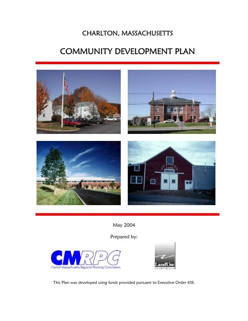
<strong>CHARLTON</strong>, <strong>MASSACHUSETTS</strong><br />
COMMUNITY DEVELOPMENT PLAN<br />
May 2004<br />
Prepared by:<br />
This Plan was developed using funds provided pursuant to Executive Order 418.
Acknowledgements<br />
CMRPC and LandUse, Inc. are grateful to the hard work and dedication <strong>of</strong> the various<br />
individuals who gave freely <strong>of</strong> their time to assist in the preparation <strong>of</strong> this Plan. <strong>Charlton</strong><br />
is fortunate to have knowledgeable and pr<strong>of</strong>essional town staff and a high level <strong>of</strong><br />
volunteerism among those who serve on its boards and committees. Their concern for the<br />
welfare <strong>of</strong> the community and their willingness to work together to find long-range<br />
solutions for current issues has resulted in a cohesive Plan that will help <strong>Charlton</strong> make<br />
sound decision as it continues to grow and change in the years ahead.<br />
Planning Board Economic Development Commission<br />
John P. McGrath, Chairman Mike Lally, Chairman<br />
William O. Hultgen, Vice-Chairman Anthony J. Detarando, Vice-Chairman<br />
Cynthia B. Cooper, Secretary Alycia D. Jette<br />
Keith R. Cloutier Michael C. Jacobs<br />
Thomas E. Reed Keith Johnson<br />
Patricia A. Tanona, Alternate Ray Mrzyglod<br />
Thomas E. Reed<br />
Alan I. Gordon, AICP<br />
<strong>Town</strong> Planner<br />
Jayne Garney<br />
Department Assistant<br />
<strong>Charlton</strong> Housing Authority Housing Advisory Committee<br />
Jean Vincent, Executive Director Kathleen Donegan<br />
Erik Jewett<br />
Funding Sources<br />
This plan was prepared with funding provided by the Commonwealth <strong>of</strong> Massachusetts<br />
pursuant to Executive Order 418. The following state agencies are members <strong>of</strong> the Inter-<br />
Agency Working Group and contributed to the implementation <strong>of</strong> this Community<br />
Development Plan.<br />
Executive Office <strong>of</strong> Environmental Affairs<br />
Executive Office <strong>of</strong> Transportation and Construction<br />
Department <strong>of</strong> Housing and Community Development<br />
Department <strong>of</strong> Economic Development<br />
<strong>Charlton</strong> Community Development Plan i Acknowledgements
Table <strong>of</strong> Contents<br />
Section 1 Executive Summary..........................................................................................1<br />
Section 2 Route 20 Development Expansion Analysis.....................................................4<br />
Zoning Provisions in Comparable <strong>Town</strong>s..................................................................5<br />
High Value Business Development In the Route 20 Corridor: Successful ...........15<br />
Package <strong>of</strong> Zoning Regulations and Administration<br />
Upgraded Zoning Along the Route 20 Corridor: Points <strong>of</strong> Consensus ...................18<br />
BEP District Adopted by <strong>Town</strong> Meeting.................................................................24<br />
Flexible Business Development Adopted by <strong>Town</strong> Meeting ..................................34<br />
BEP District Map.....................................................................................................38<br />
Zoning Study Fact Sheets ........................................................................................39<br />
Section 3 <strong>Charlton</strong> Center Study.....................................................................................46<br />
Powerpoint Presentation ..........................................................................................47<br />
Development Policy Discussion Paper ....................................................................54<br />
Proposed Village District Zoning Amendments......................................................57<br />
Proposed Village Zoning District Map....................................................................73<br />
Section 4 Housing Element.............................................................................................74<br />
1. Introduction..............................................................................................................75<br />
2. Housing Assessment and Analysis ..........................................................................75<br />
A. Population Trends ..............................................................................................75<br />
B. Housing Unit Growth.........................................................................................77<br />
C. Average Household Size....................................................................................79<br />
D. Housing Unit Inventory .....................................................................................80<br />
E. Age <strong>of</strong> Housing Stock........................................................................................81<br />
F. Housing Occupancy...........................................................................................82<br />
G. Type <strong>of</strong> Households ...........................................................................................83<br />
H. Housing Demand Assessment and Needs Analysis...........................................84<br />
I. Supply <strong>of</strong> Housing Units Eligible to Contribute Towards the State’s ..............87<br />
Chapter 40B Subsidized Housing Inventory<br />
3. Housing Goal and Objectives Statement .................................................................88<br />
A. Recommendations..............................................................................................89<br />
B. Implementation ................................................................................................100<br />
4. Housing Unit Production and Land Use Suitability ..............................................102<br />
5. Housing Suitability Map........................................................................................105<br />
Section 5 Integrating Agricultural-Related Businesses into the Zoning Bylaw ...........106<br />
Section 6 Community Development Plan Action Map.................................................112<br />
<strong>Charlton</strong> Community Development Plan ii Table <strong>of</strong> Contents
<strong>CHARLTON</strong> COMMUNITY DEVELOPMENT PLAN<br />
EXECUTIVE SUMMARY<br />
The <strong>Charlton</strong> Planning Board adopted the <strong>Town</strong>’s Master Plan in December 2000. The Plan<br />
sets forth a rational and comprehensive approach to guiding growth and development in the<br />
years ahead. Numerous initiatives recommended for implementation will require a concerted<br />
by local <strong>of</strong>ficials and dedicated volunteers. To assist in this task, the Planning Board created<br />
a “Master Plan Implementation Committee” to pick up where the Master Plan left <strong>of</strong>f and<br />
turn planning recommendations into successful accomplishments.<br />
As good fortune would have it, Governor Paul Cellucci issued Executive Order 418 that<br />
same year. Recognizing the critical need to provide communities with assistance for<br />
planning, E.O. 418 called upon state agencies to provide up to $30,000 to every community<br />
to prepare a “Community Development Plans” or CDP. As stated in E.O. 418, a CDP is<br />
intended to help cities and towns “identify locations for new housing opportunities while still<br />
preserving the unique character <strong>of</strong> their communities, and to provide incentives to cities and<br />
towns to expand the supply <strong>of</strong> new housing”. Communities that had recent Master Plans were<br />
able to obtain waivers from the state’s planning framework, and could then use these<br />
resources to address locally identified planning priorities.<br />
Working with the Central Massachusetts Regional Planning Commission (CMRPC), the<br />
Planning Board identified four tasks that were vital to implementing key recommendations <strong>of</strong><br />
the Master Plan. This scope was submitted to the state Inter-Agency Working Group for<br />
approval, and became the work program for <strong>Charlton</strong>’s CDP. CMRPC and LandUse, Inc.<br />
were hired to complete the Plan. These major elements are summarized below.<br />
1. Route 20 Development Expansion Analysis<br />
U.S. Route 20 is the principal commercial/industrial corridor in <strong>Charlton</strong>, traversing the<br />
<strong>Town</strong> in an east-west fashion. MassHighway is nearing completion <strong>of</strong> a reconstruction<br />
project to create a four land divided highway, and new water and sewer services will be<br />
added in specific locations. The Master Plan calls for the <strong>Town</strong> to attract high quality<br />
<strong>of</strong>fice/industrial growth along the Corridor in areas that have potential for large-scale<br />
development. LandUse, Inc. was retained to conduct an analysis <strong>of</strong> the potential for<br />
development along Route 20 and to revise the Zoning Bylaw to capture premier <strong>of</strong>fice and<br />
R&D development. This section <strong>of</strong> the report documents the process used to assist the<br />
Planning Board and Economic Development Committee (EDC) in making decisions on how<br />
to successfully re-zone portions <strong>of</strong> the Corridor to accomplish this goal.<br />
First, LandUse, Inc. examined zoning provisions in comparable communities to demonstrate<br />
a range <strong>of</strong> techniques for <strong>Charlton</strong> to upgrade its land use controls. This research showed<br />
how <strong>Charlton</strong> could maximize the growth potential <strong>of</strong> its industrial districts while promoting<br />
high quality development. LandUse, Inc. prepared illustrated fact sheets <strong>of</strong> industrial parks in<br />
near-by communities to stimulate thinking on industrial park concepts that would be<br />
appropriate for <strong>Charlton</strong>. LandUse, Inc. then summarized these concepts in a report entitled<br />
<strong>Charlton</strong> Community Development Plan 1 Executive Summary
“High Value Business Development in the Route 20 Corridor: A Successful Package <strong>of</strong><br />
Zoning Regulations and Administration”. Based upon discussions with the Planning Board,<br />
the consultant drafted proposed zoning amendments. CMRPC’s GIS Center helped the Board<br />
evaluate development opportunities along the Corridor and prepared a map showing areas for<br />
re-zoning. Two key components emerged from this process: 1) creation <strong>of</strong> a new Business<br />
Enterprise District (BEP) with revised use and dimensional standards; and 2) adoption <strong>of</strong> a<br />
new “Flexible Business Development” (FBD) bylaw that <strong>of</strong>fers an alternative to standard<br />
industrial development practices. The FBD provision allows the Planning Board to work<br />
closely with industrial park developers to design environmentally friendly projects,<br />
incorporate improved site design techniques, and minimize neighborhood impacts.<br />
<strong>Town</strong> Meeting adopted this package <strong>of</strong> zoning amendments at the 2003 Annual <strong>Town</strong><br />
Meeting after recognizing the careful planning process and reasonable approach<br />
recommended by the Planning Board and EDC.<br />
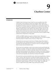
2. <strong>Charlton</strong> Center Planning Project<br />
<strong>Charlton</strong> Center is the historic heart <strong>of</strong> the <strong>Town</strong> and exemplifies the ideal <strong>of</strong> a traditional,<br />
compact New England village. Within close proximity lie the <strong>Town</strong>’s municipal <strong>of</strong>fices,<br />
classic white churches, a beautiful <strong>Town</strong> Common, small-scale commercial uses, and<br />
distinctive homes. The area’s historic significance has been recognized by its acceptance on<br />
the National Register <strong>of</strong> Historic Places as the <strong>Charlton</strong> Center Historic District. However,<br />
commercial development has occurred that has not been compatible with the unique qualities<br />
<strong>of</strong> the area. Several newer structures have been built without regard to historical context and<br />
have detracted from the New England village ambience that is still present to a large degree.<br />
The purpose <strong>of</strong> the project was two-fold. First, to identify how newer development has<br />
departed from historic development practices; these results can help guide recommendations<br />
for improved design standards that insure new development preserves the Center’s village<br />
fabric. And secondly, to identify opportunities for small-scale development that would help<br />
to meet the needs <strong>of</strong> the <strong>Town</strong>’s growing population for goods and services. The ultimate aim<br />
is to set standards that promote a compact, pedestrian-scale environment, with a mix <strong>of</strong><br />
residences, institutions, and commercial services that provide a pleasant alternative to large,<br />
single purpose, highway-oriented shopping plazas.<br />
To accomplish this task, CMRPC photographed the positive and negative attributes <strong>of</strong><br />
<strong>Charlton</strong> Center and prepared a powerpoint presentation for viewing at a public meeting. The<br />
session was well attended and helped to achieve consensus regarding how to prevent newer<br />
development from further harming its established village pattern. CMRPC prepared a policy<br />
paper for discussion with the Planning Board that summarized the strategy for changing<br />
zoning requirements that had contributed to inappropriate development. CMRPC prepared a<br />
new Village zoning district to replace the Neighborhood Business district currently in place.<br />
The proposed new district modifies the table <strong>of</strong> uses and dimensional requirements, and sets<br />
design standards for new development to achieve harmony with historic structures. In<br />
addition, CMRPC, the EDC and the Planning Board identified several locations that <strong>of</strong>fer<br />
opportunities for new commercial development. The Planning Board reviewed several drafts<br />
<strong>Charlton</strong> Community Development Plan 2 Executive Summary
<strong>of</strong> the Zoning Bylaw and Map amendments until achieving consensus, and a final draft is<br />
now ready for consideration at a future <strong>Town</strong> Meeting.<br />
3. Affordable Housing Analysis<br />
In keeping with the spirit <strong>of</strong> Executive Order 418, the Planning Board desired to explore<br />
avenues that <strong>Charlton</strong> could pursue to increase its supply <strong>of</strong> affordable housing. <strong>Charlton</strong> has<br />
been one <strong>of</strong> the fastest growing communities in Central Massachusetts, but most <strong>of</strong> the new<br />
residential development has been costly single-family homes on large lots. Much <strong>of</strong> this<br />
housing is affordable only by affluent buyers, and long-term <strong>Charlton</strong> residents find it<br />
increasingly difficult to afford to buy a home in town. In recognition <strong>of</strong> this issue, an<br />
Affordable Housing Committee was created in 2002 to address the housing needs <strong>of</strong> the<br />
<strong>Town</strong> and to work on viable solutions. The Planning Board invited the Affordable Housing<br />
Committee into this process and actively solicited their thoughts as the study progressed.<br />
A housing assessment presents a wealth <strong>of</strong> data on the characteristics <strong>of</strong> <strong>Charlton</strong>’s<br />
population and its housing stock, and demonstrates how <strong>Charlton</strong> fares in many respects to<br />
that <strong>of</strong> comparable near-by communities. The analysis helps to uncover <strong>Charlton</strong>’s needs for<br />
housing based upon current and relevant data. A “gap analysis” identifies where there are<br />
gaps between the need and the supply <strong>of</strong> housing for low, moderate and middle-income<br />
households. <strong>Charlton</strong> has a distinct shortage <strong>of</strong> affordable rental housing units for low and<br />
moderate-income households. For ownership housing, <strong>Charlton</strong> has an existing stock <strong>of</strong> older<br />
homes that are affordable by moderate and middle-income families. But there is a need for<br />
new multi-family and attached ownership units that can <strong>of</strong>fer a lower cost alternative for first<br />
time homebuyers to enter the homeownership arena.<br />
To establish <strong>Town</strong> policy for housing, a goal and objectives statement is provided to guide<br />
actions designed to meet local housing needs. With these policies as a firm foundation,<br />
numerous recommendations provide a wide range <strong>of</strong> strategies local <strong>of</strong>ficials can pursue to<br />
address the housing needs <strong>of</strong> the community. These include Zoning Bylaw changes to<br />
promote viable housing alternatives, rehabilitation <strong>of</strong> older housing stock, potential grant<br />
applications to develop affordable housing units, and homeowner education and financial<br />
assistance to help first time buyers enter the housing market.<br />
4. Agricultural-Related Businesses<br />
<strong>Charlton</strong> was once noted for its many farms, dairies, and orchards, but the number in active<br />
agricultural use has dwindled over the years due to the strong market for single-family<br />
housing. The Master Plan stressed the importance <strong>of</strong> preserving the <strong>Town</strong>’s rural character,<br />
and providing assistance to farmers to remain in business is one important way to safeguard<br />
<strong>Charlton</strong>’s agricultural heritage. CMRPC researched ways the <strong>Town</strong> can help farming to<br />
remain viable in town. These include zoning recommendations, encouraging the development<br />
<strong>of</strong> farm stands, promoting state-<strong>of</strong>-the-art bio-technology and agricultural research<br />
endeavors, and <strong>of</strong>fering support for farmers to obtain assistance <strong>of</strong>fered by a variety <strong>of</strong> state<br />
and federal agencies.<br />
<strong>Charlton</strong> Community Development Plan 3 Executive Summary
<strong>CHARLTON</strong> COMMUNITY DEVELOPMENT PLAN<br />
Route 20 Development Expansion Analysis<br />
Task Completed by: LandUse, Inc.<br />
Jeanne Armstrong, AICP<br />
Table <strong>of</strong> Contents<br />
Zoning Provisions in Comparable <strong>Town</strong>s............................................................................5<br />
High Value Business Development In the Route 20 Corridor: A Successful ...................15<br />
Package <strong>of</strong> Zoning Regulations and Administration<br />
Upgraded Zoning Along the Route 20 Corridor: Points <strong>of</strong> Consensus .............................18<br />
BEP District Adopted by <strong>Town</strong> Meeting...........................................................................24<br />
Flexible Business Development Adopted by <strong>Town</strong> Meeting ............................................34<br />
BEP District Map...............................................................................................................38<br />
Zoning Study Fact Sheets ..................................................................................................39<br />
<strong>Charlton</strong> Community Development Plan 4 Route 20 Analysis
Enterprise Park Zoning Study<br />
Zoning Provisions in Comparable <strong>Town</strong>s<br />
The Enterprise Park Zoning Study has examined business or industrial parks in towns with<br />
characteristics comparable to <strong>Charlton</strong>. The intent <strong>of</strong> this examination has been to learn from<br />
other towns’ experience as <strong>Charlton</strong> seeks to achieve high-assessed value business park<br />
development along Route 20. This chart provides a brief overview <strong>of</strong> key zoning provisions<br />
<strong>of</strong> these comparable towns, as they relate to industrial park development. Industrial parkrelated<br />
provisions are the focus, because the type <strong>of</strong> development envisioned by <strong>Charlton</strong>’s<br />
Enterprise Park concept is usually included within what other community’s term “industrial<br />
parks”.<br />
The points contained within this chart should be considered together with previous charts that<br />
compare, for example, the density and assessed value <strong>of</strong> development that has actually<br />
occurred in the parks covered by these zoning provisions.<br />
<strong>Charlton</strong> Community Development Plan 5 Route 20 Analysis<br />
Zoning in Comparable <strong>Town</strong>s
<strong>Town</strong> District(s)/Uses Standards Process Notes<br />
Auburn<br />
General Industry,<br />
Industrial District A, &<br />
Industrial Park.<br />
Industrial District A tends to<br />
require Special Permit [SP]<br />
when Industrial Park only<br />
requires Site Plan Approval<br />
[SPA]<br />
Incorporated into allowed uses<br />
table [see attached example].<br />
Definitions <strong>of</strong> Hazardous<br />
Wastes or Hazardous Materials<br />
are keyed to MGL Chapter 21C<br />
SP fairly large scope <strong>of</strong> potential<br />
conditions<br />
SPA only regarding noxious/<br />
health; nothing about<br />
aesthetics<br />
No maximum lot coverage.<br />
Parking requirements:<br />
Industrial 1 per 2,000 s.f. up to<br />
20,000 plus 1 for each<br />
additional 10,000 s.f. plus 1<br />
per employee on largest shift.<br />
Office: 1 per 200 s.f. net floor<br />
area<br />
SPGA generally ZBA<br />
SPA Planning Board<br />
Separate <strong>Town</strong> Bylaws for Earth<br />
Removal, Parking, Signs on<br />
Streets & sidewalks [i.e. in<br />
public right <strong>of</strong> way], Wetlands<br />
[thereby avoiding grandfathering<br />
limitations <strong>of</strong> zoning]<br />
<strong>Charlton</strong> Community Development Plan 6 Route 20 Analysis<br />
Zoning in Comparable <strong>Town</strong>s
<strong>Town</strong> District(s)/Uses Standards Process Notes<br />
Spencer<br />
Only Industrial, no Ind. Park<br />
Use definitions very general<br />
Definition <strong>of</strong> allowed principal<br />
use “Place for manufacturing,<br />
assembling, or packaging <strong>of</strong><br />
goods, provided that all resulting<br />
cinders, dust, flashing, fumes,<br />
gases, odors, refuse matter,<br />
smoke and vapor be effectively<br />
confined to the premises or be<br />
disposed <strong>of</strong> in a manner that<br />
does not create a nuisance or<br />
hazard to safety to health”<br />
Max building coverage: 33 1/3%<br />
Parking requirements:<br />
Industry/Manufacturing 1.75<br />
space per 1,000 s.f. GLA [gross<br />
leasable floor area]<br />
Office 1 per 300 s.f. GLA<br />
Laboratory or Research 1 per<br />
500 s.f. GLA<br />
By right in Commercial or<br />
Industrial Districts.<br />
No Site Plan Review<br />
Rely on scoping session with<br />
Department Heads to “work out<br />
bugs” in preliminary stages,<br />
before application is submitted.<br />
All Special Permits from ZBA<br />
No <strong>of</strong>ficial interviewed was<br />
active in town when FLEXcon<br />
Corporate Industrial Park was<br />
constructed, so we don’t know<br />
relationship with zoning<br />
provisions.<br />
Landowner who wants to sell<br />
lots for industrial park type<br />
development in remaining open<br />
land east <strong>of</strong> FLEXcon is<br />
stymied by fact that current<br />
road serving Dienes, etc, does<br />
not meet standards for<br />
acceptance by <strong>Town</strong>; no<br />
provision for common drive, so<br />
no frontage. Doesn’t want to<br />
submit for subdivision until has<br />
P&S in hand from prospective<br />
buyer/developer <strong>of</strong> lot(s)<br />
<strong>Charlton</strong> Community Development Plan 7 Route 20 Analysis<br />
Zoning in Comparable <strong>Town</strong>s
<strong>Town</strong> District(s)/Uses Standards Process Notes<br />
Millbury<br />
Industrial I and Industrial II<br />
“The intent <strong>of</strong> industrial<br />
districts is to provide<br />
exclusively for<br />
environmentally compatible<br />
industry in areas suited to that<br />
use by access, absence <strong>of</strong><br />
conflicting use, and services”<br />
[beginning <strong>of</strong> Section 25.<br />
Industrial Districts]<br />
By right: manufacturing,<br />
processing or research, other<br />
than asphalt plants, plus<br />
warehousing, wholesale<br />
distribution not involving<br />
bulk storage as long as 30%<br />
<strong>of</strong> required yard area free <strong>of</strong><br />
any paving & maintained with<br />
vegetation; entire yard to be<br />
free <strong>of</strong> outdoor storage <strong>of</strong><br />
materials.<br />
“Criteria. Special permits shall<br />
normally be granted unless,<br />
because <strong>of</strong> a condition peculiar<br />
to the particular case but not<br />
generally true for similar<br />
permitted uses on other sites in<br />
the same district, it appears that<br />
nuisance, hazard or congestion<br />
will be created, or for other<br />
reasons there will be substantial<br />
harm to the neighborhood or<br />
derogation from the intent <strong>of</strong><br />
the by-law, or that the stated<br />
district intent will not be<br />
satisfied”. [14.3]<br />
“Conditions. Special permits<br />
may be granted with such<br />
reasonable conditions,<br />
safeguards or limitations on<br />
time or use as the special<br />
permit granting authority may<br />
deem necessary to serve the<br />
purpose <strong>of</strong> this by-law” [14.4]<br />
Both districts side & rear yards<br />
abutting residential or suburban<br />
districts must be 100 ft. <strong>of</strong><br />
which 40’ is free <strong>of</strong> paving or<br />
outdoor storage <strong>of</strong> materials &<br />
maintained with vegetation.<br />
No maximum lot coverage.<br />
Parking requirements:<br />
SPGA is ZBA except where<br />
specifies Planning Board, e.g. for<br />
multifamily use, special density<br />
provisions, reduced parking<br />
requirements, floodplain<br />
development, open space<br />
community development, earth<br />
removal, site plan specific<br />
provisions.<br />
Site Plan Review thresholds<br />
[other than subdivisions <strong>of</strong> single<br />
family detached dwellings]:<br />
Improvement, alteration, or<br />
change in use resulting in<br />
increase <strong>of</strong> at least 6,000 s.f.<br />
gross floor area OR total <strong>of</strong><br />
10 or more parking spaces<br />
either new or existing.<br />
When any portion <strong>of</strong> lot or<br />
parcel lies within 200 feet <strong>of</strong><br />
residential district & new<br />
structure, group <strong>of</strong> structures,<br />
improvement, alteration or<br />
change in use results in<br />
increase <strong>of</strong> 3,000 s.f. <strong>of</strong> gross<br />
floor area OR requires<br />
addition <strong>of</strong> 7 or more parking<br />
spaces.<br />
SPR very rigorous; says can be<br />
denied, which is a problem.<br />
Relies a lot on SPR for<br />
industrial park-type<br />
development<br />
<strong>Charlton</strong> Community Development Plan 8 Route 20 Analysis<br />
Zoning in Comparable <strong>Town</strong>s
<strong>Town</strong> District(s)/Uses Standards Process Notes<br />
Industrial, wholesale: 1 per 1 ¼<br />
employees per shift<br />
“Others individually<br />
determined”<br />
Parking screened from abutting<br />
residential use.<br />
Route 146 Highway Corridor<br />
Overlay District to provide for<br />
orderly development, encourage<br />
economic growth while<br />
avoiding serious negative<br />
effects. Regulations vary for<br />
large vs. small parcels. Open<br />
space considerations, including<br />
transfer <strong>of</strong> development rights.<br />
Detailed landscape, parking, and<br />
performance standards.<br />
<strong>Charlton</strong> Community Development Plan 9 Route 20 Analysis<br />
Zoning in Comparable <strong>Town</strong>s
<strong>Town</strong> District(s)/Uses Standards Process Notes<br />
Holden<br />
Business Office-Pr<strong>of</strong>essional,<br />
Industrial, &<br />
Industrial-Quarry<br />
By right uses in Industrial<br />
include: quarrying, construction<br />
including suppliers,<br />
manufacturing, open storage <strong>of</strong><br />
construction equipment<br />
provided sufficient screening<br />
SP uses in Industrial include:<br />
excavation & removal <strong>of</strong> sand<br />
& gravel, motor freight<br />
transportation & warehousing,<br />
other transportation service,<br />
wholesale trade, bulk storage<br />
tanks<br />
Special regulations governing<br />
permitted manufacturing uses<br />
[see attached copy] at beginning<br />
<strong>of</strong> uses table.<br />
Industrial height & bulk regs:<br />
Maximum 50% building<br />
coverage <strong>of</strong> lot; max. 30’ height,<br />
except for special industrial<br />
structures such as cooling tower<br />
or similar where industrial<br />
process requires greater height.<br />
Max building coverage: 50%<br />
Parking:<br />
Manufacturing or industrial 1<br />
space for each 500s.f. <strong>of</strong> gross<br />
floor area, excluding storage.<br />
Wholesale 1 per 450 s.f. net<br />
floor area.<br />
SPGA [relating to industrial]<br />
appears to be ZBA, <strong>of</strong>ten refers<br />
to a waiver or variation allowed<br />
from stated standards<br />
Recall that the Holden<br />
Industrial Park resulted from<br />
intent and standards <strong>of</strong> the<br />
developer, rather than in<br />
response to zoning<br />
<strong>Charlton</strong> Community Development Plan 10 Route 20 Analysis<br />
Zoning in Comparable <strong>Town</strong>s
<strong>Town</strong> District(s)/Uses Standards Process Notes<br />
Oxford<br />
Industrial Park East is in<br />
Industrial District. Also is a<br />
Light Industrial District, but<br />
manufacturing not allowed in<br />
LI<br />
“The two industrial districts are<br />
intended to provide land with<br />
physical qualities suitable for<br />
development that can attract<br />
new industries to Oxford and<br />
cause little damage to the<br />
environment; to locate<br />
industries close to existing<br />
highways and trail lines to<br />
minimize traffic impacts on<br />
residential neighborhoods; and<br />
to separate industries from other<br />
land uses to allow industries to<br />
operate free from unwanted<br />
intrusions” [VI.1.0] Further<br />
states that each district is<br />
intended to cluster industrial<br />
development in selected<br />
locations, to provide for<br />
industries and separate them<br />
from other less intensive uses,<br />
and to minimize the hazards<br />
and nuisances resulting from<br />
operation <strong>of</strong> industries.<br />
Uses in Industrial:<br />
By right [with SPR]<br />
manufacturing, wholesale<br />
distribution, accessory<br />
warehouse & distribution,<br />
assembly & fabrication, light<br />
products, accessory <strong>of</strong>fices,<br />
accessory uses<br />
Special Permit: Extractive,<br />
smokestack [i.e. large scale],<br />
freight & trucking terminals,<br />
recycling, all other nonresidential<br />
uses found to be<br />
consistent with the stated intent<br />
<strong>of</strong> industrial districts<br />
Maximum coverage: 65%<br />
Parking requirements:<br />
Freight & trucking, wholesale<br />
distribution & warehousing,<br />
moving & storage, parcel<br />
delivery 1 per employee plus 1<br />
per each company vehicle.<br />
Auto wrecking, junk & scrap<br />
establishments: 1 per employee<br />
plus 1 per 10,000 s.f. <strong>of</strong> storage<br />
area.<br />
All other industrial uses: 1 per<br />
1.5 employees plus 1 per each<br />
company vehicle plus 1 per each<br />
25 required spaces for visitors<br />
All allowed industrial uses go<br />
through SPR process with<br />
Planning Board.<br />
SP uses go to SPGA [almost<br />
always the Planning Board], but<br />
also SPR with Planning Board<br />
[i.e., even if exception goes to<br />
ZBA for SP, still gets SPR from<br />
Planning Board]<br />
Criteria for SPR cover access for<br />
emergency & service equipment;<br />
utilities, drainage & erosion<br />
control; use <strong>of</strong> topo, landscaping,<br />
and building placement when<br />
abutting residential district;<br />
parking and loading; traffic<br />
impacts on abutting residential<br />
neighborhoods; convenience &<br />
safety in relation to adjacent<br />
streets & intersections; all other<br />
requirements <strong>of</strong> zoning bylaw.<br />
[XV.4.0]<br />
Note Planning Board is key to<br />
SP and SPR<br />
Note basic scope <strong>of</strong> SPR<br />
Planning Board can “approve<br />
with conditions or<br />
modifications that will bring<br />
about compliance” [XV.5.3]<br />
“Maximum coverage” appears<br />
to mean building coverage, but<br />
not clearly defined<br />
<strong>Charlton</strong> Community Development Plan 11 Route 20 Analysis<br />
Zoning in Comparable <strong>Town</strong>s
<strong>Town</strong> District(s)/Uses Standards Process Notes<br />
Sturbridge<br />
Industrial Park by right uses<br />
include wholesale warehouse or<br />
storage facilities; <strong>of</strong>fice with a<br />
minimum floor area <strong>of</strong> 30,000<br />
s.f. per building; hotel, inn or<br />
motel; clearly defined multispecialty<br />
physician <strong>of</strong>fice<br />
building, bank, and “any<br />
manufacturing or industrial use,<br />
including processing fabrication<br />
and assembly, provided that no<br />
such use shall be permitted<br />
which would be detrimental or<br />
<strong>of</strong>fensive or tend to reduce<br />
property values in the same or<br />
adjoining districts by reason <strong>of</strong><br />
dirt, odor, fumes, smoke, gas,<br />
sewage, refuse, noise, excessive<br />
vibration or danger <strong>of</strong> explosion<br />
or fire.”<br />
Max lot coverage: 33%, but may<br />
increase to 50% with SP<br />
Max impervious surface: 70%<br />
Parking requirements: industrial<br />
building 1 space for every 2<br />
employees<br />
[no parking in required set<br />
backs, parking lot lights must<br />
be directed away from street<br />
and away from adjoining<br />
premises used for residential<br />
purposes.]<br />
See note re SPR criteria<br />
SPR by Planning Board, applies<br />
to all uses other than single and<br />
2-family dwellings, horticultural<br />
nursery, farm, tree farm, home<br />
based pr<strong>of</strong>essional <strong>of</strong>fices.<br />
Note very broad use <strong>of</strong> SPR,<br />
and criteria for approval <strong>of</strong><br />
SPR extensively spelled out –<br />
see attached copy.<br />
Entire zoning bylaw is easy to<br />
read, “spells out what we<br />
expect” according to <strong>Town</strong><br />
Planner<br />
<strong>Charlton</strong> Community Development Plan 12 Route 20 Analysis<br />
Zoning in Comparable <strong>Town</strong>s
<strong>Town</strong> District(s)/Uses Standards Process Notes<br />
Webster<br />
Industrial District<br />
Permitted uses: wholesale<br />
distributing plant; wholesale<br />
warehouse; building<br />
materials, sales & storage;<br />
trucking terminal or bus<br />
garage; <strong>of</strong>fice space, regular<br />
business hours; any use<br />
permitted and as regulated in<br />
an Agricultural Residential<br />
District; and. . . .<br />
“Any manufacturing or<br />
industrial use [although listed<br />
criteria seem to say opposite<br />
<strong>of</strong> what intended, i.e. that<br />
won’t be detrimental etc.]<br />
SP uses: automobile<br />
dismantling or used-parts<br />
yard; junk yard<br />
Floor Area Ratio to Land Area:<br />
1 to 2<br />
Parking requirements:<br />
Pr<strong>of</strong>essional <strong>of</strong>fices, <strong>of</strong>fices <strong>of</strong> a<br />
wholesale or jobbing<br />
establishment, including<br />
incidental sales space: 1 for<br />
each 500 s.f. gross floor area.<br />
Building for manufacture,<br />
assembly, processing, or<br />
packaging: 1 for each 1,000 s.f.<br />
Storage, wholesale<br />
establishments, freight<br />
terminal, and similar uses: 1 for<br />
each 3,000 s.f. gross floor area<br />
or lot area in similar use.<br />
SPGA is ZBA<br />
Commercial SPR by Planning<br />
Board for any construction or<br />
reconstruction <strong>of</strong> any parking<br />
area or access way drive in a<br />
business or industrial district;<br />
development involving location<br />
<strong>of</strong> two or more primary uses or<br />
structure on a single lot<br />
[including industrial parks]; any<br />
construction, reconstruction,<br />
exterior alteration or addition to<br />
any commercial building<br />
[includes industrial buildings]; or<br />
a use that requires a special<br />
permit.<br />
Criteria for SPA approval are<br />
almost identical to Oxford’s.<br />
Does not specify that Planning<br />
Board can approve with<br />
conditions<br />
<strong>Charlton</strong> Community Development Plan 13 Route 20 Analysis<br />
Zoning in Comparable <strong>Town</strong>s
<strong>Town</strong> District(s)/Uses Standards Process Notes<br />
<strong>Charlton</strong><br />
Clear statement <strong>of</strong> intents <strong>of</strong><br />
districts, e.g. for Industrial Park:<br />
To provide parcels <strong>of</strong> land zoned<br />
as industrial parks, where<br />
“compatible industries” are<br />
encouraged to locate in a parklike<br />
setting. Such industries<br />
shall be “abutter friendly”; that<br />
is, they shall impact abutting<br />
lands minimally as to sight,<br />
sound, odor and traffic.<br />
Allowed uses include a mix <strong>of</strong><br />
manufacturing, research and<br />
development, <strong>of</strong>fice,<br />
distribution, and other<br />
compatible uses which <strong>of</strong>fer an<br />
opportunity for employment<br />
growth and an expansion <strong>of</strong> the<br />
tax base in the town <strong>of</strong> <strong>Charlton</strong>.<br />
[3.1.5.7]<br />
The wide range <strong>of</strong> permitted<br />
uses seems to work against this<br />
picture, since they include a lot<br />
<strong>of</strong> uses other than<br />
“manufacturing, research and<br />
development, <strong>of</strong>fice,<br />
distribution”<br />
20 ft landscaped buffer strip<br />
along frontage road, plus 100 ft.<br />
along any lot boundary abutting<br />
R-40, Agriculture, or Historic<br />
District.<br />
Screening required for outside<br />
bulk storage, contractor’s yards,<br />
disposal areas – required from<br />
street, adjacent residential use,<br />
residential district<br />
Max building coverage: 33%<br />
Parking areas in IP set back<br />
minimum 20 ft from front lot<br />
line [30 ft. if front lot line abuts<br />
State-numbered route], and not<br />
allowed in required side or rear<br />
yards, or within required buffer<br />
area.<br />
Parking requirements:<br />
Industrial 1 per 1.3 employees,<br />
maximum shift<br />
Development standards for IP:<br />
roads & utilities, landscaping,<br />
lighting, utility areas, utilities.<br />
Planning Board is SPGA for few<br />
uses that require SP in Industrial<br />
district. IP district mainly<br />
requires SPR by Planning Board.<br />
Correct to assume that the<br />
criteria for SPR are listed as 5.8<br />
Development Standards for IP<br />
Districts?<br />
Usually criteria for approval<br />
for all Sp or SPR are listed in<br />
one spot, rather than tailored to<br />
each district or use and placed<br />
throughout the bylaw<br />
accordingly.<br />
<strong>Charlton</strong> Community Development Plan 14 Route 20 Analysis<br />
Zoning in Comparable <strong>Town</strong>s
Element That Is Needed<br />
Allowed uses that clearly define what would fit<br />
and are flexible enough to accommodate<br />
unforeseen types <strong>of</strong> businesses, since<br />
technologies and sectors evolve rapidly<br />
Prohibited uses that provide a baseline <strong>of</strong><br />
protection and assurance<br />
Dimensional requirements that fit high value<br />
development onto <strong>Charlton</strong>’s topography in the<br />
Route 20 Corridor<br />
&<br />
Site plan requirements that clearly spell out the<br />
“non-negotiable” attributes <strong>of</strong> a development<br />
that fits in <strong>Charlton</strong>.<br />
High Value Business Development in the Route 20 Corridor:<br />
A Successful Package <strong>of</strong> Zoning Regulations and Administration<br />
What We Have Now<br />
The wide range <strong>of</strong> permitted uses works against<br />
bylaw’s stated intent for industrial park district,<br />
since they include a lot <strong>of</strong> uses other than<br />
“manufacturing, research and development,<br />
<strong>of</strong>fice, distribution”. Examples include car<br />
washes, gasoline service stations, restaurants,<br />
fast food places, retail stores, and personal<br />
service businesses.<br />
Currently prohibited: electric generating<br />
facilities w/ more than 50 megawatts <strong>of</strong> power<br />
output, hazardous waste disposal sites, resource<br />
recovery plants, use <strong>of</strong> more than 50% <strong>of</strong> a lot<br />
for outdoor storage.<br />
Dimensional req. for each lot within a park, but<br />
silent on business park as a whole.<br />
Max. 75% lot area impervious surface<br />
[building, parking, other asphalt & hard<br />
surface]. Trees in parking lots. Lighting for<br />
entries & exits. Curb cut width & location. IP<br />
landscaping [front yard set back area, trees in<br />
parking lots & along roadways, maintenance <strong>of</strong><br />
landscaped areas]. Utilities underground.<br />
Utility/service areas screened. Max. 33%<br />
building coverage.<br />
What Would Better Achieve Intent <strong>of</strong><br />
High Assessed Value Business Park<br />
Limit allowable uses to manufacturing, research<br />
& development, biotechnology, <strong>of</strong>fice,<br />
distribution. Allow food service, convenience<br />
retail only if a secondary use primarily intended<br />
for use by employees and visitors to the primary<br />
use.<br />
[Need to decide whether to allow specialized<br />
services such as medical clinics or fitness<br />
centers.]<br />
Specify what happens in case <strong>of</strong> a use not listed<br />
in the uses table. Automatically prohibited?<br />
Special Permit possible if meets intents <strong>of</strong><br />
district?<br />
Specify sight, sound, and light-absorbing buffer<br />
around entire park where abuts residential [e.g.<br />
75 feet densely wooded], and allow more<br />
flexibility among the lots within the park.<br />
Allow waiver by SP on maximum building<br />
height to allow for special requirements <strong>of</strong><br />
manufacturing processes [e.g. tower for run<br />
required in production such as wire]<br />
<strong>Charlton</strong> Community Development Plan 15 Route 20 Analysis<br />
High Value Business Development-Successful Package
Element That Is Needed<br />
Site plan standards that describe what the <strong>Town</strong><br />
is looking for as a particular proposal is flexibly<br />
accommodated onto a particular site. Both<br />
landscape and streetscape standards are<br />
important.<br />
Parking requirements & standards that make<br />
sure foreseen vehicles will be accommodated on<br />
site without excessive pavement.<br />
Sign design & placement requirements &<br />
standards that meet business needs without<br />
clutter.<br />
Development review & permitting process that<br />
is clear, timely, respectful <strong>of</strong> both <strong>Town</strong>’s and<br />
applicant’s needs.<br />
What We Have Now<br />
For IP District road & utility standards.<br />
Exterior lighting<br />
Off-street parking and loading schedule <strong>of</strong><br />
required parking spaces according to size and<br />
type <strong>of</strong> use.<br />
Schedule <strong>of</strong> size, type, placement <strong>of</strong> signs<br />
according to use and district.<br />
IP review & approval through subdivision<br />
control and site plan approval, which may be<br />
processed simultaneously.<br />
Planning Board is SPGA & SPA for uses<br />
considered here, with a Technical Advisory<br />
Committee for industrial uses. [This is good!]<br />
What Would Better Achieve Intent <strong>of</strong><br />
High Assessed Value Business Park<br />
Specifically minimize visibility <strong>of</strong> construction<br />
from Route 20 and neighboring roadways,<br />
except for “group sign” at entry.<br />
Specify pedestrian circulation: sidewalk along<br />
interior roadway, walkway system from parking<br />
to entries. Jogging & walking trails allowed in<br />
required buffer strip around park [but no<br />
snowmobiles or dirt bikes]?<br />
All parking & loading to side or rear <strong>of</strong><br />
buildings. [Current schedule is working; want<br />
to consider accepting designated turf area for<br />
part <strong>of</strong> required area as future expansion as<br />
need warrants.]<br />
Regulations for unified “group” sign at entry to<br />
business park on which all companies are<br />
identified. Also unified “group” sign for<br />
tenants at entry drive(s) to multi-tenant<br />
building, and at building entries. Prohibit other<br />
freestanding signs except for sole-occupant sign<br />
visible from interior roadway. Prohibit<br />
window signs. [Current schedule <strong>of</strong> sizes<br />
working?]<br />
By regulation and practice, need a process that<br />
reviews, shapes, and approves a site master plan<br />
for a complete park thus opening the way for<br />
user-friendly oversight <strong>of</strong> construction within<br />
the park over time. Firm structure where it<br />
matters, flexibility where it works to accommodate<br />
market and opportunities over time.<br />
<strong>Charlton</strong> Community Development Plan 16 Route 20 Analysis<br />
High Value Business Development-Successful Package
Element That Is Needed<br />
What We Have Now<br />
Enforcement that is clear, timely, and effective. [Reads well in Zoning Bylaw text. What is<br />
working well now, and where are there<br />
shortfalls?]<br />
What Would Better Achieve Intent <strong>of</strong><br />
High Assessed Value Business Park<br />
[Specific ways to improve this?? ]<br />
<strong>Charlton</strong> Community Development Plan 17 Route 20 Analysis<br />
High Value Business Development-Successful Package
Upgraded Zoning Along the Route 20 Corridor:<br />
Points <strong>of</strong> Consensus<br />
DRAFT: FOR REVIEW & DISCUSSION<br />
Note: This outline <strong>of</strong> consensus points works from the current Zoning Bylaw and the<br />
accompanying chart High Value Business Development In the Route 20 Corridor: A<br />
Successful Package <strong>of</strong> Zoning Regulations and Administration. The intent <strong>of</strong> the Planning<br />
Board and Economic Development Commission is to work over time with other local<br />
<strong>of</strong>ficials, property owners, and residents to document and raise the level <strong>of</strong> community<br />
consensus regarding:<br />
1. desired patterns <strong>of</strong> business development along the Route 20 Corridor<br />
2. changes in zoning and administration that would encourage such development.<br />
Consensus Point #1: Allowed Uses should clearly define what would fit and be flexible<br />
enough to accommodate unforeseen types <strong>of</strong> businesses, since technologies and sectors<br />
evolve rapidly. Uses that should be allowed include ones that support the intent <strong>of</strong><br />
“manufacturing, research and development, <strong>of</strong>fice, distribution”. Examples that first come to<br />
mind include:<br />
Medical research and development<br />
Warehouse and distribution<br />
Biotechnology<br />
Manufacturing<br />
Fiberoptics<br />
Greenhouse/horticulture<br />
Hotel<br />
Day Care Center as accessory use to serve employees<br />
Food as accessory use to serve employees and visitors<br />
Hospital and clinic<br />
Fitness Center as accessory use to serve employees<br />
Personal & consumer services as accessory use to serve employees<br />
Multiple <strong>of</strong>fice building [specify minimum square footage <strong>of</strong> XX]<br />
ATM<br />
Towers by Special Permit [keeping section 3.2.2’s note # 3]<br />
Wireless communication by Special Permit [keeping section 3.2.2’s note #2]<br />
Helicopter or gyroploane as accessory use to serve businesses in the park<br />
Consensus Point #2: Prohibited uses should provide a baseline <strong>of</strong> environmental protection<br />
and assurance that development will not detract from the purposes <strong>of</strong> the district. Examples<br />
that first come to mind include:<br />
Car wash, car repair Single business <strong>of</strong>fice e. g. realtor<br />
Fast food restaurant Retail<br />
Mini golf course Motel<br />
Motor court Bank<br />
Adult entertainment Oil or gas tanks<br />
<strong>Charlton</strong> Community Development Plan 18 Route 20 Analysis<br />
BEP District & Flexible Business Development Provisions
How does this image <strong>of</strong> allowed and prohibited uses compare with <strong>Charlton</strong>’s current<br />
business districts: Neighborhood Business [NB], Community Business [CB], General<br />
Industry [IG], & Industrial Park [IP]. Here is a chart that works from the Zoning Bylaw’s<br />
Use Regulation Schedule [section 3.2.2], and compares the desired pattern <strong>of</strong> high-assessed<br />
value business uses with current districts’ regulations. Shaded boxes highlight where there is<br />
a discrepancy between current I-P regulations & upgraded requirements that would shift the<br />
district to being a Business Park District.<br />
Y = permitted, N = prohibited, P = permitted subject to site plan review, SP = requires<br />
Special Permit from Planning Board. [“Acc.” = accessory]<br />
Principal Use [abbreviated] NB CB IG IP Upgrade<br />
Agriculture, Floriculture & Horticultural Uses<br />
1. Raising and keeping livestock on parcel over 5 acres<br />
Y Y Y Y Y<br />
2. Raising and keeping livestock on parcel under 5 acres P P N N N<br />
3. Raising crops Y Y Y Y Y<br />
4. Indoor commercial horticulture/floriculture [greenhouses] Y Y Y Y Y<br />
Residential Uses<br />
1. One-family dwelling<br />
Y Y N N N<br />
2. Accessory Apartment Y Y N N N<br />
3. Two-family dwelling Y Y N N N<br />
4. Multi-family dwelling N N N N N<br />
5. Lodging or boarding house P P N N N<br />
6. Hotel, motel, or motor court<br />
P Y SP SP Motel<br />
[Add newly defined principal use “Inn” to distinguish<br />
N<br />
between motels with external entries into rooms & more<br />
Hotel,<br />
attractive configurations that still might not be termed<br />
“Hotel”.]<br />
Inn SP<br />
7. Mobil homes/parks N N N N N<br />
8. Major Residential Development P P N N N<br />
Public and Semi-Private Uses<br />
1. Non-pr<strong>of</strong>it school<br />
P P P P P<br />
2. Day care center P P P P Acc.<br />
Only:<br />
SP<br />
3. Family day care home P P P P P<br />
4. Religious use P P P P P<br />
5. Nursing/convalescent home P P N N N<br />
6. Hospital or clinic [non-pr<strong>of</strong>it] P P SP SP SP<br />
7. Community/neighborhood center P P N N N<br />
8. Other institutional and philanthropic use P P N N N<br />
9. Cemetery P P N N N<br />
10. Other municipal use voted by <strong>Town</strong> Meeting P P P P P<br />
<strong>Charlton</strong> Community Development Plan 19 Route 20 Analysis<br />
BEP District & Flexible Business Development Provisions
Principal Use [abbreviated] NB CB IG IP Upgrade<br />
Recreational Uses<br />
1. Golf course<br />
P P N SP N<br />
2. Gold driving range and miniature golf P P N SP N<br />
3. Other indoor or outdoor recreational use P Y SP SP N<br />
4. Massage parlor N N N N N<br />
5. Private membership club Y Y SP SP N<br />
6. Picnic, beach area Y Y N N N<br />
7. Riding stable, boarding, riding academy N P N P N<br />
8. Camp ground P P N N N<br />
9. Other private predominantly open recreation use P P N P N<br />
10. Public recreation facilities P P N N Acc.<br />
Fitness<br />
center<br />
only: P<br />
Business Uses<br />
1. Convenience retail less than 20,000 s.f.<br />
8. For-pr<strong>of</strong>it school<br />
[question: educational exemption?]<br />
P Y SP SP N<br />
17. For-pr<strong>of</strong>it hospital, clinic P P SP SP N<br />
18 Storage trailers N P N N N<br />
<strong>Charlton</strong> Community Development Plan 20 Route 20 Analysis<br />
BEP District & Flexible Business Development Provisions<br />
P<br />
P<br />
SP<br />
SP<br />
Acc<br />
only:<br />
SP<br />
2. Convenience retail 20,000 s.f. or more N P SP SP N<br />
3a. Auction gallery Y Y SP SP N<br />
3b. Flea market Y Y SP SP N<br />
4. Personal & consumer services Y Y P P Acc<br />
only:<br />
SP<br />
5. Fast food establishments N Y P SP N<br />
6. Sit-down restaurant Y Y SP SP Acc<br />
only:<br />
SP<br />
7. Other eating and drinking: bar or grill P Y SP N N<br />
8. Medical, dental <strong>of</strong>fice P Y P Y N<br />
7. Business, pr<strong>of</strong>essional, general <strong>of</strong>fices<br />
[Through definition or other provision(s), make clear that in<br />
upgraded business park district, will allow only buildings<br />
containing multiple <strong>of</strong>fices with total minimum size such as<br />
12,000 s.f., i.e. not small, individual business buildings]<br />
Y Y P Y P<br />
10. Gasoline service station N P P P N<br />
11. Fuel oil dealer, station N P P P N<br />
12. Car wash N P P P N<br />
13. Bank P Y Y Y N<br />
ATM:<br />
P<br />
14. Funeral home P Y SP SP N<br />
15. Animal kennel or animal hospital P P Y SP N
Principal Use [abbreviated] NB CB IG IP Upgrade<br />
19. [No #19 in Current Table]<br />
20 Adult Entertainment Establishments 1 N N SP SP N<br />
Communications, Transportation, & Public Utility Uses<br />
1b. Wireless Communications Facilities per sec. 5.10 2<br />
1a. Wireless Communication Tower for federally licensed<br />
SP SP SP SP SP<br />
amateur radio operator 3<br />
SP SP SP SP N<br />
2. Bus or railroad passenger terminal N N P P SP<br />
3. Rail terminals for freight N N P P SP<br />
4. Truck terminals for freight<br />
9. Commercial aircraft land area:<br />
N N P P SP<br />
10. Airport or landing area for fixed wing flying craft N N P P N<br />
b) Helicopter or gyroplane landing area<br />
N N P P Acc<br />
only:<br />
SP<br />
6. Auto and/or truck sales and/or rental N P P P N<br />
7. Independent storage, parking 5 or more automobiles P P P P SP<br />
8a. Electric generating facility 50 megawatts or less N P P P Acc.<br />
Only: P<br />
8b. Electric generating facility more than 50 megawatts N N N N N<br />
8c. Gas/gasoline transmission facilities N P P P N<br />
9. Electric distribution station or substation P P P P N<br />
10. Wind energy conversion system P P P P Acc.<br />
Only: P<br />
11. Taxi or limousine service no more than 3 vehicles Y Y Y Y Acc.<br />
Only:<br />
SP<br />
12. Taxi or limousine service 4 or more vehicles N P P P Acc.<br />
Only:<br />
SP<br />
13. Water storage tanks for public system w/ restrictions N P P P P<br />
14. Pumping stations for public water system w/ restr. P P P P P<br />
Industrial and Warehouse Uses<br />
11. Light manufacturing<br />
delete meat packing & pet food plants<br />
add medical devices, pharmaceuticals,<br />
food processing, life sciences, biotechnology<br />
12. Research & development or <strong>of</strong>fice uses:<br />
13. scientific or research laboratories<br />
b) <strong>of</strong>fices for technical, executive, pr<strong>of</strong>essional or<br />
administrative uses<br />
3. Sawmills, lumber, building materials establishments N P P P N<br />
1<br />
Adult Entertainment Establishments are only allowed in locations identified in Section 5.9 <strong>of</strong> the Zoning<br />
Bylaw<br />
2<br />
Wireless Communications Facilities are only allowed in locations identified in Section 5.10 <strong>of</strong> the Zoning<br />
Bylaw<br />
3<br />
See detailed Note #3 in Zoning Bylaw<br />
<strong>Charlton</strong> Community Development Plan 21 Route 20 Analysis<br />
BEP District & Flexible Business Development Provisions<br />
N<br />
P<br />
P<br />
N<br />
P<br />
P<br />
P<br />
P<br />
P<br />
P<br />
P<br />
P<br />
P<br />
P<br />
P
Principal Use [abbreviated] NB CB IG IP Upgrade<br />
4. Automobile and/or truck repair garages N P P P N<br />
5. Scrap metal, other materials storage yards N N SP N N<br />
6. Land & water recreation vehicle sales, service, storage<br />
7. Public storage areas/buildings such as for road salt, sand,<br />
N P P P N<br />
and municipal vehicles<br />
8. Stone, sand and/or gravel processing N P P N N<br />
9. Hazardous waste disposal sites N N N N N<br />
10. Resource recovery plants N N N N N<br />
Accessory Uses**<br />
1. Customary home occupations<br />
Y Y Y P N<br />
2. Accessory pr<strong>of</strong>essional <strong>of</strong>fice in dwelling<br />
3. Accessory building such as private garage, shed, swimming<br />
Y Y Y P N<br />
pool<br />
Y Y Y P N<br />
4. Trailer for <strong>of</strong>fice & storage use only during construction Y Y Y Y Y<br />
** Note: Accessory uses 1-3 pertain to residences, and residential construction would not be<br />
permitted in the upgraded business park district. Planning team is checking to see where and<br />
how many “grandfathered” residences there are in existing IP Districts.<br />
Option to pursue: Rename and amend existing I-P district so as to “upgrade” to a<br />
Business Enterprise Park District [“BEP”] with changes in the uses table as shaded<br />
above.<br />
Consensus Point #3: Dimensional requirements should set tight standards that are adjustable<br />
through Flexible Development [similar to residential cluster – see below], so applicants are<br />
encouraged to go the flexible route which provides development that is more aesthetic and<br />
more sensitive to landscape. Site plan standards should require that parking and loading be<br />
located at the side or rear <strong>of</strong> buildings. [This would involve deleting note #5 <strong>of</strong> the current<br />
3.2.4 Intensity <strong>of</strong> Use Schedule.]<br />
Here is the proposed Intensity <strong>of</strong> Use Schedule for BEP District:<br />
Zoning District<br />
Business<br />
Enterprise Park<br />
Min.<br />
Lot<br />
Area<br />
Sq. Ft.<br />
Min. Lot<br />
Width &<br />
Contiguous<br />
Street<br />
Frontage<br />
Feet<br />
Min.<br />
Front<br />
Yard<br />
Feet<br />
Min.<br />
Side<br />
Yard<br />
Feet<br />
<strong>Charlton</strong> Community Development Plan 22 Route 20 Analysis<br />
BEP District & Flexible Business Development Provisions<br />
P<br />
Min.<br />
Rear<br />
Yard<br />
Feet<br />
P<br />
P<br />
Max.<br />
Building<br />
Coverage<br />
% <strong>of</strong> Lot<br />
N<br />
N<br />
Max.<br />
Building<br />
Height<br />
Feet<br />
80,000 260 50 50 50 33 36<br />
Notes: Side & rear yards must be at least 100 feet when abutting any residential or agricultural district<br />
Also Note #5 gives requirements for parking that is in the front setback, but consensus that such<br />
parking should not be allowed.
Consensus Point #4: Parking and loading should occur on site and be located to the side or<br />
rear <strong>of</strong> each building served. Neither should occur within a side or rear setback. Pedestrian<br />
circulation and pedestrian scale lighting should be carefully planned and sited for safety and<br />
comfort.<br />
Consensus Point #5: Add and encourage the alternative to present a flexible master plan for<br />
the property that pursues a review process similar to that <strong>of</strong> a “cluster” or “flexible<br />
development” residential subdivision. The standards and attitude <strong>of</strong> the town toward such<br />
flexible site master planning would need to encourage the developer to work within the<br />
landscape [and the review process!] to achieve an attractive and workable plan. As with<br />
flexible residential development, the flexible business park development process needs to<br />
avoid being so onerous that the developer logically decides to go the easier path <strong>of</strong> a “cookiecutter”<br />
site plan. Here are considerations/standards/things the SPGA will be looking for and<br />
able to adjust through the flexible master site plan review and approval process:<br />
Frontage flexible<br />
Front, side rear setbacks flexible<br />
Topography and nature <strong>of</strong> intervening plant materials rather than just horizontal<br />
distance when setting buffering requirements between BEP and adjoining residential<br />
& agricultural districts [Mark: i.e. could be closer if evergreen vegetation or<br />
elevation change that provides natural buffer against light, sound, site.].<br />
The quality <strong>of</strong> construction and appearance <strong>of</strong> buildings.<br />
Public health and safety [Mark: the usual suspects without being onerous]<br />
Landscape features and natural resources being better protected through flexible plan<br />
Pattern <strong>of</strong> open space/green space: location and use as habitat, recreation, buffering,<br />
etc.<br />
Non-habitable projections above the 36’ maximum building height that are necessary<br />
for the productive activity [e.g. the vertical run required for cable fabrication].<br />
[Mark: intent is to be open to productive needs <strong>of</strong> the enterprise while avoiding fire<br />
prob. With <strong>of</strong>fices, other people-containing rooms above 36’]<br />
To avoid unnecessary paving, allow the applicant to install pavement, drainage,<br />
pedestrian circulation, etc to serve a portion <strong>of</strong> the area required under the Off-Street<br />
Parking Schedule [section 4.2.2], and to designate & predesign specific unpaved but<br />
paveable areas for “reserve parking as needed”. [Mark: please suggest “trigger<br />
mechanism” that kicks in the ability to enforce paving the reserve parking area as<br />
needed, i.e. what is objective way to say it “is needed now”, and how does <strong>Town</strong><br />
make them do it?]<br />
<strong>Charlton</strong> Community Development Plan 23 Route 20 Analysis<br />
BEP District & Flexible Business Development Provisions
BEP DISTRICT ADOPTED BY TOWN MEETING<br />
ARTICLE ___. TO SEE IF THE TOWN WILL VOTE TO AMEND THE ZONING<br />
BY-LAW TO PROVIDE FOR A NEW BUSINESS ENTERPRISE PARK DISTRICT<br />
AND FLEXIBLE BUSINESS DEVELOPMENT PROVISIONS BY MAKING THE<br />
FOLLOWING CHANGES:<br />
Item 1. Delete in Section 3.2.2, Use Regulation Table, the column “IP” in its entirety,<br />
and substitute therefore a new column “BEP” as follows:<br />
<strong>Charlton</strong> Community Development Plan 24 Route 20 Analysis<br />
BEP District & Flexible Business Development Provisions
Principal Uses A R-40 R-SE NB CB I-G BEP<br />
3.2.1 Agricultural, Floriculture and Horticultural Uses<br />
Raising and keeping <strong>of</strong> livestock, including but not limited to horses,<br />
cattle, sheep, goats, swine, fur animals and poultry, on a parcel over<br />
five (5) acres.<br />
Raising and keeping <strong>of</strong> livestock, including but not limited to horses,<br />
cattle, sheep, goats, swine, fur animals and poultry, on a parcel <strong>of</strong><br />
five (5) or fewer acres.<br />
Raising <strong>of</strong> crops, whether for sale or personal consumption, on a<br />
parcel <strong>of</strong> any size.<br />
Indoor commercial horticulture/floriculture establishments (e.g.<br />
greenhouses).<br />
3.2.2 Residential Uses<br />
Y Y Y Y Y Y Y<br />
Y Y P P P N N<br />
Y Y Y Y Y Y Y<br />
Y Y Y Y Y Y Y<br />
Detached one-family dwelling Y Y Y Y Y N N<br />
Accessory Apartments Y Y Y Y Y N N<br />
Detached two-family dwelling. N Y Y Y Y N N<br />
Multi-family dwelling (See Section 5.1). N P P N N N N<br />
Lodging and/or boarding house P P P P P N N<br />
Mobile Homes, mobile home parks or trailers for human habitation.<br />
(See special regulations in Section 5.2.)<br />
N N N N N N N<br />
Major Residential Development P P P P P N N<br />
3.2.3 Public and Semi-Private Uses<br />
Public, private, sectarian or denominational school (non-pr<strong>of</strong>it) P P P P P P P<br />
Day-care centers, except that in the BEP District such centers shall<br />
only be allowable as accessory use predominantly to serve<br />
employees <strong>of</strong> the principal use<br />
P P P P P P SP<br />
Family day-care homes P P P P P P P<br />
Religious use P P P P P P P<br />
<strong>Charlton</strong> Community Development Plan 25 Route 20 Analysis<br />
BEP District & Flexible Business Development Provisions
Principal Uses A R-40 R-SE NB CB I-G BEP<br />
Nursing and/or convalescent homes P P P P P N N<br />
Hospitals and clinics for in- and out-patient care (non-pr<strong>of</strong>it) P P P P P SP SP<br />
Community and/or neighborhood centers P P P P P N N<br />
Other institutional and philanthropic uses P P P P P N N<br />
Cemeteries P P P P P N N<br />
Other municipal uses voted by <strong>Town</strong> Meeting P P P P P P P<br />
3.2.4 Recreational Uses<br />
Standard golf and par-3 golf courses Y Y P P P N N<br />
Golf driving ranges and miniature golf courses<br />
Other recreational facilities conducted for gainful pr<strong>of</strong>it, including<br />
P N P P P N N<br />
indoor and outdoor theatres, physical fitness centers, health clubs and<br />
indoor and outdoor tennis and racquetball facilities<br />
P N N P Y SP N<br />
Massage parlors N N N N N N N<br />
Private membership clubs P P P Y Y SP N<br />
Picnic and beach areas Y P P Y Y N N<br />
Riding stables and/or boarding, trails and riding academies P P P N P N N<br />
Camp grounds Y P P P P N N<br />
Other private predominantly open recreational areas Y P P P P N N<br />
Public recreational facilities P P P P P N N<br />
3.2.5 Business Uses<br />
Retail establishments serving the convenience goods needs <strong>of</strong> a local<br />
area including but not limited to: grocery, delicatessen, baker,<br />
supermarket, drug stores and similar uses, having less than 20,000<br />
sq. ft. <strong>of</strong> gross building area<br />
Retail establishments serving the convenience goods needs <strong>of</strong> a local<br />
area including but not limited to: grocery, delicatessen, baker,<br />
supermarket, drug stores and similar uses, having 20,000 sq. ft. or<br />
more <strong>of</strong> gross building area<br />
N N P P P SP N<br />
N N N N P SP N<br />
<strong>Charlton</strong> Community Development Plan 26 Route 20 Analysis<br />
BEP District & Flexible Business Development Provisions
Principal Uses A R-40 R-SE NB CB I-G BEP<br />
Auction galleries P P Y Y Y SP N<br />
Flea markets P P Y Y Y SP N<br />
Hotel or inn N N N P Y SP SP<br />
Motel or motor court N N N P Y SP N<br />
Personal and consumer services establishments, including but not<br />
limited to: barber shops, shoe and leather repair, beauty shops,<br />
laundry or dry cleaning establishments and Laundromats<br />
Establishments commonly known as fast food restaurants, selling<br />
food prepared for immediate consumption which is distributed to<br />
customers in whole or in part, by means <strong>of</strong> automobile drive-up<br />
windows, counters or by employees delivering such food to<br />
automobiles<br />
Establishments commonly known as sit-down restaurants, selling<br />
food prepared for immediate consumption where customers are<br />
served primarily at a table or counter<br />
Other eating and drinking establishments, most notably known as<br />
bars and grills<br />
N N Y Y Y P N<br />
N N N N P P N<br />
P N P P P SP N<br />
N N P P Y SP N<br />
Office <strong>of</strong> licensed medical and dental practitioners limited to general<br />
out-patient care and diagnosis<br />
N N P P Y P N<br />
Business, pr<strong>of</strong>essional and general <strong>of</strong>fices with less than 12,000<br />
gross square feet <strong>of</strong> floor area per structure<br />
N N Y Y Y P N<br />
Business, pr<strong>of</strong>essional and general <strong>of</strong>fices with 12,000 or more gross<br />
square feet <strong>of</strong> floor area per structure<br />
N N Y Y Y P P<br />
Gasoline service stations N N N N P P N<br />
Fuel oil dealers and stations N N N N P P N<br />
Car wash establishments N N N N P P N<br />
Banks N N P P P P N<br />
Service most notably known as “Automatic Teller Machine”<br />
[“ATM”], whether free-standing or accessory<br />
N N N P P P P<br />
<strong>Charlton</strong> Community Development Plan 27 Route 20 Analysis<br />
BEP District & Flexible Business Development Provisions
Principal Uses A R-40 R-SE NB CB I-G BEP<br />
Funeral homes P P P P Y SP N<br />
Animal kennels or animal hospitals P N P P P Y N<br />
Schools (for pr<strong>of</strong>it) N N P P Y SP N<br />
Hospitals and clinics for in- and out-patient care (for pr<strong>of</strong>it) P P P P P SP N<br />
Storage trailers – units designed and used solely for storage not<br />
habitation; such trailers may be used as a non-construction site<br />
<strong>of</strong>fice.<br />
N N N N P N N<br />
Adult Entertainment Establishments as per Section 5.9 <strong>of</strong> this Bylaw<br />
Adult Bookstore N N N N N SP 1 N<br />
Adult Motion Picture Theater N N N N N SP 1 N<br />
Adult Paraphernalia N N N N N SP 1 N<br />
Adult Video Store N N N N N SP 1 N<br />
Adult Live Entertainment Establishment N N N N N SP 1 N<br />
3.2.6 Communications, Transportation and Public Utility Uses<br />
Communications Tower for federally licensed amateur radio<br />
operator, limited to 75 ft in height, and requiring a minimum distance<br />
between the base <strong>of</strong> the Tower and the property boundary line and/or<br />
any residential structure to be equal to the height <strong>of</strong> the Tower,<br />
including any aerials or antennas that may be mounted on the Tower.<br />
Wireless Communications Facilities as per Section 5.10 <strong>of</strong> this By-<br />
Law.<br />
SP 3 SP 3 SP 3 SP 3 SP 3 SP 3 SP<br />
SP 2 SP 2 SP 2 SP 2 SP 2 SP 2 SP<br />
Bus or railroad passenger terminal. N N N N N P SP<br />
Rail terminals, including rail freight yards or freight terminals. N N N N N P SP<br />
Truck terminals, truck freight yards or freight terminals N N N N N P SP<br />
Commercial aircraft landing area:<br />
Airport or aircraft landing area for fixed wing flying craft; N N N N N P N<br />
Helicopter aircraft or gyroplane landing area P N N N N P N<br />
Automobile and/or truck sales and/or rental establishments N N P N P P N<br />
<strong>Charlton</strong> Community Development Plan 28 Route 20 Analysis<br />
BEP District & Flexible Business Development Provisions
Principal Uses A R-40 R-SE NB CB I-G BEP<br />
Independent storage area or parking area, automobile parking garage<br />
for five (5) or more automobiles.<br />
Electric generating facilities with less than or equal to 50 megawatts<br />
<strong>of</strong> power output.<br />
Electric generating facilities with more than 50 megawatts <strong>of</strong> power<br />
output.<br />
N N P P P P SP<br />
N N N N P P N<br />
N N N N N N N<br />
Gas/gasoline transmission facilities N N N N P P N<br />
Electric distribution station or sub-station P P P P P P N<br />
Wind energy conversion system P P P P P P P<br />
Taxi or limousine service and other vehicles for hire with drivers and<br />
having no more than three (3) vehicles and containing no more than<br />
nine (9) passengers in any one vehicle.<br />
Taxi or limousine service and other vehicles for hire with drivers and<br />
having four (4) or more vehicles and containing no more than nine<br />
(9) passengers in one vehicle.<br />
Water storage tanks, for public water systems as defined by 310<br />
CMR 22.02, provided that the height <strong>of</strong> the structure shall not exceed<br />
75 feet, that any portion <strong>of</strong> the structure shall not be less than 300<br />
feet from any residential structure, and that the distance from the<br />
base at ground level <strong>of</strong> any tank to any property or street line be<br />
equal to twice the height <strong>of</strong> the tank. Neither the minimum lot size<br />
specified in section 3.2.4 nor any other minimum lot size shall apply<br />
to such use.<br />
Pumping stations, for public water systems as defined by 310 CMR<br />
provided that any portion <strong>of</strong> the structure shall not be less than 300<br />
feet from any residential structure. Neither the minimum lot size<br />
specified in section 3.2.4 nor any other minimum lot size shall apply<br />
to such use. Provided that the minimum set back from lot lines<br />
specified in Section 3.2.4 or a setback equal to the height <strong>of</strong> the<br />
pumping station structure, whichever is greater, shall apply.<br />
N N P Y Y Y N<br />
N N N N P P N<br />
Y Y Y Y Y Y P<br />
Y Y Y Y Y Y P<br />
<strong>Charlton</strong> Community Development Plan 29 Route 20 Analysis<br />
BEP District & Flexible Business Development Provisions
Principal Uses<br />
Natural gas distribution stations, sub-stations, and piping provided<br />
that any portion <strong>of</strong> the structure (not including dwelling service pipe)<br />
shall not be less than 300 feet from any residential structure and that<br />
A R-40 R-SE NB CB I-G BEP<br />
the minimum lot size and setbacks shall not be less than required in<br />
section 3.2.4. A variance may be granted by the Zoning Board <strong>of</strong><br />
Appeals. All Gas storage tanks in such facilities shall be subsurface.<br />
3.2.7 Industrial and Warehouse Uses<br />
P P P P P P P<br />
Except as specified below, light manufacturing establishments<br />
including warehousing, assembly, fabrication, processing and reprocessing<br />
<strong>of</strong> materials, excepting that meatpacking, pet food plants,<br />
tanneries and slaughterhouses are prohibited. Also prohibited are<br />
establishments that treat and/or process hazardous waste or<br />
hazardous materials. Further provided that storage <strong>of</strong> goods or<br />
materials shall not be permitted on any lot except in an appropriate<br />
enclosure and also in compliance with Section 4.1.5. here<strong>of</strong>.<br />
N N P N N P P<br />
Biotechnology N N N N N N SP<br />
Fiberoptics facility N N N N N N SP<br />
Medical research & development<br />
The following research and development or <strong>of</strong>fice uses:<br />
N N N N N N SP<br />
scientific or research laboratories (non-medical); N N P P P P P<br />
<strong>of</strong>fices for technical, executive, pr<strong>of</strong>essional or administrative<br />
uses.<br />
N N P P P P P<br />
Sawmills, lumber and building materials establishments N N N N P P N<br />
Automobile and/or truck repair garages N N P N P P N<br />
Scrap metal and other materials storage yards including scrap<br />
automobiles and trucks<br />
N N N N N SP N<br />
Land and water recreation vehicle (including boats) sales and service<br />
and storage yards<br />
Public storage areas or buildings such as those for road salt and sand<br />
and municipal vehicles<br />
N N P N P P N<br />
P P P P P P N<br />
Stone, sand and/or gravel processing operations N N N N P P N<br />
<strong>Charlton</strong> Community Development Plan 30 Route 20 Analysis<br />
BEP District & Flexible Business Development Provisions
Principal Uses A R-40 R-SE NB CB I-G BEP<br />
Hazardous waste disposal sites N N N N N N N<br />
Resource recovery plants<br />
3.2.8 Accessory Uses<br />
Customary home occupations conducted as a gainful business,<br />
provided that all parking for such businesses shall be provided on the<br />
N N N N N N N<br />
premises where the home occupations are conducted; and further<br />
provided that all products there<strong>of</strong> are produced or sold on the<br />
premises. (See definition <strong>of</strong> “Home Occupation” in Section 2.1.)<br />
Accessory pr<strong>of</strong>essional <strong>of</strong>fice in a dwelling conducted by the<br />
Y Y Y Y Y Y N<br />
resident occupant, provided that all parking for such pr<strong>of</strong>essional<br />
services shall be provided on the premises where the pr<strong>of</strong>essional<br />
<strong>of</strong>fices are located.<br />
Y P P Y Y Y N<br />
Accessory building such as a private garage, playhouse, greenhouse,<br />
tool shed and private swimming pool.<br />
Y Y Y Y Y Y N<br />
Trailer for <strong>of</strong>fice and storage use only during construction. The<br />
trailer for <strong>of</strong>fice/storage use shall not be used for habitation. These<br />
temporary on-site construction <strong>of</strong>fice/storage trailers may be located<br />
on the building site upon issuance <strong>of</strong> a building permit and must be<br />
removed within fourteen (14) days after an occupancy permit has<br />
been issued.<br />
Y Y Y Y Y Y Y<br />
Food as accessory use to serve employees <strong>of</strong> and visitors to principal<br />
use<br />
N N N N N N P<br />
Fitness Center as accessory use to serve employees <strong>of</strong> principal use N N N N N N P<br />
Personal and consumer services as accessory use to serve employees<br />
<strong>of</strong> principal use<br />
Child care facility as accessory use to serve employees <strong>of</strong> principal<br />
use<br />
Emergency power back up facility with less than or equal to 30<br />
megawatts <strong>of</strong> power output<br />
Helicopter or gyroplane landing area as accessory use to serve<br />
businesses&/or industries in district<br />
N N N N N N P<br />
SP SP SP SP SP SP SP<br />
P P P P P P P<br />
N N N N N N SP<br />
<strong>Charlton</strong> Community Development Plan 31 Route 20 Analysis<br />
BEP District & Flexible Business Development Provisions
Item 2. Delete in Section 3.2.4, Intensity <strong>of</strong> Use Schedule, the row for the “Industrial<br />
Park IP” District in its entirety, and substitute herefore the following new row:<br />
Zoning<br />
District<br />
Business<br />
Enterprise<br />
Park (BEP)<br />
Min.<br />
Lot<br />
Area<br />
Sq. Ft.<br />
80,000<br />
Min. Lot<br />
Width &<br />
Contiguous<br />
Street<br />
Frontage<br />
Feet<br />
260<br />
Min.<br />
Front<br />
Yard<br />
Feet<br />
50<br />
Min.<br />
Side<br />
Yard<br />
Feet<br />
Min.<br />
Rear<br />
Yard<br />
Feet<br />
Max.<br />
Building<br />
Coverage<br />
% <strong>of</strong> Lot<br />
Max.<br />
Building<br />
Height<br />
Feet<br />
14. Side & rear yards must be at least 100 feet when abutting any residential or agricultural district, and at<br />
least 200 feet when abutting an Historic District.<br />
15. Excluding nonhabitable projections above the 36’ maximum building height that are reasonably<br />
necessary for the productive activity.<br />
Item 3. In Section 4.2.4.5, add the following new sentences at the end:<br />
In the BEP District, all required parking areas shall be located to the side or rear <strong>of</strong> each<br />
building served. No required parking area shall be located in a required side or rear yard.<br />
Item 4. In Section 4.2.4.7, add the following new sentence at the end:<br />
In the BEP District, lighting shall be provided to secure pedestrian safety and comfort by the<br />
illumination <strong>of</strong> all walkways, parking areas, and other common areas with minimal overspill<br />
into the night sky or adjacent properties.<br />
<strong>Charlton</strong> Community Development Plan 32 Route 20 Analysis<br />
BEP District & Flexible Business Development Provisions<br />
501<br />
Item 5. Add the following new definitions to Section 2.1:<br />
Fiberoptics facility: Manufacture or production <strong>of</strong> fiberoptic goods or products.<br />
Light manufacturing: Fabrication, assembly, processing, finishing work or packaging. Light<br />
manufacturing may include the production <strong>of</strong> medical devices, pharmaceuticals, and food<br />
products, but shall not include meatpacking or a pet food plant.<br />
Manufacturing: A use engaged in the basic processing and manufacturing <strong>of</strong> materials, or the<br />
manufacture from previously prepared materials, <strong>of</strong> finished products or parts, including<br />
processing, fabrication, assembly, treatment, packaging, incidental storage, sales and distribution <strong>of</strong><br />
such products.<br />
Warehouse: A building used primarily for the storage <strong>of</strong> goods and materials or for distribution,<br />
but not for sale on the premises.<br />
501<br />
33<br />
362
Item 6. Delete all other references to the “Industrial Park District” or “IP” District” and<br />
substitute “Business Enterprise Park District” or “BEP” District herefore.<br />
Item 7. Delete all references on the Zoning Map to the “Industrial Park District” or<br />
“IP” District” and substitute “Business Enterprise Park District” or “BEP” District<br />
herefore.<br />
Item 8. Add the following new section 5.13, entitled “Flexible Business Development”, as<br />
follows:<br />
<strong>Charlton</strong> Community Development Plan 33 Route 20 Analysis<br />
BEP District & Flexible Business Development Provisions
FLEXIBLE BUSINESS DEVELOPMENT<br />
5.13.1 Purpose. The purposes <strong>of</strong> this section, Flexible Business Development, are:<br />
16. to promote more sensitive siting <strong>of</strong> commercial and industrial buildings and better<br />
overall site planning;<br />
17. to perpetuate the appearance <strong>of</strong> the <strong>Town</strong>’s traditional New England landscape;<br />
18. to facilitate the construction and maintenance <strong>of</strong> streets, utilities, and public services<br />
in a more economical and efficient manner; and<br />
19. to <strong>of</strong>fer an alternative to standard commercial and industrial development.<br />
20. Definitions. The following terms shall have the following definitions for the<br />
purposes <strong>of</strong> this section:<br />
21. “Flexible Business Development Project (FBDP)” shall mean a commercial and/or<br />
industrial development authorized by special permit as set forth in this Section 5.13.<br />
22. “Contiguous open space” shall mean open space suitable, in the opinion <strong>of</strong> the<br />
Planning Board, for the purposes set forth herein. Such open space may be separated<br />
by the road(s) constructed within a FBDP. Contiguous open space shall not include<br />
required yards.<br />
23. Applicability. A FBDP may be created, whether a subdivision or not, from any<br />
parcel or set <strong>of</strong> contiguous parcels held in common ownership and located entirely<br />
within the Business Enterprise Park District as defined in the Zoning By-law, subject<br />
to the conditions and specifications set forth herein.<br />
24. Procedures. A FBDP may be authorized upon the issuance <strong>of</strong> a special permit by the<br />
Planning Board. An Applicant for a FBDP special permit shall file with the Planning<br />
Board ten (10) copies <strong>of</strong> the following:<br />
25. A development plan conforming to the requirements for a preliminary plan as set<br />
forth in the Subdivision Rules and Regulations <strong>of</strong> the Planning Board.<br />
26. Wetland delineation; where such is in doubt or dispute, the Planning Board may<br />
require appropriate documentation.<br />
27. Data on proposed wastewater disposal, which shall be referred to a consulting<br />
engineer for review and recommendation.<br />
28. The Planning Board may also require as part <strong>of</strong> the development plan any additional<br />
information necessary to make the determinations and assessments cited herein.<br />
<strong>Charlton</strong> Community Development Plan 34 Route 20 Analysis<br />
BEP District & Flexible Business Development Provisions
29. Modification <strong>of</strong> Lot Requirements. Applicants for a FBDP special permit may<br />
modify lot shape and other dimensional requirements for lots, subject to the following<br />
limitations:<br />
30. Lots having reduced frontage shall not have frontage on a street other than a street<br />
created by the FBDP; provided, however, that the Planning Board may waive this<br />
requirement where it is determined that such reduced lot(s) are consistent with<br />
existing development patterns in the existing neighborhood.<br />
31. Side and rear yards shall not be reduced to less than 50% <strong>of</strong> distances otherwise<br />
required.<br />
32. Standards. The following design standards shall apply to a FBDP:<br />
33. Types <strong>of</strong> Buildings. The FBDP may consist <strong>of</strong> any combination <strong>of</strong> structures on one<br />
lot or a subdivision <strong>of</strong> land; provided, however, that no single <strong>of</strong>fice buildings may be<br />
constructed unless such single <strong>of</strong>fice building exceeds 12,000 square feet in gross<br />
floor area.<br />
34. Architectural Style. The architecture <strong>of</strong> all buildings is <strong>of</strong> interest to the Planning<br />
Board. Structures shall be oriented toward the street serving the premises and not the<br />
required parking area.<br />
35. Roads. The principal roadway(s) serving the site shall be designed to conform with<br />
the Subdivision Control Regulations <strong>of</strong> the <strong>Town</strong>.<br />
36. Parking. Each business located within the FBDP shall provide parking as required by<br />
Section 4.2 <strong>of</strong> this Zoning By-law; provided, however, that the Planning Board may<br />
reduce the number <strong>of</strong> required parking spaces in a FBDP by special permit upon a<br />
finding that such reduction will not cause substantial detriment.<br />
37. Buffer Areas. A buffer area <strong>of</strong> one hundred (100) feet shall be provided at the<br />
perimeter <strong>of</strong> the property where it abuts residentially zoned properties, except for<br />
driveways necessary for access and egress to and from the site. No existing<br />
vegetation in this buffer area will be disturbed, destroyed or removed, except for<br />
normal maintenance. The Planning Board may waive the buffer requirement (i)<br />
where the land abutting the site is the subject <strong>of</strong> a permanent restriction for<br />
conservation or recreation so long as a buffer is established <strong>of</strong> at least fifty (50’) feet<br />
in depth which may include such restricted land area within such buffer area<br />
calculation; or (ii) where the land abutting the site is held by the <strong>Town</strong> for<br />
conservation or recreation purposes; or (iii) the Planning Board determines that a<br />
smaller buffer will suffice to accomplish the objectives set forth herein.<br />
38. Stormwater Management. Stormwater management shall be consistent with the<br />
requirements for subdivisions set forth in the Rules and Regulations <strong>of</strong> the Planning<br />
Board and the DEP’s Stormwater Management Policy.<br />
<strong>Charlton</strong> Community Development Plan 35 Route 20 Analysis<br />
BEP District & Flexible Business Development Provisions
39. Contiguous Open Space. A minimum <strong>of</strong> twenty-five percent (25%) [or less if in the<br />
opinion <strong>of</strong> the planning Board such reduction is consistent with the intent <strong>of</strong> this<br />
section] <strong>of</strong> the parcel shown on the development plan shall be contiguous open space.<br />
Any proposed contiguous open space, unless conveyed to the <strong>Town</strong> or its<br />
Conservation Commission, shall be subject to a recorded restriction enforceable by<br />
the <strong>Town</strong>, providing that such land shall be perpetually kept in an open state, that it<br />
shall be preserved for exclusively agricultural, horticultural, educational or<br />
recreational purposes, and that it shall be maintained in a manner which will ensure<br />
its suitability for its intended purposes.<br />
40. The percentage <strong>of</strong> the contiguous open space which is wetlands shall not normally<br />
exceed the percentage <strong>of</strong> the tract which is wetlands; provided, however, that the<br />
applicant may include a greater percentage <strong>of</strong> wetlands in such open space upon a<br />
demonstration that such inclusion promotes the purposes set forth in Section 5.13.1,<br />
above.<br />
41. In no case shall the percentage <strong>of</strong> contiguous open space which is wetlands exceed<br />
fifty (50%) <strong>of</strong> the tract.<br />
42. The contiguous open space shall be used for conservation, historic preservation and<br />
education, outdoor education, passive recreation, park purposes, agriculture,<br />
horticulture, forestry, or for a combination <strong>of</strong> these uses, and shall be served by<br />
suitable access for such purposes.<br />
43. The contiguous open space shall remain unbuilt upon, provided that the Planning<br />
Board may permit up to ten (10%) percent <strong>of</strong> such open space to be paved or built<br />
upon for structures accessory to the dedicated use or uses <strong>of</strong> such open space,<br />
pedestrian walks, and bikepaths.<br />
44. Underground utilities to serve the FBDP may be located within the contiguous open<br />
space.<br />
45. Ownership <strong>of</strong> the Contiguous Open Space. The contiguous open space shall, at the<br />
Planning Board’s election, be conveyed to:<br />
46. the <strong>Town</strong> or its Conservation Commission, subject to the public acceptance<br />
requirements <strong>of</strong> the Board <strong>of</strong> Selectmen and <strong>Town</strong> Meeting;<br />
47. a nonpr<strong>of</strong>it organization, the principal purpose <strong>of</strong> which is the conservation <strong>of</strong> open<br />
space and any <strong>of</strong> the purposes for such open space set forth above;<br />
48. a corporation or trust owned jointly or in common by the owners <strong>of</strong> lots and/or units<br />
within the FBDP, if applicable. If such corporation or trust is utilized, ownership<br />
there<strong>of</strong> shall pass with conveyance <strong>of</strong> the lots or units in perpetuity. Maintenance <strong>of</strong><br />
such open space and facilities shall be permanently guaranteed by such corporation or<br />
<strong>Charlton</strong> Community Development Plan 36 Route 20 Analysis<br />
BEP District & Flexible Business Development Provisions
trust which shall provide for mandatory assessments for maintenance expenses to<br />
each lot/unit. Each such trust or corporation shall be deemed to have assented to<br />
allow the <strong>Town</strong> to perform maintenance <strong>of</strong> such open space and facilities, if the trust<br />
or corporation fails to provide adequate maintenance, and shall grant the town an<br />
easement for this purpose. In such event, the town shall first provide fourteen (14)<br />
days written notice to the trust or corporation as to the inadequate maintenance, and,<br />
if the trust or corporation fails to complete such maintenance, the town may perform<br />
it and recover from the trust or corporation the costs <strong>of</strong> performing the maintenance.<br />
Each individual deed, and the deed or trust or articles <strong>of</strong> incorporation, shall include<br />
provisions designed to effect these provisions. Documents creating such trust or<br />
corporation shall be submitted to the Planning Board for approval, and shall thereafter<br />
be recorded.<br />
49. Decision. The Planning Board may approve, approve with conditions, or deny an<br />
application for a FBDP after determining whether the FBDP better promotes the<br />
purposes set forth in Section 5.13.1 than would a conventional commercial or<br />
industrial development <strong>of</strong> the same property.<br />
50. Relation to Other Requirements. The submittals and permits <strong>of</strong> this section shall be<br />
in addition to any other requirements <strong>of</strong> the Subdivision Control Law or any other<br />
provisions <strong>of</strong> this Zoning By-law.<br />
<strong>Charlton</strong> Community Development Plan 37 Route 20 Analysis<br />
BEP District & Flexible Business Development Provisions
<strong>Charlton</strong> Community Development Plan 38 Route 20 Analysis<br />
BEP District & Flexible Business Development Provisions
Zoning Study Fact Sheet<br />
Holden Industrial Park<br />
<strong>Charlton</strong> Community Development Plan 39 Route 20 Analysis<br />
Industrial Park Fact Sheets
Zoning Study Fact Sheet<br />
Interchange Industrial Park<br />
<strong>Charlton</strong> Community Development Plan 40 Route 20 Analysis<br />
Industrial Park Fact Sheets
Zoning Study Fact Sheet<br />
Millbury Industrial Park<br />
<strong>Charlton</strong> Community Development Plan 41 Route 20 Analysis<br />
Industrial Park Fact Sheets
Zoning Study Fact Sheet<br />
<strong>Charlton</strong> Community Development Plan 42 Route 20 Analysis<br />
Industrial Park Fact Sheets
Zoning Study Fact Sheet<br />
<strong>Charlton</strong> Community Development Plan 43 Route 20 Analysis<br />
Industrial Park Fact Sheets
Zoning Study Fact Sheet<br />
Sturbridge Technology Park<br />
June 28,2002<br />
Description<br />
Accessed <strong>of</strong>f Route 20 5 minutes from the Sturbridge I-84<br />
exit, this 94-acre park is being developed by the private<br />
landowner. The park is served by sewer & water. Interior<br />
paved roadways are 20 feet wide and do not have curbing,<br />
sidewalks, or paved parking lanes. Installation <strong>of</strong> the<br />
roadway and utilities was funded by the landowner/<br />
developer, but the <strong>Town</strong> extended the utilities along Route<br />
20 to the property. At the owner’s request, the <strong>Town</strong><br />
rezoned the parcel from residential to general industry,<br />
with the intent <strong>of</strong> creating jobs as an alternative to <strong>of</strong>fice<br />
and retail. Although the park is close to residential and<br />
recreation areas, there is little impact due to buffering by<br />
the MassPike, Routes 69 & 20, and vegetation. The recent<br />
construction <strong>of</strong> FW Webb raised concerns about water<br />
pressure.<br />
Summary <strong>of</strong> data collection and analysis performed for the <strong>Charlton</strong> Planning<br />
Board and Economic Development Commission. Full report is available<br />
through the <strong>of</strong>fice <strong>of</strong> the <strong>Charlton</strong> Planning Board. Sources <strong>of</strong> data include<br />
site surveys, Sturbridge <strong>Town</strong> <strong>of</strong>ficials & records.<br />
<strong>Charlton</strong> Community Development Plan 44 Route 20 Analysis<br />
Industrial Park Fact Sheets
Zoning Study Fact Sheet<br />
<strong>Town</strong> Forest Business Park<br />
<strong>Charlton</strong> Community Development Plan 45 Route 20 Analysis<br />
Industrial Park Fact Sheets
<strong>CHARLTON</strong> COMMUNITY DEVELOPMENT PLAN<br />
<strong>Charlton</strong> Center Study<br />
Task Completed by CMRPC<br />
Table <strong>of</strong> Contents<br />
Powerpoint Presentation ....................................................................................................47<br />
Development Policy Discussion Paper ..............................................................................54<br />
Proposed Village District Zoning Amendments................................................................57<br />
Proposed Village Zoning District Map Amendment .........................................................73<br />
<strong>Charlton</strong> Community Development Plan 46 <strong>Charlton</strong> Center Study
<strong>Charlton</strong> Center Study<br />
Planning Board and<br />
Economic Development Commission<br />
Existing Conditions Report<br />
October 28, 2002<br />
Prepared by CMRPC<br />
Funding Through E. O. 418<br />
Surrounding Zoning<br />
2<br />
7<br />
1<br />
3<br />
5<br />
7<br />
Task<br />
• Identify options for expanding retail<br />
opportunities in the NB district.<br />
• Integrate retail businesses into historic<br />
character <strong>of</strong> the Village.<br />
• Analyze applicable zoning regulations.<br />
• Recommend site design standards for new<br />
development.<br />
NB District<br />
<strong>Charlton</strong> Community Development Plan 47 <strong>Charlton</strong> Center Study<br />
1<br />
9<br />
2<br />
4<br />
6<br />
8
10<br />
6<br />
12<br />
16<br />
9<br />
11<br />
13<br />
15<br />
<strong>Charlton</strong> Community Development Plan 48 <strong>Charlton</strong> Center Study<br />
3<br />
11<br />
14<br />
8<br />
10<br />
12<br />
14<br />
16
17<br />
21<br />
25<br />
27<br />
17<br />
19<br />
21<br />
23<br />
<strong>Charlton</strong> Community Development Plan 49 <strong>Charlton</strong> Center Study<br />
19<br />
24<br />
26<br />
28<br />
18<br />
20<br />
22<br />
24
30<br />
32<br />
34<br />
37<br />
25<br />
27<br />
29<br />
31<br />
<strong>Charlton</strong> Community Development Plan 50 <strong>Charlton</strong> Center Study<br />
31<br />
33<br />
36<br />
38<br />
26<br />
28<br />
30<br />
32
39<br />
41<br />
44<br />
46<br />
33<br />
35<br />
37<br />
39<br />
<strong>Charlton</strong> Community Development Plan 51 <strong>Charlton</strong> Center Study<br />
40<br />
43<br />
45<br />
47<br />
34<br />
36<br />
38<br />
40
52<br />
50<br />
51<br />
53<br />
41<br />
43<br />
45<br />
47<br />
<strong>Charlton</strong> Community Development Plan 52 <strong>Charlton</strong> Center Study<br />
48<br />
54<br />
55<br />
56<br />
42<br />
44<br />
46<br />
48
District Purpose<br />
• 3.1.5.4 Neighborhood Business (NB): To provide sites for<br />
small scale business development for local and transient<br />
services compatible with low and medium density<br />
residential development within village settings which<br />
through landscaping and design or through preservation,<br />
enhance the natural landscaping and historic environs; at<br />
the same time protecting any existing views, minimizing<br />
the visibility <strong>of</strong> parked cars, avoiding the appearance <strong>of</strong><br />
commercial strips as well as congestion in the abutting<br />
streets and ways, and retaining the character and the<br />
quality <strong>of</strong> life in the rural New England village.<br />
Storage and Disposal Areas<br />
• 3.2.3.3 Outside bulk storage, contractor's yards, disposal<br />
areas or areas <strong>of</strong> open storage related to manufacturing,<br />
processing, warehousing, wholesale trade or a public<br />
utility facility shall be screened from an adjacent<br />
residential use, a residential district, or street by a solid<br />
stockade fence at least six (6) feet in height or densely<br />
planted trees or shrubs at least six (6) feet or more in<br />
height, or be equivalently obscured by natural vegetation<br />
on a year-round basis. No more than fifty percent (50%)<br />
<strong>of</strong> a lot may be used for outdoor storage.<br />
Parking Regulations, con’t.<br />
• 4.2.4.5 Parking areas containing more than 25 spaces shall<br />
include or be bordered within 5’ <strong>of</strong> the spaces by at least 1<br />
tree <strong>of</strong> 2” in caliper for each 5 spaces. Trees within parking<br />
areas shall be in curb or berm protective plots <strong>of</strong> at least 60<br />
square feet per tree.<br />
• 4.2.4.6 No less than 25% <strong>of</strong> any lot area shall be retained<br />
as unoccupied space free <strong>of</strong> all buildings, parking, pavement<br />
including street access drives and walks or other<br />
conditions, precluding landscaping; such unoccupied area<br />
shall be landscaped or stabilized with plant material.<br />
Zoning # <strong>of</strong> Signs <strong>of</strong> Max Area Max Height<br />
Type <strong>of</strong><br />
Use<br />
District Each Type Sq. Ft. Feet<br />
Permit Sign<br />
Residential All 1 4 -- N --<br />
Home Occupation All 1 4 -- N --<br />
Business or<br />
Industrial<br />
R-SE, NB 1 32 1 15 S Standing<br />
NB, CB 1 4 See 2 -- S Wall or<br />
Window<br />
Message Sign3 All 1 16 -- S Standing,<br />
Wall or<br />
Window<br />
Temporary Sign 5 R-SE, NB 1 12 10 N ---<br />
Temporary Off-<br />
Premises Sign 7<br />
Off Premises<br />
Directional Sign<br />
Sign Regulations for the NB District<br />
R-SE, NB 2 12 10 S ---<br />
All 3 6 2 6 8 S Standing<br />
49<br />
51<br />
53<br />
55<br />
NB Dimensional Standards<br />
• Minimum Lot Size: 20,000 sq. ft.<br />
• Minimum Frontage: 100’<br />
• 2-Family Dwelling<br />
– Minimum Lot Size: 40,000 sq. ft.<br />
– Minimum Frontage: 150’<br />
• Front Yard: 40’<br />
• Side Yard: 15’<br />
• Rear Yard: 15’<br />
• Maximum Building Coverage: 30%<br />
Special Parking Regulations<br />
• 4.2.3.2 No parking or loading area shall be located within ten<br />
(10) feet <strong>of</strong> a public right-<strong>of</strong>-way line. … No parking area or<br />
garage containing more than two (2) spaces or loading area<br />
shall be located in a front yard in an NB District.<br />
• 4.2.4.1. A parking area containing more than six (6) spaces<br />
or a required loading area shall be designed so that no vehicle<br />
need back onto or <strong>of</strong>f a street or stand on a street while<br />
parking, loading, unloading or waiting to do so.<br />
• 4.2.4.1. Minimum distance <strong>of</strong> 50’ between access drives in<br />
NB.<br />
Parking Regulations, con’t.<br />
• 4.2.4.7 All commercial site plans shall show all proposed<br />
lighting on said site for exits and entrances and said<br />
lighting shall be erected and maintained by the owner <strong>of</strong><br />
the property.<br />
<strong>Charlton</strong> Community Development Plan 53 <strong>Charlton</strong> Center Study<br />
50<br />
52<br />
54
DATE: February 3, 2003<br />
TO: <strong>Charlton</strong> Planning Board<br />
MEMORANDUM<br />
FROM: CMRPC Community Development Manager<br />
Goal:<br />
RE: Development Policy Discussion for Neighborhood Business District<br />
To establish development policies that result in a compact village setting with commercial<br />
and residential uses co-existing harmoniously as in a traditional New England town center.<br />
Zoning policies should promote a strong retail component, complemented with pr<strong>of</strong>essional,<br />
financial, and personal services to meet neighborhood needs.<br />
Objectives:<br />
• 35 Harvard Street<br />
• Worcester, MA 01609-2801<br />
• Phone: (508) 756-7717<br />
• Fax: (508) 792-6818<br />
• Web: www.cmrpc.org<br />
• Revise use schedule to insure new land uses are compatible with a small-scale, mixed-use<br />
village environment. Encourage business that generates continuous activity throughout<br />
the day. Eliminate uses that require large expanses <strong>of</strong> land or operate only sporadically.<br />
• Revise dimensional requirements to insure that new development maintains the scale and<br />
pacing <strong>of</strong> existing buildings.<br />
• Encourage pedestrian connections to encourage walking within the village. Reinforce<br />
sidewalk connections to public uses on the Common, and develop a trail network to link<br />
adjacent residential areas to commercial, recreational, and institutional uses.<br />
• Adjust zoning boundaries to promote commercial opportunities where most appropriate.<br />
• Incorporate design standards to insure new development respects the district’s village<br />
character and is compatible with residential uses. New construction should be compatible<br />
with the height, proportions, and exterior materials <strong>of</strong> significant buildings.<br />
<strong>Charlton</strong> Community Development Plan 54 <strong>Charlton</strong> Center Study
Action Strategies for Consideration:<br />
51. Changes to Use Schedule<br />
General: Consider requiring site plan review for all commercial development above a<br />
minimum threshold.<br />
Residential: Delete hotel, motel or motor court.<br />
Allow Multi-family development on upper floors <strong>of</strong> commercial property.<br />
Allow mixed residential and commercial uses in a property. (Currently section<br />
3.2.3.4. include a limit <strong>of</strong> no more than 2 non-resident employees in a home<br />
occupation.)<br />
Recreational: Delete standard golf and par-3 golf courses; golf driving ranges and<br />
miniature golf courses; and campgrounds.<br />
Business: Delete auction galleries and flea markets.<br />
Communications, Transportation and Public Utility Uses: delete electric distribution<br />
station or sub-station; natural gas distribution stations, and independent storage area<br />
or parking area (allow parking garage for 5 or more autos).<br />
52. Changes to Dimensional Requirements:<br />
Reduce front setback from 40’ to 15’ to be consistent with pattern <strong>of</strong> existing buildings.<br />
Reduce side and rear yard setbacks from 15’ to 10’.<br />
53. Changes to District Boundaries:<br />
Re-align boundaries to follow property lines to avoid split lot situations.<br />
Consider extending the NB district north along North Main Street to expand opportunities<br />
for commercial development.<br />
Consider retracting the district along Old Worcester Road where the predominant land<br />
use pattern is residential.<br />
54. Development Standards<br />
Landscaping<br />
Require planting strips between the edge <strong>of</strong> pavement and buildable area <strong>of</strong> the lot.<br />
Require curbing and sidewalks to enhance safety <strong>of</strong> pedestrians.<br />
Require landscaped buffers along side and rear yards between residential and nonresidential<br />
uses.<br />
Require landscaped screening for dumpsters and exposed storage areas.<br />
Parking<br />
Allow for a reduction <strong>of</strong> required parking spaces by special permit if the Planning Board<br />
finds that sufficient parking is available to meet the needs <strong>of</strong> the business. For<br />
<strong>Charlton</strong> Community Development Plan 55 <strong>Charlton</strong> Center Study
example, there may be public parking lots, on-street spaces, or legal arrangements<br />
between owners to share spaces when uses have different hours <strong>of</strong> operation.<br />
Allow common driveways for commercial properties to minimize individual curb cuts.<br />
Signage<br />
Examine sign standards for the NB district with an eye to promoting signs architecturally<br />
compatible with building design and appropriate for slowly moving vehicles and a<br />
pedestrian environment<br />
Fenestration:<br />
Require each structure to maintain a percentage <strong>of</strong> the front façade as window space to<br />
promote visual interest and pedestrian activity.<br />
Lighting:<br />
Adopt lighting provisions that require cut<strong>of</strong>fs to prevent light trespass into the night sky<br />
and specify illumination standards for safety and visibility.<br />
<strong>Charlton</strong> Community Development Plan 56 <strong>Charlton</strong> Center Study
Proposed Zoning Amendments<br />
Village District<br />
Amend Section 3.1.1, Establishment by adding a new district to be known as Village (V):<br />
55. Establishment<br />
The <strong>Town</strong> <strong>of</strong> <strong>Charlton</strong> is hereby divided into the following zoning districts.<br />
Title Short Name<br />
Agriculture A<br />
Low Density Residential R-40<br />
Residential – Small Enterprise R-SE<br />
Neighborhood Business NB<br />
Village V<br />
Community Business CB<br />
Industrial – General IG<br />
Business Enterprise Park BEP<br />
Flood Plain FP<br />
Adult Entertainment AE<br />
Wireless Telecommunication Facilities WCF<br />
Amend Section 3.1.5, District Intent and Purposes, by adding a purpose for the Village<br />
district:<br />
56. District Intent and Purposes<br />
3.1.5.11 Village (V) To promote mixed use development consistent with traditional<br />
New England villages, to provide pedestrian-scale amenities, to encourage smallscale<br />
retail uses and commercial services in harmony with a residential environment,<br />
and to <strong>of</strong>fer flexibility in design standards that recognizes strict adherence to wellintended<br />
regulations can inhibit the originality needed to preserve and create vigorous<br />
village environments.<br />
Amend Section 3.2.2, Use Regulation Schedule, by adding a new column for the Village<br />
district as follows:<br />
<strong>Charlton</strong> Community Development Plan 57 <strong>Charlton</strong> Center Study
57. Use Regulation Schedule<br />
Districts<br />
Principal Uses A R-40 R-SE NB V CB I-G BEP<br />
Agricultural, Floriculture and Horticultural<br />
Uses<br />
1. Raising and keeping <strong>of</strong> livestock,<br />
including but not limited to horses,<br />
cattle, sheep, goats, swine, fur animals<br />
and poultry, on a parcel over five (5)<br />
acres.<br />
2. Raising and keeping livestock,<br />
including but not limited to horses,<br />
cattle, sheep, goats, swine, fur animals<br />
and poultry, on a parcel <strong>of</strong> five (5) or<br />
fewer acres.<br />
3. Raising <strong>of</strong> crops, whether for sale or<br />
personal consumption, on a parcel <strong>of</strong><br />
any size.<br />
4. Indoor commercial horticulture/<br />
floriculture establishments (e.g.<br />
greenhouses).<br />
Residential Uses<br />
Y Y Y Y Y Y Y Y<br />
Y Y P P P P N N<br />
Y Y Y Y Y Y Y Y<br />
Y Y Y Y Y Y Y Y<br />
1. Detached one-family dwelling Y Y Y Y Y Y N N<br />
2. Accessory Apartments Y Y Y Y Y Y N N<br />
3 Detached two-family dwelling. N Y Y Y Y Y N N<br />
4. Multi-family dwelling (See Section<br />
5.1)<br />
N P P N SP N N N<br />
5. Lodging and/or boarding house P P P P P P N N<br />
6. Mobile Homes, mobile home parks or<br />
trailers for human habitation. (See<br />
special regulations in Section 5.2.)<br />
N N N N N N N N<br />
7. Major Residential Development P P P P P P N N<br />
8. Dwelling units over first floor<br />
commercial uses (Ed: new line)<br />
N N P P P N N N<br />
<strong>Charlton</strong> Community Development Plan 58 <strong>Charlton</strong> Center Study
Districts<br />
Principal Uses A R-40 R-SE NB V CB I-G BEP<br />
9. In one and two-family dwellings, a<br />
mix <strong>of</strong> residential and commercial<br />
uses (Ed: new line)<br />
Public and Semi-Private Uses<br />
1. Public, private, sectarian or<br />
denominational school (non-pr<strong>of</strong>it)<br />
2. Day-care centers, except that in the<br />
BEP District such centers shall only be<br />
allowable as an accessory use<br />
predominantly to serve employees <strong>of</strong><br />
the principal use<br />
N N P P P P N N<br />
P P P P P P P P<br />
P P P P P P P SP<br />
3. Family day-care homes P P P P P P P P<br />
4. Religious use P P P P P P P P<br />
5. Nursing and/or convalescent homes P P P P P P N N<br />
6. Hospitals and clinics for in- and outpatient<br />
care (non-pr<strong>of</strong>it)<br />
7. Community and/or neighborhood<br />
centers<br />
8 Other institutional and philanthropic<br />
uses<br />
P P P P P P SP SP<br />
P P P P P P N N<br />
P P P P P P N N<br />
9. Cemeteries P P P P P P N N<br />
10. Other municipal uses voted by <strong>Town</strong><br />
Meeting<br />
Recreational Uses<br />
P P P P P P P P<br />
1. Standard golf and par-3 golf courses Y Y P P N P N N<br />
2. Golf driving ranges and miniature golf<br />
courses<br />
3. Other recreational facilities conducted<br />
for gainful pr<strong>of</strong>it, including indoor and<br />
outdoor theatres, physical fitness<br />
centers, health clubs and indoor and<br />
outdoor tennis and racquetball facilities<br />
P N P P N P N N<br />
P N N P P Y SP N<br />
4. Massage parlors N N N N N N N N<br />
<strong>Charlton</strong> Community Development Plan 59 <strong>Charlton</strong> Center Study
Districts<br />
Principal Uses A R-40 R-SE NB V CB I-G BEP<br />
5. Private membership clubs P P P Y Y Y SP N<br />
6. Picnic and beach areas Y P P Y Y Y N N<br />
7. Riding stables and/or boarding, horse<br />
riding trails, and riding academies<br />
P P P N N P N N<br />
8. Camp grounds Y P P P N P N N<br />
9. Other private predominantly open<br />
recreational areas<br />
Y P P P N P N N<br />
10. Public recreational facilities P P P P P P N N<br />
Business Uses<br />
1. Retail establishments serving the<br />
convenience goods needs <strong>of</strong> a local<br />
area including but not limited to:<br />
grocery, delicatessen, baker,<br />
supermarket, drug stores and similar<br />
uses, having less than 20,000 sq. ft. <strong>of</strong><br />
gross building area<br />
2. Retail establishments serving the<br />
convenience goods needs <strong>of</strong> a local<br />
area including but not limited to:<br />
grocery, delicatessen, baker,<br />
supermarket, drug stores and similar<br />
uses, having 20,000 sq. ft. or more <strong>of</strong><br />
gross building area<br />
N N P P P P SP N<br />
N N N N SP P SP N<br />
3a. Commercial auction galleries P P Y Y N Y SP N<br />
3b. Commercial flea markets P P Y Y N Y SP N<br />
4. Hotel or Inn N N N P P Y SP SP<br />
5. Motel or Motor Court N N N P N Y SP N<br />
6. Personal and consumer services<br />
establishments, including but not<br />
limited to: barber shops, shoe and<br />
leather repair, beauty shops, laundry or<br />
dry cleaning establishments and<br />
Laundromats<br />
N N Y Y Y Y P N<br />
<strong>Charlton</strong> Community Development Plan 60 <strong>Charlton</strong> Center Study
Districts<br />
Principal Uses A R-40 R-SE NB V CB I-G BEP<br />
7. Establishments commonly known as<br />
fast food restaurants, selling food<br />
prepared for immediate consumption<br />
which is distributed to customers in<br />
whole or in part, by means <strong>of</strong><br />
automobile drive-up windows,<br />
counters or by employees delivering<br />
such food to automobiles<br />
8. Establishments commonly known as<br />
sit-down restaurants, selling food<br />
prepared for immediate consumption<br />
where customers are served primarily<br />
at a table or counter<br />
9. Other eating and drinking<br />
establishments, most notably known as<br />
bars and grills<br />
10 Office <strong>of</strong> licensed medical and dental<br />
practitioners limited to general outpatient<br />
care and diagnosis<br />
11. Business, pr<strong>of</strong>essional and general<br />
<strong>of</strong>fices with less than 12,000 gross<br />
square feet <strong>of</strong> floor area per structure<br />
12. Business, pr<strong>of</strong>essional and general<br />
<strong>of</strong>fices with 12,000 or more gross<br />
square feet <strong>of</strong> floor area per structure<br />
N N N N N P P N<br />
P N P P P P SP N<br />
N N P P SP Y SP N<br />
N N P P P Y P N<br />
N N Y Y P Y P N<br />
N N Y Y SP Y P P<br />
13. Gasoline service stations N N N N N P P N<br />
14. Fuel oil dealers and stations N N N N N P P N<br />
15. Car wash establishments N N N N N P P N<br />
16. Banks N N P P P P P N<br />
17 Services most notably known as<br />
“Automatic Teller Machine” {ATM},<br />
whether free-standing or accessory<br />
N N N P P P P P<br />
18. Funeral homes P P P P N Y SP N<br />
19. Animal kennels or animal hospitals P N P P N P Y N<br />
20. Schools (for pr<strong>of</strong>it) N N P P P Y SP N<br />
<strong>Charlton</strong> Community Development Plan 61 <strong>Charlton</strong> Center Study
Districts<br />
Principal Uses A R-40 R-SE NB V CB I-G BEP<br />
21. Hospitals and clinics for in- and outpatient<br />
care (for pr<strong>of</strong>it)<br />
22. Storage trailers – units designed and<br />
used solely for storage not habitation;<br />
such trailers may be used as a nonconstruction<br />
site <strong>of</strong>fice.<br />
23. Adult Entertainment Establishments as<br />
per Section 5.9 <strong>of</strong> this Bylaw<br />
P P P P N P SP N<br />
N N N N N P N N<br />
a. Adult Bookstore N N N N N N SP 1 N<br />
b. Adult Motion Picture Theater N N N N N N SP 1 N<br />
c. Adult Paraphernalia N N N N N N SP 1 N<br />
d. Adult Video Store N N N N N N SP 1 N<br />
e. Adult Live Entertainment<br />
Establishment<br />
Communications, Transportation and<br />
Public Utility Uses<br />
1a. Communications Tower for federally<br />
licensed amateur radio operator,<br />
limited to 75 ft in height, and requiring<br />
a minimum distance between the base<br />
<strong>of</strong> the Tower and the property<br />
boundary line and/or any residential<br />
structure to be equal to the height <strong>of</strong><br />
the Tower, including any aerials or<br />
antennas that may be mounted on the<br />
Tower.<br />
1b. Wireless Communications Facilities as<br />
per Section 5.10 <strong>of</strong> this By-Law.<br />
N N N N N N SP 1 N<br />
SP 3 SP 3 SP 3 SP 3 SP 3 SP 3 SP 3 SP<br />
SP 2 SP 2 SP 2 SP 2 N SP 2 SP 2 SP<br />
2. Bus or railroad passenger terminal. N N N N N N P SP<br />
3. Rail terminals, including rail freight<br />
yards or freight terminals.<br />
4. Truck terminals, truck freight yards or<br />
freight terminals<br />
5. Commercial aircraft landing area:<br />
N N N N N N P SP<br />
N N N N N N P SP<br />
<strong>Charlton</strong> Community Development Plan 62 <strong>Charlton</strong> Center Study
Districts<br />
Principal Uses A R-40 R-SE NB V CB I-G BEP<br />
a. Airport or aircraft landing area for<br />
fixed wing flying craft<br />
b. Helicopter aircraft or gyroplane<br />
landing area<br />
6. Automobile and/or truck sales and/or<br />
rental establishments<br />
7. Independent storage area or parking<br />
area, automobile parking garage for<br />
five (5) or more automobiles.<br />
8a. Electric generating facilities with less<br />
than or equal to 50 megawatts <strong>of</strong> power<br />
output.<br />
8b. Electric generating facilities with more<br />
than 50 megawatts <strong>of</strong> power output.<br />
N N N N N N P N<br />
P N N N N N P N<br />
N N P N N P P N<br />
N N P P N P P SP<br />
N N N N N P P N<br />
N N N N N N N N<br />
8c. Gas/gasoline transmission facilities N N N N N P P P<br />
9. Electric distribution station or substation<br />
P P P P N P P P<br />
10. Wind energy conversion system P P P P N P P P<br />
11. Taxi or limousine service and other<br />
vehicles for hire with drivers and<br />
having no more than three (3) vehicles<br />
and containing no more than nine (9)<br />
passengers in any one vehicle.<br />
12. Taxi or limousine service and other<br />
vehicles for hire with drivers and<br />
having four (4) or more vehicles and<br />
containing no more than nine (9)<br />
passengers in one vehicle.<br />
N N P Y P Y Y N<br />
N N N N N P P N<br />
<strong>Charlton</strong> Community Development Plan 63 <strong>Charlton</strong> Center Study
Districts<br />
Principal Uses A R-40 R-SE NB V CB I-G BEP<br />
13a Water storage tanks, for public water<br />
systems as defined by 310 CMR 22.02,<br />
provided that the height <strong>of</strong> the structure<br />
shall not exceed 75 feet, that any<br />
portion <strong>of</strong> the structure shall not be less<br />
than 300 feet from any residential<br />
structure, and that the distance from the<br />
base at ground level <strong>of</strong> any tank to any<br />
property or street line be equal to twice<br />
the height <strong>of</strong> the tank. Neither the<br />
minimum lot size specified in section<br />
3.2.4 nor any other minimum lot size<br />
shall apply to such use.<br />
13b Pumping stations, for public water<br />
systems as defined by 310 CMR<br />
provided that any portion <strong>of</strong> the<br />
structure shall not be less than 300 feet<br />
from any residential structure. Neither<br />
the minimum lot size specified in<br />
section 3.2.4 nor any other minimum<br />
lot size shall apply to such use.<br />
Provided that the minimum set back<br />
from lot lines specified in Section 3.2.4<br />
or a setback equal to the height <strong>of</strong> the<br />
pumping station structure, whichever is<br />
greater, shall apply.<br />
14. Natural gas distribution stations, substations,<br />
and piping provided that any<br />
portion <strong>of</strong> the structure (not including<br />
dwelling service pipe) shall not be less<br />
than 300 feet from any residential<br />
structure and that the minimum lot size<br />
and setbacks shall not be less than<br />
required in section 3.2.4. A variance<br />
may be granted by the Zoning Board <strong>of</strong><br />
Appeals. All Gas storage tanks in such<br />
facilities shall be sub-surface.<br />
Industrial and Warehouse Uses<br />
1. Except as specified below, light<br />
manufacturing establishments<br />
including warehousing, assembly,<br />
fabrication, processing and re-<br />
processing <strong>of</strong> materials, excepting that<br />
Y Y Y Y P Y Y P<br />
Y Y Y Y P Y Y P<br />
P P P P N P P P<br />
N N P N N N P P<br />
<strong>Charlton</strong> Community Development Plan 64 <strong>Charlton</strong> Center Study
Districts<br />
Principal Uses A R-40 R-SE NB V CB I-G BEP<br />
Meat packing, pet food plants,<br />
tanneries and slaughterhouses are<br />
prohibited. Also prohibited are<br />
establishments that treat and/or process<br />
hazardous waste or hazardous<br />
materials. Further provided that<br />
storage <strong>of</strong> goods or materials shall not<br />
be permitted on any lot except in an<br />
appropriate enclosure and also in<br />
compliance with Section 4.1.5. here<strong>of</strong>.<br />
2. Biotechnology N N N N N N N SP<br />
3. Fiberoptics facility N N N N N N N SP<br />
4. Medical research and development N N N N N N N SP<br />
5. The following research and<br />
development or <strong>of</strong>fice uses:<br />
a. scientific or research laboratories; N N P P P P P P<br />
b. <strong>of</strong>fices for technical, executive,<br />
pr<strong>of</strong>essional or administrative uses.<br />
6. Sawmills, lumber and building<br />
materials establishments<br />
N N P P P P P P<br />
N N N N N P P N<br />
7. Automobile and/or truck repair garages N N P N N P P N<br />
8. Scrap metal and other materials storage<br />
yards including scrap automobiles and<br />
trucks<br />
9. Land and water recreation vehicle<br />
(including boats) sales and service and<br />
storage yards<br />
10. Public storage areas or buildings such<br />
as those for road salt and sand and<br />
municipal vehicles<br />
11. Stone, sand and/or gravel processing<br />
operations<br />
N N N N N N SP N<br />
N N P N N P P N<br />
P P P P N P P N<br />
N N N N N P P N<br />
12. Hazardous waste disposal sites N N N N N N N N<br />
13. Resource recovery plants N N N N N N N N<br />
<strong>Charlton</strong> Community Development Plan 65 <strong>Charlton</strong> Center Study
Districts<br />
Principal Uses A R-40 R-SE NB V CB I-G BEP<br />
Accessory Uses<br />
1. Customary home occupations<br />
conducted as a gainful business,<br />
provided that all parking for such<br />
businesses shall be provided on the<br />
premises where the home occupations<br />
are conducted; and further provided<br />
that all products there<strong>of</strong> are produced<br />
or sold on the premises. (See<br />
definition <strong>of</strong> “Home Occupation” in<br />
Section 2.1.)<br />
2. Accessory pr<strong>of</strong>essional <strong>of</strong>fice in a<br />
dwelling conducted by the resident<br />
occupant, provided that all parking for<br />
such pr<strong>of</strong>essional services shall be<br />
provided on the premises where the<br />
pr<strong>of</strong>essional <strong>of</strong>fices are located.<br />
3. Accessory building such as a private<br />
garage, playhouse, greenhouse, tool<br />
shed and private swimming pool.<br />
4. Trailer for <strong>of</strong>fice and storage use only<br />
during construction. The trailer for<br />
<strong>of</strong>fice/storage use shall not be used for<br />
habitation. These temporary on-site<br />
construction <strong>of</strong>fice/storage trailers may<br />
be located on the building site upon<br />
issuance <strong>of</strong> a building permit and must<br />
be removed within fourteen (14) days<br />
after an occupancy permit has been<br />
issued.<br />
5. Snack bar facilities as an accessory use<br />
to public recreational facilities.<br />
6. Equipment storage structures as an<br />
accessory use to public recreational<br />
facilities.<br />
7. Food as accessory use to serve<br />
employees <strong>of</strong> and visitors to principal<br />
use.<br />
Y Y Y Y Y Y Y N<br />
Y P P Y Y Y Y N<br />
Y Y Y Y Y Y Y N<br />
Y Y Y Y Y Y Y Y<br />
P P P P P P P P<br />
P P P P P P P P<br />
N N N N N N N P<br />
<strong>Charlton</strong> Community Development Plan 66 <strong>Charlton</strong> Center Study
Amend Section 3.2.4, Intensity <strong>of</strong> Use Schedule, by adding a new line for the Village District<br />
and three footnotes, as follows:<br />
58. Intensity <strong>of</strong> Use Schedule<br />
Min. Lot<br />
Width &<br />
Contiguous Min. Min. Min. Max. Max.<br />
Min. Lot Street Front Side Rear Building Building<br />
Area Frontage Yard Yard Yard Coverage Height<br />
Zoning District Sq. Ft. Feet Feet Feet Feet % <strong>of</strong> Lot Feet<br />
Agricultural A 60,000 175 30 15 30 25 36<br />
Low Density<br />
Residential R-40<br />
Residential Small<br />
Enterprise R-SE<br />
Neighborhood<br />
Business NB<br />
40,000 1 150 30 15 15 30 36<br />
40,000 1,3 150 30 15 15 30 4 36<br />
20,000 1 100 40 15 15 30 36<br />
Village V (7) 10,000 (8) 75 10 (9) 10 10 60 (10) 36<br />
Community<br />
Business CB<br />
General Industrial<br />
I-G<br />
Business Enterprise<br />
Park BEP<br />
40,000 1 150 40 15 15 30 36<br />
40,000 150 40 35 2 35 2 40 36<br />
80,000 260 50 5 35 5 35 5 33 36 6<br />
Footnotes: Add the following additional footnotes for the Village district.<br />
59. To accomplish the purposes <strong>of</strong> the Village district, the Planning Board may authorize<br />
by special permit a reduction <strong>of</strong> front, side and rear setback standards for new or preexisting<br />
structures. The Board must find that the required setbacks would result in, or<br />
have resulted in, construction <strong>of</strong> structures that are not in keeping with the area’s<br />
scale and character. The Board must further find that the relaxation <strong>of</strong> said standards<br />
will not interfere or negatively impact abutting properties, particularly property used<br />
or zoned for residential purposes.<br />
60. In Village districts, the minimum lot size is 10,000 square feet for lots served by the<br />
municipal sewer system and 20,000 square feet for lots without a sewer connection.<br />
61. In order to maintain a strong sense <strong>of</strong> streetscape, in the Village district there is also<br />
established a maximum front setback <strong>of</strong> 25’.<br />
62. The maximum impervious coverage <strong>of</strong> the lot (buildings, parking, access drives, etc.)<br />
shall not exceed eighty percent (80%).<br />
<strong>Charlton</strong> Community Development Plan 67 <strong>Charlton</strong> Center Study
Add a new Section 5.14, Village District Regulations, as follows:<br />
63. Village District Regulations<br />
64. Landscaping<br />
5.14.1.1 A landscaped buffer zone, <strong>of</strong> at least the width <strong>of</strong> the required setback,<br />
continuous except for approved driveways, shall be established along any side <strong>of</strong> the lot<br />
with road frontage to visually separate the building and its parking areas from the road.<br />
Trees shall be placed at least three feet (3’) from the face <strong>of</strong> the curb, and at least two feet<br />
(2’) from the sidewalk.<br />
5.14.1.2 A landscaped buffer zone along the side and rear <strong>of</strong> each lot, <strong>of</strong> at least the<br />
width <strong>of</strong> the required side and rear setback, shall be provided where a proposed nonresidential<br />
use abuts a residential use.<br />
5.14.1.3 The buffer zones shall be planted with grass, ground cover, medium height<br />
shrubs, and shade trees planted at least every thirty feet (30’). The buffer zone shall<br />
include both deciduous and evergreen shrubs and trees. Trees and shrubs at driveway<br />
intersections shall be set back a sufficient distance from such intersections so as not to<br />
obstruct traffic visibility. Trees shall be at least eight feet (8’) tall with a trunk caliper <strong>of</strong><br />
at least two inches (2”).<br />
5.14.1.4 Exposed storage areas, machinery, garbage “dumpsters,” service areas, truck<br />
loading areas, utility buildings and structures shall be placed to the rear <strong>of</strong> buildings in<br />
visually unobtrusive locations. Screening and landscaping shall prevent direct views <strong>of</strong><br />
the loading areas and their driveways from adjacent properties or from public or private<br />
streets used by the general public. Screening and buffering shall be achieved through<br />
walls, fences and landscaping, shall be a minimum <strong>of</strong> six feet (6’) tall, and shall be<br />
visually impervious.<br />
5.14.1.5 Materials to be used in the buffer zone include but are not limited to the<br />
following: natural/existing vegetation, natural topography, berms, stone walls, fences,<br />
deciduous and coniferous shrubs/trees, perennials, annuals, pedestrian scale walkways,<br />
and other landscape materials that enhance the aesthetic quality <strong>of</strong> the site. The final<br />
approval <strong>of</strong> all material used within the buffer zone shall be at the discretion <strong>of</strong> the<br />
Planning Board.<br />
5.14.1.6 Street trees shall be planted along the edge <strong>of</strong> the parking lot at a maximum<br />
average <strong>of</strong> thirty feet (30’) on center. Parking lot edges which abut property under a<br />
different ownership shall have a screening wall or be planted with shrubs that obtain a<br />
height <strong>of</strong> at least three feet (3’) feet in three years with a maximum spacing <strong>of</strong> three feet<br />
(3’) on center.<br />
5.14.1.7 Mechanical equipment such as HVAC units, telephone boxes, or electrical<br />
transformers shall be integrated into the site design through use <strong>of</strong> landscaping, berms, or<br />
fences and shall be as unobtrusive as possible. HVAC units may be located behind ro<strong>of</strong><br />
ridge lines so they are not visible from the front view <strong>of</strong> the building.<br />
<strong>Charlton</strong> Community Development Plan 68 <strong>Charlton</strong> Center Study
65. Parking and Access: In addition to the provisions <strong>of</strong> Section 4.2, Parking and<br />
Loading, the following provisions shall apply in the Village district. Where this<br />
section conflicts with Section 4.2, this section shall govern.<br />
5.14.2.1 Parking areas shall be located to the side and rear <strong>of</strong> the structure. No parking<br />
area shall be designed such that parking is within the required or authorized front yard<br />
setback. The Planning Board may, at its discretion, allow 25% <strong>of</strong> the total parking to be<br />
located to the front <strong>of</strong> the structure.<br />
5.14.2.2 Recognizing that standard parking requirements may hamper development <strong>of</strong><br />
village-style land use and development, the Planning Board is authorized to reduce the<br />
parking requirements specified for the use/structure proposed up to 25%. In determining<br />
the appropriate reduction, if any, the Board may give consideration to the hours <strong>of</strong> use <strong>of</strong><br />
the proposed use, hours <strong>of</strong> use <strong>of</strong> other uses/structures within the Village District, near-by<br />
on-street spaces, the amount <strong>of</strong> “shared” parking with other uses, the opinions <strong>of</strong><br />
merchants, residents and municipal <strong>of</strong>ficials as to the adequacy or inadequacy <strong>of</strong> parking<br />
spaces within the specific area <strong>of</strong> the proposed use, as well as other relevant information<br />
to assist the Board in determining the need for additional parking for motor vehicles.<br />
5.14.2.3 To minimize the visual impact <strong>of</strong> parking lots and promote pedestrian use,<br />
parking lots shall occupy no more than 1/3 <strong>of</strong> the lot frontage <strong>of</strong> the proposed use, and no<br />
more than seventy-five (75’) in a stretch.<br />
5.14.2.4 Parking areas shall include provisions for the parking <strong>of</strong> bicycles in locations<br />
that are safely segregated from automobile traffic and parking.<br />
5.14.2.5 A minimum <strong>of</strong> five percent (5%) landscaping and green space must be<br />
provided for all parking areas. This area shall not include the buffer zones, but shall<br />
include all internal landscaped islands in the parking areas.<br />
5.14.2.6 The number <strong>of</strong> parking spaces required for a given site may be on another site<br />
within the district. Such <strong>of</strong>f-site parking must be established by legal documentation<br />
satisfactory to <strong>Town</strong> Counsel, and a copy filed in the <strong>of</strong>fice <strong>of</strong> the <strong>Town</strong> Clerk.<br />
5.14.2.7 Common parking areas shall be permitted for mixed-use developments which<br />
have different hours, days and/or seasons <strong>of</strong> peak parking demand. The Board may, in<br />
approving development within the District, permit individual parking standards to be<br />
reduced for separate uses where it can be demonstrated that adequate parking will be<br />
made available on a shared basis. The Board may require written easements or other<br />
assurances to enforce shared parking arrangements. Where practicable, the Planning<br />
Board may require common driveways and interconnected parking lots in order to<br />
facilitate shared parking.<br />
66. Pedestrian Amenities.<br />
5.14.3.1. Provision for safe and convenient pedestrian access shall be incorporated into<br />
plans for new construction <strong>of</strong> buildings and parking areas and should be designed in<br />
concert with landscaping plans. New construction should improve pedestrian access to<br />
buildings, sidewalks and parking areas and should be completed with considerations <strong>of</strong><br />
pedestrian safety, handicapped access and visual quality.<br />
5.14.3.2. If no public sidewalk exists across the frontage <strong>of</strong> the lot, a paved sidewalk <strong>of</strong><br />
at least four feet in width shall be provided within the front yard setback and to the<br />
<strong>Charlton</strong> Community Development Plan 69 <strong>Charlton</strong> Center Study
maximum extent possible, the sidewalk shall be designed to create a continuous<br />
pedestrian walkway with the abutting properties.<br />
5.14.3.3. At a minimum, fifty percent (50%) <strong>of</strong> the walls <strong>of</strong> ground floor spaces directly<br />
facing streets shall have transparent window and door openings, placed at the eye level <strong>of</strong><br />
pedestrians (between 3’ and 8’ above grade). The Planning Board may waive this<br />
standard for re-development if compliance would create an economic hardship or cause<br />
undesirable changes to the façade <strong>of</strong> the building. To allow people to see interesting<br />
things inside buildings, fixed interior walls shall not obscure views into the building.<br />
5.14.3.4. Commercial and <strong>of</strong>fice building should include features such as awnings,<br />
canopies, bay windows, plazas, balconies, decorative detail, public seating, and welldesigned<br />
lighting to encourage visual interest for pedestrians.<br />
67. Mixed Use Projects Ground floor space shall generally be reserved for pedestrianoriented<br />
retailing and services, with <strong>of</strong>fices and housing above. Second-story<br />
residential uses are encouraged, and shared parking arrangements shall be allowed.<br />
68. Lighting and Wiring In addition to the requirements <strong>of</strong> Section 5.8.3 the following<br />
requirements shall apply to the Village district:<br />
5.14.5.1. All applications for Site Plan Review and Special Permit shall include a<br />
proposed lighting plan that meets functional security needs <strong>of</strong> the proposed land use<br />
without adversely affecting adjacent properties or the neighborhood. Any light used to<br />
illuminate signs, parking areas or for any other purposes must be arranged to reflect light<br />
away from adjacent residential properties and away from the vision <strong>of</strong> passing motorists.<br />
The lighting plan must comply with the following design standards:<br />
69. Background spaces, such as parking lots, must be illuminated as unobtrusively as<br />
possible to meet the functional needs <strong>of</strong> safe circulation and protecting people and<br />
property. Foreground spaces, such as building entrances and plaza seating areas, must<br />
use local lighting that defines the space without glare.<br />
70. Light sources must be concealed or shielded to the maximum extent feasible to<br />
minimize the potential for glare and unnecessary diffusion on adjacent properties.<br />
71. The style <strong>of</strong> light standards and fixtures must be consistent with the style and<br />
character <strong>of</strong> architecture proposed on the site.<br />
72. Light levels measured 20 feet beyond the property line <strong>of</strong> the development site<br />
(adjacent to residential uses or public rights <strong>of</strong> way) must not exceed one-tenth footcandle<br />
as a direct result <strong>of</strong> the on-site lighting.<br />
To the extent practicable, all wiring shall be placed underground to minimize the<br />
visual exposure <strong>of</strong> overhead wires and utility poles.<br />
5.14.6 Signs: The color, size, height, and landscaping <strong>of</strong> signs shall be designed for<br />
compatibility with the local architectural motif. Permanent signs affixed to windows that<br />
advertise a product or service are encouraged. Such signs should have colorful and unique<br />
elements that provide visual interest for pedestrians.<br />
5.14.7 Historic Structures: The removal or disruption <strong>of</strong> historic, traditional or significant<br />
uses, structures, or architectural elements shall be minimized ins<strong>of</strong>ar as practicable,<br />
<strong>Charlton</strong> Community Development Plan 70 <strong>Charlton</strong> Center Study
whether these exist on the site or on adjacent properties. When new construction is<br />
surrounded by existing historic buildings, building height and exterior materials shall be<br />
harmonious with those <strong>of</strong> adjacent properties.<br />
Amend Section 4.2.4.2 by including the V district in the same line as the NB district:<br />
73. No street access drive for parking areas containing six (6) or more spaces or a loading<br />
area shall exceed thirty (30) feet in width at the street line. The minimum distance<br />
between the sidelines <strong>of</strong> such drives and the sidelines <strong>of</strong> any intersecting street and<br />
any other street access drive, measured between where such street and driveway<br />
sidelines intersect the adjacent street line shall be as follows:<br />
From intersecting streets From other<br />
drives<br />
Drives serving a dwelling 50 feet 20 feet<br />
Drives serving a hotel, motel or 50 feet 60 feet<br />
motor court<br />
Drives serving other permitted<br />
principal structures in a/an:<br />
-NB and V Districts 50 feet 50 feet<br />
-I District 50 feet<br />
100 feet<br />
(200 feet on U.S. Rt. 20)<br />
-CB District 50 feet 50 feet<br />
-Other Districts 50 feet 60 feet<br />
Amend Section 5.11, Special Permits for Senior Living Facilities, Applicability, to allow<br />
such uses in Village districts:<br />
Applicability<br />
In order to be eligible for a Special Permit for a Senior Living Development, the property<br />
under consideration must be a parcel or set <strong>of</strong> contiguous parcels held in common ownership,<br />
totaling at least ten (10) acres in size and located entirely within the Agricultural (A), Low<br />
Density Residential (R-40), Village (V) or Residential-Small Enterprise (R-SE) zoning<br />
districts as set forth on the Zoning Map. In a Senior Living Development, notwithstanding<br />
the provisions <strong>of</strong> the Table <strong>of</strong> Use Regulations (Section 3.2-Use Regulations), only those<br />
uses specified in this section 5.11 shall be allowed.<br />
<strong>Charlton</strong> Community Development Plan 71 <strong>Charlton</strong> Center Study
Use<br />
74. Permitted Signs<br />
Zoning<br />
District<br />
Number<br />
<strong>of</strong> Signs<br />
<strong>of</strong> Each<br />
Type<br />
Max<br />
Area<br />
Sq. Ft.<br />
Max<br />
Height<br />
Feet<br />
Permit<br />
Type <strong>of</strong><br />
Sign<br />
Residential All 1 4 -- N --<br />
Home<br />
Occupation<br />
Business or<br />
Industrial<br />
All 1 4 -- N --<br />
A, R-40 1 16 1 10 S Standing,<br />
Wall or<br />
Window<br />
R-SE, NB, V 1 32 1 15 S Standing<br />
CB 1 32 1 20 S Standing<br />
IG, BEP 1 32 1 36 S Standing<br />
R-SE 1 See 2 -- S Wall or<br />
Window<br />
NB, CB, V 1 4 See 2 -- S Wall or<br />
Window<br />
IG, BEP 1 4 See 2 -- S Wall or<br />
Window<br />
Message Sign 3 All 1 16 -- S Standing,<br />
Wall or<br />
Window<br />
Temporary<br />
Sign 5<br />
Temporary Off-<br />
Premises Sign 7<br />
Off Premises<br />
Directional<br />
Sign<br />
A, R-40 1 12 10 N ---<br />
R-SE, NB, V 1 12 10 N ---<br />
CB, IG, BEP 1 32 15 N ---<br />
A, R-40 2 2 8 S ---<br />
R-SE, NB, V 2 12 10 S ---<br />
CB, IG, BEP 2 32 15 S ---<br />
All 3 6 2 6 8 S Standing<br />
<strong>Charlton</strong> Community Development Plan 72 <strong>Charlton</strong> Center Study
Proposed Village Zoning District Map Amendment<br />
<strong>Charlton</strong> Community Development Plan 73 <strong>Charlton</strong> Center Study
<strong>CHARLTON</strong> COMMUNITY DEVELOPMENT PLAN<br />
Housing Element<br />
Task Completed by CMRPC<br />
Table <strong>of</strong> Contents<br />
1. Introduction................................................................................................................ 75<br />
2. Housing Assessment and Analysis ............................................................................ 75<br />
A. Population Trends ................................................................................................ 75<br />
B. Housing Unit Growth........................................................................................... 77<br />
C. Average Household Size...................................................................................... 79<br />
D. Housing Unit Inventory ....................................................................................... 80<br />
E. Age <strong>of</strong> Housing Stock.......................................................................................... 81<br />
F. Housing Occupancy............................................................................................. 82<br />
G. Type <strong>of</strong> Households ............................................................................................. 83<br />
H. Housing Demand Assessment and Needs Analysis............................................. 84<br />
I. Supply <strong>of</strong> Housing Units Eligible to Contribute Towards the State’s ................ 87<br />
Chapter 40B Subsidized Housing Inventory<br />
3. Housing Goal and Objectives Statement ................................................................... 88<br />
A. Recommendations................................................................................................ 89<br />
B. Implementation .................................................................................................. 100<br />
4. Housing Unit Production and Land Use Suitability ................................................ 102<br />
5. Housing Suitability Map.......................................................................................... 105<br />
<strong>Charlton</strong> Community Development Plan 74 Housing Element
1. INTRODUCTION<br />
<strong>Charlton</strong>’s Community Development Plan was funded by the State’s Executive Office <strong>of</strong><br />
Environmental Affairs, the Department <strong>of</strong> Housing and Community Development, the<br />
Department <strong>of</strong> Economic Development, and the Executive Office <strong>of</strong> Transportation and<br />
Construction through Executive Order 418, a statewide initiative aimed at increasing housing<br />
opportunities for a broad range <strong>of</strong> income levels by helping towns proactively plan to meet<br />
housing, economic development, open space protection, and transportation needs. The<br />
Department <strong>of</strong> Housing and Community Development provided funding for the Housing<br />
Element <strong>of</strong> the Community Development Plan.<br />
The Housing Element <strong>of</strong> the <strong>Charlton</strong> Community Development Plan first assesses and analyzes<br />
housing related trends including population and housing unit growth, average household size,<br />
population by age group, age <strong>of</strong> housing stock, housing occupancy, and type <strong>of</strong> households. A<br />
housing demand assessment and needs analysis documents the demand for housing in <strong>Charlton</strong>,<br />
the housing needs <strong>of</strong> local residents and what is actually available (and affordable).<br />
Findings from the housing assessment and analysis set <strong>Charlton</strong>’s housing goals and objectives<br />
as well as recommendations designed to fulfill them over the next 10 years and beyond. Based<br />
upon this information, coupled with the <strong>Town</strong>’s Master Plan, land use suitability for future<br />
development in the <strong>Town</strong> <strong>of</strong> <strong>Charlton</strong> will be identified and mapped and short-term and longterm<br />
numerical goals concerning housing unit production will be determined.<br />
2. HOUSING ASSESSMENT AND ANALYSIS<br />
A. Population Trends<br />
The 2000 Census counted 11,263 residents in <strong>Charlton</strong>, an increase <strong>of</strong> 1,687 persons from the<br />
1990 Census count <strong>of</strong> 9,576 residents. With a total landmass that consists <strong>of</strong> 42.5 square miles,<br />
<strong>Charlton</strong> has a population density <strong>of</strong> roughly 264.8 people per square mile. The table below<br />
presents <strong>Charlton</strong>’s growth in population over the years, as well as the <strong>Town</strong>’s projected<br />
population for the year 2010.<br />
<strong>Charlton</strong> Community Development Plan 75 Housing Element
Table 1<br />
<strong>Charlton</strong> Population Growth<br />
Year # <strong>of</strong> People Numerical<br />
Change<br />
% Change<br />
1920 1,995 --- ---<br />
1930 2,154 159 8%<br />
1940 2,557 403 18.7%<br />
1950 3,136 579 22.6%<br />
1960 3,685 549 17.5%<br />
1970 4,654 969 26.3%<br />
1980 6,719 2,065 44.4%<br />
1990 9,576 2,857 42.5%<br />
2000 11,263 1,687 17.6%<br />
2010 Projection* 12,476 1,213 10.77%<br />
Sources: US Census Bureau. *Forecast for 2010 provided by CMRPC.<br />
Table 1 shows that <strong>Charlton</strong> has been experiencing a steady increase in population each decade<br />
since the year 1940 with substantial growth occurring between 1970 and 1989 when the<br />
population grew by more than 44% and 42%, respectively. According to the Central Mass.<br />
Regional Planning Commission’s population forecast, <strong>Charlton</strong>’s population rate will continue to<br />
experience population growth (approximately 10.77%) over the next ten years.<br />
Table 2 indicates that comparable communities located in Central Massachusetts have all<br />
experienced growth while <strong>Charlton</strong> and Uxbridge have grown at a rapid rate. The 2010<br />
population projections suggest that Webster will have the slowest growth rate <strong>of</strong> the comparable<br />
communities, while <strong>Charlton</strong> and Uxbridge will have the fastest rate <strong>of</strong> growth. Regional growth<br />
is primarily due to persons migrating from the eastern part <strong>of</strong> the state, where housing costs are<br />
significantly higher, in search <strong>of</strong> more affordable housing.<br />
<strong>Charlton</strong> Community Development Plan 76 Housing Element
Table 2<br />
Population Growth and Percent Change – Comparable Communities<br />
Year <strong>Charlton</strong> Dudley Leicester Oxford Spencer Uxbridge Webster<br />
1980 6,719 8,717 9,446 11,680 10,774 8,374 14,480<br />
1990<br />
2000<br />
2010<br />
9,576<br />
(42%)<br />
11,263<br />
(17.6%)<br />
13,126<br />
(10.77%)<br />
9,540<br />
(9.4%)<br />
10,036<br />
(5.2%)<br />
10,937<br />
(8.9%)<br />
10,191<br />
(7.9%)<br />
10,471<br />
(2.7%)<br />
11,047<br />
(5.5%)<br />
Sources: US Census Bureau. Forecast for 2010 provided by CMRPC.<br />
B. Housing Unit Growth<br />
12,588<br />
(7.8%)<br />
13,352<br />
(6.1%)<br />
13,960<br />
(4.6%)<br />
11,645<br />
(8.0%)<br />
11,691<br />
(0.4%)<br />
12,201<br />
(4.4%)<br />
10,415<br />
(24.4%)<br />
11,156<br />
(7.1%)<br />
12,696<br />
(13.8%)<br />
16,196<br />
(11.8%)<br />
16,415<br />
(1.3%)<br />
17,093<br />
(4.1%)<br />
Table 3 shows how the housing stock has grown over the years and allows for a comparison<br />
against the growth in population. Please note that table 3 and 4 refer only to year-round occupied<br />
housing units.<br />
Table 3<br />
Housing Unit Growth in <strong>Charlton</strong><br />
Year # <strong>of</strong> Occupied<br />
Housing Units<br />
Numerical<br />
Change<br />
% Change<br />
1980 2,107 ---- ----<br />
1990 3,147 1,040 49.3%<br />
2000 3,788 641 20.4%<br />
Source: US Census.<br />
Table 4<br />
Housing Unit Growth – Comparable Communities<br />
Year <strong>Charlton</strong> Dudley Leicester Oxford Spencer Uxbridge Webster<br />
1980 2,107 2,929 2,961 3,813 3,708 2,900 5,626<br />
1990 3,147<br />
(49.3%)<br />
2000 3,788<br />
(20.4%)<br />
Source: US Census.<br />
3,387<br />
(15.6%)<br />
3,737<br />
(10.3%)<br />
3,458<br />
(16.8%)<br />
3,683<br />
(6.5%)<br />
4,492<br />
(17.8%)<br />
5,058<br />
(12.6%)<br />
4,321<br />
(16.5%)<br />
4,583<br />
(6.1%)<br />
3,773<br />
(30.1%)<br />
3,988<br />
(5.7%)<br />
6,529<br />
(16.1%)<br />
6,905<br />
(5.8%)<br />
<strong>Charlton</strong> Community Development Plan 77 Housing Element
Taken together, Tables 2 and 4 indicate that the housing stock <strong>of</strong> the comparable communities is<br />
growing at a faster rate than their populations. Between 1980 and 1990 the region experienced<br />
significant growth that continued into the year 2000 for <strong>Charlton</strong>. It is anticipated that housing<br />
unit growth will continue over the next decade. In fact, according to MISER, a total <strong>of</strong> one<br />
hundred and one (101) building permits were issued in the year 2002 (See Table 5), verifying<br />
that the <strong>Town</strong> continues to grow right along with other <strong>Town</strong>’s in the region; during the same<br />
year, 80 building permits were issued in Dudley, 37 in Leicester, 29 in Oxford, 34 in Spencer,<br />
108 in Uxbridge, and 86 in Webster.<br />
Table 5<br />
Annual Number <strong>of</strong> Housing Units Authorized by Building Permits: 1998-2002<br />
Year <strong>Charlton</strong> Dudley Leicester Oxford Spencer Uxbridge Webster<br />
1998 92 33 49 55 33 153 34<br />
1999 79 63 41 51 45 138 41<br />
2000 85 79 44 55 35 106 43<br />
2001 88 68 41 36 37 73 61<br />
2002 101 80 37 29 34 108 86<br />
Source: MISER.<br />
According to the <strong>Charlton</strong> Build-Out Analysis prepared by CMRPC in 2001, there are 17,754<br />
developable acres remaining in <strong>Charlton</strong>. Given existing zoning bylaw minimum lot size<br />
requirements and environmental constraints, vacant residentially zoned land could yield 7,401 new<br />
residential lots. According to this analysis, if all <strong>of</strong> these lots were developed it would mean 20,578<br />
additional residents in town, <strong>of</strong> whom 6,069 would be students. Table 6 provides a summary <strong>of</strong><br />
residential build-out related data. Based on the population projections contained in Table 1, there<br />
does not appear to be a danger <strong>of</strong> exhausting the supply <strong>of</strong> developable land at any time in the<br />
foreseeable future.<br />
Table 6<br />
<strong>Charlton</strong> Residential Build-Out Statistics<br />
Developable Acres 17,754<br />
Residential Lots 7,401<br />
New Residents 20,578<br />
New Students 6,069<br />
Source: CMRPC.<br />
Notes:<br />
1. The number <strong>of</strong> “Residents” at buildout is based on the persons per household figure derived<br />
from the 1990 US Census.<br />
2. The number <strong>of</strong> “School-Age Children” at buildout is based on a student per household ratio<br />
taken from 1990 US Census.<br />
<strong>Charlton</strong> Community Development Plan 78 Housing Element
C. Average Household Size<br />
As previously noted, <strong>Charlton</strong>’s housing stock has and continues to grow at a faster rate than its<br />
population. This is not surprising when one considers the national trend towards smaller<br />
household sizes. Couples are having fewer children today and many households are the single<br />
parent variety. <strong>Charlton</strong>’s US Census data confirms this trend. In 1980, the typical <strong>Charlton</strong><br />
household contained 3.11 people. By 1990, the persons per household figure had declined to 2.98<br />
and by 2000, to 2.92 persons per household.<br />
Another factor contributing to smaller household sizes is “the graying <strong>of</strong> America”, that is, our<br />
nation’s elderly population is expanding. The Census data clearly demonstrates that this national<br />
trend is taking place in <strong>Charlton</strong>. In 1970, the median age <strong>of</strong> <strong>Charlton</strong>’s population was 28 years<br />
<strong>of</strong> age and in 1980 it slowly increased to 28.2 year <strong>of</strong> age. By 1990, the median age had<br />
increased to 31.2 years <strong>of</strong> age, and the recent year 2000 Census show the median age has<br />
increased at a more rapid rate and now stands at 35.4 years <strong>of</strong> age.<br />
Table 7 displays change in age <strong>of</strong> the town’s population from 1990 to 2000. The number <strong>of</strong> very<br />
young children (under 5 years) declined by 6.57% during the decade, while children between 5<br />
and 19 years <strong>of</strong> age showed substantial growth, 580 or 26%. However, with a smaller number <strong>of</strong><br />
children under 5 soon entering school, it is likely that the <strong>Town</strong>’s school population will decline<br />
slightly over the next five years, unless there is an unexpected increase in new housing growth,<br />
or a turnover in the existing housing stock to families with school-aged children.<br />
The data also reveals that the largest population increases occurred among those aged 35-54<br />
(1,382 additional persons or 52.4%) and those aged 55-64 (285 additional persons or<br />
approximately 53%). This indicates that buyers <strong>of</strong> homes must wait to enter their high wageearning<br />
years before being able to afford a home. Conversely, one may also infer that it has<br />
become more difficult for young adults (20-34 years) to afford to live in <strong>Charlton</strong> and that there<br />
are insufficient rental units since that age group declined by 23.4%.<br />
Older citizens (65 and over) witnessed population changes. During the last decade, the 75 and<br />
over age group experienced a 45.7% population increase. This may be partly explained by<br />
advances in health care, as residents are now living longer lives. Residents between the ages <strong>of</strong><br />
65-74 increased by 13% even though this represents Depression Era births, when the birth rate<br />
was low due to severe economic factors. As these residents move into their more elder years,<br />
there is likely to be a continuing increase in the 75 and over population.<br />
<strong>Charlton</strong> Community Development Plan 79 Housing Element
Table 7<br />
Population by Age Group<br />
Year Under 5 5 – 19 20 – 34 35 – 54 55 – 64 65 – 74 75 +<br />
1990 867 2,231 2,522 2,640 537 375 304<br />
2000 810 2,811 1,931 4,022 822 424 443<br />
Change -57 580 -591 1,382 285 49 139<br />
% Change -6.57 26% -23.4% 52.4% 53% 13% 45.7%<br />
Source: 1990 and 2000 U.S. Census.<br />
D. Housing Unit Inventory<br />
Please note that Tables 8, 9, and 10 include all housing units in <strong>Charlton</strong>, including vacant<br />
houses and seasonal houses. Tables 8 and 9 indicate that 83.3% <strong>of</strong> <strong>Charlton</strong>’s housing stock is <strong>of</strong><br />
the single-family home variety and only 16% is <strong>of</strong> the multi-family variety. None <strong>of</strong> the<br />
comparable communities has a higher percentage <strong>of</strong> single-family units and a lower percentage<br />
<strong>of</strong> multi-family housing. When one considers that the majority <strong>of</strong> multi-family units are rental<br />
properties, the facts suggest that <strong>Charlton</strong> may be deficient in those regards. The <strong>Town</strong>’s housing<br />
mix has been fairly stable over the past twenty years, although the percentage <strong>of</strong> single family<br />
homes has grown at a faster rate than multi-family housing units during this period.<br />
Type <strong>of</strong> Unit<br />
Table 8<br />
Type <strong>of</strong> Housing Units - Year 2000<br />
Number<br />
<strong>of</strong> Units<br />
Percentage<br />
<strong>of</strong> Total<br />
One Unit (Detached) 3,145 78.5%<br />
One Unit (Attached) 192 4.8%<br />
Two Units 188 4.7%<br />
Three or Four Units 286 7.1%<br />
Five or More Units 167 4.2%<br />
Mobile Homes 30 0.7%<br />
TOTAL 1,988 100%<br />
Source: 2000 US Census.<br />
Note: One Unit Attached is defined by the US Census Bureau as a 1-unit structure that has one or more walls<br />
extending from ground to ro<strong>of</strong> separating it from adjoining structures.<br />
<strong>Charlton</strong> Community Development Plan 80 Housing Element
Table 9<br />
Type <strong>of</strong> Housing Units and Percentage <strong>of</strong> Single Family Homes<br />
in Comparable Communities - Year 2000<br />
<strong>Town</strong> One Unit Two Units 3-4 Units 5+ Units Mobile<br />
Homes<br />
<strong>Charlton</strong> 3,337 (83.3%) 188 286 167 30<br />
Dudley 2,697 (69.0%) 488 513 243 9<br />
Leicester 2,901 (75.8%) 259 223 436 7<br />
Oxford 3,802 (72.7%) 479 395 524 28<br />
Spencer 2,945 (59.7%) 675 734 566 18<br />
Uxbridge 2,996 (73.6%) 501 285 294 0<br />
Webster 3,463 (45.9%) 1,184 1,537 1,291 79<br />
Source: 2000 US Census.<br />
E. Age <strong>of</strong> Housing Stock<br />
Table 10 illustrates that the vast majority <strong>of</strong> housing is relatively new home construction. In fact,<br />
only 14.1% <strong>of</strong> <strong>Charlton</strong>’s housing stock was built before World War II. Table 11 helps to<br />
illustrate that this is very low when compared to neighboring communities within the region.<br />
Furthermore, it is well below the state average <strong>of</strong> 34.5%. A newer housing stock is much more<br />
likely to be in better structural condition. However, even though <strong>Charlton</strong> has a low number <strong>of</strong><br />
pre-1940 units (564), many <strong>of</strong> those residential dwellings probably would not meet the State’s<br />
current building code or pass muster with the <strong>Town</strong>’s Building Inspector.<br />
Year Structure<br />
Built<br />
Table 10<br />
Age <strong>of</strong> <strong>Charlton</strong> Housing Stock<br />
Number<br />
<strong>of</strong> Units<br />
% <strong>of</strong><br />
Housing Stock<br />
1990-2000 820 20.5%<br />
1980-1989 1,025 25.6%<br />
1970-1979 714 17.8%<br />
1960-1969 268 6.7%<br />
1940-1959 617 15.4%<br />
1939 or earlier 564 14.1%<br />
TOTAL 4,008 100%<br />
Sources: US Census.<br />
<strong>Charlton</strong> Community Development Plan 81 Housing Element
F. Housing Occupancy<br />
Table 11<br />
Age <strong>of</strong> Housing Stock (1939 or Earlier) in<br />
Comparable Communities - Year 2000<br />
<strong>Town</strong> Number <strong>of</strong> Pre-<br />
1940 Units<br />
% <strong>of</strong><br />
Housing Stock<br />
<strong>Charlton</strong> 564 14.1%<br />
Dudley 932 23.8%<br />
Leicester 962 25.1%<br />
Oxford 1,145 21.9%<br />
Uxbridge 1,058 25.9%<br />
Webster 2,793 37.0%<br />
Massachusetts 905,698 34.5%<br />
Source: 2000 US Census.<br />
In 1990, there were a total <strong>of</strong> 2,464 owner occupied housing units and that figure increased to<br />
3,143 in the year 2000. During the same time span rental units actually decreased from 683 units<br />
to 645. Table 12 indicates that more than 83% <strong>of</strong> <strong>Charlton</strong>’s housing stock is currently owneroccupied.<br />
In terms <strong>of</strong> the percent <strong>of</strong> occupied housing units versus the percentage <strong>of</strong> vacant units<br />
over the last decade, the 1990 Census indicated a 2.1% homeowner vacancy rate and a 3% rate<br />
for rental property. Although the 2000 Census reported that the rental vacancy rate increased to<br />
about 4.6%, the homeowner vacancy rate decreased to .5% indicating a more competitive<br />
housing market for homeownership units in <strong>Charlton</strong>.<br />
Table 12<br />
Type <strong>of</strong> Occupancy (Owner/Renter - 2000)<br />
Type <strong>of</strong> Occupancy Number <strong>of</strong> Units Percentage<br />
Owner Occupied Housing 3,143 83.0%<br />
Renter Occupied Housing 645 17.0%<br />
Source: 2000 US Census.<br />
Table 13 indicates that <strong>Charlton</strong> has a low number <strong>of</strong> rental units. Generally, rural communities<br />
tend to have substantially less rental units than suburban and urban areas. However, Table 13<br />
also indicates that <strong>Charlton</strong> provides far fewer rental units than comparable communities in the<br />
region. As previously indicated, the vast majority <strong>of</strong> <strong>Charlton</strong>’s housing stock is relatively new.<br />
<strong>Charlton</strong> Community Development Plan 82 Housing Element
Throughout the region, most multi-family homes are older with very few being developed<br />
recently.<br />
Type <strong>of</strong><br />
Unit<br />
Owner<br />
Renter<br />
Table 13<br />
Type <strong>of</strong> Occupancy in Comparable Communities (Owner/Renter - 2000)<br />
<strong>Charlton</strong> Dudley Leicester Oxford Spencer Uxbridge Webster<br />
3,143<br />
(83%)<br />
645<br />
(17%)<br />
Source: 2000 US Census.<br />
G. Types <strong>of</strong> Households<br />
2,655<br />
(71%)<br />
1,082<br />
(29%)<br />
2,811<br />
(76%)<br />
872<br />
(24%)<br />
3,801<br />
(75%)<br />
1,257<br />
(25%)<br />
2,871<br />
(63%)<br />
1,712<br />
(37%)<br />
3,139<br />
(79%)<br />
849<br />
(21%)<br />
3,728<br />
(54%)<br />
3,177<br />
(46%)<br />
Table 14 indicates that more than 80% <strong>of</strong> <strong>Charlton</strong>’s households consist <strong>of</strong> families. This<br />
represents a decrease since the 1990 Census when family households accounted for 81.6% <strong>of</strong> all<br />
<strong>Charlton</strong> Households. It should also be noted that the number <strong>of</strong> households headed by females is<br />
increasing; the 1990 Census counted 223 households headed by females while the 2000 Census<br />
counted 372 such households.<br />
Table 14<br />
<strong>Charlton</strong> Households by Type (2000)<br />
Household Type<br />
Number<br />
Households Percentage<br />
Family Household 3,045 80.4%<br />
Non-Family Household 743 19.6%<br />
Source: 2000 US Census.<br />
Since the majority <strong>of</strong> rural communities are usually largely made up <strong>of</strong> single-family homes,<br />
they tend to have a higher percentage <strong>of</strong> family households; non-family households tend to rent.<br />
In comparison to similar communities, all <strong>of</strong> which have a higher percentage <strong>of</strong> multi-family<br />
units (See Table 9), it is not surprising to see in Table 15 that <strong>Charlton</strong> has also has fewer nonfamily<br />
households as well.<br />
<strong>Charlton</strong> Community Development Plan 83 Housing Element
Household<br />
Type<br />
Family<br />
Household<br />
Non-Family<br />
Household<br />
Source: 2000 US Census.<br />
Table 15<br />
Households by Type – Comparable Communities (2000)<br />
<strong>Charlton</strong> Dudley Leicester Oxford Spencer Uxbridge Webster<br />
3,045<br />
(80%)<br />
743<br />
(20%)<br />
2,669<br />
(71%)<br />
1,068<br />
(29%)<br />
2,708<br />
(74%)<br />
975<br />
(26%)<br />
H. Housing Demand Assessment & Needs Analysis<br />
3,598<br />
(71%)<br />
1,460<br />
(29%)<br />
3,094<br />
(68%)<br />
1,489<br />
(32%)<br />
3,036<br />
(76%)<br />
952<br />
(24%)<br />
4,271<br />
(62%)<br />
2,634<br />
(38%)<br />
The following analysis will document the demand for housing in <strong>Charlton</strong>, the housing needs <strong>of</strong><br />
local residents and what is actually available (and affordable) for housing opportunities. Before<br />
going any further, it is important to outline the assumptions used in this analysis.<br />
• The analysis makes use <strong>of</strong> year 2000 statistics so that they may be cross-referenced to the<br />
2000 US Census data.<br />
• The median family income for the Worcester Primary Metropolitan Statistical Area<br />
(PMSA), as determined by the federal Department Housing & Urban Development<br />
(HUD) HOME Program income limits for the year 2000 is $54,400.<br />
• The State Department <strong>of</strong> Housing & Community Development (DHCD) Year 2000<br />
Housing Certification Program lists the median family affordable purchase price for a<br />
new home in the Worcester PMSA at $246,000.<br />
• <strong>Charlton</strong>’s poverty-level income figure was obtained from the 2000 US Census.<br />
• Housing demand and need was calculated for poverty-level households, low-income<br />
households (poverty-level to 50% <strong>of</strong> the area median income), low-to-moderate income<br />
households (50-65% <strong>of</strong> the area median income), moderate-to-middle income households<br />
(65-80% <strong>of</strong> the area median income), middle-income households (80-150% <strong>of</strong> the area<br />
median income) and upper income households (above 150% <strong>of</strong> area median income).<br />
• It was assumed that households making up to 65% <strong>of</strong> the area median income would not<br />
be in the market for buying a home but instead would most likely rent their housing.<br />
• It was assumed that households making more than 65% <strong>of</strong> the area median income would<br />
most likely be in the market for buying a home.<br />
• For renters, it was assumed that 30% <strong>of</strong> their annual income would go towards rent.<br />
• For homebuyers, it was assumed that 28% <strong>of</strong> their monthly income would go towards a<br />
house mortgage principal and interest. It was further assumed that homebuyers would<br />
make a down payment <strong>of</strong> at least 10% and have a 30-year mortgage at 7%.<br />
• The number <strong>of</strong> rental units and their price ranges were estimated from the 2000 Census.<br />
<strong>Charlton</strong> Community Development Plan 84 Housing Element
• Year 2000 home sales data was obtained from the <strong>Charlton</strong> Assessors Office and only<br />
arms-length home sales were considered qualified in the ensuing analysis. An “armslength”<br />
sale is a sale between a willing buyer and a willing seller with no unusual<br />
circumstances involved (i.e. sale between members <strong>of</strong> the same family, sale in<br />
proceedings <strong>of</strong> bankruptcy, etc.)<br />
Table 16 provides an affordability analysis for <strong>Charlton</strong> rental units. The table outlines the<br />
various renter income categories, the number <strong>of</strong> <strong>Charlton</strong> households fitting the income<br />
categories, the number <strong>of</strong> rental units in <strong>Charlton</strong> that are affordable to the various income<br />
categories and the gap/surplus for such rental units.<br />
Income<br />
Group<br />
Poverty<br />
Povertyto-Low<br />
Low-to-<br />
Moderate*<br />
Table 16<br />
Rental Unit Need/Demand Analysis<br />
Range <strong>of</strong><br />
Incomes<br />
$13,290<br />
and Below<br />
$13,290 -<br />
$27,200<br />
$27,200 -<br />
$35,360<br />
Range <strong>of</strong><br />
Affordable<br />
Rent<br />
$332 and<br />
Below<br />
# <strong>of</strong><br />
Households<br />
# <strong>of</strong><br />
Actual<br />
Units<br />
Deficit/<br />
Surplus<br />
333 87 - 246<br />
$332 - $680 304 326 +22<br />
$680 - $884 162 100 - 62<br />
* Households earning between 50-65% <strong>of</strong> the area median income.<br />
Table 16 indicates that <strong>Charlton</strong> has a shortage <strong>of</strong> rental units that are affordable to povertylevel<br />
households and low-to-moderate income households. The 2000 US Census further<br />
supports this assertion as 115 <strong>Charlton</strong> households were identified as paying more than 30%<br />
<strong>of</strong> their monthly income towards rent. It is generally assumed that renters paying more than<br />
30% <strong>of</strong> their monthly income towards rent are exceeding their affordability. The waiting list<br />
<strong>of</strong> the <strong>Charlton</strong> Housing Authority further supports the need for affordable rental units:<br />
• Elderly/Handicapped Housing Units (DHCD Program 667): There is a current waiting<br />
list <strong>of</strong> 50 people (18 local residents and 32 non-local). It is estimated that a local resident<br />
would have to wait approximately 12 to 18 months for a unit to become available.<br />
• Low Income Family Housing (DHCD Program 705): There is a current waiting list <strong>of</strong> 16<br />
families (7 local families and 9 non-local families). It is estimated that a local family<br />
would have to wait approximately 3 to 4 years for a unit to become available.<br />
The <strong>Charlton</strong> Housing Authority’s waiting lists indicate a significant demand for both<br />
elderly/low-income/disabled housing and low-income family housing. Furthermore, lowincome<br />
family housing units in <strong>Charlton</strong> consist <strong>of</strong> 3 bedrooms creating a situation in which<br />
single parents with one child are ineligible. The Director <strong>of</strong> the Housing Authority indicated<br />
<strong>Charlton</strong> Community Development Plan 85 Housing Element
a strong demand for two bedroom units. The number <strong>of</strong> non-local people on the waiting lists<br />
indicates that the demand is also regional in nature. However, in terms <strong>of</strong> affordable rental<br />
units, <strong>Charlton</strong> ranks fairly well compared to the region’s other communities. The Year 2000<br />
DHCD Housing Certification Program lists an affordable monthly rent figure <strong>of</strong> $1,360 (30%<br />
<strong>of</strong> area median family income) for the Worcester PMSA. According to the Year 2000 US<br />
Census, there are 651 rental units in <strong>Charlton</strong> and 16 <strong>of</strong> them had a monthly rent over $1,360.<br />
Thus, <strong>Charlton</strong>’s rental units are affordable when considered within the regional context.<br />
<strong>Charlton</strong> also fares somewhat favorably in terms <strong>of</strong> homeownership opportunities. There<br />
were 230 single-family property sales in <strong>Charlton</strong> during the year 2000, <strong>of</strong> which 113 were<br />
arms-length sales. Table 17 provides an analysis <strong>of</strong> demand for homeownership in <strong>Charlton</strong>.<br />
The table outlines the various homeownership income categories, the number <strong>of</strong> <strong>Charlton</strong><br />
households fitting each category and the median sales price <strong>of</strong> various types <strong>of</strong> housing units<br />
in <strong>Charlton</strong> for the year 2000.<br />
Table 17<br />
Homeownership Need/Demand Analysis<br />
Income Group Range <strong>of</strong> Incomes Range <strong>of</strong> Affordable<br />
Housing Prices<br />
Number <strong>of</strong><br />
Households<br />
Moderate to Middle $35,360 - $43,520 $138,000 - $169,000 323<br />
Middle to Upper $43,520 - $81,600 $169,000 - $318,000 1,396<br />
Upper $81,600 and above $318,000 and above 1,268<br />
Year 2000 Median Sales Price For Single Family Home: $189,900<br />
(113 Arms-Length Sales in 2000)<br />
Year 2000 Median Sales Price For Condominium: $95,750 per unit<br />
(10 Arms-Length Sales in 2000)<br />
*Please note that an analysis was not done for multi-family dwellings since there were no Arms Length<br />
transactions for that property type during the year 2000.<br />
The above table indicates that single-family homeownership is within the grasp <strong>of</strong> the middle<br />
to upper income group but the purchase <strong>of</strong> a condominium would be a more likely option for<br />
the moderate to the middle-income group.<br />
As mentioned previously, the median family income in the Worcester PMSA was $54,400<br />
for the Year 2000, with an affordable home purchase price <strong>of</strong> $246,000 for the median family<br />
income. Of the 113 qualified home sales that took place in <strong>Charlton</strong> during 2000, twenty-two<br />
homes sold above the median family income affordable purchase price <strong>of</strong> $246,000. Thus,<br />
housing in <strong>Charlton</strong> is relatively affordable when considered within the regional context<br />
According to Assessor Records dated from January through October <strong>of</strong> 2002, the median<br />
sales price <strong>of</strong> a condominium increased to $147,500 and the single-family median sales price<br />
increased to $219,900. However, the median area income increased to $58,400. Coupled with<br />
<strong>Charlton</strong> Community Development Plan 86 Housing Element
lower interest rates (approximately 6%) households earning 65% <strong>of</strong> the median area income<br />
can still afford to purchase a condominium and those earning 100% <strong>of</strong> the area median<br />
income can afford a single family home.<br />
I. Supply <strong>of</strong> Housing Units Eligible to Contribute Towards the State’s Chapter 40B<br />
Subsidized Housing Inventory<br />
In 1969, the state passed M.G.L. Chapter 40B with the goal <strong>of</strong> increasing the amount <strong>of</strong><br />
affordable housing in communities throughout the Commonwealth. It contains two major<br />
components which are meant to assist developers who wish to build housing that meets the<br />
affordable housing criteria as outlined within the law. The first component is the Comprehensive<br />
Permit process, where several local permit applications are consolidated into a single application<br />
to the Zoning Board <strong>of</strong> Appeals (ZBA). The ZBA is authorized to grant waivers from zoning and<br />
other local regulations to make a project economically viable. The second component gives<br />
developers the right to appeal ZBA decisions to the Massachusetts Housing Appeals Committee<br />
(HAC) in communities where the percentage <strong>of</strong> affordable housing units falls below 10% <strong>of</strong> the<br />
year-round housing units (See DHCD Web Site for affordable housing units that are eligible to<br />
contribute towards a community’s Chapter 40B Subsidized Housing Inventory<br />
www.state.ma.us/dhcd/ch40B).<br />
As Table 18 illustrates, <strong>Charlton</strong>’s percentage <strong>of</strong> 40B housing units amounted to 1.96% as <strong>of</strong><br />
2000, well below the state’s goal <strong>of</strong> 10%. The number <strong>of</strong> 40B units in town did not change<br />
between 1990 and 2000. With the number <strong>of</strong> year round units increasing during the decade, the<br />
percentage <strong>of</strong> affordable units decreased during the ten-year period.<br />
Table 18<br />
Supply <strong>of</strong> Eligible Housing Units Contributing Towards Chapter 40B<br />
Subsidized Housing Inventory<br />
Year Total Year-Round<br />
Housing Units<br />
Total Chapter<br />
40B Units<br />
% Subsidized<br />
Base<br />
1990 3,282 76 2.32%<br />
2000 3,868 76 1.96%<br />
Source: Mass. Department <strong>of</strong> Housing and Community Development.<br />
Table 19 shows the locations and types <strong>of</strong> the 76 affordable units. The Masonic Hill Road rental<br />
units are owned and managed by the Housing Authority and CMJ Management, Boston, MA,<br />
manages the Cady Brook/Mountain Farm rental units.<br />
<strong>Charlton</strong> Community Development Plan 87 Housing Element
Development<br />
Name<br />
Cady Brook/<br />
Mountain Farm<br />
Table 19<br />
Location and Type <strong>of</strong> Eligible Housing Units Contributing<br />
To the Chapter 40B Subsidized Housing Inventory<br />
Address<br />
Route 169/<br />
Harrington Road<br />
Total<br />
Units<br />
Chapter<br />
40B Units<br />
Type<br />
40 40 515 Program<br />
FMHA Loan<br />
Chapter 667-1 Masonic Hill Road 30 30 667 Program<br />
Elderly/handicapped<br />
Chapter 705-1 Masonic Hill Road<br />
Source: Mass. Department <strong>of</strong> Housing and Community Development.<br />
3. HOUSING GOAL AND OBJECTIVES STATEMENT<br />
6 6 705 Program (Low<br />
Income Family)<br />
Below are <strong>Charlton</strong>’s Housing Goal and Objectives. They are based upon findings from the<br />
preceding Housing Assessment and Analysis. The Recommendations that follow are designed to<br />
help fulfill <strong>Charlton</strong>’s Housing Goal and Objectives over the next ten years and beyond.<br />
GOAL<br />
• Increase housing opportunities for a broad range <strong>of</strong> income levels.<br />
OBJECTIVES<br />
• Preserve <strong>Charlton</strong>’s Rural Character as the <strong>Town</strong> Continues to Grow.<br />
• Increase the Supply <strong>of</strong> Affordable Rental Units.<br />
• Make a Good Faith Effort to Comply with Chapter 40B.<br />
• Improve the Condition <strong>of</strong> <strong>Charlton</strong>’s Housing Stock.<br />
• Promote Affordable Home Ownership.<br />
<strong>Charlton</strong> Community Development Plan 88 Housing Element
A. Recommendations<br />
1. <strong>Charlton</strong>’s Population and Housing Stock Will Continue to Expand<br />
According to the Housing Assessment and Analysis, <strong>Charlton</strong>’s population and housing unit<br />
production have expanded substantially over the last ten years. This trend is expected to<br />
continue.<br />
Even if it were desirable, it is not possible to stop growth in <strong>Charlton</strong> by protecting the remaining<br />
undeveloped land as open space: there is simply too much undeveloped land (See Page 4, Table<br />
6, Build-Out Results). This condition <strong>of</strong> ample developable land is likely to remain the case for<br />
several decades. Therefore, <strong>Charlton</strong> must continue to think in terms <strong>of</strong> managing growth, not<br />
stopping it entirely.<br />
Communities experience the negative impacts <strong>of</strong> growth long before final build-out is reached.<br />
This pattern is apparent in <strong>Charlton</strong> where growth has, to some degree, affected tax rates, scenic<br />
quality, and traffic even though plenty <strong>of</strong> land and even road frontage remain undeveloped. Thus,<br />
growth management strategies for the next 25-50 years must focus on channeling growth into<br />
patterns that minimize environmental, fiscal, scenic, and transportation impacts – not necessarily<br />
on reducing the ultimate long-term build-out, which may not happen for several decades, if ever.<br />
A. What Can <strong>Charlton</strong> Do to Preserve its Rural Character?<br />
1. Encourage the Use <strong>of</strong> the Flexible Development Zoning Provision: The <strong>Town</strong> should<br />
continue to encourage the use <strong>of</strong> the Flexible Development zoning provision to enhance its<br />
purpose. According to the <strong>Town</strong>’s Zoning Bylaw, the intention <strong>of</strong> Flexible Development is<br />
“to provide for the most efficient use <strong>of</strong> services and infrastructure, to maintain the <strong>Town</strong>’s<br />
traditional New England rural character and land use patterns and to encourage the<br />
permanent preservation <strong>of</strong> open space”. When reviewing proposed plans, the <strong>Charlton</strong><br />
Planning Board should address deed covenants that distinctly determine ownership, public<br />
access, and maintenance responsibilities <strong>of</strong> open space as early as possible in the review<br />
process.<br />
2. Adaptive Reuse: The reuse <strong>of</strong> any abandoned, underutilized, or obsolete property could<br />
enable <strong>Charlton</strong> to direct growth towards already developed locations in its village centers<br />
thus negating the need to develop additional land in areas without existing infrastructure. It<br />
would also be a way <strong>of</strong> preserving and/or restoring unique architecture in the community,<br />
which can also be <strong>of</strong> historical significance.<br />
The <strong>Town</strong> could inventory publicly owned property, vacant, underutilized, deteriorated land<br />
and/or buildings with residential reuse potential. It can be possible to acquire such properties<br />
through tax taking, donation, negotiation, distress sale, and bank foreclosure, or brownfield<br />
remediation.<br />
The Community Preservation Act is a good tool to promote adaptive reuse projects while<br />
simultaneously preserving open space and historic resources. The Community Preservation<br />
<strong>Charlton</strong> Community Development Plan 89 Housing Element
Act was voted down at <strong>Charlton</strong> <strong>Town</strong> Meeting, however the <strong>Town</strong> may wish to reconsider<br />
sometime in the future. Under this program, a community that adopts the Community<br />
Preservation Act establishes a municipal Community Preservation Fund. Monies collected<br />
come from a surcharge <strong>of</strong> up to 3% on local property taxes. The state provides matching<br />
funds – no less than 5% but no more than 100%. Communities must allocate at least 10% <strong>of</strong><br />
all funds raised to open space, historic preservation and affordable housing. The remaining<br />
70% may be allocated to any <strong>of</strong> the three without a percentage restriction. Additional<br />
information on the Community Preservation Act can be found on the state’s website at<br />
www.state.ma.us/dhcd<br />
3. Reduced Frontage Lots: The <strong>Town</strong> should encourage the use <strong>of</strong> its reduced frontage zoning<br />
bylaw. Reduced frontage zoning allows a developer to reduce the required frontage <strong>of</strong> a lot in<br />
exchange for building on land further from the road. Backlands provisions address concerns<br />
over “Approval Not Required” development, in which the entire frontage along existing<br />
public ways is developed lot by lot, in a piecemeal fashion. By allowing developers to forgo<br />
the frontage and develop further from the road, a pattern can be encouraged that is less<br />
visible from scenic roads, less likely to disturb existing historic stone walls or tree corridors,<br />
and less consumptive <strong>of</strong> remaining frontage.<br />
4. Tiered Road Width Standard: The <strong>Town</strong> should investigate the possibility <strong>of</strong> establishing a<br />
tiered road width standard for new subdivision roads. MassHighway does not recommend a<br />
definitive road width standard for local roads; rather, the department leaves it up to the<br />
municipalities to set their own road width standards. The <strong>Town</strong> <strong>of</strong> <strong>Charlton</strong> Subdivision<br />
Regulations requires that all new subdivision roads have a minimum width <strong>of</strong> 35 feet, which<br />
is excessive. It should be noted that the Planning Board does have the authority to waive or<br />
modify this requirement based on individual circumstances, which is <strong>of</strong>ten the case in<br />
<strong>Charlton</strong>.<br />
Several nationwide transportation-planning organizations like the Institute <strong>of</strong> Transportation<br />
Engineers and the American Society <strong>of</strong> Civil Engineers promote variable road width<br />
standards where the required road width is dependent on the amount <strong>of</strong> traffic volume<br />
expected and the characteristics <strong>of</strong> the area. For example, on page 7 <strong>of</strong> the Institute <strong>of</strong><br />
Transportation Engineers (ITE) Guidelines for Residential Subdivision Street Design, it is<br />
stated that a short cul-de-sac street on level terrain will have such low volume that a 20 foot<br />
road width with shoulders would probably suffice but “even in low and medium density<br />
areas, consideration should be given to wider streets in rolling or hilly terrain”. A number <strong>of</strong><br />
other sources also advocate for varying pavement widths. These include Residential Streets<br />
by the American Society <strong>of</strong> Civil Engineers, National Association <strong>of</strong> Home Builders, and the<br />
Urban Land Institute; Performance Streets by Buck’s County Planning Commission in<br />
Pennsylvania; and the Subdivision and Site Plan Handbook by David Listokin and Carole<br />
Walker. The intention <strong>of</strong> varying road widths is to reduce paving where it is not necessary for<br />
a variety <strong>of</strong> reasons, including the following:<br />
a. Laying down large swaths <strong>of</strong> pavement is expensive for developers and adds to the<br />
cost <strong>of</strong> development (which in turn adds to the cost <strong>of</strong> housing).<br />
<strong>Charlton</strong> Community Development Plan 90 Housing Element
. Excessive road widths can increase maintenance costs for a municipality, especially<br />
in those cases where the way is intended to become a town road.<br />
c. Having large swaths <strong>of</strong> pavement encourages increased travel speeds (speeding) and<br />
can endanger public safety.<br />
d. Natural vegetation must be removed to create these large paved areas, which lowers<br />
groundwater recharge and creates a high volume <strong>of</strong> stormwater run<strong>of</strong>f that must be<br />
accommodated by down-slope drainage structures.<br />
The national Institute <strong>of</strong> Traffic Engineers (ITE) recommends the following road width<br />
standards:<br />
• 20-28 feet for low density roads (1-2 dwellings per acre)<br />
• 28-34 feet for medium density roads (3-6 dwellings per acre)<br />
• 36 feet for high density roads (over 6 dwellings per acre)<br />
Some communities across the CMRPC region have adopted lower road width standards. For<br />
example, the <strong>Town</strong> <strong>of</strong> Grafton allows a pavement width between 22 and 30 feet for minor<br />
streets with no through traffic, and, rural roads and urban collector roads in the <strong>Town</strong> <strong>of</strong><br />
Oxford are allowed a minimum pavement width <strong>of</strong> 22 feet.<br />
While the <strong>Charlton</strong> Planning Board is cognizant <strong>of</strong> its ability to waive/modify its current<br />
roadway width standard based on individual circumstances such as the lay <strong>of</strong> the land and the<br />
expected traffic volume, the <strong>Town</strong> should consider establishing a tiered road width standard<br />
for new subdivision roads.<br />
5. Transfer <strong>of</strong> Development Rights: Transfer <strong>of</strong> Development Rights (TDR) can be very<br />
effective in preserving open space and directing growth to more suitable locations in a<br />
community. However, one difficulty with Transfer <strong>of</strong> Development Rights (TDR) is that it<br />
can present a significant administrative burden and requires a high level <strong>of</strong> expertise to<br />
implement. While the <strong>Town</strong> may choose not to implement TDR now, it should be aware that<br />
this tool exists for potential use in the future.<br />
Transfer <strong>of</strong> Development Rights (TDR) is an innovative policy that promotes multiple<br />
objectives, including protection <strong>of</strong> open space, efficient use <strong>of</strong> infrastructure, and reduction<br />
<strong>of</strong> the <strong>Town</strong>’s costs <strong>of</strong> providing municipal services. TDR is predicated on the legal fact that<br />
landowners possess a “bundle” <strong>of</strong> property rights, including title to the land itself plus the<br />
right to develop or use that land in certain ways, subject to zoning laws. Under TDR, these<br />
rights (i.e. the land itself and the development rights) may be bought and sold separately.<br />
TDR zoning usually establishes two district classifications. A “sending district” is an area<br />
designated for open space protection where development is to be discouraged or limited. A<br />
“receiving district” is an area that can support somewhat higher levels <strong>of</strong> development. Under<br />
TDR, owners <strong>of</strong> land in the sending district may sell their development rights to owners <strong>of</strong><br />
land in the receiving district, where higher density than otherwise allowed is permitted. This<br />
type <strong>of</strong> transfer is particularly useful when one portion <strong>of</strong> a town has valuable resources that<br />
<strong>Charlton</strong> Community Development Plan 91 Housing Element
need protection, such as open space or historic buildings, while other parts <strong>of</strong> town are<br />
suitable for new development at densities greater than those currently allowed under zoning.<br />
TDR has several advantages over other land protection options:<br />
• It is virtually free for the <strong>Town</strong><br />
• It is market-driven: the more land is developed in the <strong>Town</strong>, the more open space is<br />
likely protected.<br />
• It has the potential to protect hundreds <strong>of</strong> acres <strong>of</strong> open space. For example, a TDR<br />
program in Montgomery County, Maryland, has protected 38,251 acres <strong>of</strong> open space<br />
in the last 17 years.<br />
• It does not compromise the property rights <strong>of</strong> landowners, and, based on legal tests in<br />
the past, does not constitute a “taking”.<br />
• It promotes more cohesive neighborhoods and commercial districts by allowing<br />
higher densities where appropriate.<br />
Several steps must be considered in order to adopt a workable TDR system:<br />
• The participants in the program must be identified.<br />
• The potential receiving areas must be identified and analyzed from an economic and<br />
environmental point <strong>of</strong> view.<br />
• The donor sites also must be identified and evaluated in order to determine how the<br />
environmental goals compare with the economic costs.<br />
• It must be determined how to administer and implement the program (municipally,<br />
private, or quasi-public).<br />
• It must be determined whether the program should be voluntary or mandatory.<br />
• The program should be promoted so that interest in it is maintained.<br />
2. Rent is Expensive for Lower Income Groups and <strong>Charlton</strong> has Fewer Rental Units than<br />
Comparable Communities.<br />
The U.S. Census indicates that 115 <strong>Charlton</strong> households were identified as paying more than<br />
30% <strong>of</strong> their monthly income towards rent, which is excessive. According to the preceding<br />
Housing Assessment and Analysis, there is a deficit <strong>of</strong> rental units affordable to poverty and lowincome<br />
individuals (See page 11, Housing Assessment and Analysis). Furthermore, <strong>Charlton</strong> has<br />
a low number <strong>of</strong> rental units; only 17% <strong>of</strong> the housing stock is made up <strong>of</strong> rental units which are<br />
far fewer than comparable communities.<br />
<strong>Charlton</strong>’s population is also growing older. Most elderly individuals are on a fixed income,<br />
which <strong>of</strong>ten makes it very difficult to continue to maintain their home throughout their retirement<br />
years. <strong>Charlton</strong>’s next generation <strong>of</strong> senior citizens (55-64 population) has grown by 53% since<br />
1990 and the segment <strong>of</strong> the <strong>Town</strong>’s population aged 35-54 has grown by 52.4% over the last<br />
<strong>Charlton</strong> Community Development Plan 92 Housing Element
decade. Therefore, coupled with health care advances, it is anticipated that <strong>Charlton</strong> will be<br />
dealing with this issue for some time to come.<br />
A. How Can <strong>Charlton</strong> Help to Increase its Affordable Rental Unit Supply?<br />
1. The <strong>Town</strong> Should Continue to Work with Masonic Nursing Home, Inc. concerning the<br />
Overlook Continuing Care Retirement Community located along Masonic Home Road. This<br />
is a project that will help serve the <strong>Town</strong>’s elderly housing needs for years to come. The<br />
proposed project includes the replacement <strong>of</strong> the existing 69-bed rest home and 100-bed<br />
nursing home facilities resulting in a net increase <strong>of</strong> 12 nursing home beds, 210 independentliving<br />
apartments, and 50 independent-living cottages.<br />
In addition to working with Masonic Nursing Home, Inc., the <strong>Town</strong> should try to promote<br />
the use <strong>of</strong> its Senior Housing Bylaw. At the May 20, 2002 <strong>Charlton</strong> Annual <strong>Town</strong> Meeting,<br />
the <strong>Town</strong> Unanimously approved the addition <strong>of</strong> Section 5.11 to the Zoning By-Law which<br />
allows congregate care facilities or assisted living facilities within the Agricultural (A), Low-<br />
Density Residential (R-40) and Residential-Small Enterprise (R-SE) zones, via the issuance<br />
<strong>of</strong> a Special Permit from the Planning Board. In general, housing development in a<br />
community can have a negative impact on municipal finances largely due to educational<br />
expenses <strong>of</strong> school age children. However, senior housing does not impact municipal<br />
finances to such a degree; very few school age children, if any, reside in this type <strong>of</strong> housing.<br />
2. The <strong>Town</strong> Should Encourage the Use <strong>of</strong> the Existing Accessory Apartment Provision<br />
within its Zoning Bylaw. <strong>Charlton</strong> already has a bylaw that allows a 500 square foot<br />
accessory apartment to be located in a primary dwelling although the <strong>Town</strong> may wish to<br />
consider increasing the allowable square footage perhaps on a percentage based on the square<br />
feet <strong>of</strong> the primary dwelling. Accessory apartments allow elderly people to live in close<br />
proximity to their family while living independently at a low cost, as well as young people<br />
who cannot afford their own home at the time. Accessory apartments also allow the primary<br />
homeowner to collect a bit <strong>of</strong> rent, thus helping them cope with property taxes. The <strong>Town</strong><br />
should raise awareness <strong>of</strong> the possible use <strong>of</strong> the existing Accessory Apartment Bylaw as a<br />
way to increase the number <strong>of</strong> rental units in <strong>Charlton</strong>. Similar to elderly housing, it is<br />
unlikely that school age children would reside in this type <strong>of</strong> housing lessening any potential<br />
impacts on municipal finances. In addition, accessory apartments constructed on or after July<br />
1, 2002 can be included on the subsidized housing inventory. However, a number <strong>of</strong><br />
conditions must be met including income and asset limits, affordability <strong>of</strong> the unit, use<br />
restrictions and monitoring, and reporting (See 760 CMR 45 at<br />
www.state.ma.us/dhcd/regulations/effect.htm)<br />
3. The <strong>Town</strong> could Further Encourage Multi-Family Dwellings. Such housing tends to be<br />
more affordable than single-family homes on large lots, due to smaller land costs per unit and<br />
lower construction costs. Thus, having more multi-family units would help the <strong>Town</strong> bridge<br />
the gap in affordable rental units. In addition, allowing a higher population density in areas<br />
with public water and sewer services also alleviates some <strong>of</strong> the pressure to develop housing<br />
in the more rural areas <strong>of</strong> <strong>Town</strong> and helps to reduce road and infrastructure maintenance<br />
costs.<br />
<strong>Charlton</strong> Community Development Plan 93 Housing Element
The <strong>Town</strong> has taken a proactive approach to allow multi-family dwellings in suitable<br />
locations through recent amendments to its zoning regulations. However, according to the<br />
Housing Assessment and Analysis, only 16% <strong>of</strong> <strong>Charlton</strong>’s housing is <strong>of</strong> the multi-family<br />
variety; none <strong>of</strong> the comparable communities has a higher percentage <strong>of</strong> single-family units<br />
and a lower percentage <strong>of</strong> multi-family housing (See Housing Assessment and Analysis,<br />
Page 4 and 5). One way the <strong>Town</strong> could further help to encourage multi-family dwellings<br />
would be through Adaptive Reuse (See above).<br />
3. Currently, <strong>Charlton</strong> Does Not Comply with Chapter 40B.<br />
Chapter 40B <strong>of</strong> Massachusetts General Laws outlines a municipality’s responsibilities regarding<br />
the provision <strong>of</strong> low and moderate-income housing. The DHCD Web Site for affordable housing<br />
units that are eligible to contribute towards a community’s Chapter 40B Subsidized Housing<br />
Inventory can be found at www.state.ma.us/dhcd/ch40B). Not all subsidized, low or moderateincome<br />
housing in the community is listed since Section 8 mobile voucher and Massachusetts<br />
MRVP voucher do not qualify for the inventory. Please note that this is quite different from the<br />
issue commonly known as “affordable housing” which is generally defined as housing that costs<br />
no more than one third <strong>of</strong> a person’s total income. Looking at the average home sale price and<br />
average contract rent in <strong>Charlton</strong>, the <strong>Town</strong> does provide some opportunities for affordable<br />
housing (See Housing Demand Assessment and Needs Analysis, pages 9) especially when<br />
<strong>Charlton</strong>’s numbers are compared to similar communities in the region. However, low-income<br />
people cannot afford to buy a house in <strong>Charlton</strong> and many renters pay more than 30% towards<br />
rent. Furthermore, according to the Housing Assessment and Analysis, housing prices have<br />
increased substantially over the last two years making homeownership more difficult. While<br />
existing homeowners benefit from this price escalation, the local and regional economy will<br />
suffer if potential employees are unable to fill vacancies due to the high cost <strong>of</strong> housing.<br />
Currently, there are only a handful <strong>of</strong> municipalities in Massachusetts that have achieved this<br />
10% threshold (See DHCD Web-Site for Subsidized Housing Inventory at<br />
www.state.ma.us/dhcd/components/hac/subhous.htm. At the present time, only 1.96% <strong>of</strong><br />
<strong>Charlton</strong>’s housing stock meets the Chapter 40B definition. In order to insure an adequate supply<br />
<strong>of</strong> affordable housing, the town should make a good faith effort to provide its share <strong>of</strong> housing<br />
for a broad range <strong>of</strong> income groups that include municipal employees, fire fighters, policemen<br />
and teachers. For municipalities that do not meet the 10% threshold, any developer proposing<br />
low and moderate-income housing can have the project exempted from local zoning and<br />
subdivision requirements, and the development could be built in any zoning district, regardless<br />
<strong>of</strong> suitability. Many communities have been unpleasantly surprised to have comprehensive<br />
permit applications thrust upon them in very inappropriate locations.<br />
<strong>Charlton</strong> Community Development Plan 94 Housing Element
A. How Can <strong>Charlton</strong> Make a Good Faith Effort to Comply with Chapter 40B?<br />
1. Non-Regulatory Options: The <strong>Town</strong> could review its non-regulatory options for<br />
providing low and moderate-income housing and make every effort to ensure that 10% <strong>of</strong><br />
<strong>Charlton</strong>’s housing stock consists <strong>of</strong> low and moderate-income housing.<br />
a. Grant Programs: The <strong>Town</strong> should take a closer look at the State’s Affordable<br />
Housing Trust Fund and the various housing grant programs <strong>of</strong>fered by the<br />
Massachusetts Department <strong>of</strong> Housing and Community Development (DHCD) (See<br />
Recommendation under Section 4A, for more detail concerning grant programs). A<br />
Housing Committee has been formed and is currently inactive. The <strong>Town</strong> should<br />
activate the existing Housing Committee that was established to assist in this effort<br />
and help to implement other recommendations made in this report.<br />
b. Inventory <strong>of</strong> Privately Owned Property: The Committee could inventory vacant,<br />
underutilized, deteriorated land and/or buildings with the potential <strong>of</strong> supplying<br />
subsidized housing and work with the property owner to help secure state funds.<br />
c. Publicly Owned Property: The Committee should also conduct an inventory <strong>of</strong> any<br />
publicly owned land/buildings that might be suitable for subsidized housing. There is<br />
a variety <strong>of</strong> State sponsored funding options that can be used to develop/rehabilitate<br />
publicly owned properties that have the potential to be converted to subsidized<br />
housing.<br />
d. Public Education: The Committee should work to educate the public about current<br />
and future housing needs, the social and economic benefits associated with it, and that<br />
it is important to achieve community acceptance <strong>of</strong> different forms <strong>of</strong> affordable<br />
housing. Municipalities can play a critical role in providing and facilitating public<br />
education in order to develop the community support critical to the success <strong>of</strong><br />
affordable housing policies and initiatives. Municipalities have a variety <strong>of</strong><br />
approaches available to help educate the public, ranging from workshops and public<br />
presentations to major media campaigns.<br />
2. Chapter 40B Housing Proposals: The Zoning Board <strong>of</strong> Appeals should continue to receive<br />
training on how to deal with Comprehensive Permits as they relate to low/moderate income<br />
housing projects as defined by Chapter 40B. The UMass Extension’s Citizen Planner<br />
Training Collaborative (CPTC) <strong>of</strong>fers classes on this subject on an annual basis and will even<br />
provide customized training sessions to individual communities. In addition, DHCD has<br />
prepared a procedural “how to” booklet for local communities. The Zoning Board <strong>of</strong> Appeals<br />
would be the responsible municipal entity to establish review criteria for comprehensive<br />
permit proposals. The Massachusetts Housing Appeals Committee Web site has guidelines<br />
and examples <strong>of</strong> model by-laws.<br />
3. Inclusionary Zoning/Incentive-Based Zoning: The general purpose behind inclusionary<br />
zoning and incentive-based zoning is to increase a community’s affordable housing stock.<br />
Inclusionary zoning can be seen as the “stick” approach, while incentive-based zoning is the<br />
“carrot” approach. An inclusionary zoning bylaw is one that requires new subdivisions to set<br />
aside a certain percentage <strong>of</strong> new housing units for low and moderate income households,<br />
i.e., units that can be counted towards the town’s Chapter 40B goal. Typically, inclusionary<br />
<strong>Charlton</strong> Community Development Plan 95 Housing Element
ylaws require that anywhere from 10% to 25% <strong>of</strong> new housing units consist <strong>of</strong> belowmarket<br />
units. The Massachusetts Zoning Act does not explicitly authorize inclusionary<br />
zoning; however, many Commonwealth communities have inclusionary zoning bylaws on<br />
the books and have made the case that such bylaws are legally valid under the State’s “Home<br />
Rule” authority. Massachusetts courts have generally approved <strong>of</strong> inclusionary zoning;<br />
however, they have frowned on assessing fees in lieu <strong>of</strong> providing actual affordable housing<br />
units.<br />
Incentive-based zoning attempts to increase the affordable housing stock by <strong>of</strong>fering<br />
incentives to developers to create below-market units as part <strong>of</strong> their developments. Such<br />
incentives can include higher densities, reduced frontage, reduced setback requirements, a<br />
reduction in the required roadway width, reduced infrastructure connection fees, and other<br />
incentives that can improve a developer’s bottom line. Incentive-based zoning is an example<br />
<strong>of</strong> giving something to get something. Incentive-based zoning is explicitly authorized within<br />
the Massachusetts Zoning Act, Chapter 40A, Section 9. Incentives only become an effective<br />
tool when there exists a strong demand so that developers are willing to build the additional<br />
units in return for higher pr<strong>of</strong>its. The <strong>Town</strong> may wish to take some pro-active steps to bring<br />
its affordable housing unit inventory closer to the 10% required under Chapter 40B. Towards<br />
that end, <strong>Charlton</strong> should investigate both inclusionary zoning and incentive-based zoning<br />
and determine which approach would work best for the <strong>Town</strong>. The responsible municipal<br />
entity would be the Planning Board.<br />
4. <strong>Charlton</strong> has Approximately 564 Homes that were Built Prior to 1940.<br />
As indicated in the Housing Assessment and Analysis (Page 7, Table 10), more than 14% <strong>of</strong><br />
<strong>Charlton</strong>’s housing stock (approximately 564 homes) was built prior to 1940. While this<br />
percentage is lower than comparable communities, it is quite likely that many <strong>of</strong> these older<br />
residences would not meet today’s various housing codes (plumbing, electricity, weatherpro<strong>of</strong>ing,<br />
building code, etc.). In addition, every community contains some homes where<br />
aesthetic improvements could be made, which would also serve to enhance the visual appearance<br />
<strong>of</strong> neighborhoods throughout <strong>Charlton</strong>.<br />
A. What Could <strong>Charlton</strong> Do to Improve the Condition <strong>of</strong> its Housing Stock?<br />
The <strong>Town</strong> <strong>of</strong> <strong>Charlton</strong> could further investigate various grant opportunities to see if they make<br />
sense for <strong>Charlton</strong> and its property owners. However, because <strong>of</strong> a shortage <strong>of</strong> housing<br />
throughout the Commonwealth, the Governor issued Executive Order 418 (E.O. 418). One<br />
element <strong>of</strong> E.O. 418 involves Housing Certification. The <strong>Town</strong> was housing certified in the Year<br />
2003 Housing Certification Program. To remain competitive when applying for many state<br />
grants, the <strong>Town</strong> should make certain that it applies for Year 2004 Housing Certification.<br />
There are numerous grant opportunities for housing rehabilitation projects, especially when they<br />
benefit low and moderate-income families. The following is a brief description <strong>of</strong> some <strong>of</strong> the<br />
available housing rehab grants that could possibly be utilized by the <strong>Town</strong>.<br />
<strong>Charlton</strong> Community Development Plan 96 Housing Element
• The Housing Development Support Program: The Housing Development Support<br />
Program is a component <strong>of</strong> the federal Community Development Block Grant<br />
(CDBG) program administered by DHCD. The program is designed to assist with<br />
project-specific affordable housing initiatives with the emphasis on small-scale<br />
projects that might otherwise go un-funded. Typical projects include housing<br />
rehabilitation, new construction, reclamation <strong>of</strong> abandoned properties, elderly and<br />
special needs housing, and the conversion <strong>of</strong> obsolete and under-utilized buildings for<br />
housing. Funds can be used for acquisition, rehabilitation, site work and related<br />
infrastructure. Projects are limited to a maximum <strong>of</strong> seven housing units, 51% <strong>of</strong><br />
which must be affordable to and occupied by low and moderate-income households<br />
(households earning up to 80% <strong>of</strong> the area’s median household income).<br />
• The Massachusetts Affordable Housing Trust Fund: The Affordable Housing Trust<br />
Fund (AHTF) was established by an act <strong>of</strong> the State Legislature and is codified under<br />
Chapter 121-D <strong>of</strong> the Massachusetts General Laws. The AHTF operates out <strong>of</strong><br />
DHCD and is administered by MassHousing with guidance provided by an Advisory<br />
Committee <strong>of</strong> housing advocates. The purpose <strong>of</strong> the fund is to support the<br />
creation/preservation <strong>of</strong> housing that is affordable to people with incomes that do not<br />
exceed 110% <strong>of</strong> the area median income. The AHTF can be used to support the<br />
acquisition, development and/or preservation <strong>of</strong> affordable housing units. AHTF<br />
assistance can include:<br />
- Deferred payment loans, low/no-interest amortizing loans.<br />
- Down payment and closing cost assistance for first-time homebuyers.<br />
- Credit enhancements and mortgage insurance guarantees.<br />
- Matching funds for municipalities that sponsor affordable housing<br />
projects.<br />
- Matching funds for employer-based housing and capital grants for public<br />
housing.<br />
Housing developments financed by the AHTF can include market-rate units, but the<br />
Trust Fund cannot be used to support such units. The level <strong>of</strong> assistance provided by<br />
the AHTF to a specific project must be the minimum amount necessary to achieve the<br />
desired degree <strong>of</strong> affordability. Housing units created through the AHTF can be<br />
counted towards the <strong>Town</strong>’s 10% threshold for affordable housing under Chapter 40-<br />
B (see the previous discussion under Item #3).<br />
• The Local Initiative Program: The Local Initiative Program (LIP) is administered by<br />
DHCD and was established to give municipalities more flexibility in their efforts to<br />
provide low and moderate-income housing. The program provides technical<br />
assistance and other non-financial assistance to housing developed through the<br />
initiative <strong>of</strong> local government to serve households below 80% <strong>of</strong> the area’s median<br />
household income. The program limits the State’s review to the most basic aspects <strong>of</strong><br />
affordable housing: the incomes <strong>of</strong> the people served, the minimum quality <strong>of</strong> the<br />
housing provided, fair marketing and level <strong>of</strong> pr<strong>of</strong>it. LIP projects can include new<br />
<strong>Charlton</strong> Community Development Plan 97 Housing Element
construction, building conversion, adaptive re-use and building rehabilitation. LIP<br />
projects are usually administered at the local level by a local housing partnership and<br />
approved by the Board <strong>of</strong> Selectmen. Affordable housing units created by a LIP<br />
project will be counted towards the municipality’s 10% low and moderate-income<br />
housing goal under Chapter 40B.<br />
• The HOME Program and the Housing Stabilization Fund: These programs are<br />
<strong>of</strong>fered by HUD (managed at the state level by DHCD) and are designed to support<br />
the acquisition and/or rehabilitation <strong>of</strong> existing structures. Acquisition funds are only<br />
available to low-income families. Eligible projects include: property acquisition;<br />
housing construction and/or rehabilitation; connecting to public utilities (sewer &<br />
water); and making essential improvements such as structural improvements,<br />
plumbing improvements and energy-related improvements. These programs are<br />
<strong>of</strong>fered every two years. Once again, interested communities need to do a substantial<br />
amount <strong>of</strong> advance work prior to submitting a grant application.<br />
• The ‘Get the Lead Out’ Program: This HUD-sponsored program is managed at the<br />
State level by the Massachusetts Housing Finance Agency (MHFA). This is a lead<br />
abatement program available to single family homes and 2-4 family properties.<br />
Offered on an annual basis, these funds are generally easier to apply for than the<br />
above referenced CDBG funds.<br />
• Home Improvement Loan Program: Another HUD program managed by<br />
MassHousing, this program <strong>of</strong>fers funds to eligible owners <strong>of</strong> one-to-four unit<br />
residential properties so that they can make necessary improvements to their<br />
residential structures. Eligible improvements include: sewage disposal systems and<br />
plumbing needs; alterations and renovations that will enhance property safety;<br />
energy-related improvements and repairs designed to bring the structure up to local<br />
building codes. Offered on an annual basis, these funds generally have an easier<br />
application process than the above referenced CDBG funds.<br />
• Community Septic Management Program: This program was developed at the federal<br />
level by the Environmental Protection Agency (EPA) and is administered at the State<br />
level by the Department <strong>of</strong> Environmental Protection (DEP). The program makes<br />
available to homeowners loan money (at 5% interest) for repairing failing septic<br />
systems.<br />
• Weatherization Assistance: HUD provides funding assistance to regional non-pr<strong>of</strong>it<br />
organizations for fuel assistance and weatherization programs. The Worcester<br />
Community Action Council, Inc. is the regional agency that provides such services<br />
for Worcester County communities. In order to be eligible for the weatherization<br />
program, the applicant must receive some form <strong>of</strong> federal fuel assistance benefits.<br />
<strong>Charlton</strong> Community Development Plan 98 Housing Element
5. Many <strong>Charlton</strong> Residents are not Yet Homeowners.<br />
Rental units are an important source <strong>of</strong> housing in every community for a variety <strong>of</strong> reasons, and<br />
according to the 2000 U.S. Census, there are 645 renter-occupied housing units in the <strong>Town</strong> <strong>of</strong><br />
<strong>Charlton</strong>. However, owning a home is a goal for many Americans, and research suggests that<br />
homeownership can have a positive influence on families, neighborhoods and the economy. With<br />
more than 645 rental households in <strong>Charlton</strong>, some could be unaware that homeownership is<br />
within their grasp and/or could use assistance while going through the home buying process.<br />
A. How Can <strong>Charlton</strong> Help to Promote Homeownership?<br />
1. Homebuyer Counseling, Education. Homebuyer Counseling and Education are valuable<br />
marketing and outreach tools that can help <strong>Charlton</strong> residents bridge the information gap and<br />
prepare them for a successful application and ownership experience. The <strong>Town</strong> <strong>of</strong> <strong>Charlton</strong><br />
could either plan a first-time homeownership initiative by partnering with an agency or<br />
institution that provides homebuyer counseling or simply make it known to <strong>Charlton</strong><br />
residents that such educational organizations exist. There are many nonpr<strong>of</strong>it agencies that<br />
<strong>of</strong>fer this service and most have informational brochures that could be displayed at Municipal<br />
Offices. They are trained, monitored and certified by the Massachusetts Homeownership<br />
Collaborative, which is coordinated by the Citizens Housing and Planning Association<br />
(CHAPA). They provide “soup to nuts” information about the home-buying process, from<br />
how to budget or repair damaged credit to the many types <strong>of</strong> mortgage products and down<br />
payment assistance programs. Many also sponsor, or participate in, homebuyer fairs. The<br />
CHAPA website (www.chapa.org) maintains a list <strong>of</strong> counseling agencies and their current<br />
and planned activities. Many conventional lenders conduct similar programs.<br />
2. S<strong>of</strong>t Second Loan Program. The <strong>Town</strong> <strong>of</strong> <strong>Charlton</strong> already participates in the S<strong>of</strong>t Second<br />
Loan Program and should continue to do so in years to come. This is a program sponsored by<br />
both the public and private sector that combines a conventional first mortgage with a<br />
subsidized second mortgage to help low and moderate income households qualify for a<br />
mortgage and purchase a home for the first time. The first-time homebuyer must make a 5%<br />
down payment (2% needs to be their own money). A standard 30-year fixed rate mortgage<br />
covers up to 75% <strong>of</strong> the purchase price <strong>of</strong> a home, avoiding the additional expense <strong>of</strong> private<br />
mortgage insurance. A publicly subsidized second mortgage covers the remaining 20%. The<br />
borrower makes reduced, interest-only payments on the second mortgage for 10 years. Fore<br />
the first 5 years, public funds will cover up to 75% <strong>of</strong> the monthly payments on the second<br />
mortgage. Over the next five years, the amount <strong>of</strong> subsidy gradually decreases until it is fully<br />
phased out by year 10. By year 11, the homeowner will be paying the full principal payments<br />
on the second mortgage.<br />
3. Self-Help Housing. The <strong>Town</strong> could explore Self-Help Housing programs. Self-Help<br />
programs involve sweat-equity by the homebuyer and volunteer labor <strong>of</strong> others to reduce<br />
construction costs. Some communities have donated building lots to Habitat for Humanity to<br />
construct affordable single housing units. Under the Habitat for Humanity program,<br />
homebuyers contribute between 300 and 500 hours <strong>of</strong> sweat equity while working with<br />
volunteers from the community to construct the home. The homeowner finances the home<br />
<strong>Charlton</strong> Community Development Plan 99 Housing Element
with a 20-year loan at 0% interest. As funds are paid back to Habitat for Humanity, they are<br />
used to fund future projects.<br />
4. Senior Work-Off Abatements. One way the <strong>Town</strong> could help individuals maintain<br />
homeownership would be to further promote <strong>Charlton</strong>’s Senior Work-Off Abatement<br />
Program. Some senior citizens may not be aware that such a program exists. After retirement,<br />
some senior citizens need to sell their home due to a reduction in income. Further promoting<br />
the program could help to reduce the local property tax liability <strong>of</strong> seniors who are unaware<br />
that the program exists in exchange for volunteer service to the municipality.<br />
B. Implementation<br />
Several recommendations are made in this report to assist the <strong>Town</strong> <strong>of</strong> <strong>Charlton</strong> address the<br />
housing needs identified in the Housing Assessment and Analysis. These needs include<br />
preserving the <strong>Town</strong>’s rural character, assisting lower income groups and the <strong>Town</strong>’s growing<br />
elderly population, making a good faith effort to comply with Chapter 40B, improving the<br />
physical condition <strong>of</strong> the housing stock, and promoting homeownership. The following is a<br />
housing strategy that the <strong>Town</strong> could implement to meet its housing needs.<br />
• First, the <strong>Town</strong> should activate the existing Housing Committee to assume responsibility<br />
for implementing some <strong>of</strong> the recommendations made in this report. Simultaneously, the<br />
Committee should work to educate the public about its housing needs and the social and<br />
economic benefits associated different forms <strong>of</strong> affordable housing. Workshops and<br />
public presentations could be arranged to enhance community support for affordable<br />
housing policies and initiatives. The Housing Committee should also start to investigate<br />
grant opportunities, including those that would improve the physical condition <strong>of</strong> the<br />
housing stock. Responsible Entity: Housing Committee.<br />
• To help retain its rural character, the <strong>Town</strong> should further encourage the use <strong>of</strong> its<br />
Flexible Development zoning provision. When reviewing proposed plans, the <strong>Charlton</strong><br />
Planning Board should address deed covenants that determine ownership, public access,<br />
and maintenance responsibilities <strong>of</strong> open space early in the review process. To further<br />
enhance the rural character <strong>of</strong> the community, the <strong>Town</strong> should also promote the use <strong>of</strong><br />
its Reduced Frontage zoning by-law. Responsible Entity: Planning Board.<br />
• The <strong>Town</strong> should explore the possibility <strong>of</strong> a tiered road width standard. Excessive road<br />
widths can have negative impacts on the rural character <strong>of</strong> a community, inflate housing<br />
development costs, and can cause environmental damage (i.e. lower groundwater<br />
recharge rate, high volume stormwater run<strong>of</strong>f, etc.). Currently, the <strong>Town</strong>’s Subdivision<br />
Regulations require that all new subdivision roads have a minimum width <strong>of</strong> 35 feet,<br />
which is unnecessary in most cases. Responsible Entity: Planning Board.<br />
• The <strong>Town</strong> has taken a proactive approach to allow multi-family dwellings in the<br />
community through its zoning bylaw. Higher density housing can be more affordable and<br />
can also alleviate some pressure to develop housing in more rural areas. One way the<br />
<strong>Town</strong> could further promote multi-family dwellings is through adaptive reuse. An<br />
<strong>Charlton</strong> Community Development Plan 100 Housing Element
inventory <strong>of</strong> public and private land/buildings suitable for multi-family housing and<br />
subsidized housing should be conducted.<br />
The Community Preservation Act is a good tool to promote adaptive reuse projects while<br />
simultaneously preserving open space and historic resources; although it was voted down<br />
at <strong>Charlton</strong> <strong>Town</strong> meeting, the <strong>Town</strong> may wish to reconsider the Community<br />
Preservation Act sometime in the future. If the <strong>Town</strong> decides to pursue funds under this<br />
state program again, broad based community support will be necessary; a majority vote at<br />
<strong>Town</strong> meeting is required to participate. Since participation in the program would result<br />
in a 1 to 3% surcharge on local property taxes, the <strong>Town</strong> will need to educate the public<br />
concerning the advantages that could be realized by the <strong>Town</strong>, and that the advantages<br />
outweigh the surcharge on local taxes. A Community Preservation Committee should be<br />
formed prior to <strong>Town</strong> Meeting, and a detailed outline concerning the uses <strong>of</strong> the funds<br />
and the benefits to the community should be presented as clearly and concisely as<br />
possible.<br />
The <strong>Town</strong> should also raise awareness <strong>of</strong> the possible use <strong>of</strong> its Accessory Apartment<br />
Bylaw. This would help to assist lower income family members including the elderly on<br />
a fixed income. Responsible Entity: Housing Committee.<br />
• The <strong>Town</strong> should continue to work with Masonic Home, Inc. concerning the proposed<br />
Overlook Continuing Care Retirement Community project located along Masonic Home<br />
Road to ensure that the <strong>Town</strong>’s elderly population housing needs are addressed for years<br />
to come. <strong>Charlton</strong>’s older population is increasing. This development would provide<br />
housing for a segment <strong>of</strong> the population that is not adequately served by <strong>Charlton</strong>’s<br />
housing supply. In addition, the <strong>Town</strong> should promote the use <strong>of</strong> its Senior Housing<br />
Bylaw. Senior housing would probably have a minimal impact on town finances since<br />
very few school age children would reside in this type <strong>of</strong> housing. Responsible Entity:<br />
Planning Board.<br />
• There are more than 645 occupied rental units in <strong>Charlton</strong> and most Americans strive<br />
towards the goal <strong>of</strong> owning their own home. Furthermore, homeownership promotes<br />
stability, has a positive impact on neighborhoods, and is good for the economy. The town<br />
should continue to participate in the S<strong>of</strong>t Second Loan Program and perhaps display<br />
homebuyer counseling and education pamphlets and brochures at Municipal Offices.<br />
Responsible Entity: Housing Committee.<br />
• The Zoning Board <strong>of</strong> Appeals should attend training sessions on how to deal with<br />
Comprehensive Permits. The <strong>Town</strong> has been subject to a Comprehensive Permits in the<br />
past and when others are proposed in the future, the <strong>Town</strong> would be better prepared.<br />
Responsible Entity: Zoning Board <strong>of</strong> Appeals.<br />
• Over the long term, as the real estate market continues to strengthen and housing costs<br />
escalate in <strong>Charlton</strong>, the <strong>Town</strong> should begin to investigate more complex housing<br />
strategies such as inclusionary zoning/incentive-based zoning. In addition, Transfer <strong>of</strong><br />
Development Rights (TDR) is a tool with the potential to direct growth to more suitable<br />
<strong>Charlton</strong> Community Development Plan 101 Housing Element
locations while protecting natural resources. More information on TDR is available on<br />
the American Farmland Trust-Farmland Information Center web site at<br />
www.farmlandinfo.org/fic/tas/tafs-tdr.html including a list <strong>of</strong> local governments with<br />
TDR programs that could be contacted by the <strong>Town</strong>. In addition, a model Transfer <strong>of</strong><br />
Development Rights Bylaw/Ordinance can be found at<br />
www.capecodcommission.org/bylaws/tdr.html. Responsible Entity: Planning Board and<br />
Conservation Commission.<br />
4. HOUSING UNIT PRODUCTION AND LAND USE SUITABILITY<br />
Housing Unit Production: According to the Housing Assessment and Analysis, the <strong>Town</strong> <strong>of</strong><br />
<strong>Charlton</strong> is expected to grow by 1,213 persons between the years 2000 and 2010 (See Page 2)<br />
and the typical <strong>Charlton</strong> household contains 2.92 persons (See Page 4). Taking into consideration<br />
the trend towards smaller household sizes and assuming the average household size will decline<br />
at the same rate as last decade, to an estimated 2.86 persons per household by the year 2010, it is<br />
anticipated that an additional 424 housing units will need to be produced between the years 2000<br />
and 2010 in order to house the expected population increase. The State Department <strong>of</strong> Housing<br />
& Community Development (DHCD) Year 2003 Housing Certification Program lists the median<br />
family affordable purchase price for a new home in the Worcester PMSA at $285,592.<br />
Approximately 43 out <strong>of</strong> 61 (about 60%) units created in <strong>Charlton</strong> met the affordable criteria in<br />
the Year 2003 Housing Certification Program. The <strong>Town</strong> should try to maintain this balance; the<br />
<strong>Town</strong>’s short-term numerical goal for total housing unit production should be a minimum <strong>of</strong> 42<br />
housing units per year, and 60% or 25 units should meet the affordable purchase price.<br />
The <strong>Town</strong> currently has a relatively low mix <strong>of</strong> rental units (17% <strong>of</strong> the housing stock) in<br />
comparison to similar communities (See Page 8) and should strive to increase or at a minimum<br />
maintain this balance. Out <strong>of</strong> the additional 424 total units to be produced by the year 2010, more<br />
than 17% or 72 units should be rentals.<br />
The Housing Assessment and Analysis indicates that much <strong>of</strong> the housing stock in <strong>Charlton</strong> is<br />
relatively affordable (See Pages 11-12). However, only 1.96% <strong>of</strong> the <strong>Town</strong>’s housing stock<br />
counts towards the State’s Subsidized Housing Inventory (See Page 12). While this is not<br />
unusual for a community like <strong>Charlton</strong>, there is a shortage <strong>of</strong> affordable rental units for poverty<br />
and low-and-moderate-income groups and the <strong>Town</strong>’s elderly population is growing. The <strong>Town</strong><br />
should make a good faith effort to increase the supply <strong>of</strong> these units.<br />
Land Use Suitability: The following identifies development potential throughout the <strong>Town</strong> <strong>of</strong><br />
<strong>Charlton</strong>. It is to be used together with housing recommendations, housing unit production goals,<br />
the <strong>Charlton</strong> 1996 Open Space Plan, the December 2000 <strong>Charlton</strong> Master Plan, and the Housing<br />
Suitability Map included in the Community Development Plan (See Page 31). The Housing<br />
Suitability Map locates those areas <strong>of</strong> town, which are best suited for various types <strong>of</strong> land uses.<br />
A comparison <strong>of</strong> the <strong>Town</strong>’s Zoning Map and the districts that allow residential development,<br />
leads to the following conclusions concerning future residential development and land use<br />
suitability.<br />
<strong>Charlton</strong> Community Development Plan 102 Housing Element
According to the Zoning Bylaws, the intention <strong>of</strong> the Residential – Small Enterprise (R – SE)<br />
District is to provide sites for a mixture <strong>of</strong> medium and low density residential uses and smallscale<br />
commercial and light industrial uses appropriate to an existing mill village. The build-out<br />
scenario indicates that this district is very limited in terms <strong>of</strong> new development potential (just<br />
over 51 acres or 56 buildable lots). However, <strong>Charlton</strong> Bylaws do allow a 50% density bonus for<br />
multi-family development in R-SE zones that have sewer connections, by reducing the minimum<br />
lot size from 40,000 square feet to 20,000 square feet for sewered multi-family development.<br />
The following housing options should be promoted in the R-SE Zone to help serve the needs <strong>of</strong><br />
young adults, empty nesters, small families, special needs citizens, and others seeking smaller<br />
than traditional housing and requiring access to major transportation routes for commuting<br />
purposes:<br />
• Duplexes and Multi-family Housing (See Page 19) in areas with appropriate<br />
infrastructure<br />
• Adaptive Reuse (See Page 15)<br />
• Accessory Apartments (See Page 19)<br />
Similar to the R-SE District, the Neighborhood Business (NB) and the Commercial Business<br />
(CB) Districts also allow a mix <strong>of</strong> business and residential uses. The following uses should be<br />
promoted in these districts to serve those seeking smaller than traditional housing in close<br />
proximity to small businesses and services and major transportation routes:<br />
• Detached One-Family Dwellings<br />
• Accessory Apartments<br />
• Detached Two-Family dwellings<br />
The purpose and intent <strong>of</strong> the Low Density Residential District (R-40), according to the bylaws,<br />
is to provide sites for low-density residential development with respect to the existing character<br />
<strong>of</strong> the neighboring homes and properties, including compatible related home oriented activities<br />
and pursuits in a rural environment. The Low Density Residential District requires 40,000 square<br />
foot lots and according to the build-out scenario, there are more than 861 buildable acres in this<br />
district with the potential for 938 additional lots. The district contains infrastructure (sewer,<br />
water, roads) in some areas to accommodate higher density housing. However, the R-40 District<br />
is primarily a desirable location for residential uses serving families and the elderly. The<br />
following should be promoted in the R-40 District:<br />
• Duplexes, Multi-Family housing, and Adaptive Reuse in areas with appropriate<br />
infrastructure<br />
• The <strong>Town</strong>’s Flexible Development Bylaw (See Page 15) and Reduced Frontage Zoning<br />
(See Page16) to help retain the rural character <strong>of</strong> the community<br />
<strong>Charlton</strong> Community Development Plan 103 Housing Element
• Additional elderly/special needs, or family housing units in close proximity to existing<br />
subsidized housing along Masonic Hill Road<br />
• The <strong>Town</strong>’s new Senior-Bylaw, adopted in May 2002<br />
According to the <strong>Town</strong>’s Zoning Bylaw, the intention <strong>of</strong> the Agricultural District is to provide<br />
for agricultural and the lowest density residential sites while at the same time encouraging open<br />
space, preserving or enhancing views, protecting the character <strong>of</strong> the historic rural and<br />
agricultural environs, preserving or enhancing visual landscapes, recognizing site and area<br />
limitations for on-site waste water disposal systems in terms <strong>of</strong> drainage, soil suitability,<br />
proximity to surface and aquifer and other sub-surface water resources, and slope. The<br />
Agricultural District requires 60,000 square foot lots, and, according to <strong>Charlton</strong>’s build-out<br />
scenario, has the highest development potential (6,407 buildable lots) <strong>of</strong> all zoning districts. The<br />
Agricultural District is a good location to serve families and the elderly while helping to retain<br />
the <strong>Town</strong>’s rural character through the use <strong>of</strong>:<br />
• Flexible Development<br />
• Accessory Apartments<br />
• Reduced Frontage Bylaw Zoning<br />
• The <strong>Town</strong>’s Senior-Bylaw<br />
• Transfer <strong>of</strong> Development Rights (See Page 17)<br />
<strong>Charlton</strong> Community Development Plan 104 Housing Element
<strong>Town</strong> Of <strong>Charlton</strong><br />
Housing Suitablility Map<br />
Promote Flexible Development &<br />
Reduced Frontage Lots in A<br />
and R-40 Zoning Districts<br />
Approved 8-Unit<br />
Comprehensive Permit<br />
Encourage Duplexes, Multi-Family Housing R-40<br />
and Adaptive Re-use in Areas with Suitable<br />
Infrastructure<br />
Legend<br />
I-G<br />
I-G<br />
<strong>Town</strong> Boundary<br />
Developed Land<br />
Slopes > 25%<br />
C-B<br />
!"a$ I-G C-B<br />
I-G<br />
Iu<br />
R-40<br />
I-G<br />
R-40<br />
HYDROGRAPHY<br />
Stream<br />
Intermittent Stream<br />
100’ River Protection Act Buffer<br />
Floodplain<br />
OPEN SPACE<br />
Zoning Boundary<br />
Existing Sewer Lines<br />
TRANSPORTATION<br />
Active Rail<br />
Local Road<br />
Major Road<br />
Water Body<br />
Municipal<br />
Permanently Protected<br />
^Ö<br />
Proposed Peaceful Meadows,<br />
60 Unit Development<br />
BEP<br />
C-B<br />
Prindle<br />
Lk.<br />
R-40<br />
Glen<br />
Echo<br />
Lk.<br />
I-G<br />
]Õ<br />
R-SE<br />
]Õ<br />
N-B<br />
R-40<br />
BEP<br />
Consider the Potential Use <strong>of</strong><br />
"Transfer <strong>of</strong> Development Rights"<br />
in the Agricultural District<br />
N-B<br />
C-B<br />
N-B<br />
]Õ<br />
ZONING CODE DESCRIPTION<br />
CODE DISTRICT<br />
A Agriculture<br />
C-B Community Business<br />
I-G Industrial - General<br />
BEP Business Enterprise Park<br />
N-B Neighborhood Business<br />
R-40 Low Density Residential<br />
R-SE Residential - Small Enterprise<br />
4,000 2,000 0<br />
Feet<br />
4,000<br />
Promote the use <strong>of</strong> Senior Housing Bylaw<br />
in A and R-40 Zoning Districts<br />
A<br />
Baker<br />
Pond<br />
·<br />
BEP<br />
C-B<br />
Additional Elderly/Special Needs or<br />
Family Housing Units Along Masonic<br />
Hill Road<br />
!"a$<br />
Granite<br />
Res.<br />
Promote Use <strong>of</strong> the<br />
Accessory Apartment Bylaw<br />
C-B<br />
Iu<br />
C-B<br />
Buffumville<br />
Res.<br />
Information depicted on this map is for planning purposes only.<br />
This information is not adequate for legal boundary definition,<br />
regulatory interpretation, or parcel-level analysis. Use caution<br />
intrepreting positional accuracy.<br />
Produced by the GIS Center at<br />
Central Massachusetts Regional Planning Commission.<br />
35 Harvard Street, Second Floor, Worcester, MA 01609-2801<br />
Source data:<br />
New land use and miscellaneous undevelopable lands were developed by CMRPC.<br />
Subdivisions and zoning districts were developed by CMRPC and the town <strong>of</strong><br />
<strong>Charlton</strong>. Open space developed by CMRPC, the town <strong>of</strong> <strong>Charlton</strong>, MassGIS,<br />
and other state agencies. MassGIS 1:25,000 hydrography was derived from USGS<br />
Digital Line Graph files. River Protection Act buffers were developed by CMRPC.<br />
All other data are from MassGIS, enhnaced by CMRPC.<br />
Map Produced April 2005
DATE: July 22, 2003<br />
TO: <strong>Charlton</strong> Planning Board<br />
FROM: Stephen Wallace, CMRPC<br />
MEMORANDUM<br />
RE: Integrating Agricultural-Related Businesses into the Zoning Bylaw<br />
• 35 Harvard Street<br />
• Worcester, MA 01609-2801<br />
• Phone: (508) 756-7717<br />
• Fax: (508) 792-6818<br />
• Web: www.cmrpc.org<br />
As you may be aware, part <strong>of</strong> <strong>Charlton</strong>’s planning program sponsored by Executive Order-<br />
418 involves having CMRPC conduct research on how the <strong>Town</strong> can better integrate<br />
agricultural-related businesses into its zoning scheme. Towards that end, I have prepared this<br />
memo as a starting point for discussing the topic. Before beginning, it is important to<br />
understand the State’s legal context in regard to zoning for agricultural uses.<br />
MGL 128, §1-A provides the following definitions for the terms “agriculture”, “farming” and<br />
“farmer”:<br />
“Agriculture and farming shall include farming in all its branches and the cultivation and<br />
tillage <strong>of</strong> the soil, dairying, the production, cultivation, growing and harvesting <strong>of</strong> any<br />
agricultural, floricultural or horticultural commodities, the growing and harvesting <strong>of</strong><br />
forest products upon forest land, the raising <strong>of</strong> livestock including horses, the keeping and<br />
raising <strong>of</strong> poultry, swine, cattle and other domesticated animals used for food purposes,<br />
bees, fur-bearing animals, and any practices, including any forestry or lumbering<br />
operations, performed by a farmer, who is hereby defined as one engaged in agriculture or<br />
farming as herein defined, or on a farm as an incident to or in conjunction with such<br />
farming operations, including preparations for market, delivery to storage or to market or<br />
to carriers for transportation to market.”<br />
Further, Chapter 40-A §3 <strong>of</strong> Massachusetts General Laws (MGL) states that local zoning<br />
bylaws shall not:<br />
“prohibit, unreasonably regulate or require a special permit for the use <strong>of</strong> land for the<br />
primary purpose <strong>of</strong> agriculture, horticulture, floriculture, or viticulture; nor prohibit, or<br />
unreasonably regulate, or require a special permit for the use, expansion, or<br />
reconstruction….except that all such activities may be limited to parcels <strong>of</strong> more than five<br />
acres in area not zoned for agriculture, horticulture, floriculture, or viticulture.”<br />
<strong>Charlton</strong> Community Development Plan 106 Agricultural Businesses
A review <strong>of</strong> <strong>Charlton</strong>’s zoning bylaw indicates that raising and keeping livestock on parcels<br />
over five acres is allowed By Right throughout town. Raising and keeping livestock on<br />
parcels <strong>of</strong> five acres or less is permitted By Right in the Agricultural and R-40 districts;<br />
permitted By Right with site plan review in the R-SE, NB and CB districts; and not allowed in<br />
the two industrial districts (I-G and IP). The raising <strong>of</strong> crops is allowed By Right throughout<br />
town regardless <strong>of</strong> parcel size, as are greenhouses. The zoning bylaw currently does not<br />
address the issue <strong>of</strong> farm-stands, either as a principal or accessory use. With this overview <strong>of</strong><br />
the State’s legal context and the particulars <strong>of</strong> <strong>Charlton</strong>’s local zoning bylaw in mind, it is<br />
time to review the town’s options for promoting agriculture as a preferred land use.<br />
1. State Your Purpose: First things first: If preserving farmland and agricultural soils is<br />
something the town wants to achieve through the local zoning bylaw, then this goal should be<br />
incorporated into the bylaw’s “Purpose” section (Section 1.2). It should be noted that the<br />
<strong>Town</strong>’s Master Plan does not contain any goals that directly reference the preservation <strong>of</strong><br />
farms, farmlands or agricultural soils.<br />
2. Define Your Terms: The <strong>Charlton</strong> zoning bylaw’s definition <strong>of</strong> “farm” is rather<br />
abbreviated:<br />
“Farm: a tract <strong>of</strong> land in separate ownership devoted primarily to agricultural use,<br />
including the raising <strong>of</strong> livestock.”<br />
This scant definition is all too typical <strong>of</strong> zoning bylaws for small, rural communities in<br />
Massachusetts. Some <strong>of</strong> the more expansive local bylaw definitions for agricultural uses are<br />
from other states. Here are two examples:<br />
• “Agriculture/Farming: The cultivation or other use <strong>of</strong> land for growing food, fiber,<br />
Christmas trees, maple sap, or horticultural and orchard crops; or the raising, feeding<br />
or management <strong>of</strong> livestock, poultry, equines, fish or bees; or the operation <strong>of</strong><br />
greenhouses; or the production <strong>of</strong> maple syrup; or the on-site storage, preparation and<br />
sale <strong>of</strong> agricultural products principally produced on the farm; or the on-site<br />
production <strong>of</strong> fuel or power from agricultural products or wastes produced on the<br />
farm.” Source: Chittenden County Vermont Regional Plan.<br />
• “Agricultural Operations: Any agricultural activity, operation, or facility taking place<br />
on agricultural land including, but not limited to, the cultivation and tillage <strong>of</strong> the soil;<br />
dairying; the production, irrigation, frost protection, cultivation, growing, harvesting,<br />
and processing <strong>of</strong> any commercial agricultural commodity, including timber,<br />
viticulture, apiculture, horticulture; the raising <strong>of</strong> livestock, fur-bearing animals, fish<br />
or poultry; agricultural spoilage areas; and any practices performed by a farmer or on a<br />
farm as incidental to or in conjunction with such operations, including the legal<br />
application <strong>of</strong> pesticides and fertilizers, use <strong>of</strong> farm equipment, storage or preparation<br />
for market, delivery to storage or to market, or to carriers for transportation to<br />
market.” Source: Georgia Department <strong>of</strong> Community Affairs – Model Code.<br />
<strong>Charlton</strong> Community Development Plan 107 Agricultural Businesses
From the two example definitions, <strong>Charlton</strong> planners can pick and choose which items would<br />
make sense to include in an expanded definition for farm/agriculture in the bylaw. I would<br />
suggest some further additions: agriculture-related research & development facilities (such as<br />
the GTC Biotherapeutics Inc. goat farm), agri-tourism operations, farm-related retail sales<br />
(more on this below), and pick/cut your own operations. The Massachusetts Department <strong>of</strong><br />
Agricultural Resources (MDAR) has prepared a primer on agri-tourism and this paper is<br />
attached for review. It should be noted that the Quinebaug-Shetucket National Heritage<br />
Corridor has a vast array <strong>of</strong> resources to help communities develop agri-tourism opportunities.<br />
3. Where, What & How: As mentioned previously, raising and keeping livestock on<br />
parcels over five acres is allowed By Right throughout town. Raising and keeping livestock<br />
on parcels <strong>of</strong> five acres or less is permitted By Right in the Agricultural and R-40 districts;<br />
permitted By Right with site plan review in the R-SE, NB and CB districts; and not allowed in<br />
the two industrial districts (I-G and IP). The raising <strong>of</strong> crops is allowed By Right throughout<br />
town regardless <strong>of</strong> parcel size, as are greenhouses. Assuming that <strong>Charlton</strong> planners want to<br />
expand the bylaw definition <strong>of</strong> farming/agriculture to be more inclusive, a few questions must<br />
be answered first:<br />
• First <strong>of</strong> all, is the Planning Board comfortable with allowing ALL <strong>of</strong> the variety <strong>of</strong><br />
agricultural uses throughout ALL <strong>of</strong> the town? If so, under what circumstances (i.e.,<br />
By Right, By Right with site plan review, or by Special Permit)? Remember that MGL<br />
Chapter 40-A §3 does not allow the <strong>Town</strong> to prohibit or require a Special Permit if the<br />
agricultural operation is located on a parcel at least five acres in size.<br />
• Are there some types <strong>of</strong> agricultural operations that should be restricted to certain<br />
areas <strong>of</strong> town? If so, which types <strong>of</strong> agricultural operations and where in town should<br />
they be allowed?<br />
Here are some site plan issues to consider for agriculture-related research & development<br />
operations:<br />
• Size: It may be appropriate to require agriculture-related research & development<br />
facilities to be located on parcels <strong>of</strong> at least 10-to-20 acres in order to avoid conflicts<br />
with residential neighbors.<br />
• Agricultural Land Preservation: Much akin to the cluster development option where a<br />
certain amount/percentage <strong>of</strong> land is preserved as open space in perpetuity, it may be<br />
appropriate to have a similar clause for agriculture-related research & development<br />
facilities if such operations are required to have large minimum lot sizes (like the 10-<br />
20 acre size limit suggested above).<br />
• Appearance: It may be appropriate to have some architectural appearance standards<br />
for agriculture-related research & development facilities. If the town wants to ensure<br />
that such operations have the aesthetic appearance <strong>of</strong> your typical New England farm<br />
(as opposed to four-story glass towers), then the issue <strong>of</strong> architectural appearance<br />
should be addressed in the site plan standards for such uses.<br />
• The Typical Site Plan Issues: buffer strips for nearby residential neighbors, building<br />
height, ingress/egress, parking, dumpster screening, drainage, signage, etc.<br />
<strong>Charlton</strong> Community Development Plan 108 Agricultural Businesses
Many communities in Massachusetts have created special zoning districts for agriculture,<br />
such as Granby (Agricultural Preservation District) and Northampton (Farms, Forest & Rivers<br />
Overlay District). The Granby Agricultural Preservation District applies the cluster<br />
development concept, except that its focus is permanently protecting large tracts <strong>of</strong><br />
agricultural lands/soils rather than protecting land for general open space purposes. The<br />
Northampton overlay district does much the same thing as the Granby bylaw, however it goes<br />
further by allowing the transfer <strong>of</strong> development rights (TDR) for the purpose <strong>of</strong> protecting<br />
agricultural lands/soils. Thus, special districts can be set up for agricultural purposes (as in the<br />
Granby example) or they can be allowed town-wide based on specific criteria as an overlay<br />
district (as in the Northampton example). Both <strong>of</strong> these options may be above and beyond<br />
what the <strong>Town</strong> is looking for, but CMRPC can research them more in depth at the Planning<br />
Board’s request.<br />
4. Farm Stand Retail Activities as an Accessory Use: Before outlining the options<br />
available to <strong>Charlton</strong> in this regard, it is important to note the protections afforded to farm<br />
stands by State law. MGL Chapter 40-A, §3 affords special protection to:<br />
“Facilities for the sale <strong>of</strong> produce, and wine and dairy products, provided that during the<br />
months <strong>of</strong> June, July, August and September <strong>of</strong> every year or during the harvest season <strong>of</strong><br />
the primary crop raised on land <strong>of</strong> the owner or lessee, the majority (defined by case law<br />
as 51%) <strong>of</strong> such products for sale, based on either gross sales dollars or volume, have been<br />
produced by the owner or lessee <strong>of</strong> the land on which the facility is located.”<br />
In Massachusetts, many local zoning bylaws provide for the retail sale <strong>of</strong> farm products,<br />
usually with limitation on the total amount <strong>of</strong> sales area, the percentage <strong>of</strong> sales that may be<br />
derived from goods not grown or produced on-site, or both, as long as they are consistent with<br />
the protections afforded to such uses under MGL Chapter 40-A, §3. However, farmers are<br />
under increasing competition for customers and direct sale to the public can contribute to the<br />
sustainability <strong>of</strong> agricultural operations. Given the competition facing farmers, it makes sense<br />
to allow as much flexibility as possible as long as the farm remains the principal use and the<br />
rural character <strong>of</strong> the area is not compromised. Thus, including “farm-related retail sales” in<br />
your farm/agriculture definition or table <strong>of</strong> uses might be a good idea. Questions to answer in<br />
this regard include:<br />
• Should farm-related retail sales be allowed on any tract <strong>of</strong> land regardless <strong>of</strong> size (for<br />
example, a farm stand on a vacant corner lot); or should they be limited to large tracts<br />
<strong>of</strong> active farmland?<br />
• Should farm-related retail sales be limited to products grown/produced on-site (51% <strong>of</strong><br />
the products need to be produced on-site) or should products grown/produced<br />
elsewhere also be allowed for sale? If products that do not qualify as “local origin” are<br />
permitted, should there be cap on their percentage <strong>of</strong> all goods sold in the business (for<br />
example, “at least 51% <strong>of</strong> the goods sold shall have been grown/produced on-site”)?<br />
• Should farm-based retail businesses include temporary structures as well as permanent<br />
ones? What level (if any) <strong>of</strong> site plan review do you want to subject such uses to?<br />
<strong>Charlton</strong> Community Development Plan 109 Agricultural Businesses
• Should an upper limit be established on the total building area or total retail sales area<br />
(for example, some communities limit the size <strong>of</strong> a roadside farm stand and/or limit<br />
the amount <strong>of</strong> land that can be used for retail sales)?<br />
• What type <strong>of</strong> signage requirements are appropriate for farm-stands and should the<br />
signage size be dependant on the size <strong>of</strong> the farm-stand (i.e., a sliding scale)? The<br />
current zoning bylaw does not have any signage provisions that directly relate to farmstands.<br />
• Should there be a limitation on the number <strong>of</strong> parking spaces that are associated with<br />
farm-based retail sales? If farm-based businesses are limited to small farm stands, the<br />
principal access issues may relate to safety as cars pull <strong>of</strong>f to the roadside. However,<br />
larger farm-based retail operations may require the Planning Board to give more<br />
attention to site ingress and egress, parking area circulation, paving and drainage – the<br />
things that are typically addressed through a site plan review process.<br />
MDAR has prepared a paper on farm-stand essentials and design considerations, and this<br />
paper is attached for review.<br />
5. State Programs: There are three State-sponsored programs <strong>of</strong> note: the Agricultural<br />
Preservation Restriction (APR) program; the Farm Viability Enhancement Program, and the<br />
Agricultural Incentive Area (AIA) program. Here are a few details on each:<br />
• Agricultural Preservation Restriction (APR): This program allows the State<br />
(Department <strong>of</strong> Food & Agriculture) to purchase the development rights <strong>of</strong> farmland<br />
from a farmer while allowing the farmer to continue to live on-site and continue the<br />
farming operation as an on-going concern. Although the APR program has<br />
experienced a significant backlog during the past three years, a conversation with<br />
Richard Hubbard (Manager <strong>of</strong> the APR program) indicates that the backlog has been<br />
eased and now is a good time for farmers to apply for inclusion in the APR program.<br />
• Farm Viability Enhancement Program: This is a business planning program that looks<br />
at ways <strong>of</strong> diversifying and modernizing an existing farm’s operations. This is<br />
essentially a technical assistance program <strong>of</strong>fered by the State to existing farming<br />
operations as a way to help them diversify, become more efficient and overall stay in<br />
business. MDAR has prepared a primer on the Farm Viability Enhancement Program<br />
and this paper is attached for review.<br />
• Agricultural Incentive Areas (AIA): Chapter 40-L <strong>of</strong> MGL allows municipalities to<br />
establish Agricultural Incentive Areas in their communities. Essentially, this effort<br />
would involve mapping all active farming operations and farmland soils, identifying<br />
the owners <strong>of</strong> the affected lands, securing their permission to be included in the AIA,<br />
having the finalized boundaries <strong>of</strong> the AIA approved by the State Agricultural Lands<br />
Preservation Committee and upon their approval, having the boundaries <strong>of</strong> the AIA<br />
adopted at the local <strong>Town</strong> Meeting by a 2/3 vote. So what’s the incentive here?<br />
Simply having such lands receive higher priority in the APR program application<br />
process and nothing more. This is perhaps why no municipality in Massachusetts has<br />
ever adopted an AIA, despite the law being on the books for over twenty years.<br />
<strong>Charlton</strong> Community Development Plan 110 Agricultural Businesses
6. Non-Regulatory Efforts: Lastly, I would ask the <strong>Town</strong> what is it doing to protect and<br />
preserve the remaining lands that are suitable for agriculture. Has an inventory been prepared<br />
<strong>of</strong> large lot landowners (i.e., those property owners that own contiguous tracts <strong>of</strong> land <strong>of</strong> 50<br />
acres or more)? Is the <strong>Town</strong> working with an area land trust to reach out to these large lot<br />
landowners to educate them about their estate planning options? It is important to have a<br />
strategy for securing agricultural lands BEFORE they get developed residentially.<br />
<strong>Charlton</strong> Community Development Plan 111 Agricultural Businesses
<strong>Town</strong> Of <strong>Charlton</strong><br />
Community Development Plan<br />
I-G<br />
I-G<br />
Action Map<br />
Promote Flexible Development &<br />
Reduced Frontage Lots in A<br />
and R-40 Zoning Districts<br />
Encourage Duplexes, Multi-Family Housing R-40<br />
and Adaptive Re-use in Areas with Suitable<br />
Infrastructure<br />
Legend<br />
OPEN SPACE<br />
<strong>Town</strong> Boundary<br />
Zoning Boundary<br />
C-B<br />
!"a$ I-G C-B<br />
I-G<br />
Iu<br />
R-40<br />
Zoning District to Re-Zone<br />
Existing Sewer Lines<br />
TRANSPORTATION<br />
Active Rail<br />
Local Road<br />
Major Road<br />
Mid-State Hiking Trail<br />
Other Existing Trail<br />
Potential Trail<br />
HYDROGRAPHY<br />
Stream<br />
Intermittent Stream<br />
Water Body<br />
Municipal<br />
Permanently Protected<br />
I-G<br />
R-40<br />
^Ö<br />
BEP<br />
Promote High Quality<br />
Development in New<br />
BEP District<br />
C-B<br />
Prindle<br />
Lk.<br />
R-40<br />
Glen<br />
Echo<br />
Lk.<br />
I-G<br />
]Õ<br />
R-SE<br />
]Õ<br />
N-B<br />
R-40<br />
BEP<br />
Consider the Potential Use <strong>of</strong><br />
"Transfer <strong>of</strong> Development Rights"<br />
in the Agricultural District<br />
N-B<br />
C-B<br />
N-B<br />
]Õ<br />
ZONING CODE DESCRIPTION<br />
CODE DISTRICT<br />
A Agriculture<br />
C-B Community Business<br />
I-G Industrial - General<br />
BEP Business Enterprise Park<br />
N-B Neighborhood Business<br />
R-40 Low Density Residential<br />
R-SE Residential - Small Enterprise<br />
4,000 2,000 0<br />
Feet<br />
4,000<br />
Promote the use <strong>of</strong> Senior Housing Bylaw<br />
in A and R-40 Zoning Districts<br />
A<br />
Baker<br />
Pond<br />
·<br />
BEP<br />
C-B<br />
Additional Elderly/Special Needs or<br />
Family Housing Units Along Masonic<br />
Hill Road<br />
!"a$<br />
Granite<br />
Res.<br />
C-B<br />
Iu<br />
C-B<br />
Revise Development Standards<br />
and Create New Village District<br />
Buffumville<br />
Res.<br />
Work with MHD to<br />
Create Bicycle Route<br />
Along Route 31<br />
Information depicted on this map is for planning purposes only.<br />
This information is not adequate for legal boundary definition,<br />
regulatory interpretation, or parcel-level analysis. Use caution<br />
intrepreting positional accuracy.<br />
Produced by the GIS Center at<br />
Central Massachusetts Regional Planning Commission.<br />
35 Harvard Street, Second Floor, Worcester, MA 01609-2801<br />
Source data:<br />
New land use and miscellaneous undevelopable lands were developed by CMRPC.<br />
Subdivisions and zoning districts were developed by CMRPC and the town <strong>of</strong><br />
<strong>Charlton</strong>. Open space developed by CMRPC, the town <strong>of</strong> <strong>Charlton</strong>, MassGIS,<br />
and other state agencies. MassGIS 1:25,000 hydrography was derived from USGS<br />
Digital Line Graph files. River Protection Act buffers were developed by CMRPC.<br />
All other data are from MassGIS, enhnaced by CMRPC.<br />
Map Produced April 2005