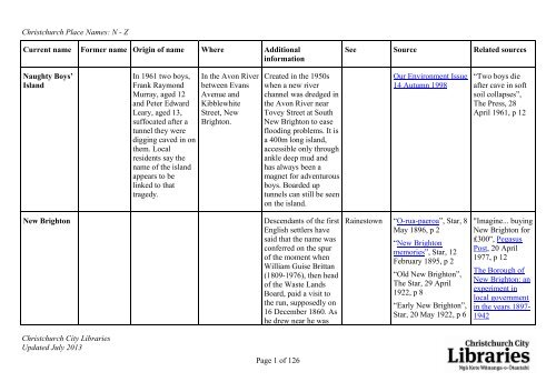
Christchurch Place Names:N-Z - Christchurch City Libraries
Christchurch Place Names:N-Z - Christchurch City Libraries
Christchurch Place Names:N-Z - Christchurch City Libraries

Create successful ePaper yourself
Turn your PDF publications into a flip-book with our unique Google optimized e-Paper software.
<strong>Christchurch</strong> <strong>Place</strong> <strong>Names</strong>: N - Z<br />
Current name Former name Origin of name Where Additional<br />
information<br />
Naughty Boys’<br />
Island<br />
<strong>Christchurch</strong> <strong>City</strong> <strong>Libraries</strong><br />
Updated July 2013<br />
In 1961 two boys,<br />
Frank Raymond<br />
Murray, aged 12<br />
and Peter Edward<br />
Leary, aged 13,<br />
suffocated after a<br />
tunnel they were<br />
digging caved in on<br />
them. Local<br />
residents say the<br />
name of the island<br />
appears to be<br />
linked to that<br />
tragedy.<br />
In the Avon River<br />
between Evans<br />
Avenue and<br />
Kibblewhite<br />
Street, New<br />
Brighton.<br />
Created in the 1950s<br />
when a new river<br />
channel was dredged in<br />
the Avon River near<br />
Tovey Street at South<br />
New Brighton to ease<br />
flooding problems. It is<br />
a 400m long island,<br />
accessible only through<br />
ankle deep mud and<br />
has always been a<br />
magnet for adventurous<br />
boys. Boarded up<br />
tunnels can still be seen<br />
on the island.<br />
New Brighton Descendants of the first<br />
English settlers have<br />
said that the name was<br />
conferred on the spur<br />
of the moment when<br />
William Guise Brittan<br />
(1809-1976), then head<br />
of the Waste Lands<br />
Board, paid a visit to<br />
the run, supposedly on<br />
16 December 1860. As<br />
he drew near he was<br />
Page 1 of 126<br />
See Source Related sources<br />
Our Environment Issue<br />
14 Autumn 1998<br />
Rainestown “O-rua-paeroa”, Star, 8<br />
May 1896, p 2<br />
“New Brighton<br />
memories”, Star, 12<br />
February 1895, p 2<br />
“Old New Brighton”,<br />
The Star, 29 April<br />
1922, p 8<br />
“Early New Brighton”,<br />
Star, 20 May 1922, p 6<br />
“Two boys die<br />
after cave in soft<br />
soil collapses”,<br />
The Press, 28<br />
April 1961, p 12<br />
"Imagine... buying<br />
New Brighton for<br />
₤300", Pegasus<br />
Post, 20 April<br />
1977, p 12<br />
The Borough of<br />
New Brighton: an<br />
experiment in<br />
local government<br />
in the years 1897-<br />
1942
<strong>Christchurch</strong> <strong>Place</strong> <strong>Names</strong>: N - Z<br />
Current name Former name Origin of name Where Additional<br />
information<br />
<strong>Christchurch</strong> <strong>City</strong> <strong>Libraries</strong><br />
Updated July 2013<br />
recognised. One of the<br />
pioneers, William Free,<br />
hastily chalked ‘New<br />
Brighton’ on a piece of<br />
wood and nailed it over<br />
the sawpit where he<br />
was working, probably<br />
because Stephen<br />
Brooker, another<br />
settler, had been born<br />
in Brighton.<br />
When the settlement<br />
was founded in 1860, it<br />
was expected that it<br />
would be a second port.<br />
New Brighton is first<br />
mentioned in The<br />
Lyttelton Times in<br />
1862. The area did not<br />
become a borough until<br />
1896.<br />
Named officially in<br />
1953.<br />
The Māori name for<br />
the area that became<br />
New Brighton was Orua-paeroa:<br />
an east<br />
Page 2 of 126<br />
See Source Related sources<br />
“History of New<br />
Brighton”, The<br />
Lyttelton Times, 5<br />
December 1925, p 8<br />
The evolution of a city,<br />
p 34<br />
Burwood All Saints’<br />
Church 1877-1977, p 2<br />
North New Brighton,<br />
1953, pp 6-7<br />
Information supplied<br />
by Richard Greenaway<br />
in 2010.<br />
“Electoral district of<br />
Avon”, The Lyttelton<br />
Times, 16 April 1862,<br />
p 6<br />
“Naming of New<br />
Brighton”, The Press, 1<br />
March 1949, p 3<br />
“Brighton’s pioneers<br />
are recalled”,<br />
<strong>Christchurch</strong> Star-Sun,<br />
3 October 1949, p 2<br />
“New Brighton<br />
"Pegasus Post<br />
presents New<br />
Brighton through<br />
the years",<br />
Pegasus Post,<br />
New Brighton<br />
supplement, 22<br />
February 1978,<br />
[16 pp]
<strong>Christchurch</strong> <strong>Place</strong> <strong>Names</strong>: N - Z<br />
Current name Former name Origin of name Where Additional<br />
information<br />
Nicholson Park Named after<br />
William Henry<br />
Nicholson (1870-<br />
1948).<br />
Noble Village Named after<br />
George Bennett<br />
Noble (1898-1983).<br />
<strong>Christchurch</strong> <strong>City</strong> <strong>Libraries</strong><br />
Updated July 2013<br />
Taylors Mistake<br />
Road<br />
wind blowing along the<br />
shore.<br />
Nicholson was mayor<br />
of Sumner 1923-1935.<br />
Noble was the head<br />
trainer at Roydon<br />
Lodge stud.<br />
A subdivision<br />
developed on the<br />
former Applefields<br />
land in Yaldhurst<br />
Road. The property has<br />
historical connections<br />
with the breeding and<br />
racing of standard<br />
breed horses.<br />
Page 3 of 126<br />
See Source Related sources<br />
district”, The Press, 23<br />
June 1953, p 7<br />
“Growth of New<br />
Brighton from a sandy<br />
waste to a prosperous<br />
community”, The<br />
<strong>Christchurch</strong> Star, 19<br />
December 1958, p 2<br />
Walking <strong>Christchurch</strong>:<br />
22 walks of discovery<br />
in and around<br />
<strong>Christchurch</strong>, p 103<br />
Riccarton/Wigram<br />
Community Board<br />
agenda 15 August<br />
2011<br />
Riccarton/Wigram<br />
Community Board<br />
minutes 23 August<br />
2011<br />
“Obituary”, The<br />
Press, 17 January<br />
1948, p 8<br />
The Port Hills of<br />
<strong>Christchurch</strong>, p 31<br />
George Noble
<strong>Christchurch</strong> <strong>Place</strong> <strong>Names</strong>: N - Z<br />
Current name Former name Origin of name Where Additional<br />
information<br />
Norrie Park Named after Sir<br />
Charles<br />
Willoughby Moke<br />
Norrie, later Baron<br />
Norrie of<br />
Wellington, New<br />
Zealand (1893-<br />
1977).<br />
Northcote Named after Henry<br />
Northcote Stafford,<br />
1st Earl of<br />
Iddesleigh (1818-<br />
1887).<br />
<strong>Christchurch</strong> <strong>City</strong> <strong>Libraries</strong><br />
Updated July 2013<br />
Norrie Street Norrie was Governor-<br />
General of New<br />
Zealand 1952-1957.<br />
Named in 1971.<br />
Sir Stafford Northcote<br />
was a British<br />
Conservative<br />
politician.<br />
Northcote is first<br />
mentioned in The Press<br />
in 1863 when land at<br />
Northcote “situated on<br />
the North Road<br />
immediately beyond<br />
the village of Papanui”<br />
is advertised for sale.<br />
Page 4 of 126<br />
See Source Related sources<br />
Northcote<br />
Road<br />
“New park”, The<br />
Papanui Herald, 20<br />
April 1971, p 6<br />
Information on naming<br />
supplied in 2010 by<br />
George Northcote of<br />
Redcliffs in an<br />
interview with<br />
Margaret Harper.<br />
“Advertisements”, The<br />
Press, 28 January<br />
1863, p 5<br />
Governor-General<br />
of Aotearoa, New<br />
Zealand
<strong>Christchurch</strong> <strong>Place</strong> <strong>Names</strong>: N - Z<br />
Current name Former name Origin of name Where Additional<br />
information<br />
North New<br />
Brighton<br />
Northshore Named to show<br />
that it is the north<br />
end of where<br />
human habitation<br />
exists in the greater<br />
New Brighton area.<br />
<strong>Christchurch</strong> <strong>City</strong> <strong>Libraries</strong><br />
Updated July 2013<br />
North of Beach<br />
Road.<br />
North Beach is the<br />
alternate name –<br />
probably the more<br />
popular version – for<br />
North New Brighton.<br />
Officially named in<br />
1953.<br />
A subdivision north of<br />
Beach Road developed<br />
in the 1990s.<br />
Page 5 of 126<br />
See Source Related sources<br />
“North Beach: a rising<br />
suburb”, The Star, 24<br />
September 1913, p 1<br />
"'DID YOU KNOW'?<br />
Facts about North New<br />
Brighton", Pegasus<br />
Post, 9 February 1977,<br />
p 13<br />
“New Brighton<br />
district”, The Press, 23<br />
June 1953, p 7
<strong>Christchurch</strong> <strong>Place</strong> <strong>Names</strong>: N - Z<br />
Current name Former name Origin of name Where Additional<br />
information<br />
Northwood 97 hectares of apple<br />
orchard between Styx<br />
Mill Reserve and the<br />
southern boundary of<br />
Belfast was named<br />
Northwood by the<br />
developers, R. D.<br />
Hughes.<br />
Named in 2000.<br />
Nunweek Park Named after Henry<br />
Nunweek (1826-<br />
1914).<br />
<strong>Christchurch</strong> <strong>City</strong> <strong>Libraries</strong><br />
Updated July 2013<br />
Wooldridge Road<br />
and Harewood<br />
Road.<br />
Nunweek arrived in<br />
Canterbury on the<br />
Joseph Fletcher in<br />
1856. He originally<br />
worked at road-making<br />
on Harewood Road for<br />
the Provincial<br />
Government. In 1861<br />
he went to the Otago<br />
goldfields. This proved<br />
successful and he<br />
brought his money<br />
back to Canterbury<br />
where he took up land<br />
in Harewood and began<br />
fruit farming. He was<br />
also a member of the<br />
Riccarton Licensing<br />
Page 6 of 126<br />
See Source Related sources<br />
Actions and reactions<br />
September 2000<br />
Shirley/Papanui<br />
Community Board<br />
agenda 2 February<br />
2000<br />
Settling near the Styx<br />
River, pp 51-56<br />
Waimairi County<br />
Council minutes book<br />
1961, p 427, CH<br />
357/51 held at<br />
<strong>Christchurch</strong> <strong>City</strong><br />
Council archives.<br />
“Northwood takes<br />
shape”, The Press,<br />
22 July 2000, p 21<br />
The Cyclopedia of<br />
New Zealand, p<br />
651<br />
Early fruitgrowing<br />
in Canterbury<br />
New Zealand, pp<br />
31-34<br />
G R Macdonald<br />
dictionary of<br />
Canterbury<br />
biographies: N162<br />
"Personal",<br />
Auckland Star, 26<br />
September 1914,<br />
p 4<br />
"Pioneer settlers",
<strong>Christchurch</strong> <strong>Place</strong> <strong>Names</strong>: N - Z<br />
Current name Former name Origin of name Where Additional<br />
information<br />
<strong>Christchurch</strong> <strong>City</strong> <strong>Libraries</strong><br />
Updated July 2013<br />
Committee, the<br />
Harewood Road<br />
School committee and<br />
a member of the<br />
Riccarton Road Board<br />
for 32 years. His house<br />
was still standing in<br />
Harewood Road in<br />
1961.<br />
Named in 1961.<br />
Page 7 of 126<br />
See Source Related sources<br />
The Press, 22<br />
September 1902,<br />
p 5
<strong>Christchurch</strong> <strong>Place</strong> <strong>Names</strong>: N - Z<br />
Current name Former name Origin of name Where Additional<br />
information<br />
Oaklands Named after the<br />
oaks trees lining<br />
the driveway into<br />
Oaklands.<br />
<strong>Christchurch</strong> <strong>City</strong> <strong>Libraries</strong><br />
Updated July 2013<br />
Daivd Lewis (1826?-<br />
874) was the original<br />
owner of Halswell<br />
House .His son Charles<br />
Lewis (1857-1927) was<br />
a member of the House<br />
of Representatives and<br />
also parliamentary<br />
whip.<br />
Peter Watson (1869?-<br />
1947), proprietor of the<br />
<strong>Christchurch</strong> Dairy<br />
Company, changed the<br />
name to Oaklands<br />
when he bought the<br />
property. The drive to<br />
the house had oaks<br />
planted on either side.<br />
Karl Scott (1910-1997)<br />
negotiated the<br />
subdivision of<br />
Oaklands about 1960.<br />
Page 8 of 126<br />
See Source Related sources<br />
Scott Park “Death”, The<br />
Press, 8 April<br />
1874, p. 2<br />
G R Macdonald<br />
dictionary of<br />
Canterbury<br />
biographies: L204<br />
“Obituary”, The<br />
Press, 29<br />
November 1927, p<br />
11
<strong>Christchurch</strong> <strong>Place</strong> <strong>Names</strong>: N - Z<br />
Current name Former name Origin of name Where Additional<br />
information<br />
Ohinetahi<br />
Bush Reserve<br />
<strong>Christchurch</strong> <strong>City</strong> <strong>Libraries</strong><br />
Updated July 2013<br />
Owned and managed<br />
by the Summit Road<br />
Society. His obituary<br />
says it was the<br />
brainchild of Gordon<br />
David Kirk (1925-<br />
2007).<br />
Page 9 of 126<br />
See Source Related sources<br />
The Port Hills of<br />
<strong>Christchurch</strong>, pp 321-<br />
322<br />
Summit Road Society<br />
newsletter, November<br />
2003<br />
“Abiding passion for<br />
the Port Hills”, The<br />
Press, 4 August 2007,<br />
p D17
<strong>Christchurch</strong> <strong>Place</strong> <strong>Names</strong>: N - Z<br />
Current name Former name Origin of name Where Additional<br />
information<br />
Okeover<br />
Stream<br />
<strong>Christchurch</strong> <strong>City</strong> <strong>Libraries</strong><br />
Updated July 2013<br />
Named after<br />
Okeover House,<br />
which, in turn, was<br />
named after the<br />
village of Okeover<br />
in Derbyshire.<br />
Omawete Named after<br />
Mawete, a Ngati<br />
Mamoe chief.<br />
Opawa Named after<br />
Opawaha, the<br />
Māori name for the<br />
Heathcote River.<br />
Near Coopers<br />
Knob.<br />
Okeover House was<br />
built in 1858 by Alfred<br />
Creyke (1831-1892) on<br />
four hectares of land at<br />
Ilam. Okeover was the<br />
name gazetted by the<br />
New Zealand<br />
Geographic Board in<br />
1968 for an upper<br />
tributary of the Avon<br />
River. It had been<br />
recommended by the<br />
Canterbury University<br />
council to avoid the<br />
confusion of a variety<br />
of names used in the<br />
past.<br />
Mawete was killed<br />
there by the Ngai Tahu.<br />
First mentioned in the<br />
Star in 1868 when T.<br />
M. Hassal is<br />
advertising for a lost<br />
red steer.<br />
Page 10 of 126<br />
See Source Related sources<br />
“New names for Upper<br />
Avon streams”, The<br />
Press, 23 March 1968,<br />
p 19<br />
"<strong>Place</strong> names on Port<br />
Hills-Akaroa Summit<br />
Road", The Star, 20<br />
November 1920, p 10<br />
The Port Hills of<br />
<strong>Christchurch</strong>, p 175<br />
“Advertisements”,<br />
Star, 15 May 1868, p 3<br />
“Will of an old<br />
Canterbury<br />
settler”, The<br />
Timaru Herald, 3<br />
March 1893, p 3<br />
G R Macdonald<br />
dictionary of<br />
Canterbury<br />
biographies: C793<br />
The evolution of a<br />
city, p 33
<strong>Christchurch</strong> <strong>Place</strong> <strong>Names</strong>: N - Z<br />
Current name Former name Origin of name Where Additional<br />
information<br />
Orongomai<br />
Reserve<br />
<strong>Christchurch</strong> <strong>City</strong> <strong>Libraries</strong><br />
Updated July 2013<br />
Orongomai means:<br />
the place where the<br />
voices were heard.<br />
Ōtautahi Otautahi means<br />
<strong>Christchurch</strong>.<br />
Named after the<br />
chief Tautahi, who<br />
was the first to<br />
construct eel-weirs<br />
and fish-dams on<br />
what is now the site<br />
of <strong>Christchurch</strong>.<br />
A name given by the<br />
Ngai Tahu invaders<br />
and refers to their<br />
scouts who were<br />
searching for the Ngati<br />
Mamoe inhabitants<br />
about the head of<br />
Governors Bay.<br />
Named during the<br />
1930s by Te Aritaua<br />
Pitama (1906-1958), a<br />
Ngai Tahu leader;<br />
teacher, broadcaster<br />
and concert party<br />
producer. Otautahi was<br />
formerly the name of a<br />
specific site in central<br />
<strong>Christchurch</strong> (in the<br />
Kilmore Street-<br />
Manchester Street area)<br />
before being adoped as<br />
the general name for<br />
the city.<br />
Page 11 of 126<br />
See Source Related sources<br />
"<strong>Place</strong> names on Port<br />
Hills-Akaroa Summit<br />
Road", The Star, 20<br />
November 1920, p 10<br />
(written by Harry Ell).<br />
Māori place names of<br />
Canterbury, p 117<br />
The city plan<br />
Ōtautahi from Tī<br />
Kōuka Whenua<br />
View the<br />
biography of Te<br />
Aritaua Pitama in<br />
the Dictionary of<br />
New Zealand<br />
Biography.<br />
“Obituary”, The<br />
Press, 15 March<br />
1958, p 4
<strong>Christchurch</strong> <strong>Place</strong> <strong>Names</strong>: N - Z<br />
Current name Former name Origin of name Where Additional<br />
information<br />
Ouruhia Marshland In an area especially<br />
associated with market<br />
gardens and gate sales<br />
of vegetables and fruit<br />
to the public.<br />
In 1905 the Star reports<br />
the opening of the Post<br />
Office at “Ouruhia<br />
Chaney’s”.<br />
Owen Mitchell<br />
Park<br />
<strong>Christchurch</strong> <strong>City</strong> <strong>Libraries</strong><br />
Updated July 2013<br />
Named after Owen<br />
Cecil Mitchell<br />
(1904-1971).<br />
Grimseys Road Mitchell was a master<br />
builder and chairman<br />
of the Waimairi County<br />
Council 1965-1966.<br />
Developed in 1982.<br />
Pacific Park Bexley Development proposed<br />
in 1991.<br />
Page 12 of 126<br />
See Source Related sources<br />
“The Mails”, Star, 11<br />
September 1905, p 2<br />
"Problems over park<br />
name", The Papanui<br />
Herald, 23 March<br />
1982, p 3<br />
“Obituary, Mr O.<br />
C. Mitchell”, The<br />
Press, 24 February<br />
1971, p 17<br />
“Wetland may be<br />
filled”, The Press,<br />
7 December 1991
<strong>Christchurch</strong> <strong>Place</strong> <strong>Names</strong>: N - Z<br />
Current name Former name Origin of name Where Additional<br />
information<br />
Packe Reserve 125 & 129 Packe<br />
Street<br />
Papanui Papa means: flat;<br />
nui means: large.<br />
Another meaning,<br />
equally applicable<br />
to the district in the<br />
early days, is: a<br />
stage set in the<br />
branches of a tree<br />
to accommodate a<br />
bird-spearer, but<br />
there are many<br />
other possible<br />
meanings.<br />
<strong>Christchurch</strong> <strong>City</strong> <strong>Libraries</strong><br />
Updated July 2013<br />
Two properties were<br />
purchased in 1996 for a<br />
neighbourhood park.<br />
Residents had lobbied<br />
for this. It had started<br />
as a community effort<br />
to save three landmark<br />
trees.<br />
The “Papanui Wood” is<br />
mentioned in the New<br />
Zealand Spectator and<br />
Cook’s Strait Guardian<br />
in 1852.<br />
The suburb of Papanui<br />
was amalgamated with<br />
the <strong>City</strong> of<br />
<strong>Christchurch</strong> in 1923.<br />
Page 13 of 126<br />
See Source Related sources<br />
Packe Street “Happiness is a New<br />
Park!”, STANN : the<br />
St Albans<br />
neighbourhood news,<br />
Vol 3, March 1996, p 1<br />
‘A history of the new<br />
Packe Street Reserve”,<br />
STANN : the St<br />
Albans neighbourhood<br />
news, Vol 3, March<br />
1996, p 4<br />
The Reed dictionary of<br />
New Zealand place<br />
names, p 384<br />
“<strong>Christchurch</strong>”, New<br />
Zealand Spectator and<br />
Cook's Strait Guardian,<br />
3 April 1852, p 3<br />
Papanui from Tī<br />
Kōuka Whenua<br />
“Progressive<br />
Papanui”, The<br />
Press, 25 July<br />
1931, p 8
<strong>Christchurch</strong> <strong>Place</strong> <strong>Names</strong>: N - Z<br />
Current name Former name Origin of name Where Additional<br />
information<br />
Papanui<br />
Memorial<br />
Reserve<br />
<strong>Christchurch</strong> <strong>City</strong> <strong>Libraries</strong><br />
Updated July 2013<br />
On the site of the<br />
Memorial Hall<br />
opened in 1923 to<br />
commemorate the<br />
38 local soldiers<br />
who died in World<br />
War I (1914-1918).<br />
In the Papanui<br />
shopping centre<br />
on Papanui Road<br />
at the intersection<br />
with Horner<br />
Street.<br />
A memorial rose<br />
garden with a<br />
commemorative<br />
plaque, flagpole,<br />
Papanui War<br />
Memorial, a fountain<br />
(donated by the<br />
Papanui Rotary Club),<br />
seating, grassed and<br />
paved areas and a toilet<br />
block.<br />
A memorial rose bed<br />
contains 57 "Lest we<br />
Forget" roses, one for<br />
every name on the<br />
commemorative plaque<br />
which came from the<br />
memorial plaques off<br />
the former Memorial<br />
Hall which was<br />
demolished in 1978.<br />
Page 14 of 126<br />
See Source Related sources<br />
Papanui<br />
Memorial<br />
Hall<br />
Shirley/Papanui<br />
Community Board<br />
agenda 5 April 2006
<strong>Christchurch</strong> <strong>Place</strong> <strong>Names</strong>: N - Z<br />
Current name Former name Origin of name Where Additional<br />
information<br />
Parklands Between the<br />
Burwood<br />
Hospital and the<br />
Waimairi Beach<br />
Golf Club.<br />
Parnham<br />
Reserve<br />
<strong>Christchurch</strong> <strong>City</strong> <strong>Libraries</strong><br />
Updated July 2013<br />
Named after Frank<br />
Nelson Parnham<br />
(1908-1999).<br />
Santa Maria<br />
Avenue and<br />
Selleck Street.<br />
John Brightling (1842-<br />
1928) operated a brick<br />
works on this site until<br />
1963 when it became<br />
part of the Parklands<br />
subdivision.<br />
Developed on about<br />
700 acres by<br />
<strong>Christchurch</strong><br />
Developments Ltd.<br />
Parnham, a surveyor<br />
and local body officer,<br />
grew daffodils on a<br />
large block of land near<br />
where this reserve was<br />
later developed. He<br />
was a brother of Agnes<br />
Leithead Drayton<br />
(1902-1986).<br />
Page 15 of 126<br />
See Source Related sources<br />
Brightlings<br />
Road<br />
Drayton<br />
Drive<br />
The Port Hills of<br />
<strong>Christchurch</strong>, pp 160,<br />
189<br />
Waimairi life, p 25<br />
Information supplied<br />
in 2009 by Peter<br />
Foster.<br />
G R Macdonald<br />
dictionary of<br />
Canterbury<br />
biographies: B723<br />
“Obituary”, The<br />
Press, 24 July<br />
1928, p 12<br />
“Problems in new<br />
suburb”, The<br />
Press, 13 February<br />
1974, p 17<br />
"Assurance given<br />
on scheme's<br />
financing", The<br />
Press, 30 October<br />
1976, p 24
<strong>Christchurch</strong> <strong>Place</strong> <strong>Names</strong>: N - Z<br />
Current name Former name Origin of name Where Additional<br />
information<br />
Peacocks<br />
Gallop<br />
Shag Rock<br />
Reserve<br />
<strong>Christchurch</strong> <strong>City</strong> <strong>Libraries</strong><br />
Updated July 2013<br />
Named after John<br />
Jenkins Peacock<br />
(1798-1868).<br />
On the Main<br />
Road at the base<br />
of Clifton Hill<br />
and opposite<br />
Shag Rock.<br />
Named Shag Rock as<br />
early as 1854.<br />
The Māori name for it<br />
is Rapanui. The<br />
meaning of this is<br />
discussed in the Star in<br />
1903.<br />
In 1940 members of<br />
the Sumner Beach<br />
Improvement and<br />
Beautifying<br />
Association arranged<br />
for the planting of 150<br />
native shrubs<br />
purchased from J. N.<br />
Baxter of Mount<br />
Pleasant.<br />
Peacock was a<br />
merchant and trader<br />
who owned numerous<br />
small vessels. He rode<br />
to <strong>Christchurch</strong> via<br />
Sumner and, according<br />
to family legend, he<br />
was afraid of rocks<br />
falling from the cliffs<br />
between Sumner and<br />
Page 16 of 126<br />
See Source Related sources<br />
Sumner-Redcliffs<br />
Historical Society<br />
Moncks Bay to<br />
Scarborough beach<br />
parks : issues and<br />
opportunities, p 23<br />
“Galloping Peacock -<br />
fact or myth”, The<br />
Press, 4 December<br />
2006, p A9<br />
“Peacock identified”,<br />
The Press, 18<br />
December 2006, p A5<br />
Search of relevant<br />
minute books<br />
undertaken by Chris<br />
Adam, regional<br />
archivist at Archives<br />
New Zealand. These<br />
books are now held by<br />
<strong>Christchurch</strong> <strong>City</strong><br />
Council archives.<br />
Hagley/Ferrymead<br />
Community Board<br />
Extraordinary Agenda<br />
G R Macdonald<br />
dictionary of<br />
Canterbury<br />
biographies: P233
<strong>Christchurch</strong> <strong>Place</strong> <strong>Names</strong>: N - Z<br />
Current name Former name Origin of name Where Additional<br />
information<br />
<strong>Christchurch</strong> <strong>City</strong> <strong>Libraries</strong><br />
Updated July 2013<br />
Shag Rock so he<br />
always galloped over<br />
this part of the road.<br />
The name was<br />
informally extended to<br />
refer to all of the<br />
parkland between the<br />
current road and the<br />
cliffs, which was<br />
formed by filling over<br />
the old beach in the<br />
1930s.<br />
A search of the Sumner<br />
Borough Council<br />
minute books 1928-<br />
1939 and indexes to<br />
minute books from the<br />
borough until 1954<br />
reveals no mention of<br />
Peacock’s Gallop.<br />
The name “Peacock’s<br />
Gallop” first appeared<br />
on an unsourced sign in<br />
the reserve about 2000.<br />
Name formally adopted<br />
in 2010.<br />
Page 17 of 126<br />
See Source Related sources<br />
22 September 2010
<strong>Christchurch</strong> <strong>Place</strong> <strong>Names</strong>: N - Z<br />
Current name Former name Origin of name Where Additional<br />
information<br />
Peer Street<br />
Reserve<br />
<strong>Christchurch</strong> <strong>City</strong> <strong>Libraries</strong><br />
Updated July 2013<br />
Peer Street Formed in 1992 when<br />
the last major stretch of<br />
open land along the<br />
Avon River near its<br />
source was sub-divided<br />
to form Ilam Park. The<br />
riverbank was retained<br />
by the <strong>Christchurch</strong><br />
<strong>City</strong> Council as a<br />
reserve contribution.<br />
Page 18 of 126<br />
See Source Related sources<br />
Peer Street<br />
and Ilam<br />
Park.<br />
"Avon River land<br />
becomes reserve", The<br />
Press, 24 February<br />
1992, p 9
<strong>Christchurch</strong> <strong>Place</strong> <strong>Names</strong>: N - Z<br />
Current name Former name Origin of name Where Additional<br />
information<br />
Pentland Named after the<br />
Pentland Hills in<br />
Scotland, just south<br />
of Edinburgh.<br />
<strong>Christchurch</strong> <strong>City</strong> <strong>Libraries</strong><br />
Updated July 2013<br />
Adjacent to the<br />
Main North Road<br />
at Belfast.<br />
An orchard belt<br />
development on an 11<br />
hectare block of land<br />
owned 1926-1975 by<br />
noted horse trainer,<br />
Cecil Sydney Donald<br />
(1901-1973) and his<br />
family. It was sold to<br />
the government in 1975<br />
and to Landcorp<br />
Management Services<br />
in 1987 who developed<br />
it in conjunction with<br />
Mauger Contracting<br />
Ltd.<br />
The street names in the<br />
subdivision are based<br />
on the names of South<br />
Island high-country<br />
holdings.<br />
Page 19 of 126<br />
See Source Related sources<br />
"Pentland - a<br />
development for<br />
Belfast", The Papanui<br />
Herald, 2 October<br />
1990, pp 6-8<br />
“Orchard-belt<br />
sections on<br />
market this<br />
week”, The Press,<br />
3 October 1990, p<br />
57
<strong>Christchurch</strong> <strong>Place</strong> <strong>Names</strong>: N - Z<br />
Current name Former name Origin of name Where Additional<br />
information<br />
Peter Scoular<br />
Park<br />
<strong>Christchurch</strong> <strong>City</strong> <strong>Libraries</strong><br />
Updated July 2013<br />
Named after Peter<br />
Gray Scoular<br />
(1924-1983).<br />
Petrie Park Named after<br />
George Petrie<br />
(1853-1912).<br />
Tuam Street Scoular was<br />
<strong>Christchurch</strong> <strong>City</strong><br />
Council deputy general<br />
manager and city<br />
engineer during the<br />
1970s and early 1980s.<br />
He “played a<br />
significant role in the<br />
conversion of the civic<br />
offices from the former<br />
Millers department<br />
store”.<br />
Petrie Street Petrie was a landowner<br />
and well-known<br />
builder of North Avon<br />
Road.<br />
A reserve of two acres<br />
and one of nine parks<br />
given their official<br />
names by the <strong>City</strong><br />
Council in 1948.<br />
Page 20 of 126<br />
See Source Related sources<br />
Scoular<br />
<strong>Place</strong><br />
“Former city engineer<br />
dies”, <strong>Christchurch</strong><br />
Star, 30 December<br />
1983, p 3<br />
Petrie Street “Nine parks named,<br />
small reserves in<br />
<strong>Christchurch</strong>”, The<br />
Press, 14 September<br />
1948, p 6<br />
Planning<br />
quarterly, Number<br />
161, June 2006, p<br />
15-16<br />
G R Macdonald<br />
dictionary of<br />
Canterbury<br />
biographies: P348<br />
& P348a<br />
“Another<br />
suicide”, Northern<br />
Advocate, 22<br />
April 1912, p 5<br />
Richmond<br />
community news,<br />
Vol 3 No 6 Issue<br />
27
<strong>Christchurch</strong> <strong>Place</strong> <strong>Names</strong>: N - Z<br />
Current name Former name Origin of name Where Additional<br />
information<br />
Phillipstown Named after Henry<br />
Phillips (1804/05-<br />
1877) and his<br />
family.<br />
<strong>Christchurch</strong> <strong>City</strong> <strong>Libraries</strong><br />
Updated July 2013<br />
Phillips was an original<br />
1850 land purchaser.<br />
He bought Rural<br />
Section 16, 100 acres,<br />
“South Bank<br />
Heathcote, Hills<br />
Road”, Rural Section<br />
54, 50 acres<br />
“Heathcote, Hills<br />
Road”, Rural Section<br />
69, 100 acres "East of<br />
the Town Reserve,<br />
<strong>Christchurch</strong>, Ferry<br />
Road" and Rural<br />
Section 73, 50 acres<br />
“South Bank<br />
Heathcote, Hills<br />
Road”.<br />
The Port Hills Road<br />
was formerly named<br />
Hills Road.<br />
First appears in the Star<br />
in an advertisement in<br />
1874 as Phillips’<br />
Town.<br />
Page 21 of 126<br />
See Source Related sources<br />
St Martins Province of<br />
Canterbury, New<br />
Zealand: list of<br />
sections purchased to<br />
April 30, 1863, pp 1, 2,<br />
7<br />
Province of<br />
Canterbury, New<br />
Zealand : list of<br />
sections purchased to<br />
April 30 1863, p 2<br />
"Rural Sections<br />
chosen", The Lyttelton<br />
Times, 1 March 1851,<br />
p 6<br />
"Rural Sections<br />
chosen", The Lyttelton<br />
Times, 22 March 1851,<br />
p 6<br />
"Local and General",<br />
Star, 24 December<br />
1875, p 2<br />
"Advertisements",<br />
Star, 3 July 1874, p 1<br />
“European place<br />
“Local and<br />
General”, Star, 17<br />
September 1877,<br />
p 2
<strong>Christchurch</strong> <strong>Place</strong> <strong>Names</strong>: N - Z<br />
Current name Former name Origin of name Where Additional<br />
information<br />
Picton Reserve Corner of Picton<br />
Avenue and<br />
Nelson Street.<br />
<strong>Christchurch</strong> <strong>City</strong> <strong>Libraries</strong><br />
Updated July 2013<br />
Three adjoining<br />
properties were<br />
purchased for the<br />
reserve in 1999. This<br />
land was transformed<br />
in 2002 into a reserve<br />
with a number of<br />
special water features,<br />
a pumping station and<br />
three well heads which<br />
supply water to houses<br />
in the surrounding area.<br />
The design theme<br />
highlights the different<br />
ways water is treated<br />
and used.<br />
Page 22 of 126<br />
See Source Related sources<br />
Bergman’s<br />
Stream<br />
names”, The Press, 12<br />
January 1924, p 11<br />
G R Macdonald<br />
dictionary of<br />
Canterbury<br />
biographies: P362<br />
Early Canterbury runs,<br />
p 208<br />
Riccarton/Wigram<br />
Community Board<br />
agenda 4 August 1999<br />
"Facelift for Picton<br />
Ave", <strong>Christchurch</strong><br />
Western Mail, 21<br />
August 2002, p<br />
1-2
<strong>Christchurch</strong> <strong>Place</strong> <strong>Names</strong>: N - Z<br />
Current name Former name Origin of name Where Additional<br />
information<br />
Plynlimon<br />
Park<br />
<strong>Christchurch</strong> <strong>City</strong> <strong>Libraries</strong><br />
Updated July 2013<br />
Named after the<br />
highest point of the<br />
Cambrian<br />
Mountains in<br />
Wales.<br />
Porritt Park Merry Estate Formerly the Merry<br />
Estate. Named after<br />
Thomas Merry<br />
(1815-1901).<br />
Re-named Porritt<br />
Park. Named after<br />
Arthur Espie Porritt<br />
(1900-1994).<br />
Plynlimon Road Named to continue the<br />
Welsh theme of street<br />
and place names in the<br />
area.<br />
Originally a gravel pit<br />
and later a city rubbish<br />
dump.<br />
Developed into a sports<br />
park in the mid-1950s.<br />
Avonside Drive Merry bought a farm<br />
on the Avon River<br />
from John Dudley<br />
(1808-1861).<br />
It was chosen in 1971<br />
by the <strong>Christchurch</strong><br />
<strong>City</strong> Council to be<br />
developed as a sports<br />
stadium for the 1974<br />
Commonwealth<br />
Games.<br />
[A change of mayor<br />
later in 1971 saw the<br />
venue changed to<br />
Queen Elizabeth II<br />
Park.]<br />
Page 23 of 126<br />
See Source Related sources<br />
Plynlimon<br />
Road<br />
Summary of parks,<br />
playgrounds, open<br />
spaces and reserves, p<br />
18<br />
"Merry Estate<br />
development proposed<br />
23 years ago", The<br />
Press, 22 September<br />
1971, p 14<br />
"New name for Games<br />
venue", The Press, 6<br />
October 1971, p 20<br />
"Sir Denis invited to<br />
open Porritt Park",<br />
Pegasus Post, 28 May<br />
1975, p 5<br />
“Sir Denis to open<br />
park”, Pegasus Post, 23<br />
July 1975, p 4<br />
G R Macdonald<br />
dictionary of<br />
Canterbury<br />
biographies:<br />
M341<br />
“Deaths”, Star, 4<br />
July 1901, p 3<br />
View the<br />
biography of<br />
Arthur Espie<br />
Porritt in the<br />
Dictionary of<br />
New Zealand<br />
Biography.
<strong>Christchurch</strong> <strong>Place</strong> <strong>Names</strong>: N - Z<br />
Current name Former name Origin of name Where Additional<br />
information<br />
<strong>Christchurch</strong> <strong>City</strong> <strong>Libraries</strong><br />
Updated July 2013<br />
Re-named Porritt Park.<br />
Named after Sir Arthur<br />
Porritt, an athlete,<br />
doctor, sports<br />
administrator and<br />
Governor-General of<br />
New Zealand 1967-<br />
1972.<br />
Named because he was<br />
a New Zealander and<br />
also associated with<br />
sport.<br />
Opened by the<br />
Governor-General, Sir<br />
Denis Blundell, on 6<br />
September 1975.<br />
Page 24 of 126<br />
See Source Related sources
<strong>Christchurch</strong> <strong>Place</strong> <strong>Names</strong>: N - Z<br />
Current name Former name Origin of name Where Additional<br />
information<br />
Potts Point Potts<br />
Peninsula<br />
<strong>Christchurch</strong> <strong>City</strong> <strong>Libraries</strong><br />
Updated July 2013<br />
Named after<br />
Thomas Henry<br />
Potts (1824-1888).<br />
Prestons Named after<br />
Thomas Herbert<br />
Preston (1824-<br />
1884).<br />
Bounded by<br />
Lower Styx Road<br />
to the north,<br />
Mairehau Road to<br />
the south and<br />
bisected by<br />
Prestons Road.<br />
Potts was an explorer,<br />
runholder,<br />
conservationist and<br />
naturalist. He<br />
purchased Rural<br />
Sections 1129 (50<br />
acres) and 1130 (20<br />
acres), "near Cass'<br />
Peak, Port Lyttelton".<br />
Preston was a chairman<br />
of the Avon Road<br />
Board and a resident of<br />
Prestons Road. He died<br />
at his residence,<br />
Audlem Farm, Styx.<br />
A 203ha suburb of<br />
6000 people developed<br />
by CDL Land New<br />
Zealand, Ngāi Tahu<br />
Page 25 of 126<br />
See Source Related sources<br />
Prestons<br />
Road<br />
Province of<br />
Canterbury, New<br />
Zealand: list of<br />
sections purchased to<br />
April 30, 1863, p 25<br />
<strong>Place</strong> names of Banks<br />
Peninsula : a<br />
topographical history,<br />
p 169<br />
History of the Akaroa<br />
Parish, 1851-1951 :<br />
prepared for the<br />
church's centenary<br />
celebrations,<br />
November 11, 1951 /<br />
by H.F. Ault.<br />
“Big plan signalled for<br />
land”, The Press, 8<br />
November 2007, p A5<br />
“Prestons Residential<br />
Subdivision”, The<br />
Press, 19 October<br />
2012, p B4<br />
“Obituary", Star,<br />
28 July 1888, p 4<br />
View the<br />
biography of<br />
Thomas Henry<br />
Potts in the<br />
Dictionary of<br />
New Zealand<br />
Biography.<br />
Out in the open : a<br />
budget of scraps<br />
of natural history<br />
gathered in New<br />
Zealand<br />
“Death”, Star, 30<br />
October 1884, p 2<br />
G. R Macdonald<br />
dictionary of<br />
Canterbury<br />
biographies: P547
<strong>Christchurch</strong> <strong>Place</strong> <strong>Names</strong>: N - Z<br />
Current name Former name Origin of name Where Additional<br />
information<br />
<strong>Christchurch</strong> <strong>City</strong> <strong>Libraries</strong><br />
Updated July 2013<br />
Property, and<br />
Foodstuffs South<br />
Island.<br />
Planning began in<br />
2007.<br />
Designed to be a<br />
sustainable urban<br />
village.<br />
First neighbourhood<br />
known as Korowai.<br />
Named because<br />
korowaui are highly<br />
valued traditional<br />
cloaks, symbolic of<br />
leadership and the<br />
commensurate<br />
obligation to care for<br />
people and their<br />
environment. The<br />
developers were<br />
looking to contribute<br />
positively to<br />
Canterbury’s post<br />
earthquake<br />
development and<br />
thought by adopting<br />
this name the<br />
Page 26 of 126<br />
See Source Related sources
<strong>Christchurch</strong> <strong>Place</strong> <strong>Names</strong>: N - Z<br />
Current name Former name Origin of name Where Additional<br />
information<br />
Prices Valley Named after Joseph<br />
Price (1809-1901).<br />
<strong>Christchurch</strong> <strong>City</strong> <strong>Libraries</strong><br />
Updated July 2013<br />
foundation for the<br />
entire development was<br />
laid.<br />
Banks Peninsula Price, a whaler, was an<br />
early Paheka-Māori.<br />
The children of his<br />
second wife, a<br />
European, were the<br />
first baptised at the<br />
Akaroa Anglican<br />
Church.<br />
Page 27 of 126<br />
See Source Related sources<br />
Captain Joseph Price.<br />
1809-1901, mariner,<br />
landowner & family<br />
man<br />
Receipts and invoices<br />
for purchases made in<br />
<strong>Christchurch</strong> by Joseph<br />
Price, 1873-1874<br />
History of the Akaroa<br />
Parish, 1851-1951 :<br />
prepared for the<br />
church’s centenary<br />
celebration
<strong>Christchurch</strong> <strong>Place</strong> <strong>Names</strong>: N - Z<br />
Current name Former name Origin of name Where Additional<br />
information<br />
Quail Island Te Kawa<br />
Kawa and<br />
Otamahua.<br />
<strong>Christchurch</strong> <strong>City</strong> <strong>Libraries</strong><br />
Updated July 2013<br />
Named because of<br />
the quail<br />
introduced there by<br />
Captain William<br />
Mein Smith (1799-<br />
1869).<br />
Smith was the first<br />
European to set foot on<br />
the island in 1842.<br />
First mentioned in the<br />
Star in 1868.<br />
Page 28 of 126<br />
See Source Related sources<br />
The Reed dictionary of<br />
New Zealand place<br />
names, p 420<br />
"Local and General",<br />
Star, 19 May 1868, p 2<br />
"Quail Island's various<br />
changes of name", The<br />
Press, 21 August 1961,<br />
p 19<br />
View the<br />
biography of<br />
William Mein<br />
Smith in the<br />
Dictionary of<br />
New Zealand<br />
Biography.
<strong>Christchurch</strong> <strong>Place</strong> <strong>Names</strong>: N - Z<br />
Current name Former name Origin of name Where Additional<br />
information<br />
Queenspark<br />
Estate<br />
Radley Park Gate’s Block Formerly Gate’s<br />
Block. Named after<br />
Alfred Charles<br />
Harold Gates<br />
(1878?-1937).<br />
Re-named Radley<br />
Park.<br />
<strong>Christchurch</strong> <strong>City</strong> <strong>Libraries</strong><br />
Updated July 2013<br />
Parklands The land was bought in<br />
1960 by Cyril Leonard<br />
Love Smith (1915-)<br />
and the first houses<br />
were built in 1974.<br />
The last part of the<br />
suburb was developed<br />
by 1986 as "one of the<br />
earliest professionally<br />
planned and integrated<br />
suburbs, with highquality<br />
home design<br />
and building".<br />
The Queenspark<br />
Community<br />
Association was<br />
established 9 June<br />
1975.<br />
Close to the<br />
Heathcote River<br />
at Cumnor<br />
Terrace.<br />
Formed on land owned<br />
by Gates, a gardener of<br />
47 Isis Street. His<br />
widow Hannah<br />
Elizabeth Gates<br />
(1881?-1945) lived on<br />
at the property until her<br />
death.<br />
Page 29 of 126<br />
See Source Related sources<br />
Gates Lane<br />
and Radley<br />
Street.<br />
"Queenspark: a living<br />
community", Pegasus<br />
Post, 26 November<br />
1975, pp 1 & 10<br />
“Queenspark Estate”,<br />
The Press, 24 August<br />
1977, p 39<br />
"Forest Park Estate,<br />
Queenspark", The<br />
Press, 16 October<br />
1991, p 33<br />
“New reserve at<br />
Woolston”, The Press,<br />
24 October 1953, p 9<br />
Summary of parks,<br />
playgrounds, open<br />
spaces and reserves, p<br />
18<br />
Report to council<br />
of the Hagley-<br />
Ferrymead<br />
Community Board<br />
4 June 1997
<strong>Christchurch</strong> <strong>Place</strong> <strong>Names</strong>: N - Z<br />
Current name Former name Origin of name Where Additional<br />
information<br />
<strong>Christchurch</strong> <strong>City</strong> <strong>Libraries</strong><br />
Updated July 2013<br />
The land was first<br />
offered to the council<br />
when the development<br />
of the area as a housing<br />
settlement was<br />
proposed. The reserves<br />
department did not<br />
accept it at first as the<br />
land was reclaimed<br />
river swamp subject to<br />
flooding and<br />
considered a dangerous<br />
site for a children’s<br />
playground. It was later<br />
filled in with spoil<br />
from the Heathcote<br />
River.<br />
Formally taken over by<br />
<strong>Christchurch</strong> <strong>City</strong><br />
Council on 23 October<br />
1953, part of the<br />
council scheme for the<br />
protection of children<br />
in the area.<br />
It was vested in the<br />
<strong>Christchurch</strong> <strong>City</strong><br />
Council on 14 June<br />
Page 30 of 126<br />
See Source Related sources
<strong>Christchurch</strong> <strong>Place</strong> <strong>Names</strong>: N - Z<br />
Current name Former name Origin of name Where Additional<br />
information<br />
Ramore<br />
Reserve<br />
Rapaki Named by the Ngāi<br />
Tahu chief Te<br />
Rangi Whakaputa<br />
symbolically by<br />
placing his rapaki<br />
(waist mat) on the<br />
ground thus laying<br />
claim to the land<br />
and making the<br />
valley tapu.<br />
Rapanui<br />
Reserve<br />
Rawhiti<br />
Domain<br />
<strong>Christchurch</strong> <strong>City</strong> <strong>Libraries</strong><br />
Updated July 2013<br />
1954.<br />
Page 31 of 126<br />
See Source Related sources<br />
Ramore <strong>Place</strong> Named in 1972. "Reserve named", The<br />
Papanui Herald, 28<br />
March 1972, p 6<br />
Below the<br />
Sumner side car<br />
park at Evans<br />
Pass.<br />
Shaw Avenue<br />
and Marine<br />
Parade.<br />
First mentioned in the<br />
Star in 1868.<br />
A small bush reserve.<br />
Planting of it started in<br />
the 1950s.<br />
The reserve was<br />
established in the<br />
1870s. The area to the<br />
east of Shaw Avenue is<br />
Reserve 1616, that to<br />
the west, part of<br />
Rapaki from Tī Kōuka<br />
Whenua<br />
“Lyttelton”, Star, 17<br />
November 1868, p 2<br />
75 years of golfing at<br />
Rawhiti: the first ten<br />
years<br />
Summary of<br />
parks,<br />
playgrounds, open<br />
spaces and<br />
reserves, p 9
<strong>Christchurch</strong> <strong>Place</strong> <strong>Names</strong>: N - Z<br />
Current name Former name Origin of name Where Additional<br />
information<br />
<strong>Christchurch</strong> <strong>City</strong> <strong>Libraries</strong><br />
Updated July 2013<br />
Reserve 1579.<br />
The Rawhiti Domain<br />
Act 1925 was an<br />
unsuccessful attempt at<br />
allowing the New<br />
Brighton Borough<br />
Council to lease out the<br />
land and make money<br />
from a reserve which it<br />
saw as a nuisance. In<br />
the 1930s Depression<br />
much government<br />
money was spent on<br />
transforming it into a<br />
golf course. The<br />
<strong>Christchurch</strong> <strong>City</strong><br />
Council later attempted<br />
to prevent sand drift<br />
through the use of<br />
native plants.<br />
When New Brighton<br />
was granted the status<br />
of a borough, this and<br />
other reserves were<br />
vested in it. New<br />
Brighton was<br />
amalgamated with the<br />
Page 32 of 126<br />
See Source Related sources
<strong>Christchurch</strong> <strong>Place</strong> <strong>Names</strong>: N - Z<br />
Current name Former name Origin of name Where Additional<br />
information<br />
Ray Blank<br />
Park<br />
<strong>Christchurch</strong> <strong>City</strong> <strong>Libraries</strong><br />
Updated July 2013<br />
Named after Albert<br />
Raymond (Ray)<br />
Blank (1887-1963).<br />
city in 1940.<br />
Maidstone Road Blank was the<br />
headmaster of<br />
Fendalton School<br />
1922-1949. He was<br />
also a member of the<br />
Waimairi County<br />
Council 1953-1962.<br />
After his retirement<br />
(presumably from the<br />
Waimairi County<br />
Council) the council<br />
named a new park in its<br />
Ilam Road/Maidstone<br />
Road subdivision the<br />
Ray Blank Park in<br />
recognition of his<br />
services to the county.<br />
Named at the<br />
suggestion of Joseph<br />
Irvine Colligan (1910-<br />
1965), a hairdresser<br />
and chairman of the<br />
Waimairi County<br />
Council 1960-1965.<br />
Page 33 of 126<br />
See Source Related sources<br />
Ascot Golf<br />
Course<br />
“Mr A. R. Blank Noted<br />
Teacher, Athlete,<br />
Dies”, <strong>Christchurch</strong><br />
Star, 14 May 1963, p<br />
18<br />
Information supplied<br />
in 2004 by Aileen<br />
Colligan (d. 2010) in<br />
an interview with<br />
Margaret Harper.<br />
Ray Blank Park<br />
“Editorial: Mr A.<br />
R. Blank”, The<br />
Press, 14 May<br />
1963, p 12<br />
“Obituary, Mr J.<br />
L. Colligan was<br />
Waimairi<br />
chairman”, The<br />
Press, 3 July<br />
1963, p 16<br />
Redcliffs Watsonville, Formerly Redcliffs was once Watsonville “Sumner Town "The Caves:
<strong>Christchurch</strong> <strong>Place</strong> <strong>Names</strong>: N - Z<br />
Current name Former name Origin of name Where Additional<br />
information<br />
also known as<br />
Poverty Flat,<br />
Fisherman’s<br />
Flat and later<br />
Clifton.<br />
<strong>Christchurch</strong> <strong>City</strong> <strong>Libraries</strong><br />
Updated July 2013<br />
Watsonville.<br />
Named after Alfred<br />
Claydon Watson<br />
(1849-1882).<br />
Re-named Clifton<br />
and later re-named<br />
Redcliffs. Named<br />
after the colour of<br />
the cliffs.<br />
The name is an<br />
exact translation of<br />
the Māori Raekura:<br />
rae: cliff or<br />
headland; kura: red.<br />
divided into two<br />
separate sections:<br />
Watsonville (on the<br />
hill) and Fisherman’s<br />
Flat (on the flat).<br />
Watsonville was<br />
named by friends of<br />
Watson. He owned 150<br />
acres of land, the hill<br />
side next to Sumner<br />
(Main) Road. His<br />
residence stood at the<br />
end of an avenue of<br />
pines.<br />
Watsonville is first<br />
mentioned in the Star<br />
in 1889.<br />
Re-named Clifton in<br />
1896 and Redcliffs in<br />
1898. It was believed<br />
by residents that they<br />
needed to change the<br />
name of their suburb in<br />
order to obtain a post<br />
office. (The reporter at<br />
the meeting appears to<br />
have mis-heard the<br />
Page 34 of 126<br />
See Source Related sources<br />
and<br />
Fisherman’s<br />
Flat.<br />
Board”, Star, 8 June<br />
1889, p 3<br />
“Watsonville,<br />
Sumner”, New Zealand<br />
Tablet, 11 April 1890,<br />
p 19<br />
“Sumner notes”, Star,<br />
11 August 1896, p 1<br />
“Borough Council”,<br />
Star, 30 September<br />
1896, p 3<br />
“Borough Councils”,<br />
28 October 1896, p 4<br />
“Local and General”,<br />
Star, 31 March 1898, p<br />
3<br />
"News of the day", The<br />
Press, 31 March 1898,<br />
p 4<br />
"News of the day", The<br />
Press, 1 April 1898, p<br />
4<br />
"News of the day", The<br />
Press, 18 June 1898, p<br />
interesting Māori<br />
relics", Early<br />
<strong>Christchurch</strong> and<br />
Canterbury :<br />
newspaper<br />
clippings ca 1923-<br />
1950, Vol 2, p<br />
171<br />
Sumner to<br />
Ferrymead: a<br />
<strong>Christchurch</strong><br />
history, pp 92-93<br />
The Port Hills of<br />
<strong>Christchurch</strong>, p 80
<strong>Christchurch</strong> <strong>Place</strong> <strong>Names</strong>: N - Z<br />
Current name Former name Origin of name Where Additional<br />
information<br />
<strong>Christchurch</strong> <strong>City</strong> <strong>Libraries</strong><br />
Updated July 2013<br />
proposed name as<br />
Radcliffe and this<br />
mistake was corrected<br />
in The Press the next<br />
day.) This new suburb<br />
would include Clifton,<br />
Watsonville and<br />
Fisherman's Flat. A<br />
post office was opend<br />
at Redcliffs by June<br />
1898.<br />
Referred to as Poverty<br />
Flat in an article in the<br />
Star in 1896.<br />
Mr J. R Evans said in<br />
1924: "I owned land at<br />
the cutting on the<br />
<strong>Christchurch</strong> tramline<br />
about a mile from<br />
Sumner. Part was on<br />
the flat and part hilly<br />
with cliffs. I cut up the<br />
land and sold it, and for<br />
the convenience of my<br />
ledger account called<br />
the place Clifton, under<br />
which name it went for,<br />
Page 35 of 126<br />
See Source Related sources<br />
7<br />
"Redcliffs: a<br />
progressive suburb,<br />
remarkable growth",<br />
Early <strong>Christchurch</strong> and<br />
Canterbury : ca 1923-<br />
1950, Vol 2, p 171<br />
The Reed dictionary of<br />
New Zealand place<br />
names, p 432<br />
“European place<br />
names”, The Press, 12<br />
January 1924, p 11
<strong>Christchurch</strong> <strong>Place</strong> <strong>Names</strong>: N - Z<br />
Current name Former name Origin of name Where Additional<br />
information<br />
Redcliffs Park Celia Street and<br />
Main Road.<br />
Redwood Formerly part<br />
of the Styx<br />
area.<br />
<strong>Christchurch</strong> <strong>City</strong> <strong>Libraries</strong><br />
Updated July 2013<br />
Formerly part of<br />
the Styx area.<br />
Named after the<br />
early settlers'<br />
practice of laying<br />
lengths of timber<br />
across the stream<br />
when crossing it.<br />
Re-named<br />
Redwood. Named<br />
until 1898 when a Post<br />
Office was applied for,<br />
when the Government<br />
objected to the name,<br />
there being already a<br />
Clifton in the colony".<br />
Formed in 1936 from<br />
land reclaimed from<br />
the estuary.<br />
The River Styx is first<br />
mentioned in The<br />
Lyttelton Times in<br />
1857.<br />
Long-time local<br />
residents say Styx<br />
extended as far south<br />
as Tuckers Road.<br />
The Redwood trees are<br />
Page 36 of 126<br />
See Source Related sources<br />
Prestons<br />
Road<br />
“Local intelligence”,<br />
The Lyttelton Times, 1<br />
July 1857, p 5<br />
Settling near the Styx<br />
River, pp 68 & 90<br />
The Reed dictionary of<br />
New Zealand place<br />
names, p 43<br />
"The Redwood trees",<br />
Summary of<br />
parks,<br />
playgrounds, open<br />
spaces and<br />
reserves, p 10<br />
“Suggested layout<br />
for reserve at<br />
Redcliffs” The<br />
Press, 11 February<br />
1936, p 4
<strong>Christchurch</strong> <strong>Place</strong> <strong>Names</strong>: N - Z<br />
Current name Former name Origin of name Where Additional<br />
information<br />
<strong>Christchurch</strong> <strong>City</strong> <strong>Libraries</strong><br />
Updated July 2013<br />
after the Redwood<br />
trees planted on the<br />
corner of Main<br />
North Road and<br />
Prestons Road.<br />
on what was once the<br />
property of the Preston<br />
family. Legend has it<br />
that the Prestons<br />
planted three Redwood<br />
trees, one for each of<br />
their sons. Peter Harris,<br />
a farmer and, later, his<br />
son, Charles Armstrong<br />
Harris (1878-1948), a<br />
gardener of Styx,<br />
owned the land. It is<br />
now occupied by the<br />
Redwood Tavern.<br />
[There is some dispute<br />
as to whether the<br />
Harris family or<br />
Thomas Preston<br />
planted the trees.]<br />
The Redwood<br />
Beautifying<br />
Association was named<br />
after the trees.<br />
Name chosen by a poll<br />
of residents in August<br />
1967 in a competition<br />
sponsored by the North<br />
Page 37 of 126<br />
See Source Related sources<br />
The Papanui Herald,<br />
11 May 1962, p 8<br />
"Wanted: a name for<br />
our north-end", The<br />
Papanui Herald, 26<br />
July 1967, pp 1 & 3<br />
"Residents' response<br />
quite staggering", The<br />
Papanui Herald, 9<br />
August 1967, p 1<br />
"Short list of five<br />
names chosen", The<br />
Papanui Herald, 23<br />
August 1967, p 3<br />
"New name approved<br />
except for riding", The<br />
Papanui Herald, 7<br />
November 1967, p 1<br />
"Name sought for<br />
proposed park", The<br />
Papanui Herald, 10<br />
April 1973, p 3
<strong>Christchurch</strong> <strong>Place</strong> <strong>Names</strong>: N - Z<br />
Current name Former name Origin of name Where Additional<br />
information<br />
<strong>Christchurch</strong> <strong>City</strong> <strong>Libraries</strong><br />
Updated July 2013<br />
Papanui co-ordinating<br />
committee. Other<br />
names suggested were<br />
North park, Clearview,<br />
Caselwood and<br />
Redpark.<br />
At the time the poll<br />
was taken the intention<br />
was to find an overall<br />
name for the district<br />
between Grimseys<br />
Road and Grampian<br />
Street and from<br />
Northcote/Winters<br />
Road to the Styx<br />
bridge. It was intended<br />
that names of Styx,<br />
Northcote and North<br />
Papanui would be<br />
retained by residents.<br />
The Styx Post Office<br />
was not changed<br />
because of<br />
Redwoodtown Post<br />
Office in Blenheim.<br />
Page 38 of 126<br />
See Source Related sources
<strong>Christchurch</strong> <strong>Place</strong> <strong>Names</strong>: N - Z<br />
Current name Former name Origin of name Where Additional<br />
information<br />
Regents Park Named after<br />
Regents Park in<br />
London.<br />
Rhodes’ Bush Named after the<br />
Hon. Sir Robert<br />
Heaton Rhodes<br />
(1861-1956).<br />
<strong>Christchurch</strong> <strong>City</strong> <strong>Libraries</strong><br />
Updated July 2013<br />
Casebrook 35 hectares of land at<br />
Styx Mill were<br />
developed into 94<br />
sections by the Carter<br />
Group. The subdivision<br />
was given a residential<br />
lifestyle zoning by the<br />
Waimairi District<br />
Council and it was<br />
intended that all the<br />
sections would be big<br />
enough for tennis<br />
courts and swimming<br />
pools. The streets in<br />
Regents Park were to<br />
be given the names of<br />
London street names.<br />
Down the<br />
western face of<br />
Cass Peak.<br />
Rhodes presented 7<br />
acres of land there,<br />
"between the boundary<br />
fence and the Summit<br />
Road", as a scenic<br />
reserve.<br />
Page 39 of 126<br />
See Source Related sources<br />
"<strong>Place</strong> names", The<br />
Star, 27 November<br />
1920, p 9 (written by<br />
H. G. Ell).<br />
“Tribunal<br />
approves Styx<br />
Mill<br />
development”,<br />
The Press, 16<br />
August 1989, p 8<br />
“Rural<br />
subdivision<br />
begun”, The<br />
Press, 11 April<br />
1992, p 2<br />
View the<br />
biography of<br />
Robert Heaton<br />
Rhodes in the<br />
Dictionary of<br />
New Zealand<br />
Biography.
<strong>Christchurch</strong> <strong>Place</strong> <strong>Names</strong>: N - Z<br />
Current name Former name Origin of name Where Additional<br />
information<br />
Rhododendron<br />
Island<br />
<strong>Christchurch</strong> <strong>City</strong> <strong>Libraries</strong><br />
Updated July 2013<br />
Named because of<br />
the many<br />
rhododendrons<br />
planted on it.<br />
Riccarton Named by the<br />
pioneer settlers, the<br />
brothers John and<br />
William Deans,<br />
after the parish in<br />
Ayrshire, Scotland,<br />
where they were<br />
born.<br />
Richmond Bingsland Formerly<br />
Bingsland. Named<br />
after Morice Bing<br />
(1830?-1878).<br />
Re-named<br />
In the Avon River<br />
opposite St<br />
Michael & All<br />
Angels Anglican<br />
Church.<br />
The rhodendrons were<br />
the gift of Richard<br />
James Stachan Harman<br />
(1826-1902).<br />
Riccarton was at first a<br />
riding of the Selwyn<br />
County Council, later<br />
becoming a part of the<br />
Waimairi County<br />
Council.<br />
It was constituted as<br />
the Borough of<br />
Riccarton in 1913 and<br />
became part of<br />
<strong>Christchurch</strong> city in<br />
1989.<br />
Bing was born in<br />
Hungary. He emigrated<br />
to Australia and then to<br />
New Zealand. He<br />
worked as a stock-<br />
Page 40 of 126<br />
See Source Related sources<br />
Harman<br />
Street<br />
“Mr R. J. S. Harman”,<br />
Star, 27 November<br />
1902, p 3<br />
Avon River "A page of early<br />
history: Canterbury<br />
before the Pilgrims, the<br />
settlement of<br />
Riccarton", Early<br />
<strong>Christchurch</strong> and<br />
Canterbury :<br />
newspaper clippings ca<br />
1923-1950, Vol 2, p<br />
162<br />
“The Riccarton<br />
Estate”, Star, 7 August<br />
1874, p 2<br />
Celebrating 150 plus<br />
years at Riccarton, p 2<br />
The evolution of a city,<br />
pp 31, 49, 52, 141, 154<br />
“New advertisements”,<br />
Star, 27 October 1869,<br />
View the<br />
biography of John<br />
Deans in the<br />
Dictionary of<br />
New Zealand<br />
Biography.<br />
View the<br />
biography of<br />
William Deans in<br />
the Dictionary of<br />
New Zealand<br />
Biography.<br />
Province of<br />
Canterbury, New<br />
Zealand: list of<br />
sections<br />
purchased to April
<strong>Christchurch</strong> <strong>Place</strong> <strong>Names</strong>: N - Z<br />
Current name Former name Origin of name Where Additional<br />
information<br />
<strong>Christchurch</strong> <strong>City</strong> <strong>Libraries</strong><br />
Updated July 2013<br />
Richmond. Named<br />
after Richmond-on-<br />
Thames in Surrey,<br />
England.<br />
dealer. He was<br />
naturalised in 1871. He<br />
leased Rural Section<br />
325, 200 acres on the<br />
"East <strong>Christchurch</strong><br />
Road, near (Avonside)<br />
cemetery", from the<br />
Church Property<br />
Trustees. He purchased<br />
land north of the Avon<br />
near Stanmore Road.<br />
He then sold building<br />
sections and the area<br />
became Bingsland.<br />
First mentioned in the<br />
Star in 1869 and<br />
appears on an 1879<br />
map.<br />
The change of name<br />
for the district was first<br />
suggested at a meeting<br />
held to elect a school<br />
committee for the East<br />
<strong>Christchurch</strong> school in<br />
the new educational<br />
district of Richmond.<br />
Richmond was<br />
Page 41 of 126<br />
See Source Related sources<br />
p 3<br />
“Local and General”,<br />
Star, 30 July 1871, p 2<br />
Plan of <strong>Christchurch</strong><br />
and suburbs, 1879<br />
“Story of 700 acres of<br />
church property", The<br />
Press, 25 February<br />
1947, p 6<br />
"East <strong>Christchurch</strong><br />
Educational District",<br />
Star, 15 December<br />
1881, p 3<br />
"Local and General",<br />
Star , 28 June 1882, p<br />
3<br />
“Obituary, Mr J. J.<br />
Anderson”, The Press,<br />
1 August 1921, p 8<br />
History of the<br />
Avonside Parish<br />
District, p 86<br />
"Richmond's past<br />
signposted", Pegasus<br />
Post, 22 January 1975,<br />
30, 1863, p 8<br />
G R Macdonald<br />
biographical<br />
dictionary: B430<br />
“News of the<br />
Day”, The Press,<br />
19 July 1876, p 2<br />
The Cyclopedia of<br />
New Zealand, Vol<br />
3, p 414<br />
“What’s in a<br />
name?”, Pegasus<br />
Post, 10<br />
December 1980, p<br />
4
<strong>Christchurch</strong> <strong>Place</strong> <strong>Names</strong>: N - Z<br />
Current name Former name Origin of name Where Additional<br />
information<br />
<strong>Christchurch</strong> <strong>City</strong> <strong>Libraries</strong><br />
Updated July 2013<br />
regarded as a more<br />
"high-sounding and<br />
classic" name than<br />
Bingsland. Joseph John<br />
Anderson (1833?-<br />
1921), a waiter and<br />
later a civil servant,<br />
was instrumental in<br />
getting the name<br />
changed. He was born<br />
near London and<br />
arrived in Canterbury<br />
in 1864. He settled in<br />
Bingsland in the 1870s<br />
and became a member<br />
of the school<br />
committee. William<br />
Flesher, the committee<br />
chairman, advised that<br />
residents should<br />
petition the Postmaster-<br />
General on the subject.<br />
Bingsland was<br />
officially re-named<br />
Richmond 28 June<br />
1882. Incorporated into<br />
<strong>Christchurch</strong> <strong>City</strong><br />
Council in 1890 - the<br />
Page 42 of 126<br />
See Source Related sources<br />
p 11
<strong>Christchurch</strong> <strong>Place</strong> <strong>Names</strong>: N - Z<br />
Current name Former name Origin of name Where Additional<br />
information<br />
Richmond Hill Named after the<br />
song “The Lass of<br />
Richmond Hill”.<br />
<strong>Christchurch</strong> <strong>City</strong> <strong>Libraries</strong><br />
Updated July 2013<br />
first local aurthority<br />
outside of the Town<br />
Belts to be absorbed by<br />
the council.<br />
Named by Walter de<br />
Thier (1884-1973) and<br />
George Humphreys<br />
(1848-1934). It was De<br />
Thier’s favourite song.<br />
Humphreys bought the<br />
Richmond Hill Estate<br />
from the Morten estate<br />
about 1910 and put a<br />
road through it to the<br />
golf links and then<br />
joined it up with the<br />
Summit Road track to<br />
the Mount Pleasant<br />
Rest House.<br />
Page 43 of 126<br />
See Source Related sources<br />
Morten<br />
Settlement<br />
Early <strong>Christchurch</strong> and<br />
Canterbury :<br />
newspaper clippings ca<br />
1923-1950, Vol 2, p<br />
168<br />
“Sumner to Ferrymead<br />
revisited”, Bay-<br />
Harbour news, 3<br />
October 2007, p 10<br />
G R Macdonald<br />
dictionary of<br />
Canterbury<br />
biographies: H871<br />
“Obituary”, The<br />
Press, 8 March<br />
1934, p 7<br />
“Man of many<br />
parts”, The Press,<br />
16 May 1973, p<br />
14
<strong>Christchurch</strong> <strong>Place</strong> <strong>Names</strong>: N - Z<br />
Current name Former name Origin of name Where Additional<br />
information<br />
Richmond<br />
Park<br />
Richmond<br />
Domain<br />
<strong>Christchurch</strong> <strong>City</strong> <strong>Libraries</strong><br />
Updated July 2013<br />
Poulton Avenue Formed from land once<br />
owned by Henry Dent<br />
Gardiner (1828-1909).<br />
He ran cattle on the<br />
land behind his home,<br />
Woodchester, which he<br />
bought in 1886. This<br />
land was presented to<br />
the city for use as a<br />
domain and was vested<br />
in the <strong>Christchurch</strong><br />
<strong>City</strong> Council in 1917.<br />
The Richmond Domain<br />
is first mentioned in the<br />
Star in 1881.<br />
Page 44 of 126<br />
See Source Related sources<br />
“Advertisements”,<br />
Star, 13 August 1881,<br />
p 2<br />
Summary of parks,<br />
playgrounds, open<br />
spaces and reserves, p<br />
10<br />
"Richmond's past<br />
signposted", Pegasus<br />
Post, 22 January 1975,<br />
p 11<br />
G R Macdonald<br />
dictionary of<br />
Canterbury<br />
biographies: G36<br />
“Obituary”, Star,<br />
5 February 1909,<br />
p 3<br />
"Obituary", The<br />
Press, 8 February<br />
1909, p 7
<strong>Christchurch</strong> <strong>Place</strong> <strong>Names</strong>: N - Z<br />
Current name Former name Origin of name Where Additional<br />
information<br />
Risingholme<br />
Park<br />
<strong>Christchurch</strong> <strong>City</strong> <strong>Libraries</strong><br />
Updated July 2013<br />
Named after<br />
Risingholme, the<br />
home there of<br />
William Reeves<br />
(1825-1891), a<br />
politician and<br />
newspaper editor.<br />
He bought the land<br />
from Joshua<br />
Strange Williams<br />
(1837-1915), its<br />
second owner, and<br />
gave the house its<br />
name because it<br />
was built on a<br />
small raised<br />
terrace.<br />
Cholmondeley<br />
Avenue<br />
In 1944 Sir John<br />
McKenzie bought the<br />
remaining area of over<br />
5 acres for £3,000 and<br />
presented it to the city<br />
for use as a public<br />
park. It was the first<br />
park ever to be<br />
presented to the city by<br />
a private person. The<br />
house was converted<br />
into a community<br />
centre.<br />
Page 45 of 126<br />
See Source Related sources<br />
“New park proposed<br />
for city”, The Press, 18<br />
October 1943, p 3<br />
“Risingholme: Mr J. R.<br />
McKenzie’s gift to the<br />
city”, The Press, 19<br />
October 1943, p 4<br />
Official opening,<br />
Risingholme, Opawa,<br />
<strong>Christchurch</strong>,<br />
Saturday, 18th<br />
November, 1944<br />
“The Funeral”,<br />
Star, 7 April 1891,<br />
p 4<br />
“Sir Joshua<br />
Williams”,<br />
Ashburton<br />
Guardian, 24<br />
December 1915, p<br />
7<br />
Summary of<br />
parks,<br />
playgrounds, open<br />
spaces and<br />
reserves, p 10<br />
“Risingholme”,<br />
The Press, 24<br />
November 1944,<br />
pp 2 & 6<br />
“Getting<br />
Centennial Coat<br />
of Paint”, The<br />
Press, 17 July<br />
1964, p 2
<strong>Christchurch</strong> <strong>Place</strong> <strong>Names</strong>: N - Z<br />
Current name Former name Origin of name Where Additional<br />
information<br />
Riverlea<br />
Estates<br />
Reserve<br />
Riverlea<br />
Recreation<br />
Rugby League<br />
Park<br />
<strong>Christchurch</strong> <strong>City</strong> <strong>Libraries</strong><br />
Updated July 2013<br />
Pine Park Adjacent to<br />
Stewarts Gully.<br />
Cricket Pitch<br />
Park<br />
Addington<br />
Showgrounds<br />
Named because it<br />
was the reserve<br />
contribution from<br />
the Riverlea<br />
subdivision.<br />
Gifted to the council<br />
with the agreement that<br />
no buildings are<br />
erected on it. It was<br />
previously planted with<br />
pine trees and is now a<br />
wilderness-type area<br />
that abuts the<br />
Waimakariri Stop<br />
Bank. Named in 2005.<br />
Named at the request<br />
of the Riverlea Estates<br />
Incorporated Society.<br />
Named in 2005.<br />
Rugby League has<br />
been played on this site<br />
since 1912.<br />
Page 46 of 126<br />
See Source Related sources<br />
Shirley/Papanui<br />
Community Board<br />
Agenda 16 March<br />
2005<br />
Shirley/Papanui<br />
Community Board<br />
agenda 20 September<br />
2006<br />
Shirley/Papanui<br />
Community Board<br />
Agenda 16 March<br />
2005<br />
Shirley/Papanui<br />
Community Board<br />
agenda 20 September<br />
2006<br />
“The new Agricultural<br />
Showgrounds”, Star,<br />
11 June 1885, p 4<br />
“League fights back”,<br />
The Press, 2 May<br />
2008, p D2
<strong>Christchurch</strong> <strong>Place</strong> <strong>Names</strong>: N - Z<br />
Current name Former name Origin of name Where Additional<br />
information<br />
Rugby Park Innes Road and<br />
Rutland Street.<br />
<strong>Christchurch</strong> <strong>City</strong> <strong>Libraries</strong><br />
Updated July 2013<br />
In 1926 the Church<br />
Property Trustees sold<br />
the block of land<br />
bounded by Innes<br />
Road, Rutland Street<br />
and Malvern Street (6<br />
acres, 3 roods, 38<br />
perches) to the<br />
Canterbury Rugby<br />
Union for £6500.<br />
The park was<br />
developed as an<br />
adjunct to Lancaster<br />
Park and the opening<br />
ceremony on 26 July<br />
1929 was one of the<br />
big events of the<br />
Canterbury Rugby<br />
Union's one hundredth<br />
jubilee celebrations.<br />
The chairman of the<br />
management<br />
committee said that<br />
"the ground was in a<br />
populous district and in<br />
fifty years or so the<br />
wisdom of the Union in<br />
Page 47 of 126<br />
See Source Related sources<br />
The Canterbury church<br />
property : articles<br />
"Story of 700 acres of<br />
church property", The<br />
Press, 25 February<br />
1947, p 6<br />
“New park”, The<br />
Press, 25 May 1926, p<br />
8<br />
"Rugby Park", The<br />
Press, 27 July 1929, p<br />
16
<strong>Christchurch</strong> <strong>Place</strong> <strong>Names</strong>: N - Z<br />
Current name Former name Origin of name Where Additional<br />
information<br />
Russley Named after<br />
Russley Farm, the<br />
home there of<br />
William Chisnall<br />
(1827-1876).<br />
Rutland<br />
Reserve<br />
<strong>Christchurch</strong> <strong>City</strong> <strong>Libraries</strong><br />
Updated July 2013<br />
Named because of<br />
its proximity to<br />
Rutland Street.<br />
Adjacent to<br />
Paparoa School.<br />
selecting such a site<br />
would be realised".<br />
Russley Farm is first<br />
mentioned in The Press<br />
in 1879.<br />
In 1996 the Council<br />
purchased<br />
approximately two<br />
hectares of land near<br />
the intersection of<br />
Rutland Street and<br />
Tomes Road for the<br />
purpose of a recreation<br />
reserve after residents<br />
requested additional<br />
land to address open<br />
space deficiencies in<br />
their local community.<br />
In August 1998 the<br />
Parks Unit circulated a<br />
concept plan for the<br />
new park to local<br />
Page 48 of 126<br />
See Source Related sources<br />
Rutland<br />
Street<br />
“Advertisements”, The<br />
Press, 17 October<br />
1879, p 4<br />
"New reserve", The<br />
<strong>Christchurch</strong> Mail, 23<br />
February 1999, p 9<br />
Shirley/Papanui<br />
Community Board<br />
agenda 3 February<br />
1999<br />
G R Macdonald<br />
dictionary of<br />
Canterbury<br />
biographies: C286<br />
“Drowned”, Star,<br />
1 September<br />
1876, p 3
<strong>Christchurch</strong> <strong>Place</strong> <strong>Names</strong>: N - Z<br />
Current name Former name Origin of name Where Additional<br />
information<br />
<strong>Christchurch</strong> <strong>City</strong> <strong>Libraries</strong><br />
Updated July 2013<br />
residents seeking their<br />
comment and input.<br />
Residents were asked<br />
to indicate their<br />
preference for the name<br />
of the new park from a<br />
list of eight potential<br />
names. Named in 1999.<br />
Sanctuary Hill Worsleys Road A subdivision once part<br />
of the A. F. Scott<br />
Estate.<br />
In 1955, Alan Flinders<br />
Scott (1908-1978) was<br />
a farmer of Hoon Hay<br />
Valley Road, Halswell.<br />
Page 49 of 126<br />
See Source Related sources<br />
"Sanctuary Hill:<br />
Lifestyle Above the<br />
<strong>City</strong>", The Press, 15<br />
December 2007, p H5
<strong>Christchurch</strong> <strong>Place</strong> <strong>Names</strong>: N - Z<br />
Current name Former name Origin of name Where Additional<br />
information<br />
Sandilands Named because it<br />
was formed on low<br />
sandhills.<br />
<strong>Christchurch</strong> <strong>City</strong> <strong>Libraries</strong><br />
Updated July 2013<br />
A 30 acre block<br />
between<br />
<strong>Christchurch</strong> and<br />
North New<br />
Brighton - on the<br />
sea side of<br />
Buckleys Road<br />
where Woodham<br />
Road comes<br />
down to meet it.<br />
First mentioned in the<br />
Star in 1885 when<br />
there is reference to a<br />
child living at<br />
Sandilands near New<br />
Brighton.<br />
In 1901 Lieutenant-<br />
Colonel Henry Slater<br />
(1830-1917) was living<br />
at Sandilands on the<br />
New Brighton tramway<br />
line. His widow, Ellen<br />
Susanna Slater, née<br />
Palairet, lived on there<br />
until her death in 1929.<br />
Houses were built there<br />
for returned World War<br />
I soldiers during the<br />
1930s by the<br />
<strong>Christchurch</strong> <strong>City</strong><br />
Council. There was<br />
also a rubbish dump<br />
there which was closed<br />
in 1942 and the land<br />
developed for housing.<br />
Page 50 of 126<br />
See Source Related sources<br />
“Local & General”,<br />
Star, 15 September<br />
1885, p 3<br />
“Local and General”,<br />
Star, 17 September<br />
1901, p 3<br />
“Women in print”,<br />
Evening Post, 9<br />
January 1929, p 13<br />
“Cottage homes”,<br />
Evening Post, 10<br />
December 1935, p 11<br />
“Disabled soldiers”,<br />
Evening Post, 2<br />
November 1937, p 11<br />
“Personal”,<br />
Ashburton<br />
Guardian, 13<br />
August 1917, p 4<br />
“Soil made safe”,<br />
The Press, 29<br />
March 2006, p A4
<strong>Christchurch</strong> <strong>Place</strong> <strong>Names</strong>: N - Z<br />
Current name Former name Origin of name Where Additional<br />
information<br />
Sarabande<br />
Reserve<br />
Grimseys<br />
Reserve<br />
Scarborough Named after the<br />
seaside resort in<br />
Yorkshire,<br />
England.<br />
<strong>Christchurch</strong> <strong>City</strong> <strong>Libraries</strong><br />
Updated July 2013<br />
A 30 acre block<br />
between<br />
<strong>Christchurch</strong> and<br />
North New<br />
Brighton - on the<br />
sea side of<br />
Buckleys Road<br />
where Woodham<br />
Road comes<br />
down to meet it.<br />
A 30 acre block<br />
between <strong>Christchurch</strong><br />
and North New<br />
Brighton - on the sea<br />
side of Buckleys Road<br />
where Woodham Road<br />
comes down to meet it.<br />
The Scarborough<br />
Estate is advertised for<br />
sale in The Press in<br />
1908.<br />
Page 51 of 126<br />
See Source Related sources<br />
"New name for park",<br />
The Papanui Herald,<br />
15 November 1988, p<br />
9<br />
The Reed dictionary of<br />
New Zealand place<br />
names, p 452<br />
The Port Hills of<br />
<strong>Christchurch</strong>, p 28<br />
“Advertisements”, The<br />
Press, 1 January 1908,<br />
p 10
<strong>Christchurch</strong> <strong>Place</strong> <strong>Names</strong>: N - Z<br />
Current name Former name Origin of name Where Additional<br />
information<br />
Scarborough<br />
Park<br />
Scarborough<br />
Domain<br />
<strong>Christchurch</strong> <strong>City</strong> <strong>Libraries</strong><br />
Updated July 2013<br />
Above Sumner<br />
on the<br />
Scarborough<br />
slopes.<br />
In 1911 the Sumner<br />
Borough Council<br />
purchased 9 1/2 acres<br />
from the Morten estate<br />
for the park for<br />
₤284.00.<br />
One of nine parks<br />
given their official<br />
names by the <strong>City</strong><br />
Council in 1948.<br />
Page 52 of 126<br />
See Source Related sources<br />
Morten<br />
Settlement<br />
Early <strong>Christchurch</strong> and<br />
Canterbury :<br />
newspaper clippings ca<br />
1923-1950, Vol 2, p<br />
168<br />
“News of the day”,<br />
The Press, 3 August<br />
1910, p 6<br />
“Nine parks named,<br />
small reserves in<br />
<strong>Christchurch</strong>”, The<br />
Press, 14 September<br />
1948, p 6<br />
G R Macdonald<br />
dictionary of<br />
Canterbury<br />
biographies:<br />
M652<br />
"Funeral Notices",<br />
Star, 21 August<br />
1909, p 3<br />
“Personal”,<br />
Taranaki Herald,<br />
27 August 1909, p<br />
2<br />
“Mr R. M.<br />
Morten”, The<br />
Press, 21 August<br />
1909, p 10g
<strong>Christchurch</strong> <strong>Place</strong> <strong>Names</strong>: N - Z<br />
Current name Former name Origin of name Where Additional<br />
information<br />
Scott Park Named after Karl<br />
Scott (1910-1997).<br />
<strong>Christchurch</strong> <strong>City</strong> <strong>Libraries</strong><br />
Updated July 2013<br />
Oaklands area of<br />
Halswell between<br />
Checketts<br />
Avenue and<br />
Nottingham<br />
Avenue.<br />
Created a reserve in<br />
1957 during the<br />
subdivision of<br />
farmland for the<br />
Oaklands Estate. Scott<br />
was a <strong>Christchurch</strong><br />
journalist and also<br />
editor of the Trotting<br />
Calendar. He owned<br />
the land at the time of<br />
the subdivision.<br />
Page 53 of 126<br />
See Source Related sources<br />
Oaklands Scott Park<br />
management plan<br />
Turf tufts and toeweights
<strong>Christchurch</strong> <strong>Place</strong> <strong>Names</strong>: N - Z<br />
Current name Former name Origin of name Where Additional<br />
information<br />
Scott Park Scott’s Park Named after John<br />
Lee Scott (1848-<br />
1913) and his<br />
brother, George<br />
(1852-1930).<br />
Scott Park Probably named<br />
after Robert Lee<br />
Scott jnr. (1908-<br />
2006).<br />
<strong>Christchurch</strong> <strong>City</strong> <strong>Libraries</strong><br />
Updated July 2013<br />
Main Road,<br />
Sumner<br />
Checketts<br />
Avenue<br />
Scott Brothers was a<br />
firm of engineers that<br />
owned the land where<br />
this park was formed.<br />
They built the first<br />
locomotives<br />
constructed in New<br />
Zealand.<br />
George Scott was for<br />
many years chairman<br />
of the Heathcote Road<br />
Board.<br />
Scott was a World War<br />
II fighter pilot in the<br />
United States Air Force<br />
in China and Burma.<br />
Named to continue the<br />
aviation theme of place<br />
and street names in the<br />
area.<br />
Page 54 of 126<br />
See Source Related sources<br />
Scott Street Sumner to Ferrymead:<br />
a <strong>Christchurch</strong> history,<br />
p 119<br />
“Obituary”,<br />
Ashburton<br />
Guardian, 13<br />
November 1913, p<br />
2<br />
“Obituary”, The<br />
Press, 13<br />
November 1913, p<br />
6<br />
“Obituary”, The<br />
Press, 7 February<br />
1930, p 18<br />
“Scott Brothers<br />
Ltd”, The<br />
<strong>Christchurch</strong> Star,<br />
21 September<br />
1970, p 22
<strong>Christchurch</strong> <strong>Place</strong> <strong>Names</strong>: N - Z<br />
Current name Former name Origin of name Where Additional<br />
information<br />
Scott Scenic<br />
Reserve<br />
Scott Statue<br />
Reserve<br />
Settlors’<br />
Corner<br />
J F Scott<br />
Reserve<br />
Pilgrims’<br />
Cormer<br />
<strong>Christchurch</strong> <strong>City</strong> <strong>Libraries</strong><br />
Updated July 2013<br />
Named after John<br />
Flinders Scott<br />
(1876-1941).<br />
Named after Robert<br />
Falcon Scott (1868-<br />
1912).<br />
A memorial to<br />
early pilgrims was<br />
erected there in<br />
1908. Marks the<br />
spot where several<br />
of the families who<br />
Summit Road Twenty acres of land<br />
for the reserve was<br />
donated to the<br />
<strong>Christchurch</strong> Domains<br />
Board in 1942 by<br />
Margaret Greig Scott,<br />
née Prosser, (1876?-<br />
1958), in memory of<br />
her husband, a pastoral<br />
farmer of Opawa.<br />
The official name of<br />
the reserve requested<br />
by the donor and<br />
approved by the Board<br />
was "John Flinders<br />
Scott Reserve".<br />
Corner of<br />
Worcester Street<br />
and Oxford<br />
Terrace.<br />
Hagley Park<br />
“near the bank of<br />
the Avon<br />
between Victoria<br />
Lake and the<br />
United Bowling<br />
A brass plate on a slab<br />
of Halswell stone.<br />
Messrs. Pitcaithly and<br />
Co. donated the stone<br />
and Major Wolfe the<br />
brass plate and<br />
Page 55 of 126<br />
See Source Related sources<br />
Bowenvale Summary of parks,<br />
playgrounds, open<br />
spaces and reserves, p<br />
33<br />
From glasshouses to<br />
the Port Hills: the story<br />
of John Flinders Scott<br />
Cashmere Spur and<br />
Bowenvale Valley<br />
Reserves :<br />
management plan<br />
Cashmere Spur And<br />
Bowenvale Valley<br />
Reserves Management<br />
Plan, July 1991<br />
Scott<br />
Reserve<br />
fountain<br />
Brockworth<br />
<strong>Place</strong><br />
“Canterbury’s<br />
anniversary”, Evening<br />
Post, 16 December<br />
1908, p 8<br />
“Foundation of<br />
“Obituary”, The<br />
Press, 30 July<br />
1941, p 8<br />
The Port Hills of<br />
<strong>Christchurch</strong>, pp<br />
117-118<br />
Province of<br />
Canterbury, New<br />
Zealand : list of<br />
sections<br />
purchased to April
<strong>Christchurch</strong> <strong>Place</strong> <strong>Names</strong>: N - Z<br />
Current name Former name Origin of name Where Additional<br />
information<br />
<strong>Christchurch</strong> <strong>City</strong> <strong>Libraries</strong><br />
Updated July 2013<br />
arrived on the<br />
Charlotte Jane in<br />
December 1850<br />
erected temporary<br />
dwellings.<br />
At the time the<br />
stone was erected,<br />
this area of Hagley<br />
Park was named<br />
Pilgrims’ Corner.<br />
Club’s ground”.<br />
“Pilgrims’<br />
Corner”, Star, 17<br />
December 1908,<br />
p 3<br />
inscription. Plaque<br />
reads: “This stone was<br />
erected on December<br />
16 1908 by the<br />
Canterbury Old<br />
Colonists’ Association<br />
to mark the spot where<br />
some of the first<br />
Canterbury settlers<br />
erected their huts”.<br />
The Bowen and<br />
Williams families were<br />
among those who built<br />
temporary houses there<br />
These comprised “a<br />
whare built of reeds by<br />
some Maoris from<br />
Kaiapoi, a kitchen, and<br />
a ditch round them to<br />
keep them dry”.<br />
The Washbourn family<br />
arrived on the Sir<br />
George Seymour 17<br />
December 1850. They<br />
camped in this area for<br />
nine months before<br />
they moved to the land<br />
Page 56 of 126<br />
See Source Related sources<br />
Canterbury”, Otago<br />
Witness, 16 December<br />
1908, p 64<br />
“Pilgrims’ Corner”,<br />
Star, 17 December<br />
1908, p 3<br />
“Settlement of<br />
Canterbury”, Otago<br />
Witness, 23 December<br />
1908, p 37<br />
“A Canterbury<br />
pilgrim”, Early<br />
<strong>Christchurch</strong> and<br />
Canterbury :<br />
newspaper clippings ca<br />
1923-1950, Vol 2, p<br />
158 (The<br />
reminiscences of Maria<br />
Banks, née<br />
Washbourn, taken<br />
from The Press, 29<br />
August 1927, p 2).<br />
30 1863, p 1<br />
“Rural Sections<br />
chosen”, The<br />
Lyttelton Times, 1<br />
March 1851, p 6<br />
“Obituary”, Star,<br />
5 September<br />
1898, p 1<br />
G R Macdonald<br />
dictionary of<br />
Canterbury<br />
biographies:<br />
W135
<strong>Christchurch</strong> <strong>Place</strong> <strong>Names</strong>: N - Z<br />
Current name Former name Origin of name Where Additional<br />
information<br />
Shag Rock<br />
Reserve<br />
<strong>Christchurch</strong> <strong>City</strong> <strong>Libraries</strong><br />
Updated July 2013<br />
they had bought in<br />
Riccarton, Rural<br />
Section 10, 50 acres<br />
"west of Hagley Park".<br />
Named Shag Rock as<br />
early as 1854.<br />
The Māori name for it<br />
is Rapanui. The<br />
meaning of this is<br />
discussed in the Star in<br />
1903.<br />
In 1940 members of<br />
the Sumner Beach<br />
Improvement and<br />
Beautifying<br />
Association arranged<br />
for the planting of 150<br />
native shrubs<br />
purchased from J. N.<br />
Baxter of Mount<br />
Pleasant.<br />
Page 57 of 126<br />
See Source Related sources<br />
“Correspondence”, The<br />
Lyttelton Times, 9<br />
September 1854, p 3<br />
“Local and General”,<br />
Star, 23 April 1903, p<br />
3<br />
"Shag Rock Reserve",<br />
The Press 31 August<br />
1940, p 7
<strong>Christchurch</strong> <strong>Place</strong> <strong>Names</strong>: N - Z<br />
Current name Former name Origin of name Where Additional<br />
information<br />
Shand<br />
Crescent<br />
Reserve<br />
<strong>Christchurch</strong> <strong>City</strong> <strong>Libraries</strong><br />
Updated July 2013<br />
Named because it<br />
is situated in Shand<br />
Crescent.<br />
Shand Crescent Formed shortly after<br />
Shand Crescent was<br />
formed in 1941.<br />
The spray fountain in a<br />
pear-shaped pond there<br />
was built in June 1977<br />
by Cyril Leonard Love<br />
Smith (1915-), a<br />
councillor and<br />
businessman, and<br />
presented to the<br />
Borough of Riccarton<br />
to commemorate the<br />
Borough’s Diamond<br />
Jubilee in 1973. It was<br />
designed by architect<br />
John Warren and<br />
formally named The C<br />
L Smith Fountain.<br />
It stopped working in<br />
early 2008 due to pump<br />
failure but was later<br />
restored using modern<br />
water conservation<br />
technologies.<br />
Page 58 of 126<br />
See Source Related sources<br />
Shand<br />
Crescent<br />
“Fountain suggested<br />
for Riccarton”, The<br />
Press, 25 July 1973, p<br />
18<br />
“Shands Fountain<br />
flows again”, The Star<br />
midweek, 10<br />
November 2010, p A2
<strong>Christchurch</strong> <strong>Place</strong> <strong>Names</strong>: N - Z<br />
Current name Former name Origin of name Where Additional<br />
information<br />
Sheldon Park Named after Sarah<br />
Sheldon Nicholls,<br />
née Dixon, (1855?-<br />
1911), by her<br />
husband, William<br />
Nicholls (1851-<br />
1920).<br />
Shirley North<br />
Richmond<br />
<strong>Christchurch</strong> <strong>City</strong> <strong>Libraries</strong><br />
Updated July 2013<br />
Named after Mrs<br />
Susannah Buxton,<br />
née Shirley,<br />
(1806?-1867).<br />
Main North Road Nicholls, a woolbroker<br />
and proprietor of the<br />
Kaputone Wool Works,<br />
gifted the land for the<br />
park to the people of<br />
Belfast in his wife’s<br />
memory. The original<br />
gift was of 8 acres and<br />
was given to the Crown<br />
on 29 March 1912.<br />
It was formally<br />
gazetted a park 21 May<br />
1912. The Nicholls'<br />
three sons gave more<br />
land on 1 June 1924.<br />
Mrs Buxton was the<br />
wife of John Buxton<br />
(1805?-1887), a<br />
saddler, and mother of<br />
Joseph Shirley Buxton<br />
(1833-1898), a<br />
gentleman of Merivale.<br />
Her son owned a large<br />
area of land on the<br />
corner of Quinn’s Road<br />
and St Albans Road.<br />
On her deathbed Mrs<br />
Page 59 of 126<br />
See Source Related sources<br />
Cresswell<br />
Avenue<br />
“Belfast”, The Press, 8<br />
December 1911, p 2<br />
“Untitled”, Poverty<br />
Bay Herald, 6 January<br />
1914, p 2<br />
A short history of<br />
Belfast, 1949<br />
"Belfast's Park was<br />
named for donor's<br />
wife", The Papanui<br />
Herald, 15 June 1966,<br />
p 7<br />
Colonial landscape<br />
gardener: Alfred<br />
Buxton of<br />
<strong>Christchurch</strong>, New<br />
Zealand, 1872-1950, p<br />
18<br />
“Avon Road Board”,<br />
Star , 29 October 1874,<br />
p 3<br />
History of Methodism<br />
The Cyclopedia of<br />
New Zealand. Vol<br />
3, p 420<br />
G R Macdonald<br />
dictionary of<br />
Canterbury<br />
biographies: N105<br />
“Obituary”, Star,<br />
22 November<br />
1898, p 1<br />
Dallington<br />
Community<br />
News, 1st quarter<br />
2007, p 4
<strong>Christchurch</strong> <strong>Place</strong> <strong>Names</strong>: N - Z<br />
Current name Former name Origin of name Where Additional<br />
information<br />
<strong>Christchurch</strong> <strong>City</strong> <strong>Libraries</strong><br />
Updated July 2013<br />
Buxton asked her son<br />
to gift this land to the<br />
Methodists to build a<br />
church. Her wish was<br />
carried out. The church<br />
was to have been<br />
named the Brighton<br />
Methodist Chapel but,<br />
in 1868, it was named<br />
the Shirley Methodist<br />
Chapel in honour of<br />
Mrs Buxton.<br />
The Shirley Chapel is<br />
first mentioned in the<br />
Star in a report of a<br />
meeting of the Avon<br />
Road Board in 1874.<br />
For a long time the<br />
district remained<br />
church property and<br />
was not sub-divided<br />
until the early 1900s<br />
when it became known<br />
as North Richmond.<br />
The suburb was known<br />
as Shirley as early as<br />
1906.<br />
Page 60 of 126<br />
See Source Related sources<br />
in New Zealand, p 416<br />
Shirley Methodist<br />
Church: one hundred<br />
years of Christian<br />
witness, 1866-1966, p<br />
6<br />
“European place<br />
names”, The Press, 12<br />
January 1924, p 11<br />
History of the<br />
Avonside Parish<br />
District, p 86<br />
G R Macdonald<br />
dictionary of<br />
Canterbury<br />
biographies: B1047 &<br />
B1055<br />
"A place by any other<br />
name...", Pegasus Post,<br />
20 September 1978, p<br />
4
<strong>Christchurch</strong> <strong>Place</strong> <strong>Names</strong>: N - Z<br />
Current name Former name Origin of name Where Additional<br />
information<br />
Simeon Park Simeon<br />
Playground<br />
Sir James<br />
Wattie Estate<br />
<strong>Christchurch</strong> <strong>City</strong> <strong>Libraries</strong><br />
Updated July 2013<br />
Named after<br />
Charles Simeon<br />
(1816-1867).<br />
Named after Sir<br />
James Wattie<br />
(1902-1974).<br />
Simeon Street,<br />
adjoining the<br />
Addington<br />
School.<br />
Off Shands Road,<br />
Hornby.<br />
Simeon was acting<br />
Canterbury Association<br />
agent and provincial<br />
treasurer of Canterbury<br />
in 1854. He owned<br />
land in Spreydon.<br />
One of nine parks<br />
given their official<br />
names by the <strong>City</strong><br />
Council in 1948<br />
although it had been<br />
known by this name for<br />
many years.<br />
Wattie was a clerk,<br />
accountant, company<br />
manager, industrialist,<br />
philanthropist and racehorse<br />
owner.<br />
The 14-hectare<br />
industrial subdivision<br />
was established in 2003<br />
on the former Watties<br />
land and was a joint<br />
venture between Laing<br />
Developments and<br />
Naylor Love.<br />
Page 61 of 126<br />
See Source Related sources<br />
Barrington “Nine parks named,<br />
small reserves in<br />
<strong>Christchurch</strong>”, The<br />
Press, 14 September<br />
1948, p 6<br />
"New industrial estate<br />
for Hornby", The<br />
<strong>Christchurch</strong> Mail,<br />
North-western edition,<br />
29 October 2003, p 22<br />
G R Macdonald<br />
dictionary of<br />
Canterbury<br />
biographies: S339<br />
The Canterbury<br />
Association: a<br />
study of its<br />
members’<br />
connections, p 89<br />
View the<br />
biography of<br />
James Wattie in<br />
the Dictionary of<br />
New Zealand<br />
Biography
<strong>Christchurch</strong> <strong>Place</strong> <strong>Names</strong>: N - Z<br />
Current name Former name Origin of name Where Additional<br />
information<br />
Sisson Park Named after, and<br />
as a memorial to,<br />
Frederick William<br />
Sisson (1894-<br />
1970).<br />
<strong>Christchurch</strong> <strong>City</strong> <strong>Libraries</strong><br />
Updated July 2013<br />
Broger <strong>Place</strong> and<br />
Northfield Road.<br />
Sisson planted his<br />
orchard after World<br />
War One. He pioneered<br />
underground<br />
reticulation for<br />
spraying in Canterbury<br />
and was the first<br />
orchardist to install oilfired<br />
pots for frost<br />
fighting.<br />
Formed on the site of<br />
an apple orchard<br />
belonging to Sisson’s<br />
son, Frank.<br />
Developed in 1976 by<br />
<strong>Christchurch</strong> Estates<br />
Ltd.<br />
Page 62 of 126<br />
See Source Related sources<br />
“Pioneer orchardist<br />
commemorated”, The<br />
Press, 1 June 1976, p 7<br />
"Reserve a memorial",<br />
The Papanui Herald,<br />
15 February 1977, p 5<br />
“Obituary”, The<br />
Press, 24 October<br />
1970, p 16<br />
“Mr Fred Sisson”,<br />
The Papanui<br />
Herald, 3<br />
November 1970, p<br />
3
<strong>Christchurch</strong> <strong>Place</strong> <strong>Names</strong>: N - Z<br />
Current name Former name Origin of name Where Additional<br />
information<br />
Skellerup Park Named after<br />
George Waldemar<br />
Skellerup (1881-<br />
1955).<br />
Smacks Creek<br />
Esplanade<br />
Reserve<br />
<strong>Christchurch</strong> <strong>City</strong> <strong>Libraries</strong><br />
Updated July 2013<br />
Named after the<br />
Schmack family.<br />
Above Dyers<br />
Pass Road<br />
between the<br />
southern<br />
boundary of<br />
Victoria Park and<br />
the Sign of the<br />
Kiwi.<br />
Skellerup established<br />
the Para Rubber<br />
Company in<br />
<strong>Christchurch</strong> in 1910.<br />
He donated money in<br />
1950 for native trees<br />
and shrubs for<br />
Skellerup Park.<br />
Gardening was his<br />
great interest and<br />
during his overseas<br />
trips he collected many<br />
magnificent specimen<br />
trees for his home at 10<br />
Desmond Street,<br />
Fendalton.<br />
The family has had<br />
associations with this<br />
area for about 140<br />
years. Their home was<br />
on the south-east<br />
corner of Gardiners and<br />
Johns Road.<br />
The last remaining<br />
member of the family,<br />
Ivy Ena Schmack<br />
(1914-1994), lived<br />
Page 63 of 126<br />
See Source Related sources<br />
Cashmere Spur and<br />
Bowenvale Valley<br />
Reserves :<br />
management plan<br />
Cashmere Spur And<br />
Bowenvale Valley<br />
Reserves Management<br />
Plan, July 1991<br />
Smacks Creek<br />
Esplanade Reserve:<br />
community planning<br />
for the future.<br />
Restoring and<br />
protecting Smacks<br />
Creek<br />
"Obituary", The<br />
Press, 7 June<br />
1955, p 12<br />
...if it's made of<br />
Rubber: Para, 75<br />
years, 1910-1985
<strong>Christchurch</strong> <strong>Place</strong> <strong>Names</strong>: N - Z<br />
Current name Former name Origin of name Where Additional<br />
information<br />
<strong>Christchurch</strong> <strong>City</strong> <strong>Libraries</strong><br />
Updated July 2013<br />
alone there for a long<br />
time.<br />
[There have been a<br />
number of spellings of<br />
the family name and it<br />
has now been<br />
anglicised to<br />
‘Smacks’.]<br />
The land in the area<br />
adjacent to Smacks<br />
Creek was set aside for<br />
esplanade reserve<br />
purposes after<br />
residential<br />
development in the<br />
area bounded by<br />
Hussey Road and<br />
Gardiners Road in the<br />
early 21st century.<br />
Page 64 of 126<br />
See Source Related sources
<strong>Christchurch</strong> <strong>Place</strong> <strong>Names</strong>: N - Z<br />
Current name Former name Origin of name Where Additional<br />
information<br />
Sockburn Probably named<br />
after Sockburn near<br />
Durham, England.<br />
Somerfield Named after<br />
Somerfield House<br />
near Maidstone,<br />
Kent, England.<br />
<strong>Christchurch</strong> <strong>City</strong> <strong>Libraries</strong><br />
Updated July 2013<br />
The railway siding<br />
where Sockburn station<br />
is situated was first<br />
called Racecourse,<br />
because it served the<br />
Riccarton racecourse. It<br />
was later removed to<br />
Hornby, but a need<br />
developed for a station<br />
on the original site.<br />
When this was built it<br />
was given the name<br />
Sockburn.<br />
Sockburn is first<br />
mentioned in The Press<br />
in 1878 where it is<br />
referred to as the old<br />
racecourse platform<br />
(Sockburn).<br />
Somerfield House was<br />
the birthplace of<br />
Edward Brenchley<br />
Bishop (1811-1887),<br />
chairman of the Town<br />
Council in 1866 and<br />
mayor of <strong>Christchurch</strong><br />
1872-1873. He and his<br />
Page 65 of 126<br />
See Source Related sources<br />
The Reed dictionary of<br />
New Zealand place<br />
names, p 462<br />
"Advertisements", The<br />
Press, 1 November<br />
1878, p 3<br />
"Electoral roll for the<br />
district of<br />
<strong>Christchurch</strong>, July 5th,<br />
1853", The Lyttelton<br />
Times, 16 July 1853, p<br />
8<br />
“Advertisements”, The<br />
The Cyclopedia of<br />
New Zealand, Vol<br />
3, p 93<br />
G R Macdonald<br />
biographical<br />
dictionary: P5 &<br />
P6
<strong>Christchurch</strong> <strong>Place</strong> <strong>Names</strong>: N - Z<br />
Current name Former name Origin of name Where Additional<br />
information<br />
<strong>Christchurch</strong> <strong>City</strong> <strong>Libraries</strong><br />
Updated July 2013<br />
younger brother<br />
Frederick Augustus<br />
Bishop owned 100<br />
acres on the Heathcote<br />
River. They appear on<br />
the electoral roll for the<br />
district of <strong>Christchurch</strong><br />
in 1853 as the owners<br />
of Somerfield Farm.<br />
By 1864 the property<br />
was owned by Richard<br />
Packer (1794-1872), a<br />
member of the<br />
Canterbury Provincial<br />
Council and member of<br />
parliament for<br />
<strong>Christchurch</strong> 1858-<br />
1859 and, later, his son<br />
Henry William Packer<br />
(1831-1890). Both men<br />
were brewers, Packer<br />
& Son, and their<br />
brewery, the Albion,<br />
was in Cashel Street on<br />
the site later occupied<br />
by the DIC. After the<br />
firm was sold to<br />
Messrs H. D. Brown &<br />
Page 66 of 126<br />
See Source Related sources<br />
Press, 6 April 1864, p<br />
6<br />
"Local and General",<br />
Star, 14 May 1874, p 2<br />
"H. W. Packer",<br />
Star, 18 October<br />
1890, p 3<br />
"Obituary", The<br />
Press, 20 October<br />
1890, p 6c
<strong>Christchurch</strong> <strong>Place</strong> <strong>Names</strong>: N - Z<br />
Current name Former name Origin of name Where Additional<br />
information<br />
South New<br />
Brighton<br />
<strong>Christchurch</strong> <strong>City</strong> <strong>Libraries</strong><br />
Updated July 2013<br />
Co, both men retired to<br />
their property,<br />
Somerfield.<br />
Mr Henry Packer of<br />
Somerfield is<br />
mentioned in the Star<br />
in 1874. In street<br />
directories of 1883 his<br />
address is given as<br />
Colombo Road.<br />
It was suggested in<br />
1952 that the name be<br />
changed to South<br />
Brighton but this was<br />
declined because of<br />
possible confusion with<br />
Brighton near Dunedin.<br />
Named officially in<br />
1953.<br />
Page 67 of 126<br />
See Source Related sources<br />
“South New Brighton”,<br />
The Press, 29 October<br />
1952, p 7<br />
“New Brighton<br />
district”, The Press, 23<br />
June 1953, p 7
<strong>Christchurch</strong> <strong>Place</strong> <strong>Names</strong>: N - Z<br />
Current name Former name Origin of name Where Additional<br />
information<br />
South New<br />
Brighton Park<br />
Dog Bay,<br />
Pleasant Point<br />
Domain and<br />
Jellicoe Park<br />
<strong>Christchurch</strong> <strong>City</strong> <strong>Libraries</strong><br />
Updated July 2013<br />
Formerly Dog Bay<br />
because it was a<br />
place where dogs<br />
which had been<br />
drowned by their<br />
owner further<br />
upstream were<br />
washed ashore by<br />
the current.<br />
Re-named Pleasant<br />
Point Domain.<br />
Jellicoe Park was<br />
named after John<br />
Henry Rushworth<br />
Jellicoe, 1st<br />
Viscount Jellicoe<br />
(1859-1935).<br />
The two parks were<br />
amalgamated and<br />
re-named South<br />
New Brighton<br />
Park.<br />
Beatty Street Dog Bay was re-named<br />
Pleasant Point Domain<br />
by the New Brighton<br />
Sailing Club when it<br />
was used by them from<br />
about 1914. Pleasant<br />
Point Domain and<br />
Jellicoe Park were<br />
divided by Jellicoe<br />
Street. They were<br />
amalgamated and renamed<br />
South New<br />
Brighton Park by the<br />
<strong>Christchurch</strong> <strong>City</strong><br />
Council in June 1953.<br />
South New Brighton<br />
Park was gazetted as a<br />
recreational reserve in<br />
1956.<br />
Page 68 of 126<br />
See Source Related sources<br />
Jellicoe<br />
Street<br />
“New Brighton<br />
district”, The Press, 23<br />
June 1953, p 7<br />
Summary of parks,<br />
playgrounds, open<br />
spaces and reserves, p<br />
8<br />
"Pleasant Point grew<br />
from Avon activities",<br />
The Press, 4<br />
September 1976, p 11<br />
View the<br />
biography of John<br />
Henry Rushworth<br />
Jellicoe in the<br />
Dictionary of<br />
New Zealand<br />
Biography.
<strong>Christchurch</strong> <strong>Place</strong> <strong>Names</strong>: N - Z<br />
Current name Former name Origin of name Where Additional<br />
information<br />
Southshore Named to show<br />
that it is the south<br />
end of where<br />
human habitation<br />
exists in the greater<br />
New Brighton area.<br />
<strong>Christchurch</strong> <strong>City</strong> <strong>Libraries</strong><br />
Updated July 2013<br />
A development from<br />
the Southshore<br />
Syndicate and South<br />
New Brighton Land<br />
Company, two<br />
companies which were<br />
trying to sell land in<br />
small sections there at<br />
the time of World War<br />
I (1914-1918). Henry<br />
Layton Bowker (1840-<br />
1921), a land agent,<br />
owned land there and<br />
his land was<br />
subdivided in 1920.<br />
Formally named in<br />
1955 although the<br />
name had been in use<br />
unofficially for many<br />
years.<br />
Page 69 of 126<br />
See Source Related sources<br />
“The estuary bridge<br />
which is still awaited”,<br />
The Press, 10 April<br />
1976, p 11<br />
Sand dunes to suburb,<br />
p 56<br />
“Obituary”, The<br />
Press, 27 July<br />
1921, p 8
<strong>Christchurch</strong> <strong>Place</strong> <strong>Names</strong>: N - Z<br />
Current name Former name Origin of name Where Additional<br />
information<br />
Spencer Park Named after<br />
William Pritchard<br />
Spencer (1873-<br />
1952).<br />
<strong>Christchurch</strong> <strong>City</strong> <strong>Libraries</strong><br />
Updated July 2013<br />
Heyders Road Spencer, a farmer of<br />
Chaneys Corner, was a<br />
son of Edmund<br />
Spencer and a member<br />
and/or chairman of the<br />
Waimairi County<br />
Council for 37 years.<br />
He had the idea of<br />
creating a park to<br />
provide work for the<br />
unemployed during the<br />
depression of the<br />
1930s.<br />
In 1933 twenty acres of<br />
land was donated to<br />
Spencerville by the<br />
government and a<br />
Domain Board was<br />
formed.<br />
Page 70 of 126<br />
See Source Related sources<br />
Spencerville “Spencer Park”, The<br />
<strong>Christchurch</strong> Times, 25<br />
August 1933, p 2<br />
“Obituary”, The<br />
Press, 30 June<br />
1952, p 8<br />
Spencer Park
<strong>Christchurch</strong> <strong>Place</strong> <strong>Names</strong>: N - Z<br />
Current name Former name Origin of name Where Additional<br />
information<br />
Spencerville Styx Named after<br />
Edmund Spencer<br />
(1828-1911).<br />
<strong>Christchurch</strong> <strong>City</strong> <strong>Libraries</strong><br />
Updated July 2013<br />
Spencer bought the<br />
first portion of his farm<br />
at the Styx (now<br />
known as<br />
Spencerville) in 1873,<br />
later increasing the size<br />
of his property to 2000<br />
acres, which at the time<br />
of his death was<br />
divided into farms<br />
mostly occupied by his<br />
family.In the late 1800s<br />
he gave 1.5 acres of<br />
land for a school site.<br />
He was also a member<br />
of the Avon Road<br />
Board (later Waimairi<br />
County Council).<br />
Page 71 of 126<br />
See Source Related sources<br />
“Personal”, Ashburton<br />
Guardian, 5 October<br />
1911, p 5<br />
“Edmund Spencer”,<br />
The Press, 5 October<br />
1911, p 7<br />
“Obituary”, The Press,<br />
30 June 1952, p 8<br />
[Obituary of William<br />
Pritchard Spencer, son<br />
of Edmund.]<br />
Settling near the Styx<br />
River, pp 190-191<br />
G R Macdonald<br />
dictionary of<br />
Canterbury<br />
biographies: S628
<strong>Christchurch</strong> <strong>Place</strong> <strong>Names</strong>: N - Z<br />
Current name Former name Origin of name Where Additional<br />
information<br />
Spitfire Square Named after the<br />
Spitfire aeroplane<br />
on display there.<br />
Spreydon Named after<br />
Spreydon Farm, the<br />
farm owned by<br />
Augustus Moore<br />
(1830-1901) on<br />
Lincoln Road (later<br />
Halswell Road),<br />
and opposite the<br />
Magdala Home<br />
<strong>Christchurch</strong> <strong>City</strong> <strong>Libraries</strong><br />
Updated July 2013<br />
On 8ha of land at<br />
the site of the<br />
former Brevet<br />
Club near from<br />
the Russley<br />
Road/Memorial<br />
Avenue<br />
intersection.<br />
The Spitfire was<br />
presented to the<br />
<strong>Christchurch</strong> Brevet<br />
Club and mounted on a<br />
plinth near<br />
<strong>Christchurch</strong> Airport<br />
on 3rd March 1964. In<br />
1984 it was replaced<br />
with a fibre glass<br />
replica and the Spitfire<br />
was donated to the<br />
museum.<br />
A retail development<br />
including a<br />
supermarket, fast food<br />
outlets, service station,<br />
bank, cafe and short<br />
stay accommodation.<br />
Moore first took up<br />
Rural Section 315, 50<br />
acres in Lower Lincoln<br />
Road, in 1853 and<br />
bought a second Crown<br />
grant in 1856. He was<br />
then described as<br />
Augustus Moore of<br />
Spreydon. He sold his<br />
Page 72 of 126<br />
See Source Related sources<br />
Moo re<br />
Street.<br />
"Major road<br />
development at<br />
airport", Nor-West<br />
News, 9 June 2010, p 3<br />
Air Force Museum of<br />
New Zealand<br />
Province of<br />
Canterbury, New<br />
Zealand: list of<br />
sections purchased to<br />
April 30, 1863, p 8<br />
Land records held at<br />
LINZ<br />
“Advertisements”, The<br />
The evolution of a<br />
city, p 32<br />
“Obituary”, The<br />
Press, 29 May<br />
1901, p 5f<br />
"Obituary", Star,<br />
27 July 1901, p 5
<strong>Christchurch</strong> <strong>Place</strong> <strong>Names</strong>: N - Z<br />
Current name Former name Origin of name Where Additional<br />
information<br />
<strong>Christchurch</strong> <strong>City</strong> <strong>Libraries</strong><br />
Updated July 2013<br />
(later St. John of<br />
God School).<br />
This is turn was<br />
named after the<br />
Moore family<br />
residence in<br />
England.<br />
farm, by then over 300<br />
acres, to William<br />
Sefton Moorhouse<br />
(1825?-1881) in 1865.<br />
The “village of<br />
Spreydon, Lower<br />
Lincoln Road”, part of<br />
Moore’s estate, was<br />
auctioned in 1863.<br />
The Spreydon Road<br />
Board was in existence<br />
by 1865.<br />
NB Some sources<br />
confuse Augustus<br />
Moore with Dr Thomas<br />
Richard Moore (1815-<br />
1869) who took up<br />
land in Charteris Bay.<br />
Page 73 of 126<br />
See Source Related sources<br />
Press, 18 March 1863,<br />
p 3<br />
“Ratepayers meeting”,<br />
The Press, 2 August<br />
1865, p 2<br />
“Obituary”, The Press,<br />
20 March 1917, p 9<br />
(Obituary of Augustus<br />
Moore’s widow)<br />
[The 2 sources listed<br />
below have<br />
inaccuracies:<br />
By-ways of history &<br />
medicine, p 357<br />
Spreydon street<br />
shopping guide, 1939-<br />
1940: incorporating a<br />
brief history of<br />
Spreydon]<br />
View the<br />
biography of<br />
William Sefton<br />
Moorhouse in the<br />
Dictionary of<br />
New Zealand<br />
Biography.<br />
G R Macdonald<br />
dictionary of<br />
Canterbury<br />
biographies:<br />
M538<br />
“The road to<br />
Halswell”, The<br />
Press, 11<br />
September 1976,<br />
p 15
<strong>Christchurch</strong> <strong>Place</strong> <strong>Names</strong>: N - Z<br />
Current name Former name Origin of name Where Additional<br />
information<br />
Spreydon<br />
Domain<br />
St Albans Part of the<br />
Avon Road<br />
Board<br />
District.<br />
Also<br />
Knightstown.<br />
<strong>Christchurch</strong> <strong>City</strong> <strong>Libraries</strong><br />
Updated July 2013<br />
Formerly part of<br />
the Avon Road<br />
Board District. St<br />
Albans was named<br />
by George<br />
Dickinson (1827-<br />
1913).<br />
Part of St Albans<br />
was formerly<br />
Knightstown.<br />
Named about 1860<br />
after Anthony<br />
Knight (d. 1869).<br />
Domain Terrace Developed on land<br />
bought from the Hon.<br />
Spencer Lyttelton.<br />
Dickinson was a<br />
Wesleyan sheep farmer<br />
who owned Rural<br />
Section 252, 50 acres<br />
right in the middle of<br />
what became St<br />
Albans. His cousin was<br />
Harriet Mellon,<br />
Duchess of St Albans.<br />
“St Alban’s, near<br />
<strong>Christchurch</strong>” is first<br />
mentioned in the<br />
Lyttelton Times in<br />
1854.<br />
Created a municipality<br />
in 1881 and joined the<br />
city in 1903.<br />
Anthony Knight was a<br />
timber merchant and<br />
Page 74 of 126<br />
See Source Related sources<br />
“Proposed Spreydon<br />
Domain”, Star, 15<br />
August 1908, p 7<br />
“A beautiful domain”,<br />
The Press, 29 March<br />
1912, p 9<br />
“Local intelligence”,<br />
Lyttelton Times, 8 July<br />
1854, p 7<br />
Province of<br />
Canterbury, New<br />
Zealand: list of<br />
sections purchased to<br />
April 30, 1863, p 7<br />
“The late Mr George<br />
Dickinson”, The Press,<br />
19 June 1913, p 7<br />
Early <strong>Christchurch</strong> and<br />
Canterbury :<br />
newspaper clippings ca<br />
1923-1950, Vol 2, p<br />
177<br />
"Advertisements",<br />
Star, 18 May 1868, p 3<br />
G R Macdonald<br />
dictionary of<br />
Canterbury<br />
biographies: D275
<strong>Christchurch</strong> <strong>Place</strong> <strong>Names</strong>: N - Z<br />
Current name Former name Origin of name Where Additional<br />
information<br />
<strong>Christchurch</strong> <strong>City</strong> <strong>Libraries</strong><br />
Updated July 2013<br />
shipping agent, who<br />
had a wharf on the<br />
Heathcote River in<br />
Woolston, off Ferry<br />
Road. He and his<br />
family lived in a large<br />
house at the southern<br />
end of Merivale Lane,<br />
near Boundary Road<br />
(later Rossall Street).<br />
He owned much of the<br />
land at the northern end<br />
of Colombo Street,<br />
beyond Edgeware<br />
Road, from Springfield<br />
Road to what is now<br />
Madras Street North.<br />
This became known as<br />
Knightstown. The St.<br />
Albans Methodist<br />
Church was originally<br />
the Knightstown<br />
Wesleyan Chapel and<br />
later the Crescent Road<br />
(later Trafalgar Street)<br />
Methodist Church.<br />
The name of<br />
Knightstown was<br />
Page 75 of 126<br />
See Source Related sources<br />
“Public meeting at St<br />
Albans”, Star, 20 June<br />
1881, p 3<br />
“<strong>City</strong> Council”, Star,<br />
13 September 1881, p<br />
4<br />
“Borough of St<br />
Albans”, Star, 22<br />
December 1881, p 3<br />
“Local and General”,<br />
Star, 3 November<br />
1868, p 2<br />
“Knightstown<br />
Wesleyan Church”,<br />
Star, 21 June 1871, p 2<br />
“Local and General”,<br />
Star, 6 August 1873, p<br />
2<br />
“Early St Albans –<br />
Wesleyan refuge”, The<br />
Press, 7 February<br />
1981, p 16
<strong>Christchurch</strong> <strong>Place</strong> <strong>Names</strong>: N - Z<br />
Current name Former name Origin of name Where Additional<br />
information<br />
St Andrews<br />
Hill<br />
<strong>Christchurch</strong> <strong>City</strong> <strong>Libraries</strong><br />
Updated July 2013<br />
Named after the<br />
Royal and Ancient<br />
Golf Club of St<br />
Andrews in<br />
Scotland.<br />
abolished in 1873 and<br />
it became part of the St<br />
Albans district.<br />
Named by developers<br />
Peter Trolove 1865?-<br />
1937) and Walter de<br />
Thier (1883-1973), a<br />
keen golfer.<br />
The first subdivision<br />
took place there in<br />
1912.<br />
Page 76 of 126<br />
See Source Related sources<br />
The Port Hills of<br />
<strong>Christchurch</strong>, p 99<br />
Z Arch 525<br />
“Man of many<br />
parts”, The Press,<br />
16 May 1973, p<br />
14
<strong>Christchurch</strong> <strong>Place</strong> <strong>Names</strong>: N - Z<br />
Current name Former name Origin of name Where Additional<br />
information<br />
St James Park St James Avenue In 1923 the Papanui<br />
Burgesses' Association<br />
decided to buy a "site<br />
of about eight acres<br />
behind Ivory's Cool<br />
Stores, having right-ofway<br />
from Harewood<br />
Road, and two<br />
entrances in St James's<br />
Avenue" for a park.<br />
The Papanui Progress<br />
League was still<br />
arguing over potential<br />
sites in 1924. Soon<br />
after the council<br />
purchased this area for<br />
£2,500.<br />
A gingko tree was<br />
planted there in 1958 in<br />
memory of Harry<br />
Tillman.<br />
St Martins Named after St<br />
Martins, the 140<br />
hectare farm there<br />
owned by Henry<br />
Phillips (1804/05-<br />
1877) and his<br />
<strong>Christchurch</strong> <strong>City</strong> <strong>Libraries</strong><br />
Updated July 2013<br />
Phillips probably<br />
named his farm in<br />
memory of a great<br />
gathering in St<br />
Martin’s Hall, London,<br />
in 1850, shortly before<br />
Page 77 of 126<br />
See Source Related sources<br />
St James<br />
Avenue and<br />
Tillman<br />
Avenue.<br />
Parish of Papanui 1853<br />
to 1953: comprising<br />
the church centres of<br />
St. Paul’s, Papanui, St.<br />
James’, Harewood and<br />
St. Silas’, Styx, p 25<br />
"Buying a park: the<br />
Papanui sites", The<br />
Press, 1 November<br />
1923, p 8<br />
"New park for<br />
Papanui: public<br />
meeting asked for",<br />
The Press, 6 May<br />
1924, p 13<br />
Phillipstown Province of<br />
Canterbury, New<br />
Zealand: list of<br />
sections purchased to<br />
April 30, 1863, pp 1 &<br />
Summary of<br />
parks,<br />
playgrounds, open<br />
spaces and<br />
reserves, p 11<br />
G R Macdonald<br />
dictionary of<br />
Canterbury<br />
biographies: T395<br />
"Obituary", Star, 1<br />
November 1898, p<br />
2<br />
"Trees and men",<br />
The Papanui<br />
Herald, 5<br />
September 1958,<br />
p 6<br />
G R Macdonald<br />
dictionary of<br />
Canterbury<br />
biographies: P362<br />
“Local and
<strong>Christchurch</strong> <strong>Place</strong> <strong>Names</strong>: N - Z<br />
Current name Former name Origin of name Where Additional<br />
information<br />
<strong>Christchurch</strong> <strong>City</strong> <strong>Libraries</strong><br />
Updated July 2013<br />
family. the departure of the<br />
Canterbury Pilgrims.<br />
Phillips arrived in<br />
Canterbury in 1850 on<br />
the Sir George<br />
Seymour and bought<br />
Rural Section 16, 100<br />
acres, “South Bank<br />
Heathcote, Hills<br />
Road”, Rural Section<br />
54, 50 acres<br />
“Heathcote, Hills<br />
Road”, Rural Section<br />
69, 100 acres "East of<br />
the Town Reserve,<br />
<strong>Christchurch</strong>, Ferry<br />
Road" and Rural<br />
Section 73, 50 acres<br />
“South Bank<br />
Heathcote, Hills<br />
Road”.<br />
The Port Hills Road<br />
was formerly named<br />
Hills Road.<br />
In 1863 Phillips<br />
subdivided some of his<br />
land, marketing it as<br />
Page 78 of 126<br />
See Source Related sources<br />
2<br />
"Rural Sections<br />
chosen", The Lyttelton<br />
Times, 1 March 1851,<br />
p 6<br />
"Rural Sections<br />
chosen", The Lyttelton<br />
Times, 22 March 1851,<br />
p 6<br />
“Rural Sections<br />
chosen”, The Lyttelton<br />
Times, 29 March 1851,<br />
p 6<br />
Early Canterbury runs,<br />
p 208<br />
The Port Hills of<br />
<strong>Christchurch</strong>, p 175<br />
“Heathcote Road<br />
Board”, Star, 2 August<br />
1871, p 2<br />
“European place<br />
names”, The Press, 12<br />
January 1924, p 11<br />
General”, Star, 17<br />
September 1877,<br />
p 2<br />
“St Martins has<br />
links with early<br />
days in London”,<br />
The Press, 7<br />
December 1974, p<br />
12<br />
“Felled totaras<br />
first bridge”, The<br />
Press, 14<br />
December 1974, p<br />
12
<strong>Christchurch</strong> <strong>Place</strong> <strong>Names</strong>: N - Z<br />
Current name Former name Origin of name Where Additional<br />
information<br />
St Martins<br />
Park<br />
<strong>Christchurch</strong> <strong>City</strong> <strong>Libraries</strong><br />
Updated July 2013<br />
the Village of St<br />
Martins.<br />
First mentioned in the<br />
Star in 1871 in a report<br />
of a meeting of the<br />
Heathcote Road Boad.<br />
Clouston Street Opened by the Mayor,<br />
R. M. Macfarlane on 6<br />
December 1952, the<br />
45th park in<br />
<strong>Christchurch</strong> to be<br />
opened.<br />
The park had been<br />
wanted by the public<br />
for a long time. There<br />
had been a public<br />
meeting in 1940 but<br />
World War II had<br />
delayed negotiations<br />
for the purchase of<br />
suitable land.<br />
Page 79 of 126<br />
See Source Related sources<br />
‘New park for St<br />
Martins opened today”,<br />
<strong>Christchurch</strong> Star-Sun,<br />
6 December 1952, p 1<br />
“New St Martins<br />
park”, The Press, 8<br />
December 1952, p 11
<strong>Christchurch</strong> <strong>Place</strong> <strong>Names</strong>: N - Z<br />
Current name Former name Origin of name Where Additional<br />
information<br />
Sticking Point When John Robert<br />
Godley had to call<br />
a halt to work on<br />
the Sumner Road<br />
because he had run<br />
out of money, the<br />
place where the<br />
work stopped was<br />
called Sticking<br />
Point.<br />
<strong>Christchurch</strong> <strong>City</strong> <strong>Libraries</strong><br />
Updated July 2013<br />
A point on the<br />
north side of<br />
Lyttelton Harbour<br />
almost due south<br />
of and a mile and<br />
a quarter distant<br />
from Mount<br />
Pleasant.<br />
Named also because of<br />
the construction<br />
difficulties. Rock<br />
cutting cost £68.00 per<br />
chain.<br />
In a letter to The<br />
Lyttelton Times, 11<br />
June 1859, the writer<br />
says: “The place is<br />
undoubtedly now a<br />
sticking point in every<br />
sense of the word.” The<br />
first stone building<br />
erected in Lyttelton,<br />
and probably the first<br />
in Canterbury, is<br />
situated near the<br />
present entrance to the<br />
tunnel and was built by<br />
Messrs. Chaney,<br />
Abraham and Evans for<br />
Messrs. Miles and Co.<br />
The stone was quarried<br />
from near the Sticking<br />
Point on the Sumner<br />
Road.<br />
Page 80 of 126<br />
See Source Related sources<br />
“The Sticking Point”,<br />
The Lyttelton Times,<br />
11 June 1859, p 4<br />
"Early provincial days:<br />
roadways and<br />
waterways", Star, 13<br />
February 1901, p 4<br />
<strong>Place</strong>-names of Banks<br />
Peninsula: a<br />
topographical history,<br />
p 196<br />
Wises New Zealand<br />
guide: a gazetteer of<br />
New Zealand 1979, p<br />
405<br />
“A pioneer's<br />
story: old<br />
Lyttelton :<br />
reminiscences of<br />
the old convict<br />
days: the prison<br />
gang: confidences<br />
and anecdotes: by<br />
a pioneer of the<br />
fifties [Edward<br />
William Seager]”,<br />
The Star, 27 June<br />
1903, p 4
<strong>Christchurch</strong> <strong>Place</strong> <strong>Names</strong>: N - Z<br />
Current name Former name Origin of name Where Additional<br />
information<br />
Stoddart’s<br />
Point<br />
<strong>Christchurch</strong> <strong>City</strong> <strong>Libraries</strong><br />
Updated July 2013<br />
Named after Mark<br />
Pringle Stoddart<br />
(1819-1885).<br />
Diamond<br />
Harbour<br />
Page 81 of 126<br />
See Source Related sources<br />
Diamond<br />
Harbour<br />
<strong>Place</strong>-names of Banks<br />
Peninsula: a<br />
topographical history,<br />
p 196<br />
G R Macdonald<br />
dictionary of<br />
Canterbury<br />
biographies: S787<br />
“Local and<br />
General”, Star, 1<br />
September 1885,<br />
p 3
<strong>Christchurch</strong> <strong>Place</strong> <strong>Names</strong>: N - Z<br />
Current name Former name Origin of name Where Additional<br />
information<br />
Strowan Named after<br />
Strowan, a large<br />
property in Papanui<br />
Road, now part of<br />
St Andrews<br />
College.<br />
<strong>Christchurch</strong> <strong>City</strong> <strong>Libraries</strong><br />
Updated July 2013<br />
Strowan first belonged<br />
to Sir Thomas Tancred<br />
(1808-1880) and, later,<br />
Thomas Smith Duncan<br />
(1821-1884), a crown<br />
prosecutor. The<br />
original Strowan is an<br />
estate in Crieff,<br />
Perthshire, Scotland,<br />
which was owned by<br />
Duncan’s brother-inlaw.<br />
In Crieff<br />
marketplace there is a<br />
memorial to St Rowan,<br />
who lived in the 7th<br />
century.<br />
First mentioned in the<br />
Star in 1893 when the<br />
estate was subdivided.<br />
Page 82 of 126<br />
See Source Related sources<br />
St. Andrews College<br />
1916-1966: history and<br />
school list, p 34<br />
“Advertisements”,<br />
Star, 20 April 1893, p<br />
1<br />
“Obituary”, Star,<br />
23 December<br />
1884, p 4
<strong>Christchurch</strong> <strong>Place</strong> <strong>Names</strong>: N - Z<br />
Current name Former name Origin of name Where Additional<br />
information<br />
Styx Mill<br />
Reserve<br />
Purare-Kanui<br />
and The<br />
Sticks.<br />
<strong>Christchurch</strong> <strong>City</strong> <strong>Libraries</strong><br />
Updated July 2013<br />
Formerly Purare-<br />
Kanui. This means:<br />
the place of<br />
abundance of flax.<br />
Re-named The<br />
Sticks, later<br />
amended to Styx<br />
Mill Reserve after<br />
the early settlers'<br />
practice of laying<br />
lengths of timber<br />
across the Styx<br />
River when<br />
crossing it. Also<br />
named after the<br />
mill or mills which<br />
existed in the area<br />
in the 19th century.<br />
Hussey Road Samuel Treleaven<br />
(1817-1888) and<br />
Samuel Orchard built<br />
mills on the Styx River<br />
in 1861. Treleaven's<br />
mill is mentioned in the<br />
Timaru Herald in 1867.<br />
A fatal accident at the<br />
Styx Flax Mill owned<br />
by W. L. Hawkins is<br />
reported in the Star in<br />
1871.<br />
Page 83 of 126<br />
See Source Related sources<br />
“Avonside was first<br />
consecrated church in<br />
Canterbury”, The Sun,<br />
20 February 1932, p 17<br />
Settling near the Styx<br />
River, pp 68 & 90<br />
"<strong>Christchurch</strong>", Timaru<br />
Herald, 5 October<br />
1867, p 2<br />
“Fatal accident”, Star,<br />
13 February 1871, p 2<br />
Styx Mill Reserve<br />
from Tī Kōuka<br />
Whenua<br />
Styx Mill Reserve<br />
Development<br />
Concept October<br />
1993<br />
G R Macdonald<br />
dictionary of<br />
Canterbury<br />
biographies: O153<br />
and T375
<strong>Christchurch</strong> <strong>Place</strong> <strong>Names</strong>: N - Z<br />
Current name Former name Origin of name Where Additional<br />
information<br />
Sugar Loaf<br />
Reserve<br />
<strong>Christchurch</strong> <strong>City</strong> <strong>Libraries</strong><br />
Updated July 2013<br />
Dyers Pass Road<br />
and Summit<br />
Road.<br />
John James Thomson<br />
(1846-1933) and<br />
William Graham<br />
Jamieson (1861?-1936)<br />
shared in purchasing<br />
this reserve of 272<br />
acres for the people of<br />
<strong>Christchurch</strong>.<br />
Page 84 of 126<br />
See Source Related sources<br />
Thomson<br />
Scenic<br />
Reserve<br />
Cashmere Spur and<br />
Bowenvale Valley<br />
Reserves :<br />
management plan<br />
Cashmere Spur And<br />
Bowenvale Valley<br />
Reserves Management<br />
Plan, July 1991<br />
“Obituary”, The Press,<br />
24 July 1933, p 10<br />
Reminiscences of<br />
J. J. Thomson<br />
Esq., 1926<br />
“Obituary”, The<br />
Press, 22 October<br />
1936, p 12
<strong>Christchurch</strong> <strong>Place</strong> <strong>Names</strong>: N - Z<br />
Current name Former name Origin of name Where Additional<br />
information<br />
Sullivan Park Part of the<br />
Robson<br />
Housing<br />
Block.<br />
<strong>Christchurch</strong> <strong>City</strong> <strong>Libraries</strong><br />
Updated July 2013<br />
Formerly part of<br />
the Robson<br />
Housing Block.<br />
Named after<br />
Thomas Turnbull<br />
Robson (1858-<br />
1940).<br />
Re-named Sullivan<br />
Park. Named after<br />
Daniel Giles<br />
Sullivan (1882-<br />
1947).<br />
Galbraith Avenue Robson, a wool buyer<br />
and scourer, lived at<br />
388 Avonside Drive.<br />
On his death the<br />
Government bought his<br />
land, calling the area<br />
the Robson Housing<br />
Block. It was broken<br />
up for housing.<br />
Sullivan Park was<br />
named in 1948 at the<br />
suggestion of local<br />
residents when it was<br />
one of nine parks given<br />
their official names by<br />
the <strong>Christchurch</strong> <strong>City</strong><br />
Council. Sullivan was a<br />
french polisher, trade<br />
unionist, journalist and<br />
politician. He was the<br />
member of parliament<br />
for Avon from 1919<br />
until his death.<br />
Page 85 of 126<br />
See Source Related sources<br />
“Nine parks named,<br />
small reserves in<br />
<strong>Christchurch</strong>”, The<br />
Press, 14 September<br />
1948, p 6<br />
“Obituary”, The<br />
Press. 9 April<br />
1947, p 8<br />
View the<br />
biography of<br />
Daniel Giles<br />
Sullivan in the<br />
Dictionary of<br />
New Zealand<br />
Biography.
<strong>Christchurch</strong> <strong>Place</strong> <strong>Names</strong>: N - Z<br />
Current name Former name Origin of name Where Additional<br />
information<br />
Sumner Named after John<br />
Bird Sumner<br />
(1780-1862).<br />
<strong>Christchurch</strong> <strong>City</strong> <strong>Libraries</strong><br />
Updated July 2013<br />
Sumner was an<br />
Archbishop of<br />
Canterbury and a<br />
President of the<br />
Canterbury<br />
Association. He<br />
preached at a farewell<br />
eucharist for the first<br />
colonists at St Pauls<br />
Cathedral, London on 1<br />
September 1850.<br />
Sumner was named by<br />
Captain Joseph<br />
Thomas (b. 1803?)<br />
who began the survey<br />
of it on 2 October<br />
1849.<br />
The suburb was<br />
amalgamated with the<br />
city of <strong>Christchurch</strong> in<br />
1945.<br />
The Māori name for<br />
the area that became<br />
Sumner was Okikaparu-paru:<br />
a place of<br />
mud-flats and cockle<br />
beds.<br />
Page 86 of 126<br />
See Source Related sources<br />
Reminiscences of a<br />
surveyor, runholder<br />
and politician in<br />
Canterbury and Otago,<br />
1841-1865, pp 28-29<br />
The Port Hills of<br />
<strong>Christchurch</strong>, p 39<br />
The early days of<br />
Canterbury: a<br />
miscellaneous<br />
collection of<br />
interesting facts<br />
dealing with the<br />
settlement’s first years<br />
of colonisation, 1850-<br />
1880, pp 61-63<br />
“Street names”, The<br />
Press, 2 September<br />
1930, p 12<br />
"O-rua-paeroa", Star,<br />
27 April 1896, p 2<br />
The Canterbury<br />
Association: a<br />
study of its<br />
members’<br />
connections, p 93
<strong>Christchurch</strong> <strong>Place</strong> <strong>Names</strong>: N - Z<br />
Current name Former name Origin of name Where Additional<br />
information<br />
Sunnyside<br />
Heritage<br />
Garden<br />
<strong>Christchurch</strong> <strong>City</strong> <strong>Libraries</strong><br />
Updated July 2013<br />
Named after<br />
Sunnyside<br />
Hospital.<br />
Annex Road Located on the area<br />
which was formerly<br />
part of the original<br />
garden in front of the<br />
administration<br />
building. The garden is<br />
the only remaining part<br />
of the once vast<br />
complex of 19th<br />
century buildings and<br />
is historically<br />
significant in terms of<br />
New Zealand’s mental<br />
health service during<br />
the Victorian era.<br />
Named in 2008.<br />
Page 87 of 126<br />
See Source Related sources<br />
Linden<br />
Grove<br />
Spreydon/Heathcote<br />
Community Board<br />
Agenda 21 October<br />
2008<br />
Report of the<br />
Spreydon/Heathcote<br />
Community Board to<br />
the Council meeting of<br />
11 December 2008
<strong>Christchurch</strong> <strong>Place</strong> <strong>Names</strong>: N - Z<br />
Current name Former name Origin of name Where Additional<br />
information<br />
Sutton Reserve Named after<br />
Frederick Ernest<br />
Sutton (1886-<br />
1967).<br />
Sydenham Newtown,<br />
Railway Town<br />
<strong>Christchurch</strong> <strong>City</strong> <strong>Libraries</strong><br />
Updated July 2013<br />
Formerly<br />
Newtown, Railway<br />
Opposite the<br />
Lyttelton Port<br />
Company<br />
Administration<br />
Building,<br />
Lyttelton.<br />
Sutton was a shipping,<br />
insurance and land<br />
agent. He was the<br />
mayor of Lyttelton for<br />
15 years and a member<br />
of the Lyttelton<br />
Harbour Board for 27<br />
years.<br />
A small park developed<br />
by the District Council<br />
and Port Lyttelton Ltd.<br />
On 8 March 2009 Ruth<br />
Dyson (Port Hills' MP)<br />
unveiled a seat<br />
installed in Sutton<br />
Reserve. The seat is<br />
made from a set of<br />
railway wagon wheels<br />
and is dedicated to the<br />
memory of the railway<br />
workers who have<br />
passed away or been<br />
killed on the job during<br />
the last 150 years.<br />
Charles Prince (b.<br />
1922), a schoolmaster,<br />
Page 88 of 126<br />
See Source Related sources<br />
Sutton Quay Railway relaxation in<br />
Sutton Reserve<br />
Waltham G R Macdonald<br />
dictionary of<br />
“Obituary”, The<br />
Press, 23 January<br />
1967, p 14<br />
The early days of<br />
Canterbury: a
<strong>Christchurch</strong> <strong>Place</strong> <strong>Names</strong>: N - Z<br />
Current name Former name Origin of name Where Additional<br />
information<br />
and Lanky<br />
Town.<br />
<strong>Christchurch</strong> <strong>City</strong> <strong>Libraries</strong><br />
Updated July 2013<br />
Town and Lanky<br />
Town. Named after<br />
the Lancashire<br />
immigrants,<br />
labourers and<br />
tradesmen who<br />
worked on the<br />
railway and in<br />
industry here.<br />
Newtown was in<br />
Durham Street<br />
South area.<br />
Re-named<br />
Sydenham. Named<br />
indirectly after<br />
Sydenham in Kent,<br />
England.<br />
arrived in Canterbury<br />
on the Zealandia in<br />
1858. He established a<br />
crockery and china<br />
shop which he called<br />
Sydenham House<br />
which is first<br />
mentioned in the<br />
Lyttelton Times in<br />
1860. He also gave this<br />
name to his home in<br />
Colombo Street South.<br />
At his home he also<br />
conducted a school<br />
which he called the<br />
Sydenham Academy.<br />
Prince was declared<br />
bankrupt in 1867.<br />
Newtown was<br />
described in The Press<br />
in 1895 in an obituary<br />
as a “new suburb of<br />
<strong>Christchurch</strong> called<br />
Newtown which<br />
afterwards became a<br />
portion of the<br />
Sydenham borough.”<br />
Page 89 of 126<br />
See Source Related sources<br />
Canterbury<br />
biographies: P567<br />
The evolution of a city,<br />
p 27<br />
Sydenham: past and<br />
present<br />
“Advertisements”,<br />
Lyttelton Times, 12<br />
December 1860, p 5<br />
“Obituary”, The Press,<br />
10 June 1895, p 2<br />
“Some early schools<br />
for boys”, The Press,<br />
22 September 1956, p<br />
13<br />
"Sydenham<br />
Municipality", Star, 6<br />
September 1876, p 3<br />
“New municipality”,<br />
The Press, 6<br />
September 1876, p 2<br />
"Municipality of<br />
Sydenham", Star, 29<br />
November 1876, p 3<br />
miscellaneous<br />
collection of<br />
interesting facts<br />
dealing with the<br />
settlement’s first<br />
years of<br />
colonisation,<br />
1850-1880, pp 85<br />
& 123<br />
“Early Sydenham<br />
had its tasks and<br />
triumphs”, The<br />
Press, 9 December<br />
1961, p 8<br />
“Sydenham<br />
Borough”, Star,<br />
10 May 1905, p 5<br />
"Obituary", The<br />
Press, 29 August<br />
1928, p 12<br />
Heart and hand: a<br />
biography of<br />
Charles Allison
<strong>Christchurch</strong> <strong>Place</strong> <strong>Names</strong>: N - Z<br />
Current name Former name Origin of name Where Additional<br />
information<br />
<strong>Christchurch</strong> <strong>City</strong> <strong>Libraries</strong><br />
Updated July 2013<br />
After the borough of<br />
Sydenham joined<br />
<strong>Christchurch</strong> city in<br />
1903, Thomas Gibbon<br />
Vennall (1823-1928)<br />
wrote in the Star about<br />
his contribution to the<br />
naming of the suburb.<br />
At an early meeting of<br />
the Colombo Road<br />
District School<br />
Committee he had<br />
said,"...why not call it<br />
Sydenham, a good<br />
well-sounding name,<br />
which was very<br />
popular in England?"<br />
His obituary says that<br />
"in 1877 he took part in<br />
forming the borough of<br />
Sydenham". Charles<br />
Allison (1845-1920)<br />
had ensured the<br />
survival of the name in<br />
1876 when he<br />
advocated, at a<br />
ratepayers’ meeting,<br />
that the new local body<br />
Page 90 of 126<br />
See Source Related sources<br />
Early <strong>Christchurch</strong> and<br />
Canterbury :<br />
newspaper clippings ca<br />
1923-1950, Vol 1, p 46
<strong>Christchurch</strong> <strong>Place</strong> <strong>Names</strong>: N - Z<br />
Current name Former name Origin of name Where Additional<br />
information<br />
Sydenham<br />
Park<br />
<strong>Christchurch</strong> <strong>City</strong> <strong>Libraries</strong><br />
Updated July 2013<br />
in the area be the<br />
Sydenham Borough<br />
Council.<br />
Brougham Street Named and opened in<br />
1894 in a formal<br />
ceremony during a<br />
function held at the<br />
park to raise funds for<br />
those who had been in<br />
the wreck of the SS<br />
Wairarapa.<br />
Page 91 of 126<br />
See Source Related sources<br />
The early days of<br />
Canterbury: a<br />
miscellaneous<br />
collection of<br />
interesting facts<br />
dealing with the<br />
settlement’s first years<br />
of colonisation, 1850-<br />
1880, pp 44-45<br />
“Sydenham Borough<br />
Council”, Star, 8 May<br />
1894, p 1<br />
“Opening of<br />
Sydenham Park”,<br />
The Press, 30<br />
November 1894, p<br />
5<br />
“Wairarapa Relief<br />
Fund”, Star, 30<br />
November 1894, p<br />
1
<strong>Christchurch</strong> <strong>Place</strong> <strong>Names</strong>: N - Z<br />
Current name Former name Origin of name Where Additional<br />
information<br />
Taylors<br />
Mistake<br />
<strong>Christchurch</strong> <strong>City</strong> <strong>Libraries</strong><br />
Updated July 2013<br />
Vincents Bay Formerly Vincents<br />
Bay. Named after<br />
Captain John<br />
Vincent.<br />
Re-named Taylors<br />
Mistake.<br />
Vincent wrecked a<br />
schooner there.<br />
Re-named Taylors<br />
Mistake as early as<br />
1853.<br />
Appears with both<br />
names in the source.<br />
Named because the<br />
master of a vessel<br />
running in there during<br />
the night-time thought<br />
he was about to pass<br />
over the Sumner Bar.<br />
Page 92 of 126<br />
See Source Related sources<br />
The Canterbury<br />
almanack for the year<br />
of our Lord. 1853, p 63<br />
"New lighthouse on<br />
Godley", New Zealand<br />
Spectator and Cook's<br />
Strait Guardian, 19<br />
April 1865, p 3 (taken<br />
from The Lyttelton<br />
Times, April 13 1865).<br />
Guardians of the<br />
mistake: the history of<br />
the Taylor's Mistake<br />
Surf Lifesaving Club<br />
1916-1991<br />
The Port Hills of<br />
<strong>Christchurch</strong>, p 21
<strong>Christchurch</strong> <strong>Place</strong> <strong>Names</strong>: N - Z<br />
Current name Former name Origin of name Where Additional<br />
information<br />
Templars<br />
Island<br />
Templers<br />
Island<br />
<strong>Christchurch</strong> <strong>City</strong> <strong>Libraries</strong><br />
Updated July 2013<br />
Named after<br />
Edward Merson<br />
Templer (1820?-<br />
1897).<br />
Templer was an<br />
Australian and brother<br />
of J. A Templer. He<br />
arrived in Canterbury<br />
in 1851 and named his<br />
run Templers Farm,<br />
later Coringa Station.<br />
William Chisnall<br />
(1823?-1876) drowned<br />
in the Waimakariri<br />
River near Templar’s<br />
Island.<br />
No date has been found<br />
for the change of<br />
spelling.<br />
Page 93 of 126<br />
See Source Related sources<br />
Templeton<br />
and Templar<br />
Street.<br />
The Reed dictionary of<br />
New Zealand place<br />
names, p 516<br />
Waimakariri: an<br />
illustrated history, pp<br />
15, 24, 97<br />
“Drowned”, Star, 11<br />
September 1876, p 3<br />
Templars Islands<br />
G R Macdonald<br />
dictionary of<br />
Canterbury<br />
biographies: T98<br />
“Obituary”, Star,<br />
5 April 1897, p 4
<strong>Christchurch</strong> <strong>Place</strong> <strong>Names</strong>: N - Z<br />
Current name Former name Origin of name Where Additional<br />
information<br />
Templeton Named after<br />
Edward Merson<br />
Templer (1820?-<br />
1897).<br />
The Groynes Named after the<br />
half-ton concretefilled<br />
woolsacks<br />
placed on the site<br />
years ago when the<br />
Waimakariri River<br />
threatened to cut<br />
into the land.<br />
<strong>Christchurch</strong> <strong>City</strong> <strong>Libraries</strong><br />
Updated July 2013<br />
Templer was an<br />
Australian and a<br />
brother of J. A<br />
Templer. He arrived in<br />
Canterbury in 1851 and<br />
named his run<br />
Templers Farm, later<br />
Coringa Station<br />
First mentioned in the<br />
Grey River Argus in<br />
1866 when the<br />
Templeton railway<br />
station is referred to.<br />
The Papanui Rotary<br />
Club was responsible<br />
for creating the reserve<br />
1961-1963.<br />
Page 94 of 126<br />
See Source Related sources<br />
Templar<br />
Street and<br />
Templars<br />
Island.<br />
The Reed dictionary of<br />
New Zealand place<br />
names, p 516<br />
"Untitled", Grey River<br />
Argus, 18 September<br />
1866, p 2<br />
The Groynes :<br />
recreation reserve<br />
The Groynes<br />
“The Rotary Club of<br />
Papanui – 50 years –<br />
serving the<br />
community”,<br />
Nor’West News, 9<br />
April 2008, p 16<br />
G R Macdonald<br />
dictionary of<br />
Canterbury<br />
biographies: T98<br />
“Obituary”, Star,<br />
5 April 1897, p 4
<strong>Christchurch</strong> <strong>Place</strong> <strong>Names</strong>: N - Z<br />
Current name Former name Origin of name Where Additional<br />
information<br />
The Spur The first hill<br />
subdivision for strictly<br />
residential purposes to<br />
be opened up in<br />
<strong>Christchurch</strong>. Samuel<br />
Hurst Seager (1855-<br />
1933) chose the area as<br />
ideal for his scheme for<br />
a garden suburb.<br />
<strong>Christchurch</strong> <strong>City</strong> <strong>Libraries</strong><br />
Updated July 2013<br />
Page 95 of 126<br />
See Source Related sources<br />
The Port Hills of<br />
<strong>Christchurch</strong>, pp 58-59<br />
The Spur,<br />
Sumner: the<br />
property of S.<br />
Hurst Seagar Esq.<br />
View the<br />
biography of<br />
Samuel Hurst<br />
Seager in the<br />
Dictionary of<br />
New Zealand<br />
Biography.
<strong>Christchurch</strong> <strong>Place</strong> <strong>Names</strong>: N - Z<br />
Current name Former name Origin of name Where Additional<br />
information<br />
Thomson Park Named after<br />
Thomas Edward<br />
Thomson (1876-<br />
1942).<br />
<strong>Christchurch</strong> <strong>City</strong> <strong>Libraries</strong><br />
Updated July 2013<br />
Marine Parade,<br />
North New<br />
Brighton<br />
Thomson was a New<br />
Brighton Borough<br />
councillor 1933-1941<br />
and the first managing<br />
director of the<br />
<strong>Christchurch</strong> Tramway<br />
Company. He was also<br />
a confectioner famed<br />
for his icecream.<br />
For some years he was<br />
an active member of<br />
the North Beach<br />
Progress League and<br />
Beautifying<br />
Assocation. Because he<br />
and his wife took<br />
interest in the<br />
formation of garden<br />
plots and the reserve in<br />
Rawhiti Domain, the<br />
place was named<br />
Thomson Park.<br />
Improvements were<br />
officially opened on 17<br />
September 1977 by the<br />
mayor, Hamish Hay.<br />
Page 96 of 126<br />
See Source Related sources<br />
New Brighton: a<br />
regional history, 1852-<br />
1970, p 178<br />
“Obituary”, The Press,<br />
14 April 1942, p 6<br />
"[Thomson Park<br />
opened]", Pegasus<br />
Post, 7 September<br />
1977, p 5<br />
"Playground off to a<br />
flying start", Pegasus<br />
Post, 5 October 1977,<br />
p 6<br />
“P-saga sorted”,<br />
<strong>Christchurch</strong> Star, 6<br />
May 2005, p A6
<strong>Christchurch</strong> <strong>Place</strong> <strong>Names</strong>: N - Z<br />
Current name Former name Origin of name Where Additional<br />
information<br />
Thomson<br />
Scenic Reserve<br />
<strong>Christchurch</strong> <strong>City</strong> <strong>Libraries</strong><br />
Updated July 2013<br />
Thomson Park Named after John<br />
James Thomson<br />
(1846-1933).<br />
Summit Road Thomson had a great<br />
love of walking. He<br />
gave land on the Port<br />
Hills for a park for the<br />
people of Canterbury.<br />
It was declared open on<br />
31 October 1931. W.<br />
Stewart, chairman of<br />
the Summit Road<br />
Scenic Reserves Board,<br />
presided and George<br />
Harper, oldest member<br />
of the Board, unveiled<br />
the memorial tablet:<br />
Thomson Park – 63<br />
acres – the gift of John<br />
James Thomson to<br />
connect Victoria Park<br />
with the Sugar Loaf<br />
reserve, 272 acres,<br />
previously given by<br />
him in conjunction<br />
with William Graham<br />
Jamieson (1861?-1936)<br />
for the benefit of the<br />
people of Canterbury,<br />
1931.<br />
Page 97 of 126<br />
See Source Related sources<br />
Sugar Loaf<br />
Reserve<br />
“Thomson Park”, The<br />
Press, 31 October<br />
1931, p 20<br />
“Obituary”, The Press,<br />
24 July 1933, p 10<br />
The Port Hills of<br />
<strong>Christchurch</strong>, p 207<br />
Reminiscences of<br />
J. J. Thomson<br />
Esq., 1926<br />
“Obituary”, The<br />
Press, 22 October<br />
1936, p 12
<strong>Christchurch</strong> <strong>Place</strong> <strong>Names</strong>: N - Z<br />
Current name Former name Origin of name Where Additional<br />
information<br />
Thorrington Named after<br />
Thorrington, a<br />
house built on the<br />
banks of the<br />
Heathcote River,<br />
near the Cashmere<br />
Hills.<br />
<strong>Christchurch</strong> <strong>City</strong> <strong>Libraries</strong><br />
Updated July 2013<br />
Thorrington was the<br />
home of an estate<br />
agent, Charles Clark<br />
(1824-1906), who<br />
arrived in <strong>Christchurch</strong><br />
in 1856. He was living<br />
at Thorrington at the<br />
time of his marriage in<br />
1865. His son Leonard<br />
Ernest Clark (1871-<br />
1932) built nearby<br />
Wairoa homestead<br />
about 1905 and his<br />
grandson Ernle was a<br />
celebrated aviator who<br />
lived at Thorrington for<br />
about 25 years. At one<br />
time it was said to have<br />
the best private garden<br />
in <strong>Christchurch</strong> and the<br />
Clarks hosted large<br />
garden parties here.<br />
The property was<br />
subdivided in the<br />
1930s.<br />
Page 98 of 126<br />
See Source Related sources<br />
Ernle Clark<br />
Reserve<br />
Was it all cricket? p 22<br />
"Marriage", Timaru<br />
Herald, 15 July 1865, p<br />
4<br />
“Obituary”, The Press,<br />
31 December 1906, p 8<br />
“Obituary”, The Press,<br />
1 November 1932, p<br />
13<br />
"Death of Mr L. E.<br />
Clark, pioneer airman",<br />
The Press, 28<br />
December 1964, p 12<br />
“Old homestead<br />
resplendent in its<br />
seclusion”, The<br />
Press, 9 February<br />
1994, p 43
<strong>Christchurch</strong> <strong>Place</strong> <strong>Names</strong>: N - Z<br />
Current name Former name Origin of name Where Additional<br />
information<br />
Travis<br />
Country Estate<br />
<strong>Christchurch</strong> <strong>City</strong> <strong>Libraries</strong><br />
Updated July 2013<br />
Travis Swamp Named after<br />
William Henry<br />
Travis (1853-<br />
1927).<br />
Tulett Park Named after James<br />
William Tulett<br />
(1907-1996).<br />
Burwood Travis emigrated to<br />
Canterbury on the<br />
Joseph Fletcher in 1856<br />
and worked as a<br />
watchmaker. On 9<br />
August 1883 he bought<br />
from Edward Norcross<br />
Corser (1840-1901) all<br />
the land bordered by<br />
Travis Road, Burwood<br />
Road, Mairehau Road<br />
and Frosts Road for<br />
£3,486/17/6.<br />
Travis’s Swamp is first<br />
mentioned in the Star<br />
in 1899.<br />
Claridges Road Tulett was a farmer of<br />
Papanui. Some of his<br />
land at 104 Claridges<br />
Road was bought from<br />
him by the Waimairi<br />
County Council in<br />
1960 for use as a park.<br />
Named in 1961.<br />
Page 99 of 126<br />
See Source Related sources<br />
"Drainage Board",<br />
Star, 5 July 1899, p 1<br />
William Henry Travis<br />
1853-1927, the W.H.<br />
Travis Trust 1927-<br />
1987<br />
Tulett Park file held at<br />
Archives New Zealand<br />
Waimairi County<br />
Council minutes book,<br />
1961, p 427, CH<br />
357/51 held at<br />
<strong>Christchurch</strong> <strong>City</strong><br />
Council archives.<br />
Travis Wetland<br />
from Tī Kōuka<br />
Whenua<br />
“Travis bequest”,<br />
Evening Post, 22<br />
July 1927, p 10<br />
“Open home<br />
today at Travis<br />
Country Estate”,<br />
The Press, 6 June<br />
1992, pp 34-35
<strong>Christchurch</strong> <strong>Place</strong> <strong>Names</strong>: N - Z<br />
Current name Former name Origin of name Where Additional<br />
information<br />
Tumara Park Tumara means: a<br />
native flax.<br />
<strong>Christchurch</strong> <strong>City</strong> <strong>Libraries</strong><br />
Updated July 2013<br />
A residential<br />
subdivision, developed<br />
by the Ngai Tahu<br />
Property Group,<br />
established in 1994 to<br />
look after tribal<br />
property assets. All the<br />
streets are named after<br />
flora and fauna to<br />
reflect the clean,<br />
peaceful environment<br />
residents would find<br />
here.<br />
Page 100 of 126<br />
See Source Related sources<br />
“Tumara Park”, The<br />
Press, 2 February<br />
2001, p 14
<strong>Christchurch</strong> <strong>Place</strong> <strong>Names</strong>: N - Z<br />
Current name Former name Origin of name Where Additional<br />
information<br />
Victoria Lake Named after HM<br />
Queen Victoria<br />
(1819-1901).<br />
Victoria Park Cashmere<br />
Hills<br />
Recreation<br />
Reserve or<br />
Cashmere<br />
Hills Domain<br />
<strong>Christchurch</strong> <strong>City</strong> <strong>Libraries</strong><br />
Updated July 2013<br />
Named after HM<br />
Queen Victoria<br />
(1819-1901).<br />
Hagley Park A group of local<br />
enthusiasts built an<br />
artificial lake in Hagley<br />
Park for model<br />
yachting and to<br />
commemorate Queen<br />
Victoria’s Diamond<br />
Jubilee. It was also a<br />
nursery for the North<br />
Canterbury<br />
Acclimatisation<br />
Society to rear brown<br />
and rainbow trout.<br />
Opened by the mayor<br />
in November 1898.<br />
The idea for the lake<br />
had come from H. R.<br />
Webb, H. S. Bushell<br />
and H. T. Worsley.<br />
Victoria Road Land was set aside in<br />
1870 as an 80 hectare<br />
quarry reserve. In 1883<br />
it became a recreation<br />
area and was placed<br />
under the control of a<br />
board.<br />
Page 101 of 126<br />
See Source Related sources<br />
19th Infantry<br />
Battalion and<br />
Armoured<br />
Regiment<br />
Association<br />
memorial<br />
“Local and General”,<br />
Star, 29 October 1896,<br />
p 3<br />
“Victoria Water”, Star,<br />
7 November 1898, p 1<br />
“Square, road, clock all<br />
her name”,<br />
<strong>Christchurch</strong> Star, 31<br />
May 1978, p 28<br />
“Selwyn County<br />
Council”, Star, 28<br />
November 1883, p 3<br />
“Cashmere Hills<br />
Domain Board”, Star,<br />
9 January 1884, p 3<br />
“The new recreation<br />
Summary of<br />
parks,<br />
playgrounds, open<br />
spaces and<br />
reserves, p 10<br />
Cashmere Spur<br />
and Bowenvale
<strong>Christchurch</strong> <strong>Place</strong> <strong>Names</strong>: N - Z<br />
Current name Former name Origin of name Where Additional<br />
information<br />
<strong>Christchurch</strong> <strong>City</strong> <strong>Libraries</strong><br />
Updated July 2013<br />
Re-named Victoria<br />
Park in 1897 to<br />
commemorate the<br />
Diamond Jubilee of<br />
Queen Victoria’s reign.<br />
At the opening<br />
ceremony held on 22<br />
June 1897 the Hon.<br />
William Rolleston and<br />
J. T. Brown, chairman<br />
of the Cashmere Hills<br />
Domain planted oak<br />
trees, H. J. Beswick a<br />
native birch and A. E.<br />
G. Rhodes a sycamore.<br />
Other visitors also<br />
planted trees.<br />
The <strong>Christchurch</strong> <strong>City</strong><br />
Council took the park<br />
over as a recreation<br />
reserve in 1911.<br />
It has a memorial<br />
plantation dedicated to<br />
men of the 19th<br />
Infantry and Armoured<br />
Regiment.<br />
Page 102 of 126<br />
See Source Related sources<br />
reserve”, Star, 14<br />
January 1884, p 4<br />
“Cashmere Hills<br />
Domain Board”, Star,<br />
10 June 1897, p 1<br />
“The Victoria Park”,<br />
The Press, 22 June<br />
1897, p 33<br />
“Square, road, clock all<br />
her name”,<br />
<strong>Christchurch</strong> Star, 31<br />
May 1978, p 28<br />
Valley Reserves :<br />
management plan<br />
Cashmere Spur<br />
And Bowenvale<br />
Valley Reserves<br />
Management<br />
Plan, July 1991<br />
The Port Hills of<br />
<strong>Christchurch</strong>, p<br />
211
<strong>Christchurch</strong> <strong>Place</strong> <strong>Names</strong>: N - Z<br />
Current name Former name Origin of name Where Additional<br />
information<br />
Victoria<br />
Precinct<br />
Victoria<br />
Square<br />
Market<br />
Square.<br />
<strong>Christchurch</strong> <strong>City</strong> <strong>Libraries</strong><br />
Updated July 2013<br />
Named after<br />
residents,<br />
represented by the<br />
Victoria<br />
Neighbourhood<br />
Group, asked the<br />
area to be<br />
designated the<br />
Victoria District.<br />
Formerly Market.<br />
Square. Named<br />
because it was the<br />
commercial hub of<br />
19th century<br />
<strong>Christchurch</strong>. It<br />
was a real marketsquare<br />
with<br />
greengrocers,<br />
butchers, etc.<br />
Re-named Victoria<br />
Square. Named<br />
after HM Queen<br />
Victoria (1819-<br />
1901).<br />
An informal<br />
name for the area<br />
bounded by the<br />
<strong>Christchurch</strong><br />
Town Hall,<br />
Bealey Avenue,<br />
Victoria Street<br />
and Colombo<br />
Street.<br />
In 1896-1897 Market<br />
Square was cleared and<br />
developed as a park to<br />
commemorate Queen<br />
Victoria’s Diamond<br />
Jubilee.<br />
The name change had<br />
been suggested in 1894<br />
by a resident, Dr<br />
Irving, as the square<br />
was no longer being<br />
used as a marketplace.<br />
This was reported in<br />
the Star.<br />
Page 103 of 126<br />
See Source Related sources<br />
“Victoria<br />
neighbourhood revels<br />
in its community<br />
spirit”, The Press, 9<br />
May 1995, p 39<br />
A dream comes true :<br />
the <strong>Christchurch</strong> Town<br />
Hall, p 18<br />
“<strong>City</strong> Council”, Star,<br />
21 August 1894, p 4<br />
Market Square<br />
from Tī Kōuka<br />
Whenua
<strong>Christchurch</strong> <strong>Place</strong> <strong>Names</strong>: N - Z<br />
Current name Former name Origin of name Where Additional<br />
information<br />
Wainoni Named after<br />
Wainoni, the home<br />
there of Professor<br />
Alexander William<br />
Bickerton (1842-<br />
1929).<br />
From the Māori:<br />
wai=stream, and<br />
noni=a bend or<br />
turn.<br />
Wainoni Park Wainoni<br />
Reserve<br />
<strong>Christchurch</strong> <strong>City</strong> <strong>Libraries</strong><br />
Updated July 2013<br />
31 Hampshire<br />
Street<br />
The suburb of Wainoni<br />
was developed during<br />
the 1960s.<br />
Formed in the early<br />
1960s.<br />
Page 104 of 126<br />
See Source Related sources<br />
Scholar-errant: a<br />
biography of Professor<br />
A. W. Bickerton, pp<br />
44-45<br />
“Wainoni”, Star, 17<br />
February 1902, p 4<br />
Wainoni “Three city reserves to<br />
be developed” The<br />
Press, 21 April 1960, p<br />
15<br />
View the<br />
biography of<br />
Alexander<br />
William Bickerton<br />
in the Dictionary<br />
of New Zealand<br />
Biography.
<strong>Christchurch</strong> <strong>Place</strong> <strong>Names</strong>: N - Z<br />
Current name Former name Origin of name Where Additional<br />
information<br />
Walter Park Named after<br />
Wilfrid John<br />
Walter (1878-<br />
1946).<br />
<strong>Christchurch</strong> <strong>City</strong> <strong>Libraries</strong><br />
Updated July 2013<br />
Kellys Road. Walter, a farmer and<br />
local body politician,<br />
lived on Briggs Road.<br />
He farmed the land<br />
which his forbears had<br />
taken up in Marshland<br />
when the swamp was<br />
first drained. Under the<br />
terms of his will he<br />
gifted four hectares of<br />
land to the city of<br />
<strong>Christchurch</strong> for the<br />
park. The land was<br />
held by the Crown in<br />
trust to allow his son<br />
Frederick Warren<br />
Walter to have "full<br />
enjoyment, use and<br />
benefit of the land<br />
during his lifetime".<br />
Walter surrendered his<br />
interest in the property<br />
on 31 March 1976.<br />
Wilfrid Walter’s wife,<br />
Emma Marie Walter,<br />
died in 1975.<br />
Page 105 of 126<br />
See Source Related sources<br />
Waimairi County<br />
Council minute book,<br />
January 1947-February<br />
1949, p 245 held at<br />
<strong>Christchurch</strong> <strong>City</strong><br />
Council archives.<br />
"New park for<br />
Mairehau?", Pegasus<br />
Post, 29 October 1975,<br />
p, 16<br />
"Gift of new park in<br />
Mairehau", The Press,<br />
26 June 1976, p 4<br />
Waltham Named indirectly Charles Prince (b. Sydenham G R Macdonald<br />
“Obituary”, The<br />
Press, 29 October<br />
1946, p 8
<strong>Christchurch</strong> <strong>Place</strong> <strong>Names</strong>: N - Z<br />
Current name Former name Origin of name Where Additional<br />
information<br />
<strong>Christchurch</strong> <strong>City</strong> <strong>Libraries</strong><br />
Updated July 2013<br />
after Waltham in<br />
Lincolnshire,<br />
England, a name<br />
which translates<br />
literally as village<br />
by the moor.<br />
1822) had a large (12<br />
room) house on<br />
Colombo Road about a<br />
mile from the South<br />
Belt (later Moorhouse<br />
Avenue), which he<br />
called Waltham House.<br />
In 1866 this<br />
advertisement appears<br />
several times in The<br />
Lyttelton Times: “At a<br />
meeting held by the<br />
inhabitants residing in<br />
the neighbourhood of<br />
Colombo Street south<br />
and the Gasworks<br />
Road, leading to<br />
Wilson’s bridge, at the<br />
private residence of Mr<br />
Charles Prince,<br />
Waltham House, in the<br />
said neighbourhood, it<br />
was unanimously<br />
agreed that the district<br />
should be called<br />
‘Waltham’. A<br />
resolution to that effect<br />
was passed and signed<br />
Page 106 of 126<br />
See Source Related sources<br />
dictionary of<br />
Canterbury<br />
biographies: P567<br />
Sydenham: the model<br />
borough of<br />
<strong>Christchurch</strong> : an<br />
informal history, p 57<br />
“Claims to vote”, The<br />
Press, 16 April 1866, p<br />
4<br />
“Mr Prince and the<br />
Waltham hoax”, The<br />
Lyttelton Times, 30<br />
October 1866, p 3
<strong>Christchurch</strong> <strong>Place</strong> <strong>Names</strong>: N - Z<br />
Current name Former name Origin of name Where Additional<br />
information<br />
Waltham Park St Martins<br />
Park<br />
<strong>Christchurch</strong> <strong>City</strong> <strong>Libraries</strong><br />
Updated July 2013<br />
by upwards of forty<br />
residents in the above<br />
neighbourhood.”<br />
A letter signed by<br />
IOTA in The Lyttelton<br />
Times, 30 October<br />
1866, p 3 says the<br />
advertisement was a<br />
“practical joke being<br />
perpetrated at the<br />
expense of Mr Prince”.<br />
Waltham was<br />
originally part of the<br />
Sydenham Borough<br />
and amalgamated with<br />
the <strong>City</strong> of<br />
<strong>Christchurch</strong> in 1903.<br />
Waltham Road Dullatur<br />
Page 107 of 126<br />
See Source Related sources
<strong>Christchurch</strong> <strong>Place</strong> <strong>Names</strong>: N - Z<br />
Current name Former name Origin of name Where Additional<br />
information<br />
Warren Park Named after<br />
Douglas Hector<br />
Warren (1912-<br />
1979).<br />
Weir’s<br />
Lookout<br />
<strong>Christchurch</strong> <strong>City</strong> <strong>Libraries</strong><br />
Updated July 2013<br />
Named after John<br />
Spence Weir<br />
(1851-1921).<br />
Oakley Crescent Warren, a farmer of<br />
Prebbleton, was<br />
chairman of the<br />
Paparua County<br />
Council in 1973.<br />
Named in 1973 when<br />
the land for the park<br />
was bought from the<br />
New Zealand Farmers’<br />
Co-operative<br />
Association of<br />
Canterbury Ltd by the<br />
Paparua County<br />
Council.<br />
On the south side<br />
of the Mt<br />
Pleasant Road,<br />
near the top, and<br />
on the north-west<br />
side of the<br />
Summit Road.<br />
Weir was manager of<br />
the Mount Pleasant<br />
run. His daughter,<br />
Mary Anne, married<br />
Arthur Roscoe Vernon<br />
Morten (1878-1931).<br />
Named by Arthur<br />
Morten and his brother,<br />
Richard May Downes<br />
Morten (1877-1950).<br />
Page 108 of 126<br />
See Source Related sources<br />
Morten<br />
Settlement<br />
“Wigram Park”, The<br />
Press, 7 August 1973,<br />
p 14<br />
"Development of park<br />
proposed", The Press,<br />
8 October 1974, p 20<br />
Information supplied<br />
in 2008 by Richard<br />
Greenaway.<br />
"<strong>Place</strong> names", The<br />
Star, 4 December<br />
1920, p 9 (written by<br />
H. G. Ell).<br />
“Popular localbody<br />
worker<br />
dead”, The Press,<br />
20 March 1979, p<br />
10
<strong>Christchurch</strong> <strong>Place</strong> <strong>Names</strong>: N - Z<br />
Current name Former name Origin of name Where Additional<br />
information<br />
Wentworth<br />
Park<br />
West-Watson<br />
Park<br />
Westhaven<br />
Stream<br />
<strong>Christchurch</strong> <strong>City</strong> <strong>Libraries</strong><br />
Updated July 2013<br />
Named after<br />
Campbell West-<br />
Watson (1877-<br />
1953).<br />
Halswell Developed by Danne<br />
Mora Holdings, the<br />
company of Wayne<br />
Francis (1943-1999).<br />
West Watson<br />
Avenue<br />
No 2 Drain A stream which<br />
flows from QEII<br />
Drive to<br />
Horseshoe Lake.<br />
Burwood.<br />
West-Watson was the<br />
third Anglican bishop<br />
of <strong>Christchurch</strong><br />
1925/26-1951 and also<br />
Archbishop of New<br />
Zealand 1940-1952. He<br />
was a Warden at<br />
Christ’s College in<br />
1925.<br />
A recreation reserve in<br />
a Christ’s College<br />
subdivision named in<br />
1957.<br />
In 2006 residents<br />
petitioned the council<br />
for the name to be<br />
changed to reflect its<br />
“locality and beauty”.<br />
Page 109 of 126<br />
See Source Related sources<br />
West-Watson<br />
Avenue<br />
“Harness racing<br />
identity gave much to<br />
sport”, The Press, 1<br />
July 1999, p 5<br />
“Street naming<br />
practices”, The Press, 1<br />
June 1957, p 4<br />
“West-Watson Park”,<br />
The Press, 14<br />
September 1957, p 4<br />
“Call for drain name<br />
change”, The Star<br />
Eastern, 7 August<br />
2006, p 2<br />
The Blain<br />
Biographical<br />
Directory of<br />
Anglican Clergy<br />
in the Pacific
<strong>Christchurch</strong> <strong>Place</strong> <strong>Names</strong>: N - Z<br />
Current name Former name Origin of name Where Additional<br />
information<br />
Westlake Named after the<br />
Westlake family.<br />
<strong>Christchurch</strong> <strong>City</strong> <strong>Libraries</strong><br />
Updated July 2013<br />
Page 110 of 126<br />
See Source Related sources<br />
Lillian Street "Stone makes a<br />
comeback", The<br />
Press, 10 March<br />
1986, p
<strong>Christchurch</strong> <strong>Place</strong> <strong>Names</strong>: N - Z<br />
Current name Former name Origin of name Where Additional<br />
information<br />
Westmorland Named after<br />
Westmorland, an<br />
English county.<br />
<strong>Christchurch</strong> <strong>City</strong> <strong>Libraries</strong><br />
Updated July 2013<br />
Named by the<br />
engineers in charge of<br />
the development<br />
project who named the<br />
subdivision after<br />
Westmorland, one of<br />
the historic counties of<br />
England from 1889 to<br />
1974, after which it<br />
was absorbed into the<br />
new county of<br />
Cumbria.<br />
The developers were<br />
brothers Wayne James<br />
Francis (1943-1999)<br />
and Bruce George<br />
Francis, who had<br />
bought the land from<br />
their father, George.<br />
Work began in 1973<br />
and the first sections<br />
were auctioned in<br />
1976.<br />
Page 111 of 126<br />
See Source Related sources<br />
Happy Home<br />
Road<br />
The Port Hills of<br />
<strong>Christchurch</strong>, p 248<br />
“Planning strategy<br />
needed”, The Press, 3<br />
July 1998, p 16<br />
“Harness racing<br />
identity gave much to<br />
sport”, The Press, 1<br />
July 1999, p 5<br />
“Legacy of<br />
Francis will live<br />
on”, The Press, 29<br />
June 1999, p 27
<strong>Christchurch</strong> <strong>Place</strong> <strong>Names</strong>: N - Z<br />
Current name Former name Origin of name Where Additional<br />
information<br />
Westridge This subdivision was<br />
built on what was once<br />
farmland, off<br />
Penruddock Rise in<br />
Westmorland. It was a<br />
joint venture between<br />
Wayne James Francis<br />
(1943-1999) and<br />
Horncastle<br />
Developments Ltd. It<br />
was productive<br />
farmland until Mr<br />
Francis saw the need<br />
for a high-quality<br />
subdivision in the<br />
south-west of<br />
<strong>Christchurch</strong>. Stage<br />
One was opened in<br />
August 1995.<br />
<strong>Christchurch</strong> <strong>City</strong> <strong>Libraries</strong><br />
Updated July 2013<br />
Page 112 of 126<br />
See Source Related sources<br />
“Westridge on<br />
Westmorland”, The<br />
Press, 3 August 1995,<br />
p 24<br />
“Westridge Estate<br />
Stage Two”, The Press,<br />
6 June 1996, p 23<br />
“Legacy of<br />
Francis will live<br />
on”, The Press, 29<br />
June 1999, p 27
<strong>Christchurch</strong> <strong>Place</strong> <strong>Names</strong>: N - Z<br />
Current name Former name Origin of name Where Additional<br />
information<br />
Wigram Skies Named after Sir<br />
Henry Francis<br />
Wigram (1857-<br />
1934).<br />
<strong>Christchurch</strong> <strong>City</strong> <strong>Libraries</strong><br />
Updated July 2013<br />
Wigram was mayor of<br />
<strong>Christchurch</strong> 1902-<br />
1903 and also the<br />
founder of the private<br />
flying school at<br />
Sockburn in 1916.<br />
Built on the site of the<br />
former Wigram<br />
Aerodrome.<br />
“The name Wigram<br />
Skies reflects the land's<br />
history as a flight<br />
school, and an air force<br />
base, along with the<br />
owners' (Ngāi Tahu)<br />
vision for the future<br />
and the creation of a<br />
vibrant community”.<br />
Page 113 of 126<br />
See Source Related sources<br />
Wigram Skies View the<br />
biography of<br />
Henry Francis<br />
Wigram in the<br />
Dictionary of<br />
New Zealand<br />
Biography.<br />
G. R Macdonald<br />
dictionary of<br />
Canterbury<br />
biographies:<br />
W463a
<strong>Christchurch</strong> <strong>Place</strong> <strong>Names</strong>: N - Z<br />
Current name Former name Origin of name Where Additional<br />
information<br />
Wilding Park Named after<br />
Anthony Frederick<br />
Wilding (1883-<br />
1915).<br />
<strong>Christchurch</strong> <strong>City</strong> <strong>Libraries</strong><br />
Updated July 2013<br />
Woodham Road Wilding was the<br />
Wimbledon singles<br />
champion 1910-1913.<br />
He was killed in action<br />
in May 1915 during<br />
World War I.<br />
The tennis courts in<br />
Woodham Road were<br />
built as a memorial to<br />
him.<br />
Page 114 of 126<br />
See Source Related sources<br />
View the biography of<br />
Anthony Frederick<br />
Wilding in the<br />
Dictionary of New<br />
Zealand Biography.<br />
“Tennis in<br />
Canterbury”,<br />
Auckland Star, 24<br />
February 1923, p<br />
7
<strong>Christchurch</strong> <strong>Place</strong> <strong>Names</strong>: N - Z<br />
Current name Former name Origin of name Where Additional<br />
information<br />
William Guise<br />
Brittan Park<br />
<strong>Christchurch</strong> <strong>City</strong> <strong>Libraries</strong><br />
Updated July 2013<br />
Named after<br />
William Guise<br />
Brittan (1809/10-<br />
1876).<br />
Windsor Probably named<br />
after Windsor Park,<br />
the residence and<br />
farm of James<br />
Rowe (1845-1923).<br />
Corner of<br />
Fitzgerald<br />
Avenue and<br />
Avonside Drive.<br />
Avon Road<br />
district between<br />
Richmond and<br />
Burwood: 1894<br />
Wise’s street<br />
directory.<br />
Brittan became<br />
commissioner of<br />
Crown lands for<br />
Canterbury in 1853.<br />
Developed in the<br />
gardens of his former<br />
home, Engelfield<br />
Lodge.<br />
Opened on 27<br />
November 1994.<br />
Several of his<br />
descendants gathered<br />
to mark the opening.<br />
A lilac was planted at<br />
the reserve in honour<br />
of Brittan’s grandson,<br />
Captain Charles<br />
Upham, VC and Bar.<br />
Rowe, a grocer, had a<br />
large-scale pig farm on<br />
his property, Windsor<br />
Park, in what is now<br />
Ajax Street, Shirley.<br />
Windsor is described as<br />
a "grand new<br />
Page 115 of 126<br />
See Source Related sources<br />
William<br />
Brittan<br />
Avenue<br />
“Reserve ensures<br />
colonists’s name lives<br />
on”, The Press, 28<br />
November 1994<br />
Rowe <strong>Place</strong> "Advertisements",<br />
Star, 6 January 1883, p<br />
4<br />
"A place by any other<br />
name...", Pegasus Post,<br />
20 September 1978, p<br />
G R Macdonald<br />
dictionary of<br />
Canterbury<br />
biographies: B740<br />
“News of the<br />
Day”, The Press,<br />
19 July, 1876, p 2<br />
Land accounts of<br />
W. G. Brittan,<br />
1853-1858<br />
"Obituary", The<br />
Press, 17<br />
December 1923, p<br />
14<br />
G. R Macdonald<br />
dictionary of<br />
Canterbury
<strong>Christchurch</strong> <strong>Place</strong> <strong>Names</strong>: N - Z<br />
Current name Former name Origin of name Where Additional<br />
information<br />
<strong>Christchurch</strong> <strong>City</strong> <strong>Libraries</strong><br />
Updated July 2013<br />
Township" in the Star<br />
in 1883 when land for<br />
sale is advertised there.<br />
This was on the north<br />
side of New Brighton<br />
Road, bounded to the<br />
east and west by what<br />
is now Lake Terrace<br />
Road. In the long term<br />
the western boundary<br />
remained and the<br />
eastern boundary was<br />
Queensbury Avenue<br />
and its cross streets.<br />
Thoroughfares in the<br />
area were given royal<br />
names eg King Street<br />
(now Kingsford Street).<br />
The occasional royal<br />
name remains e.g.<br />
Alice Street. Windsor<br />
as a name for the area<br />
was used in street<br />
directories for the first<br />
time in 1894.<br />
Page 116 of 126<br />
See Source Related sources<br />
4<br />
Dallington Community<br />
News, 1st quarter<br />
2007, p 4<br />
biographies: R411
<strong>Christchurch</strong> <strong>Place</strong> <strong>Names</strong>: N - Z<br />
Current name Former name Origin of name Where Additional<br />
information<br />
Witbrock<br />
Reserve<br />
<strong>Christchurch</strong> <strong>City</strong> <strong>Libraries</strong><br />
Updated July 2013<br />
Named after Annie<br />
Elizabeth Witbrock<br />
(1868-1947).<br />
Witbrock<br />
Crescent<br />
Witch Hill At the head of<br />
Rapaki Road.<br />
Withells Island<br />
Reserve<br />
Sefton’s<br />
Island<br />
Formerly Sefton’s<br />
Island. Named after<br />
Ernest Sefton<br />
(1861?-1945).<br />
Re-named Withells<br />
Formed in 1992 when<br />
Lorna Hide, née Flay,<br />
subdivided her land<br />
there.<br />
A scenic reserve of 13<br />
acres, presented to the<br />
public by brothers,<br />
Richard May Downes<br />
Morten (1877-1950)<br />
and Arthur Roscoe<br />
Vernon Morten (1878-<br />
1931)l, son of Richard<br />
May Morten.<br />
A stone seat erected on<br />
the summit is in<br />
memory of Canterbury<br />
men, including those<br />
from the Rapaki Pa<br />
below, who died in the<br />
First World War.<br />
Owles Terrace In the 1850s, at its<br />
lower reaches, the<br />
Avon meandered<br />
around what is now<br />
Owles Terrace. A<br />
sandbar and shoals<br />
Page 117 of 126<br />
See Source Related sources<br />
Witbrock<br />
Crescent and<br />
Flay Park.<br />
Evans<br />
Avenue<br />
"Making space", The<br />
Press, 24 February<br />
1992, p 9<br />
"<strong>Place</strong> names", The<br />
Star, 27 November<br />
1920, p 9 (written by<br />
H. G. Ell).<br />
“The “lad” from<br />
Tipperary”, The Star,<br />
31 May 1919, p 8<br />
“New Brighton’s early<br />
mayors closely<br />
G. R Macdonald<br />
dictionary of<br />
Canterbury<br />
biographies:<br />
M652<br />
“Mr R. M.<br />
Morten”, The<br />
Press, 21 August<br />
1909, p 10<br />
The Cyclopedia of<br />
New Zealand, Vol<br />
3, p 691<br />
G R Macdonald<br />
dictionary of
<strong>Christchurch</strong> <strong>Place</strong> <strong>Names</strong>: N - Z<br />
Current name Former name Origin of name Where Additional<br />
information<br />
<strong>Christchurch</strong> <strong>City</strong> <strong>Libraries</strong><br />
Updated July 2013<br />
Island Reserve.<br />
Named after<br />
Charles Withell<br />
(1831-1916).<br />
meant that merchants<br />
had difficulty getting<br />
their small goods-laden<br />
vessels up the river. In<br />
1858 Canterbury<br />
Provincial Engineer<br />
Edward Dobson (1816-<br />
1908) recommended<br />
that two cuts be made<br />
and a new channel be<br />
created to the west of<br />
what is now Royalist<br />
Terrace. Navvies<br />
employed by<br />
contractors McGrath<br />
and Brady created ‘the<br />
cutting’ in 1859. The<br />
original channel<br />
continued in existence,<br />
children playing and<br />
fishing there.<br />
The island was long<br />
private property, taking<br />
the name of whoever<br />
owned it. For a time it<br />
was Sefton's Island,<br />
named after Ernest<br />
Sefton. By the end of<br />
Page 118 of 126<br />
See Source Related sources<br />
involved with area”,<br />
Pegasus Post, 19<br />
March 1975, p 2<br />
“Taming the Avon”,<br />
The Press, 28 February<br />
1976, p 12<br />
"Island of discontent",<br />
Pegasus Post, 23<br />
February 1977, p 1<br />
The Estuary of<br />
<strong>Christchurch</strong>: a history<br />
of the Avon-Heathcote<br />
estuary, its<br />
communities, clubs,<br />
controversies and<br />
contributions, pp 32-33<br />
Canterbury<br />
biographies:<br />
W653<br />
“Mr Charles<br />
Withell”, The<br />
Press, 20<br />
December 1916, p<br />
8<br />
“A variety of<br />
options”, The<br />
Press, 3 May<br />
2006, p E1
<strong>Christchurch</strong> <strong>Place</strong> <strong>Names</strong>: N - Z<br />
Current name Former name Origin of name Where Additional<br />
information<br />
<strong>Christchurch</strong> <strong>City</strong> <strong>Libraries</strong><br />
Updated July 2013<br />
the 19th century his<br />
business was Sefton<br />
and Co., coal<br />
merchants. He lived at<br />
New Brighton.<br />
Eventually he sold up<br />
and went to the North<br />
Island.<br />
The land was later<br />
owned by Charles<br />
Withell. In 1908, the<br />
man-made island<br />
between the two<br />
channels was filled in<br />
by the New Brighton<br />
Borough Council. Even<br />
after this, the area was<br />
known as an island. In<br />
1931 Withell's trustees<br />
sold the land to the<br />
New Brighton Borough<br />
Council for a recreation<br />
reserve.<br />
Page 119 of 126<br />
See Source Related sources
<strong>Christchurch</strong> <strong>Place</strong> <strong>Names</strong>: N - Z<br />
Current name Former name Origin of name Where Additional<br />
information<br />
Withers<br />
Family Park<br />
<strong>Christchurch</strong> <strong>City</strong> <strong>Libraries</strong><br />
Updated July 2013<br />
Named after the<br />
Withers family.<br />
5 Vagues Road Norm Withers was on<br />
the Shirley/Papanui<br />
Community Board<br />
2001-2010. He was<br />
nominated because of<br />
his work as a “justice<br />
campaigner”, his<br />
mother, Nan, having<br />
been savagely<br />
assaulted in their<br />
menswear shop. He<br />
was deputy-mayor<br />
2007-2010. While in<br />
office he was awarded<br />
the MBE. His daughter,<br />
Katrina, was a Black<br />
Ferns cricketer and a<br />
member of the team<br />
that won the world cup.<br />
An interpretive panel is<br />
to be incorporated<br />
within the concept plan<br />
for the park to show the<br />
family connection.<br />
Named in 2012.<br />
Page 120 of 126<br />
See Source Related sources<br />
Woodham Named after Woodham Road Palairet lived there Retreat Road “Death”, The Press, 3 “Late Mr G. H.
<strong>Christchurch</strong> <strong>Place</strong> <strong>Names</strong>: N - Z<br />
Current name Former name Origin of name Where Additional<br />
information<br />
Park Woodham, a twostorey<br />
house of 10<br />
rooms at the Mile<br />
Road (later<br />
Woodham Road),<br />
Avonside built by<br />
John Gwalter<br />
Palairet (1798-<br />
1878).<br />
<strong>Christchurch</strong> <strong>City</strong> <strong>Libraries</strong><br />
Updated July 2013<br />
until his death in 1878,<br />
his widow, Jane,<br />
staying on there until<br />
she died in 1895.<br />
A later owner was<br />
bookseller and printer<br />
George Hawkes<br />
Whitcombe (1854?-<br />
1917). Robert Shand<br />
(d. 1936), head of<br />
Ward’s Brewery in<br />
FitzGerald Avenue,<br />
also later owned the<br />
property. His widow,<br />
Lucia, sold it by public<br />
auction to Frederick<br />
Elder Berbeck Ivimey<br />
(1880?-1961) soon<br />
after her husband’s<br />
death. Ivimey served as<br />
a captain in World War<br />
II.<br />
In 1940 the<br />
<strong>Christchurch</strong> <strong>City</strong><br />
Council purchased 3¾<br />
acres of Woodham at<br />
157 Woodham Road,<br />
Page 121 of 126<br />
See Source Related sources<br />
and<br />
Woodham<br />
Road.<br />
January 1878, p 2<br />
“Advertisements”,<br />
Star, 10 August 1895,<br />
p 6<br />
“Woodham”, The<br />
Press, 8 February<br />
1936, p. 3 (an auction<br />
notice)<br />
“New park for city”,<br />
The Press, 24 October<br />
1940, p 6<br />
Gardening in New<br />
Zealand<br />
Early Dallington, p 3<br />
“Dallington”, The<br />
Press, 4 January 1913,<br />
p 5<br />
Whitcombe”,<br />
Evening Post, 15<br />
August 1917, p 8<br />
“Obituary”, The<br />
Press, 8 December<br />
1961, p 19
<strong>Christchurch</strong> <strong>Place</strong> <strong>Names</strong>: N - Z<br />
Current name Former name Origin of name Where Additional<br />
information<br />
<strong>Christchurch</strong> <strong>City</strong> <strong>Libraries</strong><br />
Updated July 2013<br />
from Ivimey, the<br />
absentee landowner,<br />
for use as a park. The<br />
house was demolished<br />
in 1941 after it had<br />
been vandalised. The<br />
remainder of the<br />
original property of 25<br />
acres had been<br />
subdivided and sold.<br />
The council purchase<br />
became a small park,<br />
with lawns, pools,<br />
flower beds, native and<br />
English trees, and<br />
shrubs. It was officially<br />
opened on 21<br />
November 1942 by the<br />
mayor, E. H. Andrews<br />
and J. N. Clarke,<br />
chairman of the parks<br />
committee.<br />
Page 122 of 126<br />
See Source Related sources
<strong>Christchurch</strong> <strong>Place</strong> <strong>Names</strong>: N - Z<br />
Current name Former name Origin of name Where Additional<br />
information<br />
Woolston Lower<br />
Heathcote<br />
<strong>Christchurch</strong> <strong>City</strong> <strong>Libraries</strong><br />
Updated July 2013<br />
Named after<br />
Woolston, a district<br />
of Southampton,<br />
England.<br />
Re-named Woolston in<br />
1870.<br />
Named by Joseph<br />
Harry Hopkins (1837-<br />
1910) after his<br />
birthplace in in<br />
England. He came to<br />
Canterbury in 1862 and<br />
set up a store in this<br />
district.<br />
Named at a meeting of<br />
ratepayers of the<br />
Heathcote district<br />
convened by the<br />
chairman of the Road<br />
Board held to discuss<br />
the Ferry Road drain.<br />
They objected to the<br />
post office being<br />
named Ferry Road.<br />
Page 123 of 126<br />
See Source Related sources<br />
“Ferry Road drain”,<br />
The Lyttelton Times,<br />
22 April 1870, p 2f<br />
The New Zealand<br />
Gazette, 22 June 1870,<br />
p 275<br />
“Old New Brighton”,<br />
The Star, 29 April<br />
1922, p 8<br />
Centenary, 1857-1957<br />
: St John the<br />
Evangelist, Woolston,<br />
p 8<br />
G R Macdonald<br />
dictionary of<br />
Canterbury<br />
biographies: H745
<strong>Christchurch</strong> <strong>Place</strong> <strong>Names</strong>: N - Z<br />
Current name Former name Origin of name Where Additional<br />
information<br />
Woolston Loop A tight curl of the<br />
Heathcote River<br />
south of Ferry<br />
Road.<br />
<strong>Christchurch</strong> <strong>City</strong> <strong>Libraries</strong><br />
Updated July 2013<br />
During the 19th<br />
century boom, the<br />
Woolston Loop was<br />
home to eight<br />
tanneries, two lime<br />
kilns, 11 wool scourers,<br />
a flaxmill, glue works,<br />
soap and candle works,<br />
an abattoir, a leather<br />
goods manufacturer<br />
and a carpet factory.<br />
Page 124 of 126<br />
See Source Related sources<br />
“River choking on<br />
rubbish”, The Press, 20<br />
October 2008, p A3
<strong>Christchurch</strong> <strong>Place</strong> <strong>Names</strong>: N - Z<br />
Current name Former name Origin of name Where Additional<br />
information<br />
Worsleys<br />
Reserve<br />
<strong>Christchurch</strong> <strong>City</strong> <strong>Libraries</strong><br />
Updated July 2013<br />
Named after Henry<br />
Francis Worsley<br />
(1806-1876).<br />
Yaldhurst Named after<br />
Yaldhurst, the<br />
racing stables and<br />
stud owned by<br />
Frederick William<br />
Delamain (1835-<br />
Worsleys Road A one-hectare area of<br />
“semi-wild” land<br />
bounded by Cashmere<br />
Road, Worsleys Road<br />
and a tributary of the<br />
Heathcote River was<br />
designated a reserve in<br />
1979 by the Heathcote<br />
County Council.<br />
John Taylor (1828-<br />
1898) owned an<br />
accommodation house<br />
on Harewood Road<br />
(later Main South<br />
Road). This became<br />
one of the staging posts<br />
Page 125 of 126<br />
See Source Related sources<br />
Worsleys<br />
Road<br />
“From the Lyttelton<br />
Times”, Evening Post,<br />
30 October 1867, p 2<br />
“Mr F. W. Delamain”,<br />
The Press, 18 May<br />
1910, p 8<br />
“New reserve<br />
planned”, The<br />
Press, 14 April<br />
1979, p 12<br />
View the<br />
biography of<br />
Frank Arthur<br />
Worsley in the<br />
Dictionary of<br />
New Zealand<br />
Biography.<br />
G. R Macdonald<br />
dictionary of<br />
Canterbury<br />
biographies:<br />
W758<br />
“Death”, West<br />
Coast Times, 18<br />
August 1876, p 2<br />
“Obituary”, The<br />
Press, 28 February<br />
1898, p 2<br />
G R Macdonald<br />
dictionary of<br />
Canterbury
<strong>Christchurch</strong> <strong>Place</strong> <strong>Names</strong>: N - Z<br />
Current name Former name Origin of name Where Additional<br />
information<br />
<strong>Christchurch</strong> <strong>City</strong> <strong>Libraries</strong><br />
Updated July 2013<br />
1910). on the coach run to the<br />
West Coast and the<br />
Post Office for the area<br />
from 1866.<br />
The district, Taylor’s,<br />
Harewood Road, was<br />
re-named Taylor’s,<br />
Yaldhurst on 25<br />
October 1867 because<br />
of the inconvenience to<br />
residents of having<br />
three Harewood Roads.<br />
Delamain had named<br />
the stables after his<br />
uncle's home in Exeter,<br />
England. Yald means:<br />
old and hurst means:<br />
hillock or sandbank.<br />
Delamain’s house was<br />
opposite St. Peter's<br />
Anglican Church,<br />
Upper Riccarton.<br />
Page 126 of 126<br />
See Source Related sources<br />
"Obituary", Grey River<br />
Argus, 25 May 1910, p<br />
1<br />
Post and telephone<br />
offices in Canterbury :<br />
historical notes<br />
biographies: D193<br />
“Yaldhurst”, The<br />
Press, 18 August<br />
1908, p 8<br />
“Delamain<br />
Residential<br />
Subdivision”, The<br />
Press, 24 May<br />
2007, p B4