Soil Inventory and Assessment Project: The EEA ... - CLU-IN
Soil Inventory and Assessment Project: The EEA ... - CLU-IN
Soil Inventory and Assessment Project: The EEA ... - CLU-IN

Create successful ePaper yourself
Turn your PDF publications into a flip-book with our unique Google optimized e-Paper software.
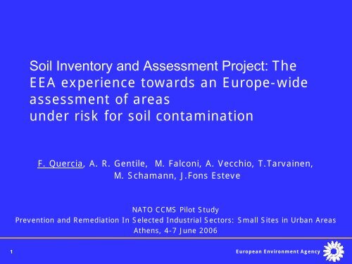
<strong>Soil</strong> <strong>Inventory</strong> <strong>and</strong> <strong>Assessment</strong> <strong>Project</strong>: <strong>The</strong><br />
<strong>EEA</strong> experience towards an Europe-wide<br />
assessment of areas<br />
under risk for soil contamination<br />
F. Quercia, A. R. Gentile, M. Falconi, A. Vecchio, T.Tarvainen,<br />
M. Schamann, J.Fons Esteve<br />
NATO CCMS Pilot Study<br />
Prevention <strong>and</strong> Remediation In Selected Industrial Sectors: Small Sites in Urban Areas<br />
Athens, 4-7 June 2006<br />
1 European Environment Agency
Contents<br />
• Background on <strong>EEA</strong> activities<br />
• Aim <strong>and</strong> objectives of the project<br />
• 2004: PRA.MS I methodology<br />
• 2004 Results of PRA.MS<br />
applications<br />
• 2004: Inputs from peer review<br />
• 2005: PRAMS II Pilot study<br />
• 2006: Case Studies<br />
• Next steps <strong>and</strong> conclusions<br />
2 European Environment Agency
<strong>EEA</strong> members <strong>and</strong> participating countries<br />
IS<br />
PT<br />
IE<br />
ES<br />
UK<br />
FR<br />
NL<br />
BE<br />
LU<br />
CH<br />
NO<br />
DE<br />
LI<br />
SE<br />
IT<br />
CZ<br />
FI<br />
PL<br />
SK<br />
EE<br />
LV<br />
LT<br />
AT<br />
HU<br />
SI HR<br />
BA YU<br />
MT<br />
RO<br />
MK<br />
AL<br />
GR<br />
BG<br />
15/02/2006<br />
3 European Environment Agency<br />
TR<br />
CY<br />
Old members<br />
New members<br />
Cooperating<br />
countries
<strong>EEA</strong> main tasks<br />
• Making environmental information accessible<br />
• Networking – Implement <strong>and</strong> coordinate the EIONET<br />
(European Environmental Observation <strong>and</strong><br />
Information Network)<br />
• Reporting – Prepare regular reports on the state <strong>and</strong><br />
trends of the environment<br />
• Annual budget of approx. 30 Meuro, about 150 staff,<br />
5 topic centres<br />
4 European Environment Agency
EIONET<br />
More than 300 national institutions in 31<br />
countries:<br />
• National Focal Points<br />
• European Topic Centres<br />
• National Reference Centres<br />
• Main component elements<br />
• National members are nominated by countries<br />
• Covers a broad range of environmental issues<br />
• Aims at:<br />
• improving capacity building in Member states<br />
• streamlining data flows originated from reporting<br />
obligations (also “moral” obligations)<br />
5 European Environment Agency
Information on contaminated sites (1)<br />
Sources of contamination<br />
• Municipal <strong>and</strong> industrial waste disposals; losses<br />
during industrial activities; accidents<br />
• CEE: mining sites; former military sites; pesticide<br />
stocks<br />
• Industry: metal working , chemical, oil <strong>and</strong> wood<br />
industries; storage of hazardous substances<br />
Major pollutants<br />
• Heavy metals (31%), mineral oil (20), PAH (16),<br />
CHC (13), BTEX (13)<br />
6 European Environment Agency
Information on contaminated sites (2)<br />
Extent of the problem<br />
• Partial estimates account for about 2 million sites in 25 countries<br />
of which about 100000 need remediation<br />
• On average 5 sites per 1,000 habitants<br />
• On average 2.2 % of artificial surface identified as contaminated<br />
Progress in the management<br />
• First management steps are far advanced, however detailed steps<br />
(investigation, remediation) are progressing slowly<br />
Expenditures<br />
• Average annual expenditures are app. 2.5 % of expected total<br />
costs<br />
7 European Environment Agency
Aim of the PRA.MS <strong>Project</strong><br />
<strong>The</strong> main aim of the project is:<br />
to develop an effective tool to identify, assess <strong>and</strong> map<br />
the areas under risk or potential problem areas for soil<br />
contamination of EU concern in order to provide inputs to<br />
<strong>EEA</strong> assessment activities <strong>and</strong> support policy<br />
development.<br />
<strong>The</strong> expected outcomes are:<br />
• a <strong>EEA</strong> proposed method for identification <strong>and</strong><br />
preliminary assessment<br />
• a map <strong>and</strong> related assessment focussing on<br />
potential problem areas for soil contamination<br />
8 European Environment Agency
Problem Areas definition<br />
• <strong>The</strong> following definition has been adopted:<br />
“Areas where soil contamination is<br />
considered to pose significant risks to<br />
human health <strong>and</strong>/or ecosystems with<br />
impacts beyond the local environment <strong>and</strong><br />
where the assessment <strong>and</strong> reporting of<br />
pressures, state, impacts <strong>and</strong> remediation<br />
activities has a relevance at the European<br />
level.”<br />
9 European Environment Agency
2004: PRA.MS I methodology<br />
PRA.MS I (Preliminary Risk <strong>Assessment</strong> Model for the<br />
identification of problem areas for <strong>Soil</strong> contamination in Europe)<br />
methodology: a risk scoring system for the classification <strong>and</strong><br />
assessment of individual sites. <strong>The</strong> system includes 3 Tiers to be<br />
applied to data of different detail.<br />
• Objectives:<br />
– Identify, classify <strong>and</strong> assess problem areas of EU concern<br />
• Background:<br />
– “Review <strong>and</strong> analysis of existing methodologies for preliminary risk<br />
assessment” <strong>and</strong> harmonization of input parameters.<br />
– data available at the EU level, such as:<br />
• the BRGM/DECHM<strong>IN</strong>UE <strong>and</strong> EPER databases<br />
• Geo-referenced environmental data<br />
10 European Environment Agency
PRA.MS I risk scoring system<br />
Parameters (values)<br />
Factors (scores)<br />
S-P-R Indicators (scores)<br />
Source Source Pathway Pathway Receptor Receptor<br />
Exposure routes (scores)<br />
Groundwater (GW), Surface Water (SW),<br />
Air (AIR), Direct Contact (DC)<br />
Human Health Health risk risk<br />
Parameters (values)<br />
Factors (scores)<br />
S-P-R Indicators (scores)<br />
Source Source Pathway Pathway Receptor Receptor<br />
Ecological receptors (scores)<br />
Surface Water (SW), Protected Areas (PA)<br />
Ecological risk risk<br />
•“PRA.MS I scoring model <strong>and</strong> algorithm” (<strong>EEA</strong> Technical Report, Volume 3)<br />
11 European Environment Agency
2004: Results of PRA.MS I applications<br />
<strong>The</strong> PRA.MS I model was applied to selected industrial <strong>and</strong> mining<br />
sites.<br />
• Tier 0 assessment: pre- selection of relevant industrial <strong>and</strong><br />
mining sites from available db (BRGM/DECHM<strong>IN</strong>UE <strong>and</strong> EPER)<br />
• BRGM/DECHM<strong>IN</strong>UE: selection of sites with chemical characterization of<br />
stored wastes (236 sites over 9 European countries)<br />
• EPER: selection of sites on the basis of source data availability (7881 sites)<br />
• Tier 1 assessment (industrial sites)<br />
• <strong>Assessment</strong> of human health risks <strong>and</strong> evaluation of dominant exposure<br />
routes<br />
• Correlation between human health risks <strong>and</strong> IPPC classes<br />
• Tier 2 assessment (mining sites)<br />
• <strong>Assessment</strong> of human health risks<br />
• <strong>Assessment</strong> of uncertainties<br />
• Mapping of results<br />
12 European Environment Agency
Overall risk score (Vtot)<br />
60<br />
50<br />
40<br />
30<br />
Application of Tier 1 to EPER sites<br />
<br />
n= 3,294<br />
<br />
n= 4,117<br />
air gw air-gw sw<br />
<br />
n= 310<br />
Dominant route<br />
Overall risk scores of<br />
industrial sites grouped<br />
according to IPPC classes<br />
<br />
n= 82<br />
Disposal of non-hazardous waste <strong>and</strong> l<strong>and</strong>fills<br />
Intensive livestock farming<br />
Disposal/recovery of hazardous or municipal waste<br />
Cement <strong>and</strong> Lime, Glass, Ceramics<br />
Metal industry<br />
Disposal or recycling of animal carcasses <strong>and</strong> animal w aste<br />
Large Combustion Plants<br />
Basic inorganic chemicals or fertilisers<br />
Surface treatment or products using organic solvents<br />
Slaughterhouses, milk, animal <strong>and</strong> vegetable raw materials<br />
Overall risk score of industrial sites grouped<br />
according to its dominant exposure route<br />
Basic organic chemicals<br />
Production of carbon or graphite<br />
Pharmaceutical products<br />
Pulp, paper or board production<br />
Refineries (Large Volume Organic Chemicals)<br />
Coke ovens<br />
Biocides <strong>and</strong> explosives<br />
13 European Environment Vtot Agency<br />
Tanneries<br />
Textiles<br />
20 25 30 35 40 45 50 55 60
Application of Tier 2 to DECHM<strong>IN</strong>UE sites<br />
Human health<br />
dominant exposure<br />
routes in selected<br />
mining sites<br />
Towards an <strong>EEA</strong> Europe-wide<br />
assessment of areas under risk for<br />
soil contamination - Application of<br />
the PRA.MS model to selected<br />
mining sites - processed by<br />
14 European<br />
APAT/ETCTE<br />
Environment<br />
- © <strong>EEA</strong><br />
Agency<br />
2004
2004 <strong>Project</strong> outcomes<br />
• ACCESS © database of existing methodologies for<br />
preliminary risk assessment<br />
• ACCESS © based PRA.MS I model<br />
• Technical reports:<br />
• Background <strong>and</strong> outcomes of the project<br />
• Review <strong>and</strong> analysis of existing methodologies for<br />
preliminary risk assessment<br />
• PRA.MS scoring model <strong>and</strong> algorithm<br />
• Application of PRA.MS to selected industrial <strong>and</strong> mining<br />
sites<br />
15 European Environment Agency
2005: Inputs from peer review<br />
Inputs from experts on methodology <strong>and</strong> data<br />
collection:<br />
• Organize a streamlined country data collection:<br />
problem areas to be selected on the basis of<br />
agreed pre-screening criteria;<br />
• Include assessment of multiple risks <strong>and</strong> multiple<br />
sources;<br />
• Focus on site classification rather than on risk<br />
prioritisation;<br />
• Add GIS <strong>and</strong> spatial assessment capabilities;<br />
• Automate the methodology where feasible <strong>and</strong><br />
relevant <strong>and</strong> integrate the procedures in an<br />
information system.<br />
16 European Environment Agency
2005:PRA.MS II Pilot study<br />
• Pre-screening of problem areas:<br />
Two sets of criteria to be used to select<br />
areas where:<br />
– knowledge on extent of impacts is available<br />
– knowledge on impacts is not sufficient <strong>and</strong><br />
“surrogate” information may support the<br />
selection<br />
• On-line questionnaire for the collection of<br />
data on areas passing the pre-screening<br />
• Analysis <strong>and</strong> assessment of data collected<br />
17 European Environment Agency
Schematic representation of a Problem<br />
Area<br />
L<strong>and</strong> use (residential areas)<br />
problem area<br />
Industrial district<br />
(8 sites)<br />
GW wells for drinking<br />
water supply<br />
Site 4<br />
Site 1 Site 2<br />
Site 3<br />
Site 5<br />
Site 7<br />
Sediment <strong>and</strong> coastal areas<br />
problem area<br />
Total Problem Area<br />
Food safety (agricultural activities)<br />
problem area<br />
L<strong>and</strong> use (protected areas)<br />
problem area<br />
18 European Environment Agency<br />
Site 6<br />
Site 8<br />
GW wells for agricultural<br />
water use<br />
Groundwater problem area
2005: Results from pilot study<br />
Pilot<br />
Country<br />
Italy<br />
Finl<strong>and</strong><br />
Austria<br />
Sweden<br />
Belgium-<br />
Fl<strong>and</strong>ers<br />
Russian<br />
Federation<br />
Total<br />
Problem Areas<br />
where prescreening<br />
applied<br />
50<br />
6<br />
11<br />
10<br />
2<br />
79<br />
Problem Areas<br />
passing prescreening<br />
19 European Environment Agency<br />
26<br />
1<br />
1<br />
1<br />
2<br />
31<br />
Problem Areas loaded<br />
in the online<br />
questionnaire<br />
1<br />
1<br />
1<br />
1<br />
1<br />
1<br />
6
2005: EIONET consultation<br />
EIONET members were consulted on a number<br />
of questions:<br />
• General data availability <strong>and</strong> accessibility<br />
(local vs. central inventories);<br />
• Application of proposed pre-screening<br />
criteria;<br />
• Relevance <strong>and</strong> availability of proposed<br />
parameters for the classification <strong>and</strong><br />
characterisation of Problem Areas.<br />
20 European Environment Agency
EIONET consultation - 18 countries<br />
77%<br />
National/regional inventories of contaminated sites<br />
in the country<br />
6%<br />
17%<br />
24%<br />
Centralised/National<br />
Local/Regional<br />
Both<br />
Availability of impacts on groundwater bodies<br />
12%<br />
6%<br />
58%<br />
available<br />
not avaliable<br />
partially available/additional<br />
resources needed<br />
in developement<br />
available in most cases<br />
available in few<br />
cas es/mostly not available<br />
not clear<br />
not answ ered<br />
European Environment Agency
2006: Conclusions <strong>and</strong> next steps 1<br />
• <strong>The</strong> EIONET consultation confirmed the<br />
feasibility of continuing the project on an<br />
operational basis. However:<br />
• Some elements (i.e. pre-screening criteria)<br />
need further clarification <strong>and</strong> simplification<br />
• Data collection <strong>and</strong> reporting is an effort<br />
that requires dedicated resources at the<br />
national level<br />
• Information on impacts on receptors is not<br />
always readily available<br />
• <strong>The</strong> implementation of the forthcoming <strong>Soil</strong><br />
Framework Directive would result in data<br />
more readily available <strong>and</strong> comparable<br />
22 European Environment Agency
2006: Conclusions <strong>and</strong> next steps 2<br />
1. Extend data collection to all Member<br />
countries<br />
2. Data collected will be used to classify<br />
Problem Areas in relation to:<br />
• Source complexity (number of sites/ownerships,<br />
categories of activities/contaminants);<br />
• Size (source size, Problem Area size);<br />
• Receptor complexity (number/types of receptors<br />
impacted/threatened within the Problem Area);<br />
• Progress in management<br />
• Case studies<br />
1. Results will be used in <strong>EEA</strong> reports<br />
23 European Environment Agency
Case study 1: ACNA, Italy<br />
Aereal photo of the source area<br />
Lagoons on site used<br />
to dispose sodic salts<br />
European Environment Agency
ACNA History<br />
1882<br />
1909<br />
1912<br />
1925<br />
1938<br />
1962<br />
‘80<br />
1986<br />
1988<br />
1998<br />
1999<br />
Activity started with the manufacturing of explosives<br />
Several drinking-water wells (up to 16 Km. from the site) of<br />
the Bormida River Valley were polluted.<br />
Production of pharmaceuticals <strong>and</strong> dyes started<br />
Production of sulphuric acid, nitric acid <strong>and</strong> phenol started<br />
Bormida river’s water were no longer used for irrigation.<br />
No living organism up to 20 km downstream <strong>and</strong> fishes<br />
captured 70 km downstream smelled like benzo-phenol<br />
ACNA dismissed dyes production but manufacture of<br />
pigments continued<br />
Wastewater with high sulfate concentration were dumped in<br />
lagoons.<br />
A cloud of sulphur dioxide was released. ACNA was closed<br />
for 45 days.<br />
ACNA was declared as “Contaminated Site of National<br />
Interest”<br />
In January 1999, ACNA was closed <strong>and</strong> a Government<br />
Commissary was nominated<br />
European Environment Agency
ACNA: ACNA Impacted area<br />
Problem area delimitation<br />
European Environment Agency
ACNA Management<br />
Delimitation of the problem area (22,200 ha)<br />
• It was divided into 3 zones: zone A, high risk, including<br />
the chemical plant, a l<strong>and</strong>fill; zone B, medium risk,<br />
including the river <strong>and</strong> flooding areas; zone C, low risk.<br />
Characterization<br />
• <strong>Soil</strong> <strong>and</strong> groundwater on site are polluted with 214<br />
different compounds. <strong>Soil</strong> off site is contaminated to a<br />
depth of 2-3 meters.<br />
Risk reduction measures<br />
• An area will be entombed because it is not possible to<br />
remove the source (2 M m3 of waste <strong>and</strong> cont’d soil).<br />
• 140,000 tons of lagooned sodic salts are being<br />
dewatered, packed <strong>and</strong> transported to Germany.<br />
• A leachate <strong>and</strong> drainage waters collection system has<br />
been completed.<br />
• Estimated costs for remediation <strong>and</strong> safety measures<br />
are 190 M euro which include government funds<br />
European Environment Agency
Case study 2: Harjavalta, Finl<strong>and</strong><br />
European Environment Agency
Harjavalta History<br />
1944<br />
‘80<br />
2000<br />
Smelter activity <strong>and</strong> fertilizer production<br />
started.<br />
Risk management actions started. As<br />
example, liming <strong>and</strong> fertilization was<br />
used to improve the condition of forest in<br />
the problem area. Emissions from plants<br />
reduced.<br />
<strong>Soil</strong> contamination thoroughly studied:<br />
affected forest growth, quality of<br />
agricultural <strong>and</strong> garden products, quality<br />
of groundwater <strong>and</strong> l<strong>and</strong>scape.<br />
European Environment Agency
Harjavalta Management<br />
Delimitation of the problem area<br />
• <strong>The</strong> location of Harjavalta town is by the river Kokemäenjoki.<br />
Foundry (metals) <strong>and</strong> fertilizer production are located near<br />
the center of the town. Natura2000 site is located in the left<br />
upper corner, downstream from the Harjavalta site. <strong>The</strong><br />
problem area includes an important groundwater reservoir<br />
called Järilänvuori groundwater area. <strong>The</strong> quality of the<br />
groundwater is good except in the area between the smelter<br />
<strong>and</strong> the river.<br />
Characterization<br />
• Heavy metals (Cu, Ni, Zn, Pb, As, Cd)<br />
• Sulphur dioxide<br />
• NH4+<br />
Risk reduction measures<br />
• Limitation on Groundwater use<br />
• Limitation on Agricoltural production<br />
• Liming <strong>and</strong> fertilization of forest<br />
European Environment Agency
PRAMS II Questionnaire<br />
Parameters ACNA HARJAVALTA<br />
Problem area characterisation<br />
Climate<br />
9-12 °C -1000 mm/yr 4 °C – 600 mm/yr<br />
Extension 22,000 ha 10,000 ha<br />
Management progress<br />
Source<br />
100% characterized<br />
20% of site remediated<br />
100% characterized<br />
Categories of activity former chemical plant smelting, fertilizers<br />
production<br />
Site ownerships 1 2<br />
Categories of contaminants heavy metals, PCB, PAH, heavy metals, SO2,<br />
etc.<br />
NH4+<br />
Quantity 0.5 M m 3 waste<br />
1.5 M m 3 cont’d soil<br />
140.000 tons salts<br />
4.8 M m 3 Receptor specific data<br />
waste<br />
Groundwater impacted, drinking use locally impacted,<br />
limitations<br />
drinking use limitations<br />
Surface water impacted<br />
L<strong>and</strong> use nature <strong>and</strong> agricultural<br />
area impacted<br />
Food safety limitation of agricultural<br />
production<br />
Sediments<br />
areas<br />
<strong>and</strong> coastal river sediments impacted<br />
European Environment Agency
<strong>EEA</strong><br />
European Environment Agency<br />
Thank you !<br />
http://www.eea.eu.int<br />
European Environment Agency