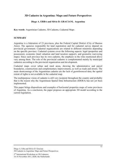
3D Cadastre in Argentina: Maps and Future Perspectives
3D Cadastre in Argentina: Maps and Future Perspectives
3D Cadastre in Argentina: Maps and Future Perspectives

You also want an ePaper? Increase the reach of your titles
YUMPU automatically turns print PDFs into web optimized ePapers that Google loves.
<strong>3D</strong> <strong>Cadastre</strong> <strong>in</strong> Argent<strong>in</strong>a: <strong>Maps</strong> <strong>and</strong> <strong>Future</strong> <strong>Perspectives</strong><br />
Diego A. ERBA <strong>and</strong> Silvio D. GRACIANI, Argent<strong>in</strong>a<br />
Key words: Argent<strong>in</strong>ian <strong>Cadastre</strong>, <strong>3D</strong> <strong>Cadastre</strong>, Cadastral <strong>Maps</strong><br />
SUMMARY<br />
Argent<strong>in</strong>a is a federation of 23 prov<strong>in</strong>ces, plus the Federal Capital District (City of Buenos<br />
Aires). The agencies responsible for l<strong>and</strong> registration <strong>and</strong> for cadastral survey depend on<br />
prov<strong>in</strong>cial government. Cadastral organizations are related to different m<strong>in</strong>istries depend<strong>in</strong>g<br />
on the specific prov<strong>in</strong>ce. Cadastral systems cover the follow<strong>in</strong>g aspects: legal (properties <strong>and</strong><br />
possession), economic (l<strong>and</strong> valuation <strong>and</strong> l<strong>and</strong> taxation support), <strong>and</strong> geometric (survey<strong>in</strong>g<br />
maps). S<strong>in</strong>ce each prov<strong>in</strong>ce has its own cadastre, the emphasis <strong>in</strong> the roles mentioned above<br />
vary among them. The role of the prov<strong>in</strong>cial cadastre is complemented ma<strong>in</strong>ly by municipal<br />
cadastres accord<strong>in</strong>g to the prov<strong>in</strong>cial organization <strong>and</strong> development.<br />
Cadastral maps cover urban <strong>and</strong> rural areas, show<strong>in</strong>g the adm<strong>in</strong>istrative <strong>and</strong> parcel<br />
boundaries, constructions <strong>and</strong> complementary improvements, as well as roads <strong>and</strong> streets. The<br />
ma<strong>in</strong> shortcom<strong>in</strong>gs of the Argent<strong>in</strong>ian cadastre are the lack of georeferenced data; the spatial<br />
extent of rights is not available <strong>in</strong> the cadastral map.<br />
The multipurpose vision of cadastre is still very <strong>in</strong>cipient throughout the country <strong>and</strong> probably<br />
that is the reason why the Argent<strong>in</strong>ean Spatial Data Infrastructure (IDERA) has not yet been<br />
implemented.<br />
This paper br<strong>in</strong>gs dispositions <strong>and</strong> examples of horizontal properties maps of some prov<strong>in</strong>ces<br />
of Argent<strong>in</strong>a. As a conclusion, the paper proposes an appropriate <strong>3D</strong> model accord<strong>in</strong>g to the<br />
current legislation.<br />
Diego A. Erba <strong>and</strong> Silvio D. Graciani<br />
<strong>3D</strong> <strong>Cadastre</strong> <strong>in</strong> Argent<strong>in</strong>a: <strong>Maps</strong> <strong>and</strong> <strong>Future</strong> <strong>Perspectives</strong><br />
2 nd International Workshop on <strong>3D</strong> <strong>Cadastre</strong>s<br />
16-18 November 2011, Delft, the Netherl<strong>and</strong>s<br />
15
<strong>3D</strong> <strong>Cadastre</strong> <strong>in</strong> Argent<strong>in</strong>a: <strong>Maps</strong> <strong>and</strong> <strong>Future</strong> <strong>Perspectives</strong><br />
1. INTRODUCTION<br />
Diego A. ERBA <strong>and</strong> Silvio D. GRACIANI, Argent<strong>in</strong>a<br />
The Argent<strong>in</strong>e Republic does not have a national cadastre, as do most of the other Lat<strong>in</strong><br />
American countries. Each prov<strong>in</strong>ce is free to organize its own system of l<strong>and</strong> <strong>in</strong>formation, as<br />
stipulated explicitly <strong>in</strong> the National Constitution. Therefore, the Argent<strong>in</strong>e cadastral structure<br />
is composed of prov<strong>in</strong>cial <strong>and</strong> municipal cadastres with different levels of sophistication <strong>and</strong><br />
<strong>in</strong>tegration across the country. Public <strong>in</strong>formation about the l<strong>and</strong> is obta<strong>in</strong>ed through the<br />
cadastral data, complemented with the records of the Registries of Deeds (Registros de la<br />
Propiedad Inmueble), which are prov<strong>in</strong>cial <strong>in</strong>stitutions.<br />
Given the diversity of criteria used to promote, coord<strong>in</strong>ate <strong>and</strong> guide the job of creat<strong>in</strong>g a<br />
countrywide territorial cadastre, the prov<strong>in</strong>ces created <strong>in</strong> 1958 the Federal Cadastral Council<br />
(Consejo Federal de Catastro) with the goal of implement<strong>in</strong>g, promot<strong>in</strong>g <strong>and</strong> coord<strong>in</strong>at<strong>in</strong>g<br />
research <strong>and</strong> consult<strong>in</strong>g activities, <strong>and</strong> contribut<strong>in</strong>g to the creation <strong>and</strong> development of a<br />
cadastre with a territorial <strong>in</strong>formation system based on a multipurpose model. The Federal<br />
Cadastral Council was formally recognized by Law No. 26.209, Cadastral National Law,<br />
Chapter V, as a body composed of all the prov<strong>in</strong>cial cadastres <strong>and</strong> the cadastre of the<br />
Autonomous City of Buenos Aires, <strong>in</strong> order to meet the goals established by law.<br />
Property rights <strong>in</strong> Argent<strong>in</strong>a always have to relate to surface parcels; consequently, the<br />
ownership of real estate above <strong>and</strong> below the surface is always established on surface parcels.<br />
A parcel column can be divided <strong>in</strong> horizontal layers, which <strong>in</strong> turn can be subdivided <strong>in</strong>to<br />
units accord<strong>in</strong>g to the Horizontal Property Law. The result<strong>in</strong>g units can be considered as true<br />
<strong>3D</strong> parcels <strong>and</strong> they are assigned a unique parcel number.<br />
The horizontal property units are registered accord<strong>in</strong>g to the dispositions of Law No.<br />
13.512/1948 (Horizontal Property - PH), which recognizes with<strong>in</strong> a complex build<strong>in</strong>g the<br />
follow<strong>in</strong>g three dimensional parts: private ownership units, common areas with exclusive use<br />
by specific owner, <strong>and</strong> true common areas.<br />
Each unit is assigned a unique parcel number, <strong>in</strong> a manner similar to other parcels accord<strong>in</strong>g<br />
to urban law. For this, a true survey plan (not a build<strong>in</strong>g design document) is required. In this<br />
document, <strong>in</strong>formation is added <strong>in</strong> the form of cuts or slices. A set of cuts, used <strong>in</strong> some<br />
prov<strong>in</strong>ces, is used to obta<strong>in</strong> a volumetric impression. The prov<strong>in</strong>ces have their own rules for<br />
draw<strong>in</strong>g the PH maps <strong>and</strong> one of the ma<strong>in</strong> tasks of this paper is to compile <strong>and</strong> describe some<br />
of them.<br />
As <strong>in</strong> most other countries of the world, the parcel is the common registration unit for<br />
cadastres <strong>in</strong> Argent<strong>in</strong>a. All l<strong>and</strong> parcel division, unification, amalgamation, etc. must be<br />
registered with<strong>in</strong> the cadastral organization. Horizontal property units (apartments,<br />
condom<strong>in</strong>iums) are also registered.<br />
With the objective of moderniz<strong>in</strong>g <strong>and</strong> improv<strong>in</strong>g the prov<strong>in</strong>cial systems, a new National<br />
<strong>Cadastre</strong> Law was published on January, 2007. It brought new <strong>and</strong> different dispositions, but<br />
Diego A. Erba <strong>and</strong> Silvio D. Graciani<br />
<strong>3D</strong> <strong>Cadastre</strong> <strong>in</strong> Argent<strong>in</strong>a: <strong>Maps</strong> <strong>and</strong> <strong>Future</strong> <strong>Perspectives</strong><br />
2 nd International Workshop on <strong>3D</strong> <strong>Cadastre</strong>s<br />
16-18 November 2011, Delft, the Netherl<strong>and</strong>s<br />
16
none of them applies specifically to <strong>3D</strong> cadastre implementation. Until now, only 8 prov<strong>in</strong>ces<br />
have adapted their laws to the national one.<br />
The cadastral legal framework is composed of the prov<strong>in</strong>cial laws, the municipal statutes <strong>and</strong><br />
the Cadastral National Law, No. 26.209, enacted on January 18, 2007, that establishes a<br />
reference framework for the entire country.<br />
In almost the entire prov<strong>in</strong>cial legislation, the cadastral unit is the parcel, which is consistent<br />
with the def<strong>in</strong>itions adopted by the National Law. The parcels can have ownership title<br />
(dom<strong>in</strong>iales), <strong>in</strong> which case they are permanently recorded <strong>in</strong> the cadastre, <strong>and</strong> may have a<br />
public or private owner; <strong>and</strong>/or they can be possessions (posesiones), whose tenants, <strong>in</strong> some<br />
jurisdictions, record them temporarily (until a judicial order grants them full title) <strong>and</strong> pay<br />
property taxes.<br />
2. A HISTORY OF THE ARGENTINE CADASTRE<br />
When the Spanish arrived <strong>in</strong> South America, they brought with them the system of public<br />
property records, <strong>in</strong>spired <strong>in</strong> Spanish legislation, which was codified <strong>in</strong> the Indies <strong>and</strong> Toro<br />
Laws (Leyes de Indias y Toro).<br />
After the Argent<strong>in</strong>e revolution, on May 25, 1810, part of the l<strong>and</strong> that belonged to the Spanish<br />
Crown was transferred to public ownership, <strong>and</strong> there was a need to structure a system of<br />
public records <strong>in</strong> order to manage the national territory.<br />
This process of <strong>in</strong>stitutional organization was slow, tak<strong>in</strong>g an important step on September 25,<br />
1824, with the creation of the Topographic Commission of the Prov<strong>in</strong>ce of Buenos Aires<br />
(Comisión Topográfica de la Prov<strong>in</strong>cia de Buenos Aires), charged with assembl<strong>in</strong>g an<br />
<strong>in</strong>formation system from the prov<strong>in</strong>cial topographic map (this date is now remembered as the<br />
National Day of the <strong>Cadastre</strong>). Two years later, on June 26, 1826, a Government Decree<br />
transformed that Commission <strong>in</strong>to the Department of Topography <strong>and</strong> Statistics, exp<strong>and</strong><strong>in</strong>g its<br />
role. This new <strong>in</strong>stitution is considered one of the first civil cadastres <strong>in</strong> the world, after the<br />
Roman Census, <strong>and</strong> even preceded the famous Swiss cadastres of the cantons of Vaud (1826)<br />
<strong>and</strong> Geneva (1841) (Castagn<strong>in</strong>o, 1967). This <strong>in</strong>stitution is considered the bedrock of the<br />
Argent<strong>in</strong>e cadastre, as it conta<strong>in</strong>ed all the survey bluepr<strong>in</strong>ts, stored both graphically <strong>and</strong> <strong>in</strong> an<br />
alphanumeric database, reason for which June 26 is celebrated as the Day of Cartography.<br />
In September of 1869, the Argent<strong>in</strong>e Civil Code was enacted by Law No. 340, which entered<br />
<strong>in</strong>to effect on January 1, 1871. The Code established a system of l<strong>and</strong> titl<strong>in</strong>g <strong>and</strong> a procedure<br />
to acquire real estate, but did not m<strong>and</strong>ate a registry system for the public record<strong>in</strong>g of real<br />
estate transfers. The cadastres <strong>and</strong> registries were thus marg<strong>in</strong>alized from the real estate<br />
market.<br />
In this context, the prov<strong>in</strong>ces decided to create an adm<strong>in</strong>istrative body to publicly record<br />
titles, <strong>and</strong> recognize it as the only form of acquir<strong>in</strong>g property <strong>and</strong> defend it from third party<br />
claims.<br />
In 1968, Law No. 17.711 <strong>in</strong>troduces the obligation of perfect<strong>in</strong>g the transfer of real estate by<br />
record<strong>in</strong>g all transfers <strong>in</strong> the correspond<strong>in</strong>g real estate registry (this signifies the public<br />
record<strong>in</strong>g of the legal right to real estate) <strong>and</strong> the Registry Law No. 17.801 m<strong>and</strong>ates real<br />
estate records.<br />
Diego A. Erba <strong>and</strong> Silvio D. Graciani<br />
<strong>3D</strong> <strong>Cadastre</strong> <strong>in</strong> Argent<strong>in</strong>a: <strong>Maps</strong> <strong>and</strong> <strong>Future</strong> <strong>Perspectives</strong><br />
2 nd International Workshop on <strong>3D</strong> <strong>Cadastre</strong>s<br />
16-18 November 2011, Delft, the Netherl<strong>and</strong>s<br />
17
In 1973, the Cadastral National Law No. 20.440 marked another historic milestone <strong>in</strong> l<strong>and</strong><br />
legislation <strong>in</strong> the Argent<strong>in</strong>e Republic. This law established uniform procedures across the<br />
country, <strong>and</strong> even though it was written with the goal of support<strong>in</strong>g the public record<strong>in</strong>g of<br />
real estate transactions, its effectiveness was truncated by Decree- Law No. 22.287 of 1980,<br />
which suspended practically all its articles.<br />
The legislative vacuum left by the suspension ordered by Decree- Law No. 22.287 motivated<br />
the professional surveyor bodies, especially the Argent<strong>in</strong>e Federation of Surveyors<br />
(Federación Argent<strong>in</strong>a de Agrimensores, or FADA) <strong>and</strong> the CFC, to write <strong>and</strong> propose federal<br />
legislation for many years, until a consensus was reached for a proposed Cadastral Act. This<br />
bill, submitted by Senators José Luis Gioja <strong>and</strong> Eduardo <strong>and</strong> Brizuela del Moral, received<br />
approval <strong>in</strong> November of 2004 by the Senate, <strong>and</strong> was f<strong>in</strong>ally promulgated <strong>in</strong>to law <strong>in</strong> January<br />
of 2007 as Law No. 26.209, known as the “Cadastral National Law”, which complements the<br />
Civil Code.<br />
This new law establishes a modern concept of the multipurpose cadastre, adapted to the<br />
present times <strong>and</strong> needs, elevat<strong>in</strong>g it as one of the ma<strong>in</strong> build<strong>in</strong>g blocks of the Spatial Data<br />
Infrastructure, <strong>and</strong> establish<strong>in</strong>g a new outlook for the Argent<strong>in</strong>e cadastre. This new law<br />
reaffirms the legal st<strong>and</strong><strong>in</strong>g of the exist<strong>in</strong>g cadastral laws <strong>in</strong> the prov<strong>in</strong>ces which have them,<br />
<strong>and</strong> requires the use of the federal legislation to complement all local ord<strong>in</strong>ances <strong>in</strong> those<br />
prov<strong>in</strong>ces that do not have one.<br />
The National Law designates the prov<strong>in</strong>cial cadastres <strong>and</strong> the cadastre of the Autonomous<br />
City of Buenos Aires as adm<strong>in</strong>istrative bodies <strong>in</strong> charge of territorial objects <strong>and</strong> keep<strong>in</strong>g all<br />
public records of “legal territorial objects”, either of public or private ownership, with<strong>in</strong> its<br />
jurisdiction (Art. 1).<br />
The same law def<strong>in</strong>es the parcel as a cadastral unit: a representation of a cont<strong>in</strong>uous real<br />
estate territory identified by a polygonal boundary with one or more legal titles of possession,<br />
whose existence <strong>and</strong> essential elements are recorded <strong>in</strong> a cartographic document registered <strong>in</strong><br />
the cadastral body (Art. 4). The essential elements of a parcel are a georeferenced location of<br />
the property, the restrictions on the parcel as def<strong>in</strong>ed by the legal clauses that created it, the<br />
l<strong>in</strong>ear, angular <strong>and</strong> area dimensions of the property, <strong>and</strong> – as complementary elements – its<br />
tax assessment <strong>and</strong> its boundaries (Art. 5).<br />
Practically all the prov<strong>in</strong>cial laws have a def<strong>in</strong>ition of “cadastre” <strong>and</strong> “parcel” consistent with<br />
the <strong>Cadastre</strong> National Law; some have implemented changes <strong>and</strong> others are <strong>in</strong> the process of<br />
adapt<strong>in</strong>g their def<strong>in</strong>itions. It is <strong>in</strong>terest<strong>in</strong>g to compare the conceptual <strong>and</strong> cartographic<br />
differences that still exist <strong>in</strong> each of these regional units.<br />
The def<strong>in</strong>itions expressed <strong>in</strong> Arts. 4 <strong>and</strong> 5 show the clear 2D concept of the Argent<strong>in</strong>e<br />
cadastre. However, the def<strong>in</strong>ition of the real estate property <strong>in</strong> the Civil Code is spatial, <strong>and</strong><br />
sets the conditions for creat<strong>in</strong>g a <strong>3D</strong> cadastre for the entire country.<br />
3. THE <strong>3D</strong> CADASTRE IN ARGENTINA<br />
This research over the <strong>in</strong>terpretation of the current <strong>and</strong> future status of the <strong>3D</strong> cadastre <strong>in</strong><br />
Argent<strong>in</strong>a was based on a questionnaire structured by the Work<strong>in</strong>g Group on <strong>3D</strong> <strong>Cadastre</strong>s,<br />
translated <strong>and</strong> adapted to the reality of the country. The document was distributed to all the<br />
members of the Federal Cadastral Council, which is composed of the Directors of the<br />
cadastres of the 23 Argent<strong>in</strong>e prov<strong>in</strong>ces <strong>and</strong> the Federal Capital. There were received 5<br />
Diego A. Erba <strong>and</strong> Silvio D. Graciani<br />
<strong>3D</strong> <strong>Cadastre</strong> <strong>in</strong> Argent<strong>in</strong>a: <strong>Maps</strong> <strong>and</strong> <strong>Future</strong> <strong>Perspectives</strong><br />
2 nd International Workshop on <strong>3D</strong> <strong>Cadastre</strong>s<br />
16-18 November 2011, Delft, the Netherl<strong>and</strong>s<br />
18
complete responses which are considered a mean<strong>in</strong>gful sample due to the geographic diversity<br />
of the prov<strong>in</strong>ces <strong>and</strong> their regulations which are analyzed below.<br />
3.1 General/applicable <strong>3D</strong> real world situations<br />
All the responses were negative, that is, the officials confirm that the concept of the <strong>3D</strong> parcel<br />
does not exist officially <strong>in</strong> Argent<strong>in</strong>a. All the parcels are def<strong>in</strong>ed <strong>in</strong> 2D. This two-dimensional<br />
def<strong>in</strong>ition is consistent with the Cadastral National Law, Art. 4: “for the purposes of this Law,<br />
a parcel is a representation of a cont<strong>in</strong>uous real estate territory identified by a polygonal<br />
boundary with one or more legal titles of possession, whose existence <strong>and</strong> essential elements<br />
are recorded <strong>in</strong> a cartographic document kept <strong>in</strong> the cadastral body”.<br />
Even though the Civil Code refers to a “volumetric property” that is also bound by vertical<br />
surfaces, for the territorial cadastre, which is where the property is legally born, the<br />
boundaries are l<strong>in</strong>es, that is, the projection of these surfaces over a map. The surfaces that<br />
def<strong>in</strong>e the natural boundaries of the parcels may be curved (e.g., a watershed, a riverbed,<br />
among others), while the anthropological limits (normally demarked with walls or fences) are<br />
vertical surfaces.<br />
There is no detailed study yet on how to describe a <strong>3D</strong> parcel; this is an area of research that<br />
should be prioritized, based on the TC211series of ISO st<strong>and</strong>ards.<br />
The current law considers the spaces occupied by natural resources, such as underground<br />
water <strong>and</strong> m<strong>in</strong>e deposits, to be territorial objects, <strong>and</strong> not parcels, which are def<strong>in</strong>ed <strong>in</strong> Art.<br />
10: “The legal territorial objects which do not constitute parcels <strong>in</strong> accordance with Art. 5 of<br />
this Cadastral National Law will be established by surveys or other alternative methods that<br />
guarantee similar levels of precision, reliability <strong>and</strong> <strong>in</strong>tegrity as surveys established by the<br />
local legislation, <strong>and</strong> recorded before the cadastral body, <strong>in</strong> accordance with local legislation”.<br />
To this end, the regulations <strong>in</strong> effect for implement<strong>in</strong>g <strong>and</strong> record<strong>in</strong>g survey bluepr<strong>in</strong>ts of the<br />
Territorial Cadastral <strong>and</strong> Information Service (Servicio de Catastro e Información Territorial,<br />
or SCIT) of the Prov<strong>in</strong>ce of Santa Fe stipulate: “The surveyor shall represent waterways, lakes<br />
<strong>and</strong> ponds, rav<strong>in</strong>es, forests, communication l<strong>in</strong>ks, conduits <strong>and</strong> other visible topographic<br />
irregularities located <strong>in</strong>side a parcel, over its boundaries or <strong>in</strong> its vic<strong>in</strong>ity, us<strong>in</strong>g terrestrial<br />
surveys <strong>and</strong>/or extract<strong>in</strong>g the <strong>in</strong>formation from cadastral <strong>and</strong>/or cartographic data”. The threedimensional<br />
representation is <strong>in</strong>troduced <strong>in</strong> Paragraph b. of the same article: “To def<strong>in</strong>e the<br />
boundaries of waterways, lakes <strong>and</strong> ponds, a planar <strong>and</strong> altitude profile shall be drawn to<br />
show the position of the boundary of the parcel <strong>and</strong> the waterway, lake or pond”.<br />
While the territorial objects identified <strong>in</strong> Paragraph b. do not require coord<strong>in</strong>ates or altitudes,<br />
other relevant objects do need to be referenced <strong>in</strong> the vertical dimension, as stipulated <strong>in</strong><br />
Paragraph c.: “In the case of a river bank reestablished by an adm<strong>in</strong>istrative ord<strong>in</strong>ance, the<br />
follow<strong>in</strong>g shall be added: date on which the height of the surface water was measured, height<br />
of the water <strong>and</strong> kilometer (location) of the waterway where it was measured; the coord<strong>in</strong>ates<br />
of the river bank that were determ<strong>in</strong>ed, the official coord<strong>in</strong>ate(s) used <strong>and</strong> the applicable<br />
towpaths”.<br />
As for easements or restrictions to the property, the regulation transfers the responsibility of<br />
def<strong>in</strong><strong>in</strong>g them to other <strong>in</strong>stitutions, as stipulated <strong>in</strong> Paragraph h.: “For properties abutt<strong>in</strong>g or<br />
crossed by canals, a report issued by the M<strong>in</strong>istry of Water, Public Services <strong>and</strong> the<br />
Environment must be enclosed show<strong>in</strong>g the width of the affected area”.<br />
Diego A. Erba <strong>and</strong> Silvio D. Graciani<br />
<strong>3D</strong> <strong>Cadastre</strong> <strong>in</strong> Argent<strong>in</strong>a: <strong>Maps</strong> <strong>and</strong> <strong>Future</strong> <strong>Perspectives</strong><br />
2 nd International Workshop on <strong>3D</strong> <strong>Cadastre</strong>s<br />
16-18 November 2011, Delft, the Netherl<strong>and</strong>s<br />
19
There have been isolated <strong>in</strong>itiatives, although by no means irrelevant, to map the<br />
contam<strong>in</strong>ated areas of the country (air, surface <strong>and</strong> underground contam<strong>in</strong>ation). As for the<br />
metrics used to represent them, although the contam<strong>in</strong>ation maps are not always compatible<br />
with the cadastral charts, it is common to f<strong>in</strong>d cartographic representations that superimpose<br />
both, <strong>in</strong> order to identify the affected areas. To reiterate, it is rare to f<strong>in</strong>d coord<strong>in</strong>ates, levels,<br />
or the vertical dimension of a contam<strong>in</strong>ation plume <strong>in</strong> these documents, so we considered<br />
them to be 2D.<br />
3.2 Infrastructure/utility networks<br />
The responses obta<strong>in</strong>ed were mixed: while some jurisdictions show a 2D representation of the<br />
distribution of the public utility networks, others only have YES/NO fields <strong>in</strong> the cadastral<br />
alphanumeric database.<br />
The public urban service utilities tend to have <strong>in</strong>formation systems that are more complete<br />
<strong>and</strong> updated than the official cadastres, although they follow the 2D tradition, represent<strong>in</strong>g<br />
their networks by l<strong>in</strong>es without specify<strong>in</strong>g coord<strong>in</strong>ates or altitudes along the way.<br />
Although the exchange of data between <strong>in</strong>stitutions is <strong>in</strong>frequent, the prov<strong>in</strong>ces with a Spatial<br />
Data Infrastructure (Infraestructura de Datos Espaciales, or IDE) have <strong>in</strong>tegrated the<br />
cadastral data with the <strong>in</strong>formation provided by utilities. Santa Fe’s Spatial Data Infrastructure<br />
(IDESF) allows public queries of territorial <strong>in</strong>formation <strong>in</strong> http://www.idesf.santafe.gov.ar/,<br />
but this <strong>in</strong>formation is still <strong>in</strong> 2D.<br />
Return<strong>in</strong>g to Art. 31 of the Santa Fe regulations, Paragraph a. states: “<strong>in</strong> the case of electric<br />
conduits, if there is no easement map, the axis of the conduit must be shown <strong>in</strong> relationship to<br />
the parcel boundaries, together with the conduit parameters, if known. If there is a recorded<br />
easement map, the axis, areas of maximum <strong>and</strong> medium security <strong>in</strong>dicated <strong>in</strong> the bluepr<strong>in</strong>t,<br />
<strong>and</strong> the actual axis surveyed by the professional must be <strong>in</strong>dicated on the parcel”.<br />
We can conclude that – similar to the territorial parcels – the <strong>in</strong>frastructure networks do not<br />
have cadastres with geometric descriptions to p<strong>in</strong>po<strong>in</strong>t their precise identification. This is<br />
another subject that needs to be prioritized for <strong>in</strong>vestigation.<br />
3.3 Construction/build<strong>in</strong>g units<br />
The positive responses to the question about record<strong>in</strong>g of build<strong>in</strong>gs or constructions as <strong>3D</strong><br />
units are a consequence of the <strong>in</strong>terpretation of the law which requires representations to be<br />
submitted <strong>in</strong> 2D, but specify<strong>in</strong>g the height of each floor <strong>and</strong> referenc<strong>in</strong>g all vertical distances<br />
to the ground.<br />
None of the responses received shows evidence of civil eng<strong>in</strong>eer<strong>in</strong>g records other than<br />
parcels. Bridges <strong>and</strong> tunnels are not recorded on the cadastral maps, nor is their value is<br />
assessed, <strong>and</strong> there is no evidence that the build<strong>in</strong>g or management companies have<br />
transferred the construction data to the cadastral body for <strong>in</strong>tegration. For that reason, at least<br />
<strong>in</strong> the jurisdictions that responded to the questionnaire, typically there are no descriptions of<br />
these objects.<br />
In accordance with Art. 2 of the Horizontal Property Law No. 13.512, “each proprietor shall<br />
be the exclusive owner of his/her flat or apartment, <strong>and</strong> co-owner of the l<strong>and</strong> <strong>and</strong> all other<br />
objects of common use or essential for ma<strong>in</strong>ta<strong>in</strong><strong>in</strong>g security <strong>in</strong> the build<strong>in</strong>g. For that reason,<br />
the follow<strong>in</strong>g are considered common ownership:<br />
Diego A. Erba <strong>and</strong> Silvio D. Graciani<br />
<strong>3D</strong> <strong>Cadastre</strong> <strong>in</strong> Argent<strong>in</strong>a: <strong>Maps</strong> <strong>and</strong> <strong>Future</strong> <strong>Perspectives</strong><br />
2 nd International Workshop on <strong>3D</strong> <strong>Cadastre</strong>s<br />
16-18 November 2011, Delft, the Netherl<strong>and</strong>s<br />
20
a. Foundations, load bear<strong>in</strong>g walls, roofs, solar patios, portals, galleries <strong>and</strong> common<br />
lobbies, stairs, entrance doors, gardens;<br />
b. Central service rooms <strong>and</strong> facilities, such as heat<strong>in</strong>g, hot or cold water, air<br />
condition<strong>in</strong>g, etc.;<br />
c. The rooms for the caretaker <strong>and</strong> super<strong>in</strong>tendent’s apartment;<br />
d. The walls or partitions between apartments;<br />
e. The elevators, freight elevators, <strong>in</strong>c<strong>in</strong>erators, <strong>and</strong> <strong>in</strong> general, all artifacts or other<br />
facilities for common benefit services. This list is not exhaustive.<br />
The basements <strong>and</strong> roof terraces are considered common areas unless otherwise noted.<br />
From the lowest garage floor downwards, <strong>and</strong> from the build<strong>in</strong>g rooftop upwards, the<br />
property is also common, as stipulated <strong>in</strong> Art. 7 of the law: “The owner of the uppermost floor<br />
cannot construct new floors or additions without the consent of the owners of the other<br />
apartments; the owner of the first floor or floors below the surface cannot build constructions<br />
that affect the stability of the build<strong>in</strong>g, such as excavations, basements, etc. All new<br />
construction that affects the common areas cannot be realized without authorization given by<br />
all the owners.<br />
As for the common property, Art. 8 states that the “the owners shall share the adm<strong>in</strong>istrative<br />
costs <strong>and</strong> repair expenses for the common elements <strong>and</strong> assets of the build<strong>in</strong>g that are<br />
<strong>in</strong>dispensable for ma<strong>in</strong>ta<strong>in</strong><strong>in</strong>g its security, comfort <strong>and</strong> decorum, <strong>in</strong> proportion to the value of<br />
their apartments, unless otherwise noted.<br />
From this it is possible to conclude that walls, floors, structures <strong>and</strong> roofs are common areas<br />
<strong>in</strong> the 2D representation <strong>and</strong> common spaces <strong>in</strong> the <strong>3D</strong> concept. The phrase “that which is<br />
common limits the extent of exclusive ownership” is valid for the 2D concept of the current<br />
cadastre, but can be extended to the <strong>3D</strong> vision.<br />
In accordance with Decree No 18.734/49 <strong>and</strong> its amendments, <strong>in</strong>troduced by Decree No<br />
23.049/56, “the transfer of ownership or other real estate rights over apartments shall not be<br />
recorded <strong>in</strong> the public registries of deed unless there is an exist<strong>in</strong>g Co-ownership <strong>and</strong><br />
Adm<strong>in</strong>istration Statute, or this Statute is presented at the time the ownership is recorded. In<br />
other words, the ownership right cannot be created without a Co-ownership Statute which, <strong>in</strong><br />
turn, depends on the existence of a cadastral bluepr<strong>in</strong>t, as stipulated <strong>in</strong> Art. 4: “In order to<br />
record a Co-ownership <strong>and</strong> Adm<strong>in</strong>istration Statute, it must be submitted to the Registry of<br />
Deeds together with… a bluepr<strong>in</strong>t of the build<strong>in</strong>g presented on cloth <strong>and</strong> signed by a<br />
professional with a qualify<strong>in</strong>g degree”. The same article describes the features of the<br />
bluepr<strong>in</strong>t, stat<strong>in</strong>g that “…<strong>in</strong> that bluepr<strong>in</strong>t, the units shall be numbered consecutively <strong>and</strong>,<br />
start<strong>in</strong>g on the bottom floor, shall <strong>in</strong>clude the dimensions <strong>and</strong> detailed description of each unit<br />
<strong>and</strong> the common areas of the build<strong>in</strong>g, identify<strong>in</strong>g <strong>in</strong> color the areas of exclusive ownership”.<br />
In this regard, different jurisdictions propose alternatives for representation of the parcels. In<br />
the prov<strong>in</strong>ce of Santa Fe, for example, the different uses of the build<strong>in</strong>g are represented with<br />
visual patterns <strong>in</strong> black <strong>and</strong> white, as shown <strong>in</strong> figure 1.<br />
Diego A. Erba <strong>and</strong> Silvio D. Graciani<br />
<strong>3D</strong> <strong>Cadastre</strong> <strong>in</strong> Argent<strong>in</strong>a: <strong>Maps</strong> <strong>and</strong> <strong>Future</strong> <strong>Perspectives</strong><br />
2 nd International Workshop on <strong>3D</strong> <strong>Cadastre</strong>s<br />
16-18 November 2011, Delft, the Netherl<strong>and</strong>s<br />
21
Partition Walls <strong>and</strong>/or Facade<br />
Area of exclusive ownership<br />
Area of common ownership <strong>and</strong> common use<br />
Structural elements <strong>and</strong> conduits<br />
Area of common ownership <strong>and</strong> exclusive use<br />
Area of common ownership <strong>and</strong> exclusive use<br />
of certa<strong>in</strong> units<br />
Figure 1. The different uses of the build<strong>in</strong>g are represented with visual patterns <strong>in</strong> black <strong>and</strong> white<br />
In Argent<strong>in</strong>a, the parcels are generally referenced to urban elements, such as the corner of a<br />
city block, determ<strong>in</strong>ed by the <strong>in</strong>tersection of the build<strong>in</strong>g setback l<strong>in</strong>es (l<strong>in</strong>e that separates the<br />
public from the private doma<strong>in</strong>), fence posts, etc. However, some jurisdictions have started to<br />
implement absolute coord<strong>in</strong>ates, such as the Prov<strong>in</strong>ce of Santa Fe, for example, where the<br />
survey bluepr<strong>in</strong>ts of certa<strong>in</strong> rural parcels larger than a given area must be georeferenced, <strong>and</strong><br />
therefore have geodesic <strong>and</strong> two dimensional coord<strong>in</strong>ates.<br />
The X, Y coord<strong>in</strong>ates of the cadastral databases is referenced to different po<strong>in</strong>ts. In the<br />
Federal Capital of Buenos Aires <strong>and</strong> <strong>in</strong> the Prov<strong>in</strong>ce of Buenos Aires, the coord<strong>in</strong>ates are<br />
local, referenced to a po<strong>in</strong>t located <strong>in</strong> the Flores Cathedral <strong>and</strong> the Prov<strong>in</strong>ce of La Pampa uses<br />
coord<strong>in</strong>ates def<strong>in</strong>ed by the National Geographic Institute (Instituto Geográfico Nacional).<br />
There is a strong tendency to adopt the POSGAR 2007 reference framework, as much for the<br />
cartography as for the geodesic network, <strong>in</strong> order to st<strong>and</strong>ardize l<strong>and</strong> <strong>in</strong>formation not only for<br />
the prov<strong>in</strong>cial cadastres but also the federal system.<br />
In practically all Argent<strong>in</strong>e cadastres, the vertical distances of elevated objects are measured<br />
to the floor on which they are supported, <strong>and</strong> not identified with absolute heights or altitudes.<br />
These representations basically follow two strategies:<br />
1. Inclusion of a circular black <strong>and</strong> white symbol (figure 2), <strong>and</strong> at its side the vertical<br />
distance from the floor to a street level reference.<br />
2. Representation of the height of the apartments (Z) <strong>in</strong> a horizontal property build<strong>in</strong>g<br />
us<strong>in</strong>g cross-sections <strong>and</strong> representation of the build<strong>in</strong>g façade. Figures 3 <strong>and</strong> 4 show<br />
examples from the prov<strong>in</strong>ce of Santa Fe <strong>and</strong> Tucuman, where <strong>3D</strong> objects are<br />
represented <strong>and</strong> visualized with simple geometric draw<strong>in</strong>gs. In this case, it is possible<br />
to say that the draw<strong>in</strong>g is a proto-<strong>3D</strong> representation, at least <strong>in</strong> build<strong>in</strong>gs whose<br />
dimensions do not always co<strong>in</strong>cide precisely with those of the parcel.<br />
Diego A. Erba <strong>and</strong> Silvio D. Graciani<br />
<strong>3D</strong> <strong>Cadastre</strong> <strong>in</strong> Argent<strong>in</strong>a: <strong>Maps</strong> <strong>and</strong> <strong>Future</strong> <strong>Perspectives</strong><br />
2 nd International Workshop on <strong>3D</strong> <strong>Cadastre</strong>s<br />
16-18 November 2011, Delft, the Netherl<strong>and</strong>s<br />
22
Figure 2. Example of survey bluepr<strong>in</strong>ts of horizontal property from the prov<strong>in</strong>ces of Entre Ríos (first) <strong>and</strong><br />
La Pampa (second)<br />
Diego A. Erba <strong>and</strong> Silvio D. Graciani<br />
<strong>3D</strong> <strong>Cadastre</strong> <strong>in</strong> Argent<strong>in</strong>a: <strong>Maps</strong> <strong>and</strong> <strong>Future</strong> <strong>Perspectives</strong><br />
2 nd International Workshop on <strong>3D</strong> <strong>Cadastre</strong>s<br />
16-18 November 2011, Delft, the Netherl<strong>and</strong>s<br />
23
Figure 3. Facade <strong>and</strong> cross-sections with identification of heights relative to the floor, <strong>in</strong> the of Santa Fe<br />
bluepr<strong>in</strong>ts<br />
Diego A. Erba <strong>and</strong> Silvio D. Graciani<br />
<strong>3D</strong> <strong>Cadastre</strong> <strong>in</strong> Argent<strong>in</strong>a: <strong>Maps</strong> <strong>and</strong> <strong>Future</strong> <strong>Perspectives</strong><br />
2 nd International Workshop on <strong>3D</strong> <strong>Cadastre</strong>s<br />
16-18 November 2011, Delft, the Netherl<strong>and</strong>s<br />
24
Figure 4. Facade <strong>and</strong> cross-sections with identification of heights relative to the floor, <strong>in</strong> the of Tucuman<br />
bluepr<strong>in</strong>ts<br />
Diego A. Erba <strong>and</strong> Silvio D. Graciani<br />
<strong>3D</strong> <strong>Cadastre</strong> <strong>in</strong> Argent<strong>in</strong>a: <strong>Maps</strong> <strong>and</strong> <strong>Future</strong> <strong>Perspectives</strong><br />
2 nd International Workshop on <strong>3D</strong> <strong>Cadastre</strong>s<br />
16-18 November 2011, Delft, the Netherl<strong>and</strong>s<br />
25
The absolute <strong>3D</strong> representation of build<strong>in</strong>gs is not a common practice <strong>in</strong> Argent<strong>in</strong>e cadastres.<br />
The <strong>3D</strong> representation prototypes are generally generated <strong>in</strong> a GIS environment, show<strong>in</strong>g the<br />
build<strong>in</strong>g as a function of the number of floors (the alphanumeric database <strong>in</strong>dicates this value,<br />
which is multiplied by 3 meters to generate the real volume).<br />
The official cadastral documents <strong>and</strong> survey bluepr<strong>in</strong>ts are based on st<strong>and</strong>ards that are strictly<br />
limited to 2D representations on paper (although CAD applications are now popular, most of<br />
the professionals <strong>and</strong> <strong>in</strong>stitutions still conceive surveys bluepr<strong>in</strong>ts as analog documents).<br />
The laser scann<strong>in</strong>g survey techniques are still not widespread <strong>in</strong> the country. Photogrammetric<br />
surveys are sporadic, but are nonetheless the most frequent way of generat<strong>in</strong>g altitude data<br />
<strong>and</strong> build<strong>in</strong>g heights. Most of the jurisdictions have not even published guidel<strong>in</strong>es for 2D<br />
georeferenced surveys, much less <strong>3D</strong> surveys.<br />
3.4 Territorial Objects <strong>in</strong> the Context of a <strong>3D</strong> <strong>Cadastre</strong><br />
The Cadastral National Law, No. 26.209, def<strong>in</strong>es a new term: the “territorial object”. In<br />
addition, it states that this object may be legal or not. Any portion of the territory that, by<br />
nature <strong>and</strong> means of access is f<strong>in</strong>ite <strong>and</strong> homogeneous, is a territorial object. A “legal<br />
territorial object” (objeto territorial legal, or OTL) is one that is generated by a legal cause.<br />
This legal cause may be a property title (as is the case <strong>in</strong> real estate transactions), an<br />
ord<strong>in</strong>ance or law (as is the case <strong>in</strong> ownership restrictions, the creation of reservation areas, or<br />
the demarcation of an urban area), or even an <strong>in</strong>ternational treaty (such as those that establish<br />
the borders between countries). The law stipulates that all the OTLs, <strong>and</strong> their public records,<br />
must be managed by the prov<strong>in</strong>cial cadastres.<br />
Argent<strong>in</strong>e law, through its Civil Code, recognizes the follow<strong>in</strong>g OTLs:<br />
• Towpaths: This is a restriction to private ownership established <strong>in</strong> Art. 2639 of the Civil<br />
Code, <strong>and</strong> is def<strong>in</strong>ed as a 35 meter strip measured from the shore of navigable waterways<br />
toward the <strong>in</strong>terior of adjo<strong>in</strong><strong>in</strong>g properties. No compensation can be claimed for this area, <strong>and</strong><br />
it implies a h<strong>and</strong>s-off or non-<strong>in</strong>terference obligation.<br />
• Real Estate Right to a Forested Area: Under National Law No. 25.509/2001, this is a real<br />
estate right. It is conveyed separately from l<strong>and</strong> ownership, <strong>and</strong> allows somebody to plant <strong>in</strong><br />
another parcel, but keep ownership of what was planted. In addition, it allows for the purchase<br />
of exist<strong>in</strong>g plantations <strong>in</strong> parcels that belong to others. This is a temporary right, with a<br />
maximum duration of 50 years, <strong>and</strong> can be canceled if it is not used for 3 or more years. This<br />
right is granted by contract <strong>and</strong> must be recorded <strong>in</strong> the Registry of Deeds.<br />
• Active Real Estate Easements: Under Art. 2970 of the Civil Code, an active easement<br />
(servidumbre) is a real estate right, permanent or temporary, exercised over a property owned<br />
by others. It is a restriction to the right of ownership by the property titleholder. An easement<br />
requires two real estate properties, a master <strong>and</strong> a slave, which must belong to different<br />
owners.<br />
• Rights Granted under the M<strong>in</strong><strong>in</strong>g Code: The M<strong>in</strong><strong>in</strong>g Code was established by Decree No.<br />
456 of 1997. It regulates the property of m<strong>in</strong>es, <strong>and</strong> the rights of exploration <strong>and</strong> operation. In<br />
Art. 7, it stipulates that the m<strong>in</strong>es are private assets of the Federal Government or the<br />
Prov<strong>in</strong>ces, depend<strong>in</strong>g on their location. Art. 10 of the M<strong>in</strong><strong>in</strong>g Code stipulates that<br />
“<strong>in</strong>dependently of the orig<strong>in</strong>al ownership by the State… the private property of the m<strong>in</strong>es can<br />
be established by legal grant”. This grant<strong>in</strong>g of m<strong>in</strong><strong>in</strong>g rights can be <strong>in</strong>terpreted as a m<strong>in</strong><strong>in</strong>g<br />
easement to the m<strong>in</strong><strong>in</strong>g company. On the other h<strong>and</strong>, Art. 12 def<strong>in</strong>es the m<strong>in</strong>es as real estate<br />
Diego A. Erba <strong>and</strong> Silvio D. Graciani<br />
<strong>3D</strong> <strong>Cadastre</strong> <strong>in</strong> Argent<strong>in</strong>a: <strong>Maps</strong> <strong>and</strong> <strong>Future</strong> <strong>Perspectives</strong><br />
2 nd International Workshop on <strong>3D</strong> <strong>Cadastre</strong>s<br />
16-18 November 2011, Delft, the Netherl<strong>and</strong>s<br />
26
properties. Art. 20 establishes a m<strong>in</strong><strong>in</strong>g cadastre to describe the physical, legal, <strong>and</strong> other<br />
useful <strong>in</strong>formation about m<strong>in</strong><strong>in</strong>g rights. Those rights are identified with po<strong>in</strong>ts that represent<br />
the vertices of the “area” def<strong>in</strong>ed <strong>in</strong> the requests for exploration permits, discovery manifests,<br />
etc. However, the M<strong>in</strong><strong>in</strong>g Code does not m<strong>and</strong>ate <strong>in</strong> any of its articles the volumetric<br />
representation of the m<strong>in</strong>eral to be explored.<br />
• Restrictions under the Aeronautic Code: The Aeronautic Code was established by<br />
National Law No. 17.285 of 1967, <strong>and</strong> it describes the limitations to ownership of property<br />
located close to airports. This Code def<strong>in</strong>es the limits to obstacles <strong>in</strong> the airspace <strong>in</strong> airports<br />
<strong>and</strong> their surround<strong>in</strong>g environment, to ensure the secure l<strong>and</strong><strong>in</strong>g <strong>and</strong> takeoff of aircrafts.<br />
Although these obstacles are by nature volumetric bodies, they are represented by their<br />
surface projections on l<strong>and</strong>. However, cross-sections are also enclosed to describe the height<br />
over l<strong>and</strong> over which the restriction extends.<br />
• Adm<strong>in</strong>istrative Easements of Utility Pipes (electrical conduits, gas pipes, etc.): Both the<br />
National Law No. 19.552 for electrical conduits, <strong>and</strong> the National Law No. 17.319 for<br />
hydrocarbons, stipulate that adm<strong>in</strong>istrative easements fir ducts affect ownership by impos<strong>in</strong>g<br />
restrictions <strong>and</strong> limitations needed to build, ma<strong>in</strong>ta<strong>in</strong>, repair <strong>and</strong> use a pipe or duct that is an<br />
essential component of an energy system. These adm<strong>in</strong>istrative easements are represented<br />
graphically as areas or surfaces, with no consideration for the height (electrical conduit) or<br />
depth (gas pipe) at which they are laid.<br />
• Urban Restrictions: These types of restrictions are established by municipal ord<strong>in</strong>ance <strong>and</strong><br />
have the goal of foster<strong>in</strong>g coexistence between neighbors, improv<strong>in</strong>g the general welfare <strong>and</strong><br />
ensur<strong>in</strong>g public health. Some of the salient features of urban restrictions are the obligation of<br />
non<strong>in</strong>terference <strong>and</strong> the lack of compensation for the affected property owner. Some examples<br />
are: Chamfered corners (for visibility), build<strong>in</strong>g setbacks, recess of common walls between<br />
build<strong>in</strong>gs, l<strong>and</strong> use regulations, street extensions, etc.<br />
• Restrictions to Protect Native Forests: National Law No. 26.331 places restrictions on the<br />
use of native forests with<strong>in</strong> a rural property, <strong>and</strong> def<strong>in</strong>es three conservation categories:<br />
− Category I (red): Areas of very high conservation value.<br />
− Category II (yellow): Areas of medium conservation value.<br />
− Category III (green): Areas of low conservation value.<br />
• Restrictions for the Protection of Glaciers: The National Law No. 26.639 of 2008 places<br />
restrictions for the conservation of glaciers <strong>and</strong> the periglacial environment. Art. 3 creates a<br />
National Glacier Inventory, with useful <strong>in</strong>formation to protect, control <strong>and</strong> monitor glaciers.<br />
Art. 4 stipulates that the National Glacier Inventory shall conta<strong>in</strong> <strong>in</strong>formation about each<br />
glacier <strong>and</strong> its periglacial environment classified by hydrologic watershed, location, area <strong>and</strong><br />
morphology. The <strong>in</strong>ventory must be updated at least every 5 years, <strong>and</strong> capture the changes <strong>in</strong><br />
the glacier surface <strong>and</strong> its periglacial environment. This last article stipulates, among others,<br />
the obligation to measure the surface of the glacier <strong>and</strong> monitor it periodically to determ<strong>in</strong>e<br />
any changes <strong>in</strong> its size. This law does not make any volumetric references, even though it<br />
would be particularly <strong>in</strong>terest<strong>in</strong>g to study changes <strong>in</strong> glaciers over time.<br />
Diego A. Erba <strong>and</strong> Silvio D. Graciani<br />
<strong>3D</strong> <strong>Cadastre</strong> <strong>in</strong> Argent<strong>in</strong>a: <strong>Maps</strong> <strong>and</strong> <strong>Future</strong> <strong>Perspectives</strong><br />
2 nd International Workshop on <strong>3D</strong> <strong>Cadastre</strong>s<br />
16-18 November 2011, Delft, the Netherl<strong>and</strong>s<br />
27
4. CONCLUSIONS<br />
The <strong>in</strong>cipient <strong>in</strong>itiatives to georeference cadastral parcels (even <strong>in</strong> 2D) <strong>and</strong> the territorial<br />
objects under the same system of reference represent the first step to establish a <strong>3D</strong> cadastre<br />
<strong>in</strong> Argent<strong>in</strong>a. Even though the prov<strong>in</strong>cial cadastres are still <strong>in</strong>dependent, their po<strong>in</strong>ts of<br />
contact with the municipal cadastres will accelerate the process of creat<strong>in</strong>g territorial data <strong>in</strong><br />
<strong>3D</strong>.<br />
The public <strong>and</strong> private utilities <strong>and</strong> the organizations that control the environment <strong>and</strong> air<br />
traffic must structure their data under the same system of reference as the territorial cadastres,<br />
represent<strong>in</strong>g their structures with equivalent precision.<br />
F<strong>in</strong>ally, <strong>in</strong> the context of a federal adm<strong>in</strong>istration that scatters territorial data among the<br />
prov<strong>in</strong>ces, the strengthen<strong>in</strong>g of the Spatial Data Infrastructure of the Argent<strong>in</strong>e Republic<br />
(Infraestructura de Datos Espaciales de la República Argent<strong>in</strong>a, or IDERA) is the shortest<br />
path to the creation of <strong>3D</strong> Multipurpose <strong>Cadastre</strong>s <strong>in</strong> the country.<br />
5. REFERENCES<br />
Castagn<strong>in</strong>o, J. M. Special Bullet<strong>in</strong> No. 11 of the Argent<strong>in</strong>e Federation of surveyors, 1967.<br />
Decree No. 456/1997. M<strong>in</strong><strong>in</strong>g Code.<br />
Erba, Diego A. El catastro territorial los países lat<strong>in</strong>oamericanos. 2008. Cambridge, MA,<br />
EEUU, 2008. ISBN 978-85-906701-3-1. 415 p. Avaliable <strong>in</strong>:<br />
http://www.l<strong>in</strong>coln<strong>in</strong>st.edu/pubs/1373_El-catastro-territorial-en-los-pa%C3%ADseslat<strong>in</strong>oamericanos<br />
Erba, Diego A. Catastro Multif<strong>in</strong>alitario Aplicado a la Def<strong>in</strong>ición de Políticas de Suelo<br />
Urbano. Cambridge, MA, EEUU, 2007. ISBN 85-906701-0-4. 455 p. Avaliable <strong>in</strong>:<br />
http://www.l<strong>in</strong>coln<strong>in</strong>st.edu/pubs/1306_Catastro-multif<strong>in</strong>alitario-aplicado-a-ladef<strong>in</strong>ici%C3%B3n-de-pol%C3%ADticas-de-suelo-Urbano<br />
Law No. 26.209/2007. Cadastral National Law.<br />
Law No. 13.512/1948 (Horizontal Property - PH).<br />
Law No. 25.509/2001. Real Estate Right to a Forested Area.<br />
Law No. 17.285/1967. Aeronautic Code.<br />
Law No. 26.639/2008. Protection of Glaciers.<br />
Diego A. Erba <strong>and</strong> Silvio D. Graciani<br />
<strong>3D</strong> <strong>Cadastre</strong> <strong>in</strong> Argent<strong>in</strong>a: <strong>Maps</strong> <strong>and</strong> <strong>Future</strong> <strong>Perspectives</strong><br />
2 nd International Workshop on <strong>3D</strong> <strong>Cadastre</strong>s<br />
16-18 November 2011, Delft, the Netherl<strong>and</strong>s<br />
28
BIOGRAPHICAL NOTES<br />
Diego A. Erba: L<strong>and</strong> Surveyor Eng<strong>in</strong>eer<strong>in</strong>g from Universidad Nacional de Rosario,<br />
Argent<strong>in</strong>a. Master of Science <strong>in</strong> Remote Sens<strong>in</strong>g from Universidade Federal de Santa Maria,<br />
Rio Gr<strong>and</strong>e do Sul, Brazil <strong>and</strong> Master of Science <strong>in</strong> Multipurpose <strong>Cadastre</strong>s from<br />
Universidade Federal de Santa Catar<strong>in</strong>a, Florianópolis, Brazil. Doctor <strong>in</strong> Survey<strong>in</strong>g Sciences<br />
from Universidad Nacional de Catamarca, Argent<strong>in</strong>a. His early professional experience was<br />
<strong>in</strong> the regularization of <strong>in</strong>formal settlements <strong>in</strong> Santa Fé, Argent<strong>in</strong>a <strong>and</strong> head<strong>in</strong>g the GIS<br />
Department for an Agricultural Cooperative <strong>in</strong> southern Brazil. He has done research <strong>in</strong> the<br />
Photogrammetry <strong>and</strong> Remote Sens<strong>in</strong>g Unit at the University of Karlsruhe, Germany. He did<br />
Post Doctoral research <strong>in</strong> GIS for Water Bodies at the Natural Resource Center of Shiga<br />
University, Otsu, Japan <strong>and</strong> Post Doctoral research <strong>in</strong> GIS for Urban Applications at LabClark<br />
IDRISI of Clark University, Worcester, Massachusetts, USA. Currently, he is Fellow at the<br />
L<strong>in</strong>coln Institute of L<strong>and</strong> Policy where he coord<strong>in</strong>ates Distance Education Programs,<br />
develop<strong>in</strong>g 20 courses per year for 19 countries <strong>in</strong> Lat<strong>in</strong> America <strong>and</strong> the Caribbean region,<br />
<strong>and</strong> he manages research projects developed <strong>in</strong> <strong>Cadastre</strong> <strong>and</strong> GIS applications areas.<br />
Silvio Daniel Graciani: L<strong>and</strong> Surveyor Eng<strong>in</strong>eer<strong>in</strong>g from Universidad Nacional del Litoral,<br />
Argent<strong>in</strong>a. Master of Science <strong>in</strong> Multipurpose <strong>Cadastre</strong>s from Universidade Federal <strong>in</strong> Santa<br />
Catar<strong>in</strong>a, Florianópolis, Brazil. Doctorate <strong>in</strong> Survey<strong>in</strong>g Sciences from Universidad Nacional<br />
de Catamarca, Argent<strong>in</strong>a. Head of the Department <strong>in</strong> Cartography of Universidad Nacional<br />
del Litoral.<br />
CONTACTS<br />
Diego A. Erba<br />
L<strong>in</strong>coln Institute of L<strong>and</strong> Policy<br />
113 Brattle Street,<br />
Cambridge, MA 02138-3400<br />
USA<br />
Tel.: +1 617-661-3016<br />
Fax: +1 617-661-7235<br />
E-mail: derba@l<strong>in</strong>coln<strong>in</strong>st.edu<br />
Website: www.l<strong>in</strong>coln<strong>in</strong>st.edu<br />
Silvio Daniel Graciani<br />
Facultad de Ingeniería y Ciencias Hídricas (FICH), UNL<br />
Ciudad Universitaria. Paraje "El Pozo". 3000<br />
Santa Fe-SF<br />
Argent<strong>in</strong>a<br />
Tel.: +54 342 457523<br />
Fax: +54 342 4575224<br />
E-mail: sgraciani@hotmail.com<br />
Website: http://fich.unl.edu.ar/<br />
Diego A. Erba <strong>and</strong> Silvio D. Graciani<br />
<strong>3D</strong> <strong>Cadastre</strong> <strong>in</strong> Argent<strong>in</strong>a: <strong>Maps</strong> <strong>and</strong> <strong>Future</strong> <strong>Perspectives</strong><br />
2 nd International Workshop on <strong>3D</strong> <strong>Cadastre</strong>s<br />
16-18 November 2011, Delft, the Netherl<strong>and</strong>s<br />
29
Diego A. Erba <strong>and</strong> Silvio D. Graciani<br />
<strong>3D</strong> <strong>Cadastre</strong> <strong>in</strong> Argent<strong>in</strong>a: <strong>Maps</strong> <strong>and</strong> <strong>Future</strong> <strong>Perspectives</strong><br />
2 nd International Workshop on <strong>3D</strong> <strong>Cadastre</strong>s<br />
16-18 November 2011, Delft, the Netherl<strong>and</strong>s<br />
30