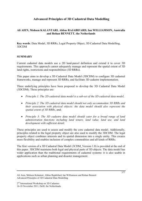
Advanced Principles of 3D Cadastral Data Modelling - 3D Cadastres ...
Advanced Principles of 3D Cadastral Data Modelling - 3D Cadastres ...
Advanced Principles of 3D Cadastral Data Modelling - 3D Cadastres ...

You also want an ePaper? Increase the reach of your titles
YUMPU automatically turns print PDFs into web optimized ePapers that Google loves.
<strong>Advanced</strong> <strong>Principles</strong> <strong>of</strong> <strong>3D</strong> <strong>Cadastral</strong> <strong>Data</strong> <strong>Modelling</strong><br />
Ali AIEN, Mohsen KALANTARI, Abbas RAJABIFARD, Ian WILLIAMSON, Australia<br />
and Rohan BENNETT, the Netherlands<br />
Key words: <strong>Data</strong> Model, <strong>3D</strong> RRRs, Legal Property Object, <strong>3D</strong> <strong>Cadastral</strong> <strong>Data</strong> <strong>Modelling</strong>,<br />
<strong>3D</strong>CDM<br />
SUMMARY<br />
Current cadastral data models use a 2D land-parcel definition and extend it to cover <strong>3D</strong><br />
requirements. This approach cannot adequately manage and represent the spatial extent <strong>of</strong> <strong>3D</strong><br />
land rights, restrictions and responsibilities (<strong>3D</strong> RRRs).<br />
This paper aims to develop a <strong>3D</strong> <strong>Cadastral</strong> <strong>Data</strong> Model (<strong>3D</strong>CDM) to configure <strong>3D</strong> cadastral<br />
frameworks, manage and represent <strong>3D</strong> RRRs, and facilitate <strong>3D</strong> cadastre implementation.<br />
Three underlying principles have been proposed to develop the <strong>3D</strong> <strong>Cadastral</strong> <strong>Data</strong> Model<br />
(<strong>3D</strong>CDM). These principles are:<br />
• Principle 1: The 2D cadastral data model is a sub-set <strong>of</strong> the <strong>3D</strong> cadastral data model,<br />
• Principle 2: The <strong>3D</strong> cadastral data model should not only accommodate <strong>3D</strong> RRRs and<br />
their association with physical objects: the data model should also represent the<br />
spatial extent <strong>of</strong> <strong>3D</strong> RRRs, and;<br />
• Principle 3: The <strong>3D</strong> cadastre data model should cater for a broad range <strong>of</strong> land<br />
administration functions including land tenure, land value, land use, and land<br />
development with sufficient detail.<br />
These principles are used to assess and modify the core cadastral data model. Additionally,<br />
principles related to the legal property object are also used to modify the <strong>3D</strong>CDM. The legal<br />
property object combines interests and its spatial dimension into a single entity. This creates<br />
more flexibility and enables inclusion <strong>of</strong> complex commodities and all kinds <strong>of</strong> RRRs.<br />
The first version <strong>of</strong> a <strong>3D</strong> <strong>Cadastral</strong> <strong>Data</strong> Model (3CDM_Version 1.0) is provided at the end <strong>of</strong><br />
this paper. <strong>3D</strong>CDM maintains both legal and physical parts <strong>of</strong> <strong>3D</strong> objects. The data model has<br />
wider application than the traditional requirements <strong>of</strong> cadastral systems: it is also usable in<br />
applications such as urban planning and disaster management.<br />
Ali Aien, Mohsen Kalantari, Abbas Rajabifard, Ian Williamson and Rohan Bennett<br />
<strong>Advanced</strong> <strong>Principles</strong> <strong>of</strong> <strong>3D</strong> <strong>Cadastral</strong> <strong>Data</strong> <strong>Modelling</strong><br />
2 nd International Workshop on <strong>3D</strong> <strong>Cadastres</strong><br />
16-18 November 2011, Delft, the Netherlands<br />
377
<strong>Advanced</strong> <strong>Principles</strong> <strong>of</strong> <strong>3D</strong> <strong>Cadastral</strong> <strong>Data</strong> <strong>Modelling</strong><br />
Ali AIEN, Mohsen KALANTARI, Abbas RAJABIFARD, Ian WILLIAMSON, Australia<br />
and Rohan BENNETT, the Netherlands<br />
1. INTRODUCTION<br />
The need for more ‘space’ resulting from population growth, urbanization and<br />
industrialization has increased the pressure on land use planning and development. As a<br />
result, space above and below ground level is increasingly used. Examples include<br />
underground developments, infrastructure facilities, high-rise buildings, and apartments. To<br />
extend the use and functionality <strong>of</strong> the land, complex infrastructures are being built, both<br />
vertically and horizontally, layered and stacked. These three-dimensional (<strong>3D</strong>) developments<br />
affect the interests attached to the underlying land.<br />
A <strong>3D</strong> cadastre will assist in managing the effects <strong>of</strong> <strong>3D</strong> development and increase the<br />
functionality <strong>of</strong> a multipurpose cadastre (Stoter & Oosterom, 2006). As the role <strong>of</strong> cadastre<br />
has changed through the development <strong>of</strong> civilization, cadastral data models have had to<br />
develop to meet ever changing demands (Williamson et al, 2010).<br />
There have been different cadastral data models since cadastral mechanization. Many<br />
jurisdictions, organizations and s<strong>of</strong>tware developers have developed their own cadastral data<br />
model. Examples <strong>of</strong> data modelling developments are the Core cadastral data model<br />
(Henssen, 1995), FGDC <strong>Cadastral</strong> <strong>Data</strong> Content Standard for the National Spatial <strong>Data</strong><br />
Infrastructure (FGDC, 1996), ArcGIS Parcel <strong>Data</strong> Model (Meyer, 2001), DM.01. (Steudler,<br />
2005), CCDM (Oosterom et al, 2006), ICSM Harmonised <strong>Data</strong> Model (ICSM, 2009), ePlan<br />
(ICSM, 2009), Legal Property Object (Kalantari et al, 2008), Ubiquitous <strong>3D</strong> Cadastre (Park et<br />
al, 2010), LADM (Lemmen et al, 2010a; Lemmen et al, 2010b), 5D <strong>Data</strong> <strong>Modelling</strong><br />
(Oosterom & Stoter, 2010), and ISO 19152- LADM (ISO, 2011).<br />
The variation between these data models is the result <strong>of</strong> the author’s different attitudes<br />
towards cadastres. They are evidence <strong>of</strong> the varying expectations <strong>of</strong> a <strong>3D</strong> cadastre. However,<br />
there is a basic common thread among them all. Current cadastral data models have been<br />
developed based on the definition <strong>of</strong> a 2D land-parcel, and most <strong>of</strong> the existing data models<br />
only cover 2D land-parcels (Kalantari et al, 2008). However, some have <strong>3D</strong> objects as<br />
components <strong>of</strong> the data model. <strong>3D</strong> cadastres are currently being developed in the context <strong>of</strong><br />
2D cadastres, yet it is argued that it is the 2D cadastre that should be accommodated within<br />
the context <strong>of</strong> a <strong>3D</strong> cadastre (Aien et al, 2011a). The research problem underpinning this<br />
paper is therefore: Current cadastral data models use a 2D land-parcel concept and extend it<br />
to support <strong>3D</strong> requirements. These data models cannot adequately manage and represent the<br />
spatial extent <strong>of</strong> <strong>3D</strong> RRRs.<br />
This paper aims to develop a <strong>3D</strong> <strong>Cadastral</strong> <strong>Data</strong> Model (<strong>3D</strong>CDM) based on three proposed<br />
principles <strong>of</strong> <strong>3D</strong> cadastral data modelling. The first principle and concept <strong>of</strong> the legal property<br />
Ali Aien, Mohsen Kalantari, Abbas Rajabifard, Ian Williamson and Rohan Bennett<br />
<strong>Advanced</strong> <strong>Principles</strong> <strong>of</strong> <strong>3D</strong> <strong>Cadastral</strong> <strong>Data</strong> <strong>Modelling</strong><br />
2 nd International Workshop on <strong>3D</strong> <strong>Cadastres</strong><br />
16-18 November 2011, Delft, the Netherlands<br />
378
object are described in Section 2. Section 3 addresses the second principle and the legal<br />
property object package. The third principle is described in Section 4. The <strong>3D</strong> <strong>Cadastral</strong> <strong>Data</strong><br />
Model (<strong>3D</strong>CDM_Version 1.0) and its components are presented in Section 5. The paper ends<br />
with conclusions in Section 6.<br />
2. FIRST PRINCIPLE OF <strong>3D</strong> CADASTRAL DATA MODELLING<br />
The first principle is:<br />
The 2D cadastral data model is a sub-set <strong>of</strong> <strong>3D</strong> cadastral data model.<br />
This principle reverses the current practice <strong>of</strong> extending the 2D model to include the <strong>3D</strong><br />
model. Most current initiatives are arguably utilising 2D cadastral concepts for the<br />
development <strong>of</strong> <strong>3D</strong> cadastres.<br />
The core cadastral data model has been developed based on three main components:<br />
InterestHolder (who has interests in a particular land parcel); Rights, Restrictions, and<br />
Responsibilities (RRRs); and Land (2D land parcel where RRRs are applied on/under that).<br />
Figure 1 shows the relationships between these components <strong>of</strong> the core cadastral data model.<br />
Figure 1. Core <strong>Cadastral</strong> <strong>Data</strong> Model (Oosterom et al, 2006)<br />
Obviously, the use <strong>of</strong> land involves multiple dimensions. However, traditional land<br />
administration systems focus on organizing 2D land parcels. A number <strong>of</strong> reasons current<br />
cadastral data models still rely on these 2D parcels for accommodating <strong>3D</strong> data. They are: the<br />
lack <strong>of</strong> <strong>3D</strong> data collection methods and equipment (lack <strong>of</strong> information in subdivision plans<br />
and architectural maps), and limited <strong>3D</strong> storage and representation technologies (<strong>3D</strong> DBMS,<br />
<strong>3D</strong> topology, and <strong>3D</strong> visualisation specifications). However, <strong>3D</strong> developments changed the<br />
characteristics <strong>of</strong> land parcels. Adding to this complexity were an increasing number <strong>of</strong><br />
different RRRs (e.g. ownership, easements, noise restriction area, mining lease, planning<br />
zone, heritage protection area) are associated with one 2D land parcel (Figure 2).<br />
The 2D land parcel is no longer the appropriate basic spatial component <strong>of</strong> cadastral models<br />
for managing and modelling <strong>3D</strong> information: 2D land parcels have been superseded by <strong>3D</strong><br />
spatial places. People now own and use volumes <strong>of</strong> space that can be determined in a <strong>3D</strong><br />
coordinate system (Aien et al, 2011a).<br />
Ali Aien, Mohsen Kalantari, Abbas Rajabifard, Ian Williamson and Rohan Bennett<br />
<strong>Advanced</strong> <strong>Principles</strong> <strong>of</strong> <strong>3D</strong> <strong>Cadastral</strong> <strong>Data</strong> <strong>Modelling</strong><br />
2 nd International Workshop on <strong>3D</strong> <strong>Cadastres</strong><br />
16-18 November 2011, Delft, the Netherlands<br />
379
Figure 2. An example <strong>of</strong> non parcel based interests (Kalantari et al, 2008)<br />
While cadastral data models have been developed to support the <strong>3D</strong> cadastre, most initiatives<br />
are based upon the 2D cadastral paradigm. In the most cases, a generic spatial unit has been<br />
defined to support <strong>3D</strong> requirements. This object maintains, for example, 2D land parcels,<br />
buildings, and utility network objects (Figure 3). The 2D land parcel object is being used<br />
when the model deals with a land parcel, and the Building object is being used when a<br />
building is being modelled.<br />
Figure 3. Spatial package in current cadastral data models (ISO, 2011)<br />
In this model, the Building object is treated as if it is dependent on a land parcel and inherits<br />
the land parcel’s RRRs. In other words, in this data model the <strong>3D</strong> cadastral data model is an<br />
extension <strong>of</strong> 2D cadastral data model. In the <strong>3D</strong> cadastral data model, the Spatial Unit could<br />
be changed to <strong>3D</strong> Spatial Space which is no longer dependant on the land parcel as it has its<br />
own associated RRRs. An initial <strong>3D</strong> <strong>Cadastral</strong> <strong>Data</strong> Model is proposed by this reform (Figure<br />
4).<br />
Figure 4. Initial <strong>3D</strong> <strong>Cadastral</strong> <strong>Data</strong> Model<br />
This data model upgrades the spatial component <strong>of</strong> the core cadastral data model from a 2D<br />
object to <strong>3D</strong> object. However, further changes are required. Spatial Component (land or <strong>3D</strong><br />
Spatial Space) and legal component (RRRs) are not conceptually separated objects. All RRRs<br />
are associated with a particular <strong>3D</strong> spatial extent. This means that RRRs and <strong>3D</strong> spatial<br />
Ali Aien, Mohsen Kalantari, Abbas Rajabifard, Ian Williamson and Rohan Bennett<br />
<strong>Advanced</strong> <strong>Principles</strong> <strong>of</strong> <strong>3D</strong> <strong>Cadastral</strong> <strong>Data</strong> <strong>Modelling</strong><br />
2 nd International Workshop on <strong>3D</strong> <strong>Cadastres</strong><br />
16-18 November 2011, Delft, the Netherlands<br />
380
extends can be combined and maintained together. The initial <strong>3D</strong> Cadastre <strong>Data</strong> Model can<br />
use the advantages <strong>of</strong> this concept, which is called the ‘legal property object’, or simply<br />
‘property object’, to simplify its structure and maximise its efficiency.<br />
2.1 Legal property object<br />
In 2008, Kalantari et al proposed the legal property object concept. The aim was to reengineer<br />
the current core cadastral data model. An underlying principle was that land could<br />
not be considered a legal entity until an interest was attached to it. There is always a<br />
relationship between each interest and its spatial dimension. Therefore, they can be<br />
maintained together as a unique entity (legal property object) in a cadastral information<br />
system. The legal property object combines an interest and its spatial dimension into an entity:<br />
an entity defined by law or regulation which relates to a physical space on, below or above the<br />
surface (Kalantari et al, 2008).<br />
The concept <strong>of</strong> the legal property object changes the current core data model from three<br />
components into two components. Figure 5 shows a new core cadastral data model based on<br />
the legal property object concept.<br />
Figure 5. New core <strong>Cadastral</strong> <strong>Data</strong> Model (Kalantari et al, 2008)<br />
The advantage <strong>of</strong> this model is the comprehensive inclusion <strong>of</strong> all interests in land. It also<br />
facilitates the land administration system to be more extensible and scalable in terms <strong>of</strong> new<br />
legislation and land related laws (Kalantari, 2008).<br />
There are some challenges to incorporate the legal property object within a cadastral model.<br />
They involve converting RRRs into their corresponding spatial dimensions (the legal property<br />
object might be a polygon, network, or a <strong>3D</strong> object) and also defining relationships among<br />
legal property object layers using identifiers, such as addresses, parcel and property maps, and<br />
coordinates.<br />
2.2 Incorporation <strong>of</strong> legal property object with <strong>3D</strong> cadastral data model<br />
Since the legal property object concept changes the core cadastral data model, it would affect<br />
the initial <strong>3D</strong> <strong>Cadastral</strong> <strong>Data</strong> Model. In this model the <strong>3D</strong> Spatial Space object and RRRs<br />
object are combined together (Figure 6).<br />
Ali Aien, Mohsen Kalantari, Abbas Rajabifard, Ian Williamson and Rohan Bennett<br />
<strong>Advanced</strong> <strong>Principles</strong> <strong>of</strong> <strong>3D</strong> <strong>Cadastral</strong> <strong>Data</strong> <strong>Modelling</strong><br />
2 nd International Workshop on <strong>3D</strong> <strong>Cadastres</strong><br />
16-18 November 2011, Delft, the Netherlands<br />
381
Figure 6. Initial <strong>3D</strong> <strong>Cadastral</strong> <strong>Data</strong> Model based on the first principle and the concept <strong>of</strong> legal property<br />
object<br />
This data model will use the advantages <strong>of</strong> the legal property object by using identifiers to<br />
connect RRRs with their spatial components.<br />
3. SECOND PRINCIPLE OF <strong>3D</strong> <strong>Cadastral</strong> <strong>Data</strong> <strong>Modelling</strong><br />
The second principle is:<br />
The <strong>3D</strong> <strong>Cadastral</strong> <strong>Data</strong> Model should not only accommodate <strong>3D</strong> RRRs and their<br />
association with physical objects: the data model should represent the spatial extent <strong>of</strong> <strong>3D</strong><br />
RRRs.<br />
This principle challenges the original definition <strong>of</strong> the cadastre where land parcels are kept as<br />
an attachment to land titles. This principle requires a higher degree <strong>of</strong> integration between<br />
RRRs and their spatial extent.<br />
While a few simple RRRs (such as an easement <strong>of</strong> way) may be represented on 2D (planar)<br />
cadastral paper maps, the diversity and complexity <strong>of</strong> <strong>3D</strong> RRRs requires more than a 2D<br />
cadastral paper map (where <strong>3D</strong> features are <strong>of</strong>ten incorporated by accompanying descriptive<br />
text). That is, <strong>3D</strong> RRRs require more than merely grafting <strong>of</strong> the 3rd dimension information<br />
onto a 2D planar representation. 2D land parcels are not flexible enough to accommodate an<br />
increasing number <strong>of</strong> non-parcel based interests (Bennett et al, 2008; Kalantari et al, 2008).<br />
Even after recent advances in storage (database) and visualisation systems, current cadastral<br />
systems do not attempt to represent RRRs in digital cadastral databases (DCDB).<br />
Consequently, the DCDB does not contain all RRRs (Oosterom et al, 2011).<br />
User expectations are for <strong>3D</strong> RRRs to be visualised in a <strong>3D</strong> cadastre. However, visualising <strong>3D</strong><br />
RRRs alone would not adequately assist management <strong>of</strong> <strong>3D</strong> RRRs (Aien et al, 2011b). Figure<br />
7(d) is an example <strong>of</strong> a <strong>3D</strong> depiction <strong>of</strong> the RRRs associated with the University <strong>of</strong><br />
Melbourne’s underground car park (UMP). Figure 7(a) and 7(b) show the location <strong>of</strong> the<br />
UMP on Google Map and Land Victoria’s DCDB respectively (the corresponding parcels are<br />
identified by the same symbols). Figure 7(c) is a cross-sectional view <strong>of</strong> UMP.<br />
Ali Aien, Mohsen Kalantari, Abbas Rajabifard, Ian Williamson and Rohan Bennett<br />
<strong>Advanced</strong> <strong>Principles</strong> <strong>of</strong> <strong>3D</strong> <strong>Cadastral</strong> <strong>Data</strong> <strong>Modelling</strong><br />
2 nd International Workshop on <strong>3D</strong> <strong>Cadastres</strong><br />
16-18 November 2011, Delft, the Netherlands<br />
382
Ali Aien, Mohsen Kalantari, Abbas Rajabifard, Ian Williamson and Rohan Bennett<br />
<strong>Advanced</strong> <strong>Principles</strong> <strong>of</strong> <strong>3D</strong> <strong>Cadastral</strong> <strong>Data</strong> <strong>Modelling</strong><br />
2 nd International Workshop on <strong>3D</strong> <strong>Cadastres</strong><br />
16-18 November 2011, Delft, the Netherlands<br />
N<br />
Figure 7(a): Orthogonal view <strong>of</strong> Melbourne University’s underground car park (Google, 2010)<br />
Figure 7(b): LandVictoria’s DCDB <strong>of</strong> this area (LandVictoria, 2010)<br />
Figure 7(c): Cross-sectional view <strong>of</strong> University <strong>of</strong> Melbourne underground car park (UMP)<br />
383
Figure 7(d). Visualisation <strong>of</strong> <strong>3D</strong> RRRs (green and blue spaces are Crown (government) land, the pink<br />
space is privately owned, and the University <strong>of</strong> Melbourne has a right <strong>of</strong> use over the yellow spaces)<br />
<strong>3D</strong> objects which represent <strong>3D</strong> RRRs are not suitable to manage <strong>3D</strong> RRRs. The actual<br />
construction <strong>of</strong> the buildings should be visualised in different details for different land<br />
administration functions (Figure 8).<br />
Figure 8. <strong>3D</strong> thematic view <strong>of</strong> the underground car park - different levels <strong>of</strong> this car park can be<br />
visualised for different purposes (different details)<br />
Based on the second <strong>3D</strong> <strong>Cadastral</strong> <strong>Data</strong> <strong>Modelling</strong> principle, the <strong>3D</strong> Cadastre <strong>Data</strong> Model<br />
should support both legal and physical objects <strong>of</strong> a building. Therefore, a<br />
<strong>3D</strong>CDM_PropertyObject (PO) class has been defined with its two specifications:<br />
PO_LegalPropertyObject and PO_PhysicalPropertyObject (Figure 9).<br />
Ali Aien, Mohsen Kalantari, Abbas Rajabifard, Ian Williamson and Rohan Bennett<br />
<strong>Advanced</strong> <strong>Principles</strong> <strong>of</strong> <strong>3D</strong> <strong>Cadastral</strong> <strong>Data</strong> <strong>Modelling</strong><br />
2 nd International Workshop on <strong>3D</strong> <strong>Cadastres</strong><br />
16-18 November 2011, Delft, the Netherlands<br />
384
Figure 9. <strong>3D</strong>CDM_PropertyObject (PO) package<br />
PO_LegalPropertyObject contains associations to support the legal objects <strong>of</strong> a building<br />
(Figure 10). The PO_LegalPropertyObject has an association with itself to enable the<br />
modelling <strong>of</strong> allocations between existing property objects and the new property objects. All<br />
associations are a kind <strong>of</strong> legal property object (LPO). Different LPOs can create the whole<br />
legal object.<br />
Figure 10. PO_LegalPropertyObject Package<br />
LPO1 can be a lot. Lot is the name given to a separate piece <strong>of</strong> land, airspace or building that<br />
come into existence when a plan <strong>of</strong> subdivision is registered in the Australian context (Figure<br />
11). LPO2 can be a common property which is the area <strong>of</strong> a plan <strong>of</strong> subdivision which is not<br />
included in one <strong>of</strong> the lots but is owned and used in common by those lot owners who are<br />
members <strong>of</strong> the body corporate. It can consist <strong>of</strong> land, building, air space or an area below the<br />
ground (Libbis, 2006).<br />
Ali Aien, Mohsen Kalantari, Abbas Rajabifard, Ian Williamson and Rohan Bennett<br />
<strong>Advanced</strong> <strong>Principles</strong> <strong>of</strong> <strong>3D</strong> <strong>Cadastral</strong> <strong>Data</strong> <strong>Modelling</strong><br />
2 nd International Workshop on <strong>3D</strong> <strong>Cadastres</strong><br />
16-18 November 2011, Delft, the Netherlands<br />
385
Figure 11. Attributes <strong>of</strong> PO_LegalPropertyObject<br />
Storey is any level part <strong>of</strong> a building that has a permanent ro<strong>of</strong> and could be used by people<br />
for different purposes. Each storey may contain a unit, its accessories and a utility network.<br />
The PO_PhysicalPropertyObject package consists <strong>of</strong> these objects to model the physical part<br />
<strong>of</strong> a building (Figure 12). Figure 13 describes attributes <strong>of</strong> LOP_PhysicalObject class.<br />
Figure 12. PO_PhysicalPropertyObject Package<br />
Ali Aien, Mohsen Kalantari, Abbas Rajabifard, Ian Williamson and Rohan Bennett<br />
<strong>Advanced</strong> <strong>Principles</strong> <strong>of</strong> <strong>3D</strong> <strong>Cadastral</strong> <strong>Data</strong> <strong>Modelling</strong><br />
2 nd International Workshop on <strong>3D</strong> <strong>Cadastres</strong><br />
16-18 November 2011, Delft, the Netherlands<br />
386
Figure 13. Attributes <strong>of</strong> PO_PhysicalPropertyObject<br />
4. THIRD PRINCIPLE OF <strong>3D</strong> CADASTRAL DATA MODELLING<br />
The third principle is:<br />
The <strong>3D</strong> <strong>Cadastral</strong> <strong>Data</strong> Model should cater for a broad range <strong>of</strong> land administration<br />
functions including land tenure, land value, land use, and land development with<br />
sufficient detail.<br />
Land administration includes diverse but related functions such as Land Tenure, Land Value,<br />
Land Use, and Land Development. Traditionally land administration functions have been<br />
founded on land parcels.<br />
Although cadastral systems were mainly established to serve a legal or a fiscal purpose, the<br />
data <strong>of</strong> the cadastral systems are also used for facilities management, base mapping, value<br />
assessment, land use planning, and environmental impact assessment. A legal basis, however,<br />
does not exist everywhere for all <strong>of</strong> these other purposes (Kaufmann & Steudler, 1998).<br />
The multipurpose <strong>3D</strong> cadastres would provide better and more efficient service to the public<br />
and private clients. However, <strong>3D</strong> cadastres need considerable investment. A <strong>3D</strong> cadastre<br />
cost/benefit analysis would be needed to demonstrate that the detailed <strong>3D</strong> information can<br />
serve as a multipurpose <strong>3D</strong> cadastre in different domains.<br />
Applications <strong>of</strong> <strong>3D</strong> cadastre are different and they require a different detail and scale <strong>of</strong><br />
information. For example, land registrars need parcel scale information, meaning that they<br />
need to register and visualise subdivided <strong>3D</strong> spatial objects and their associated rights. By<br />
387<br />
Ali Aien, Mohsen Kalantari, Abbas Rajabifard, Ian Williamson and Rohan Bennett<br />
<strong>Advanced</strong> <strong>Principles</strong> <strong>of</strong> <strong>3D</strong> <strong>Cadastral</strong> <strong>Data</strong> <strong>Modelling</strong><br />
2 nd International Workshop on <strong>3D</strong> <strong>Cadastres</strong><br />
16-18 November 2011, Delft, the Netherlands
contrast, city planning organisations need large scale and more detailed information in every<br />
unit and storey <strong>of</strong> a building.<br />
For example, consider a building with two storeys and four units where each unit has one<br />
balcony and one access way area (Figure 14). If both units 1 and 2 are owned by person (P1)<br />
and the units 3 and 4 are owned by another person (P2), what is registered and represented in<br />
a land registry <strong>of</strong>fice are subdivided lots and their associated rights, as illustrated in Figure 15.<br />
For planning proposes however, information <strong>of</strong> each separate unit as well as their legal<br />
information is important (Figure 16).<br />
Figure 14. A two storeys building with 4 units (each unit has one balcony) and one access stair<br />
Figure 15. P1 owned Lot 1 and P2 owned Lot 2 (Legal model)<br />
Figure 16. A model which is useful for planning purposes (Physical model)<br />
The third principle also challenges the single building block <strong>of</strong> the cadastre that is used as the<br />
atomic unit <strong>of</strong> land administration functions. Modern cadastral data models should use <strong>3D</strong><br />
objects as the basic building block. This principle supports the proposition that there is no<br />
single basic building block for the cadastre: different levels <strong>of</strong> detail (in terms <strong>of</strong> accuracy and<br />
feature) will be required for the <strong>3D</strong> development in different land administration functions.<br />
Based on the three principles described thus far and the ‘legal property object’ concept, the<br />
<strong>3D</strong> <strong>Cadastral</strong> <strong>Data</strong> Model (<strong>3D</strong>CDM_Version 1.0) is developed in the next section. This data<br />
model accommodates concepts <strong>of</strong> proposed principles. It maintains both legal and physical<br />
parts <strong>of</strong> <strong>3D</strong> objects. The data model has wider application than the traditional requirements <strong>of</strong><br />
cadastral systems.<br />
Ali Aien, Mohsen Kalantari, Abbas Rajabifard, Ian Williamson and Rohan Bennett<br />
<strong>Advanced</strong> <strong>Principles</strong> <strong>of</strong> <strong>3D</strong> <strong>Cadastral</strong> <strong>Data</strong> <strong>Modelling</strong><br />
2 nd International Workshop on <strong>3D</strong> <strong>Cadastres</strong><br />
16-18 November 2011, Delft, the Netherlands<br />
388
5. <strong>3D</strong> CADASTRAL DATA MODEL (<strong>3D</strong>CDM_VERSION 1.0)<br />
The first version <strong>of</strong> <strong>3D</strong> <strong>Cadastral</strong> <strong>Data</strong> Model (<strong>3D</strong>CDM_Version 1.0) is presented in this<br />
section. It is based on the principles <strong>of</strong> <strong>3D</strong> <strong>Cadastral</strong> <strong>Data</strong> <strong>Modelling</strong>, and lessons from the<br />
legal property object concept. <strong>3D</strong>CDM has seven packages to support the <strong>3D</strong> cadastres. They<br />
are <strong>3D</strong>CDM_InterestHolder, <strong>3D</strong>CDM_Propertyobject (PO), <strong>3D</strong>CDM_Geometry,<br />
<strong>3D</strong>CDM_Survey, <strong>3D</strong>CDM_SurveyPoints, <strong>3D</strong>CDM_SurveyObsevation, and<br />
<strong>3D</strong>CDM_ExternalSources (Figure 17).<br />
Figure 17. Core classes <strong>of</strong> <strong>3D</strong>CDM<br />
5.1 InterestHolder Package<br />
The only class in this package is <strong>3D</strong>CDM_InterestHolder class. InterestHolder can be a<br />
person, group, or an organization who has certain rights (RRRs) over a particular <strong>3D</strong> spatial<br />
space.<br />
Figure 18. <strong>3D</strong>CDM_InterestHolder Package<br />
Ali Aien, Mohsen Kalantari, Abbas Rajabifard, Ian Williamson and Rohan Bennett<br />
<strong>Advanced</strong> <strong>Principles</strong> <strong>of</strong> <strong>3D</strong> <strong>Cadastral</strong> <strong>Data</strong> <strong>Modelling</strong><br />
2 nd International Workshop on <strong>3D</strong> <strong>Cadastres</strong><br />
16-18 November 2011, Delft, the Netherlands<br />
389
5.2 LPO (Legal Property Object) Package<br />
As described in section 3, the main class in this package is <strong>3D</strong>CDM_PO with its two<br />
specializations, PO_LegalPropertyObject and PO_PhysicalPropertyObject. This package<br />
supports both legal and physical parts <strong>of</strong> a <strong>3D</strong> object (building) (Figure 19).<br />
Figure 19. <strong>3D</strong>CDM_PO Package<br />
5.3 Geometry Package<br />
This package utilises the geometry model <strong>of</strong> CityGML to shape the geometry <strong>of</strong> legal and<br />
physical objects. This package consists <strong>of</strong> primitives to form complexes, composite<br />
geometries or aggregates. Point is used for zero-dimensional object, _Curve for onedimensional,<br />
_Surface for two-dimensional, and _Solid for three-dimensional objects (Figure<br />
20). Combination <strong>of</strong> the primitives (aggregates, complexes or composites) forms more<br />
complex objects and provides topology among objects (Gröger et al, 2008).<br />
Figure 20. <strong>3D</strong>CDM_Geometry Package (adopted from CityGML data model)<br />
Ali Aien, Mohsen Kalantari, Abbas Rajabifard, Ian Williamson and Rohan Bennett<br />
<strong>Advanced</strong> <strong>Principles</strong> <strong>of</strong> <strong>3D</strong> <strong>Cadastral</strong> <strong>Data</strong> <strong>Modelling</strong><br />
2 nd International Workshop on <strong>3D</strong> <strong>Cadastres</strong><br />
16-18 November 2011, Delft, the Netherlands<br />
390
5.4 Survey Package<br />
This package contains 4 classes which deal with technical and administrative information <strong>of</strong><br />
surveying, surveyor, and subdivision plan. They are <strong>3D</strong>CDM_Survey,<br />
<strong>3D</strong>CDM_SurveyMetadata, <strong>3D</strong>CDM_CoordinateSystem, and <strong>3D</strong>CDM_Surveyor (Figure 21).<br />
Figure 21. <strong>3D</strong>CDM_Survey Package<br />
5.5 SurveyPoints Package<br />
This Package has one <strong>3D</strong>CDM_SurveyPoints class to contain the elements related to the<br />
survey permanent marks which are placed in the ground by monuments (e.g., pin, peg) for the<br />
purpose <strong>of</strong> being surveyed. Survey points can be 2D or <strong>3D</strong> (Figure 22).<br />
Figure 22. <strong>3D</strong>CDM_SurveyPoints Package<br />
5.6 SurveyObservation Package<br />
The <strong>3D</strong>CDM_SurveyObservation package contains <strong>3D</strong>CDM_SurveyObservedLine,<br />
<strong>3D</strong>CDM_SurveyAngle, and <strong>3D</strong>CDM_SurveyStation classes to maintain observed data which<br />
form a spatial component <strong>of</strong> the <strong>3D</strong>CDM (Figure 23).<br />
Ali Aien, Mohsen Kalantari, Abbas Rajabifard, Ian Williamson and Rohan Bennett<br />
<strong>Advanced</strong> <strong>Principles</strong> <strong>of</strong> <strong>3D</strong> <strong>Cadastral</strong> <strong>Data</strong> <strong>Modelling</strong><br />
2 nd International Workshop on <strong>3D</strong> <strong>Cadastres</strong><br />
16-18 November 2011, Delft, the Netherlands<br />
391
Figure 23. <strong>3D</strong>CDM_SurveyObservation Package<br />
5.7 ExternalResource Package<br />
Surveying data and subdivision plans are not detailed enough to guide reconstruction <strong>of</strong> both<br />
legal and physical objects <strong>of</strong> buildings. In some applications, more detailed information<br />
required, which external sources such as architectural and engineering plans can provide. The<br />
<strong>3D</strong>CDM_ExternalResource package contains only one class to support all different external<br />
sources (figure 24).<br />
Figure 24. <strong>3D</strong>CDM_ExternalSource Package<br />
6. CONCLUSION<br />
Land development and land use are increasingly three-dimensional (high-rise buildings,<br />
underground basements and car parks), but, use outdated two-dimensional cadastral systems.<br />
This paper advances the proposition that a comprehensive cadastre must be three-dimensional<br />
to properly manage, represent and visualise the spatial extent <strong>of</strong> <strong>3D</strong> land rights, restrictions<br />
and responsibilities (<strong>3D</strong> RRRs).<br />
The paper introduces three principles <strong>of</strong> an adequate <strong>3D</strong> <strong>Cadastral</strong> <strong>Data</strong> Model. In addition,<br />
the concept and advantages <strong>of</strong> using the ‘legal property object’ have been addressed. The<br />
Ali Aien, Mohsen Kalantari, Abbas Rajabifard, Ian Williamson and Rohan Bennett<br />
<strong>Advanced</strong> <strong>Principles</strong> <strong>of</strong> <strong>3D</strong> <strong>Cadastral</strong> <strong>Data</strong> <strong>Modelling</strong><br />
2 nd International Workshop on <strong>3D</strong> <strong>Cadastres</strong><br />
16-18 November 2011, Delft, the Netherlands<br />
392
esult <strong>of</strong> these principles is significant. It will shape the <strong>3D</strong> cadastre concept and consequently<br />
<strong>3D</strong> <strong>Cadastral</strong> <strong>Data</strong> Models. Most <strong>of</strong> the current cadastral data models have been influenced by<br />
a very broad understanding <strong>of</strong> <strong>3D</strong> cadastral concepts because clarity in what needs to be<br />
represented and analysed cadastre needs to be established.<br />
To this end, the first version <strong>of</strong> <strong>3D</strong> <strong>Cadastral</strong> <strong>Data</strong> Model (<strong>3D</strong>CDM_Version 1.0) has been<br />
developed to support the <strong>3D</strong> cadastre and more city planning applications. This data model<br />
has seven packages which support different parts <strong>of</strong> a <strong>3D</strong> cadastral system. The next phase <strong>of</strong><br />
this work will involve piloting and testing the model.<br />
Finally, it is also worth noting that in the short to medium term (and potentially the long<br />
term), a <strong>3D</strong> cadastre will not be required in all contexts (e.g. consider isolated rural areas in<br />
Australia). This notion may provide clues as to how <strong>3D</strong> cadastres will be implemented in<br />
practice. <strong>3D</strong> cadastral models will need to take this into account: the development <strong>of</strong> full <strong>3D</strong><br />
cadastre will most likely be staged processed, supported by cost/benefit analyses that<br />
demonstrate the value <strong>of</strong> each stage. Further research should therefore also examine<br />
approaches to implementation. In conclusion, the model presented here can be seen as part <strong>of</strong><br />
the processes <strong>of</strong> development.<br />
REFERENCES<br />
Aien, A. et al (2011a). Aspects <strong>of</strong> <strong>3D</strong> Cadastre- A Case Study in Victoria. Paper presented at<br />
the FIG Working Week 2011, Marrakech, Morocco.<br />
Aien, A. et al (2011b). <strong>3D</strong> Cadastre in Victoria, Converting Building plans <strong>of</strong> Subdivision to<br />
LandXML. GIM International, 25(8), 16-21.<br />
Bennett, R. et al (2008). A toolbox for mapping and managing new interests over land. Survey<br />
Review, 40(307), 43-53.<br />
FGDC. (1996). FGDC Standards Reference Model, NSDI, Standards Working Group,<br />
Standards Reference Model.<br />
Google. (2010). Google earth, Version 2009, July 2009.<br />
From http://www.google.com/earth/index.html.<br />
Gröger, G. et al (2008). OpenGIS City Geography Markup Language (CityGML) Encoding<br />
Standard- Version: 1.0.0, Open Geospatial Consortium Inc.<br />
Henssen, J.L.G. (1995). Basic <strong>Principles</strong> <strong>of</strong> the Main <strong>Cadastral</strong> Systems in the World. Paper<br />
presented at the Seminar Modern <strong>Cadastres</strong> and <strong>Cadastral</strong> Innovations, Delft, The<br />
Netherlands.<br />
ICSM. (2009). ePlan Model. Retrieved from http://www.icsm.gov.au/icsm/ePlan/Schema-<br />
1.2/ePlan_Model.pdf & http://www.icsm.gov.au/icsm/ePlan/Plan-1.2/index.htm.<br />
Ali Aien, Mohsen Kalantari, Abbas Rajabifard, Ian Williamson and Rohan Bennett<br />
<strong>Advanced</strong> <strong>Principles</strong> <strong>of</strong> <strong>3D</strong> <strong>Cadastral</strong> <strong>Data</strong> <strong>Modelling</strong><br />
2 nd International Workshop on <strong>3D</strong> <strong>Cadastres</strong><br />
16-18 November 2011, Delft, the Netherlands<br />
393
ISO. (2011). ISO 19152. Draft International Standard (DIS), Geographic Information- Land<br />
administration domain model (LADM), Geneva, Switzerland, 20 January 2011.<br />
Kalantari, M. (2008). <strong>Cadastral</strong> <strong>Data</strong> <strong>Modelling</strong> - A Tool for e-Land Administration. The<br />
University <strong>of</strong> Melbourne.<br />
Kalantari, M. et al (2008). Spatially referenced legal property objects. Land Use Policy, 25,<br />
173-183.<br />
Kaufmann, J., Steudler, D. (1998). Cadastre 2014, A vision for future cadastral system, with<br />
the Working Group 1 <strong>of</strong> FIG Commission 7.<br />
LandVictoria. (2010). DCDB, LandVictoria, the Department <strong>of</strong> Sustainability and<br />
Environment. From http://services.land.vic.gov.au/maps/lassi.jsp.<br />
Lemmen, C. et al (2010a). The modelling <strong>of</strong> Rights, Restrictions and Responsibilities (RRR)<br />
in the Land Administration Domain Model (LADM). Paper presented at the FIG Congress<br />
2010.<br />
Lemmen, C. et al (2010b). The <strong>Modelling</strong> <strong>of</strong> Spatial Units (Parcels) in the Land<br />
Administration Domain Model (LADM). Paper presented at the FIG Congress 2010.<br />
Libbis, S. (2006). Subdivisions with the lots, Law Crest.<br />
Meyer, N.V. (2001). ArcGIS Land parcel <strong>Data</strong> Model, Esri.<br />
Oosterom, P. J. M. van et al (2006). The core cadastral domain model. SinceDirect, 30, 627-<br />
660.<br />
Oosterom, P. van, Stoter, J. E. (2010). 5D <strong>Data</strong> <strong>Modelling</strong>: Full Integration <strong>of</strong> 2D/<strong>3D</strong> Space,<br />
Time and Scale Dimensions. GIScience 2010, LNSC (6292), 310-324.<br />
Oosterom, P. van et al (2011). World-wide Inventory <strong>of</strong> the Status <strong>of</strong> <strong>3D</strong> <strong>Cadastres</strong> in 2010<br />
and Expectations for 2014. Paper presented at the FIG Working Week 2011.<br />
Park, S. et al (2010). <strong>Data</strong> Model for <strong>3D</strong> Cadastre in Korea. Paper presented at the 2010<br />
Second International Conference on <strong>Advanced</strong> geographic information Systems,<br />
Applications, and Services.<br />
Steudler, D. (2005). Swiss cadastral core data model- experiences <strong>of</strong> the last 15 years.<br />
SinceDirect, 30, 600-613.<br />
Stoter, J.E., Oosterom, P.J.M. van (2006). <strong>3D</strong> cadastre in an international context: legal,<br />
organizational, and technological aspects, Taylor & Francis.<br />
Williamson, I. et al (2010). Land Administration for Sustainable Development, ESRI Press.<br />
Ali Aien, Mohsen Kalantari, Abbas Rajabifard, Ian Williamson and Rohan Bennett<br />
<strong>Advanced</strong> <strong>Principles</strong> <strong>of</strong> <strong>3D</strong> <strong>Cadastral</strong> <strong>Data</strong> <strong>Modelling</strong><br />
2 nd International Workshop on <strong>3D</strong> <strong>Cadastres</strong><br />
16-18 November 2011, Delft, the Netherlands<br />
394
BIOGRAPHICAL NOTES<br />
Ali Aien started his PhD on <strong>3D</strong> <strong>Cadastral</strong> <strong>Data</strong> <strong>Modelling</strong> in 2010 at the Centre for SDIs and<br />
Land Administration at the Department <strong>of</strong> Infrastructure Engineering, the University <strong>of</strong><br />
Melbourne. His research aims to develop and implement a data model to enable the capture,<br />
storage, editing, querying, analysis and supporting visualisation <strong>of</strong> <strong>3D</strong> land rights, restrictions<br />
and responsibilities in cadastre. He also has a bachelor degree in surveying engineering and<br />
master degree in GIS engineering.<br />
Mohsen Kalantari is a Research Fellow at the Centre for SDIs and Land Administration at<br />
the Department <strong>of</strong> Infrastructure Engineering, the University <strong>of</strong> Melbourne working on <strong>3D</strong><br />
cadastre and spatial metadata automation. Mohsen currently is also the ePlan project<br />
coordinator at Land Victoria, Department <strong>of</strong> suitability and Environment and is a member <strong>of</strong><br />
the ICSM ePlan working group. He finished his PhD from the University <strong>of</strong> Melbourne in<br />
2008. Mohsen has a bachelor degree in surveying engineering and master degree in GIS<br />
engineering.<br />
Abbas Rajabifard is an Associate Pr<strong>of</strong>essor and Director <strong>of</strong> the Centre for SDIs and Land<br />
Administration at the Department <strong>of</strong> Infrastructure Engineering, the University <strong>of</strong> Melbourne.<br />
He is President <strong>of</strong> the GSDI Association, a member <strong>of</strong> ICA-Spatial <strong>Data</strong> Standard<br />
Commission, and a member <strong>of</strong> Victorian Spatial Council. His research interests are spatial<br />
enablement, sustainable city development using SDI and land administration.<br />
Ian Williamson is both a pr<strong>of</strong>essional land surveyor and chartered engineer who is Pr<strong>of</strong>essor<br />
<strong>of</strong> Surveying and Land Information at the Centre for SDIs and Land Administration,<br />
Department <strong>of</strong> Infrastructure Engineering, University <strong>of</strong> Melbourne, Australia. His expertise<br />
is the cadastre, land administration, and spatial data infrastructures.<br />
Rohan Bennett works as an Assistant Pr<strong>of</strong>essor at the University <strong>of</strong> Twente, Faculty <strong>of</strong> Geo-<br />
Information Science and Earth Observation in The Netherlands. He is part <strong>of</strong> the UN School<br />
<strong>of</strong> Land Administration Studies and also an Honorary Fellow with the Centre for SDIs and<br />
Land Administration at The University <strong>of</strong> Melbourne.<br />
CONTACTS<br />
Ali Aien<br />
University <strong>of</strong> Melbourne<br />
Parkville<br />
Victoria<br />
AUSTRALIA 3010<br />
Tel.: +61 3 8344 6771<br />
E-mail: a.aien@pgrad.unimelb.edu.au<br />
Website: http://www.csdila.unimelb.edu.au/people/rteam/ali.html<br />
Ali Aien, Mohsen Kalantari, Abbas Rajabifard, Ian Williamson and Rohan Bennett<br />
<strong>Advanced</strong> <strong>Principles</strong> <strong>of</strong> <strong>3D</strong> <strong>Cadastral</strong> <strong>Data</strong> <strong>Modelling</strong><br />
2 nd International Workshop on <strong>3D</strong> <strong>Cadastres</strong><br />
16-18 November 2011, Delft, the Netherlands<br />
395
Mohsen Kalantari<br />
University <strong>of</strong> Melbourne<br />
Parkville<br />
Victoria<br />
AUSTRALIA 3010<br />
Tel.: +61 3 8344 6833<br />
E-mail: saeidks@unimelb.edu.au<br />
Website: http://www.csdila.unimelb.edu.au/people/rteam/mohsen.html<br />
Abbas Rajabifard<br />
University <strong>of</strong> Melbourne<br />
Parkville<br />
Victoria<br />
AUSTRALIA 3010<br />
Tel.: +61 3 8344 0234<br />
E-mail: abbas.r@unimelb.edu.au<br />
Website: http://www.csdila.unimelb.edu.au/people/rteam/abbas.html<br />
Ian Williamson<br />
University <strong>of</strong> Melbourne<br />
Parkville<br />
Victoria<br />
Australia 3010<br />
Tel.: +61 3 8344 5597<br />
E-mail: ianpw@unimelb.edu.au<br />
Website: http://www.geom.unimelb.edu.au/people/ipw.html<br />
Rohan Bennett<br />
Assistant Pr<strong>of</strong>essor<br />
Faculty <strong>of</strong> Geo-Information Science and Earth Observation University <strong>of</strong> Twente<br />
Boulevard 1945-4<br />
7511 AE Enschede<br />
The NETHERLANDS<br />
Tel.: +31 (0)53 4874 339<br />
Fax: +31 (0)657 050 498<br />
E-mail: bennett@itc.nl<br />
Website: http://csdila.unimelb.edu.au/people/rteam/rohan.html<br />
Ali Aien, Mohsen Kalantari, Abbas Rajabifard, Ian Williamson and Rohan Bennett<br />
<strong>Advanced</strong> <strong>Principles</strong> <strong>of</strong> <strong>3D</strong> <strong>Cadastral</strong> <strong>Data</strong> <strong>Modelling</strong><br />
2 nd International Workshop on <strong>3D</strong> <strong>Cadastres</strong><br />
16-18 November 2011, Delft, the Netherlands<br />
396