

Download - Coordinates
Download - Coordinates
Download - Coordinates

You also want an ePaper? Increase the reach of your titles
YUMPU automatically turns print PDFs into web optimized ePapers that Google loves.
etween 7 to 12 mm and 11 to 16 mm<br />
for horizontal and vertical, respectively.<br />
The RMS of fitting is 5.6 mm, 5.1 mm<br />
and 6.3 mm for the northing, easting<br />
and height components respectively.<br />
Determination of Brunei<br />
datum transformation<br />
Once the adoption of ITRF2005 has been<br />
completed, the next task is to define the<br />
relationship between the local geodetic<br />
system BT48 and the newly established<br />
geocentric datum of Brunei Darussalam<br />
2009 (GDBD2009). For this reason, the<br />
old primary and secondary triangulations<br />
of BT48 stations (see Figure 1) need to be<br />
revisited. These triangulation stations are to<br />
be observed using GPS technique in order<br />
to tie with the GDBD2009 reference frame.<br />
The most challenging task was to arrange<br />
an expedition to visit all of these stations<br />
(except for station B09, see Figure 1)<br />
since they were remotely located on<br />
the mountainous area in the Borneo<br />
tropical rain forest. A GPS campaign<br />
was conducted in January and March<br />
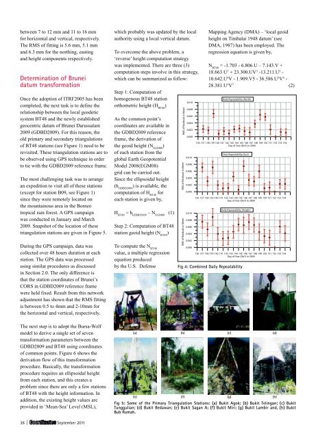
2009. Snapshot of the location of these<br />
triangulation stations are given in Figure 5.<br />
During the GPS campaign, data was<br />
collected over 48 hours duration at each<br />
station. The GPS data was processed<br />
using similar procedures as discussed<br />
in Section 2.0. The only difference is<br />
that the station coordinates of Brunei’s<br />
CORS in GDBD2009 reference frame<br />
were held fixed. Result from this network<br />
adjustment has shown that the RMS fitting<br />
is between 0.5 to 4mm and 2-10mm for<br />
the horizontal and vertical, respectively.<br />
The next step is to adopt the Bursa-Wolf<br />
model to derive a single set of seven<br />
transformation parameters between the<br />
GDBD2009 and BT48 using coordinates<br />
of common points. Figure 6 shows the<br />
derivation flow of this transformation<br />
procedure. Basically, the transformation<br />
procedure requires an ellipsoidal height<br />
from each station, and this creates a<br />
problem since there are only a few stations<br />
of BT48 with the height information. In<br />
addition, the existing height values are<br />
provided in ‘Mean-Sea’ Level (MSL),<br />
38 | September 2011<br />
which probably was updated by the local<br />
authority using a local vertical datum.<br />
To overcome the above problem, a<br />
‘reverse’ height computation strategy<br />
was implemented. There are three (3)<br />
computation steps involve in this strategy,<br />
which can be summarized as follow:<br />
Step 1: Computation of<br />
homogenous BT48 station<br />
orthometric height (H BT48 )<br />
As the common point’s<br />
coordinates are available in<br />
the GDBD2009 reference<br />
frame, the derivation of<br />
the geoid height (N EGM08 )<br />
of each station from the<br />
global Earth Geopotential<br />
Model 2008(EGM08)<br />
grid can be carried out.<br />
Since the ellipsoidal height<br />
(h GDBD2009 ) is available, the<br />
computation of H BT48 for<br />
each station is given by,<br />
H BT48 = h GDBD2009 – N EGM08 (1)<br />
Step 2: Computation of BT48<br />
station geoid height (N BT48 )<br />
To compute the N BT48<br />
value, a multiple regression<br />
equation produced<br />
by the U.S. Defense<br />
Mapping Agency (DMA) – ‘local geoid<br />
height on Timbalai 1948 datum’ (see<br />
DMA, 1987) has been employed. The<br />
regression equation is given by,<br />
N BT48 = -1.703 - 6.806.U – 7.143.V +<br />
18.663 U 3 + 23.300.UV 3 -13.211.U 5 -<br />
10.642.U 4 V - 1.909.V5 - 36.586.U 3 V 5 -<br />
28.381.U 3 V 7 (2)<br />
Fig 4: Combined Daily Repeatability<br />
(a) (b) (c) (d)<br />
(e) (f) (g) (h)<br />
Fig 5: Some of the Primary Triangulation Stations: (a) Bukit Agok; (b) Bukit Telingan; (c) Bukit<br />
Tunggulian; (d) Bukit Bedawan; (e) Bukit Sagan A; (f) Bukit Miri; (g) Bukit Lambir and, (h) Bukit<br />
Bub Rumah.


