Download - Coordinates
Download - Coordinates
Download - Coordinates
Create successful ePaper yourself
Turn your PDF publications into a flip-book with our unique Google optimized e-Paper software.
RD Programmes is also being prepared.<br />
In agriculture sector, a knowledge data<br />
base, viz. Agro Climatic Planning &<br />
Information Bank (APIB) with 18 layers<br />
of data, plot wise have been developed for<br />
farmers advisory and fi eld functionaries for<br />
planning and monitoring, at 1:10,000 scale.<br />
An ICAR project on Farmers Advisory<br />
using Mobile is ready for implementation in<br />
Andhra Pradesh in KVKs of two districts,<br />
which is taken up in a Consortium mode<br />
with other Resource Organisations.<br />
Does your Centre also<br />
undertake research activities?<br />
Research is an integral part of CGARD<br />
Centre and currently engaged in research<br />
projects on Geoinformatics applications<br />
in Watershed, MGNREGS, Village<br />
Development, Agriculture, Soil survey,<br />
profi ling & mapping, Developing SDSS<br />
etc. We have also undertaken Watershed<br />
Impact assessment using Geoinformatics<br />
for selected watersheds in many States.<br />
How do you take<br />
Geoinformatics Technology<br />
to local level applications?<br />
CGARD is relentlessly evolving systems<br />
and processes for taking Geoinformatics<br />
Technology to local level with use of Open<br />
Source Software, local language interface,<br />
mobile based application, extensive hand<br />
holding at fi eld level, establishment of<br />
fi ve(5) CGARD Centres at Guwahati,<br />
Bhubaneswar, Hyderabad, Ralegaon<br />
Siddhi and Ahmedabad and developing<br />
Server based access to fi eld functionaries<br />
for Geoinformatics applications.<br />
What will be your thrust<br />
areas in establishing the<br />
CGARD Centres in Africa and<br />
ICT Centre in Bangladesh?<br />
The thrust areas in establishing the<br />
CGARD Centres in Africa and ICT<br />
Centre in Bangladesh are to reach out<br />
to the developing world, in sharing the<br />
innovative and best practices in Geo-ICT<br />
technology applications, creating manpower<br />
pool by developing their technical skill<br />
and knowledge level, familarisation of<br />
processes and methodologies, so that<br />
country specifi c Geo-ICT applications<br />
can be developed by these Centres. <br />
44 | <strong>Coordinates</strong> January 2013<br />
“There is less awareness<br />
about Geoinformatics”<br />
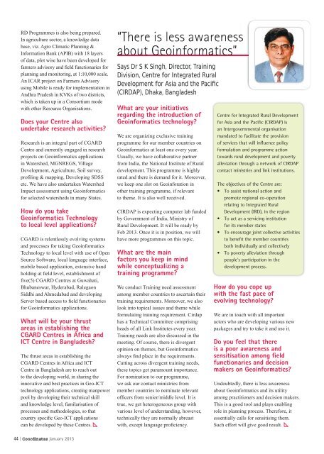
Says Dr S K Singh, Director, Training<br />
Division, Centre for Integrated Rural<br />
Development for Asia and the Pacifi c<br />
(CIRDAP), Dhaka, Bangladesh<br />
What are your initiatives<br />
regarding the introduction of<br />
Geoinformatics technology?<br />
We are organizing exclusive training<br />
programme for our member countries on<br />
Geoinformatics at least one every year.<br />
Usually, we have collaborative partner<br />
from India, the National Institute of Rural<br />
development. This programme is highly<br />
rated and there is demand for it. Moreover,<br />
we keep one slot on Geoinforation in<br />
other training programme, if relevant<br />
to theme. It is also well received.<br />
CIRDAP is expecting computer lab funded<br />
by Government of India, Ministry of<br />
Rural Development. It will be ready by<br />
Feb 2013. Once it is in position, we will<br />
have more programmes on this topic.<br />
What are the main<br />
factors you keep in mind<br />
while conceptualizing a<br />
training programme?<br />
We conduct Training need assessment<br />
among member countries to ascertain their<br />
training requirements. Moreover, we also<br />
look into topical issues and theme while<br />
formulating training requirement. Cirdap<br />
has a Technical Committee comprising<br />
heads of all Link Institutes every year.<br />
Training needs are also discussed in the<br />
meeting. Of course, there is divergent<br />
opinion on themes, but Geoinformatics<br />
always fi nd place in the requirements.<br />
Cutting across divergent training needs,<br />
these topics get paramount importance.<br />
For nomination to our programme,<br />
we ask our contact ministries from<br />
member countries to nominate relevant<br />
offi cers from senior/middle level. It is<br />
true, we get heterogeneous group with<br />
various level of understanding, however,<br />
technically they are normally abreast<br />
with, except language profi ciency.<br />
Centre for Integrated Rural Development<br />
for Asia and the Pacifi c (CIRDAP) is<br />
an Intergovernmental organisation<br />
mandated to facilitate the provision<br />
of services that will infl uence policy<br />
formulation and programme action<br />
towards rural development and poverty<br />
alleviation through a network of CIRDAP<br />
contact ministries and link institutions.<br />
The objectives of the Centre are:<br />
• To assist national action and<br />
promote regional co-operation<br />
relating to Integrated Rural<br />
Development (IRD), in the region<br />
• To act as a servicing institution<br />
for its member states<br />
• To encourage joint collective activities<br />
to benefi t the member countries<br />
both individually and collectively<br />
• To poverty alleviation through<br />
people’s participation in the<br />
development process.<br />
How do you cope up<br />
with the fast pace of<br />
evolving technology?<br />
We are in touch with all important<br />
actors who are developing various new<br />
packages and try to take it and use it.<br />
Do you feel that there<br />
is a poor awareness and<br />
sensitisation among fi eld<br />
functionaries and decision<br />
makers on Geoinformatics?<br />
Undoubtedly, there is less awareness<br />
about Geoinformatics and its utility<br />
among practitioners and decision makers.<br />
This is a good tool and plays enabling<br />
role in planning process. Therefore, it<br />
essentially calls for sensitising them.<br />
Such effort will give good result.


