Bob Marshall Wilderness Complex - USDA Forest Service
Bob Marshall Wilderness Complex - USDA Forest Service
Bob Marshall Wilderness Complex - USDA Forest Service

You also want an ePaper? Increase the reach of your titles
YUMPU automatically turns print PDFs into web optimized ePapers that Google loves.
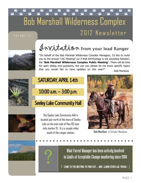
VOLUME 22<br />
<strong>Bob</strong> <strong>Marshall</strong> <strong>Wilderness</strong> <strong>Complex</strong><br />
2012 Newsletter<br />
Invitation from your lead Ranger<br />
“On behalf of the <strong>Bob</strong> <strong>Marshall</strong> <strong>Wilderness</strong> <strong>Complex</strong> Managers, I’d like to invite<br />
you to the annual “LAC Meeting” (or if that terminology is not sounding familiar),<br />
the “<strong>Bob</strong> <strong>Marshall</strong> <strong>Wilderness</strong> <strong>Complex</strong> Public Meeting”. There will be time<br />
for open dialog and questions, but can you please let me know specific topics<br />
that you would like to have updates on this year?”<br />
- Deb Mucklow<br />
SATURDAY, APRIL 14th<br />
10:00 a.m. — 3:00 p.m.<br />
Seeley Lake Community Hall<br />
The Seeley Lake Community Hall is<br />
located just north of the town of Seeley<br />
Lake on the east side of Hwy 83 near<br />
mile marker 15. It is a couple miles<br />
south of the ranger station.<br />
?<br />
Deb Mucklow at Schafer Meadows<br />
What <strong>Forest</strong> Manager has been actively involved<br />
in Limits of Acceptable Change monitoring since 1988<br />
[ COME TO THE MEETING TO FIND OUT … AND LEARN OTHER LAC TRIVIA ! ]<br />
PAGE 1
PAGE 2<br />
Backcountry Horsemen of America (3 chapters)<br />
Flathead National <strong>Forest</strong><br />
Hungry Horse Ranger District<br />
Spotted Bear Ranger District<br />
<strong>Forest</strong> <strong>Service</strong> <strong>Wilderness</strong> Research Unit<br />
Intermountain Research Station<br />
Helena National <strong>Forest</strong><br />
Lincoln Ranger District<br />
Lewis & Clark National <strong>Forest</strong><br />
Rocky Mountain Ranger District<br />
Lincoln Subgroup<br />
Lolo National <strong>Forest</strong><br />
Seeley Lake Ranger District<br />
Montana Aeronautics Division<br />
Montana Department of Fish, Wildlife, and Parks<br />
Montana Outfitters and Guides Association<br />
Montana Pilots Association<br />
Montana State University<br />
Department of Animal and Ranger Sciences<br />
Montana <strong>Wilderness</strong> Association<br />
National <strong>Forest</strong> Recreation Association<br />
North American Outfitters Association<br />
Professional <strong>Wilderness</strong> Outfitters Association<br />
Sierra Club<br />
Montana Chapter<br />
Swan Valley Citizens Group<br />
The <strong>Wilderness</strong> Society<br />
Unaffiliated Users<br />
University of Idaho<br />
Department of Wildland Recreation<br />
University of Montana<br />
School of <strong>Forest</strong>ry and <strong>Wilderness</strong> Institute<br />
TWENTY FIVE YEARS!<br />
By Deb Mucklow, Spotted Bear District Ranger<br />
Why the title TWENTY FIVE YEARS? This year, 2012, is the twenty<br />
fifth year that Limits of Acceptable Change (LAC) data has<br />
been monitored. This is the plan that set the standard for wilderness<br />
management and brought together a diverse group<br />
that today would be called a collaborative group and touted<br />
as a successful way to work together. I think it is pretty exciting<br />
that this model and working group are now a national model.<br />
Of more importance to me is that the group has continued to<br />
have interest in the <strong>Bob</strong> <strong>Marshall</strong> <strong>Wilderness</strong> <strong>Complex</strong> (<strong>Bob</strong> <strong>Marshall</strong>,<br />
Scapegoat, and Great Bear <strong>Wilderness</strong> Areas) and developed<br />
a plan and kept that interest to participate in annual meetings or<br />
as their situation allowed.<br />
In 1982 a group was formed as a LAC Task Force which is now<br />
commonly called the LAC group. [See the founding group members<br />
in the list on the left]. The group remains open to all and we<br />
encourage group and individual participation.<br />
The plan developed by this group, and then with a public involvement<br />
process, was amended to all four National <strong>Forest</strong> Plans in<br />
April 1987. The first 5 year monitoring period started in 1988<br />
and 2012 is the last year of the current 5 year monitoring period<br />
– hence twenty five years! As most of you are aware there has not<br />
been the planned revision of <strong>Forest</strong> Plans on the timeline that we<br />
all assumed would occur, and there is a new planning rule that<br />
will be or should be very close to final by the time we meet on<br />
April 14. Our plan would be to report on the latest 5 year monitoring<br />
period in 2013. Please remember that we will not have<br />
100% monitoring completed for this monitoring period as agreed<br />
to in 2008. Trends and results indicated it was appropriate to do<br />
more implementation activities (all to be reported on).<br />
For our next meeting, we’ve heard from some of you and plan to<br />
have presentations on the Gates Park Bridge, West Slope<br />
Cutthroat Trout Restoration, South Fork of the Sun Prescribed<br />
Fire Implementation, 2011 Wildfires, 2012 Wild and Scenic River<br />
Use Study, Bear Spray (a great tool), Partner involvement, trail<br />
projects, funding and available resource trends – open dialog for<br />
general questions and a BMWC LAC trivia contest. We need to<br />
hear from you! Please contact me at dmucklow@fs.fed.us or 406<br />
-387-3851 on any suggestions. I value the tenure I’ve had with<br />
being able to be a part of this great wilderness complex and<br />
working group. I’m a relative newcomer having been involved<br />
since 1995! I’m looking forward to many more years and the<br />
experience that you can bring to me and us as a manager group<br />
to be the best leaders and managers for the <strong>Bob</strong> <strong>Marshall</strong> <strong>Wilderness</strong><br />
<strong>Complex</strong>. Hope to see you April 14 in Seeley Lake!
• INFORMATION WANTED: Big Salmon Lake Fire<br />
On 8/16/2011 an aerial detection<br />
flight of the Big Salmon<br />
Lake area discovered a wildland<br />
fire burning in heavy timber<br />
upslope from the lake. On<br />
8/23/2011 a <strong>Forest</strong> <strong>Service</strong> law<br />
enforcement officer assigned to<br />
the Flathead National <strong>Forest</strong> responded<br />
to the fire area. After<br />
an investigation of the origin<br />
area the officer concluded that<br />
the fire was human caused and<br />
started near the northwest<br />
shore of Big Salmon Lake. Anyone<br />
having information about<br />
this fire is encouraged to contact<br />
<strong>Forest</strong> <strong>Service</strong> law enforcement<br />
at (406) 758-5297.<br />
FOOD STORAGE vs. SMELL STORAGE<br />
By L. Kevin Arnold, BMWC Law Enforcement Officer<br />
Over the past several years I have<br />
visited with folks who have some<br />
slight confusion in the Food Storage<br />
order in regards on what and how<br />
food needs to be stored. A common<br />
misconception is that if food; including<br />
beverages are stored in an airtight<br />
container that it is sufficient and<br />
meets our regulations. The Food Storage<br />
order is designed to prevent bears<br />
from obtaining a food reward from a<br />
human source. Here is an example of<br />
an argument I commonly hear. Folks<br />
tend to keep certain food/beverage<br />
items stored in a creek or lake for a<br />
couple reasons. One is to prevent or<br />
prolong spoilage but the other is just<br />
to enjoy a cold beverage at the end of<br />
the day when you get back to camp.<br />
POINT OF ORIGIN<br />
As the majority of the <strong>Bob</strong> <strong>Marshall</strong> <strong>Wilderness</strong> users are aware of, the <strong>Forest</strong> <strong>Service</strong><br />
has a special Food Storage order in place that includes all of the <strong>Bob</strong> <strong>Marshall</strong><br />
<strong>Wilderness</strong> <strong>Complex</strong>.<br />
Now I can’t argue with either justification especially<br />
since I do the exact same thing. However,<br />
that being said the food/beverage must be secured<br />
in a certified bear resistant container or<br />
cooler. Many people have told me that they<br />
thought they would be okay just by leaving the<br />
beverage/food in its original air tight container<br />
since obviously it didn’t produce an odor or<br />
smell attractant. They would more than likely<br />
be correct in assuming that its odor free but<br />
the fact of the matter is that a bear can still get<br />
a hold of that food/beverage and puncture the<br />
container and obtain a food reward. We all<br />
know bears, along with many other animals are<br />
really attracted to bright shiny things such as<br />
aluminum cans that may be floating in the<br />
creek. More times than not that bear’s curiosity<br />
will probably get the best of him and they will<br />
puncture and bite through every one of those<br />
aluminum cans. (Continued on pg. 12)<br />
“ …<br />
you will<br />
be the one<br />
enjoying that<br />
cold beer<br />
instead of a<br />
Grizzly Bear<br />
… ”<br />
PAGE 3
Collaboration and Restoration in the BMWC<br />
by Shannon Connolly, Seeley Lake Ranger District<br />
“biologically diverse” “science based” “roadless lands” “premier mountain regions”<br />
In 2009, Congress established the Collaborative <strong>Forest</strong><br />
Landscape Restoration Program (CFLRP). The purpose<br />
of CFLRP is to encourage collaborative, science-based<br />
ecosystem restoration of priority forest landscapes.<br />
CFLRP projects can be funded annually for the next ten<br />
years.<br />
The Southwestern Crown of the Continent (SWCC) Collaborative<br />
was one of ten of the initially selected projects<br />
nationwide. The SWCC is within the ten million<br />
acre Crown of the Continent ecosystem in northwest<br />
Montana and is one of the premier mountain regions of<br />
the world containing many of the largest remaining<br />
blocks of roadless lands in the contiguous U.S. The<br />
SWCC consists of portions of the Blackfoot, Clearwater,<br />
and Swan River watersheds and is one of the most biologically<br />
diverse and intact landscapes in the western<br />
U.S. The SWCC covers 1,449,670 acres. The Lolo, Flathead,<br />
and Helena National <strong>Forest</strong>s manage 63% or<br />
899,826 acres of the SWCC.<br />
The goals of the SWCC are to restore forest and aquatic<br />
ecosystem function, to improve landscape-level biodiversity,<br />
resiliency, and adaptability, to enhance recreational<br />
experiences, and to reduce risks for those living in<br />
PAGE 4<br />
Log jam created near Cabin Creek on the Middle Fork of the<br />
Flathead River during the high water of 2011<br />
the wildland-urban interface (WUI).<br />
So what does all of this mean for the BMWC? Approximately<br />
159,138 acres of the Scapegoat <strong>Wilderness</strong> is<br />
within the SWCC boundary, managed by the Seeley Lake<br />
and Lincoln Ranger Districts. On the Lincoln Ranger District,<br />
CFLRP helped fund the reconstruction of three miles<br />
of the Mainline trail #481 in 2011. Plans for 2012 include<br />
the reconstruction of five miles of the Mineral<br />
Creek Trail #484. On the Seeley Lake Ranger District,<br />
funds from 2011 were put into an agreement with MCC<br />
for the summer of 2012, so there will be a crew for 14<br />
weeks working on numerous trail restoration projects<br />
across the District. Also, for 2012 there are plans to<br />
work on trail maintenance and trail and watershed restoration<br />
and rehabilitation on various trails across the<br />
District. Additionally, CFLRP will help fund noxious weed<br />
treatments for new invaders in the back-country and<br />
some wilderness campsite restoration.<br />
For more information about CFLRP visit their website at<br />
http://www.fs.fed.us/restoration/CFLR.<br />
[Refer to SWCC map on the next page.]<br />
Be Prepared for <strong>Wilderness</strong> Hazards<br />
by Colter Pence, Hungry Horse<br />
Ranger District<br />
There are many hazards that wilderness users<br />
can encounter, high density blow down blocking<br />
trails, high water debris blocking the river,<br />
avalanche debris and snow lingering in slide<br />
path areas, hazard trees near campsites. Recent<br />
fire areas, even up to 15 years old, when<br />
subject to sudden wind events can dramatically<br />
change trail conditions, leaving a trail that<br />
was recently cleared appearing as if no one<br />
has cleared the trail recently. There are many<br />
places in the <strong>Bob</strong> <strong>Marshall</strong> <strong>Complex</strong> where this<br />
can happen. And with the high waters of<br />
spring 2011, river users found<br />
(Continued on pg. 15)
PAGE 5
Lincoln Ranger District Updates<br />
by Amber Kamps, District Ranger<br />
Change has been in the wind on the Lincoln Ranger District. Many of you are already aware that Ernie and Renee<br />
Lundberg retired at the end of December. We had a wonderful party for both of them in January to celebrate<br />
their career and accomplishments. Thanks to those of you that found your way to Lincoln on that snowy winter<br />
night to help us send them into retirement with warm thoughts and well wishes. Since then I've seen Ernie in the<br />
office almost weekly, not sure why, but he's popped in for various things. I think he just misses us, yet he is quick<br />
to say that he is loving his new career as a retiree.<br />
Bill Avey is the new <strong>Forest</strong> Supervisor for the Lewis and Clark<br />
National <strong>Forest</strong>. Bill started his career on Wyoming’s Bighorn NF<br />
in 1981. He worked in a variety of fire management, wilderness<br />
management, trails, recreation, timber management, range management<br />
and special uses positions on the Bighorn, Manti-LaSal,<br />
and Beaverhead-Deerlodge National <strong>Forest</strong>s. He became the District<br />
Ranger for the Big Timber Ranger District of the Gallatin National<br />
<strong>Forest</strong> in 2000, where much of the ranger district consisted<br />
of the Absaroka-Beartooth <strong>Wilderness</strong> and adjacent roadless<br />
lands. He also did several Acting Deputy <strong>Forest</strong> Supervisor/Acting<br />
<strong>Forest</strong> Supervisor assignments in Montana and New Mexico during<br />
his time as District Ranger. After ten years as District Ranger, he<br />
became the Deputy Director for Fire and Aviation for the Northern<br />
Region in Missoula, MT in 2010. He started as the <strong>Forest</strong> Supervisor<br />
of the Lewis and Clark National <strong>Forest</strong> in February, 2012.<br />
He has been married to Crystal Coffey-Avey for 26 years, she<br />
works for the Fire Science Lab of the <strong>Forest</strong> <strong>Service</strong>’s Research<br />
Branch. Crystal and Bill have two daughters, Suzy, who is a graduate<br />
of Jamestown College and is planning to attend graduate<br />
school, and Caitlin, who is a junior at University of Montana.<br />
PAGE 6<br />
“We have a<br />
big program<br />
planned with<br />
a large trail<br />
crew…”<br />
Casey Burns, whom many of you know as our <strong>Wilderness</strong> Ranger/Trail Crew Foreman,<br />
has stepped in behind Ernie for a few months starting in January. Casey is<br />
busy with the budget and preparing our District recreation, wilderness, trails, etc.<br />
program for the season. We have a big program planned with a large trail crew for<br />
both front and backcountry trails this year as well as multiple other recreation projects<br />
including volunteers and partners.<br />
In June, Casey will return to his job as <strong>Wilderness</strong> Ranger/Trail Crew Foreman and<br />
Jason Gilbert will transition to fill in. Jason comes to us from our fire/fuels organization<br />
who has always had a keen interest and strong working relationship with recreation<br />
and trails. Jason will assume this role until Ernie's position is filled permanently.<br />
We currently are outreaching and advertising this vacant position and I hope<br />
to have someone here by hunting season.<br />
New Lewis & Clark <strong>Forest</strong> Supervisor!<br />
W E L C O M E
Horsepower: Where it all Started<br />
by Guy Zoellner, Spotted Bear Ranger District<br />
Horsepower. The term oozes petroleum, big diesel pickups, Harley’s and cut-off flannel shirts in the garage. In an age<br />
where television is riddled with ads for vehicles boasting “the most” and “the strongest”, we often forget where it all started<br />
from; the horse.<br />
By definition, horsepower is what it takes to lift 33,000lbs one foot in height over the course of one minute. A healthy<br />
human can sustainably produce approximately .1 hp, not very much by any standard when the big trucks on television<br />
tout 300-500 horsepower. Now contrast that to the <strong>Wilderness</strong> where motors are no longer allowed and the options for<br />
accomplishing work and moving equipment are limited to either manpower or horsepower.<br />
Moving downfall off the trail, digging new tread or building turnpikes are examples of work that must be done without<br />
the assistance of motors. In order to accomplish many of these tasks, backcountry managers use horses and mules.<br />
While livestock can’t pull a crosscut or swing an axe, they can provide the needed torque to move heavy objects around in<br />
the backcountry. The majority of the gear necessary to work and recreate in the <strong>Wilderness</strong> is packed in on the backs of<br />
horses and mules. However, what most people don’t see is the work that was done and still continues to occur using mule<br />
teams to drag and skid objects.<br />
Punch & Judy (and their people) working to fix the rotten puncheon near Mud Lake<br />
In the early 20 th century the <strong>Forest</strong> <strong>Service</strong><br />
used draft stock to aid in the construction<br />
of numerous airstrips within the <strong>Bob</strong> <strong>Marshall</strong><br />
<strong>Wilderness</strong>. The logs necessary to<br />
build the cabins were harvested from<br />
nearby stands of timber, but inevitably<br />
found their way to the site behind a mule.<br />
The folks building the cabins even used<br />
the teams of stock to help pull the logs<br />
onto the cabin walls. There are spots<br />
miles from the current cabin locations<br />
where a person can still see evidence of<br />
shake mills that supplied the rooftop<br />
shakes for the cabins. These shakes were<br />
skidded, split and then packed to the various<br />
cabins all thanks to mules.<br />
Trail plows were constructed and used to<br />
lay in many of the trails that are still in<br />
use today. This was a simple plow pulled<br />
by one mule, followed by another mule<br />
pulling a small grater that set the bench<br />
and outslope of the trail. For the curious<br />
<strong>Wilderness</strong> visitor there are still relics of<br />
many of these tools lying around the decommissioned<br />
airstrips or in Ranger Station<br />
barns.<br />
Today’s <strong>Forest</strong> <strong>Service</strong> mule teams receive slightly less but nonetheless important use. Both remote workstations at Big<br />
Prairie and Schafer Meadows have a working team of mules. They are used to skid firewood, haul materials for fencing,<br />
clean corrals, and skid timber for use in trail projects. An example of this was a thirty-year-old puncheon structure that<br />
had rotted out near Mud Lake in the South Fork of the Flathead drainage. The puncheon was approximately 150 feet<br />
long and bridged a wetland area that was otherwise unsafe to cross with stock. The location is on one of the most well<br />
traveled trails in the South Fork, so public safety and resource damage were of utmost concern. In order to fix the problem<br />
the entire structure was removed and a new one assembled. This required a team of mules to skid in larch logs for<br />
use as the sill part of the structure. Doing this using human strength was out of the question. So two mules, Punch and<br />
Judy, were brought in and neatly accomplished the task in a few days. This provided both longevity to the structure due<br />
to the rot resistance of the larch logs and greater efficiency of the crew’s time.<br />
The <strong>Bob</strong> <strong>Marshall</strong> <strong>Wilderness</strong> is often times noted for its stock use. Although a large percentage of horses and mules that<br />
enter the woods are carrying a saddle with either rider or freight, it is the indefatigable nature of stock in harness that<br />
sets them apart on the work scale. Finding and funding a crew of people that can provide the horsepower of two mules is<br />
a daunting task. It is the quiet, patient and proud nature of both team and teamster that makes them an invaluable resource<br />
in the backcountry.<br />
PAGE 7
PAGE 8<br />
Upcoming River User Survey<br />
by Colter Pence, Hungry Horse Ranger District<br />
This summer the Flathead National <strong>Forest</strong> will be conducting a River User Survey on all three forks of the Flathead<br />
River, including the wilderness portions of the upper Middle Fork and upper South Fork. This survey is designed to<br />
gather information from all river users, including rafting, stock,<br />
hiking, and fishing parties – anyone who is recreating in the river “...to help river managers better<br />
corridor may be asked to take the survey. The survey will ask a<br />
series of questions about what the river user experienced on the understand the perceptions of river<br />
trip that they are currently on or just finished. <strong>Forest</strong> <strong>Service</strong> em-<br />
users in the <strong>Wilderness</strong>.”<br />
ployees will staff key locations to intercept river users and will ask<br />
Spruce Park rapid series on the upper Middle Fork of the Flathead River<br />
Partnerships for Trail Improvements<br />
by Aaron Klug, Spotted Bear Ranger District<br />
people to participate in the survey. Survey participants<br />
can choose to complete the survey<br />
when they are given it, or if they may take a<br />
copy, complete it at the end of their trip, and<br />
mail in afterwards. The forest hopes to reach<br />
all types of river recreationists including outfitted<br />
and guided clients. Data gathered from<br />
the survey will be compiled and used to help<br />
river managers better understand the perceptions<br />
of river users in the wilderness. The results<br />
of the survey data may be used in future<br />
wilderness and river planning efforts. If you<br />
are asked to participate in the survey, we hope<br />
you are able to take the time to share with us<br />
information about your most recent wilderness<br />
river experience.<br />
The Spotted Bear Ranger District is lining up a full slate of trail projects in partnership<br />
with the Montana Conservation Corps (MCC). The funding for this<br />
work comes from a mix of <strong>Forest</strong> <strong>Service</strong> funds matched with county Resource<br />
Advisory Committee (RAC) grants, along with the collaborative partnerships<br />
with the Flathead Chapter of the Backcountry Horsemen and the MCC. Significant improvements are targeted for<br />
Trilobite Ridge trail no. 241, Bruce Mt. – Chipmunk Peak no. 99, Flathead Divide/Twin Peaks no. 200, Jenny<br />
Creek no. 141, and Rapid Creek no. 139.<br />
The Flathead Divide project on trail no. 200 will complement other efforts in the area. The trail connects Long Creek<br />
Pass to Cy Creek Pass, and traverses almost five miles of high elevation country dividing the Middle Fork of the Flathead<br />
River and the Spotted Bear River. Backcountry Horsemen efforts in collaboration with work performed by Hungry<br />
Horse Ranger District trail crew has improved the Long Creek trail no. 166. Additional work is planned for the<br />
Cy Creek trail no. 332. This year, an MCC crew based out of Spotted Bear will work for almost four weeks on the<br />
Flathead Divide trail at the head of Grouse Creek. Specifically, heavy retread of rocky and sloughed off trail on the<br />
west side of Twin Peaks will be the main target. This section of trail has rendered the connection from Long Creek to<br />
Cy Creek impassable to stock. Packing support for this project is being graciously provided by the Backcountry<br />
Horsemen. (Continued on pg. 15)
PAGE 9
<strong>Wilderness</strong> Investigations :<br />
Coming Soon to a Classroom Near You!<br />
By Steve Archibald, Education and Outreach Specialist<br />
Arthur Carhart National <strong>Wilderness</strong> Training Center<br />
For nearly 18 years the Arthur Carhart National <strong>Wilderness</strong><br />
Training Center has worked hand in hand with other dedicated<br />
agency and non-profit wilderness organizations and<br />
individuals to provide training, information, and education<br />
to the wilderness community. Using Carhart’s excellent<br />
teaching materials, found in the K-12 <strong>Wilderness</strong> and Land<br />
Ethic guide and the well-loved wilderness trunks, many<br />
young people were exposed to wilderness concepts in formal<br />
and informal settings.<br />
Like the world in general, the education landscape has<br />
changed markedly over the past 10 years. Because of these<br />
changes, wilderness education has been shuffled to the<br />
back burner or nudged entirely off the classroom menu.<br />
What would it take to bring wilderness back to classrooms?<br />
That’s where the Carhart Center and its new educational<br />
program come in. <strong>Wilderness</strong> Investigations (WI) is not just<br />
more educational stuff, rather, it’s an educational movement<br />
to integrate wilderness across topics and disciplines.<br />
WI reconnects youth with the richness of our wilderness<br />
heritage by getting them outside.<br />
The WI Toolkit is a rigorous, standards-correlated (5 th – 8 th<br />
grade focus), project and place-based set of five investigations<br />
available to teachers and designed to enhance student<br />
understanding and appreciation of the <strong>Wilderness</strong> Act of<br />
1964, designated wilderness areas, wilderness stewards/<br />
managers, and the wilderness opportunities/responsibilities<br />
each student has as a U.S. citizen. WI offers integrated<br />
classroom, field, service-learning, and family learning opportunities.<br />
Each of the investigations allow students to experience<br />
and be involved in hands-on, real-world, meaningful<br />
wilderness education. WI creators worked with leadership<br />
of the Salish-Kootenai Culture Committee on the Flathead<br />
Indian Reservation to design a product that is respectful<br />
of Native People and connected to many educational<br />
goals shared by Tribal communities.<br />
In addition to the WI Toolkit, two-day teacher workshops are<br />
provided for teachers and are co-sponsored by a variety of<br />
locally-based agency and non-agency partners. Teachers<br />
must attend a workshop in order to receive the Toolkit. A<br />
workshop recently completed in the wilderness-rich community<br />
of Seeley Lake, Montana reached 16 educators and potentially<br />
brings wilderness education to over 300 students<br />
this year. Upon completion of the two day workshop, WI<br />
teachers are given access to an online <strong>Wilderness</strong> Educator<br />
website where they are able to participate in further WI<br />
training, download desired WI components, and communicate<br />
with other WI teachers on topics related to wilderness<br />
education.<br />
PAGE 10<br />
Here’s where we are today in the initial year of WI:<br />
WI was introduced to teachers as part of the Flathead<br />
Reservation Professional Development Day for reservation<br />
teachers, at the annual Montana Education Association<br />
conference, as part of A <strong>Forest</strong> for Every Classroom<br />
programs, at the annual convention of the Idaho<br />
Environmental Education Association, the Montana<br />
Environmental Education Association and as special<br />
presentations in a variety of university classes for inservice<br />
and pre-service teachers.<br />
As the 2012 WI workshop season begins, interest has<br />
been high. In addition to the Seeley Lake workshop,<br />
other Montana-based sessions are being offered in<br />
Bozeman, the Flathead Reservation, Sweet Grass County,<br />
Twin Bridges, Billings, Great Falls and Helena.<br />
Workshops outside of Montana are scheduled or being<br />
planned in Logan (UT), Denver (CO), Las Vegas (NV),<br />
Green Mountain National <strong>Forest</strong> (VT), Sheridan (WY), in<br />
Yosemite National Park, and in communities around<br />
the Okefenokee National Wildlife Refuge (GA).<br />
With demand for WI so high, a new piece of the puzzle is<br />
sliding into place. Selection of outstanding WI workshop<br />
alumni to participate in a train-the-trainer program<br />
is on the horizon. These master teachers will<br />
learn the ropes of workshop facilitation and then organize<br />
and present WI workshops in and around their<br />
communities.<br />
WI agency workshop partners come from the Bureau of<br />
Land Management, National Park <strong>Service</strong>, U.S. Fish<br />
and Wildlife <strong>Service</strong>, and U.S. <strong>Forest</strong> <strong>Service</strong>. Nonagency<br />
partners include Tribal Culture Committees,<br />
Tribal Departments of Education, nature centers, state<br />
environmental education associations, school districts,<br />
science schools, and other non-profit organizations.<br />
<strong>Wilderness</strong> Investigations is one more link in the Carhart<br />
Center’s efforts to advance America's Great<br />
Outdoors Goal to Promote and support replicable<br />
programs that teach about and connect children and<br />
families with their natural and cultural heritage. If<br />
you’re interested in bringing WI to your community,<br />
contact Steve Archibald at<br />
srarchibald@fs.fed.us.
Rotenone and Redd Counts<br />
Updates from Montana Fish, Wildlife, and Parks by Matt Boyer and Leo Rosenthal<br />
Our nation’s designated wilderness areas provide important habitat for many fish and wildlife species.<br />
Indeed, the presence of healthy populations of native species greatly enhances the wilderness<br />
experience for many backcountry recreationists. Within the <strong>Bob</strong> <strong>Marshall</strong> <strong>Complex</strong>, native westslope<br />
cutthroat and bull trout still thrive within its rivers and tributaries, providing anglers with outstanding<br />
fishing opportunities in a wilderness setting.<br />
Since 2007, major conservation efforts have been<br />
underway aimed at improving conditions for westslope<br />
cutthroat trout in the South Fork Flathead drainage.<br />
This native trout was once the most abundant and<br />
broadly distributed of the cutthroat trout subspecies<br />
but has since declined to less than 10% of its historic<br />
range in large part due to hybridization and<br />
competition with introduced trout species. Although<br />
the South Fork Flathead represents more than half of<br />
the remaining genetically pure populations of this fish,<br />
headwater lakes that were historically stocked with<br />
nonnative rainbow and Yellowstone cutthroat trout<br />
present a hybridization threat to the remaining<br />
westslope cutthroat populations in this drainage. To<br />
date, rotenone has been used to successfully restore<br />
westslope cutthroat to ten lakes in the South Fork. Last<br />
year’s project at Necklace Chain of Lakes represents an<br />
important step in advancing this conservation work<br />
within the <strong>Bob</strong> <strong>Marshall</strong> <strong>Wilderness</strong>. Crews used pack<br />
stock to transport gear, including rotenone and two<br />
inflatable rafts, completing the entire project in a week.<br />
Plans for fall 2012 include rotenone treatment of Lick<br />
Lake in the Gordon Creek drainage. Both Necklace and<br />
Lick lakes will be restocked with westslope cutthroat<br />
from a source founded from wild fish collected from<br />
nearby Danaher Creek. The use of locally adapted,<br />
genetically unique stocks will aid in the conservation of<br />
genetic variation necessary for the persistence of<br />
westslope cutthroat trout.<br />
The <strong>Bob</strong> <strong>Marshall</strong> <strong>Wilderness</strong> is also home to one of the<br />
strongest populations of bull trout, a species listed as<br />
threatened under the Endangered Species Act.<br />
Contrary to other bull trout populations throughout the<br />
western United States, which have seen declines in<br />
recent history, the bull trout population in Hungry<br />
Horse Reservoir and the interconnected South Fork of<br />
the Flathead River continues to thrive. Bull trout<br />
populations remain robust enough to provide anglers a<br />
catch and release fishery for bull trout in the South<br />
Fork and actually allow anglers to harvest two bull<br />
trout annually from Hungry Horse Reservoir after<br />
obtaining a valid catch card. The opportunity to<br />
pursue these large fish in a remote wilderness setting is<br />
truly a priceless experience.<br />
Lick Lake, South Fork Flathead River drainage<br />
Adult bull trout numbers are monitored by counting redds<br />
(depressions left in the stream after bull trout have spawned) in<br />
both direct tributaries to Hungry Horse Reservoir as well as in<br />
wilderness tributaries to the South Fork Flathead River. Because of<br />
the time and effort necessary to conduct the backcountry counts,<br />
these surveys are only done periodically. A basin-wide redd count<br />
survey for the South Fork was initiated in 2011 for only the third<br />
time in FWP records. Two crews of fisheries personnel covered over<br />
200 miles by trail and 70 miles of stream to complete this survey in<br />
late September. Individual surveyors counted all available spawning<br />
habitat in the Youngs, Gordon, Danaher, White River, and Little<br />
Salmon drainages. Annual redd counts in reservoir tributaries<br />
were also conducted. The crews were fortunate to have great<br />
weather and the survey was completed under ideal conditions. The<br />
2011 basin-wide survey revealed 610 redds, the highest basin-wide<br />
count on record. These results were encouraging, and lend support<br />
to the continuation of the recreational fishery that was re-opened in<br />
2004 under a permit from the U.S. Fish and Wildlife <strong>Service</strong>. The<br />
bull trout population will continue to be monitored in subsequent<br />
years to detect any trends related to overall numbers.<br />
For more information please visit the South Fork<br />
Flathead westslope cutthroat trout project website<br />
(http://fwp.mt.gov/r1/wctproject/default.html) or<br />
contact fisheries biologist Matt Boyer (phone: 751-<br />
4556, email: mboyer@mt.gov).<br />
PAGE 11
Archaeology Inventory: from Danaher Creek to Youngs Creek<br />
By Tim Light, Flathead National <strong>Forest</strong> Archaeologist<br />
The Flathead National <strong>Forest</strong> Heritage program worked with<br />
Spotted Bear Ranger District personnel and volunteers for a fifth<br />
year of a long-term archaeological inventory of the <strong>Bob</strong> <strong>Marshall</strong><br />
<strong>Wilderness</strong> <strong>Complex</strong> (BMWC). The South Fork of the Flathead River<br />
Valley, south of Hungry Horse Reservoir, was selected for archaeological<br />
surveys because previous work in the area, although<br />
brief and incomplete, seems to indicate good potential for<br />
site location.<br />
In 2011 we undertook the fifth year of survey within the <strong>Wilderness</strong>.<br />
We used $12,000 in Heritage Stewardship Enhancement<br />
(HSE) funds to take a crew of five; two FS heritage professionals,<br />
two volunteers, and one District employee, into the Danaher<br />
Meadow and Youngs area Creek in the upper end of the South<br />
Fork. We based for three nights, two days, at Danaher cabin. We<br />
located and recorded the remains of Danaher’s original homestead<br />
(1898-99), the remains of two other homesteads or possibly<br />
early <strong>Forest</strong> <strong>Service</strong> facilities, and located two isolated flakes<br />
that probably mark a prehistoric site. We were originally scheduled<br />
to spend a two days at Basin cabin conducting new inventory<br />
and relocating and re-documenting a known archaeological<br />
site... but the Stadler Fire forced a change of plans and we<br />
moved from Danaher directly to Hahn cabin on Youngs Creek.<br />
This required on long, hard day hiking over a major ridge but it<br />
gave us several extra days a Hahn cabin for inventory. After one<br />
day to recover, the crew inventoried from below Hole-in-the-Wall<br />
to Cabin Creek, and intensively around Hahn Cabin. Unfortunately,<br />
and much to our surprise, no new cultural sites were<br />
identified. Over the course of ten days we inventoried approximately<br />
1,000 acres, hiked almost 100 miles, recorded three historic-era<br />
sites, and located a possible archaeological site with two<br />
isolated flakes.<br />
PAGE 12<br />
Remains of farming equipment at the Danaher Homestead<br />
The Crew (left to right): Lisa Keibler, Eric Kroeger, Cindy<br />
Enstrom, Greg Enstrom, and Tim Light<br />
(Food Storage continued from pg. 3)<br />
This activity produces two problems; first<br />
and foremost you have just provided a bear<br />
with a food attractant/reward and secondly<br />
you no longer have any of those refreshing<br />
beverages to enjoy on your backcountry adventure.<br />
So ultimately to ensure you’re in compliance<br />
with the <strong>Forest</strong> <strong>Service</strong> Food Storage order<br />
and that you will be the one enjoying that<br />
cold beer instead of a Grizzly Bear be sure<br />
and keep ALL food attractants secured in a<br />
bear resistant container while using nature’s<br />
natural refrigerator.
<strong>Wilderness</strong> Weeds Update from the South Fork of the Flathead<br />
by Tad Wehunt, Spotted Bear Ranger District<br />
We had an interesting and difficult<br />
weed spraying season this year.<br />
The prolonged high water and lingering<br />
snow pack hampered our<br />
access in to the backcountry, and<br />
delayed our ability to continue our<br />
work on the spotted knapweed in<br />
the river corridor. In addition, an<br />
active fire season pulled our backcountry<br />
resources from their daily<br />
routine and challenged our late<br />
summer spraying regimen. Once<br />
in the backcountry, and waters<br />
receded, we we’re encouraged to<br />
see the effects of the prior years’<br />
spaying in the upper reaches of the<br />
South Fork of the Flathead River.<br />
On one floodplain just below the<br />
confluence, we used 20 gallons last<br />
summer; this year we used only 3<br />
gallons. With a more limited spaying<br />
window this year, the crew focused<br />
on areas where the knapweed<br />
is creeping away from the<br />
river corridor, or has greater potential<br />
to creep. Outside of the<br />
river corridor, we spent some more<br />
time attacking yellow toadflax, sulfur<br />
cinquefoil, ox-eye daisy, houndstongue,<br />
and leafy spurge. Each of<br />
these species remains in scattered,<br />
small patches. We are on the cusp<br />
of meeting our management objectives<br />
in several areas.<br />
Our overall “river corridor containment<br />
strategy”, for the Spotted<br />
Knapweed, is showing signs of success<br />
and slight improvement in<br />
some areas. Challenging years<br />
(like 2011 with above average high<br />
water and fire activity) increase the<br />
potential that we will lose some of<br />
the ground that we gained over the<br />
last several years. There are a few<br />
locations where seeds have moved<br />
out of the river corridor (i.e. 2-mile<br />
meadow, about 2 miles North of<br />
Big Prairie Ranger Station, along<br />
the East Side Trail #80). Recent fire<br />
activity can provide easy access for<br />
more spread away from the river<br />
corridor. In addition to Spotted<br />
Knapweed, there are isolated communities<br />
of Oxeye Daisy, Sulfur<br />
and Silver Cinquefoil, Houdstoungue,<br />
Yellow Toadflax and<br />
Canada Thistle in the areas of both<br />
the Big Salmon Lake and Hammer<br />
Creek fires. Our main concern will<br />
be with the Spotted Knapweed<br />
along the river corridor. The area<br />
along the East side of the river,<br />
from Big Prairie to White River<br />
Butte, is most susceptible to increased<br />
infestations. The fire<br />
burned fingers down to the river,<br />
closer to the White River Butte<br />
campsites, which is one of the largest<br />
areas of spotted knapweed that<br />
we spray in the <strong>Wilderness</strong>.<br />
Four years ago, we divided our district<br />
weed crew in to two teams,<br />
front country and backcountry,<br />
and were very pleased with the<br />
results. This past year, we decided<br />
to ‘beef up’ our backcountry crew,<br />
to a crew of four. They worked<br />
together to spray some of the bigger<br />
sites, yet were able to break off<br />
in to two teams to divide and conquer<br />
some of the smaller and more<br />
sparse sites. We had two <strong>Forest</strong><br />
<strong>Service</strong> weed crew leaders, each<br />
teamed up with a Student Conservation<br />
Association intern. This set<br />
up worked out tremendously well<br />
for us last year. We will continue<br />
this crew configuration in the<br />
2012 field season. Volunteers are<br />
a great help, but having the ability<br />
to fund two backcountry positions<br />
in our weed program will<br />
help us not only in our application<br />
of herbicide, but in our monitoring<br />
and efficacy reporting. We continue<br />
to get out, away from our<br />
known infestation sites, and scout<br />
un-inventoried areas as much as<br />
we can, and plan to work with our<br />
GIS folks to update our maps<br />
this winter.<br />
Hammer Creek Fire area and South Fork River corridor, 2011<br />
PAGE 13
Legislation on the Front: the Rocky Mountain Heritage Act<br />
Contributed by Holly Baker, Montana <strong>Wilderness</strong> Association<br />
PAGE 14<br />
The proposed Rocky Mountain Front Heritage Act is a common-sense approach<br />
that will help keep the Front the way it is for our kids and grandkids.<br />
Currently there is no permanent plan in place to protect<br />
existing uses on the Front’s over 400,000 acres of <strong>Forest</strong><br />
<strong>Service</strong> and BLM lands. This means that future land management<br />
could look very different from today: new trails<br />
could open up inaccessible ridge tops and drainages to<br />
motorized use, or conversely, out-of-state interests could<br />
successfully pass legislation that would blanket the Front<br />
with wilderness. Something also needs to be done for the<br />
federal public lands along the Front that are threatened<br />
by the spread of noxious weeds.<br />
We want to find middle-ground and provide certainty for<br />
the people who live, work, and play long the Front. The<br />
Heritage Act ensures that there is reasonable access for<br />
all users and the continuation of grazing, outfitting, hiking<br />
and hunting. To help us get there the Heritage Act<br />
has three main parts: (1) Conservation Management Area<br />
(2) <strong>Wilderness</strong> (3) Noxious Weed Management.<br />
The Heritage Act requires the creation of a comprehensive<br />
plan for noxious weeds control and prevention – it does<br />
not state specifics of that plan, but ensures that all interested<br />
parties can take part in the public process and help<br />
shape the outcome.<br />
CONSERVATION MANAGEMENT AREA (CMA): 208,112 acres of<br />
<strong>Forest</strong> <strong>Service</strong> and Bureau of Land Management land would be<br />
managed under the CMA which is intended to keep things the way<br />
they are and protect against an uncertain future.<br />
WILDERNESS: The Heritage Act would add approximately 50,449 acres to the <strong>Bob</strong> <strong>Marshall</strong> <strong>Wilderness</strong> and approximately<br />
16,711 acres to the Scapegoat <strong>Wilderness</strong> for a total of around 67,160 acres. The <strong>Forest</strong> <strong>Service</strong> currently manages between<br />
93,000 and 98,500 acres of non-wilderness lands to maintain its wilderness character.<br />
NOXIOUS WEEDS: Noxious weeds are a common enemy for ranchers, sportsmen, private landowners and public land<br />
managers. The Heritage Act would require the <strong>Forest</strong> <strong>Service</strong> and the BLM to prioritize noxious weed management on the<br />
public lands. The total acreage involved is approximately 405,272 acres (this includes all of the CMA, <strong>Wilderness</strong>, and the<br />
Badger-Two Medicine area of the Lewis and Clark National <strong>Forest</strong>).<br />
For more information about the Heritage Act visit www.savethefront.org<br />
or call Holly Baker at 406-466-2600
(Hazards, continued from pg. 4)<br />
debris blocking passages and had to find alternate means to get around the debris.<br />
For all hazards in the wilderness, users need to be prepared for changing conditions, bring the tools and equipment to<br />
clear hazards and know how to use those tools and equipment. Also making advanced plans, having alternate plans or<br />
routes, and checking in with others who know the area can help ensure you are better prepared for unexpected hazards<br />
in the wilderness. As you become aware of hazards in the wilderness, passing that information on to the <strong>Forest</strong> <strong>Service</strong><br />
will help us be able to spread the word and possibly work to clear the hazard.<br />
If you encounter a hazard in the wilderness, a blown in trail, river debris blocking the channel, a hazard snag tree next to<br />
your campsite, please consider doing the following: size up the hazard from a safe distance, determine what alternatives<br />
you have, then choose your best alternative that keeps you the safest while minimizing resource damage. Your party’s<br />
safety is number one.<br />
While recreating in the wilderness be aware and expect the unexpected.<br />
(Trails continued from pg. 8)<br />
Similar high elevation work will occur on the Chipmunk<br />
Peak – Bruce Mountain trail and on Trilobite<br />
Ridge. The Chipmunk Peak trail traverses extraordinarily<br />
scenic country through the west side of the<br />
South Fork of the Flathead River country, straddling<br />
the Bunker, Bruce and Sullivan Creek drainages. Certain<br />
sidehills of this high elevation trail have eroded<br />
or disappeared entirely, rendering it unsafe for stock<br />
travel and difficult to follow on foot. Four weeks of<br />
MCC labor should address the most major concerns.<br />
Similarly, 8 weeks of MCC project time will be devoted<br />
to the famous Trilobite Ridge trail in the upper Middle<br />
Fork of the Flathead. This will further work that began<br />
during the summer of 2011.<br />
In the upper South Fork of Flathead River, an additional<br />
MCC crew will be based out of the historic Big<br />
Prairie Ranger station for the summer field season.<br />
Of significant concern to many wilderness users of<br />
the area is the deteriorating condition of the Jenny<br />
Creek trail, which is increasingly becoming one of the<br />
main access routes in to the upper South Fork. Miles<br />
of mud and compromised tread require reconstructive<br />
attention. In conjunction with a <strong>Forest</strong> <strong>Service</strong><br />
trail crew, the MCC crew will work for four weeks<br />
building turnpike and constructing reroutes on the<br />
Jenny Creek trail. An additional 4 – 6 weeks of labor<br />
will improve tread width and design on the Rapid<br />
Creek trail. Rapid Creek feeds into Danaher Creek<br />
and is the main access route from the eastern front<br />
into the famous Danaher Valley.<br />
SBRD employee hiking along remnants of the Flathead Divide trail<br />
The Spotted Bear Ranger District is excited to see important<br />
projects come to fruition. The collaborative<br />
partnership agreements and common goals pursued by<br />
the agency, the MCC, Backcountry Horsemen, and our<br />
county RACs provide great opportunity for the enhancement<br />
of our invaluable trails systems.<br />
PAGE 15
You may start seeing a new sign posted<br />
at trailheads around the <strong>Wilderness</strong><br />
complex. The new sign compiles all of<br />
the rules and regulations that apply<br />
within the <strong>Bob</strong> <strong>Marshall</strong> <strong>Wilderness</strong><br />
<strong>Complex</strong> (including food storage, general<br />
<strong>Wilderness</strong> prohibitions, party size<br />
limits, stock containment restrictions,<br />
and others.) With one sign, wilderness<br />
users can anticipate what regulations<br />
they need to comply with if they are<br />
making an extensive trip through the<br />
complex. Users will also see that regulations<br />
are consistent throughout the<br />
<strong>Wilderness</strong> complex.<br />
PAGE 16<br />
NEW! <strong>Wilderness</strong> Regulations & Rules Sign<br />
CONTACT US !<br />
Hungry Horse Ranger District<br />
P O B o x 1 9 0 3 4 0<br />
Hungry Horse, MT 59919<br />
(406) 387—3800<br />
Spotted Bear Ranger District<br />
P O B o x 1 9 0 3 4 0<br />
Hungry Horse, MT 59919<br />
(406) 758—5376 / (406) 387—3800<br />
Lincoln Ranger District<br />
1 5 6 9 H w y 2 0 0<br />
L i n c o l n , M T 5 9 6 3 9<br />
(406) 362—7000<br />
Rocky Mountain Ranger District<br />
P O B o x 3 4 0<br />
C h o t e a u , M T 5 9 4 2 2<br />
(406) 466—5341<br />
Seeley Lake Ranger District<br />
H C 3 1 , B o x 3 2 0 0<br />
Seeley Lake, MT 59868<br />
(406) 677—2233