Geologic map of the Oracle Junction 7.5 - AZGS Document Repository
Geologic map of the Oracle Junction 7.5 - AZGS Document Repository
Geologic map of the Oracle Junction 7.5 - AZGS Document Repository
You also want an ePaper? Increase the reach of your titles
YUMPU automatically turns print PDFs into web optimized ePapers that Google loves.
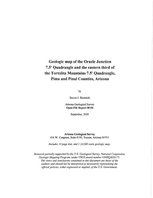
<strong>Geologic</strong> <strong>map</strong> <strong>of</strong> <strong>the</strong> <strong>Oracle</strong> <strong>Junction</strong><br />
<strong>7.5</strong>' Quadrangle and <strong>the</strong> eastern third <strong>of</strong><br />
<strong>the</strong> Tortolita Mountains <strong>7.5</strong>' Quadrangle,<br />
Pima and Pinal Counties, Arizona<br />
by<br />
Steven J. Skotnicki<br />
Arizona <strong>Geologic</strong>al Survey<br />
Open-File Report 00-04<br />
September, 2000<br />
Arizona <strong>Geologic</strong>al Survey<br />
416 W. Congress, Suite #100, Tucson, Arizona 85701<br />
Includes 19 page text, and 1:24,000 scale geologie <strong>map</strong>.<br />
Research partially supported by <strong>the</strong> u.s. <strong>Geologic</strong>al Survey, National Cooperative<br />
Geologie Mapping Program, under USGS award number # 99HQAG0171.<br />
The views and conclusions contained in this document are those <strong>of</strong> <strong>the</strong><br />
authors and should not be interpreted as necessarily representing <strong>the</strong><br />
<strong>of</strong>fiCial policies, ei<strong>the</strong>r expressed or implied, <strong>of</strong> <strong>the</strong> u.s. Government.
INTRODUCTION<br />
This study encompasses <strong>the</strong> whole <strong>of</strong> <strong>the</strong> <strong>Oracle</strong> <strong>Junction</strong> <strong>7.5</strong>' quadrangle and <strong>the</strong> eastern third <strong>of</strong> <strong>the</strong><br />
Tortolita Mountains <strong>7.5</strong>' quadrangle (see figure 1). Late Tertiary basin-fill deposits and younger Quaternary<br />
surficial deposits dominate most <strong>of</strong> <strong>the</strong> region and are well-exposed along <strong>the</strong> length <strong>of</strong> Oro Valley. The<br />
western third or so is underlain by a broad, flat pediment on <strong>the</strong> east side <strong>of</strong> <strong>the</strong> Tortolita Mountains. The<br />
pediment was etched into Proterozoic and Tertiary granitic rocks and is punctuated by more resistant hills <strong>of</strong><br />
Pinal Schist and an east-nor<strong>the</strong>ast-trending band <strong>of</strong> younger metasedimentary rocks. Middle and Late<br />
Pleistocene sandstones and conglomerates lap up onto <strong>the</strong> pediment. These deposits contain material eroded<br />
from <strong>the</strong> granitic rocks and show very little topographic relief relative to <strong>the</strong> pediment. As a result, in aerial<br />
photographs, and locally even from a short distance away (tens to hundreds <strong>of</strong> meters), <strong>the</strong>se deposits are<br />
nearly indistinguishable from <strong>the</strong> bedrock pediment.<br />
On <strong>the</strong> east side <strong>of</strong> <strong>the</strong> study area <strong>the</strong> early Pleistocene Cordones surface (McFadden, 1981) caps a<br />
sequence <strong>of</strong> at least two separate and distinct basin-fill deposits. Biosphere2 is built on this surface just<br />
outside <strong>the</strong> <strong>map</strong> area. A series <strong>of</strong> well-defined early to late Pleistocene and Holocene fluvial terraces is<br />
exposed along <strong>the</strong> Canada del Oro in <strong>the</strong> sou<strong>the</strong>ast comer <strong>of</strong> <strong>the</strong> region.<br />
Field work was carried out between November 1999 and January 2000. The surficial deposits were<br />
<strong>map</strong>ped by fieldwork and by using black-and-white aerial photographs, approximately 1:36,000 scale and<br />
dated 4-16-82 (USGS VFCHphotoset).<br />
PREVIOUS WORK<br />
H<strong>of</strong>finan (1963) analyzed <strong>the</strong> heavy-mineral distribution in sands shed <strong>of</strong>f <strong>the</strong> Tortolita Mountains<br />
pediment. Budden (1975) <strong>map</strong>ped <strong>the</strong> study area as part <strong>of</strong> a much larger study <strong>of</strong> <strong>the</strong> Tortolita-Santa<br />
Catalina Mountains complex. Dockter and Banks (1976) produced a <strong>map</strong> showing photo lineaments in <strong>the</strong><br />
Tortolita Mountains. Banks and o<strong>the</strong>rs (1977) produced a 1:62,500 scale geologic <strong>map</strong> <strong>of</strong> <strong>the</strong> Tortolita<br />
Mountains 15' quadrangle. Dickinson (1987 and 1991) created a genera11: 125,000 scale geologic <strong>map</strong> <strong>of</strong><br />
<strong>the</strong> Catalina core complex and <strong>the</strong> San Pedro Trough. McFadden (1981) studied <strong>the</strong> geomorphology <strong>of</strong> <strong>the</strong><br />
Canada del Oro Valley and described <strong>the</strong> different Quaternary terraces in <strong>the</strong> area.<br />
GEOLOGY<br />
Pinal Schist<br />
The Pinal Schist is <strong>the</strong> oldest rock exposed in <strong>the</strong> study area. It is dominantly quartz+ muscovite<br />
+biotite schist, though phyllite is common locally. Compositional banding is common and is defined by lightcolored<br />
leucocratic bands <strong>of</strong> mostly quartz and less abundant micas, and dark-colored me1anocratic bands<br />
containing quartz and abundant micas. Bands are commonly between 2-5mm thick. Compositional banding is<br />
best displayed in <strong>the</strong> hills north <strong>of</strong> Faraway Tank on <strong>the</strong> northwest side <strong>of</strong> <strong>the</strong> <strong>Oracle</strong> <strong>Junction</strong> quadrangle,<br />
where tight isoclinal folds are locally visible.<br />
The Pinal Schist is deformed by a strong, pervasive primary foliation (SI)' This foliation is very<br />
prominent and obvious in <strong>the</strong> hills north <strong>of</strong> Faraway Tank but becomes less distinct to <strong>the</strong> west. To <strong>the</strong> west<br />
<strong>the</strong> rock appears to contain more quartz, especially as white ptigmatic veins, and <strong>the</strong> rock is more contorted<br />
and folded on <strong>the</strong> centimeter to meter scale, ra<strong>the</strong>r than displaying a pervasive foliation. The primary<br />
foliation dips moderately to steeply to <strong>the</strong> northwest and strikes consistently to <strong>the</strong> nor<strong>the</strong>ast. However, north<br />
<strong>of</strong> Carpas Wash (near Falcon Divide) and on <strong>the</strong> north side <strong>of</strong> <strong>the</strong> Guild Wash Fault <strong>the</strong> primary foliation<br />
dips moderately to <strong>the</strong> nor<strong>the</strong>ast (except locally) and strikes variably to <strong>the</strong> northwest. It should be noted that<br />
where <strong>the</strong> primary foliation strikes northwest, nowhere was it cut by <strong>the</strong> secondary foliation. Because <strong>the</strong><br />
primary foliation in <strong>the</strong>se areas has an orientation similar to <strong>the</strong> secondary foliation far<strong>the</strong>r south and east, it<br />
is possible that <strong>the</strong> foliation measured in <strong>the</strong>se areas is really <strong>the</strong> secondary foliation.<br />
1
32 0<br />
45'<br />
32 0<br />
30'<br />
I<br />
111 0 00' 110 0 45'<br />
Figure 1. Location <strong>map</strong> for <strong>the</strong> <strong>Oracle</strong> <strong>Junction</strong> and eastern third <strong>of</strong> <strong>the</strong> Tortolita Mountains<br />
<strong>7.5</strong>' quadrangles.
Quaternary surticial deposits<br />
OY2 Oy<br />
OY1<br />
Oyl<br />
012<br />
0i1<br />
01<br />
Om2 Om<br />
Om1<br />
002<br />
001<br />
Tertiary deposits<br />
Tcy<br />
Tsg Tcg<br />
Tcp<br />
Tcb<br />
Tb<br />
Tri<br />
Tertiary granitic rocks<br />
Tgf<br />
Tgm<br />
Tg<br />
Tgc<br />
Paleozoic/Mesozoic rocks (?)<br />
Kc<br />
Pzm<br />
Cs<br />
Cq<br />
Middle Proterozoic rocks<br />
GJ<br />
GJ<br />
Early Proterozoic rocks<br />
GJ<br />
Figure 2. Correlation diagram for rocks in <strong>the</strong> <strong>Oracle</strong> <strong>Junction</strong> and eastern Tortolita Mountains quadrangles.<br />
4
granite must be younger than Paleozoic. Much <strong>of</strong> <strong>the</strong> pediment on <strong>the</strong> west side <strong>of</strong> <strong>the</strong> Santa Catalina<br />
Mountains south <strong>of</strong> <strong>the</strong> Mogul Fault (east <strong>of</strong> <strong>the</strong> study area) is coarse-grained, porphyritic Catalina Granite<br />
(DuBois, 1959, McCullough, 1963). It has been dated by several techniques at between about 21.1 and 29.1<br />
Ma (Keith et aI., 1980; Reynolds et aI., 1986). The band <strong>of</strong> coarse-grained granite surrounding <strong>the</strong><br />
metasedimentary rocks in <strong>the</strong> Tortolita Mountains may also be <strong>the</strong> Catalina Granite.<br />
Granites<br />
There are five major granitic intrusive rocks in <strong>the</strong> study area. The oldest is exposed in <strong>the</strong><br />
northwest. The o<strong>the</strong>r four are in close association in <strong>the</strong> same nor<strong>the</strong>ast-trending zone that includes <strong>the</strong><br />
enclaves <strong>of</strong> metasedimentary rocks. Just as <strong>the</strong> metasedimentary rocks formed enclaves and screens within<br />
what is probably <strong>the</strong> Catalina Granite (<strong>map</strong> unit Tgc), <strong>the</strong> Catalina Granite formed enclaves and screens<br />
within and between <strong>the</strong> medium- to coarse-grained granite (<strong>map</strong> unit Tg) and <strong>the</strong> mafic granitoid (<strong>map</strong> unit<br />
Tgm)-strangely in <strong>the</strong> same area. The Catalina Granite was engulfed, surrounded, and partially digested by<br />
<strong>the</strong> younger plutons. A medium-grained felsic granite intrudes <strong>the</strong> mafic granitoid in <strong>the</strong> south part <strong>of</strong> <strong>the</strong><br />
<strong>map</strong> area. All <strong>of</strong> <strong>the</strong> plutons in <strong>the</strong>'study area are foliated to some extent.<br />
Banks (1980) and Keith and o<strong>the</strong>rs (1980) recognized two distinct "phases" <strong>of</strong> granitic rocks on <strong>the</strong><br />
west side <strong>of</strong> <strong>the</strong> Santa Catalina Mountains and in <strong>the</strong> sou<strong>the</strong>rn part <strong>of</strong> <strong>the</strong> Tortolita mountains: (1) a coarsegrained,<br />
porphyritic, sphene- and hornblende-bearing biotite granite called "Catalina Granite", and (2) a<br />
finer-grained biotite granite called "Tortolita Granite" (Dickinson, 1991). These two granites have been<br />
interpreted as phases <strong>of</strong> a single composite pluton or batholith based on <strong>the</strong> concordance <strong>of</strong> inferred Rb-Sr<br />
isochron ages for both rocks and <strong>the</strong>ir concordance with a single U-Pb age (Dickinson, 1991). There is some<br />
confusion as to which rock various workers have called <strong>the</strong> "Tortolita Granite". In this report <strong>the</strong> term<br />
Tortolita Granite will be used for <strong>the</strong> mafic granitoid (<strong>map</strong> unit Tgm) exposed in <strong>the</strong> southwest part <strong>of</strong> <strong>the</strong><br />
study area. Whe<strong>the</strong>r or not <strong>the</strong> Catalina Granite and Tortolita Granite are phases <strong>of</strong> a single batholith, <strong>the</strong><br />
Tortolita Granite everywhere intrudes <strong>the</strong> Catalina Granite, both in <strong>the</strong> Tortolita Mountains and in <strong>the</strong> Santa<br />
Catalina Mountains. Additionally, <strong>the</strong> Tortolita Granite itself is intruded by a medium-grained felsic,<br />
equigranular granite (<strong>map</strong> unit Tgf). Contacts are sharp and <strong>the</strong> felsic granite commonly forms dikes and<br />
narrow sills in <strong>the</strong> Tortolita Granite. Is this felsic granite a phase <strong>of</strong> <strong>the</strong> Tortolita Granite? An apatite fissiontrack<br />
age (cooling age) <strong>of</strong> 17.00 ± 2.10 Ma (Creasey et aI., 1977), if <strong>the</strong>ir sample is from <strong>map</strong> unit Tgf,<br />
suggests that it may be appreciably younger. However, this conclusion should be taken with caution without<br />
comparable K-Ar age-dates.<br />
Coarse-grained granite (<strong>map</strong> unit Yg)<br />
The oldest pluton, a coarse-grained, K-feldspar porphyritic biotite granite (<strong>map</strong> unit Yg), is exposed<br />
in <strong>the</strong> northwest corner <strong>of</strong> <strong>the</strong> study area. Here it intrudes Pinal Schist on both <strong>the</strong> north and south sides <strong>of</strong><br />
<strong>the</strong> Guild Wash Fault. It is easily distinguished from <strong>the</strong> younger granites (except for Tgc) by <strong>the</strong> ubiquitous<br />
presence <strong>of</strong>large, 1-3 em-long K-feldspar phenocrysts and thin books <strong>of</strong> relatively fresh black biotite. It<br />
erodes readily and commonly forms low rounded hills covered with grussy regolith. On Falcon Divide it is<br />
intruded by dark green diabase that forms two small, irregularly shaped pods. Because <strong>the</strong> surface exposures<br />
are typically poor, fabrics within <strong>the</strong> granite were difficult to observe. In many areas where exposures were<br />
good, however, it is at least locally foliated. The foliation is mostly weak and is defined by alignment <strong>of</strong><br />
biotite phenocrysts. It is strongest in <strong>the</strong> southwest corner <strong>of</strong> section 4, T. 10 S., R. 13 E. where quartz is<br />
slightly elongated and feldspars are augen-shaped. The strike <strong>of</strong> <strong>the</strong> foliation is variable but is generally<br />
northwest-approximately parallel to <strong>the</strong> strike <strong>of</strong> <strong>the</strong> primary foliation in <strong>the</strong> nearby Pinal Schist.<br />
This granite is mineralogically and texturally similar to <strong>the</strong> suite <strong>of</strong> 1.4 Ga granite plutons in o<strong>the</strong>r<br />
parts <strong>of</strong> Arizona, and was assigned this age on that basis and also because it is intruded by diabase which in<br />
o<strong>the</strong>r parts <strong>of</strong> <strong>the</strong> state is middle to late Proterozoic in age (Shride, 1967; Reynolds et aI., 1986). On <strong>the</strong> far<br />
western edge <strong>of</strong> <strong>the</strong> <strong>map</strong> this granite is intruded by dikes(?) <strong>of</strong> fine- to medium-grained leucocratic granite,<br />
5
ut because exposures were so poor it was not <strong>map</strong>ped separately. The age <strong>of</strong> <strong>the</strong> leucocratic granite is<br />
uncertain. Banks and o<strong>the</strong>rs (1978) reported a K-Ar biotite age <strong>of</strong> 1438 ± 110 Ma for "Madera Diorite"<br />
exposed about 2 miles to <strong>the</strong> west <strong>of</strong> <strong>the</strong> northwest comer <strong>of</strong> <strong>the</strong> <strong>map</strong>. However, Banks and o<strong>the</strong>rs (1977)<br />
<strong>map</strong>ped a body <strong>of</strong> quartz diorite in approximately <strong>the</strong> same area. These units may be equivalent. Apparently,<br />
this body is intruded by <strong>the</strong> granite and its age may have been reduced by effects <strong>of</strong> <strong>the</strong> intrusion (Reynolds<br />
et aI., 1986).<br />
Catalina Granite (<strong>map</strong> unit Tgc)<br />
The next youngest granite (<strong>map</strong> unit Tgc) was originally <strong>map</strong>ped as equivalent to Yg because <strong>of</strong><br />
<strong>the</strong>ir mineralogical and textural similarity. Banks (1976) also called this pluton <strong>the</strong> Quartz Monzonite <strong>of</strong><br />
Samaniego Ridge. It forms an east-nor<strong>the</strong>ast trending band in <strong>the</strong> southwest comer <strong>of</strong><strong>the</strong> study area, where it<br />
intruded and partially metamorphosed a sequence <strong>of</strong>Paleozoic(?) sedimentary rocks. The metasedimentary<br />
rocks occur as lens-like enclaves from several meters across to hundreds <strong>of</strong> meters long. The granite is<br />
coarse-grained and K-feldspar porphyritic and is virtually indistinguishable from <strong>the</strong> older granite to <strong>the</strong><br />
north (<strong>map</strong> unit Yg). It was <strong>map</strong>ped separately on <strong>the</strong> assumption that <strong>the</strong> metasedimentary rocks are <strong>of</strong><br />
Apache Group age or younger, demanding that <strong>the</strong> granite must be younger still. Locally, this granite<br />
contains dark, biotite-rich inclusions (restite?). Where visible, <strong>the</strong>se inclusions are elongate parallel to <strong>the</strong><br />
local foliation direction and show that <strong>the</strong> granite was deformed while at least still partially molten. This will<br />
be discussed in more detail below in <strong>the</strong> Structure section <strong>of</strong> this report. The Catalina Granite has been dated<br />
by several techniques at between about 21.1 and 29.1 Ma (Keith et aI., 1980; Reynolds et aI., 1986).<br />
Coarse- to medium-grained granite (<strong>map</strong> unit Tg)<br />
The most voluminous plutonic rock is a coarse- to medium-grained granite underlying most <strong>of</strong> <strong>the</strong><br />
west-central part <strong>of</strong> <strong>the</strong> study area (<strong>map</strong> unit Tg). Its texture varies between coarse-grained K-feldspar<br />
porphyritic, to medium-grained nearly equigranular. This granite contains abundant biotite and minor<br />
amphibole, and because <strong>of</strong> this it is slightly darker than <strong>the</strong> o<strong>the</strong>r coarse-grained granites. The mafic minerals<br />
are commonly partially altered to chlorite and wea<strong>the</strong>red outcrops are typically slightly green-colored: A<br />
primary foliation is common, and is locally cut by kink-bands defming a second foliation. Most <strong>of</strong> <strong>the</strong><br />
exposures <strong>of</strong> this rock on <strong>the</strong> western margin <strong>of</strong> this <strong>map</strong> and beyond are permeated by abundant high-angle<br />
pegmatite dikes. Locally, <strong>the</strong> dikes consist <strong>of</strong> more than 60% <strong>of</strong> <strong>the</strong> exposures and nearly completely obscure<br />
<strong>the</strong> underlying granite. This granite with its varying texture is very similar to granites also <strong>map</strong>ped as unit Tg<br />
to <strong>the</strong> north in <strong>the</strong> Ninetysix Hills (Skotnicki, 1999). As <strong>map</strong>ped <strong>the</strong> sou<strong>the</strong>rn margin <strong>of</strong> this granite contains<br />
zones <strong>of</strong> schist and banded gneiss. The deformed rock occurs in a band up to 10-20 meters wide locally along<br />
<strong>the</strong> contact between Tg and Tgc. It is not clear if this rock is Pinal Schist or is strongly deformed Tg. North<br />
<strong>of</strong> Crow Windmill several finger-like bodies <strong>of</strong> granite appear to intrude southward across <strong>the</strong> trend <strong>of</strong> <strong>the</strong><br />
metasedimentary rocks. Parts <strong>of</strong> <strong>the</strong>se fingers look very much like <strong>the</strong> medium-grained mafic granitoid<br />
described below. They seem to grade into more normal Tg to <strong>the</strong> north. However, it is not clear which pluton<br />
<strong>the</strong>se zones belong to. Because <strong>the</strong>y are continuous with exposures to <strong>the</strong> north, <strong>the</strong>y were <strong>map</strong>ped as part <strong>of</strong><br />
Tg.<br />
Banks and o<strong>the</strong>rs (1978) called this rock <strong>the</strong> pluton <strong>of</strong> Chirreon Wash, or Chirreon Wash<br />
Granodiorite and reported a K-Ar biotite age <strong>of</strong>25.10 ± 0.50 Ma. Their sample, however, as reported in<br />
Reynolds and o<strong>the</strong>rs (1986), was taken from <strong>the</strong> west side <strong>of</strong> <strong>the</strong> divide at <strong>the</strong> head <strong>of</strong> Batamote Wash, two<br />
miles to <strong>the</strong> south <strong>of</strong> Chirreon Wash. Chirreon Wash is a minor east-flowing tributary to Big Wash that<br />
flows north to south on <strong>the</strong> east side <strong>of</strong> <strong>the</strong> Tortolita Mountains. Hence, <strong>the</strong> name Chirreon Wash<br />
Granodiorite is not very useful because <strong>the</strong> type locality is barely within <strong>the</strong> pluton, and not along Chirreon<br />
Wash. Dickinson collectively called this rock part <strong>of</strong> <strong>the</strong> Wilderness Canyon suite. Keith and o<strong>the</strong>rs (1980)<br />
named <strong>the</strong> pluton <strong>the</strong> Derrio Canyon Granodiorite. The name Granite <strong>of</strong>Derrio Canyon is preferable because<br />
Derrio Canyon is a major west-flowing drainage that slices though most <strong>of</strong> <strong>the</strong> pluton and affords good<br />
6
exposures <strong>of</strong> <strong>the</strong> rock. Also, without a more extensive analysis it is uncertain whe<strong>the</strong>r this rock is a granite or<br />
granodiorite.<br />
Banks and o<strong>the</strong>rs (1978) reported a K-Ar biotite age <strong>of</strong>24.0 ± 0.50 Ma on an unfoliated "quartz<br />
monzonite" dike apparently cutting this rock. Their sample was taken from near Bass Spring about 1 mile<br />
west <strong>of</strong> <strong>the</strong> <strong>map</strong> area.<br />
Mafic granitoid (<strong>map</strong> unit Tgm)-"Tortolita Granite"<br />
In <strong>the</strong> southwest comer <strong>of</strong> <strong>the</strong> study area a fine- to medium-grained mafic granitoid (<strong>map</strong> unit Tgm)<br />
cross-cuts Tgc, Tg, and <strong>the</strong> metasedimentary rocks. Locally this granite contains stringy inclusions <strong>of</strong>Tgc. A<br />
slightly more mafic phase containing abundant hornblende is only locally distinguishable from <strong>the</strong> less mafic<br />
phase containing mostly biotite. The hornblende-rich phase contains <strong>the</strong> Tgc inclusions, and both <strong>the</strong> host<br />
rock and <strong>the</strong> inclusions are cross-cut by <strong>the</strong> biotite-rich phase. Locally, <strong>the</strong> attitude <strong>of</strong> <strong>the</strong> Tgc inclusions was<br />
measured and labeled on <strong>the</strong> <strong>map</strong>. Foliation is weak in <strong>the</strong> mafic granitoid and was not visible in most areas.<br />
This granitoid appears to extend far to <strong>the</strong> southwest into <strong>the</strong> Tortolita Mountains.<br />
As with <strong>the</strong> name "Catalina Granite", <strong>the</strong>re has been some confusion as to which rocks workers have<br />
assigned <strong>the</strong> name "Tortolita Granite". Keith and o<strong>the</strong>rs (1980) cite an unpublished manuscript by Moore<br />
and Tolman (date uncertain but may be 1939, 1941, or 1949) who used <strong>the</strong> term Tortolita Granite. The copy<br />
<strong>of</strong> <strong>the</strong> report at <strong>the</strong> Arizona <strong>Geologic</strong>al Survey is almost illegible. It mentions <strong>the</strong> term Tortolita Granite only<br />
in <strong>the</strong> report, but on <strong>the</strong> <strong>map</strong> <strong>the</strong> label Tcg (=Catalina Granite) is used for <strong>the</strong> granite in <strong>the</strong> Tortolita<br />
Mountains exposed in <strong>the</strong> northwest comer <strong>of</strong> <strong>the</strong> Tucson 15' <strong>map</strong>. McCullough (1963) used <strong>the</strong> name<br />
Cargadero Canyon Granite. Budden (1975) used <strong>the</strong> term Tortolita Granodiorite. Banks (1976) used <strong>the</strong><br />
name Quartz Monzonite <strong>of</strong> Tortolita Mountains for rocks at<strong>the</strong> far sou<strong>the</strong>ast end <strong>of</strong> <strong>the</strong> Tortolita Mountains,<br />
and may really be equivalent to <strong>map</strong> unit Tgfin this study. Since it is not clear whe<strong>the</strong>r or not <strong>the</strong>re workers<br />
were referring to <strong>the</strong> same rock or not,in this report <strong>the</strong> term Tortolita Granite is used only for <strong>the</strong> mafic<br />
granitoid (<strong>map</strong> unit Tgm) which is exposed in <strong>the</strong> sou<strong>the</strong>ast part <strong>of</strong> <strong>the</strong> <strong>map</strong> area and <strong>the</strong> sou<strong>the</strong>rn part <strong>of</strong> <strong>the</strong><br />
Tortolita Mountains. It should be noted that previous <strong>map</strong>pers did not distinguish between <strong>the</strong> felsic granite<br />
(<strong>map</strong> unit Tgf) and <strong>the</strong> mafic granitoid, so <strong>the</strong> term as used in <strong>the</strong> past may refer to both collectively.<br />
Medium-grained felsic granite (<strong>map</strong> unit Tgf)<br />
The youngest granite body is a medium-grained, equigranular felsic granite. It forms a large, lightcolored<br />
mass in <strong>the</strong> southwest comer <strong>of</strong> <strong>the</strong> <strong>Oracle</strong> <strong>Junction</strong> quadrangle where it intrudes <strong>the</strong> mafic granitoid.<br />
Abundant dikes <strong>of</strong> this granite cross-cut Tgm. In most areas a weak to moderate foliation is visible, defined<br />
by alignment <strong>of</strong> biotite phenocrysts. The granite is cut by leucocratic dikes and light gray aplite dikes. South<br />
<strong>of</strong> Chalk Reservoir, at <strong>the</strong> easternmost exposures, <strong>the</strong> granite and <strong>the</strong> dikes are pervasively fractured and<br />
microbrecciated. Creasey and o<strong>the</strong>rs (1977) reported and an apatite fission-track age <strong>of</strong> 17.00 ± 2.10 Ma for<br />
a "quartz monzonite" located about 3 miles south <strong>of</strong> Chalk Reservoir, in <strong>the</strong> Oro Valley quadrangle. This<br />
locality was not visited during this study but from a distance <strong>the</strong> rock resembles Tgf. This reported age is a<br />
cooling age and is probably younger than <strong>the</strong> age <strong>of</strong> crystallization.<br />
Dikes<br />
At least five different types <strong>of</strong> dikes cut across older rocks in <strong>the</strong> <strong>map</strong> area. A few small, rare, dikes<br />
<strong>of</strong> vein quartz intrude both Yg and Tg. They are fractured and contain some fine-grained hematite on fracture<br />
surfaces but show no o<strong>the</strong>r obvious mineralization. The dikes immediately to <strong>the</strong> west <strong>of</strong> Crescent Tank in<br />
section 34, T. 9 S., R. 13 E. have coarse graphic margins containing long, rod-shaped crystals <strong>of</strong>light gray<br />
K-feldspar and gray quartz. These dikes are not in contact with any <strong>of</strong> <strong>the</strong> o<strong>the</strong>r dikes so <strong>the</strong>ir relative age is<br />
uncertain, but because <strong>of</strong> <strong>the</strong> graphic margins it is likely <strong>the</strong>y intruded shortly after or during <strong>the</strong> late stages<br />
<strong>of</strong> crystallization <strong>of</strong> <strong>the</strong> two plutons.<br />
Probably <strong>the</strong> next oldest dikes are <strong>the</strong> leucocratic granite dikes. These dikes are probably related to<br />
intrusion <strong>of</strong> <strong>the</strong> medium-grained felsic granite (Tgf) as <strong>the</strong>y have similar mineralogy and texture. Many <strong>of</strong><br />
7
Santa Catalina Mountains is cut by <strong>the</strong> basin-bounding Pirate Fault but <strong>the</strong> overlying conglomerate with<br />
diverse clasts is not. The similarity between <strong>the</strong> sequences suggests that <strong>the</strong> entire basin between <strong>the</strong> Santa<br />
Catalina Mountains and <strong>the</strong> Tortolita Mountains may be underlain by <strong>the</strong> same succession <strong>of</strong> units. The<br />
hanging wall <strong>of</strong> <strong>the</strong> Pirate Fault at depth may contain volcanic rocks as well.<br />
The similar sequence <strong>of</strong> at least <strong>the</strong> upper two conglomerates along <strong>the</strong> Pirate and Guild Wash<br />
Faults suggests a similar mode <strong>of</strong> formation. The very poorly sorted, nonbedded and monolithic nature <strong>of</strong> <strong>the</strong><br />
lower granite-rich conglomerate suggests it was deposited as avalanche debris flows close to a source<br />
composed only <strong>of</strong> exposed granite. Both areas have sources exposed today on <strong>the</strong> opposite side <strong>of</strong> <strong>the</strong> faults.<br />
It seems likely, <strong>the</strong>refore, that rapid movement and vertical <strong>of</strong>fset on <strong>the</strong> Pirate and Guild Wash Faults<br />
produced high topographic scarps that shed material via mass movement. Conversely, <strong>the</strong> uppermost<br />
conglomerate is unfaulted and composed <strong>of</strong> moderately sorted, clast-supported fluvial sandstones and<br />
conglomerates containing.many diverse lithologies. These deposits were deposited after faulting had ceased<br />
and subsequent deposition reflected slower erosion <strong>of</strong> <strong>the</strong> topographically more subdued hanging walls. The<br />
fact that <strong>the</strong> contact (where visible) between <strong>the</strong> two conglomerate units is so sharp suggests ei<strong>the</strong>r that <strong>the</strong>re<br />
is an erosion surface separating <strong>the</strong> two, or that <strong>the</strong> gradational part is buried, possibly in lower structural<br />
levels <strong>of</strong> a fanning-dip sequence.<br />
QUATERNARY GEOMORPHOLOGY<br />
The marked lithologic contrast between <strong>the</strong>. older, faulted granitic conglomerate and <strong>the</strong> younger,<br />
unfaulted polylithic conglomerate suggests a change from relatively rapid erosion <strong>of</strong> steep,. active fault scarps<br />
to less energetic, more widespread alluvial-fan deposition. The change was heralded by <strong>the</strong> cessation <strong>of</strong><br />
faulting along <strong>the</strong> Pirate and Guild Wash Faults. The younger, unfaulted conglomerate (<strong>map</strong> unit Tcy)<br />
grades upward into <strong>the</strong>· oldest geomorphic surface in <strong>the</strong> area, <strong>the</strong> Cordones surface. Based on<strong>the</strong><br />
magnetostratigraphy <strong>of</strong> a similar sedimentary sequence in <strong>the</strong> Sonoita Creek Basin (Menges and McFadden,<br />
1981) <strong>map</strong> unit Tcy was probably deposited between about 6 to 3 Ma.<br />
Erosionalpediments2-4km-wide are etched into granitic rocks on both sides· <strong>of</strong> <strong>the</strong> valley. Within<br />
<strong>the</strong> <strong>map</strong> area, only <strong>the</strong> pediment on <strong>the</strong> eastern side <strong>of</strong> <strong>the</strong> Tortolita Mountains is exposed. In <strong>the</strong> northwest<br />
part <strong>of</strong> <strong>the</strong> study area <strong>the</strong> Tortolita pediment appears to be overlain by <strong>the</strong> younger conglomerate (<strong>map</strong> unit<br />
Tcy). Pediments can only form during periods <strong>of</strong>tectonic quiescence when <strong>the</strong>re is relatively little<br />
downcutting. Therefore, <strong>the</strong> pediment here developed after faulting ceased and probably over a considerable<br />
amount <strong>of</strong> time (at least 2-5 m.y. according to Menges and McFadden, 1981). If <strong>the</strong> pediment was already<br />
formed prior to younger basin-fill deposition <strong>the</strong>n it already existed prior to sometime between 6 to 3 Ma.<br />
Most <strong>of</strong> <strong>the</strong> pediment to <strong>the</strong> south is overlain by middle Pleistocene alluvial surfaces (<strong>map</strong> unit Qm). From a<br />
distance <strong>the</strong>se deposits are nearly indistinguishable from <strong>the</strong> granitic rocks. Basin-fill conglomerates may<br />
have once existed on <strong>the</strong> sou<strong>the</strong>rn pediment but were subsequently removed prior to <strong>the</strong> middle Pleistocene.<br />
The oldest geomorphic surface in <strong>the</strong> area, <strong>the</strong> Cordones surface, is exposed as a high, dissected<br />
plateau in <strong>the</strong> sou<strong>the</strong>ast part <strong>of</strong> <strong>the</strong> study area. It is defined by a mature soil horizon 1-3 meters thick and a<br />
ra<strong>the</strong>r flat, though deeply dissected, constructional surface. Where exposed, <strong>the</strong> most obvious feature <strong>of</strong> <strong>the</strong><br />
soil horizon is a thick accumulation <strong>of</strong> calcium carbonate, up to 2 meters thick locally and commonly<br />
forming wavy laminae. On <strong>the</strong> upper reaches <strong>of</strong> <strong>the</strong> surface a dark red-brown argillic horizon is exposed at<br />
<strong>the</strong> surface. Far<strong>the</strong>r down, however, erosion has removed most <strong>of</strong> <strong>the</strong> argillic horizon and <strong>the</strong> carbonate<br />
horizon is exposed. This distinction can be seen on aerial photos where <strong>the</strong> argillic zones appear dark-colored<br />
and <strong>the</strong> carbonate zones appear light-colored. Apart from <strong>the</strong> soil accumulation, <strong>the</strong> Cordones surface itself<br />
is sedimentologically indistinct from <strong>the</strong> underlying basin-fill deposits. Map unit Tcy appears to grade<br />
upward without break into <strong>the</strong> soil horizon. McFadden (1981) observed that <strong>the</strong> Cordones surface contains<br />
some large boulders 2-3 meters across. Good exposures <strong>of</strong> <strong>map</strong> unit Tcy are rare but towards <strong>the</strong> eastern<br />
part <strong>of</strong> <strong>the</strong> study area similarly large boulders appear to be wea<strong>the</strong>ring out <strong>of</strong> <strong>the</strong> conglomerate as well.<br />
9
Unfortunately, a mantle <strong>of</strong> loose rubble and dark, clay-rich soil blankets and obscures almost all <strong>of</strong> <strong>the</strong><br />
exposures <strong>of</strong> <strong>the</strong> basin-fill conglomerate. Rare exposures can be found in road cuts and a few stream cuts.<br />
Because <strong>of</strong> <strong>the</strong> poor exposures interpretations should be taken with some caution.<br />
As McFadden (1981) pointed out, even though <strong>the</strong> drainage basin <strong>of</strong> Big Wash, <strong>the</strong> main axial<br />
drainage, is greater than that <strong>of</strong> Canada del Oro, <strong>the</strong> Canada del Oro drains <strong>the</strong> steep western front <strong>of</strong> <strong>the</strong><br />
high-standing Santa Catalina Mountains. Because more moisture accumulates on <strong>the</strong> high mountain range<br />
<strong>the</strong> Canada del Oro is supplied with much more run<strong>of</strong>f. Probably because <strong>of</strong> this <strong>the</strong> Quaternary stream<br />
terraces along Canada del Oro are wider and better developed than those along Grand Wash.<br />
McFadden (1981) described and named six distinct terrace levels along <strong>the</strong> Canada del Oro. He<br />
noted <strong>the</strong> general correlation between increasing clay content, thickness <strong>of</strong> <strong>the</strong> argillic horizon, and<br />
progressively redder soil color, with progressively older soils. In general, older soils show increasing<br />
accumulation <strong>of</strong> clay and calcium carbonate. He observed, however, that although <strong>the</strong> early Pleistocene<br />
Cordones surface contains very abundant carbonate, <strong>the</strong> next younger middle and late Pleistocene soils<br />
contained almost no carbonate. His interpretation was that <strong>the</strong> soil formation and carbonate accumulation<br />
was not only a function <strong>of</strong> age but <strong>of</strong> climatic change. During <strong>the</strong> middle and late Pleistocene infiltration and<br />
leaching rates were higher than <strong>the</strong>y were in <strong>the</strong> early Pleistocene, possibly due to increased precipitation,<br />
and less carbonate accumulated. During this study, eight distinct stream terrace levels were <strong>map</strong>ped along<br />
Canada del Oro. They formed in response to renewed downcutting, probably in response to climatic changes<br />
during <strong>the</strong> Pleistocene.<br />
STRUCTURE<br />
The Guild Wash Fault strikes nor<strong>the</strong>ast along <strong>the</strong> north side <strong>of</strong> <strong>the</strong> Tortolita Mountains. It<br />
downdrops Tertiary sedimentary and volcanic rocks, and middle Proterozoic granite on <strong>the</strong> north against<br />
Tertiary granite (<strong>map</strong> unit Tg), middle Proterozoic granite, and early Proterozoic Pinal Schist on <strong>the</strong> south.<br />
The attitude <strong>of</strong> <strong>the</strong> fault was not visible, but <strong>the</strong> steep, north-sloping edge <strong>of</strong> <strong>the</strong> Tortolita Mountains<br />
suggests it is a normal fault. As described above, <strong>the</strong> fault was active up through deposition <strong>of</strong> <strong>the</strong> older<br />
granitic conglomerate (<strong>map</strong> unit Tcg) but is overlain by unfaulted younger conglomerate (<strong>map</strong> unit Tcy). The<br />
basalt north <strong>of</strong> <strong>the</strong> fault is generally extensively altered. All mafic minerals are altered to red opaques and<br />
locally <strong>the</strong> rock has been extensively silicified. In thin-section, <strong>the</strong> cavities in what was once very porous<br />
basalt have been filled with granular microcrystalline chert <strong>of</strong> at least two generations. Locally <strong>the</strong> rock is<br />
rusty brown-colored and fractures easily.<br />
An east-dipping normal fault strikes northwest across <strong>the</strong> eastern Tortolita Mountains where it<br />
intersects <strong>the</strong> Guild Wash Fault. Unfortunately, Holocene deposits bury <strong>the</strong> intersection itself, so it is not<br />
clear which fault is older. Slight apparent <strong>of</strong>fset in <strong>the</strong> Guild Wash Fault suggests it is older but variation in<br />
<strong>the</strong> strike may cause <strong>the</strong> same effect. O<strong>the</strong>r northwest-striking normal faults are locally visible but identifying<br />
faults within granite is difficult, and thus <strong>the</strong>y may be more extensive than shown.<br />
South <strong>of</strong> Chalk Reservoir, at <strong>the</strong> sou<strong>the</strong>astern-most exposures <strong>of</strong> <strong>the</strong> pediment, <strong>the</strong> felsic granite<br />
(<strong>map</strong> unit Tgf) and intruding dikes (not shown) are pervasively fractured and microbrecciated. This fabric<br />
suggests <strong>the</strong>re may be a larger structure buried immediately to <strong>the</strong> east <strong>of</strong> <strong>the</strong>se exposures. Maybe <strong>the</strong><br />
Tortolita detachment fault forms a reentrant along <strong>the</strong> east side <strong>of</strong> <strong>the</strong> range. McFadden (1981) suggested<br />
that <strong>the</strong> Canada del Oro Valley is a graben formed by <strong>the</strong> Pirate Fault bounding <strong>the</strong> Santa Catalina<br />
Mountains and ano<strong>the</strong>r fault bounding <strong>the</strong> east side <strong>of</strong> <strong>the</strong> Tortolita Mountains. If a graben exists <strong>the</strong>n<br />
displacement along <strong>the</strong> Pirate Fault apparently was much greater than that along <strong>the</strong> fault to <strong>the</strong> west, owing<br />
to <strong>the</strong> enormous amount <strong>of</strong> relief between <strong>the</strong> Tortolita and Santa Catalina Mountains. This one-sided graben<br />
makes more sense if <strong>the</strong> Tortolita Mountains rotated as one block down along <strong>the</strong> Pirate Fault, ra<strong>the</strong>r than<br />
<strong>the</strong> Tortolita Mountains being a horst and <strong>the</strong> valley a graben.<br />
The strike <strong>of</strong> <strong>the</strong> primary foliation (S1) in <strong>the</strong> Pinal Schist shows an interesting pattern. South <strong>of</strong> <strong>the</strong><br />
Guild Wash Fault it strikes consistently to <strong>the</strong> nor<strong>the</strong>ast, and dips moderately to steeply to <strong>the</strong> northwest.<br />
North <strong>of</strong> <strong>the</strong> fault, however, it strikes almost at right angles to this to <strong>the</strong> northwest. The reason is unclear.<br />
10
The secondary foliation (S2) strikes ra<strong>the</strong>r consistently north-northwest and dips moderately to steeply to <strong>the</strong><br />
east-nor<strong>the</strong>ast. Locally, it forms a pervasive, weak crenulation, but in most areas it forms beautiful kinkbands<br />
showing right-lateral movement. Lineation in both SI and S2 are defmed by mineral alignment and<br />
elongation.<br />
All <strong>of</strong> <strong>the</strong> plutonic rocks in <strong>the</strong> study area are at least locally foliated. Interestingly, <strong>the</strong> attitude <strong>of</strong><br />
<strong>the</strong> foliations (both SI and S2) mimic those in <strong>the</strong> Pinal Schist and younger metamorphic rocks. In <strong>the</strong> north<br />
SI in <strong>map</strong> unit Tg strikes nor<strong>the</strong>ast as it does in <strong>the</strong> Pinal Schist. North <strong>of</strong> <strong>the</strong> Guild Wash Fault SI in <strong>map</strong><br />
unit Y g strikes northwest but is parallel to SI in <strong>the</strong> Pinal Schist (<strong>map</strong> unit Tcp). To <strong>the</strong> south <strong>the</strong> strike <strong>of</strong> <strong>the</strong><br />
foliation in <strong>the</strong> granitic rocks shifts to <strong>the</strong> northwest. In <strong>the</strong> same area foliation in <strong>the</strong> enclaves <strong>of</strong><br />
metamorphic rocks also strikes in <strong>the</strong> same direction.<br />
The concordance <strong>of</strong> foliation between younger and older rocks suggests foliation was developed after<br />
intrusion <strong>of</strong> <strong>the</strong> youngest plutons. However, <strong>the</strong> early Proterozoic age <strong>of</strong> <strong>the</strong> Pinal Schist and its highly<br />
deformed character throughout o<strong>the</strong>r parts <strong>of</strong> <strong>the</strong> state suggests that, here too, <strong>the</strong> Pinal Schist was deformed<br />
in <strong>the</strong> middle Proterozoic. That conclusion may be incorrect. Compositional banding defining SI in <strong>the</strong> Pinal<br />
Schist is well defined and deformed locally by minor isoclinal folding. If a second, much later generation <strong>of</strong><br />
foliation deformed <strong>the</strong> rock it is likely that it would not exactly parallel <strong>the</strong> first episode and <strong>the</strong>re should be<br />
some evidence for it. If <strong>the</strong> second generation <strong>of</strong> foliation was strong enough to obliterate <strong>the</strong> previous<br />
generation, <strong>the</strong>n <strong>the</strong> granitic rocks should be much more strongly deformed than <strong>the</strong>y are.<br />
O<strong>the</strong>r evidence indicates that deformation occurred both during and after intrusion <strong>of</strong> at least one <strong>of</strong><br />
<strong>the</strong> plutons. The Catalina Granite (<strong>map</strong> unit Tgc) locally contains mafic inclusions. Where visible, <strong>the</strong>se<br />
inclusions are elongate parallel to <strong>the</strong> local foliation direction, but <strong>the</strong> amount <strong>of</strong> <strong>the</strong>ir elongation is clearly<br />
much greater than that required to create <strong>the</strong> foliation. Fur<strong>the</strong>r evidence for this can be seen in weakly<br />
foliated zones that grade into zones showing no visible foliation, yet <strong>the</strong> inclusions display <strong>the</strong> same<br />
elongation in <strong>the</strong> same direction. The elongation suggests <strong>the</strong> inclusions were deformed and aligned while <strong>the</strong><br />
pluton was still partially molten. Since <strong>the</strong> elongate inclusions are parallel to <strong>the</strong> plane <strong>of</strong> foliation, <strong>the</strong><br />
granite probably intruded an area that was undergoing differential stress and being actively deformed.<br />
Foliation in <strong>the</strong> older metasedimentary enclaves within <strong>the</strong> Catalina Granite is also parallel to foliation in <strong>the</strong><br />
Catalina Granite.<br />
Since <strong>the</strong> Catalina Granite is <strong>the</strong> oldest <strong>of</strong> <strong>the</strong> four Tertiary plutons exposed in <strong>the</strong> study area,<br />
deformation ei<strong>the</strong>r ceased after its intrusion and resumed after <strong>the</strong> youngest pluton had intruded (<strong>map</strong> unit<br />
Tgf), or deformation was continuous over <strong>the</strong> entire time period <strong>of</strong> intrusion <strong>of</strong> <strong>the</strong> plutons.<br />
MINERALIZATION<br />
Very little mineralization was seen. A few small, widely separated pits were dug into granite (<strong>map</strong><br />
unit Tg) and showed fractures coated with minor amounts <strong>of</strong> chrysocolla and malachite.<br />
REFERENCES CITED<br />
Banks, N.G., 1976, Reconnaissance geologic <strong>map</strong> <strong>of</strong> <strong>the</strong> Mount Lemmon quadrangle, Arizona: U.S.<br />
<strong>Geologic</strong>al Survey Miscellaneous Field Studies Map MF-747, 1 sheet, scale 1:62,500.<br />
Banks, N.G., 1980, Geology <strong>of</strong> a zone <strong>of</strong> metamorphic core complexes in sou<strong>the</strong>astern Arizona, in<br />
Crittenden, M.D., Jr., Coney, PJ., and Davis, G.H., eds. Cordilleran metamorphic core complexes:<br />
<strong>Geologic</strong>al Society <strong>of</strong> America Memoir 153, p. 177-215.<br />
Banks, N.G., Dockter, R.D., Briskey, lA., Davis, G.H., Keith, S.B., Budden, R.T., Kiven, C.W., and<br />
Anderson, Phillip, 1977, Reconnaissance geologic <strong>map</strong> <strong>of</strong> <strong>the</strong> Tortolita Mountains quadrangle,<br />
Arizona: U.S. <strong>Geologic</strong>al Survey Miscellaneous Field Studies Map MF-864, 1 sheet, scale 1:62,500.<br />
Banks, N.G., McKee, E.H., Keith, S.B., Shafiqullah, M., and Damon, P.E., 1978, Radiometric and chemical<br />
data for rocks <strong>of</strong> <strong>the</strong> Tortolita Mountains 15' quadrangle, Pima County, Arizona: IsochroniWest, no.<br />
22, p. 17-22.<br />
11
Budden, RT., 1975, The Tortolita-Santa Catalina Mountain complex: Tucson, University <strong>of</strong> Arizona, M.S.<br />
<strong>the</strong>sis, 133 p., 5 sheets, scale 1:62,500.<br />
Creasey, S.C., Banks, N.G., Ashley, RP., and Theodore, T.G., 1977, Middle tertiary plutonism in <strong>the</strong> Santa<br />
Catalina and Tortolita Mountains, Arizona: U.S. <strong>Geologic</strong>al Survey Journal <strong>of</strong> Research, v. 5, p. 705-<br />
717.<br />
Damon, P.E., Erickson, RC., and Livingston, D.E., 1963, K-Ar dating <strong>of</strong> Basin and Range uplift, Catalina<br />
Mountains, Arizona, in Nuclear Physics: National Academy <strong>of</strong> Sciences, National research Council<br />
Publication 1075, p. 113-121.<br />
Damon, P.E., Shafiqullah, M., Harris, RC., and Spencer, J.E., 1996, Compilation <strong>of</strong> unpublished Arizona<br />
K-Ar dates from <strong>the</strong> University <strong>of</strong> Arizona Laboratory <strong>of</strong>Isotope Geochemistry, 1971-1991: Arizona<br />
<strong>Geologic</strong>al Survey Open-File Report 96-18,56 p.<br />
Dickinson, W.R, 1987, General geologic <strong>map</strong> <strong>of</strong> <strong>the</strong> Catalina core complex and San Pedro Trough, Arizona:<br />
Arizona Bureau <strong>of</strong> Geology and Mineral Technology Miscellaneous Map MM-87-A, 18 p., 15 sheets,<br />
scale 1:62,500 [superceded by Dickinson, W.R, 1992, Arizona <strong>Geologic</strong>al Survey Contributed Map<br />
CM-92-C].<br />
Dickinson, W.R, 1991, Tectonic setting <strong>of</strong> faulted Tertiary strata associated with <strong>the</strong> Catalina core complex<br />
in sou<strong>the</strong>rn Arizona: <strong>Geologic</strong>al Society <strong>of</strong> America Special Paper 264.<br />
Dockter, RD., and Banks, N.G., 1976, Map showing photo lineaments in <strong>the</strong> Tortolita Mountains<br />
quadrangle, Arizona: U.S. <strong>Geologic</strong>al Survey Open-File Report 77-0152, 1 sheet, scale 1:62,500.<br />
DuBois, RL., 1959, Geology <strong>of</strong> <strong>the</strong> Santa Catalina Mountains, in Heindl, L.A, ed., Sou<strong>the</strong>rn Arizona<br />
Guidebook II, combined with <strong>the</strong> 2 nd annual Arizona geological Society Digest: Arizona geological<br />
Society, p. 106-116.<br />
Force, E.R, 1997, Geology and mineral resources <strong>of</strong><strong>the</strong> Santa Catalina Mountains, sou<strong>the</strong>astern Arizona:<br />
Monographs in Mineral Resource Science No.1, Center for Mineral Resources, Tucson, Arizona.<br />
Keith, S.B., Reynolds, SJ., Damon, P.E., Shafiqullah, Muhammad, Livingston, D.E., and Pushkar, P.D.,<br />
1980, Evidence for multiple intrusion and deformation within <strong>the</strong> Santa Catalina-Rincon-Tortolita<br />
crystalline complex, sou<strong>the</strong>astern Arizona, in Crittenden, M,D., Coney, PJ, and Davis G.H., eds.,<br />
Cordilleran metamorphic core complexes: <strong>Geologic</strong>al Society <strong>of</strong> America Memoir l53,p. 217-267.<br />
McCullough, EJ., 1963, A structural study <strong>of</strong> <strong>the</strong> Pusch Ridge-Romero Canyon area, Santa Catalina<br />
mountains, Arizona: Tucson, University <strong>of</strong> Arizona, unpub. Ph.D. dissert., 67 p.<br />
McFadden, L.D., 1981, Quaternary evolution <strong>of</strong> <strong>the</strong> Canada del Oro Valley, sou<strong>the</strong>astern Arizona: Arizona<br />
<strong>Geologic</strong>al Society Digest 13, p. 13-19.<br />
Menges, C.M., and McFadden, L.D., 1981, evidence for latest Miocene to Pliocene transition from Basin<br />
Range tectonic to post-tectonic landscape evolution in sou<strong>the</strong>astern Arizona: Arizona <strong>Geologic</strong>al<br />
Society Digest 13, p. 151-160.<br />
Reynolds, SJ., Florence, F.P., Welty, J.W., Roddy, M.S., Currier, D.A, Anderson, AV., Keith, S.B., 1986,<br />
Compilation <strong>of</strong> radiometric age determinations in Arizona: Arizona <strong>Geologic</strong>al Survey Bulletin 197,<br />
258 p.<br />
Shride, AF., 1967, Younger Precambrian in sou<strong>the</strong>rn Arizona: U.S. <strong>Geologic</strong>al Survey Pr<strong>of</strong>essional Paper<br />
566,89 p.<br />
Skotnicki, SJ., 1999, <strong>Geologic</strong> <strong>map</strong> <strong>of</strong> <strong>the</strong> Ninetysix Hills, Pinal County, Arizona: Arizona <strong>Geologic</strong>al<br />
Survey Open-File Report 99-20, scale 1:24,000,4 sheets, with text.<br />
Spencer, J.E., Richard, S.M., and Ferguson, C.A, 2000, <strong>Geologic</strong> <strong>map</strong> and report for <strong>the</strong> <strong>Oracle</strong> <strong>7.5</strong>'<br />
quadrangle, Pinal and Pima Counties, Arizona: Arizona <strong>Geologic</strong>al Survey Open-File Report 00-05,<br />
scale 1:24,000.<br />
12
UNIT DESCRIPTIONS<br />
FOR THE ORACLE JUNCTION QUADRANGLE<br />
<strong>AZGS</strong> OFR-00-04<br />
Quaternary Surficial Deposits<br />
d disturbed by human activity (Modern). Thoroughly disturbed areas where human modifications <strong>of</strong><br />
<strong>the</strong> landscape have obscured <strong>the</strong> geology.<br />
QY2 Modern alluvium « 100 yr). Unconsolidated sand and gravel in active stream channels. Deposits<br />
consist <strong>of</strong> stratified, poorly to moderate sorted sand, gravel, pebbles, cobbles, and boulders. These<br />
deposits are highly porous and permeable. Soils are generally absent.<br />
QYl Holocene alluvial deposits (>100 yr and < 10 ka). Unconsolidated sand to small boulders reaching<br />
sizes up to 25 cm in diameter upstream but smaller and fewer downstream. Larger clasts are<br />
metamorphic rocks and medium-grained granites. Smaller clasts are subangular fragments and<br />
crystals derived from wea<strong>the</strong>red granitoids. QYl deposits are characterized by stratified, poorly to<br />
moderately sorted sand, gravel, and cobbles frequently mantled by sandy loam sediment. On this<br />
surface <strong>the</strong> main channel commonly diverges into braided channels. Locally exhibits bar and swale<br />
topography, <strong>the</strong> bars being typically more vegetated. Soil development is relatively weak with only<br />
slight texturally or structurally modified B horizons and slight calcification (Stage I). Some <strong>of</strong> <strong>the</strong><br />
older QYl soils may contain weakly developed argillic horizons. Because surface soils are not<br />
indurated with clay or calcium carbonate, <strong>the</strong>se surfaces have relatively high permeability and<br />
porosity.<br />
Qy Holocene alluvial deposits, undivided « 10 ka).<br />
Qyl Late Pleistocene to Holocene alluvial deposits, undivided.<br />
Qh Late Pleistocene alluvial deposits, younger member (10 to 130 ka). The top 30-40 cm is tan,<br />
thinly bedded, coarse and fine sand and less silt. Below is a dark brown (organic?) zone 50-80 cm<br />
thick, gradational at <strong>the</strong> bottom, containing sandy grus and abundant roots and root clasts. Below<br />
this, layers <strong>of</strong> moderately to poorly consolidated tan sand contain minor sub angular to rounded<br />
pebbles and minor red clay. No carbonate is visible. Grass and mesquite grow on this surface.<br />
QIt Late Pleistocene alluvial deposits, older member (10 to 130 ka).<br />
QI Late Pleistocene alluvial deposits, undivided (10 to 130 ka).<br />
Qm2 Middle Pleistocene alluvial deposits, younger member (130 to 750 ka). Very similar to Qml.<br />
Consists <strong>of</strong> sandy to grussy sandstone and conglomerate containing sub angular to rounded cobbles<br />
up to about 10 cm. The top 1 meter or so contains abundant clay that forms vertical colunms/peds.<br />
Abundant clay films on clasts. Locally contains thin, wavy accumulations and irregularly shaped<br />
nodules <strong>of</strong> carbonate. Prickly pear and cholla grow on this surface.<br />
Qml Middle Pleistocene alluvial deposits, older member (130 to 750 ka). Along Canada del Oro <strong>the</strong><br />
top 30-80 centimeters <strong>of</strong> <strong>the</strong>se deposits contain poorly sorted, subangular to well rounded pebbles<br />
13
visible only in road cuts. Exposures down-slope <strong>of</strong> The Cordones are almost everywhere mantled by<br />
cobbles eroded from <strong>the</strong> upslope.<br />
Tcg Conglomerate with granite clasts (late Tertiary). These deposits contain exclusively coursegrained<br />
granite clasts (<strong>map</strong> unit Y g). Clast sizes range from sand to large, round boulders over 1<br />
meter across. Good exposures are rare, but <strong>the</strong> unit appears to be massive. No bedding is visible,<br />
although good exposures are rare. Minor carbonate is present locally in <strong>the</strong> matrix. Moderately<br />
consolidated. Forms light gray rounded hills in <strong>the</strong> nor<strong>the</strong>ast comer <strong>of</strong> <strong>the</strong> Tortolita Mountains<br />
quadrangle. These deposits may be time-equivalent to <strong>map</strong> unit Tsg.<br />
Tcp Conglomerate with Pinal schist clasts (late Tertiary). These interbedded conglomerates and<br />
sandstones contain mostly sub angular to subrounded clasts <strong>of</strong> Pinal Schist (<strong>map</strong> unit Xp), cobblesize<br />
and smaller. Less abundant clast lithologies include pink, biotite-muscovite granite, minor<br />
basalt, and rare gritty metaconglomerate and maroon quartzite. Matrix is sand and fine tan silt, with<br />
minor carbonate. Locally grossy. From a distance this unit looks dark gray to brown and forms<br />
rounded hills. A dark red-brown soil on <strong>the</strong> surface is common.<br />
Tco Older conglomerate (middle to late Tertiary). This conglomerate is exposed in one small area<br />
overlying basalt in <strong>the</strong> northwestern part <strong>of</strong> <strong>the</strong> study area. It is poorly sorted and contains<br />
subangular to rounded pebble- to cobble-size clasts <strong>of</strong> granite, dacite, granite porphyry, red sandy<br />
metaconglomerate, fine-grained felsic dikes, lithic tuff, rounded cobbles <strong>of</strong> quartz and quartzite, rare<br />
limestone and fine-grained metasandstone/slate, all in a red, sandy matrix. Exposures are poor and<br />
<strong>the</strong> unit forms gentle slopes.<br />
Tcb Conglomerate with basalt clasts (middle to late Tertiary). This conglomerate contains angular to<br />
subrounded basalt clasts up to about 50 cm in dianleter, in a light tan sandy to silty matrix with<br />
siliceous cement. Strongly consolidated. Appears to overlie basalt (<strong>map</strong> unit Tb).<br />
Tb Basalt (Tertiary). Contains tiny
Xp Pinal Schist (Early Proterozoic). Quartz-muscovite±biotite schist. In section 31, T. 9 S., R. 13 E.,<br />
<strong>the</strong> rock is fine-grained, tan-colored schist that breaks into blocks. In most areas, however, <strong>the</strong> rock<br />
is dark tan to gray. In <strong>the</strong> northwest comer <strong>of</strong> section 4, T. 10 S., R. 13 E subrounded, slightly<br />
elongated quartz grains are visible in weakly foliated outcrops. Overall, though, this unit exhibits a<br />
strong, planar S1 foliation, locally cut by narrow S2 kink-bands. Thin compositional banding is<br />
common and locally defines small nearly isoclinal folds axial planar to S1. This unit forms resistant<br />
dark-colored hills shedding angular, cobble-sized platy fragments.<br />
19


