Arizona has Salt! - 41 p. - AZGS Document Repository
Arizona has Salt! - 41 p. - AZGS Document Repository
Arizona has Salt! - 41 p. - AZGS Document Repository
You also want an ePaper? Increase the reach of your titles
YUMPU automatically turns print PDFs into web optimized ePapers that Google loves.
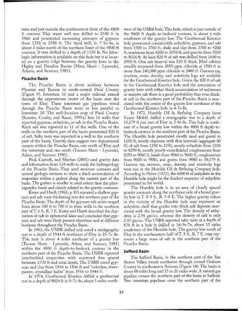
tests and just outside the northeastern limit ofthe 4800<br />
ft contour. This water well was drilled to 2180 ft in<br />
1966 and penetrated increasing amounts of gypsum<br />
from 1210 to 2180 ft. The third well, in 7-In-6e, is<br />
about 3 miles north ofthe northern limit ofthe 4800 ft<br />
contour. It was drilled to a depth of 1150 ft. No lithologic<br />
information is available on this hole but it is located<br />
on a gravity ridge between the gravity lows in the<br />
Higley and Paradise Basins (Mesa Sheet - Lysonski,<br />
Aikens, and Sumner, 1981).<br />
Picacho Basin<br />
The Picacho Basin is about midway between<br />
Phoenix and Tucson in south-central Pinal County<br />
(Figure 9). Interstate 10 and a major railroad extend<br />
through the approximate center of the basin near the<br />
town of Eloy. Three interstate gas pipelines trend<br />
through the Picacho Basin more or less parallel to<br />
Interstate 10. The well-location map of Pinal County<br />
(Koester, Conley, and Rauzi, 1995a) lists 16 wells that<br />
reported gypsum, anhydrite, or salt in the Picacho Basin.<br />
Rock salt was reported in 11 of the wells. One of the<br />
wells in the northern part of the basin penetrated 820 ft<br />
of salt. <strong>Salt</strong>y taste was reported in a well in the southern<br />
part of the basin. Gravity data suggest two depositional<br />
centers within the Picacho Basin, one north of Eloy and<br />
the interstate and one south (Tucson Sheet - Lysonski,<br />
Aiken, and Sumner, 1981).<br />
Pool, Carruth, and Meehan (2001) used gravity data<br />
and information from 124 wells to study the hydrogeology<br />
of the Picacho Basin. They used structure contours and<br />
several geologic sections to show a thick accumulation of<br />
evaporites within a graben along the eastern part of the<br />
basin. The graben is smaller in areal extent than the physiographic<br />
basin and closely related to the gravity contours.<br />
Kister and Hardt (1961, p. 83) reported a shallow gypsum<br />
and salt zone thickening into the northern part ofthe<br />
Picacho Basin. The depth ofthe gypsum-salt series ranged<br />
from about 500 ft to 700 ft in three wells in the southern<br />
part ofT. 6 S., R. 7 E. Kister and Hardt described the deposition<br />
ofsalt in ephemeral lakes and concluded that gypsum<br />
and salt were likely present elsewhere and at different<br />
horizons throughout the Picacho Basin.<br />
In 1963, the USBR drilled and cored a stratigraphic<br />
test to a depth of1944 ft northeast of Eloy in 25-7s-8e.<br />
This hole is about 4 miles southeast of a gravity low<br />
(Tucson Sheet - Lysonski, Aiken, and Sumner, 1981)<br />
within the 4800 ft depth-to-bedrock contour in the<br />
northern part ofthe Picacho Basin. The USBR reported<br />
interbedded evaporites with scattered fine gravel<br />
between 1770 ft and total depth. The USBR cored gypsum<br />
and clay from 1934 to 1936 ft and "colorless, transparent,<br />
crystalline halite" from 1936 to 1944 ft.<br />
In 1974, Geothermal Kinetics drilled a geothermal<br />
test to a depth of8024 ft in 8-7s-8e, about 5 miles north-<br />
19<br />
west ofthe USBRhole. This hole, which is just outside of<br />
the 9600 ft depth-to-bedrock contour, is about a mile<br />
southwest of the gravity low. The Geothermal Kinetics<br />
hole penetrated considerable anhydrite, gypsum, and salt<br />
from 1500 to 3700 ft, shale and clay from 3700 to 4200<br />
ft, sandstone from 4200 to 5050 ft, and granite from 5050<br />
to 8024 ft. At least 820 ft ofsalt was drilled from 1640 to<br />
2950 ft. One salt interval was 520 ft thick. Mud salinity<br />
steadily increased from 2850 ppm chloride at 1500 ft to<br />
more than 240,000 ppm chloride at 2400 ft. Gamma ray,<br />
neutron, sonic, density, and resistivity logs are available<br />
for the Geothermal Kinetics hole. Given the 820 ft ofsalt<br />
in the Geothermal Kinetics hole and the association of<br />
gravity lows with either thick accumulation of sediments<br />
or massive salt there is a good probability that even thicker<br />
salt in the northern part of the Picacho Basin is associated<br />
with the center of the gravity low northeast of the<br />
Geothermal Kinetics hole in 4-7s-8e.<br />
In 1972, Humble Oil & Refining Company (now<br />
Exxon Mobil) drilled a stratigraphic test to a depth of<br />
10,179 ft just east of Eloy in 2-8s-8e. This hole is northeast<br />
of a broad gravity low within the 4800 ft depth-tobedrock<br />
contour in the southern part ofthe Picacho Basin.<br />
The Humble hole penetrated mostly sand and gravel to<br />
1250 ft, mostly claystone with thin intervals (aggregate 80<br />
ft) ofsalt from 1250 to 2350, mostly anhydrite from 2350<br />
to 8250 ft, mostly poorly-consolidated conglomerate from<br />
8250 to 9060 ft, basalt from 9060 to 9600 ft, conglomerate<br />
from 9600 to 9880, and gneiss from 9880 to 10,179 ft.<br />
Gamma ray, neutron, sonic, density, and resistivity logs<br />
were run in the Humble Oil & Refining Company hole.<br />
According to Peirce (1973), the 6000 ft ofanhydrite in the<br />
Humble hole might be the thickest sequence of anhydrite<br />
penetrated in the world.<br />
The Humble hole is in an area of closely spaced<br />
gravity contours along the northeast side ofa broad gravity<br />
low in T. 8-9 S., R. 7-8 E. The higher gravity values<br />
in the vicinity of the Humble hole may represent an<br />
anhydrite shelf that grades into thick salt depositsassociated<br />
with the broad gravity low. The density of a.nhydrite<br />
is 2.95 gm/cc, whereas the density of salt is 0l1ly<br />
2.07 gm/cc. The USBR reported salty taste atadepthof<br />
870 ft in a hole it drilled in 34-9s-7e, about 13 miles<br />
southwest ofthe Humble hole. The gravity low south of<br />
Eloy in the southeastern half ofT. 9 S., R. 7 E. may represent<br />
a large mass of salt in the southern part ofthe<br />
Picacho Basin.<br />
Safford Basin<br />
The Safford Basin, in the northern part of the San<br />
Simon Valley, trends northwest through central Graha.m<br />
County in southeastern <strong>Arizona</strong> (Figure 10). The basil1is<br />
about 60 miles long and 15 to 20 miles wide. Anatural gas<br />
pipeline crosses the northern part ofthe basin at Safford.<br />
Two interstate pipelines cross the southern part of the


