Daley Ranch Master Plan - City of Escondido
Daley Ranch Master Plan - City of Escondido
Daley Ranch Master Plan - City of Escondido

Create successful ePaper yourself
Turn your PDF publications into a flip-book with our unique Google optimized e-Paper software.
C. Trails<br />
accordance with recommendations <strong>of</strong> the wildlife agencies. The <strong>City</strong><br />
anticipates using credits from the <strong>Daley</strong> <strong>Ranch</strong> Conservation Bank for<br />
mitigation, should the road improvements affecting biological resources<br />
be constructed.<br />
The park rangers and the caretaker will monitor the condition <strong>of</strong> all roads<br />
and trails on a monthly basis. On an annual basis, the <strong>City</strong>'s Public Works<br />
Department staff will inspect the condition <strong>of</strong> all roads and trails. Repair<br />
work will be scheduled, as conditions require. The majority <strong>of</strong> the repair<br />
work will be done by <strong>City</strong> staff, but it is the <strong>City</strong>'s intent to utilize<br />
volunteers to do various trail maintenance projects that require only hand<br />
labor. These projects will vary from repair <strong>of</strong> eroded areas to cutting back<br />
overgrown vegetation along the trails. In all cases, this work will be done<br />
under the supervision <strong>of</strong> a park ranger. Repair work involving<br />
reconfiguration and regrading <strong>of</strong> trails will require consultation with the<br />
<strong>City</strong> <strong>Plan</strong>ning Division to insure that biological and archaeological<br />
resources are not negatively affected.<br />
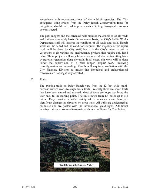
The existing trails on <strong>Daley</strong> <strong>Ranch</strong> vary from the 12-foot wide multipurpose<br />
service roads to single track trails. Presently there are seven trails<br />
that have been named and marked. Most <strong>of</strong> these are loops that bring the<br />
user back to the starting point. The trails range from 1.4 miles up to 5.5<br />
miles. They provide a wide variety <strong>of</strong> experiences since there are<br />
significant changes in elevation on most trails. All trails are designated as<br />
multi-use and are posted with the international yield signs. Additional<br />
existing trails are proposed to remain as shown on Figure 6 - Circulation<br />
Trail through the Central Valley<br />
PL\P0522-01 -22- Rev. Sept. 1998