Height System Unification with GOCE - Institut für Astronomische ...
Height System Unification with GOCE - Institut für Astronomische ...
Height System Unification with GOCE - Institut für Astronomische ...

Create successful ePaper yourself
Turn your PDF publications into a flip-book with our unique Google optimized e-Paper software.
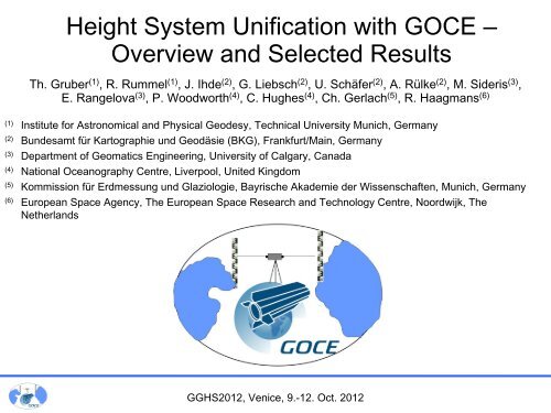
<strong>Height</strong> <strong>System</strong> <strong>Unification</strong> <strong>with</strong> <strong>GOCE</strong> –<br />
Overview and Selected Results<br />
Th. Gruber (1) , R. Rummel (1) , J. Ihde (2) , G. Liebsch (2) , U. Schäfer (2) , A. Rülke (2) , M. Sideris (3) ,<br />
E. Rangelova (3) , P. Woodworth (4) , C. Hughes (4) , Ch. Gerlach (5) , R. Haagmans (6)<br />
(1) <strong>Institut</strong>e for Astronomical and Physical Geodesy, Technical University Munich, Germany<br />
(2) Bundesamt <strong>für</strong> Kartographie und Geodäsie (BKG), Frankfurt/Main, Germany<br />
(3) Department of Geomatics Engineering, University of Calgary, Canada<br />
(4) National Oceanography Centre, Liverpool, United Kingdom<br />
(5) Kommission <strong>für</strong> Erdmessung und Glaziologie, Bayrische Akademie der Wissenschaften, Munich, Germany<br />
(6) European Space Agency, The European Space Research and Technology Centre, Noordwijk, The<br />
Netherlands<br />
GGHS2012, Venice, 9.-12. Oct. 2012
Project Overview<br />
Problem Overview<br />
<strong>Height</strong> <strong>System</strong> Offset Determination<br />
Selection of <strong>GOCE</strong> Model<br />
GPS-Levelling Data<br />
Omission Error<br />
Results<br />
<strong>Height</strong> Datum Connection:<br />
Europe - USA<br />
USA – Japan/Australia<br />
<strong>GOCE</strong> vs. Historical Results<br />
Summary & Conclusions<br />
Outline<br />
GGHS2012, Venice, 9.-12. Oct. 2012<br />
Upper-Rhine Bridge; Germany – Switzerland:<br />
27 cm height offset applied <strong>with</strong> wrong sign
ESA Project:<br />
Project Overview<br />
Support To Science Element (STSE) - <strong>GOCE</strong>+:<br />
<strong>Height</strong> <strong>System</strong> <strong>Unification</strong><br />
Study Goals:<br />
Identify the impact of <strong>GOCE</strong> gravity field models on<br />
world height system unification.<br />
(1) Requirements consolidation,<br />
(2) Review of existing methods for height system<br />
unification and further development,<br />
(3) Assessment of impact of <strong>GOCE</strong> gravity field<br />
models, and<br />
(4) Preparation of a scientific roadmap towards<br />
applications.<br />
GGHS2012, Venice, 9.-12. Oct. 2012<br />
©GSD,<br />
Canada<br />
©BKG
GPS Benchmarks<br />
Tide Gauge Benchmark<br />
Levelling Network<br />
C<br />
Vertical<br />
Datum C<br />
Problem Overview<br />
Local Vertical Datum (Equipotential Surface)<br />
Local Physical <strong>Height</strong><br />
Local Geoid <strong>Height</strong><br />
<strong>GOCE</strong> Equipotential Surface (long wavelengths)<br />
<strong>GOCE</strong> Physical <strong>Height</strong><br />
<strong>GOCE</strong> Geoid <strong>Height</strong><br />
True Equipotential Surface (short wavelengths)<br />
Omission Error<br />
Vertical<br />
Datum B<br />
B<br />
GGHS2012, Venice, 9.-12. Oct. 2012<br />
A<br />
Vertical<br />
Datum A
Selection of <strong>GOCE</strong> Model<br />
Signal Degree Variances RMS Geoid Differences per Degree<br />
Full Signal Content of<br />
<strong>GOCE</strong>-only Model TIM3<br />
Japan<br />
GGHS2012, Venice, 9.-12. Oct. 2012
Europe<br />
EVRF2007 (European Vertical<br />
Reference Frame 2007)<br />
NAP (Normaal Amsterdam Peil)<br />
Newlyn Tide Gauge<br />
Helenic Vertical Datum<br />
GPS/Levelling Data – Vertical Datums<br />
Pacific<br />
Japanese Vertical Datum (MSL Tokyo Bay)<br />
AHD71 (Australian <strong>Height</strong> Datum of 1971)<br />
ASVD02 (American Samoa Vertical Datum of 2002)<br />
GUVD04 (Guam Vertical Datum of 2004)<br />
NMVD03 (Northern Marianas Vertical Datum of 2003)<br />
GGHS2012, Venice, 9.-12. Oct. 2012<br />
North America<br />
CGVD28 (Canadian Geodetic Vertical Datum of 1928)<br />
NAVD88 (North American Vertical Datum of 1988)<br />
South America<br />
Imbituba, Santa Catarina State<br />
Montenvideo Port 1948
Europe<br />
Europe EVRF: 1233<br />
Germany: 675<br />
UK: 177<br />
Greece: 1542<br />
GPS/Levelling Data – Number Points<br />
Pacific<br />
Japan: 837<br />
Australia: 197<br />
Samoa: 22<br />
Guam: 16<br />
Northern Marianas: 54<br />
GGHS2012, Venice, 9.-12. Oct. 2012<br />
North America<br />
Canada (selected): 430 Canada (complete): 2576<br />
Continental USA (2009): 18398 Alaska: 86<br />
Continental USA (1999): 5168<br />
South America<br />
Brazil: 683<br />
Uruguay: 16
Mean Omission Error<br />
per degree from degree (to infinity)<br />
Omission error can be estimated from EGM2008 and/or residual terrain modelling<br />
GGHS2012, Venice, 9.-12. Oct. 2012
<strong>Height</strong> <strong>System</strong> Offset Results<br />
<strong>GOCE</strong> TIM3 Model truncated at D/O 180<br />
Germany<br />
-0.332<br />
-0.347<br />
Europe EVRF<br />
-0.294<br />
-0.286<br />
Greece<br />
-0.110<br />
-0.187<br />
<strong>with</strong> omission error<br />
w/o omission error<br />
Japan<br />
-0.722<br />
-0.694<br />
Marianas<br />
+0.485<br />
-0.520<br />
Australia<br />
-1.010<br />
-0.962<br />
Guam<br />
+0.458<br />
-1.361<br />
USA<br />
(2009)<br />
-1.145<br />
-1.122<br />
GGHS2012, Venice, 9.-12. Oct. 2012<br />
NA0 = Mean( ΔN)<br />
USA<br />
(1999)<br />
Samoa<br />
-1.194<br />
-3.719<br />
-0.027<br />
+0.026<br />
Canada<br />
(complete)<br />
-0.015<br />
+0.191<br />
Brazil<br />
-0.588<br />
-0.485<br />
Canada<br />
(selected)<br />
-0.038<br />
+0.129<br />
Uruguay<br />
-0.694<br />
-0.787<br />
UK<br />
+0.049<br />
+0.052
<strong>Height</strong> <strong>System</strong> Offset Results<br />
Omission Error from EGM2008 from D/O 181 to 2190<br />
Samoa Guam & Marianas<br />
GGHS2012, Venice, 9.-12. Oct. 2012
Offset per 2x2 Degree<br />
Block along US East<br />
Coast [m]<br />
32N<br />
26N<br />
34N<br />
467<br />
59<br />
1228<br />
36N<br />
475<br />
-1.890<br />
-1.983<br />
280E<br />
38N<br />
40N<br />
-2.171<br />
391<br />
42N<br />
173<br />
-1.731<br />
235<br />
-1.878<br />
-1.934<br />
44N<br />
68<br />
<strong>Height</strong> <strong>System</strong> Offset Results<br />
-1.456<br />
-1.578<br />
-1.666<br />
-2.122<br />
-1.894<br />
46N<br />
31<br />
-1.429<br />
29<br />
292E<br />
-1.362<br />
-1.470<br />
-1.520<br />
-1.641<br />
-1.321<br />
-1.616<br />
-1.172<br />
-1.286<br />
No. Points in Block<br />
GGHS2012, Venice, 9.-12. Oct. 2012<br />
<strong>with</strong> omission error<br />
w/o omission error<br />
Omission Error from EGM2008 (181-2190)<br />
in [m] and GPS/Levelling Data Distribution<br />
Mean Mean Difference: Difference: +0.014 +0.163<br />
-0.190 -0.025
-1.648<br />
-1.696<br />
-2.097<br />
-1.498<br />
-1.609<br />
<strong>Height</strong> <strong>System</strong> Connection: Europe - USA<br />
-1.409<br />
-1.472<br />
-1.444<br />
-1.435<br />
-1.296<br />
-1.389<br />
-1.389<br />
weighted mean<br />
-1.444<br />
-1.629<br />
-2.097<br />
-1.120<br />
-1.305<br />
-1.773<br />
-0.324<br />
-0.324<br />
-0.324<br />
Offset per Region <strong>with</strong> Omission Error [m]<br />
GGHS2012, NAVD88 EVRF2007 Venice, 9.-12. Newlyn Oct. 2012<br />
-0.405<br />
+0.049<br />
+0.112<br />
-0.344<br />
-0.275<br />
-0.280<br />
-0.252<br />
-0.303<br />
-0.331
-1.010<br />
<strong>Height</strong> <strong>System</strong> Connection: USA – Japan/Australia<br />
-0.722<br />
+0.458<br />
-1.194<br />
weighted mean<br />
-0.722 -0.167<br />
-0.555<br />
-0.843<br />
-1.010 -0.167<br />
Offset per Region <strong>with</strong> Omission Error [m]<br />
GGHS2012, AHD71 ASVD02 Venice, GUVD04 9.-12. Oct. Tokyo 2012<br />
+1.108<br />
+0.256<br />
+0.113<br />
-0.392<br />
NAVD88
Geoid<br />
<strong>Height</strong> <strong>System</strong> Connection – <strong>GOCE</strong> vs. Historical Results<br />
<strong>GOCE</strong><br />
Geoid<br />
-72<br />
Japan<br />
-101<br />
Australia<br />
(Mainland)<br />
+5<br />
England<br />
+72<br />
-11<br />
Greece<br />
+68<br />
+4<br />
-33<br />
Germany<br />
Brazil<br />
+14<br />
-59<br />
GGHS2012, Venice, 9.-12. Oct. 2012<br />
TIM3 (0-180) / EGM2008 (181-2190)<br />
-76<br />
-2<br />
Canada<br />
-82<br />
-3<br />
USA<br />
(1999)<br />
-115<br />
USA<br />
(2009)<br />
Results from Rapp (1994)<br />
(Bulletin Geodesique 69,<br />
p.26-31) based on JGM-2 /<br />
OSU91A and Geoid<br />
<strong>Height</strong>s on Doppler<br />
Stations.<br />
Results from this study<br />
based on <strong>GOCE</strong> /<br />
EGM2008 and Geoid<br />
<strong>Height</strong>s on GPS Levelling<br />
Stations.
Summary & Conclusions<br />
Good quality GPS/Levelling data can be used for height system offset<br />
determination.<br />
Levelling errors have significant impact on results. Therefore a careful<br />
selection of GPS/Levelling points needs to be done beforehand.<br />
<strong>GOCE</strong> geoid provides a significant better and consistent reference. <strong>GOCE</strong><br />
geoid error at a level of 3-4 cm at 100 km resolution. Some further<br />
improvement <strong>with</strong> more and reprocessed data is expected.<br />
Omission error plays a significant role, if it doesn‘t „cancel out“ for a selected<br />
GPS/Levelling data set. This needs to be identified beforehand.<br />
Areas for investigation need to be specified. Areas should be covered <strong>with</strong> a<br />
sufficient number of high quality GPS/Levelling points and corresponding to the<br />
<strong>GOCE</strong> resolution.<br />
Cross-comparison of results obtained <strong>with</strong> other techniques is needed (e.g.<br />
ocean levelling).<br />
GGHS2012, Venice, 9.-12. Oct. 2012