The Cadastral System in Hungary - Permanent Committee on ...
The Cadastral System in Hungary - Permanent Committee on ...
The Cadastral System in Hungary - Permanent Committee on ...

You also want an ePaper? Increase the reach of your titles
YUMPU automatically turns print PDFs into web optimized ePapers that Google loves.
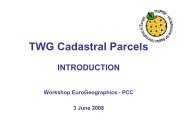
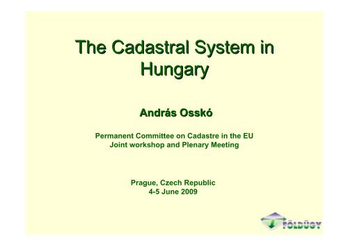
<str<strong>on</strong>g>The</str<strong>on</strong>g> <str<strong>on</strong>g>Cadastral</str<strong>on</strong>g> <str<strong>on</strong>g>System</str<strong>on</strong>g> <str<strong>on</strong>g>in</str<strong>on</strong>g><br />
<str<strong>on</strong>g>Hungary</str<strong>on</strong>g><br />
András Andr Osskó Ossk<br />
<str<strong>on</strong>g>Permanent</str<strong>on</strong>g> <str<strong>on</strong>g>Committee</str<strong>on</strong>g> <strong>on</strong> Cadastre <str<strong>on</strong>g>in</str<strong>on</strong>g> the EU<br />
Jo<str<strong>on</strong>g>in</str<strong>on</strong>g>t workshop and Plenary Meet<str<strong>on</strong>g>in</str<strong>on</strong>g>g<br />
Prague, Czech Republic<br />
4-5 June 2009
INTRODUCTION<br />
<str<strong>on</strong>g>The</str<strong>on</strong>g> official name of the Hungarian <str<strong>on</strong>g>in</str<strong>on</strong>g>tegrated cadastral<br />
system “Unified Land Registry <str<strong>on</strong>g>System</str<strong>on</strong>g>”<br />
One <str<strong>on</strong>g>in</str<strong>on</strong>g>stituti<strong>on</strong>al network- land offices- resp<strong>on</strong>sible for<br />
registrati<strong>on</strong> of legal transacti<strong>on</strong>s, cadastral mapp<str<strong>on</strong>g>in</str<strong>on</strong>g>g changes<br />
and deal<str<strong>on</strong>g>in</str<strong>on</strong>g>g with other land- and real estate property related<br />
activities.<br />
<str<strong>on</strong>g>The</str<strong>on</strong>g> Hungarian system is multipurpose nature<br />
• ma<str<strong>on</strong>g>in</str<strong>on</strong>g>tenance of c<strong>on</strong>trol po<str<strong>on</strong>g>in</str<strong>on</strong>g>t networks<br />
• topographic mapp<str<strong>on</strong>g>in</str<strong>on</strong>g>g<br />
• land protecti<strong>on</strong><br />
• land lease registrati<strong>on</strong><br />
• adm<str<strong>on</strong>g>in</str<strong>on</strong>g>istrative boundaries<br />
• etc.
<str<strong>on</strong>g>The</str<strong>on</strong>g> Unified Land registry <str<strong>on</strong>g>System</str<strong>on</strong>g> has two specific<br />
aims to be pursued<br />
Legally, the land registers provide a k<str<strong>on</strong>g>in</str<strong>on</strong>g>d of defence for<br />
the titles to real estate and also give certa<str<strong>on</strong>g>in</str<strong>on</strong>g>ity for the<br />
b<strong>on</strong>a fide holders<br />
<str<strong>on</strong>g>The</str<strong>on</strong>g> ec<strong>on</strong>omic aim is to serve as a uniform basis for<br />
establish<str<strong>on</strong>g>in</str<strong>on</strong>g>g f<str<strong>on</strong>g>in</str<strong>on</strong>g>ancial obligati<strong>on</strong>s for plann<str<strong>on</strong>g>in</str<strong>on</strong>g>g and<br />
supply<str<strong>on</strong>g>in</str<strong>on</strong>g>g statistical data for the government,<br />
organisati<strong>on</strong> of land utilisati<strong>on</strong> and services for the whole<br />
society
Important laws, decrees, regulati<strong>on</strong>s and professi<strong>on</strong>al<br />
guides support<str<strong>on</strong>g>in</str<strong>on</strong>g>g and regulat<str<strong>on</strong>g>in</str<strong>on</strong>g>g the activity of the<br />
ULRS<br />
• Act <strong>on</strong> Land and Real Property Registrati<strong>on</strong><br />
• Act <strong>on</strong> Land survey<str<strong>on</strong>g>in</str<strong>on</strong>g>g and Mapp<str<strong>on</strong>g>in</str<strong>on</strong>g>g Activities<br />
• Land Law<br />
• C<strong>on</strong>dom<str<strong>on</strong>g>in</str<strong>on</strong>g>ium Law<br />
• Build<str<strong>on</strong>g>in</str<strong>on</strong>g>g Law
Republic of <str<strong>on</strong>g>Hungary</str<strong>on</strong>g> is located <str<strong>on</strong>g>in</str<strong>on</strong>g> Central Europe<br />
Neighbour<str<strong>on</strong>g>in</str<strong>on</strong>g>g countries:<br />
Austria, Slovak Republic, Ukra<str<strong>on</strong>g>in</str<strong>on</strong>g>e, Rumania, Serbia, Croatia,<br />
Slovenia<br />
Size <str<strong>on</strong>g>in</str<strong>on</strong>g> sq km: 93 000<br />
Populati<strong>on</strong>: 10,3 milli<strong>on</strong><br />
Adm<str<strong>on</strong>g>in</str<strong>on</strong>g>istrative units: 19+1 counties<br />
3154 settlements<br />
(municipalities, local governments)
Some facts and figures<br />
<str<strong>on</strong>g>The</str<strong>on</strong>g> total number of land and real estate properties: 9 836 000<br />
Number of parcels: 7,3 milli<strong>on</strong><br />
Number of registered c<strong>on</strong>dom<str<strong>on</strong>g>in</str<strong>on</strong>g>ium units: 2, 536 milli<strong>on</strong>
Historical Background<br />
As many countries <str<strong>on</strong>g>in</str<strong>on</strong>g> Western and Central Europe, from<br />
the middle of the 19th century, real estate were double<br />
registered <str<strong>on</strong>g>in</str<strong>on</strong>g> <str<strong>on</strong>g>Hungary</str<strong>on</strong>g><br />
Cadastre was created for the purpose of the state and<br />
politics for taxati<strong>on</strong> part of the public adm<str<strong>on</strong>g>in</str<strong>on</strong>g>istrati<strong>on</strong><br />
On the other hand there was the factual land registry which<br />
the negotiable and mortgaged real estate was <str<strong>on</strong>g>in</str<strong>on</strong>g>volved <str<strong>on</strong>g>in</str<strong>on</strong>g>.<br />
<str<strong>on</strong>g>The</str<strong>on</strong>g> land registers were aim<str<strong>on</strong>g>in</str<strong>on</strong>g>g at the security of ownership<br />
the unperturbedness of the land transacti<strong>on</strong>s as well as the<br />
creditors’ <str<strong>on</strong>g>in</str<strong>on</strong>g>terest.
Historical Background<br />
<str<strong>on</strong>g>The</str<strong>on</strong>g> difference between the land registers and land cadastre<br />
can be recognised by diverg<str<strong>on</strong>g>in</str<strong>on</strong>g>g structure and authorisati<strong>on</strong>.<br />
<str<strong>on</strong>g>The</str<strong>on</strong>g> land registers were with<str<strong>on</strong>g>in</str<strong>on</strong>g> juridical scope while<br />
the land cadastre was a part of the public adm<str<strong>on</strong>g>in</str<strong>on</strong>g>istrati<strong>on</strong><br />
<str<strong>on</strong>g>The</str<strong>on</strong>g> land registers and the land cadastre were parallel used<br />
and mutual data exchange took place between them.<br />
This fact resulted double data registrati<strong>on</strong> and this fact<br />
caused a lot of <str<strong>on</strong>g>in</str<strong>on</strong>g>certa<str<strong>on</strong>g>in</str<strong>on</strong>g>ity <str<strong>on</strong>g>in</str<strong>on</strong>g> the use
Historical Background<br />
<str<strong>on</strong>g>The</str<strong>on</strong>g>se circumstances lead to decisi<strong>on</strong> <str<strong>on</strong>g>in</str<strong>on</strong>g> 1972, to <str<strong>on</strong>g>in</str<strong>on</strong>g>tegrate<br />
the two registrati<strong>on</strong>s <strong>on</strong> legal basis and <str<strong>on</strong>g>in</str<strong>on</strong>g>stituti<strong>on</strong>al level<br />
<str<strong>on</strong>g>The</str<strong>on</strong>g> new unified land registrati<strong>on</strong> was completed by the land<br />
offices organisati<strong>on</strong> for the entire country by communities <str<strong>on</strong>g>in</str<strong>on</strong>g> 1981.<br />
Legal documents and cadastral maps are <str<strong>on</strong>g>in</str<strong>on</strong>g> digital form<br />
(legal 1997, cadastral maps 2007.)<br />
Land Office organisati<strong>on</strong> became self f<str<strong>on</strong>g>in</str<strong>on</strong>g>anc<str<strong>on</strong>g>in</str<strong>on</strong>g>g with effect<br />
from 1st January 2007
ORGANISATIONAL STRUCTURE and RESPONSIBILITIES<br />
M<str<strong>on</strong>g>in</str<strong>on</strong>g>istry of Agriculture and Rural Development<br />
MARD<br />
Department Land adm<str<strong>on</strong>g>in</str<strong>on</strong>g>istrati<strong>on</strong> and Geo-<str<strong>on</strong>g>in</str<strong>on</strong>g>formati<strong>on</strong><br />
DLAG<br />
20 County Land Offices Institute of Geodesy Cartography Nati<strong>on</strong>al <str<strong>on</strong>g>Cadastral</str<strong>on</strong>g><br />
CLO and Remote Sens<str<strong>on</strong>g>in</str<strong>on</strong>g>g Program<br />
119 District Land Office FÖMI NCP<br />
DLO
ACTIVITIES of Land adm<str<strong>on</strong>g>in</str<strong>on</strong>g>istrati<strong>on</strong>, Unified Land Registry<br />
system<br />
<str<strong>on</strong>g>The</str<strong>on</strong>g> activities of the Unified Land Registry and background<br />
<str<strong>on</strong>g>in</str<strong>on</strong>g>stituti<strong>on</strong>s is a multipurpose nature <str<strong>on</strong>g>in</str<strong>on</strong>g> <str<strong>on</strong>g>Hungary</str<strong>on</strong>g>, cover<str<strong>on</strong>g>in</str<strong>on</strong>g>g the<br />
majority of mapp<str<strong>on</strong>g>in</str<strong>on</strong>g>g and land, real estate related property<br />
activities<br />
- registrati<strong>on</strong> of legal changes of rights related to land and real<br />
estate properties<br />
ma<str<strong>on</strong>g>in</str<strong>on</strong>g>tenance of the digital land registry<br />
- ma<str<strong>on</strong>g>in</str<strong>on</strong>g>tenance of digital cadastral maps<br />
- quality c<strong>on</strong>trol of cadastral mapp<str<strong>on</strong>g>in</str<strong>on</strong>g>g<br />
- data service of legal and mapp<str<strong>on</strong>g>in</str<strong>on</strong>g>g <str<strong>on</strong>g>in</str<strong>on</strong>g>formati<strong>on</strong> of properties<br />
- data service of legal and mapp<str<strong>on</strong>g>in</str<strong>on</strong>g>g <str<strong>on</strong>g>in</str<strong>on</strong>g>formati<strong>on</strong> via <str<strong>on</strong>g>in</str<strong>on</strong>g>ternet<br />
(TAKARNET)<br />
- land lease registrati<strong>on</strong><br />
- protecti<strong>on</strong> of agricultural land
ACTIVITIES of Land adm<str<strong>on</strong>g>in</str<strong>on</strong>g>istrati<strong>on</strong>, Unified Land Registry<br />
system<br />
- topographic mapp<str<strong>on</strong>g>in</str<strong>on</strong>g>g (analogue, digital)<br />
- establishment and ma<str<strong>on</strong>g>in</str<strong>on</strong>g>tenance of horiz<strong>on</strong>tal and vertical<br />
c<strong>on</strong>trol po<str<strong>on</strong>g>in</str<strong>on</strong>g>t network<br />
- ma<str<strong>on</strong>g>in</str<strong>on</strong>g>tenance of adm<str<strong>on</strong>g>in</str<strong>on</strong>g>istrative boundaries<br />
- IT support for land adm<str<strong>on</strong>g>in</str<strong>on</strong>g>istrati<strong>on</strong> <str<strong>on</strong>g>in</str<strong>on</strong>g>stituti<strong>on</strong>s<br />
- IT and mapp<str<strong>on</strong>g>in</str<strong>on</strong>g>g support for the EU agriculture subsidy<br />
system <str<strong>on</strong>g>in</str<strong>on</strong>g> <str<strong>on</strong>g>Hungary</str<strong>on</strong>g><br />
- M<strong>on</strong>itor<str<strong>on</strong>g>in</str<strong>on</strong>g>g of agricultural activities by remote sens<str<strong>on</strong>g>in</str<strong>on</strong>g>g<br />
-Etc.
RESPONSIBILITIES<br />
MARD, DLAG supervis<str<strong>on</strong>g>in</str<strong>on</strong>g>g, manag<str<strong>on</strong>g>in</str<strong>on</strong>g>g land adm<str<strong>on</strong>g>in</str<strong>on</strong>g>istrati<strong>on</strong> activities, creat<str<strong>on</strong>g>in</str<strong>on</strong>g>g<br />
laws, professi<strong>on</strong>al <str<strong>on</strong>g>in</str<strong>on</strong>g>structi<strong>on</strong>s<br />
DLO first <str<strong>on</strong>g>in</str<strong>on</strong>g>stance authority, registrati<strong>on</strong> of legal and cadastral<br />
mapp<str<strong>on</strong>g>in</str<strong>on</strong>g>g changes,<br />
Ma<str<strong>on</strong>g>in</str<strong>on</strong>g>tenance of digital legal and cadastral mapp<str<strong>on</strong>g>in</str<strong>on</strong>g>g data base,<br />
sell<str<strong>on</strong>g>in</str<strong>on</strong>g>g data, provid<str<strong>on</strong>g>in</str<strong>on</strong>g>g services<br />
land protecti<strong>on</strong> activities, land lease registrati<strong>on</strong><br />
CLO sec<strong>on</strong>d <str<strong>on</strong>g>in</str<strong>on</strong>g>stance authority <str<strong>on</strong>g>in</str<strong>on</strong>g> legal and cadastral mapp<str<strong>on</strong>g>in</str<strong>on</strong>g>g<br />
matters<br />
supervis<str<strong>on</strong>g>in</str<strong>on</strong>g>g, manag<str<strong>on</strong>g>in</str<strong>on</strong>g>g DLO activities<br />
ma<str<strong>on</strong>g>in</str<strong>on</strong>g>tenance of adm<str<strong>on</strong>g>in</str<strong>on</strong>g>istrative boundaries <str<strong>on</strong>g>in</str<strong>on</strong>g> the county<br />
quality c<strong>on</strong>trol of major cadastral mapp<str<strong>on</strong>g>in</str<strong>on</strong>g>g<br />
provid<str<strong>on</strong>g>in</str<strong>on</strong>g>g mass digital services
RESPONSIBILITIES<br />
FÖMI background <str<strong>on</strong>g>in</str<strong>on</strong>g>stituti<strong>on</strong><br />
ma<str<strong>on</strong>g>in</str<strong>on</strong>g>tenance of horiz<strong>on</strong>tal and vertical c<strong>on</strong>trol po<str<strong>on</strong>g>in</str<strong>on</strong>g>t network<br />
establish<str<strong>on</strong>g>in</str<strong>on</strong>g>g GPS network<br />
topographic mapp<str<strong>on</strong>g>in</str<strong>on</strong>g>g<br />
ma<str<strong>on</strong>g>in</str<strong>on</strong>g>tenance of adm<str<strong>on</strong>g>in</str<strong>on</strong>g>istrative boundary database of the<br />
country<br />
develop<str<strong>on</strong>g>in</str<strong>on</strong>g>g, support<str<strong>on</strong>g>in</str<strong>on</strong>g>g IT systems for land adm<str<strong>on</strong>g>in</str<strong>on</strong>g>istrati<strong>on</strong><br />
<str<strong>on</strong>g>in</str<strong>on</strong>g>stituti<strong>on</strong>s<br />
operat<str<strong>on</strong>g>in</str<strong>on</strong>g>g <strong>on</strong>l<str<strong>on</strong>g>in</str<strong>on</strong>g>e TAKARNET services for external users and<br />
land offices<br />
remote sens<str<strong>on</strong>g>in</str<strong>on</strong>g>g activities, support<str<strong>on</strong>g>in</str<strong>on</strong>g>g agriculture<br />
operat<str<strong>on</strong>g>in</str<strong>on</strong>g>g IT system, support<str<strong>on</strong>g>in</str<strong>on</strong>g>g EU agricultural subsidy<br />
issu<str<strong>on</strong>g>in</str<strong>on</strong>g>g professi<strong>on</strong>al <str<strong>on</strong>g>in</str<strong>on</strong>g>structi<strong>on</strong>s<br />
<str<strong>on</strong>g>in</str<strong>on</strong>g>ternati<strong>on</strong>al activities<br />
NCP Nati<strong>on</strong>al <str<strong>on</strong>g>Cadastral</str<strong>on</strong>g> Program as a governmental n<strong>on</strong> profit<br />
company, manag<str<strong>on</strong>g>in</str<strong>on</strong>g>g, f<str<strong>on</strong>g>in</str<strong>on</strong>g>anc<str<strong>on</strong>g>in</str<strong>on</strong>g>g countrywide digital cadastral<br />
mapp<str<strong>on</strong>g>in</str<strong>on</strong>g>g by commercial bank loan<br />
Completed by the end of 2007
Total number of staff 4000<br />
F<str<strong>on</strong>g>in</str<strong>on</strong>g>anc<str<strong>on</strong>g>in</str<strong>on</strong>g>g<br />
Annual revenue <str<strong>on</strong>g>in</str<strong>on</strong>g> 2008 23,5 billi<strong>on</strong> HUF ( 90 milli<strong>on</strong><br />
EURO)<br />
10 % has to be paid <str<strong>on</strong>g>in</str<strong>on</strong>g> the central government budget
<str<strong>on</strong>g>The</str<strong>on</strong>g> C<strong>on</strong>tent of the ULRS (Cadastre)<br />
In <str<strong>on</strong>g>Hungary</str<strong>on</strong>g> the Law <strong>on</strong> Real estate Registrati<strong>on</strong> def<str<strong>on</strong>g>in</str<strong>on</strong>g>es<br />
the registrati<strong>on</strong> as an adm<str<strong>on</strong>g>in</str<strong>on</strong>g>istrative procedure<br />
<str<strong>on</strong>g>The</str<strong>on</strong>g> land register is a system c<strong>on</strong>ta<str<strong>on</strong>g>in</str<strong>on</strong>g><str<strong>on</strong>g>in</str<strong>on</strong>g>g all landed<br />
property and other real estates<br />
Parcels, build<str<strong>on</strong>g>in</str<strong>on</strong>g>gs, apartments (<str<strong>on</strong>g>in</str<strong>on</strong>g> c<strong>on</strong>dom<str<strong>on</strong>g>in</str<strong>on</strong>g>ium), public<br />
properties, roads, railways, rivers, channels, etc.<br />
<str<strong>on</strong>g>The</str<strong>on</strong>g> system is parcel based and entirely dependent <strong>on</strong><br />
the ma<str<strong>on</strong>g>in</str<strong>on</strong>g>tenance of the land registrati<strong>on</strong> records<br />
(property sheets) and the large scale cadastral maps,<br />
l<str<strong>on</strong>g>in</str<strong>on</strong>g>ked with the unique identifier (parcel number)<br />
Data c<strong>on</strong>sistency between cadastral map and descriptive<br />
data of property sheet
Parcel is identified by parcel number with<str<strong>on</strong>g>in</str<strong>on</strong>g> a<br />
settlement, a certa<str<strong>on</strong>g>in</str<strong>on</strong>g> piece of the ground surface,<br />
c<strong>on</strong>tiguous <str<strong>on</strong>g>in</str<strong>on</strong>g> nature, not <str<strong>on</strong>g>in</str<strong>on</strong>g>tersected by any<br />
adm<str<strong>on</strong>g>in</str<strong>on</strong>g>istrative boundary l<str<strong>on</strong>g>in</str<strong>on</strong>g>e, to any part of which the<br />
same ownership or trustee rights relate<br />
Other registered properties :<br />
Build<str<strong>on</strong>g>in</str<strong>on</strong>g>gs, cellars, underground garages and other<br />
structures<br />
Flats and other units <str<strong>on</strong>g>in</str<strong>on</strong>g> c<strong>on</strong>dom<str<strong>on</strong>g>in</str<strong>on</strong>g>ium
<str<strong>on</strong>g>Cadastral</str<strong>on</strong>g> maps<br />
Orig<str<strong>on</strong>g>in</str<strong>on</strong>g>ally 60 000 paper based cadastral maps of various<br />
scales- 1:1000, 1: 1440, 1: 2000, 1: 2880,<br />
1: 4000- and projecti<strong>on</strong> systems<br />
c<strong>on</strong>t<str<strong>on</strong>g>in</str<strong>on</strong>g>uously updated s<str<strong>on</strong>g>in</str<strong>on</strong>g>ce the 19th century<br />
Digital cadastral maps <str<strong>on</strong>g>in</str<strong>on</strong>g> vector format became<br />
available countrywide <strong>on</strong> 1st. January 2008<br />
Data are organised <str<strong>on</strong>g>in</str<strong>on</strong>g>to an object-oriented relati<strong>on</strong>al<br />
database<br />
Standard for digital cadastral maps , DAT
<str<strong>on</strong>g>The</str<strong>on</strong>g> c<strong>on</strong>tent of cadastral maps<br />
Real estate registrati<strong>on</strong> map, this is identical with the<br />
cadastral map and serves also for land survey<str<strong>on</strong>g>in</str<strong>on</strong>g>g purpose<br />
<str<strong>on</strong>g>The</str<strong>on</strong>g> c<strong>on</strong>tent of cadastral map:<br />
adm<str<strong>on</strong>g>in</str<strong>on</strong>g>istrative boundaries, legal parcel boundaries,<br />
parcel number, build<str<strong>on</strong>g>in</str<strong>on</strong>g>gs and c<strong>on</strong>structi<strong>on</strong>s,<br />
street name and number, agricultural land cultivati<strong>on</strong><br />
Other attributes accord<str<strong>on</strong>g>in</str<strong>on</strong>g>g to law
legal register<br />
<str<strong>on</strong>g>The</str<strong>on</strong>g> ULRS c<strong>on</strong>ta<str<strong>on</strong>g>in</str<strong>on</strong>g>s the descriptive data files as a sec<strong>on</strong>d<br />
data holder of the registrati<strong>on</strong> system<br />
All land and real estate properties, <str<strong>on</strong>g>in</str<strong>on</strong>g>clud<str<strong>on</strong>g>in</str<strong>on</strong>g>g<br />
c<strong>on</strong>dom<str<strong>on</strong>g>in</str<strong>on</strong>g>iums are recorded<br />
<str<strong>on</strong>g>The</str<strong>on</strong>g> legal document (property sheet) c<strong>on</strong>ta<str<strong>on</strong>g>in</str<strong>on</strong>g>s all the<br />
rights, data and facts <strong>on</strong> land and real estate properties<br />
accord<str<strong>on</strong>g>in</str<strong>on</strong>g>g to law<br />
Law regulates the access to data of the ULRS<br />
It’s open to public, except to query accord<str<strong>on</strong>g>in</str<strong>on</strong>g>g to owners<br />
name l<str<strong>on</strong>g>in</str<strong>on</strong>g>ked to his/her properties
Property sheet (legal document)<br />
Part I. Descriptive data (parcel number, address, area, land use,<br />
features of cultivati<strong>on</strong>, soil quality, etc.)<br />
Part II. Titles i.e. data relat<str<strong>on</strong>g>in</str<strong>on</strong>g>g to ownership (name, birth,<br />
address, pers<strong>on</strong>al id., etc.<br />
Part III. All the other titles and rights accord<str<strong>on</strong>g>in</str<strong>on</strong>g>g to law<br />
( mortgages, restricti<strong>on</strong>s, easements, public rights, etc.)<br />
Land book descriptive data of every real estate by communities,<br />
arranged accord<str<strong>on</strong>g>in</str<strong>on</strong>g>g to parcel number order show<str<strong>on</strong>g>in</str<strong>on</strong>g>g the extent<br />
of the total area as well<br />
Archive of registered deeds, documents
Agricultural Land Lease Registrati<strong>on</strong><br />
Separate registrati<strong>on</strong> with direct l<str<strong>on</strong>g>in</str<strong>on</strong>g>k to the legal registry<br />
<str<strong>on</strong>g>The</str<strong>on</strong>g> comm<strong>on</strong> l<str<strong>on</strong>g>in</str<strong>on</strong>g>k is the parcel number<br />
C<strong>on</strong>ta<str<strong>on</strong>g>in</str<strong>on</strong>g>s the name of the leaseholder, size of the leased<br />
land, cultivati<strong>on</strong><br />
Compulsory by law to report any changes to the<br />
territorially competent DLO
TECNOLOGICAL INFRASTRUCTURE<br />
1994- 2005 develop<str<strong>on</strong>g>in</str<strong>on</strong>g>g of the IT systems , co- f<str<strong>on</strong>g>in</str<strong>on</strong>g>anced by the<br />
EU PHARE Program<br />
1997 all property sheets , approx. 9,9 milli<strong>on</strong>, have been loaded<br />
<str<strong>on</strong>g>in</str<strong>on</strong>g>to PC based computer system<br />
2000 Digital cadastral Mapp<str<strong>on</strong>g>in</str<strong>on</strong>g>g and property sheet<br />
Management systems (Infocam Budapest, TAKAROS,<br />
BIIR Budapest)<br />
2002 TAKARNET an <str<strong>on</strong>g>in</str<strong>on</strong>g>tranet type wide area telecommunicati<strong>on</strong><br />
network for countrywide data access and supply, by<br />
c<strong>on</strong>nect<str<strong>on</strong>g>in</str<strong>on</strong>g>g the land offices with each other, with FÖMI<br />
and c<strong>on</strong>t<str<strong>on</strong>g>in</str<strong>on</strong>g>uous services for external users<br />
2001-2004 META Management Informati<strong>on</strong> system for<br />
m<strong>on</strong>itor<str<strong>on</strong>g>in</str<strong>on</strong>g>g, manag<str<strong>on</strong>g>in</str<strong>on</strong>g>g, c<strong>on</strong>troll<str<strong>on</strong>g>in</str<strong>on</strong>g>g the activities of land<br />
offices<br />
2009 <strong>on</strong>e- level star topology of <strong>on</strong>l<str<strong>on</strong>g>in</str<strong>on</strong>g>e access to TAKARNET<br />
network for the 121 DLO-s, 20 CLO-s , FÖMI, MARD, and<br />
serv<str<strong>on</strong>g>in</str<strong>on</strong>g>g users through the comm<strong>on</strong> client gate of the<br />
Hungarian e- government’s B<strong>on</strong>e Network.
UPDATING PROCEDURES<br />
All of the land and real estate properties have been<br />
registered and the entire country covered by cadastral<br />
maps s<str<strong>on</strong>g>in</str<strong>on</strong>g>ce the late of the 19th century<br />
<str<strong>on</strong>g>The</str<strong>on</strong>g> Cadastre and the Land registry (Grundbuch) and<br />
with effect of 1971 the Unified LRS have c<strong>on</strong>t<str<strong>on</strong>g>in</str<strong>on</strong>g>uously<br />
been updated also dur<str<strong>on</strong>g>in</str<strong>on</strong>g>g the communist period<br />
Owners/trustees or any <str<strong>on</strong>g>in</str<strong>on</strong>g>terested parties are obliged by<br />
law to report to the territorially competent district land<br />
office about any changes, prescribed by law, <str<strong>on</strong>g>in</str<strong>on</strong>g> their<br />
property which modify the c<strong>on</strong>tent of cadastral map or<br />
legal register
updat<str<strong>on</strong>g>in</str<strong>on</strong>g>g of the cadastral map<br />
It is needed <str<strong>on</strong>g>in</str<strong>on</strong>g> the follow<str<strong>on</strong>g>in</str<strong>on</strong>g>g cases<br />
– changes of legal parcel boundary and<br />
adm<str<strong>on</strong>g>in</str<strong>on</strong>g>istrative boundary<br />
– changes <str<strong>on</strong>g>in</str<strong>on</strong>g> build<str<strong>on</strong>g>in</str<strong>on</strong>g>g or other c<strong>on</strong>structi<strong>on</strong>s<br />
– changes of land use<br />
– changes of agricultural cultivati<strong>on</strong><br />
– changes of street name, address<br />
– mass renewal of cadastral maps by settlements
updat<str<strong>on</strong>g>in</str<strong>on</strong>g>g of the legal registry (property sheet)<br />
<str<strong>on</strong>g>The</str<strong>on</strong>g> property sheet is c<strong>on</strong>t<str<strong>on</strong>g>in</str<strong>on</strong>g>uously updated based <strong>on</strong><br />
deeds, documents submitted by clients or other<br />
<str<strong>on</strong>g>in</str<strong>on</strong>g>terested parties<br />
<str<strong>on</strong>g>The</str<strong>on</strong>g> c<strong>on</strong>veyance of properties, ownership changes are<br />
compulsory to report to the competent DLO for<br />
registrati<strong>on</strong><br />
Law prescribes the c<strong>on</strong>tent and format of deeds and<br />
other legal documents<br />
– change <str<strong>on</strong>g>in</str<strong>on</strong>g> ownership<br />
– parcel number changes<br />
– mortgage registrati<strong>on</strong> and release<br />
– c<strong>on</strong>dom<str<strong>on</strong>g>in</str<strong>on</strong>g>ium registrati<strong>on</strong><br />
– easement and restricti<strong>on</strong>, etc
organisati<strong>on</strong>s and pers<strong>on</strong>s <str<strong>on</strong>g>in</str<strong>on</strong>g>volved<br />
District land offices are resp<strong>on</strong>sible for updat<str<strong>on</strong>g>in</str<strong>on</strong>g>g the cadastral maps<br />
and property sheets with registrati<strong>on</strong> of changes<br />
<str<strong>on</strong>g>The</str<strong>on</strong>g> survey divisi<strong>on</strong>s of DLOs are also resp<strong>on</strong>sible to perform the<br />
quality c<strong>on</strong>trol of the cadastral plan, which is the basic document<br />
for updat<str<strong>on</strong>g>in</str<strong>on</strong>g>g the cadastral maps<br />
<str<strong>on</strong>g>The</str<strong>on</strong>g> private sector is <str<strong>on</strong>g>in</str<strong>on</strong>g>volved <str<strong>on</strong>g>in</str<strong>on</strong>g> the preparati<strong>on</strong> of the required<br />
documents both for legal and cadastral mapp<str<strong>on</strong>g>in</str<strong>on</strong>g>g changes<br />
Only licensed surveyors are permitted to produce cadastral survey<br />
plan and survey<br />
<str<strong>on</strong>g>The</str<strong>on</strong>g> <str<strong>on</strong>g>in</str<strong>on</strong>g>volvement of lawyers or notary public <str<strong>on</strong>g>in</str<strong>on</strong>g> preparati<strong>on</strong> of legal<br />
documents for registrati<strong>on</strong> of changes <str<strong>on</strong>g>in</str<strong>on</strong>g> rights related to land and<br />
real estate properties is also compulsory by law<br />
In some cases authorities are also obliged to report changes <str<strong>on</strong>g>in</str<strong>on</strong>g> the<br />
c<strong>on</strong>tent of the cadastral map and property sheet ( local governmentstreet<br />
name, build<str<strong>on</strong>g>in</str<strong>on</strong>g>g address)
Automati<strong>on</strong> of processes<br />
<str<strong>on</strong>g>The</str<strong>on</strong>g> management of digital property sheets and<br />
cadastral maps have been automated s<str<strong>on</strong>g>in</str<strong>on</strong>g>ce mid 90s.<br />
FÖMI has been support<str<strong>on</strong>g>in</str<strong>on</strong>g>g the majority of IT systems<br />
Software applicati<strong>on</strong>s for the ma<str<strong>on</strong>g>in</str<strong>on</strong>g>tenance of property<br />
sheets TAKAROS, BIIR<br />
Software applicati<strong>on</strong>s for the management of digital<br />
cadastral maps INFOCAM, TOPOBASE <str<strong>on</strong>g>in</str<strong>on</strong>g> Budapest,<br />
DatView and DATR <str<strong>on</strong>g>in</str<strong>on</strong>g> counties
PROVIDED SERVICES<br />
Land offices, FÖMI provide legal, cadastral mapp<str<strong>on</strong>g>in</str<strong>on</strong>g>g<br />
<str<strong>on</strong>g>in</str<strong>on</strong>g>formati<strong>on</strong>, data and othe services for major external<br />
users and citizens, generally for fees.<br />
Products are available both <str<strong>on</strong>g>in</str<strong>on</strong>g> analogue and digital form<br />
Sufficient revenue is very important due to self-f<str<strong>on</strong>g>in</str<strong>on</strong>g>anc<str<strong>on</strong>g>in</str<strong>on</strong>g>g<br />
status of land adm<str<strong>on</strong>g>in</str<strong>on</strong>g>istrati<strong>on</strong><br />
<str<strong>on</strong>g>The</str<strong>on</strong>g> majority of basic laws supports the generati<strong>on</strong> of<br />
revenue<br />
Compulsory use of cadastral maps, compulsory report of<br />
legal and mapp<str<strong>on</strong>g>in</str<strong>on</strong>g>g changes, etc.
Number of registrati<strong>on</strong> of legal and mapp<str<strong>on</strong>g>in</str<strong>on</strong>g>g<br />
changes 2, 5 milli<strong>on</strong><br />
Number of property sheet queries 2, 8 milli<strong>on</strong><br />
for fee 1,9 milli<strong>on</strong><br />
Extract of cadastral maps (paper, digital) 0,5 milli<strong>on</strong><br />
Wide range of other services
Enlargement <strong>on</strong> higher level services can be realised <str<strong>on</strong>g>in</str<strong>on</strong>g><br />
the framework of e-government and e-adm<str<strong>on</strong>g>in</str<strong>on</strong>g>istrati<strong>on</strong><br />
Recently land offices are c<strong>on</strong>nected to the Government’s<br />
B<strong>on</strong>e Ntwork<br />
Growth of users’ number of TAKARNET, by 2009 more<br />
than 8000 registered users,<br />
3,5 milli<strong>on</strong> queries<br />
payment methods<br />
clients, us<str<strong>on</strong>g>in</str<strong>on</strong>g>g land office client service can pay different<br />
way<br />
registered users of the <strong>on</strong>l<str<strong>on</strong>g>in</str<strong>on</strong>g>e service TAKARNET can<br />
<strong>on</strong>ly pay by bank transfer
f<str<strong>on</strong>g>in</str<strong>on</strong>g>ancial figures (<str<strong>on</strong>g>in</str<strong>on</strong>g> milli<strong>on</strong> EURO)<br />
<str<strong>on</strong>g>The</str<strong>on</strong>g> annual revenue and the budget <str<strong>on</strong>g>in</str<strong>on</strong>g> 2008 90 milli<strong>on</strong> EURO<br />
( 23,5 billi<strong>on</strong> HUF)<br />
-registrati<strong>on</strong> fee 35,2 milli<strong>on</strong> EURO<br />
– sell<str<strong>on</strong>g>in</str<strong>on</strong>g>g of legal data 26,8<br />
– sell<str<strong>on</strong>g>in</str<strong>on</strong>g>g of mapp<str<strong>on</strong>g>in</str<strong>on</strong>g>g data 4,8<br />
– cadastral survey services 7,2<br />
– <strong>on</strong>l<str<strong>on</strong>g>in</str<strong>on</strong>g>e and other services 16,0
LINKS BETWEEN CADASTRE and LAND<br />
REGISTRY<br />
LINKS BETWEEN ULRS and REAL ESTATE<br />
Valuati<strong>on</strong> system/real estate tax<br />
<str<strong>on</strong>g>The</str<strong>on</strong>g>re is no comprehensive land and real estate taxati<strong>on</strong> <str<strong>on</strong>g>in</str<strong>on</strong>g><br />
<str<strong>on</strong>g>Hungary</str<strong>on</strong>g> but there are some land- and real estate related tax<br />
e.g. stamp duty, <str<strong>on</strong>g>in</str<strong>on</strong>g>heritance tax, tax <strong>on</strong> <str<strong>on</strong>g>in</str<strong>on</strong>g>come by sell<str<strong>on</strong>g>in</str<strong>on</strong>g>g real<br />
estate,<br />
Community taxes issued by local governments<br />
<str<strong>on</strong>g>The</str<strong>on</strong>g> cadastral mapp<str<strong>on</strong>g>in</str<strong>on</strong>g>g and legal data have been used for<br />
valuati<strong>on</strong> purposes as basic <str<strong>on</strong>g>in</str<strong>on</strong>g>formati<strong>on</strong> for valuati<strong>on</strong> of<br />
properties<br />
<str<strong>on</strong>g>The</str<strong>on</strong>g> ULRS database doesn’t c<strong>on</strong>ta<str<strong>on</strong>g>in</str<strong>on</strong>g> (<strong>on</strong>ly deeds)the value of<br />
real estates<br />
In case of agric land the property sheet c<strong>on</strong>ta<str<strong>on</strong>g>in</str<strong>on</strong>g>s the Golden<br />
Crown value which express<str<strong>on</strong>g>in</str<strong>on</strong>g>g today the<br />
quality of land
agricultural land valuati<strong>on</strong><br />
<str<strong>on</strong>g>The</str<strong>on</strong>g> agric. Land valuati<strong>on</strong> system orig<str<strong>on</strong>g>in</str<strong>on</strong>g>at<str<strong>on</strong>g>in</str<strong>on</strong>g>g from the<br />
time of the Austro-Hungarian M<strong>on</strong>archy called Golden<br />
Crown system, <str<strong>on</strong>g>in</str<strong>on</strong>g>troduced <str<strong>on</strong>g>in</str<strong>on</strong>g> the sec<strong>on</strong>d half of the 19th<br />
century, is still <str<strong>on</strong>g>in</str<strong>on</strong>g> the power for express<str<strong>on</strong>g>in</str<strong>on</strong>g>g the quality of<br />
the land<br />
Orig<str<strong>on</strong>g>in</str<strong>on</strong>g>ally the Gold Crown <str<strong>on</strong>g>System</str<strong>on</strong>g> based <strong>on</strong> yearly<br />
averaged yield estimati<strong>on</strong>, c<strong>on</strong>sider<str<strong>on</strong>g>in</str<strong>on</strong>g>g the soil quality,<br />
topography, climatic and ec<strong>on</strong>omic c<strong>on</strong>diti<strong>on</strong>s<br />
<str<strong>on</strong>g>The</str<strong>on</strong>g> soil quality map forms a layer of the digital cadastral<br />
mapp<str<strong>on</strong>g>in</str<strong>on</strong>g>g database. DLOs are resp<strong>on</strong>sible for the<br />
ma<str<strong>on</strong>g>in</str<strong>on</strong>g>tenance of these mapp<str<strong>on</strong>g>in</str<strong>on</strong>g>g data
agricultural land classificati<strong>on</strong><br />
Based <strong>on</strong> similarities of producti<strong>on</strong> c<strong>on</strong>diti<strong>on</strong>s, agric. land<br />
parcels are categorized accord<str<strong>on</strong>g>in</str<strong>on</strong>g>g to different types of<br />
cultivati<strong>on</strong> like arable land pasture land, forests, v<str<strong>on</strong>g>in</str<strong>on</strong>g>eyards, etc<br />
Areal unit of <strong>on</strong>e hectare, different sums of Golden Crown<br />
Classificati<strong>on</strong> regi<strong>on</strong>s, accord<str<strong>on</strong>g>in</str<strong>on</strong>g>g to cultivati<strong>on</strong> l<str<strong>on</strong>g>in</str<strong>on</strong>g>es and quality<br />
classes<br />
<str<strong>on</strong>g>The</str<strong>on</strong>g> agric. land will be grouped <str<strong>on</strong>g>in</str<strong>on</strong>g>to quality classes from 1-8 by<br />
cultivati<strong>on</strong><br />
Classificati<strong>on</strong> procedure is supported by a network of sample<br />
areas, set out by classificati<strong>on</strong> regi<strong>on</strong>s, valuati<strong>on</strong> procedures<br />
and settlements<br />
Comparis<strong>on</strong> the classified land with the corresp<strong>on</strong>d<str<strong>on</strong>g>in</str<strong>on</strong>g>g sample<br />
area
Thank you very much for your attenti<strong>on</strong> !