

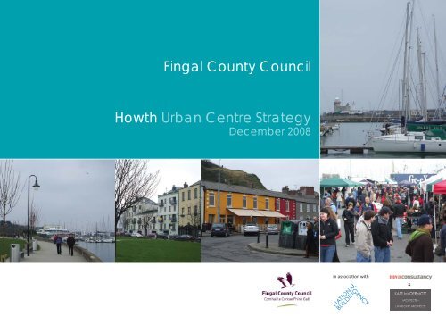
Howth Urban Centre Strategy Fingal County Council
Howth Urban Centre Strategy Fingal County Council
Howth Urban Centre Strategy Fingal County Council

You also want an ePaper? Increase the reach of your titles
YUMPU automatically turns print PDFs into web optimized ePapers that Google loves.
<strong>Fingal</strong> <strong>County</strong> <strong>Council</strong><br />
<strong>Howth</strong> <strong>Urban</strong> <strong>Centre</strong> <strong>Strategy</strong><br />
December 2008<br />
<strong>Howth</strong><br />
<strong>Urban</strong> <strong>Centre</strong> <strong>Strategy</strong><br />
in associati on with<br />
&
Contents<br />
<strong>Howth</strong> <strong>Urban</strong> <strong>Centre</strong> <strong>Strategy</strong><br />
2
Contents<br />
1.0 Introducti on<br />
2.0 <strong>Howth</strong> in Context<br />
2.1 Planning Policy Context<br />
2.2 Historical Context<br />
2.3 Character Areas<br />
2.4 <strong>Urban</strong> Design Appraisal<br />
2.5 Architectural Appraisal<br />
3.0 The Development <strong>Strategy</strong><br />
3.1 The Vision<br />
3.2 The Development Concept<br />
4.0 <strong>Urban</strong> Design Framework<br />
4.1 The Illustrati ve Masterplan<br />
5.0 General Design Guidelines<br />
6.0 Site Specifi c Development Briefs<br />
6.1 Opportunity Site 1<br />
6.2 Opportunity Site 2<br />
6.3 Opportunity Site 3<br />
7.0 Traffi c Management <strong>Strategy</strong><br />
8.0 Public Realm <strong>Strategy</strong><br />
Appendix 1: Glossary<br />
Appendix 2: Safer Places: The Planning System and Crime<br />
<strong>Howth</strong> <strong>Urban</strong> <strong>Centre</strong> <strong>Strategy</strong>
1.O Introducti on<br />
<strong>Fingal</strong> <strong>County</strong> <strong>Council</strong> appointed the Nati onal Building Agency in March<br />
2008 to undertake an <strong>Urban</strong> <strong>Centre</strong> <strong>Strategy</strong> for <strong>Howth</strong> Village <strong>Centre</strong>,<br />
as required under Objecti ve UO2 of the <strong>Fingal</strong> Development Plan 2005-<br />
2011. The lands generally comprise the village centre and harbour area,<br />
extending west to include the Techrete site and immediate environs.<br />
<strong>Howth</strong> is described in the Development Plan as a disti ncti ve sett lement<br />
located within a unique natural and built environment which fulfi ls a<br />
predominately leisure role for visitors with restaurants, cafes, bars and<br />
some niche shopping such as arts and craft s.<br />
Secti on 10.3 of the <strong>Fingal</strong> Development Plan 2005-2011 outlines the<br />
specifi c development strategy for <strong>Howth</strong> village. The development<br />
strategy envisages that <strong>Howth</strong> village will develop in a manner that<br />
will protect the character of the village, strengthen and promote the<br />
provision and range of faciliti es, especially the retenti on and promoti on<br />
of retail convenience shopping and community services to support the<br />
existi ng populati ons and tourists.<br />
<strong>Howth</strong> <strong>Urban</strong> <strong>Centre</strong> <strong>Strategy</strong><br />
4
1.0 Introduction<br />
The <strong>Urban</strong> <strong>Centre</strong> <strong>Strategy</strong> area relates to the area of <strong>Howth</strong> Village<br />
<strong>Centre</strong> defi ned by the red line on Map 1.1 and the yellow line in Map<br />
1.2.<br />
The <strong>Urban</strong> <strong>Centre</strong> <strong>Strategy</strong> is a non-statutory document which<br />
arti culates a vision for the village by way of preparati on of detailed<br />
urban design guidelines and acti ons for the village centre, harbour<br />
area and the lands located to the west of the Dart Stati on. The <strong>Urban</strong><br />
<strong>Centre</strong> <strong>Strategy</strong> should be used as a tool to assist and guide future<br />
development proposals in <strong>Howth</strong>. The enhancement of the vitality and<br />
viability of the village whilst having regard to the special historic and<br />
architectural character of the area and its special amenity and tourism<br />
value forms the basis of the <strong>Urban</strong> <strong>Centre</strong> <strong>Strategy</strong>. The <strong>Urban</strong> <strong>Centre</strong><br />
<strong>Strategy</strong> will focus on three identi fi ed areas which are described as<br />
follows:<br />
(a) The Techrete Lands and Immediate Surrounds:<br />
The subject area includes lands to the west of the Dart Stati on<br />
comprising of an SC zoning objecti ve:<br />
“to protect and enhance the special physical and social character of<br />
major sub-urban centres and provide and/or improve urban faciliti es”.<br />
Baltray Park, located immediately west of the SC zoning consists of an<br />
OS zoning objecti ve:<br />
“To preserve and provide for open space and recreati onal ameniti es.”<br />
The <strong>Urban</strong> <strong>Centre</strong> <strong>Strategy</strong> includes a specifi c and detailed Site Design<br />
and Development Brief for this area. The Brief presents a clear vision<br />
for how this area could be redeveloped in an integrated manner to<br />
provide for additi onal faciliti es to serve the village in a manner that will<br />
enhance and improve the civic and environmental quality of this village<br />
and the vibrancy and vitality of the village core whilst respecti ng the<br />
special historic and architectural character of the area and its special<br />
amenity and tourism value.<br />
The following specifi c objecti ve is contained in the <strong>Fingal</strong> Development<br />
Plan 2005-2011 which relates to the Techrete site:<br />
Objecti ve 347 - “To promote the development of a mixed use scheme<br />
on the Techrete site”.<br />
(b) The Harbour Area:<br />
West Pier comprises a GI zoning objecti ve :<br />
“To facilitate opportuniti es for general industrial employment and<br />
related uses in industrial areas.”<br />
To the northern edge of Harbour Road and part of the Central Pier<br />
consists of an OS zoning objecti ve:<br />
“To preserve and provide for open space and recreati onal ameniti es.”<br />
East Pier consists of a HA zoning objecti ve:<br />
“To protect and improve High Amenity Areas.”<br />
Additi onal relevant objecti ves in the Development Plan for the Harbour<br />
area include:<br />
Objecti ve 336: “to prepare a strategy for <strong>Howth</strong> Harbour area<br />
extending to Claremount Strand in accordance with the <strong>Urban</strong> <strong>Centre</strong><br />
<strong>Strategy</strong>”.<br />
Objecti ve 338 - “The seaward expansion of the West Pier for mariti me<br />
services and maintenance uses and the fi shing industry only shall be<br />
encouraged”.<br />
Objecti ve 343 - “To provide for marine related industry, West Pier,<br />
<strong>Howth</strong>”.<br />
Objecti ve 345 - “No over-ground development shall be permitt ed on<br />
the centre pier”.<br />
(c) The Village <strong>Centre</strong>:<br />
The subject area includes lands to the south of the Harbour comprising<br />
principally the SC zoning “to protect and enhance the special physical<br />
and social character of major sub-urban centres and provide and/<br />
or improve urban faciliti es”. The village centre area is designated an<br />
Architectural Conservati on Area (<strong>Howth</strong> Historic Core) and contains<br />
numerous protected structures.<br />
<strong>Howth</strong> <strong>Urban</strong> <strong>Centre</strong> <strong>Strategy</strong><br />
5
1.0 Introduction<br />
Consultation<br />
Pre draft written submissions were invited from the general public<br />
from the initial notice date on 14th November 2007 until the closing<br />
date for the receipt of submissions on 12th December 2007. Submissions<br />
were also invited upon completion of the Draft <strong>Howth</strong> <strong>Urban</strong><br />
<strong>Centre</strong> <strong>Strategy</strong> from the 22nd September 2008 until the 17th October<br />
2008.<br />
The <strong>Strategy</strong> was presented to Area Committee <strong>Council</strong>lors on two<br />
occasions. The fi rst meeting was held on the 7th July 2008 and the<br />
second meeting on the 18th September 2008.<br />
A number of meetings were also held with key stakeholders including<br />
<strong>Howth</strong>/Sutton Community <strong>Council</strong>, the Harbourmaster, The Department<br />
of Agriculture, Fisheries and Food and various departments within<br />
<strong>Fingal</strong> <strong>County</strong> <strong>Council</strong>.<br />
<strong>Howth</strong> Basemap<br />
Includes Ordnance Survey Ireland data reproduced under OSI Licence No. 2003/07/CCMA/<strong>Fingal</strong> <strong>County</strong> <strong>Council</strong>. © Ordnance Survey Ireland, 2006.<br />
Map 1.1 Map of <strong>Howth</strong> delineati ng strategy boundary<br />
Techrete<br />
<strong>Urban</strong> <strong>Centre</strong> <strong>Strategy</strong> Boundary<br />
0 50m<br />
Martello<br />
Tower<br />
Church of the<br />
Assumption<br />
250m<br />
<strong>Howth</strong> <strong>Urban</strong> <strong>Centre</strong> <strong>Strategy</strong><br />
N<br />
6
1.0 Introduction<br />
Map 1.2 Development Plan Map of <strong>Howth</strong> delineati ng strategy boundary in yellow<br />
<strong>Howth</strong> <strong>Urban</strong> <strong>Centre</strong> <strong>Strategy</strong><br />
7
2.O <strong>Howth</strong> in Context<br />
This secti on provides an analysis of the context of <strong>Howth</strong> under the following<br />
headings:<br />
2.1 Planning Policy Context<br />
2.2 Historical Context<br />
2.3 Character Areas<br />
2.4 <strong>Urban</strong> Design Appraisal<br />
2.5 Architectural Appraisal<br />
<strong>Howth</strong> <strong>Urban</strong> <strong>Centre</strong> <strong>Strategy</strong><br />
8
2.0 <strong>Howth</strong> in Context<br />
2.1 Planning Policy Context<br />
2.1.1 The Nati onal Level – The Nati onal Spati al <strong>Strategy</strong> (NSS)<br />
for Ireland 2002-2020.<br />
The NSS is a twenty year strategy which recognises the importance<br />
that sett lements the size of <strong>Howth</strong>¹ play within the broader context<br />
by achieving a balanced patt ern of growth between local and regional<br />
growth centres.<br />
<strong>Fingal</strong> as defi ned within the Nati onal Spati al <strong>Strategy</strong> (NSS) is located<br />
within the Greater Dublin Area (GDA). The performance of the GDA<br />
remains pivotal to the overall economic well being of Ireland. Secti on<br />
3.3.1 of the Nati onal Spati al <strong>Strategy</strong>, ‘Consolidati ng the Greater Dublin<br />
Area’ notes that Local Authoriti es should:<br />
“Encourage the preparati on of urban design plans in renewal areas,<br />
to establish a framework for buildings and public spaces which can<br />
be readily understood by developers and existi ng communiti es.<br />
Intensifi cati on can be achieved without compromising amenity.”<br />
This <strong>Urban</strong> <strong>Centre</strong> <strong>Strategy</strong> for <strong>Howth</strong> off ers a clear opportunity to<br />
address this aim and secure the future success of the village.<br />
2.1.2 Regional Level<br />
The objecti ve of the ‘Regional Planning Guidelines’ (RPGs) for the<br />
Greater Dublin Area is to provide a bett er spati al balance of social,<br />
economic and physical development throughout the region. The RPGs<br />
identi fy <strong>Howth</strong> as within the Metropolitan area.<br />
2.1.3 Local Level<br />
The overall development strategy for <strong>Howth</strong>, as set out in the ‘<strong>Fingal</strong><br />
Development Plan 2005-2011’ sets out the following:<br />
“It is envisaged that <strong>Howth</strong> village will develop in a manner that<br />
will protect the character of the town, strengthen and promote the<br />
provision and range of faciliti es especially the retenti on and promoti on<br />
of retail convenience shopping and community services to support the<br />
existi ng populati ons and tourists.“<br />
Specifi c relevant Development Objecti ves for <strong>Howth</strong> village as set out<br />
in the Development Plan are as follows:<br />
Objecti ve HOWTH 1<br />
“To prepare an <strong>Urban</strong> <strong>Centre</strong> <strong>Strategy</strong> for the village core to include<br />
detailed urban design guidelines and acti ons for the harbour (extending<br />
to Claremont Strand) and village area and which will have regard for<br />
the special historic and architectural character of the area”.<br />
Objecti ve HOWTH 2<br />
“To encourage the retenti on and development of ground fl oor<br />
commercial uses within the core of the village. New development in the<br />
core of <strong>Howth</strong> shall ensure the provision of commercial/retail uses on<br />
the ground fl oor. Such uses should be of a convenience and comparison<br />
retail mix with emphasis on the latt er. Offi ce provision should also be<br />
encouraged to ensure a vibrant village core with both indigenous day<br />
and evening populati ons“.<br />
¹<strong>Howth</strong> Electoral Division which covers the whole peninsula had a populati on of 8,196 persons in 2006. The populati on of <strong>Howth</strong> Village and environs<br />
was in the region of 4900 persons.<br />
Objecti ve HOWTH 3<br />
“To implement the <strong>Howth</strong> Special Amenity Area Order, the associated<br />
management plan and objecti ves for the buff er zone“.<br />
Objecti ve HOWTH 4<br />
“To conti nue to encourage the development of the harbour area for<br />
fi shing and marine related industry and tourism“.<br />
Objecti ve HOWTH 5<br />
“To provide traffi c calming in <strong>Howth</strong> Village taking account of its<br />
environment as a residenti al, tourist and local shopping area, and in<br />
parti cular the protecti on of the residenti al amenity of Main Street from<br />
the eff ects of motor traffi c“.<br />
Objecti ve HOWTH 6<br />
“To restrict the number of adverti sing structures in <strong>Howth</strong> peninsula“.<br />
The <strong>County</strong> Retail <strong>Strategy</strong> contained in the Development Plan provides<br />
the strategic policy framework for the spati al distributi on of new retail<br />
development. The Retail <strong>Strategy</strong> highlights that the introducti on of<br />
major new retail fl oorspace in <strong>Howth</strong> is unlikely. The Retail <strong>Strategy</strong><br />
also highlights that there is an opportunity to further exploit <strong>Howth</strong>’s<br />
att racti on and potenti al through promoti ng the development of<br />
tourism-leisure related retailing and faciliti es along the Harbour Road.<br />
<strong>Howth</strong> <strong>Urban</strong> <strong>Centre</strong> <strong>Strategy</strong><br />
9
2.0 <strong>Howth</strong> in Context<br />
2.2 Historical Context<br />
The name <strong>Howth</strong> is of Norse origin, being derived from the word<br />
Hoved (“head” in english). Aft er King Brian Boru’s defeat of the Norse<br />
in 1014, many Norse fl ed to <strong>Howth</strong> to regroup and remain a force unti l<br />
their fi nal defeat in <strong>Fingal</strong> in the middle of the 11th century. <strong>Howth</strong> sti ll<br />
remained under the control of Irish and localized Norsemen unti l the<br />
invasion of Ireland by the Anglo-Normans in 1169. In the early 18th<br />
century, <strong>Howth</strong> was chosen as the locati on for the harbour for the<br />
mail packet (postal service ship). However, due to silti ng, the harbour<br />
needed to be frequently dredged to accommodate the packet and<br />
eventually the service was relocated to Dún Laoghaire. Today <strong>Howth</strong> is<br />
a busy suburb of Dublin, with a mix of dense residenti al development<br />
and open areas of countryside.<br />
The historic map of <strong>Howth</strong> from 1841 shows that the West Pier and<br />
East Pier were constructed at this ti me.<br />
The early street patt ern of the village developed in a linear fashion<br />
south of the harbour from a primary route from Dublin city. The<br />
Martello Tower, St Mary’s Abbey, as well as Church Street, Abbey Street<br />
and Main Street are also evident from the 1841 historic map. This<br />
area today forms the basis for the <strong>Howth</strong> Historic Core Architectural<br />
Conservati on Area.<br />
Map 2.1: 6 inch Historic Map (1841) of <strong>Howth</strong> Map 2.2: 6 inch Historic Map (1841) of <strong>Howth</strong>’s historic core<br />
<strong>Howth</strong> <strong>Urban</strong> <strong>Centre</strong> <strong>Strategy</strong><br />
10
2.0 <strong>Howth</strong> in Context<br />
Towards the mid 19th and start of the 20th century <strong>Howth</strong> village<br />
underwent signifi cant change in plan morphology. By 1847 a two<br />
platf orm railway stati on opened in <strong>Howth</strong>. The railway line ran<br />
straight across Claremont Bay and fi ll material created a new area for<br />
development.<br />
The St. Lawrence Road area developed, including Dunbo Terrace, Evora<br />
Terrace, and <strong>Howth</strong> Terrace.<br />
Also, around this ti me saw the Y-shaped division of Main Street and<br />
Thormanby Road on either side of the triangular site of the Church of<br />
the Assumpti on, and the emergence of St. Mary’s Place and Road.<br />
The historic map of 1913 shows the Claremont Hotel, a prominent<br />
building on the coastline. Today the hotel is no longer in existence<br />
being replaced by blocks of residenti al units. The urban grain and<br />
character in general has changed litt le between 1841 and 1913.<br />
Map 2.3 25 inch Historic Map (1913) of <strong>Howth</strong><br />
<strong>Howth</strong> <strong>Urban</strong> <strong>Centre</strong> <strong>Strategy</strong><br />
11
2.0 <strong>Howth</strong> in Context<br />
2.3 Character Areas<br />
<strong>Howth</strong> contains fairly disti ncti ve ‘character areas’ – these are parts of<br />
the village, which are disti ncti ve in their own right or vary from other<br />
parts of village. Three character areas have been identi fi ed in <strong>Howth</strong><br />
village.<br />
• The Village Core<br />
The Village Core is designated as an Architectural Conservati on Area<br />
(ACA). The Main Street as a whole forms the main commercial/retail<br />
area of <strong>Howth</strong> village and as such development has followed the linear<br />
structure of the main access route through the village - the R105.<br />
The Main Street is composed of mainly two storey terraced buildings<br />
dati ng from the late 19th to early 20th century. Interspersed amongst<br />
these are more recent modern infi ll developments. Focal buildings of<br />
note include St Mary’s Abbey, the Church of the Assumpti on and the<br />
Martello Tower.<br />
• The Harbour Area<br />
The main building typologies in this character area are marine related<br />
terraced and detached buildings. The buildings are of widely varying<br />
sizes with newer buildings such as the Aucti on House rising to<br />
approximately 15 metres, whilst the older buildings of brickwork and<br />
stone constructi on rise to no more than two storeys in scale.<br />
• <strong>Howth</strong> Road<br />
This character area is made up of 19th/20th century terraced detached<br />
buildings. The majority of these buildings are no more than two storey<br />
in height with spacious rear gardens. To the northern edge of the<br />
<strong>Howth</strong> Road the ‘Techrete’ site creates an extreme contrast in scale<br />
within the predominantly low rise housing immediately east, south and<br />
west of the site.<br />
Character Areas<br />
<strong>Howth</strong> Road<br />
Harbour Area<br />
Includes Ordnance Survey Ireland data reproduced under OSI Licence No. 2003/07/CCMA/<strong>Fingal</strong> <strong>County</strong> <strong>Council</strong>. © Ordnance Survey Ireland, 2006.<br />
Map 2.4 Map of Character Areas<br />
Village Core<br />
0 50m<br />
250m<br />
<strong>Howth</strong> <strong>Urban</strong> <strong>Centre</strong> <strong>Strategy</strong><br />
N<br />
12
2.0 <strong>Howth</strong> in Context<br />
2.4 <strong>Urban</strong> Design Appraisal<br />
Secti on 2.4 identi fi es the key characteristi cs of the study area in terms<br />
of its structure, functi on, built form and landscape qualiti es. The focus<br />
of the analysis will be aimed at the character areas identi fi ed in secti on<br />
2.3. This urban design appraisal is helpful in identi fying those assets<br />
and features of <strong>Howth</strong> that should be retained and enhanced as part of<br />
the <strong>Urban</strong> <strong>Centre</strong> <strong>Strategy</strong>.<br />
The appraisal of the village will consider the following themes:<br />
2.4.1 Land Uses<br />
2.4.2 Topography<br />
2.4.3 Views<br />
2.4.4 Landscape Amenity<br />
2.4.5 Legibility<br />
2.4.6 Connecti ons<br />
2.4.7 Safety and Security<br />
2.4.8 Protected Structures<br />
2.4.9 Sites and Monuments Record<br />
2.4.10 Building Orientati on<br />
2.4.11 Quality of Building Frontages<br />
2.4.12 <strong>Urban</strong> Grain<br />
2.4.13 Building Heights and Massing<br />
Looking southwards along Abbey Street<br />
<strong>Howth</strong> <strong>Urban</strong> <strong>Centre</strong> <strong>Strategy</strong><br />
13
2.0 <strong>Howth</strong> in Context<br />
2.4.1 Land Uses<br />
THE VILLAGE CORE<br />
<strong>Howth</strong> has a typically wide mix of residenti al, community, ecclesiasti<br />
cal and commercial uses for a village of its size. Comparison retail<br />
at ground fl oor levels is mainly concentrated along the Main Street.<br />
Typical uses include an anti que shop, a fl ower shop, a hairdresser, two<br />
pharmacies as well as numerous public houses. Convenience retail<br />
consists of a Centra and a Spar located at Main Street. The village core<br />
is unlikely to att ract a large format retailer due to the core’s ti ght urban<br />
grain, but could accommodate specialist niche retailers.<br />
THE HARBOUR AREA<br />
Harbour Road has a broad range of comparison retail uses. Along<br />
Harbour Road uses consist of a jewellery shop, denti st, barber, clothing<br />
shops, restaurants and a public house. Along West Pier, uses are marine<br />
related and consist of fi sh restaurants, fi sh mongers, fi sh processors,<br />
fi sh markets, a net making company and the Irish Coast Guard.<br />
HOWTH ROAD<br />
<strong>Howth</strong> Road predominantly consists of low rise residenti al uses.<br />
Immediately west of the DART stati on a conti nuous wall of industrial<br />
buildings (Techrete and a car valeti ng service) forms the boundary to<br />
the northern edge of the <strong>Howth</strong> Road.<br />
Ground fl oor retail uses at Main Street Restaurant at West Pier<br />
Industrial uses along <strong>Howth</strong> Road<br />
<strong>Howth</strong> <strong>Urban</strong> <strong>Centre</strong> <strong>Strategy</strong><br />
14
2.0 <strong>Howth</strong> in Context<br />
2.4.2 Topography<br />
Building footprints and streets follow the line of<br />
contours, with buildings ‘stepping up’ slopes where<br />
they cross contours. Changes in levels and slopes<br />
here provide a disti ncti ve character and sense of<br />
place. Existi ng roofscapes emphasise the natural<br />
landform.<br />
The topography falls steeply northwards over<br />
approximately a distance of 700 metres from 70<br />
metres AOD² to just under 3m AOD along the coast.<br />
²Above Ordnance Datum<br />
Topography<br />
Includes Ordnance Survey Ireland data reproduced under OSI Licence No. 2003/07/CCMA/<strong>Fingal</strong> <strong>County</strong> <strong>Council</strong>. © Ordnance Survey Ireland, 2006.<br />
Map 2.5 Topography of <strong>Howth</strong><br />
0 50m<br />
250m<br />
N<br />
10<br />
20<br />
30<br />
40<br />
50<br />
60<br />
70<br />
<strong>Howth</strong> <strong>Urban</strong> <strong>Centre</strong> <strong>Strategy</strong><br />
15
2.0 <strong>Howth</strong> in Context<br />
2.4.3 Views<br />
Within <strong>Howth</strong>, the compositi on of views and vistas adds character<br />
and reinforces legibility and an understanding of the place. A varied<br />
sequence of connecti ng views, which lead or draw the eye from one<br />
feature to another, creates interest.<br />
Certain views within <strong>Howth</strong> are protected within the current<br />
Development Plan (2005-2011), the <strong>Howth</strong> Historic Core Architectural<br />
Conservati on Area (ACA) Statement of Character (2006) and <strong>Howth</strong><br />
Castle ACA Statement of Character (2006).<br />
Within the current Development Plan, the following views are preserved<br />
under a special objecti ve:<br />
At the northern edge of the West Pier<br />
Along the East Pier<br />
Certain views within <strong>Howth</strong> are preserved under <strong>Howth</strong> Historic Core<br />
ACA Statement of Character (2006). These are located at:<br />
Hillside Terrace<br />
<strong>Howth</strong> Terrace<br />
Main Street (Upper)<br />
St. Mary’s Abbey on Church Street<br />
Martello Tower<br />
Other key views protected under <strong>Howth</strong> Castle ACA Statement of<br />
Character (2006) include the following:<br />
From <strong>Howth</strong> Castle to the sea<br />
View towards St. Mary’s Church of Ireland<br />
Focal Buildings<br />
Vista<br />
Panorama<br />
Views and Vistas<br />
<br />
Includes Ordnance Survey Ireland data reproduced under OSI Licence No. 2003/07/CCMA/<strong>Fingal</strong> <strong>County</strong> <strong>Council</strong>. © Ordnance Survey Ireland, 2006.<br />
Map 2.6 Views and Vistas of <strong>Howth</strong><br />
<br />
<br />
<br />
<br />
0 50m<br />
<br />
<br />
<br />
250m<br />
<strong>Howth</strong> <strong>Urban</strong> <strong>Centre</strong> <strong>Strategy</strong><br />
N<br />
16
2.0 <strong>Howth</strong> in Context<br />
2.4.4 Landscape Amenity<br />
THE VILLAGE CORE<br />
There is limited public open space within the village core, as the main<br />
open space in the village of <strong>Howth</strong> is the Harbour front promenade,<br />
which falls just outside of the village core boundary. There is a small<br />
circular area of open space surrounding the Martello Tower and a small<br />
green space associated with St. Mary’s Abbey. It is noted that there is<br />
litt le public planti ng of trees, shrubs or fl owers within the village core,<br />
apart from the area at the juncti on of Church Street and Harbour Road,<br />
and a small area at Hillside Terrace. The lack of planti ng is generally as<br />
a result of building lines having frontage directly onto the street and<br />
narrow footpaths, which provide limited opportuniti es for traditi onal<br />
planti ng. The overall impression is of a hard built landscape to the core<br />
of the village.<br />
THE HARBOUR AREA<br />
The main public open space in the village of <strong>Howth</strong> is the Harbour<br />
front and the promenade. Along Harbour Road there is a large green<br />
open space with faciliti es for passive recreati on (seati ng) and acti ve<br />
recreati on (playground).<br />
HOWTH ROAD<br />
There are large areas of high amenity lands to the southern edge of the<br />
<strong>Howth</strong> Road including the demesne of <strong>Howth</strong> Castle and the Deerpark<br />
Golf Club. Claremont Beach and Baltray Park to the north presents a<br />
signifi cant public open space amenity.<br />
Baltray Balt Park<br />
Objective Open Space<br />
Objective High Amenity<br />
Street Trees & Tree Groups<br />
Open Space and Tree Groups<br />
<strong>Howth</strong> Castle<br />
Includes Ordnance Survey Ireland data reproduced under OSI Licence No. 2003/07/CCMA/<strong>Fingal</strong> <strong>County</strong> <strong>Council</strong>. © Ordnance Survey Ireland, 2006.<br />
Map 2.7 Open Space and Tree Groups in <strong>Howth</strong><br />
Claremont Beach<br />
The Promenade<br />
St. Mary’s<br />
Abbey Abb<br />
0 50m<br />
Martello M Tower<br />
250m<br />
<strong>Howth</strong> <strong>Urban</strong> <strong>Centre</strong> <strong>Strategy</strong><br />
N<br />
17
2.0 <strong>Howth</strong> in Context<br />
2.4.5 Legibility<br />
Landmark features allow visitors and residents to orientate themselves,<br />
creati ng a legible and easily navigable environment. This can include<br />
focal buildings, inti mate spaces, street trees etc. Within the proposed<br />
framework for <strong>Howth</strong> developing landmark features are criti cal to<br />
maintain a sense of legibility and an understanding of the place.<br />
Existi ng aids to legibility within <strong>Howth</strong> include the Martello Tower,<br />
Church of the Assumpti on, the harbour, St Mary’s Abbey and the DART<br />
Stati on which greatly enhances the villages legibility. View corridors as<br />
discussed previously further enhances orientati on.<br />
<strong>Howth</strong> Village is also surrounded by barriers to legibility. The train line<br />
creates an edge to the north along the <strong>Howth</strong> Road which restricts<br />
access and views to the seafront. Also steep topography surrounding<br />
the Martello Tower creates a barrier from the village core to Balscadden<br />
Bay.<br />
Legibility<br />
Focal Buildings<br />
Barriers to Legibility<br />
Positive Contribution to Legibility<br />
Includes Ordnance Survey Ireland data reproduced under OSI Licence No. 2003/07/CCMA/<strong>Fingal</strong> <strong>County</strong> <strong>Council</strong>. © Ordnance Survey Ireland, 2006.<br />
Map 2.8 Legibility in <strong>Howth</strong><br />
St Mar Mary’s<br />
Church of Ireland Irel eland<br />
and<br />
<strong>Howth</strong> Castle<br />
DART T Stati Sta Stati<br />
on<br />
Garda Ga<br />
Stati on<br />
St. Mary’s<br />
Abbey bbey bey<br />
0 50m<br />
Martello M Tower<br />
250m<br />
BALSCADDEN BAY<br />
Church of the Assumpti on<br />
<strong>Howth</strong> <strong>Urban</strong> <strong>Centre</strong> <strong>Strategy</strong><br />
N<br />
18
2.0 <strong>Howth</strong> in Context<br />
2.4.6 Connecti ons<br />
The Village Core<br />
The R105 forms the main vehicular link through <strong>Howth</strong>. The village’s<br />
historic layout also includes a number of east-west links. These include<br />
the Haggard, Seaview Terrace and Tuckett ’s Lane to the west of Main<br />
Street. To the east of Main Street and Abbey Street pedestrian and<br />
vehicular circulati on is constrained by steep topography.<br />
The Harbour Area<br />
Harbour Road provides a connecti on to the West and Central Pier. A<br />
pedestrian access point to Claremont Beach is accessed off the West<br />
Pier.<br />
<strong>Howth</strong> Road<br />
<strong>Howth</strong> Road remains a busy vehicular through route towards <strong>Howth</strong><br />
village. Pedestrian access ways exist to the southern edge of the <strong>Howth</strong><br />
Road leading to <strong>Howth</strong> Castle ACA and also a pedestrian way leading<br />
southwards to Grace O Malley Park (known locally as ‘the Tramway’).<br />
There are no north south public connecti ons from the <strong>Howth</strong> Road<br />
towards Claremont beach.<br />
Main Vehicular Connection<br />
Vehicular System enclosing Village Core<br />
Pedestrian Connections<br />
Existing Connections<br />
R105 R1<br />
Includes Ordnance Survey Ireland data reproduced under OSI Licence No. 2003/07/CCMA/<strong>Fingal</strong> <strong>County</strong> <strong>Council</strong>. © Ordnance Survey Ireland, 2006.<br />
Map 2.9 Existi ng Connecti ons within <strong>Howth</strong><br />
West Pier<br />
‘The Tramway’<br />
Central C nt Pier er<br />
0 50m<br />
East Pier<br />
The Haggard<br />
Seaview Terrace<br />
250m<br />
<strong>Howth</strong> <strong>Urban</strong> <strong>Centre</strong> <strong>Strategy</strong><br />
N<br />
19
2.0 <strong>Howth</strong> in Context<br />
2.4.7 Safety and Security<br />
The principles of ‘Safer Places: the planning system and crime<br />
preventi on’ by the ODPM (Offi ce of the Deputy Prime Minister) UK<br />
should be incorporated as part of any new development. The bett er<br />
practi ce guidance sets out seven design principles that are sought in<br />
new and existi ng developments:<br />
•<br />
•<br />
•<br />
•<br />
•<br />
•<br />
•<br />
Access and Movement<br />
Structure<br />
Surveillance<br />
Ownership<br />
Physical protecti on<br />
Acti vity<br />
Management and maintenance<br />
Please refer to Appendix 2 for a summary of the principles as outlined<br />
above.<br />
The Village Core<br />
Whilst the Main Street experiences good safety and security measures,<br />
the backland areas and in parti cular pedestrian laneways connecti ng<br />
Abbey Street to Church Street and the Harbour Road to Church Street,<br />
are prevented from benefi ti ng from natural surveillance. Orientati ng<br />
building fronts to these laneways and good lighti ng can help reduce the<br />
feeling of insecurity at these parti cular areas.<br />
The Harbour Area<br />
Harbour Road and West Pier is popular with pedestrians both day and<br />
night and are positi ve in terms of safety and security. However, the<br />
access point to Claremont Beach from the West Pier is poorly lit with<br />
no natural surveillance. This presents a potenti al safety and security<br />
issue.<br />
<strong>Howth</strong> Road<br />
The <strong>Howth</strong> Road area has a high level of surveillance. However dense<br />
planti ng and tree groups to the pedestrian way linking the <strong>Howth</strong> Road<br />
to Grace O Malley Park (‘the Tramway’) presents an inacti ve frontage<br />
with no natural surveillance.<br />
Inacti ve frontage along pedestrian laneway from Abbey Street to Church Street.<br />
<strong>Howth</strong> <strong>Urban</strong> <strong>Centre</strong> <strong>Strategy</strong><br />
20
2.0 <strong>Howth</strong> in Context<br />
2.4.8 Protected Structures<br />
The Village Core<br />
There are a number of Protected Structures within the boundary<br />
of the <strong>Urban</strong> <strong>Centre</strong> <strong>Strategy</strong> that are protected under the current<br />
Development Plan.<br />
RPS No. Descripti on<br />
561 Milestone, Harbour Road<br />
566 Burial Mound Site, Harbour Road, <strong>Howth</strong><br />
567 Former Courthouse, Harbour Road<br />
568 St. Mary’s Abbey (in ruins), Abbey Street<br />
569 <strong>Howth</strong> College, Abbey Street<br />
570 Martello Tower, off Abbey Street<br />
571 Renaissance House, Church Street<br />
572 No. 14 Main Street<br />
573 No. 15 Main Street<br />
574 No. 20 Main Street<br />
596 <strong>Howth</strong> Garda Stati on, <strong>Howth</strong> Terrace<br />
597 Church of the Assumpti on, Main Street<br />
Harbour Area<br />
RPS No. Descripti on<br />
560 Former Mariner’s Hall<br />
562 Former Lighthouse Stati on<br />
563 Former Coastguard Stati on<br />
564 Former Harbour Master’s Offi ce<br />
565 Lighthouse<br />
595 <strong>Howth</strong> Harbour, <strong>Howth</strong><br />
<strong>Howth</strong> Road<br />
RPS No. Descripti on<br />
554 The Manse, <strong>Howth</strong> Road<br />
555 Presbyterian Church, <strong>Howth</strong> Road<br />
556 <strong>Howth</strong> Castle, <strong>Howth</strong> Demesne<br />
557 Church (ruin), grounds of <strong>Howth</strong> Castle<br />
558 Stati on Masters House, Harbour Road, <strong>Howth</strong><br />
559 <strong>Howth</strong> Stati on, Harbour Road, <strong>Howth</strong><br />
594 St Mary’s Church of Ireland, <strong>Howth</strong> Road<br />
A number of these structures are landmark buildings within <strong>Howth</strong><br />
and form focal points for views into and out of the area such as the<br />
Martello Tower, St. Mary’s Abbey and the Church of the Assumpti on.<br />
However, others are more modest structures that represent examples<br />
of disti ncti ve shopfronts or vernacular houses. Most of the Protected<br />
Structures are 19th century in date refl ecti ng the period of <strong>Howth</strong>’s<br />
popularity for expansion and development.<br />
<strong>Howth</strong> <strong>Urban</strong> <strong>Centre</strong> <strong>Strategy</strong><br />
21
2.0 <strong>Howth</strong> in Context<br />
2.4.8 Protected Structures<br />
554<br />
555<br />
Protected Structures<br />
557<br />
556<br />
594<br />
Includes Ordnance Survey Ireland data reproduced under OSI Licence No. 2003/07/CCMA/<strong>Fingal</strong> <strong>County</strong> <strong>Council</strong>. © Ordnance Survey Ireland, 2006.<br />
Map 2.10 Protected Structures within <strong>Howth</strong><br />
558<br />
559<br />
566<br />
56 560<br />
567<br />
562 2<br />
564<br />
563 3<br />
595 5<br />
596<br />
565<br />
561 568<br />
571<br />
569<br />
574<br />
0 50m<br />
572<br />
573<br />
597<br />
570<br />
595<br />
250m<br />
<strong>Howth</strong> <strong>Urban</strong> <strong>Centre</strong> <strong>Strategy</strong><br />
N<br />
22
2.0 <strong>Howth</strong> in Context<br />
2.4.9 Sites and Monuments Record<br />
The Sites and Monuments Record (SMR) forms the basis for the statutory<br />
Record of Monuments and Places (RMP). These recorded monuments<br />
are protected under the Nati onal Monuments (Amendment) Act 1994.<br />
Considerati on should be given to the design of proposed works to<br />
ensure that they do not impact negati vely on the sites and monuments<br />
listed below. Consultati on with the Heritage Offi cer at <strong>Fingal</strong> <strong>Council</strong><br />
as well as the Department of the Environment, Heritage and Local<br />
Government should be carried prior to the planning applicati on stage.<br />
Ref. Descripti on<br />
015-042 Burial Ground<br />
015-028001 Cist<br />
016-002001 Castle - Mott e Possible<br />
016-002002 Martello Tower<br />
015-094 Building<br />
015-029005 Graveslab<br />
015-029004 Graveslab(s)<br />
015-029002 Ritual Site - Holy Well<br />
0105-029003 Tomb - Alter<br />
015-029001 Church<br />
015-029006 Graveyard<br />
015-026 Chapel<br />
015-027001 Castle - Tower House<br />
015-027002 Gatehouse<br />
015-30 Forti fi ed House<br />
015-026<br />
015-027001<br />
015-027002<br />
Sites and Monuments Record<br />
015-042<br />
015-028001<br />
Includes Ordnance Survey Ireland data reproduced under OSI Licence No. 2003/07/CCMA/<strong>Fingal</strong> <strong>County</strong> <strong>Council</strong>. © Ordnance Survey Ireland, 2006.<br />
Map 2.11 Sites and Monuments Record within <strong>Howth</strong><br />
015-029001<br />
0<br />
015-029002<br />
015-029003<br />
0<br />
015-029004<br />
0<br />
015-029005<br />
0<br />
015-029006<br />
015-030<br />
015-094<br />
0 50m<br />
016-002001 6<br />
016-002002<br />
1<br />
250m<br />
<strong>Howth</strong> <strong>Urban</strong> <strong>Centre</strong> <strong>Strategy</strong><br />
N<br />
23
2.0 <strong>Howth</strong> in Context<br />
2.4.10 Building Orientati on<br />
THE VILLAGE CORE<br />
The buildings along the Main Street, Abbey Street and Harbour<br />
Road off er many acti ve frontages to the public realm, with most<br />
accommodati ng shops and commercial acti vity at ground fl oor level.<br />
Gaps in the building line off er access and views into laneways, which<br />
are a disti ncti ve local feature. These include laneways primarily to the<br />
west of Main Street that includes the Haggard, Seaview Terrace and<br />
Tuckett ’s Lane. Along the northern edge of Church Street high walls<br />
contributes to an inacti ve frontage with poor visual connecti ons to the<br />
sea.<br />
THE HARBOUR AREA<br />
The formal linear block layout of the West Pier with buildings parallel<br />
to the public realm creates a strong frontage. In some areas the use<br />
of high fences and walls contributes to an inacti ve street frontage.<br />
The rear elevati ons of these buildings which are highly visible from<br />
Claremont Beach present an inacti ve frontage to the coastline.<br />
HOWTH ROAD<br />
Within this area buildings are generally set in rows facing the street.<br />
Some properti es have medium-large front gardens. The high boundary<br />
wall associated with the Techrete site along the northern edge of the<br />
<strong>Howth</strong> Road presents an inacti ve street frontage. Opportuniti es exist<br />
here to open up this area visually and physically to integrate it more<br />
positi vely into the existi ng public realm.<br />
Along Harbour Road and Main Street buildings positi vely front the street<br />
Within the Harbour Area, the use of high fences and tall planti ng contributes to an inacti ve street frontage<br />
Along <strong>Howth</strong> Road buildings front the street with open setbacks<br />
<strong>Howth</strong> <strong>Urban</strong> <strong>Centre</strong> <strong>Strategy</strong><br />
24
2.0 <strong>Howth</strong> in Context<br />
2.4.11 Quality of Building Frontages<br />
THE VILLAGE CORE<br />
The quality of building frontages with a positi ve contributi on to the<br />
public realm are mainly orientated towards the Main Street, Abbey<br />
Street, Church Street and the Harbour Road. However, there is a series<br />
of vacant buildings at the Main Street, St Mary’s Road and Tuckett ’s<br />
Lane which present poor frontages to the public realm.<br />
THE HARBOUR AREA<br />
The quality of building frontages within this area are generally positi ve<br />
along the Harbour Road. However, there is a series of buildings at the<br />
West Pier which could be signifi cantly improved.<br />
HOWTH ROAD<br />
Industrial buildings to the northern edge of the <strong>Howth</strong> Road present a<br />
negati ve frontage.<br />
Positive<br />
Negative - Could be Improved<br />
Quality of Building Frontages<br />
Includes Ordnance Survey Ireland data reproduced under OSI Licence No. 2003/07/CCMA/<strong>Fingal</strong> <strong>County</strong> <strong>Council</strong>. © Ordnance Survey Ireland, 2006.<br />
Map 2.12 Quality of Building Frontages in <strong>Howth</strong><br />
0 50m<br />
250m<br />
<strong>Howth</strong> <strong>Urban</strong> <strong>Centre</strong> <strong>Strategy</strong><br />
N<br />
25
2.0 <strong>Howth</strong> in Context<br />
2.4.12 <strong>Urban</strong> Grain<br />
THE VILLAGE CORE<br />
Building widths range on average from 6 to 8 metres in the village<br />
core. The historic narrow frontage approach establishes a building line<br />
of linked dwellings and conti nuous building frontage. This provides a<br />
very effi cient use of land with a high building density. Building depths<br />
remain consistent within the village core. On average, building depths<br />
are 13 metres.<br />
THE HARBOUR AREA<br />
Within this area, the mixture of marine industry uses result in varying<br />
building widths. On average building widths are between 8 and 19<br />
metres. Building depths remain consistent with an average depth of<br />
15 metres.<br />
HOWTH ROAD<br />
To the north of <strong>Howth</strong> Road the Techrete site’s urban grain is in extreme<br />
contrast to the predominantly fi ne grain of the existi ng residenti al uses.<br />
Building widths here are in excess of 100 metres with depths varying up<br />
to a maximum of approximately 50 metres.<br />
Respecti ng the existi ng urban grain<br />
<strong>Howth</strong> Basemap<br />
Includes Ordnance Survey Ireland data reproduced under OSI Licence No. 2003/07/CCMA/<strong>Fingal</strong> <strong>County</strong> <strong>Council</strong>. © Ordnance Survey Ireland, 2006.<br />
Map 2.13 Building grain dimensions in <strong>Howth</strong><br />
140m<br />
7m<br />
11m<br />
0 50m<br />
7m<br />
250m<br />
<strong>Howth</strong> <strong>Urban</strong> <strong>Centre</strong> <strong>Strategy</strong><br />
N<br />
26
2.0 <strong>Howth</strong> in Context<br />
2.4.13 Building Heights and Massing<br />
THE VILLAGE CORE<br />
The Main Street<br />
Along Main Street the height consists of predominantly two storey<br />
terraced dwellings with a small number of buildings consisti ng of<br />
single storey with a dormer to the roofspace. To the west of the Main<br />
Street, at the Haggard and Seaview Terrace there are single storey<br />
terraced cott ages. The Bailey Court Hotel, to the east of the Main<br />
Street, is the only building that consists of three storeys. As such it is an<br />
easily identi fi able landmark on the street.<br />
Abbey Street<br />
Abbey Street predominantly consists of two storey terraces of varying<br />
heights. A new three storey development has recently fi nished<br />
constructi on at the juncti on of Abbey Street and Church Road.<br />
Harbour Road<br />
The Harbour Road mainly consists of a strong terrace of three storeys<br />
with a fourth storey disguised within a mansard roof.<br />
Church Street<br />
Church Street consists of a defl ected building line of two storey<br />
terraced buildings to its southern edge with a row of single storey<br />
terraced cott ages to its northern edge.<br />
The western edge of the Main Street predominantly<br />
featuring two-storey terraced buildings and single<br />
storey dormer cott ages<br />
The eastern edge of the Main Street featuring the<br />
Bailey Court Hotel<br />
The western edge of the Main Street featuring single<br />
storey terraced cott ages<br />
The eastern edge of the Abbey Street featuring 2<br />
storey terraced dwellings<br />
Harbour Road<br />
Church Street featuring 2 storey terraced dwellings<br />
and single storey terraced cott ages<br />
<strong>Howth</strong> <strong>Urban</strong> <strong>Centre</strong> <strong>Strategy</strong><br />
27
2.0 <strong>Howth</strong> in Context<br />
2.4.13 Building Heights and Massing<br />
THE HARBOUR AREA<br />
The buildings within this area are of widely varying sizes with newer<br />
buildings such as the Aucti on House of steel frame constructi on clad<br />
in metal sheeti ng rising to approximately 15 metres, whilst the older<br />
buildings of brickwork and stone constructi on rise to no more than<br />
two storeys in scale.<br />
ALONG HOWTH ROAD<br />
The large buildings that form the Techrete site have created an<br />
extreme contrast in scale within the predominantly low rise housing<br />
immediately east, south and west of the site. The industrial sheds<br />
and other support buildings are not of any townscape value. The<br />
buildings are 8 to 12 metres in height to eaves level and the massing<br />
of the buildings dominate the skyline. The majority of terraced and<br />
detached buildings to the south of <strong>Howth</strong> Road are up to two storeys<br />
in height.<br />
Along the West Pier<br />
Along <strong>Howth</strong> Road<br />
<strong>Howth</strong> <strong>Urban</strong> <strong>Centre</strong> <strong>Strategy</strong><br />
28
2.0 <strong>Howth</strong> in Context<br />
2.5 Architectural Appraisal<br />
Secti on 2.5 of the <strong>Strategy</strong> focuses on the key characteristi cs<br />
of the study area in terms of its architectural design. The<br />
architectural appraisal is helpful in identi fying positi ve features<br />
of <strong>Howth</strong> that should be retained and enhanced as part of the<br />
<strong>Urban</strong> <strong>Centre</strong> <strong>Strategy</strong>.<br />
The architectural appraisal of the village will consider the<br />
following themes:<br />
2.5.1 Building Proporti on<br />
2.5.2 Roofs and Chimneys<br />
2.5.3 The Traditi onal Shopfront<br />
2.5.4 Security Shutt ers<br />
2.5.5 Adverti sements<br />
2.5.6 Hanging and Projecti ng Elements<br />
2.5.7 Outdoor Seati ng Areas<br />
2.5.8 Summary<br />
Decorati ve lintel detail at Abbey Street<br />
<strong>Howth</strong> <strong>Urban</strong> <strong>Centre</strong> <strong>Strategy</strong><br />
29
2.0 <strong>Howth</strong> in Context<br />
2.5.1 Building Proporti on<br />
Many older properti es within <strong>Howth</strong> have a verti cal emphasis<br />
to their character, having narrow frontages. Verti cal windows<br />
enhance the verti cal emphasis of the building elevati on.<br />
However in recent ti mes modern inserti ons have introduced a<br />
horizontal element that can be visually jarring to the prevailing<br />
verti cal rhythm.<br />
A ‘solid to void rati o’ describes how blank or windowed a building<br />
looks. It is interesti ng to note that the more successful buildings<br />
that fi t well in the village’s streetscape have a high degree of<br />
visual solidity.<br />
Building fronts with large areas of horizontal emphasis<br />
and dead frontage are likely to sit uncomfortably in the<br />
traditi onal streetscape.<br />
A change in height of building fronts refl ects the change in buildings. Despite the change in height, the buildings retain suitable proporti ons.<br />
A poor solid to void rati o. The building fronts appear too horizontal.<br />
A good solid to void rati o. The building fronts appear verti cal.<br />
<strong>Howth</strong> <strong>Urban</strong> <strong>Centre</strong> <strong>Strategy</strong><br />
30
2.0 <strong>Howth</strong> in Context<br />
2.5.2 Roofs and Chimneys<br />
The roofscape of <strong>Howth</strong> is the fi rst indicati on of the character and scale<br />
from a distance. On entering the sett lement we become aware of the<br />
shape and elements of the building roofs that contribute to our general<br />
impressions of the sett lement.<br />
Most of the buildings within the village core are uncomplicated and<br />
low-rise. Subtle changes of pitch between adjoining dwellings, which<br />
is a characteristi c of these streets (a matt er of a few degrees) can help<br />
enliven a roofscape.<br />
Also, a disti ncti ve feature of <strong>Howth</strong> is the use of single and double<br />
pitched roofs as part of a terrace, or on isolated properti es. Hipped<br />
roofs occur less frequently but add an interesti ng visual contrast to the<br />
streetscape. The eaves lines within <strong>Howth</strong> consist of simple shallow or<br />
no ti mber fascias.<br />
Characteristi c roofs and chimneys of <strong>Howth</strong><br />
A disti ncti ve feature is the use of hipped roofs, red brick trimmings and clay chimney pots<br />
<strong>Howth</strong> <strong>Urban</strong> <strong>Centre</strong> <strong>Strategy</strong><br />
31
2.0 <strong>Howth</strong> in Context<br />
2.5.2 Roofs and Chimneys<br />
Mansard type roofs are inconsistent to the prevailing roof typology and should generally be avoided.<br />
Subtle changes of pitch between adjoining dwellings (a matt er of a few degrees) can help enliven a roofscape.<br />
Flat roofs are inconsistent to the prevailing pitched roofscape and should generally be avoided.<br />
<strong>Howth</strong> <strong>Urban</strong> <strong>Centre</strong> <strong>Strategy</strong><br />
32
2.0 <strong>Howth</strong> in Context<br />
2.5.3 The Traditi onal Shopfront<br />
Existi ng shopfronts in <strong>Howth</strong> are based upon a series of principles<br />
that are successful in achieving a suitable relati onship between<br />
the shopfront and the elevati on as a whole.<br />
Fascia and Cornice<br />
The fascia provides the principal space for adverti sing. Above<br />
the fascia is a cornice, a projecti ng decorati ve moulding to give<br />
a visual cap.<br />
Pilasters<br />
Pilasters are the verti cal columns built in to traditi onal shopfronts<br />
that are used to defi ne the width of a shop. The pilasters visually<br />
support the fascia and give verti cal rhythm.<br />
Corbels<br />
These contain the fascia by being placed at either end, sitti ng<br />
above the pilaster. They are a key feature of traditi onal<br />
shopfronts.<br />
Stallriser<br />
The stallriser is a solid, someti mes panelled verti cal surface from<br />
the footpath to the sill of the glazed porti on of the window.<br />
Sill<br />
Sills are the lower horizontal element of a shop window, oft en<br />
provided with a projecti ng moulding to ensure that water is<br />
shed clear of the stallriser below.<br />
Fascia<br />
Pilaster Stallriser<br />
Sill<br />
Elements of a traditi onal shopfront in <strong>Howth</strong><br />
Cornice<br />
Corbel<br />
<strong>Howth</strong> <strong>Urban</strong> <strong>Centre</strong> <strong>Strategy</strong><br />
33
2.0 <strong>Howth</strong> in Context<br />
2.5.4 Security Shutt ers<br />
The appearance of shops outside opening hours has an<br />
important impact on shoppers and visitors. External solid<br />
shutt ers can have a detrimental eff ect on the visual appearance<br />
of both the shopfront and the street itself. The images adjacent<br />
highlight examples of external security shutt ers in <strong>Howth</strong> that<br />
should generally be avoided.<br />
Example of shutt ers that add to the overall character of the building<br />
External solid shutt ers having a deadening eff ect during the day<br />
<strong>Howth</strong> <strong>Urban</strong> <strong>Centre</strong> <strong>Strategy</strong><br />
34
2.0 <strong>Howth</strong> in Context<br />
2.5.5 Adverti sements<br />
Adverti sements in <strong>Howth</strong> generally respect the character and<br />
style of the building in terms of design and materials. However, in<br />
certain examples, adverti sements obscure architectural features<br />
such as windows and other shopfront details. Along Main Street,<br />
and Harbour Road in parti cular, excessive amounts of signage<br />
serve only to clutt er and detract from the overall streetscene.<br />
Unti dy and overly busy signage is confusing. Large banner signs are harmful<br />
to the appearance of this traditi onal building located at Main Street.<br />
The locati on, type and colour of lett ering respects the overall proporti on of<br />
this building located at St. Mary’s Street.<br />
A clear and well proporti oned fascia sign complements this building<br />
located at Main Street.<br />
Individual lett ers reduce impact on the appearance of this building<br />
located at Balscadden Road.<br />
<strong>Howth</strong> <strong>Urban</strong> <strong>Centre</strong> <strong>Strategy</strong><br />
35
2.0 <strong>Howth</strong> in Context<br />
2.5.6 Hanging and Projecti ng Elements<br />
Hanging and projecti ng elements can add interest to a street<br />
environment. However too many elements of the types shown in the<br />
images adjacent can cause clutt er to the building and the streetscape.<br />
Poor quality hanging/projecti ng elements at various levels,<br />
serves to detract from the appearance of this building located<br />
at Tuckett ’s Lane.<br />
Excessive projecti ng elements such as these satellite dishes should be avoided as they clutt er<br />
and detract this building front at Church Street.<br />
<strong>Howth</strong> <strong>Urban</strong> <strong>Centre</strong> <strong>Strategy</strong><br />
36
2.0 <strong>Howth</strong> in Context<br />
2.5.7 Outdoor Seati ng Areas<br />
Given the narrow widths of footpaths within <strong>Howth</strong> the opportuniti es<br />
for outdoor seati ng areas are restricted. Where outdoor seati ng<br />
areas do exist there is litt le or no demarcati on of the area making it<br />
indisti nguishable from the main footpath.<br />
Outdoor seati ng areas along the West Pier have no demarcati on of the area making it disti nguishable from the main footpath.<br />
Canvas barriers and planters can be used as a successful means of enclosure.<br />
<strong>Howth</strong> <strong>Urban</strong> <strong>Centre</strong> <strong>Strategy</strong><br />
37
2.0 <strong>Howth</strong> in Context<br />
2.5.8 Summary<br />
Changes in roof pitch enlivens the<br />
roofscape<br />
Architectural Appraisal Summary<br />
Building orientated positi vely to<br />
the street<br />
Retain shallow recessed<br />
eaves<br />
Break in the building line<br />
creates variety in the streetscape<br />
The use of verti cal windows and<br />
chimneys breaks up the horizontal<br />
emphasis<br />
Good solid to void rati o<br />
<strong>Howth</strong> <strong>Urban</strong> <strong>Centre</strong> <strong>Strategy</strong><br />
38
2.0 <strong>Howth</strong> in Context<br />
2.5.8 Summary<br />
Dead Frontage<br />
Architectural Appraisal Summary<br />
Poorly proporti oned<br />
shopfront (excessive fascia<br />
height)<br />
Avoid fl at roofs Poor solid to void<br />
relati onship<br />
Avoid breaks in<br />
the building line<br />
Good solid to void rati o<br />
The use of verti cal elements<br />
breaks up the horizontal<br />
emphasis<br />
<strong>Howth</strong> <strong>Urban</strong> <strong>Centre</strong> <strong>Strategy</strong><br />
39
3.O The Development <strong>Strategy</strong><br />
An appreciati on of <strong>Howth</strong>’s special character forms the backbone of the Vision<br />
for <strong>Howth</strong>. The special character referred to includes such features as the<br />
harbour, beaches, att racti ve village core, good public transport, high quality<br />
evening entertainment and an att racti ve public realm.<br />
<strong>Howth</strong> <strong>Urban</strong> <strong>Centre</strong> <strong>Strategy</strong><br />
40
1<br />
2<br />
3<br />
4<br />
3.0 The Development <strong>Strategy</strong><br />
3.1 The Vision<br />
The Vision for the development strategy is to:<br />
PROMOTE A THRIVING VILLAGE<br />
•<br />
•<br />
•<br />
•<br />
•<br />
•<br />
Create a new coherent design guidance for <strong>Howth</strong> that respects the village’s character.<br />
Improve the village centre with a wide range of convenience and comparison mix, offi ce development<br />
with an emphasis placed on niche shopping.<br />
Strengthen the Main Street with a dedicated public space outside the Church of the Assumpti on to act<br />
as a people draw and also act as a counterbalance to the Harbour Area.<br />
Promote a diverse and cultural evening economy.<br />
Enhance parts of the existi ng village centre with new frontages .<br />
Provide signage to help visitors locate the Main Street Area.<br />
ADD TO QUALITY OF LIFE<br />
•<br />
•<br />
•<br />
Promote physical improvements to the village core (robust lighti ng, att racti ve paving, establishing acti<br />
ve frontages, removal of street clutt er).<br />
Enhance the pathway linking Abbey Street to Church Street and also Church Street to Harbour Road.<br />
Strengthen pedestrian linkages from the <strong>Howth</strong> Road to the sea, from the village to <strong>Howth</strong> Castle and<br />
along ‘the Old Tramway’ with the introducti on of a new pedestrian wayfi nding signage system.<br />
ENHANCE HOWTH AS A CULTURAL/TOURISM DESTINATION<br />
•<br />
•<br />
•<br />
•<br />
•<br />
Implement a comprehensive and disti nct signage system throughout the village to include informati on<br />
boards signposti ng to key sites of interest and gateway welcome signs.<br />
Build upon <strong>Howth</strong>’s rich architectural heritage by retaining key focal buildings such as the DART stati on<br />
and the Martello Tower.<br />
Raise specifi cally the profi le of <strong>Howth</strong> Castle.<br />
Provide for new tourism faciliti es within the Harbour Area such as a tourist offi ce and leisure craft rental<br />
faciliti es.<br />
Encourage the provision of a hotel west of the DART Stati on.<br />
PROVIDE AN ATTRACTIVE PUBLIC REALM<br />
•<br />
•<br />
•<br />
•<br />
Enhance the area outside of the Church of the Assumpti on with a new civic space.<br />
Enhance the area directly in front of the DART stati on with a pedestrian friendly open space.<br />
Promote the development of a new civic space on the northern edge of the <strong>Howth</strong> Road fronted by<br />
retail and commercial development to act as a vibrant new desti nati on for visitors and the people of<br />
<strong>Howth</strong>.<br />
Retain existi ng and promote new vistas to the sea.<br />
CAPITALISE UPON THE EXISTING HARBOUR<br />
• Reclaim the harbour seawards to the west to provide a diversity of uses that will complement<br />
<strong>Howth</strong> village.<br />
• Provide a vibrant safe and accessible harbour for people of all ages.<br />
• Retain the existi ng mariti me industrial character of the harbour.<br />
• Recognise the social, architectural and mariti me heritage signifi cance of the harbour.<br />
•<br />
•<br />
•<br />
CREATE A WELL CONNECTED & ACCESSIBLE VILLAGE<br />
Promote the development of a high quality bus/DART interchange to provide a high quality<br />
gateway for people accessing the village centre by public transport.<br />
Enhance existi ng car parking locati ons to improve accessibility.<br />
Promote safe, att racti ve and overlooked pedestrian and cycle routes into and around the village.<br />
EXPAND THE VILLAGE AT TECHRETE<br />
• Allow the former ‘Techrete’ site act as a ‘stepping stone’ in expanding the village centre’s retail,<br />
residenti al and commercial off er west of the DART stati on.<br />
• Make more effi cient use of a key gateway site.<br />
• Greatly improve the visual appearance of the existi ng ‘Techrete’ site from the <strong>Howth</strong> Road<br />
which is a key route through to the village centre for local and tourist traffi c.<br />
• Provide for a pedestrian link from the ‘Techrete’ site over the rail line to Claremont Strand.<br />
•<br />
•<br />
•<br />
•<br />
•<br />
5<br />
6<br />
7<br />
8<br />
PROMOTE SUSTAINABILITY<br />
Reuse existi ng brownfi eld sites.<br />
Develop an integrated transport interchange at the DART stati on.<br />
Reuse existi ng buildings, where appropriate and possible.<br />
Create high density mixed use generati on in close proximity to the DART stati on.<br />
Make use of low carbon emission and renewable energy sources.<br />
<strong>Howth</strong> <strong>Urban</strong> <strong>Centre</strong> <strong>Strategy</strong><br />
41
3.0 The Development <strong>Strategy</strong><br />
3.2 The Development Concept<br />
The development concept sets out the spati al strategy for<br />
delivering the Vision as described in Secti on 3.1.<br />
<br />
<br />
Key New Frontages<br />
Major Street<br />
Secondary Street<br />
Green Routes<br />
Public Spaces<br />
New Focal Building<br />
Existing Focal Building<br />
New Vistas<br />
<strong>Howth</strong>: Framework Plan<br />
Map 3.1: Indicati ve Framework Plan for <strong>Howth</strong><br />
<br />
<br />
<br />
<br />
<br />
<br />
<br />
<br />
<br />
<br />
<br />
<strong>Howth</strong> <strong>Urban</strong> <strong>Centre</strong> <strong>Strategy</strong><br />
42
4.0 <strong>Urban</strong> Design Framework<br />
4.O <strong>Urban</strong> Design Framework<br />
The illustrati ve masterplan shows how the framework plan described in Secti on<br />
3.2 may take form on the ground. It’s main purpose is to provide a complete<br />
built form of frontages, streets and public spaces accommodati ng new faciliti es<br />
and acti viti es that will raise the quality and att racti veness of <strong>Howth</strong> Village.<br />
<strong>Howth</strong> <strong>Urban</strong> <strong>Centre</strong> <strong>Strategy</strong><br />
43
4.0 <strong>Urban</strong> Design Framework<br />
4.1 The Illustrati ve Masterplan<br />
30<br />
29<br />
<strong>Howth</strong>: Illustrative Masterplan<br />
Map 4.1: The Illustrati ve Masterplan<br />
27<br />
26<br />
28<br />
25<br />
23<br />
24<br />
22<br />
<br />
21<br />
7<br />
6<br />
<br />
<br />
20<br />
<br />
<br />
<br />
<br />
12<br />
<br />
11<br />
17<br />
14<br />
15<br />
13<br />
14<br />
16<br />
14<br />
19<br />
14<br />
18<br />
<strong>Howth</strong> <strong>Urban</strong> <strong>Centre</strong> <strong>Strategy</strong><br />
44
4.0 <strong>Urban</strong> Design Framework<br />
The Harbour Area<br />
1 New sheltered harbour for recreati onal boati ng acti vity.<br />
2 New building frontage to overlook public realm.<br />
3 New harbourmaster’s offi ce.<br />
4 New mixed use development - marine related retail/commercial uses at ground level.<br />
5 New pier and pedestrian walk.<br />
6 Tourist Offi ce.<br />
7 New improved and overlooked pedestrian way to Claremont Beach.<br />
8 New demarcated parking bays along West Pier.<br />
9 Footpaths widened along the western edge of the West Pier to facilitate ‘spill out’ areas<br />
for cafes and restaurants.<br />
Improve the safety of the West Pier Road by reducing the overall width and ti ghtening the<br />
juncti on onto Harbour Road.<br />
11 New built facility for kayaks and other small leisure craft rental.<br />
12 New pontoons for small leisure craft (sea-kayaks etc).<br />
13 Redevelopment of existi ng Lighthouse.<br />
The Village Core<br />
14 Promote the intensifi cati on of the village core by developing various infi ll sites.<br />
15 Enhance Church Street as a green link from the Harbour Road to the Main Street.<br />
16 Enhance the safety of the existi ng pedestrian way linking Abbey Street to Church Street by<br />
promoti ng ground fl oor level retail and commercial acti vity as well as adequate lighti ng.<br />
17 Enhance the safety of the existi ng pedestrian link from the Harbour Road to Church Street by<br />
the provision of adequate lighti ng.<br />
18 Retain the existi ng panoramic view at this locati on.<br />
19 Enhance the triangle in front of the Church of the Assumpti on as a new pedestrian friendly civic<br />
space.<br />
Along <strong>Howth</strong> Road<br />
20 Enhance the existi ng green link from Harbour Road to Grace O Malley Park (‘the Tramway’) by<br />
providing adequate lighti ng and environmental improvement measures.<br />
21 Enhance the area in front of the existi ng DART stati on as a pedestrian friendly civic space<br />
22 Develop a bus stop and turnaround area at this locati on.<br />
23 Enhance the northern edge of <strong>Howth</strong> Road by widening footpaths as well as introducing new<br />
street tree planti ng.<br />
24 Develop a landmark building at this locati on to act as a ‘gateway’ to <strong>Howth</strong> village.<br />
25 Provide a civic open space at this locati on fronted by ground fl oor acti vity to act as a new<br />
desti nati on west of the DART stati on.<br />
26 Encourage a well defi ned building line to the northern edge of <strong>Howth</strong> Road.<br />
27 Enhance the views of the sea and Ireland’s Eye from <strong>Howth</strong> Castle and <strong>Howth</strong> Road through<br />
the building form.<br />
28 Encourage the provision of an access way across the railway line to Claremont Beach<br />
29 Encourage the provision of a Community <strong>Centre</strong> at this locati on.<br />
30 Encourage the development of traveller accommodati on at this locati on.<br />
<strong>Howth</strong> <strong>Urban</strong> <strong>Centre</strong> <strong>Strategy</strong><br />
45
5.O General Design Guidelines<br />
This secti on presents general urban design and architectural guidelines<br />
based on the analysis in Chapter 2.0. Guidelines have been created for each<br />
of the character areas. The following provides a summary of the criteria used<br />
throughout all character areas:<br />
•Land Use<br />
•Topography<br />
•Views<br />
•Landscape Amenity<br />
•Legibility<br />
•Connecti ons + Routes<br />
•Safety and Security<br />
•Protected Structures<br />
•Building Orientati on<br />
•Quality of Building Frontages<br />
•<strong>Urban</strong> Grain<br />
•Building Heights and Massing<br />
•Architectural Features<br />
•Materials<br />
<strong>Howth</strong> <strong>Urban</strong> <strong>Centre</strong> <strong>Strategy</strong><br />
46
5.0 General Design Guidelines<br />
The Village Core<br />
<strong>Urban</strong> Design<br />
Principle<br />
Land Uses<br />
Issue <strong>Urban</strong> Design Guidelines<br />
<strong>Howth</strong> has a typically wide mix of residenti al, community, ecclesiasti cal and commercial<br />
uses for a village of its size. Comparison retail at ground fl oor levels is mainly<br />
concentrated along the Main Street. Typical uses include an anti que shop, a fl ower<br />
shop, a hairdresser, 2 pharmacies as well as numerous public houses. Convenience retail<br />
consists of a Centra and a Spar located at Main Street. The village core is unlikely to<br />
att ract a large format retailer due to the core’s ti ght urban grain, but could accommodate<br />
specialist niche retailers.<br />
Topography The village core’s steep topography heightens the signifi cance of landmark buildings.<br />
Views<br />
Landscape Amenity<br />
Legibility<br />
Connecti ons + Routes<br />
Safety and Security<br />
Protected Structures<br />
<strong>Howth</strong>’s largely steep topography increases the importance of street-long views and<br />
vistas within the sett lement. Views of the Church of the Assumpti on, the Martello Tower<br />
are especially important in <strong>Howth</strong>, projecti ng the village’s positi ve image.<br />
Amenity spaces within the village core consists of a pocket park to the western edge of<br />
Abbey Street, the ruins of St. Mary’s Abbey and around the Martello Tower. Tree planti ng<br />
along the streets is limited.<br />
The village core contains some very legible features: Church of the Assumpti on, the<br />
Martello Tower and St. Mary’s Abbey. The steep topography represents a signifi cant<br />
barrier to the east of the village core.<br />
The village core is dominated by heavy traffi c fl ow along the R105 and could be more<br />
pedestrian-friendly.<br />
The pedestrian laneways from Abbey Street and Harbour Road present themselves as<br />
parti cularly vulnerable in terms of safety and security.<br />
<strong>Howth</strong>’s medieval street layout and some buildings of high architectural quality<br />
contribute to the village’s unique character.<br />
Building Orientati on The buildings within the village core are positi vely orientated towards the public realm.<br />
•<br />
•<br />
•<br />
•<br />
•<br />
•<br />
•<br />
•<br />
•<br />
•<br />
•<br />
•<br />
•<br />
•<br />
•<br />
•<br />
•<br />
•<br />
•<br />
•<br />
•<br />
•<br />
•<br />
Promote the intensifi cati on of the village core by developing various infi ll sites.<br />
Encourage new development to contain ground fl oor retail/commercial uses.<br />
Promote the development of specialist comparison retail supported by an evening cafe/restaurant culture to the village<br />
core.<br />
Promote a pavement culture with spill out areas from restaurants and cafes along the Main Street which will also aim to<br />
diversify the current evening economy off er.<br />
To maintain Abbey Street and the Main Street as the prime historic shopping streets in <strong>Howth</strong> it is considered<br />
appropriate to limit certain uses on the streets that would otherwise detract from the overall character of the streets.<br />
These uses are as follows:<br />
• Amusement Arcades • Bookmakers/Betti ng shops • Take-Aways<br />
New development on elevated sites in <strong>Howth</strong> village core should respect the existi ng building lines and follow the<br />
patt ern set historically of taller buildings on lower contours, and reduced heights uphill.<br />
The key views highlighted in Map 2.6 Views and Vistas of <strong>Howth</strong> should be preserved and any proposed new<br />
development should not adversely impact or block these views.<br />
The village core is a sensiti ve area for new landscaping interventi ons given the number of protected structures and<br />
buildings of interest within the area.<br />
Environmentally enhance the triangle in front of the Church of the Assumpti on and around the Martello Tower.<br />
Promote, where desirable, street tree planti ng within the village core.<br />
Increase the legibility of the area through the use of landmark features such as focal buildings, inti mate spaces and<br />
street trees.<br />
Seek ways of overcoming the barrier to the east, by the creati on of a new pedestrian link to Balscadden Bay.<br />
Acknowledge the contributi on of the Church of the Assumpti on, the Martello Tower and St. Mary’s Abbey as aids to<br />
legibility.<br />
Enhance Church Street as a green link from the Harbour Road to the Main Street.<br />
Promote the village core area as a pedestrian prioriti sed environment, uti lising the area around the Church of the Assumpti<br />
on to create a pedestrian orientated public space.<br />
Provide for other public realm improvements to aid bett er connecti vity including rati onalised street signage and bett er<br />
pedestrian crossing points.<br />
Improve the connecti vity to the village centre through bett er parking arrangements (long-term and short-term parking).<br />
<strong>Urban</strong> Design interventi ons should be seen as one of many ways of addressing safety and security issues. For example,<br />
fronti ng buildings onto the street with street lighti ng and in certain cases covered by CCTV.<br />
Enhance the safety of the existi ng pedestrian way linking Abbey Street to Church Street by promoti ng ground fl oor level<br />
retail and commercial acti vity as well as adequate lighti ng.<br />
Enhance the safety of the existi ng pedestrian link from the Harbour Road to Church Street by the provision of adequate<br />
lighti ng.<br />
The village core is a sensiti ve area for new architecture, and an area where public realm quality is more noti ceable.<br />
New buildings and public realm improvements should complement the existi ng protected structures, historic<br />
streetscape and high quality of architecture.<br />
Encourage positi ve ground fl oor acti ve frontages facing the street parti cularly along the pedestrian laneways linking<br />
Abbey Street to Church Road and Church Road to the Harbour Road.<br />
<strong>Howth</strong> <strong>Urban</strong> <strong>Centre</strong> <strong>Strategy</strong><br />
47
5.0 General Design Guidelines<br />
The Village Core<br />
<strong>Urban</strong> Design<br />
Principle<br />
Quality of Building<br />
Frontage<br />
<strong>Urban</strong> Grain<br />
Building Height and<br />
Massing<br />
Architectural Features<br />
Issue<br />
The village core off ers a conti nuous wall of positi ve frontages. However there are some<br />
<strong>Urban</strong> Design Guidelines<br />
individual properti es in poor conditi on or boarded-up along St. Mary’s Place, Church • Encourage a “facelift programme” to buildings in poor conditi on parti cularly along the Main Street, Church Street and<br />
Street and the Main Street that need frontage improvements.<br />
at St. Mary’s Place.<br />
The street structure of <strong>Howth</strong> village core clearly reveals the village’s historical roles as a<br />
market town. The urban grain of the village shows a ti ght grain at Abbey Street and Main<br />
Street gradually becoming more looser as one moves westwards along Harbour Road.<br />
<strong>Howth</strong>’s village core has been developed to consistent building heights (2-3 storeys)<br />
creati ng a pleasing unity about the village as a whole. This aids the village centre’s<br />
legibility as the heart of the village.<br />
The majority of properti es within this village core have a verti cal emphasis to their<br />
character, with good solid to void rati os and architectural features of merit.<br />
•<br />
•<br />
•<br />
•<br />
•<br />
•<br />
•<br />
•<br />
•<br />
•<br />
•<br />
•<br />
Use existi ng urban grain dimensions as a basis to guide new development into a sett lement with disti nct character<br />
areas.<br />
For the village core maintain the prevailing building width of 6m - 8m.<br />
New development can address this grain through facade design with variati ons in the facade compositi on to echo the<br />
historical grain patt ern.<br />
<strong>Howth</strong>’s village core has developed as a low rise sett lement with a variati on in building heights from ground to eaves.<br />
The variati on in the pitches of the street’s roofscape should be retained.<br />
Flat roofed infi ll developments should be rejected in an eff ort to preserve the existi ng pitched roof character.<br />
The consistent heights within the village core should not be broken by inappropriately tall buildings, parti cularly around<br />
the Church of the Assumpti on and the Martello Tower.<br />
At the planning applicati on stage proposals within the village core should be subject to a visual impact assessment in an<br />
eff ort to ensure that the village’s integrity is not compromised.<br />
Ensure that new developments respect the existi ng character of the Village Core:<br />
Building Proporti on<br />
• A high solid to void rati o in all new buildings.<br />
• Verti cal window forms should be promoted to enhance the verti cal emphasis.<br />
Roofs and Chimneys<br />
• Roofs should always span the shortest plan dimension to avoid excessively large roof spans.<br />
• Roof pitches should generally be between 30°-40°.<br />
• Lean-to roofs should be of equal or lower pitch than the main roof.<br />
• Flat roofs should be avoided.<br />
• Promote the use of a gable and hipped roof styles to refl ect the prevailing roof profi le.<br />
• Discourage the use of gambrel/mansard or bonnet type roof profi les.<br />
• Retain existi ng chimneys, even if not in use, and new chimneys and repairs should match the traditi onal details.<br />
• Avoid the standard modern box eaves with deep projecti ng fascia, fl at soffi t and projecti ng barge boards.<br />
Shop fronts<br />
• Modern interpretati ons of the traditi onal shop front details are parti cularly welcomed within the village core.<br />
• Ensure fascias should not be greater than 1/5th of the height of the shop front (as measured from cornice to fl oor.<br />
<strong>Howth</strong> <strong>Urban</strong> <strong>Centre</strong> <strong>Strategy</strong><br />
48
5.0 General Design Guidelines<br />
The Village Core<br />
<strong>Urban</strong> Design<br />
Principle<br />
Architectural Features<br />
Issue <strong>Urban</strong> Design Guidelines<br />
The majority of properti es within this village core have a verti cal emphasis to their<br />
character, with good solid to void rati os and architectural features of merit.<br />
•<br />
•<br />
•<br />
•<br />
•<br />
•<br />
Security Shutt ers<br />
•Where possible shutt ers should be contained inside the shop behind the window display, so that the shop front<br />
and its contents are sti ll visible aft er opening hours.<br />
•The colour of the internal shutt ers should not cause them to detract from the character of the building or the area<br />
and should be dark in colour so that they are less visible from a distance.<br />
Shop Signage<br />
• New signage should respect the character and style of the building in terms of design and materials.<br />
• New signage should not obscure architectural features such as windows and other shop front details.<br />
• Avoid large area of glossy or refl ecti ve materials.<br />
• Avoid excessive signage, projecti ng elements and clutt er.<br />
• When designing signs considerati on should be given to colour and type of lett ering.<br />
• On signboards, the lett ering should not exceed ¾ of the depth of the fascia.<br />
• Generally banner adverti sements shall be prohibited along within the village core.<br />
Canopies<br />
• Canopies should be made from traditi onal canvas and located directly below the fascia.<br />
• They should not extend across the pilasters or obscure architectural detail.<br />
• The preferred canopy for <strong>Howth</strong> shall be the rigid traditi onal type.<br />
• Frilled pelmets around the base of the canopy will not be accepted.<br />
• Curved Dutch and balloon canopies are less preferred as they are not traditi onal to <strong>Howth</strong> and provide<br />
minimal shading and shelter.<br />
Hanging and Projecti ng Elements<br />
•Projecti ng or hanging elements should be located at fascia level, their height should be not more than that of the<br />
fascia, and generally should not harm the appearance of the rest of the shop front.<br />
•In general no more than one hanging sign per shop front will be permitt ed.<br />
Lighti ng<br />
•Lighti ng should be considered as part of the overall shop front design rather than as an ad-hoc additi on.<br />
•Lighti ng sources should be concealed, and carefully directed at the main signage.<br />
Outdoor Seati ng Areas<br />
•Outdoor seati ng areas should be located outside/clear of the lines of main pedestrian movement.<br />
•All emergency exits and routes must be kept clear.<br />
•When in use the outdoor seati ng area will need to be enclosed, to demarcate the area which contains the tables and<br />
chairs, thus making it disti nguishable from other footpath users.<br />
•Planters can be parti cularly att racti ve and can be used as part of the means of enclosure, but must be removed from<br />
the footpath outside of trading hours.<br />
•The furniture should be of a high quality and uniform style within the area.<br />
•Where umbrellas are used these must be fabric type (i.e. non refl ecti ve). Umbrellas are to be positi oned so as to<br />
avoid overhanging outside the enclosure or impairing vehicle sight lines.<br />
<strong>Howth</strong> <strong>Urban</strong> <strong>Centre</strong> <strong>Strategy</strong><br />
49
5.0 General Design Guidelines<br />
The Village Core<br />
<strong>Urban</strong> Design<br />
Principle<br />
Materials<br />
Issue <strong>Urban</strong> Design Guidelines<br />
The buildings within the village core have a consistent palett e of materials - stone, brick,<br />
render and slate.<br />
•<br />
•<br />
•<br />
Materials to be used within the village core should age well and weather well.<br />
The materials specifi ed in the table below are the ‘base materials’ to be used in a building.<br />
While glass is obviously permitt ed, buildings where the enti re façade is glazed should not generally be permitt ed. For<br />
the design of façades the relati onship between solid (wall) to void (openings) is important, and this is expressed as a<br />
percentage where the minimum recommended ‘solid’ is to comprise 40% of the façade. The maximum recommended<br />
void or glazed area is expressed as 60% of the façade.<br />
Walls Roofs Windows<br />
Stone Metal Sheeti ng with raised seams<br />
(Zinc, Copper etc.)<br />
Timber<br />
Brick (in various bonds) Slate (in various fi nishes) Extruded Metal (excluding uPVC)<br />
Metal<br />
(Copper, Aluminium)<br />
Concrete<br />
Render<br />
<strong>Howth</strong> <strong>Urban</strong> <strong>Centre</strong> <strong>Strategy</strong><br />
50
5.0 General Design Guidelines<br />
The Harbour Area<br />
<strong>Urban</strong> Design<br />
Principle<br />
Land Use<br />
Topography<br />
Views<br />
Landscape Amenity<br />
Legibility<br />
Connecti ons + Routes<br />
Safety and Security<br />
Protected Structures<br />
Building Orientati on<br />
Issue <strong>Urban</strong> Design Guidelines<br />
Harbour Road has a broad range of comparison shopping. Along Harbour Road uses<br />
consist of a jewellery shop, denti st, barber, clothing shops, restaurants and public house.<br />
Along West Pier, uses are marine related consisti ng of fi sh restaurants, fi sh mongers, fi sh<br />
processors, fi sh markets, a net making company and the Irish Coast Guard.<br />
The character area’s fl at topography heightens the signifi cance of the protected<br />
structures within the area.<br />
The harbour area contains strong vistas and panoramic views to the sea and<br />
Ireland’s eye .<br />
The main public open space in the village of <strong>Howth</strong> is the Harbour front and the<br />
promenade. Along Harbour Road there is a large green open space with faciliti es for<br />
passive recreati on (seati ng) and acti ve recreati on (playground).<br />
This character area contains some very legible features and buildings such as the<br />
Former Mariner’s Hall, Lighthouse Stati on, Coastguard Stati on, Harbour Master’s<br />
Offi ce and the Lighthouse<br />
Harbour Road provides a connecti on to the West and Central Pier. One pedestrian access<br />
point exists to Claremont Beach off the West Pier.<br />
Harbour Road and West Pier is popular with pedestrians both day and night.<br />
However, the access point to Claremont Beach from the West Pier is poorly lit with<br />
no natural surveillance.<br />
West Pier contains a number of protected structures of mariti me and architectural<br />
signifi cance.<br />
The formal linear block layout of the West Pier with buildings parallel to the<br />
public realm creates a strong frontage. In some areas the use of high fences and<br />
walls contributes to an inacti ve street frontage.<br />
•<br />
•<br />
•<br />
•<br />
•<br />
•<br />
•<br />
•<br />
•<br />
•<br />
•<br />
•<br />
•<br />
•<br />
•<br />
•<br />
•<br />
•<br />
•<br />
Conti nue to promote a broad range of comparison shopping along Harbour Road.<br />
Encourage new development to contain ground fl oor marine related retail/commercial uses along West Pier.<br />
Promote a pavement culture with spill out areas from restaurants and cafes along the West Pier which will also aim to<br />
diversify the current evening economy off er.<br />
Encourage the redevelopment of existi ng Lighthouse.<br />
Buildings here should fi t in with the existi ng townscape which brings out <strong>Howth</strong>’s local topography.<br />
Consider the impact of buildings on sightlines and views within and from outside this character area.<br />
Retain the seaward views within the harbour area through building form and layout as described in Map 2.6.<br />
Introduce additi onal public open space and street tree planti ng as part of the expansion of the harbour area seaward to<br />
the west.<br />
Environmentally enhance and dedicate new demarcated parking bays along the West Pier.<br />
Ensure that the key features of legibility remain dominant within the streetscape.<br />
Consider the introducti on of a coherent signage strategy across the village to improve legibility.<br />
With the seaward expansion of the West Pier, encourage new focal buildings at key corner sites to aid legibility in<br />
accordance with Map 3.1: Indicati ve Framework Plan for <strong>Howth</strong>.<br />
Promote a new safe access point to Claremont Beach.<br />
Provide for other public realm improvements to aid bett er connecti vity including a reduced road width along the West<br />
Pier to facilitate the widening of footpaths to the western edge of West Pier.<br />
Reduce the turning radius at the juncti on of Harbour Road and West Pier to encourage a pedestrian prioriti sed public<br />
realm.<br />
Promote a new safe access point to Claremont Beach fronted by buildings and appropriate boundary treatments to<br />
encourage natural surveillance of the public realm.<br />
Improve lighti ng levels along the key pedestrian footpaths leading to Claremont Beach.<br />
New ground fl oor acti ve uses such as cafés/restaurants as well as marine related uses to rejuvenate vacant and derelict<br />
protected structures is promoted.<br />
New buildings in the harbour area must positi vely front the public realm.<br />
<strong>Howth</strong> <strong>Urban</strong> <strong>Centre</strong> <strong>Strategy</strong><br />
51
5.0 General Design Guidelines<br />
The Harbour Area<br />
<strong>Urban</strong> Design<br />
Principle<br />
Quality of Building<br />
Frontage<br />
<strong>Urban</strong> Grain<br />
Building Height and<br />
Massing<br />
Architectural Features<br />
Issue <strong>Urban</strong> Design Guidelines<br />
The quality of building frontages within this area are generally positi ve along Harbour<br />
Road. However, there is a series of buildings at the West Pier which could be signifi cantly<br />
improved.<br />
Due to the mixture of marine industry uses and functi ons, building widths vary. On<br />
average building widths are between 8 - 19m wide. Building depths remain consistent<br />
with an average depth of 15 metres.<br />
West Pier buildings are of widely varying sizes with newer buildings such as the Aucti on<br />
House of steel frame constructi on clad in metal sheeti ng rising to approximately<br />
15m, whilst the older buildings of brickwork and stone constructi on rise to no more<br />
than 2 storeys (6m) in scale. Along the Harbour Road, terraces of 4 storey buildings (13m<br />
high approximately) line the main access road into the village.<br />
The majority of properti es within the Harbour Area have a verti cal emphasis to their<br />
character, with good solid to void rati os and architectural features of merit.<br />
•<br />
•<br />
•<br />
•<br />
•<br />
•<br />
•<br />
•<br />
•<br />
Promote the improvement of building frontages by way of a ‘facelift programme’ along West Pier as identi fi ed in Map<br />
2.12: Quality of Building Frontages.<br />
Opportuniti es to reinforce a medium urban grain should be explored.<br />
A building width of between 10m - 15m should be promoted. New development can address this medium grain also<br />
through facade arti culati on/modulati on.<br />
With the proposed expansion of the harbour the capacity to promote heights of between 2 - 3 storeys is appropriate.<br />
Ensure that new developments respect the existi ng character of the Harbour Area:<br />
Building Proporti on<br />
• A high solid to void rati o in all new buildings.<br />
• Verti cal window forms should be promoted to enhance the verti cal emphasis.<br />
Roofs and Chimneys<br />
• Roofs should always span the shortest plan dimension to avoid excessively large roof spans.<br />
• Roof pitches should generally be between 30°-40°.<br />
• A variety of roof types, including fl at roofs should be promoted at this locati on.<br />
• Discourage the use of gambrel/mansard or bonnet type roof profi les.<br />
• Avoid the standard modern box eaves with deep projecti ng fascia, fl at soffi t and projecti ng barge boards.<br />
Shop fronts<br />
• Modern interpretati ons of the traditi onal shop front details are parti cularly welcomed within the village core.<br />
• Ensure fascias should not be greater than 1/5th of the height of the shop front (as measured from cornice to fl oor).<br />
Security Shutt ers<br />
•Where possible shutt ers should be contained inside the shop behind the window display, so that the shop front and<br />
its contents are sti ll visible aft er opening hours.<br />
•The colour of the internal shutt ers should not cause them to detract from the character of the building or the area<br />
and should be dark in colour so that they are less visible from a distance.<br />
<strong>Howth</strong> <strong>Urban</strong> <strong>Centre</strong> <strong>Strategy</strong><br />
52
5.0 General Design Guidelines<br />
The Harbour Area<br />
<strong>Urban</strong> Design<br />
Principle<br />
Architectural Features<br />
Issue <strong>Urban</strong> Design Guidelines<br />
The majority of properti es within the Harbour Area have a verti cal emphasis to their<br />
character, with good solid to void rati os and architectural features of merit.<br />
•<br />
•<br />
•<br />
•<br />
•<br />
Shop Signage<br />
• New signage should respect the character and style of the building in terms of design and materials.<br />
• New signage should not obscure architectural features such as windows and other shop front details.<br />
• Avoid large area of glossy or refl ecti ve materials.<br />
• Avoid excessive signage, projecti ng elements and clutt er.<br />
• When designing signs considerati on should be given to colour and type of lett ering.<br />
• On signboards, the lett ering should not exceed ¾ of the depth of the fascia.<br />
• Generally banner adverti sements shall be prohibited along within the Harbour Area.<br />
Canopies<br />
• Canopies should be made from traditi onal canvas and located directly below the fascia.<br />
• They should not extend across the pilasters or obscure architectural detail.<br />
• The preferred canopy for <strong>Howth</strong> shall be the rigid traditi onal type.<br />
• Frilled pelmets around the base of the canopy will not be accepted.<br />
• Curved Dutch and balloon canopies are less preferred as they are not traditi onal to <strong>Howth</strong> and provide<br />
minimal shading and shelter.<br />
Hanging and Projecti ng Elements<br />
•Projecti ng or hanging elements should be located at fascia level, their height should be not more than that of the<br />
fascia and generally should not harm the appearance of the rest of the shop front.<br />
•In general no more than one hanging sign per shop front will be permitt ed.<br />
Lighti ng<br />
•Lighti ng should be considered as part of the overall shop front design rather than as an ad-hoc additi on.<br />
•Lighti ng sources should be concealed, and carefully directed at the main signage.<br />
Outdoor Seati ng Areas<br />
•Outdoor seati ng areas should be located outside/clear of the lines of main pedestrian movement.<br />
•All emergency exits and routes must be kept clear.<br />
•When in use the outdoor seati ng area will need to be enclosed, to demarcate the area which contains the tables and<br />
chairs, thus making it disti nguishable from other footpath users.<br />
•Planters can be parti cularly att racti ve and can be used as part of the means of enclosure, but must be removed from<br />
the footpath outside of trading hours.<br />
•The furniture should be of a high quality and uniform style within the area.<br />
•Where umbrellas are used these must be fabric type (i.e. non refl ecti ve). Umbrellas are to be positi oned so as to avoid<br />
overhanging outside the enclosure or impairing vehicle sight lines.<br />
<strong>Howth</strong> <strong>Urban</strong> <strong>Centre</strong> <strong>Strategy</strong><br />
53
5.0 General Design Guidelines<br />
The Harbour Area<br />
<strong>Urban</strong> Design<br />
Principle<br />
Materials<br />
Issue <strong>Urban</strong> Design Guidelines<br />
The older buildings on West Pier retain a consistent palett e of materials - render,<br />
stone and slate. In contrast, recent infi ll development to the such as ‘Ivan’s’ displays<br />
a more modern palett e of glass and metal.<br />
•<br />
•<br />
•<br />
•<br />
•<br />
Materials to be used within the Harbour area should age well and weather well.<br />
The harbour area is capable of introducing a modern palett e of materials to the highest quality.<br />
The materials specifi ed in the table below are the ‘base materials’ to be used in a building.<br />
While glass is obviously permitt ed, buildings where the enti re façade is glazed should not generally be permitt ed. For<br />
the design of façades, the relati onship between solid (wall) to void (openings) is important, and this is expressed as a<br />
percentage where the minimum recommended ‘solid’ is to comprise 40% of the façade.<br />
The maximum recommended void or glazed area is expressed as 60% of the façade.<br />
Walls Roofs Windows<br />
Stone Metal Sheeti ng with raised seams<br />
(Zinc, Copper etc.)<br />
Timber<br />
Brick (in various bonds) Slate (in various fi nishes) Extruded Metal (excluding uPVC)<br />
Wood (Cedar, Oak) Photovoltaics<br />
Metal<br />
(Copper, Aluminium)<br />
Green Roof<br />
Concrete Fibre Cement Slate<br />
Render<br />
<strong>Howth</strong> <strong>Urban</strong> <strong>Centre</strong> <strong>Strategy</strong><br />
54
5.0 General Design Guidelines<br />
<strong>Howth</strong> Road<br />
<strong>Urban</strong> Design<br />
Principle<br />
Land Use<br />
Topography<br />
Views<br />
Landscape Amenity<br />
Legibility<br />
Connecti ons + Routes<br />
Safety and Security<br />
Protected Structures<br />
Issue <strong>Urban</strong> Design Guidelines<br />
<strong>Howth</strong> Road predominantly consists of low rise residenti al uses.<br />
Immediately west of the DART stati on a conti nuous wall of industrial buildings (Techrete<br />
and a car valeti ng service) forms the boundary to the northern edge of the <strong>Howth</strong> Road.<br />
The character area’s fl at topography heightens the signifi cance of the protected<br />
structures within the area.<br />
The <strong>Howth</strong> Road contains strong vistas and panoramic views to the sea from <strong>Howth</strong><br />
Castle and to Ireland’s eye and beyond.<br />
The main public open space along the <strong>Howth</strong> Road is the high amenity open space<br />
associated with <strong>Howth</strong> Castle to the southern edge and a passive green open space and<br />
tennis courts (Baltray Park) to the northern edge.<br />
This character area contains some very legible features and buildings such as St. Mary’s<br />
Church, the sea and Ireland’s Eye.<br />
<strong>Howth</strong> Road provides a strong connecti on eastwards to the village core. North-south<br />
connecti ons to the sea are poor from <strong>Howth</strong> Road.<br />
Areas to the northern edge of <strong>Howth</strong> Road adjacent to the rail line present themselves as<br />
parti cularly vulnerable in terms of safety and security.<br />
<strong>Howth</strong> Road contains protected structures of architectural signifi cance such as St. Mary’s<br />
Church, the Former Stati on Master’s House and <strong>Howth</strong> Railway Stati on.<br />
Building Orientati on The buildings along <strong>Howth</strong> Road are positi vely orientated towards the public realm.<br />
•<br />
•<br />
•<br />
•<br />
•<br />
•<br />
•<br />
•<br />
•<br />
•<br />
•<br />
•<br />
•<br />
•<br />
•<br />
•<br />
•<br />
•<br />
•<br />
•<br />
•<br />
Create a vibrant mix of high density employment, residenti al and amenity uses at the former Techrete site and adjacent<br />
lands.<br />
Encourage the provision of a Community <strong>Centre</strong> at this locati on.<br />
Encourage the development of Traveller Accommodati on at this locati on.<br />
Buildings here should fi t in with the existi ng townscape which brings out <strong>Howth</strong>’s local topography.<br />
Consider the impact of buildings on sightlines and views within this character area and beyond.<br />
Provide for views to the sea and Ireland’s Eye through building form and layout.<br />
Enhance the views of the sea from <strong>Howth</strong> Castle and <strong>Howth</strong> Road through the building form.<br />
Consider the potenti al to introduce additi onal green space and street tree planti ng as part of the redevelopment of the<br />
Techrete site.<br />
Enhance the area in front of the existi ng DART stati on as a pedestrian friendly civic space.<br />
Enhance the northern edge of <strong>Howth</strong> Road by widening footpaths as well as introducing new street tree planti ng.<br />
Provide a civic open space at this locati on fronted by ground fl oor acti vity to act as a new desti nati on west of the DART<br />
stati on.<br />
Ensure that the key features of legibility remain dominant within the streetscape.<br />
Consider the potenti al for a landmark building within the former Techrete site to enhance this area’s legibility as a<br />
gateway site to <strong>Howth</strong>.<br />
Consider the introducti on of a coherent signage strategy across the village to <strong>Howth</strong> Road to improve legibility.<br />
Introduce pedestrian friendly north - south connecti ons towards the sea.<br />
Provide for a pedestrian bridge across the rail line to Claremont Beach.<br />
Enhance the existi ng green link from Harbour Road to Grace O Malley Park (‘the Tramway’) by providing adequate<br />
lighti ng and environmental improvement measures.<br />
Develop a bus stop and turnaround area at this locati on.<br />
Introduce new building frontages onto vulnerable areas to improve safety and security.<br />
New buildings and public realm improvements should complement the existi ng protected structures, historic<br />
streetscape and high quality of architecture.<br />
Encourage positi ve ground fl oor acti ve frontages along <strong>Howth</strong> Road. In new residenti al development along <strong>Howth</strong> Road<br />
encourage the orientati on of habitable rooms such as living areas/dining rooms towards <strong>Howth</strong> Road.<br />
<strong>Howth</strong> <strong>Urban</strong> <strong>Centre</strong> <strong>Strategy</strong><br />
55
5.0 General Design Guidelines<br />
<strong>Howth</strong> Road<br />
<strong>Urban</strong> Design<br />
Principle<br />
Quality of Building<br />
Frontage<br />
<strong>Urban</strong> Grain<br />
Building Height and<br />
Massing<br />
Architectural Features<br />
Issue <strong>Urban</strong> Design Guidelines<br />
The quality of building frontages within this area are generally positi ve.<br />
However, the frontages associated with the former Techrete site are of a negati ve quality.<br />
Due to the mixture of industry uses and residenti al uses building widths vary. On average<br />
building widths are between 7 - 10m wide for residenti al uses. Building widths are<br />
approximately 140m wide for buildings associated with the former Techrete site.<br />
The large buildings that form the Techrete site have created an extreme contrast in<br />
scale within the predominantly low rise housing immediately east, south and west of the<br />
site. The industrial sheds and other support buildings are not of any townscape value. The<br />
buildings are 8m - 12m in height to eaves level. The majority of terraced and detached<br />
buildings to the south of <strong>Howth</strong> Road are no more than 2 storeys in height.<br />
The majority of properti es along the <strong>Howth</strong> Road have a verti cal emphasis to their<br />
character, with good solid to void rati os and architectural features of merit.<br />
Promote the redevelopment of the former Techrete site and improve the quality of the building frontage along <strong>Howth</strong> Road.<br />
Opportuniti es to reinforce a ti ght urban grain should be explored . A building width of between 10m -15m should be<br />
promoted along <strong>Howth</strong> Road. New development can address this medium grain also through facade arti culati on/modulati on.<br />
The former Techrete site has the capacity to promote heights of up to 7 storeys. There is also potenti al for a landmark building<br />
within this gateway area. At the planning applicati on stage proposals for this area should be subject to a visual impact<br />
assessment in an eff ort to ensure that the integrity of the area is not compromised.<br />
Ensure that new developments respect the existi ng character of the <strong>Howth</strong> Road:<br />
Building Proporti on<br />
• A high solid to void rati o in all new buildings fronti ng onto the <strong>Howth</strong> Road.<br />
• Verti cal window forms should be promoted to enhance the verti cal emphasis.<br />
Roofs and Chimneys<br />
• Roofs should always span the shortest plan dimension to avoid excessively large roof spans.<br />
• Roof pitches should generally be between 30°-40°.<br />
• A variety of roof types, including fl at roofs should be promoted at this locati on.<br />
• Discourage the use of gambrel/mansard or bonnet type roof profi les.<br />
• Avoid the standard modern box eaves with deep projecti ng fascia, fl at soffi t and projecti ng barge boards.<br />
Shop fronts<br />
• Modern interpretati ons of the traditi onal shop front details are parti cularly welcomed within the village core.<br />
• Ensure fascias should not be greater than 1/5th of the height of the shop front (as measured from cornice to fl oor)<br />
Security Shutt ers<br />
•Where possible shutt ers should be contained inside the shop behind the window display, so that the shop front<br />
and its contents are sti ll visible aft er opening hours.<br />
•The colour of the internal shutt ers should not cause them to detract from the character of the building or the area<br />
and should be dark in colour so that they are less visible from a distance.<br />
<strong>Howth</strong> <strong>Urban</strong> <strong>Centre</strong> <strong>Strategy</strong><br />
56
5.0 General Design Guidelines<br />
<strong>Howth</strong> Road<br />
<strong>Urban</strong> Design<br />
Principle<br />
Architectural Features<br />
Issue <strong>Urban</strong> Design Guidelines<br />
The majority of properti es within the Harbour Area have a verti cal emphasis to their<br />
character, with good solid to void rati os and architectural features of merit.<br />
•<br />
•<br />
•<br />
•<br />
•<br />
Shop Signage<br />
• New signage should respect the character and style of the building in terms of design and materials<br />
• New signage should not obscure architectural features such as windows and other shop front details<br />
• Avoid large area of glossy or refl ecti ve materials<br />
• Avoid excessive signage, projecti ng elements and clutt er<br />
• When designing signs considerati on should be given to colour and type of lett ering.<br />
• On signboards, the lett ering should not exceed ¾ of the depth of the fascia.<br />
• Generally banner adverti sements shall be prohibited along the <strong>Howth</strong> Road.<br />
Canopies<br />
• Canopies should be made from traditi onal canvas and located directly below the fascia.<br />
• They should not extend across the pilasters or obscure architectural detail<br />
• The preferred canopy for <strong>Howth</strong> shall be the rigid traditi onal type<br />
• Frilled pelmets around the base of the canopy will not be accepted<br />
• Curved Dutch and balloon canopies are less preferred as they are not traditi onal to <strong>Howth</strong> and provide minimal<br />
shading and shelter.<br />
Hanging and Projecti ng Elements<br />
•Projecti ng or hanging elements should be located at fascia level, their height should be not more than that of the<br />
fascia, and generally should not harm the appearance of the rest of the shop front.<br />
•In general no more than one hanging sign per shop front will be permitt ed.<br />
Lighti ng<br />
•Lighti ng should be considered as part of the overall shop front design rather than as an ad-hoc additi on.<br />
•Lighti ng sources should be concealed, and carefully directed at the main signage.<br />
Outdoor Seati ng Areas<br />
•Outdoor seati ng areas should be located outside/clear of the lines of main pedestrian movement.<br />
•All emergency exits and routes must be kept clear.<br />
•When in use the outdoor seati ng area will need to be enclosed, to demarcate the area which contains the tables and<br />
chairs, thus making it disti nguishable from other footpath users.<br />
•Planters can be parti cularly att racti ve and can be used as part of the means of enclosure, but must be removed from<br />
the footpath outside of trading hours.<br />
•The furniture should be of a high quality and uniform style within the area.<br />
•Where umbrellas are used these must be fabric type (i.e. non refl ecti ve). Umbrellas are to be positi oned so as to avoid<br />
overhanging outside the enclosure or impairing vehicle sight lines.<br />
<strong>Howth</strong> <strong>Urban</strong> <strong>Centre</strong> <strong>Strategy</strong><br />
57
5.0 General Design Guidelines<br />
<strong>Howth</strong> Road<br />
<strong>Urban</strong> Design<br />
Principle<br />
Materials<br />
Issue <strong>Urban</strong> Design Guidelines<br />
The buildings along the <strong>Howth</strong> Road retain a consistent palett e of materials - render,<br />
stone, brick and slate.<br />
•<br />
•<br />
•<br />
•<br />
•<br />
Materials to be used along the <strong>Howth</strong> Road should age well and weather well.<br />
The <strong>Howth</strong> Road area is capable of introducing a modern palett e of materials to the highest quality.<br />
The materials specifi ed in the table below are the ‘base materials’ to be used in a building.<br />
While glass is obviously permitt ed, buildings where the enti re façade is glazed should not generally be permitt ed. For<br />
the design of façades, the relati onship between solid (wall) to void (openings) is important. In all new buildings fronti ng<br />
onto the <strong>Howth</strong> Road this is expressed as a percentage where the minimum recommended ‘solid’ is to comprise 40% of<br />
the façade whilst the maximum recommended void or glazed area is expressed as 60% of the façade.<br />
In all new buildings fronti ng onto Claremont Beach a high degree of transparency is desirable to the sea. Here, the<br />
minimum recommended ‘solid’ is to comprise 25% of the façade whilst the maximum recommended void or glazed<br />
area is expressed as 75% of the façade.<br />
Walls Roofs Windows<br />
Stone Metal Sheeti ng with raised seams<br />
(Zinc, Copper etc.)<br />
Timber<br />
Brick (in various bonds) Slate (in various fi nishes) Extruded Metal (excluding uPVC)<br />
Wood (Cedar, Oak) Photovoltaics<br />
Metal<br />
(Copper, Aluminium)<br />
Green Roof<br />
Concrete Fibre Cement Slate<br />
Render<br />
<strong>Howth</strong> <strong>Urban</strong> <strong>Centre</strong> <strong>Strategy</strong><br />
58
6.O Site Specifi c Development Briefs<br />
7.0 Traffic Management <strong>Strategy</strong><br />
For each character area, a site has been identi fi ed for a specifi c development<br />
brief. These sites, which are identi fi ed in Map 6.1, represent signifi cant<br />
opportuniti es for delivering environmental and economic benefi ts to <strong>Howth</strong>.<br />
The briefs takes cognisance of the urban design and architectural guidelines<br />
outlined in Chapter 5.0.<br />
Opportunity Site 1<br />
Opportunity Site 1 looks at the redevelopment of the former Techrete site<br />
and adjacent lands into a new mixed use development in accordance with the<br />
current Development Plan Objecti ve 347:<br />
“To promote the development of a mixed use scheme on the Techrete site”.<br />
Opportunity Site 2<br />
Opportunity Site 2 seeks to capitalise upon the West Pier as a new quarter<br />
for development. Two opti ons are presented for discussion and other opti ons<br />
may emerge over ti me.<br />
Opti on 1 is the primary opti on of the <strong>Urban</strong> <strong>Centre</strong> <strong>Strategy</strong>. It seeks the<br />
expansion westwards of the West Pier for marine related uses with the<br />
retenti on of the boat ramp and dry dock at its current locati on in accordance<br />
with the current Development Plan Objecti ve 338:<br />
“The seaward expansion of the West Pier for mariti me services and<br />
maintenance uses and the fi shing industry only shall be encouraged”.<br />
Opti on 2 is included to highlight the fact that expansion of the West Pier could<br />
occur more comprehensively than Opti on 1. This opti on seeks the expansion<br />
westwards of the West Pier in the long term for a mixed use development<br />
with the relocati on of the boat ramp and dry dock to the northern edge of the<br />
West Pier. The land uses proposed within this opti on would require a variati on<br />
to the current Development Plan.<br />
The <strong>Urban</strong> <strong>Centre</strong> <strong>Strategy</strong> acknowledges that all opti ons would require<br />
a Strategic Environmental Assessment and Appropriate Assessment to be<br />
undertaken.<br />
Opportunity Site 3<br />
Opportunity Site 3 aims to develop a residenti ally led scheme within the<br />
village core.<br />
Site development briefs have been prepared for these sites to guide their<br />
redevelopment thus ensuring that future development proposals adhere to<br />
the principles of good design and contribute to the achievement of the overall<br />
vision.<br />
<strong>Howth</strong> <strong>Urban</strong> <strong>Centre</strong> <strong>Strategy</strong><br />
59
6.0 Site Specific Development Briefs<br />
<strong>Howth</strong>: Site Development Briefs<br />
<br />
Map 6.1 Locati on of Site Specifi c Development Briefs<br />
<br />
<br />
<strong>Howth</strong> <strong>Urban</strong> <strong>Centre</strong> <strong>Strategy</strong><br />
60
6.0 Site Specific Development Briefs<br />
6.1 Opportunity Site 1<br />
Analysis<br />
Existi ng Land Uses Environmental Designati ons Physical and Visual Connecti ons Dimensions<br />
Existi ng Pump House<br />
Baltray Park<br />
Views along <strong>Howth</strong> Road<br />
Techrete concrete works<br />
Former Petrol Stati on<br />
DART Stati on<br />
Protected Structures with reference<br />
NHA/SAC<br />
SAAO<br />
594<br />
558<br />
594<br />
559<br />
Panoramic Views<br />
Vista<br />
<strong>Howth</strong> Road<br />
To <strong>Howth</strong> Castle<br />
Walkway along Claremont Beach<br />
90m<br />
490m<br />
35m<br />
<strong>Howth</strong> <strong>Urban</strong> <strong>Centre</strong> <strong>Strategy</strong><br />
61
6.0 Site Specific Development Briefs<br />
6.1 Opportunity Site 1<br />
Introducti on<br />
Opportunity Site 1 looks at the redevelopment of the former Techrete<br />
site and adjacent lands into a new mixed use development.<br />
Indicati ve Land Uses<br />
Opportunity Site 1 comprises of an SC zoning under the <strong>Fingal</strong><br />
Development Plan 2005-2011:<br />
“to protect and enhance the special physical and social character of<br />
major sub-urban centres and provide and/or improve urban faciliti es”.<br />
Baltray Park immediately west of the SC zoning objecti ve consists of an<br />
OS zoning objecti ve:<br />
“To preserve and provide for open space and recreati onal ameniti es.”<br />
The following specifi c objecti ve relates to the Techrete area.<br />
Objecti ve 347 - “To promote the development of a mixed use scheme<br />
on the Techrete site”.<br />
Key Principle<br />
•<br />
Create a vibrant mix of employment and residenti al uses.<br />
Commercial and residenti al will be the main uses and they will include<br />
a mix of retail, restaurants, cafes, cultural, community and other<br />
civic uses. This combinati on will create a vibrant new community.<br />
Descripti on of uses to be contained within this site are as follows:<br />
a Retail Provision<br />
Retail uses should be provided within the site in order to boost the<br />
retail ‘off er’ of the area. These uses should be located to the eastern<br />
edge of the site, at the gateway to <strong>Howth</strong>, which will provide a new<br />
urban setti ng in close proximity to the village.<br />
b Commercial - e.g. Hotel, offi ces, crèche<br />
Hotel<br />
The proposed landmark building should be located to the eastern<br />
secti on of the site and include a hotel use. This would be in close<br />
proximity to the existi ng concentrati on of services within <strong>Howth</strong>, whilst<br />
defi ning a focal area within the site.<br />
Offi ces<br />
Offi ces and live work units should be located to the eastern edge of<br />
the site adjacent to the proposed new civic square. It is envisaged<br />
that there will be a broad mix of offi ce type. Live-work units will be<br />
encouraged as a means of enlivening the public realm and contributi ng<br />
to the vitality to the eastern edge of the site.<br />
Crèche<br />
The provision of childcare faciliti es should be provided with reference<br />
to ‘Guidelines on Childcare Faciliti es for Planning Authoriti es’ (June<br />
2001).<br />
c Residenti al<br />
The majority of residenti al uses should primarily be located to the<br />
central and western edge of the site. Residenti al blocks located to<br />
the eastern edge of the site must contain ground fl oor level acti ve<br />
retail or commercial frontage to provide vibrancy and vitality to the<br />
public realm. Please refer to Proposed Public Realm for specifi c acti ve<br />
frontage guidelines.<br />
Good design should incorporate a mix of housing types, sizes and tenure<br />
to provide for the development of a mixed community. Proposals for<br />
residenti al schemes must comply with “Sustainable <strong>Urban</strong> Housing:<br />
Design Standards for New Apartments - Guidelines for Planning<br />
Authoriti es ( September 2007).<br />
d Community<br />
There is an opportunity for the development of a Community <strong>Centre</strong><br />
with meeti ng rooms, crèche and badminton courts etc. to the western<br />
edge of the site.<br />
e Traveller Accommodati on<br />
The traveller accommodati on proposed consists of fi ve units sited to<br />
the western edge of the site. It is a specifi c objecti ve of the current<br />
Development Plan to locate the travellers’ accommodati on in this<br />
general area.<br />
<strong>Howth</strong> <strong>Urban</strong> <strong>Centre</strong> <strong>Strategy</strong><br />
62
6.0 Site Specific Development Briefs<br />
6.1 Opportunity Site 1<br />
Indicati ve Land Uses<br />
Key Principles<br />
1.<br />
Create a vibrant mix of employment and residenti al<br />
uses<br />
Map 6.2 Indicati ve Land Uses<br />
<strong>Howth</strong> Road<br />
Residenti al<br />
Residenti al with Retail/Commercial<br />
Commercial (Hotel/Offi ces)<br />
Community<br />
Residenti al - Traveller Accommodati on<br />
<strong>Howth</strong> <strong>Urban</strong> <strong>Centre</strong> <strong>Strategy</strong><br />
63
6.0 Site Specific Development Briefs<br />
6.1 Opportunity Site 1<br />
Indicati ve Built Form<br />
Key Principles<br />
1. Finger Blocks<br />
2. Landmark Building<br />
3. Solar Orientati on<br />
4. Well defi ned edges to main route<br />
5. High Quality Landscaping<br />
6. A permeable urban grain<br />
7. Separati ng Distances<br />
8. Parking<br />
9. An Exemplar of Sustainable Development<br />
1. Finger Blocks<br />
The Finger Blocks will step up in height progressively from west to east<br />
and from south to north. The open ended fi nger arrangement of the<br />
blocks located in a north south orientati on allows for the maximum<br />
number of apartments to benefi t from sea views as well as sunlight<br />
access.<br />
2. Landmark Building<br />
The site is located on a prominent seafront locati on and the siti ng of<br />
a landmark building will act as a point of reference as people move<br />
around <strong>Howth</strong>. In keeping with the rhythm of changes in scale between<br />
blocks from west to east the landmark building is located northeast of<br />
the site. The building will form a new gateway to <strong>Howth</strong>. The landmark<br />
building should be appropriate in terms of proporti on, compositi on<br />
and their visual impact. As such, it should be slender and have a<br />
recommended minimum height to width rati o (slenderness rati o) of<br />
between 1:3 and 1:4.<br />
3. Solar Orientati on<br />
The blocks are located within 15 degrees of due south which will<br />
provide the best solar orientati on.<br />
4. Well defi ned edges to main route<br />
Conti nuous edges along <strong>Howth</strong> Road are essenti al to provide defi niti on,<br />
scale and enclosure.<br />
5. High Quality Landscaping<br />
A series of linear landscaped gardens with controlled public access will<br />
ensure clear sight lines to the sea.<br />
6. A permeable urban grain<br />
At regular intervals public routes provide visual and physical connecti ons<br />
at right angles from <strong>Howth</strong> Road to the waterfront. The blocks will be<br />
accessed either directly from the street (public) or from hard landscaped<br />
areas within the linear gardens (semi-public) which themselves form<br />
natural routes and vistas through the new development.<br />
7. Separati ng Distances<br />
It is an important quality of the residenti al environment that the private<br />
spaces should enjoy freedom from undue observati on by others and<br />
that no undue loss of light is caused by overshadowing from adjoining<br />
higher buildings. In general, 20 metres of separati ng distance between<br />
opposing fi rst fl oor habitable windows must be maintained.<br />
8. Environmental Buff er Zone<br />
It is desirable that the existi ng pumping stati on maintains a buff er zone<br />
in the region of 50 metres for environmental amenity reasons. The<br />
buff er zone discourages the development of residenti al development<br />
however non-residenti al development such as civic and community<br />
uses are permitt ed within this buff er.<br />
9. An Exemplar of Sustainable Development<br />
The use of low carbon emission and renewable energy sources such as<br />
solar thermal collectors, photovoltaics, ground thermal energy storage<br />
and Combined Heat and Power is promoted at this site. It is anti cipated<br />
that the BER standard of development on site will be well in excess of<br />
minimum standards.<br />
<strong>Howth</strong> <strong>Urban</strong> <strong>Centre</strong> <strong>Strategy</strong><br />
64
6.0 Site Specific Development Briefs<br />
6.1 Opportunity Site 1<br />
Indicati ve Built Form<br />
Key Principles<br />
1. Finger Blocks<br />
2. Landmark Building<br />
3. Solar Orientati on<br />
4. Well defi ned edges to main route<br />
5. High Quality Landscaping<br />
6. A permeable urban grain<br />
7. Separati ng Distances<br />
8. Environmental Buff er Zone<br />
9. An Exemplar of Sustainable Development<br />
<br />
<br />
Map 6.3 Indicati ve Built Form<br />
50m<br />
<br />
<br />
<br />
<br />
<br />
<br />
<strong>Howth</strong> Road<br />
<br />
15°<br />
<br />
s<br />
<strong>Howth</strong> <strong>Urban</strong> <strong>Centre</strong> <strong>Strategy</strong><br />
65
6.0 Site Specific Development Briefs<br />
6.1 Opportunity Site 1<br />
Indicati ve Public Realm<br />
Key Principles<br />
1. A new focal area for the site<br />
2. Acti ve frontages and Transparency<br />
3. Key views to Ireland’s Eye and along the Coastline<br />
4. Access across the rail line to the water’s edge<br />
5. High quality public realm<br />
1. A new focal area for the site<br />
A new civic square to the eastern edge of the site will act as a new<br />
focal area and physically and visually connect the <strong>Howth</strong> Road to the<br />
seafront. Along the perimeter of the new civic square, buildings will<br />
provide a clearly defi ned and comfortable enclosure. A recommended<br />
suitable height to width rati o for the square should be between 1:3<br />
and 1:4.<br />
2. Acti ve frontages and Transparency<br />
Acti ve frontages<br />
Acti ve frontages, defi ned as those uses open to the general public<br />
which generate footf all and acti vity will be required along the ground<br />
fl oor levels surrounding the public open space. Characteristi cs of acti ve<br />
frontages are set out in the table below. It will be a specifi c objecti ve<br />
for the site to achieve a Grade A and B frontages.<br />
Grade A Frontage<br />
• More than 15 premises every 100 metres<br />
• More than 25 doors and windows every 100 metres<br />
• High quality materials and details<br />
• No blind facades. Few passive ones<br />
• Much depth and relief in the building surface<br />
Grade B Frontage<br />
• 10 to 15 premises every 100 metres<br />
• More than 15 doors and windows every 100 metres<br />
• A few blind or passive facades<br />
• Some depth and modelling in the building surface<br />
(Taken from <strong>Urban</strong> Design Compendium, English Partnerships, 2000)<br />
Transparency<br />
Façade transparency is defi ned by the rati o of glassed areas in<br />
comparison to solid areas. Transparency provides the opportunity to<br />
look into the ground fl oor area, as well as the integrati on of acti viti es<br />
on the ground fl oor with the street space. Best practi ce recommends<br />
that the glass surface should extend about 60% of façade length at<br />
ground fl oor level.<br />
3. Key views to Ireland’s Eye and along the Coastline<br />
The built form should maximise views to Ireland’s Eye and the coastline<br />
from <strong>Howth</strong> Road and the protected view to the sea from <strong>Howth</strong><br />
Castle.<br />
4. Access across the rail line to the water’s edge<br />
An opportunity for public access across the train line exists as a<br />
conti nuati on of the public open space. This access across the rail<br />
line requires a clearance height of 6.5 metres in line with Irish Rail’s<br />
requirements. There is also an opportunity to upgrade the beach<br />
promenade.<br />
5. High quality public realm<br />
A high quality public realm with high quality durable materials will<br />
signifi cantly increase the amenity value of the site.<br />
The public square is conceived as a high quality hard landscaped<br />
space with mature trees and soft landscaping where appropriate in<br />
a contemporary style. The landscape design of the public square will<br />
have to take into account any requirements to miti gate prevailing<br />
winds from the south west through landscaping interventi ons such as<br />
tree planti ng.<br />
<strong>Howth</strong> <strong>Urban</strong> <strong>Centre</strong> <strong>Strategy</strong><br />
66
6.0 Site Specific Development Briefs<br />
6.1 Opportunity Site 1<br />
Indicati ve Public Realm<br />
Key Principles<br />
1. A new focal area for the site<br />
2. Acti ve frontages and Transparency<br />
3. Key views to Ireland’s Eye and along the Coastline<br />
4. Access across the rail line to the water’s edge<br />
5. High quality public realm<br />
<br />
Map 6.4 Indicati ve Public Realm<br />
<br />
<br />
<br />
<br />
<br />
<br />
Key<br />
Grade A Acti ve Frontage (min. 60% transparency recommended)<br />
Grade B Acti ve Frontage (50% - 60% transparency recommended)<br />
Views<br />
<strong>Howth</strong> Road<br />
<strong>Howth</strong> <strong>Urban</strong> <strong>Centre</strong> <strong>Strategy</strong><br />
67
6.0 Site Specific Development Briefs<br />
6.1 Opportunity Site 1<br />
Indicati ve Movement, Parking and Access<br />
Key Principles<br />
1.<br />
2.<br />
Promote walking, cycling and a healthier lifestyle<br />
Quality and Accessibility of Parking<br />
1. Promoti ng walking, cycling and a healthier lifestyle<br />
The environment for pedestrians and cyclists should be improved<br />
through an enhanced path and cycle network within the site. This<br />
should create opportuniti es to make safe, strategic linkages and<br />
enhance access to the sea.<br />
2. Quality and Accessibility of Parking<br />
Given the signifi cant car parking requirements for proposed land uses,<br />
the majority should be accommodated at basement or half basement<br />
levels. The design of access ways to the underground parking should be<br />
designed to limit the amount of dead frontage to the building elevati on.<br />
Basement or sub-basement car parking should be located in a single<br />
subterranean block. A package of measures such as a “green travel<br />
plan” designed to reduce car use originati ng from new development<br />
by supporti ng alternati ve forms of transport and reducing the need to<br />
travel in the fi rst place should be promoted within the scheme.<br />
Parking Opti on 1: Podium level with single aspect<br />
use to the public realm<br />
<br />
Map 6.5 Indicati ve Movement, Parking and Access<br />
Parking Opti on 2: Underground<br />
<strong>Howth</strong> Road<br />
<br />
Main Pedestrian/Cycle Route<br />
Beach Access (to be upgraded)<br />
Indicati ve access to basement<br />
parking<br />
Pedestrian bridge across the rail line<br />
Parking Opti on 3: Half Basement<br />
<strong>Howth</strong> <strong>Urban</strong> <strong>Centre</strong> <strong>Strategy</strong><br />
68
6.0 Site Specific Development Briefs<br />
6.1 Opportunity Site 1<br />
Indicati ve Height and Massing<br />
Key Principles<br />
1. Increased<br />
height towards the seafront<br />
2. Decreased height from east to west<br />
The proposed blocks rise in height from west to east of the site and<br />
generally climb in height from the <strong>Howth</strong> Road to the sea edge.<br />
There is also potenti al for a landmark building within this gateway area<br />
to the eastern edge. This landmark building is recommended to retain<br />
an appropriate slenderness rati o of between 1:3 and 1:4.<br />
The form, bulk and profi le (especially of the roof), separati on and the<br />
materials (colour and texture) are important design considerati ons for<br />
the site. If a singular architectural style is applied across the site, it will<br />
be perceived as a single object in views from the north in parti cular (the<br />
sailing routes and the coastline). If however, the component buildings<br />
are designed with a degree of variety (e.g. in height, width, profi le,<br />
materials, etc.) as in the Georgian terrace along the Harbour Road,<br />
the combined visual mass of the development would be lessened.<br />
Large expanses of light coloured, refl ecti ve material, e.g. glass, will be<br />
most prominent and will display the form and scale of buildings most<br />
conspicuously. Darker and more textured materials will reduce visibility<br />
and are therefore promoted within the site.<br />
At the planning applicati on stage proposals within this area will be<br />
subject to a visual impact assessment in an eff ort to ensure that the<br />
integrity of the area is not compromised.<br />
Map 6.6 Indicati ve Height and Massing<br />
<strong>Howth</strong> Road<br />
Building Heights<br />
<br />
<br />
2 storey<br />
3/4 storey<br />
4-6 storey<br />
6-7 storey<br />
Landmark Building<br />
<strong>Howth</strong> <strong>Urban</strong> <strong>Centre</strong> <strong>Strategy</strong><br />
69
<strong>Howth</strong> <strong>Urban</strong> <strong>Centre</strong> <strong>Strategy</strong><br />
70
6.0 Site Specific Development Briefs<br />
6.2 Opportunity Site 2<br />
Analysis<br />
Existi ng Land Uses Environmental Designati ons Physical and Visual Connecti ons Dimensions<br />
Fish Processors<br />
Aqua restaurant<br />
Former Coastguard Stati on<br />
Former Lighthouse Stati on<br />
Former Mariner’s Hall<br />
Irish Coast Guard<br />
Scout Hall<br />
Views along West Pier<br />
Aucti on House &<br />
Harbourmaster’s Offi ce<br />
Protected Structures with reference<br />
NHA/SAC<br />
SAAO<br />
558<br />
559<br />
566<br />
560<br />
563<br />
562<br />
567<br />
564<br />
596<br />
595<br />
564<br />
561<br />
Panoramic Views<br />
Harbour Road<br />
West Pier<br />
Walkway along Claremont Beach<br />
165m<br />
590m<br />
<strong>Howth</strong> <strong>Urban</strong> <strong>Centre</strong> <strong>Strategy</strong><br />
35m<br />
71
6.0 Site Specific Development Briefs<br />
6.2 Opportunity Site 2<br />
Introducti on<br />
Opportunity Site 2 seeks to capitalise upon the West Pier as a new<br />
quarter for development. Two opti ons are presented.<br />
Opti on 1 is the primary opti on of the <strong>Urban</strong> <strong>Centre</strong> <strong>Strategy</strong>. It seeks<br />
the expansion westwards of the West Pier for marine related uses with<br />
the retenti on of the boat ramp and dry dock at its current locati on in<br />
accordance with the current Development Plan Objecti ve 338:<br />
“The seaward expansion of the West Pier for mariti me services and<br />
maintenance uses and the fi shing industry only shall be encouraged”.<br />
Opti on 2 is included to highlight the fact that expansion of the West Pier<br />
could occur more comprehensively than Opti on 1. This opti on seeks<br />
the expansion westwards of the West Pier in the long term for a mixed<br />
use development with the relocati on of the boat ramp and dry dock to<br />
the northern edge of the West Pier. The land uses proposed within this<br />
opti on would require a variati on to the current Development Plan.<br />
The <strong>Urban</strong> <strong>Centre</strong> <strong>Strategy</strong> acknowledges that all opti ons would require<br />
a Strategic Environmental Assessment and Appropriate Assessment to<br />
be undertaken.<br />
Indicati ve Land Uses<br />
Opportunity Site 2 comprises of a GI zoning under the <strong>Fingal</strong><br />
Development Plan 2005-2011:<br />
“To facilitate opportuniti es for general industrial employment and<br />
related uses in industrial areas.”<br />
Additi onal relevant objecti ves in the Development Plan for the Harbour<br />
area include:<br />
Objecti ve 338 - “The seaward expansion of the West Pier for mariti me<br />
services and maintenance uses and the fi shing industry only shall be<br />
encouraged”.<br />
Objecti ve 343 - “To provide for marine relates industry, west pier,<br />
<strong>Howth</strong>”.<br />
Objecti ve 345 - “No over-ground development shall be permitt ed on<br />
the centre pier”.<br />
Opti on 1: Key Principles<br />
1. Expand upon the existi ng marine related uses<br />
The key uses that will deliver Opti on 1 are likely to include the<br />
following:<br />
a Marine Related Industry<br />
Opti on 1 seeks the provision of marine industry related uses within<br />
the West Pier with the retenti on of the boat ramp and dry dock at its<br />
current locati on. The opti on envisages reinstati ng the Harbourmaster’s<br />
offi ce, centrally within the proposed plan, to its former locati on at the<br />
northern end of West Pier.<br />
b Leisure Faciliti es<br />
Opti on 1 off ers the opportunity to maximise <strong>Howth</strong>’s natural assets<br />
and provide a range of marine related leisure faciliti es within its unique<br />
waterfront environment.<br />
•<br />
The provision of a recreati onal marina to the north western edge<br />
of the plan would provide opportuniti es for motor boats and<br />
•<br />
•<br />
leisure craft .<br />
A new leisure building and associated pontoons to support<br />
sailing and other water-based acti viti es such as sea-kayaking is<br />
also proposed at Central Pier.<br />
A tourist informati on centre is proposed at the entrance to West<br />
Pier.<br />
Opti on 2: Key Principles<br />
2. A mixed use development with expanded marine related<br />
uses (as described in Opti on 1)<br />
(subject to a variati on to the current Development Plan)<br />
a Mixed Use Development<br />
Opti on 2 seeks the development of a mixed use development requiring<br />
a variati on to the current Development Plan. Development to the<br />
Harbour Area provides a consolidated and improved retail/food and<br />
drink off er for <strong>Howth</strong>. It is intended that the existi ng buildings along<br />
West Pier will conti nue to be linked to the strong fi sh industry present.<br />
A key part of the development concept is the opportunity to provide<br />
additi onal business faciliti es to supplement those existi ng in the<br />
harbour and village.<br />
<strong>Howth</strong> <strong>Urban</strong> <strong>Centre</strong> <strong>Strategy</strong><br />
72
6.0 Site Specific Development Briefs<br />
6.2 Opportunity Site 2<br />
Map 6.7 Opti on 1:<br />
Expansion of the West Pier requiring no variati on to current Development Plan<br />
<strong>Howth</strong> Harbour<br />
Trawler<br />
Basin Marina<br />
Opti on 2: Long - term expansion of the West Pier<br />
Map 6.8 Opti on 2:<br />
Expansion of the West Pier requiring a variati on to current Development Plan<br />
LEGEND<br />
Mixed Use<br />
Marine Related Industry<br />
<strong>Howth</strong> Harbour<br />
Leisure<br />
Marina<br />
Existi ng Marine Related Uses<br />
Extent of Trawler Basin<br />
<strong>Howth</strong> <strong>Urban</strong> <strong>Centre</strong> <strong>Strategy</strong><br />
73
6.0 Site Specific Development Briefs<br />
6.2 Opportunity Site 2<br />
Indicati ve Built Form<br />
Key Principles<br />
1. Perimeter Blocks<br />
2. Focal Buildings<br />
3. Well defi ned edges to main route<br />
4. High Quality Landscaping<br />
5. A permeable urban grain<br />
6. Separati ng Distances<br />
7. Adaptability<br />
Indicati ve Built Form<br />
1. Perimeter Blocks<br />
A perimeter block layout size is one of the most important aspects<br />
of built form to get right in order to create a pedestrian friendly<br />
urban form. The blocks proposed off er the most fl exible basis for<br />
accommodati ng a range of uses. A building depth of approximately 12<br />
metres is recommended to accommodate double aspect buildings with<br />
good daylighti ng to the internal space.<br />
2. Focal Buildings<br />
Focal buildings are buildings that due to their unique characteristi cs<br />
and locati on help to provide reference points within the area. Within<br />
the proposal for the Harbour Area the use of focal buildings are used<br />
to terminate street vistas. It is imperati ve that the design and material<br />
fi nish of the proposed buildings are of the highest quality.<br />
3. Well defi ned edges to main route<br />
Conti nuous edges along the streets are essenti al to provide defi niti on,<br />
scale and enclosure.<br />
4. High Quality Landscaping<br />
A series of linear landscaped gardens with controlled public access will<br />
ensure clear sight lines to the sea. Opportuniti es also exist to create<br />
architecture to provide for overlooking and animati on to the space.<br />
5. A permeable urban grain<br />
At regular intervals public routes provide visual and physical connecti ons<br />
at right angles from <strong>Howth</strong> Road to the waterfront. The blocks will be<br />
accessed either directly from the street (public) or from hard landscaped<br />
areas within the linear gardens (semi-public) which themselves form<br />
natural routes and vistas through the new development. The proposed<br />
urban grain respects the existi ng harbour plots.<br />
6. Separati ng Distances<br />
It is an important quality of the built environment that private spaces<br />
should enjoy freedom from undue observati on by others and that<br />
no undue loss of light is caused by overshadowing from adjoining<br />
buildings.<br />
7. Adaptability<br />
The proposed building blocks off er the potenti al to be fl exible and<br />
adaptable.<br />
<strong>Howth</strong> <strong>Urban</strong> <strong>Centre</strong> <strong>Strategy</strong><br />
74
6.0 Site Specific Development Briefs<br />
6.2 Opportunity Site 2<br />
<strong>Howth</strong> Harbour<br />
Trawler<br />
Basin Marina<br />
Map 6.9 Opti on 1: Indicati ve Built Form Map 6.10 Opti on 2: Indicati ve Proposed Built Form<br />
<strong>Howth</strong> Harbour<br />
Marina<br />
<strong>Howth</strong> <strong>Urban</strong> <strong>Centre</strong> <strong>Strategy</strong><br />
75
6.0 Site Specific Development Briefs<br />
6.2 Opportunity Site 2<br />
Indicati ve Public Realm<br />
Key Principles<br />
1.<br />
2.<br />
3.<br />
4.<br />
5.<br />
Semi-public courtyards with a comfortable enclosure rati o<br />
Acti ve frontages and Transparency<br />
Key views to Ireland’s Eye and along the Coastline<br />
Provision of good access to Claremont Beach<br />
Provision of access to and along the waterfront<br />
1. Semi-public courtyards with a comfortable enclosure rati o<br />
The semi-public courtyards proposed within the plan should aim for a<br />
suitable height to width rati o of between 1:3 and 1:4.<br />
2. Acti ve frontages and Transparency<br />
Acti ve frontages<br />
Acti ve frontages defi ned as those uses open to the general public which<br />
generate footf all and acti vity will be required along the ground fl oor<br />
levels surrounding the public open space. Characteristi cs of very acti ve<br />
frontages are set out in the table below. It will be a specifi c objecti ve<br />
for the site to achieve Grade A and B frontages.<br />
Grade A Frontage<br />
• More than 15 premises every 100 metres<br />
• More than 25 doors and windows every 100 metres<br />
• High quality materials and details<br />
• No blind facades. Few passive ones<br />
• Much depth and relief in the building surface<br />
Grade B Frontage<br />
• 10-15 premises every 100 metres<br />
• More than 15 doors and windows every 100 metres<br />
• A few blind or passive facades<br />
• Some depth and modelling in the building surface<br />
(Taken from <strong>Urban</strong> Design Compendium, English Partnerships, 2000)<br />
Ground Floor Transparency<br />
Façade transparency is defi ned by the rati o of glassed areas in<br />
comparison to solid areas. Transparency provides the opportunity to<br />
look into the ground fl oor area, as well as the integrati on of acti viti es<br />
on the ground fl oor with the street space. Best practi ce recommends<br />
that the glass surface should extend about 60% of façade length at<br />
ground fl oor level.<br />
3. Key views to Ireland’s Eye and along the Coastline<br />
At the northern edge of the plan the proposed buildings allow views<br />
through to Ireland’s Eye and beyond.<br />
4. Provision of good access to Claremont Beach<br />
The beach provides an important open space resource for the village.<br />
The harbour is ideally located on the link between the village and<br />
the beach. The existi ng accessway to the beach from the West Pier<br />
is uninviti ng and unsafe due to its lack of natural surveillance. The<br />
proposed new access allows for buildings to front it with ground fl oor<br />
retail uses thus increasing the natural surveillance and vibrancy of the<br />
area.<br />
5. Provision of access to and along the waterfront<br />
The key element of the public realm at the Harbour is the waterfront. A<br />
linear waterfront promenade is proposed at the periphery of the plan<br />
forming a loop linking back to West Pier. The waterfront promenade<br />
will form the key pedestrian/cycle route through the area linking<br />
Claremont Beach to the south, the new recreati onal marina to the<br />
north west and back to West Pier. The promenade will be a key area for<br />
strong, robust and high quality public realm. The new promenade will<br />
also double as outdoor space for restaurants, bars and shops mainly to<br />
the western edge of the plan.<br />
<strong>Howth</strong> <strong>Urban</strong> <strong>Centre</strong> <strong>Strategy</strong><br />
76
6.0 Site Specific Development Briefs<br />
<br />
<br />
<br />
<br />
<br />
Map 6.11 Opti on 1: Indicati ve Public Realm Map 6.12 Opti on 2: Indicati ve Public Realm<br />
Key<br />
1.<br />
2.<br />
3.<br />
4.<br />
5.<br />
<strong>Howth</strong> Harbour<br />
Trawler<br />
Basin Marina<br />
<br />
Semi-public courtyards with a comfortable enclosure rati o<br />
Acti ve frontages and Transparency<br />
Key views to Ireland’s Eye and along the Coastline<br />
Provision of good access to Claremont Beach<br />
Provision of access to and along the waterfront<br />
<br />
<br />
<br />
<br />
Grade A Acti ve Frontage (min. 60% transparency recommended)<br />
Grade B Acti ve Frontage (50% - 60% transparency recommended)<br />
Views<br />
<strong>Howth</strong> Harbour<br />
Marina<br />
<strong>Howth</strong> <strong>Urban</strong> <strong>Centre</strong> <strong>Strategy</strong><br />
77
6.0 Site Specific Development Briefs<br />
6.2 Opportunity Site 2<br />
Indicati ve Movement, Parking and Access<br />
Key Principles<br />
1.<br />
Improve links between the Harbour and Claremont<br />
Beach<br />
2.<br />
Improved links within the proposed Harbour Plan<br />
3. Realign the Road Access to West Pier<br />
4. Variety in Street Type<br />
5. 5. Parking should be at basement or half basement levels<br />
The movement framework should aim for the creati on of a sustainable<br />
development. The key principles include the following:<br />
1. Improve links between the Harbour and Claremont Beach<br />
One of the key movement principles for <strong>Howth</strong> Harbour is the<br />
creati on of a pedestrian/cycle waterfront route which links to<br />
Claremont Beach.<br />
2. Improved links within the Proposed Harbour Plan.<br />
The connecti ons within the site defi ne the urban structure of the<br />
masterplan. Key linkages with the site include the following:<br />
North/South links<br />
A key principle is to provide a main north/south access route<br />
immediately west of West Pier. It is recommended that this road<br />
will accommodate vehicular and pedestrian access whilst the<br />
existi ng West Pier conti nues to be used for marine industrial access<br />
purposes.<br />
East/West Links<br />
Links connecti ng the west of the quay to the east (West Pier) will<br />
need to be allowed for within the development, allowing movement<br />
between the two sides of the pier.<br />
3. Realign the Road Access to West Pier<br />
Upon entering <strong>Howth</strong>, via Harbour Road, the harbour is located to the<br />
north of Harbour Road. Access to the harbour area is via the local access<br />
road connecti ng Harbour Road to the West Pier. It also provides<br />
access to the car park, which is located to the east of this local road.<br />
It may be benefi cial to realign the juncti on of Harbour Road /Harbour<br />
Access Road in the medium to long term (i.e. if the West Pier is developed),<br />
as shown in Maps 6.13 and 6.14. This would enhance the<br />
road entry into <strong>Howth</strong> and act as both a mini demand management<br />
and a speed reducti on measure. Signage will be required in the short<br />
term to highlight West Pier as a major desti nati on in <strong>Howth</strong>.<br />
4. Variety in Street Type<br />
The access framework sets the urban structure of the development<br />
and consists of the following types of street:<br />
• Primary street: the main vehicular route through the site from the<br />
Harbour Road. This primary route has an important traffi c functi on<br />
and is essenti al to the operati on of the harbour.<br />
• Shared streets: these have a vehicular functi on for access, and will<br />
be designed to accommodate vehicles, pedestrians and cyclists within<br />
a shared surface. They will be the sort of street that pedestrians will<br />
feel comfortable within, even if walking within the carriageway.<br />
• Cyclist/pedestrian laneways: these include pathways which do not<br />
have any vehicular functi on other than for cyclists and pedestrians.<br />
5. Parking should be at basement or half basement levels<br />
Given the signifi cant car parking requirements for proposed land<br />
uses within Opti on 1 and 2, the majority should be accommodated at<br />
basement or half basement levels. Vehicular access to the basement<br />
parking should be off minor streets rather than main streets where<br />
possible.<br />
Access ways to the underground parking should be designed to limit<br />
the amount of dead frontage to the buildings elevati on. Parallel<br />
surface car parking will be accommodated along the street edge and<br />
delineated with a suitable mix of materials and acti ve measures such<br />
as bollards.<br />
<strong>Howth</strong> <strong>Urban</strong> <strong>Centre</strong> <strong>Strategy</strong><br />
78
6.0 Site Specific Development Briefs<br />
6.2 Opportunity Site 2<br />
Map 6.13 Opti on 1: Indicati ve Movement, Parking and Access Map 6.14 Opti on 2: Indicati ve Movement, Parking and Access<br />
<br />
<br />
Primary Access<br />
Shared Streets<br />
Cycle/Pedestrian ways<br />
Indicati ve basement parking access<br />
<br />
<strong>Howth</strong> Harbour<br />
Trawler<br />
Basin Marina<br />
<br />
<br />
<strong>Howth</strong> Harbour<br />
Marina<br />
<strong>Howth</strong> <strong>Urban</strong> <strong>Centre</strong> <strong>Strategy</strong><br />
79
6.0 Site Specific Development Briefs<br />
6.2 Opportunity Site 2<br />
Indicati ve Height and Massing<br />
Key Principles<br />
1.<br />
Heights should be consistent with existi ng heights along West<br />
Pier.<br />
<strong>Howth</strong> Harbour<br />
Trawler<br />
Basin Marina<br />
Map 6.15 Opti on 1: Indicati ve Height and Massing Map 6.16 Opti on 2: Indicati ve Height and Massing<br />
<strong>Howth</strong> Harbour<br />
Marina<br />
Building Heights<br />
<strong>Howth</strong> <strong>Urban</strong> <strong>Centre</strong> <strong>Strategy</strong><br />
2 storey<br />
3 storey<br />
80
<strong>Howth</strong> <strong>Urban</strong> <strong>Centre</strong> <strong>Strategy</strong><br />
81
6.0 Site Specific Development Briefs<br />
6.3 Opportunity Site 3<br />
Analysis<br />
Existi ng Land Uses Environmental Designati ons Physical and Visual Connecti ons Dimensions<br />
Existi ng bungalow<br />
The Bailey Court Hotel<br />
Church of the Assumpti on<br />
Views from within the site and along Tuckett ’s Lane<br />
Protected Structures with reference<br />
ACA<br />
574<br />
572<br />
573<br />
597<br />
564<br />
Panoramic Views<br />
Vista<br />
Tuckett ’s Lane<br />
Abbey Street<br />
St. Lawrence Road<br />
73m<br />
27m<br />
50m<br />
<strong>Howth</strong> <strong>Urban</strong> <strong>Centre</strong> <strong>Strategy</strong><br />
82
6.0 Site Specific Development Briefs<br />
6.3 Opportunity Site 3<br />
Introducti on<br />
Opportunity Site 3 aims to develop a residenti ally led scheme within<br />
the village core.<br />
Indicati ve Land Uses<br />
A Residenti ally Led Scheme<br />
This is a large undeveloped site with frontage onto Tuckett ’s Lane<br />
within the boundary of the village core. The overall site has two zoning<br />
designati ons:<br />
Objecti ve SC to protect and enhance the special physical<br />
and social character of major sub-urban centres<br />
and provide and/or improve urban faciliti es.<br />
Objecti ve RS To provide for residenti al development and to<br />
protect and improve residenti al amenity.<br />
Good design should incorporate a mix of housing types, sizes and tenure<br />
to provide for the development of a mixed community. Proposals for<br />
residenti al schemes must comply with “Sustainable <strong>Urban</strong> Housing:<br />
Design Standards for New Apartments - Guidelines for Planning<br />
Authoriti es ( September 2007).<br />
Opportuniti es also exist within the Objecti ve SC zoning to provide for<br />
“urban faciliti es” which may include retail/commercial or a community<br />
related use.<br />
As part of any redevelopment proposal for the site, the upgrading of<br />
Tuckett ’s lane to accommodate increased traffi c movements will need<br />
to be implemented.<br />
Map 6.17 Indicati ve Land Uses<br />
Residenti al<br />
Residenti al with provision for “urban faciliti es” such as a retail shop, commercial unit or<br />
a community related space<br />
Tuckett ’s Lane<br />
<strong>Howth</strong> <strong>Urban</strong> <strong>Centre</strong> <strong>Strategy</strong><br />
83
6.0 Site Specific Development Briefs<br />
6.3 Opportunity Site 3<br />
Indicati ve Built Form<br />
Key Principles<br />
1. Residenti al Blocks<br />
2. Well defi ned edge to Tuckett ’s Lane<br />
3. A permeable urban grain<br />
4. Separati ng Distances<br />
5. Adaptability<br />
1. Residenti al Blocks<br />
A building depth of approximately 10 metres is recommended to<br />
accommodate double aspect buildings with good daylighti ng to the<br />
internal spaces.<br />
2. Well defi ned edge to Tuckett ’s Lane<br />
A conti nuati on of the building line along Tuckett ’s Lane is essenti al to<br />
provide defi niti on, scale and enclosure.<br />
3. A permeable urban grain<br />
The blocks will be accessed directly from Tuckett ’s Lane. The proposed<br />
urban grain will respect the prevailing fi ne grain of the village.<br />
4. Separati ng Distances<br />
It is an important quality of the residenti al environment that the private<br />
spaces should enjoy freedom from undue observati on by others and<br />
that no undue loss of light is caused by overshadowing from adjoining<br />
higher buildings. In general, 20 metres of separati ng distance between<br />
opposing fi rst fl oor habitable windows must be maintained to the<br />
immediate west and north of the site.<br />
5. Adaptability<br />
The development will be designed to meet the requirements of the<br />
Lifeti me Homes Standards, to ensure that they can accommodate<br />
the less mobile and can easily be adapted for residents who use a<br />
wheelchair. This will allow for the changing needs and circumstances<br />
of residents and their visitors; will enable less mobile residents to<br />
visit friends and families; and maximize the fl exibility of use for future<br />
tenants and purchasers.<br />
Map 6.18 Indicati ve Built Form<br />
Tuckett ’s Lane<br />
<strong>Howth</strong> <strong>Urban</strong> <strong>Centre</strong> <strong>Strategy</strong><br />
84
6.0 Site Specific Development Briefs<br />
6.3 Opportunity Site 3<br />
Indicati ve Movement, Parking and Access<br />
The main access into the site will consist of a shared surface designed<br />
to accommodate vehicles, pedestrians and cyclists. Well designed<br />
shared surfaces encourage low vehicle speeds and avoid confl icts of<br />
movement whilst encouraging other acti viti es to take place. Shared<br />
surfaces make it easier for people to move around, promote social<br />
interacti on, and create an environment in which pedestrians can walk,<br />
or stop and chat without feeling inti midated by motor traffi c.<br />
The car parking is organised in pockets accessed off the shared surface<br />
route through the site. As a general principle surface car parking within<br />
the front curti lage of the building blocks fronti ng Tuckett ’s lane are<br />
avoided as it breaks up the frontage, reduces the street enclosure<br />
and restricts informal surveillance. Good quality landscaping to the<br />
western edge of the site will be criti cal to screening the visual eff ect of<br />
the surface parking areas.<br />
Map 6.19 Indicati ve Movement Map 6.20 Indicati ve Parking<br />
Primary Access along Tuckett ’s Lane<br />
Shared Surface<br />
Pedestrian laneway<br />
<br />
<br />
<br />
Tuckett ’s Lane<br />
Surface Car Parking Locati ons<br />
<strong>Howth</strong> <strong>Urban</strong> <strong>Centre</strong> <strong>Strategy</strong><br />
85
6.0 Site Specific Development Briefs<br />
6.3 Opportunity Site 3<br />
Indicati ve Height and Massing<br />
The building heights proposed should create a human scale<br />
development whilst providing appropriate levels of enclosure. Given<br />
the prevailing two storey heights within the area the proposed heights<br />
of the building blocks range in height from two storeys to three storeys.<br />
The site’s gradient changes signifi cantly from west to east toward the<br />
Main Street. Because of this the third storey proposed is deemed<br />
acceptable without compromising the visual integrity of the area.<br />
Map 6.21 Indicati ve Height and Massing<br />
Tuckett ’s Lane<br />
Building Heights<br />
2 storey<br />
3 storey<br />
<strong>Howth</strong> <strong>Urban</strong> <strong>Centre</strong> <strong>Strategy</strong><br />
86
6.0 Site Specific Development Briefs<br />
6.3 Opportunity Site 3<br />
Indicati ve Public Realm<br />
Key Principles<br />
1. Semi-public courtyards with a comfortable enclosure rati o<br />
2. Key views to the Martello Tower and the Church of the<br />
Assumpti on<br />
1. Semi-public courtyards with a comfortable enclosure rati o<br />
The semi-public courtyards proposed within the plan should aim for a<br />
suitable height to width rati o of between 1:3 and 1:4.<br />
2. Key views to the Martello Tower and the Church of the<br />
Assumpti on<br />
The proposed building layout is deigned to ensure that views through<br />
to the Martello Tower and the Church of the Assumpti on are maintained<br />
from both the habitable rooms within the building block and also from<br />
the central semi-public courtyard.<br />
Map 6.22 Indicati ve Public Ream<br />
<br />
<br />
Tuckett ’s Lane<br />
<strong>Howth</strong> <strong>Urban</strong> <strong>Centre</strong> <strong>Strategy</strong><br />
87
7.O Traffi c Management <strong>Strategy</strong><br />
As part of the <strong>Howth</strong> <strong>Urban</strong> <strong>Centre</strong> <strong>Strategy</strong>, MVA Consultancy has prepared<br />
a Transport Assessment of <strong>Howth</strong>. <strong>Howth</strong> is a prime tourist and recreati onal<br />
area and because of this att racts large amounts of visitors, especially during<br />
summer weekends. <strong>Howth</strong> is also an existi ng residenti al area where people<br />
commute to/ from work. Facilitati ng conti nued accessibility to <strong>Howth</strong> is therefore<br />
essenti al, requiring due considerati on to be given to current and projected<br />
requirements. The existi ng road network is currently congested during peak<br />
periods and due to its peninsular locati on there is limited scope to provide<br />
additi onal road capacity. Therefore, public transport services are of utmost<br />
importance when considering <strong>Howth</strong> in the future. Walking and cycling must<br />
also be encouraged and collecti vely this will help reduce the reliance on the<br />
private car in <strong>Howth</strong>.<br />
The four main areas of interest in <strong>Howth</strong> from a transport perspecti ve are:<br />
• <strong>Howth</strong> DART stati on and bus interchange;<br />
• <strong>Howth</strong> harbour area including access and parking;<br />
• <strong>Howth</strong> Main Street/ Church of the Assumpti on; and<br />
• Potenti al development of the Techrete site.<br />
This report will address each of these four areas, highlighti ng both existi ng and<br />
future opportuniti es and constraints. Considering this informati on a number of<br />
recommendati ons will be made for each of the four areas.<br />
<strong>Howth</strong> <strong>Urban</strong> <strong>Centre</strong> <strong>Strategy</strong><br />
88
7.0 Traffic Management <strong>Strategy</strong><br />
7.1 <strong>Howth</strong> DART Stati on<br />
As menti oned above, the public transport services are of signifi cant importance in parti cular when considering<br />
the future of <strong>Howth</strong>. <strong>Howth</strong> DART stati on is located close to the intersecti on between Harbour<br />
Road and the west pier. Currently, there is a rail service terminati ng at <strong>Howth</strong> DART stati on, and also three<br />
bus services stopping here. All of these connect <strong>Howth</strong> with Dublin City <strong>Centre</strong>. The Irish Rail service runs<br />
between <strong>Howth</strong> and Bray (some extend to Greystones) via Dublin City <strong>Centre</strong>, every 10 minutes in the peak<br />
including Saturdays. It has approximately an hourly service on Sundays. The three Dublin Bus routes are<br />
31, 31B and 31C. The 31 route runs approximately three ti mes an hour between <strong>Howth</strong> Summit and Eden<br />
Quay, via <strong>Howth</strong> Road stopping at <strong>Howth</strong> DART stati on. The 31B service is approximately once an hour, also<br />
between <strong>Howth</strong> Summit and Eden Quay. This service mainly travels along the south of the peninsula, with<br />
only two buses a day serving <strong>Howth</strong> DART stati on, during the weekday morning peak. The 31C service links<br />
<strong>Howth</strong> and Sutt on DART stati ons, via <strong>Howth</strong> Summit. There is approximately one bus per hour during the<br />
day, between 10:00 and 17:00.<br />
7.1.1 Revised Public Transport Interchange<br />
The current layout at the DART stati on is not ideal from a safety and operati onal point of view. The stati on<br />
building also houses a pub. There are a number of car parking spaces outside of this building which are<br />
generally full during the day. A footpath runs alongside the stati on connecti ng it to the northside footpaths<br />
on Harbour Road. There are two bus stops on opposite sides of Harbour Road, directly outside of the DART<br />
stati on. There is also a signalised pedestrian crossing here.<br />
There are safety issues because of the proximity of the bus stops and the signalised pedestrian crossing.<br />
When buses stop here, travelling eastbound, they someti mes obstruct the driver’s view of the pedestrian<br />
crossing from vehicles travelling behind the bus. Also, as there is no pedestrian priority to link this signalised<br />
crossing to the DART stati on, pedestrians must walk across the car park.<br />
DART Station -- Existing Situation<br />
Includes Ordnance Survey Ireland data reproduced under OSI Licence No. 2003/07/CCMA/<strong>Fingal</strong> <strong>County</strong> <strong>Council</strong>. © Ordnance Survey Ireland, 2006.<br />
Map 7.1 Existi ng DART Stati on Layout<br />
DART Station<br />
Existing Car Park<br />
Bus Stop<br />
Bus Stop<br />
Signalised<br />
Pedestrian Crossing<br />
0 5m<br />
25m<br />
<strong>Howth</strong> <strong>Urban</strong> <strong>Centre</strong> <strong>Strategy</strong><br />
N<br />
89
7.0 Traffic Management <strong>Strategy</strong><br />
There is also no turnaround area to facilitate buses changing directi on on Harbour Road, for example the<br />
31C bus which travels between <strong>Howth</strong> and Sutt on DART stati ons. <strong>Fingal</strong> <strong>County</strong> <strong>Council</strong>, Roads Department,<br />
stated that a turnaround facility would be welcomed at this locati on.<br />
Thus, it is recommended that the space in front of the DART stati on is rati onalised to improve safety for all<br />
users, especially pedestrians. This stati on should facilitate bus services, with a turnaround area if suffi cient<br />
space is available. The provision of a taxi rank and car drop-off and pick-up areas also needs to be given<br />
considerati on together with safe access for cyclists and secure and sheltered cycle parking. Accessibility and<br />
parking for mobility impaired also requires att enti on.<br />
Therefore it is deemed appropriate to redesign this area to allow for a safer and more effi cient public transport<br />
interchange. In any redesign opti on a good quality way-fi nding signage strategy for pedestrians and<br />
cyclists directi ng them from the interchange is important. These should recognise the main desire lines<br />
between key desti nati ons, including the DART stati on, the harbour area, the Main Street and the Techrete<br />
site (if developed). Secure and sheltered cycle parking should be introduced within all of the redesign opti<br />
ons. Also, some mobility impaired parking spaces should be provided within close proximity to the stati on<br />
and bus stops.<br />
Four opti ons for the DART stati on were designed which are shown in the sketches below. Each focuses on<br />
facilitati ng bus and pedestrian movements. These do not preclude the necessity of designing in close proximity<br />
both secure cycle parking and mobility impaired parking.<br />
Opti on 1<br />
Opti on 1 is largely similar to the existi ng layout. It proposes to relocate the eastbound bus stop off Harbour<br />
Road to within the existi ng car park, which will improve safety at the existi ng pedestrian signalised crossing.<br />
All parking within the stati on grounds will be removed; however a loading area will be maintained. Vehicles<br />
will remain in the car park area and therefore pedestrians wishing to cross between the stati on and the<br />
pedestrian crossing will have no priority for this secti on. Buses terminati ng here that arrive from <strong>Howth</strong><br />
Summit will turn right into the stati on forecourt and relocated bus stop.<br />
DART Station Redesign - Option 1<br />
Includes Ordnance Survey Ireland data reproduced under OSI Licence No. 2003/07/CCMA/<strong>Fingal</strong> <strong>County</strong> <strong>Council</strong>. © Ordnance Survey Ireland, 2006.<br />
Map 7.2: Opti on 1<br />
DART Station<br />
Bus<br />
Loading<br />
Bus Stop<br />
Signalised Pedestrian Crossing<br />
0 5m<br />
25m<br />
<strong>Howth</strong> <strong>Urban</strong> <strong>Centre</strong> <strong>Strategy</strong><br />
N<br />
90
7.0 Traffic Management <strong>Strategy</strong><br />
Opti on 2<br />
Opti on 2 is similar to Opti on 1, however a turning area is provided to facilitate buses changing directi on at<br />
this locati on. This turning area is provided within an existi ng green space on the southside of Harbour Road,<br />
west of the DART stati on. It would be easier for buses to turn here and then access the DART stati on by<br />
turning left off Harbour Road.<br />
There is a possibility for the provision of an alternati ve bus turning opti on further west subject to feasibility.<br />
Rumble Strips<br />
Entry Treatment<br />
Bus Turn<br />
DART Station Redesign - Option 2<br />
Bus<br />
DART Station<br />
Includes Ordnance Survey Ireland data reproduced under OSI Licence No. 2003/07/CCMA/<strong>Fingal</strong> <strong>County</strong> <strong>Council</strong>. © Ordnance Survey Ireland, 2006.<br />
Bus<br />
Loading<br />
Bus Stop<br />
Signalised Pedestrian Crossing<br />
0 5m<br />
25m<br />
N<br />
Opti on 3<br />
Opti on 3 looks at making the existi ng car parking area in front of the DART stati on into a plaza area, only<br />
accessible by pedestrians. It would remove the bus stops from outside of the DART stati on and provide an<br />
interchange area approximately 75 metres east of the DART stati on entrance. This area would also facilitate<br />
taxis and drop-off . This layout would allow for buses to exit onto Harbour Road and travel east or west from<br />
the interchange.<br />
* 75 metre walk between bus and DART<br />
DART Area - Option 3<br />
Map 7.3: Opti on 2 Map 7.4: Opti on 3<br />
DART Station<br />
Signalised Pedestrian Crossing<br />
Includes Ordnance Survey Ireland data reproduced under OSI Licence No. 2003/07/CCMA/<strong>Fingal</strong> <strong>County</strong> <strong>Council</strong>. © Ordnance Survey Ireland, 2006.<br />
Bus Stop<br />
0 5m<br />
Bus<br />
25m<br />
Taxi<br />
<strong>Howth</strong> <strong>Urban</strong> <strong>Centre</strong> <strong>Strategy</strong><br />
N<br />
91
7.0 Traffic Management <strong>Strategy</strong><br />
Opti on 4<br />
Finally, Opti on 4 is a hybrid opti on which also provides a plaza in front of the stati on. However, it maintains<br />
the bus stops on Harbour Road at the DART stati on. A taxi rank with drop-off /loading area would also be<br />
located here. The signalised pedestrian crossing would be maintained and allow for pedestrians to safely<br />
cross between Harbour Road and the DART stati on. It is proposed that both the bus stops and taxi rank are<br />
set back from the road so that sightlines are maximised between drivers on the main carriageway and pedestrians<br />
crossing here. The turnaround area detailed in Opti on 2 would also be included here. As with Opti on 2,<br />
there is a possibility for the provision of an alternati ve bus turning opti on further west subject to feasibility.<br />
Rumble Strips<br />
Entry Treatment<br />
Bus Turn<br />
Indicative only - requires swept path analysis<br />
DART Station Redesign - Option 4<br />
Includes Ordnance Survey Ireland data reproduced under OSI Licence No. 2003/07/CCMA/<strong>Fingal</strong> <strong>County</strong> <strong>Council</strong>. © Ordnance Survey Ireland, 2006.<br />
Map 7.5: Opti on 4<br />
Taxi/Loading<br />
Bus<br />
DART Station<br />
Bus Stop<br />
Signalised Pedestrian Crossing<br />
Bus Stop<br />
All layouts require further analysis, including swept path analysis at preliminary design stage to investi gate<br />
0 5m<br />
25m<br />
N<br />
their functi onality.<br />
Summary<br />
The table below summarises each opti on and the facility it can achieve:<br />
<strong>Howth</strong> <strong>Urban</strong> <strong>Centre</strong> <strong>Strategy</strong><br />
92
7.0 Traffic Management <strong>Strategy</strong><br />
At this stage, we consider Opti on 3 and Opti on 4, are the best layouts in terms of safety and operati on. Both<br />
of these opti ons include a plaza area outside of the DART stati on which would generally improve the pedestrian<br />
environment and safety at this locati on. However, Opti on 4 provides a multi -modal interchange at the<br />
DART stati on access thus reducing the walk ti me required when changing between modes. Also, Opti on 3<br />
is considered a less aestheti cally pleasing opti on when viewed from the harbour area. Therefore we would<br />
recommend Opti on 4 as the best layout with regard to safety, operati on and the facility provided.<br />
7.2 <strong>Howth</strong> Harbour Area<br />
<strong>Howth</strong> Harbour is located to the east of the DART stati on. It is a working harbour, with many fi shing vessels<br />
docking here. It also provides a number of recreati onal and tourism sailing services. There is currently a<br />
Sunday market in the park area at the south of the West Pier. There are also a number of restaurants and<br />
shops located on the West Pier.<br />
7.2.1 Road Access<br />
Through consultati on with the Harbourmaster it is known that there are aspirati ons to make <strong>Howth</strong> an acti<br />
ve harbour in the future, selling fi sh along the piers, introducing new café’s etc. The Sunday market will be<br />
maintained, and maybe even extended due to its current popularity (4,000 to 6,000 people). The harbour<br />
area is currently a very busy place, especially during the weekends, and because of this there are safety<br />
issues associated with the accessibility of emergency vehicles. It is therefore advised to reduce general<br />
traffi c in the area, increase the land available to pedestrians and also allow for maximum accessibility for<br />
emergency services along all piers.<br />
Reducing the road widths within the harbour area would support the character of the area by giving greater<br />
priority to pedestrian movement, facilitati ng pavement acti vity and minimising pedestrian crossing distances.<br />
Refer to Figure 7.6. This will also act as a traffi c calming measure for the area, reducing general traffi c<br />
speeds. These revised road widths must also allow for heavy goods vehicles to access the harbour area,<br />
including a turnaround facility on the West Pier. The wider footpaths can be designed to allow for emergency<br />
access in some places.<br />
<strong>Howth</strong> <strong>Urban</strong> <strong>Centre</strong> <strong>Strategy</strong><br />
93
7.0 Traffic Management <strong>Strategy</strong><br />
Map 7.6: Footpath widening and Road Narrowing along West Pier<br />
7.2.2 Parking<br />
There is currently a Traffi c Management and Parking scheme being prepared by Clift on Scannell Emerson<br />
(CSE) on behalf of <strong>Fingal</strong> <strong>County</strong> <strong>Council</strong>. It indicates the proposed ‘Pay & Display’ parking in <strong>Howth</strong> harbour<br />
and village area. The harbour area is controlled by the Department of the Marine. There are 526 proposed<br />
car parking spaces within the harbour area. In additi on, a total of 474 spaces are proposed along Harbour<br />
Road and in the village. This equates to 1,000 ‘Pay & Display’ parking spaces in <strong>Howth</strong>, less than the existi ng<br />
parking capacity of <strong>Howth</strong>, at just over 1,100 spaces. It is proposed that additi onal landscaping is introduced<br />
in the harbour area to soft en the impact of providing these Pay & Display spaces.<br />
The existi ng car parking generates signifi cant amounts of traffi c during peak ti mes and therefore existi ng<br />
levels should not be exceeded. Any additi onal parking above today’s provision would only exacerbate traffi c<br />
congesti on in the area. The introducti on of ‘Pay & Display’ will grade spaces which should be used to encourage<br />
short-stay in areas close to the village and other retail areas while providing long stay spaces further<br />
away from businesses for staff and commuter parking. This will facilitate passing trade which is necessary<br />
for village type areas.<br />
Instead of providing additi onal road space for drivers, any additi onal people travelling to <strong>Howth</strong> in the future<br />
should be facilitated by public transport, walking and cycling opti ons. As discussed previously, an improved<br />
public transport interchange should be implemented at the existi ng DART stati on. Perhaps an increase of<br />
additi onal public transport services during peak ti mes, especially on summer Sundays, would be benefi cial.<br />
These services should be acti vely adverti sed as an att racti ve alternati ve to the private car.<br />
A reducti on of car parking spaces provided in <strong>Howth</strong> supported by improved bus services and walking and<br />
cycling accessibility will help to preserve and enhance the character of the harbour area, reduce peak ti me<br />
traffi c, and support increased vitality. This would be of great benefi t to all users.<br />
<strong>Howth</strong> <strong>Urban</strong> <strong>Centre</strong> <strong>Strategy</strong><br />
94
7.0 Traffic Management <strong>Strategy</strong><br />
7.2.3 Pedestrian Faciliti es<br />
A good quality way-fi nding strategy is required in conjuncti on with suffi cient footpaths and suitable<br />
pedestrian crossings to facilitate both existi ng and future pedestrian desire lines. This would enhance the<br />
walking faciliti es and promote walking in the area. The main att racti ons in the area are:<br />
• <strong>Howth</strong> DART stati on;<br />
• <strong>Howth</strong> harbour;<br />
• Main Street/Church of the Assumpti on; and<br />
• Techrete site (if developed).<br />
It is recommended that those walking to the Main Street from the DART stati on/Techrete site are encouraged<br />
to cross the road at the DART stati on/bus stops and travel along the existi ng southside footpath on<br />
Harbour Road.<br />
7.3 <strong>Howth</strong> Main Street<br />
There are three opti ons for reconfi guring the area around the Church of the Assumpti on, shown in Maps<br />
7.7, 7.8 and 7.9. All of these opti ons include the introducti on of a civic space and changes to the car parking<br />
in this area. Juncti on treatments are proposed for the three major juncti ons in the area, the primary<br />
functi on of which is to slow traffi c and to improve pedestrian safety in the area. In all opti ons there are<br />
pedestrian crossings proposed across Main Street and Abbey Street. In Opti ons 1 and 2, all roads will<br />
conti nue as two-way. However, in Opti on 3 a one-way loop is proposed along the length of the church<br />
grounds, with one-way northbound along Main Street and one-way westbound directly south of the<br />
church. The juncti on between Thormanby Road and the street directly south of the church grounds would<br />
need to widened, to assist larger vehicles turning into this street. This is needed so that service vehicles<br />
can access businesses on Main Street.<br />
In Opti on 1, there is a civic space north of the church, with parallel parking located along Main Street and<br />
Abbey Street. A loading bay will be located on Main Street outside of the shops here, which will become a<br />
parking bay outside of loading hours. It is proposed that parallel parking is situated along the street directi<br />
on south of the church.<br />
Loading Bay<br />
At Certain Hours<br />
Pedestrian Priority Crossing<br />
Junction Treatment<br />
Church of the Assumption Area - Option 1<br />
Junction Treatment<br />
Church of the<br />
Assumption<br />
Includes Ordnance Survey Ireland data reproduced under OSI Licence No. 2003/07/CCMA/<strong>Fingal</strong> <strong>County</strong> <strong>Council</strong>. © Ordnance Survey Ireland, 2006.<br />
Pedestrian Priority Crossing<br />
0 5m<br />
Junction Treatment<br />
25m<br />
<strong>Howth</strong> <strong>Urban</strong> <strong>Centre</strong> <strong>Strategy</strong><br />
N<br />
Map 7.7: Opti on 1<br />
95
7.0 Traffic Management <strong>Strategy</strong><br />
Opti on 2 also includes a civic space north of the church, smaller than that shown in Opti on 1. Parallel<br />
parking is included alongside this civic space area. Parallel parking is also proposed on Main Street at the<br />
Church of the Assumpti on and Abbey Street. As with Opti on 1, the parking on Main Street will also be used<br />
as a loading bay during certain hours to facilitate the shops in the vicinity. Also, the street directly south of<br />
the church will have parking along it.<br />
Map 7.8 <strong>Howth</strong> Main Street – Opti on 2<br />
Loading Bay<br />
At Certain Hours<br />
Pedestrian Priority Crossing<br />
Junction Treatment<br />
Church of the Assumption Area - Option 2<br />
Junction Treatment<br />
Church of the<br />
Assumption<br />
Parallel Parking<br />
Includes Ordnance Survey Ireland data reproduced under OSI Licence No. 2003/07/CCMA/<strong>Fingal</strong> <strong>County</strong> <strong>Council</strong>. © Ordnance Survey Ireland, 2006.<br />
Pedestrian Priority Crossing<br />
0 5m<br />
Junction Treatment<br />
25m<br />
N<br />
Finally, Opti on 3 allows for a one-way system along Main Street and the road directly south of the church.<br />
As stated above, this would require widening the juncti on between Thormanby Road and the road directly<br />
south of the church. This one-way system can be applied to either Opti on 1 or 2.<br />
Map 7.9 <strong>Howth</strong> Main Street – Opti on 3<br />
Loading Bay<br />
At Certain Hours<br />
Pedestrian Priority Crossing<br />
Junction Treatment<br />
Church of the Assumption Area - Option 3<br />
one way<br />
Junction Treatment<br />
Church of the<br />
Assumption<br />
one way<br />
Includes Ordnance Survey Ireland data reproduced under OSI Licence No. 2003/07/CCMA/<strong>Fingal</strong> <strong>County</strong> <strong>Council</strong>. © Ordnance Survey Ireland, 2006.<br />
Junction Widened<br />
Junction Treatment<br />
All of the car parking spaces in both opti ons would be designed to IHT (The Insti tuti on of Highways &<br />
Transportati on) guidelines in accordance with <strong>Fingal</strong> <strong>County</strong> <strong>Council</strong> recommendati ons. All of these opti ons<br />
would enhance the pedestrian environment at this locati on, reducing the dominance of vehicular traffi c<br />
movements on Main Street.<br />
<strong>Howth</strong> <strong>Urban</strong> <strong>Centre</strong> <strong>Strategy</strong> 96<br />
0 5m<br />
25m<br />
N
7.0 Traffic Management <strong>Strategy</strong><br />
7.4 Techrete Site<br />
This site represents a sustainable locati on for development because of its locati on close to the DART stati on,<br />
<strong>Howth</strong> Harbour and Town <strong>Centre</strong> and the associated reduced dependency on the private car use. Below are<br />
a number of key recommendati ons for the site.<br />
Entry Treatment<br />
An entry treatment to <strong>Howth</strong> is desirable as the Techrete site will in eff ect extend <strong>Howth</strong> Village west from<br />
where it currently commences. This should be located prior to the DART stati on and include part of the<br />
Techrete site. A suitable locati on for this entry treatment may be the signalised juncti on between the development<br />
access and <strong>Howth</strong> Road. As discussed above, this may also include for a bus turnaround facility.<br />
Access arrangements and car parking<br />
It is not recommended to provide above ground vehicular access to the redeveloped Techrete site and<br />
therefore it is recommended that all parking is provided underground. However, some drop-off parking for<br />
the crèche, short stay parking for the retail convenience store and visitor parking for the residenti al units<br />
would be appropriate at ground level. Ground fl oor parking will be permissable to serve the community<br />
centre.<br />
Service and emergency access requirements<br />
Service and emergency access should be provided at ground level with access available to all buildings.<br />
Loading access should also be provided at ground level, however it is recommended that this access should<br />
be limited, away from the main public areas of the site and avoid pedestrian/cycle paths where possible.<br />
Pedestrian and cycling connecti ons to, from and through the Techrete site<br />
Direct pedestrian and cycling access between the Techrete development site and <strong>Howth</strong> harbour/town<br />
centre and the DART stati on is paramount. Public access for pedestrians and cyclists in the form of a green<br />
route is desirable to allow for movements between <strong>Howth</strong>/Harbour Road and the coastline/west harbour<br />
area. This would require a pedestrian bridge over the railway line.<br />
Future Possibiliti es<br />
It may be a future possibility to reclaim land north of the existi ng railway line and west of the harbour area,<br />
which could be developed as an extension of the Techrete site.<br />
<strong>Howth</strong> <strong>Urban</strong> <strong>Centre</strong> <strong>Strategy</strong><br />
97
7.0 Traffic Management <strong>Strategy</strong><br />
7.5 Conclusions<br />
This Transport Assessment forms part of the <strong>Urban</strong> <strong>Centre</strong> <strong>Strategy</strong> being prepared for <strong>Howth</strong> Harbour,<br />
Village and the Techrete Site. It is clear that there is limited scope to increase the road capacity in the area<br />
and therefore public transport services, walking and cycling are paramount in order to properly develop the<br />
area in the future.<br />
<strong>Howth</strong> DART stati on provides a reasonable rail service to <strong>Howth</strong> from Dublin City <strong>Centre</strong> and beyond. There<br />
are also a number of bus services which interchange at this stati on. The suggested design alterati ons to<br />
aspects of the current layout of this area can help to sustain and enhance the character and vibrancy of the<br />
area. A number of opti ons were proposed for the stati on and its forecourt area. One opti on was preferred<br />
which includes a plaza area in front of the DART stati on, which would involve removing the existi ng car parking<br />
here. The bus stops would be maintained on Harbour Road, with the eastbound bus stop being moved<br />
east of the signalised pedestrian crossing to improve safety. A taxi rank and drop-off area is also located<br />
here. A bus turnaround facility is proposed west of the stati on, and could be incorporated into a gateway<br />
for <strong>Howth</strong> and/or an access to the redeveloped Techrete site. Cycle and mobility impaired parking will be<br />
provided within close proximity to this public transport interchange.<br />
It is advised that all road widths within the harbour area are reduced both to minimise traffi c speeds and<br />
to allow for wider pavements with reduced crossing widths for pedestrians. The lower speeds supported by<br />
cycle signage on the roads would provide for and encourage safer cycling.<br />
The current CSE Traffi c Management and Parking proposals are encouraged where there is a reducti on in the<br />
levels of parking proposed compared to existi ng levels of parking. Some landscaping is proposed in the harbour<br />
area to soft en the impact of the parking proposals. Any increase in parking would only increase traffi c<br />
levels in <strong>Howth</strong> which is not advisable. Any increase of visitors to the area should be encouraged to avail of<br />
public transport and/or to walk and cycle.<br />
Pedestrian faciliti es should be improved along desire lines between the harbour, village, DART stati on and<br />
the Techrete site. This should include suitable pedestrian crossings along these routes.<br />
A plaza and revised parking area is proposed at the Church of the Assumpti on. This will include a number of<br />
traffi c calming proposals to slow vehicular traffi c travelling through the area. This will improve the environment<br />
for pedestrians and is therefore also encouraged.<br />
The Techrete site would be within walking distance of the public transport interchange, harbour and village.<br />
It is recommended that minimum levels of traffi c are facilitated above ground, with the majority of car parking<br />
being provided underground. All service and emergency vehicles should be accommodated at ground<br />
level. Pedestrian links between the site and nearby areas, including the beach, should be of a very high standard.<br />
This would include a footbridge over the existi ng railway line. There is a great opportunity to introduce<br />
a walking route between the Techrete site, beach, harbour and village in the future.<br />
<strong>Howth</strong> <strong>Urban</strong> <strong>Centre</strong> <strong>Strategy</strong><br />
98
8.O Public Realm <strong>Strategy</strong><br />
The quality of the public realm in <strong>Howth</strong> is excellent with areas such as the<br />
Harbour front promenade, the passive open space surrounding the Martello<br />
Tower, St. Mary’s Abbey, the East Mountain cliff walks, the Hill of <strong>Howth</strong> and<br />
the large areas of high amenity lands surrounding the village which are located<br />
within the demesne of <strong>Howth</strong> Castle.<br />
However some areas have been identi fi ed where the quality of the public realm<br />
needs to be improved to create a more att racti ve and inviti ng village centre.<br />
The focus of the public realm strategy will be to defi ne the village centre by<br />
creati ng an att racti ve gateway and approach along the <strong>Howth</strong> Road into the<br />
village and environmentally improving spaces in front of the DART Stati on and<br />
the Church of the Assumpti on to create a more pedestrian friendly att racti ve<br />
civic spaces. The key principles of the public realm strategy are outlined on the<br />
following page.<br />
<strong>Howth</strong> <strong>Urban</strong> <strong>Centre</strong> <strong>Strategy</strong><br />
99
8.0 Public Realm <strong>Strategy</strong><br />
The public realm around <strong>Howth</strong><br />
<strong>Howth</strong> <strong>Urban</strong> <strong>Centre</strong> <strong>Strategy</strong><br />
100
8.0 Public Realm <strong>Strategy</strong><br />
Map 8.1 Public realm strategy for <strong>Howth</strong><br />
17<br />
16<br />
15<br />
<br />
<br />
<br />
17<br />
14<br />
11<br />
12<br />
17<br />
17<br />
<br />
<br />
13<br />
<br />
<br />
<br />
17<br />
17<br />
<br />
Repair and widen pavement to the western edge of<br />
West Pier.<br />
Remove superfl uous street signs and barriers.<br />
Given the wide width of the street ensure an eff ecti ve<br />
enclosure rati o of between 1:1.5 and 1:3 is created<br />
through the use of trees and other verti cal elements.<br />
Provide for a focal space to the front of the Church at<br />
the Assumpti on.<br />
Reduce carriageway width and ti ghten road juncti on at<br />
this locati on.<br />
Investi gate the potenti al to ‘homezone’ the Haggard<br />
and Seaview Terrace.<br />
Repair grass to verge.<br />
Repair footpath to southern edge of Tuckett ’s Lane.<br />
Repave laneway from Abbey Street to Church Street<br />
and introduce street lighti ng.<br />
Repair the public realm to the front of the ‘Big Blue<br />
Restaurant’.<br />
11<br />
12<br />
13<br />
14<br />
15<br />
16<br />
17<br />
Introduce a pocket park at this locati on with new<br />
paving, street trees and seati ng.<br />
Retain the existi ng wall mounted postbox.<br />
Remove hedge in front of slipway.<br />
Extend quay wall to replace existi ng rock armour.<br />
Promote a new civic square west of the DART stati on.<br />
Provide a new pedestrian accessway over the rail line to<br />
Claremont Strand.<br />
Retain green spaces located at the Harbour front<br />
promenade, at the piers, surrounding the Martello<br />
Tower, St. Mary’s Abbey and large areas of high<br />
amenity lands within the demesne of <strong>Howth</strong> Castle.<br />
<strong>Howth</strong> <strong>Urban</strong> <strong>Centre</strong> <strong>Strategy</strong><br />
101
8.0 Public Realm <strong>Strategy</strong><br />
In order to understand the public realm issues aff ecti ng <strong>Howth</strong> Village<br />
the fi rst step is to identi fy objecti ves for the key areas and then establish<br />
key design principles.<br />
Five typical sample areas have been selected within <strong>Howth</strong><br />
1. The area in front of the DART Stati on<br />
2. The triangle in front of the Church of the Assumpti on<br />
3. The Harbour Area, specifi cally at West Pier<br />
4. The Central Pier<br />
5. The Harbour Road Car Park<br />
Aft er highlighti ng the issues and objecti ves, the main design principles<br />
have been applied to each sample area by way of illustrated examples.<br />
Map 8.2 Sample areas for public realm interventi on<br />
KEY AREA 1<br />
KEY AREA 3<br />
KEY AREA 4<br />
KEY AREA 5<br />
KEY AREA 2<br />
<strong>Howth</strong> <strong>Urban</strong> <strong>Centre</strong> <strong>Strategy</strong><br />
102
8.0 Public Realm <strong>Strategy</strong><br />
KEY AREA 1<br />
Area in front of the DART station<br />
OBJECTIVES<br />
• Provide for a new transport interchange.<br />
• Focus acti vity to the front of the DART stati on.<br />
• Remove superfl uous street clutt er.<br />
• Design the public realm for the pedestrian rather than the<br />
vehicle.<br />
• Enhance the green character through the introducti on of<br />
new street trees.<br />
KEY DESIGN PRINCIPLES<br />
A Reduce juncti on radii to 5 metres.<br />
B Reduce road width to 7 metres.<br />
C Increase footpath width to western edge of the West<br />
Pier.<br />
D Create a new stati on plaza with granite paving and semi<br />
mature lime trees (Tilia europeus “Pallida”), street trees<br />
and seati ng.<br />
E Introduce rough-cut granite sett s rumble strips to reduce<br />
traffi c speed an denote entry to <strong>Howth</strong> Village.<br />
F Provide monument at stati on plaza.<br />
G Dedicate an area for a bus stop in front of the DART<br />
stati on.<br />
H Dedicate an area for a taxi rank in front of the DART<br />
stati on.<br />
I Introduce a coordinated signage strategy throughout the<br />
village.<br />
D<br />
H<br />
DART Stati on<br />
E<br />
F<br />
G<br />
Map 8.3 Area in front of the DART Stati on<br />
I<br />
Harbour Road<br />
C<br />
A<br />
B<br />
<strong>Howth</strong> <strong>Urban</strong> <strong>Centre</strong> <strong>Strategy</strong><br />
West Pier<br />
North<br />
103
8.0 Public Realm <strong>Strategy</strong><br />
KEY AREA 2<br />
The triangle in front of the Church of the Assumption<br />
Option 1<br />
OBJECTIVES<br />
• Provide a focal point to the Church of the Assumpti on.<br />
• Reduce the dominance of cars within the area.<br />
• Enhance the green character of the street.<br />
DESIGN PRINCIPLES<br />
A Improve street scale and containment by introducing<br />
new street trees such as semi mature lime trees (Tilia<br />
europeus “Pallida”).<br />
B Establish a raised civic plaza with granite paving<br />
and seati ng to the front of the Church.<br />
C Introduce pedestrian priority crossing areas.<br />
D Delineate parallel car parking to western and eastern edges<br />
of the triangle.<br />
E Loading Bay at certain hours. Otherwise parallel<br />
parking.<br />
North<br />
E<br />
C<br />
D<br />
A<br />
D<br />
B<br />
Church of the<br />
Assumpti on<br />
Map 8.4 Opti on 1: The triangle in front of the Church of the Assumpti on<br />
C<br />
<strong>Howth</strong> <strong>Urban</strong> <strong>Centre</strong> <strong>Strategy</strong><br />
104
8.0 Public Realm <strong>Strategy</strong><br />
The triangle in front of the Church of the Assumption<br />
Option 2<br />
OBJECTIVES<br />
• Provide a focal point to the Church of the Assumpti on.<br />
• Reduce the dominance of cars within the area.<br />
• Enhance the green character of the street.<br />
KEY DESIGN PRINCIPLES<br />
A Improve street scale and containment by introducing<br />
new street trees such as semi mature lime trees (Tilia<br />
europeus “Pallida”).<br />
B Establish a civic plaza with granite paving and seati ng to the<br />
front of the Church.<br />
C Introduce pedestrian priority crossing areas.<br />
D Loading Bay at certain hours. Otherwise parallel<br />
parking.<br />
North<br />
D<br />
C<br />
B<br />
A<br />
Church of the<br />
Assumpti on<br />
Map 8.5 Opti on 2: The triangle in front of the Church of the Assumpti on<br />
C<br />
<strong>Howth</strong> <strong>Urban</strong> <strong>Centre</strong> <strong>Strategy</strong><br />
105
8.0 Public Realm <strong>Strategy</strong><br />
KEY AREA 3<br />
OBJECTIVES<br />
• Increase pavement to West Pier to facilitate a ‘spill<br />
out’ area.<br />
• Seek to reduce traffi c dominance and redress the<br />
balance between vehicles and pedestrians through<br />
shared surfaces.<br />
• Improve pedestrian crossings.<br />
• Remove superfl uous street clutt er.<br />
• Reduce the width and ti ghten juncti on radii at West<br />
Pier.<br />
600x600 granite slabs on newly laid pavement<br />
Building Line<br />
900x300 Granite Kerb<br />
Granite Sett s<br />
Map 8.6 Indicati ve plan to West Pier<br />
Tarmac Carriageway<br />
100x100x100 Granite Sett s<br />
Tarmac<br />
Car Park Bay<br />
Recessed Uplighter<br />
Quay Edge<br />
Granite Seati ng Bollard Exposed Aggregate<br />
Working Dock<br />
<strong>Howth</strong> <strong>Urban</strong> <strong>Centre</strong> <strong>Strategy</strong><br />
106
8.0 Public Realm <strong>Strategy</strong><br />
KEY AREA 4<br />
OBJECTIVES<br />
• Retain the functi on of a working dock.<br />
• Retain the existi ng surfaces for heavy vehicular traffi c.<br />
• Sympatheti cally delineate car parking spaces.<br />
• Avoid garish double yellow lines and road markings.<br />
2m wide footpath<br />
incorporati ng low<br />
seati ng wall<br />
Access to Working Dock<br />
Keep clear zones marked with low<br />
impact conservati on lines<br />
Map 8.7 Middle Pier<br />
Existi ng Quay Wall<br />
Car spaces marked at corners only<br />
by 50mm wide low impact lines<br />
<strong>Howth</strong> <strong>Urban</strong> <strong>Centre</strong> <strong>Strategy</strong><br />
107
8.0 Public Realm <strong>Strategy</strong><br />
KEY AREA 5<br />
OBJECTIVES<br />
• Enhance the green character of the car park by<br />
extending the existi ng lines of trees on either<br />
side of the car park to provide conti nuity along<br />
the promenade.<br />
• Reduce the impact of cars with a proposed<br />
hedge below the trees while also allowing views<br />
over the hedgetowards the sea.<br />
Line of trees conti nued<br />
Map 8.8 Harbour Road carpark<br />
Existi ng vegetati on retained<br />
1.2m high hedge under trees<br />
<strong>Howth</strong> <strong>Urban</strong> <strong>Centre</strong> <strong>Strategy</strong><br />
108
8.0 Public Realm <strong>Strategy</strong><br />
General Design Guidelines<br />
A general public realm design guide for <strong>Howth</strong> has been prepared to provide a consistent, integrated and<br />
fi t for purpose approach. The materials used should be robust and of high quality to create a modern<br />
public realm. Suggested design guidelines are outlined in the following secti on.<br />
Paving<br />
• Materials should aim to set an environmentally sustainable approach for <strong>Howth</strong> village. For example, Locally<br />
sourced materials are preferable both in terms of local disti ncti veness and carbon footprint.<br />
• High quality materials should be specifi ed where possible. Natural stone products look, feel and age far<br />
bett er than concrete alternati ves.<br />
• Areas of high pedestrian or vehicular impact such as along the West Pier should avoid light colours to<br />
minimise staining and resulti ng maintenance.<br />
• Paving should be carefully considered around uti lity covers, street furniture, tree pits and building lines to<br />
ensure ti dy detailing.<br />
• Gullies and channels should be integrated in to the paving design.<br />
Carriageways<br />
• Tarmac is the predominant surface for vehicular carriageways in <strong>Howth</strong> village and the strategy<br />
conti nues to promote this for all heavy vehicular routes. However there are locati ons where it is<br />
appropriate to upgrade this with the aim of creati ng more pedestrian dominant environments and<br />
slowing traffi c.<br />
• All streets should be considered for opportuniti es to use paving sett s to defi ne key pedestrian<br />
crossings, on-street parking bays, taxi ranks and bus lay-bys.<br />
• In high quality areas, shared surface treatments should be encouraged in light traffi c streets.<br />
• Routes should be delineated in a simple way that provides a clear disti ncti on while being sympatheti c<br />
to adjacent surface treatments.<br />
• Avoid garish double yellow lines and road markings. Instead use a consistent and subtle colour for<br />
road markings e.g primrose yellow for double/single yellow lines.<br />
Examples of granite slabs/sett s Examples of granite slabs/sett s to demarcate pedestrian crossings and parking areas<br />
<strong>Howth</strong> <strong>Urban</strong> <strong>Centre</strong> <strong>Strategy</strong><br />
109
8.0 Public Realm <strong>Strategy</strong><br />
General Design Guidelines<br />
Seati ng<br />
• A range of seati ng opportuniti es should be provided to cater for all needs and occasions, especially to<br />
provide regular stopping points in high use areas such as at the proposed civic area in front of the DART<br />
Stati on.<br />
• Formal Seati ng: The majority of benches should incorporate a backrest and armrest to cater for accessibility<br />
and comfort.<br />
• Informal Seati ng: Sculptural seati ng elements off er att racti ve ‘short stay’ seati ng.<br />
Examples of seati ng elements for ‘short stay’ seati ng<br />
Bollards<br />
Bollards should be simple and elegant in form and only used where absolutely necessary (i.e. where the<br />
preventi on/protecti on from traffi c is required).<br />
Examples of bollards<br />
Lighti ng<br />
Two methods can be used to achieve appropriate lighti ng levels:<br />
• Lighti ng columns which can light a space evenly without need for additi onal methods.<br />
• A combinati on of methods that can light a space (e.g. building mounted fl ood lighti ng, low level<br />
pedestrian lighti ng bollards, recessed uplighters).<br />
Examples of recessed and columned lighters<br />
<strong>Howth</strong> <strong>Urban</strong> <strong>Centre</strong> <strong>Strategy</strong><br />
110
8.0 Public Realm <strong>Strategy</strong><br />
General Design Guidelines<br />
Signage<br />
• Signage should be clear and legible for all including the visually impaired.<br />
• Lett ering should provide a clear contrast with the background.<br />
• The typeface should be a simple and modern font.<br />
• The use of Braille or raised text for parti ally sighted pedestrians should be considered on informati on<br />
boards/maps.<br />
• Informati on boards should be large enough to provide a good level of informati on but should be in scale<br />
with its surroundings.<br />
• Fingerposts should be simple and elegant and keeping with the street furniture palett e.<br />
Examples of modern signage systems<br />
<strong>Howth</strong> <strong>Urban</strong> <strong>Centre</strong> <strong>Strategy</strong><br />
111
Appendix 1: Glossary<br />
<strong>Howth</strong> <strong>Urban</strong> <strong>Centre</strong> <strong>Strategy</strong><br />
112
Appendix 1: Glossary<br />
Acti ve frontage<br />
Provided by a building or other feature whose use is directly accessible<br />
from the street or space which it faces; the opposite eff ect to a blank<br />
wall.<br />
Architectural features<br />
Doors, windows, cornices and other features which contribute to the<br />
overall design and architecture of a building.<br />
Backland Development<br />
Development which takes place to the rear of existi ng structures<br />
fronti ng a street or roadway.<br />
Building types<br />
The building typologies in the area. For example terrace, detached,<br />
block etc.<br />
Building heights and massing<br />
The combined eff ect of the height and bulk of a building or group of<br />
buildings.<br />
Context<br />
The setti ng of a site or area, including factors such as traffi c, acti viti es<br />
and land uses as well as landscape and built form.<br />
Elevati on<br />
The facade of a building.<br />
Enclosure<br />
The use of buildings to create a sense of defi ned space.<br />
Green Link<br />
A pedestrian priority way.<br />
Landmark<br />
A building or structure that stands out from its background by virtue of<br />
height, size or some other aspect of design.<br />
Legibility<br />
The degree to which a place can be easily understood and traversed.<br />
Permeability<br />
The degree to which an area has a variety of pleasant, convenient and<br />
safe routes through it.<br />
Protected structures<br />
A building, feature, site, or structure identi fi ed in the Development<br />
Plan as worthy of protecti on or preservati on in accordance with the<br />
Planning and Development Act 2000.<br />
Public open space<br />
The areas created and operated for benefi t of the public and which are<br />
open to public (i.e., park, square, playground, etc.).<br />
Safety and security<br />
The discouragement to wrong-doing by the presence of passers-by or<br />
the ability of people to be seen from surrounding windows.<br />
Topography<br />
A descripti on or representati on of arti fi cial or natural features on or<br />
of the ground.<br />
Threshold Zone<br />
An area of land that separate private space and buildings from public<br />
space, such as a small front garden.<br />
Typology<br />
A study of building types. Examples include bungalows, terraced<br />
housing, semi-detached housing, detached housing etc.<br />
<strong>Urban</strong> grain<br />
The patt ern of the arrangement and size of buildings and their plots<br />
in a sett lement; and the degree to which an area’s patt ern of streetblocks<br />
and street juncti ons is respecti vely small and frequent, or large<br />
and infrequent.<br />
Views<br />
What is visible from a parti cular point.<br />
Vista<br />
An enclosed view, usually a long and narrow one.<br />
<strong>Howth</strong> <strong>Urban</strong> <strong>Centre</strong> <strong>Strategy</strong><br />
113
Appendix 2: Summary of Checklists<br />
<strong>Howth</strong> <strong>Urban</strong> <strong>Centre</strong> <strong>Strategy</strong><br />
114
Appendix 2: Summary of Checklists<br />
Safer Places: The Planning System and Crime, ODPM, April 2004<br />
Access and Movement<br />
1 Have the consequences of the number and nature of all<br />
connecti ons been considered?<br />
2 Do all routes lead to somewhere people want to go? Are all<br />
routes necessary?<br />
3 Do routes provide potenti al off enders with ready and<br />
unnoti ced access to potenti al targets?<br />
4 Are routes for diff erent users segregated when they could<br />
be integrated?<br />
5 Will pedestrians, cyclists and drivers be able to understand<br />
which routes they should use?<br />
6 Is it easy to understand how to travel through an area?<br />
Structure<br />
1 Have the types of building been selected and designed<br />
with security in mind?<br />
2 Is the layout of the development appropriate for the<br />
identi fi ed crime risk, as well as to meet wider<br />
planning objecti ves?<br />
3 Will all uses in an area be compati ble and have potenti al<br />
confl icts been thoroughly thought through?<br />
4 Does all public space serve a purpose and support an<br />
appropriate level of legiti mate acti vity?<br />
5 Has the remodelling, removal or re-use of buildings and<br />
spaces that are vulnerable to crime been considered?<br />
6 Have the potenti al benefi ts for crime preventi on of<br />
restoring historic environments been considered?<br />
Surveillance<br />
1 Are opportuniti es for surveillance from the subject and<br />
adjacent buildings maximised?<br />
2 Will those most likely to observe any criminal or anti -social<br />
behaviour respond appropriately?<br />
3 Are both of the above true at all ti mes of the day, week<br />
and year?<br />
4 Have eff orts been made to eliminate ‘inacti ve’ frontages<br />
and corners?<br />
5 Where appropriate, such as in public buildings, does the<br />
design allow for high visibility into the building or site?<br />
6 Are parked cars highly visible but secure?<br />
7 Has lighti ng been a primary considerati on in planning out<br />
crime?<br />
8 Is the standard of lighti ng and its maintenance regime<br />
adequate and is it resistant to vandalism and damage? Is it<br />
well-designed and well-sited?<br />
9 Is CCTV the best way to solve the parti cular problem and is<br />
it the most eff ecti ve use of resources?<br />
10 Is the CCTV part of a wider package of crime preventi on<br />
measures?<br />
11 Will the resources be in place to maintain the CCTV system,<br />
including staff to monitor and respond to the pictures, in<br />
future years?<br />
Ownership<br />
1 Will it be clear to users — including potenti al off enders and<br />
capable guardians — which space is public, communal,<br />
semi-private and private?<br />
2 Are the boundaries between public, communal and private<br />
space signifi ed in the most appropriate manner, be it a<br />
physical barrier or a psychological barriers such as changes<br />
in paving, surface texture/colour, landscaping and<br />
signage?<br />
3 Will the place have an identi ty of its own?<br />
4 Are all those who should feel ownership involved in<br />
defi ning the place’s identi ty?<br />
5 Are barriers of a high quality of design in their<br />
detailing and appropriate to their local context?<br />
Physical protecti on<br />
1 Have the ‘target hardening’ principles of Secured by Design<br />
been addressed?<br />
2 Has the potenti ally negati ve visual impact of crime<br />
preventi on measures been addressed and, where<br />
these cannot be ameliorated by good design,<br />
have the advantages been weighed against their adverse<br />
impacts?<br />
Acti vity<br />
1 Will as many law abiding people as possible be att racted to<br />
use the public realm?<br />
2 Is there a strategy for encouraging residenti al populati on in<br />
town centres?<br />
3 Should the evening economy be nurtured, and, if so, is it<br />
diverse and inclusive?<br />
4 Are mixed uses successfully integrated with one another?<br />
5 Are all uses in an area compati ble and have potenti al<br />
confl icts been thoroughly addressed?<br />
6 Will what att racts people to the public realm uphold its<br />
att racti veness?<br />
Management and maintenance<br />
1 Has care been taken to create a good quality public realm?<br />
2 Are appropriate faciliti es management systems in place?<br />
Does the design and layout support these?<br />
3 Are users, businesses and residents involved in<br />
management?<br />
<strong>Howth</strong> <strong>Urban</strong> <strong>Centre</strong> <strong>Strategy</strong><br />
115


