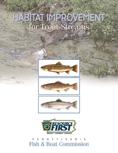
Habitat Improvement for Trout Streams - Pennsylvania Fish and Boat ...
Habitat Improvement for Trout Streams - Pennsylvania Fish and Boat ...
Habitat Improvement for Trout Streams - Pennsylvania Fish and Boat ...

You also want an ePaper? Increase the reach of your titles
YUMPU automatically turns print PDFs into web optimized ePapers that Google loves.
P E N N S Y L V A N I A<br />
<strong>Fish</strong> & <strong>Boat</strong> Commission
<strong>Habitat</strong> <strong>Improvement</strong><br />
F O R T R O U T S T R E A M S<br />
PREPARED BY:<br />
Karl J. Lutz<br />
<strong>Habitat</strong> Management Division<br />
<strong>Pennsylvania</strong> <strong>Fish</strong> & <strong>Boat</strong> Commission<br />
DRAWINGS BY:<br />
Carey W. Huber<br />
2007<br />
PUBLISHED BY THE<br />
<strong>Pennsylvania</strong> <strong>Fish</strong> & <strong>Boat</strong> Commission<br />
P.O. Box 67000<br />
Harrisburg, PA 17106-7000<br />
© 2007 <strong>Pennsylvania</strong> <strong>Fish</strong> & <strong>Boat</strong> Commission<br />
All rights reserved.
Contents<br />
Introduction . . . . . . . . . . . . . . . . . . . . . . . . . . . . . . . . . . . . . . . . . . 1<br />
Stream Ecology . . . . . . . . . . . . . . . . . . . . . . . . . . . . . . . . . . . . . . . 2<br />
Dynamic Nature of <strong>Streams</strong> . . . . . . . . . . . . . . . . . . . . . . . . . . 2<br />
Stream Bank Stabilization. . . . . . . . . . . . . . . . . . . . . . . . . . . . 2<br />
Flood Plains, Wetl<strong>and</strong>s <strong>and</strong> Storm Water . . . . . . . . . . . . . . . . 2<br />
Diversity of <strong>Habitat</strong>s <strong>for</strong> Wild <strong>Trout</strong> . . . . . . . . . . . . . . . . . . . . 2<br />
Woody Debris . . . . . . . . . . . . . . . . . . . . . . . . . . . . . . . . . . . . . 3<br />
Stream Corridor Management. . . . . . . . . . . . . . . . . . . . . . . . . 3<br />
Stream Assessment. . . . . . . . . . . . . . . . . . . . . . . . . . . . . . . . . . . . 5<br />
Permit Requirements <strong>for</strong> <strong>Habitat</strong> Enhancement Structures . . . . . 6<br />
Department of Environmental Protection . . . . . . . . . . . . . . . . 6<br />
U.S. Army Corp of Engineers . . . . . . . . . . . . . . . . . . . . . . . . . 6<br />
General Construction Guidelines . . . . . . . . . . . . . . . . . . . . . . . . . . 6<br />
Construction Materials . . . . . . . . . . . . . . . . . . . . . . . . . . . . . . . . . 7<br />
Logs <strong>and</strong> Timbers . . . . . . . . . . . . . . . . . . . . . . . . . . . . . . . . . . 7<br />
Flooring . . . . . . . . . . . . . . . . . . . . . . . . . . . . . . . . . . . . . . . . . . 7<br />
Rein<strong>for</strong>cement Rods . . . . . . . . . . . . . . . . . . . . . . . . . . . . . . . . 7<br />
Nails . . . . . . . . . . . . . . . . . . . . . . . . . . . . . . . . . . . . . . . . . . . . 7<br />
Stone . . . . . . . . . . . . . . . . . . . . . . . . . . . . . . . . . . . . . . . . . . . . 7<br />
Construction of Structures . . . . . . . . . . . . . . . . . . . . . . . . . . . . . . 8<br />
Boulder Placement . . . . . . . . . . . . . . . . . . . . . . . . . . . . . . . . . 8<br />
Half-Log <strong>and</strong> Whole-Log Structures . . . . . . . . . . . . . . . . . . . . 8<br />
Deflectors . . . . . . . . . . . . . . . . . . . . . . . . . . . . . . . . . . . . . . . . 8<br />
Low Flow Channel Structures . . . . . . . . . . . . . . . . . . . . . . . . 12<br />
Adding Downstream Wings to a Water Jack . . . . . . . . . . . . . 14<br />
Mud Sill Cribbing. . . . . . . . . . . . . . . . . . . . . . . . . . . . . . . . . . 14<br />
Channel Blocks . . . . . . . . . . . . . . . . . . . . . . . . . . . . . . . . . . . 15<br />
Sample Erosion <strong>and</strong> Sedimentation Plan . . . . . . . . . . . . . . . . . . 17<br />
Deflector Dimensions <strong>and</strong> Spacing . . . . . . . . . . . . . . . . . . . . . . . 18<br />
<strong>Habitat</strong> Assessment Forms . . . . . . . . . . . . . . . . . . . . . . . . . . . . . 19<br />
Structure Drawings . . . . . . . . . . . . . . . . . . . . . . . . . . . . . . . . . . . 23<br />
Karl J. Lutz<br />
<strong>Habitat</strong> Manager<br />
450 Robinson Lane<br />
Bellefonte, PA 16823<br />
814-359-5191<br />
E-mail: klutz@state.pa.us
<strong>Fish</strong>, like all living organisms,<br />
need a certain amount of<br />
space in which to live <strong>and</strong><br />
grow. This space is called their habitat,<br />
<strong>and</strong> it must provide everything<br />
that they require <strong>for</strong> their survival<br />
<strong>and</strong> prosperity. The more diverse<br />
this habitat is, the greater potential<br />
it has to support a healthy, self-sustaining<br />
population. While nature<br />
does well on its own, the placement<br />
of artificial habitat structures can<br />
often enhance stream reaches that<br />
lack naturally occurring habitat features.<br />
Lack of natural habitat can be<br />
the result of many situations, including<br />
stream channelization, poor<br />
agricultural practices, inadequate<br />
stormwater management, <strong>and</strong> disturbance<br />
to the riparian zones bordering<br />
the stream.<br />
The <strong>Pennsylvania</strong> <strong>Fish</strong> & <strong>Boat</strong><br />
Commission affirms that fish habitat<br />
improvement projects contribute to<br />
its mission of providing fishing <strong>and</strong><br />
boating opportunities through the<br />
protection <strong>and</strong> management of<br />
aquatic resources. However, the<br />
design <strong>and</strong> placement of fish habitat<br />
improvement structures should not<br />
be a haphazard venture. There is a<br />
science, <strong>and</strong> to some extent, an art<br />
to this process that should not be<br />
ignored. The science comes from<br />
very specific criteria that has been<br />
developed by the <strong>Pennsylvania</strong> <strong>Fish</strong><br />
& <strong>Boat</strong> Commission from decades<br />
of h<strong>and</strong>s-on experience <strong>and</strong> creating<br />
countless successful stream projects.<br />
It is also important to underst<strong>and</strong><br />
how flowing water reacts to<br />
an improvement structure under<br />
HABITAT IMPROVEMENT FOR TROUT STREAMS<br />
Introduction<br />
normal <strong>and</strong>, most especially, higher<br />
flows. The artistic process comes<br />
from developing a personal expertise<br />
<strong>and</strong> philosophy in structure design<br />
<strong>and</strong> placement. And while there are<br />
st<strong>and</strong>ard designs <strong>for</strong> all fish habitat<br />
improvement structures,there may<br />
be a necessity to use some creativity<br />
<strong>and</strong> imagination to modify a device<br />
or adjust the placement as the site<br />
dictates.<br />
This publication presents some basic<br />
underst<strong>and</strong>ing of stream ecology <strong>and</strong><br />
management philosophy as it relates<br />
to habitat improvement. It discusses<br />
stream habitat assessment to help<br />
determine the “limiting factors” that<br />
may keep a stream from reaching<br />
its potential. It offers some general<br />
guidance in determining which habitat<br />
structure is appropriate <strong>for</strong> a<br />
situation <strong>and</strong> how to construct the<br />
device. Permit requirements <strong>for</strong><br />
these designs, which are administered<br />
by the Department of Environmental<br />
Protection (DEP), are also<br />
explained.<br />
1<br />
The terms “fish habitat improvement”<br />
<strong>and</strong> “habitat restoration,” as discussed<br />
in this booklet, involve the<br />
enhancement of the existing stream<br />
channel. With these methods, there<br />
is only minor disturbance to the<br />
stream channel <strong>and</strong> every ef<strong>for</strong>t is<br />
made to use natural materials that<br />
allow fish habitat structures to blend<br />
with their surroundings. Stream<br />
bank stability is often a secondary<br />
benefit, but the primary objective<br />
should be resource-based <strong>and</strong><br />
should seek to provide better aquatic<br />
<strong>and</strong> riparian habitats. While there is<br />
certainly some overlap of purpose,<br />
other stream restoration methods,<br />
including fluvial geomorphology<br />
(FGM), or Natural Stream Channel<br />
Design (NSCD), have a primary goal<br />
of creating stream channel stability,<br />
which often involves a reconfiguration<br />
of the channel <strong>and</strong> often with<br />
major disturbance. Determining<br />
what level of restoration that is<br />
actually needed will determine the<br />
best approach.
Knowing the mechanics of<br />
flowing water, what has good<br />
<strong>and</strong> poor habitat value, <strong>and</strong><br />
how a stream reacts to change are<br />
important elements in underst<strong>and</strong>ing<br />
<strong>and</strong> conducting habitat work.<br />
Dynamic nature of streams<br />
Whether a headwaters trout<br />
stream or a larger river, all<br />
waterways have something in common;<br />
they are dynamic systems,<br />
which means they are ever-changing<br />
<strong>and</strong> reacting to other processes,<br />
both natural <strong>and</strong> man-made. This is<br />
a natural process as the waterway<br />
tends to seek equilibrium with a stable<br />
pattern, profile <strong>and</strong> dimension. If<br />
a stream is channelized <strong>and</strong> made<br />
wider, shallower <strong>and</strong> straighter, it<br />
will inevitably begin to narrow <strong>and</strong><br />
deepen itself again <strong>and</strong> re-establish<br />
its natural me<strong>and</strong>ering pattern. As a<br />
stream changes, some features like<br />
deep pools, remembered as old fishing<br />
holes, may temporarily or permanently<br />
be lost, but they may<br />
appear elsewhere as the stream<br />
evolves through years of varying<br />
flows. The <strong>for</strong>mation of split channels<br />
is also a natural process <strong>and</strong><br />
often provides beneficial habitat<br />
variation <strong>for</strong> young trout <strong>and</strong> other<br />
wildlife. Even though it is<br />
human nature to try to<br />
“stabilize” streams, their<br />
natural evolution causes<br />
their changing <strong>and</strong><br />
even moving from one<br />
place to another<br />
across a valley floor.<br />
These changes can be<br />
subtle, taking decades to<br />
occur, or they can happen<br />
suddenly during a single highwater<br />
event. Successful stream<br />
restoration approaches should work<br />
with what the stream is trying to do,<br />
if possible, instead of working<br />
“against the flow.”<br />
HABITAT IMPROVEMENT FOR TROUT STREAMS<br />
Stream Ecology<br />
Stream<br />
Bank Stabilization<br />
The use of rip-rap (large stone),<br />
gabions (stone-filled wire baskets)<br />
<strong>and</strong> concrete-lined stream<br />
banks all provide good bank stabilization<br />
when properly used, but with<br />
the possible exception of rip-rap,<br />
they have little or no habitat value to<br />
the aquatic environment. To increase<br />
this value <strong>and</strong> add some variation, a<br />
more habitat-friendly approach<br />
should always be considered<br />
as an option <strong>for</strong><br />
stream bank stabilization.<br />
A variety<br />
of more natural<br />
techniques discussed<br />
later in<br />
this publication<br />
can provide<br />
stream bank<br />
stability while<br />
improving fish<br />
habitat.<br />
Flood Plains, Wetl<strong>and</strong>s<br />
<strong>and</strong> Storm Water<br />
The importance of keeping the<br />
stream connected to its flood<br />
2<br />
plain cannot be over-stated. By<br />
allowing high flows to escape the<br />
channel <strong>and</strong> spread out across a<br />
wider area, the hydraulic energy is<br />
released in a more dispersed fashion.<br />
In contrast, constructing a barrier<br />
between the stream <strong>and</strong> its flood<br />
plain confines all the energy from<br />
raging high water to the stream<br />
channel, where it scours away existing<br />
habitats <strong>and</strong> can cause extensive<br />
stream bank damage as it tries to<br />
escape. Evidence of this process can<br />
be readily seen in more urban areas,<br />
where flood plains have been developed<br />
<strong>and</strong> the destructive energy of<br />
high flows is compounded by poor<br />
storm-water practices. Developed<br />
flood plains coupled with ineffective<br />
stormwater management plans allow<br />
excess flows to reach the stream<br />
more quickly, causing higher-thannormal<br />
flows. Since there is less<br />
time <strong>for</strong> water to soak in to the<br />
ground, a period of lower-than-normal<br />
flows can soon follow. Retention<br />
of storm water will go a long way<br />
toward helping retain natural aquatic<br />
<strong>and</strong> riparian habitats. Natural flood<br />
plains often contain wetl<strong>and</strong> features<br />
that are not only valuable <strong>for</strong> wildlife<br />
habitat, but they also act as large<br />
sponges, soaking up higher flows<br />
<strong>and</strong> releasing them gradually, thus<br />
minimizing high flow damage. Eliminating<br />
wetl<strong>and</strong>s not only hurts fish<br />
<strong>and</strong> wildlife habitat, but it also<br />
increases the likelihood of stormwater<br />
damage to human interests.<br />
Diversity of <strong>Habitat</strong>s <strong>for</strong><br />
Wild <strong>Trout</strong><br />
Initially, when many people think of<br />
improving wild trout habitat, they<br />
usually picture a large, easily fished<br />
hole that will be filled with “lunker”<br />
trout. However, the physical makeup<br />
of an ideal trout stream will have a<br />
diversity of habitat types <strong>for</strong> all size<br />
classes of trout <strong>and</strong> other aquatic
organisms. Good<br />
fish habitat serves all the ecological<br />
needs of the species, including<br />
spawning areas, nursery habitats,<br />
<strong>and</strong> <strong>for</strong>aging, resting <strong>and</strong> hiding<br />
areas. There<strong>for</strong>e, the objective of<br />
undertaking a fish habitat improvement<br />
project should address all<br />
aspects of the life history needs of<br />
the designated species.<br />
The objective should not necessarily<br />
be to make every linear foot of<br />
stream fishable <strong>for</strong> adult trout.<br />
<strong>Habitat</strong> diversity is the key <strong>and</strong> will<br />
increase the potential <strong>for</strong> a healthy,<br />
self-sustaining ecosystem. It is also<br />
HABITAT IMPROVEMENT FOR TROUT STREAMS<br />
important to examine an<br />
extended stream stretch beyond the<br />
immediate treatment area <strong>and</strong> any<br />
artificial boundaries or property<br />
lines. For example, a good riffle<br />
stretch on one property may be the<br />
only available riffle habitat nearby<br />
<strong>and</strong> should not necessarily be converted<br />
to more pool habitat. Good<br />
habitat management values the<br />
protection of important existing<br />
habitats as well as the creation<br />
of new habitats.<br />
Woody Debris<br />
To this day, it is often<br />
considered an acceptable<br />
practice to keep<br />
stream channels “clean” by<br />
cutting brush from the<br />
stream banks <strong>and</strong> by removing<br />
larger woody debris from<br />
the channel. Although these<br />
ef<strong>for</strong>ts seem pleasing to the eye,<br />
they usually prove detrimental to the<br />
aquatic environment. Large woody<br />
debris (fallen trees, roots, log jams)<br />
<strong>and</strong> vegetative matter, such as<br />
leaves <strong>and</strong> twigs, which enter the<br />
stream channel, are an important<br />
<strong>and</strong> necessary component of the<br />
aquatic ecosystem. This material<br />
serves as a primary food source as<br />
well as habitat <strong>for</strong> many organisms<br />
throughout the food chain. Larger<br />
woody debris helps to <strong>for</strong>m <strong>and</strong><br />
3<br />
shape the stream channel <strong>and</strong> creates<br />
variability in habitat types.<br />
Woody debris can also provide excellent<br />
trout habitat <strong>and</strong> is not easily<br />
duplicated.<br />
Woody debris provides many benefits<br />
to the stream ecosystem, but individual<br />
debris jams may increase<br />
erosion or endanger roadways,<br />
bridges <strong>and</strong> personal property. In<br />
these cases, it may be necessary<br />
to remove part or all of the jam to<br />
alleviate the problem. Removal decisions<br />
are subjective <strong>and</strong> should be<br />
made individually, ultimately removing<br />
or altering only what is necessary.<br />
In more wilderness areas, it can be<br />
argued to allow woody debris to continually<br />
shape <strong>and</strong> change a stream<br />
channel as a natural process without<br />
interference. It should also be noted<br />
that good wild trout habitat in this<br />
<strong>for</strong>m might not always be “pretty” or<br />
easily fished, but it remains a vital<br />
component of the stream ecosystem.<br />
Stream Corridor<br />
Management<br />
Astream is only as healthy as the<br />
l<strong>and</strong> it flows through. In return,<br />
the l<strong>and</strong> area adjacent to the stream<br />
(known as the riparian zone) derives<br />
nourishment from the stream’s<br />
water. They are connected <strong>and</strong><br />
depend on each other <strong>for</strong> their well
eing. The waterway <strong>and</strong> its riparian<br />
area are a complete ecosystem <strong>and</strong><br />
should be managed as a whole.<br />
There<strong>for</strong>e, when considering aquatic<br />
habitat enhancement, managing the<br />
riparian area is just as important as<br />
placing artificial structures in the<br />
stream. Having a vegetated buffer<br />
zone between the waterway <strong>and</strong><br />
other l<strong>and</strong> uses has many benefits.<br />
Root systems help to keep stream<br />
banks stabilized, reducing the<br />
amount of silt that enters the<br />
stream. Shading from the tree<br />
canopy helps keep water temperatures<br />
cooler, which is necessary <strong>for</strong><br />
the survival of many aquatic organisms.<br />
There is a direct increase in<br />
food, cover <strong>and</strong> nesting habitat <strong>for</strong> a<br />
variety of terrestrial wildlife species.<br />
Woody debris <strong>and</strong> leaf litter, which<br />
end up in the stream, are a necessary<br />
element in a healthy aquatic<br />
ecosystem’s “food chain.” Many<br />
aquatic invertebrates use this material<br />
as habitat <strong>and</strong> as a food source.<br />
The aquatic invertebrates in turn<br />
HABITAT IMPROVEMENT FOR TROUT STREAMS<br />
create an ample <strong>for</strong>age base <strong>for</strong> fish.<br />
Larger trees absorb excess nutrients<br />
through their root systems, changing<br />
them into plant tissue, while some<br />
nutrients are broken down by organisms<br />
in the soil <strong>and</strong> leaf litter. Sediment<br />
can also be filtered out by<br />
thick, understory vegetation. A<br />
buffer of larger shrubs <strong>and</strong> trees<br />
helps to slow flood waters while<br />
deflecting or catching debris, thus<br />
protecting fences <strong>and</strong> other property.<br />
Depending on objectives, management<br />
of the buffer can either be as simple<br />
as letting nature take its course, or<br />
Existing riparian buffers will be protected <strong>and</strong> encouraged to develop naturally with a minimum of<br />
disturbance.<br />
Riparian buffers may be established by simply allowing an area to grow naturally, allowing<br />
natural succession to determine vegetative composition, or can be accelerated with plantings of<br />
native shrubs <strong>and</strong>/or trees.<br />
BBuuffffeerr CCoommppoossiittiioonn:: A <strong>for</strong>ested buffer provides the most benefits <strong>and</strong> should be promoted<br />
whenever possible. However, a native shrub <strong>and</strong>/or grass community is also acceptable if it is a<br />
more amenable l<strong>and</strong> use. Native vegetation should always be selected while the use of exotics <strong>and</strong><br />
ornamentals should be avoided.<br />
BBuuffffeerr WWiiddtthh:: The width of the buffer area can be very subjective depending upon the use of the<br />
site. Forested buffers <strong>and</strong> areas of limited use should be a mmiinniimmuumm of 35 feet wide, measured from<br />
the top of the bank or shoreline. On areas that have been routinely mowed <strong>for</strong> aesthetic reasons, a<br />
mmiinniimmuumm five-foot strip of denser vegetation should be established along the top of the bank.<br />
BBuuffffeerr MMaaiinntteennaannccee:: Riparian buffer areas should be allowed to grow naturally <strong>and</strong> with a<br />
minimum of disturbance. Any removal of noxious plant species <strong>and</strong> exotics should be done<br />
mechanically whenever possible. If chemicals are to be considered, they should be applied to specific<br />
target plants <strong>and</strong> they need to be approved <strong>for</strong> use near water. They also need to be used in<br />
accordance with label instructions <strong>and</strong> con<strong>for</strong>m to all Federal, State <strong>and</strong> Local regulations. Grass<br />
buffers in more manicured areas can be maintained by occasional weed eating, but should remain<br />
considerably denser <strong>and</strong> higher than the adjacent mowed lawn.<br />
Larger woody debris found within the stream channel, on the stream banks or elsewhere in the<br />
riparian zone should be left as habitat <strong>for</strong> aquatic <strong>and</strong> terrestrial animals, unless it is causing property<br />
damage or posing a public health or environmental safety hazard.<br />
4<br />
it can use a more specific approach.<br />
For example, wildflowers or flowering<br />
trees can be planted to improve<br />
aesthetics. Planting to attract wildlife<br />
or to improve water quality may be a<br />
priority, or planting fruit trees or<br />
managing <strong>for</strong> timber production to<br />
yield a future crop can be a goal.<br />
Planting materials should be native<br />
species that tolerate moist soils.<br />
Studies have shown that the survival<br />
of aquatic invertebrates feeding on<br />
native leaf litter was significantly<br />
higher than those consuming exotic<br />
plant species.<br />
In the year 2000, the <strong>Pennsylvania</strong><br />
<strong>Fish</strong> & <strong>Boat</strong> Commission established<br />
a riparian buffer policy to establish<br />
<strong>and</strong>/or preserve, wherever feasible,<br />
a stable, vegetated riparian buffer<br />
zone between waters of the Commonwealth<br />
<strong>and</strong> other l<strong>and</strong> uses on<br />
all Commission property. An excerpt<br />
of the Commission’s riparian buffer<br />
guidelines follows:
Even though the majority of streams<br />
in <strong>Pennsylvania</strong> can benefit from<br />
vegetated riparian buffer zones,<br />
some select streams without temperature-related<br />
problems could<br />
actually be enhanced by “daylighting”<br />
cuts of the thicker, shrubby vegetation.<br />
Typically, the streams that may<br />
fit into this category are the springfed,<br />
meadow limestone streams with<br />
a constant water temperature. By<br />
maintaining a scattering of larger<br />
overstory trees <strong>and</strong> thicker grassy<br />
vegetation <strong>for</strong> stabilization <strong>and</strong> overhanging<br />
cover, the stream actually<br />
can be made more productive by<br />
having sunlight reach a portion of<br />
Conducting pre-project<br />
assessments can be beneficial<br />
during the initial stages of<br />
habitat enhancement planning. Be<strong>for</strong>e<br />
beginning any design work, it is<br />
important to determine the problems,<br />
or limiting factors, that keep the<br />
stream from reaching its potential.<br />
By identifying these limiting factors<br />
<strong>and</strong> developing objectives, creating<br />
an effective work plan will be easier.<br />
The lack of good habitat is often the<br />
limiting factor <strong>and</strong> can easily be<br />
addressed, but sometimes more difficult<br />
problems need to be solved,<br />
such as water quality, stormwater<br />
issues <strong>and</strong> water temperature.<br />
To evaluate habitat features, the<br />
<strong>Pennsylvania</strong> <strong>Fish</strong> & <strong>Boat</strong> Commission<br />
uses a habitat assessment procedure<br />
that originated in the U.S.<br />
Environmental Protection Agency’s<br />
Rapid Bio Assessment Protocols (see<br />
pages 19–22). The procedure is quick<br />
<strong>and</strong> simple to complete <strong>and</strong> is useful<br />
in identifying habitat-limiting factors<br />
<strong>and</strong> making planning decisions to<br />
improve habitat. The assessment<br />
will also provide a numerical score<br />
to show justification <strong>for</strong> project proposals,<br />
or the evaluation can be<br />
HABITAT IMPROVEMENT FOR TROUT STREAMS<br />
the stream channel. This technique<br />
should be considered only where<br />
water temperatures would not rise<br />
above the trout’s tolerance.<br />
Addressing stream <strong>and</strong> riparianrelated<br />
concerns on agricultural l<strong>and</strong><br />
brings into focus some additional<br />
components of stream corridor management.<br />
Practices like streamside<br />
fencing <strong>and</strong> the construction of stable<br />
livestock access ramps <strong>and</strong><br />
crossings are important in managing<br />
many farm properties.<br />
For more detailed in<strong>for</strong>mation on<br />
these matters <strong>and</strong> other agricultural-<br />
Stream Assessment<br />
compared<br />
with post-project assessments.<br />
Stream stretches to be assessed are<br />
first classified as either riffle/runpredominant<br />
or glide/pool-predominant.<br />
The assessment then rates ten<br />
habitat related parameters on a<br />
scale of 0 to 20. Parameters examined<br />
include fish <strong>and</strong> aquatic insect<br />
cover, channel alteration, sediment<br />
5<br />
related concerns, see the <strong>Pennsylvania</strong><br />
<strong>Fish</strong> & <strong>Boat</strong> Commission publication,<br />
Corridor Management <strong>for</strong><br />
Pasturel<strong>and</strong> Stream (Lalo, J., et al.,<br />
1994).<br />
Improving a small stream stretch<br />
<strong>and</strong> its riparian corridor will show<br />
many benefits. However, to realize a<br />
goal of trout stream restoration, it is<br />
often necessary to extend the scope<br />
of the project to a watershed scale.<br />
By assessing the entire stream <strong>and</strong><br />
all of its tributaries, problem areas<br />
can be identified, priorities can be<br />
established, <strong>and</strong> an organized plan of<br />
improvements can be implemented.<br />
deposition, substrate<br />
embeddedness, channel<br />
flow status, frequency <strong>and</strong><br />
quality of riffles, pool variability <strong>and</strong><br />
substrate composition, bank stability,<br />
bank vegetation, <strong>and</strong> riparian<br />
zone width. The cumulative score<br />
(xxx/200) categorizes the stream<br />
stretch as poor (0-55), marginal (56-<br />
105), sub-optimal (106-155) or optimal<br />
(156-200). Each parameter’s<br />
scoring will also help determine
specific limiting factors related to<br />
habitat in the stream stretch.<br />
For a more detailed explanation of<br />
these protocols, see the following<br />
reference: Barbour, M.T.; Gerritsen,<br />
J.; Snyder, B.D.; <strong>and</strong> Stribling, J.B.,<br />
Rapid Bioassessment Protocols <strong>for</strong><br />
Use in <strong>Streams</strong> <strong>and</strong> Wadeable<br />
Rivers: Periphyton, Benthic Macroinvertebrates<br />
<strong>and</strong> <strong>Fish</strong>. Second<br />
Edition. EPA 841-B-99-002. U.S.<br />
Environmental Protection Agency,<br />
Office of Water, Washington, D.C.,<br />
HABITAT IMPROVEMENT FOR TROUT STREAMS<br />
1999. This reference can be found<br />
online at www.epa.gov/owow/<br />
monitoring/rbp/ Chapter 5.<br />
The <strong>Pennsylvania</strong> <strong>Fish</strong> & <strong>Boat</strong><br />
Commission also uses fish surveys<br />
(electrofishing) <strong>and</strong> may conduct<br />
redd (trout nest sites) count surveys<br />
to assess habitat projects. Electrofishing<br />
surveys facilitate the calculation<br />
of wild trout population estimates<br />
<strong>and</strong> age/size class distributions. The<br />
presence or absence of other fish<br />
6<br />
species is also noted during this procedure,<br />
because they are good indicators<br />
of aquatic diversity. Redd<br />
counts are per<strong>for</strong>med during the<br />
spawning period to determine where<br />
trout are attempting to spawn <strong>and</strong> to<br />
determine any increase in spawning<br />
activity as the project proceeds. The<br />
pre-project counts will also help<br />
determine where or where not to<br />
place improvement structures during<br />
the design phase, thus protecting<br />
preferred spawning sites.<br />
Permit Requirements<br />
<strong>for</strong> <strong>Habitat</strong> Enhancement Structures<br />
Department of<br />
Environmental Protection<br />
(DEP)—Chapter 105 & 102<br />
of the <strong>Pennsylvania</strong> Code<br />
Placement of any device in<br />
Commonwealth waters is regulated<br />
under Chapter 105 of DEP’s<br />
regulations. In this chapter, habitat<br />
enhancement structures are considered<br />
an encroachment <strong>and</strong>/or water<br />
obstruction <strong>and</strong> require a permit to<br />
be constructed.<br />
In cooperation with the <strong>Pennsylvania</strong><br />
<strong>Fish</strong> & <strong>Boat</strong> Commission, DEP has<br />
developed General Permit Authorization-1,<br />
<strong>for</strong> fish enhancement<br />
structures. The permit is free <strong>and</strong><br />
authorizes the placement of all<br />
approved structures used by the<br />
Commission’s <strong>Habitat</strong> Management<br />
Division. The proposed design work<br />
requires pre-approval from the<br />
Commission’s Division of <strong>Habitat</strong><br />
As mentioned previously, the<br />
design <strong>and</strong> placement of fish<br />
habitat enhancement structures<br />
should not be a haphazard<br />
Management be<strong>for</strong>e DEP will issue<br />
an acknowledgement letter to proceed<br />
with the project. The acknowledgement<br />
letter, in essence, is the<br />
authorization <strong>and</strong> must be on site<br />
during construction.<br />
DEP’s Chapter 102 addresses the<br />
control of accelerated soil erosion, <strong>and</strong><br />
the resulting sedimentation in Commonwealth<br />
waters. All work per<strong>for</strong>med<br />
under General Permit Authorization-1,<br />
mentioned above, must comply with<br />
Chapter 102. It also requires that an<br />
Erosion <strong>and</strong> Sedimentation (E&S)<br />
Control Plan be developed to minimize<br />
soil erosion resulting from earth<br />
disturbance during the construction<br />
of fish habitat enhancement projects.<br />
This plan must be pre-approved by<br />
the county conservation district <strong>and</strong><br />
must also be on site as part of the<br />
authorization. Review a sample E&S<br />
control plan on page 17.<br />
General Construction Guidelines<br />
venture. The <strong>Habitat</strong> Management<br />
Division uses specific criteria <strong>for</strong><br />
building these structures. The following<br />
guidelines include in<strong>for</strong>ma-<br />
U. S. Army Corps of<br />
Engineers (COE)—Section<br />
404 of the Clean Water Act<br />
The U. S. Army Corps of Engineers<br />
(COE), under Section 404 of the<br />
Clean Water Act, requires a permit<br />
to place any material (or structure)<br />
in any stream with a flow greater<br />
than 5 cubic feet per second. The<br />
COE has issued a general permit<br />
(SPGP-3) <strong>for</strong> the construction <strong>and</strong><br />
maintenance of approved habitat<br />
enhancement structures in Commonwealth<br />
waters. Essentially, the<br />
acknowledgement of <strong>and</strong> compliance<br />
with DEP’s General Permit-1 satisfies<br />
the COE’s Section 404 regulatory<br />
requirements. The exception is if the<br />
project length exceeds 250 linear<br />
feet, in which case the COE will<br />
review the project <strong>and</strong> will issue its<br />
own letter of authorization.<br />
tion on habitat structure designs,<br />
materials <strong>and</strong> installation procedures.<br />
Actually building these structures<br />
is a challenging experience,
<strong>and</strong> varying from these guidelines is<br />
often necessary as dictated by the<br />
uniqueness of the site.<br />
All fish habitat enhancement<br />
structures should be built during<br />
normal low-flow conditions, usually<br />
early summer through the mid-fall.<br />
The completed structure should<br />
never be built at an elevation higher<br />
than the adjacent stream banks, <strong>and</strong><br />
it should slope slightly upward from<br />
the stream to a point on the stream<br />
bank known as “bankfull elevation,”<br />
the height at which high water leaves<br />
the stream channel <strong>and</strong> enters the<br />
flood plain. If both stream banks are<br />
equally high, the bankfull elevation<br />
will be the top of the bank. If one<br />
bank is higher than the other, there<br />
will be a line of noticeable change in<br />
the slope <strong>and</strong>/or vegetation on the<br />
higher bank, indicating the bankfull<br />
elevation. Bankfull water flows have<br />
the most effect on natural channel<br />
alteration <strong>and</strong> should there<strong>for</strong>e be<br />
used as a gauge when installing some<br />
Logs <strong>and</strong> Timbers<br />
Logs that average 6 to 12 inches<br />
in diameter generally fit most<br />
needs, although some situations may<br />
call <strong>for</strong> logs with larger diameters.<br />
Most hardwood <strong>and</strong> some softwood<br />
logs, including hemlock, are adequate.<br />
Species like aspen, birch <strong>and</strong><br />
white pine should be avoided because<br />
they tend to rot much faster. Raw<br />
logs look more natural <strong>and</strong> blend<br />
with the surroundings. The use of<br />
treated or creosoted timbers is not<br />
necessary or advised.<br />
Flooring<br />
Rough-cut hemlock (1” x 8” x 8’)<br />
is used <strong>for</strong> flooring <strong>and</strong> face<br />
boards on water jacks. Eight-inchwide<br />
boards are best because wider<br />
boards may bow, <strong>and</strong> narrower<br />
boards are not efficient when span-<br />
HABITAT IMPROVEMENT FOR TROUT STREAMS<br />
fish habitat improvement structures.<br />
Stone structures should be keyed into<br />
the stream bottom <strong>and</strong> banks. When<br />
using logs, the largest end of the log<br />
should be trenched a minimum of 3<br />
feet to 5 feet into the stream bank.<br />
Logs are anchored to the stream<br />
bottom by drilling <strong>and</strong> pinning with<br />
rebar about every 5 feet along the log,<br />
<strong>and</strong> perhaps closer in the trenches.<br />
Driving rebar through logs <strong>and</strong> into<br />
the stream bottom can be made<br />
much easier by using a 6-inch-long,<br />
2-inch-diameter soft steel driving<br />
head with a ¾-inch-diameter hole<br />
drilled 4 inches deep. The driving<br />
head slips over the rebar <strong>and</strong> gives<br />
the sledgehammer a larger target to<br />
hit. Use slow <strong>and</strong> steady blows to<br />
sink the pin. If the pin hits a rock,<br />
keep the same steady pace <strong>and</strong> the<br />
rock may break. Drive the pin until<br />
the head meets the log, remove the<br />
head, <strong>and</strong> bend over the last 4 inches<br />
parallel <strong>and</strong> flush with the log,<br />
pointing in a downstream direction.<br />
Construction Materials<br />
ning a wider stream channel. Roughcut<br />
oak (2” x 6” x 8’) is used <strong>for</strong><br />
flooring in the overhead cover structures.<br />
The design work of these<br />
structures should allow <strong>for</strong> this<br />
flooring to be submerged at all times<br />
to slow rotting. Single oak boards<br />
span a distance no greater than 8<br />
feet. Treated lumber is not necessary<br />
or advised.<br />
Rein<strong>for</strong>cement Rods<br />
Rebar rods are used to pin logs<br />
together or to secure logs to the<br />
stream bottom. Rods having a 5 /8inch<br />
diameter, cut in lengths of 2, 3<br />
<strong>and</strong> 4 feet, should suit most needs<br />
<strong>for</strong> building habitat improvement<br />
structures. Two-foot pins are used<br />
to attach logs together. Three-foot<br />
pins are used to anchor logs to the<br />
stream bottom in most cases. How-<br />
7<br />
When building structures with<br />
flooring, driving nails into submerged<br />
boards can be made easier<br />
with the use of an “underwater nailer.”<br />
This tool is made from a ½-inchdiameter<br />
heavy gauge water pipe<br />
about 2 feet long <strong>and</strong> a slightly<br />
longer length of 3 /8-inch rebar. Position<br />
the pipe where the nail is to be<br />
driven, drop the nail down the tube,<br />
insert the length of rebar, <strong>and</strong> hammer<br />
the top of the rebar until the<br />
nail is fully seated.<br />
One of the most important things<br />
that can be done to reduce future<br />
maintenance of structures is to<br />
“shingle” the stone fill in place. This<br />
technique involves h<strong>and</strong>-placing<br />
stone in an overlapping fashion (like<br />
shingles on a roof) by starting downstream<br />
<strong>and</strong> working upstream. Even<br />
though it’s not always feasible or<br />
necessary to h<strong>and</strong>-place every stone,<br />
this procedure should be followed<br />
whenever possible.<br />
ever, 4-foot pins can be used <strong>for</strong><br />
extra holding power in fine substrate.<br />
Four-foot pins are also used in the<br />
construction of channel blocks to pin<br />
the brace logs to the main logs <strong>and</strong><br />
on through to the stream bottom.<br />
Nails<br />
Whenever a board is to be<br />
attached to a log, use two nails<br />
equally spaced from the edge of the<br />
board. Galvanized nails are not necessary.<br />
Use 20d common nails when<br />
working with 1-inch flooring <strong>and</strong> 40d<br />
common nails when using 2-inch<br />
flooring. Ten-inch spikes can come in<br />
h<strong>and</strong>y <strong>for</strong> attaching smaller-diameter<br />
logs.<br />
Stone<br />
Only clean, nonpolluting material<br />
should be used to construct fish
enhancement structures. Stone size<br />
depends on structure design <strong>and</strong> the<br />
stream’s scouring ability. Stone used<br />
in log frame structures can be smaller<br />
(usually 12” to 18”) <strong>and</strong> should be<br />
shingled in place. Structures made<br />
Boulder Placement<br />
Placing boulders (see page 23) in<br />
uni<strong>for</strong>m stream stretches with<br />
little fish cover is probably one of<br />
the simplest ways to improve the<br />
aquatic habitat. Water flow will<br />
scour a deeper pocket around the<br />
boulders <strong>and</strong> fish will use the structures<br />
as “side” cover <strong>and</strong> as places<br />
to get out of the main flow. A scattering<br />
of boulders may also provide<br />
a travel corridor through open<br />
areas with minimal<br />
cover. Use boulders<br />
that are large<br />
enough so that<br />
they cannot<br />
be moved by<br />
normal high<br />
flows. Generally,<br />
they<br />
should be<br />
placed in<br />
the center<br />
third or half<br />
of the stream<br />
channel so that<br />
they do not direct<br />
flows against the stream<br />
bank. They can be placed r<strong>and</strong>omly<br />
or in a triangular or diamond<br />
pattern. They can also be placed just<br />
off the tip of a deflector or positioned<br />
to create a small run between<br />
the deflector <strong>and</strong> the boulder. They<br />
can also be placed at the downstream<br />
tip of a single or multi-log<br />
structure as an added brace, which<br />
also provides additional cover.<br />
HABITAT IMPROVEMENT FOR TROUT STREAMS<br />
entirely of stone should use stone<br />
large enough so that it cannot be<br />
moved by normal high flows (usually<br />
18” to 24”). Rock used <strong>for</strong> boulder<br />
placement (usually 24” to 36”) should<br />
not be moved by high flows. Con-<br />
Construction of Structures<br />
8<br />
Half-Log<br />
<strong>and</strong> Whole-<br />
Log Structures<br />
The half-log<br />
or wholelog<br />
structures<br />
(see pages 23 <strong>and</strong><br />
24) are mid-stream<br />
cover devices best<br />
used in uni<strong>for</strong>m areas that<br />
lack fish cover. They are best<br />
placed along the edge of a stream’s<br />
main channel where they don’t take<br />
the full <strong>for</strong>ce of the current, but<br />
where there is enough flow to keep<br />
the structures clean. These structures<br />
are simple to build. They can<br />
be assembled on the stream bank<br />
be<strong>for</strong>e placement.<br />
First, cut two 6” to 8” long sections<br />
of log <strong>for</strong> spacers. Position them<br />
under either end of a heavy piece of<br />
slab wood or whole log. Drill a hole<br />
struction of some devices (rock vanes,<br />
J-hooks, cross vanes) may require<br />
very large stone, sometimes as large<br />
as 4 to 5 feet in diameter (cubeshaped<br />
or rectangular-shape preferred).<br />
through the slab wood or log <strong>and</strong><br />
through the spacers so that the<br />
structure can be pinned together<br />
with a 4-foot rebar pin. Place the<br />
structure in the stream <strong>and</strong> anchor it<br />
by driving the rebar pins into the<br />
stream bottom.<br />
Deflectors<br />
D eflectors are triangular<br />
structures that serve several<br />
purposes. They narrow the existing<br />
stream channel, which causes a<br />
scouring <strong>and</strong> deepening effect along<br />
the outer face of the device. They<br />
will deposit substrate material along<br />
the bank below the device, which<br />
further narrows the channel. They<br />
create some habitat value along the<br />
edges of the device, <strong>and</strong> they provide<br />
some stream bank stability where<br />
the device is located. Deflectors are<br />
often used on overly wide stream<br />
sections or to help move the main<br />
flow away from the stream bank.
Deflectors can vary in design <strong>and</strong><br />
construction materials, depending on<br />
the specific situation. Whatever the<br />
variation, some general guidelines of<br />
shape, size <strong>and</strong> spacing should be<br />
followed during construction of these<br />
structures (see page 18).<br />
The three angles of the triangle<br />
determine the overall shape of the<br />
deflector. The most effective design<br />
calls <strong>for</strong> an upstream angle of 30<br />
degrees (to allow scouring to occur<br />
along the face of the structure while<br />
not causing a damming effect), a<br />
downstream angle of 60 degrees<br />
(to help deflect higher flows back<br />
toward the stream), <strong>and</strong> a 90-degree<br />
angle at the tip of the structure (to<br />
provide strength at a critical point).<br />
The deflector size depends on the<br />
stream channel’s width. Generally,<br />
the distance from the stream bank<br />
to the tip of the structure should<br />
equal a third of the channel width.<br />
This measurement can vary depending<br />
on the situation, but should<br />
never be more than half the channel<br />
width. If you know the distance<br />
measured from the tip of the device<br />
to the stream bank, you can figure<br />
out the other dimensions of the<br />
deflector (see page 18).<br />
Single deflectors can be used to<br />
solve specific problems, but they are<br />
more often used in a pattern alternating<br />
from one stream bank to the<br />
other. This placement helps create a<br />
me<strong>and</strong>ering low-flow channel in the<br />
existing channel. The spacing of<br />
these alternating deflectors varies<br />
from stream to stream, but a good<br />
place to start is to leave the length<br />
of one deflector (measured along the<br />
bank) between structures on opposite<br />
sides. Adjustments can be made<br />
as necessary.<br />
Stone “saw tooth” deflectors (see<br />
page 24) are basically irregular riprap.<br />
They serve not only to stabilize<br />
stream banks, but also to create fish<br />
habitat in the nooks between the<br />
rocks <strong>and</strong> in the backwater area<br />
HABITAT IMPROVEMENT FOR TROUT STREAMS<br />
behind each point. Construction<br />
involves grading the bank, where<br />
possible, to a 3:1 slope (3 feet of<br />
horizontal distance <strong>for</strong> every foot of<br />
vertical drop) <strong>and</strong> then blanketing<br />
the area with large stone up to bankfull<br />
height. The stone can be dumped<br />
in an irregular pattern, or a backhoe<br />
can be used to <strong>for</strong>m the deflector<br />
shapes. In most cases, the deflectors<br />
should extend only about 5 feet out<br />
into the stream.<br />
Larger stone deflectors (see page<br />
25) can also be constructed. Bigger<br />
stone should be used as the frame<br />
<strong>and</strong> keyed into the stream bottom<br />
<strong>and</strong> stream banks. Smaller stone<br />
can then be used to fill the frame’s<br />
interior.<br />
A stone<br />
deflector with single<br />
log (see page 25)<br />
is a variation of<br />
the st<strong>and</strong>ard<br />
stone deflector<br />
that adds a log<br />
<strong>for</strong> some additional<br />
fish<br />
cover. It is<br />
constructed by<br />
embedding the<br />
large end of a log<br />
into the deflector. The<br />
log is positioned parallel<br />
to the device’s downstream edge<br />
<strong>and</strong> allowed to protrude out of the<br />
deflector’s upstream face <strong>for</strong> several<br />
feet. The log may cause some extra<br />
scouring off the tip of the device,<br />
<strong>and</strong> the angle will help direct flows<br />
toward the middle of the stream<br />
channel.<br />
A log-faced stone deflector (see page<br />
26) is another variation of the stone<br />
deflector that uses logs to add an<br />
9<br />
extra lip of cover<br />
along the outer face of the device. It<br />
is constructed by embedding two or<br />
more sill logs into the deflector, perpendicular<br />
to the upstream face of<br />
the device. Only a 1-foot or 2-foot<br />
section of these logs should<br />
extend out from this<br />
edge. A face log is<br />
then attached to<br />
the tips of the sill<br />
logs with a<br />
short piece of<br />
rebar. An additional<br />
one or<br />
two face logs<br />
can be used to<br />
increase the<br />
width of cover, if<br />
desired. Water depth<br />
should be close to two<br />
log diameters deep.
Log frame deflectors (see page 26),<br />
as the name implies, use logs to<br />
frame out the device. The log frame<br />
allows <strong>for</strong> the use of smaller stone<br />
<strong>for</strong> construction. The main log<br />
(upstream log) is first trenched<br />
into the stream bank at a<br />
30-degree angle. The<br />
brace log (downstream<br />
log) is then<br />
trenched into the<br />
bank at a 60degree<br />
angle <strong>and</strong><br />
positioned on top<br />
of the main log at<br />
a 90-degree angle.<br />
The brace log can<br />
now be cut to an exact<br />
fit, so it can lie behind the<br />
main log. The two logs should<br />
then be pinned together using a 2foot<br />
rebar pin. The main log can<br />
overhang the brace log by a few feet<br />
to provide some extra cover <strong>and</strong><br />
scouring effect. To finish the frame,<br />
both logs should be drilled <strong>and</strong><br />
pinned to the stream bottom with 3foot<br />
or 4-foot rebar pins at 5-foot<br />
intervals. Stone can now be shingled<br />
into the frame, using larger stone to<br />
rein<strong>for</strong>ce the areas where the logs<br />
meet the stream bank. Stone should<br />
also be placed behind the brace log<br />
<strong>and</strong> taper downstream to prevent a<br />
scouring effect in this area.<br />
The st<strong>and</strong>ard log frame deflector can<br />
be modified into an improved overhead<br />
cover deflector (see page 27),<br />
providing overhead cover as flows<br />
scour under the face log. This is<br />
accomplished simply by nailing 2” x<br />
6” oak flooring onto the main log<br />
<strong>and</strong> angling it down to the stream<br />
bed within the deflector frame. Only<br />
the outermost third of the main log<br />
should be floored <strong>and</strong> no rebar pins<br />
should be located in this area.<br />
Another layer of logs should be<br />
added, using 2-foot pins, if there is<br />
enough water depth.<br />
A stacked deflector (see page 27) is<br />
a marriage of the log frame <strong>and</strong> the<br />
improved overhead cover deflectors<br />
HABITAT IMPROVEMENT FOR TROUT STREAMS<br />
<strong>and</strong> again<br />
adds overhead cover under the<br />
face log. This device is built by<br />
“stacking” <strong>and</strong> pinning the upstream<br />
main log on top of the downstream<br />
brace log. This provides an immediate<br />
undercut along the face of the<br />
device. The undercut is maintained<br />
by nailing 2” x 6” oak flooring onto<br />
the main log <strong>and</strong> angling it down to<br />
the streambed as with the improved<br />
overhead cover deflector. An additional<br />
log should be pinned on top of<br />
the downstream brace log to act as<br />
a frame to hold the stone in place. A<br />
small diameter framing log can also<br />
be pinned on the flooring along the<br />
face log to help hold the stone as<br />
well. Water depth should be about<br />
two log diameters deep.<br />
In low-gradient streams with a high<br />
slit load, brush deflectors (see page<br />
28) can be constructed from old<br />
Christmas trees or other dense<br />
brush placed in a deflector shape as<br />
an alternative to rock. This type of<br />
deflector encourages the stream to<br />
build a stable stream bank on its<br />
own by trapping silt, which will<br />
eventually become stable with vegetation<br />
growth. The brush should be<br />
compacted <strong>and</strong> secured to stream<br />
bottom with wooden stakes <strong>and</strong><br />
nylon twine <strong>for</strong>ming a webbing over<br />
the top.<br />
10<br />
Other deflector variations are not<br />
really st<strong>and</strong>ard deflectors in the<br />
sense that they do not con<strong>for</strong>m to<br />
the 30-60-90 degree triangle shape,<br />
but they serve their purpose by<br />
deflecting water <strong>and</strong> protecting<br />
stream banks all the same.
A root wad deflector (see page 29) is<br />
comprised of a mature tree stem cut<br />
to a minimum of 8 feet in length<br />
with the root ball still attached.<br />
These devices provide excellent<br />
habitat <strong>and</strong> act to stabilize the<br />
stream bank as well. They are typically<br />
used along higher, eroding<br />
stream banks. To install this device,<br />
a trench is dug at an upstream angle<br />
of 30 degrees. The root wad is<br />
placed into the trench with the root<br />
ball extending into the stream channel.<br />
When laid in the trench, the root<br />
ball should rest on the stream bottom<br />
or it should be one-third to onehalf<br />
submerged in deeper water. The<br />
upstream side of the root ball should<br />
be tight against the stream bank.<br />
Large stone should be placed on the<br />
stem within the trench <strong>and</strong> used to<br />
backfill the gap between the root<br />
ball <strong>and</strong> the stream bank. Root wads<br />
can be installed in an overlapping<br />
fashion or can be spaced out over a<br />
length of stream bank.<br />
Single log vane deflectors (see page<br />
28) are most often used in runs <strong>and</strong><br />
pools to create <strong>and</strong> maintain small<br />
pockets of habitat <strong>and</strong> provide some<br />
stream bank stabilization. Construction<br />
is quite simple, requiring only<br />
the digging of a trench in the stream<br />
bank <strong>for</strong> placement of a log. The log<br />
should extend out from the stream<br />
bank as much as one-third the width<br />
of the stream channel, with at least<br />
HABITAT IMPROVEMENT FOR TROUT STREAMS<br />
as much in the trench.<br />
The log should slope downward<br />
into the stream channel <strong>and</strong><br />
most often be pointed in an<br />
upstream direction at a 20degree<br />
to 30-degree angle.<br />
This will help direct flows<br />
toward the center of the<br />
stream. A log angled in a<br />
downstream direction will<br />
direct flows toward the<br />
stream bank, if desired. It<br />
should be remembered that<br />
water tends to fall off objects at<br />
a 90-degree angle, so the placement<br />
of the log is important. To finish<br />
the structure, large stone should<br />
be placed on the log within the<br />
trench <strong>and</strong> in the area where the log<br />
enters the stream bank.<br />
A multi-log vane deflector (see page<br />
29) is a heftier version of the single<br />
log structure <strong>and</strong> is typically used<br />
where there is a high stream bank.<br />
Construction is the same except that<br />
11<br />
two logs are pinned together sideby-side,<br />
or three logs in the <strong>for</strong>m of<br />
a pyramid.<br />
Rock vanes <strong>and</strong> J-hook vanes (see<br />
pages 30 <strong>and</strong> 31) are linear deflectors<br />
constructed entirely from large<br />
rock (as large as 4 feet to 5 feet<br />
average diameter) <strong>and</strong> will usually<br />
require a trac-hoe with a bucket<br />
“thumb” <strong>for</strong> placement. Rock vanes<br />
<strong>and</strong> J-hook vanes provide stream<br />
bank stabilization, help direct flows<br />
away from the stream bank <strong>and</strong> provide<br />
some plunge-pool habitat.<br />
The linear configuration of the rock<br />
vane structure runs in an upstream<br />
direction at a 20-degree to 30-degree<br />
angle to the stream bank. It begins<br />
at the bankfull height on the stream
ank, <strong>and</strong><br />
drops at a<br />
2 percent to 7 percent slope down<br />
from the stream bank to just above<br />
normal low-flow water levels. A perpendicular<br />
measurement from the<br />
tip of the device to the stream bank<br />
should be one-third of the total<br />
bankfull width. To keep the device<br />
from falling into it’s own scour pool,<br />
the first step in construction is to<br />
embed a line of footer rocks into<br />
stream bottom along the downstream<br />
edge of where the surface<br />
rocks are to be placed. The tops of<br />
these footer rocks should be at the<br />
stream bottom level.<br />
A curved “J-hook” pattern can be<br />
added to the upstream end of the<br />
rock vane to create a centered<br />
plunge pool effect. The rocks of this<br />
extension can have some space<br />
between them, but should also have<br />
footer rocks. This extension should<br />
reach through only the next onethird<br />
of the bankfull width.<br />
These devices work by <strong>for</strong>cing higher<br />
flows to run slightly uphill along the<br />
stream bank, thus removing some of<br />
its energy. Since flowing water tends<br />
to fall off objects at a 90-degree<br />
angle, the device will also turn flows<br />
toward the center of the stream <strong>and</strong><br />
away from stream banks <strong>and</strong> as the<br />
water falls, more energy is released<br />
into the plunge pool.<br />
HABITAT IMPROVEMENT FOR TROUT STREAMS<br />
While these<br />
devices can<br />
be used on<br />
straight<br />
stretches, they<br />
are also well<br />
suited <strong>for</strong> the<br />
outside of curves.<br />
However, it may not<br />
be practical to use<br />
them on outside bends that<br />
exceed a 70-degree radius of curvature.<br />
As a general rule these devices<br />
should be spaced one device length<br />
apart. Placing the uppermost device<br />
<strong>and</strong> observing the water flow can<br />
also determine spacing. The device<br />
will redirect flows away from the<br />
bank, but it will tend to move back<br />
toward the bank at some point<br />
12<br />
below. The next device should be<br />
placed at the point where flow<br />
begins hitting the bank again. In general,<br />
these structures will need to be<br />
closer together on an outside bend<br />
as opposed to a straighter stretch of<br />
stream.<br />
Low Flow Channel<br />
Structures<br />
Stone cross vane (see page 31)<br />
structures extend completely across<br />
the stream channel <strong>and</strong> are<br />
essentially two linear<br />
vanes connected in<br />
the middle. The<br />
two linear<br />
arms should<br />
extend to<br />
one-third of<br />
the bankfull<br />
width each,<br />
with the<br />
middle portion<br />
taking up<br />
the center onethird.Construction<br />
techniques are<br />
similar to linear rock<br />
vanes. These devices are<br />
used <strong>for</strong> grade control <strong>and</strong> <strong>for</strong> centering<br />
flows in the channel, but also<br />
provide some plunge pool habitat.<br />
A log cross vane (see page 32) can<br />
be constructed using a log trenched<br />
into each bank <strong>and</strong> meeting each<br />
other in the middle of the stream
channel. The placement dimensions<br />
should be the same as the stone<br />
cross vane.<br />
A water jack (see page 32) is a pooldigging<br />
device, best suited <strong>for</strong> higher<br />
gradient streams with little pool<br />
habitat. The structure is meant to<br />
create <strong>and</strong> maintain a pool on the<br />
downstream side of the device. It is<br />
not meant to back up water into a<br />
pool above the device where silt will<br />
collect <strong>and</strong> destroy as much habitat<br />
as is being created. Water jacks<br />
should be located in an area with<br />
high stream banks, where the<br />
stream channel is narrow <strong>and</strong><br />
should be situated where a section<br />
of high gradient meets a section of<br />
lower gradient.<br />
Construction begins with the<br />
placement of the main log, perpendicular<br />
to stream flow, onto the<br />
stream bottom <strong>and</strong> into trenches in<br />
each stream bank. Once the log is<br />
level, it is pinned in place on both<br />
ends within the trench (not in the<br />
middle) with 3-foot or 4-foot rebar.<br />
Moving upstream about 3½ to 4<br />
feet, a trench is dug parallel to the<br />
main log. This trench should be deep<br />
enough so that when the nailer log<br />
(6” diameter) is inserted it will sit<br />
considerably lower than the main<br />
log. When a piece of 8-foot flooring<br />
is placed on top of these two logs, it<br />
should be at a 20-degree to 30degree<br />
angle with the stream bottom.<br />
If the flooring is too level, the<br />
trench should be deepened until the<br />
board is close to the correct angel<br />
<strong>and</strong> the end catches in the back of<br />
the trench. When the nailer log sits<br />
deep enough <strong>and</strong> level, it should be<br />
pinned in place like the main log.<br />
Next, take a piece of 1” x 8” x 8’<br />
flooring <strong>and</strong> slide it onto the center<br />
of the two logs at a 90-degree angle<br />
until the end touches the stream<br />
bottom above the nailer log. The<br />
flooring should be driven into the<br />
stream bottom as far as it will go<br />
without lifting off the nailer log. Nail<br />
in place, using four nails per board.<br />
HABITAT IMPROVEMENT FOR TROUT STREAMS<br />
Continue this<br />
procedure in both directions until<br />
there is a single layer of flooring<br />
spanning the entire stream channel.<br />
Use stone <strong>and</strong> gravel to fill any gaps<br />
while creating a smooth transition<br />
between the flooring <strong>and</strong> the banks.<br />
The overhanging ends of these<br />
boards can be trimmed off, but don’t<br />
cut them too short at this point.<br />
To obtain an immediate seal, a layer<br />
of clear, 4-mil plastic, in a 12-foot<br />
width, is laid over this first layer of<br />
flooring. Cut this sheeting so that it<br />
extends at least 5 feet onto both<br />
stream banks. Several pairs of<br />
h<strong>and</strong>s will be needed to help spread<br />
the plastic out <strong>and</strong> hold it above the<br />
structure <strong>and</strong> over the water surface.<br />
When everybody is in position,<br />
lay the upstream edge down onto<br />
the stream bottom <strong>and</strong> secure the<br />
edge with stone <strong>and</strong> gravel. Hold on<br />
to the downstream edge until the<br />
water pressure slowly pulls the<br />
sheeting tight over the flooring.<br />
Water should now be flowing over<br />
the structure, creating a small<br />
waterfall.<br />
Apply a second layer of flooring by<br />
sliding boards down over the plastic<br />
(only until they touch the bottom—<br />
do not drive them through the plastic),<br />
making sure they overlap the<br />
cracks of the first layer. Nail these<br />
13<br />
boards in<br />
place, following the nail line on the<br />
first layer, which can be seen through<br />
the clear plastic (see in<strong>for</strong>mation on<br />
underwater nailers in the Construction<br />
Guidelines section). Trim both<br />
layers of flooring so that only a few<br />
inches overhang the main log.<br />
Be<strong>for</strong>e attaching the wings, the size<br />
of the opening must be determined.<br />
It should be wide enough to take<br />
normal flows, yet narrow enough to<br />
concentrate the hydraulic <strong>for</strong>ce of<br />
the water to dig the desired hole.<br />
The small end of the wing logs<br />
should be pinned through the flooring<br />
<strong>and</strong> into the main log with a 2foot<br />
pin on either side of the desired<br />
opening. The other end of this log<br />
should be pinned in a trench dug at<br />
a 30-degree angle to the bank <strong>and</strong><br />
should slope slightly upward. Complete<br />
the wings by installing brace<br />
logs on both sides, attached by 2foot<br />
pins through the flooring <strong>and</strong><br />
into the main log. Face boards can<br />
be nailed to the inside or outside of<br />
the wing logs to minimize leaking<br />
though this area. To complete the<br />
water jack, stone should be shingled<br />
into each wing <strong>and</strong> any place a log<br />
enters the bank should be rein<strong>for</strong>ced<br />
with large stone.
Adding Downstream Wings<br />
to a Water Jack<br />
After a water jack structure has<br />
been given time to scour a deep<br />
plunge pool (a year or so), the addition<br />
of downstream wings is usually<br />
recommended <strong>and</strong> can help stabilize<br />
<strong>and</strong> greatly enhance this pool area.<br />
The wings can be made of stone<br />
only, or with logs <strong>and</strong> flooring if<br />
additional cover is desired (see page<br />
32). When completed, the downstream<br />
wings should somewhat mirror<br />
the existing upstream wings.<br />
The following describes the<br />
construction of the log <strong>and</strong> flooring<br />
version. Start by digging a trench 3<br />
feet to 4 feet into the stream bank<br />
on the downstream side of the main<br />
log. The trench should be deep<br />
enough that when a sill log is laid in<br />
place, it will be covered by 2 inches<br />
of water. Counter-balance the sill log<br />
by placing large stone within the<br />
trench. Attach the small end of the<br />
wing log to the end of the sill log<br />
with a 2-foot rebar pin. The other<br />
end of this log should be trenched<br />
into the stream bank <strong>and</strong> pinned in<br />
place with 3-foot or 4-foot rebar.<br />
Once secure 2” x 6” x 8’ oak flooring<br />
positioned perpendicular to the<br />
stream bank, is nailed to the top of<br />
this wing log. Overhanging boards<br />
can be trimmed off be<strong>for</strong>e pinning a<br />
top log in place with 2-foot pins,<br />
s<strong>and</strong>wiching the flooring between<br />
the two logs. The final step is to<br />
shingle stone over the flooring <strong>and</strong><br />
rein<strong>for</strong>ce the area where the logs<br />
enter the bank.<br />
A “brookie” water jack (see page 33)<br />
HABITAT IMPROVEMENT FOR TROUT STREAMS<br />
is an<br />
abbreviated<br />
version of the full-sized water jack.<br />
It is meant <strong>for</strong> small brook trout<br />
type streams with the same physical<br />
characteristics as required <strong>for</strong> the<br />
st<strong>and</strong>ard water jack. Construction is<br />
very similar with the main exception<br />
being there is no upstream nailer<br />
log. Instead, the flooring is placed at<br />
a 45-degree angle to the main log<br />
<strong>and</strong> driven into the stream bottom<br />
be<strong>for</strong>e being nailed to the main log.<br />
Two layers of flooring are still used<br />
with or without plastic being s<strong>and</strong>wiched<br />
between the layers. Generally,<br />
stone wings suffice <strong>for</strong> both the<br />
upstream <strong>and</strong> downstream sides of<br />
the device.<br />
Mud Sill Cribbing<br />
Mud sill cribbing (see page 33) is an<br />
excellent overhead cover device that<br />
is best suited <strong>for</strong> lower gradient<br />
streams with steep, eroded banks<br />
14<br />
found next to a deep main channel.<br />
They provide stream bank stability<br />
<strong>and</strong> create a stable undercut bank<br />
effect <strong>for</strong> fish cover. They can be<br />
constructed on a straight stretch of<br />
stream or they can follow the contour<br />
of an outside curve. In most situations,<br />
a backhoe is very helpful, if<br />
not necessary, to construct a<br />
mudsill.<br />
To begin construction, it’s often<br />
desirable to grade any steep banks<br />
back to a 3:1 slope. The next step is<br />
to set the sill logs, usually 8 to 10<br />
feet in length, into a series of<br />
trenches dug perpendicular to the<br />
stream flow. A properly dug trench<br />
should allow a sill log to sit in a level<br />
position with about two 2 to 4 inches<br />
of water over the log. If using an<br />
8-foot sill log, 5 feet should be in the<br />
bank <strong>and</strong> 3 feet should extend out<br />
into the stream (a 6-foot <strong>and</strong> 4-foot<br />
split, if using a 10-foot sill log). Once<br />
the sill log is in proper position,<br />
h<strong>and</strong> place the stone on the back<br />
end until it is stable. Now the backhoe<br />
can dump additional stone into<br />
the trench <strong>and</strong> can be topped off<br />
with soil. The first <strong>and</strong> last trench<br />
should contain only one sill log,<br />
while the ones in between should be<br />
doubled. The widest point between<br />
sill logs should be 8 feet or less.<br />
After all the sill logs are in position,<br />
attach face logs running from the tip<br />
of one sill to the next using 2-foot<br />
pins. Drive these pins only to the<br />
point where they are flush with the<br />
bottom of the sill log so no debris<br />
catches underneath.<br />
Next, nail 2” x 6” x 8’ oak flooring
from sill to sill, running from the<br />
face log to the stream bank, to create<br />
an overhanging or “front porch”<br />
effect. If the sills are set properly,<br />
this flooring should remain slightly<br />
underwater.<br />
To complete the framework, a wing<br />
log should be added to each end of<br />
the structure, running from the tip of<br />
the last sill to the bank. This log<br />
should slope slightly upward <strong>and</strong><br />
enter a bank trench at a 30-degree<br />
angle. To provide some extra cover,<br />
oak flooring can be nailed to the<br />
wing logs, running at a downward<br />
angle toward the stream bank.<br />
To finish, single stone over the<br />
flooring, fill the wings with stone <strong>and</strong><br />
place stone on the stream bank up<br />
to bankfull height. As always, rein<strong>for</strong>ce<br />
the wing logs where they enter<br />
the bank.<br />
The modified mud sill crib (see page<br />
34) is a simplified version of the full<br />
mud sill crib. It is used in the same<br />
situations as the full mud sill, but<br />
does not use the oak board flooring.<br />
This allows the spacing of the sill<br />
logs to vary up to 15 feet apart. This<br />
is useful if trenches need to be dug<br />
around trees or other obstructions<br />
along the stream bank. Two face<br />
logs are used to <strong>for</strong>m the undercut<br />
instead of the flooring.<br />
Construction begins by setting the<br />
sill logs as with the full mud<br />
sill structure (see above).<br />
Double-face logs are then<br />
pinned to the tips of the<br />
sill logs with 2-foot<br />
rebar pins. Stone fill is<br />
placed from the face<br />
logs back to the bankfull<br />
point on the<br />
stream bank. Larger<br />
stone can be propped<br />
up along the face log by<br />
h<strong>and</strong> to maintain the<br />
undercut when back filling<br />
with stone. Water depth<br />
should be no more than two<br />
log diameters deep.<br />
HABITAT IMPROVEMENT FOR TROUT STREAMS<br />
The bank<br />
cover crib (see page 34) is a simplified<br />
variation of the mudsill cribbing<br />
<strong>and</strong> provides similar benefits of<br />
stream bank stability <strong>and</strong> overhead<br />
cover. It is most suited to span an<br />
outside bend of an eroded stream<br />
bank, but can work on a straight<br />
stretch as well.<br />
Begin by digging a trench on both<br />
sides of an outside turn. Insert a single<br />
log into these trenches so that it<br />
spans the bend, sits level <strong>and</strong> is submerged<br />
by 2 inches of water. Pin the<br />
log in the trenches with 3-foot or 4foot<br />
rebar pins.<br />
Oak flooring (2” x 6”) is now nailed<br />
perpendicular to the log, sloping<br />
downward toward the stream bank<br />
at an angle no<br />
greater<br />
than<br />
15<br />
45 degrees. Attach a top log by using<br />
2-foot pins driven through the flooring<br />
<strong>and</strong> into the bottom log. To avoid<br />
catching debris, do not allow these<br />
pins to extend out of the bottom log.<br />
The final steps are to grade the bank<br />
to a 3:1 slope, if necessary, fill the<br />
frame with stone, <strong>and</strong> rein<strong>for</strong>ce the<br />
logs where they enter the bank. Sill<br />
logs can be used under a splice of<br />
the main log or to modify the structure<br />
<strong>for</strong> straight stretches. A face log<br />
should not span more than 15-feet<br />
without the addition of a sill log.<br />
Channel Blocks<br />
Channel block structures are<br />
designed to do just what the<br />
name implies—block off the flow of<br />
one channel <strong>and</strong> divert all the flow<br />
into another channel. It should be<br />
noted that every split channel does<br />
not necessarily need to be blocked.<br />
In fact, many side channels add to<br />
the variety of habits in the stream’s<br />
ecosystem <strong>and</strong> are often used as<br />
nursery waters <strong>for</strong> young trout. They<br />
might be best used to direct normal<br />
flows away from a road, building or<br />
other property. However, remember<br />
that the blocked channel will still fill<br />
with water during higher flows.<br />
When deciding to modify a split<br />
channel with this structure, it is critical<br />
to choose the best channel to<br />
block off. Though many factors come<br />
into play, generally it is best to work
with what the stream may be trying<br />
to do. It is important to construct<br />
these structures at a lower elevation<br />
than the surrounding stream banks,<br />
as to allow higher flows to pass over<br />
the device, releasing pressure on the<br />
main channel.<br />
A log frame channel block (see page<br />
35), best <strong>for</strong> smaller streams, is<br />
started by placing two parallel logs<br />
into slight depressions across the<br />
stream bottom <strong>and</strong> into trenches in<br />
each stream bank. The logs should<br />
be about 4 feet apart with the back<br />
log a little smaller or sit slightly<br />
lower than the front log. Pin these<br />
two logs in the trenches using 3-foot<br />
or 4-foot rebar pins.<br />
Next, cut brace logs long enough to<br />
span the distance across the two<br />
lower logs. Spaced about 4 feet to 5<br />
feet apart, pin the brace logs in<br />
place by driving a 4-foot pin through<br />
both logs <strong>and</strong> into the stream bottom.<br />
Fill this frame <strong>and</strong> the trenches with<br />
stone, making sure that the overall<br />
height of the structure is lower than<br />
the surrounding stream banks. To<br />
complete the structure, place stone<br />
behind the back log, tapering downstream,<br />
to prevent scouring in this<br />
area.<br />
In some situations, especially larger<br />
streams with higher flows, it may be<br />
more feasible to build a stone channel<br />
block (see page 35). Use stone<br />
large enough so they are not moved<br />
by normal high flows. Key them in<br />
References<br />
HABITAT IMPROVEMENT FOR TROUT STREAMS<br />
the width<br />
of the channel bottom <strong>and</strong> slightly<br />
into the stream banks. Larger stone<br />
should be used as a frame to hold<br />
the smaller stone in the middle <strong>and</strong><br />
behind the structure. As with the log<br />
frame structure, make sure the overall<br />
height of the stone structure is<br />
lower than the surrounding stream<br />
bank.<br />
Closing<br />
The first version of this publication<br />
was printed in the 1950s, <strong>and</strong> the<br />
<strong>Pennsylvania</strong> <strong>Fish</strong> & <strong>Boat</strong> Commission<br />
has been conducting fish habitat<br />
improvement since the 1930s. At<br />
first, work was done with Commission<br />
staff <strong>and</strong> equipment. Later, the<br />
work developed into a cooperative<br />
program using conservation-minded<br />
volunteers from all over the Commonwealth.<br />
Over the years, the<br />
designs <strong>and</strong> techniques have<br />
changed, but the mission remains<br />
the same—<br />
providing fishing <strong>and</strong> boating opportunities<br />
through the protection <strong>and</strong><br />
management of aquatic resources.<br />
In 2006, the Commission elevated<br />
its commitment to restoring <strong>and</strong><br />
improving aquatic habitats by creating<br />
the Division of <strong>Habitat</strong> Management<br />
under the Bureau of <strong>Fish</strong>eries.<br />
This new division will build on<br />
decades of successful habitat work<br />
by providing more expertise in the<br />
field, bringing more funding to the<br />
table, <strong>and</strong> extending its outreach to<br />
those interested in improving the<br />
aquatic resource. Continuing <strong>and</strong><br />
exp<strong>and</strong>ing the existing partnerships<br />
with individuals, organizations <strong>and</strong><br />
other agencies will be a vital part of<br />
completing the high-quality habitat<br />
work that will keep <strong>Pennsylvania</strong> a<br />
national leader in fish habitat<br />
initiatives.<br />
Barbour, M.T.; Gerritsen, J.; Snyder, B.D.; <strong>and</strong> Stribling, J.B. Rapid Bioassessment Protocols <strong>for</strong> Use in <strong>Streams</strong><br />
<strong>and</strong> Wadeable Rivers: Periphyton, Benthic Macroinvertebrates <strong>and</strong> <strong>Fish</strong>. Second Edition. EPA 841-B-99-002, U.S.<br />
Environmental Protection Agency, Office of Water. Washington, D.C., 1999.<br />
Lalo, J. <strong>and</strong> Lutz, K.J. Corridor Management <strong>for</strong> Pasturel<strong>and</strong> <strong>Streams</strong>. <strong>Pennsylvania</strong> <strong>Fish</strong> & <strong>Boat</strong> Commission,<br />
1994.<br />
16
HABITAT IMPROVEMENT FOR TROUT STREAMS<br />
Sample Erosion <strong>and</strong> Sedimentation Plan<br />
<strong>Pennsylvania</strong> <strong>Fish</strong> & <strong>Boat</strong> Commission<br />
Division of Environmental Services<br />
<strong>Habitat</strong> Management Section<br />
450 Robinson Lane<br />
Bellefonte, PA 16823-9620<br />
Erosion & Sedimentation Control Plan<br />
<strong>for</strong> the Construction of<br />
<strong>Fish</strong> Enhancement Structures<br />
1. Maps <strong>and</strong> Plans:<br />
• Maps should show the location of the project with respect to municipalities, access roads, existing<br />
structures or other l<strong>and</strong>marks.<br />
• Work plans should show a detailed drawing of the specific work site including device dimensions, stream<br />
width <strong>and</strong> other on-site features (including seed mixtures <strong>and</strong> rates of seeding <strong>and</strong> mulching).<br />
2. All work will be done during low-flow conditions, avoiding periods during or immediately following heavy<br />
precipitation.<br />
3. Any <strong>and</strong> all equipment work will be done from the stream bank. Equipment should be inspected to ensure that<br />
there is no leaking of lubricants, fuel, hydraulic fluids, etc.<br />
4. Excavation of stream banks <strong>and</strong>/or stream bottom <strong>for</strong> the purpose of keying in stone <strong>and</strong>/or timbers, will be<br />
restricted to work that can be completed in one day.<br />
5. All disturbed areas will be immediately stabilized with rock, seeding, <strong>and</strong> mulching, or other suitable material,<br />
during the one-day construction limit. Newly vegetated areas will be inspected <strong>and</strong> repaired (as needed) until<br />
grass is well established.<br />
6. Grass seed mixtures used in stabilization will be either a shade, conservation or slope variety depending upon<br />
the site requirements. H<strong>and</strong> broadcasting of seed will average six pounds per 1,000 sq. ft.<br />
7. Straw or hay mulch will be placed by h<strong>and</strong> to produce a loose layer three-fourths to one inch deep. (2.5<br />
Tons/Acre)<br />
8. Only clean, nonpolluting materials shall be used as fill, which should be shingled or keyed into the structures<br />
<strong>for</strong> longevity. Minimum stone size should be R-4, as rated by the National Stone Association.<br />
9. Any material excavated during the installation of the structures should be deposited in a suitable site away<br />
from areas affected by flood waters or wetl<strong>and</strong>s, <strong>and</strong> stabilized within 24 hours of initial excavation.<br />
10. All enhancement structures shall be constructed according to approved <strong>Pennsylvania</strong> <strong>Fish</strong> & <strong>Boat</strong> Commission<br />
specifications. Other designs may be reviewed on a case-by-case basis.<br />
11. Enhancement structures shall be maintained in a safe <strong>and</strong> functional condition, including necessary debris<br />
removal by the owner.<br />
17<br />
Revised 6/11/98
HABITAT IMPROVEMENT FOR TROUT STREAMS<br />
Deflector Dimensions <strong>and</strong> Spacing<br />
18<br />
1 /3<br />
1 /3<br />
1 /3
HABITAT IMPROVEMENT FOR TROUT STREAMS<br />
<strong>Habitat</strong> Assessment Field Data Sheet – Low Gradient <strong>Streams</strong> (side 1)<br />
Stream Name: Location:<br />
Station #: Rivermile: Basin/Sub-basin: Agency:<br />
Lat: Long: Date:<br />
Time: am pm<br />
Investigators: TOTAL SCORE:<br />
<strong>Habitat</strong><br />
Parameter<br />
1. Epifaunal<br />
Substrate/<br />
Available Cover<br />
Condition Category<br />
19<br />
Reason <strong>for</strong> Survey:<br />
Optimal Suboptimal Marginal Poor<br />
Greater than 50% of substrate<br />
favorable <strong>for</strong> epifaunal<br />
colonization & fish cover;<br />
mix of snags submerged logs,<br />
undercut banks, cobble or<br />
other stable habitat <strong>and</strong> at<br />
stage to allow full<br />
colonization potential<br />
(logs/snags that are not new<br />
fall <strong>and</strong> not transient<br />
30-50% mix of stable<br />
habitat; well suited <strong>for</strong> full<br />
colonization potential;<br />
adequate habitat <strong>for</strong><br />
maintenance of<br />
populations; presence of<br />
additional substrate in the<br />
<strong>for</strong>m of newfall, but not<br />
yet prepared <strong>for</strong><br />
colonization (may rate at<br />
high end of scale.<br />
10-30% mix of stable<br />
habitat; habitat availability<br />
less than desirable;<br />
substrate frequently<br />
disturbed or removed.<br />
Less than 10% stable<br />
habitat; lack of habitat is<br />
obvious; substrate unstable<br />
or lacking<br />
SCORE: 20 19 18 17 16 15 14 13 12 11 10 9 8 7 6 5 4 3 2 1 0<br />
2. Pool Substrate<br />
Characterization<br />
Mixture of substrate<br />
materials, with gravel <strong>and</strong><br />
firm s<strong>and</strong> prevalent; root mats<br />
<strong>and</strong> submerged vegetation<br />
common.<br />
Mixture of soft s<strong>and</strong>, mud<br />
or clay; mud may be<br />
dominant; some root mats<br />
<strong>and</strong> submerged vegetation<br />
present.<br />
All mud or clay or s<strong>and</strong><br />
bottom; little or no root<br />
mat; no submerged<br />
vegetation.<br />
Hard-pan clay or bedrock;<br />
no root mat or vegetation.<br />
SCORE:<br />
3. Pool Variability<br />
20 19 18 17 16 15 14 13 12 11 10 9 8 7 6 5 4 3 2 1 0<br />
Note: Deep = > 18”<br />
Even mix of large-shallow,<br />
large-deep, small-shallow,<br />
small-deep pools present.<br />
Majority of pools largedeep;<br />
very few shallow.<br />
Shallow pools much more<br />
prevalent than deep pools.<br />
Majority of pools smallshallow<br />
or pools absent.<br />
SCORE: 20 19 18 17 16 15 14 13 12 11 10 9 8 7 6 5 4 3 2 1 0<br />
4. Sediment<br />
Deposition<br />
Little or no enlargement of<br />
isl<strong>and</strong>s or point bars <strong>and</strong> <br />
20% of the bottom affected<br />
by sediment deposition.<br />
Some new increase in bar<br />
<strong>for</strong>mation, mostly from<br />
gravel, s<strong>and</strong> or fine<br />
sediment; 20-50% of the<br />
bottom affected; slight<br />
deposition in pools.<br />
Moderate deposition of<br />
new gravel, s<strong>and</strong> or fine<br />
sediment on old <strong>and</strong> new<br />
bars; 50-80% of the bottom<br />
affected; sediment deposits<br />
at obstructions,<br />
constrictions <strong>and</strong> bends;<br />
moderate deposition of<br />
pools prevalent.<br />
Heavy deposits of fine<br />
material, increased bar<br />
development; more than<br />
80% of the bottom<br />
changing frequently; pools<br />
almost absent due to<br />
substantial sediment<br />
deposition.<br />
SCORE: 20 19 18 17 16 15 14 13 12 11 10 9 8 7 6 5 4 3 2 1 0<br />
5. Channel Flow<br />
Status<br />
SCORE:<br />
<strong>Habitat</strong> Assessment Forms<br />
Water reaches base of both<br />
lower banks <strong>and</strong> minimal<br />
amount of channel substrate<br />
is exposed.<br />
Water fills 75% of the<br />
available channel; or<br />
25% of channel substrate<br />
is exposed.<br />
Water fills 25-75% of the<br />
available channel, <strong>and</strong>/or<br />
riffle substrates are mostly<br />
exposed.<br />
Very little water in channel<br />
<strong>and</strong> mostly present as<br />
st<strong>and</strong>ing pools.<br />
20 19 18 17 16 15 14 13 12 11 10 9 8 7 6 5 4 3 2 1 0
<strong>Habitat</strong><br />
Parameter<br />
6. Channel<br />
Alteration<br />
HABITAT IMPROVEMENT FOR TROUT STREAMS<br />
Condition Category<br />
20<br />
Low Gradient <strong>Streams</strong> (side 2)<br />
Optimal Suboptimal Marginal Poor<br />
Channelization or dredging<br />
absent or minimal; stream<br />
with normal pattern.<br />
Some channelization<br />
present, usually in areas of<br />
bridge abutments; evidence<br />
of past channelization i.e.,<br />
dredging (greater than past<br />
20 years) may be present,<br />
but recent channelization is<br />
not present.<br />
Channelization may be<br />
extensive; embankments or<br />
shoring structures present<br />
on both banks; <strong>and</strong> 40-80%<br />
of stream reach<br />
channelized <strong>and</strong> disrupted.<br />
Banks shored with gabion<br />
or cement; over 80% of the<br />
stream reach channelized<br />
<strong>and</strong> disrupted. Instream<br />
habitat greatly altered or<br />
removed entirely.<br />
SCORE: 20 19 18 17 16 15 14 13 12 11 10 9 8 7 6 5 4 3 2 1 0<br />
7. Channel<br />
Sinuosity<br />
SCORE:<br />
8. Bank Stability<br />
Note: Determine left &<br />
Right by facing<br />
downstream.<br />
Score (LB):<br />
Score (RB):<br />
9. Vegetative<br />
Protection<br />
The bends in the stream<br />
increase the stream length 3<br />
to 4 times longer than if it<br />
was in a straight line. (Note:<br />
channel braiding is<br />
considered normal in coastal<br />
plains <strong>and</strong> other low-lying<br />
areas. This is not easily rated<br />
in these areas).<br />
The bends in the stream<br />
increase the stream length<br />
2 to 3 times longer than if<br />
it was in a straight line.<br />
The bends in the stream<br />
increase the stream length<br />
1 to 2 times longer than if<br />
it was in a straight line.<br />
Channel straight; waterway<br />
has been channelized <strong>for</strong> a<br />
long distance.<br />
20 19 18 17 16 15 14 13 12 11 10 9 8 7 6 5 4 3 2 1 0<br />
Banks stable; evidence of<br />
erosion or bank failure absent<br />
or minimal; little potential <strong>for</strong><br />
future problems. 5% of<br />
bank affected.<br />
Moderately stable;<br />
infrequent, small areas of<br />
erosion mostly healed<br />
over. 5 – 30 % of bank in<br />
reach has areas of erosion.<br />
Moderately unstable; 30 –<br />
60 % of bank in reach has<br />
areas of erosion; high<br />
erosion potential during<br />
floods.<br />
Unstable; many eroded<br />
areas; raw areas frequent<br />
along straight sections <strong>and</strong><br />
bends; obvious bank<br />
sloughing; 60 – 100 % of<br />
bank has erosional scars.<br />
10 9 8 7 6 5 4 3 2 1 0<br />
10 9 8 7 6 5 4 3 2 1 0<br />
More than 90% of the stream<br />
bank surfaces <strong>and</strong> immediate<br />
riparian zone covered by<br />
native vegetation, including<br />
trees, understory shrubs, or<br />
non-woody macrophytes;<br />
vegetative disruption through<br />
grazing or mowing minimal<br />
or not evident; almost all<br />
plants allowed to grow<br />
naturally.<br />
Width of riparian zone 18<br />
meters (58”); human activities<br />
(parking lots, roadbeds,<br />
clearcuts, lawns or crops)<br />
have not impacted zone.<br />
70 – 90% of the stream<br />
bank surfaces covered by<br />
native vegetation, but one<br />
class of plants is not well<br />
represented; disruption<br />
evident but not affecting<br />
full plant growth potential<br />
to any great extent; more<br />
than one-half of the<br />
potential plant stubble<br />
height remaining.<br />
Width of riparian zone 12<br />
– 18 meters (39’-58’);<br />
human activities have<br />
impacted zone only<br />
minimally.<br />
50 – 70% of the stream<br />
bank surfaces covered by<br />
vegetation; disruption<br />
obvious; patches of bare<br />
soil or closely cropped<br />
vegetation common; less<br />
than one-half of the<br />
potential plant stubble<br />
height remaining.<br />
Width of riparian zone 6 –<br />
12 meters (20’-39’);<br />
human activities have<br />
impacted zone a great deal.<br />
Less than 50% of the<br />
stream bank surfaces<br />
covered by vegetation;<br />
disruption of stream bank<br />
vegetation is very high;<br />
vegetation has been<br />
removed to 5 centimeters<br />
or less in average stubble<br />
height.<br />
Score (LB):<br />
10 9 8 7 6 5 4 3 2 1 0<br />
Score (RB):<br />
10. Riparian<br />
Vegetative Zone<br />
Width<br />
10 9 8 7 6 5 4 3 2 1 0<br />
Score (LB):<br />
Score (RB):<br />
Width of riparian zone 6<br />
meters (20’); little or no<br />
riparian vegetation due to<br />
human activities.<br />
10 9 8 7 6 5 4 3 2 1 0<br />
10 9 8 7 6 5 4 3 2 1 0
HABITAT IMPROVEMENT FOR TROUT STREAMS<br />
<strong>Habitat</strong> Assessment Field Data Sheet – High Gradient <strong>Streams</strong> (side 1)<br />
Stream Name: Location:<br />
Station #: Rivermile: Basin/Sub-basin: Agency:<br />
Lat: Long: Date:<br />
Time: am pm<br />
Investigators: TOTAL SCORE:<br />
<strong>Habitat</strong><br />
Parameter<br />
1. Epifaunal<br />
Substrate/<br />
Available Cover<br />
Condition Category<br />
21<br />
Reason <strong>for</strong> Survey:<br />
Optimal Suboptimal Marginal Poor<br />
Greater than 70% of substrate<br />
favorable <strong>for</strong> epifaunal<br />
colonization & fish cover;<br />
mix of snags submerged logs,<br />
undercut banks, cobble or<br />
other stable habitat <strong>and</strong> at<br />
stage to allow full<br />
colonization potential<br />
(logs/snags that are not new<br />
fall <strong>and</strong> not transient<br />
40-70% mix of stable<br />
habitat; well suited <strong>for</strong> full<br />
colonization potential;<br />
adequate habitat <strong>for</strong><br />
maintenance of<br />
populations; presence of<br />
additional substrate in the<br />
<strong>for</strong>m of newfall, but not<br />
yet prepared <strong>for</strong><br />
colonization (may rate at<br />
high end of scale.<br />
20-40% mix of stable<br />
habitat; habitat availability<br />
less than desirable;<br />
substrate frequently<br />
disturbed or removed.<br />
Less than 20% stable<br />
habitat; lack of habitat is<br />
obvious; substrate unstable<br />
or lacking<br />
SCORE:<br />
2. Embeddedness<br />
20 19 18 17 16 15 14 13 12 11 10 9 8 7 6 5 4 3 2 1 0<br />
Gravel, cobble <strong>and</strong> boulder<br />
particles are 0-25%<br />
surrounded by fine sediment.<br />
Layering of cobble provides<br />
diversity of niche space.<br />
Gravel, cobble <strong>and</strong> boulder<br />
particles are 25-50%<br />
surrounded by fine<br />
sediment.<br />
Gravel, cobble <strong>and</strong> boulder<br />
particles are 50-75%<br />
surrounded by fine<br />
sediment.<br />
Gravel, cobble <strong>and</strong> boulder<br />
particles are more than<br />
75% surrounded by fine<br />
sediment.<br />
SCORE: 20 19 18 17 16 15 14 13 12 11 10 9 8 7 6 5 4 3 2 1 0<br />
3. Velocity/Depth<br />
Regime<br />
Note: Deep = > 18”<br />
All four velocity/depth<br />
regimes present (slow-deep,<br />
slow-shallow, fast-deep, fastshallow)<br />
(Slow is 0.3 m/s,<br />
deep is 0.5 m).<br />
Only 3 of the 4 regimes<br />
present (if fast-shallow is<br />
missing, score lower than<br />
if missing other regimes).<br />
Only 2 of the 4 habitat<br />
regimes present (if fastshallow<br />
or slow-shallow<br />
are missing, score low).<br />
Dominated by 1<br />
velocity/depth regime<br />
(usually slow-deep).<br />
SCORE: 20 19 18 17 16 15 14 13 12 11 10 9 8 7 6 5 4 3 2 1 0<br />
4. Sediment<br />
Deposition<br />
Little or no enlargement of<br />
isl<strong>and</strong>s or point bars <strong>and</strong> <br />
5% of the bottom affected by<br />
sediment deposition.<br />
Some new increase in bar<br />
<strong>for</strong>mation, mostly from<br />
gravel, s<strong>and</strong> or fine<br />
sediment; 5-30% of the<br />
bottom affected; slight<br />
deposition in pools.<br />
Moderate deposition of<br />
new gravel, s<strong>and</strong> or fine<br />
sediment on old <strong>and</strong> new<br />
bars; 30-50% of the bottom<br />
affected; sediment deposits<br />
at obstructions,<br />
constrictions <strong>and</strong> bends;<br />
moderate deposition of<br />
pools prevalent.<br />
Heavy deposits of fine<br />
material, increased bar<br />
development; more than<br />
50% of the bottom<br />
changing frequently; pools<br />
almost absent due to<br />
substantial sediment<br />
deposition.<br />
SCORE: 20 19 18 17 16 15 14 13 12 11 10 9 8 7 6 5 4 3 2 1 0<br />
5. Channel Flow<br />
Status<br />
Water reaches base of both<br />
lower banks <strong>and</strong> minimal<br />
amount of channel substrate<br />
is exposed.<br />
Water fills 75% of the<br />
available channel; or<br />
25% of channel substrate<br />
is exposed.<br />
Water fills 25-75% of the<br />
available channel, <strong>and</strong>/or<br />
riffle substrates are mostly<br />
exposed.<br />
Very little water in channel<br />
<strong>and</strong> mostly present as<br />
st<strong>and</strong>ing pools.<br />
SCORE: 20 19 18 17 16 15 14 13 12 11 10 9 8 7 6 5 4 3 2 1 0
<strong>Habitat</strong><br />
Parameter<br />
6. Channel<br />
Alteration<br />
HABITAT IMPROVEMENT FOR TROUT STREAMS<br />
Condition Category<br />
22<br />
High Gradient <strong>Streams</strong> (side 2)<br />
Optimal Suboptimal Marginal Poor<br />
Channelization or dredging<br />
absent or minimal; stream<br />
with normal pattern.<br />
Some channelization<br />
present, usually in areas of<br />
bridge abutments; evidence<br />
of past channelization i.e.,<br />
dredging (greater than past<br />
20 years) may be present,<br />
but recent channelization is<br />
not present.<br />
Channelization may be<br />
extensive; embankments or<br />
shoring structures present<br />
on both banks; <strong>and</strong> 40-80%<br />
of stream reach<br />
channelized <strong>and</strong> disrupted.<br />
Banks shored with gabion<br />
or cement; over 80% of the<br />
stream reach channelized<br />
<strong>and</strong> disrupted. Instream<br />
habitat greatly altered or<br />
removed entirely.<br />
SCORE: 20 19 18 17 16 15 14 13 12 11 10 9 8 7 6 5 4 3 2 1 0<br />
7. Frequency of<br />
Riffles (or bends)<br />
Occurrence of riffles<br />
relatively frequent; ratio of<br />
distance between riffles<br />
divided by width of the<br />
stream 7:1 (generally 5 to<br />
7); variety of habitat is key in<br />
streams where riffles are<br />
continuous, placement of<br />
boulders or other large natural<br />
obstruction is important.<br />
Occurrence of riffles<br />
infrequent; distance<br />
between riffles divided by<br />
the width of the stream is<br />
between 7 to 15.<br />
Occasional riffle or bend;<br />
bottom contours provide<br />
habitat; distance between<br />
riffles divided by the width<br />
of the stream is between 15<br />
to 25.<br />
Generally all flat water or<br />
shallow riffles; poor<br />
habitat; distance between<br />
riffles divided by the width<br />
of the stream is a ratio of<br />
25.<br />
SCORE: 20 19 18 17 16 15 14 13 12 11 10 9 8 7 6 5 4 3 2 1 0<br />
8. Bank Stability<br />
Note: Determine left &<br />
right banks by facing<br />
downstream.<br />
Score (LB):<br />
Score (RB):<br />
9. Vegetative<br />
Protection<br />
Banks stable; evidence of<br />
erosion or bank failure absent<br />
or minimal; little potential <strong>for</strong><br />
future problems. 5% of<br />
bank affected.<br />
Moderately stable;<br />
infrequent, small areas of<br />
erosion mostly healed<br />
over. 5 – 30 % of bank in<br />
reach has areas of erosion.<br />
Moderately unstable; 30 –<br />
60 % of bank in reach has<br />
areas of erosion; high<br />
erosion potential during<br />
floods.<br />
Unstable; many eroded<br />
areas; raw areas frequent<br />
along straight sections <strong>and</strong><br />
bends; obvious bank<br />
sloughing; 60 – 100 % of<br />
bank has erosional scars.<br />
10 9 8 7 6 5 4 3 2 1 0<br />
10 9 8 7 6 5 4 3 2 1 0<br />
More than 90% of the stream<br />
bank surfaces <strong>and</strong> immediate<br />
riparian zone covered by<br />
native vegetation, including<br />
trees, understory shrubs, or<br />
non-woody macrophytes;<br />
vegetative disruption through<br />
grazing or mowing minimal<br />
or not evident; almost all<br />
plants allowed to grow<br />
naturally.<br />
Width of riparian zone 18<br />
meters (58”); human activities<br />
(parking lots, roadbeds,<br />
clearcuts, lawns or crops)<br />
have not impacted zone.<br />
70 – 90% of the stream<br />
bank surfaces covered by<br />
native vegetation, but one<br />
class of plants is not well<br />
represented; disruption<br />
evident but not affecting<br />
full plant growth potential<br />
to any great extent; more<br />
than one-half of the<br />
potential plant stubble<br />
height remaining.<br />
Width of riparian zone 12<br />
– 18 meters (39’-58’);<br />
human activities have<br />
impacted zone only<br />
minimally.<br />
50 – 70% of the stream<br />
bank surfaces covered by<br />
vegetation; disruption<br />
obvious; patches of bare<br />
soil or closely cropped<br />
vegetation common; less<br />
than one-half of the<br />
potential plant stubble<br />
height remaining.<br />
Width of riparian zone 6 –<br />
12 meters (20’-39’);<br />
human activities have<br />
impacted zone a great deal.<br />
Less than 50% of the<br />
stream bank surfaces<br />
covered by vegetation;<br />
disruption of stream bank<br />
vegetation is very high;<br />
vegetation has been<br />
removed to 5 centimeters<br />
or less in average stubble<br />
height.<br />
Score (LB):<br />
10 9 8 7 6 5 4 3 2 1 0<br />
Score (RB):<br />
10. Riparian<br />
Vegetative Zone<br />
Width<br />
10 9 8 7 6 5 4 3 2 1 0<br />
Score (LB):<br />
Score (RB):<br />
Width of riparian zone 6<br />
meters (20’); little or no<br />
riparian vegetation due to<br />
human activities.<br />
10 9 8 7 6 5 4 3 2 1 0<br />
10 9 8 7 6 5 4 3 2 1 0
HABITAT IMPROVEMENT FOR TROUT STREAMS<br />
Structure Drawings<br />
23
HABITAT IMPROVEMENT FOR TROUT STREAMS<br />
24
HABITAT IMPROVEMENT FOR TROUT STREAMS<br />
25
HABITAT IMPROVEMENT FOR TROUT STREAMS<br />
26
HABITAT IMPROVEMENT FOR TROUT STREAMS<br />
27
HABITAT IMPROVEMENT FOR TROUT STREAMS<br />
28
HABITAT IMPROVEMENT FOR TROUT STREAMS<br />
29
HABITAT IMPROVEMENT FOR TROUT STREAMS<br />
30
HABITAT IMPROVEMENT FOR TROUT STREAMS<br />
31
HABITAT IMPROVEMENT FOR TROUT STREAMS<br />
32
HABITAT IMPROVEMENT FOR TROUT STREAMS<br />
33
HABITAT IMPROVEMENT FOR TROUT STREAMS<br />
34
HABITAT IMPROVEMENT FOR TROUT STREAMS<br />
35