Disaster management strategy for avoiding landslide induced losses to the villages in the vicinity of the Himalayan township of Mussoorie in Uttaranchal (India)
Disaster management strategy for avoiding landslide induced losses to the villages in the vicinity of the Himalayan township of Mussoorie in Uttaranchal (India)
Disaster management strategy for avoiding landslide induced losses to the villages in the vicinity of the Himalayan township of Mussoorie in Uttaranchal (India)

You also want an ePaper? Increase the reach of your titles
YUMPU automatically turns print PDFs into web optimized ePapers that Google loves.
<strong>Disaster</strong>Prevention<br />
and Management<br />
<strong>Disaster</strong> <strong>management</strong> <strong>strategy</strong> <strong>for</strong> <strong>avoid<strong>in</strong>g</strong><br />
<strong>landslide</strong> <strong><strong>in</strong>duced</strong> <strong>losses</strong> <strong>to</strong> <strong>the</strong> <strong>villages</strong><br />
<strong>in</strong> <strong>the</strong> vic<strong>in</strong>ity <strong>of</strong> <strong>the</strong> <strong>Himalayan</strong><strong>to</strong>wnship<br />
<strong>of</strong> <strong>Mussoorie</strong> <strong>in</strong> <strong>Uttaranchal</strong> (<strong>India</strong>)<br />
AniruddhaUniyat<br />
<strong>Disaster</strong> Mitigation and Management Centre, <strong>Uttaranchal</strong> Secretariat, Dehradun, <strong>India</strong><br />
PiyooshRauteta<br />
<strong>Disaster</strong> Mitigation and Management Centre, <strong>Uttaranchal</strong> Secretariat, Dehradun, <strong>India</strong><br />
<strong>Disaster</strong> Prevention and Management, Vol. 14 NO.3, 2005,<br />
@ Emerald Group Publish<strong>in</strong>g Limited, 0965-3562
I'<br />
<strong>Disaster</strong> Prevention and Management An International<br />
Journal, sets out <strong>to</strong> advance <strong>the</strong> available knowledge <strong>in</strong><br />
<strong>the</strong> fields <strong>of</strong> disaster prevention and <strong>management</strong> and<br />
<strong>to</strong> aetas an <strong>in</strong>tegrative agent <strong>for</strong> extant methodologies<br />
and activities relat<strong>in</strong>g <strong>to</strong> disaster emergency and crisis<br />
<strong>management</strong>. Publish<strong>in</strong>g high quality, refereed<br />
papers, <strong>the</strong> journal supports <strong>the</strong> exchange <strong>of</strong> Ideas,<br />
experience and practice between academics,<br />
practitioners, and policy-makers.<br />
EDITOR<br />
Dr H.C. Wilson<br />
Senior University Teacher, Department <strong>of</strong><br />
Cybernetics & Virtual Systems, University <strong>of</strong><br />
Brad<strong>for</strong>d, Brad<strong>for</strong>d BD7 1DP<br />
MANAGING EDITOR<br />
Simon Llnacre<br />
CONSULTINGEDITOR<br />
Dr A.Z. Keller<br />
DurhamUniversityBus<strong>in</strong>essSchool,UK<br />
ISSN 0965-3562<br />
@ 2005 EmeraldGroupPublish<strong>in</strong>g Limited<br />
Published<strong>in</strong> associationwith <strong>the</strong><br />
<strong>Disaster</strong>Preventionand Limitation Unit,<br />
University<strong>of</strong> Brad<strong>for</strong>d<br />
~<br />
CertifiC8lenwnber LtII:r'!I:........<br />
<strong>Disaster</strong> Prevention and Management:<br />
An Intematlonalloumal<br />
Is <strong>in</strong>dexed and abstracted <strong>in</strong>:<br />
Awarded<strong>in</strong> recognition<strong>of</strong><br />
Emerald'sproduction<br />
department'sadherence<strong>to</strong><br />
quality systemsand<br />
processeswhen prepar<strong>in</strong>g<br />
scholarlyjournals<strong>for</strong> pr<strong>in</strong>t<br />
Cabell's Direc<strong>to</strong>ry <strong>of</strong> Publish<strong>in</strong>g Opportunities In<br />
Management and Market<strong>in</strong>g<br />
Emerald Reviews (<strong>for</strong>merly Anbar)<br />
GeographicalAbstracts: Human Geography<br />
Health & Safety Science Abstracts<br />
Risk Abstracts<br />
ASFA-2: Ocean Technology, Policy & Non Liv<strong>in</strong>g<br />
Resources Abstracts<br />
ASFA-3: Aquatic Pollution & Environmental Quality<br />
Abstracts<br />
Scopus<br />
Taylor and Francis Ergonomics Abstracts<br />
This journal Is also available onl<strong>in</strong>e at<br />
www.emerald<strong>in</strong>sight.com/dpm.htm<br />
Internet services available worldwide<br />
at www.emerald<strong>in</strong>sighLcom<br />
EmeraldGroupPublish<strong>in</strong>gLimited<br />
60/62 Tollerlane, Brad<strong>for</strong>d<br />
( -<br />
)<br />
BD89BY,UnitedK<strong>in</strong>gdom<br />
Tel +44 (0) 1274 7mOO<br />
Q<br />
:.>_c:<br />
Fax+44 (0) 1274 785200<br />
E-mailhelp@emeraldlnslght.com<br />
INVESTORINPEOPLE<br />
Regional <strong>of</strong>fices:<br />
For North America<br />
Emerald, 875 Massachusetts Avenue, 7th Roor,<br />
Cambridge,MA02139.USA<br />
TelTollfree +1888 6220075;Fax+16173546875<br />
E-mailamerlca@emeraldlnslghLcom<br />
ForJapan<br />
Emerald, 3-22-7Oowada. Ichlkawa-shi. Chiba,<br />
272-0025. Japan<br />
Tel+8147 393 7322; Fax+81 47 393 7323<br />
E-mailJapan@emeraldlnslghLcom<br />
ForAsia Pacific<br />
Emerald, 7-2, 7th Floor.MenaraKLH,BandarPuchong<br />
Jaya, 47100 Puchong,Selangor.Malaysia<br />
Tel+60 3 8076 6009; Fax+60 3 8076 6007<br />
E-mailaslapaclflC@emeraldlnslght.com<br />
Cus<strong>to</strong>mer helpdesk:<br />
Tel+44 (0) 1274785278; Fax+44 (0) 1274785204;<br />
E-mailsupport@emeraldlnslghLcom<br />
Webwww.emeraldlnslghLcom/cus<strong>to</strong>mercharter<br />
Orders, subscription and miss<strong>in</strong>g claims enquiries:<br />
Tel+44(0)1274777700;Fax+44(0)1274785200<br />
Miss<strong>in</strong>gissueclaimswill befulfilled if claimedwith<strong>in</strong><br />
four months<strong>of</strong> date<strong>of</strong> despatch.Maximum<strong>of</strong> one<br />
claim per issue.<br />
Repr<strong>in</strong>ts and permissions service:<br />
Anne-MarieThorslund<br />
Tel+44(0) 1274785139<br />
E-mailathorslund@emeraldlnslghLcom<br />
Web www.emeraldlnslght.com/reprlnts<br />
www.emeraldlnslght.com/permlsslons<br />
No part <strong>of</strong> this journal may be reproduced, s<strong>to</strong>red <strong>in</strong> a retrieval<br />
system, transmitted <strong>in</strong> any <strong>for</strong>m or by any means electronic,<br />
mechanical, pho<strong>to</strong>copy<strong>in</strong>g, record<strong>in</strong>g or o<strong>the</strong>lWise without<br />
ei<strong>the</strong>r <strong>the</strong> prior written permission <strong>of</strong> <strong>the</strong> publisher or a licence<br />
permitt<strong>in</strong>g restricted copy<strong>in</strong>g issued <strong>in</strong> <strong>the</strong> UK by The Copyright<br />
Licens<strong>in</strong>g Agency and In <strong>the</strong> USA by The Copyright Clearance<br />
Center. No responsibility is accepted <strong>for</strong> <strong>the</strong> accuracy <strong>of</strong><br />
<strong>in</strong><strong>for</strong>mation conta<strong>in</strong>ed <strong>in</strong> <strong>the</strong> text, illustrations or advertisements.<br />
The op<strong>in</strong>ions expressed <strong>in</strong> <strong>the</strong> articles are not necessarily<br />
those o!<strong>the</strong> Edi<strong>to</strong>r or <strong>the</strong> publisher. -<br />
Emerald is a trad<strong>in</strong>g name <strong>of</strong> Emerald Group<br />
Publish<strong>in</strong>g limited<br />
Pr<strong>in</strong>ted by Pr<strong>in</strong>thaus Group Ltd, Scirocco Close,<br />
Moul<strong>to</strong>n Park, Northamp<strong>to</strong>n NN3 6HE<br />
--<br />
I<br />
I<br />
I<br />
l
L<br />
The Emerald Research Register <strong>for</strong> this journal is available at. The ClUTent issue and full text archive <strong>of</strong> this journal is available at<br />
www.emerald<strong>in</strong>sight.comlresearchregister .. www.emerald<strong>in</strong>sight.coml0965-3562.htm<br />
DPM<br />
14,3<br />
378<br />
<strong>Disaster</strong> Pre\'entjon and Management<br />
Vol. 14 No.3. 2005<br />
pp. 378-387<br />
iC Emerald Group Publish<strong>in</strong>g Limited<br />
0965-3562<br />
DOl 10.I 108109653560510605036<br />
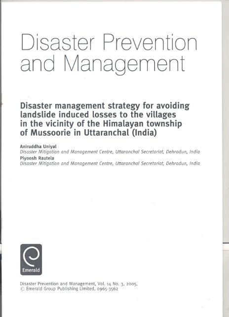
<strong>Disaster</strong> <strong>management</strong> <strong>strategy</strong><br />
<strong>for</strong> <strong>avoid<strong>in</strong>g</strong> <strong>landslide</strong> <strong><strong>in</strong>duced</strong><br />
<strong>losses</strong> <strong>to</strong> <strong>the</strong> <strong>villages</strong> <strong>in</strong> <strong>the</strong><br />
vic<strong>in</strong>ity <strong>of</strong> <strong>the</strong> <strong>Himalayan</strong><br />
<strong>to</strong>wnship <strong>of</strong> <strong>Mussoorie</strong> <strong>in</strong><br />
<strong>Uttaranchal</strong> (<strong>India</strong>)<br />
Aniruddha Uniyal and Piyoosh Rautela<br />
<strong>Disaster</strong> Mitigation and Management Centre, <strong>Uttaranchal</strong> Secretanat,<br />
Dehradun, <strong>India</strong><br />
Abstract<br />
Purpose - Many <strong>villages</strong> <strong>in</strong> <strong>the</strong> vic<strong>in</strong>ity <strong>of</strong> <strong>the</strong> hill <strong>to</strong>wnship <strong>of</strong> Mussorie <strong>in</strong> <strong>the</strong> <strong>India</strong>n Himalayas are<br />
witness<strong>in</strong>g signs <strong>of</strong> an impend<strong>in</strong>g disaster. These <strong>villages</strong> are witness<strong>in</strong>g active wastage that might<br />
take an heavy <strong>to</strong>ll <strong>of</strong> human <strong>in</strong>terest dur<strong>in</strong>g <strong>the</strong> monsoon season and <strong>the</strong>re<strong>for</strong>e <strong>the</strong> paper proposes<br />
exam<strong>in</strong><strong>in</strong>g this subjeci.<br />
Design/methodology/approach - A detailed study was undertaken <strong>in</strong> <strong>the</strong> area <strong>of</strong> Mussorie.<br />
F<strong>in</strong>d<strong>in</strong>gs - It is suggested that a series <strong>of</strong> prevention and mitigation measures (both structural and<br />
non-struct1lr(1) with <strong>the</strong> <strong>in</strong>volvement <strong>of</strong> <strong>the</strong> local conUTIunityare required <strong>for</strong> rul<strong>in</strong>g out <strong>the</strong> possibility<br />
<strong>of</strong> any mishap <strong>in</strong> <strong>the</strong> area.<br />
Orig<strong>in</strong>ality/value - This paper highlights <strong>the</strong> importance <strong>of</strong> hav<strong>in</strong>g a disaster <strong>management</strong><br />
strategies <strong>for</strong> <strong>the</strong> region and <strong>in</strong>volv<strong>in</strong>g <strong>the</strong> community with <strong>the</strong>se.<br />
Keywords Landslides, <strong>India</strong>, <strong>Disaster</strong>s. Management <strong>strategy</strong><br />
Paper type Research paper<br />
Introduction<br />
Natural disasters are common <strong>in</strong> <strong>the</strong> <strong>Himalayan</strong> state <strong>of</strong> <strong>Uttaranchal</strong> but <strong>the</strong>ir<br />
<strong>in</strong>creased frequency and impact <strong>in</strong> <strong>the</strong> recent past has turned out <strong>to</strong> be a cause <strong>of</strong><br />
concern <strong>for</strong> both <strong>the</strong> masses and <strong>the</strong> government alike. In <strong>the</strong> past earthquakes (1991<br />
Uttarkashi and 1999 Chamoli), <strong>landslide</strong>s (1998 Malpa and Okhimath, 2003<br />
Uttarkashi), cloudbursts and flash floods (1971 Alaknanda, 2001 Burakedar and<br />
Khetgaon) have caused great damage <strong>to</strong> life and property <strong>in</strong> <strong>the</strong> various parts <strong>of</strong> <strong>the</strong><br />
state.<br />
The Himalayas owe <strong>the</strong>ir evolution <strong>to</strong> <strong>the</strong> subduction and eventual collision <strong>of</strong> <strong>the</strong><br />
alien plates (<strong>India</strong>n and Eurasian) that have resulted <strong>in</strong> <strong>the</strong> <strong>for</strong>mation <strong>of</strong> <strong>the</strong> tec<strong>to</strong>nically<br />
active <strong>Himalayan</strong> orogenic belt (Thakur, 1992)which is subject <strong>to</strong> modifications by<br />
natural processes. High relief and peculiar meteorological regime <strong>of</strong> <strong>the</strong> region add <strong>to</strong><br />
<strong>the</strong> pace <strong>of</strong> <strong>the</strong> natural degradational processes. Unplanned and uncontrolled L<br />
The authors are thankful <strong>to</strong> Dr R.K. Pan de, executive direc<strong>to</strong>r, DMMC <strong>for</strong> guidance, support and<br />
encouragement <strong>to</strong> undertake work <strong>in</strong> <strong>the</strong> field <strong>of</strong> <strong>Disaster</strong> Management.
'<br />
anthropogenic <strong>in</strong>terventions <strong>in</strong> this sensitive and fragile terra<strong>in</strong>, <strong>in</strong> <strong>the</strong> <strong>for</strong>m <strong>of</strong><br />
unplanned cutt<strong>in</strong>g <strong>of</strong> slope <strong>for</strong> construction, blast<strong>in</strong>g <strong>of</strong> highly jo<strong>in</strong>ted rock mass <strong>for</strong><br />
road construction and unplanned disposal <strong>of</strong> <strong>the</strong> slope cut debris material, fur<strong>the</strong>r add<br />
<strong>to</strong> <strong>the</strong> vulnerability <strong>of</strong> <strong>the</strong> populations resid<strong>in</strong>g <strong>in</strong> this terra<strong>in</strong> and expose <strong>the</strong>m <strong>to</strong> <strong>the</strong><br />
risk <strong>of</strong> natural hazards.<br />
The present communication focuses on <strong>the</strong> mass wastage-related problem around<br />
<strong>the</strong> hill <strong>to</strong>wnship <strong>of</strong> <strong>Mussoorie</strong> located <strong>in</strong> <strong>the</strong> Lesser Himalayas. Natural degradational<br />
processes <strong>to</strong>ge<strong>the</strong>r with unplanned disposal <strong>of</strong> <strong>the</strong> atmospheric precipitation and<br />
mount<strong>in</strong>g anthropogenic pressure are observed <strong>to</strong> threaten <strong>the</strong> livelihood <strong>strategy</strong> <strong>of</strong><br />
<strong>the</strong> masses and expos<strong>in</strong>g <strong>the</strong>m <strong>to</strong> <strong>the</strong> risk <strong>of</strong> natural disasters. The micro-watershed <strong>of</strong><br />
Rangaon-ka-Kahala <strong>to</strong>ge<strong>the</strong>r with <strong>the</strong> surround<strong>in</strong>g area <strong>of</strong> Birgaon and Kempty<br />
hous<strong>in</strong>g <strong>the</strong> <strong>landslide</strong> zone was studied <strong>in</strong> detail and a detailed <strong>management</strong> plan <strong>for</strong><br />
<strong>the</strong> same was prepared on <strong>the</strong> basis <strong>of</strong> <strong>the</strong> satellite image <strong>in</strong>terpretation and field<br />
studies. The <strong>in</strong>dividual layers <strong>of</strong> <strong>the</strong> various geo-environmental parameters, such as<br />
faults, l<strong>in</strong>eaments, land<strong>for</strong>ms, dra<strong>in</strong>age, <strong>landslide</strong>s and <strong>the</strong> o<strong>the</strong>rs, were <strong>in</strong>tegrated<br />
us<strong>in</strong>g ARC GIS 8.3 s<strong>of</strong>tware (Figure 1). Rangaon, Rampur, Lagwalgaon and Dabla<br />
<strong>villages</strong> <strong>of</strong> Thatyur Block <strong>of</strong> Dhanolti Tehsil (district Tehri Garhwal) fall <strong>in</strong><br />
Rangaon-ka-Khala micro-watershed (Figure 1).<br />
Overview <strong>of</strong> <strong>the</strong> area<br />
<strong>Mussoorie</strong> is a famous hill station located <strong>in</strong> <strong>the</strong> Lesser Himalayas at a distance <strong>of</strong><br />
26 kilometres from Dehradun, <strong>the</strong> capital <strong>of</strong><strong>Uttaranchal</strong> state <strong>of</strong> <strong>India</strong>. The <strong>to</strong>wnship is<br />
located between 1,820 and 2,100 metres above mean sea level and experiences<br />
appreciable ra<strong>in</strong>fall (annual ra<strong>in</strong>fall > 2,000mm) most <strong>of</strong> which (- 95 per cent <strong>of</strong> <strong>the</strong><br />
<strong>to</strong>tal) is conf<strong>in</strong>ed <strong>to</strong> <strong>the</strong> monsoons. It was dur<strong>in</strong>g <strong>the</strong> British rule that <strong>Mussoorie</strong><br />
developed <strong>in</strong><strong>to</strong> a <strong>to</strong>wnship and its population <strong>in</strong> 1881was just 3,106 (Atk<strong>in</strong>son, 1882).<br />
Increas<strong>in</strong>g economic opportunities have led <strong>to</strong> <strong>the</strong> growth <strong>of</strong> population and<br />
<strong>in</strong>frastructure and <strong>the</strong> present population <strong>of</strong> <strong>the</strong> <strong>to</strong>wn is 29,329,exclud<strong>in</strong>g <strong>the</strong> float<strong>in</strong>g<br />
population <strong>of</strong> <strong>to</strong>urists, students and o<strong>the</strong>rs. This has resulted <strong>in</strong> <strong>the</strong> hi<strong>the</strong>r<strong>to</strong> prist<strong>in</strong>e<br />
hills witness<strong>in</strong>g rigorous cutt<strong>in</strong>g <strong>of</strong> hill slope <strong>for</strong> erect<strong>in</strong>g new commercial/residential<br />
complexes, expansion <strong>of</strong> exist<strong>in</strong>g park<strong>in</strong>g spaces <strong>to</strong> cope up with <strong>the</strong> mount<strong>in</strong>g<br />
vehicular traffic, creation <strong>of</strong> educational and recreational facilities besides road cutt<strong>in</strong>g<br />
and widen<strong>in</strong>g. The vegetal cover is consequently be<strong>in</strong>g destroyed and <strong>the</strong> natural<br />
dra<strong>in</strong>age system is be<strong>in</strong>g disrupted or disturbed even <strong>in</strong> <strong>the</strong> outskirts <strong>of</strong> <strong>Mussoorie</strong><br />
<strong>to</strong>wn, <strong>the</strong>reby caus<strong>in</strong>g <strong>the</strong> problems <strong>of</strong> slope <strong>in</strong>stability and bank erosion <strong>in</strong> <strong>the</strong> nearby<br />
<strong>villages</strong>.<br />
The <strong>Mussoorie</strong>-Yamuna bridge road l<strong>in</strong>ks <strong>the</strong> <strong>to</strong>wnship <strong>of</strong> <strong>Mussoorie</strong> <strong>to</strong> Yamuna<br />
valley and passes through Kempty Fall which is a major <strong>to</strong>urist attraction around <strong>the</strong><br />
<strong>to</strong>wn. Severe landslid<strong>in</strong>g is observed <strong>in</strong> <strong>the</strong> vic<strong>in</strong>ity <strong>of</strong> Kempty Fall along <strong>the</strong><br />
<strong>Mussoorie</strong>-Yamuna bridge road that is tak<strong>in</strong>g <strong>to</strong>ll <strong>of</strong> <strong>the</strong> agricultural and community<br />
<strong>for</strong>est land and threatens <strong>the</strong> livelihood<strong>strategy</strong> <strong>of</strong> <strong>the</strong> people and <strong>the</strong> existence <strong>of</strong> <strong>the</strong><br />
habitations around. The vehicular trdffic along <strong>Mussoorie</strong>-Yamuna bridge mo<strong>to</strong>r road<br />
<strong>to</strong>ge<strong>the</strong>r with o<strong>the</strong>r l<strong>in</strong>k roads (Kempty-Thatyur and Kempty-Charogi)also faces high<br />
risk <strong>of</strong> <strong>landslide</strong> hazard (Figure 1).<br />
The geomorphic set-up <strong>of</strong> <strong>the</strong> area is def<strong>in</strong>ed by <strong>the</strong> highly dissected denudo -<br />
structural hills that have witnessed gravity transport with <strong>the</strong> <strong>villages</strong> <strong>of</strong> Rampur,<br />
Langwalgaon, Biragaon and Bamangaon be<strong>in</strong>g located on colluvial deposits. Rangaon<br />
<strong>Disaster</strong><br />
<strong>management</strong><br />
<strong>strategy</strong><br />
379<br />
-
~@@~§"[g.g::;1<br />
g: 0. 5' ;::;:-0. ~ '1j IIQ<br />
S" ::3 I» .m \!?._. 0 e;<br />
g. (t) ~ =:o:~ ::::-~<br />
~~~~lR&.if~<br />
*
village is located on an alluvial fan (RangaonFan) and immediately above <strong>the</strong> proximal<br />
end <strong>of</strong> this fan a major slide (SurbeeResort Slide)has developed (Figure 1 and Plates 1<br />
and 2).<br />
The satellite imageries (IRS 1D LISS III False Colour Composite <strong>of</strong> Oc<strong>to</strong>ber, 2002)<br />
reveal a prom<strong>in</strong>ent ridge valley <strong>to</strong>pography <strong>of</strong> area with narrow valleys and deep<br />
gorges <strong>in</strong> <strong>the</strong> upper part. The valleys, however, widen gradually <strong>to</strong>wards <strong>the</strong> lower<br />
part with slopes be<strong>in</strong>g generally moderate <strong>to</strong> steep. Dendritic dra<strong>in</strong>age pattern is<br />
conspicuous <strong>in</strong> <strong>the</strong> area with <strong>the</strong> dra<strong>in</strong>age texture be<strong>in</strong>g medium <strong>to</strong> course and most <strong>of</strong><br />
<strong>the</strong> slides are observed <strong>to</strong> be develop<strong>in</strong>g along <strong>the</strong> dra<strong>in</strong>age l<strong>in</strong>es. Rangaon-ka-Khala<br />
dra<strong>in</strong>s <strong>in</strong><strong>to</strong> Aglar River that is <strong>the</strong> major stream <strong>of</strong> <strong>the</strong> area and followsNW-SEtrend <strong>of</strong><br />
<strong>the</strong> Aglar Fault (Figure 1).<br />
<strong>Disaster</strong><br />
<strong>management</strong><br />
<strong>strategy</strong><br />
381<br />
Plate 1.<br />
Field view <strong>of</strong><br />
Rangaon-ka-Khala<br />
flow<strong>in</strong>g through an<br />
alluvial fan (Rangaon Fan)<br />
and seen <strong>in</strong> <strong>the</strong><br />
background is Surbee<br />
Resort Slide<br />
Plate 2.<br />
Full view <strong>of</strong> <strong>the</strong> Surbee<br />
Resort Slide. Inset is <strong>the</strong><br />
Surbee Resort situated<br />
immediately above <strong>the</strong><br />
active scarp <strong>of</strong> <strong>the</strong> large<br />
slide named after this<br />
resort<br />
-
DPM<br />
14,3<br />
382<br />
The rocks exposed <strong>in</strong> <strong>the</strong> area belong <strong>to</strong> meta-sedimentaries <strong>of</strong> Lesser Himalaya that<br />
are mostly calcareous <strong>in</strong> nature <strong>to</strong>ge<strong>the</strong>r with subord<strong>in</strong>ate variegated shales (Valdiya,<br />
1980).These have witnessed many stages <strong>of</strong> tec<strong>to</strong>nism that has rendered <strong>the</strong>se highly<br />
folded, faulted, jo<strong>in</strong>ted, and fractured. Four jo<strong>in</strong>t sets trend<strong>in</strong>g NNE-SSW,ESE-WNW,<br />
. NNW-SSE and NE-SW are prom<strong>in</strong>ent <strong>in</strong> <strong>the</strong> region. Toge<strong>the</strong>r with <strong>the</strong>se <strong>the</strong> area has<br />
many prom<strong>in</strong>ent l<strong>in</strong>eaments del<strong>in</strong>eated through <strong>the</strong> study <strong>of</strong> satellite imageries. These<br />
trend E-W (Aglar Fault), NW-SE, E-W, and NE-SW. The NW-SE trend<strong>in</strong>g l<strong>in</strong>eament<br />
extend<strong>in</strong>g from <strong>the</strong> NE <strong>of</strong> Siyagaon <strong>to</strong> <strong>the</strong> SE <strong>of</strong> Santuree Devi Temple is very<br />
conspicuous. The steep slope (more than 45°) below Surbee Resort and Siyagaon<br />
village is <strong>the</strong> geomorphic expression <strong>of</strong> this l<strong>in</strong>eament. Ano<strong>the</strong>r major l<strong>in</strong>eament<br />
mapped <strong>in</strong> <strong>the</strong> area trends NW-SE can be traced along <strong>the</strong> sou<strong>the</strong>rn edge <strong>of</strong> <strong>the</strong> Polo<br />
Ground where <strong>the</strong> hill slope is steep with prom<strong>in</strong>ent zones <strong>of</strong> old rock fall. The creep<br />
observed on <strong>the</strong> nor<strong>the</strong>rn (valley ward) edge <strong>of</strong> Polo Ground <strong>in</strong> upper reaches <strong>of</strong> MIS<br />
can also be attributed <strong>to</strong> this l<strong>in</strong>eament. Sudden skew<strong>in</strong>g <strong>of</strong> <strong>the</strong> distal part <strong>of</strong> large<br />
colluvial fan <strong>of</strong> Birgaon-Bamangaon area is due <strong>to</strong> E-W trend<strong>in</strong>g l<strong>in</strong>eament that passes<br />
through <strong>the</strong> proximity <strong>of</strong> Rampur-Nawaridhar-Bamangaon <strong>villages</strong> (Figure 1).<br />
The land use/land cover <strong>in</strong> <strong>the</strong> hill slope around Santuree Devi and Surbee Resort<br />
area is def<strong>in</strong>ed by open <strong>to</strong> dense <strong>for</strong>est cover (plate 2). Terrace cultivation is<br />
dom<strong>in</strong>antly practised around Siyagaon, while a few pockets <strong>of</strong> open scrub and sparse<br />
scrub are also noticed. Along Rangaon-ka-Khala terrace cultivation is be<strong>in</strong>g practised<br />
on <strong>the</strong> colluvial deposits on <strong>the</strong> upper slopes while <strong>the</strong> middle slopes support grasses.<br />
On both <strong>the</strong> banks <strong>of</strong> Rangaon-ka-Khala around Rangaon and <strong>to</strong> <strong>the</strong> upslope <strong>of</strong><br />
Kempty-Charogi road cross<strong>in</strong>g terrace cultivation is be<strong>in</strong>g practiced on <strong>the</strong> reworked<br />
fan surface (plate 1). In <strong>the</strong> lower part <strong>of</strong> Rangaon-ka-Khala micro watershed down<br />
slope <strong>of</strong> <strong>the</strong> Kempty-Charogi road <strong>the</strong> agricultural fields <strong>of</strong> Langwalgaon, Rampur and<br />
Dabla <strong>villages</strong> occupy<strong>in</strong>g <strong>the</strong> lower slopes <strong>of</strong> Rangaon-ka-Khala are developedover <strong>the</strong><br />
distal part <strong>of</strong> Rangaon Alluvial Fan.<br />
Landslide scenario <strong>in</strong> <strong>the</strong> area<br />
Dur<strong>in</strong>g <strong>the</strong> fieldwork undertaken <strong>in</strong> <strong>the</strong> area attempts were made <strong>to</strong> assess <strong>the</strong> past<br />
disaster events <strong>in</strong> <strong>the</strong> area through <strong>in</strong>teraction with <strong>the</strong> village elders. It was revealed<br />
that a small slide scar had developedbelow <strong>the</strong> Surbee Resort <strong>in</strong> Panyara area after <strong>the</strong><br />
1991Uttarkashi Earthquake. This slide scar activated and enlarged gradually and <strong>the</strong><br />
<strong>in</strong>cessant ra<strong>in</strong>s <strong>of</strong> 2003monsoon trans<strong>for</strong>med it <strong>in</strong><strong>to</strong> a large and active slide zone. The<br />
slide material comprises rock fragments <strong>of</strong> various sizes <strong>in</strong>clud<strong>in</strong>g large boulders along<br />
with debris material. This slide is caus<strong>in</strong>g <strong>the</strong> subsidence <strong>of</strong> <strong>Mussoorie</strong>-Yamunabridge<br />
road that poses serious risk <strong>to</strong> <strong>the</strong> vehicular traffic around Surbee Resort where <strong>the</strong><br />
road passes through <strong>the</strong> active scarp, besides threaten<strong>in</strong>g <strong>the</strong> <strong>in</strong>frastructure <strong>of</strong> <strong>the</strong><br />
resort itself (plate 2).The slide mass, transported downstream by Rangaon-ka-Khala,is<br />
caus<strong>in</strong>g severe damage <strong>to</strong> crop fields, <strong>to</strong>ge<strong>the</strong>r with community lands <strong>of</strong> Kyar-ki-Dhar,<br />
Nawaridhar, Rangaon, Rampur, Langwalgaon and Dabla <strong>villages</strong>. The Water mills<br />
(gharats <strong>in</strong> local parlance) <strong>of</strong> <strong>the</strong>se <strong>villages</strong> were reportedly washed away dur<strong>in</strong>g <strong>the</strong><br />
monsoons <strong>of</strong> 2003. Rangaon village is <strong>the</strong> worst affected and suffered major loss <strong>of</strong><br />
agricultural and community land, <strong>the</strong> khalians (granaries <strong>in</strong> local parlance), and<br />
houses. The cattle sheds (channies<strong>in</strong> local parlance) <strong>of</strong> Nawaridhar, Kyar-ki-Dhar and<br />
Rampur <strong>villages</strong> were also washed away dur<strong>in</strong>g this event. The Kempty-Charogi and<br />
Kempty-Thatyur mo<strong>to</strong>r roads are also be<strong>in</strong>g badly damaged by <strong>the</strong> slide.
I. I<br />
Siyagaon Slide is a translational debris rock slide developed below <strong>Mussoorie</strong><br />
International School (MIS)with <strong>the</strong> slide debris be<strong>in</strong>g spread over <strong>the</strong> crop fields and<br />
community land <strong>of</strong> Siyagaon and caus<strong>in</strong>g damage <strong>to</strong> <strong>Mussoorie</strong>-Yamuna bridge mo<strong>to</strong>r<br />
road at three places (plate 3).The slide material comprises rock fragments <strong>in</strong>clud<strong>in</strong>g<br />
large boulders <strong>of</strong> dolomite and limes<strong>to</strong>ne along with <strong>the</strong> debris material. Evidence <strong>of</strong><br />
creep<strong>in</strong>g movement were observed <strong>in</strong> <strong>the</strong> upper hill reaches at <strong>the</strong> junction <strong>of</strong> Polo<br />
Ground and MIS.<br />
Devidhar-Biragaon Slide is a translational debris rock slide that has developed <strong>in</strong><br />
<strong>the</strong> upslope <strong>of</strong> Biragaon and has an active scarp with <strong>the</strong> slide material fann<strong>in</strong>g out <strong>in</strong><strong>to</strong><br />
<strong>the</strong> agricultural fields and community lands <strong>of</strong> Biragaon village and adjacent area <strong>of</strong><br />
Ghuttudhar (plate 4).Santuree Devi-Biragaonmo<strong>to</strong>r road has been badly damaged by<br />
this slide.<br />
Dur<strong>in</strong>g <strong>the</strong> fieldwork small slide scars were also observed <strong>to</strong> be <strong>in</strong>itiat<strong>in</strong>g <strong>to</strong> <strong>the</strong><br />
down slope <strong>of</strong> Kempty and upslope <strong>of</strong> Kempty Lake on <strong>Mussoorie</strong>-Yamuna bridge road<br />
(plate 5).<br />
Causative fac<strong>to</strong>rs <strong>of</strong> <strong>the</strong> <strong>landslide</strong>s<br />
Both Surbee Resort and Siyagaon slides represent reactivation <strong>of</strong> a large old slide zone<br />
that extends from Siyagaon <strong>to</strong> <strong>the</strong> fur<strong>the</strong>r east <strong>of</strong> MIS (Figure 1). The <strong>in</strong> situ rocks<br />
<strong>Disaster</strong><br />
<strong>management</strong><br />
<strong>strategy</strong><br />
383<br />
Plate3.<br />
Field view <strong>of</strong> <strong>the</strong> Siyagaon<br />
Slide damag<strong>in</strong>g<br />
agricultural fields <strong>of</strong><br />
Siyagaon along with <strong>the</strong><br />
<strong>Mussoorie</strong>-Kempty stretch<br />
<strong>of</strong> <strong>the</strong> <strong>Mussoorie</strong>-Yamuna<br />
Bridge mo<strong>to</strong>r road<br />
Plate 4.<br />
Field view <strong>of</strong><br />
Devidhar-Biragaon Slide<br />
-
I J<br />
I<br />
I I<br />
~<br />
DPM<br />
14,3<br />
384<br />
Plate 5.<br />
Field view <strong>of</strong> Kempty<br />
Slide Zone. Seen <strong>in</strong> <strong>the</strong><br />
ridge are commercial cum<br />
residential complexes <strong>of</strong><br />
Kempty<br />
exposed <strong>in</strong> <strong>the</strong> road cutt<strong>in</strong>g <strong>in</strong> this area are observed <strong>to</strong> be highly jo<strong>in</strong>ted and fractured<br />
dolomitic limes<strong>to</strong>ne with four dist<strong>in</strong>ct sets <strong>of</strong> jo<strong>in</strong>ts. The jo<strong>in</strong>t set trend<strong>in</strong>g ESE-WNW<br />
with 60°-70°dip <strong>to</strong>wards north shows jo<strong>in</strong>t spac<strong>in</strong>g <strong>of</strong> 4-6cm and aperture <strong>of</strong> 3-5mm.<br />
O<strong>the</strong>r jo<strong>in</strong>t set trend<strong>in</strong>g NNW-SSEwith dip <strong>of</strong> 70°<strong>to</strong>wards east shows jo<strong>in</strong>t spac<strong>in</strong>g <strong>of</strong><br />
about 5cm and jo<strong>in</strong>t aperture <strong>of</strong> <strong>the</strong> order <strong>of</strong> 1mm. The third set <strong>of</strong> sub vertical jo<strong>in</strong>ts<br />
trends NE-SW and has jo<strong>in</strong>t spac<strong>in</strong>g <strong>of</strong> about 4 em with an aperture <strong>of</strong> 2mm. The<br />
NNE-SSWtrend<strong>in</strong>g fourth jo<strong>in</strong>t set dips <strong>to</strong>wards west at angles vary<strong>in</strong>g between 60°<br />
and 65°. These show jo<strong>in</strong>t spac<strong>in</strong>g <strong>of</strong> about 10em and aperture <strong>of</strong> <strong>the</strong> order <strong>of</strong> 2 <strong>to</strong><br />
2.5mm. Stereographic analysis <strong>of</strong> <strong>the</strong> jo<strong>in</strong>t set data shows that <strong>the</strong> <strong>in</strong>tersection <strong>of</strong> <strong>the</strong><br />
<strong>for</strong>mer three jo<strong>in</strong>t sets plunges at high angles (65-70°)<strong>to</strong>wards NE that is also <strong>the</strong><br />
direction <strong>of</strong> <strong>the</strong> slope <strong>in</strong> <strong>the</strong> area that is a major cause <strong>of</strong> rock failure. Apart from this<br />
<strong>the</strong> percolation <strong>of</strong> water through jo<strong>in</strong>ts, fractures and cracks and consequent <strong>in</strong>crease<br />
<strong>in</strong> pore water pressure as also <strong>the</strong> lubrication <strong>of</strong> jo<strong>in</strong>t planes that act as failure surfaces<br />
seem most likely reasons <strong>for</strong> tJ.;gger<strong>in</strong>g<strong>the</strong> Surbee Resort and Siyagaon slides. Field<br />
<strong>in</strong>vestigations reveal that ra<strong>in</strong>water collected over <strong>the</strong> Polo Ground and MIS is be<strong>in</strong>g<br />
disposed <strong>of</strong>f <strong>in</strong> an unmanaged manner <strong>in</strong> <strong>the</strong> crown portion <strong>of</strong> <strong>the</strong> active slide scars.<br />
This concentrated discharge has a def<strong>in</strong>ite role <strong>to</strong> play <strong>in</strong> destabilis<strong>in</strong>g <strong>the</strong> slopes and<br />
n;gger<strong>in</strong>g <strong>landslide</strong>s.<br />
Devidhar-Biragaon debris rock slide is developed <strong>in</strong> an area that has witnessed rock<br />
fall <strong>in</strong> <strong>the</strong> past as evident by <strong>the</strong> presence <strong>of</strong> huge boulders with wea<strong>the</strong>r<strong>in</strong>g surfaces<br />
and lichen growth. Large volume <strong>of</strong> water enters <strong>the</strong> crown portion <strong>of</strong> <strong>the</strong> slide dur<strong>in</strong>g<br />
ra<strong>in</strong>y season, as <strong>the</strong> surface run<strong>of</strong>f <strong>of</strong> MIS is dra<strong>in</strong>ed <strong>in</strong><strong>to</strong> a small scupper across <strong>the</strong><br />
road downslope, and dra<strong>in</strong>s fur<strong>the</strong>r downslope through steep slope <strong>of</strong> large old rock<br />
fall zone <strong>to</strong> <strong>the</strong> immediate upslope <strong>of</strong> Biragaon. Previously <strong>the</strong> surface run<strong>of</strong>f used <strong>to</strong><br />
get dissipated all through <strong>the</strong> hill slope but <strong>the</strong> slope modifications <strong>for</strong> <strong>in</strong>frastructure<br />
creation at MIS and consequent channelisation <strong>of</strong> <strong>the</strong> water has altered <strong>the</strong> natural<br />
mechanism <strong>of</strong> dra<strong>in</strong><strong>in</strong>g out <strong>the</strong> surface run<strong>of</strong>f through <strong>the</strong> multiple channels. This has<br />
augmented <strong>the</strong> pore water pressure and has ultimately caused slope failure <strong>in</strong> <strong>the</strong> <strong>for</strong>m<br />
<strong>of</strong> debris rock slide.<br />
The rocks <strong>in</strong> <strong>the</strong> area are disposed at critical spatial orientations that facilitate<br />
active mass wast<strong>in</strong>g <strong>in</strong> <strong>the</strong> region. Overload<strong>in</strong>g <strong>of</strong> this critical mass with heavy
structures (MIS and Surbee Resort) and chang<strong>in</strong>g <strong>the</strong> subsurface water regime by<br />
unmanaged wastewater disposal add <strong>to</strong> <strong>the</strong> slope <strong>in</strong>stability.<br />
The perceived risk<br />
Dur<strong>in</strong>g <strong>the</strong> previous monsoon seasons <strong>the</strong> area has witnessed <strong>losses</strong> (Table I) and <strong>the</strong><br />
loss <strong>of</strong> agricultural land, pastures and community <strong>for</strong>est <strong>to</strong>ge<strong>the</strong>r with water resources<br />
adversely affect <strong>the</strong> life support <strong>strategy</strong> <strong>of</strong> <strong>the</strong> masses. If timely mitigation measures<br />
are not <strong>in</strong>itiated <strong>the</strong> ongo<strong>in</strong>g mass wastage <strong>in</strong> <strong>the</strong> area can lead <strong>to</strong> devastation dur<strong>in</strong>g<br />
<strong>the</strong> com<strong>in</strong>g monsoons.<br />
It is observed that <strong>the</strong> flow lobe <strong>of</strong> <strong>the</strong> Surbee Resort Slide emerges from <strong>the</strong><br />
proximal part <strong>of</strong> Rangaon Fan along Rangaon-ka-Khala and fans out fur<strong>the</strong>r down<br />
slope, <strong>the</strong>reby pos<strong>in</strong>g a threat <strong>to</strong> <strong>the</strong> houses <strong>of</strong> Rangaon dur<strong>in</strong>g <strong>in</strong>cessant ra<strong>in</strong>s. Huge<br />
volumes <strong>of</strong> debris are presently be<strong>in</strong>g discharged <strong>in</strong><strong>to</strong> Rangaon-ka-Khala. In <strong>the</strong><br />
vic<strong>in</strong>ity <strong>of</strong> <strong>the</strong> Rangaon village Rangaon-ka-Khala flows through a narrow gorge and<br />
<strong>the</strong> material emanat<strong>in</strong>g out <strong>of</strong> <strong>the</strong> gorge fans out and poses threat <strong>to</strong> <strong>the</strong> habitations at<br />
Rangaon (plate 6).Six families, with a population <strong>of</strong> 45 resid<strong>in</strong>g on <strong>the</strong> right bank <strong>of</strong><br />
Rangaon-ka-Khala <strong>in</strong> Rangaon are at high risk though <strong>the</strong> entire Rangaon village is<br />
vulnerable <strong>to</strong> bank erosion dur<strong>in</strong>g ra<strong>in</strong>y season (plate 6).The majority <strong>of</strong> <strong>the</strong>se fall <strong>in</strong><strong>to</strong><br />
<strong>the</strong> category <strong>of</strong> <strong>in</strong>fants and women, which fur<strong>the</strong>r enhances <strong>the</strong>ir vulnerability.<br />
Slope cutt<strong>in</strong>g <strong>for</strong> road construction and widen<strong>in</strong>g has altered <strong>the</strong> slope angle at<br />
many places around Kempty on <strong>Mussoorie</strong>-Yamuna bridge road. Heavy concentrated<br />
precipitation dur<strong>in</strong>g <strong>the</strong> previous monsoons <strong>in</strong>itiated developmen<strong>to</strong>f small slide scarps<br />
<strong>in</strong> this area. In <strong>the</strong> event <strong>of</strong> <strong>in</strong>cessant ra<strong>in</strong>s <strong>the</strong> enlargement and <strong>the</strong> head ward shift <strong>of</strong><br />
<strong>the</strong>se slide scars might pose a serious threat <strong>to</strong> commercial cum residential complexes<br />
Families Land affected Watermillswashed Cattlesheds<br />
Villagename affected (<strong>in</strong> hectares) away affected<br />
<strong>Disaster</strong><br />
<strong>management</strong><br />
<strong>strategy</strong><br />
Rangaon 17 2.260 3 6 Table I.<br />
Nawaridhar 2 0.205 1 0 Summary<strong>of</strong> <strong>the</strong> <strong>losses</strong><br />
Langwalgaon 10 1.547 2 0 <strong>in</strong>curredby <strong>the</strong> <strong>villages</strong><br />
Dabla Matela 3 0.210 3 0 <strong>in</strong> <strong>the</strong> vic<strong>in</strong>ity<strong>of</strong><br />
Biragaon 6 0.756 0 3 <strong>Mussoorie</strong><br />
385<br />
Plate6.<br />
View <strong>of</strong> <strong>the</strong> Rangaon<br />
village that is vulnerable<br />
<strong>to</strong> flash flood and debris<br />
flow dur<strong>in</strong>g ra<strong>in</strong>y season.<br />
Rangaon-ka-Khala is seen<br />
<strong>in</strong> <strong>the</strong> background<br />
-
DPM<br />
14,3<br />
386<br />
<strong>of</strong> Kempty while <strong>the</strong> Kempty Lake might witness debris flow slide with <strong>the</strong> downslope<br />
expansion <strong>of</strong> <strong>the</strong> <strong>to</strong>e portion <strong>of</strong> <strong>the</strong>se slides (plate 5). This might jeopardise <strong>the</strong> very<br />
existence <strong>of</strong> <strong>the</strong> recreational facilities created around <strong>the</strong> Kempty Lake.<br />
<strong>Disaster</strong> <strong>management</strong> <strong>strategy</strong> <strong>for</strong> <strong>the</strong> area<br />
Although human <strong>in</strong>terests are at stake at a number <strong>of</strong> <strong>villages</strong> <strong>in</strong> <strong>the</strong> area, human<br />
population is at risk <strong>in</strong> Rangaon village. In order <strong>to</strong> m<strong>in</strong>imise <strong>the</strong> risk posed <strong>to</strong> <strong>the</strong><br />
habitations <strong>of</strong> Rangaon village <strong>the</strong>re is an urgent need <strong>of</strong> undertak<strong>in</strong>g structural<br />
mitigation works, such as construction <strong>of</strong> check dams at every 25m <strong>in</strong>terval across <strong>the</strong><br />
Rangaon-ka-Khala stretch <strong>in</strong> <strong>the</strong> down slope <strong>of</strong> Surbee Resort Slide and upslope <strong>of</strong><br />
Rangaon village. This measure would m<strong>in</strong>imise <strong>the</strong> pace <strong>of</strong> <strong>to</strong>e erosion <strong>of</strong><br />
Rangaon-ka-Khala and <strong>the</strong> consequent loss <strong>of</strong> <strong>the</strong> agricultural and community lands<br />
<strong>of</strong> Nawaridhar, Kyar-ki-Dhar, Rampur, Rangaon, Langwalgaon and Dabla <strong>villages</strong>.<br />
For fur<strong>the</strong>r ensur<strong>in</strong>g <strong>the</strong> safety <strong>of</strong> <strong>the</strong> habitations <strong>in</strong> Rangaon village from flash floods<br />
and debris flow dur<strong>in</strong>g <strong>the</strong> ra<strong>in</strong>y season, construction <strong>of</strong> spurs/protection walls need <strong>to</strong><br />
be taken up along <strong>the</strong> right bank <strong>of</strong> <strong>the</strong> stream between Kyar-ki-Dhar and Rangaon<br />
<strong>villages</strong>.<br />
Uncontrolled percolation <strong>of</strong> water <strong>in</strong><strong>to</strong> <strong>the</strong> slide zones is observed <strong>to</strong> be caus<strong>in</strong>g<br />
slope destabilisation <strong>in</strong> <strong>the</strong> area, <strong>the</strong>re<strong>for</strong>e l<strong>in</strong>ed dra<strong>in</strong>s need <strong>to</strong> be constructed <strong>in</strong> <strong>the</strong><br />
upslope portion <strong>of</strong> <strong>the</strong> Surbee Resort. This would restrict <strong>the</strong> head-ward shift <strong>of</strong> this<br />
slide and its fur<strong>the</strong>r enlargement. The percolation <strong>of</strong> water <strong>in</strong> Siyagaon Slidezone and<br />
also <strong>in</strong> <strong>the</strong> area adjacent <strong>to</strong> <strong>the</strong> left flank <strong>of</strong> Surbee Resort Slide needs <strong>to</strong> m<strong>in</strong>imised by<br />
creat<strong>in</strong>g a proper dra<strong>in</strong>age network <strong>in</strong> <strong>the</strong> upslope area around MIS and <strong>for</strong> this <strong>the</strong><br />
cemented pipes <strong>of</strong> <strong>the</strong> Polo Ground should be connected<strong>to</strong> vertical l<strong>in</strong>ed dra<strong>in</strong>s or catch<br />
pipes. Similarly <strong>the</strong> horizontal dra<strong>in</strong>s with proper l<strong>in</strong><strong>in</strong>g need <strong>to</strong> be constructed <strong>in</strong> MIS<br />
area and should be connected <strong>to</strong> <strong>the</strong> catch pipes or vertical l<strong>in</strong>ed dra<strong>in</strong>s <strong>to</strong> be laid <strong>in</strong> a<br />
radial pattern down slope up <strong>to</strong> <strong>the</strong> stream bed. The vertical l<strong>in</strong>ed dra<strong>in</strong>s or catch pipes<br />
should not be allowed <strong>to</strong> term<strong>in</strong>ate <strong>in</strong> between as is happen<strong>in</strong>g presently. The radial<br />
pattern <strong>of</strong> vertical l<strong>in</strong>ed dra<strong>in</strong>s would facilitate <strong>the</strong> disposal and dissipation <strong>of</strong> surface<br />
run<strong>of</strong>f and m<strong>in</strong>imisepercolation <strong>of</strong> water <strong>in</strong><strong>to</strong> <strong>the</strong> valley slopes and consequently avoid<br />
slope failure <strong>to</strong> a great extent.<br />
The Devidhar-Biragaon Slide can be controlled by m<strong>in</strong>imis<strong>in</strong>g <strong>the</strong> percolation <strong>of</strong><br />
water <strong>in</strong><strong>to</strong> crown portion <strong>of</strong> this wne through <strong>the</strong> construction <strong>of</strong> horizontal l<strong>in</strong>ed<br />
dra<strong>in</strong>s <strong>in</strong> <strong>the</strong> upslope area and connect<strong>in</strong>g <strong>the</strong>se <strong>to</strong> <strong>the</strong> vertical dra<strong>in</strong>s laid <strong>in</strong> a radial<br />
fashion along <strong>the</strong> slope up <strong>to</strong> <strong>the</strong> stream bed level. The vertical dra<strong>in</strong>s <strong>of</strong> MIS<br />
term<strong>in</strong>at<strong>in</strong>g <strong>in</strong><strong>to</strong> a small scupper across <strong>the</strong> road <strong>in</strong> <strong>the</strong> upslope <strong>of</strong> this slide zoneshould<br />
also be connected <strong>to</strong> catch pipes <strong>to</strong> be laid down slope up <strong>to</strong> <strong>the</strong> stream bed. This would<br />
eheck <strong>the</strong> head-ward shift <strong>of</strong> <strong>the</strong> slide zone.<br />
In order <strong>to</strong> reduce <strong>the</strong> risk <strong>to</strong> <strong>the</strong> vehicular traffic along 100m stretch <strong>of</strong> <strong>the</strong><br />
<strong>Mussoorie</strong>-Yamunabridge mo<strong>to</strong>r I:'oadaround Surbee Resort protection work needs <strong>to</strong><br />
be taken up immediately. This would not however solve <strong>the</strong> problem permanently as<br />
all such structures would have <strong>to</strong> be erected over <strong>the</strong> active scarp <strong>of</strong> Surbee Resort<br />
Slide. Alternate route alignment through <strong>the</strong> CTOpfields <strong>of</strong> Siyagaon is a better, viable<br />
and cost effective option. This alternative <strong>of</strong> realignment <strong>of</strong> <strong>the</strong> road would not<br />
however avoid <strong>the</strong> Siyagaon Slide <strong>for</strong> which reta<strong>in</strong><strong>in</strong>g wall with weep holes needs <strong>to</strong> be<br />
constructed at <strong>the</strong> hillside where <strong>the</strong> Siyagaon Slide was triggered.
.-<br />
The preventive measures such as shift<strong>in</strong>g public utility build<strong>in</strong>gs and build<strong>in</strong>gs <strong>of</strong><br />
mass occupancy <strong>to</strong> a safer location are also required as <strong>the</strong> head-ward expansion <strong>of</strong> <strong>the</strong><br />
Surbee Resort Slide might cause subsidence <strong>of</strong> <strong>the</strong> Surbee Resort <strong>in</strong> <strong>the</strong> near future.<br />
In order <strong>to</strong> cope with <strong>the</strong> impact <strong>of</strong> heavy ra<strong>in</strong>s and subsequent flash floods and<br />
debris flow dur<strong>in</strong>g <strong>the</strong> ra<strong>in</strong>y season an emergency evacuation plan needs <strong>to</strong> be<br />
prepared <strong>for</strong> Rangaon village as an essential component <strong>of</strong> preparedness. Facilitat<strong>in</strong>g<br />
creation <strong>of</strong> disaster <strong>in</strong>tervention teams (DITs)<strong>in</strong> Rangaon, Nawaridhar, Kyar-ki-Dhar,<br />
Rampur, Langwalgaon and Dabla <strong>villages</strong> from among <strong>the</strong> masses could be <strong>the</strong> first<br />
step <strong>in</strong> this direction. Initiatives can <strong>the</strong>n be directed <strong>to</strong>wards human resource<br />
development <strong>of</strong> <strong>the</strong> DIT members through focused tra<strong>in</strong><strong>in</strong>gs on Search and Rescue and<br />
Medical First Aid and <strong>the</strong> like. The DITs at <strong>the</strong> same time have <strong>to</strong> be equipped with<br />
essential equipments like solar lights, first aid boxes and efficient communication<br />
systems. Besidesbr<strong>in</strong>g<strong>in</strong>g <strong>for</strong>th mass awareness regard<strong>in</strong>g <strong>the</strong> disasters and prepar<strong>in</strong>g<br />
<strong>the</strong>m mentally <strong>for</strong> temporary evacuation. The DIT members would be responsible <strong>for</strong><br />
rais<strong>in</strong>g alarm <strong>in</strong> <strong>the</strong> event <strong>of</strong> heavy ra<strong>in</strong>s and facilitate temporary evacuation <strong>of</strong> <strong>the</strong><br />
severe hazard prone Rangaon village. The DIT members would also be br<strong>in</strong>g<strong>in</strong>g <strong>for</strong>th<br />
unanimity amongst <strong>the</strong> fellow villagers <strong>of</strong> Nawaridhar, Kyar-ki-Dhar, Rampur,<br />
Langwalgaon and Dabla <strong>villages</strong> <strong>for</strong> not approach<strong>in</strong>g <strong>the</strong>ir crop fields close <strong>to</strong><br />
Rangaon-ka-Khala dur<strong>in</strong>g heavy ra<strong>in</strong>s. Attempts would also be made <strong>to</strong> persuade <strong>the</strong><br />
fellowvillagers <strong>to</strong> prevent <strong>the</strong>ir children from attempt<strong>in</strong>g <strong>to</strong> cross Rangaon-ka-Khala at<br />
<strong>the</strong> time <strong>of</strong> heavy ra<strong>in</strong>s. The DITs are thus expected <strong>to</strong> act as <strong>the</strong> first responders <strong>in</strong> <strong>the</strong><br />
event <strong>of</strong> flash flood and debris slide <strong>in</strong> <strong>the</strong> area.<br />
O<strong>the</strong>r urgently required non-structural mitigation measures <strong>in</strong>clude a complete ban<br />
on quarry<strong>in</strong>g along hill slopes with active slide zones (as near Rampur village on<br />
Kempty-Charogi road) and <strong>the</strong> <strong>in</strong>troduction <strong>of</strong> restricted blast<strong>in</strong>g <strong>for</strong> road construction<br />
and or road widen<strong>in</strong>g <strong>in</strong> this area.<br />
Kempty Fall is a major <strong>to</strong>urist attraction and revenue earner and <strong>the</strong> protection <strong>of</strong><br />
<strong>the</strong> area can be ensured by construct<strong>in</strong>g reta<strong>in</strong><strong>in</strong>g walls <strong>to</strong> control <strong>the</strong> smaller slides<br />
develop<strong>in</strong>g on <strong>the</strong> upslope <strong>of</strong> Kempty Lake. A proper dra<strong>in</strong>age system also needs <strong>to</strong> be<br />
<strong>in</strong>troduced <strong>for</strong> <strong>the</strong> disposal <strong>of</strong> <strong>the</strong> household wastewater <strong>of</strong> Kempty.<br />
References<br />
Atk<strong>in</strong>son, E.T. (1882),The<strong>Himalayan</strong>Gazetteer,Cosmo Publications, Delhi.<br />
Thakur, V.c. (1992),Geology<strong>of</strong> Western Himalaya, Pergamon Press, Ox<strong>for</strong>d.<br />
Valdiya, K.S. (1980), Geology <strong>of</strong> Kumaun Lesser Himalaya, Wadia Institute <strong>of</strong> <strong>Himalayan</strong><br />
Geology, Dehradun.<br />
<strong>Disaster</strong><br />
<strong>management</strong><br />
<strong>strategy</strong><br />
387
Authors.Charter<br />
www.emerald<strong>in</strong>sight.comjcharter<br />
Yourrightsas a contribu<strong>to</strong>r<br />
<strong>to</strong> an Emeraldjournal<br />
Emerald'scopyrightpr<strong>in</strong>ciples<br />
Emerald* seeks <strong>to</strong> reta<strong>in</strong> copyright <strong>of</strong> <strong>the</strong> articles it publishes, without <strong>the</strong> authors<br />
giv<strong>in</strong>g up <strong>the</strong>ir rights <strong>to</strong> republish or reproduce <strong>the</strong>ir articles on paper or electronically,<br />
subject <strong>to</strong> acknowledgment <strong>of</strong> first publication details.<br />
Emerald'scommitmen<strong>to</strong> you<br />
·An <strong>in</strong>novative publish<strong>in</strong>g service which is timely, efficient, responsive and courteous<br />
·Quality peer reviewed journals with edi<strong>to</strong>rial teams <strong>of</strong> dist<strong>in</strong>ction<br />
·A named <strong>in</strong>dividual <strong>to</strong> keep you <strong>in</strong><strong>for</strong>med <strong>of</strong> publication progress<br />
·Complimentary journal copy plus repr<strong>in</strong>ts <strong>of</strong> your paper<br />
·An edi<strong>to</strong>rial and production policy which encourages accuracy and reduces submission <strong>to</strong><br />
publication times<br />
·On-l<strong>in</strong>e resources, <strong>for</strong>ums and conferences <strong>to</strong> assist you with your research<br />
·Responsible rights <strong>management</strong> <strong>to</strong> promote and safeguard <strong>the</strong> <strong>in</strong>tegrity <strong>of</strong> your work, encourage<br />
citation and wider dissem<strong>in</strong>ation<br />
· Liberal reproduction rights and premium permissions service <strong>for</strong> yourself and subscrib<strong>in</strong>g<br />
organizations <strong>to</strong> serve <strong>the</strong> <strong>in</strong>terests and needs <strong>of</strong> <strong>the</strong> scholarly community<br />
·Additional benefits <strong>of</strong> Literati Club membership<br />
·Consideration <strong>for</strong> nom<strong>in</strong>ation <strong>of</strong> <strong>the</strong> Annual Awards <strong>for</strong> Excellence <strong>to</strong> reward outstand<strong>in</strong>g work<br />
· Outstand<strong>in</strong>g Doc<strong>to</strong>ral Research Awards <strong>for</strong> our author community.<br />
"Emerald. Electronic Management Research Library Database. Emerald is a trad<strong>in</strong>g name <strong>of</strong> MCB UP Ltd.<br />
The full text <strong>of</strong> Emerald's Authors' Charter can be found at<br />
www.emerald<strong>in</strong>sight.com/charter<br />
To discuss any aspect <strong>of</strong> this charter please contact us bye-mail at<br />
literaticlub@emerald<strong>in</strong>sight.com<br />
Tel+44(0) 1274 777700 Fax+44 (0) 1274 785200<br />
Literati Club, Emerald, 60/62 Toller Lane, Brad<strong>for</strong>d BD89BY,United K<strong>in</strong>gdom.<br />
C?<br />
Emerald<br />
<strong>in</strong><strong>for</strong>mation ideas <strong>in</strong>sight