

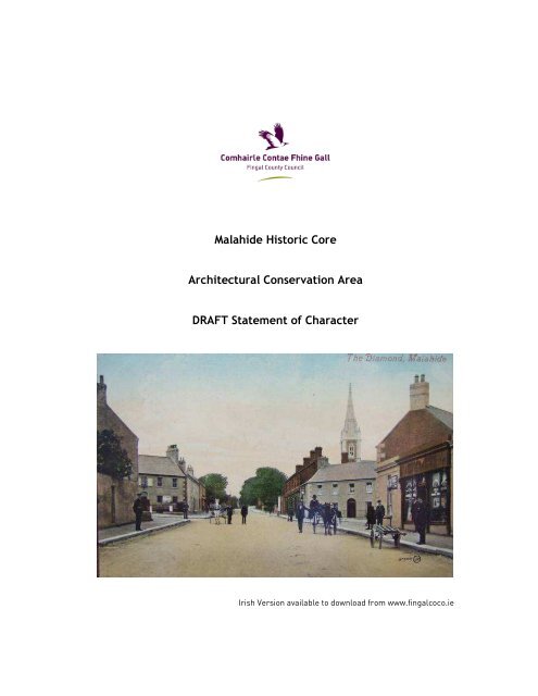
DRAFT Malahide Historic Core ACA Statement of Character
DRAFT Malahide Historic Core ACA Statement of Character
DRAFT Malahide Historic Core ACA Statement of Character

Create successful ePaper yourself
Turn your PDF publications into a flip-book with our unique Google optimized e-Paper software.
<strong>Malahide</strong> <strong>Historic</strong> <strong>Core</strong><br />
Architectural Conservation Area<br />
<strong>DRAFT</strong> <strong>Statement</strong> <strong>of</strong> <strong>Character</strong><br />
Irish Version available to download from www.fingalcoco.ie
MALAHIDE ARCHITECTURAL CONSERVATION AREA JUNE 2009<br />
<strong>DRAFT</strong> STATEMENT OF CHARACTER<br />
Preface<br />
This assessment <strong>of</strong> the special character <strong>of</strong> the <strong>Malahide</strong> Architectural Conservation Area was<br />
prepared in September 2008 by Lotts Architecture and Urbanism.<br />
The study was commissioned by Fingal County Council and its progress was guided by Helena<br />
Bergin, Conservation Officer and Fionnuala May, Senior Architect. The <strong>Statement</strong> <strong>of</strong> <strong>Character</strong><br />
follows the format devised by the Conservation Office <strong>of</strong> Fingal County Council for other <strong>ACA</strong>s<br />
in the county.<br />
Richard McLoughlin<br />
Lotts Architecture and Urbanism Ltd.<br />
December 2008<br />
1 <strong>of</strong> 59
MALAHIDE ARCHITECTURAL CONSERVATION AREA JUNE 2009<br />
<strong>DRAFT</strong> STATEMENT OF CHARACTER<br />
NOTE:<br />
This document includes Ordnance Survey Ireland data reproduced under the OSI licence number<br />
2008/10/CCMA/Fingal County Council. Unauthorised reproduction infringes Ordnance Survey<br />
Ireland and Government <strong>of</strong> Ireland copyright.<br />
The extract from Rocque’s map <strong>of</strong> 1756 (Fig. 3) has been reproduced with the permission <strong>of</strong><br />
Fingal County Local Studies Library and Archive<br />
The extract from Taylor’s map <strong>of</strong> Dublin <strong>of</strong> 1816 (Fig. 4) has been reproduced with the<br />
permission <strong>of</strong> Fingal County Local Studies Library and Archive<br />
The survey map <strong>of</strong> Lord Talbot de <strong>Malahide</strong>’s Estate by Clarges Green and Son in 1851 (Fig 7)<br />
and has been reproduced with the kind permission <strong>of</strong> the Irish Architectural Archive<br />
<strong>Historic</strong> photographs are courtesy <strong>of</strong> Fingal County Local Studies Library and Archive<br />
2 <strong>of</strong> 59
MALAHIDE ARCHITECTURAL CONSERVATION AREA JUNE 2009<br />
<strong>DRAFT</strong> STATEMENT OF CHARACTER<br />
Contents<br />
1.0 Introduction 4<br />
2.0 Location and Boundary <strong>of</strong> Architectural Conservation Area 5<br />
3.0 <strong>Historic</strong>al Development <strong>of</strong> the Area 7<br />
4.0 Schedule <strong>of</strong> Protected Structures and Recorded Monuments 14<br />
5.0 Development Plan Zoning & Objectives 15<br />
6.0 Description <strong>of</strong> Existing Built Environment 16<br />
7.0 Summary <strong>of</strong> Special <strong>Character</strong> 41<br />
8.0 Implications for Planning and Development 43<br />
3 <strong>of</strong> 59
MALAHIDE ARCHITECTURAL CONSERVATION AREA JUNE 2009<br />
<strong>DRAFT</strong> STATEMENT OF CHARACTER<br />
1.0 Introduction<br />
Many <strong>of</strong> the towns and villages <strong>of</strong> Fingal contain areas <strong>of</strong> architectural, historical,<br />
and/or cultural interest, which have a particular distinctive character considered<br />
worthy <strong>of</strong> retention and enhancement. Planning legislation allows a planning authority<br />
to include objectives in the County Development Plan to preserve the character <strong>of</strong><br />
places, areas, group <strong>of</strong> structures or townscapes that:<br />
• are <strong>of</strong> special architectural, historical, archaeological, artistic, cultural, scientific,<br />
social or technical interest or value, or<br />
• contribute to the appreciation <strong>of</strong> protected structures.<br />
Such areas or places are known as Architectural Conservation Areas, or for short, <strong>ACA</strong>s.<br />
Currently, there are 28 <strong>ACA</strong>s designated in Fingal.<br />
An <strong>ACA</strong> could be a terrace <strong>of</strong> houses, a streetscape, a town centre, or a cluster <strong>of</strong><br />
structures associated with a specific building such as an historic mill or country house.<br />
Most structures in an <strong>ACA</strong> are important in how they positively contribute to the<br />
character <strong>of</strong> the area. <strong>Historic</strong> building materials and features, heights and building<br />
lines, and the scale and arrangement <strong>of</strong> streets and open spaces all make a<br />
contribution to the character <strong>of</strong> an <strong>ACA</strong>. Therefore, it is the external appearance <strong>of</strong><br />
structures and the appearance <strong>of</strong> the open space which are protected in an <strong>ACA</strong>.<br />
Planning permission is required for any works that would have a material effect, or<br />
impact, on the character <strong>of</strong> an <strong>ACA</strong>. Even works which in other locations would meet<br />
the criteria for Exempted Development as outlined in the Planning Regulations will<br />
require planning permission if they are within an <strong>ACA</strong>. This does not prevent<br />
alterations, extensions or new build within <strong>ACA</strong>s but the designation seeks to ensure<br />
that any new development respects or enhances the special character <strong>of</strong> the area and<br />
is carried out in consultation with the Planning Department and Conservation Officer,<br />
usually through a planning application.<br />
This document is one in a series that set out to identify the special character <strong>of</strong> each<br />
individual <strong>ACA</strong> and give guidance to homeowners, developers and planning<br />
pr<strong>of</strong>essionals on the type <strong>of</strong> works that would require planning permission in that<br />
specific area.<br />
4 <strong>of</strong> 59
MALAHIDE ARCHITECTURAL CONSERVATION AREA JUNE 2009<br />
<strong>DRAFT</strong> STATEMENT OF CHARACTER<br />
2.0 Location and Boundary <strong>of</strong> Architectural Conservation Area<br />
<strong>Malahide</strong> is a medium-sized coastal town within the Greater Dublin area, located at the<br />
mouth <strong>of</strong> the shallow Broadmeadow estuary <strong>of</strong> the Irish Sea, 4 km east <strong>of</strong> Swords, 13<br />
km north east <strong>of</strong> Dublin city centre and on the opposite side <strong>of</strong> the estuary to<br />
Donabate. Due to its location, with the sea to the north <strong>of</strong> the town, the road network<br />
serves <strong>Malahide</strong> almost exclusively with little through-traffic destined for other<br />
locations. The Swords Road links <strong>Malahide</strong> to the M1 west <strong>of</strong> the town, while the Dublin<br />
Road connects more directly to the city centre.<br />
<strong>Malahide</strong> <strong>Historic</strong> <strong>Core</strong> Architectural Conservation Area (<strong>ACA</strong>) has The Diamond as its<br />
focal point and the four streets radiating from it New Street, Church Road, Dublin Road<br />
and The Mall (the latter two now forming Main Street). The northern boundary<br />
stretches along the south side <strong>of</strong> Strand Street and continues along The Green. St<br />
James’ Terrace and the railway line border the <strong>ACA</strong> to the east and west respectively<br />
while the southern limit is bounded by St Margaret’s Avenue and the rear <strong>of</strong> the plots<br />
<strong>of</strong> the buildings along The Mall. The railway station and Old Street are located on the<br />
western side <strong>of</strong> the <strong>ACA</strong>.<br />
The streets included within the <strong>ACA</strong> Boundary are:<br />
• Main Street (The Mall to the intersection with James’ Terrace and Dublin Road<br />
to the intersection with the railway line)<br />
• Old Street<br />
• New Street<br />
• South side <strong>of</strong> Strand Road<br />
• South side <strong>of</strong> The Green<br />
• South side <strong>of</strong> Railway Avenue<br />
• Townyard Lane<br />
• James’ Terrace Upper<br />
• West side <strong>of</strong> James’ Terrace<br />
• St Margaret’s Road approximately half the distance to the intersection with St<br />
Margaret’s Avenue<br />
• Church Road to the intersection with St Margaret’s Avenue<br />
• St Margaret’s Avenue (only to the extent <strong>of</strong> which the rear boundaries <strong>of</strong><br />
properties on Dublin Road front onto it)<br />
5 <strong>of</strong> 59
MALAHIDE ARCHITECTURAL CONSERVATION AREA JUNE 2009<br />
<strong>DRAFT</strong> STATEMENT OF CHARACTER<br />
Fig 1. Boundary <strong>of</strong> <strong>Malahide</strong> <strong>Historic</strong> <strong>Core</strong> Architectural Conservation Area (<strong>ACA</strong>)<br />
3.0 <strong>Historic</strong>al Development <strong>of</strong> the Area<br />
3.1 Origin <strong>of</strong> <strong>Malahide</strong><br />
According to the Placenames Database <strong>of</strong> Ireland the name <strong>Malahide</strong> is possibly derived<br />
from the Irish “Baile Átha Thíd” meaning “the town <strong>of</strong> the ford <strong>of</strong> Thíd”. The more<br />
common Irish version <strong>of</strong> the name is Mullach Íde meaning “the hilltop <strong>of</strong> Ide” or<br />
“Hyde’s brow” probably referring to a Norman family from the Donabate area.<br />
There is a long history <strong>of</strong> settlement in the area with prehistoric artefacts discovered in<br />
the vicinity. An early church and holy well were sited near present day St. Sylvester’s<br />
Roman Catholic Church.<br />
The Norse settled in the area in circa AD 793 before they established their settlement<br />
in Dublin in AD 836. The last Norse king <strong>of</strong> Dublin, Hammund MacTorkill had his home<br />
6 <strong>of</strong> 59
MALAHIDE ARCHITECTURAL CONSERVATION AREA JUNE 2009<br />
<strong>DRAFT</strong> STATEMENT OF CHARACTER<br />
farm near <strong>Malahide</strong> at The Grange and Broomfield West. In 1170 MacTorkill surrendered<br />
to the Normans and was permitted to retire to <strong>Malahide</strong>. He rebelled the following year<br />
and was executed and his lands were granted by Henry II to a Norman knight Sir<br />
Richard Talbot, with the usual feudal privileges, as a reward for his “war like services”<br />
in the conquest <strong>of</strong> Ireland.<br />
Sir Richard Talbot built a motte and bailey castle and circa 1250 AD he built the first<br />
stone castle in <strong>Malahide</strong>. The estate was passed down through the male heirs <strong>of</strong> Sir<br />
Richard Talbot for over the next eight centuries and the castle was rebuilt, extended<br />
and remodelled during the successive generations. During the 1650s, the family’s<br />
estates were sequestered and granted to Cromwellian soldiers and adventurers.<br />
However the family recovered their lands in the subsequent decades. Notably the<br />
Talbot’s land holdings were not confiscated after The Battle <strong>of</strong> the Boyne in 1690<br />
although they supported the Jacobite side. When Lord Talbot de <strong>Malahide</strong> died in 1973<br />
the castle and estate were put up for sale and purchased by Dublin County Council.<br />
3.2 17th and 18th Century <strong>Malahide</strong><br />
The population in the town appears to have grown from approximately 100 to 200<br />
people in the 17 th century. The court and its <strong>of</strong>fices were stone built with slate ro<strong>of</strong>s<br />
and all the houses were thatched with mud walls. The town’s water supply, which was<br />
also a venerated holy well, known as St Sylvester’s Well was located at the centre <strong>of</strong><br />
the square at the intersection between Old Street and Railway Avenue. The one inn in<br />
the town was described as “a poor ordinary place”. <strong>Malahide</strong>’s safe harbour led the<br />
town to be known as one <strong>of</strong> the chief haven towns in Ireland. <strong>Malahide</strong> was also one <strong>of</strong><br />
only three settlements in North Dublin to achieve borough status in the 17 th century,<br />
the other settlements being Lusk and Swords.<br />
An unflattering account <strong>of</strong> the town given by John Dunton in 1699, an English<br />
bookseller records<br />
“It contains 30 ordinary huts in all, and not one without several little children who are<br />
sprawling about the fireplace (for there was but small appearance <strong>of</strong> a fire on it) like<br />
so many maggot’s on a dunghill in a summer’s day”<br />
<strong>Malahide</strong> developed around the castle and the Talbot family strongly influenced its<br />
development. In the 17th century there were two main areas <strong>of</strong> settlement within the<br />
area, <strong>Malahide</strong> Castle and one mile to the north, <strong>Malahide</strong> town.<br />
7 <strong>of</strong> 59
MALAHIDE ARCHITECTURAL CONSERVATION AREA JUNE 2009<br />
<strong>DRAFT</strong> STATEMENT OF CHARACTER<br />
In 1660 the land was described as “for the most part waste and yielding no pr<strong>of</strong>it”.<br />
Rocque's map 1760 shows the layout <strong>of</strong> the town from the mid 19 th century. The<br />
present main diamond and the four radiating streets did not yet exist and the central<br />
point <strong>of</strong> the village was the present day junction <strong>of</strong> Old Street and Railway Avenue,<br />
where St Sylvester’s Well now stands. Three streets converged here, the present day<br />
Railway Avenue which extended west and lead to <strong>Malahide</strong> Castle, following the<br />
present north access road via the site <strong>of</strong> the present day Casino and continuing through<br />
the demesne to Dublin, a second headed south to become what has since been<br />
realigned as Church Road and a third connected to a road along the shoreline to the<br />
north. Leases for the lands <strong>of</strong> <strong>Malahide</strong> show that the development <strong>of</strong> the modern<br />
street layout occurred in the later part <strong>of</strong> the 18th century and early part <strong>of</strong> the 19 th<br />
century after Rocque had mapped the area.<br />
Fig 2. Thatch cottages on Old Street near the square<br />
8 <strong>of</strong> 59
MALAHIDE ARCHITECTURAL CONSERVATION AREA JUNE 2009<br />
<strong>DRAFT</strong> STATEMENT OF CHARACTER<br />
Fig 3. Extract from Rocque’s Map 1756 depicting <strong>Malahide</strong><br />
3.3 19th Century <strong>Malahide</strong><br />
The centre <strong>of</strong> the town moved eastwards during the beginning <strong>of</strong> the 19th century with<br />
the laying out <strong>of</strong> The Diamond influenced by the Talbot family. Taylor’s Map <strong>of</strong> Dublin<br />
1816, depicts The Diamond as four buildings forming the sides <strong>of</strong> The Diamond with<br />
four wide roads radiating from each corner, New Street, Dublin Road and Church Street<br />
with the fourth road to the east not yet developed. The Diamond acted as the focus for<br />
the new grander developments in <strong>Malahide</strong>, the more humble houses <strong>of</strong> the ordinary<br />
villagers remaining around the former core on Old Street.<br />
Fig 4. Extract from Taylor’s map <strong>of</strong> Dublin 1816<br />
9 <strong>of</strong> 59
MALAHIDE ARCHITECTURAL CONSERVATION AREA JUNE 2009<br />
<strong>DRAFT</strong> STATEMENT OF CHARACTER<br />
In the early 19th century, the village had a population <strong>of</strong> over one thousand people and<br />
the principal trade in the town was centred around the harbour, the exportation <strong>of</strong><br />
meal and flour, and the importation <strong>of</strong> coal. There was also a small silk factory and<br />
cotton mill in the town and the fishing and harvesting <strong>of</strong> salt and oysters contributed to<br />
the local economy.<br />
Fig 5. Extract from the first edition Ordinance Survey map 1837 depicting <strong>Malahide</strong> town and <strong>Malahide</strong> Castle<br />
in the lower left hand corner<br />
Fig 6. Large scale, first edition Ordinance Survey map 1844 depicting <strong>Malahide</strong> town<br />
10 <strong>of</strong> 59
MALAHIDE ARCHITECTURAL CONSERVATION AREA JUNE 2009<br />
<strong>DRAFT</strong> STATEMENT OF CHARACTER<br />
Fig 7. General Survey Map <strong>of</strong> Lord Talbot de <strong>Malahide</strong>’s estate by Clarges Green and Son 1851<br />
Facilitated by the construction <strong>of</strong> the railway line in 1844 linking <strong>Malahide</strong> to Dublin,<br />
<strong>Malahide</strong> became popular with tourists as a seaside resort in the 19th century and<br />
tourists flocked to the hot sea-baths which resembled Roman Baths and were renowned<br />
for their health-giving properties. These were located on a site to the east <strong>of</strong> The<br />
Grand Hotel. A number <strong>of</strong> sea side terraces were constructed including James’<br />
Terrace, overlooking its own private pleasure grounds located on the opposite side <strong>of</strong><br />
the road, Killeen Terrace and Castle Terrace and the Grand Hotel was built to the east<br />
side <strong>of</strong> the town.<br />
Fig 8. <strong>Historic</strong> photograph <strong>of</strong> the sea shore (probably area in front <strong>of</strong> present day Tennis Club)<br />
11 <strong>of</strong> 59
MALAHIDE ARCHITECTURAL CONSERVATION AREA JUNE 2009<br />
<strong>DRAFT</strong> STATEMENT OF CHARACTER<br />
Fig 9. 19 th century view <strong>of</strong> New Street towards The Diamond from Strand Road<br />
In 1837 Samuel Lewis described <strong>Malahide</strong> as having<br />
“a pleasing and sequestered character, and contains many handsome cottages, chiefly<br />
occupied by visitors during the bathing season and in some instances by permanent<br />
residents.”<br />
Buildings <strong>of</strong> historical importance in <strong>Malahide</strong>, from the early 19 th century, include the<br />
two churches which were constructed within a decade <strong>of</strong> one another, St Sylvester’s<br />
Church, Roman Catholic Church <strong>of</strong> 1837 on the Dublin Road on the site <strong>of</strong> an earlier<br />
church and St. Andrew’s Church <strong>of</strong> Ireland <strong>of</strong> 1832 on Church Road. The Carnegie<br />
library, a fine red brick building was constructed in 1909 by the architects Anthony<br />
Scott under the patronage <strong>of</strong> the philanthropist Andrew Carnegie.<br />
Development in the town was slow during the late 19th and early 20th century and<br />
<strong>Malahide</strong> had the reputation that nothing more exciting than croquet and afternoon tea<br />
took place. Weston St John Joyce described <strong>Malahide</strong> as<br />
“a decayed watering hole, which attained an ephemeral population 60 years ago”<br />
Fig 10. <strong>Historic</strong> photographs <strong>of</strong> the Diamond looking towards the Dublin Road<br />
12 <strong>of</strong> 59
MALAHIDE ARCHITECTURAL CONSERVATION AREA JUNE 2009<br />
<strong>DRAFT</strong> STATEMENT OF CHARACTER<br />
Fig 11. Extract from Ordnance Survey map 1907 depicting <strong>Malahide</strong> town<br />
In the 1960s, <strong>Malahide</strong> began to expand once more, developing into a dormitory town<br />
for Dublin. Housing estates grew up around the village core <strong>of</strong> <strong>Malahide</strong>, launching the<br />
first housing estate Ard na Mara in 1964 and further estates followed, to the north,<br />
south and west.<br />
13 <strong>of</strong> 59
MALAHIDE ARCHITECTURAL CONSERVATION AREA JUNE 2009<br />
<strong>DRAFT</strong> STATEMENT OF CHARACTER<br />
4.0 Schedule <strong>of</strong> Protected Structures and Recorded Monuments<br />
A number <strong>of</strong> Protected Structures that lie within the boundary <strong>of</strong> the Architectural<br />
Conservation Area. These are listed in Fingal County Council’s Record <strong>of</strong> Protected<br />
Structures (RPS) and are protected in their own right under Part IV <strong>of</strong> the Planning and<br />
Development Act 2000. They are as follows:<br />
RPS No. 387 Station Master’s House<br />
RPS No. 388 Railway Station<br />
RPS No. 389 St Sylvester’s Roman Catholic Church<br />
RPS No. 390 St Sylvester’s Well<br />
RPS No. 398-401 Killeen Terrace<br />
RPS No. 391-397 Castle Terrace<br />
RPS No. 408 Carnegie Library<br />
RPS No. 409-419 1-12 James’ Terrace<br />
RPS No. 427 St Sylvester’s GAA club<br />
Further protected structures lie outside the boundary <strong>of</strong> the <strong>ACA</strong> but nonetheless make<br />
a positive contribution to the character on the area. These are as follows.<br />
RPS No. 385 The Casino<br />
RPS No.402-407 Nos. 1 to 8 Windsor terrace<br />
RPS No.423 Railway bridge on The Strand<br />
RPS No.428-435 Nos. 1 to 8 Carlisle Terrace<br />
RPS No.437 St Andrew’s Church<br />
The following archaeological sites, features and artefacts within the <strong>Malahide</strong> <strong>Historic</strong><br />
<strong>Core</strong> <strong>ACA</strong> are protected by the National Monument legislation as they are listed as<br />
Recorded Monuments in the Record <strong>of</strong> Monuments and Places (RMP);<br />
RMP No. DUO12-02301 Holy Well, Railway Ave/Old Street, <strong>Malahide</strong><br />
RMP No. DUO12-02302 Church possible, Railway Ave/Old Street, <strong>Malahide</strong><br />
RMP No. DUO12-02303 Earthen structure, Railway Ave/Old Street, <strong>Malahide</strong><br />
They are located in the vicinity <strong>of</strong> present day St. Sylvester’s Roman Catholic Church<br />
and Well<br />
14 <strong>of</strong> 59
MALAHIDE ARCHITECTURAL CONSERVATION AREA JUNE 2009<br />
<strong>DRAFT</strong> STATEMENT OF CHARACTER<br />
5.0 Development Plan Zoning & Objectives<br />
The Fingal Development Plan 2005 – 2011 zones all the sites within the <strong>Malahide</strong><br />
Architectural Conservation Area (<strong>ACA</strong>) with Objective SC: To protect and enhance the<br />
special physical and social character <strong>of</strong> major suburban centres and provide and/or<br />
improve urban facilities.<br />
Part X <strong>of</strong> the Development Plan sets down the development strategy for <strong>Malahide</strong> as<br />
“to promote the planned and sustainable consolidation <strong>of</strong> the existing urban form and<br />
retention <strong>of</strong> amenities. The need to upgrade and support the development <strong>of</strong> the core<br />
as a town centre will be balanced with the need to conserve its appearance as an<br />
attractive, historical village settlement and the need to retain the existing amenities<br />
<strong>of</strong> the area.”<br />
Eleven planning objectives adopted for <strong>Malahide</strong> include aims to preserve the special<br />
character and identity <strong>of</strong> the town, to retain the existing centre with its mixed use and<br />
varied architectural character as the heart and focal point <strong>of</strong> <strong>Malahide</strong>, to prepare an<br />
urban centre strategy for the core <strong>of</strong> <strong>Malahide</strong>, to facilitate and encourage the<br />
provision <strong>of</strong> a broader base <strong>of</strong> retail and commercial development in <strong>Malahide</strong>, to<br />
develop its services and to develop satellite Neighbourhood Centres in new residential<br />
areas.<br />
In relation to infrastructure, the objectives intend to conserve and improve the<br />
pedestrian permeability <strong>of</strong> the town core, to improve the railway facilities and to<br />
develop its car parking strategy.<br />
Also intended is the retention <strong>of</strong> the impressive tree-lined approach from the city along<br />
Dublin Road and to encourage the continuing development <strong>of</strong> the Castle and Demesne.<br />
15 <strong>of</strong> 59
MALAHIDE ARCHITECTURAL CONSERVATION AREA JUNE 2009<br />
<strong>DRAFT</strong> STATEMENT OF CHARACTER<br />
6.0 Description <strong>of</strong> Existing Built Environment<br />
6.1 Defining <strong>Character</strong>istics<br />
6.1.1 Layout<br />
This section provides a brief description <strong>of</strong> the designated <strong>ACA</strong> under the following<br />
headings: layout; socio-economic functions; building types and materials, quality and<br />
treatment <strong>of</strong> open spaces<br />
The street pattern <strong>of</strong> <strong>Malahide</strong> focuses on The Diamond and the four wide straight<br />
roads radiating from it; New Street, Church Street, The Mall and The Dublin Road, with<br />
the latter two now forming Main Street. The Main Street extends from the railway line<br />
to The Diamond and continues eastwards. To the north <strong>of</strong> The Diamond the topography<br />
<strong>of</strong> the town descends towards the coastland, while south <strong>of</strong> The Diamond the ground<br />
gradually rises. The Diamond is the thoroughfare <strong>of</strong> all activity in the town and its<br />
social and commercial centre. There is a secondary network <strong>of</strong> roads which form a<br />
roughly regular grid, with roads running on a north-south axis intersected by east-west<br />
roads.<br />
This regular layout, undertaken at the beginning <strong>of</strong> the 19 th century, is overlaid on the<br />
earlier village layout (see Fig. 3) and the early town centre at the junction <strong>of</strong> Old<br />
Street and Railway Avenue is evident in the irregular line <strong>of</strong> Old Street and the small<br />
square at the junction with Railway Avenue.<br />
The western side <strong>of</strong> The Diamond has been more heavily developed than the eastern<br />
side, which is likely due to contributory factors such as the railway station, <strong>Malahide</strong><br />
Castle and the Dublin Road. Early evidence <strong>of</strong> this is depicted on the first edition OS<br />
map <strong>of</strong> 1844 which shows only three streets radiating from The Diamond.<br />
The typical plots sizes in the town centre are long and narrow, although a number <strong>of</strong><br />
plots in particular on New Street and Church Street are almost square. Several<br />
passages, providing access to the rear <strong>of</strong> the houses have survived, the majority on Old<br />
Street. Closer to The Diamond, many <strong>of</strong> the shops have been extended to the rear<br />
increasing their floor space. The town centre has a medium density and there are no<br />
undeveloped sites within the limits <strong>of</strong> the <strong>ACA</strong>.<br />
16 <strong>of</strong> 59
MALAHIDE ARCHITECTURAL CONSERVATION AREA JUNE 2009<br />
<strong>DRAFT</strong> STATEMENT OF CHARACTER<br />
Apart from the streets themselves, there are few open spaces within the <strong>ACA</strong><br />
boundaries. There are two small private green areas to the front <strong>of</strong> Killeen Terrace and<br />
St Sylvester’s Roman Catholic Church and a small square at St Sylvester’s well. There<br />
are large carparks at the railway station, the shopping centre and smaller carparks to<br />
the rear <strong>of</strong> shops. The main public spaces in the town are all outside the <strong>ACA</strong>; the sea<br />
front, The Green and the former Pleasure Ground facing James’ Terrace (which is now<br />
<strong>Malahide</strong> Lawn Tennis and Croquet Club).<br />
Fig 12. Green space beside St Sylvester’s Church<br />
Within the core <strong>of</strong> the town most properties front directly onto the street apart from<br />
the historic terraces. Despite the broad streets, only limited space has been provided<br />
for narrow footpaths. Plane trees, Acer Platinoides, have been planted on the<br />
footpaths on New Street, The Mall, Dublin Road, The Strand and Old Street restricting<br />
their width even further in places, and the tree roots have frequently pushed up the<br />
footpath surface.<br />
6.1.2 Socio-economic Functions<br />
The population <strong>of</strong> <strong>Malahide</strong> has boomed since the latter half <strong>of</strong> the 20th century and it<br />
has evolved during this period from a country village into a large dormitory town<br />
serving Dublin and is now considered as one <strong>of</strong> the capital’s most affluent suburbs. It<br />
benefits from good public transport accessibility and a good road network. <strong>Malahide</strong><br />
has a high quality built and natural environment.<br />
17 <strong>of</strong> 59
MALAHIDE ARCHITECTURAL CONSERVATION AREA JUNE 2009<br />
<strong>DRAFT</strong> STATEMENT OF CHARACTER<br />
The town centre still retains its functional independence and contains a variety <strong>of</strong><br />
shops and services characteristic <strong>of</strong> a prosperous town with specialist retailers<br />
including boutiques, grocers, butchers, newsagents, pharmacies, hairdressers, etc.<br />
alongside a medium size supermarket, bank, cafés, restaurants, post <strong>of</strong>fice, churches,<br />
public library and Garda station, all contributing to the vitality <strong>of</strong> the town.<br />
A number <strong>of</strong> houses retain their original residential use in the town centre and there<br />
are several apartments and business premises located above the ground floor retail<br />
units. The majority <strong>of</strong> the population is however accommodated in large housing<br />
developments surrounding the historic core <strong>of</strong> the town.<br />
<strong>Malahide</strong>’s coastal location contributes significantly to its character. From early times<br />
the sea provided a living to the townspeople and later during the 19th century led to<br />
the development <strong>of</strong> <strong>Malahide</strong> as a tourist resort. There has been a harbour in <strong>Malahide</strong><br />
from early times and it is believed that at one stage it rivalled Dublin in importance.<br />
<strong>Malahide</strong> continues to thrive as a tourist destination for day trippers from Dublin and<br />
consequently there are a large number <strong>of</strong> cafes, pubs and shops to cater for them.<br />
During the 1980s the local Chamber <strong>of</strong> Commerce encouraged local shop owners to<br />
introduce old style shop fronts in an effort to attract tourists to the town. The town<br />
continues to be well presented, decorated with hanging baskets <strong>of</strong> flowers and always<br />
highly placed in the Tidy Towns competitions.<br />
6.1.3 Building Types and Materials<br />
The majority <strong>of</strong> the buildings within the <strong>ACA</strong> were constructed between the late 18th<br />
century and late 19th century. They are typically rendered with slate pitched ro<strong>of</strong>s and<br />
this homogeneity <strong>of</strong> materials is a distinctive attribute <strong>of</strong> <strong>Malahide</strong>. <strong>Character</strong>-defining<br />
materials include the variety <strong>of</strong> renders including smooth lime render with stucco work<br />
detailing to door and window architraves and to raised quoins. On several buildings,<br />
historic renders, have been replaced with modern cement renders and pepple-dash.<br />
While render is the predominant material, there are also a number <strong>of</strong> red brick<br />
buildings punctuating the streetscape. The ro<strong>of</strong>s within the <strong>ACA</strong> are typically double<br />
pitched, slate ro<strong>of</strong> with the occasional projecting gables. A number <strong>of</strong> buildings retain<br />
historic timber doors, fanlights and sash windows and these are <strong>of</strong> crucial historic<br />
importance to the character <strong>of</strong> <strong>Malahide</strong>.<br />
18 <strong>of</strong> 59
MALAHIDE ARCHITECTURAL CONSERVATION AREA JUNE 2009<br />
<strong>DRAFT</strong> STATEMENT OF CHARACTER<br />
The majority <strong>of</strong> buildings in <strong>Malahide</strong> <strong>ACA</strong> conform to one <strong>of</strong> the building typologies<br />
listed below<br />
• 18th century single-storey vernacular cottages, formerly thatched, examples survive on<br />
The Strand and Railway Avenue.<br />
• Modest terraced two and three bay, two-storey 19th century houses. These are<br />
common on Old Street and near The Diamond.<br />
• Large 19 th century structures, typically two-storey and several bays wide, examples<br />
include The Diamond, New Street and Church Street.<br />
• Regency-style terraces, these are typically three-storeys with stucco facades and are<br />
iconic <strong>of</strong> the mid 19 th century when <strong>Malahide</strong> was a fashionable seaside resort. Terraces<br />
include James’ Terrace, Killeen Terrace and Castle Terrace.<br />
• Landmark buildings <strong>of</strong> unique design, examples include St. Sylvester’s Church, Carnegie<br />
Library and the railway station.<br />
6.1.4 Quality and treatment <strong>of</strong> Open Space<br />
There are significant runs <strong>of</strong> granite kerbing along stretches <strong>of</strong> New Street, Old Street,<br />
The Dublin Road and Church Road. Due to the sloping nature <strong>of</strong> the streets and<br />
conformity with architectural styles many houses are approached by granite steps. Cast<br />
iron railing, set in granite plinths line a number <strong>of</strong> the streets.<br />
Fig 13. Railings along Castle Terrace<br />
19 <strong>of</strong> 59
MALAHIDE ARCHITECTURAL CONSERVATION AREA JUNE 2009<br />
<strong>DRAFT</strong> STATEMENT OF CHARACTER<br />
Street furniture has survived less well. There is a gas lamp standard and water hydrant<br />
c.1900 on Old Street. A freestanding post box on The Mall and a disused wall-mounted<br />
post box are located on The Mall. More generally there are tarmacadamed road<br />
surfaces and the majority <strong>of</strong> footpaths are <strong>of</strong> concrete either poured or as flags,<br />
several with granite kerbs with the exception <strong>of</strong> sections <strong>of</strong> Church Street and Strand<br />
Street where the footpaths are tarmacadamed.<br />
Fig 14. Water pump on Old Street and Fig 15. footpath and granite kerb on Old Street<br />
6.2 Street by street appraisal<br />
The streets within the <strong>ACA</strong> are <strong>of</strong> a variety <strong>of</strong> scales reflecting different social and<br />
economic functions within the town. Each street has a distinct character but the<br />
homogeneity <strong>of</strong> design and materials integrates the streets into a unique multifaceted<br />
entity<br />
6.1.5 Old Street<br />
Old Street as the name indicates is the original centre <strong>of</strong> the village. Looking upwards on<br />
Old Street towards the Dublin Road, St Sylvester’s Church dominates the skyline due to<br />
its elevated position and tall spire. Single-storey, thatched cottages formerly lined the<br />
street and the current building stock comprises <strong>of</strong> extended or replacement houses<br />
constructed in an effort to improve housing on Old Street in the 19 th century and early<br />
20 th century.<br />
The street has a quiet character away from the commercial hub <strong>of</strong> The Diamond,<br />
attractive in its informality, non-linearity and incident. It is mainly residential with the<br />
20 <strong>of</strong> 59
MALAHIDE ARCHITECTURAL CONSERVATION AREA JUNE 2009<br />
<strong>DRAFT</strong> STATEMENT OF CHARACTER<br />
houses fronting directly onto the street and several doors accessed by one or two<br />
granite steps. Its character is enriched by an almost continuous run <strong>of</strong> granite kerbing<br />
and the only surviving water pump in the <strong>ACA</strong> and a freestanding cast-iron gas lamp<br />
standard <strong>of</strong> c.1900, with fluted shaft and moulded capping.<br />
On the western side <strong>of</strong> the street from the junction with Strand Street, there are two<br />
large, three-bay semi-detached houses with shops at ground floor. Both have a<br />
centrally located door and good quality traditional commercial frontages on either side<br />
that enhance the nineteenth-century character <strong>of</strong> the street.<br />
Fig 16. Building at intersection with Strand Street with historic display windows<br />
Further up the hill, a terrace <strong>of</strong> nine houses <strong>of</strong> simple understated elegant design,<br />
grouped in threes , line the street to the corner with Railway Avenue, having lined<br />
render to ground floor and pebble-dashed to upper floor, separated by a string course,<br />
originally unpainted but several are now painted. No.2 retains the original six-over-six<br />
sash windows and No.6 has later one-over-one Victorian sash windows. The central and<br />
end houses are articulated with slight breakfronts and corresponding hipped ro<strong>of</strong>s.<br />
Fig 17. Terraces on either side <strong>of</strong> Old Street with St Sylvester’s Church dominating the skyline<br />
Fig 18. <strong>Historic</strong> gate on Old Street<br />
21 <strong>of</strong> 59
MALAHIDE ARCHITECTURAL CONSERVATION AREA JUNE 2009<br />
<strong>DRAFT</strong> STATEMENT OF CHARACTER<br />
On the opposite side <strong>of</strong> the road, an alternating arrangement <strong>of</strong> 19 th century and 20 th<br />
century artisan terraces ascends the hill. The 19 th century terraces have an identical<br />
appearance, with a pepple-dashed finish, red-brick quoins and brick block-and-start<br />
door and window surrounds. Narrow gated passage between the terraces, some<br />
retaining plain historic gates, provide access to the rear.<br />
Fig 19. Nineteenth century terrace with a small gateway visible on the left hand side <strong>of</strong> the photograph and<br />
a later 20th century terrace receding into the background <strong>of</strong> the photograph<br />
Fig 20. Water pump and old lamp standard<br />
The junction <strong>of</strong> Old Street and Railway Street was the centre <strong>of</strong> <strong>Malahide</strong> until the<br />
beginning <strong>of</strong> the 19 th century and is still the site <strong>of</strong> St Sylvester’s Well and therefore a<br />
key point in the <strong>ACA</strong>. The ancient well was reconstructed c. 1900 <strong>of</strong> rubble stone with<br />
a conical ro<strong>of</strong>.<br />
The three-bay parish hall <strong>of</strong> St Sylvester’s Church borders the southern side <strong>of</strong> the<br />
square, articulated by its pointed lancets with hood mouldings and drip stones and a<br />
rubble stone wall extends from the presbytery to the Dublin Road. The elegant church<br />
façade, expressing a high quality <strong>of</strong> workmanship and enhances the character <strong>of</strong> the<br />
street.<br />
Fig 21. Parish Hall <strong>of</strong> St Sylvester’s Church Fig 22. St. Sylvester’s Well<br />
6.1.6 Railway Avenue and the Railway Station<br />
22 <strong>of</strong> 59
MALAHIDE ARCHITECTURAL CONSERVATION AREA JUNE 2009<br />
<strong>DRAFT</strong> STATEMENT OF CHARACTER<br />
Railway Avenue provides a link between Old Street and the rear <strong>of</strong> the railway station<br />
complex and was formerly lined with single storey, thatched houses. The site adjoining<br />
the well has been redeveloped. Further towards the station, two 18 th century houses<br />
survive, that despite their modern render and altered appearance, retain a strong<br />
vernacular expression. A rubble stone boundary wall marks the boundary between<br />
Railway Avenue and the railway station complex. The gateway is framed by sturdy<br />
square plan, cut stone gate piers with elegant pyramidal concave coping stones.<br />
Fig 23. Boundary wall and vernacular house Fig 24. Vernacular house on Railway Avenue<br />
The railway station complex is a rectangular site parallel to the railway track below the<br />
level <strong>of</strong> the Dublin Road. A large parking area extends to the north <strong>of</strong> the <strong>ACA</strong><br />
boundary. The station, built 1851, is a long nine-bay single-storey yellow brick building<br />
<strong>of</strong> distinctive and picturesque quality, with central gabled half-timber Tudor style<br />
glazed projecting porch, to the design <strong>of</strong> George Papworth, an important architect <strong>of</strong><br />
the Victorian period. The poor surface treatment <strong>of</strong> the forecourt and its use as a<br />
carpark, detract from the setting <strong>of</strong> the station and the flanking extensions on either<br />
side <strong>of</strong> the Railway House interrupt its relationship with the station, however from the<br />
station there is an attractive view <strong>of</strong> the St. Sylvester’s church spire framed between<br />
an impressive stand <strong>of</strong> trees.<br />
Fig 25. Railway Station<br />
6.1.7 Dublin Road<br />
The view from the crest <strong>of</strong> the railway bridge towards <strong>Malahide</strong> is a tree-lined street,<br />
the buildings concealed by tree canopies with the spire <strong>of</strong> St Sylvester’s rising above<br />
23 <strong>of</strong> 59
MALAHIDE ARCHITECTURAL CONSERVATION AREA JUNE 2009<br />
<strong>DRAFT</strong> STATEMENT OF CHARACTER<br />
the tree tops on the northern side <strong>of</strong> the road and on the other side <strong>of</strong> the road the<br />
elegant uniform stucco Castle Terrace extends from the bridge to St. Margaret’s Road<br />
with small front gardens bounded by iron railings. Typical <strong>of</strong> the seaside architecture <strong>of</strong><br />
the Regency and early Victorian period it is decorated with raised window surrounds<br />
and corner quoins. The western elevation <strong>of</strong> the terrace visible from the bridge<br />
presents a blank face in contrast to the eastern elevation on St Margaret’s Road which<br />
is articulated by raised window surrounds to address The Green space at neighbouring<br />
Killeen Terrace which originally extended right up to it. The terrace provides an<br />
introduction to the sea side character <strong>of</strong> the town. The view up St Margaret’s Road <strong>of</strong> a<br />
distinguished Edwardian house outside the <strong>ACA</strong> enhances the character <strong>of</strong> the street.<br />
Fig 26. <strong>Historic</strong> view <strong>of</strong> the Dublin Road<br />
Beneath the level <strong>of</strong> the road, on the other side, is Railway House, a detached, red<br />
brick building with a central projecting gable accentuated with yellow brick string<br />
courses, block-and-start door surround and segmental window arches, flanked on<br />
either side by two modern symmetrical extensions. The railway station can be seen to<br />
the rear, on lower ground, parallel to the railway line. Adjacent to the station, the<br />
Gothic-Revival style St Sylvester’s Church has a dignified presence on the street, its<br />
setting enhanced by the cast iron railing set in a low granite plinth and The Green area<br />
to the front. Built in random coursed square-rubble stone with ashlar details and lancet<br />
openings. The spire dominates the skyline and pinnacles accentuate the corners <strong>of</strong> the<br />
nave.<br />
24 <strong>of</strong> 59
MALAHIDE ARCHITECTURAL CONSERVATION AREA JUNE 2009<br />
<strong>DRAFT</strong> STATEMENT OF CHARACTER<br />
Fig 27. Station House Fig 28. St. Sylvester’s Church<br />
Killeen Terrace, on the site <strong>of</strong> a former ribbon factory, is set back from the Dublin<br />
Road opposite the church with a landscaped garden and parking area to the front,<br />
creating an elegant and verdant street setting. A local history publication states that<br />
these houses were erected by a local builder called Killeen as a marriage dowry for his<br />
daughter, and are also known as The Dowry Houses. The two end houses have full<br />
height canted bays and all the houses in the terrace retain their original doorcases,<br />
multi-pane timber sash windows, original coloured glass and teardrop fanlights<br />
conveying an elegant uniformity to the terrace. An urn and a broken section <strong>of</strong> coiled<br />
rope form a centrally positioned motif on the ro<strong>of</strong> parapet, the coiled rope<br />
accentuating the maritime connections <strong>of</strong> the terrace. The original entrance to the<br />
terrace now provides access to a neighbouring property but the understanding <strong>of</strong> the<br />
setting has not been compromised. The panelled stone piers, granite kerbs and iron<br />
railings reinforce the understated refinement <strong>of</strong> this section <strong>of</strong> the street.<br />
Fig 29. Killeen Terrace<br />
25 <strong>of</strong> 59
MALAHIDE ARCHITECTURAL CONSERVATION AREA JUNE 2009<br />
<strong>DRAFT</strong> STATEMENT OF CHARACTER<br />
Fig 30. Stone pier, Fig 31. Door at Killeen Terrace and<br />
Fig 32. Railings outside Station House<br />
The character <strong>of</strong> the street changes approaching The Diamond. The building density<br />
increases and the buildings decrease in size with commercial activities at ground floor.<br />
A terrace, with modern shop fronts extends from opposite the junction with Old Street<br />
to The Diamond. Elaboration in detail is restricted to the eaves brackets and corner<br />
quoins and two modern two end buildings with discordant fenestration pattern, pitch<br />
and ridge detail forms an abrupt junction with the older terrace.<br />
Fig 33. Terrace on the southern side <strong>of</strong> the Dublin Road approaching The Diamond and<br />
Fig 34. Buildings on the northern side <strong>of</strong> the Dublin Road<br />
The opposite side <strong>of</strong> road is characterised by a juxtaposition <strong>of</strong> styles. The three<br />
buildings closest to Old Street have projecting gables, the middle single storey building<br />
sandwiched between two storey buildings on either side <strong>of</strong> it. The section <strong>of</strong> the<br />
building west <strong>of</strong> the projecting gable furthest from the intersection <strong>of</strong> Old Street is an<br />
extension <strong>of</strong> a red brick terrace that extends to The Diamond. This terrace displays<br />
modest distinction, constructed in an English bond brickwork pattern with individual<br />
26 <strong>of</strong> 59
MALAHIDE ARCHITECTURAL CONSERVATION AREA JUNE 2009<br />
<strong>DRAFT</strong> STATEMENT OF CHARACTER<br />
and paired windows and having an solider brick sting course and moulded window<br />
reveals.<br />
Fig 35. A new and old photograph <strong>of</strong> the red-brick terrace on the northern side <strong>of</strong> the Dublin Road<br />
approaching The Diamond<br />
6.1.8 The Diamond<br />
The distinctive appearance <strong>of</strong> The Diamond makes it one <strong>of</strong> the strong identifying<br />
features <strong>of</strong> the town and heightens its intimate village-like character. The four<br />
buildings forming the sides <strong>of</strong> The Diamond chamfer the corner between the<br />
intersecting streets. <strong>Historic</strong> photos show these to have been two-storey, five-bay<br />
dwelling houses with gable chimneys and front railings, only two <strong>of</strong> the four survive,<br />
the north-eastern and north-western buildings, though shopfronts have been inserted in<br />
each on either side <strong>of</strong> the central doors. Both have rendered walls and slate ro<strong>of</strong>s, a<br />
chimney is positioned over the apex <strong>of</strong> both gables <strong>of</strong> the north-western building<br />
however both have been removed from the north-eastern building. Raised quoins on<br />
the corners lend architectural formality to the buildings. A section <strong>of</strong> railing survives<br />
outside the Ulster Bank.<br />
Fig 36. The north western and north eastern buildings<br />
The south-eastern building, Mahon House now an estate agents was built in 2003,<br />
broadly reflecting the design <strong>of</strong> the historic house but with altered proprtions and<br />
without hall door or chimneys resulting in a bland elevation which does not contribute<br />
to the character <strong>of</strong> the <strong>ACA</strong>.<br />
27 <strong>of</strong> 59
MALAHIDE ARCHITECTURAL CONSERVATION AREA JUNE 2009<br />
<strong>DRAFT</strong> STATEMENT OF CHARACTER<br />
The south-western building has also been reconstructed, the original building on the<br />
site housed the Royal Irish Constabulary Barracks and was burned down in 1920. The<br />
new building retains its original scale and orientation, however its gabled central<br />
breakfront, larger ro<strong>of</strong>, horizontal windows and dormers do not follow the historic<br />
design.<br />
Fig 37. The south western and south eastern buildings<br />
The Diamond preserves its sense <strong>of</strong> space and aspect but is now a busy intersection.<br />
Footpaths within The Diamond are wider with granite kerbs. The early Ordnance Survey<br />
maps show a monument or fountain at the centre <strong>of</strong> The Diamond which reinforced its<br />
character as the focal point <strong>of</strong> the town.<br />
6.1.9 New Street<br />
New Street extends northwards from The Diamond towards what was formerly mud-<br />
flats and seafront at Strand Street. The vista is terminated by the arched entrance <strong>of</strong><br />
the Marina Complex development, dating from the 1980s and there are views towards<br />
the sea from the lower part <strong>of</strong> the street. The houses on New Street are larger than on<br />
Old Street, most buildings being four or five bays wide.<br />
The four-bay corner house at the intersection with The Strand has an elliptical-headed<br />
door opening and timber sashes, simply ornamented with eaves brackets and corner<br />
quoins. Aprat from this house, few buildings <strong>of</strong> architectural heritage interest survive<br />
on the lower section <strong>of</strong> the street. From the intersection with The Strand, on the<br />
western side <strong>of</strong> the road, a late 20 th century shopping centre stretches half the length<br />
<strong>of</strong> the street and on the opposite side <strong>of</strong> the road there is a modern, five-bay building.<br />
28 <strong>of</strong> 59
MALAHIDE ARCHITECTURAL CONSERVATION AREA JUNE 2009<br />
<strong>DRAFT</strong> STATEMENT OF CHARACTER<br />
Fig 38. Nineteenth century house at the bottom <strong>of</strong> New Street with views <strong>of</strong> The Green and the sea to the<br />
left hand side <strong>of</strong> the photograph and Fig 39. <strong>Historic</strong> door surround and fanlight on New Street<br />
Large 19 th century, houses predominate closer to The Diamond, most have shops at<br />
ground floor however several retain their original residential use. Similarities <strong>of</strong><br />
external appearance include their continuous slate ro<strong>of</strong>s, rendered walls and round-<br />
arch door opening, several retaining historic doors, door surrounds and fanlights. A<br />
building <strong>of</strong> particular distinction is the red brick former dispensary near The Diamond<br />
which functioned as a dispensary in the 19 th century, contrasting in style to the other<br />
buildings on the street, it has segmental-headed window openings, blue brick string<br />
courses and a ro<strong>of</strong> finial to the ridge. Smyth’s Pub is another prominent building, its<br />
projecting ro<strong>of</strong> gable and oriel window can be seen in historic photographs.<br />
Fig 39. The red brick former dispensary Fig 40. typical house on the street with shop to ground floor<br />
A number <strong>of</strong> historic shopfronts survive in this part <strong>of</strong> the street, <strong>of</strong> particular note are<br />
two bow-shaped shop fronts. Visible from the street, in a rear yard on the eastern side<br />
is a rubble stone, gable fronted former outbuilding which adds richness and variety to<br />
the street. This building is remarkably similar in appearance and aspect to a building<br />
on Townyard Street, though its door and window surrounds are likely to be later<br />
additions.<br />
29 <strong>of</strong> 59
MALAHIDE ARCHITECTURAL CONSERVATION AREA JUNE 2009<br />
<strong>DRAFT</strong> STATEMENT OF CHARACTER<br />
Fig 41. Bow shaped shopfront Fig 42. Outbuilding visible from New Street<br />
6.1.10 Church Street<br />
Church Road forms the axis between The Diamond and the newer residential area that<br />
developed later in the 19 th century. The street has a formal character developing from<br />
the civic functions such as the police station and manor court <strong>of</strong>fice, that were<br />
situated there in the 19 th century. The street is dominated by substantially built, two-<br />
storey, stucco-fronted town houses, and continues outside the <strong>ACA</strong> with elegant<br />
Classical stucco and red-brick houses with well planted front gardens.<br />
Fig 43 a & b Buildings on west side <strong>of</strong> Church Road<br />
On the eastern side <strong>of</strong> the street, a five-bay rendered house <strong>of</strong> the type, that formerly<br />
stood around The Diamond, retains elements <strong>of</strong> an historic shopfront, Medical Hall No.<br />
4 (Fig 43a). Adjoining this are two, wide stucco-fronted houses <strong>of</strong> formal design<br />
character set back from the footpath and bounded by iron railings, their dignity<br />
enhanced by Doric porticos (Fig 43b). A low two-storey house <strong>of</strong> irregular picturesque<br />
design, contrasting with the formality <strong>of</strong> other buildings on the street, marks the<br />
30 <strong>of</strong> 59
MALAHIDE ARCHITECTURAL CONSERVATION AREA JUNE 2009<br />
<strong>DRAFT</strong> STATEMENT OF CHARACTER<br />
intersection with St Margaret Avenue, having a tall chimney stack, hipped slate ro<strong>of</strong><br />
and a projecting single bay entrance porch.<br />
On the opposite side, the modern building on The Diamond extends onto Church Road<br />
and a further three houses, that exemplify the typical character <strong>of</strong> this section <strong>of</strong> the<br />
Church Road, extend towards the southern boundary <strong>of</strong> the <strong>ACA</strong>, increasing in size and<br />
decoration as they move away from The Diamond. The houses front directly onto the<br />
street with rendered elevations, corner quoins and shops to ground floor. The most<br />
significant <strong>of</strong> the three is the centrally located six-bay building, originally a five bay <strong>of</strong><br />
the same typology as an example on the opposite side <strong>of</strong> the street and which<br />
historically stood on the four sides <strong>of</strong> The Diamond. The building retains its original<br />
fenestration and the central door and fanlight. The building closest The Diamond, has a<br />
separate building extending from its northern side, that has a bipartite sash window<br />
and the console brackets in its fascia board survive which from an earlier shop front.<br />
Fig 44. Buildings on Church Road<br />
Fig 45. Doric portico Fig 46. Stone pier to St Margaret’s Avenue<br />
31 <strong>of</strong> 59
MALAHIDE ARCHITECTURAL CONSERVATION AREA JUNE 2009<br />
<strong>DRAFT</strong> STATEMENT OF CHARACTER<br />
Panelled stone piers, <strong>of</strong> similar design to ones seen on the Dublin road, flank the<br />
entrance to St Margaret’s Avenue and to the laneway providing rear access to the<br />
building on The Mall, enhancing the formal character <strong>of</strong> the street.<br />
South <strong>of</strong> the <strong>ACA</strong> boundary, Church Road is lined on its eastern side by the handsome<br />
Regency-style Windsor Terrace, built c. 1835, and on the opposite side <strong>of</strong> the road by<br />
Carlisle Terrace, a richly detailed Victorian red brick terrace dated 1859. The street<br />
preserves a mature character rich in architectural and landscape detail and is an<br />
elegant demonstration <strong>of</strong> the evolution <strong>of</strong> architectural styles throughout the 19th<br />
century. The Gothic Revival St Andrew’s Church <strong>of</strong> Ireland Church <strong>of</strong> 1832 further to<br />
the south gives the street its name.<br />
Fig 47. Windsor Terrace Fig 48. Carlisle Terrace<br />
6.1.11 The Mall<br />
The Mall is more disparate in character to the other streets radiating from The<br />
Diamond. On the northern side <strong>of</strong> The Mall, single-storey shops line the street from The<br />
Diamond to Townyard Street with flat ro<strong>of</strong>s and parapets, in contrast to the pitched<br />
slate ro<strong>of</strong>s widespread within the <strong>ACA</strong>. The shops closest to the Diamond constitute a<br />
subdivision <strong>of</strong> a single wider shopfront flanked by sash windows visible on historic<br />
photographs (see cover), and the scrolled console brackets on the shopfront <strong>of</strong> No. 2<br />
are possibly reused from this historic shopfront.<br />
The corner to Townyard Street is formed by further single-storey shops which do not<br />
follow the historic building line and form the frontage <strong>of</strong> a small shopping centre built<br />
on the site <strong>of</strong> a former cinema, and are out <strong>of</strong> character with the scale and grain <strong>of</strong> the<br />
<strong>ACA</strong>. A freestanding cast-iron post box, made by Mc Dowell Steven & Co. Ltd, London &<br />
Glasgow stands near the corner with Townyard Street.<br />
32 <strong>of</strong> 59
MALAHIDE ARCHITECTURAL CONSERVATION AREA JUNE 2009<br />
<strong>DRAFT</strong> STATEMENT OF CHARACTER<br />
Fig 49. Shops on The Mall near The Diamond, Fig 50. <strong>Historic</strong> view <strong>of</strong> same shop before subdivision<br />
Fig 52. The Carnegie Library Fig 53. the gable fronted red brick building.<br />
On the opposite side the modern building on The Diamond, Mahon House extends along<br />
part <strong>of</strong> The Mall to a narrow laneway which provides access to the rear <strong>of</strong> the buildings<br />
on Church Street.<br />
A semi-detached gable fronted, red brick house <strong>of</strong> Art and Crafts inspiration with<br />
porthole window, terracotta wall panels and diagonally angled chimney stacks, stands<br />
in a garden bounded by a high clipped hedge and marks the change in character from a<br />
commercial shopping street to a mature residential suburban atmosphere. This building<br />
forms a suited complement to the adjacent Carnegie Library <strong>of</strong> 1909, the last building<br />
on The Mall within the <strong>ACA</strong>. This imposing red brick building with a three-bay Dutch<br />
gable-fronted projecting bay has a dominant presence on the streetscape, raised above<br />
street level and accessed by steps. A glimpse <strong>of</strong> the contemporary extension to the<br />
rear is visible from the street, an example <strong>of</strong> successful contextual development within<br />
an <strong>ACA</strong>. Adjoining the library is a petrol station, though outside the <strong>ACA</strong>, it causes the<br />
loss <strong>of</strong> the streetscape definition and has a negative visual impact on the character on<br />
the <strong>ACA</strong>.<br />
On the opposite side <strong>of</strong> The Mall, the sea can be seen looking down Townyard Street,<br />
which adds a significant aspect to the <strong>ACA</strong>. The wall rounding the corner from<br />
33 <strong>of</strong> 59
MALAHIDE ARCHITECTURAL CONSERVATION AREA JUNE 2009<br />
<strong>DRAFT</strong> STATEMENT OF CHARACTER<br />
Townyard street has a wall-mounted cast-iron post box, the maker’s mark Allen <strong>of</strong><br />
London, dates the box to 1882-85.<br />
Fig 51. Wall mounted post box Fig 52. Freestanding post box<br />
A single storey, concrete brick building <strong>of</strong> stripped classical design having a dentillated<br />
coping, metal windows and lattice shutter forms the street frontage between the wall<br />
and the end <strong>of</strong> James’ Terrace, providing a striking architectural foil to the Classical<br />
elevation <strong>of</strong> James’ Terrace. The end house <strong>of</strong> James’ Terrace, which is the Garda<br />
Station, has two entrance elevations, the elevation to The Mall is a finely detailed<br />
smooth stucco façade, asymmetrical with windows to one side <strong>of</strong> a centrally located<br />
entrance with an open basement and the area to the front enclosed by cast iron<br />
railings set on a granite plinth. The Grand Hotel, in a similar Regency stucco style lies<br />
outside the <strong>ACA</strong> and provides a pleasant terminating vista to The Mall and helps shape<br />
the elegant architectural character <strong>of</strong> this part <strong>of</strong> the <strong>ACA</strong>.<br />
Fig 54. Concrete brick building<br />
34 <strong>of</strong> 59
MALAHIDE ARCHITECTURAL CONSERVATION AREA JUNE 2009<br />
<strong>DRAFT</strong> STATEMENT OF CHARACTER<br />
Fig 56. Detail <strong>of</strong> concrete brick building Fig 55. James’ Terrace<br />
6.1.12 James’ Terrace<br />
James’ Terrace comprises <strong>of</strong> an elegant symmetrical terrace <strong>of</strong> 12 houses, composed <strong>of</strong><br />
six three-storey over basement houses, flanked by three two-storey over basement<br />
houses on each end to form the grandest terrace in <strong>Malahide</strong>, epitomising its seaside<br />
resort character. Unlike the streets running parallel to it, James’ Terrace does not<br />
descend downhill towards the sea but maintains a constant elevation by the<br />
construction <strong>of</strong> an embankment, James’ Terrace Upper, which originally overlooked a<br />
formal park, now in use as a sports ground, and forms a raised vantage point for looking<br />
out to the sea. The exclusive nature <strong>of</strong> the terrace is heightened by the private street<br />
on this embankment, the entrance flanked by cast iron piers surmounted by lamps and<br />
bordered by a stone balustrade with concrete coping. At the seaward end, granite<br />
steps lead down from the embankment to natural ground level at James’ Terrace.<br />
Fig 58. <strong>Historic</strong> photograph <strong>of</strong> James’ Terrace looking north<br />
35 <strong>of</strong> 59
MALAHIDE ARCHITECTURAL CONSERVATION AREA JUNE 2009<br />
<strong>DRAFT</strong> STATEMENT OF CHARACTER<br />
Originally unpainted, the terrace retains the integrity <strong>of</strong> its design with the survival <strong>of</strong><br />
a wealth <strong>of</strong> original stucco detailing, lined render, panelled pilasters, six-over-six<br />
timber sash window, original raised and fielded six panel doors and door hoods on<br />
scrolled console brackets. The six central houses, formerly had ironwork balconies at<br />
first floor level, two <strong>of</strong> which now remain. Cast iron railings, mostly intact with fluer-<br />
de-lys finials protect the areas to the front. Unfortunately, cluttered signage, business<br />
plaques and overhead wires mar the visual integrity <strong>of</strong> the otherwise extremely<br />
attractive architectural set piece.<br />
Fig 59. View <strong>of</strong> James’ Terrace looking north<br />
Fig 60. View <strong>of</strong> James’ Terrace looking south<br />
36 <strong>of</strong> 59
MALAHIDE ARCHITECTURAL CONSERVATION AREA JUNE 2009<br />
<strong>DRAFT</strong> STATEMENT OF CHARACTER<br />
A substantial rendered house, at the intersection to The Green with canted bays<br />
flanking a glazed porch located at natural ground level forms a strong corner despite<br />
large dormer windows and a modern single-storey house beside it. A continuous wall<br />
extends from the end <strong>of</strong> the terrace and wraps around the corner to The Green<br />
providing a homogenous boundary treatment to the juxtaposition <strong>of</strong> building styles.<br />
Fig 60. Doorcase on James’ Terrace<br />
Fig 61. house at the intersection <strong>of</strong> James’ Terrace and The Strand<br />
Fig 62. Attractive lamp standard at entrance to James’ Terrace, not visible in historic photograph<br />
Fig 63. Decorative bootscraper<br />
Fig 64. Balcony<br />
6.1.13 The Strand and The Green<br />
The south side <strong>of</strong> The Strand and The Green have undergone much recent development<br />
which has detracted from its character. From the junction with Old Street, there is a<br />
significant view from the <strong>ACA</strong> <strong>of</strong> the attractive, single arch rail bridge with panelled<br />
guard rail. At the western end <strong>of</strong> Strand Street there are two single-storey cottages set<br />
between taller slate-ro<strong>of</strong>ed houses standing as a reminder <strong>of</strong> the former character <strong>of</strong><br />
37 <strong>of</strong> 59
MALAHIDE ARCHITECTURAL CONSERVATION AREA JUNE 2009<br />
<strong>DRAFT</strong> STATEMENT OF CHARACTER<br />
the town despite their modern renders, tiled ro<strong>of</strong>s and altered window openings.<br />
Development during the 19 th century on Strand Street was possibly deterred by the<br />
presence <strong>of</strong> the gas works on the opposite side <strong>of</strong> the road. A three-bay, two-storey<br />
house adjacent to the single-storey vernacular house marks the intersection with Old<br />
Street.<br />
Further to the east, The Green opens onto the coastline and a newly laid out park from<br />
which the road derives its name. A terrace <strong>of</strong> three 19 th century houses at the<br />
intersection with Townyard Street whose external appearance has been heavily<br />
modified yet contribute nonetheless to this side <strong>of</strong> the <strong>ACA</strong>. The corner house on<br />
James’ Terrace presents a second elevation to The Green, its elevation dominated by a<br />
semi circular bay window and a large dormer.<br />
Fig 65. View along The Green Fig 66. View along The Strand.<br />
6.1.14 Townyard Street<br />
Townyard Street is a narrow street, originally the mews lane to the rear <strong>of</strong> James’<br />
Terrace falling downhill from The Mall to the former shoreline. From this vantage<br />
point, the sea can be glimpsed at the end <strong>of</strong> the narrow street forming a significant<br />
aspect the <strong>ACA</strong>. Five coach houses to the rear <strong>of</strong> James’ Terrace survive and the coach<br />
house closest to the intersection with The Mall, which has not been converted into a<br />
shop, retains a clear sense <strong>of</strong> its original function, which enhances the appreciation <strong>of</strong><br />
the other coach houses on the street. The rear facades <strong>of</strong> James’ Terrace are visible<br />
from the lane and present an orderly homogeneous façade with two-storey flat ro<strong>of</strong><br />
returns and a number <strong>of</strong> round-headed stair window openings.<br />
The building line on the opposite side is poorly defined due to the parking area <strong>of</strong> the<br />
shopping centre which opens onto The Mall. A section <strong>of</strong> rubble stone wall provides the<br />
northern boundary <strong>of</strong> the car parking area, partially concealed behind unsightly<br />
billboards.<br />
38 <strong>of</strong> 59
MALAHIDE ARCHITECTURAL CONSERVATION AREA JUNE 2009<br />
<strong>DRAFT</strong> STATEMENT OF CHARACTER<br />
Fig 67. Coach house along Townyard Street and Fig 68. View down Townyard Street<br />
The lower section <strong>of</strong> the street has large new infill buildings constructed in the later<br />
half <strong>of</strong> the 20 th century, incongruous in scale and appearance. Balconies and projecting<br />
window boxes overhang the street and clutter views towards the sea. These buildings<br />
retain little <strong>of</strong> the character suggested by the streets name. Near the end <strong>of</strong> the street<br />
at the intersection with The Green set back from the street is a rubble stone, gable<br />
fronted building. The building is similar in appearance and aspect to a building on New<br />
Street and would appear to formerly have been associated with James’ Terrace.<br />
Fig 69. Shopping centre on Townyard Street and Fig 70. Gable fronted outbuilding to the rear <strong>of</strong> James’<br />
Terraces<br />
6.2 Views<br />
• The sloping nature <strong>of</strong> the terrain within the <strong>ACA</strong> affords many panoramic views towards<br />
the sea, in particular from James’ Terrace, The Green and down Townsend Street from<br />
The Mall.<br />
• Other views within the <strong>ACA</strong> in <strong>Malahide</strong> are provided by the streetscapes. The<br />
impressive width <strong>of</strong> the streets radiating from The Diamond, deliberately planned,<br />
provides long vistas in all directions. The tree-lined avenues are further enhanced by<br />
the absence <strong>of</strong> electricity and telephone poles and cables.<br />
39 <strong>of</strong> 59
MALAHIDE ARCHITECTURAL CONSERVATION AREA JUNE 2009<br />
<strong>DRAFT</strong> STATEMENT OF CHARACTER<br />
• The view from the crest <strong>of</strong> the railway bridge <strong>of</strong> the tree lined approach from Dublin is<br />
one <strong>of</strong> the most significant and is afforded protection in part X <strong>of</strong> the Development<br />
Plan.<br />
• Within the <strong>ACA</strong>, the spire <strong>of</strong> St. Sylvester’s Church dominates the skyline and there are<br />
many views <strong>of</strong> it framed between the tree tops, the most notable views are from Old<br />
Street and the railway station complex.<br />
• The vistas from the <strong>ACA</strong> to points outside the <strong>ACA</strong> also enhance the <strong>ACA</strong>’s character,<br />
notably the view from The Mall terminated by the Grand Hotel and the railway bridge<br />
from The Strand<br />
Fig 71. View <strong>of</strong> the Dublin Road from the railway bridge Fig 72. View from The Mall down Townyard Street to the sea<br />
Fig 73. View up Old Street towards St. Sylvester’s Church Fig 74. View towards the railway bridge on The Strand.<br />
Fig 75. View up from James’ Terrace Upper and Fig 76. View <strong>of</strong> The Mall with The Grand Hotel in the distance<br />
40 <strong>of</strong> 59
MALAHIDE ARCHITECTURAL CONSERVATION AREA JUNE 2009<br />
<strong>DRAFT</strong> STATEMENT OF CHARACTER<br />
7.0 Summary <strong>of</strong> Special <strong>Character</strong><br />
<strong>Malahide</strong>, despite exponential population growth in the later half <strong>of</strong> the 20 th century,<br />
retains its village charm in its historic core. The main elements, significant to its early<br />
development, such as its close links to the Talbot family and <strong>Malahide</strong> Castle and its<br />
coastal location contribute its special character and while <strong>Malahide</strong> shares many <strong>of</strong> the<br />
characteristic typical <strong>of</strong> medium sized Irish town, its maintains a unique identity <strong>of</strong> its<br />
own.<br />
• The Talbot family were instrumental in the development <strong>of</strong> <strong>Malahide</strong> and the family’s<br />
influence is most clearly evident in the planned arrangement <strong>of</strong> The Diamond, a layout<br />
common to a number <strong>of</strong> 18 th estate towns which contributes to its distinctiveness and<br />
places the town in the context <strong>of</strong> the Irish urban design. It is characteristic <strong>of</strong> a<br />
planned estate town with its geometrically designed centre, and hierarchy <strong>of</strong> streets<br />
and mews lanes. It is the only example <strong>of</strong> this type <strong>of</strong> town in Fingal.<br />
• The development <strong>of</strong> the town can be clearly read through the expression <strong>of</strong> its<br />
buildings and streets. The early town centre at the junction <strong>of</strong> Old Street and Railway<br />
Avenue and the nearby passages and gateways on Old Street retain their appealing<br />
early informality while the formal planning around The Diamond embodies the<br />
aspirations for growth and prosperity at the beginning <strong>of</strong> the 19th century. This<br />
juxtaposition <strong>of</strong> earlier organic development and formal urban planning is a defining<br />
characteristic <strong>of</strong> the town.<br />
• The majority <strong>of</strong> the houses in the historic core are representative <strong>of</strong> the typical<br />
architecture <strong>of</strong> 18 th and 19 th century Irish towns and their value lies in their contextual<br />
grouping and the survival <strong>of</strong> early detailing. Many retain early features such as<br />
doorcases, windows, corner quoins and railings which survive as evidence <strong>of</strong> the skill <strong>of</strong><br />
the local tradesmen.<br />
• The topography <strong>of</strong> the town enhances <strong>Malahide</strong>’s special character, the land rising<br />
gently from the sea and sea views form the most significant views out <strong>of</strong> the <strong>ACA</strong>.<br />
• The proximity to the sea has also had a fundamental role in the development <strong>of</strong> the<br />
town in the nineteenth century and its influence can be seen in <strong>Malahide</strong>’s most<br />
elegant terraces including James’ Terrace and Killeen Terrace, epitomising its sea side<br />
resort character.<br />
41 <strong>of</strong> 59
MALAHIDE ARCHITECTURAL CONSERVATION AREA JUNE 2009<br />
<strong>DRAFT</strong> STATEMENT OF CHARACTER<br />
• There are a number <strong>of</strong> landmark buildings in the town including St. Sylvester’s Church,<br />
Carnegie Library and the railway station whose high architectural quality reflects the<br />
town’s importance and prosperity. These buildings, individual to <strong>Malahide</strong>, contribute<br />
to the unique character <strong>of</strong> the town. The landmark buildings frame picturesque views<br />
within the <strong>ACA</strong> and in particular St. Sylvester’s spire dominates the skyline.<br />
• The streets and their furniture are also important to the historic character and<br />
architectural richness <strong>of</strong> <strong>Malahide</strong>. The narrow footpaths and overhanging tree<br />
canopies shape the intimate village-like atmosphere <strong>of</strong> the historic core and the<br />
surviving runs <strong>of</strong> limestone kerbing, the water pump and post boxes add further<br />
context to the historic setting <strong>of</strong> the buildings in the town.<br />
42 <strong>of</strong> 59
MALAHIDE ARCHITECTURAL CONSERVATION AREA JUNE 2009<br />
<strong>DRAFT</strong> STATEMENT OF CHARACTER<br />
8.0 Implications for Planning and Development<br />
The objective <strong>of</strong> Architectural Conservation Area designation is to protect the special<br />
character <strong>of</strong> an area through the careful control and positive management <strong>of</strong> change <strong>of</strong><br />
the built environment. The Planning & Development Act 2000 requires that planning<br />
permission be obtained for all development works except for those deemed to be<br />
exempted development, which Section 4(1)(h) <strong>of</strong> the Act defines as follows:<br />
Development consisting <strong>of</strong> the carrying out <strong>of</strong> works for the maintenance,<br />
improvement or other alteration <strong>of</strong> any structure, being works which affect only the<br />
interior <strong>of</strong> the structure or which do not materially affect the external appearance <strong>of</strong><br />
the structure so as to render the appearance inconsistent with the character <strong>of</strong> the<br />
structure or <strong>of</strong> the neighbouring structures.<br />
With regard to Architectural Conservation Areas, it is important to note that works,<br />
which would not under normal circumstances be inconsistent with the character <strong>of</strong> an<br />
area, may affect the particular character <strong>of</strong> an <strong>ACA</strong> and would therefore not be<br />
exempt. Section 82(1) and (2) <strong>of</strong> the Act defines exempted development in the context<br />
<strong>of</strong> an <strong>ACA</strong>:<br />
(1) Notwithstanding section 4 (1)(h), the carrying out <strong>of</strong> works to the exterior <strong>of</strong> a<br />
structure located in an architectural conservation area shall be exempted<br />
development only if those works would not materially affect the character <strong>of</strong> the<br />
area.<br />
(2) In considering an application for permission for development in relation to land<br />
situated in an architectural conservation area, a planning authority, or the Board on<br />
appeal, shall take into account the material effect (if any) that the proposed<br />
development would be likely to have on the character <strong>of</strong> the architectural<br />
conservation area.<br />
Assigning <strong>ACA</strong> status to a streetscape, cluster <strong>of</strong> buildings, or a town or village core<br />
therefore results in considerable restrictions on works to the exteriors <strong>of</strong> structures<br />
within the boundary <strong>of</strong> the <strong>ACA</strong>. Planning permission is required for any new build<br />
works to visible sides <strong>of</strong> buildings or for changes to original materials, such as windows,<br />
wall finishes, boundary walls, ro<strong>of</strong> coverings etc. New infill development and<br />
alterations to existing structures are subject to planning permission and only proposals<br />
which respect or enhance the special character <strong>of</strong> the area can be granted permission.<br />
43 <strong>of</strong> 59
MALAHIDE ARCHITECTURAL CONSERVATION AREA JUNE 2009<br />
<strong>DRAFT</strong> STATEMENT OF CHARACTER<br />
More detailed direction is given in the following section on the type <strong>of</strong> works that will<br />
or will not require planning permission.<br />
Protected structures: Planning permission is required for all works that would<br />
materially affect the character <strong>of</strong> a protected structure, or any element <strong>of</strong> the<br />
structure including its curtilage, which contributes to its special character. Works to a<br />
protected structure that constitute essential repairs or maintenance require a<br />
declaration from Fingal County Council under Section 57 <strong>of</strong> the Planning &<br />
Development Act 2000. A declaration issued under this section sets out the type <strong>of</strong><br />
works the Planning Authority considers would or would not affect the character <strong>of</strong> a<br />
structure or any elements which contribute to its special interest.<br />
Recorded Monuments: The provisions <strong>of</strong> National Monument legislation must be<br />
adhered to where development is proposed on or close to Recorded Monuments in the<br />
town.<br />
Non-protected structures: Owners and occupiers <strong>of</strong> non-protected structures located<br />
within the Architectural Conservation Area <strong>of</strong> <strong>Malahide</strong> should be aware that works,<br />
which in the opinion <strong>of</strong> the Planning Authority would materially affect the character <strong>of</strong><br />
the Architectural Conservation Area will require specific grant <strong>of</strong> planning permission<br />
under Section 82(1) <strong>of</strong> the Planning & Development Act 2000.<br />
Public Domain: Agencies and service-providers carrying out works to the public realm<br />
e.g. footpaths, planting, street furniture, parking schemes, public lighting, etc., are<br />
required to consider the special character <strong>of</strong> the area as identified in this document,<br />
and should consult with the Planning Department and Conservation Officer <strong>of</strong> Fingal<br />
County Council.<br />
8.1 Works Requiring Planning Permission<br />
8.1.1 External Walls<br />
Removal <strong>of</strong> Render: The majority <strong>of</strong> structures in <strong>Malahide</strong> are rendered with only a<br />
few stone-faced or brick-finished buildings. These rendered buildings are key<br />
contributors to the distinctive architectural character <strong>of</strong> <strong>Malahide</strong>. The loss <strong>of</strong> external<br />
render damages the authentic character <strong>of</strong> the town and removes a water-resisting<br />
surface that protects the building from decay. This type <strong>of</strong> work would be deemed<br />
unacceptable.<br />
44 <strong>of</strong> 59
MALAHIDE ARCHITECTURAL CONSERVATION AREA JUNE 2009<br />
<strong>DRAFT</strong> STATEMENT OF CHARACTER<br />
Pointing: Renewal <strong>of</strong> pointing to facades <strong>of</strong> exposed brick or stone can substantially<br />
alter the appearance <strong>of</strong> a building. Such work must retain intact historic pointing<br />
mortar, and care must be taken to use the correct material and detail. This work will<br />
generally require planning permission, unless carried out in consultation with the<br />
Conservation Officer.<br />
Painting: Many structures within the <strong>ACA</strong> have a render finish that was always intended<br />
to remain unpainted. Such renders add to the aged patina <strong>of</strong> the <strong>ACA</strong> and should never<br />
be painted over. Similarly, structures originally constructed with exposed cut-stone or<br />
brick were not intended to be painted and removal <strong>of</strong> paint can damage the external<br />
surface <strong>of</strong> the material. Painted finishes may be visually acceptable for certain<br />
buildings, however the use <strong>of</strong> modern chemical based paints can have a detrimental<br />
effect on historic buildings by trapping moisture in the building causing dampness and<br />
decay. For this reason any external paints used in historic buildings must be<br />
breathable.<br />
Cleaning: Abrasive cleaning methods such as sandblasting damage the external surface<br />
<strong>of</strong> natural building materials. They <strong>of</strong>ten remove the hand-tooled surface from<br />
stonework or the protective fired surface from bricks, leading to porosity and harmful<br />
water ingress. Sandblasting <strong>of</strong> external walls is therefore not acceptable in historic<br />
buildings. Other non-abrasive cleaning methods may be appropriate, but these must be<br />
non-destructive and must preserve the aged appearance <strong>of</strong> historic buildings. Cleaning<br />
measures will always require planning permission or consultation with the Conservation<br />
Officer.<br />
8.1.2 Ro<strong>of</strong>s<br />
External Cladding: <strong>Historic</strong> buildings in Fingal tend to have a rendered finish. The<br />
alteration <strong>of</strong> the original finish by cladding external walls with stone or timber is<br />
generally not acceptable in the historic buildings <strong>of</strong> the <strong>ACA</strong>. Original historic external<br />
finishes must always be retained. Any proposal for the alteration <strong>of</strong> the existing<br />
finishes will require planning permission, and changes which affect the special<br />
character <strong>of</strong> the <strong>ACA</strong> will not be acceptable. However the addition <strong>of</strong> cladding to more<br />
modern structure may be considered, but only in consultation with the conservation<br />
<strong>of</strong>ficer and area planner.<br />
Ro<strong>of</strong>ing Materials: The removal <strong>of</strong> the original ro<strong>of</strong>ing material, ridge tiles, chimneys,<br />
bargeboards, eaves details, cast-iron gutters and downpipes, and their replacement<br />
45 <strong>of</strong> 59
MALAHIDE ARCHITECTURAL CONSERVATION AREA JUNE 2009<br />
<strong>DRAFT</strong> STATEMENT OF CHARACTER<br />
with modern materials can seriously damage the character <strong>of</strong> the <strong>ACA</strong>. Original<br />
coverings and elements can generally be repaired and reused and should always be<br />
retained as they are essential to the character <strong>of</strong> the area. Where original ro<strong>of</strong>ing<br />
materials have been lost, replacement with historically correct materials will be<br />
encouraged. Materials used in repairs should also be historically correct to prevent<br />
incremental erosion <strong>of</strong> the character <strong>of</strong> the <strong>ACA</strong>.<br />
Ro<strong>of</strong> Lights: The installation <strong>of</strong> ro<strong>of</strong> lights is only acceptable on hidden ro<strong>of</strong> pitches, as<br />
they can fundamentally alter the visual character <strong>of</strong> the streetscape.<br />
Dormer Windows: There is no tradition <strong>of</strong> dormer windows to front elevations within<br />
the <strong>Malahide</strong> <strong>Historic</strong> <strong>Core</strong> <strong>ACA</strong>, and their increased proliferation fundamentally<br />
changes the special character <strong>of</strong> the town. Dormers are therefore only acceptable on<br />
hidden pitches or in very exceptional circumstances on front elevations.<br />
Eaves Fascias, S<strong>of</strong>fits and Bargeboards: Most traditional buildings in the <strong>ACA</strong> were built<br />
without timber eaves details, and this historic detail should be retained if ro<strong>of</strong><br />
coverings are renewed. Verge details at gable end, typically have no bargeboards and<br />
render extends to the underside <strong>of</strong> the ro<strong>of</strong> slates, forming a neat junction<br />
characteristic <strong>of</strong> Irish traditional buildings, and this detail should always be retained.<br />
Projecting eaves or verges should be avoided except in buildings where this was the<br />
historic detail. Some Victorian and 20 th century buildings have decorative eaves and<br />
bargeboards, and these should be carefully repaired and restored in any refurbishment<br />
work. UPVC fascias or bargeboards should never be used within the <strong>ACA</strong>.<br />
Ro<strong>of</strong> pitch: Many <strong>of</strong> the streetscapes with the <strong>ACA</strong> boundary consist <strong>of</strong> terraces <strong>of</strong><br />
houses with similar ro<strong>of</strong> pitches, heights, etc. The alteration <strong>of</strong> the pr<strong>of</strong>ile <strong>of</strong> just one<br />
structure not only affects the character <strong>of</strong> that building but can have an impact on a<br />
number <strong>of</strong> adjoining structures. Changes to the angle, ridge height, eaves level or span<br />
<strong>of</strong> ro<strong>of</strong>s would not be deemed acceptable within the <strong>ACA</strong>.<br />
Satellite antenna, TV aerials and other communications devices: The addition <strong>of</strong> such<br />
installations to the front elevations or ro<strong>of</strong>s <strong>of</strong> structures within the <strong>ACA</strong> would be<br />
considered to have a negative impact on the character <strong>of</strong> the area. Satellite dishes<br />
should not be visible on the front elevation <strong>of</strong> buildings. Planning permission is required<br />
for the erection <strong>of</strong> a satellite dish on the front elevation <strong>of</strong> any property, wheter in an<br />
<strong>ACA</strong> or not. Less visible methods <strong>of</strong> TV reception, such as cable, should be used and<br />
where the existing aerials have become redundant they should be removed.<br />
46 <strong>of</strong> 59
MALAHIDE ARCHITECTURAL CONSERVATION AREA JUNE 2009<br />
<strong>DRAFT</strong> STATEMENT OF CHARACTER<br />
8.1.3 Windows & Doors<br />
Alteration <strong>of</strong> Openings: Enlargement <strong>of</strong> window or door openings or the removal <strong>of</strong><br />
stone sills or doorsteps can alter the prevailing proportions <strong>of</strong> the townscape, and<br />
result in incremental loss <strong>of</strong> historic materials on whose texture and authenticity the<br />
special character to the town relies. Any proposed change to openings would therefore<br />
require planning permission.<br />
Replacement <strong>of</strong> Windows or External Doors: Original timber or metal windows, doors<br />
and fanlights are key features which enrich the character <strong>of</strong> the <strong>ACA</strong>. Examples <strong>of</strong><br />
authentic historic fenestration and external doors are becoming relatively rare in<br />
<strong>Malahide</strong> and their retention is therefore crucial to the preservation <strong>of</strong> the character <strong>of</strong><br />
the <strong>ACA</strong>. Decayed timber windows can in most cases be repaired and cannot be<br />
accepted as a reason for replacement. Replacement <strong>of</strong> original windows and doors with<br />
modern artificial materials such as uPVC or aluminium has a particularly negative<br />
impact and will always be deemed unacceptable. Where windows and doors have been<br />
altered or replaced prior to <strong>ACA</strong> designation, the reinstatement <strong>of</strong> windows <strong>of</strong> correct<br />
historic design will be encouraged, and where planning applications are made for the<br />
buildings concerned such reinstatement may be made a condition <strong>of</strong> permission. Any<br />
alteration to windows or doors within the <strong>ACA</strong> requires planning permission.<br />
8.1.4 Vernacular Buildings<br />
Eighteenth century vernacular houses, typically single-storey, built <strong>of</strong> simple materials<br />
in unpretentious style are a component <strong>of</strong> the special character <strong>of</strong> the <strong>Malahide</strong><br />
<strong>Historic</strong> <strong>Core</strong> <strong>ACA</strong> and <strong>of</strong> which only a few now survive. Despite changes to their<br />
exteriors, these house retain their vernacular form and appeal. Demolition or<br />
replacement <strong>of</strong> single-storey vernacular buildings is therefore not acceptable. Raising<br />
<strong>of</strong> eaves levels, alteration <strong>of</strong> ro<strong>of</strong> pitches or insertion <strong>of</strong> dormer windows<br />
fundamentally change the character <strong>of</strong> vernacular buildings and are similarly<br />
unacceptable. Alterations to provide modern facilities must be carried out in sympathy<br />
with the historic value <strong>of</strong> these buildings. Alterations to increase the size <strong>of</strong> vernacular<br />
houses are not always appropriate and must be confined to the rears <strong>of</strong> houses.<br />
Reinstatement <strong>of</strong> traditional vernacular features such as thatch ro<strong>of</strong>s, lime-washed<br />
47 <strong>of</strong> 59
MALAHIDE ARCHITECTURAL CONSERVATION AREA JUNE 2009<br />
<strong>DRAFT</strong> STATEMENT OF CHARACTER<br />
external walls, timber sheeted doors and sash windows will be encouraged, but must<br />
conform to correct historic detail in form, material and technique.<br />
8.1.5 <strong>Historic</strong> Terraces<br />
Care needs to be taken with any new development to or adjoining the historic terraces<br />
<strong>of</strong> Castle Terrace, Killeen Terrace, St. James Terrace, Windsor Terrace and Carlisle<br />
Terrace not to negatively impact <strong>of</strong> the symmetry and uniformity <strong>of</strong> their design. The<br />
garden areas fronting most <strong>of</strong> them also add to the character <strong>of</strong> the streetscape<br />
8.1.6 Commercial Frontages<br />
Traditional Shopfronts and Display Windows: There are a limited number <strong>of</strong> historic<br />
shop fronts within the <strong>ACA</strong> boundary, examples <strong>of</strong> shopfronts that retain historic fabric<br />
include The Medical Hall, No.4 Church Street, the two bow shaped shop fronts, No. 11<br />
and 12 New Street and display windows, No. 19 Old Street near the Junction with The<br />
Strand. All surviving elements <strong>of</strong> historic shop fronts should be retained as these<br />
enhance the special character <strong>of</strong> the <strong>ACA</strong> and provide a tangible link to <strong>Malahide</strong>’s<br />
commercial past. Any proposed alteration to traditional shopfronts will require<br />
planning permission. Traditional shopfronts <strong>of</strong>ten retain historic painted lettering,<br />
sometimes beneath later paint layers. Repainting or stripping <strong>of</strong> paint from traditional<br />
shopfronts should therefore only be carried out in consultation with the Conservation<br />
Officer.<br />
Alterations to Existing Shopfronts and Signage: Existing shopfront or pubfront signage<br />
fascias may cover earlier fascias beneath, which are <strong>of</strong>ten fine examples <strong>of</strong> traditional<br />
sign writing. Where such concealed features are discovered they must always be<br />
retained. If it is not appropriate to leave such signs exposed, new signage should be<br />
placed over it retaining the historic sign in situ and taking care to avoid damage. Whilst<br />
planning permission is required for any alteration to commercial frontages, whether<br />
within an <strong>ACA</strong> or not, applications for alterations within the <strong>ACA</strong> boundaries will also<br />
be assessed in the impact <strong>of</strong> the proposed design on surrounding structures and the<br />
special character <strong>of</strong> the <strong>ACA</strong>, having regard to scale, proportions, materials and<br />
detailing.<br />
New Shopfronts: New frontages should never obscure architectural details <strong>of</strong> the<br />
original building such as sills, stringcourses, windows, doorways, etc. As for existing<br />
shopfronts, applications within the <strong>ACA</strong> boundaries will be assessed in the impact <strong>of</strong><br />
the proposed design on the special character <strong>of</strong> the <strong>ACA</strong>, having regard to scale,<br />
48 <strong>of</strong> 59
MALAHIDE ARCHITECTURAL CONSERVATION AREA JUNE 2009<br />
<strong>DRAFT</strong> STATEMENT OF CHARACTER<br />
proportions, materials and detailing. This does not preclude good modern design, and<br />
well-considered design solutions will be favoured over poorly detailed pastiche, which<br />
can devalue the authentic quality <strong>of</strong> the <strong>ACA</strong>.<br />
Extended Commercial Frontages: Shopfronts spanning more than one property must<br />
have regard to the scale <strong>of</strong> shopfronts typical to <strong>Malahide</strong>. The design should respond<br />
to the width <strong>of</strong> individual properties, and where these are buildings <strong>of</strong> different style<br />
or scale this should be reflected in the design. Where internal connections are made<br />
between adjoining buildings, an active function must be ensured to all the structures,<br />
to avoid dead or underused street frontages.<br />
New signage: In <strong>Malahide</strong> signage consists either <strong>of</strong> flat fascia bands or surface-<br />
mounted lettering and several shops have horizontally projecting signs at first floor<br />
level. New signage on structures in the <strong>ACA</strong> should be <strong>of</strong> an appropriate design to<br />
complement or enhance the structure, and should not be overtly dominant on the<br />
streetscape. Internally illuminated and plastic fascia boxes are therefore not<br />
acceptable. Standard corporate signage which would detract from the character <strong>of</strong> the<br />
<strong>ACA</strong> should be adapted in scale, colour or material colour to be more in keeping with<br />
the area. Proposed shopfront designs should follow general design guidance for<br />
shopfronts given in Appendix C <strong>of</strong> the Fingal Development Plan 2005-2011.<br />
Outdoor Advertising Billboards: Care should be taken that outdoor advertising does not<br />
detract from the special character <strong>of</strong> the <strong>ACA</strong>. Billboards which conceal historic<br />
features or impinge on significant views will not be deemed acceptable.<br />
Shutters: The design <strong>of</strong> security shutters should complement rather than damage the<br />
character <strong>of</strong> the building and the <strong>ACA</strong> . Metal roller shutters with visible boxes are not<br />
acceptable within the <strong>ACA</strong> boundaries. Shutter boxes should be positioned discreetly<br />
behind the fascia board, or sliding lattice grills be positioned behind the shop window.<br />
In some buildings the original internal timber shutters can be used for security<br />
purposes. Security shutters should not cover the whole commercial frontage but only<br />
the vulnerable glazed areas. Where appropriate to the type <strong>of</strong> shop or to the historic<br />
interior arrangement, security shutters should be placed behind the window display.<br />
Where external security screens are deemed acceptable they should be <strong>of</strong> transparent<br />
open chain-link grille design rather than solid or perforated shutters, which are not<br />
transparent when viewed obliquely. Shutters and grilles should be painted or finished<br />
in colour to complement the rest <strong>of</strong> the exterior.<br />
49 <strong>of</strong> 59
MALAHIDE ARCHITECTURAL CONSERVATION AREA JUNE 2009<br />
<strong>DRAFT</strong> STATEMENT OF CHARACTER<br />
Other External Elements to Commercial Premises: Canopies, awnings, enclosing ropes,<br />
canvas windbreaks, newspaper receptacles, vending machines, etc. can incrementally<br />
damage the special character <strong>of</strong> an <strong>ACA</strong>, and can only be accepted to a limited degree.<br />
Where canopies or awnings are deemed acceptable in the <strong>ACA</strong>, they should not be<br />
made <strong>of</strong> plastic but <strong>of</strong> heavy-duty cotton material with painted metal or timber<br />
hardware. Planning permission is required for external vending machines, ATMs,<br />
newspaper receptacles, storage bays, seating etc. Commercial premises should limit<br />
the clutter <strong>of</strong> temporary external retail furniture, such as external heaters, bins,<br />
menu-boards, etc. Such fittings are only acceptable where their design complements or<br />
enhances the character <strong>of</strong> the area.<br />
External Seating: External seating should be <strong>of</strong> wood, painted metal or other material<br />
which enhances the visual appearance <strong>of</strong> the <strong>ACA</strong>. Plastic seating is not acceptable.<br />
Nor is plastic an acceptable material for the screen to enclose external seating areas.<br />
These screen may be made <strong>of</strong> heavy-duty cotton, glazed or metal panels and should<br />
not be used for advertising purposes.<br />
8.1.7 New Build Interventions<br />
Plot Size: New buildings should follow existing plot boundaries to retain the existing<br />
grain which is an important determining factor <strong>of</strong> the special character <strong>of</strong> the <strong>ACA</strong>.<br />
Where larger developments span across former individual boundaries, the original plot<br />
divisions should be articulated in the volume <strong>of</strong> the new buildings, both to the front<br />
and the rear.<br />
Infill Developments: Designation as an <strong>ACA</strong> puts an onus on prospective developers to<br />
produce a very high standard <strong>of</strong> design, which respects or enhances the particular<br />
qualities <strong>of</strong> the area. New buildings should be designed to blend into the streetscape <strong>of</strong><br />
<strong>Malahide</strong> using the materials, proportions and massing which determine its special<br />
urban character. Buildings should follow the eaves heights, ro<strong>of</strong> pitches, chimney<br />
positions and building lines which predominate in the street. Windows should be <strong>of</strong><br />
matching proportions and alignments at head and cill, and the window-to-wall ratio<br />
should be derived from the historic buildings forming the context <strong>of</strong> the infill site.<br />
Contemporary interpretations should be favoured over pastiche in order to maintain<br />
the authenticity <strong>of</strong> the fabric <strong>of</strong> the town.<br />
Alternative Design Approach: New buildings which depart from the proportions and<br />
façade arrangements typical to <strong>Malahide</strong> must be <strong>of</strong> a very high standard <strong>of</strong><br />
50 <strong>of</strong> 59
MALAHIDE ARCHITECTURAL CONSERVATION AREA JUNE 2009<br />
<strong>DRAFT</strong> STATEMENT OF CHARACTER<br />
architectural design and must positively contribute to the character <strong>of</strong> the area. A<br />
character impact statement outlining the design concept and providing justification for<br />
the proposal in terms <strong>of</strong> its response to the scale, materials and grain <strong>of</strong> the <strong>ACA</strong> must<br />
be accompany any such application.<br />
Materials and Features: Only materials <strong>of</strong> good visual quality and durability may be<br />
used in new developments. Features which are not typical <strong>of</strong> the historic buildings <strong>of</strong><br />
the town should be avoided. These include projecting eaves, fascia and s<strong>of</strong>fit boards,<br />
dormer windows and ro<strong>of</strong> lights, standard-issue concrete sills or copings, top-hung<br />
casement windows, pressed aluminium gutters or uPVC features <strong>of</strong> any kind. Ro<strong>of</strong>s<br />
should be covered with natural slate, lead or other ro<strong>of</strong>ing which enhances the<br />
character <strong>of</strong> the <strong>ACA</strong>.<br />
Extensions to Front or Side: All new additions to the front or visible elevations <strong>of</strong><br />
structures within the <strong>ACA</strong> will require planning permission. Very careful consideration<br />
will be given to applications for extensions to the side or front <strong>of</strong> a structure within the<br />
<strong>ACA</strong>, as these can be particularly detrimental to the character <strong>of</strong> the area.<br />
Rear Extensions: Additions to the rears <strong>of</strong> properties can <strong>of</strong>ten be visible, because <strong>of</strong><br />
the network <strong>of</strong> streets and laneways. Rear extensions which may otherwise constitute<br />
exempted development may materially affect the external appearance <strong>of</strong> a building<br />
within the <strong>ACA</strong> and would in that case require planning permission. As the laneways are<br />
key elements <strong>of</strong> the special character <strong>of</strong> the <strong>Malahide</strong> <strong>Historic</strong> <strong>Core</strong> <strong>ACA</strong> it is important<br />
that their character should not be affected by visible extensions. Extensions should<br />
therefore be designed to minimise their visibility from any public laneway, they should<br />
be subsidiary to the main building, <strong>of</strong> an appropriate scale, and should follow the<br />
guidance for new infill buildings given above.<br />
8.1.8 Amalgamation <strong>of</strong> Properties or Sites<br />
Amalgamation <strong>of</strong> Structures: Joining buildings together into one functional unit<br />
requires planning permission irrespective <strong>of</strong> whether located in an <strong>ACA</strong>. Any proposals<br />
for the amalgamation <strong>of</strong> properties within the <strong>ACA</strong> will be considered with regard to<br />
the impact <strong>of</strong> the change on the special character <strong>of</strong> the <strong>ACA</strong>, whether in its visual<br />
appearance or characteristic use. Original entrances should therefore remain in use to<br />
maintain an active and vibrant street frontage.<br />
51 <strong>of</strong> 59
MALAHIDE ARCHITECTURAL CONSERVATION AREA JUNE 2009<br />
<strong>DRAFT</strong> STATEMENT OF CHARACTER<br />
Amalgamation <strong>of</strong> Plots: Any proposed development <strong>of</strong> a group <strong>of</strong> sites within the <strong>ACA</strong>,<br />
especially at an increased density, must respect the scale, mass, height, and design <strong>of</strong><br />
adjoining buildings and <strong>of</strong> the whole streetscape. This does not preclude modern design<br />
but should reflect the predominant grain <strong>of</strong> the town, characterised by narrow<br />
frontages. Developments which span across former individual plot boundaries, should<br />
be articulated in their volume and facades to reflect the historic plot divisions, both to<br />
the front and the rear, avoiding wide frontages <strong>of</strong> continuous height. However, the<br />
demolition <strong>of</strong> buildings that contribute positively to the character <strong>of</strong> the <strong>ACA</strong> is not<br />
acceptable and they should be retained and incorporated to form part <strong>of</strong> any proposed<br />
re-development.<br />
8.1.9 Demolition<br />
Demolition <strong>of</strong> any building visible from the public realm within the <strong>ACA</strong>, whether it is a<br />
Protected Structure or not, will require planning permission. Demolition will only be<br />
permitted where the structure makes no material contribution to the character or<br />
appearance <strong>of</strong> the area, or does not have the potential to do so through reinstatement<br />
<strong>of</strong> historic features. There will be a presumption in favour <strong>of</strong> retaining any structure<br />
that makes any positive contribution to the character <strong>of</strong> the <strong>ACA</strong> to avoid incremental<br />
loss or damage to its special character. Where permission is sought for demolition on<br />
the grounds <strong>of</strong> structural defects or failure, a condition report produced by a suitably<br />
qualified and experienced conservation pr<strong>of</strong>essional, supported by photographs and<br />
drawings indicating locations <strong>of</strong> defects will be required. Justification on structural<br />
grounds for any demolition within the <strong>ACA</strong> must include details <strong>of</strong> repairs or remedial<br />
works normally used in similar circumstances demonstrating why they are not suitable<br />
in that instance. A full photographic record will be required before any demolition<br />
commences.<br />
8.1.10 Boundary Treatments<br />
Alteration or removal <strong>of</strong> historic railings, bollards, boundary walls, piers, gates, etc.<br />
always requires planning permission. Loss <strong>of</strong> such features can be seriously damaging to<br />
the character <strong>of</strong> the <strong>ACA</strong> and is therefore not acceptable. Reinstatement <strong>of</strong> lost<br />
features such as finials to correct historic detail will be encouraged by the planning<br />
authority, or required by condition where appropriate when granting permission for<br />
developments within the <strong>ACA</strong>.<br />
52 <strong>of</strong> 59
MALAHIDE ARCHITECTURAL CONSERVATION AREA JUNE 2009<br />
<strong>DRAFT</strong> STATEMENT OF CHARACTER<br />
8.1.11 External Lighting.<br />
8.1.12 Views<br />
Proposals for the illumination at night <strong>of</strong> buildings and other features within the <strong>ACA</strong><br />
requires the consent <strong>of</strong> Fingal County Council. The method <strong>of</strong> lighting, i.e. type <strong>of</strong><br />
fitting, fixing method and type <strong>of</strong> light, must be specified by the applicant in seeking<br />
permission and should be designed so that it does not affect public lighting levels,<br />
result in light pollution, or negatively impact on other structures in the <strong>ACA</strong>.<br />
The key views out <strong>of</strong> the <strong>ACA</strong>s such as those <strong>of</strong> the sea at the end <strong>of</strong> laneways on The<br />
Mall and towards other significant structures outside the <strong>ACA</strong> such as the Grand Hotel,<br />
or railway bridges must be preserved and any works within the <strong>ACA</strong> should not<br />
adversely impact on or block these views.<br />
8.2 Works Not Requiring Planning Permission<br />
8.2.1. Maintenance & Repairs<br />
Planning permission is not required for regular maintenance and necessary repair<br />
works, such as to ro<strong>of</strong>s, rainwater goods or windows within the <strong>ACA</strong>, as long as original<br />
materials are retained, and necessary replacement is strictly limited to damaged<br />
fabric, and made on a like-for-like basis.<br />
8.2.2. Internal Alterations<br />
<strong>ACA</strong> designation for <strong>Malahide</strong> does not prevent internal changes or re-arrangements to<br />
those buildings within the area that are not Protected Structures (see list <strong>of</strong> Protected<br />
Structures in earlier section <strong>of</strong> this document), and as long as these changes do not<br />
impact on the exterior <strong>of</strong> the building. Interior features such as internal window<br />
shutters can be seen externally and therefore impact on the appearance <strong>of</strong> the<br />
building.<br />
8.2.3. Restoration <strong>of</strong> <strong>Character</strong><br />
Where original materials have been removed and replaced with modern or<br />
inappropriate alternatives, the restoration or reinstatement <strong>of</strong> these features will not<br />
53 <strong>of</strong> 59
MALAHIDE ARCHITECTURAL CONSERVATION AREA JUNE 2009<br />
<strong>DRAFT</strong> STATEMENT OF CHARACTER<br />
require planning permission where the method, materials and details for the works<br />
have been agreed with the Conservation Officer.<br />
8.3 Works To The Public Realm<br />
In general, works to the public domain will be carried out by Fingal County Council or<br />
major utility and service providers, and may be exempt from planning permission.<br />
However, consultation with the Conservation Staff <strong>of</strong> Fingal County Council will be<br />
required before any works commence, to ensure that these works do not adversely<br />
affect, but rather enhance the character <strong>of</strong> the area.<br />
8.3.1. <strong>Historic</strong> Paving & Street Furniture<br />
Removal <strong>of</strong> original material and items, especially the stone kerbing along Dublin Road,<br />
Old Street, New Street, Church Street and The Diamond is not acceptable. If<br />
development works require temporary lifting or removal <strong>of</strong> paving material, paving<br />
units must be properly recorded, carefully removed & stored and reset following best<br />
conservation practice. Street furniture such as the cast-iron post-box and wall mounted<br />
post box on The Mall and the water pump on Old Street should be retained in-situ<br />
during any works.<br />
The character <strong>of</strong> the <strong>ACA</strong> can be strengthened, enhanced or better appreciated if<br />
certain improvements are made to the urban environment. Areas that could benefit<br />
from improvement are detailed below.<br />
8.3.2. Traffic & Parking Signage<br />
Cluttered traffic signage and poles prevent proper appreciation <strong>of</strong> buildings and<br />
architectural spaces in the <strong>ACA</strong>. Fingal County Council will therefore seek to minimise<br />
clutter through the use <strong>of</strong> innovative integrated designs. Designs for lighting, signage<br />
and fittings such as parking meters, litter bins and bollards should be <strong>of</strong> a scale<br />
sympathetic to the character <strong>of</strong> the <strong>ACA</strong>. Where historic evidence <strong>of</strong> street furniture<br />
does not survive, new elements should be chosen to be high qulity and low-key, and<br />
conspicuous arrays <strong>of</strong> lamp standards or bollards should be avoided.<br />
Attractive views towards the sea from Townyard Street which due to the narrowness <strong>of</strong><br />
the street are considerably obstructed by bins, electricity poles, traffic signage or<br />
54 <strong>of</strong> 59
MALAHIDE ARCHITECTURAL CONSERVATION AREA JUNE 2009<br />
<strong>DRAFT</strong> STATEMENT OF CHARACTER<br />
lighting standards. These items should be reduced as far as possible and positions <strong>of</strong><br />
unavoidable item should be choosed to minimise their impact.<br />
The use <strong>of</strong> The Diamond as a busy road intersection and particularly heavy traffic on<br />
the Dublin Road and The Mall detract from the character <strong>of</strong> the town and its village-<br />
like atmosphere. Improved road traffic management should be considered to mitigate<br />
against this detrimental impact.<br />
8.3.3. Planting & Landscaping<br />
The design <strong>of</strong> the streetscape and open spaces should strive for the spatial simplicity<br />
visible in historic photos <strong>of</strong> <strong>Malahide</strong>. Trees have been planted along the Dublin Road,<br />
Old Street, New Street Church Road, The Mall and Diamond and while the trees provide<br />
welcome greenery, they have been planted in very limited space and consequently<br />
reduce the pavement widths and obscure proper views <strong>of</strong> the buildings.<br />
The reinstatement <strong>of</strong> a monument in The Diamond would improve its visual setting and<br />
help reinforce its character as a focal point <strong>of</strong> the town.<br />
Good quality landscape design can enhance the setting <strong>of</strong> historic buildings and<br />
improve the appreciation <strong>of</strong> the urban spaces. Such designs should employ good quality<br />
natural materials which are already found in the streetscape, or are in sympathy with<br />
its scale and materials. The Conservation Office should be consulted in the design <strong>of</strong><br />
any such schemes, to ensure that the impact on the historic character <strong>of</strong> the town is<br />
acceptable.<br />
8.3.4. Management <strong>of</strong> Parking<br />
Kerbing, line-painting and other means <strong>of</strong> delineation for parking, where necessary,<br />
should be designed in such a way that the surface quality <strong>of</strong> the open spaces in the <strong>ACA</strong><br />
does not suffer when cars are absent. A high standard <strong>of</strong> landscape design should be<br />
employed and the Conservation Office should be consulted regarding the impact <strong>of</strong><br />
proposed parking schemes on the special character <strong>of</strong> the area. <strong>Malahide</strong> has several<br />
<strong>of</strong>f-street car parks and the potential <strong>of</strong> these should be maximised in order to further<br />
reduce the need for on-street parking.<br />
8.3.5. Wires And Distribution Poles<br />
55 <strong>of</strong> 59
MALAHIDE ARCHITECTURAL CONSERVATION AREA JUNE 2009<br />
<strong>DRAFT</strong> STATEMENT OF CHARACTER<br />
<strong>Malahide</strong> has benefited from the removal <strong>of</strong> overhead electricity supply and telephone<br />
cables from a number <strong>of</strong> its streets but unfortunately overhead wiring still detracts<br />
from the character <strong>of</strong> Old Street and James’ Terrace. The Council should facilitate and<br />
support any further initiatives to place overhead services underground within the<br />
historic <strong>ACA</strong>. The removal <strong>of</strong> redundant services from the facades <strong>of</strong> buildings should<br />
also be required.<br />
56 <strong>of</strong> 59
MALAHIDE ARCHITECTURAL CONSERVATION AREA JUNE 2009<br />
<strong>DRAFT</strong> STATEMENT OF CHARACTER<br />
NOTE:<br />
Some <strong>of</strong> the works listed overleaf require planning permission irrespective <strong>of</strong> whether they are<br />
located within an <strong>ACA</strong> or not, but are included to highlight the need for careful consideration<br />
<strong>of</strong> the design <strong>of</strong> the proposed works to ensure that they do not impact negatively on the<br />
character <strong>of</strong> the area.<br />
The guidance given above is not in itself a comprehensive list <strong>of</strong> all works, in all circumstances,<br />
that require planning permission, but identifies those works that would impact on the<br />
character <strong>of</strong> the <strong>ACA</strong>. Development works would still have to adhere to the general provisions<br />
<strong>of</strong> the Planning and Development Acts 2000-2006 and Planning Regulations. The Area Planner<br />
and Conservation Officer <strong>of</strong> Fingal County Council can be consulted if there is any doubt as to<br />
whether planning permission is required or not.<br />
57 <strong>of</strong> 59
MALAHIDE ARCHITECTURAL CONSERVATION AREA JUNE 2009<br />
<strong>DRAFT</strong> STATEMENT OF CHARACTER<br />
Annotated Map <strong>of</strong> <strong>Malahide</strong> <strong>Historic</strong> <strong>Core</strong> Architectural Conservation Area<br />
58 <strong>of</strong> 59


