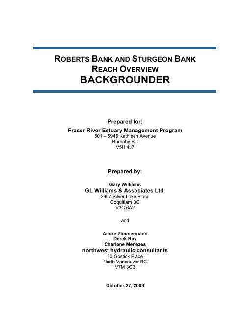
Roberts and Sturgeon Banks Reach Overview Backgrounder
Roberts and Sturgeon Banks Reach Overview Backgrounder
Roberts and Sturgeon Banks Reach Overview Backgrounder

You also want an ePaper? Increase the reach of your titles
YUMPU automatically turns print PDFs into web optimized ePapers that Google loves.
ROBERTS BANK AND STURGEON BANK<br />
REACH OVERVIEW<br />
BACKGROUNDER<br />
Prepared for:<br />
Fraser River Estuary Management Program<br />
501 – 5945 Kathleen Avenue<br />
Burnaby BC<br />
V5H 4J7<br />
Prepared by:<br />
Gary Williams<br />
GL Williams & Associates Ltd.<br />
2907 Silver Lake Place<br />
Coquitlam BC<br />
V3C 6A2<br />
<strong>and</strong><br />
Andre Zimmermann<br />
Derek Ray<br />
Charlene Menezes<br />
northwest hydraulic consultants<br />
30 Gostick Place<br />
North Vancouver BC<br />
V7M 3G3<br />
October 27, 2009
3-5119
Fraser River Estuary Management Program GL Williams & Associates/Northwest Hydraulics Consultants<br />
<strong>Roberts</strong> <strong>and</strong> <strong>Sturgeon</strong> Bank <strong>Reach</strong> <strong>Overview</strong><br />
BACKGROUNDER October 2009<br />
i
Fraser River Estuary Management Program GL Williams & Associates/Northwest Hydraulics Consultants<br />
<strong>Roberts</strong> <strong>and</strong> <strong>Sturgeon</strong> Bank <strong>Reach</strong> <strong>Overview</strong><br />
Draft Final Report September 2009<br />
TABLE OF CONTENTS<br />
1 Introduction ....................................................................................................... 1<br />
1.1 Estuary Management Plan............................................................................ 1<br />
1.2 Ecological Features <strong>and</strong> Functions Approach............................................... 1<br />
1.3 <strong>Reach</strong> <strong>Overview</strong> ........................................................................................... 3<br />
1.4 Ecological Context of <strong>Roberts</strong> Bank <strong>and</strong> <strong>Sturgeon</strong> Bank <strong>Reach</strong>................... 3<br />
1.5 Scope of Report............................................................................................ 4<br />
2 Status, Trends <strong>and</strong> Research Needs ............................................................... 5<br />
2.1 S<strong>and</strong>flat Habitat ............................................................................................ 5<br />
2.2 Mudflat Habitat.............................................................................................. 6<br />
2.3 Eelgrass Habitat ........................................................................................... 6<br />
2.4 Intertidal Marsh Habitat................................................................................. 6<br />
2.5 Backshore Habitat ........................................................................................ 7<br />
3 <strong>Overview</strong> of Fraser River Estuary Environment ............................................. 7<br />
3.1 L<strong>and</strong>scape History ........................................................................................ 7<br />
3.2 Climate.......................................................................................................... 8<br />
3.3 Physical Processes....................................................................................... 8<br />
3.3.1 Salinity............................................................................................................... 9<br />
3.3.2 Non-stationary Processes on the Delta ........................................................... 10<br />
3.3.3 Changes in L<strong>and</strong> Elevation.............................................................................. 10<br />
3.3.4 Eustatic Changes ............................................................................................ 11<br />
3.3.5 Extreme Weather Events................................................................................. 12<br />
3.4 Biological Context ....................................................................................... 12<br />
3.4.1 Vegetated Habitats.......................................................................................... 12<br />
3.4.2 Fish.................................................................................................................. 13<br />
3.4.3 Birds ................................................................................................................ 13<br />
3.5 Anthropogenic Context <strong>Overview</strong> ............................................................... 14<br />
3.5.1 Federal Government........................................................................................ 15<br />
3.5.2 Provincial Government .................................................................................... 21<br />
3.5.3 Regional Government...................................................................................... 22<br />
3.5.4 Municipal Government..................................................................................... 25<br />
3.5.5 First Nations .................................................................................................... 26<br />
3.5.6 Non Government Organizations ...................................................................... 30<br />
3.5.7 Important Designations.................................................................................... 30<br />
4 Dominant Habitat Types in the Robert <strong>and</strong> <strong>Sturgeon</strong> <strong>Banks</strong><br />
Ecosystems ..................................................................................................... 32<br />
iii
Fraser River Estuary Management Program GL Williams & Associates/Northwest Hydraulics Consultants<br />
<strong>Roberts</strong> <strong>and</strong> <strong>Sturgeon</strong> Bank <strong>Reach</strong> <strong>Overview</strong><br />
Draft Final Report September 2009<br />
4.1 S<strong>and</strong>flat....................................................................................................... 33<br />
4.1.1 Physical processes.......................................................................................... 35<br />
4.1.2 Biological processes........................................................................................ 35<br />
4.1.3 History of human activities on s<strong>and</strong>flat zone ................................................... 38<br />
4.1.4 Status, trends <strong>and</strong> research needs.................................................................. 38<br />
4.2 Mudflats ...................................................................................................... 40<br />
4.2.1 Physical processes.......................................................................................... 40<br />
4.2.2 Biological processes........................................................................................ 42<br />
4.2.3 History of activities on Mudflat zone ................................................................ 44<br />
4.2.4 Status, trends <strong>and</strong> research needs.................................................................. 45<br />
4.3 Eelgrass...................................................................................................... 46<br />
4.3.1 Physical processes.......................................................................................... 47<br />
4.3.2 Biological processes........................................................................................ 47<br />
4.3.3 History of activities on Eelgrass zone.............................................................. 51<br />
4.3.4 Status, trends <strong>and</strong> research needs.................................................................. 51<br />
4.4 Intertidal marshes ....................................................................................... 52<br />
4.4.1 Physical processes.......................................................................................... 53<br />
4.4.2 Biological processes........................................................................................ 54<br />
4.4.3 History of activities on Intertidal Marsh zone ................................................... 60<br />
4.4.4 Status, trends <strong>and</strong> research needs.................................................................. 60<br />
4.5 Backshore................................................................................................... 61<br />
4.5.1 Physical processes.......................................................................................... 62<br />
4.5.2 Biological processes........................................................................................ 63<br />
4.5.3 History of Activities in Backshore Zone ........................................................... 65<br />
4.5.4 Status, trends <strong>and</strong> research needs.................................................................. 65<br />
5 Summary.......................................................................................................... 65<br />
6 References....................................................................................................... 69<br />
7 Appendix A: Maps ........................................................................................... 75<br />
8 Appendix B: System Pathways Context........................................................ 83<br />
LIST OF TABLES<br />
Table 1. Tidal elevations (m Chart Datum – CD) reported for the Canadian Hydrographic<br />
Service (CHS) tide gauge at Point Atkinson............................................................................. 9<br />
Table 2. Characteristics of s<strong>and</strong>flats. ...................................................................................... 34<br />
Table 3. Characteristics of mudflats. ...................................................................................... 41<br />
Table 4. Characteristics of eelgrass. ....................................................................................... 49<br />
Table 5. Characteristics of intertidal marshes......................................................................... 54<br />
iv
Fraser River Estuary Management Program GL Williams & Associates/Northwest Hydraulics Consultants<br />
<strong>Roberts</strong> <strong>and</strong> <strong>Sturgeon</strong> Bank <strong>Reach</strong> <strong>Overview</strong><br />
Draft Final Report September 2009<br />
Table 6. Elevation range of dominant intertidal marsh species measured on <strong>Roberts</strong> Bank<br />
(from Williams 2008). High marsh extends from 4.1 m to 4.8 m (CD) <strong>and</strong> low marsh occurs<br />
below 4.1 m............................................................................................................................. 57<br />
Table 7. Characteristics of backshore. .................................................................................... 62<br />
LIST OF FIGURES<br />
Figure 1. Schematic illustrating an ecological perspective used by the Ecological Features<br />
<strong>and</strong> Functions Approach (EFFA) for achieving ecosystem-based management in the Fraser<br />
River Estuary. ........................................................................................................................... 2<br />
Figure 2. Example of typical tidal fluctuations over a one month period at the CHS tide<br />
gauge at Steveston (data from 1984). ....................................................................................... 9<br />
Figure 3. Uplift <strong>and</strong> subsidence rates in the Fraser River delta <strong>and</strong> greater Vancouver Region.<br />
Green vectors <strong>and</strong> ellipses show horizontal velocities <strong>and</strong> 95 % confidence limits (Mazzotti<br />
et al. in press).......................................................................................................................... 11<br />
Figure 4. Birds <strong>and</strong> small dunes on <strong>Sturgeon</strong> Bank s<strong>and</strong>flats................................................. 14<br />
Figure 5. Tsawwassen First Nations l<strong>and</strong> areas (Source: TFN 2009)..................................... 27<br />
Figure 6. L<strong>and</strong> use plan for <strong>Roberts</strong> Bank (Source: TFN 2009)............................................. 27<br />
Figure 7. Seals on s<strong>and</strong>flats on <strong>Sturgeon</strong> Bank....................................................................... 34<br />
Figure 8. Shorebirds feeding on mudflats............................................................................... 40<br />
Figure 9. Eelgrass community <strong>and</strong> dendritic channel pattern................................................. 45<br />
Figure 10. Brackish marsh on Swishwash Isl<strong>and</strong> in late winter. ............................................ 52<br />
Figure 11. Brackish marsh near Canoe Passage in late summer............................................. 53<br />
Figure 12. Tsawwassen salt marsh.......................................................................................... 55<br />
Figure 13. Distribution of S. anglica in the Fraser River delta in 2008 (Map by Ducks<br />
Unlimited Canada).................................................................................................................. 58<br />
Figure 14. Brackish Marsh...................................................................................................... 59<br />
Figure 15. Backshore habitat. ................................................................................................. 61<br />
LIST OF MAPS<br />
Map 1. Location Map<br />
Map 2. Key Management Issues Diagram<br />
Map 3. <strong>Sturgeon</strong> Bank Habitat Classification Map<br />
Map 4. <strong>Roberts</strong> Bank Habitat Classification Map<br />
Map 5. <strong>Roberts</strong> <strong>and</strong> <strong>Sturgeon</strong> Bank Jurisdictions Map<br />
Map 6. <strong>Roberts</strong> Bank Bathymetry Map<br />
Map 7. System Pathways Map<br />
v
1 INTRODUCTION<br />
Established in 1985, the Fraser River Estuary Management Program (FREMP) is an intergovernmental<br />
partnership that coordinates planning <strong>and</strong> decision making in the estuary. FREMP<br />
brings together the agencies responsible for setting <strong>and</strong> enforcing environmental legislation <strong>and</strong><br />
policy with those responsible for l<strong>and</strong> <strong>and</strong> water management. Together the FREMP partners<br />
coordinate their long-range planning <strong>and</strong> operational decision making to help ensure a sustainable<br />
future for the Fraser River estuary. The FREMP partners are: Environment Canada, Fisheries <strong>and</strong><br />
Oceans Canada, BC Ministry of Environment, Metro Vancouver, Port Metro Vancouver <strong>and</strong><br />
Transport Canada. The FREMP area is on the wetted side of the dyke, downstream from Kanaka<br />
Creek <strong>and</strong> Pitt Lake to the Strait of Georgia <strong>and</strong> includes <strong>Sturgeon</strong> Bank, <strong>Roberts</strong> Bank <strong>and</strong> Boundary<br />
Bay.<br />
1.1 ESTUARY MANAGEMENT PLAN<br />
FREMP is guided by the Estuary Management Plan (EMP), "A Living Working River", which<br />
outlines a shared vision, goals <strong>and</strong> actions for improving the environmental, economic, <strong>and</strong> social<br />
health of the Fraser River estuary.<br />
The vision of A Living Working River is to “improve environmental quality in the Fraser River<br />
estuary while providing economic development opportunities <strong>and</strong> sustaining the quality of life in <strong>and</strong><br />
around the estuary”.<br />
The goals of A Living Working River are:<br />
1. Conserve <strong>and</strong> enhance the environmental quality of the estuary to sustain healthy fish,<br />
wildlife, plants <strong>and</strong> people.<br />
2. Respect <strong>and</strong> further the estuary's role as the social, cultural, recreational <strong>and</strong> economic heart<br />
of the region.<br />
3. Encourage human activities <strong>and</strong> economic development that protect <strong>and</strong> enhance the<br />
environmental quality of the estuary.<br />
The EMP contains a number of action programs to guide activities in the estuary, in the areas in<br />
environmental protection <strong>and</strong> human activities. In 2003, the EMP was updated to include a new<br />
Integration Action Program with the objective to: “Develop <strong>and</strong> implement a features <strong>and</strong> functions<br />
approach to management <strong>and</strong> decision-making in the estuary.” The task under this objective is to<br />
develop <strong>Reach</strong> <strong>Overview</strong>s for the estuary.<br />
1.2 ECOLOGICAL FEATURES AND FUNCTIONS APPROACH<br />
An “ecological features <strong>and</strong> functions approach” or EFFA is an ecosystem-based, collaborative <strong>and</strong><br />
flexible approach to management, which includes estuary <strong>and</strong> upl<strong>and</strong> features, while taking into<br />
account the biological, economic <strong>and</strong> social characteristics of the river. The reach overview is<br />
primarily a compilation of biophysical <strong>and</strong> socioeconomic information, acknowledging that natural<br />
1
<strong>and</strong> human uses are both occurring in the reach <strong>and</strong> that there are linkages between biological,<br />
physical, <strong>and</strong> human processes.<br />
The features <strong>and</strong> functions approach is a beneficial way of managing the estuary for a variety of<br />
reasons. It provides a tool for better planning, guidance <strong>and</strong> cooperation on l<strong>and</strong> <strong>and</strong> water issues for<br />
FREMP partners, municipalities <strong>and</strong> the development community. The EFFA provides a sciencebased<br />
approach that places equal relevance on all parts of the ecosystem, i.e. biological, physical <strong>and</strong><br />
human processes, as well as the interrelationships between them. The approach attempts to reveal <strong>and</strong><br />
protect the underlying needs within a reach given its various economic, social, biological <strong>and</strong> cultural<br />
attributes.<br />
The EFFA links the foreshore <strong>and</strong> upl<strong>and</strong> so that water <strong>and</strong> l<strong>and</strong>-based habitats can be managed more<br />
effectively <strong>and</strong> provides a more environmentally sound basis for decision-making. In this respect, the<br />
EFFA is a particularly useful tool for FREMP as it requires managers to look beyond the immediate<br />
intertidal <strong>and</strong> riparian zones to underst<strong>and</strong> the role of each reach within the Fraser, <strong>and</strong> the function of<br />
the Fraser River in the region as a whole. Conceptually this approach is illustrated in Figure 1.<br />
This approach differs from a more traditional reductionist approach where each process <strong>and</strong> activity<br />
that occurs across the banks is described. The purpose of the EFFA is to integrate the existing<br />
knowledge base to provide a more complete underst<strong>and</strong>ing of the ecosystems on the bank, rather than<br />
present a detailed summary of each biological, physical <strong>and</strong> human related characteristic that occurs.<br />
The integrated knowledge that is presented here was synthesized from a wide range of detailed<br />
scientific studies.<br />
Figure 1. Schematic illustrating an ecological perspective used by the Ecological<br />
Features <strong>and</strong> Functions Approach (EFFA) for achieving ecosystem-based<br />
management in the Fraser River Estuary.<br />
2
1.3 REACH OVERVIEW<br />
The <strong>Reach</strong> <strong>Overview</strong> provides a comprehensive <strong>and</strong> functional compilation of information that will<br />
lead to formulating management guidelines with the end goal of achieving more sustainable<br />
development. <strong>Roberts</strong> Bank <strong>and</strong> <strong>Sturgeon</strong> Bank comprise <strong>Reach</strong> One of ten identified ecological<br />
reaches designated in “A Living Working River: The Estuary Management Plan for the Fraser River”<br />
(FREMP 2003). The Plan calls for a <strong>Reach</strong> <strong>Overview</strong> to be prepared for each reach that will compile<br />
information on the natural <strong>and</strong> human features <strong>and</strong> functions, planning designations <strong>and</strong> zoning, <strong>and</strong><br />
FREMP habitat classifications <strong>and</strong> area designations. The <strong>Reach</strong> <strong>Overview</strong>s will provide FREMP<br />
partners with a useful tool to link water <strong>and</strong> l<strong>and</strong> uses, as well as leading to more effective strategies<br />
to address long-term planning <strong>and</strong> development.<br />
1.4 ECOLOGICAL CONTEXT OF ROBERTS BANK AND STURGEON<br />
BANK REACH<br />
The importance of <strong>Roberts</strong> Bank <strong>and</strong> <strong>Sturgeon</strong> Bank stems from the dynamic estuarine conditions<br />
that make these areas an extremely productive natural environment. The daily tidal exchange of rich<br />
marine waters of the Strait of Georgia <strong>and</strong> fresh water from the Fraser River, combined with the large<br />
expanse of shallow s<strong>and</strong> <strong>and</strong> mudflats that are exposed to warm temperatures <strong>and</strong> day-long solar<br />
radiation provide the ideal environment for the growth of benthic algae <strong>and</strong> diatoms, eelgrass beds,<br />
<strong>and</strong> intertidal marshes. These floral communities in turn provide habitat for a diverse <strong>and</strong> plentiful<br />
invertebrate community that form the basis of a rich feeding ground for birds, fish, wildlife, <strong>and</strong><br />
marine mammals. However, the estuarine environment is very dynamic, with seasonal events such as<br />
the annual Fraser River freshet driven by snowmelt in the mountains within the watershed, which<br />
brings millions of tonnes of sediment annually to the reach, as well as more regional oceanographic<br />
events such as El Niño <strong>and</strong> La Nina, that can have a significant effect on the estuarine environment<br />
<strong>and</strong> weather conditions. Storm events can also modify the estuarine environment.<br />
The Fraser River is one of the most important salmon rivers in the world <strong>and</strong> also supports over 30<br />
other fish species. <strong>Roberts</strong> Bank <strong>and</strong> <strong>Sturgeon</strong> Bank provide rich juvenile rearing grounds for fish<br />
from the Fraser River <strong>and</strong> other marine species found in the Strait of Georgia. This tremendous<br />
secondary productivity provides an opportunity for commercial, sport <strong>and</strong> First Nations fisheries,<br />
with salmon <strong>and</strong> crab being the most important species taken.<br />
<strong>Roberts</strong> Bank <strong>and</strong> <strong>Sturgeon</strong> Bank, together with Boundary Bay, form one of the richest <strong>and</strong> most<br />
important ecosystems for migratory <strong>and</strong> wintering birds in Canada. The mudflat-marsh-biofilm<br />
complex, especially on <strong>Roberts</strong> Bank, is unique in the province <strong>and</strong> essential for supporting the<br />
migratory bird population. Millions of migratory birds migrate annually thorough the estuary to<br />
northern breeding grounds in the spring <strong>and</strong> return in the fall on their way to southern wintering areas.<br />
Of these, the western s<strong>and</strong>piper is the most numerous species, with daily counts exceeding half a<br />
million birds during the spring migration. The Fraser delta is a key stop-over on the Pacific Flyway<br />
for millions if western s<strong>and</strong>piper on their spring migration from South America to their breeding<br />
grounds in Alaska. The incremental loss of the Fraser Estuary staging <strong>and</strong> feeding grounds –<br />
including the mudflats which support large numbers of small invertebrates taken as prey as well as<br />
the biofilm coating composed of microscopic diatoms <strong>and</strong> bacteria – would be devastating to this<br />
species <strong>and</strong> affect the whole chain of stop-overs along the Pacific Flyway.<br />
3
The <strong>Banks</strong> also support numerous other species, <strong>and</strong> at least 47 species of shorebird, <strong>and</strong> a significant<br />
percentages of the total region populations of great blue herons, trumpeter <strong>and</strong> tundra swans, lesser<br />
snow geese <strong>and</strong> dabbling ducks utilize <strong>Sturgeon</strong> <strong>Banks</strong>. In addition, hundreds of thous<strong>and</strong>s of<br />
migrating <strong>and</strong> wintering waterfowl, shorebirds, <strong>and</strong> raptors use the area each year. As well, at least<br />
two nationally at risk (special concern) bird species breed in the area: great blue heron (ssp. fannini)<br />
<strong>and</strong> barn owl.<br />
From a human use perspective, the flat l<strong>and</strong>s of the delta have provided an ideal area for urban <strong>and</strong><br />
agricultural development. The rich soils of the delta were diked <strong>and</strong> developed for agriculture <strong>and</strong><br />
urban l<strong>and</strong> uses beginning before the turn of the last century. The attractive location <strong>and</strong> moderate<br />
maritime climate has attracted large numbers of people <strong>and</strong> today the Lower Mainl<strong>and</strong> human<br />
population is greater than 2 million people. Urban expansion has generated billions of dollars in<br />
economic growth through port, industrial, agricultural, forestry, <strong>and</strong> airport development. These<br />
development pressures continue as the region builds infrastructure to take advantage of Asian trade<br />
opportunities with the Pacific Gateway initiative <strong>and</strong> associated port expansion, the South Fraser<br />
perimeter road project, <strong>and</strong> continued airport expansion. The ever-growing population will likely<br />
continue to require more roads, urban space <strong>and</strong> recreational amenities.<br />
The human l<strong>and</strong> issues within the <strong>Roberts</strong> Bank <strong>and</strong> <strong>Sturgeon</strong> Bank <strong>Reach</strong> also include First Nations.<br />
The treaty settlement with Tsawwassen First Nation (TFN) has resulted in a major l<strong>and</strong> transfer of<br />
agricultural <strong>and</strong> foreshore l<strong>and</strong> <strong>and</strong> access to Fraser River fisheries, as well as increased selfgovernance.<br />
Future plans for the TFN l<strong>and</strong>s will include substantial new development to provide<br />
economic return <strong>and</strong> jobs for b<strong>and</strong> members. There are also several other First Nations from the<br />
Fraser River <strong>and</strong> Vancouver Isl<strong>and</strong> that have an interest in the area that will need to be addressed<br />
within the l<strong>and</strong> claims process.<br />
Management of the <strong>Roberts</strong> Bank <strong>and</strong> <strong>Sturgeon</strong> Bank <strong>Reach</strong> includes federal, provincial, <strong>and</strong> regional<br />
municipal levels of government, as well as major non-private l<strong>and</strong> owners such as the Port Metro<br />
Vancouver <strong>and</strong> Vancouver Airport Authority. The area also has a high profile with the public <strong>and</strong><br />
numerous special interest groups, many of which are concerned with the scale <strong>and</strong> level of<br />
development in the area. These multi-level management jurisdictions complicate decision-making<br />
<strong>and</strong> often require complex negotiation processes to reach a consensus. The often-stated goal of<br />
sustainable development is further complicated by climate change <strong>and</strong> the associated sea level rise.<br />
Not only is the estuarine environment dynamic by nature, but the goal posts <strong>and</strong> end points are now<br />
understood to be changing <strong>and</strong> this uncertainty needs to be addressed within the planning process.<br />
Governance <strong>and</strong> decision-making is further affected by economic factors that result in a lack of<br />
adequate financial resources to fund planning programs <strong>and</strong> processes.<br />
1.5 SCOPE OF REPORT<br />
This report provides a compilation <strong>and</strong> synthesis of existing information on the physical, biological<br />
<strong>and</strong> human activities <strong>and</strong> processes for <strong>Sturgeon</strong> <strong>and</strong> <strong>Roberts</strong> <strong>Banks</strong>. The study area examined<br />
includes the foreshore environment bounded by the North Arm Jetty at the north boundary of the area,<br />
to Point <strong>Roberts</strong> in the south, to the break in slope at about -3 m CD to the west, <strong>and</strong> to the top of the<br />
bank along the eastern <strong>Roberts</strong>/<strong>Sturgeon</strong> Bank shoreline to the east but including an undefined area of<br />
adjacent backshore area (Map 1).<br />
To provide a practical <strong>and</strong> useful integration of the physical, biological <strong>and</strong> anthropogenic processes<br />
occurring in the <strong>Roberts</strong> Bank <strong>and</strong> <strong>Sturgeon</strong> Bank <strong>Reach</strong>, published reports as well as primary <strong>and</strong><br />
4
secondary data sources were synthesized <strong>and</strong> described according to five habitat types. The key<br />
management issues affecting the study area are presented in Map 2 in order to graphically<br />
contextualise some of the concerns regarding human development in the reach. The five broad<br />
habitat types considered in this report are s<strong>and</strong>flat, mudflat, eelgrass, intertidal marsh that extends<br />
from the edge of the s<strong>and</strong>flats up to the high water line, <strong>and</strong> the backshore communities (Map 3 <strong>and</strong><br />
Map 4).<br />
The intent is to identify <strong>and</strong> describe the main processes, features, <strong>and</strong> functions operating in each of<br />
the habitat types to provide a foundation for underst<strong>and</strong>ing how they are affected by contemporary<br />
activities on the delta <strong>and</strong> what needs to be considered with regards to future development in the<br />
reach. An integrated underst<strong>and</strong>ing of the physical, biological <strong>and</strong> anthropogenic activities is<br />
required to effectively manage the foreshore <strong>and</strong> nearshore environment since the effects of all three<br />
activities are intertwined. To underst<strong>and</strong> the dynamic changes <strong>and</strong> evolution of these systems that are<br />
operating on the banks requires consideration of the combined interactions between biological,<br />
physical <strong>and</strong> anthropogenic activities.<br />
This report represents Phase I of a multi-phase study. The Phase I terms of reference include<br />
documentation <strong>and</strong> synthesis of information on the natural <strong>and</strong> human features <strong>and</strong> functions of the<br />
reach, analysis of existing l<strong>and</strong> <strong>and</strong> water use plans <strong>and</strong> designations, <strong>and</strong> preparation of a draft report<br />
to be presented at a technical workshop. Following completion of Phase I it was advised that followup<br />
studies should be conducted to address field research needs, existing GIS mapping should be<br />
updated <strong>and</strong> detailed research <strong>and</strong> analysis needs of the stakeholders should be determined. This<br />
information would provide further guidance for coordinating the management of the reach.<br />
2 STATUS, TRENDS AND RESEARCH NEEDS<br />
2.1 SANDFLAT HABITAT<br />
S<strong>and</strong>flat habitat is located in the outer tidal flats <strong>and</strong> offers physical protection to the inner mudflat<br />
<strong>and</strong> marsh habitats by reducing wave energy from storms through wave dissipation. Being coarser<br />
grained, the sediments tend to have less organic matter <strong>and</strong> have reduced invertebrate productivity.<br />
Several potential developments are anticipated for the s<strong>and</strong>flats within the study area, including port<br />
development, Vancouver Airport runway expansion, <strong>and</strong> outfall twinning at Iona. S<strong>and</strong> is also<br />
periodically dredged from the navigation channel in the Fraser River.<br />
In order to develop a meaningful sediment budget to monitor dredging operations, there is a need to<br />
determine how much sediment is being discharged to <strong>Roberts</strong> Bank <strong>and</strong> <strong>Sturgeon</strong> Bank. This could<br />
be coupled with investigations on subsidence (i.e. rate <strong>and</strong> areas of where it is most prevalent) <strong>and</strong><br />
effects of interruption of longshore transport to assess these effects on seal level rise.<br />
There is also a need to study the effects of major developments on the off-site impacts such as<br />
drainage patterns <strong>and</strong> dendritic channel formation. For example, dredging the intercauseway ship<br />
turning basin initiated a system of dendritic channels that led to formation of a s<strong>and</strong> lobe that has<br />
covered substantial areas (e.g. 30 ha) of eelgrass. More research is required to determine how they<br />
are formed <strong>and</strong> whether possible mitigative measures to control them exist.<br />
5
2.2 MUDFLAT HABITAT<br />
Mudflats are tremendously productive habitats that support a high abundance of invertebrates that in<br />
turn support fish <strong>and</strong> waterbirds. Mudflat ecology is very poorly understood but because of this<br />
importance, is deserving of much more ecologically-based studies on a wide range of processes<br />
including geochemical investigations, nutrient cycling, biofilm dynamics, <strong>and</strong> the role of mudflats in<br />
the interconnected intertidal habitat continuum. One suggested approach is to have an invited<br />
workshop of international specialists to guide development of a comprehensive research program.<br />
European researchers have been doing more intensive mudflat investigations over many years <strong>and</strong><br />
could provide valuable guidance on developing appropriate programs <strong>and</strong> approaches to the Fraser<br />
Delta.<br />
In the past, mudflats have been considered to be less productive than intertidal marshes <strong>and</strong> relative<br />
habitat compensation ratios developed by various governing agencies were about half the value given<br />
to marshes. In light of the importance of marine mudflats to shorebirds, for example, there is a need<br />
to better underst<strong>and</strong> the functions <strong>and</strong> mechanisms that mudflats provide for fish <strong>and</strong> birds.<br />
On <strong>Roberts</strong> Bank, mudflats are being colonised by invasive cordgrass (Spartina anglica). This<br />
species has the potential to grow much lower elevations than native marsh species <strong>and</strong> tends to form<br />
large monocultures on mudflats, as well as invading <strong>and</strong> outcompeting the native salt marsh plant<br />
species. The species is beginning to spread <strong>and</strong> control of the infestation is now beyond manual<br />
removal capabilities. A targeted program needs to be developed to remove it before it exp<strong>and</strong>s<br />
further <strong>and</strong> makes control/removal much more difficult.<br />
As with s<strong>and</strong>flats, the off-site impacts from large-scale port or other developments should be studied.<br />
The formation of drainage channels <strong>and</strong> dendritic networks from intertidal fills can be quite disruptive<br />
of mudflat <strong>and</strong> other habitats.<br />
2.3 EELGRASS HABITAT<br />
Although eelgrass is known to be an extremely important habitat for estuarine invertebrates, fish <strong>and</strong><br />
birds, there has been little ecological study of eelgrass beds in the Fraser River estuary as compared to<br />
other areas in the world. In particular, the processes <strong>and</strong> functions have not been adequately studied.<br />
One example of a gap in our underst<strong>and</strong>ing is the nature of epiphyte communities on Fraser eelgrass.<br />
Another is that eelgrass has not developed on <strong>Sturgeon</strong> Bank, although it is prevalent on <strong>Roberts</strong><br />
Bank. What are the main factors limiting the species – salinity, wave energy, stable substrate,<br />
turbidity, etc.<br />
In addition, the introduced eelgrass species, Zostera japonica, has not been well studied to determine<br />
if it is detrimental to the native habitats. It appears that waterfowl <strong>and</strong> geese feed on it, but denser<br />
beds are apparently capable of locally modifying sediment composition. The potential contribution to<br />
the detritus food change is another area worthy of further research.<br />
2.4 INTERTIDAL MARSH HABITAT<br />
Brackish marsh <strong>and</strong> salt marsh are important feeding <strong>and</strong> cover areas for fish <strong>and</strong> waterfowl in the<br />
Fraser River Estuary. However, the marshes are under heavy grazing pressure from geese, which<br />
6
emoves the vegetation, leading to the promotion of erosion <strong>and</strong> development of tidal channels.<br />
These relationships should be studied to provide better data for management.<br />
Invasive cordgrass (Spartina anglica) is colonising natural salt marshes on <strong>Roberts</strong> Bank. There is a<br />
need to develop a more concerted control effort, <strong>and</strong> if necessary, a research program to assess<br />
chemical control of the cordgrass before it becomes too established in the native marshes.<br />
There is also a need to map marsh communities to determine if there have been shifts in community<br />
composition from changes in salinity <strong>and</strong> elevation changes from sediment accumulation <strong>and</strong> erosion,<br />
glacial subsidence, subsidence, sediment degassing <strong>and</strong> tectonic downwarping.<br />
2.5 BACKSHORE HABITAT<br />
Backshore habitats, particularly grassl<strong>and</strong> <strong>and</strong> forested communities, have been fragmented by<br />
agricultural <strong>and</strong> urban development. Traditional use farml<strong>and</strong>, which is important for supporting<br />
waterfowl, is being lost to other uses or converted to other non-traditional agriculture such as<br />
blueberry production <strong>and</strong> greenhouses. Sufficient farml<strong>and</strong> should be maintained to support<br />
waterfowl <strong>and</strong> shorebirds.<br />
Research is needed to better underst<strong>and</strong> the use of backshore habitats by waterbirds <strong>and</strong> passerines to<br />
better underst<strong>and</strong> the connectiveness of the upl<strong>and</strong> <strong>and</strong> inter-habitat uses. For example, growing<br />
raptor populations have affected the behaviour of shorebirds <strong>and</strong> great blue herons. Also, the presence<br />
of large numbers of people can be disruptive of shorebird feeding during times the birds need to bulk<br />
up to prepare for their migration. Humans need to be educated so as to avoid approaching flocks for<br />
observation, which can frighten them <strong>and</strong> interrupt feeding.<br />
3 OVERVIEW OF FRASER RIVER ESTUARY ENVIRONMENT<br />
<strong>Sturgeon</strong> Bank <strong>and</strong> <strong>Roberts</strong> Bank occupy the front of the Fraser River estuary, a river-dominated<br />
delta (USACE, 2002) consisting of prograding branching distributary channels, separated by marshes.<br />
The long-term evolution of the delta is governed by the rate of riverine sediment input <strong>and</strong> the pattern<br />
of sediment re-working, transport <strong>and</strong> deposition associated with tidal currents <strong>and</strong> waves.<br />
3.1 LANDSCAPE HISTORY<br />
The contemporary location of the Fraser delta has developed following at least four glaciations<br />
(Ryder <strong>and</strong> Clague 1989) with the most recent, the Fraser glaciation, beginning sometime before<br />
25,000 years Before Present (B.P.) (Ryder 1972). It reached its maximum extent around 15,000 years<br />
B.P. <strong>and</strong> retreated less than 2,000 years later. During the advance of the glaciations, outwash deposits<br />
of s<strong>and</strong> <strong>and</strong> gravel were laid down <strong>and</strong> these were subsequently overridden by the glacier ice. These<br />
deposits formed the compact Quadra S<strong>and</strong>s that compose Point Grey <strong>and</strong> the upl<strong>and</strong>s at Point<br />
<strong>Roberts</strong>, which define the north <strong>and</strong> south boundary of this study, respectively. Following the initial<br />
glacial retreat (circa 13,000 years B.P.), sea level was at least 174 m above contemporary levels<br />
(Ryder 1972). At this time, glacier ice persisted further up the Fraser basin <strong>and</strong> a small re-advance,<br />
the Sumas glaciation, occurred between 13,000 <strong>and</strong> 11,000 years B.P. (Armstrong 1981). The Sumas<br />
glaciation did not reach the contemporary delta, but it would have supplied large quantities of s<strong>and</strong>,<br />
7
silt <strong>and</strong> clay to the recently de-glaciated l<strong>and</strong>scape. As a result of the isostatic rebound following<br />
deglaciation, 9,000 years B.P., sea level was 10 m to 20 m below present (Clague <strong>and</strong> Turner 2006).<br />
This relatively low sea level would have provided a sufficiently steep local gradient to move coarse<br />
<strong>and</strong> medium s<strong>and</strong> further into the Georgia Basin than is currently possible. Sea level has gradually<br />
risen to current conditions since this time, while the Fraser River has continued to supply sediment to<br />
the delta. In more recent times, the main mouth of the Fraser River was further south than present,<br />
but by the end of the 19th Century the channel had shifted closer to its present location (Kostaschuk<br />
et al. 1998).<br />
3.2 CLIMATE<br />
Vancouver <strong>and</strong> its region are characterised by a maritime climate with relatively warm winters <strong>and</strong><br />
cool summers. On average 1,200 mm of precipitation is measured each year at Vancouver<br />
International Airport, <strong>and</strong> almost all (>95%) of the precipitation occurs as rain (Environment Canada<br />
2009). Most of the rain (72%) falls between the beginning of October <strong>and</strong> the end of March. At the<br />
airport weather station, located immediately adjacent to <strong>Sturgeon</strong> Bank, mean daily temperatures<br />
reach only 17.5°C during July <strong>and</strong> August <strong>and</strong> drop to 3.5°C during the winter (Environment Canada<br />
2009). Thus, substantial amounts of desiccation <strong>and</strong> ice are rare along the delta. While the mean<br />
wind direction is from the east, maximum wind directions consistently come from the west <strong>and</strong> have a<br />
longer fetch resulting in larger waves that are associated with erosion of the delta front <strong>and</strong> surface.<br />
The climate is influenced by regional <strong>and</strong> global climate anomalies including the El Niño-Southern<br />
Oscillation (ENSO) <strong>and</strong> the Pacific Decadal Oscillation (PDO) (Kiffney et al. 2002; Mantua et al.<br />
1997). Positive values of the PDO indicate warmer waters in the equatorial regions <strong>and</strong> cooler waters<br />
in the central northern Pacific region. El Niño events are typically associated with warmer, dryer<br />
winters in BC while La Niña events are associated with cooler, wetter winters (Shabbar et al. 1997).<br />
The occurrence of these events has an effect on storm characteristics <strong>and</strong> water temperatures, both of<br />
which can have a direct effect on water levels along the delta (Thomson et al. 2008). Climate change<br />
may be increasing the frequency of these events (Overl<strong>and</strong> et al. 2006, 2008; Rudnick <strong>and</strong> Davis<br />
2003).<br />
3.3 PHYSICAL PROCESSES<br />
Physical processes in the estuary are driven by the Fraser River, tidal fluctuations <strong>and</strong> wind-generated<br />
waves, particularly associated with storm events. The Fraser River is the main supplier of sediment<br />
<strong>and</strong> consists of four distributary channels (Map 1) with 85 % of the flow coming through the main<br />
South Arm. The Fraser transports an average of 17.3 million tonnes of sediment annually (measured<br />
at Mission, 84 km above the river mouth), which is considered as the input point for the estuary.<br />
Most of this sediment is transported during the later spring <strong>and</strong> early summer period, coinciding with<br />
the timing of the annual flood. The annual sediment load consists of 35% s<strong>and</strong>, 50% silt <strong>and</strong> 15%<br />
clay (McLean et al. 1999). Fraser River is exceptional among large deltas for the high proportion of<br />
s<strong>and</strong> it delivers to the sea. The total bed material load (medium <strong>and</strong> coarse s<strong>and</strong>) averaged 2.8 million<br />
tonnes/year between 1966 <strong>and</strong> 1997 <strong>and</strong> about 30 % of this sediment is delivered to S<strong>and</strong>heads at the<br />
mouth of the South Arm. The remaining sediment is dredged from the channel <strong>and</strong> deposited in deep<br />
water in the Strait of Georgia (McLean <strong>and</strong> Tassone 1988; Northwest Hydraulic Consultants 2002).<br />
Most of the s<strong>and</strong> <strong>and</strong> coarser silts that are transported to the delta settle out within a few hundred<br />
meters of the channel mouth resulting in deposition rates greater than 1 mm per year for the period<br />
8
from 1994 to 2006 (Hill et al. 2008). The amount of s<strong>and</strong> delivered through the other channels is<br />
very small at present. For example, based on the sediment budget analysis <strong>and</strong> flow splitting<br />
information, the long-term load through Canoe Passage is estimated to be in the order of 50,000<br />
tonnes/year, or less than 0.3%.<br />
The estuary is strongly influenced by tidal fluctuations that are predominantly mixed, mainly semidiurnal,<br />
with a range of up to 5 m near Tsawwassen. The mean tidal height is about 3.1 m (Table 1)<br />
but the tides vary over the course of a typical month (Figure 2). The variability in tide height results<br />
in considerable temporal differences in the mobility of sediment on the tidal flats.<br />
Beyond areas immediately influenced by Fraser River outflow, the main sediment mobilizing force<br />
on the banks is waves, with the largest waves coming from the west. The effect of storm events is<br />
strongly moderated by tidal conditions during storms; a high tide <strong>and</strong> strong westerly winds can result<br />
in considerable flooding along the banks. Dunes have formed on <strong>Sturgeon</strong> Bank due to wave<br />
processes, while on <strong>Roberts</strong> Bank only smaller bedforms are present, since the wave energy is<br />
reduced due to the presence of jetties (discussed below).<br />
Table 1. Tidal elevations (m Chart Datum – CD) reported for the Canadian<br />
Hydrographic Service (CHS) tide gauge at Point Atkinson.<br />
Mean Tide Large Tide<br />
(m CD) (m CD)<br />
Higher High Water 4.4 5.1<br />
Lower Low Water 1.2 0<br />
Mean Water Level 3.1 3.1<br />
Figure 2. Example of typical tidal fluctuations over a one month period at the CHS tide<br />
gauge at Steveston (data from 1984).<br />
3.3.1 SALINITY<br />
Salinity varies spatially <strong>and</strong> temporally across <strong>Sturgeon</strong> <strong>and</strong> <strong>Roberts</strong> <strong>Banks</strong>. Spatial variability is<br />
associated with the location of jetties <strong>and</strong> causeways that modify circulation patterns of fresh water<br />
9
discharging from the Fraser River mixing with the salt water in the Strait of Georgia. Temporal<br />
variability is due to seasonal fluctuations in Fraser River discharge, diurnal tidal fluctuations <strong>and</strong><br />
sporadic storm conditions. Where fresh water can mix with salt water, the estuary is classified as<br />
moderately stratified. The lighter fresh water spreads out on top of the more dense salt water before<br />
eventually mixing with the salt water. This mixing is influenced by differences in density, sediment<br />
concentration <strong>and</strong> the structure of the flow. In the <strong>Roberts</strong> Bank intercauseway area between the<br />
Deltaport <strong>and</strong> BC Ferries causeways <strong>and</strong> in the area south of the causeways, the salinity is more<br />
stable than most areas along the banks. Minimal fresh water reaches these areas <strong>and</strong> the salinity is<br />
similar to that found in the Strait of Georgia.<br />
A salt wedge forms in the river channels during high Fraser River discharge. The location of the salt<br />
wedge in the water column moves throughout the day in response to variations in tide height, as well<br />
as seasonally in response to variations in river discharge. In the top portion of the water column the<br />
lighter, less saline water flows down-channel while up-channel flow occurs in the salt water portion<br />
of the wedge near the bed (Kostaschuk 2002). This upstream flow near the bed transports<br />
contaminants upstream from source zones in the estuary, which is counter intuitive if only the<br />
obvious down-gradient flow patterns are considered. Detailed observations regarding seasonal <strong>and</strong><br />
temporal patterns of salinity on the <strong>Sturgeon</strong> <strong>and</strong> <strong>Roberts</strong> <strong>Banks</strong> in areas outside of the river channels<br />
are scarce, yet salinity has a strong influence on the geographic extents of the various biological<br />
communities that develop in these areas since many species have adapted to a specific range of<br />
salinity.<br />
3.3.2 NON-STATIONARY PROCESSES ON THE DELTA<br />
Averaged over a few years or decades, many of the processes operating on the delta, such as floods,<br />
tidal fluctuations <strong>and</strong> long-shore drift, attain some ‘mean’ process resulting in some ‘mean’ delta<br />
state. At the limit of these time scales, other processes that can drive the evolution of the delta begin<br />
to be important. The processes acting at these longer time scales include the response of the earth’s<br />
crust to the last glaciation <strong>and</strong> the deposition of sediment on the delta (isostatic changes), the downwarping<br />
of the earth’s crust in response to the movement of tectonic plates (tectonic changes), as well<br />
as the response of sea level to climate change (eustatic changes). Thus the delta should not be<br />
considered static, but rather evolving from one state to another with rates <strong>and</strong> patterns that are<br />
governed by a range of processes. Some of these processes are internally regulated (e.g. sediment<br />
deposition/subsidence) while others are externally driven (isostatic rebound, eustatic changes,<br />
tectonic downwarping). The following few sections briefly discuss some of the factors operating at<br />
the longer time scales.<br />
3.3.3 CHANGES IN LAND ELEVATION<br />
The elevation of the l<strong>and</strong> surface along <strong>Roberts</strong> <strong>and</strong> <strong>Sturgeon</strong> Bank is influenced by four factors.<br />
First, the l<strong>and</strong> mass is rebounding from being depressed by thick (i.e. over one kilometre) sheets of<br />
ice during the last glacial maximum at an estimated rate of approximately 0.25 mm/yr (Thomson et<br />
al. 2008). Second, the l<strong>and</strong> mass is subsiding in response to the continuous accumulation of new<br />
sediment from the Fraser River, <strong>and</strong> third, the sediment is becoming more dense as it<br />
dewaters/degasses over time. Combined, these two yield 1-2 mm/yr of subsidence (Thomson et al.<br />
2008; Mazzotti et al. in press). Fourth, the l<strong>and</strong> surface is tilting downward in response to tectonic<br />
plate movements in the coastal subduction zone (Clague, et al., 1982). Mazzotti et al. (in press)<br />
suggest that in response to the additional load caused by the construction of the <strong>Roberts</strong> Bank <strong>and</strong> the<br />
10
BC ferry terminal subsidence rates of 3 to 8 mm per year can occur. They also observed that these<br />
rates slow exponentially with a time constant around (analogous to half-life) of 20 years. InSAR<br />
radar (Interferometric Synthetic Aperture Radar) provides very accurate elevation data but since the<br />
observations cannot image surfaces under water, it remains unclear if the s<strong>and</strong> <strong>and</strong> coarse silt that are<br />
currently being deposited at the mouth of the main stem of the Fraser River are also associated with<br />
local increased rates of subsidence. The nearby terrestrial l<strong>and</strong> surfaces, such as Westham Isl<strong>and</strong>, do<br />
not appear to be affected by the additional loading due to Fraser River sediments (Figure 3).<br />
3.3.4 EUSTATIC CHANGES<br />
Eustatic changes occur when sea level rises or falls due to 1) the melting of the ice caps, 2) expansion<br />
of water due to warming or 3) changes in salinity. All three of these are affected by climate change.<br />
Within the Strait of Georgia salinity effects account for 63 % if the observed sea level change while<br />
temperature effects accounts for 37 % (Bornhold 2008).<br />
Figure 3. Uplift <strong>and</strong> subsidence rates in the Fraser River delta <strong>and</strong> greater Vancouver<br />
Region. Green vectors <strong>and</strong> ellipses show horizontal velocities <strong>and</strong> 95 %<br />
confidence limits (Mazzotti et al. in press).<br />
Climate change is widely accepted in the scientific community to be occurring <strong>and</strong> the latest<br />
International Panel on Climate Change (IPCC) Report (IPCC 2007) states that an average warming of<br />
0.2 °C per decade is expected for the next two decades. Thomson et al. (2008) note that global mean<br />
sea level has risen 2 mm/year recently <strong>and</strong> this is expected to continue. Assuming that mean eustatic<br />
increases in sea level, along with projected changes in l<strong>and</strong> surface elevation, this will result in a<br />
combined estimated mean sea level rise of 0.55 m by 2100 for the Fraser delta with the range of<br />
uncertainty yielding a minimum of 0.33 m <strong>and</strong> a maximum of 0.77 m (Thomson et al. 2008).<br />
11
3.3.5 EXTREME WEATHER EVENTS<br />
A rise in global temperature that has been predicted by numerous climate scientists is expected to<br />
produce a complex response in the global circulation of weather. According to predictions, there may<br />
be greater temperature increases in the central portions of the North American continent, while<br />
coastal <strong>and</strong> southern regions may experience a more moderate rise in temperature. In addition, many<br />
researchers point to an increase in severe weather events as a likely outcome of global climate change<br />
(for examples see McBean 2004). Furthermore, many climate models predict more El Niño events,<br />
which are associated with mean sea levels several tens of centimetres above background levels;<br />
however, there still remains some uncertainty if El Niño events will become more frequent (Thomson<br />
et al. 2008). In general, an increase in extreme weather events is expected to generate a greater<br />
frequency of large storms as well as an overall increase in the magnitude of storm intensity.<br />
3.4 BIOLOGICAL CONTEXT<br />
<strong>Roberts</strong> Bank <strong>and</strong> <strong>Sturgeon</strong> Bank provide vital estuarine habitat for sustaining diverse assemblages of<br />
fish <strong>and</strong> wildlife (see for example Hoos <strong>and</strong> Packman 1974; Butler <strong>and</strong> Campbell 1987; Harrison <strong>and</strong><br />
Dunn 2004; Levings 2004; Adams <strong>and</strong> Williams 2004). The estuarine habitats include expansive<br />
tidal flats ranging from up to 5 km wide on <strong>Sturgeon</strong> Bank <strong>and</strong> up to 7 km on <strong>Roberts</strong> Bank, that are<br />
characterized by an outer s<strong>and</strong>flat <strong>and</strong> inner mudflat.<br />
3.4.1 VEGETATED HABITATS<br />
Backshore areas behind the dykes have largely been developed for agriculture, residential<br />
development or parkl<strong>and</strong>. However, fragmented coniferous <strong>and</strong> deciduous forests <strong>and</strong> open grass <strong>and</strong><br />
herbaceous vegetated areas exist l<strong>and</strong>ward of the dykes in Richmond <strong>and</strong> Delta that are important for<br />
supporting migratory <strong>and</strong> resident birds as well as other wildlife.<br />
Extensive intertidal marshes have established along the foreshore. Brackish marsh dominates most of<br />
the shoreline habitat (Burgess 1970; Yamanaka 1975; Moody 1978; Hutchinson et al. 1989) from<br />
high water down to about 2.6 m Chart Datum (CD) (Hutchinson et al. 1989; Williams 2008). The<br />
typical plant community zonation in the brackish marsh consists of a lower bulrush (S. armericanus<br />
<strong>and</strong> S. maritimus), mid-marsh sedge (Carex lyngbyei), <strong>and</strong> an upper cattail zone (Hutchinson et al.<br />
1989). Salt marsh, characterized by pickleweed (Salicornia virginica) <strong>and</strong> saltgrass (Distichlis<br />
spicata), is restricted to the southern portion of <strong>Roberts</strong> Bank (Hillaby <strong>and</strong> Barrett 1976; Triton 2004;<br />
Williams 2009). The largest salt marsh area in the study area is within the Tsawwassen First Nation<br />
Reserve L<strong>and</strong>s, <strong>and</strong> fringing marshes are present along the dyke north of the <strong>Roberts</strong> Bank causeway,<br />
<strong>and</strong> along the north <strong>and</strong> south shores of the causeway. A large salt marsh habitat compensation site<br />
has been constructed along the BC Ferries Causeway.<br />
Extensive eelgrass beds exist on <strong>Roberts</strong> Bank in the intertidal <strong>and</strong> shallow subtidal elevations<br />
(Harrison <strong>and</strong> Dunn; Triton 2004; Precision Identification 2006). Eelgrass distribution is dominated<br />
by the introduced species Zostera japonica in the higher intertidal <strong>and</strong> the native Z. marina in the<br />
lower intertidal <strong>and</strong> shallow subtidal with a narrow transition zone in between.<br />
The high primary production from vegetated estuarine habitats supports a detritus-based food web<br />
that includes high secondary production in the form of benthic invertebrates, infauna <strong>and</strong> epifauna,<br />
zooplankton <strong>and</strong> drift insects (Levings 2004). Benthic surveys show that intertidal mudflat areas<br />
12
ordering marshes support the greatest number of invertebrates, with estuarine polychaetes,<br />
amphipods <strong>and</strong> tanaids dominating, while lower intertidal areas are dominated by bivalves (Levings<br />
<strong>and</strong> Coustalin 1975). <strong>Roberts</strong> Bank supports a high abundance <strong>and</strong> diversity of marine invertebrates,<br />
dominated by crustaceans <strong>and</strong> polychaetes.<br />
3.4.2 FISH<br />
Approximately 78 species of fish, including marine, anadromous <strong>and</strong> freshwater species, use the<br />
Fraser River Estuary for at least part of their life history (Naito 2004). Gordon <strong>and</strong> Levings (1975)<br />
found 52 species of marine <strong>and</strong> anadromous fish at <strong>Roberts</strong> Bank. The value of fish habitat was<br />
found to be associated with vegetated habitats, including macroalgae, eelgrass beds, intertidal<br />
marshes, <strong>and</strong> backshore or riparian vegetation, because they produced prey organisms (Levings<br />
2004).<br />
3.4.3 BIRDS<br />
The Fraser River estuary is an important staging area for up to 1.4 million migratory birds (Figure 4),<br />
including up to 0.75 million waterfowl, 0.6 million shorebirds, <strong>and</strong> 60,000 gulls moving through the<br />
region annually (Butler <strong>and</strong> Campbell 1987). Wintering populations may reach 0.5 million <strong>and</strong><br />
include internationally-significant populations of snow geese, green-winged teal, mallard, American<br />
wigeon, canvasback, greater scaup, surf scoter, white-headed scoter, black scoter, common<br />
goldeneye, bufflehead, ruddy duck, western s<strong>and</strong>piper, dunlin <strong>and</strong> glaucous-winged gulls. Foraging,<br />
resting, <strong>and</strong> roosting are the most important bird activities on <strong>Roberts</strong> <strong>and</strong> <strong>Sturgeon</strong> banks, with<br />
mudflats, intertidal marshes, eelgrass beds, <strong>and</strong> backshore areas (both natural <strong>and</strong> agricultural) being<br />
heavily used by birds (Vermeer <strong>and</strong> Butler 1989).<br />
<strong>Roberts</strong> Bank <strong>and</strong> <strong>Sturgeon</strong> Bank, together with Boundary Bay, form one of the richest <strong>and</strong> most<br />
important ecosystems for migrant <strong>and</strong> wintering waterbirds in Canada. The most numerous species<br />
found here is the Western S<strong>and</strong>piper of which there are one-day estimates of at least 500,000 during<br />
spring migration. For this species in particular, the area is irreplaceable because the Fraser River<br />
delta habitat mosaic, in general, <strong>and</strong> <strong>Roberts</strong> Bank, in particular, is unique in the Province <strong>and</strong> if<br />
individual elements, such as the marsh/mudflat/biofilm, were to be either lost or degraded, significant<br />
impacts to migratory bird population levels would be expected. <strong>Roberts</strong> Bank is critical for this<br />
species as it is a key stop-over on the Pacific Flyway for millions of Western S<strong>and</strong>pipers on their<br />
spring migration from South America to their breeding grounds in Alaska. If the <strong>Roberts</strong> Bank link is<br />
broken, the whole chain of stop-overs would be put at risk of collapse <strong>and</strong> this species (<strong>and</strong> possibly<br />
some congeners) are predicted to suffer at a time when shorebirds generally are in global decline.<br />
The key element of this area for Western S<strong>and</strong>pipers is the extremely productive mud flats. The mud<br />
teams with tiny invertebrates – in some places over 1,000 invertebrates have been tallied in a 10 cm<br />
diameter core of mud. On the surface, tiny diatoms <strong>and</strong> bacteria coat the mud to form a ‘biofilm’<br />
with a greenish hue that western s<strong>and</strong>pipers dab from the surface with their uniquely specialized<br />
tongues.<br />
The <strong>Banks</strong> also support numerous other bird species – at least 47 species of shorebirds <strong>and</strong> significant<br />
percentages of the total regional populations of Great Blue Herons, Trumpeter <strong>and</strong> Tundra Swans,<br />
Lesser Snow Geese <strong>and</strong> Dabbling Ducks. The area is also used by hundreds of thous<strong>and</strong>s of<br />
migrating <strong>and</strong> wintering waterfowl, shorebirds <strong>and</strong> raptors each year. During the fall <strong>and</strong> early winter,<br />
13
one-day counts of greater than 100,000 waterfowl are regularly made. As well, about 47% (or 46,700<br />
birds) of the Wrangel Isl<strong>and</strong> Snow Goose population uses the <strong>Banks</strong>. In the fall, one-day totals of<br />
10,000 to 15,000 are typical.<br />
At least two nationally at-risk (special concern) bird species breed in the area. Three heronries of the<br />
Great Blue Heron (ssp. fannini) are present adjacent to this area (at Point <strong>Roberts</strong>, Nicomekl River<br />
<strong>and</strong> Serpentine River). These colonies represent 6% of the total fannini population. These herons, as<br />
well as others presumably from colonies further away, feed in Boundary Bay <strong>and</strong> the <strong>Banks</strong><br />
throughout the year. The Fraser River delta also supports one of the last Canadian nesting populations<br />
of the Barn Owl that is considered to be a vulnerable species Canada-wide. An average of 15 birds<br />
that were recorded on the 1992 to 1997 Ladner Christmas Bird Counts represents 1.5% of Canada's<br />
population of Barn Owls.<br />
Figure 4. Birds <strong>and</strong> small dunes on <strong>Sturgeon</strong> Bank s<strong>and</strong>flats.<br />
Several species of marine mammals are associated with <strong>Roberts</strong> <strong>and</strong> <strong>Sturgeon</strong> <strong>Banks</strong>. The southern<br />
resident killer whale is a red-listed species <strong>and</strong> its critical habitat includes the Southern Strait of<br />
Georgia (Fisheries <strong>and</strong> Oceans Canada 2008). The greatest identified risks to the small number of<br />
remaining individuals include: low reproductive rate; anthropogenic threats including environmental<br />
contamination, reductions in the availability or quality of prey; <strong>and</strong> physical <strong>and</strong> acoustic disturbance<br />
associated with human activities. During the summer <strong>and</strong> fall, the principal prey is chinook <strong>and</strong> chum<br />
salmon, both of which have important spawning runs that move up the Fraser River. Other marine<br />
mammals of concern include harbour porpoise, transient killer whale (provincially red-listed),<br />
humpback whale, fin whale, <strong>and</strong> grey whale (Triton 2004).<br />
3.5 ANTHROPOGENIC CONTEXT OVERVIEW<br />
<strong>Roberts</strong> <strong>and</strong> <strong>Sturgeon</strong> <strong>Banks</strong> support several important anthropogenic features <strong>and</strong> functions that<br />
influence the existing processes operating within the estuarine ecosystem. Anthropogenic activities<br />
related to improving navigation access through the Fraser River estuary date back to the beginning of<br />
the 1900s. Efforts to improve drainage for agriculture <strong>and</strong> prevent the ingress of saltwater inl<strong>and</strong><br />
have similarly been ongoing for over a century but the construction of an interconnected system of<br />
dykes <strong>and</strong> pumping stations was not initiated on a very large scale until after the large Fraser River<br />
flood of 1948. Several major infrastructure construction projects have been completed on the tidal<br />
flats since the 1950s, including the construction of the Deltaport <strong>and</strong> BC Ferries terminals <strong>and</strong><br />
14
causeways. The growing municipalities of Richmond <strong>and</strong> Delta, <strong>and</strong> more recent agreements with<br />
the First Nations, have <strong>and</strong> will continue to have an effect on the area. The main l<strong>and</strong> ownership <strong>and</strong><br />
jurisdictions are shown in Map 5. The main anthropogenic features <strong>and</strong> functions are summarised<br />
below, organised by level of government <strong>and</strong> non-governmental groups.<br />
3.5.1 FEDERAL GOVERNMENT<br />
Fisheries <strong>and</strong> Oceans Canada<br />
Key Jurisdiction <strong>and</strong> M<strong>and</strong>ate:<br />
Fisheries <strong>and</strong> Oceans Canada (DFO) <strong>and</strong> its Special Operating Agency, the Canadian Coast Guard,<br />
deliver programs <strong>and</strong> services that support sustainable use <strong>and</strong> development of Canada’s waterways<br />
<strong>and</strong> aquatic resources.<br />
Fisheries <strong>and</strong> Oceans Canada is responsible for policies <strong>and</strong> programs in support of Canada's<br />
economic, ecological <strong>and</strong> scientific interests in the oceans <strong>and</strong> freshwater fish habitat. Their work is<br />
focused on the conservation <strong>and</strong> sustained utilization of Canada's fisheries resources in marine <strong>and</strong><br />
inl<strong>and</strong> waters, <strong>and</strong> for safe, effective <strong>and</strong> environmentally sound marine services that are responsive<br />
to the needs of Canadians in a global economy. Its stated mission is to work toward safe, healthy,<br />
productive waters <strong>and</strong> aquatic ecosystems for the benefit of present <strong>and</strong> future generations by<br />
maintaining the highest possible st<strong>and</strong>ards of service to Canadians.<br />
Legislation or Management Tools Employed:<br />
The Department’s guiding legislation includes the Oceans Act, which charges the Minister with<br />
leading oceans management <strong>and</strong> providing coast guard <strong>and</strong> hydrographic services on behalf of the<br />
Government of Canada, <strong>and</strong> the Fisheries Act, which confers responsibility to the Minister for the<br />
management of fisheries, habitat <strong>and</strong> aquaculture. The Department is also one of the three responsible<br />
authorities under the Species at Risk Act. For complex or larger projects with substantial social or<br />
environmental impact, an environmental review may be required under the Canadian Environmental<br />
Assessment Act (CEAA) <strong>and</strong> DFO may be one of the responsible agencies within that process.<br />
Fisheries <strong>and</strong> Oceans Canada's primary role has been to provide advice on compliance with the<br />
habitat sections of the Fisheries Act. The most commonly used sections of the Fisheries Act are<br />
Section 35(1) dealing with harmful alteration, disruption <strong>and</strong> destruction of fish habitat (HADD), <strong>and</strong><br />
Section 36 dealing with deposits of deleterious substances, which is also administered by<br />
Environment Canada. The Fisheries Act is the only legislation through which an environmental<br />
offender can be charged, but it can only be invoked after the fact.<br />
An important DFO policy initiative is the national Policy for the Management of Fish Habitat, which<br />
includes the guiding principle of no net loss of productive capacity of fish habitat. The procedures for<br />
applying no net loss during DFO’s review include consideration of project rationale <strong>and</strong> alternative<br />
project siting <strong>and</strong> design, mitigation measures, <strong>and</strong> compensation for unavoidable habitat impacts.<br />
Determining habitat compensation is facilitated by a hierarchy of preferences <strong>and</strong> relative habitat<br />
ratios.<br />
As part of DFO’s “Streamlining Referrals” element of the Environmental Process Modernization Plan<br />
(EPMP), a series of Operational Statements (OS) has been developed to streamline the Habitat<br />
Management Program’s (HMP) regulatory review of low risk activities. The OS outline measures <strong>and</strong><br />
conditions for avoiding the harmful alteration, disruption <strong>and</strong> destruction (HADD) to fish habitat <strong>and</strong><br />
15
thus be in compliance with subsection 35(1) of the Fisheries Act. Proponents are not required to<br />
submit their proposal for review by Fisheries <strong>and</strong> Oceans Canada (DFO) when they incorporate the<br />
measures <strong>and</strong> conditions outlined in the OS into their plans.<br />
In total, there are 19 Operational Statements applicable throughout British Columbia <strong>and</strong> the Yukon,<br />
but most are applicable to freshwater streams. The Routine Maintenance Dredging for Navigation OS<br />
is one that is applicable to the Fraser River navigation channel within the study area.<br />
Responsibilities in Study Area:<br />
DFO has jurisdiction over all tidal <strong>and</strong> intertidal fish habitat of <strong>Roberts</strong> Bank <strong>and</strong> <strong>Sturgeon</strong> Bank, as<br />
well as the immediate backshore terrestrial areas that contribute to fish habitat. Fish habitat is<br />
defined as “spawning grounds <strong>and</strong> nursery, rearing, food supply <strong>and</strong> migration areas on which fish<br />
depend directly or indirectly in order to carry out their life processes” (Section 34.1). Fish are defined<br />
under the Fisheries Act as all life-history stages of shellfish, crustaceans, <strong>and</strong> marine animals, <strong>and</strong><br />
also includes marine plants.<br />
As well as being a FREMP partner <strong>and</strong> member of the Partners <strong>and</strong> Management Committees, DFO<br />
serves on the FREMP Environmental Review Committee to ensure that proposed project<br />
developments meet the requirements of the Fish Act. For projects with more substantial social or<br />
environmental impacts, DFO Major Projects is responsible for the project assessment under CEAA,<br />
often in conjunction with Environment Canada <strong>and</strong> other federal agencies, or in association with<br />
provincial agencies if a harmonized Provincial-Federal process is adopted.<br />
DFO plays a very important role in policy directives <strong>and</strong> habitat restoration within the study area.<br />
DFO is responsible for managing commercial, sport <strong>and</strong> First Nations fisheries, protecting fish<br />
habitat, <strong>and</strong> requiring habitat mitigation <strong>and</strong> compensation for development projects, as well as<br />
covering Species at Risk. One particularly important Species at Risk found within the study area is<br />
the southern resident killer whale because <strong>Roberts</strong> Bank <strong>and</strong> <strong>Sturgeon</strong> Bank are located within the<br />
Species at Risk Act (SARA) defined Critical Area.<br />
Environment Canada<br />
Key Jurisdiction <strong>and</strong> M<strong>and</strong>ate:<br />
Environment Canada (EC) is the federal government's main environmental arm. Its m<strong>and</strong>ate is to:<br />
• preserve <strong>and</strong> enhance the quality of the natural environment, including water, air <strong>and</strong> soil<br />
quality;<br />
• conserve Canada's renewable resources, including migratory birds <strong>and</strong> other non-domestic flora<br />
<strong>and</strong> fauna;<br />
• conserve <strong>and</strong> protect Canada's water resources;<br />
• carry out meteorology;<br />
• enforce the rules made by the Canada–United States International Joint Commission relating to<br />
boundary waters; <strong>and</strong>,<br />
• to co-ordinate environmental policies <strong>and</strong> programs for the federal government.<br />
Environment Canada’s stated mission is to promote a vision of Canada where people make<br />
responsible decisions about the environment, where the environment is sustained for the benefit of<br />
16
present <strong>and</strong> future generations, <strong>and</strong> helps Canadians live <strong>and</strong> prosper in an environment that needs to<br />
be respected, protected <strong>and</strong> conserved.<br />
The Canadian Wildlife Service (CWS) is Canada's national wildlife agency which operates under the<br />
auspices of Environment Canada. They h<strong>and</strong>le wildlife matters that are the responsibility of the<br />
federal government. This includes the protection <strong>and</strong> management of migratory birds <strong>and</strong> nationally<br />
important wildlife habitat, endangered species, research on nationally important wildlife issues,<br />
control of international trade in endangered species, <strong>and</strong> international treaties. The federal <strong>and</strong><br />
provincial governments share wildlife management in Canada.<br />
Legislation or Management Tools Employed:<br />
Legislation administered by EC that is most applicable to the FREMP study area includes the<br />
Canadian Environmental Assessment Act (CEAA), the Fisheries Act (principally Section 36(3) which<br />
prohibits the planned or accidental discharge of deleterious substances to waters frequented by fish),<br />
the Migratory Birds Convention Act, Species at Risk Act (SARA), <strong>and</strong> the Canadian Environmental<br />
Protection Act.<br />
The main historic legislative m<strong>and</strong>ate for the Canadian Wildlife Service is the Migratory Bird<br />
Convention Act. As well, in 1973 the Canada Wildlife Act was passed enabling the federal<br />
government to carry out wildlife research <strong>and</strong>, in co-operation with the provinces, to undertake a wide<br />
range of wildlife conservation <strong>and</strong> interpretation activities for "any non-domestic animals or their<br />
habitats."<br />
SARA was established in 2003 to prevent Canadian indigenous species, subspecies, <strong>and</strong> distinct<br />
populations from becoming extirpated or extinct, to provide for the recovery of endangered or<br />
threatened species, <strong>and</strong> encourage the management of other species to prevent them from becoming at<br />
risk. The stated purpose of the Act is to:<br />
• establish the Committee on the Status of Endangered Wildlife in Canada (COSEWIC) as an<br />
independent body of experts responsible for assessing <strong>and</strong> identifying species at risk;<br />
• require that the best available knowledge be used to define long <strong>and</strong> short-term objectives in a<br />
recovery strategy <strong>and</strong> action plan;<br />
• create prohibitions to protect listed threatened <strong>and</strong> endangered species <strong>and</strong> their critical<br />
habitat;<br />
• recognize that compensation may be needed to ensure fairness following the imposition of the<br />
critical habitat prohibitions;<br />
• create a public registry to assist in making documents under the Act more accessible to the<br />
public; <strong>and</strong><br />
• be consistent with Aboriginal <strong>and</strong> treaty rights <strong>and</strong> respect the authority of other federal<br />
ministers <strong>and</strong> provincial governments.<br />
SARA is a result of the implementation of the Canadian Biodiversity Strategy, which is in response to<br />
the United Nations Convention on Biological Diversity. The Act provides federal legislation to<br />
prevent wildlife species from becoming extinct <strong>and</strong> to provide for their recovery.<br />
Two important SARA listed species that are affected by projects within, or associated with, the study<br />
area include the Pacific water shrew <strong>and</strong> the southern resident killer whale. For example, for the<br />
southern resident killer whale, the study area is within the critical habitat identified for the species in<br />
17
the recovery plan. This could affect future development projects <strong>and</strong> on-going operations within the<br />
study area.<br />
<strong>Roberts</strong> Bank <strong>and</strong> <strong>Sturgeon</strong> Bank are areas of international importance for birds, particularly<br />
waterfowl <strong>and</strong> shorebirds, <strong>and</strong> several international initiatives involve EC <strong>and</strong> CWS.<br />
The North American Waterfowl Management Plan is an international action plan to conserve<br />
migratory birds throughout the continent. The Plan's goal is to return waterfowl populations to their<br />
1970s levels by conserving wetl<strong>and</strong> <strong>and</strong> upl<strong>and</strong> habitat. Canada <strong>and</strong> the United States signed the Plan<br />
in 1986 in reaction to critically low numbers of waterfowl. Mexico joined in 1994 making it a truly<br />
continental effort. The Plan is a partnership of federal, provincial/state <strong>and</strong> municipal governments,<br />
non-governmental organizations, private companies <strong>and</strong> many individuals, working towards<br />
achieving better wetl<strong>and</strong> habitat for the benefit of migratory birds, other wetl<strong>and</strong>-associated species<br />
<strong>and</strong> people. The Plan's unique combination of biology, l<strong>and</strong>scape conservation <strong>and</strong> partnerships<br />
comprise its exemplary conservation legacy.<br />
The Pacific Coast Joint Venture works to ensure the long-term maintenance of habitat values <strong>and</strong><br />
natural ecological processes in lowl<strong>and</strong> wetl<strong>and</strong> <strong>and</strong> upl<strong>and</strong> habitats. It uses six habitat strategies to<br />
reach its goals: securement, restoration, enhancement, management <strong>and</strong> stewardship of private l<strong>and</strong>s,<br />
monitoring, evaluation <strong>and</strong> research <strong>and</strong> communication <strong>and</strong> education.<br />
Launched by the Commission for Environmental Cooperation (CEC) between Canada, Mexico <strong>and</strong><br />
the United States in 1999, North American Bird Conservation Initiative (NABCI) is now part of the<br />
agenda of the North American bird conservation community. NABCI has successfully completed the<br />
initial phase of establishing the institutional basis for undertaking the conservation of all birds in all<br />
habitats in North America. Since 2002, NABCI initiated its on-the-ground phase to serve as a vehicle<br />
for integrated bird conservation. In 2003, the CEC will continue its facilitating role in building<br />
partnerships for on-the-ground implementation, including the enhancement of local capacity to<br />
participate in continental-wide conservation efforts. Moreover, further support will be provided to<br />
establish a harmonized biological knowledge base necessary for integrated bird conservation.<br />
Responsibilities in Study Area:<br />
Environment Canada plays an important role in all areas of the Program, with a presence on the<br />
FREMP Partners <strong>and</strong> Management Committee, the Water <strong>and</strong> L<strong>and</strong> Use Committee <strong>and</strong> the FREMP<br />
Environmental Review Committee. Some specific EC responsibilities in the <strong>Roberts</strong> Bank <strong>and</strong><br />
<strong>Sturgeon</strong> Bank study area include:<br />
1. Disposal at Sea<br />
Under the Canadian Environmental Protection Act, 1999 (CEPA), disposal at sea is defined as the<br />
deliberate disposal of approved substances at sea from ships, aircraft, platforms or other structures.<br />
Only those substances listed in Schedule 5 of CEPA may be considered for disposal at sea. These are:<br />
dredged material, fisheries waste, ships, inert matter, uncontaminated organic matter <strong>and</strong> bulky<br />
substances. Discharges from l<strong>and</strong> or from normal ship operations (such as bilge water) are not<br />
considered disposal at sea, but are subject to other controls. Disposal sites within the study area<br />
include the established sites at S<strong>and</strong>heads <strong>and</strong> Point Grey.<br />
2. Air Quality Management<br />
EC works cooperatively with the BC Ministry of Environment <strong>and</strong> Metro Vancouver to implement a<br />
monitoring program for air quality. The department is working with numerous federal, provincial <strong>and</strong><br />
18
egional governments, as well as the public <strong>and</strong> private industry to reduce air pollution <strong>and</strong> improve<br />
air quality in the region. For example, industry, motor vehicles <strong>and</strong> port operations are required to<br />
meet increasingly strict emissions levels to improve air quality in the region.<br />
EC is also working internationally to improve air quality. The Georgia Basin-Puget Sound<br />
International Airshed Strategy is a multi-agency, international co-operative effort to address shared<br />
air quality management concerns. These include impacts to human <strong>and</strong> environmental health specific<br />
to this region. This strategy also aims to prevent future deterioration of air quality, <strong>and</strong> is particularly<br />
important due to the significant regional population growth that has been experienced in recent<br />
decades, which is expected to continue for at least the next two decades.<br />
3. Georgia Basin Management<br />
The Canadian federal <strong>and</strong> provincial governments launched the Georgia Basin Ecosystem Initiative<br />
(GBEI) in 1998 to protect, restore <strong>and</strong> conserve the Georgia Basin (Strait of Juan de Fuca, Strait of<br />
Georgia <strong>and</strong> Puget Sound). Due to the inter-connection between the Georgia Basin <strong>and</strong> Puget Sound<br />
ecosystems, the Joint Statement of Cooperation on the Georgia Basin <strong>and</strong> Puget Sound Ecosystems<br />
was signed by Environment Canada <strong>and</strong> the United States Environmental Protection Agency (EPA) in<br />
January 2000.<br />
Between 1998 <strong>and</strong> 2003, the GBEI brought together federal, provincial <strong>and</strong> state agencies, local<br />
governments, community groups, Coast Salish First Nations <strong>and</strong> industry representatives. Working<br />
collaboratively, the partners took an ecosystem approach to address environmental needs in the<br />
Georgia Basin. Building from a vision of healthy <strong>and</strong> sustainable ecosystems <strong>and</strong> communities, it<br />
focused its support on actions that seek to protect ecological values, <strong>and</strong> mitigate <strong>and</strong> reverse the<br />
harmful impacts that can result from human activities. Partnerships through local government<br />
agencies, First Nations <strong>and</strong> community groups, industry associations, conservation groups <strong>and</strong> other<br />
non-profit organizations led to actions on growth management strategies, included the formation of<br />
many community round tables throughout the Georgia Basin.<br />
The Georgia Basin Action Plan (GBAP), initiated in 2003, builds upon the work of the Georgia Basin<br />
Ecosystem Initiative, between Environment Canada <strong>and</strong> US Environmental Protection Agency. To<br />
protect, restore <strong>and</strong> conserve the Salish Sea Puget Sound,<br />
The Action Plan is built upon a vision of “healthy, productive <strong>and</strong> sustainable ecosystems <strong>and</strong><br />
communities in the Georgia Basin that is shared by Environment Canada, Fisheries <strong>and</strong> Oceans<br />
Canada, Parks Canada, the BC Ministry of Environment <strong>and</strong> the Coast Salish First Nations. In<br />
support of this vision, these partners are collectively applying their m<strong>and</strong>ates, values <strong>and</strong> resources to<br />
address the challenges confronting the Georgia Basin ecosystem, focusing on the themes of<br />
sustainable communities, clean air, habitat <strong>and</strong> species, <strong>and</strong> clean water. As GBAP enters into its<br />
sixth year the initiative is working to disseminate results <strong>and</strong> enhance awareness <strong>and</strong> underst<strong>and</strong>ing of<br />
the initiative <strong>and</strong> its products among partners, other government departments, Coast Salish Nations,<br />
environmental non-governmental organizations, community groups, the general public <strong>and</strong> media by<br />
profiling various projects.<br />
4. Canadian Wildlife Service<br />
CWS manages the Alaksen National Wildlife Area, established in 1967, <strong>and</strong> the George, C. Reifel<br />
Migratory Bird Sanctuary, established in 1976, which consists of 299 ha <strong>and</strong> 648 ha respectively on<br />
Westham Isl<strong>and</strong>. CWS also manages the Sea Isl<strong>and</strong> Conservation Area, which consists of 140 ha<br />
along the north part of Sea Isl<strong>and</strong>.<br />
19
These protected areas include wetl<strong>and</strong>s, agricultural l<strong>and</strong> <strong>and</strong> wooded upl<strong>and</strong>s acquired to conserve<br />
part of the internationally important migration stopover <strong>and</strong> wintering area for a huge number <strong>and</strong><br />
variety of birds.<br />
Transport Canada<br />
Key Jurisdiction <strong>and</strong> M<strong>and</strong>ate:<br />
Transport Canada is responsible for serving the Canadian public interest through the promotion of a<br />
safe, secure, efficient <strong>and</strong> environmentally responsible air, road, rail <strong>and</strong> marine transportation system<br />
guided by policies <strong>and</strong> programs to support a healthy <strong>and</strong> competitive economy. Transport Canada's<br />
safety <strong>and</strong> security activities include aircraft services <strong>and</strong> civil aviation, marine safety <strong>and</strong> security,<br />
rail <strong>and</strong> road safety, security <strong>and</strong> emergency preparedness, transportation of dangerous goods <strong>and</strong> rail<br />
<strong>and</strong> urban transit security. Environmentally responsible transportation systems focus on three key<br />
program priorities: climate change <strong>and</strong> clean air, environmental assessment <strong>and</strong> environmental<br />
protection <strong>and</strong> remediation. Transport Canada also administers the Navigable Waters Protection Act<br />
(NWPA).<br />
Legislation or Management Tools Employed:<br />
Legislation administered by Transport Canada includes the Canada Shipping Act, Transportation of<br />
Dangerous Goods Act <strong>and</strong> Navigable Waters Protection Act, <strong>and</strong> Canada Marine Act.<br />
Responsibilities in the Study Area:<br />
Transport Canada is a key player in the marine, rail <strong>and</strong> air transportation projects affecting <strong>Roberts</strong><br />
<strong>and</strong> <strong>Sturgeon</strong> <strong>Banks</strong>. Transport Canada is responsible for shared governance of the Canadian Airport<br />
Authorities, including Vancouver Airport Authority, <strong>and</strong> Canadian Port Authorities, including the<br />
Vancouver Fraser Port Authority, within the <strong>Roberts</strong> Bank <strong>and</strong> <strong>Sturgeon</strong> Bank study area.<br />
In keeping with the Government of Canada's National Policy Framework for Strategic Gateways <strong>and</strong><br />
Trade Corridors, Transport Canada is a main player in the Asia-Pacific Gateway <strong>and</strong> Corridor<br />
Initiative (APGI) to increase the efficiency of movement of cargo between Asia <strong>and</strong> North American<br />
markets. The Asia-Pacific Gateway <strong>and</strong> Corridor Initiative is a major federal program to take<br />
advantage of economic trade opportunities with China, India <strong>and</strong> other Asian countries. Between<br />
1995 <strong>and</strong> 2005, Canada’s exports to China doubled to $7.1 billion <strong>and</strong> imports grew by almost 550 %<br />
to $29.5 billion. The Chinese economy, currently the fourth largest in the world, is anticipated to<br />
grow to be the second largest in 2016 <strong>and</strong> largest by 2041. Container traffic will grow from about 2<br />
million ten foot equivalent units (TFUs) in 2004 by up to 300 % to between 5 <strong>and</strong> 7 million TFUs by<br />
2020. This translates to an increase of trade value from the current $35 billion to $75 billion by 2020.<br />
The APGCI will include major infrastructure improvements, private investment <strong>and</strong> innovation,<br />
security <strong>and</strong> border efficiency, improvements to governance <strong>and</strong> policy renewal. Transportation<br />
infrastructure improvement projects include the Deltaport Connector, South Fraser Perimeter Road,<br />
dredging at Deltaport, <strong>and</strong> <strong>Roberts</strong> Bank Rail Corridor Road. Private sector improvements for 2004-<br />
2010 include $5.4 billion for railway, port <strong>and</strong> airport across Canada. Changes in governance will<br />
include amalgamation of the Vancouver, Fraser River <strong>and</strong> North Fraser Port Authorities to improve<br />
port administration efficiency in the Lower Mainl<strong>and</strong>. Policy initiatives include potential l<strong>and</strong>-use<br />
planning, labour market skills assessment, <strong>and</strong> other issues related to improving the movements of<br />
goods.<br />
The federal <strong>and</strong> provincial governments have signed the Canada-British Columbia Memor<strong>and</strong>um of<br />
Underst<strong>and</strong>ing (MOU) Asia-Pacific Gateway Corridor in May 2007. This MOU requires the<br />
provincial <strong>and</strong> federal government to further the Gateway <strong>and</strong> work cooperatively to plan <strong>and</strong><br />
20
implement infrastructure projects, strengthen collaboration to improve timelines of environmental<br />
assessments, coordinate <strong>and</strong> share information regarding policies <strong>and</strong> activities connected with port<br />
expansion in Metro Vancouver <strong>and</strong> Prince Rupert, consult <strong>and</strong> accommodate First Nation issues to<br />
ensure smooth <strong>and</strong> expeditious resolution of issues related to the Gateway, discuss potential Gatewayrelated<br />
environmental programs <strong>and</strong> measures to improve air quality <strong>and</strong> mitigate the effects of<br />
increased trade flows on the environment.<br />
Partly in support of the APGCI, the BC government has developed the Gateway Program to reduce<br />
the growing regional traffic congestion <strong>and</strong> realise greater efficiencies in the movement of goods <strong>and</strong><br />
people within the Lower Mainl<strong>and</strong>. The program consists of three main components: Port<br />
Mann/Highway 1 Project, South Fraser Perimeter Road Project, <strong>and</strong> North Fraser Perimeter Road.<br />
The South Fraser Perimeter Road is a proposed new four-lane, 80 kph route extending from Deltaport<br />
Way to the Golden Ears Bridge connector road in Surrey/Langley to improve road access for port <strong>and</strong><br />
commuter traffic.<br />
3.5.2 PROVINCIAL GOVERNMENT<br />
Ministry of Environment<br />
Key Jurisdiction <strong>and</strong> M<strong>and</strong>ate:<br />
The Ministry of Environment (MOE) currently consists of seven divisions <strong>and</strong> the Climate Action<br />
Secretariat, as well as the independently operated Environmental Assessment Office (MOE 2009).<br />
The Climate Action Secretariat is responsible for coordinating climate action activities across<br />
government <strong>and</strong> with stakeholders. The Environmental Assessment Office coordinates the<br />
assessment of major projects in BC but has an arm’s length reporting relationship with MOE.<br />
Along with the Climate Action Secretariat, the MOE has six core business areas delivered by ministry<br />
divisions:<br />
1. Environmental Stewardship Division, responsible for maintaining <strong>and</strong> restoring healthy species<br />
<strong>and</strong> ecosystems;<br />
2. Water Stewardship Division, responsible for water innovation <strong>and</strong> planning, water science <strong>and</strong><br />
information, water management <strong>and</strong> st<strong>and</strong>ards;<br />
3. Parks <strong>and</strong> Protected Areas Division, responsible for park planning <strong>and</strong> management, park visitor<br />
services <strong>and</strong> protected areas;<br />
4. Environmental Protection Division, responsible for climate change, water <strong>and</strong> air monitoring,<br />
waste management, l<strong>and</strong> remediation, integrated pest management, product stewardship, spill<br />
response<br />
5. Compliance Division, responsible for Conservation Officer Service;<br />
6. Executive <strong>and</strong> Support Services, which includes the Strategic Policy Division <strong>and</strong> Corporate<br />
Services Division. The Strategic Policy Division is responsible for policy <strong>and</strong> legislation,<br />
intergovernmental relations, science <strong>and</strong> economics, planning <strong>and</strong> reporting, evaluation <strong>and</strong><br />
performance management, while the Corporate Services Division is responsible for strategic<br />
human resources, finance <strong>and</strong> administration, internal communications, information management.<br />
21
Legislation or Management Tools Employed:<br />
MOE administers several different pieces of legislation. The Environmental Assessment Office<br />
administers the Environmental Assessment Act for large scale projects or those with substantial social<br />
or environmental impacts. MOE <strong>and</strong> EC signed the Canada-British Columbia Agreement on<br />
Environmental Assessment Cooperation that provides for creation of a harmonized process to reduce<br />
duplication of the two processes.<br />
The Environment Stewardship Division administers the Ecological Reserve Act, Wildlife Act, <strong>and</strong><br />
Fish Protection Act. The Water Stewardship Division administers the Water Act, Water Protection<br />
Act, Water Utility Act through the Comptroller of Water Rights <strong>and</strong> the Dike Maintenance Act <strong>and</strong><br />
the Drainage, Ditch <strong>and</strong> Dike Act thorough the Inspector of Dikes Office. The Parks <strong>and</strong> Protected<br />
Areas Division administers the Park Act <strong>and</strong> Protected Areas of British Columbia Act. Environmental<br />
Protection Division administers the Environmental Management Act, Industrial Operation<br />
Compensation Act, Integrated Pest Management Act <strong>and</strong> the Sustainable Environmental Fund Act.<br />
The L<strong>and</strong> Remediation Section administers the provisions for the investigation <strong>and</strong> remediation of<br />
contaminated sites in British Columbia under the Environmental Management Act <strong>and</strong> Contaminated<br />
Sites Regulation. The section focuses on the remediation of brownfields, orphan sites <strong>and</strong> complex,<br />
high risk contaminated sites, <strong>and</strong> facilitates the remediation of low <strong>and</strong> medium risk sites. It also<br />
manages the Site Registry, providing operational <strong>and</strong> procedural contaminated sites guidance, <strong>and</strong><br />
administering the site screening process using site profiles. The remediation of contaminated sites<br />
also involves EC. This process is separate from the review conducted by the FREMP ERC.<br />
Under the authority of the Dike Maintenance Act, the Ministry of Environment, Water Stewardship<br />
Division, regulates diking authorities <strong>and</strong> their operation <strong>and</strong> maintenance of dikes or flood protection<br />
structures through the Deputy Inspectors of Dikes Offices. However, the actual diking authority may<br />
be delegated to a municipality or other agency (e.g. Vancouver International Airport Authority for<br />
Sea Isl<strong>and</strong>). The FREMP ERC does not directly review diking issues but refers it to the Deputy<br />
Inspectors of Dikes Office.<br />
Responsibilities in the Study Area:<br />
MOE is one of the original FREMP partners <strong>and</strong> is active on the Partners <strong>and</strong> Management<br />
Committees, Environmental Review Committee, as well as the technical committees.<br />
The B.C. Ministry of Environment manages the <strong>Sturgeon</strong> Bank Wildlife Management Area that<br />
includes approximately 4,400 ha of intertidal habitat <strong>and</strong> 744 ha of subtidal habitat. The provincial<br />
government also owns several parcels of l<strong>and</strong> along the foreshore of Lulu Isl<strong>and</strong>. Specific plans of<br />
interest to the study area in include the <strong>Sturgeon</strong> Bank Wildlife Management Area Management Plan,<br />
which covers the existing Wildlife Management Area., <strong>and</strong> the <strong>Roberts</strong> Bank Wildlife Management<br />
Area Management Plan, which addresses the proposed WMA that is still under negotiation.<br />
3.5.3 REGIONAL GOVERNMENT<br />
Metro Vancouver (formerly the Greater Vancouver Regional District) is a working partnership of 22<br />
municipalities, one electoral area, <strong>and</strong> one Treaty First Nation (Tsawwassen). Metro Vancouver’s<br />
22
m<strong>and</strong>ate comes from Provincial legislation. Metro Vancouver is dedicated to maintaining the quality<br />
of life in the Greater Vancouver area through three main roles:<br />
1. Delivery of core services to municipalities including provision of drinking water, sewerage <strong>and</strong><br />
drainage, <strong>and</strong> solid waste (i.e. recycling <strong>and</strong> garbage disposal) management. Regional parks <strong>and</strong><br />
affordable housing are significant services provided directly to the public:<br />
2. Planning <strong>and</strong> regulatory responsibility relate to regional growth l<strong>and</strong> use through municipalities<br />
<strong>and</strong> transportation through TransLink; waste management (solid <strong>and</strong> liquid waste) <strong>and</strong> air quality<br />
management (a delegated Provincial function); <strong>and</strong><br />
3. Facilitating political forums for discussion of significant community issues at the regional level.<br />
Under the umbrella of Metro Vancouver, there are a number of separate legal entities: the Greater<br />
Vancouver Water District (GVWD), the Greater Vancouver Sewerage <strong>and</strong> Drainage District<br />
(GVS&DD), <strong>and</strong> the Greater Vancouver Housing Corporation (GVHC). These legal entities are<br />
linked by a shared vision <strong>and</strong> common goals set out in the Creating Our Future <strong>and</strong> the regional<br />
growth management strategy - the Liveable Region Strategic Plan (LRSP).<br />
An important role for Metro Vancouver is regional planning, <strong>and</strong> the implementation of the regional<br />
growth strategy. The plan sets a regional vision <strong>and</strong> reflects the relationship between member<br />
municipalities <strong>and</strong> Metro Vancouver in terms of growth management. Each municipality must<br />
develop a Regional Context Statement as part of their Official Community Plan that links their local<br />
planning to regional objectives. An important part of the regional growth strategy is a l<strong>and</strong> use<br />
designation that protects conservation, recreation <strong>and</strong> agricultural l<strong>and</strong>s from conversion to urban<br />
uses.<br />
Liveable Region Strategic Plan<br />
The Liveable Region Strategic Plan (LRSP) is Greater Vancouver's regional growth strategy; it was<br />
adopted by the Board with the formal support of all municipalities in 1996. The Province of B.C. has<br />
recognized the plan under the Growth Strategies Act. The primary goal of the plan is to help maintain<br />
regional liveability <strong>and</strong> protect the environment in the face of anticipated growth.<br />
The four main strategies of the plan are:<br />
• Protect the Green Zone: The Green Zone protects Greater Vancouver's natural assets,<br />
including major parks, watersheds, ecologically important areas <strong>and</strong> resource l<strong>and</strong>s such as<br />
farml<strong>and</strong>. It also establishes a long-term growth boundary.<br />
• Build complete communities: The plan supports the public's desire for communities with a<br />
wider range of opportunities for day-to-day life. Focused on regional <strong>and</strong> municipal town<br />
centres, more complete communities would result in more jobs closer to where people live<br />
<strong>and</strong> accessible by transit, shops <strong>and</strong> services near home, <strong>and</strong> a wider choice of housing types.<br />
• Achieve a compact metropolitan region: The plan avoids widely dispersed communities<br />
<strong>and</strong> accommodates a significant proportion of population growth within the "growth<br />
concentration area" in a central part of the region.<br />
• Increase transportation choice: The plan supports the increased use of transit, walking <strong>and</strong><br />
cycling by minimizing the need to travel (through convenient arrangement of l<strong>and</strong> uses) <strong>and</strong><br />
by managing transportation supply <strong>and</strong> dem<strong>and</strong>.<br />
23
Sustainable Region Initiative:<br />
In 2002, Metro Vancouver adopted the Sustainable Region Initiative (SRI) as its framework for<br />
decision making as well as the mechanism by which sustainability principles are moved from ideas<br />
into action. The SRI has been driven by the following overarching principles which state that decision<br />
making must:<br />
• have regard for both local <strong>and</strong> global consequences, <strong>and</strong> long term impacts;<br />
• recognize <strong>and</strong> reflect the interconnectedness <strong>and</strong> interdependence of systems; <strong>and</strong><br />
• be collaborative<br />
On February 27, 2009 the Metro Vancouver released the draft Regional Growth Strategy titled<br />
“Metro Vancouver 2040: Shaping our Future”. The draft plan has 5 goals: Create a Compact Urban<br />
Area, Support a Sustainable Economy, Protect the Region’s Natural Assets, Develop Complete <strong>and</strong><br />
Resilient Communities, <strong>and</strong> Support Sustainable Transportation Choices. One of the example ways<br />
to protect the natural assets was the conservation of ecologically important features <strong>and</strong> corridors.<br />
The SRI is being revised to incorporate municipal <strong>and</strong> stakeholder comments.<br />
Responsibilities in the Study Area:<br />
Metro Vancouver plays an active role on a variety of committees within FREMP, including the<br />
Partners Committee, the Management Committee <strong>and</strong> other technical <strong>and</strong> assessment committees.<br />
One of the most important things Metro Vancouver does is in FREMP is to manage the sewerage <strong>and</strong><br />
drainage systems which discharge into the Fraser River. An important part of this works is the<br />
monitoring programs <strong>and</strong> the data that is collected.<br />
Metro Vancouver (formerly Greater Vancouver Regional District) operates the Iona Wastewater<br />
Treatment Plant that provides primary treatment for approximately 600,000 homes in Vancouver,<br />
Burnaby <strong>and</strong> Richmond. The Iona causeway was constructed in 1958, Iona jetty in 1961, <strong>and</strong> the<br />
sewage treatment plant opened in 1963. The plant has exp<strong>and</strong>ed six times for growth <strong>and</strong> treatment<br />
upgrades. Treated effluent was discharged at the end of the jetty through an intertidal channel located<br />
parallel to the south bank of the jetty. In 1988 a 7.5 km deep-sea outfall was completed that<br />
eliminated the discharge of effluent directly to the intertidal zone of <strong>Sturgeon</strong> Bank. The effluent used<br />
to supply sediment, nutrients <strong>and</strong> contaminants to <strong>Sturgeon</strong> Bank, which still persist (Bendell-Young<br />
et al. 2004). The area of l<strong>and</strong> jurisdiction includes the central part of Iona Isl<strong>and</strong>, the right-of-way for<br />
the jetty, <strong>and</strong> outfall pipes.<br />
The Iona Beach Regional Park, operated by Metro Vancouver Parks, occupies Iona Isl<strong>and</strong> <strong>and</strong> part of<br />
the Iona intertidal area between the North Arm jetty <strong>and</strong> Iona outfall jetty. It is a passive park that<br />
includes activities such as picnicking <strong>and</strong> hiking, <strong>and</strong> is a prime birding area. Two excess sewage<br />
lagoons were enhanced for waterbird use, <strong>and</strong> support several pairs of nesting yellow-headed<br />
blackbirds that relocated from the YVR property. The Iona jetty is a popular biking <strong>and</strong> walking area.<br />
Future Plans or Projects of Interest:<br />
The Iona Wastewater Treatment Facility will need to be exp<strong>and</strong>ed in the future. This may include<br />
exp<strong>and</strong>ing the treatment facility as well as increasing capacity of the outfall sewer <strong>and</strong> footprint of the<br />
Iona Outfall Jetty.<br />
24
3.5.4 MUNICIPAL GOVERNMENT<br />
City of Richmond<br />
The City of Richmond had a population of 182,000 people as of 2005, an increase of about 6.7 %<br />
over the previous 5 years, <strong>and</strong> is anticipated to increase to 212,000 by 2021 (Richmond 2005). In<br />
comparison, the population of Metro Vancouver is expected to increase from 2.2 million in 2005 to<br />
about 2.6 million in 2021.<br />
The Agricultural L<strong>and</strong> Reserve occupies approximately 5200 ha (205 ha is located on the federallyowned<br />
Sea Isl<strong>and</strong>), comprising 40 % of the l<strong>and</strong> base in Richmond. Since 1974 the ALR in<br />
Richmond has been reduced by approximately 10 %. Farml<strong>and</strong> protection is included in Richmond’s<br />
Official Community Plan (OCP) <strong>and</strong> is also included through designation in the Green Zone in the<br />
Metro Vancouver’s Liveable Region Strategic Plan (LRSP). The Quilchena Golf Course, bordering<br />
<strong>Sturgeon</strong> Bank, is within the ALR.<br />
Approximately 9.7 % of Richmond’s l<strong>and</strong> base in 2005 was located in parks or protected areas, an<br />
increase of 10.9 ha from 2001. Increased recreational dem<strong>and</strong> will continue to create the need for<br />
park space in the city. It should be noted that intertidal areas of <strong>Sturgeon</strong> Bank are included within<br />
the municipal boundaries.<br />
Environmentally Sensitive Areas (ESA) in Richmond include valuable habitat for birds, fish, reptiles,<br />
amphibians <strong>and</strong> other wildlife. ESA’s were identified by the City of Richmond, as required by the<br />
provincial Local Government Act, <strong>and</strong> mapped in 1991. They are now designated in the OCP<br />
(including all of Richmond’s shoreline) affording them greater protection because a Development<br />
Permit is required prior to commencement of development activity. Some of the ESAs are designated<br />
in the OCP as Conservation Areas, which have a higher degree of protection (i.e. secured through<br />
legal means, or by a long-term policy commitment by a senior government).ESA’s total 1,578 ha,<br />
about 815 ha (52 %) of which are in the ALR. In 2005, 49 % of the ESAs were protected <strong>and</strong><br />
continuing efforts are being made to acquire <strong>and</strong> link ESAs to parks <strong>and</strong> protected areas. The<br />
<strong>Sturgeon</strong> Bank Wildlife Management Area (WMA), covering approximately 5,200 ha, is not included<br />
in the Richmond totals.<br />
An extensive trail system is located in Richmond that totalled 49 km in 2005, a 10 % increase since<br />
2001. The West Dyke trail connects the Terra Nova Natural Area with Garry Point Park. Staging<br />
areas are located at the street ends. The 2009 Waterfront Strategy identifies the Middle Arm Fraser<br />
River waterfront from No 2 Road Bridge to Garry Point Park as the Middle Arm/West Dyke<br />
Conservation <strong>and</strong> Recreation Waterfront. The privately owned Grauer l<strong>and</strong>s are located outside the<br />
dyke <strong>and</strong> are of interest for purchase for conservation purposes.<br />
Within the City of Richmond jurisdiction, permitted l<strong>and</strong> uses are governed by the Official<br />
Community Plan (2008). The entire shoreline along <strong>Sturgeon</strong> Bank is designated as a Conservation<br />
Area, with the adjacent upl<strong>and</strong> areas designated neighbourhood residential, public open space or<br />
Agricultural L<strong>and</strong> Reserve (ALR). The <strong>Sturgeon</strong> Bank foreshore is designated an Environmentally<br />
Sensitive Area <strong>and</strong> any development must leave a minimum buffer width of 30 m from the high water<br />
mark. Any development permit outside the dyke is required to be reviewed by FREMP.<br />
Richmond entered into an Area Designation Agreement with FREMP in 1991, which was updated in<br />
2006. The Area Designation Agreement is an agreement between the City of Richmond <strong>and</strong> the<br />
FREMP partners on how l<strong>and</strong> or water uses (e.g. industry, recreation, conservation, port development,<br />
etc.) will be coordinated for specific, mapped areas in the Fraser River estuary. Virtually all of the<br />
<strong>Sturgeon</strong> Bank shoreline is designated as Conservation Area with permitted recreational uses.<br />
25
Corporation of Delta<br />
The population of Delta was 97,208 in 2001 <strong>and</strong> is projected to increase to 112,360 by 2021. As in<br />
Richmond, farml<strong>and</strong> in Delta is protected by Delta’s OCP <strong>and</strong> is part of Metro Vancouver’s Green<br />
Zone. All foreshore l<strong>and</strong>s, except First Nations L<strong>and</strong>s <strong>and</strong> any l<strong>and</strong>s associated with Port Metro<br />
Vancouver or BC Ferries, are within the ALR. Parts of the foreshore dyke offer biking <strong>and</strong> hiking<br />
opportunities for the public. Almost half of the municipal l<strong>and</strong> area (48.4 % or 8,509 ha) is within the<br />
ALR. Developed areas of Delta include the communities of Ladner <strong>and</strong> Tsawwassen, Tsawwassen<br />
First Nations l<strong>and</strong>s, <strong>and</strong> transportation infrastructure for the Deltaport coal <strong>and</strong> container terminals,<br />
associated causeway, as well as the BC Ferries Tsawwassen ferry terminal <strong>and</strong> causeway.<br />
The OCP l<strong>and</strong> use designations include National Wildlife Area, covering the federal Alaksen<br />
National Wildlife Area, Agricultural, First Nations L<strong>and</strong>s, One <strong>and</strong> Two Unit Residential <strong>and</strong><br />
Transportation Terminal. The residential/commercial centre of Tsawwassen is located south of<br />
Highway 17. In addition to the designations noted above, Delta’s OCP recognizes <strong>and</strong> maps the tidal<br />
flats <strong>and</strong> wetl<strong>and</strong>s along its waterfronts, including along <strong>Roberts</strong> Bank <strong>and</strong> Canoe Passage <strong>Reach</strong>. It<br />
also contains several policies focused on protecting shoreline <strong>and</strong> riparian areas as well as<br />
maintaining high st<strong>and</strong>ards for water quality. The OCP identifies a number of important heritage<br />
areas in the <strong>Roberts</strong> Bank <strong>Reach</strong> area on the west side of Westham Isl<strong>and</strong>, at Brunswick Point <strong>and</strong><br />
further east up the Fraser River.<br />
Delta is part of the BC Spartina Working Group. The multi-agency program was established to<br />
manage the invasive cordgrass infestations in Boundary Bay, <strong>Roberts</strong> Bank <strong>and</strong> Burrard Inlet, as well<br />
as provide support to efforts on Vancouver Isl<strong>and</strong> <strong>and</strong> other parts of the province.<br />
3.5.5 FIRST NATIONS<br />
Tsawwassen First Nation<br />
The Tsawwassen First Nation (TFN) are members of the Coast Salish people who belong to the<br />
Hun’qum’i’num linguistic group (TFN 2009). Today TFN membership includes 400 people, half of<br />
whom live on the Tsawwassen reserve l<strong>and</strong>s, where there are currently 62 homes. The TFN also<br />
control several business interests, including housing developments at Tsatsu Shores, Stahaken, <strong>and</strong><br />
Tsawwassen Beach Lots south of Highway 17. Commercial ventures include Splashdown Park,<br />
F4440 Kart Race Track, Tsatsu Gas, Park N’Go, contracting <strong>and</strong> several other businesses.<br />
The TFN Final Agreement with the federal <strong>and</strong> provincial governments provides the TFN with<br />
important self-government powers. As part of the agreement, the TFN l<strong>and</strong> base will total 724 ha,<br />
comprised of 290 ha of former reserve l<strong>and</strong>s, 372 ha of former BC Crown l<strong>and</strong>, <strong>and</strong> 62 ha of l<strong>and</strong><br />
along the Fraser River <strong>and</strong> Boundary Bay (Figure 5). A further 157 ha, currently in the ALR, may be<br />
removed subject to the ALR l<strong>and</strong> removal process. The TFN also has right of refusal for a period of<br />
80 years on 278 ha in the area of Brunswick Point. A l<strong>and</strong>-use plan has been prepared by the TFN for<br />
these l<strong>and</strong>s (Figure 6).<br />
Included as part of the same agreement with the federal <strong>and</strong> provincial governments, PMV transferred<br />
two waterlots (451 ha) on either side of the Deltaport Causeway. Under the l<strong>and</strong>-use plan (Figure 6),<br />
the waterlots will be used for traditional hunting <strong>and</strong> gathering activities as well as cultural uses.<br />
26
Figure 5. Tsawwassen First Nations l<strong>and</strong> areas (Source: TFN 2009).<br />
Figure 6. L<strong>and</strong> use plan for <strong>Roberts</strong> Bank (Source: TFN 2009).<br />
27
Musqueam First Nations<br />
The Musqueam First Nations belong to the Halkomelem language group which includes Fraser River<br />
<strong>and</strong> south Vancouver Isl<strong>and</strong> First Nations. The Musqueam number over 1250 members <strong>and</strong> their<br />
reserve l<strong>and</strong>s are centred at the Musqueam Indian Reservation #2 (See Map 5). Additional l<strong>and</strong>s are<br />
located at IR #3 on Sea Isl<strong>and</strong>, <strong>and</strong> the recently negotiated agreement with the Province of BC: which<br />
include the Bridgepoint l<strong>and</strong>s (7 ha) on Lulu Isl<strong>and</strong> in Richmond, University Golf Club l<strong>and</strong>s (59 ha)<br />
<strong>and</strong> 2 parcels (24.3 ha) in Pacific Spirit Regional Park in Vancouver.<br />
The Musqueam have lived at the mouth of the Fraser River for thous<strong>and</strong>s of years <strong>and</strong> harvested the<br />
fisheries resources of the Fraser River (e.g. salmon <strong>and</strong> eulachon) as well as the fish, invertebrates<br />
<strong>and</strong> wildlife resources of the estuary, including <strong>Sturgeon</strong> Bank <strong>and</strong> <strong>Roberts</strong> Bank. The traditional<br />
territory currently claimed by the Musqueam <strong>and</strong> under negotiation in the BC Treaty Process include<br />
<strong>Roberts</strong> <strong>and</strong> <strong>Sturgeon</strong> Bank.<br />
Vancouver International Airport<br />
The Vancouver International Airport Authority is a non-profit, federally incorporated company that<br />
manages the Vancouver International Airport (YVR) under a 60-year lease from the federal<br />
government. YVR is the second largest airport on the west coast of North America, <strong>and</strong> in 2007<br />
served a record 17.5 million passengers, managed 275,000 aircraft takeoffs <strong>and</strong> l<strong>and</strong>ings, <strong>and</strong><br />
transported 226,000 tonnes of cargo (YVR 2007). YVR was responsible for 2.3 % of the total<br />
employment in Greater Vancouver <strong>and</strong> for contributing $6.8 billion to the provincial economy.<br />
Medium forecasts predict doubling of the numbers of passengers, l<strong>and</strong>ings <strong>and</strong> takeoffs, <strong>and</strong> cargo<br />
tonnage by 2027. To meet the needs of these growth projections, YVR has developed a 20-year plan<br />
that includes several airport improvements, including a potential aircraft runway expansion of 4.2 km<br />
(5.5 km airside reserve) from the existing dyke onto <strong>Sturgeon</strong> Bank or a south parallel runway on<br />
existing l<strong>and</strong> on Sea Isl<strong>and</strong>.<br />
Operationally, YVR is developing a number of measures to improve sustainability of its operations.<br />
The wildlife control program includes a harassment program to move birds from airport l<strong>and</strong>s. In<br />
2007, 1.58 million birds were moved away from YVR, representing a 21 % decrease from 2006.<br />
Control officers killed 873 birds in 2007 <strong>and</strong> 424 birds were killed in 137 bird-strikes with aircraft,<br />
mostly dunlin <strong>and</strong> barn swallows.<br />
The Sea Isl<strong>and</strong> Conservation Area, managed by the Canadian Wildlife Service, Environment Canada,<br />
includes 140 ha of bird <strong>and</strong> wildlife habitat along the north part of Sea Isl<strong>and</strong>. The area is managed to<br />
maintain habitat <strong>and</strong> populations that do not significantly pose a threat to aviation safety.<br />
BC Ferries<br />
BC Ferries was a Crown corporation operated by the provincial government of B.C. until it was<br />
privatised in 2003. BC Ferries operates the ferry service that transports vehicles <strong>and</strong> passengers from<br />
the Lower Mainl<strong>and</strong> through Tsawwassen to Vancouver Isl<strong>and</strong> <strong>and</strong> the Gulf Isl<strong>and</strong>s. The<br />
Tsawwassen ferry causeway was constructed between 1959 <strong>and</strong> 1960, <strong>and</strong> a terminal expansion was<br />
constructed from 1991 to 1995, which included an 8 ha area of fill for parking <strong>and</strong> additional loading<br />
lanes.<br />
Port Metro Vancouver<br />
Port Metro Vancouver (PMV) is Canada’s largest port <strong>and</strong> the fourth largest tonnage port in North<br />
America, h<strong>and</strong>ling nearly 130 million tonnes of cargo annually, worth more than $75 billion. The<br />
28
port is responsible for generating $10.5 billion in Gross Domestic Product, $22 billion in economic<br />
output, <strong>and</strong> 129,500 jobs $6.1 billion in wages.<br />
PMV was formed from the amalgamation of North Fraser, Fraser River <strong>and</strong> Vancouver Port<br />
Authorities in 2008. The North Fraser River is a shallow-draft harbour that manages shipping of<br />
forestry products (e.g. logs, hog fuel <strong>and</strong> chips for paper manufacture, <strong>and</strong> processed lumber),<br />
aggregates, fish processing, <strong>and</strong> BC coastal bound cargo. The North Arm Jetty was initially<br />
constructed in 1917 to improve navigation access into the mouth at the shallows of the delta. It was<br />
extended in 1935 <strong>and</strong> 1951, <strong>and</strong> repaired in 1994, <strong>and</strong> is maintained now by PMV.<br />
The Fraser River is a navigation channel for deep-draft sea ships for access as far upstream as New<br />
Westminster. The Steveston Jetty was constructed in 1912 <strong>and</strong> reconstructed in 1978 to help maintain<br />
navigation access at the mouth of the river. The PMV manages dredging operations of the deep sea<br />
navigation channel that crosses <strong>Sturgeon</strong> Bank to the Fraser South Arm. Most dredge spoil is<br />
disposed of at the Steveston Disposal Site, with some going to the Point Grey deep water disposal<br />
site. When dredging began in 1885 the river was only 2.7 m deep at the mouth. Approximately<br />
120,000,000 m 3 of s<strong>and</strong> has been dredged from the river over the period from 1952 to 1987 (McLean<br />
<strong>and</strong> Tassone 1988). The dredging effort peaked in the period between 1975 <strong>and</strong> 1990, with annual<br />
dredging volumes (combined maintenance <strong>and</strong> borrow) reaching up to 7,000,000 m 3 in some years.<br />
During this period, sediment removals from dredging exceeded the incoming bed material load by up<br />
to a factor of four. The dredging effort on the Fraser River has decreased substantially since the mid-<br />
1990s, in part due to economic factors <strong>and</strong> also in response to efforts to manage dredging activities in<br />
a more sustainable manner. Current dredging management guidelines developed for FREMP suggest<br />
limiting total net dredging removals to about 70% of the incoming annual bed material load<br />
(Northwest Hydraulic Consultants 1999, 2002).<br />
The <strong>Roberts</strong> Bank Coal Port (operated by Westshore Terminals) was originally a 20 ha artificial<br />
isl<strong>and</strong> with a 5 km long causeway. The coal port was constructed at <strong>Roberts</strong> Bank near Tsawwassen<br />
between 1968 <strong>and</strong> 1970. In 1981,a plan for expansion of the port facility footprint was put forward<br />
<strong>and</strong> a reduced footprint was approved. In 1984 Westshore Terminal’s expansion to 93 ha was<br />
completed. The expansion remained vacant until 1990 when TSI Terminals Inc. developed the<br />
Deltaport Container Terminal between 1994 <strong>and</strong> 1996. The most recent expansion was the Deltaport<br />
Third Berth (DP3), adds another 20 ha to the terminal facility. Construction of DP3 began in 2007<br />
<strong>and</strong> will be completed in 2010.<br />
Consideration of First Nations issues was an important component in the environmental review of the<br />
DP3 port expansion. The PMV-TFN Agreement effectively dealt with past litigation <strong>and</strong> potential<br />
issues arising from future port expansion. <strong>Sturgeon</strong> Bank <strong>and</strong> <strong>Roberts</strong> Bank fall within the traditional<br />
territories of the Musqueam, Tsawwassen <strong>and</strong> Hul’qumi’num Treaty Group on Vancouver Isl<strong>and</strong>.<br />
The Semiahmoo have joined the Sencot’en Alliance <strong>and</strong> have expressed concerns about the project on<br />
their traditional use areas. Should salmon become a higher profile issue, it may bring in the Katzie<br />
<strong>and</strong> Sto:lo First Nations, although the area falls outside their traditional territory boundaries as<br />
defined in their statement of intent for the BC Treaty Commission.<br />
PMV is currently planning future expansion to accommodate the projected increases in container<br />
traffic from around the Pacific Rim. Preliminary planning has been initiated for the construction of a<br />
second terminal (Terminal 2) at Deltaport, which may be sited west of the Existing terminal.<br />
Conceptual plans for Terminal 2 included exp<strong>and</strong>ing the causeway westward, filling to create a 100<br />
ha terminal <strong>and</strong> dredging an area of up to 1,000 ha to create a second boat turning basin.<br />
The port is also preparing for future expansion of port operations along the Fraser River <strong>and</strong> has been<br />
acquiring upl<strong>and</strong>s for future port facilities as well as investigating l<strong>and</strong> reclamation options in the<br />
29
iver channel. These large scale port expansions, whether in the river channels or on <strong>Roberts</strong> Bank,<br />
will require large habitat compensation measures that may require involved detailed assessment <strong>and</strong><br />
design to meet DFO’s national fish habitat policy <strong>and</strong> no net loss guidelines.<br />
3.5.6 NON GOVERNMENT ORGANIZATIONS<br />
Nature Conservancy of Canada<br />
The Nature Conservancy of Canada (NCC) is a private, non-profit organisation with a m<strong>and</strong>ate to<br />
protect biodiversity in Canada through the purchase, donation or placing of ecological elements on<br />
ecologically significant l<strong>and</strong>s. Swishwash Isl<strong>and</strong>, located in the mouth of the Fraser Middle Arm is<br />
owned <strong>and</strong> managed by the NCC.<br />
Ducks Unlimited Canada<br />
Ducks Unlimited Canada (DUC) is private, charitable, non-profit <strong>and</strong> completely Canadian owned<br />
<strong>and</strong> governed. DUC is part of the larger Ducks Unlimited family, which has representation in both the<br />
United States <strong>and</strong> Mexico. DUC is working to achieve a mosaic of natural, restored <strong>and</strong> managed<br />
l<strong>and</strong>scapes capable of perpetually sustaining populations of waterfowl <strong>and</strong> other wildlife. DUC is a<br />
proud program partner of the North American Waterfowl Management Plan (NAWMP)<br />
Nature Vancouver<br />
Nature Vancouver is a non-profit naturalists club that includes birders <strong>and</strong> other naturalists interested<br />
in the local natural environment. Nature Vancouver, in association with the BC Federation of<br />
Naturalists conducts the annual Christmas bird count that provides long-term data on bird<br />
observations in the Lower Mainl<strong>and</strong>. Within its membership are numerous knowledgeable<br />
specialists.<br />
Against Port Expansion<br />
Against Port Expansion (APE) is a local activist club based in Delta, BC that was formed to oppose<br />
the Port Metro Vancouver expansion at Deltaport.<br />
Fraser River Coalition<br />
The Fraser River Coalition is an established advocacy non-governmental organisation (NGO)<br />
involved in issues facing the Fraser River estuary. Many of its members have been active in<br />
environmental issues for several decades <strong>and</strong> have been keenly interested in promoting public<br />
involvement in estuary planning.<br />
3.5.7 IMPORTANT DESIGNATIONS<br />
As well as the federal, provincial, regional, First Nations, <strong>and</strong> municipal designations noted above,<br />
there are several special designations that apply to the <strong>Roberts</strong> <strong>and</strong> <strong>Sturgeon</strong> <strong>Banks</strong>. These are listed<br />
below.<br />
Hemispheric Reserve designation by the Western Hemisphere Shorebirds Reserve Network<br />
The intertidal portions of the entire Fraser River Estuary, comprising <strong>Sturgeon</strong> Bank, <strong>Roberts</strong> Bank,<br />
<strong>and</strong> Boundary Bay, as well as areas upriver to the Fraser River South Arm have been designated a<br />
Hemispheric Reserve (i.e. meets criteria of >500,000 shorebirds annually) by the Western<br />
Hemisphere Shorebirds Reserve Network (WHSRN), in acknowledgement of the international<br />
30
significance of the area for shorebirds (http://www.whsrn.org/drupal/fraser-s launched by scientists<br />
throughout the Americas in 1985 to protect key habitats in order to sustain healthy populations of<br />
shorebirds (WHSRN, http://www.whsrn.org/drupal/fraser-river-estuary).<br />
The WHSRN designation is recognized internationally as a symbol of a site’s critical conservation<br />
importance for shorebirds, <strong>and</strong> has led to the development of national shorebird conservation plans by<br />
Canada, Mexico, <strong>and</strong> the United States, as well as numerous more localized initiatives throughout the<br />
Americas. Because of the international significance of the designation, which is based on<br />
determinations by member scientists, the WHSRN has a high public perception.<br />
Important Bird Area designation by BirdLife International<br />
BirdLife International is a global partnership of conservation organizations that strives to conserve<br />
birds, their habitats <strong>and</strong> global biodiversity, while working with people towards sustainability in the<br />
use of natural resources. The entire Fraser delta has been designated an Important Bird Area (IBA) as<br />
it has the greatest combined total number of global, continental <strong>and</strong> national species in Canada. To be<br />
designated an IBA, it must meet one or more or three criteria: hold significant numbers of one or<br />
more globally threatened species, be one of a set of sites that together hold a suite of restricted-range<br />
species or biome-restricted species, or have exceptionally large numbers of migratory or congregatory<br />
species. IBAs are identified, monitored <strong>and</strong> protected by national <strong>and</strong> local organisations <strong>and</strong><br />
individuals, working on the ground (IBA, http://www.bsc-eoc.org/iba/site.jsp?siteID=BC017).<br />
The IBA designation has a high international profile <strong>and</strong> would be familiar to all bird watchers <strong>and</strong><br />
the environmentally-aware members of the public. It is recognized as an important designation in<br />
Canada because of the high national rating the area receives.<br />
<strong>Sturgeon</strong> Bank Wildlife Management Area designation by the B.C. Ministry of Environment<br />
The <strong>Sturgeon</strong> Bank Wildlife Management Area (WMA) was established in 2002 by the B.C. Ministry<br />
of Environment (MOE 2002). It is an important provincial designation that offers increased protection<br />
to fish <strong>and</strong> wildlife. The WMA covers approximately 5,200 ha of the intertidal <strong>and</strong> subtidal portion<br />
of the delta, extending seaward to a depth of -10 m CD. Existing WMA’s in the area include<br />
Boundary Bay, <strong>Sturgeon</strong> Bank, <strong>and</strong> the South Arm Marshes in the Fraser River. The WMA<br />
designation is one of the highest provincial legislated l<strong>and</strong> management tools, <strong>and</strong> the existence of<br />
several WMA’s in adjacent areas underlies the importance of the area for fish <strong>and</strong> wildlife.<br />
Proposed <strong>Roberts</strong> Bank Wildlife Management Area designation by the B.C. Ministry of<br />
Environment<br />
<strong>Roberts</strong> Bank is a proposed Wildlife Management Area (MOE 1996). The fact that the WMA has not<br />
yet been established is due to the potential complications concerning future port development rather<br />
than shortcomings in meeting WMA criteria. Any WMA designation will now have to be approved<br />
by the TFN under the Tsawwassen First Nation Treaty. WMA’s have a high public perception<br />
because they hold such a high status in provincial l<strong>and</strong> management initiatives.<br />
RAMSAR Wetl<strong>and</strong> of International Importance designation for Alaksen National Wildlife Area<br />
The Alasken National Wildlife Area on <strong>Roberts</strong> Bank is designated as a Wetl<strong>and</strong> of International<br />
Importance under the RAMSAR Convention, which is an initiative that arose from an international<br />
meeting in Ramsar, Iran, in 1971 (Ramsar,<br />
http://ramsar.wetl<strong>and</strong>s.org/GISMaps/WebGIS/tabid/809/Default.aspx). It was also declared an<br />
Important Bird Area in 2001 <strong>and</strong> was recognized as the most significant out of 597 such sites in<br />
Canada. In addition, the George C. Reifel Migratory Bird Sanctuary offers a small amount of<br />
protection to some marshes on <strong>Roberts</strong> Bank adjacent the Alasken site. The designations reflect the<br />
31
international importance of these areas. Although the actual area that is designated does not include<br />
<strong>Roberts</strong> Bank, for public <strong>and</strong> wildlife interests it is an important rating that illustrates the international<br />
significance of the lower Fraser River <strong>and</strong> outer delta.<br />
Highly Productivity Habitat (Red-coded) designation by the Fraser River Estuary Management<br />
Program (FREMP)<br />
<strong>Roberts</strong> Bank <strong>and</strong> <strong>Sturgeon</strong> Bank are classified by FREMP as being high productivity habitat, which<br />
includes ‘productive <strong>and</strong> diverse habitat features that support critical fish <strong>and</strong> wildlife functions onsite<br />
or as part of a more regional context <strong>and</strong>/or areas where habitat compensation has been<br />
previously constructed to offset habitat losses’ (FREMP 2003). It should be noted that the<br />
classification <strong>and</strong> rating was based on a habitat inventory <strong>and</strong> classification process involving<br />
Department of Fisheries <strong>and</strong> Oceans, Ministry of Environment, <strong>and</strong> Environment Canada/Canadian<br />
Wildlife Service, as well as input from the ports.<br />
The FREMP classification is used by the Environmental Review Committee to identify areas of<br />
highly productive habitat within the Fraser River estuary <strong>and</strong> rate relative sensitivity to development<br />
projects. It has been a critical tool in estuarine management involving the various ports (now<br />
combined under PMV), Metro Vancouver (formerly GVRD), MOE, EC, DFO, <strong>and</strong> Transport Canada,<br />
as well as various municipal governments. Over the last several years, there has been a refocus on the<br />
ecological functions of the estuarine habitats that reflects the dynamic nature of the estuary <strong>and</strong> the<br />
need to balance the living environment with economic development to maintain a “living working<br />
river”. The FREMP classification has a high public perception because of its importance in estuarine<br />
management at a local level.<br />
4 DOMINANT HABITAT TYPES IN THE ROBERT AND<br />
STURGEON BANKS ECOSYSTEMS<br />
The five main habitat types within the area of study include: 1) s<strong>and</strong>flat, 2) mudflat, 3) eelgrass, 4)<br />
intertidal marshes, <strong>and</strong> 5) backshore. All five habitat types are exposed to a wide range of physical,<br />
biological, <strong>and</strong> anthropogenic activities. The extent of the various habitat types are shown in the map<br />
compilations for <strong>Sturgeon</strong> Bank (Map 3) <strong>and</strong> <strong>Roberts</strong> Bank (Map 4).<br />
Several data sources were used to map the boundaries of habitat types but these vary in scale <strong>and</strong><br />
detail. The boundary between the s<strong>and</strong>flat <strong>and</strong> mudflat at <strong>Sturgeon</strong> Bank was derived from the very<br />
fine s<strong>and</strong> to fine s<strong>and</strong> transition that Feeney (1995) identified based on grain size samples collected<br />
<strong>and</strong> analyzed from field surveys. Hill’s (2006) “Transition from mudflat to s<strong>and</strong>flat” zone was<br />
bisected along the middle to delineate the two zones on <strong>Roberts</strong> Bank so the break between s<strong>and</strong>flat<br />
<strong>and</strong> mudflat in this area is not well defined <strong>and</strong> should be considered a transitional boundary.<br />
Mapping of the eelgrass community was based on the latest surveys completed for Port Metro<br />
Vancouver <strong>and</strong> British Columbia Transmission Corporation, while Port Metro Vancouver <strong>and</strong><br />
FREMP mapping were sources for the marsh <strong>and</strong> backshore communities.<br />
Six traits or parameters were identified for each habitat type to describe the main characteristics <strong>and</strong><br />
illustrate the functional attributes that operate locally or cover larger spatial scales, as well as<br />
operating over seasonal <strong>and</strong> longer temporal scales. This analysis was adapted from the Gulf of<br />
Mexico Regional Collaborative program (www.gomrc.org) <strong>and</strong> illustrates the interactions of the<br />
physical, biological <strong>and</strong> human processes that operate on <strong>Roberts</strong> <strong>and</strong> <strong>Sturgeon</strong> <strong>Banks</strong>. The traits are<br />
summarized in tabular form for each habitat type. The key habitat type traits include:<br />
32
1. the characteristic biota that utilize or reside in the habitat type;<br />
2. factors that control the evolution, processes, <strong>and</strong> communities that are present. These<br />
controlling factors are usually external forcings;<br />
3. processes that operate on the community within the habitat type <strong>and</strong> influence other processes<br />
within the ecosystem;<br />
4. the effect of processes occurring in the habitat type that are exported to other systems, i.e.<br />
functions of the habitat type that affect the biosphere;<br />
5. the nature of stresses that impact the habitat type; <strong>and</strong><br />
6. the temporal variability <strong>and</strong> spatial variability associated with the habitat type.<br />
These are summarized for each habitat type to illustrate their inter-relationships <strong>and</strong> to develop a<br />
more comprehensive underst<strong>and</strong>ing of the ecological habitat functioning.<br />
4.1 SANDFLAT<br />
S<strong>and</strong>flats are unvegetated, intertidal <strong>and</strong> shallow subtidal areas with medium to fine s<strong>and</strong> substrates<br />
that occur along the outer delta below mean water level (Figure 7). They extend from the foreshore<br />
slope (i.e. elevation -3.0 m CD) to about 1.5 m to 2.0 m elevation. S<strong>and</strong>flats are exposed to waves<br />
<strong>and</strong> higher energy oceanographic conditions so the s<strong>and</strong>s can be quite mobile <strong>and</strong> are constantly being<br />
reworked. Communities of flora <strong>and</strong> fauna are limited to patchy distributions of benthic diatoms <strong>and</strong><br />
benthic infauna that are exposed at low tide <strong>and</strong> preyed upon by shorebirds, waterfowl <strong>and</strong> other<br />
water birds. During flooding tides, s<strong>and</strong>flats are washed by marine waters from the Strait of Georgia,<br />
bringing in marine plankton <strong>and</strong> fishes, <strong>and</strong> freshwater inputs from the Fraser River, including<br />
nutrients <strong>and</strong> contaminants from upstream anthropogenic sources, as well as freshwater <strong>and</strong><br />
anadromous fishes. While submerged at high tide, s<strong>and</strong>flats provide feeding <strong>and</strong> resting areas for<br />
water birds, such as ducks, diving birds, <strong>and</strong> gulls. The main characteristics of the s<strong>and</strong>flat habitat<br />
type are summarized in Table 2. These characteristics are discussed in more detail below.<br />
33
Table 2. Characteristics of s<strong>and</strong>flats.<br />
Characteristic<br />
species<br />
• Clams<br />
(Macoma<br />
spp.)<br />
• Crabs<br />
• Polychaete<br />
worms<br />
• Flatfish<br />
• Diving<br />
ducks<br />
• Piscivorous<br />
birds<br />
Controlling<br />
factors Processes Function Stresses<br />
• Elevation • Primary • Water quality • Dykes<br />
• Currents production maintenance • Dredging<br />
• Wave exposure • Carbon • Invertebrate • Filling<br />
• Supply of sequestration production • Fraser River<br />
sediments (i.e. • Food web • Salmonid floods<br />
medium & fine support production • Noise<br />
size s<strong>and</strong>) • Element • Other fish • Vessel<br />
• Light<br />
cycling production activity<br />
• Nutrients • Succession • Avifauna • Knick points<br />
• Salinity • Sediment production • Changes in<br />
• Turbidity supply <strong>and</strong> • Wildlife sediment<br />
• Upslope trapping production supply<br />
drainage area • Subsidence • Flood • Storm events<br />
• Foreslope<br />
attenuation • Nutrient<br />
stability<br />
• Erosion discharge<br />
prevention (sewage<br />
• Storm surge treatment<br />
protection plants)<br />
• Wave • Contaminants<br />
dampening (oil spill)<br />
<strong>and</strong> energy • Sea level<br />
dissipation change<br />
• Biodiversity<br />
maintenance<br />
(eustatic)<br />
Figure 7. Seals on s<strong>and</strong>flats on <strong>Sturgeon</strong> Bank<br />
Temporal<br />
variability<br />
• Bedforms;<br />
daily to
4.1.1 PHYSICAL PROCESSES<br />
The s<strong>and</strong>flats are composed of medium <strong>and</strong> fine-grained s<strong>and</strong> that has mostly originated from the<br />
modern Fraser River. A relatively small portion of the s<strong>and</strong>flats has come from erosion <strong>and</strong><br />
longshore transport of the Quadra S<strong>and</strong>s that outcrop to the north (Point Grey) <strong>and</strong> south (Point<br />
<strong>Roberts</strong>) of the study area. Presently about 30 % of the coarse <strong>and</strong> medium sized s<strong>and</strong>s that the<br />
Fraser transports past Mission are deposited at the mouth of the main channel of the Fraser River on<br />
the s<strong>and</strong> flats (Hill et al. 2008; Northwest Hydraulic Consultants 2004). Only a very small amount of<br />
s<strong>and</strong> is transported through Canoe Passage <strong>and</strong> the Middle <strong>and</strong> North Arms of the Fraser.<br />
The entire delta area is subsiding in response to the ongoing inputs of s<strong>and</strong> as well as the process of<br />
dewatering <strong>and</strong> degassing of the sediments. This is likely most pronounced in the s<strong>and</strong>flats where the<br />
most recently deposited sediments occur; however, subsidence data for this region are not available<br />
since the area is often inundated with shallow water making the tracking of bed elevations particularly<br />
difficult.<br />
The large area of the s<strong>and</strong>flats, coupled with shallow water depths (Map 6) results in the wave energy<br />
associated with storms being reduced over the s<strong>and</strong>flats <strong>and</strong> the gradual transition from a high energy,<br />
coarse to medium s<strong>and</strong>y outer edge to a lower energy, fine s<strong>and</strong> <strong>and</strong> silt environment to shoreward.<br />
This reduction in energy enables the mudflats to exist (Feeney 1995).<br />
4.1.2 BIOLOGICAL PROCESSES<br />
Although considered unvegetated, s<strong>and</strong>flats support benthic diatom growth, usually quantified by<br />
measuring sediment chlorophyll-a. S<strong>and</strong>flat chlorophyll-a biomass in the upper 4 cm of the<br />
sediments of <strong>Roberts</strong> Bank was substantially lower in the s<strong>and</strong>flat than at mudflat sampling stations<br />
(e.g. 60 µg.L -1 for s<strong>and</strong> compared to 215 µg.mL -1 for mudflat in June) (Sutherl<strong>and</strong> 2005).<br />
Invertebrates<br />
S<strong>and</strong>flats supports the lowest benthic invertebrate biomass (0 g to 20 g wet weight per m -2 ) <strong>and</strong><br />
species diversity on <strong>Roberts</strong> <strong>and</strong> <strong>Sturgeon</strong> <strong>Banks</strong> as well as the benthos types is more characteristic of<br />
marine environments, e.g. cumacean, Cumella vulgaris, <strong>and</strong> amphipod Eohaustorius washingtonianus<br />
(Levings <strong>and</strong> Coustalin 1975). On <strong>Sturgeon</strong> Bank, the bivalve Macoma spp. makes up most of the<br />
biomass, with small contributions from polychaetes <strong>and</strong> amphipods. Macoma spp. were also present<br />
at north <strong>Roberts</strong> Bank, but polychaetes, gammarid amphipods <strong>and</strong> mysids contributed more to the<br />
total biomass.<br />
Plankton communities found over the s<strong>and</strong>flat in the outer area of <strong>Sturgeon</strong> Bank between the North<br />
Arm Jetty <strong>and</strong> Iona Outfall Jetty are dominated by canlaniods, ctenophores (Pleurobrachia sp.), <strong>and</strong><br />
medusae (Phialidium sp.). Plankton biomass is much higher south of the Iona outfall jetty, largely<br />
from the decapod shrimp, Cragon franciscorum. The presence of marine organisms such as<br />
ctenophores <strong>and</strong> medusae <strong>and</strong> freshwater calanoid copepods (Epichura sp.) indicate that both marine<br />
waters <strong>and</strong> freshwater flows contribute to the plankton.<br />
<strong>Sturgeon</strong> <strong>and</strong> <strong>Roberts</strong> <strong>Banks</strong> support meiofauna (organisms retained by a 0.1 mm screen) that provide<br />
food for juvenile salmonids <strong>and</strong> other organisms. Epifauna <strong>and</strong> meiofauna surveys using benthic sled<br />
<strong>and</strong> cores respectively, conducted at stations on Iona Isl<strong>and</strong> (sewage outlet channel), <strong>Sturgeon</strong> Bank<br />
(exposed s<strong>and</strong>), <strong>and</strong> <strong>Roberts</strong> Bank (cobble, s<strong>and</strong> eelgrass), collected high numbers of meiofauna<br />
(Bravender et al. 1993; Sibert 1982a; Sibert 1982b). At all three of these sites nematodes, copepod<br />
nauplii, <strong>and</strong> harpacticoid copepods were the most numerous groups sampled, with nematodes being<br />
35
the most abundant. Copepod nauplii <strong>and</strong> harpacticoid copepods were most abundant at <strong>Roberts</strong> Bank.<br />
Meiofauna groups showed seasonal cycles, with harpacticoid copepods at <strong>Roberts</strong> Bank showing a<br />
peak in abundance in spring <strong>and</strong> several yearly peaks at the other sites. The highest number of<br />
harpacticoid copepods species (56) occurred at <strong>Roberts</strong> Bank, compared with 36 for Iona <strong>and</strong><br />
<strong>Sturgeon</strong> Bank. The Harpacticus sp., Zaus sp. <strong>and</strong> Tisbe sp. complex, which is indicative of juvenile<br />
salmonid rearing habitat (Cordell <strong>and</strong> Simenstad (1988), was highest at <strong>Roberts</strong> Bank. On this basis,<br />
<strong>Roberts</strong> Bank was assessed as being the most suitable area for the rearing of juvenile salmonids based<br />
on the potential food availability (Bravender et al. 1993).<br />
One of the most highly dynamic features within the <strong>Roberts</strong> Bank s<strong>and</strong>flat area is a large s<strong>and</strong> lobe<br />
that has formed in the last few decades in the inter-causeway portion of the tidal flats. The surface<br />
sediments of the s<strong>and</strong> lobe are reworked on a regular basis by rapid tidal flows to a depth of up to 10<br />
cm. Infaunal organisms inhabiting this s<strong>and</strong> lobe are dominated by sessile polychaetes, ostracod,<strong>and</strong><br />
amphipod crustaceans, <strong>and</strong> bivalves (Thuringer et al. 2009). Horse clams <strong>and</strong> cockles were the most<br />
common clams observed.<br />
Fish<br />
A sampling survey employing trawling at high tide captured a total of 27 fish species, while six<br />
species accounted for 84 % of the total catch: starry flounder, English sole, staghorn sculpin, Pacific<br />
s<strong>and</strong>dab, speckled s<strong>and</strong>dab, <strong>and</strong> Dover sole (Greer et al. 1980). The s<strong>and</strong>flats located on the north<br />
side of the Iona Outfall jetty <strong>and</strong> in <strong>Sturgeon</strong> Pit, north of the Stevenston Jetty, were found to be the<br />
most utilized by bottom dwelling fish species. In a low tide beach seine survey, 37 species were<br />
recorded with 80% of the total catch comprised of six species: Pacific herring, staghorn sculpin, starry<br />
flounder, shiner perch, Pacific s<strong>and</strong> lance, <strong>and</strong> juvenile Chinook salmon. The intercauseway area,<br />
<strong>Sturgeon</strong> Pit, <strong>and</strong> outer Middle Arm drainage channel were found to be the most utilized low-tide<br />
refuges.<br />
A beach seining sampling program on s<strong>and</strong>flat habitats off the Iona jetty, mid-<strong>Sturgeon</strong> Bank, <strong>and</strong><br />
dredged basin within former eelgrass beds on <strong>Roberts</strong> Bank captured 27 fish species at Iona, 25<br />
species on <strong>Sturgeon</strong> Bank <strong>and</strong> 52 species on <strong>Roberts</strong> Bank (Gordon <strong>and</strong> Levings 1984). Starry<br />
flounder, threespine stickleback, herring <strong>and</strong> shiner perch were the most abundant species, along with<br />
juvenile Chinook salmon on <strong>Sturgeon</strong> Bank <strong>and</strong> Pacific staghorn sculpin at Iona. There were<br />
pronounced differences in salinity at Iona Jetty <strong>and</strong> <strong>Sturgeon</strong> <strong>Banks</strong> sites during the Fraser River<br />
freshet when salinities decreased to between 2 parts per thous<strong>and</strong> (‰) <strong>and</strong> 4 ‰ from the winter<br />
maxima of approximately 23 ‰. In contrast, the <strong>Roberts</strong> Bank intercauseway station experienced<br />
less influence from the Fraser discharge <strong>and</strong> the salinity range was from 18 ‰ to 25 ‰. Dissolved<br />
oxygen levels at <strong>Sturgeon</strong> Bank were usually between 10 mg.L -1 <strong>and</strong> 12 mg.L -1 , compared to between<br />
4 mg.L -1 <strong>and</strong> 10 mg.L -1 at Iona Jetty <strong>and</strong> greater than 10 mg.L -1 at <strong>Roberts</strong> Bank.<br />
Birds<br />
S<strong>and</strong>flats provide feeding <strong>and</strong> roosting areas for waterbirds. During low tide, waterfowl <strong>and</strong><br />
shorebirds tend to feed by following the receding tide line; however, the most productive areas are the<br />
mudflats, which are exposed for bird foraging for longer periods of time. The waterbird discussion in<br />
this section is focused on waterbirds that utilize deeper water or prey on organisms that are prevalent<br />
in the s<strong>and</strong>flats (e.g. bivalves or benthic macrofauna).<br />
Vermeer <strong>and</strong> Levings (1977) studied diving duck feeding behaviour <strong>and</strong> found that bivalves made up<br />
79 % of the wet weight of food consumed by surf scoters, with polychaetes, crustaceans <strong>and</strong> snails<br />
each comprising less than 5 %. Black scoters consumed bivalves (60 %) <strong>and</strong> polychaetes (21 %),<br />
white-winged scoters took bivalves (43 %), snails (30 %) <strong>and</strong> crustaceans (25 %). Oldsquaw<br />
36
consumed bivalves (58 %), crustaceans (33 %) <strong>and</strong> snails (8 %), <strong>and</strong> common goldeneye fed on<br />
crustaceans (61 %) <strong>and</strong> bivalves (16 %). Greater scaup fed mostly on algae (60 %) <strong>and</strong> vascular<br />
plants (14 %), <strong>and</strong> to a much lesser extent on snails (16 %) <strong>and</strong> bivalves (10 %). Common goldeneye<br />
also consumed plant material, including algae (10 %) <strong>and</strong> vascular plants (6 %).<br />
Of the four ducks that consumed bivalves, black <strong>and</strong> surf scoters ate mainly mussels (65-76 %) <strong>and</strong><br />
s<strong>and</strong> clam Mya arenaria (11-20 %), white-winged scoters ate heart cockles (50 %) <strong>and</strong> little-necked<br />
clams (38 %), <strong>and</strong> oldsquaws consumed s<strong>and</strong> clams, e.g. Macoma spp. (82 %). For white-winged<br />
scoters <strong>and</strong> greater scaup that consumed snails, Batillaria zonalis was the principal species taken.<br />
Crustaceans, mostly crabs (48 %) <strong>and</strong> mud shrimp, Upogebia pugenttensis (34 %), were the main<br />
food of common goldeneye. Oldsquaw <strong>and</strong> white-winged scoter consumed a broader range of<br />
crustaceans. Shrimp (39 %), especially Crangon fransciscorum), amphipods (28 %), <strong>and</strong> isopods (21<br />
%) were taken by oldsquaw, while barnacles (46 %), crab (34 %) <strong>and</strong> mud shrimp (20 %) were eaten<br />
by white-winged scoters.<br />
During the winter, greater scaup consumed vascular plants, bivalves <strong>and</strong> algae at Iona Isl<strong>and</strong> <strong>and</strong><br />
<strong>Sturgeon</strong> <strong>Banks</strong>, <strong>and</strong> algae <strong>and</strong> snails at <strong>Roberts</strong> Bank. Surf scoter consumed bivalves at Iona Isl<strong>and</strong><br />
<strong>and</strong> <strong>Sturgeon</strong> Bank, <strong>and</strong> bivalves <strong>and</strong> polychaetes at <strong>Roberts</strong> Bank.<br />
There appears to be a spatial segregation of birds based on food preference. In Boundary Bay,<br />
oldsquaws feed on s<strong>and</strong> clams (e.g. Macoma spp.) in deeper water, surf scoters feed on the outer edge<br />
of eelgrass beds, white-winged scoters fed on cockles in the lower intertidal, especially over eelgrass<br />
beds, <strong>and</strong> greater scaup used shallow waters <strong>and</strong> channel edges at low tide (Vermeer <strong>and</strong> Levings<br />
1977).<br />
Loons, grebes, cormorants <strong>and</strong> alcids make up a small portion of total waterbird population, <strong>and</strong><br />
higher densities were observed on <strong>Sturgeon</strong> <strong>and</strong> <strong>Roberts</strong> <strong>Banks</strong>, probably attracted by the greater<br />
availability of fish in the deeper water adjacent to the banks (Vermeer et al. 1994). Pacific loon <strong>and</strong><br />
common loon were the two most common of the loons observed; the former on <strong>Sturgeon</strong> Bank in the<br />
spring <strong>and</strong> the latter on <strong>Roberts</strong> Bank in the fall. Horned grebes had the highest densities on <strong>Roberts</strong><br />
Bank in spring <strong>and</strong> fall, <strong>and</strong> red-necked grebes were common on <strong>Roberts</strong> <strong>and</strong> <strong>Sturgeon</strong> <strong>Banks</strong>.<br />
Western grebe was most numerous with peak densities on <strong>Sturgeon</strong> <strong>and</strong> <strong>Roberts</strong> Bank in October.<br />
The four main diving ducks were greater scaup, surf scoter, white-winged scoter, <strong>and</strong> bufflehead<br />
(Vermeer et al. 1994). They were most abundant in spring, fall <strong>and</strong> winter. Greater scaups, whitewinged<br />
scoters <strong>and</strong> buffleheads were more abundant on <strong>Roberts</strong> Bank than <strong>Sturgeon</strong> Bank. Surf<br />
scoters had highest densities on <strong>Sturgeon</strong> Bank in the spring but were most common over <strong>Roberts</strong><br />
Bank in fall <strong>and</strong> winter.<br />
The three most numerous gulls were glaucous-winged gull, mew gull, <strong>and</strong> Bonaparte’s gull.<br />
Bonaparte’s gull showed high densities in the summer on <strong>Roberts</strong> <strong>and</strong> <strong>Sturgeon</strong> banks. Ring-billed<br />
gulls were most numerous on <strong>Roberts</strong> Bank in August.<br />
Marine Mammals<br />
Harbour seals were the most abundant marine mammal in the study area (Triton 2004), followed by<br />
porpoises. The six marine mammals identified as Valued Ecosystem Components for the DP3 study<br />
included:<br />
• southern resident killer whales<br />
• transient killer whales<br />
• harbour porpoise<br />
37
• humpback whales<br />
• fin whales<br />
• grey whales<br />
Southern resident whales are provincially red-listed species because of the small, declining population<br />
that may be susceptible to habitat disruption, changes in prey availability, <strong>and</strong> chemical <strong>and</strong> noise<br />
pollution (Fisheries <strong>and</strong> Oceans Canada. 2008). Transient killer whales are also red-listed. The<br />
harbour porpoise is blue-listed <strong>and</strong> is a species of special concern.<br />
Marine mammals primarily use the deeper waters off the banks <strong>and</strong> river channels to feed on adult<br />
herring, salmon, <strong>and</strong> eulachon during spawning migration runs. Southern resident killer whales, a<br />
red-listed species, are particularly important because of their dependence on chinook <strong>and</strong> chum<br />
salmon that spawn in the Fraser River. The size <strong>and</strong> quality of chinook salmon runs have decreased<br />
over the years<br />
4.1.3 HISTORY OF HUMAN ACTIVITIES ON SANDFLAT ZONE<br />
As discussed in Section 3.5, the history of human activities that have had the greatest effect on the<br />
s<strong>and</strong>flat zone are related to navigation <strong>and</strong> transportation. The various jetties (i.e. North Arm, Iona<br />
Outfall, <strong>and</strong> Steveston) shown in Map 1 were constructed to assist with maintaining safe navigation<br />
into <strong>and</strong> out of the Fraser River. Dredging is another component of this program, <strong>and</strong> has had an<br />
effect on sediment supply to the delta. The construction of the Deltaport <strong>and</strong> BC Ferries causeways<br />
<strong>and</strong> terminals near Tsawwassen has had a profound effect on sediment dynamics, wave energy, <strong>and</strong><br />
tidal flows. Currently approximately 70 % of the s<strong>and</strong>s from the Fraser River are deposited in deep<br />
water after being dredged from the river, whereas, historically much of this material would have been<br />
added to the foreslopes <strong>and</strong> s<strong>and</strong>flats. In the past the sediment from the Fraser would have then been<br />
reworked in a northeast direction by longshore transport (Hay <strong>and</strong> Company 1996; Luternauer <strong>and</strong><br />
Murray 1973) or settled in the deeper foreslope region. Today these s<strong>and</strong>s are mostly deposited on<br />
the foreslopes as the construction of the jetties has reduced longshore transport <strong>and</strong> the redistribution<br />
of sediment from the mainstem of the Fraser River.<br />
The construction of the BC Ferries <strong>and</strong> Deltaport terminals has also had secondary effects that were<br />
completely unforeseen at the time of construction. The reduction in wave energy <strong>and</strong> greater water<br />
clarity brought about by the sheltering effect of the causeways as well as diversion of the Fraser<br />
plume has resulted in a rapid expansion of pre-existing eelgrass communities within, <strong>and</strong> adjacent to,<br />
the inter-causeway area. There has also been a rapid formation <strong>and</strong> expansion of tidal channels in the<br />
inter-causeway portion of the s<strong>and</strong>flats related to dredging of a ship turning basin <strong>and</strong> construction of<br />
a crest protection structure. Further north, a sewage outfall from the Iona sewage treatment plant was<br />
formerly located on <strong>Sturgeon</strong> Bank between 1963 <strong>and</strong> 1988. This outfall supplied sediment,<br />
nutrients, <strong>and</strong> contaminants onto <strong>Sturgeon</strong> Bank prior to the construction of the deep-water outfall<br />
(Bendell-Young et al. 2004).<br />
4.1.4 STATUS, TRENDS AND RESEARCH NEEDS<br />
Within the s<strong>and</strong>flat habitat type, consisting of the outer estuarine zone of <strong>Roberts</strong> <strong>and</strong> <strong>Sturgeon</strong> <strong>Banks</strong><br />
study area, several developments are being considered or may occur in the future. These are<br />
identified below.<br />
38
Dredge Material Disposal from the Fraser River North Arm<br />
Dredging is required on a regular basis to maintain the navigation channel. While this activity does<br />
not directly occur within the <strong>Sturgeon</strong> <strong>and</strong> <strong>Roberts</strong> <strong>Banks</strong> <strong>Reach</strong> (it is covered within the FREMP<br />
North Arm <strong>Reach</strong>), historic dredging of the channel has included s<strong>and</strong> disposal on Iona Isl<strong>and</strong> <strong>and</strong> on<br />
<strong>Sturgeon</strong> Bank along the North Arm Jetty.<br />
There may also be a need to dredge the Point Grey log storage booming grounds in the future. One<br />
option that may be considered is disposing of dredge spoil on <strong>Sturgeon</strong> Bank along the North Arm<br />
jetty to create habitat (e.g. s<strong>and</strong> beaches or salt marsh).<br />
Iona Debris Recovery Site<br />
The PMV operates the Iona Debris Recovery Site on Iona Isl<strong>and</strong>. The site historically contained<br />
considerable amounts of wood debris in the form of stored logs. However, recently much of the wood<br />
was removed during cleanup operations. FREMP should obtain an update on the operation <strong>and</strong> future<br />
management of the site <strong>and</strong> wood debris management.<br />
YVR Runway Expansion<br />
Future YVR expansion may include construction of a new runway that would extend out into<br />
<strong>Sturgeon</strong> Bank. The potential effects of the runway could have substantial impacts on the <strong>Banks</strong> <strong>and</strong><br />
will need to be thoroughly assessed. Wildlife (i.e. bird) management will continue to be an issue <strong>and</strong><br />
may be of further concern with a <strong>Sturgeon</strong> Bank runway.<br />
Iona Sewage Outfall<br />
Sewage treatment capacity may need to be exp<strong>and</strong>ed to address the growing population in the Lower<br />
Mainl<strong>and</strong>. This would likely require additional effluent disposal <strong>and</strong> “twinning” of the current deep<br />
sea outfall at the end of the Iona Jetty, which would increase the footprint of the Iona outfall jetty.<br />
BC Ferry Expansion – Iona<br />
BC Ferry expansion may be required in the future to increase passenger capacity <strong>and</strong> Iona Isl<strong>and</strong> may<br />
be considered for a new ferry terminal. The site offers shorter sailing times to Vancouver Isl<strong>and</strong> but<br />
there are several infrastructure issues that would need to be addressed.<br />
Increasing Port Capacity<br />
Maintenance dredging of the South Arm navigation channel for deep sea ports is an ongoing<br />
operational activity. Growing Asian economies will continue to export cargo to North America <strong>and</strong><br />
PMV is planning for expansion of cargo h<strong>and</strong>ling facilities. This includes expansion of Deltaport on<br />
<strong>Roberts</strong> Bank <strong>and</strong> Fraser River port operations through l<strong>and</strong> acquisition <strong>and</strong> possibly l<strong>and</strong><br />
reclamation, as well as the potential to construct new port facilities, such as the proposed Terminal 2<br />
project at Deltaport. Port expansion also requires road <strong>and</strong> rail services. In light of the PMV’s<br />
commitment to sustainable development, there may be a need to prepare a more regional strategic<br />
plan that includes consideration of the entire Canadian Pacific Coast options to ensure that the Fraser<br />
River ecology, including human <strong>and</strong> natural components, are maintained.<br />
These proposed <strong>and</strong> ongoing activities have the potential to affect the s<strong>and</strong>flats in numerous ways,<br />
<strong>and</strong> could cause unforeseen changes to a valuable habitat unit that supports a complex biological<br />
community <strong>and</strong> affords protection to other sensitive habitat units inshore by reducing incoming wave<br />
energy. As such, a substantial reduction in the height of s<strong>and</strong>flats that enables waves to penetrate<br />
further inshore could be particularly detrimental. The assessment of this risk is made difficult by a<br />
lack of knowledge of how fast the s<strong>and</strong> flats are subsiding <strong>and</strong> where subsidence is most prevalent.<br />
39
At the century time-scale, subsidence coupled with the interruption of the longshore transport <strong>and</strong><br />
global sea level rise is likely to result in wave energy penetrating further inshore. Over shorter time<br />
scales it is unclear if noticeable changes will occur (see Hill (2006) for more information). Additional<br />
research needs include basic research on ecological functioning of the s<strong>and</strong>flats, ecology of<br />
waterbirds, fish resources, <strong>and</strong> marine mammals of the area. Comprehensive research has not been<br />
conducted on the banks since the 1970s <strong>and</strong> 1980s, although a major research program has been<br />
conducted on <strong>Roberts</strong> Bank related to sea level rise (Hill et al. 2006).<br />
4.2 MUDFLATS<br />
Mudflats are unvegetated intertidal areas with fine s<strong>and</strong> <strong>and</strong> silt sized substrates (Figure 8). They<br />
occur from the middle to upper tidal zone, seaward of the intertidal marshes <strong>and</strong> shoreward of the<br />
s<strong>and</strong>flat. Being located higher in the intertidal, they are less exposed to wave action <strong>and</strong> are exposed<br />
above water for longer periods of time during low tides (i.e. approximately 50 % of the time).<br />
Mudflats are inundated by marine waters from the Strait of Georgia <strong>and</strong> freshwater inputs from the<br />
Fraser River.<br />
Mudflats support more diverse flora <strong>and</strong> fauna communities than s<strong>and</strong>flats. Various types of biofilms<br />
<strong>and</strong> benthic algae communities cover the mudflat, including floating mats of sea lettuce. Being<br />
exposed to sunlight for longer periods of time, benthic flora communities are quite productive <strong>and</strong><br />
support a diverse detritus-based food web that includes benthic invertebrates, fish, <strong>and</strong> water birds.<br />
Mudflats are an important feeding area for shorebirds, waterfowl <strong>and</strong> other waterbirds at low tide.<br />
During high water, mudflats provide rich feeding areas for fish, waterfowl <strong>and</strong> diving birds. Table 3<br />
summarises the main characteristics of the mudflat habitat type. These characteristics are discussed<br />
in more detail below.<br />
Figure 8. Shorebirds feeding on mudflats.<br />
4.2.1 PHYSICAL PROCESSES<br />
Energy from ocean waves is dissipated over the outer delta, through the processes of shoaling <strong>and</strong><br />
breaking waves transitioning from deep water to the shallower water. The mudflats are therefore<br />
40
sheltered by the s<strong>and</strong>flats, providing a lower energy environment where very fine s<strong>and</strong> <strong>and</strong> silt-sized<br />
sediments can settle out of suspension, <strong>and</strong> are unlikely to be remobilised. Once the fine sediment<br />
settles out, they generally form cohesive deposits <strong>and</strong> become proportionally more difficult to entrain<br />
than their grain size alone would indicate. The formation of these cohesive deposits is aided by the<br />
growth of biofilm <strong>and</strong> algae mats. Feeney (1995) observed that water velocities induced by waves<br />
<strong>and</strong> currents along the <strong>Sturgeon</strong> Bank mudflats are insufficient to entrain the bed surface implying<br />
that the supply of sediment strongly influences the vertical growth of the mudflats. Based on<br />
sediment samples, increased concentrations of heavy-mineral sediments are associated with the<br />
relatively sheltered mudflats in response to shoreward transport of material (Bendell-Young et al.<br />
2004).<br />
Table 3. Characteristics of mudflats.<br />
Characteristic<br />
species<br />
• Diatoms<br />
(biofilm)<br />
• Amphipods,<br />
polychaetes,<br />
gastropods,<br />
• Crabs<br />
• Sculpins,<br />
stickleback,<br />
flatfish,<br />
salmonids,<br />
smelt<br />
• Shorebirds,<br />
• Dabbling<br />
ducks,<br />
• gulls<br />
Controlling<br />
factors Processes Function Stresses<br />
• Elevation • Primary • Water • Dykes<br />
• Currents production quality • Dredging<br />
• Wave • Carbon maintenance • Filling<br />
exposure sequestration • Invertebrate • Fraser River<br />
• Supply of • Food web production floods<br />
sediments support • Salmonid • Noise<br />
(silt <strong>and</strong> • Element production • Subsidence<br />
clay sized<br />
sediment)<br />
cycling<br />
• Successional<br />
• Other fish<br />
production<br />
• Vessel<br />
activity<br />
• Light<br />
• Nutrients<br />
• Salinity<br />
• Turbidity<br />
• Water<br />
circulation<br />
• Geese<br />
populations<br />
• Elevation of<br />
development<br />
• Sediment<br />
supply <strong>and</strong><br />
trapping<br />
(suspended<br />
sediments)<br />
• Algae mat<br />
growth <strong>and</strong><br />
die off<br />
• Avifauna<br />
production<br />
• Wildlife<br />
production<br />
• Flood<br />
attenuation<br />
• Erosion<br />
prevention<br />
• Storm surge<br />
• Knick points<br />
• Changes in<br />
sediment<br />
supply<br />
• Storm events<br />
• Nutrient<br />
discharge<br />
(sewage<br />
treatment<br />
Fraser<br />
protection plants)<br />
River<br />
• Wave • Contaminants<br />
channels<br />
dampening (oil spill)<br />
<strong>and</strong> energy<br />
dissipation<br />
• Biodiversity<br />
maintenance<br />
• Sea level rise<br />
Temporal<br />
variability<br />
• Algae mats;<br />
annual<br />
• Changes in<br />
source of silt;<br />
103 yr<br />
• Storms<br />
capable of<br />
erosion; 10-<br />
102 yr<br />
• Geese<br />
disturbance of<br />
surface; annual<br />
41
4.2.2 BIOLOGICAL PROCESSES<br />
Mucilage-laden diatom biofilms influence sediment erodibility (Sutherl<strong>and</strong> et al. 1998) <strong>and</strong> sediment<br />
chlorophyll serves as a quantitative index for diatom films (Sutherl<strong>and</strong> et al. 1998a). Diatom trophic<br />
relationships have been demonstrated for shorebirds (Elner et al. 2004, Kuwae et al. 2008) <strong>and</strong><br />
harpacticoid copepods (Decho <strong>and</strong> Moriarty 1990), which in turn are consumed by juvenile salmon<br />
<strong>and</strong> shorebirds on <strong>Roberts</strong> Bank (Sutherl<strong>and</strong> et al. 2000).<br />
Existing benthic algal chlorophyll measurements are limited on <strong>Roberts</strong> <strong>and</strong> <strong>Sturgeon</strong> <strong>Banks</strong>.<br />
Bendell-Young et al. (2004) found that the biomass of benthic microalgae ranged from 200 mg.m -2<br />
near the muddy Iona shore discharge, to up to 4,000 mg.m -2 at a s<strong>and</strong>y site near the mouth of the<br />
Fraser River Middle Arm. However, sample depth ranged from 4 cm in muddy areas to 10 cm in<br />
s<strong>and</strong>y sediments based on the depth of observable chlorophyll. Benthic algae biomass was affected by<br />
terrestrial runoff, Fraser River discharge, levels of solar radiation, <strong>and</strong> grazing.<br />
Sutherl<strong>and</strong> (2005) measured chlorophyll-a concentrations along transects spanning high (mudflat) to<br />
low (s<strong>and</strong>flat) intertidal areas of <strong>Roberts</strong> Bank. Chlorophyll-a biomass measured in June on north<br />
<strong>Roberts</strong> Bank from the upper 4 cm of sediment was substantially higher in the mudflat than for the<br />
s<strong>and</strong>flat stations (e.g. 260 µg.L -1 compared to 15 µg.mL -1 ).<br />
Within the mudflat area there was a biomat area characterized by cracking polygons of benthic algae<br />
<strong>and</strong> diatoms (Figure 4). The surface elevation at the eastern end ranged from 3.4 m to 3.5 m<br />
(Williams 2008). The biomat area was dissected by 0.2 m to 0.3 m deep channels. Between the edge<br />
of the marsh <strong>and</strong> biomat, the mudflat elevation was slightly lower at 3.2 m, <strong>and</strong> formed a swale that<br />
provided foraging habitat for shorebirds feeding on benthic fauna or biofilm.<br />
Two important macroalgae species associated with mudflats are Entermorpha spp. <strong>and</strong> Ulva spp.<br />
Enteromorpha attaches to gravel <strong>and</strong> rocks <strong>and</strong> can grow in a wide range of salinities. Ulva spp.<br />
occurs as an attached or free-floating form <strong>and</strong> offers cover for juvenile salmonids (Triton 2004) as<br />
well as providing food for waterfowl (Hutchinson et al. 1989).<br />
Invertebrates<br />
Mudflat benthic organisms are dominated by estuarine forms, primarily crustaceans, polychaetes, <strong>and</strong><br />
tanaids: e.g. amphipods Corophium salmonis <strong>and</strong> C. insidiosum <strong>and</strong> polychaete Manayunkia<br />
aestuarina, <strong>and</strong> Tanais spp. (Levings <strong>and</strong> Coustalin 1975). Mudflat had high biomass (10 g to 100 g<br />
wet weight per m -2 ) <strong>and</strong> species diversity. Maximum biomass <strong>and</strong> abundance was recorded between<br />
elevation 2.5 m <strong>and</strong> 3.0 m CD, adjacent to the zone of emergent vegetation, where the median grain<br />
size was 50 µ.<br />
Epifauna <strong>and</strong> meiofauna surveys that were conducted at stations on Iona Isl<strong>and</strong> (sewage outlet<br />
channel), <strong>Sturgeon</strong> Bank (exposed s<strong>and</strong>) <strong>and</strong> <strong>Roberts</strong> Bank (cobble, s<strong>and</strong>y eelgrass) using benthic<br />
sled <strong>and</strong> cores, respectively, collected high numbers of meiofauna (Bravender et al. 1993; Sibert<br />
1982a; Sibert 1982b). At all three sites nematodes, copepod nauplii, <strong>and</strong> harpacticoid copepods were<br />
the most numerous groups sampled, with nematodes being the most abundant, <strong>and</strong> copepod nauplii<br />
<strong>and</strong> harpacticoid copepods occurring in the highest numbers at <strong>Roberts</strong> Bank. Meiofauna groups<br />
showed seasonal cycles, with harpacticoid copepods showing a spring peak in abundance at <strong>Roberts</strong><br />
Bank <strong>and</strong> several peaks throughout the year at the other sites.<br />
Macrofauna diversity <strong>and</strong> biomass was higher on the east side of the Deltaport Causeway than the<br />
west side as demonstrated in surveys conducted for the DP3 expansion. The differences were<br />
attributed to the more intensive sampling on the east side <strong>and</strong> resulting greater habitat diversity<br />
42
covered (Triton 2004). However, the increased diversity <strong>and</strong> abundance of marine organisms<br />
attracted by the higher salinity within the intercauseway area was also suggested as a contributing<br />
factor by Levings <strong>and</strong> Coustalin (1975). Over 76 species of macroinvertebrates were collected in<br />
quadrate sampling, with amphipods found to be more numerous in the intercauseway area <strong>and</strong><br />
gastropods more numerous west of the causeway. Grouped according to trophic levels, scavengers,<br />
deposit feeders, <strong>and</strong> herbivores dominated the faunal composition, while carnivores <strong>and</strong> omnivores<br />
were less abundant. Juvenile Dungeness crab catches ranged from 4 to 16 individuals per m -2 on the<br />
west side of the causeway to between 4 <strong>and</strong> 120 individual per m -2 on the east side. Most (87 %) of<br />
the macroinvertebrates captured with beam trawls were comprised of 5 species groups: crangonid<br />
shrimps, isopods, nudibranchs, salps, <strong>and</strong> ctenophores. The intercauseway mudflat/eelgrass habitats<br />
were found to be a spring recruitment <strong>and</strong> settlement area of juvenile crabs.<br />
Fish<br />
Sixteen species of fish were captured on <strong>Sturgeon</strong> <strong>and</strong> <strong>Roberts</strong> <strong>Banks</strong> during beach seine surveys <strong>and</strong><br />
27 species captured during beam trawls (Greer et al. 1980). Recently-hatched staghorn sculpin,<br />
stickleback, pink salmon <strong>and</strong> larvae smelt were the most abundant fishes captured during seining.<br />
The west side of the causeway was found to support more juvenile salmon in the spring. Beam trawl<br />
catches consisted of sticklebacks, staghorn sculpin, shiner perch, juvenile flounders <strong>and</strong> prickleback,<br />
but abundance was greater in the intercauseway area. The data show that the area is a nursery for<br />
sculpins, flounders <strong>and</strong> salmonids <strong>and</strong> that the periods of highest fish productivity <strong>and</strong> diversity are<br />
spring <strong>and</strong> summer.<br />
Birds<br />
The highest densities of shorebirds <strong>and</strong> waterbirds in the Fraser River estuary were observed in the<br />
period from October to December, with a smaller peak in fall <strong>and</strong> spring consisting of migrant species<br />
(Vermeer et al. 1994). Ducks <strong>and</strong> shorebirds comprised the majority of birds observed. Although<br />
seasonal patterns were similar in Surgeon <strong>and</strong> <strong>Roberts</strong> <strong>Banks</strong> <strong>and</strong> Boundary Bay, the latter had the<br />
highest bird densities.<br />
The four most numerous dabbling ducks are mallard, northern pintail, American wigeon <strong>and</strong> greenwinged<br />
teal. Mallards, widgeon, <strong>and</strong> pintail were found to be more numerous in the fall <strong>and</strong> winter<br />
on <strong>Roberts</strong> Bank than <strong>Sturgeon</strong> Bank, while green-winged teal were slightly more numerous on<br />
<strong>Sturgeon</strong> Bank. Green-winged teal were most abundant on <strong>Sturgeon</strong> Bank in the spring. Gadwall<br />
was most numerous at Iona <strong>and</strong> Sea Isl<strong>and</strong>s, <strong>and</strong> was abundant at Iona throughout the summer.<br />
<strong>Sturgeon</strong> Bank also had the highest densities of ruddy duck in spring <strong>and</strong> fall <strong>and</strong> canvasback in the<br />
spring. <strong>Roberts</strong> Bank had the highest densities in the fall. Dabbling ducks foraged along dendritic<br />
channels <strong>and</strong> shorelines as the tides exposed the tidal flats (Triton 2004).<br />
Up to a million western s<strong>and</strong>pipers use the estuary daily during migration periods (Butler 1994).<br />
Western s<strong>and</strong>pipers migrate north through the estuary between mid-April <strong>and</strong> early May. The<br />
greatest numbers occur in late April on <strong>Roberts</strong> <strong>and</strong> <strong>Sturgeon</strong> <strong>Banks</strong>. The greatest daily densities<br />
occurred on <strong>Roberts</strong> Bank (6 days) <strong>and</strong> <strong>Sturgeon</strong> Bank (3 days). The greatest overall densities were<br />
found to occur on <strong>Roberts</strong> Bank, west Boundary Bay, <strong>and</strong> Sea Isl<strong>and</strong>. During the southward<br />
migration, western s<strong>and</strong>pipers are present from as early as late June, with numbers peaking in August,<br />
<strong>and</strong> departing in September. Calidrid species were most abundant while feeding on intertidal<br />
mudflats during receding <strong>and</strong> low tides, as well as for resting (Triton 2004).<br />
Dunlin arrive mostly between October <strong>and</strong> December, <strong>and</strong> winter populations total between 25,000<br />
<strong>and</strong> 35,000 birds. They utilized mudflats <strong>and</strong> fields at Brunswick point between October <strong>and</strong><br />
February. The species was present in greatest numbers on the beaches of Brunswick Point. Mudflats<br />
43
on <strong>Sturgeon</strong> Bank are exposed later in the day <strong>and</strong> birds may use feeding areas at other sites. Western<br />
s<strong>and</strong>piper prefers amphipods that are more common on <strong>Roberts</strong> Bank while dunlins eat gastropods,<br />
bivalves, <strong>and</strong> marine worms. Plovers feed on polychaetes, molluscs <strong>and</strong> crustaceans.<br />
Black-bellied plovers use the estuary throughout the year <strong>and</strong> fields within 2 km of the shore from<br />
November to March. They are numerous in April on their northward migration <strong>and</strong> in July <strong>and</strong><br />
August during south migration.<br />
Triton (2004) found over 92,000 gulls, divided into 9 species, <strong>and</strong> were most abundant between June<br />
<strong>and</strong> October <strong>and</strong> least abundant in the period from April to May (Triton 2004). Foraging <strong>and</strong><br />
resting/roosting were the main activities within the habitat unit. During high tide they were found<br />
primarily along shorelines <strong>and</strong> roost locations along base <strong>and</strong> embayment locations along Robert<br />
Bank causeway. During low tide they opportunistically foraged by following the tide line with the<br />
dabbling ducks <strong>and</strong> shorebirds on receding tides.<br />
The intertidal mudflats represent important habitat for all foraging guilds of birds (Triton 2004). The<br />
benthic production (i.e. macrofauna, meiofauna, epifauna, diatom, etc.) supports important feeding<br />
areas for migrating <strong>and</strong> wintering shorebirds <strong>and</strong> dabbling ducks. Herons <strong>and</strong> gulls scavenge during<br />
low tide <strong>and</strong> early flood <strong>and</strong> ebb periods to capture polychaete worms, ghost shrimp, isopods,<br />
amphipods, clams, cockle <strong>and</strong> shrimp. Mudflats are important nursery areas for juvenile flounders,<br />
pricklebacks, surf smelt, salmonids, sculpins <strong>and</strong> crabs that are easy prey for piscivorous birds <strong>and</strong><br />
diving ducks.<br />
4.2.3 HISTORY OF ACTIVITIES ON MUDFLAT ZONE<br />
The main changes that have affected the mudflats include the construction of the jetties <strong>and</strong><br />
causeways, the expansion of the eelgrass communities, <strong>and</strong> dredging of sediment in the Fraser River.<br />
The construction of the jetties <strong>and</strong> causeways has reduced wave energy, interrupted longshore drift,<br />
diverted the path of the Fraser River plume, <strong>and</strong> has likely resulted in an overall lower energy<br />
environment along the mudflats. The jetties also direct silt <strong>and</strong> clay-rich sediment directly into Strait<br />
of Georgia, reducing the supply of these finer sediments to the mudflats. These two factors<br />
counteract on another; a reduction in wave energy would be expected to increase sediment<br />
accumulation rates, while a reduction in sediment supply would reduce sediment accumulation. The<br />
growth of eelgrass communities, particularly in the vicinity of the causeways on <strong>Roberts</strong> Bank, has<br />
further reduced wave energies reaching the mudflats. The formation of tidal channels is associated<br />
with the dredging of the ship turning basin at Deltaport. These channels have migrated l<strong>and</strong>ward <strong>and</strong><br />
formed a dendritic pattern of drainage channels that extend shoreward to the mudflats as well as a<br />
large area of s<strong>and</strong> lobe (Figure 9).<br />
44
Figure 9. Eelgrass community <strong>and</strong> dendritic channel pattern.<br />
4.2.4 STATUS, TRENDS AND RESEARCH NEEDS<br />
The mudflat, consisting of the inner section of the banks up to the intertidal marsh, may be impacted<br />
by the ongoing <strong>and</strong> future developments that are listed in Section 4.1. As well, there are a number of<br />
specific issues <strong>and</strong> research needs that are pertinent to this report. These include:<br />
Invasive Cordgrass<br />
Invasive cordgrass, specifically English cordgrass (Spartina anglica) has invaded the mudflat <strong>and</strong><br />
intertidal marshes of <strong>Roberts</strong> Bank. A multi-agency program has been managing the control effort<br />
but it is severely underfunded <strong>and</strong> the issue has not received sufficient agency resources. The<br />
experience in Washington State should be a lesson as Spartina was left unmanaged <strong>and</strong> allowed to<br />
spread over thous<strong>and</strong>s of hectares of mudflat before decisive action was finally taken. Millions of<br />
dollars were required to eradicate <strong>and</strong> control this invasive species <strong>and</strong> reclaim fisheries <strong>and</strong><br />
waterfowl habitat.<br />
Environmental quality<br />
Protection of environmental quality is of prime importance. High quality sediment <strong>and</strong> water needs<br />
to be maintained to protect the mudflat habitat that sustains waterbirds, fish <strong>and</strong> wildlife, <strong>and</strong><br />
contributes to human activities such as commercial <strong>and</strong> sport fisheries, <strong>and</strong> hunting. Discharge of<br />
sewage in the past from the Iona sewage treatment plant has resulted in impacts with a multi-decade<br />
timeframe to restore productivity. This provides an example of the impact that contaminant loading<br />
can have on mudflat habitats. Growing urban populations, agricultural runoff, <strong>and</strong> the redirection of<br />
estuarine circulation through causeway installation <strong>and</strong> other foreshore development are examples of<br />
human activities that have potential to impair environmental quality.<br />
45
Research Needs<br />
Basic research is required on waterfowl <strong>and</strong> fish utilization of mudflats. Shorebirds have shown<br />
significant reductions in populations, which is especially pertinent because the Fraser estuary supports<br />
a substantial portion of the world’s shorebird populations so the problem is potentially not only<br />
localised. Recent research documenting the use of biofilms by shorebirds highlights the need to more<br />
fully investigate the function <strong>and</strong> importance of this recently-discovered phenomenon, while<br />
developing a more thorough underst<strong>and</strong>ing of where it occurs as well as the ecological connections to<br />
other species <strong>and</strong> systems. There are also opportunities to create partnerships with academic<br />
institutions to conduct applied <strong>and</strong> basic research. An example is the Simon Fraser University Centre<br />
for Wildlife that is conducting research on shorebird ecology. Other joint industry-university<br />
research projects would be mutually beneficial to achieve sustainable port development.<br />
There is also a vital need for basic research on mudflat ecology. There has been a trend to<br />
concentrate on vegetative habitats, based on the production of fish prey organisms, so un-vegetated<br />
habitats may be under appreciated. For example, DFO’s ‘no net loss’ guiding principle <strong>and</strong><br />
implementation ratios afford marsh habitat twice the value of that of mudflat <strong>and</strong> thus tend to<br />
diminish the relative value of this habitat. Mudflats support numerous nearshore processes <strong>and</strong><br />
provide important functions that could be better explained with appropriate research.<br />
Research on physical features such as dendritic channels <strong>and</strong> tidal drainage needs to be conducted.<br />
For example, dredging of the turning basin at Deltaport has initiated tidal channel development <strong>and</strong><br />
s<strong>and</strong> lobe formation that is covering eelgrass habitat. More research is needed to determine if this<br />
process can be controlled, particularly if future projects require similar dredging.<br />
While the biofilm <strong>and</strong> algae mats are very important for the biological community, little is known<br />
about how these communities vary seasonally or their response to sediment accumulation <strong>and</strong><br />
changing salinity. Changes in the supply of fine sediment <strong>and</strong> wave energy associated with the jetties<br />
<strong>and</strong> causeways, <strong>and</strong> erosion of the s<strong>and</strong>banks have certainly occurred, but the effect of these changes<br />
on the production of biofilm is not known. Particularly important questions include: What rate of<br />
sedimentation can the biofilm tolerate? What is the acceptable salinity range? Does the biofilm<br />
persist through the stormy, cold winter months? Is there a minimum period that the mudflats need to<br />
remain dry for the biofilm to initially develop? How sensitive is the biofilm to disturbances of the<br />
surface sediments?<br />
4.3 EELGRASS<br />
Eelgrass habitats are marine <strong>and</strong> higher-brackish vegetated communities that occur in s<strong>and</strong>y or muddy<br />
intertidal <strong>and</strong> shallow subtidal areas of <strong>Roberts</strong> Bank. There are two main eelgrass communities:<br />
Zostera marina, the native species, which extends from about -3 m to +1.5 m CD elevation, <strong>and</strong> Z.<br />
japonica, an introduced species, which occurs from about 1.4 m to 3.5 m CD. There is typically only<br />
a very narrow elevation b<strong>and</strong> where the two species inter-mingle <strong>and</strong> there is no apparent competition<br />
from the introduced Z. japonica. Z. marina forms dense beds of high primary productivity <strong>and</strong><br />
secondary productivity. The beds provide a wide range of functions including habitat for fish <strong>and</strong><br />
invertebrate spawning, rearing, <strong>and</strong> refuge. The dense beds also dampen wave energy <strong>and</strong> promote<br />
sediment accretion, alter drainage patterns, <strong>and</strong> enhance nutrient entrapment <strong>and</strong> processing. Eelgrass<br />
also supports an important detritus-based food web that includes invertebrates, fish <strong>and</strong> birds.<br />
Eelgrass is a prime feeding area for brant geese <strong>and</strong> great blue heron, as well as juvenile salmon.<br />
46
Table 4 summarises the main characteristics of the eelgrass habitat type. These characteristics are<br />
discussed in more detail below.<br />
4.3.1 PHYSICAL PROCESSES<br />
Eelgrass becomes established on s<strong>and</strong>flats <strong>and</strong> mudflats in response to an as-yet undefined threshold<br />
of stable bed conditions, low turbidity <strong>and</strong> relatively low sedimentation rates. Eelgrass beds appear to<br />
initiate a positive feedback mechanism that is associated with two separate processes that are<br />
important both in terms of further eelgrass colonisation, as well as modification to other physical<br />
processes.<br />
First, eelgrass beds reduce local flow velocities induced by tidal currents <strong>and</strong> waves, <strong>and</strong> enables fine<br />
sediment in the water column to be deposited on the bed, which increases sediment accumulation<br />
rates in an otherwise high energy environment. Reduced local flow velocities tend to result in<br />
improved conditions for lateral expansion <strong>and</strong> densification of the eelgrass beds.<br />
Second, the physical presence of the eelgrass substantially increases the bed roughness, modifying<br />
water drainage off the tidal flats during falling tides. Water drains more slowly from the areas<br />
covered by eelgrass, resulting in a reduction in the length of time that these areas are dry, as well as in<br />
steeper water surface gradients overall. Since one of the main limiting physical factors to the<br />
shoreward extent of Z. marina is desiccation during very low tides that occur during the day in<br />
summer, retention of water by the eelgrass generally results in a shoreward expansion of the beds to<br />
higher elevations where eelgrass survival would otherwise not be possible. The steeper water surface<br />
gradients result in a hydraulic imbalance on the tidal flats that would otherwise have had more or less<br />
homogenous flow characteristics. Where there is less resistance (i.e. between eelgrass beds), water<br />
flow tends to become move concentrated, increasing shear stresses <strong>and</strong> can lead to the formation of<br />
channels. These channels then erode the bed <strong>and</strong> local eelgrass communities, further increasing the<br />
erosion. The erosion can then result in splays of transported sediment to be deposited on top of<br />
existing eelgrass communities where the water velocities are reduced.<br />
4.3.2 BIOLOGICAL PROCESSES<br />
Two species of eelgrass occur in the study area. Zostera japonica is a small, annual seagrass that<br />
invaded the area around 1974. It colonizes higher intertidal elevation s<strong>and</strong> <strong>and</strong> mud substrates<br />
between 1.4 m to 3.5 m CD (Precision Identification 2006; Triton 2004; Thuringer et al. 2009). The<br />
current distribution extends from the Canada-U.S. border up to Brunswick Point. Limited growth<br />
occurs on <strong>Sturgeon</strong> Bank, typically limited to the areas in the troughs between s<strong>and</strong> waves (G.<br />
Williams pers. obs.).<br />
Zostera marina is the larger native species that colonizes s<strong>and</strong> or mud substrates of the shallow<br />
subtidal zone (down to approximately -3 m CD) <strong>and</strong> grows up to 1.7 m. Desiccation limits growth at<br />
the upper elevation range while water turbidity limits growth at the lower elevation limit. Two of the<br />
three ecotypes of Z. marina are found on <strong>Roberts</strong> Bank: Z. marina ecotype phillipsi (intertidal) <strong>and</strong> Z.<br />
marina ecotype latifolia (shallow subtidal). The current distribution extends from the international<br />
border to northwest of the Deltaport Causeway.<br />
Zostera occurs as dense continuous beds in optimal habitat <strong>and</strong> a more patchy distribution where<br />
excessive currents or wave action, unsuitable or unstable substrate, or sub-optimal depths (elevation)<br />
occur. Z. marina productivity (e.g. blade length <strong>and</strong> width) increases with water depth <strong>and</strong> blades can<br />
47
grow up to 2 m in length <strong>and</strong> over a cm in width under optimum conditions. The larger plants<br />
growing at higher density have a greater effect on habitat than smaller plants growing at lower<br />
density. The current distribution of Zostera includes continuous sparse beds of Z. japonica in the mid<br />
to upper intertidal <strong>and</strong> Z. marina in the lower intertidal down to the shallow subtidal, with a transition<br />
zone in between where the two species intermingle. Although Z. japonica is a non-native species,<br />
there is no evidence that it is displacing the native marina. On the contrary, the greater resistance of<br />
japonica to desiccation has resulted in the presence of eelgrass beds at higher elevations on the tidal<br />
flats than occurred previously. The increased water retention of these areas upslope of the marina<br />
beds <strong>and</strong> may be contributing to their survival at higher elevations by keeping them wetted longer<br />
during low tide conditions. The area of eelgrass coverage has greatly exp<strong>and</strong>ed from 1959 to 2005<br />
(Precision 2006; Triton 2004; Triton 1996). Possible reasons for the expansion include:<br />
• sediment accretion<br />
• reduced water turbidity <strong>and</strong> increased water clarity (due to construction of causeways)<br />
• introduction of Z. japonica<br />
• increase of density in formerly sparsely colonized areas<br />
• decline of ghost shrimp population <strong>and</strong> reduction of bioturbation of tidal flats<br />
• climatic events such as Pacific Decadal Oscillation (PDO) with cyclic warming<br />
oceanographic warming events <strong>and</strong> associated increases in sea level<br />
• impediment of surface drainage by eelgrass plants (e.g. on ebb tides) reduces desiccation time<br />
to increase plant survival, <strong>and</strong> exp<strong>and</strong>s upper elevation range of growth.<br />
48
Table 4. Characteristics of eelgrass.<br />
Characteristic<br />
species<br />
• Zostera<br />
marina<br />
• Z.japonica<br />
• Polychaetes<br />
• amphipods<br />
• harpacticoid<br />
copepods<br />
• bivalves<br />
• Juvenile<br />
fishes<br />
(flatfish,<br />
sculpins<br />
salmonids)<br />
• Shiner perch,<br />
sticklebacks,<br />
pipefish<br />
• Herons, brant<br />
geese, gulls,<br />
diving ducks,<br />
• piscivorous<br />
birds<br />
Controlling<br />
factors<br />
• Elevation<br />
• Currents<br />
• Wave<br />
exposure<br />
• Supply of<br />
sediments<br />
• Light<br />
• Nutrients<br />
• Salinity<br />
• Turbidity<br />
• Water<br />
circulation<br />
• Foreslope<br />
stability<br />
• Water depth<br />
Processes Function Stresses Temporal<br />
variability<br />
• Primary • Water • Dykes • Community<br />
production quality • Dredging adaptation;<br />
• Carbon maintenance • Noise ~10 yrs<br />
sequestration • Invertebrate • Subsidence • Seasonal<br />
• Food web production • Vessel cycles<br />
support • Salmonid activity<br />
• Refuge production • Sea level rise<br />
• Reproduction<br />
• Element<br />
cycling<br />
• Organic<br />
matter export<br />
• Filtration of<br />
contaminants<br />
• Other fish<br />
production<br />
• Avifauna<br />
production<br />
• Wildlife<br />
production<br />
• Aesthetics<br />
• Foreslope<br />
erosion<br />
• Storm events<br />
• Nutrient<br />
discharge<br />
(sewage<br />
treatment<br />
<strong>and</strong> nutrients <strong>and</strong><br />
plants)<br />
• Successional recreation • Spills of<br />
development • Flood contaminants<br />
• Sediment attenuation (oil spill)<br />
supply <strong>and</strong> • Erosion<br />
trapping prevention<br />
• Tidal • Storm surge<br />
drainage protection<br />
delay • Biodiversity<br />
Wave <strong>and</strong><br />
current energy<br />
dampening<br />
maintenance<br />
Invertebrates<br />
Infauna sampling studies in the eelgrass bed in the intercauseway show that eelgrass beds have high<br />
species abundance <strong>and</strong> diversity (Thuringer et al. 2009). Polychaetes, oligochaetes, gastropods,<br />
bivalves, amphipods <strong>and</strong> tanaids were the prevalent organisms.<br />
Epifauna <strong>and</strong> meiofauna surveys conducted on <strong>Roberts</strong> Bank showed that copepod nauplii <strong>and</strong><br />
harpacticoid copepods are occurring in the highest numbers at <strong>Roberts</strong> Bank (Bravender et al. 1993;<br />
Sibert 1982a; Sibert 1982b) <strong>and</strong> that harpacticoid copepod abundance peaks at <strong>Roberts</strong> Bank in the<br />
spring. The highest number of species found during these surveys was 56 at <strong>Roberts</strong> Bank, compared<br />
with 36 for Iona <strong>and</strong> <strong>Sturgeon</strong> Bank. The complex, consisting of Harpacticus sp., Zaus sp. <strong>and</strong> Tisbe<br />
sp., is indicative of juvenile rearing habitat (Cordell <strong>and</strong> Simenstad (1988) <strong>and</strong> was found to be<br />
highest at <strong>Roberts</strong> Bank. On this basis, <strong>Roberts</strong> Bank was assessed as being the most suitable area for<br />
the rearing of juvenile salmonids based on the potential for food availability (Bravender et al. 1993).<br />
The Family Ectinosomatidae, a group that is commonly found in association with vegetation (e.g.,<br />
eelgrass), was the most numerous in the core samples. The highest densities of epifauna (e.g.<br />
Harpacticus <strong>and</strong> Zaus) were attributed to the presence of eelgrass. Webb (1989) (cited in Bravender<br />
et al. 1993; 1991; 1991a) documented the importance of eelgrass for harpacticoid copepods <strong>and</strong><br />
49
identified 55 species in the sediments <strong>and</strong> eelgrass on <strong>Roberts</strong> Bank. D’Amours (1987, cited in<br />
Bravender et al. 1993; 1988) studied harpacticoid copepod distribution on <strong>Roberts</strong> Bank, focusing on<br />
Tisbe, Harpacticus uniremis <strong>and</strong> Zaus aurelii. These studies provide further evidence supporting the<br />
importance of <strong>Roberts</strong> Bank <strong>and</strong> eelgrass for supporting juvenile salmonids <strong>and</strong> other fishes.<br />
Fish<br />
Gordon <strong>and</strong> Levings (1984) found 52 species of marine <strong>and</strong> anadromous fish at <strong>Roberts</strong> Bank. The<br />
value of fish habitat was found to be associated with vegetative habitats, including macroalgae,<br />
eelgrass beds, intertidal marshes, <strong>and</strong> backshore or riparian vegetation because they provided prey<br />
organisms (Levings 2004).<br />
Birds<br />
Waterbird use of eelgrass beds is substantial <strong>and</strong> includes the grazing of leaves by trumpeter swans,<br />
brant, <strong>and</strong> American widgeon; consumption of seeds by mallard, northern pintail, <strong>and</strong> green-winged<br />
teal, <strong>and</strong> feeding on invertebrates <strong>and</strong> fish by great blue herons, gulls, <strong>and</strong> other water birds<br />
(Hutchinson et al. 1989). Many shorebirds <strong>and</strong> some ducks feed on the eelgrass epiphytes <strong>and</strong><br />
herring deposit eggs on eelgrass, which are in turn eaten by water birds.<br />
Diving ducks comprised 10 species <strong>and</strong> about 44,000 individual birds (Triton 2004). Numbers<br />
typically peak in May, but remain relatively constant through the year except during the breeding<br />
season from June to September. Foraging <strong>and</strong> resting/roosting were the dominant activities in deeper<br />
water associated with dendritic channels <strong>and</strong> eelgrass beds. The tip of the causeway was found to be a<br />
area of concentration for birds.<br />
Ditchgrass, Ruppia maritima, is an aquatic herb found in brackish <strong>and</strong> marine waters (Hutchinson et<br />
al. 1989). It provides food <strong>and</strong> cover for fish, <strong>and</strong> the seeds <strong>and</strong> shoots are eaten by rails, while<br />
waterfowl graze on the plants.<br />
Two important macroalgae species associated with eelgrass <strong>and</strong> tidal flats are Entermorpha spp. <strong>and</strong><br />
Ulva spp. (Hutchinson et al. 1989). Enteromorpha attaches to gravel <strong>and</strong> rocks <strong>and</strong> can grow in a<br />
wide range of salinities. Ulva spp. occurs as an attached or free floating form. The latter is common<br />
throughout eelgrass <strong>and</strong> mudflats.<br />
High densities of brant geese occur in the spring on <strong>Roberts</strong> Bank feeding on eelgrass (Vermeer et al.<br />
1994). Loons, grebes, cormorants <strong>and</strong> alcids make up a small portion of the total waterbird<br />
population, <strong>and</strong> were observed in higher densities on <strong>Sturgeon</strong> <strong>and</strong> <strong>Roberts</strong> <strong>Banks</strong>, probably attracted<br />
by the greater availability of fish in the deeper water adjacent the banks. Higher densities of doublecrested<br />
<strong>and</strong> pelagic cormorants occur at <strong>Roberts</strong> Bank, making use of pilings <strong>and</strong> breakwaters<br />
associated with the port facility (Vermeer et al. 1994).<br />
Twelve species of piscivorous birds, representing 6,000 individuals, used the site, with the greatest<br />
abundance observed between July <strong>and</strong> October (Triton 2004). They were mainly associated with<br />
deeper water along the causeway for foraging (e.g. diving) <strong>and</strong> resting/roosting (e.g. swimming).<br />
Eelgrass zones as well as the turning basin were also popular areas. Birds rested <strong>and</strong> roosted close to<br />
shore at high water in the lower energy environments.<br />
Great blue heron were widespread throughout the year <strong>and</strong> high densities were found in the eelgrass<br />
beds in the <strong>Roberts</strong> bank intercauseway area (Butler 1989). The numbers of heron feeding in eelgrass<br />
tend to decrease between August <strong>and</strong> February while they increase in the marshes on <strong>Sturgeon</strong> <strong>and</strong><br />
<strong>Roberts</strong> <strong>Banks</strong>. This pattern reverses after February. Great blue herons nest near foraging grounds<br />
(e.g. Tsawwassen bluffs).<br />
50
Eelgrass provides habitat for adult <strong>and</strong> juvenile Dungeness crabs, isopods, amphipods, many juvenile<br />
fishes that are preyed upon by piscivorous birds as well as many species of dabbling <strong>and</strong> diving ducks<br />
(Triton 2004).<br />
4.3.3 HISTORY OF ACTIVITIES ON EELGRASS ZONE<br />
Eelgrass beds on <strong>Roberts</strong> Bank have been exp<strong>and</strong>ing steadily since the 1950’s in response to the<br />
construction of the two causeways. This process is documented in detail by Triton (1996) <strong>and</strong><br />
summarised in Section 4.3.1 above. Other development activities that have altered the physical<br />
processes or affected the eelgrass zone include:<br />
• dredging for the ship turning basin at Deltaport;<br />
• installation of power transmission cables crossing <strong>Roberts</strong> Bank along the Canada-U.S.<br />
border;<br />
• formation of tidal channels;<br />
• introduction of the seagrass Zostera japonica; <strong>and</strong><br />
• expansion of the Deltaport <strong>and</strong> BC Ferries Tsawwassen terminals.<br />
Prior to the construction of the BC Ferries causeway <strong>and</strong> terminal, the zone that is presently covered<br />
by eelgrass beds was largely featureless, being composed of s<strong>and</strong>flat <strong>and</strong> mudflat habitat with a small<br />
area of eelgrass (NHC 2004). Eelgrass beds exp<strong>and</strong>ed rapidly from the 1950’s due to a variety of<br />
factors but there have also been some losses since the early 1980’s due to dredging of the ship turning<br />
basin <strong>and</strong> formation of tidal channels that have eroded tens of hectares of s<strong>and</strong>flat/eelgrass habitat.<br />
Other drainage channels include a small channel adjacent to the northwest edge of the BC Ferries<br />
Causeway, a long borrow pit that extends parallel to the southeast side of the BC Ferries causeway,<br />
<strong>and</strong> a small channel roughly parallel to the Canada-U.S. border that is associated with installation of<br />
buried power transmission cables that was completed in 1950. All of these channels are examined in<br />
detail in Northwest Hydraulic Consultants (2004).<br />
Both the Deltaport terminal <strong>and</strong> the BC Ferries terminal, as well as the causeways, have been<br />
exp<strong>and</strong>ed since the initial construction <strong>and</strong> each expansion has resulted in an increase in the footprint<br />
of the structures. Some of this expansion has occurred onto areas that were occupied by eelgrass<br />
beds.<br />
Introduction of the non-native species Z. japonica had a large impact on the extent of eelgrass beds.<br />
Because this species is more tolerant to desiccation, it is able to survive at higher elevations on the<br />
tidal flats, thus extending the range of the habitat zone well beyond that of the native Z. marina. As<br />
outlined above in Section 4.3.1, the presence of the Z. japonica may also allow the Z. marina to exist<br />
at a higher elevation because of increased water retention.<br />
4.3.4 STATUS, TRENDS AND RESEARCH NEEDS<br />
Eelgrass habitats are highly valued because they support numerous processes <strong>and</strong> functions. As such<br />
they have been relatively well studied. These studies have shown that there has been a tremendous<br />
expansion of eelgrass habitat area on <strong>Roberts</strong> Bank, resulting in part from port development, but<br />
recent research has shown that these same anthropogenic activities have resulted in significant<br />
subsequent losses in the intercauseway area.<br />
51
By studying the eelgrass community it has become evident that there is a need to better underst<strong>and</strong><br />
the behaviour of structures with respect to interactions with marine <strong>and</strong> estuarine processes. Drainage<br />
issues from the structure <strong>and</strong> tidal channel development are two examples of impacts from foreshore<br />
development.<br />
Additional research is needed to underst<strong>and</strong> the ecology of eelgrass beds. In particular, while<br />
considerable work has been done to map the distribution of eelgrass, the processes <strong>and</strong> functions have<br />
not been fully studied. The importance <strong>and</strong> nature of epiphytes <strong>and</strong> associated epifauna are also not<br />
well understood for the Fraser River delta, <strong>and</strong> documentation of utilization by invertebrates, fish <strong>and</strong><br />
birds could be improved.<br />
Additional research questions include: (1) do s<strong>and</strong>flat <strong>and</strong> eelgrass represent multiple stable-state<br />
communities under certain conditions, or are they mutually exclusive? (2) What are the main factors<br />
limiting the development of eelgrass communities on <strong>Sturgeon</strong> Bank, i.e. wave energy regime,<br />
suitable parent eelgrass communities, turbidity, salinity, <strong>and</strong>/or bank elevation? Future development<br />
on <strong>Sturgeon</strong> Bank would likely affect these environmental conditions <strong>and</strong> may affect the presence of<br />
eelgrass on <strong>Sturgeon</strong> Bank.<br />
4.4 INTERTIDAL MARSHES<br />
Intertidal marshes are productive marine <strong>and</strong> brackish vegetated habitats that occur along most of the<br />
foreshore on <strong>Roberts</strong> <strong>and</strong> <strong>Sturgeon</strong> <strong>Banks</strong> (Figure 10 <strong>and</strong> Figure 11). Tidal marshes occur above the<br />
elevation of approximately 3.2 m CD <strong>and</strong> extend to higher high water 4.8 m CD (Williams 2008).<br />
The tidal marshes are classified as either salt marsh or brackish. Salt marsh, dominated by<br />
pickleweed (Salicornia virginica) <strong>and</strong> saltgrass (Distichlis spicata), is mainly found in areas with<br />
strong marine influence such as the intercauseway area on <strong>Roberts</strong> Bank <strong>and</strong> the upper tidal zone<br />
between the Iona breakwater <strong>and</strong> Iona jetty on <strong>Sturgeon</strong> Bank (Map 3 <strong>and</strong> Map 4). Brackish marsh,<br />
typified by bulrush (Scirpus americanus <strong>and</strong> S. maritimus) <strong>and</strong> sedge (Carex lyngbyei) is found along<br />
the <strong>Sturgeon</strong> Bank <strong>and</strong> northern <strong>Roberts</strong> Bank foreshore.<br />
Figure 10. Brackish marsh on Swishwash Isl<strong>and</strong> in late winter.<br />
52
Figure 11. Brackish marsh near Canoe Passage in late summer.<br />
Intertidal marshes are important habitats that support a rich detritus-based food web that includes<br />
invertebrates, fish <strong>and</strong> water birds. Tidal marshes also process <strong>and</strong> export nutrients to surrounding<br />
habitats, provide shoreline protection from storms, <strong>and</strong> provide direct grazing areas for ducks, geese<br />
<strong>and</strong> swans. Table 5 summarises the main characteristics of the marsh habitat type. These<br />
characteristics are discussed in more detail below.<br />
4.4.1 PHYSICAL PROCESSES<br />
Intertidal marshes consist of hummocky, vegetated topography incised by me<strong>and</strong>ering tidal creeks<br />
<strong>and</strong> ponds. The marshes grow vertically in response to the deposition of silt, clay <strong>and</strong> organic<br />
material that accumulates within the lower-energy environment. In contrast, they are eroded laterally<br />
as tidal channels migrate. The thick vegetation cover offers good protection to the fine sediments <strong>and</strong><br />
erosion of the marsh surface is rare. The vertical growth of the marshes is limited by the height that<br />
sediment-rich waters can reach as well as the duration during which the marshes are inundated. As a<br />
result, low-elevation marshes typically accumulate sediment more rapidly than higher elevation<br />
marshes. More protected marshes also tend to grow more quickly since the water that inundates the<br />
marsh remains less disturbed, <strong>and</strong> silts <strong>and</strong> clays are more readily deposited (Hales 2000).<br />
Since the intertidal marshes are composed of two different communities, one that tolerates highly<br />
saline conditions <strong>and</strong> one that is more suited to brackish conditions, salinity has a significant effect on<br />
the composition of the intertidal marsh communities. Brackish marshes are more common in areas<br />
closer to the Fraser River channels. Changes in the discharge pattern <strong>and</strong> mixing of marine <strong>and</strong> fresh<br />
water are apt to significantly affect the marshes <strong>and</strong> the communities they support.<br />
Mudflat colonization occurs through a feedback between the colonizing species <strong>and</strong> sediment<br />
deposition. Sediment is deposited rapidly around small patches of pioneering marsh species (e.g.<br />
Spergularia <strong>and</strong> Triglochin <strong>and</strong> Salicornia), increasing their elevation <strong>and</strong> rate of lateral growth. This<br />
leads to further sedimentation <strong>and</strong> the eventual establishment of the marsh. If the marsh species are<br />
inundated beyond a certain time threshold, they fail to grow <strong>and</strong> the marsh does not develop.<br />
53
Table 5. Characteristics of intertidal marshes.<br />
Characteristic<br />
species<br />
• Scirpus<br />
americanus,<br />
• S. maritimus,<br />
• Salicornia<br />
virginica,<br />
• Distichlis<br />
spicata,<br />
• Carex<br />
lyngbyei,<br />
• Triglochin<br />
maritimum,<br />
• Typha<br />
latifolia,<br />
• Dabbling<br />
ducks, snow<br />
geese,<br />
trumpeter<br />
swans,<br />
bitterns<br />
Controlling<br />
factors<br />
• Elevation<br />
• Currents<br />
• Wave<br />
exposure<br />
• Supply of<br />
sediments<br />
(clay, silt<br />
sized)<br />
• Light<br />
• Nutrients<br />
• Salinity<br />
• Turbidity<br />
• Top down<br />
grazing by<br />
waterfowl<br />
• Tidal cycle<br />
4.4.2 BIOLOGICAL PROCESSES<br />
Processes Function Stresses Temporal<br />
variability<br />
• Primary • Water • Dykes • mm/yr<br />
production quality • Dredging accumulation<br />
• Carbon maintenance • Filling rates<br />
sequestration • Invertebrate • Noise • Evolve over<br />
• Food web<br />
support<br />
• Refuge<br />
• Reproduction<br />
• Element<br />
production<br />
• Salmonid<br />
production<br />
• Other fish<br />
production<br />
• Subsidence<br />
• Vessel<br />
activity<br />
(wave<br />
erosion)<br />
101-102 yr<br />
time scales<br />
• Annual<br />
(seasonal)<br />
growth cycle<br />
cycling • Avifauna • Sea level rise<br />
• Organic production • Storm events<br />
matter export<br />
• Filtration of<br />
contaminants<br />
• Wildlife<br />
production<br />
• Aesthetics<br />
• Nutrient<br />
discharge<br />
(agriculture<br />
<strong>and</strong> nutrients <strong>and</strong><br />
& sewage<br />
• Successional recreation treatment<br />
development • Flood plants)<br />
• Sediment attenuation • Spills of<br />
supply <strong>and</strong> • Erosion contaminants<br />
trapping prevention (oil spill)<br />
• Wave <strong>and</strong> • Storm surge • Introduced<br />
current protection species<br />
energy • Biodiversity<br />
• dampening maintenance<br />
Intertidal marshes are one of the dominant habitat features of <strong>Roberts</strong> <strong>and</strong> <strong>Sturgeon</strong> <strong>Banks</strong>, existing at<br />
the shoreward margins of the area on higher elevation ground (see Map 3 <strong>and</strong> Map 4). Intertidal<br />
marshes can be classified as salt marsh or brackish (Hoos <strong>and</strong> Packman (1974); Glooschenko et al.<br />
(1988); Luternauer et al. 1995) depending on species composition, which is mostly determined by the<br />
flow regime of tidal <strong>and</strong> river water. Salt marshes are dominated by halophytes or salt tolerant<br />
species such as pickleweed (Salicornia virginica), orache (Atriplex patula) <strong>and</strong> saltgrass (Distichlis<br />
spicata), <strong>and</strong> are confined to the Iona intercauseway on <strong>Sturgeon</strong> Bank, <strong>and</strong> between Brunswick Point<br />
<strong>and</strong> the Tsawwassen ferry causeway on <strong>Roberts</strong> Bank.<br />
In contrast, brackish marshes are more widely distributed, occurring between the Iona Outfall Jetty<br />
<strong>and</strong> Deltaport Causeway where Fraser River distributary channels discharge freshwater unto the<br />
<strong>Banks</strong>. Brackish mashes support higher species diversity than salt marshes with typical species<br />
including three-square bulrush, Scirpus americanus, seacoast bulrush (Scirpus maritimus), <strong>and</strong><br />
Lyngbye’s sedge (Carex lyngbyei), as well as a numerous herbaceous species. The ranges of some<br />
plant species overlap, <strong>and</strong> species such as arrowgrass (Triglochin maritima) may occur in both marsh<br />
54
types, <strong>and</strong> site specific conditions (e.g. topography, salinity, elevation, substrate, etc.) may affect<br />
species distribution.<br />
Most of the published studies on marshes within the study area were done in the 1970’s, focusing on<br />
the brackish marsh at Brunswick Point (e.g. Moody 1978) <strong>and</strong> salt marsh at Tsawwassen (e.g. Hillaby<br />
<strong>and</strong> Barrett 1976). Yamanaka (1975) reported on primary production <strong>and</strong> selected plant <strong>and</strong> soil<br />
characteristics. More recently, marsh surveys were conducted on <strong>Roberts</strong> Bank for the Port of Metro<br />
Vancouver in 2003 <strong>and</strong> 2004 relating to the proposed Deltaport Third Berth (Williams 2003) <strong>and</strong> in<br />
2008 for baseline studies completed for proposed future port expansion (Williams 2009). The<br />
following sub-sections provide more detailed information for the two main marsh types.<br />
Salt Marsh<br />
Salt marshes consist of a lower elevation, or pioneer, zone ranging from approximately 3.3 m to 4.1 m<br />
CD (corresponding to mean tide high water) <strong>and</strong> a high marsh zone ranging from 4.1 m up to 5.6 m<br />
CD. The most prevalent pioneer marsh species consists of the annual nitrogen-fixing saltmarsh<br />
s<strong>and</strong>spurry (Spergularia salina) that colonizes mud substrates beginning at elevation 3.3 m <strong>and</strong> has a<br />
range up to about 3.9 m. S<strong>and</strong>spurry occurs just above the upper range of the introduced eelgrass,<br />
(Zostera japonica) that has been recorded at between 3.2 m <strong>and</strong> 3.3 m. The colonizing perennials<br />
found in the pioneer marsh include pickelweed (Salicornia virginica) <strong>and</strong> seaside arrowgrass<br />
(Triglochin maritima) that form small circular clones beginning at about elevation 3.6 m CD.<br />
Seashore saltgrass (Distichlis spicata) occurs in the low marsh around elevation 3.8 m but it tends to<br />
prefer better draining or s<strong>and</strong>y substrates, <strong>and</strong> is found more frequently at higher elevations. In<br />
muddy environments with poorer drainage, two species of bulrush were recorded. Three-square<br />
bulrush, (Schoenoplectus americanus) was found from 3.2 m to 3.9 m elevation <strong>and</strong> seacoast bulrush<br />
(Bolboschoenus maritimus) ranged from 3.4 m to 4.0 m elevation. The salt marsh extended to higher<br />
elevations with pickleweed growing up to 4.5 m elevation, arrowgrass up to 4.0 m elevation <strong>and</strong><br />
saltgrass up to 5.0 m.<br />
Figure 12. Tsawwassen salt marsh.<br />
Pickleweed <strong>and</strong> saltgrass, which are true halophytes capable of growing in high salinity<br />
environments, were the dominant species in the high marsh (Figure 12). Surface water salinity of 30<br />
55
‰ was recorded during marsh surveys for the Deltaport expansion (Triton 2004). The high marsh<br />
zone typically had a steeper gradient than the low marsh <strong>and</strong> substrates were coarser (e.g. cobble to<br />
s<strong>and</strong> compared with s<strong>and</strong> <strong>and</strong> mud in the low marsh), providing better drainage. The upper elevation<br />
limit of the high marsh is characteristically delineated by dunegrass (Leymus mollis) which was found<br />
to have an elevation range of 4.5 m to 5.6 m. Dunegrass was associated with higher salinity <strong>and</strong><br />
str<strong>and</strong>ed logs that are washed up during storm events on high tides. Gumweed (Grindelia<br />
integrifolia) <strong>and</strong> orache (Atriplex patula) are two herbaceous salt marsh species that were recorded<br />
just above the higher high water elevation, at 5.1 m elevation. This elevation is within the range of<br />
extreme tides <strong>and</strong> salt water would be introduced mainly by waves <strong>and</strong> sea spray. The high marsh was<br />
found to be quite narrow, with widths ranging from 2 m to 10 m. The elevation ranges for the<br />
dominant plant species are shown in Table 6.<br />
English cordgrass (Spartina anglica) is an invasive species that occurs within the pioneer <strong>and</strong> low<br />
marsh (3.6 m to 3.8 m elevation) <strong>and</strong> to date has been found along the dyke near Brunswick Point <strong>and</strong><br />
along the Deltaport Causeway (Figure 13). The cordgrass occurs as seedlings or small tussocks,<br />
indicating recent colonization within the last few years. Spartina is an aggressive invasive that can<br />
cover large areas of mudflat, reducing its value for fisheries <strong>and</strong> shorebirds. Since 2003, it has been a<br />
focus of an interagency program to control its spread. Control efforts have been conducted at the site<br />
including manual removal by volunteers, mechanical burial using an excavator, <strong>and</strong> an experimental<br />
coverage trial currently underway.<br />
Along the Delta dike foreshore, a 60 m wide intertidal marsh b<strong>and</strong> occurs, comprised mostly of a low<br />
marsh bench <strong>and</strong> a narrow b<strong>and</strong> (2 m to 5 m in width) of upper marsh. The brackish marsh, with a<br />
salinity of 15 ‰, consists of a low marsh bench of pickleweed <strong>and</strong> arrowgrass beginning at<br />
approximately 3.5 m elevation. Three-square <strong>and</strong> seacoast bulrush also occur in the low marsh, either<br />
as co-dominant or small monotypic st<strong>and</strong>s. This marsh is quite mature <strong>and</strong> there is no distinct pioneer<br />
marsh zone, <strong>and</strong> s<strong>and</strong>spurry is not as prevalent as the causeway marsh areas.<br />
56
Table 6. Elevation range of dominant intertidal marsh species measured on <strong>Roberts</strong><br />
Bank (from Williams 2008). High marsh extends from 4.1 m to 4.8 m (CD)<br />
<strong>and</strong> low marsh occurs below 4.1 m.<br />
Species<br />
saltmarsh s<strong>and</strong>spurry<br />
(Spergularia salina)<br />
pickleweed<br />
(Salicornia virginica)<br />
Seashore saltgrass<br />
(Distichilis spicata)<br />
seaside arrowgrass<br />
(Triglochin maritima)<br />
dunegrass<br />
(Leymus mollis)<br />
three-square bulrush<br />
(Schoenoplectus americanus)<br />
seacoast bulrush<br />
(Bolboschoenus maritimus)<br />
English cordgrass<br />
(Spartina anglica)<br />
Lyngbye’s sedge<br />
(Carex lyngbyei)<br />
great bulrush<br />
(Schoenoplectus tabernaemontani)<br />
Common cattail<br />
(Typha latifolia)<br />
Brackish Marsh<br />
Elevation Range in Zone (m CD)<br />
Causeway Delta Dike<br />
Brunswick Point<br />
<strong>Roberts</strong> Bank Canoe Pass<br />
3.3 - 3.9 3.4 (sparse)<br />
3.6 - 4.7 3.5 - 4.6<br />
3.8 - 5.0 3.8 - 4.8<br />
3.6 - 4.0 3.5 - 4.0<br />
4. 5 - 6.8 4.4 - 4.8<br />
3.2 - 3.9 3.8 2.6 - 3.8 2.2 - 3.1<br />
3.4 - 4.0 3.3 - 3.9 3.0 - 3.8<br />
3.5 - 3.6 3.6 - 3.8<br />
3.1 - 4.2 3.1 - 4.2<br />
3.1 4.5<br />
4.0 - 4.3 4.1 - 4.3<br />
The brackish marsh at Brunswick Point covers a large area, estimated at 159 ha, <strong>and</strong> the marsh<br />
complex is influenced by the Fraser River freshwater discharge from Canoe Pass <strong>and</strong> marine water<br />
from the Strait of Georgia, connected by large tidal channels. In the July 2008 field studies, water<br />
salinity in Canoe Pass was measured at 4 ‰, while it was between 9 ‰ <strong>and</strong> 15 ‰ on <strong>Roberts</strong> Bank<br />
near the Delta dike, <strong>and</strong> between 1 ‰ <strong>and</strong> 5 ‰ within the marsh interior. The vegetation<br />
communities sampled along a transect running from Canoe Pass to the dike showed distinct b<strong>and</strong>s of<br />
three-square bulrush between 2.2 m <strong>and</strong> 3.2 m elevation, Lyngbye’s sedge (Carex lyngbyei) between<br />
3.2 m <strong>and</strong> 4.2 m elevation, <strong>and</strong> cattail, along with softstem bulrush (Schoenoplectus tabernaemontani)<br />
between 4.1 m <strong>and</strong> 4.3 m elevation.<br />
57
Figure 13. Distribution of S. anglica in the Fraser River delta in 2008 (Map by Ducks<br />
Unlimited Canada).<br />
A 1.75 km long transect set along the main axis of the marsh indicated that the low marsh includes<br />
three-square bulrush, seacoast bulrush, Lyngbye’s sedge, <strong>and</strong> softstem bulrush, while the high marsh<br />
was dominated by cattail, canary reed grass <strong>and</strong> numerous herbaceous species. Within the large<br />
three-square marsh area were patches of seacoast bulrush occurring within an elevation range from<br />
3.0 m to 3.8 m, softstem bulrush at elevation 3.1 m, <strong>and</strong> Lyngbye’s sedge within an elevation range of<br />
3.1 m to 4.2 m that occurs on pedestals within the marsh. Three-square bulrush was found to extend<br />
down to 2.6 m elevation, suggesting that it is able to colonize lower areas of the intertidal zone in<br />
areas of freshwater influence compared to the higher salinities found at the outer embayment marsh.<br />
Sedge species become dominant around the 3.1 m elevation, <strong>and</strong> species diversity increases. Near the<br />
mean tide higher high water elevation, arrowhead (Sagittaria latifolia), water-parsnip (Sium suave)<br />
<strong>and</strong> other herbaceous species appear in the community. The high marsh is dominated by cattail with<br />
an elevation range from 4.0 m to 4.3 m, softstem bulrush, canary reed grass <strong>and</strong> several species of<br />
grasses <strong>and</strong> herbaceous plants are also found (Figure 14). These communities tend to form distinct<br />
b<strong>and</strong>s according to elevation <strong>and</strong> salinity gradients.<br />
Tidal channels within the marsh are common <strong>and</strong> several of these provide hydraulic connection<br />
between the Fraser River <strong>and</strong> the tide flats of <strong>Roberts</strong> Bank. Erosion of the banks indicates that<br />
channel velocities can be destructive of the marsh platform. Spot salinity measurements indicate that<br />
the tidal flats support elevated salinities of between 11 ‰ <strong>and</strong> 14 ‰ but localized pools within the<br />
marsh interior may have very low salinities that support freshwater species such as water parsnip <strong>and</strong><br />
arrowhead.<br />
The brackish marshes on <strong>Sturgeon</strong> Bank <strong>and</strong> northern <strong>Roberts</strong> Bank are strongly influenced by<br />
freshwater discharge from the Fraser River. Marsh soil salinity was found to decline from a range of<br />
15 ‰ to 20 ‰ in winter to less than 5 ‰ in the spring <strong>and</strong> summer (Karagatzides (1987). The<br />
brackish marshes develop a distinct low marsh zone comprised of three-square bulrush (Scirpus<br />
americanus) <strong>and</strong> seacoast bulrush, (S. maritimus). S. americanus was observed to colonize relatively<br />
well-drained s<strong>and</strong>y silt sediments from about 2.6 m to 3.0 m CD, which are submerged about 50 % of<br />
58
the time (Hutchinson et al. 1989) while S. maritimus was restricted to the anoxic mud found along the<br />
edges of tidal channels <strong>and</strong> ponds. The high marsh begins at the zone dominated by Carex lyngbyei<br />
<strong>and</strong> Triglochin maritimum (elevation between 3.6 m <strong>and</strong> 4.2 m), backed by cattail (Typa latifolia) <strong>and</strong><br />
soft-stem bulrush (S. validus) at elevations ranging from 4.2 m to 5.0 m in areas surrounding<br />
distributary channels, separated by st<strong>and</strong>s of C. lyngbyei, bentgrass (Agrostis alba), <strong>and</strong> Pacific<br />
silverweed (Potentilla pacifica). In more saline areas, C. lyngbyei, Deschampsia cespitosa <strong>and</strong><br />
Distichlis spicata were found. The sedge-arrowgrass zone is sometimes described as a middle marsh<br />
zone. However, the mean high tide elevation of 4.1 m was used to delineate a high <strong>and</strong> low marsh on<br />
<strong>Roberts</strong> Bank (Williams 2008).<br />
Figure 14. Brackish Marsh.<br />
The primary productivity of the brackish marshes is high. Total biomass estimates (above <strong>and</strong> below<br />
ground) in the low marsh range from 880 g.m -2 to 2,300 g.m -2 for S. americanus <strong>and</strong> from 3,200 g.m -2<br />
to 12,000 g.m -2 for S. maritimus (Karagatzides 1987). The peak st<strong>and</strong>ing crop biomass for S.<br />
americanus in the Pacific Northwest ranges from 300 g.m -2 to 600 g.m -2 , 550 g.m -2 to 1,000 g.m -2 for<br />
S. maritimus in the low marsh, <strong>and</strong> from 700 g.m -2 to 900 for C. lyngbyei <strong>and</strong> from 1,500 g.m -2 to<br />
2,000 for Typha latifolia in the high marsh (Hutchinson et al. 1989). Brackish marsh plants also<br />
produce considerable numbers of seeds, which are consumed by dabbling ducks. Seed production is<br />
estimated at between 13,000 to 41,000 seeds.m -2 for S. americanus, 2,000 seeds.m -2 for S. maritimus,<br />
<strong>and</strong> 100,000 seeds.m -2 for Carex lyngbei (Hutchinson et al. 1989).<br />
The Fraser River estuary is prograding <strong>and</strong> the mean annual accretion rate is 18 mm, suggesting that<br />
the foreshore marshes can evolve from a pioneer community to high marsh in about 400 to 500 years<br />
(Hutchison et al. 1989).<br />
Birds<br />
A total of 10 species <strong>and</strong> 0.5 million dabbling ducks were noted in the DP3 studies conducted from<br />
September 2003 to August 2004 (Triton 2004) <strong>and</strong> were most abundant from October to December.<br />
Foraging <strong>and</strong> resting were the primary uses of the habitats. Preferred resting or roosting areas were<br />
associated with intertidal marshes at Brunswick Point, dykes along the Delta foreshore, the BC<br />
Ferries Tsawwassen compensation marsh, the tip of the <strong>Roberts</strong> Bank causeway, <strong>and</strong> the two<br />
embayments located north <strong>and</strong> south of the causeway. Dabbling ducks were observed to forage along<br />
dendritic channels <strong>and</strong> shorelines while the tidal flats were exposed.<br />
59
Eighteen species <strong>and</strong> over 0.5 million shorebirds were observed, with abundance peaking during<br />
spring <strong>and</strong> fall migrations. Foraging <strong>and</strong> resting/roosting were the primary uses of the area, with<br />
Calidrid species particularly abundant north of <strong>Roberts</strong> Bank causeway. Semi-palmated plover,<br />
killdeer <strong>and</strong> other shorebirds (e.g. dowitchers, knots, yellowlegs, godwits) utilized marsh <strong>and</strong> stubble<br />
grass of the shoreline of the Brunswick Point marsh, <strong>Roberts</strong> Bank causeway (north <strong>and</strong> south),<br />
Tsawassen ferry compensation marsh, <strong>and</strong> Tsawwassen salt marsh. Calidrid species were most<br />
abundant feeding on intertidal mudflats during receding <strong>and</strong> low tides, as well as for resting.<br />
Snow geese, present from October to April in flocks typically numbering between 10,000 <strong>and</strong> 20,000<br />
but sometimes up to 50,000 birds, forage on S. americanus, <strong>and</strong> to a lesser extent S. maritimus,<br />
rhizomes (Hutchinson et al. 1989; Boyd 1995). Burton (1977) determined that geese grubbing has<br />
the potential to remove 32 % of the winter below-ground biomass of S. americanus each year. The<br />
cratering has caused major localized changes in the topography <strong>and</strong> sedimentation patterns along the<br />
low marsh <strong>and</strong> led to significant reduction in the area of bulrush. In the spring the geese also feed on<br />
Carex rhizomes. Trumpeter swans also feed on the bulrush <strong>and</strong> can be destructive to marsh<br />
vegetation (Boyd 1994). Lesser snow geese consume 30 % to 40 % of rhizome biomass annually,<br />
lower mudflat elevations, <strong>and</strong> hinder plant succession (Butler 1994; Boyd 1995).<br />
Trumpeter swans <strong>and</strong> lesser snow geese mostly occur on <strong>Sturgeon</strong> Bank in fall <strong>and</strong> winter, <strong>and</strong> spring<br />
<strong>and</strong> fall, respectively, attracted by bulrush <strong>and</strong> sedge in the brackish marshes (Vermeer et al. 1994;<br />
Boyd 1994). Their preferred food is bulrush rhizomes but both species eat potatoes, grasses, <strong>and</strong><br />
winter wheat <strong>and</strong> rye on upl<strong>and</strong> farms during high tide. High densities of Canada geese occur in<br />
summer on <strong>Sturgeon</strong> Bank feeding on bulrush rhizomes <strong>and</strong> sedge.<br />
4.4.3 HISTORY OF ACTIVITIES ON INTERTIDAL MARSH ZONE<br />
The salt marshes have been heavily affected by the construction of dykes, jetties <strong>and</strong> the re-direction<br />
of the Fraser River discharge into deep portions of the Strait of Georgia. Hales (2000) reports that the<br />
most rapid period of vertical growth of the marshes coincided with the period during which the major<br />
river training structures were constructed <strong>and</strong> attributed this to the increased stability that the main<br />
channels achieved from the river training works, allowing marsh accretion to occur without being<br />
interrupted by periodic erosion cycles. The addition of the jetties to the delta was also responsible for<br />
changes in the salinity in the marshes.<br />
4.4.4 STATUS, TRENDS AND RESEARCH NEEDS<br />
Intertidal marsh habitat is especially important for waterfowl <strong>and</strong> shorebirds, as well as fish <strong>and</strong><br />
wildlife. Although waterfront development is of obvious concern, three additional issues affecting<br />
marshes are described below.<br />
Grazing pressure<br />
The foreshore marshes are under heavy grazing pressure from waterfowl (e.g. snow geese, trumpeter<br />
swans, <strong>and</strong> Canada geese). The effects of snow geese grubbing is affecting the marsh habitat, as well<br />
as leading to erosion <strong>and</strong> alteration to tidal channel development. There is a need to address the issue<br />
<strong>and</strong> determine if sediment supply can be altered or if the dykes <strong>and</strong> jetties can be modified to improve<br />
the protection of this important habitat.<br />
60
Invasive species<br />
The intertidal marsh is under threat of being invaded by Spartina anglica on <strong>Roberts</strong> Bank. S.<br />
anglica has already invaded the salt marsh along the dyke north of the Deltaport causeway <strong>and</strong> has<br />
invaded the mudflat <strong>and</strong> approaching Brunswick Point brackish marsh. There is a pressing need to<br />
remove <strong>and</strong> control the infestation before it spreads further on the mudflat <strong>and</strong> invades the Brunswick<br />
marsh. Experience gained in Washington State should be viewed as a hard-learned lesson.<br />
There is a need for marsh surveys to be conducted to determine the current distribution, community<br />
changes due to salinity modifications, <strong>and</strong> elevations along the foreshore <strong>and</strong> improve our<br />
underst<strong>and</strong>ing of seasonal patterns of accumulation. Some of this has been started by PMV for port<br />
expansion on <strong>Roberts</strong> Bank, but additional research is required. In general, marsh ecology on the<br />
Fraser River has not been well studied since the 1970s.<br />
4.5 BACKSHORE<br />
Backshore habitats provide feeding areas for birds <strong>and</strong> other wildlife <strong>and</strong> include the upl<strong>and</strong> areas<br />
above high tide (Error! Reference source not found.). These habitats are characterised as natural<br />
woody <strong>and</strong> herbaceous vegetated areas, as well as agricultural areas. Woody vegetated backshore<br />
areas support st<strong>and</strong>s of deciduous <strong>and</strong> coniferous trees, (e.g. black cottonwood, red alder bigleaf<br />
maple, Sitka Spruce, Douglas Fir, red cedar, etc.), <strong>and</strong> shrubs (e.g. black hawthorn, Pacific crabapple,<br />
Nootka rose, etc.). Non-woody vegetated habitat includes grasses <strong>and</strong> herbaceous plants. These<br />
natural habitats support nesting <strong>and</strong> roosting areas for raptors, game birds, passerines, <strong>and</strong> water<br />
birds, as well as wildlife. An important component of the backshore habitat is agricultural crop<br />
production, especially grains <strong>and</strong> potatoes that provide nutrient sources for waterfowl <strong>and</strong> other<br />
species of migratory <strong>and</strong> resident birds. Table 7 summarises the main characteristics of the backshore<br />
habitat type. These characteristics are discussed in more detail below.<br />
Figure 15. Backshore habitat.<br />
61
Table 7. Characteristics of backshore.<br />
Characteristic<br />
species<br />
• Leymus<br />
mollis;<br />
• Trees <strong>and</strong><br />
shrubs;<br />
• Grassl<strong>and</strong>;<br />
• Agricultural<br />
crops<br />
• Water fowl<br />
foraging in<br />
fields<br />
• Passerines<br />
• Eagles <strong>and</strong><br />
red-tailed<br />
hawks<br />
Controlling<br />
factors<br />
• Storm surge<br />
• Surface<br />
drainage<br />
• Elevation<br />
• Salinity<br />
• Foraging<br />
pressures<br />
• Upslope<br />
drainage<br />
area<br />
• Wave<br />
exposure<br />
• Supply of<br />
sediments<br />
• Nutrients<br />
• Temperature<br />
• Organic<br />
debris<br />
• L<strong>and</strong> use<br />
decisions<br />
4.5.1 PHYSICAL PROCESSES<br />
Processes Function Stresses Temporal<br />
variability<br />
• Primary • Water • Dykes • Infrequent<br />
production quality • Filling disturbance;<br />
• Carbon maintenance • Noise 102 yr<br />
sequestration • Invertebrate • Subsidence • Spatially<br />
• Food web<br />
support<br />
production<br />
• Salmonid<br />
• Vessel<br />
activity<br />
heterogeneo<br />
us<br />
• Refuge production (wave • Seasonal<br />
• Reproduction • Other fish erosion) growth<br />
• Element production • Sea level cycle<br />
cycling • Avifauna rise<br />
• Organic production • Storm<br />
matter export • Wildlife events<br />
• Filtration of production • Nutrient<br />
contaminants • Aesthetics discharge<br />
<strong>and</strong> nutrients <strong>and</strong><br />
(agriculture<br />
• Successional recreation & sewage<br />
development • Flood treatment<br />
• Upl<strong>and</strong> attenuation plants)<br />
erosion • Erosion • Spills of<br />
control prevention contaminant<br />
• Water • Storm surge s (oil spill)<br />
storage protection • Agriculture<br />
• Biodiversity • Urbanization<br />
maintenance • Shoreline<br />
• Food armouring<br />
production • Invasive<br />
species<br />
The backshore environment is the most stable of all the environments <strong>and</strong> is disturbed only rarely by<br />
natural events when high tides coincide with storm surges. During these conditions sediment <strong>and</strong><br />
woody debris can be washed into the backshore. Many of the species residing in the backshore are<br />
therefore adapted to stable environmental conditions <strong>and</strong> are susceptible to changes in the disturbance<br />
regime. The sections of backshore habitat existing between the dykes <strong>and</strong> the marsh/mudflat<br />
represent the community most likely to be pinched out by sea level rise. As sea level rise occurs, the<br />
marsh <strong>and</strong> mudflats can extend l<strong>and</strong>ward up until the dykes <strong>and</strong> replace the small amount of<br />
backshore that is present within the study extent (see Map 3 <strong>and</strong> Map 4).<br />
62
On account of the infrequent disturbance regime, typical time scales of change in the backshore<br />
environment are likely on the order of decades to centuries. At these timescales climate change <strong>and</strong><br />
l<strong>and</strong> subsidence are also relevant forcing factors. Climate change has been projected to increase the<br />
frequency of extreme weather events <strong>and</strong> El Niño events, which in turn may change the frequency of<br />
disturbance within the backshore environment.<br />
4.5.2 BIOLOGICAL PROCESSES<br />
Backshore habitats include the upper rock rip rap <strong>and</strong> vegetated upl<strong>and</strong> areas above higher high water<br />
(i.e. 4.8 m elevation). They are subject to marine influences during storms, <strong>and</strong> vegetation in this<br />
zone must be able to tolerate sea spray, wind, <strong>and</strong> other marine influences. Several species of grasses<br />
colonize this zone including dune grass (Leymus mollis), which begins at, or just below, the higher<br />
water mark <strong>and</strong> extends as a dense, narrow b<strong>and</strong> demarking the high tide level (Williams 2008;<br />
2009). In the s<strong>and</strong>y beaches along the north side of the causeway, European beachgrass (Ammophila<br />
arenaria) grows amongst the dunegrass. Associated species include silver burweed (Ambrosia<br />
chamissonis) <strong>and</strong> orache (Atriplex patula), with less abundant species such as gumweed (Grindelia<br />
integrifolia), beach pea (Lathyrus japonicus), spotted cat’s ear (Hypochaeris radicata), <strong>and</strong> American<br />
sea rocket (Cakile edentula). The high tide level is typically marked by numerous str<strong>and</strong>ed logs left<br />
by storms.<br />
Upl<strong>and</strong> of the dunegrass zone the upl<strong>and</strong> vegetation is dominated by grasses <strong>and</strong> herbaceous plants.<br />
Nearer freshwater or low brackish areas reed canary grass (Phalaris arundinacea) grows in thick<br />
st<strong>and</strong>s. Common herbaceous species include tansy (Tanacetum vulgare), yarrow (Achillea<br />
millefolium), English plantain (Plantago lanceolata), Canada thistle (Circium arvense), <strong>and</strong> common<br />
St. John’s wort (Hypericum perforatum). Less common species, which may be abundant where<br />
conditions are favourable, include gum weed, white sweet-clover (Melilotus alba), goldenrod<br />
(Solidago canadensis), purple nightshade (Solanum dulcamara), fireweed (Epilobium angustifolium),<br />
<strong>and</strong> prairie pepper-grass (Lepidium densiflorum).<br />
Invasive shrubs growing in the backshore include Scotch broom (Cytisus scoparius), English<br />
hawthorn (Crataegus monogyna), Himalayan blackberry (Rubus armeniacus), evergreen blackberry<br />
(Rubus laciniatus), <strong>and</strong> butterfly bush (Buddleia sp.). Common native species include Pacific<br />
crabapple (Malus fusca), black hawthorn (Crataegus douglasii), Hooker’s willow (Salix hookeri),<br />
ocean spray (Holodiscus discolor), Nootka rose (Rosa nutkeana), thimbleberry (Rubus parviflorus),<br />
red elderberry (Sambucus racemosa), <strong>and</strong> snowberry (Symphoricarpos albus). Tree species observed<br />
include black cottonwood (Populus balsamifera), bigleaf maple (Acer macrophylum), bitter cherry<br />
(Prunus emarginata), <strong>and</strong> white birch (Betula papyrifera). Trees growing on the dikes are typically<br />
removed as part of ongoing maintenance programs because root penetration into the dike could<br />
potentially lead to dike failure during flood events.<br />
The backshore vegetation falls within the moist maritime Coastal Douglas Fir biogeoclimatic zone.<br />
Jacques Whitford (2006) reviewed the habitat capability for terrestrial birds <strong>and</strong> identified six<br />
vegetation communities:<br />
• agricultural areas (pastures <strong>and</strong> farml<strong>and</strong>)<br />
• riparian areas<br />
• wetl<strong>and</strong>s<br />
• second growth forest<br />
63
• old growth forest<br />
• disturbed areas<br />
Most birds were observed in coniferous forest habitats (57 %), followed by mixed forest (19 %) <strong>and</strong><br />
agriculture or disturbed l<strong>and</strong> (24 %). The following summary is provided according to the major bird<br />
guilds:<br />
Birds of prey<br />
A total of 16 diurnal raptors <strong>and</strong> 12 nocturnal raptors have been observed in the study area, including<br />
red-tailed hawk, bald eagle, osprey, <strong>and</strong> northern harrier. Diurnal raptors such as Coopers hawk <strong>and</strong><br />
sharp-skinned hawk may occur in forests with open understory, which does not make up a large<br />
proportion of the study area. Peregrine falcons are common in the area, gyrfalcon is a rare winter<br />
visitor, <strong>and</strong> merlin, forest dwelling falcon may use the area for foraging. Nocturnal raptors include<br />
short-eared owl <strong>and</strong> barn owl, which forage in open fields <strong>and</strong> use the forest edges <strong>and</strong> tall shrubs for<br />
nesting <strong>and</strong> roosting. Mature second growth trees in the area provide cavity nesting opportunities for<br />
small raptors like the northern saw-whet owl, western screech owl, <strong>and</strong> northern pygmy owl.<br />
Upl<strong>and</strong> game birds<br />
Two upl<strong>and</strong> game species, ring-necked pheasant <strong>and</strong> California Quail (both introduced species), use<br />
open habitats such as shrubs <strong>and</strong> grasses for cover <strong>and</strong> nesting. Greater s<strong>and</strong>hill cranes are a<br />
provincially blue listed species <strong>and</strong> nest in Burns Bog. Roosting <strong>and</strong> feeding habitat includes<br />
estuarine marshes, intertidal areas, grassl<strong>and</strong>s <strong>and</strong> agricultural fields.<br />
Pigeons <strong>and</strong> Doves<br />
Rock dove <strong>and</strong> mourning dove use barns <strong>and</strong> buildings, <strong>and</strong> deciduous trees respectively.<br />
Hummingbirds<br />
Rufous hummingbirds, <strong>and</strong> to a lesser extent Anna’s hummingbirds, use the area. Rufous<br />
hummingbirds were commonly observed in coniferous forests. Their nesting habitat includes dense<br />
mature, <strong>and</strong> second growth, coniferous forest, deciduous forest, riparian thickets, swamps, <strong>and</strong><br />
residential areas.<br />
Woodpeckers<br />
Common woodpecker species include red-breasted sapsucker, downy woodpecker, hairy woodpecker,<br />
northern flicker, <strong>and</strong> pileated woodpecker, which commonly occur in old growth coniferous forests,<br />
but primarily deciduous forests, <strong>and</strong> the forested edges of orchards, pastures <strong>and</strong> power transmission<br />
line ROW’s.<br />
Passerines<br />
Up to 140 species of perching birds occur in the study area, arriving in area in March to breed from<br />
April to the end of July, <strong>and</strong> migrating to southern wintering areas in the fall. The eight most<br />
commonly observed perching birds in the breeding survey were: American robin, European starling,<br />
white-crowned sparrow, willow flycatcher, rufous hummingbird, spotted towhee, chestnut-backed<br />
chickadee, <strong>and</strong> song sparrow. A total of 47 species were recorded in the surveys.<br />
An important upl<strong>and</strong> habitat is farml<strong>and</strong>, which provides habitat for shorebirds <strong>and</strong> waterfowl<br />
(Vermeer 1994). Recent research has shown that American widgeon using the Fraser delta tend to<br />
utilize agricultural upl<strong>and</strong> habitats for overwintering, <strong>and</strong> northern pintail use a broader area that<br />
includes the Fraser delta <strong>and</strong> northern Puget Sound with heavy use of the intertidal areas (e.g. eelgrass<br />
64
eds). Potato crops offered the highest energy-dense food <strong>and</strong> potato fields had the highest waterfowl<br />
density, while eelgrass provided the largest total energy abundance (Buffett pers. comm.). Other<br />
important agricultural foraging areas were found to be grain crops, annual cover crops <strong>and</strong> perennial<br />
grass crops. Lovvorn <strong>and</strong> Baldwin (1996) found that wintering dabbling ducks ate mainly Z.<br />
japonica while feeding in intertidal areas of the Fraser delta. However, biomass of Z. japonica was<br />
insufficient to support herbivorous American widgeon, <strong>and</strong> invertebrate biomass declined in winter<br />
for omnivorous pintail, mallards <strong>and</strong> green-winged teal so these species switched to agricultural<br />
l<strong>and</strong>s. Most of the high production areas for dabbling ducks consisted of intertidal areas adjacent to<br />
farml<strong>and</strong> that are maintained to support waterfowl populations.<br />
4.5.3 HISTORY OF ACTIVITIES IN BACKSHORE ZONE<br />
The backshore environment has been highly modified <strong>and</strong> constrained by human activity as it has<br />
been enclosed by dykes <strong>and</strong> in many places been converted to agricultural l<strong>and</strong>. Unlike most of the<br />
other habitat units discussed in this report, the management of the backshore is particularly<br />
complicated by the involvement of many more jurisdictions (Map 5).<br />
4.5.4 STATUS, TRENDS AND RESEARCH NEEDS<br />
Backshore habitats, particularly grassl<strong>and</strong> <strong>and</strong> forested areas continue to be fragmented by upl<strong>and</strong><br />
development. The main issue relating to the backshore community is the loss of farml<strong>and</strong> for<br />
waterfowl. Farml<strong>and</strong>, which is particularly important for waterfowl foraging (e.g. potatoes, grain<br />
crops, annual cover crops <strong>and</strong> perennial grass crops) has been lost at a rate of 1,500 acres per year<br />
between 1980 <strong>and</strong> 2001, due to conversion to greenhouses, nurseries <strong>and</strong> berry crops (Buffett pers.<br />
comm.). Additional agricultural areas are needed to sustain waterfowl <strong>and</strong> shorebirds in the Fraser<br />
River Estuary.<br />
Research needs include additional study of waterbirds <strong>and</strong> passerines to better underst<strong>and</strong> the<br />
connectivity between backshore, upl<strong>and</strong>, <strong>and</strong> intertidal habitats of <strong>Roberts</strong> Bank <strong>and</strong> <strong>Sturgeon</strong> Bank.<br />
For example, increasing raptor populations have been found to have affected the behaviour of<br />
shorebirds <strong>and</strong> great blue herons.<br />
5 SUMMARY<br />
The Ecological Features <strong>and</strong> Functions Approach (EFFA) descriptions are provided to assist FREMP<br />
<strong>and</strong> partner agencies to effectively coordinate the management of economic development whilst<br />
sustaining the ecological productivity of <strong>Roberts</strong> <strong>and</strong> <strong>Sturgeon</strong> <strong>Banks</strong>. An important step in doing so<br />
is to more fully underst<strong>and</strong> the features, processes <strong>and</strong> functions that are operating in the estuarine<br />
environment so that development can proceed without having a detrimental affecting on them. A<br />
system pathways diagram is shown in Map 7 to illustrate many of the energy pathways <strong>and</strong><br />
interactions of the physical <strong>and</strong> biological processes that operate within the study area (see Appendix<br />
B for context summary).<br />
The habitat types that make up <strong>Roberts</strong> Bank <strong>and</strong> <strong>Sturgeon</strong> Bank are interconnected by the fluvial<br />
processes originating from the Fraser River <strong>and</strong> the marine processes that are brought onto the banks<br />
with each tidal exchange. Fluvial systems include the discharge of large volumes of fresh water <strong>and</strong><br />
sediments that flow over the tide flats <strong>and</strong> denser saline waters brought in from the Strait of Georgia.<br />
65
This intertidal mixing, combined with the physical setting, has produced a tremendously productive<br />
estuarine environment that supports millions of migratory birds along the Pacific Flyway, <strong>and</strong> a large<br />
population of wintering waterfowl. The Fraser River is also one of the world’s most important<br />
salmon rivers <strong>and</strong> supports over 50 species of other fish. The estuary is a particularly important<br />
migration, rearing <strong>and</strong> refuge area for juvenile fishes. The flat, fertile l<strong>and</strong> of the delta supports<br />
productive agricultural l<strong>and</strong> uses <strong>and</strong> the large urbanized centers of the Lower Mainl<strong>and</strong>. The delta is<br />
also a prime area for development, especially related to ports <strong>and</strong> transportation that are important<br />
economic generators for the region.<br />
The EFFA used by FREMP in implementing the estuary management plan provides a useful<br />
framework for preparing an ecological overview of the dominant species, controlling factors,<br />
ecological processes <strong>and</strong> functions, <strong>and</strong> stresses that are involved in each habitat type. The main<br />
habitat types, s<strong>and</strong>flat, mudflat, eelgrass, intertidal marsh, <strong>and</strong> backshore, are useful units for<br />
determining the key characteristics that determine estuarine processes <strong>and</strong> functions.<br />
S<strong>and</strong>flats, located in the outer estuary are characterized by medium s<strong>and</strong> substrate that is subject to<br />
considerable energy inputs from tidal forcing, storm events, <strong>and</strong> longer-term geotechnical processes<br />
(e.g. subsidence). The fluvial inputs of freshwater <strong>and</strong> sediments set up zones of differing salinity<br />
that influence the biota that are able to establish <strong>and</strong> persist. These zones change dynamically with<br />
climate <strong>and</strong> season, as well as in response to physical structures such as causeways <strong>and</strong> jetties. Biota<br />
tends to be benthic infauna <strong>and</strong> migratory species, with minimal emergent vegetation.<br />
Mudflats, which are located further inl<strong>and</strong> between the s<strong>and</strong>flat <strong>and</strong> intertidal marsh, represent a more<br />
sheltered <strong>and</strong> productive habitat. This habitat unit tends to be more influenced by estuarine processes,<br />
except where causeways have deflected fluvial inputs <strong>and</strong> created a more marine environment.<br />
Sediments are finer, due to the lower energy environment, <strong>and</strong> are characterized by fine s<strong>and</strong>s, silts<br />
<strong>and</strong> clay. Organic matter is retained to a greater degree <strong>and</strong> productive biofilms coat the surface in<br />
many areas. These physical conditions promote high species abundance <strong>and</strong> diversity of infauna,<br />
epifauna, birds <strong>and</strong> fish, all of which are connected by a detritus-based food web. The mudflat is<br />
afforded protection by the s<strong>and</strong>flats to seaward that dampens storm <strong>and</strong> wave effects, <strong>and</strong> benefits<br />
from the high production of organic matter that is generated from adjacent eelgrass beds <strong>and</strong> intertidal<br />
marsh.<br />
Eelgrass is a highly productive habitat that has colonized the lower s<strong>and</strong>flat <strong>and</strong> mudflat substrates on<br />
<strong>Roberts</strong> Bank. The dense beds that have established, modify the tidal flat environment by trapping<br />
finer sediments <strong>and</strong> ponding water on ebbing tides to exp<strong>and</strong> the conditions for favourable growth<br />
<strong>and</strong> promote expansion into higher elevations. Eelgrass provides direct grazing for waterfowl <strong>and</strong><br />
invertebrates <strong>and</strong> provides large inputs into the detritus-based food web, which includes invertebrates,<br />
fish <strong>and</strong> birds. The beds also provide refuge <strong>and</strong> nursery areas <strong>and</strong> several physical functions that<br />
protect the shoreline. Anthropogenic developments (e.g. causeway <strong>and</strong> port development) have<br />
modified estuarine conditions <strong>and</strong> promoted the expansion of eelgrass in the intercauseway area, but<br />
the expansion of dendritic channels <strong>and</strong> the formation of s<strong>and</strong> lobes have led to substantial subsequent<br />
reductions in its distribution.<br />
Marshes have developed in the higher intertidal zone in response to salinity, elevation <strong>and</strong> substrate.<br />
In areas with fluvial inputs, such as <strong>Sturgeon</strong> Bank, brackish marshes have developed. Salt marshes<br />
have established in areas of more marine influence where higher salinity occurs, such as the<br />
intercauseway area on <strong>Roberts</strong> Bank. Fluvial sediment carried into the lower-energy marsh<br />
environment will settle to promote vertical marsh growth.<br />
Marshes have high primary productivity <strong>and</strong> are important in maintaining the detritus-based food web<br />
as well as offering physical protection to the shoreline. They are important foraging, resting <strong>and</strong><br />
66
staging areas for waterfowl <strong>and</strong> shorebirds. Intertidal marshes, particularly leading brackish marsh<br />
zones, are prime feeding areas for geese <strong>and</strong> swans, <strong>and</strong> they have been severely impacted from<br />
rhizome grubbing. This has led to receding marsh edges, sediment erosion, lowering of the adjacent<br />
mudflat <strong>and</strong> modification of tidal drainage channels.<br />
Backshore areas include the upl<strong>and</strong> immediately above the high tide line, <strong>and</strong> include forested <strong>and</strong><br />
shrub areas as well as open grass <strong>and</strong> herbaceous fields. The backshore habitats support many species<br />
of birds <strong>and</strong> wildlife that utilize the intertidal habitats of <strong>Roberts</strong> <strong>and</strong> <strong>Sturgeon</strong> <strong>Banks</strong>. For example,<br />
waterfowl <strong>and</strong> shorebirds forage in backshore habitats during high tides <strong>and</strong> storms. Raptors nest in<br />
backshore wooded areas <strong>and</strong> take shorebirds <strong>and</strong> waterfowl as prey. An important component of the<br />
backshore is agricultural l<strong>and</strong>s, especially potato crops, grain crops, annual cover crops <strong>and</strong> perennial<br />
grass crops. Much of the upl<strong>and</strong> has been developed for urbanization <strong>and</strong> agriculture.<br />
Vital to proper management of the delta, is a full underst<strong>and</strong>ing of the extent that the various habitat<br />
types are interconnected with respect to controlling factors, processes, <strong>and</strong> functions that flow back<br />
<strong>and</strong> forth between them. Each habitat type is supported <strong>and</strong> affected by its neighbour. Although<br />
considered as separate habitats, the species that utilize these habitat units move amongst them to take<br />
advantage of various forage, shelter, nesting, <strong>and</strong> rearing functions that change with tide height, time<br />
of day, time of the season, <strong>and</strong> life-stage dem<strong>and</strong>s. Thus, there is a broader spatial consideration that<br />
needs to be fully understood beyond just the details of each individual habitat area.<br />
There are also important temporal scales that act on the bank that vary from daily tidal cycles through<br />
to long-term climate <strong>and</strong> tectonic changes. The various habitat units are affected by these cycles in<br />
different ways, which influences the ecological composition in each habitat type. As an example, the<br />
daily tidal cycle can move sediment on to the s<strong>and</strong>flats <strong>and</strong> re-arrange the surface structure, while in<br />
the backshore areas the habitat is disturbed very infrequently, enabling species that require more<br />
stable habitats to persist. Slow, ongoing processes, such as sea level rise <strong>and</strong> l<strong>and</strong> subsidence affect<br />
all of the habitat units, but whether these effects are relevant within the policy <strong>and</strong> planning time<br />
frame requires a more detailed underst<strong>and</strong>ing of how each habitat unit adapts to such changes.<br />
The <strong>Roberts</strong> Bank <strong>and</strong> <strong>Sturgeon</strong> Bank study area have experienced considerable growth pressures in<br />
the past <strong>and</strong> this trend will continue. The South Fraser Perimeter Road is being built to improve road<br />
transportation for moving goods from Deltaport, which is part of the federal <strong>and</strong> provincial<br />
governments Gateway initiative. Port Metro Vancouver is actively looking for port expansion<br />
opportunities in the Fraser River <strong>and</strong> on <strong>Roberts</strong> Bank. The recent completion of DP3 will provide<br />
additional container terminal capacity but increased trade with the improving global economy will<br />
add pressure to develop more capacity at the <strong>Roberts</strong> Bank facility. Federal <strong>and</strong> provincial agencies<br />
will find it challenging to conduct environmental assessments <strong>and</strong> find suitable habitat compensation<br />
to result in sustainable development. Assessing the impacts on the shorebird use of mudflats <strong>and</strong> the<br />
importance of biofilm, <strong>and</strong> determining suitable habitat compensation for impacts to fish utilizing the<br />
banks to satisfy the no net loss requirements will be particularly challenging. Dredging for ship<br />
turning basins <strong>and</strong> the creation of dendritic channels will also require careful assessments in light of<br />
the history within the intercauseway area. For many of these issues, the proponent will be required to<br />
generate more ecosystem type studies to provide agencies with sufficient data to demonstrate that the<br />
projects are sustainable.<br />
Recent concerns about salt levels in dredged s<strong>and</strong> <strong>and</strong> MOE’s addition of sodium ion to the<br />
contaminated site regulations caused considerable concern with the Port’s navigation dredging<br />
program. An interim agreement has been worked out to allow the parties to study the problem <strong>and</strong><br />
develop appropriate management options.<br />
67
Potential airport expansion on to <strong>Sturgeon</strong> Bank could affect waterfowl <strong>and</strong> fish utilization <strong>and</strong> cause<br />
further pressures on intertidal habitat. Expansion of the Iona outfall jetty will also be a concern from<br />
a water quality perspective although the existing deep water discharge outfall does not appear to have<br />
affected nearshore conditions.<br />
The first treaty agreement with the Tsawwassen First Nations <strong>and</strong> the agreement with Port Metro<br />
Vancouver has resulted in substantial transfer of l<strong>and</strong> <strong>and</strong> foreshore area to the TFN. A l<strong>and</strong>-use plan<br />
has been drafted, which includes port, commercial <strong>and</strong> residential development. The proposed l<strong>and</strong><br />
uses will further reduce the agricultural l<strong>and</strong> base <strong>and</strong> reduce the area of backshore available for<br />
waterfowl <strong>and</strong> shorebird usage.<br />
As well as growth pressures from human development projects, there are several habitat management<br />
issues that will require attention. English cordgrass (Spartina anglica) has invaded the mudflats <strong>and</strong><br />
salt marsh of <strong>Roberts</strong> Bank <strong>and</strong> has the potential to cause substantial impact. This species formed an<br />
11,000 acre invasive monoculture area in Willipa Bay in Washington State. It is currently advancing<br />
towards Brunswick Point marshes <strong>and</strong> could spread out over the mudflat <strong>and</strong> affect the shorebird<br />
biofilm area. Efforts to-date by the BC Spartina Working Group have not been successful in<br />
controlling the infestations due to lack of funding <strong>and</strong> lack of senior agency support.<br />
The recovery plan for the southern resident killer whale population identified in the Fraser River<br />
estuary, including the study area as critical habitat, may affect port development projects, as well as<br />
other sectors. The killer whale depend on chinook salmon, which are not showing strong returns at<br />
present. Developing an action plan to improve the killer whale status will be challenging.<br />
Snow <strong>and</strong> Canada geese populations have risen dramatically <strong>and</strong> current high populations are<br />
threatening marsh habitat within the study area. Control measures are being considered but there may<br />
be some public opposition to the more direct methods, such as culling, to reduce population levels.<br />
However, without some management intervention the habitat base will continue to decline.<br />
The management efforts are further complicated by the effects of climate change. Some of the<br />
consequences of climate change include an overall rise in sea level rise, an increase in the incidence<br />
of extreme weather events, <strong>and</strong> more frequent regional oceanographic El Niño <strong>and</strong> La Nina events.<br />
Depending on the rate of sea level rise, there will be a need to develop mitigative or adaptive<br />
strategies. One of the major future implications of sea level rise will be the question of increasing the<br />
dike elevations for areas like Lulu Isl<strong>and</strong> <strong>and</strong> Sea Isl<strong>and</strong> in Richmond.<br />
The range <strong>and</strong> complexity of the issues further support the need to develop a better ecologically-based<br />
underst<strong>and</strong>ing of processes occurring in the estuary. With reduced levels of funding available for<br />
government agencies, it may require more innovative management approaches <strong>and</strong> different ways of<br />
doing things. For example, we may need to consider alternative planning strategies that do not<br />
necessarily accommodate continued growth, <strong>and</strong> instead think about the ecological limits of the area<br />
for development in order to preserve an acceptable quality of life.<br />
68
6 REFERENCES<br />
Adams, M.A., <strong>and</strong> G.L. Williams. 2004. Tidal marshes of the Fraser River estuary: composition,<br />
structure, <strong>and</strong> a history of marsh creation efforts to 1997: in Fraser River Delta, British Columbia:<br />
Issues of an Urban Estuary, (ed.) B.J. Groulx, D.C. Mosher, J.L. Luternauer, <strong>and</strong> D.E. Bilderback ;<br />
Geol. Surv. Can. Bull. 567: 147-172.<br />
Amos, C. L., T. D. Feeney, T. F. Sutherl<strong>and</strong>, <strong>and</strong> J. L. Luternauer (1997), The stability of fine-grained<br />
sediments from the Fraser River delta, Estuarine, Coastal <strong>and</strong> Shelf Science, 45, 507-524.<br />
Anon. 1996. Receiving water assimilative capacity assessment of the Tsawwassen salt marsh. IRC<br />
Integrated Resource Consultants Inc. Report to Tsawwassen First Nations.<br />
Armstrong, J. E. (1981), Post-Vashon Wisconsin glaciation, Fraser Lowl<strong>and</strong>, British Columbia,<br />
Geological Survey of Canada Bulletin, 322, 1-34.<br />
Bendell-Young, L., K. Yin, C. Thomas, P. J. Harrison, T. D. Feeney, J. L. Arvai, C. D. Levings, <strong>and</strong><br />
L. Ross (2004), Biogeochemistry of the intertidal area of the Fraser River estuary, in: Groulx B.,<br />
Mosher D.C., Luternauer J.L., <strong>and</strong> Bilderback D. (Eds.), Fraser River Delta, British Columbia: Issues<br />
of an Urban Estuary, pp. 189-212.<br />
Bornhold, B.D. 2008. Preliminary examination of factors affecting relative sea level in<br />
British Columbia. Report prepared for the Department of Fisheries <strong>and</strong> Oceans, March 2008,<br />
38p.<br />
Boyd, S. 1995. Lesser snow geese (Anser C. caerulescens) <strong>and</strong> American three-square bulrush<br />
(Scirpus americanus) on the Fraser <strong>and</strong> Skagit river deltas. Ph.D. Thesis, Simon Fraser University,<br />
Burnaby: 154 p.<br />
Bravender, B.A., C.D. Levings, <strong>and</strong> T.J. Brown. 1993. A comparison of meiofauna available as fish<br />
food on <strong>Sturgeon</strong> <strong>and</strong> <strong>Roberts</strong> <strong>Banks</strong>, Fraser River estuary, British Columbia. Can. Tech. Rep. Fish.<br />
Aquat. Sci. 1904: 40 p.<br />
Buffett, D. 2009. Ducks Unlimited Canada, Surrey, pers. commun.<br />
Burgess, T.E. 1970. Foods <strong>and</strong> habitat of four Anatinids wintering on the Fraser delta marshes. M.Sc.<br />
Thesis, Department of Zoology, University of British Columbia, Vancouver: 124 p.<br />
Burton, B.A. 1977. Some aspects of the ecology of lesser snow geese wintering on the Fraser River<br />
estuary. M.Sc. Thesis, Univ. Brit. Col., Vancouver: 173 p.<br />
Butler, R.W., <strong>and</strong> R.W. Campbell. 1987. The birds of the Fraser River delta: populations, ecology <strong>and</strong><br />
international significance. Can. Wildl. Serv., Ottawa, Ontario, Occasional Paper No. 65: 73 p.<br />
Butler, R.W. 1989. Breeding ecology ad population trends of the great blue heron (Ardea Herodias<br />
fannini) in the Strait of Georgia, pp. 112-130 In Vermerr, K, <strong>and</strong> R.W. Butler (eds). 1989. The<br />
ecology <strong>and</strong> status of marine <strong>and</strong> shoreline birds in the Strait of Georgia., British Columbia. Spec.<br />
Publ.Can. Wildl. Serv., Ottawa.<br />
Butler, R.W., K. Vermeer, <strong>and</strong> G.E. John Smith. 1994. Estimated energy consumption by estuarine<br />
birds a different trophic levels, pp. 70-74, In Butler, R.W., <strong>and</strong> K, Vermeer (eds.) The abundance <strong>and</strong><br />
distribution of estuarine birds in the Strait of Georgia, British Columbia. Can. Wildl. Serv., Ottawa,<br />
Ontario, Occasional Paper No. 83.<br />
69
Clague, J. J., <strong>and</strong> B. Turner, 2006. Vancouver, city on the edge, Tricouni Press Ltd, Vancouver, BC.<br />
Clague, J.J., Harper, H.R., Hebda, R.J., <strong>and</strong> D.E. Howes. 1982. Late Quaternary sea levels <strong>and</strong> crustal<br />
movements, coastal British Columbia. Canadian Journal of Earth Sciences, 19:597-618.<br />
Cordell, J.R., <strong>and</strong> C.A.Simenstad. 1988. Epibenthic harpacticoid copepods as indicators of wetl<strong>and</strong><br />
fitness, p. 422-431 in Proc. First Annual Meeting on Puget Sound Research, March 18-19, 1988.<br />
Puget Sound Water Quality Authority, Seattle, WA.<br />
D’amours, D. 1988. Vertical distribution <strong>and</strong> abundance of natant harpacticoid copepods on a<br />
vegetated tidal flat. Neth. J.Sea Res. 22:161-170.<br />
Decho, A. W., <strong>and</strong> D.J.W. Moriarty. 1990. Bacterial exopolymer utilization by a harpacticoid<br />
copepod: a methodology <strong>and</strong> results. Limnol. Oceanogr. 35: 1039-1049.<br />
Elner, R.W., P.G. Beninger, D.L. Jackson, <strong>and</strong> T. M. Porter. 2004. Evidence of a new feeding mode<br />
in western s<strong>and</strong>piper (Calidris mauri) <strong>and</strong> dunlin (Calidris alpine) based on bill <strong>and</strong> tongue<br />
morphology <strong>and</strong> ultrastructure. Mar. Biol.146: 1223-1234.<br />
Environment Canada (2009), Canadian Climate Normals 1971-2000 | Canada's National Climate<br />
Archive, [online] Available from:<br />
http://www.climate.weatheroffice.ec.gc.ca/climate_normals/station_metadata_e.html?Province=ALL<br />
&StationName=vancouver&SearchType=BeginsWith&LocateBy=Province&Proximity=25&Proximi<br />
tyFrom=City&StationNumber=&IDType=MSC&CityName=&ParkName=&LatitudeDegrees=&Latit<br />
udeMinutes=&LongitudeDegrees=&LongitudeMinutes=&NormalsClass=A&SelNormals=&StnId=8<br />
89& (Accessed 22 April 2009)<br />
Feeney, T. D. (1995), Physical controls on the distribution of contaminants on <strong>Sturgeon</strong> Bank, Fraser<br />
River Delta, British Columbia, MSc, 309 pp., University of British Columbia, Vancouver BC.<br />
Fisheries <strong>and</strong> Oceans Canada. 2008. Recovery Strategy for the northern <strong>and</strong> southern resident killer<br />
whales (Orcinus orca) in Canada. Species at Risk Act Recovery Strategy Series, Fisheries & Oceans<br />
Canada, Ottawa: 81 p.<br />
FREMP. 2003. The living working river: the estuary management plan for the Fraser River. Fraser<br />
River Estuary Management Program, Burnaby: 88 p.<br />
Glooschenko, W.A., I.P. Martini, <strong>and</strong> K. Clarke-Whistler.1988. Salt marshes of Canada, pp. 349-375.<br />
In National Wetl<strong>and</strong>s Working Group (eds.), Canada Committee on Ecological L<strong>and</strong> Classification,<br />
Sustainable Development Branch, Canadian Wildlife Service, Conservation <strong>and</strong> Protection,<br />
Environment Canada, Ecological L<strong>and</strong> Classification Series 24, Ottawa.<br />
Gordon D.K., <strong>and</strong> C.D. Levings. 1984. Seasonal changes of inshore fish populations on <strong>Sturgeon</strong> <strong>and</strong><br />
<strong>Roberts</strong> Bank, Fraser River estuary, British Columbia. Can. Fish. Aquat. Sci. Tech. Rep. 1240: 81 p.<br />
Greer, G.L., C.D. Levings, R. Harbo, B. Hillaby, T. Brown, <strong>and</strong> J. Sibert. 1980. Distribution of fish<br />
species on <strong>Roberts</strong> <strong>and</strong> <strong>Sturgeon</strong> <strong>Banks</strong> recorded in Seine <strong>and</strong> trawl surveys. Can. MS Rep. Fish.<br />
Aquat. Sci. 1596: 51 p.<br />
Hales, W. (2000), The impact of human activity on deltaic sedimentation, Marshes of the Fraser River<br />
delta, British Columbia, PhD, 214 pp., University of British Columbia, Vancouver BC.<br />
Harrison, P.G., <strong>and</strong> M. Dunn. 2004. Fraser River seagrass ecosystems: their distributions <strong>and</strong><br />
importance to migratory birds, pp. 173-188, In, B.J. Groulx, D.C. Mosher, J. L. Luternauer, <strong>and</strong> D. E.<br />
Bilderback (eds.) Fraser River Delta, British Columbia: Issues of an Urban Estuary. Geol. Surv. Can.<br />
Bull. 576.<br />
70
Hay <strong>and</strong> Company (1996), Erosion at <strong>Roberts</strong> Bank geophysical evaluation, Report prepared for<br />
Vancouver Port Corporation.<br />
Hill, P.R. (ed.). 2006. Biophysical impacts of sea level rise <strong>and</strong> changing storm conditions on <strong>Roberts</strong><br />
Bank. Draft Assessment Report, Geol. Survey of Canada, Unpubl. Rep.: 42 p.<br />
Hill, P. R., K. Conway, G. Lintern, S. Meule, K. Picard, <strong>and</strong> J. V. Barrie (2008), Sedimentary<br />
processes <strong>and</strong> sediment dispersal in the southern Strait of Georgia, BC, Canada, Marine<br />
Environmental Research, 66, 539-548.<br />
Hillaby, F.B., <strong>and</strong> D.T. Barrett. 1976. Vegetation communities of a Fraser River salt marsh.<br />
Environment Canada, Fisheries <strong>and</strong> Marine Service, Habitat Protection Directorate Technical Report<br />
Series No. Pac/T-76-14: 20 p.<br />
Hoos, L.M., <strong>and</strong> G.A. Packman. 1974. The Fraser River estuary: status of environmental knowledge<br />
to 1974. Special Estuary Series No. 1. Estuary Working Group, Environment Canada, Vancouver:<br />
518 p.<br />
Hutchinson, I., A. Campbell Prentice, <strong>and</strong> G. Bradfield. 1989. Aquatic plant resources of the Strait of<br />
Georgia, pp. 50-60, In Vermerr, K, <strong>and</strong> R.W. Butler (eds). 1989. The ecology <strong>and</strong> status of marine<br />
<strong>and</strong> shoreline birds in the Strait of Georgia., British Columbia. Spec. Publ.Can. Wildl. Serv., Ottawa.<br />
IPCC. 2007. Climate change 2007: synthesis report. Contribution of Working Groups I, II, <strong>and</strong> III to<br />
the Fourth Assessment Report of the Intergovernmental Panel on Climate Change [Core Writing<br />
Team, Pachauri, R.K., <strong>and</strong> Reisinger, A. (eds.)]. IPCC, Geneva, Switzerl<strong>and</strong>, 104 p.<br />
Jacques Whitford Limited. 2006. Vancouver Isl<strong>and</strong> Transmission Reinforcement Project Technical<br />
Data Report: Wildlife <strong>and</strong> Terrestrial Resources. British Columbia Transmission Corporation. Project.<br />
Karagatzides, J.M. 1987. Intraspecific variation of biomass <strong>and</strong> nutrient allocation in Scirpus<br />
americanus <strong>and</strong> Scirpus maritimus. M.Sc., Thesis, Simon Fraser University, Burnaby.<br />
Kiffney, P. M., J. P. Bull, <strong>and</strong> M. C. Feller (2002), Climatic <strong>and</strong> hydrologic variability in a coastal<br />
watershed of southwestern British Columbia, Journal of the American Water Resources Association,<br />
38(5), 1437-1451.<br />
Koch, E. W. (2001), Beyond light: physical, geological, <strong>and</strong> geochemical parameters as possible<br />
submersed aquatic vegetation habitat requirements, Estuaries, 24(1), 1-17.<br />
Kostaschuk, R. (2002), Flow <strong>and</strong> sediment dynamics in migrating salinity intrusions: Fraser River<br />
Estuary, Canada, Estuaries, 25(2), 197-203.<br />
Kostaschuk, R., J. L. Luternauer, <strong>and</strong> M. A. Church (1998), Sedimentary processes in the estuary, in:<br />
Clague J.J., Luternauer J.L., <strong>and</strong> Mosher D.C. (Eds.), Geology <strong>and</strong> Natural Hazards of the Fraser<br />
River Delta, British Columbia,, Geologic Survey of Canada, pp. 41-56.<br />
Kuwae, T., P.G. Beninger, P.Decottignies, K.J. Mathot, D.R. Lund, <strong>and</strong> R.W. Elner. 2008. Biofilm<br />
grazing in a higher vertebrate: the western s<strong>and</strong>piper, Calidris mauri. Ecology 89: 599-606.<br />
Levings, C.D. 2004. Knowledge of fish ecology <strong>and</strong> its application to habitat management, pp. 213-<br />
236, In. Groulx, B.J., D.C. Moser, J.L. Luternauer, <strong>and</strong> D.E. Bilderbeck. (eds.) Fraser River delta,<br />
British Columbia: Issues of an urban estuary. Geological Survey of Canada Bulletin 567.<br />
Levings, C.D., <strong>and</strong> J.-B. Coustalin. 1975. Zonation of intertidal biomass <strong>and</strong> related benthic data from<br />
<strong>Sturgeon</strong> <strong>and</strong> <strong>Roberts</strong> <strong>Banks</strong> Fraser River estuary British Columbia. Fish. Mar. Serv. Dev. Tech. Rep.<br />
468: 139 p.<br />
71
Lovvorn, J.R., <strong>and</strong> J.R. Baldwin. 1996. Intertidal <strong>and</strong> farml<strong>and</strong> habitats of ducks in the Puget Sound<br />
region: a l<strong>and</strong>scape perspective. Biol. Conserv. 77 (1): 97-114.<br />
Luternauer, J. L., <strong>and</strong> J. Murray (1973), Sedimentation on the western delta-front of the Fraser River,<br />
British Columbia, Canadian Journal of Earth Sciences, 10, 1642-1663.<br />
Luternauer, J.L., R. J. Atkins, A.I. Moody, H.F.L. Williams, <strong>and</strong> J. W. Gibson. 1995. Salt marshes,<br />
pp. 307-332. In G.M.E. Perillo (ed.) Geomorphology <strong>and</strong> Sedimentology of Estuaries. Developments<br />
in Sedimentology 53, Elsevier Science B.V.<br />
Mantua, N. J., S. R. Hare, Y. Zhang, J. M. Wallace, <strong>and</strong> R. C. Francis (1997), A Pacific interdecadal<br />
climate oscillation with impacts on salmon production, Bulletin of the American Meteorological<br />
Society, 78(6), 1069-1079.<br />
Mazzotti, S., A. Lambert, M. Van der Koiij, <strong>and</strong> A. Mainville. In press. Impact of Anthropogenic<br />
subsidence on relative sea-level rise in the Fraser River delta. Geol.<br />
McBean, G., 2004. Climate Change <strong>and</strong> Extreme Weather: a basis for action. Natural Hazards, 31,<br />
177-190.<br />
McLean, D. G., M. A. Church, <strong>and</strong> B. Tassone (1999), Sediment transport along lower Fraser River<br />
1: Measurements <strong>and</strong> hydraulic computations, Water Resources Research, 35(8), 2533-2548.<br />
McLean, D. G., <strong>and</strong> B. Tassone (1988), Budget of the Lower Fraser River, Federal Inter-Agency<br />
Committee on Sedimentation, 5th International Conference, Las Vegas, Nevada, p. 16.<br />
MOE. 1996. <strong>Roberts</strong> Bank wildlife management area management plan. Ministry of Environment,<br />
L<strong>and</strong>s <strong>and</strong> Parks, BC Environment, Lower Mainl<strong>and</strong> Region, Surrey.<br />
MOE. 2002. <strong>Sturgeon</strong> Bank wildlife management area management plan. Ministry of Environment,<br />
BC Environment Lower Mainl<strong>and</strong> Region, Surrey.<br />
Moody, A.I. 1978. Growth <strong>and</strong> distribution of the vegetation of a southern Fraser delta marsh. M.Sc.,<br />
Thesis, University of British Columbia, Department of Plant Science, Vancouver: 153 p.<br />
Naito, B. 2004. Fishes of Richmond, In, B. Klinberg <strong>and</strong> R. Klinberg. The biodiversity of British<br />
Columbia. Web citation http://www.geog.ubc.ca/richmond/city/fish.html. Compiled October 1, 2004.<br />
Northwest Hydraulic Consultants (2002), Review of Fraser River Sediment Budget, Report to Dredge<br />
Management Advisory Committee, Fraser River Estuary Management Program.<br />
Northwest Hydraulic Consultants (2004), <strong>Roberts</strong> Bank container expansion coastal geomorphology<br />
study, Prepared for Vancouver Port Authority, Vancouver.<br />
Northwest Hydraulic Consultants (1999), Sediment Budget of Lower Fraser River, Report to Dredge<br />
Management Advisory Committee, Fraser River Estuary Management Program, North Vancouver.<br />
Overl<strong>and</strong>, J., D. B. Percival, <strong>and</strong> H. O. Mofjeld (2006), Regime shifts <strong>and</strong> red noise in the North<br />
Pacific, Deep-sea Research I, 53, 582-588.<br />
Overl<strong>and</strong>, J., S. Rodionov, S. Minobe, <strong>and</strong> N. Bond (2008), North Pacific regime shifts: Definitions,<br />
issues <strong>and</strong> recent transitions, Progress in Oceanography, 77, 92-102.<br />
Precision Identification. 2006. Vancouver Isl<strong>and</strong> Transmission Reinforcement Project: eelgrass<br />
habitat summary report. Prepared for British Columbia Transmission Corporation: 31 p.<br />
Richmond. 2005. City of Richmond state of the environment report: 2005 update report. City of<br />
Richmond, Planning <strong>and</strong> Development Department, <strong>and</strong> The Sheltair Group, Richmond.<br />
72
Richmond. 2003. 2010 Richmond trail strategy: linking people, the community, <strong>and</strong> nature. City of<br />
Richmond, Parks, Recreation <strong>and</strong> Cultural Services Division, Richmond.<br />
Rudnick, D. L., <strong>and</strong> R. E. Davis (2003), Red noise <strong>and</strong> regime shifts, Deep-sea Research I, 30, 691-<br />
699.<br />
Ryder, J. M. (1972), Pleistocene chronology <strong>and</strong> glacial geomorphology: Studies in southwestern<br />
British Columbia, in: Slaymaker O. <strong>and</strong> McPherson H.J. (Eds.), Mountain Geomorphology, pp. 63-<br />
72.<br />
Ryder, J. M., <strong>and</strong> J. J. Clague (1989), British Columbia, in: Fulton R.J. (Ed.), Quaternary stratigraphy<br />
<strong>and</strong> history, Cordilleran ice sheet, Geological Survey of Canada, pp. 48-58.<br />
Shabbar, A., B. Bonsal, <strong>and</strong> M. Kh<strong>and</strong>ekar (1997), Canadian precipitation patterns associated with<br />
the southern oscillation, Journal of Climate, 10(12), 3016-3027.<br />
Sibert, J.R., T.J. Brown, <strong>and</strong> B.A. Kask. 1982. Meiofauna counts from the Fraser River delta, 1980<br />
<strong>and</strong> 1981, Fraser foreshore sled core samples. Can. Data Rep. Fish. Aquat. Sci. 341: 143 p.<br />
Sibert, J.R., T.J. Brown, <strong>and</strong> B.A. Kask. 1982. Meiofauna counts from the Fraser River 1980 <strong>and</strong><br />
1981 Fraser foreshore core samples. Can. Data Rep. Fish. Aquat. Sci. 342: 129 p.<br />
Sutherl<strong>and</strong>, T.F., C.L. Amos, <strong>and</strong> J. Grant. 1998a. The effect of buoyant biofils on the erodibility of<br />
sublitorral sediments of a temperate microtidal estuary. Limnol. Oceanogr. 43 (1):225-235.<br />
Sutherl<strong>and</strong>, T.F., J. Grant, <strong>and</strong> C.L. Amos. 1998. The effect of carbohydrate production by the diatom<br />
(Nitzschia curvilineata) on the erodibility of sediment. Limnol. Oceanogr. 43: 65-72.<br />
Sutherl<strong>and</strong>, T.F., S. Morrison, S.A. Petersen, C.D. Levings, <strong>and</strong> P. Hill. 2005. Data report on vertical<br />
profiles of sediment chlorophyll concentrations across the tidal flats of <strong>Roberts</strong> Bank, British<br />
Columbia. Can. Data Rep. Fish. Aquat. Sci. 1175: 67 p.<br />
Sutherl<strong>and</strong>, T.F., P.C.F. Shepherd, <strong>and</strong> R.W. Elner. 2000. Predation on meiofaunal <strong>and</strong> macrofaunal<br />
invertebrates by western s<strong>and</strong>pipers (Calidris mauri): evidence for dual foraging modes. Mar. Biol.<br />
137:983-993.<br />
TFN. 2009. Tsawwassen First Nation l<strong>and</strong> use plan. Tsawwassen First Nations, Tsawwassen.<br />
Thomson, R.E., Bornhold, B.D. <strong>and</strong> Mazzotti, S. 2008. An Examination of the Factors Affecting<br />
Relative <strong>and</strong> Absolute Sea Level in Coastal British Columbia. Can.Tech. Rep. Hydrogr.<br />
Ocean Sci. 260, 49 p.<br />
Thuringer, P., M. Morris, H. Anderson, J. Tyler, G.Williams, <strong>and</strong> C. Durance. 2009. Deltaport Third<br />
Berth habitat compensation monitoring: s<strong>and</strong>bar stabilization pre-construction baseline study.<br />
Archipelago Marine Research Ltd., GL Williams & Associates Ltd., <strong>and</strong> Precision Identification<br />
Client Report to Port Metro Vancouver, Vancouver: 127 p.<br />
Triton Consultants Ltd. (1996), A review of the recent physical <strong>and</strong> biological development of the<br />
southern <strong>Roberts</strong> Bank Seagrass System, 1950-1994, Report prepared for <strong>Roberts</strong> Bank<br />
Environmental Review Committee.<br />
Triton Environmental Consultants. 2004. Technical Volume 5: Deltaport Third Berth Project Marine<br />
Resources Impact Assessment. Deltaport Third Berth EA Application (February 2005).<br />
http://www.portvancouver.com/container_expansion/deltaport/index.html#supp_docs<br />
USACE (2002), Coastal morphodynamics, Engineering Manual, EM1110-2-1100 Part IV, US Army<br />
Corps of Engineers.<br />
73
Vermeer, K, <strong>and</strong> C.D. Levings. 1977. Populations, biomass <strong>and</strong> food habitats of ducks on the Fraser<br />
intertidal area, British Columbia. Wildfowl. 28: 49-60.<br />
Vermeer, K., <strong>and</strong> R.W. Butler (eds). 1989. The ecology <strong>and</strong> status of marine <strong>and</strong> shoreline birds in<br />
the Strait of Georgia, British Columbia. Spec. Publ. Can. Wildl. Serv., Ottawa: 186 p.<br />
Vermeer, K., R.W., Butler, <strong>and</strong> K.H. Morgan. 1994. Comparison of seasonal shorebird <strong>and</strong> waterbird<br />
densities within Fraser River delta intertidal regions, pp. 6-17, In Butler, R.W. <strong>and</strong> K. Vermeer (eds.)<br />
The abundance <strong>and</strong> distribution of estuarine birds in the Strait of Georgia, British Columbia. Can.<br />
Wildl. Serv., Ottawa, Ontario, Occasional Paper No. 83.<br />
Webb, D.G. 1989. Predation by juvenile salmonids on harpacticoid copepodsin a shallow subtidal<br />
seagrass bed: effects on copepod community structure <strong>and</strong> dynamics. Ph.D. Thesis, Univ. Brit. Col.,<br />
Vancouver.<br />
Webb, D.G. 1991. Effect of predation by juvenile Pacific salmon on marine harpaticoid copepods. I.<br />
Comparisons of patterns of copepod mortality with patterns of salmon consumption. Predator density<br />
manipulation experiments. Mar. Ecol. Prog. Ser. 72: 25-36.<br />
Webb, D.G. 1991a. Effect of predation by juvenile Pacific salmon on marine harpaticoid copepods.<br />
II. Predator density manipulation experiments. Mar. Ecol. Prog. Ser. 72: 37-47.<br />
Williams, G. L. 2003. Shoreline habitat surveys for the Deltaport Third Berth conducted for Triton<br />
Environmental Consultants <strong>and</strong> Vancouver Port Authority.<br />
Williams, G.L. 2008. Section 4. Shoreline habitat 2008 surveys. In (Hemmera Envirochem Inc. (ed.)<br />
T2 Environmental Baseline Monitoring Report. Draft Report. Vancouver Port Authority, Vancouver:<br />
18 p.<br />
Yamanaka, K. 1975. Primary productivity of the Fraser River delta foreshore: yield estimates of<br />
emergent vegetation. M.Sc., Thesis, University of British Columbia, Department of Plant Science,<br />
Vancouver: 134 p.<br />
YVR. 2007. YVR: your airport 2007. 20-year master plan. Vancouver Airport Authority, Vancouver.<br />
74
7 APPENDIX A: MAPS<br />
75
STRAIT<br />
OF<br />
GEORGIA<br />
SAND HEADS<br />
DISPOSAL SITE<br />
POINT GREY<br />
DISPOSAL SITE<br />
SAND HEADS<br />
S<br />
North Arm Jetty<br />
Iona Outfall Jetty<br />
Iona Causeway<br />
Swishwash Isl<strong>and</strong><br />
STURGEON<br />
BANK<br />
Steveston Jetty<br />
ROBERTS<br />
BANK<br />
¸ ¹<br />
STURGEON<br />
PIT<br />
Iona Isl<strong>and</strong><br />
FRASER R. NORTH ARM<br />
» 5<br />
Sea<br />
Isl<strong>and</strong><br />
o<br />
º<br />
FRASER R. MIDD LE AR M<br />
Garry Point<br />
Steveston<br />
DELTAPORT<br />
FRASER RIVER SOUTH AR M<br />
& :<br />
Westham<br />
Isl<strong>and</strong><br />
CANOE PASS<br />
Brunswick<br />
Point<br />
WESTSHORE<br />
Lulu<br />
Isl<strong>and</strong><br />
Vancouver<br />
Richmond<br />
Deltaport Causeway<br />
DP3<br />
TSI<br />
S<br />
¼<br />
BC Ferries Causeway<br />
Delta<br />
Ladner<br />
Tsawwassen<br />
POINT<br />
ROBERTS<br />
PENINSULA<br />
BOUNDARY<br />
BAY<br />
Canada - US International Border<br />
ROBERTS AND STURGEON BANK REACH OVERVIEW<br />
Location Map<br />
Scale - 1:130,000<br />
2 1 0 2 4 6 Kilometers<br />
®<br />
coord. syst.: UTM Zone 10 horz. datum: NAD 83 horz. units: metres<br />
northwest hydraulic consultants project no. 3-5119 September 2009<br />
Legend<br />
¸<br />
Reference Map<br />
Iona Beach Regional Park<br />
¹<br />
¼ Tsawwassen First Nation Reserve L<strong>and</strong>s<br />
: George C. Reifel Migratory Bird Sanctuary<br />
Iona Wastewater Treatment Plant<br />
» Terra Nova Natural Area<br />
º<br />
& Alaksen National Wildlife Area<br />
Sea Isl<strong>and</strong> Conservation Area<br />
S<br />
5<br />
o<br />
<strong>Reach</strong> Boundary<br />
South Arm Isl<strong>and</strong> Marshes<br />
Quilchena Golf Course<br />
Vancouver International Airport<br />
Ocean Disposal Site<br />
Note:<br />
- July 30, 2000 L<strong>and</strong>sat 7 composite orthoimage<br />
from Geogratis.ca<br />
Map 1<br />
JXD, linuxprojects:\35119 FREMP <strong>Roberts</strong> Bank\GIS\LocationMap.mxd
A<br />
Southern<br />
Resident<br />
Killer Whale<br />
Critical<br />
Habitat<br />
Coastal squeeze<br />
from sea level rise<br />
Ongoing channel<br />
navigation dredging<br />
XY<br />
XY<br />
XY<br />
Geese<br />
Overgrazing<br />
Marshes<br />
XY<br />
XY<br />
XY<br />
XY<br />
XY<br />
STURGEON<br />
BANK<br />
ROBERTS<br />
BANK<br />
XY<br />
XY<br />
XY<br />
XY<br />
XY<br />
Shorebird Biofilm<br />
Feeding Area<br />
Spartina<br />
Invasive Plants<br />
XY<br />
XY<br />
XY<br />
XY<br />
@<br />
Dendridic Channel/S<strong>and</strong> Lobe<br />
Impacting Eelgrass<br />
XY<br />
Vancouver<br />
Richmond<br />
Upl<strong>and</strong> areas are<br />
subject to subsidence<br />
<strong>and</strong> salization<br />
FRASER RIVER<br />
@<br />
Delta<br />
Canada - US International Border<br />
ROBERTS AND STURGEON BANK REACH OVERVIEW<br />
Key Management Issues Diagram<br />
2 1 0 2<br />
Scale - 1:150,000<br />
4 6 Kilometers<br />
®<br />
coord. syst.: UTM Zone 10 horz. datum: NAD 83 horz. units: metres<br />
northwest hydraulic consultants project no. 3-5119 September 2009<br />
Legend<br />
@<br />
XY<br />
XY<br />
XY<br />
Reference Map<br />
bcbound arc<br />
Continued Urbanization Pressure<br />
Iona Sewage Outfall Expansion (proposed)<br />
YVR Fuel Pipeline Delivery (proposed)<br />
YVR Runway Expansion (proposed)<br />
South Fraser Perimeter Road<br />
Terminal 2 Port Expansion (proposed)*<br />
TFN L<strong>and</strong> Use Planning Areas (proposed)<br />
* includes potential new compensation sites on<br />
<strong>Sturgeon</strong> Bank <strong>and</strong> <strong>Roberts</strong> Bank<br />
Note:<br />
- July 30, 2000 L<strong>and</strong>sat 7 composite orthoimage<br />
from Geogratis.ca<br />
Map 2<br />
JXD, linuxprojects:\35119 FREMP <strong>Roberts</strong> Bank\GIS\LocationMap.mxd
Map 3<br />
North Arm Jetty<br />
Iona Outfall Jetty<br />
(Causeway)<br />
STURGEON<br />
BANK<br />
Steveston Jetty<br />
Note:<br />
- ESRI ShadedRelief World 2D used as background<br />
- Backshore <strong>and</strong> Marsh habitat mapping from 2006 FREMP Habitat Inventory.<br />
- S<strong>and</strong> <strong>and</strong> Mud classification derived from Feeney, T.D. (1995).<br />
Iona Isl<strong>and</strong><br />
<strong>Sturgeon</strong><br />
Pit<br />
Reference Map<br />
Vancouver<br />
FRASER R. NORTH ARM<br />
Sea<br />
Isl<strong>and</strong><br />
o<br />
FRASER R. MIDDLE ARM<br />
Steveston<br />
Marsh<br />
Legend<br />
Deciduous tree woodl<strong>and</strong><br />
Coniferous tree woodl<strong>and</strong><br />
Mixed tree woodl<strong>and</strong><br />
Low shrub woodl<strong>and</strong><br />
Tall shrub woodl<strong>and</strong><br />
Meadow, vascular<br />
Meadow, non-vascular<br />
Macroalgae<br />
Rock<br />
Mud<br />
S<strong>and</strong><br />
Richmond<br />
Lulu<br />
Isl<strong>and</strong><br />
FRASER RIVER SOUTH ARM<br />
ROBERTS AND STURGEON BANK REACH OVERVIEW<br />
<strong>Sturgeon</strong> Bank<br />
Habitat Classification Map<br />
Scale - 1:50,000<br />
1 0.5 0 1 2 Kilometers<br />
®<br />
coord. syst.: UTM Zone 10 horz. datum: NAD 83 horz. units: metres<br />
northwest hydraulic consultants project no. 3-5119 September 2009<br />
JXD, linuxprojects:\35119 FREMP <strong>Roberts</strong> Bank\GIS\<strong>Sturgeon</strong>HabitatMap.mxd
Steveston Jetty<br />
ROBERTS<br />
BANK<br />
Steveston<br />
DELTAPORT<br />
FRASER RIVER SOUTH ARM<br />
Westham<br />
Isl<strong>and</strong><br />
CANOE PASS<br />
Brunswick<br />
Point<br />
Lulu<br />
Isl<strong>and</strong><br />
Deltaport Causeway<br />
Richmond<br />
BC Ferries Causeway<br />
Delta<br />
Ladner<br />
Tsawwassen<br />
ROBERTS AND STURGEON BANK REACH OVERVIEW<br />
<strong>Roberts</strong> Bank<br />
Habitat Classification Map<br />
1 0.5 0 1 2 Kilometers<br />
®<br />
coord. syst.: UTM Zone 10 horz. datum: NAD 83 horz. units: metres<br />
northwest hydraulic consultants project no. 3-5119 September 2009<br />
Legend<br />
S<strong>and</strong><br />
Mud<br />
Backshore<br />
Scale - 1:60,000<br />
Reference Map<br />
Tidal flats - Unclassified<br />
deciduous tree woodl<strong>and</strong><br />
coniferous tree woodl<strong>and</strong><br />
mixed tree woodl<strong>and</strong><br />
low shrub woodl<strong>and</strong><br />
tall shrub woodl<strong>and</strong><br />
meadow, vascular<br />
meadow, non-vascular<br />
marsh<br />
macroalgae<br />
rock<br />
Marsh<br />
Eelgrass<br />
High Marsh<br />
Low Marsh - Dense<br />
Low Marsh - Pioneer<br />
Biomat<br />
Note:<br />
- ESRI ShadedRelief World 2D used as background<br />
- Backshore <strong>and</strong> Marsh habitat mapping from 2006<br />
FREMP Habitat Inventory.<br />
- Eelgrass habitat mapping supplied by Precision<br />
Identification.<br />
- S<strong>and</strong> <strong>and</strong> Mud classification adapted from Hill, P.R.<br />
(2006).<br />
Zj<br />
Zm<br />
Zmixed<br />
Map 4<br />
JXD, linuxprojects:\35119 FREMP <strong>Roberts</strong> Bank\GIS\<strong>Roberts</strong>HabitatMap.mxd
Map 5<br />
Reference Map<br />
UBC Endowment<br />
L<strong>and</strong>s<br />
GREATER VANCOUVER SEWERAGE<br />
& DRAINAGE DIST<br />
CROWN FEDERAL<br />
CITY OF<br />
RICHMOND<br />
KIT GRAUER<br />
MWLAP<br />
NATURE<br />
CONSERVANCY<br />
OF CANADA<br />
MoE, FISH & WILDLIFE<br />
BRANCH<br />
CBC<br />
STEVES<br />
CROWN PROVINCIAL<br />
CROWN FEDERAL<br />
SCOTCH POND<br />
HERITAGE<br />
CITY OF<br />
RICHMOND<br />
Vancouver<br />
Richmond<br />
(BOUNDARIES OF PROPOSED ROBERTS BANK WILDLIFE<br />
MANAGEMENT AREA UNDER NEGOTIATION) Delta<br />
Legend<br />
Boundary Bay WMA<br />
South Arm Marshes WMA<br />
<strong>Sturgeon</strong> Bank WMA<br />
Proposed <strong>Roberts</strong> Bank WMA<br />
Alaksen NWA<br />
Note:<br />
- ESRI ShadedRelief World 2D used as background<br />
- WMA boundaries supplied by Base Mapping <strong>and</strong><br />
Geomatic Services Branch of the Integrated L<strong>and</strong> Mgmt.<br />
Bureau.<br />
- <strong>Roberts</strong> Bank WMA boundaries under negotiation.<br />
- Parks boundary <strong>and</strong> intertidal area data supplied by<br />
Metro Vancouver Parks.<br />
- ALR Mapping obtained from Provincial Agricultural<br />
L<strong>and</strong> Commission.<br />
- Data on Richmond foreshore properties supplied by<br />
City of Richmond.<br />
The Nature Trust / Ducks<br />
Iona Park Boundary<br />
Iona Intertidal Area<br />
Agricultural L<strong>and</strong> Reserve (ALR) areas<br />
ROBERTS AND STURGEON BANK REACH OVERVIEW<br />
<strong>Roberts</strong> <strong>and</strong> <strong>Sturgeon</strong> Bank<br />
Jurisdictions<br />
Scale - 1:100,000<br />
1 0.5 0 1 2 3 4 Kilometres<br />
®<br />
coord. syst.: UTM Zone 10 horz. datum: NAD 83 horz. units: metres<br />
northwest hydraulic consultants project no. 3-5119 September 2009<br />
JXD, linuxprojects:\35119 FREMP <strong>Roberts</strong> Bank\GIS\JurisMap.mxd
SAND HEADS<br />
STURGEON<br />
BANK<br />
Steveston Jetty<br />
ROBERTS<br />
BANK<br />
FRASER R. MIDD LE ARM<br />
DELTAPORT<br />
Steveston<br />
FRASER RIVER SOUTH AR M<br />
Westham<br />
Isl<strong>and</strong><br />
Lulu<br />
Isl<strong>and</strong><br />
CAN OE PA SS<br />
Richmond<br />
Brunswick<br />
Point<br />
Deltaport Causeway<br />
Ladner<br />
Delta<br />
BC Ferries Causeway<br />
Tsawwassen<br />
POINT<br />
ROBERTS<br />
PENINSULA<br />
BOUNDARY<br />
BAY<br />
Canada - US International Border<br />
ROBERTS AND STURGEON BANK REACH OVERVIEW<br />
<strong>Roberts</strong> Bank<br />
Bathymetry Map<br />
Scale - 1:100,000<br />
1 0.5 0 1 2 3 4 Kilometres<br />
®<br />
coord. syst.: UTM Zone 10 horz. datum: NAD 83 horz. units: metres<br />
northwest hydraulic consultants project no.3-5119 September 2009<br />
Reference Map<br />
Elevation<br />
Legend<br />
-200.0 - -155.0<br />
-154.9- -115.0<br />
-114.9 - -85.0<br />
-84.9 - -55.0<br />
-54.9 - -30.0<br />
-29.9 - -12.0<br />
-11.9 - -6.0<br />
-5.9 - -1.5<br />
-1.49 - 1.0<br />
1.0 - 7.5<br />
Note:<br />
- July 30, 2000 L<strong>and</strong>sat 7 composite<br />
orthoimage from Geogratis.ca<br />
Map 6<br />
JXD, linuxprojects:\35119 FREMP <strong>Roberts</strong> Bank\GIS\BathymetryMap.mxd
Canada-US International Border<br />
ROBERTS AND STURGEON BANK REACH OVERVIEW<br />
System Pathways<br />
2 1 0 2 4 6 Kilometers<br />
®<br />
coord. syst.: UTM Zone 10 horz. datum: NAD 83 horz. units: metres<br />
northwest hydraulic consultants project no. 3-5119 September 2009<br />
Legend<br />
Scale - 1:135,000<br />
Reference Map<br />
Man-made nutrient/energy barriers<br />
Fish <strong>and</strong> Wildlife Pathways (not shown) but include:<br />
Migratory Birds:<br />
- spring migration to northern breeding areas<br />
- fall migration to southern wintering areas<br />
- daily/tidal feeding movements from intertidal to<br />
upl<strong>and</strong> agricultural areas<br />
Fish:<br />
- adult salmonid upstream Fraser River fall spawning<br />
migration<br />
- juvenile salmonid downstream Fraser River spring<br />
rearing migration<br />
- marine species juvenile rearing in spring <strong>and</strong> summer<br />
Marine mammals:<br />
- seal <strong>and</strong> seal lion feeding on eulachon spring spawning<br />
migration<br />
- killer whale feeding on adult salmon fall spawning<br />
migration<br />
Note:<br />
- July 30, 2000 L<strong>and</strong>sat 7 composite<br />
orthoimage from Geogratis.ca<br />
Map 7<br />
JXD, linuxprojects:\35119 FREMP <strong>Roberts</strong> Bank\GIS\PathwaysMap.mxd
8 APPENDIX B: SYSTEM PATHWAYS CONTEXT<br />
The <strong>Roberts</strong> Bank <strong>and</strong> <strong>Sturgeon</strong> Bank reach covers an incredibly productive <strong>and</strong> dynamic part of the<br />
Fraser River Estuary. The Ecological Features <strong>and</strong> Functions Approach (EFFA) provides the<br />
overriding framework for implementing ecosystem-based, sustainable management as described in<br />
the updated estuary management plan, “A Living Working River: Estuary Management Plan for the<br />
Fraser River”. As a means of illustrating the tremendously complex interactions that occur between<br />
the estuarine physical <strong>and</strong> biological processes, a system pathways schematic is provided in Map 7.<br />
It is a schematic summation of the information contained in the RSBRO report.<br />
The pathways that are illustrated represent the flow of energy, both living <strong>and</strong> non-living, through the<br />
estuary. Fraser River fluvial processes, such as downstream freshwater, sediment <strong>and</strong> nutrient<br />
transport, are shown in dark brown. The marine, saline waters from the Strait of Georgia that flow<br />
into the estuary <strong>and</strong> upstream through the distributary channels (i.e. North, Middle, <strong>and</strong> South Arms,<br />
<strong>and</strong> Canoe Pass) are shown in black. The combination of marine <strong>and</strong> river waters are strongly<br />
influenced by tides <strong>and</strong> wave energy, which together constantly mix <strong>and</strong> rework the sediments <strong>and</strong><br />
nutrients deposited in the region.<br />
At the shoreline-tidal flats interface, brackish <strong>and</strong> estuarine marshes have established. These marshes<br />
incorporate solar energy inputs (i.e. light <strong>and</strong> heat) <strong>and</strong> create productive areas of primary production<br />
that support a complex <strong>and</strong> multi-layered trophic organization that is comprised of microbial,<br />
invertebrate <strong>and</strong> vertebrate communities. At lower elevations eelgrass, another primary production<br />
system, has established. The eelgrass habitat provides another complex <strong>and</strong> multi-layered trophic<br />
system of great importance. Between these two primary production systems, unvegetated s<strong>and</strong>flats<br />
<strong>and</strong> mudflats exist that host other biological communities. Together these habitats interchange energy<br />
<strong>and</strong> materials, as well as influence over how physical processes modify neighboring communities.<br />
Finally, the huge number of species that are present form complex food webs that are responsible for<br />
additional transfers of energy.<br />
Within the estuary there is a constant recycling of energy <strong>and</strong> materials from one trophic level to<br />
another, <strong>and</strong> form one habitat to another. On the schematic, nutrient cycling between the foreshore<br />
<strong>and</strong> backshore is illustrated, as are detrital <strong>and</strong> nutrient exports from eelgrass <strong>and</strong> marsh communities.<br />
An attempt has also been made to incorporate the temporal <strong>and</strong> spatial elements in the estuarine<br />
system by illustrating season pathways in <strong>and</strong> out of the estuary. For example, waterfowl <strong>and</strong><br />
shorebirds use the estuarine habitat for their northward breeding migrations in the spring <strong>and</strong><br />
southward wintering migrations in the fall. Pacific salmon migrate upstream to spawn in the fall <strong>and</strong><br />
juveniles migrated downstream in the spring to rear in the marshes <strong>and</strong> eelgrass beds. Adult<br />
Dungeness crabs breed in deeper water while juveniles rear in shallow nearshore areas using eelgrass<br />
<strong>and</strong> macroalgae for cover.<br />
There are also vertical transfers of material <strong>and</strong> energy in the sediment <strong>and</strong> water column. In<br />
particular, at the sediment/water interface there is often an aerobic/anaerobic transition that affects<br />
flora <strong>and</strong> fauna as well as biogeochemical processes. Furthermore, the coupling of sediment <strong>and</strong> the<br />
water column is an important pathway that mobilizes primary production originating from benthic<br />
83
algal growth into the water column. The products of this primary production are then distributed<br />
across the tidal flats <strong>and</strong> feed zooplankton, which in turn support invertebrates <strong>and</strong> fish populations.<br />
In summary, the system pathways illustrated in Map 7 highlight some of the interactions between the<br />
physical <strong>and</strong> biological processes that are described in the habitat sections of the report. It also helps<br />
to visualize <strong>and</strong> better appreciate some of the controlling factors, processes, functions <strong>and</strong> stresses.<br />
These stresses included human development that has introduced several nutrient/energy barriers,<br />
which include the North Arm, Iona <strong>and</strong> Steveston jetties <strong>and</strong> the Deltaport <strong>and</strong> BC Ferries causeways.<br />
In addition, dredging of the river has modified the depth of the river, distribution of sediments to<br />
<strong>Roberts</strong> <strong>and</strong> <strong>Sturgeon</strong> <strong>Banks</strong>, <strong>and</strong> the penetration of the salt wedge up the channel.<br />
Our underst<strong>and</strong>ing of the system pathways is not complete <strong>and</strong> in some instances is very limited;<br />
nevertheless, the system pathways illustrated in Map 7 are broad <strong>and</strong> dynamic. While habitats are<br />
often considered as discrete units which support particular biota, they are actually part of a continuum<br />
<strong>and</strong> governed by many processes that extend across a range of habitat boundaries. As an example, the<br />
expansive tide flats mediate wave energy enabling sediment deposition to occur along shorelines<br />
which promotes marsh development.<br />
The development <strong>and</strong> controls on biofilm growth is particularly poorly understood, yet Biofilms are<br />
important for shorebird feeding <strong>and</strong> a better underst<strong>and</strong>ing of the biofilm community is required to<br />
manage shorebirds on <strong>Roberts</strong> <strong>and</strong> <strong>Sturgeon</strong> <strong>Banks</strong>. Preliminary investigations indicate that biofilm<br />
growth requires nutrient inputs from the Fraser River be deposited in a low energy environment over<br />
a mud substrate with a limited range of tidal fluctuations. Human development may affect the<br />
establishment of biofilms directly by filling or dredging mud substrate that falls within the requisite<br />
tidal range, or indirectly by modifying fluvial inputs or tidal currents.<br />
The system pathways that are shown in Map 7 illustrate that sustainable management of the estuary<br />
will require a holistic <strong>and</strong> functional perspective to achieve sustainable management. By considering<br />
the interactions between the physical, biological <strong>and</strong> human processes <strong>and</strong> the ecological services <strong>and</strong><br />
functions that result, an improved underst<strong>and</strong>ing of the estuary can be achieved that will lead to better<br />
management prescriptions than species focused management.<br />
84