The German-Indonesian Tsunami Early-Warning System - FZK
The German-Indonesian Tsunami Early-Warning System - FZK
The German-Indonesian Tsunami Early-Warning System - FZK

Create successful ePaper yourself
Turn your PDF publications into a flip-book with our unique Google optimized e-Paper software.
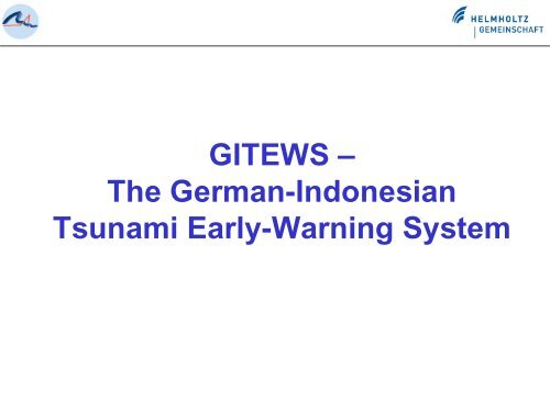
GITEWS –<br />
<strong>The</strong> <strong>German</strong>-<strong>Indonesian</strong><br />
<strong>Tsunami</strong> <strong>Early</strong>-<strong>Warning</strong> <strong>System</strong>
GITEWS-Partner National<br />
Helmholtz-Gemeinschaft deutscher Forschungszentren (HGF)<br />
GeoForschungsZentrum Potsdam (GFZ)<br />
Deutsches Zentrum für Luft- und Raumfahrt (DLR)<br />
Alfred-Wegener-Institut für Polar- und Meeresforschung (AWI)<br />
Forschungszentrum Geesthacht (GKSS)<br />
Konsortium Deutsche Meeresforschung (KDM)<br />
Leibniz-Institut für Meereswissenschaften (IfM-GEOMAR), Kiel<br />
United Nations University (UNU)<br />
Institut für Umwelt & Menschliche Sicherheit (EHS), Bonn<br />
Gesellschaft für Technische Zusammenarbeit (GTZ)<br />
Bundesanstalt für Geowissenschaften und Rohstoffe (BGR)
Components of GITEWS<br />
(1) Real-Time Earthquake Monitoring<br />
Seismology: Location, magnitude, rupture process<br />
Deformationmeasurements by GPS<br />
(2) Real-Time Sea-Level Monitoring<br />
GPS-Buoys with ocean-bottom pressure sensor<br />
GPS-Tide Gauges<br />
(3) <strong>Tsunami</strong> Simulation<br />
(4) <strong>Early</strong> <strong>Warning</strong> and Mitigation Centers<br />
(5) Capacity Building
Organization<br />
Steering Committee<br />
Emmermann (GFZ), Hamacher (DLR),<br />
Thiede (AWI), Kaysser (GKSS),<br />
Herzig (KDM), Hoffmann (GTZ),<br />
Bogardi (UNU)<br />
Project Management<br />
Lauterjung (GFZ), Sprecher Projekt-<br />
Gruppen<br />
Earthquake<br />
Monitoring<br />
Zschau (GFZ)<br />
Ocean<br />
Instrumen-<br />
tation<br />
Flueh (IfM)<br />
Project Project-Groups Groups<br />
GPS<br />
Technology<br />
Rothacher (GFZ)<br />
<strong>Early</strong> <strong>Warning</strong><br />
and Mitigation<br />
Centre<br />
Dech (DLR)<br />
Advisory Board<br />
Deuflhard (Konrad-Zuse-<br />
Zentrum), Harjes (U Bochum),<br />
Hartl (acatech), Schwaetzer<br />
(DKKV), Wefer (U Bremen)<br />
<strong>Tsunami</strong><br />
Modelling<br />
Schröter (AWI)<br />
Capacity<br />
Building<br />
Schaef (GTZ)<br />
Schlurmann (UNU)
Challenge Indonesia:<br />
<strong>Early</strong> <strong>Warning</strong> Times extremely short<br />
<strong>Tsunami</strong> travel times from trench (orange line) to coast line (yellow line):<br />
20-40 Minuten
Distribution of seismic stations in Indonesia<br />
(<strong>German</strong> contribution)
International seismic Network - Indonesia
Detection of the seismic rupture process<br />
using seismic arrays
GPS Shield Concept<br />
Control<br />
Station at<br />
Sumatra<br />
GPS Baselines<br />
at the Islands
Tide Gauges
Tide gauges<br />
Seismic Stations<br />
Distribution Tide Gauges in Indonesia<br />
(<strong>German</strong> contribution)
<strong>Tsunami</strong> Buoy <strong>System</strong><br />
GPS-Antenna<br />
Communikation<br />
Windgenerator<br />
Meteorological<br />
Instruments<br />
<strong>Tsunami</strong> Buoy<br />
Pressure Sensor<br />
Ocean Bottom<br />
Seismometer<br />
Ocean Bottom Unit<br />
Acustic Modem
Buoy <strong>System</strong>s<br />
Tide gauges<br />
Seismic Stations<br />
Distribution Buoy <strong>System</strong>s in Indonesia<br />
(<strong>German</strong> Contribution)
<strong>Early</strong> <strong>Warning</strong> and Mitigation Centre<br />
Seismic and GPS Tide Gauges OBU (pressure, seismic) Buoys<br />
EO Data<br />
Continuous data stream<br />
Periodical data stream<br />
Decision support at EWMC (BMG)<br />
Matching of scenarios, continuous refinement of warning processes<br />
Determination of risk areas<br />
Selection of evacuation support products<br />
Rapid mapping with Geospatial- and EO-data<br />
Post-event data stream<br />
Event-triggered data stream<br />
<strong>Warning</strong> dossier<br />
Local authorities,<br />
Bakornas, Kominfo, Lipi, etc.<br />
Disaster Management
signal data<br />
command GEOFON<br />
change mode<br />
(normal or tsunami)<br />
catalogue<br />
queries<br />
data request<br />
EO images<br />
(satellite)<br />
Seismogram<br />
Display<br />
Seismic<br />
<strong>System</strong><br />
Geofon<br />
EO<br />
<strong>System</strong><br />
Simulation<br />
<strong>System</strong><br />
EO Images<br />
(incl.Meteo)<br />
Display<br />
EWMS functional overview<br />
EWMS<br />
Sea Level<br />
Display<br />
GPS<br />
Display<br />
GPS<br />
Land Based<br />
<strong>System</strong><br />
Buoys/OBU<br />
<strong>System</strong><br />
Tide Gauge<br />
<strong>System</strong><br />
signal data<br />
command land station<br />
change mode<br />
(normal or tsunami)<br />
height<br />
wave length<br />
command buoy<br />
change mode<br />
(normal or tsunami)<br />
sea level<br />
command gauge<br />
change mode<br />
(normal or tsunami)
EWMS functional overview
Simulation <strong>System</strong>
Bathymetry
Bathymetry
Vulnerability analysis and risk assessment<br />
Joint <strong>Indonesian</strong>-<strong>German</strong><br />
working group<br />
Workshop, Aug. 2006, Bandung<br />
Mapping the city of Padang based on<br />
high-resolution satellite data
Identification of<br />
infractructure<br />
and its degree<br />
of exposure<br />
(e.g. Padang)<br />
Risk & vulnerability assessment<br />
Coastal<br />
Elevation Zoning<br />
Major Road Net<br />
Official and<br />
Public Buildings
Capacity Building<br />
Academic programme & Technical work shops<br />
Training of scientist and engineers during installation phase<br />
(„Training on the job“), Workshop planned for Spring 2006,<br />
eight PhD positions for applicants from IORC (“sandwich<br />
programme”), Scientists exchange has started<br />
Consultancy to organizational structures and inter-institutional<br />
communication (government at different levels)<br />
Advices for planning and construction of new infrastructures,<br />
establishing of communication platforms and chains<br />
Establishment of warning mechanisms within three pilot regions<br />
GTZ staff in charge in Indonesia since summer 2006, training for<br />
last mile actions in Padang, South Java & Kuta/Sanur (Bali)
Training and Capacity Building<br />
Training Course Seismology, Data Analysis and <strong>Tsunami</strong><br />
Detection<br />
29 Jan – 18 Feb 2007 in Jakarta<br />
Organized by: GFZ Potsdam, BMG Jakarta and USGS<br />
30 Paticipants<br />
PhD-Program with 9 Scholarships for 3 years at german<br />
research institutions started this year<br />
Participants from Indonesia, Malaysia, Madagascar<br />
Post-Doc Programe for the exchange of Scientists (2-4<br />
Months) started
Seismology, Data Analysis and <strong>Tsunami</strong> Detection<br />
29 Jan – 18 Feb 2007 in Jakarta
International GNSS-Altimetry Activities<br />
<strong>German</strong> activities are realized under UNESCO’s umbrella<br />
IOC : Intergovernmental Oceanographic Commission<br />
ICG: Intergovernmental Coordination Group<br />
Intersessional Working Groups:<br />
1: Seismic measurements, data collection,<br />
and exchange<br />
2: Sea level data collection and exchange,<br />
including deep-ocean tsunami detection instruments<br />
3: Risk Assessment<br />
4: Modelling, Forecasting, and Scenario Development<br />
5: <strong>The</strong> Establishment of a <strong>System</strong> of Interoperable<br />
Advisory and <strong>Warning</strong> Centres<br />
6: Mitigation and Emergency Management (NEW!)<br />
Involvement into EC/EU activities as well<br />
as in NEAMTWS (IOC)
South Africa<br />
International Cooperation<br />
Kenia<br />
Yemen<br />
Tanzania<br />
Maldives<br />
Sri Lanka<br />
Indonesia<br />
Australia
GPS GLONASS<br />
Satelliten constellation as component of a<br />
future Multi Hazard <strong>Early</strong> <strong>Warning</strong> <strong>System</strong><br />
GALILEO
EWMC<br />
<strong>Warning</strong><br />
Message<br />
End-to-end <strong>System</strong> Approach<br />
Radio<br />
Station<br />
Enduser<br />
Authorities<br />
Private<br />
Houses<br />
Hotels<br />
2wcom <strong>System</strong> based on existing FM broadcast infrastructure<br />
Using the RDS-channel for warning<br />
<strong>System</strong> tested successfully in Bali
Thank you<br />
End<br />
Terima kasih<br />
Website: http://www.gitews.org<br />
Funding by the <strong>German</strong> Federal<br />
Ministry for Education and Research<br />
(BMBF) is gratefully acknowledged