Deglaciation dynamics following the Little Ice Age on Svalbard:
Deglaciation dynamics following the Little Ice Age on Svalbard:
Deglaciation dynamics following the Little Ice Age on Svalbard:

You also want an ePaper? Increase the reach of your titles
YUMPU automatically turns print PDFs into web optimized ePapers that Google loves.
Søren H. Rasmussen<br />
<str<strong>on</strong>g>Deglaciati<strong>on</strong></str<strong>on</strong>g> <str<strong>on</strong>g>dynamics</str<strong>on</strong>g> <str<strong>on</strong>g>following</str<strong>on</strong>g> <str<strong>on</strong>g>the</str<strong>on</strong>g> <str<strong>on</strong>g>Little</str<strong>on</strong>g> <str<strong>on</strong>g>Ice</str<strong>on</strong>g> <str<strong>on</strong>g>Age</str<strong>on</strong>g> <strong>on</strong> <strong>Svalbard</strong>:<br />
Implicati<strong>on</strong> of debris-covered glaciers dynamic and morphological setting<br />
Søren H. Rasmussen<br />
Term project, The Quaternary history of <strong>Svalbard</strong>, AG 210<br />
The University Centre of <strong>Svalbard</strong>. Autumn 2006<br />
Abstract:<br />
Recently debris-covered glacier near L<strong>on</strong>gyearbyen in central Spitsbergen has been studied to<br />
understand <str<strong>on</strong>g>the</str<strong>on</strong>g> deglaciati<strong>on</strong> process <str<strong>on</strong>g>following</str<strong>on</strong>g> <str<strong>on</strong>g>the</str<strong>on</strong>g> <str<strong>on</strong>g>Little</str<strong>on</strong>g> <str<strong>on</strong>g>Ice</str<strong>on</strong>g> <str<strong>on</strong>g>Age</str<strong>on</strong>g>. This study presented new<br />
geomorphological data for some of <str<strong>on</strong>g>the</str<strong>on</strong>g> same glacier. Through a careful descripti<strong>on</strong> of <str<strong>on</strong>g>the</str<strong>on</strong>g><br />
dynamic of debris-covered glacier, what its means for <str<strong>on</strong>g>the</str<strong>on</strong>g> interpretati<strong>on</strong> of <str<strong>on</strong>g>the</str<strong>on</strong>g> moraines, and a<br />
analyse of <str<strong>on</strong>g>the</str<strong>on</strong>g> geomorphology in relati<strong>on</strong> to <str<strong>on</strong>g>the</str<strong>on</strong>g> <strong>on</strong>going glaciofluvial processes <str<strong>on</strong>g>the</str<strong>on</strong>g><br />
preservati<strong>on</strong> potential are c<strong>on</strong>sidered in relati<strong>on</strong> to <str<strong>on</strong>g>the</str<strong>on</strong>g> underlying morphological setting. The<br />
two studied glaciers represent two different morphological settings respectively a plateau and<br />
a c<strong>on</strong>fined steep-sided valley. It is c<strong>on</strong>clude that flat lying moraine <strong>on</strong> a plateau has a high<br />
preservati<strong>on</strong> potential and moraine <strong>on</strong> a steep valley side has low preservati<strong>on</strong> potential. At<br />
<str<strong>on</strong>g>the</str<strong>on</strong>g> steep valley side gravity and water working toge<str<strong>on</strong>g>the</str<strong>on</strong>g>r to transport <str<strong>on</strong>g>the</str<strong>on</strong>g> sediment, in c<strong>on</strong>trast,<br />
water <strong>on</strong> a plateau can make channels witch <str<strong>on</strong>g>the</str<strong>on</strong>g> water follows and <str<strong>on</strong>g>the</str<strong>on</strong>g>refore maybe not affect<br />
<str<strong>on</strong>g>the</str<strong>on</strong>g> entire moraine.<br />
Introducti<strong>on</strong><br />
<strong>Svalbard</strong> is an archipelago located at<br />
high latitudes (76-81 o N). In <str<strong>on</strong>g>the</str<strong>on</strong>g> recent<br />
years deglaciati<strong>on</strong> of glaciers <strong>on</strong> <strong>Svalbard</strong><br />
has been studied. The task has being<br />
understanding of deglaciati<strong>on</strong>, <str<strong>on</strong>g>the</str<strong>on</strong>g>reby<br />
rec<strong>on</strong>structing deglaciati<strong>on</strong> and <str<strong>on</strong>g>the</str<strong>on</strong>g><br />
different geomorphologic features preservati<strong>on</strong><br />
potential. On <strong>Svalbard</strong> <str<strong>on</strong>g>the</str<strong>on</strong>g> <str<strong>on</strong>g>Little</str<strong>on</strong>g> <str<strong>on</strong>g>Ice</str<strong>on</strong>g><br />
<str<strong>on</strong>g>Age</str<strong>on</strong>g> (LIA) was culminating late, this<br />
provides a better opportunity to rec<strong>on</strong>struct<br />
<str<strong>on</strong>g>the</str<strong>on</strong>g> <str<strong>on</strong>g>following</str<strong>on</strong>g> deglaciati<strong>on</strong> in detail.<br />
Recently glaciers nearby L<strong>on</strong>gyearbyen,<br />
<str<strong>on</strong>g>the</str<strong>on</strong>g> main city <strong>on</strong> <strong>Svalbard</strong>, have been<br />
studied geomorphologic for deglaciati<strong>on</strong><br />
(Lønne and Lyså, 2005, Lukas et al.,<br />
2005). Lønne and Lyså (2005)’s work has<br />
started a discussi<strong>on</strong> about terminology and<br />
Page 1 of 15<br />
how to understand <str<strong>on</strong>g>the</str<strong>on</strong>g>se glaciers (Lønne,<br />
2006, Lukas et al., 2006). This article<br />
presents new geomorphological data for<br />
two of <str<strong>on</strong>g>the</str<strong>on</strong>g> same glaciers and <str<strong>on</strong>g>the</str<strong>on</strong>g>reby<br />
answers some of <str<strong>on</strong>g>the</str<strong>on</strong>g> main open questi<strong>on</strong>s<br />
for understanding <str<strong>on</strong>g>the</str<strong>on</strong>g>se glaciers. The geomorphology<br />
of <str<strong>on</strong>g>the</str<strong>on</strong>g> two glaciers moraines<br />
will be compared in a discussi<strong>on</strong> of glaciofluvial<br />
processes and preservati<strong>on</strong> potential,<br />
in relati<strong>on</strong> to <str<strong>on</strong>g>the</str<strong>on</strong>g> different underlying<br />
morphology.<br />
Study area<br />
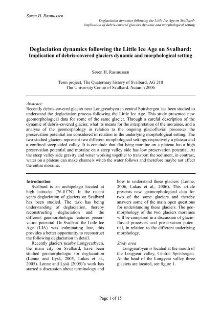
L<strong>on</strong>gyearbyen is located at <str<strong>on</strong>g>the</str<strong>on</strong>g> mouth of<br />
<str<strong>on</strong>g>the</str<strong>on</strong>g> L<strong>on</strong>gyear valley, Central Spitsbergen.<br />
At <str<strong>on</strong>g>the</str<strong>on</strong>g> head of <str<strong>on</strong>g>the</str<strong>on</strong>g> L<strong>on</strong>gyear valley three<br />
glaciers are located, see figure 1.
Søren H. Rasmussen<br />
<str<strong>on</strong>g>Deglaciati<strong>on</strong></str<strong>on</strong>g> <str<strong>on</strong>g>dynamics</str<strong>on</strong>g> <str<strong>on</strong>g>following</str<strong>on</strong>g> <str<strong>on</strong>g>the</str<strong>on</strong>g> <str<strong>on</strong>g>Little</str<strong>on</strong>g> <str<strong>on</strong>g>Ice</str<strong>on</strong>g> <str<strong>on</strong>g>Age</str<strong>on</strong>g> <strong>on</strong> <strong>Svalbard</strong>:<br />
Implicati<strong>on</strong> of debris-covered glaciers dynamic and morphological setting<br />
Figure 1. Overview map of <str<strong>on</strong>g>the</str<strong>on</strong>g> head of L<strong>on</strong>gyear valley, Central <strong>Svalbard</strong>. Redrawing of Norwegian<br />
Polar Institute (2000). Data to <str<strong>on</strong>g>the</str<strong>on</strong>g> overview map of <strong>Svalbard</strong> is from ESRI (2000).<br />
L<strong>on</strong>gyearbreen is laying in <str<strong>on</strong>g>the</str<strong>on</strong>g> main valley.<br />
East of L<strong>on</strong>gyearbreen is Larsbreen. The<br />
sou<str<strong>on</strong>g>the</str<strong>on</strong>g>rn part of Larsbreen is lying <strong>on</strong> a<br />
plateau, where <str<strong>on</strong>g>the</str<strong>on</strong>g> nor<str<strong>on</strong>g>the</str<strong>on</strong>g>rn part is a glacier<br />
t<strong>on</strong>gue reaching down in a c<strong>on</strong>fined steepsided<br />
valley. On <str<strong>on</strong>g>the</str<strong>on</strong>g> western side of L<strong>on</strong>gyearbreen<br />
is ano<str<strong>on</strong>g>the</str<strong>on</strong>g>r glacier, this has now<br />
name. It is starting at <str<strong>on</strong>g>the</str<strong>on</strong>g> top of Nordenskiöldfjellet<br />
and ending <strong>on</strong> <str<strong>on</strong>g>the</str<strong>on</strong>g> flat Platåberget.<br />
Page 2 of 15<br />
The geomorphologic mapping has been<br />
carried out <strong>on</strong> Larsbreen and <str<strong>on</strong>g>the</str<strong>on</strong>g> unnamed<br />
glacier. These two are chosen because <str<strong>on</strong>g>the</str<strong>on</strong>g><br />
difference between <str<strong>on</strong>g>the</str<strong>on</strong>g> moraines. Through<br />
this article <str<strong>on</strong>g>the</str<strong>on</strong>g> unnamed glacier will be<br />
called Platåbreen, after <str<strong>on</strong>g>the</str<strong>on</strong>g> locati<strong>on</strong> of <str<strong>on</strong>g>the</str<strong>on</strong>g><br />
moraine, with is <str<strong>on</strong>g>the</str<strong>on</strong>g> interesting part in this<br />
study. This name is also used by Lønne<br />
and Lyså (2005). Lukas et al. (2005)<br />
named it Nordenskiöldtoppenbreen.
Søren H. Rasmussen<br />
Previous work<br />
Lønne and Lyså (2005) have made a<br />
detailed geomorphologic map of Platåbreen.<br />
They divide <str<strong>on</strong>g>the</str<strong>on</strong>g> ice-marginal landscape<br />
into five different z<strong>on</strong>es: 1) glacier<br />
ice, with a thin debris mantle locally,<br />
including medial moraines; 2) proglacial<br />
areas influenced by glacial meltwater; 3)<br />
ice-cored termino-lateral moraines; 4)<br />
areas deglaciated after <str<strong>on</strong>g>the</str<strong>on</strong>g> LIA maximum,<br />
and 5) areas not directly affected by this<br />
glacial event.<br />
They describe <str<strong>on</strong>g>the</str<strong>on</strong>g> five z<strong>on</strong>es and<br />
document with pictures. From historical<br />
aerial photos <str<strong>on</strong>g>the</str<strong>on</strong>g>y find <str<strong>on</strong>g>the</str<strong>on</strong>g> terminus at<br />
different years. They end up with a four<br />
stage model of <str<strong>on</strong>g>the</str<strong>on</strong>g> evoluti<strong>on</strong> of Platåbreen,<br />
from early LIA to fully deglaciated basin.<br />
Every stage show shifting in geomorphologic<br />
z<strong>on</strong>es in different areas.<br />
They c<strong>on</strong>clude that <str<strong>on</strong>g>the</str<strong>on</strong>g> evoluti<strong>on</strong> of <str<strong>on</strong>g>the</str<strong>on</strong>g><br />
landscape can be divided into tree phases:<br />
Temperate glacier, cold-based ice and n<strong>on</strong>glacial<br />
c<strong>on</strong>diti<strong>on</strong>s. Erosi<strong>on</strong> by glacial meltwater<br />
is <str<strong>on</strong>g>the</str<strong>on</strong>g> most notable landscape process,<br />
and study of modern analogical glacial<br />
meltwater processes can improve rec<strong>on</strong>structi<strong>on</strong><br />
of glacier.<br />
Lukas et al. (2005) has made a detailed<br />
study of <str<strong>on</strong>g>the</str<strong>on</strong>g> debris-covered fr<strong>on</strong>tal icemargins<br />
of L<strong>on</strong>gyear-, Lars- and Platåbreen.<br />
They have mapped <str<strong>on</strong>g>the</str<strong>on</strong>g> geomorphology<br />
of <str<strong>on</strong>g>the</str<strong>on</strong>g> glaciers and measured clast<br />
shape and roundness. They c<strong>on</strong>clude that<br />
cold-based to poly<str<strong>on</strong>g>the</str<strong>on</strong>g>rmal, high-arctic glaciers<br />
can not be used as modern analogues<br />
for well-preserved Quaternary glacial landforms<br />
such as those in <str<strong>on</strong>g>the</str<strong>on</strong>g> Scottish Highland.<br />
This building <strong>on</strong> <str<strong>on</strong>g>the</str<strong>on</strong>g> remains of deglaciating<br />
of <str<strong>on</strong>g>the</str<strong>on</strong>g> three present glaciers is<br />
dump moraine due to glaciofluvial rework<br />
and removal.<br />
Lønne and Lyså (2005) and Lukas et al.<br />
(2005) agree in <str<strong>on</strong>g>the</str<strong>on</strong>g> importance of glaciofluvial<br />
processes for preservati<strong>on</strong> of modern<br />
<strong>Svalbard</strong> glacier’s moraines.<br />
<str<strong>on</strong>g>Deglaciati<strong>on</strong></str<strong>on</strong>g> <str<strong>on</strong>g>dynamics</str<strong>on</strong>g> <str<strong>on</strong>g>following</str<strong>on</strong>g> <str<strong>on</strong>g>the</str<strong>on</strong>g> <str<strong>on</strong>g>Little</str<strong>on</strong>g> <str<strong>on</strong>g>Ice</str<strong>on</strong>g> <str<strong>on</strong>g>Age</str<strong>on</strong>g> <strong>on</strong> <strong>Svalbard</strong>:<br />
Implicati<strong>on</strong> of debris-covered glaciers dynamic and morphological setting<br />
Page 3 of 15<br />
Lukas et al. (2006) comment <strong>on</strong> <str<strong>on</strong>g>the</str<strong>on</strong>g><br />
work of Lønne and Lyså (2005). Here is a<br />
review of some of <str<strong>on</strong>g>the</str<strong>on</strong>g> points. Use of <str<strong>on</strong>g>the</str<strong>on</strong>g><br />
term “ice-cored moraine”: Lukas et al.<br />
(2006) claim that with using <str<strong>on</strong>g>the</str<strong>on</strong>g> term “icecored<br />
moraine” it implicit say that <str<strong>on</strong>g>the</str<strong>on</strong>g> ice<br />
in <str<strong>on</strong>g>the</str<strong>on</strong>g> moraine is dead-ice that is detached<br />
from <str<strong>on</strong>g>the</str<strong>on</strong>g> glacier. Lukas et al. (2006) has<br />
made a cross profile of <str<strong>on</strong>g>the</str<strong>on</strong>g> debris-cover of<br />
Platåbreen, with show supraglacial debris<br />
<strong>on</strong> clean glacier ice. This means <str<strong>on</strong>g>the</str<strong>on</strong>g> fr<strong>on</strong>t<br />
of <str<strong>on</strong>g>the</str<strong>on</strong>g> glacier is a debris-cover glacier and<br />
not a dead-ice “ice-cored moraine”. Lønne<br />
and Lyså (2005) have identified former<br />
ice-fr<strong>on</strong>t positi<strong>on</strong>s through aerial photos,<br />
but Lukas et al. (2006) observati<strong>on</strong>s<br />
claimed <str<strong>on</strong>g>the</str<strong>on</strong>g> active glacier c<strong>on</strong>tinued under<br />
<str<strong>on</strong>g>the</str<strong>on</strong>g> debris and <str<strong>on</strong>g>the</str<strong>on</strong>g>refore <str<strong>on</strong>g>the</str<strong>on</strong>g> real ice-fr<strong>on</strong>t is<br />
still at LIA positi<strong>on</strong>.<br />
Lukas et al. (2006) have not found any<br />
thrusting <strong>on</strong> Platåbreen and <str<strong>on</strong>g>the</str<strong>on</strong>g>refore <str<strong>on</strong>g>the</str<strong>on</strong>g>y<br />
say it is unlikely that a subglacial transport<br />
is a source for some of <str<strong>on</strong>g>the</str<strong>on</strong>g> debris at <str<strong>on</strong>g>the</str<strong>on</strong>g><br />
surface. Far<str<strong>on</strong>g>the</str<strong>on</strong>g>r more <str<strong>on</strong>g>the</str<strong>on</strong>g> shale would have<br />
been crushed under <str<strong>on</strong>g>the</str<strong>on</strong>g> subglacial transport.<br />
Lønne (2006) is a reply <strong>on</strong> Lukas et al.<br />
(2006) comment. One of <str<strong>on</strong>g>the</str<strong>on</strong>g> points is that<br />
moraines can be ice-core with out <str<strong>on</strong>g>the</str<strong>on</strong>g> ice<br />
being dead-ice.<br />
In <str<strong>on</strong>g>the</str<strong>on</strong>g> forefield of Larsbreen are rockglaciers.<br />
These and <str<strong>on</strong>g>the</str<strong>on</strong>g> additi<strong>on</strong>al talus<br />
c<strong>on</strong>es has been m<strong>on</strong>itored and studied by<br />
Humlum (2005), since 1999.<br />
Glasser and Hambery (2006) presented<br />
a landsystem model for a typical terrestrial<br />
<strong>Svalbard</strong> poly<str<strong>on</strong>g>the</str<strong>on</strong>g>rmal glacier. The model is<br />
based <strong>on</strong> observati<strong>on</strong> of modern <strong>Svalbard</strong><br />
glacier and <str<strong>on</strong>g>the</str<strong>on</strong>g> published literature. This<br />
model will be used for comparis<strong>on</strong> with<br />
Larsbreen and Platåbreen, as a reference<br />
model for <strong>Svalbard</strong> glacier. The model<br />
divides <str<strong>on</strong>g>the</str<strong>on</strong>g> glacier forefield in tree, see<br />
figure 2:<br />
Outer moraine ridges: steep ridges up to<br />
15-20 m height, with usually are ice<br />
cored.
Søren H. Rasmussen<br />
<str<strong>on</strong>g>Deglaciati<strong>on</strong></str<strong>on</strong>g> <str<strong>on</strong>g>dynamics</str<strong>on</strong>g> <str<strong>on</strong>g>following</str<strong>on</strong>g> <str<strong>on</strong>g>the</str<strong>on</strong>g> <str<strong>on</strong>g>Little</str<strong>on</strong>g> <str<strong>on</strong>g>Ice</str<strong>on</strong>g> <str<strong>on</strong>g>Age</str<strong>on</strong>g> <strong>on</strong> <strong>Svalbard</strong>:<br />
Implicati<strong>on</strong> of debris-covered glaciers dynamic and morphological setting<br />
Figure 2. A landsystem model for a typical terrestrial <strong>Svalbard</strong> poly<str<strong>on</strong>g>the</str<strong>on</strong>g>rmal glacier (Glasser and<br />
Hambery, 2006, Fig. 4.10).<br />
Moraine-mound complexes: rich relief,<br />
l<strong>on</strong>g and short linear ridges, slops<br />
around 30 o and thrusting.<br />
Inner z<strong>on</strong>e: field with flutes, stream-lined<br />
ridges and melt out debris, usually<br />
reworking by glaciofluvial processes.<br />
Based <strong>on</strong> radio-echo soundings and<br />
glaciological investigati<strong>on</strong>s it is believed<br />
that Larsbreen is largely cold-based.<br />
Platåbreen is smaller and lying at a higher<br />
altitude, <str<strong>on</strong>g>the</str<strong>on</strong>g>refore it is also believed to be<br />
largely cold-based (Lukas et al., 2005). For<br />
analytic purpose it is assumed to be<br />
valuable to compare <str<strong>on</strong>g>the</str<strong>on</strong>g> two glaciers with<br />
Glasser and Hambery (2006) model for a<br />
typical terrestrial <strong>Svalbard</strong> poly<str<strong>on</strong>g>the</str<strong>on</strong>g>rmal<br />
glacier even thou <str<strong>on</strong>g>the</str<strong>on</strong>g>y are largely coldbased.<br />
The different between a cold-based<br />
and a poly<str<strong>on</strong>g>the</str<strong>on</strong>g>rmal glacier are that poly<str<strong>on</strong>g>the</str<strong>on</strong>g>rmal<br />
glacier has <strong>on</strong>ly <str<strong>on</strong>g>the</str<strong>on</strong>g> terminus<br />
frozen to <str<strong>on</strong>g>the</str<strong>on</strong>g> ground where <str<strong>on</strong>g>the</str<strong>on</strong>g> cold-based<br />
Page 4 of 15<br />
glacier is total frozen to <str<strong>on</strong>g>the</str<strong>on</strong>g> ground. The<br />
comparis<strong>on</strong> is assumed to be valid because<br />
both types have a frozen terminus and<br />
<str<strong>on</strong>g>the</str<strong>on</strong>g>reby nearly <str<strong>on</strong>g>the</str<strong>on</strong>g> same land-forming<br />
processes at <str<strong>on</strong>g>the</str<strong>on</strong>g> terminus.<br />
Geological settings<br />
The bedrock in <str<strong>on</strong>g>the</str<strong>on</strong>g> study area is<br />
sedimentary, mostly shale and some layers<br />
of sandst<strong>on</strong>e. The bedrock is soft <str<strong>on</strong>g>the</str<strong>on</strong>g>refore<br />
glaciers, running water and frost shattering<br />
easily erode it (Lønne and Lyså, 2005).<br />
Wea<str<strong>on</strong>g>the</str<strong>on</strong>g>ring of <str<strong>on</strong>g>the</str<strong>on</strong>g> bedrock and <str<strong>on</strong>g>the</str<strong>on</strong>g><br />
enclosed debris is dominating al<strong>on</strong>g <str<strong>on</strong>g>the</str<strong>on</strong>g><br />
slops. There are coal bearing layer and<br />
fossil leaves and o<str<strong>on</strong>g>the</str<strong>on</strong>g>r plants remains can<br />
be found, some places <str<strong>on</strong>g>the</str<strong>on</strong>g>y are comm<strong>on</strong>.<br />
The mean annual air temperature is -6 o<br />
C, measured at <str<strong>on</strong>g>the</str<strong>on</strong>g> L<strong>on</strong>gyearbyen Airport.<br />
The airport is situated 5 km north of<br />
Platåbreen, around 25 m altitude, at <str<strong>on</strong>g>the</str<strong>on</strong>g><br />
foot of Platåbjerget (Lukas et al., 2005).
Søren H. Rasmussen<br />
The fr<strong>on</strong>t moraine of Larsbreen is<br />
starting around 150 m altitude and <str<strong>on</strong>g>the</str<strong>on</strong>g><br />
clean glacier ice is reach from ca. 250 to<br />
800 m altitude, see figure 1. The outlet<br />
valley part of <str<strong>on</strong>g>the</str<strong>on</strong>g> glacier is <strong>on</strong>ly <str<strong>on</strong>g>the</str<strong>on</strong>g><br />
nor<str<strong>on</strong>g>the</str<strong>on</strong>g>rn part, from 500 m altitude and<br />
down.<br />
At <str<strong>on</strong>g>the</str<strong>on</strong>g> fr<strong>on</strong>t of Larsbreens moraine are<br />
rock-glacier, <str<strong>on</strong>g>the</str<strong>on</strong>g>se are laying largely parallel<br />
with <str<strong>on</strong>g>the</str<strong>on</strong>g> fr<strong>on</strong>tal moraine. Under <str<strong>on</strong>g>the</str<strong>on</strong>g> LIA<br />
advance Larsbreen has pushed to rockglaciers<br />
(Humlum, 2005).<br />
Platåbreen starts <strong>on</strong> <str<strong>on</strong>g>the</str<strong>on</strong>g> nor<str<strong>on</strong>g>the</str<strong>on</strong>g>rn side of<br />
mountain top Nordenskjöldfjellet (1050 m)<br />
and follow a broad flat valley down to <str<strong>on</strong>g>the</str<strong>on</strong>g><br />
plateau at Platåbjerget. The fr<strong>on</strong>t moraine<br />
is lying around 450-600 m altitude.<br />
The valley under Larsbreen is more V-<br />
<str<strong>on</strong>g>the</str<strong>on</strong>g>n U-shaped, with indicated less erosi<strong>on</strong><br />
and <str<strong>on</strong>g>the</str<strong>on</strong>g>refore a cold-based glacier (Lukas<br />
et al., 2005).<br />
Most of <str<strong>on</strong>g>the</str<strong>on</strong>g> glaciers <strong>on</strong> <strong>Svalbard</strong> have<br />
retreating since <str<strong>on</strong>g>the</str<strong>on</strong>g> LIA maximum ca.<br />
1890-1900 (Glasser and Hambrey, 2006).<br />
This is also <str<strong>on</strong>g>the</str<strong>on</strong>g> case for Lars- and Platåbreen.<br />
The two glacier is believed to be<br />
more than 100 years out of climate equilibrium,<br />
with mean <str<strong>on</strong>g>the</str<strong>on</strong>g>y still resp<strong>on</strong>ds <strong>on</strong><br />
<str<strong>on</strong>g>the</str<strong>on</strong>g> climate that was around 100 years ago<br />
(Lukas et al., 2005).<br />
There is no observati<strong>on</strong> of surging of<br />
<str<strong>on</strong>g>the</str<strong>on</strong>g>se glaciers (Lukas et al., 2005).<br />
Methods<br />
Mapping of Larsbreen and Platåbreen<br />
was carried out in <str<strong>on</strong>g>the</str<strong>on</strong>g> last half of<br />
September 2006. The basic map was a<br />
digital redrawing of <str<strong>on</strong>g>the</str<strong>on</strong>g> topographic map<br />
in 1:100,000 from Norwegian Polar<br />
Institute (2000). On <str<strong>on</strong>g>the</str<strong>on</strong>g> basic map, in <str<strong>on</strong>g>the</str<strong>on</strong>g><br />
scale 1:5000, observati<strong>on</strong>s were drawn in<br />
<str<strong>on</strong>g>the</str<strong>on</strong>g> field and later digitalised. In <str<strong>on</strong>g>the</str<strong>on</strong>g> field a<br />
compass was used for orientati<strong>on</strong> and<br />
measurements.<br />
Figure 3 and 5 are showing <str<strong>on</strong>g>the</str<strong>on</strong>g> result of<br />
<str<strong>on</strong>g>the</str<strong>on</strong>g> mapping. There are two sets of c<strong>on</strong>tour<br />
lines some from Norwegian Polar Institute<br />
(2000) (solid lines) and approximated<br />
<str<strong>on</strong>g>Deglaciati<strong>on</strong></str<strong>on</strong>g> <str<strong>on</strong>g>dynamics</str<strong>on</strong>g> <str<strong>on</strong>g>following</str<strong>on</strong>g> <str<strong>on</strong>g>the</str<strong>on</strong>g> <str<strong>on</strong>g>Little</str<strong>on</strong>g> <str<strong>on</strong>g>Ice</str<strong>on</strong>g> <str<strong>on</strong>g>Age</str<strong>on</strong>g> <strong>on</strong> <strong>Svalbard</strong>:<br />
Implicati<strong>on</strong> of debris-covered glaciers dynamic and morphological setting<br />
Page 5 of 15<br />
c<strong>on</strong>tour lines (dash lines) from field<br />
investigati<strong>on</strong>s. The c<strong>on</strong>tour lines from<br />
Norwegian Polar Institute (2000) are<br />
assumed to be right, even though <str<strong>on</strong>g>the</str<strong>on</strong>g> scale<br />
is bigger. This means <str<strong>on</strong>g>the</str<strong>on</strong>g>re could be some<br />
inaccuracy. The c<strong>on</strong>tour lines are for<br />
giving <str<strong>on</strong>g>the</str<strong>on</strong>g> reader a principle picture of <str<strong>on</strong>g>the</str<strong>on</strong>g><br />
morphology and <str<strong>on</strong>g>the</str<strong>on</strong>g>refore <str<strong>on</strong>g>the</str<strong>on</strong>g> inaccuracy is<br />
not c<strong>on</strong>sidering as a problem.<br />
The field data have been compared with<br />
aerial photos from Norwegian Polar<br />
Institute (1990) and <str<strong>on</strong>g>the</str<strong>on</strong>g> Geomorphological<br />
and Quaternary Geological map of Adventdalen<br />
from Tolgensbakk et al. (2000).<br />
Observati<strong>on</strong>s<br />
Platåbreen<br />
The moraines of Platåbreen is mainly a<br />
symmetric c<strong>on</strong>cave form, apart from a<br />
t<strong>on</strong>gue reaching down towards Tverrdalen,<br />
see figure 1 and 3. There is a medial<br />
moraine c<strong>on</strong>sisting of three groups, with a<br />
form like drops. The lateral moraines is<br />
around 100 m, <str<strong>on</strong>g>the</str<strong>on</strong>g> fr<strong>on</strong>tal moraine is ca.<br />
500 m wide, <str<strong>on</strong>g>the</str<strong>on</strong>g> distance from <str<strong>on</strong>g>the</str<strong>on</strong>g> clean<br />
glacier ice to <str<strong>on</strong>g>the</str<strong>on</strong>g> end of <str<strong>on</strong>g>the</str<strong>on</strong>g> moraine<br />
reaching down to Tverrdalen is 800 m. The<br />
medial moraine is 500 m l<strong>on</strong>g. On <str<strong>on</strong>g>the</str<strong>on</strong>g> top<br />
of <str<strong>on</strong>g>the</str<strong>on</strong>g> fr<strong>on</strong>tal moraine are some l<strong>on</strong>g small<br />
hills largely <str<strong>on</strong>g>following</str<strong>on</strong>g> <str<strong>on</strong>g>the</str<strong>on</strong>g> c<strong>on</strong>cave shape<br />
of <str<strong>on</strong>g>the</str<strong>on</strong>g> moraine, see figure 4.<br />
The western lateral moraine is mainly<br />
<strong>on</strong>e l<strong>on</strong>g hill, when it reach <str<strong>on</strong>g>the</str<strong>on</strong>g> fr<strong>on</strong>tal<br />
moraine it splits op in <str<strong>on</strong>g>the</str<strong>on</strong>g> previous<br />
menti<strong>on</strong>ed small hills. Outside <str<strong>on</strong>g>the</str<strong>on</strong>g> lateral<br />
moraine is <str<strong>on</strong>g>the</str<strong>on</strong>g> wea<str<strong>on</strong>g>the</str<strong>on</strong>g>ring bedrock of black<br />
shale and water has cut channels into it.<br />
These channels are merging with channels<br />
running <strong>on</strong> <str<strong>on</strong>g>the</str<strong>on</strong>g> lateral moraine. On <str<strong>on</strong>g>the</str<strong>on</strong>g><br />
glacier-side of <str<strong>on</strong>g>the</str<strong>on</strong>g> western lateral moraine<br />
melt-water channels from <str<strong>on</strong>g>the</str<strong>on</strong>g> glacier is<br />
running. These meltwater channels are<br />
meting in <strong>on</strong>e channel before its run over<br />
<str<strong>on</strong>g>the</str<strong>on</strong>g> fr<strong>on</strong>tal moraine. It is <strong>on</strong>e of <str<strong>on</strong>g>the</str<strong>on</strong>g> two<br />
large meltwater channels <str<strong>on</strong>g>the</str<strong>on</strong>g>re are parsing<br />
through <str<strong>on</strong>g>the</str<strong>on</strong>g> fr<strong>on</strong>tal moraine. The channel is<br />
eroded down into <str<strong>on</strong>g>the</str<strong>on</strong>g> fr<strong>on</strong>tal moraine and<br />
making steep channel sides. Outside of <str<strong>on</strong>g>the</str<strong>on</strong>g>
Søren H. Rasmussen<br />
<str<strong>on</strong>g>Deglaciati<strong>on</strong></str<strong>on</strong>g> <str<strong>on</strong>g>dynamics</str<strong>on</strong>g> <str<strong>on</strong>g>following</str<strong>on</strong>g> <str<strong>on</strong>g>the</str<strong>on</strong>g> <str<strong>on</strong>g>Little</str<strong>on</strong>g> <str<strong>on</strong>g>Ice</str<strong>on</strong>g> <str<strong>on</strong>g>Age</str<strong>on</strong>g> <strong>on</strong> <strong>Svalbard</strong>:<br />
Implicati<strong>on</strong> of debris-covered glaciers dynamic and morphological setting<br />
Figure 3. Geomorphology map of Platåbreen. C<strong>on</strong>tour lines with 50 m intervals (solid lines) are from<br />
Norwegian Polar Institute (2000).<br />
moraine <str<strong>on</strong>g>the</str<strong>on</strong>g> channel met with o<str<strong>on</strong>g>the</str<strong>on</strong>g>r smaller<br />
channels and as <strong>on</strong>e <str<strong>on</strong>g>the</str<strong>on</strong>g>y run toward west<br />
over Platåbjerget.<br />
The fr<strong>on</strong>tal moraine has a steep fr<strong>on</strong>t,<br />
rising around 30 m higher than <str<strong>on</strong>g>the</str<strong>on</strong>g> plateau.<br />
The fr<strong>on</strong>tal moraine is c<strong>on</strong>tinuingly raising<br />
upglacier, <str<strong>on</strong>g>the</str<strong>on</strong>g> first part is flat with small<br />
Page 6 of 15<br />
l<strong>on</strong>g hills, upglacier <str<strong>on</strong>g>the</str<strong>on</strong>g> amplitude of <str<strong>on</strong>g>the</str<strong>on</strong>g><br />
relief getting larger and les c<strong>on</strong>tinuing hills<br />
al<strong>on</strong>g <str<strong>on</strong>g>the</str<strong>on</strong>g> moraine. At <str<strong>on</strong>g>the</str<strong>on</strong>g> fr<strong>on</strong>t of <str<strong>on</strong>g>the</str<strong>on</strong>g><br />
moraine <str<strong>on</strong>g>the</str<strong>on</strong>g>re are streamlines spreading<br />
out in different directi<strong>on</strong>. A streamline is<br />
here defined as a line formed by running<br />
water, but <strong>on</strong>ly used periods or maybe not
Søren H. Rasmussen<br />
<str<strong>on</strong>g>Deglaciati<strong>on</strong></str<strong>on</strong>g> <str<strong>on</strong>g>dynamics</str<strong>on</strong>g> <str<strong>on</strong>g>following</str<strong>on</strong>g> <str<strong>on</strong>g>the</str<strong>on</strong>g> <str<strong>on</strong>g>Little</str<strong>on</strong>g> <str<strong>on</strong>g>Ice</str<strong>on</strong>g> <str<strong>on</strong>g>Age</str<strong>on</strong>g> <strong>on</strong> <strong>Svalbard</strong>:<br />
Implicati<strong>on</strong> of debris-covered glaciers dynamic and morphological setting<br />
Figure 4. Aerial photo of Platåbreen’s moraine (Norwegian Polar Institute, 1990).<br />
at all any l<strong>on</strong>ger. There are not observed<br />
any signs of meltwater channel passing <str<strong>on</strong>g>the</str<strong>on</strong>g><br />
fr<strong>on</strong>tal moraine, <strong>on</strong>ly <str<strong>on</strong>g>the</str<strong>on</strong>g> two main<br />
channels.<br />
The moraine t<strong>on</strong>gue towards Tverrdalen<br />
has like <str<strong>on</strong>g>the</str<strong>on</strong>g> rest of <str<strong>on</strong>g>the</str<strong>on</strong>g> fr<strong>on</strong>tal moraine a<br />
steep edge and is generally raising upglacier.<br />
There are observed debris-flow<br />
several places. North of <str<strong>on</strong>g>the</str<strong>on</strong>g> moraine<br />
streamlines are running parallel with <str<strong>on</strong>g>the</str<strong>on</strong>g><br />
moraine towards Tverrdalen. The sec<strong>on</strong>d<br />
main meltwater channel has eroded its way<br />
through <str<strong>on</strong>g>the</str<strong>on</strong>g> moraine toward Tverrdalen. A<br />
characteristic ridge around 300 m in north<br />
directi<strong>on</strong> is seen. The sediments <strong>on</strong> nor<str<strong>on</strong>g>the</str<strong>on</strong>g>rn<br />
end was wea<str<strong>on</strong>g>the</str<strong>on</strong>g>ring black shale, <str<strong>on</strong>g>the</str<strong>on</strong>g><br />
rest was diamict<strong>on</strong> like o<str<strong>on</strong>g>the</str<strong>on</strong>g>r places <strong>on</strong> <str<strong>on</strong>g>the</str<strong>on</strong>g><br />
moraine, some places black shale could be<br />
seen locally. South-west of <str<strong>on</strong>g>the</str<strong>on</strong>g> ridge is<br />
ano<str<strong>on</strong>g>the</str<strong>on</strong>g>r ridge next to <str<strong>on</strong>g>the</str<strong>on</strong>g> clean glacier ice.<br />
The sediments here are black shale.<br />
Page 7 of 15<br />
The eastern lateral moraine is lying <strong>on</strong> a<br />
mountain ridge between <str<strong>on</strong>g>the</str<strong>on</strong>g> two valleys<br />
with Platåbreen and L<strong>on</strong>gyeardalen lying<br />
in respectively. Outside <str<strong>on</strong>g>the</str<strong>on</strong>g> moraine<br />
several parallel streamlines is seen,<br />
merging in to <strong>on</strong>e channel and running<br />
towards L<strong>on</strong>gyeardalen.<br />
West of <str<strong>on</strong>g>the</str<strong>on</strong>g> medial moraine <str<strong>on</strong>g>the</str<strong>on</strong>g> glacier<br />
surface is dominated of debris.<br />
Larsbreen<br />
The moraine of Larsbreen is lying in a<br />
c<strong>on</strong>fined steep-sided valley. The lateral<br />
moraines are mainly 100 m wide, with<br />
variati<strong>on</strong> from 50-200 m, see figure 5. The<br />
fr<strong>on</strong>tal moraine is up to 500 m wide.<br />
The lateral moraines are largely<br />
<str<strong>on</strong>g>following</str<strong>on</strong>g> <str<strong>on</strong>g>the</str<strong>on</strong>g> slope of valley sides, towards<br />
<str<strong>on</strong>g>the</str<strong>on</strong>g> glacier <str<strong>on</strong>g>the</str<strong>on</strong>g> slope angel is getting<br />
smaller, see figure 5 and 6. On <str<strong>on</strong>g>the</str<strong>on</strong>g> eastern<br />
lateral moraine amplitude of <str<strong>on</strong>g>the</str<strong>on</strong>g> relief is
Søren H. Rasmussen<br />
<str<strong>on</strong>g>Deglaciati<strong>on</strong></str<strong>on</strong>g> <str<strong>on</strong>g>dynamics</str<strong>on</strong>g> <str<strong>on</strong>g>following</str<strong>on</strong>g> <str<strong>on</strong>g>the</str<strong>on</strong>g> <str<strong>on</strong>g>Little</str<strong>on</strong>g> <str<strong>on</strong>g>Ice</str<strong>on</strong>g> <str<strong>on</strong>g>Age</str<strong>on</strong>g> <strong>on</strong> <strong>Svalbard</strong>:<br />
Implicati<strong>on</strong> of debris-covered glaciers dynamic and morphological setting<br />
Figure 5. Geomorphology map of Larsbreen. C<strong>on</strong>tour lines with 50 m intervals (solid lines) are from<br />
Norwegian Polar Institute (2000).<br />
bigger, than <str<strong>on</strong>g>the</str<strong>on</strong>g> western. Meltwater channels<br />
are eroding down into <str<strong>on</strong>g>the</str<strong>on</strong>g> moraine.<br />
The fr<strong>on</strong>tal moraine is highest at <str<strong>on</strong>g>the</str<strong>on</strong>g><br />
sides and falling in altitude towards <str<strong>on</strong>g>the</str<strong>on</strong>g><br />
main surface meltwater channels in <str<strong>on</strong>g>the</str<strong>on</strong>g><br />
middle. At <str<strong>on</strong>g>the</str<strong>on</strong>g> fr<strong>on</strong>t of <str<strong>on</strong>g>the</str<strong>on</strong>g> fr<strong>on</strong>tal moraine<br />
a meltwater tunnel is seen, see figure 7.<br />
Observati<strong>on</strong> of this channel, from late<br />
August to total frozen middle October,<br />
show that largely all meltwater running<br />
through this tunnel. On <str<strong>on</strong>g>the</str<strong>on</strong>g> surface of <str<strong>on</strong>g>the</str<strong>on</strong>g><br />
fr<strong>on</strong>tal moraine <str<strong>on</strong>g>the</str<strong>on</strong>g>re are observed ice<br />
Page 8 of 15<br />
caves and channels leading meltwater into<br />
<str<strong>on</strong>g>the</str<strong>on</strong>g> caves, see figure 7.<br />
On <str<strong>on</strong>g>the</str<strong>on</strong>g> eastern side of <str<strong>on</strong>g>the</str<strong>on</strong>g> main surface<br />
meltwater channel debris-flow toward <str<strong>on</strong>g>the</str<strong>on</strong>g><br />
channel is dominating. Al<strong>on</strong>g <str<strong>on</strong>g>the</str<strong>on</strong>g> main<br />
surface meltwater channel two meltwater<br />
lakes are present. On <str<strong>on</strong>g>the</str<strong>on</strong>g> western side of<br />
<str<strong>on</strong>g>the</str<strong>on</strong>g> channel hills and some debris-flow is<br />
observed. The western margin of <str<strong>on</strong>g>the</str<strong>on</strong>g><br />
fr<strong>on</strong>tal moraine has also debris-flow; in<br />
<str<strong>on</strong>g>the</str<strong>on</strong>g>se areas <str<strong>on</strong>g>the</str<strong>on</strong>g> slope angel of <str<strong>on</strong>g>the</str<strong>on</strong>g> moraine<br />
is larger.
Søren H. Rasmussen<br />
<str<strong>on</strong>g>Deglaciati<strong>on</strong></str<strong>on</strong>g> <str<strong>on</strong>g>dynamics</str<strong>on</strong>g> <str<strong>on</strong>g>following</str<strong>on</strong>g> <str<strong>on</strong>g>the</str<strong>on</strong>g> <str<strong>on</strong>g>Little</str<strong>on</strong>g> <str<strong>on</strong>g>Ice</str<strong>on</strong>g> <str<strong>on</strong>g>Age</str<strong>on</strong>g> <strong>on</strong> <strong>Svalbard</strong>:<br />
Implicati<strong>on</strong> of debris-covered glaciers dynamic and morphological setting<br />
Figure 6. Oblique view of Larsbreen’s moraine. View toward South-south-west, 30 th September 2000<br />
(Humlum, 2005).<br />
At <str<strong>on</strong>g>the</str<strong>on</strong>g> eastern margin of <str<strong>on</strong>g>the</str<strong>on</strong>g> fr<strong>on</strong>tal<br />
moraine <str<strong>on</strong>g>the</str<strong>on</strong>g>re is a ridge. Toward <str<strong>on</strong>g>the</str<strong>on</strong>g> main<br />
surface meltwater channel <str<strong>on</strong>g>the</str<strong>on</strong>g>re is a gentle<br />
slope and towards moraine margin <str<strong>on</strong>g>the</str<strong>on</strong>g><br />
slope is steeper. The ridge is c<strong>on</strong>tinuing<br />
towards <str<strong>on</strong>g>the</str<strong>on</strong>g> fr<strong>on</strong>t of <str<strong>on</strong>g>the</str<strong>on</strong>g> fr<strong>on</strong>tal moraine.<br />
On <str<strong>on</strong>g>the</str<strong>on</strong>g> outside of this ridge are rock<br />
glaciers. There is a clear shift in sediments<br />
between <str<strong>on</strong>g>the</str<strong>on</strong>g> moraine and <str<strong>on</strong>g>the</str<strong>on</strong>g> rock glaciers,<br />
see figure 6. The moraine is c<strong>on</strong>sisting of<br />
diamict<strong>on</strong> from clay to clasts, where <str<strong>on</strong>g>the</str<strong>on</strong>g><br />
surface of <str<strong>on</strong>g>the</str<strong>on</strong>g> rock glacier is <strong>on</strong>ly clasts.<br />
Talus c<strong>on</strong>es are present al<strong>on</strong>g <str<strong>on</strong>g>the</str<strong>on</strong>g> eastern<br />
Page 9 of 15<br />
valley side. The sediment <strong>on</strong> <str<strong>on</strong>g>the</str<strong>on</strong>g> talus<br />
c<strong>on</strong>es and <str<strong>on</strong>g>the</str<strong>on</strong>g> rock glaciers is <str<strong>on</strong>g>the</str<strong>on</strong>g> same<br />
type.<br />
Discussi<strong>on</strong><br />
Debris-covered glaciers<br />
Classificati<strong>on</strong> of Larsbreen and Platåbreen<br />
as debris-covered glacier, like Lukas<br />
et al. (2006) points out, are important for<br />
understanding <str<strong>on</strong>g>the</str<strong>on</strong>g> two glaciers moraines.<br />
Lønne (2006) is also making it clear that<br />
<str<strong>on</strong>g>the</str<strong>on</strong>g> moraine at Platåbreen is not cored with<br />
dead-ice. This means that <str<strong>on</strong>g>the</str<strong>on</strong>g> active glacier<br />
Figure 7. Left, mouth of meltwater channel at <str<strong>on</strong>g>the</str<strong>on</strong>g> base of Larsbreen fr<strong>on</strong>tal moraine. Right, ice cave<br />
<strong>on</strong> Larsbreen fr<strong>on</strong>tal moraine, situated west of <str<strong>on</strong>g>the</str<strong>on</strong>g> sou<str<strong>on</strong>g>the</str<strong>on</strong>g>rn meltwater lake.
Søren H. Rasmussen<br />
ice, not dead-ice, is under <str<strong>on</strong>g>the</str<strong>on</strong>g> moraines<br />
largely all <str<strong>on</strong>g>the</str<strong>on</strong>g> way to <str<strong>on</strong>g>the</str<strong>on</strong>g> fr<strong>on</strong>t of <str<strong>on</strong>g>the</str<strong>on</strong>g><br />
moraines.<br />
With this understanding model of <str<strong>on</strong>g>the</str<strong>on</strong>g><br />
moraines it is possible to explain why this<br />
glacier is not <str<strong>on</strong>g>following</str<strong>on</strong>g> <str<strong>on</strong>g>the</str<strong>on</strong>g> model for<br />
<strong>Svalbard</strong> glaciers and why <str<strong>on</strong>g>the</str<strong>on</strong>g>y are still at<br />
<str<strong>on</strong>g>the</str<strong>on</strong>g> LIA maximum fr<strong>on</strong>t.<br />
When a debris-covered glacier melts<br />
debris from <str<strong>on</strong>g>the</str<strong>on</strong>g> glacier ice will be released<br />
and <str<strong>on</strong>g>the</str<strong>on</strong>g> thickness of <str<strong>on</strong>g>the</str<strong>on</strong>g> debris cover will<br />
increase. The debris cover is isolating <str<strong>on</strong>g>the</str<strong>on</strong>g><br />
glacier ice from <str<strong>on</strong>g>the</str<strong>on</strong>g> air temperature.<br />
Increasing debris cover thickness decrease<br />
<str<strong>on</strong>g>the</str<strong>on</strong>g> melt rate logarithmic, see figure 8.<br />
Figure 8. Relati<strong>on</strong>ship between debris thickness<br />
and ablati<strong>on</strong> rate measured at Larsbreen<br />
from July 9 to 20, 2002, with a logarithmic line<br />
of best fit (Lukas et al., 2005, Fig 12).<br />
In this way <str<strong>on</strong>g>the</str<strong>on</strong>g> melt rate decreases to<br />
near zero and preventing <str<strong>on</strong>g>the</str<strong>on</strong>g> glacier<br />
terminus of retreating. The retreating of<br />
debris-covered glacier is instead thinning<br />
of <str<strong>on</strong>g>the</str<strong>on</strong>g> glacier (Benn et al., 2006). From<br />
aerial photos, where <str<strong>on</strong>g>the</str<strong>on</strong>g> oldest was from<br />
1936, Lønne and Lyså (2005) c<strong>on</strong>clude<br />
about Platåbreen: “There have been no<br />
apparent changes in <str<strong>on</strong>g>the</str<strong>on</strong>g> structures of <str<strong>on</strong>g>the</str<strong>on</strong>g><br />
glacier ice and moraines since 1936… but<br />
<str<strong>on</strong>g>the</str<strong>on</strong>g> glacier surface has lowered by<br />
approximately 40 m” (Lønne and Lyså,<br />
<str<strong>on</strong>g>Deglaciati<strong>on</strong></str<strong>on</strong>g> <str<strong>on</strong>g>dynamics</str<strong>on</strong>g> <str<strong>on</strong>g>following</str<strong>on</strong>g> <str<strong>on</strong>g>the</str<strong>on</strong>g> <str<strong>on</strong>g>Little</str<strong>on</strong>g> <str<strong>on</strong>g>Ice</str<strong>on</strong>g> <str<strong>on</strong>g>Age</str<strong>on</strong>g> <strong>on</strong> <strong>Svalbard</strong>:<br />
Implicati<strong>on</strong> of debris-covered glaciers dynamic and morphological setting<br />
Page 10 of 15<br />
2005, Page 302). In <str<strong>on</strong>g>the</str<strong>on</strong>g> same analysis<br />
Lønne and Lyså (2005) claim to identify<br />
different ice-fr<strong>on</strong>ts while Platåbreen retreat<br />
after <str<strong>on</strong>g>the</str<strong>on</strong>g> LIA. The term ice-fr<strong>on</strong>t is not<br />
precise, it could referred to where <str<strong>on</strong>g>the</str<strong>on</strong>g><br />
glacier ice-fr<strong>on</strong>t met dead-ice, but<br />
according to <str<strong>on</strong>g>the</str<strong>on</strong>g> understanding model of<br />
Platåbreen being a debris-covered glacier,<br />
<str<strong>on</strong>g>the</str<strong>on</strong>g> glacier ice is underlying <str<strong>on</strong>g>the</str<strong>on</strong>g> moraine<br />
largely out to <str<strong>on</strong>g>the</str<strong>on</strong>g> fr<strong>on</strong>t of <str<strong>on</strong>g>the</str<strong>on</strong>g> moraine, and<br />
<str<strong>on</strong>g>the</str<strong>on</strong>g>refore <str<strong>on</strong>g>the</str<strong>on</strong>g> identified ice-fr<strong>on</strong>t is <str<strong>on</strong>g>the</str<strong>on</strong>g><br />
border between clean glacier ice and<br />
debris-covered glacier ice (Lukas et al.,<br />
2006). A more precise term will be <str<strong>on</strong>g>the</str<strong>on</strong>g><br />
fr<strong>on</strong>t of <str<strong>on</strong>g>the</str<strong>on</strong>g> clean ice.<br />
During negative net balance of a debriscovered<br />
glacier <str<strong>on</strong>g>the</str<strong>on</strong>g> fr<strong>on</strong>t of <str<strong>on</strong>g>the</str<strong>on</strong>g> clean ice<br />
could move upglacier. The clean ice has<br />
unlike <str<strong>on</strong>g>the</str<strong>on</strong>g> debris-covered part of <str<strong>on</strong>g>the</str<strong>on</strong>g><br />
glacier no isolati<strong>on</strong> against <str<strong>on</strong>g>the</str<strong>on</strong>g> warm<br />
summer air temperature, and <str<strong>on</strong>g>the</str<strong>on</strong>g>refore<br />
ablati<strong>on</strong> of <str<strong>on</strong>g>the</str<strong>on</strong>g> clean ice will be larger than<br />
<str<strong>on</strong>g>the</str<strong>on</strong>g> debris-covered ice. When <str<strong>on</strong>g>the</str<strong>on</strong>g> clean ice<br />
melts it releases debris, debris is accumulated<br />
<strong>on</strong> <str<strong>on</strong>g>the</str<strong>on</strong>g> surface and resulting in a<br />
debris cover. While this process goes <strong>on</strong><br />
<str<strong>on</strong>g>the</str<strong>on</strong>g> clean ice fr<strong>on</strong>t moves. The amount of<br />
lowering of <str<strong>on</strong>g>the</str<strong>on</strong>g> surface during this process<br />
is depending of <str<strong>on</strong>g>the</str<strong>on</strong>g> c<strong>on</strong>centrati<strong>on</strong> of debris<br />
in <str<strong>on</strong>g>the</str<strong>on</strong>g> glacier ice. According to figure 8<br />
lowering of <str<strong>on</strong>g>the</str<strong>on</strong>g> surface are inc<strong>on</strong>siderable<br />
<strong>on</strong> Larsbreen when <str<strong>on</strong>g>the</str<strong>on</strong>g> debris-cover is over<br />
0.6 m.<br />
Compared to <str<strong>on</strong>g>the</str<strong>on</strong>g> “Landsystem model<br />
for a typical terrestrial <strong>Svalbard</strong> poly<str<strong>on</strong>g>the</str<strong>on</strong>g>rmal<br />
glacier” from Glasser and Hambrey<br />
(2006) <str<strong>on</strong>g>the</str<strong>on</strong>g>re is a difference in <str<strong>on</strong>g>the</str<strong>on</strong>g><br />
geomorphology. Where <str<strong>on</strong>g>the</str<strong>on</strong>g> landsystem<br />
model divide <str<strong>on</strong>g>the</str<strong>on</strong>g> glacier forefield into<br />
outer moraine ridges, morine-mound complexes<br />
and <str<strong>on</strong>g>the</str<strong>on</strong>g> inner z<strong>on</strong>e (figure 2), Larsbreen<br />
and Platåbreen has a steep fr<strong>on</strong>t and<br />
a largely c<strong>on</strong>tinuous slope upwards to <str<strong>on</strong>g>the</str<strong>on</strong>g><br />
clean glacier ice (figure 3 and 5). This<br />
morphology can be interpreted as; <str<strong>on</strong>g>the</str<strong>on</strong>g><br />
steep fr<strong>on</strong>t is similar to <str<strong>on</strong>g>the</str<strong>on</strong>g> “outer moraine<br />
ridge”, but upglacier it is c<strong>on</strong>tinuing into
Søren H. Rasmussen<br />
“moraine-mound complex”. Unlike <str<strong>on</strong>g>the</str<strong>on</strong>g><br />
landsystem model Larsbreen’s and<br />
Platåbreen’s moraine-mound complex is<br />
ice-cored with glacier ice. The “inner<br />
z<strong>on</strong>e” is not exciting because <str<strong>on</strong>g>the</str<strong>on</strong>g> glacier<br />
ice c<strong>on</strong>tinues under <str<strong>on</strong>g>the</str<strong>on</strong>g> moraine-mound<br />
complex.<br />
In <str<strong>on</strong>g>the</str<strong>on</strong>g> landsystem model glacier ice<br />
from <str<strong>on</strong>g>the</str<strong>on</strong>g> outer moraine ridge to <str<strong>on</strong>g>the</str<strong>on</strong>g> present<br />
glacier terminus is melted or left as deadice.<br />
On Larsbreen and Platåbreen debris<br />
cover are preventing <str<strong>on</strong>g>the</str<strong>on</strong>g> glacier ice for<br />
melting.<br />
In <str<strong>on</strong>g>the</str<strong>on</strong>g> text of Glasser and Hambrey<br />
(2006) where <str<strong>on</strong>g>the</str<strong>on</strong>g> landsystem model is<br />
presented it is not clear witch glacier it is<br />
building <strong>on</strong>. In <str<strong>on</strong>g>the</str<strong>on</strong>g> text <str<strong>on</strong>g>the</str<strong>on</strong>g>re are menti<strong>on</strong><br />
glacier from twelve locati<strong>on</strong>s, see figure 9.<br />
If <str<strong>on</strong>g>the</str<strong>on</strong>g> model is made <strong>on</strong> <str<strong>on</strong>g>the</str<strong>on</strong>g> base of <str<strong>on</strong>g>the</str<strong>on</strong>g>se<br />
glaciers <str<strong>on</strong>g>the</str<strong>on</strong>g>re can be a problem with <str<strong>on</strong>g>the</str<strong>on</strong>g><br />
representati<strong>on</strong>. Only <strong>on</strong>e of <str<strong>on</strong>g>the</str<strong>on</strong>g> twelve<br />
locati<strong>on</strong>s are in tertiary bed rock, see figure<br />
9. O<str<strong>on</strong>g>the</str<strong>on</strong>g>r glaciers are located in harder bed<br />
rock, e.g. tree in <str<strong>on</strong>g>the</str<strong>on</strong>g> metamorphic Hecla<br />
Hoek. A harder basement could release<br />
debris slower than <str<strong>on</strong>g>the</str<strong>on</strong>g> softer rock <str<strong>on</strong>g>the</str<strong>on</strong>g>reby<br />
leaving less sediment to build up a debris<br />
cover. The c<strong>on</strong>sequent of this is debriscovered<br />
glacier are not <str<strong>on</strong>g>the</str<strong>on</strong>g> typical <strong>Svalbard</strong><br />
glacier or <str<strong>on</strong>g>the</str<strong>on</strong>g> model is based <strong>on</strong> n<strong>on</strong><br />
representative glacier.<br />
Glaciofluvial processes<br />
The areas <strong>on</strong> <str<strong>on</strong>g>the</str<strong>on</strong>g> moraines where <str<strong>on</strong>g>the</str<strong>on</strong>g><br />
biggest amplitude in <str<strong>on</strong>g>the</str<strong>on</strong>g> relief is observed<br />
are in associati<strong>on</strong> with meltwater channels.<br />
On Larsbreen this is al<strong>on</strong>g <str<strong>on</strong>g>the</str<strong>on</strong>g> main surface<br />
meltwater channel in <str<strong>on</strong>g>the</str<strong>on</strong>g> middle of <str<strong>on</strong>g>the</str<strong>on</strong>g><br />
fr<strong>on</strong>tal moraine, see figure 5. Platåbreen<br />
has two main meltwater channels <strong>on</strong>e in<br />
each side of <str<strong>on</strong>g>the</str<strong>on</strong>g> fr<strong>on</strong>tal moraine, see figure<br />
3. Especially <strong>on</strong> Larsbreen debris-flow is<br />
c<strong>on</strong>centrated down towards <str<strong>on</strong>g>the</str<strong>on</strong>g> main<br />
channel.<br />
In areas between two near channels are<br />
usually a ridge. This is seen at <str<strong>on</strong>g>the</str<strong>on</strong>g> eastern<br />
lateral moraine of Larsbreen, western side<br />
of Larsbreen fr<strong>on</strong>tal moraine and al<strong>on</strong>g <str<strong>on</strong>g>the</str<strong>on</strong>g><br />
<str<strong>on</strong>g>Deglaciati<strong>on</strong></str<strong>on</strong>g> <str<strong>on</strong>g>dynamics</str<strong>on</strong>g> <str<strong>on</strong>g>following</str<strong>on</strong>g> <str<strong>on</strong>g>the</str<strong>on</strong>g> <str<strong>on</strong>g>Little</str<strong>on</strong>g> <str<strong>on</strong>g>Ice</str<strong>on</strong>g> <str<strong>on</strong>g>Age</str<strong>on</strong>g> <strong>on</strong> <strong>Svalbard</strong>:<br />
Implicati<strong>on</strong> of debris-covered glaciers dynamic and morphological setting<br />
Page 11 of 15<br />
western lateral moraine of Platåbreen.<br />
These slopes are often steep towards <str<strong>on</strong>g>the</str<strong>on</strong>g><br />
channels, suggesting that <str<strong>on</strong>g>the</str<strong>on</strong>g> debris is<br />
transported to <str<strong>on</strong>g>the</str<strong>on</strong>g> channels. This will be<br />
<str<strong>on</strong>g>the</str<strong>on</strong>g> main transport of sediments away from<br />
<str<strong>on</strong>g>the</str<strong>on</strong>g> glacier forefield.<br />
Rock-glaciers at Larsbreen <strong>on</strong> <str<strong>on</strong>g>the</str<strong>on</strong>g><br />
eastern side and wea<str<strong>on</strong>g>the</str<strong>on</strong>g>ring material <strong>on</strong> <str<strong>on</strong>g>the</str<strong>on</strong>g><br />
bedrock <strong>on</strong> <str<strong>on</strong>g>the</str<strong>on</strong>g> western side allow water,<br />
and <str<strong>on</strong>g>the</str<strong>on</strong>g>reby sediments, to escape <strong>on</strong>ly<br />
through <str<strong>on</strong>g>the</str<strong>on</strong>g> middle nor<str<strong>on</strong>g>the</str<strong>on</strong>g>rn channel outlet,<br />
<strong>on</strong> <str<strong>on</strong>g>the</str<strong>on</strong>g> surface or through <str<strong>on</strong>g>the</str<strong>on</strong>g> tunnel, of <str<strong>on</strong>g>the</str<strong>on</strong>g><br />
fr<strong>on</strong>tal moraine.<br />
Platåbreen has today two patches for<br />
transporting water to lower laying area,<br />
<strong>on</strong>e east in Tverrdalen to L<strong>on</strong>gyear valley<br />
and <strong>on</strong>e over <str<strong>on</strong>g>the</str<strong>on</strong>g> Platåbjerget to Bjørndalen<br />
west of Platåbjerget. Lønne and Lyså<br />
(2005) has identified two more, <strong>on</strong>e way<br />
north over Platåbjerget down to<br />
Adventfjorden and <strong>on</strong>e over <str<strong>on</strong>g>the</str<strong>on</strong>g> eastern<br />
lateral moraine toward L<strong>on</strong>gyear valley.<br />
They suggest that <str<strong>on</strong>g>the</str<strong>on</strong>g> way north <strong>on</strong>ly has<br />
been active when <str<strong>on</strong>g>the</str<strong>on</strong>g> way east in<br />
Tverrdalen is blocked and <str<strong>on</strong>g>the</str<strong>on</strong>g> o<str<strong>on</strong>g>the</str<strong>on</strong>g>r has<br />
been active when <str<strong>on</strong>g>the</str<strong>on</strong>g> glacier was thicker.<br />
Today <str<strong>on</strong>g>the</str<strong>on</strong>g>re is a well developed channel<br />
system outside <str<strong>on</strong>g>the</str<strong>on</strong>g> eastern lateral moraine.<br />
Lønne and Lyså (2005) suggest that<br />
<str<strong>on</strong>g>the</str<strong>on</strong>g>re has been an englacial water way<br />
through <str<strong>on</strong>g>the</str<strong>on</strong>g> moraine. They documented<br />
this with mapping of a dead alluvial fan,<br />
this is seen <strong>on</strong> figure 3 as stream line in<br />
different directi<strong>on</strong> middle north of <str<strong>on</strong>g>the</str<strong>on</strong>g><br />
fr<strong>on</strong>tal moraine. With <str<strong>on</strong>g>the</str<strong>on</strong>g> leak of channel<br />
<strong>on</strong> <str<strong>on</strong>g>the</str<strong>on</strong>g> surface <str<strong>on</strong>g>the</str<strong>on</strong>g>y c<strong>on</strong>clude it to be<br />
englacial water way. Lukas et al. (2006)<br />
means this is just an erosi<strong>on</strong>al feature and<br />
not a build up fan.<br />
Larsbreen is lying in a c<strong>on</strong>fined steepsided<br />
valley and by comparing <str<strong>on</strong>g>the</str<strong>on</strong>g><br />
horiz<strong>on</strong>tal shape of it’s moraine with <str<strong>on</strong>g>the</str<strong>on</strong>g><br />
shape of <str<strong>on</strong>g>the</str<strong>on</strong>g> valley it looks like <str<strong>on</strong>g>the</str<strong>on</strong>g> valley<br />
shape dictating <str<strong>on</strong>g>the</str<strong>on</strong>g> shape of <str<strong>on</strong>g>the</str<strong>on</strong>g> moraine.<br />
The glacier has during <str<strong>on</strong>g>the</str<strong>on</strong>g> LIA pushed <str<strong>on</strong>g>the</str<strong>on</strong>g><br />
rock-glacier at <str<strong>on</strong>g>the</str<strong>on</strong>g> fr<strong>on</strong>t (Humlum, 2005).<br />
This means that <str<strong>on</strong>g>the</str<strong>on</strong>g> rock-glacier has
Søren H. Rasmussen<br />
4<br />
3<br />
2<br />
1<br />
11<br />
6<br />
9<br />
<str<strong>on</strong>g>Deglaciati<strong>on</strong></str<strong>on</strong>g> <str<strong>on</strong>g>dynamics</str<strong>on</strong>g> <str<strong>on</strong>g>following</str<strong>on</strong>g> <str<strong>on</strong>g>the</str<strong>on</strong>g> <str<strong>on</strong>g>Little</str<strong>on</strong>g> <str<strong>on</strong>g>Ice</str<strong>on</strong>g> <str<strong>on</strong>g>Age</str<strong>on</strong>g> <strong>on</strong> <strong>Svalbard</strong>:<br />
Implicati<strong>on</strong> of debris-covered glaciers dynamic and morphological setting<br />
Figure 9. Bedrock map of <strong>Svalbard</strong>, modificati<strong>on</strong> of Norwegian Polar Institute (2003). Glacier form<br />
with <str<strong>on</strong>g>the</str<strong>on</strong>g> Landsystem model for a typical <strong>Svalbard</strong> poly<str<strong>on</strong>g>the</str<strong>on</strong>g>rmal glacier is stated: 1. Kr<strong>on</strong>ebreen /<br />
K<strong>on</strong>gsvegen, 2. Vestre, Midtre and Austre Lovénbreen, Pedersenbreen, Botnfjellbreen, 3. Uvêrsbreen,<br />
Comfortlessbreen, 4. Vestre and Austre Brøggerbreen, 5. Holmströmbreen, 6. Sefströmbreen, 7. Bakaninbreen,<br />
8. Fridtjovbreen, Sagabreen, 9. Marthabreen, 10. Usherbreen, 11. Erikbreen and 12. Bråsvellbreen<br />
(Glasser and Hambrey, 2006).<br />
preventing <str<strong>on</strong>g>the</str<strong>on</strong>g> glacier of reacting far<str<strong>on</strong>g>the</str<strong>on</strong>g>r<br />
down <str<strong>on</strong>g>the</str<strong>on</strong>g> valley. As menti<strong>on</strong> earlier <str<strong>on</strong>g>the</str<strong>on</strong>g><br />
morphology at fr<strong>on</strong>t of <str<strong>on</strong>g>the</str<strong>on</strong>g> fr<strong>on</strong>tal moraine<br />
provide <strong>on</strong>ly <strong>on</strong>e way for meltwater to<br />
leave <str<strong>on</strong>g>the</str<strong>on</strong>g> moraine. Toge<str<strong>on</strong>g>the</str<strong>on</strong>g>r all <str<strong>on</strong>g>the</str<strong>on</strong>g>se<br />
factors force <str<strong>on</strong>g>the</str<strong>on</strong>g> meltwater to run through<br />
<str<strong>on</strong>g>the</str<strong>on</strong>g> middle of <str<strong>on</strong>g>the</str<strong>on</strong>g> fr<strong>on</strong>tal moraine; <strong>on</strong>ly <strong>on</strong>e<br />
outlet all o<str<strong>on</strong>g>the</str<strong>on</strong>g>r ways is uphill.<br />
The meltwater in <str<strong>on</strong>g>the</str<strong>on</strong>g> channel will cut<br />
down in to <str<strong>on</strong>g>the</str<strong>on</strong>g> moraine; debris in <str<strong>on</strong>g>the</str<strong>on</strong>g> sides<br />
5<br />
8 7<br />
10<br />
Page 12 of 15<br />
12<br />
will be undermined and start to flow<br />
toward <str<strong>on</strong>g>the</str<strong>on</strong>g> channel. In <str<strong>on</strong>g>the</str<strong>on</strong>g> channel <str<strong>on</strong>g>the</str<strong>on</strong>g><br />
debris will be transported away with <str<strong>on</strong>g>the</str<strong>on</strong>g><br />
water <strong>on</strong>ly leaving <str<strong>on</strong>g>the</str<strong>on</strong>g> biggest blocks.<br />
When debris flow down of a slope it can<br />
leave some of <str<strong>on</strong>g>the</str<strong>on</strong>g> ice core exposed. The<br />
exposed ice will start to melt until it again<br />
is covered with debris. At Larsbreen <str<strong>on</strong>g>the</str<strong>on</strong>g>se<br />
processes dominate <str<strong>on</strong>g>the</str<strong>on</strong>g> moraine. Debris<br />
from <str<strong>on</strong>g>the</str<strong>on</strong>g> sides is transported by sliding and
Søren H. Rasmussen<br />
in streams towards <str<strong>on</strong>g>the</str<strong>on</strong>g> main channel in <str<strong>on</strong>g>the</str<strong>on</strong>g><br />
middle, and with <str<strong>on</strong>g>the</str<strong>on</strong>g> channel down of <str<strong>on</strong>g>the</str<strong>on</strong>g><br />
moraine.<br />
The area affected by channels and<br />
running water is smaller <strong>on</strong> Platåbreen than<br />
Larsbreen. On Larsbreen <str<strong>on</strong>g>the</str<strong>on</strong>g> slope gradient<br />
towards <str<strong>on</strong>g>the</str<strong>on</strong>g> main channel is larger;<br />
<str<strong>on</strong>g>the</str<strong>on</strong>g>refore a flow of debris will affect a<br />
bigger area. The middle part of Platåbreen’s<br />
fr<strong>on</strong>tal moraine is largely flat<br />
lying, meltwater from <str<strong>on</strong>g>the</str<strong>on</strong>g> glacier flow in<br />
<str<strong>on</strong>g>the</str<strong>on</strong>g> main channel and does not affect this<br />
area. The debris cover prevents <str<strong>on</strong>g>the</str<strong>on</strong>g> ice core<br />
from melting. The <strong>on</strong>ly water running in<br />
this area is yearly rain and meltwater from<br />
seas<strong>on</strong>al snow cover falling inside <str<strong>on</strong>g>the</str<strong>on</strong>g> area.<br />
Therefore <str<strong>on</strong>g>the</str<strong>on</strong>g>re is a small amount of water<br />
to transport sediments away from this area,<br />
compare to <str<strong>on</strong>g>the</str<strong>on</strong>g> main channels. On Larsbreen<br />
<str<strong>on</strong>g>the</str<strong>on</strong>g>re is <strong>on</strong>ly smaller local area <str<strong>on</strong>g>the</str<strong>on</strong>g>re<br />
<strong>on</strong>ly drain water falling inside <str<strong>on</strong>g>the</str<strong>on</strong>g> area and<br />
which does not has a meltwater channel<br />
near it.<br />
On Larsbreen most of <str<strong>on</strong>g>the</str<strong>on</strong>g> moraine is<br />
sloping, mainly toward <str<strong>on</strong>g>the</str<strong>on</strong>g> main channel in<br />
<str<strong>on</strong>g>the</str<strong>on</strong>g> middle. At Platåbreen <str<strong>on</strong>g>the</str<strong>on</strong>g> flat fr<strong>on</strong>tal<br />
moraine does not have a main slope toward<br />
any channel. Transport due to gravity is<br />
<str<strong>on</strong>g>the</str<strong>on</strong>g>refore smaller <strong>on</strong> Platåbreen than<br />
Larsbreen. Fur<str<strong>on</strong>g>the</str<strong>on</strong>g>r more <str<strong>on</strong>g>the</str<strong>on</strong>g> gravity forces<br />
are not in <str<strong>on</strong>g>the</str<strong>on</strong>g> same degree working<br />
toge<str<strong>on</strong>g>the</str<strong>on</strong>g>r <strong>on</strong> Platåbreen’s moraine as <strong>on</strong><br />
Larsbreen’s moraine.<br />
Preservati<strong>on</strong> potential<br />
The combinati<strong>on</strong> of cold climate and<br />
debris-cover is preventing <str<strong>on</strong>g>the</str<strong>on</strong>g> fr<strong>on</strong>tal<br />
glacier ice from melting. The glaciers has<br />
been retreating since <str<strong>on</strong>g>the</str<strong>on</strong>g> LIA, this means<br />
<str<strong>on</strong>g>the</str<strong>on</strong>g> melt rate is higher than <str<strong>on</strong>g>the</str<strong>on</strong>g> snow<br />
accumulati<strong>on</strong> rate. If <str<strong>on</strong>g>the</str<strong>on</strong>g> temperature<br />
c<strong>on</strong>tinuing to raise <str<strong>on</strong>g>the</str<strong>on</strong>g> melt rate will be<br />
larger and <str<strong>on</strong>g>the</str<strong>on</strong>g> warmer air temperature will<br />
affect ice deeper in <str<strong>on</strong>g>the</str<strong>on</strong>g> debris-cover. This<br />
process will c<strong>on</strong>tinuing until all ice is<br />
g<strong>on</strong>e.<br />
The melting process is slowing down <strong>on</strong><br />
Platå- and Larsbreen, because <str<strong>on</strong>g>the</str<strong>on</strong>g>y c<strong>on</strong>tain<br />
<str<strong>on</strong>g>Deglaciati<strong>on</strong></str<strong>on</strong>g> <str<strong>on</strong>g>dynamics</str<strong>on</strong>g> <str<strong>on</strong>g>following</str<strong>on</strong>g> <str<strong>on</strong>g>the</str<strong>on</strong>g> <str<strong>on</strong>g>Little</str<strong>on</strong>g> <str<strong>on</strong>g>Ice</str<strong>on</strong>g> <str<strong>on</strong>g>Age</str<strong>on</strong>g> <strong>on</strong> <strong>Svalbard</strong>:<br />
Implicati<strong>on</strong> of debris-covered glaciers dynamic and morphological setting<br />
Page 13 of 15<br />
large amount of debris. When <str<strong>on</strong>g>the</str<strong>on</strong>g> glacier<br />
melt it release debris, <str<strong>on</strong>g>the</str<strong>on</strong>g> debris cover<br />
getting thicker and <str<strong>on</strong>g>the</str<strong>on</strong>g>reby isolate more. In<br />
additi<strong>on</strong> <str<strong>on</strong>g>the</str<strong>on</strong>g> ice under <str<strong>on</strong>g>the</str<strong>on</strong>g> debris are active<br />
glacier ice, this means ice c<strong>on</strong>tinuing to<br />
flow towards <str<strong>on</strong>g>the</str<strong>on</strong>g> fr<strong>on</strong>t, and <str<strong>on</strong>g>the</str<strong>on</strong>g>refore more<br />
ice has to be melted. In this way <str<strong>on</strong>g>the</str<strong>on</strong>g> icecored<br />
moraine will last for l<strong>on</strong>ger than a<br />
dead-ice ice-cored moraine.<br />
By thinking <str<strong>on</strong>g>the</str<strong>on</strong>g> deglaciati<strong>on</strong> to <str<strong>on</strong>g>the</str<strong>on</strong>g> end<br />
and how <str<strong>on</strong>g>the</str<strong>on</strong>g> glaciofluvial process will<br />
affect <str<strong>on</strong>g>the</str<strong>on</strong>g> sediments under <str<strong>on</strong>g>the</str<strong>on</strong>g> deglaciati<strong>on</strong>,<br />
<str<strong>on</strong>g>the</str<strong>on</strong>g> preservati<strong>on</strong> potential for <str<strong>on</strong>g>the</str<strong>on</strong>g> moraine<br />
of <str<strong>on</strong>g>the</str<strong>on</strong>g> two glaciers can be estimated.<br />
At Larsbreen water running down <str<strong>on</strong>g>the</str<strong>on</strong>g><br />
sides of <str<strong>on</strong>g>the</str<strong>on</strong>g> valley and gravity because <str<strong>on</strong>g>the</str<strong>on</strong>g><br />
steep sides will work toge<str<strong>on</strong>g>the</str<strong>on</strong>g>r to transport<br />
sediments to valley floor, where <str<strong>on</strong>g>the</str<strong>on</strong>g>y will<br />
be reworked by a steam. The stream will<br />
transport <str<strong>on</strong>g>the</str<strong>on</strong>g> sediments out to <str<strong>on</strong>g>the</str<strong>on</strong>g> L<strong>on</strong>gyear<br />
River and with <str<strong>on</strong>g>the</str<strong>on</strong>g> river to <str<strong>on</strong>g>the</str<strong>on</strong>g> fjordsystem.<br />
Al<strong>on</strong>g <str<strong>on</strong>g>the</str<strong>on</strong>g> valley sides new rock-fall will<br />
be mixed with <str<strong>on</strong>g>the</str<strong>on</strong>g> previous moraine debris<br />
and with time <strong>on</strong>ly traces of rock-fall is<br />
left.<br />
At Platåbreen <str<strong>on</strong>g>the</str<strong>on</strong>g> main channels may<br />
c<strong>on</strong>tinuing to cut down into moraine and<br />
fur<str<strong>on</strong>g>the</str<strong>on</strong>g>r into <str<strong>on</strong>g>the</str<strong>on</strong>g> bedrock. In this way <str<strong>on</strong>g>the</str<strong>on</strong>g><br />
water c<strong>on</strong>tinue to prefer to flow al<strong>on</strong>g <str<strong>on</strong>g>the</str<strong>on</strong>g><br />
channel and maybe not shifting directi<strong>on</strong>.<br />
The flat fr<strong>on</strong>tal moraine may <str<strong>on</strong>g>the</str<strong>on</strong>g>refore not<br />
be affected by <str<strong>on</strong>g>the</str<strong>on</strong>g> runoff of water. In<br />
additi<strong>on</strong> <str<strong>on</strong>g>the</str<strong>on</strong>g> underlying surface is nearly<br />
flat, meaning that gravity transport has a<br />
low influence or a stabilizati<strong>on</strong> effect.<br />
These to factor toge<str<strong>on</strong>g>the</str<strong>on</strong>g>r means <str<strong>on</strong>g>the</str<strong>on</strong>g> debris<br />
from <str<strong>on</strong>g>the</str<strong>on</strong>g> flat fr<strong>on</strong>tal moraine has a high<br />
preservati<strong>on</strong> potential and may be found as<br />
thick debris-cover <strong>on</strong> <str<strong>on</strong>g>the</str<strong>on</strong>g> ground. The<br />
lateral moraines at Platåbreen may undergo<br />
<str<strong>on</strong>g>the</str<strong>on</strong>g> same processes as Larsbreen’s<br />
moraine.<br />
C<strong>on</strong>clusi<strong>on</strong><br />
Results of mapping <str<strong>on</strong>g>the</str<strong>on</strong>g> moraines at<br />
Larsbreen and Platåbreen have been<br />
presented and compared with o<str<strong>on</strong>g>the</str<strong>on</strong>g>r studies<br />
of <str<strong>on</strong>g>the</str<strong>on</strong>g>se glaciers and a model for a typical
Søren H. Rasmussen<br />
terrestrial <strong>Svalbard</strong> poly<str<strong>on</strong>g>the</str<strong>on</strong>g>rmal glacier.<br />
Larsbreen and Platåbreen are different than<br />
<str<strong>on</strong>g>the</str<strong>on</strong>g> typical <strong>Svalbard</strong> model, which is<br />
caused by <str<strong>on</strong>g>the</str<strong>on</strong>g> presence of a debris cover.<br />
The debris-cover reduces <str<strong>on</strong>g>the</str<strong>on</strong>g> melt rate and<br />
<str<strong>on</strong>g>the</str<strong>on</strong>g>reby active glacier ice coring <str<strong>on</strong>g>the</str<strong>on</strong>g><br />
moraines all <str<strong>on</strong>g>the</str<strong>on</strong>g> way to <str<strong>on</strong>g>the</str<strong>on</strong>g> fr<strong>on</strong>t of <str<strong>on</strong>g>the</str<strong>on</strong>g><br />
moraine. This allows <str<strong>on</strong>g>the</str<strong>on</strong>g> glacier still to be<br />
at <str<strong>on</strong>g>the</str<strong>on</strong>g> LIA maximum. Retreat of <str<strong>on</strong>g>the</str<strong>on</strong>g> glacier<br />
is manifested by thinning of <str<strong>on</strong>g>the</str<strong>on</strong>g> glacier<br />
instead. By melting debris accumulating <strong>on</strong><br />
<str<strong>on</strong>g>the</str<strong>on</strong>g> glacier surface and <str<strong>on</strong>g>the</str<strong>on</strong>g>reby <str<strong>on</strong>g>the</str<strong>on</strong>g> fr<strong>on</strong>t of<br />
<str<strong>on</strong>g>the</str<strong>on</strong>g> clean glacier ice moves upglacier.<br />
Glaciofluvial processes are transporting<br />
sediments away form <str<strong>on</strong>g>the</str<strong>on</strong>g> moraines.<br />
Nearest <str<strong>on</strong>g>the</str<strong>on</strong>g>se meltwater channels wasting<br />
of <str<strong>on</strong>g>the</str<strong>on</strong>g> moraines are larges, do to <str<strong>on</strong>g>the</str<strong>on</strong>g><br />
channels cut down into <str<strong>on</strong>g>the</str<strong>on</strong>g> moraine,<br />
removing of sediments and c<strong>on</strong>tributory<br />
factor for generating debris-flow. The<br />
steep sides of <str<strong>on</strong>g>the</str<strong>on</strong>g> valley Larsbreen is lying<br />
in and thinning of <str<strong>on</strong>g>the</str<strong>on</strong>g> glacier are causes for<br />
a sloping of <str<strong>on</strong>g>the</str<strong>on</strong>g> moraine toward <str<strong>on</strong>g>the</str<strong>on</strong>g><br />
middle. The slope of <str<strong>on</strong>g>the</str<strong>on</strong>g> moraine means<br />
<str<strong>on</strong>g>the</str<strong>on</strong>g> gravity flow and transport with water<br />
are working in <str<strong>on</strong>g>the</str<strong>on</strong>g> same directi<strong>on</strong>. At<br />
Platåbreen some areas of <str<strong>on</strong>g>the</str<strong>on</strong>g> moraine are<br />
nearly horiz<strong>on</strong>tal and <str<strong>on</strong>g>the</str<strong>on</strong>g>reby preventing<br />
gravity flow. Fur<str<strong>on</strong>g>the</str<strong>on</strong>g>r more <str<strong>on</strong>g>the</str<strong>on</strong>g>re are now<br />
channels observed in <str<strong>on</strong>g>the</str<strong>on</strong>g>se areas, telling<br />
that <strong>on</strong>ly a small amount of water are<br />
running here.<br />
By thinking <str<strong>on</strong>g>the</str<strong>on</strong>g> deglaciati<strong>on</strong> to <str<strong>on</strong>g>the</str<strong>on</strong>g> end<br />
it is estimated that debris <strong>on</strong> <str<strong>on</strong>g>the</str<strong>on</strong>g> flat laying<br />
fr<strong>on</strong>tal moraine of Platåbreen has a high<br />
preservati<strong>on</strong> potential, because <str<strong>on</strong>g>the</str<strong>on</strong>g> less<br />
running water and gravity flow. In c<strong>on</strong>trast<br />
moraine lying <strong>on</strong> steep valley sides, like<br />
<str<strong>on</strong>g>the</str<strong>on</strong>g> moraine of Larsbreen, has a low<br />
potential of preservati<strong>on</strong> due to gravity and<br />
water working toge<str<strong>on</strong>g>the</str<strong>on</strong>g>r, transporting <str<strong>on</strong>g>the</str<strong>on</strong>g><br />
sediments to streams for fur<str<strong>on</strong>g>the</str<strong>on</strong>g>r transport<br />
out of <str<strong>on</strong>g>the</str<strong>on</strong>g> system.<br />
Reference<br />
Benn, D. I., Kirkbride, M. P., Owen, L. A.<br />
and Brazier, V. (2006), Glaciated<br />
Valley Landsystems, In: Evans, J. A. D.<br />
<str<strong>on</strong>g>Deglaciati<strong>on</strong></str<strong>on</strong>g> <str<strong>on</strong>g>dynamics</str<strong>on</strong>g> <str<strong>on</strong>g>following</str<strong>on</strong>g> <str<strong>on</strong>g>the</str<strong>on</strong>g> <str<strong>on</strong>g>Little</str<strong>on</strong>g> <str<strong>on</strong>g>Ice</str<strong>on</strong>g> <str<strong>on</strong>g>Age</str<strong>on</strong>g> <strong>on</strong> <strong>Svalbard</strong>:<br />
Implicati<strong>on</strong> of debris-covered glaciers dynamic and morphological setting<br />
Page 14 of 15<br />
(2006), Glacial Landsystems, Arnold,<br />
page 372-406.<br />
ESRI (2000), World, countries, shape-file,<br />
Data <str<strong>on</strong>g>following</str<strong>on</strong>g> ESRI’s GIS software<br />
ArcView 3.2 1995-2000.<br />
Glasser, N. F. and Hambrey, H. J. (2006),<br />
<str<strong>on</strong>g>Ice</str<strong>on</strong>g>-marginal terrestrial landsystems:<br />
<strong>Svalbard</strong> poly<str<strong>on</strong>g>the</str<strong>on</strong>g>rmal glaciers, In:<br />
Evans, J. A. D. (2006), Glacial Landsystems,<br />
Arnold, page 65-88.<br />
Humlum, O. (2005), The Climatic and<br />
Palaeoclimatic Significance of Rock<br />
Glaciers, http://www.unis.no/research/geology/Geo_research/Ole/RockGlacier<br />
ClimaticSignificance.htm.<br />
Lukas, S., Nichols<strong>on</strong>, L. I., Ross, F. H. and<br />
Humlum, O. (2005), Formati<strong>on</strong>, meltout<br />
processes and landscape alterati<strong>on</strong> of<br />
high-arctic ice-cored moraines -<br />
examples from Nordenskiöld land,<br />
Central Spitsbergen, Polar Geography,<br />
29, No. 3, page 157-187.<br />
Lukas, S., Nichols<strong>on</strong>, L. I. and Humlum,<br />
O. (2006), Comment <strong>on</strong> Lønne and Lyså<br />
(2005): “<str<strong>on</strong>g>Deglaciati<strong>on</strong></str<strong>on</strong>g> <str<strong>on</strong>g>dynamics</str<strong>on</strong>g> <str<strong>on</strong>g>following</str<strong>on</strong>g><br />
<str<strong>on</strong>g>the</str<strong>on</strong>g> <str<strong>on</strong>g>Little</str<strong>on</strong>g> <str<strong>on</strong>g>Ice</str<strong>on</strong>g> <str<strong>on</strong>g>Age</str<strong>on</strong>g> <strong>on</strong> <strong>Svalbard</strong>:<br />
Implicati<strong>on</strong>s for shaping of landscapes<br />
at high latitude, Geomorphology 72,<br />
page 300-319”, Geomorphology,<br />
Article in press.<br />
Lønne, I. and Lyså, A. (2005), <str<strong>on</strong>g>Deglaciati<strong>on</strong></str<strong>on</strong>g><br />
<str<strong>on</strong>g>dynamics</str<strong>on</strong>g> <str<strong>on</strong>g>following</str<strong>on</strong>g> <str<strong>on</strong>g>the</str<strong>on</strong>g> <str<strong>on</strong>g>Little</str<strong>on</strong>g> <str<strong>on</strong>g>Ice</str<strong>on</strong>g><br />
<str<strong>on</strong>g>Age</str<strong>on</strong>g> <strong>on</strong> <strong>Svalbard</strong>: Implicati<strong>on</strong>s for<br />
shaping of landscapes at high latitude,<br />
Geomorphology 72, page 300-319.<br />
Lønne, I (2006), Reply to Lukas, S.,<br />
Nichols<strong>on</strong>, L. I. and Humlum, O.<br />
(2006), Comment <strong>on</strong> Lønne and Lyså<br />
(2005): “<str<strong>on</strong>g>Deglaciati<strong>on</strong></str<strong>on</strong>g> <str<strong>on</strong>g>dynamics</str<strong>on</strong>g> <str<strong>on</strong>g>following</str<strong>on</strong>g><br />
<str<strong>on</strong>g>the</str<strong>on</strong>g> <str<strong>on</strong>g>Little</str<strong>on</strong>g> <str<strong>on</strong>g>Ice</str<strong>on</strong>g> <str<strong>on</strong>g>Age</str<strong>on</strong>g> <strong>on</strong> <strong>Svalbard</strong>:<br />
Implicati<strong>on</strong>s for shaping of landscapes
Søren H. Rasmussen<br />
at high latitude, Geomorphology 72,<br />
page 300-319”, Geomorphology,<br />
Article in press.<br />
Norwegian Polar Institute (1990), Aerial<br />
Photos, <strong>Svalbard</strong>, Norwegian Polar<br />
Institute.<br />
Norwegian Polar Institute (2000), Topographic<br />
map of <strong>Svalbard</strong> 1:100,000,<br />
Adventdalen, Norsk Polarinstitutt Temakart,<br />
http://miljo.npolar.no/temakart.<br />
<str<strong>on</strong>g>Deglaciati<strong>on</strong></str<strong>on</strong>g> <str<strong>on</strong>g>dynamics</str<strong>on</strong>g> <str<strong>on</strong>g>following</str<strong>on</strong>g> <str<strong>on</strong>g>the</str<strong>on</strong>g> <str<strong>on</strong>g>Little</str<strong>on</strong>g> <str<strong>on</strong>g>Ice</str<strong>on</strong>g> <str<strong>on</strong>g>Age</str<strong>on</strong>g> <strong>on</strong> <strong>Svalbard</strong>:<br />
Implicati<strong>on</strong> of debris-covered glaciers dynamic and morphological setting<br />
Page 15 of 15<br />
Norwegian Polar Institute (2003), Stratigraphic<br />
overview map of <strong>Svalbard</strong><br />
1:3,000,000, Norsk Polarinstitutt Temakart,<br />
http://miljo.npolar.no/temakart.<br />
Tolgensbakk, J., Sørbel, L. and Høgvard,<br />
K. (2000), Adventdalen, Geomorphological<br />
and Quaternary Geological map,<br />
1:100,000, Norwegian Polar Institute.