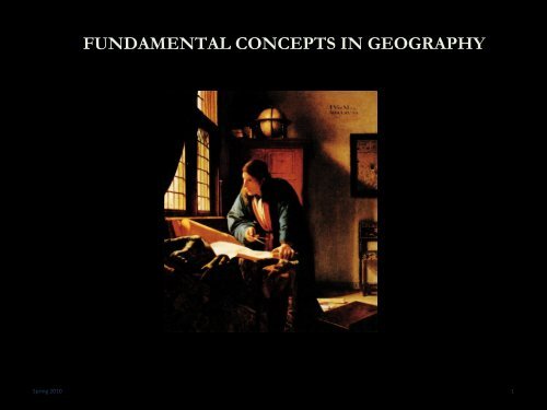
FUNDAMENTAL CONCEPTS IN GEOGRAPHY
FUNDAMENTAL CONCEPTS IN GEOGRAPHY
FUNDAMENTAL CONCEPTS IN GEOGRAPHY
You also want an ePaper? Increase the reach of your titles
YUMPU automatically turns print PDFs into web optimized ePapers that Google loves.
<strong>FUNDAMENTAL</strong> <strong>CONCEPTS</strong> <strong>IN</strong> <strong>GEOGRAPHY</strong><br />
Spring 2010 1
<strong>FUNDAMENTAL</strong> <strong>CONCEPTS</strong> <strong>IN</strong> <strong>GEOGRAPHY</strong><br />
Geog 5<br />
People, place<br />
& Environment<br />
<br />
<br />
<br />
<br />
What is Geography?<br />
Geo [earth] graphy [write, describe]<br />
<br />
The study of earth as our home<br />
A “Spatial” Science<br />
<br />
<br />
Space the fundamental element of analysis<br />
Human vs. Physical (and techniques)<br />
Theoretical approaches<br />
<br />
<br />
Systematic vs. Regional vs. Critical<br />
UCSB Geography<br />
Spring 2010 2
THE BASICS<br />
Geog 5<br />
People, place<br />
& Environment<br />
<br />
<br />
<br />
<br />
<br />
<br />
<br />
<br />
<br />
Location<br />
Distance / Direction<br />
Magnitude<br />
Scale<br />
Feature distribution/interataction<br />
1 st Law of Geography<br />
Spatial diffusion<br />
Regions<br />
Spring 2010 3
Absolute location<br />
Relative location<br />
Spring 2010 4
LOCATION<br />
Geog 5<br />
People, place<br />
& Environment<br />
<br />
<br />
<br />
Site: physical (and cultural) characteristics of the<br />
location<br />
Situation: external relationships of a location to<br />
other places<br />
Spring 2010 5
Spring 2010 6
Spring 2010 7
Spring 2010 8
DIRECTION & DISTANCE<br />
Geog 5<br />
People, place<br />
& Environment<br />
<br />
<br />
<br />
Direction: Absolute (cardinal) vs. relative location<br />
Distance: Absolute vs. relative (transformed)<br />
measures of distance<br />
Spring 2010 9
Spring 2010 10
SCALE<br />
Geog 5<br />
People, place<br />
& Environment<br />
<br />
<br />
Types of scales<br />
<br />
<br />
<br />
Phenomenon: spatial and/or temporal extent at which a<br />
phenomena occurs<br />
Analysis: scale at which phenomena will be studied<br />
Cartographic: relationship between the size of an object<br />
on a map and the size of the actual feature on the earths<br />
surface<br />
Spring 2010 11
Spring 2010 12
Spring 2010 13
MAGNITUDE<br />
Geog 5<br />
People, place<br />
& Environment<br />
<br />
<br />
Magnitude: how much of a characteristic or<br />
phenomena at a particular location?<br />
Spring 2010 14
Spring 2010 15
FEATURE DISTRIBUTION <strong>CONCEPTS</strong><br />
Geog 5<br />
People, place<br />
& Environment<br />
<br />
<br />
<br />
<br />
Clustered: close together, grouped<br />
Dispersed: spread out<br />
Others: systematic, random, linear<br />
Spring 2010 16
Spring 2010 17
Spring 2010 18
FEATURE DISTRIBUTION <strong>CONCEPTS</strong><br />
Geog 5<br />
People, place<br />
& Environment<br />
<br />
<br />
Spatial Association: distribution of two or more<br />
features and the degree of correlation<br />
Spring 2010 19
PREVALENCE OF TYPE 2 DIABETES<br />
Spring 2010 20
Obesity Trends* Among U.S. Adults<br />
BRFSS, 2004<br />
(*BMI ≥30, or ~ 30 lbs overweight for 5’ 4” person)<br />
No Data
Spring 2010 22
FEATURE <strong>IN</strong>TERACTION <strong>CONCEPTS</strong><br />
Geog 5<br />
People, place<br />
& Environment<br />
<br />
<br />
<br />
<br />
Accessibility: relative ease with which you can reach<br />
a destination<br />
Connectivity: a measure of the degree of<br />
connections or relationships between people [and<br />
objects] across the barrier of space<br />
Network: the areal pattern of connections between<br />
places<br />
Spring 2010 23
Spring 2010 24
Spring 2010 25
1 ST LAW OF <strong>GEOGRAPHY</strong><br />
Geog 5<br />
People, place<br />
& Environment<br />
<br />
<br />
Tobler’s Law:<br />
"Everything is related to everything else, but near<br />
things are more related than distant things."<br />
Distance Decay ( y=x -2 )<br />
Spring 2010 26
Spring 2010 27
Spring 2010 28
Modeling Deforestation<br />
Risks for the Maya<br />
Biosphere Reserve,<br />
Guatemala (Grunberg<br />
et. al. 2001)<br />
Spring 2010 29
SPATIAL DIFFUSION<br />
Geog 5<br />
People, place<br />
& Environment<br />
<br />
The process by which a characteristic spreads from a<br />
center of origin to more distant places<br />
2 processes:<br />
<br />
<br />
Relocation diffusion: through physical movement of people,<br />
things or ideas<br />
Expansion diffusion: snowball spread<br />
Spring 2010 30
Spring 2010 31
DIFFUSION<br />
Geog 5<br />
People, place<br />
& Environment<br />
<br />
3 types of expansion:<br />
<br />
<br />
<br />
Contagious: rapid, widespread contact diffusion<br />
Hierarchical: diffusion from nodes of authority<br />
Stimulus: cultural spread of underlying principle without<br />
characteristic<br />
Spring 2010 32
REGIONS<br />
Geog 5<br />
People, place<br />
& Environment<br />
<br />
<br />
An area distinguished by a unique combination of<br />
trends or features (internal uniformity) as compared<br />
to surrounding areas<br />
<br />
<br />
<br />
Location<br />
Size<br />
Boundaries<br />
Variable boundary permeability<br />
Spring 2010 33
REGIONS<br />
Geog 5<br />
People, place<br />
& Environment<br />
<br />
<br />
Administrative:<br />
<br />
<br />
<br />
<br />
Politically determined<br />
Hierarchical organization<br />
Uniform membership (everyone in that region equally a<br />
member)<br />
Boundaries precise (or can be made precise)<br />
Spring 2010 34
Spring 2010 35
REGIONS<br />
Geog 5<br />
People, place<br />
& Environment<br />
<br />
<br />
Thematic (or “formal”):<br />
<br />
<br />
<br />
1 or more variable or theme<br />
Membership strength varies<br />
Imprecise boundaries<br />
Spring 2010 36
Spring 2010 37
REGIONS<br />
Geog 5<br />
People, place<br />
& Environment<br />
<br />
<br />
Functional:<br />
<br />
<br />
<br />
Functional interconnectedness<br />
Nodal<br />
Vague boundaries<br />
Spring 2010 38
Spring 2010 39
REGIONS<br />
Geog 5<br />
People, place<br />
& Environment<br />
<br />
<br />
Cognitive (or “perceptual”)<br />
<br />
<br />
<br />
How people informally organize places in their mind<br />
Usually shared between people (culturally shared beliefs)<br />
Imprecise, vague, or variable boundaries<br />
Spring 2010 40
Spring 2010 41
TOOLS AND TECHNOLOGIES <strong>IN</strong> <strong>GEOGRAPHY</strong><br />
Spring 2010 42
THE GLOBE GRID<br />
Spring 2010 43
PROJECTION<br />
Spring 2010 44
Three classes (families) of projections:<br />
Developable surface as a:<br />
• Planar (Azimuthal), project the globe<br />
onto a tangent plane.<br />
• Conic, project the globe on to a cone<br />
• Cylindrical, central cylindrical vs.<br />
cylindrical equal-area<br />
Spring 2010 45
Equivalent projections<br />
Preserves relative areas, used for area-based<br />
thematic maps<br />
Ex: Sinusoidal<br />
Conformal projections<br />
Preserve angles, correct shape … with small shapes at<br />
least<br />
Graticule has right angles<br />
Ex: Mercator<br />
Compromise projections<br />
Sort of preserves relative area, sort of<br />
preserves angles…it’s “good enough”<br />
Ex. Lots of world maps (the rounded, nice<br />
looking ones)<br />
* No flat map is both equivalent and conformal – only globes have this property<br />
Spring 2010 46
WHY DOES PROJECTION MATTER?<br />
Appropriate visualization of data<br />
Mercator projection<br />
Mollweide (equal-area)<br />
What if these maps were showing population density?<br />
Spring 2010 47
Spring 2010 Mercator projection<br />
48
Peters projection<br />
Spring 2010 49
WHERE DOES PROJECTION MATTER?<br />
Spring 2010 50
WHAT ARE MAPS?<br />
Geog 5<br />
People, place<br />
& Environment<br />
<br />
<br />
Pictorial models of reality<br />
An idea that changed the world! 1<br />
1<br />
Ten Geographic Ideas that Changed the World (Hanson, S. ed. 1997)<br />
Spring 2010 51
POWER OF MAPS<br />
Geog 5<br />
People, place<br />
& Environment<br />
<br />
<br />
Pictorial models of reality<br />
<br />
<br />
<br />
Use of symbols to represent meaning<br />
Facilitate perception of spatial relationships<br />
Highlight only necessary information<br />
Spring 2010 52
“ON THE EXACTITUDE <strong>IN</strong> SCIENCE”<br />
Geog 5<br />
People, place<br />
& Environment<br />
<br />
“In that Empire, the Art of Cartography attained such<br />
Perfection that the map of a single Province occupied the<br />
entirety of a City, and the map of the Empire, the entirety of a<br />
Province. In time, those Unconscionable Maps no longer<br />
satisfied, and the Cartographers Guilds struck a Map of the<br />
Empire whose size was that of the Empire, and which coincided<br />
point for point with it. The following Generations, who were not<br />
so fond of the Study of Cartography as their Forebears had been,<br />
saw that that vast Map was Useless, and not without some<br />
Pitilessness was it, that they delivered it up to the Inclemencies<br />
of Sun and Winters. In the Deserts of the West, still today, there<br />
are Tattered Ruins of that Map, inhabited by Animals and<br />
Beggars; in all the Land there is no other Relic of the Disciplines<br />
of Geography.”<br />
--Jorge Luis Borges, Collected Fictions, Translated by Andrew Hurley Copyright<br />
Penguin 1999 .<br />
Spring 2010 53
Spring 2010 54
Choropleth map<br />
Spring 2010 55
Dot-distribution map<br />
Spring 2010 56
Isopleth maps<br />
Spring 2010 57
Cartogram<br />
Spring 2010 58
Graduated circle map<br />
Spring 2010 59
Sketch maps<br />
Spring 2010 60
T-in-O maps<br />
Spring 2010 61
Peutinger map<br />
Spring 2010 62
Spring 2010 63
Spring 2010 64
Network maps<br />
Spring 2010 65
Administrative maps<br />
Spring 2010 66
MAPS CAN DECEIVE!<br />
Spring 2010 67
MAPS CAN DECEIVE!<br />
Geog 5<br />
People, place<br />
& Environment<br />
<br />
<br />
<br />
<br />
<br />
<br />
Simplification: selective presentation<br />
Generalization: averaging over details leads to<br />
homogenization<br />
Graphical clarity: exaggeration of features<br />
Projection: distortion can lead to false sense of<br />
reality<br />
Symbolism: can be misleading<br />
Spring 2010 68
GIS: GEOGRAPHICAL <strong>IN</strong>FORMATION<br />
SYSTEM<br />
Geog 5<br />
People, place<br />
& Environment<br />
<br />
<br />
<br />
Tool for performing spatial analysis<br />
Data in layers<br />
Spring 2010 69
Spring 2010 70
Spring 2010 71
REMOTE SENS<strong>IN</strong>G<br />
Geog 5<br />
People, place<br />
& Environment<br />
<br />
<br />
Collection of information about earth’s surface<br />
through aerial photography or satellite imagery<br />
Spring 2010 72
Geog 5<br />
People, place<br />
& Environment<br />
<br />
Spring 2010<br />
IV - UCSB<br />
73<br />
April 4, 2001
Geog 5<br />
People, place<br />
& Environment<br />
<br />
UCSB<br />
Campus<br />
Spring 2010<br />
Nov<br />
7414,<br />
2000
Geog 5<br />
People, place<br />
& Environment<br />
<br />
Spring 2010 75
LA Spring -2010 1928<br />
76
Spring 2010 77<br />
LA - 1932
Spring 2010 78<br />
LA - 1970
Spring 2010 79
MODELS<br />
Geog 5<br />
People, place<br />
& Environment<br />
<br />
<br />
A simplified representation of a portion of reality,<br />
expressed in conceptual, physical, graphical, or<br />
computational form.<br />
<br />
What does this mean?<br />
• Models convey a set of interrelated theories about structures<br />
and processes of a system of interest to the world<br />
• Expresses the parts and their causal interactions<br />
• Many examples in human geography<br />
Spring 2010 80
OTHER FIELD METHODS<br />
Geog 5<br />
People, place<br />
& Environment<br />
<br />
<br />
<br />
Human geography (Primary vs. secondary data)<br />
<br />
<br />
<br />
<br />
Physical measurement<br />
Interviews & questionnaires<br />
Behavioral observation<br />
Archival studies<br />
Physical geography<br />
<br />
<br />
Geodetic measurements<br />
Physical measurement of earth systems<br />
e.g. vegetative sampling [phytosociology], soil texture<br />
analysis, carbon dating<br />
Spring 2010 81


