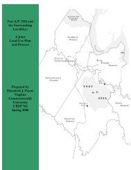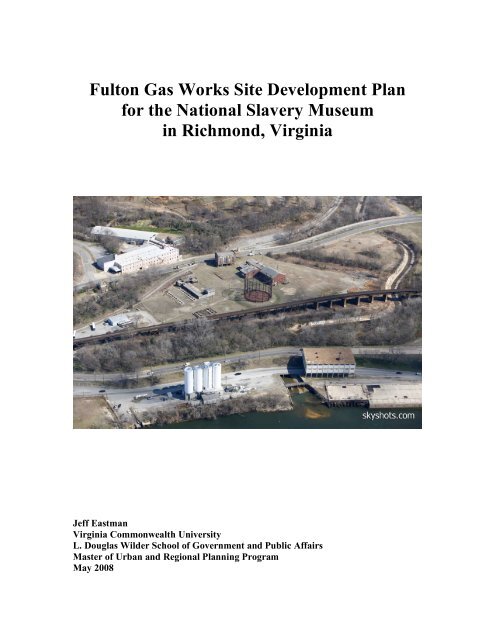
Fulton Gas Works Site Development Plan for the - Virginia ...
Fulton Gas Works Site Development Plan for the - Virginia ...
Fulton Gas Works Site Development Plan for the - Virginia ...

Create successful ePaper yourself
Turn your PDF publications into a flip-book with our unique Google optimized e-Paper software.
<strong>Fulton</strong> <strong>Gas</strong> <strong>Works</strong> <strong>Site</strong> <strong>Development</strong> <strong>Plan</strong><br />
<strong>for</strong> <strong>the</strong> National Slavery Museum<br />
in Richmond, <strong>Virginia</strong><br />
Jeff Eastman<br />
<strong>Virginia</strong> Commonwealth University<br />
L. Douglas Wilder School of Government and Public Affairs<br />
Master of Urban and Regional <strong>Plan</strong>ning Program<br />
May 2008
(page intentionally left blank)
<strong>Fulton</strong> <strong>Gas</strong> <strong>Works</strong> <strong>Site</strong> <strong>Development</strong> <strong>Plan</strong><br />
<strong>for</strong> <strong>the</strong> National Slavery Museum<br />
in Richmond, <strong>Virginia</strong><br />
Prepared <strong>for</strong> <strong>the</strong> City of Richmond<br />
Department of Community <strong>Development</strong><br />
Jeff Eastman<br />
<strong>Virginia</strong> Commonwealth University<br />
L. Douglas Wilder School of Government and Public Affairs<br />
Master of Urban and Regional <strong>Plan</strong>ning Program<br />
May 2008
(page intentionally left blank)
Acknowledgements<br />
The <strong>Fulton</strong> <strong>Gas</strong> <strong>Works</strong> <strong>Site</strong> <strong>Development</strong> <strong>Plan</strong> could not have been completed in five<br />
months without <strong>the</strong> generous support and insight of <strong>the</strong> following people:<br />
• Reverend Delores McQuinn, City of Richmond Councilwoman to <strong>the</strong> 7 th District<br />
• Jeannie Welliver and Lisbeth Coker in <strong>the</strong> City of Richmond Department of<br />
Economic <strong>Development</strong><br />
• Bob Howard, Deputy Director of <strong>the</strong> City of Richmond Department of Public<br />
Utilities<br />
• Jane Ferrara, Director, City of Richmond Department of Real Estate Services<br />
• David Herring, Interim Director of A.C.O.R.N., <strong>the</strong> Association to Conserve Old<br />
Richmond Neighborhoods<br />
• Tom Stiles, Skyshots Aerial Photography<br />
• Bob Strohm, Executive Vice President and Chief Operating Officer of <strong>the</strong><br />
<strong>Virginia</strong> Historical Society<br />
• Mort Gulak, Brooke Hardin and Ivan Suen, my panel members<br />
Thanks to all of you <strong>for</strong> opening doors <strong>for</strong> me and pointing me in <strong>the</strong> right direction when<br />
I strayed.<br />
My friends and family, especially Meg, also deserve special thanks <strong>for</strong> supporting my<br />
decision to return to school and putting up with my ceaseless talk about urban planning<br />
issues. I owe you all a debt of gratitude.
Contents of <strong>the</strong> <strong>Plan</strong><br />
Executive Summary 1<br />
Introduction 3<br />
• Purpose of <strong>the</strong> <strong>Plan</strong> 3<br />
• Justification <strong>for</strong> Proposed Use 3<br />
• <strong>Site</strong> Location 5<br />
Part 1. Assessment of Existing Conditions and <strong>Development</strong> Potential 7<br />
1.1 Existing Land Use 7<br />
1.2 <strong>Site</strong> Description 8<br />
1.3 History 9<br />
1.3.1 <strong>Fulton</strong> <strong>Gas</strong> <strong>Works</strong> 10<br />
1.3.2 <strong>Fulton</strong> Neighborhood 12<br />
1.3.3 C&O Tunnel Collapse 14<br />
1.4 Environmental Conditions 15<br />
1.4.1 Floodplain 15<br />
1.4.2 Chesapeake Bay Preservation Area 17<br />
1.4.3 Contamination From Former Use 19<br />
1.4.4 Combined Sewage Overflow From Gillies Creek 21<br />
1.5 Building Conditions 23<br />
1.6 Zoning 30<br />
1.7 Related <strong>Plan</strong>s and Surrounding Influences 32<br />
1.7.1 1960s RRHA <strong>Fulton</strong> Bottom <strong>Plan</strong> 32<br />
1.7.2 City of Richmond Master <strong>Plan</strong> 2000-2020 32<br />
1.7.3 Rocketts Landing 34<br />
1.7.4 City of Richmond Public Marina 35<br />
1.7.5 <strong>Virginia</strong> Capital Trail 36<br />
1.7.6 Market Analysis and Mixed-Use <strong>Development</strong> <strong>Plan</strong> 38<br />
1.8 Circulation 39<br />
1.8.1 Traffic Rates 2001-2006 40<br />
1.8.2 Route 5 Relocation 40<br />
1.8.3 Traffic Impact Analyses <strong>for</strong> Route 5 <strong>Development</strong>s 42<br />
1.8.4 GRTC Route and Expansion <strong>Plan</strong>s 43<br />
1.9 Summary of Existing Conditions and <strong>Development</strong> Potential 44<br />
1.9.1 Assets 44<br />
1.9.2 Liabilities 44<br />
Part 2. <strong>Plan</strong> <strong>for</strong> <strong>the</strong> <strong>Development</strong> of <strong>the</strong> Study Area 45<br />
2.1 Vision: National Slavery Museum 45<br />
2.2 <strong>Development</strong> Guidelines 46<br />
2.3 Design Guidelines 46<br />
2.4 <strong>Site</strong> <strong>Plan</strong> 47<br />
2.5 Implementation 49<br />
Reference List 61<br />
Appendix
List of Tables and Charts<br />
Table 1. <strong>Fulton</strong> <strong>Gas</strong> <strong>Works</strong> site Parcel Acreage and Ownership 8<br />
Table 2. Annual Average Daily Traffic <strong>for</strong> Roads Near <strong>the</strong> <strong>Fulton</strong> <strong>Gas</strong> <strong>Works</strong> <strong>Site</strong> 40<br />
Chart 1. Timeline of Slavery Museum <strong>Site</strong> <strong>Development</strong> 60<br />
List of Figures<br />
Figure 1. Location of <strong>the</strong> <strong>Fulton</strong> <strong>Gas</strong> <strong>Works</strong> <strong>Site</strong> in <strong>the</strong> City of Richmond 5<br />
Figure 2. Boundaries of <strong>the</strong> <strong>Fulton</strong> <strong>Gas</strong> <strong>Works</strong> <strong>Site</strong> 6<br />
Figure 3. Topography of <strong>the</strong> <strong>Gas</strong> <strong>Works</strong> <strong>Site</strong> and Surrounding Area 6<br />
Figure 4. Existing Land Use on <strong>the</strong> <strong>Fulton</strong> <strong>Gas</strong> <strong>Works</strong> <strong>Site</strong> 7<br />
Figure 5. <strong>Fulton</strong> <strong>Gas</strong> <strong>Works</strong> <strong>Site</strong> Parcel Ownership 8<br />
Figure 6. 1935 Map of <strong>the</strong> <strong>Fulton</strong> <strong>Gas</strong> <strong>Works</strong> <strong>Site</strong> 11<br />
Figure 7. 1905 Sanborn Map of <strong>Fulton</strong> Neighborhood in Relation to <strong>the</strong> <strong>Gas</strong> <strong>Works</strong> 13<br />
Figure 8. Parcels Owned by CSX Showing Route to Tunnel Collapse 14<br />
Figure 9. Location of <strong>the</strong> <strong>Fulton</strong> <strong>Gas</strong> <strong>Works</strong> <strong>Site</strong> in <strong>the</strong> 100-Year Floodplain 16<br />
Figure 10. Location of <strong>the</strong> <strong>Fulton</strong> <strong>Gas</strong> <strong>Works</strong> <strong>Site</strong> in <strong>the</strong> 500-Year Floodplain 16<br />
Figure 11. Location of <strong>the</strong> <strong>Fulton</strong> <strong>Gas</strong> <strong>Works</strong> <strong>Site</strong> in a Chesapeake Bay Pres. Area 18<br />
Figure 12. Potentially Contaminated Area of <strong>the</strong> <strong>Fulton</strong> <strong>Gas</strong> <strong>Works</strong> <strong>Site</strong> 20<br />
Figure 13. One of Seven Combined Sewer Overflow Points Into Gillies Creek 21<br />
Figure 14. Location of Combined Sewer Overflows Into Gillies Creek 22<br />
Figure 15. Newton’s Bus Service Building on <strong>the</strong> <strong>Fulton</strong> <strong>Gas</strong> <strong>Works</strong> <strong>Site</strong> 24<br />
Figure 16. <strong>Gas</strong>ometer at <strong>the</strong> <strong>Fulton</strong> <strong>Gas</strong> <strong>Works</strong> <strong>Site</strong> 24<br />
Figure 17. The Top of <strong>the</strong> <strong>Gas</strong>ometer 25<br />
Figure 18. Building Containing <strong>the</strong> Office, Blacksmith Shop, and Machine Shop 26<br />
Figure 19. Building Containing <strong>the</strong> Office, Blacksmith Shop, and Machine Shop 26<br />
Figure 20. Building Containing <strong>the</strong> Boiler House, Compressor, and Exhauster House 27<br />
Figure 21. Building Containing <strong>the</strong> Boiler House, Compressor, and Exhauster House 27<br />
Figure 22. The Retort House on <strong>the</strong> <strong>Gas</strong> <strong>Works</strong> <strong>Site</strong> 28<br />
Figure 23. The Retort House on <strong>the</strong> <strong>Gas</strong> <strong>Works</strong> <strong>Site</strong> 28<br />
Figure 24. The Steam Generating <strong>Plan</strong>t on <strong>the</strong> <strong>Gas</strong> <strong>Works</strong> <strong>Site</strong> 29<br />
Figure 25. The Steam Generating <strong>Plan</strong>t on <strong>the</strong> <strong>Gas</strong> <strong>Works</strong> <strong>Site</strong> 30<br />
Figure 26. <strong>Fulton</strong> <strong>Gas</strong> <strong>Works</strong> <strong>Site</strong> Current Zoning 31<br />
Figure 27. City of Richmond Master <strong>Plan</strong> 2000-2020 Land Use Map 34<br />
Figure 28. Architect’s Rendering of Rocketts Landing Master <strong>Plan</strong> 35<br />
Figure 29. Conceptual Rendering of <strong>the</strong> Proposed City of Richmond Public Marina 36<br />
Figure 30. Location of <strong>the</strong> <strong>Gas</strong> <strong>Works</strong> <strong>Site</strong> in Relation to <strong>the</strong> <strong>Virginia</strong> Capital Trail 37<br />
Figure 31. Circulation Around <strong>Fulton</strong> <strong>Gas</strong> <strong>Works</strong> <strong>Site</strong> 39<br />
Figure 32. <strong>Fulton</strong> <strong>Gas</strong> <strong>Works</strong> <strong>Site</strong> in Relation to <strong>the</strong> Proposed Route 5 Relocation 41<br />
Figure 33. Conceptual <strong>Site</strong> Arrangement <strong>for</strong> National Slavery Museum 47<br />
Figure 34. Detailed <strong>Site</strong> <strong>Plan</strong> <strong>for</strong> <strong>the</strong> National Slavery Museum 48<br />
Figure 35. Rendering of <strong>the</strong> Slavery Museum Building with a Green Roof 54<br />
Figure 36. Open Pier Construction at <strong>the</strong> <strong>Virginia</strong> Eye Institute 55<br />
Figure 37. Rendering of <strong>the</strong> Slavery Museum Building with a Stepped Profile 56<br />
Figure 38. The Winfree Cottage 58
Executive Summary<br />
The <strong>Fulton</strong> <strong>Gas</strong> <strong>Works</strong> <strong>Site</strong> <strong>Development</strong> <strong>Plan</strong> was prepared as a guide <strong>for</strong> developing <strong>the</strong><br />
site to be <strong>the</strong> home of <strong>the</strong> United States National Slavery Museum.<br />
The <strong>Fulton</strong> <strong>Gas</strong> <strong>Works</strong> site is composed of ten separate parcels owned by five entities,<br />
totaling 19.1 acres. The largest parcel is <strong>the</strong> <strong>for</strong>mer location of <strong>the</strong> <strong>Fulton</strong> <strong>Gas</strong> <strong>Works</strong>, an<br />
industrial site that dates to 1856 where coal was converted to gas to light Richmond’s<br />
streets and buildings.<br />
The site is located just sou<strong>the</strong>ast of downtown Richmond, <strong>Virginia</strong>, and sits between <strong>the</strong><br />
long established downtown and <strong>the</strong> exciting new developments occurring along <strong>the</strong><br />
James River. There is a rich history in this area that includes Native American settlement<br />
and <strong>the</strong> founding of <strong>the</strong> City. The area also played an important part in <strong>the</strong> Civil War,<br />
with Chimborazo Hospital located on <strong>the</strong> hill above <strong>the</strong> site and <strong>the</strong> Confederate Naval<br />
Yard along <strong>the</strong> river below. Slaves were brought into and taken out of Richmond by way<br />
of <strong>the</strong> Port of Rocketts, also located along <strong>the</strong> river below <strong>the</strong> <strong>Gas</strong> <strong>Works</strong> site.<br />
There are several factors that kept this strategically situated site from being developed<br />
over <strong>the</strong> last several decades. The first is <strong>the</strong> probable contamination from its <strong>for</strong>mer use.<br />
The process of converting coal into gas creates by-products that are environmental<br />
contaminants and are believed to have been disposed of on site. Ano<strong>the</strong>r drawback is that<br />
<strong>the</strong> site is entirely located in <strong>the</strong> 100 and 500-year floodplains due to its proximity to <strong>the</strong><br />
James River and Gillies Creek. For <strong>the</strong>se same reasons, <strong>the</strong> site is located in a<br />
Chesapeake Bay Preservation Area, which also places some restrictions on <strong>the</strong> manner in<br />
which <strong>the</strong> site can be developed. Lastly, Gillies Creek, which <strong>for</strong>ms <strong>the</strong> sou<strong>the</strong>rn<br />
boundary of <strong>the</strong> study area, is a combined sewer overflow <strong>for</strong> <strong>the</strong> City, which means that<br />
in a heavy rain, raw sewage from homes and businesses may be diverted into <strong>the</strong> creek<br />
and released into <strong>the</strong> James River.<br />
Despite <strong>the</strong>se restrictions, <strong>the</strong>re are many positive aspects that make <strong>the</strong> site appealing <strong>for</strong><br />
development. The <strong>Fulton</strong> <strong>Gas</strong> <strong>Works</strong> site is well situated along a highly visible location<br />
on a gateway road into <strong>the</strong> city, and if <strong>the</strong> proposed relocation of Route 5 occurs, along<br />
with <strong>the</strong> large scale developments being constructed fur<strong>the</strong>r south on Route 5, this will<br />
lead to increased traffic and visibility <strong>for</strong> <strong>the</strong> site. Ano<strong>the</strong>r positive in developing <strong>the</strong> site<br />
is that utilities are already present, which will cut down on development time and<br />
expense. Several of <strong>the</strong> existing buildings, though currently in a deteriorated state, are<br />
candidates <strong>for</strong> listing on <strong>the</strong> National Register of Historic Places, which would allow <strong>for</strong><br />
<strong>the</strong> use of tax credits while lending an important historical significance to <strong>the</strong> Slavery<br />
Museum.<br />
Perhaps <strong>the</strong> most important positive is <strong>the</strong> site’s proximity to downtown Richmond, <strong>the</strong><br />
James River, and exciting new developments like Rocketts Landing, <strong>the</strong> <strong>Virginia</strong> Capital<br />
Trail, and <strong>the</strong> proposed public marina. Indeed, it is <strong>the</strong> proximity to <strong>the</strong>se developments<br />
as well as <strong>the</strong> rich history of site and surrounding area that led to <strong>the</strong> proposal to use <strong>the</strong><br />
site as <strong>the</strong> home of <strong>the</strong> National Slavery Museum.<br />
<strong>Fulton</strong> <strong>Gas</strong> <strong>Works</strong><br />
<strong>Site</strong> <strong>Development</strong> <strong>Plan</strong> 1
The <strong>Fulton</strong> <strong>Gas</strong> <strong>Works</strong> <strong>Site</strong> <strong>Development</strong> <strong>Plan</strong> includes a thorough analysis of existing<br />
conditions such as land use, building conditions, zoning, and circulation, with special<br />
attention paid to <strong>the</strong> history and environmental conditions of <strong>the</strong> site as well as <strong>the</strong> area’s<br />
related plans and surrounding influences.<br />
Building upon <strong>the</strong> site’s assets and minimizing <strong>the</strong> liabilities led to <strong>the</strong> <strong>for</strong>mulation of a<br />
number of development and design guidelines, listed below, that will guide <strong>the</strong><br />
preparation and use of <strong>the</strong> site as <strong>the</strong> Slavery Museum.<br />
The following guidelines will dictate how <strong>the</strong> site is developed.<br />
• The ten parcels must be combined under single ownership, and <strong>the</strong> site must be<br />
rezoned “Institutional”.<br />
• The environmental contamination of <strong>the</strong> site will need to be remediated.<br />
• The site will need 200,000 square feet of space <strong>for</strong> <strong>the</strong> museum, and ano<strong>the</strong>r 164,092<br />
square feet <strong>for</strong> parking.<br />
• The site will need vehicular access off Williamsburg Avenue and Peebles Street.<br />
The following guidelines will dictate <strong>the</strong> design of <strong>the</strong> site.<br />
• The Slavery Museum buildings will be prominent on <strong>the</strong> site when viewed from both<br />
Williamsburg Avenue and <strong>the</strong> James River.<br />
• The site shall be developed in a way that minimizes negative impact on <strong>the</strong><br />
environment through pervious paving, green roof technology, bio-retention swales,<br />
and green spaces.<br />
• The new buildings will need to be constructed above <strong>the</strong> level of <strong>the</strong> floodplain to<br />
promote views of <strong>the</strong> river but to heights that respect <strong>the</strong> viewshed of Church Hill<br />
and Chimborazo Hill.<br />
• The site will feature <strong>the</strong> Spirit of Freedom Exhibit Garden and trail along Gillies<br />
Creek.<br />
• The site will be <strong>the</strong> permanent home of <strong>the</strong> Winfree Cottage.<br />
• The gasometer shall hold a slave ship replica and will act as a vista upon entering <strong>the</strong><br />
site.<br />
• The site will connect to <strong>the</strong> public marina, <strong>Virginia</strong> Capital Trail, and <strong>the</strong> Richmond<br />
Slave Trail.<br />
The benefits of having <strong>the</strong> National Slavery Museum locate in Richmond are<br />
immeasurable. Beyond <strong>the</strong> pure dollars and cents of what <strong>the</strong> museum may bring to <strong>the</strong><br />
City and region, <strong>the</strong> Slavery Museum offers all visitors, whe<strong>the</strong>r Richmonders,<br />
<strong>Virginia</strong>ns, Americans, or <strong>for</strong>eign tourists <strong>the</strong> chance to fully understand this regrettable<br />
though significant portion of our country’s past. Fur<strong>the</strong>rmore, <strong>the</strong> museum can help heal<br />
<strong>the</strong> divisions that still plague this City nearly a century and a half after slavery was<br />
abolished.<br />
<strong>Fulton</strong> <strong>Gas</strong> <strong>Works</strong><br />
<strong>Site</strong> <strong>Development</strong> <strong>Plan</strong> 2
Introduction<br />
Purpose of <strong>the</strong> <strong>Plan</strong><br />
The <strong>Fulton</strong> <strong>Gas</strong> <strong>Works</strong> <strong>Site</strong> <strong>Development</strong> <strong>Plan</strong> is <strong>the</strong> product of five months of detailed<br />
research, interviews, and brainstorming. More accurately, though, it represents <strong>the</strong><br />
culmination of two years of graduate study in urban planning. Creation of this plan was<br />
<strong>the</strong> primary assignment <strong>for</strong> URSP 762, <strong>Plan</strong>ning Studio II, <strong>the</strong> capstone course in<br />
<strong>Virginia</strong> Commonwealth University’s Master of Urban and Regional <strong>Plan</strong>ning program.<br />
The following members of <strong>the</strong> Studio Panel contributed to <strong>the</strong> development of this plan:<br />
• Dr. I-Shian (Ivan) Suen, Panel Chairperson and Primary Content Advisor<br />
Assistant Professor of Urban Studies and <strong>Plan</strong>ning, L. Douglas Wilder<br />
School of Government and Public Affairs, <strong>Virginia</strong> Commonwealth<br />
University<br />
• Dr. Morton Gulak, Panel Member<br />
Associate Professor of Urban Studies and <strong>Plan</strong>ning, L. Douglas Wilder<br />
School of Government and Public Affairs, <strong>Virginia</strong> Commonwealth<br />
University<br />
• Mr. Brooke Hardin, Panel Member<br />
Deputy Director, City of Richmond Department of Community<br />
<strong>Development</strong><br />
Justification <strong>for</strong> <strong>the</strong> proposed use<br />
Richmond is <strong>for</strong>ever linked to history as a participant in <strong>the</strong> transatlantic and interstate<br />
slave trade. It is critical to <strong>the</strong> understanding of American history to tell <strong>the</strong> story of this<br />
regrettable but none<strong>the</strong>less real era of our past. Richmond’s legacy as <strong>the</strong> slave trade<br />
capital of <strong>the</strong> United States has been a black eye in <strong>the</strong> past, but <strong>the</strong> time is ripe to<br />
confront this issue in a way that can heal <strong>the</strong> still lingering tensions. Just last spring<br />
Richmond unveiled a reconciliation statue that matches ones found in Liverpool, England<br />
and <strong>the</strong> Republic of Benin in Africa, o<strong>the</strong>r participants in <strong>the</strong> transatlantic slave trade.<br />
Liverpool has taken <strong>the</strong> opportunity to confront <strong>the</strong>ir past involvement in <strong>the</strong> slave trade<br />
by becoming <strong>the</strong> home of <strong>the</strong> International Slavery Museum, and Richmond, which<br />
played a primary role in <strong>the</strong> history of slavery in <strong>the</strong> United States, should not let this<br />
opportunity pass <strong>the</strong>m by <strong>for</strong>ever.<br />
The area near and including <strong>the</strong> <strong>Fulton</strong> <strong>Gas</strong> <strong>Works</strong> was actually considered several years<br />
ago <strong>for</strong> <strong>the</strong> location of <strong>the</strong> National Slavery Museum be<strong>for</strong>e it was eventually awarded to<br />
Fredericksburg, <strong>Virginia</strong> (Redmon and Krishnamurthy, 2001). The site of <strong>the</strong> museum<br />
would have been largely on City owned property close to <strong>the</strong> river, near where <strong>the</strong><br />
Intermediate Terminal building is today, and would have included <strong>the</strong> Lehigh Cement<br />
Company parcel. The mission of <strong>the</strong> museum was to focus on <strong>the</strong> role of slavery from <strong>the</strong><br />
<strong>Fulton</strong> <strong>Gas</strong> <strong>Works</strong><br />
<strong>Site</strong> <strong>Development</strong> <strong>Plan</strong> 3
time of <strong>the</strong> Nation’s founding in 1776 through <strong>the</strong> Emancipation Proclamation and Civil<br />
War.<br />
Un<strong>for</strong>tunately <strong>for</strong> Richmond, <strong>the</strong> Slavery Museum’s Board of Directors chose to locate<br />
<strong>the</strong> museum in Fredericksburg, on 39 acres of a 2,100 acre development along <strong>the</strong><br />
Rappahannock River called Celebrate <strong>Virginia</strong> that would include a golf course and<br />
commercial areas. According to a 2001 Richmond Times-Dispatch article, <strong>the</strong> developer<br />
of <strong>the</strong> site, Larry Silver, donated <strong>the</strong> land to <strong>the</strong> museum (Redmon and Krishnamurthy).<br />
Councilwoman Delores McQuinn, whose district includes <strong>the</strong> <strong>Fulton</strong> <strong>Gas</strong> <strong>Works</strong> site, was<br />
on City Council at <strong>the</strong> time, and says that <strong>the</strong> Council went to great lengths to entice <strong>the</strong><br />
Slavery Museum to locate in Richmond, even without seeing a feasibility study. Council<br />
offered millions of dollars to <strong>the</strong> museum’s board, and even went so far as to set aside<br />
money <strong>for</strong> <strong>the</strong> environmental remediation of <strong>the</strong> site. Councilwoman McQuinn feels now,<br />
as she did <strong>the</strong>n, that Richmond is <strong>the</strong> proper home <strong>for</strong> <strong>the</strong> museum.<br />
Though Richmond City Council made ef<strong>for</strong>ts to secure <strong>the</strong> area around <strong>the</strong> <strong>Gas</strong> <strong>Works</strong> as<br />
<strong>the</strong> site of <strong>the</strong> museum, <strong>the</strong>n City Councilman Sa’ad El-Amin had concerns that <strong>the</strong>re was<br />
nothing else in <strong>the</strong> immediate area to keep museum visitors down <strong>the</strong>re. That was true<br />
<strong>the</strong>n, but in <strong>the</strong> years since <strong>the</strong> original proposal, <strong>the</strong>re have been many positive<br />
developments in this area, including Rocketts Landing, which will bring both residential<br />
and commercial activity to this area of <strong>the</strong> City. At <strong>the</strong> <strong>Gas</strong> <strong>Works</strong> site, <strong>the</strong> Slavery<br />
Museum can connect to <strong>the</strong> City’s Slave Trail, adding a wealth of in<strong>for</strong>mation to <strong>the</strong><br />
moving experience of <strong>the</strong> trail. When combined with <strong>the</strong> City’s plans <strong>for</strong> a public marina<br />
and <strong>the</strong> completion of <strong>the</strong> Capital Trail, this area will be one of <strong>the</strong> City’s centers of<br />
recreation, and hopefully, tourism as well.<br />
Although <strong>the</strong> location of <strong>the</strong> National Slavery Museum was awarded to Fredericksburg,<br />
ground has yet to be broken, and recent newspaper articles report that slow fundraising<br />
results may fur<strong>the</strong>r hinder plans to begin construction. The time is right <strong>for</strong> <strong>the</strong> museum<br />
to reassess <strong>the</strong>ir choice of location and consider a site that more closely ties <strong>the</strong> mission<br />
of <strong>the</strong> museum to its location. The powerful story that <strong>the</strong> museum will tell fits better in<br />
Richmond than it does in <strong>the</strong> middle of <strong>the</strong> woods outside of Fredericksburg.<br />
<strong>Fulton</strong> <strong>Gas</strong> <strong>Works</strong><br />
<strong>Site</strong> <strong>Development</strong> <strong>Plan</strong> 4
<strong>Site</strong> Location<br />
The study area consists of a group of parcels surrounding <strong>the</strong> <strong>for</strong>mer <strong>Fulton</strong> <strong>Gas</strong> <strong>Works</strong><br />
located just sou<strong>the</strong>ast of downtown Richmond, <strong>Virginia</strong> (see Figure 1). The site is<br />
bounded by Gillies Creek on <strong>the</strong> south, Williamsburg Avenue on <strong>the</strong> east, and Main<br />
Street on <strong>the</strong> west (see Figure 2), and bisected by <strong>the</strong> raised railroad trestles of <strong>the</strong> CSX<br />
Transportation Company. Although <strong>the</strong>re are ten parcels that make up <strong>the</strong> study area, <strong>for</strong><br />
<strong>the</strong> purposes of this paper, <strong>the</strong> area will be referred to as <strong>the</strong> <strong>Fulton</strong> <strong>Gas</strong> <strong>Works</strong> site.<br />
Figure 1. Location of <strong>the</strong> <strong>Fulton</strong> <strong>Gas</strong> <strong>Works</strong> <strong>Site</strong> in <strong>the</strong> City of Richmond<br />
The <strong>Gas</strong> <strong>Works</strong> site and surrounding area are a geographic low point (see Figure 3),<br />
sitting at <strong>the</strong> bottom of Church, Chimborazo, and <strong>Fulton</strong> Hills, with <strong>the</strong> James River on<br />
<strong>the</strong> fourth side. These hills are home to <strong>the</strong> first neighborhoods of Richmond and are rich<br />
in history, architecture, and character. Downtown Richmond, including <strong>the</strong> State Capitol<br />
building, financial district, Shockoe Slip and Shockoe Bottom, is just over a mile away to<br />
<strong>the</strong> northwest. The Tobacco Row apartment buildings (old tobacco warehouses converted<br />
into hundreds of apartments in <strong>the</strong> last two decades) are located less than a mile away,<br />
and Shockoe Bottom is <strong>the</strong> City’s main entertainment destination.<br />
<strong>Fulton</strong> <strong>Gas</strong> <strong>Works</strong><br />
<strong>Site</strong> <strong>Development</strong> <strong>Plan</strong> 5
Figure 2. Boundaries of <strong>the</strong> <strong>Fulton</strong> <strong>Gas</strong> <strong>Works</strong> <strong>Site</strong><br />
source: City of Richmond GIS<br />
Figure 3. Topography of <strong>the</strong> <strong>Gas</strong> <strong>Works</strong> <strong>Site</strong> and Surrounding Area<br />
source: City of Richmond GIS<br />
<strong>Fulton</strong> <strong>Gas</strong> <strong>Works</strong><br />
<strong>Site</strong> <strong>Development</strong> <strong>Plan</strong> 6
Part 1. Assessment of Existing Conditions and<br />
<strong>Development</strong> Potential<br />
1.1 Existing Land Use<br />
All of <strong>the</strong> land in <strong>the</strong> study area is vacant at <strong>the</strong> present time (see Figure 4), with <strong>the</strong><br />
exception of a parcel that is operated as a bus repair facility. Existing land use in <strong>the</strong> area<br />
surrounding <strong>the</strong> <strong>Gas</strong> <strong>Works</strong> site is presently mixed. Just north of <strong>the</strong> study area along<br />
Williamsburg Avenue sits a house that, according to City tax records, was built in 1780.<br />
The larger area of yellow in Figure 4 shows <strong>the</strong> residential neighborhood of Church Hill.<br />
Although <strong>the</strong>re used to be a thriving neighborhood in <strong>the</strong> area around <strong>the</strong> <strong>Fulton</strong> <strong>Gas</strong><br />
<strong>Works</strong>, <strong>the</strong> site is now mostly surrounded by small industrial operations and vacant land.<br />
However, due to its proximity to downtown and <strong>the</strong> river, this area is garnering increased<br />
interest from <strong>the</strong> development community. Much of that interest is driven by <strong>the</strong> Rocketts<br />
Landing development, which, when coupled with <strong>the</strong> plans <strong>for</strong> <strong>the</strong> public marina and<br />
<strong>Virginia</strong> Capital Trail, could make this a very attractive place to live, work, and play.<br />
Figure 4. Existing Land Use on <strong>the</strong> <strong>Fulton</strong> <strong>Gas</strong> <strong>Works</strong> <strong>Site</strong><br />
source: City of Richmond GIS<br />
<strong>Fulton</strong> <strong>Gas</strong> <strong>Works</strong><br />
<strong>Site</strong> <strong>Development</strong> <strong>Plan</strong> 7
1.2 <strong>Site</strong> Description<br />
Ten separate parcels comprise <strong>the</strong> study area, totaling 19.1 acres (see Figure 5 and Table<br />
1). The largest parcel, at 10.4 acres, is <strong>the</strong> physical site of <strong>the</strong> <strong>for</strong>mer <strong>Gas</strong> <strong>Works</strong>, owned<br />
by <strong>the</strong> City’s Department of Public Utilities (DPU). The next largest parcel is <strong>the</strong> 3.3 acre<br />
piece of land between <strong>the</strong> <strong>Gas</strong> <strong>Works</strong> and Gillies Creek that is owned by RRHA, <strong>the</strong><br />
Richmond Redevelopment and Housing Authority. The o<strong>the</strong>r eight parcels are all small,<br />
with no one parcel larger than 1.3 acres. Owners of <strong>the</strong>se parcels include <strong>the</strong> CSX<br />
Transportation Company, <strong>the</strong> City’s Department of Parks and Recreation, and one parcel<br />
owned by Newton’s Bus Service.<br />
Figure 5. <strong>Fulton</strong> <strong>Gas</strong> <strong>Works</strong> <strong>Site</strong> Parcel Ownership<br />
source: City of Richmond GIS<br />
Table 1. <strong>Fulton</strong> <strong>Gas</strong> <strong>Works</strong> site Parcel Acreage and Ownership<br />
Parcel # Acreage Owner Name<br />
1 10.4 City Of Richmond Department of Public Utilities<br />
2 3.3 Richmond Redevelopment & Housing Authority<br />
3 1.3 City Of Richmond Department of Parks & Recreation<br />
4 1.2 Richmond Redevelopment & Housing Authority<br />
5 1.1 Newton’s Bus Service<br />
6 0.7 C S X Transportation<br />
7 0.4 C S X Transportation<br />
8 0.4 C S X Transportation<br />
9 0.2 C S X Transportation<br />
10 0.2 City Of Richmond Department of Parks & Recreation<br />
19.1<br />
source: City of Richmond GIS<br />
<strong>Fulton</strong> <strong>Gas</strong> <strong>Works</strong><br />
<strong>Site</strong> <strong>Development</strong> <strong>Plan</strong> 8
1.3 History<br />
There is a long history of human settlement in this area of <strong>the</strong> City. Indeed, this site and<br />
<strong>the</strong> surrounding area have played a prominent role in <strong>the</strong> history and development of<br />
Richmond. In his 1976 book Richmond, <strong>the</strong> Story of a City, author Virginius Dabney tells<br />
us that <strong>the</strong> valley between <strong>the</strong> hills and <strong>the</strong> river in this area (on both sides of Gillies<br />
Creek) was farmed by a group of Powhatan Indians under <strong>the</strong> leadership of Little<br />
Powhatan, son of Chief Powhatan. Gabriel Archer, <strong>the</strong> chronicler of an expedition of<br />
English explorers who traveled up <strong>the</strong> James River in 1607 with Christopher Newport,<br />
wrote of a “playne between <strong>the</strong> hill and river, whereon he [Little Powhatan] soes his<br />
wheate, beane, peaze, tobacco, pompions, gourdes, Hempe, flaxe, etc.” (Dabney, 1976).<br />
The study area, like <strong>the</strong> hill that stands to <strong>the</strong> sou<strong>the</strong>ast, is named <strong>for</strong> James Alexander<br />
<strong>Fulton</strong>, who built his home in 1800 where Powhatan Village once stood (Dabney, 1976).<br />
This area was key in <strong>the</strong> early development of Richmond because it marked <strong>the</strong> last<br />
navigable stretch of <strong>the</strong> James River be<strong>for</strong>e <strong>the</strong> fall line. The area along <strong>the</strong> James River<br />
just below <strong>the</strong> <strong>Gas</strong> <strong>Works</strong> site was known as <strong>the</strong> Port of Rocketts, where, in <strong>the</strong> 1700s,<br />
goods from <strong>the</strong> interior of <strong>Virginia</strong> were loaded on ocean-going ships, and vice versa.<br />
Later, this area was used to load ano<strong>the</strong>r export, slaves, onto ships <strong>for</strong> transport fur<strong>the</strong>r<br />
south. This area was also home to <strong>the</strong> Confederate Naval Shipyard, which is today<br />
commemorated by a stone marker at <strong>the</strong> corner of Main Street and Peebles Street.<br />
Church Hill and Chimborazo Hill, located north and east of <strong>the</strong> study area, respectively,<br />
are both City Old and Historic Districts and have each played important roles in <strong>the</strong><br />
history of Richmond. From a vantage point on Church Hill, near <strong>the</strong> present day<br />
Confederate Sailors and Soldiers Monument in Libby Park, William Byrd II surveyed <strong>the</strong><br />
bend of <strong>the</strong> James River and found it remarkably similar to <strong>the</strong> view from Richmondupon-Thames<br />
in England, and this is how <strong>the</strong> City got its name. Church Hill encompasses<br />
<strong>the</strong> original development of <strong>the</strong> City of Richmond, and is so named <strong>for</strong> St. Johns Church,<br />
where Patrick Henry proclaimed “Give me Liberty or Give me Death” (Kimmel, 1958).<br />
Chimborazo Hill, located adjacent to Church Hill to <strong>the</strong> sou<strong>the</strong>ast, was home to one of<br />
<strong>the</strong> largest Confederate hospitals during <strong>the</strong> Civil War. All structures dating from that<br />
period have vanished, but <strong>the</strong> site is now a museum operated by <strong>the</strong> National Park<br />
Service as part of <strong>the</strong> Richmond National Battlefield Parks and features interpretive<br />
displays on medical treatment during <strong>the</strong> war.<br />
Shortly after <strong>the</strong> end of <strong>the</strong> Civil War, President Lincoln and his son Tad traveled by boat<br />
to Richmond to view <strong>the</strong> damage firsthand. They disembarked at <strong>the</strong> Port of Rocketts and<br />
walked through <strong>the</strong> city to <strong>the</strong> Confederate White House. An April 4 th , 1865 article in <strong>the</strong><br />
New York Times reports that Lincoln was guided through <strong>the</strong> city by many of <strong>the</strong> slaves<br />
his Emancipation Proclamation had freed: “The arrival of <strong>the</strong> President soon got noised<br />
abroad, and <strong>the</strong> colored population turned out in great <strong>for</strong>ce, and <strong>for</strong> a time blockaded <strong>the</strong><br />
quarters of <strong>the</strong> President, cheering vociferously. It was to be expected, that a population<br />
that three days since were in slavery, should evince a strong desire to look upon <strong>the</strong> man<br />
whose edict had struck <strong>for</strong>ever <strong>the</strong> manacles from <strong>the</strong>ir limbs”. It is <strong>the</strong> area’s history that<br />
makes it such an appropriate site <strong>for</strong> <strong>the</strong> Slavery Museum.<br />
<strong>Fulton</strong> <strong>Gas</strong> <strong>Works</strong><br />
<strong>Site</strong> <strong>Development</strong> <strong>Plan</strong> 9
1.3.1 <strong>Fulton</strong> <strong>Gas</strong> <strong>Works</strong><br />
Richmond was one of <strong>the</strong> first cities in <strong>the</strong> United States to use gas as a source of light<br />
and heat. Even in those days, streetlights were used in order to decrease crime. On<br />
November 29, 1849, <strong>the</strong> City adopted an ordinance that created a “Committee on Light”<br />
which was tasked “to have constructed suitable works <strong>for</strong> <strong>the</strong> manufacture and<br />
distribution of carbureted hydrogen gas from bituminous coal <strong>for</strong> <strong>the</strong> purpose of<br />
illumination through <strong>the</strong> streets, lanes, and alleys of <strong>the</strong> city” (City of Richmond DPU,<br />
1935).<br />
The Committee on Light purchased two lots on Cary Street between Fifteenth and<br />
Sixteenth streets as <strong>the</strong> site of <strong>the</strong> gas works, and construction began soon <strong>the</strong>reafter.<br />
The gas works began operations in 1851, and use of gas caught on quickly, as <strong>the</strong> number<br />
of private users grew to 627 in <strong>the</strong> first year, and <strong>the</strong>n 937 in <strong>the</strong> next year a 49% increase<br />
(City of Richmond DPU, 1935). At this point <strong>the</strong> gas was being used <strong>for</strong> <strong>the</strong> purposes of<br />
lighting interior spaces and streets. City officials soon realized that <strong>the</strong> plant <strong>the</strong>y had<br />
built just two years prior would soon have to be enlarged to meet <strong>the</strong> growing demand,<br />
but un<strong>for</strong>tunately, <strong>the</strong> current site was not suitable <strong>for</strong> expansion. Thus, <strong>the</strong> Committee on<br />
Light recommended <strong>the</strong> purchase of new land near Rocketts Landing at <strong>the</strong> current site of<br />
<strong>the</strong> <strong>Gas</strong> <strong>Works</strong>. The 1935 annual report of <strong>the</strong> Department of Public Utilities (in 1919 <strong>the</strong><br />
Committee on Light became a division of <strong>the</strong> Department of Public Utilities) posits “It<br />
seems possible that <strong>the</strong> extremely offensive odors which were produced by <strong>the</strong> purifying<br />
process <strong>the</strong>n in use had something to do with this recommendation”. The current <strong>Gas</strong><br />
<strong>Works</strong> site was purchased in 1853, and construction began immediately (see Figure 6).<br />
The new plant took over gas production <strong>for</strong> <strong>the</strong> city on October 5, 1856.<br />
The gas business continued to grow in <strong>the</strong> years following construction of <strong>the</strong> new <strong>Gas</strong><br />
<strong>Works</strong>, but as <strong>the</strong> Civil War loomed, improvements were delayed, and <strong>the</strong> work<strong>for</strong>ce was<br />
trimmed in order to free men up to fight <strong>for</strong> <strong>the</strong> Confederacy. To free up even more<br />
soldiers, it was suggested that “negroes be substituted <strong>for</strong> present employees”, and so it<br />
was that in 1862 <strong>the</strong> Committee on Light presented a resolution to City Council “to<br />
purchase as many negroes as in <strong>the</strong> opinion of <strong>the</strong> Chairman of <strong>the</strong> Committee and <strong>the</strong><br />
Superintendent of <strong>the</strong> <strong>Gas</strong> <strong>Works</strong> may be advisable to secure labour <strong>for</strong> <strong>the</strong> gas works”<br />
(City of Richmond DPU, 1935). City Council approved <strong>the</strong> resolution and gave <strong>the</strong><br />
Committee $30,000 to buy slaves to work in <strong>the</strong> <strong>Gas</strong> <strong>Works</strong>. The same buildings that<br />
<strong>the</strong>se slaves worked in may house <strong>the</strong> National Slavery Museum.<br />
The fire set by retreating Confederate soldiers in Richmond on April 3, 1865 that<br />
destroyed so much of <strong>the</strong> city caused a complete shutdown of <strong>the</strong> gas system, but workers<br />
were asked to restore <strong>the</strong> works to service be<strong>for</strong>e long in order to improve security and<br />
also to facilitate nighttime reconstruction.<br />
<strong>Fulton</strong> <strong>Gas</strong> <strong>Works</strong><br />
<strong>Site</strong> <strong>Development</strong> <strong>Plan</strong> 10
Figure 6. 1935 Map of <strong>the</strong> <strong>Fulton</strong> <strong>Gas</strong> <strong>Works</strong> <strong>Site</strong><br />
source: City of Richmond Department of Public Utilities<br />
In <strong>the</strong> years after <strong>the</strong> Civil War, <strong>the</strong> <strong>Gas</strong> <strong>Works</strong> continued to expand and add new<br />
services, all while surviving numerous floods that caused temporary setbacks. In <strong>the</strong> late<br />
19 th century, as electric light use became more widespread, use of gas was shifted from<br />
lighting to cooking and heating. The 1930 Annual Report from <strong>the</strong> Department of Public<br />
Utilities relates that <strong>the</strong> Nolde Bro<strong>the</strong>rs bakery installed a 73 foot traveling bake oven that<br />
could bake 4,000 pounds of bread per hour, using up to 4,000 cubic feet of gas an hour.<br />
O<strong>the</strong>r large gas consumers include one who used gas in <strong>the</strong>ir meat-smoking operation,<br />
and ano<strong>the</strong>r who used gas-fired kettles to make soap. (City of Richmond DPU, 1930).<br />
In <strong>the</strong> early 1950s, <strong>the</strong> Department of Public Utilities began to convert <strong>the</strong> system from<br />
manufactured gas to natural gas, and this began <strong>the</strong> slow decline <strong>for</strong> <strong>the</strong> <strong>Gas</strong> <strong>Works</strong> site.<br />
Natural gas burned hotter and more efficiently than manufactured gas did. Large concrete<br />
cradles were constructed on <strong>the</strong> gas works site to hold giant propane tanks. Natural gas<br />
was now being pumped into Richmond via pipeline from Greene County, and <strong>the</strong> gas<br />
works served only as a “peak use” source, mixing propane with air to lower <strong>the</strong><br />
combustion efficiency down to <strong>the</strong> level of natural gas. This system worked fine until<br />
1972, when <strong>the</strong> flood from Hurricane Agnes dislodged <strong>the</strong> propane tanks from <strong>the</strong>ir<br />
cradles. Miraculously, none of <strong>the</strong> propane tanks floated away or exploded, but due to<br />
this problem <strong>the</strong> tanks were moved to less flood prone areas on <strong>the</strong> south side of <strong>the</strong> river,<br />
and <strong>the</strong> active use of <strong>the</strong> <strong>Gas</strong> <strong>Works</strong> site ended.<br />
<strong>Fulton</strong> <strong>Gas</strong> <strong>Works</strong><br />
<strong>Site</strong> <strong>Development</strong> <strong>Plan</strong> 11
1.3.2 <strong>Fulton</strong> Neighborhood<br />
During <strong>the</strong> same time that <strong>the</strong> city was buying <strong>the</strong> property to house <strong>the</strong> expanded <strong>Gas</strong><br />
<strong>Works</strong>, homes were being built to <strong>the</strong> south of <strong>the</strong> site. In his 2007 book Built by Blacks:<br />
African American Architecture & Neighborhoods in Richmond, VA, local preservationist<br />
Seldon Richardson explains that “lots were <strong>for</strong> sale in what was known as <strong>the</strong> town of<br />
<strong>Fulton</strong> as early as 1853”.<br />
The <strong>Fulton</strong> neighborhood that emerged in <strong>the</strong> 1850s was originally a white neighborhood,<br />
but when <strong>the</strong> white families moved out in <strong>the</strong> late 1800s, <strong>the</strong> area became populated by<br />
<strong>for</strong>mer slaves and <strong>the</strong>ir families (Bass, 2007). These <strong>for</strong>mer slaves prospered in <strong>the</strong>ir new<br />
neighborhood, and established deep roots around churches and schools. <strong>Fulton</strong> was like<br />
many of today’s prized urban neighborhoods, built on <strong>the</strong> street grid with community<br />
commercial centers (see Figure 7). The <strong>Fulton</strong> neighborhood was <strong>the</strong> eastern stop on <strong>the</strong><br />
City’s trolley line, and it naturally became <strong>the</strong> place where people coming in from <strong>the</strong><br />
country would park to ride <strong>the</strong> trolley into downtown. The supermarkets, furniture stores,<br />
and movie <strong>the</strong>aters in <strong>Fulton</strong> served <strong>the</strong>se early commuters as well as <strong>the</strong> rural<br />
community in eastern Henrico County.<br />
When <strong>the</strong> trolley stopped running and commuters chose to drive into <strong>the</strong> city <strong>the</strong>mselves,<br />
<strong>the</strong> prosperity that had blessed <strong>Fulton</strong> declined. The rise of suburbs pulled more money<br />
out of <strong>the</strong> neighborhood that was by now a firmly established African American<br />
community, and <strong>the</strong> decline continued into <strong>the</strong> mid-20 th century. In <strong>the</strong> mid 1960s, City<br />
Council commissioned <strong>the</strong> Richmond Redevelopment and Housing Authority (RRHA) to<br />
complete a study to see what could be done about <strong>the</strong> deteriorating situation in <strong>Fulton</strong>.<br />
After much debate between <strong>the</strong> residents of <strong>Fulton</strong>, City officials, and <strong>the</strong> RRHA, <strong>Fulton</strong>,<br />
like so many inner-city neighborhoods across <strong>the</strong> country during <strong>the</strong> urban renewal<br />
fervor, fell victim to <strong>the</strong> bulldozer. The last structure remaining in <strong>the</strong> <strong>for</strong>mer bustling<br />
neighborhood fell in <strong>the</strong> early 1980s. With <strong>the</strong> exception of a suburban residential<br />
development, a city park, and a few industrial buildings, nothing has materialized where<br />
<strong>the</strong> neighborhood once stood. That this neighborhood became <strong>the</strong> home of freed slaves<br />
lends more credence to <strong>the</strong> historical significance of <strong>the</strong> area as <strong>the</strong> site of <strong>the</strong> Slavery<br />
Museum.<br />
<strong>Fulton</strong> <strong>Gas</strong> <strong>Works</strong><br />
<strong>Site</strong> <strong>Development</strong> <strong>Plan</strong> 12
Figure 7. 1905 Sanborn Map of <strong>Fulton</strong> Neighborhood in Relation to <strong>the</strong> <strong>Gas</strong> <strong>Works</strong><br />
source: VCU Libraries Digital Archive of Sanborn Maps<br />
<strong>Fulton</strong> <strong>Gas</strong> <strong>Works</strong><br />
<strong>Site</strong> <strong>Development</strong> <strong>Plan</strong> 13
1.3.3 C&O Tunnel Collapse<br />
Two slender parcels in <strong>the</strong> study area running north-south (see Figure 8) are currently<br />
owned by <strong>the</strong> CSX Transportation Company and are a grim reminder of a tunnel collapse<br />
that occurred in Richmond in 1925. The tunnel, built in 1873 by <strong>the</strong> Chesapeake and<br />
Ohio (C&O) Railway Company (CSX absorbed C&O in 1987), ran underneath Church<br />
Hill just to <strong>the</strong> north of <strong>the</strong> <strong>Gas</strong> <strong>Works</strong>, and continued underneath Jefferson Park. By<br />
1925 <strong>the</strong> tunnel needed to be widened to accommodate larger trains. On October 2, 1925,<br />
during <strong>the</strong> course of <strong>the</strong> widening, a 100 to 200 foot stretch of <strong>the</strong> tunnel under Jefferson<br />
Park collapsed. Three men were killed that day, and <strong>the</strong> tunnel was later filled with sand<br />
and sealed at both ends. The tracks leading into <strong>the</strong> tunnel were later removed, yet CSX<br />
still retains ownership of <strong>the</strong> land.<br />
Figure 8. Parcels Owned by CSX Showing Route to Tunnel Collapse<br />
source: City of Richmond GIS<br />
<strong>Fulton</strong> <strong>Gas</strong> <strong>Works</strong><br />
<strong>Site</strong> <strong>Development</strong> <strong>Plan</strong> 14
1.4 Environmental Conditions<br />
1.4.1 Floodplain<br />
In <strong>the</strong> past 100 years, floods have caused more loss of life and property damage in <strong>the</strong><br />
Unites States than any o<strong>the</strong>r type of natural disaster (Daniels and Daniels, 2003).<br />
Richmond has not been immune to flooding, and <strong>the</strong> entire <strong>Fulton</strong> <strong>Gas</strong> <strong>Works</strong> study area<br />
is located in <strong>the</strong> 100 and 500-year floodplains due to its proximity to <strong>the</strong> James River and<br />
Gillies Creek (see Figures 9 and 10). As such, any development that occurs on this site<br />
must be in compliance with City of Richmond Municipal Code Chapter 50, Article II<br />
[Floodplain Management]. The delineation of floodplain districts has been prepared <strong>for</strong><br />
<strong>the</strong> City by <strong>the</strong> Federal Emergency Management Agency (FEMA), and was most recently<br />
updated in July of 1998. The boundaries of <strong>the</strong> floodplain districts have been established<br />
on flood insurance rate maps, or FIRMS, also prepared by FEMA.<br />
There are three types of floodplain districts: floodway districts, flood fringe districts, and<br />
approximate floodplain districts. Floodway districts are those where <strong>the</strong> deepest and most<br />
frequent flood flows are conducted, while flood fringe districts are those that would be<br />
lightly inundated by a 100-year flood.<br />
Generally, development of <strong>the</strong> land in a floodplain requires a building permit and/or a<br />
land disturbing activity permit, and <strong>the</strong> development would have to be in strict<br />
compliance with <strong>the</strong> applicable sections of <strong>the</strong> <strong>Virginia</strong> Uni<strong>for</strong>m Statewide Building<br />
Code. The development could not adversely affect <strong>the</strong> capacity of <strong>the</strong> floodway or<br />
watercourse. If any alteration or relocation of <strong>the</strong> waterway were to occur, approval<br />
would need to be obtained from <strong>the</strong> U.S. Army Corps of Engineers. Additionally, no new<br />
residential construction will be allowed without provision of adequate vehicular access to<br />
<strong>the</strong> site prior to and during a 100-year flood.<br />
<strong>Fulton</strong> <strong>Gas</strong> <strong>Works</strong><br />
<strong>Site</strong> <strong>Development</strong> <strong>Plan</strong> 15
Figure 9. Location of <strong>the</strong> <strong>Fulton</strong> <strong>Gas</strong> <strong>Works</strong> <strong>Site</strong> in <strong>the</strong> 100-Year Floodplain<br />
source: City of Richmond GIS<br />
Figure 10. Location of <strong>the</strong> <strong>Fulton</strong> <strong>Gas</strong> <strong>Works</strong> <strong>Site</strong> in <strong>the</strong> 500-Year Floodplain<br />
source: City of Richmond GIS<br />
<strong>Fulton</strong> <strong>Gas</strong> <strong>Works</strong><br />
<strong>Site</strong> <strong>Development</strong> <strong>Plan</strong> 16
1.4.2 Chesapeake Bay Preservation Area<br />
The <strong>Gas</strong> <strong>Works</strong> site is also located in a Chesapeake Bay Preservation Area, with <strong>the</strong> main<br />
portion in a Resource Management Area, and <strong>the</strong> land along Gillies Creek in a Resource<br />
Protection Area (see Figure 11). As such, any development that occurs on <strong>the</strong> study site<br />
must also abide by <strong>the</strong> regulations set <strong>for</strong>th in City of Richmond Municipal Code,<br />
Chapter 50, Article IV [Chesapeake Bay Preservation Areas]. The Chesapeake Bay<br />
Preservation Act was adopted by <strong>the</strong> <strong>Virginia</strong> General Assembly in 1988, and is one<br />
portion of a multi-state initiative to confront issues of environmental degradation of <strong>the</strong><br />
Chesapeake Bay and its watershed.<br />
The Chesapeake Bay Preservation Act was designed to protect and improve <strong>the</strong> water<br />
quality of <strong>the</strong> Bay and its watershed by minimizing <strong>the</strong> effects of human activity on <strong>the</strong><br />
land and tributaries that feed <strong>the</strong> Bay. The Act divides preservation areas into two<br />
designations: resource protection areas and resource management areas. The Act also<br />
allows <strong>the</strong> identification of intensely developed areas suitable <strong>for</strong> redevelopment.<br />
Intensely developed areas are those where heavy development has occurred and little of<br />
<strong>the</strong> natural environment remains.<br />
Resource protection areas are those that are adjacent to water bodies that have a perennial<br />
flow and intrinsic water quality due to <strong>the</strong> natural processes <strong>the</strong>y per<strong>for</strong>m. These areas<br />
<strong>for</strong>m a buffer of not less than 100 feet along both sides of a designated water body.<br />
Resource protection areas also include those that are sensitive to impacts that may cause<br />
significant degradation to <strong>the</strong> quality of state waters. The Act recognizes that <strong>the</strong>se lands<br />
are important to <strong>the</strong> removal or reduction of sediments, nutrients, and potentially toxic<br />
substances in runoff. Resource protection areas include tidal wetlands and tidal shores,<br />
among o<strong>the</strong>r designations.<br />
Resource management areas include land that could have a detrimental effect on water<br />
quality or <strong>the</strong> functionality of resource protection areas if improperly used or developed.<br />
Resource management areas also include land contiguous to <strong>the</strong> inland boundary of<br />
designated protection areas. These areas can take <strong>the</strong> <strong>for</strong>m of floodplains, highly erodible<br />
soils including steep slopes, highly permeable soils, and non-tidal wetlands, among o<strong>the</strong>r<br />
designations.<br />
The Chesapeake Bay Preservation Act requires that certain per<strong>for</strong>mance criteria be met,<br />
including: disturbing as little land as possible <strong>for</strong> <strong>the</strong> proposed development; preserving<br />
and/or providing indigenous vegetation to enhance retention of non-point source<br />
pollution and prevent runoff; minimize <strong>the</strong> amount of impervious cover on <strong>the</strong> proposed<br />
development; and contain a comprehensive stormwater management plan in compliance<br />
with <strong>the</strong> <strong>Virginia</strong> Stormwater Management Regulations.<br />
<strong>Fulton</strong> <strong>Gas</strong> <strong>Works</strong><br />
<strong>Site</strong> <strong>Development</strong> <strong>Plan</strong> 17
Figure 11. Location of <strong>the</strong> <strong>Fulton</strong> <strong>Gas</strong> <strong>Works</strong> <strong>Site</strong> in a Chesapeake Bay Preservation Area<br />
source: City of Richmond GIS<br />
<strong>Fulton</strong> <strong>Gas</strong> <strong>Works</strong><br />
<strong>Site</strong> <strong>Development</strong> <strong>Plan</strong> 18
1.4.3 Contamination From Former Use<br />
At <strong>the</strong> present time, <strong>the</strong> extent of environmental contamination on <strong>the</strong> <strong>Fulton</strong> <strong>Gas</strong> <strong>Works</strong><br />
site from its <strong>for</strong>mer use is unknown. Scientific studies of <strong>the</strong> soil have not been<br />
per<strong>for</strong>med on this site, but manufactured gas sites were common around <strong>the</strong> United<br />
States, and remediation of o<strong>the</strong>r such sites around <strong>the</strong> country can shed light on <strong>the</strong> types<br />
of contamination that are likely to be present.<br />
The <strong>Fulton</strong> <strong>Gas</strong> <strong>Works</strong> was a coal gasification plant, meaning that coal was converted<br />
into gas <strong>for</strong> later use. For about a hundred years, from <strong>the</strong> 1850s to <strong>the</strong> 1950s,<br />
manufactured gas was <strong>the</strong> primary source of energy <strong>for</strong> lighting and heating (Fischer,<br />
1999). At <strong>the</strong> peak of <strong>the</strong> industry, <strong>the</strong>re were an estimated 10,000 manufactured gas<br />
plants (MGP) across North America and Europe. In o<strong>the</strong>r locations, like in Richmond, <strong>the</strong><br />
availability of less expensive alternatives like natural gas and electricity led to <strong>the</strong> demise<br />
of <strong>the</strong> manufactured gas plant. Many of <strong>the</strong> MGP sites were used <strong>for</strong> delivery of <strong>the</strong>se<br />
new types of energy, though o<strong>the</strong>rs were dismantled and repurposed without<br />
consideration of <strong>the</strong> environmental impacts of <strong>the</strong> <strong>for</strong>mer use. Some estimates show that<br />
<strong>the</strong>re are as many as 2,500 <strong>for</strong>mer MGP sites in <strong>the</strong> United States, and <strong>the</strong> cost of<br />
remediation could run between $25-75 billion (Fischer, 1999).<br />
In <strong>the</strong> coal gasification process, <strong>the</strong> distillation of bituminous coal in oxygen deficient<br />
containers called retorts produces gas. One of <strong>the</strong> by-products of <strong>the</strong> process is coke, a<br />
solid fuel that can be used <strong>for</strong> heating. The gases produced during <strong>the</strong> coal burning are<br />
condensed, removing tar, ano<strong>the</strong>r by-product. The gas is <strong>the</strong>n treated to remove ammonia<br />
and gaseous sulfur compounds, and after this stage it is sent through <strong>the</strong> station meter <strong>for</strong><br />
measuring. The gas finally ended up in a large storage tank called a gasometer, where it<br />
would eventually be sent through gas mains <strong>for</strong> consumption by customers.<br />
It was not uncommon at MGP sites <strong>for</strong> <strong>the</strong> waste products from <strong>the</strong> manufacturing<br />
process to be disposed of on site by burial. The specific inputs and processing techniques<br />
used to create <strong>the</strong> gas dictate <strong>the</strong> volume, toxicity, and chemical composition of <strong>the</strong><br />
contamination. A 1999 study by scientists at <strong>the</strong> Georgia Institute of Technology reports<br />
that, generally, <strong>the</strong> waste products at MGP sites include: tars; oils; inorganic spent oxides<br />
(ferrocyanide); benzene, toluene, ethylbenzene, and xylene (BTEX); volatile organic<br />
compounds (VOCs); semi-volatile organic compounds (SVOCs); phenolics; polynuclear<br />
aromatic hydrocarbons (PAHs); cyanides; thiocynates; metals (Arsenic, copper, lead,<br />
nickel, and zinc); ammoniates; nitrates; sludges; ash; ammonia; lime wastes; and<br />
sulfates/sulfides. Coal tars are a particular problem, as <strong>the</strong>y migrate down through <strong>the</strong> soil<br />
and often pool up in <strong>the</strong> bottom of aquifers, becoming a continual source of<br />
contamination.<br />
In 1987, under contract with <strong>the</strong> Environmental Protection Agency, scientists from <strong>the</strong><br />
Research Triangle Institute investigated six manufactured gas sites on <strong>the</strong> east coast of<br />
<strong>the</strong> U.S., and one of <strong>the</strong> sites <strong>the</strong>y visited was <strong>the</strong> <strong>Fulton</strong> <strong>Gas</strong> <strong>Works</strong>. During <strong>the</strong>ir visit,<br />
<strong>the</strong> scientists met with DPU employees, toured <strong>the</strong> site and its structures, and examined<br />
<strong>the</strong> site perimeter <strong>for</strong> wastes and dumping locations. As a result of <strong>the</strong>ir investigations,<br />
<strong>Fulton</strong> <strong>Gas</strong> <strong>Works</strong><br />
<strong>Site</strong> <strong>Development</strong> <strong>Plan</strong> 19
<strong>the</strong> group concluded that “<strong>the</strong> area between <strong>the</strong> gas plant and <strong>the</strong> creek (see Figure 12)<br />
shows substantial signs of being a dump area <strong>for</strong> <strong>the</strong> plant, with contaminated woodchips,<br />
ash, coke, firebricks, and tar present” (Harkins et. al., 1987).<br />
A 2005 summary of hindrances to development in this area by <strong>the</strong> City of Richmond<br />
Department of Economic <strong>Development</strong> noted that environmental contamination is<br />
probably not limited to just <strong>the</strong> <strong>Gas</strong> <strong>Works</strong> parcel. According to this summary, old<br />
documents indicate that <strong>the</strong>re are waste trenches containing coal tars in <strong>the</strong> RRHA parcel<br />
north of Gillies Creek. In addition, <strong>the</strong> paper notes that creosote is likely present along<br />
<strong>the</strong> abandoned CSX railroad right-of-way.<br />
It is clear that thorough testing must be completed to gain a comprehensive understanding<br />
of <strong>the</strong> contamination at <strong>the</strong> site. Testing can be done any number of ways, and should<br />
include soil screening, soil sampling, and groundwater sampling. Remediation can take<br />
many <strong>for</strong>ms, but will likely entail removal of contaminated soil <strong>for</strong> off-site treatment and<br />
replacement with uncontaminated soil.<br />
Figure 12. Potentially Contaminated Area of <strong>the</strong> <strong>Fulton</strong> <strong>Gas</strong> <strong>Works</strong> <strong>Site</strong><br />
source: courtesy Skyshots Aerial Photography<br />
<strong>Fulton</strong> <strong>Gas</strong> <strong>Works</strong><br />
<strong>Site</strong> <strong>Development</strong> <strong>Plan</strong> 20
1.4.4 Combined Sewage Overflow From Gillies Creek<br />
Gillies Creek, which has been made into a concrete channel, serves as <strong>the</strong> sou<strong>the</strong>rn border<br />
of <strong>the</strong> study area, and contains a combined sewer overflow (see Figure 13). According to<br />
<strong>the</strong> City of Richmond Department of Public Utilities website, a combined sewer overflow<br />
(CSO) is “a discharge of untreated storm and wastewater from a combined sewer into <strong>the</strong><br />
environment” (2008). Current engineering standards are to construct separate systems <strong>for</strong><br />
sewage and storm water, and in Richmond, no CSO’s have been built since <strong>the</strong> early<br />
1950s. Under normal conditions, a combined sewer moves wastewater from homes and<br />
businesses along with water from street drains to <strong>the</strong> wastewater treatment plant on <strong>the</strong><br />
south side of <strong>the</strong> James River. However, during a period of heavy or extended rain in<br />
which <strong>the</strong> flow exceeds what <strong>the</strong> combined sewer can handle, excess flow is discharged<br />
into <strong>the</strong> James River by way of Gillies Creek.<br />
There are seven points along Gillies Creek where combined sewer overflow is discharged<br />
into <strong>the</strong> creek (see area highlighted in yellow on Figure 14). This discharge keeps<br />
sewerage from backing up into people’s homes, but in order to do that it releases<br />
untreated human and industrial waste, toxic materials, and debris into Gillies Creek, and<br />
eventually <strong>the</strong> James River, exposing people and downstream ecosystems to potentially<br />
hazardous bacteria and microorganisms. This not only pollutes <strong>the</strong> river, but it makes<br />
developing <strong>the</strong> land surrounding Gillies Creek a less attractive proposition.<br />
Figure 13. One of Seven Combined Sewer Overflow Points Into Gillies Creek<br />
source: photograph by <strong>the</strong> author<br />
<strong>Fulton</strong> <strong>Gas</strong> <strong>Works</strong><br />
<strong>Site</strong> <strong>Development</strong> <strong>Plan</strong> 21
In 1988 <strong>the</strong> City completed a study of <strong>the</strong> CSO program to see what improvements could<br />
be made. The result of this study was <strong>the</strong> Long Term Control <strong>Plan</strong>, or LTCP, which<br />
describes measures to be taken to improve <strong>the</strong> water quality in <strong>the</strong> James River by<br />
making modifications to <strong>the</strong> CSO. Two phases have already been completed, at a cost of<br />
$242 million, and <strong>the</strong>se ef<strong>for</strong>ts have led to an increase in <strong>the</strong> water quality when<br />
measured by bacteriological standards (Greeley and Hansen, 2006). Phase III of <strong>the</strong><br />
project calls <strong>for</strong>, among o<strong>the</strong>r improvements, <strong>the</strong> construction of new conveyance pipes<br />
that would reduce (but not remove) <strong>the</strong> combined sewage overflows into Gillies Creek to<br />
4 times a year.<br />
Figure 14. Location of Combined Sewer Overflows Into Gillies Creek<br />
source: City of Richmond Department of Public Utilities<br />
<strong>Fulton</strong> <strong>Gas</strong> <strong>Works</strong><br />
<strong>Site</strong> <strong>Development</strong> <strong>Plan</strong> 22
1.5 Building Conditions<br />
Building conditions on <strong>the</strong> <strong>Fulton</strong> <strong>Gas</strong> <strong>Works</strong> site were evaluated using criteria developed<br />
by Peter Dunbar and Associates (see Appendix <strong>for</strong> detailed description). Dunbar’s<br />
criterion has three ratings (sound, deteriorating, and dilapidated) <strong>for</strong> structures based on<br />
<strong>the</strong> number of deficiencies <strong>the</strong> structure possesses. There are only 6 structures in <strong>the</strong><br />
entire study area: five on <strong>the</strong> <strong>for</strong>mer <strong>Fulton</strong> <strong>Gas</strong> <strong>Works</strong> site, and one that is being used by<br />
a bus repair company.<br />
According to City of Richmond tax records, <strong>the</strong> corrugated metal building used by<br />
Newton’s Bus Service (see Figure 15) was constructed in 1988. The building is<br />
considered one story tall, though it appears taller since it is built to accommodate<br />
commercial buses. Though <strong>the</strong> building is not significant architecturally, it is in sound<br />
condition.<br />
The gas works has not been used <strong>for</strong> decades, and although <strong>the</strong> site has been fenced off,<br />
vandals and natural deterioration have left <strong>the</strong>ir mark on <strong>the</strong> buildings. The five structures<br />
that remain on <strong>the</strong> site of <strong>the</strong> <strong>Gas</strong> <strong>Works</strong> (please refer back to Figure 5) are <strong>the</strong> 600,000<br />
cubic foot gasometer; <strong>the</strong> building containing <strong>the</strong> office, blacksmith shop and machine<br />
shop; <strong>the</strong> building containing <strong>the</strong> boiler house, compressor, and exhauster house; <strong>the</strong><br />
retort house; and <strong>the</strong> steam generating plant located along Williamsburg Avenue.<br />
The gasometer (see Figure 16) was <strong>the</strong> device that held <strong>the</strong> gas after it was produced and<br />
be<strong>for</strong>e it got piped out to <strong>the</strong> customers. This is perhaps <strong>the</strong> most noticeable structure on<br />
<strong>the</strong> <strong>Gas</strong> <strong>Works</strong> site because it is several stories tall but its purpose remains a mystery to<br />
<strong>the</strong> observer. The gasometer worked like a collapsible cup that might be used on a<br />
camping trip. There are large cylindrical rings at <strong>the</strong> base of <strong>the</strong> structure (thus why <strong>the</strong><br />
ground is raised below <strong>the</strong> gasometer) and a metal lid on top (see Figure 17). When<br />
enough gas was produced, one of <strong>the</strong> cylinders would rise out of <strong>the</strong> ground, and when<br />
<strong>the</strong> gasometer was full, <strong>the</strong> whole collapsible structure would rise up to <strong>the</strong> top of <strong>the</strong><br />
steel frame.<br />
While <strong>the</strong> gasometer remains intact, it has not been used <strong>for</strong> decades, and its structural<br />
integrity is unknown. It does not appear to have suffered much degradation, however, a<br />
mechanical room underneath <strong>the</strong> gasometer has filled up with rainwater. The Dunbar<br />
criteria were not applied to this structure since it was not able to be viewed.<br />
<strong>Fulton</strong> <strong>Gas</strong> <strong>Works</strong><br />
<strong>Site</strong> <strong>Development</strong> <strong>Plan</strong> 23
Figure 15. Newton’s Bus Service Building on <strong>the</strong> <strong>Fulton</strong> <strong>Gas</strong> <strong>Works</strong> <strong>Site</strong><br />
Figure 16. <strong>Gas</strong>ometer at <strong>the</strong> <strong>Fulton</strong> <strong>Gas</strong> <strong>Works</strong> <strong>Site</strong><br />
source: photograph by <strong>the</strong> author<br />
source: photograph by <strong>the</strong> author<br />
<strong>Fulton</strong> <strong>Gas</strong> <strong>Works</strong><br />
<strong>Site</strong> <strong>Development</strong> <strong>Plan</strong> 24
Figure 17. The Top of <strong>the</strong> <strong>Gas</strong>ometer<br />
source: photograph by <strong>the</strong> author<br />
The remaining four buildings of <strong>the</strong> <strong>Gas</strong> <strong>Works</strong> are in deteriorated or dilapidated<br />
condition according to <strong>the</strong> Dunbar criteria. Natural deterioration and vandalism have left<br />
<strong>the</strong> buildings containing <strong>the</strong> office, blacksmith shop and machine shop; <strong>the</strong> boiler house,<br />
compressor, and exhauster house; and <strong>the</strong> retort house with enough deficiencies to<br />
qualify as dilapidated. The steam generator building is in slightly better condition than<br />
<strong>the</strong> rest of <strong>the</strong> buildings, and as such is in dilapidated condition. The distressed state of<br />
<strong>the</strong> buildings, however, should not detract from <strong>the</strong> possibility of reusing <strong>the</strong>se buildings<br />
<strong>for</strong> <strong>the</strong> Slavery Museum.<br />
A preliminary analysis based on Department of Public Utilities maps and interviews with<br />
DPU staff indicate that several if not all of <strong>the</strong>se buildings date to <strong>the</strong> founding of <strong>the</strong> <strong>Gas</strong><br />
<strong>Works</strong> on this site in <strong>the</strong> 1850s. The architectural detail, though utilitarian, tells its own<br />
story in a way that new construction often lacks, and <strong>the</strong> fact that <strong>the</strong>se buildings may<br />
date to a time when slavery still existed, and was in fact employed at this site, would<br />
make a strong connection to <strong>the</strong> proposed use. (see Figures 18 through 25).<br />
<strong>Fulton</strong> <strong>Gas</strong> <strong>Works</strong><br />
<strong>Site</strong> <strong>Development</strong> <strong>Plan</strong> 25
Figure 18. Building Containing <strong>the</strong> Office, Blacksmith Shop, and Machine Shop<br />
source: photograph by <strong>the</strong> author<br />
Figure 19. Building Containing <strong>the</strong> Office, Blacksmith Shop, and Machine Shop<br />
source: photograph by <strong>the</strong> author<br />
<strong>Fulton</strong> <strong>Gas</strong> <strong>Works</strong><br />
<strong>Site</strong> <strong>Development</strong> <strong>Plan</strong> 26
Figure 20. Building Containing <strong>the</strong> Boiler House, Compressor, and Exhauster House<br />
source: photograph by <strong>the</strong> author<br />
Figure 21. Building Containing <strong>the</strong> Boiler House, Compressor, and Exhauster House<br />
source: photograph by <strong>the</strong> author<br />
<strong>Fulton</strong> <strong>Gas</strong> <strong>Works</strong><br />
<strong>Site</strong> <strong>Development</strong> <strong>Plan</strong> 27
Figure 22. The Retort House on <strong>the</strong> <strong>Gas</strong> <strong>Works</strong> <strong>Site</strong><br />
source: photograph by <strong>the</strong> author<br />
Figure 23. The Retort House on <strong>the</strong> <strong>Gas</strong> <strong>Works</strong> <strong>Site</strong><br />
source: photograph by <strong>the</strong> author<br />
<strong>Fulton</strong> <strong>Gas</strong> <strong>Works</strong><br />
<strong>Site</strong> <strong>Development</strong> <strong>Plan</strong> 28
Figure 24. The Steam Generating <strong>Plan</strong>t on <strong>the</strong> <strong>Gas</strong> <strong>Works</strong> <strong>Site</strong><br />
source: photograph by <strong>the</strong> author<br />
<strong>Fulton</strong> <strong>Gas</strong> <strong>Works</strong><br />
<strong>Site</strong> <strong>Development</strong> <strong>Plan</strong> 29
Figure 25. The Steam Generating <strong>Plan</strong>t on <strong>the</strong> <strong>Gas</strong> <strong>Works</strong> <strong>Site</strong><br />
source: photograph by <strong>the</strong> author<br />
1.6 Zoning<br />
Currently, <strong>the</strong> study area is split between M-1, light industrial, and M-2, heavy industrial<br />
zoning (see Figure 26). The eastern portion of <strong>the</strong> study area, defined by <strong>the</strong> CSX parcels,<br />
Gillies Creek, and Williamsburg Avenue, is zoned M-1. According to <strong>the</strong> City of<br />
Richmond Zoning Ordinance, this type of zoning allows <strong>for</strong> “light industrial uses that<br />
manufacture, process, store and distribute goods and materials and are in general<br />
dependent upon raw materials refined elsewhere”. This includes manufacturing of food<br />
and beverages, metal and metal products, textiles, bedding, and fibers, wood and paper<br />
products, among o<strong>the</strong>r uses. This zoning classification has no front, side, or rear yard<br />
requirements, except where <strong>the</strong> lot abuts an alleyway or is across from a residential<br />
district. Screening is required in this zone <strong>for</strong> refuse areas, and <strong>the</strong>re are o<strong>the</strong>r screening<br />
requirements if <strong>the</strong> lot abuts a residential property. Lastly, <strong>the</strong>re is a height restriction of<br />
45 feet <strong>for</strong> any building in this zone.<br />
<strong>Fulton</strong> <strong>Gas</strong> <strong>Works</strong><br />
<strong>Site</strong> <strong>Development</strong> <strong>Plan</strong> 30
The rest of <strong>the</strong> study area is zoned M-2, heavy industrial. Heavy industrial zoning allows<br />
all uses that are permitted in M-1 plus all uses that are not permitted in any o<strong>the</strong>r district.<br />
There are a number of uses that are not permitted in M-2, including incinerating or<br />
dumping of garbage, manufacturing of ammonia, and outdoor shooting ranges. This<br />
zoning classification has no front, side, or rear yard requirements, except where <strong>the</strong> lot<br />
abuts an alleyway or is across from a residential district. Screening is required in this<br />
zone <strong>for</strong> refuse areas, and <strong>the</strong>re are o<strong>the</strong>r screening requirements if <strong>the</strong> lot abuts a<br />
residential property. Lastly, <strong>the</strong>re is a height restriction of 45 feet <strong>for</strong> any building in this<br />
zone.<br />
Nei<strong>the</strong>r of <strong>the</strong>se zoning classifications is appropriate <strong>for</strong> <strong>the</strong> proposed use of <strong>the</strong> site,<br />
which should be zoned Institutional to support <strong>the</strong> location as <strong>the</strong> site of <strong>the</strong> National<br />
Slavery Museum.<br />
Figure 26. <strong>Fulton</strong> <strong>Gas</strong> <strong>Works</strong> <strong>Site</strong> Current Zoning<br />
source: City of Richmond GIS<br />
<strong>Fulton</strong> <strong>Gas</strong> <strong>Works</strong><br />
<strong>Site</strong> <strong>Development</strong> <strong>Plan</strong> 31
1.7 Related <strong>Plan</strong>s and Surrounding Influences<br />
1.7.1 1960s RRHA <strong>Fulton</strong> Bottom <strong>Plan</strong><br />
In <strong>the</strong> 1960s, <strong>the</strong> Richmond Redevelopment and Housing Authority (RRHA), along with<br />
<strong>the</strong> Real Estate Research Corporation, conducted a study of <strong>the</strong> <strong>Fulton</strong> Bottom area to<br />
determine what could be done to improve <strong>the</strong> deteriorating <strong>Fulton</strong> neighborhood. The<br />
study area was defined as <strong>the</strong> area bounded generally by <strong>the</strong> James River, <strong>the</strong> city limits,<br />
and ground of a substantially higher elevation to <strong>the</strong> north, east and south. U.S. Route 60<br />
(Williamsburg Avenue) passes through <strong>the</strong> area, and at <strong>the</strong> time served as <strong>the</strong> main route<br />
from downtown Richmond to <strong>the</strong> Airport serving <strong>the</strong> city.<br />
Initially, this study was intended to act as a revitalization plan <strong>for</strong> <strong>the</strong> area, but in <strong>the</strong> end<br />
it proposed tearing down all of <strong>the</strong> existing buildings and starting anew. The study<br />
determined that no economic market existed <strong>for</strong> residential reuse in <strong>the</strong> <strong>Fulton</strong> Bottom<br />
Area, and given <strong>the</strong> deterioration of <strong>the</strong> area at that time, concluded that <strong>the</strong> most<br />
economic use <strong>for</strong> <strong>the</strong> majority of land in this area was industrial. To fur<strong>the</strong>r support <strong>the</strong>ir<br />
conclusion that <strong>the</strong> neighborhood was not suitable <strong>for</strong> residential development, <strong>the</strong>y noted<br />
that although <strong>the</strong> area does not have a history of flooding, <strong>the</strong> ground is low and has no<br />
attributes of view or outlook. They also said that because it had been a “slum” area <strong>for</strong> so<br />
long it “possesses an adverse reputation which could not be readily overcome by any<br />
attractive feature which could economically be offered in privately-developed housing at<br />
this location”.<br />
When contemplating potential new uses <strong>for</strong> <strong>the</strong> area, <strong>the</strong> study cited <strong>the</strong> good rail and<br />
water transportation available as well as <strong>the</strong> presence of all utilities. In fact, <strong>the</strong> study<br />
found that <strong>the</strong> only thing <strong>the</strong> area lacked to be suitable <strong>for</strong> heavy industry was a good<br />
highway link to <strong>the</strong> Interstate System, which was still being developed. It was proposed<br />
that most of <strong>the</strong> land should be set aside <strong>for</strong> industrial redevelopment, with <strong>the</strong> balance<br />
used <strong>for</strong> low-rent public housing. To make <strong>the</strong> site attractive to new industries, <strong>the</strong> study<br />
declared that all blighting influences had to be removed, and this is what led to <strong>the</strong><br />
destruction of <strong>the</strong> African American <strong>Fulton</strong> neighborhood.<br />
1.7.2 City of Richmond Master <strong>Plan</strong> 2000-2020<br />
Approved by City Council on January 8, 2001, <strong>the</strong> City of Richmond Master <strong>Plan</strong> 2000-<br />
2020 is <strong>the</strong> current citywide Master <strong>Plan</strong>, setting policy and providing direction <strong>for</strong> public<br />
and private investment in <strong>the</strong> City. The <strong>Fulton</strong> <strong>Gas</strong> <strong>Works</strong> site is outside <strong>the</strong> boundaries<br />
of <strong>the</strong> current Downtown Master <strong>Plan</strong> <strong>for</strong> <strong>the</strong> City, approved by City Council in 2004,<br />
and is also outside <strong>the</strong> boundaries of <strong>the</strong> current revision to <strong>the</strong> Downtown Master <strong>Plan</strong>,<br />
which is still working its way through <strong>the</strong> approval process.<br />
<strong>Fulton</strong> <strong>Gas</strong> <strong>Works</strong><br />
<strong>Site</strong> <strong>Development</strong> <strong>Plan</strong> 32
In <strong>the</strong> current citywide Master <strong>Plan</strong>, <strong>the</strong> study area is wholly contained in <strong>the</strong> East<br />
<strong>Plan</strong>ning District. While <strong>the</strong> citywide Master <strong>Plan</strong> does not specifically mention <strong>the</strong><br />
<strong>Fulton</strong> <strong>Gas</strong> <strong>Works</strong> site, it does recognize <strong>the</strong> general area around <strong>the</strong> site as being one of<br />
three concentrations of industrial-use land in <strong>the</strong> District, a use that, as recently<br />
explained, was made possible by <strong>the</strong> RRHA study of <strong>the</strong> 1960s. In describing <strong>the</strong> East<br />
<strong>Plan</strong>ning District, <strong>the</strong> citywide Master <strong>Plan</strong> states that “<strong>the</strong>re is very little vacant and<br />
undeveloped land in <strong>the</strong> District, and what exists generally falls into three categories:<br />
1. Environmentally challenging land-usually steep slopes, floodplains, or <strong>for</strong>mer<br />
landfills or o<strong>the</strong>r industrial sites.<br />
2. Isolated parcels within neighborhoods, usually <strong>the</strong> result of demolition of<br />
unsafe structures over <strong>the</strong> period of several years.<br />
3. Land within designated Redevelopment Areas.<br />
The <strong>Fulton</strong> <strong>Gas</strong> <strong>Works</strong> site falls into <strong>the</strong> first and third categories. The <strong>Fulton</strong><br />
Redevelopment Area, adopted in 1970 as a direct result of <strong>the</strong> RRHA plan, was designed<br />
to eliminate blight and deterioration through incremental property clearance and <strong>the</strong><br />
establishment of a medium-density single family residential community. A significant<br />
portion of <strong>the</strong> Redevelopment Area remains undeveloped, and present plans <strong>for</strong> <strong>the</strong> area<br />
(much of which is now owned by RRHA) are intended to add to <strong>the</strong> existing stock of<br />
detached, single family residential housing units.<br />
The citywide Master <strong>Plan</strong> identifies several significant issues in <strong>the</strong> East <strong>Plan</strong>ning<br />
District, including <strong>the</strong> James River waterfront from Great Shiplock Park downstream to<br />
<strong>the</strong> City limits. This area, as <strong>the</strong> plan points out, includes vacated industrial land and <strong>the</strong><br />
City’s Intermediate Terminal. While historically identified <strong>for</strong> industrial use, <strong>the</strong> plan<br />
acknowledges that this area may no longer be appropriate <strong>for</strong> <strong>the</strong>se uses as interest in<br />
riverfront development has been gaining traction. To support that change, <strong>the</strong> land use<br />
map (see Figure 27) identifies <strong>the</strong> land between <strong>the</strong> James River and elevated CSX rail<br />
line on <strong>the</strong> <strong>Gas</strong> <strong>Works</strong> site as mixed-use in response to “<strong>the</strong> likelihood of continued<br />
departure of riverfront industries to be replaced by development catering to new<br />
residents, visitors and a variety of commercial opportunities”. The remaining portion of<br />
<strong>the</strong> <strong>Gas</strong> <strong>Works</strong> site is designated as industrial on <strong>the</strong> land use map.<br />
While not categorized as mixed use, <strong>the</strong> Slavery Museum fits into <strong>the</strong> Master <strong>Plan</strong>’s<br />
vision of <strong>the</strong> area as catering to residents and visitors. In order to support <strong>the</strong> proposed<br />
use of <strong>the</strong> Slavery Museum on <strong>the</strong> <strong>Gas</strong> <strong>Works</strong> site, <strong>the</strong> land use map will have to be<br />
updated to reflect <strong>the</strong> site as being appropriate <strong>for</strong> Institutional use.<br />
<strong>Fulton</strong> <strong>Gas</strong> <strong>Works</strong><br />
<strong>Site</strong> <strong>Development</strong> <strong>Plan</strong> 33
Figure 27. City of Richmond Master <strong>Plan</strong> 2000-2020 Land Use Map<br />
source: City of Richmond Master <strong>Plan</strong> 2000-2020<br />
1.7.3 Rocketts Landing<br />
Rocketts Landing is a large-scale, New Urbanism development on 54 acres straddling <strong>the</strong><br />
border between <strong>the</strong> City of Richmond and Henrico County. The project includes reuse of<br />
existing buildings as well as construction of new structures <strong>for</strong> town homes,<br />
condominiums, office and retail space, with an estimated $500 million price tag. Phase I<br />
began in 2006, with <strong>the</strong> first residents moving in to <strong>the</strong>ir condos in 2007. When <strong>the</strong> dust<br />
clears a decade from now with <strong>the</strong> completion of Phase IV, Rocketts Landing will<br />
include 500,000 square feet of office space, 200,000 square feet of retail and<br />
entertainment space, 2,000 residential units, a hotel, a marina, and a mile-long riverfront<br />
park contiguous with <strong>the</strong> <strong>Virginia</strong> Capital Trail.<br />
This project is of particular significance to <strong>the</strong> future of <strong>the</strong> <strong>Fulton</strong> <strong>Gas</strong> <strong>Works</strong> site. If<br />
reality on <strong>the</strong> ground matches <strong>the</strong>ir plans, Rocketts Landing will eventually reach all <strong>the</strong><br />
way to <strong>the</strong> south side of Gillies Creek (see Figure 28), abutting <strong>the</strong> <strong>Gas</strong> <strong>Works</strong> site.<br />
Rocketts Landing will have a trans<strong>for</strong>mative effect on this area, and will brea<strong>the</strong> life into<br />
a long dormant area of <strong>the</strong> city. Its mixed-use design will bring 24-hour vibrancy to <strong>the</strong><br />
area, encouraging recreation and exploration in a way that will be supportive to locating<br />
<strong>the</strong> Slavery Museum on <strong>the</strong> <strong>Gas</strong> <strong>Works</strong> site.<br />
<strong>Fulton</strong> <strong>Gas</strong> <strong>Works</strong><br />
<strong>Site</strong> <strong>Development</strong> <strong>Plan</strong> 34
Figure 28. Architect’s Rendering of Rocketts Landing Master <strong>Plan</strong><br />
source: WVS Companies LLC<br />
1.7.4 City of Richmond Public Marina<br />
City of Richmond Mayor L. Douglas Wilder introduced an ordinance to City Council on<br />
November 12, 2007 that proposed <strong>the</strong> acquisition of 3111 Water Street, currently <strong>the</strong> site<br />
of <strong>the</strong> Lehigh Cement Company. The Mayor’s goal is to combine this parcel with <strong>the</strong><br />
City’s adjacent Intermediate Terminal property (see Figure 29) to create a public marina<br />
and park in conjunction with <strong>the</strong> <strong>Virginia</strong> Capital Trail. In his fiscal year 2009 budget,<br />
Mayor Wilder has budgeted $6 million <strong>for</strong> this project, which would create public access<br />
to <strong>the</strong> river and a spot <strong>for</strong> riverside recreation. Preliminary plans indicate that <strong>the</strong> marina<br />
would contain 70 boat slips.<br />
The proposed location of <strong>the</strong> marina marks <strong>the</strong> last stretch of navigable waters be<strong>for</strong>e <strong>the</strong><br />
falls of <strong>the</strong> James. At <strong>the</strong> <strong>Fulton</strong> area <strong>the</strong> channel is 200 feet wide and 17 feet deep. There<br />
is a 300 foot turning basin 18 feet deep opposite <strong>the</strong> upstream edge of <strong>the</strong> <strong>Fulton</strong> area.<br />
Gillies Creek runs through <strong>the</strong> center of <strong>the</strong> proposed project between <strong>the</strong> Intermediate<br />
Terminal and Lehigh Cement and empties into <strong>the</strong> James River opposite <strong>the</strong> turning<br />
basin. When combined with <strong>the</strong> riverfront park at Rocketts Landing, <strong>the</strong> public marina<br />
and park will create a large, continuous recreation area. The <strong>Fulton</strong> <strong>Gas</strong> <strong>Works</strong> site can<br />
be connected to <strong>the</strong>se developments in order to draw some of <strong>the</strong> park’s visitors up to <strong>the</strong><br />
Slavery Museum.<br />
<strong>Fulton</strong> <strong>Gas</strong> <strong>Works</strong><br />
<strong>Site</strong> <strong>Development</strong> <strong>Plan</strong> 35
Figure 29. Early Conceptual Rendering of <strong>the</strong> Proposed City of Richmond Public Marina<br />
source: City of Richmond Department of Economic <strong>Development</strong><br />
1.7.5 <strong>Virginia</strong> Capital Trail<br />
The <strong>Virginia</strong> Capital Trail is a pedestrian and bicycle trail connecting <strong>Virginia</strong>’s colonial<br />
capital, Williamsburg, with it’s present day capital, Richmond, offering an alternative to<br />
vehicular travel while providing recreational opportunities. When completed, <strong>the</strong> trail<br />
will cross more than 50 miles of <strong>Virginia</strong>, roughly following <strong>the</strong> path of Scenic Route 5.<br />
The Trail is being financed in part with Federal funds administered by <strong>the</strong> <strong>Virginia</strong><br />
Department of Transportation (VDOT), but also involves <strong>the</strong> cooperation of county and<br />
city governments, non-profit organizations, private companies, and volunteers.<br />
Construction on <strong>the</strong> Capital Trail began in 2005 and is being completed in phases, with<br />
several lengths already completed and in use. By 2012, all sections are expected to be<br />
completed and linked toge<strong>the</strong>r.<br />
The western portion of <strong>the</strong> trail will pass through <strong>the</strong> Rocketts Landing development,<br />
through <strong>the</strong> proposed public marina and park at <strong>the</strong> Intermediate Terminal, past Great<br />
Shiplock park, past <strong>the</strong> Canal Walk in downtown Richmond, and terminate at <strong>the</strong> Capitol<br />
Building. Along <strong>the</strong> way from Williamsburg, <strong>the</strong> trail will provide links to a number of<br />
<strong>Virginia</strong>’s most historic sites, including Colonial Williamsburg, Historic Jamestowne and<br />
<strong>the</strong> Jamestown Settlement, Malvern Hill (one of <strong>the</strong> Richmond National Battlefield<br />
Parks), <strong>the</strong> James River <strong>Plan</strong>tations, and <strong>the</strong> American Civil War Center at Historic<br />
Tredegar.<br />
<strong>Fulton</strong> <strong>Gas</strong> <strong>Works</strong><br />
<strong>Site</strong> <strong>Development</strong> <strong>Plan</strong> 36
An interview with Beth Weisbrod, Executive Director of <strong>the</strong> <strong>Virginia</strong> Capital Trail<br />
Foundation, indicated that when completed, <strong>the</strong> trail may see as many as 1,000,000<br />
visitors a year. The <strong>Gas</strong> <strong>Works</strong> site is less than two miles from <strong>the</strong> western terminus of<br />
<strong>the</strong> trail, and is situated between downtown Richmond and Rocketts Landing. When <strong>the</strong><br />
public marina and park open up, this could be a very heavily traveled section of <strong>the</strong><br />
Capital Trail. Creating a connection to <strong>the</strong> study area and siting <strong>the</strong> museum’s buildings<br />
and outdoor exhibits to maximize visibility from <strong>the</strong> river could draw users off <strong>the</strong> trail<br />
and up to <strong>the</strong> Slavery Museum. The Capital Trail will also connect <strong>the</strong> Slavery Museum<br />
to o<strong>the</strong>r historic sites, including <strong>the</strong> James River <strong>Plan</strong>tations, which utilized slave labor<br />
and also exported slaves to Richmond to sell downriver, and <strong>the</strong> American Civil War<br />
Center at Historic Tredegar, a museum that tells <strong>the</strong> story of <strong>the</strong> Civil War through <strong>the</strong><br />
eyes of Unionists, Confederates, and African Americans.<br />
Figure 30. Location of <strong>the</strong> <strong>Gas</strong> <strong>Works</strong> <strong>Site</strong> in Relation to <strong>the</strong> <strong>Virginia</strong> Capital Trail<br />
source: <strong>Virginia</strong> Department of Transportation<br />
<strong>Fulton</strong> <strong>Gas</strong> <strong>Works</strong><br />
<strong>Site</strong> <strong>Development</strong> <strong>Plan</strong> 37
1.7.6 Market Analysis and Mixed-Use <strong>Development</strong> <strong>Plan</strong><br />
In <strong>the</strong> early 2000s, <strong>the</strong> City of Richmond released a Request <strong>for</strong> Proposals to per<strong>for</strong>m a<br />
market feasibility analysis to assess <strong>the</strong> development potential <strong>for</strong> <strong>the</strong> <strong>Fulton</strong> <strong>Gas</strong> <strong>Works</strong><br />
<strong>Site</strong>. The City selected THK Associates, Inc. and <strong>the</strong> Sterling Appraisal Group, both of<br />
Aurora, CO, to per<strong>for</strong>m this analysis, which was submitted on November 5, 2002. The<br />
groups completed a market analysis <strong>for</strong> office, retail, hotel/lodging, and high density<br />
residential. They also assessed development feasibility based on a syn<strong>the</strong>sis of supply and<br />
demand. An economic base analysis <strong>for</strong> <strong>the</strong> Richmond-Petersburg MSA was also<br />
per<strong>for</strong>med. After completing <strong>the</strong>se analyses, THK felt that a market existed <strong>for</strong> a highdensity<br />
mixed-use project including office, retail, and hotel/lodging space along with<br />
high-density residential (Conway, 2003).<br />
This analysis did not consider whe<strong>the</strong>r <strong>the</strong>re was a “market” <strong>for</strong> a museum, as <strong>the</strong>y were<br />
only looking at private, revenue generating uses. One reason <strong>for</strong> this is that <strong>the</strong> City was<br />
hoping to have a private company take on <strong>the</strong> cost of rehabilitating <strong>the</strong> site, but it is also<br />
important to note that market analyses do not always take a comprehensive view. Though<br />
<strong>the</strong> Slavery Museum does not fulfill a traditional “market” role, <strong>the</strong> argument can be<br />
made that in Richmond <strong>the</strong>re is a very strong demand <strong>for</strong> <strong>the</strong> type of goods <strong>the</strong> Museum<br />
can deliver.<br />
With <strong>the</strong> market analysis results in mind, City Council in 2004 unanimously approved a<br />
plan to develop <strong>the</strong> <strong>Fulton</strong> <strong>Gas</strong> <strong>Works</strong> site as a mixed-use development (Ress and<br />
Wermers, 2004). This was not <strong>the</strong> first proposal <strong>for</strong> <strong>the</strong> redevelopment of this site, but it<br />
was one of <strong>the</strong> most promising. East West Partners, of Midlothian, <strong>Virginia</strong>, was to join<br />
<strong>for</strong>ces with <strong>the</strong> City as well as Brownfields Capital out of Denver, Colorado. The plan<br />
featured a complex cost, revenue, and liability sharing structure so that no one entity was<br />
fully responsible <strong>for</strong> <strong>the</strong> costs of cleanup or any future litigation in connection with <strong>the</strong><br />
environmental condition (Ress, 2004). One complicating factor to <strong>the</strong> plan was that no<br />
one knew <strong>the</strong> extent of <strong>the</strong> environmental contamination, and thus <strong>the</strong> costs associated<br />
with cleanup.<br />
East West was to purchase <strong>the</strong> <strong>Gas</strong> <strong>Works</strong> site at a nominal cost, and also acquire <strong>the</strong><br />
adjoining lots owned by RRHA. At <strong>the</strong> time, <strong>the</strong> City saw <strong>the</strong> proposal as a catalyst to<br />
jumpstart development in <strong>the</strong> east end of <strong>the</strong> City. Despite all <strong>the</strong> excitement over <strong>the</strong><br />
proposal, <strong>the</strong> plan never materialized. The problem was not that preliminary testing of <strong>the</strong><br />
soil revealed that <strong>the</strong> costs of cleanup were going to be prohibitive. Ra<strong>the</strong>r, <strong>the</strong> biggest<br />
hurdles to overcome were <strong>the</strong> ownership of <strong>the</strong> various parcels involved in <strong>the</strong> deal and<br />
<strong>the</strong> financing.<br />
<strong>Fulton</strong> <strong>Gas</strong> <strong>Works</strong><br />
<strong>Site</strong> <strong>Development</strong> <strong>Plan</strong> 38
1.8 Circulation<br />
The study area is bounded on <strong>the</strong> east by Williamsburg Avenue and on <strong>the</strong> west by East<br />
Main Street (see Figure 31). Nicholson Road to <strong>the</strong> south connects Main Street to<br />
Williamsburg Avenue, roughly <strong>for</strong>ming a triangle. Peebles Street connects to Main Street<br />
in <strong>the</strong> northwest portion of <strong>the</strong> site and acts as an access road to <strong>the</strong> interior. Both Main<br />
Street and Williamsburg Avenue are classified in <strong>the</strong> 2000-2020 citywide Master <strong>Plan</strong> as<br />
minor arterial roadways, while Nicholson Road is classified as a collector street.<br />
Main Street becomes Scenic Route 5 as it leaves <strong>the</strong> City to <strong>the</strong> east, and connects<br />
Richmond to <strong>the</strong> James River <strong>Plan</strong>tations and later Williamsburg and Jamestown.<br />
Williamsburg Avenue later becomes Williamsburg Road and <strong>the</strong>n Route 60 as it heads to<br />
<strong>the</strong> east and roughly parallels Interstate 64, passing by Richmond International Airport,<br />
until it too reaches Williamsburg. Commuters coming in to <strong>the</strong> City from <strong>the</strong> east <strong>for</strong><br />
work and entertainment use both Main Street and Williamsburg Avenue.<br />
The <strong>Fulton</strong> <strong>Gas</strong> <strong>Works</strong> site is not immediately accessible from any of <strong>the</strong> interstate<br />
highways. The closest highway to <strong>the</strong> site is <strong>the</strong> Downtown Expressway, Interstate 195.<br />
From <strong>the</strong> 9 th Street exit off Route 195, it is approximately 2 miles to <strong>the</strong> <strong>Gas</strong> <strong>Works</strong> site.<br />
If a visitor were flying into <strong>the</strong> airport, <strong>the</strong> trip to <strong>the</strong> Slavery Museum would be as<br />
simple as taking a left onto Williamsburg Road. The easiest way to provide future access<br />
to <strong>the</strong> Slavery Museum would be to add an interchange off Interstate 64 at Stony Run<br />
Parkway, which becomes Stony Run Road be<strong>for</strong>e terminating into Williamsburg Avenue<br />
just feet from <strong>the</strong> study area. This would create a 2.5-mile direct route to <strong>the</strong> museum.<br />
Figure 31. Circulation Around <strong>Fulton</strong> <strong>Gas</strong> <strong>Works</strong> <strong>Site</strong><br />
source: City of Richmond GIS<br />
<strong>Fulton</strong> <strong>Gas</strong> <strong>Works</strong><br />
<strong>Site</strong> <strong>Development</strong> <strong>Plan</strong> 39
1.8.1 Traffic Rates 2001-2006<br />
Table 2 (below) shows <strong>the</strong> Annual Average Daily Traffic (AADT) <strong>for</strong> Williamsburg<br />
Avenue and two stretches of Main Street (Route 5), taken from traffic count data<br />
compiled by <strong>the</strong> <strong>Virginia</strong> Department of Transportation. AADT is defined as <strong>the</strong> total<br />
annual traffic estimate divided by <strong>the</strong> number of days in <strong>the</strong> year.<br />
The table shows that <strong>the</strong> AADT has remained relatively stable over <strong>the</strong> six-year period<br />
2001-2006. There was a slight jump in <strong>the</strong> AADT on Williamsburg Avenue from 2001 to<br />
2002, but levels dropped back down slightly by 2005. Likewise, <strong>the</strong>re was a slight<br />
increase on Rt. 5 from 2001 to 2002, but this jump subsided (in 2003 between <strong>the</strong> city<br />
line and Nicholson Street, and in 2005 between Williamsburg Road and Nicholson Street.<br />
These jumps and subsequent subsidence might be explained by a construction re-routing<br />
that sent vehicles onto Route 5, or perhaps an increase in traffic due to Rocketts Landing<br />
site preparation, though <strong>the</strong> true cause remains a mystery.<br />
Table 2. Annual Average Daily Traffic <strong>for</strong> Roads Near <strong>the</strong> <strong>Fulton</strong> <strong>Gas</strong> <strong>Works</strong> <strong>Site</strong><br />
Route Start Point End Point<br />
Williamsburg<br />
Rd.<br />
Hatcher St.<br />
Annual Average Daily Traffic (AADT)<br />
Length<br />
(miles) 2001 2002 2003 2004 2005 2006<br />
RT 5 (Main<br />
St.) 0.74 9200 9500 9500 9500 9300 9300<br />
RT 5<br />
(Main St.)<br />
Williamsburg<br />
Rd.<br />
Nicholson<br />
St. 0.4 6700 6900 6900 6900 6700 6700<br />
RT 5<br />
Richmond<br />
(Main St.) Nicholson St. City Line 0.26 11000 12000 11000 11000 11000 11000<br />
source: <strong>Virginia</strong> Department of Transportation<br />
1.8.2 Route 5 Relocation<br />
There is currently a proposal being considered by <strong>the</strong> City’s <strong>Plan</strong>ning Commission <strong>for</strong> <strong>the</strong><br />
relocation of a portion of Route 5 that will have a definite impact on <strong>the</strong> study site. The<br />
purposes of <strong>the</strong> proposal are to improve <strong>the</strong> traffic flow through this area, enhance safety<br />
<strong>for</strong> a range of transportation users, and support <strong>the</strong> Rocketts Landing development<br />
through road design (turning lanes, parking) and urban design elements (pedestrian scale<br />
street lights, landscaping). The project will be completed in three phases, and will include<br />
straightening a section of Route 5 to run parallel to <strong>the</strong> CSX railroad to a point where it<br />
intersects with Nicholson Street instead of swooping down towards <strong>the</strong> James River as it<br />
does now (see Figure 32). This intersection would be converted to a roundabout, as<br />
would <strong>the</strong> intersection of Williamsburg Avenue and Nicholson Street.<br />
<strong>Fulton</strong> <strong>Gas</strong> <strong>Works</strong><br />
<strong>Site</strong> <strong>Development</strong> <strong>Plan</strong> 40
Eventually, <strong>the</strong> portion of Nicholson Street between <strong>the</strong> Route 5 roundabout and <strong>the</strong> river<br />
would be closed to through traffic and would lead to a parking facility <strong>for</strong> <strong>the</strong> Rocketts<br />
Landing development, diverting all Route 5 traffic onto Williamsburg Avenue and<br />
presumably, most of <strong>the</strong> northbound traffic would continue towards <strong>the</strong> City and past <strong>the</strong><br />
<strong>Gas</strong> <strong>Works</strong> site. Under current conditions, this would add thousands of daily trips to <strong>the</strong><br />
stretch of Williamsburg Avenue between Main Street and Nicholson Street.<br />
It will be necessary <strong>for</strong> <strong>the</strong> Slavery Museum to add an entrance off of Williamsburg<br />
Avenue, and also important to site <strong>the</strong> buildings so that <strong>the</strong>y are prominent when viewed<br />
from <strong>the</strong> road. The museum will not necessarily add much traffic to <strong>the</strong> road, but it can<br />
take advantage of <strong>the</strong> traffic volume passing by to increase its visibility.<br />
Figure 32. <strong>Fulton</strong> <strong>Gas</strong> <strong>Works</strong> <strong>Site</strong> in Relation to <strong>the</strong> Proposed Route 5 Relocation<br />
source: City of Richmond Department of Community <strong>Development</strong><br />
<strong>Fulton</strong> <strong>Gas</strong> <strong>Works</strong><br />
<strong>Site</strong> <strong>Development</strong> <strong>Plan</strong> 41
1.8.3 Traffic Impact Analyses <strong>for</strong> Route 5 <strong>Development</strong>s<br />
Until recently, <strong>the</strong> sou<strong>the</strong>astern portion of <strong>the</strong> City and neighboring Henrico County has<br />
remained largely rural and undeveloped. However, <strong>the</strong> emerging trend in this area has<br />
tended towards large, New Urbanism developments. These developments are capitalizing<br />
on <strong>the</strong> popularity of New Urbanism communities, but more importantly, <strong>the</strong> relative<br />
proximity of <strong>the</strong>se sites to downtown Richmond. In addition to Rocketts Landing, which<br />
will eventually abut <strong>the</strong> <strong>Gas</strong> <strong>Works</strong> site, two additional large developments are in <strong>the</strong><br />
planning in Henrico County.<br />
In 2004, <strong>the</strong> Cox Company conducted a Traffic Impact Analysis <strong>for</strong> Rocketts Landing to<br />
determine what effect <strong>the</strong> development would have on traffic in <strong>the</strong> area. Their study<br />
found that, when fully built out in 2010 (estimated), <strong>the</strong> development will add 13,938<br />
Average Daily Trips (ADT). The authors add that not all of <strong>the</strong>se trips will impact <strong>the</strong><br />
adjacent road network, as some will be internal. Due to <strong>the</strong> development’s location,<br />
nestled between <strong>the</strong> James River and Route 5, all non-internal traffic will have an impact<br />
on Route 5.<br />
Henrico County boasts two more New Urbanism developments in Tree Hill and Wilton<br />
on <strong>the</strong> James. Tree Hill sits on 531 acres of <strong>for</strong>mer farmland along Route 5 just a mile<br />
from <strong>the</strong> City limits. When completed, Tree Hill will contain approximately 2,770<br />
residences, a school, and a library along with an estimated 1,160,000 square fee of<br />
commercial space. A Traffic Impact Analysis completed by <strong>the</strong> development company<br />
estimates that, when fully completed in 2016, Tree Hill will generate an estimated 51,165<br />
Average Daily Trips (Gray Land and <strong>Development</strong> Company, 2008).<br />
Wilton on <strong>the</strong> James is <strong>the</strong> largest of <strong>the</strong> three projects, with a proposed 1,185 acres of<br />
residential and commercial development (HHHunt, 2008). Wilton is also <strong>the</strong> far<strong>the</strong>st<br />
development from <strong>the</strong> <strong>Gas</strong> <strong>Works</strong> site, but it will be connected to Route 5 by a road<br />
presently not constructed. Wilton is scheduled to be completely built out by 2018, and<br />
<strong>the</strong>ir Traffic Impact Analysis estimates that 35,744 Average Daily Trips will be generated<br />
by <strong>the</strong> development (Wilbur Smith Associates, 2005).<br />
All told, <strong>the</strong> estimates from <strong>the</strong>se traffic impact analyses point to an additional 100,847<br />
average daily trips. It remains unclear at this point exactly how large an impact <strong>the</strong>se<br />
three developments will have on <strong>the</strong> amount of traffic generated on Route 5 near <strong>the</strong> <strong>Gas</strong><br />
<strong>Works</strong> site, but if even 3% of <strong>the</strong>se trips involve using Route 5 to get into <strong>the</strong> city, this<br />
will be a more than 25% increase in <strong>the</strong> annual average daily traffic on Route 5. This will<br />
only add to <strong>the</strong> visibility of <strong>the</strong> Slavery Museum.<br />
<strong>Fulton</strong> <strong>Gas</strong> <strong>Works</strong><br />
<strong>Site</strong> <strong>Development</strong> <strong>Plan</strong> 42
1.8.4 GRTC Route and Expansion <strong>Plan</strong>s<br />
GRTC, <strong>the</strong> Greater Richmond Transit Company, provides bus routes to <strong>the</strong> residents of<br />
<strong>the</strong> City of Richmond as well as Henrico and Chesterfield Counties. Bus service in this<br />
area of <strong>the</strong> City is sparse at <strong>the</strong> moment, but <strong>the</strong> #6 route runs along Williamsburg<br />
Avenue approximately every 20 minutes within operating hours, connecting east end<br />
residents to parts west. In its most recent Comprehensive Operations Analysis (COA),<br />
GRTC has identified <strong>the</strong> #6 route as one to be converted to a Bus Rapid Transit (BRT)<br />
line (Hagin, 2008).<br />
The conceptual BRT line would run from The Shops at Willow Lawn in <strong>the</strong> near west<br />
end of <strong>the</strong> city to Main Street Station, and on to Rocketts Landing in <strong>the</strong> east end, just<br />
south of <strong>the</strong> <strong>Fulton</strong> <strong>Gas</strong> <strong>Works</strong> site. <strong>Plan</strong>ners <strong>for</strong> <strong>the</strong> transit company don’t know <strong>the</strong><br />
exact circulation route yet, but <strong>the</strong>se three anchors will remain. If <strong>the</strong> BRT line does not<br />
materialize, it is possible to add a stop on <strong>the</strong> regular #6 route in front of <strong>the</strong> <strong>Gas</strong> <strong>Works</strong><br />
site, though that may require adding ano<strong>the</strong>r bus to <strong>the</strong> route fleet because it already takes<br />
55 minutes to run from one end to <strong>the</strong> o<strong>the</strong>r.<br />
Tying <strong>the</strong> Slavery Museum into <strong>the</strong> bus service will be important <strong>for</strong> visitors and <strong>for</strong><br />
museum staff as well. City residents without personal transportation will be able to access<br />
<strong>the</strong> site, and less parking may be necessary on site.<br />
<strong>Fulton</strong> <strong>Gas</strong> <strong>Works</strong><br />
<strong>Site</strong> <strong>Development</strong> <strong>Plan</strong> 43
1.9 Summary of Existing Conditions and <strong>Development</strong> Potential<br />
1.9.1 Assets<br />
• Proximity to downtown Richmond, <strong>the</strong> James River, and exciting new<br />
developments like Rocketts Landing, <strong>the</strong> <strong>Virginia</strong> Capital Trail, and <strong>the</strong> proposed<br />
public marina<br />
• Rich history of site and surrounding area<br />
• Highly visible location on a gateway road into <strong>the</strong> city<br />
• Relocation of Route 5, along with <strong>the</strong> large scale developments, will lead to<br />
increased traffic and visibility <strong>for</strong> <strong>the</strong> site<br />
• Utilities are already present on <strong>the</strong> site<br />
• Existing buildings are candidates <strong>for</strong> listing on <strong>the</strong> National Register of Historic<br />
Places, which would allow <strong>for</strong> <strong>the</strong> use of tax credits<br />
1.9.2 Liabilities<br />
• Environmental contamination from <strong>for</strong>mer use as manufactured gas plant<br />
• Varied ownership of parcels can be a hindrance to developing <strong>the</strong> site as a unit<br />
• Floodplain and Chesapeake Bay regulations can have a limiting factor on<br />
development plans<br />
• Combined sewage overflow in Gillies Creek can lead to potentially hazardous<br />
health situations<br />
• Residents of Church Hill are very vocal about development along <strong>the</strong> James River<br />
viewshed<br />
• Raised train trestles bisect <strong>the</strong> site<br />
• Current Zoning<br />
• Poor Interstate Access<br />
<strong>Fulton</strong> <strong>Gas</strong> <strong>Works</strong><br />
<strong>Site</strong> <strong>Development</strong> <strong>Plan</strong> 44
Part 2. <strong>Plan</strong> <strong>for</strong> <strong>the</strong> <strong>Development</strong> of <strong>the</strong> Study Area<br />
2.1 Vision: National Slavery Museum<br />
<strong>Development</strong> of <strong>the</strong> <strong>Fulton</strong> <strong>Gas</strong> <strong>Works</strong> site has been hindered in <strong>the</strong> past by its <strong>for</strong>mer use<br />
and location. Indeed, had <strong>the</strong>se problems not been present, <strong>the</strong> site would have been<br />
redeveloped years ago due to its proximity to downtown Richmond. <strong>Site</strong>s this size, and so<br />
close to <strong>the</strong> central portion of a city are rare <strong>the</strong>se days, and thus present a wonderful<br />
opportunity.<br />
Imagine a use <strong>for</strong> <strong>the</strong> <strong>Fulton</strong> <strong>Gas</strong> works site that preserves and promotes <strong>the</strong> deep historic<br />
roots of <strong>the</strong> area. Picture a development that complements <strong>the</strong> present day rebirth of <strong>the</strong><br />
<strong>Fulton</strong> Bottom area, breathing additional life into a long <strong>for</strong>gotten area of town. Think of<br />
a use that draws tourists to Richmond from parts afar and builds on <strong>the</strong> City’s reputation<br />
as <strong>the</strong> home to world-class museums. Envision a use that symbolically heals not only <strong>the</strong><br />
scars of <strong>the</strong> site’s <strong>for</strong>mer industrial use but also acts as a healing place <strong>for</strong> <strong>the</strong> wrongs<br />
committed by our nation’s <strong>for</strong>ebears on African-Americans.<br />
The United States National Slavery Museum is <strong>the</strong> fulfillment of this vision.<br />
Museums, especially those that are based on history, fare best when <strong>the</strong>y have a<br />
connection to <strong>the</strong>ir settings. Given <strong>the</strong> history of this area as one of <strong>the</strong> major ports of <strong>the</strong><br />
downriver slave trade, and as a working site that purchased slaves during <strong>the</strong> Civil War to<br />
provide Richmond with gas service, it seems destined to tell <strong>the</strong> story of this regrettable<br />
era of our past. It was also this location, however, where President Lincoln arrived to<br />
symbolically reunite north and south at <strong>the</strong> end of <strong>the</strong> Civil War, and thus <strong>the</strong> site is also<br />
one of great celebration.<br />
<strong>Fulton</strong> <strong>Gas</strong> <strong>Works</strong><br />
<strong>Site</strong> <strong>Development</strong> <strong>Plan</strong> 45
2.2 <strong>Development</strong> Guidelines<br />
The following guidelines will dictate how <strong>the</strong> site is developed.<br />
• The ten parcels must be combined under single ownership, and <strong>the</strong> site must be<br />
rezoned “Institutional”.<br />
• The environmental contamination of <strong>the</strong> site will need to be remediated.<br />
• The site will need 200,000 square feet of space <strong>for</strong> <strong>the</strong> museum, and ano<strong>the</strong>r 164,092<br />
square feet <strong>for</strong> parking.<br />
• The site will need vehicular access off Williamsburg Avenue and Peebles Street.<br />
2.3 Design Guidelines<br />
The following guidelines will dictate <strong>the</strong> design of <strong>the</strong> site.<br />
• The Slavery Museum buildings will be prominent on <strong>the</strong> site when viewed from both<br />
Williamsburg Avenue and <strong>the</strong> James River.<br />
• The site shall be developed in a way that minimizes negative impact on <strong>the</strong><br />
environment through pervious paving, green roof technology, bio-retention swales,<br />
and green spaces.<br />
• The new buildings will need to be constructed above <strong>the</strong> level of <strong>the</strong> floodplain to<br />
promote views of <strong>the</strong> river but to heights that respect <strong>the</strong> viewshed of Church Hill<br />
and Chimborazo Hill.<br />
• The site will feature <strong>the</strong> Spirit of Freedom Exhibit Garden and trail along Gillies<br />
Creek.<br />
• The site will be <strong>the</strong> permanent home of <strong>the</strong> Winfree Cottage.<br />
• The gasometer shall hold a slave ship replica and will act as a vista upon entering <strong>the</strong><br />
site.<br />
• The site will connect to <strong>the</strong> public marina, <strong>Virginia</strong> Capital Trail, and <strong>the</strong> Richmond<br />
Slave Trail.<br />
<strong>Fulton</strong> <strong>Gas</strong> <strong>Works</strong><br />
<strong>Site</strong> <strong>Development</strong> <strong>Plan</strong> 46
2.4 <strong>Site</strong> <strong>Plan</strong><br />
The development and design guidelines laid out in <strong>the</strong> previous section help in<strong>for</strong>m how<br />
<strong>the</strong> site will be arranged. With <strong>the</strong> guidelines and o<strong>the</strong>r factors such as topography in<br />
mind, <strong>the</strong> first step in site planning is to determine generally where <strong>the</strong> uses go. Taking<br />
into consideration that <strong>the</strong>re will be a new entrance to <strong>the</strong> museum off Williamsburg<br />
Avenue, and with <strong>the</strong> desire to reuse <strong>the</strong> existing buildings, <strong>the</strong> optimal position <strong>for</strong> <strong>the</strong><br />
new museum building is to <strong>the</strong> north of <strong>the</strong> current buildings (see Figure 33). The<br />
position of <strong>the</strong> new entrance on Williamsburg Avenue is dictated by <strong>the</strong> topography of<br />
<strong>the</strong> site and <strong>the</strong> private ownership of <strong>the</strong> parcel located between <strong>the</strong> <strong>Gas</strong> <strong>Works</strong> site and<br />
<strong>the</strong> intersection of Main Street and Williamsburg Avenue. There<strong>for</strong>e, <strong>the</strong> new entrance<br />
will be located between <strong>the</strong> museum buildings and <strong>the</strong> parking area. As mentioned in <strong>the</strong><br />
guidelines, Gillies Creek is to be converted to its natural state and made to be an amenity<br />
to <strong>the</strong> site. Capitalizing on this, and keeping Chesapeake Bay Preservation Area<br />
restrictions in mind, <strong>the</strong> area along Gillies Creek is set aside <strong>for</strong> green space. The area<br />
between <strong>the</strong> railroad trestles and Main Street, which is currently wooded, is also slated<br />
<strong>for</strong> use as green space. This area, as well as <strong>the</strong> space alongside Gillies Creek, will be<br />
used as <strong>the</strong> location of <strong>the</strong> Spirit of Freedom Exhibit Garden and trail, and will act as a<br />
draw <strong>for</strong> users of <strong>the</strong> public marina and Capital Trail.<br />
Figure 33. Conceptual <strong>Site</strong> Arrangement <strong>for</strong> National Slavery Museum<br />
source: City of Richmond GIS<br />
<strong>Fulton</strong> <strong>Gas</strong> <strong>Works</strong><br />
<strong>Site</strong> <strong>Development</strong> <strong>Plan</strong> 47
With <strong>the</strong> site’s uses generally laid out, a more detailed site plan emerges (see Figure 34).<br />
This diagram shows <strong>the</strong> location of <strong>the</strong> main museum building, connected to two of <strong>the</strong><br />
rehabilitated original buildings. The new Slavery Museum building takes <strong>the</strong> shape of a<br />
triangle to evoke <strong>the</strong> triangular transatlantic slave trade. The gasometer has been moved<br />
into a position where it acts as a vista when <strong>the</strong> visitor enters <strong>the</strong> museum’s grounds.<br />
Parking is conveniently located across from <strong>the</strong> museum’s entrance, and a smaller lot <strong>for</strong><br />
tour buses is located at <strong>the</strong> north end of <strong>the</strong> site. A vegetative swale is found next to <strong>the</strong><br />
parking deck to capture and filter rainwater from <strong>the</strong> parking. Additional parking <strong>for</strong> staff<br />
is located under <strong>the</strong> new museum building. The Winfree Cottage is placed in open space<br />
on <strong>the</strong> grounds, returning <strong>the</strong> 1866 home to it natural settings. The walking path takes<br />
visitors through <strong>the</strong> Spirit of Freedom Exhibit Garden and trail, and connects across Main<br />
Street to <strong>the</strong> public marina and Capital Trail. The whole site is landscaped with<br />
indigenous vegetation, reducing erosion and enhancing <strong>the</strong> visual experience.<br />
Figure 34. Detailed <strong>Site</strong> <strong>Plan</strong> <strong>for</strong> <strong>the</strong> National Slavery Museum<br />
source: City of Richmond GIS<br />
<strong>Fulton</strong> <strong>Gas</strong> <strong>Works</strong><br />
<strong>Site</strong> <strong>Development</strong> <strong>Plan</strong> 48
2.5 Implementation<br />
Implementation is broken down by individual development and design guidelines and is<br />
followed with a chart showing <strong>the</strong> timeline <strong>for</strong> <strong>the</strong> site’s development.<br />
The ten parcels must be combined under single ownership, and <strong>the</strong> site must be<br />
rezoned “Institutional”.<br />
Be<strong>for</strong>e any o<strong>the</strong>r measures are taken to develop <strong>the</strong> <strong>Fulton</strong> <strong>Gas</strong> <strong>Works</strong> site, <strong>the</strong> ten<br />
separate parcels in <strong>the</strong> study area must be combined into one contiguous site, and <strong>the</strong><br />
entire site must be rezoned to Institutional. The varied parcel ownership is one of <strong>the</strong><br />
reasons why <strong>the</strong> mixed-use plan that was proposed a few years back did not materialize,<br />
and <strong>the</strong> current zoning does not match <strong>the</strong> intended use.<br />
Of <strong>the</strong> ten parcels in <strong>the</strong> study area, three are owned by departments of <strong>the</strong> City<br />
government, and ano<strong>the</strong>r two are owned by <strong>the</strong> Richmond Redevelopment and Housing<br />
Authority, a quasi-governmental organization that has a working partnership with <strong>the</strong><br />
City and will relinquish ownership of <strong>the</strong>ir land to <strong>the</strong> City if <strong>the</strong>re are no legal obstacles.<br />
Four of <strong>the</strong> remaining five parcels are owned by <strong>the</strong> CSX Transportation Company and<br />
are considered surplus property. The City has already started negotiations with CSX <strong>for</strong><br />
ei<strong>the</strong>r <strong>the</strong> purchase or donation of <strong>the</strong> land. The last parcel is owned by Newton’s Bus<br />
Service and is still in use. While CSX might consider donating <strong>the</strong> land to <strong>the</strong> Slavery<br />
Museum, it is likely that Newton’s will ei<strong>the</strong>r have to be bought or be a part of a land<br />
swap <strong>for</strong> ano<strong>the</strong>r piece of City owned land.<br />
In order to rezone <strong>the</strong> site to Institutional, which is <strong>the</strong> proper zoning <strong>for</strong> museums, <strong>the</strong><br />
Slavery Museum will have to file a rezoning application, turn in <strong>the</strong>ir master plan <strong>for</strong> <strong>the</strong><br />
site’s development, and pay <strong>the</strong> fee of $3652. The total fee is calculated by <strong>the</strong> base price<br />
of $825 plus an additional $110/acre (<strong>the</strong> site is 25.7 acres, and <strong>the</strong> corresponding fee is<br />
$2827). The museum must meet with Land Use <strong>Plan</strong>ning staff from <strong>the</strong> City’s<br />
Department of Community <strong>Development</strong> to review <strong>the</strong>ir master plan, and from <strong>the</strong>re <strong>the</strong><br />
rezoning request will be reviewed by <strong>the</strong> City’s Law Department, who will schedule a<br />
hearing <strong>for</strong> <strong>the</strong> application by <strong>the</strong> City’s <strong>Plan</strong>ning Commission. The <strong>Plan</strong>ning<br />
Commission will hear <strong>the</strong> proposal and will <strong>for</strong>ward a recommendation on to City<br />
Council. If City Council approves <strong>the</strong> plan, an ordinance will be passed and <strong>the</strong> site will<br />
be rezoned. There are no height restrictions in sites zoned Institutional, except <strong>for</strong> where<br />
<strong>the</strong> zoning district abuts <strong>the</strong> road or an alleyway, and lot coverage cannot exceed 50% of<br />
<strong>the</strong> size of <strong>the</strong> lot.<br />
<strong>Fulton</strong> <strong>Gas</strong> <strong>Works</strong><br />
<strong>Site</strong> <strong>Development</strong> <strong>Plan</strong> 49
The environmental contamination of <strong>the</strong> site will need to be remediated.<br />
As mentioned in <strong>the</strong> existing conditions, <strong>the</strong> extent of environmental contamination from<br />
<strong>the</strong> site’s <strong>for</strong>mer use as a manufactured gas plant is unknown. Cleaning up sites like this<br />
can be prohibitively expensive, and it is common <strong>for</strong> municipalities who own such sites<br />
to sell <strong>the</strong> land at a nominal price to a private firm that would take on <strong>the</strong> cost of <strong>the</strong><br />
cleanup as well as <strong>the</strong> any future liability. This would also be attractive to <strong>the</strong> City<br />
because it would mean that a private developer was putting <strong>the</strong> site on <strong>the</strong> tax rolls.<br />
However, as <strong>the</strong> <strong>Gas</strong> <strong>Works</strong> operated as a City government agency, <strong>the</strong> City may want to<br />
take responsibility <strong>for</strong> <strong>the</strong> contamination that it created in <strong>the</strong> past and pay <strong>for</strong> <strong>the</strong><br />
remediation itself.<br />
Be<strong>for</strong>e any construction may begin, <strong>the</strong> entire site must be evaluated through scientific<br />
testing to determine <strong>the</strong> extent of <strong>the</strong> contamination. Once <strong>the</strong> extent of <strong>the</strong> contamination<br />
is known, a comprehensive plan to remediate <strong>the</strong> site must be drawn up. The magnitude<br />
of <strong>the</strong> remediation plan can be tailored to <strong>the</strong> future use of <strong>the</strong> site. For example, if <strong>the</strong><br />
site was going to be a commercial area where human contact with soil would be low, less<br />
extensive remediation ef<strong>for</strong>ts could be employed. However, if <strong>the</strong> site was to be used <strong>for</strong><br />
residences, a much more in-depth cleanup would need to be undertaken.<br />
By some estimates, <strong>the</strong>re were approximately 2,500 manufactured gas plants around <strong>the</strong><br />
United States that operated during <strong>the</strong> same time as <strong>the</strong> <strong>Fulton</strong> <strong>Gas</strong> <strong>Works</strong>. Many of <strong>the</strong>se<br />
sites have been remediated already. Several examples, including one in New Bern, NC,<br />
and ano<strong>the</strong>r in Savannah, GA, were remediated in less than two years. The price will be<br />
determined by <strong>the</strong> extent of contamination, but should run into <strong>the</strong> millions of dollars.<br />
The next step would be to locate sources of funding to employ <strong>the</strong> remediation program.<br />
The City can look <strong>for</strong> brownfield remediation grants through state and federal<br />
government as well as o<strong>the</strong>r sources. The Department of Environmental Quality (DEQ)<br />
administers <strong>the</strong> State’s Brownfield Remediation Loan Program, a program of <strong>the</strong> <strong>Virginia</strong><br />
Clean Water Revolving Loan Fund that provides low interest loans to local governments<br />
to encourage <strong>the</strong> cleanup and reuse of contaminated properties. This program was created<br />
in part to “facilitate <strong>the</strong> creation, preservation, or addition to parks, greenways, open<br />
spaces, recreational properties, or o<strong>the</strong>r properties <strong>for</strong> nonprofit purposes”, so it would be<br />
an appropriate source of money to undertake <strong>the</strong> environmental remediation <strong>for</strong> <strong>the</strong><br />
museum.<br />
<strong>Virginia</strong> has a Voluntary Remediation Program, also administered through <strong>the</strong> DEQ, that<br />
issues a “certification of satisfactory completion of remediation". This does not help to<br />
pay <strong>for</strong> cleanup, but “provides assurance that <strong>the</strong> remediated site will not later become<br />
<strong>the</strong> subject of a DEQ en<strong>for</strong>cement action unless new issues are discovered”. This would<br />
also be an appropriate program <strong>for</strong> <strong>the</strong> City to enroll in.<br />
<strong>Fulton</strong> <strong>Gas</strong> <strong>Works</strong><br />
<strong>Site</strong> <strong>Development</strong> <strong>Plan</strong> 50
The site will need 200,000 square feet of space <strong>for</strong> <strong>the</strong> museum, and ano<strong>the</strong>r 164,092<br />
square feet <strong>for</strong> parking.<br />
The National Slavery Museum buildings should total 200,000 square feet, which would<br />
include spaces <strong>for</strong> permanent and rotating exhibits, a library and archives, classrooms,<br />
lecture halls, a <strong>the</strong>ater, and climate controlled storage, among o<strong>the</strong>r behind-<strong>the</strong>-scenes<br />
uses. Reuse of three of <strong>the</strong> <strong>Gas</strong> <strong>Works</strong>’ original buildings (all but <strong>the</strong> Retort House) will<br />
yield approximately 32,000 square feet of space, and more importantly, if rehabilitated<br />
within guidelines set <strong>for</strong>th by <strong>the</strong> National Register of Historic Places, may be eligible <strong>for</strong><br />
federal and state historic tax credits. When used toge<strong>the</strong>r, state and federal tax credits can<br />
offset 45% of eligible expenditures on those buildings. Restoring and updating <strong>the</strong>se<br />
buildings <strong>for</strong> use by <strong>the</strong> Slavery Museum will likely take a couple of years, with one of<br />
<strong>the</strong> biggest tasks being <strong>the</strong> removal of all of <strong>the</strong> machinery that occupies <strong>the</strong> buildings.<br />
Un<strong>for</strong>tunately, reuse of two of <strong>the</strong>se buildings (<strong>the</strong> office building and <strong>the</strong> boiler house<br />
building) will have to take into account <strong>the</strong> site’s location in a flood plain. Careful<br />
consideration will have to be given to <strong>the</strong> uses on <strong>the</strong> ground floor of each building.<br />
Obviously this area would not be safe <strong>for</strong> storage of irreplaceable historic items, but it<br />
could be used <strong>for</strong> classrooms, exhibit design space, a carpentry shop, or empty crate<br />
storage.<br />
A recent interview with Robert Strohm, Executive Vice President and Chief Operating<br />
Officer of <strong>the</strong> <strong>Virginia</strong> Historical Society (VHS), gave some insight on <strong>the</strong> square footage<br />
needed <strong>for</strong> different uses in a museum this size. In total, <strong>the</strong> VHS includes approximately<br />
200,000 square feet of space, so it is nearly <strong>the</strong> same size as <strong>the</strong> proposed Slavery<br />
Museum. The percentage of total area at <strong>the</strong> VHS is broken down by use as such: gallery<br />
space 15%; storage space 24%; office space 12%; mechanical, services, and restrooms<br />
38%; auditorium 3%; open areas, lecture hall and conference room 2% each; museum<br />
shop, classroom, and shipping/receiving 1% each. The percentages appropriated <strong>for</strong> <strong>the</strong>se<br />
uses at <strong>the</strong> Slavery Museum may not be exactly <strong>the</strong> same, but this gives a rough idea of<br />
how <strong>the</strong> space will be used.<br />
As <strong>for</strong> parking, <strong>the</strong> City of Richmond Zoning Ordinance specifies <strong>the</strong> number of spaces<br />
required ei<strong>the</strong>r by use or by zoning. In sites that are used <strong>for</strong> art galleries, libraries, or<br />
museums, <strong>the</strong>re is an initial parking requirement of ten parking spaces, plus one space per<br />
every 300 square feet of building area above 2,000. This computes to a total parking<br />
requirement of 670 spaces (200,000 square feet of space minus 2,000 = 198,000.<br />
198,000/300 = 660 spaces plus <strong>the</strong> initial ten = 670 spaces). Some of this parking can be<br />
accommodated under <strong>the</strong> main structure since it will be raised above <strong>the</strong> flood level, but<br />
<strong>the</strong> rest of it will be surface parking.<br />
Assuming 90 degree wall-to-wall parking, and using <strong>the</strong> guidelines set <strong>for</strong>th in <strong>the</strong> City’s<br />
Zoning Ordinance, <strong>the</strong> area required <strong>for</strong> 660 spaces would be 164,092 square feet, or 3.77<br />
acres of land. Since a parking lot this big would create a large amount of stormwater<br />
runoff while taking up a lot of space, a two-story parking deck would be a better solution.<br />
<strong>Fulton</strong> <strong>Gas</strong> <strong>Works</strong><br />
<strong>Site</strong> <strong>Development</strong> <strong>Plan</strong> 51
The parking deck, plus landscaping, would occupy about 2 acres of space. Surface<br />
parking would also be required <strong>for</strong> buses.<br />
The money needed <strong>for</strong> <strong>the</strong> rehabilitation of <strong>the</strong> existing buildings and <strong>the</strong> construction of<br />
<strong>the</strong> new buildings can come from money already raised <strong>for</strong> <strong>the</strong> Slavery Museum. To date,<br />
<strong>the</strong> museum has raised approximately $50 million of <strong>the</strong> $200 million <strong>the</strong>y deem<br />
necessary <strong>for</strong> <strong>the</strong>ir goals. Some of this money may be withdrawn if <strong>the</strong> museum is moved<br />
from Fredericksburg to Richmond, but much of it should still be available, and fur<strong>the</strong>r<br />
fundraising can be accomplished among Richmond’s population and business<br />
community.<br />
The site will need vehicular access off Williamsburg Avenue and Peebles Street.<br />
As mentioned in <strong>the</strong> Circulation portion of <strong>the</strong> existing conditions, Williamsburg Avenue<br />
will become <strong>the</strong> main access road to downtown in this portion of <strong>the</strong> city. The relocation<br />
of Route 5 will divert all city-bound traffic onto Williamsburg Avenue and will increase<br />
<strong>the</strong> visibility of <strong>the</strong> <strong>Gas</strong> <strong>Works</strong> site. This increase in traffic in conjunction with<br />
topographical and ownership restrictions make Williamsburg Avenue <strong>the</strong> logical site <strong>for</strong><br />
<strong>the</strong> main access road used by visitors to <strong>the</strong> museum.<br />
Having Williamsburg Avenue act as <strong>the</strong> main access road will also allow users of <strong>the</strong><br />
GRTC transportation system to gain entry to <strong>the</strong> museum. A new stop should be<br />
requested on both sides of Williamsburg Avenue in front of <strong>the</strong> museum. This will be<br />
important to museum visitors and employees alike.<br />
Peebles Street will act as a secondary access point to <strong>the</strong> museum site, but will primarily<br />
be used <strong>for</strong> museum staff access as well as <strong>for</strong> shipping and receiving, which is an<br />
important but often overlooked portion of museum site planning. Having two access<br />
roads is also an important aspect of developing in <strong>the</strong> floodplain. Williamsburg Avenue is<br />
located ten to fifteen feet higher in elevation than Peebles Street and will serve as <strong>the</strong><br />
main egress in <strong>the</strong> event of a major flood.<br />
<strong>Fulton</strong> <strong>Gas</strong> <strong>Works</strong><br />
<strong>Site</strong> <strong>Development</strong> <strong>Plan</strong> 52
The Slavery Museum buildings will be prominent on <strong>the</strong> site when viewed from both<br />
Williamsburg Avenue and <strong>the</strong> James River.<br />
It is important that <strong>the</strong> Slavery Museum buildings be prominent on <strong>the</strong>ir site when viewed<br />
from both Williamsburg Avenue and <strong>the</strong> James River. Initially this will be important<br />
because <strong>the</strong> site has been vacant <strong>for</strong> so long, but over time <strong>the</strong> prominence of <strong>the</strong> site will<br />
be important because of <strong>the</strong> o<strong>the</strong>r already strong elements in <strong>the</strong> area.<br />
The Slavery Museum will be competing with <strong>the</strong> topography of <strong>the</strong> land as well as <strong>the</strong><br />
existing industrial feel of <strong>the</strong> area. With <strong>the</strong> main access to <strong>the</strong> site from Williamsburg<br />
Avenue, <strong>the</strong> museum’s entrance will actually be below <strong>the</strong> traveler as <strong>the</strong>y enter <strong>the</strong><br />
grounds. Thus it will be important <strong>for</strong> <strong>the</strong> buildings to be highly visible from<br />
Williamsburg Avenue to state its presence and let visitors know <strong>the</strong>y have arrived.<br />
The Slavery Museum will also be competing with <strong>the</strong> recent industrial history of <strong>the</strong> area,<br />
highlighted by <strong>the</strong> raised CSX railroad trestles that cut across <strong>the</strong> site. The massing of <strong>the</strong><br />
building should overcome <strong>the</strong> grittiness of <strong>the</strong> railroad trestles when viewed from <strong>the</strong><br />
riverfront so that <strong>the</strong> museum is highly visible to people taking advantage of <strong>the</strong><br />
riverfront recreational opportunities. The Slavery Museum building should take<br />
advantage of its location and height by having <strong>the</strong> riverfront side of <strong>the</strong> building<br />
constructed mainly of glass. This will let <strong>the</strong> museum visitor look out towards <strong>the</strong> river,<br />
but it can also present an inviting image to those viewing <strong>the</strong> museum from <strong>the</strong> riverfront.<br />
Perhaps <strong>the</strong> most important aspect of this design guideline is <strong>the</strong> symbolic statement that<br />
a prominent Slavery Museum presents. It is crucial that <strong>the</strong> museum not be “hidden”,<br />
nestled into its site without fanfare. A prominent museum conveys <strong>the</strong> idea that our past<br />
involvement in slavery is being confronted ra<strong>the</strong>r than hidden.<br />
The site shall be developed in a way that minimizes negative impact on <strong>the</strong><br />
environment through pervious paving, green roof technology, bio-retention swales,<br />
and green spaces.<br />
Article IV of <strong>the</strong> City of Richmond Municipal Code calls <strong>for</strong> development in Chesapeake<br />
Bay Preservation Areas to minimize <strong>the</strong> effects of human activity on waters that effect<br />
<strong>the</strong> Bay. As previously mentioned, <strong>the</strong> entire <strong>Fulton</strong> <strong>Gas</strong> <strong>Works</strong> site is located in a<br />
resource management area, with <strong>the</strong> land along Gillies Creek designated a resource<br />
protection area.<br />
Specific strategies to minimize <strong>the</strong> negative effects of land development on <strong>the</strong><br />
environment include pervious paving, green roofs, bio-retention swales, and green spaces<br />
to reduce erosion and rainwater runoff. Pervious paving allows water to permeate through<br />
<strong>the</strong> paved surface, reducing runoff and allowing <strong>for</strong> <strong>the</strong> recharge of <strong>the</strong> groundwater<br />
supply. This can be employed on parking surfaces and walking paths. A side benefit of<br />
parking underneath <strong>the</strong> ground floor of <strong>the</strong> museum, as mentioned in a previous section,<br />
is that <strong>the</strong>re will be reduced demand <strong>for</strong> surface parking lots on <strong>the</strong> rest of <strong>the</strong> land.<br />
<strong>Fulton</strong> <strong>Gas</strong> <strong>Works</strong><br />
<strong>Site</strong> <strong>Development</strong> <strong>Plan</strong> 53
Green roofs use drought-tolerant, low maintenance plants to soak up rainwater on <strong>the</strong><br />
roof of <strong>the</strong> building, reducing <strong>the</strong> amount of runoff from a typical roof. Using green roof<br />
technology also saves money in <strong>the</strong> long run as <strong>the</strong>y provide additional insulation to <strong>the</strong><br />
building, resulting in lower heating and cooling costs. Fur<strong>the</strong>rmore, green roofs need to<br />
be replaced less frequently than traditional roofs since <strong>the</strong>y are not adversely affected by<br />
degradation from <strong>the</strong> sun. Ano<strong>the</strong>r benefit of using a green roof on <strong>the</strong> Slavery Museum<br />
building is that it would minimize <strong>the</strong> intrusion on <strong>the</strong> viewshed from Church and<br />
Chimborazo Hills (see Figure 35), instead presenting a more natural looking roof.<br />
Figure 35. Rendering of <strong>the</strong> Slavery Museum Building with a Green Roof<br />
source: author’s rendering using Google Sketchup<br />
Bio-retention swales can be used next to parking lots and o<strong>the</strong>r covered surfaces to catch<br />
any runoff that might o<strong>the</strong>rwise find its way into Gillies Creek or lead to erosion. These<br />
swales act as temporary storage <strong>for</strong> stormwater, and allow nature to filter out pollutants<br />
and eroded soil. This will help keep eroded soil and runoff from parking surfaces, which<br />
can include gasoline and oils, from getting into Gillies Creek, and eventually <strong>the</strong> James<br />
River and Chesapeake Bay. In addition, <strong>the</strong>se swales can act as an attractive part of <strong>the</strong><br />
landscape.<br />
Lastly, any spaces that aren’t used <strong>for</strong> development should include landscaping that is<br />
indigenous to <strong>Virginia</strong>. Indigenous, or native, vegetation is suited to <strong>Virginia</strong>’s climate<br />
and is more tolerant of our wea<strong>the</strong>r. Vegetation helps to control erosion by locking soil<br />
into <strong>the</strong> roots of <strong>the</strong> plants, and also plays a role in filtering non-point source pollution.<br />
<strong>Fulton</strong> <strong>Gas</strong> <strong>Works</strong><br />
<strong>Site</strong> <strong>Development</strong> <strong>Plan</strong> 54
The new buildings will need to be developed above <strong>the</strong> level of <strong>the</strong> floodplain to<br />
promote views of <strong>the</strong> river but to heights that respect <strong>the</strong> viewshed of Church Hill<br />
and Chimborazo Hill.<br />
Developing <strong>for</strong> any use in a floodplain calls <strong>for</strong> cautious measures in order to limit<br />
potential losses from flooding. This caution becomes even more necessary when <strong>the</strong><br />
proposed use includes irreplaceable historic artifacts. With this in mind, any new<br />
structures built on <strong>the</strong> site should have <strong>the</strong> “finished first floor” built a foot above Base<br />
Flood Elevation (BFE), a construction practice called “free boarding”. BFE is defined as<br />
<strong>the</strong> expected height of <strong>the</strong> 100-year flood. Many museums utilize subterranean storage<br />
<strong>for</strong> <strong>the</strong>ir museums’ collections, but this will not be possible on <strong>the</strong> <strong>Fulton</strong> <strong>Gas</strong> <strong>Works</strong> site.<br />
From an environmental perspective, having to build above <strong>the</strong> BFE can actually be a<br />
positive, because it allows <strong>for</strong> <strong>the</strong> provision of parking under <strong>the</strong> first floor, at grade level,<br />
and reduces <strong>the</strong> amount of impervious surfaces by reducing <strong>the</strong> amount of surface<br />
parking that is necessary. An open pier construction method, with <strong>the</strong> structure on top of<br />
columns, can allow water to flow in and recede without damaging <strong>the</strong> structure. A<br />
practical and local example is <strong>the</strong> <strong>Virginia</strong> Eye Institute located at <strong>the</strong> end of <strong>the</strong><br />
Huguenot Bridge (see Figure 36).<br />
Figure 36. Open Pier Construction at <strong>the</strong> <strong>Virginia</strong> Eye Institute<br />
source: photograph by <strong>the</strong> author<br />
<strong>Fulton</strong> <strong>Gas</strong> <strong>Works</strong><br />
<strong>Site</strong> <strong>Development</strong> <strong>Plan</strong> 55
The second part of this development guideline is also critical to <strong>the</strong> successful<br />
development of <strong>the</strong> site. Recently proposed developments along <strong>the</strong> riverfront have met<br />
with vociferous opposition from residents of Church Hill and o<strong>the</strong>r preservationists who<br />
object to <strong>the</strong> destruction of <strong>the</strong> viewshed that gave Richmond its name. This is actually<br />
ano<strong>the</strong>r positive <strong>for</strong> <strong>the</strong> <strong>Fulton</strong> <strong>Gas</strong> <strong>Works</strong> site. Since it sits back from <strong>the</strong> river, it can be<br />
developed at a greater height than if it were located along <strong>the</strong> riverfront. None<strong>the</strong>less, <strong>the</strong><br />
building should be constructed to a maximum level of 3-4 stories above <strong>the</strong> parking level<br />
to respect <strong>the</strong> viewshed from Church and Chimborazo Hills.<br />
Additionally, to minimize <strong>the</strong> obstruction of <strong>the</strong> building in <strong>the</strong> viewshed <strong>the</strong> roof can be<br />
stepped downwards (see Figure 37), with each successive story being set back from <strong>the</strong><br />
story below. A stepped profile could also allow <strong>for</strong> enjoyable views of <strong>the</strong> river and<br />
perhaps even outdoor spaces on <strong>the</strong> uppermost floors of <strong>the</strong> museum.<br />
Figure 37. Rendering of <strong>the</strong> Slavery Museum Building with a Stepped Profile<br />
source: author’s rendering using Google Sketchup<br />
<strong>Fulton</strong> <strong>Gas</strong> <strong>Works</strong><br />
<strong>Site</strong> <strong>Development</strong> <strong>Plan</strong> 56
The site will feature <strong>the</strong> Spirit of Freedom Exhibit Garden and trail along Gillies<br />
Creek.<br />
The current state of Gillies Creek is a liability to development of <strong>the</strong> <strong>Fulton</strong> <strong>Gas</strong> <strong>Works</strong><br />
site. The creek has been trans<strong>for</strong>med from its natural state by paving, and also acts as a<br />
combined sewer overflow. Presumably <strong>the</strong> idea behind making <strong>the</strong> creek a concrete<br />
channel was to move <strong>the</strong> wastewater created by <strong>the</strong> combined sewer events into <strong>the</strong><br />
James River where it would be diluted by <strong>the</strong> volume of water. Un<strong>for</strong>tunately, <strong>the</strong> culvert<br />
moves water too efficiently, sending it into <strong>the</strong> river instead of allowing it to recharge <strong>the</strong><br />
groundwater supply as nature intended. The channel is also an eyesore that has been<br />
peppered with graffiti.<br />
Gillies Creek has <strong>the</strong> potential to be an asset to <strong>the</strong> site by returning it to a natural state<br />
and using it to act as <strong>the</strong> site of <strong>the</strong> Spirit of Freedom Exhibit Garden. To do this, <strong>the</strong> City<br />
should separate <strong>the</strong> combined sewer to create new wastewater pipes connecting directly<br />
to <strong>the</strong> wastewater treatment plant south of <strong>the</strong> river. Once that is completed, <strong>the</strong> City<br />
should deconstruct <strong>the</strong> concrete culvert and restore <strong>the</strong> creek to a natural condition. In<br />
addition to this, <strong>the</strong> City should look into employing natural solutions to capture and<br />
slowly release stormwater at critical locations along upstream Gillies Creek. By using<br />
strategies such as <strong>the</strong> a<strong>for</strong>ementioned bio-retention swales, <strong>the</strong> volume of stormwater<br />
flowing through <strong>the</strong> creek can be held down during peak rain events, while allowing <strong>for</strong><br />
recharge of <strong>the</strong> groundwater. One potential way to pay <strong>for</strong> this is to raise water and<br />
wastewater rate fees by a few cents per customer, as has been done in <strong>the</strong> past <strong>for</strong> o<strong>the</strong>r<br />
CSO projects.<br />
Once Gillies Creek is returned to its natural state, it can work as an asset to <strong>the</strong> site.<br />
Locating <strong>the</strong> Spirit of Freedom Exhibit Garden alongside <strong>the</strong> creek will allow <strong>for</strong> quiet<br />
contemplation of slavery. The Exhibit Garden, which is already in use at <strong>the</strong><br />
Fredericksburg site, features educational displays about abolitionists, runaways, acts of<br />
bravery and <strong>the</strong> need <strong>for</strong> endurance on <strong>the</strong> road to freedom. The Garden will run<br />
alongside <strong>the</strong> naturalized Gilles Creek and include <strong>the</strong> entire area between <strong>the</strong> railroad<br />
trestles and Main Street, joining up with <strong>the</strong> public marina and park by way of a path.<br />
<strong>Fulton</strong> <strong>Gas</strong> <strong>Works</strong><br />
<strong>Site</strong> <strong>Development</strong> <strong>Plan</strong> 57
The site will be <strong>the</strong> permanent home of <strong>the</strong> Winfree Cottage.<br />
The Winfree Cottage (see Figure 38) is a small, two-room house believed to have been<br />
built <strong>for</strong> freed slave Emily Winfree by her <strong>for</strong>mer owner David Winfree, with whom she<br />
had a number of children. David Winfree deeded <strong>the</strong> two-room house and 100 acres of<br />
land to <strong>the</strong> <strong>for</strong>mer slave in 1866 (Sinclair, 2002). The cottage was rescued from<br />
demolition in 2002 by <strong>the</strong> Association to Conserve Old Richmond Neighborhoods<br />
(A.C.O.R.N.) and is now owned by <strong>the</strong> City. Since its removal from <strong>the</strong> Manchester site<br />
where it resided since at least 1866, <strong>the</strong> cottage has sat on a trailer looking <strong>for</strong> a<br />
permanent home. Locating <strong>the</strong> cottage on <strong>the</strong> grounds of <strong>the</strong> Slavery Museum can add a<br />
unique interpretive experience to <strong>the</strong> story of slavery. The cottage should be placed in an<br />
open, landscaped area to return it to its original setting in order to enhance <strong>the</strong><br />
interpretative aspect.<br />
Figure 38. The Winfree Cottage<br />
source: photograph by <strong>the</strong> author<br />
<strong>Fulton</strong> <strong>Gas</strong> <strong>Works</strong><br />
<strong>Site</strong> <strong>Development</strong> <strong>Plan</strong> 58
The gasometer shall hold a slave ship replica and will act as a vista upon entering<br />
<strong>the</strong> site.<br />
The gasometer is <strong>the</strong> most recognizable structure on <strong>the</strong> <strong>Gas</strong> <strong>Works</strong> site, but it will need<br />
to be moved to make way <strong>for</strong> <strong>the</strong> Slavery Museum building. Ra<strong>the</strong>r than scrapping <strong>the</strong><br />
structure, it can be moved to a spot where it creates a vista from both entrances to <strong>the</strong><br />
museum. Utilizing its size and shape, <strong>the</strong> gasometer can be glassed in to become a part of<br />
<strong>the</strong> museum’s exhibits, holding a scaled down replica of a slave ship. Visitors will be<br />
able to enter <strong>the</strong> exhibit during open hours to experience what it would have been like to<br />
travel across <strong>the</strong> Atlantic aboard one of <strong>the</strong>se vessels. When closed, <strong>the</strong> highly visible<br />
exhibit will attract <strong>the</strong> curious. At night, <strong>the</strong> exhibit can be dimly lit to add an additional<br />
level of interest.<br />
The site will connect to <strong>the</strong> public marina, <strong>Virginia</strong> Capital Trail, and <strong>the</strong> Richmond<br />
Slave Trail.<br />
A path should be created that ties <strong>the</strong> Slavery Museum to <strong>the</strong> proposed public marina and<br />
<strong>the</strong> <strong>Virginia</strong> Capital Trail in order to capture some of <strong>the</strong> vitality of <strong>the</strong>se projects and<br />
invite visitors up to explore what <strong>the</strong> museum has to offer. The path will connect <strong>the</strong><br />
Museum’s Spirit of Freedom Garden Exhibit and Trail to <strong>the</strong> public marina and Capital<br />
Trail. Fur<strong>the</strong>rmore, <strong>the</strong> Freedom Garden will be highly visible from <strong>the</strong> riverfront to<br />
entice <strong>the</strong> park users to explore <strong>the</strong> museum site. Pedestrian scale urban design elements,<br />
such as lighting, benches, and raised crosswalks will help to bridge <strong>the</strong> gap between <strong>the</strong>se<br />
projects.<br />
The Richmond Slave Trail begins at Manchester Docks on <strong>the</strong> south side of <strong>the</strong> river at<br />
<strong>the</strong> present day site of Ancarrow’s Landing, directly across <strong>the</strong> river from <strong>the</strong> proposed<br />
marina. The Slavery Museum should be connected to <strong>the</strong> beginning of <strong>the</strong> Slave Trail by<br />
way of a small ferryboat that will shuttle visitors from <strong>the</strong> public marina to <strong>the</strong><br />
Manchester Docks. This boat trip can also act as an interpretive ride, helping visitors<br />
learn what <strong>the</strong> experience <strong>for</strong> slaves arriving or leaving Richmond was like.<br />
The Slave Trail travels along <strong>the</strong> riverside until it crosses <strong>the</strong> river at Mayo’s bridge and<br />
enters <strong>the</strong> heart of downtown. Once downtown, <strong>the</strong> trail tells <strong>the</strong> story of <strong>the</strong> slave<br />
auction houses and <strong>the</strong> infamous Lumpkin’s Jail, known by slaves as “The Devil’s Half-<br />
Acre”. The Slave Trail can <strong>the</strong>n be made to loop back to <strong>the</strong> Slavery Museum after it<br />
makes its way through downtown, creating a comprehensive, moving history of slavery<br />
in Richmond and <strong>the</strong> United States.<br />
<strong>Fulton</strong> <strong>Gas</strong> <strong>Works</strong><br />
<strong>Site</strong> <strong>Development</strong> <strong>Plan</strong> 59
Chart 1. Timeline of Slavery Museum <strong>Site</strong> <strong>Development</strong><br />
Years<br />
Task 0 1 2 3 4 5<br />
Assembling parcels into one unit<br />
Environmental Remediation<br />
Rehabilitation of Existing Buildings<br />
Construction of New Building<br />
Construction of Parking Deck<br />
Construction of Roads<br />
Construction of Walking Paths<br />
Landscaping, Including Swales<br />
source: author<br />
The National Slavery Museum can have an overwhelmingly positive effect on <strong>the</strong> City,<br />
region, and State. Besides <strong>the</strong> ability to bring tourist money to <strong>the</strong> area, <strong>the</strong> museum can<br />
have a positive effect on <strong>the</strong> perception of Richmond to residents and outsiders. The City<br />
has many museums and sites dedicated to history that would complement <strong>the</strong> mission of<br />
<strong>the</strong> National Slavery Museum. Connecting <strong>the</strong> Slavery Museum to <strong>the</strong>se institutions can<br />
result in increased visitation and scholarship <strong>for</strong> all.<br />
In <strong>the</strong> immediate area, <strong>the</strong> Slavery Museum can be marketed as a destination with <strong>the</strong><br />
Richmond National Battlefield Park on Chimborazo Hill and <strong>the</strong> American Civil War<br />
Center at Historic Tredegar. More research can also be done to see what buildings and<br />
structures that remain in <strong>the</strong> City may have been constructed with slave labor, and <strong>the</strong>se<br />
can be tied in to <strong>the</strong> museum and <strong>the</strong> Richmond Slave Trail.<br />
Citywide, <strong>the</strong> Slavery Museum can be marketed with o<strong>the</strong>r museums such as <strong>the</strong><br />
Valentine Richmond History Center, <strong>the</strong> Museum of <strong>the</strong> Confederacy, <strong>the</strong> <strong>Virginia</strong><br />
Historical Society, and <strong>the</strong> Black History Museum of Richmond. The Black History<br />
Museum has struggled financially <strong>for</strong> years, and could benefit from joining <strong>for</strong>ces with<br />
<strong>the</strong> National Slavery Museum, perhaps even locating on <strong>the</strong> same site. There has also<br />
been talk of creating an African-American genealogy center, which if located on <strong>the</strong> site<br />
with <strong>the</strong> Slavery Museum, could become a very large tourism draw <strong>for</strong> <strong>the</strong> City. Linking<br />
<strong>the</strong> Slavery Museum to <strong>the</strong>se o<strong>the</strong>r Richmond institutions can result in increased<br />
visitation to all and open up partnerships that can result in a deeper understanding of our<br />
history.<br />
Regionally, <strong>the</strong> museum can be linked by Route 5 to <strong>the</strong> Historic James River<br />
<strong>Plan</strong>tations. Many of <strong>the</strong>se plantations employed slave labor, and were often <strong>the</strong> source of<br />
slaves who were sold downriver through Richmond. Linking <strong>the</strong> plantations to <strong>the</strong><br />
museum can lead to increased understanding on <strong>the</strong> role of slavery on <strong>the</strong> plantations as<br />
well as <strong>the</strong> role of <strong>the</strong> plantations in <strong>the</strong> downriver slave trade.<br />
<strong>Fulton</strong> <strong>Gas</strong> <strong>Works</strong><br />
<strong>Site</strong> <strong>Development</strong> <strong>Plan</strong> 60
Reference List<br />
Bass, Scott. 2007. The Greatest Place on Earth. Style Weekly, September 12,<br />
http://www.styleweekly.com/article.asp?idarticle=15148 (Accessed January 30,<br />
2008).<br />
City of Richmond Department of Community <strong>Development</strong>. 2000. Richmond Master<br />
<strong>Plan</strong> 2000-2020. Richmond, VA: City of Richmond Department of Community<br />
<strong>Development</strong>.<br />
City of Richmond Department of Public Utilities. 1930. “Story of <strong>the</strong> Water <strong>Works</strong> and<br />
Annual Report”. Richmond, VA: City of Richmond Department of Public<br />
Utilities.<br />
City of Richmond Department of Public Utilities. 1935. “Story of <strong>the</strong> <strong>Gas</strong> <strong>Works</strong> and<br />
Annual Report”. Richmond, VA: City of Richmond Department of Public<br />
Utilities.<br />
City of Richmond Department of Public Utilities. “Combined Sewer Overflow (CSO)<br />
Project”. http://www.ci.richmond.va.us/dpu/cso.aspx (Accessed March 9, 2008).<br />
City of Richmond, <strong>Virginia</strong>. 2006. “Chapter 50, Floodplain Management, Erosion and<br />
Sediment Control, and Drainage Generally, of <strong>the</strong> City of Richmond Municipal<br />
Code”. Tallahassee, FL: Municipal Code Corporation.<br />
City of Richmond, <strong>Virginia</strong>. Amended October 22, 2007. “Chapter 114, Zoning, of <strong>the</strong><br />
Code of Ordinances of <strong>the</strong> City of Richmond, <strong>Virginia</strong>”. Tallahassee, FL:<br />
Municipal Code Corporation.<br />
Conway, Daniel M. 2003. Preliminary Land Use Potentials <strong>for</strong> <strong>the</strong> <strong>Fulton</strong> <strong>Gas</strong> Property,<br />
Richmond, <strong>Virginia</strong>. Aurora, CO: THK Associates, Inc. and The Sterling<br />
Appraisal Group.<br />
Dabney, Virginius. 1976. Richmond, The Story of a City. Charlottesville: University Press<br />
of <strong>Virginia</strong>.<br />
Daniels, Tom and Ka<strong>the</strong>rine Daniels. 2003. The Environmental <strong>Plan</strong>ning Handbook <strong>for</strong><br />
Sustainable Communities and Regions. Chicago: <strong>Plan</strong>ners Press.<br />
Fischer, Corey L. J., Robert D. Schmitter, and Eliesh O’Neil Lane. 1999. Manufactured<br />
<strong>Gas</strong> <strong>Plan</strong>ts: The Environmental Legacy. Atlanta, GA: A Report by <strong>the</strong> Georgia<br />
Institute of Technology Technical Outreach Services of Communities Program.<br />
Gray Land and <strong>Development</strong> Company, LLC. “Tree Hill”.<br />
http://www.treehillva.com/team.html (Accessed March 14, 2008).<br />
<strong>Fulton</strong> <strong>Gas</strong> <strong>Works</strong><br />
<strong>Site</strong> <strong>Development</strong> <strong>Plan</strong> 61
Greeley and Hansen. 2006. Richmond Phase III CSO Control <strong>Plan</strong>: Program Project<br />
<strong>Plan</strong>. Richmond, VA: City of Richmond Department of Public Utilities.<br />
Hagin, Larry. 2008. Interview by author. Richmond, VA, February 12.<br />
Harkins, Scott M., Robert S. Truesdale, Ronald Hill, Paula Hoffman, and Steven Winters.<br />
1987. U.S. Production of Manufactured <strong>Gas</strong>es: Assessment of Past Disposal<br />
Practices. Research Triangle Park, NC: Research Triangle Institute, on contract<br />
<strong>for</strong> <strong>the</strong> Environmental Protection Agency.<br />
HHHunt. “Wilton on <strong>the</strong> James”.<br />
http://www.hhhunt.com/Communities/BrowseCommunities/RichmondVA/Wilto<br />
on<strong>the</strong>James/tabid/177/Default.aspx (Accessed March 14, 2008).<br />
Kimmel, Stanley. 1958. Mr. Davis’s Richmond. New York: Coward-McCann, Inc.<br />
Redmon, Jeremy and Kiran Krishnamurthy. 2001. Richmond Sought Slavery Museum in<br />
December. Richmond Times-Dispatch, August 17, pg. B-1.<br />
Redmon, Jeremy and Kiran Krishnamurthy. 2001. Wilder: City <strong>Site</strong> Too Small –<br />
Richmond Offering 9.9 Acres Near Canal. Richmond Times-Dispatch, August 28,<br />
pg. A-1.<br />
Redmon, Jeremy and Kiran Krishnamurthy. 2001. Museum Offered 22 Acres – James<br />
River Canal Near Proposed <strong>Site</strong>. Richmond Times-Dispatch, October 6, pg. A-1.<br />
Ress, David and Jason Wermers. 2004. Council OKs <strong>Development</strong>s – Three Sales<br />
Approved that are Expected to Bring Money to City. Richmond Times-Dispatch,<br />
February 10, pg. B-1.<br />
Ress, David. 2004. Council to Consider <strong>Plan</strong> to Develop <strong>Gas</strong> <strong>Works</strong> <strong>Site</strong> – <strong>Fulton</strong> Deal<br />
Would Let City, Developers Share <strong>the</strong> Risks and Profits. Richmond Times-<br />
Dispatch, January 26, pg. A-1.<br />
Richardson, Seldon. 2007. Built by Blacks: African American Architecture &<br />
Neighborhoods in Richmond, VA. Richmond, VA: The Dietz Press.<br />
Richmond Redevelopment and Housing Authority. ca. 1965. <strong>Fulton</strong> Bottom<br />
Redevelopment <strong>Plan</strong>. Richmond, VA: Real Estate Research Corporation on<br />
contract <strong>for</strong> RRHA.<br />
Sinclair, Melissa Scott. 2002. Preservation Group Rescues Slave Cottage. Style Weekly,<br />
October 23. http://styleweekly.com/article.asp?idarticle=5400 (accessed April 7,<br />
2008).<br />
Strohm, Robert. 2008. Interview by author. Richmond, VA, April 4.<br />
<strong>Fulton</strong> <strong>Gas</strong> <strong>Works</strong><br />
<strong>Site</strong> <strong>Development</strong> <strong>Plan</strong> 62
The Cox Company. 2004. Traffic Impact Analysis <strong>for</strong> Rocketts Landing. Charlottesville,<br />
VA: The Cox Company.<br />
Traffic Engineering Division. 2006. “Daily Traffic Volume Estimates Including Vehicle<br />
Classification Estimates Where Available. Special Locality Report 127: City of<br />
Richmond” Richmond, VA: <strong>Virginia</strong> Department of Transportation.<br />
Traffic Engineering Division. 2005. “Daily Traffic Volume Estimates Including Vehicle<br />
Classification Estimates Where Available. Special Locality Report 127: City of<br />
Richmond” Richmond, VA: <strong>Virginia</strong> Department of Transportation.<br />
Traffic Engineering Division. 2004. “Daily Traffic Volume Estimates Including Vehicle<br />
Classification Estimates Where Available. Special Locality Report 127: City of<br />
Richmond” Richmond, VA: <strong>Virginia</strong> Department of Transportation.<br />
Traffic Engineering Division. 2003. “Daily Traffic Volume Estimates Including Vehicle<br />
Classification Estimates Where Available. Special Locality Report 127: City of<br />
Richmond” Richmond, VA: <strong>Virginia</strong> Department of Transportation.<br />
Traffic Engineering Division. 2002. “Daily Traffic Volume Estimates Including Vehicle<br />
Classification Estimates Where Available. Special Locality Report 127: City of<br />
Richmond” Richmond, VA: <strong>Virginia</strong> Department of Transportation.<br />
Traffic Engineering Division. 2001. “Daily Traffic Volume Estimates Including Vehicle<br />
Classification Estimates Where Available. Special Locality Report 127: City of<br />
Richmond” Richmond, VA: <strong>Virginia</strong> Department of Transportation.<br />
U.S. Department of <strong>the</strong> Interior National Park Service. “Richmond National Battlefield<br />
Park”. http://www.nps.gov/rich/ (Accessed March 12, 2008).<br />
Unknown Correspondent. 1865. From Richmond: Visit of President Lincoln to Richmond<br />
– His Interview with Prominent Citizens – Immense Enthusiasm of <strong>the</strong> Colored<br />
Population – The City Perfectly Tranquil – Navigation on <strong>the</strong> James Again<br />
Resumed. New York Times, April 4.<br />
<strong>Virginia</strong> Capital Trail Foundation. “The <strong>Virginia</strong> Capital Trail”.<br />
http://www.virginiacapitaltrail.org/trail.html (Accessed March 11, 2008).<br />
<strong>Virginia</strong> Department of Transportation. “<strong>Virginia</strong> Capital Trail”.<br />
http://www.virginiadot.org/projects/newcaptrail_welcome.asp (Accessed March<br />
11, 2008).<br />
<strong>Fulton</strong> <strong>Gas</strong> <strong>Works</strong><br />
<strong>Site</strong> <strong>Development</strong> <strong>Plan</strong> 63
<strong>Virginia</strong> Historical Society. “Richmond’s Buried Train: The Death and Possible<br />
Resurrection of Church Hill Tunnel’s Locomotive 231”.<br />
http://www.vahistorical.org/news/richmondtunnel.htm (Accessed February 29,<br />
2008).<br />
Weisbrod, Beth. 2008. Interview by author. Richmond, VA, February 21.<br />
Wilbur Smith Associates. 2005. Wilton <strong>Development</strong> Traffic Impact Study. Richmond,<br />
VA: HHHunt.<br />
<strong>Fulton</strong> <strong>Gas</strong> <strong>Works</strong><br />
<strong>Site</strong> <strong>Development</strong> <strong>Plan</strong> 64
Appendix<br />
Contents of <strong>the</strong> Appendix<br />
Dunbar Criteria 2<br />
GRTC Route 6 Map 6<br />
<strong>Fulton</strong> <strong>Gas</strong> <strong>Works</strong><br />
<strong>Site</strong> <strong>Development</strong> <strong>Plan</strong><br />
Appendix<br />
1
Dunbar Criteria<br />
The following criteria were used to determine <strong>the</strong> existing conditions of <strong>the</strong> buildings on<br />
<strong>the</strong> <strong>Fulton</strong> <strong>Gas</strong> <strong>Works</strong> <strong>Site</strong>.<br />
<strong>Fulton</strong> <strong>Gas</strong> <strong>Works</strong><br />
<strong>Site</strong> <strong>Development</strong> <strong>Plan</strong><br />
Appendix<br />
2
<strong>Fulton</strong> <strong>Gas</strong> <strong>Works</strong><br />
<strong>Site</strong> <strong>Development</strong> <strong>Plan</strong><br />
Appendix<br />
3
<strong>Fulton</strong> <strong>Gas</strong> <strong>Works</strong><br />
<strong>Site</strong> <strong>Development</strong> <strong>Plan</strong><br />
Appendix<br />
4
<strong>Fulton</strong> <strong>Gas</strong> <strong>Works</strong><br />
<strong>Site</strong> <strong>Development</strong> <strong>Plan</strong><br />
Appendix<br />
5
GRTC Route 6 Map<br />
This is <strong>the</strong> Greater Richmond Transit Company’s map <strong>for</strong> <strong>the</strong> #6 Route that runs past <strong>the</strong><br />
<strong>Fulton</strong> <strong>Gas</strong> <strong>Works</strong> site.<br />
<strong>Fulton</strong> <strong>Gas</strong> <strong>Works</strong><br />
<strong>Site</strong> <strong>Development</strong> <strong>Plan</strong><br />
Appendix<br />
6