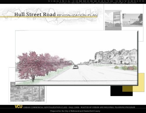
Hull Street Road Revitalization Plan - College of Humanities and ...
Hull Street Road Revitalization Plan - College of Humanities and ...
Hull Street Road Revitalization Plan - College of Humanities and ...

You also want an ePaper? Increase the reach of your titles
YUMPU automatically turns print PDFs into web optimized ePapers that Google loves.
page intentionally blank
<strong>Hull</strong> <strong>Street</strong> <strong>Road</strong> <strong>Revitalization</strong> <strong>Plan</strong><br />
Acknowledgements<br />
The development <strong>of</strong> this plan would not have been possible without the generous assistance <strong>and</strong><br />
commitments from various organizations <strong>and</strong> individuals whom we wish to acknowledge.<br />
For their guidance <strong>and</strong> feedback throughout the process, we thanks Brooke Hardin, Deputy Director<br />
<strong>of</strong> Community Development for the City <strong>of</strong> Richmond <strong>and</strong> Tom Jacobson, Director <strong>of</strong> Community<br />
<strong>Revitalization</strong> for Chesterfield County.<br />
We are also very grateful to Cary Brown <strong>of</strong> the City <strong>of</strong> Richmond Department <strong>of</strong> Economic <strong>Revitalization</strong>,<br />
as well as Kirk Turner, Steven Haasch <strong>and</strong> Zachary Mayo <strong>of</strong> the Chesterfield County <strong>Plan</strong>ning<br />
Department <strong>and</strong> Will Davis <strong>and</strong> Karen Aylward <strong>of</strong> the Chesterfield County Economic Development<br />
Department.<br />
We extend our thanks to all who participated in our surveys <strong>and</strong> interviews, including <strong>Hull</strong> <strong>Street</strong> <strong>Road</strong><br />
business <strong>and</strong> property owners, real estate agents, <strong>and</strong> patrons <strong>and</strong> customers <strong>of</strong> <strong>Hull</strong> <strong>Street</strong> <strong>Road</strong><br />
businesses.<br />
We also acknowledge Anita Nadal, Hispanic Liason for Virginia Commonwealth University, <strong>and</strong> Gabriel<br />
Gonzalez for their help with translations <strong>and</strong> surveys for the Hispanic community.<br />
Finally, we wish to thank the <strong>Hull</strong> <strong>Street</strong> <strong>Road</strong> community for allowing us the opportunity to spend<br />
several months in their area. It is our hope that you find our recommendations helpful.
<strong>Hull</strong> <strong>Street</strong> <strong>Road</strong> <strong>Revitalization</strong> <strong>Plan</strong><br />
contents <strong>of</strong> the plan<br />
Executive Summary 1<br />
I. Introduction<br />
Study Methods 4<br />
II. Overview <strong>of</strong> <strong>Plan</strong>ning Area<br />
Background <strong>and</strong> History 6<br />
Related <strong>Plan</strong>s 7<br />
Surrounding Influences 9<br />
Spatial Structure 12<br />
Circulation 13<br />
Building Size <strong>and</strong> Use 15<br />
Zoning 17<br />
Hard <strong>and</strong> S<strong>of</strong>t Areas 19<br />
III. SWOT Analysis<br />
Strengths 20<br />
Weaknesses 21<br />
Opportunities 25<br />
Threats 27<br />
IV. <strong>Revitalization</strong> <strong>Plan</strong> for <strong>Hull</strong> <strong>Street</strong> <strong>Road</strong><br />
Vision 28<br />
Development Goals 29<br />
Organizational Goals 37<br />
Physical Goals 39<br />
Financing Options 44<br />
Conclusion 45<br />
Sources 46
page intentionally blank
<strong>Hull</strong> <strong>Street</strong> <strong>Road</strong> <strong>Revitalization</strong> <strong>Plan</strong><br />
EXECUTIVE SUMMARY<br />
The <strong>Hull</strong> <strong>Street</strong> <strong>Road</strong> commercial corridor is situated on both sides <strong>of</strong> Chippenham Parkway, from Warwick <strong>Road</strong> in the City <strong>of</strong> Richmond to the<br />
Route 360 West Shopping Center in Chesterfield County. The unprecendented collaboration between the City <strong>of</strong> Richmond <strong>and</strong> Chesterfield<br />
County in this planning process provides an opportunity for revitalization on both sides <strong>of</strong> Chippenham Parkway. <strong>Hull</strong> <strong>Street</strong> <strong>Road</strong> is centrally<br />
located among major transporation routes, including Jefferson Davis Highway, Midlothian Turnpike, Chippenham Parkway, <strong>and</strong> Interstate 95,<br />
providing easy access to <strong>and</strong> from the corridor, but also leading many to focus on the corridor solely as a major arterial route for commuters. The<br />
corridor is also home to many commercial businesses who serve nearby residential neighborhoods with needed convenience goods. In addition, a<br />
thriving Hispanic business cluster that provides speciality goods to the growing Hispanic population is located here.<br />
Despite these assets, <strong>Hull</strong> <strong>Street</strong> <strong>Road</strong> faces numerous challenges. The corridor is surrounded by many shopping centers that provide goods <strong>and</strong><br />
attractions that <strong>Hull</strong> <strong>Street</strong> <strong>Road</strong> does not <strong>of</strong>fer. Shoppers <strong>and</strong> business owners perceive the area to be unsafe. The corridor also does not provide<br />
easy or safe access to shopping from nearby neighborhoods because <strong>of</strong> its lack <strong>of</strong> sidewalks <strong>and</strong> crosswalks. The most challenging aspect,<br />
however, is the lack <strong>of</strong> design unity between the city <strong>and</strong> county portions <strong>of</strong> the corridor. The corridor lacks l<strong>and</strong>scaping, building design guidelines,<br />
<strong>and</strong> pedestrian-scale amenities that could create a sense <strong>of</strong> comfort <strong>and</strong> enclosure for shoppers <strong>and</strong> drivers alike.<br />
Despite these weaknesses, <strong>Hull</strong> <strong>Street</strong> <strong>Road</strong> has many opportunities for revitalization. The area already serves as a central location for Hispanic<br />
goods <strong>and</strong> services for the Richmond area. Encouraging growth <strong>of</strong> this market will increase its ability to attract shoppers from surrounding areas<br />
<strong>and</strong> the region. Past development patterns in the corridor have also left many undeveloped <strong>and</strong> underutilized parcels that can be used to attract<br />
new businesses to the area.<br />
A market analyis conducted for this plan revealed unmet dem<strong>and</strong> for several businesses, including fast food restaurants, laundry businesses,<br />
tobacco products, household furnishings, entertainment goods <strong>and</strong> services, <strong>and</strong> specialty apparel, such as watches <strong>and</strong> shoes. These findings,<br />
conditions currently found in the area, <strong>and</strong> survey responses are the basis for the following recommendations.<br />
I. Development<br />
• Develop a Hispanic Business Cluster providing Hispanic goods, food, <strong>and</strong> entertainment, for both the local Hispanic Ccommunity <strong>and</strong> the<br />
surrounding Metropolitan Richmond community.<br />
• Develop an open-air shopping mall, surrounding a central courtyard containing design elements from Spanish Revival style.<br />
• Attract <strong>and</strong> foster the development <strong>of</strong> new Hispanic-run businesses.<br />
• Develop a public open space within the courtyard <strong>of</strong> the open-air shopping mall.<br />
• Develop an open-air Farmers Market that includes Hispanic food <strong>and</strong> goods among produce from local farmers.<br />
• Create a Hispanic Community Center.<br />
Page 1
<strong>Hull</strong> <strong>Street</strong> <strong>Road</strong> <strong>Revitalization</strong> <strong>Plan</strong><br />
• Create a thriving entertainment cluster by encouraging the placement <strong>of</strong> moderately-priced restaurants, bars <strong>and</strong> movie theater at<br />
opportunity sites along the corridor.<br />
• Identify potential development sites near intersections <strong>of</strong> major corridors to enable new entertainment venues to effectively compete.<br />
• Attract a small movie theater to the <strong>Hull</strong> <strong>Street</strong> <strong>Road</strong> corridor.<br />
• Identify potential moderately priced restaurants br<strong>and</strong>s planning to start individual restaurants willing to locate to the <strong>Hull</strong> <strong>Street</strong> <strong>Road</strong><br />
corridor.<br />
• Promote <strong>and</strong> advertise the development <strong>of</strong> an entertainment <strong>and</strong> retail activity node.<br />
• Create a contractor <strong>and</strong> construction services business node, making them more accessible to area residents <strong>and</strong> contracting pr<strong>of</strong>essionals,<br />
<strong>and</strong> strengthening those types <strong>of</strong> businesses already found in the study area.<br />
• Identify one site with a minimum <strong>of</strong> 10 continguous acres that would support multiple contractor-oriented businesses.<br />
• Idenfity a minimum <strong>of</strong> five contractor-oriented businesses that are interested in locating along the corridor.<br />
• Secure redevelopment agreements with all owners <strong>of</strong> properties identified as suitable to support contractor-oriented business<br />
functions.<br />
• Provide technical assistance to all property owners to facilitate agreement with developer(s) to construct <strong>of</strong>fice <strong>and</strong> warehouse<br />
facilities for contractor business operations.<br />
• Develop a senior living center for residents 55 <strong>and</strong> older. A medical rehabilitation facility should be located next to the community.<br />
• Identify one site that would support a senior living community <strong>and</strong> rehabilitation center for residents 55 <strong>and</strong> over.<br />
II. Organization<br />
• Retain <strong>and</strong> strengthen existing businesses by providing the resources they require to remain competitive <strong>and</strong> attract customers to the <strong>Hull</strong><br />
<strong>Street</strong> <strong>Road</strong> corridor.<br />
• Create a <strong>Hull</strong> <strong>Street</strong> <strong>Road</strong> Business Retention <strong>and</strong> Improvement Task Force.<br />
• Form a Business Association consisting <strong>of</strong> property owners <strong>and</strong> business owners (representatives) from throughout the <strong>Hull</strong> <strong>Street</strong> <strong>Road</strong><br />
study area.<br />
• Work with locally owned businesses <strong>and</strong> local property owners to develop a Business Association for all businesses along the<br />
corridor.<br />
• Develop a Hispanic Business subcommittee within the Business Association.<br />
• Attract corporate-owned businesses to become involved in the <strong>Hull</strong> <strong>Street</strong> <strong>Road</strong> Business Association.<br />
• Provide assistance to businesses <strong>and</strong> developers seeking to redevelop property along the corridor.<br />
• Incentivize redevelopment through the creation <strong>of</strong> an expedited approval process for business owners <strong>and</strong> developers.<br />
• Provide technical assistance to all property owners to facilitate agreement with developer(s).<br />
Page 2
<strong>Hull</strong> <strong>Street</strong> <strong>Road</strong> <strong>Revitalization</strong> <strong>Plan</strong><br />
III. Physical/Design<br />
• Create an aesthetically pleasing community, uniting the corridor <strong>and</strong> establishing a sense <strong>of</strong> place within it.<br />
• Develop a set a guidelines for the exterior <strong>of</strong> buildings along <strong>Hull</strong> <strong>Street</strong> <strong>Road</strong>.<br />
• Adopt the design guidelines as an ordinance.<br />
• Bury overhead power lines complying with High Performance Infrastructure guidelines.<br />
• Develop amenities to increase pedestrian <strong>and</strong> vehicular safety throughout the <strong>Hull</strong> <strong>Street</strong> <strong>Road</strong> Corridor <strong>and</strong> surrounding neighborhoods.<br />
• Widen <strong>and</strong> repair the city portion <strong>of</strong> <strong>Hull</strong> <strong>Street</strong> <strong>Road</strong> to provide a wider <strong>and</strong> l<strong>and</strong>scaped median.<br />
• Reduce the number <strong>of</strong> curb cuts along <strong>Hull</strong> <strong>Street</strong> <strong>Road</strong>.<br />
• Develop a l<strong>and</strong>scaping pattern using native, drought-resistant vegetation on either side <strong>of</strong> the road where possible.<br />
• Continue the GRTC bus line to Route 360 West Shopping Center<br />
• Establish crosswalks <strong>and</strong> pedestrian crossing signals.<br />
• Construct sidewalks from neighboring communities into shopping centers <strong>and</strong> major attractions along <strong>Hull</strong> <strong>Street</strong> <strong>Road</strong>.<br />
• Create a safe community where both local residents <strong>and</strong> individuals from the Metro Richmond area feel safe during both the day <strong>and</strong> night.<br />
• All improvements along the corridor shall follow Crime Prevention Through Environmental Design (CPTED) principles.<br />
• Increase the police presence.<br />
• Hire private security to patrol commercial locations.<br />
• Develop community programs regarding neighborhood policing.<br />
• Adopt <strong>and</strong> increase environmental st<strong>and</strong>ards in the <strong>Hull</strong> <strong>Street</strong> <strong>Road</strong> study area <strong>and</strong> make the area a showcase for green building <strong>and</strong><br />
infrastructure.<br />
• Employ low-impact, environmentally-beneficial l<strong>and</strong>scaping <strong>and</strong> stormwater management techniques that also improve the aesthetic<br />
appearance <strong>of</strong> the area.<br />
• Require residential <strong>and</strong> commercial building construction <strong>and</strong> renovation to meet minimum LEED or EarthCraft certification levels.<br />
This <strong>Hull</strong> <strong>Street</strong> <strong>Road</strong> <strong>Revitalization</strong> <strong>Plan</strong> is accompanied by a technical appendix <strong>and</strong> a synopsis, both under separate covers.<br />
Page 3
page intentionally blank
<strong>Hull</strong> <strong>Street</strong> <strong>Road</strong> <strong>Revitalization</strong> <strong>Plan</strong><br />
I. Introduction<br />
The <strong>Hull</strong> <strong>Street</strong> <strong>Road</strong> <strong>Revitalization</strong> <strong>Plan</strong> is a tool whose purpose is to<br />
help to guide future development in the study area. Its recommendations<br />
seek to infuse a new sense <strong>of</strong> vitality into this aging regional corridor that<br />
is located near a number <strong>of</strong> competitive retail markets.<br />
At the request <strong>of</strong> both Chesterfield County’s Department <strong>of</strong> Community<br />
<strong>Revitalization</strong> <strong>and</strong> the City <strong>of</strong> Richmond’s Department <strong>of</strong> Community<br />
Development, the VCU study team examined the portion <strong>of</strong> <strong>Hull</strong> <strong>Street</strong><br />
<strong>Road</strong> that spans both localities—from Warwick <strong>Road</strong> in the city to<br />
the Route 360 West Shopping Center in the county, <strong>and</strong> across the<br />
physical <strong>and</strong> psychological divide <strong>of</strong> Chippenham Parkway. See map,<br />
page 11. The study team strived to create a plan that would seize<br />
upon the corridor’s strengths, minimize or eliminate its weaknesses,<br />
encourage unity between the two localities <strong>and</strong> identify unique economic<br />
opportunities available along the corridor. Significantly, this is the first<br />
plan developed as the direct result <strong>of</strong> the two localities’ collaboration on<br />
a shared corridor.<br />
The study team was asked to focus primarily on design <strong>and</strong> economic<br />
restructuring issues.<br />
Study Methods<br />
In order to gain a greater underst<strong>and</strong>ing <strong>of</strong> how various stakeholders<br />
view the <strong>Hull</strong> <strong>Street</strong> <strong>Road</strong> corridor <strong>and</strong> how it functions economically,<br />
the VCU study team designed <strong>and</strong> employed a number <strong>of</strong> research<br />
methods. These included a series <strong>of</strong> surveys <strong>and</strong> a market analysis<br />
<strong>of</strong> supply <strong>and</strong> dem<strong>and</strong> for goods <strong>and</strong> services in the area, as well as<br />
observation <strong>of</strong> design <strong>and</strong> physical elements.<br />
To begin, the study team designed a series <strong>of</strong> surveys that gauged<br />
participants’ general impressions <strong>of</strong> the <strong>Hull</strong> <strong>Street</strong> <strong>Road</strong> corridor <strong>and</strong><br />
desires for change. A different survey was used for each category <strong>of</strong><br />
stakeholders:<br />
Surveys 1<br />
• Customer Survey<br />
• Merchant Survey<br />
• Property Owner Survey<br />
• Real Estate Agent Survey<br />
• Pastor/Minister Survey<br />
This document presents the research process <strong>and</strong> the plan. The first<br />
section covers background <strong>and</strong> history, existing studies <strong>and</strong> methods.<br />
The following section provides an overview <strong>of</strong> the study area. The next<br />
section examines the corridor’s strengths, weaknesses, opportunities<br />
<strong>and</strong> threats in light <strong>of</strong> the existing conditions. The document concludes<br />
with the study team’s vision <strong>and</strong> recommendations for the future <strong>of</strong> the<br />
<strong>Hull</strong> <strong>Street</strong> <strong>Road</strong> corridor.<br />
The VCU team also conducted a market analysis <strong>of</strong> the study area’s<br />
larger convenience trade area. This involved drawing the trade area’s<br />
boundaries, conducting a windshield survey <strong>of</strong> all operating businesses<br />
in the trade area, collecting data on product supply <strong>and</strong> dem<strong>and</strong>, <strong>and</strong><br />
determining <strong>Hull</strong> <strong>Street</strong> <strong>Road</strong>’s ability to absorb additional types <strong>of</strong><br />
businesses. 2 Map 1 on page 5 shows the convenience trade area.<br />
Page 4<br />
1<br />
Refer to Appendix C for survey instruments <strong>and</strong> quantitative results<br />
2<br />
Refer to Appendix E for detailed market analysis results <strong>and</strong> trade area
<strong>Hull</strong> <strong>Street</strong> <strong>Road</strong> <strong>Revitalization</strong> <strong>Plan</strong><br />
introduction<br />
Finally, the VCU team looked at another important aspect <strong>of</strong> the<br />
corridor—its design characteristics. The group made multiple trips to<br />
the area, surveying <strong>and</strong> assessing the corridor’s urban design features<br />
in a number <strong>of</strong> measurable areas.<br />
Urban Design Analysis 3<br />
• Sidewalks<br />
• L<strong>and</strong>scaping<br />
• Pedestrian Amenities<br />
• Signage<br />
• Utilities<br />
Map 1: Location <strong>of</strong> <strong>Hull</strong> <strong>Street</strong> <strong>Road</strong> Corridor Study Area <strong>and</strong> Convenience Trade Area.<br />
3<br />
Refer to Appendix G for survey instruments <strong>and</strong> quantitative results<br />
Page 5
<strong>Hull</strong> <strong>Street</strong> <strong>Road</strong> <strong>Revitalization</strong> <strong>Plan</strong><br />
II. Overview <strong>of</strong> <strong>Plan</strong>ning Area<br />
Background & History<br />
The evolution <strong>of</strong> <strong>Hull</strong> <strong>Street</strong> <strong>Road</strong> is a classic example <strong>of</strong> rapid post-<br />
World War II commercial development <strong>and</strong> sprawl. While the portion <strong>of</strong><br />
<strong>Hull</strong> <strong>Street</strong> <strong>Road</strong> close to downtown Richmond traces its roots to the<br />
commercial <strong>and</strong> industrial port activities <strong>of</strong> Manchester, the corridor’s<br />
westward expansion has been shaped by the rise <strong>of</strong> the automobile <strong>and</strong><br />
growth <strong>of</strong> the region’s population.<br />
Following World War II, new buildings <strong>and</strong> businesses, as well as new<br />
neighborhoods <strong>and</strong> housing developments, emerged. <strong>Road</strong>ways were<br />
built <strong>and</strong> more public services provided as a result <strong>of</strong> this growth. The<br />
trend <strong>of</strong> growth continued <strong>and</strong> between 1970 <strong>and</strong> 1990, as Chesterfield<br />
County’s population grew from 76,855 to 209,274 people. Several roads<br />
<strong>and</strong> highways including Chippenham Parkway, which bisects the study<br />
area, were built to serve the population <strong>and</strong> to move more vehicles<br />
through the area.<br />
Figure 1: Elkhard Middle School is located in the City <strong>of</strong><br />
Richmond within the central portion <strong>of</strong> the corridor.<br />
Aside from a small h<strong>and</strong>ful <strong>of</strong> important institutional buildings such<br />
as Ramsey Memorial United Methodist Church located at 5900 <strong>Hull</strong><br />
<strong>Street</strong> or Elkhardt Middle School at 6300 <strong>Hull</strong> <strong>Street</strong>, there are very few<br />
buildings within the study area that are more than 40 years old.<br />
Figure 2: Ramsey Memorial Church is one <strong>of</strong> the most<br />
historic buildings along the corridor.<br />
Page 6
<strong>Hull</strong> <strong>Street</strong> <strong>Road</strong> <strong>Revitalization</strong> <strong>Plan</strong><br />
overview <strong>of</strong> planning area<br />
Related <strong>Plan</strong>s<br />
The <strong>Hull</strong> <strong>Street</strong> <strong>Road</strong> corridor is referenced in several area plans<br />
produced by both the City <strong>of</strong> Richmond <strong>and</strong> Chesterfield County. These<br />
plans provide insight into the goals each jurisdiction has for the corridor<br />
as well as goals for the area as a whole. The City <strong>of</strong> Richmond has<br />
three plans that discuss the <strong>Hull</strong> <strong>Street</strong> <strong>Road</strong> corridor; Chesterfield<br />
County has one plan.<br />
City <strong>of</strong> Richmond’s Master <strong>Plan</strong> 2000 – 2020<br />
Richmond’s current comprehensive planning document, the Master <strong>Plan</strong><br />
2000 – 2020, presents the city’s overall mission statement as well as<br />
goals, strategies <strong>and</strong> directions areas. While the plan does not mention<br />
<strong>Hull</strong> <strong>Street</strong> <strong>Road</strong> in any great detail, it suggests further analysis <strong>of</strong> all<br />
areas <strong>of</strong> the corridor. <strong>Hull</strong> <strong>Street</strong> <strong>Road</strong> is the dividing line between the<br />
Midlothian <strong>and</strong> Broad Rock planning districts. Each district’s plan is<br />
discussed below.<br />
Broad Rock <strong>Plan</strong>ning District <strong>Plan</strong><br />
The Broad Rock area plan is a subsection <strong>of</strong> the city’s master plan. The<br />
plan identifies <strong>Hull</strong> <strong>Street</strong> <strong>Road</strong> as a mostly commercial corridor that<br />
features mainly marginalized businesses, although several development<br />
opportunities along the corridor exist due to vacant l<strong>and</strong>. It identifies the<br />
interest <strong>of</strong> the Virginia Department <strong>of</strong> Transportation (VDOT) in widening<br />
<strong>Hull</strong> <strong>Street</strong> between Elkhardt <strong>and</strong> Dixon <strong>Road</strong>s from four lanes to six<br />
lanes. Bike routes are also planned for the corridor.<br />
multi-family residential (medium density), <strong>and</strong> a housing opportunity<br />
area. The housing opportunity area (HOA) is located at the southeast<br />
corner <strong>of</strong> <strong>Hull</strong> <strong>Street</strong> <strong>Road</strong> <strong>and</strong> Warwick <strong>Road</strong>, which the city states is<br />
appropriate for higher density residential development, such as town<br />
homes, if done properly.<br />
The Broad Rock <strong>Plan</strong>ning District <strong>Plan</strong> suggests further study <strong>of</strong> <strong>Hull</strong><br />
<strong>Street</strong> <strong>Road</strong>.<br />
Midlothian <strong>Plan</strong>ning District <strong>Plan</strong><br />
<strong>Hull</strong> <strong>Street</strong> <strong>Road</strong> forms the southern boundary <strong>of</strong> the Midlothian <strong>Plan</strong>ning<br />
District in the City <strong>of</strong> Richmond. This area plan focuses on the north<br />
side <strong>of</strong> the corridor. Current l<strong>and</strong> uses along this side <strong>of</strong> the corridor<br />
include commercial, single family residential, <strong>of</strong>fice, public l<strong>and</strong>, as well<br />
as a considerable amount <strong>of</strong> vacant l<strong>and</strong>. In the Midlothian district,<br />
the expansion <strong>of</strong> commercial uses is seen as a threat to the adjacent<br />
residential neighborhoods. The plan calls for future l<strong>and</strong> uses <strong>of</strong><br />
community commercial, single family residential, mixed use <strong>and</strong> public<br />
uses. Elkhardt Middle School is on this side <strong>of</strong> the corridor. The plan<br />
proposes a new road as well as bike routes, <strong>and</strong> additional lanes along<br />
<strong>Hull</strong> <strong>Street</strong> <strong>Road</strong>.<br />
The Midlothian <strong>Plan</strong>ning District <strong>Plan</strong> also suggests further study <strong>of</strong> <strong>Hull</strong><br />
<strong>Street</strong> <strong>Road</strong>.<br />
While the primary focus <strong>of</strong> the Broad Rock plan is on Jefferson Davis<br />
Highway, it does have some suggestions for the southern side <strong>of</strong> the<br />
<strong>Hull</strong> <strong>Street</strong> <strong>Road</strong> corridor which forms the northern boundary <strong>of</strong> the plan<br />
area. One <strong>of</strong> the goals is to resolve l<strong>and</strong> use conflicts along the corridor;<br />
another is to develop the corridor’s vacant l<strong>and</strong>. A need for public park<br />
space in the area is identified. Future l<strong>and</strong> uses planned for the corridor<br />
include community commercial, single family residential (low density),<br />
Page 7
<strong>Hull</strong> <strong>Street</strong> <strong>Road</strong> <strong>Revitalization</strong> <strong>Plan</strong><br />
overview <strong>of</strong> planning area<br />
Chesterfield County’s Route 360 Corridor <strong>Plan</strong><br />
Chesterfield County’s 1995 (reformatted in 2006) plan for the <strong>Hull</strong> <strong>Street</strong><br />
<strong>Road</strong> corridor seeks to create a “quality mixed use business corridor.”<br />
The plan addresses several major goals for the corridor, such as:<br />
• Provide for future dem<strong>and</strong>s on business <strong>and</strong> residential<br />
conversion <strong>of</strong> l<strong>and</strong> to new uses<br />
• Minimize traffic congestion<br />
• Improve access for motorists <strong>and</strong> pedestrians<br />
• Implement aesthetic enhancements<br />
One <strong>of</strong> the major elements <strong>of</strong> the plan is the creation <strong>of</strong> a new corridor<br />
center at the northeast corner <strong>of</strong> Hicks <strong>Road</strong> <strong>and</strong> Route 360 (<strong>Hull</strong> <strong>Street</strong><br />
<strong>Road</strong>). This commercial center would serve motorists <strong>and</strong> nearby<br />
residents. This concept was presented following the Route 360 Market<br />
Trends Study.<br />
The plan presents several recommendations for the corridor. Some <strong>of</strong><br />
the recommendations include:<br />
• Focus on mixed-use development<br />
• Cluster development, especially in the corridor center area<br />
• Create a convenience goods niche because <strong>of</strong> nearby<br />
competition<br />
• Encourage a pedestrian system linking key locations<br />
• Create design guidelines<br />
• Upgrade transportation systems by closing crossovers that do not<br />
have signals <strong>and</strong> installing up to four more traffic signals<br />
• Widen the Chesterfield section <strong>of</strong> <strong>Hull</strong> <strong>Street</strong> <strong>Road</strong><br />
Current l<strong>and</strong> uses along <strong>Hull</strong> <strong>Street</strong> <strong>Road</strong> in Chesterfield County include<br />
residential, commercial, <strong>of</strong>fice, <strong>and</strong> open space. The county has four<br />
major objectives for the corridor, with several strategies under each:<br />
• Maintain vitality <strong>and</strong> attractiveness as a mixed use corridor<br />
• Enhance the potential for prosperous commerce<br />
• Enhance public facilities <strong>and</strong> services to encourage infill<br />
development<br />
• Provide a safe, efficient transportation system<br />
Page 8
<strong>Hull</strong> <strong>Street</strong> <strong>Road</strong> <strong>Revitalization</strong> <strong>Plan</strong><br />
Overview <strong>of</strong> planning area<br />
Surrounding Influences<br />
The <strong>Hull</strong> <strong>Street</strong> <strong>Road</strong> study area is influenced by a number <strong>of</strong> nearby<br />
uses, such as shopping centers, schools, residential neighborhoods <strong>and</strong><br />
its close proximity to a number <strong>of</strong> major arterial roads.<br />
Schools<br />
Schools located in the <strong>Hull</strong> <strong>Street</strong> <strong>Road</strong> area impact traffic patterns when<br />
they open <strong>and</strong> close. Within the Richmond study area <strong>of</strong> the <strong>Hull</strong> <strong>Street</strong><br />
<strong>Road</strong> corridor, there is Elkhardt Middle School, <strong>and</strong> two elementary<br />
schools, G.H. Reid <strong>and</strong> J.L. Francis Elementary. Chesterfield County<br />
has four schools in close proximity to the study area <strong>of</strong> <strong>Hull</strong> <strong>Street</strong> <strong>Road</strong>,<br />
including two middle, Manchester Middle <strong>and</strong> Providence Middle, <strong>and</strong><br />
two elementary schools, Chalkley Elementary <strong>and</strong> Davis Elementary. 4<br />
Hospitals<br />
Hunter Holmes McGuire VA Medical Center is located at 1201 Broad<br />
Rock Boulevard in the Richmond side <strong>of</strong> the study area. It contains 427<br />
beds <strong>and</strong> acts as a tertiary care center. The services are available to<br />
over 200,000 veterans who travel to the facility from over 52 cities <strong>and</strong><br />
counties across central <strong>and</strong> southern Virginia, as well as parts <strong>of</strong> North<br />
Carolina. 5<br />
<strong>Road</strong>s<br />
Chippenham Parkway (Route 150) bisects the <strong>Hull</strong> <strong>Street</strong> <strong>Road</strong><br />
commercial corridor at the city/county line. It is a major arterial road<br />
connecting city <strong>and</strong> county residents to I-95 while bypassing the City<br />
<strong>of</strong> Richmond to the southwest As a major arterial road, Chippenham<br />
Parkway connects many <strong>of</strong> the minor arterial roads extending out from<br />
the City <strong>of</strong> Richmond. Chippenham Parkway provides easy accessibility<br />
to residents <strong>and</strong> drivers to both enter <strong>and</strong> leave the <strong>Hull</strong> <strong>Street</strong> <strong>Road</strong><br />
commercial corridor.<br />
Richmond-Petersburg Turnpike (I-95) connects Canada to Miami,<br />
Florida traveling up the east coast <strong>of</strong> the United States. It provides easy<br />
access for travelers from far distances into the <strong>Hull</strong> <strong>Street</strong> <strong>Road</strong> corridor.<br />
It is a major arterial road for transporting goods.<br />
Midlothian Turnpike (Route 60) is an east-west corridor that branches <strong>of</strong>f<br />
<strong>of</strong> <strong>Hull</strong> <strong>Street</strong> in the City <strong>of</strong> Richmond <strong>and</strong> runs parallel to the <strong>Hull</strong> <strong>Street</strong><br />
<strong>Road</strong> commercial corridor. The Midlothian Turnpike contains a mixture<br />
<strong>of</strong> retail, <strong>of</strong>fice, <strong>and</strong> residential space, similar to that <strong>of</strong> <strong>Hull</strong> <strong>Street</strong><br />
<strong>Road</strong>. However, in recent years Midlothian Turnpike has received more<br />
development <strong>and</strong> investment than <strong>Hull</strong> <strong>Street</strong> <strong>Road</strong>, <strong>and</strong> with its close<br />
proximity, Midlothian Turnpike has the potential to continue siphoning <strong>of</strong>f<br />
potential investors from <strong>Hull</strong> <strong>Street</strong> <strong>Road</strong>.<br />
Neighborhoods<br />
Overall, the neighborhoods surrounding the study area are older,<br />
established single-family residences <strong>and</strong> several multi-family apartment<br />
complexes. Field observations indicated that these two types <strong>of</strong><br />
residences were generally well-kept. Problems such as visible dwelling<br />
deterioration <strong>and</strong> subst<strong>and</strong>ard yard maintenance were not observed;<br />
however, there is a trailer park visible from <strong>Hull</strong> <strong>Street</strong> <strong>Road</strong> within the<br />
Richmond section <strong>of</strong> the study area that appears to be in poor condition.<br />
4<br />
See Appendix B additional schools information<br />
5<br />
See Appendix B for additional hospital informtion<br />
Broad <strong>Street</strong> (Route 250) is an east-west corridor that runs from<br />
Richmond to S<strong>and</strong>usky, Ohio. In the Richmond region, it parallels I-64<br />
<strong>and</strong> serves as a major commercial corridor. Broad <strong>Street</strong> is home to<br />
numerous shopping centers, including Short Pump Town Center; its<br />
variety <strong>and</strong> convenience combine to draw customers from across the<br />
central Virginia region.<br />
Jefferson Davis Highway (Route 1) is a north-south corridor that<br />
parallels I-95 <strong>and</strong> provides easy access in <strong>and</strong> out <strong>of</strong> the metropolitan<br />
area. It follows the coast, connecting Key West, Florida to Canada. In<br />
Richmond <strong>and</strong> Chesterfield, the Jefferson Davis Highway is surrounded<br />
by older neighborhoods, commercial buildings, <strong>and</strong> manufacturing. It is<br />
an area prone to blight <strong>and</strong> is therefore a focus for revitalization efforts.<br />
Page 9
<strong>Hull</strong> <strong>Street</strong> <strong>Road</strong> <strong>Revitalization</strong> <strong>Plan</strong><br />
Overview <strong>of</strong> planning area<br />
Surrounding Shopping Centers<br />
The closest <strong>and</strong> perhaps most significant<br />
influence on the <strong>Hull</strong> <strong>Street</strong> <strong>Road</strong><br />
commercial corridor is Southside Plaza,<br />
located about one mile east <strong>of</strong> the study<br />
area. This shopping center has a range<br />
<strong>of</strong> goods <strong>and</strong> services from general<br />
convenience stores, hair salons, fast food,<br />
<strong>and</strong> auto repair shops to check cashing,<br />
clothing <strong>and</strong> rent-to-own furniture <strong>and</strong><br />
appliance stores. Many <strong>of</strong> the businesses<br />
within the <strong>Hull</strong> <strong>Street</strong> <strong>Road</strong> corridor study<br />
area <strong>of</strong>fer these same goods <strong>and</strong> services.<br />
Map 2: Surrounding shopping centers.<br />
Other shopping centers worth noting<br />
include: Chippenham Square (3 miles west),<br />
Beaufont Shopping Center (3 miles north),<br />
Meadowbrook Plaza Shopping Center (4<br />
miles south), Chesterfield Towne Center (6.5<br />
miles west) <strong>and</strong> Stony Point Fashion Park<br />
(9 miles north). Several shopping centers<br />
such as Chippenham Square, Beaufont<br />
Shopping Center <strong>and</strong> Meadowbrook Plaza<br />
<strong>of</strong>fer many <strong>of</strong> the same convenience goods<br />
<strong>and</strong> services found within the study corridor.<br />
Retail centers such as Chesterfield Towne<br />
Center <strong>and</strong> Stony Point Fashion Park <strong>of</strong>fer<br />
a greater number <strong>of</strong> stores <strong>and</strong> selection <strong>of</strong><br />
upscale shoppers’ goods, such as clothing,<br />
books, jewelry <strong>and</strong> dining.<br />
Page 10
Map 3: <strong>Hull</strong> <strong>Street</strong> <strong>Road</strong> spatial structure.<br />
Page 11
<strong>Hull</strong> <strong>Street</strong> <strong>Road</strong> <strong>Revitalization</strong> <strong>Plan</strong><br />
Overview <strong>of</strong> planning area<br />
Spatial Structure<br />
Location/Concentration <strong>of</strong> Uses & Adjacent Uses<br />
Commercial structures <strong>and</strong> uses dominate the l<strong>and</strong>scape <strong>of</strong> <strong>Hull</strong> <strong>Street</strong><br />
<strong>Road</strong>; however, there are pockets <strong>of</strong> residential development found<br />
along the corridor in the City <strong>of</strong> Richmond. One <strong>of</strong> the houses appears<br />
to be vacant, but the others are occupied. There is also an assisted<br />
living or group home located at the intersection <strong>of</strong> Linwood Avenue <strong>and</strong><br />
<strong>Hull</strong> <strong>Street</strong> <strong>Road</strong>. In addition, there is a small mobile home park located<br />
across from the vacant Pinebrook Estates apartment complex, as well<br />
as Chippenham Place Apartments.<br />
Some concentrations <strong>of</strong> related businesses are evident along the<br />
corridor. Uses at the intersection <strong>of</strong> Warwick <strong>Road</strong> <strong>and</strong> <strong>Hull</strong> <strong>Street</strong> <strong>Road</strong><br />
are primarily convenience retail, including a Walgreens Pharmacy,<br />
Valero gas station <strong>and</strong> convenience store, <strong>and</strong> Dollar General store.<br />
A short distance west <strong>of</strong> the Valero station is the Salvage Barn, a<br />
large warehouse-type store on the north side <strong>of</strong> <strong>Hull</strong> <strong>Street</strong> <strong>Road</strong>, <strong>and</strong><br />
some smaller adjacent businesses. Just past this intersection as one<br />
travels west on <strong>Hull</strong> <strong>Street</strong> <strong>Road</strong> is a small cluster <strong>of</strong> motor vehiclerelated<br />
businesses. These include Departure Bike Works immediately<br />
behind the Valero station on the north side <strong>of</strong> <strong>Hull</strong> <strong>Street</strong> <strong>Road</strong> <strong>and</strong><br />
Hoyt’s tire shop, a short distance west on the other side <strong>of</strong> the street.<br />
Businesses around Hoyt’s include a used-car sales lot located to the<br />
west <strong>and</strong> a general auto repair shop across the street. Traveling west<br />
along <strong>Hull</strong> <strong>Street</strong> <strong>Road</strong>, a sporadic pattern <strong>of</strong> auto repair shops <strong>and</strong><br />
automotive sales lots is found between Warwick <strong>Road</strong> <strong>and</strong> Chippenham<br />
Parkway. In the Chesterfield portion <strong>of</strong> the corridor study area, a similar<br />
automotive business cluster is found at the intersection <strong>of</strong> <strong>Hull</strong> <strong>Street</strong><br />
<strong>Road</strong> <strong>and</strong> Tacony Drive. Each <strong>of</strong> these light-industrial businesses<br />
operates in close proximity to residential areas just <strong>of</strong>f <strong>Hull</strong> <strong>Street</strong> <strong>Road</strong>.<br />
The map on page 10 shows the locations <strong>of</strong> these concentrations <strong>and</strong><br />
buildings.<br />
From Linwood Avenue west to Berrywood <strong>Road</strong>, uses remain generally<br />
inconsistent <strong>and</strong> feature several light-industrial businesses. These<br />
include Neat Sweep Chimney Sweep, located in a Cape Cod-style<br />
house on the south side <strong>of</strong> <strong>Hull</strong> <strong>Street</strong> <strong>Road</strong> with a large, paved<br />
employee <strong>and</strong> company vehicle parking lot behind it. Farther west, on<br />
the north side <strong>of</strong> the road, is a Flowers bakery store, with an attached<br />
distribution center for the company’s products. This is evidenced<br />
by a large warehouse <strong>and</strong> loading dock with several delivery trucks<br />
present. Just beyond the Flowers store are <strong>of</strong>fices <strong>and</strong> workshops for<br />
both Comfort First Heating & Air Conditioning <strong>and</strong> Adams Heating & Air<br />
Conditioning. These heating <strong>and</strong> air conditioning companies are within<br />
100 yards <strong>of</strong> each other, though Adams occupies a significantly larger<br />
parcel <strong>and</strong> building.<br />
Infrastructure<br />
There is a noticeable lack <strong>of</strong> pedestrian amenities throughout the<br />
corridor, including sidewalks, seating, lighting <strong>and</strong> buffers between<br />
pedestrians <strong>and</strong> the street traffic. However, there are sidewalks,<br />
crosswalks, <strong>and</strong> crossing signals present at the intersection <strong>of</strong> <strong>Hull</strong><br />
<strong>Street</strong> <strong>Road</strong> <strong>and</strong> Warwick <strong>Road</strong>. This location represents some <strong>of</strong> the<br />
newer development in the corridor, <strong>and</strong> the sidewalks are in excellent<br />
condition <strong>and</strong> include curb ramps to permit full access for those with<br />
disabilities. The crossing signals were observed to function properly,<br />
though the crosswalks are badly faded <strong>and</strong> in need <strong>of</strong> repainting.<br />
The sidewalks end approximately a half mile west <strong>of</strong> the Warwick <strong>Road</strong><br />
intersection. The next occurrence <strong>of</strong> a sidewalk is on the south side <strong>of</strong><br />
<strong>Hull</strong> <strong>Street</strong> <strong>Road</strong> where a short spur connects the Chippenham Place<br />
Apartments to a bus stop at the Orcutt Lane intersection. This provides<br />
pedestrians with a relatively safe <strong>and</strong> direct path to a GRTC bus shelter<br />
located at the end <strong>of</strong> this sidewalk. There are no sidewalks for the<br />
remainder <strong>of</strong> the corridor as one proceeds west into Chesterfield County.<br />
Page 12
<strong>Hull</strong> <strong>Street</strong> <strong>Road</strong> <strong>Revitalization</strong> <strong>Plan</strong><br />
Overview <strong>of</strong> planning area<br />
Other observations:<br />
• There is open drainage from Warwick <strong>Road</strong> extending one half<br />
mile west along <strong>Hull</strong> <strong>Street</strong> <strong>Road</strong>.<br />
• Overhead utility lines are present along the entire length <strong>of</strong> the<br />
corridor.<br />
• Chesterfield possesses turning lanes <strong>and</strong> a well-marked median;<br />
owever, there do not appear to be any sidewalks in the area.<br />
• Signage throughout the entire corridor is varied <strong>and</strong> shows no<br />
planned design continuity.<br />
Connectivity<br />
Within the study corridor, there are few major intersections <strong>and</strong> many<br />
more minor ones. Major intersections include Warwick <strong>Road</strong> at the<br />
east end <strong>of</strong> the corridor, followed by (proceeding west) Elkhardt <strong>Road</strong>,<br />
Chippenham Parkway, <strong>and</strong> Turner <strong>Road</strong>. Many <strong>of</strong> the minor roads<br />
intersecting <strong>Hull</strong> <strong>Street</strong> <strong>Road</strong> are collectors <strong>and</strong> meet the corridor as a<br />
T-intersection; in several cases, minor roads meet <strong>Hull</strong> <strong>Street</strong> <strong>Road</strong> on<br />
opposite sides <strong>of</strong> the corridor in close proximity to one another, creating<br />
an “<strong>of</strong>fset intersection”. This creates potentially dangerous turning<br />
situations from these minor streets onto <strong>Hull</strong> <strong>Street</strong> <strong>Road</strong>.<br />
The lack <strong>of</strong> pedestrian amenities along <strong>Hull</strong> <strong>Street</strong> <strong>Road</strong> extends into the<br />
neighborhoods found just <strong>of</strong>f the corridor. With the exception <strong>of</strong> a short<br />
sidewalk segment that connects the Chippenham Place Apartments to<br />
the corridor, no other sidewalks connect neighborhoods with <strong>Hull</strong> <strong>Street</strong><br />
<strong>Road</strong>. GRTC bus service does not extend into these neighborhoods,<br />
<strong>and</strong> designated bike lanes are nonexistent in the area.<br />
Circulation<br />
<strong>Road</strong> Network<br />
<strong>Hull</strong> <strong>Street</strong> <strong>Road</strong> is classified as a principal arterial highway throughout<br />
the length <strong>of</strong> the study corridor. It is four lanes wide from Warwick <strong>Road</strong><br />
to Elkhardt <strong>Road</strong>. At Elkhardt it exp<strong>and</strong>s to six lanes <strong>and</strong> remains that<br />
width through the Chesterfield side <strong>of</strong> the study corridor.<br />
From a traffic-engineering st<strong>and</strong>point, the primary intent <strong>of</strong> this section<br />
<strong>of</strong> <strong>Hull</strong> <strong>Street</strong> <strong>Road</strong> is to move large volumes <strong>of</strong> traffic in an efficient<br />
manner. Zoning ordinances direct development in which shoppers must<br />
drive to their destination, park <strong>and</strong> shop, then get back in their car to visit<br />
other destinations along the corridor. The heavy traffic volumes moving<br />
at a high rate <strong>of</strong> speed make it difficult <strong>and</strong> inherently dangerous to<br />
travel along the corridor as a pedestrian.<br />
The road surface appears to be in good shape along most <strong>of</strong> the<br />
corridor. In the Chesterfield section, shoulders consist mainly <strong>of</strong> curbs<br />
with occasional cuts to allow vehicle access to driveways <strong>and</strong> parking.<br />
There is a well-maintained grassy median that runs down the center <strong>of</strong><br />
the right-<strong>of</strong>-way. On the Richmond side, however, poorly defined gravel<br />
shoulders <strong>and</strong> parking lots contribute to uncertain boundaries between<br />
public <strong>and</strong> private space. In several instances on the Richmond side,<br />
there is a noticeable trend <strong>of</strong> decay where the road edge meets the<br />
business property. Many poorly maintained parking lots consist only <strong>of</strong><br />
loose gravel <strong>and</strong> are full <strong>of</strong> potholes, <strong>and</strong> the pavement appears to stop<br />
at the street line. Many business lots are not labeled or marked clearly;<br />
consequently it is difficult to tell if they are open. The center median<br />
on the Richmond side <strong>of</strong> the corridor is narrow <strong>and</strong> poorly marked.<br />
There are also many curb cuts through the median that create small<br />
gravel isl<strong>and</strong>s, contributing to a design that appears poorly planned <strong>and</strong><br />
hazardous. 6<br />
6<br />
See Appendix A for additional maps <strong>of</strong> street hierarchy.<br />
Page 13
<strong>Hull</strong> <strong>Street</strong> <strong>Road</strong> <strong>Revitalization</strong> <strong>Plan</strong><br />
Overview <strong>of</strong> planning area<br />
Traffic Counts<br />
Pedestrian Network & Alternate Transit<br />
In the City <strong>of</strong> Richmond, the average annual daily traffic volume for the<br />
section <strong>of</strong> the <strong>Hull</strong> <strong>Street</strong> <strong>Road</strong> corridor between Belt Boulevard <strong>and</strong><br />
Hey <strong>Road</strong> is 24,000 vehicles, while the volume between Hey <strong>Road</strong> <strong>and</strong><br />
Chippenham Parkway is 33,000 vehicles per day (with 97% being two<br />
<strong>and</strong> four tire vehicles). Both sections <strong>of</strong> the <strong>Hull</strong> <strong>Street</strong> <strong>Road</strong> commercial<br />
corridor within the city received the lowest annual average daily traffic<br />
quality rating <strong>of</strong> “F”. Within Chesterfield County, the corridor averages<br />
37,000 vehicles per day between Chippenham Parkway <strong>and</strong> Walmsley<br />
Boulevard Of these vehicles, 92% were two or four wheeled vehicles<br />
<strong>and</strong> 6% were trucks with trailers. 7<br />
Parking<br />
There is no on-street parking along the <strong>Hull</strong> <strong>Street</strong> <strong>Road</strong> corridor. All<br />
parking is privately owned <strong>and</strong> associated with particular businesses<br />
or shopping centers. Since there is little or no shared parking, there<br />
are a high number <strong>of</strong> parking spaces observed along the corridor.<br />
The condition <strong>of</strong> the parking depends on the property owners <strong>and</strong><br />
maintenance performed by them. Additionally, there are few connections<br />
in either locality between adjacent businesses unless they both front a<br />
shared access road. Since businesses are widely spread throughout the<br />
corridor, there is no shared parking.<br />
There is a noticeable lack <strong>of</strong> a pedestrian network throughout the <strong>Hull</strong><br />
<strong>Street</strong> <strong>Road</strong> corridor. Sidewalks are few; in their absence, pedestrians<br />
are forced to use improvised footpaths along the shoulders throughout<br />
the corridor. Pedestrians must also cross <strong>Hull</strong> <strong>Street</strong> <strong>Road</strong> without the<br />
aid <strong>of</strong> crosswalks or signals. This most <strong>of</strong>ten results in pedestrians<br />
crossing one direction <strong>of</strong> traffic <strong>and</strong> then waiting in the narrow medians<br />
to cross the other lanes <strong>of</strong> traffic. Observations <strong>of</strong> the corridor have<br />
also indicated that pedestrians do indeed traverse the street with some<br />
regularity.<br />
The Greater Richmond Transit Company (GRTC) serves <strong>Hull</strong> <strong>Street</strong><br />
<strong>Road</strong> with a regular schedule. The end <strong>of</strong> the <strong>Hull</strong> <strong>Street</strong> Line is at<br />
Haynes Plaza; GRTC does not serve Chesterfield County as shown<br />
on the map below. There are several GRTC stops along <strong>Hull</strong> <strong>Street</strong><br />
<strong>Road</strong> within the study corridor; distance between bus stops in this area<br />
generally reflects placement according to stop spacing st<strong>and</strong>ards for a<br />
suburban area (600-2,500 feet). In many cases, bus stops in the study<br />
area are placed on narrow shoulders, forcing customers to walk along<br />
improvised footpaths next to the road, <strong>and</strong> most lack amenities such as<br />
benches, trash cans, <strong>and</strong> shelters.<br />
Map 4: Ttraffic volumes on <strong>Hull</strong> <strong>Street</strong> <strong>Road</strong> <strong>and</strong> surrounding roads, as well as locatioins <strong>of</strong> GRTC bus stops <strong>and</strong> traffic lights along the corridor.<br />
7<br />
See Appendix A for detail on traffic counts for the City <strong>of</strong> Richmond <strong>and</strong> Chesterfield County<br />
Page 14
<strong>Hull</strong> <strong>Street</strong> <strong>Road</strong> <strong>Revitalization</strong> <strong>Plan</strong><br />
Overview <strong>of</strong> planning area<br />
Building Size & Use<br />
Structures in the <strong>Hull</strong> <strong>Street</strong> <strong>Road</strong> corridor study area are predominantly<br />
commercial <strong>and</strong> feature a mix <strong>of</strong> large, medium, <strong>and</strong> small “one story”<br />
sizes. Although the buildings are functionally one story, many have<br />
parapet walls that make them appear taller. The median size <strong>of</strong> all<br />
buildings in the study area, measured in building square footage,<br />
is 3,419 square feet. The largest structure is Haynes Plaza at the<br />
Chippenham Parkway intersection. Other large structures include the<br />
Food Lion, Skatel<strong>and</strong> rollerskating rink, Elkhardt Middle School, <strong>and</strong> the<br />
Route 360 Shopping Center. Residential buildings fronting <strong>Hull</strong> <strong>Street</strong><br />
<strong>Road</strong> mainly include one-story ranch-type homes, although there are a<br />
few two-story structures, as well as a trailer park <strong>and</strong> a vacant apartment<br />
complex.<br />
acres. Two other large parcels surround Elkhardt Middle School. The<br />
smallest parcel is 0.16 acres in area <strong>and</strong> is located at the southwestern<br />
end <strong>of</strong> a small, partially vacant strip mall across from the Food Lion.<br />
For the Chesterfield portion <strong>of</strong> the <strong>Hull</strong> <strong>Street</strong> <strong>Road</strong> study area, the<br />
median size <strong>of</strong> all the commercial <strong>and</strong> residential parcels is 1.57 acres.<br />
The largest parcel, encompassing 11.17 acres, is owned by the Kemlake<br />
Corporation <strong>of</strong> Virginia Beach, Virginia, <strong>and</strong> is located at the <strong>Hull</strong> <strong>Street</strong><br />
<strong>Road</strong> <strong>and</strong> Turner <strong>Road</strong> intersection. This parcel is behind the Bliley<br />
Funeral Home at 7000 <strong>Hull</strong> <strong>Street</strong> <strong>Road</strong>. The smallest parcel in the<br />
Chesterfield section <strong>of</strong> the study area [0.06 acres] is located at the<br />
intersection <strong>of</strong> <strong>Hull</strong> <strong>Street</strong> <strong>Road</strong> <strong>and</strong> Goodes Bridge <strong>Road</strong> <strong>and</strong> is owned<br />
by the Commonwealth <strong>of</strong> Virginia. 8<br />
Building Condition<br />
For the Richmond portion <strong>of</strong> the <strong>Hull</strong> <strong>Street</strong> <strong>Road</strong> corridor study area,<br />
the average size <strong>of</strong> all commercial <strong>and</strong> residential parcels is 2.53 acres,<br />
with the largest parcel located at the southeastern corner <strong>of</strong> the <strong>Hull</strong><br />
<strong>Street</strong> <strong>Road</strong> <strong>and</strong> Warwick <strong>Road</strong>, encompassing approximately 24.71<br />
Building conditions were assessed using criteria developed by Peter<br />
Dunbar <strong>and</strong> Associates. 9 Most <strong>of</strong> the commercial structures appear to<br />
have been built in the post-World War II period, <strong>and</strong> many date back to<br />
the 1970s based on design elements <strong>and</strong> building appearance. They<br />
Map 5: City <strong>of</strong> Richmond <strong>and</strong> Chesterfield County l<strong>and</strong> uses.<br />
8<br />
See Appendix A for map <strong>of</strong> corridor parcels <strong>and</strong> existing buildings<br />
Page 15<br />
9<br />
See Appendix C for Dunbar criteria <strong>and</strong> results
<strong>Hull</strong> <strong>Street</strong> <strong>Road</strong> <strong>Revitalization</strong> <strong>Plan</strong><br />
Overview <strong>of</strong> planning area<br />
are, for the most part, in relatively good condition <strong>and</strong> are primarily<br />
masonry, with very few structural defects. Most <strong>of</strong> the non-structural<br />
design elements are outdated, <strong>and</strong> in need <strong>of</strong> maintenance <strong>and</strong> repair.<br />
Property surrounding the structures in the corridor, including l<strong>and</strong>scaping<br />
<strong>and</strong> parking lots, are generally in poor condition.<br />
The relatively few residential structures in the study area consist mainly<br />
<strong>of</strong> detached single family homes with the exception <strong>of</strong> the mobile<br />
home park <strong>and</strong> the ab<strong>and</strong>oned apartment complex called Pinebrook<br />
Estates. Chippenham Place Apartments are located near the Hey <strong>Road</strong><br />
intersection. Taken as a group, the residential structures appear to<br />
require fairly substantial upgrades.<br />
Most <strong>of</strong> the commercial structures along <strong>Hull</strong> <strong>Street</strong> <strong>Road</strong>, especially<br />
in the City <strong>of</strong> Richmond, appear qualify as inner-ring suburban<br />
development. For the most part, these buildings are in good structural<br />
shape but the buildings’ aesthetics have declined since construction.<br />
Many commercial structures display a strip-mall construction <strong>of</strong> masonry<br />
with metal awnings hanging over the sidewalk. Very few buildings have<br />
any form <strong>of</strong> maintained vegetation, including parking lot screening or<br />
ornamental l<strong>and</strong>scaping. Several buildings in the study corridor are<br />
vacant <strong>and</strong> have overgrown vegetation, which includes grass sprouting<br />
through the cracks <strong>of</strong> the parking lot asphalt. Other buildings appear to<br />
be in use for other activities not associated with the former business.<br />
There is an overall lack <strong>of</strong> unifying or identifying l<strong>and</strong>scaping along<br />
the corridor. There are no street trees, aside from those found on<br />
vacant wooded lots creating feeling <strong>of</strong> exposure for both drivers <strong>and</strong><br />
pedestrians. Some <strong>of</strong> the buildings are not oriented to the street <strong>and</strong><br />
are <strong>of</strong>ten separated from the street with parking lots <strong>of</strong> varying size.<br />
These parking lots do not have any screening to enhance the view from<br />
the street. The small strip mall fronting the Pinebrook Estates property<br />
graphically illustrates these deficiencies; it is difficult to see the business<br />
from the westbound lanes. The corridor is lined with mismatched<br />
signage that creates visual clutter. Some signs remain for commercial<br />
buildings that are no longer st<strong>and</strong>ing.<br />
Page 16
<strong>Hull</strong> <strong>Street</strong> <strong>Road</strong> <strong>Revitalization</strong> <strong>Plan</strong><br />
Overview <strong>of</strong> planning area<br />
Zoning<br />
As shown on the map below, the predominant zoning classification<br />
throughout the corridor study area is commercial (Chesterfield) or<br />
business (Richmond), which are roughly equivalent to one another in<br />
their st<strong>and</strong>ards <strong>and</strong> applications. Within the Chesterfield County section<br />
<strong>of</strong> the study area, these commercial uses comprise all but two parcels,<br />
whereas residential uses <strong>of</strong> varying intensity are interspersed among the<br />
business uses throughout Richmond’s portion.<br />
According to the C-5 (General Business District) zoning in Chesterfield<br />
County’s ordinance, the purpose <strong>and</strong> intent is: “... to provide areas<br />
primarily for motor vehicle use…that ensure maximum compatibility with,<br />
<strong>and</strong> minimal impact on, existing <strong>and</strong> future residential development.”<br />
For example, the C-5 district includes uses such as:<br />
• Special contractor businesses<br />
• Automotive repair services<br />
• Restaurants<br />
• Commercial parking lots <strong>and</strong><br />
• Limited light industrial uses<br />
The exceptional parcels in this portion <strong>of</strong> the corridor are an R-7 parcel –<br />
the Elkhardt Baptist Church – <strong>and</strong> a C-3 parcel that comprises half <strong>of</strong> the<br />
Cloverhill Motors vehicle storage lot. There are no explicitly prescribed<br />
design st<strong>and</strong>ards for Chesterfield’s C-5 zoning category.<br />
The Richmond portion <strong>of</strong> the <strong>Hull</strong> <strong>Street</strong> <strong>Road</strong> study area contains 10<br />
distinct zoning categories, with the majority <strong>of</strong> parcels zoned as either<br />
B-2 (Community Business District), or B-3 (General Business District).<br />
Map 6: City <strong>of</strong> Richmond <strong>and</strong> Chesterfield County zoning.<br />
Page 17
<strong>Hull</strong> <strong>Street</strong> <strong>Road</strong> <strong>Revitalization</strong> <strong>Plan</strong><br />
Overview <strong>of</strong> planning area<br />
The B-2 designations allow for uses such as:<br />
• Auto service centers<br />
• Restaurants<br />
• Wholesale/distribution centers<br />
• Pr<strong>of</strong>essional <strong>of</strong>fice centers<br />
The B-3 category allows for more varied uses such as:<br />
• <strong>Plan</strong>t nurseries<br />
• Drive-in theatres<br />
• Gas stations<br />
• Recreational areas<br />
A small cluster <strong>of</strong> RO-1 (Residential Office) zoning is located near the<br />
intersection <strong>of</strong> <strong>Hull</strong> <strong>Street</strong> <strong>Road</strong> <strong>and</strong> Orcutt Lane, <strong>and</strong> is located just east<br />
<strong>of</strong> a group <strong>of</strong> parcels zoned as R-3 (Single-Family Residential District)<br />
<strong>and</strong> R-48 (Multi-family Residential District) The RO-1 designation allows<br />
for the following uses:<br />
• Pr<strong>of</strong>essional <strong>of</strong>fices<br />
• Day care facilities<br />
• Home businesses (appropriate as accessory uses)<br />
• Multi-family dwellings up to 10 units per lot<br />
The other two residential zonings are more restrictive in their allowances<br />
<strong>and</strong> are designed with more exclusive residential allowances in mind.<br />
Other notable exceptions to the commercial zonings in this portion are<br />
Elkhardt Middle School <strong>and</strong> the residential node formed by the mobile<br />
home park <strong>and</strong> Pinebrook Estates. 10<br />
10<br />
See Appendix A for additional zoning maps<br />
Page 18
<strong>Hull</strong> <strong>Street</strong> <strong>Road</strong> <strong>Revitalization</strong> <strong>Plan</strong><br />
Overview <strong>of</strong> planning area<br />
Hard <strong>and</strong> S<strong>of</strong>t Areas<br />
This section distinguishes structures or uses on the corridor that are<br />
unlikely to change in the forseeable future-- so called hard areas-- from<br />
structures or uses whose highest <strong>and</strong> best use is not clear, <strong>and</strong> which<br />
present opportunities for redevelopment--so called s<strong>of</strong>t areas. 11<br />
Hard Areas<br />
Although the Chesterfield portion <strong>of</strong> the study corridor has some vacant<br />
<strong>and</strong> underutilized properties, including the large, unimproved Kemlake<br />
parcel, overall it is fairly well developed. As such, this area will likely see<br />
little in the way <strong>of</strong> physical or economic overhauls. The Route 360 West<br />
Shopping Center forms a stable economic anchor at the westernmost<br />
end <strong>of</strong> the corridor study area. Similarly, the Elkhardt Baptist Church<br />
<strong>and</strong> the recently built commercial structures across <strong>Hull</strong> <strong>Street</strong> <strong>Road</strong>–<br />
namely, the stretch from the Advance Auto Parts to the Wendy’s – are<br />
structures <strong>and</strong> parcel uses that are unlikely to see redevelopment. One<br />
existing structure that may be considered for redevelopment is Goodes<br />
Bridge Center.<br />
The structures in the Richmond section appear to be significantly older<br />
than those within the Chesterfield portion, <strong>and</strong> there are noticeably<br />
more vacant parcels; therefore, the hard areas on the Richmond side<br />
are more separated <strong>and</strong> thus less definable. The parcels bordering the<br />
intersection <strong>of</strong> <strong>Hull</strong> <strong>Street</strong> <strong>Road</strong> <strong>and</strong> Warwick <strong>Road</strong> – at the easternmost<br />
end <strong>of</strong> the corridor – form a small commercial node featuring a Valero,<br />
Dollar General (or Family Dollar), <strong>and</strong> Walgreens. Further west is the<br />
Food Lion <strong>and</strong> another Family Dollar. Finally, the intersection <strong>of</strong> <strong>Hull</strong><br />
<strong>Street</strong> <strong>Road</strong> <strong>and</strong> Chippenham Parkway features the Haynes Shopping<br />
Center <strong>and</strong> the Elkhardt Middle School, although the future <strong>of</strong> the school<br />
is undetermined at this point <strong>and</strong> if it were to move, the l<strong>and</strong> parcel<br />
would make an attractive residential or commercial property.<br />
S<strong>of</strong>t Areas<br />
The Goodes Bridge Shopping Center is currently underutilized <strong>and</strong> when<br />
combined with smaller surrounding parcels, represents an excellent<br />
opportunity for development in line with the existing commercial uses<br />
at Route 360 West Shopping Center. There are also VDOT-owned<br />
parcels adjacent to the Chippenham Parkway on- <strong>and</strong> <strong>of</strong>f-ramps that<br />
are currently unimproved. Finally, there are two industrial parcels that,<br />
while technically compatible with existing uses according to the zoning<br />
ordinance, seem out <strong>of</strong> place within a commercial corridor.<br />
The Richmond portion <strong>of</strong> the <strong>Hull</strong> <strong>Street</strong> <strong>Road</strong> corridor contains more<br />
opportunities for redevelopment. Beginning at the Warwick <strong>Road</strong><br />
intersection <strong>and</strong> heading westward, a potential redevelopment node<br />
is encountered at the Pinebrook Estates apartment complex <strong>and</strong><br />
neighboring mobile home park. These properties, including the forested<br />
lot abutting the western edge <strong>of</strong> Pinebrook, are large, underdeveloped<br />
parcels that <strong>of</strong>fer an opportunity for residential development. Another<br />
s<strong>of</strong>t area with redevelopment potential is the parcels encompassing<br />
Elkhardt Middle School; plans to shutter the school would make a<br />
significant amount <strong>of</strong> l<strong>and</strong> available. Across <strong>Hull</strong> <strong>Street</strong> <strong>Road</strong> from the<br />
school is another unimproved, forested lot that could be developed in<br />
conjunction with the revitalization efforts around it.<br />
Taken altogether, these elements <strong>of</strong> the <strong>Hull</strong> <strong>Street</strong> <strong>Road</strong> corridor<br />
interact with one another to influence consumer perceptions <strong>of</strong> the study<br />
area <strong>and</strong> its ability to compete with local markets.<br />
Page 19<br />
11<br />
See Appendix A for map <strong>of</strong> hard <strong>and</strong> s<strong>of</strong>t areas.
<strong>Hull</strong> <strong>Street</strong> <strong>Road</strong> <strong>Revitalization</strong> <strong>Plan</strong><br />
III. SWOT Analysis<br />
Based on an examination <strong>of</strong> the <strong>Hull</strong> <strong>Street</strong> <strong>Road</strong>’s physical conditions<br />
<strong>and</strong> competitive market potential as well as preferences <strong>of</strong> shoppers,<br />
merchants <strong>and</strong> property owners, a SWOT analysis was constructed.<br />
This analysis highlights the strengths <strong>and</strong> weaknesses <strong>of</strong> the study<br />
area, as well as opportunities for new development <strong>and</strong> threats to the<br />
corridor’s future viability. The goals <strong>and</strong> objectives at the end <strong>of</strong> the<br />
document are based upon the information presented in this section.<br />
Strengths<br />
The <strong>Hull</strong> <strong>Street</strong> <strong>Road</strong> corridor study area has several significant<br />
strengths upon which to build. These include:<br />
• Central location <strong>and</strong> proximity to arterial highways. The corridor<br />
study area is located between downtown Richmond <strong>and</strong> highgrowth<br />
areas <strong>of</strong> Chesterfield County. The corridor straddles a<br />
major highway intersection at <strong>Hull</strong> <strong>Street</strong> <strong>Road</strong> <strong>and</strong> Chippenham<br />
Parkway, an artery which connects the area to both Midlothian<br />
Turnpike <strong>and</strong> Interstate Route 95. This connectivity makes the<br />
corridor a prime area for developing destination shoppers’ goods,<br />
such as a furniture cluster. The corridor also has a large amount<br />
<strong>of</strong> traffic that passes through it daily. Annual Average Daily Traffic<br />
Volume (AADTV) values for <strong>Hull</strong> <strong>Street</strong> <strong>Road</strong> indicate that the<br />
most-traveled section <strong>of</strong> the corridor – Walmsley Boulevard to<br />
Chippenham Parkway – sees 37,000, whereas Chippenham<br />
brings 75,000 through its intersection with <strong>Hull</strong> <strong>Street</strong> <strong>Road</strong>.<br />
both single-family <strong>and</strong> multi-family residences that provide a<br />
strong existing customer base for commercial businesses along<br />
the corridor. Housing in these neighborhoods is generally<br />
affordable, but in good condition, so the neighborhoods are likely<br />
to remain strong.<br />
• Presence <strong>of</strong> Hispanic business cluster. The corridor study<br />
area possess a unique demographic advantage in that it has a<br />
Hispanic business cluster located within the City <strong>of</strong> Richmond.<br />
The main node for this commercial center is the Happy Mart in<br />
the middle <strong>of</strong> the corridor near the Food Lion. These thriving<br />
businesses illustrate a significant dem<strong>and</strong> among the Hispanic<br />
population from the surrounding area <strong>and</strong> beyond for Hispanic<br />
goods <strong>and</strong> services that cannot be found elsewhere in the region.<br />
• Existing commercial anchors/infrastructure. Haynes Plaza<br />
<strong>and</strong> Route 360 West Shopping Center provide existing retail<br />
infrastructure <strong>and</strong> surrounding well-traveled shopping options for<br />
businesses looking to move into the corridor to take advantage<br />
<strong>of</strong> the area’s low rents. The Route 360 West Shopping Center in<br />
particular serves as a fairly stable retail anchor.<br />
• Well-used public-transportation routes. Although GRTC bus<br />
routes currently terminate at Haynes Plaza, the presence <strong>of</strong> this<br />
mass transit system means a reduction in auto dependence is<br />
possible. Currently, the #63 <strong>and</strong> #67 lines run to the Chippenham<br />
Parkway intersection <strong>of</strong> <strong>Hull</strong> <strong>Street</strong> <strong>Road</strong>.<br />
• Strong customer base in surrounding communities. The existing<br />
businesses already attract residents from many nearby residential<br />
neighborhoods for convenience goods. The <strong>Hull</strong> <strong>Street</strong> <strong>Road</strong><br />
corridor is surrounded by established neighborhoods that contain<br />
Page 20<br />
Figure 3: The 360 West Shopping<br />
Center serves as an anchor for the<br />
corridor.<br />
Figure 4: Hispanic business cluster<br />
along the corridor.
<strong>Hull</strong> <strong>Street</strong> <strong>Road</strong> <strong>Revitalization</strong> <strong>Plan</strong><br />
SWOT ANALYSIS<br />
• Comparatively low commercial rents. Commercial rents along<br />
the <strong>Hull</strong> <strong>Street</strong> <strong>Road</strong> corridor are significantly cheaper than rents<br />
along the more developed corridors nearby, such as Midlothian<br />
Turnpike <strong>and</strong> western <strong>Hull</strong> <strong>Street</strong> <strong>Road</strong>. This should attract a<br />
variety <strong>of</strong> commercial retail businesses that sell both discount<br />
<strong>and</strong> higher-value merch<strong>and</strong>ise to locate along <strong>Hull</strong> <strong>Street</strong> <strong>Road</strong>.<br />
These businesses, especially those selling discount goods <strong>and</strong><br />
services, supply the surrounding residential neighborhoods with<br />
necessary convenience goods that are within their price range.<br />
• City/County financial incentive programs. <strong>Hull</strong> <strong>Street</strong> <strong>Road</strong> has<br />
been designated an Enterprise Zone by the City <strong>of</strong> Richmond<br />
<strong>and</strong> an Enterprise Sub-zone by Chesterfield County. These<br />
designations <strong>of</strong>fer financial assistance for businesses relocating<br />
to, or already located in, the corridor from the localities <strong>and</strong> the<br />
Commonwealth <strong>of</strong> Virginia. Incentives <strong>of</strong>fered by Richmond City<br />
for businesses in these areas include a special tax abatement<br />
program, the Brownfields Assessment Grant Program, <strong>and</strong><br />
rebate programs. State incentives include grant programs for<br />
job creation <strong>and</strong> real property investment. East <strong>of</strong> Chippenham<br />
Parkway, <strong>Hull</strong> <strong>Street</strong> <strong>Road</strong> is also designated as an Extra CARE<br />
area for the City <strong>of</strong> Richmond that is jointly administered by<br />
the Department <strong>of</strong> Economic Development <strong>and</strong> the Richmond<br />
Economic Development Authority. This designation encourages<br />
revitalization <strong>of</strong> the area <strong>and</strong> seeks to return economic vitality<br />
by supporting commercial investment along the corridor. Extra<br />
CARE areas seek to accomplish this goal by forming partnerships<br />
between local merchants, residents <strong>and</strong> the city.<br />
Weaknesses<br />
It is apparent the <strong>Hull</strong> <strong>Street</strong> <strong>Road</strong> corridor has several strengths;<br />
nevertheless, the area remains economically <strong>and</strong> aesthetically<br />
depressed. Some weaknesses <strong>of</strong> the corridor include:<br />
• Run-down appearance <strong>of</strong> corridor.This is especially characterisitc<br />
<strong>of</strong> the central segment <strong>of</strong> the corridor study area. Many<br />
structurally-sound buildings in the corridor appear dilapidated.<br />
There are also many vacant structures along the corridor that<br />
do not positively contribute to the overall design <strong>of</strong> the corridor<br />
<strong>and</strong> which project an areawide sense <strong>of</strong> neglect. Aesthetic<br />
improvements are needed most; a majority <strong>of</strong> the buildings are<br />
post-World War II <strong>and</strong> thus are in good structural condition, but<br />
their appearance has declined since construction due to lack <strong>of</strong><br />
maintenance.<br />
Figure 5: Vacant <strong>and</strong> run-down structures dot the corridor.<br />
Page 21
<strong>Hull</strong> <strong>Street</strong> <strong>Road</strong> <strong>Revitalization</strong> <strong>Plan</strong><br />
SWOT ANALYSIS<br />
• Visual clutter. Signage <strong>and</strong> overhead utilities along the corridor<br />
are visually disorienting <strong>and</strong> aesthetically distracting. Nearly<br />
every commercial structure uses large signage, but these signs<br />
vary in height, design, <strong>and</strong> size, resulting in an incoherent<br />
streetscape. Additionally, there are signs remaining from some<br />
commercial buildings that are no longer st<strong>and</strong>ing or are currently<br />
vacant. Overhead utility lines on both sides <strong>of</strong> <strong>Hull</strong> <strong>Street</strong><br />
<strong>Road</strong> contribute to this visual confusion <strong>and</strong> distract from the<br />
streetscape.<br />
• Lack <strong>of</strong> design continuity. This weakness, which is exacerbated<br />
by corridor buildings’ rundown appearance, is particularly<br />
noticeable in the city. There is an overall lack <strong>of</strong> unifying or<br />
identifying l<strong>and</strong>scaping along the entire corridor. There are<br />
almost no street trees, aside from those found on vacant wooded<br />
lots, which produces a feeling <strong>of</strong> exposure for both drivers <strong>and</strong><br />
pedestrians. There is no apparent architectural style that defines<br />
structures within the study area. Some <strong>of</strong> the buildings are not<br />
oriented to the street <strong>and</strong> are <strong>of</strong>ten separated from <strong>Hull</strong> <strong>Street</strong><br />
<strong>Road</strong> with parking lots <strong>of</strong> varying depths. These parking lots do<br />
not have any screening to s<strong>of</strong>ten the view from the street.<br />
• Poor vehicular circulation in the city portion. Gravel shoulders<br />
contribute to poorly defined boundaries between public <strong>and</strong><br />
private space. Many parking lots are poorly maintained. The<br />
center median on the Richmond side <strong>of</strong> the corridor is narrow<br />
<strong>and</strong> poorly marked. There are also many curb cuts through<br />
the median that allow vehicles to turn, but which also create<br />
dangerous traffic conditions. There are also several “<strong>of</strong>fset<br />
intersections” where minor roads meet <strong>Hull</strong> <strong>Street</strong> <strong>Road</strong>. This<br />
creates potentially dangerous turning situations from these minor<br />
streets, <strong>and</strong> contributes to automotive congestion.<br />
Figure 6: Large signs contribute to the visual clutter.<br />
Figure 7: There is no common design between Richmond<br />
<strong>and</strong> Chesterfield sections <strong>of</strong> the corridor.<br />
Page 22
<strong>Hull</strong> <strong>Street</strong> <strong>Road</strong> <strong>Revitalization</strong> <strong>Plan</strong><br />
SWOT ANALYSIS<br />
• Lack <strong>of</strong> pedestrian amenities. This creates dangerous conditions<br />
for the substantial pedestrian traffic observed along the road.<br />
There are very few sidewalks; in fact, only two stretches exist the<br />
city. In the absence <strong>of</strong> sidewalks, pedestrians are forced to use<br />
improvised footpaths along the shoulders, <strong>of</strong>ten in close proximity<br />
to fast-moving traffic. The lack <strong>of</strong> pedestrian amenities along <strong>Hull</strong><br />
<strong>Street</strong> <strong>Road</strong> extends into the neighborhoods found just <strong>of</strong>f the<br />
corridor. With the exception <strong>of</strong> the sidewalk near Chippenham<br />
Place Apartments, no other sidewalks connect neighborhoods<br />
with <strong>Hull</strong> <strong>Street</strong> <strong>Road</strong>. GRTC bus service does not extend into<br />
these neighborhoods, <strong>and</strong> designated bike lanes are nonexistent<br />
in the area. Another obstacle to pedestrian circulation is the<br />
lack <strong>of</strong> crosswalks <strong>and</strong> crossing signals within the corridor.<br />
Pedestrians generally cross <strong>Hull</strong> <strong>Street</strong> <strong>Road</strong> without the aid <strong>of</strong><br />
crosswalks or signals. This <strong>of</strong>ten results in pedestrians crossing<br />
one direction <strong>of</strong> traffic <strong>and</strong> then waiting in the dangerously narrow<br />
medians to cross the other lanes <strong>of</strong> traffic. Observations <strong>of</strong> the<br />
corridor have shown significant numbers <strong>of</strong> pedestrians crossing<br />
<strong>Hull</strong> <strong>Street</strong> <strong>Road</strong> on a daily basis.<br />
• Small parcels create obstacles to attracting large businesses.<br />
The majority <strong>of</strong> parcels fronting <strong>Hull</strong> <strong>Street</strong> <strong>Road</strong> are too small to<br />
attract larger businesses. Combining parcels into an area that<br />
is big enough to attract some desired businesses would involve<br />
negotiating with several different l<strong>and</strong> owners simultaneously <strong>and</strong><br />
arranging a sale or lease to the same business or property owner.<br />
Furthermore, the disjointed nature <strong>of</strong> the l<strong>and</strong> uses <strong>and</strong> zoning<br />
along <strong>Hull</strong> <strong>Street</strong> <strong>Road</strong> presents a challenge to the creation <strong>of</strong><br />
continuous commercial districts <strong>and</strong> a sense <strong>of</strong> cohesive design.<br />
• Lack <strong>of</strong> retail variety. The majority <strong>of</strong> businesses are convenience<br />
retail who serve the surrounding neighborhoods but do not<br />
provide any destination shopping goods or services that attract<br />
people to the corridor from outside the area. Additionally,<br />
shopper-intercept surveys highlighted a distinct lack <strong>of</strong> clothing<br />
stores, restaurants or entertainment options. This may hurt<br />
convenience retailers, as shoppers make convenience purchases<br />
in other business districts closer to the wanted shoppers’ goods.<br />
Page 23<br />
•<br />
•<br />
•<br />
•<br />
•<br />
•<br />
•<br />
•<br />
•<br />
•<br />
•<br />
•<br />
•<br />
•<br />
•<br />
•<br />
Figure 8: Pedestrian footpaths connect<br />
neighborhoods with shopping centers.<br />
Figure 9: Poorly defined<br />
boundaries between public <strong>and</strong><br />
private space.<br />
• Resident <strong>and</strong> shopper dissatisfaction. As indicated by shopperintercept<br />
surveys conducted during the study, residents are<br />
generally displeased with several key aspects <strong>of</strong> the corridor,<br />
including a lack <strong>of</strong> adequate shopping selection <strong>and</strong> specials, the<br />
absence <strong>of</strong> restaurants, <strong>and</strong> entertainment options. Shoppers<br />
most <strong>of</strong>ten make single-destination trips into the corridor, most<br />
<strong>of</strong>ten for necessary convenience goods.<br />
• Crime in the area. Crime statistics from Chesterfield County<br />
<strong>and</strong> the City <strong>of</strong> Richmond indicate a higher rate <strong>of</strong> crime in the<br />
residential areas surrounding the <strong>Hull</strong> <strong>Street</strong> <strong>Road</strong> corridor than<br />
elsewhere in the city <strong>and</strong> county. The areas measured for these<br />
statistics, however, are far larger than the corridor study area <strong>and</strong><br />
therefore it would be incorrect to conclude that the corridor itself<br />
is unsafe. Still, corrdor users perceive the area to be unsafe, <strong>and</strong><br />
this perception is bolstered by the run-down appearance <strong>of</strong> the<br />
buildings <strong>and</strong> infrastructure, <strong>and</strong> the presence <strong>of</strong> many vacant<br />
structures. This perception <strong>of</strong> crime is strongest within the City<br />
<strong>of</strong> Richmond, <strong>and</strong> is most likely influenced by crime that takes
<strong>Hull</strong> <strong>Street</strong> <strong>Road</strong> <strong>Revitalization</strong> <strong>Plan</strong><br />
SWOT ANALYSIS<br />
place along the corridor farther east in the city <strong>and</strong> in surrounding<br />
residential neighborhoods. Shopper-intercept surveys indicated<br />
that this perception actually discourages residents <strong>of</strong> the county<br />
from patronizing businesses in the city, further complicating<br />
revitalization efforts. 12<br />
• Psychological barrier <strong>of</strong> Chippenham Parkway. Shopper-intercept<br />
surveys indicated that this highway effectively functions as a<br />
barrier between the city <strong>and</strong> county that very few people are<br />
either willing or able to cross. Many survey respondents who<br />
live in Chesterfield County do not want to go to the city, <strong>and</strong><br />
respondents living in the city cannot use mass transit to get to<br />
shopping options in the county, since GRTC lines do not run into<br />
the county. This weakness could present significant challenges<br />
for implementation <strong>of</strong> planning recommendations.<br />
• Apathy towards improving the corridor. Based on survey<br />
responses, particularly those relating to merchants’ attititudes<br />
toward a possible business association <strong>and</strong> shoppers’ overall<br />
perception <strong>of</strong> the corridor, there exists a lack <strong>of</strong> concern over<br />
progress. This apathy poses a barrier to the success <strong>of</strong> any<br />
redevelopment plans along the corridor, since residents <strong>and</strong><br />
business owners must “buy in” to the idea <strong>of</strong> a redeveloped <strong>Hull</strong><br />
<strong>Street</strong> <strong>Road</strong> corridor <strong>and</strong> be willing to actively participate in the<br />
process. Although many <strong>of</strong> the plan’s recommendations address<br />
action items for the City <strong>and</strong> County, private businesses <strong>and</strong><br />
residents will be key partners in the implementation <strong>of</strong> these<br />
proposals.<br />
• Lack <strong>of</strong> historic identity. The majority <strong>of</strong> the development along<br />
<strong>Hull</strong> <strong>Street</strong> <strong>Road</strong> has taken place since World War II, resulting in<br />
the lack <strong>of</strong> an historical identity that could assist in marketing the<br />
corridor or building on its background to engage residents <strong>and</strong><br />
business owners. Furthermore, the few older structures that do<br />
exist, such as Elkhardt Middle School, are churches or schools<br />
<strong>and</strong>, as such, would be unlikely to function as incentives for<br />
commercial development.<br />
Page 24<br />
• No current corridor business association. There are no existing<br />
business associations, either corridor-wide or industry-specific, to<br />
help organize <strong>and</strong> empower existing businesses <strong>and</strong> attract new<br />
businesses. This lack <strong>of</strong> organization also means that there is<br />
no association to collect funds in order to implement any <strong>of</strong> the<br />
recommendations for businesses along the corridor. Merchant<br />
surveys have indicated only minimal interest in establishing<br />
such an association, with the lone exception being the Hispanic<br />
business cluster.<br />
• Current City district plans do not address the corridor as a single<br />
entity. <strong>Hull</strong> <strong>Street</strong> <strong>Road</strong> serves as the dividing line between the<br />
Broad Rock <strong>and</strong> Midlothian District <strong>Plan</strong>s. The Broad Rock plan<br />
contains the southern side <strong>of</strong> <strong>Hull</strong> <strong>Street</strong> <strong>Road</strong> <strong>and</strong> the Broad<br />
Rock plan contains the northern side. These plans focus on other<br />
corridors within their districts <strong>and</strong> simply prescribe further study<br />
<strong>of</strong> <strong>Hull</strong> <strong>Street</strong> <strong>Road</strong>. Neither plan identifies a specific character<br />
for the corridor <strong>and</strong> in some cases, they propose differing<br />
recommendations for adjacent areas.<br />
• History <strong>of</strong> poor City/County cooperation. This joint planning effort<br />
marks an important step forward for Richmond <strong>and</strong> Chesterfield.<br />
But as our surveys revealed, much work needs to be done before<br />
residents <strong>and</strong> shoppers will see the area as one corridor.<br />
12<br />
See Appendix A for detailed crime statistics
<strong>Hull</strong> <strong>Street</strong> <strong>Road</strong> <strong>Revitalization</strong> <strong>Plan</strong><br />
SWOT ANALYSIS<br />
Opportunities<br />
Despite the aforementioned weaknesses, several development<br />
opportunities exist. They include:<br />
• Unused right-<strong>of</strong>-way in the city. This opportunity is particularly<br />
applicable to the Richmond portion <strong>of</strong> the corridor study area.<br />
The amount <strong>of</strong> unused l<strong>and</strong> in the public right-<strong>of</strong>-way provides<br />
the opportunity to widen the road, thereby creating a boulevard<br />
design similar to that already existing in Chesterfield County. A<br />
continuous l<strong>and</strong>scaped median throughout the entire corridor<br />
would establish visual continuity. This would have the added<br />
effect <strong>of</strong> improving traffic circulation via the incorporation <strong>of</strong><br />
turning lanes, <strong>and</strong> enhancing pedestrian circulation by providing<br />
those crossing the street with a safe stopping point. This would<br />
include adding new travel lanes. <strong>Plan</strong>ting l<strong>and</strong>scaping along the<br />
roadway would make it more aesthetically appealing <strong>and</strong> provide<br />
greater definition <strong>of</strong> the change between public <strong>and</strong> private<br />
ownership.<br />
• “Blank slate” for incorporating design recommendations. The<br />
existing conditions <strong>of</strong> the corridor provide the opportunity for a<br />
number <strong>of</strong> relatively easy design recommendations that could be<br />
implemented fairly quickly. The corridor is mature, so very few<br />
recommendations can be made for existing buildings. Despite<br />
this obstacle, many aesthetic improvements could be made to the<br />
roadway or City- <strong>and</strong> County-owned property that would allow for<br />
a more attractive <strong>and</strong> cohesive appearance that would not involve<br />
extended labor or changes to existing policies. These changes<br />
could be made within a relatively short period <strong>of</strong> time <strong>and</strong> possibly<br />
provide the impetus for private investment along the corridor.<br />
• Redevelopment on underutilized <strong>and</strong>/or undeveloped parcels.<br />
There are many <strong>of</strong> these properties along the corridor, especially<br />
within the City <strong>of</strong> Richmond. Vacant structures represent an<br />
obvious chance for redevelopment, even on the smaller parcels.<br />
In addition, there are a number <strong>of</strong> large parcels available for<br />
development/redevelopment, such as the l<strong>and</strong> at the corner <strong>of</strong><br />
<strong>Hull</strong> <strong>Street</strong> <strong>Road</strong> <strong>and</strong> Warwick <strong>Road</strong> within the City <strong>of</strong> Richmond.<br />
This parcel has been designated a Housing Opportunity Area<br />
(HOA) by the City <strong>and</strong> is zoned for multi-family use. The City<br />
believes this parcel is appropriate for the type <strong>of</strong> higher density<br />
residential development seen in the surrounding community.<br />
Some objectives for housing on this lot are access to the site<br />
without increasing traffic volume along <strong>Hull</strong> <strong>Street</strong> <strong>Road</strong>, creating<br />
an objective method <strong>of</strong> design review, <strong>and</strong> adequate buffering<br />
between new constructions <strong>and</strong> existing residential development.<br />
Figure 10: Pinebrook Estates has redevelopment potential.<br />
• Target businesses suggested by market analysis. Several <strong>of</strong> the<br />
above opportunities were identified through surveys <strong>of</strong> corridor<br />
shoppers; a market analysis was performed to examine the<br />
viability <strong>of</strong> these suggestions. This analysis involved examining<br />
commercial business that were currently in the convenience<br />
trade area <strong>and</strong> comparing this to the amount <strong>of</strong> businesses<br />
that the trade area could support, as determined by national<br />
trends is spending habits <strong>of</strong> various household income groups.<br />
Although these results do not preclude incorporation <strong>of</strong> the<br />
aforementioned commercial proposals, they do highlight some<br />
discrepancy between shoppers’ preferences <strong>and</strong> the corridor’s<br />
Page 25
<strong>Hull</strong> <strong>Street</strong> <strong>Road</strong> <strong>Revitalization</strong> <strong>Plan</strong><br />
SWOT ANALYSIS<br />
ability to support them. This market analysis identified necessary<br />
businesses that could form an important foundation for further<br />
economic revitalization supporting some <strong>of</strong> the more ambitious<br />
suggestions. The businesses generally include: fast food<br />
restaurants, laundry, <strong>and</strong> tobacco products, as well as minor<br />
support for clusters <strong>of</strong> household furnishings, entertainment<br />
goods <strong>and</strong> services, <strong>and</strong> specialty apparel such as watches <strong>and</strong><br />
shoes. 13<br />
• Hispanic business cluster. The aforementioned demographic<br />
patterns resulting in the location <strong>of</strong> a Hispanic business<br />
cluster provides the opportunity for growth among specialized<br />
businesses that provide Hispanic goods or services. The<br />
Hispanic merchants interviewed during the study demonstrated<br />
a higher satisfaction with the corridor than other merchants <strong>and</strong><br />
indicated a desire to continue operating, <strong>and</strong> possibly exp<strong>and</strong>,<br />
in the area. In particular, there are several large parcels, such<br />
as those adjacent to the western edge <strong>of</strong> the Pinebrook Estates<br />
property, that would be capable <strong>of</strong> supporting construction <strong>of</strong> a<br />
Hispanic business cluster. Beyond serving to consolidate the<br />
Hispanic commercial uses in a single location, thus engendering<br />
locational synergies, the corridor could function as a destination<br />
for those interested in Hispanic culture. Encouraging the Hispanic<br />
Chamber <strong>of</strong> Commerce, currently located along Midlothian<br />
Turnpike, to relocate to the corridor study area would establish<br />
a base for commercial revitalization. Other recommendations<br />
would include attracting additional cultural anchors, such as<br />
the Hispanic Academy & Cultural Center, or encouraging the<br />
expansion <strong>of</strong> institutions such as the Latin Ballet <strong>of</strong> Virginia,<br />
currently operating in Glen Allen on <strong>Hull</strong> <strong>Street</strong> <strong>Road</strong>.<br />
• Market dem<strong>and</strong> for entertainment uses. Both shopper-intercept<br />
surveys <strong>and</strong> a quantitative market analysis have revealed unmet<br />
dem<strong>and</strong> for entertainment options on the corridor, which in<br />
turn would generate more vehicular traffic for businesses. The<br />
corridor presently has a good location for this proposed district<br />
adjacent to the existing Skatel<strong>and</strong> business. The largely vacant<br />
Page 26<br />
parcel on which it is located has the possibility <strong>of</strong> supporting<br />
an independently-owned movie theater catering to the local<br />
population, <strong>and</strong> could show second-run movies, foreign films<br />
(especially Spanish-speaking), <strong>and</strong> older, black-<strong>and</strong>-white<br />
films. In addition, the neighboring Food Lion property has two<br />
outparcels located along <strong>Hull</strong> <strong>Street</strong> <strong>Road</strong> that could support the<br />
construction <strong>of</strong> several sit-down restaurants, which were regularly<br />
mentioned as a desired business by respondents <strong>of</strong> the shopperintercept<br />
surveys<br />
• Creation <strong>of</strong> senior housing developments. Retention <strong>of</strong> the area’s<br />
substantial senior population through provision <strong>of</strong> affordable<br />
housing <strong>and</strong> the increased development <strong>of</strong> entertainment<br />
options should be an important goal. The local population’s older<br />
demographic indicates that having affordable housing in the area<br />
should be an attraction for them to remain near the <strong>Hull</strong> <strong>Street</strong><br />
<strong>Road</strong> corridor study area, thereby increasing the population<br />
which is able to support additional businesses.<br />
• Flexibility to “upzone” corridor parcels. Many <strong>of</strong> the residential<br />
areas surrounding, <strong>and</strong> along, <strong>Hull</strong> <strong>Street</strong> <strong>Road</strong> are not<br />
completely developed or are underdeveloped, leaving the<br />
opportunity for the upzoning <strong>of</strong> residential parcels. Increased<br />
residential density surrounding the corridor could provide a<br />
greater population base for stores already in the study area <strong>and</strong><br />
those considering moving to the <strong>Hull</strong> <strong>Street</strong> <strong>Road</strong> area.<br />
• Cloverleaf Mall “spillover effect”. Although redevelopment <strong>of</strong><br />
Cloverleaf Mall at the nearby intersection <strong>of</strong> Midlothian Turnpike<br />
<strong>and</strong> Chippenham Parkway to the north would appear to be a<br />
threat, it also represents the opportunity for a positive “spillover<br />
effect.” In addition to the added traffic that such development<br />
could bring to the area, this project could bring renewed attention<br />
from developers to the potential that older commercial corridors<br />
have for redevelopment.<br />
13<br />
Please see Appendix E for quantitative market analysis resuts
<strong>Hull</strong> <strong>Street</strong> <strong>Road</strong> <strong>Revitalization</strong> <strong>Plan</strong><br />
SWOT ANALYSIS<br />
• Extension <strong>of</strong> GRTC line to Chesterfield County. As previously<br />
mentioned, the two existing mass transportation lines currently<br />
end at the City/County line in Haynes Plaza. The presence <strong>of</strong><br />
the Route 360 West Shopping Center, however, provides an<br />
ideal location for the transit organization’s first extension into<br />
Chesterfield County. Beyond providing county access to residents<br />
from the city, this recommendation has the potential to serve as<br />
an immediate action that the municipalities can take to promote<br />
their cooperation <strong>and</strong> show how serious they are about improving<br />
the corridor.<br />
Threats<br />
• Development in the County. There has been continuing<br />
commercial development to the west <strong>of</strong> the study area in<br />
Chesterfield County <strong>and</strong> along nearby corridors, such as<br />
Midlothian Turnpike to the north <strong>and</strong> Jefferson Davis Highway<br />
(Route 1) to the east. Some <strong>of</strong> the largest developments have<br />
occurred around the Swift Creek Reservoir area <strong>and</strong> along Route<br />
288 in Chesterfield County. This growth consists <strong>of</strong> mainly<br />
residential, but also some commercial, property development<br />
along the major roadways. Additionally, much <strong>of</strong> Chesterfield’s<br />
planned growth, which is projected to be rather significant, will<br />
occur in the southern <strong>and</strong> western portions <strong>of</strong> the county, drawing<br />
shoppers away from the <strong>Hull</strong> <strong>Street</strong> <strong>Road</strong> corridor study area.<br />
Although the <strong>Hull</strong> <strong>Street</strong> <strong>Road</strong> corridor has the potential for many new<br />
commercial opportunities <strong>and</strong> design improvements, there are a couple<br />
<strong>of</strong> looming obstacles which threaten to hamper revitalization including:<br />
• Business leaving the corridor. <strong>Hull</strong> <strong>Street</strong> <strong>Road</strong> has long been<br />
the location <strong>of</strong> multiple furniture stores that established a small<br />
cluster; however, several <strong>of</strong> these businesses are closing <strong>and</strong><br />
leaving the corridor. These represent some <strong>of</strong> the only shoppers’<br />
goods, or destination retail, that has existed along the corridor.<br />
Continual loss <strong>of</strong> more furniture stores, especially a large<br />
anchor business such as Haynes, poses a serious threat to<br />
redevelopment efforts. Independent stores with older owners are<br />
particularly vulnerable to closing or relocating.<br />
Figure 11: Development continues along the<br />
western end <strong>of</strong> <strong>Hull</strong> <strong>Street</strong> <strong>Road</strong> in Chesterfield<br />
County<br />
The foregoing analysis provides the framework on which to build the<br />
<strong>Hull</strong> <strong>Street</strong> <strong>Road</strong> <strong>Revitalization</strong> plan. To revitalize the <strong>Hull</strong> <strong>Street</strong> <strong>Road</strong><br />
corridor, the city, county <strong>and</strong> community at-large must build upon the<br />
corridor’s strengths, address <strong>and</strong> overcome its weaknesses, seize<br />
opportunities <strong>and</strong> address looming threats.<br />
Page 27
<strong>Hull</strong> <strong>Street</strong> <strong>Road</strong> <strong>Revitalization</strong> <strong>Plan</strong><br />
IV. <strong>Revitalization</strong> <strong>Plan</strong> for the <strong>Hull</strong> <strong>Street</strong> <strong>Road</strong> Corridor<br />
Vision<br />
<strong>Hull</strong> <strong>Street</strong> <strong>Road</strong> evolved from an 18th Century commerce route into<br />
a modern arterial highway moving thous<strong>and</strong>s <strong>of</strong> area residents from<br />
their homes to jobs <strong>and</strong> back again. This is the <strong>Hull</strong> <strong>Street</strong> <strong>Road</strong> <strong>of</strong><br />
tomorrow: a corridor brimming with a diversity <strong>of</strong> residents, visitors,<br />
<strong>and</strong> destinations. Residents <strong>of</strong> all ages are able to benefit from ample<br />
housing options that are well-designed, well-built, <strong>and</strong> affordable.<br />
Convenience shopping, from grocery stores to pharmacies, continues<br />
to meet the needs <strong>of</strong> the surrounding residents <strong>and</strong> commuters, while<br />
visitors from throughout Richmond, Chesterfield, <strong>and</strong> the surrounding<br />
counties stop along <strong>Hull</strong> <strong>Street</strong> <strong>Road</strong> to enjoy all that it has to <strong>of</strong>fer.<br />
It is a destination that <strong>of</strong>fers unique goods <strong>and</strong> services, delicious<br />
food, exciting opportunities for cultural exchange, <strong>and</strong> one-<strong>of</strong>-a-kind<br />
entertainment options.<br />
<strong>Hull</strong> <strong>Street</strong> <strong>Road</strong> still ably manages a tremendous amount <strong>of</strong> daily traffic,<br />
but does so in a way that poses no unwarranted danger to residents<br />
<strong>and</strong> visitors. New sidewalks, l<strong>and</strong>scaped medians, <strong>and</strong> logically-placed<br />
curb cuts clearly define vehicle <strong>and</strong> pedestrian spaces. These, combined<br />
with shared parking, ample crosswalks <strong>and</strong> complementary businesses<br />
placed close to one another encourage residents <strong>and</strong> visitors to<br />
reach their destinations on foot. Throughout the corridor, unified site<br />
requirements <strong>and</strong> building design combined with new streetscape <strong>and</strong><br />
l<strong>and</strong>scaping elements create a sense <strong>of</strong> place <strong>and</strong> enclosure throughout<br />
<strong>Hull</strong> <strong>Street</strong> <strong>Road</strong>.<br />
The <strong>Hull</strong> <strong>Street</strong> <strong>Road</strong> <strong>of</strong> tomorrow has fulfilled its promise <strong>and</strong> is<br />
constantly redefining itself to meet new dem<strong>and</strong>s thanks to its<br />
passionate <strong>and</strong> engaged residents, merchants, <strong>and</strong> visitors. It is a<br />
place that residents <strong>and</strong> merchants are proud to call home, <strong>and</strong> it is a<br />
destination for the region.<br />
The following goals, objectives, <strong>and</strong> implementation strategies will help<br />
to bring this vision to reality.<br />
Figure 12: The future <strong>of</strong> <strong>Hull</strong> <strong>Street</strong> <strong>Road</strong> hinges on maintaining<br />
existing businesses <strong>and</strong> attracting new ones.<br />
Page 28
<strong>Hull</strong> <strong>Street</strong> <strong>Road</strong> <strong>Revitalization</strong> <strong>Plan</strong><br />
goals <strong>and</strong> objectives<br />
Development Goals<br />
New business development along <strong>Hull</strong> <strong>Street</strong> <strong>Road</strong> will build upon the<br />
study area’s strengths <strong>and</strong> opportunities to serve the needs <strong>and</strong> wishes<br />
<strong>of</strong> local residents while improving economic returns for area merchants<br />
<strong>and</strong> attracting visitors from outside the study area. 14 (Please see<br />
development concept map on page 36.)<br />
Goal 1: Develop a Hispanic Business Cluster where Hispanic<br />
businesses can be formed <strong>and</strong> flourish, providing Hispanic goods,<br />
food, <strong>and</strong> entertainment, for both the local Hispanic community <strong>and</strong><br />
the surrounding Metro Richmond community.<br />
• Objective 1: Develop an open-air shopping mall surrounding a<br />
central courtyard. This building should contain design elements<br />
from the Spanish Revival style. (Please see map on page 30.)<br />
Why: This new shopping center will provide a destination for<br />
individuals to travel to purchase Hispanic goods <strong>and</strong> experience<br />
Hispanic food <strong>and</strong> cultures.<br />
Where:The new shopping center should be located in the lots<br />
adjacent to <strong>and</strong> across the street from the Pinebrook Estates<br />
in Richmond (on the north <strong>and</strong> south sides <strong>of</strong> <strong>Hull</strong> <strong>Street</strong> <strong>Road</strong>,<br />
respectively).<br />
Who: Private Developers in cooperation with the City <strong>of</strong><br />
Richmond Departments <strong>of</strong> Economic Development <strong>and</strong><br />
Community <strong>Revitalization</strong>.<br />
When: Development should occur in two phases. Phase One<br />
on the north side <strong>of</strong> <strong>Hull</strong> <strong>Street</strong> <strong>Road</strong> should begin immediately.<br />
Phase Two on the south side <strong>of</strong> the road should begin within five<br />
years.<br />
• Objective 2: Attract <strong>and</strong> foster the development <strong>of</strong> new Hispanicrun<br />
businesses.<br />
Why: The present large concentration <strong>of</strong> Hispanic businesses<br />
makes this location along <strong>Hull</strong> <strong>Street</strong> <strong>Road</strong> an ideal place for new<br />
Hispanic businesses to flourish.<br />
Where: Centrally locate new Hispanic businesses within the new<br />
open-air shopping mall.<br />
Who: Virginia Hispanic Chamber <strong>of</strong> Commerce, Innovative<br />
Bank, <strong>and</strong> the City <strong>of</strong> Richmond Departments <strong>of</strong> Economic<br />
Development <strong>and</strong> Minority Business Development.<br />
When: Efforts to attract <strong>and</strong> develop new Hispanic businesses<br />
should start immediately.<br />
• Objective 3: Develop a public open space within the courtyard<br />
<strong>of</strong> the open-air shopping mall. This space should be a mixture <strong>of</strong><br />
green space <strong>and</strong> masonry.<br />
Why: A public space will provide a place for recreation,<br />
socialization, <strong>and</strong> displaying public art. Located within the<br />
courtyard, this new public space will have ample natural<br />
surveillance <strong>and</strong> activity during the day.<br />
Where: The open space should be contained within the new<br />
open-air shopping mall.<br />
Who: Private Developers in cooperation with the City <strong>of</strong><br />
Richmond Departments <strong>of</strong> Economic Development, Parks,<br />
Recreation <strong>and</strong> Community Facilities.<br />
When: This public space should be completed within two years.<br />
14<br />
Please see Appendix E for detailed results <strong>of</strong> the retail market analysis <strong>and</strong> Appendix F for reports on the development potential analysis<br />
Page 29
Map 7: Proposed Hispanic Business Cluster<br />
Page 30
<strong>Hull</strong> <strong>Street</strong> <strong>Road</strong> <strong>Revitalization</strong> <strong>Plan</strong><br />
goals <strong>and</strong> objectives<br />
• Objective 4: Develop an open-air farmers market that includes<br />
Hispanic food <strong>and</strong> goods among produce from local farmers.<br />
Why: The farmers market can be quickly established <strong>and</strong><br />
implemented as a weekly event on <strong>Hull</strong> <strong>Street</strong> <strong>Road</strong>. It will serve<br />
the local communities by supplying fresh food in close proximity<br />
to their neighborhood as well as bring people to this section <strong>of</strong><br />
<strong>Hull</strong> <strong>Street</strong> <strong>Road</strong> for unique Hispanic foods that can only be found<br />
in this area.<br />
Where: Develop on site <strong>of</strong> the open-air shopping mall.<br />
Who: Private Developers in cooperation with the City <strong>of</strong><br />
Richmond Departments <strong>of</strong> Economic Development <strong>and</strong> Minority<br />
Business Development.<br />
When: The farmers market should be in operation within one<br />
year.<br />
• Objective 5: Create an Hispanic Community Center.<br />
Why: The community center will be a place where members <strong>of</strong><br />
the Hispanic community can learn English, gather resources for<br />
their business, <strong>and</strong> hold special events; <strong>and</strong> where members<br />
<strong>of</strong> the non-Hispanic community can learn more about Hispanic<br />
culture.<br />
Where: Within the Second Phase <strong>of</strong> the Hispanic Business<br />
Cluster on the south side <strong>of</strong> <strong>Hull</strong> <strong>Street</strong> <strong>Road</strong>.<br />
Who: Virginia Hispanic Chamber <strong>of</strong> Commerce in Cooperation<br />
with the City <strong>of</strong> Richmond Department <strong>of</strong> Park, Recreation <strong>and</strong><br />
Community Facilities.<br />
When: The Hispanic Community Center should be operational<br />
within seven years.<br />
Goal 2: Create a thriving entertainment cluster in the study area by<br />
encouraging the placement <strong>of</strong> moderately-priced restaurants, bars,<br />
<strong>and</strong> a movie theater at opportunity sites along the corridor.<br />
• Objective 1: Identify potential development sites near the<br />
intersections <strong>of</strong> major corridors, yet far enough away from<br />
existing activity nodes to enable the new entertainment venues to<br />
compete effectively.<br />
Why: The various surveys, market analysis, <strong>and</strong> consideration <strong>of</strong><br />
existing restaurant locations show a market dem<strong>and</strong> for primarily<br />
fast-food restaurants, <strong>and</strong> to some extent moderately-priced sitdown<br />
restaurants.<br />
Where: Parcels adjacent to Skatel<strong>and</strong> <strong>and</strong> two small out-parcels<br />
in front <strong>of</strong> Food Lion in the City <strong>of</strong> Richmond.<br />
Who: Chesterfield County Department <strong>of</strong> Community<br />
<strong>Revitalization</strong>; Chesterfield County Department <strong>of</strong> Economic<br />
Development; City <strong>of</strong> Richmond Department <strong>of</strong> Community<br />
Development; City <strong>of</strong> Richmond Department <strong>of</strong> Economic<br />
Development; Greater Richmond Partnership.<br />
When: Parcels capable <strong>of</strong> development for these uses will be<br />
identified should within one years.<br />
• Objective 2: Attract a small movie theater to the <strong>Hull</strong> <strong>Street</strong> <strong>Road</strong><br />
Corridor.<br />
Why: A quantitative market analysis <strong>of</strong> the defined trade area<br />
revealed a dem<strong>and</strong> for a small theater, equipped with as many as<br />
four screens.<br />
What: A theater that caters to the <strong>Hull</strong> <strong>Street</strong> <strong>Road</strong> corridor’s<br />
residents could succeed by <strong>of</strong>fering a mix <strong>of</strong> second-run movies,<br />
old films, <strong>and</strong> Spanish-language films at reduced ticket prices.<br />
Page 31
<strong>Hull</strong> <strong>Street</strong> <strong>Road</strong> <strong>Revitalization</strong> <strong>Plan</strong><br />
goals <strong>and</strong> objectives<br />
When: Within five years<br />
Where: In the Entertainment Cluster<br />
Who: <strong>Hull</strong> <strong>Street</strong> <strong>Road</strong> Merchants’ Association; Richmond<br />
Chamber <strong>of</strong> Commerce; Chesterfield County Chamber <strong>of</strong><br />
Commerce; Greater Richmond Partnership; Chesterfield County<br />
Department <strong>of</strong> Economic Development; City <strong>of</strong> Richmond<br />
Department <strong>of</strong> Economic Development.<br />
• Objective 3: Identify potential moderately-priced restaurants, or<br />
individuals planning to start independent restaurants, who are<br />
willing to locate on the <strong>Hull</strong> <strong>Street</strong> <strong>Road</strong> corridor.<br />
Why: Targeted recruitment is more likely to be successful, as<br />
some types <strong>of</strong> restaurants are more suitable than others for the<br />
market’s study areas.<br />
What: The marketing program should utilize brochures <strong>and</strong> other<br />
advertising strategies to emphasize the area’s suitability for<br />
business development with its proximity to major transportation<br />
corridors, the abundance <strong>of</strong> nearby moderate-income households<br />
requiring everyday goods <strong>and</strong> services, <strong>and</strong> existing<br />
economic development programs.<br />
Who: <strong>Hull</strong> <strong>Street</strong> <strong>Road</strong> Merchants’ Association; Richmond<br />
Chamber <strong>of</strong> Commerce; Chesterfield County Chamber <strong>of</strong><br />
Commerce; Greater Richmond Partnership; Chesterfield County<br />
Department <strong>of</strong> Economic Development; City <strong>of</strong> Richmond<br />
Department <strong>of</strong> Economic Development.<br />
When: The marketing program should be operational within two<br />
years.<br />
Where: Regionally, statewide, <strong>and</strong> nationally.<br />
Who: Virginia Hospitality <strong>and</strong> Travel Association; Virginia Small<br />
Business Association; Richmond <strong>and</strong> Chesterfield Chambers<br />
<strong>of</strong> Commerce; students from culinary training programs (such<br />
as those <strong>of</strong>fered by local community colleges or vocational<br />
schools intending to open new restaurants; Chesterfield County<br />
Department <strong>of</strong> Economic Development; City <strong>of</strong> Richmond<br />
Department <strong>of</strong> Economic Development.<br />
When: Negotiations with potential restaurant owners or<br />
franchises will begin within five years.<br />
• Objective 4: Promote <strong>and</strong> advertise the development <strong>of</strong> an<br />
entertainment <strong>and</strong> retail activity node.<br />
Figure 13: Attract moderately priced restaurants.<br />
Why: To generate interest <strong>and</strong> excitement among entrepreneurs<br />
<strong>and</strong> business owners for opening locations in the <strong>Hull</strong> <strong>Street</strong><br />
<strong>Road</strong> study area.<br />
Page 32
<strong>Hull</strong> <strong>Street</strong> <strong>Road</strong> <strong>Revitalization</strong> <strong>Plan</strong><br />
goals <strong>and</strong> objectives<br />
Goal 3: Create a contractor <strong>and</strong> construction services business<br />
node in the <strong>Hull</strong> <strong>Street</strong> <strong>Road</strong> study area, thereby making these<br />
businesses more accessible to area residents <strong>and</strong> contracting<br />
pr<strong>of</strong>essionals, <strong>and</strong> strengthening similar businesses already found<br />
in the study area.<br />
• Objective 1: Identify one site with a minimum <strong>of</strong> ten contiguous<br />
acres that would support multiple contractor-oriented business<br />
operations without negatively affecting neighboring businesses or<br />
residences.<br />
Why: Locating multiple contractor business operations near one<br />
another would create a convenient one-stop- shopping experience<br />
for potential customers requiring the goods <strong>and</strong> services these<br />
businesses provide.<br />
businesses <strong>of</strong>fering plumbing <strong>and</strong> lighting fixtures, cabinetry, <strong>and</strong><br />
stone products, such as countertops.<br />
Where: Businesses with <strong>of</strong>fices <strong>and</strong> showrooms both in <strong>and</strong><br />
outside the Richmond Metro area may have interest in opening<br />
an additional location in the study area.<br />
Who: Chesterfield County Department <strong>of</strong> Economic<br />
Development; City <strong>of</strong> Richmond Department <strong>of</strong> Economic<br />
Development.<br />
When: Efforts to identify new businesses should begin<br />
immediately.<br />
Where: The strip shopping-center site <strong>and</strong> nearby undeveloped<br />
property on the south side <strong>of</strong> <strong>Hull</strong> <strong>Street</strong> <strong>Road</strong> between Goodes<br />
Bridge <strong>Road</strong> <strong>and</strong> Turner <strong>Road</strong> would provide a high-visibility<br />
location for this type <strong>of</strong> development.<br />
Who: Chesterfield County Department <strong>of</strong> Community<br />
<strong>Revitalization</strong>; Chesterfield County Department <strong>of</strong> Economic<br />
Development; City <strong>of</strong> Richmond Department <strong>of</strong> Community<br />
Development; City <strong>of</strong> Richmond Department <strong>of</strong> Economic<br />
Development.<br />
When: Redevelopment negotiations with the property owner(s)<br />
should begin within five years.<br />
• Objective 2: Identify a minimum <strong>of</strong> five contractor-oriented<br />
businesses that are interested in opening new locations in the<br />
<strong>Hull</strong> <strong>Street</strong> <strong>Road</strong> study area.<br />
Figure 14: Attract contractor services businesses to the corridor.<br />
Why: There are a number <strong>of</strong> goods <strong>and</strong> services <strong>of</strong>fered by<br />
various contractor-oriented companies that are currently not<br />
represented in the Hiull <strong>Street</strong> <strong>Road</strong> study area. These include<br />
Page 33
<strong>Hull</strong> <strong>Street</strong> <strong>Road</strong> <strong>Revitalization</strong> <strong>Plan</strong><br />
goals <strong>and</strong> objectives<br />
• Objective 3: Secure redevelopment agreements with all owners<br />
<strong>of</strong> properties identified as suitable to support contractor-oriented<br />
business functions.<br />
Why: Property owner cooperation is essential for this type <strong>of</strong><br />
redevelopment to succeed. There may be multiple property<br />
owners in the study area who wish to make their properties more<br />
economically viable but who have not considered this option.<br />
Where: Efforts should begin with owners <strong>of</strong> properties south <strong>of</strong><br />
<strong>Hull</strong> <strong>Street</strong> <strong>Road</strong> between Goodes Bridge <strong>Road</strong> <strong>and</strong> Turner <strong>Road</strong>.<br />
Who: Chesterfield County Department <strong>of</strong> Community<br />
<strong>Revitalization</strong>; Chesterfield County Department <strong>of</strong> Economic<br />
Development; City <strong>of</strong> Richmond Department <strong>of</strong> Community<br />
Development; City <strong>of</strong> Richmond Department <strong>of</strong> Economic<br />
Development.<br />
When: Redevelopment agreements will be secured within eight<br />
years.<br />
• Objective 4: Provide technical assistance to all property owners<br />
to secure agreement with developer(s) to construct <strong>of</strong>fice <strong>and</strong><br />
warehouse facilities for contractor business operations.<br />
Why: Some property owners in the study area may be interested<br />
in redeveloping their properties for these types <strong>of</strong> uses but may<br />
be unfamiliar with developers who specialize in constructing<br />
these types <strong>of</strong> facilities. Providing assistance with contacting <strong>and</strong><br />
negotiating with suitable developers would save busy property<br />
owners time <strong>and</strong> money.<br />
Who: Chesterfield County Department <strong>of</strong> Community<br />
<strong>Revitalization</strong>; Chesterfield County Department <strong>of</strong> Economic<br />
Development; City <strong>of</strong> Richmond Department <strong>of</strong> Community<br />
Development; City <strong>of</strong> Richmond Department <strong>of</strong> Economic<br />
Development.<br />
When: Technical assistance should begin upon securing<br />
redevelopment agreements with property owners, <strong>and</strong> will remain<br />
an ongoing effort.<br />
Figure 15: Contractor services need large sites to cluster.<br />
Page 34
<strong>Hull</strong> <strong>Street</strong> <strong>Road</strong> <strong>Revitalization</strong> <strong>Plan</strong><br />
goals <strong>and</strong> objectives<br />
Goal 4: Develop a senior living center that supports their<br />
independence, community involvement <strong>and</strong> overall wellbeing.<br />
through their participation in health programs <strong>and</strong><br />
services, <strong>and</strong> A medical rehabilitation facility should be<br />
located next to the center.<br />
• Objective 1: Identify one site that would support a senior living<br />
community <strong>and</strong> rehabilitation center for residents age 55 <strong>and</strong><br />
over.<br />
Why: To cater to an elderly population in the area <strong>and</strong> intensify<br />
the use <strong>of</strong> <strong>and</strong> economic returns from existing, undeveloped l<strong>and</strong><br />
<strong>and</strong> add diversity <strong>and</strong> character to the corridor.<br />
Where: City <strong>of</strong> Richmond, <strong>Hull</strong> <strong>Street</strong> <strong>Road</strong> corridor. Over 21<br />
acres exist on the south side <strong>of</strong> <strong>Hull</strong> <strong>Street</strong> <strong>Road</strong>, east <strong>of</strong> Warwick<br />
<strong>Road</strong>. It is mostly wooded <strong>and</strong> is currently zoned for <strong>of</strong>fice,<br />
but the Broad Rock <strong>Plan</strong> suggests that this area is a Housing<br />
Opportunity Area (HOA).<br />
Who: U.S. Department <strong>of</strong> Housing <strong>and</strong> Urban Development, City<br />
<strong>of</strong> Richmond Department <strong>of</strong> Community Development, City <strong>of</strong><br />
Richmond Department <strong>of</strong> Economic Development, The Economic<br />
Development Initiative. Special Project Congressional Grants are<br />
available <strong>and</strong> authorized each year.<br />
When: Development should occur within five years.<br />
Figure 16: Potential site for senior housing<br />
development at the intersection <strong>Hull</strong> <strong>Street</strong> <strong>Road</strong> <strong>and</strong><br />
Warwick <strong>Road</strong>.<br />
Page 35
Map 8: Proposed Redevelopment<br />
Page 36
<strong>Hull</strong> <strong>Street</strong> <strong>Road</strong> <strong>Revitalization</strong> <strong>Plan</strong><br />
Goals <strong>and</strong> objectives<br />
Organizational Goals<br />
Organizing <strong>Hull</strong> <strong>Street</strong> <strong>Road</strong> businesses will provide them with a unified<br />
voice that works to help current businesses thrive <strong>and</strong> prosper, to attract<br />
new businesses to the area, to pursue financial assistance for property<br />
improvements <strong>and</strong> expansion, <strong>and</strong> to advertise the corridor’s unique<br />
businesses <strong>and</strong> attractions throughout the Richmond Metropolitan area.<br />
Goal 1: Form a Business Association consisting <strong>of</strong> property<br />
owners, <strong>and</strong> business owners (representatives) from throughout<br />
the <strong>Hull</strong> <strong>Street</strong> <strong>Road</strong> study area.<br />
• Objective 1: Work with locally owned businesses <strong>and</strong> local<br />
property owners to develop a Business Association for all<br />
businesses along the corridor.<br />
Why: The business association will unite stakeholders <strong>of</strong> the<br />
area behind a common goal <strong>of</strong> improving the area.<br />
Where: The association should meet in a central location such<br />
as Elkhardt Middle School.<br />
Who: All local commercial property owners <strong>and</strong> business<br />
owners.<br />
Hispanic Community Center.<br />
Who: The association should include owners <strong>of</strong> Hispanic<br />
Businesses from throughout the corridor in cooperation with the<br />
Virginia Hispanic Chamber <strong>of</strong> Commerce.<br />
When: The Hispanic Business Association will be formed within<br />
two years.<br />
• Objective 3: Attract corporate-owned businesses to become<br />
involved in the <strong>Hull</strong> <strong>Street</strong> <strong>Road</strong> Business Association.<br />
Why: The established business association should invite the<br />
many corporate owned businesses to become involved in the<br />
neighborhood, requesting them to send representatives to the<br />
meetings.<br />
Where: The association should meet in a central location such as<br />
Elkhardt Middle School.<br />
Who: The new Business Association<br />
When: These efforts will begin upon formation <strong>of</strong> the <strong>Hull</strong> <strong>Street</strong><br />
<strong>Road</strong> Business Association <strong>and</strong> will remain ongoing.<br />
When: The <strong>Hull</strong> <strong>Street</strong> <strong>Road</strong> Business Association will be formed<br />
within one year.<br />
• Objective 2: Develop an Hispanic Business Subcommittee<br />
within the Business Association.<br />
Why: The Hispanic Business Association would work to unify the<br />
Hispanic Business Community <strong>and</strong> help members work together<br />
to improve their businesses, attract like businesses, <strong>and</strong> attract<br />
more customers.<br />
Where: The association would locate an <strong>of</strong>fice in the new<br />
Page 37<br />
Goal 2: Retain <strong>and</strong> strengthen existing businesses by providing the<br />
resources they require to remain competitive <strong>and</strong> attract customers<br />
to the <strong>Hull</strong> <strong>Street</strong> <strong>Road</strong> study area.<br />
• Objective 1: Create a <strong>Hull</strong> <strong>Street</strong> <strong>Road</strong> Business Retention <strong>and</strong><br />
Improvement Task Force.<br />
Why: Successful businesses already located in the study area<br />
are the key to attracting new businesses that complement the<br />
goods <strong>and</strong> services already <strong>of</strong>fered. Additionally, nearby residents<br />
with limited transportation options are dependent on the goods<br />
<strong>and</strong> services these businesses provide. In order for the study
<strong>Hull</strong> <strong>Street</strong> <strong>Road</strong> <strong>Revitalization</strong> <strong>Plan</strong><br />
Goals <strong>and</strong> objectives<br />
area to sustain <strong>and</strong> increase its vitality, it is essential that existing<br />
businesses remain in the area.<br />
Who: The <strong>Hull</strong> <strong>Street</strong> <strong>Road</strong> Business Retention Task Force will be<br />
comprised <strong>of</strong> two Richmond business owners, two Chesterfield<br />
business owners, one representative from the Richmond<br />
Department <strong>of</strong> Economic development, one representative from<br />
the Chesterfield Department <strong>of</strong> Economic Development, <strong>and</strong> one<br />
representative from the Greater Richmond Partnership.<br />
What: The Task Force will provide <strong>Hull</strong> <strong>Street</strong> <strong>Road</strong> merchants<br />
with current information about Various incentive programs<br />
for improving <strong>and</strong> upgrading their business operations <strong>and</strong><br />
properties. The Task Force will also provide technical assistance<br />
to merchants for creating activity nodes <strong>of</strong> complementary<br />
businesses that in turn create cross-shopping opportunities for<br />
potential customers.<br />
When: The Task Force should be created within one year.<br />
Goal 3: Provide assistance to businesses <strong>and</strong> developers seeking<br />
to redevelop property along the corridor.<br />
• Objective 1: Incentivize redevelopment by creating an expedited<br />
approval process for business owners <strong>and</strong> developers seeking to<br />
do business in the <strong>Hull</strong> <strong>Street</strong> <strong>Road</strong> study area.<br />
When: The expedited approval process should be in place within<br />
five years.<br />
• Objective 2: Provide technical assistance to all property owners<br />
to secure agreement with developer(s) to construct entertainment<br />
facilities.<br />
Why: Some property owners in the study area may be interested<br />
in redeveloping their properties for these uses but may be<br />
unfamiliar with developers who specialize in constructing<br />
these types <strong>of</strong> facilities. Providing assistance with contacting<br />
suitable developers would save busy property owners time <strong>and</strong><br />
money.<br />
Who: <strong>Hull</strong> <strong>Street</strong> <strong>Road</strong> Merchants’ Association; Richmond<br />
Chamber <strong>of</strong> Commerce; Chesterfield County Chamber <strong>of</strong><br />
Commerce; Greater Richmond Partnership; Chesterfield County<br />
Department <strong>of</strong> Community <strong>Revitalization</strong>; Chesterfield County<br />
Department <strong>of</strong> Economic Development; City <strong>of</strong> Richmond<br />
Department <strong>of</strong> Community Development; City <strong>of</strong> Richmond<br />
Department <strong>of</strong> Economic Development.<br />
When: Technical assistance will begin immediately <strong>and</strong> remain<br />
an ongoing effort.<br />
Why: A frequent complaint <strong>of</strong> business owners <strong>and</strong> developers is<br />
the perceived sluggishness <strong>of</strong> municipal approval processes. An<br />
expedited approval process would encourage businesspeople to<br />
redevelop properties <strong>and</strong> open businesses in the study area.<br />
Who: Chesterfield County Department <strong>of</strong> Community<br />
<strong>Revitalization</strong>; Chesterfield County Department <strong>of</strong> Economic<br />
Development; City <strong>of</strong> Richmond Department <strong>of</strong> Community<br />
Development; City <strong>of</strong> Richmond Department <strong>of</strong> Economic<br />
Development.<br />
Page 38<br />
Figure 17: Existing businesses along <strong>Hull</strong> <strong>Street</strong> <strong>Road</strong> should be<br />
retained <strong>and</strong> new businesses brought in.
<strong>Hull</strong> <strong>Street</strong> <strong>Road</strong> <strong>Revitalization</strong> <strong>Plan</strong><br />
goals <strong>and</strong> objectives<br />
Physical/Design Recommendations<br />
High-quality st<strong>and</strong>ards for urban design help to create environments that<br />
are both aesthetically pleasing <strong>and</strong> exceedingly functional. The following<br />
recommendations will aid in achieving consistency in building design<br />
<strong>and</strong> streetscape elements to create a sense <strong>of</strong> enclosure <strong>and</strong> place<br />
along the corridor. These recommendations will also assist in creating<br />
conditions that ensure the safety <strong>of</strong> pedestrians <strong>and</strong> motorists as they<br />
travel throughout the <strong>Hull</strong> <strong>Street</strong> <strong>Road</strong> study area. 15<br />
Goal 1: Create an aesthetically pleasing community, uniting the<br />
corridor <strong>and</strong> establishing a sense <strong>of</strong> place within it.<br />
• Objective 1: Develop a set <strong>of</strong> design guidelines for the exterior <strong>of</strong><br />
buildings <strong>and</strong> signage along <strong>Hull</strong> <strong>Street</strong> <strong>Road</strong>.<br />
Why: Front yard setbacks <strong>and</strong> signage requirements currently<br />
vary between Chesterfield County <strong>and</strong> Richmond City. Creating<br />
similar requirements will help to provide a sense <strong>of</strong> enclosure<br />
<strong>and</strong> provide unity throughout the corridor while directing the<br />
appearance <strong>and</strong> aesthetics <strong>of</strong> future development.<br />
What: A complete set <strong>of</strong> design guidelines should take care to<br />
include at least the following:<br />
• A minimum front yard setback <strong>of</strong> 15 feet <strong>and</strong> a maximum<br />
front yard setback <strong>of</strong> 40 feet.<br />
• Buildings should front <strong>Hull</strong> <strong>Street</strong> <strong>Road</strong> or appear to.<br />
• A sign area between 50 <strong>and</strong> 75 feet.<br />
• A sign height between 10 <strong>and</strong> 20 feet.<br />
• Color limitations for new signage.<br />
• L<strong>and</strong>caping around signs less than 20 feet in height.<br />
• Provide gateway signs indicating arrival at the <strong>Hull</strong> <strong>Street</strong><br />
<strong>Road</strong> Corridor in both locatlities next to Chippenham<br />
Parkway.<br />
Figure 18: Develop Design Guidelines for the <strong>Hull</strong> <strong>Street</strong><br />
<strong>Road</strong> Corridor.<br />
Who: The City <strong>of</strong> Richmond Department <strong>of</strong> Community<br />
Development, Urban Design Committee, Architectural Review<br />
Board <strong>and</strong> the County <strong>of</strong> Chesterfield Department <strong>of</strong> <strong>Plan</strong>ning.<br />
When: Within two years.<br />
• Objective 2: Adopt the design guidelines as an ordinance.<br />
Why: An ordinance will require by law new development <strong>and</strong><br />
major renovations to follow the design guidelines.<br />
Where: Throughout the <strong>Hull</strong> <strong>Street</strong> <strong>Road</strong> corridor.<br />
Who: The City <strong>of</strong> Richmond Architectural Review Board <strong>and</strong> the<br />
Chesterfield County <strong>Plan</strong>ning Department<br />
When: Ordinance will be adopted by both municipalities within<br />
three years.<br />
Where: Throughout the <strong>Hull</strong> <strong>Street</strong> <strong>Road</strong> corridor.<br />
• Objective 3: Bury overhead power lines complying with High<br />
Performance Infrastructure guidelines.<br />
15<br />
Please see Appendix G for design aesthetics <strong>and</strong> design guidelines recommendations<br />
Page 39
<strong>Hull</strong> <strong>Street</strong> <strong>Road</strong> <strong>Revitalization</strong> <strong>Plan</strong><br />
goals <strong>and</strong> objectives<br />
Why: Burying the power lines greatly improves the aesthetic <strong>of</strong><br />
the corridor.<br />
Where: Along <strong>Hull</strong> <strong>Street</strong> <strong>Road</strong>.<br />
Who: Dominion Virginia Power; City <strong>of</strong> Richmond Department <strong>of</strong><br />
Public Utilities; Chesterfield County Department <strong>of</strong> Public Utilities.<br />
When: Burying overhead utilities should begin within five years<br />
<strong>and</strong> will remain an ongoing effort.<br />
Goal 2: Increase pedestrian <strong>and</strong> vehicular safety throughout the<br />
<strong>Hull</strong> <strong>Street</strong> <strong>Road</strong> corridor <strong>and</strong> surrounding neighborhoods.<br />
• Objective 1: Widen <strong>and</strong> repair the city portion <strong>of</strong> <strong>Hull</strong> <strong>Street</strong> <strong>Road</strong><br />
to a minimum <strong>of</strong> 5 feet in order to provide a l<strong>and</strong>scaped median.<br />
Why: A wider median will promote safety <strong>and</strong> create unity through<br />
a like design between the city <strong>and</strong> the county portions <strong>of</strong> the road.<br />
Where: City <strong>of</strong> Richmond section <strong>of</strong> <strong>Hull</strong> <strong>Street</strong> <strong>Road</strong><br />
Who: City <strong>of</strong> Richmond Department <strong>of</strong> Public Works; Virginia<br />
Department <strong>of</strong> Transportation.<br />
When: <strong>Road</strong> <strong>and</strong> median widening should begin within seven<br />
years <strong>and</strong> completed within 10 years.<br />
• Objective 2: Reduce the number <strong>of</strong> curb cuts along <strong>Hull</strong> <strong>Street</strong><br />
<strong>Road</strong>.<br />
Why: Reducing the number <strong>of</strong> curb cuts will increase the safety<br />
<strong>of</strong> the corridor by decreasing the frequency <strong>of</strong> stopping <strong>and</strong><br />
decreasing the number <strong>of</strong> potential impact sites throughout the<br />
corridor.<br />
Where: Along <strong>Hull</strong> <strong>Street</strong> <strong>Road</strong> throughout the City <strong>of</strong> Richmond<br />
<strong>and</strong> Chesterfield County.<br />
Who: City <strong>of</strong> Richmond Department <strong>of</strong> Public Works, Virginia<br />
Department <strong>of</strong> Transportation, Chesterfield County Department <strong>of</strong><br />
Transportation.<br />
When: Curb-cut reduction will take place concurrently with<br />
road widening on the Richmond portion <strong>of</strong> <strong>Hull</strong> <strong>Street</strong> <strong>Road</strong>. In<br />
Chesterfield County this work will begin within five years <strong>and</strong><br />
remain an ongoing effort.<br />
• Objective 3: Develop a l<strong>and</strong>scaping pattern using native,<br />
drought resistant vegetation on either side <strong>of</strong> the road where<br />
possible.<br />
Figure 19: Widen <strong>and</strong> repair medians <strong>and</strong> plant<br />
l<strong>and</strong>scaping throughout the corridor.<br />
Page 40<br />
Why: This will act as a traffic buffer between pedestrian,<br />
storefronts, parking lots <strong>and</strong> <strong>Hull</strong> <strong>Street</strong> <strong>Road</strong>. It will also aid in
<strong>Hull</strong> <strong>Street</strong> <strong>Road</strong> <strong>Revitalization</strong> <strong>Plan</strong><br />
goals <strong>and</strong> objectives<br />
identifying where the curb cuts are.<br />
Where: Along <strong>Hull</strong> <strong>Street</strong> <strong>Road</strong> throughout the City <strong>of</strong> Richmond<br />
<strong>and</strong> Chesterfield County.<br />
Who: City <strong>of</strong> Richmond Department <strong>of</strong> Public Works, Virginia<br />
Department <strong>of</strong> Transportation, Chesterfield County Department <strong>of</strong><br />
Transportation.<br />
Who: City <strong>of</strong> Richmond Department <strong>of</strong> Public Works, Virginia<br />
Department <strong>of</strong> Transportation, Chesterfield County Department <strong>of</strong><br />
Transportation.<br />
When: Crosswalks <strong>and</strong> pedestrian signals should be installed<br />
within four years.<br />
When: Installation <strong>of</strong> l<strong>and</strong>scaping should begin within two years<br />
<strong>and</strong> should remain an ongoing effort.<br />
• Objective 4: Continue GRTC bus line to Route 360 West<br />
Shopping Center in Chesterfield County<br />
Why: Extending the bus line will permit residents <strong>of</strong> the city<br />
to safely cross from the city to the county <strong>and</strong> vice versa. The<br />
extension <strong>of</strong> the bus line will aid in unifying the corridor.<br />
Where: Along <strong>Hull</strong> <strong>Street</strong> <strong>Road</strong> from the Haynes Plaza to Route<br />
360 West Shopping Center.<br />
Who: GRTC in cooperation with Chesterfield County Department<br />
<strong>of</strong> Transportation <strong>and</strong> the management <strong>of</strong> Route 360 West<br />
Shopping Center.<br />
When: Bus service should be extended within one year.<br />
• Objective 5: Establish crosswalks <strong>and</strong> pedestrian crossing<br />
signals.<br />
Why: Crosswalks <strong>and</strong> pedestrian crossing signals will help<br />
pedestrians to safely cross <strong>Hull</strong> <strong>Street</strong> <strong>Road</strong>, <strong>and</strong> direct<br />
pedestrians to cross at specific locations.<br />
Where: Along <strong>Hull</strong> <strong>Street</strong> <strong>Road</strong> throughout the City <strong>of</strong> Richmond<br />
<strong>and</strong> County <strong>of</strong> Chesterfield.<br />
Figure 20: Continue GRTC bus line into Chesterfield County<br />
• Objective 6: Construct sidewalks from neighboring communities<br />
into shopping centers <strong>and</strong> major attractions along <strong>Hull</strong> <strong>Street</strong><br />
<strong>Road</strong>.<br />
Why: New sidewalks will encourage pedestrian activity by<br />
creating a safe route to walk along.<br />
Where: To key residential neighborhoods adjacent to <strong>Hull</strong> <strong>Street</strong><br />
<strong>Road</strong>, key re-development areas, from residential neightborhoods<br />
to major intersections <strong>and</strong> convenience goods along <strong>Hull</strong> <strong>Street</strong><br />
<strong>Road</strong>.<br />
Who: City <strong>of</strong> Richmond Department <strong>of</strong> Public Works, Virginia<br />
Department <strong>of</strong> Transportation, Chesterfield County Departments<br />
<strong>of</strong> <strong>Plan</strong>ning <strong>and</strong> Transportation.<br />
Page 41
<strong>Hull</strong> <strong>Street</strong> <strong>Road</strong> <strong>Revitalization</strong> <strong>Plan</strong><br />
goals <strong>and</strong> objectives<br />
When: Sidewalk construction should begin within three years <strong>and</strong><br />
be completed within eight years.<br />
Goal 3: Create a community where both local residents <strong>and</strong><br />
individuals from the metro Richmond area feel safe during both the<br />
day <strong>and</strong> night.<br />
• Objective 1: All improvements along the corridor should follow<br />
Crime Prevention Through Environmental Design (CPTED)<br />
principles.<br />
Why: By following CPTED principles, new improvements will<br />
decrease the potential for criminal activity to occur.<br />
• Objective 3: Hire private security to patrol commercial locations<br />
after dusk.<br />
Why: Increased security will make shoppers feel safe at night.<br />
It will also deter criminal activity. Merchants have noticed a<br />
decrease in customers after dusk <strong>and</strong> an increase in crime.<br />
Where: Throughout the corridor.<br />
Who: <strong>Hull</strong> <strong>Street</strong> <strong>Road</strong> Business Association.<br />
When: Private security should be added within three years.<br />
Where: Along <strong>Hull</strong> <strong>Street</strong> <strong>Road</strong> <strong>and</strong> the neighboring communities<br />
throughout the City <strong>of</strong> Richmond <strong>and</strong> Chesterfield County.<br />
Who: City <strong>of</strong> Richmond Architectural Review Board <strong>and</strong> <strong>Plan</strong>ning<br />
Department, Chesterfield County Department <strong>of</strong> <strong>Plan</strong>ning, <strong>and</strong><br />
Chesterfield Police CPTED planners<br />
When: CPTED guidelines should be continually incorporated into<br />
all physical improvements made to the corridor.<br />
• Objective 2: Increase police presence.<br />
Why: The increase <strong>of</strong> patrols will make residents <strong>and</strong> shoppers<br />
feel safe. It will also deter criminal activity.<br />
Where: Along the <strong>Hull</strong> <strong>Street</strong> <strong>Road</strong> Corridor <strong>and</strong> the surrounding<br />
neighborhoods.<br />
Who: City <strong>of</strong> Richmond Police Department <strong>and</strong> the Chesterfield<br />
County Police Department.<br />
When: Increased police patrols should begin within one year.<br />
Page 42<br />
Figure 21: Create a safe community with greater security<br />
presence<br />
• Objective 4: Develop community programs for neighborhood<br />
policing. This includes setting up a neighborhood watch for the<br />
corridor <strong>and</strong> surrounding neighborhoods.<br />
Why: Educate the public on how to reduce crime in the area <strong>and</strong><br />
the importance <strong>of</strong> being proactive. This will aid in decreasing<br />
both crime <strong>and</strong> the fear <strong>of</strong> crime.<br />
Where: These programs should be developed for the corridor<br />
<strong>and</strong> for the neighborhoods adjacent to it.
<strong>Hull</strong> <strong>Street</strong> <strong>Road</strong> <strong>Revitalization</strong> <strong>Plan</strong><br />
goals <strong>and</strong> objectives<br />
Who: Richmond Police Community Care Unit, Chesterfield<br />
County Police, Neighborhood Associations, <strong>and</strong> Business<br />
Association.<br />
When: These programs should be operational within three years.<br />
Goal 4: Establish environmental st<strong>and</strong>ards in the <strong>Hull</strong> <strong>Street</strong> <strong>Road</strong><br />
study area that make the corridor a showcase for green building<br />
<strong>and</strong> infrastructure.<br />
• Objective 1: Employ low-impact, environmentally-beneficial<br />
l<strong>and</strong>scaping <strong>and</strong> stormwater management techniques that also<br />
improve the aesthetic appearance <strong>of</strong> the study area.<br />
Why: Current stormwater management methods found in<br />
the corridor are either open drainage ditches or roadway<br />
curb-<strong>and</strong>-gutter systems used for decades in most localities.<br />
While efficient, these systems direct stormwater flow, typically<br />
containing high percentages <strong>of</strong> pollutants such as motor oil<br />
<strong>and</strong> other vehicular fluids, directly into nearby waterways.<br />
Open drainage ditches, if not properly maintained, <strong>of</strong>ten fill with<br />
st<strong>and</strong>ing water <strong>and</strong> become stagnant breeding grounds for<br />
mosquitoes in summer. Both types <strong>of</strong> systems pose significant<br />
risk to human <strong>and</strong> environmental health.<br />
What: Low-impact stormwater management <strong>and</strong> l<strong>and</strong>scaping<br />
installations generally contain a mixture <strong>of</strong> stone, weedy<br />
vegetation, shrubs, <strong>and</strong> highly permeable soil. These systems<br />
may also include or wholly consist <strong>of</strong> large ponds that slowly<br />
allow water run<strong>of</strong>f to infiltrate the ground or drain to filtration<br />
facilities.<br />
Where: Various locations throughout the corridor, including<br />
open drainage ditches near <strong>Hull</strong> <strong>Street</strong> <strong>Road</strong>’s intersection with<br />
Warwick <strong>Road</strong>; around the wetl<strong>and</strong>s areas near the intersection<br />
<strong>of</strong> <strong>Hull</strong> <strong>Street</strong> <strong>Road</strong> <strong>and</strong> Hey <strong>Road</strong>; <strong>and</strong> west <strong>of</strong> Chippenham<br />
Parkway where curb-<strong>and</strong>-guttering is most prevalent.<br />
Who: Chesterfield County Department <strong>of</strong> Public Works; City <strong>of</strong><br />
Richmond Department <strong>of</strong> Public Works; Virginia Department <strong>of</strong><br />
Transportation.<br />
When: Installation should begin immediately <strong>and</strong> remain an<br />
ongoing task.<br />
• Objective 2: Require residential <strong>and</strong> commercial building<br />
construction <strong>and</strong> renovation to meet minimum LEED or EarthCraft<br />
certification levels.<br />
Why: Buildings are significant energy consumers, <strong>and</strong> many<br />
wasteful <strong>and</strong> environmentally detrimental techniques are<br />
employed in traditional building practice.<br />
What: Applying LEED <strong>and</strong> EarthCraft rating systems to various<br />
aspects <strong>of</strong> building construction produces structures that require<br />
fewer natural resources to build <strong>and</strong> are energy-efficient <strong>and</strong><br />
aesthetically pleasing.<br />
Where: Throughout the study area.<br />
When: Ordinances specifying adherence to LEED <strong>and</strong> EarthCraft<br />
building st<strong>and</strong>ards should be adopted in both localities within<br />
five years.<br />
Figure 22: Employ low-impact l<strong>and</strong>scaping<br />
<strong>and</strong> stormwater management.<br />
Page 43
<strong>Hull</strong> <strong>Street</strong> <strong>Road</strong> <strong>Revitalization</strong> <strong>Plan</strong><br />
Financing options<br />
There are numerous goals presented in this plan in order to help<br />
revitalize the <strong>Hull</strong> <strong>Street</strong> <strong>Road</strong> corridor. Many <strong>of</strong> these would require<br />
capital to achieve. Realizing that developers, business owners <strong>and</strong><br />
homeowners do not always have the funds necessary to embark on<br />
these projects, many organizations have made capital available to<br />
those who qualify. For example, much <strong>of</strong> the <strong>Hull</strong> <strong>Street</strong> <strong>Road</strong> corridor<br />
lies in an Enterprise Zone, a specific geographic area targeted for<br />
economic revitalizing. Enterprise Zones encourage economic growth<br />
<strong>and</strong> investment in distressed areas by <strong>of</strong>fering tax advantages <strong>and</strong><br />
incentives to businesses locating within the zone boundaries. Funds<br />
from this program could be used for existing <strong>and</strong> new businesses alike.<br />
In addition, there are incentives available from other agencies such as<br />
The U.S. Department <strong>of</strong> Housing <strong>and</strong> Urban Development (HUD). With<br />
the accessibility <strong>of</strong> these financing tools, the <strong>Hull</strong> <strong>Street</strong> <strong>Road</strong> corridor<br />
has the potential to become a thriving social <strong>and</strong> business community. 16<br />
Table 1 below lists the key goals suggested in this plan <strong>and</strong> sources <strong>of</strong><br />
public capital that could help finance their realization.<br />
Table 1: Financing Options for development goals.<br />
Goal TIF BEZL MDLP EZ CARE Brown RE Tax LIHTC 202<br />
Hispanic Business Cluster X X X X X<br />
Entertainment Cluster X X X X X<br />
Contractor <strong>and</strong> Construction Services<br />
X<br />
Senior Living Center X X X X X<br />
Retain <strong>and</strong> Strengthen businesses X X X X<br />
Form a Business Association<br />
Create pleasing aesthetics X X X<br />
Pedestrian <strong>and</strong> vehicular amenities X<br />
Legend<br />
TIF : Tax Increment Financing<br />
BEZL : Business Enterprise Zone Loan<br />
MDLP : Microenterprise Development Loan Program<br />
EZ : Enterprise Zone Incentives<br />
CARE : Commercial Area <strong>Revitalization</strong> Effort<br />
Brown : Brownfield <strong>and</strong> L<strong>and</strong> <strong>Revitalization</strong><br />
RE Tax : Real Estate Tax Abatement Program<br />
LIHTC : Low Income Housing Tax Credit Program<br />
202 : Section 202 Supportive Housing for the Elderly<br />
16<br />
Please see Appendix H further information regarding financing options<br />
Page 44
<strong>Hull</strong> <strong>Street</strong> <strong>Road</strong> <strong>Revitalization</strong> <strong>Plan</strong><br />
Conclusion<br />
Conclusion<br />
There are many steps that must be followed for <strong>Hull</strong> <strong>Street</strong> <strong>Road</strong> to achieve its full potential. These steps will involve a significant<br />
amount <strong>of</strong> time <strong>and</strong> energy from many people, but the results will be well worth their efforts. <strong>Hull</strong> <strong>Street</strong> <strong>Road</strong> did not reach its current<br />
condition overnight, <strong>and</strong> it will not achieve revitalization overnight. Implementing the preceding objectives <strong>and</strong> working to achieve these<br />
goals are the keys to unlocking the full potential <strong>of</strong> the <strong>Hull</strong> <strong>Street</strong> <strong>Road</strong> study area. When this occurs, <strong>Hull</strong> <strong>Street</strong> <strong>Road</strong> will fulfill the<br />
expectations <strong>of</strong> its residents <strong>and</strong> merchants <strong>and</strong> will be an attractive destination for new visitors from throughout the region.<br />
Page 45
<strong>Hull</strong> <strong>Street</strong> <strong>Road</strong> <strong>Revitalization</strong> <strong>Plan</strong><br />
Sources<br />
Center for Community <strong>and</strong> Economic Development at the University <strong>of</strong><br />
Wisconsin. “Downtown <strong>and</strong> Business District Market Analysis<br />
for Evaluating Theater Opportunities.” http://www.uwex.edu/ces/<br />
CCED/downtowns/dma/12.cfm<br />
Chesterfield County. “Chesterfield County Population.” http://www.<br />
chesterfield.gov/popchts.asp<br />
Chesterfield County <strong>Plan</strong>ning Department. “Route 360 Corridor <strong>Plan</strong>.”<br />
http://www.chesterfield.gov/communitydevelopment/planning/<br />
Comprehensive<strong>Plan</strong>/Route360Corridor<strong>Plan</strong>.pdf<br />
City <strong>of</strong> Richmond Department <strong>of</strong> Community Development. “Broad<br />
Rock <strong>Plan</strong>ning District.” http://www.ci.richmond.va.us/forms/<br />
docs/online/masterplan/11BroadRock.pdf<br />
City <strong>of</strong> Richmond Department <strong>of</strong> Community Development. “Master<br />
<strong>Plan</strong> 2000-2020.” http://www.ci.richmond.va.us/forms/<br />
Masterplan.aspx<br />
City <strong>of</strong> Richmond Department <strong>of</strong> Community Development. “Midlothian<br />
<strong>Plan</strong>ning District.” http://www.ci.richmond.va.us/forms/docs/<br />
online/masterplan/11Midlothian.pdf<br />
City <strong>of</strong> Richmond Department <strong>of</strong> Economic Development. “Financing &<br />
Incentives.” http://www.ci.richmond.va.us/departments/econdev/<br />
business_finance.aspx<br />
Council <strong>of</strong> Development Finance Agencies Online Resource Database.<br />
2006. “Virginia Tax Increment Financing.” Title 58.1, Subtitle III,<br />
Chapter 32, Article 4.1.<br />
Code <strong>of</strong> Ordinances <strong>of</strong> Chesterfield County. “Zoning.” http://www.<br />
municode.com/resources/gateway.asp?pid=10531&sid=46<br />
Code <strong>of</strong> Ordinances <strong>of</strong> the City <strong>of</strong> Richmond. “Zoning Ordinance.”<br />
http://www.richmondgov.com/Departments/communitydev/docs/<br />
Zoning_Ordinance_On-line.pdf<br />
Dunbar <strong>and</strong> Associates. Criteria for Evaluating Building Conditions.<br />
“Elkhardt Middle School.” http://www.trulia.com/schools/VA-Richmond/<br />
Elkhardt_Middle_School<br />
Field Observations. Conducted September - October 2008.<br />
GRTC Transit System. “System Map.” http://www.ridegrtc.com/<br />
RideGRTC.aspx?pg=System-Map<br />
Johnson, Craig L. Ph.D. 2002. “Tax Increment Financing.” Indiana<br />
University, School <strong>of</strong> Public <strong>and</strong> Environmental Affairs.<br />
“Manchester Historic District, Richmond, Virginia.” http://www.<br />
livingplaces.com/VA/Independent_Cities/Richmond_City/<br />
Manchester_Historic_District.html<br />
Montarti, Eric. 1999. “A Brief Lesson in Tax Increment Financing.” The<br />
Heartl<strong>and</strong> Institute, http://www.heartl<strong>and</strong>.org/policybot/results.<br />
html?articleid=306<br />
Motion Picture Association <strong>of</strong> America. “Movie Attendance Study.”<br />
http://www.mpaa.org/MovieAttendanceStudy.pdf<br />
National Association <strong>of</strong> Theatre Owners. http://www.natoonline.org/<br />
index.php<br />
“Ramsey Memorial United Methodist Church.” http://www.<br />
ramseymemorial.org/about_us/our_history.html<br />
U.S. Department <strong>of</strong> Housing <strong>and</strong> Urban Development. “Grants <strong>and</strong><br />
News Releases in Virginia.” http://www.hud.gov/local/va/news/<br />
localnews.cfm http://www.co.henrico.va.us/devsite/<br />
Virginia Department <strong>of</strong> Transportation. “Average Daily Traffic Volumes,<br />
2007.” http://www.virginiadot.org/info/resources/AADT_<br />
PrimaryInterstate_2007.pdf<br />
Page 46