Hull Street Road Revitalization Plan - College of Humanities and ...
Hull Street Road Revitalization Plan - College of Humanities and ...
Hull Street Road Revitalization Plan - College of Humanities and ...
Create successful ePaper yourself
Turn your PDF publications into a flip-book with our unique Google optimized e-Paper software.
<strong>Hull</strong> <strong>Street</strong> <strong>Road</strong> <strong>Revitalization</strong> <strong>Plan</strong><br />
Overview <strong>of</strong> planning area<br />
Spatial Structure<br />
Location/Concentration <strong>of</strong> Uses & Adjacent Uses<br />
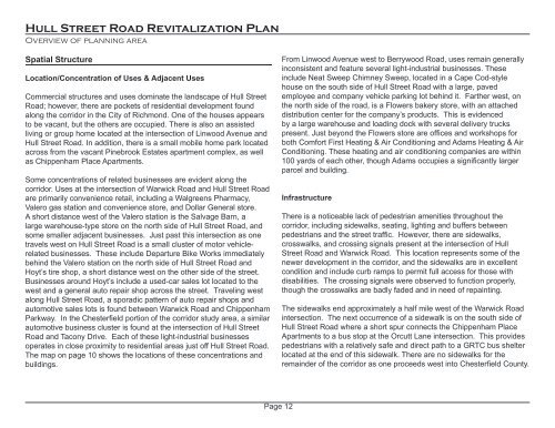
Commercial structures <strong>and</strong> uses dominate the l<strong>and</strong>scape <strong>of</strong> <strong>Hull</strong> <strong>Street</strong><br />
<strong>Road</strong>; however, there are pockets <strong>of</strong> residential development found<br />
along the corridor in the City <strong>of</strong> Richmond. One <strong>of</strong> the houses appears<br />
to be vacant, but the others are occupied. There is also an assisted<br />
living or group home located at the intersection <strong>of</strong> Linwood Avenue <strong>and</strong><br />
<strong>Hull</strong> <strong>Street</strong> <strong>Road</strong>. In addition, there is a small mobile home park located<br />
across from the vacant Pinebrook Estates apartment complex, as well<br />
as Chippenham Place Apartments.<br />
Some concentrations <strong>of</strong> related businesses are evident along the<br />
corridor. Uses at the intersection <strong>of</strong> Warwick <strong>Road</strong> <strong>and</strong> <strong>Hull</strong> <strong>Street</strong> <strong>Road</strong><br />
are primarily convenience retail, including a Walgreens Pharmacy,<br />
Valero gas station <strong>and</strong> convenience store, <strong>and</strong> Dollar General store.<br />
A short distance west <strong>of</strong> the Valero station is the Salvage Barn, a<br />
large warehouse-type store on the north side <strong>of</strong> <strong>Hull</strong> <strong>Street</strong> <strong>Road</strong>, <strong>and</strong><br />
some smaller adjacent businesses. Just past this intersection as one<br />
travels west on <strong>Hull</strong> <strong>Street</strong> <strong>Road</strong> is a small cluster <strong>of</strong> motor vehiclerelated<br />
businesses. These include Departure Bike Works immediately<br />
behind the Valero station on the north side <strong>of</strong> <strong>Hull</strong> <strong>Street</strong> <strong>Road</strong> <strong>and</strong><br />
Hoyt’s tire shop, a short distance west on the other side <strong>of</strong> the street.<br />
Businesses around Hoyt’s include a used-car sales lot located to the<br />
west <strong>and</strong> a general auto repair shop across the street. Traveling west<br />
along <strong>Hull</strong> <strong>Street</strong> <strong>Road</strong>, a sporadic pattern <strong>of</strong> auto repair shops <strong>and</strong><br />
automotive sales lots is found between Warwick <strong>Road</strong> <strong>and</strong> Chippenham<br />
Parkway. In the Chesterfield portion <strong>of</strong> the corridor study area, a similar<br />
automotive business cluster is found at the intersection <strong>of</strong> <strong>Hull</strong> <strong>Street</strong><br />
<strong>Road</strong> <strong>and</strong> Tacony Drive. Each <strong>of</strong> these light-industrial businesses<br />
operates in close proximity to residential areas just <strong>of</strong>f <strong>Hull</strong> <strong>Street</strong> <strong>Road</strong>.<br />
The map on page 10 shows the locations <strong>of</strong> these concentrations <strong>and</strong><br />
buildings.<br />
From Linwood Avenue west to Berrywood <strong>Road</strong>, uses remain generally<br />
inconsistent <strong>and</strong> feature several light-industrial businesses. These<br />
include Neat Sweep Chimney Sweep, located in a Cape Cod-style<br />
house on the south side <strong>of</strong> <strong>Hull</strong> <strong>Street</strong> <strong>Road</strong> with a large, paved<br />
employee <strong>and</strong> company vehicle parking lot behind it. Farther west, on<br />
the north side <strong>of</strong> the road, is a Flowers bakery store, with an attached<br />
distribution center for the company’s products. This is evidenced<br />
by a large warehouse <strong>and</strong> loading dock with several delivery trucks<br />
present. Just beyond the Flowers store are <strong>of</strong>fices <strong>and</strong> workshops for<br />
both Comfort First Heating & Air Conditioning <strong>and</strong> Adams Heating & Air<br />
Conditioning. These heating <strong>and</strong> air conditioning companies are within<br />
100 yards <strong>of</strong> each other, though Adams occupies a significantly larger<br />
parcel <strong>and</strong> building.<br />
Infrastructure<br />
There is a noticeable lack <strong>of</strong> pedestrian amenities throughout the<br />
corridor, including sidewalks, seating, lighting <strong>and</strong> buffers between<br />
pedestrians <strong>and</strong> the street traffic. However, there are sidewalks,<br />
crosswalks, <strong>and</strong> crossing signals present at the intersection <strong>of</strong> <strong>Hull</strong><br />
<strong>Street</strong> <strong>Road</strong> <strong>and</strong> Warwick <strong>Road</strong>. This location represents some <strong>of</strong> the<br />
newer development in the corridor, <strong>and</strong> the sidewalks are in excellent<br />
condition <strong>and</strong> include curb ramps to permit full access for those with<br />
disabilities. The crossing signals were observed to function properly,<br />
though the crosswalks are badly faded <strong>and</strong> in need <strong>of</strong> repainting.<br />
The sidewalks end approximately a half mile west <strong>of</strong> the Warwick <strong>Road</strong><br />
intersection. The next occurrence <strong>of</strong> a sidewalk is on the south side <strong>of</strong><br />
<strong>Hull</strong> <strong>Street</strong> <strong>Road</strong> where a short spur connects the Chippenham Place<br />
Apartments to a bus stop at the Orcutt Lane intersection. This provides<br />
pedestrians with a relatively safe <strong>and</strong> direct path to a GRTC bus shelter<br />
located at the end <strong>of</strong> this sidewalk. There are no sidewalks for the<br />
remainder <strong>of</strong> the corridor as one proceeds west into Chesterfield County.<br />
Page 12


