national hydrographic office of oman â report 2007 - IHO
national hydrographic office of oman â report 2007 - IHO
national hydrographic office of oman â report 2007 - IHO

You also want an ePaper? Increase the reach of your titles
YUMPU automatically turns print PDFs into web optimized ePapers that Google loves.
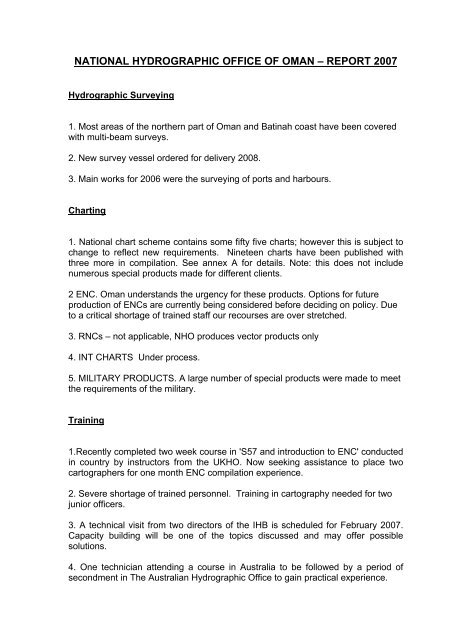
NATIONAL HYDROGRAPHIC OFFICE OF OMAN – REPORT <strong>2007</strong><br />
Hydrographic Surveying<br />
1. Most areas <strong>of</strong> the northern part <strong>of</strong> Oman and Batinah coast have been covered<br />
with multi-beam surveys.<br />
2. New survey vessel ordered for delivery 2008.<br />
3. Main works for 2006 were the surveying <strong>of</strong> ports and harbours.<br />
Charting<br />
1. National chart scheme contains some fifty five charts; however this is subject to<br />
change to reflect new requirements. Nineteen charts have been published with<br />
three more in compilation. See annex A for details. Note: this does not include<br />
numerous special products made for different clients.<br />
2 ENC. Oman understands the urgency for these products. Options for future<br />
production <strong>of</strong> ENCs are currently being considered before deciding on policy. Due<br />
to a critical shortage <strong>of</strong> trained staff our recourses are over stretched.<br />
3. RNCs – not applicable, NHO produces vector products only<br />
4. INT CHARTS Under process.<br />
5. MILITARY PRODUCTS. A large number <strong>of</strong> special products were made to meet<br />
the requirements <strong>of</strong> the military.<br />
Training<br />
1.Recently completed two week course in 'S57 and introduction to ENC' conducted<br />
in country by instructors from the UKHO. Now seeking assistance to place two<br />
cartographers for one month ENC compilation experience.<br />
2. Severe shortage <strong>of</strong> trained personnel. Training in cartography needed for two<br />
junior <strong><strong>of</strong>fice</strong>rs.<br />
3. A technical visit from two directors <strong>of</strong> the IHB is scheduled for February <strong>2007</strong>.<br />
Capacity building will be one <strong>of</strong> the topics discussed and may <strong>of</strong>fer possible<br />
solutions.<br />
4. One technician attending a course in Australia to be followed by a period <strong>of</strong><br />
secondment in The Australian Hydrographic Office to gain practical experience.
-<br />
5. A course in Multi – Beam data processing is planned to be held early this year.<br />
Printing<br />
The NHO runs a 'plot on demand' system utilizing 3 x HP A0 plotters.<br />
A total number <strong>of</strong> over 2000 prints <strong>of</strong> all types were made in 2006. In addition 400<br />
copies <strong>of</strong> the Oman Maritime Handbook were printed to meet increasing demand.<br />
Publicity<br />
The <strong>national</strong> press in Oman printed several articles highlighting World<br />
Hydrographic Day, with the assistance <strong>of</strong> the NHO.
OMAN CHART SCHEME (ANNEX A)<br />
Chart No.<br />
Chart Name SW Corner<br />
NE Corner<br />
° ' N ° ' E ° ' N ° ' E<br />
Scale 1 : 1500 000<br />
OM 1<br />
INT 749<br />
13 15.00 53 00.0 27 30.0 63 45.0<br />
The Sultanate <strong>of</strong> Oman<br />
سلطنة عمان<br />
Scale<br />
54 Said Bin Sultan Naval Base<br />
قاعدة سعيد بن سلطان البحرية<br />
100 Khawr al Qawi<br />
خور القيوي<br />
100 A Khawr al Qawi<br />
خور القيوي<br />
101 Port Khasab<br />
ميناء خصب<br />
120<br />
INT 7194<br />
250<br />
INT 7173<br />
1 : 5000<br />
23 48.59 57 30.15 23 50.95 57 33.35<br />
Scale 1 : 10 000<br />
26 18.50 56 19.0 26 23.9 56 23.0<br />
Scale<br />
Muscat to Mina al Fahl<br />
مسقط إلى ميناء الفحل<br />
26 18.50 56 19.0 26 23.9 56 23.0<br />
00.12<br />
26 56 12.5 26 15.5 56 18.0<br />
1 : 20 000<br />
23 36.5 58 28.6 23 41.6 58 36.6<br />
Scale 1 : 25 000<br />
Apps to Port Salalah 16 52.30 53 54.6 17 02.0 54 10.0<br />
مداخل ميناء صلالة<br />
251 Apps to Marbat<br />
مداخل مرباط<br />
252 Apps to Duqm<br />
مداخل الدقم<br />
253 Ra’s Hilf<br />
رأس حلف<br />
16 52.9 54 29.4 17 03.0 54 45.0<br />
19 38.0 57 39.0 19 48.1 57 54.7<br />
20 37.0 58 43.0 20 47.0 58 58.8<br />
254<br />
INT 7191<br />
255<br />
INT 7192<br />
E App’s to Muscat<br />
المداخل الشرقية لمسقط<br />
W App’s to Muscat<br />
المداخل الغربية لمسقط<br />
23 30.2 58 31.7 23 40.3 58 47.8<br />
23 34.8 58 20.9 23 44.9 58 37.0<br />
256 App’s to SBSNB<br />
مداخل قاعدة سعيد بن سلطان البحرية<br />
23 46.0 57 26.0 23 56.0 57 42.0<br />
257<br />
INT 7201<br />
Port Sohar Apps to<br />
مداخل ميناء صحار<br />
24 27.5 56 30.5 24 37.0 56 46.0<br />
258 Apps to Diba<br />
مداخل دباء<br />
Scale<br />
300 Ras al Hadd to Sur<br />
رأس الحد الى صور<br />
25 33.5 56 14.0 25 43.8 56 30.1<br />
1 : 30 000<br />
22 28.5 59 30.7 22 40.0 59 49.5<br />
301<br />
INT 7200<br />
Sur to Qalhat<br />
صور الى قلهات<br />
22 33.8 59 18.19 22 45.6 59 37.0
302 Ras Kumzar To Ras Ash Shaykh<br />
Masud<br />
رأس آمزارإالى رأس الشيخ مسعود<br />
Scale<br />
503 S.W <strong>of</strong> Khalij Masirah<br />
جنوب غرب خليج مصيرة<br />
504 W <strong>of</strong> Khalij Masirah N<br />
الشمال الغربي لخليج مصيرة<br />
509 Khawr Al Hablayn to jazirat<br />
Salamah<br />
خور الحبلين الى جزيرة سلامة<br />
Scale<br />
1200 Ras Darbat Ali To Port Salalah<br />
رأس ضربة علي إلى ميناء صلالة<br />
1201<br />
INT 7172<br />
To Bandar<br />
Port Salalah<br />
Janjari<br />
ميناء صلالة إلى بندر جنجري<br />
1202 Marbat to As Sawda<br />
مرباط إلى السوداء<br />
1203 Ras Nuss to Sharbithat<br />
رأس النوس الى شربثات<br />
1204 Al Qibliyah to Qaysad<br />
القبلية الى قاصد<br />
1205 Qaysad to Madrakah<br />
قاصد الى مدرآة<br />
1206 Ras Madrakah – Duqm<br />
رأس مدرآة الى الدقم<br />
1207 Khalij al Masirah<br />
خليج مصيرة<br />
1208 H’an Nafur to Masirah<br />
حمر النفور الى مصيرة<br />
1209 Abu Rasas to Ar Ruays<br />
أبو الرساس الى الرويس<br />
1210 Ar Ruays to ash Sharik<br />
الرويس الى الشارك<br />
26 10.5 56 12.5 26 27.8 56 26.0<br />
1 : 50 000<br />
19 46.5 57 44.0 20 13.0 58 04.0<br />
20 12.0 57 48.8 20 30.0 58 17.5<br />
26 04.5 56 19.0 26 31.5 56 40.5<br />
1 : 125 000<br />
16 13.0 53 00.0 17 05.0 54 20.0<br />
16 25.0 53 53.0 17 15.0 55 12.0<br />
16 39.0 54 37.0 17 31.0 55 57.0<br />
17 08.0 55 10.0 18 00.0 56 30.0<br />
17 14.0 56 16.0 18 30.0 57 10.0<br />
18 10.0 56 31.5 19 02.0 57 51.5<br />
18 27.0 57 35.0 19 43.0 58 28.0<br />
19 21.0 57 35.0 20 12.0 58 55.0<br />
19 46.5 57 39.0 20 37.0 58 58.0<br />
20 08.0 58 17.0 20 58.0 59 36.0<br />
20 51.0 58 41.0 21 40.0 60 00.0<br />
1211<br />
INT 7183<br />
1212<br />
INT 7186<br />
1213<br />
INT 7187<br />
Ash Sharik to Qalhat<br />
الشارك الى قلهات<br />
Al Hadd to Abu Da’ud<br />
الحد الى أبو داوؤد<br />
Quriyat to Jaz’t al Fahl<br />
قريات الى جزيرة الفحل<br />
21 34.0 59 18.0 22 47.0 60 10.0<br />
22 31.0 58 52.0 23 20.0 60 07.0<br />
23 13.0 58 18.0 24 00.0 59 36.0
1214<br />
INT 7189<br />
1215<br />
INT 7196<br />
1216<br />
INT 7198<br />
1217<br />
INT 7199<br />
Muscat to Wudam<br />
مسقط الى ودام<br />
Jaz Suwadi to Sohar<br />
جزيرة السوادي الى صحار<br />
Sohar to Ras Daba<br />
صحار الى رأس دباء<br />
Fujairah to Ras Khaysah<br />
الفجيرة الى رأس قيشة<br />
23 29.0 57 34.0 24 12 52.8 58 48.0<br />
23 45.0 56 35.0 24 28 46.8 57 49.0<br />
24 22.0 56 17.50 25 05.0 57 32.0<br />
25 00.0 56 12.8 25 38.7 57 20.5<br />
1218 The Strait <strong>of</strong> Hormuz<br />
3500<br />
INT 7170<br />
مضيق هرمز<br />
Scale<br />
Damqawt to Sharbithat<br />
دمقوات الى شربثات<br />
3501 Ras Nuss to Madrakah<br />
رأس النوس الى مدرآة<br />
3502 Madrakah to Masirah<br />
مدرآة الى مصيرة<br />
25 33 12 56 13.6 26 11.2 57 21.3<br />
1 : 350 000<br />
18 30.0 35 00.0 18 02.0 56 32.0<br />
16 15.0 55 14.0 19 15.0 58 54.0<br />
18 33.0 57 30.0 20 55.0 61 10.0<br />
3503<br />
INT 7182<br />
3504<br />
INT 7185<br />
3505<br />
INT 7188<br />
7500<br />
INT 7015<br />
Masirah to Ras al Hadd<br />
مصيرة الى رأس الحد<br />
Ras al Hadd to Muscat<br />
رأس الحد الى مسقط<br />
Muscat to Lima<br />
مسقط الى ليما<br />
Scale<br />
Ras Fartak to Masirah<br />
رأس فرتاق الى مصيرة<br />
20 25.0 58 25.0 22 45.0 62 05.0<br />
22 16.0 57 42.0 24 34.0 61 22.0<br />
23 34.0 56 10.0 25 58.0 59 50.0<br />
1 : 750 000<br />
15 29.0 53 00.0 20 38.0 60 00.0<br />
7501<br />
INT 7016<br />
007<br />
Masirah to Str Hormuz<br />
مصيرة إلى مضيق هرمز<br />
20 00.0 56 00.0 27 15.0 61 22.0<br />
Different Scales<br />
Plans in Sharqiya Region _ - - -<br />
(A,B,C&D)<br />
مخططات في المنطقة الشرقية<br />
Note:<br />
- Black indicates Charts in scheme.<br />
- Green indicates Charts completed.<br />
- Red indicates charts being compiled.<br />
- Blue indicates “INT” Charts number.<br />
Feb <strong>2007</strong>