Dietz_Mapping the Homunculus_2006.pdf - iSites
Dietz_Mapping the Homunculus_2006.pdf - iSites
Dietz_Mapping the Homunculus_2006.pdf - iSites

Create successful ePaper yourself
Turn your PDF publications into a flip-book with our unique Google optimized e-Paper software.
Else/Where<br />
<strong>Mapping</strong><br />
Steve <strong>Dietz</strong> 200<br />
<strong>Mapping</strong> <strong>the</strong> <strong>Homunculus</strong><br />
1/6<br />
----------------------------------------------- -------------------- ------------------------------------ - ----- ;- - ;;; --- ; --- ; . ;;; ----.--~ - ; ------. :-- -----------------------.: ; -;.; -~ :;:<br />
MAPPING THE<br />
HOMUNCULUS<br />
One of <strong>the</strong> most common ways to place<br />
ourselves in relation to <strong>the</strong> incomprehensibly<br />
vast, be it God or The Matrix, is by<br />
creating a map . In an age of information<br />
overload, <strong>the</strong> map has become a favorite<br />
interface to data sets of all types,<br />
geographic and o<strong>the</strong>rwise. More importantly,<br />
<strong>the</strong> map can become a kind of visual bridge<br />
between disparate facts - zip codes and<br />
cereal preferences, for instance. As loca <br />
tion -aware devices proliferate - from cell<br />
phones to any object with a radio frequency<br />
10 tag-maps will become an increasingly<br />
important means to <strong>the</strong>orize and discover<br />
relationships that are not easily graspable .<br />
Several artists' projects model how maps<br />
might help not only locate us, but how<br />
mapmaking can be a tool to build a counterimage<br />
of our future urbanity-in contrast<br />
to contemporary culture ' s panoptic, datamining<br />
gaze onto our zip-coded profiles. I<br />
shall argue that <strong>the</strong> image of <strong>the</strong> homunculus-<br />
a diminutive human character who serves<br />
as a kind of sensory index - is a useful<br />
concept in two respects: it embodies <strong>the</strong><br />
idea that what we experience physically or<br />
personally has a disproportionate effect<br />
on our mental maps of <strong>the</strong> world, and that<br />
simple rules can give rise to complex - even<br />
intelligent - systems .<br />
fiT VE:<br />
DIETZ<br />
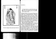
Neurologist Wilder Penfield used <strong>the</strong> term<br />
"homunculus" in his famous early brain maps,<br />
which showed that each part of <strong>the</strong> body<br />
is represented on two strips of <strong>the</strong> brain' s<br />
cerebral cortex, <strong>the</strong> somatosensory cortex<br />
(which receives sensations of touch) and <strong>the</strong><br />
motor cortex (which receives control movements).<br />
Fingers, mout h and o<strong>the</strong>r sensitive<br />
areas take up most space on both maps, a<br />
point he exaggerated on ano<strong>the</strong>r drawing of<br />
a homunculus with sensitive body parts exaggerated<br />
. If we extend this notion to mapping gazeUeer H 10 - 11/13 pp.196- 197<br />
............_........................................._..............................._.............................__................_..............................................................--<br />
1. Guy Debord, "Theory of <strong>the</strong> Deriye." Inlema/ionale Si/ua/lOnfl;ste 112<br />
(December 1958) translated by Ken Knabb. < hUp://www2.cddc.vt.edu/<br />
situationiSVsVl heory.html><br />
T<br />
~ RK BY<br />
'.1 EDIA<br />
OG RAPH I<br />
our direct experience of <strong>the</strong> lived eelV1ron,<br />
ment, it will create a very different<br />
from a conventional street plan.<br />
In his Theory of <strong>the</strong> Derive, Guy Debord<br />
quotes <strong>the</strong> sociologist Paul-Henry Chombart<br />
de Lauwe: "an urban neighborhood is deter.<br />
mined not only by geographical and eco n~<br />
factors, but also by <strong>the</strong> image that its<br />
inhabitants and those of o<strong>the</strong>r neighbor_<br />
hoods have of it."'<br />
De Lauwe included in one text a map of all<br />
<strong>the</strong> movements made during one year by a<br />
student living in <strong>the</strong> 16th Arrondissement of<br />
Paris . Her itinerary forms a small triangle<br />
with no significant deviations, <strong>the</strong> three<br />
apexes of which are <strong>the</strong> School of Political<br />
SCiences, her residence and that of her<br />
piano teacher- illustrating, according to<br />
Chombart de Lauwe, "<strong>the</strong> narrowness of <strong>the</strong><br />
real Paris in which each individual lives.<br />
and which, according to Debord, ought to<br />
provoke "outrage at <strong>the</strong> fact that anyone' s<br />
life can be so pa<strong>the</strong>tically limited."<br />
2. Regarding complexily and emergent systems. see Steven Johnson.<br />
Emergence: The Connected Lives of Ants, Brams, Cities, and Software;<br />
Mitchel Resnick, Turtles, Termites, and Traffic Jams: Etploratlons in<br />
Massively Parallel M icrowOflds, 1997: and Albert·li!szI6 Barabiisi. Linked:<br />
The New Science of Networks. 2002.<br />
~eerH 2-3'13 pp. 188- 189<br />
<strong>Mapping</strong><br />
MapPing <strong>the</strong> <strong>Homunculus</strong><br />
probably many of us can relate to a dominat <br />
ing triangle of home, work and hobby <br />
regardless of its parochial nature-but .<br />
metaphorically speaking, de Lauwe ' s mapp1ng<br />
of <strong>the</strong> student ' s movements in Paris is her<br />
geographic homunculus. A contemporary<br />
version of Chombart de Lauwe ' s project is<br />
<strong>the</strong> Wa ag Society'S Amsterdam RealTime<br />
proj ect. The issue with such homuncular maps<br />
is that individually <strong>the</strong>y don't create a<br />
rich image of <strong>the</strong> who l e city. However, with<br />
new understanding of complexity and emergent<br />
sys tems , it is possible to imagine that<br />
when t hese simp l e views are combined , <strong>the</strong><br />
sum may be greater than <strong>the</strong> parts. 2<br />
Homuncular maps, deeply rooted in <strong>the</strong><br />
pe rsonal, can give rise to very powerful and<br />
useful maps of more complex systems such as<br />
cities . It is possible to imagine societal<br />
systems that rely on individual input to<br />
generate emergent and dynamically adaptive<br />
solutions independent of a pre-existing<br />
structure, single leader or top-down<br />
process . It may be stating <strong>the</strong> obvious, but<br />
one of <strong>the</strong> reasons to focus on maps is that<br />
<strong>the</strong>y matter. They make a difference in society'<br />
s somatosensory cortex as profound and<br />
direct as touch has on our own.<br />
Steve <strong>Dietz</strong> 201<br />
s ize of landmasses nearer <strong>the</strong> polespri<br />
marily Europe and North America .'<br />
2/6<br />
In contrast , <strong>the</strong> Peters project i on accu <br />
rately portrays <strong>the</strong> size of all nations,<br />
and , according to its creator, gives a voice<br />
t o underrepresented countries i n <strong>the</strong> devel <br />
oping world. This would seem an important<br />
issue, especially given <strong>the</strong> research by<br />
Thomas Saarinen, who ga<strong>the</strong>red over 3,800<br />
sketch maps of <strong>the</strong> world by children from 49<br />
countries for <strong>the</strong> project Children's Mental<br />
Maps of <strong>the</strong> World. A composite of <strong>the</strong><br />
results by children from Thailand looks most<br />
like <strong>the</strong> Mercator projection, which greatly<br />
exaggerates areas where <strong>the</strong> children don't<br />
live. Theirs is <strong>the</strong> opposite of a homuncular<br />
view of <strong>the</strong> world.·<br />
The Peters projection is significant not<br />
only for <strong>the</strong> interface it provides, but<br />
for its highlighting of <strong>the</strong> fact that <strong>the</strong><br />
Mercator projection is only one option among<br />
worldviews, not <strong>the</strong> natural way to map <strong>the</strong><br />
world, no matter how logical or effiCient.<br />
Homuncular projects are important not only<br />
for <strong>the</strong>ir viewpoint, but for how <strong>the</strong>y de <br />
naturalize <strong>the</strong> dominant interfaces we swim<br />
i n, whe<strong>the</strong>r <strong>the</strong> interface is Sky News or<br />
America Online or MapQuest, More powerful<br />
than <strong>the</strong> meanings of <strong>the</strong> visualized data is<br />
how that very act of visualization disrupts<br />
systems of knowledge and relationships of<br />
power. As <strong>the</strong> geographer Denis Wood frames<br />
it, "maps work by serving interests."5<br />
The following projects serve <strong>the</strong> interests<br />
of individuals and local communities while<br />
still attempting a holistiC functionality;<br />
<strong>the</strong>y disrupt business as usual in terms of<br />
who and what is representedj and many of<br />
<strong>the</strong>m provide alternative interfaces that<br />
viscerally connote <strong>the</strong> possibility of alternative<br />
viewpoints and multiple worldviews.<br />
MINNEAPOLIS ANO ST. PAUL<br />
ARE EAST AFRICAN CITIES<br />
In 2002, <strong>the</strong> New York-based artist Julie<br />
Mehretu was invited to undertake a residency<br />
at <strong>the</strong> Walker Art Center in Minneapolis.<br />
As she tells it, she was quite surprised in<br />
Creating abstractions of <strong>the</strong> physical world<br />
i s no mean feat, posing <strong>the</strong> problem of how<br />
t o represent <strong>the</strong> third dimension. Mercator's<br />
20 projection of 1569 came as an almost this land of lutefisk and lefse s to get into<br />
magical event, providing a synoptic image<br />
a heated conversation with her airport taxi<br />
of t he world which has dominated ever since. driver about cu rrent events in Ethiopia -<br />
As cartographer Arno Peters demonstrated<br />
where <strong>the</strong>y were both born. On fur<strong>the</strong>r invesi<br />
n his alternative 1974 projection, <strong>the</strong><br />
tigation, it turned out that <strong>the</strong> largest<br />
Mercator map accurately depicts <strong>the</strong> shape of Somali population outside of Africa lives<br />
} ?:~~.~.~.~.~.~.~ . ,... ~~~ ._~~.~.~.~.! .~.~ .~ .~.~y... ~~~.~.:.9.~.~ ... ~.~~ .............___........ ~~ .. ~~~ ..!.~.~.~... ~.~ .~ .~~~.. ?:~.~...!.~.~.~.. ~ .. ~~~~. ~!. ~.~.~.~ .~ .~y........_<br />
See "Perils of Precision." p. 184.<br />
The Peters M ap PrOject was undertaken in a class taught atlhe UniyerSlty<br />
01 Minnesota in 2003 by artist Alfredo Jaar. Winton Chair in liberal Arts.<br />
< www.pelersworldmap.org/><br />
4. Thomas Saarinen, "The Euro·centric Nature of Mental Maps of <strong>the</strong> World.-<br />
R~.,,,,,.,,;,, 1':""",,,,,";,,1'",,,.,.,,1/,,,, I" IQ("IQ<br />
5. Denis Wood. The Power of Maps. New York and l ondon: The Guilford<br />
Press, 1992.<br />
6. See .
p<br />
Ei se/Where<br />
<strong>Mapping</strong><br />
<strong>Mapping</strong> <strong>the</strong> Hom unculus<br />
growing number of residents are from East<br />
Africa by birth or heritage.<br />
Mehretu decided to work with about 30<br />
students from two Minneapolis high schools,<br />
all of whom were of East African descent.<br />
They were asked to complete two projects .<br />
In one project , <strong>the</strong> students were asked to<br />
photograph sites that mattered to each of<br />
<strong>the</strong>m and make a brief audio recording of <strong>the</strong><br />
significance of <strong>the</strong> image and locate where<br />
it was taken on a map of <strong>the</strong> Twin Cities.<br />
The tools for <strong>the</strong>se projects were decidedly<br />
low tech - a map of <strong>the</strong> Twin Cities, a notebook,<br />
and inexpensive digital cameras and<br />
recorders . Once <strong>the</strong> students had finished<br />
recording <strong>the</strong>ir stories, <strong>the</strong> texts, images,<br />
sound recordings and map locations were<br />
entered into a database and <strong>the</strong> Belgiumbased<br />
group Entropy8Zuper! (Auriea Harvey<br />
and Mic hael Samyn) was commissioned to<br />
design a combinatory map int erface.<br />
The interface is an interactive audio-visual<br />
collage composed of <strong>the</strong> sound bites and<br />
photographs contributed by <strong>the</strong> students. You<br />
can follow <strong>the</strong> stories of each participant<br />
by clicking on nodes, and as you move from<br />
spot to spot, you leave a t r ace, which cumul<br />
atively maps yo ur route through t he interface-through<br />
<strong>the</strong> content.<br />
The nodes are not mapped to <strong>the</strong>ir geographic<br />
coordinates; <strong>the</strong>y provide an impressionistic<br />
re-mapping of <strong>the</strong> city based on each participant's<br />
selections and commentary . These are<br />
<strong>the</strong> pl aces in <strong>the</strong> cities to which <strong>the</strong><br />
participants were particularly sensitive. In<br />
addition , <strong>the</strong> interface references Mehretu's<br />
own paintings, which consist of a seri es of<br />
highly specific mappings painted over with<br />
<strong>the</strong> vectors of explosive i nteractions.<br />
One criticism that can be leveled at <strong>the</strong><br />
homuncular viewpoint is that one ends up<br />
with a mishmash, without order . Perhaps this<br />
is why Kevin Lynch-<strong>the</strong> city planner whose<br />
infl uential book The Image of <strong>the</strong> City first<br />
popularized <strong>the</strong> idea of using maps sketched<br />
by individuals "in order to communicate,<br />
study, and exploit personal cities" - didn ' t<br />
publish a single one of <strong>the</strong> maps he<br />
collected, "preferring to • summarize , <strong>the</strong>m<br />
in maps of his own devising. "T<br />
This tension between instrumental profess-<br />
Steve <strong>Dietz</strong> ,.,<br />
3/6<br />
The Presence of <strong>the</strong> Pa st, authors Roy<br />
Rosenzweig and David Thelen examine, as on<br />
reviewer puts it, "how deeply ordinary e<br />
people are engaged with <strong>the</strong> past but at t he<br />
same time are alienated from <strong>the</strong> hist ory<br />
<strong>the</strong>y have been taught. "' Rosenzweig writes<br />
about this issue:<br />
-.-...<br />
Our survey respondents often used t he<br />
past in complex and subtle ways, but<br />
<strong>the</strong>ir approach was sometimes i n tenSion<br />
with my hist orical t r aini ng and prefer.<br />
ences . For example, I fou nd t heir<br />
emphasis on <strong>the</strong> firsthand, t he ex pe rien.<br />
tial, <strong>the</strong> intimate, and <strong>the</strong> f amilial to<br />
be confining as well as illuminating.<br />
At times respondents seemed primaril y<br />
concerned with <strong>the</strong>ir own and <strong>the</strong>ir<br />
family's pasts; <strong>the</strong> stories of o<strong>the</strong>rs<br />
were often ignored . This privat ized<br />
version of <strong>the</strong> past, I worried, can<br />
reinforce ra<strong>the</strong>r than br eak down barriers<br />
between people, resist ra<strong>the</strong>r than<br />
promote change.'<br />
Indeed, while many of <strong>the</strong> 30 participants<br />
in Minneapolis and St . Paul Are East African<br />
Cities reported that participating i n <strong>the</strong><br />
workshops was a transformative experience,<br />
its val ue t o vi ewer-participants may be i n<br />
direct proport i on to t he hi stories-t heir<br />
own homuncula r geographies-t hat t he y bring<br />
to <strong>the</strong>ir viewing. Is <strong>the</strong>re a way t o create<br />
a wider base of experience without becoming<br />
prescriptive, to honor <strong>the</strong> individual point<br />
of view while ending up with an overall<br />
point of view that has value for more people<br />
than just <strong>the</strong> participants?<br />
ionali sm and <strong>the</strong> homunC'Jlar perspective is <strong>Mapping</strong> <strong>the</strong> Homunc::ulus 5/6 p.204<br />
............ !'!?~ ... ~_~.I!l.~.~ .~ .~ .. ~~ .. ~. ~~.y ... ~.~.~.~ .~ .~!'!~: ... ~. ~ ... !.~.~_ .. ~.~ .~~ ........................................................................................................ ---<br />
See " Epic Vessels: pp. 248- 249.<br />
1. See artists' proposal for PDPal < hllp://gallery9.walkerart.org/bookmark.<br />
htmt?id=599&type _ text &bookmark= I >.<br />
8. John Gillis. Rutgers University. quoted on <strong>the</strong> back cover of The Pre~<br />
o{<strong>the</strong> P(Jst.<br />
9. Roy Rosenzweig and Dav,d Thelen. The Presence of <strong>the</strong> Pdst:<br />
of His tory in Amerkan Life. New York: Columbia University<br />
<strong>Mapping</strong><br />
<strong>Mapping</strong> <strong>the</strong> <strong>Homunculus</strong><br />
PDPAL<br />
PDPal, a mobile, public map -art project by<br />
scott paterson, Marina Zurkow and Julian<br />
Bleecker , pursues <strong>the</strong> notion of a "communicity"-a<br />
city written by individuals and<br />
f iltered by individuals to create alterna ·<br />
t ive cartographies, both physical and<br />
emot ional, which would never be found on<br />
MapOuest , yet which collaboratively map <strong>the</strong><br />
homuncu l us of a city.<br />
According to <strong>the</strong> artists, part of <strong>the</strong> i nspiration<br />
for PDPal was entirely pe r sonal,<br />
almost nostalgic:<br />
When we were little, we really wanted a<br />
little companion who would ride sidesaddle<br />
on <strong>the</strong> crests of our ears. A<br />
misc hievous and constant pal, who was our<br />
charge and also our commentator , who gave<br />
context and breadth to <strong>the</strong> worl d and<br />
shoo k up our autonomic ways. to<br />
PDPal is designed as a new way for users to<br />
sha re t heir experiences and learn about<br />
o<strong>the</strong>rs' experiences of (in its initial test <br />
ru ns, i n 2003) <strong>the</strong> Minneapolis Sculpture<br />
Ga rden, <strong>the</strong> Twin Cities, and Times Square in<br />
New Yor k. A mapping application for Pal m OS <br />
based POAs and t he Web, it aims to transform<br />
eve ryda y activities and urban expe r iences<br />
into a dynamic ci ty that <strong>the</strong> user creates,<br />
composed of <strong>the</strong> places in which she lives,<br />
plays and works (recal ling Chombart de<br />
Lauwe) as well as those she remembers. PDPal<br />
allows <strong>the</strong> user to capture and visualize<br />
<strong>the</strong>se places and imaginatively capture <strong>the</strong><br />
meanings and histories of <strong>the</strong>se pl aces so<br />
<strong>the</strong>y, in effect , "write <strong>the</strong>ir own city."<br />
The most successfu l feature of POPal is<br />
its use of a graphically-friendl y character<br />
known as <strong>the</strong> Urban Park Ranger to nudge<br />
users into thinking about <strong>the</strong>ir maps as<br />
narratives as well as cartography. This<br />
cha racter is designed both as an embodiment<br />
of a software Help function, and as a provo <br />
cateur, acting as a guide to help user s see<br />
<strong>the</strong>ir city in new ways, by presenting yo u<br />
with simple leading questions such as<br />
"Which is noisier, Godzill a or a garbage<br />
truCk? Map <strong>the</strong> beasts that roam your city . "<br />
Steve <strong>Dietz</strong><br />
'.3<br />
4/6<br />
Ga<strong>the</strong>ring around <strong>the</strong> campfire screen would<br />
definitely be <strong>the</strong> best way to listen to <strong>the</strong><br />
tales elicited by <strong>the</strong> Urban Park Ranger.<br />
According t o Scott Paterson , PDPal is also<br />
a new kind of virtual public art practice,<br />
bridging <strong>the</strong> gap between <strong>the</strong> physical<br />
and <strong>the</strong> virtual , <strong>the</strong> cartographic grid and<br />
psychogeography, <strong>the</strong> personal and <strong>the</strong><br />
community:<br />
POPal investigates met hods of construction<br />
via dimensions beyond <strong>the</strong> latit ude<br />
and longitude of geographic mapping<br />
such as time, memory and emotion. PDPal<br />
exists as a public art project in that it<br />
considers mobile devices and <strong>the</strong> web as<br />
a constantly shifting ephemeral public<br />
space generated by <strong>the</strong> expressions of its<br />
population of users-a place we call <strong>the</strong><br />
"communicity.""<br />
Ano<strong>the</strong>r significant aspect of POPal rel ates<br />
to <strong>the</strong> fact that all maps represent i nterests<br />
. Similarly, all interfaces, no matter<br />
how neutral seeming, have an embedded<br />
philosophy . To counter this or at least make<br />
it apparent, POPal foregrounds its interface<br />
thr ough <strong>the</strong> intervention of <strong>the</strong> Urban Park<br />
Ranger. Notes Paterson :<br />
Every project has a voice or bias. It's<br />
<strong>the</strong> artist's prerogative to make this<br />
voice explicit or implicit. Much software<br />
-as-art work being done today has an<br />
implicit voice in that <strong>the</strong> protocols are<br />
inherent in <strong>the</strong> interaction, which is not<br />
readily apparent because <strong>the</strong> project is<br />
seen as enabling action ra<strong>the</strong>r than<br />
l imiting it . The Urban Park Range r , on<br />
<strong>the</strong> contrary , acts as a provocateur as<br />
well as a host to explain <strong>the</strong> particular<br />
bias of <strong>the</strong> software and in doing so,<br />
informs <strong>the</strong> user of our critique of more<br />
traditional mapping techniques . '2<br />
When users log onto t he POPal website, <strong>the</strong>ir<br />
city or personal map i s displayed, and can<br />
al so be visualized alongside t he cities of<br />
o<strong>the</strong>r POPal users and , eventual ly, f i l tered<br />
according to various criteria-<strong>the</strong> ratings<br />
and attr ibutes entered when making a map.<br />
Users can connect with o<strong>the</strong>r users whose<br />
homes are near <strong>the</strong>irs in order to see how<br />
<strong>the</strong>y imagine <strong>the</strong> shared neighborhood. Or<br />
<strong>the</strong>y can filter <strong>the</strong> maps by keywords used<br />
when entering dat a, creating what <strong>the</strong><br />
PDPal is perhaps l ess successful as a device<br />
for mak ing on-<strong>the</strong>-go entries (despite its<br />
mobile format) and unlike, for exampl e,<br />
Urban Tapestries, <strong>the</strong>re is little advantage<br />
_ ....... ~~ .. y.~.~w ing o<strong>the</strong>r people's maps in t he f i el d. artists r efer to as a "commu nicity" out of<br />
See "The M~·~-G~~~·P; ;~~~·~i.:·~:·;01:················'''·''···· ··...--........................................................................................................................<br />
10. See < www.walkerart.org/gallery9/jerome/> . 11. Scott Paterson. from an email interview between <strong>the</strong> author and <strong>the</strong> artists.<br />
summer 2003. < hUP://gallery9.walkerart.org/bookmark.hlml?id=624&type<br />
", text&bookmark .. l><br />
12. ibid.
El se/Where<br />
<strong>Mapping</strong><br />
<strong>Mapping</strong> <strong>the</strong> <strong>Homunculus</strong><br />
<strong>Mapping</strong><br />
<strong>Mapping</strong> <strong>the</strong> <strong>Homunculus</strong><br />
Steve <strong>Dietz</strong> 205<br />
6/6<br />
by t he Banff New Media Institute, i s an open<br />
so urce philosophy. As <strong>the</strong>y write:<br />
•<br />
•<br />
• •<br />
••<br />
•<br />
•<br />
•<br />
•<br />
•<br />
Mlnno:Jpoll,1yo SL Paul waa<br />
lfQgulooyln geesu Afrika.<br />
... • ~ •• • "! .!. "I"<br />
---...,.<br />
• • •<br />
•<br />
•<br />
•<br />
•<br />
•<br />
•<br />
• C<br />
..<br />
•<br />
•<br />
...................... .......................................................... -.-<br />
··········· ·j~li~· M ;;h;~t~··Mi~~~~;~~~;;si;;;~i~·,;E~~iA;;,~~·~·c~i,:;~: 200i i·i·~i;;~~i;~~·~~·p~~~·d~i~~·se of I ~e TWin CiUes a.s seen<br />
by Minneapolis high school students of East African descent. The project was led by E th loPIBn.~rn arhs! Mehre tu. whIle she was<br />
an artist.in·residence at <strong>the</strong> Walker Art Center; interaction designers Entropy8Zuperi created <strong>the</strong> Interface.<br />
fUtitHf H 12-13/13 pp. 198-199<br />
-, +<br />
everyone's personal cit y, without losing<br />
access to <strong>the</strong> personal and <strong>the</strong> individual.<br />
Everyone's individual maps can thus be<br />
combined and recombined, so that PDPal<br />
effectively image·maps <strong>the</strong> city without <strong>the</strong><br />
i ntervention of an authority.<br />
open systems never<strong>the</strong>less need to take on a<br />
life of <strong>the</strong>ir own - to emerge - if <strong>the</strong>y are to<br />
be truly successful . During <strong>the</strong> launch and<br />
promot ion of PDPal, it received significant<br />
use, but it is unclear whe<strong>the</strong>r <strong>the</strong> narrat<br />
ives that are now being told are sufficient<br />
t o keep <strong>the</strong> "communicity" growing. However,<br />
each iteration of <strong>the</strong> project has made<br />
enormo us conceptual leaps and adjustments,<br />
and as <strong>the</strong> ability to add any geographic<br />
base·map into <strong>the</strong> system becomes available,<br />
PDPal has <strong>the</strong> potential to become a virtual<br />
locus for homuncular storytelling.<br />
Where as PDPal allows users to enter informat<br />
ion from home, via <strong>the</strong> web, a number of<br />
o<strong>the</strong>r current pro jects investigate personal<br />
mapp ing, but require <strong>the</strong> viewer· participant<br />
to be physically present at <strong>the</strong> location of<br />
t he story in order to access it. The city<br />
becomes <strong>the</strong> map, or perhaps more accurately<br />
a telecommunications layer is overlaid on<br />
t he physical city at a 1:1 scale. A user can<br />
l eave a story about a particular location<br />
at t hat location. When ano<strong>the</strong>r user walks<br />
by, her locati on-aware device can alert her<br />
to t he presence of <strong>the</strong> story, to which she<br />
may decide to listen while strolling about<br />
<strong>the</strong> location.<br />
GEOGRAFFITI<br />
At t he core of <strong>the</strong> Geograffiti project by<br />
Recen t l y, researche r s and free-GIS enthu·<br />
si ast s have begun to share t heir data in<br />
a va r iety of networking machi ne -search <br />
able en vironments. enabling t he develop"<br />
ment of a non· proprietary data pool of<br />
human geography, whe r e meaning emerges<br />
and i s inscribed at ground level. 13<br />
GPS devices use "waypoints" that mark<br />
a particular spot. Generally, <strong>the</strong>se are<br />
personal and not shared. but part of<br />
Geograffiti is an open database (called<br />
GPSter) of waypoints - or GPS-encoded<br />
locations where someone has left a storywriting.<br />
audio. video or some combination .<br />
Geograffiti i s as much a platform for <strong>the</strong><br />
exchange of geographically-tagged information<br />
as is a particular interface like<br />
PDPal. but its goal is to enable "collabo r a·<br />
tive cartography . . . to map according to our<br />
desires, providing artists with tool s with<br />
which . effectively, to step outs ide of <strong>the</strong><br />
box. whereby architectonic space now becomes<br />
<strong>the</strong>ir canvas . " In o<strong>the</strong>r words, it is a<br />
platform for mapping t he urban homunculus.<br />
PANOPTIC AND HOMUNCULAR VISIONS<br />
The future of computing is ubiquitous,<br />
aware. embedded and distributed . 13<br />
IncreaSingly, computers and de vices such<br />
as RFID tags that communicate with computers<br />
will be embedded in objects throughout our<br />
environment. These skeins of computing can<br />
and almost certainly will give rise to<br />
nightmarish scenarios of Total Information<br />
Awareness by governmental. commercial and<br />
illegal powers. At <strong>the</strong> same time, especially<br />
if we can maintain a system of protocols<br />
that is predominantly open, <strong>the</strong>se capabili·<br />
ties can be used to give expression to<br />
personal points of view which, in turn,<br />
can be mapped into collaborative. alternative<br />
visions. These will not be sufficient<br />
actions. but <strong>the</strong>y are important if we are<br />
t o approach <strong>the</strong> lines of flight necessary<br />
to imagine an alternative outcome to our<br />
urban condition.<br />
...... ~~~~ ...!.~.~ .~ .~.~ -. ~~~ .. ~?-~.~.~.~ ... ~.~ .~~~~~!... ~.~. : .~.~.I?~~ ~ ~~ ..-....-.........-...-.-.-............_.........._._.............._.......................__.................<br />
13. Jeffrey Gennari, et at - Preparatory Observalioos Ubiquitous Knowledge<br />
Environments: The CybennfrastrUCl ure Information E<strong>the</strong>r.~ Wave of/he<br />
Future. 2003. .