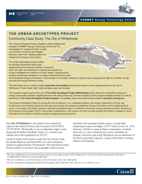
The Urban archeTypes projecT Community Case Study: The City of ...
The Urban archeTypes projecT Community Case Study: The City of ...
The Urban archeTypes projecT Community Case Study: The City of ...

Create successful ePaper yourself
Turn your PDF publications into a flip-book with our unique Google optimized e-Paper software.
CANMET Energy Technology Centre<br />
CLEAN ENERGY TECHNOLOGIES<br />
<strong>The</strong> <strong>Urban</strong> Archetypes Project<br />
<strong>Community</strong> <strong>Case</strong> <strong>Study</strong>: <strong>The</strong> <strong>City</strong> <strong>of</strong> Whitehorse<br />
<strong>The</strong> <strong>Urban</strong> Archetypes Project initiated by Natural Resources<br />
Canada’s CANMET Energy Technology Centre (CETC),<br />
investigated 31 neighbourhoods 1 in eight<br />
communities 2 to explore the linkages<br />
between urban form, lifestyle patterns <strong>of</strong><br />
residents and energy consumption.<br />
<strong>The</strong> project developed energy pr<strong>of</strong>iles<br />
for average households within each<br />
neighbourhood for personal vehicles, household<br />
heat, hot water and electricity for lighting and appliances.<br />
It also investigated the influence <strong>of</strong> urban design, neighbourhood<br />
location and lifestyle variables on average household vehicle travel<br />
and associated energy consumption. Communities in the project reflected a range <strong>of</strong> sizes, geographical regions, climates, energy<br />
sources and energy efficiency issues.<br />
This fact sheet, one in a series <strong>of</strong> eight community case studies presents the results for three neighbourhoods in the <strong>City</strong> <strong>of</strong><br />
Whitehorse: Porter Creek; Wolf Creek and Mary Lake; and Granger.<br />
This research project explored the use <strong>of</strong> <strong>The</strong> <strong>Urban</strong> Archetypes Project Methodology which allows for comparative analysis <strong>of</strong><br />
energy consumption between neighbourhoods in the same community. A further analysis <strong>of</strong> all the project’s neighbourhoods (31) will be<br />
presented in <strong>The</strong> <strong>Urban</strong> Archetypes Project Analysis. As available, these documents will be posted to www.sbc.nrcan.gc.ca.<br />
<strong>The</strong> <strong>Urban</strong> Archetypes Project is among the first to explore, in an integrated fashion, the energy implications <strong>of</strong> land use,<br />
infrastructure and building decisions through case studies that present quantitative energy information at the neighbourhood<br />
scale. In so doing, this project begins to address a significant gap in Canadian community energy planning practice. Building on<br />
the findings <strong>of</strong> this project, CETC, with project collaborators, will continue to work to make energy information available to assist<br />
Canadian communities in making strategic energy planning decisions.<br />
<strong>The</strong> <strong>City</strong> <strong>of</strong> Whitehorse is the political and commercial<br />
capital <strong>of</strong> the Yukon Territory and is located at 60°43’00”N<br />
135°03’00”W. Historically, it was an important supply centre<br />
during the Klondike Gold Rush. Today, it’s a modern and<br />
vibrant town with a population <strong>of</strong> 24,151 3 .<br />
Linear in nature, from north to south, the city extends along<br />
the Alaska Highway and Yukon River in a non-contiguous<br />
fashion for approximately 30 kilometres. <strong>The</strong> downtown/central<br />
business district is located in the geographic centre <strong>of</strong> town.<br />
Situated in the mountain climate region, average daily<br />
temperatures range from highs <strong>of</strong> 21°C (July) to lows <strong>of</strong> −22°C<br />
(January). Similar to many northern communities, residents<br />
<strong>of</strong>ten rely on a mix <strong>of</strong> heating fuel sources including oil,<br />
propane, electricity and wood. Whitehorse has an abundance <strong>of</strong><br />
electricity generation capacity; a legacy from Yukon’s mining<br />
industry development.<br />
1 <br />
<strong>The</strong> term neighbourhood, as used in this project, denotes an area approximately 300 dwelling units in size and <strong>of</strong> relatively homogenous urban form;<br />
a neighbourhood could vary in size geographically.<br />
2<br />
<strong>The</strong> term community, as used in this project, refers to the same scale as the municipality.<br />
3 <br />
<strong>The</strong> <strong>City</strong> <strong>of</strong> Whitehorse Integrated <strong>Community</strong> Sustainability Plan. September 2007. http://www.city.whitehorse.yk.ca<br />
Cat. N o .: M154-15/2008E-PDF ISBN: 978-1-100-10283-2
<strong>Urban</strong> Archetypes Project Whitehorse YK<br />
CANMET Energy Technology Centre<br />
NEIGHBOURHOOD DESCRIPTIONS<br />
Porter Creek<br />
Porter Creek is situated on the upper bench <strong>of</strong> the Yukon<br />
River Valley, approximately 6 km from downtown Whitehorse.<br />
Built in the late 1970s and early 1980s, dwellings are almost<br />
exclusively single detached although some contain legal<br />
secondary suites.<br />
<strong>The</strong> neighbourhood was developed according to a grid pattern<br />
<strong>of</strong> streets and avenues complete with sidewalks, streetlights,<br />
and cross-walks; houses are set back from the street allowing<br />
for manicured front yards and a suburban appearance. While<br />
there are no commercial operations within the study area, a<br />
few commercial businesses are found on Centennial Street.<br />
A school, a church, and art theatre are also located nearby.<br />
Residents <strong>of</strong> this area have access to a local park and outdoor<br />
rink. <strong>The</strong>re are many recreational trails throughout the<br />
neighbourhood.<br />
Wolf Creek & Mary Lake<br />
Wolf Creek and Mary Lake 4 are country residential<br />
subdivisions <strong>of</strong> large lots located approximately 15 km south <strong>of</strong><br />
downtown Whitehorse on the Alaska Highway. While the first<br />
homes were built in the late 1970s, redevelopment continues<br />
to take place. <strong>The</strong> majority <strong>of</strong> residences are single-detached<br />
dwellings interspersed with a few mobile homes.<br />
Homes are generally set back from the road, giving the<br />
neighbourhood a rural appearance. <strong>The</strong> road network pattern<br />
consists <strong>of</strong> crescents and cul-de-sacs branching out from a<br />
main road. <strong>The</strong> majority <strong>of</strong> the streets are minimally surfaced,<br />
with street lights but no sidewalks. <strong>The</strong>se subdivisions are<br />
surrounded by natural green space in all directions.<br />
<strong>The</strong>re are no city services to Wolf Creek and Mary Lake<br />
(no water, sewer or public transportation). No commercial<br />
operations exist within this study area; however, a convenience<br />
store, gas station, and restaurant are located in nearby McRae<br />
industrial area. Residents do have access to a local park and<br />
outdoor rink. Many trails are found within and around the<br />
neighbourhoods.<br />
Granger<br />
Located on the upper Yukon River bench, Granger lies<br />
approximately 3km west <strong>of</strong> downtown Whitehorse. Developed<br />
in the early 1990s, Granger consists mostly <strong>of</strong> single-detached<br />
homes, some <strong>of</strong> which contain legal suites, as well as a limited<br />
number <strong>of</strong> duplexes and town houses. Bordered to the south,<br />
west and north by residential development, Granger residents<br />
enjoy a large expanse <strong>of</strong> natural open space and recreational<br />
trails to the east as well as excellent views <strong>of</strong> the Yukon River<br />
valley and Grey Mountain.<br />
<strong>The</strong> road network pattern in Granger consists <strong>of</strong> local roads,<br />
crescents and courts branching <strong>of</strong>f from Hamilton Boulevard.<br />
Commercial operations include a grocery store, daycare, gas<br />
station and video store. Granger residents have access to a local<br />
park and outdoor rink. Additional recreational opportunities<br />
are available at the nearby Canada Games Centre. <strong>The</strong><br />
neighbourhood has bus service to downtown and bike and<br />
pedestrian paths leading to other areas within Whitehorse.<br />
4 <br />
Wolf Creek and Mary Lake are two separate subdivisions but were considered as one neighbourhood for the purposes <strong>of</strong> the Archetypes Project to ensure a<br />
sufficient sample size for the interviews.<br />
2<br />
www.sbc.nrcan.gc.ca
CANMET Energy Technology Centre<br />
<strong>Urban</strong> Archetypes Project Whitehorse YK<br />
SUMMARY OF ENERGY INPUTS AND SERVICES<br />
<strong>The</strong> graphics summarize an average household’s energy inputs and services. <strong>The</strong> proportional scale between neighbourhoods is<br />
accurate and is reflected in the different size <strong>of</strong> the maps. More detailed source data can be found on pages 5 & 6.<br />
GHGs<br />
(14 tonnes<br />
C0 2<br />
e/yr)<br />
Cost<br />
($7,800/yr)<br />
Porter Creek<br />
Granger<br />
Central<br />
Business<br />
District<br />
Airport<br />
Electricity (14,700 kWh/yr)<br />
Propane (3,300 L/yr)<br />
Gasoline<br />
(3,600 L/yr)<br />
Pl<br />
Grouse Cres<br />
Heron Drive<br />
Falcon Drive<br />
ENERGY<br />
INPUTS<br />
(260 GJ/yr)<br />
Thompson Road<br />
Wilson Drive<br />
Hamilton Boulevard<br />
Turner Crescent<br />
Salter Pl<br />
Wilson Drive<br />
About 4 minutes<br />
walking or<br />
1 minute cycling<br />
250 meters<br />
Wilson Drive<br />
Park Lane<br />
Lighting<br />
and Appliances<br />
(32 GJ/yr)<br />
Hot Water (21 GJ/yr)<br />
Space Heat (85 GJ/yr)<br />
ENERGY<br />
SERVICES<br />
Hi lcrest Drive<br />
Transportation<br />
(123 GJ/yr)<br />
Wolf Creek &<br />
Mary Lake<br />
Falcon Dr<br />
GRANGER<br />
Hayes Pl<br />
GHGs<br />
(20 tonnes<br />
C0 2<br />
e/yr)<br />
Cost<br />
($9400/yr)<br />
Dogwood Street<br />
Electricity (15,100 kWh/yr)<br />
Oil (3,000 L/yr)<br />
Gasoline<br />
(4,500 L/yr)<br />
ENERGY<br />
INPUTS<br />
(320 GJ/yr)<br />
Alaska Highway<br />
14th Avenue<br />
Centennial Street<br />
Versluce Pl<br />
Elm Street<br />
Fir Street<br />
14th Avenue<br />
12th Avenue<br />
Fir Street<br />
Fir Street<br />
Grove Street<br />
Grove Street<br />
11th Avenue<br />
10th Avenue<br />
About 4 minutes<br />
walking or<br />
1 minute cycling<br />
9th Avenue<br />
Ho ly Street<br />
13th Avenue<br />
Grove Street<br />
Pine Street<br />
Spruce Street<br />
13th Avenue<br />
HemlockStreet<br />
Almond Place<br />
Pine Street<br />
11th Avenue<br />
Lighting<br />
and Appliances<br />
(32 GJ /yr)<br />
Hot Water (22 GJ/yr)<br />
Space Heat<br />
ENERGY<br />
(117 GJ/yr)<br />
SERVICES<br />
Transportation<br />
(154 GJ/yr)<br />
Mountainview<br />
250 meters<br />
PORTER CREEK<br />
www.sbc.nrcan.gc.ca 3
Larkspur Place<br />
<strong>Urban</strong> Archetypes Project Whitehorse YK<br />
CANMET Energy Technology Centre<br />
GHGs<br />
(25 tonnes<br />
C0 2<br />
e/yr)<br />
Cost<br />
($11,600/yr)<br />
HarveyPlace<br />
Nansen Drive<br />
Harvey Road<br />
Lighting and<br />
Appliances (33 GJ/yr)<br />
Boss Road<br />
Arke l Place<br />
Hot Water (21 GJ/yr)<br />
Logan Road<br />
Harbottle Road<br />
Phelps Place<br />
Langholz Road<br />
Harbottle Road<br />
Cronkhite Road<br />
Dawson Road<br />
Castle Drive<br />
Keele Place<br />
Tombstone Pl<br />
Logan Road<br />
ENERGY<br />
SERVICES<br />
Space Heat (142 GJ/yr)<br />
Transportation<br />
(204 GJ/yr)<br />
Cronkhite Road<br />
Ryder Place<br />
Fireweed Drive<br />
Dawson Road<br />
Orchid Place<br />
Salmon Trail<br />
Sage Place<br />
Fireweed Drive<br />
Lupin Place<br />
Sockeye Place<br />
Chum Place<br />
Electricity (14,900 kWh/yr)<br />
Aster Place<br />
Kokanee Place<br />
Fireweed Drive<br />
Oil (3,600 L/yr)<br />
Gasoline<br />
(5,900 L/yr)<br />
ENERGY<br />
INPUTS<br />
(400 GJ/YR)<br />
Iris Place<br />
Crocus Place<br />
Columbine Place<br />
Fireweed Drive<br />
Bluebe l Place<br />
Salmon Trail<br />
Do ly Varden Drive<br />
Do ly Varden Drive<br />
Grayling Place<br />
Coho Trail<br />
Chinook Lane<br />
Marigold Place<br />
Buttercup Place<br />
About 4 minutes walking<br />
or 1 minute cycling<br />
250 meters<br />
WOLF CREEK & MARY LAKE<br />
Legend for Area Maps<br />
Residential<br />
<strong>Study</strong> area with<br />
residential lots<br />
Land Use<br />
Retail/Commercial<br />
Industrial<br />
Institutional<br />
Municipal<br />
Recreational<br />
Parkland<br />
Water<br />
Transportation<br />
Arterial (with sidewalks)<br />
Collector (with sidewalks)<br />
Local (with sidewalks)<br />
Roads without sidewalks<br />
Alleys<br />
Pathways<br />
Bike lanes, bike paths<br />
Bus routes<br />
4<br />
www.sbc.nrcan.gc.ca
CANMET Energy Technology Centre<br />
ENERGY USE IN HOUSES<br />
<strong>The</strong> amount <strong>of</strong> energy consumed to provide the energy services<br />
<strong>of</strong> space heating, domestic hot water heating, lighting and<br />
appliances can vary substantially from house to house. Factors<br />
influencing household energy consumption include: levels <strong>of</strong><br />
insulation and airtightness, efficiency <strong>of</strong> mechanical systems for<br />
space heating and hot water, choice <strong>of</strong> lighting and appliances,<br />
size <strong>of</strong> house, and occupant lifestyles.<br />
162 GJ<br />
$4,330<br />
8.3 tonnes<br />
171 GJ<br />
$4,540<br />
8.9 tonnes<br />
<strong>The</strong> energy consumption <strong>of</strong> common house types found within<br />
the Whitehorse study areas ranges from 138 GJ to 205 GJ per<br />
205 GJ<br />
$5,320<br />
11.7 tonnes<br />
174 GJ<br />
$4,600<br />
9.2 tonnes<br />
196 GJ<br />
$5,120<br />
10.7 tonnes<br />
175 GJ<br />
<strong>Urban</strong> Archetypes Project Whitehorse YK<br />
year. For homes heated with oil, this represents 2,750 litres to<br />
4,000 litres per year. For those heated with propane, it ranges<br />
from 3,250 litres to 4,650 litres per year. <strong>The</strong> electricity use<br />
for all houses ranges from 13,600 to 15,100 kilowatt hours<br />
per year for hot water heating, lighting and appliances. Given<br />
this consumption, energy costs 5 range from $3,890 to $5,320<br />
per year for the use <strong>of</strong> a combination <strong>of</strong> oil or propane and<br />
electricity; associated greenhouse gas emissions range from<br />
5.5 tonnes to 11.7 tonnes <strong>of</strong> equivalent CO 2<br />
per year.<br />
$4,820<br />
7.6 tonnes<br />
138 GJ<br />
$3,890<br />
5.5 tonnes<br />
Porter Creek Wolf Creek & Mary Lake Granger<br />
ENERGY SERVICES<br />
Lighting and Appliances<br />
Domestic Hot Water<br />
Space Heat<br />
COST<br />
Electricity<br />
Propane<br />
Oil<br />
GHG EMISSIONS<br />
A B A B C A B<br />
Equivalent C0 2<br />
5.5 tonnes<br />
$3,890<br />
138 GJ<br />
7.6 tonnes<br />
$4,820<br />
175 GJ<br />
10.7 tonnes<br />
$5,120<br />
196 GJ<br />
9.2 tonnes<br />
$4,600<br />
174 GJ<br />
11.7 tonnes<br />
$5,320<br />
205 GJ<br />
8.9 tonnes<br />
$4,540<br />
171 GJ<br />
8.3 tonnes<br />
$4,330<br />
162 GJ<br />
Building Type storeys One-storey One-storey Two-storeys Two-storeys One-storey Two-storeys One-storey<br />
attachment single-detached single-detached single-detached single-detached single-detached single-detached single-detached<br />
built 1978-1983 1961-1977 after 1995 1984-1995 1978-1983 1984-1995 1984-1995<br />
Heated Floor Area 185 m 2<br />
(2,000 sq.ft.)<br />
200 m 2<br />
(2,150 sq.ft.)<br />
260 m 2<br />
(2,800 sq.ft.)<br />
235 m 2<br />
(2,500 sq.ft.)<br />
240 m 2<br />
(2,600 sq.ft.)<br />
300 m 2<br />
(3,200 sq.ft.)<br />
225 m 2<br />
(2,400 sq.ft.)<br />
Insulation ceiling RSI 5.7 (R-32) RSI 4.6 (R-26) RSI 6.0 (R-34) RSI 7.0 (R-40) RSI 4.2 (R-24) RSI 6.0 (R-34) RSI 6.3 (R-36)<br />
Space<br />
Heating<br />
walls RSI 2.4 (R-14) RSI 2.3 (R-13) RSI 2.9 (R-16) RSI 3.6 (R-20) RSI 2.3 (R-13) RSI 3.6 (R-20) RSI 2.9 (R-16)<br />
foundation RSI 2.1 (R-12) RSI 2.3 (R-13) RSI 3.1 (R-18) RSI 2.6 (R-15) RSI 2.4 (R-14) RSI 3.7 (R-21) RSI 3.1 (R-18)<br />
fuel oil oil oil oil oil propane propane<br />
furnace<br />
furnace with flame<br />
retention head<br />
furnace with flame<br />
retention head<br />
furnace with flame<br />
retention head<br />
mid-efficiency<br />
furnace<br />
furnace with flame<br />
retention head<br />
condensing<br />
furnace<br />
efficiency 83% 83% 83% 85% 83% 87% 87%<br />
condensing<br />
furnace<br />
Hot Water fuel electric electric electric electric electric electric electric<br />
Lighting<br />
Appliances<br />
ENERGY SERVICES<br />
Lighting and Appliances<br />
Domestic Hot Water<br />
Space Heat<br />
COST<br />
Electricity<br />
Propane<br />
Oil<br />
tank conventional tank conventional tank conserver tank conserver tank conserver tank conserver tank conserver tank<br />
efficiency 82% 82% 87% 87% 87% 87% 87%<br />
GHG EMISSIONS<br />
Equivalent C0 2<br />
standard<br />
residential<br />
incandescent<br />
lighting<br />
standard<br />
appliances<br />
standard<br />
residential<br />
incandescent<br />
lighting<br />
standard<br />
appliances<br />
standard<br />
residential<br />
incandescent<br />
lighting<br />
standard<br />
appliances<br />
standard<br />
residential<br />
incandescent<br />
lighting<br />
standard<br />
appliances<br />
standard<br />
residential<br />
incandescent<br />
lighting<br />
standard<br />
appliances<br />
standard<br />
residential<br />
incandescent<br />
lighting<br />
standard<br />
appliances<br />
Occupants 4 4 3 4 4 4 4<br />
standard<br />
residential<br />
incandescent<br />
lighting<br />
standard<br />
appliances<br />
5 Average costs were calculated using available price data for Whitehorse: Oil (93.9 ¢/L, 2006 average), Propane (67¢/L, 2006 average)<br />
and Electricity (11.5 ¢/kWh, 2005 average).<br />
www.sbc.nrcan.gc.ca 5
<strong>Urban</strong> Archetypes Project Whitehorse YK<br />
CANMET Energy Technology Centre<br />
Energy Use for Personal Vehicle Transportation 6<br />
Personal transportation helps Canadians accomplish a wide<br />
variety <strong>of</strong> activities and is essential to the functioning <strong>of</strong> our<br />
communities. Personal vehicles are the predominant form <strong>of</strong><br />
personal transportation, accounting for 78% <strong>of</strong> total passenger<br />
transportation energy end-use in Canada in 2005 7 .<strong>The</strong> <strong>Urban</strong><br />
Archetypes Project calculated energy consumption for personal<br />
vehicles 8 and additionally examined public transit and the active<br />
modes <strong>of</strong> walking and cycling.<br />
Factors influencing transportation energy consumption for<br />
personal vehicles considered here include distance travelled,<br />
vehicle type, and fuel efficiency. <strong>The</strong> influence <strong>of</strong> neighbourhood<br />
design characteristics, neighbourhood location and lifestyle<br />
were analyzed across all neighbourhoods included in the study,<br />
the results <strong>of</strong> which are presented in <strong>The</strong> <strong>Urban</strong> Archetypes<br />
Methodology.<br />
Average annual household Vehicle Kilometres Travelled 9<br />
(VKT) in the Whitehorse study areas ranged from 30,700 km<br />
to 42,000 km. In 2006, the average study area household<br />
consumed between 3,560 and 5,885 litres <strong>of</strong> gasoline that cost 10<br />
between $3,898 and $6,444, and produced greenhouse gas<br />
emissions <strong>of</strong> between 9 and 14 tonnes <strong>of</strong> equivalent CO 2<br />
.<br />
ENERGY INPUTS<br />
Gasoline (L)<br />
ENERGY INPUTS<br />
Gasoline (L)<br />
Cost<br />
Porter Creek Wolf Creek & Mary Lake Granger<br />
Cost<br />
GHG Emissions<br />
(Equivalent C0 2<br />
)<br />
GHG Emissions<br />
(Equivalent C0 2<br />
)<br />
154 GJ<br />
154 GJ<br />
(4,500 L/yr)<br />
(4,500 L/yr)<br />
10.7 tonnes<br />
10.7 tonnes<br />
$4,887<br />
$4,887<br />
204 GJ<br />
204 GJ<br />
(5,900 L/yr)<br />
(5,900 L/yr)<br />
14.1 tonnes<br />
14.1 tonnes<br />
$6,4440<br />
$6,4440<br />
123 GJ<br />
123 GJ<br />
(3,600 L/yr)<br />
(3,600 L/yr)<br />
8.5 tonnes<br />
8.5 tonnes<br />
$3,898<br />
$3,898<br />
Neighbourhood Design Gross Density 4.00 UPH 0.46 UPH 6.60 UPH<br />
Neighbourhood Location<br />
Resident Lifestyle<br />
Percent <strong>of</strong> Housing Units<br />
Single Detached<br />
93% 98% 88%<br />
Land Use Mix Index 0.31 0 0.39<br />
Total Road Length 7.9 km 22.8 km 6.0 km<br />
Distance to Central<br />
Business District<br />
Average Number <strong>of</strong><br />
Vehicles per Household<br />
6.4 km 15.0 km 3.2 km<br />
2.4 2.5 1.9<br />
Vehicle Kilometers Traveled (VKT) 30,700 km 42,000 km 24,400 km<br />
PROJECT COLLABORATION<br />
Natural Resources Canada recognizes the contribution <strong>of</strong><br />
project collaborators in Whitehorse including the <strong>City</strong> <strong>of</strong><br />
Whitehorse, the Northern Climate Exchange, Yukon Electric<br />
and North 60° Petro.<br />
FOR MORE INFORMATION<br />
To learn more about the <strong>Urban</strong> Archetypes Project, or to access<br />
project companion documents (Methodology and additional case<br />
studies), go to www.sbc.nrcan.gc.ca or contact Jessica Webster by<br />
phone: (613) 992-9532 or email: jessica.webster@nrcan.gc.ca.<br />
6<br />
Indicator definitions can be found in <strong>The</strong> <strong>Urban</strong> Archetypes Project Methodology (www.sbc.nrcan.gc.ca).<br />
7 Passenger Transportation Secondary Energy Use by Energy Source and Transportation Mode<br />
http://www.oee.nrcan.gc.ca/corporate/statistics/neud/dpa/tableshandbook2/tran_00_4_e_2.cfm?attr=0.<br />
8 Personal vehicles include small and large cars and light trucks.<br />
9 Based on total household VKT-AVG responses, collected from study area residents in 2006. See <strong>Urban</strong> Archetype Project Methodology for more details.<br />
10 Average costs were calculated using available price data for Whitehorse: Gasoline ($1.095/L, 2006 average).<br />
6<br />
www.sbc.nrcan.gc.ca