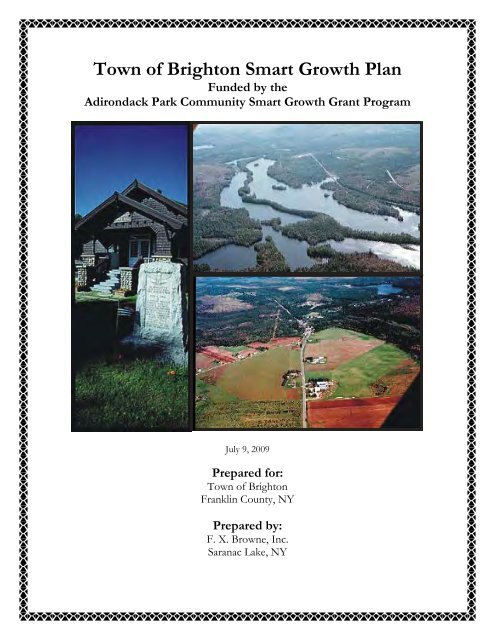
Town of Brighton Smart Growth Plan - New York State Department of ...
Town of Brighton Smart Growth Plan - New York State Department of ...
Town of Brighton Smart Growth Plan - New York State Department of ...

You also want an ePaper? Increase the reach of your titles
YUMPU automatically turns print PDFs into web optimized ePapers that Google loves.
<strong>Town</strong> <strong>of</strong> <strong>Brighton</strong> <strong>Smart</strong> <strong>Growth</strong> <strong>Plan</strong><br />
Funded by the<br />
Adirondack Park Community <strong>Smart</strong> <strong>Growth</strong> Grant Program<br />
July 9, 2009<br />
Prepared for:<br />
<strong>Town</strong> <strong>of</strong> <strong>Brighton</strong><br />
Franklin County, NY<br />
Prepared by:<br />
F. X. Browne, Inc.<br />
Saranac Lake, NY
<strong>Town</strong> <strong>of</strong> <strong>Brighton</strong> <strong>Smart</strong> <strong>Growth</strong> <strong>Plan</strong><br />
July 9, 2009<br />
Prepared for:<br />
<strong>Town</strong> <strong>of</strong> <strong>Brighton</strong><br />
P.O. Box 260<br />
Paul Smiths, NY 12970<br />
Franklin County<br />
Prepared by:<br />
F. X. Browne, Inc.<br />
1519 <strong>State</strong> Route 86<br />
Funded by:<br />
The <strong>New</strong> <strong>York</strong> <strong>State</strong> Adirondack Park Community <strong>Smart</strong> <strong>Growth</strong> Grant Program<br />
<strong>New</strong> <strong>York</strong> <strong>State</strong> <strong>Department</strong> <strong>of</strong> Environmental Conservation<br />
625 Broadway<br />
Albany, NY 12233-4250<br />
Photo credits, previous page:<br />
<strong>Town</strong> hall: Mark Kurtz<br />
Aerial photos: Colonel Hank Snow<br />
Courtesy <strong>of</strong> the <strong>Brighton</strong> 2000 project<br />
Unless otherwise designated, all photos within this <strong>Plan</strong> are by Rebecca Buerkett, used with permission
F. X. Browne, Inc.<br />
Table <strong>of</strong> Contents<br />
Acknowledgements .......................................................................................................................... i<br />
Executive Summary ......................................................................................................................... i<br />
1.0 Introduction ......................................................................................................................... 1<br />
1.1 Purpose <strong>of</strong> <strong>Smart</strong> <strong>Growth</strong> <strong>Plan</strong> ............................................................................... 1<br />
1.2 Demographics and Background .............................................................................. 1<br />
1.3 Community Assets .................................................................................................. 3<br />
1.4 <strong>Town</strong> Government and Local Laws ........................................................................ 4<br />
1.5 What is <strong>Smart</strong> <strong>Growth</strong>? ........................................................................................... 5<br />
1.6 <strong>Brighton</strong> <strong>Smart</strong> <strong>Growth</strong> Initiative ........................................................................... 6<br />
1.7 <strong>Brighton</strong> <strong>Smart</strong> <strong>Growth</strong> Community Survey .......................................................... 7<br />
1.8 Public meetings ..................................................................................................... 10<br />
2.0 Land Use ........................................................................................................................... 11<br />
2.1 Existing Land Use ................................................................................................. 11<br />
2.2 Build-Out Analysis ............................................................................................... 12<br />
2.3 Environmental Assessment ................................................................................... 16<br />
2.4 Land Use Recommendations ................................................................................ 17<br />
3.0 <strong>Brighton</strong> Businesses .......................................................................................................... 19<br />
3.1 Existing Businesses ............................................................................................... 19<br />
3.2 Business Social ..................................................................................................... 19<br />
3.3 Survey Results ...................................................................................................... 19<br />
3.4 Brochure ................................................................................................................ 19<br />
3.5 <strong>Brighton</strong> Website .................................................................................................. 20<br />
3.6 Camp Gabriels ...................................................................................................... 20<br />
4.0 Telecommunications ......................................................................................................... 21<br />
4.1 Existing Telecommunications in <strong>Brighton</strong> ........................................................... 22<br />
4.2 Regional Telecommunications <strong>Plan</strong>ning .............................................................. 22<br />
4.3 Telecommunications Recommendations .............................................................. 23<br />
5.0 Evaluation <strong>of</strong> <strong>Smart</strong> <strong>Growth</strong> Alternatives ......................................................................... 23<br />
5.1 Affordable Housing ............................................................................................. 23<br />
5.2 <strong>Town</strong> center revitalization .................................................................................... 25<br />
5.3 Craft/Heritage trails .............................................................................................. 25<br />
5.4 Historic Resources ................................................................................................ 26<br />
5.5 Energy Efficiency/Green building ........................................................................ 27<br />
5.6 Multi-use/Walkable Neighborhoods ..................................................................... 27<br />
6.0 Municipal <strong>Plan</strong>ning ........................................................................................................... 28<br />
6.1 Past <strong>Town</strong> <strong>Plan</strong>ning Efforts .................................................................................. 28<br />
6.2 Regional <strong>Plan</strong>ning ................................................................................................. 28<br />
6.3 <strong>Plan</strong>ning Recommendations.................................................................................. 30<br />
7.0 <strong>Smart</strong> <strong>Growth</strong> Action <strong>Plan</strong> ................................................................................................ 32<br />
7.1 Action <strong>Plan</strong>............................................................................................................ 32<br />
7.2 Timeline, Organizational Capacity and Funding .................................................. 33<br />
8.0 References ......................................................................................................................... 34<br />
<strong>Brighton</strong> <strong>Smart</strong> <strong>Growth</strong> <strong>Plan</strong><br />
Table <strong>of</strong> Contents
F. X. Browne, Inc.<br />
Appendix A ................................................... <strong>Town</strong> <strong>of</strong> <strong>Brighton</strong> Historical Information and Assets<br />
Appendix B ............................................................................ <strong>Brighton</strong> Community Survey Results<br />
Appendix C ......................................................................................................... Land Use Analysis<br />
Appendix D ............................................................................................ Environmental Assessment<br />
Appendix E .......................................................................................... <strong>Brighton</strong> Business Directory<br />
Appendix F..................................................................................... <strong>Brighton</strong> Connections Brochure<br />
Appendix G .......................................................................................... Glossary <strong>of</strong> <strong>Plan</strong>ning Terms<br />
<strong>Brighton</strong> <strong>Smart</strong> <strong>Growth</strong> <strong>Plan</strong><br />
Table <strong>of</strong> Contents
F. X. Browne, Inc.<br />
Acknowledgements<br />
This project would not have been possible without the help <strong>of</strong> many dedicated project partners,<br />
town board members, committee members, and community members, including the following:<br />
<strong>Brighton</strong> <strong>Town</strong> Board members (2008-2009), for project support,<br />
review and assistance:<br />
• David Knapp, Supervisor<br />
• Sheila Delarm<br />
• Jeff Leavitt<br />
• Steve Tucker<br />
• Lydia Wright<br />
Rebecca Buerkett, Project Scientist at<br />
F. X. Browne, Inc., for preparing the<br />
grant proposal, coordinating and<br />
carrying out the project, and preparing<br />
this <strong>Smart</strong> <strong>Growth</strong> <strong>Plan</strong>.<br />
Leslie Karasin, Program Manager <strong>of</strong> the Wildlife<br />
Conservation Society's Adirondack Program, for serving in<br />
an advisory capacity and preparing GIS mapping and<br />
environmental analyses.<br />
Diane Leifheit, Point <strong>of</strong> View Studios, for designing the <strong>Brighton</strong> Connections brochure and<br />
serving in an advisory capacity.<br />
Michael Martin, President <strong>of</strong> Cedar Eden Environmental, LLC, for conducting the build-out<br />
analysis and GIS mapping.<br />
<strong>Brighton</strong> <strong>Smart</strong> <strong>Growth</strong> Grant Committee members, for meeting<br />
to advise and implement the project on a monthly basis:<br />
• Robyn Burgess<br />
• Leslie Karasin<br />
• Sheila Delarm<br />
• Steve Tucker<br />
• Holly Huber<br />
Elaine Sater, <strong>Brighton</strong> <strong>Town</strong> Clerk, for project assistance.<br />
And last but definitely not least, thanks to the NYS DEC Adirondack <strong>Smart</strong> <strong>Growth</strong> Program for<br />
providing funding for this project.<br />
<strong>Brighton</strong> <strong>Smart</strong> <strong>Growth</strong> <strong>Plan</strong><br />
Acknowledgements
F. X. Browne, Inc.<br />
Executive Summary<br />
In 2008, the <strong>Town</strong> <strong>of</strong> <strong>Brighton</strong> received an Adirondack Park Community <strong>Smart</strong> <strong>Growth</strong> Grant<br />
from the <strong>New</strong> <strong>York</strong> <strong>State</strong> <strong>Department</strong> <strong>of</strong> Environmental Conservation for a sustainable economic<br />
development project. The project was designed to investigate solutions for some <strong>of</strong> the biggest<br />
issues facing <strong>Brighton</strong> residents: the closure <strong>of</strong> Camp Gabriels, high energy costs, poor<br />
telecommunications access, lack <strong>of</strong> affordable housing, lack <strong>of</strong> public transportation, and poor<br />
visibility for local businesses. The project included the<br />
following activities:<br />
● Review <strong>of</strong> existing documents<br />
● Key stakeholder interviews<br />
● Community survey<br />
● <strong>Brighton</strong> Connections tourism brochure<br />
● <strong>Brighton</strong> business social<br />
● Energy efficiency workshop<br />
● Telecommunications planning<br />
● Land use evaluation<br />
● <strong>Smart</strong> <strong>Growth</strong> <strong>Plan</strong><br />
● Public Meetings<br />
Community Survey<br />
Approximately 25 percent <strong>of</strong> the households in <strong>Brighton</strong> that were mailed the survey responded.<br />
Of the respondents, the vast majority (72 percent) feel that <strong>Brighton</strong>’s primary “identity” should<br />
be “a place to live and work.” The type <strong>of</strong> economic development that community members<br />
listed as most desirable was re-use <strong>of</strong> existing buildings (51 percent), followed by Camp Gabriels<br />
replacement (48 percent), recreation businesses (46 percent), and home-based businesses (44<br />
percent). More information about the community survey is provided in section 1.7 and Appendix<br />
B.<br />
Land Use Analysis<br />
Very little land is available for development within the <strong>Town</strong> <strong>of</strong> <strong>Brighton</strong>. Of the available land,<br />
much <strong>of</strong> it is “land-locked” behind properties along roads, making it inaccessible. However, six<br />
key areas have been identified as locations close to existing development centers or prominent<br />
intersections with potential for the type <strong>of</strong> commercial or light industrial development that will<br />
bring jobs and economic development to the town. The <strong>Town</strong> <strong>of</strong> <strong>Brighton</strong> should consider<br />
implementing town planning to designate these areas as economic development centers. In<br />
addition, the town should promote reuse and redevelopment <strong>of</strong> existing buildings for commercial<br />
use. The land use analysis is provided in section 2.0.<br />
Environmental Assessment<br />
The <strong>Town</strong> <strong>of</strong> <strong>Brighton</strong> has a wealth <strong>of</strong> environmental assets that attract visitors, scientists,<br />
birders, students, and local residents. For example, the town has high-value wetland complexes,<br />
an extensive underlying aquifer, quality forest resources, habitat for rare and threatened species,<br />
and spectacular rivers, lakes, and mountains for recreational opportunities. Although the town’s<br />
environmental resources are largely in good condition, the <strong>Town</strong> <strong>of</strong> <strong>Brighton</strong> should consider<br />
<strong>Brighton</strong> <strong>Smart</strong> <strong>Growth</strong> <strong>Plan</strong><br />
Page i
F. X. Browne, Inc.<br />
environmental planning initiatives to protect the town’s greatest assets in terms <strong>of</strong> economic<br />
development potential: natural and recreational resources. In particular, the town should pass a<br />
conservation subdivision (cluster development) ordinance to ensure that future development<br />
protects open space and focuses development in key areas. The environmental assessment is<br />
discussed in section 2.3 and maps are provided in Appendix D.<br />
Business Development/<strong>Brighton</strong> Connections Brochure<br />
The <strong>Town</strong> <strong>of</strong> <strong>Brighton</strong> has an active business community, the vast majority <strong>of</strong> which are small<br />
businesses. In order to highlight and capitalize upon the town’s economic development potential,<br />
a tourist brochure, “<strong>Brighton</strong> Connections” was developed. The goal <strong>of</strong> the brochure is to attract<br />
visitors to the <strong>Town</strong> <strong>of</strong> <strong>Brighton</strong> from the greater Adirondack region, as well as to provide<br />
information to visitors that may keep them in the town for additional recreational opportunities,<br />
shopping, accommodations, etc. Three thousand full-color copies <strong>of</strong> the brochure have been<br />
printed and are being distributed to local and regional venues such as the Visitor’s Interpretive<br />
Center, chambers <strong>of</strong> commerce, museums, hotels, and other locations. More information about<br />
the brochure is provided in section 3.4 and a copy <strong>of</strong> the brochure is provided in Appendix F.<br />
Telecommunications<br />
A major impediment to economic development in the <strong>Town</strong> <strong>of</strong> <strong>Brighton</strong> is a lack <strong>of</strong> high-speed<br />
Internet and cell phone access in parts <strong>of</strong> the town. For many residents, the cost <strong>of</strong> installing<br />
high-speed Internet access from the main road to their homes (so-called “last mile” access) is<br />
prohibitive. The <strong>Town</strong> <strong>of</strong> <strong>Brighton</strong> should partner with CBN Connect and/or other area<br />
telecommunications interests to improve high-speed Internet and cell phone access to town<br />
residents, possibly via supporting the installation <strong>of</strong> a wireless transmitter in a strategic location<br />
such as the Adirondack Airport. Telecommunications issues in the <strong>Town</strong> <strong>of</strong> <strong>Brighton</strong> are<br />
discussed in Section 4.0.<br />
<strong>Town</strong> <strong>Plan</strong>ning<br />
Currently, the <strong>Town</strong> <strong>of</strong> <strong>Brighton</strong> has no comprehensive, zoning, or site review plan to guide<br />
future development and ensure that development practices within the town are compatible with<br />
the town’s character and identity. At a minimum, the town should re-establish its site review<br />
board and pass a Site Review <strong>Plan</strong> to allow for review <strong>of</strong> major developments within the town.<br />
The town should also consider implementing a Comprehensive <strong>Plan</strong>, Land Use <strong>Plan</strong> or<br />
Subdivision and Land Development Ordinance, and Conservation Subdivision Ordinance.<br />
Information on planning issues in the <strong>Town</strong> <strong>of</strong> <strong>Brighton</strong> is provided in section 6.0.<br />
Organizational Capacity<br />
The <strong>Town</strong> <strong>of</strong> <strong>Brighton</strong> has no full-time employees other than Highway <strong>Department</strong> personnel.<br />
The <strong>Town</strong> Supervisor and the <strong>Town</strong> Board members are part-time elected <strong>of</strong>ficials, and all have<br />
other jobs that keep them very busy. The town would benefit greatly from having a full-time<br />
<strong>Town</strong> Manager to keep up with grant opportunities, regional collaborations, and economic<br />
development initiatives. At least part <strong>of</strong> the <strong>Town</strong> Manager’s salary could be paid with grant<br />
money, which would provide an incentive to apply for grants.<br />
<strong>Brighton</strong> <strong>Smart</strong> <strong>Growth</strong> <strong>Plan</strong><br />
Page ii
F. X. Browne, Inc.<br />
Action <strong>Plan</strong><br />
The following Action <strong>Plan</strong> summary highlights the most pressing needs in the <strong>Town</strong> <strong>of</strong> <strong>Brighton</strong><br />
in terms <strong>of</strong> economic development. The Action <strong>Plan</strong>, timeline, and potential funding<br />
opportunities are discussed in section 7.0.<br />
1. Distribute the <strong>Brighton</strong> Connections brochure widely in the Tri-lakes region.<br />
2. Hire a town manager or town planner to seek grants and advocate for the town’s interests<br />
within the Adirondack region.<br />
3. Support efforts to find a year-round business to replace Camp Gabriels.<br />
4. Hold monthly <strong>Brighton</strong> business socials, rotating locations between town businesses, in<br />
order to foster connections and collaboration between area businesses.<br />
5. Periodically hold energy efficiency workshops and additional opportunities to provide<br />
information to residents about how they can improve their homes and reduce the cost <strong>of</strong><br />
home ownership.<br />
6. Develop and implement a Site Review <strong>Plan</strong>.<br />
7. Develop and implement a conservation subdivision ordinance.<br />
8. Apply for a technology grant or stimulus funding in conjunction with CBN Connect and<br />
other area towns to build a wireless high-speed Internet transmitter at the Adirondack<br />
Airport.<br />
9. Partner with neighboring towns to share services and engage in cooperative purchasing to<br />
save money.<br />
10. Encourage year-round economic development in the town, including support for “green<br />
jobs.”<br />
11. Whenever possible, maintain existing buildings and support historic preservation projects<br />
such as the <strong>Town</strong> Hall renovation. This includes promoting historic preservation<br />
easements on public and private properties in the town.<br />
12. Encourage smart economic growth in existing centers such as Gabriels village and other<br />
identified potential growth areas.<br />
<strong>Brighton</strong> <strong>Smart</strong> <strong>Growth</strong> <strong>Plan</strong><br />
Page iii
F. X. Browne, Inc.<br />
1.0 Introduction<br />
The <strong>Brighton</strong> <strong>Smart</strong> <strong>Growth</strong> Project was funded by the<br />
<strong>New</strong> <strong>York</strong> <strong>State</strong> <strong>Department</strong> <strong>of</strong> Environmental<br />
Conservation (NYS DEC) Adirondack Park<br />
Community <strong>Smart</strong> <strong>Growth</strong> Grant. This grant program<br />
(funded by the Environmental Protection Fund).<br />
provided funds for eighteen projects in Adirondack<br />
Park communities that need financial or technical<br />
assistance to plan successfully for the future.<br />
1.1 Purpose <strong>of</strong> <strong>Smart</strong> <strong>Growth</strong> <strong>Plan</strong><br />
We need to capitalize on our<br />
rich history, ample and<br />
unique recreational<br />
opportunities, supportive<br />
community spirit, and<br />
diverse economic potential to<br />
keep our town viable long<br />
into the future.<br />
The <strong>Brighton</strong> <strong>Smart</strong> <strong>Growth</strong> <strong>Plan</strong> is intended to inform<br />
decision-making in the <strong>Town</strong> <strong>of</strong> <strong>Brighton</strong> with respect to economically and environmentally<br />
sustainable growth practices. It is not a town governing document, but rather serves as a<br />
springboard for future planning efforts in the town. The <strong>Plan</strong> documents the desires and goals <strong>of</strong><br />
town residents, and provides information about how to guide growth within the town so that our<br />
community and recreational character can be preserved, while creating jobs and small business<br />
opportunities for our residents. The <strong>Town</strong> <strong>of</strong> <strong>Brighton</strong> is seen by our residents and visitors as a<br />
recreation haven and a place to live and work. We need to capitalize on our rich history, ample<br />
and unique recreational opportunities, supportive community spirit, community and natural<br />
assets, and diverse economic potential to keep our town viable long into the future. A glossary <strong>of</strong><br />
planning terms designed to assist readers <strong>of</strong> this <strong>Plan</strong> is provided in Appendix G.<br />
1.2 Demographics and Background<br />
The <strong>Town</strong> <strong>of</strong> <strong>Brighton</strong> is located in south-central Franklin County, one <strong>of</strong> the northernmost<br />
counties in <strong>New</strong> <strong>York</strong> <strong>State</strong>. The town occupies an area <strong>of</strong> about 78 square miles. Most <strong>of</strong> the<br />
land is forested. According to the <strong>Brighton</strong> 2000 Report (Willis 2002), the <strong>State</strong> <strong>of</strong> <strong>New</strong> <strong>York</strong><br />
owns about 47% <strong>of</strong> the land in the town, most <strong>of</strong> it wild forest. Lands <strong>of</strong> Paul Smith's College<br />
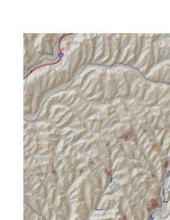
account for an additional 20% <strong>of</strong> town acreage. Figure 1 is a location map <strong>of</strong> the <strong>Town</strong> <strong>of</strong><br />
<strong>Brighton</strong>.<br />
Modern-day development in <strong>Brighton</strong> is primarily centered along the few roads in town. Two<br />
state highways intersect in <strong>Brighton</strong>; Route 30 runs north to Malone and south to Tupper Lake,<br />
and Route 86 runs east to Saranac Lake and ends at Paul Smith’s College at its western terminus.<br />
Approximately 8 miles <strong>of</strong> county and town roads also exist in the town. Several developed areas,<br />
or neighborhoods, are located within the town, including McColloms, Paul Smiths (including<br />
Keese Mill Road), Gabriels, Rainbow Lake, and Split Rock Road.<br />
<strong>Brighton</strong> <strong>Smart</strong> <strong>Growth</strong> <strong>Plan</strong> 1<br />
July 2009
F. X. Browne, Inc.<br />
Figure 1 - <strong>Town</strong> <strong>of</strong> <strong>Brighton</strong> Location Map<br />
Source: <strong>Brighton</strong> 2000 Report (Willis 2002)<br />
Historical information about the <strong>Town</strong> <strong>of</strong> <strong>Brighton</strong> is provided<br />
in Appendix A.<br />
According to the US Census Bureau there were 1,682<br />
residents in the <strong>Town</strong> <strong>of</strong> <strong>Brighton</strong> in the year 2000. That total<br />
included 363 inmates <strong>of</strong> Camp Gabriels and 535 Paul Smith's<br />
College students, leaving 784 people not resident in either<br />
Photo Credit: Pat Willis institution. The 1999 per capita income in the town was<br />
$11,995, which is about half the national average <strong>of</strong> $21,587.<br />
Of the town’s population over age 16, 86 percent were in the labor force. The total assessment<br />
for the <strong>Town</strong> in 2009 was $247,296,840, with approximately 1,097 tax parcels on the tax rolls.<br />
The Total Warrant for the town and county in 2009 was $1,319,109; the school tax re-levy<br />
(unpaid school taxes are added on to town and county) was $64,589.<br />
Figure 2 is a topographic map <strong>of</strong> the <strong>Town</strong> <strong>of</strong> <strong>Brighton</strong>.<br />
<strong>Brighton</strong> <strong>Smart</strong> <strong>Growth</strong> <strong>Plan</strong> 2<br />
July 2009
F. X. Browne, Inc.<br />
Figure 2 - <strong>Town</strong> <strong>of</strong> <strong>Brighton</strong> Map<br />
Source: <strong>Brighton</strong> 2000 Report (Willis 2002)<br />
1.3 Community Assets<br />
<strong>Brighton</strong> has a wealth <strong>of</strong> economic, cultural, historical, and recreational opportunities existing<br />
within the town. However, many <strong>of</strong> these opportunities are under-utilized or not recognized by<br />
tourists passing through the town on their way to the Visitor’s Interpretive Center or other<br />
recreational opportunities. <strong>Brighton</strong> is a wonderful place to live and work, as well as a recreation<br />
haven. <strong>Brighton</strong> has many assets to <strong>of</strong>fer our visitors, including hiking trails, numerous lakes and<br />
<strong>Brighton</strong> <strong>Smart</strong> <strong>Growth</strong> <strong>Plan</strong> 3<br />
July 2009
F. X. Browne, Inc.<br />
rivers for paddling, wetland bird watching sites, historical sites, crafters’ studios, working farms,<br />
a nature center, and an award-winning college. <strong>Brighton</strong> contains a broad mix <strong>of</strong> land use,<br />
including a small town center in Gabriels, three larger institutions (Paul Smith’s College, the<br />
Adirondack Park Visitor Interpretive Center, and the Camp Gabriels Correctional Facility,<br />
although the latter recently closed), several large recreational lakes with many second homes,<br />
two multigenerational working family farms, and several small forestry operations and tree<br />
farms.<br />
<strong>Brighton</strong> has a strong community volunteer base, supporting the following organizations:<br />
<strong>Brighton</strong> Architectural Heritage Committee, <strong>Brighton</strong> Seniors, Osgood Lake Association, Paul<br />
Smiths-Gabriels Volunteer Fire <strong>Department</strong>, Rainbow Lake Association, St. Paul's/Assumption<br />
Church Food Pantry, St. Regis Lakes Association, and the Volunteer Ride-to-<strong>Town</strong> Program.<br />
The citizens <strong>of</strong> the <strong>Brighton</strong> community are a major asset; a culture <strong>of</strong> neighborliness and a<br />
willingness to help others abounds.<br />
A more detailed listing <strong>of</strong> the <strong>Town</strong> <strong>of</strong> <strong>Brighton</strong>’s assets is included in Appendix A.<br />
1.4 <strong>Town</strong> Government and Local Laws<br />
The <strong>Town</strong> <strong>of</strong> <strong>Brighton</strong> is governed by a supervisor and four town council members. Decisions<br />
regarding town business are made by majority rule <strong>of</strong> the town council and supervisor, consisting<br />
<strong>of</strong> at least three <strong>of</strong> the five members. The town supervisor is the chief financial <strong>of</strong>ficer <strong>of</strong> the<br />
town and presides over town council meetings. <strong>Town</strong> council meetings are held at the town hall<br />
on the second Tuesday <strong>of</strong> each month at 7:00 pm, and are open to the public. Periodically,<br />
special town meetings are held to address interim issues, which are announced in the local<br />
newspaper.<br />
The town does not have any full time staff other than the highway department personnel. The<br />
town clerk, town supervisor, and town council members are elected <strong>of</strong>ficials, and all work parttime<br />
for the town (most <strong>of</strong> them have other full-time jobs). The town clerk has <strong>of</strong>fice hours two<br />
afternoons a week, and the town has no planning department. Other elected part-time personnel<br />
include a tax collector and a town justice. Part-time personnel that are appointed by the town<br />
board or town supervisor include the code enforcement <strong>of</strong>ficer, town assessor, bookkeeper, park<br />
attendant, dog control <strong>of</strong>ficer, board <strong>of</strong> assessment review, and custodian. The highway<br />
department is supervised by the highway superintendent (elected), and consists <strong>of</strong> three other<br />
full-time department personnel.<br />
The <strong>Town</strong> <strong>of</strong> <strong>Brighton</strong> has no existing approved zoning, comprehensive plan, or other land use<br />
planning documents. All town planning is currently governed by the Adirondack Park Agency<br />
(APA) Act. While the APA Act does protect some environmentally sensitive areas from<br />
development and manages some land use, it does not necessarily take into account the<br />
community character and land use impacts on surrounding businesses, nor is it intended to take<br />
the place <strong>of</strong> local municipal planning. The APA acts within its jurisdiction only.<br />
<strong>Brighton</strong> <strong>Smart</strong> <strong>Growth</strong> <strong>Plan</strong> 4<br />
July 2009
F. X. Browne, Inc.<br />
The following local laws govern the <strong>Town</strong> <strong>of</strong> <strong>Brighton</strong> (<strong>Town</strong> <strong>of</strong> <strong>Brighton</strong>):<br />
• Liability concerning town highways<br />
• Avoidable Alarms<br />
• Veterans Exemption Increase<br />
• Dog control<br />
• Repair and removal <strong>of</strong> unsafe buildings<br />
• Four-year terms for <strong>Town</strong> Clerk and Tax Collector<br />
• Establish Grievance Day as the first Thursday in June<br />
• Residency requirements for Code Enforcement Officer<br />
• Administration and enforcement <strong>of</strong> the Uniform Fire Prevention and Building Code<br />
• Prohibition <strong>of</strong> litter, clutter and debris<br />
• Personal Watercraft Regulation Zone<br />
1.5 What is <strong>Smart</strong> <strong>Growth</strong>?<br />
According to the American <strong>Plan</strong>ning Association<br />
(2002), <strong>Smart</strong> <strong>Growth</strong> is the process <strong>of</strong> using various<br />
community planning techniques to develop and<br />
revitalize communities. “<strong>Smart</strong> <strong>Growth</strong> is critically<br />
important in rural and small town economic<br />
development initiatives because the limited availability<br />
<strong>of</strong> public funding means each dollar must accomplish<br />
more” (American <strong>Plan</strong>ning Association 2002). The<br />
<strong>Smart</strong> <strong>Growth</strong> Network developed a set <strong>of</strong> ten basic<br />
principles for <strong>Smart</strong> <strong>Growth</strong> (2001):<br />
<strong>Smart</strong> <strong>Growth</strong> does not mean<br />
‘No <strong>Growth</strong>.’ <strong>Plan</strong>ning for<br />
economically and<br />
environmentally sustainable<br />
growth is a responsible way<br />
to ensure that community<br />
growth takes into account<br />
community character and<br />
the needs and preferences <strong>of</strong><br />
community members.<br />
1. Mix land uses<br />
2. Take advantage <strong>of</strong> compact building design<br />
3. Create a range <strong>of</strong> housing opportunities and<br />
choices<br />
4. Create walkable neighborhoods<br />
5. Foster distinctive, attractive communities with a strong sense <strong>of</strong> place<br />
6. Preserve open space, farmland, natural beauty, and critical environmental areas<br />
7. Strengthen and direct development towards existing communities<br />
8. Provide a variety <strong>of</strong> transportation choices<br />
9. Make development decisions predictable, fair, and cost effective<br />
10. Encourage community and stakeholder collaboration in development decisions<br />
Even though the <strong>Town</strong> <strong>of</strong> <strong>Brighton</strong> is rural in character, <strong>Smart</strong> <strong>Growth</strong> issues are just as relevant.<br />
The Common Ground Alliance has developed a Blueprint for the Blue Line that addresses many<br />
<strong>Smart</strong> <strong>Growth</strong> issues within the Adirondack Park; for example, main street revitalization,<br />
infrastructure, sustainable economic development, high-speed telecommunications, community<br />
housing, transportation, and land use planning (2008). The Blueprint cites a lack <strong>of</strong> municipal<br />
planning as a major concern for Adirondack communities, leaving them unprepared for<br />
<strong>Brighton</strong> <strong>Smart</strong> <strong>Growth</strong> <strong>Plan</strong> 5<br />
July 2009
F. X. Browne, Inc.<br />
unwanted or poorly-planned development and unable to protect vulnerable natural areas and<br />
critical habitat. The Adirondack Council’s report, Climate Change and Future Land Use in the<br />
Adirondack Park (n.d.), recommends that Adirondack communities “strengthen comprehensive<br />
planning from the local community level and extend across the entire Park to address climate<br />
change and also to ‘brand’ the Park’s unique natural, cultural and historic assets for its future<br />
sustainable development.”<br />
<strong>Smart</strong> <strong>Growth</strong> does not mean ‘No <strong>Growth</strong>.’ <strong>Plan</strong>ning for economically and environmentally<br />
sustainable growth is a responsible way to ensure that community growth takes into account<br />
community character and the needs and preferences <strong>of</strong> community members.<br />
1.6 <strong>Brighton</strong> <strong>Smart</strong> <strong>Growth</strong> Initiative<br />
In 2008, the <strong>Town</strong> <strong>of</strong> <strong>Brighton</strong> received an Adirondack Park Community <strong>Smart</strong> <strong>Growth</strong> Grant<br />
through the <strong>New</strong> <strong>York</strong> <strong>State</strong> <strong>Department</strong> <strong>of</strong> Environmental Conservation for a sustainable<br />
economic development project. The project was designed to investigate solutions for some <strong>of</strong> the<br />
biggest issues facing <strong>Brighton</strong> residents: the closure <strong>of</strong> Camp Gabriels, high energy costs, poor<br />
telecommunications access, lack <strong>of</strong> affordable housing, lack <strong>of</strong> public transportation, and poor<br />
visibility for local businesses. This project includes the following activities:<br />
● Review <strong>of</strong> Existing Documents – reviewed and summarized past town planning<br />
documents and historical documents.<br />
● Key Stakeholder Interviews – interviewed representatives <strong>of</strong> key stakeholder groups in<br />
the town, including the Adirondack Visitor Interpretive Center, Camp Gabriels<br />
Correctional Facility, Paul Smith’s College, local churches, the <strong>Brighton</strong> Seniors, area<br />
farmers, and local businesspeople).<br />
● Community Survey – mailed a survey to all community taxpayers to assess their<br />
priorities in terms <strong>of</strong> the town’s identity, development priorities, Internet access, and<br />
businesses.<br />
● Brochure – designed a town <strong>of</strong> <strong>Brighton</strong> tourist brochure to highlight local businesses and<br />
attractions for visitors to the town as well as services for residents.<br />
● Business Social – held the first ever <strong>Brighton</strong> Business Social at the town hall to bring<br />
local business people together in hopes <strong>of</strong> forging partnerships and shared services.<br />
● Energy Efficiency Workshop – held a workshop at the VIC to inform residents about<br />
opportunities to save money by making their homes and businesses more energy<br />
efficient.<br />
● Telecommunications <strong>Plan</strong>ning – the <strong>Town</strong> began coordination with other area<br />
telecommunications planning teams in efforts to bring high-speed Internet into more<br />
areas <strong>of</strong> the town without high-speed access.<br />
● Land Use Evaluation – conducted an environmental risk assessment, GIS land use<br />
mapping project, and build-out analysis to determine areas <strong>of</strong> the town that are open for<br />
development as well as to highlight unique and marketable natural features in the town.<br />
● <strong>Smart</strong> <strong>Growth</strong> <strong>Plan</strong> – compiled and evaluated the results <strong>of</strong> the economic and land use<br />
assessments in order to determine economic development alternatives that will improve<br />
the economy <strong>of</strong> the town <strong>of</strong> <strong>Brighton</strong> while at the same time protecting the town’s vital<br />
<strong>Brighton</strong> <strong>Smart</strong> <strong>Growth</strong> <strong>Plan</strong> 6<br />
July 2009
F. X. Browne, Inc.<br />
environmental, cultural, and historical resources. The alternatives have been prioritized in<br />
this <strong>Smart</strong> <strong>Growth</strong> <strong>Plan</strong>.<br />
● Public Meetings – Held two public meetings as part <strong>of</strong> this project, one at the beginning<br />
and one at the end, to allow local residents to voice their opinions about smart growth<br />
topics in the <strong>Town</strong> <strong>of</strong> <strong>Brighton</strong>.<br />
1.7 <strong>Brighton</strong> <strong>Smart</strong> <strong>Growth</strong> Community Survey<br />
As part <strong>of</strong> the <strong>Brighton</strong> <strong>Smart</strong><br />
<strong>Growth</strong> project, the <strong>Town</strong> <strong>of</strong><br />
<strong>Brighton</strong> solicited information<br />
from town residents and<br />
business owners via a<br />
community survey regarding<br />
community issues, businesses,<br />
energy efficiency needs, and<br />
the town’s overall identity.<br />
The goal was not a scientific<br />
survey <strong>of</strong> resident perceptions,<br />
but rather a method for<br />
soliciting interest and<br />
facilitating connections<br />
between residents and<br />
businesses within the town. In<br />
order to reach all <strong>of</strong> the<br />
interested small business<br />
owners and residents within the town to gather information about green building, small<br />
businesses cooperatives, high-speed internet access, and other issues related to smart growth, a<br />
paper survey was mailed to every household in the town using a fire department mailing list.<br />
The survey was also advertised to residents via ads in the newspaper, announcements on the<br />
radio, flyers at the stores and post <strong>of</strong>fices in town, email lists, and word <strong>of</strong> mouth. The survey<br />
was posted online using SurveyMonkey.com, and all responses, both paper and online, were<br />
entered and compiled using the online service.<br />
A total <strong>of</strong> 151 surveys were returned, with a return rate <strong>of</strong> approximately 25 percent. The survey<br />
results are discussed throughout this plan. A summary <strong>of</strong> the survey data is included in Appendix<br />
B.<br />
<strong>Brighton</strong> <strong>Smart</strong> <strong>Growth</strong> <strong>Plan</strong> 7<br />
July 2009
F. X. Browne, Inc.<br />
Some <strong>of</strong> the most interesting survey general results include the following:<br />
● The vast majority (72 percent) <strong>of</strong> respondents feel that <strong>Brighton</strong>’s primary “identity”<br />
should be “a place to live and work.” The second most popular category for <strong>Brighton</strong>’s<br />
identity was “traditional Adirondack camp community” with 45 percent.<br />
<strong>Brighton</strong> <strong>Smart</strong> <strong>Growth</strong> <strong>Plan</strong> 8<br />
July 2009
F. X. Browne, Inc.<br />
● The community issue <strong>of</strong> greatest concern was property taxes (77 percent), followed by<br />
environmental protection (49 percent) and land development practices (43 percent) and<br />
local jobs/business opportunities (40 percent).<br />
<strong>Brighton</strong> <strong>Smart</strong> <strong>Growth</strong> <strong>Plan</strong> 9<br />
July 2009
F. X. Browne, Inc.<br />
● The type <strong>of</strong> economic development that community members listed as most desirable was<br />
re-use <strong>of</strong> existing buildings (51 percent), followed by Camp Gabriels replacement (48<br />
percent), recreation businesses (46 percent), and home-based businesses (44 percent).<br />
1.8 Public meetings<br />
Two public meetings were held as part <strong>of</strong> the <strong>Brighton</strong> <strong>Smart</strong> <strong>Growth</strong> Initiative. The first was<br />
held at the beginning <strong>of</strong> the project, on September 4, 2008. The purpose <strong>of</strong> the initial meeting<br />
was to solicit input from town residents about what types <strong>of</strong> growth they wanted to see in the<br />
town, as to obtain feedback on the project goals and activities.<br />
The second public meeting was held on July 23, at the end <strong>of</strong> the project, to present the draft<br />
<strong>Smart</strong> <strong>Growth</strong> <strong>Plan</strong> to residents.<br />
<strong>Brighton</strong> <strong>Smart</strong> <strong>Growth</strong> <strong>Plan</strong> 10<br />
July 2009
F. X. Browne, Inc.<br />
2.0 Land Use<br />
A land use assessment and build-out analysis for the <strong>Town</strong> <strong>of</strong> <strong>Brighton</strong> was conducted by<br />
Michael R. Martin, CLM, <strong>of</strong> Cedar Eden Environmental LLC using a geographic information<br />
system (GIS) and a wide variety <strong>of</strong> available data layers. The primary layers used were APA<br />
Land Classification and APA Wetlands. In addition, GIS layers containing an estimation <strong>of</strong><br />
existing structures within the <strong>Town</strong> <strong>of</strong> <strong>Brighton</strong> were created by digitizing structures visible on<br />
USGS Topographic Quadrangles and 2004 High-Resolution Infrared Aerial Photography.<br />
2.1 Existing Land Use<br />
Approximately 26 percent (13,850 acres) <strong>of</strong> the town’s lands are wetlands. Approximately 19<br />
percent (9,908 acres) <strong>of</strong> the land within the town is potentially developable. The remaining lands<br />
are either wetlands, lakes and ponds, or public lands. In terms <strong>of</strong> APA land use classifications,<br />
the majority <strong>of</strong> land use in the town is either Wild Forest (44 percent) or Resource Management<br />
(39 percent).<br />
It is not known how many dwellings are presently within the town. Buildings digitized from the<br />
topographic maps and aerial photographs do not distinguish between dwellings and other<br />
structures, such as garages, barns, and sheds. However, the digital analysis and US Census data<br />
indicate that there may be as many as 550 dwellings presently within the town. These structures<br />
<strong>Brighton</strong> <strong>Smart</strong> <strong>Growth</strong> <strong>Plan</strong> 11<br />
July 2009
F. X. Browne, Inc.<br />
are clustered in certain areas, including along Rainbow Lake, the St. Regis Lakes, and several<br />
areas along Route 86, as shown in the Dwelling Density map, which is provided in Appendix C.<br />
Below is a table showing the number <strong>of</strong> parcels per NYS ORPS Property Type Classifications in<br />
the <strong>Town</strong> <strong>of</strong> <strong>Brighton</strong> (LA Group 2009).<br />
Tax Code Type<br />
Number<br />
100<br />
NYS ORPS Property Type Classifications<br />
Agricultural - property used for the production <strong>of</strong> crops or<br />
livestock<br />
# <strong>of</strong> Parcels*<br />
200 Residential - property used for human habitation 505<br />
300<br />
Vacant Land - property that is not in use, is in temporary use,<br />
or lacks permanent improvement<br />
283<br />
400<br />
Commercial - property used for the sale <strong>of</strong> goods and/or<br />
services<br />
14<br />
500<br />
Recreation & Entertainment - property used by groups for<br />
recreation, amusement, or entertainment<br />
5<br />
600<br />
Community Services - property used for the well being <strong>of</strong><br />
the community.<br />
15<br />
700<br />
Industrial - property used for the production and fabrication<br />
<strong>of</strong> durable and nondurable man-made goods<br />
0<br />
800<br />
Public Services - property used to provide services to the<br />
general public.<br />
26<br />
900<br />
Wild, Forested, Conservation Lands & Public Parks -<br />
reforested lands, preserves, and private hunting and fishing 193<br />
clubs<br />
* parcel data from the Franklin County Real Property Tax Service and NYS Office <strong>of</strong> Real<br />
Property Services, 2007<br />
23<br />
2.2 Build-Out Analysis<br />
The build-out analysis (potential for development, if everything in the town that could be<br />
developed was developed) within the <strong>Town</strong> <strong>of</strong> <strong>Brighton</strong> was based upon the acreage <strong>of</strong> land<br />
within each APA land classification, since this sets the present allowable maximum dwelling<br />
density. Since development cannot take place within wetlands or on lands with conservation<br />
easements, these areas were removed from this analysis. Approximately 46 percent (24,354<br />
acres) <strong>of</strong> the town’s lands are protected by easements or are wetlands. Approximately 19 percent<br />
(9,908 acres) <strong>of</strong> the land within the town is potentially developable. The remaining lands are<br />
either protected by easement, wetlands, lakes and ponds, or public lands.<br />
<strong>Brighton</strong> <strong>Smart</strong> <strong>Growth</strong> <strong>Plan</strong> 12<br />
July 2009
F. X. Browne, Inc.<br />
Based upon these analyses, the <strong>Town</strong> <strong>of</strong> <strong>Brighton</strong> could potentially produce a total <strong>of</strong> 1,874<br />
principal dwellings under current APA Land Classification. These dwellings would be located in<br />
the various Land Classifications as such:<br />
Hamlet<br />
Moderate Intensity<br />
Low Intensity<br />
Rural Use<br />
Resource Management<br />
205 – 410 dwellings<br />
783 dwellings<br />
383 dwellings<br />
154 dwellings<br />
145 dwellings<br />
At the present time the only lands classified by the APA as Hamlet in the town are located<br />
around the southern shore <strong>of</strong> Rainbow Lake. The lands surrounding Rainbow Lake contain many<br />
wetlands and some steep slopes which might inhibit future development. There are 282.4 acres<br />
<strong>of</strong> Moderate Intensity lands along Route 86 in Gabriels which includes commercial uses, Camp<br />
Gabriels and the Gabriels Post Office. If these lands were reclassified as Hamlet, an additional<br />
62 – 344 dwellings could potentially be built within the town.<br />
This analysis demonstrates that technically, a considerable number <strong>of</strong> dwellings could be<br />
constructed within the town under full build-out conditions. Assuming that all <strong>of</strong> the<br />
approximately 1,874 or more potential dwellings that could be constructed were constructed, and<br />
assuming there are approximately 550 existing dwellings within the town, an additional 1,324<br />
dwellings could be constructed under full build-out. However, it is unknown how many principal<br />
building rights exist in the town under APA regulations, so this number is likely an overestimate.<br />
The actual number <strong>of</strong> dwellings that could be constructed in the <strong>Town</strong> <strong>of</strong> <strong>Brighton</strong> would be<br />
affected by on-the-ground wetland delineations, soil conditions, topography (steep slopes), and<br />
other factors, including APA principal building rights. Roads would need to be constructed in<br />
many areas, and in some cases, road access to interior land parcels is not possible. Also, although<br />
public water and sewer are not required for building in the town unless reclassification is desired,<br />
the lack <strong>of</strong> public sewer or water may be an impediment to additional building construction in<br />
the town. Without public sewers, septic systems will need to be constructed on new building<br />
sites, Septic systems need to be properly sited with respect to soil and site conditions, so this<br />
could be an issue on certain parcels with soil conditions that are incompatible with septic system<br />
construction.<br />
This analysis demonstrates that there is the potential for considerable uncontrolled change within<br />
the town. When one considers the growing population in our nation and the desire for retirement<br />
and second homes within the Adirondack Park, there can be considerable pressure to develop, at<br />
least during good economic times. The <strong>Town</strong> <strong>of</strong> <strong>Brighton</strong> should act now to guide growth in the<br />
best interest <strong>of</strong> the <strong>Town</strong> and in accordance with sustainable economic and environmental<br />
development practices. This smart growth initiative has helped the community describe what it<br />
wants its identity to be, which may be incompatible with unplanned development.<br />
Potential <strong>Growth</strong> Areas<br />
As shown on the dwelling density map in Appendix C, several specific areas <strong>of</strong> the town have<br />
been identified as potential growth areas. The individual characteristics <strong>of</strong> each area should guide<br />
<strong>Brighton</strong> <strong>Smart</strong> <strong>Growth</strong> <strong>Plan</strong> 13<br />
July 2009
F. X. Browne, Inc.<br />
the type <strong>of</strong> development that is most suitable in each location. Whenever possible and applicable,<br />
the <strong>Town</strong> <strong>of</strong> <strong>Brighton</strong> should consider recommending conservation subdivision design for any<br />
major subdivisions or developments in the town. Conservation subdivisions involve clustered or<br />
concentrated building sites in one area <strong>of</strong> the development while leaving the remainder <strong>of</strong> the<br />
development site as open space. This would allow as much wildlife habitat, forestry resources,<br />
and recreational opportunities to be preserved as possible within each development.<br />
Conservation subdivisions have small lot sizes but allow for greater open space preservation in<br />
the overall project. Conservation subdivisions are <strong>of</strong>ten cheaper for developers to construct and<br />
retain resale value very well. This type <strong>of</strong> development design may require APA approval in<br />
certain areas due to the small lot sizes, but the APA endorses conservation design when designed<br />
correctly.<br />
Each potential development area is discussed individually below. Refer to the dwelling density<br />
map in Appendix C for locations <strong>of</strong> each area. A smaller version <strong>of</strong> the map is shown below for<br />
ease <strong>of</strong> reference.<br />
Potential <strong>Growth</strong> Area A:<br />
County Route 60 in Rainbow<br />
Lake (Rainbow Lake Road).<br />
This area includes the only part<br />
<strong>of</strong> the town that is designated<br />
Hamlet by the APA, although it<br />
is nearly all residential land use<br />
and there is no public water or<br />
sewer. Much <strong>of</strong> this area is<br />
already highly developed,<br />
especially around the southern<br />
tip <strong>of</strong> Rainbow Lake, which<br />
includes areas within riparian<br />
buffer zones (around lake and<br />
stream shorelines). This area is<br />
best suited for carefully<br />
planned, cluster development to<br />
protect and preserve open space<br />
and environmentally sensitive<br />
buffer areas. These buffer areas<br />
help protect the water quality <strong>of</strong><br />
Rainbow Lake.<br />
Smaller version <strong>of</strong> dwelling<br />
density map showing the six<br />
Potential <strong>Growth</strong> Areas, labeled A-<br />
F. The full version <strong>of</strong> the map with<br />
legend is provided in Appendix C<br />
Potential <strong>Growth</strong> Area B: Gabriels Center, including the corner <strong>of</strong> Route 86 and County Route<br />
55 (Bloomingdale Road). This area is currently classified as Moderate Use by the APA;<br />
however, it is the primary center <strong>of</strong> commercial development in the town. This area should be the<br />
major focus <strong>of</strong> town center revitalization, and the target area for commercial development, the<br />
creation <strong>of</strong> walkable neighborhoods, and potential future reclassification as a Hamlet. This area<br />
has good visibility for businesses as it is a well traveled corridor. This area is also the location <strong>of</strong><br />
<strong>Brighton</strong> <strong>Smart</strong> <strong>Growth</strong> <strong>Plan</strong> 14<br />
July 2009
F. X. Browne, Inc.<br />
the Camp Gabriels Correctional Facility which has recently been closed by the <strong>State</strong> and is in<br />
need <strong>of</strong> a re-use plan.<br />
Potential <strong>Growth</strong> Area C: Route 86 in Gabriels/Paul Smiths (Easy Street). This area is currently<br />
a town center <strong>of</strong> sorts, and is nearly all residential development, with some farm and forestry<br />
resources. The area is designated as Rural Use, and while land is available for development,<br />
much <strong>of</strong> it is landlocked behind houses built along the road. This growth area would be a good<br />
possible location for a forestry resource industry or cluster development, although access roads<br />
would be needed.<br />
Potential <strong>Growth</strong> Area D: Strip <strong>of</strong> land between White Pine Camp Road and County Route 31<br />
(Jones Pond Road). This area is currently designated as Rural Use by the APA. Care should be<br />
taken to avoid development patterns such as those in <strong>Growth</strong> Area C, in which houses are built<br />
along the road and interior sections are landlocked. This growth area is close enough to Paul<br />
Smith’s College to warrant some commercial land use. If the land is developed as residential<br />
land use, conservation subdivision design should be employed for any larger subdivisions.<br />
Potential <strong>Growth</strong> Area E: Corner <strong>of</strong> Keese Mill Road and Route 30. This area is designated as<br />
Moderate Intensity by the APA. Its close proximity to Paul Smith’s College provides good<br />
potential for commercial development. Ideally, the development focus <strong>of</strong> this area should be<br />
commercial businesses that cater to the college students and visitors such as restaurants, a<br />
laundromat, entertainment venues, a gas station, and/or stores. These businesses would not only<br />
service the college population, they would also bring in jobs for local residents,<br />
encourage/enable visitors to the town to stay longer, and encourage additional business growth.<br />
Potential <strong>Growth</strong> Area F: Route 30 and Route 458 in McColloms. This area is a large tract that<br />
is designated as Rural Use. It does have good development potential, but since this area is far<br />
away from the existing town center or the college, it is not an attractive development option at<br />
this time. <strong>Growth</strong> in this area, under current circumstances, would be considered sprawl rather<br />
than smart growth; however, the potential development <strong>of</strong> this growth area should be revisited in<br />
the future as the town grows and changes.<br />
Even within the above potential growth areas, it will be important to think carefully about how<br />
best to develop the areas, taking into consideration factors such as wildlife habitat, forestry<br />
resources, water quality impacts, and recreational opportunities in addition to more traditional<br />
factors such as infrastructure needs. In most cases, new development and subdivisions should be<br />
reasonably dense and clustered in the most appropriate locations within the growth areas,<br />
allowing for preservation <strong>of</strong> open space. Guiding growth in each <strong>of</strong> the above potential growth<br />
areas would entail comprehensive planning, zoning, site review or other planning ordinances. In<br />
the past, none <strong>of</strong> these measures have been implemented in the town, but it is important to<br />
consider and encourage sustainable economic growth at this time. <strong>Brighton</strong> should take control<br />
over its future through planning in order to preserve the existing character and resources.<br />
<strong>Brighton</strong> <strong>Smart</strong> <strong>Growth</strong> <strong>Plan</strong> 15<br />
July 2009
F. X. Browne, Inc.<br />
2.3 Environmental Assessment<br />
The <strong>Town</strong> <strong>of</strong> <strong>Brighton</strong> benefits from rich<br />
environmental resources. These include abundant<br />
forests, lakes, streams, fields, pastures and wetlands.<br />
These resources provide varied benefits to the<br />
community: hunting and fishing opportunities,<br />
wildlife habitat for game and non-game species, rich<br />
water resources and high water quality, air quality,<br />
carbon sequestration, and local economic<br />
opportunities (through direct land uses such as<br />
agriculture and forestry, as well as indirect<br />
opportunities such as guiding and nature-based<br />
businesses). In addition, it is largely these characteristics and the natural beauty which they<br />
confer which provide <strong>Brighton</strong> with its identity and its rural and wild character; these features<br />
make <strong>Brighton</strong> a beautiful place to live and to visit. Some <strong>of</strong> the economic opportunities afforded<br />
by the town’s environmental qualities are being capitalized upon; others represent untapped<br />
opportunities.<br />
<strong>Brighton</strong> is in a good position to protect its environmental quality. Many <strong>of</strong> the town’s<br />
environmental resources are in good condition and have not been severely impacted by human<br />
uses or pollution. Therefore, the town is in an excellent position to think carefully about its<br />
natural resources and its environmental quality now, rather than needing to try to restore a<br />
tarnished landscape.<br />
Although the town’s environmental resources are largely in good condition, past development<br />
patterns have not been carefully planned. Existing development in the town is strung along<br />
roadways and clustered around lakes. Some camps and structures that were initially meant for<br />
seasonal use are being converted to year-round use, in the absence <strong>of</strong> any coordinated planning.<br />
These incremental decisions are not necessarily conducive to protecting environmentallysensitive<br />
features. Lakefront development presents obvious challenges to maintaining water<br />
quality and access; this is compounded by older septic systems that are not necessarily wellsituated<br />
or properly maintained. Future planning efforts will need to consider, and look beyond,<br />
this historical legacy if they are to successfully protect environmental features.<br />
Mapping<br />
<strong>Brighton</strong> has abundant<br />
environmental resources.,<br />
and is in a good position to<br />
protect them. However, past<br />
development patterns have<br />
not been carefully planned,<br />
and this needs to change.<br />
A set <strong>of</strong> maps were created as part <strong>of</strong> this project, and are provided in Appendix D. Map notes<br />
explaining map sources and descriptions are also included in Appendix D. The maps include<br />
land ownership and management, water resources, water resources showing ecological buffers,<br />
land cover, <strong>Brighton</strong> area lakes: aquatic invasive status, core wildlife habitat, modeled and<br />
observed wildlife data.<br />
<strong>Brighton</strong> <strong>Smart</strong> <strong>Growth</strong> <strong>Plan</strong> 16<br />
July 2009
F. X. Browne, Inc.<br />
The mapping exercises and<br />
environmental analysis components <strong>of</strong><br />
this <strong>Smart</strong> <strong>Growth</strong> <strong>Plan</strong> are intended to<br />
inform future development choices. The<br />
town has an opportunity to utilize tools<br />
that would plan for growth and<br />
development while protecting important<br />
resources and avoiding environmentallysensitive<br />
features on the landscape. In<br />
this <strong>Smart</strong> <strong>Growth</strong> <strong>Plan</strong>, the goal <strong>of</strong> this<br />
analysis is somewhat limited, and is<br />
focused on recognizing environmental<br />
benefits and natural features that serve<br />
as “green infrastructure” in the town,<br />
and to illustrate the town landscape in a<br />
new way. Opportunities for future<br />
environmental analyses include the<br />
following:<br />
Wildlife data map; full version<br />
provided in Appendix D.<br />
Field surveys: The town-scale mapping<br />
using existing ecological data is just a<br />
starting point for a serious effort to<br />
understand, locate, and determine<br />
protection measures for habitats and<br />
natural features in the <strong>Town</strong> <strong>of</strong> <strong>Brighton</strong>.<br />
This is not a substitute for on-the-ground site surveys, which would yield tremendous<br />
information, including locating sign <strong>of</strong> wildlife, wildlife’s use <strong>of</strong> habitats or potential conflict<br />
areas, such as road crossings, and high value habitats such as vernal pools or old-growth forests.<br />
The existing data used in the current analysis is not sufficiently scaled to be used for site-based<br />
determinations or detailed local land use planning.<br />
Conservation priorities: This environmental analysis has not attempted to make value judgments<br />
about which habitats and natural features are important to protect. As the <strong>Town</strong> <strong>of</strong> <strong>Brighton</strong><br />
makes decisions about the future, it will have to weigh how to prioritize environmental benefits.<br />
Some options for how to approach this include: identifying important community values as a<br />
filter for prioritization (e.g. is wildlife habitat important to the community? What about scenic<br />
resources and viewsheds?); using the uniqueness <strong>of</strong> features as key criteria; and using the quality<br />
<strong>of</strong> features as key criteria.<br />
2.4 Land Use Recommendations<br />
Many tools exist that can help <strong>Brighton</strong> protect features that are important to the community.<br />
Some <strong>of</strong> these are dependent upon engaging in local land use planning; others are not. Some<br />
steps that would help in protecting environmental features include:<br />
<strong>Brighton</strong> <strong>Smart</strong> <strong>Growth</strong> <strong>Plan</strong> 17<br />
July 2009
F. X. Browne, Inc.<br />
• Being explicit about identifying and listing community values in town planning efforts.<br />
For example, if biodiversity protection is a goal that is important to the town, it should be<br />
explicitly mentioned.<br />
• Learning about planning tools that are available to enhance natural resource protection,<br />
such as conservation subdivisions, Transfer <strong>of</strong> Development Rights, and conservation<br />
overlay zones.<br />
• Continuing to collect information about the town’s environmental resources, potentially<br />
including the use <strong>of</strong> field surveys, as mentioned above.<br />
• Advancing the concept <strong>of</strong> the potential growth areas presented in this plan to identify<br />
specific locations (such as Gabriels) as places where intensified development might be<br />
appropriate, as a way to achieve <strong>Smart</strong> <strong>Growth</strong> and steer development away from lesssuitable<br />
locations. This consideration should be based on an analysis <strong>of</strong> the locations in<br />
the community that are best able to sustain development (Klemens et al, 2006).<br />
• Emphasizing opportunities to cluster development in suitable locations rather than<br />
dispersing development across the landscape, as outlined in Section 2.2 above.<br />
• Talking with other local municipalities about planning beyond town boundaries to<br />
achieve regional-level thinking.<br />
• Taking advantage <strong>of</strong> regional organizations and resources to help with natural resource<br />
protection (e.g. the Wildlife Conservation Society, Paul Smith’s College, state agencies,<br />
etc.)<br />
• Thinking broadly about natural resources that should be protected. For example, <strong>Brighton</strong><br />
includes many large, intact forest blocks that provide habitat for interior forest species,<br />
and that help provide connectivity for wildlife needing to travel across the landscape. A<br />
narrow view <strong>of</strong> natural resources that only accounts for features like wetlands would<br />
overlook the importance <strong>of</strong> this upland habitat.<br />
<strong>Brighton</strong> <strong>Smart</strong> <strong>Growth</strong> <strong>Plan</strong> 18<br />
July 2009
F. X. Browne, Inc.<br />
3.0 <strong>Brighton</strong> Businesses<br />
3.1 Existing Businesses<br />
A list <strong>of</strong> businesses operating within the<br />
<strong>Town</strong> <strong>of</strong> <strong>Brighton</strong> had been compiled by<br />
community members as part <strong>of</strong> the<br />
<strong>Brighton</strong> 2000 project, and this list was<br />
updated as part <strong>of</strong> this project. The list<br />
was posted at all area post <strong>of</strong>fices and<br />
stores for community members to<br />
update. Questions about area businesses<br />
were also included in the Community<br />
Survey. Approximately 70 businesses<br />
were identified in the town (although it<br />
is likely that there are more out there). The majority <strong>of</strong> the businesses are rental cottages,<br />
artisans, and single-proprietor service businesses. Examples include daycares, contractors, stores,<br />
restaurant/bars, automotive care, and farming. The major employers in the <strong>Town</strong> <strong>of</strong> <strong>Brighton</strong><br />
other than these small businesses include Paul Smith’s College and the Adirondack Park Visitor<br />
Interpretive Center. Camp Gabriels Correctional Facility was the largest employer in the town,<br />
but it was closed on June 30, 2009. A copy <strong>of</strong> the business directory spreadsheet is provided in<br />
Appendix E.<br />
3.2 Business Social<br />
As a focus group meeting <strong>of</strong> interested <strong>Brighton</strong> business owners, the <strong>Smart</strong> <strong>Growth</strong> Grant<br />
Committee held a town business social event at the town hall on Friday, March 6, from 5-7 pm.<br />
The goal <strong>of</strong> the social was to encourage interaction and shared services between local businesses,<br />
and to foster a sense <strong>of</strong> community. The event was advertised with flyers and press releases, and<br />
light refreshments were served. The social was attended by approximately 10-20 artisans and<br />
business owners, all <strong>of</strong> whom appreciated the networking opportunity, and some <strong>of</strong> whom vowed<br />
to hold future socials at their places <strong>of</strong> business.<br />
3.3 Survey Results<br />
Of the 151 community survey respondents, 30 (20 percent) stated that they owned or operated a<br />
business in <strong>Brighton</strong>. About half <strong>of</strong> these are year-round businesses, and the other half are<br />
seasonal, mostly summer.<br />
3.4 Brochure<br />
As part <strong>of</strong> this project, a brochure, called <strong>Brighton</strong> Connections, was developed to advertise the<br />
various wonderful businesses, services, artists and artisans, attractions, history, annual events,<br />
and recreational opportunities in the <strong>Town</strong> <strong>of</strong> <strong>Brighton</strong>. The brochure is being distributed<br />
throughout the Tri-Lakes at local chambers <strong>of</strong> commerce, hotels, and tourist venues such as the<br />
Visitor’s Interpretive Center, the Corn Maze, and the Wild Center. Over 3,000 four-color<br />
<strong>Brighton</strong> <strong>Smart</strong> <strong>Growth</strong> <strong>Plan</strong> 19<br />
July 2009
F. X. Browne, Inc.<br />
production high quality pieces were printed, in a 4 x 11” glossy booklet-style with photographs<br />
from Mark Kurtz and other area photographers.<br />
Advertisements were sponsored in the brochure by local businesses to cover printing costs. The<br />
goal <strong>of</strong> the brochure is to not only attract visitors to our town, but also to provide information<br />
about services and additional activities for visitors to patronize while they are here. The title <strong>of</strong><br />
the brochure is <strong>Brighton</strong> Connections, which represents the connection between <strong>Brighton</strong><br />
businesses and residents with each other and with businesses in the surrounding region. A copy<br />
<strong>of</strong> the brochure is provided in Appendix F.<br />
3.5 <strong>Brighton</strong> Website<br />
The committee meeting minutes from the <strong>Smart</strong> <strong>Growth</strong> Grant project have been posted on the<br />
<strong>Town</strong> <strong>of</strong> <strong>Brighton</strong> Web site. This final <strong>Smart</strong> <strong>Growth</strong> <strong>Plan</strong> will also be posted on the Web site, as<br />
well as information from the <strong>Brighton</strong> Connections brochure and <strong>Brighton</strong> Business Directory.<br />
Currently, although the <strong>Town</strong> <strong>of</strong> <strong>Brighton</strong> Web site is attractive and well-organized, the<br />
information on individual pages should be updated, including contact information (for example,<br />
church pastors, organization contacts, etc). Updates should happen on a regular basis, so that the<br />
Web site can serve as a tourist and business information center.<br />
3.6 Camp Gabriels<br />
Despite the efforts <strong>of</strong> many local supporters, the Camp Gabriels Correctional Facility in Gabriels<br />
was closed on June 30, 2009. The town and community sincerely hope that the facility is redeveloped<br />
into some sort <strong>of</strong> entity that provides year-round employment for local residents.<br />
Having this facility fall into disrepair by disuse could be disastrous and seriously hamper future<br />
development. The <strong>New</strong> <strong>York</strong> <strong>State</strong> <strong>Department</strong> <strong>of</strong> Corrections is required to prepare an adaptive<br />
re-use plan for the facility by October 1, 2009. Some <strong>of</strong> the facility re-use options that have been<br />
floated by Camp Gabriels employees and community members include:<br />
• Drug and alcohol rehabilitation center similar to or affiliated with St. Joseph’s in Saranac<br />
Lake<br />
• VA clinic<br />
• School or facility for youth at risk<br />
• Forest Rangers training school<br />
• Teaching and/or research facility for green living (e.g. small space farming, eco-friendly<br />
technologies, composting, etc.)<br />
• Light manufacturing facility such as a pellet plant<br />
• Resort<br />
A resort may not be the best option for sustainable economic development because it would be<br />
unlikely to be a year-round facility. Other than that, any <strong>of</strong> the above options are worth pursuing.<br />
The <strong>Town</strong> <strong>of</strong> <strong>Brighton</strong> should form (or join) a task force to investigate and guide re-use <strong>of</strong> the<br />
facility. The task force should include community members, elected <strong>of</strong>ficials from <strong>Brighton</strong>,<br />
<strong>Brighton</strong> <strong>Smart</strong> <strong>Growth</strong> <strong>Plan</strong> 20<br />
July 2009
F. X. Browne, Inc.<br />
Franklin County, neighboring municipalities, and the <strong>State</strong>, as well as representatives from the<br />
former correctional facility.<br />
At one <strong>of</strong> the <strong>Smart</strong> <strong>Growth</strong> Grant Committee meetings, the possibility <strong>of</strong> developing a wood<br />
pellet plant in the <strong>Town</strong> <strong>of</strong> <strong>Brighton</strong>, in particular as an alternative to Camp Gabriels, was<br />
discussed with some representatives from Paul Smith’s College. Paul Smith’s College is working<br />
on developing their own biomass facility and is not interested in collaborating on building a<br />
pellet plant in <strong>Brighton</strong>. Although the APA would most likely approve a pellet plant in the town<br />
since it would be compatible with forestry-based land uses, a small pellet plant would have a<br />
hard time competing with planned and existing plants in Massena and elsewhere. The most<br />
effective means <strong>of</strong> developing a pellet plant in <strong>Brighton</strong> would be for an interested entrepreneur<br />
to pursue working with Finch Pruyn or some other<br />
larger established forestry product business to<br />
develop a plant.<br />
4.0 Telecommunications<br />
Telecommunications refers to the transmission <strong>of</strong><br />
electromagnetic signals, including Internet and cell<br />
phone signals. High-speed Internet access, also<br />
known as broadband access, is necessary for<br />
economic development, since high-speed access is<br />
required for transmitting large documents or<br />
photos, streaming video, or many other forms <strong>of</strong><br />
online communication. Transfer <strong>of</strong> documents and<br />
information <strong>of</strong> all kinds is necessary for most<br />
modern-day business operations.<br />
Telecommunication speeds <strong>of</strong> the most common<br />
forms <strong>of</strong> Internet access are listed below (as<br />
discussed at the November 14, 2008 APA<br />
conference on telecommunications):<br />
Broadband as defined by the FCC: 750 kb/sec<br />
Regular Roadrunner Cable (broadband): 3-10 MB/sec, depending on number <strong>of</strong> users<br />
Time Warner Turbo: 15 MB/sec, depending on number <strong>of</strong> users<br />
DSL: 750 kb/sec upload, 1.5 MB/sec download<br />
Satellite: 1.5 MB/sec<br />
Dialup: 56 kb/sec<br />
Wireless: 1.0 MB/sec<br />
Telecommunications is a smart growth issue since access to high-speed Internet attracts business<br />
growth as well as visitors. <strong>New</strong> businesses may choose not to located in <strong>Brighton</strong> if they cannot<br />
get high-speed Internet access. Visitors coming to <strong>Brighton</strong> on vacation who are used to having<br />
high-speed Internet access might be frustrated and not return for future vacations if they cannot<br />
<strong>Brighton</strong> <strong>Smart</strong> <strong>Growth</strong> <strong>Plan</strong> 21<br />
July 2009
F. X. Browne, Inc.<br />
check email or keep in touch with their businesses while they are here. And small businesses in<br />
<strong>Brighton</strong> without high-speed Internet access are at a disadvantage if they can’t transfer large<br />
files, upload pictures or videos to their website, or access certain Web applications like their<br />
competitors in other areas. According to the Adirondack Park Regional Assessment Project<br />
report (2009), only seven out <strong>of</strong> 103 communities in the Adirondack Park have full cell phone<br />
coverage (and <strong>Brighton</strong> is not one <strong>of</strong> the seven), and only five percent <strong>of</strong> Adirondack<br />
communities report that broadband service is available everywhere.<br />
4.1 Existing Telecommunications in <strong>Brighton</strong><br />
According to the <strong>Brighton</strong> community survey, the majority <strong>of</strong> <strong>Brighton</strong> residents who have<br />
Internet access have cable high-speed Internet access (51 percent). However, a significant<br />
percentage <strong>of</strong> respondents have only dial-up Internet access or no access at all. Of these, a<br />
number <strong>of</strong> respondents said they would use the Internet for business purposes if they had it. This<br />
is a concern, as it indicates that the lack <strong>of</strong> high-speed Internet access is negatively impacting<br />
business growth in the town.<br />
Also, the cell phone tower at Paul Smith’s College is planned to be operational by this summer.<br />
Although it will not provide cell service to the entire town, it will improve cell phone access for<br />
many, and will be an important safety feature for the college students. Improved cell phone<br />
coverage will allow residents the option to use a mobile broadband device for Internet access,<br />
even if they do not have access to cable broadband.<br />
4.2 Regional Telecommunications <strong>Plan</strong>ning<br />
Two groups, the Development Authority <strong>of</strong> the North Country (DANC) and CBN Connect, are<br />
wholesale "carrier's carriers" with the goal <strong>of</strong> installing and managing broadband infrastructure<br />
in the North Country. DANC is located in central <strong>New</strong> <strong>York</strong> and CBN Connect is in the process<br />
<strong>of</strong> creating infrastructure throughout the Clinton, Essex and Franklin tri-county region. CBN<br />
Connect will be seeking providers to service the area, hoping to encourage multiple providers<br />
and therefore better pricing through competition.<br />
CBN Connect will be constructing broadband infrastructure down the Route 86 corridor through<br />
<strong>Brighton</strong> by the end <strong>of</strong> 2009 and possibly up Route 30 in the future. However, this will not help<br />
many <strong>of</strong> the <strong>Brighton</strong> residents that need connection for the “last mile” from the main road to<br />
their houses. According to Howard Lowe <strong>of</strong> CBN Connect, last mile services could be provided<br />
by individual wireless transmitters (personal communication, October 14, 2008). Wireless<br />
subscribers would have an antenna receiver at their house (inside or outside, depending on<br />
proximity to the transmitter), which would transmit signal via a secure link to their router. Each<br />
antenna receiver would have its own IP address, only enabling subscribers to utilize the wireless<br />
service.<br />
The Saranac Lake Chamber <strong>of</strong> Commerce is in the process <strong>of</strong> developing a coalition to look into<br />
wireless networks, and a Franklin County pilot project is being planned by CBN Connect. The<br />
pilot project, located in Chateauguay, is working with Primelink and Westelcom, and it is<br />
possible that those two companies would be interested in expanding their business base, in<br />
<strong>Brighton</strong> <strong>Smart</strong> <strong>Growth</strong> <strong>Plan</strong> 22<br />
July 2009
F. X. Browne, Inc.<br />
addition to Time Warner Cable (personal communication, Julie West, CBN Connect, November<br />
2009). In addition, CBN Connect is in the process <strong>of</strong> conducting a survey <strong>of</strong> all potential wireless<br />
antennae sites in the Adirondack Park.<br />
The Common Ground Alliance is a coalition <strong>of</strong> local leaders seeking to identify and improve key<br />
issues for the park. The three core issues identified during the summer 2008 conference were<br />
property taxes, energy, and telecommunications/high speed internet. The <strong>Town</strong> <strong>of</strong> <strong>Brighton</strong><br />
should participate in the Common Ground Alliance and work together with CBN Connect to<br />
install last-mile connections in the <strong>Town</strong> <strong>of</strong> <strong>Brighton</strong> via a wireless transmitter or other means in<br />
the town.<br />
4.3 Telecommunications Recommendations<br />
CBN Connect is making concerted efforts to bring broadband access to the Adirondacks, and the<br />
<strong>Town</strong> <strong>of</strong> <strong>Brighton</strong> should partner with them if at all possible. The <strong>Town</strong> <strong>of</strong> <strong>Brighton</strong> should<br />
pursue the possibility <strong>of</strong> collaborating with CBN Connect and area towns to install a wireless<br />
transmitter at the Adirondack Regional Airport in Lake Clear or other suitable location. A united<br />
effort to pursue access for the residents <strong>of</strong> multiple towns is more likely to succeed than any one<br />
town’s efforts alone. Funding sources for such a project could include a NYS Office <strong>of</strong><br />
Technology grant or federal stimulus funds. If a wireless antenna were to be installed at the<br />
Adirondack Regional Airport, the radius <strong>of</strong> transmission would be approximately five miles as<br />
the crow flies, so it would probably cover most if not all <strong>of</strong> the town (Julie West, personal<br />
communication, November 2008).<br />
5.0 Evaluation <strong>of</strong> <strong>Smart</strong> <strong>Growth</strong> Alternatives<br />
5.1 Affordable Housing<br />
As in many areas <strong>of</strong> the<br />
Adirondacks, many homeowners,<br />
including seniors and working<br />
families, are being priced out <strong>of</strong><br />
their homes in the <strong>Town</strong> <strong>of</strong><br />
<strong>Brighton</strong>. According to the Saranac<br />
Lake and Harrietstown Draft<br />
Comprehensive <strong>Plan</strong>, although<br />
personal income has grown only 2<br />
percent per year in the Saranac Lake<br />
area, home sale prices have<br />
increased 20 percent per year since<br />
2000 (2009). As a result, middleincome<br />
families earning<br />
approximately $50,000 cannot expect to find a decent home within their budget. This housing<br />
gap is reaching crisis proportions in <strong>Brighton</strong> as well, where few affordable rental properties<br />
<strong>Brighton</strong> <strong>Smart</strong> <strong>Growth</strong> <strong>Plan</strong> 23<br />
July 2009
F. X. Browne, Inc.<br />
exist and those that do exist are <strong>of</strong>ten quickly snapped up by Paul Smith’s College students<br />
(Village <strong>of</strong> Saranac Lake and <strong>Town</strong> <strong>of</strong> Harrietstown Comprehensive <strong>Plan</strong>ning Committee, 2009).<br />
Affordable housing, as defined by the US <strong>Department</strong> <strong>of</strong> Housing and Urban Development, is<br />
housing for which the occupant is paying no more than 30 percent <strong>of</strong> his or her income for gross<br />
housing costs, including utilities. The 2007 median income in Franklin County was $ 39,199.<br />
Affordable housing concerns were frequently mentioned in the <strong>Town</strong> <strong>of</strong> <strong>Brighton</strong> community<br />
survey. The issue <strong>of</strong> affordable housing in the <strong>Town</strong> <strong>of</strong> <strong>Brighton</strong> should be addressed by finding<br />
ways to improve existing homes and make them more affordable for residents to own, rather than<br />
focusing on constructing new low-income affordable housing in the town, due to the lack <strong>of</strong><br />
available building lots for large developments and a lack <strong>of</strong> funding for such projects.<br />
The <strong>Town</strong> <strong>of</strong> <strong>Brighton</strong> has been working to provide affordable housing for its residents for over a<br />
decade. The town applied for and received two separate Small Cities Community Development<br />
Block Grants from the US <strong>Department</strong> <strong>of</strong> Housing and Urban Development (HUD). In 1992, 28<br />
different projects were funded in the Gabriels area, for a total cost <strong>of</strong> $394,000. In 1994, the<br />
second HUD grant funded 30 projects in Gabriels and Rainbow Lake, for a total <strong>of</strong> $400,000.<br />
The town applied for a third HUD grant in 1996 but was turned down. Now that it has been<br />
several years, the town should apply for additional HUD funding to pay for much-needed home<br />
repairs in the town, making it more affordable for low-income families and seniors to stay in<br />
their own homes.<br />
Additional funding options for affordable housing in Franklin County include housing grant<br />
assistance from Friends <strong>of</strong> the North Country, Inc. (518-834-9696 or 800-355-3662 and<br />
http://www.friends<strong>of</strong>thenorthcountry.org/ ), or senior heating assistance programs through the<br />
<strong>New</strong> <strong>York</strong> <strong>State</strong> Office <strong>of</strong> Temporary or Disability Assistance Home Energy Assistance<br />
Program (HEAP), which can be contacted at 1-800-342-3009, or<br />
http://www.otda.state.ny.us/main/heap/.<br />
The Adirondack Community Housing Trust (ACHT) was created to keep some homes in the<br />
Adirondack Park affordable for middle income families to purchase. Thanks to Senator Betty<br />
Little, the <strong>State</strong> last year budgeted $1 Million to be used by the ACHT to reduce the cost <strong>of</strong> home<br />
purchases for families making up to 120% <strong>of</strong> area median income. The initiative requires that<br />
resale limitations be placed on the property so that in the future, the sale <strong>of</strong> these homes will be<br />
managed by ACHT so they will be passed on to other income-qualified families at affordable<br />
prices. More information on this program can be found at http://www.adkhousing.org/ or 518-<br />
873-6888.<br />
The APA is attempting to increase affordable housing opportunities within the Adirondack Park<br />
on land best suited to sustain a higher density <strong>of</strong> development through proposed changes in<br />
legislation (S.3367). The bill would encourage community housing projects within a three mile<br />
radius <strong>of</strong> APA classified Hamlet land use areas through special treatment under the “overall<br />
intensity guidelines” <strong>of</strong> the Adirondack Park Agency Act (APA) Act, Executive Law (EL)<br />
Article 27. If this bill passes, and if the construction <strong>of</strong> additional affordable housing units is<br />
desired in the future within the <strong>Town</strong> <strong>of</strong> <strong>Brighton</strong>, the town should consider constructing any<br />
new units within Potential <strong>Growth</strong> Area A, as outlined in Section 2.2 <strong>of</strong> this <strong>Plan</strong>.<br />
<strong>Brighton</strong> <strong>Smart</strong> <strong>Growth</strong> <strong>Plan</strong> 24<br />
July 2009
F. X. Browne, Inc.<br />
5.2 <strong>Town</strong> center revitalization and reclassification<br />
The <strong>Town</strong> <strong>of</strong> <strong>Brighton</strong> consists <strong>of</strong> several developed areas, including Rainbow Lake, Paul<br />
Smiths, Gabriels and McColloms. The only area within <strong>Brighton</strong> that could be considered a<br />
“town center” is Gabriels, which has a community park with field house, two small stores, two<br />
small restaurants, several other small businesses, and a small concentration <strong>of</strong> houses. Clustering<br />
growth into areas that are already developed can help protect open space in other areas. In<br />
addition, revitalizing a town center into an attractive, inviting mix <strong>of</strong> commercial and residential<br />
land use and walkable neighborhoods invites not only tourists but also greater use by local<br />
residents. Encouraging attractive infill growth in Gabriels would benefit the local economy in<br />
<strong>Brighton</strong>. The bill on community housing mentioned in the previous section might also provide<br />
funding for additional development in Gabriels as the area is within a 3-mile radius <strong>of</strong> the<br />
existing Hamlet in Rainbow Lake and currently classified as Moderate Intensity. Adding well-lit<br />
sidewalks between the park and the stores would be an excellent first step toward town center<br />
revitalization, followed by the addition <strong>of</strong> more restaurants and stores and attractive landscaping.<br />
Currently, Gabriels is classified as Moderate Intensity land use by the Adirondack Park Agency.<br />
If the <strong>Town</strong> <strong>of</strong> <strong>Brighton</strong> was granted a map amendment to reclassify Gabriels as a Hamlet, more<br />
businesses and economic growth could be encouraged in that area. The major benefit <strong>of</strong><br />
reclassification in Gabriels is that it loosens the density restrictions for building in the area. If the<br />
town wishes to pursue reclassification, it would need to apply for a Map Amendment, which<br />
entails mapping soils, slopes, wetlands, and natural resources. Because Gabriels is not serviced<br />
by central sewer and water, the map amendment is less likely to be approved. However, if the<br />
central sewage facility at Camp Gabriels were modified to service the entire Gabriels area this<br />
would improve chances <strong>of</strong> the map amendment being approved. Public sewer and water is an<br />
important consideration to increased density, since as lot sizes get smaller, the potential for<br />
appropriate well and on-site septic locations are greatly decreased. The proximity <strong>of</strong> wetlands<br />
may also be an issue in the area. In addition, if the town could implement a local land use plan,<br />
which transfers jurisdiction <strong>of</strong> land use planning to the town from the APA, the town could shift<br />
around the development densities so that they are concentrated in Gabriels center. This process<br />
<strong>of</strong>ten calls for detailed comprehensive planning and at this time, it is not likely to be financially<br />
beneficial or feasible. Discussion with the APA on the process and requirements for this map<br />
amendment may still be useful and should be pursued if so desired by the town.<br />
5.3 Craft/Heritage trails<br />
The <strong>Town</strong> <strong>of</strong> <strong>Brighton</strong> has a vibrant art community, with a number <strong>of</strong> well-known artists making<br />
their studios here. In addition, the town’s rich heritage is celebrated around kitchen tables and on<br />
an annual basis at events such as <strong>Brighton</strong> History Days. Craft studios, Adirondack Great<br />
Camps, historic hotels and canoe routes, churches, and one-room schoolhouses, all are <strong>of</strong><br />
potential interest to visitors to our town. The town should consider developing craft and/or<br />
heritage “trails” in order to lure visitors to the area. Future grants should be sought to develop<br />
these trails, potentially even including pre-recorded local history tours that can be followed using<br />
GPS coordinates and mp3 or CD recordings tied to specific historical or heritage sites around the<br />
town. The local history tours could be coordinated in conjunction with the Visitor Interpretive<br />
Center and Paul Smith’s College.<br />
<strong>Brighton</strong> <strong>Smart</strong> <strong>Growth</strong> <strong>Plan</strong> 25<br />
July 2009
F. X. Browne, Inc.<br />
Efforts are currently underway by the Adirondack North Country Association to develop 13<br />
Scenic Byway Trails throughout the Adirondacks, one <strong>of</strong> which (the Adirondack Trail) passes<br />
through the western edge <strong>of</strong> the <strong>Town</strong> <strong>of</strong> <strong>Brighton</strong> down Route 30. The <strong>Town</strong> <strong>of</strong> <strong>Brighton</strong> should<br />
capitalize on the Scenic Byway program in order to promote local businesses and artisans along<br />
the route to draw tourists and visitors to the region.<br />
5.4 Historic Resources<br />
The Adirondack Architectural<br />
Heritage (AARCH) is the nonpr<strong>of</strong>it<br />
historic preservation organization for<br />
the Adirondack Park. AARCH has<br />
been involved in a number <strong>of</strong><br />
historical preservation initiatives<br />
within the <strong>Town</strong> <strong>of</strong> <strong>Brighton</strong>,<br />
including a historic building<br />
inventory (which was started but<br />
never fully completed), and the<br />
renovation <strong>of</strong> the historic <strong>Brighton</strong><br />
<strong>Town</strong> Hall. The <strong>Town</strong> Hall<br />
renovation was recently approved for<br />
a $400,000 <strong>State</strong> Historic<br />
Preservation Office grant; this<br />
worthwhile project should be supported.<br />
Historic, or heritage preservation is a smart growth issue, because such preservation leads to<br />
economic and environmental sustainability. Renovation and re-use <strong>of</strong> existing buildings using<br />
local labor and original local materials creates local jobs, saves on fossil fuels, reduces landfill<br />
waste, and provides affordable housing (Rypkema 2005). Preservation <strong>of</strong> historic buildings in<br />
the <strong>Town</strong> <strong>of</strong> <strong>Brighton</strong> should be a priority. In fact, over 50 percent <strong>of</strong> respondents to the <strong>Brighton</strong><br />
Community Survey rated “re-use <strong>of</strong> existing buildings” as one <strong>of</strong> the five types <strong>of</strong> economic<br />
development on which the community should focus. Clearly this is an important issue to local<br />
residents.<br />
As more and more private land is developed in the Adirondacks, land owners and builders are<br />
becoming creative in finding shoreline properties upon which to build. The practice <strong>of</strong> tearing<br />
down historic camps and buildings in order to construct new ‘mcmansions’ in their shoreline<br />
footprints is becoming more and more common. In order to avoid this happening to beloved<br />
family and historic properties, property owners can place historic preservation easements on their<br />
homes. Such easements serve to protect the property in perpetuity against future alteration or<br />
intentional damage. In exchange for the preservation easement, property owners can receive a<br />
substantial tax credit. For more information, visit the National Park Service’s Historical<br />
Preservation Tax Credit website at http://www.nps.gov/hps/tps/tax/easement.htm.<br />
<strong>Brighton</strong> <strong>Smart</strong> <strong>Growth</strong> <strong>Plan</strong> 26<br />
July 2009
F. X. Browne, Inc.<br />
5.5 Energy Efficiency/Green building<br />
<strong>Brighton</strong> Energy Efficiency Workshop<br />
The <strong>Town</strong> <strong>of</strong> <strong>Brighton</strong> held an informational energy efficiency workshop at the Paul Smiths<br />
Visitor Interpretive Center on Saturday, March 21. The event was publicized in the newspaper,<br />
via flyers, and via the community survey. This free workshop was presented by Ann Heidenreich<br />
from North Country Energy $mart Communities. Ms. Heidenreich is a recognized expert on the<br />
subject and speaks to many organizations on this topic. Information about programs and funding<br />
opportunities for home energy improvements were discussed, as well as the energy audit process<br />
and examples <strong>of</strong> energy efficiency improvements that local residents had implemented in their<br />
own homes. More information can be found at http://www.getenergysmart.org. Funding is also<br />
available for residential homeowners that meet low income guidelines for weatherization and<br />
appliance replacement. NYSERDA’s energy audits are available for commercial, institutional,<br />
non-pr<strong>of</strong>it and local government buildings, as well as individual residences.<br />
Regional Energy Initiatives<br />
Energy represents a major municipal and household expense within <strong>Brighton</strong>, and the<br />
community survey demonstrated that over 32 percent <strong>of</strong> <strong>Brighton</strong> residents feel that energy<br />
efficiency and renewable energy opportunities are issues <strong>of</strong> greatest concern. Regional initiatives<br />
such as the Adirondack Climate Action <strong>Plan</strong>, Regional Greenhouse Gas and Energy Audit, and<br />
Energy $mart Park Initiative, <strong>of</strong>fer opportunities for Adirondack communities such as <strong>Brighton</strong><br />
to receive assistance and support in identifying and implementing municipal and local energy<br />
projects. These include such ideas as improving community energy efficiency by adopting an<br />
enhanced energy code; working with other municipalities to implement the concept <strong>of</strong><br />
Community Energy Efficiency Managers (a person who would identify and implement energysaving<br />
opportunities); and communities working with regional groups to identify opportunities<br />
for converting municipal energy sources to renewables such as biomass. As part <strong>of</strong> implementing<br />
this <strong>Smart</strong> <strong>Growth</strong> <strong>Plan</strong>, <strong>Brighton</strong> should take advantage <strong>of</strong> opportunities to learn more about,<br />
and potentially participate in, energy conservation initiatives.<br />
Green Building<br />
Green building practices are growing in popularity nationwide; no less in <strong>Brighton</strong>. These<br />
practices include energy efficient appliances, alternative energy sources (solar, geothermal, etc),<br />
use <strong>of</strong> locally-available building materials, and energy efficient design, among others. Over 22<br />
percent <strong>of</strong> respondents to the community survey indicated their interest in learning more about<br />
green building practices and energy efficiency, as well as shared services between businesses. In<br />
the future, homeowners and business owners in the <strong>Town</strong> <strong>of</strong> <strong>Brighton</strong> should work together for<br />
cooperative purchasing <strong>of</strong> green building materials and supplies.<br />
5.6 Multi-use/Walkable Neighborhoods<br />
Designing and incorporating more traditional, multi-use, walkable neighborhoods is a central<br />
tenet <strong>of</strong> smart growth planning initiatives nationwide. The idea is that neighborhoods with a<br />
mixture <strong>of</strong> businesses, services, and housing all within a walkable distance reduce sprawl,<br />
decrease the consumption <strong>of</strong> fossil fuels, generate business growth, improve the health <strong>of</strong><br />
residents, and are generally more environmentally-friendly. Opportunities for multi-use,<br />
<strong>Brighton</strong> <strong>Smart</strong> <strong>Growth</strong> <strong>Plan</strong> 27<br />
July 2009
F. X. Browne, Inc.<br />
walkable neighborhoods are minimal within the <strong>Town</strong> <strong>of</strong> <strong>Brighton</strong>, but some potential exists<br />
within the Gabriels center area. Indeed, stores, businesses, a church, a park, restaurants and<br />
dwellings already exist within a small area, and many people do walk within this radius. To the<br />
greatest extent possible, future business and affordable housing growth should be concentrated<br />
within walking distance <strong>of</strong> Gabriels in order to continue to develop the walkable community. If<br />
needed, sidewalks, bike paths, or walking paths could be established in order to increase walking<br />
safety and greater town center use.<br />
6.0 Municipal <strong>Plan</strong>ning<br />
6.1 Past <strong>Town</strong> <strong>Plan</strong>ning Efforts<br />
The <strong>Town</strong> <strong>of</strong> <strong>Brighton</strong> has attempted to<br />
develop and implement planning and zoning<br />
regulations several times in the past, although<br />
none has ever passed the public hearing process<br />
or the <strong>Town</strong> Board vote. In the 1980s, a<br />
Comprehensive <strong>Plan</strong> and a Zoning <strong>Plan</strong> were<br />
developed by hired consultants, but neither was<br />
ever passed. In the 1990s, a site review<br />
planning board was established, which met<br />
regularly for a year. A Site Review <strong>Plan</strong> was<br />
developed, undergoing multiple revisions, and<br />
a public hearing was held. The Site Review<br />
<strong>Plan</strong> stipulated that the <strong>Plan</strong>ning Board would<br />
review and approve new construction and<br />
development above a specified size and scope<br />
in the town. A <strong>Town</strong> <strong>Plan</strong>ner was hired on a<br />
part time basis (shared with the <strong>Town</strong> <strong>of</strong> Santa<br />
Clara) to assist with developing the Site<br />
Review <strong>Plan</strong> and to help with any planning issues. The Site Review Board was made up <strong>of</strong><br />
informed group <strong>of</strong> town citizens representing diverse interests as well as each <strong>of</strong> the major<br />
“neighborhoods” in <strong>Brighton</strong>. Despite concerted efforts by then-town board members and despite<br />
numerous revisions to the Site Review <strong>Plan</strong>, the <strong>Plan</strong> was never passed and the Site Review<br />
Board was eventually disbanded. One <strong>of</strong> the main reasons why people were opposed to the Site<br />
Review <strong>Plan</strong> was that they felt that the APA already put enough restrictions on private land.<br />
Another reason was questions about the qualifications <strong>of</strong> the individuals on the <strong>Plan</strong>ning Board;<br />
although the hiring <strong>of</strong> the <strong>Town</strong> <strong>Plan</strong>ner was intended to address that issue.<br />
6.2 Regional <strong>Plan</strong>ning<br />
Quite a number <strong>of</strong> regional planning initiatives are currently underway in the Tri-Lakes and<br />
Adirondack regions. Each <strong>of</strong> these planning initiatives are mentioned briefly below. The<br />
<strong>Brighton</strong> <strong>Town</strong> Board should make every effort to keep apprised <strong>of</strong> the progress <strong>of</strong> these<br />
initiatives and participate in the initiatives when possible.<br />
<strong>Brighton</strong> <strong>Smart</strong> <strong>Growth</strong> <strong>Plan</strong> 28<br />
July 2009
F. X. Browne, Inc.<br />
Transition <strong>Town</strong><br />
Transition <strong>Town</strong> is a group <strong>of</strong> concerned Saranac Lake citizens formed to address economic and<br />
climatic concerns. The group is looking at ways to reduce local reliance on fossil fuels, and to<br />
establish a more sustainable future. More information about the parent organization can be found<br />
at http://www.transitiontowns.org/.<br />
Hamlets 3 – <strong>Smart</strong> Hamlets<br />
The Adirondack Hamlets is a project through the Adirondack Community Housing Trust to<br />
create opportunities for economic development and physical improvement <strong>of</strong> the Adirondack<br />
region through smart expansion. This can be achieved through the use <strong>of</strong> mapping, analysis, and<br />
interaction with the public community. The types <strong>of</strong> growth advocated by this project are in line<br />
with our recommendations in this <strong>Smart</strong> <strong>Growth</strong> <strong>Plan</strong>. More information can be found at<br />
http://www.adkhousing.org/hamlets.asp, or by calling (518) 873-6888.<br />
Adirondack North Country Association (ANCA) Common Ground Alliance<br />
The Common Ground Alliance is a coalition <strong>of</strong> community leaders from towns throughout the<br />
Adirondacks come together on a semi-annual basis in a forum for public-private collaboration on<br />
Adirondack issues. The Alliance consists <strong>of</strong> representatives from state and local governments,<br />
nonpr<strong>of</strong>it organizations, and residents <strong>of</strong> the Park working as equals to recognize the common<br />
good <strong>of</strong> the communities, residents, and resources <strong>of</strong> the Adirondack Park. More information can<br />
be found in the Blueprint for the Blue Line at http://www.adirondack.org/news/blueprint.php.<br />
Adirondack Association <strong>of</strong> <strong>Town</strong>s and Villages (AATV)<br />
The Adirondack Association <strong>of</strong> <strong>Town</strong>s and Villages is made up <strong>of</strong> representatives from the<br />
towns and villages within the Adirondack park. The Association was formed to address issues<br />
unique to local government and residents within the Park. More information is available at<br />
http://aatvny.org/content, or (518) 661-7622.<br />
Adirondack Park Regional Assessment Report (AATV and ANCA)<br />
The APRAP report provides a descriptive analysis <strong>of</strong> the towns and villages in the Adirondack<br />
Park, including government, social, and economic data and trends. The report found that school<br />
enrollment is dramatically dropping in the Adirondacks, even compared to other rural areas <strong>of</strong><br />
<strong>New</strong> <strong>York</strong> <strong>State</strong>. Young families are moving out <strong>of</strong> the Park and older retirees are moving in.<br />
Approximately 40 percent <strong>of</strong> Adirondack homes are owned by people whose primary residence<br />
is outside <strong>of</strong> the Blue Line. Broadband telecommunications infrastructure lags behind other areas<br />
<strong>of</strong> the state. To obtain a copy <strong>of</strong> the report, visit http://aatvny.org/ or call (518) 661-7622.<br />
Adirondack Park Local Government Review Board<br />
The Adirondack Park Local Government Review Board is made up <strong>of</strong> members appointed by the<br />
governing bodies <strong>of</strong> the twelve counties wholly or partly in the Adirondack Park. The Review<br />
Board represents the interests <strong>of</strong> Adirondack communities, in collaboration with the Adirondack<br />
Park Agency. More information can be found at http://www.adkreviewboard.com/, or (518) 494-<br />
3607.<br />
Adirondack North Country Association (ANCA) Scenic Byway Program<br />
The Scenic Byway Program outlines thirteen interconnected routes in the Adirondacks that<br />
visitors can travel to enjoy local history, artist studios, outdoor adventure locales, and farmer’s<br />
<strong>Brighton</strong> <strong>Smart</strong> <strong>Growth</strong> <strong>Plan</strong> 29<br />
July 2009
F. X. Browne, Inc.<br />
markets. The goal <strong>of</strong> the program is to increase state, national, and international exposure for the<br />
towns along the scenic byways. More information about this organization can be found at<br />
http://www.adirondack.org/introscenicbywaycurrent.php, or 891-6200.<br />
Adirondack Climate Action <strong>Plan</strong> (ADKCAP)<br />
ADKCAP is working to help the economy <strong>of</strong> the Adirondacks by helping local residents reduce<br />
energy use, decrease our dependence on foreign oil, and improve the long-term economic health<br />
<strong>of</strong> the Adirondack region. The Adirondack Park Greenhouse Gas Inventory was prepared in<br />
April 2009 as part <strong>of</strong> the Adirondack Energy $mart Park Initiative (E$PI). More information and<br />
a copy <strong>of</strong> the report can be found at http://www.adkcap.org/.<br />
Saranac Lake Community Garden<br />
A community garden is being planned in Saranac Lake beginning in the summer <strong>of</strong> 2009. Tucker<br />
Farms, Inc. in Gabriels has <strong>of</strong>fered “spillover” garden space for local residents desiring garden<br />
plots.<br />
6.3 <strong>Plan</strong>ning Recommendations<br />
The <strong>Town</strong> <strong>of</strong> <strong>Brighton</strong> currently lacks any planning tools, beyond those which are exercised by<br />
the Adirondack Park Agency as part <strong>of</strong> their jurisdiction. The APA Act was passed primarily for<br />
the purpose <strong>of</strong> protecting the natural resources in the Park, and preserving the Park’s “forever<br />
wild” status for future generations. The APA Act, however, is not intended to supplant local<br />
planning efforts, which take into account local character and the needs <strong>of</strong> local stakeholders. For<br />
this reason, the following local planning initiatives should be considered for the <strong>Town</strong> <strong>of</strong><br />
<strong>Brighton</strong>.<br />
Site Review <strong>Plan</strong><br />
A Site Review <strong>Plan</strong> has already been developed for the <strong>Town</strong> <strong>of</strong> <strong>Brighton</strong> during the 1990s, as<br />
described in Section 6.1. The <strong>Plan</strong> establishes a Site Review Board and a process for reviewing<br />
all new development sites in the town, including single family homes. Although the Site Review<br />
<strong>Plan</strong> was never passed, the time may be right for the <strong>Town</strong> <strong>of</strong> <strong>Brighton</strong> to revisit the regulation<br />
and attempt to pass it with possible revisions. Concerns expressed by residents in the past<br />
included doubts over the qualifications <strong>of</strong> the review board members, and disapproval <strong>of</strong> the fact<br />
that even small development sites must be reviewed.<br />
A Site Review <strong>Plan</strong> provides the opportunity for the town to examine new development<br />
proposals for their applicability to the town’s character. The Site Review Board should consist <strong>of</strong><br />
community members representing the different “neighborhoods” <strong>of</strong> <strong>Brighton</strong> (Gabriels, Rainbow<br />
Lake, Paul Smiths, McColloms, and Split Rock Road. Many towns have planning boards<br />
consisting <strong>of</strong> local citizens without planning experience or qualifications. Often if expert<br />
knowledge is required in review <strong>of</strong> a plan, towns have required the applicant to pay for such<br />
services. In addition, the inclusion on the board <strong>of</strong> a pr<strong>of</strong>essional town planner (optimally shared<br />
with a neighboring town, as has been done in the past) will provide sufficient pr<strong>of</strong>essional<br />
expertise. Alternatively, rather than (or in addition to) implementing a Site Review <strong>Plan</strong>, the<br />
town may choose to implement a Subdivision Review <strong>Plan</strong>, which may have a greater likelihood<br />
<strong>of</strong> being passed if it pertained only to larger developments and subdivisions rather than every<br />
<strong>Brighton</strong> <strong>Smart</strong> <strong>Growth</strong> <strong>Plan</strong> 30<br />
July 2009
F. X. Browne, Inc.<br />
new dwelling or development. At the very least, even if no additional ordinances or plans are<br />
desired in the <strong>Town</strong> <strong>of</strong> <strong>Brighton</strong>, a Site or Subdivision Review <strong>Plan</strong> and planning board is<br />
recommended. Unbridled development can destroy a <strong>Town</strong>’s character and Hamlet areas can be<br />
particularly vulnerable as there is little APA jurisdiction. The environmentally-sensitive area<br />
around the southern end <strong>of</strong> Rainbow Lake is <strong>of</strong> particular concern as much <strong>of</strong> the area is<br />
designated as a Hamlet.<br />
Comprehensive <strong>Plan</strong>ning<br />
A Comprehensive <strong>Plan</strong> is a road<br />
map for determining what a<br />
particular municipality desires for<br />
its future, and how it intends to<br />
get there. The term<br />
“comprehensive” refers to the<br />
planning method that looks at the<br />
past development patterns <strong>of</strong> the<br />
municipality and examines future<br />
planning from all angles, and<br />
across all stakeholders. Typically,<br />
a Comprehensive <strong>Plan</strong> provides a<br />
long range view <strong>of</strong> how the town<br />
should develop or redevelop,<br />
usually over ten to twenty-five<br />
years. The community survey conducted as part <strong>of</strong> this <strong>Smart</strong> <strong>Growth</strong> <strong>Plan</strong> showed strong<br />
consensus as to the town’s “identity” as a place to live and work; this is evidence that<br />
comprehensive planning may be successful and constructive for the <strong>Town</strong> <strong>of</strong> <strong>Brighton</strong>.<br />
Zoning/Subdivision and Land Development Ordinances<br />
Many municipalities have both Zoning Ordinances and Subdivision and Land Development<br />
Ordinances (SALDOs). Zoning Ordinances shape the overall development trends in a<br />
municipality by targeting different areas within the municipality for different types <strong>of</strong> growth<br />
(e.g. commercially developed areas vs. residentially developed areas). The SALDO outlines<br />
specific, detailed requirements for development standards within each zoning district. The two<br />
types <strong>of</strong> regulations work hand-in-hand. Although the <strong>Town</strong> <strong>of</strong> <strong>Brighton</strong> has historically<br />
developed slowly, and although the APA Act provides regulation for many types <strong>of</strong> development<br />
in the town, the <strong>Town</strong> <strong>of</strong> <strong>Brighton</strong> may wish to designate certain areas in which to concentrate<br />
growth, or to concentrate certain types <strong>of</strong> growth (i.e. commercial or industrial) in order to<br />
increase the economic viability <strong>of</strong> the town. The potential growth areas outlined in Section 2.3<br />
may be a place to start. The <strong>Town</strong> may find that without local control, unwanted developments<br />
or businesses could potentially be established without any legal recourse to stop them.<br />
<strong>Brighton</strong> <strong>Smart</strong> <strong>Growth</strong> <strong>Plan</strong> 31<br />
July 2009
F. X. Browne, Inc.<br />
Other Municipal Ordinances<br />
Other municipal ordinances may be warranted for the <strong>Town</strong> <strong>of</strong> <strong>Brighton</strong>, depending on the types<br />
<strong>of</strong> growth desired. In particular, an open space ordinance, cluster/conservation development<br />
ordinance, would serve to guide development in potential growth areas <strong>of</strong> the town to<br />
incorporate smart growth principles such as preservation <strong>of</strong> open space, mixed land use, and<br />
walkable neighborhoods.<br />
Conservation Easements<br />
Conservation Easements help preserve open space, protect critical areas from development, and<br />
concentrate development in areas that are already disturbed. A conservation easement is a<br />
voluntary agreement that allows a landowner to limit the type or amount <strong>of</strong> development on their<br />
property while retaining private ownership <strong>of</strong> the land. The easement is signed by the landowner,<br />
who is the easement donor, and a land trust or conservancy, who is the party receiving the<br />
easement. The easement applies to all future owners <strong>of</strong> the land. By granting a conservation<br />
easement, a landowner can assure that the property will be protected from unwanted<br />
development forever, while maintaining ownership <strong>of</strong> the land. An additional benefit <strong>of</strong> granting<br />
a conservation easement is that the donation <strong>of</strong> an easement may provide financial advantage to<br />
the donor. <strong>Town</strong> <strong>of</strong> <strong>Brighton</strong> land owners should be aware <strong>of</strong> the option to protect their land via<br />
conservation easements.<br />
In April 2009, Governor Paterson and the <strong>New</strong> <strong>York</strong> <strong>State</strong> legislature approved funding for the<br />
Conservation Partnership Program, which is a land trust capacity-building program administered<br />
by the Land Trust Alliance in coordination with the NYS DEC. This legislation and funding will<br />
provide additional opportunities for land trust funding, and therefore conservation easements.<br />
7.0 <strong>Smart</strong> <strong>Growth</strong> Action <strong>Plan</strong><br />
Although the <strong>State</strong>-funded smart growth study in the <strong>Town</strong> <strong>of</strong> <strong>Brighton</strong> is complete, the town<br />
should continue to pursue and implement the smart growth recommendations outlined in this<br />
<strong>Plan</strong>. The Action <strong>Plan</strong> and some recommended funding sources are provided below.<br />
7.1 Action <strong>Plan</strong><br />
The following Action <strong>Plan</strong> summary highlights the most pressing needs in the <strong>Town</strong> <strong>of</strong> <strong>Brighton</strong><br />
in terms <strong>of</strong> economic development.<br />
1. Distribute the <strong>Brighton</strong> Connections brochure widely in the Tri-lakes region<br />
2. Hire a town manager or town planner to seek grants and advocate for the town’s interests<br />
within the Adirondack region.<br />
3. Support efforts to find a year-round business(es) to replace Camp Gabriels.<br />
4. Hold monthly <strong>Brighton</strong> business socials, rotating locations between town businesses, in<br />
order to foster connections and collaboration between area businesses.<br />
5. Periodically hold energy efficiency workshops and additional opportunities to provide<br />
information to residents about how they can improve their homes and reduce the cost <strong>of</strong><br />
home ownership.<br />
<strong>Brighton</strong> <strong>Smart</strong> <strong>Growth</strong> <strong>Plan</strong> 32<br />
July 2009
F. X. Browne, Inc.<br />
6. Develop and implement a Site Review <strong>Plan</strong>.<br />
7. Develop and implement a conservation subdivision ordinance.<br />
8. Apply for a technology grant or stimulus funding in conjunction with CBN Connect and<br />
other area towns to build a wireless high-speed Internet transmitter at the Adirondack<br />
Airport.<br />
9. Partner with neighboring towns to share services and engage in cooperative purchasing to<br />
save money.<br />
10. Encourage year-round economic development in the town, including support for “green<br />
jobs.”<br />
11. Whenever possible, maintain existing buildings and support historic preservation projects<br />
such as the <strong>Town</strong> Hall renovation. This includes promoting historic preservation<br />
easements on public and private properties in the town.<br />
12. Encourage smart economic growth in existing centers such as Gabriels village and other<br />
identified potential growth areas.<br />
7.2 Timeline, Organizational Capacity and Funding<br />
It is difficult to place the above recommendations onto a timeline, as many <strong>of</strong> them are<br />
contingent upon funding and/or public approval. An important step in implementing the<br />
recommendations is to determine who will carry out the <strong>Plan</strong>. The <strong>Town</strong> <strong>of</strong> <strong>Brighton</strong> has no fulltime<br />
employees other than the highway department personnel, and all <strong>of</strong> the town board<br />
members (including the supervisor) have other jobs or run their own businesses. It is<br />
recommended that the town pursue hiring either a community planner or a town manager, at least<br />
part-time but preferably full-time. The planner or manager could represent the town in regional<br />
planning efforts, apply for grants, and attend to all the issues that will further the <strong>Town</strong> <strong>of</strong><br />
<strong>Brighton</strong>’s interests. The town needs someone to continue the momentum initiated by this<br />
project, whose job it is to keep on top <strong>of</strong> opportunities that arise, and to move the town forward<br />
as an economically viable place to live and work.<br />
In addition, the <strong>Brighton</strong><br />
<strong>Town</strong> Supervisor should be<br />
in communication with the<br />
supervisors <strong>of</strong> the<br />
neighboring towns and<br />
villages (Franklin, Santa<br />
Clara, Harrietstown, Saranac<br />
Lake, and St. Armand) to let<br />
them know about this<br />
project, and to discuss<br />
interest in any cooperative<br />
planning efforts. In this, and<br />
the other ways outlined in<br />
the Action <strong>Plan</strong>, the<br />
recommendations outlined in<br />
the <strong>Brighton</strong> <strong>Smart</strong> <strong>Growth</strong><br />
<strong>Plan</strong> can move forward.<br />
<strong>Brighton</strong> <strong>Smart</strong> <strong>Growth</strong> <strong>Plan</strong> 33<br />
July 2009
F. X. Browne, Inc.<br />
8.0 References<br />
Adirondack Council. (n.d.). Climate change and future land use in the Adirondack Park.<br />
Retrieved from<br />
http://www.adirondackcouncil.org/ARC%20final%20climate%20change%20paper.pdf.<br />
American <strong>Plan</strong>ning Association. (2002). Policy guide on <strong>Smart</strong> <strong>Growth</strong>. Retrieved from<br />
http://www.planning.org/policy/guides/adopted/smartgrowth.htm.<br />
Aquatic Invasive Observations [Computer file]. (2009). Keene Valley, <strong>New</strong> <strong>York</strong>: Adirondack<br />
Park Invasive <strong>Plan</strong>t Program.<br />
Boreal Bird Occurrence Data [Computer file]. (2009). Saranac Lake, <strong>New</strong> <strong>York</strong>: Wildlife<br />
Conservation Society. Available: Wildlife Conservation Society.<br />
Calhoun, A.J. K., N. A. Miller, and M. W. Klemens. (2005). Conserving pool-breeding<br />
amphibians in human-dominated landscapes through local implementation <strong>of</strong> Best<br />
Development Practices. Wetlands Ecology and Management, 13, 291-304.<br />
CBN Connect. “What is CBN Connect?” CBN Connect, Broadband for Everyone. Retrieved<br />
May 17, 2009 from http://www.cbnconnect.org./<br />
Collins, Geraldine. (1977). The <strong>Brighton</strong> story, being the history <strong>of</strong> Paul Smiths, Gabriels, and<br />
Rainbow Lake. Saranac Lake, NY: The Chauncy Press.<br />
Common Ground Alliance. (2008). Blueprint for the blue line. Adirondack North Country<br />
Association. Retrieved from http://www.adirondack.org/news/blueprint.php.<br />
Cover Type Wetlands Map <strong>of</strong> the Oswegatchie-Black, Upper Hudson, and St. Regis Watersheds<br />
v. 1.0 [Computer file]. (2001). Ray Brook, NY: <strong>New</strong> <strong>York</strong> <strong>State</strong> Adirondack Park<br />
Agency. Available: Adirondack Park Agency (wetlands\covertype).<br />
Element Occurrence Locations for the <strong>Town</strong> <strong>of</strong> <strong>Brighton</strong> [Computer file]. (2008). Albany, <strong>New</strong><br />
<strong>York</strong>: <strong>New</strong> <strong>York</strong> Natural Heritage Program.<br />
Environmental Law Institute. (2003). Conservation thresholds for land use planners.<br />
Washington, D.C..<br />
GIS Habitat Models for Spruce Grouse in the Adirondack Park [CD-ROM]. (2004). Ray Brook,<br />
<strong>New</strong> <strong>York</strong>: Adirondack Park Agency with SUNY Plattsburgh and SUNY Potsdam.<br />
Available: Adirondack Park Agency.<br />
Harper, E. B., T. A. G. Rittenhouse, and R. D. Semlitsch. (2008). Demographic consequences<br />
<strong>of</strong> terrestrial habitat loss for pool-breeding amphibians: predicting extinction risks<br />
associated with inadequate size <strong>of</strong> buffer zones. Conservation Biology, 22, 1205-1215.<br />
<strong>Brighton</strong> <strong>Smart</strong> <strong>Growth</strong> <strong>Plan</strong> 34<br />
July 2009
F. X. Browne, Inc.<br />
Klemens, M. W., M. F. Shansky and H. J. Gruner. (2006). From planning to action: biodiversity<br />
conservation in Connecticut towns. MCA Technical Paper No. 10. Metropolitan<br />
Conservation Alliance, Wildlife Conservation Society, Bronx, <strong>New</strong> <strong>York</strong>.<br />
Major Adirondack Park Watersheds [Computer file]. (1991). Ray Brook, NY: <strong>New</strong> <strong>York</strong> <strong>State</strong><br />
Adirondack Park Agency. Available: Adirondack Park Agency (parkwshed.shp).<br />
<strong>New</strong> <strong>York</strong> Gap Analysis Project [CD-ROM]. (2001). Ithaca, <strong>New</strong> <strong>York</strong>: United <strong>State</strong>s<br />
Geological Survey. Available: Cornell University.<br />
<strong>New</strong> <strong>York</strong> <strong>State</strong> 1:24,000 Hydrography Network Coverages [Computer file]. (2001). Albany,<br />
<strong>New</strong> <strong>York</strong>: <strong>New</strong> <strong>York</strong> <strong>State</strong> <strong>Department</strong> <strong>of</strong> Environmental Conservation. Available:<br />
Adirondack Park Agency (Hydronet24K).<br />
Paul Smiths College. (2007). “Hotel scenes.” Paul Smith’s College digital archives. Retrieved<br />
Mar. 2, 2009 from http://libsnap.paulsmiths.edu/PastPerfect/exhibit1/vexmain1.htm.<br />
Potential Deer Yard Habitat in the Adirondack Park [Computer file]. (2004). <strong>New</strong>comb, <strong>New</strong><br />
<strong>York</strong>: Adirondack Ecological Center SUNY Environmental Science and Forestry.<br />
Available: Adirondack Ecological Center (pot_deer_yards).<br />
Potential Yields <strong>of</strong> Wells in Unconsolidated Aquifers in Upstate <strong>New</strong> <strong>York</strong> [Computer file].<br />
United <strong>State</strong>s Geological Survey in cooperation with <strong>New</strong> <strong>York</strong> <strong>State</strong> <strong>Department</strong> <strong>of</strong><br />
Environmental Conservation. Available: Adirondack Park Agency (aquifers.shp).<br />
Rypkema, Donovan. (2005). “Economics, Sustainability, and Historic Preservation.”<br />
Proceedings from the National Trust Conference: Portland, Oregon, Oct. 1, 2005.<br />
Seaver, Frederick J. (1918). “History <strong>of</strong> <strong>Brighton</strong>, <strong>New</strong> <strong>York</strong>, from Historical Sketches <strong>of</strong><br />
Franklin County and its Several <strong>Town</strong>s.” Rays Place. Retrieved Apr. 15, 2009 from<br />
http://history.rays-place.com/ny/brighton-ny.htm.<br />
Semlitsch, R. D., and J. R. Bodie. (2003). Biological criteria for buffer zones around wetlands<br />
and riparian habitats for amphibians and reptiles. Conservation Biology, 17, 1219-1228.<br />
Shared Adirondack Park Geographic Information CD-ROM ver.1.0 [CD-ROM]. (2001). Ray<br />
Brook, NY: <strong>New</strong> <strong>York</strong> <strong>State</strong> Adirondack Park Agency. Available: Adirondack Park<br />
Agency.<br />
<strong>Smart</strong> <strong>Growth</strong> Network. (2001). What is <strong>Smart</strong> <strong>Growth</strong>? US Environmental Protection Agency.<br />
[Fact Sheet: EPA 231-F-01-001A]. Retrieved from<br />
http://www.epa.gov/smartgrowth/pdf/whtissg4v2.pdf.<br />
<strong>Town</strong> <strong>of</strong> <strong>Brighton</strong> (n.d.). <strong>Town</strong> <strong>of</strong> <strong>Brighton</strong> Franklin County, NY (<strong>of</strong>ficial Website). Retrieved<br />
Mar. 30, 2009 from http://www.town<strong>of</strong>brighton.net/.<br />
<strong>Brighton</strong> <strong>Smart</strong> <strong>Growth</strong> <strong>Plan</strong> 35<br />
July 2009
F. X. Browne, Inc.<br />
U.S. Census Bureau. (2000). American fact finder fact sheets, Tract 9508, Block 1. Retrieved<br />
from http://factfinder.census.gov/.<br />
Village <strong>of</strong> Saranac Lake and <strong>Town</strong> <strong>of</strong> Harrietstown Comprehensive <strong>Plan</strong>ning Committee. (2009).<br />
Saranac Lake & Harrietstown draft comprehensive plan. Retrieved May 19, 2009 from<br />
http://www.saranaclakeny.gov/index.asp?Type=DYNAFORM&SEC={E25C6E23-<br />
EA7D-4662-8D42-8663841A3991}.<br />
Willis, P. (2002). <strong>Brighton</strong> 2000: Life in the <strong>Town</strong> <strong>of</strong> <strong>Brighton</strong>, Franklin County, <strong>New</strong> <strong>York</strong> in the<br />
year 2000. Paul Smiths, N.Y.: <strong>Brighton</strong> Architectural Heritage Committee.<br />
<strong>Brighton</strong> <strong>Smart</strong> <strong>Growth</strong> <strong>Plan</strong> 36<br />
July 2009