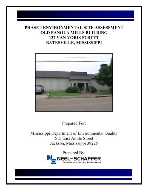
PHASE I ENVIRONMENTAL SITE ASSESSMENT OLD PANOLA ...
PHASE I ENVIRONMENTAL SITE ASSESSMENT OLD PANOLA ...
PHASE I ENVIRONMENTAL SITE ASSESSMENT OLD PANOLA ...

You also want an ePaper? Increase the reach of your titles
YUMPU automatically turns print PDFs into web optimized ePapers that Google loves.
<strong>PHASE</strong> I <strong>ENVIRONMENTAL</strong> <strong>SITE</strong> <strong>ASSESSMENT</strong><br />
<strong>OLD</strong> <strong>PANOLA</strong> MILLS BUILDING<br />
137 VAN VORIS STREET<br />
BATESVILLE, MISSISSIPPI<br />
Prepared For:<br />
Mississippi Department of Environmental Quality<br />
515 East Amite Street<br />
Jackson, Mississippi 39225<br />
Prepared By:
TABLE OF CONTENTS<br />
LIST OF ACRONYMS ................................................................................................................. i<br />
EXECUTIVE SUMMARY .......................................................................................................... ii<br />
1.0 INTRODUCTION................................................................................................................ 1<br />
1.1 Purpose ...................................................................................................................... 1<br />
1.2 Scope of Services ....................................................................................................... 1<br />
1.3 Limitations ................................................................................................................. 2<br />
2.0 <strong>SITE</strong> DESCRIPTION .......................................................................................................... 2<br />
2.1 Location ..................................................................................................................... 2<br />
2.2 Current Uses of Property and Adjoining Properties .............................................. 2<br />
3.0 USER PROVIDED INFORMATION ................................................................................ 3<br />
3.1 Environmental Liens or Use Restrictions on Title Records .................................. 3<br />
3.2 Specialized Knowledge ............................................................................................. 3<br />
3.3 Commonly or Reasonably Ascertainable Information ......................................... 3<br />
3.4 Valuation Reduction for Environmental Issues ..................................................... 3<br />
3.5 Owner, Property Manager, and Occupant Information ........................................ 3<br />
3.6 Previous Reports ....................................................................................................... 3<br />
3.7 Reason for Performing the Phase I ESA ................................................................ 3<br />
4.0 RECORDS REVIEW .......................................................................................................... 4<br />
4.1 Environmental Record Sources ................................................................................. 4<br />
4.2 Unmappable Sites ....................................................................................................... 5<br />
4.3 Physical Setting Sources ............................................................................................. 5<br />
4.4 Subject Property Historical Use Information ........................................................... 5<br />
4.5 Adjoining Properties Historical Use Information ................................................... 6<br />
5.0 <strong>SITE</strong> RECONNAISSANCE ................................................................................................ 6<br />
5.1 Methodology and Limiting Conditions ..................................................................... 6<br />
5.2 General Site Setting .................................................................................................... 6<br />
5.3 Summary of Observations ......................................................................................... 7<br />
6.0 INTERVIEWS..................................................................................................................... 8<br />
6.1 Interview with Past and Present Owners/Managers ............................................... 8<br />
6.2 Interview with Local Government Official .............................................................. 8<br />
7.0 FINDINGS ............................................................................................................................ 8<br />
8.0 OPINIONS ............................................................................................................................ 8<br />
9.0 CONCLUSIONS .................................................................................................................. 9<br />
10.0 DATA GAPS........................................................................................................................ 9<br />
11.0 DEVIATIONS ...................................................................................................................... 9
TABLE OF CONTENTS (continued)<br />
FIGURES Figure 1 Site Location Map<br />
Figure 2 2006 Aerial Photograph<br />
Figure 3 Floor Plan<br />
APPENDICES Appendix A User Questionnaire<br />
Appendix B EDR Radius Map TM with GeoCheck ® Report<br />
Appendix C Historical Sources<br />
Appendix D Photographs<br />
ATTACHMENT<br />
Environmental Professional Qualifications
Phase 1 Environmental Site Assessment<br />
Old Panola Mills Building<br />
Batesville, MS<br />
LIST OF ACRONYMS<br />
ASTM<br />
CERCLA<br />
CESQG<br />
CFR<br />
EDR<br />
ESA<br />
FINDS<br />
LUST<br />
NFA<br />
PCB<br />
P.E.<br />
RCRA<br />
SQG<br />
SWF/LF<br />
USGS<br />
UST<br />
American Society for Testing and Materials<br />
Comprehensive Environmental Response, Compensation, and Liability Act<br />
Conditionally Exempt Small Quantity Generator<br />
Code of Federal Register<br />
Environmental Data Resources, Inc.<br />
Environmental Site Assessment<br />
Facility Index System/Facility Registry System<br />
Leaking Underground Storage Tank<br />
No Further Action<br />
Polychlorinated Biphenyl<br />
Professional Engineer<br />
Resource Conservation Recovery Act<br />
Small Quantity Generator<br />
Solid Waste Facilities/Landfill Sites<br />
United States Geological Survey<br />
Underground Storage Tank<br />
________________________________________________________________________________________________________<br />
Neel-Schaffer, Inc.<br />
Page i<br />
Project No. NS.7705.001
Phase 1 Environmental Site Assessment<br />
Old Panola Mills Building<br />
Batesville, MS<br />
EXECUTIVE SUMMARY<br />
Neel-Schaffer, Inc., Jackson, Mississippi, has performed a Phase I Environmental Site<br />
Assessment (ESA) in general conformance with the scope and limitations of ASTM Practice E<br />
1527-05 and 40 CFR 312 “All Appropriate Inquiry” for a portion of the Old Panola Mills<br />
Building located at 137 Van Voris Street, Batesville, Mississippi. Approximately 33,000 square<br />
feet of the Old Panola Mills Building is scheduled for demolition and is referred to in this report<br />
as the property. This assessment revealed no evidence of recognized environmental conditions<br />
in connection with the property.<br />
The original building was built around 1945 as a textile mill. Several additions of similar<br />
construction have been added. At the time of the site reconnaissance performed on July 21,<br />
2009, the property was unoccupied and the most recent tenant was Fruit of the Loom.<br />
The other portions of the Old Panola Mills Building not designated as the property were leased<br />
to Batesville Casket Company, used by the City of Batesville for equipment storage, and other<br />
areas of the building were unoccupied.<br />
The Phase I ESA included a review of information from regulatory data files as provided by<br />
EDR. According to the EDR Radius Map TM with GeoCheck ® Report, the Old Panola Building<br />
was listed in the FINDS, UST, AND RCRA-CESQ databases.<br />
According to the MDEQ files two underground storage tanks were removed on June 25, 1991.<br />
One of the tanks was 10,000 gallons in size and contained gasoline. The second UST was 1,000<br />
gallons in size and contained diesel. A NFA letter was issued on August 19, 1991.<br />
Three LUST facilities were reportedly located within approximately 1,000 feet of their property.<br />
Descriptions of these facilities are provided in the body of this report. Based on its distance from<br />
the property, the site reconnaissance, records review, and interviews, it is our opinion that these<br />
sites are not recognized environmental conditions in connection with the property.<br />
________________________________________________________________________________________________________<br />
Neel-Schaffer, Inc.<br />
Page ii<br />
Project No. NS.7705.001
Phase 1 Environmental Site Assessment<br />
Old Panola Mills Building<br />
Batesville, MS<br />
1.0 INTRODUCTION<br />
1.1 Purpose<br />
The MDEQ retained Neel-Schaffer, Inc. to perform a Phase I ESA on a portion of the Old Panola<br />
Mills Building located at 137 Van Voris Street, Batesville, Mississippi. For purposes of this<br />
report, the property is defined as the 33,000 square feet portion of the Old Panola Mills Building<br />
that is scheduled for demolition. The purpose of the Phase I ESA was to identify recognized<br />
environmental conditions at the property in accordance with ASTM Practice E 1527-05 Standard<br />
Practice for Environmental Site Assessments: Phase I Environmental Site Assessment Process<br />
and 40 CFR 312 “All Appropriate Inquiry”. ASTM E 1527-05 defines a recognized<br />
environmental condition as…“the presence or likely presence of any hazardous substances or<br />
petroleum products on a property under conditions that indicate an existing release, a past<br />
release, or a material threat of a release of any hazardous substances or petroleum products into<br />
structures on the property or into the ground, groundwater, or surface water of the property. The<br />
term includes hazardous substances or petroleum products even under conditions in compliance<br />
with laws. The term is not intended to include de minimis conditions that generally do not<br />
present a material risk of harm to public health or the environment and that generally would not<br />
be the subject of an enforcement action if brought to the attention of the appropriate<br />
governmental agencies.”<br />
1.2 Scope of Services<br />
The scope of this assessment included the following activities:<br />
1. The results of an inquiry by an environmental professional.<br />
2. Interviews with past and present owners, operators, and/or occupants of the property for<br />
the purpose of gathering information regarding the potential for contamination at the<br />
facility.<br />
3. Reviews of historical sources, such as chain of title documents, aerial photographs,<br />
topographic maps, Sanborn® maps, building department records, and/or land use records,<br />
to determine previous uses and occupancies of the property since the property was first<br />
developed, or back to 1940, whichever is earlier.<br />
4. Reviews of federal, state and local government records, waste disposal records,<br />
underground storage tank records, and hazardous waste handling, generation, treatment,<br />
disposal and spill records concerning contamination at or near the property.<br />
5. Visual inspections of the property and adjoining properties.<br />
6. Specialized knowledge or experience on the part of the user (the City of Batesville).<br />
7. The relationship of the purchase price to the value of the property, if the property was not<br />
contaminated.<br />
8. Commonly known or reasonably ascertainable information about the property.<br />
9. The degree of obviousness of the presence or likely presence of contamination at the<br />
property, and the ability to detect the contamination by appropriate investigation.<br />
________________________________________________________________________________________________________<br />
Neel-Schaffer, Inc. Page 1<br />
Project No. NS.7705.001
Phase 1 Environmental Site Assessment<br />
Old Panola Mills Building<br />
Batesville, MS<br />
1.3 Limitations<br />
Neel-Schaffer, Inc. is not able to represent that the property or adjoining properties contains no<br />
hazardous waste, oil, or other latent condition beyond that detected or observed during the<br />
assessment. The possibility exists for contaminants to migrate through surface water, air, or<br />
groundwater. The ability to address the environmental risk associated with transport in these<br />
media including, but not limited to, vapor intrusion, is beyond the scope of this investigation. No<br />
statement of scientific certainty can be made regarding latent subsurface conditions that may be<br />
the result of onsite or offsite sources. The findings and conclusions of this report are not<br />
scientific certainties, but rather probabilities based on professional judgment concerning the<br />
significance of the data gathered during this environmental assessment. During the course of this<br />
assessment, we have relied on information obtained from interviews, third party research, and<br />
other entities. We did not conduct an independent verification of the accuracy of such<br />
information. The only warranty made by us in connection with the services provided is that we<br />
have used that degree of care and skill ordinarily exercised under similar conditions by reputable<br />
members of our profession practicing in the same or similar locality. No other warranty,<br />
expressed or implied, is made or intended.<br />
This report has been prepared for the exclusive use of the MDEQ and the City of Batesville for<br />
the purpose of determining current physical setting and qualifying for one of the requirements for<br />
landowner liability protections under the CERCLA in connection with the Old Panola Mills<br />
Building located at 137 Van Voris Street, Batesville, Mississippi.<br />
2.0 <strong>SITE</strong> DESCRIPTION<br />
2.1 Location<br />
The Old Panola Mills Building is located at 137 Van Voris Street, Batesville, Panola County,<br />
Mississippi, latitude 34º18′56″ North, longitude 89º57′18″ West. Adjoining paved roads to the<br />
Old Panola Mills Building are Vance Street to the west, Hays Street to the south, and Thomas<br />
Street to the southeast. A copy of a portion of the U.S. Geological Survey (USGS) 1982<br />
Batesville, MS 7.5-Minute Series topographic map, a 2006 aerial photograph showing the Old<br />
Panola Mills Building, and a site plan of the property are attached as Figures 1, 2, and 3,<br />
respectively.<br />
2.2 Current Uses of the Property and Adjoining Properties<br />
At the time of the site reconnaissance performed on July 21, 2009, the property was an<br />
unoccupied section of the former textile mill. The property is bounded to the north by a City of<br />
Batesville construction materials storage yard, to the west by a service station (Friendly<br />
Supermarket) and residential property, to the south by the abandoned manufacturing area of the<br />
Old Panola Mills Building, and to the east by the City of Batesville Street Department.<br />
________________________________________________________________________________________________________<br />
Neel-Schaffer, Inc. Page 2<br />
Project No. NS.7705.001
Phase 1 Environmental Site Assessment<br />
Old Panola Mills Building<br />
Batesville, MS<br />
3.0 USER PROVIDED INFORMATION<br />
The City of Batesville provided user information by completing the user questionnaire presented<br />
in Appendix X3 of ASTM E 1527-05. A copy of the completed user questionnaire is provided as<br />
Appendix A.<br />
3.1 Environmental Liens or Use Restrictions Recorded on Title Records<br />
Jerry Autrey, the Mayor of Batesville knew of no environmental liens or activity and use<br />
limitations recorded against the property on title records.<br />
3.2 Specialized Knowledge<br />
Mr. Autrey had no specialized knowledge in connection with the property.<br />
3.3 Commonly Known or Reasonably Ascertainable Information<br />
The City of Batesville was aware of the historical past uses of the property. The city was not<br />
aware of any chemical releases or any environmental cleanups that have taken place at the<br />
property.<br />
3.4 Valuation Reduction for Environmental Issues<br />
The City of Batesville owns the property being evaluated.<br />
3.5 Owner, Property Manager, and Occupant Information<br />
The City of Batesville owns the Old Panola Mills Building, inclusive of the property. Other<br />
portions of the Old Panola Mills Building not designated as the property are leased to Batesville<br />
Casket Company, used by the City of Batesville for equipment storage, and other areas of the<br />
building remain unoccupied.<br />
The Batesville Casket Company stores wood and has a gluing operation. The most recent<br />
occupant of the property was Fruit of the Loom which made underwear. Teddy Austin, the City<br />
of Batesville street superintendent was the site contact for the assessment.<br />
3.6 Previous Reports<br />
According to Jerry Autrey, the Mayor of Batesville, the City was aware of a Phase I ESA for the<br />
Old Panola Mills Building that was performed approximately seven years ago. However, the<br />
City was unable to locate this report.<br />
3.7 Reason for Performing the Phase I ESA<br />
The Phase I ESA was requested by the MDEQ. The purpose of this report is to qualify for one<br />
of the requirements for landowner liability protections under the CERCLA. The City of<br />
Batesville plans to raze the property for possible redevelopment.<br />
________________________________________________________________________________________________________<br />
Neel-Schaffer, Inc. Page 3<br />
Project No. NS.7705.001
Phase 1 Environmental Site Assessment<br />
Old Panola Mills Building<br />
Batesville, MS<br />
4.0 RECORDS REVIEW<br />
4.1 Environmental Record Sources<br />
A review of environmental databases was performed by Environmental Data Resources, Inc.<br />
(EDR). The database reviews included a search of federal, tribal, and state environmental<br />
records. The EDR Radius Map TM with GeoCheck ® Report is attached as Appendix B. The<br />
property did appear in three of the databases searched by EDR. The property appeared on the<br />
FINDS, UST and RCRA – CESQG database.<br />
Registered USTs – Two USTs were removed on June 25, 1991. One of the tanks was<br />
10,000 gallons in size and contained gasoline. The second UST was 1,000 gallons in size<br />
and contained diesel. The MDEQ issued a NFA letter concerning these tanks on<br />
August19, 1991.<br />
<br />
Facility Index System/Facility Registry System (FINDS) - Facility appears on the FINDS<br />
database as Resource conservation Recovery Act – Conditionally Exempt Small Quantity<br />
Generator (RCRA-CESQG). The facility at present does not generate any hazardous<br />
waste. Previously, the facility handled listed hazardous waste D001 (ignitable).<br />
A more detailed description of each source is provided on pages 7 through 10 of the EDR Radius<br />
Map TM with GeoCheck ® Report in Appendix B.<br />
The EDR Radius Map TM with GeoCheck ® Report listed the following facilities within the ASTM search<br />
radii:<br />
<br />
<br />
<br />
Friendly Supermarket: The facility is located approximately 470 feet west and<br />
topographically down gradient of the property and was listed in the LUST and UST<br />
databases. This facility was granted No Further Action (NFA) status on April 14, 2004 in<br />
connection with a reported release, and based on its distance from the property, the site<br />
reconnaissance, records review, and interviews, it is our opinion that this site is not a<br />
recognized environmental condition in connection with the property.<br />
Ward Hudson: The facility is located approximately 767 feet south-southwest and<br />
topographically up gradient of the property and was listed in the LUST and UST<br />
databases. This facility was granted NFA status on September 21, 1993, in connection<br />
with a reported UST release, and based on its distance from the property, the site<br />
reconnaissance, records review, and interviews, it is our opinion that this site is not a<br />
recognized environmental condition in connection with the property.<br />
Crowson’s Grocery: The facility is located approximately 1,072 feet west and<br />
topographically down gradient of the property and was listed in the LUST and UST<br />
databases. This facility was granted NFA status on May 16, 1997, in connection with a<br />
reported UST release, and based on its distance from the property, the site reconnaissance,<br />
records review, and interviews, it is our opinion that this site is not a recognized<br />
environmental condition in connection with the property.<br />
City of Batesville Class II Rubbish Site: The facility is located approximately 1,152<br />
feet northeast of the property and was listed on the SWF/LF database. Based on its<br />
distance from the property, the site reconnaissance, records review, and interviews, it is<br />
________________________________________________________________________________________________________<br />
Neel-Schaffer, Inc. Page 4<br />
Project No. NS.7705.001
Phase 1 Environmental Site Assessment<br />
Old Panola Mills Building<br />
Batesville, MS<br />
our opinion that this site is not a recognized environmental condition in connection with<br />
the property.<br />
Framed Picture Enterprise: The facility is located approximately 1,241 feet down<br />
gradient of the property and was listed on the RCRA-CESQG database. Based on its<br />
distance from the property, the site reconnaissance, records review, and interviews, it is<br />
our opinion that this site is not a recognized environmental condition in connection with<br />
the property.<br />
Smith Oil Company, a motor fuels bulk distribution plant with aboveground tanks, was located<br />
approximately 410 feet southwest of the Old Panola Mills property but was not listed on the<br />
EDR report.<br />
4.2 Unmappable Sites<br />
The EDR Radius Map TM with GeoCheck ® Report lists 39 facilities that were not mapped due to<br />
inadequate address information. The site reconnaissance revealed no evidence that these<br />
unmappable sites were located on the property or adjoining properties.<br />
4.3 Physical Setting Sources<br />
The USGS 1982 Batesville, MS 7.5-Minute Series topographic map was reviewed for physical<br />
setting information. The referenced map is the most recent USGS 7.5-Minute topographic map<br />
coverage for the property. The general topography of the area is flat with a slight topographic<br />
gradient to the west. A property elevation of approximately 214 feet National Geodetic Vertical<br />
Datum was inferred from the topographic map. Based on site topography, a groundwater flow<br />
direction to the west can be inferred.<br />
The EDR Radius Map TM with GeoCheck ® Report included a review of federal and state water,<br />
oil, and gas well information databases. Forty-two drinking water supply wells were reportedly<br />
located within a 1-mile radius of the property. There were no wells reported as being located on<br />
the property.<br />
4.4 Subject Property Historical Use Information<br />
The following historical sources were reviewed and are attached as Appendix C:<br />
The EDR Historical Topographic Map Report (1953, and 1982 topographic maps);<br />
The EDR Aerial Photo Decade Package (1975, 1977, 1981, 1985, 1991, 1996, 2005, and<br />
2006);<br />
The EDR Property Tax Map Report (no coverage);<br />
The EDR-City Directory Abstract; and<br />
Certified Sanborn® Map Report (1932 and 1945).<br />
The 1932 Sanborn map does not indicate any development on the property. However, the 1945<br />
Sanborn map indicates The Batesville Hosiery Mill on the subject property. Topographic maps<br />
from 1977 to 2006 indicated that no additions have been made to the subject property.<br />
________________________________________________________________________________________________________<br />
Neel-Schaffer, Inc. Page 5<br />
Project No. NS.7705.001
Phase 1 Environmental Site Assessment<br />
Old Panola Mills Building<br />
Batesville, MS<br />
4.5 Adjoining Properties Historical Use Information<br />
The historical sources cited in Section 4.4 were used to investigate previous uses of adjoining<br />
properties.<br />
North – The referenced sources indicated a developed use at least back to 1932 in the<br />
form of residences.<br />
East – Initial development was noted on the 1977 topographic map as a structure similar<br />
in appearance to the Batesville Street Department facility observed during the site<br />
reconnaissance.<br />
South – The referenced sources indicated that the adjoining property south of the<br />
property to be razed is the manufacturing area of the Old Panola Mills Building; and<br />
West – The referenced sources indicated a paved road, which later became Vance Street,<br />
west of the Old Panola Mills Building property at least back to 1932.<br />
5.0 <strong>SITE</strong> RECONNAISSANCE<br />
5.1 Methodology and Limiting Conditions<br />
Mr. Walter Huff, P.E., Senior Project Manager, Neel-Schaffer, Inc., performed a site<br />
reconnaissance on July 21, 2009. Photographs taken of the property, and adjoining properties<br />
are attached as Appendix D. The site reconnaissance was accomplished by walking the<br />
perimeter and viewing the interior of the property.<br />
5.2 General Site Setting<br />
The Old Panola Mills Building was formerly a textile mill. The original building was<br />
constructed shortly after World War II according to the Mayor of Batesville and is shown on the<br />
1945 Sanborn Map as The Batesville Hosiery Mill. The building has been expanded several<br />
times with similar type of construction. The property was unoccupied but was previously<br />
utilized as office space, cutting room, sewing room, cleaning and repairing room, and the T-shirt<br />
room according to a June 26, 2003 document submitted by Dickson & Associates, P.A., to the<br />
City of Batesville. Surrounding the Old Panola Mills Building, including the property, was a<br />
total of 18 electrical transformers. The transformers appeared to be in good condition and there<br />
were no apparent signs of leakeage.<br />
Adjoining property usage was noted as follows during the site reconnaissance:<br />
North – City of Batesville construction materials storage yard;<br />
West – Residential properties and a service station.<br />
South – The abandoned manufacturing area of the Old Panola Mills Building;<br />
East – Batesville Street Department.<br />
________________________________________________________________________________________________________<br />
Neel-Schaffer, Inc. Page 6<br />
Project No. NS.7705.001
Phase 1 Environmental Site Assessment<br />
Old Panola Mills Building<br />
Batesville, MS<br />
5.3 Summary of Observations<br />
A summary of observations noted during the site reconnaissance is presented as Table 2.<br />
Table 2: Summary of Site Reconnaissance Observations<br />
Item<br />
Hazardous Substances and Petroleum Products<br />
Hazardous Substances and Petroleum Products<br />
Containers<br />
Unidentified Substance Containers<br />
Potential PCB-Containing Equipment<br />
Storage Tanks<br />
Odors<br />
Pools of Liquids<br />
Drums<br />
Stains or Corrosion<br />
Drains and Sumps<br />
Pits, Ponds, or Lagoons<br />
Stained Soil or Pavement<br />
Stressed Vegetation<br />
Solid Waste<br />
Waste Water<br />
Wells<br />
Septic Systems<br />
Observed on Subject Property<br />
No<br />
No<br />
No<br />
Transformers indicated no signs of<br />
leakage and appeared to be in good<br />
condition<br />
No<br />
No<br />
No<br />
Drums were unmarked, empty<br />
plastic drums. The drums were<br />
occasionally filled with water for<br />
city activities to be used as weight to<br />
aid in holding down tents<br />
No<br />
The drains discharged into the city<br />
sewer system<br />
No<br />
Limited oil staining was observed<br />
No<br />
No<br />
No<br />
No<br />
No<br />
________________________________________________________________________________________________________<br />
Neel-Schaffer, Inc. Page 7<br />
Project No. NS.7705.001
Phase 1 Environmental Site Assessment<br />
Old Panola Mills Building<br />
Batesville, MS<br />
6.0 INTERVIEWS<br />
Mr. Walter Huff, P.E. conducted the interviews. Summaries of the interviews are presented in<br />
the following sections.<br />
6.1 Interview with Past and Present Owners/Managers<br />
The City of Batesville Street Department Superintendent, Mr. Teddy Austin, was interviewed the<br />
day of the site reconnaissance. Mr. Austin has worked for the City for approximately 16 years.<br />
Mr. Austin was not aware of any hazardous materials spills or releases at the property.<br />
On August 6, 2009, the Mayor of Batesville, Mr. Jerry Autrey, was interviewed by telephone.<br />
According to the mayor, an asbestos survey was conducted. Records from the MDEQ contained<br />
an August 5, 2003, asbestos report from Dickson and Associates, P.A. of Clarksdale, Mississippi,<br />
that indicated asbestos-containing material on the base flashing of the roofing area.<br />
On August 12, 2009, Mr. Phil Waldrup, former plant engineer, for Panola Mills a/k/a Union<br />
Underware Corp. was interviewed by telephone. He was not aware of any hazardous spills or<br />
releases at the property. He stated that the drains on the property led to the city sewer. He also<br />
stated there was one abandoned well on the property, which was decommissioned by concreting<br />
the well, and capping it off. Mr. Waldrup stated that the well was abandoned before he started<br />
working at Panola Mills in 1970.<br />
6.2 Interview with Local Government Official<br />
Training Coordinator, Mr. Cowles Horton, of the Batesville Fire Department was interviewed the<br />
day of the reconnaissance, to provide information pertaining to hazardous materials responses<br />
associated with the Old Panola Mills Building. Mr. Horton reported that there was no record of<br />
any major spills or releases in the past two years.<br />
7.0 FINDINGS<br />
Based on a review of available historic records, commercial development at the Old Panola Mills<br />
Building occurred around 1945. The property was unoccupied at the time of the site<br />
reconnaissance. The most recent tenant was reportedly Fruit of the Loom. The Old Panola Mills<br />
Building appeared on the UST and RCRA-CESQG environmental databases. Two USTs were<br />
removed and MDEQ issued a NFA action letter in August 1991. During the course of the Phase<br />
I ESA, we were not able to determine where the tanks were located on the property. Appearance<br />
on the RCRA-CESQG database was in connection with handling of ignitable hazardous wastes.<br />
8.0 OPINIONS<br />
Based on site observations conducted on July 21, 2009, a review of reasonably ascertainable<br />
environmental records, interviews with City of Batesville personnel, reviewing applicable<br />
records, and development adjacent to the property, we did not identify any apparent recognized<br />
environmental conditions in connection with the property.<br />
Items of note, deemed to be de minimis conditions, included limited surface staining in the<br />
interior of the Old Panola Mills Building. It is our opinion that these de minimis conditions will<br />
not likely affect the property.<br />
________________________________________________________________________________________________________<br />
Neel-Schaffer, Inc. Page 8<br />
Project No. NS.7705.001
Phase 1 Environmental Site Assessment<br />
Old Panola Mills Building<br />
Batesville, MS<br />
9.0 CONCLUSIONS<br />
We have performed a Phase I Environmental Site Assessment in general conformance with the<br />
scope and limitations of ASTM Practice E 1527-05 and 40 CFR 312 “All Appropriate Inquiry”<br />
of the proposed razed-portion of the Old Panola Mills Building located at 137 Van Voris Street,<br />
Batesville, Mississippi. Any exceptions to, or deletions from, this practice are described in<br />
Section 11.0 of this report. This assessment has revealed no apparent evidence of recognized<br />
environmental conditions in connection with the property.<br />
10.0 DATA GAPS<br />
Reasonably ascertainable historical documentation at five-year intervals back to first<br />
development was not available. It is our opinion that this data gap did not affect our ability to<br />
identify recognized environmental conditions in connection with the property.<br />
11.0 DEVIATIONS<br />
There were no deviations from the referenced practice.<br />
________________________________________________________________________________________________________<br />
Neel-Schaffer, Inc. Page 9<br />
Project No. NS.7705.001
FIGURES
( (<br />
(<br />
(<br />
89°58'30"<br />
89°58'0"<br />
227000<br />
89°57'30"<br />
228000<br />
89°57'0"<br />
229000<br />
89°56'30"<br />
89°56'0"<br />
230000<br />
34°17'30"<br />
34°18'00"<br />
34°18'30"<br />
34°19'00"<br />
34°19'30"<br />
34°20'00"<br />
3803000<br />
34°20'00"<br />
3803000<br />
34°19'30"<br />
3802000<br />
34°19'00"<br />
3801000<br />
34°18'30"<br />
3800000<br />
3799000<br />
3800000<br />
3801000<br />
3802000<br />
34°18'00"<br />
3799000<br />
34°17'30"<br />
89°58'30"<br />
227000<br />
89°58'0"<br />
89°57'30"<br />
228000<br />
1:24000 Scale<br />
89°57'0"<br />
229000<br />
89°56'30"<br />
0 0.25 0.5 0.75 1 Miles<br />
0 0.25 0.5 0.75 1 Kilometers<br />
230000<br />
89°56'0"<br />
Universal Transverse Mercator (UTM) Projection Zone16<br />
North American Datum of 1983 (NAD83)<br />
UTM Grid shown in Blue<br />
Magnetic declination at center of map on<br />
July 28, 2009
UST<br />
Vance St<br />
Van Voris Street<br />
Area of Old Panola<br />
Mills Bldg to be razed<br />
Children’s Daycare<br />
Hayes Street<br />
Thomas Street<br />
Smith Oil Company (ASTs)<br />
<strong>PHASE</strong> I ESA<br />
<strong>OLD</strong> <strong>PANOLA</strong> MILLS BUILDING<br />
137 VAN VORIS STREET, BATESVILLE, MISSISSIPPI<br />
FIGURE 2<br />
2006 AERIAL PHOTOGRAPH<br />
Scale: 1″ ~ 180′
Figure 3
APPENDIX A<br />
ASTM E 1527-05 Phase I Environmental Site Assessment<br />
User Questionnaire and Disclosure Statement
APPENDIX B<br />
EDR Radius Map TM with Geocheck ® Report
Panola Mills Building<br />
137 Van Voris Street<br />
Batesville, MS 38606<br />
Inquiry Number: 2534220.2s<br />
July 06, 2009<br />
The<br />
EDR Radius Map<br />
Report<br />
with GeoCheck®<br />
440 Wheelers Farms Road<br />
Milford, CT 06461<br />
Toll Free: 800.352.0050<br />
www.edrnet.com<br />
FORM-PRM-GON
TABLE OF CONTENTS<br />
SECTION<br />
PAGE<br />
Executive Summary<br />
ES1<br />
Overview Map 2<br />
Detail Map 3<br />
Map Findings Summary 4<br />
Map Findings 7<br />
Orphan Summary 28<br />
Government Records Searched/Data Currency Tracking<br />
GR-1<br />
GEOCHECK ADDENDUM<br />
Physical Setting Source Addendum A-1<br />
Physical Setting Source Summary A-2<br />
Physical Setting Source Map A-8<br />
Physical Setting Source Map Findings A-9<br />
Physical Setting Source Records Searched A-36<br />
Thank you for your business.<br />
Please contact EDR at 1-800-352-0050<br />
with any questions or comments.<br />
Disclaimer - Copyright and Trademark Notice<br />
This Report contains certain information obtained from a variety of public and other sources reasonably available to Environmental Data<br />
Resources, Inc. It cannot be concluded from this Report that coverage information for the target and surrounding properties does not exist from<br />
other sources. NO WARRANTY EXPRESSED OR IMPLIED, IS MADE WHATSOEVER IN CONNECTION WITH THIS REPORT. <strong>ENVIRONMENTAL</strong><br />
DATA RESOURCES, INC. SPECIFICALLY DISCLAIMS THE MAKING OF ANY SUCH WARRANTIES, INCLUDING WITHOUT LIMITATION,<br />
MERCHANTABILITY OR FITNESS FOR A PARTICULAR USE OR PURPOSE. ALL RISK IS ASSUMED BY THE USER. IN NO EVENT SHALL<br />
<strong>ENVIRONMENTAL</strong> DATA RESOURCES, INC. BE LIABLE TO ANYONE, WHETHER ARISING OUT OF ERRORS OR OMISSIONS, NEGLIGENCE,<br />
ACCIDENT OR ANY OTHER CAUSE, FOR ANY LOSS OF DAMAGE, INCLUDING, WITHOUT LIMITATION, SPECIAL, INCIDENTAL,<br />
CONSEQUENTIAL, OR EXEMPLARY DAMAGES. ANY LIABILITY ON THE PART OF <strong>ENVIRONMENTAL</strong> DATA RESOURCES, INC. IS STRICTLY<br />
LIMITED TO A REFUND OF THE AMOUNT PAID FOR THIS REPORT. Purchaser accepts this Report "AS IS". Any analyses, estimates, ratings,<br />
environmental risk levels or risk codes provided in this Report are provided for illustrative purposes only, and are not intended to provide, nor<br />
should they be interpreted as providing any facts regarding, or prediction or forecast of, any environmental risk for any property. Only a Phase I<br />
Environmental Site Assessment performed by an environmental professional can provide information regarding the environmental risk for any<br />
property. Additionally, the information provided in this Report is not to be construed as legal advice.<br />
Copyright 2009 by Environmental Data Resources, Inc. All rights reserved. Reproduction in any media or format, in whole<br />
or in part, of any report or map of Environmental Data Resources, Inc., or its affiliates, is prohibited without prior written permission.<br />
EDR and its logos (including Sanborn and Sanborn Map) are trademarks of Environmental Data Resources, Inc. or its affiliates. All other<br />
trademarks used herein are the property of their respective owners.<br />
TC2534220.2s Page 1
EXECUTIVE SUMMARY<br />
A search of available environmental records was conducted by Environmental Data Resources, Inc (EDR).<br />
The report was designed to assist parties seeking to meet the search requirements of EPA’s Standards<br />
and Practices for All Appropriate Inquiries (40 CFR Part 312), the ASTM Standard Practice for<br />
Environmental Site Assessments (E 1527-05) or custom requirements developed for the evaluation of<br />
environmental risk associated with a parcel of real estate.<br />
TARGET PROPERTY INFORMATION<br />
ADDRESS<br />
COORDINATES<br />
137 VAN VORIS STREET<br />
BATESVILLE, MS 38606<br />
Latitude (North):<br />
34.315600 - 34˚ 18’ 56.2’’<br />
Longitude (West):<br />
89.955000 - 89˚ 57’ 18.0’’<br />
Universal Tranverse Mercator: Zone 16<br />
UTM X (Meters):<br />
228075.0<br />
UTM Y (Meters):<br />
3800909.8<br />
Elevation:<br />
214 ft. above sea level<br />
USGS TOPOGRAPHIC MAP ASSOCIATED WITH TARGET PROPERTY<br />
Target Property Map:<br />
Most Recent Revision:<br />
34089-C8 BATESVILLE, MS<br />
1982<br />
AERIAL PHOTOGRAPHY IN THIS REPORT<br />
Portions of Photo from:<br />
Source:<br />
2005, 2006<br />
USDA<br />
TARGET PROPERTY SEARCH RESULTS<br />
The target property was identified in the following records. For more information on this<br />
property see page 7 of the attached EDR Radius Map report:<br />
Site<br />
<strong>PANOLA</strong> MILLS AKA UNION UNDERWARE<br />
137 VAN VORIS ST<br />
BATESVILLE, MS 38606<br />
Database(s)<br />
UST<br />
EPA ID<br />
N/A<br />
<strong>PANOLA</strong> MILLS INC.<br />
137 VAN VORIS STREET<br />
BATESVILLE, MS 38606<br />
FINDS<br />
RCRA-CESQG<br />
MSD982772162<br />
TC2534220.2s EXECUTIVE SUMMARY 1
EXECUTIVE SUMMARY<br />
DATABASES WITH NO MAPPED <strong>SITE</strong>S<br />
No mapped sites were found in EDR’s search of available ("reasonably ascertainable ") government<br />
records either on the target property or within the search radius around the target property for the<br />
following databases:<br />
STANDARD <strong>ENVIRONMENTAL</strong> RECORDS<br />
Federal NPL site list<br />
NPL<br />
Proposed NPL<br />
NPL LIENS<br />
National Priority List<br />
Proposed National Priority List Sites<br />
Federal Superfund Liens<br />
Federal Delisted NPL site list<br />
Delisted NPL<br />
National Priority List Deletions<br />
Federal CERCLIS list<br />
CERCLIS<br />
Comprehensive Environmental Response, Compensation, and Liability Information System<br />
Federal CERCLIS NFRAP site List<br />
CERC-NFRAP<br />
CERCLIS No Further Remedial Action Planned<br />
Federal RCRA CORRACTS facilities list<br />
CORRACTS<br />
Corrective Action Report<br />
Federal RCRA non-CORRACTS TSD facilities list<br />
RCRA-TSDF<br />
RCRA - Transporters, Storage and Disposal<br />
Federal RCRA generators list<br />
RCRA-LQG<br />
RCRA - Large Quantity Generators<br />
RCRA-SQG<br />
RCRA - Small Quantity Generators<br />
Federal institutional controls / engineering controls registries<br />
US ENG CONTROLS Engineering Controls Sites List<br />
US INST CONTROL Sites with Institutional Controls<br />
Federal ERNS list<br />
ERNS<br />
Emergency Response Notification System<br />
State and tribal landfill and/or solid waste disposal site lists<br />
DEBRIS<br />
Debris Site Locations Listing<br />
State and tribal leaking storage tank lists<br />
INDIAN LUST<br />
Leaking Underground Storage Tanks on Indian Land<br />
TC2534220.2s EXECUTIVE SUMMARY 2
EXECUTIVE SUMMARY<br />
State and tribal registered storage tank lists<br />
AST<br />
Aboveground Storage Tanks<br />
INDIAN UST<br />
Underground Storage Tanks on Indian Land<br />
State and tribal institutional control / engineering control registries<br />
ENG CONTROLS<br />
Sites with Engineering Controls<br />
INST CONTROL<br />
Sites with Institutional Controls<br />
State and tribal voluntary cleanup sites<br />
VCP<br />
Voluntary Evaluation Program Sites<br />
INDIAN VCP<br />
Voluntary Cleanup Priority Listing<br />
State and tribal Brownfields sites<br />
BROWNFIELDS<br />
Uncontrolled Sites List<br />
ADDITIONAL <strong>ENVIRONMENTAL</strong> RECORDS<br />
Local Brownfield lists<br />
US BROWNFIELDS<br />
A Listing of Brownfields Sites<br />
Local Lists of Landfill / Solid Waste Disposal Sites<br />
DEBRIS REGION 9 Torres Martinez Reservation Illegal Dump Site Locations<br />
ODI<br />
Open Dump Inventory<br />
SWRCY<br />
Mississippi Recycling Directory<br />
INDIAN ODI<br />
Report on the Status of Open Dumps on Indian Lands<br />
Local Lists of Hazardous waste / Contaminated Sites<br />
US CDL<br />
Clandestine Drug Labs<br />
Local Land Records<br />
LIENS 2<br />
LUCIS<br />
CERCLA Lien Information<br />
Land Use Control Information System<br />
Records of Emergency Release Reports<br />
HMIRS<br />
Hazardous Materials Information Reporting System<br />
Other Ascertainable Records<br />
RCRA-NonGen<br />
RCRA - Non Generators<br />
DOT OPS<br />
Incident and Accident Data<br />
DOD<br />
Department of Defense Sites<br />
FUDS<br />
Formerly Used Defense Sites<br />
CONSENT<br />
Superfund (CERCLA) Consent Decrees<br />
ROD<br />
Records Of Decision<br />
TC2534220.2s EXECUTIVE SUMMARY 3
EXECUTIVE SUMMARY<br />
UMTRA<br />
MINES<br />
TRIS<br />
TSCA<br />
FTTS<br />
HIST FTTS<br />
SSTS<br />
ICIS<br />
PADS<br />
MLTS<br />
RADINFO<br />
RAATS<br />
PERMITS<br />
DRYCLEANERS<br />
NPDES<br />
INDIAN RESERV<br />
SCRD DRYCLEANERS<br />
Uranium Mill Tailings Sites<br />
Mines Master Index File<br />
Toxic Chemical Release Inventory System<br />
Toxic Substances Control Act<br />
FIFRA/ TSCA Tracking System - FIFRA (Federal Insecticide, Fungicide, & Rodenticide<br />
Act)/TSCA (Toxic Substances Control Act)<br />
FIFRA/TSCA Tracking System Administrative Case Listing<br />
Section 7 Tracking Systems<br />
Integrated Compliance Information System<br />
PCB Activity Database System<br />
Material Licensing Tracking System<br />
Radiation Information Database<br />
RCRA Administrative Action Tracking System<br />
Environmental Site Information System Listing<br />
Drycleaner Facilities Listing<br />
Industrial & Municipal NPDES Facilities<br />
Indian Reservations<br />
State Coalition for Remediation of Drycleaners Listing<br />
EDR PROPRIETARY RECORDS<br />
EDR Proprietary Records<br />
Manufactured Gas Plants<br />
EDR Proprietary Manufactured Gas Plants<br />
SURROUNDING <strong>SITE</strong>S: SEARCH RESULTS<br />
Surrounding sites were identified in the following databases.<br />
Elevations have been determined from the USGS Digital Elevation Model and should be evaluated on<br />
a relative (not an absolute) basis. Relative elevation information between sites of close proximity<br />
should be field verified. Sites with an elevation equal to or higher than the target property have been<br />
differentiated below from sites with an elevation lower than the target property.<br />
Page numbers and map identification numbers refer to the EDR Radius Map report where detailed<br />
data on individual sites can be reviewed.<br />
Sites listed in bold italics are in multiple databases.<br />
Unmappable (orphan) sites are not considered in the foregoing analysis.<br />
STANDARD <strong>ENVIRONMENTAL</strong> RECORDS<br />
Federal RCRA generators list<br />
RCRA-CESQG: RCRAInfo is EPA’s comprehensive information system, providing access to data supporting<br />
the Resource Conservation and Recovery Act (RCRA) of 1976 and the Hazardous and Solid Waste Amendments (HSWA)<br />
of 1984. The database includes selective information on sites which generate, transport, store, treat and/or<br />
dispose of hazardous waste as defined by the Resource Conservation and Recovery Act (RCRA). Conditionally<br />
exempt small quantity generators (CESQGs) generate less than 100 kg of hazardous waste, or less than 1 kg of<br />
acutely hazardous waste per month.<br />
A review of the RCRA-CESQG list, as provided by EDR, and dated 11/12/2008 has revealed that there is<br />
TC2534220.2s EXECUTIVE SUMMARY 4
EXECUTIVE SUMMARY<br />
1 RCRA-CESQG site within approximately 0.25 miles of the target property.<br />
____________________ Lower Elevation<br />
________ Address<br />
Direction ___________________ / Distance Map _____ ID Page _____<br />
FRAMED PICTURE ENTERPRISE 208 PEARSON STREET WSW 1/8 - 1/4 (0.235 mi.) 10 23<br />
State- and tribal - equivalent CERCLIS<br />
SHWS: The State Hazardous Waste Sites records are the states’ equivalent to CERCLIS. These sites<br />
may or may not already be listed on the federal CERCLIS list. Priority sites planned for cleanup using state<br />
funds (state equivalent of Superfund) are identified along with sites where cleanup will be paid for by<br />
potentially responsible parties. The data come from the Department of Environmental Quality’s Uncontrolled<br />
Site Project Tracking System.<br />
A review of the SHWS list, as provided by EDR, and dated 04/08/2009 has revealed that there is 1 SHWS<br />
site within approximately 1 mile of the target property.<br />
____________________ Equal/Higher Elevation<br />
________ Address<br />
Direction ___________________ / Distance Map _____ ID Page _____<br />
MDOT - KELLY’S ONE STOP NE 1/2 - 1 (0.695 mi.) 12 27<br />
State and tribal landfill and/or solid waste disposal site lists<br />
SWF/LF: The Solid Waste Facilities/Landfill Sites records typically contain an inventory of solid<br />
waste disposal facilities or landfills in a particular state. The data come from the Department of<br />
Environmental Quality’s Solid Waste Landfills.<br />
A review of the SWF/LF list, as provided by EDR, and dated 04/09/2009 has revealed that there is 1<br />
SWF/LF site within approximately 0.5 miles of the target property.<br />
____________________ Equal/Higher Elevation<br />
________ Address<br />
Direction ___________________ / Distance Map _____ ID Page _____<br />
CITY OF BATESVILLE CLASS II RU NE 1/8 - 1/4 (0.218 mi.) C8 20<br />
State and tribal leaking storage tank lists<br />
LUST: The Leaking Underground Storage Tank Incident Reports contain an inventory of reported<br />
leaking underground storage tank incidents. The data come from the Department of Environmental Quality’s LUST<br />
Status Report.<br />
A review of the LUST list, as provided by EDR, and dated 04/20/2009 has revealed that there are 4<br />
LUST sites within approximately 0.5 miles of the target property.<br />
____________________ Equal/Higher Elevation<br />
________ Address<br />
Direction ___________________ / Distance Map _____ ID Page _____<br />
WARD HUDSON 214 THOMAS SSW 1/8 - 1/4 (0.145 mi.) B4 13<br />
Status Code: Closed<br />
BATESVILLE EXPRESS # 2 309 HWY 6 WEST SSE 1/4 - 1/2 (0.361 mi.) 11 26<br />
Status Code: Closed<br />
____________________ Lower Elevation<br />
________ Address<br />
Direction ___________________ / Distance _____ Map ID _____ Page<br />
FRIENDLY SUPERMARKET 200 VAN VORIS ST W 0 - 1/8 (0.089 mi.) 3 10<br />
Status Code: Closed<br />
TC2534220.2s EXECUTIVE SUMMARY 5
EXECUTIVE SUMMARY<br />
____________________ Lower Elevation<br />
Address ________ Direction ___________________ / Distance _____ Map ID _____ Page<br />
CROWSON’S GROCERY 211 VAN VORIS ST W 1/8 - 1/4 (0.203 mi.) 6 15<br />
Status Code: Closed<br />
State and tribal registered storage tank lists<br />
UST: The Underground Storage Tank database contains registered USTs. USTs are regulated under<br />
Subtitle I of the Resource Conservation and Recovery Act (RCRA). The data come from the Department of<br />
Environmental Quality’s Underground Storage Tanks list.<br />
A review of the UST list, as provided by EDR, and dated 04/20/2009 has revealed that there are 6 UST<br />
sites within approximately 0.25 miles of the target property.<br />
____________________ Equal/Higher Elevation<br />
________ Address<br />
Direction ___________________ / Distance Map _____ ID Page _____<br />
WARD HUDSON 214 THOMAS SSW 1/8 - 1/4 (0.145 mi.) B4 13<br />
HUDSON SAND & GRAVEL 214 THOMAS AVE SSW 1/8 - 1/4 (0.145 mi.) B5 14<br />
BATESVILLE 103 COLLEGE ST NE 1/8 - 1/4 (0.217 mi.) C7 17<br />
THE BATESVILLE STATION 152 PUBLIC SQUARE NE 1/8 - 1/4 (0.218 mi.) C9 20<br />
____________________ Lower Elevation<br />
________ Address<br />
Direction ___________________ / Distance _____ Map ID _____ Page<br />
FRIENDLY SUPERMARKET 200 VAN VORIS ST W 0 - 1/8 (0.089 mi.) 3 10<br />
CROWSON’S GROCERY 211 VAN VORIS ST W 1/8 - 1/4 (0.203 mi.) 6 15<br />
TC2534220.2s EXECUTIVE SUMMARY 6
EXECUTIVE SUMMARY<br />
Due to poor or inadequate address information, the following sites were not mapped:<br />
Site Name Database(s)<br />
____________ ____________<br />
L C BRASELL COMPANY LUST, UST<br />
PERKINS CROSSROADS LUST, UST<br />
DUNLAP & KYLE COMPANY LUST, UST<br />
BRASELL’S SERVICE AST<br />
FRANKLIN’S GROCERY AST<br />
SEVERERS AST<br />
SUNNY’S COUNTRY STORE AST<br />
MCCULLAR’S 1ST STOP AST<br />
TERZA ONE STOP SHOP AST<br />
MARTHA’S C STORE UST<br />
RAYMOND L HOUSTON UST<br />
DEES GROCERY UST<br />
BATESVILLE AIRPORT UST<br />
BST BATESVILLE SOC 75134 UST<br />
MHP DISTRICT #3 UST<br />
<strong>PANOLA</strong> FARMERS SERVICE INC UST<br />
PARKER-HANNIFIN CORP. FINDS, UST, RCRA-NonGen<br />
D & L GROCERY UST<br />
BATESVILLE JO JO’S UST<br />
DEVINEY CONSTRUCTION BATESVILLE UST<br />
LAWRENCE BROTHERS UST<br />
TEDFORD’S GROCERY UST<br />
POWELL’S GROCERY UST<br />
FEDERAL COMPRESS & WAREHOUSE COMPA UST<br />
TENNESSEE GAS PIPELINE COMPANY UST<br />
BATESVILLE IMPLEMENT COMPANY UST<br />
BATESVILLE GAS MART #19 UST<br />
JENNINGS CITGO UST<br />
HELMES GROCERY UST<br />
THOMPSON’S GENERAL STORE UST<br />
GRAVES OIL COMPANY UST<br />
POYNOR SERVICE UST<br />
THOMPSON MACHINERY FINDS, RCRA-CESQG<br />
HEAFNER MOTORS, INC FINDS, RCRA-CESQG<br />
HOOD EQUIPMENT COMPANY, INC. FINDS, RCRA-CESQG<br />
BUDDYS TRUCK SALVAGE FINDS, RCRA-CESQG<br />
SPENCERS SHIFT SHOP FINDS, RCRA-CESQG<br />
L. C. BRASELL COMPANY INC. FINDS, RCRA-CESQG<br />
HOLCOMB BODY SHOP FINDS, RCRA-CESQG<br />
TC2534220.2s EXECUTIVE SUMMARY 7
2<br />
0 0<br />
EDR Inc.<br />
0<br />
200<br />
2<br />
4 0<br />
8 0<br />
2 0 0<br />
2<br />
0 0<br />
200<br />
2<br />
2<br />
4 0<br />
2<br />
0 0<br />
0 0<br />
2 4 0<br />
2<br />
4 0<br />
2<br />
2 8 0<br />
2<br />
8 0<br />
3<br />
4 0<br />
2 8 0<br />
2<br />
2 4 0<br />
2<br />
8 0<br />
3<br />
2 0
EDR Inc.
MAP FINDINGS SUMMARY<br />
Search<br />
Target Distance Total<br />
Database Property (Miles) < 1/8 1/8 - 1/4 1/4 - 1/2 1/2 - 1 > 1 Plotted<br />
STANDARD <strong>ENVIRONMENTAL</strong> RECORDS<br />
Federal NPL site list<br />
NPL<br />
Proposed NPL<br />
NPL LIENS<br />
1.000<br />
1.000<br />
TP<br />
0<br />
0<br />
NR<br />
0<br />
0<br />
NR<br />
0<br />
0<br />
NR<br />
0<br />
0<br />
NR<br />
NR<br />
NR<br />
NR<br />
0<br />
0<br />
0<br />
Federal Delisted NPL site list<br />
Delisted NPL<br />
1.000<br />
0<br />
0<br />
0<br />
0<br />
NR<br />
0<br />
Federal CERCLIS list<br />
CERCLIS<br />
0.500<br />
0<br />
0<br />
0<br />
NR<br />
NR<br />
0<br />
Federal CERCLIS NFRAP site List<br />
CERC-NFRAP<br />
0.500<br />
0<br />
0<br />
0<br />
NR<br />
NR<br />
0<br />
Federal RCRA CORRACTS facilities list<br />
CORRACTS<br />
1.000<br />
0<br />
0<br />
0<br />
0<br />
NR<br />
0<br />
Federal RCRA non-CORRACTS TSD facilities list<br />
RCRA-TSDF<br />
0.500<br />
0<br />
0<br />
0<br />
NR<br />
NR<br />
0<br />
Federal RCRA generators list<br />
RCRA-LQG<br />
RCRA-SQG<br />
RCRA-CESQG<br />
X<br />
0.250<br />
0.250<br />
0.250<br />
0<br />
0<br />
0<br />
0<br />
0<br />
1<br />
NR<br />
NR<br />
NR<br />
NR<br />
NR<br />
NR<br />
NR<br />
NR<br />
NR<br />
0<br />
0<br />
1<br />
Federal institutional controls /<br />
engineering controls registries<br />
US ENG CONTROLS<br />
US INST CONTROL<br />
0.500<br />
0.500<br />
0<br />
0<br />
0<br />
0<br />
0<br />
0<br />
NR<br />
NR<br />
NR<br />
NR<br />
0<br />
0<br />
Federal ERNS list<br />
ERNS<br />
TP<br />
NR<br />
NR<br />
NR<br />
NR<br />
NR<br />
0<br />
State- and tribal - equivalent CERCLIS<br />
SHWS<br />
1.000<br />
0<br />
0<br />
0<br />
1<br />
NR<br />
1<br />
State and tribal landfill and/or<br />
solid waste disposal site lists<br />
SWF/LF<br />
DEBRIS<br />
0.500<br />
0.500<br />
0<br />
0<br />
1<br />
0<br />
0<br />
0<br />
NR<br />
NR<br />
NR<br />
NR<br />
1<br />
0<br />
State and tribal leaking storage tank lists<br />
LUST<br />
INDIAN LUST<br />
0.500<br />
0.500<br />
1<br />
0<br />
2<br />
0<br />
1<br />
0<br />
NR<br />
NR<br />
NR<br />
NR<br />
4<br />
0<br />
State and tribal registered storage tank lists<br />
UST<br />
X<br />
0.250<br />
1<br />
5<br />
NR<br />
NR<br />
NR<br />
6<br />
TC2534220.2s Page 4
MAP FINDINGS SUMMARY<br />
Search<br />
Target Distance Total<br />
Database Property (Miles) < 1/8 1/8 - 1/4 1/4 - 1/2 1/2 - 1 > 1 Plotted<br />
AST<br />
INDIAN UST<br />
0.250<br />
0.250<br />
0<br />
0<br />
0<br />
0<br />
NR<br />
NR<br />
NR<br />
NR<br />
NR<br />
NR<br />
0<br />
0<br />
State and tribal institutional<br />
control / engineering control registries<br />
ENG CONTROLS<br />
INST CONTROL<br />
0.500<br />
0.500<br />
0<br />
0<br />
0<br />
0<br />
0<br />
0<br />
NR<br />
NR<br />
NR<br />
NR<br />
0<br />
0<br />
State and tribal voluntary cleanup sites<br />
VCP<br />
INDIAN VCP<br />
0.500<br />
0.500<br />
0<br />
0<br />
0<br />
0<br />
0<br />
0<br />
NR<br />
NR<br />
NR<br />
NR<br />
0<br />
0<br />
State and tribal Brownfields sites<br />
BROWNFIELDS<br />
0.500<br />
0<br />
0<br />
0<br />
NR<br />
NR<br />
0<br />
ADDITIONAL <strong>ENVIRONMENTAL</strong> RECORDS<br />
Local Brownfield lists<br />
US BROWNFIELDS<br />
0.500<br />
0<br />
0<br />
0<br />
NR<br />
NR<br />
0<br />
Local Lists of Landfill / Solid<br />
Waste Disposal Sites<br />
DEBRIS REGION 9<br />
ODI<br />
SWRCY<br />
INDIAN ODI<br />
0.500<br />
0.500<br />
0.500<br />
0.500<br />
0<br />
0<br />
0<br />
0<br />
0<br />
0<br />
0<br />
0<br />
0<br />
0<br />
0<br />
0<br />
NR<br />
NR<br />
NR<br />
NR<br />
NR<br />
NR<br />
NR<br />
NR<br />
0<br />
0<br />
0<br />
0<br />
Local Lists of Hazardous waste /<br />
Contaminated Sites<br />
US CDL<br />
TP<br />
NR<br />
NR<br />
NR<br />
NR<br />
NR<br />
0<br />
Local Land Records<br />
LIENS 2<br />
LUCIS<br />
TP<br />
0.500<br />
NR<br />
0<br />
NR<br />
0<br />
NR<br />
0<br />
NR<br />
NR<br />
NR<br />
NR<br />
0<br />
0<br />
Records of Emergency Release Reports<br />
HMIRS<br />
TP<br />
NR<br />
NR<br />
NR<br />
NR<br />
NR<br />
0<br />
Other Ascertainable Records<br />
RCRA-NonGen<br />
DOT OPS<br />
DOD<br />
FUDS<br />
CONSENT<br />
ROD<br />
UMTRA<br />
MINES<br />
TRIS<br />
TSCA<br />
FTTS<br />
0.250<br />
TP<br />
1.000<br />
1.000<br />
1.000<br />
1.000<br />
0.500<br />
0.250<br />
TP<br />
TP<br />
TP<br />
0<br />
NR<br />
0<br />
0<br />
0<br />
0<br />
0<br />
0<br />
NR<br />
NR<br />
NR<br />
0<br />
NR<br />
0<br />
0<br />
0<br />
0<br />
0<br />
0<br />
NR<br />
NR<br />
NR<br />
NR<br />
NR<br />
0<br />
0<br />
0<br />
0<br />
0<br />
NR<br />
NR<br />
NR<br />
NR<br />
NR<br />
NR<br />
0<br />
0<br />
0<br />
0<br />
NR<br />
NR<br />
NR<br />
NR<br />
NR<br />
NR<br />
NR<br />
NR<br />
NR<br />
NR<br />
NR<br />
NR<br />
NR<br />
NR<br />
NR<br />
NR<br />
0<br />
0<br />
0<br />
0<br />
0<br />
0<br />
0<br />
0<br />
0<br />
0<br />
0<br />
TC2534220.2s Page 5
MAP FINDINGS SUMMARY<br />
Search<br />
Target Distance Total<br />
Database Property (Miles) < 1/8 1/8 - 1/4 1/4 - 1/2 1/2 - 1 > 1 Plotted<br />
HIST FTTS<br />
SSTS<br />
ICIS<br />
PADS<br />
MLTS<br />
RADINFO<br />
FINDS<br />
RAATS<br />
PERMITS<br />
DRYCLEANERS<br />
NPDES<br />
INDIAN RESERV<br />
SCRD DRYCLEANERS<br />
X<br />
TP<br />
TP<br />
TP<br />
TP<br />
TP<br />
TP<br />
TP<br />
TP<br />
TP<br />
0.250<br />
TP<br />
1.000<br />
0.500<br />
NR<br />
NR<br />
NR<br />
NR<br />
NR<br />
NR<br />
NR<br />
NR<br />
NR<br />
0<br />
NR<br />
0<br />
0<br />
NR<br />
NR<br />
NR<br />
NR<br />
NR<br />
NR<br />
NR<br />
NR<br />
NR<br />
0<br />
NR<br />
0<br />
0<br />
NR<br />
NR<br />
NR<br />
NR<br />
NR<br />
NR<br />
NR<br />
NR<br />
NR<br />
NR<br />
NR<br />
0<br />
0<br />
NR<br />
NR<br />
NR<br />
NR<br />
NR<br />
NR<br />
NR<br />
NR<br />
NR<br />
NR<br />
NR<br />
0<br />
NR<br />
NR<br />
NR<br />
NR<br />
NR<br />
NR<br />
NR<br />
NR<br />
NR<br />
NR<br />
NR<br />
NR<br />
NR<br />
NR<br />
0<br />
0<br />
0<br />
0<br />
0<br />
0<br />
0<br />
0<br />
0<br />
0<br />
0<br />
0<br />
0<br />
EDR PROPRIETARY RECORDS<br />
EDR Proprietary Records<br />
Manufactured Gas Plants<br />
1.000<br />
0<br />
0<br />
0<br />
0<br />
NR<br />
0<br />
NOTES:<br />
TP = Target Property<br />
NR = Not Requested at this Search Distance<br />
Sites may be listed in more than one database<br />
TC2534220.2s Page 6
Map ID<br />
Direction<br />
Distance<br />
Elevation<br />
Site<br />
MAP FINDINGS<br />
Database(s)<br />
EDR ID Number<br />
EPA ID Number<br />
A1 <strong>PANOLA</strong> MILLS AKA UNION UNDERWARE UST 1000475964<br />
Target 137 VAN VORIS ST N/A<br />
Property BATESVILLE, MS 38606<br />
Site 1 of 2 in cluster A<br />
Actual:<br />
214 ft.<br />
UST:<br />
Facility ID:<br />
Facility Status:<br />
Facility Tel:<br />
Latitude:<br />
Longitude:<br />
Permanently Out of Use Tanks:<br />
Active Tanks:<br />
AIID:<br />
Owner Name:<br />
Owner Address:<br />
Owner Tele:<br />
3549<br />
Inactive<br />
Not reported<br />
Not reported<br />
Not reported<br />
2<br />
0<br />
31202<br />
Not reported<br />
Not reported<br />
Not reported<br />
Tank:<br />
Tank No:<br />
Tank ID:<br />
Tank Status:<br />
Tank Capacity:<br />
Date Installed:<br />
Substance:<br />
Reported Release:<br />
Close Type:<br />
Date Removed:<br />
Close Type:<br />
Tank Material:<br />
2nd Containmnt:<br />
Tank Lead Detection:<br />
Overfill Protection:<br />
Spill Prevention:<br />
Pipe:<br />
Tank No:<br />
Tank Id:<br />
Pipe Id:<br />
Pipe Status:<br />
Type Of Closure:<br />
Pipe Material Of Construction:<br />
Secondary Pipe Material:<br />
Piping Type:<br />
Pipe Leak Detection:<br />
1<br />
8390<br />
Permanently Out of Use<br />
10000<br />
1/1/1970<br />
Gasoline<br />
Not reported<br />
Closed<br />
6/25/1991<br />
6/25/1991<br />
Asphalt Coated or Bare Steel<br />
None<br />
N/A<br />
No<br />
No<br />
1<br />
8390<br />
1<br />
Permanently Out of Use<br />
Closed Closed<br />
Bare/Galvanized Steel<br />
None<br />
U.S. Suction<br />
Not Listed<br />
Tank:<br />
Tank No:<br />
Tank ID:<br />
Tank Status:<br />
Tank Capacity:<br />
Date Installed:<br />
Substance:<br />
Reported Release:<br />
Close Type:<br />
Date Removed:<br />
2<br />
8391<br />
Permanently Out of Use<br />
1000<br />
1/1/1970<br />
Diesel<br />
Not reported<br />
Closed<br />
6/25/1991<br />
TC2534220.2s Page 7
Map ID<br />
Direction<br />
Distance<br />
Elevation<br />
Site<br />
MAP FINDINGS<br />
Database(s)<br />
EDR ID Number<br />
EPA ID Number<br />
<strong>PANOLA</strong> MILLS AKA UNION UNDERWARE (Continued) 1000475964<br />
Close Type:<br />
Tank Material:<br />
2nd Containmnt:<br />
Tank Lead Detection:<br />
Overfill Protection:<br />
Spill Prevention:<br />
Pipe:<br />
Tank No:<br />
Tank Id:<br />
Pipe Id:<br />
Pipe Status:<br />
Type Of Closure:<br />
Pipe Material Of Construction:<br />
Secondary Pipe Material:<br />
Piping Type:<br />
Pipe Leak Detection:<br />
6/25/1991<br />
Asphalt Coated or Bare Steel<br />
None<br />
N/A<br />
No<br />
No<br />
2<br />
8391<br />
2<br />
Permanently Out of Use<br />
Closed Closed<br />
Bare/Galvanized Steel<br />
None<br />
U.S. Suction<br />
Not Listed<br />
A2 <strong>PANOLA</strong> MILLS INC. FINDS 1004742988<br />
Target 137 VAN VORIS STREET RCRA-CESQG MSD982772162<br />
Property BATESVILLE, MS 38606<br />
Site 2 of 2 in cluster A<br />
Actual:<br />
214 ft.<br />
FINDS:<br />
Other Pertinent Environmental Activity Identified at Site<br />
Registry ID:<br />
110003998185<br />
MS-EN<strong>SITE</strong> (Mississippi - Tools For Environmental Management And<br />
Protection Organizations). Mississippi Department of Environmental<br />
Quality (MDEQ) Office of Pollution Control’s (OPC) maintains enSite.<br />
It is the electronic Environmental Site Information System that that<br />
regulates compliance assurance, permitting, activity tracking, and<br />
maintenance of a single agency interest-link to definition master file<br />
RCRAInfo is a national information system that supports the Resource<br />
Conservation and Recovery Act (RCRA) program through the tracking of<br />
events and activities related to facilities that generate, transport,<br />
and treat, store, or dispose of hazardous waste. RCRAInfo allows RCRA<br />
program staff to track the notification, permit, compliance, and<br />
corrective action activities required under RCRA.<br />
RCRA-CESQG:<br />
Date form received by agency:06/03/1994<br />
Facility name:<br />
<strong>PANOLA</strong> MILLS INC.<br />
Facility address:<br />
137 VAN VORIS STREET<br />
BATESVILLE, MS 38606<br />
EPA ID:<br />
MSD982772162<br />
Mailing address:<br />
P.O. BOX 630<br />
BATESVILLE, MS 38606<br />
Contact:<br />
MIKE VERNON<br />
Contact address:<br />
137 VAN VORIS STREET<br />
BATESVILLE, MS 38606<br />
Contact country:<br />
US<br />
Contact telephone:<br />
(601) 563-4731<br />
TC2534220.2s Page 8
Map ID<br />
Direction<br />
Distance<br />
Elevation<br />
Site<br />
MAP FINDINGS<br />
Database(s)<br />
EDR ID Number<br />
EPA ID Number<br />
<strong>PANOLA</strong> MILLS INC. (Continued) 1004742988<br />
Contact email:<br />
EPA Region:<br />
Classification:<br />
Description:<br />
Not reported<br />
04<br />
Conditionally Exempt Small Quantity Generator<br />
Handler: generates 100 kg or less of hazardous waste per calendar<br />
month, and accumulates 1000 kg or less of hazardous waste at any time;<br />
or generates 1 kg or less of acutely hazardous waste per calendar<br />
month, and accumulates at any time: 1 kg or less of acutely hazardous<br />
waste; or 100 kg or less of any residue or contaminated soil, waste or<br />
other debris resulting from the cleanup of a spill, into or on any<br />
land or water, of acutely hazardous waste; or generates 100 kg or less<br />
of any residue or contaminated soil, waste or other debris resulting<br />
from the cleanup of a spill, into or on any land or water, of acutely<br />
hazardous waste during any calendar month, and accumulates at any<br />
time: 1 kg or less of acutely hazardous waste; or 100 kg or less of<br />
any residue or contaminated soil, waste or other debris resulting from<br />
the cleanup of a spill, into or on any land or water, of acutely<br />
hazardous waste<br />
Owner/Operator Summary:<br />
Owner/operator name:<br />
Owner/operator address:<br />
Owner/operator country:<br />
Owner/operator telephone:<br />
Legal status:<br />
Owner/Operator Type:<br />
Owner/Op start date:<br />
Owner/Op end date:<br />
CITY OF BATESVILLE<br />
CITY HALL<br />
BATESVILLE, MS 38606<br />
Not reported<br />
(601) 563-4576<br />
Municipal<br />
Owner<br />
Not reported<br />
Not reported<br />
Handler Activities Summary:<br />
U.S. importer of hazardous waste:<br />
Mixed waste (haz. and radioactive):<br />
Recycler of hazardous waste:<br />
Transporter of hazardous waste:<br />
Treater, storer or disposer of HW:<br />
Underground injection activity:<br />
On-site burner exemption:<br />
Furnace exemption:<br />
Used oil fuel burner:<br />
Used oil processor:<br />
User oil refiner:<br />
Used oil fuel marketer to burner:<br />
Used oil Specification marketer:<br />
Used oil transfer facility:<br />
Used oil transporter:<br />
Off-site waste receiver:<br />
Unknown<br />
Unknown<br />
No<br />
No<br />
No<br />
No<br />
Unknown<br />
Unknown<br />
No<br />
No<br />
No<br />
No<br />
No<br />
No<br />
No<br />
Commercial status unknown<br />
Hazardous Waste Summary:<br />
Waste code:<br />
Waste name:<br />
D001<br />
IGNITABLE HAZARDOUS WASTES ARE THOSE WASTES WHICH HAVE A FLASHPOINT OF<br />
LESS THAN 140 DEGREES FAHRENHEIT AS DETERMINED BY A PENSKY-MARTENS<br />
CLOSED CUP FLASH POINT TESTER. ANOTHER METHOD OF DETERMINING THE<br />
FLASH POINT OF A WASTE IS TO REVIEW THE MATERIAL SAFETY DATA SHEET,<br />
WHICH CAN BE OBTAINED FROM THE MANUFACTURER OR DISTRIBUTOR OF THE<br />
MATERIAL. LACQUER THINNER IS AN EXAMPLE OF A COMMONLY USED SOLVENT<br />
WHICH WOULD BE CONSIDERED AS IGNITABLE HAZARDOUS WASTE.<br />
TC2534220.2s Page 9
Map ID<br />
Direction<br />
Distance<br />
Elevation<br />
Site<br />
MAP FINDINGS<br />
Database(s)<br />
EDR ID Number<br />
EPA ID Number<br />
<strong>PANOLA</strong> MILLS INC. (Continued) 1004742988<br />
Violation Status:<br />
No violations found<br />
3 FRIENDLY SUPERMARKET<br />
LUST U003115906<br />
West 200 VAN VORIS ST UST N/A<br />
< 1/8 BATESVILLE, MS 38606<br />
0.089 mi.<br />
470 ft.<br />
Relative:<br />
Lower<br />
Actual:<br />
211 ft.<br />
Facility Id:<br />
Facility Satus:<br />
Lust Status:<br />
AIID:<br />
Event #:<br />
Project Manager:<br />
Date Of Report:<br />
Trust Fund Status:<br />
Confirmed On:<br />
NFA Date:<br />
8366<br />
Active<br />
Closed<br />
25925<br />
1<br />
Heather Pitts<br />
4/4/2001<br />
NTFE<br />
10/4/1999<br />
4/14/2003<br />
UST:<br />
Facility ID:<br />
Facility Status:<br />
Facility Tel:<br />
Latitude:<br />
Longitude:<br />
Permanently Out of Use Tanks:<br />
Active Tanks:<br />
AIID:<br />
Owner Name:<br />
Owner Address:<br />
Owner Tele:<br />
8366<br />
Active<br />
(662) 563-6008<br />
34 18’ 57.1100"<br />
89 57’ 24.2800"<br />
3<br />
2<br />
25925<br />
Karen Shedd<br />
200 Van Voris Street<br />
(662)578-2788<br />
Tank:<br />
Tank No:<br />
Tank ID:<br />
Tank Status:<br />
Tank Capacity:<br />
Date Installed:<br />
Substance:<br />
Reported Release:<br />
Close Type:<br />
Date Removed:<br />
Close Type:<br />
Tank Material:<br />
2nd Containmnt:<br />
Tank Lead Detection:<br />
Overfill Protection:<br />
Spill Prevention:<br />
Pipe:<br />
Tank No:<br />
Tank Id:<br />
Pipe Id:<br />
Pipe Status:<br />
Type Of Closure:<br />
Pipe Material Of Construction:<br />
Secondary Pipe Material:<br />
1<br />
21273<br />
Permanently Out of Use<br />
3000<br />
1/1/1977<br />
Gasoline<br />
Yes<br />
Closed<br />
12/21/1998<br />
8/29/2002<br />
Asphalt Coated or Bare Steel<br />
None<br />
N/A<br />
No<br />
No<br />
1<br />
21273<br />
1<br />
Permanently Out of Use<br />
Closed Closed<br />
Bare/Galvanized Steel<br />
None<br />
TC2534220.2s Page 10
Map ID<br />
Direction<br />
Distance<br />
Elevation<br />
Site<br />
MAP FINDINGS<br />
Database(s)<br />
EDR ID Number<br />
EPA ID Number<br />
FRIENDLY SUPERMARKET (Continued)<br />
Piping Type:<br />
N/A<br />
Pipe Leak Detection:<br />
Not Listed<br />
U003115906<br />
Tank:<br />
Tank No:<br />
Tank ID:<br />
Tank Status:<br />
Tank Capacity:<br />
Date Installed:<br />
Substance:<br />
Reported Release:<br />
Close Type:<br />
Date Removed:<br />
Close Type:<br />
Tank Material:<br />
2nd Containmnt:<br />
Tank Lead Detection:<br />
Overfill Protection:<br />
Spill Prevention:<br />
Pipe:<br />
Tank No:<br />
Tank Id:<br />
Pipe Id:<br />
Pipe Status:<br />
Type Of Closure:<br />
Pipe Material Of Construction:<br />
Secondary Pipe Material:<br />
Piping Type:<br />
Pipe Leak Detection:<br />
2<br />
21274<br />
Permanently Out of Use<br />
3000<br />
1/1/1977<br />
Gasoline<br />
Yes<br />
Closed<br />
12/21/1998<br />
8/29/2002<br />
Asphalt Coated or Bare Steel<br />
None<br />
N/A<br />
No<br />
No<br />
2<br />
21274<br />
2<br />
Permanently Out of Use<br />
Closed Closed<br />
Bare/Galvanized Steel<br />
None<br />
N/A<br />
Not Listed<br />
Tank:<br />
Tank No:<br />
Tank ID:<br />
Tank Status:<br />
Tank Capacity:<br />
Date Installed:<br />
Substance:<br />
Reported Release:<br />
Close Type:<br />
Date Removed:<br />
Close Type:<br />
Tank Material:<br />
2nd Containmnt:<br />
Tank Lead Detection:<br />
Overfill Protection:<br />
Spill Prevention:<br />
Pipe:<br />
Tank No:<br />
Tank Id:<br />
Pipe Id:<br />
Pipe Status:<br />
3<br />
21275<br />
Permanently Out of Use<br />
2000<br />
1/1/1977<br />
Gasoline<br />
Yes<br />
Closed<br />
12/21/1998<br />
8/29/2002<br />
Asphalt Coated or Bare Steel<br />
None<br />
N/A<br />
No<br />
No<br />
3<br />
21275<br />
3<br />
Permanently Out of Use<br />
TC2534220.2s Page 11
Map ID<br />
Direction<br />
Distance<br />
Elevation<br />
Site<br />
MAP FINDINGS<br />
Database(s)<br />
EDR ID Number<br />
EPA ID Number<br />
FRIENDLY SUPERMARKET (Continued)<br />
Type Of Closure:<br />
Closed Closed<br />
Pipe Material Of Construction: Bare/Galvanized Steel<br />
Secondary Pipe Material: None<br />
Piping Type:<br />
N/A<br />
Pipe Leak Detection:<br />
Not Listed<br />
U003115906<br />
Tank:<br />
Tank No:<br />
Tank ID:<br />
Tank Status:<br />
Tank Capacity:<br />
Date Installed:<br />
Substance:<br />
Reported Release:<br />
Close Type:<br />
Date Removed:<br />
Close Type:<br />
Tank Material:<br />
2nd Containmnt:<br />
Tank Lead Detection:<br />
Overfill Protection:<br />
Spill Prevention:<br />
Pipe:<br />
Tank No:<br />
Tank Id:<br />
Pipe Id:<br />
Pipe Status:<br />
Type Of Closure:<br />
Pipe Material Of Construction:<br />
Secondary Pipe Material:<br />
Piping Type:<br />
Pipe Leak Detection:<br />
4<br />
21276<br />
Currently In Use<br />
10000<br />
12/1/2002<br />
Gasoline<br />
Yes<br />
Not reported<br />
Not reported<br />
Not reported<br />
Composite (Steel w/ FRP)<br />
None<br />
Groundwater/Vapor Monitoring<br />
Yes<br />
Yes<br />
4<br />
21276<br />
4<br />
Currently In Use<br />
Not reported<br />
Fiberglass Reinforced Plastic<br />
None<br />
Safe Suction<br />
N/A<br />
Tank:<br />
Tank No:<br />
Tank ID:<br />
Tank Status:<br />
Tank Capacity:<br />
Date Installed:<br />
Substance:<br />
Reported Release:<br />
Close Type:<br />
Date Removed:<br />
Close Type:<br />
Tank Material:<br />
2nd Containmnt:<br />
Tank Lead Detection:<br />
Overfill Protection:<br />
Spill Prevention:<br />
Pipe:<br />
Tank No:<br />
5<br />
21277<br />
Currently In Use<br />
4000<br />
12/1/2002<br />
Gasoline<br />
Yes<br />
Not reported<br />
Not reported<br />
Not reported<br />
Composite (Steel w/ FRP)<br />
None<br />
Groundwater/Vapor Monitoring<br />
Yes<br />
Yes<br />
5<br />
TC2534220.2s Page 12
Map ID<br />
Direction<br />
Distance<br />
Elevation<br />
Site<br />
MAP FINDINGS<br />
Database(s)<br />
EDR ID Number<br />
EPA ID Number<br />
FRIENDLY SUPERMARKET (Continued)<br />
Tank Id:<br />
21277<br />
Pipe Id:<br />
5<br />
Pipe Status:<br />
Currently In Use<br />
Type Of Closure:<br />
Not reported<br />
Pipe Material Of Construction: Fiberglass Reinforced Plastic<br />
Secondary Pipe Material: None<br />
Piping Type:<br />
Safe Suction<br />
Pipe Leak Detection:<br />
N/A<br />
U003115906<br />
B4 WARD HUDSON<br />
LUST U001298744<br />
SSW 214 THOMAS UST N/A<br />
1/8-1/4 BATESVILLE, MS 38606<br />
0.145 mi.<br />
767 ft. Site 1 of 2 in cluster B<br />
Relative:<br />
Higher<br />
Actual:<br />
215 ft.<br />
Facility Id:<br />
Facility Satus:<br />
Lust Status:<br />
AIID:<br />
Event #:<br />
Project Manager:<br />
Date Of Report:<br />
Trust Fund Status:<br />
Confirmed On:<br />
NFA Date:<br />
4944<br />
Inactive<br />
Closed<br />
31500<br />
1<br />
Sharon Vinson<br />
6/1/1993<br />
NTFE<br />
6/1/1993<br />
9/21/1993<br />
UST:<br />
Facility ID:<br />
Facility Status:<br />
Facility Tel:<br />
Latitude:<br />
Longitude:<br />
Permanently Out of Use Tanks:<br />
Active Tanks:<br />
AIID:<br />
Owner Name:<br />
Owner Address:<br />
Owner Tele:<br />
4944<br />
Inactive<br />
Not reported<br />
Not reported<br />
Not reported<br />
2<br />
0<br />
31500<br />
Not reported<br />
Not reported<br />
Not reported<br />
Tank:<br />
Tank No:<br />
Tank ID:<br />
Tank Status:<br />
Tank Capacity:<br />
Date Installed:<br />
Substance:<br />
Reported Release:<br />
Close Type:<br />
Date Removed:<br />
Close Type:<br />
Tank Material:<br />
2nd Containmnt:<br />
Tank Lead Detection:<br />
Overfill Protection:<br />
Spill Prevention:<br />
1<br />
12380<br />
Permanently Out of Use<br />
2000<br />
1/1/1975<br />
Gasoline<br />
Yes<br />
Closed<br />
7/1/1993<br />
7/1/1993<br />
Asphalt Coated or Bare Steel<br />
None<br />
N/A<br />
No<br />
No<br />
TC2534220.2s Page 13
Map ID<br />
Direction<br />
Distance<br />
Elevation<br />
Site<br />
MAP FINDINGS<br />
Database(s)<br />
EDR ID Number<br />
EPA ID Number<br />
WARD HUDSON (Continued)<br />
U001298744<br />
Pipe:<br />
Tank No:<br />
Tank Id:<br />
Pipe Id:<br />
Pipe Status:<br />
Type Of Closure:<br />
Pipe Material Of Construction:<br />
Secondary Pipe Material:<br />
Piping Type:<br />
Pipe Leak Detection:<br />
1<br />
12380<br />
1<br />
Permanently Out of Use<br />
Closed Closed<br />
Bare/Galvanized Steel<br />
None<br />
N/A<br />
Not Listed<br />
Tank:<br />
Tank No:<br />
Tank ID:<br />
Tank Status:<br />
Tank Capacity:<br />
Date Installed:<br />
Substance:<br />
Reported Release:<br />
Close Type:<br />
Date Removed:<br />
Close Type:<br />
Tank Material:<br />
2nd Containmnt:<br />
Tank Lead Detection:<br />
Overfill Protection:<br />
Spill Prevention:<br />
2<br />
12381<br />
Permanently Out of Use<br />
560<br />
1/1/1975<br />
Gasoline<br />
Yes<br />
Closed<br />
7/1/1993<br />
7/1/1993<br />
Asphalt Coated or Bare Steel<br />
None<br />
N/A<br />
No<br />
No<br />
Pipe:<br />
Tank No:<br />
Tank Id:<br />
Pipe Id:<br />
Pipe Status:<br />
Type Of Closure:<br />
Pipe Material Of Construction:<br />
Secondary Pipe Material:<br />
Piping Type:<br />
Pipe Leak Detection:<br />
2<br />
12381<br />
2<br />
Permanently Out of Use<br />
Closed Closed<br />
Bare/Galvanized Steel<br />
None<br />
N/A<br />
Not Listed<br />
B5 HUDSON SAND & GRAVEL<br />
UST U001298907<br />
SSW 214 THOMAS AVE N/A<br />
1/8-1/4 BATESVILLE, MS 38606<br />
0.145 mi.<br />
767 ft. Site 2 of 2 in cluster B<br />
Relative:<br />
Higher<br />
Actual:<br />
215 ft.<br />
UST:<br />
Facility ID:<br />
Facility Status:<br />
Facility Tel:<br />
Latitude:<br />
Longitude:<br />
Permanently Out of Use Tanks:<br />
Active Tanks:<br />
AIID:<br />
8360<br />
Inactive<br />
Not reported<br />
Not reported<br />
Not reported<br />
1<br />
0<br />
31441<br />
TC2534220.2s Page 14
Map ID<br />
Direction<br />
Distance<br />
Elevation<br />
Site<br />
MAP FINDINGS<br />
Database(s)<br />
EDR ID Number<br />
EPA ID Number<br />
HUDSON SAND & GRAVEL (Continued)<br />
Owner Name:<br />
Not reported<br />
Owner Address:<br />
Not reported<br />
Owner Tele:<br />
Not reported<br />
U001298907<br />
Tank:<br />
Tank No:<br />
Tank ID:<br />
Tank Status:<br />
Tank Capacity:<br />
Date Installed:<br />
Substance:<br />
Reported Release:<br />
Close Type:<br />
Date Removed:<br />
Close Type:<br />
Tank Material:<br />
2nd Containmnt:<br />
Tank Lead Detection:<br />
Overfill Protection:<br />
Spill Prevention:<br />
Pipe:<br />
Tank No:<br />
Tank Id:<br />
Pipe Id:<br />
Pipe Status:<br />
Type Of Closure:<br />
Pipe Material Of Construction:<br />
Secondary Pipe Material:<br />
Piping Type:<br />
Pipe Leak Detection:<br />
1<br />
21266<br />
Permanently Out of Use<br />
10000<br />
1/1/1983<br />
Diesel<br />
Not reported<br />
Closed<br />
11/30/1993<br />
11/30/1993<br />
Asphalt Coated or Bare Steel<br />
None<br />
N/A<br />
No<br />
No<br />
1<br />
21266<br />
1<br />
Permanently Out of Use<br />
Closed Closed<br />
Bare/Galvanized Steel<br />
None<br />
N/A<br />
Not Listed<br />
6 CROWSON’S GROCERY<br />
LUST U001297778<br />
West 211 VAN VORIS ST UST N/A<br />
1/8-1/4 BATESVILLE, MS 38606<br />
0.203 mi.<br />
1072 ft.<br />
Relative:<br />
Lower<br />
Actual:<br />
211 ft.<br />
Facility Id:<br />
Facility Satus:<br />
Lust Status:<br />
AIID:<br />
Event #:<br />
Project Manager:<br />
Date Of Report:<br />
Trust Fund Status:<br />
Confirmed On:<br />
NFA Date:<br />
4517<br />
Active<br />
Closed<br />
26019<br />
1<br />
Larry Flynt<br />
11/19/1996<br />
NTFE<br />
11/19/1996<br />
5/16/1997<br />
UST:<br />
Facility ID:<br />
Facility Status:<br />
Facility Tel:<br />
Latitude:<br />
Longitude:<br />
4517<br />
Active<br />
Not reported<br />
34 18’ 55.6000"<br />
89 57’ 31.1000"<br />
TC2534220.2s Page 15
Map ID<br />
Direction<br />
Distance<br />
Elevation<br />
Site<br />
MAP FINDINGS<br />
Database(s)<br />
EDR ID Number<br />
EPA ID Number<br />
CROWSON’S GROCERY (Continued)<br />
Permanently Out of Use Tanks: 0<br />
Active Tanks:<br />
3<br />
AIID:<br />
26019<br />
Owner Name:<br />
Mary Evelyn Barber<br />
Owner Address:<br />
232 1/2 Pollard Street<br />
Owner Tele:<br />
(662)563-9846<br />
U001297778<br />
Tank:<br />
Tank No:<br />
Tank ID:<br />
Tank Status:<br />
Tank Capacity:<br />
Date Installed:<br />
Substance:<br />
Reported Release:<br />
Close Type:<br />
Date Removed:<br />
Close Type:<br />
Tank Material:<br />
2nd Containmnt:<br />
Tank Lead Detection:<br />
Overfill Protection:<br />
Spill Prevention:<br />
Pipe:<br />
Tank No:<br />
Tank Id:<br />
Pipe Id:<br />
Pipe Status:<br />
Type Of Closure:<br />
Pipe Material Of Construction:<br />
Secondary Pipe Material:<br />
Piping Type:<br />
Pipe Leak Detection:<br />
1<br />
11300<br />
Currently In Use<br />
8000<br />
1/1/1978<br />
Gasoline<br />
Yes<br />
Not reported<br />
Not reported<br />
Not reported<br />
Asphalt Coated or Bare Steel<br />
Cathodically Protect<br />
Groundwater/Vapor Monitoring<br />
Yes<br />
Yes<br />
1<br />
11300<br />
1<br />
Currently In Use<br />
Not reported<br />
Bare/Galvanized Steel<br />
Cathodically Protected<br />
Pressurized<br />
Groundwater/Vapor Monitoring<br />
Tank:<br />
Tank No:<br />
Tank ID:<br />
Tank Status:<br />
Tank Capacity:<br />
Date Installed:<br />
Substance:<br />
Reported Release:<br />
Close Type:<br />
Date Removed:<br />
Close Type:<br />
Tank Material:<br />
2nd Containmnt:<br />
Tank Lead Detection:<br />
Overfill Protection:<br />
Spill Prevention:<br />
Pipe:<br />
Tank No:<br />
Tank Id:<br />
2<br />
11301<br />
Currently In Use<br />
8000<br />
1/1/1978<br />
Gasoline<br />
Yes<br />
Not reported<br />
Not reported<br />
Not reported<br />
Asphalt Coated or Bare Steel<br />
Cathodically Protect<br />
Groundwater/Vapor Monitoring<br />
Yes<br />
Yes<br />
2<br />
11301<br />
TC2534220.2s Page 16
Map ID<br />
Direction<br />
Distance<br />
Elevation<br />
Site<br />
MAP FINDINGS<br />
Database(s)<br />
EDR ID Number<br />
EPA ID Number<br />
CROWSON’S GROCERY (Continued)<br />
Pipe Id:<br />
2<br />
Pipe Status:<br />
Currently In Use<br />
Type Of Closure:<br />
Not reported<br />
Pipe Material Of Construction: Bare/Galvanized Steel<br />
Secondary Pipe Material: Cathodically Protected<br />
Piping Type:<br />
Pressurized<br />
Pipe Leak Detection:<br />
Groundwater/Vapor Monitoring<br />
U001297778<br />
Tank:<br />
Tank No:<br />
Tank ID:<br />
Tank Status:<br />
Tank Capacity:<br />
Date Installed:<br />
Substance:<br />
Reported Release:<br />
Close Type:<br />
Date Removed:<br />
Close Type:<br />
Tank Material:<br />
2nd Containmnt:<br />
Tank Lead Detection:<br />
Overfill Protection:<br />
Spill Prevention:<br />
Pipe:<br />
Tank No:<br />
Tank Id:<br />
Pipe Id:<br />
Pipe Status:<br />
Type Of Closure:<br />
Pipe Material Of Construction:<br />
Secondary Pipe Material:<br />
Piping Type:<br />
Pipe Leak Detection:<br />
3<br />
11302<br />
Currently In Use<br />
8000<br />
1/1/1978<br />
Gasoline<br />
Yes<br />
Not reported<br />
Not reported<br />
Not reported<br />
Asphalt Coated or Bare Steel<br />
Cathodically Protect<br />
Groundwater/Vapor Monitoring<br />
Yes<br />
Yes<br />
3<br />
11302<br />
3<br />
Currently In Use<br />
Not reported<br />
Bare/Galvanized Steel<br />
Cathodically Protected<br />
Pressurized<br />
Groundwater/Vapor Monitoring<br />
C7 BATESVILLE<br />
UST U001295910<br />
NE 103 COLLEGE ST N/A<br />
1/8-1/4 BATESVILLE, MS 38606<br />
0.217 mi.<br />
1144 ft. Site 1 of 3 in cluster C<br />
Relative:<br />
Higher<br />
Actual:<br />
217 ft.<br />
UST:<br />
Facility ID:<br />
Facility Status:<br />
Facility Tel:<br />
Latitude:<br />
Longitude:<br />
Permanently Out of Use Tanks:<br />
Active Tanks:<br />
AIID:<br />
Owner Name:<br />
Owner Address:<br />
Owner Tele:<br />
144<br />
Inactive<br />
Not reported<br />
34 19’ 1.0000"<br />
89 57’ 10.0000"<br />
4<br />
0<br />
31436<br />
Not reported<br />
Not reported<br />
Not reported<br />
TC2534220.2s Page 17
Map ID<br />
Direction<br />
Distance<br />
Elevation<br />
Site<br />
MAP FINDINGS<br />
Database(s)<br />
EDR ID Number<br />
EPA ID Number<br />
BATESVILLE (Continued)<br />
U001295910<br />
Tank:<br />
Tank No:<br />
Tank ID:<br />
Tank Status:<br />
Tank Capacity:<br />
Date Installed:<br />
Substance:<br />
Reported Release:<br />
Close Type:<br />
Date Removed:<br />
Close Type:<br />
Tank Material:<br />
2nd Containmnt:<br />
Tank Lead Detection:<br />
Overfill Protection:<br />
Spill Prevention:<br />
1<br />
528<br />
Permanently Out of Use<br />
8000<br />
1/1/1965<br />
Gasoline<br />
Not reported<br />
Closed<br />
8/1/1995<br />
1/8/1996<br />
Asphalt Coated or Bare Steel<br />
None<br />
Groundwater/Vapor Monitoring<br />
No<br />
No<br />
Pipe:<br />
Tank No:<br />
Tank Id:<br />
Pipe Id:<br />
Pipe Status:<br />
Type Of Closure:<br />
Pipe Material Of Construction:<br />
Secondary Pipe Material:<br />
Piping Type:<br />
Pipe Leak Detection:<br />
1<br />
528<br />
1<br />
Permanently Out of Use<br />
Closed Closed<br />
Bare/Galvanized Steel<br />
None<br />
Safe Suction<br />
N/A<br />
Tank:<br />
Tank No:<br />
Tank ID:<br />
Tank Status:<br />
Tank Capacity:<br />
Date Installed:<br />
Substance:<br />
Reported Release:<br />
Close Type:<br />
Date Removed:<br />
Close Type:<br />
Tank Material:<br />
2nd Containmnt:<br />
Tank Lead Detection:<br />
Overfill Protection:<br />
Spill Prevention:<br />
2<br />
529<br />
Permanently Out of Use<br />
2000<br />
1/1/1978<br />
Diesel<br />
Not reported<br />
Closed<br />
8/1/1995<br />
1/8/1996<br />
Asphalt Coated or Bare Steel<br />
None<br />
Groundwater/Vapor Monitoring<br />
No<br />
No<br />
Pipe:<br />
Tank No:<br />
Tank Id:<br />
Pipe Id:<br />
Pipe Status:<br />
Type Of Closure:<br />
Pipe Material Of Construction:<br />
Secondary Pipe Material:<br />
Piping Type:<br />
Pipe Leak Detection:<br />
2<br />
529<br />
2<br />
Permanently Out of Use<br />
Closed Closed<br />
Bare/Galvanized Steel<br />
None<br />
Safe Suction<br />
N/A<br />
TC2534220.2s Page 18
Map ID<br />
Direction<br />
Distance<br />
Elevation<br />
Site<br />
MAP FINDINGS<br />
Database(s)<br />
EDR ID Number<br />
EPA ID Number<br />
BATESVILLE (Continued)<br />
U001295910<br />
Tank:<br />
Tank No:<br />
Tank ID:<br />
Tank Status:<br />
Tank Capacity:<br />
Date Installed:<br />
Substance:<br />
Reported Release:<br />
Close Type:<br />
Date Removed:<br />
Close Type:<br />
Tank Material:<br />
2nd Containmnt:<br />
Tank Lead Detection:<br />
Overfill Protection:<br />
Spill Prevention:<br />
3<br />
530<br />
Permanently Out of Use<br />
175<br />
1/1/1980<br />
Gasoline<br />
Not reported<br />
Closed<br />
8/1/1995<br />
1/8/1996<br />
Asphalt Coated or Bare Steel<br />
None<br />
Groundwater/Vapor Monitoring<br />
No<br />
No<br />
Pipe:<br />
Tank No:<br />
Tank Id:<br />
Pipe Id:<br />
Pipe Status:<br />
Type Of Closure:<br />
Pipe Material Of Construction:<br />
Secondary Pipe Material:<br />
Piping Type:<br />
Pipe Leak Detection:<br />
3<br />
530<br />
3<br />
Permanently Out of Use<br />
Closed Closed<br />
Bare/Galvanized Steel<br />
None<br />
Safe Suction<br />
N/A<br />
Tank:<br />
Tank No:<br />
Tank ID:<br />
Tank Status:<br />
Tank Capacity:<br />
Date Installed:<br />
Substance:<br />
Reported Release:<br />
Close Type:<br />
Date Removed:<br />
Close Type:<br />
Tank Material:<br />
2nd Containmnt:<br />
Tank Lead Detection:<br />
Overfill Protection:<br />
Spill Prevention:<br />
4<br />
531<br />
Permanently Out of Use<br />
175<br />
1/1/1980<br />
Diesel<br />
Not reported<br />
Closed<br />
8/1/1995<br />
1/8/1996<br />
Asphalt Coated or Bare Steel<br />
None<br />
Groundwater/Vapor Monitoring<br />
No<br />
No<br />
Pipe:<br />
Tank No:<br />
Tank Id:<br />
Pipe Id:<br />
Pipe Status:<br />
Type Of Closure:<br />
Pipe Material Of Construction:<br />
Secondary Pipe Material:<br />
Piping Type:<br />
Pipe Leak Detection:<br />
4<br />
531<br />
4<br />
Permanently Out of Use<br />
Closed Closed<br />
Bare/Galvanized Steel<br />
None<br />
Safe Suction<br />
N/A<br />
TC2534220.2s Page 19
Map ID<br />
Direction<br />
Distance<br />
Elevation<br />
Site<br />
MAP FINDINGS<br />
Database(s)<br />
EDR ID Number<br />
EPA ID Number<br />
C8 CITY OF BATESVILLE CLASS II RUBBISH <strong>SITE</strong><br />
SWF/LF S103865877<br />
NE N/A<br />
1/8-1/4 <strong>PANOLA</strong> (County), MS<br />
0.218 mi.<br />
1152 ft. Site 2 of 3 in cluster C<br />
Relative:<br />
Higher<br />
Actual:<br />
217 ft.<br />
LF:<br />
Facility ID:<br />
Mailing Address:<br />
Mailing City:<br />
Mailing State:<br />
Mailing Zip:<br />
Classification:<br />
Section:<br />
Township:<br />
Range:<br />
Owner:<br />
Contact:<br />
Facility Tel:<br />
Waste Type:<br />
Facility Type:<br />
Location:<br />
Materials:<br />
Not reported<br />
P.O. Box 689<br />
Batesville<br />
MS<br />
38606 -<br />
Not reported<br />
2<br />
27 N<br />
3 E<br />
City of Batesville<br />
Bobby G. Baker, Mayor<br />
662<br />
Not reported<br />
Closed Rubbish Disposal Facilities<br />
Not reported<br />
Not reported<br />
C9 THE BATESVILLE STATION<br />
UST U003008916<br />
NE 152 PUBLIC SQUARE N/A<br />
1/8-1/4 BATESVILLE, MS 38606<br />
0.218 mi.<br />
1153 ft. Site 3 of 3 in cluster C<br />
Relative:<br />
Higher<br />
Actual:<br />
218 ft.<br />
UST:<br />
Facility ID:<br />
Facility Status:<br />
Facility Tel:<br />
Latitude:<br />
Longitude:<br />
Permanently Out of Use Tanks:<br />
Active Tanks:<br />
AIID:<br />
Owner Name:<br />
Owner Address:<br />
Owner Tele:<br />
2968<br />
Active<br />
(662) 563-1943<br />
34 19’ 1.2000"<br />
89 57’ 4.4000"<br />
4<br />
1<br />
26017<br />
Dennis Baker<br />
102 Ward Avenue<br />
(662)563-3009<br />
Tank:<br />
Tank No:<br />
Tank ID:<br />
Tank Status:<br />
Tank Capacity:<br />
Date Installed:<br />
Substance:<br />
Reported Release:<br />
Close Type:<br />
Date Removed:<br />
Close Type:<br />
Tank Material:<br />
2nd Containmnt:<br />
Tank Lead Detection:<br />
Overfill Protection:<br />
Spill Prevention:<br />
1<br />
6850<br />
Permanently Out of Use<br />
3000<br />
1/1/1974<br />
Gasoline<br />
Not reported<br />
Closed<br />
12/21/1998<br />
1/27/1999<br />
Asphalt Coated or Bare Steel<br />
None<br />
Groundwater/Vapor Monitoring<br />
No<br />
No<br />
TC2534220.2s Page 20
Map ID<br />
Direction<br />
Distance<br />
Elevation<br />
Site<br />
MAP FINDINGS<br />
Database(s)<br />
EDR ID Number<br />
EPA ID Number<br />
THE BATESVILLE STATION (Continued)<br />
U003008916<br />
Pipe:<br />
Tank No:<br />
Tank Id:<br />
Pipe Id:<br />
Pipe Status:<br />
Type Of Closure:<br />
Pipe Material Of Construction:<br />
Secondary Pipe Material:<br />
Piping Type:<br />
Pipe Leak Detection:<br />
1<br />
6850<br />
1<br />
Permanently Out of Use<br />
Closed Closed<br />
Bare/Galvanized Steel<br />
None<br />
U.S. Suction<br />
Groundwater/Vapor Monitoring<br />
Tank:<br />
Tank No:<br />
Tank ID:<br />
Tank Status:<br />
Tank Capacity:<br />
Date Installed:<br />
Substance:<br />
Reported Release:<br />
Close Type:<br />
Date Removed:<br />
Close Type:<br />
Tank Material:<br />
2nd Containmnt:<br />
Tank Lead Detection:<br />
Overfill Protection:<br />
Spill Prevention:<br />
Pipe:<br />
Tank No:<br />
Tank Id:<br />
Pipe Id:<br />
Pipe Status:<br />
Type Of Closure:<br />
Pipe Material Of Construction:<br />
Secondary Pipe Material:<br />
Piping Type:<br />
Pipe Leak Detection:<br />
2<br />
6851<br />
Permanently Out of Use<br />
3000<br />
1/1/1974<br />
Gasoline<br />
Not reported<br />
Closed<br />
12/22/1998<br />
1/27/1999<br />
Asphalt Coated or Bare Steel<br />
None<br />
Groundwater/Vapor Monitoring<br />
No<br />
No<br />
2<br />
6851<br />
2<br />
Permanently Out of Use<br />
Closed Closed<br />
Bare/Galvanized Steel<br />
None<br />
U.S. Suction<br />
Groundwater/Vapor Monitoring<br />
Tank:<br />
Tank No:<br />
Tank ID:<br />
Tank Status:<br />
Tank Capacity:<br />
Date Installed:<br />
Substance:<br />
Reported Release:<br />
Close Type:<br />
Date Removed:<br />
Close Type:<br />
Tank Material:<br />
2nd Containmnt:<br />
3<br />
6852<br />
Permanently Out of Use<br />
3000<br />
1/1/1974<br />
Gasoline<br />
Not reported<br />
Closed<br />
12/22/1998<br />
1/27/1999<br />
Asphalt Coated or Bare Steel<br />
None<br />
TC2534220.2s Page 21
Map ID<br />
Direction<br />
Distance<br />
Elevation<br />
Site<br />
MAP FINDINGS<br />
Database(s)<br />
EDR ID Number<br />
EPA ID Number<br />
THE BATESVILLE STATION (Continued)<br />
Tank Lead Detection:<br />
Overfill Protection:<br />
Spill Prevention:<br />
Pipe:<br />
Tank No:<br />
Tank Id:<br />
Pipe Id:<br />
Pipe Status:<br />
Type Of Closure:<br />
Pipe Material Of Construction:<br />
Secondary Pipe Material:<br />
Piping Type:<br />
Pipe Leak Detection:<br />
Groundwater/Vapor Monitoring<br />
No<br />
No<br />
3<br />
6852<br />
3<br />
Permanently Out of Use<br />
Closed Closed<br />
Bare/Galvanized Steel<br />
None<br />
U.S. Suction<br />
Groundwater/Vapor Monitoring<br />
U003008916<br />
Tank:<br />
Tank No:<br />
Tank ID:<br />
Tank Status:<br />
Tank Capacity:<br />
Date Installed:<br />
Substance:<br />
Reported Release:<br />
Close Type:<br />
Date Removed:<br />
Close Type:<br />
Tank Material:<br />
2nd Containmnt:<br />
Tank Lead Detection:<br />
Overfill Protection:<br />
Spill Prevention:<br />
Pipe:<br />
Tank No:<br />
Tank Id:<br />
Pipe Id:<br />
Pipe Status:<br />
Type Of Closure:<br />
Pipe Material Of Construction:<br />
Secondary Pipe Material:<br />
Piping Type:<br />
Pipe Leak Detection:<br />
4<br />
6853<br />
Permanently Out of Use<br />
3000<br />
1/1/1974<br />
Gasoline<br />
Not reported<br />
Closed<br />
12/21/1998<br />
1/27/1999<br />
Asphalt Coated or Bare Steel<br />
None<br />
N/A<br />
No<br />
No<br />
4<br />
6853<br />
4<br />
Permanently Out of Use<br />
Closed Closed<br />
Bare/Galvanized Steel<br />
None<br />
N/A<br />
Not Listed<br />
Tank:<br />
Tank No:<br />
Tank ID:<br />
Tank Status:<br />
Tank Capacity:<br />
Date Installed:<br />
Substance:<br />
Reported Release:<br />
Close Type:<br />
Date Removed:<br />
5<br />
6854<br />
Currently In Use<br />
Not reported<br />
2/1/1999<br />
Gasoline, Gasoline<br />
Not reported<br />
Not reported<br />
Not reported<br />
TC2534220.2s Page 22
Map ID<br />
Direction<br />
Distance<br />
Elevation<br />
Site<br />
MAP FINDINGS<br />
Database(s)<br />
EDR ID Number<br />
EPA ID Number<br />
THE BATESVILLE STATION (Continued)<br />
Close Type:<br />
Tank Material:<br />
2nd Containmnt:<br />
Tank Lead Detection:<br />
Overfill Protection:<br />
Spill Prevention:<br />
Pipe:<br />
Tank No:<br />
Tank Id:<br />
Pipe Id:<br />
Pipe Status:<br />
Type Of Closure:<br />
Pipe Material Of Construction:<br />
Secondary Pipe Material:<br />
Piping Type:<br />
Pipe Leak Detection:<br />
Not reported<br />
Epoxy Coated Steel<br />
Cathodically Protect<br />
Automatic Tank Gauging<br />
Yes<br />
Yes<br />
5<br />
6854<br />
5<br />
Currently In Use<br />
Not reported<br />
Flexible Plastic<br />
Double-Walled<br />
Safe Suction<br />
N/A<br />
U003008916<br />
Tank No:<br />
Tank Id:<br />
Pipe Id:<br />
Pipe Status:<br />
Type Of Closure:<br />
Pipe Material Of Construction:<br />
Secondary Pipe Material:<br />
Piping Type:<br />
Pipe Leak Detection:<br />
5<br />
6854<br />
6<br />
Currently In Use<br />
Not reported<br />
Flexible Plastic<br />
Double-Walled<br />
Safe Suction<br />
N/A<br />
10 FRAMED PICTURE ENTERPRISE FINDS 1001221029<br />
WSW 208 PEARSON STREET RCRA-CESQG MSR000004705<br />
1/8-1/4 BATESVILLE, MS 38606<br />
0.235 mi.<br />
1241 ft.<br />
Relative:<br />
Lower<br />
FINDS:<br />
Other Pertinent Environmental Activity Identified at Site<br />
Actual:<br />
213 ft.<br />
Registry ID:<br />
110002205364<br />
MS-EN<strong>SITE</strong> (Mississippi - Tools For Environmental Management And<br />
Protection Organizations). Mississippi Department of Environmental<br />
Quality (MDEQ) Office of Pollution Control’s (OPC) maintains enSite.<br />
It is the electronic Environmental Site Information System that that<br />
regulates compliance assurance, permitting, activity tracking, and<br />
maintenance of a single agency interest-link to definition master file<br />
RCRAInfo is a national information system that supports the Resource<br />
Conservation and Recovery Act (RCRA) program through the tracking of<br />
events and activities related to facilities that generate, transport,<br />
and treat, store, or dispose of hazardous waste. RCRAInfo allows RCRA<br />
program staff to track the notification, permit, compliance, and<br />
corrective action activities required under RCRA.<br />
RCRA-CESQG:<br />
Date form received by agency:09/16/2005<br />
Facility name:<br />
FRAMED PICTURE ENTERPRISE<br />
TC2534220.2s Page 23
Map ID<br />
Direction<br />
Distance<br />
Elevation<br />
Site<br />
MAP FINDINGS<br />
Database(s)<br />
EDR ID Number<br />
EPA ID Number<br />
FRAMED PICTURE ENTERPRISE (Continued) 1001221029<br />
Facility address:<br />
EPA ID:<br />
Mailing address:<br />
Contact:<br />
Contact address:<br />
Contact country:<br />
Contact telephone:<br />
Contact email:<br />
EPA Region:<br />
Land type:<br />
Classification:<br />
Description:<br />
209 PEARSON STREET<br />
BATESVILLE, MS 38606<br />
MSR000004705<br />
HIGHWAY 6 WEST<br />
BATESVILLE, MS 38606<br />
DENNIS F ERB<br />
HIGHWAY 6 WEST<br />
BATESVILLE, MS 38606<br />
US<br />
(662) 563-5652<br />
Not reported<br />
04<br />
Private<br />
Conditionally Exempt Small Quantity Generator<br />
Handler: generates 100 kg or less of hazardous waste per calendar<br />
month, and accumulates 1000 kg or less of hazardous waste at any time;<br />
or generates 1 kg or less of acutely hazardous waste per calendar<br />
month, and accumulates at any time: 1 kg or less of acutely hazardous<br />
waste; or 100 kg or less of any residue or contaminated soil, waste or<br />
other debris resulting from the cleanup of a spill, into or on any<br />
land or water, of acutely hazardous waste; or generates 100 kg or less<br />
of any residue or contaminated soil, waste or other debris resulting<br />
from the cleanup of a spill, into or on any land or water, of acutely<br />
hazardous waste during any calendar month, and accumulates at any<br />
time: 1 kg or less of acutely hazardous waste; or 100 kg or less of<br />
any residue or contaminated soil, waste or other debris resulting from<br />
the cleanup of a spill, into or on any land or water, of acutely<br />
hazardous waste<br />
Owner/Operator Summary:<br />
Owner/operator name:<br />
Owner/operator address:<br />
Owner/operator country:<br />
Owner/operator telephone:<br />
Legal status:<br />
Owner/Operator Type:<br />
Owner/Op start date:<br />
Owner/Op end date:<br />
FPC H<strong>OLD</strong>INGS<br />
483 HWY 6 WEST<br />
BATESVILLE, MS 38606<br />
Not reported<br />
(601) 563-5652<br />
Private<br />
Owner<br />
01/01/0001<br />
Not reported<br />
Handler Activities Summary:<br />
U.S. importer of hazardous waste:<br />
Mixed waste (haz. and radioactive):<br />
Recycler of hazardous waste:<br />
Transporter of hazardous waste:<br />
Treater, storer or disposer of HW:<br />
Underground injection activity:<br />
On-site burner exemption:<br />
Furnace exemption:<br />
Used oil fuel burner:<br />
Used oil processor:<br />
User oil refiner:<br />
Used oil fuel marketer to burner:<br />
Used oil Specification marketer:<br />
Used oil transfer facility:<br />
Used oil transporter:<br />
No<br />
No<br />
No<br />
No<br />
No<br />
No<br />
No<br />
No<br />
No<br />
No<br />
No<br />
No<br />
No<br />
No<br />
No<br />
TC2534220.2s Page 24
Map ID<br />
Direction<br />
Distance<br />
Elevation<br />
Site<br />
MAP FINDINGS<br />
Database(s)<br />
EDR ID Number<br />
EPA ID Number<br />
FRAMED PICTURE ENTERPRISE (Continued) 1001221029<br />
Off-site waste receiver:<br />
Commercial status unknown<br />
Historical Generators:<br />
Date form received by agency:05/07/1998<br />
Facility name:<br />
FRAMED PICTURE ENTERPRISE<br />
Classification:<br />
Small Quantity Generator<br />
Hazardous Waste Summary:<br />
Waste code:<br />
Waste name:<br />
Waste code:<br />
Waste name:<br />
Waste code:<br />
Waste name:<br />
Waste code:<br />
Waste name:<br />
Violation Status:<br />
D001<br />
IGNITABLE HAZARDOUS WASTES ARE THOSE WASTES WHICH HAVE A FLASHPOINT OF<br />
LESS THAN 140 DEGREES FAHRENHEIT AS DETERMINED BY A PENSKY-MARTENS<br />
CLOSED CUP FLASH POINT TESTER. ANOTHER METHOD OF DETERMINING THE<br />
FLASH POINT OF A WASTE IS TO REVIEW THE MATERIAL SAFETY DATA SHEET,<br />
WHICH CAN BE OBTAINED FROM THE MANUFACTURER OR DISTRIBUTOR OF THE<br />
MATERIAL. LACQUER THINNER IS AN EXAMPLE OF A COMMONLY USED SOLVENT<br />
WHICH WOULD BE CONSIDERED AS IGNITABLE HAZARDOUS WASTE.<br />
D035<br />
METHYL ETHYL KETONE<br />
F003<br />
THE FOLLOWING SPENT NON-HALOGENATED SOLVENTS: XYLENE, ACETONE, ETHYL<br />
ACETATE, ETHYL BENZENE, ETHYL ETHER, METHYL ISOBUTYL KETONE, N-BUTYL<br />
ALCOHOL, CYCLOHEXANONE, AND METHANOL; ALL SPENT SOLVENT<br />
MIXTURES/BLENDS CONTAINING, BEFORE USE, ONLY THE ABOVE SPENT<br />
NON-HALOGENATED SOLVENTS; AND ALL SPENT SOLVENT MIXTURES/BLENDS<br />
CONTAINING, BEFORE USE, ONE OR MORE OF THE ABOVE NON-HALOGENATED<br />
SOLVENTS, AND, A TOTAL OF TEN PERCENT OR MORE (BY VOLUME) OF ONE OR<br />
MORE OF THOSE SOLVENTS LISTED IN F001, F002, F004, AND F005, AND STILL<br />
BOTTOMS FROM THE RECOVERY OF THESE SPENT SOLVENTS AND SPENT SOLVENT<br />
MIXTURES.<br />
F005<br />
THE FOLLOWING SPENT NON-HALOGENATED SOLVENTS: TOLUENE, METHYL ETHYL<br />
KETONE, CARBON DISULFIDE, ISOBUTANOL, PYRIDINE, BENZENE,<br />
2-ETHOXYETHANOL, AND 2-NITROPROPANE; ALL SPENT SOLVENT MIXTURES/BLENDS<br />
CONTAINING, BEFORE USE, A TOTAL OF TEN PERCENT OR MORE (BY VOLUME) OF<br />
ONE OR MORE OF THE ABOVE NON-HALOGENATED SOLVENTS OR THOSE SOLVENTS<br />
LISTED IN F001, F002, OR F004; AND STILL BOTTOMS FROM THE RECOVERY OF<br />
THESE SPENT SOLVENTS AND SPENT SOLVENT MIXTURES.<br />
No violations found<br />
Evaluation Action Summary:<br />
Evaluation date:<br />
Evaluation:<br />
Area of violation:<br />
Date achieved compliance:<br />
Evaluation lead agency:<br />
03/24/2005<br />
COMPLIANCE EVALUATION INSPECTION ON-<strong>SITE</strong><br />
Not reported<br />
Not reported<br />
State<br />
TC2534220.2s Page 25
Map ID<br />
Direction<br />
Distance<br />
Elevation<br />
Site<br />
MAP FINDINGS<br />
Database(s)<br />
EDR ID Number<br />
EPA ID Number<br />
11 BATESVILLE EXPRESS # 2<br />
LUST U003775691<br />
SSE 309 HWY 6 WEST UST N/A<br />
1/4-1/2 BATESVILLE, MS 38606<br />
0.361 mi.<br />
1905 ft.<br />
Relative:<br />
Higher<br />
Actual:<br />
228 ft.<br />
Facility Id:<br />
Facility Satus:<br />
Lust Status:<br />
AIID:<br />
Event #:<br />
Project Manager:<br />
Date Of Report:<br />
Trust Fund Status:<br />
Confirmed On:<br />
NFA Date:<br />
9559<br />
Active<br />
Closed<br />
26021<br />
1<br />
Mark Taylor<br />
12/9/1996<br />
EUD<br />
12/9/1996<br />
4/25/1997<br />
UST:<br />
Facility ID:<br />
Facility Status:<br />
Facility Tel:<br />
Latitude:<br />
Longitude:<br />
Permanently Out of Use Tanks:<br />
Active Tanks:<br />
AIID:<br />
Owner Name:<br />
Owner Address:<br />
Owner Tele:<br />
9559<br />
Active<br />
(662) 563-1274<br />
34 18’ 41.4000"<br />
89 57’ 2.0000"<br />
0<br />
2<br />
26021<br />
Mary Evelyn Barber<br />
232 1/2 Pollard Street<br />
(662)563-9846<br />
Tank:<br />
Tank No:<br />
Tank ID:<br />
Tank Status:<br />
Tank Capacity:<br />
Date Installed:<br />
Substance:<br />
Reported Release:<br />
Close Type:<br />
Date Removed:<br />
Close Type:<br />
Tank Material:<br />
2nd Containmnt:<br />
Tank Lead Detection:<br />
Overfill Protection:<br />
Spill Prevention:<br />
Pipe:<br />
Tank No:<br />
Tank Id:<br />
Pipe Id:<br />
Pipe Status:<br />
Type Of Closure:<br />
Pipe Material Of Construction:<br />
Secondary Pipe Material:<br />
Piping Type:<br />
Pipe Leak Detection:<br />
1<br />
24109<br />
Currently In Use<br />
2000<br />
1/1/1986<br />
Diesel<br />
Yes<br />
Not reported<br />
Not reported<br />
Not reported<br />
Epoxy Coated Steel<br />
Cathodically Protect<br />
Groundwater/Vapor Monitoring<br />
Yes<br />
Yes<br />
1<br />
24109<br />
1<br />
Currently In Use<br />
Not reported<br />
Bare/Galvanized Steel<br />
Cathodically Protected<br />
Safe Suction<br />
Not reported<br />
TC2534220.2s Page 26
Map ID<br />
Direction<br />
Distance<br />
Elevation<br />
Site<br />
MAP FINDINGS<br />
Database(s)<br />
EDR ID Number<br />
EPA ID Number<br />
BATESVILLE EXPRESS # 2 (Continued)<br />
U003775691<br />
Tank:<br />
Tank No:<br />
Tank ID:<br />
Tank Status:<br />
Tank Capacity:<br />
Date Installed:<br />
Substance:<br />
Reported Release:<br />
Close Type:<br />
Date Removed:<br />
Close Type:<br />
Tank Material:<br />
2nd Containmnt:<br />
Tank Lead Detection:<br />
Overfill Protection:<br />
Spill Prevention:<br />
Pipe:<br />
Tank No:<br />
Tank Id:<br />
Pipe Id:<br />
Pipe Status:<br />
Type Of Closure:<br />
Pipe Material Of Construction:<br />
Secondary Pipe Material:<br />
Piping Type:<br />
Pipe Leak Detection:<br />
2<br />
24110<br />
Currently In Use<br />
10000<br />
3/17/1995<br />
Gasoline<br />
Yes<br />
Not reported<br />
Not reported<br />
Not reported<br />
Epoxy Coated Steel<br />
Cathodically Protect<br />
Groundwater/Vapor Monitoring<br />
Yes<br />
Yes<br />
2<br />
24110<br />
2<br />
Currently In Use<br />
Not reported<br />
Fiberglass Reinforced Plastic<br />
None<br />
Pressurized<br />
Groundwater/Vapor Monitoring<br />
12 MDOT - KELLY’S ONE STOP<br />
SHWS S106593238<br />
NE N/A<br />
1/2-1 BATESVILLE, MS<br />
0.695 mi.<br />
3672 ft.<br />
Relative:<br />
Higher<br />
Actual:<br />
217 ft.<br />
SHWS:<br />
Lat/Long (dms):<br />
Site Size (acres):<br />
EPA ID:<br />
Project Manager:<br />
Status:<br />
State No Further Action Date:<br />
Federal:<br />
Federal No Further Action Date:<br />
Soil Contamination:<br />
Surface Water Contamination:<br />
Ground Water Contamination:<br />
Remediation Type:<br />
Surface Water Remediation:<br />
GW Remediation Type:<br />
Maj. Contaminant:<br />
High Concentration:<br />
High Concentration Units:<br />
Institutional Control:<br />
Engineering Control:<br />
Voluntary Cleanups:<br />
Date Section 128(a) Assessment:<br />
Date TBA Requested:<br />
34 19 20 / 89 56 45<br />
Not reported<br />
Not reported<br />
Not reported<br />
Not reported<br />
Not reported<br />
Not reported<br />
Not reported<br />
Yes<br />
No<br />
Yes<br />
Not reported<br />
Not reported<br />
Not reported<br />
Benzene<br />
5.1499999999999997E-2<br />
mg/L<br />
Not reported<br />
Not reported<br />
Not reported<br />
Not reported<br />
Not reported<br />
TC2534220.2s Page 27
ORPHAN SUMMARY<br />
City EDR ID Site Name Site Address Zip Database(s)<br />
BATESVILLE A100201223 BRASELL’S SERVICE RT 2 BOX 374 HWY 35 38606 AST<br />
BATESVILLE A100201358 FRANKLIN’S GROCERY 110 HWY 315 38606 AST<br />
BATESVILLE U001298246 MARTHA’S C STORE HWY 315 38606 UST<br />
BATESVILLE U001304154 RAYMOND L HOUSTON HWY 315 EAST 38606 UST<br />
BATESVILLE U001304156 DEES GROCERY HWY 315 /RT. 1 BOX 117 38606 UST<br />
BATESVILLE U003773673 BATESVILLE AIRPORT HWY 315 EAST 38606 UST<br />
BATESVILLE 1004743176 THOMPSON MACHINERY HIGHWAY 35 NORTH 38606 FINDS, RCRA-CESQG<br />
BATESVILLE U001302359 BST BATESVILLE SOC 75134 HWY 51 NORTH 38606 UST<br />
BATESVILLE U003774139 MHP DISTRICT #3 HWY 51 NORTH 38606 UST<br />
BATESVILLE U001301625 <strong>PANOLA</strong> FARMERS SERVICE INC HWY 6 WEST 38606 UST<br />
BATESVILLE 1000269003 PARKER-HANNIFIN CORP. HIGHWAY 6 WEST 38606 FINDS, UST, RCRA-NonGen<br />
BATESVILLE 1000474966 HEAFNER MOTORS, INC HIGHWAY 6 WEST 38606 FINDS, RCRA-CESQG<br />
BATESVILLE 1004742580 HOOD EQUIPMENT COMPANY, INC. HIGHWAY 6 WEST 38606 FINDS, RCRA-CESQG<br />
BATESVILLE 1004742870 BUDDYS TRUCK SALVAGE HIGHWAY 6 EAST 38606 FINDS, RCRA-CESQG<br />
BATESVILLE 1004742910 SPENCERS SHIFT SHOP HIGHWAY 6 EAST 38606 FINDS, RCRA-CESQG<br />
BATESVILLE 1004743360 L. C. BRASELL COMPANY INC. HWY 6 WEST 38606 FINDS, RCRA-CESQG<br />
BATESVILLE 1004743489 HOLCOMB BODY SHOP HWY 6 EAST & GOOD HOPE ROAD 38606 FINDS, RCRA-CESQG<br />
BATESVILLE A100201641 SEVERERS 29298 HWY 6 E 38606 AST<br />
BATESVILLE A100266517 SUNNY’S COUNTRY STORE 12568 HWY 6 38606 AST<br />
BATESVILLE U001294469 D & L GROCERY HWY 6 WEST 38606 UST<br />
BATESVILLE U001295558 L C BRASELL COMPANY HWY 6 WEST 38606 LUST, UST<br />
BATESVILLE U001296912 BATESVILLE JO JO’S HWY 6 EAST 38606 UST<br />
BATESVILLE U001297279 DEVINEY CONSTRUCTION BATESVILLE HWY 6 EAST 38606 UST<br />
BATESVILLE U001298743 LAWRENCE BROTHERS HWY 6 EAST 38606 UST<br />
BATESVILLE U001298759 TEDFORD’S GROCERY HWY 6 WEST 38606 UST<br />
BATESVILLE U001298766 POWELL’S GROCERY HWY 6 EAST 38606 UST<br />
BATESVILLE U001298779 FEDERAL COMPRESS & WAREHOUSE COMPA HWY 6 WEST 38606 UST<br />
BATESVILLE U001303393 TENNESSEE GAS PIPELINE COMPANY HWY 6 WEST 38606 UST<br />
BATESVILLE U003578976 BATESVILLE IMPLEMENT COMPANY HWY 6 WEST 38606 UST<br />
BATESVILLE U003579086 BATESVILLE GAS MART #19 HWY 6 EAST 38606 UST<br />
BATESVILLE U004126220 PERKINS CROSSROADS HWY 6 WEST 38606 LUST, UST<br />
BATESVILLE U001298761 JENNINGS CITGO EUREKA ST 38606 UST<br />
BATESVILLE U003008738 DUNLAP & KYLE COMPANY EUREKA STREET EXT 38606 LUST, UST<br />
BATESVILLE U001298757 HELMES GROCERY <strong>PANOLA</strong> AVE 38606 UST<br />
BATESVILLE U001303437 THOMPSON’S GENERAL STORE <strong>PANOLA</strong> AVENUE EXTENDED 38606 UST<br />
BATESVILLE U001298259 GRAVES OIL COMPANY PEARSON ST 38606 UST<br />
BATESVILLE U001294696 POYNOR SERVICE VAN VORIS ST 38606 UST<br />
COURTLAND A100200958 MCCULLAR’S 1ST STOP 8967 HWY 51 S 38606 AST<br />
TERZA A100210556 TERZA ONE STOP SHOP 22023 HWY 6 E 38606 AST<br />
TC2534220.2s Page 28
GOVERNMENT RECORDS SEARCHED / DATA CURRENCY TRACKING<br />
To maintain currency of the following federal and state databases, EDR contacts the appropriate governmental agency<br />
on a monthly or quarterly basis, as required.<br />
Number of Days to Update: Provides confirmation that EDR is reporting records that have been updated within 90 days<br />
from the date the government agency made the information available to the public.<br />
STANDARD <strong>ENVIRONMENTAL</strong> RECORDS<br />
Federal NPL site list<br />
NPL: National Priority List<br />
National Priorities List (Superfund). The NPL is a subset of CERCLIS and identifies over 1,200 sites for priority<br />
cleanup under the Superfund Program. NPL sites may encompass relatively large areas. As such, EDR provides polygon<br />
coverage for over 1,000 NPL site boundaries produced by EPA’s Environmental Photographic Interpretation Center<br />
(EPIC) and regional EPA offices.<br />
Date of Government Version: 02/02/2009<br />
Date Data Arrived at EDR: 02/12/2009<br />
Date Made Active in Reports: 03/30/2009<br />
Number of Days to Update: 46<br />
Source: EPA<br />
Telephone: N/A<br />
Last EDR Contact: 04/20/2009<br />
Next Scheduled EDR Contact: 07/27/2009<br />
Data Release Frequency: Quarterly<br />
NPL Site Boundaries<br />
Sources:<br />
EPA’s Environmental Photographic Interpretation Center (EPIC)<br />
Telephone: 202-564-7333<br />
EPA Region 1 EPA Region 6<br />
Telephone 617-918-1143 Telephone: 214-655-6659<br />
EPA Region 3 EPA Region 7<br />
Telephone 215-814-5418 Telephone: 913-551-7247<br />
EPA Region 4 EPA Region 8<br />
Telephone 404-562-8033 Telephone: 303-312-6774<br />
EPA Region 5 EPA Region 9<br />
Telephone 312-886-6686 Telephone: 415-947-4246<br />
EPA Region 10<br />
Telephone 206-553-8665<br />
Proposed NPL: Proposed National Priority List Sites<br />
A site that has been proposed for listing on the National Priorities List through the issuance of a proposed rule<br />
in the Federal Register. EPA then accepts public comments on the site, responds to the comments, and places on<br />
the NPL those sites that continue to meet the requirements for listing.<br />
Date of Government Version: 04/23/2009<br />
Date Data Arrived at EDR: 04/28/2009<br />
Date Made Active in Reports: 05/19/2009<br />
Number of Days to Update: 21<br />
Source: EPA<br />
Telephone: N/A<br />
Last EDR Contact: 04/20/2009<br />
Next Scheduled EDR Contact: 07/27/2009<br />
Data Release Frequency: Quarterly<br />
NPL LIENS: Federal Superfund Liens<br />
Federal Superfund Liens. Under the authority granted the USEPA by CERCLA of 1980, the USEPA has the authority<br />
to file liens against real property in order to recover remedial action expenditures or when the property owner<br />
received notification of potential liability. USEPA compiles a listing of filed notices of Superfund Liens.<br />
Date of Government Version: 10/15/1991<br />
Date Data Arrived at EDR: 02/02/1994<br />
Date Made Active in Reports: 03/30/1994<br />
Number of Days to Update: 56<br />
Source: EPA<br />
Telephone: 202-564-4267<br />
Last EDR Contact: 05/17/2009<br />
Next Scheduled EDR Contact: 08/17/2009<br />
Data Release Frequency: No Update Planned<br />
TC2534220.2s<br />
Page GR-1
GOVERNMENT RECORDS SEARCHED / DATA CURRENCY TRACKING<br />
Federal Delisted NPL site list<br />
DELISTED NPL: National Priority List Deletions<br />
The National Oil and Hazardous Substances Pollution Contingency Plan (NCP) establishes the criteria that the<br />
EPA uses to delete sites from the NPL. In accordance with 40 CFR 300.425.(e), sites may be deleted from the<br />
NPL where no further response is appropriate.<br />
Date of Government Version: 02/02/2009<br />
Date Data Arrived at EDR: 02/12/2009<br />
Date Made Active in Reports: 03/30/2009<br />
Number of Days to Update: 46<br />
Source: EPA<br />
Telephone: N/A<br />
Last EDR Contact: 04/20/2009<br />
Next Scheduled EDR Contact: 07/27/2009<br />
Data Release Frequency: Quarterly<br />
Federal CERCLIS list<br />
CERCLIS: Comprehensive Environmental Response, Compensation, and Liability Information System<br />
CERCLIS contains data on potentially hazardous waste sites that have been reported to the USEPA by states, municipalities,<br />
private companies and private persons, pursuant to Section 103 of the Comprehensive Environmental Response, Compensation,<br />
and Liability Act (CERCLA). CERCLIS contains sites which are either proposed to or on the National Priorities<br />
List (NPL) and sites which are in the screening and assessment phase for possible inclusion on the NPL.<br />
Date of Government Version: 01/09/2009<br />
Date Data Arrived at EDR: 01/30/2009<br />
Date Made Active in Reports: 05/11/2009<br />
Number of Days to Update: 101<br />
Source: EPA<br />
Telephone: 703-412-9810<br />
Last EDR Contact: 05/29/2009<br />
Next Scheduled EDR Contact: 07/13/2009<br />
Data Release Frequency: Quarterly<br />
Federal CERCLIS NFRAP site List<br />
CERCLIS-NFRAP: CERCLIS No Further Remedial Action Planned<br />
Archived sites are sites that have been removed and archived from the inventory of CERCLIS sites. Archived status<br />
indicates that, to the best of EPA’s knowledge, assessment at a site has been completed and that EPA has determined<br />
no further steps will be taken to list this site on the National Priorities List (NPL), unless information indicates<br />
this decision was not appropriate or other considerations require a recommendation for listing at a later time.<br />
This decision does not necessarily mean that there is no hazard associated with a given site; it only means that,<br />
based upon available information, the location is not judged to be a potential NPL site.<br />
Date of Government Version: 12/03/2007<br />
Date Data Arrived at EDR: 12/06/2007<br />
Date Made Active in Reports: 02/20/2008<br />
Number of Days to Update: 76<br />
Source: EPA<br />
Telephone: 703-412-9810<br />
Last EDR Contact: 06/15/2009<br />
Next Scheduled EDR Contact: 09/14/2009<br />
Data Release Frequency: Quarterly<br />
Federal RCRA CORRACTS facilities list<br />
CORRACTS: Corrective Action Report<br />
CORRACTS identifies hazardous waste handlers with RCRA corrective action activity.<br />
Date of Government Version: 03/25/2009<br />
Date Data Arrived at EDR: 04/02/2009<br />
Date Made Active in Reports: 05/11/2009<br />
Number of Days to Update: 39<br />
Source: EPA<br />
Telephone: 800-424-9346<br />
Last EDR Contact: 06/01/2009<br />
Next Scheduled EDR Contact: 08/31/2009<br />
Data Release Frequency: Quarterly<br />
Federal RCRA non-CORRACTS TSD facilities list<br />
RCRA-TSDF: RCRA - Transporters, Storage and Disposal<br />
RCRAInfo is EPA’s comprehensive information system, providing access to data supporting the Resource Conservation<br />
and Recovery Act (RCRA) of 1976 and the Hazardous and Solid Waste Amendments (HSWA) of 1984. The database<br />
includes selective information on sites which generate, transport, store, treat and/or dispose of hazardous waste<br />
as defined by the Resource Conservation and Recovery Act (RCRA). Transporters are individuals or entities that<br />
move hazardous waste from the generator offsite to a facility that can recycle, treat, store, or dispose of the<br />
waste. TSDFs treat, store, or dispose of the waste.<br />
TC2534220.2s<br />
Page GR-2
GOVERNMENT RECORDS SEARCHED / DATA CURRENCY TRACKING<br />
Date of Government Version: 11/12/2008<br />
Date Data Arrived at EDR: 11/18/2008<br />
Date Made Active in Reports: 03/16/2009<br />
Number of Days to Update: 118<br />
Source: Environmental Protection Agency<br />
Telephone: (404) 562-8651<br />
Last EDR Contact: 04/23/2009<br />
Next Scheduled EDR Contact: 07/20/2009<br />
Data Release Frequency: Quarterly<br />
Federal RCRA generators list<br />
RCRA-LQG: RCRA - Large Quantity Generators<br />
RCRAInfo is EPA’s comprehensive information system, providing access to data supporting the Resource Conservation<br />
and Recovery Act (RCRA) of 1976 and the Hazardous and Solid Waste Amendments (HSWA) of 1984. The database<br />
includes selective information on sites which generate, transport, store, treat and/or dispose of hazardous waste<br />
as defined by the Resource Conservation and Recovery Act (RCRA). Large quantity generators (LQGs) generate<br />
over 1,000 kilograms (kg) of hazardous waste, or over 1 kg of acutely hazardous waste per month.<br />
Date of Government Version: 11/12/2008<br />
Date Data Arrived at EDR: 11/18/2008<br />
Date Made Active in Reports: 03/16/2009<br />
Number of Days to Update: 118<br />
Source: Environmental Protection Agency<br />
Telephone: (404) 562-8651<br />
Last EDR Contact: 04/23/2009<br />
Next Scheduled EDR Contact: 07/20/2009<br />
Data Release Frequency: Quarterly<br />
RCRA-SQG: RCRA - Small Quantity Generators<br />
RCRAInfo is EPA’s comprehensive information system, providing access to data supporting the Resource Conservation<br />
and Recovery Act (RCRA) of 1976 and the Hazardous and Solid Waste Amendments (HSWA) of 1984. The database<br />
includes selective information on sites which generate, transport, store, treat and/or dispose of hazardous waste<br />
as defined by the Resource Conservation and Recovery Act (RCRA). Small quantity generators (SQGs) generate<br />
between 100 kg and 1,000 kg of hazardous waste per month.<br />
Date of Government Version: 11/12/2008<br />
Date Data Arrived at EDR: 11/18/2008<br />
Date Made Active in Reports: 03/16/2009<br />
Number of Days to Update: 118<br />
Source: Environmental Protection Agency<br />
Telephone: (404) 562-8651<br />
Last EDR Contact: 04/23/2009<br />
Next Scheduled EDR Contact: 07/20/2009<br />
Data Release Frequency: Quarterly<br />
RCRA-CESQG: RCRA - Conditionally Exempt Small Quantity Generators<br />
RCRAInfo is EPA’s comprehensive information system, providing access to data supporting the Resource Conservation<br />
and Recovery Act (RCRA) of 1976 and the Hazardous and Solid Waste Amendments (HSWA) of 1984. The database<br />
includes selective information on sites which generate, transport, store, treat and/or dispose of hazardous waste<br />
as defined by the Resource Conservation and Recovery Act (RCRA). Conditionally exempt small quantity generators<br />
(CESQGs) generate less than 100 kg of hazardous waste, or less than 1 kg of acutely hazardous waste per month.<br />
Date of Government Version: 11/12/2008<br />
Date Data Arrived at EDR: 11/18/2008<br />
Date Made Active in Reports: 03/16/2009<br />
Number of Days to Update: 118<br />
Source: Environmental Protection Agency<br />
Telephone: (404) 562-8651<br />
Last EDR Contact: 04/23/2009<br />
Next Scheduled EDR Contact: 07/20/2009<br />
Data Release Frequency: Varies<br />
Federal institutional controls / engineering controls registries<br />
US ENG CONTROLS: Engineering Controls Sites List<br />
A listing of sites with engineering controls in place. Engineering controls include various forms of caps, building<br />
foundations, liners, and treatment methods to create pathway elimination for regulated substances to enter environmental<br />
media or effect human health.<br />
Date of Government Version: 03/31/2009<br />
Date Data Arrived at EDR: 04/22/2009<br />
Date Made Active in Reports: 05/05/2009<br />
Number of Days to Update: 13<br />
Source: Environmental Protection Agency<br />
Telephone: 703-603-0695<br />
Last EDR Contact: 06/29/2009<br />
Next Scheduled EDR Contact: 09/28/2009<br />
Data Release Frequency: Varies<br />
TC2534220.2s<br />
Page GR-3
GOVERNMENT RECORDS SEARCHED / DATA CURRENCY TRACKING<br />
US INST CONTROL: Sites with Institutional Controls<br />
A listing of sites with institutional controls in place. Institutional controls include administrative measures,<br />
such as groundwater use restrictions, construction restrictions, property use restrictions, and post remediation<br />
care requirements intended to prevent exposure to contaminants remaining on site. Deed restrictions are generally<br />
required as part of the institutional controls.<br />
Date of Government Version: 03/31/2009<br />
Date Data Arrived at EDR: 04/22/2009<br />
Date Made Active in Reports: 05/05/2009<br />
Number of Days to Update: 13<br />
Source: Environmental Protection Agency<br />
Telephone: 703-603-0695<br />
Last EDR Contact: 06/29/2009<br />
Next Scheduled EDR Contact: 09/28/2009<br />
Data Release Frequency: Varies<br />
Federal ERNS list<br />
ERNS: Emergency Response Notification System<br />
Emergency Response Notification System. ERNS records and stores information on reported releases of oil and hazardous<br />
substances.<br />
Date of Government Version: 12/31/2008<br />
Date Data Arrived at EDR: 01/30/2009<br />
Date Made Active in Reports: 05/19/2009<br />
Number of Days to Update: 109<br />
Source: National Response Center, United States Coast Guard<br />
Telephone: 202-267-2180<br />
Last EDR Contact: 05/12/2009<br />
Next Scheduled EDR Contact: 07/20/2009<br />
Data Release Frequency: Annually<br />
State- and tribal - equivalent CERCLIS<br />
SHWS: CERCLA/Uncontrolled Sites File List<br />
State Hazardous Waste Sites. State hazardous waste site records are the states’ equivalent to CERCLIS. These sites<br />
may or may not already be listed on the federal CERCLIS list. Priority sites planned for cleanup using state funds<br />
(state equivalent of Superfund) are identified along with sites where cleanup will be paid for by potentially<br />
responsible parties. Available information varies by state.<br />
Date of Government Version: 04/08/2009<br />
Date Data Arrived at EDR: 04/21/2009<br />
Date Made Active in Reports: 05/27/2009<br />
Number of Days to Update: 36<br />
Source: Department of Environmental Quality<br />
Telephone: 601-961-5666<br />
Last EDR Contact: 04/21/2009<br />
Next Scheduled EDR Contact: 07/20/2009<br />
Data Release Frequency: Annually<br />
State and tribal landfill and/or solid waste disposal site lists<br />
SWF/LF: Solid Waste Landfills<br />
Solid Waste Facilities/Landfill Sites. SWF/LF type records typically contain an inventory of solid waste disposal<br />
facilities or landfills in a particular state. Depending on the state, these may be active or inactive facilities<br />
or open dumps that failed to meet RCRA Subtitle D Section 4004 criteria for solid waste landfills or disposal<br />
sites.<br />
Date of Government Version: 04/09/2009<br />
Date Data Arrived at EDR: 04/09/2009<br />
Date Made Active in Reports: 04/17/2009<br />
Number of Days to Update: 8<br />
Source: Department of Environmental Quality<br />
Telephone: 601-961-5082<br />
Last EDR Contact: 06/18/2009<br />
Next Scheduled EDR Contact: 09/14/2009<br />
Data Release Frequency: Semi-Annually<br />
DEBRIS: Debris Site Locations Listing<br />
A listing of Hurricane Katrina debris disposal site locations. Not all of these sites were approved or utilized.<br />
Please note that the list includes a number of different types of sites including vegetative debris burn, chip,<br />
staging and disposal sites as well as structural debris staging and disposal sites.<br />
Date of Government Version: 06/17/2008<br />
Date Data Arrived at EDR: 06/17/2008<br />
Date Made Active in Reports: 07/31/2008<br />
Number of Days to Update: 44<br />
Source: Department of Environmental Quality<br />
Telephone: 601-961-5726<br />
Last EDR Contact: 06/15/2009<br />
Next Scheduled EDR Contact: 09/14/2009<br />
Data Release Frequency: Varies<br />
TC2534220.2s<br />
Page GR-4
GOVERNMENT RECORDS SEARCHED / DATA CURRENCY TRACKING<br />
State and tribal leaking storage tank lists<br />
LUST: Leaking Underground Storage Tank Database<br />
Leaking Underground Storage Tank Incident Reports. LUST records contain an inventory of reported leaking underground<br />
storage tank incidents. Not all states maintain these records, and the information stored varies by state.<br />
Date of Government Version: 04/20/2009<br />
Date Data Arrived at EDR: 04/22/2009<br />
Date Made Active in Reports: 05/27/2009<br />
Number of Days to Update: 35<br />
Source: Department of Environmental Quality<br />
Telephone: 601-961-5058<br />
Last EDR Contact: 04/22/2009<br />
Next Scheduled EDR Contact: 07/20/2009<br />
Data Release Frequency: Quarterly<br />
INDIAN LUST R8: Leaking Underground Storage Tanks on Indian Land<br />
LUSTs on Indian land in Colorado, Montana, North Dakota, South Dakota, Utah and Wyoming.<br />
Date of Government Version: 06/01/2009<br />
Date Data Arrived at EDR: 06/03/2009<br />
Date Made Active in Reports: 06/17/2009<br />
Number of Days to Update: 14<br />
Source: EPA Region 8<br />
Telephone: 303-312-6271<br />
Last EDR Contact: 05/17/2009<br />
Next Scheduled EDR Contact: 08/17/2009<br />
Data Release Frequency: Quarterly<br />
INDIAN LUST R7: Leaking Underground Storage Tanks on Indian Land<br />
LUSTs on Indian land in Iowa, Kansas, and Nebraska<br />
Date of Government Version: 03/24/2009<br />
Date Data Arrived at EDR: 05/20/2009<br />
Date Made Active in Reports: 06/17/2009<br />
Number of Days to Update: 28<br />
Source: EPA Region 7<br />
Telephone: 913-551-7003<br />
Last EDR Contact: 05/20/2009<br />
Next Scheduled EDR Contact: 08/17/2009<br />
Data Release Frequency: Varies<br />
INDIAN LUST R10: Leaking Underground Storage Tanks on Indian Land<br />
LUSTs on Indian land in Alaska, Idaho, Oregon and Washington.<br />
Date of Government Version: 06/04/2009<br />
Date Data Arrived at EDR: 06/05/2009<br />
Date Made Active in Reports: 06/17/2009<br />
Number of Days to Update: 12<br />
Source: EPA Region 10<br />
Telephone: 206-553-2857<br />
Last EDR Contact: 05/17/2009<br />
Next Scheduled EDR Contact: 08/17/2009<br />
Data Release Frequency: Quarterly<br />
INDIAN LUST R9: Leaking Underground Storage Tanks on Indian Land<br />
LUSTs on Indian land in Arizona, California, New Mexico and Nevada<br />
Date of Government Version: 12/15/2008<br />
Date Data Arrived at EDR: 12/16/2008<br />
Date Made Active in Reports: 03/16/2009<br />
Number of Days to Update: 90<br />
Source: Environmental Protection Agency<br />
Telephone: 415-972-3372<br />
Last EDR Contact: 05/17/2009<br />
Next Scheduled EDR Contact: 08/17/2009<br />
Data Release Frequency: Quarterly<br />
INDIAN LUST R6: Leaking Underground Storage Tanks on Indian Land<br />
LUSTs on Indian land in New Mexico and Oklahoma.<br />
Date of Government Version: 05/20/2009<br />
Date Data Arrived at EDR: 05/20/2009<br />
Date Made Active in Reports: 05/29/2009<br />
Number of Days to Update: 9<br />
Source: EPA Region 6<br />
Telephone: 214-665-6597<br />
Last EDR Contact: 05/17/2009<br />
Next Scheduled EDR Contact: 08/17/2009<br />
Data Release Frequency: Varies<br />
INDIAN LUST R1: Leaking Underground Storage Tanks on Indian Land<br />
A listing of leaking underground storage tank locations on Indian Land.<br />
TC2534220.2s<br />
Page GR-5
GOVERNMENT RECORDS SEARCHED / DATA CURRENCY TRACKING<br />
Date of Government Version: 02/19/2009<br />
Date Data Arrived at EDR: 02/19/2009<br />
Date Made Active in Reports: 03/16/2009<br />
Number of Days to Update: 25<br />
Source: EPA Region 1<br />
Telephone: 617-918-1313<br />
Last EDR Contact: 05/17/2009<br />
Next Scheduled EDR Contact: 08/17/2009<br />
Data Release Frequency: Varies<br />
INDIAN LUST R4: Leaking Underground Storage Tanks on Indian Land<br />
LUSTs on Indian land in Florida, Mississippi and North Carolina.<br />
Date of Government Version: 02/24/2009<br />
Date Data Arrived at EDR: 03/03/2009<br />
Date Made Active in Reports: 05/05/2009<br />
Number of Days to Update: 63<br />
Source: EPA Region 4<br />
Telephone: 404-562-8677<br />
Last EDR Contact: 05/17/2009<br />
Next Scheduled EDR Contact: 08/17/2009<br />
Data Release Frequency: Semi-Annually<br />
State and tribal registered storage tank lists<br />
UST: Underground Storage Tanks<br />
Registered Underground Storage Tanks. UST’s are regulated under Subtitle I of the Resource Conservation and Recovery<br />
Act (RCRA) and must be registered with the state department responsible for administering the UST program. Available<br />
information varies by state program.<br />
Date of Government Version: 04/20/2009<br />
Date Data Arrived at EDR: 04/22/2009<br />
Date Made Active in Reports: 05/26/2009<br />
Number of Days to Update: 34<br />
Source: Department of Environmental Quality<br />
Telephone: 601-961-5058<br />
Last EDR Contact: 04/22/2009<br />
Next Scheduled EDR Contact: 07/20/2009<br />
Data Release Frequency: Quarterly<br />
AST: Aboveground Storage Tanks<br />
Aboveground storage tanks regulated by the Department of Agriculture & Commerce. The tanks contents will be gasoline,<br />
diesel, racing fuel or kerosene.<br />
Date of Government Version: 03/31/2009<br />
Date Data Arrived at EDR: 04/21/2009<br />
Date Made Active in Reports: 05/26/2009<br />
Number of Days to Update: 35<br />
Source: Department of Agriculture & Commerce<br />
Telephone: 601-359-1101<br />
Last EDR Contact: 06/15/2009<br />
Next Scheduled EDR Contact: 09/14/2009<br />
Data Release Frequency: Semi-Annually<br />
INDIAN UST R10: Underground Storage Tanks on Indian Land<br />
The Indian Underground Storage Tank (UST) database provides information about underground storage tanks on Indian<br />
land in EPA Region 10 (Alaska, Idaho, Oregon, Washington, and Tribal Nations).<br />
Date of Government Version: 06/04/2009<br />
Date Data Arrived at EDR: 06/05/2009<br />
Date Made Active in Reports: 06/17/2009<br />
Number of Days to Update: 12<br />
Source: EPA Region 10<br />
Telephone: 206-553-2857<br />
Last EDR Contact: 05/17/2009<br />
Next Scheduled EDR Contact: 08/17/2009<br />
Data Release Frequency: Quarterly<br />
INDIAN UST R9: Underground Storage Tanks on Indian Land<br />
The Indian Underground Storage Tank (UST) database provides information about underground storage tanks on Indian<br />
land in EPA Region 9 (Arizona, California, Hawaii, Nevada, the Pacific Islands, and Tribal Nations).<br />
Date of Government Version: 12/15/2008<br />
Date Data Arrived at EDR: 12/16/2008<br />
Date Made Active in Reports: 03/16/2009<br />
Number of Days to Update: 90<br />
Source: EPA Region 9<br />
Telephone: 415-972-3368<br />
Last EDR Contact: 05/17/2009<br />
Next Scheduled EDR Contact: 08/17/2009<br />
Data Release Frequency: Quarterly<br />
INDIAN UST R8: Underground Storage Tanks on Indian Land<br />
The Indian Underground Storage Tank (UST) database provides information about underground storage tanks on Indian<br />
land in EPA Region 8 (Colorado, Montana, North Dakota, South Dakota, Utah, Wyoming and 27 Tribal Nations).<br />
TC2534220.2s<br />
Page GR-6
GOVERNMENT RECORDS SEARCHED / DATA CURRENCY TRACKING<br />
Date of Government Version: 06/01/2009<br />
Date Data Arrived at EDR: 06/03/2009<br />
Date Made Active in Reports: 06/17/2009<br />
Number of Days to Update: 14<br />
Source: EPA Region 8<br />
Telephone: 303-312-6137<br />
Last EDR Contact: 05/17/2009<br />
Next Scheduled EDR Contact: 08/17/2009<br />
Data Release Frequency: Quarterly<br />
INDIAN UST R7: Underground Storage Tanks on Indian Land<br />
The Indian Underground Storage Tank (UST) database provides information about underground storage tanks on Indian<br />
land in EPA Region 7 (Iowa, Kansas, Missouri, Nebraska, and 9 Tribal Nations).<br />
Date of Government Version: 04/01/2008<br />
Date Data Arrived at EDR: 12/30/2008<br />
Date Made Active in Reports: 03/16/2009<br />
Number of Days to Update: 76<br />
Source: EPA Region 7<br />
Telephone: 913-551-7003<br />
Last EDR Contact: 05/22/2009<br />
Next Scheduled EDR Contact: 08/17/2009<br />
Data Release Frequency: Varies<br />
INDIAN UST R6: Underground Storage Tanks on Indian Land<br />
The Indian Underground Storage Tank (UST) database provides information about underground storage tanks on Indian<br />
land in EPA Region 6 (Louisiana, Arkansas, Oklahoma, New Mexico, Texas and 65 Tribes).<br />
Date of Government Version: 05/20/2009<br />
Date Data Arrived at EDR: 05/20/2009<br />
Date Made Active in Reports: 05/29/2009<br />
Number of Days to Update: 9<br />
Source: EPA Region 6<br />
Telephone: 214-665-7591<br />
Last EDR Contact: 05/17/2009<br />
Next Scheduled EDR Contact: 08/17/2009<br />
Data Release Frequency: Semi-Annually<br />
INDIAN UST R5: Underground Storage Tanks on Indian Land<br />
The Indian Underground Storage Tank (UST) database provides information about underground storage tanks on Indian<br />
land in EPA Region 5 (Michigan, Minnesota and Wisconsin and Tribal Nations).<br />
Date of Government Version: 09/08/2008<br />
Date Data Arrived at EDR: 09/19/2008<br />
Date Made Active in Reports: 10/16/2008<br />
Number of Days to Update: 27<br />
Source: EPA Region 5<br />
Telephone: 312-886-6136<br />
Last EDR Contact: 05/17/2009<br />
Next Scheduled EDR Contact: 08/17/2009<br />
Data Release Frequency: Varies<br />
INDIAN UST R4: Underground Storage Tanks on Indian Land<br />
The Indian Underground Storage Tank (UST) database provides information about underground storage tanks on Indian<br />
land in EPA Region 4 (Alabama, Florida, Georgia, Kentucky, Mississippi, North Carolina, South Carolina, Tennessee<br />
and Tribal Nations)<br />
Date of Government Version: 02/24/2009<br />
Date Data Arrived at EDR: 03/03/2009<br />
Date Made Active in Reports: 05/05/2009<br />
Number of Days to Update: 63<br />
Source: EPA Region 4<br />
Telephone: 404-562-9424<br />
Last EDR Contact: 05/17/2009<br />
Next Scheduled EDR Contact: 08/17/2009<br />
Data Release Frequency: Semi-Annually<br />
INDIAN UST R1: Underground Storage Tanks on Indian Land<br />
The Indian Underground Storage Tank (UST) database provides information about underground storage tanks on Indian<br />
land in EPA Region 1 (Connecticut, Maine, Massachusetts, New Hampshire, Rhode Island, Vermont and ten Tribal<br />
Nations).<br />
Date of Government Version: 02/19/2009<br />
Date Data Arrived at EDR: 02/19/2009<br />
Date Made Active in Reports: 03/16/2009<br />
Number of Days to Update: 25<br />
Source: EPA, Region 1<br />
Telephone: 617-918-1313<br />
Last EDR Contact: 05/17/2009<br />
Next Scheduled EDR Contact: 08/17/2009<br />
Data Release Frequency: Varies<br />
State and tribal institutional control / engineering control registries<br />
TC2534220.2s<br />
Page GR-7
GOVERNMENT RECORDS SEARCHED / DATA CURRENCY TRACKING<br />
ENG CONTROLS: Sites with Engineering Controls<br />
Sites included on the CERCLA/Uncontrolled Sites File List that have Engineering Controls. Engineering Controls<br />
encompass a variety of engineered remedies to contain and/or reduce contamination, and/or physical barriers intended<br />
to limit access to property. ECs include fences, signs, guards, landfill caps, provision of potable water, slurry<br />
walls, sheet pile (vertical caps), pumping and treatment of groundwater, monitoring wells, and vapor extraction<br />
systems<br />
Date of Government Version: 04/08/2009<br />
Date Data Arrived at EDR: 04/21/2009<br />
Date Made Active in Reports: 05/27/2009<br />
Number of Days to Update: 36<br />
Source: Department of Environmental Quality<br />
Telephone: 601-961-5666<br />
Last EDR Contact: 04/21/2009<br />
Next Scheduled EDR Contact: 07/20/2009<br />
Data Release Frequency: Quarterly<br />
INST CONTROL: Sites with Institutional Controls<br />
Sites included on the CERCLA/Uncontrolled Sites File List that have Institutional Controls. Institutional Controls<br />
are non-engineered instruments, such as administrative and/or legal controls, that help minimize the potential<br />
for human exposure to contamination and/or protect the integrity of a remedy by limiting land or resource use<br />
Date of Government Version: 04/08/2009<br />
Date Data Arrived at EDR: 04/21/2009<br />
Date Made Active in Reports: 05/27/2009<br />
Number of Days to Update: 36<br />
Source: Department of Environmental Quality<br />
Telephone: 601-961-5666<br />
Last EDR Contact: 04/21/2009<br />
Next Scheduled EDR Contact: 07/20/2009<br />
Data Release Frequency: Quarterly<br />
State and tribal voluntary cleanup sites<br />
INDIAN VCP R7: Voluntary Cleanup Priority Lisitng<br />
A listing of voluntary cleanup priority sites located on Indian Land located in Region 7.<br />
Date of Government Version: 03/20/2008<br />
Date Data Arrived at EDR: 04/22/2008<br />
Date Made Active in Reports: 05/19/2008<br />
Number of Days to Update: 27<br />
Source: EPA, Region 7<br />
Telephone: 913-551-7365<br />
Last EDR Contact: 04/20/2009<br />
Next Scheduled EDR Contact: 07/20/2009<br />
Data Release Frequency: Varies<br />
INDIAN VCP R1: Voluntary Cleanup Priority Listing<br />
A listing of voluntary cleanup priority sites located on Indian Land located in Region 1.<br />
Date of Government Version: 04/02/2008<br />
Date Data Arrived at EDR: 04/22/2008<br />
Date Made Active in Reports: 05/19/2008<br />
Number of Days to Update: 27<br />
Source: EPA, Region 1<br />
Telephone: 617-918-1102<br />
Last EDR Contact: 04/20/2009<br />
Next Scheduled EDR Contact: 07/20/2009<br />
Data Release Frequency: Varies<br />
VCP: Voluntary Evaluation Program Sites<br />
The Voluntary Evaluation Program allows accepted parties the opportunity to participate in a program that will<br />
expedite the evaluation of the site information.<br />
Date of Government Version: 04/08/2009<br />
Date Data Arrived at EDR: 04/21/2009<br />
Date Made Active in Reports: 05/27/2009<br />
Number of Days to Update: 36<br />
Source: Department of Environmental Quality<br />
Telephone: 601-961-5063<br />
Last EDR Contact: 04/21/2009<br />
Next Scheduled EDR Contact: 07/20/2009<br />
Data Release Frequency: Varies<br />
State and tribal Brownfields sites<br />
BROWNFIELDS: Uncontrolled Sites List<br />
A listing of sites from the Uncontrolled Sites List that are currently in the Mississippi Brownfields Program<br />
(which means that they are pursuing liability protection and paying for MDEQ oversight costs).<br />
TC2534220.2s<br />
Page GR-8
GOVERNMENT RECORDS SEARCHED / DATA CURRENCY TRACKING<br />
Date of Government Version: 04/08/2009<br />
Date Data Arrived at EDR: 04/21/2009<br />
Date Made Active in Reports: 05/27/2009<br />
Number of Days to Update: 36<br />
ADDITIONAL <strong>ENVIRONMENTAL</strong> RECORDS<br />
Source: Department of Environmental Quality<br />
Telephone: 601-961-5666<br />
Last EDR Contact: 04/21/2009<br />
Next Scheduled EDR Contact: 07/20/2009<br />
Data Release Frequency: Varies<br />
Local Brownfield lists<br />
US BROWNFIELDS: A Listing of Brownfields Sites<br />
Included in the listing are brownfields properties addresses by Cooperative Agreement Recipients and brownfields<br />
properties addressed by Targeted Brownfields Assessments. Targeted Brownfields Assessments-EPA’s Targeted Brownfields<br />
Assessments (TBA) program is designed to help states, tribes, and municipalities--especially those without EPA<br />
Brownfields Assessment Demonstration Pilots--minimize the uncertainties of contamination often associated with<br />
brownfields. Under the TBA program, EPA provides funding and/or technical assistance for environmental assessments<br />
at brownfields sites throughout the country. Targeted Brownfields Assessments supplement and work with other efforts<br />
under EPA’s Brownfields Initiative to promote cleanup and redevelopment of brownfields. Cooperative Agreement<br />
Recipients-States, political subdivisions, territories, and Indian tribes become Brownfields Cleanup Revolving<br />
Loan Fund (BCRLF) cooperative agreement recipients when they enter into BCRLF cooperative agreements with the<br />
U.S. EPA. EPA selects BCRLF cooperative agreement recipients based on a proposal and application process. BCRLF<br />
cooperative agreement recipients must use EPA funds provided through BCRLF cooperative agreement for specified<br />
brownfields-related cleanup activities.<br />
Date of Government Version: 10/01/2008<br />
Date Data Arrived at EDR: 11/14/2008<br />
Date Made Active in Reports: 12/23/2008<br />
Number of Days to Update: 39<br />
Source: Environmental Protection Agency<br />
Telephone: 202-566-2777<br />
Last EDR Contact: 05/20/2009<br />
Next Scheduled EDR Contact: 07/13/2009<br />
Data Release Frequency: Semi-Annually<br />
Local Lists of Landfill / Solid Waste Disposal Sites<br />
DEBRIS REGION 9: Torres Martinez Reservation Illegal Dump Site Locations<br />
A listing of illegal dump sites location on the Torres Martinez Indian Reservation located in eastern Riverside<br />
County and northern Imperial County, California.<br />
Date of Government Version: 03/25/2008<br />
Date Data Arrived at EDR: 04/17/2008<br />
Date Made Active in Reports: 05/15/2008<br />
Number of Days to Update: 28<br />
Source: EPA, Region 9<br />
Telephone: 415-972-3336<br />
Last EDR Contact: 06/21/2009<br />
Next Scheduled EDR Contact: 09/21/2009<br />
Data Release Frequency: Varies<br />
ODI: Open Dump Inventory<br />
An open dump is defined as a disposal facility that does not comply with one or more of the Part 257 or Part 258<br />
Subtitle D Criteria.<br />
Date of Government Version: 06/30/1985<br />
Date Data Arrived at EDR: 08/09/2004<br />
Date Made Active in Reports: 09/17/2004<br />
Number of Days to Update: 39<br />
Source: Environmental Protection Agency<br />
Telephone: 800-424-9346<br />
Last EDR Contact: 06/09/2004<br />
Next Scheduled EDR Contact: N/A<br />
Data Release Frequency: No Update Planned<br />
SWRCY: Mississippi Recycling Directory<br />
A listing of recycling facilities.<br />
Date of Government Version: 11/01/2007<br />
Date Data Arrived at EDR: 01/10/2008<br />
Date Made Active in Reports: 01/22/2008<br />
Number of Days to Update: 12<br />
Source: Department of Environmental Quality<br />
Telephone: 601-961-5005<br />
Last EDR Contact: 06/18/2009<br />
Next Scheduled EDR Contact: 09/14/2009<br />
Data Release Frequency: Varies<br />
TC2534220.2s<br />
Page GR-9
GOVERNMENT RECORDS SEARCHED / DATA CURRENCY TRACKING<br />
INDIAN ODI: Report on the Status of Open Dumps on Indian Lands<br />
Location of open dumps on Indian land.<br />
Date of Government Version: 12/31/1998<br />
Date Data Arrived at EDR: 12/03/2007<br />
Date Made Active in Reports: 01/24/2008<br />
Number of Days to Update: 52<br />
Source: Environmental Protection Agency<br />
Telephone: 703-308-8245<br />
Last EDR Contact: 05/26/2009<br />
Next Scheduled EDR Contact: 08/24/2009<br />
Data Release Frequency: Varies<br />
Local Lists of Hazardous waste / Contaminated Sites<br />
CDL: Clandestine Drug Labs<br />
A listing of clandestine drug lab locations. The U.S. Department of Justice ("the Department") provides this<br />
web site as a public service. It contains addresses of some locations where law enforcement agencies reported<br />
they found chemicals or other items that indicated the presence of either clandestine drug laboratories or dumpsites.<br />
In most cases, the source of the entries is not the Department, and the Department has not verified the entry<br />
and does not guarantee its accuracy. Members of the public must verify the accuracy of all entries by, for example,<br />
contacting local law enforcement and local health departments.<br />
Date of Government Version: 07/01/2008<br />
Date Data Arrived at EDR: 10/31/2008<br />
Date Made Active in Reports: 12/23/2008<br />
Number of Days to Update: 53<br />
Source: Drug Enforcement Administration<br />
Telephone: 202-307-1000<br />
Last EDR Contact: 03/26/2009<br />
Next Scheduled EDR Contact: 06/22/2009<br />
Data Release Frequency: Quarterly<br />
Local Land Records<br />
LIENS 2: CERCLA Lien Information<br />
A Federal CERCLA (’Superfund’) lien can exist by operation of law at any site or property at which EPA has spent<br />
Superfund monies. These monies are spent to investigate and address releases and threatened releases of contamination.<br />
CERCLIS provides information as to the identity of these sites and properties.<br />
Date of Government Version: 05/29/2009<br />
Date Data Arrived at EDR: 06/03/2009<br />
Date Made Active in Reports: 06/17/2009<br />
Number of Days to Update: 14<br />
Source: Environmental Protection Agency<br />
Telephone: 202-564-6023<br />
Last EDR Contact: 05/18/2009<br />
Next Scheduled EDR Contact: 08/17/2009<br />
Data Release Frequency: Varies<br />
LUCIS: Land Use Control Information System<br />
LUCIS contains records of land use control information pertaining to the former Navy Base Realignment and Closure<br />
properties.<br />
Date of Government Version: 12/09/2005<br />
Date Data Arrived at EDR: 12/11/2006<br />
Date Made Active in Reports: 01/11/2007<br />
Number of Days to Update: 31<br />
Source: Department of the Navy<br />
Telephone: 843-820-7326<br />
Last EDR Contact: 06/08/2009<br />
Next Scheduled EDR Contact: 09/07/2009<br />
Data Release Frequency: Varies<br />
Records of Emergency Release Reports<br />
HMIRS: Hazardous Materials Information Reporting System<br />
Hazardous Materials Incident Report System. HMIRS contains hazardous material spill incidents reported to DOT.<br />
Date of Government Version: 03/31/2009<br />
Date Data Arrived at EDR: 04/16/2009<br />
Date Made Active in Reports: 05/29/2009<br />
Number of Days to Update: 43<br />
Source: U.S. Department of Transportation<br />
Telephone: 202-366-4555<br />
Last EDR Contact: 04/16/2009<br />
Next Scheduled EDR Contact: 07/13/2009<br />
Data Release Frequency: Annually<br />
Other Ascertainable Records<br />
TC2534220.2s<br />
Page GR-10
GOVERNMENT RECORDS SEARCHED / DATA CURRENCY TRACKING<br />
RCRA-NonGen: RCRA - Non Generators<br />
RCRAInfo is EPA’s comprehensive information system, providing access to data supporting the Resource Conservation<br />
and Recovery Act (RCRA) of 1976 and the Hazardous and Solid Waste Amendments (HSWA) of 1984. The database<br />
includes selective information on sites which generate, transport, store, treat and/or dispose of hazardous waste<br />
as defined by the Resource Conservation and Recovery Act (RCRA). Non-Generators do not presently generate hazardous<br />
waste.<br />
Date of Government Version: 11/12/2008<br />
Date Data Arrived at EDR: 11/18/2008<br />
Date Made Active in Reports: 03/16/2009<br />
Number of Days to Update: 118<br />
Source: Environmental Protection Agency<br />
Telephone: (404) 562-8651<br />
Last EDR Contact: 04/23/2009<br />
Next Scheduled EDR Contact: 07/20/2009<br />
Data Release Frequency: Varies<br />
DOT OPS: Incident and Accident Data<br />
Department of Transporation, Office of Pipeline Safety Incident and Accident data.<br />
Date of Government Version: 05/14/2008<br />
Date Data Arrived at EDR: 05/28/2008<br />
Date Made Active in Reports: 08/08/2008<br />
Number of Days to Update: 72<br />
Source: Department of Transporation, Office of Pipeline Safety<br />
Telephone: 202-366-4595<br />
Last EDR Contact: 05/27/2009<br />
Next Scheduled EDR Contact: 08/24/2009<br />
Data Release Frequency: Varies<br />
DOD: Department of Defense Sites<br />
This data set consists of federally owned or administered lands, administered by the Department of Defense, that<br />
have any area equal to or greater than 640 acres of the United States, Puerto Rico, and the U.S. Virgin Islands.<br />
Date of Government Version: 12/31/2005<br />
Date Data Arrived at EDR: 11/10/2006<br />
Date Made Active in Reports: 01/11/2007<br />
Number of Days to Update: 62<br />
Source: USGS<br />
Telephone: 703-692-8801<br />
Last EDR Contact: 05/08/2009<br />
Next Scheduled EDR Contact: 08/03/2009<br />
Data Release Frequency: Semi-Annually<br />
FUDS: Formerly Used Defense Sites<br />
The listing includes locations of Formerly Used Defense Sites properties where the US Army Corps of Engineers<br />
is actively working or will take necessary cleanup actions.<br />
Date of Government Version: 12/31/2007<br />
Date Data Arrived at EDR: 09/05/2008<br />
Date Made Active in Reports: 09/23/2008<br />
Number of Days to Update: 18<br />
Source: U.S. Army Corps of Engineers<br />
Telephone: 202-528-4285<br />
Last EDR Contact: 07/01/2009<br />
Next Scheduled EDR Contact: 09/28/2009<br />
Data Release Frequency: Varies<br />
CONSENT: Superfund (CERCLA) Consent Decrees<br />
Major legal settlements that establish responsibility and standards for cleanup at NPL (Superfund) sites. Released<br />
periodically by United States District Courts after settlement by parties to litigation matters.<br />
Date of Government Version: 01/27/2009<br />
Date Data Arrived at EDR: 04/23/2009<br />
Date Made Active in Reports: 05/11/2009<br />
Number of Days to Update: 18<br />
Source: Department of Justice, Consent Decree Library<br />
Telephone: Varies<br />
Last EDR Contact: 04/21/2009<br />
Next Scheduled EDR Contact: 07/20/2009<br />
Data Release Frequency: Varies<br />
ROD: Records Of Decision<br />
Record of Decision. ROD documents mandate a permanent remedy at an NPL (Superfund) site containing technical<br />
and health information to aid in the cleanup.<br />
Date of Government Version: 04/23/2009<br />
Date Data Arrived at EDR: 04/28/2009<br />
Date Made Active in Reports: 05/19/2009<br />
Number of Days to Update: 21<br />
Source: EPA<br />
Telephone: 703-416-0223<br />
Last EDR Contact: 06/29/2009<br />
Next Scheduled EDR Contact: 09/28/2009<br />
Data Release Frequency: Annually<br />
TC2534220.2s<br />
Page GR-11
GOVERNMENT RECORDS SEARCHED / DATA CURRENCY TRACKING<br />
UMTRA: Uranium Mill Tailings Sites<br />
Uranium ore was mined by private companies for federal government use in national defense programs. When the mills<br />
shut down, large piles of the sand-like material (mill tailings) remain after uranium has been extracted from<br />
the ore. Levels of human exposure to radioactive materials from the piles are low; however, in some cases tailings<br />
were used as construction materials before the potential health hazards of the tailings were recognized.<br />
Date of Government Version: 01/05/2009<br />
Date Data Arrived at EDR: 05/07/2009<br />
Date Made Active in Reports: 05/08/2009<br />
Number of Days to Update: 1<br />
Source: Department of Energy<br />
Telephone: 505-845-0011<br />
Last EDR Contact: 06/15/2009<br />
Next Scheduled EDR Contact: 09/14/2009<br />
Data Release Frequency: Varies<br />
MINES: Mines Master Index File<br />
Contains all mine identification numbers issued for mines active or opened since 1971. The data also includes<br />
violation information.<br />
Date of Government Version: 02/19/2009<br />
Date Data Arrived at EDR: 03/24/2009<br />
Date Made Active in Reports: 05/05/2009<br />
Number of Days to Update: 42<br />
Source: Department of Labor, Mine Safety and Health Administration<br />
Telephone: 303-231-5959<br />
Last EDR Contact: 06/23/2009<br />
Next Scheduled EDR Contact: 09/21/2009<br />
Data Release Frequency: Semi-Annually<br />
TRIS: Toxic Chemical Release Inventory System<br />
Toxic Release Inventory System. TRIS identifies facilities which release toxic chemicals to the air, water and<br />
land in reportable quantities under SARA Title III Section 313.<br />
Date of Government Version: 12/31/2007<br />
Date Data Arrived at EDR: 04/09/2009<br />
Date Made Active in Reports: 06/17/2009<br />
Number of Days to Update: 69<br />
Source: EPA<br />
Telephone: 202-566-0250<br />
Last EDR Contact: 06/16/2009<br />
Next Scheduled EDR Contact: 09/14/2009<br />
Data Release Frequency: Annually<br />
TSCA: Toxic Substances Control Act<br />
Toxic Substances Control Act. TSCA identifies manufacturers and importers of chemical substances included on the<br />
TSCA Chemical Substance Inventory list. It includes data on the production volume of these substances by plant<br />
site.<br />
Date of Government Version: 12/31/2002<br />
Date Data Arrived at EDR: 04/14/2006<br />
Date Made Active in Reports: 05/30/2006<br />
Number of Days to Update: 46<br />
Source: EPA<br />
Telephone: 202-260-5521<br />
Last EDR Contact: 04/14/2009<br />
Next Scheduled EDR Contact: 07/13/2009<br />
Data Release Frequency: Every 4 Years<br />
FTTS: FIFRA/ TSCA Tracking System - FIFRA (Federal Insecticide, Fungicide, & Rodenticide Act)/TSCA (Toxic Substances Control Act)<br />
FTTS tracks administrative cases and pesticide enforcement actions and compliance activities related to FIFRA,<br />
TSCA and EPCRA (Emergency Planning and Community Right-to-Know Act). To maintain currency, EDR contacts the<br />
Agency on a quarterly basis.<br />
Date of Government Version: 04/09/2009<br />
Date Data Arrived at EDR: 04/16/2009<br />
Date Made Active in Reports: 05/11/2009<br />
Number of Days to Update: 25<br />
Source: EPA/Office of Prevention, Pesticides and Toxic Substances<br />
Telephone: 202-566-1667<br />
Last EDR Contact: 06/15/2009<br />
Next Scheduled EDR Contact: 09/14/2009<br />
Data Release Frequency: Quarterly<br />
FTTS INSP: FIFRA/ TSCA Tracking System - FIFRA (Federal Insecticide, Fungicide, & Rodenticide Act)/TSCA (Toxic Substances Control Act)<br />
A listing of FIFRA/TSCA Tracking System (FTTS) inspections and enforcements.<br />
Date of Government Version: 04/09/2009<br />
Date Data Arrived at EDR: 04/16/2009<br />
Date Made Active in Reports: 05/11/2009<br />
Number of Days to Update: 25<br />
Source: EPA<br />
Telephone: 202-566-1667<br />
Last EDR Contact: 06/15/2009<br />
Next Scheduled EDR Contact: 09/14/2009<br />
Data Release Frequency: Quarterly<br />
TC2534220.2s<br />
Page GR-12
GOVERNMENT RECORDS SEARCHED / DATA CURRENCY TRACKING<br />
HIST FTTS: FIFRA/TSCA Tracking System Administrative Case Listing<br />
A complete administrative case listing from the FIFRA/TSCA Tracking System (FTTS) for all ten EPA regions. The<br />
information was obtained from the National Compliance Database (NCDB). NCDB supports the implementation of FIFRA<br />
(Federal Insecticide, Fungicide, and Rodenticide Act) and TSCA (Toxic Substances Control Act). Some EPA regions<br />
are now closing out records. Because of that, and the fact that some EPA regions are not providing EPA Headquarters<br />
with updated records, it was decided to create a HIST FTTS database. It included records that may not be included<br />
in the newer FTTS database updates. This database is no longer updated.<br />
Date of Government Version: 10/19/2006<br />
Date Data Arrived at EDR: 03/01/2007<br />
Date Made Active in Reports: 04/10/2007<br />
Number of Days to Update: 40<br />
Source: Environmental Protection Agency<br />
Telephone: 202-564-2501<br />
Last EDR Contact: 12/17/2007<br />
Next Scheduled EDR Contact: 03/17/2008<br />
Data Release Frequency: No Update Planned<br />
HIST FTTS INSP: FIFRA/TSCA Tracking System Inspection & Enforcement Case Listing<br />
A complete inspection and enforcement case listing from the FIFRA/TSCA Tracking System (FTTS) for all ten EPA<br />
regions. The information was obtained from the National Compliance Database (NCDB). NCDB supports the implementation<br />
of FIFRA (Federal Insecticide, Fungicide, and Rodenticide Act) and TSCA (Toxic Substances Control Act). Some<br />
EPA regions are now closing out records. Because of that, and the fact that some EPA regions are not providing<br />
EPA Headquarters with updated records, it was decided to create a HIST FTTS database. It included records that<br />
may not be included in the newer FTTS database updates. This database is no longer updated.<br />
Date of Government Version: 10/19/2006<br />
Date Data Arrived at EDR: 03/01/2007<br />
Date Made Active in Reports: 04/10/2007<br />
Number of Days to Update: 40<br />
Source: Environmental Protection Agency<br />
Telephone: 202-564-2501<br />
Last EDR Contact: 12/17/2008<br />
Next Scheduled EDR Contact: 03/17/2008<br />
Data Release Frequency: No Update Planned<br />
SSTS: Section 7 Tracking Systems<br />
Section 7 of the Federal Insecticide, Fungicide and Rodenticide Act, as amended (92 Stat. 829) requires all<br />
registered pesticide-producing establishments to submit a report to the Environmental Protection Agency by March<br />
1st each year. Each establishment must report the types and amounts of pesticides, active ingredients and devices<br />
being produced, and those having been produced and sold or distributed in the past year.<br />
Date of Government Version: 12/31/2006<br />
Date Data Arrived at EDR: 03/14/2008<br />
Date Made Active in Reports: 04/18/2008<br />
Number of Days to Update: 35<br />
Source: EPA<br />
Telephone: 202-564-4203<br />
Last EDR Contact: 05/18/2009<br />
Next Scheduled EDR Contact: 07/13/2009<br />
Data Release Frequency: Annually<br />
ICIS: Integrated Compliance Information System<br />
The Integrated Compliance Information System (ICIS) supports the information needs of the national enforcement<br />
and compliance program as well as the unique needs of the National Pollutant Discharge Elimination System (NPDES)<br />
program.<br />
Date of Government Version: 03/20/2009<br />
Date Data Arrived at EDR: 03/20/2009<br />
Date Made Active in Reports: 05/05/2009<br />
Number of Days to Update: 46<br />
Source: Environmental Protection Agency<br />
Telephone: 202-564-5088<br />
Last EDR Contact: 04/13/2009<br />
Next Scheduled EDR Contact: 07/13/2009<br />
Data Release Frequency: Quarterly<br />
PADS: PCB Activity Database System<br />
PCB Activity Database. PADS Identifies generators, transporters, commercial storers and/or brokers and disposers<br />
of PCB’s who are required to notify the EPA of such activities.<br />
Date of Government Version: 02/26/2009<br />
Date Data Arrived at EDR: 05/20/2009<br />
Date Made Active in Reports: 05/29/2009<br />
Number of Days to Update: 9<br />
Source: EPA<br />
Telephone: 202-566-0500<br />
Last EDR Contact: 05/04/2009<br />
Next Scheduled EDR Contact: 08/03/2009<br />
Data Release Frequency: Annually<br />
TC2534220.2s<br />
Page GR-13
GOVERNMENT RECORDS SEARCHED / DATA CURRENCY TRACKING<br />
MLTS: Material Licensing Tracking System<br />
MLTS is maintained by the Nuclear Regulatory Commission and contains a list of approximately 8,100 sites which<br />
possess or use radioactive materials and which are subject to NRC licensing requirements. To maintain currency,<br />
EDR contacts the Agency on a quarterly basis.<br />
Date of Government Version: 04/02/2009<br />
Date Data Arrived at EDR: 04/24/2009<br />
Date Made Active in Reports: 05/19/2009<br />
Number of Days to Update: 25<br />
Source: Nuclear Regulatory Commission<br />
Telephone: 301-415-7169<br />
Last EDR Contact: 06/29/2009<br />
Next Scheduled EDR Contact: 09/28/2009<br />
Data Release Frequency: Quarterly<br />
RADINFO: Radiation Information Database<br />
The Radiation Information Database (RADINFO) contains information about facilities that are regulated by U.S.<br />
Environmental Protection Agency (EPA) regulations for radiation and radioactivity.<br />
Date of Government Version: 04/28/2009<br />
Date Data Arrived at EDR: 04/29/2009<br />
Date Made Active in Reports: 05/11/2009<br />
Number of Days to Update: 12<br />
Source: Environmental Protection Agency<br />
Telephone: 202-343-9775<br />
Last EDR Contact: 04/29/2009<br />
Next Scheduled EDR Contact: 07/27/2009<br />
Data Release Frequency: Quarterly<br />
FINDS: Facility Index System/Facility Registry System<br />
Facility Index System. FINDS contains both facility information and ’pointers’ to other sources that contain more<br />
detail. EDR includes the following FINDS databases in this report: PCS (Permit Compliance System), AIRS (Aerometric<br />
Information Retrieval System), DOCKET (Enforcement Docket used to manage and track information on civil judicial<br />
enforcement cases for all environmental statutes), FURS (Federal Underground Injection Control), C-DOCKET (Criminal<br />
Docket System used to track criminal enforcement actions for all environmental statutes), FFIS (Federal Facilities<br />
Information System), STATE (State Environmental Laws and Statutes), and PADS (PCB Activity Data System).<br />
Date of Government Version: 04/28/2009<br />
Date Data Arrived at EDR: 05/01/2009<br />
Date Made Active in Reports: 05/19/2009<br />
Number of Days to Update: 18<br />
Source: EPA<br />
Telephone: (404) 562-9900<br />
Last EDR Contact: 06/29/2009<br />
Next Scheduled EDR Contact: 09/28/2009<br />
Data Release Frequency: Quarterly<br />
RAATS: RCRA Administrative Action Tracking System<br />
RCRA Administration Action Tracking System. RAATS contains records based on enforcement actions issued under RCRA<br />
pertaining to major violators and includes administrative and civil actions brought by the EPA. For administration<br />
actions after September 30, 1995, data entry in the RAATS database was discontinued. EPA will retain a copy of<br />
the database for historical records. It was necessary to terminate RAATS because a decrease in agency resources<br />
made it impossible to continue to update the information contained in the database.<br />
Date of Government Version: 04/17/1995<br />
Date Data Arrived at EDR: 07/03/1995<br />
Date Made Active in Reports: 08/07/1995<br />
Number of Days to Update: 35<br />
Source: EPA<br />
Telephone: 202-564-4104<br />
Last EDR Contact: 06/02/2008<br />
Next Scheduled EDR Contact: 09/01/2008<br />
Data Release Frequency: No Update Planned<br />
BRS: Biennial Reporting System<br />
The Biennial Reporting System is a national system administered by the EPA that collects data on the generation<br />
and management of hazardous waste. BRS captures detailed data from two groups: Large Quantity Generators (LQG)<br />
and Treatment, Storage, and Disposal Facilities.<br />
Date of Government Version: 12/31/2007<br />
Date Data Arrived at EDR: 02/19/2009<br />
Date Made Active in Reports: 05/22/2009<br />
Number of Days to Update: 92<br />
Source: EPA/NTIS<br />
Telephone: 800-424-9346<br />
Last EDR Contact: 06/08/2009<br />
Next Scheduled EDR Contact: 09/07/2009<br />
Data Release Frequency: Biennially<br />
TC2534220.2s<br />
Page GR-14
GOVERNMENT RECORDS SEARCHED / DATA CURRENCY TRACKING<br />
PERMITS: Environmental Site Information System Listing<br />
The purpose of this system is to support the permitting and compliance activities of the Office of Pollution Control.<br />
Regulatory programs that are supported by this database are the Surface Water National Pollutant Discharge Elimination<br />
System (NPDES) Program; the Air Title V, Construction and Operating Programs; and the Solid and Hazardous Waste<br />
Programs.<br />
Date of Government Version: 06/08/2009<br />
Date Data Arrived at EDR: 06/09/2009<br />
Date Made Active in Reports: 07/02/2009<br />
Number of Days to Update: 23<br />
Source: The Office of Pollution Control<br />
Telephone: 601-961-5670<br />
Last EDR Contact: 06/08/2009<br />
Next Scheduled EDR Contact: 09/07/2009<br />
Data Release Frequency: Quarterly<br />
DRYCLEANERS: Drycleaner Facilities Listing<br />
A listing of drycleaner facilities.<br />
Date of Government Version: 06/08/2009<br />
Date Data Arrived at EDR: 06/09/2009<br />
Date Made Active in Reports: 07/02/2009<br />
Number of Days to Update: 23<br />
Source: Department of Environmental Quality<br />
Telephone: 601-961-5670<br />
Last EDR Contact: 06/08/2009<br />
Next Scheduled EDR Contact: 09/07/2009<br />
Data Release Frequency: Varies<br />
NPDES: Industrial & Municipal NPDES Facilities<br />
Water discharge permit data.<br />
Date of Government Version: 06/08/2009<br />
Date Data Arrived at EDR: 06/09/2009<br />
Date Made Active in Reports: 07/02/2009<br />
Number of Days to Update: 23<br />
Source: Department of Environmental Quality<br />
Telephone: 601-961-5666<br />
Last EDR Contact: 06/08/2009<br />
Next Scheduled EDR Contact: 09/07/2009<br />
Data Release Frequency: Quarterly<br />
INDIAN RESERV: Indian Reservations<br />
This map layer portrays Indian administered lands of the United States that have any area equal to or greater<br />
than 640 acres.<br />
Date of Government Version: 12/31/2005<br />
Date Data Arrived at EDR: 12/08/2006<br />
Date Made Active in Reports: 01/11/2007<br />
Number of Days to Update: 34<br />
Source: USGS<br />
Telephone: 202-208-3710<br />
Last EDR Contact: 05/08/2009<br />
Next Scheduled EDR Contact: 08/03/2009<br />
Data Release Frequency: Semi-Annually<br />
SCRD DRYCLEANERS: State Coalition for Remediation of Drycleaners Listing<br />
The State Coalition for Remediation of Drycleaners was established in 1998, with support from the U.S. EPA Office<br />
of Superfund Remediation and Technology Innovation. It is comprised of representatives of states with established<br />
drycleaner remediation programs. Currently the member states are Alabama, Connecticut, Florida, Illinois, Kansas,<br />
Minnesota, Missouri, North Carolina, Oregon, South Carolina, Tennessee, Texas, and Wisconsin.<br />
Date of Government Version: 04/13/2009<br />
Date Data Arrived at EDR: 04/14/2009<br />
Date Made Active in Reports: 06/17/2009<br />
Number of Days to Update: 64<br />
Source: Environmental Protection Agency<br />
Telephone: 615-532-8599<br />
Last EDR Contact: 06/22/2009<br />
Next Scheduled EDR Contact: 08/10/2009<br />
Data Release Frequency: Varies<br />
FEDLAND: Federal and Indian Lands<br />
Federally and Indian administrated lands of the United States. Lands included are administrated by: Army Corps<br />
of Engineers, Bureau of Reclamation, National Wild and Scenic River, National Wildlife Refuge, Public Domain Land,<br />
Wilderness, Wilderness Study Area, Wildlife Management Area, Bureau of Indian Affairs, Bureau of Land Management,<br />
Department of Justice, Forest Service, Fish and Wildlife Service, National Park Service.<br />
Date of Government Version: 12/31/2005<br />
Date Data Arrived at EDR: 02/06/2006<br />
Date Made Active in Reports: 01/11/2007<br />
Number of Days to Update: 339<br />
Source: U.S. Geological Survey<br />
Telephone: 888-275-8747<br />
Last EDR Contact: 05/08/2009<br />
Next Scheduled EDR Contact: 08/03/2009<br />
Data Release Frequency: N/A<br />
TC2534220.2s<br />
Page GR-15
GOVERNMENT RECORDS SEARCHED / DATA CURRENCY TRACKING<br />
EDR PROPRIETARY RECORDS<br />
EDR Proprietary Records<br />
Manufactured Gas Plants: EDR Proprietary Manufactured Gas Plants<br />
The EDR Proprietary Manufactured Gas Plant Database includes records of coal gas plants (manufactured gas plants)<br />
compiled by EDR’s researchers. Manufactured gas sites were used in the United States from the 1800’s to 1950’s<br />
to produce a gas that could be distributed and used as fuel. These plants used whale oil, rosin, coal, or a mixture<br />
of coal, oil, and water that also produced a significant amount of waste. Many of the byproducts of the gas production,<br />
such as coal tar (oily waste containing volatile and non-volatile chemicals), sludges, oils and other compounds<br />
are potentially hazardous to human health and the environment. The byproduct from this process was frequently<br />
disposed of directly at the plant site and can remain or spread slowly, serving as a continuous source of soil<br />
and groundwater contamination.<br />
Date of Government Version: N/A<br />
Date Data Arrived at EDR: N/A<br />
Date Made Active in Reports: N/A<br />
Number of Days to Update: N/A<br />
Source: EDR, Inc.<br />
Telephone: N/A<br />
Last EDR Contact: N/A<br />
Next Scheduled EDR Contact: N/A<br />
Data Release Frequency: No Update Planned<br />
OTHER DATABASE(S)<br />
Depending on the geographic area covered by this report, the data provided in these specialty databases may or may not be<br />
complete. For example, the existence of wetlands information data in a specific report does not mean that all wetlands in the<br />
area covered by the report are included. Moreover, the absence of any reported wetlands information does not necessarily<br />
mean that wetlands do not exist in the area covered by the report.<br />
NY MANIFEST: Facility and Manifest Data<br />
Manifest is a document that lists and tracks hazardous waste from the generator through transporters to a TSD<br />
facility.<br />
Date of Government Version: 05/22/2009<br />
Date Data Arrived at EDR: 05/27/2009<br />
Date Made Active in Reports: 07/01/2009<br />
Number of Days to Update: 35<br />
Source: Department of Environmental Conservation<br />
Telephone: 518-402-8651<br />
Last EDR Contact: 05/27/2009<br />
Next Scheduled EDR Contact: 08/24/2009<br />
Data Release Frequency: Annually<br />
PA MANIFEST: Manifest Information<br />
Hazardous waste manifest information.<br />
Date of Government Version: 12/31/2007<br />
Date Data Arrived at EDR: 09/11/2008<br />
Date Made Active in Reports: 10/02/2008<br />
Number of Days to Update: 21<br />
Source: Department of Environmental Protection<br />
Telephone: N/A<br />
Last EDR Contact: 06/08/2009<br />
Next Scheduled EDR Contact: 09/07/2009<br />
Data Release Frequency: Annually<br />
Oil/Gas Pipelines: This data was obtained by EDR from the USGS in 1994. It is referred to by USGS as GeoData Digital Line Graphs<br />
from 1:100,000-Scale Maps. It was extracted from the transportation category including some oil, but primarily<br />
gas pipelines.<br />
Electric Power Transmission Line Data<br />
Source: PennWell Corporation<br />
Telephone: (800) 823-6277<br />
This map includes information copyrighted by PennWell Corporation. This information is provided<br />
on a best effort basis and PennWell Corporation does not guarantee its accuracy nor warrant its<br />
fitness for any particular purpose. Such information has been reprinted with the permission of PennWell.<br />
Sensitive Receptors: There are individuals deemed sensitive receptors due to their fragile immune systems and special sensitivity<br />
to environmental discharges. These sensitive receptors typically include the elderly, the sick, and children. While the location of all<br />
sensitive receptors cannot be determined, EDR indicates those buildings and facilities - schools, daycares, hospitals, medical centers,<br />
and nursing homes - where individuals who are sensitive receptors are likely to be located.<br />
AHA Hospitals:<br />
Source: American Hospital Association, Inc.<br />
Telephone: 312-280-5991<br />
The database includes a listing of hospitals based on the American Hospital Association’s annual survey of hospitals.<br />
TC2534220.2s<br />
Page GR-16
GOVERNMENT RECORDS SEARCHED / DATA CURRENCY TRACKING<br />
Medical Centers: Provider of Services Listing<br />
Source: Centers for Medicare & Medicaid Services<br />
Telephone: 410-786-3000<br />
A listing of hospitals with Medicare provider number, produced by Centers of Medicare & Medicaid Services,<br />
a federal agency within the U.S. Department of Health and Human Services.<br />
Nursing Homes<br />
Source: National Institutes of Health<br />
Telephone: 301-594-6248<br />
Information on Medicare and Medicaid certified nursing homes in the United States.<br />
Public Schools<br />
Source: National Center for Education Statistics<br />
Telephone: 202-502-7300<br />
The National Center for Education Statistics’ primary database on elementary<br />
and secondary public education in the United States. It is a comprehensive, annual, national statistical<br />
database of all public elementary and secondary schools and school districts, which contains data that are<br />
comparable across all states.<br />
Private Schools<br />
Source: National Center for Education Statistics<br />
Telephone: 202-502-7300<br />
The National Center for Education Statistics’ primary database on private school locations in the United States.<br />
Daycare Centers: Child Care Listing<br />
Source: Department of Health<br />
Telephone: 601-576-7613<br />
Flood Zone Data: This data, available in select counties across the country, was obtained by EDR in 1999 from the Federal<br />
Emergency Management Agency (FEMA). Data depicts 100-year and 500-year flood zones as defined by FEMA.<br />
NWI: National Wetlands Inventory. This data, available in select counties across the country, was obtained by EDR<br />
in 2002 and 2005 from the U.S. Fish and Wildlife Service.<br />
Scanned Digital USGS 7.5’ Topographic Map (DRG)<br />
Source: United States Geologic Survey<br />
A digital raster graphic (DRG) is a scanned image of a U.S. Geological Survey topographic map. The map images<br />
are made by scanning published paper maps on high-resolution scanners. The raster image<br />
is georeferenced and fit to the Universal Transverse Mercator (UTM) projection.<br />
STREET AND ADDRESS INFORMATION<br />
© 2009 Tele Atlas North America, Inc. All rights reserved. This material is proprietary and the subject of copyright protection<br />
and other intellectual property rights owned by or licensed to Tele Atlas North America, Inc. The use of this material is subject<br />
to the terms of a license agreement. You will be held liable for any unauthorized copying or disclosure of this material.<br />
TC2534220.2s<br />
Page GR-17
GEOCHECK ® - PHYSICAL SETTING SOURCE ADDENDUM<br />
TARGET PROPERTY ADDRESS<br />
<strong>PANOLA</strong> MILLS BUILDING<br />
137 VAN VORIS STREET<br />
BATESVILLE, MS 38606<br />
TARGET PROPERTY COORDINATES<br />
Latitude (North):<br />
Longitude (West):<br />
Universal Tranverse Mercator:<br />
UTM X (Meters):<br />
UTM Y (Meters):<br />
Elevation:<br />
34.31560 - 34˚ 18’ 56.2’’<br />
89.955 - 89˚ 57’ 18.0’’<br />
Zone 16<br />
228075.0<br />
3800909.8<br />
214 ft. above sea level<br />
USGS TOPOGRAPHIC MAP<br />
Target Property Map:<br />
Most Recent Revision:<br />
34089-C8 BATESVILLE, MS<br />
1982<br />
EDR’s GeoCheck Physical Setting Source Addendum is provided to assist the environmental professional in<br />
forming an opinion about the impact of potential contaminant migration.<br />
Assessment of the impact of contaminant migration generally has two principle investigative components:<br />
1. Groundwater flow direction, and<br />
2. Groundwater flow velocity.<br />
Groundwater flow direction may be impacted by surface topography, hydrology, hydrogeology, characteristics<br />
of the soil, and nearby wells. Groundwater flow velocity is generally impacted by the nature of the<br />
geologic strata.<br />
TC2534220.2s Page A-1
GEOCHECK ® - PHYSICAL SETTING SOURCE SUMMARY<br />
GROUNDWATER FLOW DIRECTION INFORMATION<br />
Groundwater flow direction for a particular site is best determined by a qualified environmental professional<br />
using site-specific well data. If such data is not reasonably ascertainable, it may be necessary to rely on other<br />
sources of information, such as surface topographic information, hydrologic information, hydrogeologic data<br />
collected on nearby properties, and regional groundwater flow information (from deep aquifers).<br />
TOPOGRAPHIC INFORMATION<br />
Surface topography may be indicative of the direction of surficial groundwater flow. This information can be used to<br />
assist the environmental professional in forming an opinion about the impact of nearby contaminated properties or,<br />
should contamination exist on the target property, what downgradient sites might be impacted.<br />
TARGET PROPERTY TOPOGRAPHY<br />
General Topographic Gradient:<br />
General WNW<br />
SURROUNDING TOPOGRAPHY: ELEVATION PROFILES<br />
Elevation (ft)<br />
Elevation (ft)<br />
199 201<br />
210<br />
North<br />
209<br />
211<br />
211<br />
211<br />
211<br />
210<br />
210<br />
211<br />
211<br />
211<br />
211<br />
212<br />
211<br />
213<br />
210<br />
214<br />
TP<br />
214<br />
216<br />
218<br />
218<br />
231<br />
220<br />
224<br />
228<br />
223<br />
241<br />
248<br />
233<br />
264<br />
256<br />
276<br />
252<br />
268<br />
South<br />
307<br />
270<br />
West<br />
✩Target Property Elevation: 214 ft.<br />
East<br />
TP<br />
0 1/2 1 Miles<br />
Source: Topography has been determined from the USGS 7.5’ Digital Elevation Model and should be evaluated<br />
on a relative (not an absolute) basis. Relative elevation information between sites of close proximity<br />
should be field verified.<br />
TC2534220.2s Page A-2
GEOCHECK ® - PHYSICAL SETTING SOURCE SUMMARY<br />
HYDROLOGIC INFORMATION<br />
Surface water can act as a hydrologic barrier to groundwater flow. Such hydrologic information can be used to assist<br />
the environmental professional in forming an opinion about the impact of nearby contaminated properties or, should<br />
contamination exist on the target property, what downgradient sites might be impacted.<br />
Refer to the Physical Setting Source Map following this summary for hydrologic information (major waterways<br />
and bodies of water).<br />
FEMA FLOOD ZONE<br />
Target Property County<br />
<strong>PANOLA</strong>, MS<br />
Flood Plain Panel at Target Property:<br />
Additional Panels in search area:<br />
NATIONAL WETLAND INVENTORY<br />
NWI Quad at Target Property<br />
BATESVILLE<br />
FEMA Flood<br />
Electronic Data<br />
Not Available<br />
Not Reported<br />
Not Reported<br />
NWI Electronic<br />
Data Coverage<br />
Not Available<br />
HYDROGEOLOGIC INFORMATION<br />
Hydrogeologic information obtained by installation of wells on a specific site can often be an indicator<br />
of groundwater flow direction in the immediate area. Such hydrogeologic information can be used to assist the<br />
environmental professional in forming an opinion about the impact of nearby contaminated properties or, should<br />
contamination exist on the target property, what downgradient sites might be impacted.<br />
AQUIFLOW ®<br />
Search Radius: 1.000 Mile.<br />
EDR has developed the AQUIFLOW Information System to provide data on the general direction of groundwater<br />
flow at specific points. EDR has reviewed reports submitted by environmental professionals to regulatory<br />
authorities at select sites and has extracted the date of the report, groundwater flow direction as determined<br />
hydrogeologically, and the depth to water table.<br />
MAP ID<br />
Not Reported<br />
LOCATION<br />
FROM TP<br />
GENERAL DIRECTION<br />
GROUNDWATER FLOW<br />
TC2534220.2s Page A-3
GEOCHECK ® - PHYSICAL SETTING SOURCE SUMMARY<br />
GROUNDWATER FLOW VELOCITY INFORMATION<br />
Groundwater flow velocity information for a particular site is best determined by a qualified environmental professional<br />
using site specific geologic and soil strata data. If such data are not reasonably ascertainable, it may be necessary<br />
to rely on other sources of information, including geologic age identification, rock stratigraphic unit and soil<br />
characteristics data collected on nearby properties and regional soil information. In general, contaminant plumes<br />
move more quickly through sandy-gravelly types of soils than silty-clayey types of soils.<br />
GEOLOGIC INFORMATION IN GENERAL AREA OF TARGET PROPERTY<br />
Geologic information can be used by the environmental professional in forming an opinion about the relative speed<br />
at which contaminant migration may be occurring.<br />
ROCK STRATIGRAPHIC UNIT<br />
GEOLOGIC AGE IDENTIFICATION<br />
Era:<br />
Cenozoic<br />
Category:<br />
System:<br />
Tertiary<br />
Series:<br />
Eocene Claiborne Group<br />
Code: Te2 (decoded above as Era, System & Series)<br />
Stratified Sequence<br />
Geologic Age and Rock Stratigraphic Unit Source: P.G. Schruben, R.E. Arndt and W.J. Bawiec, Geology<br />
of the Conterminous U.S. at 1:2,500,000 Scale - a digital representation of the 1974 P.B. King and H.M. Beikman<br />
Map, USGS Digital Data Series DDS - 11 (1994).<br />
DOMINANT SOIL COMPOSITION IN GENERAL AREA OF TARGET PROPERTY<br />
The U.S. Department of Agriculture’s (USDA) Soil Conservation Service (SCS) leads the National Cooperative Soil<br />
Survey (NCSS) and is responsible for collecting, storing, maintaining and distributing soil survey information<br />
for privately owned lands in the United States. A soil map in a soil survey is a representation of soil patterns<br />
in a landscape. Soil maps for STATSGO are compiled by generalizing more detailed (SSURGO) soil survey maps.<br />
The following information is based on Soil Conservation Service STATSGO data.<br />
Soil Component Name:<br />
Soil Surface Texture:<br />
Hydrologic Group:<br />
Soil Drainage Class:<br />
COLLINS<br />
silt loam<br />
Class C - Slow infiltration rates. Soils with layers impeding downward<br />
movement of water, or soils with moderately fine or fine textures.<br />
Moderately well drained. Soils have a layer of low hydraulic<br />
conductivity, wet state high in the profile. Depth to water table is 3<br />
to 6 feet.<br />
Hydric Status: Soil does not meet the requirements for a hydric soil.<br />
Corrosion Potential - Uncoated Steel:<br />
Depth to Bedrock Min:<br />
Depth to Bedrock Max:<br />
MODERATE<br />
> 60 inches<br />
> 60 inches<br />
TC2534220.2s Page A-4
GEOCHECK ® - PHYSICAL SETTING SOURCE SUMMARY<br />
Boundary<br />
Soil Layer Information<br />
Classification<br />
Layer Upper Lower Soil Texture Class AASHTO Group Unified Soil Permeability Soil Reaction<br />
Rate (in/hr) (pH)<br />
1<br />
2<br />
0 inches<br />
7 inches<br />
7 inches<br />
48 inches<br />
silt loam<br />
silt loam<br />
Silt-Clay<br />
Materials (more<br />
than 35 pct.<br />
passing No.<br />
200), Silty<br />
Soils.<br />
Silt-Clay<br />
Materials (more<br />
than 35 pct.<br />
passing No.<br />
200), Silty<br />
Soils.<br />
FINE-GRAINED<br />
SOILS, Silts and<br />
Clays (liquid<br />
limit less than<br />
50%), silt.<br />
FINE-GRAINED<br />
SOILS, Silts and<br />
Clays (liquid<br />
limit less than<br />
50%), silt.<br />
Max: 2.00<br />
Min: 0.60<br />
Max: 2.00<br />
Min: 0.60<br />
Max: 5.50<br />
Min: 4.50<br />
Max: 5.50<br />
Min: 4.50<br />
OTHER SOIL TYPES IN AREA<br />
Based on Soil Conservation Service STATSGO data, the following additional subordinant soil types may<br />
appear within the general area of target property.<br />
Soil Surface Textures:<br />
Surficial Soil Types:<br />
Shallow Soil Types:<br />
Deeper Soil Types:<br />
loamy sand<br />
loamy sand<br />
No Other Soil Types<br />
silty clay loam<br />
silt<br />
sand<br />
LOCAL / REGIONAL WATER AGENCY RECORDS<br />
EDR Local/Regional Water Agency records provide water well information to assist the environmental<br />
professional in assessing sources that may impact ground water flow direction, and in forming an<br />
opinion about the impact of contaminant migration on nearby drinking water wells.<br />
WELL SEARCH DISTANCE INFORMATION<br />
DATABASE<br />
Federal USGS<br />
Federal FRDS PWS<br />
State Database<br />
SEARCH DISTANCE (miles)<br />
1.000<br />
Nearest PWS within 1 mile<br />
1.000<br />
TC2534220.2s Page A-5
GEOCHECK ® - PHYSICAL SETTING SOURCE SUMMARY<br />
FEDERAL USGS WELL INFORMATION<br />
MAP ID<br />
1<br />
A3<br />
B4<br />
B5<br />
B6<br />
B7<br />
B9<br />
C10<br />
C11<br />
D14<br />
D15<br />
E18<br />
G24<br />
H25<br />
H26<br />
I27<br />
I28<br />
I29<br />
31<br />
32<br />
J34<br />
35<br />
K36<br />
L38<br />
K39<br />
M40<br />
M41<br />
M42<br />
WELL ID<br />
USGS2418091<br />
USGS2418080<br />
USGS2418101<br />
USGS2418099<br />
USGS2418098<br />
USGS2418083<br />
USGS2418104<br />
USGS2417936<br />
USGS2417937<br />
USGS2418117<br />
USGS2418118<br />
USGS2418050<br />
USGS2418084<br />
USGS2418045<br />
USGS2418044<br />
USGS2418116<br />
USGS2418115<br />
USGS2418114<br />
USGS2418031<br />
USGS2418056<br />
USGS2418199<br />
USGS2418203<br />
USGS2418214<br />
USGS2418077<br />
USGS2418209<br />
USGS2417941<br />
USGS2417939<br />
USGS2417942<br />
LOCATION<br />
FROM TP<br />
0 - 1/8 Mile ENE<br />
1/8 - 1/4 Mile SW<br />
1/4 - 1/2 Mile ENE<br />
1/4 - 1/2 Mile ENE<br />
1/4 - 1/2 Mile ENE<br />
1/4 - 1/2 Mile ENE<br />
1/4 - 1/2 Mile ENE<br />
1/4 - 1/2 Mile North<br />
1/4 - 1/2 Mile North<br />
1/4 - 1/2 Mile NE<br />
1/4 - 1/2 Mile NE<br />
1/4 - 1/2 Mile SW<br />
1/2 - 1 Mile East<br />
1/2 - 1 Mile SW<br />
1/2 - 1 Mile SW<br />
1/2 - 1 Mile ENE<br />
1/2 - 1 Mile ENE<br />
1/2 - 1 Mile ENE<br />
1/2 - 1 Mile SW<br />
1/2 - 1 Mile ESE<br />
1/2 - 1 Mile South<br />
1/2 - 1 Mile SSW<br />
1/2 - 1 Mile SW<br />
1/2 - 1 Mile East<br />
1/2 - 1 Mile SW<br />
1/2 - 1 Mile WNW<br />
1/2 - 1 Mile WNW<br />
1/2 - 1 Mile WNW<br />
FEDERAL FRDS PUBLIC WATER SUPPLY SYSTEM INFORMATION<br />
MAP ID<br />
30<br />
WELL ID<br />
MS0540047<br />
LOCATION<br />
FROM TP<br />
1/2 - 1 Mile ESE<br />
Note: PWS System location is not always the same as well location.<br />
STATE DATABASE WELL INFORMATION<br />
MAP ID<br />
A2<br />
B8<br />
C12<br />
C13<br />
16<br />
E17<br />
F19<br />
F20<br />
21<br />
WELL ID<br />
MSPR20000006226<br />
MSP200000019276<br />
MSPR20000006153<br />
MSPR20000006154<br />
MSH200000000463<br />
MSPR20000006271<br />
MSU200000000777<br />
MSU200000000778<br />
MSP200000019214<br />
LOCATION<br />
FROM TP<br />
1/8 - 1/4 Mile SW<br />
1/4 - 1/2 Mile ENE<br />
1/4 - 1/2 Mile North<br />
1/4 - 1/2 Mile North<br />
1/4 - 1/2 Mile NE<br />
1/4 - 1/2 Mile SW<br />
1/2 - 1 Mile East<br />
1/2 - 1 Mile East<br />
1/2 - 1 Mile SW<br />
TC2534220.2s Page A-6
GEOCHECK ® - PHYSICAL SETTING SOURCE SUMMARY<br />
STATE DATABASE WELL INFORMATION<br />
MAP ID<br />
G22<br />
G23<br />
J33<br />
L37<br />
WELL ID<br />
MSH200000000466<br />
MSP200000019271<br />
MSPR20000006342<br />
MSPR20000006231<br />
LOCATION<br />
FROM TP<br />
1/2 - 1 Mile East<br />
1/2 - 1 Mile East<br />
1/2 - 1 Mile South<br />
1/2 - 1 Mile East<br />
TC2534220.2s Page A-7
2<br />
EDR Inc.<br />
2<br />
0 0<br />
2<br />
2<br />
2<br />
2<br />
3<br />
2<br />
3<br />
3<br />
2 0 0<br />
2 0 0<br />
2<br />
0 0<br />
200<br />
2<br />
2 4 0<br />
2<br />
4 0<br />
2 0 0<br />
2 8 0<br />
0 0<br />
4 0<br />
2<br />
8 0<br />
2 0<br />
3<br />
2 0<br />
0 0<br />
4 0<br />
2<br />
8 0<br />
4 0<br />
2<br />
8 0<br />
2<br />
8 0<br />
3<br />
2 0<br />
4 0<br />
2 8 0<br />
2<br />
4 0<br />
8 0<br />
2<br />
8 0<br />
2<br />
3<br />
2 0<br />
MS<br />
240<br />
2 8 0<br />
2 8 0<br />
2<br />
4 0<br />
2<br />
8 0<br />
2 0<br />
3<br />
2 0<br />
2 4 0<br />
2 0<br />
2 8
GEOCHECK ® - PHYSICAL SETTING SOURCE MAP FINDINGS<br />
Map ID<br />
Direction<br />
Distance<br />
Elevation<br />
1<br />
ENE<br />
0 - 1/8 Mile<br />
Higher<br />
Database<br />
FED USGS<br />
EDR ID Number<br />
USGS2418091<br />
Agency cd:<br />
USGS<br />
Site no:<br />
341858089571201<br />
Site name:<br />
R0052 <strong>PANOLA</strong><br />
Latitude:<br />
341858<br />
Longitude:<br />
0895712<br />
Dec lat:<br />
34.31622028<br />
Dec lon:<br />
-89.9534233<br />
Coor meth:<br />
M<br />
Coor accr:<br />
F<br />
Latlong datum:<br />
NAD27<br />
Dec latlong datum: NAD83<br />
District:<br />
28<br />
State:<br />
28<br />
County:<br />
107<br />
Country:<br />
US<br />
Land net:<br />
SENWS 08T09S R07W<br />
Location map:<br />
Not Reported<br />
Map scale:<br />
Not Reported<br />
Altitude:<br />
Not Reported<br />
Altitude method:<br />
Not Reported<br />
Altitude accuracy: Not Reported<br />
Altitude datum:<br />
Not Reported<br />
Hydrologic:<br />
Little Tallahatchie. Mississippi. Area = 1640 sq.mi.<br />
Topographic:<br />
Not Reported<br />
Site type:<br />
Ground-water other than Spring Date construction:<br />
19670101<br />
Date inventoried: Not Reported<br />
Mean greenwich time offset: CST<br />
Local standard time flag: Y<br />
Type of ground water site: Single well, other than collector or Ranney type<br />
Aquifer Type:<br />
Not Reported<br />
Aquifer:<br />
SPARTA AQUIFER<br />
Well depth:<br />
125<br />
Hole depth:<br />
Not Reported<br />
Source of depth data: Not Reported<br />
Project number:<br />
73-007<br />
Real time data flag: 0<br />
Daily flow data begin date: 0000-00-00<br />
Daily flow data end date: 0000-00-00<br />
Daily flow data count: 0<br />
Peak flow data begin date: 0000-00-00<br />
Peak flow data end date: 0000-00-00<br />
Peak flow data count: 0<br />
Water quality data begin date: 0000-00-00<br />
Water quality data end date:0000-00-00<br />
Water quality data count: 0<br />
Ground water data begin date: 1967-05-01<br />
Ground water data end date: 1967-05-01<br />
Ground water data count: 1<br />
Ground-water levels, Number of Measurements: 1<br />
Date<br />
Feet below<br />
Surface<br />
Feet to<br />
Sealevel<br />
-------------------------------------------------<br />
1967-05-01 18.00<br />
A2<br />
SW<br />
1/8 - 1/4 Mile<br />
Lower<br />
MS WELLS<br />
MSPR20000006226<br />
Wellid:<br />
Longn:<br />
Use:<br />
Depth:<br />
Fips:<br />
341850089572501<br />
895725<br />
Home (Domestic)<br />
0<br />
107<br />
Latn:<br />
Local no:<br />
Aquifer:<br />
County:<br />
Site id:<br />
341850<br />
R049<br />
Not Reported<br />
<strong>PANOLA</strong><br />
MSPR20000006226<br />
TC2534220.2s Page A-9
GEOCHECK ® - PHYSICAL SETTING SOURCE MAP FINDINGS<br />
Map ID<br />
Direction<br />
Distance<br />
Elevation<br />
A3<br />
SW<br />
1/8 - 1/4 Mile<br />
Lower<br />
Database<br />
FED USGS<br />
EDR ID Number<br />
USGS2418080<br />
Agency cd:<br />
USGS<br />
Site no:<br />
341850089572501<br />
Site name:<br />
R0049 <strong>PANOLA</strong><br />
Latitude:<br />
341850<br />
Longitude:<br />
0895725<br />
Dec lat:<br />
34.31399806<br />
Dec lon:<br />
-89.9570347<br />
Coor meth:<br />
M<br />
Coor accr:<br />
F<br />
Latlong datum:<br />
NAD27<br />
Dec latlong datum: NAD83<br />
District:<br />
28<br />
State:<br />
28<br />
County:<br />
107<br />
Country:<br />
US<br />
Land net:<br />
SWNES 08T09S R08E<br />
Location map:<br />
Not Reported<br />
Map scale:<br />
Not Reported<br />
Altitude:<br />
Not Reported<br />
Altitude method:<br />
Not Reported<br />
Altitude accuracy: Not Reported<br />
Altitude datum:<br />
Not Reported<br />
Hydrologic:<br />
Little Tallahatchie. Mississippi. Area = 1640 sq.mi.<br />
Topographic:<br />
Not Reported<br />
Site type:<br />
Ground-water other than Spring Date construction:<br />
Not Reported<br />
Date inventoried: Not Reported<br />
Mean greenwich time offset: CST<br />
Local standard time flag: Y<br />
Type of ground water site: Single well, other than collector or Ranney type<br />
Aquifer Type:<br />
Not Reported<br />
Aquifer:<br />
Not Reported<br />
Well depth:<br />
Not Reported<br />
Hole depth:<br />
Not Reported<br />
Source of depth data: Not Reported<br />
Project number:<br />
Not Reported<br />
Real time data flag: Not Reported<br />
Daily flow data begin date: Not Reported<br />
Daily flow data end date: Not Reported<br />
Daily flow data count: Not Reported<br />
Peak flow data begin date: Not Reported<br />
Peak flow data end date: Not Reported<br />
Peak flow data count: Not Reported<br />
Water quality data begin date: Not Reported<br />
Water quality data end date:Not Reported<br />
Water quality data count: Not Reported<br />
Ground water data begin date: Not Reported<br />
Ground water data end date: Not Reported<br />
Ground water data count: Not Reported<br />
Ground-water levels, Number of Measurements: 0<br />
B4<br />
ENE<br />
1/4 - 1/2 Mile<br />
Higher<br />
FED USGS<br />
USGS2418101<br />
Agency cd:<br />
Site name:<br />
Latitude:<br />
Longitude:<br />
Dec lon:<br />
Coor accr:<br />
Dec latlong datum:<br />
State:<br />
Country:<br />
Location map:<br />
USGS<br />
R0005 <strong>PANOLA</strong><br />
341902<br />
0895703<br />
-89.9509233<br />
M<br />
NAD83<br />
28<br />
US<br />
Not Reported<br />
Site no:<br />
Dec lat:<br />
Coor meth:<br />
Latlong datum:<br />
District:<br />
County:<br />
Land net:<br />
Map scale:<br />
341902089570301<br />
34.31733139<br />
M<br />
NAD27<br />
28<br />
107<br />
S T09S R07W<br />
Not Reported<br />
TC2534220.2s Page A-10
GEOCHECK ® - PHYSICAL SETTING SOURCE MAP FINDINGS<br />
Altitude:<br />
234.00<br />
Altitude method:<br />
Interpolated from topographic map<br />
Altitude accuracy: 20<br />
Altitude datum:<br />
National Geodetic Vertical Datum of 1929<br />
Hydrologic:<br />
Little Tallahatchie. Mississippi. Area = 1640 sq.mi.<br />
Topographic:<br />
Not Reported<br />
Site type:<br />
Ground-water other than Spring Date construction:<br />
19140101<br />
Date inventoried: Not Reported<br />
Mean greenwich time offset: CST<br />
Local standard time flag: Y<br />
Type of ground water site: Single well, other than collector or Ranney type<br />
Aquifer Type:<br />
Not Reported<br />
Aquifer:<br />
SPARTA AQUIFER<br />
Well depth:<br />
100<br />
Hole depth:<br />
Not Reported<br />
Source of depth data: Not Reported<br />
Project number:<br />
Not Reported<br />
Real time data flag: Not Reported<br />
Daily flow data begin date: Not Reported<br />
Daily flow data end date: Not Reported<br />
Daily flow data count: Not Reported<br />
Peak flow data begin date: Not Reported<br />
Peak flow data end date: Not Reported<br />
Peak flow data count: Not Reported<br />
Water quality data begin date: Not Reported<br />
Water quality data end date:Not Reported<br />
Water quality data count: Not Reported<br />
Ground water data begin date: Not Reported<br />
Ground water data end date: Not Reported<br />
Ground water data count: Not Reported<br />
Ground-water levels, Number of Measurements: 0<br />
B5<br />
ENE<br />
1/4 - 1/2 Mile<br />
Higher<br />
FED USGS<br />
USGS2418099<br />
Agency cd:<br />
Site name:<br />
Latitude:<br />
Longitude:<br />
Dec lon:<br />
Coor accr:<br />
Dec latlong datum:<br />
State:<br />
Country:<br />
Location map:<br />
Altitude:<br />
Altitude method:<br />
Altitude accuracy:<br />
Altitude datum:<br />
Hydrologic:<br />
Topographic:<br />
Site type:<br />
Date inventoried:<br />
Local standard time flag:<br />
Type of ground water site:<br />
Aquifer Type:<br />
Aquifer:<br />
Well depth:<br />
Source of depth data:<br />
Project number:<br />
Real time data flag:<br />
Daily flow data end date:<br />
Peak flow data begin date:<br />
USGS<br />
Site no:<br />
R0004 <strong>PANOLA</strong><br />
341901<br />
0895701<br />
Dec lat:<br />
-89.9503678<br />
Coor meth:<br />
M<br />
Latlong datum:<br />
NAD83<br />
District:<br />
28<br />
County:<br />
US<br />
Land net:<br />
Not Reported<br />
Map scale:<br />
230.00<br />
Interpolated from topographic map<br />
20<br />
National Geodetic Vertical Datum of 1929<br />
Little Tallahatchie. Mississippi. Area = 1640 sq.mi.<br />
Not Reported<br />
Ground-water other than Spring Date construction:<br />
Not Reported<br />
Mean greenwich time offset:<br />
Y<br />
Single well, other than collector or Ranney type<br />
Not Reported<br />
MERIDIAN-UPPER WILCOX AQUIFER<br />
396<br />
Hole depth:<br />
Not Reported<br />
Not Reported<br />
Not Reported<br />
Daily flow data begin date:<br />
Not Reported<br />
Daily flow data count:<br />
Not Reported<br />
Peak flow data end date:<br />
341901089570101<br />
34.3170536<br />
M<br />
NAD27<br />
28<br />
107<br />
S T09S R07W<br />
Not Reported<br />
19110101<br />
CST<br />
Not Reported<br />
Not Reported<br />
Not Reported<br />
Not Reported<br />
TC2534220.2s Page A-11
GEOCHECK ® - PHYSICAL SETTING SOURCE MAP FINDINGS<br />
Peak flow data count: Not Reported<br />
Water quality data end date:Not Reported<br />
Ground water data begin date: Not Reported<br />
Ground water data count: Not Reported<br />
Water quality data begin date: Not Reported<br />
Water quality data count: Not Reported<br />
Ground water data end date: Not Reported<br />
Ground-water levels, Number of Measurements: 0<br />
B6<br />
ENE<br />
1/4 - 1/2 Mile<br />
Higher<br />
FED USGS<br />
USGS2418098<br />
Agency cd:<br />
USGS<br />
Site no:<br />
341900089570001<br />
Site name:<br />
R0003 <strong>PANOLA</strong><br />
Latitude:<br />
341900<br />
Longitude:<br />
0895700<br />
Dec lat:<br />
34.3167758<br />
Dec lon:<br />
-89.95009<br />
Coor meth:<br />
M<br />
Coor accr:<br />
M<br />
Latlong datum:<br />
NAD27<br />
Dec latlong datum: NAD83<br />
District:<br />
28<br />
State:<br />
28<br />
County:<br />
107<br />
Country:<br />
US<br />
Land net:<br />
S T06S R09W<br />
Location map:<br />
Not Reported<br />
Map scale:<br />
Not Reported<br />
Altitude:<br />
230.00<br />
Altitude method:<br />
Interpolated from topographic map<br />
Altitude accuracy: 20<br />
Altitude datum:<br />
National Geodetic Vertical Datum of 1929<br />
Hydrologic:<br />
Little Tallahatchie. Mississippi. Area = 1640 sq.mi.<br />
Topographic:<br />
Not Reported<br />
Site type:<br />
Ground-water other than Spring Date construction:<br />
19020101<br />
Date inventoried: Not Reported<br />
Mean greenwich time offset: CST<br />
Local standard time flag: Y<br />
Type of ground water site: Single well, other than collector or Ranney type<br />
Aquifer Type:<br />
Not Reported<br />
Aquifer:<br />
MERIDIAN-UPPER WILCOX AQUIFER<br />
Well depth:<br />
302<br />
Hole depth:<br />
Not Reported<br />
Source of depth data: Not Reported<br />
Project number:<br />
Not Reported<br />
Real time data flag: Not Reported<br />
Daily flow data begin date: Not Reported<br />
Daily flow data end date: Not Reported<br />
Daily flow data count: Not Reported<br />
Peak flow data begin date: Not Reported<br />
Peak flow data end date: Not Reported<br />
Peak flow data count: Not Reported<br />
Water quality data begin date: Not Reported<br />
Water quality data end date:Not Reported<br />
Water quality data count: Not Reported<br />
Ground water data begin date: Not Reported<br />
Ground water data end date: Not Reported<br />
Ground water data count: Not Reported<br />
Ground-water levels, Number of Measurements: 0<br />
B7<br />
ENE<br />
1/4 - 1/2 Mile<br />
Higher<br />
FED USGS<br />
USGS2418083<br />
TC2534220.2s Page A-12
GEOCHECK ® - PHYSICAL SETTING SOURCE MAP FINDINGS<br />
Agency cd:<br />
USGS<br />
Site no:<br />
341853089564601<br />
Site name:<br />
R0002 <strong>PANOLA</strong><br />
Latitude:<br />
341903.14<br />
Longitude:<br />
0895701.31<br />
Dec lat:<br />
34.31753889<br />
Dec lon:<br />
-89.9503639<br />
Coor meth:<br />
D<br />
Coor accr:<br />
1<br />
Latlong datum:<br />
NAD83<br />
Dec latlong datum: NAD83<br />
District:<br />
28<br />
State:<br />
28<br />
County:<br />
107<br />
Country:<br />
US<br />
Land net:<br />
NESES 08T09S R07W<br />
Location map:<br />
BATESVILLE<br />
Map scale:<br />
Not Reported<br />
Altitude:<br />
220.00<br />
Altitude method:<br />
Interpolated from topographic map<br />
Altitude accuracy: 5<br />
Altitude datum:<br />
National Geodetic Vertical Datum of 1929<br />
Hydrologic:<br />
Little Tallahatchie. Mississippi. Area = 1640 sq.mi.<br />
Topographic:<br />
Not Reported<br />
Site type:<br />
Ground-water other than Spring Date construction:<br />
19540101<br />
Date inventoried: Not Reported<br />
Mean greenwich time offset: CST<br />
Local standard time flag: Y<br />
Type of ground water site: Single well, other than collector or Ranney type<br />
Aquifer Type:<br />
Not Reported<br />
Aquifer:<br />
WILCOX.AQUIFER,LOWER<br />
Well depth:<br />
1034<br />
Hole depth:<br />
Not Reported<br />
Source of depth data: Not Reported<br />
Project number:<br />
73-007<br />
Real time data flag: 0<br />
Daily flow data begin date: 0000-00-00<br />
Daily flow data end date: 0000-00-00<br />
Daily flow data count: 0<br />
Peak flow data begin date: 0000-00-00<br />
Peak flow data end date: 0000-00-00<br />
Peak flow data count: 0<br />
Water quality data begin date: 1958-08-15<br />
Water quality data end date:1958-08-15<br />
Water quality data count: 1<br />
Ground water data begin date: 1954-01-01<br />
Ground water data end date: 1982-11-18<br />
Ground water data count: 4<br />
Ground-water levels, Number of Measurements: 4<br />
Date<br />
Feet below<br />
Surface<br />
Feet to<br />
Sealevel<br />
Date<br />
Feet below<br />
Surface<br />
Feet to<br />
Sealevel<br />
-------------------------------------------------<br />
-------------------------------------------------<br />
1982-11-18 76.70 1979-11-07 72.61<br />
1973-04-13 52.85 1954-01-01 20.00<br />
B8<br />
ENE<br />
1/4 - 1/2 Mile<br />
Higher<br />
MS WELLS<br />
MSP200000019276<br />
County nam:<br />
Permit num:<br />
Fip well:<br />
Aquifer:<br />
Use descri:<br />
Owner name:<br />
Section:<br />
Township:<br />
Range:<br />
Latdd:<br />
<strong>PANOLA</strong><br />
MS-GW-02449<br />
107R0002<br />
LOWER WILCOX<br />
PUBLIC WATER SYSTEM<br />
BATESVILLE, CITY OF<br />
08<br />
09S<br />
07W<br />
34.3175<br />
TC2534220.2s Page A-13
GEOCHECK ® - PHYSICAL SETTING SOURCE MAP FINDINGS<br />
Longdd:<br />
Date drill:<br />
Well depth:<br />
Casing len:<br />
Casing dia:<br />
Screen len:<br />
Site id:<br />
-89.9503<br />
08/30/54<br />
1034<br />
980<br />
10<br />
Not Reported<br />
MSP200000019276<br />
B9<br />
ENE<br />
1/4 - 1/2 Mile<br />
Higher<br />
FED USGS<br />
USGS2418104<br />
Agency cd:<br />
USGS<br />
Site no:<br />
341905089570001<br />
Site name:<br />
R0048 <strong>PANOLA</strong><br />
Latitude:<br />
341905<br />
Longitude:<br />
0895700<br />
Dec lat:<br />
34.3181647<br />
Dec lon:<br />
-89.95009<br />
Coor meth:<br />
M<br />
Coor accr:<br />
F<br />
Latlong datum:<br />
NAD27<br />
Dec latlong datum: NAD83<br />
District:<br />
28<br />
State:<br />
28<br />
County:<br />
107<br />
Country:<br />
US<br />
Land net:<br />
NWSES 08T09S R07W<br />
Location map:<br />
Not Reported<br />
Map scale:<br />
Not Reported<br />
Altitude:<br />
Not Reported<br />
Altitude method:<br />
Not Reported<br />
Altitude accuracy: Not Reported<br />
Altitude datum:<br />
Not Reported<br />
Hydrologic:<br />
Little Tallahatchie. Mississippi. Area = 1640 sq.mi.<br />
Topographic:<br />
Not Reported<br />
Site type:<br />
Ground-water other than Spring Date construction:<br />
19660101<br />
Date inventoried: Not Reported<br />
Mean greenwich time offset: CST<br />
Local standard time flag: Y<br />
Type of ground water site: Single well, other than collector or Ranney type<br />
Aquifer Type:<br />
Not Reported<br />
Aquifer:<br />
SPARTA AQUIFER<br />
Well depth:<br />
183<br />
Hole depth:<br />
Not Reported<br />
Source of depth data: Not Reported<br />
Project number:<br />
73-007<br />
Real time data flag: 0<br />
Daily flow data begin date: 0000-00-00<br />
Daily flow data end date: 0000-00-00<br />
Daily flow data count: 0<br />
Peak flow data begin date: 0000-00-00<br />
Peak flow data end date: 0000-00-00<br />
Peak flow data count: 0<br />
Water quality data begin date: 0000-00-00<br />
Water quality data end date:0000-00-00<br />
Water quality data count: 0<br />
Ground water data begin date: 1966-11-01<br />
Ground water data end date: 1966-11-01<br />
Ground water data count: 1<br />
Ground-water levels, Number of Measurements: 1<br />
Date<br />
Feet below<br />
Surface<br />
Feet to<br />
Sealevel<br />
-------------------------------------------------<br />
1966-11-01 16.00<br />
C10<br />
North<br />
1/4 - 1/2 Mile<br />
Lower<br />
FED USGS<br />
USGS2417936<br />
TC2534220.2s Page A-14
GEOCHECK ® - PHYSICAL SETTING SOURCE MAP FINDINGS<br />
Agency cd:<br />
USGS<br />
Site no:<br />
341916089571801<br />
Site name:<br />
R0080 <strong>PANOLA</strong><br />
Latitude:<br />
341916<br />
Longitude:<br />
0895718<br />
Dec lat:<br />
34.32122028<br />
Dec lon:<br />
-89.95509<br />
Coor meth:<br />
M<br />
Coor accr:<br />
F<br />
Latlong datum:<br />
NAD27<br />
Dec latlong datum: NAD83<br />
District:<br />
28<br />
State:<br />
28<br />
County:<br />
107<br />
Country:<br />
US<br />
Land net:<br />
S 08T09S R07W<br />
Location map:<br />
Not Reported<br />
Map scale:<br />
Not Reported<br />
Altitude:<br />
215.00<br />
Altitude method:<br />
Unknown<br />
Altitude accuracy: 10<br />
Altitude datum:<br />
National Geodetic Vertical Datum of 1929<br />
Hydrologic:<br />
Little Tallahatchie. Mississippi. Area = 1640 sq.mi.<br />
Topographic:<br />
Not Reported<br />
Site type:<br />
Ground-water other than Spring Date construction:<br />
19840529<br />
Date inventoried: Not Reported<br />
Mean greenwich time offset: CST<br />
Local standard time flag: Y<br />
Type of ground water site: Single well, other than collector or Ranney type<br />
Aquifer Type:<br />
Not Reported<br />
Aquifer:<br />
TALLAHATTA FORMATION<br />
Well depth:<br />
160<br />
Hole depth:<br />
160<br />
Source of depth data: Not Reported<br />
Project number:<br />
Not Reported<br />
Real time data flag: 0<br />
Daily flow data begin date: 0000-00-00<br />
Daily flow data end date: 0000-00-00<br />
Daily flow data count: 0<br />
Peak flow data begin date: 0000-00-00<br />
Peak flow data end date: 0000-00-00<br />
Peak flow data count: 0<br />
Water quality data begin date: 0000-00-00<br />
Water quality data end date:0000-00-00<br />
Water quality data count: 0<br />
Ground water data begin date: 1984-05-29<br />
Ground water data end date: 1984-05-29<br />
Ground water data count: 1<br />
Ground-water levels, Number of Measurements: 1<br />
Date<br />
Feet below<br />
Surface<br />
Feet to<br />
Sealevel<br />
-------------------------------------------------<br />
1984-05-29 10.00<br />
C11<br />
North<br />
1/4 - 1/2 Mile<br />
Lower<br />
FED USGS<br />
USGS2417937<br />
Agency cd:<br />
Site name:<br />
Latitude:<br />
Longitude:<br />
Dec lon:<br />
Coor accr:<br />
Dec latlong datum:<br />
State:<br />
Country:<br />
Location map:<br />
Altitude:<br />
Altitude method:<br />
Altitude accuracy:<br />
Altitude datum:<br />
Hydrologic:<br />
Topographic:<br />
Site type:<br />
Date inventoried:<br />
USGS<br />
Site no:<br />
R0081 <strong>PANOLA</strong><br />
341916<br />
0895718<br />
Dec lat:<br />
-89.95509<br />
Coor meth:<br />
F<br />
Latlong datum:<br />
NAD83<br />
District:<br />
28<br />
County:<br />
US<br />
Land net:<br />
Not Reported<br />
Map scale:<br />
215.00<br />
Unknown<br />
10<br />
National Geodetic Vertical Datum of 1929<br />
Little Tallahatchie. Mississippi. Area = 1640 sq.mi.<br />
Not Reported<br />
Ground-water other than Spring Date construction:<br />
Not Reported<br />
Mean greenwich time offset:<br />
341916089571802<br />
34.32122028<br />
M<br />
NAD27<br />
28<br />
107<br />
S 08T09S R07W<br />
Not Reported<br />
19840530<br />
CST<br />
TC2534220.2s Page A-15
GEOCHECK ® - PHYSICAL SETTING SOURCE MAP FINDINGS<br />
Local standard time flag: Y<br />
Type of ground water site: Single well, other than collector or Ranney type<br />
Aquifer Type:<br />
Not Reported<br />
Aquifer:<br />
SPARTA AQUIFER<br />
Well depth:<br />
74.0<br />
Hole depth:<br />
74.0<br />
Source of depth data: Not Reported<br />
Project number:<br />
Not Reported<br />
Real time data flag: 0<br />
Daily flow data begin date: 0000-00-00<br />
Daily flow data end date: 0000-00-00<br />
Daily flow data count: 0<br />
Peak flow data begin date: 0000-00-00<br />
Peak flow data end date: 0000-00-00<br />
Peak flow data count: 0<br />
Water quality data begin date: 0000-00-00<br />
Water quality data end date:0000-00-00<br />
Water quality data count: 0<br />
Ground water data begin date: 1984-05-30<br />
Ground water data end date: 1984-05-30<br />
Ground water data count: 1<br />
Ground-water levels, Number of Measurements: 1<br />
Date<br />
Feet below<br />
Surface<br />
Feet to<br />
Sealevel<br />
-------------------------------------------------<br />
1984-05-30 10.00<br />
C12<br />
North<br />
1/4 - 1/2 Mile<br />
Lower<br />
MS WELLS<br />
MSPR20000006153<br />
Wellid:<br />
Longn:<br />
Use:<br />
Depth:<br />
Fips:<br />
341916089571802<br />
895718<br />
Home (Domestic)<br />
74<br />
107<br />
Latn:<br />
Local no:<br />
Aquifer:<br />
County:<br />
Site id:<br />
341916<br />
R081<br />
124SPRT<br />
<strong>PANOLA</strong><br />
MSPR20000006153<br />
C13<br />
North<br />
1/4 - 1/2 Mile<br />
Lower<br />
MS WELLS<br />
MSPR20000006154<br />
Wellid:<br />
Longn:<br />
Use:<br />
Depth:<br />
Fips:<br />
341916089571801<br />
895718<br />
Home (Domestic)<br />
160<br />
107<br />
Latn:<br />
Local no:<br />
Aquifer:<br />
County:<br />
Site id:<br />
341916<br />
R080<br />
124TLLT<br />
<strong>PANOLA</strong><br />
MSPR20000006154<br />
D14<br />
NE<br />
1/4 - 1/2 Mile<br />
Higher<br />
FED USGS<br />
USGS2418117<br />
TC2534220.2s Page A-16
GEOCHECK ® - PHYSICAL SETTING SOURCE MAP FINDINGS<br />
Agency cd:<br />
USGS<br />
Site no:<br />
341912089565901<br />
Site name:<br />
R0006 <strong>PANOLA</strong><br />
Latitude:<br />
341912<br />
Longitude:<br />
0895659<br />
Dec lat:<br />
34.32010917<br />
Dec lon:<br />
-89.9498122<br />
Coor meth:<br />
M<br />
Coor accr:<br />
T<br />
Latlong datum:<br />
NAD27<br />
Dec latlong datum: NAD83<br />
District:<br />
28<br />
State:<br />
28<br />
County:<br />
107<br />
Country:<br />
US<br />
Land net:<br />
NESES 08T09S R07W<br />
Location map:<br />
Not Reported<br />
Map scale:<br />
Not Reported<br />
Altitude:<br />
Not Reported<br />
Altitude method:<br />
Not Reported<br />
Altitude accuracy: Not Reported<br />
Altitude datum:<br />
Not Reported<br />
Hydrologic:<br />
Little Tallahatchie. Mississippi. Area = 1640 sq.mi.<br />
Topographic:<br />
Not Reported<br />
Site type:<br />
Ground-water other than Spring Date construction:<br />
Not Reported<br />
Date inventoried: Not Reported<br />
Mean greenwich time offset: CST<br />
Local standard time flag: Y<br />
Type of ground water site: Single well, other than collector or Ranney type<br />
Aquifer Type:<br />
Not Reported<br />
Aquifer:<br />
SPARTA AQUIFER<br />
Well depth:<br />
89.0<br />
Hole depth:<br />
Not Reported<br />
Source of depth data: Not Reported<br />
Project number:<br />
Not Reported<br />
Real time data flag: 0<br />
Daily flow data begin date: 0000-00-00<br />
Daily flow data end date: 0000-00-00<br />
Daily flow data count: 0<br />
Peak flow data begin date: 0000-00-00<br />
Peak flow data end date: 0000-00-00<br />
Peak flow data count: 0<br />
Water quality data begin date: 1973-08-22<br />
Water quality data end date:1973-08-22<br />
Water quality data count: 1<br />
Ground water data begin date: 1960-09-01<br />
Ground water data end date: 1960-09-01<br />
Ground water data count: 1<br />
Ground-water levels, Number of Measurements: 1<br />
Date<br />
Feet below<br />
Surface<br />
Feet to<br />
Sealevel<br />
-------------------------------------------------<br />
1960-09-01 21.00<br />
D15<br />
NE<br />
1/4 - 1/2 Mile<br />
Higher<br />
FED USGS<br />
USGS2418118<br />
Agency cd:<br />
Site name:<br />
Latitude:<br />
Longitude:<br />
Dec lon:<br />
Coor accr:<br />
Dec latlong datum:<br />
State:<br />
Country:<br />
Location map:<br />
Altitude:<br />
Altitude method:<br />
Altitude accuracy:<br />
Altitude datum:<br />
Hydrologic:<br />
Topographic:<br />
Site type:<br />
Date inventoried:<br />
USGS<br />
Site no:<br />
R0007 <strong>PANOLA</strong><br />
341912<br />
0895659<br />
Dec lat:<br />
-89.9498122<br />
Coor meth:<br />
F<br />
Latlong datum:<br />
NAD83<br />
District:<br />
28<br />
County:<br />
US<br />
Land net:<br />
Not Reported<br />
Map scale:<br />
230.00<br />
Unknown<br />
10<br />
National Geodetic Vertical Datum of 1929<br />
Little Tallahatchie. Mississippi. Area = 1640 sq.mi.<br />
Not Reported<br />
Ground-water other than Spring Date construction:<br />
Not Reported<br />
Mean greenwich time offset:<br />
341912089565902<br />
34.32010917<br />
M<br />
NAD27<br />
28<br />
107<br />
SENES 08T09S R07W<br />
Not Reported<br />
19520101<br />
CST<br />
TC2534220.2s Page A-17
GEOCHECK ® - PHYSICAL SETTING SOURCE MAP FINDINGS<br />
Local standard time flag: Y<br />
Type of ground water site: Single well, other than collector or Ranney type<br />
Aquifer Type:<br />
Not Reported<br />
Aquifer:<br />
SPARTA AQUIFER<br />
Well depth:<br />
125<br />
Hole depth:<br />
Not Reported<br />
Source of depth data: Not Reported<br />
Project number:<br />
73-007<br />
Real time data flag: 0<br />
Daily flow data begin date: 0000-00-00<br />
Daily flow data end date: 0000-00-00<br />
Daily flow data count: 0<br />
Peak flow data begin date: 0000-00-00<br />
Peak flow data end date: 0000-00-00<br />
Peak flow data count: 0<br />
Water quality data begin date: 0000-00-00<br />
Water quality data end date:0000-00-00<br />
Water quality data count: 0<br />
Ground water data begin date: 1960-09-27<br />
Ground water data end date: 1960-09-27<br />
Ground water data count: 1<br />
Ground-water levels, Number of Measurements: 1<br />
Date<br />
Feet below<br />
Surface<br />
Feet to<br />
Sealevel<br />
-------------------------------------------------<br />
1960-09-27 22.00<br />
16<br />
NE<br />
1/4 - 1/2 Mile<br />
Higher<br />
MS WELLS<br />
MSH200000000463<br />
Wellid:<br />
Latn:<br />
Type:<br />
Fips:<br />
Coname:<br />
540002-01<br />
341909<br />
C<br />
107<br />
Panola<br />
Name:<br />
Longn:<br />
Cnty:<br />
Region:<br />
Site id:<br />
CITY OF BATESVILLE<br />
895655<br />
<strong>PANOLA</strong><br />
7<br />
MSH200000000463<br />
E17<br />
SW<br />
1/4 - 1/2 Mile<br />
Higher<br />
MS WELLS<br />
MSPR20000006271<br />
Wellid:<br />
Longn:<br />
Use:<br />
Depth:<br />
Fips:<br />
341835089573501<br />
895735<br />
Home (Domestic)<br />
50<br />
107<br />
Latn:<br />
Local no:<br />
Aquifer:<br />
County:<br />
Site id:<br />
341835<br />
R013<br />
121CRNL<br />
<strong>PANOLA</strong><br />
MSPR20000006271<br />
E18<br />
SW<br />
1/4 - 1/2 Mile<br />
Higher<br />
FED USGS<br />
USGS2418050<br />
TC2534220.2s Page A-18
GEOCHECK ® - PHYSICAL SETTING SOURCE MAP FINDINGS<br />
Agency cd:<br />
USGS<br />
Site no:<br />
341835089573501<br />
Site name:<br />
R0013 <strong>PANOLA</strong><br />
Latitude:<br />
341835<br />
Longitude:<br />
0895735<br />
Dec lat:<br />
34.30983167<br />
Dec lon:<br />
-89.9598125<br />
Coor meth:<br />
M<br />
Coor accr:<br />
M<br />
Latlong datum:<br />
NAD27<br />
Dec latlong datum: NAD83<br />
District:<br />
28<br />
State:<br />
28<br />
County:<br />
107<br />
Country:<br />
US<br />
Land net:<br />
S 08T09S R07W<br />
Location map:<br />
Not Reported<br />
Map scale:<br />
Not Reported<br />
Altitude:<br />
Not Reported<br />
Altitude method:<br />
Not Reported<br />
Altitude accuracy: Not Reported<br />
Altitude datum:<br />
Not Reported<br />
Hydrologic:<br />
Little Tallahatchie. Mississippi. Area = 1640 sq.mi.<br />
Topographic:<br />
Not Reported<br />
Site type:<br />
Ground-water other than Spring Date construction:<br />
19710101<br />
Date inventoried: Not Reported<br />
Mean greenwich time offset: CST<br />
Local standard time flag: Y<br />
Type of ground water site: Single well, other than collector or Ranney type<br />
Aquifer Type:<br />
Not Reported<br />
Aquifer:<br />
CITRONELLE FORMATION<br />
Well depth:<br />
50.0<br />
Hole depth:<br />
Not Reported<br />
Source of depth data: Not Reported<br />
Project number:<br />
Not Reported<br />
Real time data flag: 0<br />
Daily flow data begin date: 0000-00-00<br />
Daily flow data end date: 0000-00-00<br />
Daily flow data count: 0<br />
Peak flow data begin date: 0000-00-00<br />
Peak flow data end date: 0000-00-00<br />
Peak flow data count: 0<br />
Water quality data begin date: 0000-00-00<br />
Water quality data end date:0000-00-00<br />
Water quality data count: 0<br />
Ground water data begin date: 1971-02-01<br />
Ground water data end date: 1971-02-01<br />
Ground water data count: 1<br />
Ground-water levels, Number of Measurements: 1<br />
Date<br />
Feet below<br />
Surface<br />
Feet to<br />
Sealevel<br />
-------------------------------------------------<br />
1971-02-01 12.00<br />
F19<br />
East<br />
1/2 - 1 Mile<br />
Higher<br />
MS WELLS<br />
MSU200000000777<br />
Wellid:<br />
Longn:<br />
Local no:<br />
Aquifer:<br />
Site id:<br />
341853089564601<br />
895646<br />
R002<br />
124WLCXL<br />
MSU200000000777<br />
Latn:<br />
Fips:<br />
Use:<br />
Depth:<br />
341853<br />
107<br />
P<br />
1034<br />
F20<br />
East<br />
1/2 - 1 Mile<br />
Higher<br />
MS WELLS<br />
MSU200000000778<br />
TC2534220.2s Page A-19
GEOCHECK ® - PHYSICAL SETTING SOURCE MAP FINDINGS<br />
Wellid:<br />
Longn:<br />
Local no:<br />
Aquifer:<br />
Site id:<br />
341853089564602<br />
895646<br />
R011<br />
124WLCXL<br />
MSU200000000778<br />
Latn:<br />
Fips:<br />
Use:<br />
Depth:<br />
341853<br />
107<br />
P<br />
1085<br />
21<br />
SW<br />
1/2 - 1 Mile<br />
Higher<br />
MS WELLS<br />
MSP200000019214<br />
County nam:<br />
Permit num:<br />
Fip well:<br />
Aquifer:<br />
Use descri:<br />
Owner name:<br />
Section:<br />
Township:<br />
Range:<br />
Latdd:<br />
Longdd:<br />
Date drill:<br />
Well depth:<br />
Casing len:<br />
Casing dia:<br />
Screen len:<br />
Site id:<br />
<strong>PANOLA</strong><br />
MS-GW-01813<br />
107R0018<br />
MERIDIAN-UPPER WILCOX<br />
FIRE PROTECTION<br />
BATESVILLE COMPRESS & WAREHOUSE COMPANY INC<br />
17<br />
09S<br />
07W<br />
34.3083<br />
-89.9611<br />
01/01/63<br />
414<br />
391<br />
10<br />
Not Reported<br />
MSP200000019214<br />
G22<br />
East<br />
1/2 - 1 Mile<br />
Higher<br />
MS WELLS<br />
MSH200000000466<br />
Wellid:<br />
Latn:<br />
Type:<br />
Fips:<br />
Coname:<br />
540002-02<br />
341857<br />
C<br />
107<br />
Panola<br />
Name:<br />
Longn:<br />
Cnty:<br />
Region:<br />
Site id:<br />
CITY OF BATESVILLE<br />
895639<br />
<strong>PANOLA</strong><br />
7<br />
MSH200000000466<br />
G23<br />
East<br />
1/2 - 1 Mile<br />
Higher<br />
MS WELLS<br />
MSP200000019271<br />
County nam:<br />
Permit num:<br />
Fip well:<br />
Aquifer:<br />
Use descri:<br />
Owner name:<br />
Section:<br />
Township:<br />
Range:<br />
Latdd:<br />
<strong>PANOLA</strong><br />
MS-GW-02446<br />
107R0011<br />
LOWER WILCOX<br />
PUBLIC WATER SYSTEM<br />
BATESVILLE, CITY OF<br />
09<br />
09S<br />
07W<br />
34.3169<br />
TC2534220.2s Page A-20
GEOCHECK ® - PHYSICAL SETTING SOURCE MAP FINDINGS<br />
Longdd:<br />
Date drill:<br />
Well depth:<br />
Casing len:<br />
Casing dia:<br />
Screen len:<br />
Site id:<br />
-89.9442<br />
08/01/64<br />
1094<br />
1038<br />
16<br />
Not Reported<br />
MSP200000019271<br />
G24<br />
East<br />
1/2 - 1 Mile<br />
Higher<br />
FED USGS<br />
USGS2418084<br />
Agency cd:<br />
USGS<br />
Site no:<br />
341853089564602<br />
Site name:<br />
R0011 <strong>PANOLA</strong><br />
Latitude:<br />
341901.16<br />
Longitude:<br />
0895638.99<br />
Dec lat:<br />
34.31698889<br />
Dec lon:<br />
-89.9441639<br />
Coor meth:<br />
D<br />
Coor accr:<br />
1<br />
Latlong datum:<br />
NAD83<br />
Dec latlong datum: NAD83<br />
District:<br />
28<br />
State:<br />
28<br />
County:<br />
107<br />
Country:<br />
US<br />
Land net:<br />
NWSWS 09T09S R07W<br />
Location map:<br />
BATESVILLE<br />
Map scale:<br />
Not Reported<br />
Altitude:<br />
245.<br />
Altitude method:<br />
Interpolated from topographic map<br />
Altitude accuracy: 5<br />
Altitude datum:<br />
National Geodetic Vertical Datum of 1929<br />
Hydrologic:<br />
Little Tallahatchie. Mississippi. Area = 1640 sq.mi.<br />
Topographic:<br />
Not Reported<br />
Site type:<br />
Ground-water other than Spring Date construction:<br />
19640401<br />
Date inventoried: Not Reported<br />
Mean greenwich time offset: CST<br />
Local standard time flag: Y<br />
Type of ground water site: Single well, other than collector or Ranney type<br />
Aquifer Type:<br />
Not Reported<br />
Aquifer:<br />
WILCOX.AQUIFER,LOWER<br />
Well depth:<br />
1085.<br />
Hole depth:<br />
1208.<br />
Source of depth data: Not Reported<br />
Project number:<br />
Not Reported<br />
Real time data flag: 0<br />
Daily flow data begin date: 0000-00-00<br />
Daily flow data end date: 0000-00-00<br />
Daily flow data count: 0<br />
Peak flow data begin date: 0000-00-00<br />
Peak flow data end date: 0000-00-00<br />
Peak flow data count: 0<br />
Water quality data begin date: 0000-00-00<br />
Water quality data end date:0000-00-00<br />
Water quality data count: 0<br />
Ground water data begin date: 1964-04-01<br />
Ground water data end date: 1988-12-01<br />
Ground water data count: 5<br />
Ground-water levels, Number of Measurements: 5<br />
Date<br />
Feet below<br />
Surface<br />
Feet to<br />
Sealevel<br />
Date<br />
Feet below<br />
Surface<br />
Feet to<br />
Sealevel<br />
-------------------------------------------------<br />
-------------------------------------------------<br />
1988-12-01 101.15 1982-11-18 76.70<br />
1979-11-07 72.61 1973-04-13 52.85<br />
1964-04-01 68.<br />
H25<br />
SW<br />
1/2 - 1 Mile<br />
Higher<br />
FED USGS<br />
USGS2418045<br />
TC2534220.2s Page A-21
GEOCHECK ® - PHYSICAL SETTING SOURCE MAP FINDINGS<br />
Agency cd:<br />
USGS<br />
Site no:<br />
341832089574802<br />
Site name:<br />
R0083 <strong>PANOLA</strong><br />
Latitude:<br />
341832<br />
Longitude:<br />
0895748<br />
Dec lat:<br />
34.3089983<br />
Dec lon:<br />
-89.9634236<br />
Coor meth:<br />
M<br />
Coor accr:<br />
F<br />
Latlong datum:<br />
NAD27<br />
Dec latlong datum: NAD83<br />
District:<br />
28<br />
State:<br />
28<br />
County:<br />
107<br />
Country:<br />
US<br />
Land net:<br />
NWNWS 17T09S R07W<br />
Location map:<br />
Not Reported<br />
Map scale:<br />
Not Reported<br />
Altitude:<br />
217.<br />
Altitude method:<br />
Unknown<br />
Altitude accuracy: 10<br />
Altitude datum:<br />
National Geodetic Vertical Datum of 1929<br />
Hydrologic:<br />
Little Tallahatchie. Mississippi. Area = 1640 sq.mi.<br />
Topographic:<br />
Not Reported<br />
Site type:<br />
Ground-water other than Spring Date construction:<br />
19740101<br />
Date inventoried: Not Reported<br />
Mean greenwich time offset: CST<br />
Local standard time flag: Y<br />
Type of ground water site: Single well, other than collector or Ranney type<br />
Aquifer Type:<br />
Not Reported<br />
Aquifer:<br />
SPARTA AQUIFER<br />
Well depth:<br />
115.<br />
Hole depth:<br />
Not Reported<br />
Source of depth data: Not Reported<br />
Project number:<br />
Not Reported<br />
Real time data flag: 0<br />
Daily flow data begin date: 0000-00-00<br />
Daily flow data end date: 0000-00-00<br />
Daily flow data count: 0<br />
Peak flow data begin date: 0000-00-00<br />
Peak flow data end date: 0000-00-00<br />
Peak flow data count: 0<br />
Water quality data begin date: 0000-00-00<br />
Water quality data end date:0000-00-00<br />
Water quality data count: 0<br />
Ground water data begin date: 1974-01-01<br />
Ground water data end date: 1974-01-01<br />
Ground water data count: 1<br />
Ground-water levels, Number of Measurements: 1<br />
Date<br />
Feet below<br />
Surface<br />
Feet to<br />
Sealevel<br />
-------------------------------------------------<br />
1974-01-01 10.<br />
H26<br />
SW<br />
1/2 - 1 Mile<br />
Higher<br />
FED USGS<br />
USGS2418044<br />
Agency cd:<br />
Site name:<br />
Latitude:<br />
Longitude:<br />
Dec lon:<br />
Coor accr:<br />
Dec latlong datum:<br />
State:<br />
Country:<br />
Location map:<br />
Altitude:<br />
Altitude method:<br />
Altitude accuracy:<br />
Altitude datum:<br />
Hydrologic:<br />
Topographic:<br />
Site type:<br />
Date inventoried:<br />
USGS<br />
Site no:<br />
R0082 <strong>PANOLA</strong><br />
341832<br />
0895748<br />
Dec lat:<br />
-89.9634236<br />
Coor meth:<br />
F<br />
Latlong datum:<br />
NAD83<br />
District:<br />
28<br />
County:<br />
US<br />
Land net:<br />
Not Reported<br />
Map scale:<br />
217.<br />
Unknown<br />
10<br />
National Geodetic Vertical Datum of 1929<br />
Little Tallahatchie. Mississippi. Area = 1640 sq.mi.<br />
Not Reported<br />
Ground-water other than Spring Date construction:<br />
Not Reported<br />
Mean greenwich time offset:<br />
341832089574801<br />
34.3089983<br />
M<br />
NAD27<br />
28<br />
107<br />
NWNWS 17T09S R07W<br />
Not Reported<br />
19770101<br />
CST<br />
TC2534220.2s Page A-22
GEOCHECK ® - PHYSICAL SETTING SOURCE MAP FINDINGS<br />
Local standard time flag: Y<br />
Type of ground water site: Single well, other than collector or Ranney type<br />
Aquifer Type:<br />
Not Reported<br />
Aquifer:<br />
SPARTA AQUIFER<br />
Well depth:<br />
116.<br />
Hole depth:<br />
Not Reported<br />
Source of depth data: Not Reported<br />
Project number:<br />
Not Reported<br />
Real time data flag: 0<br />
Daily flow data begin date: 0000-00-00<br />
Daily flow data end date: 0000-00-00<br />
Daily flow data count: 0<br />
Peak flow data begin date: 0000-00-00<br />
Peak flow data end date: 0000-00-00<br />
Peak flow data count: 0<br />
Water quality data begin date: 0000-00-00<br />
Water quality data end date:0000-00-00<br />
Water quality data count: 0<br />
Ground water data begin date: 1977-01-01<br />
Ground water data end date: 1977-01-01<br />
Ground water data count: 1<br />
Ground-water levels, Number of Measurements: 1<br />
Date<br />
Feet below<br />
Surface<br />
Feet to<br />
Sealevel<br />
-------------------------------------------------<br />
1977-01-01 10.<br />
I27<br />
ENE<br />
1/2 - 1 Mile<br />
Higher<br />
FED USGS<br />
USGS2418116<br />
Agency cd:<br />
USGS<br />
Site no:<br />
341912089564003<br />
Site name:<br />
R0016 <strong>PANOLA</strong><br />
Latitude:<br />
341912<br />
Longitude:<br />
0895640<br />
Dec lat:<br />
34.32010917<br />
Dec lon:<br />
-89.9445344<br />
Coor meth:<br />
M<br />
Coor accr:<br />
F<br />
Latlong datum:<br />
NAD27<br />
Dec latlong datum: NAD83<br />
District:<br />
28<br />
State:<br />
28<br />
County:<br />
107<br />
Country:<br />
US<br />
Land net:<br />
SWNWS 09T09S R07W<br />
Location map:<br />
Not Reported<br />
Map scale:<br />
Not Reported<br />
Altitude:<br />
220.00<br />
Altitude method:<br />
Unknown<br />
Altitude accuracy: 10<br />
Altitude datum:<br />
National Geodetic Vertical Datum of 1929<br />
Hydrologic:<br />
Little Tallahatchie. Mississippi. Area = 1640 sq.mi.<br />
Topographic:<br />
Not Reported<br />
Site type:<br />
Ground-water other than Spring Date construction:<br />
19400101<br />
Date inventoried: Not Reported<br />
Mean greenwich time offset: CST<br />
Local standard time flag: Y<br />
Type of ground water site: Single well, other than collector or Ranney type<br />
Aquifer Type:<br />
Not Reported<br />
Aquifer:<br />
TALLAHATTA FORMATION<br />
Well depth:<br />
260<br />
Hole depth:<br />
Not Reported<br />
Source of depth data: Not Reported<br />
Project number:<br />
Not Reported<br />
Real time data flag: 0<br />
Daily flow data begin date: 0000-00-00<br />
Daily flow data end date: 0000-00-00<br />
Daily flow data count: 0<br />
Peak flow data begin date: 0000-00-00<br />
Peak flow data end date: 0000-00-00<br />
Peak flow data count: 0<br />
Water quality data begin date: 0000-00-00<br />
Water quality data end date:0000-00-00<br />
Water quality data count: 0<br />
Ground water data begin date: 1960-09-27<br />
Ground water data end date: 1960-09-27<br />
Ground water data count: 1<br />
TC2534220.2s Page A-23
GEOCHECK ® - PHYSICAL SETTING SOURCE MAP FINDINGS<br />
Ground-water levels, Number of Measurements: 1<br />
Date<br />
Feet below<br />
Surface<br />
Feet to<br />
Sealevel<br />
-------------------------------------------------<br />
1960-09-27 -6.00<br />
I28<br />
ENE<br />
1/2 - 1 Mile<br />
Higher<br />
FED USGS<br />
USGS2418115<br />
Agency cd:<br />
USGS<br />
Site no:<br />
341912089564002<br />
Site name:<br />
R0015 <strong>PANOLA</strong><br />
Latitude:<br />
341912<br />
Longitude:<br />
0895640<br />
Dec lat:<br />
34.32010917<br />
Dec lon:<br />
-89.9445344<br />
Coor meth:<br />
M<br />
Coor accr:<br />
T<br />
Latlong datum:<br />
NAD27<br />
Dec latlong datum: NAD83<br />
District:<br />
28<br />
State:<br />
28<br />
County:<br />
107<br />
Country:<br />
US<br />
Land net:<br />
NWSWS 09T09S R07W<br />
Location map:<br />
Not Reported<br />
Map scale:<br />
Not Reported<br />
Altitude:<br />
Not Reported<br />
Altitude method:<br />
Not Reported<br />
Altitude accuracy: Not Reported<br />
Altitude datum:<br />
Not Reported<br />
Hydrologic:<br />
Little Tallahatchie. Mississippi. Area = 1640 sq.mi.<br />
Topographic:<br />
Not Reported<br />
Site type:<br />
Ground-water other than Spring Date construction:<br />
Not Reported<br />
Date inventoried: Not Reported<br />
Mean greenwich time offset: CST<br />
Local standard time flag: Y<br />
Type of ground water site: Single well, other than collector or Ranney type<br />
Aquifer Type:<br />
Not Reported<br />
Aquifer:<br />
EOCENE SERIES<br />
Well depth:<br />
600<br />
Hole depth:<br />
Not Reported<br />
Source of depth data: Not Reported<br />
Project number:<br />
Not Reported<br />
Real time data flag: Not Reported<br />
Daily flow data begin date: Not Reported<br />
Daily flow data end date: Not Reported<br />
Daily flow data count: Not Reported<br />
Peak flow data begin date: Not Reported<br />
Peak flow data end date: Not Reported<br />
Peak flow data count: Not Reported<br />
Water quality data begin date: Not Reported<br />
Water quality data end date:Not Reported<br />
Water quality data count: Not Reported<br />
Ground water data begin date: Not Reported<br />
Ground water data end date: Not Reported<br />
Ground water data count: Not Reported<br />
Ground-water levels, Number of Measurements: 0<br />
I29<br />
ENE<br />
1/2 - 1 Mile<br />
Higher<br />
FED USGS<br />
USGS2418114<br />
TC2534220.2s Page A-24
GEOCHECK ® - PHYSICAL SETTING SOURCE MAP FINDINGS<br />
Agency cd:<br />
USGS<br />
Site no:<br />
341912089564001<br />
Site name:<br />
R0014 <strong>PANOLA</strong><br />
Latitude:<br />
341912<br />
Longitude:<br />
0895640<br />
Dec lat:<br />
34.32010917<br />
Dec lon:<br />
-89.9445344<br />
Coor meth:<br />
M<br />
Coor accr:<br />
T<br />
Latlong datum:<br />
NAD27<br />
Dec latlong datum: NAD83<br />
District:<br />
28<br />
State:<br />
28<br />
County:<br />
107<br />
Country:<br />
US<br />
Land net:<br />
NWSWS 09T09S R07W<br />
Location map:<br />
Not Reported<br />
Map scale:<br />
Not Reported<br />
Altitude:<br />
220.00<br />
Altitude method:<br />
Level or other surveying method<br />
Altitude accuracy: 1.<br />
Altitude datum:<br />
National Geodetic Vertical Datum of 1929<br />
Hydrologic:<br />
Little Tallahatchie. Mississippi. Area = 1640 sq.mi.<br />
Topographic:<br />
Not Reported<br />
Site type:<br />
Ground-water other than Spring Date construction:<br />
19380101<br />
Date inventoried: Not Reported<br />
Mean greenwich time offset: CST<br />
Local standard time flag: Y<br />
Type of ground water site: Single well, other than collector or Ranney type<br />
Aquifer Type:<br />
Not Reported<br />
Aquifer:<br />
WILCOX.AQUIFER,LOWER<br />
Well depth:<br />
374<br />
Hole depth:<br />
Not Reported<br />
Source of depth data: Not Reported<br />
Project number:<br />
Not Reported<br />
Real time data flag: 0<br />
Daily flow data begin date: 0000-00-00<br />
Daily flow data end date: 0000-00-00<br />
Daily flow data count: 0<br />
Peak flow data begin date: 0000-00-00<br />
Peak flow data end date: 0000-00-00<br />
Peak flow data count: 0<br />
Water quality data begin date: 0000-00-00<br />
Water quality data end date:0000-00-00<br />
Water quality data count: 0<br />
Ground water data begin date: 1938-12-01<br />
Ground water data end date: 1964-04-17<br />
Ground water data count: 8<br />
Ground-water levels, Number of Measurements: 8<br />
Date<br />
Feet below<br />
Surface<br />
Feet to<br />
Sealevel<br />
Date<br />
Feet below<br />
Surface<br />
Feet to<br />
Sealevel<br />
-------------------------------------------------<br />
-------------------------------------------------<br />
1964-04-17 0.90 1963-10-04 1.30<br />
1962-04-05 0.81 1961-10-05 1.12<br />
1961-04-06 1.12 1961-01-11 1.10<br />
1960-10-20 1.10 1938-12-01 15.00<br />
30<br />
ESE<br />
1/2 - 1 Mile<br />
Higher<br />
FRDS PWS<br />
MS0540047<br />
Pwsid:<br />
State:<br />
Pws name:<br />
Population Served:<br />
PWS Source:<br />
Pws type:<br />
Status:<br />
Facility id:<br />
Facility name:<br />
Facility type:<br />
Treatment objective:<br />
MS0540047<br />
MS<br />
I-55 REST AREA SOUTH<br />
150<br />
Groundwater<br />
TNCWS<br />
Closed<br />
1<br />
WELL-0540047-01<br />
Well<br />
disinfection<br />
Epa region:<br />
County:<br />
Pwssvcconn:<br />
Owner type:<br />
Treatment process:<br />
04<br />
Panola<br />
4<br />
Private<br />
gaseous chlorination, post<br />
TC2534220.2s Page A-25
GEOCHECK ® - PHYSICAL SETTING SOURCE MAP FINDINGS<br />
Contact name:<br />
Original name:<br />
Contact phone:<br />
Contact address2:<br />
Contact zip:<br />
I-55 REST AREA SOUTH<br />
Not Reported<br />
601-563-4541<br />
P. O. BOX 660<br />
39205<br />
Contact address1:<br />
Contact city:<br />
RICHARD SMITH<br />
BATESVILLE<br />
Pwsid:<br />
State:<br />
Pws name:<br />
Population Served:<br />
PWS Source:<br />
Pws type:<br />
Status:<br />
Facility id:<br />
Facility name:<br />
Facility type:<br />
Treatment objective:<br />
Contact name:<br />
Original name:<br />
Contact phone:<br />
Contact address2:<br />
Contact zip:<br />
MS0540047<br />
MS<br />
I-55 REST AREA SOUTH<br />
150<br />
Groundwater<br />
TNCWS<br />
Closed<br />
1T<br />
WELL-0540047-01<br />
Treatment_plant<br />
disinfection<br />
I-55 REST AREA SOUTH<br />
Not Reported<br />
601-563-4541<br />
P. O. BOX 660<br />
39205<br />
Epa region:<br />
County:<br />
Pwssvcconn:<br />
Owner type:<br />
Treatment process:<br />
Contact address1:<br />
Contact city:<br />
04<br />
Panola<br />
4<br />
Private<br />
gaseous chlorination, post<br />
RICHARD SMITH<br />
BATESVILLE<br />
PWS ID:<br />
Date Initiated:<br />
PWS Name:<br />
MS0540047<br />
7401<br />
Date Deactivated:<br />
I-55 REST AREA SOUTH<br />
RICHARD SMITH<br />
P. O. BOX 660<br />
BATESVILLE, MS 39205<br />
Not Reported<br />
Addressee / Facility:<br />
Operator<br />
I-55 REST AREA SOUTH<br />
RICHARD SMITH<br />
P. O. BOX 660<br />
BATESVILLE, MS 38606<br />
Facility Latitude:<br />
City Served:<br />
Treatment Class:<br />
34 18 41<br />
BATESVILLE<br />
Treated<br />
Facility Longitude:<br />
Population:<br />
089 56 39<br />
00000150<br />
Violations information not reported.<br />
31<br />
SW<br />
1/2 - 1 Mile<br />
Higher<br />
FED USGS<br />
USGS2418031<br />
Agency cd:<br />
Site name:<br />
Latitude:<br />
Longitude:<br />
Dec lon:<br />
Coor accr:<br />
Dec latlong datum:<br />
State:<br />
Country:<br />
Location map:<br />
USGS<br />
R0039 <strong>PANOLA</strong><br />
341827<br />
0895755<br />
-89.965368<br />
M<br />
NAD83<br />
28<br />
US<br />
Not Reported<br />
Site no:<br />
Dec lat:<br />
Coor meth:<br />
Latlong datum:<br />
District:<br />
County:<br />
Land net:<br />
Map scale:<br />
341827089575501<br />
34.30760944<br />
M<br />
NAD27<br />
28<br />
107<br />
NWNWS 17T09S R07W<br />
Not Reported<br />
TC2534220.2s Page A-26
GEOCHECK ® - PHYSICAL SETTING SOURCE MAP FINDINGS<br />
Altitude:<br />
220.00<br />
Altitude method:<br />
Interpolated from topographic map<br />
Altitude accuracy: 20<br />
Altitude datum:<br />
National Geodetic Vertical Datum of 1929<br />
Hydrologic:<br />
Little Tallahatchie. Mississippi. Area = 1640 sq.mi.<br />
Topographic:<br />
Not Reported<br />
Site type:<br />
Ground-water other than Spring Date construction:<br />
19550101<br />
Date inventoried: Not Reported<br />
Mean greenwich time offset: CST<br />
Local standard time flag: Y<br />
Type of ground water site: Single well, other than collector or Ranney type<br />
Aquifer Type:<br />
Not Reported<br />
Aquifer:<br />
SPARTA AQUIFER<br />
Well depth:<br />
190<br />
Hole depth:<br />
Not Reported<br />
Source of depth data: Not Reported<br />
Project number:<br />
73-007<br />
Real time data flag: 0<br />
Daily flow data begin date: 0000-00-00<br />
Daily flow data end date: 0000-00-00<br />
Daily flow data count: 0<br />
Peak flow data begin date: 0000-00-00<br />
Peak flow data end date: 0000-00-00<br />
Peak flow data count: 0<br />
Water quality data begin date: 0000-00-00<br />
Water quality data end date:0000-00-00<br />
Water quality data count: 0<br />
Ground water data begin date: 1955-12-01<br />
Ground water data end date: 1955-12-01<br />
Ground water data count: 1<br />
Ground-water levels, Number of Measurements: 1<br />
Date<br />
Feet below<br />
Surface<br />
Feet to<br />
Sealevel<br />
-------------------------------------------------<br />
1955-12-01 18.00<br />
32<br />
ESE<br />
1/2 - 1 Mile<br />
Higher<br />
FED USGS<br />
USGS2418056<br />
Agency cd:<br />
Site name:<br />
Latitude:<br />
Longitude:<br />
Dec lon:<br />
Coor accr:<br />
Dec latlong datum:<br />
State:<br />
Country:<br />
Location map:<br />
Altitude:<br />
Altitude method:<br />
Altitude accuracy:<br />
Altitude datum:<br />
Hydrologic:<br />
Topographic:<br />
Site type:<br />
Date inventoried:<br />
Local standard time flag:<br />
Type of ground water site:<br />
Aquifer Type:<br />
Aquifer:<br />
Well depth:<br />
Source of depth data:<br />
Project number:<br />
Real time data flag:<br />
Daily flow data end date:<br />
Peak flow data begin date:<br />
USGS<br />
Site no:<br />
R0061 <strong>PANOLA</strong><br />
341840<br />
0895626<br />
Dec lat:<br />
-89.9406456<br />
Coor meth:<br />
T<br />
Latlong datum:<br />
NAD83<br />
District:<br />
28<br />
County:<br />
US<br />
Land net:<br />
Not Reported<br />
Map scale:<br />
240.00<br />
Unknown<br />
10<br />
National Geodetic Vertical Datum of 1929<br />
Little Tallahatchie. Mississippi. Area = 1640 sq.mi.<br />
Not Reported<br />
Ground-water other than Spring Date construction:<br />
Not Reported<br />
Mean greenwich time offset:<br />
Y<br />
Single well, other than collector or Ranney type<br />
Not Reported<br />
SPARTA AQUIFER<br />
110<br />
Hole depth:<br />
Not Reported<br />
73-007<br />
0<br />
Daily flow data begin date:<br />
0000-00-00<br />
Daily flow data count:<br />
0000-00-00<br />
Peak flow data end date:<br />
341840089562601<br />
34.31122028<br />
M<br />
NAD27<br />
28<br />
107<br />
SESWS 09T09S R07W<br />
Not Reported<br />
19730101<br />
CST<br />
Not Reported<br />
0000-00-00<br />
0<br />
0000-00-00<br />
TC2534220.2s Page A-27
GEOCHECK ® - PHYSICAL SETTING SOURCE MAP FINDINGS<br />
Peak flow data count: 0<br />
Water quality data end date:0000-00-00<br />
Ground water data begin date: 1973-10-01<br />
Ground water data count: 1<br />
Water quality data begin date: 0000-00-00<br />
Water quality data count: 0<br />
Ground water data end date: 1973-10-01<br />
Ground-water levels, Number of Measurements: 1<br />
Date<br />
Feet below<br />
Surface<br />
Feet to<br />
Sealevel<br />
-------------------------------------------------<br />
1973-10-01 28.00<br />
J33<br />
South<br />
1/2 - 1 Mile<br />
Higher<br />
MS WELLS<br />
MSPR20000006342<br />
Wellid:<br />
Longn:<br />
Use:<br />
Depth:<br />
Fips:<br />
341810089571001<br />
895710<br />
Home (Domestic)<br />
0<br />
107<br />
Latn:<br />
Local no:<br />
Aquifer:<br />
County:<br />
Site id:<br />
341810<br />
R065<br />
Not Reported<br />
<strong>PANOLA</strong><br />
MSPR20000006342<br />
J34<br />
South<br />
1/2 - 1 Mile<br />
Higher<br />
FED USGS<br />
USGS2418199<br />
Agency cd:<br />
USGS<br />
Site no:<br />
341810089571001<br />
Site name:<br />
R0065 <strong>PANOLA</strong><br />
Latitude:<br />
341810<br />
Longitude:<br />
0895710<br />
Dec lat:<br />
34.3028872<br />
Dec lon:<br />
-89.9528678<br />
Coor meth:<br />
M<br />
Coor accr:<br />
T<br />
Latlong datum:<br />
NAD27<br />
Dec latlong datum: NAD83<br />
District:<br />
28<br />
State:<br />
28<br />
County:<br />
107<br />
Country:<br />
US<br />
Land net:<br />
SENWS 17T09S R07W<br />
Location map:<br />
Not Reported<br />
Map scale:<br />
Not Reported<br />
Altitude:<br />
Not Reported<br />
Altitude method:<br />
Not Reported<br />
Altitude accuracy: Not Reported<br />
Altitude datum:<br />
Not Reported<br />
Hydrologic:<br />
Little Tallahatchie. Mississippi. Area = 1640 sq.mi.<br />
Topographic:<br />
Not Reported<br />
Site type:<br />
Ground-water other than Spring Date construction:<br />
Not Reported<br />
Date inventoried: Not Reported<br />
Mean greenwich time offset: CST<br />
Local standard time flag: Y<br />
Type of ground water site: Single well, other than collector or Ranney type<br />
Aquifer Type:<br />
Not Reported<br />
Aquifer:<br />
Not Reported<br />
Well depth:<br />
Not Reported<br />
Hole depth:<br />
Not Reported<br />
Source of depth data: Not Reported<br />
Project number:<br />
Not Reported<br />
Real time data flag: Not Reported<br />
Daily flow data begin date: Not Reported<br />
Daily flow data end date: Not Reported<br />
Daily flow data count: Not Reported<br />
Peak flow data begin date: Not Reported<br />
Peak flow data end date: Not Reported<br />
Peak flow data count: Not Reported<br />
Water quality data begin date: Not Reported<br />
Water quality data end date:Not Reported<br />
Water quality data count: Not Reported<br />
Ground water data begin date: Not Reported<br />
Ground water data end date: Not Reported<br />
Ground water data count: Not Reported<br />
Ground-water levels, Number of Measurements: 0<br />
TC2534220.2s Page A-28
GEOCHECK ® - PHYSICAL SETTING SOURCE MAP FINDINGS<br />
Map ID<br />
Direction<br />
Distance<br />
Elevation<br />
35<br />
SSW<br />
1/2 - 1 Mile<br />
Higher<br />
Database<br />
FED USGS<br />
EDR ID Number<br />
USGS2418203<br />
Agency cd:<br />
USGS<br />
Site no:<br />
341813089573901<br />
Site name:<br />
R0064 <strong>PANOLA</strong><br />
Latitude:<br />
341813<br />
Longitude:<br />
0895739<br />
Dec lat:<br />
34.30372056<br />
Dec lon:<br />
-89.9609236<br />
Coor meth:<br />
M<br />
Coor accr:<br />
M<br />
Latlong datum:<br />
NAD27<br />
Dec latlong datum: NAD83<br />
District:<br />
28<br />
State:<br />
28<br />
County:<br />
107<br />
Country:<br />
US<br />
Land net:<br />
S 17T09S R07W<br />
Location map:<br />
Not Reported<br />
Map scale:<br />
Not Reported<br />
Altitude:<br />
Not Reported<br />
Altitude method:<br />
Not Reported<br />
Altitude accuracy: Not Reported<br />
Altitude datum:<br />
Not Reported<br />
Hydrologic:<br />
Little Tallahatchie. Mississippi. Area = 1640 sq.mi.<br />
Topographic:<br />
Not Reported<br />
Site type:<br />
Ground-water other than Spring Date construction:<br />
19740101<br />
Date inventoried: Not Reported<br />
Mean greenwich time offset: CST<br />
Local standard time flag: Y<br />
Type of ground water site: Single well, other than collector or Ranney type<br />
Aquifer Type:<br />
Not Reported<br />
Aquifer:<br />
SPARTA AQUIFER<br />
Well depth:<br />
115<br />
Hole depth:<br />
Not Reported<br />
Source of depth data: Not Reported<br />
Project number:<br />
Not Reported<br />
Real time data flag: 0<br />
Daily flow data begin date: 0000-00-00<br />
Daily flow data end date: 0000-00-00<br />
Daily flow data count: 0<br />
Peak flow data begin date: 0000-00-00<br />
Peak flow data end date: 0000-00-00<br />
Peak flow data count: 0<br />
Water quality data begin date: 0000-00-00<br />
Water quality data end date:0000-00-00<br />
Water quality data count: 0<br />
Ground water data begin date: 1974-02-01<br />
Ground water data end date: 1974-02-01<br />
Ground water data count: 1<br />
Ground-water levels, Number of Measurements: 1<br />
Date<br />
Feet below<br />
Surface<br />
Feet to<br />
Sealevel<br />
-------------------------------------------------<br />
1974-02-01 20.00<br />
K36<br />
SW<br />
1/2 - 1 Mile<br />
Higher<br />
FED USGS<br />
USGS2418214<br />
TC2534220.2s Page A-29
GEOCHECK ® - PHYSICAL SETTING SOURCE MAP FINDINGS<br />
Agency cd:<br />
USGS<br />
Site no:<br />
341820089575701<br />
Site name:<br />
R0017 <strong>PANOLA</strong><br />
Latitude:<br />
341820<br />
Longitude:<br />
0895757<br />
Dec lat:<br />
34.305665<br />
Dec lon:<br />
-89.9659236<br />
Coor meth:<br />
M<br />
Coor accr:<br />
F<br />
Latlong datum:<br />
NAD27<br />
Dec latlong datum: NAD83<br />
District:<br />
28<br />
State:<br />
28<br />
County:<br />
107<br />
Country:<br />
US<br />
Land net:<br />
NWNWS 17T09S R07W<br />
Location map:<br />
Not Reported<br />
Map scale:<br />
Not Reported<br />
Altitude:<br />
220.00<br />
Altitude method:<br />
Interpolated from topographic map<br />
Altitude accuracy: 10<br />
Altitude datum:<br />
National Geodetic Vertical Datum of 1929<br />
Hydrologic:<br />
Little Tallahatchie. Mississippi. Area = 1640 sq.mi.<br />
Topographic:<br />
Not Reported<br />
Site type:<br />
Ground-water other than Spring Date construction:<br />
19460101<br />
Date inventoried: Not Reported<br />
Mean greenwich time offset: CST<br />
Local standard time flag: Y<br />
Type of ground water site: Single well, other than collector or Ranney type<br />
Aquifer Type:<br />
Not Reported<br />
Aquifer:<br />
MERIDIAN-UPPER WILCOX AQUIFER<br />
Well depth:<br />
410<br />
Hole depth:<br />
Not Reported<br />
Source of depth data: Not Reported<br />
Project number:<br />
Not Reported<br />
Real time data flag: 0<br />
Daily flow data begin date: 0000-00-00<br />
Daily flow data end date: 0000-00-00<br />
Daily flow data count: 0<br />
Peak flow data begin date: 0000-00-00<br />
Peak flow data end date: 0000-00-00<br />
Peak flow data count: 0<br />
Water quality data begin date: 0000-00-00<br />
Water quality data end date:0000-00-00<br />
Water quality data count: 0<br />
Ground water data begin date: 1960-09-01<br />
Ground water data end date: 1960-09-01<br />
Ground water data count: 1<br />
Ground-water levels, Number of Measurements: 1<br />
Date<br />
Feet below<br />
Surface<br />
Feet to<br />
Sealevel<br />
-------------------------------------------------<br />
1960-09-01 14.00<br />
L37<br />
East<br />
1/2 - 1 Mile<br />
Higher<br />
MS WELLS<br />
MSPR20000006231<br />
Wellid:<br />
Longn:<br />
Use:<br />
Depth:<br />
Fips:<br />
341848089561901<br />
895619<br />
Home (Domestic)<br />
80<br />
107<br />
Latn:<br />
Local no:<br />
Aquifer:<br />
County:<br />
Site id:<br />
341848<br />
R023<br />
124SPRT<br />
<strong>PANOLA</strong><br />
MSPR20000006231<br />
L38<br />
East<br />
1/2 - 1 Mile<br />
Higher<br />
FED USGS<br />
USGS2418077<br />
TC2534220.2s Page A-30
GEOCHECK ® - PHYSICAL SETTING SOURCE MAP FINDINGS<br />
Agency cd:<br />
USGS<br />
Site no:<br />
341848089561901<br />
Site name:<br />
R0023 <strong>PANOLA</strong><br />
Latitude:<br />
341848<br />
Longitude:<br />
0895619<br />
Dec lat:<br />
34.3134425<br />
Dec lon:<br />
-89.9387011<br />
Coor meth:<br />
M<br />
Coor accr:<br />
M<br />
Latlong datum:<br />
NAD27<br />
Dec latlong datum: NAD83<br />
District:<br />
28<br />
State:<br />
28<br />
County:<br />
107<br />
Country:<br />
US<br />
Land net:<br />
S 09T09S R07W<br />
Location map:<br />
Not Reported<br />
Map scale:<br />
Not Reported<br />
Altitude:<br />
Not Reported<br />
Altitude method:<br />
Not Reported<br />
Altitude accuracy: Not Reported<br />
Altitude datum:<br />
Not Reported<br />
Hydrologic:<br />
Little Tallahatchie. Mississippi. Area = 1640 sq.mi.<br />
Topographic:<br />
Not Reported<br />
Site type:<br />
Ground-water other than Spring Date construction:<br />
19640101<br />
Date inventoried: Not Reported<br />
Mean greenwich time offset: CST<br />
Local standard time flag: Y<br />
Type of ground water site: Single well, other than collector or Ranney type<br />
Aquifer Type:<br />
Not Reported<br />
Aquifer:<br />
SPARTA AQUIFER<br />
Well depth:<br />
80.0<br />
Hole depth:<br />
Not Reported<br />
Source of depth data: Not Reported<br />
Project number:<br />
Not Reported<br />
Real time data flag: 0<br />
Daily flow data begin date: 0000-00-00<br />
Daily flow data end date: 0000-00-00<br />
Daily flow data count: 0<br />
Peak flow data begin date: 0000-00-00<br />
Peak flow data end date: 0000-00-00<br />
Peak flow data count: 0<br />
Water quality data begin date: 0000-00-00<br />
Water quality data end date:0000-00-00<br />
Water quality data count: 0<br />
Ground water data begin date: 1964-10-01<br />
Ground water data end date: 1964-10-01<br />
Ground water data count: 1<br />
Ground-water levels, Number of Measurements: 1<br />
Date<br />
Feet below<br />
Surface<br />
Feet to<br />
Sealevel<br />
-------------------------------------------------<br />
1964-10-01 30.00<br />
K39<br />
SW<br />
1/2 - 1 Mile<br />
Higher<br />
FED USGS<br />
USGS2418209<br />
Agency cd:<br />
Site name:<br />
Latitude:<br />
Longitude:<br />
Dec lon:<br />
Coor accr:<br />
Dec latlong datum:<br />
State:<br />
Country:<br />
Location map:<br />
Altitude:<br />
Altitude method:<br />
Altitude accuracy:<br />
Altitude datum:<br />
Hydrologic:<br />
Topographic:<br />
Site type:<br />
Date inventoried:<br />
USGS<br />
Site no:<br />
R0018 <strong>PANOLA</strong><br />
341819<br />
0895758<br />
Dec lat:<br />
-89.9662014<br />
Coor meth:<br />
T<br />
Latlong datum:<br />
NAD83<br />
District:<br />
28<br />
County:<br />
US<br />
Land net:<br />
Not Reported<br />
Map scale:<br />
220.00<br />
Interpolated from topographic map<br />
10<br />
National Geodetic Vertical Datum of 1929<br />
Little Tallahatchie. Mississippi. Area = 1640 sq.mi.<br />
Not Reported<br />
Ground-water other than Spring Date construction:<br />
Not Reported<br />
Mean greenwich time offset:<br />
341819089575801<br />
34.3053872<br />
M<br />
NAD27<br />
28<br />
107<br />
NWNWS 17T09S R07W<br />
Not Reported<br />
19630101<br />
CST<br />
TC2534220.2s Page A-31
GEOCHECK ® - PHYSICAL SETTING SOURCE MAP FINDINGS<br />
Local standard time flag: Y<br />
Type of ground water site: Single well, other than collector or Ranney type<br />
Aquifer Type:<br />
Not Reported<br />
Aquifer:<br />
MERIDIAN-UPPER WILCOX AQUIFER<br />
Well depth:<br />
414<br />
Hole depth:<br />
Not Reported<br />
Source of depth data: Not Reported<br />
Project number:<br />
Not Reported<br />
Real time data flag: 0<br />
Daily flow data begin date: 0000-00-00<br />
Daily flow data end date: 0000-00-00<br />
Daily flow data count: 0<br />
Peak flow data begin date: 0000-00-00<br />
Peak flow data end date: 0000-00-00<br />
Peak flow data count: 0<br />
Water quality data begin date: 1973-08-22<br />
Water quality data end date:1974-07-08<br />
Water quality data count: 2<br />
Ground water data begin date: 1965-04-19<br />
Ground water data end date: 1994-06-23<br />
Ground water data count: 8<br />
Ground-water levels, Number of Measurements: 8<br />
Date<br />
Feet below<br />
Surface<br />
Feet to<br />
Sealevel<br />
Date<br />
Feet below<br />
Surface<br />
Feet to<br />
Sealevel<br />
-------------------------------------------------<br />
-------------------------------------------------<br />
1994-06-23 -13.00 1988-12-01 -11.30<br />
1983-10-16 11.90 1979-11-07 -12.00<br />
1974-07-08 -13.90 1973-08-22 -10.60<br />
1973-07-13 -11.09 1965-04-19 -12.00<br />
M40<br />
WNW<br />
1/2 - 1 Mile<br />
Lower<br />
FED USGS<br />
USGS2417941<br />
Agency cd:<br />
Site name:<br />
Latitude:<br />
Longitude:<br />
Dec lon:<br />
Coor accr:<br />
Dec latlong datum:<br />
State:<br />
Country:<br />
Location map:<br />
Altitude:<br />
Altitude method:<br />
Altitude accuracy:<br />
Altitude datum:<br />
Hydrologic:<br />
Topographic:<br />
Site type:<br />
Date inventoried:<br />
Local standard time flag:<br />
Type of ground water site:<br />
Aquifer Type:<br />
Aquifer:<br />
Well depth:<br />
Source of depth data:<br />
Project number:<br />
Real time data flag:<br />
Daily flow data end date:<br />
Peak flow data begin date:<br />
USGS<br />
Site no:<br />
R0037 <strong>PANOLA</strong><br />
341918<br />
0895813<br />
Dec lat:<br />
-89.970368<br />
Coor meth:<br />
F<br />
Latlong datum:<br />
NAD83<br />
District:<br />
28<br />
County:<br />
US<br />
Land net:<br />
Not Reported<br />
Map scale:<br />
210.00<br />
Interpolated from topographic map<br />
10<br />
National Geodetic Vertical Datum of 1929<br />
Little Tallahatchie. Mississippi. Area = 1640 sq.mi.<br />
Not Reported<br />
Ground-water other than Spring Date construction:<br />
Not Reported<br />
Mean greenwich time offset:<br />
Y<br />
Single well, other than collector or Ranney type<br />
Not Reported<br />
WILCOX AQUIFER,MIDDLE<br />
783<br />
Hole depth:<br />
Not Reported<br />
Not Reported<br />
0<br />
Daily flow data begin date:<br />
0000-00-00<br />
Daily flow data count:<br />
0000-00-00<br />
Peak flow data end date:<br />
341918089581301<br />
34.3217758<br />
M<br />
NAD27<br />
28<br />
107<br />
NENES 07T09S R07W<br />
Not Reported<br />
19710101<br />
CST<br />
Not Reported<br />
0000-00-00<br />
0<br />
0000-00-00<br />
TC2534220.2s Page A-32
GEOCHECK ® - PHYSICAL SETTING SOURCE MAP FINDINGS<br />
Peak flow data count: 0<br />
Water quality data end date:0000-00-00<br />
Ground water data begin date: 1971-11-01<br />
Ground water data count: 1<br />
Water quality data begin date: 0000-00-00<br />
Water quality data count: 0<br />
Ground water data end date: 1971-11-01<br />
Ground-water levels, Number of Measurements: 1<br />
Date<br />
Feet below<br />
Surface<br />
Feet to<br />
Sealevel<br />
-------------------------------------------------<br />
1971-11-01 2.00<br />
M41<br />
WNW<br />
1/2 - 1 Mile<br />
Lower<br />
FED USGS<br />
USGS2417939<br />
Agency cd:<br />
USGS<br />
Site no:<br />
341917089581401<br />
Site name:<br />
R0072 <strong>PANOLA</strong><br />
Latitude:<br />
341917<br />
Longitude:<br />
0895814<br />
Dec lat:<br />
34.32149806<br />
Dec lon:<br />
-89.9706458<br />
Coor meth:<br />
M<br />
Coor accr:<br />
F<br />
Latlong datum:<br />
NAD27<br />
Dec latlong datum: NAD83<br />
District:<br />
28<br />
State:<br />
28<br />
County:<br />
107<br />
Country:<br />
US<br />
Land net:<br />
NENES 07T09S R07W<br />
Location map:<br />
Not Reported<br />
Map scale:<br />
Not Reported<br />
Altitude:<br />
210.00<br />
Altitude method:<br />
Unknown<br />
Altitude accuracy: 10<br />
Altitude datum:<br />
National Geodetic Vertical Datum of 1929<br />
Hydrologic:<br />
Little Tallahatchie. Mississippi. Area = 1640 sq.mi.<br />
Topographic:<br />
Not Reported<br />
Site type:<br />
Ground-water other than Spring Date construction:<br />
19700101<br />
Date inventoried: Not Reported<br />
Mean greenwich time offset: CST<br />
Local standard time flag: Y<br />
Type of ground water site: Single well, other than collector or Ranney type<br />
Aquifer Type:<br />
Not Reported<br />
Aquifer:<br />
SPARTA AQUIFER<br />
Well depth:<br />
90.0<br />
Hole depth:<br />
Not Reported<br />
Source of depth data: Not Reported<br />
Project number:<br />
Not Reported<br />
Real time data flag: Not Reported<br />
Daily flow data begin date: Not Reported<br />
Daily flow data end date: Not Reported<br />
Daily flow data count: Not Reported<br />
Peak flow data begin date: Not Reported<br />
Peak flow data end date: Not Reported<br />
Peak flow data count: Not Reported<br />
Water quality data begin date: Not Reported<br />
Water quality data end date:Not Reported<br />
Water quality data count: Not Reported<br />
Ground water data begin date: Not Reported<br />
Ground water data end date: Not Reported<br />
Ground water data count: Not Reported<br />
Ground-water levels, Number of Measurements: 0<br />
M42<br />
WNW<br />
1/2 - 1 Mile<br />
Lower<br />
FED USGS<br />
USGS2417942<br />
TC2534220.2s Page A-33
GEOCHECK ® - PHYSICAL SETTING SOURCE MAP FINDINGS<br />
Agency cd:<br />
USGS<br />
Site no:<br />
341918089581401<br />
Site name:<br />
R0073 <strong>PANOLA</strong><br />
Latitude:<br />
341918<br />
Longitude:<br />
0895814<br />
Dec lat:<br />
34.3217758<br />
Dec lon:<br />
-89.9706458<br />
Coor meth:<br />
M<br />
Coor accr:<br />
F<br />
Latlong datum:<br />
NAD27<br />
Dec latlong datum: NAD83<br />
District:<br />
28<br />
State:<br />
28<br />
County:<br />
107<br />
Country:<br />
US<br />
Land net:<br />
NENES 07T09S R07W<br />
Location map:<br />
Not Reported<br />
Map scale:<br />
Not Reported<br />
Altitude:<br />
210.00<br />
Altitude method:<br />
Unknown<br />
Altitude accuracy: 10<br />
Altitude datum:<br />
National Geodetic Vertical Datum of 1929<br />
Hydrologic:<br />
Little Tallahatchie. Mississippi. Area = 1640 sq.mi.<br />
Topographic:<br />
Not Reported<br />
Site type:<br />
Ground-water other than Spring Date construction:<br />
19700101<br />
Date inventoried: Not Reported<br />
Mean greenwich time offset: CST<br />
Local standard time flag: Y<br />
Type of ground water site: Single well, other than collector or Ranney type<br />
Aquifer Type:<br />
Not Reported<br />
Aquifer:<br />
SPARTA AQUIFER<br />
Well depth:<br />
30.0<br />
Hole depth:<br />
Not Reported<br />
Source of depth data: Not Reported<br />
Project number:<br />
Not Reported<br />
Real time data flag: Not Reported<br />
Daily flow data begin date: Not Reported<br />
Daily flow data end date: Not Reported<br />
Daily flow data count: Not Reported<br />
Peak flow data begin date: Not Reported<br />
Peak flow data end date: Not Reported<br />
Peak flow data count: Not Reported<br />
Water quality data begin date: Not Reported<br />
Water quality data end date:Not Reported<br />
Water quality data count: Not Reported<br />
Ground water data begin date: Not Reported<br />
Ground water data end date: Not Reported<br />
Ground water data count: Not Reported<br />
Ground-water levels, Number of Measurements: 0<br />
TC2534220.2s Page A-34
GEOCHECK ® - PHYSICAL SETTING SOURCE MAP FINDINGS<br />
RADON<br />
AREA RADON INFORMATION<br />
State Database: MS Radon<br />
Radon Test Results<br />
County<br />
_____<br />
Num Sites<br />
________<br />
Avg Pci/L<br />
________<br />
Max Pci/L<br />
________<br />
Median Pci/L<br />
___________<br />
% > 4 Pci/L<br />
__________<br />
% > 20 Pci/L<br />
___________<br />
<strong>PANOLA</strong><br />
8<br />
1.3<br />
3.3<br />
1.0<br />
0<br />
0<br />
Federal EPA Radon Zone for <strong>PANOLA</strong> County: 3<br />
Note: Zone 1 indoor average level > 4 pCi/L.<br />
: Zone 2 indoor average level >= 2 pCi/L and
PHYSICAL SETTING SOURCE RECORDS SEARCHED<br />
TOPOGRAPHIC INFORMATION<br />
USGS 7.5’ Digital Elevation Model (DEM)<br />
Source: United States Geologic Survey<br />
EDR acquired the USGS 7.5’ Digital Elevation Model in 2002 and updated it in 2006. The 7.5 minute DEM corresponds<br />
to the USGS 1:24,000- and 1:25,000-scale topographic quadrangle maps. The DEM provides elevation data<br />
with consistent elevation units and projection.<br />
Scanned Digital USGS 7.5’ Topographic Map (DRG)<br />
Source: United States Geologic Survey<br />
A digital raster graphic (DRG) is a scanned image of a U.S. Geological Survey topographic map. The map images<br />
are made by scanning published paper maps on high-resolution scanners. The raster image<br />
is georeferenced and fit to the Universal Transverse Mercator (UTM) projection.<br />
HYDROLOGIC INFORMATION<br />
Flood Zone Data: This data, available in select counties across the country, was obtained by EDR in 1999 from the Federal<br />
Emergency Management Agency (FEMA). Data depicts 100-year and 500-year flood zones as defined by FEMA.<br />
NWI: National Wetlands Inventory. This data, available in select counties across the country, was obtained by EDR<br />
in 2002 and 2005 from the U.S. Fish and Wildlife Service.<br />
HYDROGEOLOGIC INFORMATION<br />
AQUIFLOW R Information System<br />
Source: EDR proprietary database of groundwater flow information<br />
EDR has developed the AQUIFLOW Information System (AIS) to provide data on the general direction of groundwater<br />
flow at specific points. EDR has reviewed reports submitted to regulatory authorities at select sites and has<br />
extracted the date of the report, hydrogeologically determined groundwater flow direction and depth to water table<br />
information.<br />
GEOLOGIC INFORMATION<br />
Geologic Age and Rock Stratigraphic Unit<br />
Source: P.G. Schruben, R.E. Arndt and W.J. Bawiec, Geology of the Conterminous U.S. at 1:2,500,000 Scale - A digital<br />
representation of the 1974 P.B. King and H.M. Beikman Map, USGS Digital Data Series DDS - 11 (1994).<br />
STATSGO: State Soil Geographic Database<br />
Source: Department of Agriculture, Natural Resources Conservation Services<br />
The U.S. Department of Agriculture’s (USDA) Natural Resources Conservation Service (NRCS) leads the national<br />
Conservation Soil Survey (NCSS) and is responsible for collecting, storing, maintaining and distributing soil<br />
survey information for privately owned lands in the United States. A soil map in a soil survey is a representation<br />
of soil patterns in a landscape. Soil maps for STATSGO are compiled by generalizing more detailed (SSURGO)<br />
soil survey maps.<br />
SSURGO: Soil Survey Geographic Database<br />
Source: Department of Agriculture, Natural Resources Conservation Services (NRCS)<br />
Telephone: 800-672-5559<br />
SSURGO is the most detailed level of mapping done by the Natural Resources Conservation Services, mapping<br />
scales generally range from 1:12,000 to 1:63,360. Field mapping methods using national standards are used to<br />
construct the soil maps in the Soil Survey Geographic (SSURGO) database. SSURGO digitizing duplicates the<br />
original soil survey maps. This level of mapping is designed for use by landowners, townships and county<br />
natural resource planning and management.<br />
TC2534220.2s Page A-36
PHYSICAL SETTING SOURCE RECORDS SEARCHED<br />
LOCAL / REGIONAL WATER AGENCY RECORDS<br />
FEDERAL WATER WELLS<br />
PWS: Public Water Systems<br />
Source: EPA/Office of Drinking Water<br />
Telephone: 202-564-3750<br />
Public Water System data from the Federal Reporting Data System. A PWS is any water system which provides water to at<br />
least 25 people for at least 60 days annually. PWSs provide water from wells, rivers and other sources.<br />
PWS ENF: Public Water Systems Violation and Enforcement Data<br />
Source: EPA/Office of Drinking Water<br />
Telephone: 202-564-3750<br />
Violation and Enforcement data for Public Water Systems from the Safe Drinking Water Information System (SDWIS) after<br />
August 1995. Prior to August 1995, the data came from the Federal Reporting Data System (FRDS).<br />
USGS Water Wells: USGS National Water Inventory System (NWIS)<br />
This database contains descriptive information on sites where the USGS collects or has collected data on surface<br />
water and/or groundwater. The groundwater data includes information on wells, springs, and other sources of groundwater.<br />
STATE RECORDS<br />
Health Department Wells<br />
Source: Mississippi Automated Resource Information System Technical Center<br />
Telephone: 601-432-6149<br />
Public supply water wells monitored by the Environmental Division of the Department of Health.<br />
Permitted Wells<br />
Source: Mississippi Automated Resource Information System Technical Center<br />
Telephone: 601-432-6149<br />
Water wells, 6-inches in diameter or larger that are permitted and monitored by the Office of Land and Water Resources.<br />
USGS Private Wells<br />
Source: Mississippi Automated Resource Information System Technical Center<br />
Telephone: 601-432-6149<br />
Privately owned water wells monitored by the USGS.<br />
USGS Public Wells<br />
Source: Mississippi Automated Resource Information System Technical Center<br />
Telephone: 601-432-6149<br />
Publicly owned water wells monitored by the USGS.<br />
OTHER STATE DATABASE INFORMATION<br />
Oil and Gas Well Location Listing<br />
Source: Mississippi Oil and Gas Board<br />
Telephone: 601-354-7119<br />
RADON<br />
State Database: MS Radon<br />
Source: Department of Health<br />
Telephone: 601-987-6893<br />
Radon Levels<br />
Area Radon Information<br />
Source: USGS<br />
Telephone: 703-356-4020<br />
The National Radon Database has been developed by the U.S. Environmental Protection Agency<br />
(USEPA) and is a compilation of the EPA/State Residential Radon Survey and the National Residential Radon Survey.<br />
The study covers the years 1986 - 1992. Where necessary data has been supplemented by information collected at<br />
private sources such as universities and research institutions.<br />
TC2534220.2s Page A-37
PHYSICAL SETTING SOURCE RECORDS SEARCHED<br />
EPA Radon Zones<br />
Source: EPA<br />
Telephone: 703-356-4020<br />
Sections 307 & 309 of IRAA directed EPA to list and identify areas of U.S. with the potential for elevated indoor<br />
radon levels.<br />
OTHER<br />
Airport Landing Facilities: Private and public use landing facilities<br />
Source: Federal Aviation Administration, 800-457-6656<br />
Epicenters: World earthquake epicenters, Richter 5 or greater<br />
Source: Department of Commerce, National Oceanic and Atmospheric Administration<br />
STREET AND ADDRESS INFORMATION<br />
© 2009 Tele Atlas North America, Inc. All rights reserved. This material is proprietary and the subject of copyright protection<br />
and other intellectual property rights owned by or licensed to Tele Atlas North America, Inc. The use of this material is subject<br />
to the terms of a license agreement. You will be held liable for any unauthorized copying or disclosure of this material.<br />
TC2534220.2s Page A-38
APPENDIX C<br />
Historical Sources
Panola Mills Building<br />
137 Van Voris Street<br />
Batesville, MS 38606<br />
Inquiry Number: 2534220.5<br />
July 07, 2009<br />
The EDR Aerial Photo Decade Package
EDR Aerial Photo Decade Package<br />
Environmental Data Resources, Inc. (EDR) Aerial Photo Decade Package is a screening tool designed to assist<br />
environmental professionals in evaluating potential liability on a target property resulting from past activities. EDRs<br />
professional researchers provide digitally reproduced historical aerial photographs, and when available, provide one photo<br />
per decade.<br />
When delivered electronically by EDR, the aerial photo images included with this report are for ONE TIME USE<br />
ONLY. Further reproduction of these aerial photo images is prohibited without permission from EDR. For more<br />
information contact your EDR Account Executive.<br />
Thank you for your business.<br />
Please contact EDR at 1-800-352-0050<br />
with any questions or comments.<br />
Disclaimer - Copyright and Trademark Notice<br />
This Report contains certain information obtained from a variety of public and other sources reasonably available to Environmental Data Resources, Inc.<br />
It cannot be concluded from this Report that coverage information for the target and surrounding properties does not exist from other sources. NO<br />
WARRANTY EXPRESSED OR IMPLIED, IS MADE WHATSOEVER IN CONNECTION WITH THIS REPORT. <strong>ENVIRONMENTAL</strong> DATA<br />
RESOURCES, INC. SPECIFICALLY DISCLAIMS THE MAKING OF ANY SUCH WARRANTIES, INCLUDING WITHOUT LIMITATION,<br />
MERCHANTABILITY OR FITNESS FOR A PARTICULAR USE OR PURPOSE. ALL RISK IS ASSUMED BY THE USER. IN NO EVENT SHALL<br />
<strong>ENVIRONMENTAL</strong> DATA RESOURCES, INC. BE LIABLE TO ANYONE, WHETHER ARISING OUT OF ERRORS OR OMISSIONS, NEGLIGENCE,<br />
ACCIDENT OR ANY OTHER CAUSE, FOR ANY LOSS OF DAMAGE, INCLUDING, WITHOUT LIMITATION, SPECIAL, INCIDENTAL,<br />
CONSEQUENTIAL, OR EXEMPLARY DAMAGES. ANY LIABILITY ON THE PART OF <strong>ENVIRONMENTAL</strong> DATA RESOURCES, INC. IS STRICTLY<br />
LIMITED TO A REFUND OF THE AMOUNT PAID FOR THIS REPORT. Purchaser accepts this Report AS IS. Any analyses, estimates, ratings,<br />
environmental risk levels or risk codes provided in this Report are provided for illustrative purposes only, and are not intended to provide, nor should they<br />
be interpreted as providing any facts regarding, or prediction or forecast of, any environmental risk for any property. Only a Phase I Environmental Site<br />
Assessment performed by an environmental professional can provide information regarding the environmental risk for any property. Additionally, the<br />
information provided in this Report is not to be construed as legal advice.<br />
Copyright 2009 by Environmental Data Resources, Inc. All rights reserved. Reproduction in any media or format, in whole or in part, of any report or map<br />
of Environmental Data Resources, Inc., or its affiliates, is prohibited without prior written permission.<br />
EDR and its logos (including Sanborn and Sanborn Map) are trademarks of Environmental Data Resources, Inc. or its affiliates. All other trademarks<br />
used herein are the property of their respective owners.
Date EDR Searched Historical Sources:<br />
Aerial Photography July 07, 2009<br />
Target Property:<br />
137 Van Voris Street<br />
Batesville, MS 38606<br />
Year Scale Details Source<br />
1975 Aerial Photograph. Scale: 1"=1000' Panel #: 2434089-C8/Flight Date: February 21, 1975 EDR<br />
1977 Aerial Photograph. Scale: 1"=750' Panel #: 2434089-C8/Flight Date: February 01, 1977 EDR<br />
1981 Aerial Photograph. Scale: 1"=1000' Panel #: 2434089-C8/Flight Date: March 10, 1981 EDR<br />
1985 Aerial Photograph. Scale: 1"=1000' Panel #: 2434089-C8/Flight Date: April 01, 1985 EDR<br />
1991 Aerial Photograph. Scale: 1"=1000' Panel #: 2434089-C8/Flight Date: February 01, 1991 EDR<br />
1996 Aerial Photograph. Scale: 1"=750' Panel #: 2434089-C8/Flight Date: February 17, 1996 EDR<br />
2005 Aerial Photograph. 1" = 604' Flight Year: 2005 EDR<br />
2006 Aerial Photograph. 1" = 604' Flight Year: 2006 EDR<br />
2534220.5<br />
2
INQUIRY #:<br />
2534220.5<br />
YEAR:<br />
1975<br />
= 1000'
INQUIRY #:<br />
2534220.5<br />
YEAR:<br />
1977<br />
= 750'
INQUIRY #:<br />
2534220.5<br />
YEAR:<br />
1981<br />
= 1000'
INQUIRY #:<br />
2534220.5<br />
YEAR:<br />
1985<br />
= 1000'
INQUIRY #:<br />
2534220.5<br />
YEAR:<br />
1991<br />
= 1000'
INQUIRY #:<br />
2534220.5<br />
YEAR:<br />
1996<br />
= 750'
INQUIRY #:<br />
2534220.5<br />
YEAR:<br />
2005<br />
= 604'
INQUIRY #:<br />
2534220.5<br />
YEAR:<br />
2006<br />
= 604'
Panola Mills Building<br />
137 Van Voris Street<br />
Batesville, MS 38606<br />
Inquiry Number: 2534220.8<br />
July 06, 2009<br />
The EDR Property Tax Map Report<br />
Environmental Data Resources Inc<br />
440 Wheelers Farms Road<br />
Milford, CT 06461<br />
800.352.0050<br />
www.edrnet.com
EDR Property Tax Map Report<br />
Environmental Data Resources, Inc.'s EDR Property Tax Map Report is designed to assist environmental<br />
professionals in evaluating potential environmental conditions on a target property by understanding property<br />
boundaries and other characteristics. The report includes a search of available property tax maps, which include<br />
information on boundaries for the target property and neighboring properties, addresses, parcel identification<br />
numbers, as well as other data typically used in property location and identification.<br />
NO COVERAGE<br />
Thank you for your business.<br />
Please contact EDR at 1-800-352-0050<br />
with any questions or comments.<br />
Disclaimer - Copyright and Trademark Notice<br />
This Report contains certain information obtained from a variety of public and other sources reasonably available to<br />
Environmental Data Resources, Inc. It cannot be concluded from this Report that coverage information for the target and<br />
surrounding properties does not exist from other sources. NO WARRANTY EXPRESSED OR IMPLIED, IS MADE<br />
WHATSOEVER IN CONNECTION WITH THIS REPORT. <strong>ENVIRONMENTAL</strong> DATA RESOURCES, INC. SPECIFICALLY<br />
DISCLAIMS THE MAKING OF ANY SUCH WARRANTIES, INCLUDING WITHOUT LIMITATION, MERCHANTABILITY<br />
OR FITNESS FOR A PARTICULAR USE OR PURPOSE. ALL RISK IS ASSUMED BY THE USER. IN NO EVENT SHALL<br />
<strong>ENVIRONMENTAL</strong> DATA RESOURCES, INC. BE LIABLE TO ANYONE, WHETHER ARISING OUT OF ERRORS OR<br />
OMISSIONS, NEGLIGENCE, ACCIDENT OR ANY OTHER CAUSE, FOR ANY LOSS OR DAMAGE, INCLUDING,<br />
WITHOUT LIMITATION, SPECIAL, INCIDENTAL, CONSEQUENTIAL, OR EXEMPLARY DAMAGES. ANY LIABILITY ON<br />
THE PART OF <strong>ENVIRONMENTAL</strong> DATA RESOURCES, INC. IS STRICTLY LIMITED TO A REFUND OF THE AMOUNT<br />
PAID FOR THIS REPORT. Purchaser accepts this Report "AS IS". Any analyses, estimates, ratings, environmental risk<br />
levels or risk codes provided in this Report are provided for illustrative purposes only, and are not intended to provide, nor<br />
should they be interpreted as providing any facts regarding, or prediction orforecast of, any environmental risk for any<br />
property. Only a Phase I Environmental Site Assessment performed by an environmental professional can provide<br />
information regarding the environmental risk for any property. Additionally, the information provided in this Report is not to be<br />
construed as legal advice.<br />
Copyright 2008 by Environmental Data Resources, Inc. All rights reserved. Reproduction in any media or format, in whole or in<br />
part, of any report or map of Environmental Data Resources, Inc. or its affiliates is prohibited without prior written permission.<br />
EDR and its logos (including Sanborn and Sanborn Map) are trademarks of Environmental Data Resources, Inc. or its affiliates.<br />
All other trademarks used herein are the property of their respective owners.
Panola Mills Building<br />
137 Van Voris Street<br />
Batesville, MS 38606<br />
Inquiry Number: 2534220.6<br />
July 09, 2009<br />
The EDR-City Directory Abstract<br />
Environmental Data Resources Inc<br />
440 Wheelers Farms Road<br />
Milford, CT 06461<br />
800.352.0050<br />
www.edrnet.com
TABLE OF CONTENTS<br />
SECTION<br />
Executive Summary<br />
Findings<br />
Thank you for your business.<br />
Please contact EDR at 1-800-352-0050<br />
with any questions or comments.<br />
Disclaimer - Copyright and Trademark Notice<br />
This Report contains certain information obtained from a variety of public and other sources reasonably available to<br />
Environmental Data Resources, Inc. It cannot be concluded from this Report that coverage information for the target and<br />
surrounding properties does not exist from other sources. NO WARRANTY EXPRESSED OR IMPLIED, IS MADE<br />
WHATSOEVER IN CONNECTION WITH THIS REPORT. <strong>ENVIRONMENTAL</strong> DATA RESOURCES, INC. SPECIFICALLY<br />
DISCLAIMS THE MAKING OF ANY SUCH WARRANTIES, INCLUDING WITHOUT LIMITATION, MERCHANTABILITY<br />
OR FITNESS FOR A PARTICULAR USE OR PURPOSE. ALL RISK IS ASSUMED BY THE USER. IN NO EVENT SHALL<br />
<strong>ENVIRONMENTAL</strong> DATA RESOURCES, INC. BE LIABLE TO ANYONE, WHETHER ARISING OUT OF ERRORS OR<br />
OMISSIONS, NEGLIGENCE, ACCIDENT OR ANY OTHER CAUSE, FOR ANY LOSS OR DAMAGE, INCLUDING,<br />
WITHOUT LIMITATION, SPECIAL, INCIDENTAL, CONSEQUENTIAL, OR EXEMPLARY DAMAGES. ANY LIABILITY ON<br />
THE PART OF <strong>ENVIRONMENTAL</strong> DATA RESOURCES, INC. IS STRICTLY LIMITED TO A REFUND OF THE AMOUNT<br />
PAID FOR THIS REPORT. Purchaser accepts this Report "AS IS". Any analyses, estimates, ratings, environmental risk<br />
levels or risk codes provided in this Report are provided for illustrative purposes only, and are not intended to provide, nor<br />
should they be interpreted as providing any facts regarding, or prediction orforecast of, any environmental risk for any<br />
property. Only a Phase I Environmental Site Assessment performed by an environmental professional can provide<br />
information regarding the environmental risk for any property. Additionally, the information provided in this Report is not to<br />
be construed as legal advice.<br />
Copyright 2008 by Environmental Data Resources, Inc. All rights reserved. Reproduction in any media or format, in whole or in<br />
part, of any report or map of Environmental Data Resources, Inc. or its affiliates is prohibited without prior written permission.<br />
EDR and its logos (including Sanborn and Sanborn Map) are trademarks of Environmental Data Resources, Inc. or its affiliates.<br />
All other trademarks used herein are the property of their respective owners.
2009 Enhancements to EDR City Directory Abstract<br />
New for 2009, the EDR City Directory Abstract has been enhanced with additional information and<br />
features. These enhancements will make your city directory research process more efficient, flexible, and<br />
insightful than ever before. The enhancements will improve the options for selecting adjoining properties,<br />
and will speed up your review of the report.<br />
City Directory Report. Three important enhancements have been made to the EDR City Directory<br />
Abstract:<br />
1. Executive Summary. The report begins with an Executive Summary that lists the sources<br />
consulted in the preparation of the report. Where available, a parcel map is also provided within the<br />
report, showing the locations of properties researched.<br />
2. Page Images. Where available, the actual page source images will be included in the Appendix,<br />
so that you can review them for information that may provide additional insight. EDR has copyright<br />
permission to include these images.<br />
3. Findings Listed by Location. Another useful enhancement is that findings are now grouped by<br />
address. This will significantly reduce the time you need to review your abstracts. Findings are<br />
provided under each property address, listed in reverse chronological order and referencing the<br />
source for each entry.<br />
Options for Selecting Adjoining Properties. Ensuring that the right adjoining property addresses are<br />
searched is one of the biggest challenges that environmental professionals face when conducting city<br />
directory historical research. EDR's new enhancements make it easier for you to meet this challenge.<br />
Now, when you place an order for the EDR City Directory Abstract, you have the following choices for<br />
determining which addresses should be researched.<br />
1. You Select Addresses and EDR Selects Addresses. Use the "Add Another Address" feature to<br />
specify the addresses you want researched. Your selections will be supplemented by addresses<br />
selected by EDR researchers using our established research methods. Where available, a digital<br />
map will be shown, indicating property lines overlaid on a color aerial photo and their corresponding<br />
addresses. Simply use the address list below the map to check off which properties shown on the<br />
map you want to include. You may also select other addresses using the "Add Another Address"<br />
feature at the bottom of the list.<br />
2. EDR Selects Addresses. Choose this method if you want EDR's researchers to select the<br />
addresses to be researched for you, using our established research methods.<br />
3. You Select Addresses. Use this method for research based solely on the addresses you select or<br />
enter into the system.<br />
4. Hold City Directory Research Option. If you choose to select your own adjoining addresses, you<br />
may pause production of your EDR City Directory Abstract report until you have had a chance to look<br />
at your other EDR reports and sources. Sources for property addresses include: your Certified<br />
Sanborn Map Report may show you the location of property addresses; the new EDR Property Tax<br />
Map Report may show the location of property addresses; and your field research can supplement<br />
these sources with additional address information. To use this capability, simply click "Hold City<br />
Directory research" box under "Other Options" at the bottom of the page. Once you have determined<br />
what addresses you want researched, go to your EDR Order Status page, select the EDR City<br />
Directory Abstract, and enter the addresses and submit for production.<br />
Questions? Contact your EDR representative at 800-352-0050. For more information about all of EDR's<br />
2009 report and service enhancements, visit www.edrnet.com/2009enhancements
EXECUTIVE SUMMARY<br />
DESCRIPTION<br />
Environmental Data Resources, Inc.’s (EDR) City Directory Abstract is a screening tool designed to assist<br />
environmental professionals in evaluating potential liability on a target property resulting from past activities.<br />
EDR’s City Directory Abstract includes a search and abstract of available city directory data. For each<br />
address, the directory lists the name of the corresponding occupant at five year intervals.<br />
RESEARCH SUMMARY<br />
The following research sources were consulted in the preparation of this report. An "X" indicates where<br />
information was identified in the source and provided in this report.<br />
Year Source<br />
TP Adjoining Text Abstract Source Image<br />
1992 Polk's City Directory X X X -<br />
1988 Polk's City Directory X X X -<br />
1984 Polk's City Directory X X X -<br />
1978 Polk's City Directory X X X -<br />
1974 Polk's City Directory X X X -<br />
2534220 - 6 Page 1
FINDINGS<br />
TARGET PROPERTY INFORMATION<br />
ADDRESS<br />
137 Van Voris Street<br />
Batesville, MS 38606<br />
FINDINGS DETAIL<br />
Target Property research detail.<br />
Year Uses Source<br />
1992 Panola Mills Inc Polk's City Directory<br />
1988 Panola Mills Inc Polk's City Directory<br />
1984 Panola Mills Inc Polk's City Directory<br />
1978 Panola Mills Inc Polk's City Directory<br />
1974 Panola Mills Inc Polk's City Directory<br />
2534220 - 6 Page 2
FINDINGS<br />
ADJOINING PROPERTY DETAIL<br />
The following Adjoining Property addresses were researched for this report. Detailed findings are provided<br />
for each address.<br />
Van Voris Street<br />
125 Van Voris Street<br />
Year Uses Source<br />
1992 Vacant Polk's City Directory<br />
1988 Vacant Polk's City Directory<br />
1984 Vacant Polk's City Directory<br />
1978 Vacant Polk's City Directory<br />
1974 Vacant Polk's City Directory<br />
126 Van Voris Street<br />
Year Uses Source<br />
1978 Vacant Polk's City Directory<br />
1974 Taylor Lumber Co Inc Polk's City Directory<br />
127 Van Voris Street<br />
Year Uses Source<br />
1992 Storage Town Polk's City Directory<br />
1988 Mini Storage Polk's City Directory<br />
1984 Mini Storage Polk's City Directory<br />
131 Van Voris Street<br />
Year Uses Source<br />
1992 Panola Mills Polk's City Directory<br />
1988 Panola Mills Polk's City Directory<br />
1984 Wic Warehouse Polk's City Directory<br />
1978 Vacant Polk's City Directory<br />
1974 Taylor Lumber Co Polk's City Directory<br />
200 Van Voris Street<br />
Year Uses Source<br />
1992 Lott Quick Stop Polk's City Directory<br />
1988 Food Fare Polk's City Directory<br />
1984 Food Fare Polk's City Directory<br />
1978 Quick Stop Polk's City Directory<br />
1974 H & H Grocery Polk's City Directory<br />
2534220 - 6 Page 3
Year Uses Source<br />
FINDINGS<br />
201 Van Voris Street<br />
Year Uses Source<br />
1992 Don's Storage Polk's City Directory<br />
Don's Surplus Sales<br />
Polk's City Directory<br />
1988 Don's Storage Polk's City Directory<br />
Don's Surplus Sales<br />
Polk's City Directory<br />
1984 Don's Storage Polk's City Directory<br />
Don's Surplus Sales<br />
Polk's City Directory<br />
1978 Morton's Electric Repair Polk's City Directory<br />
1974 Morton's Electric Repair Polk's City Directory<br />
202 Van Voris Street<br />
Year Uses Source<br />
1992 Residential Polk's City Directory<br />
1988 Residential Polk's City Directory<br />
1984 Residential Polk's City Directory<br />
1978 Residential Polk's City Directory<br />
1974 Residential Polk's City Directory<br />
Vance St<br />
100 Vance St<br />
Year Uses Source<br />
1974 Residential Polk's City Directory<br />
103 Vance St<br />
Year Uses Source<br />
1992 Wash A Lot Laundry Polk's City Directory<br />
1988 Wash A Lot Laundry Polk's City Directory<br />
1984 Wash A Lot Laundry Polk's City Directory<br />
1978 Wash A Lot Laundry Polk's City Directory<br />
233 Vance St<br />
Year Uses Source<br />
1992 Residential Polk's City Directory<br />
1988 Residential Polk's City Directory<br />
1984 Residential Polk's City Directory<br />
1978 Residential Polk's City Directory<br />
1974 Residential Polk's City Directory<br />
2534220 - 6 Page 4
FINDINGS<br />
ADJOINING PROPERTY: ADDRESSES NOT LISTED IN RESEARCH SOURCE<br />
The following Adjoining Property addresses were researched for this report, and the addresses were not<br />
listed in research source.<br />
Address Researched<br />
103 Vance St 1974<br />
127 Van Voris Street 1978, 1974<br />
Address Not Listed in Research Source
Panola Mills Building<br />
137 Van Voris Street<br />
Batesville, MS 38606<br />
Inquiry Number: 2534220.3<br />
July 06, 2009<br />
Certified Sanborn® Map Report
Certified Sanborn® Map Report 7/06/09<br />
Site Name:<br />
Panola Mills Building<br />
137 Van Voris Street<br />
Batesville, MS 38606<br />
Client Name:<br />
Neel-Schaffer, Inc.<br />
100 Renaissance,1022<br />
Ridgeland, MS 39157<br />
EDR Inquiry # 2534220.3 Contact: Greg Taylor<br />
The complete Sanborn Library collection has been searched by EDR, and fire insurance maps covering the target<br />
property location provided by Neel-Schaffer, Inc. were identified for the years listed below. The certified Sanborn Library<br />
search results in this report can be authenticated by visiting www.edrnet.com/sanborn and entering the certification<br />
number. Only Environmental Data Resources Inc. (EDR) is authorized to grant rights for commercial reproduction of<br />
maps by Sanborn Library LLC, the copyright holder for the collection.<br />
Certified Sanborn Results:<br />
Site Name: Panola Mills Building<br />
Address: 137 Van Voris Street<br />
City, State, Zip: Batesville, MS 38606<br />
Cross Street:<br />
P.O. # 7705.001<br />
Project: Phase I ESA<br />
Certification # 0B53-452D-AA99<br />
Maps Provided:<br />
1945<br />
1932<br />
Sanborn® Library search results<br />
Certification # 0B53-452D-AA99<br />
The Sanborn Library includes more than 1.2 million<br />
Sanborn fire insurance maps, which track historical<br />
property usage in approximately 12,000 American<br />
cities and towns. Collections searched:<br />
Library of Congress<br />
University Publications of America<br />
EDR Private Collection<br />
Limited Permission To Make Copies<br />
Neel-Schaffer, Inc. (the client) is permitted to make up to THREE photocopies of this Sanborn Map transmittal and each fire insurance map<br />
accompanying this report solely for the limited use of its customer. No one other than the client is authorized to make copies. Upon request made<br />
directly to an EDR Account Executive, the client may be permitted to make a limited number of additional photocopies. This permission is<br />
conditioned upon compliance by the client, its customer and their agents with EDR's copyright policy; a copy of which is available upon request.<br />
Disclaimer - Copyright and Trademark notice<br />
This Report contains certain information obtained from a variety of public and other sources reasonably available to Environmental Data Resources, Inc. It cannot be<br />
concluded from this Report that coverage information for the target and surrounding properties does not exist from other sources. NO WARRANTY EXPRESSED OR<br />
IMPLIED, IS MADE WHATSOEVER IN CONNECTION WITH THIS REPORT. <strong>ENVIRONMENTAL</strong> DATA RESOURCES, INC. SPECIFICALLY DISCLAIMS THE<br />
MAKING OF ANY SUCH WARRANTIES, INCLUDING WITHOUT LIMITATION, MERCHANTABILITY OR FITNESS FOR A PARTICULAR USE OR PURPOSE. ALL<br />
RISK IS ASSUMED BY THE USER. IN NO EVENT SHALL <strong>ENVIRONMENTAL</strong> DATA RESOURCES, INC. BE LIABLE TO ANYONE, WHETHER ARISING OUT OF<br />
ERRORS OR OMISSIONS, NEGLIGENCE, ACCIDENT OR ANY OTHER CAUSE, FOR ANY LOSS OF DAMAGE, INCLUDING, WITHOUT LIMITATION, SPECIAL,<br />
INCIDENTAL CONSEQUENTIAL, OR EXEMPLARY DAMAGES. ANY LIABILITY ON THE PART OF <strong>ENVIRONMENTAL</strong> DATA RESOURCES, INC. IS STRICTLY<br />
LIMITED TO A REFUND OF THE AMOUNT PAID FOR THIS REPORT. Purchaser accepts this Report "AS IS". Any analyses, estimates, ratings, environmental risk<br />
levels or risk codes provided in this Report are provided for illustrative purposes only, and are not intended to provide, nor should they be interpreted as providing<br />
any facts regarding, or prediction or forecast of, any environmental risk for any property. Only a Phase I Environmental Site Assessment performed by an<br />
environmental professional can provide information regarding the environmental risk for any property. Additionally, the information provided in this Report is not to be<br />
construed as legal advice.<br />
Copyright 2009 by Environmental Data Resources, Inc. All rights reserved. Reproduction in any media or format, in whole or in part, of any report or map of<br />
Environmental Data Resources, Inc., or its affiliates, is prohibited without prior written permission.<br />
EDR and its logos (including Sanborn and Sanborn Map) are trademarks of Environmental Data Resources, Inc. or its affiliates. All other trademarks used herein are<br />
the property of their respective owners.<br />
2534220 - 3 page 2
Certified Sanborn® Map Report Enhancements for 2009<br />
The accompanying Certified Sanborn Map Report reflects a number of enhancements that make it easier for you to<br />
review these historical maps. EDR has digitally joined together the more than one million fire insurance maps from<br />
the Sanborn Library collection so that your target property is centered, making it easier for you to review adjoining<br />
properties. Here is a list of the new features:<br />
· Your target property is centered on each map. You can quickly locate your target property and view adjoining<br />
properties. Plus, adjoining properties are included more often, reducing your need to refer to additional maps.<br />
· All maps are now displayed at a uniform scale. This makes it easier for you to view changes to the property over<br />
time.<br />
· We’ve increased coverage by adding thousands of new maps from 40 cities for years 1994-2007.<br />
· A new Map Key and Sheet Thumbnails let you reference sheet numbers, year and volume of original Sanborn<br />
Map panels used for this report.<br />
For more information about the new enhancements to the Certified Sanborn Map Report, contact your EDR<br />
representative at 800-352-0050.<br />
2534220 - 3 page 3
Sanborn Sheet Thumbnails<br />
This Certified Sanborn Map Report is based upon the following Sanborn<br />
Fire Insurance map sheets.<br />
1945 Source Sheets<br />
Volume 1, Sheet 4 Volume 1, Sheet 2 Volume 1, Sheet 1<br />
1932 Source Sheets<br />
Volume 1, Sheet 4 Volume 1, Sheet 2 Volume 1, Sheet 1<br />
2534220 - 3 page 4
1945 Certified Sanborn Map<br />
0B53-452D-AA99<br />
Site Name:<br />
Address:<br />
City, ST, ZIP:<br />
Client:<br />
EDR Inquiry:<br />
Order Date:<br />
Certification #<br />
Panola Mills Building<br />
137 Van Voris Street<br />
Batesville MS 38606<br />
Neel-Schaffer, Inc.<br />
2534220.3<br />
7/6/2009 4:11:04 PM<br />
0B53-452D-AA99<br />
Copyright: 1945<br />
This Certified Sanborn Map combines the following sheets<br />
(thumbnails on page 3).<br />
0 Feet 150 300 600<br />
Volume 1, Sheet 4<br />
Volume 1, Sheet 2<br />
Volume 1, Sheet 1<br />
2534220 - 3 page 5
1932 Certified Sanborn Map<br />
0B53-452D-AA99<br />
Site Name:<br />
Address:<br />
City, ST, ZIP:<br />
Client:<br />
EDR Inquiry:<br />
Order Date:<br />
Certification #<br />
Panola Mills Building<br />
137 Van Voris Street<br />
Batesville MS 38606<br />
Neel-Schaffer, Inc.<br />
2534220.3<br />
7/6/2009 4:11:04 PM<br />
0B53-452D-AA99<br />
Copyright: 1932<br />
This Certified Sanborn Map combines the following sheets<br />
(thumbnails on page 3).<br />
0 Feet 150 300 600<br />
Volume 1, Sheet 4<br />
Volume 1, Sheet 2<br />
Volume 1, Sheet 1<br />
2534220 - 3 page 6
Panola Mills Building<br />
137 Van Voris Street<br />
Batesville, MS 38606<br />
Inquiry Number: 2534220.4<br />
July 07, 2009<br />
The EDR Historical Topographic Map Report
EDR Historical Topographic Map Report<br />
Environmental Data Resources, Inc.s (EDR) Historical Topographic Map Report is designed to assist professionals in<br />
evaluating potential liability on a target property resulting from past activities. EDRs Historical Topographic Map Report<br />
includes a search of a collection of public and private color historical topographic maps, dating back to the early 1900s.<br />
Thank you for your business.<br />
Please contact EDR at 1-800-352-0050<br />
with any questions or comments.<br />
Disclaimer - Copyright and Trademark Notice<br />
This Report contains certain information obtained from a variety of public and other sources reasonably available to Environmental Data Resources, Inc.<br />
It cannot be concluded from this Report that coverage information for the target and surrounding properties does not exist from other sources. NO<br />
WARRANTY EXPRESSED OR IMPLIED, IS MADE WHATSOEVER IN CONNECTION WITH THIS REPORT. <strong>ENVIRONMENTAL</strong> DATA<br />
RESOURCES, INC. SPECIFICALLY DISCLAIMS THE MAKING OF ANY SUCH WARRANTIES, INCLUDING WITHOUT LIMITATION,<br />
MERCHANTABILITY OR FITNESS FOR A PARTICULAR USE OR PURPOSE. ALL RISK IS ASSUMED BY THE USER. IN NO EVENT SHALL<br />
<strong>ENVIRONMENTAL</strong> DATA RESOURCES, INC. BE LIABLE TO ANYONE, WHETHER ARISING OUT OF ERRORS OR OMISSIONS, NEGLIGENCE,<br />
ACCIDENT OR ANY OTHER CAUSE, FOR ANY LOSS OF DAMAGE, INCLUDING, WITHOUT LIMITATION, SPECIAL, INCIDENTAL,<br />
CONSEQUENTIAL, OR EXEMPLARY DAMAGES. ANY LIABILITY ON THE PART OF <strong>ENVIRONMENTAL</strong> DATA RESOURCES, INC. IS STRICTLY<br />
LIMITED TO A REFUND OF THE AMOUNT PAID FOR THIS REPORT. Purchaser accepts this Report AS IS. Any analyses, estimates, ratings,<br />
environmental risk levels or risk codes provided in this Report are provided for illustrative purposes only, and are not intended to provide, nor should they<br />
be interpreted as providing any facts regarding, or prediction or forecast of, any environmental risk for any property. Only a Phase I Environmental Site<br />
Assessment performed by an environmental professional can provide information regarding the environmental risk for any property. Additionally, the<br />
information provided in this Report is not to be construed as legal advice.<br />
Copyright 2009 by Environmental Data Resources, Inc. All rights reserved. Reproduction in any media or format, in whole or in part, of any report or map<br />
of Environmental Data Resources, Inc., or its affiliates, is prohibited without prior written permission.<br />
EDR and its logos (including Sanborn and Sanborn Map) are trademarks of Environmental Data Resources, Inc. or its affiliates. All other trademarks<br />
used herein are the property of their respective owners.
Historical Topographic Map<br />
N<br />
→<br />
TARGET QUAD<br />
NAME: SARDIS<br />
MAP YEAR: 1953<br />
SERIES: 15<br />
SCALE: 1:62500<br />
<strong>SITE</strong> NAME: Panola Mills Building<br />
ADDRESS: 137 Van Voris Street<br />
Batesville, MS 38606<br />
LAT/LONG: 34.3156 / 89.955<br />
CLIENT: Neel-Schaffer, Inc.<br />
CONTACT: Greg Taylor<br />
INQUIRY#: 2534220.4<br />
RESEARCH DATE: 07/07/2009
Historical Topographic Map<br />
N<br />
→<br />
TARGET QUAD<br />
NAME: BATESVILLE<br />
MAP YEAR: 1982<br />
SERIES: 7.5<br />
SCALE: 1:24000<br />
<strong>SITE</strong> NAME: Panola Mills Building<br />
ADDRESS: 137 Van Voris Street<br />
Batesville, MS 38606<br />
LAT/LONG: 34.3156 / 89.955<br />
CLIENT: Neel-Schaffer, Inc.<br />
CONTACT: Greg Taylor<br />
INQUIRY#: 2534220.4<br />
RESEARCH DATE: 07/07/2009
APPENDIX D<br />
Photographs
1. Adjoining property northeast of the subject property<br />
2. Adjoining property to the west of subject property
3. Adjoining property to the east of the subject property<br />
4. Adjoining property south of subject property
5. Transformers on west side of subject property<br />
6. Ceiling open to atmosphere of subject property
7. Interior of subject property<br />
8. Roof of subject property with transformers on Background.
9. Floor tiles in subject property<br />
10. Children’s Daycare to the east of the subject property
ATTACHMENT<br />
Environmental Professional Qualifications
Walter E. Huff, PE, BCEE<br />
Education<br />
Bachelor of Science,<br />
Civil Engineering,<br />
Mississippi State<br />
University,<br />
1979<br />
Master of Civil<br />
Engineering,<br />
Mississippi State<br />
University,<br />
1986<br />
Registrations<br />
Professional Engineer:<br />
Mississippi<br />
Board Certified<br />
Environmental Engineer<br />
Professional History<br />
Mr. Walter Huff, PE, BCEE has provided professional engineering services specializing in environmental<br />
engineering since 1980. Prior to joining Neel-Schaffer in 2009, Mr. Huff was employed with the<br />
Mississippi Department of Environmental Quality’s (MDEQ) Underground Storage Tank (UST) Branch.<br />
During his 30 year tenure with MDEQ, Mr. Huff served as Chief of the UST Branch for 16 years with an<br />
emphasis on customer-focused and results-oriented leadership. Throughout his career with MDEQ, he<br />
served on numerous national committees regarding UST programs such as the Free-Product Recovery<br />
Task Force, Committee Leader for the Environmental Protection Agency (EPA) national committee on<br />
Web-based training for UST assessment and remediation, and web-based training for UST compliance<br />
inspections. In addition he participated as a speaker and moderator to numerous national UST<br />
conventions.<br />
As part of the Neel-Schaffer Environmental Science Division, Mr. Huff provides efficient and effective<br />
environmental solutions to clients and Neel-Schaffer personnel through his comprehensive knowledge<br />
of federal and state environmental compliance/regulations including UST, Resource Conservation and<br />
Recovery Act (RCRA), and industrial wastewater.<br />
Related Experience<br />
Project Manager – Neel-Schaffer – June 2009 to Present<br />
• Review UST assessment and remediation reports<br />
• Phase I Environmental Site Assessments<br />
Branch Chief – MDEQ UST Branch – 1993 to 2009<br />
• Managed UST Trust Fund to assess and/or remediate contamination resulting from leaking USTs<br />
with an annual income of over $10 million.<br />
• Directed 18 professionals including engineers, geologists, and business personnel to oversee<br />
the protection of groundwater throughout Mississippi from leaking USTs.<br />
• Regulated over 7,800 USTs consisting of 2,800 facilities and over 1,200 UST owners.<br />
• Accomplished an exceptionally quality performance rating with the Environmental Protection<br />
Agency (EPA) that rated Mississippi as 6th in the nation for the smallest backlog of UST sites<br />
and 16th in compliance with UST regulations.<br />
Technical Supervisor – MDEQ UST Branch – 1986 to 1993<br />
• Directed the UST Branch Technical Section consisting of 8 engineers and geologists which was<br />
responsible for the assessment and/or remediation of contamination resulting from leaking<br />
USTs.<br />
Project Manager – MDEQ Industrial Wastewater and RCRA Branch – 1981 to 1986<br />
• Permitted Industrial Wastewater sites<br />
• Permitted RCRA facilities