to launch the PDF document full screen - East Carolina University
to launch the PDF document full screen - East Carolina University
to launch the PDF document full screen - East Carolina University

You also want an ePaper? Increase the reach of your titles
YUMPU automatically turns print PDFs into web optimized ePapers that Google loves.
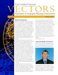
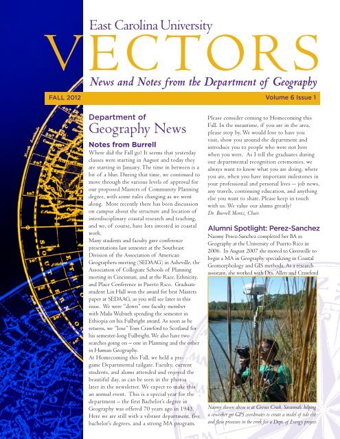
FALL 2012<br />
Volume 6 Issue 1<br />
Department of<br />
Geography News<br />
Notes from Burrell<br />
Where did <strong>the</strong> Fall go? It seems that yesterday<br />
classes were starting in August and <strong>to</strong>day <strong>the</strong>y<br />
are starting in January. The time in between is a<br />
bit of a blur. During that time, we continued <strong>to</strong><br />
move through <strong>the</strong> various levels of approval for<br />
our proposed Masters of Community Planning<br />
degree, with some rules changing as we went<br />
along. More recently <strong>the</strong>re has been discussion<br />
on campus about <strong>the</strong> structure and location of<br />
interdisciplinary coastal research and teaching,<br />
and we, of course, have lots invested in coastal<br />
work.<br />
Many students and faculty gave conference<br />
presentations last semester at <strong>the</strong> Sou<strong>the</strong>ast<br />
Division of <strong>the</strong> Association of American<br />
Geographers meeting (SEDAAG) in Asheville, <strong>the</strong><br />
Association of Collegiate Schools of Planning<br />
meeting in Cincinnati, and at <strong>the</strong> Race, Ethnicity,<br />
and Place Conference in Puer<strong>to</strong> Rico. Graduate<br />
student Lin Hall won <strong>the</strong> award for best Masters<br />
paper at SEDAAG, as you will see later in this<br />
issue. We were “down” one faculty member<br />
with Mulu Wubneh spending <strong>the</strong> semester in<br />
Ethiopia on his Fulbright award. As soon as he<br />
returns, we “lose” Tom Crawford <strong>to</strong> Scotland for<br />
his semester-long Fulbright. We also have two<br />
searches going on – one in Planning and <strong>the</strong> o<strong>the</strong>r<br />
in Human Geography.<br />
At Homecoming this Fall, we held a pregame<br />
Departmental tailgate. Faculty, current<br />
students, and alums attended and enjoyed <strong>the</strong><br />
beautiful day, as can be seen in <strong>the</strong> pho<strong>to</strong>s<br />
later in <strong>the</strong> newsletter. We expect <strong>to</strong> make this<br />
an annual event. This is a special year for <strong>the</strong><br />
department – <strong>the</strong> first Bachelor’s degree in<br />
Geography was offered 70 years ago in 1943.<br />
Here we are still with a vibrant department, five<br />
bachelor’s degrees, and a strong MA program.<br />
Please consider coming <strong>to</strong> Homecoming this<br />
Fall. In <strong>the</strong> meantime, if you are in <strong>the</strong> area,<br />
please s<strong>to</strong>p by. We would love <strong>to</strong> have you<br />
visit, show you around <strong>the</strong> department and<br />
introduce you <strong>to</strong> people who were not here<br />
when you were. As I tell <strong>the</strong> graduates during<br />
our departmental recognition ceremonies, we<br />
always want <strong>to</strong> know what you are doing, where<br />
you are, when you have important miles<strong>to</strong>nes in<br />
your professional and personal lives -- job news,<br />
any travels, continuing education, and anything<br />
else you want <strong>to</strong> share. Please keep in <strong>to</strong>uch<br />
with us. We value our alums greatly!<br />
Dr. Burrell Montz, Chair.<br />
Alumni Spotlight: Perez-Sanchez<br />
Naomy Perez-Sanchez completed her BA in<br />
Geography at <strong>the</strong> <strong>University</strong> of Puer<strong>to</strong> Rico in<br />
2006. In August 2007 she moved <strong>to</strong> Greenville <strong>to</strong><br />
begin a MA in Geography specializing in Coastal<br />
Geomorphology and GIS methods. As a research<br />
assistant, she worked with Drs. Allen and Crawford<br />
Naomy shown above is at Groves Creek, Savannah. helping<br />
a coworker get GPS coordinates <strong>to</strong> create a model of tide ebb<br />
and flow processes in <strong>the</strong> creek for a Dept. of Energy project.
Inside This Issue<br />
Notes from Burrell 1<br />
Alumni Spotlight 1<br />
News and Events 2<br />
Newest Alums 5<br />
4<br />
in <strong>the</strong> Center for Geographic Information Science.<br />
Her <strong>the</strong>sis, Influence of Geographical Orientation,<br />
Beach Shelter, and Seasonality on Beach Behavior in<br />
<strong>the</strong> Caribbean: A Case of Study, Puer<strong>to</strong> Rico, was<br />
completed in <strong>the</strong> summer of 2009 under <strong>the</strong><br />
direction of Dr. Paul Gares.<br />
In fall 2009, she left Greenville for Savannah,<br />
GA and joined <strong>the</strong> Geology Department at <strong>the</strong><br />
Skidaway Institute of Oceanography as a GIS<br />
Research Tech. At <strong>the</strong> institute she worked closely<br />
with two his<strong>to</strong>rical shoreline change projects on<br />
Georgia’s coast. For <strong>the</strong> study, Quantifying <strong>the</strong><br />
Impact of Recreational and Commercial Usage of <strong>the</strong><br />
Atlantic Intracoastal Waterway on <strong>the</strong> Natural Resources<br />
of Georgia, she analyzied his<strong>to</strong>rical shoreline change<br />
along <strong>the</strong> Atlantic Intracoastal Waterway and its<br />
relationship <strong>to</strong> recreational boating. For Quantifying<br />
<strong>the</strong> Threat <strong>to</strong> Archeological, His<strong>to</strong>rical, and Cultural<br />
Resources from Shoreline Change, Naomy analyzed<br />
his<strong>to</strong>rical shoreline change at archeological sites<br />
along Georgia’s back barrier islands <strong>to</strong> determine<br />
<strong>the</strong>ir probably lifetime due <strong>to</strong> erosional processes.<br />
Currently, she is working with <strong>the</strong> Ports and Coasts<br />
Division at Atkins Global in <strong>the</strong>ir Austin, TX office<br />
as a Geomorphologist in <strong>the</strong> Coastal Planning<br />
and Res<strong>to</strong>ration group, and is part of <strong>the</strong> group<br />
developing a Regional Plan for Sustainable Development<br />
for <strong>the</strong> Brazoria County Parks Department in TX.<br />
“The culture of <strong>the</strong> ECU Geography Department<br />
broke every graduate school stereotype in my mind.<br />
The sense of respect and collegiality between<br />
students and faculty are key for a good graduate<br />
school experience and <strong>the</strong> Geography Department<br />
has a good handle on it. Faculty was nothing<br />
like <strong>the</strong> intimidating s<strong>to</strong>ries I often heard and<br />
<strong>the</strong> comradeship among fellow classmates was<br />
exceptional. The Geography Department gave me<br />
<strong>the</strong> knowledge, <strong>to</strong>ols, confidence, and leadership<br />
needed <strong>to</strong> go in<strong>to</strong> <strong>the</strong> professional world and I am<br />
beyond thankful for that. I truly enjoyed <strong>the</strong> time<br />
spent in <strong>the</strong> department.”<br />
BS Grad, Amy Shew, BS Grad Brandon Hill at <strong>the</strong><br />
Homecoming Fall 2012 pre-game Departmental tailgate.<br />
News and Events<br />
Undergrad Planning Curriculum<br />
Changes Proposed<br />
Revisions <strong>to</strong> <strong>the</strong> curriculum for <strong>the</strong> BS in Urban<br />
and Regional Planning Degree are currently in<br />
<strong>the</strong> review and approval process and is reportedly<br />
one of <strong>the</strong> most complex proposals that have<br />
ever been processed at one time through <strong>the</strong><br />
college and university. The planning program’s<br />
curriculum revision process began in 2011 and<br />
involved significant coordination with geography<br />
department faculty. This article summarizes<br />
selected parts of <strong>the</strong> curriculum changes, which if<br />
approved, will go in<strong>to</strong> effect August 2013.<br />
The Geography Department appointed an ad<br />
hoc curriculum committee during Fall 2012 <strong>to</strong><br />
recommend integration of certain geography<br />
and planning courses. A key outcome of that<br />
committee’s recommendation was <strong>the</strong> alignment<br />
and cross-listing of Geography and Planning<br />
courses on Geographic Information Systems<br />
(GIS). Under <strong>the</strong> new curriculum, <strong>the</strong>re<br />
will be three levels of proficiency in GIS for<br />
planning students, ra<strong>the</strong>r than <strong>the</strong> current two.<br />
Ano<strong>the</strong>r driving force was <strong>the</strong> desire of <strong>the</strong><br />
<strong>University</strong> Curriculum Committee <strong>to</strong> replace<br />
some 5000-level courses. As a result several of<br />
<strong>the</strong> planning program’s courses will become<br />
4000-level courses if approved. Complicating<br />
<strong>the</strong> effort fur<strong>the</strong>r was <strong>the</strong> anticipated master of<br />
community planning degree proposal. Under<br />
a separate but parallel graduate curriculum<br />
revision process, <strong>the</strong> planning program is seeking<br />
<strong>the</strong> creation of 6000-level courses suitable<br />
for graduate students but that cover <strong>the</strong> same<br />
substantive content as <strong>the</strong> proposed 4000-level<br />
courses.<br />
Equally important is <strong>the</strong> proposed revamping of<br />
concentration study areas available <strong>to</strong> planning<br />
students. The BS in urban and regional planning<br />
degree allows students <strong>to</strong> choose a minor, or<br />
in lieu of a minor, two concentration areas. It<br />
has been several years since <strong>the</strong> concentrations<br />
have been revised and, if approved, <strong>the</strong>y should<br />
enhance <strong>the</strong> marketability of undergraduates<br />
for employment. New concentrations include<br />
geographic information science, urban studies,<br />
rural development, and public administration. The<br />
program faculty believes that <strong>the</strong>se concentrations<br />
are better connected <strong>to</strong> <strong>the</strong> demand for planners<br />
in <strong>the</strong> local government sec<strong>to</strong>r. Certain o<strong>the</strong>r<br />
concentrations were proposed for elimination,<br />
not necessarily because <strong>the</strong>y were inappropriate
ut because of a general lack of available course<br />
offerings in those concentration areas. For more<br />
information about <strong>the</strong>se curriculum changes,<br />
contact Jerry Weitz at weitzj@ecu.edu.<br />
Planning Program Recommends Old<br />
Waynesborough Park Improvements<br />
Old Waynesborough Park and His<strong>to</strong>ric Village<br />
is located along <strong>the</strong> banks of <strong>the</strong> Neuse River<br />
in Goldsboro, NC. The park includes <strong>the</strong><br />
original location of <strong>the</strong> county seat of Wayne<br />
County, Waynesborough, which declined in <strong>the</strong><br />
1840’s when railroads were extended <strong>to</strong> nearby<br />
Goldsborough (now Goldsboro).<br />
In Oc<strong>to</strong>ber 2011, Jerry Weitz, direc<strong>to</strong>r of <strong>the</strong><br />
urban and regional planning program at ECU<br />
began discussions with representatives of <strong>the</strong> Old<br />
Waynesborough Commission regarding technical<br />
assistance for Old Waynesborough Park.<br />
Weitz agreed <strong>to</strong> look for opportunities <strong>to</strong> direct<br />
students <strong>to</strong> work on a master plan as part of <strong>the</strong>ir<br />
academic studies. Students from various courses<br />
contributed <strong>to</strong> a report completed in 12/2012,<br />
entitled Assessment and Plan of Improvement of Old<br />
Waynesborough Park.<br />
The resulting assessment and plan suggests<br />
several improvements <strong>to</strong> existing features of<br />
<strong>the</strong> park, including correction of existing<br />
drainage problems, installation of his<strong>to</strong>rical<br />
structure identification signs and replacement<br />
of park entrance signs, improvement of an<br />
existing overflow parking lot, and expansion and<br />
improvement of <strong>the</strong> existing trail system. The<br />
plan recommends that <strong>the</strong> Old Waynesborough<br />
Commission complete major capital<br />
improvements, such as expansion of <strong>the</strong> existing<br />
general s<strong>to</strong>re (which does not function as an actual<br />
s<strong>to</strong>re), construction of an old Waynesborough<br />
Tavern, construction of a replica of <strong>the</strong> old<br />
Wayne County courthouse, a tribute <strong>to</strong> Native<br />
Americans, a transportation his<strong>to</strong>ry museum, a<br />
playground, and a large concert stage <strong>to</strong> serve<br />
larger events at <strong>the</strong> park.<br />
Old Waynesborough Park is already optimally<br />
located <strong>to</strong> connect in<strong>to</strong> regional and statewide<br />
<strong>to</strong>urism activity patterns and development<br />
plans. Strategic improvements could provide<br />
<strong>the</strong> Commission with additional revenue-raising<br />
potential and be responsive <strong>to</strong> community needs.<br />
For more information go <strong>to</strong> www.ecu.edu/plan<br />
(go <strong>to</strong> “outreach projects”). by Jerry Weitz<br />
Hur Particpates in Outreach Academy<br />
& Recieves $11,000 Research Award<br />
Dr. Misun Hur, Assistant Professor in <strong>the</strong><br />
planning program, was one of 10 participants in<br />
<strong>the</strong> ECU 2012 Engagement and Outreach<br />
Scholars Academy, a program <strong>to</strong> cultivate engaged<br />
scholars who can be leaders in <strong>the</strong>ir professions<br />
while working with communities, offered by <strong>the</strong><br />
Office of Public Service and Community<br />
Relations. She was selected through a peer<br />
selection process, attended a series of workshops<br />
throughout Fall 2012 semester, and received an<br />
award ($11,000) for her proposed research,<br />
Empowering <strong>the</strong> Latino/Hispanic Immigrants by <strong>the</strong> Social<br />
Network Analysis in Asset-based Community Development<br />
Practice in Pitt County, North <strong>Carolina</strong>. Partnered<br />
with <strong>the</strong> Asociación de Mexicanos en <strong>Carolina</strong> del<br />
Norte, Inc. (AMEXCAN), her research team<br />
including a graduate assistant and two EC<br />
scholars, will investigate a way <strong>to</strong> empower <strong>the</strong><br />
community by identifying <strong>the</strong> community’s assets,<br />
strengths, and resources.<br />
Dr. Misun Hur accepting her award with Provost Sheerer<br />
(left) and Chancellor Ballard (right)<br />
Undergrads Receive Scholarships<br />
Matt Moy, Allysa Randall and Jamie Wheeler<br />
were each awarded a $500 scholarship from <strong>the</strong><br />
Geography Department for Fall 2012.<br />
Geography
Check out Vaughn’s GISci Poster<br />
Sallie Vaughn <strong>to</strong>ok 3rd place in <strong>the</strong> GISci.org<br />
poster contest. Some of you probably remember<br />
Sallie as one of our excellent grad students from<br />
a few years back. For GISci 2012 Poster Contest<br />
Entries, see www.gisci.org/Contest2012/index.htm<br />
Hall Awarded SEDAAG Best MA Paper<br />
Lin Hall received <strong>the</strong> award for best Masters’<br />
Paper at SEDAAG for his paper and presentation<br />
on Clima<strong>to</strong>logy of <strong>the</strong> Structure, Frequency, and Propagation<br />
of Midlatitude Cyclones that Affect North <strong>Carolina</strong>.<br />
ecology. The<br />
program familiarized<br />
participants<br />
with tides,<br />
waves, geological<br />
classifications of<br />
estuarine systems,<br />
and <strong>the</strong> plants and<br />
animals that call<br />
<strong>the</strong> estuary home.<br />
Exerpted from Magnetic<br />
<strong>East</strong>, Fall 2012.<br />
Randall with turtle hatchling<br />
Internship Report<br />
Alyssa Randall, a senior geography major with a<br />
minor in coastal and marine studies, received a<br />
2012 summer internship through <strong>the</strong> NC State<br />
Government Summer Internship Program led<br />
by <strong>the</strong> Youth Advocacy and Involvement Office.<br />
For 10 weeks Randall worked within <strong>the</strong> DENR<br />
Division of Coastal Management in Wilming<strong>to</strong>n,<br />
NC, as a natural resource management and<br />
outreach assistant for <strong>the</strong> NC Coastal Reserve and<br />
National Estuarine Research Reserve System.<br />
Randall’s job was <strong>to</strong> oversee and lead <strong>the</strong> sea turtle<br />
nesting efforts on Masonboro Island. As part of<br />
<strong>the</strong> North <strong>Carolina</strong> Coastal Reserve, Masonboro<br />
Island is a protected island with no man-made<br />
structures and is only accessible by boat. While<br />
<strong>the</strong> public can visit <strong>the</strong> reserve, its main function<br />
is <strong>to</strong> act as a field research site and provide a haven<br />
for hundreds of different species.<br />
During her internship, Randall led volunteers on<br />
a 10-mile sea turtle nest patrol. When a site was<br />
identified, participants would dig in <strong>the</strong> sand until<br />
<strong>the</strong> <strong>to</strong>p layer of eggs was reached. In order <strong>to</strong><br />
track where turtles may nest in <strong>the</strong> future, a DNA<br />
sample was taken by collecting <strong>the</strong> shell of one<br />
of <strong>the</strong> eggs. The eggs were <strong>the</strong>n recovered with<br />
sand and wire mesh (<strong>to</strong> mainly keep out <strong>the</strong> red<br />
foxes that live on <strong>the</strong> island). In addition, Randall<br />
used a GPS unit <strong>to</strong> mark <strong>the</strong> location of <strong>the</strong> nest<br />
and <strong>to</strong> <strong>document</strong> <strong>the</strong> data, including species type,<br />
predation count and track width.<br />
Once in <strong>the</strong> lab, Randall processed <strong>the</strong> GPS and<br />
created nesting maps using ArcGIS. She also<br />
created a map of fox dens on <strong>the</strong> island, as well as<br />
a map of potential kayak routes that can be used<br />
<strong>to</strong> look for diamondback terrapin.<br />
Randall participated in o<strong>the</strong>r activities during her<br />
internship, including shorebird rescue efforts and<br />
sea turtle necropsies. Her final project as an intern<br />
with <strong>the</strong> North <strong>Carolina</strong> Coastal Reserve was <strong>to</strong><br />
teach an outreach program on <strong>the</strong> <strong>to</strong>pic of estuary<br />
Job Reports<br />
Tyler Bruce, Spring 2012. GIS Techncian 1 with<br />
Stantec (Formally Greenhorn and O’Mara)<br />
Recently I traveled <strong>to</strong> Seattle for field recon. We<br />
were geotagging a coastline in Kitsap county<br />
across <strong>the</strong> Puget Sound from Seattle. It was a 3<br />
day adventure with 342 miles on a boat doing<br />
3D geotagged pictures for engineering models<br />
<strong>to</strong> represent <strong>the</strong> actual coastline. It was a great<br />
opportunity and was fun <strong>to</strong> travel with work.<br />
At <strong>the</strong> beginning of November I accepted a <strong>full</strong><br />
time offer <strong>to</strong> become a GIS Tech 1. I willcontinue<br />
<strong>to</strong> work on projects as well as picking up several<br />
new tasks related <strong>to</strong> <strong>the</strong> FEMA FIRM process I<br />
will be involved in more coastal primary frontal<br />
dune analysis and wave runup/still water flooding<br />
mapping. It has been challenging at times but a lot<br />
of interesting work that is helping me learn new<br />
tasks.<br />
Dr. Palmer-Moloney Deploys <strong>to</strong><br />
Afghanistan<br />
Former Geography instruc<strong>to</strong>r and Ph.D. candidate<br />
in Coastal Resources Management, Dr. Laura<br />
Dr. Palmer-Moloney and Corpsman Daniel Holmberg<br />
hike <strong>to</strong> <strong>the</strong> Helmand River in sou<strong>the</strong>rn Helmand Province.
Jean Palmer-Moloney joined <strong>the</strong> U.S.<br />
government service first as a visiting research<br />
scientist with <strong>the</strong> National Geospatial-<br />
Intelligence Agency and<br />
<strong>the</strong>n as a federal employee with USACE<br />
in 2009. At that time she began her<br />
study of <strong>the</strong> Helmand River watershed in<br />
Afghanistan. In her role as civilian employee<br />
of <strong>the</strong> Department of Defense, Dr. Palmer-<br />
Moloney served as <strong>the</strong> principal investiga<strong>to</strong>r<br />
for <strong>the</strong> “Civil-Military Operation/Human-<br />
Environment Interaction” USACE ERDC<br />
work package and was a lead research<br />
scientist in <strong>the</strong> Pentagon’s “Helmand Deep<br />
Dive” strategic multi-layered assessment of<br />
Afghanistan. She deployed <strong>to</strong> Afghanistan<br />
as senior advisor on watershed management<br />
<strong>to</strong> <strong>the</strong> Commander of Regional Command<br />
Southwest from 2011-2012. As such, she<br />
served on <strong>the</strong> Stability Operations staff, Camp<br />
Lea<strong>the</strong>rneck, Helmand Province, Afghanistan.<br />
Excerpted from 12/2012 WaterWell Journal article by<br />
Mike Price.<br />
Hall Awarded Space Grant<br />
Fellowship<br />
Lin Hall has been granted an NC Space Grant<br />
Graduate Research Fellowship Award which<br />
provides add-on support for graduate students<br />
<strong>to</strong> supplement and enhance basic research<br />
support.<br />
Our Newest Alums<br />
Fall 2012 Undergraduates<br />
Jason Alan Blumenfeld BS Geography, Certificate in<br />
Geographic Information Systems<br />
Kathleen Ellen Muriel Clifford, BS Geography<br />
Mat<strong>the</strong>w Craig Hall, BS Urban & Regional Planning<br />
Jared Brannon Tyndall, BS Geography<br />
Cameron Tyler Williams, BS Urban & Regional<br />
Planning<br />
Summer MA 2012 Graduates<br />
Chad Godshalk Buch, Internship Report: A<br />
Professional Review of Planning Interaction in <strong>the</strong> Public<br />
Sec<strong>to</strong>r.<br />
Kelsey Jill Mulder. Predicting Resjponses <strong>to</strong> Flash<br />
Flooding: A Case Study of Boulder, Colorado.<br />
Cal Ryan Scheinert. Debris Flow Fan Evolution: Chalk<br />
Creek Natural Debris Flow, Labora<strong>to</strong>ry, Colorado.<br />
We Want <strong>to</strong> Hear from You<br />
Do you have news <strong>to</strong> share with your fellow<br />
Department of Geography alumni? How about<br />
an idea you think would make a good s<strong>to</strong>ry for<br />
Vec<strong>to</strong>rs? Email Karen at mulcahyk@ecu.edu.<br />
Geography<br />
Homecoming Fall 2012 at a pre-game Departmental tailgate.<br />
Clockwise from below. MA Grads Gary Monitz and Alison<br />
Hueber, Dr. Curtis and BS Grad Brandon Hill and Dr.<br />
Allen and BS Grad Kyle Whaley