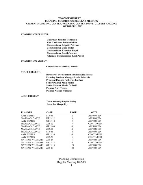
TOWN OF GILBERT
TOWN OF GILBERT
TOWN OF GILBERT

Create successful ePaper yourself
Turn your PDF publications into a flip-book with our unique Google optimized e-Paper software.
<strong>TOWN</strong> <strong>OF</strong> <strong>GILBERT</strong><br />
PLANNING COMMISSION REGULAR MEETING<br />
<strong>GILBERT</strong> MUNICIPAL CENTER, 50 E. CIVIC CENTER DRIVE, <strong>GILBERT</strong> ARIZONA<br />
OCTOBER 2, 2013<br />
COMMISSION PRESENT:<br />
COMMISSION ABSENT:<br />
Chairman Jennifer Wittmann<br />
Vice Chairman Joshua Oehler<br />
Commissioner Brigette Peterson<br />
Commissioner Chad Fuller<br />
Commissioner Kristofer Sippel<br />
Commissioner David Cavenee<br />
Alternate Commissioner Khyl Powell<br />
Commissioner Anthony Bianchi<br />
STAFF PRESENT:<br />
Director of Development Services Kyle Mieras<br />
Planning Services Manager Linda Edwards<br />
Principal Planner Catherine Lorbeer<br />
Senior Planner Mike Milillo<br />
Senior Planner Maria Cadavid<br />
Planner Amy Temes<br />
Planner Nathan Williams<br />
ALSO PRESENT:<br />
Town Attorney Phyllis Smiley<br />
Recorder Margo Fry<br />
PLANNER CASE PAGE VOTE<br />
AMY TEMES S13-06 2 APPROVED<br />
MARIA CADAVID UP13-12 3 APPROVED<br />
AMY TEMES UP13-14 3 APPROVED<br />
MARIA CADAVID Z13-12 3 CONTINUED<br />
MARIA CADAVID GP13-06 4 APPROVED<br />
MARIA CADAVID Z13-14 4 APPROVED<br />
MARIA CADAVID S13-05 4 APPROVED<br />
AMY TEMES GP13-16 4 CONTINUED<br />
AMY TEMES Z13-27 5 CONTINUED<br />
NATHAN WILLIAMS Z13-24 5 APPROVED<br />
NATHAN WILLIAMS UP13-17 6 CONTINUED<br />
NATHAN WILLIAMS GP13-13 20 APPROVED<br />
NATHAN WILLIAMS Z13-23 20 APPROVED<br />
Planning Commission<br />
Regular Meeting 10-2-13<br />
1
CALL TO ORDER:<br />
Chairman Jennifer Wittmann called the meeting to order at 6:20 p.m.<br />
ROLL CALL<br />
Ms. Fry called roll and a quorum was determined to be present.<br />
APPROVAL <strong>OF</strong> AGENDA<br />
Chairman Wittmann asked if there were any changes to the agenda.<br />
Vice Chairman Oehler said that they would be moving Items 9, 10, 11, 12, 13, 14 and 16 to the Consent<br />
Agenda. Items 9, 13 and 14 are being continued to the November 6 th Planning Commission meeting.<br />
Chairman Wittmann requested a motion to approve the Agenda.<br />
A motion was made by Vice Chairman Joshua Oehler and seconded by Commissioner Brigette<br />
Peterson to approve the revised Agenda.<br />
Motion carried 6 - 0<br />
COMMUNICATIONS FROM CITIZENS<br />
At this time members of the public can comment on items not on the agenda. The Commission’s response<br />
is limited to responding to criticism, asking staff to review a matter commented upon or asking that the<br />
matter be put on a future agenda.<br />
Chairman Wittmann asked if there was anyone present who wished to speak under those terms. There was<br />
no response.<br />
PUBLIC HEARING (CONSENT)<br />
Consent Public Hearing items will be heard at one Public Hearing. After the Consent Public Hearing, these<br />
items may be approved by a single motion. At the request of a member of the Commission or Staff, an item<br />
may be removed from the Consent Calendar and may be heard and acted upon separately. Other items on<br />
the agenda may be added to the Consent Public Hearing and approved under a single motion.<br />
Chairman Wittmann opened the public hearing and read the consent items.<br />
S13-06 - FULTON HOMES AT COOLEY STATION, REQUEST TO APPROVE THE<br />
PRELIMINARY PLAT FOR 397 SINGLE FAMILY HOME LOTS ON APPROXIMATELY 79<br />
ACRES <strong>OF</strong> REAL PROPERTY LOCATED AT THE SOUTHWEST CORNER <strong>OF</strong> RECKER<br />
ROAD AND GALVESTON ROAD IN THE SINGLE FAMILY – DETACHED (SF-D) WITH A<br />
PLANNED AREA DEVELOPMENT (PAD) OVERLAY ZONING DISTRICT.<br />
Move to approve the findings and S13-06, Fulton Homes at Cooley Station, approximately 79 acres<br />
consisting of 397 single family lots, generally located at the southwest corner of Recker and Galveston<br />
Roads zoned SF-D with a PAD overlay, subject to the following conditions;<br />
1. The Final Plat for Fulton Homes at Cooley Station shall be in substantial conformance with<br />
Ordinance No. 2443, Exhibits 4, Preliminary Plat approved by the Planning Commission at the<br />
Planning Commission<br />
Regular Meeting 10-2-13<br />
2
October 2, 2013 public hearing and Exhibit 5, Open Space Plan, approved by the Design Review<br />
Board on September 12, 2013.<br />
2. The applicant sub-divider has not proposed, as part of the preliminary plat approval process, to<br />
delineate S13-06 Fulton Homes at Cooley Station Preliminary Plat into two (2) or more final plat<br />
filing/construction phases. S13-06 is approved as a single phase for final plat filing/ construction.<br />
When phasing is not indicated on the preliminary plat, the final plat shall be submitted for the<br />
entire area shown on the preliminary plat. If the applicant desires to establish phases following<br />
approval of the preliminary plat, a new preliminary plat delineating the phases must be submitted<br />
and approved.<br />
UP13-12 - SPRINT: REQUEST TO APPROVE A CONDITIONAL USE PERMIT FOR<br />
APPROXIMATELY 0.05 ACRES <strong>OF</strong> REAL PROPERTY LOCATED AT 4627 EAST QUEEN<br />
CREEK ROAD IN THE TRILOGY AT POWER RANCH GOLF COURSE, TO PERMIT A<br />
WIRELESS COMMUNICATION FACILITY/WCF (65 FOOT HIGH FAUX PINE TREE TO<br />
CONCEAL A WCF ANTENNA) IN THE PUBLIC FACILITY INSTITUTIONAL (PF/I) WITH A<br />
PLANNED AREA DEVELOPMENT OVERLAY (PAD) ZONING DISTRICT.<br />
Move to approve the findings of fact and approve UP13-12, a Conditional Use Permit to allow the<br />
installation of a 65 foot high faux pine tree to conceal a WCF antenna in the Public Facility/Institutional<br />
zoning district at 4627 Queen Creek Road in the Trilogy golf course in Power Ranch subject to conditions:<br />
1. The Project shall be in substantial conformance with the site plan, and elevations/ details shown on the<br />
Exhibits noted under Attachment No.4.<br />
2. The 50’x50’ masonry enclosure that defines the leased area to conceal the equipment cabinets shall be<br />
constructed and finished per the wall standards in Power Ranch as determined by the HOA. Wall<br />
details shall be specified in the construction documents to be submitted prior to issuance of a building<br />
permit.<br />
UP13-14 - <strong>GILBERT</strong> ASSISTED LIVING; A CONDITIONAL USE PERMIT TO ALLOW A<br />
CONGREGATE CARE FACILITY, ON APPROXIMATELY 4.8 ACRES <strong>OF</strong> REAL PROPERTY,<br />
LOCATED SOUTHEAST <strong>OF</strong> THE SOUTHEAST CORNER <strong>OF</strong> VAL VISTA DRIVE AND<br />
MERCY ROAD, IN GENERAL <strong>OF</strong>FICE (GO) WITH PLANNED AREA DEVELOPMENT (PAD)<br />
OVERLAY ZONING DISTRICT .<br />
Move to make the findings of fact and approve UP13-14 Gilbert Assisted Living, a Conditional Use Permit<br />
to allow congregate living facilities on 4.8 acres of property located southeast of the southeast corner of Val<br />
Vista Drive and Mercy Road within the General Office (GO) with Planned Area Development (PAD)<br />
overlay zoning district, subject to conditions:<br />
1. The Project shall be in substantial conformance with the site plan (Attachment #4).<br />
Z13-12 -REQUEST TO AMEND ORDINANCES NO. 1597 AND 1956 AND REZONE<br />
APPROXIMATELY 13.2 ACRES <strong>OF</strong> REAL PROPERTY WITHIN THE COPPER RANCH<br />
PLANNED AREA DEVELOPMENT (PAD), GENERALLY LOCATED SOUTH AND EAST <strong>OF</strong><br />
THE SOUTHEAST CORNER <strong>OF</strong> WARNER AND RECKER ROADS FROM MULTI FAMILY-<br />
MEDIUM (MF/M) WITH A PLANNED AREA DEVELOPMENT (PAD) TO SINGLE FAMILY-<br />
DETACHED (SF-D) WITH A PLANNED AREA DEVELOPMENT (PAD) OVERLAY ZONING<br />
DISTRICT AND TO AMEND CONDITIONS <strong>OF</strong> DEVELOPMENT AS FOLLOWS: REDUCE<br />
LOT DIMENSIONS; DECREASE SIDE AND REAR SETBACKS AND SEPARATION BETWEEN<br />
Planning Commission<br />
Regular Meeting 10-2-13<br />
3
DWELLING UNITS; AND INCREASE THE MAXIMUM LOT COVERAGE FOR TWO-STORY<br />
UNITS.<br />
STAFF REQUESTS A CONTINUANCE TO THE NOVEMBER 6, 2013 PLANNING COMMISSION<br />
MEETING.<br />
GP13-06: A MINOR GENERAL PLAN AMENDMENT TO CHANGE THE LAND USE<br />
CLASSIFICATION FOR APPROXIMATELY 239.4 ACRES <strong>OF</strong> REAL PROPERTY<br />
GENERALLY LOCATED AT THE NORTHWEST CORNER <strong>OF</strong> WARNER AND RECKER<br />
ROADS FROM APPROXIMATELY 91.2 ACRES <strong>OF</strong> RESIDENTIAL >5-8 DU/AC, 136.1 ACRES<br />
<strong>OF</strong> RESIDENTIAL 3.5-5 DU/AC., 3.9 ACRES <strong>OF</strong> GENERAL COMMERCIAL (GC) AND 8.2<br />
ACRES <strong>OF</strong> COMMUNITY COMMERCIAL (CC) LAND USE CLASSIFICATIONS TO<br />
APPROXIMATELY 67.8 DU/AC. <strong>OF</strong> RESIDENTIAL 3.5-5 DU/AC. AND 171.6 ACRES <strong>OF</strong><br />
RESIDENTIAL 2-3.5 DU/AC. LAND USE CLASSIFICATIONS, AND;<br />
Z13-14: A REQUEST TO AMEND THE MORRISON RANCH PLANNED AREA<br />
DEVELOPMENT (PAD) ZONING MAP AND DEVELOPMENT STANDARDS BY AMENDING<br />
APPROXIMATELY 239.4 ACRES <strong>OF</strong> REAL PROPERTY GENERALLY LOCATED AT THE<br />
NORTHWEST CORNER <strong>OF</strong> RECKER AND WARNER ROADS FROM APPROXIMATELY 8.2<br />
ACRES <strong>OF</strong> COMMUNITY COMMERCIAL (CC), 3.9 ACRES <strong>OF</strong> GENERAL COMMERCIAL<br />
(GC), 91.2 ACRES <strong>OF</strong> SINGLE FAMILY-DETACHED (SF-D), 37.9 ACRES <strong>OF</strong> SINGLE<br />
FAMILY-6 (SF-6),77.2 ACRES <strong>OF</strong> SINGLE FAMILY-7 (SF-7) AND 21 ACRES <strong>OF</strong> SINGLE<br />
FAMILY-8 (SF-8).<br />
A. Adopt the Resolution and approve GP13-06 a minor General Plan Amendment to change the land use<br />
classification: and<br />
B. Make the Findings of Fact and adopt an ordinance for Z13-14, subject to the conditions in the draft<br />
ordinance.<br />
S13-05 - PRELIMINARY PLAT – WHITE FENCE ESTATES, SOUTH <strong>OF</strong> THE SWC <strong>OF</strong><br />
WARNER ROAD & 130 TH STREET.<br />
Move to approve the findings and S13-05, the preliminary plat and open space plan for White Fence<br />
Estates, approximately 6.8 acres of residential development consisting of 27 Single Family-6 (SF-6) lots<br />
and generally located south of the southwest corner of Warner and Higley Roads, subject to the following<br />
conditions:<br />
1. The Final Plat and open space plan for White Fence Estates shall be in substantial conformance with<br />
Attachments 2 and 3, Preliminary Plat and Open Space Plan documents approved by the Planning<br />
Commission at the October 2, 2013 meeting.<br />
GP13-16, EPICENTER: REQUEST FOR MINOR GENERAL PLAN AMENDMENT TO<br />
CHANGE THE LAND USE CLASSIFICATION <strong>OF</strong> APPROXIMATELY 22.5 ACRES <strong>OF</strong> REAL<br />
PROPERTY GENERALLY LOCATED AT THE NORTHWEST CORNER <strong>OF</strong> HIGLEY AND<br />
RAY ROADS FROM GENERAL COMMERCIAL TO REGIONAL COMMERCIAL LAND USE<br />
CLASSIFICATION.<br />
Z13-27, EPICENTER: REQUEST TO AMEND ORDINANCES NO.1305 AND 2364 AND<br />
REZONE APPROXIMATELY 22.5 ACRES <strong>OF</strong> REAL PROPERTY WITHIN THE AGRITOPIA<br />
PLANNED AREA DEVELOPMENT (PAD), GENERALLY LOCATED AT THE NORTHWEST<br />
CORNER <strong>OF</strong> HIGLEY AND RAY ROADS FROM APPROXIMATELY 22.5 ACRES <strong>OF</strong><br />
GENERAL COMMERCIAL (GC) WITH A PLANNED AREA DEVELOPMENT OVERLAY<br />
Planning Commission<br />
Regular Meeting 10-2-13<br />
4
ZONING DISTRICT TO APPROXIMATELY 22.5 ACRES <strong>OF</strong> REGIONAL COMMERCIAL (RC)<br />
WITH A PLANNED AREA DEVELOPMENT OVERLAY ZONING DISTRICT.<br />
STAFF REQUESTS A CONTINUANCE TO THE NOVEMBER 6, 2013 PLANNING COMMISSION<br />
MEETING.<br />
Z13-24 - REQUEST TO AMEND ORDINANCES NO.1527 AND 1664 TO AMEND THE<br />
DEVELOPMENT PLAN AND CONDITIONS <strong>OF</strong> DEVELOPMENT WITHIN THE MEDICAL<br />
CAMPUS PLANNED AREA DEVELOPMENT (PAD) FOR APPROXIMATELY 63 ACRES <strong>OF</strong><br />
REAL PROPERTY GENERALLY LOCATED AT THE NORTHEAST CORNER <strong>OF</strong> VAL VISTA<br />
DRIVE AND MERCY ROAD, TO DELETE THE 100 FOOT BUILDING SETBACK BUFFER<br />
REQUIREMENT ALONG THE NORTH AND WEST SIDES <strong>OF</strong> MERCY ROAD, EAST <strong>OF</strong> VAL<br />
VISTA DRIVE.<br />
For the following reasons: the development proposal conforms to the intent of the general plan and can be<br />
coordinated with existing and planned development of the surrounding areas, staff recommends the<br />
Planning Commission recommend approval to the Town Council for Z13-24 medical campus pad: request<br />
to amend ordinance nos. 1527 and 1664 to amend conditions of development in the medical campus pad,<br />
subject to the conditions of the draft ordinance and the following condition:<br />
1. The Zoning Exhibit and Development Plan shall be in substantial conformance with Exhibit 4 and<br />
Exhibit 5.<br />
Chairman Wittmann closed the public hearing.<br />
Commissioner Fuller requested that they do two separate motions on the consent calendar, one for all of the<br />
items excluding items 10 and 11 and a separate motion for items 10 and 11 as he needed to recuse himself<br />
from the vote for those two items.<br />
A motion was made by Commissioner Chad Fuller and seconded by Commissioner Brigette Peterson<br />
to approve consent items 9, 12, 13, 14 and 16.<br />
Motion carried 6 – 0<br />
A motion was made by Commissioner Brigette Peterson and seconded by Vice Chairman Joshua<br />
Oehler to approve consent items 10 and 11.<br />
Motion carried 5 – 0<br />
Commissioner Chad Fuller abstained from the vote.<br />
A motion was made by Commissioner Chad Fuller and seconded by Commissioner Brigette Peterson<br />
to approve consent items 6, 7 and 8.<br />
Motion carried 6 – 0<br />
PUBLIC HEARING (NON-CONSENT)<br />
Non-Consent Public Hearing items will be heard at an individual public hearing and will be acted upon by<br />
the Commission by a separate motion. During the public hearings, anyone wishing to comment in support<br />
of or in opposition to a public hearing item may do so. If you wish to comment on a public hearing item<br />
Planning Commission<br />
Regular Meeting 10-2-13<br />
5
you must fill out a public comment form, indicating the item number on which you wish to be heard. Once<br />
the hearing is closed, there will be no further public comment unless requested by a member of the<br />
commission.<br />
UP13-17 -GREAT HEARTS ACADEMY: REQUEST TO APPROVE A CONDITIONAL USE<br />
PERMIT FOR APPROXIMATELY 8.9 ACRES <strong>OF</strong> REAL PROPERTY LOCATED AT THE<br />
SOUTHWEST CORNER <strong>OF</strong> QUINN AVENUE AND BASELINE ROAD TO ALLOW A SCHOOL,<br />
PUBLIC OR PRIVATE, LARGE SCALE IN THE GENERAL COMMERCIAL (GC) ZONING<br />
DISTRICT, SUBJECT TO CONDITIONS <strong>OF</strong> SITE PLAN, CIRCULATION, AND<br />
COMPATIBILITY WITH ADJOINING USES.<br />
Commissioner Sippel excused himself from the discussion due to a conflict.<br />
Planner Nathan Williams stated that Great Arts Academy was a K – 12 charter school located at the<br />
Southwest corner of Quinn and Baseline Roads. Mr. Williams noted that the site was zoned general<br />
commercial (GC) and in that zoning district a large scale charter school or public/private school requires a<br />
Use Permit for approval. The site is for buildings and is approximately 73,000 ft.² with 45 classrooms, 33<br />
which will be K – 8 and 12 which will be through 12 th grade. Since it’s a public school it does not have to<br />
go through Design Review. The circulation has not changed much since it was seen at study session and the<br />
applicant has submitted a traffic impact analysis and circulation plan which was reviewed by the Town<br />
Engineer who was present. It has been updated since the study session. The applicant provided more detail<br />
on the circulation maps which they did not have previously. There is one for the archway which is K – 5<br />
where the drop off is started at 7:30 AM and they come through the site from the West, circle around the<br />
open space retention area which is also a ball field, circulate through and then drop off on the northwestern<br />
portion of the site. The preparatory is 6 – 12 and they start at 8 AM so there is a half hour stagger. They<br />
enter the same way with double stacking and drop off on the North Eastern side. Planner Williams<br />
displayed an aerial map and commented that staff had some concerns. There are two access points to the<br />
site and the one at the northwestern portion is full motion and currently a shared between the remainder of<br />
the center. He also indicated a right in right out. The Conditional Use Permit requires 4 findings of fact to<br />
be approved. The major points are going to be traffic, access, circulation etc. One of staff’s concerns is the<br />
main access point from the Northwest is the only place that a left turn can occur. The Towns biggest<br />
concern is that the outbound left turn movement is essentially going to create an unacceptable level of<br />
service for exiting the site at peak hours of the day. The applicant has submitted a revised traffic impact<br />
analysis which the Town Traffic Engineer has looked at. The site design has not really changed but they are<br />
now proposing to utilize a cross access agreement with the remainder of the center to exit vehicles out onto<br />
Greenfield. That still does not meet with approval of the Town Traffic Engineer. Planner Williams said that<br />
when you force people to turn right out of the site that will create issues on other sites as well as u- turn<br />
movement and vehicles coming in through residential neighborhoods as well as the adjacent commercial<br />
and industrial. Staff is concerned about the impact that it will create for surrounding properties. One of the<br />
four findings of fact is that they not negatively impact the surrounding property and it is a major concern<br />
for the Town is that the traffic generated from that number of students will create negative impact on the<br />
surrounding properties. Staff is also somewhat concerned with the parking. Planner Williams indicated on<br />
the site map where the parking will be for the high school students and noted that the applicant says that it<br />
is a privilege type of situation and only 32 students are able to park on-site determined by grade level as<br />
well as first-come first-served basis. Parking requirements for high schools are 7 spaces per classroom<br />
which is 84 parking spaces for this particular site and although they may not be utilizing 84 in the way they<br />
are calculating, staff is concerned with students parking on neighboring properties. Staff is recommending<br />
approval with an approved traffic impact analysis, however, that was under the assumption that through the<br />
course of time they would have something that the Town Traffic Engineer could look upon favorably but at<br />
this time the Traffic Engineer is not able to support the project.<br />
Planning Commission<br />
Regular Meeting 10-2-13<br />
6
Commissioner Powell said that he appreciated staff’s presentation, however, he did not hear anything about<br />
the quality of the project or the applicant or what they are proposing but staff did make the comment that<br />
they would make the recommendation to go forward if they could work out the traffic situation. He said<br />
that he could only assume that staff supported the product.<br />
Planner Williams said that they do support the product and always support schools where they are allowed.<br />
He said that they were not able to look at the architecture or development criteria but only does it meet the<br />
findings of fact. The planning department finds acceptable the way that the buildings are laid out toward<br />
the street and that they buffer the residential properties to the South but the core issue is that it doesn’t meet<br />
the findings of fact for safe access and circulation.<br />
Commissioner Powell said that he has known the Town to go to great lengths to assist other projects<br />
because they saw the value in a project and he would hope that the Town would extend the same courtesy<br />
to everyone. If it is a valuable project and could bring a wonderful influence into the community he would<br />
hope that the Town would find a solution to make this work.<br />
Chairman Wittmann said that this was the process that every applicant must go through and this is just a<br />
hurdle that they are trying to overcome. She said that she did not see the Town favoring any applicant over<br />
another.<br />
Commissioner Powell said that it seemed a little one-sided and he just wanted to be sure that they could see<br />
the entire picture.<br />
Chairman Wittmann invited the applicant to come forward.<br />
Stephen Earl, Gilbert, AZ came forward for the applicant. Mr. Earl said that he knew that the Town had had<br />
some poor experiences with charter schools. There are charter school that locate in a strip center or facility<br />
that is not designed as a school, was not built as a school from ground-up or that do not know how to<br />
control the ingress and egress and queuing on-site. Mr. Earl said that in Gilbert they have had charter<br />
schools that back traffic up onto arterial roads because they were not providing proper queuing on the site.<br />
Mr. Earl said that he would like to introduce to the Planning Commission the CEO of Great Hearts<br />
Academy, Dan Scroggin, who could present a little bit of the culture.<br />
Dan Scroggin, Gilbert, AZ, CEO of Great Hearts Academy came forward. Mr. Scroggin stated that they<br />
had schools across the valley. Five out of the top 10 public schools in Arizona, based on College Board<br />
scores, are Great Hearts Academy. This site will be part of that family of schools. 100% of the students go<br />
to four-year colleges and universities and there is a full liberal arts program. There is a long wait list to<br />
come into the school and Gilbert families want a world-class college prep school. Their schools are highly<br />
structured with a 10 to 1 student to teacher ratio. The students are highly supervised and were uniforms and<br />
ties on a closed campus where they have a strong history of traffic control and pattern throughout the<br />
Valley and all their schools. Their staff is outside monitoring the traffic and all of the families sign an<br />
honor code and a contract with the school to follow the family handbook which includes the traffic plan<br />
and these are families that that do what the school says because they want the program. Mr. Scroggin said<br />
that he could assure them that there would be no backing up onto the street and the families will be highly<br />
regulated and following the traffic patterns and highly staggered and controlled. Mr. Scroggin asked for the<br />
Planning Commissions support for their request.<br />
Chairman Wittmann asked if any of the other academies were located near other public or charter schools.<br />
Mr. Scroggin responded that they have Chandler preparatory Academy at Warner and Alma School Road<br />
where there are 11 schools within .3 miles. The preparatory Academy at 56 Street and Indian school has<br />
two public schools on the same street within half a mile.<br />
Planning Commission<br />
Regular Meeting 10-2-13<br />
7
Stephen Earl displayed an aerial which showed the project site. He indicated that there was a joint access<br />
driveway on the West side as well as an access point in the middle. To the east of the property is a street<br />
called Quinn that goes into the neighborhood to the south, however, the applicant does not have access to<br />
Quinn but access only to Baseline and Greenfield Roads. He noted that they had a reciprocal access<br />
agreement with the property owners to the west and noted that there was also a driveway behind the Chase<br />
Bank. The logical route for people to get out to Greenfield to go north or to go west on Baseline was to take<br />
the access point that he indicated on the map. Mr. Earl said that they would have five faculty members onsite<br />
during all peak hour movements both to help children get into the school and to help parents leave. He<br />
said that they could meter the people going west so that they don’t have a big lineup going through the<br />
shopping center. Making a left out at Greenfield may be difficult because of the adjacent public school so<br />
they will tell their parents that if they want to make that kind of left to go south and are really better off<br />
making three rights by going right to Recker, right down Guadalupe and going back. Mr. Earl said that part<br />
of the concern that staff is indicated in the past has been that people will leave the facility and make U-<br />
turns and go west in order to go north on Greenfield or west on Baseline Road. He said that he wanted to<br />
make it clear that they will control all of the impact of their development on their own site. If there is a<br />
delay that gets to service level B it will be their parents leaving the site. They will be signing a contract that<br />
obligates them to go in the routing pattern that the school has asked them to go. There are also a lot of<br />
children who come in ridesharing situations and that help a lot on the reduction of traffic movement. The<br />
concern that they will have a great number of cars turning left out of their joint access way is simply not<br />
correct. They know that it is a normal fear of traffic engineers in that you have a place where people can<br />
turn left that they will or will try and make left-hand turn setter and safe or make a right-hand turn only to<br />
make a left U-turn. The applicant’s position is that they have been able to confirm that their parents do as<br />
they ask and actually form patterns of exiting the site. As far as they know, PM is not an issue as it is not<br />
the normal PM peak of 4 PM to 6 PM it is really at 3 o’clock so that is not a legitimate problem either<br />
coming to the site or leaving. AM is during the normal AM. peak. Mr. Earl said the challenge appears to be<br />
where they are going to leave the site and initially they were not sure that they had the ability to have a<br />
joint access out across the properties to the west of them to Greenfield and now they know that they do.<br />
They will not cause any off-site driveway to drop below service-level D because of the traffic that they are<br />
introducing to the situation. There is the possibility that the intersection of Baseline and Greenfield may<br />
need to be modified, re-striped to have dual left turns. There is current pavement there where they could restripe<br />
and then change the signalization to allow more capacity in a left turn movement at Greenfield Road.<br />
They could absorb the cost of that if that is necessary as the traffic report suggests. The only other<br />
potentially problematic turn is someone trying to turn left onto Greenfield. They can simply tell parents that<br />
if they are going south on Greenfield Road they need to go east instead and make 3 right-hand turns or wait<br />
a great deal of time at that location. Mr. Earl said that they believe that they have the ability on-site to make<br />
things work. He noted that there are 2000 feet of stacking on-site and that the site was specifically designed<br />
so that everyone could get into the site and not back up onto any arterial. He said that he believed that they<br />
were dealing with only the AM peak exit and that they control that by having a number of faculty members<br />
on-site to control and meter out that traffic. He noted that they have a facility at 56th Street that used to be a<br />
Motorola plant, which has this exact same set up with a number of faculty members going out to make sure<br />
that drop offs and exits occur normally. Mr. Earl indicated on the site map where the parking lot was<br />
located. He noted that it did have 32 spaces and was for high school student parking and was merit-based. It<br />
was an incentive to get high grades to get one of those 32 spaces. No one is allowed to park off-site and that<br />
is one of the standards in the booklet that is given to students and parents. If there is an infraction of that<br />
rule there are consequences that could lead to expulsion. Mr. Earl said that they would be happy to sit down<br />
with the traffic engineer and figure out any nuances to what they are proposing to make sure that it works<br />
and that they are not degrading any off-site intersections from normal service levels and that they have<br />
sufficient queuing on-site to bring their people on-site and that the delays that occur are delays that they<br />
force their people to make in order to leave at a metered rate so as not to negatively impact their neighbors.<br />
Mr. Earl displayed an exhibit listing the permitted uses in General Commercial. He noted that the ordinance<br />
allows charter/public schools on residential property without a Use Permit. If they went down the street into<br />
Planning Commission<br />
Regular Meeting 10-2-13<br />
8
a residential zone, which was their second choice, they would not be coming before the Commission for a<br />
Use Permit they would just be able to do it at right. That would not have been right because it would<br />
introduce a considerable amount of traffic on Recker Road into a neighborhood. Instead, they came to a<br />
commercial site which does require a Use Permit. He listed the uses allowed without a Use Permit in that<br />
district and noted that their use is a very quiet use during the day. It does have an issue of traffic morning<br />
and afternoon but they feel that they can completely control that on-site.<br />
Chairman Fuller asked for clarification on the 30 parking spaces.<br />
Mr. Earl said that there will only be sufficient passes given out to the total number of spaces that are there.<br />
No other passes will be given out. Students will also sign a contract that they will not park anywhere else<br />
on neighboring properties.<br />
Chairman Fuller asked how it would work to have staff outside directing traffic.<br />
Mr. Earl said that he would encourage them to go over and observe the facility at 56th Street in Phoenix<br />
because it is a rehab in the sense that used to be a Motorola plant but has a very large athletic field and the<br />
same kind of stacking that is being shown for this project as well as alternate arrival times for younger and<br />
older children. There are seven faculty members who are outside every day to guide the process to ensure<br />
that it runs in an organized fashion. Part of the reason that individuals want their children at this school is<br />
not only for the academics makes but because it is also highly organized so that they have confidence. Part<br />
of that confidence is showing them that they can get in and out of the site in a controlled fashion.<br />
Vice Chairman Oehler said that in his personal experience with schools that have staff metering the parking<br />
and driving it works fairly well and there is a lot of value in what he has seen.<br />
Chairman Fuller said that they could decide in two months that they don’t have the budget for staffing so<br />
they are not having staff do that anymore. He said that he did not believe that that was a condition to the<br />
Use Permit.<br />
Mr. Earl said that they were certainly willing to making that a condition to the Use Permit because that is<br />
exactly how it will work. Stipulating them to have on-site faculty monitors of traffic coming in and out of<br />
the site would be agreeable to them. He said that they would also agree to submit to the Commission the<br />
manual that they provide to the parents so that they can see exactly what they require their students and<br />
parents to do.<br />
Chairman Fuller said that that would add to his comfort level if it were possible to add that as a condition to<br />
the Use Permit.<br />
Commissioner Peterson asked the Town Attorney if they could set conditions on a Use Permit.<br />
Town Attorney Phyllis Smiley responded that they could.<br />
Commissioner Peterson said that she believed that the staff that the applicant was referring to were not<br />
additional staff hired just too direct traffic but would be full time school staff.<br />
Chairman Wittmann asked if their traffic impact analysis included the school located south on Greenfield<br />
on the east side of the road.<br />
Mr. Earl said that the traffic engineering report that they had filed does take into account all background<br />
traffic including that school. He said that they realize that the elementary school traffic could potentially be<br />
making left-hand turns onto Greenfield can create difficulty for some of their parents making that same<br />
Planning Commission<br />
Regular Meeting 10-2-13<br />
9
movement since they are not very far away. However, they believe that they can make it clear that if they<br />
need to go south on Greenfield, unless you’re moving at a time when it is very clear, you must make righthand<br />
turns. Their experience has been that their parents do with the school ask them to.<br />
Chairman Wittmann said that there was also a small charter school one quarter mile from the proposed site.<br />
Mr. Earl said that he had made an effort over the past couple of weeks to go to that intersection at AM<br />
peaks between 7:30 and 8:30 and PM peaks at 3:30 PM and the 5:30 PM peak and this is a problem that is<br />
going to exist in the future, it is not a problem today. Allowing unrestricted movement of parent cars this is<br />
simply not workable in a charter school environment.<br />
Chairman Wittmann said that it appeared like the 56th Street local was not located on an arterial street and<br />
may have access to a residential street before getting onto a collector Street.<br />
Mr. Earl said that 56th Street is a major collector and used by the entire neighborhood. The movement is<br />
down to Thomas Road where they are making rights out of the facility down to Thomas and then going<br />
East or West on Thomas. While it is not on an arterial it is very close to an arterial.<br />
Chairman Wittmann said that the main exit from the parking area doesn’t appear to be directly on the<br />
collector but on a residential street before you get to the collector.<br />
Mr. Earl said that it is actually exiting on 56th Street which is the major collector. He said that they do not<br />
allow parents to turn left out of that exit.<br />
Commissioner Cavanee joined the meeting.<br />
Vice Chairman Oehler indicated the site map and asked if there were two lanes of egress where you could<br />
be in a right or left lane and not be stacking.<br />
Mr. Earl said that was correct, there are two lanes, one to go right and one to go left.<br />
Chairman Wittmann invited the Town Traffic Engineer to come forward.<br />
Erik Guderian, Town Traffic Engineer, came forward. Mr. Guderian said that in terms of Vice Chairman<br />
Oehler’s question about the access there is only a single right turn and left turn lane. There is not a dual<br />
lane where there is a single left turn and right turn coming out onto Baseline.<br />
Chairman Wittmann asked for Mr. Guderian’s overview on the site.<br />
Mr. Guderian said that what they have to look at are the numbers and unfortunately they have not seen<br />
many numbers because the numbers that have been presented in the traffic impact analysis shows that, yes<br />
they can get their vehicles on-site, it is getting them off site which is the issue. Because Baseline Road is a<br />
six lane arterial and Greenfield road is a four-lane arterial that will be congested, they had to look 10 years<br />
into the future to see what sort of impact the site would cause. They do not have the opportunity to make<br />
those left turns out onto Baseline. Mr. Guderian said that in terms of some of the methodology that the<br />
applicant says that they will use, there is only a direct access out onto Baseline which is six lanes and will<br />
have a median in the future. To have the joint access agreement onto Greenfield road, these full access<br />
driveways are not exclusive to the school site but are shared with the other commercial properties. There<br />
are two other commercial parcels that will be part of the overall development. It is nice to say that they will<br />
make their parents make three right-hand turns and then they will get back to wherever they need to go. Mr.<br />
Guderian said that he would like to show the Commission where the three right-hand turns were located<br />
and pointed out on the site map that you would need to go all the way over to Higley which is 3/4 of a mile<br />
Planning Commission<br />
Regular Meeting 10-2-13<br />
10
and then you must go north up to the 60 and come back around or Guadalupe and through so it is<br />
essentially a two mile detour. In past experience with schools it has shown that once parents are off the<br />
school site the school has no authority or jurisdiction and it is the Town that must deal with those traffic<br />
issues. A two mile detour to get back to Greenfield, if you live directly west of the site, is a difficult<br />
movement to make. Another issue that makes the site difficult is the existing driveways and the way they<br />
are built. They have various short storage lengths of approximately 40 to 60 feet which is not conducive to<br />
putting a traffic signal in because you can stack 2 to 3 cars before you start losing efficiency of the traffic<br />
signal. The major issue that traffic has with the traffic analysis is that it has shown that to get out of the site<br />
without everyone making a right, the Town has a concern that traffic will try to make U- turns or cut<br />
through the commercial properties. They may have people monitoring the site, but the way that they have<br />
the traffic signals coordinated there is a very small window for people to make a left out onto the site. The<br />
school drop off area for the archway is approximately 150 feet from the driveway and their analysis is<br />
showing that the queue will extend past and backup any sort of on-site traffic. It is the same thing with the<br />
preparatory if that is the main point of access to make lefts the analysis is showing that the queue will<br />
extend past the driveway. Essentially what they are saying is that everyone is going to be making a righthand<br />
turn. The new analysis that was just received by staff shows that they will have traffic going over to<br />
Greenfield and there is no way for a monitor to see what sort of stacking is happening at the Greenfield<br />
driveway because of buildings obscuring their view. The traffic analysis does not show, because they did<br />
not report it, that the intersection, if they shift the traffic over there, will cause great delays and blocking of<br />
that driveway and the business access. There was a previous plat on the site for 75,000 feet of medical and<br />
dental office. Mr. Guderian stated that he wanted to show the comparative trip generations that they were<br />
talking for different types of land uses that could go on the site and referred to the following chart:<br />
Mr. Guderian stated that the figures on the chart come out of the traffic study that the applicant has<br />
prepared and that the site will generate 913 trips which include both inbound and outbound trips in the AM<br />
peak hour and 654 in the PM when school is getting out. On the previous plat there would be 179 trips in<br />
the AM peak hour or 1/5 of what the school is generating. With regular office building the numbers would<br />
be slightly less. They also looked at general retail of a shopping center where the AM peak hour is<br />
decidedly less and trip generation increases in the PM peak hour.<br />
Chairman Wittmann asked if the traffic impact analysis study submitted by the applicant did not include the<br />
school located to the South.<br />
Mr. Guderian said that was correct. In their previous iterations of the traffic study they were just showing<br />
access out onto Baseline and so staff really focused on the intersections along Baseline. In the new study<br />
that was submitted recently the only access point that they really looked at and do not have traffic counts<br />
for, they assumed some traffic would access on to Greenfield but did not look further south.<br />
Planning Commission<br />
Regular Meeting 10-2-13<br />
11
Commissioner Fuller said that looking at the exhibit if you go to the proposed school site you have 557<br />
people coming on and 356 leaving so there are 200 cars that are staying on. He asked if that was correct<br />
Mr. Guderian said that was correct. Charter schools are relatively new and they don’t have good trip<br />
generation numbers for those schools so they use the private school trip generation formula.<br />
Commissioner Fuller said that you have 200 cars staying on 557 coming in and 356 leaving. In the p.m.<br />
you have 270 coming in and 379 leaving so there are an extra 100 that are leaving in the p.m. so where do<br />
the other hundred cars go from the a.m. He said that it looked to him that they have 825 coming in and 725<br />
leaving so how does that work.<br />
Mr. Guderian said that they were average trip rates that were taken out of their multiple sites. Usually the<br />
a.m. peak hour is higher because everyone is arriving at the same time especially when there are upper<br />
levels and have afterschool activities which spread the traffic out in the p.m.<br />
Commissioner Fuller said that the applicant’s site plan showed an easement to the west and asked how the<br />
easement affected staff’s analysis and the fact that they can’t shuttle people West through the bank and auto<br />
repair side.<br />
Mr. Guderian said that initially the applicant was showing a number of vehicles trying to make a left turn<br />
out onto Baseline. There just isn’t the available capacity to make those turns so they move those people<br />
over to the Greenfield driveway and from there they either went south or north on Greenfield. Staff’s<br />
review of the traffic models that were included in the report show that essentially they just shifted the delay<br />
from one driveway to the other and that there would be queuing that would occur there. Mr. Guderian said<br />
that they took all of the left turns away from one next set and essentially moved them over to the other.<br />
Chairman Fuller asked if there was a scenario that they could propose to the Traffic Engineer where he<br />
would potentially supports the project.<br />
Mr. Guderian said that he was hesitant to say no because there may be other options, however, he believed<br />
that it was very difficult. They have been very upfront with the applicant from day one that a right out<br />
situation only onto Baseline is not an acceptable solution for the Town because of the long detour and the<br />
U-turns. They have not seen anything from the applicant to this point that would be acceptable. It would be<br />
very difficult with the number of trips that they are looking at and the existing roadway network that is<br />
there to make it work. Mr. Guderian said that they made it possible for staff to go to the charter school at<br />
56 Street and it was noted that there are some major differences at that site. It exits out onto a three Lane<br />
Collector Rd. instead of a six Lane arterial and they did witness a few vehicles making a left turn and not<br />
right turns out onto 56th Street. Traffic can be controlled on-site but once it is off-site that is based on the<br />
roadway network. This is simply a very difficult parcel to make a school work.<br />
Chairman Fuller said that he understood that the traffic engineer was not saying “no, there is nothing we<br />
can do” but that the applicant has not presented anything that would work.<br />
Mr. Guderian said that was correct.<br />
Commissioner Fuller said the on-site queuing does seem like something that they could control on-site and<br />
it appears like they have more queuing than has been seen in the vast majority of sites. He asked if the<br />
traffic engineer would classify that as a minor issue and that the real issue is the three right turns.<br />
Mr. Guderian said that the major issue is getting people off site and getting them in the direction that they<br />
should be going. Without making right turns out onto Baseline in Greenfield the queue begins to back up<br />
Planning Commission<br />
Regular Meeting 10-2-13<br />
12
and affect the drop-off area. Staff has worked with the applicant in terms of the on-site stacking and they<br />
have rearranged their site plan to provide more stacking so that is less of a concern.<br />
Commissioner Powell said that if he was in private enterprise and was faced with trying to make something<br />
work, you would make it work. He said that medians could be installed to prevent left hand turns or No U-<br />
turn signs that would possibly make it work. The vacant lot immediately to the East right off from<br />
Greenfield is zoned GC and will ultimately be built out by someone and that will create the need to have<br />
traffic coming in off of Greenfield and going off onto Baseline. Commissioner Powell said that it seemed<br />
to him that in the future in order to make that facility or site work for everyone when it is completely built<br />
out you might have to have some combining and multiple joint uses of ingress and egresses. They should<br />
be able to develop a plan that could make this work going forward so that as it builds out it could be<br />
adapted so that the uses are shared by everyone. He said that he believed there were opportunities to make<br />
this work.<br />
Commissioner Peterson said that there had been some talk about doing double left lane turns on Baseline<br />
and changing the signalization. She asked if that was something that is easily achieved since that is shared<br />
with Mesa since it is Baseline and Greenfield roads.<br />
Mr. Guderian said that the actual roadway width is there to make dual lefts turns however, the most<br />
difficult part would be coordination with Mesa.<br />
Commissioner Peterson asked if that is something that they would could possibly due to work with Mesa to<br />
add double left lanes and change the timing of the signal.<br />
Mr. Guderian said that Gilbert actually controls that and it is under Gilbert’s jurisdiction.<br />
Commissioner Cavanee said that he agreed with Commissioner Powell in that there was plenty of<br />
opportunity but perhaps they weren’t there yet. If Gilbert controls that median then maybe there is some<br />
opportunity to offer the applicant to make some of the ingress/egress a little more palpable once they leave<br />
the site.<br />
Mr. Guderian said that currently out on Baseline there is not a median but it is a project anticipated in the<br />
next 10 years. On sections of Baseline near the existing school there is a section that is not fully built<br />
because of the farmland. They will have to wait and see what sort of mitigation it will take to make it<br />
happen.<br />
Chairman Wittmann said in terms of the surrounding land uses to this particular parcel and the future<br />
development that may occur she assumed that the traffic impact analysis that was submitted included<br />
potential future trip generations and build out for those parcels as well and the impact that it may cause to<br />
the ingress/egress of the driveways on Baseline and Greenfield Roads.<br />
Mr. Guderian said that they did not take into account those two parcels for in the future. They did have the<br />
applicant’s traffic engineer take into account the parcels to the North on the Mesa site.<br />
Chairman Wittmann invited citizens from the public forward who wish to speak on the matter.<br />
Gary Nelson, Gilbert, AZ, came forward. Mr. Nelson said that he lived in the residential area just east of<br />
Quinn in the Green Acres subdivision. He said that the biggest concern for him was that on Baseline at 7:30<br />
a.m. it is very difficult to get onto Baseline to go to work. The traffic is so heavy going west it can take<br />
them a long time to get across. A lot of people that come out on Quinn, out of their subdivision, will take a<br />
right-hand turn and then a quick left turn into the small hospital to make their U-turn and come back out so<br />
that they can go west. Looking at a school where they’re all turning right to come out doubles up the traffic<br />
Planning Commission<br />
Regular Meeting 10-2-13<br />
13
to Quinn. He and his neighbors feel that they need a stoplight at that intersection because it’s almost<br />
impossible to get out of their subdivision going to the west if they bring in extra traffic. Mr. Nelson said<br />
their other concern was students parking along Quinn before they get into the subdivision because their<br />
parking lots are overloaded.<br />
Chairman Wittmann invited the applicant back to the podium.<br />
Stephen Earl said that he highly respected the Traffic Engineer and freely admitted that he was not an<br />
engineer and so would concede to the position of an engineer who is reviewing the case. With that said, he<br />
wanted to make a few things clear that he believed that they agree on. He did not hear any dispute that the<br />
school will not degrade any off-site intersections and that they are committed, if necessary, to improve the<br />
intersection at Greenfield and Baseline to have dual lefts. Increasing the capacity of that intersection is not<br />
a significant problem. Whenever you have a use on property the number one thing is “are you going to<br />
negatively impact off-site facilities” so a main goal of the applicant is to make sure that no other<br />
intersection where the public was using that intersection would be degraded by virtue of the schools traffic.<br />
In addition, the PM peak is not the normal PM peak which is roughly 4 o’clock to perhaps 6 PM. The<br />
school lets out long before that so the PM peak is long before the typical PM peak. The times are staggered<br />
and they recognize that the challenge is the AM exit from the property; however, it is a problem on their<br />
property and not affecting anyone else. Mr. Guderian stated that there is a challenge with people leaving the<br />
site and turning left but based on the fact of knowing where the students are coming from while there are<br />
some who want to go south the primary access would the North. A right turnout would not be a significant<br />
degraded movement. Mr. Earl said that they agreed that that movement might be problematic. He said that<br />
if you have a person standing at the point where opportunities to make a left are allowed they would make a<br />
left. He said that they also appreciate that the neighbors who use Quinn would like to have a traffic signal<br />
there and if a traffic signal were proposed there it would allow for safer left hand outs and create breaks in<br />
the traffic that would make it easier for the school traffic. Mr. Earl said that the primary movement for their<br />
parents if they really must go north or left is to meter the traffic out. Mr. Earl said that they believe that<br />
they can make the site work and did not feel that the site is too small for the school.<br />
Vice Chairman Oehler asked if the numbers that were presented by Mr. Guderian were from the applicant’s<br />
traffic engineer.<br />
Mr. Earl said that those were total trips.<br />
Vice Chairman Oehler asked if the staggering number was taken into consideration.<br />
Mr. Earl said that technically both aspects of the school would be during the peak in the mornings where<br />
some would be coming before 8 o’clock and someone be coming at 8:30 AM so you would count both of<br />
those as a peak but their point was that they were not bringing them there all at the same time but are<br />
staggering them.<br />
Chairman Wittmann asked if she heard correctly that the school intends to provide someone to control<br />
traffic at the full turning access point at Baseline Road so that someone would be standing at the<br />
intersection controlling traffic.<br />
Mr. Earl said that they can make a decision if there is an opportunity for a left and if there is a break in<br />
traffic they may let a few go through otherwise they are metering people who want to get to that<br />
intersection and metering them out to make a right-hand turn to go out and turn left or to go through. Other<br />
parents are asked to come to the middle entrance and turn right only. Mr. Earl indicated the site map and<br />
stated that even though you could make a left they will have cones and a diverter actually built that will be<br />
a right out only.<br />
Planning Commission<br />
Regular Meeting 10-2-13<br />
14
Chairman Wittmann asked if she understood that the school is proposing to have someone stand on the<br />
street corner in the sidewalk area directing traffic.<br />
Mr. Earl indicated the position that the person directing traffic would be standing. He said that in the future<br />
there may be a signal at Quinn but there also may be other ways to solve the problem. They are content<br />
with staff’s condition which is to approve subject to working out the issues because they believed that they<br />
can.<br />
Commissioner Cavanee asked to see the aerial map and noted that Mr. Earl had referenced connectivity to<br />
the South over to Greenfield and yet he did not see it on the flow and could not understand how they are<br />
getting there.<br />
Mr. Earl said that you can go two different ways one being to access around the back side of the Chase<br />
bank or go through the parking lot.<br />
Vice Chairman Oehler said that after staff working with the applicant to come up with the solution what<br />
happens if they can’t get there.<br />
Mr. Earl said that ultimately if they can’t get there they will need to come back to the Planning<br />
Commission or appeal the matter to Council and let them make the decision. He said that they were<br />
optimistic that if they sit down in a room with the two traffic engineers they can figure out a way to make it<br />
work as they are committed to the site and wish to open by August.<br />
Chairman Wittmann said that it seemed as though there were a lot of unanswered questions related to<br />
traffic and asked if Mr. Earl would be amenable to continuing to the next Planning Commission hearing?<br />
She said that they were having a special meeting on October 23rd and it could be on the agenda at that<br />
time.<br />
Mr. Earl said that if they could have a two-week continuance rather than a month that would be workable.<br />
Erik Guderian said that if they are talking about staff members at that driveway and some of the volume<br />
that they are looking at, and trying to direct traffic on a very short driveway that is 60 foot long and not<br />
stopping incoming traffic as it would then back up onto Baseline. They have 600 inbound vehicles coming<br />
through that driveway and trying to get people across is going to be very difficult and very busy. It would<br />
be very hard to direct traffic there. It is not a simple staff matter where they can see an opening in 20<br />
seconds and quickly send three cars out. It is not going to work like that.<br />
Chairman Wittmann closed the public hearing.<br />
Commissioner Fuller stated that he would like to see what the proposed solution is before they make a<br />
decision. He said he would like to give the applicant and staff a chance to sit down together to try to find a<br />
solution. He said that he believed that they could find a way to make it work and that he really liked the<br />
use. He said that his preference would be to continue the matter for two weeks to the special meeting.<br />
Commissioner Peterson said that she completely agreed with Commissioner Fuller.<br />
Commissioner Powell said that they have the opportunity currently to assist a great cause and if they all see<br />
the value in it then it was his opinion that they should give the applicant an opportunity to move forward.<br />
Why delay it because they think there are not enough answers when they are comfortable with whom they<br />
are in what they’re bringing to the town. They can find the answers and make it work and delaying it for<br />
two weeks does not bring any value as ultimately they like these kinds of projects. Commissioner Powell<br />
Planning Commission<br />
Regular Meeting 10-2-13<br />
15
said that he highly suggested that they vote in favor of the request and move the project forward and then<br />
work collectively to make it work.<br />
Vice Chairman Oehler said that he appreciated the project coming to Gilbert; however, he would like to see<br />
how it can be worked out in terms of the traffic. With the ability to come back within two weeks he would<br />
like to see the case continued.<br />
Commissioner Cavanee said that he understood the positions on both sides and would like to see them<br />
move forward but he also wanted the staff to be happy and to believe in it as well. He said he would lean<br />
towards giving them another shot at a solution, not to say that if they can’t come together the Commission<br />
could still say yes. He said that he thought they should look at it one more time.<br />
Chairman Wittmann said that for the most part she agreed with the Commissioners that it was a great use,<br />
however, she believed there was some difficulties in the site design for this particular location and that<br />
difficulty revolved around traffic and the impact on the existing on-site traffic and off-site traffic and how it<br />
coordinates with other schools in the vicinity during the same peak hours. She said that the Use Permit has<br />
4 findings that must be met and she did not believe the 1 st finding had been met as the traffic poses a<br />
potential safety issue. She said that she would like to see when the case comes back some input on the<br />
existing uses that are approved on the site that is not currently built and when it is built in the future how it<br />
may or may not impact those particular parcels. She said that she could not support the request at this time<br />
and would support a continuance.<br />
A motion was made by Commissioner Chad Fuller and seconded by Commissioner Brigette Peterson<br />
to continue UP13-17 to the next special Planning Commission meeting to be held on October 23,<br />
2013.<br />
Motion carried 5 – 1<br />
Aye – Chairman Jennifer Wittmann<br />
Aye – Vice Chairman Joshua Oehler<br />
Aye – Commissioner Chad Fuller<br />
Aye – Commissioner Brigette Peterson<br />
Aye – Commissioner David Cavenee<br />
Nay – Alternate Commissioner Kyle Powell<br />
Chairman Wittmann recessed the meeting at 8:05 PM.<br />
Chairman Wittmann reconvened the meeting at 8:10 PM.<br />
GP13-13 - REQUEST FOR MINOR GENERAL PLAN AMENDMENT TO CHANGE THE LAND<br />
USE CLASSIFICATION <strong>OF</strong> APPROXIMATELY 13.3 ACRES <strong>OF</strong> REAL PROPERTY<br />
GENERALLY LOCATED AT THE SOUTHEAST CORNER <strong>OF</strong> MCQUEEN ROAD AND<br />
WARNER ROAD FROM SHOPPING CENTER (SC) TO RESIDENTIAL > 2-3.5 DU/AC LAND<br />
USE CLASSIFICATION, AND<br />
Z13-23 - REQUEST TO REZONE APPROXIMATELY 13.3 ACRES <strong>OF</strong> REAL PROPERTY<br />
GENERALLY LOCATED AT THE SOUTHEAST CORNER <strong>OF</strong> MCQUEEN ROAD AND<br />
WARNER ROAD FROM <strong>TOWN</strong> <strong>OF</strong> <strong>GILBERT</strong> SHOPPING CENTER (SC) WITH PLANNED<br />
AREA DEVELOPMENT OVERLAY ZONING DISTRICT TO <strong>TOWN</strong> <strong>OF</strong> <strong>GILBERT</strong> SINGLE<br />
FAMILY - 6 (SF-6) WITH A PLANNED AREA DEVELOPMENT OVERLAY ZONING<br />
DISTRICT.<br />
Planning Commission<br />
Regular Meeting 10-2-13<br />
16
Chairman Wittmann opened the public hearing.<br />
Planner Nathan Williams said that the general plan amendment and rezone was 13.3 acres of Shopping<br />
Center to residential 2 – 3.5. The applicant is proposing SF – 6 PAD zoning. A site map was displayed and<br />
it was noted that the applicant is proposing a PAD in order to provide a development plan that has 44<br />
individual detached lots with a singular access point off of Islands Drive across from the existing Lobster<br />
Trap Drive. The secondary access is on the western portion of the site. The applicant is requesting a PAD to<br />
solidify the site plan essentially requiring the 44 lots which is a gross density of 3.3 dwelling units per acre<br />
for the site. There are some issues one being the existing carwash, Classic Car Spa, on 1.7 acres on the<br />
Southeast corner adjacent to the site and how this use changing from commercial to residential wood<br />
impact that user. Staff had concerns with it becoming a legal, nonconforming structure on the site. The<br />
applicant has provided buffers which planner Williams indicated on the site map which are approximately<br />
75 feet to the property to the East from the property line that would be designated as residential. He<br />
indicated on the map another area which would provide a 100 foot buffer. One item that has changed since<br />
the previous study session was a signed letter from the car wash owner that the applicant has provided<br />
where they have reached an agreement in the sense that the applicant has agreed to do a few things that the<br />
carwash owner would be happy with. Staff notes that these are not part of the Conditional Use Permit.<br />
Planner Williams said that a larger issue is do they feel that rezoning and changing the land use designation<br />
from commercial/residential is adequate for the site. One of the requests from the Commission to help them<br />
make the decision was “what are some vacant commercial uses within 5 miles of the site?” Mr. Williams<br />
displayed a color-coded site map that indicated the various parcels and what the zoning categories were and<br />
what parcels were currently developable. The applicant also provided an aerial site map which displayed<br />
the area 3 miles around the project site and their zoning categories. Mr. Williams noted that at the<br />
Southwest corner of Elliott and McQueen that there is vacant employment and commercial land with<br />
existing Shopping Center (SC) at Cooper and Warner. Planner Williams said that essentially the question is<br />
does staff support the change from commercial to residential and staff does not. Staff is taking a longerterm<br />
approach and feels that approach is more consistent with the goals and policies of the General Plan<br />
which would not like to see the commercial loss especially at an arterial intersection into the Town of<br />
Gilbert adjacent to Chandler. There are two recommendations in the staff report, one is for denial and one<br />
is for approval of the request.<br />
Chairman Wittmann said that at this time, based on the exhibit and the application that has been presented<br />
and the vacant commercial land uses that exist, the recommendation by staff is still for denial and the<br />
reason is based on the long term and potential use of the property.<br />
Planner Williams said that was correct. He noted that Economic Development has not been supportive of<br />
the request. The Gilbert Chamber Of Commerce recently submitted information to staff stating that they<br />
want to take a closer look at the loss of Commercial/ Residential as they are troubled by the continued loss<br />
of Commercial.<br />
Chairman Wittmann asked if their recommendation for denial of the request was based on the long-term<br />
goals for the entire Town or was it site specific.<br />
Planner Williams said that he was not prepared to answer that.<br />
Commissioner Fuller said that this is a part of town that is for the most part already built out and there are<br />
not a lot of rooftops coming in. You do not want to lose commercial in areas where the rooftops are coming<br />
but are just not there yet. He commented that there are vacant existing commercial buildings within a mile<br />
or two or maybe even closer. Why is looking at it long-term when they just don’t see the rooftops being<br />
added to support the existing commercial zoning.<br />
Planning Commission<br />
Regular Meeting 10-2-13<br />
17
Planner Williams said that it is built out and there are some struggling commercial centers at Ray and<br />
Cooper Roads and there is some vacant commercial land around there. Staff feels that there are a lot of uses<br />
that are allowed in commercial such as charter schools and congregate care etc. that the community needs<br />
as it grows and demands change. It is not always going to be a grocery store.<br />
Commissioner Powell asked staff what the projections were as they consider going forward with all the<br />
unpredictability and uncertainty of things and say “let’s hold this for the future.” What is the projection 5,<br />
10, 15 or 25 years when it has already sat there for 25 years.<br />
Planner Williams said that he did not have any of those projections.<br />
Commissioner Powell said that the question was presented to stimulate the thought that if it hasn’t<br />
developed in 25 years why would the Town think that it would develop in the next 25 years. There are<br />
some major arterials that just do not attract commercial build outs. They just don’t. He said that he had a<br />
hard time understanding sometimes when the Town takes these positions.<br />
Commissioner Cavanee stated that the last commercial interest in this property was in 2007. He asked if<br />
staff knew when the adjacent corners, one on the north and one on the northwest were built.<br />
Planner Williams said that he believed that they were developed when the Islands was built back in the 90s.<br />
Commissioner Cavanee said that he heard that one of the reasons that staff was recommending denial was<br />
because it was contrary to the General Plan and asked how the General Plan fit in that area. He said that he<br />
imagined that it was a revenue type of comment and asked for clarification.<br />
Planner Williams displayed an exhibit of the subject site which was approved by The Design Review in<br />
2007 to show what was approved at that time. Currently 8% of the Towns land is commercial and looking<br />
back to March it was 8 ½%. In 7 months they have lost ½% of commercial land. Some of those decisions<br />
were supported by staff and some weren’t but staff believes that an arterial intersection, gateway corner<br />
into the Town is an important piece to the Town and for commercial to remain commercial. In terms of the<br />
goals and policies of the General Plan which are pointed out on page 4 of the staff report, staff believes that<br />
this particular parcel was placed on the General Plan for a reason and should remain as such.<br />
Chairman Wittmann invited the applicant to come forward.<br />
Sean Lake, Pew and Lake LLC, Mesa, AZ, came forward representing the applicant. Mr. Lake said that this<br />
property was originally designated commercial in 1984 when the Islands development was going in. Since<br />
that time they have been looking for a commercial opportunity. Mr. Lake said if you look at the shopping<br />
center to the North you can see that it is mostly vacant and the property manager for that property owner is<br />
excited about additional rooftops because the additional rooftops will help with the existing vacant<br />
commercial. The North corner is largely a vacant center which is anchored by Goodwill and the Northwest<br />
corner where the CVS is located, that shopping center has a lot of vacant space as well. There is plenty of<br />
supply of commercial, just not enough demand. The request before the Commission currently is to change<br />
the General Plan from Shopping Center (SC) to Residential 2 – 3.5. Mr. Lake said that later on they will<br />
follow a preliminary plat and also an open space plan. The preliminary plat will go to the Planning<br />
Commission and the open space plan will go to the Design Review Board. This is a land use decision. What<br />
is a reasonable land use for this property owner at the site? Mr. Lake displayed the development plan and<br />
noted that it was 44 homes on approximately 13.3 gross acres. Lot sizes are roughly 65 x 100 where the lots<br />
directly to the South are 45 x 100. They’ve tried to present a plan that is not controversial and does not<br />
push the envelope but are simply larger lots than currently exists there on the South side currently. At the<br />
study session the question was asked “what is going to develop in this area that will change the<br />
demographics that will add more demand that will meet the supply of existing commercial?” They did a<br />
Planning Commission<br />
Regular Meeting 10-2-13<br />
18
study of evaluating how many residential lots are undeveloped and available for development in the area.<br />
On a 2 mile radius there are 8 residential lots for a home so there is a potential for 8 additional homes on<br />
vacant lots that are available. It is fair to say based upon this type of analysis that there is not going to be a<br />
whole lot of demand or homes that will be built in the area. The area is built out from a residential<br />
standpoint. Mr. Lake said that they have also done a study of the existing retail buildings and there is over<br />
1,000,000 ft.² of vacant retail space within 2 miles of the subject site. With additional demand you can then<br />
help to fill up some of that supply. There is already more commercial there then needs to be built today so<br />
why add more to and already glutted market of retail buildings. Mr. Lake indicated an exhibit that Staff had<br />
requested for analysis of vacant land within a 3 mile radius of nonresidential land. Mr. Lake said that at the<br />
inception of the project they felt it was important to work with the Homeowners Association. They went to<br />
that HOA and came up with what they felt was a very good plan and received a letter of support from the<br />
Homeowner’s Association which stated that they hoped that their efforts in working with the Town Council<br />
and the Planning Commission that the Town will grant a change of zoning for that area from shops and<br />
retail to residential. The HOA believes that this is a reasonable use for the property. After the last study<br />
session the applicant had another neighborhood meeting and had the support of the neighbors at that<br />
meeting. They also worked with the carwash owner and received a signed letter of support from him based<br />
on an agreement that the applicant would do certain things for him to help mitigate the sound that is<br />
generated by his site for their homeowners. Based on the things that they have agreed to do with that<br />
agreement the carwash owner did remove his opposition and support the project. Mr. Lake indicated the<br />
site map and stated that they had agreed to establish a no build easement along the property adjacent to the<br />
carwash. What they tried to do was visualize that if the homes were built first and the car wash second<br />
which is typical, what would the carwash owner have to have done as far as setbacks and then took that<br />
number and built the setback into their property and created a no build easement over that area so that the<br />
effect is the same separation whether they went first or he went first. They are also building in an 8 foot<br />
sound wall to bring the noise level within an acceptable standard that is below the ambient noise of the<br />
roadways in the adjacent area. They also put in landscape buffers and the nearest lot on the East side would<br />
be approximately 77 feet and over 100 feet on the South side so they have created the separation. Another<br />
issue that was brought up at study session was is it safe the way it accesses onto Island Drive and they<br />
believe it is. Mr. Lake indicated the traffic signal on the site plan and noted that the traffic should be<br />
accommodated. Based upon what they have presented to staff with the supply and demand dated that has<br />
been provided and working with surrounding property owners on a reasonable land use they believe that<br />
what they propose is reasonable. Mr. Lake said that they would request that the Planning Commission<br />
support the General Plan modification and also rezone it to an R16 PAD.<br />
Commissioner Fuller asked how the no build easement will be documented.<br />
Mr. Lake responded that they will be noting the no build easement on the plat itself and in addition one of<br />
the agreements that they made with the carwash owner is that they will be providing notice of the proximity<br />
to the carwash in the public report and have a separate letter that is signed by the homeowner noting the<br />
proximity of the carwash so that they are aware of it. He noted that when he said no build area he meant no<br />
homes.<br />
Commissioner Fuller said that the notices that they give to the homeowner are only effective to the initial<br />
homeowner and on a resale they would not have notice of that because it is not a recorded document other<br />
than the plat.<br />
Mr. Lake stated that it will be recorded on the plat and that area would be owned by the HOA.<br />
Chairman Wittmann said if the case gets approved in the preliminary plat is processed and something<br />
happens between that and final plat and they have a new user that comes in and decides to build the SF- 6<br />
and doesn’t include the easement how do they protect the Town and the residents with the agreement that<br />
they made.<br />
Planning Commission<br />
Regular Meeting 10-2-13<br />
19
Mr. Lake said that what they could do was incorporate the conditions that they made with the carwash<br />
owner dealing with separation and the no build area as a condition. Assuming someone else ends up<br />
developing the property they would be happy to add a condition stating that they will work with staff on a<br />
no build easement during the preliminary plat stage.<br />
Commissioner Powell said that on page 6 of the staff report it is titled School District Comments and says<br />
that staff has received a signed donation agreement from the proposed homebuilders and the Chandler<br />
Unified School District with regard to the subject. Commissioner Powell asked Mr. Lake what that meant.<br />
Mr. Lake said that it means that the property owner has agreed to voluntarily work with the school district<br />
on contributing per unit to the school district.<br />
Commissioner Powell asked if that was the only way that they could get them on board was through this<br />
method.<br />
Mr. Lake said no, every home builder that he’s ever worked with within the Town of Gilbert has reached<br />
the same agreement.<br />
Commissioner Fuller said that it is not just the Town of Gilbert it is valley wide.<br />
Chairman Wittmann stated that most schools have a standard fee that they request from the homebuilders<br />
as a contribution to the school to help build up the school for capacity and it is school district wide.<br />
Mr. Lake said that school impact fees were struck down by the courts 15 years ago so school districts<br />
decided to work with developers on a “voluntary” contribution and ever since then all homebuilders have<br />
voluntarily agreed to pay to the school district a contribution to help with that school area throughout the<br />
state.<br />
Town Attorney Phyllis Smiley asked the Commission to bring it back to what is in the purview of the<br />
Commission.<br />
Chairman Wittmann said that she believed that it was because it is in the staff report and that is the purpose<br />
of the discussion.<br />
Ms. Smiley said that it is not under the Towns jurisdiction to dictate what the applicant does with the<br />
school district it is just for information.<br />
Commissioner Powell said that he understood that and he was just trying to gather information. He asked<br />
Mr. Lake if he chose not to voluntarily contribute to the school would he still receive the support of the<br />
school.<br />
Mr. Lake said they have met with the school district and they do have capacity in that area.<br />
Chairman Wittmann invited anyone who wished to speak on the item to come forward.<br />
Les Presmyk, Gilbert, AZ, came forward in favor of the request. Mr. Presmyk said that this was his<br />
neighborhood and he had lived just north of the subject property for 28 years and watched the area develop.<br />
He noted that there were established commercial areas that are within a mile of the subject property that<br />
represent every department store and every grocery store that ever come to the area. They needed to set<br />
aside the idea that they would ever get a grocery store on that corner. The ABCO that was built on the<br />
northeast corner in the early 90s was the highest grossing grocery store in their entire chain until the Fry’s<br />
Planning Commission<br />
Regular Meeting 10-2-13<br />
20
was built at Cooper and Warner and basically because of that competition ABCO went out of business.<br />
There is a Safeway a mile south and a Target a mile to the west and Albertsons is three miles away. They<br />
are not going to see a grocery store there. In the staff report they make the comment that other uses such as<br />
entertainment, congregate care facilities, churches and schools could come to the corner or are allowed in<br />
the SC zoning. As nice as those uses may be, churches and schools take it off the tax base. In terms of<br />
congregate care facilities, a mile to the north there is a care facility on the northwest corner of Guadalupe<br />
and McQueen. There was one of those proposed at Lindsay and Williams Field and the reason it never<br />
developed was because the neighbors came forward and said they did not want it and produced all the<br />
horror stories and killed the project. That was a perfect place for it. The idea of putting a congregate care<br />
facility on the subject corner would be difficult at best. Mr. Presmyk said that as much as he agreed that<br />
this is a gateway commercial parcel and as much as over his career of 16 years on the dais that he has tried<br />
to protect commercial properties, at the same time they need to realize that there are some commercial zone<br />
properties that all the opportunities have bypassed them. As Scott Morrison said a few years ago when he<br />
asked for rezoning and down zoning of a parcel in Morrison Ranch “all the crazy money did not come to<br />
this parcel a few years ago and so why would they ever expect it to develop commercially.” Mr. Presmyk<br />
said that he would use that same argument currently for this parcel. Six years ago there was a commercial<br />
plan proposed for this site and that was before the downturn in the recession and all the crazy money that<br />
was being spent and used for this kind of development did not come to this parcel. Mr. Presmyk said that<br />
this is a good use for this parcel which has sat vacant for almost 30 years. He said that he thought that it<br />
was time to recognize that just because they have some land that is zoned commercial they really need to<br />
look at what this parcel will do and this proposal is a good one for the neighborhood. There is plenty of<br />
commercial in that area and they do not need to save this for the future.<br />
Chairman Wittmann closed the public hearing.<br />
Commissioner Fuller said that he did not see that the demand was going to be there to justify keeping this<br />
for shopping center use. He said that he would be supporting the General Plan zoning change.<br />
Commissioner Cavanee said that they talk about doing these projects on a case-by-case basis and this is one<br />
of those that perhaps you look at in a different light. In the end you must look at the specific conditions and<br />
the time for this property as a commercial property has passed. He said that he would lean in the direction<br />
of supporting moving ahead and letting the project be developed.<br />
Commissioner Powell said that he was in favor of allowing the rezoning principally because private<br />
property is private property and should not be controlled beyond its highest and best use and if the highest<br />
and best use cannot be achieved it is not fair to the property owner to continue to restrict him from using his<br />
property to his best interest. Government serves a purpose but not when it begins to infringe on an<br />
individual’s property rights.<br />
Vice Chairman Oehler stated that the open 8 lots really shows that they are already built out in this area and<br />
trying to get more rooftops in there would be tough. He said that he would be in favor of the change.<br />
Chairman Wittmann said that she agreed with the other Commissioners, however, she would want to<br />
stipulate that the no build easement be a stipulation as part of the zoning case to be held for any future uses<br />
to protect the Town.<br />
A motion was made by Commissioner Chad Fuller and seconded by Commissioner Kyle Powell to<br />
recommend to the Town Council approval of GP13-13, to change the land use classification of<br />
approximately 13.3 acres of real property generally located at the southeast corner of McQueen<br />
Road and Warner Road from Shopping Center (SC) to Residential >2-3.5 DU/Acre land use<br />
classification.<br />
Planning Commission<br />
Regular Meeting 10-2-13<br />
21
Motion carried 7 - 0<br />
A motion was made by Commissioner Chad Fuller and seconded by Commissioner David Cavenee<br />
that for the following reasons: the development proposal conforms to the intent of the general plan<br />
and can be appropriately coordinated with existing and planned development of the surrounding<br />
areas, and all required public notice and meetings have been held, the planning commission moves to<br />
recommend approval to the Town Council for Z13-23 a request to amend ordinance no. 429 and<br />
rezone approximately 13.3 acres of real property within the Islands Planned Area Development<br />
(PAD) and generally located at the southeast corner of McQueen Road and Warner Road from<br />
approximately 13.3 acres of Shopping Center (SC) with a Planned Area Development (PAD) overlay<br />
zoning district to approximately 13.3 acres of single family residential 6 (SF-6) with a Planned Area<br />
Development (PAD) overlay zoning district, subject to the following conditions:1. The Zoning Exhibit<br />
and Development Plan shall be in substantial conformance with Exhibit 3, Exhibit 4 and Exhibit 5.<br />
2. The 35’ proposed no build easement along the east and southern boundary of the property be<br />
incorporated into the preliminary and final plats for the property.<br />
Motion carried 7 – 0<br />
A. Recommend to the Town Council denial of GP13-13, to change the land use classification of<br />
approximately 13.3 acres of real property generally located at the southeast corner of McQueen Road<br />
and Warner Road from Shopping Center (SC) to Residential >2-3.5 DU/Acre land use classification;<br />
AND<br />
B. FOR THE FOLLOWING REASONS: THE DEVELOPMENT PROPOSAL DOES NOT CONFORM<br />
TO THE INTENT <strong>OF</strong> THE GENERAL PLAN AND CANNOT BE APPROPRIATELY<br />
COORDINATED WITH EXISTING AND PLANNED DEVELOPMENT <strong>OF</strong> THE SURROUNDING<br />
AREAS, AND ALL REQUIRED PUBLIC NOTICE AND MEETINGS HAVE BEEN HELD, THE<br />
PLANNING COMMISSION MOVES TO RECOMMEND DENIAL TO THE <strong>TOWN</strong> COUNCIL<br />
FOR Z13-23: a request to amend Ordinance No. 429 and rezone approximately 13.3 acres of real<br />
property within the Islands Planned Area Development (PAD) and generally located at the southeast<br />
corner of McQueen Road and Warner Road from approximately 13.3 acres of Shopping Center (SC)<br />
with a Planned Area Development (PAD) overlay zoning district to approximately 13.3 acres of Single<br />
Family Residential 6 (SF-6) with a Planned Area Development (PAD) overlay zoning district.<br />
If the Planning Commission determines that it is supportive of the requests under GP13-13 and Z13-23, the<br />
following motion is recommended.<br />
A. Recommend to the Town Council approval of GP13-13, to change the land use classification of<br />
approximately 13.3 acres of real property generally located at the southeast corner of McQueen Road<br />
and Warner Road from Shopping Center (SC) to Residential > 2-3.5 DU/Acre land use classification;<br />
AND<br />
B. FOR THE FOLLOWING REASONS: THE DEVELOPMENT PROPOSAL CONFORMS TO THE<br />
INTENT <strong>OF</strong> THE GENERAL PLAN AND CAN BE APPROPRIATELY COORDINATED WITH<br />
EXISTING AND PLANNED DEVELOPMENT <strong>OF</strong> THE SURROUNDING AREAS, AND ALL<br />
REQUIRED PUBLIC NOTICE AND MEETINGS HAVE BEEN HELD, THE PLANNING<br />
COMMISSION MOVES TO RECOMMEND APPROVAL TO THE <strong>TOWN</strong> COUNCIL FOR Z13-23<br />
a request to amend Ordinance No. 429 and rezone approximately 13.3 acres of real property within the<br />
Islands Planned Area Development (PAD) and generally located at the southeast corner of McQueen<br />
Road and Warner Road from approximately 13.3 acres of Shopping Center (SC) with a Planned Area<br />
Development (PAD) overlay zoning district to approximately 13.3 acres of Single Family Residential 6<br />
Planning Commission<br />
Regular Meeting 10-2-13<br />
22
(SF-6) with a Planned Area Development (PAD) overlay zoning district, SUBJECT TO THE<br />
FOLLOWING CONDITIONS:<br />
1. The Zoning Exhibit and Development Plan shall be in substantial conformance with<br />
Exhibit 3, Exhibit 4 and Exhibit 5.<br />
2. The 35’ proposed no build easement along the east and southern boundary of the property<br />
be incorporated into the preliminary and final plats for the property.<br />
ADMINISTRATIVE ITEMS<br />
Minutes – Consider approval of the minutes of the Study Session and Regular Meeting of September 4,<br />
2013.<br />
A motion was made by Commissioner Chad Fuller and seconded by Vice Chairman Joshua Oehler to<br />
approve the minutes of the Study Session and Regular Meeting of September 4, 2013.<br />
Motion carried 7 – 0<br />
COMMUNICATIONS<br />
Report from the Chairman and Members of the Commission on current events.<br />
Commissioner Peterson commented that the special meeting will be held on October 23, at 6:00 p.m. at the<br />
Southeast Regional Library. Gilbert Digital is doing a very good job of getting the word out about all the<br />
ways that you can access information about the Town of Gilbert. There is another Operation Welcome<br />
Home on Tuesday, October 22 nd at 6:00 p.m. in the Council Chambers for a couple of members of the<br />
military.<br />
Report from Council Liaison<br />
No report was given.<br />
Report from the Planning & Development Services Manager on current events.<br />
Planning Manager Linda Edwards stated that the new home permits for September were 115.<br />
ADJOURNMENT<br />
Chairman Wittmann adjourned the meeting at 9:05 p.m.<br />
___________________________<br />
Chairman Jennifer Wittmann<br />
ATTEST:<br />
___________________________<br />
Recorder Margo Fry<br />
Planning Commission<br />
Regular Meeting 10-2-13<br />
23