Walks in and around Tongariro National Park - Department of ...
Walks in and around Tongariro National Park - Department of ...
Walks in and around Tongariro National Park - Department of ...

You also want an ePaper? Increase the reach of your titles
YUMPU automatically turns print PDFs into web optimized ePapers that Google loves.
<strong>Walks</strong> <strong>in</strong><br />
<strong>and</strong> <strong>around</strong><br />
<strong>Tongariro</strong><br />
<strong>National</strong> <strong>Park</strong><br />
CONTENT<br />
<strong>Tongariro</strong> <strong>National</strong> <strong>Park</strong><br />
World Heritage Area 1<br />
Gett<strong>in</strong>g here 2<br />
Whakapapa Visitor Centre 2<br />
Access <strong>and</strong> transport 2<br />
Volcanic hazards 3<br />
Weather <strong>and</strong> river cross<strong>in</strong>gs 3<br />
Snow <strong>and</strong> avalanches 4<br />
Water 4<br />
Dogs <strong>and</strong> other pets 4<br />
Vehicles 5<br />
Mounta<strong>in</strong> bik<strong>in</strong>g 5<br />
Camp<strong>in</strong>g 5<br />
Huts 6<br />
Hut fees <strong>and</strong> book<strong>in</strong>g 7<br />
Rubbish <strong>and</strong> Care Code 7<br />
Essential equipment 8<br />
Tracks <strong>and</strong> walks (general) 9<br />
Whakapapa<br />
<strong>Walks</strong> (less than 3 hours) 10<br />
Day tramps (3 - 8 hours) 14<br />
Ohakune<br />
<strong>Walks</strong> (less than 3 hours) 14<br />
Day tramps (3 - 8 hours) 17<br />
Mt <strong>Tongariro</strong><br />
<strong>Walks</strong> (less than 3 hours) 19<br />
Day tramps (3 - 8 hours) 19<br />
Further afield<br />
<strong>Walks</strong> (less than 3 hours) 23<br />
Day tramps (3 - 8 hours) 24<br />
Multi-day tramps<br />
Round the Mounta<strong>in</strong> 25<br />
The <strong>Tongariro</strong> Northern Circuit 30<br />
Summit routes<br />
Ngauruhoe 34<br />
<strong>Tongariro</strong> 35<br />
Ruapehu 35<br />
Flora <strong>and</strong> fauna 38<br />
Protect<strong>in</strong>g our natural heritage 40<br />
Project <strong>Tongariro</strong> 41<br />
Maps<br />
Whakapapa enlargement (fold out) 13<br />
Ruapehu-Whanganui Trails (fold out) 16<br />
Ohakune enlargement 18<br />
<strong>Tongariro</strong> <strong>National</strong> <strong>Park</strong> 20 - 21<br />
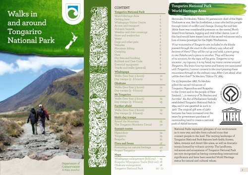
<strong>Tongariro</strong> <strong>National</strong> <strong>Park</strong><br />
World Heritage Area<br />
Horonuku Te Heuheu Tūk<strong>in</strong>o IV, paramount chief <strong>of</strong> the Ngāti<br />
Tūwharetoa was, like his forefathers, a man who led his people<br />
through times <strong>of</strong> conflict <strong>and</strong> change. Dur<strong>in</strong>g the mid-late<br />
1800s there was considerable pressure on the central North<br />
Isl<strong>and</strong> from farmers, logg<strong>in</strong>g <strong>and</strong> rival tribal claims. Loss <strong>of</strong><br />
this l<strong>and</strong> would have meant loss <strong>of</strong> the sacred volcanoes <strong>and</strong> a<br />
loss <strong>of</strong> mana (prestige) for the Ngāti Tūwharetoa.<br />
‘If our mounta<strong>in</strong>s <strong>of</strong> <strong>Tongariro</strong> are <strong>in</strong>cluded <strong>in</strong> the blocks<br />
passed through the court <strong>in</strong> the ord<strong>in</strong>ary way, what will<br />
become <strong>of</strong> them? They will be cut up <strong>and</strong> sold, a piece go<strong>in</strong>g<br />
to one Pakeha <strong>and</strong> a piece to another. They will become<br />
<strong>of</strong> no account, for the tapu will be gone. <strong>Tongariro</strong> is my<br />
ancestor , my tupuna, it is my head; my mana centres <strong>around</strong><br />
<strong>Tongariro</strong>. You know how my name <strong>and</strong> history are associated<br />
with <strong>Tongariro</strong>, I cannot consent to the court pass<strong>in</strong>g these<br />
mounta<strong>in</strong>s through <strong>in</strong> the ord<strong>in</strong>ary way. After I am dead, what<br />
will be their fate?’ Te Heuheu Tūk<strong>in</strong>o IV, 1885.<br />
On 23 September 1887, Te Heuheu<br />
gifted the sacred volcanoes <strong>of</strong><br />
<strong>Tongariro</strong>, Ngauruhoe <strong>and</strong> Ruapehu<br />
to the Crown <strong>and</strong> to the people <strong>of</strong> New<br />
Zeal<strong>and</strong>, ‘... <strong>in</strong> memory <strong>of</strong> Te Heuheu <strong>and</strong><br />
his tribe.’ An Act <strong>of</strong> Parliament formally<br />
established <strong>Tongariro</strong> <strong>National</strong> <strong>Park</strong> <strong>in</strong><br />
1894 <strong>and</strong> it was gazetted as such <strong>in</strong><br />
1907. The orig<strong>in</strong>al gift area <strong>of</strong> 2360<br />
hectares has been <strong>in</strong>creased over the<br />
years by government purchase <strong>of</strong><br />
surround<strong>in</strong>g l<strong>and</strong> to create a national<br />
park <strong>of</strong> 78,618 hectares.<br />
<strong>National</strong> <strong>Park</strong>s represent glimpses <strong>of</strong> our environment<br />
as it once was, <strong>and</strong> also form cultural icons that<br />
connect people to the l<strong>and</strong>. The vary<strong>in</strong>g l<strong>and</strong>scape <strong>of</strong><br />
<strong>Tongariro</strong> <strong>National</strong> <strong>Park</strong> features herb fields, forests,<br />
lakes, streams <strong>and</strong> desert-like areas, as well as dramatic<br />
terra<strong>in</strong> formed by volcanic activity. The l<strong>and</strong>forms,<br />
volcanoes <strong>and</strong> ecosystems <strong>of</strong> <strong>Tongariro</strong> <strong>National</strong> <strong>Park</strong><br />
are now recognised as hav<strong>in</strong>g outst<strong>and</strong><strong>in</strong>g <strong>in</strong>ternational<br />
significance <strong>and</strong> have been awarded World Heritage<br />
status for natural <strong>and</strong> cultural values.<br />
1
Gett<strong>in</strong>g here<br />
This 78,618 hectare park, located <strong>in</strong> the Central North Isl<strong>and</strong>, is<br />
bordered by State Highways 1, 49, 4 <strong>and</strong> 47. The nearest towns<br />
are Turangi, <strong>National</strong> <strong>Park</strong> <strong>and</strong> Ohakune. The small village <strong>of</strong><br />
Whakapapa is located with<strong>in</strong> the park.<br />
The ma<strong>in</strong> trunk railway runs through <strong>National</strong> <strong>Park</strong> <strong>and</strong><br />
Ohakune townships. Regular bus services operate to Ohakune,<br />
<strong>National</strong> <strong>Park</strong> <strong>and</strong> Turangi.<br />
Whakapapa Visitor Centre<br />
The visitor centre for <strong>Tongariro</strong><br />
<strong>National</strong> <strong>Park</strong> is situated <strong>in</strong><br />
Whakapapa Village. It is open every<br />
day (closed Christmas Day) from 8 am<br />
to 5 pm (w<strong>in</strong>ter) or 6 pm (summer).<br />
The Centre’s ‘<strong>Tongariro</strong> Experience’<br />
<strong>in</strong>cludes two audiovisual presentations<br />
screened on request. Exhibits <strong>in</strong>clude<br />
cultural <strong>and</strong> natural history, World<br />
Heritage <strong>and</strong> ski history displays.<br />
The centre takes reservations for the<br />
<strong>Tongariro</strong> Northern Circuit Great<br />
Walk <strong>and</strong> sells hut tickets, hut passes, a<br />
range <strong>of</strong> books, cards, maps <strong>and</strong> walk<strong>in</strong>g brochures.<br />
Up-to-date weather, volcanic <strong>and</strong> snow stability <strong>in</strong>formation is<br />
also available. Tel: (07) 892 3729, Fax: (07)892 3814,<br />
Email: tongarirovc@doc.govt.nz<br />
There is also <strong>Department</strong> <strong>of</strong> Conservation visitor <strong>in</strong>formation<br />
at the Ohakune i-Site, open daily 9 am - 5 pm.<br />
Access <strong>and</strong> transport<br />
Dur<strong>in</strong>g summer, several operators provide transport to some<br />
tracks <strong>in</strong> the park. All track transport arrangements (drop <strong>of</strong>fs<br />
<strong>and</strong> pick ups) must be made before departure. Whakapapa<br />
Village is the only access po<strong>in</strong>t with a public telephone.<br />
There are transport operators who regularly service<br />
Whakapapa Village, to <strong>and</strong> from Turangi <strong>and</strong> <strong>National</strong><br />
<strong>Park</strong>. Transport can also be arranged from Ohakune up the<br />
Ohakune Mounta<strong>in</strong> Road.<br />
Contact local <strong>Department</strong> <strong>of</strong> Conservation Visitor centres or<br />
<strong>in</strong>formation centres for up-to-date <strong>in</strong>formation <strong>and</strong> timetables.<br />
Volcanic hazards<br />
One <strong>of</strong> the ma<strong>in</strong> reasons <strong>Tongariro</strong> <strong>National</strong> <strong>Park</strong> is<br />
considered a special area is because <strong>of</strong> its volcanic features.<br />
Although volcanic events are <strong>of</strong>ten spectacular to view at a<br />
safe distance, there can be considerable risk for those who<br />
venture close to the activity.<br />
Visitors should be aware that volcanic activity is possible <strong>in</strong><br />
this region at any time, <strong>and</strong> with little or no warn<strong>in</strong>g. Anyone<br />
<strong>in</strong>tend<strong>in</strong>g to tramp or climb on the upper slopes <strong>of</strong> the<br />
volcanoes should first check the current volcanic alert status<br />
<strong>and</strong> any recommended safety <strong>in</strong>formation for the area. Dur<strong>in</strong>g<br />
times <strong>of</strong> volcanic activity trampers <strong>and</strong> skiers should move to<br />
high ground <strong>and</strong> out <strong>of</strong> valleys to avoid lahar danger.<br />
Weather<br />
The climate <strong>of</strong> <strong>Tongariro</strong> <strong>National</strong> <strong>Park</strong> is highly<br />
unpredictable <strong>and</strong> it can snow or ra<strong>in</strong> at any time <strong>of</strong> the<br />
year. Check the weather forecast <strong>and</strong> track conditions before<br />
start<strong>in</strong>g out on any walk or tramp<strong>in</strong>g trip <strong>and</strong> always be<br />
prepared for bad weather.<br />
Westerly w<strong>in</strong>ds prevail, result<strong>in</strong>g <strong>in</strong> more ra<strong>in</strong>fall <strong>in</strong> the west<br />
<strong>and</strong> less <strong>in</strong> the east, but strong w<strong>in</strong>ds can arrive from any<br />
direction. There is no wet or dry season <strong>in</strong> the park, although<br />
summer <strong>and</strong> autumn are the warmest seasons. For an up-todate<br />
weather forecast check at a local visitor centre or with<br />
MetPhone: 0900 999 15 or www.metservice.com<br />
River cross<strong>in</strong>gs<br />
Heavy ra<strong>in</strong> will cause <strong>in</strong>creased water flow <strong>in</strong> all streams <strong>and</strong><br />
rivers <strong>in</strong> the park. At such times some unbridged rivers become<br />
difficult or impossible to cross, particularly those on the longer<br />
walks such as the Round the Mounta<strong>in</strong> <strong>and</strong> Whakapapaiti<br />
Valley Tracks. If you come across a swollen river, do not cross<br />
it. Turn back or stop <strong>and</strong> wait for the river to subside.<br />
Snow <strong>and</strong> avalanches<br />
Dur<strong>in</strong>g w<strong>in</strong>ter any <strong>of</strong> the tracks <strong>in</strong> the park may be affected<br />
by snow <strong>and</strong> ice. In these conditions walks may take longer<br />
than the prescribed track times. After heavy snowfalls,<br />
be aware <strong>of</strong> avalanche danger – check <strong>in</strong>formation on the<br />
current snow stability before you set out. Climbers should<br />
treat any loaded ice slope as a high hazard area.<br />
Throughout w<strong>in</strong>ter, ice axes <strong>and</strong> crampons (<strong>and</strong> the<br />
experience to use them) are usually required for the<br />
Ngauruhoe summit, <strong>Tongariro</strong> Alp<strong>in</strong>e Cross<strong>in</strong>g <strong>and</strong> Mt<br />
Ruapehu Crater trips. Whakapapaiti Valley, Tama Lakes<br />
<strong>and</strong> Round the Mounta<strong>in</strong> Tracks can also be snow-covered<br />
dur<strong>in</strong>g w<strong>in</strong>ter <strong>and</strong> will require extra care. Visitors must be<br />
able to make their own on-site assessments on weather,<br />
route <strong>and</strong> avalanche conditions <strong>and</strong> should consider<br />
carry<strong>in</strong>g an avalanche transceiver, probe <strong>and</strong> shovel if<br />
ventur<strong>in</strong>g <strong>in</strong>to snow-covered areas.<br />
Water<br />
Giardia may be present <strong>in</strong> some streams <strong>in</strong> the park. We<br />
recommend you treat, filter or boil all water (for at least<br />
three m<strong>in</strong>utes) <strong>in</strong>tended for dr<strong>in</strong>k<strong>in</strong>g.<br />
Water from the upper Mangatepopo Stream, Emerald<br />
Lakes <strong>and</strong> Ketetahi Spr<strong>in</strong>gs is not suitable for dr<strong>in</strong>k<strong>in</strong>g<br />
due to high m<strong>in</strong>eral content. In times <strong>of</strong> volcanic activity<br />
water tanks at huts may be disconnected to avoid ash<br />
contam<strong>in</strong>ation. Streams <strong>and</strong> rivers could also become<br />
contam<strong>in</strong>ated. Visitors should carry their own water<br />
supply. For cultural <strong>and</strong> health reasons, swimm<strong>in</strong>g is not<br />
advised <strong>in</strong> many <strong>of</strong> the lakes, streams <strong>and</strong> rivers <strong>of</strong> the park.<br />
Check with <strong>Department</strong> <strong>of</strong> Conservation staff for further<br />
<strong>in</strong>formation.<br />
Dogs <strong>and</strong> other pets<br />
It is an <strong>of</strong>fence under the <strong>National</strong> <strong>Park</strong>s Act to br<strong>in</strong>g dogs<br />
or any other <strong>in</strong>troduced animals <strong>in</strong>to <strong>Tongariro</strong> <strong>National</strong><br />
<strong>Park</strong>. To give greater protection to native wildlife please<br />
leave your pets to be looked after at home.<br />
2<br />
3<br />
4
Vehicles<br />
Do not leave valuables <strong>in</strong> parked cars <strong>and</strong> if possible arrange<br />
alternative transport to <strong>and</strong> from tracks. Leav<strong>in</strong>g vehicles<br />
parked overnight, especially <strong>in</strong> more isolated carparks, is<br />
not recommended. Vehicle v<strong>and</strong>alism can be a problem,<br />
particularly at the Mangatepopo, Ketetahi <strong>and</strong> Waihohonu<br />
park<strong>in</strong>g areas.<br />
Mounta<strong>in</strong> bik<strong>in</strong>g<br />
Mounta<strong>in</strong> bik<strong>in</strong>g is permitted <strong>in</strong> <strong>Tongariro</strong> <strong>National</strong> <strong>Park</strong><br />
on formed roads i.e. Bruce Road, Ohakune Mounta<strong>in</strong> Road,<br />
Tūk<strong>in</strong>o Road <strong>and</strong> Mangatepopo Road <strong>and</strong> on the Ohakune<br />
Old Coach Road, Ruapehu-Whanganui Trails.<br />
Mounta<strong>in</strong> bik<strong>in</strong>g is permitted <strong>in</strong> adjacent Rangataua<br />
Conservation Area on the southern boundary <strong>of</strong> <strong>Tongariro</strong><br />
<strong>National</strong> <strong>Park</strong> east <strong>of</strong> Ohakune. Erua <strong>and</strong> <strong>Tongariro</strong> Forest<br />
Conservation Areas are also good locations for mounta<strong>in</strong><br />
bik<strong>in</strong>g, hunt<strong>in</strong>g <strong>and</strong> tramp<strong>in</strong>g. Disused logg<strong>in</strong>g tracks provide<br />
trails through varied <strong>and</strong> scenic forest.<br />
Camp<strong>in</strong>g<br />
Mangawhero Campsite is located two<br />
kilometres up Ohakune Mounta<strong>in</strong><br />
Road. Mangahuia Campsite is located<br />
<strong>of</strong>f State Highway 47. There is a<br />
charge <strong>and</strong> self-registration is required. Toilets are provided.<br />
Campsites are located near each <strong>of</strong> the huts on the <strong>Tongariro</strong><br />
Northern Circuit. There is a charge for campsites at huts, check<br />
the <strong>Department</strong> <strong>of</strong> Conservation website or at a DOC visitor<br />
centre for current rates. Reservations are required dur<strong>in</strong>g the<br />
Great Walk season. If you camp at a campsite at a hut you may<br />
use any <strong>of</strong> the hut facilities except a bunk <strong>and</strong> mattress.<br />
Hut <strong>and</strong> camp<strong>in</strong>g fees (see follow<strong>in</strong>g section) contribute<br />
towards service <strong>and</strong> ma<strong>in</strong>tenance <strong>and</strong> help to ensure that<br />
these special backcountry facilities rema<strong>in</strong> available. Contact<br />
the <strong>Department</strong> <strong>of</strong> Conser vation Visitor centres <strong>and</strong>/or Visitor<br />
Information Network (i-Site) centres for more <strong>in</strong>forma tion <strong>and</strong><br />
hut/campsite pass sales.<br />
Camp<strong>in</strong>g is not permitted at picnic sites or with<strong>in</strong> 200 metres<br />
<strong>of</strong> any State Highway or other road. Camp<strong>in</strong>g is not permitted<br />
with<strong>in</strong> 500 metres <strong>of</strong> the Northern Circuit Track or with<strong>in</strong> 200<br />
metres <strong>of</strong> any other track except designated campsites.<br />
Huts<br />
There are n<strong>in</strong>e public huts <strong>in</strong> <strong>Tongariro</strong> <strong>National</strong> <strong>Park</strong><br />
available for overnight use. Historic Waihohonu Hut,<br />
preserved as an historic build<strong>in</strong>g, is not available for<br />
overnight use.<br />
Facilities at huts <strong>in</strong>clude toilets <strong>and</strong> a water supply. Firewood<br />
<strong>and</strong> an axe or saw are provided at huts with wood burners.<br />
Dur<strong>in</strong>g the Great Walk season (the start <strong>of</strong> the third weekend<br />
<strong>in</strong> October to the 30th <strong>of</strong> April) huts <strong>in</strong> the <strong>Tongariro</strong><br />
Northern Circuit (Mangatepopo, Ketetahi, Oturere <strong>and</strong><br />
Waihohonu) are also supplied with gas cookers. Hut wardens<br />
are <strong>in</strong> residence at these huts over this period <strong>and</strong> can provide<br />
park <strong>and</strong> weather <strong>in</strong>formation.<br />
Considerate hut use<br />
Dur<strong>in</strong>g your visit to <strong>Tongariro</strong> <strong>National</strong> <strong>Park</strong>, please respect<br />
the rights <strong>of</strong> other visitors. Clean the benches, sweep the floor<br />
<strong>and</strong> ensure no food scraps (which encourage verm<strong>in</strong>) rema<strong>in</strong>.<br />
Maximum group size at huts or campsites is 12. Use is limited<br />
to two consecutive nights.<br />
Hut book<strong>in</strong>gs <strong>and</strong> fees<br />
The <strong>Tongariro</strong> Northern Circuit Great Walk<br />
Dur<strong>in</strong>g the Great Walk Season (the start <strong>of</strong> the third weekend<br />
<strong>in</strong> October to the 30th <strong>of</strong> April) book<strong>in</strong>gs must be made for<br />
Mangatepopo, Ketetahi, Oturere <strong>and</strong> Waihohonu Huts.<br />
Book<strong>in</strong>gs for these huts can be made onl<strong>in</strong>e at www.doc.govt.nz<br />
- click the Book Onl<strong>in</strong>e l<strong>in</strong>k. Alternatively, if you are unable<br />
to book onl<strong>in</strong>e, staff at a <strong>Department</strong> <strong>of</strong> Conservation visitor<br />
centre can make book<strong>in</strong>gs for you. A book<strong>in</strong>g fee may apply.<br />
Other huts<br />
Other huts <strong>in</strong> <strong>Tongariro</strong> <strong>National</strong> <strong>Park</strong> do not require book<strong>in</strong>g<br />
at any time. They are on a first come basis only. Backcountry<br />
tickets may be purchased for these huts from <strong>Department</strong> <strong>of</strong><br />
Conservation visitor centres.<br />
Hut fees<br />
These are listed on the <strong>Department</strong> <strong>of</strong> Conservation website<br />
for the Great Walk Season under <strong>Tongariro</strong> <strong>National</strong> <strong>Park</strong>. For<br />
backcountry hut fees please contact your closest <strong>Department</strong><br />
<strong>of</strong> Conservation <strong>of</strong>fice or visitor centre.<br />
Backcountry Hut Passes <strong>and</strong> backcountry hut tickets are not<br />
accepted on the <strong>Tongariro</strong> Northern Circuit dur<strong>in</strong>g the Great<br />
Walk Season.<br />
Rubbish<br />
There is a ‘pack-it-<strong>in</strong>, pack-it-out’ policy with<strong>in</strong> the park. Please<br />
carry out all your rubbish. There is a recycl<strong>in</strong>g <strong>and</strong> rubbish<br />
transfer station at Whakapapa Village.<br />
Environmental Care Code<br />
Please follow the Environmental Care Code when travell<strong>in</strong>g<br />
<strong>and</strong> stay<strong>in</strong>g <strong>in</strong> the back country.<br />
• Protect plants <strong>and</strong> animals<br />
• Remove rubbish<br />
• Keep streams <strong>and</strong> lakes clean<br />
• Camp carefully<br />
• Keep to the track<br />
• Consider others<br />
• Respect cultural heritage<br />
• Enjoy your visit <strong>and</strong><br />
Toitū te whenua /<br />
leave the l<strong>and</strong><br />
undisturbed<br />
5<br />
6<br />
Oturere Hut<br />
7
Essential equipment<br />
Weather <strong>in</strong> <strong>Tongariro</strong> <strong>National</strong> <strong>Park</strong> is notoriously changeable.<br />
Be prepared for all conditions <strong>and</strong> take the correct cloth<strong>in</strong>g<br />
<strong>and</strong> equipment.<br />
While an afternoon walk on a short track will obviously<br />
require less gear than a full day on Mt Ruapehu,<br />
you should always have adequate footwear<br />
(tramp<strong>in</strong>g boots for all but the short<br />
walks), w<strong>in</strong>d <strong>and</strong> waterpro<strong>of</strong> ra<strong>in</strong>coat <strong>and</strong><br />
overtrousers, warm cloth<strong>in</strong>g, a hat, gloves,<br />
suncream, water, food, dr<strong>in</strong>k <strong>and</strong> a map.<br />
For longer walks, also take:<br />
• Additional warm woollen or<br />
thermal cloth<strong>in</strong>g<br />
• First aid kit<br />
• Map <strong>and</strong> compass<br />
Dur<strong>in</strong>g w<strong>in</strong>ter <strong>and</strong> snow conditions:<br />
• Snow gaiters<br />
• Snow goggles<br />
• Ice axe <strong>and</strong> crampons<br />
(<strong>and</strong> know how to use them)<br />
Consider also:<br />
• Avalanche transceiver<br />
• Snow shovel<br />
• Avalanche probe<br />
Set to go for a summer walk<br />
Tracks <strong>and</strong> walks<br />
There are many walks suitable for most park visitors <strong>in</strong><br />
<strong>and</strong> <strong>around</strong> <strong>Tongariro</strong> <strong>National</strong> <strong>Park</strong>. This booklet gives<br />
brief track descriptions <strong>and</strong> simple locality maps. These<br />
should be used <strong>in</strong> conjunction with more detailed maps.<br />
Supplementary <strong>in</strong>formation, current weather forecasts, up-todate<br />
track conditions, snow stability estimates (<strong>in</strong> w<strong>in</strong>ter) <strong>and</strong><br />
volcanic alert status are available from local <strong>Department</strong> <strong>of</strong><br />
Conservation visitor centres. Also check daylight hours, which<br />
are much reduced <strong>in</strong> w<strong>in</strong>ter.<br />
Most <strong>of</strong> the shorter walks are on well-surfaced tracks <strong>and</strong> are<br />
suitable for most visitors. Many <strong>of</strong> the longer tracks follow<br />
poled routes only. Some, such as the Mt. Ruapehu Crater<br />
climb, are completely unmarked <strong>and</strong> require special care <strong>and</strong><br />
navigation.<br />
Before sett<strong>in</strong>g out on your trip, remember to <strong>in</strong>form a reliable<br />
person <strong>of</strong> your <strong>in</strong>tentions, <strong>and</strong> check <strong>in</strong> with them on or after<br />
your return. If you are overdue they should contact the police.<br />
The tracks described <strong>in</strong> this booklet have been classified as<br />
follows:<br />
Easy access short walk: suitable for people <strong>of</strong> all<br />
abilities, wheelchairs <strong>and</strong> children’s buggies<br />
Short Walk: well formed, easy walk<strong>in</strong>g for up to<br />
an hour<br />
Walk<strong>in</strong>g Track: well formed easy walks from a few<br />
m<strong>in</strong>utes to a day<br />
Great Walk or Easy Tramp<strong>in</strong>g Track: generally<br />
well formed track for comfortable overnight<br />
tramp<strong>in</strong>g/ hik<strong>in</strong>g trips<br />
Tramp<strong>in</strong>g Track: mostly unformed but have track<br />
directional markers, poles or cairns<br />
Route: unformed, suitable only for people with<br />
high level backcountry skills <strong>and</strong> experience<br />
For more track <strong>in</strong>formation see:<br />
• <strong>Tongariro</strong> <strong>National</strong> <strong>Park</strong> 273/04 map<br />
• NZTopo50 series maps: BJ34 Mt Ruapehu, BH34 Raurimu,<br />
BH35 Turangi, <strong>and</strong> BJ35 Waiouru<br />
• <strong>Tongariro</strong> Alp<strong>in</strong>e Cross<strong>in</strong>g brochure<br />
• <strong>Tongariro</strong> Northern Circuit brochure<br />
8<br />
9
Whakapapa<br />
Whakapapa Village lies with<strong>in</strong> <strong>Tongariro</strong> <strong>National</strong> <strong>Park</strong>, on<br />
the lower north-west slopes <strong>of</strong> Mount Ruapehu. The village<br />
has accommodation <strong>and</strong> other visitor services.<br />
<strong>Walks</strong> - less than 3 hours<br />
These walk are accessible on foot from Whakapapa Village or<br />
require a short drive to the start<strong>in</strong>g po<strong>in</strong>t.<br />
1. Whakapapa Nature Walk<br />
15 m<strong>in</strong>ute loop track. Beg<strong>in</strong>s 250 metres above<br />
Whakapapa Visitor Centre on SH 48.<br />
This sealed loop track gives a glimpse <strong>of</strong> the unique flora<br />
<strong>of</strong> <strong>Tongariro</strong> <strong>National</strong> <strong>Park</strong>. A series <strong>of</strong> on-site <strong>in</strong>formation<br />
panels expla<strong>in</strong> the various vegetation zones <strong>in</strong> the park.<br />
2. Mounds Walk<br />
20 m<strong>in</strong>utes return, via same track. Beg<strong>in</strong>s 5 kilometres<br />
below Whakapapa Visitor Centre on SH 48.<br />
Debris avalanches dur<strong>in</strong>g Ruapehu’s periods <strong>of</strong> volcanic<br />
activity are believed to have formed these mounds thous<strong>and</strong>s<br />
<strong>of</strong> years ago. Follow this <strong>in</strong>terpretive walk <strong>and</strong> learn more<br />
about the mounds. The top <strong>of</strong> the track <strong>of</strong>fers good views <strong>of</strong><br />
the volcanoes <strong>and</strong> surround<strong>in</strong>g area.<br />
3. Tawhai Falls Walk<br />
20 m<strong>in</strong>utes, return via same track. Beg<strong>in</strong>s 4 kilometres<br />
below Whakapapa Visitor Centre on SH 48.<br />
The falls, which tumble over the edge <strong>of</strong> an ancient lava flow,<br />
are reached after a short stroll through mounta<strong>in</strong> toatoa <strong>and</strong><br />
beech forest.<br />
4. Ridge Walk<strong>in</strong>g Track<br />
30 - 40 m<strong>in</strong>utes, 1.2 kilometres return via same track.<br />
Beg<strong>in</strong>s 150 metres above Whakapapa Visitor Centre.<br />
After a short climb through low beech forest, the track<br />
emerges <strong>in</strong>to alp<strong>in</strong>e shrubl<strong>and</strong>s with panoramic views <strong>of</strong><br />
Ruapehu, Ngauruhoe <strong>and</strong> the surround<strong>in</strong>g l<strong>and</strong>scape.<br />
5. Taranaki Falls Walk<strong>in</strong>g Track<br />
2 hours, 6 kilometre loop track. Beg<strong>in</strong>s 100 metres below<br />
Whakapapa Visitor Centre at Ngauruhoe Place.<br />
The track to Taranaki Falls has excellent mounta<strong>in</strong> views <strong>and</strong><br />
crosses a range <strong>of</strong> l<strong>and</strong> forms. The upper <strong>and</strong> lower tracks<br />
form a loop with the falls situated <strong>around</strong> the half-way po<strong>in</strong>t.<br />
The lower track passes through tussock <strong>and</strong> alp<strong>in</strong>e shrubl<strong>and</strong>s<br />
before enter<strong>in</strong>g beech forest. On a clear day Ngauruhoe’s<br />
symmetrical cone <strong>and</strong> the older, eroded mounta<strong>in</strong>s <strong>of</strong><br />
<strong>Tongariro</strong> <strong>and</strong> Pukekaikiore are visible. Once <strong>in</strong> the forest,<br />
the track descends to Wairere Stream then climbs alongside<br />
it, pass<strong>in</strong>g Cascade Falls. The forest consists ma<strong>in</strong>ly <strong>of</strong> large<br />
mounta<strong>in</strong> beech trees, sh<strong>in</strong>y broadleaf, mounta<strong>in</strong> five-f<strong>in</strong>ger,<br />
umbrella ferns <strong>and</strong> mounta<strong>in</strong> toatoa. Small native birds such<br />
as whiteheads, grey warbler <strong>and</strong> rifleman are commonly seen.<br />
From the forest edge the track passes over the Wairere Stream<br />
with impressive views <strong>of</strong> a small narrow gorge. Cont<strong>in</strong>u<strong>in</strong>g<br />
on up the track, Taranaki Falls come <strong>in</strong>to view tumbl<strong>in</strong>g 20<br />
metres over the edge <strong>of</strong> a large <strong>and</strong>esite lava flow which<br />
erupted from Ruapehu 15,000 years ago. Wairere Stream is<br />
slowly erod<strong>in</strong>g a channel through this lava flow.<br />
The trail from the falls climbs up through a forest <strong>of</strong> mounta<strong>in</strong><br />
toatoa before jo<strong>in</strong><strong>in</strong>g the Tama Lakes Track. Turn right to<br />
return to Whakapapa, cross Wairere Stream <strong>and</strong> climb the<br />
shoulder <strong>of</strong> the lava flow, now covered with red tussock. Native<br />
birds likely to be heard <strong>in</strong> this area <strong>in</strong>clude pipits, fern birds<br />
<strong>and</strong> occasionally skylarks.<br />
The return track crosses a series <strong>of</strong> eroded gullies formed by<br />
w<strong>in</strong>d, ra<strong>in</strong> <strong>and</strong> frost action on volcanic soils. As the trail beg<strong>in</strong>s<br />
to sidle <strong>around</strong> the slopes <strong>of</strong> Mount Ruapehu, it merges with<br />
the wider old Waihohonu horse trail. Here, layers <strong>of</strong> pumice<br />
<strong>and</strong> ash from previous eruptions are exposed. After pass<strong>in</strong>g<br />
through the last patch <strong>of</strong> bush, the track emerges aga<strong>in</strong> <strong>in</strong>to red<br />
tussock <strong>and</strong> manuka, lead<strong>in</strong>g easily back to the village.<br />
6. Whakapapanui Walk<strong>in</strong>g Track<br />
2 hours, 6 kilometres return via same track or SH 48.<br />
Beg<strong>in</strong>s 250 metres above Whakapapa Visitor Centre.<br />
After a 10 -15 m<strong>in</strong>ute walk, the Whakapapanui Walk<strong>in</strong>g Track<br />
branches to the right (don’t follow the Whakapapaiti Track<br />
sign <strong>in</strong> error!) <strong>and</strong> heads downstream. Water-logged clear<strong>in</strong>gs<br />
are passed as the track follows Whakapapanui Stream. Here,<br />
storm-damaged beech forest is slowly regenerat<strong>in</strong>g.<br />
7. Silica Rapids Walk<strong>in</strong>g Track<br />
2½ hours, 7 kilometres return via Bruce Road. Beg<strong>in</strong>s<br />
250 metres above Whakapapa Visitor Centre.<br />
This track takes <strong>in</strong> a range <strong>of</strong> vegetation types as well as<br />
the creamy-white Silica Rapid terraces. After cross<strong>in</strong>g<br />
Whakapapanui Stream at the top end <strong>of</strong> the Holiday <strong>Park</strong> the<br />
track me<strong>and</strong>ers through beech forest. Pass the Whakapapanui<br />
Track turn-<strong>of</strong>f <strong>and</strong> cont<strong>in</strong>ue towards Silica Rapids. The track<br />
soon crosses a bubbl<strong>in</strong>g stream with a gold-toned bed. The<br />
coloured deposits are iron-oxide clays from upstream swamps.<br />
Coprosma, five f<strong>in</strong>ger <strong>and</strong> broadleaf surround the stream <strong>and</strong><br />
track.<br />
Emerg<strong>in</strong>g from the bush, the track climbs to a swampy area<br />
<strong>of</strong> wire rush, tangle fern <strong>and</strong> red tussock. Seepage ponds<br />
beside the boardwalk are home to freshwater crayfish (koura).<br />
The boardwalk makes walk<strong>in</strong>g over swampy ground more<br />
comfortable <strong>and</strong> reduces the impact <strong>of</strong> foot traffic on delicate<br />
vegetation. On clear days this is a great place to enjoy<br />
mounta<strong>in</strong> views.<br />
After pass<strong>in</strong>g the Whakapapaiti Track turn-<strong>of</strong>f, the Silica<br />
Rapids Track follows the stream up through dense bush to<br />
Punaruku Falls. Here, after heavy ra<strong>in</strong>, Tawha<strong>in</strong>ui Stream<br />
tumbles over the edge <strong>of</strong> an ancient lava flow. Close to the<br />
track metal b<strong>and</strong>s on tree trunks protect mistletoe from<br />
possums. At the forest edge gold-coloured snow totara <strong>and</strong><br />
olive-green bog p<strong>in</strong>e give way to sun-lov<strong>in</strong>g alp<strong>in</strong>e herbs <strong>and</strong><br />
alp<strong>in</strong>e flowers like mounta<strong>in</strong> daisies, hare bells <strong>and</strong> ourisia.<br />
A little further up the hill the stream bed widens <strong>and</strong> forms a<br />
series <strong>of</strong> shallow terraces coated <strong>in</strong> creamy white deposits -<br />
the famous Silica Rapids. When the stream emerges from lava<br />
cliffs at the head <strong>of</strong> the valley the water is rich <strong>in</strong> alum<strong>in</strong>ium<br />
<strong>and</strong> silicate m<strong>in</strong>erals. As the stream gathers speed <strong>and</strong> the<br />
water is aerated, the alum<strong>in</strong>o-silicates are deposited on the<br />
stream bed.<br />
Mov<strong>in</strong>g away from the rapids, the track climbs the side <strong>of</strong> a<br />
tussock-covered lava flow. A small clump <strong>of</strong> mounta<strong>in</strong> beech<br />
<strong>and</strong> toatoa, seen a short distance up the mounta<strong>in</strong>, forms the<br />
upper limit <strong>of</strong> beech trees <strong>in</strong> the area. The track then w<strong>in</strong>ds<br />
through tussock <strong>and</strong> sub-alp<strong>in</strong>e shrubs to the Bruce Road,<br />
which can be followed downhill 2.5 kilometres to Whakapapa<br />
Village.<br />
8. Meads Wall Route<br />
NB: this is not a <strong>Department</strong> <strong>of</strong> Conservation track, it is<br />
a route adm<strong>in</strong>istered by Ruapehu Alp<strong>in</strong>e Lifts.<br />
Ten m<strong>in</strong>utes return from Iwikau Village, at the top <strong>of</strong> the<br />
Bruce Road. Follow the route to Meads Wall - a spectacular<br />
rocky outcrop which was one <strong>of</strong> the film<strong>in</strong>g locations for Lord<br />
<strong>of</strong> the R<strong>in</strong>gs. Meads Wall drops <strong>of</strong>f steeply <strong>and</strong> care is required<br />
whilst st<strong>and</strong><strong>in</strong>g at the edge to enjoy spectacular views <strong>of</strong> the<br />
valley below <strong>and</strong> Ngauruhoe to the northeast.<br />
10<br />
11 12
Whakapapa maps<br />
To<br />
Whakapapa Ski Area<br />
Whakapapaiti Track<br />
Bruce Road<br />
Whakapapa<br />
Nature Walk<br />
Day tramps (3 - 8 hours)<br />
10. Whakapapaiti Valley Tramp<strong>in</strong>g Track<br />
4-5 hours, 16 kilometre loop (<strong>in</strong>clud<strong>in</strong>g the Bruce<br />
Road section) or 11 kilometres one-way (transport<br />
required). Beg<strong>in</strong>s 250 metres above Whakapapa Visitor<br />
Centre. See Whakapapa map (page 13). The track can be<br />
walked <strong>in</strong> either direction but is described anticlockwise.<br />
Follow Silica Rapids Track for about 45 m<strong>in</strong>utes to<br />
the junction with Whakapapaiti Track. The track goes<br />
through forest then an open tussock-covered area.<br />
There is a bridged cross<strong>in</strong>g <strong>of</strong> Whakapapaiti River, then<br />
the track cont<strong>in</strong>ues up the valley, pass<strong>in</strong>g the junction<br />
with Mangahuia Track (2 - 3 hours to campsite). Further<br />
up the valley there is an unbridged river cross<strong>in</strong>g - it<br />
may not be possible to cross safely when the river is<br />
high follow<strong>in</strong>g or dur<strong>in</strong>g ra<strong>in</strong>fall. Whakapapaiti Hut is<br />
10 - 15 m<strong>in</strong>utes further up the track.<br />
Leav<strong>in</strong>g the hut, the track w<strong>in</strong>ds its way through<br />
stunted beech forest, then up the valley to the Round<br />
the Mounta<strong>in</strong> Track junction. Turn left here towards<br />
Bruce Road. The track zig-zags up <strong>and</strong> over a mora<strong>in</strong>e<br />
ridge with great views <strong>of</strong> Whakapapaiti Valley <strong>and</strong> the<br />
surround<strong>in</strong>g l<strong>and</strong>scape. Cont<strong>in</strong>ue to the Scoria Flat<br />
area on the Bruce Road. From here it is approximately 5<br />
kilometres down the road to Whakapapa Village.<br />
47<br />
4<br />
T<br />
Ridge Track<br />
Whakapapa<br />
Visitor Centre<br />
Skotel<br />
Taranaki Falls<br />
Tama Lakes<br />
Taranaki Falls<br />
P Carpark<br />
Toilet<br />
P<br />
Ngauruhoe Place<br />
Shop<br />
Bayview<br />
Chateau<br />
<strong>Tongariro</strong><br />
0 300 m<br />
9. Skyl<strong>in</strong>e Route<br />
Holiday<br />
<strong>Park</strong><br />
Silica Rapids<br />
Whakapapanui Walk<br />
Tavern<br />
To<br />
The Mounds<br />
Tawhai Falls<br />
NB: this is not a DOC track,<br />
it is a route adm<strong>in</strong>istered by<br />
Ruapehu Alp<strong>in</strong>e Lifts.<br />
1½ - 2 hours return from the top<br />
<strong>of</strong> Waterfall Express chairlift,<br />
Whakapapa Ski Area. This walk<br />
follows a poled route, marked<br />
only <strong>in</strong> summer, over steep rocky<br />
terra<strong>in</strong> <strong>and</strong> loose scree. There is<br />
no formed track. This walk is not<br />
recommended <strong>in</strong> w<strong>in</strong>ter, <strong>in</strong> poor<br />
weather, <strong>and</strong>/or snow or ice cover.<br />
Follow the marker poles beside the<br />
Valley T-bar l<strong>in</strong>e, at the top <strong>of</strong> the<br />
T-bar, climb up the side <strong>of</strong> the ridge<br />
to your left for fantastic views.<br />
Return the same way.<br />
P<br />
11. Tama Lakes Tramp<strong>in</strong>g Track<br />
5-6 hours, 17 kilometres return on same track.<br />
Beg<strong>in</strong>s 100 metres below the Visitor Centre<br />
at the end <strong>of</strong> Ngauruhoe Place. This track is an extension<br />
<strong>of</strong> the Taranaki Falls Track <strong>and</strong> part <strong>of</strong> the <strong>Tongariro</strong><br />
Northern Circuit <strong>and</strong> Round the Mounta<strong>in</strong> Tracks.<br />
At the top <strong>of</strong> Taranaki Falls, the track branches <strong>of</strong>f the<br />
Taranaki Falls Walk, to cross roll<strong>in</strong>g tussock country<br />
<strong>and</strong> alp<strong>in</strong>e herbfields. Further on, the track branches left<br />
to Tama Lakes, while the ma<strong>in</strong> track cont<strong>in</strong>ues on to<br />
Waihohonu Hut. There is a view <strong>of</strong> the lower lake (1240<br />
metres), <strong>and</strong> then the track climbs steeply to a viewpo<strong>in</strong>t<br />
(1440 metres) <strong>of</strong> the upper lake.<br />
Tama Lakes occupy several old explosion craters on<br />
Tama Saddle between Ruapehu <strong>and</strong> Ngauruhoe. The<br />
saddle acts as a funnel for prevail<strong>in</strong>g westerly w<strong>in</strong>ds<br />
<strong>and</strong> w<strong>in</strong>dpro<strong>of</strong> cloth<strong>in</strong>g is recommended.<br />
13<br />
14
Ohakune<br />
<strong>Walks</strong> (less than 3 hours)<br />
See Ohakune map (page 18)<br />
12. Rimu Walk<br />
15 m<strong>in</strong>utes return. This walk beg<strong>in</strong>s opposite the<br />
<strong>Department</strong> <strong>of</strong> Conservation Field Centre at the<br />
bottom <strong>of</strong> Ohakune Mounta<strong>in</strong> Road.<br />
This track loops <strong>of</strong>f the Mangawhero Forest Walk. It me<strong>and</strong>ers<br />
gently through an understorey <strong>of</strong> ground ferns <strong>and</strong> kāmahi<br />
<strong>and</strong> crisscrosses a quiet mounta<strong>in</strong> stream. It is suitable for<br />
wheelchairs <strong>and</strong> pushchairs.<br />
13. Mangawhero Forest Walk<br />
1 hour, 3 kilometre loop track. This track beg<strong>in</strong>s opposite<br />
the <strong>Department</strong> <strong>of</strong> Conservation Field Centre at the<br />
bottom <strong>of</strong> Ohakune Mounta<strong>in</strong> Road.<br />
After cross<strong>in</strong>g the Mangawhero River the track leads <strong>in</strong>to a<br />
forest <strong>of</strong> kāmahi, broadleaf <strong>and</strong> five f<strong>in</strong>ger, with giant rimu, mataī<br />
<strong>and</strong> kahikatea reach<strong>in</strong>g 30 metres or more above the forest floor.<br />
Immediately after pass<strong>in</strong>g through a cut log the track crosses<br />
a large volcanic crater. At its highest po<strong>in</strong>t, the track crosses<br />
Ohakune Mounta<strong>in</strong> Road <strong>and</strong> returns to the Field Centre.<br />
14. Mangawhero Falls Walk<br />
5 to 10 m<strong>in</strong>utes return. Starts from a carpark on Ohakune<br />
Mounta<strong>in</strong> Road, 13 kilometres past the <strong>Department</strong> <strong>of</strong><br />
Conservation Field Centre.<br />
This short walk provides excellent views <strong>of</strong> a beautiful waterfall<br />
close to the road. Here, not far below bushl<strong>in</strong>e, the beech forest<br />
is stunted because <strong>of</strong> the hash climate. Spectacular icicles form<br />
<strong>around</strong> the falls <strong>in</strong> w<strong>in</strong>ter.<br />
15. Waitonga Falls Walk<strong>in</strong>g Track<br />
1 hour 20 m<strong>in</strong>utes, 4 kilometres return via same track. The<br />
track beg<strong>in</strong>s on Ohakune Mounta<strong>in</strong> Road, 11 kilometres past<br />
the <strong>Department</strong> <strong>of</strong> Conservation Field Centre.<br />
The park’s highest waterfall, Waitonga Falls (39 metres), is<br />
reached via a well-formed track through mounta<strong>in</strong> beech <strong>and</strong><br />
kaikawaka (mounta<strong>in</strong> cedar) forest. The track passes Rotokawa,<br />
an alp<strong>in</strong>e bog where on a calm day the reflection <strong>of</strong> Mt<br />
Ruapehu’s southern face can be seen <strong>in</strong> the pools. Past the falls,<br />
the track cont<strong>in</strong>ues as part <strong>of</strong> the Round the Mounta<strong>in</strong> Track, a<br />
four to six day tramp <strong>around</strong> Mt Ruapehu (see page 25).<br />
Lake Rotokura<br />
16. Lake Rotokura Walk<strong>in</strong>g Track<br />
30 m<strong>in</strong>utes return. Signposted <strong>of</strong>f SH 49, 12 kilometres<br />
from Ohakune enroute to Waiouru. Drive one kilometre<br />
from the turn<strong>of</strong>f along Karioi Station Road, cross the railway l<strong>in</strong>e,<br />
cont<strong>in</strong>ue to Rotokura carpark. See ma<strong>in</strong> map (page 20).<br />
Lakes, beech forest <strong>and</strong> plentiful bird life feature on this short<br />
walk <strong>in</strong> Rotokura Ecological Area. The first lake passed on the<br />
track is Dry Lake. Flat, grassed areas above the lake are perfect<br />
for family picnics. The track cont<strong>in</strong>ues past Dry Lake to Lake<br />
Rotokura. This lake is surrounded by ancient beech forest <strong>and</strong><br />
on clear days Mount Ruapehu is reflected <strong>in</strong> the lake’s calm<br />
waters. Native birds such as tūī, kākā, bellbird, fantail <strong>and</strong> North<br />
Isl<strong>and</strong> rob<strong>in</strong> are commonly seen or heard along the track to the<br />
lake. Rotokura is tapu (sacred heal<strong>in</strong>g waters) to Ngāti Rangi, the<br />
local Māori people or tangata whenua. Please respect this by not<br />
eat<strong>in</strong>g at or near Rotokura. Fish<strong>in</strong>g is also prohibited.<br />
<strong>National</strong> Cycle Trail: Ruapehu-Whanganui<br />
Trails Ngā ara Tūhono From the mounta<strong>in</strong>s to the sea<br />
17. Ohakune Old Coach Road <strong>and</strong> Historic Viaducts<br />
Walk <strong>and</strong> Cycle Track:<br />
Ohakune to Horopito (or reverse)<br />
15 kilometres: Ohakune Railway Station to Horopito<br />
2 hours 20 m<strong>in</strong> cycle 4 hours 30 m<strong>in</strong> walk<br />
Ohakune Railway Station to Marshalls Road carpark<br />
From the station follow the footpath to the Mangawhero River<br />
Bridge <strong>and</strong> cross over onto Old Station Road. Cont<strong>in</strong>ue about<br />
1.5 kilometres <strong>and</strong> turn right onto Marshalls Road. Rongokaupo<br />
Wetl<strong>and</strong> <strong>and</strong> picnic area, a community project under<br />
development, is situated about 350 metres before Marshalls Road<br />
carpark. Total distance, 3 kilometres. The track cont<strong>in</strong>ues from<br />
the car park.<br />
Marshalls Road carpark to Hapuawhenua Viaduct<br />
From the car park the track follows the Ohakune<br />
Old Coach Road, weav<strong>in</strong>g its way through roll<strong>in</strong>g<br />
farml<strong>and</strong> with views over the spectacular Ohakune<br />
Bas<strong>in</strong>. It then heads <strong>in</strong>to native bush toward the<br />
Hapuawhenua Viaducts. Cobblestones (setts) are still<br />
evident along the track. Explore the Hapuawhenua<br />
Tunnel <strong>and</strong> marvel at the workmanship <strong>of</strong> yesteryear.<br />
The track climbs up to a ridge before dropp<strong>in</strong>g <strong>in</strong>to<br />
the Hapuawhenua Valley. There are good st<strong>and</strong>s <strong>of</strong><br />
kahikatea, rimu, mataī <strong>and</strong> ponga along the way. From<br />
this po<strong>in</strong>t the two viaducts come <strong>in</strong>to view. Walk the<br />
historic Hapuawhenua Viaduct (cyclists dismount<br />
on the viaduct) <strong>and</strong> enjoy both old <strong>and</strong> new viaducts<br />
<strong>and</strong> native forest surrounds. The limestone cliff that is<br />
visible high up on top <strong>of</strong> Raetihi Hill is a rem<strong>in</strong>der that<br />
this area was once under the sea. From here you can<br />
return to Ohakune or carry on to Horopito.<br />
Hapuawhenua Viaduct to Horopito<br />
From the western end <strong>of</strong> Hapuawhenua Viaduct access<br />
the cycle trail to Horopito. The trail passes through a<br />
beautiful section <strong>of</strong> native bush before com<strong>in</strong>g out on<br />
the orig<strong>in</strong>al Old Coach Road aga<strong>in</strong>. This is known as<br />
the Skyl<strong>in</strong>e section; some kilometres <strong>of</strong> it can be very<br />
muddy <strong>and</strong> difficult for less experienced riders. On the<br />
way to the highest po<strong>in</strong>t the trail passes the old quarry<br />
which supplied much <strong>of</strong> the rock for the cobbles as the<br />
old dray road was upgraded to a coach<strong>in</strong>g road <strong>in</strong> 1905.<br />
At the top <strong>of</strong> the ridge you aga<strong>in</strong> pass by some<br />
magnificent rimu <strong>and</strong> rātā trees <strong>and</strong> there are beautiful<br />
views over farml<strong>and</strong> <strong>and</strong> hills. Throughout this part <strong>of</strong><br />
the trail there are old campsites established when the<br />
dray road was upgraded. While not much can be seen<br />
<strong>of</strong> them, they are a rem<strong>in</strong>der <strong>of</strong> the hardships the road<br />
workers <strong>and</strong> their families faced while liv<strong>in</strong>g <strong>in</strong> canvascovered<br />
houses <strong>in</strong> the midst <strong>of</strong> a cold, wet ra<strong>in</strong>forest.<br />
Cyclists on the historic<br />
Hapuawhenua Viaduct<br />
14<br />
15
Shortly after cross<strong>in</strong>g the bridge over<br />
a beautiful spr<strong>in</strong>g-fed stream, there is a<br />
grassed picnic area surrounded by rimu<br />
<strong>and</strong> tawa trees. This is an ideal place to<br />
stop for a rest before cont<strong>in</strong>u<strong>in</strong>g through<br />
the forest, down the hill to Taonui Stream<br />
<strong>and</strong> under the new Taonui Rail Bridge. The<br />
trail follows the stream down to the historic<br />
Taonui Viaduct. From the top <strong>of</strong> the viaduct<br />
you follow part <strong>of</strong> the old railway alignment<br />
through to the present day railway l<strong>in</strong>e.<br />
The railway l<strong>in</strong>e must be crossed at the<br />
designated cross<strong>in</strong>g po<strong>in</strong>t. Use caution<br />
when look<strong>in</strong>g for tra<strong>in</strong>s which regularly use<br />
the l<strong>in</strong>e.<br />
From the railway l<strong>in</strong>e the next po<strong>in</strong>ts <strong>of</strong><br />
<strong>in</strong>terest are the old viaduct abutments<br />
across Haeremaere Stream. From here the<br />
trail crosses the stream <strong>and</strong> follows the Old<br />
Coach Road through to Horopito.<br />
Signs at each end <strong>of</strong> the trail give distances<br />
<strong>and</strong> time estimates for rid<strong>in</strong>g <strong>and</strong> walk<strong>in</strong>g.<br />
There are also directional signs enroute.<br />
Taonui<br />
Viaduct<br />
Please respect the environment <strong>and</strong> ensure<br />
all rubbish <strong>and</strong> human waste is removed from the park.<br />
Marshalls Road, Ohakune to<br />
Hapuawhenua Viaduct return<br />
6.8 kilometres return<br />
1 hour 30 m<strong>in</strong> cycle 2 hours 30 m<strong>in</strong> walk<br />
See description on page 15 (top right) to the viaduct.<br />
Return via same route. Access along the railway l<strong>in</strong>e or<br />
rail access road is not permitted.<br />
4<br />
Ruapehu - Whanaganui Trails<br />
HOROPITO<br />
Haeremaere Stream<br />
Taonui Stream<br />
Ohakune Old Coach Rd<br />
Hapua w henua Stream<br />
Hapuawhenua rail tunnel portal<br />
Marshalls Road<br />
<strong>Tongariro</strong><br />
<strong>National</strong> <strong>Park</strong><br />
Day tramps (3-8 hours)<br />
See Ohakune map (page 18)<br />
18. Lake Surprise Tramp<strong>in</strong>g Track<br />
5 hours, 9 kilometres return. This track is part <strong>of</strong> the<br />
Round the Mounta<strong>in</strong> Track <strong>and</strong> beg<strong>in</strong>s on the Ohakune<br />
Mounta<strong>in</strong> Road, 15 kilometres past the <strong>Department</strong> <strong>of</strong><br />
Conservation Field Centre.<br />
After sidl<strong>in</strong>g <strong>around</strong> open country from Mounta<strong>in</strong> Road, the<br />
track descends <strong>in</strong>to Mangaturuturu Valley beside a beautiful<br />
cascade. This section can be very slippery. The creamy coat<strong>in</strong>g<br />
on the cascade is due to silica <strong>and</strong> m<strong>in</strong>eral rich water from an<br />
alp<strong>in</strong>e spr<strong>in</strong>g. Waterfalls <strong>and</strong> bluffs complement the backdrop<br />
<strong>of</strong> Mount Ruapehu. The Mangaturuturu River is forded shortly<br />
after pass<strong>in</strong>g Mangaturuturu Hut, (1 hour 30 m<strong>in</strong>utes from the<br />
road). Evidence <strong>of</strong> the 1975 lahar (volcanic mudflow) can be<br />
seen here <strong>in</strong> the scoured treeless river banks. Lake Surprise, a<br />
broad, shallow lake set amongst beech forest <strong>and</strong> tussock, is<br />
reached after a steady climb from the river valley.<br />
Return the same way or follow Horopito Track to Horopito<br />
(3 hours).<br />
19. Old Blyth Tramp<strong>in</strong>g Track<br />
4 to 5 hours, 11 kilometre round trip. This track beg<strong>in</strong>s<br />
on the Ohakune Mounta<strong>in</strong> Road, 7 kilometres past the<br />
<strong>Department</strong> <strong>of</strong> Conservation Field Centre.<br />
Follow<strong>in</strong>g part <strong>of</strong> the historic route up Mount Ruapehu, the<br />
track climbs gradually through one <strong>of</strong> the few red beech<br />
st<strong>and</strong>s <strong>in</strong> the park <strong>and</strong> then passes through kaikawaka <strong>and</strong><br />
mounta<strong>in</strong> beech until it meets the Waitonga Falls Track.<br />
When Blyth Track was constructed <strong>in</strong> the early 1900s, much<br />
<strong>of</strong> the route was through alp<strong>in</strong>e bog. Logs placed horizontally<br />
across the track (‘corduroy’) helped improve the muddy<br />
surface. The rema<strong>in</strong>s <strong>of</strong> this type <strong>of</strong> track can still be seen.<br />
For the return it is necessary to retrace your steps or walk out<br />
to the Mounta<strong>in</strong> Road via the Waitonga Falls / Round the<br />
Mounta<strong>in</strong> Tramp<strong>in</strong>g Track, <strong>and</strong> then down the road.<br />
Old Station Road<br />
OHAKUNE<br />
Lake Surprise<br />
16<br />
17
Ruapehu-Whanganui Trails<br />
Ohakune Old Coach Road<br />
Ohakune enlargement<br />
P<br />
P<br />
P<br />
P<br />
On <strong>and</strong> near Mt <strong>Tongariro</strong><br />
<strong>Walks</strong> (less than 3 hours)<br />
See map (pages 20-21)<br />
20. Soda Spr<strong>in</strong>gs Walk<strong>in</strong>g Track<br />
2 hours, 6 kilometres return via same track. Beg<strong>in</strong>s at the<br />
Mangatepopo roadend 13.4 kilometres from Whakapapa<br />
Village, 7 kilometres up Mangatepopo Road, <strong>of</strong>f SH 47.<br />
The track to Soda Spr<strong>in</strong>gs is part <strong>of</strong> the <strong>Tongariro</strong> Alp<strong>in</strong>e<br />
Cross<strong>in</strong>g Track <strong>and</strong> follows Mangatepopo Stream.<br />
Ngauruhoe’s most recent lava flows appear dark <strong>in</strong> contrast<br />
to the older flows which are slowly revegetat<strong>in</strong>g. Under the<br />
headwall <strong>of</strong> the Mangatepopo Valley these cold water spr<strong>in</strong>gs<br />
create a small oasis <strong>of</strong> lush yellow mounta<strong>in</strong> buttercups <strong>and</strong><br />
white foxgloves <strong>in</strong> summer.<br />
Day tramps (3 - 8 hours)<br />
21. Historic Waihohonu Hut<br />
3 hours, 6.3 kilometres return from the Desert Road.<br />
35 kilometres south <strong>of</strong> Turangi. Part <strong>of</strong> the Round the<br />
Mounta<strong>in</strong> <strong>and</strong> <strong>Tongariro</strong> Northern Circuit Tracks.<br />
Built <strong>in</strong> 1903/04 by the government, this hut used to be a stopover<br />
for stage coaches. The walls are constructed <strong>of</strong> a double<br />
layer <strong>of</strong> corrugated iron with a layer <strong>of</strong> pumice s<strong>and</strong>wiched<br />
between for <strong>in</strong>sulation. No longer used for accom modation,<br />
the hut is preserved as an historical build<strong>in</strong>g <strong>and</strong> is classified<br />
by the Historic Places Trust.<br />
The track me<strong>and</strong>ers through beech forest <strong>and</strong> open tussock<br />
l<strong>and</strong>, cross<strong>in</strong>g the Oh<strong>in</strong>epango Stream. At the junction where<br />
the track branches right to the new Waihohonu <strong>and</strong> Oturere<br />
Huts or left to Rangipo Hut, cont<strong>in</strong>ue straight ahead towards<br />
Whakapapa for about five m<strong>in</strong>utes to the next junction. Turn<br />
left to reach the historic Waihohonu Hut. Return the same way.<br />
22. Ketetahi Hut<br />
4-5 hours, 13.4 kilometres return via same track.<br />
Signposted <strong>of</strong>f SH 46, 25 m<strong>in</strong>utes drive from<br />
Whakapapa Village or Turangi.<br />
High on the slopes <strong>of</strong> Mt <strong>Tongariro</strong>, Ketetahi Hut comm<strong>and</strong>s<br />
a magnificent view <strong>of</strong> Lake Rotoaira, Mt Pihanga <strong>and</strong> distant<br />
Lake Taupo. The track to the hut is part <strong>of</strong> the popular<br />
<strong>Tongariro</strong> Alp<strong>in</strong>e Cross<strong>in</strong>g.<br />
From the carpark, the track climbs through podocarp forest.<br />
For part <strong>of</strong> the way it follows a stream naturally polluted by<br />
thermal activity <strong>and</strong> unfit for dr<strong>in</strong>k<strong>in</strong>g. The track opens out<br />
onto a broad tussock-covered ridge <strong>and</strong> heads up the slopes<br />
past Ketetahi Spr<strong>in</strong>gs to the hut.<br />
Ketetahi Spr<strong>in</strong>gs<br />
Ketetahi Spr<strong>in</strong>gs are on private l<strong>and</strong>, please respect this <strong>and</strong><br />
keep to the track. Walk<strong>in</strong>g the <strong>Tongariro</strong> Alp<strong>in</strong>e Cross<strong>in</strong>g<br />
Track does not convey any right <strong>of</strong> access to the spr<strong>in</strong>gs.<br />
23. <strong>Tongariro</strong> Alp<strong>in</strong>e Cross<strong>in</strong>g<br />
6-8 hours, 19.4 kilometres one way. Recommended<br />
direction is from Mangatepopo to Ketetahi. This track<br />
is part <strong>of</strong> the <strong>Tongariro</strong> Northern Circuit <strong>and</strong> beg<strong>in</strong>s at the<br />
Mangatepopo roadend, 13.4 kilometres from Whakapapa.<br />
The track w<strong>in</strong>ds up the Mangatepopo Valley to the saddle<br />
between <strong>Tongariro</strong> <strong>and</strong> Ngauruhoe. It climbs to Red Crater<br />
(1886 metres), then drops down to the vivid Emerald Lakes.<br />
After pass<strong>in</strong>g Blue Lake the track sidles <strong>around</strong> the northern<br />
slope <strong>of</strong> <strong>Tongariro</strong>, then descends <strong>in</strong> a zigzag past Ketetahi<br />
Hut <strong>and</strong> down to the roadend.<br />
This is a one-way track, so return transport is required. This<br />
is easy to arrange with your accommodation provider, <strong>and</strong><br />
several local operators provide transport services. Details<br />
are available from the Whakapapa Visitor Centre. Check<br />
weather <strong>and</strong> avalanche conditions before you beg<strong>in</strong> the hike.<br />
Mounta<strong>in</strong>eer<strong>in</strong>g experience <strong>and</strong> equipment is essential <strong>in</strong><br />
w<strong>in</strong>ter conditions. More detailed <strong>in</strong>formation <strong>and</strong> maps are<br />
available at Whakapapa Visitor Centre:<br />
• <strong>Tongariro</strong> <strong>National</strong> <strong>Park</strong> 273/04 map<br />
• NZTopo50 series: BJ34 Raurimu <strong>and</strong> BH35 Turangi<br />
• <strong>Tongariro</strong> Alp<strong>in</strong>e Cross<strong>in</strong>g brochure (available onl<strong>in</strong>e)<br />
www.tongariro.org.nz/pocketranger<br />
The <strong>Tongariro</strong> Alp<strong>in</strong>e Cross<strong>in</strong>g<br />
Download the free Pocket<br />
Ranger App to have<br />
everyth<strong>in</strong>g you need to know<br />
about the <strong>Tongariro</strong> Alp<strong>in</strong>e<br />
Cross<strong>in</strong>g ‘at your f<strong>in</strong>gertips’.<br />
18<br />
19<br />
22
23<br />
<strong>Tongariro</strong> <strong>National</strong> <strong>Park</strong><br />
Further afield<br />
<strong>Walks</strong> (less than 3 hours)<br />
10<br />
See map (pages 20 21)<br />
24. Taurewa Loop Walk<strong>in</strong>g Track<br />
2 - 3 hours, 4.5 kilometre loop track. 17 kilometres from<br />
Whakapapa Village.<br />
Take SH 47 north <strong>and</strong> turn left at John McDonald Road<br />
(gravel road that can be rough). Turn right onto Pukeh<strong>in</strong>au<br />
Road <strong>and</strong> look for the Taurewa Track sign. The track starts<br />
on the edge <strong>of</strong> <strong>Tongariro</strong> Forest <strong>and</strong> follows old mill<strong>in</strong>g trails<br />
through bush.<br />
25. Okupata Caves<br />
25 kilometres from Whakapapa Village. Turn <strong>of</strong>f SH 47<br />
<strong>and</strong> travel 11 kilometres down John McDonald Road<br />
(gravel road that can be rough). Veer left at the Pukeh<strong>in</strong>au<br />
Road <strong>in</strong>tersection, cont<strong>in</strong>ue to caves.<br />
A natural, unmarked network <strong>of</strong> limestone passages <strong>in</strong><br />
<strong>Tongariro</strong> Forest. Only enter the caves with people who know<br />
them well as it is easy to get lost. Heavy ra<strong>in</strong>fall may result <strong>in</strong><br />
ris<strong>in</strong>g water levels or flood<strong>in</strong>g <strong>in</strong> the caves.<br />
26. Te Porere Redoubt Walk<br />
45 m<strong>in</strong>utes, 2.5 kilometres return via same track. 25<br />
kilometres from Turangi on SH 47 (just south <strong>of</strong><br />
junction with SH47A), 22.3 kilometres from Whakapapa.<br />
These 1869 earthworks fortifications (outpost <strong>and</strong> ma<strong>in</strong><br />
redoubt) were built by the Māori warrior Te Kooti <strong>and</strong> his<br />
followers. It was here that the last <strong>of</strong> the Māori l<strong>and</strong> wars was<br />
fought. This area is preserved as an historic place.<br />
27. Rotopounamu Walk<strong>in</strong>g Track<br />
20 m<strong>in</strong>utes to lake (one way), or 2 hours to <strong>and</strong> <strong>around</strong><br />
the 5 kilometre loop track. 11 kilometres from Turangi<br />
<strong>and</strong> 35 kilometres from Whakapapa on SH 47. Carpark<br />
signposted on south side <strong>of</strong> Te Ponanga Saddle.<br />
Beautiful Rotopounamu (the greenstone lake), nestled <strong>in</strong>to the<br />
side <strong>of</strong> Mt Pihanga, is a favourite <strong>of</strong> tree lovers, birdwatchers,<br />
walkers <strong>and</strong> swimmers. Beg<strong>in</strong>n<strong>in</strong>g opposite the carpark, the<br />
track w<strong>in</strong>ds gently uphill. At the top the track branches; either<br />
track leads <strong>around</strong> the lake, past several beaches <strong>and</strong> returns<br />
to the junction.
28. Oh<strong>in</strong>etonga Walk<strong>in</strong>g Track<br />
2 hours, 3.8 kilometre loop track. 35 kilometres from<br />
Whakapapa Village. Turn right onto SH 4 at <strong>National</strong><br />
<strong>Park</strong> <strong>and</strong> head north towards Taumarunui. Turn right at<br />
the‘Walk<strong>in</strong>g tracks’ sign <strong>in</strong> Owhango.<br />
This reserve lies between Owhango <strong>and</strong> the Whakapapa<br />
River (not shown on map). The track w<strong>in</strong>ds through a variety<br />
<strong>of</strong> attractive scenery, past Oh<strong>in</strong>etonga Lagoon <strong>and</strong> through<br />
beautiful forest. There are picnic areas <strong>and</strong> good places to<br />
swim by the river.<br />
Day tramps (3-8 hours)<br />
29. Tupapakurua Falls Track<br />
4 - 5 hours, 11 kilometres (return) to Tupapakurua Falls<br />
Lookout. Beg<strong>in</strong>s at Fishers Road, <strong>National</strong> <strong>Park</strong> Village.<br />
Walk about 30 m<strong>in</strong>utes down Fishers Road to the start <strong>of</strong> the<br />
Tupapakurua Falls Track (left side <strong>of</strong> road). The track has<br />
recently been upgraded by the local community <strong>in</strong> partnership<br />
with the <strong>Department</strong> <strong>of</strong> Conservation. It beg<strong>in</strong>s with an easy<br />
20 m<strong>in</strong>ute walk to the Taranaki Lookout. From this po<strong>in</strong>t the<br />
track becomes a back country adventure track <strong>and</strong> is suitable<br />
for experienced trampers only. The track follows a ridge <strong>and</strong><br />
then descends steeply to a stream. There are good st<strong>and</strong>s<br />
<strong>of</strong> tawa, mature rimu, miro <strong>and</strong> totara to see along the way.<br />
Climb<strong>in</strong>g from the stream, the track w<strong>in</strong>ds its way <strong>around</strong><br />
bluffs to a good lookout po<strong>in</strong>t with views <strong>of</strong> the falls. Return<br />
via the same track.<br />
Oh<strong>in</strong>etonga Lagoon<br />
24<br />
Multi-day tramp<strong>in</strong>g tracks<br />
30. Round the Mounta<strong>in</strong><br />
This is a 4 to 6 day tramp <strong>around</strong> Mount Ruapehu. It is<br />
ideal for those seek<strong>in</strong>g solitude, magnificent mounta<strong>in</strong><br />
views <strong>and</strong> a backcountry experience <strong>and</strong> is a more remote<br />
alternative to the popular <strong>Tongariro</strong> Northern Circuit.<br />
The track can be walked at any time <strong>of</strong> year, but the safest <strong>and</strong><br />
most popular time is from December to March. Dur<strong>in</strong>g this<br />
period the tracks are normally clear <strong>of</strong> snow <strong>and</strong> the weather is<br />
less severe.<br />
The Round the Mounta<strong>in</strong> Track traverses a myriad <strong>of</strong><br />
l<strong>and</strong>scapes, rang<strong>in</strong>g from mounta<strong>in</strong> beech forest, tussockcountry<br />
<strong>and</strong> alp<strong>in</strong>e herb fields; to desert l<strong>and</strong>s <strong>and</strong> glacial river<br />
valleys. Although a greater part <strong>of</strong> the track is <strong>in</strong> an alp<strong>in</strong>e<br />
environment, there are no major alp<strong>in</strong>e passes.<br />
There are six huts are on the track. Five are backcountry huts<br />
on a first-come basis only; Waihohonu is a Great Walk hut<br />
requir<strong>in</strong>g reservations <strong>in</strong> the Great Walk season.<br />
More detailed <strong>in</strong>formation <strong>and</strong> maps are available at<br />
Whakapapa Visitor Centre:<br />
• <strong>Tongariro</strong> <strong>National</strong> <strong>Park</strong> 273/04 map<br />
• NZTopo50 series: BJ34 Mt Ruapehu <strong>and</strong> BJ35 Waiouru<br />
Access<br />
It is possible to walk sections <strong>of</strong> the track <strong>in</strong> 1-2 days, or the full<br />
trip <strong>in</strong> up to 6 days. Access po<strong>in</strong>ts are:<br />
• Whakapapa<br />
Whakapapa Village – Silica Rapids Track/Whakapapaiti<br />
Track entrance. There are overnight carparks <strong>in</strong> the village<br />
opposite the Whakapapa Visitor Centre.<br />
• Scoria Flat<br />
5 kilometres from Whakapapa Village on the Bruce Road.<br />
• Desert Road (State Highway 1)<br />
There is a carpark just <strong>of</strong>f the Desert Road, 35 kilometres<br />
from Turangi or 21 kilometres from the Rangipo Junction.<br />
It is approximately 1.5 hours to the Round the Mounta<strong>in</strong>/<br />
<strong>Tongariro</strong> Northern Circuit junction, then a further 5 hours<br />
to Rangipo Hut.<br />
• Ohakune Mounta<strong>in</strong> Road<br />
There are two access po<strong>in</strong>ts: Waitonga Falls carpark (at 11<br />
kilometres) <strong>and</strong> Wanganui Corner (at 15 kilometres) on<br />
opposite sides <strong>of</strong> the road.<br />
25<br />
• <strong>Tongariro</strong> Northern Circuit<br />
There are two connection po<strong>in</strong>ts with the Northern Circuit;<br />
Whakapapa Village <strong>and</strong> Waihohonu Track junction.<br />
• Tuk<strong>in</strong>o Road (4 wheel drive)<br />
This is not a regular track access po<strong>in</strong>t. The road leads to<br />
the Tuk<strong>in</strong>o club ski field. Road conditions vary. It can be<br />
rough at any time <strong>of</strong> the year <strong>and</strong> <strong>in</strong> the w<strong>in</strong>ter it is <strong>of</strong>ten<br />
impassable due to snow. In summer there is a locked gate<br />
beyond the po<strong>in</strong>t where the Round the Mounta<strong>in</strong> Track<br />
crosses the road.<br />
Track description (Note: Enjoyable <strong>in</strong> either direction)<br />
Whakapapa Village to Waihohonu Hut<br />
5½ hours, 14.3 kilometres<br />
The track beg<strong>in</strong>s at the end <strong>of</strong> Ngauruhoe Place 100 metres<br />
below Whakapapa Visitor Centre. There are two options. The<br />
Lower Taranaki Falls Track crosses tussock <strong>and</strong> shrubl<strong>and</strong><br />
before follow<strong>in</strong>g the Wairere Stream through mounta<strong>in</strong> beech<br />
forest to the base <strong>of</strong> Taranaki Falls. On leav<strong>in</strong>g the falls, the<br />
track climbs a set <strong>of</strong> steps <strong>and</strong> br<strong>in</strong>gs you to the junction<br />
with the Upper Taranaki Falls Track (1¼ hours to this po<strong>in</strong>t).<br />
Alternatively, the Upper Taranaki Falls Track takes you over<br />
tussock <strong>and</strong> shrubl<strong>and</strong> to the same po<strong>in</strong>t <strong>in</strong> one hour.<br />
After leav<strong>in</strong>g the Taranaki Falls Track, it is a further 2 hours to<br />
Tama Saddle <strong>and</strong> Tama Lakes junction. From here a side trip<br />
can be made to the Tama Lakes. Tama Saddle is exposed <strong>and</strong><br />
can be w<strong>in</strong>dy <strong>in</strong> bad weather (see page 14).<br />
From Tama Saddle the track gradually descends for 2½<br />
hours down Waihohonu Stream to Waihohonu Hut (note<br />
that reservations are required from late October to April). A<br />
side trip can be made from the Round the Mounta<strong>in</strong> Track to<br />
the historic Waihohonu Hut (see page 19) about 10 m<strong>in</strong>utes<br />
before you reach the new hut.<br />
Waihohonu Hut to Rangipo Hut<br />
5 hours, 12.5 kilometres<br />
The track from Waihohonu Hut to Rangipo Hut is <strong>in</strong> one<br />
<strong>of</strong> the most unique areas <strong>in</strong> the park. It is the only true<br />
desert l<strong>and</strong>scape <strong>in</strong> the North Isl<strong>and</strong>, <strong>and</strong> as such, features<br />
vast pla<strong>in</strong>s <strong>of</strong> w<strong>in</strong>d sculptured s<strong>and</strong>s <strong>and</strong> volcanic rock.<br />
The Rangipo Desert is dryer than most areas <strong>in</strong> <strong>Tongariro</strong><br />
<strong>National</strong> <strong>Park</strong> as it is sited <strong>in</strong> the ra<strong>in</strong> shadow to the east <strong>of</strong><br />
Mount Ruapehu.<br />
26
The track passes Oh<strong>in</strong>epango Spr<strong>in</strong>gs then traverses the<br />
eastern side <strong>of</strong> Ruapehu, past Tuk<strong>in</strong>o Mounta<strong>in</strong> Road <strong>and</strong> the<br />
Whangaehu River, eventually arriv<strong>in</strong>g at Rangipo Hut. The hut<br />
is perched on the southern edge <strong>of</strong> the desert with views east to<br />
the Kaimanawa mounta<strong>in</strong>s.<br />
Rangipo Hut to Mangaehuehu Hut<br />
5½ hours, 8.5 kilometres<br />
The trip from Rangipo to Mangaehuehu is an undulat<strong>in</strong>g<br />
traverse. It leaves the desertl<strong>and</strong>s <strong>of</strong> Rangipo, re-enter<strong>in</strong>g the<br />
mounta<strong>in</strong> beech forest on the southern flanks <strong>of</strong> Mt Ruapehu.<br />
A feature <strong>of</strong> this section is cross<strong>in</strong>g the awesome Waihianoa<br />
Gorge which cuts a path down the mounta<strong>in</strong> <strong>in</strong>to Karioi Forest.<br />
Mangaehuehu Hut to Ohakune Mounta<strong>in</strong> Road<br />
3 hours, 8.9 kilometres<br />
The gradual downhill traverse from Mangaehuehu weaves<br />
through open alp<strong>in</strong>e tussock country <strong>and</strong> mounta<strong>in</strong> beech<br />
st<strong>and</strong>s. After an hour <strong>and</strong> a half, a track junction gives walkers<br />
the option <strong>of</strong> a side trip to Blyth Hut (1 hour return) or<br />
cont<strong>in</strong>u<strong>in</strong>g out to Ohakune Mounta<strong>in</strong> Road. About 20 m<strong>in</strong>utes<br />
past the track junction are Waitonga Falls (39 metres), reputedly<br />
the highest falls <strong>in</strong> <strong>Tongariro</strong> <strong>National</strong> <strong>Park</strong>. The track out to the<br />
road passes Rotokawa, a tarn featur<strong>in</strong>g several alp<strong>in</strong>e wetl<strong>and</strong><br />
species <strong>and</strong> spectacular views <strong>of</strong> Ruapehu on a clear day.<br />
27<br />
A second junction <strong>in</strong>dicates the<br />
Old Blyth Track (1½ hours to the<br />
7 kilometre po<strong>in</strong>t on Ohakune<br />
Mounta<strong>in</strong> Road) on the left, or 15<br />
m<strong>in</strong>utes straight ahead to Waitonga<br />
Falls carpark (see page 14), the 11<br />
kilometre po<strong>in</strong>t on the road. There<br />
is a 3 kilometre walk up the road to<br />
l<strong>in</strong>k up with the Round the Mounta<strong>in</strong><br />
Track aga<strong>in</strong>.<br />
Lahar hazard<br />
Mistletoe may be seen on<br />
beech trees along the track.<br />
Mt Ruapehu is an active volcano. An eruption may<br />
generate lahars (volcanic mudflows) <strong>in</strong> major valleys <strong>and</strong><br />
<strong>in</strong> the Whakapapa ski-area. Trampers <strong>and</strong> skiers should<br />
familiarise themselves with known lahar paths <strong>and</strong> be<br />
prepared to move out <strong>of</strong> valleys should an eruption occur.<br />
Check with a local <strong>Department</strong> <strong>of</strong> Conservation <strong>of</strong>fice for<br />
updates on current eruption hazard status <strong>and</strong> risk level.<br />
Ohakune Mounta<strong>in</strong> Road to Mangaturuturu Hut<br />
1½ hours, 3 kilometres<br />
The track beg<strong>in</strong>s at Wanganui Corner, the 15 kilometre po<strong>in</strong>t<br />
on the Ohakune Mounta<strong>in</strong> Road, <strong>and</strong> descends <strong>in</strong>to the<br />
Makotuku Valley. It crosses over a lava ridge covered <strong>in</strong> alp<strong>in</strong>e<br />
herbs <strong>and</strong> then descends <strong>in</strong>to the expansive Mangaturuturu<br />
Valley via the Cascades, where a mounta<strong>in</strong> stream tumbles<br />
over a spectacular rockfall. The rocks are coated with a creamycoloured<br />
silica deposit left beh<strong>in</strong>d by the fast flow<strong>in</strong>g stream.<br />
Take care here, as the rocks can be slippery dur<strong>in</strong>g wet or icy<br />
conditions. Mangaturuturu Hut, situated on the valley floor, is<br />
ma<strong>in</strong>ta<strong>in</strong>ed jo<strong>in</strong>tly by the <strong>Department</strong> <strong>of</strong> Conservation <strong>and</strong> the<br />
Wanganui Tramp<strong>in</strong>g Club.<br />
Mangaturuturu Hut to Whakapapaiti Hut<br />
5½ hours, 10.3 kilometres<br />
On leav<strong>in</strong>g the Hut, the track crosses the Mangaturuturu<br />
River. It may not be possible to cross safely when the river is<br />
high dur<strong>in</strong>g or follow<strong>in</strong>g ra<strong>in</strong>. The river bed was scoured out<br />
<strong>in</strong> 1975 by a lahar (volcanic mud flow), thus the sides <strong>of</strong> the<br />
river are devoid <strong>of</strong> established vegetation. Take care cross<strong>in</strong>g<br />
the river, particularly after heavy ra<strong>in</strong>. A climb out <strong>of</strong> the valley<br />
br<strong>in</strong>gs you to Lake Surprise, a shallow alp<strong>in</strong>e tarn. The staircase<br />
that climbs up from Lake Surprise onto the ridge above, was<br />
constructed to protect the fragile alp<strong>in</strong>e environment previously<br />
destroyed by trampers clamber<strong>in</strong>g up the difficult rock face.<br />
The traverse to Whakapapaiti features two magnificent river<br />
valleys, the Manganui-o-te-Ao <strong>and</strong> the Makatote. These rivers<br />
merge <strong>in</strong> the Ruatiti Valley then flow <strong>in</strong>to the Whanganui River.<br />
This part <strong>of</strong> the track features views <strong>of</strong> Hauhungatahi, a conical<br />
peak to the northwest <strong>of</strong> Ruapehu, as well as spectacular<br />
waterfalls tumbl<strong>in</strong>g <strong>of</strong>f lava bluffs <strong>in</strong> the Whakapapaiti Valley.<br />
The track junction just before Whakapapaiti Hut gives you the<br />
option <strong>of</strong> cont<strong>in</strong>u<strong>in</strong>g on to Scoria Flat on the Bruce Road (1½<br />
hours), or turn<strong>in</strong>g <strong>of</strong>f to Whakapapaiti Hut (15 m<strong>in</strong>utes) <strong>and</strong> on<br />
to Whakapapa Village (2½ hours).<br />
Whakapapaiti Hut to Whakapapa Village<br />
1½ hours to Scoria Flat. 2½ hours to the village. 8.7 kilometres<br />
From Whakapapaiti Hut the track cont<strong>in</strong>ues down the valley.<br />
Fifteen m<strong>in</strong>utes below the hut it crosses Whakapapaiti River. In<br />
low flow it is possible to boulder hop across the river but after<br />
heavy ra<strong>in</strong> cross<strong>in</strong>gs can be unsafe. If necessary take the<br />
alternative return route via the Round the Mounta<strong>in</strong> top track to<br />
Scoria Flat, 5 kilometres above Whakapapa Village on Bruce Rd.<br />
28<br />
About 45 m<strong>in</strong>utes below the hut Mangahuia Track branches<br />
<strong>of</strong>f to the left (to Mangahuia Campsite <strong>and</strong> SH 47). The<br />
track to the village cont<strong>in</strong>ues straight on then veers east.<br />
Interest<strong>in</strong>g features <strong>of</strong> this area are the groves <strong>of</strong> kaikawaka<br />
<strong>and</strong> cabbage trees amongst the beech forest. From here the<br />
track undulates for a number <strong>of</strong> easy climbs <strong>and</strong> descents<br />
before jo<strong>in</strong><strong>in</strong>g the well formed Silica Rapids Track, for the last<br />
45 m<strong>in</strong>utes to Whakapapa Village.<br />
Side trips<br />
Historic Waihohonu Hut<br />
See walk 21 (page 19) for more <strong>in</strong>formation.<br />
Blyth Hut<br />
1 hour return from track junction<br />
Blyth Hut can be reached by leav<strong>in</strong>g the Round the Mounta<strong>in</strong><br />
Track at a junction just east <strong>of</strong> Waitonga Falls. A gentle climb<br />
through mounta<strong>in</strong> beech forest br<strong>in</strong>gs you out <strong>in</strong>to the open,<br />
from where the hut is a short climb above the headwaters <strong>of</strong><br />
the Mangateitei Stream. The hut site features expansive views<br />
<strong>of</strong> the mounta<strong>in</strong> <strong>and</strong> the countryside to the south.<br />
Tama Lakes<br />
Lower Tama: 20 m<strong>in</strong>utes return from the junction<br />
Upper Tama 1½ hours return from the junction<br />
Tama Lakes, two <strong>in</strong>filled explosion craters, are named after<br />
Tamatea, the high chief <strong>of</strong> the Täkitimu Canoe, who explored<br />
the area six centuries ago. The lower lake (1200 metres above<br />
sea level), is a ten m<strong>in</strong>ute side trip from the junction. Volcanic<br />
debris is slowly wash<strong>in</strong>g <strong>in</strong> <strong>and</strong> fill<strong>in</strong>g the crater. The upper<br />
lake (at 1314 metres), is a further 35 m<strong>in</strong>utes up a steep ridge.<br />
This beautiful lake is reputed to be very deep.<br />
Oh<strong>in</strong>epango Spr<strong>in</strong>gs<br />
Five m<strong>in</strong>utes return from Round the Mounta<strong>in</strong> Track. 1 hour<br />
return from new Waihohonu Hut<br />
The spr<strong>in</strong>gs are signposted on the Round the Mounta<strong>in</strong> Track<br />
head<strong>in</strong>g south towards Rangipō Hut. Crystal clear cold water<br />
bubbles up from beneath an old lava flow <strong>and</strong> discharges at<br />
an enormous rate <strong>in</strong>to the Oh<strong>in</strong>epango Stream.<br />
Lower Tama Lake<br />
29
31. The <strong>Tongariro</strong> Northern Circuit<br />
Reservations required <strong>in</strong> the Great<br />
<strong>Walks</strong> Season (see page 7).<br />
A range <strong>of</strong> trips can be planned <strong>around</strong><br />
the <strong>Tongariro</strong> Northern Circuit. Day trips,<br />
overnight trips, or a three to four day walk<br />
<strong>around</strong> the complete circuit. The safest<br />
<strong>and</strong> most popular time <strong>of</strong> year to walk the <strong>Tongariro</strong> Northern<br />
Circuit is dur<strong>in</strong>g the summer months (December to March)<br />
when the tracks are normally clear <strong>of</strong> snow <strong>and</strong> the weather is<br />
less severe.<br />
The <strong>Tongariro</strong> Northern Circuit connects with the Round<br />
the Mounta<strong>in</strong> Track at two po<strong>in</strong>ts - Whakapapa Village <strong>and</strong><br />
Waihohonu.<br />
More detailed <strong>in</strong>formation <strong>and</strong> maps are available at<br />
Whakapapa Visitor Centre:<br />
• <strong>Tongariro</strong> <strong>National</strong> <strong>Park</strong> 273/04 map<br />
• NZTopo50 series: BJ34 Mt Ruapehu, BH34 Raurimu, <strong>and</strong><br />
BH35 Turangi<br />
• <strong>Tongariro</strong> Northern Circuit brochure (available onl<strong>in</strong>e)<br />
Track description<br />
Whakapapa to Mangatepopo Hut<br />
3 hours (up to 5 hours <strong>in</strong> bad weather), 8.5 kilometres<br />
Beg<strong>in</strong>s 100 metres below the Whakapapa Visitor Centre at<br />
Ngauruhoe Place <strong>and</strong> along the lower Taranaki Falls Track.<br />
About 20 m<strong>in</strong>utes from the village the Mangatepopo Track<br />
branches <strong>of</strong>f the Falls Track. For the last hour the track skirts<br />
<strong>around</strong> Pukekaikiore until it reaches the Mangatepopo Valley.<br />
Mangatepopo Hut is five m<strong>in</strong>utes <strong>of</strong>f the ma<strong>in</strong> Mangatepopo<br />
to Ketetahi Hut Track.<br />
Red Crater<br />
30<br />
The <strong>Tongariro</strong> Alp<strong>in</strong>e Cross<strong>in</strong>g<br />
The track from Mangatepopo to Ketetahi (described <strong>in</strong><br />
the next two sections <strong>and</strong> on page 22) is known as the<br />
<strong>Tongariro</strong> Alp<strong>in</strong>e Cross<strong>in</strong>g. It is one <strong>of</strong> the best one-day<br />
treks <strong>in</strong> the country <strong>and</strong> is a highlight <strong>of</strong> the <strong>Tongariro</strong><br />
Northern Circuit.<br />
Because much <strong>of</strong> the terra<strong>in</strong> is elevated <strong>and</strong> exposed it<br />
is essential to carry adequate cloth<strong>in</strong>g even on a day trip.<br />
See the recommended gear list on page 8.<br />
Mangatepopo Hut to Emerald Lakes<br />
3½ hours, 8 kilometres<br />
The track follows Mangatepopo Stream up the glacially<br />
carved valley, climb<strong>in</strong>g over a succession <strong>of</strong> lava flows from<br />
Ngauruhoe. A five m<strong>in</strong>ute detour at the head <strong>of</strong> the valley<br />
leads to Soda Spr<strong>in</strong>gs, cold spr<strong>in</strong>gs which emerge beneath an<br />
old lava flow.<br />
The steep climb required to reach the Mangatepopo Saddle<br />
rewards climbers with views <strong>of</strong> the valley <strong>and</strong> if clear, Mt<br />
Taranaki to the west. From the saddle the track crosses South<br />
Crater, not a true crater but a dra<strong>in</strong>age bas<strong>in</strong> between the<br />
surround<strong>in</strong>g volcanic l<strong>and</strong>forms.<br />
The climb to Red Crater <strong>of</strong>fers splendid views <strong>of</strong> Oturere<br />
Valley <strong>and</strong> the Kaimanawa Ranges to the east. At the top <strong>of</strong><br />
Red Crater (the highest po<strong>in</strong>t on the Cross<strong>in</strong>g at 1886 metres)<br />
a poled route to the left leads to <strong>Tongariro</strong> Summit (1½ - 2<br />
hours return). The ma<strong>in</strong> track cont<strong>in</strong>ues on along the crater<br />
rim. The large flat topped crater seen ahead is North Crater.<br />
A scoria covered ridge leads down to Emerald Lakes. These<br />
three lakes fill old explosion craters. Their brilliant colour is<br />
caused by m<strong>in</strong>erals washed down from the thermal area <strong>of</strong><br />
Red Crater. The lakes are tapu or sacred <strong>and</strong> also have a high<br />
m<strong>in</strong>eral content so swimm<strong>in</strong>g <strong>in</strong> them is not recommended.<br />
Just beyond Emerald Lakes the track branches right, to<br />
Oturere Hut or cont<strong>in</strong>ues straight ahead to Ketetahi Hut.<br />
Emerald Lakes to Ketetahi Hut<br />
1½ hours, 4.2 kilometres<br />
Leav<strong>in</strong>g Emerald Lakes the track crosses Central Crater which<br />
like South Crater is actually another dra<strong>in</strong>age bas<strong>in</strong>. A short<br />
climb leads up to the ridge beside Te Wai-whakaiata-o-te-<br />
Ranihiroa (Blue Lake). The track then sidles <strong>around</strong> North<br />
Crater. Lakes Rotoaira (foreground) <strong>and</strong> Taupō are visible on<br />
31<br />
Morn<strong>in</strong>g view from<br />
Ketetahi Hut<br />
Cross<strong>in</strong>g South Crater<br />
clear days. As the track loses altitude it enters vast areas <strong>of</strong> red<br />
tussock cloak<strong>in</strong>g the hills. The track zigzags down to Ketetahi<br />
Hut. Please resist the temptation to take short cuts as it causes<br />
accelerated erosion.<br />
From Ketetahi Hut the <strong>Tongariro</strong> Alp<strong>in</strong>e Cross<strong>in</strong>g Track<br />
cont<strong>in</strong>ues down the hill (see page 22). To complete the<br />
Northern Circuit make your way back to Emerald Lakes <strong>and</strong><br />
take the turn <strong>of</strong>f to Oturere Hut.<br />
Emerald Lakes to Oturere Hut<br />
1½ hours, 4.8 kilometres<br />
From Emerald Lakes the track descends steeply <strong>in</strong>to the<br />
Oturere Valley with views <strong>of</strong> the valley <strong>and</strong> the Kaimanawa<br />
Ranges. The track weaves through an endless variety <strong>of</strong><br />
unusual jagged lava forms created by early eruptions from<br />
Red Crater. A magical place to visit especially on a misty day.<br />
Oturere Hut is nestled on the eastern edge <strong>of</strong> these flows.<br />
Oturere Hut to Waihohonu Hut<br />
3 hours, 7.5 kilometres<br />
After leav<strong>in</strong>g Oturere Hut the track undulates over a number<br />
<strong>of</strong> stream valleys <strong>and</strong> open gravel fields. The track gradually<br />
32
sidles <strong>around</strong> the foot hills <strong>of</strong> Ngauruhoe descend<strong>in</strong>g <strong>in</strong>to a<br />
valley <strong>and</strong> cross<strong>in</strong>g one <strong>of</strong> the branches <strong>of</strong> the Waihohonu<br />
Stream. Cont<strong>in</strong>ue through a beech clad valley before climb<strong>in</strong>g<br />
towards the ridge top. Waihohonu Hut is <strong>in</strong> the next valley.<br />
Waihohonu Hut to Whakapapa Village<br />
5½ hours, 14.3 kilometres<br />
From the historic hut the track follows the Waihohonu Stream<br />
gradually climb<strong>in</strong>g to Tama Saddle. Tama Saddle is exposed<br />
<strong>and</strong> can be w<strong>in</strong>dy <strong>in</strong> bad weather.<br />
On reach<strong>in</strong>g the saddle a track branches right to Tama Lakes,<br />
two partially <strong>in</strong>filled explosion craters. The lower lake is a ten<br />
m<strong>in</strong>ute side trip from the junction while the upper lake is up a<br />
steep ridge, a one <strong>and</strong> a half hour side trip.<br />
Whakapapa Village is approximately two hours from the<br />
Tama Lakes junction. After the first hour the track meets the<br />
Taranaki Falls loop walk. To view the falls, follow the lower<br />
track down a flight <strong>of</strong> stairs to a boulder-r<strong>in</strong>ged pool at the<br />
base <strong>of</strong> the falls. The track then cont<strong>in</strong> ues beside Wairere<br />
Stream through mounta<strong>in</strong> beech forest.<br />
Alternatively, take the upper<br />
track through tussock <strong>and</strong><br />
shrubl<strong>and</strong>. Both options<br />
take about one hour to<br />
return to the village.<br />
Emerald Lakes (right)<br />
Taranaki Falls from the<br />
lower track (below)<br />
33<br />
Summit routes (5- 12 hours)<br />
Warn<strong>in</strong>g: These summit climb<strong>in</strong>g routes are unmarked <strong>and</strong><br />
should only be undertaken by fit, experienced, well equipped<br />
people who can make effective judgments about alp<strong>in</strong>e <strong>and</strong><br />
volcanic hazards. Icy or ‘white out’ conditions can make all<br />
climbs a serious undertak<strong>in</strong>g. Before sett<strong>in</strong>g out check at<br />
the Whakapapa Visitor Centre for current route <strong>and</strong> weather<br />
conditions, volcanic activity <strong>and</strong> avalanche risk.<br />
More detailed <strong>in</strong>formation <strong>and</strong> maps are available at<br />
Whakapapa Visitor Centre:<br />
• <strong>Tongariro</strong> <strong>National</strong> <strong>Park</strong> 273/04 map<br />
• NZTopo50 series: BJ34 Mt Ruapehu, BH34 Raurimu, <strong>and</strong><br />
BH35 Turangi<br />
The weather may deteriorate dur<strong>in</strong>g the trip – alp<strong>in</strong>e weather<br />
can change very quickly. Attempt these trips only <strong>in</strong> good<br />
weather <strong>and</strong> be prepared to turn back if conditions change.<br />
Dur<strong>in</strong>g w<strong>in</strong>ter <strong>and</strong> times <strong>of</strong> snow, surface conditions will<br />
vary day to day. Depend<strong>in</strong>g on the time <strong>of</strong> year some <strong>of</strong> the<br />
follow<strong>in</strong>g hazards may be encountered on Mounts Ruapehu,<br />
Ngauruhoe <strong>and</strong> <strong>Tongariro</strong>: icy slopes, ice cliffs, avalanches,<br />
waterfall holes, crevasses <strong>and</strong> schrunds.<br />
Do not climb above your level <strong>of</strong> experience. Turn back as soon<br />
as you feel uncomfortable with the weather or route conditions.<br />
If travell<strong>in</strong>g alone tell a responsible person <strong>of</strong> your <strong>in</strong>tentions.<br />
32. Ngauruhoe Summit (2287 metres)<br />
6-7 hours, 19 kilometres return on same route. Beg<strong>in</strong>s at<br />
Mangatepopo park<strong>in</strong>g area. 3 hours return from South<br />
Crater.<br />
The 2500 year old near perfect cone <strong>of</strong> Mt Ngauruhoe entices<br />
many visitors to its summit. Relatively quiet s<strong>in</strong>ce 1975, this<br />
parasitic cone <strong>of</strong> Mt <strong>Tongariro</strong> is traditionally one <strong>of</strong> New<br />
Zeal<strong>and</strong>’s most active volcanoes.<br />
Follow the <strong>Tongariro</strong> Alp<strong>in</strong>e Cross<strong>in</strong>g Track up Mangatepopo<br />
Valley to the saddle between Ngauruhoe <strong>and</strong> <strong>Tongariro</strong>. A<br />
poled route leads to the foot <strong>of</strong> a ridge near the centre <strong>of</strong><br />
Ngauruhoe’s northern slope. From here the route is not marked<br />
but climbs a b<strong>and</strong> <strong>of</strong> red scoria to the summit. Be aware <strong>of</strong><br />
fall<strong>in</strong>g rocks dislodged by others on the steep slopes above.<br />
Avoid enter<strong>in</strong>g the <strong>in</strong>ner crater area, where volcanic fumaroles<br />
may emit overpower<strong>in</strong>g gases. Descend via the red scoria, then<br />
on the loose scree to either side <strong>of</strong> the ridge.<br />
34<br />
33. <strong>Tongariro</strong> Summit (1967 metres)<br />
1½ - 2 hours return from the <strong>Tongariro</strong> Alp<strong>in</strong>e Cross<strong>in</strong>g<br />
From Red Crater a poled route branches <strong>of</strong>f to the<br />
summit <strong>of</strong> <strong>Tongariro</strong>. The route <strong>of</strong>fers some wonderful views<br />
<strong>of</strong> the area.<br />
34. Mt Ruapehu Crater Climb (2672 metres)<br />
7 hours, 10 kilometres, return via same route. Beg<strong>in</strong>s<br />
from Iwikau Village at the top <strong>of</strong> the Bruce Road.<br />
Or 5 hours, 7 kilometres, return via the same route. Take<br />
Whakapapa Ski Area chairlift from Iwikau Village. Walk<br />
beg<strong>in</strong>s at Knoll Ridge.<br />
This is NOT a marked route. You need to be able to f<strong>in</strong>d your<br />
own way, have a map (<strong>Tongariro</strong> <strong>National</strong> <strong>Park</strong> map 273-04)<br />
<strong>and</strong> be well equipped (see gear list <strong>in</strong> <strong>in</strong>troduction). It is only<br />
suitable for fit, experienced, <strong>and</strong> well equipped people who<br />
can make effective judgments about alp<strong>in</strong>e <strong>and</strong> volcanic<br />
hazards. If unsure, travel with a guided party. Whakapapa Ski<br />
Area <strong>of</strong>fers guided trips to the Crater dur<strong>in</strong>g summer months.<br />
Phone (07) 892 4000. www.mtruapehu.com<br />
If chairlifts or the guided summit walk are not operat<strong>in</strong>g, it is<br />
a clear <strong>in</strong>dication that conditions are not suitable for tramp<strong>in</strong>g<br />
on Mt Ruapehu.<br />
Mounta<strong>in</strong>eer<strong>in</strong>g experience <strong>and</strong> equipment (such as ice axes<br />
<strong>and</strong> crampons) are essential for w<strong>in</strong>ter climb<strong>in</strong>g. Many people<br />
have enjoyed the climb to the Crater with its panoramic<br />
views <strong>and</strong> volcanic l<strong>and</strong>scape. However, some have met with<br />
tragedy because they were either not experienced or were ill<br />
equipped to h<strong>and</strong>le the conditions they encountered.<br />
The follow<strong>in</strong>g descriptions are simplified route guides from<br />
Whakapapa Ski Area to Dome Ridge, where you can view the<br />
crater area. Two st<strong>and</strong>ard routes are marked on the illustration<br />
(see page 37). The most commonly used early summer route,<br />
when snow is still present <strong>in</strong> the valleys, follows up the lefth<strong>and</strong>-side<br />
<strong>of</strong> the Knoll Ridge T-bar l<strong>in</strong>e <strong>and</strong> cont<strong>in</strong>ues up the<br />
valley above the last T-bar pylon. At the head <strong>of</strong> the valley<br />
climb up onto the ridge beh<strong>in</strong>d Glacier Knob. From this po<strong>in</strong>t<br />
follow the narrow foot track zigzagg<strong>in</strong>g up the side <strong>of</strong> <strong>and</strong><br />
along Dome Ridge.<br />
Dome Ridge <strong>in</strong> w<strong>in</strong>ter<br />
35
The second marked route is recommended when most <strong>of</strong><br />
the snow has disappeared. From the top <strong>of</strong> the Waterfall<br />
Express chairlift travel to your right past pylons <strong>in</strong>dicat<strong>in</strong>g<br />
the Knoll Ridge T-bar l<strong>in</strong>e <strong>and</strong> over to Restful Ridge. Stay on<br />
Restful Ridge as you climb towards the crater area. You will<br />
go up a series <strong>of</strong> rises. The terra<strong>in</strong> is ma<strong>in</strong>ly rock. At the top<br />
<strong>of</strong> Restful Ridge there is a more open face. From this po<strong>in</strong>t<br />
follow the narrow foot track zigzagg<strong>in</strong>g up the side <strong>of</strong> <strong>and</strong><br />
along Dome Ridge.<br />
The weather can deteriorate quickly.<br />
Waterfall Express Chairlift<br />
Waterfall T-bar<br />
Te Heuheu<br />
Cathedral Rocks<br />
Pyramid<br />
Lost <strong>and</strong> found<br />
When travell<strong>in</strong>g <strong>in</strong> the back country, especially on<br />
unmarked routes, it is essential to have excellent<br />
navigational skills <strong>and</strong> equipment as well as favourable<br />
weather conditions. Otherwise you may f<strong>in</strong>d yourself lost.<br />
If you lose your way - do not panic!<br />
• Try to retrace your steps to the last po<strong>in</strong>t where you<br />
recognise the route<br />
• Mark your current position e.g. with a hat on a rock<br />
<strong>and</strong> only move with<strong>in</strong> sight<strong>in</strong>g distance <strong>of</strong> this object<br />
so that you do not stray further from your known<br />
route.<br />
• Do not split up the party.<br />
• Do not travel <strong>in</strong> ‘white out’ conditions or <strong>in</strong> the dark.<br />
• If you can not f<strong>in</strong>d the route, <strong>and</strong> visibility allows,<br />
head for the best shelter that you can f<strong>in</strong>d (e.g. any<br />
build<strong>in</strong>g, the leeward side <strong>of</strong> a ridge, a large rock).<br />
Then stay <strong>in</strong> one place.<br />
• Make your position as conspicuous as possible.<br />
West Rodge T-bar<br />
This sketch is illustrative only<br />
<strong>and</strong> is not suitable for navigation.<br />
Far West T-bar<br />
Tahurangi<br />
Crater<br />
Paretetaitonga<br />
Dome<br />
36<br />
37
<strong>Tongariro</strong>’s unique flora <strong>and</strong> fauna<br />
Wildlife<br />
New Zeal<strong>and</strong>’s plants <strong>and</strong> animals have developed dur<strong>in</strong>g 80<br />
million years <strong>of</strong> isolation from the ancient super-cont<strong>in</strong>ent <strong>of</strong><br />
Gondwana, as a result many <strong>of</strong> them are unique <strong>and</strong> found<br />
only <strong>in</strong> this country.<br />
Birds found <strong>in</strong> <strong>Tongariro</strong> <strong>National</strong> <strong>Park</strong> <strong>in</strong>clude blue duck,<br />
North Isl<strong>and</strong> brown kiwi, the North Isl<strong>and</strong> rob<strong>in</strong>, whitehead,<br />
kererū, fantail, silvereye, chaff<strong>in</strong>ch, tūī, tomtit, blackbird,<br />
yellow-crowned parakeet, morepork <strong>and</strong> kākā. While the birds<br />
are mostly active dur<strong>in</strong>g the day, many <strong>of</strong> the park’s other<br />
unique creatures, such as bats <strong>and</strong> kiwi, only come out at<br />
night. <strong>Tongariro</strong> is home to New Zeal<strong>and</strong>’s only native l<strong>and</strong><br />
mammals, the short <strong>and</strong> long tailed bats. Sk<strong>in</strong>ks <strong>and</strong> geckos<br />
are also found <strong>in</strong> the park, but are more likely to be visible<br />
dur<strong>in</strong>g the warmer summer months.<br />
Insects found <strong>in</strong> the park <strong>in</strong>clude many varieties <strong>of</strong> cicada,<br />
New Zeal<strong>and</strong>’s largest beetle (the huhu), the rare forest r<strong>in</strong>glet<br />
butterfly, wēta <strong>and</strong> several species <strong>of</strong> moth.<br />
Most notable amongst <strong>in</strong>troduced animals are deer, goats,<br />
possum <strong>and</strong> hare, all <strong>of</strong> which cause severe damage to alp<strong>in</strong>e<br />
<strong>and</strong> forest vegetation. Wasps also pose a threat to native bird<br />
species with whom they compete for nectar <strong>and</strong> other food.<br />
Red deer provide sport for hunters, but unfortunately also<br />
severely affect the health <strong>of</strong> our native forests.<br />
Blue duck or whio<br />
Vegetation<br />
The park’s plant life has to cope<br />
with a wide spectrum <strong>of</strong> climatic<br />
conditions <strong>and</strong> temperatures that<br />
range from warm to freez<strong>in</strong>g cold.<br />
In barren, dry, <strong>and</strong> cold<br />
environments like the Rangipo<br />
Desert or high slopes on the<br />
mounta<strong>in</strong>s, many plants like<br />
the vegetable sheep adopt a<br />
low creep<strong>in</strong>g form, or shelter <strong>in</strong><br />
cracks <strong>and</strong> crevices.<br />
In moist alp<strong>in</strong>e environments,<br />
mounta<strong>in</strong> shrubs survive, many<br />
<strong>of</strong> them herbaceous. Common<br />
plants <strong>in</strong> this category <strong>in</strong>clude<br />
mounta<strong>in</strong> <strong>in</strong>aka <strong>and</strong> white daisy.<br />
Mounta<strong>in</strong> daisy (top)<br />
Sedges, rushes <strong>and</strong> flax are<br />
<strong>and</strong> gentian<br />
common <strong>in</strong> the park’s wetl<strong>and</strong>s, such<br />
as those on the southern slopes <strong>of</strong> Ruapehu, <strong>and</strong> <strong>around</strong><br />
Hauhangatahi.<br />
The greatest variety <strong>of</strong> plants probably exists <strong>in</strong> the tussock<br />
grassl<strong>and</strong>s so characteristic <strong>of</strong> the park’s mid-mounta<strong>in</strong><br />
slopes. While red tussock may seem to dom<strong>in</strong>ate these<br />
l<strong>and</strong>scapes, these native grasses shelter a large number <strong>of</strong><br />
other plants <strong>in</strong>clud<strong>in</strong>g mosses, daisies, hebes <strong>and</strong> mounta<strong>in</strong><br />
toatoa.<br />
Mounta<strong>in</strong> beech forest is the most widespread forest type <strong>in</strong><br />
the park, occurr<strong>in</strong>g as an almost cont<strong>in</strong>uous belt <strong>around</strong> the<br />
western <strong>and</strong> southern slopes <strong>of</strong> Ruapehu. Dist<strong>in</strong>ctive <strong>in</strong> these<br />
mounta<strong>in</strong> beech forests is kaikawaka, or mounta<strong>in</strong> cedar,<br />
which is recognised by its dark green, conical appearance.<br />
Silver <strong>and</strong> red beech occur <strong>in</strong> isolated patches on the eastern<br />
slopes <strong>of</strong> <strong>Tongariro</strong> <strong>and</strong> extensively on the south slopes<br />
<strong>of</strong> Ruapehu, <strong>in</strong> a zone below the mounta<strong>in</strong> beech. In other<br />
scattered areas <strong>of</strong> the park, usually between 600 <strong>and</strong> 900<br />
metres, various hardwood species <strong>and</strong> podocarps such as<br />
rimu, kamahi, kahikatea, <strong>and</strong> rātā can be found.<br />
Native plants <strong>in</strong> the park have been displaced by <strong>in</strong>troduced<br />
plants (referred to as weeds) <strong>in</strong>clud<strong>in</strong>g heather <strong>and</strong> broom.<br />
Although these weeds have attractive flowers they are<br />
aggressively <strong>in</strong>vad<strong>in</strong>g many tussock grassl<strong>and</strong>s <strong>in</strong> the park.<br />
Protect<strong>in</strong>g our natural heritage<br />
Karioi Rahui<br />
The Karioi Rahui is a 5300 hectare ecological restoration<br />
project managed jo<strong>in</strong>tly by the <strong>Department</strong> <strong>of</strong><br />
Conservation <strong>and</strong> the local iwi (tribe) Ngāti Rangi. Located<br />
on the southern slopes <strong>of</strong> Mt Ruapehu, the area conta<strong>in</strong>s<br />
an almost complete ecological sequence <strong>of</strong> forest spann<strong>in</strong>g<br />
the altitude 700-1500 metres <strong>and</strong> largely <strong>in</strong>tact sub-alp<strong>in</strong>e<br />
vegetation <strong>in</strong> the 1200-2000+ metres altitude.<br />
The Rahui conta<strong>in</strong>s a number <strong>of</strong> nationally ranked, high<br />
priority threatened species <strong>and</strong> ecosystems, <strong>in</strong>clud<strong>in</strong>g the<br />
North Isl<strong>and</strong>’s largest mistletoe population <strong>and</strong> the largest<br />
known population <strong>of</strong> short-tailed bats <strong>in</strong> New Zeal<strong>and</strong>.<br />
There is also a small population <strong>of</strong> North Isl<strong>and</strong> brown<br />
kiwi. The <strong>Department</strong> <strong>of</strong> Conservation <strong>and</strong> Ngāti Rangi are<br />
work<strong>in</strong>g together to protect the area by controll<strong>in</strong>g pests<br />
like possums that destroy native plants <strong>and</strong> wildlife, <strong>and</strong><br />
monitor<strong>in</strong>g the bat <strong>and</strong> kiwi populations.<br />
Access to the area is through the Rotokura Ecological<br />
Reserve, situated just <strong>of</strong>f State Highway 49, 14 kilometres<br />
southeast <strong>of</strong> Ohakune, where there is a half hour walk to<br />
tranquil Lake Rotokura.<br />
Mt Pihanga <strong>and</strong> Rotopounamu restoration<br />
Mt Pihanga is situated at the northernmost po<strong>in</strong>t <strong>of</strong> the<br />
<strong>Tongariro</strong> <strong>National</strong> <strong>Park</strong>. Rotopounamu is nestled <strong>in</strong>to the<br />
flank <strong>of</strong> Mt Pihanga, an easy 20 m<strong>in</strong>ute walk from State<br />
Highway 47. A project commenced <strong>in</strong> 2003 with the aim<br />
<strong>of</strong> protect<strong>in</strong>g <strong>and</strong> restor<strong>in</strong>g the native biodiversity <strong>of</strong> the<br />
area. To date, <strong>Tongariro</strong> Natural History Society volunteers<br />
<strong>and</strong> the <strong>Department</strong> <strong>of</strong> Conservation have achieved the<br />
follow<strong>in</strong>g steps toward restoration:<br />
• Monitor<strong>in</strong>g <strong>and</strong> <strong>in</strong>vestigation towards <strong>in</strong>troduced pest<br />
control with<strong>in</strong> the area<br />
• Nest<strong>in</strong>g success study <strong>of</strong> New Zeal<strong>and</strong> rob<strong>in</strong><br />
• Set up bat detection boxes<br />
• Completion <strong>of</strong> a freshwater study <strong>of</strong> the lake<br />
38<br />
39<br />
40
Project <strong>Tongariro</strong><br />
Project <strong>Tongariro</strong> (known for many years as the <strong>Tongariro</strong><br />
Natural History Society) is made up <strong>of</strong> people from<br />
throughout New Zeal<strong>and</strong> with a love for <strong>Tongariro</strong> <strong>National</strong><br />
<strong>Park</strong> <strong>and</strong> the surround<strong>in</strong>g areas, <strong>and</strong> a commitment to<br />
conservation.<br />
The vision is to promote a wider knowledge <strong>and</strong><br />
appreciation <strong>of</strong> the unique natural heritage, historic,<br />
educational <strong>and</strong> recreational values <strong>of</strong> Project <strong>Tongariro</strong>.<br />
S<strong>in</strong>ce establishment <strong>in</strong> 1984, as a liv<strong>in</strong>g memorial to<br />
five people who died <strong>in</strong> a helicopter accident on Mt<br />
Ruapehu, Project <strong>Tongariro</strong> has contributed to promot<strong>in</strong>g<br />
<strong>and</strong> support<strong>in</strong>g conservation efforts <strong>in</strong> <strong>and</strong> <strong>around</strong><br />
<strong>Tongariro</strong> <strong>National</strong> <strong>Park</strong> such as the forest restoration <strong>of</strong><br />
Rotopounamu, the restoration <strong>of</strong> the Hapuawhenua viaduct<br />
as a walkway <strong>and</strong> provid<strong>in</strong>g opportunities for students to<br />
study <strong>in</strong> the park.<br />
Project <strong>Tongariro</strong> welcomes new members. If you enjoy<br />
visit<strong>in</strong>g the park <strong>and</strong> wish to give practical support or are<br />
<strong>in</strong>terested <strong>in</strong> learn<strong>in</strong>g more, contact them at:<br />
E: <strong>in</strong>fo@tongariro.org.nz<br />
T: 07 386 6499<br />
www.tongariro.org.nz<br />
<strong>Department</strong> <strong>of</strong> Conservation contacts<br />
Whakapapa Visitor Centre<br />
State Highway 48, Whakapapa Village<br />
PO Box 71029, Mt Ruapehu 3951<br />
T: 07 892 3729<br />
F: 07 892 3814<br />
Email: tongarirovc@doc.govt.nz<br />
Ohakune Visitor Centre<br />
Ruapehu i-Site<br />
54 Clyde Street, Ohakune<br />
T: 06 385 8427<br />
Email: ohakunevc@doc.govt.nz<br />
To f<strong>in</strong>d out more, visit the DOC website:<br />
www.doc.govt.nz<br />
TONGARIRO NATURAL HISTORY SOCIET Y<br />
41<br />
Photography<br />
Iris Broekema 30, 33, 36<br />
Keith Broome 38<br />
Rosie Brown Cover, 15 (right), 16 (top)<br />
Sonia Frimmel 6, 17, 21, 22, 24, 29, 32 (bottom), 40, back<br />
cover<br />
Jimmy Johnson 6, 8, 32 (top), 39<br />
Brian Mason 16 (bottom)<br />
Paul Smith 15 (top)<br />
Sarah Thompson 35<br />
Maps Chris Edk<strong>in</strong>s (exclud<strong>in</strong>g p16)<br />
Layout Sonia Frimmel - What’s the Story?<br />
40<br />
Published by:<br />
<strong>Department</strong> <strong>of</strong> Conservation<br />
Te Papa Atawhai<br />
<strong>Tongariro</strong> Whanganui Taranaki Conservancy<br />
© Crown Copyright 2012<br />
WEB ISBN: 978-0-478-14940-1