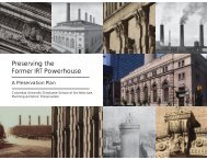
14th street and union square preservation plan - Columbia ...
14th street and union square preservation plan - Columbia ...
14th street and union square preservation plan - Columbia ...

You also want an ePaper? Increase the reach of your titles
YUMPU automatically turns print PDFs into web optimized ePapers that Google loves.
14TH STREET AND UNION SQUARE<br />
PRESERVATION PLAN<br />
HISTORIC PRESERVATION PROGRAM<br />
GRADUATE SCHOOL OF ARCHITECTURE, PLANNING AND PRESERVATION<br />
COLUMBIA UNIVERSITY<br />
NEW YORK CITY, 2006
TABLE OF CONTENTS<br />
I. Statement of Purpose<br />
II. History of <strong>14th</strong> Street <strong>and</strong> Union Square:<br />
A Brief Overview<br />
III. Significant Resources<br />
a. Introduction - Current Context<br />
b. Hudson River to Ninth Avenue<br />
c. Ninth to Seventh Avenue<br />
d. Seventh Avenue to University Place<br />
e. Union Square<br />
f. Fourth to First Avenue<br />
g. First Avenue to the East River<br />
IV. The Plan<br />
a. Proposal for Designating<br />
Significant Resources<br />
b. Balancing Public & Private Interests<br />
c. Encouraging Sensitive Development<br />
d. Managing Institutional Presence<br />
e. Addressing Physical Deterioration<br />
f. Promoting Appropriate Alterations<br />
g. Enhancing Interprestation<br />
of Open Spaces<br />
V. Conclusion<br />
1<br />
2<br />
5<br />
6<br />
7<br />
11<br />
16<br />
19<br />
22<br />
24<br />
25<br />
27<br />
30<br />
31<br />
33<br />
35<br />
38<br />
STUDENTS AND FACULTY<br />
STUDENTS<br />
Peter Anderson<br />
Avigail Appelbaum<br />
Christopher Brazee<br />
Laura Brown<br />
Allison Chambers<br />
Diane De Fazio<br />
Toni Di Maggio<br />
Brett Dorfman<br />
Abbie Hurlbut<br />
Mersedeh Jorjani<br />
Iris Kashman<br />
Olivia Klose<br />
Chian-Ju Ku<br />
Michelle Langlie<br />
Cleary Larkin<br />
Ana Linares<br />
FACULTY<br />
Francoise Bollack<br />
Andrew Dolkart<br />
Dorothy Miner<br />
Jorge Otero-Pailos<br />
Norman Weiss<br />
Katherine Longfield<br />
Marissa Marvelli<br />
Lurita McIntosh<br />
Katie McLaughlin<br />
Lindsay Miller<br />
Benika Morokuma<br />
Lisa Mroszczyk<br />
Caroline Pasion<br />
Justine Posluszny<br />
Megan Rispoli<br />
Lindsey Schweinberg<br />
Pat See-umponroj<br />
Am<strong>and</strong>a Stauffer<br />
Blaire Walsh<br />
Pepper Watkins<br />
II
STATEMENT OF PURPOSE<br />
As first-year Historic Preservation students, our goal<br />
in producing a Preservation Plan for Union Square<br />
<strong>and</strong> 14 th Street: River to River, is to present our analysis<br />
of the specific issues affecting the built fabric <strong>and</strong> the<br />
community on 14 th Street <strong>and</strong> Union Square, <strong>and</strong> to<br />
propose solutions for the <strong>preservation</strong> of historically<br />
significant buildings <strong>and</strong> sites that respect <strong>and</strong> complement<br />
the existing economic, political, <strong>and</strong> social character of<br />
the area.<br />
The Plan is the result of one year of intensive research<br />
<strong>and</strong> thorough survey of the area’s history <strong>and</strong> conditions.<br />
However, our investigation was not confined to the<br />
built environment: we engaged in direct dialogue with<br />
representatives from the various communities on<br />
<strong>and</strong> around 14 th Street <strong>and</strong> Union Square in order to<br />
better underst<strong>and</strong> the non-physical forces that affect<br />
<strong>preservation</strong>.<br />
The intended audience for our Preservation Plan includes<br />
the academic community in general, professionals who<br />
have an interest in urban historic <strong>preservation</strong>, <strong>and</strong>, most<br />
importantly, the constituents of 14 th Street <strong>and</strong> Union<br />
Square. In addition to providing a significant depth of<br />
new knowledge about New York City, the Plan seeks<br />
to present a model for activism that addresses specific<br />
<strong>preservation</strong> issues in a timely, practical, <strong>and</strong> accessible<br />
way.<br />
We have attempted to synthesize our idealism as historic<br />
<strong>preservation</strong>ists while recognizing the economic,<br />
political, <strong>and</strong> social limitations of the present time. It is<br />
our hope that future <strong>preservation</strong> students will reference<br />
our Plan in their learning process; that the City of New<br />
York will take note of the concerns highlighted by our<br />
research <strong>and</strong> analysis; that our <strong>preservation</strong> goals will be<br />
implemented by the City <strong>and</strong> other organizations; <strong>and</strong><br />
that the community of 14 th Street <strong>and</strong> Union Square will<br />
be able to utilize our <strong>plan</strong> to their benefit.<br />
STATEMENT OF PURPOSE<br />
1
HISTORY OF 14TH STREET AND UNION SQUARE: A BRIEF OVERVIEW<br />
During the colonial <strong>and</strong> early Federal periods, in<br />
the seventeenth <strong>and</strong> eighteenth centuries, the area<br />
now traversed by 14 th Street was farml<strong>and</strong> owned by the<br />
Stuyvesants <strong>and</strong> the Van Burens, among others (Figure<br />
1). In the early nineteenth century, the farml<strong>and</strong> of these<br />
early settlers became incorporated into the growing city<br />
grid, <strong>and</strong> row houses <strong>and</strong> mansions replaced open l<strong>and</strong><br />
<strong>and</strong> antiquated farm structures. The Commissioners’<br />
Plan of 1811 positioned 14 th Street in such a way that<br />
it was the southern most <strong>street</strong> to run straight from<br />
the East River to the Hudson River. Furthermore, 14 th<br />
Street became the longest among the cross-town <strong>street</strong>s<br />
laid out in this <strong>plan</strong>.<br />
On the eastern waterfront edge of this area, small<br />
commercial centers formed around dry docks used for<br />
ship building. On the Hudson River waterfront, coal,<br />
stone <strong>and</strong> lumber yards existed as early as the 1840s.<br />
The small centers on the two waterfronts were the only<br />
form of commerce in the area at this time, <strong>and</strong> stood in<br />
contrast to the residential character of the remainder of<br />
14 th <strong>street</strong>. By the 1830s, a locus of residential activity—<br />
Union Square—had formed in the center of the <strong>street</strong><br />
at the junction of two of the north-south arteries:<br />
Bloomingdale Road (later Broadway) <strong>and</strong> the Bowery<br />
(later Fourth Avenue). This area was easily accessed by<br />
horse-drawn rail cars on Broadway that began operation<br />
in 1832. The residences along the <strong>street</strong> were joined by<br />
churches <strong>and</strong> other upper-class residential necessities.<br />
The open area at the junction, which had formerly been<br />
a potter’s field, was transformed into a public park in<br />
1839. In the 1860s the park became so popular that<br />
several well-established businesses located along its<br />
perimeter, converting some of the existing row houses<br />
into commercial spaces, with ground floor storefronts.<br />
Along with the high-end retail stores several theaters<br />
<strong>and</strong> musicales appeared on Union Square. Theatres<br />
became an important presence on 14 th Street, creating<br />
a major theatre district that existed until 1910. By the<br />
1870s, Union Square <strong>and</strong> the surrounding area had<br />
become more commercial than residential in character,<br />
<strong>and</strong> consequently the affluent residents who had lived<br />
in the row houses of what had been a quiet residential<br />
neighborhood moved uptown, presumably to find<br />
quieter, more fashionable residences. The small-scale<br />
retail stores were soon joined by larger department<br />
stores that moved to the area by building their own<br />
architecturally distinct multi-story facilities that dwarfed<br />
the previously low-scale neighborhood (Figure 2).<br />
Following the departure of the affluent residents from<br />
2. UNION SQUARE AS A BUSTLING CENTER IN 1900.<br />
14 th Street, the growth of the <strong>street</strong> did not plateau, but<br />
rather it continued, taking on a new flavor. The “new”<br />
character of 14 th Street was a reflection of the changing<br />
nature of much of New York at the time that resulted<br />
from the influx of western European immigrants <strong>and</strong><br />
later southeastern European immigrants. In the central<br />
section of 14 th Street, the row houses that were vacated<br />
by the affluent were converted into boarding houses for<br />
working class residents. The high-end retail stores of<br />
the mid-nineteenth century left the area, following their<br />
wealthier clientele uptown, <strong>and</strong> were replaced by lowend<br />
retail stores that better fit the needs of the shoppers<br />
who frequented them. In 1881, an elevated rail line was<br />
constructed to better serve the growing commercial hub<br />
that existed between Sixth Avenue <strong>and</strong> Union Square,<br />
making the area more accessible to people from all over<br />
the city.<br />
1. UNION SQUARE AS A RURAL ENCLAVE IN 1767.<br />
HISTORY OF 14TH STREET AND UNION SQUARE: A BRIEF OVERVIEW<br />
Industry also found a home in the central section of<br />
14 th Street <strong>and</strong> took on a specialized form known as<br />
the single-bay loft building. This unusual building type,<br />
identifiable by a single bay of large windows needed for<br />
the admission of light to the workers within, adapted<br />
2
its manufacturing use to the narrow city lot. Industry,<br />
in a larger, more conventional fashion, also blossomed<br />
on the waterfronts. The new immigrant population<br />
flooded the eastern <strong>and</strong> western extremes of 14 th Street,<br />
providing a work force for the new manufacturing<br />
centers of the two waterfronts. By the 1870s, the<br />
Hudson River waterfront had transformed from an area<br />
of raw goods to an area used for light manufacturing<br />
<strong>and</strong> the distribution of meat, produce, <strong>and</strong> liquor. This<br />
area further blossomed in 1870 when the Ninth Avenue<br />
elevated train opened with a stop on 14 th Street. The East<br />
River waterfront, which had been used primarily for dry<br />
docks in the early to mid-nineteenth century, was now<br />
primarily occupied by coal yards, gas tanks, city sanitation<br />
facilities, <strong>and</strong> manufacturing buildings. Adjacent to both<br />
industrial waterfronts, tenements were built to house the<br />
growing number of German, Irish, Italian, <strong>and</strong> Spanish<br />
immigrants who flooded the area between 1860 <strong>and</strong> 1910<br />
(Figure 3). Institutions, including most notably, houses<br />
of worship, accompanied the tenements, matching their<br />
diverse ethnicities. Places for mass entertainment, such<br />
as theaters for vaudeville <strong>and</strong> movie houses for motion<br />
pictures, also peaked during this period.<br />
14 th Street as a commercial <strong>and</strong> industrial axis was<br />
productive <strong>and</strong> successful in many ways in its peak<br />
(1860-1910). However, its success was not without some<br />
disruption. Workers formed <strong>union</strong>s to more effectively<br />
deal with poor working conditions, <strong>and</strong> built <strong>union</strong><br />
centers to establish their presence on the <strong>street</strong>. Laborers<br />
dissatisfied with conditions gathered in Union Square to<br />
demonstrate, <strong>and</strong> the nation’s first Labor Day parade was<br />
held there in 1882. Industry on 14 th Street lasted up until<br />
the 1930s on the East River waterfront, <strong>and</strong> continues<br />
until today on the Hudson River waterfront. On the East<br />
River waterfront, the laborers <strong>and</strong> industry moved away,<br />
favoring locations that lay outside of Manhattan that<br />
were made accessible as inter-borough transportation<br />
3. TENEMENTS ALONG EAST 14TH STREET. 4. STUYVESANT TOWN UNDER CONSTRUCTION IN 1946.<br />
HISTORY OF 14TH STREET AND UNION SQUARE: A BRIEF OVERVIEW<br />
3
improved in the 1920s. On the Hudson River waterfront,<br />
industry suffered a decline, despite the addition of an<br />
elevated industrial rail, the High Line, in 1934. However,<br />
unlike the East River waterfront, the Hudson River<br />
waterfront managed to maintain a stronghold of activity<br />
in the Gansevoort meatpacking district.<br />
Development on 14 th Street was relatively stagnant<br />
between 1930 <strong>and</strong> 1950. Interest in developing the <strong>street</strong><br />
came about after World War II, mainly in two forms.<br />
Firstly, as a result of government sponsored urban renewal<br />
effort, the east end of 14 th Street was condemned, razed,<br />
<strong>and</strong> redeveloped as the large-scale “tower-in-the-park”<br />
housing project: Stuyvesant Town (Figure 4). Secondly,<br />
as a result of the sale of several large l<strong>and</strong> holdings, by<br />
the VanBurens <strong>and</strong> others in the late 1950s, 14 th Street<br />
became the site of the development of large apartment<br />
buildings for the upper middle class. The low-end retail<br />
stores, movie theatres, <strong>and</strong> other residential necessities<br />
that had been associated with the late-nineteenth <strong>and</strong><br />
early-twentieth century commercial boom of Union<br />
Square remained a defining characteristic on the <strong>street</strong><br />
until the mid-1980s when a Business Improvement<br />
District (BID) was formed on 14 th Street. By the mid<br />
1980s, 14 th Street had developed a bad reputation as<br />
an unsafe neighborhood, home to drug addicts <strong>and</strong><br />
the homeless. Symbolically, the BID showed the city’s<br />
renewed interest in 14 th Street <strong>and</strong> revitalized the <strong>street</strong><br />
by encouraging economic growth <strong>and</strong> improving the<br />
physical fabric. In 1974, the Greenmarket, a produce<br />
market, opened on Union Square <strong>and</strong> similarly gave the<br />
<strong>square</strong> a facelift in both the mind’s of outsiders <strong>and</strong> the<br />
lives of 14 th Street residents. In 1984, Union Square Park<br />
also underwent the first of a three-phase improvement,<br />
physically making the park an even more attractive asset<br />
to the <strong>street</strong>.<br />
Over the past twenty years, 14 th Street has experienced<br />
a revival in interest <strong>and</strong> activity. The Parks Department<br />
has followed through on the 1984 Union Square Park<br />
<strong>plan</strong> <strong>and</strong> is currently completing the third phase of<br />
improvements to the park. The Greenmarket has<br />
5. TODAY, THE ZECKENDORFF TOWERS AND THE CONSOLIDATED GAS COMPANY BUILDING LOOM OVER UNION SQUARE PARK.<br />
continued to flourish as has commerce around the<br />
<strong>square</strong>. In addition, improvements to the High Line <strong>and</strong><br />
the Hudson River Park promise further attention to the<br />
<strong>street</strong>. Institutions <strong>and</strong> developers alike have recognized<br />
this renaissance <strong>and</strong> have effectively capitalized on the<br />
action by building large-scale apartment <strong>and</strong> dormitory<br />
buildings. The meatpacking district is now part of the<br />
Gansevoort Historic District <strong>and</strong> several industrial<br />
buildings have been converted to high-end retail <strong>and</strong><br />
commercial uses. The eastern end of 14 th Street has<br />
seen the least amount of change despite the upsurge of<br />
activity along the rest of the <strong>street</strong> in the last twenty years.<br />
The blocks between First Avenue <strong>and</strong> the river remain<br />
much the way they were following the development of<br />
Stuyvesant Town.<br />
This overview of the history of 14 th Street is in no way<br />
an exhaustive history. Rather, it touches on the defining<br />
moments of the formation <strong>and</strong> growth of the <strong>street</strong>.<br />
For further information please refer to the 14 th Street<br />
<strong>and</strong> Union Square Preservation Plan for an extended<br />
discussion of the history of 14 th Street.<br />
HISTORY OF 14TH STREET AND UNION SQUARE: A BRIEF OVERVIEW<br />
4
SIGNIFICANT RESOURCES<br />
1 4th Street is the longest cross-<strong>street</strong> in Manhattan, <strong>and</strong> marks the widest point of<br />
the isl<strong>and</strong>. It has traditionally been treated as the boundary line between “uptown,”<br />
with its orderly grid of <strong>street</strong>s, <strong>and</strong> “downtown,” with its centuries-old crooked <strong>street</strong><br />
pattern. 14 th Street bisects many different neighborhoods <strong>and</strong> districts, <strong>and</strong> is often<br />
described as an “in-between” area. In fact, 14 th Street has a remarkable diversity of<br />
urban expression in its buildings, its character, <strong>and</strong> people. From river to river, the <strong>street</strong><br />
changes in feeling <strong>and</strong> in how people perceive it. These changes have come to define<br />
our underst<strong>and</strong>ing of the <strong>street</strong> <strong>and</strong>, accordingly, we have divided the <strong>street</strong> into six<br />
geographic regions for study. They are:<br />
- From the Hudson River to Ninth Avenue<br />
- From Ninth to Seventh Avenues<br />
- From Seventh Avenue to University Place<br />
- Union Square<br />
- From Fourth to First Avenues<br />
- From First Avenue to the East River<br />
While underst<strong>and</strong>ing the <strong>street</strong>’s discreet areas is helpful for the in-depth analysis<br />
necessary in creating a <strong>plan</strong>, it is also important to underst<strong>and</strong> the characteristics of the<br />
entire <strong>street</strong>. The components of “character” that we will be looking at are zoning, use,<br />
age, scale, materials, <strong>and</strong> conditions.<br />
Zoning – There are three types of zoning on the <strong>street</strong>: manufacturing, residential, <strong>and</strong><br />
commercial. The manufacturing zones are concentrated on both the western <strong>and</strong> eastern<br />
waterfronts, while residential <strong>and</strong> commercial zoning designations are concentrated<br />
in between. Often the combination of residential <strong>and</strong> commercial is produced by a<br />
commercial zone overlaid with its residential equivalent.<br />
Use – The l<strong>and</strong> use follows the zoning closely, although commercial enterprises are<br />
encroaching on the traditionaly industrial western waterfront. Scattered along the entire<br />
<strong>street</strong> are government, institutional, <strong>and</strong> church buildings<br />
Age – The buildings that exist today on 14 th Street <strong>and</strong> Union Square span almost two<br />
hundred years of development, from 1820 to 2006. The majority of buildings were<br />
built in an eighty-year range, from 1870 to 1950.<br />
Scale – While it is difficult to make broad generalizations concerning scale on the<br />
longest <strong>street</strong> in Manhattan, buildings on the north side of the <strong>street</strong> are generally taller<br />
than those on the south side. Also, buildings near the western <strong>and</strong> eastern extremities<br />
of the <strong>street</strong> are generally lower than those towards the <strong>street</strong>’s midpoint at Union<br />
Square. Eighty-one percent of the buildings in the Study Area are six-stories or fewer.<br />
Materials – The majority of buildings in the Study Area are made of brick. Other<br />
prevalent façade materials include stucco, cast iron, glass, terracotta <strong>and</strong> stone.<br />
The following section will present a brief look at the character of each Geographic<br />
Region. Special attention will be given to the Significant Resources located within the<br />
area.<br />
SIGNIFICANT RESOURCES<br />
5
HUDSON RIVER TO NINTH AVENUE<br />
Most of the area is a part of the Gansevoort Market Historic District, bounded<br />
by Chelsea to the north <strong>and</strong> Greenwich Village to the south. The area is<br />
characterized by the low-scale, brick industrial buildings <strong>and</strong> tenements built for<br />
neighborhood workers in the mid-nineteenth century. It is experiencing a shift from<br />
the meatpacking industry to commercial high-end retail stores. The area is segregated<br />
from the waterfront by the West Side Highway.<br />
THE HIGH LINE<br />
The High Line is a 13-mile long elevated railway extending from 35 th Street all the way<br />
to St. John’s Park Terminal on Manhattan’s West Side. The High Line was built in 1934<br />
in response to a long <strong>and</strong> serious history of accidents <strong>and</strong> deaths associated with cargo<br />
trains running at <strong>street</strong> level. Its function was to transport goods <strong>and</strong> materials (including<br />
lumber, bricks, fruit <strong>and</strong> coal) on a short, one-track route between the Hudson River<br />
piers <strong>and</strong> the markets <strong>and</strong> warehouses of Chelsea <strong>and</strong> Greenwich Village. The High<br />
Line is significant because it represents a technological innovation that had a short-lived<br />
usefulness within the history of New York City’s transportation infrastructure, <strong>and</strong><br />
because it was a vital part <strong>and</strong> distinguishing feature of the wholesale market economy<br />
of the Chelsea/Greenwich Village neighborhood. (Figure 1)<br />
THE HIGH LINE BUILDING<br />
The former Cudahy Cold Storage Facility, at 450 West 14 th Street, was the first of four<br />
buildings designed <strong>and</strong> built expressly for through-passage of the High Line railway.<br />
The five-story Art Deco brick <strong>and</strong> cast-stone structure was completed in 1932 by<br />
engineers of the New York Central Railroad Company, as part of New York City’s<br />
West Side Improvement project. The High Line Building is an integral part of the<br />
history of the High Line railway, <strong>and</strong> is significant as a demonstration of the large-scale<br />
industrial design projects championed by federal <strong>and</strong> municipal agencies during the<br />
Great Depression in America. (Figure 2)<br />
LIBERTY INN<br />
The Liberty Inn, designed by Richard R. Davis, was built in 1908 for the Conron Brothers,<br />
who were poultry dealers. Originally known as the Str<strong>and</strong> Hotel, it accommodated<br />
sailors from the nearby piers. When the Titanic survivors were brought to these piers,<br />
the New York Times used the hotel as a headquarters. Other uses have included a<br />
boarding house, speakeasy, night club, <strong>and</strong> restaurant. Its many alterations reflect the<br />
changes in the Gansevoort area from shipbuilding to meatpacking to night-life hot<br />
spot, <strong>and</strong> it st<strong>and</strong>s out within the area as one of the few buildings still retaining its<br />
original use, that of a hotel. (Figure 3)<br />
1. THE HIGH LINE. 2. THE HIGH LINE BUILDING. 3. LIBERTY INN.<br />
SIGNIFICANT RESOURCES: HUDSON RIVER TO NINTH AVENUE<br />
6
NINTH TO SEVENTH AVENUES<br />
Surrounded by Greenwich Village to the south, Chelsea to the north, a commercial<br />
zone to the east, <strong>and</strong> the historically industrial Meatpacking District to the west,<br />
the section of 14 th Street between Seventh <strong>and</strong> Ninth Avenues is characterized by a<br />
diverse assortment of small-scale buildings. Residential buildings, including many midnineteenth-century<br />
rowhouses, with ground-level commercial spaces predominate,<br />
while commercial, light-manufacturing <strong>and</strong> religious buildings dating from the latenineteenth<br />
to the early-twentieth century dot the <strong>street</strong>scapes. The rich variety of<br />
building uses, ages, architectural styles <strong>and</strong> materials, combined with the small scale of<br />
the structures, help to create a distinct sense of neighborhood.<br />
The building occupied by Guadalupe is a mid-nineteenth-century brownstone that<br />
has been masterfully converted from a posh rowhouse to a double-height sanctuary,<br />
complete with a monumental entrance, side chapel, tiny balcony, <strong>and</strong> clerestory. This<br />
transformation which makes Guadalupe extremely rare, if not unique, in the city<br />
spanned two decades <strong>and</strong> involved several notable architects one of which was Gustave<br />
Steinback. Steinback, known for his work on religious projects, designed No. 229’s<br />
classically proportioned Spanish Revival façade in 1921. Although the church remained<br />
extremely popular, it was consolidated with nearby St. Bernard’s parish <strong>and</strong> closed in<br />
2003. Today, Guadalupe is clear architectural trace of Little Spain. (Figure 5)<br />
ST. BERNARD’S PARISH<br />
Historically, St. Bernard’s Parish was considered one of the most important parishes in<br />
the city. In the 1870s, the congregation was primarily composed of Irish immigrants<br />
<strong>and</strong> descendants of Irish immigrants. Irish-born architect Patrick Charles Keely was<br />
selected to design a new St. Bernard’s <strong>and</strong> the cornerstone was laid in May of 1873. The<br />
church is built in the Victorian Gothic style with the twin towers, triple-portal entrance,<br />
<strong>and</strong> rose window inset into a pointed<br />
arch reveal a masterful blending<br />
of French <strong>and</strong> English influences.<br />
(Figure 4)<br />
242 WEST 14 TH STREET<br />
The building located at 242 West 14 th Street is a great example of a residential to partial<br />
commercial conversion due to its intact, double-height cast iron storefront. (Figure 6)<br />
(FORMER) ROMAN CATHOLIC<br />
CHURCH OF OUR LADY OF<br />
GUADALUPE<br />
Founded at the turn of the twentieth<br />
century by the Augustinians of the<br />
Assumption, Guadalupe was the<br />
first Spanish-speaking Catholic<br />
parish in New York City <strong>and</strong> for a<br />
time served as the national parish for<br />
Spanish-speaking Catholics. At this<br />
time <strong>14th</strong> Street between Seventh<br />
<strong>and</strong> Eighth Avenues was the heart<br />
of “Little Spain,” <strong>and</strong> working-class<br />
Spanish immigrants composed<br />
most of the early congregation.<br />
4. ST. BERNARD’S.<br />
SIGNIFICANT RESOURCES: NINTH TO SEVENTH AVENUES<br />
5. OUR LADY OF GUADALUPE. 6. 242 WEST 14 TH STREET.<br />
7
NEWTON BUILDING<br />
The Newton Building was designed by the architect, James Farnsworth in 1890 as a<br />
speculative office <strong>and</strong> manufacturing building, which was caused by the development<br />
of nearby Gansevoort Market. The unusual combination of the large manufacturing<br />
building on the West 13 th Street <strong>and</strong> a narrow office building on the 14 th Street represents<br />
the developer, John Pettit’s intention to make the building more marketable by taking<br />
advantage of the prominence of the West 14 th Street as a commercial district. (Figure 7)<br />
210 WEST 14 TH STREET<br />
It is here that French Dadaist artist Marcel Duchamp lived from 1942 until the<br />
year of his death, 1968, on the top floor. Due to the fact that the building itself, an<br />
1849 brownstone, has been altered since Duchamp resided here, the significance is<br />
compromised. While it is important to acknowledge this connection with the artist’s<br />
later works that have only recently been found <strong>and</strong> exhibited, the alteration means that<br />
less can be learned from the building than if it were not the case. (Figure 8)<br />
BANKERS’ TRUST COMPANY BUILDING<br />
The former Bankers’ Trust Company building is an excellent example of the setback,<br />
Art Deco-style office tower strongly associated with Manhattan’s pre- Depression<br />
financial <strong>and</strong> building boom. Commissioned by Vincent Astor for his investment<br />
banking firm, the building was completed in 1929 to serve the meat <strong>and</strong> poultry<br />
dealers in the market district of Chelsea <strong>and</strong> Greenwich Village. In striking contrast<br />
to the two fine examples of the low, classically-inspired purpose-built bank st<strong>and</strong>ing<br />
on opposite corners, the former Bankers’ Trust building uses expressive Art Deco<br />
ornament <strong>and</strong> the monumentality of the ziggurat form to establish itself in the<br />
neighborhood. (Figure 9)<br />
INTERIOR<br />
The small office lobby of the<br />
former Bankers’ Trust building is a<br />
sumptuous exposition of high Art<br />
Deco design <strong>and</strong> materials. The<br />
tight, streamlined composition of<br />
highly-polished marble surfaces,<br />
smoked glass <strong>and</strong> bronze grillework<br />
articulates the principles of<br />
craftsmanship, elegant detail, <strong>and</strong><br />
luxury demonstrated by the finest<br />
examples of Art Deco design.<br />
(Figure 10)<br />
7. NEWTON BUILDING. 8. 210 WEST 14 TH STREET.<br />
9. BANKERS’ TRUST COMPANY BUILDING. 10. INTERIOR, BANKERS’ TRUST<br />
SIGNIFICANT RESOURCES: NINTH TO SEVENTH AVENUES<br />
8
LITTLE SPAIN<br />
11. JEANNE D’ARC.<br />
200 WEST 14 TH STREET (JEANNE D’ARC)<br />
Also known as the Jeanne d’ Arc, 200 West 14 th Street was designed by architect James<br />
W. Cole <strong>and</strong> built for owner Henry Meinken between 1888 <strong>and</strong> 1889. Cole designed<br />
more than fifty buildings in New York City throughout his career, <strong>and</strong> is perhaps best<br />
know known for his Charles A. Vissani House, a designated New York City l<strong>and</strong>mark<br />
on the Upper West Side. 200 West 14 th Street originally housed eight families above<br />
ground-level commercial spaces, <strong>and</strong> is listed in the 1889 docket books under “French<br />
flat,” a category then used for buildings that fell between single-family dwellings <strong>and</strong><br />
boardinghouses. Cole’s intention to present the building as a middle-class dwelling<br />
remains evident in the sophisticated facades of this corner building. They are composed<br />
of American-bond brick; carved brownstone sills, lintels, stringcourses, <strong>and</strong> pilasters;<br />
<strong>and</strong> a projecting pressed-metal cornice. Cole’s rhythmic <strong>and</strong> lively north elevation<br />
directs a viewer’s eye to a central entrance surrounded by carved figures, <strong>and</strong> above it,<br />
a stone statue of Joan of Arc. Aside from its architectural merit, 200 West 14 th Street is<br />
significant as the earliest existing French flat along <strong>14th</strong> Street, <strong>and</strong> as a remnant of the<br />
<strong>street</strong>’s brief period as an upper- <strong>and</strong> middle-class residential enclave. (Figure 11)<br />
SIGNIFICANT RESOURCES: NINTH TO SEVENTH AVENUES<br />
At the turn of the century, Spanish immigrants settled in the area around West 14 th<br />
Street. The degree to which this was the center of Spanish life in the city is visible in<br />
the number of services that were offered within the area, <strong>and</strong> particularly on the block<br />
between Eighth <strong>and</strong> Seventh Avenues. In the first decades of the twentieth century,<br />
the Casa Maria, a Spanish settlement house protecting the “temporal, social, mental,<br />
moral, <strong>and</strong> religious welfare of young<br />
women <strong>and</strong> Spanish speaking people,”<br />
the Spanish Benevolent Society, <strong>and</strong> St.<br />
Raphael’s Spanish Immigrant Society all<br />
located on this block, while still more,<br />
such as the Spanish American Workers<br />
Alliance, the Hotel Espanyol, <strong>and</strong><br />
many other businesses serving Spanish<br />
<strong>and</strong> Spanish-speaking people located<br />
nearby. In 1902, the Augustinians of the<br />
Assumption established the Our Lady<br />
of Guadalupe Roman Catholic Church,<br />
the first Latino church in Manhattan, in<br />
order to “do [their] work for the Spanish<br />
speaking people.” In 1939, the New<br />
York City Guide published by the WPA<br />
acknowledged that, while “the Spanish<br />
Colony has declined,” many remaining<br />
institutions “still preserve[d] the Iberian<br />
flavor.” Continuing waves of Spanishspeaking<br />
immigrants, most noticeably<br />
those from Puerto Rico in the second<br />
half of the twentieth century, have also<br />
12. LITTLE SPAIN.<br />
gathered in this area. Today, the area serves the larger Hispanic community of New<br />
York with the Spanish Benevolent Society, the Asociacion Tepeyac de New York, the<br />
Centro Español La Nacional, Spanish-language bookstores, <strong>and</strong> the Lady of Guadalupe<br />
Church, albeit relocated <strong>and</strong> consolidated with nearby St. Bernard’s Parish. While<br />
there have been <strong>and</strong> continue to be many geographic centers for Spanish <strong>and</strong> Hispanic<br />
immigrants, 14 th Street’s Little Spain is significant as being the first major gathering<br />
place for generations of Spanish <strong>and</strong> Hispanic immigrants. (Figure 12)<br />
9
240 WEST 14 TH STREET<br />
240 West 14 th Street, a mid-nineteenth-century rowhouse in the<br />
Italianate style, is architecturally significant for the elaborate<br />
cast-iron window <strong>and</strong> door surrounds applied to its brownstone<br />
façade. (Figure 15)<br />
STREETSCAPE (ANDREW NORWOOD BLOCK)<br />
13. 244 WEST 14 TH STREET 14. 314 WEST 14 TH 15. 240 WEST 14 TH<br />
STREET.<br />
STREET.<br />
244 WEST 14 TH STREET<br />
The Greek Revival, Italianate, <strong>and</strong> Second Empire style<br />
rowhouses along the north side of West 14 th Street, between<br />
Seventh <strong>and</strong> Eight Avenues, were constructed between 1840 <strong>and</strong><br />
1860. Surviving in a nearly intact row, these buildings represent<br />
the period when West 14 th Street, from Union Square to Ninth<br />
Avenue, was regarded as a fashionable address for upper- <strong>and</strong><br />
upper-middle-class New Yorkers. (Figure 16)<br />
Constructed in 1930, 244 West 14 th Street is a two-story taxpayer in the Art Deco style.<br />
One of fifteen taxpayers along 14 th Street, this structure is the most notable for its<br />
patterned brickwork <strong>and</strong> stylized cast-stone ornament. (Figure 13)<br />
314 WEST 14 TH STREET<br />
Built in 1907 by retail druggists Daggett <strong>and</strong> Ramsdell, the three-story loft building<br />
at 314 West 14 th Street is one of the earliest examples of the wave of commercial/<br />
manufacturing loft development that transformed 14 th Street in the early 20th century.<br />
Additionally, it is one of the few remaining single-bay loft buildings constructed on a<br />
25-foot-wide lot on 14 th Street. (Figure 14)<br />
16. STREETSCAPE (ANDREW NORWOOD BLOCK).<br />
SIGNIFICANT RESOURCES: NINTH TO SEVENTH AVENUES<br />
10
SEVENTH AVENUE TO UNIVERSITY PLACE<br />
The area contains continuing reminders of 14 th Street’s involvement with the<br />
commerce of the avenues that interest it <strong>and</strong> is defined mostly by medium scale<br />
commercial architecture from the 1880s-1930s with the exception of several institutions<br />
<strong>and</strong> large mid-twentieth-century apartment buildings.<br />
THE SALVATION ARMY’S NATIONAL & TERRITORIAL HEADQUARTERS<br />
The Salvation Army’s National <strong>and</strong> Territorial<br />
Headquarters buildings strove to change the public’s<br />
negative perception of the organization, integrate<br />
social <strong>and</strong> charitable aspects with its religious past, <strong>and</strong><br />
physically reflect the Salvation Army as a progressive<br />
organization. These goals were accomplished with<br />
innovative materials such as cast stone <strong>and</strong> the selection<br />
of modern architect Ralph Walker to design a new<br />
headquarters influenced by the German Expressionist<br />
style. (Figure 17)<br />
(FORMER) MACY’S SITE<br />
The former Macy’s building, designed by architects Schickel & Ditmars<br />
in 1898, located at 56 West 14 th Street, is the last remnant of Macy’s<br />
presence on 14 th Street where the store got its start <strong>and</strong> went from a<br />
small dry goods store to full-fledged department store occupying the<br />
ground space of eleven buildings in this area. (Figure 19)<br />
(FORMER) GEORGE C. FLINT CO./LATER COWPERTHWAIT &<br />
CO. FURNITURE STORE<br />
This five-story Renaissance Revival cast iron building was designed by<br />
architects William Field & Son in 1875 for the furniture emporium of<br />
George C. Flint & Co., later becoming Cowperthwait & Co. Furniture<br />
Store in 1894. It was erected at a time when 14 th Street was part of<br />
“Furniture Row”. (Figure 20)<br />
19. MACY’S<br />
SITE.<br />
(FORMER) 14 TH STREET STORE<br />
The (Former) 14 th Street Store, located on the southeast<br />
corner of 14 th Street <strong>and</strong> Sixth Avenue, was designed<br />
by the architects Cady, Burg, <strong>and</strong> See for the major<br />
department store developer Henry Siegal. The site was<br />
chosen for its location near the stop of the Elevated<br />
Train, <strong>and</strong> because it was the site of the Macy’s store.<br />
This building is notable, not only for its connections<br />
with a well-known architecture firm <strong>and</strong> developer,<br />
but also for its architectural dialogue with Chicago’s<br />
Carson Pirie Scott Building, which was commissioned<br />
at the same time as the 14 th Street Store by the same<br />
developer, but designed by Louis Sullivan. The building<br />
also currently marks the southern-most point of the<br />
Ladies’ Mile on Sixth Avenue <strong>and</strong> continues to represent<br />
a transitional piece of architecture moving from the<br />
arcaded commercial style of the late nineteenth-century<br />
towards a more modern expression. (Figure 18)<br />
17. SALVATION ARMY HQ.<br />
18. 14TH STREET STORE.<br />
THE DIX BUILDING<br />
Designed by Louis Korn <strong>and</strong> completed in 1907 for developer Samuel Weil, this building<br />
located at 116 West 14 th Street has become to be known as the Dix Building, for long-term<br />
occupant <strong>and</strong> progressive employer<br />
Henry A. Dix, dressmaker. While Dix<br />
maintained an “open shop” (which<br />
employs non-<strong>union</strong>ized workers), his<br />
business practices were progressive<br />
in a time that employers, especially in<br />
the garment-making industry, treated<br />
employees poorly <strong>and</strong> kept appalling<br />
work conditions. Dix was one of the<br />
first employers to instate the fiveday<br />
work week without reduction<br />
of wages, as well as paid vacation<br />
time. In 1923, at the age of 72, Dix<br />
retired <strong>and</strong> h<strong>and</strong>ed his business over<br />
to his employees, whom all became<br />
shareholders. (Figure 21)<br />
20. COOPERWAITH STORE. 21. DIX BUILDING<br />
SIGNIFICANT RESOURCES: SEVENTH TO AVENUE TO UNIVERSITY PLACE<br />
11
(FORMER) GREENWICH SAVINGS BANK<br />
The former Greenwich Savings Bank was built in 1952 by prominent New York bank<br />
architects Halsey, McCormack & Helmer. The building’s exterior, with its simple<br />
architectural vocabulary, evokes the stability <strong>and</strong> staid conservatism of the savings bank<br />
industry. It is a remarkably late example of classicizing Art Deco architectural design.<br />
(Figure 24)<br />
527 SIXTH AVENUE<br />
22. J.G. JOHNSON STORE. 23. LUDWIG BROTHERS STORE.<br />
(FORMER) J.G. JOHNSON DEPARTMENT STORE<br />
This nineteenth century building elevation bears a cast-iron façade, designed by<br />
architect Alfred Hoe in 1879 following the Renaissance Revival Style, very popular in<br />
the 1870’s <strong>and</strong> 1880’s, for the shopping emporium of J. G. Johnson. Erected at a time<br />
when 14 th Street was a busy commercial thoroughfare, it is a significant remnant of the<br />
time. (Figure 22)<br />
527 Sixth Avenue is a Romanesque Revival commercial building designed by Theo<br />
Thomson <strong>and</strong> erected in 1896. The brick <strong>and</strong> granite structure is actually composed of<br />
three separate buildings erected on three contiguous lots clustered on the southwest<br />
corner of 14 th Street <strong>and</strong> Sixth Avenue. The buildings were designed in response to the<br />
site’s proximity to the Sixth Avenue elevated train, which first opened on 14 th Street<br />
in 1881, <strong>and</strong> the round, turreted corner tower of building announces its prominence<br />
<strong>and</strong> commercial prowess. From ground level, pedestrians would see the main entry<br />
surrounded by Corinthian columns, <strong>and</strong> the heavily ornamented doors <strong>and</strong> windows<br />
capped by the first-level stringcourse. From the tracks of the El, riders would clearly<br />
see the corner tower with its turret, rising above the second-level stringcourse <strong>and</strong><br />
solidly articulated in buff colored brick <strong>and</strong> heavily rusticated details. This building is<br />
significant for the way its unified architectural program reflects a special relationship<br />
with the Sixth Avenue elevated train. Additionally, the building represents an unusual<br />
application of Romanesque Revival style to the commercial building form. (Figure 25)<br />
(FORMER) LUDWIG BROTHERS DRY GOODS STORE/LATER ROTHENBERG &<br />
CO. DEPARTMENT STORE<br />
This five-story Renaissance Revival cast iron department store building was designed by<br />
prominent architect William Wheeler Smith in 1878 for the Ludwig Brothers’ dry goods<br />
company. It was later altered <strong>and</strong> exp<strong>and</strong>ed when it became Rothenberg & Co. in 1899.<br />
Erected as a gr<strong>and</strong> emporium catering to a middle <strong>and</strong> upper-middle class clientele,<br />
the Ludwig Brothers Dry Goods Store was one of several gr<strong>and</strong> department stores<br />
constructed along 14 th Street, between Sixth Avenue <strong>and</strong> Broadway, <strong>and</strong> is representative<br />
of a time when that area was a fashionable shopping district. (Figure 23)<br />
24. GREENWICH SAVINGS BANK. 25. 527 SIXTH AVENUE.<br />
SIGNIFICANT RESOURCES: SEVENTH TO AVENUE TO UNIVERSITY PLACE<br />
12
(FORMER) BAUMANN<br />
BROTHERS’ STORE<br />
The Baumann Brothers’<br />
Store is significant both as<br />
an artifact of 14 th Street’s<br />
retail past <strong>and</strong> as a marker in<br />
the evolution of the oeuvre<br />
of architects D. & J. Jardine.<br />
The building represents the<br />
Jardines’ later work in cast<br />
iron—a period in which they<br />
had broken with mimicry of<br />
Italianate forms in iron <strong>and</strong><br />
embraced the possibilities of<br />
the material. Commissioned<br />
for the fashionable Union<br />
Square retail district in 1880<br />
by New York business icon<br />
<strong>and</strong> 14 th Street resident James<br />
McCreery, the structure was<br />
first occupied by the Bauman<br />
n Brothers’ Furniture <strong>and</strong><br />
Carpet store after it moved<br />
uptown from Hudson Street.<br />
Invoking elements of the 26. BAUMANN BROTHERS’ STORE.<br />
Aesthetic movement <strong>and</strong> the Queen Anne style, the building freely integrated rich<br />
classical motifs with contemporary design elements while employing a playful virtuosity<br />
rarely seen in the city’s other cast iron. The exuberant façade distills a unique moment<br />
in New York architecture—one in which the moribund technology of cast iron was<br />
used with unconventional design inspiration to create a building bound to the past<br />
but also breaking with it. The evolving Jardine aesthetic of cast iron is still visible in<br />
New York’s built fabric, starting with the remaining Thomas Twin (1869), progressing<br />
to B. Altman’s Sixth Avenue Store (1877), <strong>and</strong> ending with the Baumann Brothers’<br />
Store (1880). McCreery’s building is a powerful reminder of 14 th Street’s former retail<br />
magnetism, of the way that commerce <strong>and</strong> manufacturing were housed under one roof,<br />
<strong>and</strong> of how architects were squaring innovation, function, <strong>and</strong> aesthetics in a moment<br />
of major change. (Figure 26)<br />
154-160 WEST 14 TH STREET<br />
The steel frame twelve-story loft building at<br />
14 th Street <strong>and</strong> Seventh Avenue was designed in<br />
1912 by Herman Lee Meader <strong>and</strong> is a spectacular<br />
example of the use of polychrome terra cotta.<br />
The base consists of golden terra cotta tiles with<br />
white floral relief work <strong>and</strong> green diamonds<br />
with blue surrounds. Blue diamond accents are<br />
used below each window in the central section<br />
of the tripartite design. The top of the building<br />
is emphasized with elaborate laurel wreaths<br />
<strong>and</strong> floral elements to the upper stories <strong>and</strong> the<br />
cornice.<br />
Meader’s use of polychrome terra cotta in this<br />
building was one of the boldest of its time. The<br />
organic motifs <strong>and</strong> geometric building forms,<br />
along with the use of laurel wreaths near the<br />
cornice selected by Meader for this loft building<br />
indicates the influence of Austrian architect Otto<br />
Wagner <strong>and</strong> his followers on the architecture of<br />
New York City. (Figure 27)<br />
28 EAST 14 TH STREET<br />
27. 154-160 WEST 14 TH STREET.<br />
28 East 14 th Street is notable for its striking cast-iron façade<br />
that features central bay windows. It is possible that this<br />
address represents a last-minute shift in the utilization of<br />
cast iron (from commercial to residential) before its usage<br />
fell out of fashion. (Figure 28)<br />
28. 28 EAST 14 TH STREET.<br />
SIGNIFICANT RESOURCES: SEVENTH TO AVENUE TO UNIVERSITY PLACE<br />
13
45 WEST 14 TH STREET<br />
In 1959, this 1875 rowhouse was purchased by<br />
the Painting Industry Funding Corporation, <strong>and</strong><br />
converted into the office building for use by the<br />
International Union of Painters <strong>and</strong> Allied Traders.<br />
Located within two blocks of Union Square, a historic<br />
center of labor activity, protest <strong>and</strong> organization,<br />
this site was appropriate to serve the activities of<br />
the Union. Consecutively with the occupation of<br />
their new headquarters, the Union played a major<br />
role in the 1960s fight for legislation regarding labor<br />
<strong>and</strong> civil rights.<br />
20 EAST 14 TH STREET<br />
Perhaps capitalizing on the prosperity of neighboring Baumann Brothers’ stores, 20<br />
East 14 th Street erected its own cast-iron storefront in 1911. Though spare in detailing,<br />
it remains a good example of cast-iron’s small-scale applications, both on 14 th Street<br />
<strong>and</strong> in New York City. (Figure 30)<br />
108 WEST 14TH STREET<br />
108 West 14 th Street is a notable example of the typical conversions from residential<br />
rowhouses to commercial entities. The double-height cast iron storefront is simple but<br />
is also a good example of small residential conversions. (Figure 31)<br />
The Union commissioned William Conklin of the<br />
Mayer, Whittlesley, <strong>and</strong> Glass to adapt the existing<br />
structure in the modern context. The design of the<br />
new façade with the sunshades was inspired by the<br />
arches of the cast iron buildings in its neighborhood.<br />
This acknowledgement of historical influences in<br />
“modern” design was a radical departure from the<br />
historical design theory of the time. Furthermore,<br />
Conklin successfully incorporated the practical<br />
concerns <strong>and</strong> function requirements, such as the 29. 45 WEST 14 TH STREET.<br />
need to shade large areas of glass <strong>and</strong> convenient access for cleaning, into its design.<br />
Hence, this building is significant in that it is the remnant of the rowhouse development<br />
in the neighborhood in 1870s, <strong>and</strong> it represents the relationship with the history of the<br />
labor <strong>union</strong>s on the 14 th Street <strong>and</strong> the innovative design idea in early 1960s. (Figure 29)<br />
30. 20 EAST 14 TH STREET. 31. 108 WEST 14 TH STREET.<br />
SIGNIFICANT RESOURCES: SEVENTH TO AVENUE TO UNIVERSITY PLACE<br />
14
FIFTH AVENUE COMMERCIAL BUILDINGS<br />
The speculative commercial buildings on the western corner 14 th Street <strong>and</strong> Fifth<br />
Avenue provide a strong visible boundary between East <strong>and</strong> West Fourteenth Street<br />
<strong>and</strong> illustrate the differing scale of the avenues <strong>and</strong> the cross <strong>street</strong>. The building on<br />
the south corner was designed by Buchman <strong>and</strong> Fox <strong>and</strong> was completed in 1907, while<br />
the building on the north corner was designed by Robert Maynicke <strong>and</strong> was completed<br />
in 1902. These buildings exemplify the incorporation of new technology into the<br />
preferred architectural styles of the period. (Figures 35 <strong>and</strong> 36)<br />
32. THE VICTORIA. 33. WEDGEWOOD HOUSE.<br />
WHITE BRICK APTARTMENT BUILDINGS<br />
14 th Street is home to a number of mid-century white-brick apartment buildings,<br />
notable for their monumental size (a result of the sale of large l<strong>and</strong>holdings), their sleek<br />
modernist design, their use of modern materials (including white brick <strong>and</strong> aluminum),<br />
<strong>and</strong>, finally, their pretentious names, like the “The Victoria” <strong>and</strong> “Wedgewood House”<br />
(Figure 32 <strong>and</strong> 33)<br />
33 WEST 14TH STREET<br />
The building is significant as part of the taxpayer<br />
properties created by the Van Beuren family on<br />
the northern side of 14 th Street. The family’s<br />
speculation activities on 14 th Street are recorded<br />
in the surviving taxpayers <strong>and</strong> these buildings<br />
reflect different periods of economic expansion<br />
<strong>and</strong> contraction on the <strong>street</strong>. (Figure 34)<br />
35 AND 36. FIFTH AVENUE COMMERCIAL BUILDINGS.<br />
34. 33 WEST 14 TH STREET.<br />
SIGNIFICANT RESOURCES: SEVENTH TO AVENUE TO UNIVERSITY PLACE<br />
15
UNION SQUARE<br />
Since the early nineteenth century, Union Square has been a public, political <strong>and</strong><br />
social gathering space for commerce, entertainment, labor, political events <strong>and</strong><br />
recreation. Developed as a major transportation hub within the city, Union Square<br />
consists of a two-part whole: the park plus the buildings that surround the park. The<br />
park has historically been a primary location for political, social <strong>and</strong> cultural expression<br />
contained within the defining walls of the conglomeration of buildings that reflect<br />
diverse use, age, character, scale <strong>and</strong> architectural style. Their architectural significance<br />
derives from the various design responses they present for the early exploration of the<br />
skyscraper in New York.<br />
UNION SQUARE PARK<br />
As the oldest green space in the Study Area, Union Square Park has changed <strong>and</strong><br />
evolved with the <strong>street</strong>, but is most of all important in the role that it has played as a<br />
historic gathering spot for protests, celebrations <strong>and</strong> memorials. (Figure 37)<br />
SPINGLER BUILDING<br />
Located on the west side of Union Square,<br />
this Classical-inspired building was built in<br />
1896 by architects William H. Hume & Son,<br />
appointed by the firm of James L. Libby &<br />
Son, who designed it as a commercial building<br />
that housed a variety of uses such as stores,<br />
showrooms, manufacturing enterprises <strong>and</strong><br />
industrial lofts. Its structure was built at a<br />
time when Union Square was changing its<br />
character <strong>and</strong> appearance, no longer the<br />
site of fine residences, luxury hotels <strong>and</strong><br />
theatres, but rather a more commercial<br />
<strong>and</strong> manufacturing area. It represented a<br />
new typology in the distribution of space<br />
required by the flourishing garment industry,<br />
which dem<strong>and</strong>ed spaces for showrooms <strong>and</strong><br />
manufacturing processes, all in the same<br />
place. The building’s façade, made out of limestone at its base, <strong>and</strong><br />
buff brick <strong>and</strong> terra cotta in the remaining stories, portrayed the<br />
architectural ideas of the time, following the “tripartite scheme” in<br />
a unique way by introducing a transitional level above the base, <strong>and</strong><br />
reflecting the style set forth by the World’s <strong>Columbia</strong>n Exhibition<br />
held in Chicago in 1893. It has become an important element of<br />
Union Square’s built fabric, a reflection of its character <strong>and</strong> an<br />
important vestige of its history. (Figure 38)<br />
38. THE SPINGLER BUILDING.<br />
COMMERCIAL TRADERS BUILDING<br />
A vernacular Beaux Arts building, this single bay loft was designed<br />
by amateur architect William Pigueron for his brother George,<br />
an active developer. The façade adapted the features of a wildly<br />
popular style to a singularly New York building typology, resulting<br />
in a building that, when new, would have been fashionable, quite<br />
tall, <strong>and</strong> desirable to rent. (Figure 39)<br />
37. UNION SQUARE.<br />
SIGNIFICANT RESOURCES: UNION SQUARE<br />
39. COMMERCIAL<br />
TRADERS BUILDING.<br />
16
(FORMER) TAMMANY HALL<br />
Tammany Hall is the former<br />
headquarters of the infamous<br />
political machine by the same<br />
name, which occupied the<br />
building from 1928 to 1940. It<br />
also served a second life as the<br />
headquarters for the International<br />
Ladies’ Garment Workers’ Union.<br />
Their use of this building, <strong>and</strong> 40. TAMMANY HALL.<br />
particularly Roosevelt Hall,<br />
established the building as a center of labor <strong>union</strong> activity <strong>and</strong> contributes to this aspect<br />
of Union Square’s history. Architecturally, the building serves as an imposing example<br />
of Neo-Colonial architecture in its emulation of Pierre L’Enfant’s 1789 Federal Hall in<br />
New York City. The structure, with its gr<strong>and</strong> order, monumental rise, <strong>and</strong> pedimented<br />
portico, was designed by Charles B. Meyers <strong>and</strong> Thompson, Holmes <strong>and</strong> Converse in<br />
1928. The details of Flemish bond Harvard brick, corncob <strong>and</strong> wheatstalk cartouches,<br />
<strong>and</strong> images of the “Tammany Brave” <strong>and</strong> Christopher Columbus present a nostalgic<br />
<strong>and</strong> patriotic image. Its architectural value, combined with its important role in the<br />
political development of New York City, make Tammany Hall a significant part of the<br />
built fabric of Union Square <strong>and</strong> New York City as a whole. (Figure 40)<br />
(FORMER) SCHIRMER’S STORE<br />
Gustav Schirmer’s store (D & J Jardine, 1880) is one of the few mostly intact vestiges<br />
of the high end retailers, particularly of music goods, that once occupied Union Square<br />
<strong>and</strong> served the musical <strong>and</strong> theatre community that developed there. Schirmer’s was a<br />
prominent business, noted for being the first to publish the<br />
works of Wagner in America. His building contributed to the<br />
architectural eclecticism of its unique block by employing<br />
a stripped, almost abstracted classicism in its facade. The<br />
structure reflected the transitional nature of architecture in<br />
the 1880s as it moved away from facades of cast iron toward<br />
brick here experimenting with the structural expressivity of<br />
the Neo Gréc <strong>and</strong> the ornament of Queen Anne (sunflowers<br />
bookend the sp<strong>and</strong>rels, <strong>and</strong> a triangular parapet once<br />
crowned a garl<strong>and</strong>ed cornice). Gustav Schirmer’s store is a<br />
singular survivor that conveys a largely lost piece of Union<br />
Square musical history, <strong>and</strong> records the transitional work of a<br />
masterful New York architecture firm. (Figure 41)<br />
41. SCHIMER’S STORE.<br />
SIGNIFICANT RESOURCES: UNION SQUARE<br />
50 EAST 14 TH STREET<br />
Emery Roth’s 20-story office tower<br />
of 1929 is the only Art Deco tower<br />
on Union Square—<strong>and</strong> st<strong>and</strong>s,<br />
with the Salvation Army <strong>and</strong><br />
Bankers’ Trust Company Building,<br />
as one of the few examples of the<br />
style on 14 th Street. From <strong>street</strong><br />
level to roofline, Roth’s design is<br />
remarkably free of ornament except<br />
for a cast-iron <strong>and</strong> glass “screen”<br />
treatment on the third through<br />
fifth floors <strong>and</strong> a unique castellated<br />
cornice on the uppermost tier. The<br />
architecture of the tower displays a<br />
strong vertical emphasis typical of<br />
art deco designs, as well as setbacks<br />
required by the 1916 zoning<br />
resolution. The original entrance<br />
of the building, which once<br />
included a portal to the subway,<br />
42. 50 EAST 14 TH STREET.<br />
features a h<strong>and</strong>some mural of<br />
stylized birdflight <strong>and</strong> foliate motifs. Roth’s <strong>plan</strong> for the building carefully regulated<br />
the unusual space dictated by the lot lines, arranging stores on the floors behind the<br />
façade screen, <strong>and</strong> offices <strong>and</strong> lofts on the upper levels. Filed for the relatively modest<br />
cost of $700,000 in 1927, Roth produced a building of great efficiency <strong>and</strong> utility, but<br />
also up-to-date style. Emery Roth’s Union Square tower st<strong>and</strong>s as the only Art Deco<br />
building in its eclectic context, <strong>and</strong> exemplifies the speculative boom of the twenties in<br />
the h<strong>and</strong>s of a master, constrained by budget though he was. (Figure 42)<br />
17
PAVILION—UNION SQUARE<br />
UNION HALL<br />
The Italian Renaissance inspired pavilion in Union Square was designed for the New<br />
York City Parks Department in 1931 by the Department’s architect Charles Schmieder.<br />
Schmieder joined the Parks<br />
Department as a draftsman in<br />
1912 <strong>and</strong> served as Department<br />
architect from 1922 until his<br />
death in 1950. During this time he<br />
designed many structures in parks<br />
throughout the city, including a<br />
boathouse in Central Park <strong>and</strong> a<br />
field house in Inwood Hill Park,<br />
in 1931 <strong>and</strong> 1933 respectively.<br />
The Pavilion was part of greater<br />
park improvements made during<br />
subway construction, <strong>and</strong> at its inception housed a b<strong>and</strong>st<strong>and</strong> <strong>and</strong> comfort station. The<br />
pavilion has since served as a meeting point, a playground, a restaurant <strong>and</strong> a “soap<br />
box” for political protesters. (Figure 43)<br />
27-29 Union Square West, the <strong>union</strong> meeting <strong>and</strong> offices, represents<br />
the rise of the trade <strong>and</strong> labor <strong>union</strong>s in the 1950’s. Its architectural style<br />
is representative of vernacular modern architecture. (Figure 45)<br />
HARTFORD BUILDING<br />
This eleven-story corner building built in a neo-Renaissance style<br />
was designed by Youngs, Bergesen, <strong>and</strong> Cornell in 1894. Built as a<br />
speculative office <strong>and</strong> loft building by Charles Wadsworth to meet the<br />
increasing dem<strong>and</strong> of the wholesale <strong>and</strong> manufacturing establishments<br />
that moved to Union Square since the 1880’s, the Hartford Building<br />
represents the transition of Union Square’s built fabric <strong>and</strong> character,<br />
going from residential to commercial in the late nineteenth century.<br />
(Figure 46)<br />
43. PAVILION—UNION SQUARE.<br />
46. HARTFORD<br />
ZECKENDORFF TOWERS<br />
BUILDING.<br />
24-30 UNION SQUARE EAST<br />
Once four individual Greek Revival rowhouses, these buildings are an excellent<br />
example of the evolution of New York architecture from residential to commercial.<br />
The re-cladding of the structures in cast iron, designed by architect Henry Fernbach,<br />
characterizes the shift from traditional masonry facades to a progressive style of the<br />
late nineteenth century. (Figure 44)<br />
These large-scale, residential mixeduse<br />
towers on the southwest corner<br />
of Union Square were built by the<br />
prominent real estate developer<br />
Zeckendorff in 1988. Its significance<br />
lies in the fact that it played a large part<br />
in the revitalization of Union Square,<br />
an area which had been in decline since<br />
the 1960’s. (Figure 47)<br />
47. ZECKENDORFF TOWERS.<br />
44. 24-30 UNION SQUARE EAST. 45. UNION HALL.<br />
SIGNIFICANT RESOURCES: UNION SQUARE<br />
18
FOURTH TO FIRST AVENUES<br />
This neighborhood located between First Avenue <strong>and</strong> Fourth Avenue is<br />
characterized by surviving immigrant presence manifested in tenements, ethnic<br />
stores <strong>and</strong> cultural support networks. It is a transitional “valley” between Union Square<br />
<strong>and</strong> Stuyvesant Town, <strong>and</strong> still retains vestiges of affluent mid-nineteenth-century<br />
residential development.<br />
ENGINE COMPANY NO. 5<br />
Built in 1880 by architect Napolean LeBrun,<br />
Engine Company No. 5 is the earliest firehouse<br />
built during a wave of New York City firehouse<br />
construction to still be used for its original<br />
purpose <strong>and</strong> maintains its original appearance.<br />
The austerity <strong>and</strong> simplicity of this early design,<br />
illustrative of the professionalization of the latenineteenth-century<br />
Fire Department, provides<br />
interesting <strong>and</strong> valuable contrast to his later, more<br />
ornate firehouses, several of which have already<br />
been designated. Engine Company No. 5, located<br />
on the south side of 14 th Street between First <strong>and</strong><br />
Second Avenues, is one of the last functioning<br />
firehouses remaining from the major 1880s<br />
firehouse building campaign. (Figure 48)<br />
48. ENGINE COMPANY NO. 5.<br />
(FORMER) ITALIAN LABOR CENTER<br />
Dating from 1920-21, the (former) Italian Labor<br />
Center building is a significant reminder of the Italian-<br />
American working class community which flourished<br />
in New York City in the early to mid-twentieth century.<br />
One of the few extant examples of a labor <strong>union</strong>based<br />
community service center in New York City,<br />
the (former) Italian Labor Center’s notable façade,<br />
designed by Bronx-based architects John Caggiano,<br />
Matthew Del Gaudio, <strong>and</strong> Anthony Lombardi is<br />
modeled after well-known Italian architectural ideas.<br />
Originally constructed for the members of the<br />
International Ladies’ Garment Worker Union (I. L.<br />
G. W. U.) Local 48 with a public store on the ground<br />
floor, more recently the Ukrainian Center for Social<br />
Research, <strong>and</strong> now a six-story apartment building with<br />
a theme-based bar on the first floor, the building has<br />
long been a gathering place for New Yorkers. Further,<br />
it, like the Triangle shirtwaist factory, is a “reminder of<br />
the period at the beginning of the twentieth century<br />
when the garment industry was the largest employer 49. ITALIAN LABOR CENTER.<br />
in New York City.” Notable features include intact<br />
breccia pernice wainscoting detail on the first <strong>and</strong> second floor interiors <strong>and</strong>, most<br />
strikingly, two decorative terra-cotta bas reliefs depicting scenes of Italian, family,<br />
<strong>and</strong> labor-related significance located between the second <strong>and</strong> third floors. The<br />
eastern panel clearly shows a content working family. The western panel illustrates<br />
the naked Roman goddess Minerva, patroness of craftspeople, in the foreground<br />
before a shirtless laborer. An early work in the career of Matthew Del Gaudio, the<br />
(Former) Italian Labor Center acknowledges the versatility of this architect, who<br />
was later recognized for his work on both the Williamsburg Houses <strong>and</strong> the Civil<br />
Courthouse of the City of New York (with William Lescaze). (Figure 49)<br />
SIGNIFICANT RESOURCES: FOURTH TO FIRST AVENUES<br />
19
(FORMER) FIRST GERMAN BAPTIST CHURCH/<br />
NOW TOWN & VILLAGE SYNANGOGUE<br />
The former First German Baptist Church (now the<br />
Town <strong>and</strong> Village Synagogue), located on the south<br />
side of 14 th Street between First <strong>and</strong> Second Avenues,<br />
is indicative of the ethnic changes that occurred in this<br />
area of New York City. The building was originally built<br />
with a German architectural influence, later added to<br />
with Ukrainian influenced onion domes, <strong>and</strong> the removal<br />
of the Christian-themed stained glass when it became a<br />
Synagogue. (Figure 50)<br />
50. TOWN & VILLAGE<br />
SYNOGOGUE.<br />
LABOR TEMPLE<br />
The Labor Temple, located on the southwest corner of Second Avenue <strong>and</strong> 14 th Street,<br />
was designed by a prominent New York City architect, Emery Roth, as an experimental<br />
reaction of the Presbyterian Church to reach out, for the first time, in a deliberate <strong>and</strong><br />
public way to the working class immigrants that inhabited 14 th Street. The building<br />
was designed to spread the beliefs of the Presbyterian Church in a subtle <strong>and</strong> nonthreatening<br />
manner by incorporating many different activities <strong>and</strong> uses that were more<br />
community-based rather than religious. (Figure 51)<br />
52. MCCREERY HOUSE. 53. MECHANICS & METALS NATIONAL BANK.<br />
JAMES MCCREERY HOUSE<br />
This largely intact mid-nineteenth century rowhouse, with its Greek Revival doorfront<br />
<strong>and</strong> its Italianate cornice, was originally the home of James McCreery, a New York<br />
business icon <strong>and</strong> founder of the James McCreery & Company Dry Goods House.<br />
The house was built in 1851 by McCreery, who lived there with his wife <strong>and</strong> seven<br />
children until 1869. He owned the property until his death in 1903. James McCreery<br />
was born in Irel<strong>and</strong> in 1826. Twenty years later, he came to the United States <strong>and</strong><br />
settled in Baltimore, where he worked for the dry goods house of Hamilton Easter &<br />
Company. In 1851, he moved with his family to New York, <strong>and</strong> in 1867, he founded<br />
the firm of James McCreery & Company, a dry goods house that would later become<br />
one of the biggest businesses in the city. Besides being a successful business man <strong>and</strong><br />
merchant, he was also a developer, one of his projects being the Baumann Brothers<br />
Store building. Until his death on February 26, 1903, he was known as “The Gr<strong>and</strong> Old<br />
Man of Business.” (Figure 52)<br />
(FORMER) MECHANICS & METALS NATIONAL BANK BUILDING<br />
The former Mechanics & Metals Bank, located on the northwest corner of 14 th Street<br />
<strong>and</strong> Second Avenue, was designed by the prolific bank architects, the Hoggson Brothers,<br />
during the 1920s when New York became a world leader in banking, indicating the<br />
importance of the business district surrounding Stuyvesant Square. (Figure 53)<br />
51. LABOR TEMPLE<br />
SIGNIFICANT RESOURCES: FOURTH TO FIRST AVENUES<br />
20
THE CONSOLIDATED GAS COMPANY BUILDING<br />
The impressive expansion of the Consolidated Gas Company Building mirrors the<br />
explosive growth of the utility industry in the first quarter of the 20 th century. Henry<br />
J. Hardenberg’s original tall office building was designed with wonderful Beaux-Arts<br />
ornament that was created to highlight the building’s architecture especially at night,<br />
when it was illuminated with the emerging technology of the electric lamp. Warren &<br />
Wetmore later added their mark on the building by erecting a skyscraping tower that<br />
still rises far above the low-rise neighborhoods of Greenwich Village <strong>and</strong> Gramercy<br />
Park. (Figure 54)<br />
FIRST FEDERAL SAVINGS AND LOAN<br />
COMPANY BUILDING<br />
The First Federal Savings & Loan building, located<br />
on the southwest corner of <strong>14th</strong> Street <strong>and</strong> First<br />
Avenue, is a physical testimony to the perceived<br />
importance of Stuyvesant Town; its main entrance<br />
on the corner directly facing the “new” housing<br />
project. (Figure 55)<br />
HISTORIC STREETSCAPE<br />
The tenements found in this area on <strong>14th</strong> Street, 55. FIRST FEDERAL S&L.<br />
between First <strong>and</strong> Third Avenues specifically, are<br />
architecturally significant because they create the desirable “neighborhood valley”<br />
connecting the busy commercial area of Union Square to the large housing complex<br />
of Stuyvesant Town. (Figure 56)<br />
56. HISTORIC STREETSCAPE.<br />
54. CONSOLIDATED GAS COMPANY BUILDING.<br />
SIGNIFICANT RESOURCES: FOURTH TO FIRST AVENUES<br />
21
FIRST AVENUE TO THE EAST RIVER<br />
1 4th Street from the East River to First Avenue serves as a border between the Lower<br />
East Side to the south <strong>and</strong> Stuyvesant Town to the north. The north side of the <strong>street</strong><br />
is characterized by large-scale, post-war urban renewal masonry development, while<br />
the south side features low-scale, mid-twentieth-century commercial developments<br />
(taxpayers) interspersed with tenements dating from the 1860s to the 1910s. The area<br />
terminates at the Consolidated Edison Company’s historical heavy industrial facility.<br />
628-640 EAST 14 TH STREET<br />
Designed in 1890 by George F. Pelham, one of New York City’s most prolific housing<br />
developers of the late-nineteenth <strong>and</strong> early-twentieth centuries, the series of nine<br />
connected “dumbbell” tenements at 628-640 East 14 th Street are significant as one<br />
of the earliest experiments in large-scale, immigrant housing development. While the<br />
façade of the Pelham row (still largely intact) exhibits attention to detail in the use of<br />
popular architectural styles <strong>and</strong> durable materials, the interior layout of each tenement<br />
reflects the minimum quality of light, ventilation <strong>and</strong> sanitary facilities required under<br />
the 1879 Tenements Law. (Figure 57)<br />
EAST RIVER GENERATING STATION<br />
The Consolidated Edison Company’s East<br />
River Generating Station dominates the<br />
eastern section of 14 th Street. It was erected<br />
primarily in two phases, the first campaign<br />
completed in 1926 <strong>and</strong> the second in the<br />
1950s. The station is a powerful presence<br />
on the East River, not only hearkening back<br />
to the industrial nature of this waterfront<br />
throughout history but, more specifically,<br />
Consolidated Edison’s prominence <strong>and</strong><br />
importance in the city’s viability. The strong<br />
architecture of the the phases is indicative<br />
of New York Edison’s transformation<br />
from a young, civic-minded company<br />
into a government-regulated corporation.<br />
To sustain these buildings as a symbol<br />
of historic significance <strong>and</strong> an iconic<br />
New York corporation will appropriately<br />
maintain this strong presence on 14 th<br />
Street at the East River. (Figure 58)<br />
58. EAST RIVER GENERATING STATION.<br />
STUYVESANT TOWN<br />
Stuyvesant Town is New York City’s largest moderate-income housing project, begun<br />
in 1943 <strong>and</strong> completed in 1947 as a joint<br />
venture of the city <strong>and</strong> the Metropolitan<br />
Life Insurance Company. Architecturally,<br />
Stuyvesant Town is significant as an<br />
embodiment of the revolutionary “tower in<br />
the park” <strong>plan</strong>ning ideals of the first half of<br />
the 20 th century. However, it also possesses<br />
transcendent historical importance as the<br />
site of an early Civil Rights struggle to<br />
win equal housing opportunity for African<br />
American citizens. (Figure 59)<br />
59. STUYVESANT TOWN.<br />
57. 628-640 EAST 14 TH STREET.<br />
SIGNIFICANT RESOURCES: FIRST AVENUE TO THE EAST RIVER<br />
22
602 EAST 14 TH STREET<br />
As a “taxpayer” building, meant to<br />
generate the taxes on an expensive piece<br />
of l<strong>and</strong>, 602 East 14 th Street is by definition<br />
a transient structure. However at some<br />
point select long-lived taxpayers such as<br />
this one become an establishment within<br />
the neighborhood. 602 East 14 th Street<br />
st<strong>and</strong>s as a counterbalance to towering<br />
Stuyvesant Town <strong>and</strong> its presence is<br />
essential to the local neighborhood 60. 602 EAST 14 TH STREET.<br />
character. Since this site <strong>and</strong> many others<br />
like it are highly under built, the numerous taxpayers on East 14 th Street will play a vital<br />
role in its future redevelopment. (Figure 60)<br />
EAST SIDE TENEMENTS<br />
Historically, these blocks were part of a larger immigrants’ neighborhood that was<br />
formed when the Lower East Side, the traditional residential location for this group,<br />
began pushing north. Many of the former industrial sites were replaced with tenements<br />
as early as the 1850s. About twenty tenements <strong>and</strong> flats still remain on the south side<br />
st<strong>and</strong>ing in contrast to Stuyvesant Town to the north. (Figure 62)<br />
UNITED STATES POST OFFICE—STUYVESANT BRANCH<br />
The Stuyvesant Branch of the United States Post Office was designed by architects<br />
Wechsler & Schimenti in 1949. Along with several banks <strong>and</strong> retail stores, this building<br />
is a wholly intact remnant of the residential boom following World War II <strong>and</strong> the<br />
opening of Stuyvesant Town in 1947. (Figure 61)<br />
61. UNITED STATES POST OFFICE—STUYVESANT BRANCH.<br />
62. EAST SIDE TENEMENTS.<br />
SIGNIFICANT RESOURCES: FIRST AVENUE TO THE EAST RIVER<br />
23
THE PLAN<br />
After highlighting the character, significant resources,<br />
<strong>and</strong> issues—both positive <strong>and</strong> negative—of each<br />
geographic region, we compiled a group of “<strong>street</strong>-wide<br />
issues,” including:<br />
- Unprotected Historic Resources<br />
- Public-Private Interface<br />
- Institutional Presence<br />
- Development<br />
- Open Spaces<br />
- Physical Deterioration<br />
- Alterations to the Built Environment<br />
Out of these “<strong>street</strong>-wide” issues, we developed general<br />
initiatives that would address each issue in a broad way<br />
(i.e. “Balance Public <strong>and</strong> Private Interests”).<br />
While we felt that this approach was helpful in identifying<br />
our goals generally, we also realized the importance of<br />
singling out instances <strong>and</strong> examples in order to create<br />
an executable <strong>plan</strong>. For each of these specific examples,<br />
we have suggested certain tools that address the specific<br />
needs of that situation. The examples that we have<br />
identified are in no way an exhaustive list of the instances<br />
where certain issues play out on the <strong>street</strong>, however they<br />
are the most illustrative.<br />
We have also written this <strong>plan</strong> with the assumption that<br />
the most important tool to be applied in order to protect<br />
our primary <strong>and</strong> secondary resources would be l<strong>and</strong>mark<br />
designation. Designation would be achieved through<br />
education <strong>and</strong> advocacy that would also concurrently aid<br />
in other <strong>preservation</strong> goals.<br />
should be taken towards l<strong>and</strong>mark designation: making<br />
our research available to the public, both on the internet<br />
for academic <strong>and</strong> professional use, <strong>and</strong> for promotion<br />
through themed events <strong>and</strong> walking tours; signaling<br />
the significant resources to advocacy groups such as<br />
the Historic Districts Council or the Municipal Art<br />
Society; <strong>and</strong> preparing l<strong>and</strong>mark nomination forms for<br />
submission to local, state, <strong>and</strong> national registers; <strong>and</strong><br />
organizing letter writing campaigns in defense of the<br />
significant resources.<br />
Engaging the building owner in the process is also<br />
instrumental to the success of any designation campaign.<br />
Without owner consent, the designation process can<br />
become marred by legal difficulties or even halted<br />
altogether by an owner’s insensitive efforts to prevent<br />
designation through defacing or demolishing their<br />
building.<br />
Example: 154-160 West 14 th Street<br />
One historic resource that would benefit from public<br />
<strong>and</strong> owner education is 154-160 West 14 th Street, a<br />
polychrome terra cotta loft building located on the<br />
southeast corner of Seventh Avenue. Not only is the<br />
building currently deteriorating, there is the likelihood<br />
that the owner will strip the ornament from the entire<br />
façade in order to prevent violation of Local Law 11<br />
in the most economical way possible. By educating the<br />
building owner about the building’s importance <strong>and</strong> the<br />
benefits deriving from l<strong>and</strong>mark status (such as grants<br />
<strong>and</strong> tax incentives for historic rehabilitation), he or she<br />
would hopefully become more inclined to support a<br />
designation campaign as well as maintain the building.<br />
PROPOSAL FOR DESIGNATING SIGNIFICANT<br />
RESOURCES<br />
Having identified the significant resources worthy of<br />
l<strong>and</strong>mark status in the Study Area, the following steps<br />
THE PLAN<br />
24
BALANCING PUBLIC & PRIVATE INTERESTES<br />
For purposes of definition, “public” interests are issues<br />
raised by, concerning, or affecting the community.<br />
“Public” community groups may be grass-roots<br />
organizations, civic organizations, or government-funded<br />
institutions. “Private” interests spring from entities not<br />
available for public use, control, or participation, such as<br />
commercial enterprises.<br />
1. MORRIS LAPIDUS BUILDING BEFORE DEMOLITION.<br />
Balancing public <strong>and</strong> private interests is another guiding<br />
goal of the <strong>plan</strong>. The Study Area has a history of publicprivate<br />
conflict over the fate of buildings, from the<br />
Zeckendorff Towers that rose to obscure a view of the<br />
beloved Consolidated Edison clock tower, to the recent<br />
“demolition-over-night” of Morris Lapidus’ Patterson<br />
Silks building, which had been awaiting its hearing before<br />
New York City’s L<strong>and</strong>marks Preservation Commission<br />
(Figures 1 <strong>and</strong> 2).<br />
The fact that 14 th Street divides many different Community<br />
Boards presents a serious barrier to communication<br />
among different interest groups; this dynamic has<br />
been acknowledged as a problem by representatives of<br />
many of the Community Boards. Improving both the<br />
communication between Community Boards that border<br />
each other <strong>and</strong> between Community Boards <strong>and</strong> the<br />
City—about not only demolition <strong>and</strong> new construction<br />
but also about alterations to historic buildings—would<br />
ameliorate this problem. Further, giving Community<br />
Boards the power to call for such things as a “Delay of<br />
Demolition” would better balance their interests with<br />
the private forces that shape the public environment.<br />
Our Study Area provides many examples of the<br />
complexities involved in balancing public <strong>and</strong> private<br />
interests. Two recent <strong>and</strong> highly publicized examples<br />
particularly illustrate how the desires of the general<br />
public have not been successfully incorporated into citydirected<br />
private initiatives.<br />
The <strong>plan</strong> was conceived by a grass-roots organization<br />
called Friends of the High Line, but, as it gained citywide<br />
popularity, it was adopted as a cause by celebrities <strong>and</strong><br />
the wealthy residents <strong>and</strong> merchants of Chelsea <strong>and</strong> the<br />
Meatpacking District (Figure 3). The winning design for<br />
the park transforms the High Line into a sleek, glassy,<br />
statement of design that is elegant but ultimately fails to<br />
reflect the industrial history of the area (Figures 4 <strong>and</strong> 5).<br />
The Department of City Planning has considered the<br />
risk that the public will view this as the City catering to<br />
private developers <strong>and</strong> the area’s wealthy constituents.<br />
City Planning has addressed this by ensuring equal<br />
public <strong>and</strong> private access at all entry points, <strong>and</strong> creating<br />
the High Line Transfer Corridor, which is a zoning<br />
mechanism to prevent new tall buildings from crowding<br />
the High Line.<br />
Our hope is that the original meaning of the Highline<br />
is not lost in the city’s willingness to “package” public<br />
places as consumer-<strong>and</strong>-leisure oriented “experiences”<br />
of urban New York.<br />
We have not chosen to focus on the Highline for new<br />
design proposals; however, we recognize it as a distinct<br />
2. MORRIS LAPIDUS BUILDING DURING DEMOLITION.<br />
Example: The High Line Park<br />
The High Line project is a city-funded <strong>plan</strong> currently<br />
underway for the creation of a l<strong>and</strong>scaped public<br />
park on the High Line elevated railway. The Highline<br />
represents a unique public-private interface in that the<br />
proposed design for the Highline would create a public<br />
park that runs through privately owned buildings, as<br />
well as the development of private spaces on top of <strong>and</strong><br />
underneath the park.<br />
3. STAR-STUDDED GROUND BREAKING CEREMONY OF THE<br />
HIGH LINE PARK<br />
THE PLAN: BALANCING PUBLIC & PRIVATE INTERESTS<br />
25
4. PRELIMINARY PLAN FOR THE HIGH LINE PARK<br />
5. PRELIMINARY PLAN FOR THE HIGH LINE PARK<br />
public/private interface <strong>and</strong> through advocacy would<br />
like to insure that its industrial meaning is preserved.<br />
Example: The Pavilion in Union Square Park<br />
One element of the Department of Parks <strong>and</strong> Recreation’s<br />
proposal for Union Square Park is the establishment<br />
of a permanent seasonal restaurant to occupy the<br />
park’s Pavilion building, which is in need of substantial<br />
conservation work. Since 1992, a “temporary” seasonal<br />
restaurant, called Luna Park, has existed right next to<br />
the Pavilion, using the Pavilion’s facilities <strong>and</strong> providing<br />
outdoor seating for paying customers (Figure 6).<br />
From its beginning, many members of the Union Square<br />
community have voiced their opposition to a private<br />
restaurant operating within a public park. Jack Taylor,<br />
long-time resident of the area <strong>and</strong> vociferous member<br />
of the Union Square Community Coalition, said, when<br />
asked why he found the restaurant offensive, “You are<br />
escorted to a table by a maitre d’ in the most proletariat<br />
<strong>square</strong> in NYC.”<br />
Taking into consideration these sentiments, but also<br />
recognizing that the public has come to accept the<br />
presence of a restaurant (<strong>and</strong> indeed enjoys its services),<br />
we feel that an appropriate solution would be to locate<br />
an entirely non-profit, self-service restaurant within the<br />
Pavilion. Currently, the restaurant operators pay the city<br />
$130,000 of rent annually, all of which goes to the city’s<br />
General Fund <strong>and</strong> does not benefit Union Square in any<br />
way. Our proposal would call for a portion of all restaurant<br />
proceeds to be invested directly into maintenance <strong>and</strong><br />
restoration of the Park <strong>and</strong> the Pavilion, modeled on the<br />
organization of the New Leaf Café at Fort Tryon Park.<br />
Greenmarket produce would be a featured ingredient in<br />
the food offered by the restaurant, <strong>and</strong> customers would<br />
serve themselves, eliminating the need for a wait staff.<br />
The Parks Department’s preliminary design called for<br />
the raising of the seating to the Pavilion level, <strong>and</strong> the<br />
connection <strong>and</strong> extension of the playground. This <strong>plan</strong><br />
would still be used, but the seating would be available<br />
for use by the general public. No maitre d’ would be<br />
needed, ridding the Pavilion of the air of exclusivity it<br />
currently has.<br />
The justification for continuing a private use within the<br />
Pavilion is that any use is better than no use at all, with<br />
respect to the long-term maintenance <strong>and</strong> <strong>preservation</strong><br />
of a building. Our proposal provides for limited private<br />
use, while broadening the public sphere associated with<br />
this use.<br />
6. LUNA PARK RESTAURANT IN UNION SQUARE.<br />
THE PLAN: BALANCING PUBLIC & PRIVATE INTERESTS<br />
26
ENCOURAGING SENSITIVE DEVELOPMENT<br />
The real estate economy is a major factor defining the<br />
growth of New York City, especially with respect to the<br />
physical <strong>and</strong> functional “recycling” of the built fabric.<br />
Looking broadly at the Study Area, we identified different<br />
economic trends prevailing on West 14 th Street, Union<br />
Square, <strong>and</strong> East 14 th Street, respectively. West 14 th Street<br />
supports the widest range of economic activity, from<br />
discount stores to haute-couture fashion houses. Diversity<br />
in the area’s historic fabric attracts people <strong>and</strong> provides<br />
rich opportunities for entrepreneurs. Union Square, on<br />
the other h<strong>and</strong>, has traditionally accommodated larger<br />
businesses because of its central location, its role as a<br />
major transit hub for the city, <strong>and</strong> the large scale of the<br />
existing building stock. 14 th Street east of Union Square<br />
fosters economic activity on a much more local level<br />
because of the smaller scale of building stock <strong>and</strong> the<br />
prevalence of residential use.<br />
7. DESIGN FOR THE NEW DIANE VON FURSTENBERG STORE IN<br />
THE MEATPACKING DISTRICT<br />
THE PLAN: ENCOURAGING SENSITIVE DEVELOPMENT<br />
Example: Merchants’ Association<br />
The Meatpacking District is a model of successful<br />
adaptive reuse of industrial buildings for high-end retail<br />
use, <strong>and</strong> our <strong>plan</strong> seeks to encourage this trend through<br />
the formation of a Merchants’ Association (Figure 7).<br />
A Merchant’s Association would strengthen a sense of<br />
investment in the special identity of the area, <strong>and</strong> serve<br />
as a magnet for similar high-end businesses by setting<br />
the example of how incorporating innovative store<br />
design into existing historic fabric can be an effective<br />
marketing tool. Development of the High Line Park<br />
<strong>and</strong> the opening of the “Italian Craft Village” on Pier<br />
57 could lead to a major increase in density for the area,<br />
<strong>and</strong> the presence of a Merchants’ Association would<br />
help the local economy sustain the impacts of increased<br />
daytime <strong>and</strong> nighttime population.<br />
Example: Business Improvement District<br />
The Union Square Partnership (a Business Improvement<br />
District) has guided the redevelopment of Union Square<br />
over the past twenty years, achieving remarkable success<br />
in improving the physical appearance of the <strong>street</strong>scape<br />
<strong>and</strong> Union Square Park <strong>and</strong> also in attracting major retail<br />
chains to occupy buildings with large <strong>square</strong> footage.<br />
One model of their success is Barnes & Noble’s use of<br />
federal tax credit money to restore the l<strong>and</strong>mark Century<br />
Building on the north side of Union Square. Upon<br />
its inception, the primary goals of the Union Square<br />
Partnership were <strong>street</strong> maintenance <strong>and</strong> security, but<br />
it has evolved to become a major player in real estate<br />
<strong>and</strong> economic development for the area. Although<br />
some citizens feel that the Partnership has overstepped<br />
its founding mission, its increasing financial leverage<br />
has allowed it to exp<strong>and</strong> its focus to include community<br />
services like educational programming.<br />
While Union Square is a natural location for high<br />
commercial volume sustained by national <strong>and</strong> regional<br />
chains, the blocks east of Union Square are home to<br />
small-scale commerce. The economic health of the area<br />
has improved in recent years, but capacity for further<br />
development exists in the form of underbuilt nonhistoric<br />
buildings, vacant lots, <strong>and</strong> generally cheaper<br />
real estate. Our proposal is to lay the groundwork for<br />
economic revitalization of the blocks east of Union<br />
Square –specifically, the blocks east of First Avenue—<br />
by establishing a Business Improvement District (BID).<br />
The primary mission of the Business Improvement<br />
District would be <strong>street</strong> maintenance <strong>and</strong> security, based<br />
on the principle that an attractive <strong>street</strong>scape contributes<br />
to lively <strong>street</strong> life, which in turn contributes to retail <strong>and</strong><br />
residential stability.<br />
The BID would evolve towards more proactive<br />
methods for retail stabilization, like facilitating façade<br />
improvements <strong>and</strong> “brokering” the purchase of retail<br />
space by merchants. The BID would also actively recruit<br />
businesses to fill vacant storefronts; targeted businesses<br />
could range from individual merchants (to complement<br />
the quirky array of existing small businesses) to<br />
“chainlets” <strong>and</strong> franchises, such as a stationary store (to<br />
serve the increasing student population) or sports club.<br />
The importance of attracting small businesses to an area<br />
like East 14 th Street is simply the fact that local merchants<br />
are more inclined to care about their <strong>street</strong> <strong>and</strong> their<br />
storefront than employees of a chain or franchise. Small<br />
businesses, in order to survive, must recognize <strong>and</strong> take<br />
advantage of the particular assets <strong>and</strong> markets existing<br />
within the local community; they are able to adapt to the<br />
existing character <strong>and</strong> in so doing often extend the life of<br />
old buildings without compromising the “sense of place.”<br />
Finally, the goal of the BID could evolve to incorporate<br />
advocacy for affordable housing development funded<br />
in part by the city’s Housing Preservation Department.<br />
Increased residential population would help to sustain<br />
increased economic activity.<br />
27
Example: Sensitive Design<br />
Design is another way to affect sensitive development,<br />
especially with respect to new construction. The goal<br />
of sensitive design is not to homogenize the built fabric<br />
of the <strong>street</strong>, nor to mimic the past in contemporary<br />
designs, but to respect the existing significant resources<br />
<strong>and</strong> enhance their presence towards enriching the identity<br />
<strong>and</strong> public perception of the <strong>street</strong>. The following is an<br />
ex<strong>plan</strong>ation of how design can be used to both develop<br />
sites <strong>and</strong> help sustain historic resources, based on<br />
principles incorporated into design proposals produced<br />
during an intense three-day charrette undertaken by the<br />
Studio.<br />
The development of infill buildings in an area with<br />
a specific <strong>and</strong> defined architectural character or<br />
<strong>street</strong>scape is relevant to various soft sites <strong>and</strong> empty<br />
lots along the <strong>street</strong>. A condition that occurs more<br />
than once within the Study Area is the presence of a<br />
series of intact rowhouses, creating a distinct character.<br />
The design of new buildings along these blocks must<br />
be particularly sensitive to issues such as scale, height,<br />
materials, rhythm, <strong>and</strong> <strong>street</strong>wall. One of the two<br />
proposals addressing such a situation allows for a freer<br />
use of more modern materials while maintaining the<br />
basic façade composition, rhythm, entrance location,<br />
<strong>street</strong> wall, <strong>and</strong> scale of the surrounding rowhouses on<br />
the block. In effect, this continuity in several aspects<br />
creates a harmonious feeling within the block while the<br />
use of different materials does not try to feign historic<br />
relevance (Figure 8).<br />
Another charrette proposal is located on a block that<br />
contains both rowhouses <strong>and</strong> tenements, but maintains<br />
the scale of four to five stories <strong>and</strong> twenty-five-foot<br />
8. SPRING 2006 HISTORIC PRESERVATION STUDIO CHARRETTE PROPOSAL FOR EMPTY LOT AT 214 EAST 14TH STREET.<br />
THE PLAN: ENCOURAGING SENSITIVE DEVELOPMENT<br />
28
wide lots. Through its modern interpretation of the<br />
architectural elements <strong>and</strong> materials around it, such<br />
as bay windows, cornices, <strong>and</strong> brick, the new design<br />
is complimentary to but not indistinguishable from<br />
its surrounding historic resources. The building takes<br />
advantage of a through-lot to spread the institutional<br />
program over a wider area, thus maintaining the current<br />
rhythm of the twenty-five foot façade module on the<br />
<strong>street</strong>.<br />
Potential development within a defined <strong>street</strong>scape is<br />
relevant to other scenarios as well, such as the site on<br />
Union Square addressed by another proposal (Figure 9).<br />
This design addresses the dynamic <strong>and</strong> varying skyline<br />
of the block, emphasizing the piston-like composition<br />
of the adjacent buildings. The massing of the design<br />
embodies the dynamic skyline in its own form, as well as<br />
filling voids created by underbuilt surrounding buildings.<br />
The façade design itself is a study in fenestration patterns<br />
<strong>and</strong> rhythm in the historic context. The final outcome is<br />
one in which the new design helps unify the different<br />
buildings of the block.<br />
In the instances where new buildings are developed in<br />
proximity to buildings of monumental character, the<br />
hierarchy in which these historic <strong>and</strong> contemporary<br />
designs are placed is important. An example for this is<br />
a proposed design for a site that is on the corner of<br />
an intersection dominated by three monumental banks<br />
(Figure 10). The proposal chooses not to detract from<br />
the monumental buildings, but instead compliments<br />
them with a building that relates proportionally to two<br />
of the buildings <strong>and</strong> fills the void that currently exists<br />
on the corner. The materials are modern, <strong>and</strong> do not<br />
subvert the high quality of ornament <strong>and</strong> construction<br />
of the three monumental banks with mimicry.<br />
9. SPRING 2006 HISTORIC PRESERVATION STUDIO CHARRETTE<br />
PROPOSAL FOR UNDERBUILT SITE IN UNION SQUARE.<br />
10. SPRING 2006 HISTORIC PRESERVATION STUDIO CHARRETTE PROPOSAL FOR A SITE ON THE SOUTHEAST CORNER OF 14TH<br />
STREET AND EIGHTH AVENUE.<br />
THE PLAN: ENCOURAGING SENSITIVE DEVELOPMENT<br />
29
MANAGING INSTITUTIONAL PRESENCE<br />
Large institutions have a notable presence on 14 th Street. By building, adapting, or<br />
ab<strong>and</strong>oning their often monumental structures they exert a great deal of influence<br />
over the physical fabric of the <strong>street</strong>. One subcategory of institutions is religious<br />
organizations, of which there are several in the Study Area. While many funding sources<br />
are available for the maintenance <strong>and</strong> <strong>preservation</strong> of these structures, implementation<br />
of <strong>preservation</strong> initiaves remains difficult <strong>and</strong> the fate of religious buildings is one of<br />
the most difficult challenges facing <strong>preservation</strong>ists.<br />
In addition to religious institutions, 14 th Street is affected by the presence of medical,<br />
community, <strong>and</strong> educational establishments. The zoning categorization of these<br />
as “community facilities” furthers their influence by often allowing them to exceed<br />
the massing <strong>and</strong> scale of their surroundings. Additionally, the constituents of these<br />
institutions, most noticeably the huge numbers of students from NYU, Pratt, <strong>and</strong> the<br />
New School, introduce a new demographic to the area, affecting everything from traffic<br />
congestion to the types of commerce drawn to the area. Recognizing that these forces<br />
have the potential to either help or hinder the <strong>street</strong> <strong>and</strong> its resources, we propose<br />
managing these forces through zoning, facilitating community input, <strong>and</strong> providing<br />
institutions with models of successful adaptive reuse.<br />
Example: Regulatory Management<br />
The former Baumann Brothers’ Store, which is currently owned by The New School,<br />
furnishes examples of how the above mentioned strategies can be used to manage<br />
institutional expansion (Figure 11). The L<strong>and</strong>marks Preservation Commission has heard<br />
the proposed designation for the building, but the process stalled over disagreement<br />
concerning the size of a rooftop addition that the LPC would allow if it chose to<br />
designate. The building is built to a Floor Area Ration (FAR) of 5.0 in a zone where<br />
6.0 is the maximum allowed, which is equivalent to eighty three percent of bulk). As a<br />
community facility, the New School is entitled to a FAR bonus of 2.0, allowing a total<br />
of 7.0. This would translate to an addition of roughly two stories. Even as a l<strong>and</strong>mark,<br />
there are several options that would allow the New School to exploit the building’s<br />
unused FAR either for financial or spatial gain, thus achieving the institution’s goal of<br />
creating more space, <strong>and</strong> ours of designating it as a l<strong>and</strong>mark.<br />
One option is to transfer the unused bulk from the Baumann Store to an adjacent<br />
underbuilt property through a zoning lot merger. The New School’s building occupies<br />
a lot that goes through to 13th Street, where its neighbor is a small two-story structure<br />
built to an FAR of 0.5. If the two zoning lots were merged, the aggregate unused FAR<br />
could be used to concentrate the bulk of new construction on the site of the underbuilt<br />
11. FORMER BAUMANN BROTHERS’ STORE.<br />
THE PLAN: MANAGING INSTITUTIONAL PRESENCE<br />
30
structure. This would not require the purchase or sale of<br />
either plot of l<strong>and</strong>, but it would allow the New School to<br />
transfer unused development rights for its own financial<br />
gain. However, the bulk of the receiving property could<br />
easily undermine the historic scale of 13th <strong>and</strong> <strong>14th</strong><br />
Streets—a scale this Studio has identified as valuable.<br />
If the Baumann Store were designated a l<strong>and</strong>mark,<br />
section 74-711 of the zoning resolution could be used<br />
to arrange this bulk in a fashion more sympathetic to the<br />
height profile of both <strong>street</strong>s.<br />
Because the New School has demonstrated a desire for<br />
increased space, a more realistic option would be the<br />
purchase by the school of the neighboring underbuilt<br />
property. In that case, the Baumann Store’s unused<br />
development rights could be transferred to the adjacent<br />
site, but the <strong>square</strong> footage enabled by the shift would<br />
belong to the New School. As in the previous case, if<br />
the building were designated a l<strong>and</strong>mark, section 74-711<br />
would be a good tool for mitigating the distribution of<br />
new bulk.<br />
As a l<strong>and</strong>mark, the Baumann Store’s eligibility for a<br />
transfer of development rights, pursuant to section<br />
74-79 of the Zoning Resolution, would allow the New<br />
School to earn money by transferring its air rights to<br />
the underbuilt parcels on the north side of 13th Street.<br />
However, this would not solve the school’s space<br />
problems.<br />
A more aggressive approach to reducing the development<br />
potential of the former Baumann Store would involve<br />
eliminating the FAR bonus offered to community<br />
facilities. While this is not a viable option citywide, it<br />
is feasible to advocate for the change within the Store’s<br />
zoning district.<br />
In the event that the New School went ahead with a<br />
rooftop addition without being designated a l<strong>and</strong>mark,<br />
the local community board or the proposed interinstitutional<br />
student committee could encourage a work<br />
executed with materials, massing, setbacks <strong>and</strong> sightlines<br />
to minimize its own obtrusiveness to (or maximize<br />
engagement with) the original structure.<br />
Example: Community Involvement<br />
Another way to manage institutional forces is through<br />
communication between the community at large,<br />
the institution’s representatives, <strong>and</strong> the institution’s<br />
constituents. Issues such as the desire for institutions to<br />
integrate with their surroundings <strong>and</strong> “give back” to the<br />
community could be addressed by a cross-community<br />
board review. Preservation <strong>and</strong> l<strong>and</strong> use subcommittees<br />
of community boards bordering 14 th Street could meet<br />
together to discuss the proliferation of institutional<br />
facilities in their areas. Further, they could present<br />
a unified view of their desires to institutions in an<br />
educational packet including information on façade<br />
easements <strong>and</strong> grants, TDRs, design guidelines, building<br />
maintenance, <strong>and</strong> the history <strong>and</strong> character of the<br />
area. Such a packet could also include examples of the<br />
successful adaptive reuse of historic buildings, such as<br />
the Eye <strong>and</strong> Ear Infirmary’s use of the former Mechanics<br />
<strong>and</strong> Metals Bank Building.<br />
This communication could also stem from the<br />
institutions themselves through the development of<br />
an inter-institutional student government committee.<br />
Involving the students of the many institutions in the<br />
Study Area, the committee would serve as a mediator<br />
between the community <strong>and</strong> the institutions, encouraging<br />
accountability on the part of the institutions for their<br />
impact on the surrounding neighborhoods.<br />
HABUS ETOR HALI SES MERVIUS INATU ESSILIN HOS RENA RESSIL UNUM CONSILINIMIS MO NONFIT; IAM TEMORTUM<br />
31
ADDRESSING PHYSICAL DETERIORATION<br />
Physical deterioration of the built fabric is a pervasive<br />
problem along 14 th Street, but with the help of<br />
conservation-related tools, this problem can be<br />
correctly addressed. After analyzing the composition<br />
<strong>and</strong> behavior of building materials in the Study Area<br />
<strong>and</strong> assessing the forces acting upon them, a set of<br />
recommendations <strong>and</strong> treatments that can be used to<br />
prevent or ameliorate adverse material conditions has<br />
been formulated.<br />
When considering recent <strong>and</strong> past conservation efforts<br />
on 14 th Street, it becomes apparent that conservation<br />
thus far has not been orchestrated in any coherent or<br />
<strong>street</strong>-wide manner. In order to create a uniform system<br />
of assessment, building conditions in the Study Area<br />
were categorized in a range from 1-5, with “1” being the<br />
poorest condition <strong>and</strong> “5” the best.<br />
The survey showed that eighty percent of the buildings<br />
in the study area rank as threes, fours, or fives, suggesting<br />
that the majority of the built fabric along the <strong>street</strong> is safe<br />
<strong>and</strong> in reasonably good condition (Figure 12). However,<br />
subsiding l<strong>and</strong> on the eastern extremity of 14 th Street, an<br />
area which was reclaimed from the East River, may be<br />
affecting the tenements at 628-640 East 14 th Street <strong>and</strong><br />
possibly other buildings; however, further appraisal from<br />
a structural engineer would be needed to confirm this.<br />
While an in-depth survey of the conditions on 14 th Street<br />
<strong>and</strong> Union Square is an integral part of a <strong>preservation</strong><br />
<strong>plan</strong>, the size of this study area was prohibitively<br />
large for carrying out a fully comprehensive survey.<br />
Therefore, two blocks were selected because of the<br />
range of materials <strong>and</strong> conditions present, <strong>and</strong> were<br />
used as a representative cross-section of the <strong>street</strong>-wide<br />
data as well as a solid methodological foundation for<br />
the study. Both sides of 14 th Street between Sixth <strong>and</strong><br />
Eighth Avenues were examined, covering a total of 74<br />
buildings, including a sizable proportion of tenements,<br />
THE PLAN: ADDRESSING PHYSCIAL DETERIORATION<br />
12. CONDITIONS OF BUILDINGS IN STUDY AREA.<br />
commercial structures <strong>and</strong> row houses.. Observations<br />
were made from the sidewalk, using the naked eye<br />
aided by binoculars, as needed. Building interiors were<br />
not examined or considered in this survey. The range<br />
of problems affecting the facades spanned from simple<br />
soiling (which is pervasive) to the more extreme (<strong>and</strong><br />
dangerous) bowing of facades <strong>and</strong> failure of parapet<br />
walls.<br />
Aside from general soiling, the most prevalent<br />
conservation issues found were: cracking, mortar loss,<br />
<strong>and</strong> cornice deterioration, with surface erosion <strong>and</strong><br />
water staining as close followers (Figure 13). The survey<br />
concluded that, while some level of general soiling <strong>and</strong><br />
deterioration resulting from the urban environment is<br />
inevitable, owner neglect has exacerbated the rates <strong>and</strong><br />
levels of deterioration <strong>and</strong> decay along 14 th Street.<br />
32
Materials Assessment <strong>and</strong> Proposals for<br />
Treatment<br />
Selected case studies were chosen to provide a more<br />
in-depth assessment of these conditions <strong>and</strong> others.<br />
The specific problems affecting the built fabric were<br />
analyzed in greater detail through the façade mapping<br />
of the tenements at 628-640 East 14 th Street <strong>and</strong> the<br />
photographic case study of 240 West 14 th Street. A<br />
comprehensive glossary, which explains <strong>and</strong> identifies<br />
various instances of material failure, also includes<br />
suggested methods of treatment.<br />
Just as conservation on <strong>14th</strong> Street has not been<br />
undertaken in any <strong>street</strong>-wide, coherent manner, it would<br />
be very difficult to enforce or implement a <strong>street</strong>-wide<br />
<strong>plan</strong> for conservation; the decision of how to maintain<br />
a building is, by <strong>and</strong> large, left to each individual owner.<br />
However, for the conservation-minded building owner,<br />
there are indeed resources available to provide practical,<br />
instructive, <strong>and</strong> financial assistance.<br />
Certain organizations offer emergency loans to property<br />
owners for critical situations, such as serious structural<br />
problems. One of these available locally is through the<br />
New York L<strong>and</strong>marks Conservancy; their Emergency<br />
Loan Program is available for those structures that are<br />
either designated to the National Register or eligible for<br />
designation.<br />
Financial assistance for rehabilitation projects is largely<br />
available to non-profit groups <strong>and</strong> to buildings already<br />
listed on the National Register of Historic Places (or<br />
within a National Register Historic District). As of now,<br />
there are few buildings in the study area that are listed on<br />
the National Register; however, for those that are or may<br />
be in the future, the Federal Rehabilitation Tax Credit<br />
program is a powerful tool.<br />
On the national level, funding for the rehabilitation<br />
of private residences is scarce; however, opportunities<br />
do exist at the local level. The New York L<strong>and</strong>marks<br />
THE PLAN: ADDRESSING PHYSCIAL DETERIORATION<br />
13. CONDITIONS REVEALED ON BUILDING FACADES BETWEEN SIXTH AND EIGHTH AVENUES.<br />
Conservancy maintains a Historic Properties Fund. The<br />
Fund offers low-interest loans <strong>and</strong> project management<br />
assistance to owners of historic residential properties, as<br />
well as non-profit, religious, <strong>and</strong> commercial structures<br />
throughout New York City. Such structures must be<br />
designated as a New York City L<strong>and</strong>mark, as a building<br />
within a Historic District, or as eligible for inclusion on<br />
the State <strong>and</strong>/or National Register of Historic Places.<br />
Other underutilized resources for conservation in the<br />
city are the local Business Improvement Districts. In<br />
the past, many BIDs have held workshops <strong>and</strong> created<br />
groups for the removal of garbage <strong>and</strong> graffiti, as well as<br />
other general maintenance <strong>and</strong> upkeep issues. One option<br />
for advocacy <strong>and</strong> education for conservation would be<br />
to hold BID-sponsored workshops <strong>and</strong> lectures. Since<br />
the 14 th Street BID is already involved in the screening<br />
of potential contractors, it would be simple to develop<br />
a database of those companies specializing in the<br />
conservation <strong>and</strong> restoration of historic properties <strong>and</strong><br />
make this database available to the tenants <strong>and</strong> property<br />
owners of the <strong>street</strong>. The proposed BID on the eastern<br />
end of 14 th Street could advise building owners about<br />
building maintenance as well.<br />
There are currently workshops in New York that offer<br />
basic instruction <strong>and</strong> technical assistance on a variety of<br />
building materials <strong>and</strong> structural systems. One of these<br />
is RESTORE, which offers introductory level classes on<br />
subjects ranging from masonry to building ventilation<br />
systems.<br />
33
PROMOTING APPROPRIATE ALTERATIONS<br />
The next factor affecting the historic resources of 14 th<br />
Street <strong>and</strong> Union Square is the most concrete: alterations<br />
to the built fabric as a result of use conversions or<br />
periodic aesthetic “upgrades.” Façade alterations are<br />
the most common architectural characteristic in the<br />
Study Area, <strong>and</strong> affect our ability to “read” history in<br />
the <strong>street</strong>scape. At its best, the haphazard juxtapositions<br />
of style, materials, signage <strong>and</strong> building type (reflecting<br />
different uses) creates a richly layered atmosphere<br />
attractive to economic <strong>and</strong> social diversity; at its worst,<br />
this parti-colored <strong>street</strong>scape threatens to obscure 14 th<br />
Street’s oldest <strong>and</strong> rarest substrates of built fabric.<br />
The historical <strong>and</strong> architectural variety of buildings in the<br />
Study Area, discussed in depth in this document, is largely<br />
obscured on the current <strong>street</strong>scape. Large awnings,<br />
unifying cornices <strong>and</strong> signs dominate the ground floor<br />
<strong>and</strong> represent the <strong>street</strong>’s current commercial character<br />
with mostly middle <strong>and</strong> low-end retail. Since many of<br />
the buildings are old <strong>and</strong> some were not built with retail<br />
in mind, most of the storefronts on the <strong>street</strong> are later<br />
additions. Flashy signage has been a characteristic of 14 th<br />
Street since the early 1900s <strong>and</strong> the Plan proposes to<br />
maintain this diversity.<br />
However, it seems that today one encounters two separate<br />
<strong>street</strong>s: a non-descript <strong>and</strong> monotonous ground floor,<br />
<strong>and</strong> upper levels displaying rich architectural styles. The<br />
goal is to propose storefront designs for the previously<br />
identified historic resources as a way of showing how<br />
sensitive design can respond to the existing architecture<br />
of the building <strong>and</strong> the modern needs of commerce<br />
without compromising the nature of the <strong>street</strong> as a<br />
bustling shopping area. Ultimately, these storefront<br />
designs will also enhance the hsitorical “legibility” of the<br />
buildings.<br />
Since <strong>14th</strong> Street is not considered an economically<br />
disadvantageous area <strong>and</strong> therefore not eligible for many<br />
THE PLAN: PROMOTING APPROPRIATE ALTERATIONS<br />
14. TAX PHOTO OF THE BASE OF THE DIX BUILDING, 1939.<br />
economic incentives, finding appropriate economic<br />
tools to help with this issue has been a difficult process.<br />
For non-designated buildings, the Plan proposes the<br />
implementation of a Retail Assistance Program to be<br />
administrated by the <strong>street</strong>’s BID or other non-profit<br />
community organization.<br />
This program will promote the removal of illegal<br />
awnings <strong>and</strong> canopies, as well as give recommendations<br />
for appropriate façade alterations. It can organize<br />
storefronts workshops <strong>and</strong> coordinate efforts to<br />
improve the <strong>street</strong>scape through adding <strong>plan</strong>tings <strong>and</strong><br />
<strong>street</strong> furniture. This program should provide technical<br />
assistance, apply for <strong>and</strong> administer grants obtained from<br />
various city agencies. If the Plan’s recommendations<br />
for l<strong>and</strong>mark designation should come to pass, the<br />
L<strong>and</strong>mark Preservation Commission will publicly review<br />
new designs in order to induce appropriate alterations.<br />
The in-depth study of one building that would be wellserved<br />
by more sensitive storefront design is given<br />
below.<br />
34
Example: The Dix Building<br />
The considerations for the design of the new storefront<br />
for the Dix Building at 116-118 West 14 th Street involved<br />
a thorough analysis of the façade, a study of historic<br />
photos, <strong>and</strong> a working knowledge of the historic<br />
significance of the building (Figure 14). The current<br />
storefront <strong>and</strong> signage combination is not appropriate<br />
for this building because the long horizontal sign cuts the<br />
building off in a way in which the building appears to be<br />
“floating” above the sign <strong>and</strong> the insensitive storefront<br />
below. The current storefront does not respond to the<br />
entire building in any way. It does not follow the existing<br />
rhythm of the fenestration or the massive feeling that the<br />
building portrays through the use of massive material.<br />
The storefront is also unbalanced <strong>and</strong> confusing to the<br />
observer (Figure 15).<br />
The proposed new design of this building’s storefront<br />
would therefore continue the rhythm <strong>and</strong> pattern of the<br />
fenestration <strong>and</strong> the materials of the building down to<br />
the <strong>street</strong> level. The sign would also be broken up into<br />
two wire mesh sign holders on each end of the building<br />
above the first story. While two vertical blade signs would<br />
project from the pilasters on the center of the facade<br />
beginning at the top of the third story <strong>and</strong> ending at the<br />
top of the first story (Figure 16). In this way the vertical<br />
signs accentuate the verticality of the center, while the<br />
wire-mesh signs do not detract from the distinguishing<br />
qualities of the building. This scheme opens the center<br />
of the building to create a gr<strong>and</strong> two-story entranceway<br />
that is much more inviting to the customer <strong>and</strong> more<br />
responsive to the entire building.<br />
15. CURRENT STOREFRONTS. 16. DESIGN PROPOSAL FOR STOREFRONTS OF THE DIX BUILDING.<br />
THE PLAN: PROMOTING APPROPRIATE ALTERATIONS<br />
35
ENHANCING INTERPRETATION OF OPEN SPACES<br />
The open spaces along 14 th Street <strong>and</strong> Union Square are<br />
a distinctive characteristic of the Study Area, <strong>and</strong> they<br />
act as a positive draw in terms of cultural identity <strong>and</strong><br />
potential for economic development. Because of its<br />
strategic location as the dividing line between “uptown”<br />
<strong>and</strong> “downtown,” 14 th Street, <strong>and</strong> especially Union<br />
Square Park, served as the city’s spiritual gathering place<br />
in the aftermath of the attacks on the World Trade<br />
Center; this is just one example of the latent cultural<br />
meaning of 14 th Street’s open spaces.<br />
Spaces like the Hudson River Park, Piers 56 <strong>and</strong> 57, <strong>and</strong><br />
the eastern terminus of 14 th Street once had industrial<br />
uses. However, as these uses gave way to commercial<br />
<strong>and</strong> residential use, <strong>and</strong> availability of open space<br />
decreased, these spaces found new uses as recreational<br />
parks; some were owned by the city <strong>and</strong> some belonged<br />
to private <strong>plan</strong>ned communities. Conversely, Union<br />
Square Park has functioned as an open space as long<br />
as residents have inhabited its perimeters, though it too<br />
has changed greatly in appearance. Regardless of their<br />
history as long-st<strong>and</strong>ing open spaces or adapted open<br />
spaces, these parks tell the history of the <strong>street</strong>, function<br />
as place markers, <strong>and</strong> create a sense of place for visitors<br />
<strong>and</strong> residents alike.<br />
Previous <strong>plan</strong>s for the design of many of these spaces<br />
have tended to respond more to l<strong>and</strong> use issues <strong>and</strong><br />
traffic concerns, <strong>and</strong> have neglected their story-telling<br />
ability. These spaces, despite general success as urban<br />
attractions, have failed to address the unique histories<br />
that enhance their meaning. Two such examples are<br />
Pier 56 <strong>and</strong> Union Square Park. In both cases, design<br />
techniques can be used as a tool to improve accessibility<br />
<strong>and</strong> enhance historical interpretation.<br />
Example: Pier 56<br />
Pier 56 was once a pier used for the Cunard White Star<br />
THE PLAN: ENHANCING INTERPRETATION OF OPEN SPACES<br />
17. SPRING 2006 HISTORIC PRESERVATION STUDIO CHARRETTE PROPOSAL FOR PIER 56.<br />
Lines <strong>and</strong> was the dock for ocean liners of such stature<br />
as the Titanic. As steamship travel became less popular<br />
in the early twentieth century, Pier 56 fell into disuse,<br />
as did many other Cunard White Star Line piers. Its<br />
neglect was compounded by the construction of the<br />
Miller Elevated Highway in 1931, which effectively cut<br />
off the unused pier area from the remainder of 14 th<br />
Street. The reconstruction of the West Side Highway<br />
at grade (which resulted from its collapse in 1973), <strong>and</strong><br />
the addition of the Hudson River Park brought new<br />
attention <strong>and</strong> activity to the pier. The pier can now be<br />
viewed by anyone traveling down the foot path in the<br />
Hudson River Park. However, the pier is still partially<br />
inaccessible as a result of the fast moving traffic along<br />
36
the West Side Highway that divides the Hudson River<br />
Park <strong>and</strong> 14 th Street.<br />
We propose to use design as a way to physically bridge<br />
the Pier 56 area with the High Line. The addition of<br />
a footbridge from the pier to the High Line would<br />
encourage <strong>and</strong> increase pedestrian traffic <strong>and</strong> thus<br />
increase the acknowledgement of this important historic<br />
resource. Secondly, the pier’s history should be recognized<br />
<strong>and</strong> interpreted in the redevelopment of the site. We<br />
have created a design that interprets the pier as both<br />
the unused place of the twentieth century by keeping it<br />
as an archaeological ruin, <strong>and</strong> as the important thriving<br />
pier of the late nineteenth century by the installation of<br />
historic plaques (Figure 17). Our proposal intervenes in<br />
a minimal way with the physical remains of the pier by<br />
adding a pedestrian ramp on which informational panels<br />
are located. The walk along the ramp in between the<br />
panels reveals images <strong>and</strong> facts pertaining to the history<br />
of the pier.<br />
Increasing recognition of the intrinsic design value of<br />
industrial sites, <strong>and</strong> the rich history they possess, has led<br />
cities around the country, <strong>and</strong> even around the world, to<br />
reclaim ab<strong>and</strong>oned industrial sites for public parks. New<br />
York City has demonstrated its willingness to reinvest in<br />
its own industrial past with the High Line Park project,<br />
<strong>and</strong> Pier 56 presents a natural extension of this effort.<br />
Example: Union Square Park<br />
Union Square is the most important <strong>and</strong> most highly used<br />
open space on 14 th Street. Its long history, connected<br />
with the development of the area, further emphasizes its<br />
importance to the study area. However, its history—both<br />
in the evolution of the park’s design <strong>and</strong> in the <strong>square</strong>’s<br />
relationship to the labor movement <strong>and</strong> surrounding<br />
buildings—has not been clearly expressed to the public.<br />
Though the park’s <strong>plan</strong>s have changed many times<br />
throughout its 150 year history, the use has remained<br />
generally the same within the park; it is the activity<br />
THE PLAN: ENHANCING INTERPRETATION OF OPEN SPACES<br />
<strong>and</strong> circulation patterns on the park’s perimeter that<br />
have seen the most change. Historically, the northern<br />
end of the park was used for public gatherings <strong>and</strong><br />
demonstrations; however since the renovation of the<br />
south end in the 1980’s, <strong>and</strong> with the Greenmarket in<br />
the north end, the stepped plaza has become the popular<br />
spot for gatherings today.<br />
After analysis of the current design, it was decided that<br />
the design proposals would focus on four objectives:<br />
first, that Union Square should be a place primarily<br />
for people, not for cars; second, that the evolution of<br />
the park’s designs need to be expressed to the public;<br />
third, that the park connect to its building context <strong>and</strong><br />
concurrent labor history; <strong>and</strong> fourth, that the park have<br />
a means of conveying its use as a political gathering<br />
space, in the past, <strong>and</strong> for current <strong>and</strong> future use.<br />
Objective 1: Circulation<br />
In order to ease the circulation conflicts throughout<br />
Union Square, the focus of the design should be the<br />
movement of people throughout the <strong>square</strong>, not the<br />
movement of automobile traffic on the <strong>street</strong>. Exp<strong>and</strong>ing<br />
the park’s boundaries to the north <strong>and</strong> the east solves<br />
many of the problems Union Square currently faces.<br />
The expansion creates one-way <strong>street</strong>s at Union Square<br />
East <strong>and</strong> 17 th Street, turning the <strong>street</strong>s around Union<br />
Square into a traffic circle <strong>and</strong> allowing easier <strong>and</strong> safer<br />
pedestrian crossings. The expansion allows more room<br />
for people to move around the perimeter of the park<br />
<strong>and</strong> also provides more space for the Greenmarket on<br />
three sides of the park. If, historically, the park was the<br />
only densely l<strong>and</strong>scaped space in Union Square, new<br />
proposals should maintain Olmsted’s intention that the<br />
park be a place of repose <strong>and</strong> isolation in the middle of<br />
the <strong>square</strong>.<br />
Objective 2: Evolution of park designs<br />
The formal <strong>plan</strong> of the design has evolved over the<br />
park’s 150-year history but there is no evidence left of<br />
18. PROPOSED MASTER PLAN FOR UNION SQUARE PARK.<br />
its origins. To further public underst<strong>and</strong>ing of the park’s<br />
history, it is important to illustrate the most significant<br />
aspects of the previous designs while not disturbing the<br />
current function of the park.<br />
The proposal layers the 1872 network of paths that<br />
radiate from the historic location of the fountain <strong>and</strong><br />
connects the 1872 paths to the current ones. Materials<br />
for the 1872 paths will be similar to what might have<br />
historically been used; grass cellular paving <strong>plan</strong>ted<br />
throughout will visually distinguish the old from the new,<br />
while maintaining the current use of the grassy areas for<br />
sitting. The center will be re-established with a flat circle<br />
of water, representative of the fountain installed for the<br />
1842 Croton water celebration (Figure 18).<br />
37
Objective 3: Connection between park <strong>and</strong> labor history<br />
in adjacent buildings<br />
Historic Lot Lines—one of the goals for interpretation<br />
of labor history is that the information must have a<br />
physical connection with the building context; it must<br />
connect the park with its surroundings. Using the 1890’s<br />
Sanborn maps as a reference, the mapping of historic lot<br />
lines of adjacent buildings starts to denote the historic<br />
presence of labor at Union Square <strong>and</strong> will work in<br />
conjunction with the history markers.<br />
History Markers—Union Square’s current interpretive<br />
plaques are embedded into the southern perimeter of<br />
the park. They depict a timeline of events, arts, culture<br />
<strong>and</strong> historical development connected with Union<br />
Square. However, the plaques have no consistent theme,<br />
<strong>and</strong> they are not highly visible due to their placement on<br />
the ground. The materials have little contrast with the<br />
pavement <strong>and</strong> the engraving is not easily read.<br />
The proposed history markers will present the relationship<br />
of labor history <strong>and</strong> the surrounding context; only<br />
buildings that have a history of involvement with labor<br />
will have a history marker. Each four-foot tall marker<br />
will start with the Cor-Ten lot line “peeling up” off the<br />
ground <strong>and</strong> ending with a small informative panel (Figure<br />
19). Each panel will have a photograph of the building’s<br />
former appearance at its height in labor history, as well<br />
as written text that states the building information.<br />
The history markers peel at various distances from<br />
the building so as to provide the best vantage point<br />
appropriate in regards to the historic paragraph, but they<br />
will also be placed so as to avoid interrupting circulation<br />
<strong>and</strong> activities around the perimeter of the <strong>square</strong>. The<br />
verticality of the markers succeeds in drawing the eye<br />
<strong>and</strong> grabbing the attention of passerby.<br />
Objective 4: Promote character of demonstration<br />
Union Square Colonnade—the northern end of<br />
Union Square was the site of many historic labor<br />
demonstrations <strong>and</strong> public gatherings, but today the<br />
smaller southern end is typically used. The purpose of<br />
our design solution is to highlight the history of this area<br />
of the Square, while facilitating future demonstrations<br />
<strong>and</strong> gatherings in the historic space. Through an analysis<br />
of the current circulation patterns of the Square it was<br />
determined that the southern end is frequented by small<br />
groups of demonstrators, while the northern end is still<br />
used for larger gatherings. By studying the historical<br />
section of the park at this end, it is apparent that the<br />
large gatherings were facilitated by the lack of barriers<br />
between the park <strong>and</strong> the building faces of 17 th Street.<br />
Today, as well as in the proposal currently <strong>plan</strong>ned for<br />
the park’s future, there is some type of obstruction<br />
present, cutting the circulation space in two.<br />
The proposal narrows the road to one lane, alleviating<br />
some of the traffic at the north end <strong>and</strong> making it<br />
more attractive to large gatherings, <strong>and</strong> eliminating<br />
the obstruction between the open space in front of<br />
the Pavilion <strong>and</strong> the <strong>street</strong> <strong>and</strong> sidewalk adjacent. We<br />
propose building a colonnade in front of the Union<br />
Square Pavilion (on the north side) for the display of<br />
interpretive panels, cultural advertisements, <strong>and</strong> protest<br />
banners (Figure 20). Calvert Vaux’s redesign for Union<br />
Square in 1872 included a lighted colonnade in the same<br />
location as the proposed colonnade. The new colonnade<br />
is a modern interpretation of Vaux’s original idea<br />
proposed for a new era, referencing the past without<br />
mimicking, <strong>and</strong> creating an amenity that will make use<br />
of the space for large gatherings more attractive <strong>and</strong><br />
pointed.<br />
19. PERSPECTIVE OF PROPOSED HISTORY MARKERS.<br />
20. PROPOSED COLONNADE.<br />
THE PLAN: ENHANCING INTERPRETATION OF OPEN SPACES<br />
38
CONCLUSION<br />
What we hope will be instructive from our study<br />
<strong>and</strong> the conclusions we have made are the<br />
implications they offer, not just for the development of<br />
<strong>14th</strong> Street <strong>and</strong> Union Square but also for the insight it<br />
may offer in the creation of <strong>preservation</strong> <strong>plan</strong>s for other<br />
places in other neighborhoods, in other cities. That said,<br />
it is this essence of <strong>14th</strong> Street’s character that our study<br />
attempts to define.<br />
The following is a list of buildings that capture the<br />
essence of Union Square <strong>and</strong> <strong>14th</strong> Street, <strong>and</strong> whose<br />
precarious existence demonstrates the need for historic<br />
<strong>preservation</strong>. The buildings on this list are “at-risk”<br />
buildings, meaning that if all potential tools have been<br />
exhausted, or if no effective tools present themselves,<br />
<strong>and</strong> l<strong>and</strong>mark designation is not achieved, the building is<br />
at risk of being demolished or seriously defaced.<br />
1. The church of Our Lady of Guadalupe, located<br />
on West <strong>14th</strong> Street, is at risk because it currently<br />
sits vacant, having lost its congregation after a recent<br />
merger of two congregations. The building is owned<br />
by the Roman Catholic Church, which has a checkered<br />
history of stewardship to historic buildings. Finally,<br />
the Archdiocese of New York has been engaged in<br />
institutional restructuring that results in the closing of<br />
church facilities, like schools.<br />
2. The former Schirmer’s Store, located on Union Square<br />
West, is at risk because it is significantly underbuilt <strong>and</strong><br />
is flanked on the right side by another vastly underbuilt<br />
lot occupied by a one-story “taxpayer.” The rising real<br />
estate values on Union Square could make these two lots<br />
attractive to a developer seeking to merge two 25-foot<br />
lots for demolition <strong>and</strong> redevelopment.<br />
3. The former Greenwich Savings Bank, located on the<br />
northwest corner of <strong>14th</strong> Street <strong>and</strong> Sixth Avenue, is<br />
at risk because it is a one-story building located on a<br />
prominent commercial corner near Union Square.<br />
4. The polychrome terra cotta loft on the southeast<br />
corner of <strong>14th</strong> Street <strong>and</strong> Seventh Avenue is currently<br />
suffering from lack of maintenance, <strong>and</strong> runs the risk<br />
of having its terra cotta detailing stripped because of<br />
Local Law 11.<br />
5. The row of tenements at628-640 East <strong>14th</strong> Street<br />
are currently suffering from lack of maintenance <strong>and</strong><br />
structural failure, <strong>and</strong> could be demolished in the future<br />
for redevelopment. The fact that several different parties<br />
own groupings of tenements in the row increases the<br />
likelihood of partial demolition.<br />
6. 527 Sixth Avenue currently suffers from lack of<br />
maintenance, <strong>and</strong> is also an underbuilt building located<br />
on a prominent commercial lot.<br />
7. The still-functioning firehouse on East <strong>14th</strong> Street<br />
is at risk of closure, which would lead to deterioration<br />
<strong>and</strong> possible condemnation. In light of the New<br />
York City Fire Department’s acknowledged policy of<br />
ab<strong>and</strong>oning nineteenth-century fire houses in favor of<br />
modern facilities, it is a matter of particular urgency to<br />
raise public awareness about the value of the Engine<br />
Company Number 5.<br />
We realize that we as <strong>preservation</strong>ists cannot save every<br />
building, nor do we think this is constructive in an<br />
evolving city. Our Plan seeks to address the best possible<br />
way of balancing the integrity of the historic built fabric<br />
with the need for change.<br />
CONCLUSION<br />
39
CONCLUSION: IMPLEMENTATION CHART<br />
Group<br />
Action<br />
Make Study<br />
Area<br />
research<br />
available to<br />
the public<br />
Prepare<br />
l<strong>and</strong>mark<br />
designation<br />
forms<br />
Integrate<br />
public<br />
interest,<br />
design, <strong>and</strong><br />
education of<br />
history in<br />
the High<br />
Line Park<br />
Designate<br />
identified<br />
resources as<br />
l<strong>and</strong>marks<br />
Establish<br />
not-forprofit<br />
café<br />
in Union<br />
Square<br />
Pavilion<br />
Enact<br />
Community<br />
Facility<br />
Zoning<br />
reform<br />
Enhance<br />
Historical<br />
Interpretation<br />
of<br />
Open<br />
Spaces (Pier<br />
56 <strong>and</strong><br />
Union Sq.<br />
Park)<br />
Organize<br />
walking tour<br />
of Study<br />
Area<br />
Start a<br />
letterwriting<br />
campaign<br />
Educate<br />
building<br />
owner about<br />
designation<br />
issues <strong>and</strong><br />
benefits<br />
East Side<br />
Economic<br />
Revitalization:<br />
trash<br />
collection,<br />
security,<br />
merchant<br />
assistance<br />
Manage<br />
economic<br />
development<br />
of<br />
Meatpacking<br />
District<br />
Encourage<br />
appropriate<br />
adaptive<br />
reuse of<br />
Meatpacking<br />
District<br />
buildings<br />
Promote<br />
sensitive<br />
alterations<br />
to buildings<br />
through<br />
education of<br />
building<br />
owners<br />
Advocate<br />
for<br />
Community<br />
Facility<br />
Zoning<br />
reform<br />
Review <strong>and</strong><br />
guide<br />
institutional<br />
activity<br />
throughout<br />
the area<br />
Educate<br />
institutions<br />
about<br />
appropriate<br />
adaptive<br />
reuse of<br />
historic<br />
buildings<br />
Facilitate<br />
communicat<br />
ion between<br />
institutions<br />
<strong>and</strong> the<br />
community<br />
Provide<br />
building<br />
owners with<br />
workshops,<br />
resources<br />
<strong>and</strong> a<br />
glossary for<br />
conservation<br />
(RESTORE)<br />
Help<br />
businesses<br />
with façade<br />
improvements,<br />
<strong>and</strong><br />
building<br />
maintenance<br />
(RAP)<br />
GSAPP at <strong>Columbia</strong> University<br />
Historic Districts Council<br />
X X X X X X<br />
X X X<br />
Municipal Art Society/ City<br />
Lore/Place Matters<br />
New York City L<strong>and</strong>marks<br />
Preservation Commission<br />
New York State Historic<br />
Preservation Office<br />
National Resister of Historic<br />
Places<br />
Department of City Planning<br />
X X X<br />
X<br />
X<br />
X<br />
X X X<br />
X<br />
Department of Parks <strong>and</strong><br />
Recreation<br />
Department of Small Business<br />
Services<br />
Friends of the Highline<br />
X<br />
X<br />
X<br />
X<br />
Friends of Terra Cotta<br />
X X X<br />
Friends of Cast Iron<br />
X X X<br />
Union Square Community<br />
Coalition<br />
Stuyvesant Town Tenants<br />
Association<br />
Union Square Partnership<br />
X X X X X<br />
X X X<br />
X<br />
X<br />
Cipriani Group<br />
X<br />
East 14 th Street BID<br />
Meatpacking District<br />
Merchants’ Association<br />
Cross-community board<br />
agencies<br />
Inter-institutional student<br />
committee<br />
X X X X<br />
X X X X X X<br />
X X X X<br />
X X X<br />
One-time events<br />
Ongoing actions<br />
Existing organization<br />
Proposed organizations<br />
CONCLUSION: IMPLEMENTATION CHART<br />
40