

Global Geospatial Conference 2012 - Global Spatial Data ...
Global Geospatial Conference 2012 - Global Spatial Data ...
Global Geospatial Conference 2012 - Global Spatial Data ...

Create successful ePaper yourself
Turn your PDF publications into a flip-book with our unique Google optimized e-Paper software.
6/23/12<br />
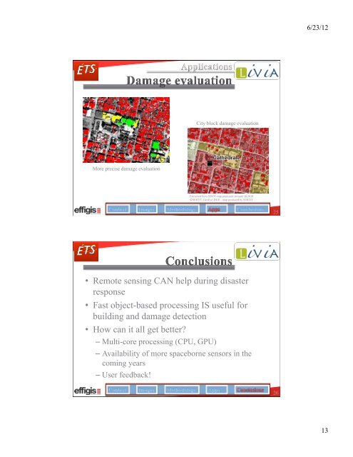
City block damage evaluation<br />
More precise damage evaluation<br />
Extracted from SERTIT map produced January 18 2010 <br />
©SERTIT, GeoEye, DLR – map produced by SERTIT<br />
25<br />
• Remote sensing CAN help during disaster<br />
response<br />
• Fast object-based processing IS useful for<br />
building and damage detection<br />
• How can it all get better?<br />
– Multi-core processing (CPU, GPU)<br />
– Availability of more spaceborne sensors in the<br />
coming years<br />
– User feedback!<br />
26<br />
13


