The Colonial Frontier of New York - H-Net
The Colonial Frontier of New York - H-Net
The Colonial Frontier of New York - H-Net

Create successful ePaper yourself
Turn your PDF publications into a flip-book with our unique Google optimized e-Paper software.
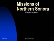
<strong>The</strong> <strong>Colonial</strong><br />
<strong>Frontier</strong> <strong>of</strong> <strong>New</strong><br />
<strong>York</strong><br />
Robert H. Jackson<br />
1
In the second decade <strong>of</strong> the<br />
seventeenth-century the<br />
Dutch settled Fort Orange<br />
(modern Albany). <strong>The</strong> Dutch<br />
established <strong>New</strong> Amsterdam<br />
(<strong>New</strong> <strong>York</strong> City) in the 1620s.<br />
In 1664, forces sent by the<br />
Duke <strong>of</strong> <strong>York</strong> (future King<br />
James ll) expelled the Dutch<br />
from their colony. By the mideighteenth<br />
century the<br />
English frontier in <strong>New</strong> <strong>York</strong><br />
had begun to expand<br />
northward and westward<br />
from Albany.<br />
2
<strong>The</strong> two centers <strong>of</strong><br />
colonial <strong>New</strong> <strong>York</strong><br />
were Albany and<br />
Manhattan-<strong>New</strong> <strong>York</strong><br />
City. <strong>The</strong> Hudson<br />
River, the Mohawk<br />
Valley, and the Lake<br />
George-Lake<br />
Champlain corridor<br />
were the natural<br />
highways through the<br />
colony.<br />
3
Dutch Manhattan.<br />
4
Albany in the late 1750s.<br />
5
Lake Champlain Region.<br />
6
Lake George-Lake<br />
Champlain Region.<br />
7
<strong>The</strong> Lake Champlain-Lake George<br />
Corridor was a contested borderland<br />
between Albany and the French<br />
settlements in Canada, shown in this<br />
map.<br />
8
In 1739, the French built Fort St. Frederick<br />
at a strategic point on Lake Champlain, at<br />
a site where the lake is only ¼ mile wide.<br />
<strong>The</strong> new fort controlled all lake traffic<br />
south or north. In 1759, the British<br />
occupied the fort, and replaced it with a<br />
larger fortification.<br />
9
Fort St. Frederick in a<br />
1740 Drawing<br />
10
<strong>The</strong> dominant feature <strong>of</strong> Fort St.<br />
Frederick was the bastion, built<br />
alongside the lake. Shown here in an<br />
18 th century illustration.<br />
11
Architectural Reconstruction <strong>of</strong> the<br />
bastion<br />
12
Diagram <strong>of</strong> Fort St. Frederick<br />
13
Ruins today <strong>of</strong> Fort St. Frederick<br />
14
Ruins <strong>of</strong> the Bastion today<br />
15
In the mid-1750s, the French<br />
occupied the southern part <strong>of</strong> Lake<br />
Champlain, and began the<br />
construction <strong>of</strong> Fort Carrilon, shown<br />
in an 18 th century map.<br />
16
Ticonderoga/Carrilon in a 1759 map.<br />
17
Fort Ticonderoga.<br />
18
Fort Ticonderoga during<br />
the American Revolution.<br />
19
Following the American Revolution, the<br />
army abandoned Fort Ticonderoga. <strong>The</strong><br />
buildings <strong>of</strong> the old fort gradually fell into<br />
ruin, as shown in this c. 1900 photograph.<br />
20
Ruins <strong>of</strong> Fort Ticonderoga c. 1900<br />
21
Ruins <strong>of</strong> Fort Ticonderoga c. 1900<br />
22
Ruins <strong>of</strong> Fort Ticonderoga c. 1900<br />
23
Ruins <strong>of</strong> Fort Ticonderoga c. 1900<br />
24
In the early part <strong>of</strong> the twentiethcentury<br />
a member <strong>of</strong> the Pell family<br />
that owned the site <strong>of</strong> the old fort<br />
began reconstruction. <strong>The</strong> process<br />
continues today.<br />
25
Restored Structure at Fort<br />
Carrilon/Ticonderoga<br />
26
In 1755, at the beginning <strong>of</strong> the Seven<br />
Years War (1755-1763), Sir William<br />
Johnson defeated a French force at the<br />
Battle <strong>of</strong> Lake George, fought at the<br />
southern end <strong>of</strong> the lake. Johnson then<br />
began construction <strong>of</strong> a fort he named<br />
William Henry. Two years later, in 1757, a<br />
French army under Montcalm attacked<br />
Fort William Henry, and forced the British<br />
garrison commanded by Col. Munro to<br />
surrender. Despite the granting <strong>of</strong> terms<br />
to the British force, Montcalm’s Indian<br />
allies killed many <strong>of</strong> the British, including<br />
the wounded in the hospital. <strong>The</strong> French<br />
attack on Fort William Henry and the<br />
massacre are depicted in the film “<strong>The</strong><br />
Last <strong>of</strong> the Mohicans.”<br />
27
A Contemporary Map <strong>of</strong> Fort<br />
William Henry.<br />
28
Contemporary map <strong>of</strong> the French<br />
campaign against Fort William<br />
Henry.<br />
29
Battle <strong>of</strong> Fort William<br />
Henry-1757<br />
30
Restored Structure at<br />
Fort William Henry<br />
31
In 1759, British forces occupied Fort<br />
Carrilon and Fort St. Frederick. <strong>The</strong><br />
British renamed Carrilon Fort<br />
Ticonderoga. Fort St. Frederick, left<br />
in a damaged state by the retreating<br />
French, did not suit the military<br />
needs <strong>of</strong> the British. In the early<br />
1760s, the British began<br />
construction <strong>of</strong> His Majesty’s Fort at<br />
Crown Point. <strong>The</strong> new fort was the<br />
largest British military installation in<br />
North America.<br />
32
A Contemporary Map <strong>of</strong> Crown<br />
Point.<br />
33
Another contemporary map <strong>of</strong><br />
Crown Point.<br />
34
A model showing Crown Point<br />
35
<strong>The</strong> plan <strong>of</strong> Crown Point<br />
36
c. 1900 Photograph <strong>of</strong> Crown Point<br />
37
c. 1900 Photo <strong>of</strong> Crown Point<br />
38
c. 1900 photo <strong>of</strong> Crown Point<br />
39
c. 1900 photo <strong>of</strong> Crown Point<br />
40
Moat and Defensive Walls at Crown<br />
Point<br />
41
Defensive walls at Crown Point<br />
42
Soldiers Barracks<br />
43
Officers Quarters<br />
44
Ruins <strong>of</strong> building inside fort that<br />
was never completed.<br />
45
Crown Point was the largest British<br />
fortification in North America, but<br />
was only one among a number <strong>of</strong><br />
garrisons, shown in a 1765 map.<br />
46
A 1766 map <strong>of</strong> British forces in<br />
North America.<br />
47
<strong>The</strong> Mohawk Valley was the natural<br />
route to the western frontier <strong>of</strong> <strong>New</strong><br />
<strong>York</strong>.<br />
48
Map <strong>of</strong> the Mohawk Valley.<br />
49
At the western end <strong>of</strong> <strong>of</strong> English settlement in the Mohawk<br />
Valley was Fort Stanwix, built in 1758. General Stanwix,<br />
who directed the construction <strong>of</strong> the fort, wrote this<br />
description to his superiors.<br />
“…we have finished the foundation <strong>of</strong> the fort inside &<br />
outside & tyed the work with retaining Logs & half way<br />
round the second tier <strong>of</strong> logs, are pretty forward with a<br />
Magazine in one <strong>of</strong> the Bastions & laid the foundations <strong>of</strong><br />
two <strong>of</strong> the Curtains for Casements for the Barracks, have<br />
got 40000 Bricks ready to Burn for the Chimneys & propose<br />
another Kiln <strong>of</strong> 100000, if the Weather will allow, in a weeks<br />
time shall have a Saw Mill Completed which. will furnish us<br />
plentiful with Boards & plank, and have got ready a great<br />
quantity <strong>of</strong> shingles for Covering such huts & other<br />
Buildings as we get back our men from Col. Bradstreet's<br />
Enterprise in any time to make tolerable Cover for 400 men<br />
for the winter & this Fort will take I view that number at<br />
least to defend it as our Bastions are very large & when a<br />
Ditch & Glacis is Completed will take up all the height <strong>of</strong><br />
this fine spot & as Oswego is by you in one <strong>of</strong> Your letters<br />
proposed to be the principle Fortification this will I think<br />
answer every purpose if we can in time make it Tenable, in<br />
which all pains & industry shall be made upon it".<br />
50
Plan <strong>of</strong> Fort Stanwix<br />
51
Rebuilt Fort Stanwix<br />
52
<strong>The</strong> Mable House in Rotterdam built<br />
in 1670, the oldest European-style<br />
structure in the Mohawk Valley .<br />
53
Glen-Sanders House built in 1713 in<br />
Scotia<br />
54
<strong>The</strong> English established<br />
Fort Hunter around 1710<br />
for the Mohawk, and<br />
within the fort built<br />
Queen Anne’s church.<br />
<strong>The</strong> church was<br />
demolished to make way<br />
for the Erie Canal in the<br />
1820s, but the<br />
parsonage built in 1712<br />
still exists.<br />
55
Queen Anne’s<br />
Parsonage, now a<br />
private home.<br />
56
Fort Ehle was built in 1727 by<br />
the Rev. Johannes Jacobus as a<br />
mission station for the Mohawk<br />
village Tarajorees. Being built <strong>of</strong><br />
stone, it was used as a place <strong>of</strong><br />
refuge from attack by hostile<br />
Indians, and during the<br />
American Revolution from<br />
Tories and their Indian allies.<br />
Fort Ehle no longer exists,<br />
having been torn down.<br />
57
A c. 1935 photograph <strong>of</strong> Fort<br />
Ehle<br />
58
English settlers <strong>of</strong>ten<br />
built stone houses that<br />
could be used for<br />
defense in case <strong>of</strong><br />
attack. <strong>The</strong>se houses<br />
became known as<br />
“Forts,” and might also<br />
include a stockade<br />
around the house.<br />
59
Fort Johnson, built in 1749 by Sir William<br />
Johnson, Indian Agent, Soldier, and important<br />
Mohawk Valley Settler.<br />
60
Fort Klock built in 1750<br />
61
Johnson Hall built for Sir William Johnson in the<br />
1760s<br />
62
In the 1760s, Sir William Johnson had a<br />
house built for his son-in-law Guy<br />
Johnson, now called “Guy Park”.<br />
63
English settlers brought their religion with them, and a<br />
handful <strong>of</strong> colonial-era churches still exist in the Mohawk<br />
Valley. This photograph shows the Fort Plain church.<br />
64
Palatine church built in 1770<br />
65
English settlers established several towns in and on the margins<br />
<strong>of</strong> the Mohawk Valley. One such community was Cherry Valley,<br />
established in 1740. During the American Revolution Mohawk<br />
under Joseph Brandt and Butler’s Tory Rangers raided Cherry<br />
Valley in November 1778, and a second time in 1779. This photo<br />
shows Cherry Valley today, with houses dating from the early<br />
republic.<br />
66
<strong>The</strong> attack left 32 dead.<br />
Cherry Valley lost 40<br />
prisoners never<br />
returned, but 30 were<br />
returned. In the<br />
aftermath <strong>of</strong> the attack,<br />
182 settlers were left<br />
homeless.<br />
67
In the year following the<br />
Cherry Valley attack, in<br />
1779, George Washington<br />
sent an expedition against<br />
the Iroquois led by General<br />
Sullivan. Sullivan’s army<br />
destroyed many towns,<br />
crops, and livestock, and<br />
created considerable<br />
hardship for the Iroquois.<br />
68
Contemporary map <strong>of</strong> the<br />
1779 Sullivan campaign.<br />
69
In the early years <strong>of</strong> the<br />
republic settlement<br />
spread out from the<br />
Mohawk Valley. One <strong>of</strong><br />
the new communities<br />
was Milford, settled<br />
around 1810.<br />
70
Sayre House built in<br />
1810<br />
71
Early church built in<br />
Milford around 1812<br />
72
To the west, in the Niagara Falls<br />
region, the French built a fort in<br />
the 1720s at the point where the<br />
Niagara River enters Lake<br />
Ontario. Fort Niagara served<br />
during three major wars, and was<br />
an active military outpost into the<br />
20 th century.<br />
73
Overhead photograph <strong>of</strong> Fort<br />
Niagara<br />
74
French structure built <strong>of</strong> Stone at<br />
Fort Niagara in the mid-1720s<br />
75