Pollution and Coastal Zone Management: A Case Study - Halifax ...
Pollution and Coastal Zone Management: A Case Study - Halifax ...
Pollution and Coastal Zone Management: A Case Study - Halifax ...

Create successful ePaper yourself
Turn your PDF publications into a flip-book with our unique Google optimized e-Paper software.
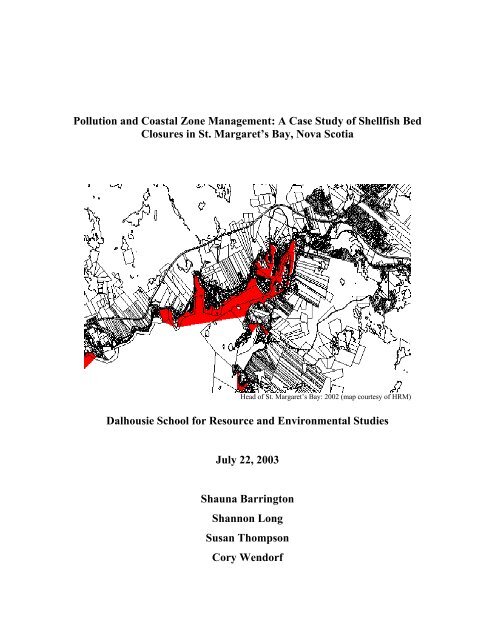
<strong>Pollution</strong> <strong>and</strong> <strong>Coastal</strong> <strong>Zone</strong> <strong>Management</strong>: A <strong>Case</strong> <strong>Study</strong> of Shellfish Bed<br />
Closures in St. Margaret’s Bay, Nova Scotia<br />
Head of St. Margaret’s Bay: 2002 (map courtesy of HRM)<br />
Dalhousie School for Resource <strong>and</strong> Environmental Studies<br />
July 22, 2003<br />
Shauna Barrington<br />
Shannon Long<br />
Susan Thompson<br />
Cory Wendorf
1<br />
Abstract<br />
Current research attributes l<strong>and</strong>-based development as the major cause of marine<br />
pollution. Shellfish, with their ability to filter large amounts of water, are considered an<br />
indicator species for declining water quality due to chemical <strong>and</strong> bacterial contamination<br />
from point <strong>and</strong> non-point source pollution.<br />
The Head of St. Margaret’s Bay has experienced an overwhelming increase in the size of<br />
its shellfish closure area in the past two years. Yet between 1995 <strong>and</strong> 2001, the closure<br />
area essentially remained unchanged. It is unknown whether this dramatic increase is the<br />
result of cumulative environmental impact <strong>and</strong> / or a significant pollution event occurring<br />
sometime in 2002.<br />
The following report is presented as requested to the <strong>Halifax</strong> Regional Municipality<br />
(HRM) Planning Committee by students in the School for Resource <strong>and</strong> Environmental<br />
Studies, Dalhousie University as part of a joint project in collaboration with HRM,<br />
Environment Canada (EC), <strong>and</strong> the Department of Fisheries <strong>and</strong> Oceans (DFO). The<br />
report concerns the recent exponential increase in shellfish closures in the St. Margaret’s<br />
Bay area. Although there is reason to believe that leaking septic tank systems in older<br />
residential developments are the likely source of increased levels of fecal coliform, there<br />
is an interest in exp<strong>and</strong>ing the scope of probable causes by investigating other<br />
contributing factors from both l<strong>and</strong> <strong>and</strong> water use practices. Accordingly, this report will<br />
examine a variety of l<strong>and</strong> <strong>and</strong> water use activities that may be linked to fecal coliformrelated<br />
shellfish closures in the St. Margaret’s Bay area. It will also explore a broad<br />
range of issues pertaining to coastal zones that are applicable to St. Margaret’s Bay,<br />
including legislation, marine environmental quality indicators, community involvement<br />
<strong>and</strong> education, <strong>and</strong> integrated coastal zone management.
2<br />
Table of Contents<br />
Abstract 1<br />
Introduction 4<br />
Shellfish, Fecal Coliform <strong>and</strong> Sewage 4<br />
Sources of <strong>Pollution</strong> 5<br />
Background on St. Margaret’s Bay 7<br />
L<strong>and</strong> <strong>and</strong> Water Uses 7<br />
Geomorphology of St. Margaret’s Bay 7<br />
Circulation 8<br />
Canadian Shellfish Sanitation Program 9<br />
Criteria for Determining Shellfish Closures 9<br />
Municipal Legislation 10<br />
Dogs 10<br />
Minimum St<strong>and</strong>ards 10<br />
Municipal Planning Strategy 10<br />
Community Council 11<br />
L<strong>and</strong> Use Bylaws 12<br />
Subdivisions 13<br />
Septic Systems 13<br />
Recommendations to HRM 14<br />
Applied L<strong>and</strong> Use Practices in St. Margaret’s Bay 14<br />
Zoning Regulations <strong>and</strong> Watercourses 18<br />
Sampling Stations in St. Margaret’s Bay 20<br />
Setbacks from Watercourses 22<br />
New Brunswick 22<br />
Prince Edward Isl<strong>and</strong> 23<br />
Recommendations to HRM 23<br />
Marine Environmental Quality Indicators 23<br />
Eutrophication 24<br />
Ecological Indicators 24<br />
Other Possible Indicators 25<br />
Recommendations to HRM 25
3<br />
Community Involvement <strong>and</strong> Education 26<br />
Rationale 26<br />
Benefits <strong>and</strong> Drawbacks 27<br />
<strong>Case</strong> Studies 28<br />
Baynes Sound, Vancouver Isl<strong>and</strong>, BC 28<br />
Sequim Bay, Washington, DC 29<br />
Recommendations to HRM 30<br />
Integrated <strong>Coastal</strong> <strong>Zone</strong> <strong>Management</strong> 30<br />
Integration 30<br />
Capacity 31<br />
Recommendations to HRM 32<br />
Conclusion 32<br />
Summary of Recommendations to HRM 33<br />
References 34<br />
About the Authors 40<br />
Figures <strong>and</strong> Tables<br />
Figure 1: Trends in Shellfish Closures in the Atlantic Provinces 5<br />
Figure 2: Planning Districts 1 & 3 15<br />
Figure 3: Sanitary Observation Stations around Mason’s Point 19<br />
Figure 4: Location of Sampling Stations St. Margaret’s Bay 20<br />
Figure 5: New Brunswick Proposed <strong>Coastal</strong> <strong>Zone</strong>s Policy 22<br />
Table 1: Freshwater Discharge in St. Margaret’s Bay 9<br />
Table 2: Zoning Designations in the St. Margaret’s Bay Area 15<br />
Table 3: Shoreline Sanitary Survey around Mason’s Point 19<br />
Table 4: <strong>Zone</strong> Classifications <strong>and</strong> <strong>Coastal</strong> Activities for Select<br />
Sampling Stations in St. Margaret’s Bay 21
4<br />
Introduction<br />
Most of the pollution entering the world’s coastal waters originates from human activities<br />
on l<strong>and</strong> (GESAMP, 2001a). The l<strong>and</strong> <strong>and</strong> sea are closely linked through physical,<br />
geological, biological <strong>and</strong> atmospheric processes. As such, the effects of harmful<br />
activities on l<strong>and</strong> will be felt in coastal waters. For example, sewage <strong>and</strong> chemicals are<br />
washed off the l<strong>and</strong> into streams <strong>and</strong> rivers during wet weather, which in turn flow into<br />
the sea. The pollution of coastal waters around the world is largely attributed to<br />
commercial <strong>and</strong> residential development. A lack of public awareness is often a key<br />
factor at the root of this problem. For some, the direct connection between l<strong>and</strong> activities<br />
<strong>and</strong> marine pollution is not readily apparent. As well, proper disposal of pollutants can<br />
be expensive <strong>and</strong> existing legislation for protecting coastal zones may not be adequate or<br />
enforced.<br />
Shellfish, Fecal Coliform <strong>and</strong> Sewage<br />
Good water quality is vital to the shellfish harvesting industry (Lorio <strong>and</strong> Malone, 1994;<br />
GESAMP, 2001a). Shellfish feed by straining large amounts of water through their gills.<br />
Particulate food caught on the surface of the gills is transported to the digestive tract<br />
(Massachusetts Office of <strong>Coastal</strong> <strong>Zone</strong> <strong>Management</strong> [MOCZM], 1995). Bacteria <strong>and</strong><br />
viruses may also be ingested during the filter-feeding process, along with toxic pollutants<br />
<strong>and</strong> heavy metals. For this reason, shellfish are commonly used as an indicator organism<br />
for evaluating marine water quality, <strong>and</strong> detecting changes in aquatic ecosystem health.<br />
The accumulation of pathogens in shellfish tissues often has little effect on the animal<br />
itself. When consumed by humans, however, the consequences can be serious.<br />
“Of all the pollutants introduced by humans, sewage has the longest history, <strong>and</strong> efforts<br />
to control it date back more than a century” (Topping, 1976, p. 304). The human<br />
population explosion has resulted in a desperate need for an acceptable way of dealing<br />
with sewage created by people <strong>and</strong> animals. It has long been recognized that feces is a<br />
major source of waterborne disease transmitted by the fecal-oral route (Kator <strong>and</strong><br />
Rhodes, 1994). Feces contain dangerous pathogens (i.e., organisms capable of causing<br />
diseases) like Salmonella <strong>and</strong> Escherichia coli bacteria, known to cause typhoid fever,<br />
food poisoning, <strong>and</strong> cholera, <strong>and</strong> viruses linked to hepatitis-A, gastro-enteritis, <strong>and</strong> polio.<br />
Feces also contain fecal coliform bacteria, which live in the intestines of humans <strong>and</strong><br />
other warm-blooded animals. While not a pathogen itself, fecal coliform in water<br />
indicates the potential presence of pathogens since both are commonly found in raw<br />
sewage. In addition, both fecal coliform <strong>and</strong> the pathogens mentioned above tend to<br />
accumulate in shellfish tissues. For these reasons, fecal coliform has traditionally been<br />
used as an indicator of sewage pollution in water <strong>and</strong> shellfish (MOCZM, 1995).<br />
Health authorities have established st<strong>and</strong>ards <strong>and</strong> protocols to manage the public safety<br />
hazard posed by the consumption of shellfish contaminated by pathogens. Shellfish<br />
waters are tested for fecal coliform levels, <strong>and</strong> subsequently classified on this basis<br />
(MOCZM, 1995). Harvesting is forbidden in areas contaminated with unacceptably high
5<br />
levels of fecal coliform, <strong>and</strong> shellfish from areas with borderline levels of fecal coliform<br />
must be cleansed or sterilized before sale (Topping, 1976).<br />
The number of areas being closed to shellfish harvesting, due to elevated levels of fecal<br />
coliform in the water, poses a serious problem for the shellfish industry. Closures in the<br />
Atlantic Provinces have been increasing on the whole, with Nova Scotia experiencing the<br />
largest rise (Figure 1). Currently, 35% of Nova Scotia’s shellfish growing areas are<br />
closed to harvesting (Canada’s National Program of Action for the Protection of the<br />
Marine Environment from L<strong>and</strong>-based Activities [CNPA], 2000).<br />
Figure 1: Trends in Shellfish Closures in the Atlantic Provinces (source: EC, 2003).<br />
Sources of <strong>Pollution</strong><br />
In many parts of the world, treatment processes have been implemented to help reduce<br />
the harmful environmental effects of sewage before it enters the sea. However, sewage<br />
still reaches the sea from a number of direct (point) sources such as municipal piped<br />
outfalls, <strong>and</strong> indirect (non-point) sources such as leaky septic tanks <strong>and</strong> farm animal<br />
waste (CNPA, 2000). In Nova Scotia, “sewage treatment facilities serve approximately<br />
24% of the population, while an additional 45% of the population is served by on-site<br />
disposal systems. As a result, some 31% of the population (almost 300,000 people) still<br />
has sewage collection systems without treatment” (CNPA, 2000, p. 87).<br />
Recreational boaters contribute to point-source pollution by discharging raw or poorly<br />
treated sewage from their holding tanks into the water. The San Francisco Estuary<br />
Project (1995) website states, “studies have found high levels of coliform bacteria in<br />
areas with heavy concentrations of recreational boats. Studies have also shown a direct<br />
relationship between the number of boats in a sampled area <strong>and</strong> increased coliform levels<br />
in both the water column <strong>and</strong> shellfish”. Amazingly, “the untreated discharge from one<br />
weekend boater puts the same amount of bacterial pollution into the water as does the<br />
treated sewage of 10,000 people” (San Francisco Estuary Project, 1995). Compared to<br />
the open ocean, the problem is more serious when dumping occurs in confined spaces
6<br />
such as harbours, coves, <strong>and</strong> inlets where flushing rates may not be as fast (San Francisco<br />
Estuary Project, 1995; EC, 2001). Marinas <strong>and</strong> yacht clubs are often situated in these<br />
areas, so boaters tend to congregate there to anchor, swim, <strong>and</strong> fish.<br />
In Canada, it is illegal for vessels to discharge raw sewage into the water (EC, 2001).<br />
Along with the human health risk posed by the consumption of contaminated shellfish,<br />
swimmers, water-skiers, surfers, <strong>and</strong> others can get sick when they come into contact<br />
with water containing fecal pollution. Common symptoms include nausea, stomachache,<br />
vomiting, diarrhea, sore throat, cough, runny nose, earache, respiratory problems, skin<br />
infections, <strong>and</strong> rashes (San Francisco Estuary Project, 1995).<br />
Sewage from non-point sources usually reaches the sea by being washed off into rivers<br />
<strong>and</strong> estuaries during wet weather. This runoff is exacerbated by coastal zone<br />
development <strong>and</strong> urbanization. When terrestrial vegetation is removed <strong>and</strong> replaced by<br />
soil-sealing infrastructure such as houses, parking lots, <strong>and</strong> roads, the soil loses its ability<br />
to absorb water (Percy, 1997; Puget Sound Shoreline Stewardship Guidebook, 2002).<br />
The threat of l<strong>and</strong> runoff is heightened when steep slopes border watercourses <strong>and</strong> seas.<br />
Non-point source pollution is a major problem because it often goes undetected while<br />
causing significant damage to the marine environment. Once detected, the origin of the<br />
pollution may be difficult to trace.<br />
Leaky septic tanks are one of the main causative agents of non-point source pollution<br />
(Hodges, 1977). Septic tanks are commonly used for disposal of wastewater in rural<br />
areas. During the cleansing process, solid materials are removed from wastewater in the<br />
septic tank. The wastewater then flows into a drain field, where it is slowly absorbed <strong>and</strong><br />
filtered by the ground. Polluted wastewater can enter watercourses when the absorptive<br />
capacity of the soil is inadequate for proper disposal (Hodges, 1977). Yet by far the most<br />
common reason for septic tank failure is improper maintenance by homeowners. “When<br />
a system is poorly maintained <strong>and</strong> not pumped out on a regular basis, sludge (solid<br />
material) builds up inside the septic tank, then flows into the absorption field, clogging it<br />
beyond repair” (Vogel, 2002). The lifespan of a septic tank system is between 20 <strong>and</strong> 25<br />
years, after which it needs to be replaced to prevent leaks <strong>and</strong> malfunctions (Correa,<br />
1999).<br />
Farm animal wastes are another key contributor to non-point source pollution. These<br />
pollutants can enter watercourses as runoff from agricultural l<strong>and</strong>s (Hodges, 1977).<br />
Agricultural runoff has been positively linked to shellfish closures (EC, 2002b). This<br />
problem is particularly severe near large, overcrowded feedlots. It may come as a<br />
surprise that feces from domestic animals, dogs in particular, also play a major role in<br />
contributing to water pollution. According to Hodges (1977, p. 231), “domestic animals<br />
produce about 1 billion metric tons of fecal wastes each year”. Remarkably, “a single<br />
gram of dog feces contains an average of 23 million fecal coliform bacteria” (Slagle <strong>and</strong><br />
Meiburg, 2001). As with farm animals, domestic animal waste poses a serious<br />
problem when it is washed into streams <strong>and</strong> rivers during storms. The United States<br />
Environmental Protection Agency reports that “for watersheds of up to twenty-square<br />
miles draining to small coastal bays, two to three days of droppings from a population of
7<br />
about 100 dogs would contribute enough bacteria <strong>and</strong> nutrients to temporarily close a bay<br />
to swimming <strong>and</strong> shellfishing” (The Stormwater Manager’s Resource Center, 2003).<br />
There are several issues that make l<strong>and</strong>-based sources of fecal contamination difficult to<br />
manage. First, it may be hard to pinpoint exactly where the sewage is coming from<br />
because there may be several sources (GESAMP, 2001a). Second, there is often a lack of<br />
awareness concerning the connection between l<strong>and</strong> activities <strong>and</strong> marine sewage<br />
pollution. People may not realize that their septic tank is old or has not been maintained<br />
properly. They may not underst<strong>and</strong> the extent to which dog waste contributes to water<br />
quality problems, or they may not want to deal with their dog’s feces (Slagle <strong>and</strong><br />
Meiburg, 2001). Third, septic system upgrades are expensive, so those who cannot<br />
afford it may not want to admit that their system requires maintenance. Similarly,<br />
municipalities may be unable to finance a sewage treatment plant upgrade, or the<br />
construction of one in the first place. Fourth, agriculture is a major industry upon which<br />
the livelihood of many people depends. As such, environmental matters must be dealt<br />
with in a careful, sensitive manner against potentially serious social <strong>and</strong> economic<br />
ramifications. Finally, the economic benefits derived from developing subdivisions often<br />
outweigh environmental concerns <strong>and</strong>, as such, are accompanied by a lack of foresight.<br />
Property lots may be located on soil with limited absorption capacity, or placed so close<br />
together that the carrying capacity of the l<strong>and</strong> <strong>and</strong> waterways is exceeded (Hodges,<br />
1977).<br />
Background on St. Margaret’s Bay<br />
St. Margaret's Bay is characterized by its natural beauty. Its rugged coastline is typical of<br />
the south shore of Nova Scotia, <strong>and</strong> the forested hinterl<strong>and</strong> is interrupted only as it<br />
reaches the shoreline homes (Taylor <strong>and</strong> Frobel, 1996). Despite the boulder-lined shore,<br />
there are several s<strong>and</strong>y beaches in the area, along with some saltwater marshes <strong>and</strong><br />
intertidal mud flats (<strong>Halifax</strong> County Regional Development Agency [HCRDA], 1995-<br />
96). There is a significant amount of residential development around the Head of the<br />
Bay.<br />
The biological resources of the area include the typical Atlantic Coast fish, such as cod,<br />
herring, <strong>and</strong> flounder (HCRDA, 1995-96). There are also bluefin tuna, porpoises, <strong>and</strong><br />
whales in the outer reaches of the Bay. Atlantic salmon <strong>and</strong> trout can be found in the<br />
streams <strong>and</strong> brooks in the watershed. Animals in the area include beaver, moose, black<br />
bears, <strong>and</strong> deer. There are wild berries, such as cranberries <strong>and</strong> bake apples. Bird life is<br />
abundant; cormorants, great blue herons, eagles, <strong>and</strong> terns can be seen. Seaweeds in the<br />
Bay include kelp <strong>and</strong> rockweed (HCRDA, 1995-96). The ocean floor supports clams,<br />
worms, crabs, <strong>and</strong> scallops.<br />
L<strong>and</strong> <strong>and</strong> Water Uses<br />
Human activities in St. Margaret's Bay are largely based on the natural resources in the<br />
area. There have been various recreational <strong>and</strong> commercial fishing activities over the<br />
years, including a lobster <strong>and</strong> mackerel fishery, shellfish harvesting, <strong>and</strong> eel spearing
8<br />
(HCRDA, 1995-96). The area is popular for tourism <strong>and</strong> recreational activities. The St.<br />
Margaret’s Bay Yacht Club is a key attraction. Camping, windsurfing, diving, kayaking,<br />
boating, swimming, hiking <strong>and</strong> biking are just a sample of the many activities people<br />
enjoy.<br />
A considerable amount of infrastructure exists in the area, mainly for residential <strong>and</strong><br />
recreational purposes. The main road in the area winds along the coast, in some cases<br />
within meters of the shoreline (Taylor <strong>and</strong> Frobel, 1996). Wharves, piers, docks <strong>and</strong><br />
slipways line the shore, built for private, government <strong>and</strong> commercial watercraft<br />
(HCRDA, 1995-96). Major infrastructure includes a fish plant, a municipal sewage<br />
treatment plant, <strong>and</strong> an ice plant. There are also a few aquaculture leases for oysters <strong>and</strong><br />
mussels on the eastern side of the Bay (Nova Scotia Department of Agriculture <strong>and</strong><br />
Fisheries, 2001).<br />
Geomorphology of St. Margaret's Bay<br />
St. Margaret's Bay is a large coastal inlet, 16 km long <strong>and</strong> 10 km wide (Piper <strong>and</strong> Keen,<br />
1976). The middle of the Bay is a large flat-bottomed basin, with depths up to 90m.<br />
There is a bedrock sill at the southern mouth of the Bay at a depth of 55m (although a<br />
substantial portion of it lies at less than 20m). This sill plays a major role in the<br />
movement of ocean water into the Bay. The Bay is generally deeper on the western side,<br />
with steep cliffs being mirrored by steep underwater slopes. Its eastern <strong>and</strong> northeastern<br />
portions are generally more shallow <strong>and</strong> gradual, with underwater shoals of sediment.<br />
The floor of the Bay is underlain with bedrock, which was scoured by the glaciers as they<br />
retreated (Piper <strong>and</strong> Keen, 1976). A thick layer of glacial sediments, including gravelly<br />
s<strong>and</strong>s <strong>and</strong> mud in the northeastern sections, overlies the bedrock. These glacial deposits<br />
along the coast were the main source of new sedimentation on the floor of the Bay at the<br />
time of the Piper <strong>and</strong> Keen study (1976). This is likely still the case, as wave action<br />
continuously moves the cobble, gravel <strong>and</strong> s<strong>and</strong> around. The coastline of St. Margaret's<br />
Bay is largely made up of granite, with some limestone on the eastern side.<br />
Circulation<br />
The ocean water in St. Margaret’s Bay circulates in a counter-clockwise direction (Heath,<br />
1973; Piper <strong>and</strong> Keen, 1976). Ocean water generally enters the Bay on the eastern side,<br />
<strong>and</strong> leaves it on the western side (Heath, 1973). This horizontal movement dominates<br />
over any vertical movement of water, <strong>and</strong> results in a well-mixed bay. Underst<strong>and</strong>ing<br />
this pattern of circulation is important, since it is how pollutants, debris, silt <strong>and</strong> juvenile<br />
organisms from coastal habitats are carried out to sea <strong>and</strong> cooler, nutrient rich waters<br />
enter the Bay (Duxbury <strong>and</strong> Duxbury, 1994). The tidal currents in the Bay are strong, but<br />
decrease in velocity as they reach the Head of the Bay (Piper <strong>and</strong> Keen, 1976).<br />
A strong thermocline does occur in summer, however, with a layer of warm, relatively<br />
fresh water above <strong>and</strong> a layer of cool, highly saline water on the bottom (Heath, 1973).<br />
Both of these layers continue to move in a counter-clockwise direction. This<br />
stratification is more pronounced after heavy rainfalls when rivers discharge more
9<br />
freshwater (<strong>and</strong> potential pollutants) into the system. Most of the freshwater entering the<br />
Bay enters in the north <strong>and</strong> northeast portions of the Bay (Piper <strong>and</strong> Keen, 1976).<br />
The dominant counter-clockwise movement of ocean water is the principle mechanism<br />
through which flushing of the Bay occurs (Heath, 1973). The flushing time is the amount<br />
of time it takes for water in the Bay to be completely exchanged with water from the<br />
open ocean (Duxbury <strong>and</strong> Duxbury, 1994). The overall flushing time of St. Margaret's<br />
Bay is approximately 12 days (Gregory et al., 1993). The flushing times for smaller<br />
sections of the Bay are difficult to estimate, however, because of the complexity of the<br />
coastline <strong>and</strong> micro-circulation cells this may generate (Kennish, 1998). This should be<br />
an area for further investigation. The flushing rates for individual coves, if substantially<br />
higher than for the Bay as a whole, may contribute to the local retainment of sewage<br />
pollution <strong>and</strong> therefore shellfish closures.<br />
Table 1: Freshwater Discharge in St. Margaret’s Bay (source: Gregory et al., 1993).<br />
Month Discharge Rate (m 3/ s) Month Discharge Rate (m 3 /s)<br />
January 29.0 July 10.1<br />
February 22.4 August 8.6<br />
March 30.5 September 10.7<br />
April 50.7 October 17.2<br />
May 29.4 November 30.3<br />
June 16.7 December 33.0<br />
Canadian Shellfish Sanitation Program<br />
The purpose of the CSSP is to ensure public health <strong>and</strong> safety by assessing shellfish<br />
harvesting areas for contamination (EC, 2003). This program is administered by three<br />
federal government agencies, each of which plays a different role. EC collects <strong>and</strong><br />
analyses water samples, <strong>and</strong> recommends closure areas to the Shellfish Growing Area<br />
<strong>and</strong> Survey Classification Committee. DFO is responsible for enforcing these closures,<br />
along with overseeing harvesting, relaying <strong>and</strong> depuration procedures. The Canadian<br />
Food Inspection Agency (CFIA) is responsible for “the h<strong>and</strong>ling, processing, marketing,<br />
import <strong>and</strong> export of shellfish <strong>and</strong> liaison with foreign governments. CFIA is also<br />
responsible for the management of the marine biotoxin monitoring program” (EC, 2003).<br />
Criteria for Determining Shellfish Closures<br />
The monitoring conducted by EC consists of two parts: a bacteriological survey <strong>and</strong> a<br />
shoreline survey (EC, 2003). The bacteriological survey involves collecting <strong>and</strong><br />
analysing water samples for the presence of fecal coliform. If water samples show a<br />
median fecal coliform higher than 14 MPN/100ml (where MPN is Most Probable<br />
Number), or more than 10% of the samples are above 43 MPN/100ml, the area will be<br />
closed to shellfish harvesting. The shoreline survey documents the type of l<strong>and</strong> use<br />
practices around the sites being tested <strong>and</strong> records observations of potential sources of
10<br />
sewage. The area will be closed if it is clear from the shoreline survey that there are<br />
direct sources of fecal coliform entering the water, even if bacteriological test results on<br />
samples from a particular site are within the acceptable fecal coliform range (Young et<br />
al., 2002).<br />
In the case of the shellfish closure in the Head of St. Margaret’s Bay in 2002, the decision<br />
was based on the large number of tested sites that failed to meet the above criteria<br />
(Young et al., 2002). The larger closed area incorporates seven previous closures, along<br />
with new areas that have deteriorated beyond acceptable levels. Although one sample<br />
within the closed area did meet the criteria, it would not be prudent to harvest shellfish at<br />
this site since it is surrounded by contaminated water. For this reason it was included in<br />
the shellfish closure area (J. Young, pers. comm., May 9, 2003).<br />
Municipal Legislation<br />
Significant legislation exists in Nova Scotia to give municipalities the power to regulate<br />
<strong>and</strong> control a variety of activities pertaining to the environment. HRM has the power to<br />
create <strong>and</strong> enforce by-laws that it deems necessary for maintaining a healthy environment<br />
in St. Margaret’s Bay <strong>and</strong> throughout the entire municipality. The following is a<br />
summary of relevant information involving l<strong>and</strong>, water, <strong>and</strong> environmental quality taken<br />
from the Municipal Government Act, 1998.<br />
Dogs<br />
Under section 175(1i) of the Act, a council may make by-laws “requiring the owner of a<br />
dog, other than a dog that is trained to assist <strong>and</strong> is assisting a person with a disability, to<br />
remove the dog's feces from public property <strong>and</strong> from private property other than the<br />
owner's”. Since it is likely that the pollution in St. Margaret’s Bay is caused in part by<br />
fecal runoff from domestic dog waste, HRM could enforce municipal bylaw D-100,<br />
Respecting the Registration <strong>and</strong> Regulation of Dogs, more strictly to help mitigate this<br />
source of pollution (HRM, 2001).<br />
Minimum St<strong>and</strong>ards<br />
Section 181(1a) of the Act states that “a council may make by-laws prescribing minimum<br />
st<strong>and</strong>ards of sanitation, plumbing, water supply, lighting, wiring, ventilation, heating,<br />
access, maintenance, appearance, construction <strong>and</strong> material for buildings, or parts<br />
thereof, occupied for residential or commercial purposes.” HRM could create/enforce the<br />
minimum st<strong>and</strong>ards by-law more strongly with respect to sanitation, plumbing, <strong>and</strong><br />
maintenance in areas of St. Margaret’s Bay where increased development has occurred.<br />
Municipal Planning Strategy<br />
Proper planning <strong>and</strong> development are essential for the positive growth of St. Margaret’s<br />
Bay <strong>and</strong> the entire HRM. Good planning can help to prevent environmental degradation<br />
in the future. Part VIII (ss. 190-267) of the Act addresses “Planning <strong>and</strong> Development”
11<br />
<strong>and</strong> is worthy of HRM’s consideration. It gives the municipality the authority to<br />
establish a municipal planning strategy. This planning strategy should “establish (a)<br />
policies which address problems <strong>and</strong> opportunities concerning the development of l<strong>and</strong><br />
<strong>and</strong> the effects of the development; (b) policies to provide a framework for the<br />
environmental, social <strong>and</strong> economic development within a municipality…” (s. 213).<br />
According to section 214(1), statements of policy may relate to matters including:<br />
(a) the goals <strong>and</strong> objectives of the municipality for its future;<br />
(b) the physical, economic <strong>and</strong> social environment of the municipality;<br />
(c) the protection, use <strong>and</strong> development of l<strong>and</strong>s within the municipality, including the<br />
identification, protection, use <strong>and</strong> development of l<strong>and</strong>s subject to flooding, steep<br />
slopes, l<strong>and</strong>s susceptible to subsidence, erosion or other geological hazards, swamps,<br />
marshes or other environmentally sensitive areas;<br />
(d) stormwater management <strong>and</strong> erosion control…<br />
(f) in connection with a development, retention of trees <strong>and</strong> vegetation for the purposes of<br />
l<strong>and</strong>scaping, buffering, sedimentation or erosion control;<br />
(g) studies to be carried out prior to undertaking specified developments or developments<br />
in specified areas…<br />
(i) the provision of municipal services <strong>and</strong> facilities…<br />
(l) the subdivision of l<strong>and</strong>…<br />
(m) the use <strong>and</strong> conservation of energy, including the height <strong>and</strong> siting of developments;<br />
(n) measures for informing, or securing, the views of the public regarding contemplated<br />
planning policies <strong>and</strong> actions or by-laws arising from such policies…<br />
The municipality may also establish planning <strong>and</strong> area advisory committees (ss. 200-<br />
201). Separate or joint advisory committees may be created for different parts of the<br />
municipality to deal with matters specific to the area.<br />
Community Council<br />
Under part XXII, section 521(1), HRM holds the power to establish a community council<br />
for an area. The powers <strong>and</strong> duties of a community council include making<br />
recommendations with respect to “…appropriate by-laws, regulations, controls <strong>and</strong><br />
development st<strong>and</strong>ards for the community…” (s. 521[1c]) <strong>and</strong> “ the adoption of policies<br />
that would allow the people of the community to participate more effectively in the<br />
governance of the community” (s. 521[1e(ii)]).<br />
A community council can be an extremely useful tool in municipal management. Public<br />
involvement is crucial to the success of any management plan geared toward improving<br />
environmental quality. A community council could assist HRM in better underst<strong>and</strong>ing
12<br />
the values <strong>and</strong> attitudes of the people of St. Margaret’s Bay, by putting forth important<br />
work <strong>and</strong> input.<br />
L<strong>and</strong> Use By-Laws<br />
HRM has the power to adopt <strong>and</strong> enforce l<strong>and</strong> use by-laws in St. Margaret’s Bay <strong>and</strong><br />
throughout the municipality to sustain <strong>and</strong> improve environmental quality. Under section<br />
220(4) of the Act, a l<strong>and</strong>-use by-law may regulate<br />
(a) the minimum dimensions for frontage <strong>and</strong> lot area for any class of use <strong>and</strong> size of<br />
structure;<br />
(b) the maximum floor area of each use to be placed upon a lot, where more than one use<br />
is permitted upon a lot;<br />
(c) the maximum area of the ground that a structure may cover;<br />
(ca) the location of a structure on a lot…<br />
(e) the percentage of l<strong>and</strong> that may be built upon…<br />
(g) the maximum density of dwelling units…<br />
Moreover, where a municipal planning strategy allows, section 220(5) states that a<br />
l<strong>and</strong>-use by-law may<br />
(d) in connection with a development, regulate, or require the planting or retention of,<br />
trees <strong>and</strong> vegetation for the purposes of l<strong>and</strong>scaping, buffering, sedimentation or<br />
erosion control…<br />
(f) regulate the location of disposal sites for any waste material;<br />
(g) in relation to a development, regulate or prohibit the altering of l<strong>and</strong> levels, the excavation<br />
or filling in of l<strong>and</strong>, the placement of fill or the removal of soil unless these matters are<br />
regulated by another enactment of the Province;<br />
(h) regulate or prohibit the removal of topsoil…<br />
(l) prescribe methods for controlling erosion <strong>and</strong> sedimentation during the construction of a<br />
development;<br />
(m) regulate or prohibit excavation, filling in, placement of fill or reclamation of l<strong>and</strong> on<br />
floodplains identified in the l<strong>and</strong>-use by-law;<br />
(n) prohibit development or certain classes of development where, in the opinion of council,<br />
the<br />
(i) cost of providing municipal wastewater facilities, stormwater systems or water<br />
systems would be prohibitive,
13<br />
(ii) provision of municipal wastewater facilities, stormwater systems or water systems<br />
would be premature…<br />
(o) prohibit development within a specified distance of a watercourse;<br />
(p) prohibit development on l<strong>and</strong> that<br />
Subdivisions<br />
(i) is subject to flooding or subsidence,<br />
(ii) has steep slopes,<br />
(iii) is low-lying, marshy, or unstable…<br />
Part IX (ss. 268-292) of the Act addresses “Subdivisions” <strong>and</strong> is important when<br />
considering the management <strong>and</strong> development of St. Margaret’s Bay. Currently there are<br />
several subdivisions in the area, <strong>and</strong> conceivably more could be added in the future.<br />
Under section 271(5a,d), a subdivision by-law may require that prior to approval of a<br />
final plan of subdivision, the applicant shall “install [<strong>and</strong>/or] provide the water systems,<br />
wastewater facilities, stormwater systems <strong>and</strong> other services in the area of l<strong>and</strong> being<br />
subdivided to the st<strong>and</strong>ards prescribed by the municipality”. The applicant may also be<br />
required to “have a qualified professional certify to the municipality that the services<br />
have been designed <strong>and</strong> installed to the st<strong>and</strong>ards prescribed by the municipality” (s.<br />
271[6]).<br />
In St. Margaret’s Bay, a subdivision called Allan Heights was built in the 1970s. As<br />
discussed, septic tank systems typically have a lifespan of 20-25 years. Thus, it is<br />
reasonable to believe that many of the septic tanks in Allan Heights may now be faulty,<br />
causing sewage to leak into the water <strong>and</strong> increasing levels of fecal coliform in the bay.<br />
HRM should require that professionals study these septic systems to determine their<br />
efficacy <strong>and</strong> safety. Any defects should be repaired immediately in order to reduce the<br />
flow of fecal waste into the bay.<br />
Septic Systems<br />
HRM has the authority to enforce stringent regulations regarding septic systems in St.<br />
Margaret’s Bay. Enforcement is essential if fecal coliform levels in the bay are to be<br />
reduced. According to part XIII, section 333(1) of the Act, “no person shall permit the<br />
discharge into wastewater facilities or a stormwater system of a municipality or a village<br />
or into wastewater facilities or a stormwater system or building service connection<br />
connecting with the wastewater facilities or stormwater system of a municipality or a<br />
village of<br />
(g) the contents of septic tanks, holding tanks or wastes from marine vessels or vehicles or<br />
sludge from sewage treatment plants…<br />
(j) sewage in concentrations of suspended solids that exceed the limit specified by the<br />
council or village commission by by-law;
14<br />
(k) sewage that exerts or causes biological oxygen dem<strong>and</strong> <strong>and</strong> chemical oxygen dem<strong>and</strong><br />
greater than amounts specified by the council or village commission, by by-law…<br />
The Act also deals explicitly with private septic systems, which is extremely relevant to<br />
HRM in its management of St. Margaret’s Bay. HRM has the authority to enforce proper<br />
treatment of these systems: “A municipality may, by by-law, require owners of private<br />
on-site sewage disposal systems to have the systems pumped, emptied, cleaned, checked<br />
<strong>and</strong> maintained in accordance with the st<strong>and</strong>ards set out in the by-law” (s. 336).<br />
Prohibitions under section 338 state that no person shall<br />
(a) permit stormwater, surface water, ground water, roof runoff, subsurface drainage,<br />
cooling water or industrial process waters to be discharged into a sanitary sewer…<br />
(c) discharge sewage anywhere except into a municipal sewer, private on-site sewage<br />
system or central sewage collection <strong>and</strong> treatment system;<br />
(d) permit any contents of a septic tank or cesspit to be discharged into a municipal sewer<br />
or watercourse.<br />
According to section 339, “a person who owns, maintains or operates private wastewater<br />
facilities or who owns or occupies l<strong>and</strong> on or under which there is private wastewater<br />
facilities shall maintain <strong>and</strong> operate the system in such a manner that<br />
(a) a danger to the public health is not created by the system;<br />
(b) sewage or effluent from the system does not appear on the surface of the ground, or in<br />
any ditch, excavation or building basement…<br />
(d) sewage or effluent from the system does not leak from any part of the system…<br />
Any person found to be in violation of these regulations may be given seven days notice<br />
to correct the problem, after which “the engineer may cause to be done all work<br />
necessary for compliance with the notice” (s. 339[3]).<br />
Recommendations to HRM<br />
HRM has the legal authority to implement measures for decreasing <strong>and</strong> preventing<br />
environmental degradation in a variety ways. It is recommended that HRM carefully<br />
inspect current by-laws to determine if they are adequate <strong>and</strong>, more importantly, if they<br />
are being properly enforced in St. Margaret’s Bay. Community councils, <strong>and</strong> planning<br />
<strong>and</strong> advisory committees can provide useful information <strong>and</strong> assistance to HRM in this<br />
regard. Overall, it appears that HRM holds ample authority to promote positive<br />
environmental change in St. Margaret’s Bay.<br />
Applied L<strong>and</strong> Use Practices in St. Margaret’s Bay<br />
In many cases, the increase in shellfish bed closures in St. Margaret’s Bay can be<br />
associated with coastal zone development on l<strong>and</strong>. As such, the importance of l<strong>and</strong> use<br />
practices is apparent when protecting shellfish fisheries. As discussed above,<br />
urbanization <strong>and</strong> agriculture practices are two of the major sources of bacterial<br />
contamination of shellfish. In the St Margaret’s Bay area, the population of Planning
15<br />
District 3 has grown exponentially: 16.7% for the period from 1986 to 1991, compared<br />
to 1.5% for the period from 1981-1986 (HRM, 1995a). This population boom has been<br />
accompanied by a substantial rise in the number of new homes <strong>and</strong> subdivisions being<br />
constructed (Friends of St Margaret’s Bay, 2002).<br />
Figure 2: Planning districts 1 & 3 (source: HRM, 1995a).<br />
While the Municipal Planning Strategy for the St. Margaret’s Bay area outlines the l<strong>and</strong><br />
use intent for the planning district, it does not commit “Council to undertake any of the<br />
projects or actions contained herein” (HRM, 1995a). Therein lies a significant weakness<br />
in the strategy, particularly for l<strong>and</strong>-use practices as they relate to the shellfish bed<br />
closures in the area. Granted, the planning strategy also states that, “Council cannot take<br />
any action within the scope of this strategy which would, in any manner, be inconsistent<br />
with the strategy or at variance with it” (HRM, 1995a). Yet the document fails to define<br />
the terms inconsistent <strong>and</strong> variance. This kind of ambiguity sets a dangerous precedent,<br />
for when terms are undefined they are open to interpretation.<br />
Table 2: Zoning Designations in the St. Margaret’s Bay Area (source: HRM, 1995b)<br />
Designation Activities Permitted Designation Activities Permitted<br />
R-1 (SINGLE UNIT<br />
DWELLING)<br />
ZONE:<br />
Single unit dwellings,<br />
day care facilities.<br />
Business uses, bed <strong>and</strong><br />
breakfasts. Community<br />
use (open space)<br />
R-A<br />
(RESIDENTIAL)<br />
ZONE:<br />
Single unit dwellings,<br />
auxiliary dwelling<br />
units, day care<br />
facilities. Business<br />
uses, bed <strong>and</strong><br />
breakfasts. Community<br />
use (open space)
16<br />
R-A1 (GENERAL<br />
RESIDENTIAL)<br />
ZONE:<br />
Single unit dwellings,<br />
auxiliary dwelling<br />
units, day care<br />
facilities. Business<br />
uses, bed <strong>and</strong><br />
breakfasts. Community<br />
uses (open space <strong>and</strong><br />
institutional)<br />
R-1E<br />
(RESIDENTIAL<br />
ESTATE) ZONE:<br />
Single unit dwellings,<br />
auxiliary dwelling<br />
units, day care<br />
facilities. Business<br />
uses, bed <strong>and</strong><br />
breakfasts. Community<br />
use (open space).<br />
Agricultural uses<br />
(stables)<br />
R-2 (TWO UNIT<br />
DWELLING)<br />
ZONE:<br />
Single unit dwellings,<br />
two unit dwellings, day<br />
care facilities. Business<br />
uses, bed <strong>and</strong><br />
breakfasts. Community<br />
use (open space)<br />
MRR-1 (MIXED<br />
RURAL<br />
RESIDENTIAL)<br />
ZONE:<br />
Single unit dwellings,<br />
two unit dwellings,<br />
mobile dwellings<br />
skirted, day care<br />
facilities, business uses,<br />
boat houses.<br />
Commercial uses (e.g.,<br />
bed <strong>and</strong> breakfasts,<br />
convenience stores).<br />
Resource uses<br />
(agriculture, forestry,<br />
fishery support)<br />
Community use (open<br />
space <strong>and</strong> institutional)<br />
MU-1 (MIXED<br />
USE) ZONE:<br />
All uses except the<br />
following: residential<br />
(mobile home parks,<br />
multi-unit dwellings,<br />
senior citizen housing<br />
over 20 units),<br />
commercial uses<br />
(entertainment uses,<br />
campgrounds,<br />
marinas), resource uses<br />
(agricultural, extractive<br />
facilities, sawmills <strong>and</strong><br />
industrial mills over<br />
3,000 sq ft.), industrial<br />
uses (salvage yards,<br />
does not apply to<br />
traditional uses <strong>and</strong><br />
service industries),<br />
Construction <strong>and</strong><br />
demolition<br />
MU-2 (MIXED<br />
USE) ZONE:<br />
Same as MU-1<br />
designation except fish<br />
processing plants are<br />
not permitted
17<br />
C-1 (LOCAL<br />
BUSINESS) ZONE:<br />
Residential uses (single<br />
unit dwellings, two unit<br />
dwellings, day care<br />
facilities
18<br />
I-1 (SALVAGE<br />
YARD) ZONE:<br />
Salvage <strong>and</strong> scrap<br />
yards, service stations,<br />
<strong>and</strong> associated dwelling<br />
units<br />
I-3 (MIXED<br />
INDUSTRIAL)<br />
ZONE:<br />
Manufacturing,<br />
assembly, or<br />
warehousing operations<br />
within a building,<br />
transportation yards,<br />
heavy machinery sales,<br />
office or retail use,<br />
composting operations<br />
P-3 (PROVINCIAL<br />
PARK) ZONE:<br />
Conservation <strong>and</strong><br />
related uses.<br />
Recreational uses,<br />
public parks.<br />
Commercial uses<br />
applicable to public<br />
park use<br />
P-4<br />
(CONSERVATION)<br />
ZONE:<br />
Conservation uses<br />
(conservation, historic<br />
sites <strong>and</strong> monuments).<br />
Watershed uses<br />
(distribution,<br />
management, resource<br />
use associated with<br />
watershed<br />
management)<br />
CD-1 (C&D<br />
MATERIALS<br />
TRANSFER<br />
STATIONS) ZONE:<br />
Construction <strong>and</strong><br />
demolition materials<br />
transfer stations<br />
CD-2 (C&D<br />
MATERIALS<br />
PROCESSING<br />
FACILITIES) ZONE:<br />
Material processing<br />
facilities, accessory<br />
dwelling units,<br />
excluding construction<br />
<strong>and</strong> demolition disposal<br />
CD-3 (C&D<br />
MATERIALS<br />
DISPOSAL SITES)<br />
ZONE:<br />
All CD-2 zone uses,<br />
construction <strong>and</strong><br />
demolition disposal,<br />
accessory dwelling<br />
units<br />
ICH<br />
(INFRASTRUCTURE<br />
CHARGE<br />
HOLDING) ZONE:<br />
No development except<br />
for single unit<br />
dwellings <strong>and</strong> open<br />
space uses<br />
Zoning Regulations <strong>and</strong> Watercourses<br />
The HRM L<strong>and</strong> Use Bylaw for the St. Margaret’s Bay area contains numerous sections<br />
involving setbacks from watercourses. Section 4.19(a) stipulates that a building or<br />
structure (with the exception of boathouses <strong>and</strong> buildings related to such activities) must<br />
be at least 25 feet (7.6 m) from the edge of a watercourse or body of water (HRM,<br />
1995b). Other l<strong>and</strong> uses vary in the distance they are required to be from watercourses.<br />
For example, agricultural uses must be at least 300 feet (91.5 m) from a watercourse;<br />
construction <strong>and</strong> demolition (C&D) transfer stations must be 98.4 feet (30 m) from a<br />
watercourse; <strong>and</strong>, C&D processing facilities must be 196.8 feet (60 m) from a<br />
watercourse (s. 12.6; HRM, 1995b).<br />
Despite the good intentions of the l<strong>and</strong> use bylaw, its effectiveness is confounded by the<br />
fact that a large portion of the l<strong>and</strong> around the St Margaret’s Bay area is elevated. Most<br />
of the structures <strong>and</strong> accompanying activities (e.g., farming) are located on slopes, which
19<br />
act as a catalyst for agricultural <strong>and</strong> urban runoff. A typical example of this is Mason’s<br />
Point where “given the steepness of the hill in some areas, fecal coliform might be<br />
leached by l<strong>and</strong> wash” (Young <strong>and</strong> Menon, 1998, p. 90). Not surprisingly, fecal coliform<br />
levels are notably higher around Mason’s Point. Unfortunately, the bylaw fails to<br />
account for the influence of sloped l<strong>and</strong> on runoff, thereby impeding good l<strong>and</strong> use<br />
planning practice.<br />
The bylaw is further weakened by a caveat in section 4.19(a) that states, “any existing<br />
building within this setback distance (25 feet or 7.6 m) shall be a permitted <strong>and</strong><br />
conforming use”. While not all existing buildings between the shore <strong>and</strong> 25-foot setback<br />
can be relocated, perhaps some could be moved to adhere to current setback regulations.<br />
HRM should inventory <strong>and</strong> classify existing structures as to their potential for relocation<br />
as well as their current impact on marine environmental pollution.<br />
Figure 3: Sanitary Observation Stations for Potential Problem Areas Associated with<br />
Agricultural <strong>and</strong> Urban Runoff around Mason’s Point, Head of St. Margaret’s Bay.<br />
(source: Young <strong>and</strong> Menon, 1998).<br />
Table 3: Shoreline Sanitary Survey around Mason’s Point, Head of St. Margaret’s Bay<br />
(source: Young <strong>and</strong> Menon, 1998).<br />
Survey Site<br />
Observations<br />
1 Ab<strong>and</strong>oned house<br />
2 House, 75 m from shore with septic tank<br />
3 House, situated on a hill, 75 m from shore<br />
4 House<br />
5 House, 150 m from shore with possible septic tank<br />
6 House, 100 m from shore with possible septic tank<br />
8 New house 50 m from shore, a small wharf is present<br />
9 Large log house<br />
10 House, 250 m from shore<br />
11 House, 40 m from shore. A well is located 140m from shore with a possible septic<br />
tank 75 m from shore
20<br />
12 House, 125 m from shore<br />
13 No buildings present<br />
14 Two houses on a steep hill 60 m from shore<br />
15 Two houses on a steep hill 250 m from shore<br />
16 Two houses, one is 60 m from shore; the other is 70 m from shore. Both are located<br />
on a steep hill<br />
17 Two houses 70 m from shore; both are located on a steep hill. Two unoccupied<br />
cottages are also present<br />
18 Six houses in close proximity with the nearest house being 20 m from the shore.<br />
There are also two small wharves <strong>and</strong> a 2 speed-boat without a head<br />
19 Three houses in close proximity, with the nearest being 25 m from shore.<br />
20 Two ab<strong>and</strong>oned houses<br />
21 Two houses<br />
22 Three houses, all located 100 m from shore<br />
23 Thirteen cottages, most of which are 20 m from shore, although a few are within 10<br />
m of the shore<br />
24 Cottage, 50 m from shore<br />
25 Five houses in close proximity<br />
26 Two houses on the North side of the road <strong>and</strong> two houses on the South side of the<br />
road<br />
Sampling Stations in St. Margaret’s Bay<br />
The following is an analysis of l<strong>and</strong> use <strong>and</strong> water-based activities near selected<br />
bacteriological sampling stations in the St. Margaret’s Bay area (Figure 4). It was<br />
compiled from data provided by HRM, DFO, <strong>and</strong> EC. Shellfish closures often are not the<br />
result of a single source of pollution; rather, “multiple pollution sources account for the<br />
largest area closures, followed by sewage out-falls, agricultural/hinterl<strong>and</strong> drainage, boat<br />
sewage discharges, urban run-off including septic seepage <strong>and</strong> pulp mill pollution” (EC,<br />
2002a).<br />
Figure 4: Location of Sampling Stations in the St Margaret’s Bay Area (source: EC<br />
Environmental Protection Branch, 2002a)
21<br />
Table 4: <strong>Zone</strong> Classifications <strong>and</strong> <strong>Coastal</strong> Activities for Select Sampling Stations in St.<br />
Margaret’s Bay (source: EC Environmental Protection Branch, 2002; HCRDA, 1995-6;<br />
HRM, 1995b).<br />
Sample Station <strong>Zone</strong> Classification <strong>Coastal</strong> Activities<br />
#33 R-2 <strong>and</strong> MU-2 Anchorage<br />
#37 R-A Aquaculture leases<br />
#41 *MRR-1 Mooring area<br />
#42 MU-1 Fish plant<br />
#45 *MRR-1 <strong>and</strong> MU-1 Swimming<br />
#48 *MRR-1 Anchorage<br />
#49 *MRR-1 Anchorage<br />
#53 *MRR-1 Private docks<br />
#57 *MRR-1 Large mooring area<br />
#66 MU-2 Intertidal mud flats<br />
#67 *MRR-1 Boat building <strong>and</strong> fishing<br />
#70 *MRR-1 No classification<br />
#71 R-A Sailing <strong>and</strong> cruising<br />
#76 MU-2 Environmentally impacted area<br />
#78 R-A Private docks <strong>and</strong> mooring areas<br />
#85 R-A Anchorage, sailing, <strong>and</strong> private docks<br />
#89 R-A Recreational fishing<br />
#93 MU-2 No classification<br />
#95 C-3 Small marina, small craft harbour, hotel<br />
#96 C-3 Small marina, small craft harbour, hotel<br />
#102 *MRR-1 Private docks, diving, recreational fishing, <strong>and</strong><br />
sailing<br />
#103 *MRR-1 Private docks, diving, recreational fishing, <strong>and</strong><br />
sailing<br />
#104 MU-1 Diving, recreational fishing, <strong>and</strong> sailing<br />
#105 I-1 Recreational fishing <strong>and</strong> sailing<br />
#107 *MRR-1 Private docks<br />
#108 MU-1 Swimming<br />
#111 MU-1 Swimming <strong>and</strong> kayaking<br />
#112 MU-1 Swimming <strong>and</strong> kayaking<br />
*Mixed Rural Residential Area<br />
(Note: The information for this table was taken from data collected in 1996; it may not be<br />
entirely up-to-date.)<br />
From the above table, one can see the links between l<strong>and</strong> use zoning <strong>and</strong> the<br />
accompanying water-based activities in relation to possible sources of pollution. In some<br />
areas there is a Mixed Rural Residential l<strong>and</strong> classification which, when combined with<br />
the accompanying water-based coastal activity (e.g., mooring areas, marinas, private<br />
docks, <strong>and</strong> recreational fishing), increases the likelihood of fecal coliform bacteria.<br />
Existing water-based coastal activities must be taken into account when developing or<br />
modifying l<strong>and</strong>-use zoning by-laws for coastal communities.
22<br />
Setbacks from Watercourses<br />
When establishing setbacks from watercourses, several factors must be considered<br />
including the variability of river breaks, the stability of the ground, the slope stability of<br />
the l<strong>and</strong>, all possible mitigative measures, <strong>and</strong> any pertinent information applicable to the<br />
site (e.g., underlying geology; Government of Alberta, 2002a). A setback should be<br />
regarded as the minimum distance required to protect watercourses from contamination.<br />
In Alberta, the provincial guideline calls for a 45 m setback, but slope <strong>and</strong> break setback<br />
guidelines state, “local conditions could result in the setback being increased”<br />
(Government of Alberta, 2002b). Notwithst<strong>and</strong>ing environmental concerns, another<br />
reason for greater setback distances arises when there is the potential for running <strong>and</strong><br />
drinking water supplies to be contaminated (New Canaan Environmental Commission,<br />
2002). Also, “setbacks should be deeper whenever faster runoffs are anticipated [<strong>and</strong>]<br />
the l<strong>and</strong> is steep” (New Canaan Environmental Commission, 2002). HRM should<br />
incorporate this notion into its plans for St. Margaret’s Bay since these conditions are<br />
present in the area.<br />
New Brunswick<br />
HRM could look to the other two Maritime Provinces for guidance in determining<br />
appropriate setbacks from watercourses. In New Brunswick, the coastal area has been<br />
divided into three zones, with different restrictions on the types of activities permitted in<br />
each zone. New Brunswick’s <strong>Coastal</strong> Areas Protection Policy was formally introduced in<br />
2002 <strong>and</strong> contains the following steps leading to its implementation: (a) public<br />
consultation; (b) stakeholder consultation; (c) regulatory amendments; (d) an<br />
implementation strategy; (e) training; (f) coastal regulations; <strong>and</strong> (g) implementation <strong>and</strong><br />
on-going training (Jordan, 2003).<br />
Figure 5: Proposed <strong>Coastal</strong> <strong>Zone</strong>s in New Brunswick (source: Government of New<br />
Brunswick, 2002a).
23<br />
The most significant part of New Brunswick’s policy is that the proposed setback of 30 m<br />
is taken from the perimeter of the <strong>Coastal</strong> L<strong>and</strong>s Core Area (<strong>Zone</strong> A) instead of the edge<br />
of the watercourse itself. The list of proposed prohibited activities within this zone<br />
include groynes, infilling, dredging, excavation, soil disposal, beach quarrying, <strong>and</strong> the<br />
construction of causeways should a bridge be technically feasible (Jordan, 2003). Given<br />
that setbacks are established from the perimeter of sensitive ecological features (e.g.,<br />
beaches, s<strong>and</strong> dunes, <strong>and</strong> coastal marshes), they are protected <strong>and</strong> able to mitigate urban<br />
<strong>and</strong> agricultural runoff (Government of New Brunswick, 2002a).<br />
In addition to the <strong>Coastal</strong> Areas Protection Policy, New Brunswick also has a Surface<br />
Water Protection Program. Again, it consists of a series of zones extending out from the<br />
watercourse, which serve to mitigate urban <strong>and</strong> agricultural runoff. <strong>Zone</strong> A refers to the<br />
watercourse itself, <strong>Zone</strong> B refers to the 75 m setback, <strong>and</strong> <strong>Zone</strong> C designates the<br />
remainder of the watershed area (Government of New Brunswick, 2002b). The use of<br />
motorized watercrafts is one of the restricted activities in <strong>Zone</strong> A. In <strong>Zone</strong> B, trees<br />
cannot be removed within 15 m of a watercourse.<br />
Prince Edward Isl<strong>and</strong><br />
Prince Edward Isl<strong>and</strong> has a similar policy for setbacks from watercourses. There are<br />
specific distances for setbacks that are taken from the perimeter of natural features rather<br />
than the coastline itself. For example, a building must be at least 30.5 m from a<br />
migrating s<strong>and</strong> dune, <strong>and</strong> the exterior of a building must be at least “22.9 meters or 60<br />
times the annual rate of erosion, whichever is greater, to a beach, measured from the top<br />
of the bank” (Government of Prince Edward Isl<strong>and</strong>, 2002).<br />
Recommendations to HRM<br />
Ideally, the area around St. Margaret’s Bay should be re-evaluated as to the suitability of<br />
the existing planning strategy <strong>and</strong> l<strong>and</strong> use by-law. Ground-truthing should be carried<br />
out to obtain up-to-date information on the types of l<strong>and</strong>- <strong>and</strong> water-based activities<br />
occurring on the St. Margaret’s Bay coastline. Any agricultural use of l<strong>and</strong> should be<br />
prohibited where there is a substantial slope bordering a watercourse As well, setbacks<br />
should be measured from the perimeter of significant coastal features rather than the edge<br />
of the watercourse.<br />
Marine Environmental Quality Indicators<br />
Indicators are used in a variety of disciplines, but are particularly useful for measuring<br />
environmental quality <strong>and</strong> sustainability. They provide information on current<br />
conditions, <strong>and</strong> can serve as warning signs for the future. “The main cause of<br />
biodiversity loss in the marine environment is human activity: increased coastal <strong>and</strong><br />
urban development, growing dem<strong>and</strong> for food resources <strong>and</strong> commercial product, <strong>and</strong><br />
increased pollution” (New Zeal<strong>and</strong> Environmental Reporting Programme [NZERP],<br />
2003). It is therefore crucial that we monitor our effects on natural systems, <strong>and</strong> try to<br />
minimize negative impacts.
24<br />
Eutrophication<br />
Eutrophication is a significant <strong>and</strong> persistent problem in coastal areas. It is the process by<br />
which a body of water becomes enriched with dissolved nutrients (such as nitrogen <strong>and</strong><br />
phosphorous) that promote the growth of aquatic plant life, especially algae<br />
(Dictionary.com, 2003; Merriam-Webster Online, 2003). As with terrestrial plants,<br />
aquatic plants take in oxygen from their surroundings during the respiration process.<br />
Thus, an increase in aquatic vegetation will reduce the amount of dissolved oxygen in the<br />
water available for fish <strong>and</strong> other marine life. Anoxic conditions occur when a body of<br />
water has been severely depleted of oxygen. Marine life will perish under these<br />
conditions. Eutrophication often occurs when pollution from sewage <strong>and</strong> fertilizers,<br />
which is rich in nutrients, enters the sea.<br />
Phytoplankton are microscopic, free-floating, marine algae that serve as food for fish <strong>and</strong><br />
other larger organisms. Essentially, they form the cornerstone of the marine food web.<br />
Eutrophication causes such algae to proliferate out of control, forming what are known as<br />
algal blooms. Some algal blooms contain toxins that can be lethal when ingested; these<br />
are called harmful algal blooms (HAB). HAB toxins accumulate in shellfish tissues<br />
during the filter-feeding process. Neither shellfish nor the small fish that eat them seem<br />
to be directly affected by the toxins (Northwest Fisheries Science Centre, 2003).<br />
However, larger fish, seabirds, marine mammals, <strong>and</strong> humans that eat contaminated<br />
shellfish can become severely ill <strong>and</strong> even die. Depending on the type of toxin present,<br />
humans can suffer a variety of gastrointestinal <strong>and</strong> neuro-muscular side effects including<br />
diarrhea, paralysis, <strong>and</strong> short-term amnesia.<br />
Ecological Indicators<br />
Past scientific studies in St. Margaret's Bay have included such things as its physical<br />
oceanography, geology, marine ecology, <strong>and</strong> the productivity of seaweeds <strong>and</strong><br />
phytoplankton (Heath, 1973; Mann, 1972; Platt, 1975; Piper <strong>and</strong> Keen, 1976; Gregory et<br />
al., 1993; Sheibling et al., 1999). Currently, EC continues its fecal coliform sampling.<br />
Water is tested every few years at different places in the Bay. Fecal coliform,<br />
temperature <strong>and</strong> salinity are measured, <strong>and</strong> shellfish closures are assigned accordingly.<br />
In addition, St. Margaret's Bay is used as a study area by various scientific researchers<br />
<strong>and</strong> their students at Dalhousie University (Sheibling, 2002). HRM should encourage <strong>and</strong><br />
support studies such as these, which measure <strong>and</strong> record specific scientific parameters in<br />
the Bay.<br />
Dr. Ken Mann, a retired marine ecologist, studied the interactions between kelp, sea<br />
urchins, <strong>and</strong> lobster in St. Margaret’s Bay. Sea urchins feed on the kelp beds, <strong>and</strong> lobster<br />
prey upon the urchins (K. Mann, pers. comm., April 26, 2003). As such, the kelp beds are<br />
near the bottom of the food chain <strong>and</strong> are important for the survival of other species, <strong>and</strong><br />
the overall stability of the marine ecosystem. The quality <strong>and</strong> size of the kelp beds, like<br />
all plants, is partly dependent on the amount of sunlight they receive for photosynthesis.<br />
According to Mann, St. Margaret’s Bay has the potential for eutrophication due to the<br />
pollution from sewage <strong>and</strong> fertilizers that flows into the Bay. As discussed above,
25<br />
eutrophication can lead to large algal blooms, which can block out the sunlight needed<br />
for photosynthesis. This has potential implications for the kelp beds of the Bay, <strong>and</strong> all<br />
species that depend on them.<br />
The above example illustrates the complex interdependencies of typical ecosystems. We<br />
lack perfect underst<strong>and</strong>ing of how all the various components contribute to the<br />
productivity <strong>and</strong> stability of ecosystems. In fact, many of these components have yet to<br />
be discovered. We have much to learn about how ecosystems function, fluctuate, <strong>and</strong><br />
evolve on a broader scale. Still, pollution from activities on l<strong>and</strong> is unnatural <strong>and</strong> has<br />
affected the ecosystem of St. Margaret’s Bay. It is therefore best to err on the side of<br />
caution. Only when we take action to decrease the flow of harmful substances into the<br />
Bay can we move closer to our goal of maintaining the ecological integrity of the coastal<br />
zone for present <strong>and</strong> future generations.<br />
Other possible indicators<br />
Various countries around the world have created environmental performance indicator<br />
programmes in an attempt to monitor <strong>and</strong> measure human activities <strong>and</strong> their effects on<br />
the environment. New Zeal<strong>and</strong> has developed an impressive set of indicators, both<br />
available <strong>and</strong> proposed, for marine environmental quality (MEQ). These indicators<br />
include sedimentation, l<strong>and</strong> use/eutrophication risk, chlorophyll-a index, toxic<br />
contaminants, percent of area under protection, <strong>and</strong> threatened species (NZERP, 2003).<br />
It also has sets of indicators for beach water quality, which include “time not suitable for<br />
bathing <strong>and</strong> shellfish gathering’ <strong>and</strong> ‘toxic <strong>and</strong> non-toxic algal blooms” (NZERP, 2003).<br />
A separate set of nine indicators has been created for assessing fish stocks. Further<br />
information on New Zeal<strong>and</strong>’s MEQ indicator programme is available online at<br />
.<br />
Recommendations to HRM<br />
HRM should look to other governments, both nationally <strong>and</strong> internationally, for ideas <strong>and</strong><br />
lessons learned on MEQ. Extensive work has already been done on indicators for<br />
sustainability. For example, Canada is currently conducting “Canada’s Sustainability<br />
Indicators Initiative” (The Sustainability Report, 2003). An international conference on<br />
The Role of Indicators in Integrated <strong>Coastal</strong> <strong>Management</strong><br />
(http://www.udel.edu/CMS/csmp/indicators/reference.html) held in Ottawa saw the<br />
collaboration of the DFO, Government of Canada, <strong>and</strong> the Intergovernmental<br />
Oceanographic Commission (IOC) of UNESCO (with the support of the U.S. National<br />
Oceanic <strong>and</strong> Atmospheric Administration <strong>and</strong> the International Geographical Union). Its<br />
goal was to encourage scientific discussion on the development <strong>and</strong> application of<br />
indicators for sustainable coastal <strong>and</strong> ocean development. HRM could adopt existing<br />
provincial or national incentives for monitoring <strong>and</strong> measuring environmental quality.<br />
Finally, HRM should incorporate more science into their policy input process, be it done<br />
internally or sourced from other groups / agencies.
26<br />
Scientific studies <strong>and</strong> monitoring programs are integral components of sustainable<br />
development <strong>and</strong> proper management. Efforts should be made to encourage these types<br />
of activities. For example, small scholarships could be provided for students to conduct<br />
research in St. Margaret’s Bay <strong>and</strong> throughout the municipality. Studies that particularly<br />
need to be encouraged include:<br />
1. The differentiation between human <strong>and</strong> animal sources of fecal coliform pollution<br />
using molecular biological methods such as PCR (polymerase chain reaction);<br />
2. The hydrology <strong>and</strong> surface water pathways of the area;<br />
3. The imperviousness of the area (i.e. how much of the natural surface area has<br />
been paved, which alters the amount <strong>and</strong> composition of surface runoff) (White et<br />
al., 2000).<br />
Community groups can play a large role in monitoring various indicators. In fact,<br />
community monitoring programs are very cost-effective for government departments<br />
(Jacoby et al., 1997). HRM could engage members of the community to become<br />
environmental stewards <strong>and</strong> participate in volunteer monitoring programs for their coastal<br />
zone. There is great potential for designing <strong>and</strong> implementing a MEQ indicator<br />
programme that responds to the uniqueness of St. Margaret’s Bay.<br />
Community Involvement <strong>and</strong> Education<br />
Rationale<br />
It is evident that sewage pollution entering St. Margaret's Bay is not originating from a<br />
single, dominant source; rather, the sewage is from many small sources that together are<br />
causing a severe effect on the marine environment. This is typical of a cumulative effect:<br />
one action may not harm the environment, but several actions combined may result in a<br />
significant effect (Pinkerton, 1991; P. Duinker, pers. comm., Feb. 10, 2003). The<br />
problem is aggravated by the fact that some natural features in the area that would<br />
normally help mitigate the pollution, such as marshes <strong>and</strong> riparian zones, have been<br />
damaged or destroyed during coastal zone development.<br />
Because the detrimental effects are cumulative <strong>and</strong> caused by the actions of many<br />
individuals, groups, businesses <strong>and</strong> agencies, any attempts at eliminating the l<strong>and</strong>-based<br />
sources of pollution must involve as many members of the community as possible<br />
(Pinkerton, 1991). It is the people who live <strong>and</strong> work in the community “whose values<br />
<strong>and</strong> activities ultimately determine the treatment of the environment” (Jacoby et al., 1997,<br />
p. 205-6). Therefore, any unilateral attempts by government at rectifying the situation<br />
would be futile without community involvement. However, it is not intended that<br />
individuals be singled out <strong>and</strong> “blamed” for pollution. Rather, the problem should, <strong>and</strong><br />
can, be addressed at the broader community level.
27<br />
Education is a major component of involving the community <strong>and</strong> moving towards a<br />
solution (Cicin-Sain <strong>and</strong> Knecht, 1998). Citizens cannot act on a problem they do not<br />
know about. When the community is educated about a problem, they are often quite<br />
willing <strong>and</strong> eager to do something about it, or at least to support policy revision aimed at<br />
a solution. Education about the value of the marine environment <strong>and</strong> the effects of l<strong>and</strong>based<br />
sources of pollution should be directed at all sectors of society, <strong>and</strong> all education<br />
levels. One method of raising awareness about these issues is to have an annual “coastal<br />
stewardship” award, which highlights a particular development or project that has been<br />
implemented in an environmentally responsible manner (Cicin-Sain <strong>and</strong> Knecht, 1998, p.<br />
241).<br />
However, “while education is key, it must be combined with open discussion of the<br />
problems <strong>and</strong> concerns of local residents” (Pinkerton, 1991, p. 1330). People cannot<br />
simply be presented with a problem (<strong>and</strong>/or a solution) without the opportunity to ask<br />
questions about it. Open houses <strong>and</strong> meetings could be held with the purposes of<br />
educating people about proper sewage treatment, addressing their concerns, <strong>and</strong> receiving<br />
feedback from them about proposed solutions.<br />
Benefits <strong>and</strong> Drawbacks<br />
Besides the absolute need to do so, there are innumerable benefits to involving the<br />
community in addressing sewage problems (Pinkerton, 1991; Jacoby et al., 1997; Pinho,<br />
2000). People are a valuable source of information about local causes of pollution, which<br />
often would go undetected by regulatory officials. The community may act as a sort of<br />
“watchdog” for destructive activities. Citizens also know what solutions would have the<br />
best chance of being successful in their communities. Concerned citizens often find<br />
innovative solutions <strong>and</strong> can be very resourceful at securing outside funding for projects.<br />
As well, involved citizens tend to become educators in the community (Pinho, 2000).<br />
They exert peer pressure on their friends, families <strong>and</strong> neighbours <strong>and</strong> “encourag[e]<br />
people to see that the community shares a collective responsibility for water quality <strong>and</strong><br />
for protecting clean-water-dependent industries, like shellfish culture” (Pinho, 2000, p.<br />
447).<br />
More <strong>and</strong> more, communities are dem<strong>and</strong>ing to be involved in management decisions<br />
that affect their area (Pinkerton, 1991; Jacoby et al., 1997). While involving the<br />
community may initially appear to be cumbersome <strong>and</strong> slow the process down, it can be<br />
far more dangerous to implement decisions without consulting the community first<br />
(Shepherd <strong>and</strong> Bowler, 1997). Citizens hold a tremendous amount of power to<br />
drastically slow down or even halt a process that they are not happy with. Since to date<br />
there is no formal process for dealing with the sewage problem in St. Margaret's Bay, it<br />
would be fairly easy <strong>and</strong> certainly beneficial to involve the community from the outset in<br />
any course of action.
28<br />
<strong>Case</strong> Studies<br />
The following case studies give concrete examples of community educational activities<br />
<strong>and</strong> programs that have been successful in dealing with sewage pollution. They are not<br />
meant to be prescriptive, but simply to illustrate the kinds of things that can be done at<br />
the community level. HRM may choose to implement some of these ideas themselves in<br />
an educational program for the area, or to facilitate such activities through community<br />
groups that already exist in the area, such as the Friends of St. Margaret's Bay. In any<br />
case, all stakeholders in the area must be involved to some extent, including residents,<br />
fishers, aquaculturalists, tourism representatives, developers, environmentalists, First<br />
Nations, farmers, boaters, local businesses, <strong>and</strong> all levels of government.<br />
Baynes Sound, Vancouver Isl<strong>and</strong>, BC<br />
The Baynes Sound on Vancouver Isl<strong>and</strong>, British Columbia, was one of the most<br />
productive shellfish growing areas in the province. In 1994, however, 20% of its<br />
shellfish harvesting areas were closed due to fecal coliform contamination (Pinho, 2000).<br />
These closures were implemented as a result of water quality testing by EC under the<br />
CSSP program. This resulted in economic losses in the community <strong>and</strong> highlighted the<br />
issue of pollution in the Sound. In response, the Baynes Sound Stewardship Action<br />
Group (BSSAG) was formed, comprising government representatives, shellfish<br />
harvesters, <strong>and</strong> community groups.<br />
A preliminary study of septic systems in the area was conducted, with the help of a local<br />
septic company, to determine their condition (Pinho, 2000). “The study results indicated<br />
a need for improved education, routine maintenance, <strong>and</strong>, in some cases, complete<br />
replacements of on-site septic systems in the region” (Pinho, 2000, p. 446). A local<br />
community group developed educational kits, which were distributed throughout the area<br />
by volunteers.<br />
Residents were invited to a “septic social”, which was a huge success (Pinho, 2000, p.<br />
446). At this septic social, participants were treated to an oyster barbecue <strong>and</strong> given<br />
presentations on caring for their septic systems. A septic company also inspected a<br />
nearby septic system as a demonstration. Another creative tool used is described below:<br />
An interactive full-size model of a septic system was constructed for the program to<br />
further educate <strong>and</strong> involve citizens in underst<strong>and</strong>ing the proper functioning of septic<br />
systems. The system is made largely of a PVC pipe frame with ripstop nylon covers<br />
illustrating the general concept of a distribution box, septic tank, <strong>and</strong> distribution pipes.<br />
The model is set up at community events <strong>and</strong> parents are encouraged to “flush” their<br />
children down the play toilet <strong>and</strong> have them crawl through the distribution box, into the<br />
septic tank, <strong>and</strong> then “flow” out one of the three distribution pipes. This has become a<br />
hugely popular <strong>and</strong> fun educational tool for approaching rural residents on this unfamiliar<br />
subject (Pinho, 2000, p. 446).<br />
Regarding pollution from farms, another local community group under BSSAG<br />
developed a program to encourage farmers to plant trees in riparian zones <strong>and</strong> construct<br />
fences to prevent their livestock from entering waterways. A key element to this
29<br />
program’s success was not only the financial incentive that was offered, but also the fact<br />
that farmers were involved in the design <strong>and</strong> implementation of the program from the<br />
beginning. “The insight <strong>and</strong> credibility gained from involving the agricultural<br />
community in the program management was an essential component for farmer<br />
participation in this project” (Pinho, 2000, p. 446). Both a program representative <strong>and</strong> a<br />
retired member of the farming community approached individual farmers. Although<br />
more evidence needs to be gathered, preliminary testing in Baynes Sound has shown an<br />
improvement in water quality (Pinho, 2000). This demonstrates that community efforts<br />
directed at mitigating pollution from l<strong>and</strong>-based activities can produce results. It would<br />
therefore be beneficial for HRM to work closely with community groups in the St.<br />
Margaret’s Bay area.<br />
Sequim Bay, Washington, DC<br />
Sequim Bay is a smaller watershed in the Puget Sound watershed system in Washington,<br />
DC. It was also experiencing deteriorating water quality due to l<strong>and</strong>-based sources of<br />
pollution, which affected both shellfish <strong>and</strong> salmon health (Pinkerton, 1991). Sequim Bay<br />
had similar sources of pollution to those in St. Margaret's Bay, such as “a new marina,<br />
livestock use of streams, failing septic tanks, erosion from timber felling <strong>and</strong> transport,<br />
<strong>and</strong> steady population growth…” (Pinkerton, 1991, p. 1328). The local county took the<br />
lead in addressing these problems <strong>and</strong> hired a coordinator (with external funding) to<br />
involve the public in an overall management plan for the watershed. This public<br />
involvement “created the political will <strong>and</strong> widespread local involvement necessary to get<br />
significant compliance <strong>and</strong> support for life styles which are less destructive to water<br />
quality” (Pinkerton, 1991, p. 1328). This level of compliance could not have been<br />
achieved if the county had simply imposed a plan on the community without consultation<br />
or involvement.<br />
The way in which the coordinator approached <strong>and</strong> defined the sewage problem was a<br />
major contributor to the success of creating <strong>and</strong> implementing the plan (Pinkerton, 1991).<br />
It is therefore extremely important to have an experienced, skilled coordinator in dealing<br />
with these issues. When working with committees <strong>and</strong> the community, the coordinator<br />
always focussed on solutions instead of causes. In addition, pollution was not defined by<br />
its source, such as farms or forestry, so that no individual or group would feel blamed.<br />
Instead, pollution was defined according to its type, such as bacteria or sediments.<br />
Wording used in regulations also reflected this approach.<br />
One of the recommendations articulated by the community was “the opportunity for<br />
voluntary compliance, before the use of enforcement” (Pinkerton, 1991, p. 1331). This is<br />
reflected in the following practice:<br />
If a complaint about farm practices polluting a stream is initiated by or filed with the<br />
county or Department of Ecology, the complaint is forwarded to the local farmers`<br />
voluntary association, which contacts the l<strong>and</strong>owner <strong>and</strong> offers technical assistance to<br />
remedy the situation. Technical assistance can include cost sharing of improvements. A<br />
recommendation for enforcement is sent to the state only if the l<strong>and</strong>owner is unwilling to<br />
cooperate (Pinkerton, 1991, p. 1331).
30<br />
This technique, along with the overall planning strategy of involving the public, has<br />
worked. “On one creek in the Sequim Bay watershed, for example, the five most<br />
important cattle farmers who created 90% of the bacteria in the creek adopted best<br />
management practices to reduce or eliminate runoff from their pastures into fish streams.<br />
One year later, there is already a 10% reduction in fecal coliform levels” (Pinkerton,<br />
1991, p. 1330).<br />
Recommendations to HRM<br />
HRM should initiate a public education program immediately <strong>and</strong> aim for a high level of<br />
community involvement in finding solutions. A monitoring program should also be<br />
established that allows for community participation. Accordingly, existing groups such as<br />
the Friends of St, Margaret’s Bay should be involved in the education process.<br />
Integrated <strong>Coastal</strong> <strong>Zone</strong> <strong>Management</strong><br />
The need for considering l<strong>and</strong> <strong>and</strong> water together is gaining wide recognition, but this is<br />
not always reflected in management plans (Cicin-Sain <strong>and</strong> Knecht, 1998; CNPA, 2000;<br />
Ricketts, 2000; Chao, 2002). Today, integrated coastal zone management (ICZM) is<br />
considered to be “the most appropriate process to address current <strong>and</strong> long-term coastal<br />
management issues” (World Bank, 1993, p. 1). Cicin-Sain <strong>and</strong> Knecht (1998, p. 461)<br />
define ICZM as “a continuous <strong>and</strong> dynamic process by which decisions are made for the<br />
sustainable use, development, <strong>and</strong> protection of coastal <strong>and</strong> marine areas <strong>and</strong> resources.”<br />
According to the Noordwijk Guidelines, “the purpose of ICZM is to maximize the<br />
benefits provided by the coastal zone <strong>and</strong> to minimize the conflicts <strong>and</strong> harmful effects of<br />
activities upon each other, on resources <strong>and</strong> on the environment” (Post <strong>and</strong> Lundin, 1996,<br />
p.1).<br />
ICZM can be used in the promotion of sustainable economic development, the restoration<br />
of damaged habitats, the protection of biodiversity, or the equal allocation of resources<br />
among stakeholders (Cicin-Sain <strong>and</strong> Knecht, 1998; GESAMP, 2001b). Ultimately, it<br />
“should result in consistency of policy <strong>and</strong> legislation between different levels <strong>and</strong><br />
sectors of government” (GESAMP, 2001b, p. 11-12). ICZM is a slow process requiring<br />
ample funds. However, creating a management plan that is effective <strong>and</strong> satisfying to all<br />
stakeholders requires considerable time, along with the use of all necessary resources.<br />
Integration<br />
Integration lies at the very core of ICZM. There are five major dimensions of integration:<br />
intersectoral, intergovernmental, spatial, science-management, <strong>and</strong> international (Cicin-<br />
Sain <strong>and</strong> Knecht, 1998).<br />
1. Intersectoral integration: Integration within <strong>and</strong> between sectors is necessary for<br />
preventing efforts from overlapping, <strong>and</strong> keeping all relevant sectors informed of<br />
past, current, <strong>and</strong> future activities. <strong>Management</strong> plans created by different groups
31<br />
<strong>and</strong> agencies should be communicated within the sector, <strong>and</strong> coordinated with a<br />
broad, large-scale coastal zone management plan.<br />
2. Intergovernmental integration: Intergovernmental integration implies<br />
cooperation <strong>and</strong> coordination between all levels of government: municipal,<br />
provincial, <strong>and</strong> national. This kind of integration is necessary for dealing with<br />
jurisdictional issues. Jurisdiction over the environment <strong>and</strong> natural resources is<br />
very complicated in Canada. Governments must work together to find ways to<br />
properly manage coastal zones, where often more than one government level can<br />
exert authority.<br />
3. Spatial integration: Spatial integration involves the association between the l<strong>and</strong><br />
<strong>and</strong> water areas of the coastal zone. Underst<strong>and</strong>ing the l<strong>and</strong>-water relationship is<br />
crucial to successful <strong>and</strong> sustainable management.<br />
4. Science-management integration: Science-management integration refers to the<br />
important but often weak link between science, policy-making, <strong>and</strong> management<br />
of coastal zones. Efforts should be made to translate the relevant science into<br />
appropriate policies <strong>and</strong> management plans.<br />
5. International integration: International integration implies the necessary<br />
consideration <strong>and</strong> use of international laws <strong>and</strong> recommendations. For coastal<br />
zones, international bodies <strong>and</strong> regulations should be incorporated into<br />
management plans (e.g., United Nations Convention on the Law of the Sea).<br />
Capacity<br />
There are four major types of capacity required for the successful implementation of an<br />
ICZM program: legal <strong>and</strong> administrative, financial, technical, <strong>and</strong> human resources<br />
(Cicin-Sain <strong>and</strong> Knecht, 1998). Legal <strong>and</strong> administrative backing must be present for the<br />
ICZM process to operate in a lawful <strong>and</strong> defensible manner. Sufficient funds, <strong>and</strong><br />
technical <strong>and</strong> human resources must be available to conduct ICZM <strong>and</strong> carry the process<br />
through to completion.<br />
In summary, ICZM allows for a more effective engagement of stakeholders in the<br />
decision-making process. In turn, this can lead to more relevant decisions, increased<br />
compliance with regulations, decreased conflict, <strong>and</strong> less expensive enforcement. Most<br />
importantly, the contribution of all stakeholders can promote economic development that<br />
corresponds to people’s values <strong>and</strong> preferences (Graham <strong>and</strong> Idechong, 1998). Planning<br />
<strong>and</strong> management, education <strong>and</strong> public involvement, monitoring, <strong>and</strong> research are all<br />
essential to the successful implementation of an ICZM plan.<br />
It has been said that the ICZM process is not limited to one single project, rather it can<br />
consider all existing initiatives that could contribute to the development of an ICZM plan<br />
in an area (Henocque, 2003). It is recognized that it would take considerable time to<br />
initiate an ICZM strategy for St. Margaret’s Bay. However, certain ICZM characteristics
32<br />
can be utilized to benefit the Bay <strong>and</strong> its occupants, particularly the concept of<br />
integration, as explained above.<br />
Recommendations to HRM<br />
Efforts can be made to increase communication between sectors <strong>and</strong> all levels of<br />
government. This is an ongoing problem that is not limited to environmental<br />
management. Additionally, ICZM theory should be considered in all management<br />
decisions related to l<strong>and</strong> use practices, especially in coastal zones.<br />
An assessment of the potential for ICZM in St. Margaret’s Bay (<strong>and</strong> ideally for all of<br />
HRM) should be conducted. This will provide all managers <strong>and</strong> levels of government<br />
with a solid underst<strong>and</strong>ing of where HRM st<strong>and</strong>s in terms of potentially creating an<br />
ICZM plan with a coordinating body. This could ultimately lead to ICZM being<br />
incorporated into all of HRM’s activities, benefiting the area economically, socially,<br />
politically, <strong>and</strong> environmentally.<br />
Conclusion<br />
After working on this project for several months, we have come to appreciate the<br />
challenge <strong>and</strong> difficulties posed by the situation in St. Margaret’s Bay. This report may<br />
be overwhelming at first; however, we hope that it will serve as a good reference <strong>and</strong><br />
starting point for dealing with the shellfish closures <strong>and</strong> managing the coastal zone.<br />
The incidence of fecal coliform-related shellfish closures in St. Margaret’s Bay is not<br />
unique, as can be seen from other examples <strong>and</strong> case studies discussed in this report. We<br />
have tried to accumulate all available information related to fecal pollution <strong>and</strong> shellfish<br />
closures in the area, but research should continue as indicated in the recommendations<br />
list. Scientific underst<strong>and</strong>ing, public outreach <strong>and</strong> education, legislation, community<br />
involvement, <strong>and</strong> government integration are all essential to finding an appropriate<br />
solution.<br />
While the St. Margaret’s Bay situation may seem complex, it does not mean that there<br />
cannot be realistic, effective action to help improve it. Not everything can be sorted out<br />
at once, but some initial response should occur as soon as possible. Once HRM begins<br />
the process of initiating proper coastal zone management practices, these efforts can be<br />
exp<strong>and</strong>ed to other areas. In other words, once a model for coastal zone management has<br />
been created, it can be applied to the entire municipality. It will be much easier to begin<br />
this process sooner rather than later, especially considering the predictions for population<br />
increase within HRM, which will continue to exert pressure on the natural environment.<br />
We have enjoyed working on this project, <strong>and</strong> would like to thank all who assisted us in<br />
our research. We are available to answer any questions <strong>and</strong> can be contacted through<br />
John Charles at HRM.
33<br />
Summary of Recommendations to HRM<br />
• Look to other governments, both nationally <strong>and</strong> internationally, for ideas <strong>and</strong><br />
lessons learned on MEQ.<br />
• Inspect current by-laws to determine if they are adequate <strong>and</strong>, more importantly,<br />
if they are being properly enforced in St. Margaret’s Bay.<br />
• Consider existing l<strong>and</strong>- <strong>and</strong> water-based coastal activities when developing or<br />
modifying l<strong>and</strong>-use zoning by-laws for coastal communities.<br />
• Re-evaluate the area around St. Margaret’s Bay for the suitability of the existing<br />
planning strategy <strong>and</strong> l<strong>and</strong> use by-law.<br />
• Prohibit any agricultural use of l<strong>and</strong> where there is a substantial slope bordering a<br />
watercourse.<br />
• Establish setbacks from the perimeter of significant coastal features (e.g., s<strong>and</strong><br />
dunes, marshes) rather than the edge of the watercourse.<br />
• Initiate a public education program immediately.<br />
• Aim for a high level of community involvement in finding solutions.<br />
• Involve the community in a monitoring program.<br />
• Do more science (or campaign for it to be done by other groups/agencies).<br />
• Engage in close collaboration with Friends of St. Margaret`s Bay <strong>and</strong> other<br />
community <strong>and</strong> environmental groups in the area.<br />
• Increase communication between sectors <strong>and</strong> all levels of government.<br />
• Consider ICZM theory in all management decisions.<br />
• Conduct an assessment of the potential for ICZM in St. Margaret’s Bay (<strong>and</strong><br />
ideally for all of HRM).
34<br />
References<br />
Canada’s National Program of Action for the Protection of the Marine Environment from<br />
L<strong>and</strong>-Based Activities (CNPA): Federal/Provincial/Territorial Advisory Committee.<br />
2000. Canada’s National Program of Action for the Protection of the Marine<br />
Environment from L<strong>and</strong>-based Activities. Minister of Public Works <strong>and</strong> Government<br />
Services: Canada.<br />
Chao, G. 2002. Moving from international “good steward” to domestic integrated<br />
manager: Challenges of importing principles of integrated coastal <strong>and</strong> ocean<br />
management into Canada’s oceans law. Ocean Yearbook, 16: 421-462.<br />
Cicin-Sain, B. <strong>and</strong> Knecht, R.W. 1998. Integrated <strong>Coastal</strong> <strong>and</strong> Ocean <strong>Management</strong>:<br />
Concepts <strong>and</strong> Practices. Isl<strong>and</strong> Press: Washington D.C. 517 pp.<br />
Correa, A. 1999. Septic Tank Maintenance Saves Money; Protects Water. Virginia<br />
Cooperative Extension. <br />
Accessed 30 May 2003.<br />
Department of Fisheries <strong>and</strong> Oceans (DFO), Government of Canada, <strong>and</strong> the<br />
Intergovernmental Oceanographic Commission (IOC) of UNESCO. 2003. The Role of<br />
Indicators in Integrated <strong>Coastal</strong> <strong>Management</strong>.<br />
Accessed 2 June 2003.<br />
Duxbury, A.C. <strong>and</strong> Duxbury, A.B. 1994. An Introduction to the World`s Oceans. (4 th<br />
ed.) Wm. C. Brown Publishers: Dubuque, Iowa. 472 pp.<br />
Environment Canada (EC). 2001. Clean Marinas: Marina Pump-Out Facilities.<br />
<strong>Pollution</strong> Prevention Factsheet #18, Federal Programs Division. Ontario Region<br />
Environmental Protection Branch. Accessed 18 July 2003.<br />
Environment Canada (EC). 2002a. Trends in Shellfish Closures. Environmental<br />
Protection Branch, <strong>Pollution</strong> Prevention <strong>and</strong> Assessment Division.<br />
Accessed 9 May 2003.<br />
Environment Canada (EC). 2002b. Agricultural <strong>and</strong> Forestry L<strong>and</strong> Use Impacts.<br />
National Water Research Institute. <br />
Accessed 9 May 2003.<br />
Environment Canada (EC). 2003. Canadian Shellfish Sanitation Program.<br />
Accessed 5 April 2003.<br />
Friends of St. Margaret’s Bay. 2002. Report in a September 11 th , 2002 meeting at Two<br />
Gulls Restaurant, Tantallon, NS responding to a call for Position Papers from <strong>Halifax</strong><br />
Regional Municipality Regional Planning Process.<br />
Accessed 16 May 2003.
35<br />
GESAMP (IMO/FAO/UNESCO-IOC/WMO/WHO/IAEA/UN/UNEP Joint Group of<br />
Experts on the Scientific Aspects of Marine Environmental Protection) <strong>and</strong> Advisory<br />
Committee on Protection of the Sea. 2001a. A Sea of Troubles. GESAMP Reports <strong>and</strong><br />
Studies no. 70. United Nations Environment Program: Nairobi.<br />
GESAMP (IMO/FAO/UNESCO-IOC/WMO/WHO/IAEA/UN/UNEP Joint Group of<br />
Experts on the Scientific Aspects of Marine Environmental Protection). 2001b. Planning<br />
<strong>and</strong> <strong>Management</strong> for Sustainable <strong>Coastal</strong> Aquaculture Development. GESAMP Reports<br />
<strong>and</strong> Studies no. 68. Food <strong>and</strong> Agriculture Organization of the United Nations: Rome.<br />
Government of Alberta. 2002a. Industry Directive 2002-01: Slope <strong>and</strong> Break Setback<br />
Guidelines. Government of Alberta: Public L<strong>and</strong>s Division.<br />
Accessed 27 May 2003.<br />
Government of Alberta. 2002b. Slope <strong>and</strong> Break Setback Guidelines for Wellsites <strong>and</strong><br />
Associated Infrastructures on Public L<strong>and</strong> in the White Area. Government of Alberta:<br />
Public L<strong>and</strong> <strong>Management</strong>. Accessed 25 May 2003.<br />
Government of New Brunswick. 2002a. A <strong>Coastal</strong> Areas Protection Policy for New<br />
Brunswick. Government of New Brunswick: Environment <strong>and</strong> Local Government.<br />
Fredericton, NB. 15 pp.<br />
Government of New Brunswick. 2002b. Surface Water Protection Program.<br />
Accessed 22 May 2003.<br />
Government of Nova Scotia. 1998. Municipal Government Act, c. 18, s. 1.<br />
Government of Prince Edward Isl<strong>and</strong>. 2002. Development (Building) Setbacks.<br />
Accessed 22 May 2003.<br />
Graham, T. <strong>and</strong> Idechong, N.T. 1998. Reconciling customary <strong>and</strong> constitutional law:<br />
managing marine resources in Palau, Micronesia. Ocean <strong>and</strong> <strong>Coastal</strong> <strong>Management</strong>, 40:<br />
143-164.<br />
Gregory, D., Petrie, B., Jordan, F. <strong>and</strong> Langille, P. 1993. Oceanographic, Geographic,<br />
<strong>and</strong> Hydrological Parameters of Scotia-Fundy <strong>and</strong> Southern Gulf of St. Lawrence Inlets.<br />
Fisheries <strong>and</strong> Oceans Canada, Physical <strong>and</strong> Chemical Sciences Branch. Canadian<br />
Technical Report of Hydrography <strong>and</strong> Ocean Sciences no. 143.<br />
<strong>Halifax</strong> County Regional Development Agency (HCRDA). Oct 1, 1995 – March, 1996.<br />
<strong>Coastal</strong> Resources Mapping Project (Western Region). Department of Fisheries <strong>and</strong><br />
Oceans.
36<br />
<strong>Halifax</strong> Regional Municipality (HRM). 1995a. Municipal Planning Strategy for<br />
Planning District 1 <strong>and</strong> 3 (St Margaret’s Bay). <strong>Halifax</strong> Regional Municipality: Planning<br />
<strong>and</strong> Development Services. <strong>Halifax</strong>, NS. 93 pp.<br />
<strong>Halifax</strong> Regional Municipality (HRM). 1995b. L<strong>and</strong> Use Bylaw for Planning Districts 1<br />
<strong>and</strong> 3 (St. Margaret’s Bay). <strong>Halifax</strong> Regional Municipality: Planning <strong>and</strong> Development<br />
Services. <strong>Halifax</strong>, NS. 101 pp.<br />
<strong>Halifax</strong> Regional Municipality (HRM). 2001. HRM By-Law Legislation. Municipal<br />
bylaw D-100, Respecting the Registration <strong>and</strong> Regulation of Dogs<br />
Accessed 12 June<br />
2003.<br />
Heath, R.A. 1973. Variability of Water Properties <strong>and</strong> Circulation of St. Margaret`s Bay,<br />
Nova Scotia. Fisheries Research Board of Canada. Technical Report no. 404.<br />
Henocque, Y. 2003. Development of process indicators for coastal zone management<br />
assessment in France. Ocean <strong>and</strong> <strong>Coastal</strong> <strong>Management</strong>. Article in Press, Corrected<br />
Proof.<br />
Hodges, L. 1977. Environmental <strong>Pollution</strong> (2 nd ed.). Holt, Rinehart <strong>and</strong> Winston:<br />
Montreal. 496 pp.<br />
Jacoby, C., Manning, C., Fritz, S., <strong>and</strong> Rose, L. 1997. Three recent initiatives for<br />
monitoring of Australian coasts by the community. Ocean <strong>and</strong> <strong>Coastal</strong> <strong>Management</strong>, 36:<br />
205-226.<br />
Jordan, P. 2003. June 12. New Brunswick Department of Environment <strong>and</strong> Local<br />
Government, Sustainable Planning Branch. New Brunswick’s <strong>Coastal</strong> Areas Protection<br />
Policy. [PowerPoint presentation]. C-CIARN Workshop, University of Prince Edward<br />
Isl<strong>and</strong>. Charlottetown, PEI.<br />
Kennish, M.J. 1998. <strong>Pollution</strong> Impacts on Marine Biotic Communities. CRC Press:<br />
Boca Raton, Florida. 310 pp.<br />
Lorio, W.J. <strong>and</strong> Malone, S. 1994. The Cultivation of American Oysters (Crassostrea<br />
virginica). Southern Regional Aquaculture Center. SRAC Publication no. 432.<br />
Mann, K.H. 1972. Ecological energetics of the seaweed zone in a marine bay on the<br />
Atlantic Coast of Canada II. Productivity of the seaweeds. Marine Biology, 14(3): 199-<br />
209.<br />
Massachusetts Office of <strong>Coastal</strong> <strong>Zone</strong> <strong>Management</strong> (MOCZM). 1995. Massachusetts<br />
Aquaculture White Paper – Seafood Safety/Public Health.<br />
Accessed 10 May 2003.
37<br />
Merriam-Webster Online. 2003. Accessed 2<br />
June 2003.<br />
New Canaan Environmental Commission. 2002. Setbacks <strong>and</strong> Buffers.<br />
Accessed 22 May 2003.<br />
New Zeal<strong>and</strong> Environmental Reporting Programme [NZERP]. 2003. Marine Indicators.<br />
Accessed 28 May 2003.<br />
Northwest Fisheries Science Centre. 2003. Harmful Algal Blooms. National<br />
Oceanographic <strong>and</strong> Atmospheric Administration. National Marine Fisheries Service.<br />
Accessed 13 June 2003.<br />
Nova Scotia Department of Agriculture <strong>and</strong> Fisheries (NSDAF). 2001. NSDAF<br />
Homepage. Accessed 9 March 2003.<br />
Percy, J.A. 1997. L<strong>and</strong> – Based Activities <strong>and</strong> their Physical Impacts on Marine<br />
Habitats of the Gulf of Maine. Commission for Environmental Cooperation. Global<br />
Programme of Action Coalition for the Gulf of Maine <strong>and</strong> the Secretariat of the<br />
Commission for Environmental Cooperation. Montreal, QC. 76 pp.<br />
Pinho, O.D.S. 2000. Community involvement in projects to reduce nonpoint source<br />
pollution. Journal of Shellfish Research, 19(1): 445-447.<br />
Pinkerton, E. 1991. Locally based water quality planning: Contributions to fish habitat<br />
protection. Canadian Journal of Fisheries <strong>and</strong> Aquatic Sciences, 48: 1326-1333.<br />
Piper, D.J.W. <strong>and</strong> Keen, M.J. 1976. Geological Studies in St. Margaret's Bay, Nova<br />
Scotia. Geological Survey of Canada. Paper 76-18. Energy, Mines <strong>and</strong> Resources<br />
Canada: Ottawa, ON.<br />
Platt, T. 1975. Analysis of the importance of spatial <strong>and</strong> temporal heterogeneity in the<br />
estimation of annual production by phytoplankton in a small, enriched, marine basin.<br />
Journal of Experimental Marine Biology <strong>and</strong> Ecology, 18(2): 99-109.<br />
Post, J.C. <strong>and</strong> Lundin, C.G. (eds.) 1996. Guidelines for integrated coastal zone<br />
management. [Noordwijk Guidelines]. Environmentally Sustainable Development<br />
Studies <strong>and</strong> Monograph Series no. 9. The World Bank: Washington, D.C.<br />
Puget Sound Shoreline Stewardship Guidebook. 2002. King County Department of<br />
Natural Resources <strong>and</strong> Parks. King’s County, NS. 26 pp.<br />
Ricketts, P.J. 2000. Integrated coastal zone management in Atlantic Canada: Looking<br />
toward the third millennium. Ocean Yearbook, 14: 291-359.
38<br />
San Francisco Estuary Project. 1995. Programs <strong>and</strong> Workshops: How Boat Sewage<br />
Discharges Affect the Environment.<br />
Accessed 18 July<br />
2003.<br />
Scheibling, R.E., Hennigar, A.W. <strong>and</strong> Balch, T. 1999. Destructive grazing, epiphytism,<br />
<strong>and</strong> disease: The dynamics of sea urchin-kelp interactions in Nova Scotia. Canadian<br />
Journal of Fisheries <strong>and</strong> Aquatic Sciences, 56(12): 2300-2314.<br />
Sheibling, 2002. Benthic Ecology Lab website. Dalhousie University.<br />
Accessed 28 May 2003.<br />
Shepherd, A. <strong>and</strong> Bowler, C. 1997. Beyond the requirements: Improving public<br />
participation in EIA. Journal of Environmental Planning <strong>and</strong> <strong>Management</strong>, 40(6): 725-<br />
738.<br />
Slagle, J. <strong>and</strong> Meiburg, J. 2001. Dog Feces <strong>and</strong> Water Quality.<br />
Accessed<br />
17 July 2003.<br />
Taylor, R.B. <strong>and</strong> Frobel, D. 1996. Aerial Video Surveys: The Coastline of Nova Scotia.<br />
Part 2: Atlantic Coast (Yarmouth to <strong>Halifax</strong>). Geological Survey of Canada, Open File<br />
Report 3301. A Cooperative Project with the Canadian Coast Guard, Helicopter Section,<br />
Maritimes Region. Natural Resources Canada.<br />
The Stormwater Manager’s Resource Center. 2003. Animal Waste Factsheet.<br />
Accessed 17 July 2003.<br />
The Sustainability Report. 2003. Canada's Sustainability Indicators Initiative: The<br />
Environment <strong>and</strong> Sustainable Development Indicators Initiative of the National Round<br />
Table on the Environment <strong>and</strong> the Economy.<br />
Accessed 2 June 2003.<br />
Topping, G. 1976. Sewage <strong>and</strong> the sea. In: Marine <strong>Pollution</strong>, Johnston, R. (editor).<br />
Academic Press: New York.<br />
Vogel, M.P. 2002. Septic Tank Inspection <strong>and</strong> Trouble Shooting. Montana State<br />
University Extension Service. <br />
Accessed 30 May 2003.<br />
White, N.M., Line, D.E., Potts, J.D., Kirby-Smith, W., Doll, B., <strong>and</strong> Hunt, W.F. 2000.<br />
Jump Run Creek Shellfish Restoration Project. Journal of Shellfish Research, 19(1):<br />
473-476.<br />
World Bank. 1993. Noordwijk Guidelines for Integrated <strong>Coastal</strong> <strong>Zone</strong> <strong>Management</strong>.<br />
World Coast Conference, 1-5 November 1993, Noordwijk, Netherl<strong>and</strong>s. Washington,<br />
D.C.
39<br />
Young, J.H. <strong>and</strong> Menon A.S. 1998. Re-evaluation Report: Nova Scotia Shellfish<br />
Growing Sectors 13-010 to 14-040 (South Shore: <strong>Halifax</strong> – Lockepoint). Environment<br />
Canada, Environmental Protection Branch. <strong>Halifax</strong>, NS. 300 pp.<br />
Young, J.H., MacArthur, D. <strong>and</strong> Gaudet, R. 2002. Re-evaluation Report: Nova Scotia<br />
Shellfish Growing Sector 13-020-001. St. Margaret's Bay (Head). April 2002.<br />
Manuscript Report no. EP-AR-2002-4. Environment Canada.
40<br />
About The Authors<br />
Shauna Barrington<br />
Originally from Cape Breton Isl<strong>and</strong> NS, Shauna graduated from St. Francis Xavier<br />
University in 1996 with a B.Sc. in Biology. Her degree included courses in<br />
oceanography, environmental microbiology, environmental geology <strong>and</strong> geochemistry,<br />
<strong>and</strong> freshwater ecology. In the summer of 1996, she completed a course in Biological<br />
Oceanography at the Bermuda Biological Station for Research. This was an intensive,<br />
international program that focused on nutrient <strong>and</strong> carbon cycling in the upper levels of<br />
the ocean.<br />
After completing her Biological Oceanography course, Shauna chose to enter the health<br />
care field, <strong>and</strong> graduated from the Queen Elizabeth II Health Sciences Centre in 1998<br />
with a Diploma in Diagnostic Cytology. She then worked as a Cytologist in Switzerl<strong>and</strong><br />
for four years.<br />
Currently, Shauna is working on an integrated management plan for the River Denys<br />
Watershed (located on the Bras d’Or) for her thesis at Dalhousie, in collaboration with<br />
DFO. This will involve assimilating the current scientific data for the area <strong>and</strong><br />
identifying gaps in knowledge. The River Denys Basin is also experiencing shellfish<br />
closures due to fecal coliform in the marine environment. Shauna completed a course in<br />
Integrated <strong>Coastal</strong> <strong>Zone</strong> <strong>Management</strong> last winter.<br />
Shannon Long<br />
Originally from Ottawa ON, Shannon graduated from Queen’s University with a BSCH<br />
in environmental <strong>and</strong> earth systems science in 2002. Shannon participated in an<br />
exchange to Australia in her third year, <strong>and</strong> has experience in environmental education,<br />
conference planning <strong>and</strong> public speaking, facilitating, physical geography, GIS, <strong>and</strong><br />
biology. Shannon has an interdisciplinary background with a focus on natural <strong>and</strong> social<br />
science <strong>and</strong> environmental issues.<br />
Shannon’s current thesis work at Dalhousie University involves surveying residents of<br />
Palau (a small developing isl<strong>and</strong> state in the Pacific) to gain a better underst<strong>and</strong>ing of<br />
their values, preferences <strong>and</strong> attitudes regarding coastal resources <strong>and</strong> marine protected<br />
areas (MPA) in their country. This will contribute to a larger MPA management<br />
effectiveness study that has been initiated by the World Commission on Protected Areas<br />
Marine Division <strong>and</strong> the World Wildlife Fund for the United States <strong>and</strong> all its<br />
protectorates <strong>and</strong> affiliations (including Palau).<br />
Susan Thompson<br />
Originally from Fredericton NB, Susan graduated from Mount Allison University with a<br />
B.Sc. in biology in 2000. During her senior year, she completed a research project under<br />
the joint supervision of Dr. Irena Kaczmarska (Mount Allison) <strong>and</strong> Dr. Stephen Bates
41<br />
(DFO, Moncton NB). The study related to harmful algal blooms, specifically the effects<br />
of bacteria on the sexual reproduction of the toxic diatom Pseudo-nitzschia multiseries.<br />
In September 2001, Susan was hired as an assistant microbiologist for 3 months with the<br />
Fisheries Research Services (FRS) Marine Laboratory in Aberdeen, Scotl<strong>and</strong>. At FRS,<br />
she participated in ongoing shellfish monitoring involving media <strong>and</strong> sample preparation,<br />
<strong>and</strong> chromogenic analysis of shellfish for Escherichia coli. Susan also assisted on a<br />
project involving diarrhetic shellfish toxin extraction, wrote a literature review on<br />
shellfish depuration, <strong>and</strong> began an experiment involving E. coli O157 in seawater.<br />
For her thesis research at Dalhousie University, Susan is examining how forest age <strong>and</strong><br />
management practices affect the quality <strong>and</strong> quantity of coarse woody debris (dead wood)<br />
in forest ecosystems in southwestern Nova Scotia. Her findings will be applied to<br />
research involving wildlife habitat, carbon budget modelling, <strong>and</strong> the Kyoto Protocol.<br />
Cory Wendorf<br />
Originally from Mississauga ON, Cory graduated from McMaster University with an<br />
honours degree (with distinction) in philosophy in 2002. While at McMaster, Cory was<br />
employed as a research assistant for the Bertr<strong>and</strong> Russell archives. Cory also holds an<br />
honours diploma in business from Sheridan College.<br />
Prior to returning to full-time studies, Cory was employed in the purchasing/logistics<br />
field where he held numerous management positions for both regional <strong>and</strong> national-based<br />
companies.<br />
Cory’s current thesis research at Dalhousie University involves analyzing the human<br />
appropriation of net primary production (the products of photosynthesis) in terms of l<strong>and</strong>use<br />
practices, <strong>and</strong> relating the findings to concepts of biodiversity <strong>and</strong> sustainability.