Tottenham Hale Urban Centre Masterplan - Haringey Council
Tottenham Hale Urban Centre Masterplan - Haringey Council
Tottenham Hale Urban Centre Masterplan - Haringey Council

You also want an ePaper? Increase the reach of your titles
YUMPU automatically turns print PDFs into web optimized ePapers that Google loves.
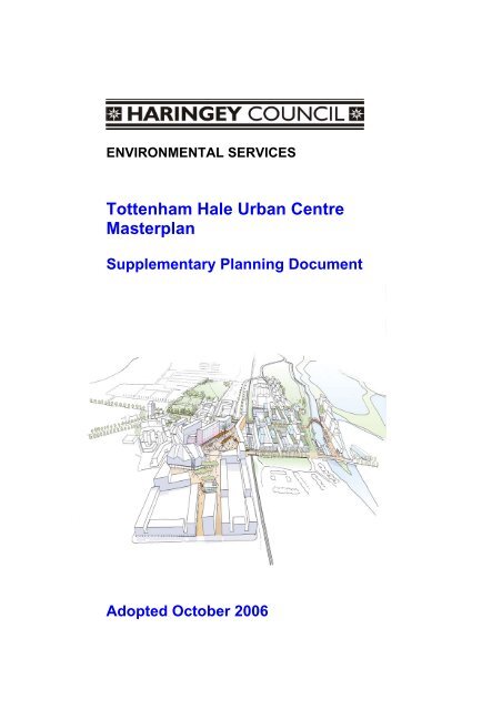
ENVIRONMENTAL SERVICES<br />
<strong>Tottenham</strong> <strong>Hale</strong> <strong>Urban</strong> <strong>Centre</strong><br />
<strong>Masterplan</strong><br />
Supplementary Planning Document<br />
Adopted October 2006
<strong>Tottenham</strong> <strong>Hale</strong> <strong>Urban</strong> <strong>Centre</strong> <strong>Masterplan</strong><br />
The <strong>Tottenham</strong> <strong>Hale</strong> <strong>Urban</strong> <strong>Centre</strong> <strong>Masterplan</strong> was commissioned by the following<br />
agencies, with funding from the ODPM’s Growth Area Fund Round 1:<br />
London Development Agency – John Uden and David Joy<br />
Greater London Authority – Jamie Dean and John Fannon<br />
Transport for London – Maxine Simmons and Tanya Adams<br />
London Borough of <strong>Haringey</strong> – Mark Lucas and Steve Carter<br />
Drafted, typeset and printed by:<br />
<strong>Urban</strong> Practitioners<br />
Allies & Morrison<br />
Mouchel Parkman<br />
CB Richard Ellis<br />
Gardiner & Theobald<br />
For the;-<br />
London Borough of <strong>Haringey</strong><br />
Strategic Sites and Projects Group<br />
Planning, Environmental Policy and Performance<br />
639 <strong>Tottenham</strong> High Road<br />
LONDON<br />
N17 8BD<br />
Phone: (020) 8489 5226<br />
Fax: (020) 8489 2673<br />
E-mail: geoff.merry@haringey.gov.uk<br />
2
<strong>Tottenham</strong> <strong>Hale</strong> <strong>Urban</strong> <strong>Centre</strong> <strong>Masterplan</strong><br />
3
<strong>Tottenham</strong> <strong>Hale</strong> <strong>Urban</strong> <strong>Centre</strong> <strong>Masterplan</strong><br />
CONTENTS<br />
1. INTRODUCTION<br />
1.1 Purpose of the Draft <strong>Masterplan</strong><br />
1.2 The Area<br />
1.3 Vision<br />
1.4 Objectives<br />
1.5 Facilities for new and existing communities<br />
2. ABOUT THE DRAFT MASTERPLAN<br />
2.1 Public Consultation<br />
2.2 Status of the Draft <strong>Masterplan</strong><br />
2.3 Sustainability Appraisal<br />
3. PLANNING POLICY CONTEXT<br />
3.1 Introduction<br />
3.2 National Context<br />
3.3 Regional Context<br />
3.4 Sub-Regional Framework<br />
3.5 Local Context<br />
4. GENERAL DEVELOPMENT PRINCIPLES<br />
4.1 Introduction<br />
4.2 Golden Rules<br />
4.3 The Principles<br />
5. URBAN FORM<br />
5.1 Introduction<br />
5.2 Blocks with building at the perimeter<br />
6. PUBLIC REALM PROJECTS<br />
6.1 Introduction<br />
6.2 Station Square<br />
6.3 Ferry Lane / The <strong>Hale</strong><br />
6.4 Lea Valley Waterfront<br />
6.5 Ashley Link<br />
6.6 Retail <strong>Centre</strong><br />
6.7 Monument Way<br />
7. KEY DEVELOPMENT SITES<br />
7.1 Introduction<br />
7.2 Indicative Phasing<br />
7.3 Former GLS site<br />
7.4 <strong>Hale</strong> Wharf<br />
7.5 Ashley Road Area<br />
7.6 Station Interchange<br />
7.7 <strong>Tottenham</strong> <strong>Hale</strong> Retail Park<br />
7.8 High Cross Estate<br />
8. SUSTAINABILITY CHECKLIST<br />
8.1 Introduction<br />
8.2 The Checklist<br />
9. PLANNING OBLIGATIONS<br />
9.1 Introduction<br />
9.2 Possible Planning Obligations<br />
5<br />
5<br />
5<br />
5<br />
7<br />
8<br />
13<br />
13<br />
13<br />
13<br />
15<br />
15<br />
15<br />
16<br />
19<br />
20<br />
24<br />
24<br />
24<br />
24<br />
31<br />
31<br />
32<br />
33<br />
33<br />
33<br />
34<br />
35<br />
36<br />
37<br />
37<br />
38<br />
38<br />
38<br />
39<br />
42<br />
45<br />
48<br />
52<br />
55<br />
57<br />
57<br />
57<br />
59<br />
59<br />
59<br />
10. REQUIREMENTS FOR A PLANNING APPLICATION 61<br />
11. GLOSSARY 63<br />
APPENDIX – CONSULTATION STATEMENT 67<br />
4
<strong>Tottenham</strong> <strong>Hale</strong> <strong>Urban</strong> <strong>Centre</strong> <strong>Masterplan</strong><br />
1. INTRODUCTION<br />
1.1 Purpose of the Draft <strong>Masterplan</strong><br />
1.1.1. The <strong>Council</strong> has prepared this Draft <strong>Masterplan</strong> to guide the redevelopment of key<br />
sites within the <strong>Tottenham</strong> <strong>Hale</strong> <strong>Urban</strong> <strong>Centre</strong>. It draws upon the detailed guidance<br />
set out in the <strong>Tottenham</strong> <strong>Hale</strong> <strong>Urban</strong> <strong>Centre</strong> Design Framework (June 2006), and<br />
elaborates upon policies identified in the <strong>Council</strong>’s Unitary Development Plan (July<br />
2006), the Mayor’s London Plan and other relevant supplementary planning guidance<br />
notes.<br />
1.1.2. The main purpose of this document is to improve the efficiency of the planning<br />
system and development process, as well as improving the quality of any new<br />
development. It establishes a framework that will be used to assess any future<br />
planning applications, and provides advice on the nature of acceptable development,<br />
potential uses, and design issues.<br />
1.2 The <strong>Tottenham</strong> <strong>Hale</strong> area<br />
1.2.1 <strong>Tottenham</strong> <strong>Hale</strong> is located in North London, on the eastern side of the London<br />
Borough of <strong>Haringey</strong>, and sits within the Upper Lea Valley. The area, which covers<br />
some 39 hectares, comprises a mixture of industrial and warehousing units involving<br />
the storage and distribution of goods, a major gyratory road system and public<br />
transport interchange. Relatively few people live within the area and the residential<br />
community is concentrated within the council-owned High Cross Estate. <strong>Tottenham</strong><br />
<strong>Hale</strong> is characterised currently by a high volume of traffic on the gyratory system, a<br />
disjointed urban fabric and a general severance from its surroundings.<br />
1.2.2 <strong>Tottenham</strong> <strong>Hale</strong> is identified as an Opportunity Area in the Mayor’s London Plan and<br />
is located within the Department for Communities and Local Government’s (formerly<br />
the Office of the Deputy Prime Minister) London-Stansted-Cambridge-Peterborough<br />
Growth Corridor. It provides a major opportunity to create a thriving, sustainable<br />
urban centre with new homes and jobs, focused around an enhanced, fully accessible<br />
transport interchange with rapid access to Central London, Cambridge and Stansted<br />
International Airport.<br />
1.3 The vision – transforming <strong>Tottenham</strong> <strong>Hale</strong><br />
1.3.1 ‘’A new vision for <strong>Tottenham</strong> <strong>Hale</strong> will transform the area into an attractive,<br />
thriving, mixed use urban centre and will instill a new sense of identity,<br />
vibrancy and confidence into local and sub-regional communities, visitors and<br />
investors alike’’. <strong>Tottenham</strong> <strong>Hale</strong> <strong>Urban</strong> <strong>Centre</strong> Design Framework<br />
1.3.2 The vision for <strong>Tottenham</strong> <strong>Hale</strong> is the creation of a thriving urban centre with a vibrant<br />
mix of community, commercial, leisure and residential uses, set within a truly public<br />
network of streets and spaces of the highest quality. The transformation of <strong>Tottenham</strong><br />
<strong>Hale</strong> from a fragmented, traffic-dominated, illegible and unwelcoming environment to<br />
a bustling hive of activity, occupying streets, public spaces and buildings of the<br />
highest possible quality, along with a high-quality, integrated waterfront will maximise<br />
the area's exceptional locational advantages and create a critical mass of reasons for<br />
people to visit, with increased opportunities for local and wider communities.<br />
1.3.3 A strong sense of identity<br />
One of the most important aims is to create a strong sense of identity for <strong>Tottenham</strong><br />
<strong>Hale</strong>, with a clearly identifiable 'heart' and streets and public spaces of exceptional<br />
quality, enabling the area to become a destination of choice for living, working and<br />
leisure. At present, the area lacks cohesion and legibility, and a strong urban<br />
structure is necessary if the new urban centre is to succeed and to thrive.<br />
Development proposals for the area’s six key sites should, therefore, focus on the<br />
5
<strong>Tottenham</strong> <strong>Hale</strong> <strong>Urban</strong> <strong>Centre</strong> <strong>Masterplan</strong><br />
importance of a high quality public realm, strong architectural treatment and urban<br />
design principles that will help create a positive visual identity for the area. This new<br />
identity will help to revitalise the area and instill confidence into residents and<br />
investors alike, and will enable the area to fulfil its potential as an important node in<br />
the North London sub-region and the London-Stansted-Cambridge-Peterborough<br />
growth corridor.<br />
1.3.4 Repairing the urban fabric<br />
As the existing network of streets and buildings is disjointed and severed from the<br />
surrounding area, one of the key priorities is to 'repair' the urban fabric in the<br />
<strong>Tottenham</strong> <strong>Hale</strong> area, re-introducing and knitting together the new urban centre with<br />
the surrounding area through the layout of a fine grain, human scale, network of<br />
streets and public spaces. This will provide a robust framework for new urban<br />
development, which is able to support the needs of the local economy and community<br />
as they change over time. The vibrant mix of streets and public spaces will be<br />
accommodated within high quality buildings interspersed with urban green spaces,<br />
and focused around a new station square and public transport interchange, all<br />
located within walking distance of each other.<br />
1.3.5 A highly accessible destination<br />
A high quality station square and state-of-the art, enhanced public transport<br />
interchange will help provide a focus and identity for the urban centre at <strong>Tottenham</strong><br />
<strong>Hale</strong> with strong, active edges providing a varied retail offer for both existing and new<br />
communities in the area. It will also seek to carve out an identity for the urban centre<br />
as a major destination within the context of London, the South East and ultimately,<br />
Europe via Stansted Airport (and St. Pancras and Stratford International stations in<br />
due course), based upon its excellent connectivity.<br />
1.3.6 Connecting communities<br />
As a new urban centre, <strong>Tottenham</strong> <strong>Hale</strong> will be distinctly different, though<br />
complementary, to the existing town centres at Bruce Grove and Seven Sisters along<br />
<strong>Tottenham</strong> High Road, with a focus on improving the contribution made by the<br />
existing retail park and providing convenience retailing at the station and for the<br />
existing and new residential communities, which would be under-served by the<br />
current provision. One of the main priorities is to ensure the integration of the existing<br />
and new communities physically (for example, to the High Road in the west and the<br />
Ferry Lane housing estate in the south) as well economically and socially, with new<br />
housing, community facilities and educational and employment opportunities<br />
available and accessible to all sections of the community. In addition, it will provide a<br />
healthier and safer environment, increasing confidence within the local community.<br />
Whilst relatively few people live within the area at present, <strong>Tottenham</strong> <strong>Hale</strong> benefits<br />
from the diverse, vibrant and entrepreneurial local community that live around the<br />
area. This population is characterised by a high proportion of young people, high<br />
levels of unemployment and deprivation. Therefore, clear and explicit links must be<br />
made between the new opportunities in <strong>Tottenham</strong> <strong>Hale</strong> and the existing community,<br />
to ensure that local people are able to benefit.<br />
1.3.7 Making the most of exceptional natural assets<br />
The location of the new urban centre, adjacent to the Lee Valley Regional Park is one<br />
of the most important characteristics of <strong>Tottenham</strong> <strong>Hale</strong>. The area is located adjacent<br />
to the River Lee Navigation Channel, the Lee Diversion and Pymme’s Brook which<br />
offer significant recreational and environmental benefits, as do the series of reservoirs<br />
immediately to the east of the area. Whilst the <strong>Masterplan</strong> acknowledges the<br />
importance of the River Lee in terms of ecology and biodiversity, it also recognises<br />
the value of other key local watercourses. The Lee Valley Regional Park acts as a<br />
vital ecological and recreational resource for London and the surrounding counties,<br />
6
<strong>Tottenham</strong> <strong>Hale</strong> <strong>Urban</strong> <strong>Centre</strong> <strong>Masterplan</strong><br />
and as such, <strong>Tottenham</strong> <strong>Hale</strong> needs to maximise the opportunities this affords by<br />
opening up physical and visual access to a wider range of people. The vision for the<br />
area seeks to improve safe access to, and facilities at, the Lee Valley Regional Park<br />
and the River Lee Navigation Channel to provide leisure opportunities for local<br />
people, as well as the provision of food and drink type uses along the water's edge at<br />
<strong>Hale</strong> Wharf. The unique location of the <strong>Tottenham</strong> <strong>Hale</strong> between the Lee Valley<br />
Regional Park in the east and <strong>Tottenham</strong> High Road to the west should be reflected<br />
in its built form, character and uses.<br />
1.4 Objectives<br />
1.4.1 In order to realise the vision for <strong>Tottenham</strong> <strong>Hale</strong>, the following objectives have been<br />
identified:<br />
• To create a high density, sustainable and mixed use urban centre at <strong>Tottenham</strong><br />
<strong>Hale</strong>;<br />
• To maximise the environmental, economic and social benefits of <strong>Tottenham</strong> <strong>Hale</strong><br />
as a riverside location;<br />
• To create a safe and secure environment;<br />
• To achieve high levels of accessible and inclusive design in all new buildings,<br />
places and spaces;<br />
• To achieve high standards of public realm design;<br />
• To enhance access to the Lee Valley Regional Park, the River Lee and the<br />
Paddock as natural assets whilst protecting them;<br />
• To improve public transport interchange facilities at <strong>Tottenham</strong> <strong>Hale</strong> Station;<br />
• To improve the gyratory system and reduce the impact of traffic on the<br />
surrounding environment;<br />
• To improve linkages for pedestrians and cyclists in the area;<br />
• To provide more facilities and amenities in <strong>Tottenham</strong> <strong>Hale</strong> which are<br />
complementary to <strong>Tottenham</strong> High Road;<br />
• To provide more learning and employment opportunities for local people<br />
Fig1: Boundary of <strong>Masterplan</strong> area<br />
7
<strong>Tottenham</strong> <strong>Hale</strong> <strong>Urban</strong> <strong>Centre</strong> <strong>Masterplan</strong><br />
1.5 Facilities for existing and new communities<br />
1.5.1 It is essential that development within the <strong>Tottenham</strong> <strong>Hale</strong> <strong>Urban</strong> <strong>Centre</strong> provides<br />
facilities and services to meet the needs of both existing residents and an expanding<br />
residential community. In part, such facilities and services will be provided in terms<br />
of the new retail provision, high quality public spaces, improved access to the Lee<br />
Valley Regional Park and enhanced pedestrian environment. However, a number of<br />
public and voluntary sector facilities, such as those needed by the police and other<br />
emergency services, are also required, in order to ensure the existing<br />
community is able to take full advantage of the opportunities which will be provided,<br />
and to ensure that the <strong>Tottenham</strong> <strong>Hale</strong> community grows in a balanced and<br />
sustainable way. It is anticipated that these will be funded in part through private<br />
sector development.<br />
1.5.2 Figure 2 shows the potential distribution of employment uses in the new development<br />
throughout the area. Employment uses are focused on the area around the new<br />
station interchange, because of its high public transport accessibility. In addition, this<br />
area is already the focus for a number of employment uses, particularly in the Ashley<br />
Road area. The <strong>Masterplan</strong> proposes retention of the Millmead and Lockwood<br />
industrial areas in the medium term, because of the valuable role they play in<br />
providing local employment opportunities. Significant retail uses are proposed, which<br />
are also potentially sources of local employment, and that the new station<br />
interchange will improve the accessibility of employment opportunities at Stansted<br />
Airport, in Central and East London, and the Thames Gateway.<br />
Fig 2. Employment<br />
8
<strong>Tottenham</strong> <strong>Hale</strong> <strong>Urban</strong> <strong>Centre</strong> <strong>Masterplan</strong><br />
1.5.3 Figure 3 shows how residential uses can be incorporated throughout much of the<br />
core area, often integrated within a mix of other uses, including employment, retail<br />
and community uses. A series of new neighbourhoods will be created at the GLS site,<br />
<strong>Hale</strong> Wharf and in the Ashley Road area, and there is scope to improve the High<br />
Cross Estate in the longer term. The provision of a critical mass of new residents at<br />
relatively high densities will enable the area to support and sustain this new mix of<br />
uses.<br />
Fig3: Residential<br />
9
<strong>Tottenham</strong> <strong>Hale</strong> <strong>Urban</strong> <strong>Centre</strong> <strong>Masterplan</strong><br />
1.5.4 Figure 4 shows the suggested distribution of retail and leisure uses. The retail is<br />
focused on the existing retail park, which has significant potential to be improved in<br />
order to make a better contribution to the environment and quality of the pedestrian<br />
experience. Convenience retail is also provided at the station interchange, to serve<br />
the needs of local residents, commuters and those changing between transport<br />
modes. A small amount of retail is envisaged at the GLS site to serve immediate local<br />
needs. In addition, both retail and leisure uses are accommodated at <strong>Hale</strong> Wharf,<br />
including provision for a new high quality market, which could occupy a new public<br />
space on the waterfront.<br />
Fig 4. Retail and Leisure<br />
10
<strong>Tottenham</strong> <strong>Hale</strong> <strong>Urban</strong> <strong>Centre</strong> <strong>Masterplan</strong><br />
1.5.5 Figure 5 shows the preferred distribution of community uses throughout the<br />
<strong>Masterplan</strong> area, which include a new health centre, new adult education centre,<br />
enhanced Down Lane Recreation Ground, re-provided Welbourne <strong>Centre</strong>, City Farm /<br />
interpretation centre and a network of new, high quality green spaces, streets and<br />
public squares.<br />
Fig 5. Community and Open Space<br />
11
<strong>Tottenham</strong> <strong>Hale</strong> <strong>Urban</strong> <strong>Centre</strong> <strong>Masterplan</strong><br />
Fig 6: <strong>Tottenham</strong> <strong>Hale</strong> <strong>Masterplan</strong> – key drawing<br />
Fig 7: Indicative aerial view of new urban centre<br />
12
<strong>Tottenham</strong> <strong>Hale</strong> <strong>Urban</strong> <strong>Centre</strong> <strong>Masterplan</strong><br />
2. ABOUT THE DRAFT MASTERPLAN<br />
2.1 PUBLIC CONSULTATION<br />
2.1.1. The Draft <strong>Tottenham</strong> <strong>Hale</strong> <strong>Urban</strong> <strong>Centre</strong> <strong>Masterplan</strong> was the subject of statutory<br />
public consultation during July and August 2006<br />
2.1.2 Following the consultation period, the <strong>Council</strong> considered all responses, and<br />
amended the draft document as appropriate. The results of the public consultation<br />
exercise and the amended <strong>Masterplan</strong> were reported back to Planning Application<br />
Sub-Committee (PASC) before being presented to the <strong>Council</strong>’s Executive for<br />
adoption as a Supplementary Planning Document (SPD). The timetable for adoption<br />
is set-out below:<br />
Stage<br />
Date<br />
PASC for Public Consultation Approval 26 th June 2006<br />
Public Consultation 3rd July – 28 th August 2006<br />
PASC for Approval of Amended Brief 30 th October 2006<br />
<strong>Council</strong>’s Executive for Adoption as SPD 31 st October 2006<br />
2.1.3 A separate report outlining the public consultation strategy has been produced, which<br />
includes a summary of any representations received, the issues raised, the <strong>Council</strong>’s<br />
response and any resulting changes to the <strong>Masterplan</strong>.<br />
2.1.4 If any planning applications are submitted, further public consultation will take place<br />
as part of the development control process before any decision is made, and the<br />
public will be able to make representations regarding the specifics of any proposal.<br />
2.1.5 The Consultation Statement which summarises the consultation and findings at the<br />
pre-production stage of the <strong>Tottenham</strong> <strong>Hale</strong> <strong>Urban</strong> <strong>Centre</strong> Design Framework, as well<br />
as the formal consultation strategy in respect of this <strong>Masterplan</strong>, is appended to this<br />
document.<br />
2.2 STATUS OF THE DRAFT MASTERPLAN<br />
2.2.1. This <strong>Masterplan</strong> has been prepared within the context of Government guidance, the<br />
Mayor’s London Plan (2004), the London Borough of <strong>Haringey</strong> Unitary Development<br />
Plan (July 2006) , the <strong>Tottenham</strong> <strong>Hale</strong> <strong>Urban</strong> <strong>Centre</strong> Design Framework (June 2006)<br />
and other relevant supplementary planning guidance notes. The <strong>Masterplan</strong> has been<br />
approved by the <strong>Council</strong> as a Supplementary Planning Document (SPD) that<br />
elaborates upon the policies contained within the borough’s UDP – in particular Policy<br />
AC2. The <strong>Masterplan</strong> will be a strong material planning consideration and afforded<br />
significant weight when used to determine planning applications for the <strong>Tottenham</strong><br />
<strong>Hale</strong> area.<br />
2.3 SUSTAINABILITY APPRAISAL<br />
2.3.1 This document has been prepared with a view to contributing to the achievement of<br />
sustainable development. In essence, this involves ensuring a better quality of life for<br />
everyone, for present and future generations.<br />
2.3.2 The Planning and Compulsory Purchase Act 2004 requires that local planning<br />
authorities carry out sustainability appraisals for Supplementary Planning Documents<br />
such as this. European Directive 2001/42/EC also requires that Strategic<br />
Environmental Assessments be carried out for certain types of plans that will set a<br />
framework for future development consents and that are likely to have significant<br />
environmental effects.<br />
13
<strong>Tottenham</strong> <strong>Hale</strong> <strong>Urban</strong> <strong>Centre</strong> <strong>Masterplan</strong><br />
2.3.3 A sustainability appraisal has been carried out in conjunction with the preparation of<br />
this document, which meets the regulatory requirements though a single appraisal<br />
process. Its main purpose is to appraise the social, environmental and economic<br />
effects of the brief, from the outset of the preparation process, so that decisions can<br />
be made that achieve sustainable development.<br />
14
<strong>Tottenham</strong> <strong>Hale</strong> <strong>Urban</strong> <strong>Centre</strong> <strong>Masterplan</strong><br />
3. PLANNING POLICY CONTEXT<br />
3.1 INTRODUCTION<br />
3.1.1 The transformation of <strong>Tottenham</strong> <strong>Hale</strong> is both driven and supported by a range of<br />
planning and regeneration policies at the national, regional and local level.<br />
3.2 NATIONAL PLANNING POLICY CONTEXT<br />
PPG and PPS<br />
• PPS 1: Delivering Sustainable Development (2005)<br />
• PPG 3: Housing (2000)<br />
• PPG 4: Industry, Commercial Development & Small Firms (1992)<br />
• PPS 6: Planning for Town <strong>Centre</strong>s (2005)<br />
• PPS 9: Biodiversity and Geological Conservation (2005)<br />
• PPS 12: Local Development Frameworks (2004)<br />
• PPG 13: Transport (2001)<br />
• PPS 23: Planning and Pollution Control (2004)<br />
• PPG/S 25 Development and Flood Risk (2001 and 2005)<br />
3.2.1 PPS1: Delivering Sustainable Development (2005) sets out the Government’s<br />
national policies on different aspects of land-use planning. It outlines the overarching<br />
planning policies on the delivery of sustainable development, and other aspects of<br />
planning including high quality and inclusive design. It states that community<br />
involvement is an essential element in delivering sustainable development and<br />
creating sustainable and safe communities. It promotes economic development to<br />
secure higher living standards while protecting and enhancing the environment, and a<br />
more efficient use of land through higher density, mixed use development and the use<br />
of previously developed land and buildings.<br />
3.2.2 PPG3: Housing (2000) introduced a sequential approach to housing development<br />
and provision, which involves using previously developed land before greenfield sites.<br />
It states that when considering housing provision local planning authorities should:<br />
• Give priority to the re-use of previously developed land within urban areas, in<br />
preference to the development of greenfield sites.<br />
• Create more sustainable patterns of development by building in ways that exploit<br />
and deliver accessibility to jobs, education, and health facilities, shopping, leisure<br />
and local services by public transport.<br />
• Make more efficient use of land by reviewing planning policies and standards.<br />
• Seek to reduce car dependency by facilitating walking and cycling, and promote<br />
good design in new housing developments in order to create attractive<br />
environments in which people would choose to live.<br />
It also emphasises the importance of conversions as a source of additional housing,<br />
the importance of bringing vacant buildings into use, and making the best use of<br />
previously developed land whilst improving the quality of the environment.<br />
3.2.3 PPG4: Industry, Commercial Development and Small Firms (1992) states that<br />
planning authorities should:<br />
• ensure speculative developers who provide premises suitable for small firms are<br />
allowed to contribute to the expansion of the economy and employment ,<br />
• aim to ensure that there is sufficient land available which is readily capable of<br />
development and well served by infrastructure.<br />
• ensure there is a variety of sites to meet differing needs,<br />
• include policies for the type of condition or planning obligation that might be<br />
imposed or sought in a particular situation,<br />
• provide positive policies for small businesses,<br />
15
<strong>Tottenham</strong> <strong>Hale</strong> <strong>Urban</strong> <strong>Centre</strong> <strong>Masterplan</strong><br />
• recognise that it may not be appropriate to separate industry and commerce,<br />
especially small scale developments, from the residential communities for whom<br />
they are a source of employment and services,<br />
• not seek unreasonably to restrict commercial and industrial activities of an<br />
appropriate scale which would not adversely affect residential amenity<br />
3.2.4 PPS6: Planning for Town <strong>Centre</strong>s (2005), focuses on enhancing the vitality and<br />
viability of town centres by:<br />
• planning for growth and development of existing centres, and<br />
• promoting and enhancing existing centres, by focusing development in such<br />
centres and encouraging a wide range of services in a good environment that is<br />
accessible to all.<br />
It states that a sequential approach should be adopted when selecting sites for retail<br />
and leisure. Adopting the sequential approach means that first preference is for town<br />
centre sites, where suitable buildings for conversion are available, followed by edge<br />
of centre sites and then out-of-centre sites in locations that are accessible by a choice<br />
and means of transport. This approach should be applied to all key town centre uses,<br />
which attract many people.<br />
3.2.5 PPS9: Biodiversity and Geological Conservation (2005) sets out planning policies<br />
on the protection of biodiversity and geological conservation through planning.<br />
3.2.6 PPS12: Local Development Frameworks (2004) sets out the Government’s policy<br />
on the preparation of local development documents, which includes the preparation of<br />
Supplementary Planning Documents (SPD).<br />
3.2.7 PPG13: Transport (2001) provides advice on the integration of transport and land<br />
use planning to encourage alternative means of travel and reduce reliance on the<br />
private car. Reducing the level of car parking in new development is essential in<br />
promoting sustainable travel choices, avoiding the wasted costs to business of<br />
providing too much parking, and tackling congestion which might other wise detract<br />
from the convenience of car use and other road based transport. It emphasises the<br />
importance of taking a flexible approach to car parking standards to achieve the<br />
objectives of sustainability, and sets out maximum car parking standards as opposed<br />
to minimum.<br />
3.2.8 PPS23: Planning and Pollution Control (2004) is intended to complement the new<br />
pollution control framework under the Pollution and Prevention Act 1993 and PPC<br />
Regulations 2000<br />
3.2.9 PPG25 and Draft PPS25: Development and Flood Risk (2001 and 2005) provides<br />
significant safeguards against inappropriate new development in flood risk areas. All<br />
development must be in line with the current PPG25 and Draft PPS 25. This aims to<br />
ensure flood risk is considered at all stages of the planning and development process<br />
from regional plans, to local plans and individual site development. All development<br />
proposals in flood risk areas should be subject to a sequential, risk-based approach<br />
accompanied by a flood risk assessment, and local planning authorities should<br />
consult the Environment Agency.<br />
3.3 REGIONAL PLANNING CONTEXT<br />
3.3.1 London-Stansted-Cambridge-Peterborough (LSCP) Corridor<br />
A key component of the Government’s Sustainable Communities Plan (2003) focused<br />
on the four main areas identified previously by Regional Planning Guidance 9; the<br />
Thames Gateway, Milton Keynes/South Midlands, Ashford, and London-Stansted-<br />
Cambridge (LSC), in order to accommodate and sustain the economic success of<br />
London and the South East region. The Sustainable Communities Plan stated that<br />
London and the four growth areas had the potential to accommodate an additional<br />
16
<strong>Tottenham</strong> <strong>Hale</strong> <strong>Urban</strong> <strong>Centre</strong> <strong>Masterplan</strong><br />
200,000 homes above levels projected in the Regional Planning Guidance and<br />
London Plan. The London-Stansted-Cambridge corridor was extended in 2004 to<br />
include the whole of Cambridgeshire and Peterborough. <strong>Tottenham</strong> <strong>Hale</strong> is perhaps<br />
the most well-connected node within the LSC growth corridor with its existing<br />
connections to Stansted International Airport and Central London.<br />
3.3.2 The Mayor’s London Plan (2004)<br />
The Mayor's London Plan (2004) sets out the spatial development strategy for<br />
London and identifies <strong>Tottenham</strong> <strong>Hale</strong> as an Opportunity Area (Policy 2A.2) in the<br />
North London Sub-Region where major development is proposed to intensify and<br />
accommodate substantial growth, particularly in economic terms. The London Plan<br />
identifies a target for <strong>Tottenham</strong> <strong>Hale</strong> to provide at least 5,000 new jobs and 200 new<br />
homes by 2016, largely through increasing density, redeveloping major brownfield<br />
sites and increasing accessibility through improvements in public transport. However,<br />
it should be noted that the Mayor has more ambitious targets for the quantum of<br />
housing to be provided at <strong>Tottenham</strong> <strong>Hale</strong>, and this is reflected in the North London<br />
Sub Regional Development Framework (SRDF) (May 2006), which states that it will<br />
seek to exceed the minimum guidelines for housing.<br />
3.3.3 The London Plan states that higher density development in the area could be<br />
accommodated close to <strong>Tottenham</strong> <strong>Hale</strong> Station, and that it could become the main<br />
service area focus for the North London sub-region. The Plan also highlights the<br />
excellent transport connections that serve <strong>Tottenham</strong> <strong>Hale</strong>, with its rail, tube and bus<br />
interchange.<br />
3.3.4 The London Plan encourages boroughs to seek an intensification of housing<br />
provision through development at higher densities, particularly where there is access<br />
to public transport. <strong>Tottenham</strong> <strong>Hale</strong>’s status as an Opportunity Area also suggests it<br />
is an appropriate location for some development of considerable height. The London<br />
Plan states clearly that whilst high density does not necessarily imply tall buildings,<br />
they can support the strategy of creating the highest levels of activity at locations with<br />
the greatest transport capacity, and well designed tall buildings can contribute to<br />
regeneration<br />
3.3.5 London Plan Policy 4B.8 states that tall buildings should create attractive landmarks,<br />
helping to provide a coherent location for economic clusters, and/or to act as a<br />
catalyst for regeneration. Policy 4B.9 states that the design and impact of all largescale<br />
buildings, including tall buildings, should be of the highest quality design and in<br />
particular, they should:<br />
• be suited to their wider context in terms of proportion and composition and in<br />
terms of their relationship to other buildings, streets, public and private open<br />
spaces, the waterways or other townscape elements;<br />
• be attractive city elements as viewed from all angles and where appropriate<br />
contribute to an interesting skyline, consolidating clusters within that skyline or<br />
providing key foci within views;<br />
• illustrate exemplary standards of sustainable construction and resource<br />
management and potential for renewable energy generation and recycling;<br />
• be sensitive to their impact on micro-climates in terms of wind, sun, reflection and<br />
overshadowing;<br />
• be appropriate to the transport capacity of the area ensuring adequate, attractive,<br />
inclusive and safe pedestrian and public transport access; and<br />
• relate positively to water spaces taking into account the particular needs and<br />
characteristics of such spaces.<br />
3.3.6 <strong>Tottenham</strong> <strong>Hale</strong> is identified in the London Plan as being an Opportunity Area<br />
adjoining the Blue Ribbon Network of waterways. Development proposals for<br />
riverside sites must be take account of the Blue Ribbon Network Principles.<br />
Proposals for tall buildings near this network should meet the design requirements as<br />
set out in Policy 4B.9 and should address the specific impacts on the water spaces,<br />
17
<strong>Tottenham</strong> <strong>Hale</strong> <strong>Urban</strong> <strong>Centre</strong> <strong>Masterplan</strong><br />
including the public realm of the waterside. In addition, Policy 4C.23 requires new<br />
safety provision as part of any development proposal.<br />
3.3.7 Policy 3A.7 states that local authority policies should take into consideration the<br />
Mayor's strategic target of providing new housing of which 50% is affordable, and<br />
within this target, the London-wide objective of 70% social housing (i.e. social rented)<br />
and 30% intermediate housing (i.e. shared ownership/key workers), in order to help<br />
promote mixed, balanced communities. In addition, Policy 3A.8 states that Boroughs<br />
should:<br />
"Seek the maximum reasonable amount of affordable housing when negotiating on<br />
individual private residential and mixed-use schemes, having regard to their<br />
affordable housing targets adopted in line with policy 3A.7, the need to encourage<br />
rather than restrain residential development and the individual circumstances of the<br />
site. Targets should be applied flexibly, taking account of individual site costs, the<br />
availability of public subsidy and other scheme requirements."<br />
3.3.8 The principles of inclusive design underpin the London Plan and are fundamental in<br />
achieving the aim of social inclusion. Policy 4B.5 states that all future development<br />
should meet the highest standards of accessibility and inclusion, designed so that it:<br />
• Can be used safely by as many people as possible without undue effort,<br />
separation or special treatment;<br />
• Offers the freedom to choose, and the ability to participate equally in the<br />
development’s mainstream activities; and<br />
• Values diversity and difference<br />
3.3.9 In addition to its Opportunity Area designation, <strong>Tottenham</strong> <strong>Hale</strong> is identified as a<br />
Strategic Employment Location (SEL) specifically for businesses requiring a relatively<br />
good quality environment. Under Policy 3B.5, the London Plan states that the SEL<br />
framework is designed to reconcile demand and supply, and take into account the<br />
needs of industry in terms of clustering, capacity, environment, accessibility and cost<br />
requirements, and that the Mayor will work with strategic partners to promote and<br />
manage the varied industrial offer of SELs. Further details are set out in the GLA’s<br />
Draft Industrial Capacity SPG (2003), which is discussed below.<br />
3.3.10 There are a number of London Plan policies that impact upon the <strong>Tottenham</strong> <strong>Hale</strong><br />
area, which are;<br />
• Policy 3B.4 Mixed-use development<br />
• Policy 3B.6: Supporting innovation<br />
• Policy 3B.9 Creative industries<br />
• Policy 3B.12: Improving the skills and employment opportunities for Londoners<br />
• Policy 3C.1: Integration of transport and spatial development<br />
• Policy 3C.2; Matching development to transport capacity<br />
• Policy 3C.3: Sustainable transport for London<br />
In addition, it is a key objective that the development at <strong>Tottenham</strong> <strong>Hale</strong> is<br />
sustainable. Policy 2A.1 promotes the concept of sustainable development that<br />
underpins all of the proposals contained within this document.<br />
3.3.11 GLA Draft Industrial Capacity SPG (2003)<br />
The draft Supplementary Planning Guidance (SPG) on ‘Industrial Capacity’ was<br />
published in September 2003 to accompany the London Plan, and set out to:<br />
“Encourage owners and occupiers of industrial land, as well as the LDA, boroughs<br />
and other relevant agencies, to manage and invest in capacity to meet the changing<br />
needs of different types of industry. To support this, mixed use, higher density redevelopment<br />
of some Strategic Employment Locations close to town centres<br />
and public transport nodes is encouraged providing it does not compromise [London<br />
Plan Policy 3B.5] and capacity to meet London’s future industrial needs.”<br />
18
<strong>Tottenham</strong> <strong>Hale</strong> <strong>Urban</strong> <strong>Centre</strong> <strong>Masterplan</strong><br />
3.3.12 The SPG emphasises the importance of analysing the strategic factors, site<br />
characteristics, and industrial demand factors in determining future allocations for<br />
industrial uses. The guidance quotes government research and advice that:<br />
“industrial uses will usually be accommodated on the lower floors of mixed use<br />
developments with other uses above...Most appropriate will be locations where<br />
such development can be closely integrated with a wider mix of surrounding uses,<br />
such as on the edge of town centres...there may be scope to redevelop and<br />
upgrade parts of some Preferred Industrial Locations near stations or town centres,<br />
especially where there is a barrier separating the area from the rest of the<br />
Preferred Industrial Location.”<br />
3.3.13 The guidance from this SPG has informed the <strong>Masterplan</strong> proposals, particularly as<br />
some of the sites designated as SELs are in close proximity to <strong>Tottenham</strong> <strong>Hale</strong><br />
station with its direct links to Central London, Cambridge and Stansted Airport.<br />
3.3.14 GLA Sustainable Design & Construction SPG (2006)<br />
The Supplementary Planning Guidance (SPG) on ‘Sustainable Design &<br />
Construction’ was published in May 2006 to provide guidance on the way that the<br />
seven principles in London Plan Policy 4B.6 Sustainable Design and Construction<br />
can be implemented to meet the London Plan objectives. To this end, the guidance<br />
contains a checklist of essential and preferred standards. Policy 4B.6 requires<br />
boroughs to use the seven sustainability principles when assessing major<br />
applications. <strong>Haringey</strong> <strong>Council</strong> will expect proposals to employ environmental best<br />
practice to meet the Mayor’s preferred standards as set out in the SPG.<br />
3.4 SUB-REGIONAL CONTEXT<br />
3.4.1 North London Sub - Regional Development Framework (SRDF)(May 2006)<br />
The North London Sub Regional Development Framework (SRDF) provides nonstatutory<br />
guidance on the implementation of the London Plan and covers the<br />
boroughs of Barnet, Enfield, <strong>Haringey</strong> and Waltham Forest. The SRDF sets out a<br />
number of key issues for <strong>Tottenham</strong> <strong>Hale</strong> which build upon the policy direction<br />
provided in the London Plan, which include:<br />
• the area is likely to involve a significantly higher housing allocation than originally<br />
envisaged in the London Plan;<br />
• the area is suitable for higher densities and tall buildings with exceptional views<br />
over the Lea Valley, North and East London, and into Central London – therefore,<br />
it has the potential to develop landmark buildings to identify itself as a<br />
strategically important gateway; and<br />
• some of the employment functions around <strong>Tottenham</strong> <strong>Hale</strong> can be expected to be<br />
relocated in the wider Upper Lea Valley as the role of <strong>Tottenham</strong> <strong>Hale</strong> as a sub<br />
regional focus grows.<br />
3.4.2 In addition, the SRDF sets out the draft indicative boundary of the <strong>Tottenham</strong> <strong>Hale</strong><br />
SEL which covers the Millmead and Lockwood Industrial Estates, Ashley Road area<br />
and the northern half of the <strong>Hale</strong> island site (between Station Road and <strong>Hale</strong> Road).<br />
3.4.3 The SRDF recognises there have been problems with localised flooding on some of<br />
the area’s tributaries, with a wider question over the levels of flood protection in the<br />
Lee Valley. In order to understand the issue in greater detail, and given that the<br />
Opportunity Areas of the Upper Lee Valley and <strong>Tottenham</strong> <strong>Hale</strong> are within the<br />
indicative floodplain, the SRDF requires the boroughs, LDA and GLA to work with the<br />
Environment Agency to produce a Strategic Flood Risk Assessment for the Upper<br />
Lee Valley.<br />
3.4.4 A partnership lead by the Environment Agency has produced a River Restoration<br />
Strategy which covers the sub-regions rivers. The EA and its partners believe that<br />
including river restoration into regeneration schemes can promote a more<br />
environmentally friendly, sound approach to the development of sustainable<br />
communities. The strategy highlights locations in North London where specific<br />
19
<strong>Tottenham</strong> <strong>Hale</strong> <strong>Urban</strong> <strong>Centre</strong> <strong>Masterplan</strong><br />
reaches of river could benefit from restoration. The SRDF requires boroughs, and<br />
where appropriate the Mayor and LDA, to work to implement proposals contained in<br />
the strategy through decisions on planning applications and specific projects.<br />
3.5 LOCAL CONTEXT<br />
London Borough of <strong>Haringey</strong> Unitary Development Plan (July 2006)<br />
3.5.1 The <strong>Council</strong>'s Unitary Development Plan provides the policy framework for land use<br />
and development in <strong>Haringey</strong> up to 2016.The UDP policy of primary importance and<br />
relevance to <strong>Tottenham</strong> <strong>Hale</strong> is Policy AC2 which sets out the <strong>Council</strong>'s proposals for<br />
the <strong>Tottenham</strong> International area and supports its designation as an Opportunity Area<br />
within the London Plan. Policy AC2 states that 'there should be the creation of a new<br />
urban focus centred on <strong>Tottenham</strong> <strong>Hale</strong> Station' and that ‘development should have<br />
regard to the development framework for the area’ - namely the <strong>Tottenham</strong> <strong>Hale</strong><br />
<strong>Urban</strong> <strong>Centre</strong> <strong>Masterplan</strong>, which:<br />
• Creates a comprehensive mixed-use development, including appropriate retailing<br />
such as a small food store, and the development of a cinema and hotel;<br />
• Supports the London Plan designation as a Major Development Opportunity and<br />
Strategic Employment location suitable for a business park, potentially achieving<br />
5,000 new jobs and a minimum of 200 new homes; which will include a proportion<br />
of affordable housing to meet an overall borough target of 50%;<br />
• Lessens dominance of the private car through conversion of the <strong>Tottenham</strong><br />
Green / <strong>Hale</strong> gyratory to two way flow;<br />
• Creates an integrated transport interchange at <strong>Tottenham</strong> <strong>Hale</strong>;<br />
• Achieves better links to surrounding communities and to <strong>Tottenham</strong> <strong>Hale</strong> Station<br />
and the Lea Valley;<br />
• Maximises opportunities of riverside development and enhancement of the Lee<br />
Valley Regional Park, its openness and nature conservation value and taking<br />
advantage of the areas industrial heritage;<br />
• Provides more sustainable forms of development, built to high density and high<br />
quality design; and<br />
• Provides a choice of good quality housing that meets the needs of all in the<br />
community and promotes a sustainable and socially mixed community.<br />
Key issues relevant to development at <strong>Tottenham</strong> <strong>Hale</strong> are set out in the adopted<br />
UDP as follows:<br />
• Housing (Policies HSG1, HSG4, HSG9 and HSG10) – with regard to affordable<br />
housing, Policy HSG4 states that:<br />
"Housing developments capable of providing 10 or more units will be required to<br />
include a proportion of affordable housing to meet an overall borough target of<br />
50%. The proportion negotiated will depend on the location, scheme details or<br />
site characteristics. The <strong>Council</strong> will use planning agreements and planning<br />
conditions to secure the provision of affordable housing’’.<br />
The London Plan requires that boroughs should seek to achieve a range of types<br />
of affordable housing and an appropriate balance between social and<br />
intermediate housing to meet a London-wide objective of 70% social housing and<br />
30% intermediate provision.<br />
<strong>Haringey</strong> is polarised both socially and economically, with high levels of<br />
deprivation in eastern parts of the borough and relative affluence in the west.<br />
Social rented accommodation is concentrated in the east of the borough and<br />
there is an opportunity to redress the imbalance to promote other types of<br />
affordable housing, in particular key worker schemes, which can help to develop<br />
mixed and balanced communities. Therefore, the <strong>Council</strong> will negotiate different<br />
proportions of social rented and intermediate housing having regard to the<br />
existing proportion of social rented provision in an area, the overall amount of<br />
affordable housing proposed, the suitability of the site and location for family<br />
20
<strong>Tottenham</strong> <strong>Hale</strong> <strong>Urban</strong> <strong>Centre</strong> <strong>Masterplan</strong><br />
housing, individual site costs, the availability of public subsidy and other planning<br />
requirements<br />
Policy HSG9 states that residential development in the borough should normally<br />
be provided within the density range of 200 - 700 habitable rooms per hectare<br />
(hrh), and have regard to the density ranges set-out in Table 4B.1 of the London<br />
Plan. However, higher density development up to 1100 hrh may be allowed,<br />
provided the proposed development is in one of the exception areas, which<br />
includes the <strong>Tottenham</strong> <strong>Hale</strong> Opportunity Area, as well as those areas with good<br />
public transport accessibility (PTALs 4-6) and the development comprises<br />
predominantly of flats; where they are within mixed use schemes and where a<br />
planning brief has been adopted which recommends higher densities<br />
• Floodplain (Policy Env1) - <strong>Tottenham</strong> <strong>Hale</strong> is located within the River Lee<br />
floodplain and the <strong>Council</strong>'s high-risk flood zones. It is essential therefore, that<br />
development in these zones is subject to a risk-based or sequential approach.<br />
• Enhancing and protecting the water environment (Policy Env4) – the <strong>Council</strong>,<br />
in consultation with the Environment Agency and where appropriate Thames<br />
Water and Lea Valley Regional Park Authority, will seek to promote river corridors<br />
as important areas of open land both within the borough and, where appropriate,<br />
across the boundary<br />
• Tall buildings (Policy UD9) - the UDP considers <strong>Tottenham</strong> <strong>Hale</strong> as a location<br />
suitable for tall buildings, based upon proximity to a major public transport<br />
interchange and the strategic designation as an ‘Opportunity Area’. Applications<br />
for tall buildings will be assessed against the strict criteria-based Policy UD9.<br />
• Employment (Policy EMP1) - the UDP designates <strong>Tottenham</strong> <strong>Hale</strong> as a<br />
Regeneration Area - Defined Employment Area (DEA). As the area falls within<br />
the <strong>Council</strong>’s framework of main regeneration areas, it is considered to be<br />
appropriate for mixed-use, including residential, employment and community<br />
facilities.<br />
• Green space (Policies OS1, OS2, OS3, OS5, OS6 and OS9) – There are a<br />
number of existing UDP open space designations within the area. The Lee Valley<br />
Regional Park is designated as Green Belt and Metropolitan Open Land, and the<br />
Down Lane Recreation Ground is designated as Significant Local Open Land.<br />
The Down Lane Recreation Ground is a Site of Local Importance and as such, it<br />
is considered to be of particular value to nearby residents or schools. In addition,<br />
the safeguarded corridor alongside the railway tracks is an Ecologically Valuable<br />
Site of Borough Importance due to its significant nature conservation value. The<br />
Paddock is covered by the Green Belt designation and listed as a local nature<br />
reserve. Any planning application adjacent to or within the Lee Valley Regional<br />
Park should consider the Lee Valley Regional Park Plan, which sets out guidance<br />
for the protection and promotion of the waterside environment at <strong>Hale</strong> Wharf, and<br />
protection of the Paddock Local Nature Reserve as a gateway to the Park and as<br />
an area of wildlife value and interest.<br />
• Mitigating climate change: energy efficiency (Policy ENV9) - through this<br />
policy, the <strong>Council</strong> will encourage energy efficiency and a reduction in carbon<br />
dioxide emissions. This might be achieved through a range of measures, which<br />
include: careful layout, design and landscaping, avoiding mechanical/electrical<br />
ventilation systems, providing community heating and CHP systems where<br />
feasible, mixed-use developments and reducing car-use.<br />
• Mitigating climate change: renewable energy (Policy ENV10) the UDP<br />
requires all major development schemes to provide an energy assessment with<br />
their planning application showing an on-site provision of 10% of their projected<br />
energy requirement from renewable sources, where feasible. In addition, all major<br />
21
<strong>Tottenham</strong> <strong>Hale</strong> <strong>Urban</strong> <strong>Centre</strong> <strong>Masterplan</strong><br />
schemes must demonstrate in their energy assessment that the proposed heating<br />
and cooling systems have been selected in the order of preference set-out in the<br />
UDP.<br />
• Sustainable design and construction (Policy UD2) is concerned primarily with<br />
the environmental / natural resource aspects of sustainable development.<br />
Through this policy, the <strong>Council</strong> will seek that all development is designed in a<br />
way that maximises the potential of the site, without causing any unnecessary<br />
local or global environmental consequences.<br />
• Contaminated land (Policy ENV11) requires development proposals on<br />
potentially contaminated land to: follow a risk management based protocol to<br />
ensure contamination is properly addressed; and carry-out investigations to<br />
remove or mitigate any risks to local receptors. Development proposals on<br />
potentially contaminated land will be refused planning permission where it has not<br />
been demonstrated to the satisfaction of the <strong>Council</strong> that the risks have been<br />
addressed properly.<br />
3.5.2 London Borough of <strong>Haringey</strong> Supplementary Planning Guidance Notes (SPG)<br />
The <strong>Council</strong> has prepared a number of SPGs that provide additional advice on<br />
particular topic or policy areas, which are related to, and expand upon statutory<br />
policies. SPGs will be material considerations when assessing planning applications.<br />
3.5.3 <strong>Haringey</strong>’s Climate Change Strategy<br />
<strong>Haringey</strong> <strong>Council</strong> is in the process of developing a strategy that will help the borough<br />
play its part in mitigating climate change, as well as helping to adapt to the impacts of<br />
climate change both now and in the future. The <strong>Tottenham</strong> <strong>Hale</strong> development<br />
presents the <strong>Council</strong> with a major opportunity to make an impact on future carbon<br />
emissions in the borough through its planning controls and expects developers to<br />
work pro-actively on assisting the borough make significant achievements in this<br />
area.<br />
3.5.4 <strong>Haringey</strong>’s Community Strategy (2003- 2007)<br />
The purpose of the <strong>Haringey</strong> Community Strategy is to make changes that will<br />
improve the quality of life for people living, working, learning, visiting and investing in<br />
the borough. The priorities are to: THE PLAN & THE S.A KEY TARGETS AND<br />
INDICATORS REANT TO THE<br />
• Improve services;<br />
• Narrow the gap between the east and the west of <strong>Haringey</strong> through:<br />
neighbourhood development in the most deprived areas, better access to jobs<br />
and training, supporting businesses and attracting investment, better housing for<br />
all, and developing key sites such as <strong>Tottenham</strong> <strong>Hale</strong><br />
• Create safer communities and places<br />
• Improve the environment by: developing civic pride, creating a cleaner<br />
environment, improving transport, and promoting opportunities for relaxation and<br />
enjoyment; and<br />
• Raise achievement in education and create opportunities for life long success.<br />
3.5.5 <strong>Tottenham</strong> <strong>Hale</strong> <strong>Urban</strong> <strong>Centre</strong> Design Framework (June 2006)<br />
The <strong>Tottenham</strong> <strong>Hale</strong> Design Framework is an overarching document, which sets-out<br />
a powerful vision for the transformation of the area, with the creation of a new highdensity<br />
urban centre, focused around an enhanced public transport interchange of<br />
sufficient capacity and a high quality public realm. The Design Framework provides<br />
detailed technical guidance on urban design, public realm issues and development<br />
principles.<br />
3.5.6 The Design Framework has been prepared by <strong>Urban</strong> Practitioners, Allies and<br />
Morrison, Mouchel Parkman, CB Richard Ellis and Gardiner & Theobald on behalf of<br />
a client group comprising the London Development Agency, Greater London<br />
Authority, London Borough of <strong>Haringey</strong> and Transport for London. Its preparation has<br />
22
<strong>Tottenham</strong> <strong>Hale</strong> <strong>Urban</strong> <strong>Centre</strong> <strong>Masterplan</strong><br />
been funded by the Department for Communities and Local Government’s (formerly<br />
the ODPM) Growth Area Fund, Round 1.<br />
3.5.7 The overall vision and design concepts outlined originally within the Design<br />
Framework have underpinned production of this <strong>Masterplan</strong>. The Design Framework<br />
will provide valuable background information of a more detailed, technical nature than<br />
that presented within this <strong>Masterplan</strong>.<br />
23
<strong>Tottenham</strong> <strong>Hale</strong> <strong>Urban</strong> <strong>Centre</strong> <strong>Masterplan</strong><br />
4. GENERAL DEVELOPMENT PRINCIPLES<br />
4.1 INTRODUCTION<br />
There are a number of underlying principles which should be adhered to in the<br />
development of the new urban centre at <strong>Tottenham</strong> <strong>Hale</strong>. These general and sitespecific<br />
principles are a starting point for design. The principles are a means to an<br />
end, not an end in themselves.<br />
4.2 GOLDEN RULES<br />
4.2.1 Four ‘Golden Rules’ underpin these development principles and should also underpin<br />
any planning applications for the six key sites within the <strong>Tottenham</strong> <strong>Hale</strong> area:<br />
• Buildings should make a positive contribution to the public realm; its character,<br />
hierarchy and scale;<br />
• Buildings should relate positively to neighbouring structures (both old and new)<br />
and the waterfront environment to create a harmonious whole; and<br />
• Developments should not limit the future flexibility of neighbouring plots beyond<br />
the constraints already imposed<br />
• Waterfront development must be of the highest quality design, integrating<br />
successfully with the waterspace – the water must be the starting point for design<br />
4.3 THE PRINCIPLES<br />
4.3.1 High quality design<br />
The new urban centre at <strong>Tottenham</strong> <strong>Hale</strong> will be a substantial and high profile<br />
development, given its strategic location within the London-Stansted-Cambridge-<br />
Peterborough growth corridor. If the development is to succeed and to grow, the<br />
design of the sites, station interchange and public realm must be of the highest<br />
possible quality in order to achieve the radical transformation of the area that is<br />
envisaged. Openly procured, high calibre design team and partnership working will be<br />
encouraged for all sites within the area to promote high quality design<br />
4.3.2 Flexibility<br />
New development should be designed to allow maximum flexibility over time in order<br />
to ensure that it can accommodate the changing needs of its users in a sustainable<br />
manner. The re-introduction or ‘repairing’ of the existing east-west urban grain seeks<br />
to encourage large-scale development to be delivered as a number of smaller units,<br />
each capable of accommodating a range of different users (or owners) over time.<br />
4.3.3 Active frontage and ground floor use<br />
In order to animate the streets and the public realm, and create a lively and<br />
interesting street scene, it is important to accommodate and encourage active<br />
frontage and ground floor use in new development, including waterfront. This will<br />
include shop fronts, entrances to residential or commercial properties and windows,<br />
to ensure passive surveillance of the public realm.<br />
4.3.4 Mixed use<br />
As part of the drive to create a high-density, sustainable development, an appropriate<br />
mix of uses will be encouraged both vertically and horizontally. The urban centre will<br />
have excellent connectivity in terms of public transport and therefore a mix of uses -<br />
with commercial units on the lower floors and residential units on the upper floors -<br />
should be encouraged on plots closest to the enhanced interchange.<br />
4.3.5 Density<br />
Residential development in the borough should normally be provided at a density of<br />
between 200 to 700 habitable rooms per hectare (hrh), , with higher density<br />
development within the range of 650 to 1100 hrh permitted at <strong>Tottenham</strong> <strong>Hale</strong>, due<br />
to its Opportunity Area status and proximity to good public transport provision. Whilst<br />
high-density development may be an appropriate aspiration in terms of planning<br />
policy, it would be difficult to implement in <strong>Tottenham</strong> <strong>Hale</strong>, given the area’s existing<br />
24
<strong>Tottenham</strong> <strong>Hale</strong> <strong>Urban</strong> <strong>Centre</strong> <strong>Masterplan</strong><br />
environmental and locational constraints. Therefore, it is considered that a density<br />
limit of 700hrh would be more appropriate and achieveable. The <strong>Council</strong> will use the<br />
Public Transport Accessibility Level Index (PTAL) as a guide to the intensity of<br />
development compatible with individual sites. PTAL is a measure of the accessibility<br />
of any location to the public transport network. It provides important information for<br />
determining what types of development, densities and parking standards are<br />
appropriate in different locations. The key development sites within the masterplan<br />
area are PTAL 4 – 6 (medium to high accessibility). Residential development should<br />
conform to the ranges established within the London Plan density location and<br />
parking matrix.<br />
4.3.6 Affordable housing<br />
All residential development within the <strong>Masterplan</strong> area that is capable of providing 10<br />
units or more will be required to include a proportion of affordable housing to meet an<br />
overall borough target of 50%. The proportion negotiated will depend upon the<br />
location, scheme details or site characteristics. Developers should refer to the GLA<br />
Affordable Housing Toolkit, which allows the user to test the economic implications of<br />
different types and amounts of planning obligation, including the volume and mix of<br />
affordable housing sought and amount of public subsidy.<br />
4.3.7 Housing mix<br />
The suggested housing mix for the new development at <strong>Tottenham</strong> <strong>Hale</strong> is set out<br />
below. The suggested mix is in line with the adopted UDP, the draft SPG3a Dwelling<br />
Mix, Floorspace Minima, Conversions, Extensions and Lifetime Homes and emerging<br />
Housing SPD. A mix of social rented and intermediate affordable housing is required<br />
to meet housing needs in the borough. Where private housing is proposed, the<br />
<strong>Council</strong> will take appropriate action to ensure it remains in private use and contributes<br />
towards the achievement of a mixed and balanced sustainable community. The<br />
precise housing mix is a matter for negotiation in each case and dependant upon sitespecific<br />
factors. The <strong>Council</strong> will seek to maximise the provision of family-size units in<br />
order to meet the borough’s housing needs.<br />
Dwelling Mix for Private Housing:<br />
1 Bed 37%<br />
2 Bed 30%<br />
3 Bed 22%<br />
4+ Bed 11%<br />
Dwelling Mix for Affordable Housing:<br />
1 Bed 22%<br />
2 Bed 20%<br />
3 Bed 26%<br />
4+ Bed 32%<br />
4.3.8 Lifetime Homes<br />
In addition to meeting Part M of the current building regulations, all residential<br />
accommodation must be designed to Lifetime Homes Standards, as established by<br />
the Joseph Rowntree Foundation, with 10% of all housing types and tenures<br />
designed specifically to accept wheelchair users or be easily adapted for residents<br />
who are wheelchair users. Wheelchair accessible housing must meet the standards<br />
set out in the ‘Wheelchair Housing Design Guide’.<br />
4.3.9 <strong>Urban</strong> grain and scale<br />
Single-use and overly-large development blocks should be avoided, and permeable<br />
facades created where possible in order to enhance the flow of people.<br />
4.3.10 <strong>Urban</strong> enclosure<br />
25
<strong>Tottenham</strong> <strong>Hale</strong> <strong>Urban</strong> <strong>Centre</strong> <strong>Masterplan</strong><br />
The public spaces - which include the streets, bridges, greens and squares - should<br />
be strongly defined by the surrounding built edges. The groups of buildings that<br />
provide these edges should be designed to respect one another and the open space,<br />
creating a consistent and coherent façade, rather than a collection of unrelated<br />
buildings.<br />
4.3.11 Building heights<br />
The excellent connectivity of <strong>Tottenham</strong> <strong>Hale</strong> and its location within the ODPM<br />
growth corridor suggests that it is an appropriate location for some development of<br />
considerable height. However, tall buildings should be of the highest quality design,<br />
located appropriately, respecting the scale of surrounding development, and avoiding<br />
detrimental impacts on the openness of the Green Belt, the River Lee, the Paddock<br />
and adjoining buildings. Proposals or applications for tall buildings should be<br />
accompanied by design and environmental impact statements, and take into account<br />
the objectives of ‘Guidance on Tall Buildings’ (2003), a best practice guide produced<br />
by English Heritage and CABE.<br />
4.3.12 Edges, consistency and variety<br />
Proposals for new development at <strong>Tottenham</strong> <strong>Hale</strong> should demonstrate a<br />
consideration of the following design objectives:<br />
• that development on a plot considers its relationship with that on adjoining plots in<br />
terms of design, height, building line, façade and frontage;<br />
• that development on a plot demonstrates a coherence and consistency with its<br />
neighbouring plots, whilst maintaining a degree of variety in design and<br />
architectural style;<br />
• that development on a plot demonstrates a positive contribution to the edges of<br />
public spaces (streets, greens and squares); and<br />
• that development facing the waterfront demonstrates a positive contribution to the<br />
water’s edge and the proposed bridge(s).<br />
4.3.13 Connection and accessibility<br />
New development at <strong>Tottenham</strong> <strong>Hale</strong> should be designed to improve connections<br />
within the area and to significant neighbouring destinations such as <strong>Tottenham</strong> High<br />
Road and the Lee Valley Regional Park. In particular, accessibility and legibility for<br />
pedestrians and cyclists should be improved and new public routes should be<br />
created. All new pedestrian routes, open spaces, waterfront features and public realm<br />
improvements must be accessible. Excellent access to <strong>Tottenham</strong> <strong>Hale</strong> Station from<br />
either side of the rail corridor will be a pre-requisite, with careful consideration given<br />
to the needs of mobility-impaired users.<br />
4.3.14 Access and servicing<br />
Access to sites within the masterplan area should not, wherever possible, be<br />
provided from the Principal or Transport for London Road Network (TLRN). Servicing<br />
for developments should take place off the public highway. Sufficient space should be<br />
provided within the curtilage of the site. Specific minimum standards are provided for<br />
B1, B2 – B7 and B8 Use Classes to prevent loading from adjacent roads. Guidance is<br />
provided in the UDP. Opportunities to use the River Lee during construction and<br />
future servicing should be explored.<br />
4.3.15 Measures to reduce car use<br />
The establishment of car-clubs and car-sharing schemes would be supported. Travel<br />
plans would need to be prepared. Guidance can be found in <strong>Haringey</strong> <strong>Council</strong>’s SPG<br />
7c - Travel Plans. Specific measures to reduce car use are described in SPG 7d –<br />
Transport Assessments, which include: limiting and charging for on-site parking,<br />
funding the implementation of on-street parking controls, the application of modal split<br />
targets, travel plans, funding public transport, pedestrian and cycle improvements,<br />
maximising access to existing public transport services, maximising linkages and<br />
facilities for pedestrians and cyclists, incentives for non-car users, encouraging home<br />
working and telecommuting, car-sharing and car-pooling schemes.<br />
26
<strong>Tottenham</strong> <strong>Hale</strong> <strong>Urban</strong> <strong>Centre</strong> <strong>Masterplan</strong><br />
4.3.16 Car and cycle parking<br />
To create a high quality environment, residential or commercial private parking should<br />
be provided safely out of sight, either underground or contained within the interior of<br />
blocks. Large areas of surface parking should be avoided. <strong>Tottenham</strong> <strong>Hale</strong> is well<br />
served by public transport and therefore car-free residential development may be<br />
appropriate in locations with a PTAL score of 4 or above. Within car-free schemes, an<br />
appropriate number of parking spaces must be provided for Blue Badge holders. In<br />
general, parking provision should be considerably lower than the UDP maximum<br />
standard. However, for larger developments, car parking requirements would be<br />
assessed as part of a transport assessment. Guidance can be found in <strong>Haringey</strong><br />
<strong>Council</strong>’s SPG 7d Transport Assessments. Cycle parking should be provided as a<br />
minimum in accordance with the parking standards contained within the UDP.<br />
4.3.17 Enhancing the waterways<br />
The River Lee Navigation, the Lee Diversion and Pymme’s Brook provide an<br />
exceptional natural asset for <strong>Tottenham</strong> <strong>Hale</strong>. New development in the area presents<br />
a major opportunity to maximise the benefits of a waterfront location in terms of<br />
leisure and recreation, as well as the provision of natural habitats and effective flood<br />
defences. New development on the waterfront should address the waterways<br />
positively to create an attractive waterfront environment, as well as addressing each<br />
other in a coherent and complementary way. Any waterfront development should<br />
respect and enhance natural habitats, and consider opportunities to enhance the<br />
ecology and biodiversity of the area. Any development that affects a watercourse will<br />
need to consider flood risk including defences. Flood defences are a fundamental<br />
requirement for areas at risk from flooding and should be considered along with flood<br />
mitigation and floodplain compensation measures.<br />
4.3.18 Designing out crime<br />
Good design of buildings and their relationship with the environment affects peoples’<br />
perception of an area, as well as the opportunity for anti-social or criminal behaviour.<br />
Active frontages, a mix of uses and a high quality public realm will help ensure the<br />
optimum level of natural surveillance. New development should be safe and secure<br />
taking into account the objectives of Planning Policy Statement 1 – Delivering<br />
Sustainable Development, the DCLG and Home Office good practice guide ‘Safer<br />
Places – the planning system and crime reduction’ and the police initiative ‘Secured<br />
by Design’ which encourages crime prevention measures and provides best practice<br />
on security and design matters. Waterside development should have regard to the<br />
British Waterways and Metropolitan Police good practice guide ‘Under Lock and<br />
Quay’. In addition, developers are encouraged to liaise with the Metropolitan Police<br />
Crime Prevention Team early in the design process.<br />
4.3.19 Flood mitigation requirements<br />
There are four sources of flood risk: fluvial, groundwater, surface and sewer flooding.<br />
According to information supplied by the Environment Agency, <strong>Tottenham</strong> <strong>Hale</strong> lies<br />
within the floodplain of the River Lee complex and is zoned as high flood risk (Zone<br />
3), with the rest of the borough little or no risk (Zone 1).<br />
Emerging PPS 25 requires adoption of a risk-based, sequential approach to<br />
development in the floodplain, with the overall aim of steering all new development to<br />
Zone 1. Vulnerable land-uses should only be considered appropriate in Zones 2 or 3<br />
where;<br />
• the requirements relating to Flood Risk Assessments (FRA) are met,<br />
• the residual risks of flooding are assessed and managed and,<br />
• where appropriate, the Exceptions Test is passed.<br />
Where no lower risk sites are available, there are four criteria to be met in order to<br />
provide safe development, which are:<br />
• the development contributes to Sustainable Communities and sustainability<br />
objectives,<br />
27
<strong>Tottenham</strong> <strong>Hale</strong> <strong>Urban</strong> <strong>Centre</strong> <strong>Masterplan</strong><br />
• it is on brownfield land where possible,<br />
• the flood risk assessment indicates the risk is ‘acceptable’, and.<br />
• it contributes to reducing or managing risk.<br />
A Flood Risk Assessment (FRA) will be required for any development site that falls<br />
within Flood Zones 2 and 3. A full FRA should identify and address flood mitigation<br />
measures, flood compensation and safe, dry access and egress. An FRA which<br />
addresses the risk of flooding from surface water run-off will also be required for any<br />
development site greater than one hectare, including those in Flood Zone 1.<br />
A preliminary drainage design strategy should be carried out at the outset to identify<br />
the options for the design of the surface water drainage system, and how it will affect<br />
the site layout. This should include:<br />
• SuDS,<br />
• surface water discharges being reduced to the greenfield runoff rate,<br />
• accommodation of any storm event up to the critical duration 1 in 100 year storm<br />
event for the site without the flow balancing system being bypassed.<br />
Any development in the functional floodplain or inappropriately defended floodplain<br />
should be wholly exceptional. Bridge design should meet the Environment Agency<br />
standard requirements and require Land Drainage Consent. Proposed development<br />
must have regard to PPG25 and the emerging PPS25, as well as the relevant policies<br />
in the UDP.<br />
4.3.20 Sustainable Design and Construction<br />
To reduce the environmental impact of development proposals and mitigate against<br />
climate change impacts, proposals for the <strong>Tottenham</strong> <strong>Hale</strong> area should fully integrate<br />
principles of sustainable design and construction. Proposals will be expected to<br />
achieve high sustainability standards, and incorporate innovative design, technology<br />
and construction solutions to climate change challenges. These will include measures<br />
to:<br />
• Reduce energy use and CO2 emissions by way of energy efficient systems and<br />
technologies, and innovative design<br />
• Reduce dependency on fossil fuels by utilising renewable energy systems<br />
• Conserve and enhance the natural environment and biodiversity<br />
• Promote water conservation<br />
• Reduce the impact of noise, pollution, flooding and microclimatic effects<br />
• Implement measures which include SUDS principles<br />
• Improve resource efficiency and promote sustainable waste behaviour including<br />
use of sustainable materials, and design and construction solutions to reduce<br />
waste.<br />
Use of Sustainability Checklist and Energy Statement will be required to demonstrate<br />
good practice, and adherence to the Mayor and <strong>Haringey</strong> <strong>Council</strong>’s policies on<br />
sustainability, energy efficiency and climate change. The expectation is Ecohomes /<br />
Breeam Excellent rating for 100% of all developments in the masterplan area and<br />
10% renewable energy use on site.<br />
4.3.21 Public art<br />
Innovative public art in new or existing schemes adds diversity to the borough and to<br />
individual developments, whether on-site or in the immediate vicinity. Careful<br />
integration of art within a development and linking it to the public realm has<br />
advantages for developers, users of the facility and for passers-by. Public art can<br />
enhance a building and its environs by promoting local character and identity, by<br />
making a development more user-friendly and thereby increasing its prestige, by<br />
being part of an urban design strategy and helping to promote further improvements<br />
to environmental quality and by assisting long-term urban regeneration. The<br />
28
<strong>Tottenham</strong> <strong>Hale</strong> <strong>Urban</strong> <strong>Centre</strong> <strong>Masterplan</strong><br />
appropriate use of public art will be supported within the <strong>Tottenham</strong> <strong>Hale</strong> <strong>Urban</strong><br />
<strong>Centre</strong>.<br />
4.3.22 Tree planting<br />
Trees can contribute positively to landscape character, carbon dioxide fixing, nature<br />
conservation, urban open space and the provision of natural shading in sunny<br />
conditions. In developing within the <strong>Tottenham</strong> <strong>Hale</strong> <strong>Urban</strong> <strong>Centre</strong>, due regard must<br />
be given to the preservation of existing trees and tree masses, and ensuring that the<br />
number of trees is increased overall.<br />
4.3.23 Existing buildings<br />
Existing buildings are a key element of successful place-making. The re-use of<br />
existing buildings in the <strong>Urban</strong> <strong>Centre</strong> may be possible / desirable, depending on their<br />
quality.<br />
4.3.24 Archaeology<br />
A number of sites within the masterplan are located within designated Areas of<br />
Archaeological Importance. The <strong>Council</strong> will consult with, and be guided by, the<br />
Greater London Archaeological Advisory Service on the archaeological implications<br />
of development proposals in these areas and in the vicinity of known find locations.<br />
UDP Policy CSV8 will be applied strictly in these areas. Detailed guidance is set out<br />
in the <strong>Council</strong>’s Conservation and Archaeology SPG2.<br />
4.3.25 Inclusive design<br />
A truly inclusive society demands an environment in which a diverse population can<br />
exist harmoniously and where everyone, regardless of disability, age or gender can<br />
participate equally and independently, with dignity and choice. The design,<br />
construction and management of the whole range of buildings, spaces and places is<br />
a fundamental part of this. All new development should meet the highest standards of<br />
accessibility and inclusion. Proposals should include a Design and Access Statement<br />
showing how the principles of inclusive design, including the specific needs of<br />
disabled people, have been integrated into the proposed development, and how<br />
inclusion will be maintained and managed. Detailed guidance is set out in the GLA’s<br />
SPG on creating inclusive environments and in <strong>Haringey</strong> <strong>Council</strong>’s SPG4 ‘Access for<br />
All’.<br />
29
<strong>Tottenham</strong> <strong>Hale</strong> <strong>Urban</strong> <strong>Centre</strong> <strong>Masterplan</strong><br />
This page is blank<br />
30
<strong>Tottenham</strong> <strong>Hale</strong> <strong>Urban</strong> <strong>Centre</strong> <strong>Masterplan</strong><br />
5. URBAN FORM<br />
5.1 INTRODUCTION<br />
5.1.1 The following drawings illustrate how the <strong>Masterplan</strong> proposes to turn an urban area<br />
which is low density, fragmented and disjointed, into a new urban area which is of a<br />
fine grain and with a human scale, with clear, understandable connections within and<br />
between the different development sites. This section also sets out the building<br />
typologies that will help to create a sustainable new urban centre at <strong>Tottenham</strong> <strong>Hale</strong>.<br />
Fig 8 Existing building footprints<br />
Fig 9 Proposed urban blocks<br />
m<br />
31
<strong>Tottenham</strong> <strong>Hale</strong> <strong>Urban</strong> <strong>Centre</strong> <strong>Masterplan</strong><br />
Fig 10 Building typology<br />
5.2 Blocks with buildings at the perimeter<br />
5.2.1 A number of development plots in the<br />
<strong>Masterplan</strong> are illustrated with built form located<br />
primarily at the perimeter. The ‘courtyard’ type<br />
offers an effective, tried and tested urban form. It<br />
is also a very flexible format for development.<br />
There are many ways in which to arrange the<br />
building massing around the perimeter and to<br />
make use of the centre of the block. Car parking<br />
could be located typically one level or half a<br />
level below ground leaving the ground floor level<br />
free for gardens, forecourts, working yards or<br />
service areas. Designers can explore<br />
alternatives to the ‘courtyard’ type that also<br />
provide a strong built perimeter to the urban<br />
block. The diagrams show a number of types<br />
that may be appropriate for consideration by designers. In each case, the location and use<br />
mix of a block will determine, largely, whether a particular approach is more or less<br />
appropriate. The primary orientation for the residential buildings in the illustrative schemes is<br />
east-west. This offers both morning and evening sun to dual-aspect dwellings, with Valley<br />
views to one- side and town views to the other. The building ‘grain’ generated by this primary<br />
orientation is reflected in the geometry of development plots and should be a key<br />
characteristic of built form in the <strong>Tottenham</strong> <strong>Hale</strong> area.<br />
32
<strong>Tottenham</strong> <strong>Hale</strong> <strong>Urban</strong> <strong>Centre</strong> <strong>Masterplan</strong><br />
6. PUBLIC REALM FRAMEWORK<br />
1. Station Square<br />
2. Ashley Link<br />
3. Lea Valley Waterfront<br />
4. Ferry Lane<br />
5. Retail Park<br />
6. Monument Way<br />
Fig12 location key for public realm projects<br />
6.1 INTRODUCTION<br />
6.1.1 The public realm is the network of streets and public places which connects the<br />
various sites within <strong>Tottenham</strong> <strong>Hale</strong>. Public open spaces are essential to the success<br />
of the new urban centre, creating focal points, meeting places and venues for public<br />
activity. Public space in <strong>Tottenham</strong> <strong>Hale</strong> must be of the highest quality possible in<br />
order to re-establish the area’s image and identity, a good example being the area<br />
outside of <strong>Tottenham</strong> Town Hall. There are a number of key projects required to<br />
affect that transformation, which can be delivered through new development and<br />
strategic projects.<br />
6.2 Station Square<br />
6.2.1 The new transport interchange at <strong>Tottenham</strong> <strong>Hale</strong> will provide a focal point at the<br />
heart of the new urban centre, as well as making public transport more attractive to<br />
existing and potential passengers. It is proposed that the existing mini-gyratory<br />
system is removed, thereby opening up a public space and providing development<br />
opportunities on the peninsular site.<br />
Fig13 existing gyratory prohibits development<br />
Fig 14 proposed traffic junction opens up<br />
and provides a poor pedestrian environment public space and development<br />
opportunities on the peninsular site<br />
33
<strong>Tottenham</strong> <strong>Hale</strong> <strong>Urban</strong> <strong>Centre</strong> <strong>Masterplan</strong><br />
The Station Square will be formed of four parts: station forecourt, bus interchange,<br />
forecourt of the mixed use building and the forecourt of the retail centre on the south<br />
side of Ferry Lane. Each part provides opportunities for engagement with the uses of<br />
the building for which it creates the setting. The landscape design of the space should<br />
however be approached as a totality with each part contributing to the legibility of the<br />
whole. Pedestrian and wheelchair access should be seamless as should connections<br />
to other parts of the masterplan area. The elements of the bus interchange and the<br />
retail forecourts should therefore be designed to make a positive contribution to the<br />
public space as a whole.<br />
6.3 Ferry Lane / The <strong>Hale</strong><br />
Fig 15 Station Square public realm project<br />
6.3.1 Ferry Lane is the primary east-west route through the<br />
area, leading from <strong>Tottenham</strong> High Road in the west to the<br />
borough of Waltham Forest in the east. At present, Ferry<br />
Lane is purely a functional route, and the pedestrian<br />
environment is dominated by the vehicular traffic,<br />
particularly towards the <strong>Hale</strong> and the gyratory system. It is<br />
proposed that Ferry Lane will become the central spine of<br />
<strong>Tottenham</strong> <strong>Hale</strong>, providing an attractive pedestrian<br />
environment and linking a series of key destinations. At its<br />
western end, Ferry Lane becomes the <strong>Hale</strong>. The <strong>Hale</strong> is<br />
currently part of the gyratory system and is fronted by two<br />
four-storey blocks of flats, a small row of retailers, the White<br />
Hart public house, and the rear of Pizza Hut and<br />
Blockbusters on the Ferry Island Retail Park. As such, it<br />
lacks a sense of identity as well as an easily<br />
understandable route to the station or the main retail centre.<br />
It is envisaged that the <strong>Hale</strong> will become a broadway-style<br />
street, which sustains a mixture of uses whilst fulfilling its<br />
transport function. The Ferry Lane street environment will<br />
be lively and animated by active frontages as it passes by<br />
the station square, retail centre and GLS site. As it leads<br />
towards the reservoirs and Lea Valley, a range of soft<br />
landscaping improvements along Ferry Lane should<br />
reinforce the identity of the Lee Valley Regional Park,<br />
complementing the new pedestrian and cycle links<br />
introduced by the Ashley Link<br />
Fig 16 Ferry lane public realm project<br />
34
<strong>Tottenham</strong> <strong>Hale</strong> <strong>Urban</strong> <strong>Centre</strong> <strong>Masterplan</strong><br />
6.4 Lea Valley Waterfront<br />
6.4.1 The Lea Valley waterfront is <strong>Tottenham</strong> <strong>Hale</strong>’s strongest natural asset and there are<br />
many opportunities to improve safe public access to the water and to introduce a<br />
range of leisure uses. A core aim of the <strong>Masterplan</strong> is to improve access to the Lee<br />
Valley Regional Park at <strong>Tottenham</strong> <strong>Hale</strong>, for the existing residential community, new<br />
residents moving into the area, and for those living within a wider north London<br />
catchment area. Whilst one component of this strategy is to create more east-west<br />
links across the study area (see Ashley Link), another important component is the<br />
development of the River Lee Navigation Channel waterfront to provide a high quality<br />
public environment, further leisure opportunities for the local community, and new<br />
residential units. The River Lee waterfront development could include a visitor and<br />
interpretation centre for the Lee Valley Regional Park, new development to the east<br />
along <strong>Hale</strong> Wharf. The creation of a new public realm along the eastern edge of <strong>Hale</strong><br />
Wharf will provide an area for people to enjoy the waterfront location and the retail<br />
and leisure offer that will be located there, with potential to incorporate a high quality<br />
market and café type uses spilling out into the space. There is also potential for<br />
combined workshop and showroom units along the waterfront at <strong>Hale</strong> Wharf. A high<br />
quality bridge, perhaps sculptural in form, should link the GLS site to <strong>Hale</strong> Wharf and<br />
beyond. Any proposed development that affects a watercourse will need to consider<br />
flood risk, including defences as well as opportunities to enhance the ecology and<br />
biodiversity of the area.<br />
Fig17 Lea Valley Waterfront public realm project<br />
35
<strong>Tottenham</strong> <strong>Hale</strong> <strong>Urban</strong> <strong>Centre</strong> <strong>Masterplan</strong><br />
6.5 Ashley Link<br />
6.5.1 One of the key issues identified in the <strong>Tottenham</strong><br />
<strong>Hale</strong> area is the lack of east-west permeability, that is, how<br />
the design of the area affects where people can and cannot<br />
go. There are substantial barriers to movement created by<br />
the railway lines and Watermead Way, which fragment the<br />
area and limit wider access to the Lee Valley Regional Park.<br />
To improve east-west pedestrian permeability and to bring<br />
the park into the heart of the new community, a significant<br />
intervention is proposed. Ashley Link is a green link that<br />
extends Chesnut Road for pedestrians eastward towards the<br />
waterfront, connecting to the proposed footbridge across the<br />
river to <strong>Hale</strong> Wharf. Ashley Link will be a wide, pedestrian<br />
and cycle-only link which ramps up to a high level to cross<br />
Watermead Way, and provides the potential for access to a<br />
high level entrance to the station before continuing across<br />
the railway lines to the redeveloped GLS site where it<br />
connects with a new public square at the heart of the new<br />
mixed-use development. Ashley Link will become an<br />
important feature in the new landscape of <strong>Tottenham</strong> <strong>Hale</strong><br />
and will be an instantly recognisable landmark<br />
Fig 18 Ashley Link public realm project<br />
36
<strong>Tottenham</strong> <strong>Hale</strong> <strong>Urban</strong> <strong>Centre</strong> <strong>Masterplan</strong><br />
6.6 Retail <strong>Centre</strong><br />
6.6.1 The urban centre is formed of two<br />
interconnected public spaces; the Station Square and<br />
Retail <strong>Centre</strong>, which are located on either side of Ferry<br />
Lane. The existing retail park will become a higher<br />
quality location, with a more diverse range of goods,<br />
including convenience shopping. As phased<br />
redevelopment is undertaken, the retail centre will<br />
provide a wider, more varied, offer of goods for the<br />
existing and new communities than currently exists at<br />
<strong>Tottenham</strong> <strong>Hale</strong>. On the existing retail park site, it is<br />
envisaged that the units for higher quality retailers will<br />
be developed on the northern edge, with a central<br />
retail square to the south. This public square would<br />
provide a focus for the retail park and establish a<br />
human scale and arrangement of buildings, with clear,<br />
easily understandable routes linking it to the station<br />
square. The retail centre would provide active groundfloor<br />
frontages to the <strong>Hale</strong> and Ferry Lane and would<br />
connect the existing communities to the west of<br />
<strong>Tottenham</strong> <strong>Hale</strong> to the new development.<br />
Fig 19 illustrative sketch of the retail centre<br />
looking north towards station square<br />
6.7 Monument Way<br />
6.7.1 Monument Way is currently part of the one-way gyratory system, distributing traffic<br />
from <strong>Tottenham</strong> High Road towards the <strong>Hale</strong>. It has been described as a 'race track'<br />
because of the heavy volumes of fast flowing traffic which creates a dangerous<br />
environment for pedestrians and cyclists, with few active frontages. Whilst the<br />
Gyratory is technically outside of the <strong>Masterplan</strong> study boundary, its future will be<br />
crucial in creating investor and developer confidence, attracting inward investment<br />
and forming a safe and civilised public and private transport highway network.<br />
Following studies commissioned by TfL, and TfL’s analysis of the various options, the<br />
Mayor of London supports the return of the gyratory to two-way working, which will<br />
enhance the east-west connections and further promote the seamless integration of<br />
the existing and new communities.<br />
37
<strong>Tottenham</strong> <strong>Hale</strong> <strong>Urban</strong> <strong>Centre</strong> <strong>Masterplan</strong><br />
7. KEY DEVELOPMENT SITES<br />
7.1 INTRODUCTION<br />
7.1.1 Six key sites make up the <strong>Tottenham</strong> <strong>Hale</strong> <strong>Urban</strong> <strong>Centre</strong> area. Taken together, they<br />
represent a major opportunity to create a thriving, sustainable urban centre, providing<br />
more than 2,500 new homes and a substantial number of jobs, which maximise the<br />
area’s exceptional locational advantages.<br />
7.2 INDICATIVE PHASING<br />
7.2.1 It is important that development of the key sites is phased carefully to ensure minimal<br />
disruption locally, enable new development to benefit from infrastructure<br />
improvements, and to avoid over-supply of specific land-uses. It is anticipated that<br />
development will take place in the following sequence:<br />
3<br />
6<br />
4<br />
1<br />
2<br />
5<br />
Fig 20 Indicative phasing of development<br />
Site 1: Former GLS Depot<br />
Site 2: <strong>Hale</strong> Wharf<br />
Site 3: Ashley Road area<br />
Site 4: Station Interchange<br />
Site 5: <strong>Tottenham</strong> <strong>Hale</strong> Retail Park<br />
Site 6: High Cross Housing Estate<br />
38
<strong>Tottenham</strong> <strong>Hale</strong> <strong>Urban</strong> <strong>Centre</strong> <strong>Masterplan</strong><br />
7.3 SITE 1 - FORMER GLS DEPOT SITE<br />
Site area: 4.76 ha<br />
Landowner: Lee Valley Estates<br />
Proposals:<br />
• Residential-led, mixed-use scheme including health, education, retail, hotel, offices, and<br />
student accommodation<br />
Fig 23 illustrative plan of <strong>Hale</strong> Wharf and GLS site<br />
7.3.1 Site character<br />
The former GLS Depot is occupied currently by a number of light industrial and<br />
warehouse units. The site is located adjacent to <strong>Tottenham</strong> <strong>Hale</strong> Station and is<br />
exceptionally placed to deliver new mixed-use development which is extremely well<br />
connected to the new public transport interchange, the retail centre, the waterfront<br />
and Lee Valley Regional Park via the proposed Ashley Link. It will also benefit from<br />
its frontage along Ferry Lane as the central spine for the new urban centre.<br />
7.3.2 Between the GLS Depot site and <strong>Tottenham</strong> <strong>Hale</strong> Station lies a strip of land which is<br />
currently designated as an Ecologically Valuable Site of Borough Importance Grade<br />
II, and adjacent to the railway corridor safeguarded for future twin-tracking proposals<br />
to segregate local and fast trains. It should be noted that development on this narrow<br />
strip will only be permitted if a detailed ecological survey is undertaken, and the<br />
results show it has limited ecological value; or an equivalent or larger area of land is<br />
made available and planted to provide an ecological asset within the overall<br />
development proposal. Any development which is permitted should include proposals<br />
for enhancements to adjacent green open spaces or the provision of new green open<br />
spaces in adjacent areas.<br />
7.3.3 Mix of uses<br />
The former GLS Depot site could become a high density, mixed-use community with<br />
residential, including student accommodation, employment, community uses and<br />
local retail, with good connections to the Ashley Road area via Ashley Link. Due to<br />
the excellent connectivity of <strong>Tottenham</strong> <strong>Hale</strong> Station there is also potential for a hotel<br />
39
<strong>Tottenham</strong> <strong>Hale</strong> <strong>Urban</strong> <strong>Centre</strong> <strong>Masterplan</strong><br />
to be located on this site, with strong frontage to Ferry Lane and with good local<br />
visibility. In parallel with this, it is important that new development creates a strong,<br />
positive frontage to Ferry Lane, with pavement widening, tree planting and enhanced<br />
hard landscape finishes. There is scope for active workspace/shopfronts or<br />
community uses at ground level with some potential for retail along Ferry Lane and in<br />
the southernmost section of the site.<br />
7.3.4 At the heart of the site, it is proposed that there is an enclosed urban green space,<br />
Chesnut Square, connecting with Ashley Link. This square could be a landscaped<br />
public open space with childrens’ play facilities, and defined by strong active edges.<br />
One edge of the square could be ideally suited to the provision of an educational use,<br />
such as a primary school. The south facing block has potential for café/restaurant use<br />
with sunny terraces on the edge of the park. To the north of the site, a new public<br />
open green space, Brook Park, is proposed on the banks of the existing watercourse,<br />
which should be naturalised. Residential development on the GLS site should take<br />
advantage wherever possible of overlooking green spaces, the Lee Valley Regional<br />
Park, the River Lee and the reservoirs beyond.<br />
7.3.5 Links<br />
A key feature of the GLS site is the new ‘green link’ which is proposed to connect the<br />
site to <strong>Tottenham</strong> <strong>Hale</strong> station and the Ashley Road area, creating east-west<br />
connections across the area. The new Ashley Link will provide a direct link over the<br />
railway, thereby offering potential connections to the station, and from the station to<br />
the waterfront; two of the most important locations within the area.<br />
7.3.6 Any development at the GLS site must take advantage of the site's proximity to the<br />
River Lee Navigation Channel and Lee Valley Regional Park. This may be achieved<br />
by setting back buildings from the line of Mill Mead Road to create linear garden<br />
space along the eastern edge, ensuring active frontages and a strong relationship<br />
with the park and the water. It is also important that any new development at the GLS<br />
site should provide safe access to the waterfront.<br />
7.3.7 It is of primary importance that a public network of streets and open spaces should be<br />
provided on the GLS site, and that east-west connections between the retail centre,<br />
station interchange and Lee Valley Regional Park should be strengthened.<br />
7.3.8 Frontages / Building lines<br />
Development on the GLS site should seek to reinforce the importance of Ferry Lane<br />
as the central spine through the area. The building frontage on Ferry Lane should be<br />
set back from the street, strong and with a consistent building line to create urban<br />
enclosure and a good environment for pedestrians. New development should be<br />
complemented by high-quality, hard landscaping. All development along Ferry Lane<br />
should contain active frontages.<br />
7.3.9 There is potential for family homes to be located along the east-west routes within the<br />
GLS site, with the front doors leading on to these smaller streets, or on to the new<br />
park. A fine urban grain and variations in height and use type will be encouraged, as<br />
will green roofs for lower level blocks, to enhance the environmental sustainability of<br />
the development. The building line along Mill Mead Way should be cranked in order<br />
to create locally focused and sheltered open spaces, with garden edges.<br />
7.3.10 At the heart of the site is Chesnut Square, where a strong frontage could be provided<br />
by an educational use, for example a primary school, addressing one edge.<br />
7.3.11 Parking<br />
Private residential parking could be accommodated beneath buildings or landscaped<br />
decks and screened from the public realm. There is potential to exploit level<br />
differences at Ferry Lane to create parking/service area at lower level away from<br />
streets. North-south streets in <strong>Hale</strong> Village could provide some on-street visitor<br />
parking. Details of screening and parking ventilation and section to public realm must<br />
40
<strong>Tottenham</strong> <strong>Hale</strong> <strong>Urban</strong> <strong>Centre</strong> <strong>Masterplan</strong><br />
be given consideration. Measures to reduce car-use will be required, as expressed in<br />
the General Development Principles Chapter.<br />
7.3.12 Sustainability<br />
Development should include measures to conserve energy, materials, water and<br />
other resources. Designs must make the most of natural systems, both within and<br />
around the building, reduce the impacts of noise, pollution and micro-climatic effects<br />
and the impact on flooding, ensure that the development is comfortable and secure<br />
for users and conserve and enhance the natural environment, particularly in relation<br />
to biodiversity. All buildings will be designed to incorporate energy-efficient fabric and<br />
systems.<br />
Fig 24 indicative view of active frontage proposed for the former GLS site<br />
41
<strong>Tottenham</strong> <strong>Hale</strong> <strong>Urban</strong> <strong>Centre</strong> <strong>Masterplan</strong><br />
7.4 SITE 2 – HALE WHARF<br />
Site area: 1.67 ha<br />
Landowner: British Waterways<br />
Proposals:<br />
• Residential-led mixed-use scheme<br />
• New commercial floorspace<br />
• Community centre<br />
• New public space<br />
• Bridge links<br />
Fig 21 illustrative plan of <strong>Hale</strong> Wharf and GLS site<br />
7.4.1 Site character<br />
<strong>Hale</strong> Wharf and the former GLS Depot are two of the highest profile sites within the<br />
<strong>Tottenham</strong> <strong>Hale</strong> area. Taken together, they have the potential to become a highquality,<br />
mixed-use neighbourhood, which maximises the asset of the River Lee, and<br />
<strong>Tottenham</strong> <strong>Hale</strong>’s exceptional public transport facilities.<br />
7.4.2 <strong>Hale</strong> Wharf presents a unique opportunity to contribute significantly to the<br />
regeneration of <strong>Tottenham</strong> <strong>Hale</strong>, through the provision of a new mixed-use<br />
development, with improved access to the waterfront and a new public space along<br />
the eastern bank of the River Lee. <strong>Hale</strong> Wharf forms an edge to the Lea Valley and<br />
will become a landmark for the area, providing local orientation and an important and<br />
distinctive destination for the area. It also plays a vital role in creating an identity for<br />
<strong>Tottenham</strong> <strong>Hale</strong>, as it will form the visual gateway to the area for those arriving from<br />
the London Borough of Waltham Forest in the east. The reservoirs and marshes form<br />
part of the Lee Valley Regional Park. The area is of ecological significance, much of<br />
which is covered by the Green Belt designation and has recreational and<br />
environmental benefits for the wider community. Therefore, any proposed<br />
development which interfaces with this setting must reflect its unique position through<br />
sensitive use of urban form and character<br />
7.4.3 Mix of uses<br />
At <strong>Hale</strong> Wharf, the configuration and location of the site provides a unique opportunity<br />
to create a high profile development, accommodating a mix of retail, leisure and<br />
workspace on the wharf site, with residential units on the upper floors. There is<br />
potential for the renovation or redevelopment of the lock-keepers' cottages at<br />
<strong>Tottenham</strong> Lock, to form a restaurant/café destination, with a possible bridge<br />
connection over Pymme's Brook to the north. On the western side of <strong>Hale</strong> Wharf, a<br />
42
<strong>Tottenham</strong> <strong>Hale</strong> <strong>Urban</strong> <strong>Centre</strong> <strong>Masterplan</strong><br />
continuous public space at least four metres wide, could be provided, with the<br />
potential for a waterfront public space north of the development which could be used<br />
for leisure activities such as a weekend arts and crafts or farmers' market and outdoor<br />
café life. It is suggested that development along <strong>Hale</strong> Wharf should be sub-divided<br />
into blocks to achieve permeability and to create visual and pedestrian access to<br />
water and open space through breaks in the built form.<br />
7.4.4 An important component for the success of the Lea Valley waterfront development as<br />
an attractive visitor destination and leisure opportunity is the provision of a city farm<br />
or interpretation centre by the water’s edge, just south of the existing allotments. This<br />
centre should be of a distinctive and sensitive design, with minimal impact on the<br />
environment, and designed to act as a gateway to the Park, as well as a selfcontained<br />
facility.<br />
7.4.5 The opportunity exists to create a building of exceptional quality on the former petrol<br />
station site at the corner of the Paddock and Ferry Lane. This prominent site provides<br />
the ideal location for a development that showcases ‘green’ or sustainable design<br />
best practice, in line with the Mayor’s request that each borough should establish at<br />
least one renewable energy project. Development proposals will require special<br />
architectural consideration, due to the location of the site within the designated Green<br />
Belt, and its sensitive position adjacent to green open space and a nature reserve.<br />
Therefore, any development on this site must be consistent with its high-profile<br />
location, in terms of quality and relationship with the public realm, whilst fully<br />
respecting its character and possible impact upon the openness of the Green Belt.<br />
Any appropriate re-use must accord with PPG2 and UDP Policy OS1.<br />
7.4.6 Links<br />
As <strong>Hale</strong> Wharf is surrounded by water and accessible only from the south on Ferry<br />
Lane, it is essential that the open spaces in this location are publicly accessible, and<br />
gated developments are to be avoided. It is therefore recommended that a new<br />
footbridge, compliant with the Disability Discrimination Act (DDA) 2005, be<br />
constructed connecting the green link from the GLS site to <strong>Hale</strong> Wharf, which maybe<br />
of a sculptural form defining the threshold between the urban waterfront space to the<br />
south and the widening valley landscape to the north. Development on <strong>Hale</strong> Wharf<br />
should be designed carefully to allow permeability with routes and views from the<br />
River Lee to the Paddock, and reservoirs beyond. An important objective of any new<br />
development at <strong>Hale</strong> Wharf should also include the creation of safe access to the<br />
waterfront.<br />
7.4.7 Frontage<br />
The buildings on <strong>Hale</strong> Wharf have the potential to create a distinctive landmark and<br />
local point of reference for those traveling between <strong>Tottenham</strong> and Blackhorse Lane.<br />
The linear grouping of buildings should be of exceptional quality with a coherent but<br />
varied architectural design for individual blocks, to create a fine grain, interesting<br />
townscape and dynamic roofscape. Buildings should relate positively to, and reflect<br />
the character of the wharf and the reservoirs. Frontages should strike a balance<br />
between providing a strong sense of enclosure to the wharf space, a strong edge to<br />
the reservoirs whilst allowing views through the Paddock and the waterscape beyond.<br />
Development at <strong>Hale</strong> Wharf should permit glimpse views of the reservoirs for new<br />
residents at the GLS site. Hard landscaping materials used throughout should be of<br />
the highest possible quality.<br />
7.4.8 Building lines<br />
On <strong>Hale</strong> Wharf and the former petrol station site, it is important to emphasise that<br />
build lines should be adhered to, in order to ensure consistency of frontage along<br />
streets and public spaces. Buildings should be animated and ordered by front doors<br />
and openings between parts at regular intervals, to create permeability, interest and<br />
access to views from the public realm.<br />
43
<strong>Tottenham</strong> <strong>Hale</strong> <strong>Urban</strong> <strong>Centre</strong> <strong>Masterplan</strong><br />
7.4.9 Parking<br />
Private residential parking to be accommodated beneath buildings or landscaped<br />
decks and screened from public realm. There is potential to exploit level differences<br />
at Ferry Lane to create parking/service area at lower level away from streets.<br />
Underground parking and ventilation grilles on this site should be carefully designed<br />
to avoid any negative impact on the public realm. Measures to reduce car-use will be<br />
required, as expressed in the General Development Principles Chapter.<br />
7.4.10 Water safety<br />
New safety provision should be provided as part of any development proposal, and<br />
accompanied by a risk and safety assessment.<br />
7.4.11 Sustainability<br />
Development should include measures to conserve energy, materials, water and<br />
other resources. Designs must make the most of natural systems, both within and<br />
around the building, reduce the impacts of noise, pollution and micro-climatic effects<br />
and the impact on flooding,<br />
ensure that the development<br />
is comfortable and secure for<br />
users and conserve and<br />
enhance the natural<br />
environment, particularly in<br />
relation to biodiversity. All<br />
buildings will be designed to<br />
incorporate energy-efficient<br />
fabric and systems<br />
Fig 22 creation of a new public space along the eastern<br />
edge of the waterfront<br />
44
<strong>Tottenham</strong> <strong>Hale</strong> <strong>Urban</strong> <strong>Centre</strong> <strong>Masterplan</strong><br />
7.5 SITE 3 - ASHLEY ROAD AREA<br />
Site area: 3.4ha (approx)<br />
Landowner: Several, including Cannon Street Jersey Fabrics, BP Oils,<br />
Cannon Advent, PWL Holdings Ltd<br />
Proposals:<br />
• Employment-led mixed-use scheme including workspace and residential<br />
along with community / health facilities and potential for shopfront/workspace and<br />
live/work units<br />
• Continued focus on employment uses, including new low-cost workspace units<br />
• Creation of east-west linkages with the new Ashley Link<br />
• Enhanced pedestrian and street environment on Ashley Road<br />
• Improvements to the southern section of Down Lane Park<br />
Fig 25 illustrative plan of Ashley Road area<br />
7.5.1 Site character<br />
The area around Ashley Road is a long-established employment location, the<br />
importance of which is recognised in the Mayor’s London Plan. The area is<br />
characterised by a mixture of light industrial units, such as those at Liteworks / Berol<br />
House and green open space at Down Lane Recreation Ground. The Ashley Road<br />
area is in a prominent location, adjacent to the station interchange and retail centre.<br />
It is envisaged that proposals for the area will take advantage of its successful<br />
employment-based role, with the introduction of a new, complementary mix of uses,<br />
which will include a residential component. This will help to create a neighbourhood<br />
and community focus, centred around an enhanced urban green space with a focus<br />
on children and families and proximity to the Down Lane Recreation Ground. The<br />
vision for the Ashley Road area also includes the extension of Chesnut Road<br />
45
<strong>Tottenham</strong> <strong>Hale</strong> <strong>Urban</strong> <strong>Centre</strong> <strong>Masterplan</strong><br />
eastwards, leading into the new Ashley Link. The area has the potential for some<br />
family-oriented development, in terms of access to recreation and community facilities<br />
and in the types of homes created.<br />
7.5.2 Mix of uses<br />
It is envisaged that the Ashley Road area will include a number of community or<br />
health type uses such as an enhanced Welbourne Community <strong>Centre</strong> and adjoining<br />
community garden, and an enhanced Down Lane Recreation Ground. Facilities at the<br />
improved recreation ground could include new youth facilities and a new children’s<br />
playground. A small parade of local shops could potentially be located at the eastern<br />
end of Chesnut Road before it meets Ashley Road to provide convenience goods for<br />
local residents. The area to the west of Ashley Road will become mixed-use, with a<br />
focus on residential accommodation in proximity to the recreation ground, with family<br />
housing considered appropriate opposite the park. Improvements to the fabric, and<br />
conversion/retention of Berol House to office use, will be encouraged together with<br />
additional mixed-use development which incorporates further employment uses. New,<br />
low-cost workspace shell units located between the rail corridor and Watermead Way<br />
will be supported. The <strong>Council</strong> will resist a reduction of employment floorspace within<br />
the context of any redevelopment proposal. Within mixed-use schemes, the balance<br />
of uses should not drive down the overall capacity for employment.<br />
7.5.3 Links<br />
As with the other key sites in the <strong>Tottenham</strong> <strong>Hale</strong> area, it is vital that the new<br />
development is integrated into the existing, surrounding urban fabric. Key linkages<br />
should include:<br />
• extending Chesnut Road and Scales Road eastwards to meet Ashley Road to<br />
improve east-west connections between the High Road and the Lee Valley<br />
Regional Park;<br />
• creating Ashley Link as a green pedestrian and cycle link, again to improve the<br />
area's east-west connections and reduce the severance created by existing<br />
infrastructure; and<br />
• creating clear north-south connections between the station square and the <strong>Hale</strong><br />
peninsular blocks and the new residential blocks south of Down Lane Park.<br />
7.5.4 Frontage<br />
Throughout the Ashley Road area, it is important that active street frontages are<br />
created to maximise opportunities for natural surveillance. It is also important that<br />
new residential development creates a strong sense of enclosure and neighbourhood<br />
character, by adopting a simple perimeter block structure, with clear differentiation<br />
between the fronts and backs of properties.<br />
The prominent corner site currently occupied by the Welbourne Community <strong>Centre</strong><br />
requires special architectural treatment, and there may be potential to incorporate<br />
residential units on the upper floors, and other facilities such as a health centre, to<br />
justify the delivery of a more substantial local landmark. The eastern side of the<br />
recreation ground between Chesnut Road and Scales Road should be a prominent<br />
residential frontage contributing to a strong sense of place. All residential<br />
development between the enclosed recreation ground and Down Lane Recreation<br />
Ground should seek to maximise the opportunities offered by views of the green<br />
spaces, and of east-west orientation. In accordance with its highly visible location,<br />
development along Watermead Way must be of good quality design.<br />
7.5.5 Building lines<br />
Building lines should be adhered to in order to ensure coherent street frontages and<br />
public squares<br />
7.5.6 Parking<br />
Residential private parking should be located within the build line and concealed from<br />
view. Capacity for on-street visitor parking should be provided. Servicing for<br />
46
<strong>Tottenham</strong> <strong>Hale</strong> <strong>Urban</strong> <strong>Centre</strong> <strong>Masterplan</strong><br />
commercial development should be provided off-street. On-site car parking provision<br />
should be assessed as part of a transport assessment. Measures to reduce car-use<br />
will be required, as expressed in the General Development Principles Chapter.<br />
Fig 26 illustrative view of the revitalised Ashley Road area looking north toward Down Lane Park<br />
47
<strong>Tottenham</strong> <strong>Hale</strong> <strong>Urban</strong> <strong>Centre</strong> <strong>Masterplan</strong><br />
7.6 SITE 4 - STATION INTERCHANGE<br />
Site area: 3.2 ha (approx)<br />
Proposals:<br />
• New, enhanced station with potential for residential above<br />
• Increased capacity for buses, new shelter, new layout<br />
• Step-free interchange<br />
• New taxi rank<br />
• Retail A1 - A5 potential<br />
• New, high quality public space<br />
Fig 27 Station Square public realm project<br />
7.6.1 Site character<br />
At present, the physical environment that is encountered upon leaving <strong>Tottenham</strong><br />
<strong>Hale</strong> Station is dominated by the overcrowded bus interchange area and the heavy<br />
volume of traffic on the gyratory system. The area lacks legibility for pedestrians and<br />
cyclists, and functions poorly as a gateway to the wider area. The interchange space<br />
itself and the act of changing between the different modes of transport, is inadequate<br />
and needs to be improved. It is proposed that the new station will be a state-of-the-art<br />
public transport interchange including a new station building and new public space<br />
with interchange facilities for buses and taxis. Replacement of the mini-gyratory road<br />
system with a new station square would be supported.<br />
7.6.2 Mix of uses<br />
• Potential for a new station building which includes ground floor retail / leisure /<br />
workspace with mixed-use commercial / residential building above the station<br />
functions<br />
• Retail A1 – A5 opportunities fronting the new Station Square<br />
• Dwell space at the corner of Station Square<br />
7.6.3 Interchange<br />
The transport interchange at <strong>Tottenham</strong> <strong>Hale</strong> must be state-of-the-art, fully accessible<br />
by all users, future-proof and able to accommodate the projected demand for bus, rail<br />
and underground services. The interchange also has an important role to play, not<br />
only as the hub of the new physical development at <strong>Tottenham</strong> <strong>Hale</strong> <strong>Urban</strong> <strong>Centre</strong>,<br />
but as a high quality gateway into London for travellers arriving via Stansted<br />
International Airport from the capital cities and regional centres of the European<br />
Union and succession countries. The main objectives in relation to the interchange<br />
are:<br />
48
<strong>Tottenham</strong> <strong>Hale</strong> <strong>Urban</strong> <strong>Centre</strong> <strong>Masterplan</strong><br />
• A larger, enhanced interchange with increased capacity for buses, underground,<br />
taxis and rail<br />
• Direct intervisibility and efficient interchange between main public transport<br />
modes<br />
• The physical segregation of public and private transport (particularly in relation to<br />
highway access) to minimise congestion problems<br />
• Step free transition between modes, which particularly benefits disabled people<br />
• Increased covered, secure cycle parking<br />
• Increased taxi provision in the form of additional ranks<br />
• Adequate stand and stop space for buses<br />
• Clear signage and information<br />
• Quality pedestrian approaches and waiting facilities<br />
• Public space to allow for milling and orientation<br />
• Active surroundings during the day and evening, and<br />
• A secure and conspicuous interchange area<br />
7.6.4 Station redevelopment<br />
As a gateway into a major residential, employment, retail and leisure destination, the<br />
station must present a high quality image, as well as being fully functional, accessible<br />
and legible for users. The main objectives for <strong>Tottenham</strong> <strong>Hale</strong> Station are:<br />
• Unobstructed pedestrian negotiation of all station elements<br />
• An enhanced link from southbound platforms to the Victoria Line<br />
• Direct access to the station to/ from Ferry Lane at grade level<br />
• Provision of pedestrian and cycle links to GLS site and Watermead Way<br />
• Provision of secure cyclist and cycle parking facilities and at the station<br />
• Direct sight-lines and navigability within the station<br />
• Orientation of exits to give widest catchment distribution<br />
• Be future-proofed to cope with changes in services or demand patterns<br />
• Step free access allowed, including to Station Square<br />
• Station layout must be safe - no blind spots<br />
• Station layout must operate efficiently - no duplication of facilities for staffing<br />
• Allowance for PA system and CCTV requirements<br />
• ‘Kiss and ride’ facilities separated from the bus and taxi areas<br />
• Considered future maintenance - whole life cost issues<br />
• Clear agreements which identify Train Operators’ areas of responsibility<br />
• Provision of shared facilities, particularly ticket selling, and<br />
• Provision of other facilities to improve upon the ambience<br />
7.6.5 Station Square<br />
The public square fronting the enhanced station will be at the heart of the new urban<br />
centre and gateway into the wider area, as such, it should fulfill the following broad<br />
objectives:<br />
• enable effective, accessible interchange between different modes of transport<br />
• provide an attractive convenience retail offer for commuters and local people<br />
• encourage visitors to relax and enjoy the cultural uses expected to cluster around<br />
the square, and<br />
• provide a strong sense of orientation and identity, connecting various local<br />
neighbourhoods and amenities at the High Road and Lee Valley Regional Park<br />
7.6.6 Bus interchange<br />
It is likely that existing bus routes serving <strong>Tottenham</strong> <strong>Hale</strong> will need to be enhanced in<br />
the future in order to serve the new urban centre and existing communities, and to<br />
increase the area’s overall accessibility by public transport, as well as to ensure that<br />
development occurs in a sustainable manner. Further work will be required to<br />
determine the exact requirements at the detailed design stage, but should reflect<br />
principles including:<br />
49
<strong>Tottenham</strong> <strong>Hale</strong> <strong>Urban</strong> <strong>Centre</strong> <strong>Masterplan</strong><br />
• easy, step-free interchange between taxis, buses, train and underground, with<br />
clearly marked pedestrian crossings where necessary<br />
• buses which are easily visible to passengers leaving the station, with clearly<br />
signposted routes, and<br />
• additional bus stands in the vicinity of the interchange.<br />
7.6.7 Taxis and private vehicles<br />
A taxi rank should be provided within the station interchange space and step-free<br />
access between the taxi rank and the station building should be developed to assist<br />
the flow of movement for all users, particularly those with mobility impairments. A<br />
kiss-and-ride pick-up and drop-off point may also be included in the interchange area.<br />
Fig 28 illustrative movements around the interchange<br />
7.6.8 Landscape design<br />
The station interchange should be developed using a mixture of high quality hard<br />
landscaping and soft landscaping to produce a good quality public space and easy<br />
interchange, and to create a sense of identity and cohesiveness. Where possible,<br />
structures, (such as bus shelters), or planting should be used to screen the station<br />
square from the traffic on Watermead Way in particular, and clutter should be<br />
avoided, to create a spacious and open ambience in the square.<br />
7.6.9 Car-parking<br />
Measures to reduce car-use will be required, as expressed in the General<br />
Development Principles Chapter. Car-free development will be supported in this<br />
location, however, an appropriate number of parking spaces must be provided for<br />
Blue-Badge holders.<br />
50
<strong>Tottenham</strong> <strong>Hale</strong> <strong>Urban</strong> <strong>Centre</strong> <strong>Masterplan</strong><br />
7.6.10 Sustainability<br />
Development should include measures to conserve energy, materials, water and<br />
other resources. Designs must make the most of natural systems, both within and<br />
around the building, reduce the impacts of noise, pollution and micro-climatic effects<br />
and the impact on flooding, ensure that the development is comfortable and secure<br />
for users and conserve and enhance the natural environment, particularly in relation<br />
to biodiversity. All buildings will be designed to incorporate energy-efficient fabric and<br />
systems.<br />
Fig 29 Indicative view of new interchange<br />
51
<strong>Tottenham</strong> <strong>Hale</strong> <strong>Urban</strong> <strong>Centre</strong> <strong>Masterplan</strong><br />
7.7 SITE 5 - TOTTENHAM HALE RETAIL PARK<br />
Site area: 4.55 ha<br />
Landowner: Hermes<br />
Proposals<br />
• Long-term demolition and redevelopment for retail-led mixed use<br />
• Improved frontage to Ferry Lane<br />
• New central public square<br />
• Clear linkages to the station and Broad Lane<br />
• High quality pedestrian environment<br />
Figure 30 indicative framework for the retail park site<br />
7.7.1 Site character<br />
The retail offer at <strong>Tottenham</strong> <strong>Hale</strong> is currently focused around the Hermes-owned<br />
retail park which provides white goods, bulky household appliances and fast food in<br />
warehouse units, accessible mainly by car. The existing site presents a low-grade<br />
pedestrian environment; poor legibility of street network with a multiplication of<br />
through or access roads. There is a large, undeveloped area at the site centre, and<br />
low-rise buildings with staggered or broken frontages creating low quality street<br />
edges. There is a poorly landscaped car park area, which is difficult for pedestrians to<br />
negotiate. There is no permeability to the south of the site.<br />
7.7.2 The retail centre will become a 'local hub' for existing and new communities, providing<br />
a range of higher quality retailers on the retail park and the <strong>Hale</strong> peninsular site<br />
(currently known as the Ferry Island Retail Park), and a convenience retail offer in the<br />
vicinity of the station square. The new retail centre will contribute to the new character<br />
of <strong>Tottenham</strong> <strong>Hale</strong> by providing positive frontage to Ferry Lane, and strong visual and<br />
pedestrian links to the station square.<br />
7.7.3 Development – phase 1<br />
52
<strong>Tottenham</strong> <strong>Hale</strong> <strong>Urban</strong> <strong>Centre</strong> <strong>Masterplan</strong><br />
The longer term vision for the retail centre envisages a significant redevelopment of<br />
the retail park with provision for higher quality retailing units on the northern edge,<br />
and ground floor retail units on the south, east and west faces of the <strong>Hale</strong> peninsular<br />
site. Given the length of a number of leases left to run on the main retail park, it is<br />
anticipated that the first phase of development could include an improved retail<br />
frontage to Ferry Lane and the public transport interchange. This would help to<br />
integrate the retail park more fully into the new urban centre whilst increasing its<br />
visibility from Ferry Lane and improving security at the retail park itself. Phase 1 of the<br />
development would also include improvements to the car park environment, whilst the<br />
southern retail units would remain as they are at present. The peninsular site would<br />
be developed with two mixed-use blocks comprising retail and workspace, in<br />
conjunction with changes to the road layout .<br />
7.7.4 Mix of uses<br />
The retail centre as a whole would provide a mix of A1 retail, workspace and possibly<br />
leisure, with some residential uses in the longer term. The Station Square would<br />
provide a focus for convenience retail. The <strong>Hale</strong> peninsular site would act as a centre<br />
of activity, with retail uses fronting the <strong>Hale</strong> and Station Square at ground level,<br />
workspace units fronting <strong>Hale</strong> Road at ground level, and a number of workspace units<br />
provided on the upper floors. These two densely developed blocks could support a<br />
wider mix of uses including studio/workshop space for creative industries, education,<br />
leisure and residential.<br />
7.7.5 To the south of the <strong>Hale</strong>, the longer term vision for the retail park includes retail and<br />
leisure uses fronting Ferry Lane/The <strong>Hale</strong>, the remainder of the site split between<br />
residential and retail uses, focused around a central public space. This shopping<br />
square would provide a neighbourhood focus for new and existing communities and<br />
should include a childrens’ play area and possibly retail kiosks and food outlets.<br />
7.7.6 Links<br />
To ensure that the retail centre is integrated seamlessly with the existing, surrounding<br />
urban grain, it is essential that there are clear linkages to and from existing and new<br />
development. On the redeveloped retail park site, direct visual and pedestrian<br />
connections to existing streets off Broad Lane should be provided to assist<br />
integration, and the southern edge of the retail park should allow connections to<br />
future development on the adjacent site. In addition, there is potential for a residential<br />
street to the south of the retail park site to connect with a new footbridge across the<br />
River Lee Navigation connecting to the Ferry Lane Estate and Lee Valley Regional<br />
Park to the east. The redeveloped retail park should include a central public square,<br />
with clearly legible routes leading to and from Broad Lane, south of the retail park,<br />
and north into the adjoining station square, as the heart of the new urban centre. The<br />
two densely developed, mixed-use blocks on the <strong>Hale</strong> peninsular site should also<br />
provide a clear, visual connection between Broad Lane and Ashley Road.<br />
7.7.7 Frontage<br />
The retail centre should be developed with active frontages wherever possible, and<br />
certainly on the southern edge of the shopping square in the redeveloped retail park,<br />
and the south and west faces of the station square. The western edge of the station<br />
square requires special architectural treatment and materials, and should present a<br />
strong, large-scale frontage to the square. Upon leaving <strong>Tottenham</strong> <strong>Hale</strong> Station, the<br />
first impression of the new urban centre will be influenced by the character of this<br />
building, and should, therefore, relate strongly to the station. The southern edge of<br />
the square is also important in forming a new identity for <strong>Tottenham</strong> <strong>Hale</strong>, and should<br />
present a strong frontage to Ferry Lane and the square. The prominent location of<br />
this façade means that the development of this block should occur preferably in<br />
Phase 1 to help solidify the nature of the new urban centre, and to set a benchmark<br />
for the quality of architecture and public space.<br />
7.7.8 Vehicle access and parking<br />
53
<strong>Tottenham</strong> <strong>Hale</strong> <strong>Urban</strong> <strong>Centre</strong> <strong>Masterplan</strong><br />
Parking displaced by Phase 1 development may be accommodated at upper level or<br />
beneath buildings using the advantage of the change in level between the Ferry Lane<br />
bridge and the current Retail Park service area. Deck parking to be screened from the<br />
street. The vehicle exit from Ferry Lane should be phased out, with the entrance to<br />
underground car park and service area from Broad Lane. Residential parking to be<br />
located under courtyard decks and screened at visible edges. There are opportunities<br />
for car free homes and car club schemes due to proximity to good public transport<br />
links.<br />
7.7.9 Measures to reduce car-use<br />
Cycle parking should be provided as a minimum in accordance with the parking<br />
standards contained within the revised UDP. The establishment of car clubs could be<br />
supported. Travel plans would need to be prepared. Guidance is to be found in<br />
SPG7c Travel Plans. Specific measures to reduce car-use are described in SPG7d<br />
Transport Assessments.<br />
7.7.10 Building lines<br />
Build lines should be adhered to in order to ensure coherence of street frontages and<br />
public spaces.<br />
7.7.11 Building grain and frontage<br />
A narrow grain to frontages in the shopping environment with changes in building<br />
heights and frontages at party walls and a diversity of designers will be encouraged.<br />
Plot sub-division to create interest for the pedestrian at street level will be<br />
encouraged.<br />
7.7.12 Sustainability<br />
New development should conform to the highest standards of environmental<br />
sustainability, including measures to maximise energy efficiency, minimise heat loss,<br />
re-use grey water, incorporate sustainable urban drainage systems and green roofs.<br />
54
<strong>Tottenham</strong> <strong>Hale</strong> <strong>Urban</strong> <strong>Centre</strong> <strong>Masterplan</strong><br />
7.8 SITE 6 - HIGH CROSS ESTATE<br />
Site area: 1.4 ha (approx)<br />
Proposals:<br />
• Scope for improvements to the estate<br />
• Should remain residential in character<br />
• Creation of a safer, more attractive area<br />
• Opportunity to incorporate a small element of workspace fronting Monument Way<br />
• Further consultation with existing residents and detailed masterplanning would be required<br />
Fig31 illustrative plan for the long-term improvements to High Cross Estate<br />
7.8.1 Site character<br />
The High Cross Estate comprises a mixture of four to eight-storey blocks of <strong>Council</strong>owned<br />
flats, a small number of local shops, Welbourne Primary School and a derelict<br />
public house. This area presents opportunities to regenerate the estate in the longer<br />
term, providing an enhanced residential environment for the existing community, and<br />
incorporating new development to create a more coherent, attractive and safe<br />
environment.<br />
7.8.2 Mix of uses<br />
The High Cross Estate should remain residential in character, but has scope to<br />
incorporate a small element of workspace fronting Monument Way. Given the<br />
proposed improvements to the adjacent road and pedestrian environment at The<br />
<strong>Hale</strong> and Monument Way in particular, it is anticipated that this area will become a<br />
more pleasant, primarily residential quarter which includes family-size homes which is<br />
well placed for the retail centre, community facilities and the transport interchange. It<br />
is proposed that the pedestrian subway under Monument Way, located off High Cross<br />
Road, should be closed as other pedestrian crossing facilities are enhanced<br />
7.8.3 Car parking<br />
Measures to reduce car-use will be required, as expressed in the General<br />
Development Principles Chapter. Car-free residential will be supported in this<br />
location.<br />
55
<strong>Tottenham</strong> <strong>Hale</strong> <strong>Urban</strong> <strong>Centre</strong> <strong>Masterplan</strong><br />
7.8.4 Long-term development<br />
• Potential to develop new homes along Monument Way and the corner of The<br />
<strong>Hale</strong>, with new family homes overlooking <strong>Hale</strong> Gardens, which extend the historic<br />
pattern of terraced houses.<br />
• Potential to create a community garden, by re-using and enclosing open space<br />
on both sides of Monument Way.<br />
• Improvements to safety, lighting and landscape quality, with new road alignments<br />
providing more space at the rear of homes along The <strong>Hale</strong>.<br />
Fig 32 indicative view of High Cross Estate from the <strong>Hale</strong><br />
56
<strong>Tottenham</strong> <strong>Hale</strong> <strong>Urban</strong> <strong>Centre</strong> <strong>Masterplan</strong><br />
8 SUSTAINABILITY CHECKLIST<br />
8.1 Introduction<br />
8.1.1 The creation of an urban centre at <strong>Tottenham</strong> <strong>Hale</strong> which is socially, economically<br />
and environmentally sustainable must be the highest priority.<br />
8.1.2 London Plan Policy 4A.7 on energy efficiency and renewable energy states that the<br />
Mayor and the boroughs should support the Mayor’s Energy Strategy and its<br />
objectives of reducing carbon dioxide emissions, improving energy efficiency and<br />
increasing the proportion of energy used generated from renewable sources. The<br />
Mayor’s Energy Strategy highlights the importance of increasing renewable energy in<br />
London, and states at least 10% of applications referable to the Mayor should<br />
incorporate renewable energy technologies. It also states that applications for major<br />
developments should generate a proportion of its energy needs from renewables on<br />
site where feasible.<br />
8.1.3 The Mayor requests that each borough seeks to establish at least one well -founded<br />
‘showcase’ renewable energy project in their area, in order to raise the profile of<br />
renewable energy best practice, and to help bring it to the mass market. There may<br />
be an opportunity to do this at <strong>Tottenham</strong> <strong>Hale</strong>, perhaps on the corner of the Paddock<br />
site.<br />
8.1.4 With regard to sustainable design and construction, London Plan Policy 4B.6 seeks<br />
high standards, which are implemented through the GLA’s Supplementary Planning<br />
Guidance (2006), which includes the Mayor’s preferred standards on new<br />
development.<br />
8.1.5 At the local level, <strong>Haringey</strong>’s UDP (2006) contains three policies of particular<br />
relevance to all new development at <strong>Tottenham</strong> <strong>Hale</strong>, which are: Policy ENV9<br />
Mitigating climate change: energy efficiency, Policy ENV10 Mitigating climate change:<br />
renewable energy and Policy UD2 Sustainable design and construction.<br />
8.1.6 In addition, <strong>Haringey</strong> <strong>Council</strong> wishes to see one zero-carbon development provided<br />
within the urban centre, and that the entire area could be declared an Energy Action<br />
Area.<br />
8.2 The Checklist<br />
8.2.1 In line with the policies contained within the Mayor’s London Plan, <strong>Haringey</strong>’s<br />
Adopted UDP (2006) and relevant SPGs, the <strong>Council</strong> will seek to ensure that all new<br />
development at <strong>Tottenham</strong> <strong>Hale</strong> is as sustainable as possible, and reduce energy<br />
and utility costs. Where relevant, the <strong>Council</strong> will apply targets from the Mayor’s SPG<br />
on Sustainable Design and Construction to development proposals. The following list<br />
of points, whilst not exhaustive, should be considered:<br />
• Renewable energy – the <strong>Council</strong> will require all major development schemes to<br />
provide an energy assessment with their planning application, showing on-site<br />
provision of 10% where feasible, of their projected energy requirement from<br />
renewable sources<br />
• Water efficiency measures – all development should demonstrate a commitment<br />
to water efficiency, including installation of low-usage appliances<br />
• Sustainable <strong>Urban</strong> Drainage (SUDS) – all development should demonstrate a<br />
commitment to SUDS<br />
• Where possible, construction materials should be reused / reclaimed / recycled.<br />
When using new materials, care should be taken not to further deplete threatened<br />
resources.<br />
57
<strong>Tottenham</strong> <strong>Hale</strong> <strong>Urban</strong> <strong>Centre</strong> <strong>Masterplan</strong><br />
• Green roofs - ‘green’ or ‘brown’ roofs will be encouraged, particularly where<br />
adjacent to taller building elements. This will have the added benefit of enhancing<br />
views from tall buildings over the development<br />
• EcoHomes targets - 100% of all development on plots should seek to attain the<br />
‘BREEAM’ excellent standard<br />
• Non – residential development should seek to attain the ‘BREEAM’ excellent<br />
certificate rating.<br />
• ‘Car club’ membership available to all residents and businesses<br />
• Car free residential may be appropriate at PTAL levels of 4 and above .<br />
• Reduced car parking, generally below UDP standards<br />
• Controlled Parking Zones should be employed where appropriate<br />
• Travel plans for all major development, including residential as part of Section<br />
106 agreements<br />
• Waste and recycling facilities - all developers should seek to engage with<br />
<strong>Haringey</strong> <strong>Council</strong> as early as possible to ensure that adequate storage facilities<br />
are provided and functional, including provision for bio-degradable waste. Where<br />
possible, on-site composting facilities should be provided.<br />
• Accessibility - all future development must meet the highest standards of<br />
accessibility and inclusion. Wheelchair accessible housing must meet the<br />
standards set out in the ‘Wheelchair Housing Design Guide’. Design and Access<br />
Statements are required showing how the principles of inclusive design, including<br />
the specific needs of disabled people, have been integrated into the proposed<br />
development, and how inclusion will be maintained and managed.<br />
• Ecological survey should be undertaken using an ecological consultant (who is a<br />
full member of the IEMA, AWTC or IEEM) to establish the opportunities to protect<br />
and enhance the ecological value of the site. The recommendations from the<br />
survey should be incorporated into the proposals.<br />
58
<strong>Tottenham</strong> <strong>Hale</strong> <strong>Urban</strong> <strong>Centre</strong> <strong>Masterplan</strong><br />
9 PLANNING OBLIGATIONS<br />
9.1 Introduction<br />
9.1.1 The <strong>Council</strong> will negotiate with developers as to planning obligations associated with<br />
development in the <strong>Tottenham</strong> <strong>Hale</strong> area. The policy context for this includes national<br />
policy, the London Plan, <strong>Haringey</strong> UDP (Policy UD8) and Supplementary Planning<br />
Guidance (in particular SPG10: The negotiation, management and monitoring of<br />
planning obligations). The starting point for each site will be that each development<br />
should support its own site-specific infrastructure costs, should conform to the<br />
London Plan / London Borough of <strong>Haringey</strong> affordable housing requirement of 50%,<br />
and should make an appropriate contribution towards a general infrastructure fund<br />
which will pool individual developers, or land-owners’ contributions to help fund those<br />
elements of infrastructure / public realm which cannot be attributed to individual sites<br />
or ownerships within the <strong>Tottenham</strong> <strong>Hale</strong> area.<br />
9.1.2 These judgements will, however, be informed by the detailed financial viability<br />
assessment, undertaken on the basis of a bespoke development appraisal<br />
programme which reflects the individual land-use components of the <strong>Masterplan</strong>, and<br />
their associated costs and values<br />
9.1.3 The suggested main heads of terms of a planning obligation are set out below and<br />
will apply in the consideration of planning applications within the <strong>Tottenham</strong> <strong>Hale</strong><br />
area. The list is not exhaustive, as other items may come to light through the detailed<br />
assessment of planning applications, other assessments and through public<br />
consultation.<br />
9.2 Possible planning obligations<br />
9.2.1 Planning obligations should cover all of the issues identified in a balanced way. It is<br />
anticipated that specific outputs will be triggered at particular stages of development,<br />
ensuring that an appropriate phasing of development is achieved. The <strong>Council</strong> will<br />
assess the scale of contribution required under each of the headings within the<br />
context of the overall package of benefits that the scheme will deliver and scheme<br />
viability. The list of possible planning obligations might include:<br />
• Affordable housing – to address quantity, mix, tenure proportions, timing of<br />
delivery and nomination rights in accordance with SPG11, UDP (2006) and the<br />
London Plan (2004)<br />
• Education – in accordance with the guidelines set out in SPG12. It will be<br />
necessary for contributions to satisfy educational needs generated by new<br />
housing development.<br />
• Employment - local labour and training programmes<br />
• Health and community facilities – particularly primary care services and the<br />
requirements of the emergency services.<br />
• Public transport – Section 106 contributions will be required to mitigate the<br />
effects of development by enhancing public transport services, bus priority<br />
measures and improvements to the station interchange<br />
• Off-site highway improvements – bridges, roads, two traffic gyratory systems,<br />
traffic-calming measures, crossings, parking controls, walking and cycling<br />
environment etc.<br />
• Environmental infrastructure - general fund for non site-specific environmental<br />
/ public realm / infrastructure improvement work<br />
• Other matters – additional matters not covered in the list above<br />
59
<strong>Tottenham</strong> <strong>Hale</strong> <strong>Urban</strong> <strong>Centre</strong> <strong>Masterplan</strong><br />
9.2.2 <strong>Haringey</strong> <strong>Council</strong> will charge a project management and administration fee as part of<br />
any planning obligation. All legal fees will be borne by the applicant<br />
60
<strong>Tottenham</strong> <strong>Hale</strong> <strong>Urban</strong> <strong>Centre</strong> <strong>Masterplan</strong><br />
10 REQUIREMENTS FOR PLANNING APPLICATIONS<br />
10.1 Introduction<br />
10.2 Planning applications for any one of the key development sites will require a range of<br />
documentation and supporting information to provide the <strong>Council</strong> with sufficient information to<br />
determine the proposals and comply with the relevant legislation and guidance.<br />
10.3 Policy UD1-Planning Statements of <strong>Haringey</strong>’s adopted UDP lists the type of planning<br />
statements that will need to be submitted with planning applications, where appropriate. Table<br />
2.1 of the UDP shows typical types of development and the statements that the <strong>Council</strong> would<br />
expect to accompany planning applications. Further clarification is provided in the relevant<br />
<strong>Haringey</strong> SPGs including SPG1a Design Guidance and Design Statements, SPG2<br />
Conservation and Archaeology, SPG4 Access for all-Mobility Statement, SPG7b Travel<br />
Plans, SPG7c Transport Assessments, SPG7c Transport Assessments, SPG8a Waste and<br />
Recycling, SPG8g Ecological Impact Assessment, SPG8h Environmental Impact<br />
Assessment, SPG8i Air Quality, SPG9 Sustainability Statement -Including Checklist,<br />
10.4 The following indicative list identifies the statements that will most likely be required<br />
for developments within the <strong>Masterplan</strong> area:<br />
• Environmental Impact Assessment, where required by the Town and Country<br />
Planning Environmental Impact (Assessment) Regulations 1999.<br />
• Environmental Statement<br />
• Design and Access Statement explaining the design principles and concepts that<br />
have informed the development and how access issues have been dealt with.<br />
• Where relevant an archaeological desktop assessment of the potential archaeological<br />
value of the site, and, or a field evaluation should be carried out.<br />
• Flood Risk Assessment (FRA).<br />
• Transport Assessment for development likely to have a significant transport impact,<br />
the scope of which should be agreed at an early stage with the <strong>Council</strong>.<br />
• Travel plan and parking strategy (the study should also address construction traffic).<br />
• Retail impact assessment, sequential and needs assessment, for retail developments<br />
over 2500 sq. m.<br />
• Sustainability statement.<br />
• Ecological impact assessment.<br />
• Energy assessment.<br />
• Air quality statement, for significant impact on air quality.<br />
• A detailed sunlight/daylight assessment and microclimate report as required.<br />
• Remediation Strategy to address contamination and demolition within the existing<br />
site.<br />
• Waste management plan.<br />
• Section 106 planning obligation heads of terms.<br />
• Health impact assessment.<br />
61
<strong>Tottenham</strong> <strong>Hale</strong> <strong>Urban</strong> <strong>Centre</strong> <strong>Masterplan</strong><br />
• Phasing strategy;<br />
• Statement of Community Involvement, summarising pre-application consultation<br />
undertaken by the applicant, the findings of that consultation and demonstration as to<br />
how the application has been altered as a result of the findings of the consultation.<br />
10.5 The <strong>Council</strong> welcomes pre-application discussions concerning the scope of supporting<br />
reports regarding new build and major applications.<br />
62
<strong>Tottenham</strong> <strong>Hale</strong> <strong>Urban</strong> <strong>Centre</strong> <strong>Masterplan</strong><br />
11 GLOSSARY OF TERMS<br />
Active Frontage – Relationship between the ground floor uses of the buildings that<br />
frame a place or street and those people walking past.<br />
Affordable Housing – Housing which is attainable to buy/rent for those people<br />
whose incomes are insufficient to allow them to afford to buy/rent locally on the open<br />
market. The affordable housing should achieve weekly outgoing levels appreciably<br />
below the minimum cost of market housing and be available in perpetuity for those in<br />
housing need.<br />
Amenity – A positive element or elements which contribute to the overall character of<br />
an area, for example open land, trees, historic buildings and the inter-relationship<br />
between all elements in the environment.<br />
Archaeological Sites of Importance – Areas with known archaeological potential<br />
where the <strong>Council</strong>’s archaeology policies will be applied.<br />
Assessibility – Ability of people or goods and services to reach places and facilities<br />
Biodiversity – Biodiversity encompasses the whole variety of life on earth including<br />
all species of plants and animals and the variety of habitats within which they live.<br />
BREEAM – Building Research Establishment Environmental Assessment Method,<br />
assesses the performance of new and existing buildings. It is recognised as a<br />
measure of best practice in environmental design and management.<br />
Brownfield Site – Land usually within an urban or suburban area which has been<br />
previously developed, often for industrial uses.<br />
Building Line – The line formed by frontages of buildings along a street.<br />
Built Form – The existing pattern of building site coverage in relation to property<br />
boundaries, public access ways, street frontages and other spaces built over.<br />
Car Clubs – These allow the use of a car as required without the problems of<br />
ownership. Vehicles are parked locally and rented on an hourly basis<br />
Catchment Area – The area surrounding a facility (for example a pub or health<br />
centre), from which its customers or users may be drawn<br />
Context – The character and setting of the immediate area within which a building is<br />
situated or will be sited. Context will take into account any local distinctiveness and<br />
special character.<br />
Controlled Parking Zone – An area in which all kerbside space is controlled by both<br />
waiting and loading restrictions, or by designated parking spaces such as meters or<br />
residents’ bays.<br />
Convenience Shopping – Goods bought on a regular basis that meet day-to-day<br />
needs, such as food, newspapers and tobacco, which require minimum effort in<br />
selection.<br />
Density – The amount of development on a given plot of land and the range of uses.<br />
Density influences the intensity of development, which in combination with the mix of<br />
uses can affect a place’s vitality and viability. Density is usually expressed in number<br />
of habitable rooms per hectare (hrh)<br />
Design and Access Statements - explain the design thinking behind a planning<br />
application. For example, they should show that the applicant has carefully<br />
63
<strong>Tottenham</strong> <strong>Hale</strong> <strong>Urban</strong> <strong>Centre</strong> <strong>Masterplan</strong><br />
considered how everyone, including disabled people, older people and very young<br />
children, will be able to use the places they want to build. Statements should include<br />
a written description and justification of the planning application. Sometimes photos,<br />
maps and drawings may be needed to further illustrate the points made.<br />
Edges – Linear elements not used or thought of as routes, which may act as a barrier<br />
between areas. Edges may take the form of busy roads, railway lines and canals.<br />
Energy Action Area – A defined geographical area that acts as a showcase lowcarbon<br />
community, within which a number of the elements of the Mayor’s Energy<br />
Strategy can be brought into operation simultaneously. This will enable a showcase<br />
of how the strategy could be applied and replicated more widely, to demonstrate<br />
integration opportunities between sustainable energy technologies and specific built<br />
environments, e.g. a new build housing development powered by a community<br />
network of biomass CHP. Whilst a number of elements are likely to be common<br />
across each of the areas, e.g. use of local heat distribution networks, CCHP,<br />
renewable technologies, carbon reduction and green procurement processes, each<br />
will be expected to demonstrate unique characteristics in terms of the technical,<br />
financial and partnership approaches.<br />
Façade – The face (elevation) of a building, especially the principal face.<br />
Floodplain – All land adjacent to a watercourse, as defined in the Land Drainage Act<br />
1991, or the coast over which water flows in time of flood, or would flow but for the<br />
presence of defences.<br />
Flood Risk Assessments (FRA) - are required to accompany planning proposals to<br />
identify the threat of flooding for the proposed development and the measures by<br />
which the risk can be minimised or avoided. The key components of an FRA are<br />
identifying the source of flooding, reviewing the flood history, deriving critical water<br />
levels and identifying any influences on river hydraulics. Projects must assess<br />
flooding from tidal, fluvial, groundwater, and on-site drainage sources both<br />
individually and in combination. A Flood Risk Assessment covers a number of other<br />
factors such as loss of floodplain storage and surface water drainage issues.<br />
Drainage calculations establish storm run-off from the site, and assess the risk of<br />
flooding, should the drainage system become restricted. Having assessed the flood<br />
risk to a site, a series of alleviation measures and engineering options such as<br />
Sustainable <strong>Urban</strong> Drainage Systems (SUDS), on-site storage and compensation<br />
storage can be evaluated by which the risk can be avoided or mitigated within<br />
acceptable limits to avoid flooding on-site or elsewhere.<br />
Footprint – The enclosed shape made by the external or outside walls of a building.<br />
Greater London Authority (GLA) – Unique form of strategic, city-wide government<br />
for London, made-up of a directly elected Mayor and Assembly<br />
Green Belt – Area of land which has been given special status under PPG2 to<br />
protect it from inappropriate development. The Lee Valley is <strong>Haringey</strong>’s single area of<br />
designated Green Belt.<br />
Gyratory System – Large road-traffic roundabout, with non-standard markings or<br />
priorities<br />
Habitable Room – The rooms in a dwelling excluding bathrooms, toilets and some<br />
other Spaces. Often used as a measure of density e.g. habitable rooms per hectare<br />
(hrh)<br />
Inclusive Design – creates an environment where everyone can access and benefit<br />
from the full range of opportunities available to members of society. It aims to remove<br />
barriers that create undue effort, separation or special treatment, and enables<br />
64
<strong>Tottenham</strong> <strong>Hale</strong> <strong>Urban</strong> <strong>Centre</strong> <strong>Masterplan</strong><br />
everyone to participate equally in mainstream activities independently, with choice<br />
and dignity.<br />
Integrated Transport System – Network of links (bus, road and rail) rather than the<br />
individual routes, connected in terms of physical access, ticketing, frequency, timing<br />
and capacity.<br />
Landmark – Simple physical object, such as a church spire or tower, which serves as<br />
a point of reference.<br />
Legibility – The creation of clear routes, intersections, landmarks and signage which<br />
are easily understood, and allow people to find their way around.<br />
Lifetime Homes - Lifetime Homes are ordinary homes designed to provide<br />
accessible and convenient homes to a large section of the population from young<br />
children to the elderly, and those with temporary or permanent impairments. Lifetime<br />
Homes have design features that ensure the home will be flexible enough to meet the<br />
current and changing needs of most households.<br />
London Development Agency (LDA) – Organisation within the GLA family whose<br />
aim is to further the economic development and regeneration of London.<br />
<strong>Masterplan</strong> – Framework for physical development of large parcels of urban land, in<br />
terms of layout, land use and phasing.<br />
Mixed-use – Provision of a mix of complementary uses, such as residential,<br />
community and leisure uses, on a single site, within the same building or within a<br />
particular area.<br />
Permeability – The degree of movement possible or permitted between public<br />
outside and private inside or between urban areas, buildings, places and spaces.<br />
Planning Obligations – Under Section 106 of the Town and Country Planning Act a<br />
‘Planning Obligation’ can be entered into regarding the use or development of land.<br />
Obligations can be used to ensure the environment is safeguarded and that the costs<br />
of infrastructure associated with a particular development are met by the developer<br />
and landowner, and not the taxpayer.<br />
Planning Policy Guidance or Statement (PPG or PPS) –. PPGs and their<br />
replacement PPSs are prepared by the Government after consultation, to explain<br />
statutory provisions and provide guidance to local authorities and others on planning<br />
policy and the operation of the planning system.<br />
.<br />
Public Realm – The spaces around and between buildings that have unrestricted<br />
public access, including streets, squares, forecourts, parks and open spaces.<br />
Public Transport Accessibility Level (PTAL) – A measure of the accessibility of<br />
any location to the public transport network. It provides important information for<br />
determining what types of development, densities and parking standards are<br />
appropriate in different locations. For simplicity, three levels of accessibility have<br />
been defined: Low (levels 1-2), Medium (levels 3-4) and High (levels 5-6).<br />
Renewable Energy – Energy derived from a source that is continually replenished,<br />
such as wind, solar, hydroelectric and plant material (not fossil fuels or nuclear<br />
power)<br />
Section 106 Agreement – See planning obligations<br />
65
<strong>Tottenham</strong> <strong>Hale</strong> <strong>Urban</strong> <strong>Centre</strong> <strong>Masterplan</strong><br />
Social Exclusion – A term for what can happen when people or areas suffer from a<br />
combination of linked problems, such as unemployment, poor skills, low incomes,<br />
poor housing, high crime, bad health and family breakdowns.<br />
Streetscape (or townscape) – The visible impact of streets and urban scenes,<br />
spaces, facades, enclosures, views, vegetation, materials and finishes<br />
Sustainable Development / Sustainability – Development which meets the needs<br />
the needs of the present without damaging the ability of future generations to meet<br />
their needs and does not reduce the global stock of environmental capital.<br />
Sustainable <strong>Urban</strong> Drainage (SUDs) – A means for avoiding wastage of water and<br />
overloading of drainage systems. SUDs use techniques to control surface water runoff<br />
as close as possible to its origin, before it enters the watercourse.<br />
Transport for London (TfL) – One of the GLA group of organisations, with<br />
responsibility for an integrated and sustainable transport strategy and service for<br />
London<br />
Travel Plan – Plan produced by any organisation in order to decrease the number of<br />
people travelling to work by car, using parking charges, car-sharing, car-pools and<br />
encouraging the use of public transport, walking and cycling.<br />
<strong>Urban</strong> Form – The physical shape of urban areas as determined by the relationship<br />
to each other and the basic urban elements, such as transport links, land-use, builtform,<br />
population settlement and topography.<br />
<strong>Urban</strong> Grain - The scale, frequency and orientation of streets. The pattern of<br />
arrangement and size of buildings and their plots.<br />
66
<strong>Tottenham</strong> <strong>Hale</strong> <strong>Urban</strong> <strong>Centre</strong> <strong>Masterplan</strong><br />
APPENDIX – CONSULTATION STATEMENT<br />
Introduction<br />
Consultation is critical to the success and delivery of the <strong>Masterplan</strong>, such that<br />
significant local support and 'buy-in' can help to accelerate the momentum of<br />
implementation and transformation. This appendix outlines the informal consultation<br />
undertaken in respect of the <strong>Tottenham</strong> <strong>Hale</strong> <strong>Urban</strong> <strong>Centre</strong> Design Framework, from<br />
which this draft masterplan has evolved along with the statutory consultation process.<br />
<strong>Tottenham</strong> <strong>Hale</strong> <strong>Urban</strong> <strong>Centre</strong> Design Framework<br />
Alongside desk-based research and analysis, preparation of the Draft Design<br />
Framework was informed by a detailed process of public consultation and<br />
stakeholder engagement in order to ensure that it was able to meet the needs of<br />
existing stakeholders, as well as the new residential community proposed for area.<br />
Summary of the Design Framework consultation process:<br />
• Community Consultation Day 9 April 2005<br />
• Workshop for young people 3 June 2005<br />
• Workshop for parents 11 May 2005<br />
• Transport stakeholders’ workshops 4 February and 20 April 2005<br />
• Workshop for key landowners 26 May 2005<br />
• Dedicated project website (over 900 visits since it was launched)<br />
• Five GLA design review sessions<br />
• Two presentations to the local businesses (North London Chamber of Commerce)<br />
• Transforming <strong>Tottenham</strong> Committee meetings 14 February, 21 April and<br />
19 September 2005<br />
• Ferry Lane Action Group AGM 29 June 2005<br />
• Meeting with Joining Up Northumberland Park Board members 11 July 2005<br />
Consultation findings:<br />
• Better connections to the High Road through improvements to Monument Way<br />
• Improved facilities at Down Lane Park (including new play and sports facilities) with<br />
no development on the park<br />
• New urban green space at the GLS site<br />
• Improved street environment for pedestrians and cyclists<br />
• Strong connections between new development and existing communities<br />
• An emphasis on employment opportunities<br />
• New adult education centre, possibly on the GLS site<br />
• Convenience retailing at the enhanced station<br />
• Re-provided, enhanced Welbourne Community <strong>Centre</strong><br />
• Full accessibility of the interchange, Ashley Park and new bridge<br />
• New health provision<br />
• Interpretation centre/city farm at Lee Valley Regional Park<br />
These consultation findings were taken into account in production of the draft<br />
<strong>Masterplan</strong>/SPD.<br />
67
<strong>Tottenham</strong> <strong>Hale</strong> <strong>Urban</strong> <strong>Centre</strong> <strong>Masterplan</strong><br />
Summary of the statutory consultation process (July and August 2006):<br />
The statutory consultation process in respect of the Draft <strong>Masterplan</strong> and Sustainability<br />
Appraisal commenced on 3 rd July and ended on 28 th August 2006. The consultation was<br />
wide-ranging and extensive, with the documents available in variety of languages and formats<br />
upon request. The process included the following:<br />
• <strong>Masterplan</strong> and Sustainability Appraisal available for inspection at 639 High Road,<br />
<strong>Tottenham</strong>, N17 8BD and public libraries throughout the borough<br />
• Advertisement (public notice) placed in a local paper with borough-wide circulation<br />
• Article in <strong>Haringey</strong> People Magazine<br />
• Over 7,500 summary leaflets distributed to all residents, resident/tenant associations<br />
and businesses within a defined area<br />
• Over 500 summary leaflets with covering letters sent to adjoining boroughs, statutory<br />
bodies, land owners, Ward and neighbouring Ward <strong>Council</strong>lors, local<br />
community/amenity groups and members of the local Neighbourhood Assembly<br />
• Professionally produced exhibition material on display at the Marcus Garvey Library.<br />
• Posters at various public places and <strong>Council</strong> buildings<br />
• Websites (<strong>Haringey</strong> <strong>Council</strong> and dedicated project website) containing the draft<br />
documents with details of how to make representations<br />
• Public presentation at the Welbourne Community <strong>Centre</strong> – 10 th August 2006<br />
• Meeting with local environmental and residents’ groups attended by <strong>Council</strong> officers<br />
from the Strategic Sites and Projects Group – 21 st August 2006<br />
• During the consultation, over 40 telephone and email enquiries were dealt with by the<br />
Strategic Sites and Projects Group.<br />
The level of response:<br />
Around 330 separate representations – both objection and support, were received from 31<br />
respondents, which included statutory consultees, local businesses, developers, local<br />
environmental and amenity groups. Their comments were often quite specific, and<br />
represented their own field of interest or statutory responsibility.<br />
A summary of all the representations received, The London Borough of <strong>Haringey</strong>’s responses<br />
and changes to the Draft <strong>Masterplan</strong> are set out in a separate document: ‘Schedule of<br />
Comments Received, London Borough of <strong>Haringey</strong> Responses and Changes’.<br />
Main issues raised:<br />
The main issues arising from the statutory public consultation included:<br />
• The proposed housing density (hrh) is too high, with the potential for overcrowding<br />
and impact upon local environment<br />
• Concerns about the location of tall buildings – particularly near the river.<br />
• Overcrowded local roads will not cope with additional traffic generated.<br />
• Car-parking should be reduced further.<br />
• Housing mix – need for family-size dwellings<br />
• Concerns over possible footbridge into the Paddock<br />
• Concerns over possible footbridge into the Ferry Lane Estate<br />
• Concerns over redevelopment of the petrol station site<br />
• Possible loss of environmental corridor along the railway<br />
• Development should address environmental best practice / sustainability<br />
• Designing-out crime<br />
• What is likely to happen to Millmead and Lockwood Industrial Estates.<br />
• Concerns about development in the flood plain.<br />
• Importance of the waterways<br />
• What can be addressed through S106 contributions<br />
• Reference to inclusive design and accessibility should be increased (GLA comment)<br />
• Development of S106 framework which allows pooling of contributions for major<br />
public transport infrastructure developments (TfL comment)<br />
68
<strong>Tottenham</strong> <strong>Hale</strong> <strong>Urban</strong> <strong>Centre</strong> <strong>Masterplan</strong><br />
69