Business Paper - Hawkesbury City Council
Business Paper - Hawkesbury City Council
Business Paper - Hawkesbury City Council

Create successful ePaper yourself
Turn your PDF publications into a flip-book with our unique Google optimized e-Paper software.
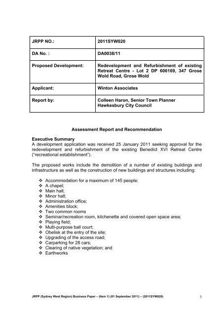
JRPP NO.:<br />
DA No. :<br />
Proposed Development:<br />
Applicant:<br />
Report by:<br />
2011SYW020<br />
DA0038/11<br />
Redevelopment and Refurbishment of existing<br />
Retreat Centre - Lot 2 DP 606169, 347 Grose<br />
Wold Road, Grose Wold<br />
Winton Associates<br />
Colleen Haron, Senior Town Planner<br />
<strong>Hawkesbury</strong> <strong>City</strong> <strong>Council</strong><br />
Assessment Report and Recommendation<br />
Executive Summary<br />
A development application was received 25 January 2011 seeking approval for the<br />
redevelopment and refurbishment of the existing Benedict XVI Retreat Centre<br />
(“recreational establishment”).<br />
The proposed works include the demolition of a number of existing buildings and<br />
infrastructure as well as the construction of new buildings and structures including:<br />
Accommodation for a maximum of 145 people;<br />
A chapel;<br />
Main hall;<br />
Minor hall;<br />
Administration office;<br />
Amenities block;<br />
Two common rooms<br />
Seminar/recreation room, kitchenette and covered open space area;<br />
Playing field;<br />
Multi-purpose ball court;<br />
Obelisk at the entry of the site;<br />
Upgrading of the access road;<br />
Carparking for 28 cars;<br />
Clearing of native vegetation; and<br />
Earthworks<br />
JRPP (Sydney West Region) <strong>Business</strong> <strong>Paper</strong> – (Item 1) (01 September 2011) – (2011SYW020) 1
Assessment of the proposal highlights the following relevant issues for consideration<br />
in the determination of the application:<br />
<br />
<br />
<br />
<br />
<br />
<br />
Flora and Fauna impacts<br />
Bushfire<br />
Noise<br />
Visual Impact – building height<br />
Stormwater, Effluent Disposal & Water Quality<br />
Carparking and Traffic<br />
The application is supported by:<br />
‘Assessment of Traffic and Parking Impacts of Proposed<br />
Refurbishment of Benedict XVI Retreat Centre’ prepared by Transport<br />
& Urban Planning and dated 22 December 2010<br />
Flora & Fauna Study and Ecological Assessment’, dated 6 January<br />
2011 and prepared by UBM Ecological Consultants P/L<br />
‘Peer review of a flora and fauna report by UBM Pty Ltd dated 6<br />
January 2011‘, dated 2 March 2011.<br />
‘Flora and fauna impact assessment for the Benedict XVI Retreat<br />
Proposal 347 Grose Wold Rd, Grose Vale’ dated 2 March 2011<br />
‘Bushfire Hazard Assessment Report’ Ref 10006 prepared by Building<br />
code & Bushfire Hazard Solutions P/L dated 7 March 2011.<br />
Design Review of a Proposed Wastewater Treatment and Effluent<br />
Irrigation System at Grose Vale, NSW prepared by Whitehead &<br />
Associates Environmental Consultants P/L dated 6 June 2011<br />
Concept Application Design Report for Benedict XVI Retreat Centre,<br />
Issue D prepared by Warren Smith & Partners<br />
This matter is being reported to the Joint Regional Planning Panel due to the<br />
proposal being development with a capital investment value that exceeds $10 million.<br />
The Capital Investment Value is $14,937,000.<br />
The application was publicly notified from 4 February 2011 to 11 March 2011.<br />
Fourteen (14) submissions and one (1) petition containing forty six (46) signatures<br />
were received. A summary of the matters raised in the submissions follows:<br />
Lack of consultation with neighbours<br />
Noise<br />
Trespassing onto adjoining properties<br />
Bushfire<br />
Lack of management of the facility<br />
Ecological impact<br />
Effluent Disposal<br />
Water demand of the development<br />
Potentially contaminated fill<br />
Hazardous materials being demolished<br />
Bridge capacity and lack of traffic barrier on bridge<br />
Increased traffic<br />
JRPP (Sydney West Region) <strong>Business</strong> <strong>Paper</strong> – (Item 1) (01 September 2011) – (2011SYW020) 2
Insufficient parking<br />
Power supply<br />
Visual impact of development<br />
Not consistent with existing use of the site<br />
Hours of use<br />
Non-compliance with height requirements<br />
No benefit to the community<br />
This Report demonstrates that the proposed development will not have any<br />
significant adverse impact on the natural or built environment. The redevelopment<br />
and refurbishment of the site will result in improved bushfire protection and safety,<br />
improved protection of waterways and bushland communities and management of<br />
the activity to minimise any potential adverse impacts on the amenity of the locality.<br />
It is recommended that the application be approved subject to conditions.<br />
Description of Proposal<br />
The application seeks approval for the redevelopment and refurbishment of the<br />
existing Benedict XVI Retreat Centre and includes the following works:<br />
<br />
<br />
Demolition of a number of existing buildings and items of infrastructure.<br />
Construction of new buildings consisting of:<br />
- Accommodation for a total of 145 people.<br />
- A chapel.<br />
- A minor hall.<br />
- An administration office.<br />
- Amenities block.<br />
- Two common rooms; and<br />
- Seminar/recreation room, kitchenette and covered open space area.<br />
<br />
Recreation facilities:<br />
- New playing field; and<br />
- New multi-purpose ball court.<br />
<br />
<br />
<br />
<br />
Obelisk at the entry to the site.<br />
Works to the access road to provide a new drop off zone, new passing bay, an<br />
upgraded 3 point turn and new loop road.<br />
Tree removal and landscaping.<br />
Earthworks<br />
JRPP (Sydney West Region) <strong>Business</strong> <strong>Paper</strong> – (Item 1) (01 September 2011) – (2011SYW020) 3
Description of the Site and Surrounds<br />
The site is situated upon the western side of Grose Wold Road at Grose Wold.<br />
The site is zoned Rural Living and is 15.95ha in area. A private access road<br />
meanders through the property to the south. All proposed and existing structures,<br />
including playing fields are predominately located at the bottom south west corner of<br />
the site.<br />
The subject property and surrounding properties contain the endangered ecological<br />
community, Shale sandstone transition forest, which is listed as a critical endangered<br />
ecological community under both Commonwealth and State legislation. Some 13.2ha<br />
of this vegetation community is contained on the subject development lot. Woods<br />
Creek transverses the property to the north and east. The topography of the locality<br />
is undulating.<br />
Adjoining and surrounding properties are predominantly used for rural residential<br />
purposes.<br />
Background<br />
The site has an extensive history of applications. Listed in chronological order, the<br />
following proposals have been considered by <strong>Council</strong>:<br />
BO0616/91 –<br />
DA0187/89 –<br />
BO0946/88 –<br />
BO1587/87 –<br />
BO0508/86 –<br />
BO0669/84 –<br />
DO0223/84 –<br />
DO083/82 –<br />
Kitchen / lounge renovation – Approved<br />
Erection of a managers residence – Approved<br />
Inground swimming pool – Approved<br />
Amenities block – Approved<br />
Resited dwelling – Approved<br />
Additions to church conference centre – Approved<br />
Erect additional cabins and ablutions to the existing Church<br />
Conference centre – Approved<br />
Erection of a dwelling house - Approved<br />
Relevant Policies, Procedures and Codes<br />
State Environmental Planning Policy (Major Developments) 2005<br />
State Environmental Planning Policy No. 44 – Koala habitat<br />
State Environmental Planning Policy No. 55 – Remediation of Land<br />
Sydney Regional Environmental Plan No 20 – <strong>Hawkesbury</strong> Nepean River<br />
<strong>Hawkesbury</strong> Local Environmental Plan 1989<br />
Draft <strong>Hawkesbury</strong> Local Environmental Plan 2009<br />
JRPP (Sydney West Region) <strong>Business</strong> <strong>Paper</strong> – (Item 1) (01 September 2011) – (2011SYW020) 4
<strong>Hawkesbury</strong> Development Control Plan 2002<br />
S94A Development Contribution Plan<br />
Section 79C Matters for Consideration<br />
In determining the application, the following matters are relevant:<br />
a. The provisions (where applicable) of any:<br />
i. Environmental Planning Instrument:<br />
The relevant environmental planning instruments are:<br />
State Environmental Planning Policy (Major Developments) 2005<br />
The application is required to be referred to the Joint Regional Planning Panel for<br />
determination in accordance with Clause 13B(1)(a) of this Policy as the development<br />
has a capital investment value in excess of $10 million.<br />
State Environmental Planning Policy No. 44 - Koala Habitat Protection<br />
Both the ‘Flora and Fauna Study and Ecological Assessment’ prepared by UBM<br />
Ecological Consultants Pty Ltd and the ‘Flora and Fauna Impact Assessment’ and<br />
‘Peer Review of flora and Fauna Report’ prepared by Abel Ecology identified the site<br />
as being ‘potential habitat’, but not ‘core koala habitat’ as defined by State<br />
Environmental Planning Policy No. 44.<br />
Therefore the Panel is not prevented from granting consent to the proposal under the<br />
provisions of this Policy.<br />
State Environmental Planning Policy No. 55 - Remediation of Land<br />
A search of <strong>Council</strong> files indicated that the land has not been used for any activities<br />
which would render the soil contaminated to such a degree as to prevent the further<br />
development of the land for a retreat centre. Therefore the application is considered<br />
to be consistent with the provisions of State Environmental Planning Policy No. 55.<br />
Sydney Regional Environmental Planning Policy 20. (No.2 - 1997) - <strong>Hawkesbury</strong><br />
- Nepean River (SREP No. 20).<br />
It is considered that the proposed development will not significantly impact on the<br />
environment of the <strong>Hawkesbury</strong>-Nepean River, either in a local or regional context<br />
and that the development is not inconsistent with the general or specific aims,<br />
planning considerations, planning policies, recommended strategies and<br />
development controls.<br />
<strong>Hawkesbury</strong> Local Environmental Plan 1989 (HLEP 1989)<br />
Clause 2 – Aims, objectives etc,<br />
The proposed development is considered to be consistent with the aims and<br />
objectives as outlined in Clause 2 of <strong>Hawkesbury</strong> Local Environmental Plan 1989.<br />
JRPP (Sydney West Region) <strong>Business</strong> <strong>Paper</strong> – (Item 1) (01 September 2011) – (2011SYW020) 5
Clause 8 – Zones indicated on the map<br />
The subject land is within the Rural Living zone.<br />
Clause 9 – Carrying out of development<br />
The proposed development is defined as ‘recreational establishment’ which is<br />
permissible with consent within the Rural Living zone.<br />
Clause 9A – Zone objectives<br />
Clause 9A states that consent shall not be granted for a development unless, in the<br />
opinion of <strong>Council</strong>, the carrying out of the development is consistent with the<br />
objectives of the zone.<br />
The objectives of the Rural Living zone are:<br />
(a)<br />
to provide primarily for a rural residential lifestyle,<br />
Comment: The property is already approved for use as a retreat and conference<br />
centre, which is considered compatible with the rural residential nature<br />
of the locality.<br />
(b)<br />
to enable identified agricultural land uses to continue in operation,<br />
Comment: The property is approved for and being used as a retreat and<br />
conference centre.<br />
(c)<br />
to minimise conflict with rural living land uses,<br />
Comment: It is considered that the proposed development for the intensification of<br />
use of the property as a retreat and conference centre will not result in<br />
unreasonable impacts on the amenity of adjoining properties used for<br />
rural residential purposes.<br />
(d)<br />
to ensure that agricultural activity is sustainable,,<br />
Comment: The land is not used for any agricultural purpose.<br />
(e) To provide for rural residential development on former agricultural land if<br />
the land has been remediated,<br />
Comment: The land is not considered to be contaminated due to any past land uses<br />
or activities.<br />
(f)<br />
To preserve the rural landscape character of the area by controlling the<br />
choice and colour of building materials and the position of buildings,<br />
access roads and landscaping.<br />
JRPP (Sydney West Region) <strong>Business</strong> <strong>Paper</strong> – (Item 1) (01 September 2011) – (2011SYW020) 6
Comment: The design, materials, colours and siting of proposed buildings are<br />
considered to be compatible with the character of the locality, and with<br />
existing development on the land and on adjoining properties.<br />
(g) To allow for agricultural land uses that are ancillary to an approved rural<br />
residential land use that will not have significant adverse environmental<br />
effects or conflict with other land uses in the locality.<br />
Comment: The proposed development is for the redevelopment and refurbishment<br />
of an existing retreat and conference centre. No agricultural activities are<br />
proposed.<br />
(h)<br />
to ensure that agricultural activities occur in a manner:<br />
a. that does not have a significant adverse effect on water catchments,<br />
including surface and groundwater quality and flows, land surface<br />
conditions and important ecosystems such as streams and wetlands,<br />
and<br />
b. that satisfies best practice guidelines and best management practices,<br />
Comment<br />
The development site is in close proximity to Woods Creek<br />
(approximately 100 m from the development site at the closet point),<br />
which is a tributary of the Grose River (which is a nominated ‘Wild River’<br />
due to its pristine condition). The subject land is also located<br />
approximately 864m from a World Heritage National Park.<br />
In this regard, and in consideration of the vegetated setbacks of the<br />
development from these watercourses and National Parks, it is<br />
considered that the proposal will have no significant adverse impact on<br />
watercourses, surface and groundwater quality and surface conditions<br />
in the locality from stormwater or effluent disposal.<br />
(i)<br />
to prevent the establishment of traffic generating development along main<br />
and arterial roads,<br />
Comment: The proposed development is not classified as traffic generating<br />
development under the provisions of State Environmental Planning<br />
Policy (Infrastructure) 2007.<br />
(j)<br />
to ensure that development does not create unreasonable economic<br />
demands for the provision or extension of public amenities or services.<br />
Comment: The proposed development will not create unreasonable demands for<br />
the provision/extension of public amenities or services.<br />
JRPP (Sydney West Region) <strong>Business</strong> <strong>Paper</strong> – (Item 1) (01 September 2011) – (2011SYW020) 7
Clause 18 – Provision of water, sewerage etc services<br />
Electrical and telephone services are available to the site. It is considered that these<br />
available services are satisfactory for the proposed development. Written evidence<br />
that satisfactory arrangements for the provision/extension of telephone and electrical<br />
services to this development will be required as a condition of consent.<br />
A new onsite effluent disposal system will service the existing and proposed<br />
buildings, and this system is considered satisfactory. The development will be<br />
subject to on site collection of rainwater for reuse and a stormwater drainage and<br />
treatment system will be installed.<br />
Clause 28 – Development in the vicinity of heritage items<br />
The subject land adjoins a property identified as a heritage item under Schedule 1 to<br />
<strong>Hawkesbury</strong> Local Environmental Plan 1989 located at 663 Grose Vale Road, Grose<br />
Wold. The heritage item (residence) situated on this adjoining property is<br />
approximately 850m to the north of the development site. It is considered that the<br />
proposed development will have no significant impact on the heritage value of this<br />
item given that there is no visual connection between this item and the development.<br />
Clause 36 – Clearing of land in certain environmental and other zones.<br />
This Clause prohibits the felling of trees, filling or otherwise altering the surface level<br />
of land without the consent of the <strong>Council</strong>. The development application includes the<br />
removal of trees and earthworks.<br />
Clause 37A – Development on land identified on Acid Sulfate Soils Planning<br />
Map<br />
The land affected by the development falls within Class 5 as identified on the Acid<br />
Sulfate Soils Planning Map. The proposed development does not include any works<br />
as defined within this Clause and therefore no further investigations in respect to acid<br />
sulphate soils are required. The proposal is consistent with the requirements of this<br />
Clause.<br />
ii.<br />
Draft Environmental Planning Instrument that is or has been placed on<br />
exhibition and details of which have been notified to <strong>Council</strong>:<br />
Draft <strong>Hawkesbury</strong> Local Environmental Plan 2011 applies to the proposal. The<br />
exhibition of this draft Plan was undertaken from 5 February 2010 to 12 April 2010.<br />
Under this Plan the subject land is proposed to be zoned RU4 Rural Small Holdings.<br />
It is noted that many of the landuse definitions within the Draft Plan have been<br />
changed from how they are currently defined within <strong>Hawkesbury</strong> Local Environmental<br />
Plan 1989. As a result the proposed use no longer fit within the ‘recreation’<br />
definitions and it is considered that the activity is best defined under the Draft Plan as<br />
“place of public worship”, which means:<br />
“a building or place used for the purpose of religious worship by a congregation or<br />
religious group, whether or not the building or place is also used for counselling,<br />
social events, instruction or religious training.” The accommodation on the site is<br />
JRPP (Sydney West Region) <strong>Business</strong> <strong>Paper</strong> – (Item 1) (01 September 2011) – (2011SYW020) 8
considered to be an ancillary use, as this accommodation is only provided in<br />
conjunction with the religious activities provided on the site.<br />
’Place of public worship’ is permissible with development consent within the RU4<br />
zone. The proposed development is considered to be consistent with the provisions<br />
of the Draft Plan, including the RU4 zone objectives.<br />
Draft Local Environmental Plan 2011 also includes a height restriction for buildings<br />
on this land of 10m. Currently, <strong>Hawkesbury</strong> Local Environmental Plan 1989 does not<br />
have a height requirement. The proposed chapel will have a total height of 14.8m,<br />
however the design of the building is not considered to be bulky and is consistent<br />
with the use of the building ie the building looks like a church. The design of the<br />
building is considered to be compatible with the rural character of the locality.<br />
At present the Draft Plan is not considered to be either imminent or certain and<br />
therefore the provisions of <strong>Hawkesbury</strong> Local Environmental Plan 1989 prevail.<br />
iii.<br />
Development Control Plan applying to the land:<br />
<strong>Hawkesbury</strong> Development Control Plan 2002<br />
The <strong>Hawkesbury</strong> Development Control Plan applies to the proposal. An assessment<br />
of the proposal against the relevant provisions of this Plan follows:<br />
Notification Chapter<br />
The application was publicly notified from 4 February 2011 to 11 March 2011.<br />
Fourteen (14) submissions and one (1) petition containing forty six (46) signatures<br />
were received. The matters raised in the submissions are discussed further in this<br />
Report.<br />
Erosion and Sediment Control Chapter<br />
An erosion and sediment control plan was submitted with the application and is<br />
considered satisfactory. Erosion and sediment control can be enforced through<br />
conditions of consent in accordance with the provisions of this Chapter.<br />
Effluent Disposal<br />
A wastewater feasibility Assessment has been submitted in accordance with this<br />
Chapter of the Development Control Plan.<br />
Landscape Chapter<br />
A concept landscaping plan has been submitted with the application and is<br />
considered satisfactory in identifying areas for landscaping however a detailed<br />
landscaping plan will be required and a condition of consent has been imposed in<br />
this regard.<br />
iv.<br />
Planning agreement that has been entered into under section 93F, or any<br />
draft planning agreement that a developer has offered to enter into under<br />
section 93F:<br />
JRPP (Sydney West Region) <strong>Business</strong> <strong>Paper</strong> – (Item 1) (01 September 2011) – (2011SYW020) 9
There has been no planning agreement or draft planning agreement entered into<br />
under Section 93F of the Environmental Planning and Assessment Act, 1979.<br />
v. Matters prescribed by the Regulations:<br />
Conditions will be imposed relating to compliance with the Building Code of Australia.<br />
Demolition will be carried out in accordance with the relevant Australia Standards.<br />
b. The likely impacts of that development, including environmental impacts<br />
on both the natural and built environments and the social and economic<br />
impacts in the locality:<br />
Context & Setting<br />
Existing development in the locality is predominantly for rural residential uses. The<br />
proposed use is considered compatible with these landuses as the activity will have<br />
no adverse impact on the amenity of adjoining and nearby residential properties.<br />
It is considered that the siting of the proposed new buildings is appropriate having<br />
regard to the utilisation of an existing cleared and level area (formally a playing field).<br />
Whilst close to the boundary, this area has a level lower than the adjoining property<br />
and the retention of existing vegetation, along with the additional proposed<br />
landscaping will afford a reasonable level of privacy to adjoining and nearby<br />
dwellings.<br />
The new buildings are considered to be compatible with the rural character of the<br />
locality having regard to their design, siting, materials and colours and will not have<br />
an adverse impact on the scenic quality of the area.<br />
There is no development standard for obelisks, however by comparison <strong>Council</strong>s<br />
sign policy requires freestanding signs to have a maximum height of 6m. In this<br />
regard, it is considered reasonable to limit the height of the obelisk to 6m and<br />
accordingly a condition of consent has been included. With the reduction in the<br />
height, it is considered that the proposed obelisk at the entrance of the property will<br />
have no adverse impact on the streetscape or scenic quality of the area due to its<br />
setting which includes a backdrop of trees that provide scale to the structure. This<br />
structure is not considered to be either bulky or dominant.<br />
It is considered that the proposed development will have no unreasonable impacts on<br />
adjoining properties in terms of overshadowing, loss of visual or acoustic privacy, or<br />
loss of views and vistas given its siting, the presence of existing vegetation and the<br />
inclusion of additional landscaping.<br />
Access, Transport & Traffic<br />
An ‘Assessment of Traffic and Parking Impacts of Proposed Refurbishment of<br />
Benedict XVI Retreat Centre’ prepared by Transport & Urban Planning and dated 22<br />
December 2010 was submitted in support of the application. This Report concluded:<br />
JRPP (Sydney West Region) <strong>Business</strong> <strong>Paper</strong> – (Item 1) (01 September 2011) – (2011SYW020) 10
“This report has been prepared to examine the traffic and parking impacts of a<br />
proposal to refurbish the Benedict XVI Retreat Centre at 347 Grose Wold Road,<br />
Grose Vale...<br />
The assessment has found that the proposed refurbishment will result in a small<br />
increase in traffic coming to the Retreat Centre and overall the traffic impacts will be<br />
relatively minor, with little impact on the adjacent local roads and on the wider road<br />
network.<br />
The Retreat Centre will have 28 formal parking spaces (including 2 disabled spaces),<br />
as well as an overflow parking area, a bus/coach set down and pick up bay and turn<br />
around facility. These facilities will be adequate to cater for the parking demands on<br />
the site.<br />
<strong>Hawkesbury</strong> Development Control Plan does not provide a parking rate for the<br />
proposed development. The Traffic Report highlights that the majority of people will<br />
arrive at the Centre by bus.<br />
The Applicant advises:<br />
“Given the highest number of visitors to the Centre are generally school groups,<br />
which, generate the lowest traffic and parking demand as they arrive and depart by<br />
bus/coach, it is considered that the proposed bus/coach and car parking provision<br />
will adequately cater for school groups.<br />
Furthermore, whilst the maximum parking demand occurs from community groups,<br />
these generally comprise a maximum of 60 people.”<br />
On the occasions that the centre will be full, the Traffic Report identifies that a spill<br />
over of approximately 9 vehicles will result, which can be accommodated within the<br />
proposed new oval on the site. Carparking has been calculated based on an<br />
occupancy rate of 4 people per vehicle. However, this occupancy rate is not<br />
considered to be realistic for situations where over 60 people are travelling to the site<br />
only by car.<br />
In addition, it is further considered that the proposal for overflow parking on the oval<br />
area is undesirable. This is because the oval is used for effluent disposal and there<br />
could be potential damage to irrigation infrastructure for effluent disposal and impacts<br />
on sensitive vegetation and watercourse through soil disturbance from over use of<br />
that irrigated area.<br />
There is ample room on the site to accommodate additional car parking to provide a<br />
suitable level of parking for guests. In this regard, details of the number and location<br />
of additional car parking spaces will be required to be submitted to <strong>Hawkesbury</strong> <strong>City</strong><br />
<strong>Council</strong> for approval by way of a condition of a deferred commencement consent.<br />
A ‘Structural Condition Report of the Existing Road Bridge’ prepared by Mott<br />
MacDonald Hughes Trueman dated 22 December 2010 was submitted with the<br />
application. This Report advised:<br />
JRPP (Sydney West Region) <strong>Business</strong> <strong>Paper</strong> – (Item 1) (01 September 2011) – (2011SYW020) 11
“The bridge in current configuration does not comply with AS5100<br />
(Bridge Design), however it might be able to carry 15t vehicles with a<br />
maximum axle load 9t. (subject to further investigation into existing<br />
concrete deck)<br />
Heavily corroded steal beam is to be cleaned and re-inspected in order<br />
to establish structural adequacy of this beam.<br />
Safety barriers do not comply with loading requirements of AS5100<br />
(Bridge Design).<br />
Further investigation will be required to verify structural adequacy of the<br />
existing footings.<br />
In this regard, the Applicant has advised:<br />
“The structural engineer, Mott Macdonald Hughes Trueman’s report does<br />
recommend further investigation and CAS intend to undertake this work as part of the<br />
detailed design. Should an upgrade to the bridge be required this would be carried<br />
out as due maintenance.”<br />
It is considered that any structural work in relation to the bridge will require the<br />
approval of <strong>Council</strong>. In this regard, it will be a requirement of the consent that the<br />
investigations be carried out and a report provided to <strong>Council</strong>. Should works be<br />
required to upgrade the bridge, details will be required to be submitted for approval.<br />
Heritage<br />
In their letter of 2 December 2010 the Deerubbin Local Aboriginal land <strong>Council</strong><br />
advised that they have “no objections to the proposed upgrade of Benedict XVI<br />
Retreat Centre on the grounds of Aboriginal cultural heritage.”<br />
As previously discussed, the proposal will have no adverse impact on the adjoining<br />
heritage item at 663 Grose Vale Road, Grose Vale.<br />
Water<br />
A central rainwater reuse tank, 200,000 litres in capacity, is proposed to be installed<br />
to collect rainwater from downpipes from the roof areas. Captured roof water is<br />
proposed to be utilised as potable water in the proposed development as well as for<br />
WC flushing and laundry reuse.<br />
The Concept Application Design Report for Benedict XVI Retreat Centre, Issue D<br />
prepared by Warren Smith & Partners has identified that the potable water demand<br />
on-site is 11,750 litre/day and provides the following summary:<br />
Summary<br />
Roof Capture Area 2,878m 2<br />
Rainwater Storage Required 200 kL<br />
% Efficiency 98.05%<br />
Mean Annual Harvest<br />
2,304 kL<br />
Annual Demand<br />
2,447 kL<br />
Potable Make up Required 48 kL<br />
JRPP (Sydney West Region) <strong>Business</strong> <strong>Paper</strong> – (Item 1) (01 September 2011) – (2011SYW020) 12
It is noted that the system has been sized using mean rainfall data. During dry<br />
periods, water shall be required to be tanked into the centre in a similar fashion to the<br />
current scenario.<br />
The calculation for the demand for potable water was based on the usage of the site<br />
being 3 days and two nights during the week, and 2 days and 1 night over the<br />
weekend.<br />
It is considered that the collection, storage and treatment of roof rainwater can satisfy<br />
the potable water requirements of the centre, with minimal reliance on potable water<br />
being brought to the site. In this regard, it is further considered that no adverse<br />
impact will result from the occasional truck delivery of water.<br />
Flora & Fauna<br />
A Report titled ‘Flora & Fauna Study and Ecological Assessment’, dated 6 January<br />
2011 and prepared by UBM Ecological Consultants P/L was submitted in support of<br />
the application.<br />
The Report concluded that a Species Impact Statement would be required in respect<br />
to impacts on Shale Sandstone Transition Forest and <strong>Council</strong> requested that the<br />
applicant provide one. As a result, a ‘Peer review’ and supplementary Report was<br />
submitted. These Reports titled ‘Peer review of a flora and fauna report by UBM Pty<br />
Ltd dated 6 January 2011‘, dated 2 March 2011 and ‘Flora and fauna impact<br />
assessment for the Benedict XVI Retreat Proposal 347 Grose Wold Rd, Grose Vale’<br />
dated 2 March 2011 prepared by Abel Ecology concluded respectively:<br />
“The proposal can be modified to minimize impact by:<br />
1. reducing the extent of eastern batter of the playing field where the plan shows<br />
that the batter extends into the forest;<br />
2. Provide site-specific data for both input and output from the sewerage<br />
treatment plant and provide a very clear analysis of nutrient control<br />
performance of both soil and turf;<br />
3. Redesign of bushfire APZ to indicate extent from the buildings, clearly map<br />
and specify trees for removal and retention. Once the number of trees is<br />
finalized for removal an impact can be quantified.<br />
A new impact assessment report will rely on clear data for each of the above points.<br />
Actions to ameliorate or offset the anticipated impacts may include:<br />
Weed management in the EEC;<br />
Use of EEC species (that are able to tolerate effluent) in the landscape plan;<br />
Use of felled logs as habitat enhancement in the forest; and<br />
Planting of replacement trees (including phosphorus tolerant species) in<br />
clearings beyond the APZ.<br />
“A Species Impact Statement is not recommended.<br />
A Vegetation management Plan is needed to provide the following:<br />
JRPP (Sydney West Region) <strong>Business</strong> <strong>Paper</strong> – (Item 1) (01 September 2011) – (2011SYW020) 13
Control of vegetation within the landscape plan<br />
Control of unauthorised clearing<br />
Control of fuel load within the APZ<br />
Control of weeds in the entire site, both cleared area and retained intact forest<br />
Placement of fallen or felled logs in the intact forest<br />
Placement of fauna nest boxes in both the intact forest and landscape zone<br />
Planting of replacement trees beyond the APZ as offset for trees removed<br />
Planting and maintenance of the 10m buffer zone to the SSTF around the<br />
development area<br />
That VMP will refer to the entire site, being 0.65 ha Western Sydney Dry Rainforest,<br />
13.0 ha Shale Sandstone Transition Forest (SSTF) and the developed area. The<br />
extent of (canopy) loss of SSTF is 6,367m 2 (4.47%) out of a total 14.25ha.<br />
The VMP is in effect providing an offset to impacts on site in a ratio of 22:1 just for<br />
SSTF, excluding Western Sydney Dry Rainforest.<br />
There is no impediment to this proposal in the scope of this report. There is not likely<br />
to be any significant effect on any Endangered Ecological Community, Threatened<br />
Species or their habitats.<br />
The proposal was modified so that the Asset Protection zones and the playing field<br />
do not intrude into the intact bushland areas. The reduction in the APZ was achieved<br />
by increasing the level of construction of the building on the southern side of the<br />
development. The portion of the batter for the playing field has been reduced<br />
through the use of a retaining wall. A ten (10) metre buffer area between the APZ<br />
and the natural vegetation has been provided to the east and south of the<br />
development. The new proposal will require removal of 132 trees, however no trees<br />
within the intact bushland will be removed and it is proposed to replant trees within<br />
cleared areas between the Asset Protection Zones and the bushland.<br />
The trees to be removed do not form intact habitat in that these trees sit within a<br />
previously disturbed area that has an understorey of exotic lawn. Specific trees have<br />
now been selected for removal for the establishment of the asset protection zones.<br />
The trees selected were done on the basis of:<br />
Most common species on the site;<br />
Exotic species or native species that are not of local provenance or are not<br />
part of the Shale Sandstone Transition Forest community;<br />
Youngest specimens (do not provide hollows/habitat)<br />
Appropriate stormwater disposal and on site effluent disposal has been provided.<br />
With the inclusion of the buffer areas, the selective removal of vegetation and the<br />
development of a Vegetation Management Plan as specified above, it is considered<br />
that the requirements of Part 5A of the EP & A Act are satisfied in that the proposed<br />
development will have no significant impact on threatened species, populations,<br />
ecological communities or their habitats.<br />
JRPP (Sydney West Region) <strong>Business</strong> <strong>Paper</strong> – (Item 1) (01 September 2011) – (2011SYW020) 14
Waste<br />
The ‘flora and fauna impact assessment prepared by Abel Ecology states that:<br />
“The soil has adequate adsorption capacity such that nutrient control is not a limiting<br />
factor. Sufficient area is available so that water is disposed by evaporation and<br />
transpiration, using underground dispersal so that there is no risk of overland flow of<br />
nutrient to the downslope forest. The disposal area is greater than 40m from any<br />
watercourse. A ten metre (10m) buff is provided between the effluent disposal area<br />
and the sensitive vegetation community on the site, so no adverse impact is<br />
anticipated.”<br />
The Design of the effluent treatment and disposal system includes:<br />
A 100m buffer zone from creek to the east from the treatment system and the<br />
land application area.<br />
Sub-surface irrigation with treated effluent within the playing field area.<br />
Effluent will be disinfected with UV, and dosed with chlorine, prior to<br />
discharge. It is proposed to provide sub-surface drip irrigation at 600mm<br />
centres in the playing field. This shall provide for a uniform distribution of<br />
effluent. The land application area will be 5,500m 2 in size.<br />
Wet weather storage for 9.67 days of storage.<br />
Capacity to cater for 150 persons (guests and staff inclusive).<br />
The existing septic tank and absorption trench which services the manager’s<br />
residence is to be retained. All other existing systems will be decommissioned and<br />
all wastewater will be directed to a new treatment and reuse system.<br />
A “Design Review of a Proposed Wastewater Treatment and Effluent Irrigation<br />
System at Grose Vale, NSW” prepared by Whitehead & Associates Environmental<br />
Consultants P/L dated 6 June 2011was submitted in support of the application.<br />
This Review advises that design flow to the treatment system is expected to be<br />
12,000 litres per day based on a maximum occupancy of 150 persons and a design<br />
daily flow allowance of 80L per person and that this is considered appropriate given<br />
that no full scale laundry facilities are provided and “AAA” rate water saving fixtures<br />
will be used throughout the development.<br />
The Review concludes that:<br />
“The proposed effluent irrigation system is adequately sized and provides an<br />
acceptable level of additional capacity to sustainably manage the expected<br />
wastewater flows from the redevelopment.<br />
Additionally, the proposed wastewater treatment system represents a significant<br />
upgrade form the existing operation and will provide measureable improvements in<br />
irrigation water quality and treatment reliability. The improved irrigation water quality<br />
JRPP (Sydney West Region) <strong>Business</strong> <strong>Paper</strong> – (Item 1) (01 September 2011) – (2011SYW020) 15
will substantially reduce the risk of poor land application area performance,<br />
particularly when compared to the existing situation.”<br />
On site wastewater disposal has been assessed by <strong>Council</strong>’s Sewerage<br />
Management Facility Team and is considered satisfactory having regard to the<br />
nature and size of the activity and the attributes and constraints of the land, including<br />
soil conditions and proximity to sensitive receptors. However, use of the disposal<br />
area for carparking is not supported.<br />
Noise & Vibration<br />
The applicant advises that:<br />
“The new accommodation units will have ensuite amenities replacing the<br />
existing separate communal facilities avoiding the need to leave the<br />
accommodation units at night for ablutions;<br />
The new conference rooms and chapel will mitigate the need for holding<br />
conference and devotion activities out doors as is the case with the existing<br />
facilities; and<br />
Activities currently taking place near the western property boundary (on the<br />
existing playing field) will be moved down the hill and away from the proximate<br />
neighbouring dwelling improving amenity of these properties.”<br />
A Plan of Management has been submitted with the application and proposes the<br />
following management measure to reduce noise impacts within the locality:<br />
“Noise levels from the Chapel will be managed to endeavour to ensure that<br />
any <strong>Council</strong> requirements are adhered to.<br />
Doors to the Conference will generally remain closed when in use to ensure<br />
that singing and music do not disturb neighbouring properties.<br />
A maximum of 160 people will be permitted within the Chapel and Conference<br />
hall.<br />
Outdoor activities which could be deemed to cause a noise nuisance will<br />
generally be restricted to the hours 6:00am – 9.00pm.”<br />
The development proposal includes the operation of an organ within the chapel and<br />
the use of the site will include indoor music and singing. The application has been<br />
assessed by <strong>Council</strong>’s Environmental Health Officers and it is considered that the<br />
noise generated by the activity can comply with the Protection of the Environment<br />
Operations Act.<br />
The Management Plan restricts the number of people within the buildings to a<br />
maximum of 160 people however the onsite effluent disposal design caters for a<br />
maximum of 150 people, guests and employees inclusive. In this regard, it is<br />
considered that the consent be limited to a maximum of 150 people (excluding the<br />
onsite managers) at any one time.<br />
It is also proposed to restrict outdoor activities to the hours of 6:00am to 9:00pm and<br />
the applicant advises that early morning external activities will be restricted to prayer<br />
and reflection. However, it is considered that outdoor activities start at 7:00am in line<br />
JRPP (Sydney West Region) <strong>Business</strong> <strong>Paper</strong> – (Item 1) (01 September 2011) – (2011SYW020) 16
with the night time period of 10:00pm to 7:00am, to prevent the potential for offensive<br />
noise.<br />
The development, in general, will be subject to meeting required noise levels in<br />
accordance with the Protection of the Environment Operations Act, and this will be<br />
ensured through conditions of consent, as well as the abovementioned management<br />
practices.<br />
Natural Hazards<br />
A ‘Bushfire Hazard Assessment Report’ Ref: 100006 dated 7 March 2011 and<br />
prepared by Building Code & Bushfire Hazard Solutions Pty Limited was submitted in<br />
support of the application.<br />
The application, including this Report, was referred to NSW Rural Fire Services for<br />
approval as ‘integrated development’ in accordance with Section 91 of the<br />
Environmental Planning and Assessment Act, 1979.<br />
In their letter of 21 June 2011, NSW Rural Fire Services granted their Bushfire<br />
Authority subject to conditions.<br />
Safety, Security & Crime Prevention<br />
Safety and security will be ensured through the implementation of the Management<br />
Plan and the presence of Site Managers who reside on the property.<br />
Social Impact in the Locality<br />
It is considered that the proposed development will have no negative social impact<br />
on the locality given that the activity is self contained within the site. The potential for<br />
guests trespassing onto to adjoining properties have been addressed through the<br />
requirement for fencing and proposed management practices of the activity.<br />
Economic Impact on the Locality<br />
It is considered that the proposed development will have a positive, if minor, impact<br />
on the economy of the locality.<br />
Cumulative Impacts<br />
Having regard to the nature and design of the proposed development it is considered<br />
that the proposal is compatible with the surrounding landuses and no negative<br />
cumulative impact is foreseen.<br />
c. Suitability of the site for the development:<br />
The development site has adequate setbacks from roads and adjoining properties so<br />
as to minimise visual and privacy impacts on nearby properties. The application<br />
demonstrates that the proposed development will have no adverse impacts on the<br />
locality. The development site has been previously cleared and the proposed<br />
development will not have an adverse impact on the adjacent Endangered Ecological<br />
Community or nearby watercourse. The land is designated as being bushfire prone<br />
JRPP (Sydney West Region) <strong>Business</strong> <strong>Paper</strong> – (Item 1) (01 September 2011) – (2011SYW020) 17
however this affectation is not prohibitive to the development. Appropriate<br />
stormwater drainage of the site and development can be achieved, as well as the<br />
onsite disposal of effluent. It is therefore considered that the site is suitable for the<br />
proposed development.<br />
d. Any submissions made in accordance with the Act or the Regulations:<br />
Integrated Development<br />
NSW Rural Fire Services<br />
The application was referred to NSW Rural Fire Services for approval as ‘integrated<br />
development’ in accordance with Section 91 of the Environmental Planning and<br />
Assessment Act, 1979.<br />
In their letter of 21 June 2011, NSW Rural Fire Services granted their Bushfire<br />
Authority subject to conditions.<br />
Public Submissions<br />
The application was publicly notified from 4 February 2011 to 11 March 2011.<br />
Fourteen (14) submissions and one (1) petition containing forty six (46) signatures<br />
were received.<br />
The matters raised in the submissions are discussed below:<br />
Lack of consultation with neighbours<br />
Comment: The application was duly notified in accordance with <strong>Hawkesbury</strong><br />
Development Control Plan and thereby the requirements of the<br />
Environmental Planning and Assessment Act, 1979 have been met.<br />
Prior to the lodgement of the application, the proponents of the<br />
development sought consultation with neighbours via letters and an<br />
information session and it is noted that some residents may not have<br />
been included in that process.<br />
Noise including singing and music, horns, noise resulting from an<br />
increase in number of people and after hours noise.<br />
Comment: The applicant has submitted a Plan of Management for the activity and<br />
hours of operation. New rooms include an adjoining ensuite thus<br />
removing the necessity for guests to leave their rooms at night. No horns<br />
are proposed to be used. It is considered that whilst there is an increase<br />
in the number of guests from 116 to 145 people, the management of the<br />
development, including that of after hours external games and activities<br />
will ensure that no unreasonable impacts on the amenity of adjoining<br />
properties will result. In addition, all external activities have been<br />
relocated away from the western boundary and the residences of the<br />
nearest neighbouring properties.<br />
JRPP (Sydney West Region) <strong>Business</strong> <strong>Paper</strong> – (Item 1) (01 September 2011) – (2011SYW020) 18
As previously discussed, it is considered that the noise generated by the<br />
activity can comply with the Protection of the Environment Operations Act<br />
and this will be ensured through conditions of consent.<br />
Trespassing onto adjoining properties<br />
Comment: The applicant proposes to erect a fence to limit roaming of guests onto<br />
adjoining properties. A condition of consent will be imposed to ensure the<br />
erection of the fence and to obtain details and location of the fence for<br />
approval. Measures, in the form of educating visitors to the site, will be<br />
included in the Management Plan for the activity.<br />
Access requirements of the NSW Rural Fire Services<br />
Comment: NSW Rural Fire Services have assessed the application and granted<br />
their Bush Fire Safety Authority subject to conditions. The granting of<br />
this approval indicates that the NSW Rural Fire Services are satisfied<br />
with regard to access to and from the development over the subject<br />
property.<br />
Evacuation procedures appear insufficient<br />
Comment: NSW Rural Fire Services have assessed the application and granted<br />
their Bush Fire Safety Authority subject to conditions, including that for an<br />
evacuation plan. Approval has been granted without reliance on<br />
evacuation over the adjoining property.<br />
Lack of water storage in relation to capacity for fire fighting.<br />
Comment: A 200 kl static water supply is proposed. NSW Rural Fire Services have<br />
assessed the application and granted their Bush Fire Safety Authority<br />
subject to conditions, including requirements for the provision of water<br />
tanks.<br />
Lack of management of the facility<br />
Comment: A detailed Plan of Management for the activity has been submitted and is<br />
considered satisfactory.<br />
Lack of consultation with local rural fire brigade.<br />
Comment: The application requires the approval of NSW Rural Fire Services as<br />
‘integrated development’. NSW Rural Fire Services have assessed the<br />
JRPP (Sydney West Region) <strong>Business</strong> <strong>Paper</strong> – (Item 1) (01 September 2011) – (2011SYW020) 19
application and granted their Bush Fire Safety Authority subject to<br />
conditions.<br />
Ecological impact.<br />
Comment: The submitted Flora and Fauna Reports demonstrate that the proposed<br />
development will have no significant impact on threatened species,<br />
populations, ecological communities or their habitats.<br />
Impact on the creek.<br />
Comment: The submitted Flora and Fauna Reports demonstrate that the proposed<br />
development will have no significant impact on Woods Creek and<br />
subsequently the Grose River. The development is located<br />
approximately 100m (at its closest point) from Woods Creek which is<br />
considered to be a satisfactory buffer distance to minimise any adverse<br />
impacts, with particular regard to wastewater disposal.<br />
It is considered that with the implementation of appropriate erosion and<br />
sedimentation controls during construction of the development, as well as<br />
the implementation of the proposed stormwater management devices, no<br />
significant adverse impacts on water courses, including Woods Creek<br />
and the Grose River, will result.<br />
Use of equivalent usage in calculations for wastewater generation and<br />
disposal not justified.<br />
Comment: The “Design Review of a Proposed Wastewater Treatment and Effluent<br />
Irrigation System” prepared by Whitehead & Associates Environmental<br />
Consultants P/L advises that design flow to the treatment system is<br />
expected to be 12,000 litres per day based on a maximum occupancy<br />
of 150 persons and a design daily flow allowance of 80L per person and<br />
that this is considered appropriate given that no full scale laundry<br />
facilities are provided and “AAA” rate water saving fixtures will be used<br />
throughout the development.<br />
Insufficient area for required treated effluent irrigation<br />
Comment: The proposed land application area for wastewater disposal is 5,500m 2<br />
which has been assessed as being adequate. This area is<br />
predominantly within the new playing field (oval) and as previously<br />
discussed to ensure the effectiveness of this disposal area, overflow<br />
carparking within this area is not supported.<br />
JRPP (Sydney West Region) <strong>Business</strong> <strong>Paper</strong> – (Item 1) (01 September 2011) – (2011SYW020) 20
Hard surface ball court in proposed effluent irrigation area.<br />
Comment: The Applicant has advised that the new multi-purpose ball court, which is<br />
located adjacent to the playing field is to remain in the land application<br />
area, it will not be a hard surface.<br />
Lack of capacity of fill soil for absorption.<br />
Comment: The wastewater consultant advises that the soil is adequate for<br />
absorption, and on site effluent disposal has been assessed as being<br />
satisfactory having regard to soil conditions, amongst other<br />
considerations.<br />
Insufficient wet weather storage of wastewater<br />
Comment: The proposed wastewater system has soil probes which shuts the<br />
system down in the event of wet weather and has a storage volume of<br />
9.7 days for treated effluent if continuous rainfall occurs. At 80%<br />
capacity the effluent system will alarm and a pump out service will be<br />
required. The level of wet weather storage is considered satisfactory.<br />
Water demand exceeds supply.<br />
Comment: As previously discussed, it is considered that the collection, storage and<br />
treatment of roof rainwater can satisfy the potable water requirements of<br />
the centre, with minimal reliance on potable water being brought to the<br />
site.<br />
Potentially contaminated fill<br />
Comment: The source of the identified uncontrolled fill was from the cut and fill<br />
operation to form the existing open space area. Given the history of the<br />
use of the property, and that no fill was imported onto the site, it is<br />
considered the land has not been used for any activities which would<br />
render the soil contaminated to such a degree as to prevent the<br />
proposed development.<br />
Hazardous materials being demolished.<br />
Comment: The only material likely to be hazardous is asbestos, which would be<br />
required to be removed by a licensed contractor in accordance with Work<br />
Cover requirements.<br />
JRPP (Sydney West Region) <strong>Business</strong> <strong>Paper</strong> – (Item 1) (01 September 2011) – (2011SYW020) 21
Bridge capacity<br />
Comment: The applicant will be required to provide engineering certification in<br />
respect to the capacity of the bridge to support the loads likely to be<br />
imposed on it.<br />
Lack of traffic barrier on bridge<br />
Comment: The Applicant advises that “the safety of the bridge is addressed in the<br />
Traffic Report with mitigation measures proposed to be implemented<br />
including signage. As noted above, this is a privately owned bridge on a<br />
private road and the standards applicable generally to existing single<br />
land bridges on rural secondary and tertiary roads will be met.”<br />
Increased traffic<br />
Comment: Given that the increase in the number of people is 29, and that most<br />
guests will arrive at the centre by bus, it is considered that traffic<br />
generated by the activity will have no significant adverse impact on the<br />
local road network.<br />
Insufficient parking<br />
Comment: It is considered that in the circumstances where buses are used the<br />
parking available on site is adequate to cater for the likely number of<br />
vehicles generated. However, as previously discussed, for larger<br />
community groups adequate parking has not been proposed. However,<br />
there is ample room on the site to accommodate additional car parking to<br />
provide a suitable level of parking for guests. In this regard, details of the<br />
number and location of additional car parking spaces will be required to<br />
be submitted to <strong>Hawkesbury</strong> <strong>City</strong> <strong>Council</strong> for approval by way of a<br />
condition of a deferred commencement consent.<br />
Power supply is incoming over other properties<br />
Comment: The Applicant further advises that “CAS has undertaken investigations<br />
into the requirements for bringing power to the site from Grose Wold<br />
Road and initial indications are that even if feasible now, it likely would<br />
require the erection of more poles and would need to be taken through<br />
two area classified as Endangered Ecological Communities.<br />
CAS could not support such a proposal that damages the environment<br />
and adds unnecessary cost to the project – especially when easements<br />
already exist over the adjoining properties to allow for the supply of<br />
power.”<br />
JRPP (Sydney West Region) <strong>Business</strong> <strong>Paper</strong> – (Item 1) (01 September 2011) – (2011SYW020) 22
Incoming power and telecommunications lines enter the site across<br />
adjoining properties to the west and are covered by existing easements.<br />
There is no need to alter the existing easement.<br />
Termite damage to existing power poles<br />
Comment: Termite damage to the existing poles is the responsibility of the electricity<br />
supplier.<br />
Power pole aesthetics<br />
Comment: The aesthetics of the existing and proposed power poles is the<br />
responsibility of the electricity supplier.<br />
Visual impact of development<br />
Comment: It is considered that the design, siting and appearance of the proposed<br />
buildings and structures (obelisk) will not result in any significant adverse<br />
visual impacts or be detrimental to the scenic quality of the locality.<br />
Not consistent with existing use of the site.<br />
Comment: The site is currently used as a religious retreat centre and has done so<br />
for many years. The proposal is consistent with the existing use and is<br />
an intensification of this current use.<br />
Confusing hours of use.<br />
Comment: The retreat is already in operation 24 hours a day, 7 days a week.<br />
However, outdoor activities are proposed to occur between 6:00am to<br />
9:00pm each day. This was proposed by the proponent as a noise<br />
mitigation measure to limit the time that users of the facility will be<br />
outdoors. In addition, early morning activities will be restricted to prayer<br />
and reflection.<br />
Non-compliance with height requirements.<br />
Comment: As previously discussed, Draft Local Environmental Plan 2011 includes a<br />
height restriction for buildings of 10m. The height of the proposed<br />
Chapel, being 14.8m, is not considered to be visually dominating from<br />
adjoining properties given the design of the building; the siting on a<br />
lowered building platform and the inclusion of proposed screen plantings.<br />
Three metre high embankment not clearly shown.<br />
JRPP (Sydney West Region) <strong>Business</strong> <strong>Paper</strong> – (Item 1) (01 September 2011) – (2011SYW020) 23
Comment: The submitted plans show the location of the embankment along the<br />
western boundary.<br />
Distance of buildings from boundary not clearly shown.<br />
Comment: Whilst not annotated on the plans, the plans are drawn to scale and<br />
therefore distances can be determined.<br />
Water storage capacity is inadequate.<br />
Comment: As previously discussed the Applicant proposes to install a 200kL tank<br />
for water storage which is considered adequate for potable water supply<br />
and bush fire purposes.<br />
No benefit to the community.<br />
Comment: The retreat provides an existing service to schools, parish and<br />
community groups across the Sydney region. The proposal seeks to<br />
upgrade that service by providing better facilities, improved wastewater,<br />
stormwater and bushland management, increased bushfire measures<br />
and improved management of the facility.<br />
It is considered that the matters raised in the submissions do not warrant refusal of<br />
the application.<br />
Department of Environment and Climate Changes’ Advice<br />
In their letter of 8 March 2011, the Department of Environment and Climate Change<br />
advised that the development site is within close proximity to Blue Mountains<br />
National Park which is within the Greater Blue Mountains World Heritage Area. As a<br />
result, the Department provided their document ‘Guidelines for development<br />
adjoining land and water managed by the Department of Environment, Climate<br />
Change and Water’ for consideration. The matters raised in these Guidelines have<br />
been assessed throughout this Report and it is considered that the proposed<br />
development is consistent with the relevant objectives and recommendations of the<br />
Guidelines having regard to:<br />
erosion and sediment control,<br />
stormwater runoff,<br />
wastewater,<br />
management implications relating to pests, weeds and edge effects,<br />
Fire and the location of asset protection zones,<br />
threats to ecological connectivity and groundwater dependent<br />
ecosystems, and<br />
cultural heritage<br />
JRPP (Sydney West Region) <strong>Business</strong> <strong>Paper</strong> – (Item 1) (01 September 2011) – (2011SYW020) 24
e. The Public Interest:<br />
The proposed development is considered to be in the public interest for the following<br />
reasons:<br />
The proposal involves the upgrading of an existing activity which will meet<br />
current best practices with respect to:<br />
o Bushfire protection;<br />
o Effluent disposal;<br />
o Ecological protection and management of significant bushland;<br />
o Energy and water efficiency.<br />
Whilst located within an environmentally sensitive area, the proposed<br />
development has been designed to have no adverse impact on the natural or<br />
built environment;<br />
The proposed development will provide improved facilities for the retreat<br />
centre, thereby increasing the activity’s sustainability in providing retreat and<br />
convention facilities.<br />
Section 94A Development Contribution Plan<br />
A contribution plan applies to the land under Section 94A of the Environmental<br />
Planning and Assessment Act, 1979 and requires a levy of 1% be imposed on this<br />
development. In accordance with the above, a $96,055 developer contribution<br />
applies to this development. An appropriate condition of consent can been included<br />
in any consent.<br />
Conclusion:<br />
The proposed development is permissible on the land and will provide additional<br />
accommodation and upgraded facilities to an existing religious retreat centre. Whilst<br />
the development is sited within an environmentally sensitive area, it is considered<br />
that the development has been suitably designed to minimise any adverse impacts<br />
on the environment. It is further considered that the proposal will have no adverse<br />
impact on the amenity of adjoining and nearby properties, and no negative impact on<br />
the locality in general.<br />
RECOMMENDATION:<br />
That development application DA0038/11 at Lot 2 DP 606169, 347 Grose Wold<br />
Road, Grose Wold for Recreational Establishment – redevelopment and<br />
refurbishment of existing religious retreat centre be approved as a Deferred<br />
Commencement Consent subject to the following conditions:-<br />
1. Upon compliance with the conditions appearing in Schedule 1, and with<br />
the issue of confirmation to that effect in writing from <strong>Council</strong>, this<br />
"Deferred Commencement" consent shall commence to operate as a<br />
JRPP (Sydney West Region) <strong>Business</strong> <strong>Paper</strong> – (Item 1) (01 September 2011) – (2011SYW020) 25
Schedule 1<br />
development consent inclusive of all conditions appearing in Schedule 2<br />
pursuant to Section 80(3) of the Act.<br />
2. The 'Deferred Commencement" consent will lapse in twelve months from<br />
the date of this consent unless all conditions appearing in Schedule 1<br />
have been complied with.<br />
a. The playing field/oval shall not be used for carparking due to the potential<br />
damage to the effluent disposal area. Additional carparking spaces shall be<br />
provided on site to cater for the expected demand based on the submission of<br />
a traffic report demonstrating a suitable occupancy rate per vehicle. Details<br />
shall be submitted to <strong>Hawkesbury</strong> <strong>City</strong> <strong>Council</strong> for approval.<br />
b. An amended Plan of Management for the activity shall be submitted to<br />
<strong>Hawkesbury</strong> <strong>City</strong> <strong>Council</strong> for approval. This amended Plan is to include the<br />
following details:<br />
Number of Staff<br />
Signage – to be erected explaining contents and location of sign about<br />
‘private property’<br />
Complaints register – to be maintained on site and submitted to <strong>Council</strong><br />
for information annually<br />
Security measures – including practices for when site is not in use<br />
Education of guests about site practices, procedures and rules<br />
including:<br />
i. Noise<br />
ii. Trespass<br />
iii. Promoting respect for environmental significance of the site and<br />
locality<br />
Noise – Amended hours for commencement of outdoor activities; hours<br />
for servicing of the site<br />
Schedule 2<br />
NSW Rural Fire Services Conditions<br />
Asset Protection Zone<br />
The intent of measures is to provide sufficient space and maintain reduced fuel loads<br />
so as to ensure radiant heat levels of building are below critical limits and to prevent<br />
direct flame contact with a building. To achieve this, the following conditions shall<br />
apply:<br />
A. At the commencement of building works and in perpetuity the Asset Protection<br />
Zones shall be provided as detailed on the “Site Plan – Asset Protection Zone<br />
Drawing No. DA 403 issue B” by Suttie Rofe Architects dated 02/03/11 and<br />
JRPP (Sydney West Region) <strong>Business</strong> <strong>Paper</strong> – (Item 1) (01 September 2011) – (2011SYW020) 26
shall be managed as an inner protection area (IPA) as outlined within section<br />
4.1.3 and Appendix 5 of ‘Planning for Bush Fire Protection 2006’ and the NSW<br />
Rural Fire Service’s document ‘Standards for asset protection zones’.<br />
Water and Utilities<br />
The intent of measures is to provide adequate services of water for the protection of<br />
buildings during and after the passage of a bush fire, and to locate gas and electricity<br />
so as not to contribute to the risk of fire to a building. To achieve this, the following<br />
conditions shall apply:<br />
B. Water, electricity and gas are to comply with sections 4.1.3 and 4.2.7 of<br />
‘Planning for Bush Fire Protection 2006’.<br />
<br />
An ‘SWS’ marker shall be obtained from the local NSW Rural Fire<br />
Service and positioned for ease of identification by brigade personnel<br />
and other users of the SWS. In this regard:<br />
i. Markers must be fixed in a suitable location so as to be highly<br />
visible; and<br />
ii. Markers should be positioned adjacent to the most appropriate<br />
access for the static water supply.<br />
<br />
<br />
<br />
<br />
<br />
A 150,000 L water tank and fittings shall be provided in accordance<br />
with the “Site Plan Asset Protection Zone Drawing No. DA 403 issue<br />
B” by Suttie Rofe Architects dated 02/03/11 and the additional<br />
information dated 12 May 2011 ref 100006 submitted by Building<br />
Code & Bushfire Hazard Solutions.<br />
An additional water tank of 5,000 L shall be installed next to the<br />
manager’s residence.<br />
The water tanks shall be of a non-combustible material.<br />
A 65mm metal Storz outlet with a gate or ball valve shall be provided.<br />
All associated fittings shall be of non-combustible material.<br />
C. A hardened ground surface for truck access is to be supplied up to and within<br />
4 metres of the swimming pool.<br />
Access<br />
The intent of measures for internal roads is to provide safe operational access for<br />
emergency services personnel in suppressing a bush fire, while residents are<br />
accessing or egressing an area. To achieve this, the following conditions shall<br />
apply:<br />
JRPP (Sydney West Region) <strong>Business</strong> <strong>Paper</strong> – (Item 1) (01 September 2011) – (2011SYW020) 27
D. Internal roads and the access road shall comply with the Road Upgrade Plan<br />
DWG No DA 104 issue B, Site Plan and road width diagrams submitted by<br />
Suttie Rofe Architects, and;<br />
<br />
<br />
<br />
<br />
<br />
Shall be two wheel drive, sealed, all weather roads.<br />
Traffic management devices are constructed to facilitate access by<br />
emergency services vehicles.<br />
Shall have a minimum vertical clearance of 4 metres to any<br />
overhanging obstructions, including tree branches, is provided.<br />
Shall be clearly signposted and bridges clearly indicate load ratings.<br />
The internal road surfaces and bridges shall have a capacity to carry<br />
fully loaded fire fighting vehicles (15 tonnes).<br />
Evacuation and Emergency Management<br />
The intent of measures is to provide suitable emergency and evacuation (and<br />
relocation) arrangements for occupants of special fire protection purpose<br />
development. To achieve this, the following conditions shall apply:<br />
E. Arrangements for emergency and evacuation are to comply with section 4.2.7<br />
of ‘Planning for Bush Fire Protection 2006’.<br />
Design and Construction<br />
The intent of measures is that buildings are designed and constructed to withstand<br />
the potential impacts of bush fire attack. To achieve this, the following conditions<br />
shall apply:<br />
F. The existing buildings are required to be upgraded to improve ember<br />
protection. This is to be achieved by enclosing all openings (excluding roof tile<br />
spaces) or covering openings with a non-corrosive metal screen mesh with a<br />
maximum aperture of 2mm. Where applicable, this includes any sub floor<br />
areas, openable windows, vent, weepholes and eaves. External doors are to<br />
be fitted with draft excluders.<br />
G. The proposed new buildings shall be constructed in accordance with the<br />
recommendations of section 9 of the Bushfire Hazard Assessment Report<br />
reference no. 100006, prepared by Building Code & Bushfire Hazard Solutions<br />
Pty Ltd dated 7 March 2011-08-11.<br />
New fencing shall be constructed in accordance with the<br />
recommendations of section 9 of the Bushfire Hazard Assessment<br />
Report reference no. 100006, prepared by Building Code & Bushfire<br />
hazard Solutions Pty Ltd dated 7 march 2011.<br />
JRPP (Sydney West Region) <strong>Business</strong> <strong>Paper</strong> – (Item 1) (01 September 2011) – (2011SYW020) 28
Landscaping<br />
H. Landscaping to the site is to comply with the principles of Appendix 5 of<br />
‘Planning for Bush Fire Protection 2006’.<br />
<strong>Hawkesbury</strong> <strong>City</strong> <strong>Council</strong> Conditions<br />
General Conditions<br />
1. The development shall take place in accordance with the stamped plans,<br />
specifications and accompanying documentation submitted with the<br />
application except as modified by these further conditions.<br />
2. The height of the obelisk shall not exceed 6m.<br />
3. No excavation, site works or building works shall be commenced prior to the<br />
issue of an appropriate Construction Certificate.<br />
4. The approved use shall not commence until all conditions of this Development<br />
Consent have been complied with.<br />
5. The buildings shall not be used or occupied prior to the issue of an Occupation<br />
Certificate.<br />
6. The development shall comply with the provisions of the Building Code of<br />
Australia at all times.<br />
7. The accredited certifier shall provide copies of all Part 4 certificates issued<br />
under the Environmental Planning and Assessment Act, 1979 relevant to this<br />
development to <strong>Hawkesbury</strong> <strong>City</strong> <strong>Council</strong> within 7 (seven) days of issuing the<br />
certificate. A registration fee applies.<br />
8. <strong>Hawkesbury</strong> <strong>City</strong> <strong>Council</strong> is the sewer authority for this development,<br />
inspection for compliance certification for internal and external sewer drainage<br />
shall be requested and approved prior to covering any pipe. An inspection fee<br />
applies.<br />
9. All vegetative debris (including felled trees) resulting from the approved<br />
clearing of the site for construction, is to be chipped or mulched. Tree trunks<br />
are to be recovered for posts, firewood or other appropriate use. No<br />
vegetative material is to be disposed of by burning.<br />
Prior to Issue of Construction Certificate<br />
10. An Environmental Management and Rehabilitation Plan for the development<br />
site shall be prepared by an appropriately qualified person. The Plan shall<br />
address (without being limited to) the clearing of vegetation, lopping and<br />
removal of trees, earthworks, erosion control, site rehabilitation and<br />
landscaping.<br />
JRPP (Sydney West Region) <strong>Business</strong> <strong>Paper</strong> – (Item 1) (01 September 2011) – (2011SYW020) 29
All site works shall be carried out in accordance with the Plan. Implementation<br />
of the Plan shall be supervised by an appropriately qualified person.<br />
11. Construction of the access, car park, drainage, filling and retaining walls are<br />
not to commence until three (3) copies of the plans and specifications of the<br />
proposed works are submitted to and approved by the Director of <strong>City</strong><br />
Planning or an Accredited Certifier.<br />
12. Payment of a Construction Certificate checking fee and a Compliance<br />
Certificate inspection fee when submitting Civil Engineering Plans for<br />
approval. Required fees will be provided on request. Fees required if an<br />
Accredited Certifier is used will be provided on request.<br />
13. Details of any fill material removed from or imported to the site shall be<br />
submitted with the engineering plans. Details to include quantities, borrow<br />
sites or disposal sites.<br />
14. Where the design for the constructed batters is steeper than 1:3, geotechnical<br />
advice is to be provided to confirm the long term stability of the batters.<br />
15. Retaining walls are to be designed by a suitably qualified and experienced<br />
Structural Engineer.<br />
16. Pursuant to section 80A(1) of the Environmental Planning and Assessment<br />
Act 1979 and <strong>Hawkesbury</strong> <strong>City</strong> <strong>Council</strong>'s Section 94A Development<br />
Contributions Plan 2006 (as amended from time to time), a contribution of<br />
$96,055.00 shall be paid to <strong>Hawkesbury</strong> <strong>City</strong> <strong>Council</strong>.<br />
The amount to be paid is to be adjusted at the time of the actual payment, in<br />
accordance with the provisions of <strong>Hawkesbury</strong> <strong>City</strong> <strong>Council</strong>'s Section 94A<br />
Development Contributions Plan 2006 (as amended from time to time).<br />
The contribution is to be paid prior to the issue of the construction certificate<br />
and copies of receipts(s) confirming that the contribution has been fully paid<br />
are to be provided to the certifying authority.<br />
17. Details demonstrating that provision shall be made for access to the buildings<br />
with adequate aids provided for those with disabilities (i.e. mobility, hearing,<br />
site impaired) in accordance with the Discrimination Against People with<br />
Disabilities Act (DDA), Building Code of Australia and the Commonwealth<br />
Disability (Access to Premises – Buildings) Standards (Premises Standards).<br />
18. The existing pool fence shall be upgraded to comply with the current<br />
Swimming Pool Act, Regulations and Australian Standard. Details<br />
demonstrating compliance shall be submitted prior to the issue of the<br />
Construction Certificate.<br />
JRPP (Sydney West Region) <strong>Business</strong> <strong>Paper</strong> – (Item 1) (01 September 2011) – (2011SYW020) 30
19. A Sewer Management Facility System application shall be submitted to and<br />
approved by <strong>Council</strong>.<br />
20. Boundary fences are to be provided to prevent trespassing onto adjoining<br />
properties. Details of the design and location of fencing is to be provided to<br />
<strong>Hawkesbury</strong> <strong>City</strong> <strong>Council</strong> for approval prior to the issue of any construction<br />
certificate.<br />
21. A landscape plan suitable for construction is to be submitted to <strong>Hawkesbury</strong><br />
<strong>City</strong> <strong>Council</strong> for approval. The landscaping plan shall detail plant species and<br />
mature heights, the number and location of each species, the establishment<br />
and ongoing maintenance of plantings, paving and location of lighting.<br />
Landscaping of the development shall be a mixture of trees, shrubs and<br />
ground cover and are to be species of local provenance where bushfire<br />
requirements permit.<br />
22. A Vegetation Management Plan shall be submitted to, and approved by<br />
<strong>Hawkesbury</strong> <strong>City</strong> <strong>Council</strong> prior to the issue of the Construction Certificate. The<br />
Plan shall incorporate, but not be limited to the following:<br />
• The recommendations contained within the ‘Flora & Fauna Study and<br />
Ecological Assessment’, dated 6 January 2011 and prepared by UBM<br />
Ecological Consultants P/L.<br />
• The recommendations contained within the ‘Peer review of a flora and<br />
fauna report by UBM Pty Ltd dated 6 January 2011‘, dated 2 March<br />
2011 and ‘Flora and fauna impact assessment for the Benedict XVI<br />
Retreat Proposal 347 Grose Wold Rd, Grose Vale’ dated 2 March 2011<br />
prepared by Abel Ecology<br />
• The methods for protecting existing vegetation and revegetated areas;<br />
• Weed management;<br />
• Maintenance and monitoring of revegetated areas;<br />
• Location, number and species of replacement/off set planting;<br />
The compilation and implementation of the Vegetation Management Plan is to<br />
be supervised by a suitably qualified and experienced person, such as a bush<br />
regenerator.<br />
The Rehabilitation Plan shall be updated every five (5) years, commencing<br />
from the date of this Consent. A copy is to be provided to <strong>Council</strong>.<br />
Prior to Commencement of Works<br />
23. Erosion and sediment control devices are to be installed and maintained at all<br />
times during site works and construction. The enclosed warning sign shall be<br />
affixed to the sediment fence/erosion control device.<br />
JRPP (Sydney West Region) <strong>Business</strong> <strong>Paper</strong> – (Item 1) (01 September 2011) – (2011SYW020) 31
24. A waste management plan shall be submitted to and approved by <strong>Council</strong>.<br />
The plan shall address any builder's waste and waste generated during the<br />
day to day operation of the development. Particular attention shall be paid to<br />
type and quantity of waste, recycling, reuse, storage and disposal.<br />
25. The applicant shall advise <strong>Council</strong> of the name, address and contact number<br />
of the principal certifier, in accordance with Section 81A 2(b) of the<br />
Environmental Planning and Assessment Act, 1979.<br />
26. At least two days prior to commencement of works, notice is to be given to<br />
<strong>Hawkesbury</strong> <strong>City</strong> <strong>Council</strong>, in accordance with the Environmental Planning and<br />
Assessment Regulation.<br />
27. Toilet facilities (to the satisfaction of <strong>Council</strong>) shall be provided for workmen<br />
throughout the course of building operations. Such facility shall be located<br />
wholly within the property boundary.<br />
28. A sign displaying the following information is to be erected adjacent to each<br />
access point and to be easily seen from the public road. The sign is to be<br />
maintained for the duration of works:<br />
(a)<br />
(b)<br />
Unauthorised access to the site is prohibited.<br />
The owner of the site.<br />
(c) The person/company carrying out the site works and telephone<br />
number (including 24 hour 7 days emergency numbers).<br />
(d)<br />
The name and contact number of the Principal Certifying Authority.<br />
29. The existing access road bridge is to be certified by a suitably qualified<br />
structural engineer as being adequate to support the loadings from<br />
construction vehicles, including deliveries of fill and earthmoving equipment,<br />
buses, bush fire tankers/vehicles and water carters tankers and comply with<br />
NSW Rural Fire Services Condition ‘D’.<br />
During Construction<br />
30. Site and building works (including the delivery of materials to and from the<br />
property) shall be carried out only on Monday to Friday between 7:00am –<br />
6:00pm and on Saturdays between 8:00am – 4:00pm.<br />
31. During the demolition and construction period, the person responsible for the<br />
site is to retain records of waste disposal (waste receipts or dockets, recycling<br />
processor receipts etc.) in a Waste Data File. The Waste Data File must be<br />
provided to <strong>Council</strong> officers on request to demonstrate that the approved<br />
Waste Management Plan is being implemented.<br />
32. No excavated material, including soil, shall be removed from the site.<br />
JRPP (Sydney West Region) <strong>Business</strong> <strong>Paper</strong> – (Item 1) (01 September 2011) – (2011SYW020) 32
33. The topsoil shall be stripped and stockpiled and used to cover the landfill.<br />
34. The filled area, including batters, shall be grassed immediately after filling<br />
takes place.<br />
35. All fill to be adequately compacted by track rolling or similar in layers not<br />
exceeding 300mm.<br />
36. The cut or fill shall be battered at a slope not exceeding 1 (one) vertical to 3<br />
horizontal, unless prior geotechnical advice have been provided to the<br />
principal certifying authority as part of the construction certificate application.<br />
37. The site shall be secured to prevent the depositing of any unauthorised<br />
material.<br />
38. Dust control measures, e.g. vegetative cover, mulches, irrigation, barriers and<br />
stone shall be applied to reduce surface and airborne movement of sediment<br />
blown from exposed areas.<br />
39. Measures shall be implemented to prevent vehicles tracking sediment, debris,<br />
soil and other pollutants onto any road.<br />
40. All trucks entering or leaving the site shall have their trays suitably covered to<br />
prevent spillage of any material from the truck onto the road.<br />
41. Off-street car parking spaces, together with access driveways and turning<br />
areas, shall be constructed, paved, line marked, signposted and maintained,<br />
as shown on the approved plan.<br />
42. Disabled parking shall be provided in accordance with AS2890.1-1993.<br />
43. A ticketing system is to accompany any fill material being brought to the site.<br />
A register is to be kept on site to cross reference against the source records.<br />
An independent site auditor is to be engaged to undertake appropriate<br />
certification regarding the monitoring and validation of the fill material imported<br />
to the site as being sound, suitable for the proposed use and free of<br />
contamination.<br />
44. All necessary works being carried out to ensure that any natural water flow<br />
from adjoining properties is not impeded or diverted.<br />
45. All civil construction works required by this consent shall be in accordance with<br />
<strong>Hawkesbury</strong> Development Control Plan appendix E Civil Works Specification.<br />
46. All fill including existing fill must be compacted to 98% standard compaction in<br />
accordance with AS1289 and verified by the submission of test results and<br />
accompanied by a contoured depth of fill plan.<br />
JRPP (Sydney West Region) <strong>Business</strong> <strong>Paper</strong> – (Item 1) (01 September 2011) – (2011SYW020) 33
47. Inspections shall be carried out and compliance certificates issued by <strong>Council</strong><br />
or an accredited certifier for the components of construction detailed in<br />
<strong>Hawkesbury</strong> Development Control Plan Appendix E Civil Works Specification,<br />
Part II, Table 1.1.<br />
48. The construction of a sealed loop road extension, parking spaces, coach<br />
parking/drop off bay and turning area as shown on the approved plans.<br />
49. The construction of the service road with an all weather surface, as shown on<br />
the approved plans and to the requirements of the NSW Rural Fire Service.<br />
50. The construction of an additional passing bay along the entrance road and any<br />
other upgrading required in accordance with the approved plans and the<br />
requirements of the NSW Rural Fire Service.<br />
51. Where upgrading of the entrance to the site within the road reserve is<br />
required, consent form <strong>Council</strong> by way of approval under the Roads Act is<br />
required. Fees apply.<br />
52. The proposed headwalls are to be replaced with suitably designed infiltration<br />
basin/trenches.<br />
53. The site shall be kept clean and tidy during the construction period and all<br />
unused building materials and rubbish shall be removed from the site upon<br />
completion of the project. The following restrictions apply during construction:<br />
(a)<br />
Stockpiles of topsoil, sand, aggregate, spoil or other material shall be<br />
stored clear of any drainage path or easement, natural watercourse,<br />
footpath, kerb or road surface and shall have measures in place to<br />
prevent the movement of such material off site.<br />
(b) Building operations such as brick cutting, washing tools, concreting<br />
and bricklaying shall be undertaken only within the site.<br />
(c) Builders waste must not be burnt or buried on site. All waste<br />
(including felled trees) must be contained and removed to a Waste<br />
Disposal Depot.<br />
54. At all times during demolition, a competent person shall directly supervise<br />
work. It is the responsibility of the person to ensure that:<br />
(a)<br />
Adjoining owners are given 24 (twenty four) hours notice, in writing,<br />
prior to commencing demolition.<br />
(b) Utility services within the structure not required to be maintained<br />
during the demolition work shall be properly disconnected and sealed<br />
before any demolition commences.<br />
JRPP (Sydney West Region) <strong>Business</strong> <strong>Paper</strong> – (Item 1) (01 September 2011) – (2011SYW020) 34
(c)<br />
(d)<br />
The site shall be secured at all times against the unauthorised entry<br />
of persons or vehicles.<br />
Safe access and egress from adjoining buildings is to be maintained<br />
at all times for the duration of the demolition work.<br />
(e) Precautions are taken to ensure that the stability of all parts of the<br />
structure and the safety of persons on and outside the site are<br />
maintained, particularly in the event of sudden and severe weather<br />
changes.<br />
(f)<br />
(g)<br />
(h)<br />
(i)<br />
(j)<br />
(k)<br />
The structure and all components shall be maintained in a stable and<br />
safe condition at all stages of the demolition work.<br />
Demolition activity shall not cause damage to or adversely affect the<br />
structural integrity of adjoining buildings.<br />
Removal of dangerous or hazardous materials shall be carried out in<br />
accordance with the provisions of all applicable State legislation and<br />
with any relevant recommendations published by the National<br />
Occupational Health and Safety Commission (Worksafe Australia).<br />
All work shall be carried out in accordance with AS2601 and the Work<br />
Plan submitted with the development application.<br />
Unless otherwise permitted by <strong>Council</strong>, the structure is to be<br />
demolished in reverse order of construction, being progressive and<br />
having regard to the type of construction, to enable the maximum<br />
separation and recycling of demolished materials to take place.<br />
No material is to be burnt on site.<br />
55. The footings shall be piered or shall penetrate through any fill or unstable<br />
foundation material to bear upon a structurally adequate foundation material of<br />
a uniform load-bearing value.<br />
56. All natural and subsurface water-flow shall not be re-directed or concentrated<br />
to adjoining properties. Water flows shall follow the original flow direction<br />
without increased velocity.<br />
57. Erosion and sediment control devices are to be installed and maintained until<br />
the site is fully stabilised in accordance with the approved plan and<br />
<strong>Hawkesbury</strong> Development Control Plan chapter on Soil Erosion and<br />
Sedimentation.<br />
58. The development shall be completed in accordance with the approved colours<br />
and finishes and shall not be altered.<br />
JRPP (Sydney West Region) <strong>Business</strong> <strong>Paper</strong> – (Item 1) (01 September 2011) – (2011SYW020) 35
However, the zincalume roof sheeting and gutters shall be treated or painted<br />
in an earth toned colour so that it is non-reflective.<br />
59. Landscaping shall be completed in accordance with the approved landscaping<br />
plan.<br />
60. Boundary fences shall be completed in accordance with the approved plan.<br />
Prior to Issue of the Occupation Certificate<br />
61. A Plan of Management for the gross pollutant tap units shall be submitted to<br />
and approved by the Principal Certifying Authority. The Plan of Management<br />
shall set out inspection and maintenance requirements and time intervals for<br />
such inspection and maintenance.<br />
62. A works as executed plan and contour depth of fill plan prepared by a<br />
registered surveyor or the design engineer shall be submitted.<br />
63. Retaining walls are to be certified on completion by a suitably qualified and<br />
experienced Structural Engineer.<br />
64. Prior to occupation of the development, a grease trap of an appropriate size<br />
shall be installed on the drainage line at a location approved by the Manager<br />
of Regulatory Services. Alternatively, details of an existing trap are to be<br />
supplied to <strong>Hawkesbury</strong> <strong>City</strong> <strong>Council</strong>.<br />
Use of the Development<br />
65. All fire safety equipment and fixtures shall be regularly serviced and<br />
maintained. The owner or their agent shall certify annually that each of the fire<br />
safety measures specified in this statement has:<br />
(a)<br />
(b)<br />
been assessed by a properly qualified person, and<br />
found, when it was assessed, to be capable of performing to at least<br />
the standard required by the current Fire Safety Schedule for the<br />
building for which the certificate is issued.<br />
66. No advertising signs or structures shall be erected, displayed or affixed on any<br />
building or land without prior approval.<br />
67. The development is limited to a maximum of 150 people (excluding the onsite<br />
managers) at any one time.<br />
68. The development shall be operated in accordance with the approved<br />
Management Plan.<br />
69. Service vehicles are only permitted on the site 7:00am to 6:00pm Monday to<br />
Saturday inclusive.<br />
JRPP (Sydney West Region) <strong>Business</strong> <strong>Paper</strong> – (Item 1) (01 September 2011) – (2011SYW020) 36
70. Outdoor activities are restricted to the hours of 7:00am to 9:00pm.<br />
71. A complaints register shall be kept and details of all complaints documented<br />
and provided to <strong>Hawkesbury</strong> <strong>City</strong> <strong>Council</strong> annually commencing from the issue<br />
of the Occupation Certificate.<br />
72. Any external lighting shall be directed in such a manner so that no nuisance is<br />
caused to adjoining properties or to drivers on surrounding streets.<br />
73. The development shall be limited to the area shown on the submitted plans.<br />
74. The subject development, including landscaping, is to be maintained in a<br />
clean and tidy manner.<br />
75. All waste materials shall be regularly removed from the property.<br />
76. All food premises are to comply with <strong>Hawkesbury</strong> <strong>City</strong> <strong>Council</strong>’s Food<br />
Premises Fit Out Code.<br />
77. All premises offering food, packaged or otherwise, are to be registered with<br />
<strong>Council</strong> and have inspections conducted by <strong>Council</strong>’s officers as<br />
necessary/required. These premises are required to comply with the Food<br />
Act, 2003, associated Regulations, and the Food Safety Standards 3.2.2 and<br />
3.2.3. These are available at www.foodstandards.gov.au.<br />
78. The premises are to provide potable water and comply with the NSW Health<br />
Private Water Supply Guidelines.<br />
79. Noise generated from the proposed development is to comply with the<br />
intrusive noise criteria for the day time periods (7.00am to 6.00pm) and<br />
evening periods (6.00pm to 10.00pm) in accordance with the NSW Industrial<br />
Noise Policy, i.e. noise generated shall not exceed 5 decibels above<br />
background noise during.<br />
80. No offensive noise is to be generated from the proposed development during<br />
the night time period (10.00pm to 7.00am) as defined by the NSW Industrial<br />
Noise Policy.<br />
Advisory Notes<br />
*** The applicant is advised to make detailed inquiries as to whether approval by<br />
the Australian Government Minister for the Environment and Heritage is<br />
necessary under the Environment Protection and Biodiversity Conservation Act<br />
1999.<br />
*** The land is within the <strong>Hawkesbury</strong> <strong>City</strong> <strong>Council</strong> Sewerage Catchment. A<br />
separate application shall be submitted to <strong>Council</strong> for any alterations or<br />
JRPP (Sydney West Region) <strong>Business</strong> <strong>Paper</strong> – (Item 1) (01 September 2011) – (2011SYW020) 37
connections to the sewer mains. The applicant shall consult with <strong>Council</strong><br />
regarding acceptable discharge limits to the sewerage system.<br />
*** The applicant shall make themselves aware of the Discrimination Against<br />
People with Disabilities Act (DDA) and assess their responsibilities and liabilities<br />
with regards to the provision of access for all people.<br />
*** Non-compliance with any condition of this development consent may result in a<br />
penalty notice being issued by <strong>Council</strong>.<br />
*** The applicant is advised to consult with:<br />
(a)<br />
(b)<br />
(c)<br />
(d)<br />
(e)<br />
Water and Sewer provider<br />
Electricity provider<br />
Natural Gas provider<br />
Telecommunications carrier<br />
Road authority<br />
regarding their requirements for the provision of services to the development<br />
and the location of existing services that may be affected by proposed works,<br />
either on site or on the adjacent public roads.<br />
*** The developer is responsible for all costs associated with any alteration,<br />
relocation or enlargement to public utilities whether caused directly or indirectly<br />
by this proposed subdivision. Such utilities include water, sewerage, drainage,<br />
power, communication, footways, kerb and gutter.<br />
*** The applicant shall make themselves aware of any User Restriction, Easements<br />
and Covenants to this property and shall comply with the requirements of any<br />
Section 88B Instrument relevant to the property in order to prevent the<br />
possibility of legal proceedings against them.<br />
Attachments<br />
AT 1 – Locality Plan & Aerial<br />
AT 2 – Site Plan –<br />
AT 3 – Site Plan - Development Site<br />
AT 4 – Elevation Plan - Chapel<br />
AT 5 – Elevation Plan – Main Hall<br />
AT 6 – Elevation Plan – Minor Hall, Covered Area, Administration<br />
AT 7 – Elevation Plan – Northern Accommodation<br />
AT 8 – Elevation Plan – Southern Accommodation<br />
AT 9 – Elevation Plan – Southern Common Room/Amenities<br />
AT 10 – Elevation Plan - Obelisk<br />
AT 11 – Landscaping Plan<br />
JRPP (Sydney West Region) <strong>Business</strong> <strong>Paper</strong> – (Item 1) (01 September 2011) – (2011SYW020) 38
Attachment No. 1<br />
Locality Plan<br />
Lot 2 DP 606169, 347 Grose Wold Road, Grose Wold<br />
JRPP (Sydney West Region) <strong>Business</strong> <strong>Paper</strong> – (Item 1) (01 September 2011) – (2011SYW020) 39
Attachment No. 2<br />
Site Plan<br />
Lot 2 DP 606169, 347 Grose Wold Road, Grose Wold<br />
JRPP (Sydney West Region) <strong>Business</strong> <strong>Paper</strong> – (Item 1) (01 September 2011) – (2011SYW020) 40
Attachment No. 3<br />
Site Plan – Development Site<br />
Lot 2 DP 606169, 347 Grose Wold Road, Grose Wold<br />
JRPP (Sydney West Region) <strong>Business</strong> <strong>Paper</strong> – (Item 1) (01 September 2011) – (2011SYW020) 41
Attachment No. 4<br />
Elevation Plan - Chapel<br />
Lot 2 DP 606169, 347 Grose Wold Road, Grose Wold<br />
JRPP (Sydney West Region) <strong>Business</strong> <strong>Paper</strong> – (Item 1) (01 September 2011) – (2011SYW020) 42
Attachment No. 5<br />
Elevation Plan – Main Hall<br />
Lot 2 DP 606169, 347 Grose Wold Road, Grose Wold<br />
JRPP (Sydney West Region) <strong>Business</strong> <strong>Paper</strong> – (Item 1) (01 September 2011) – (2011SYW020) 43
Attachment No. 6<br />
Elevation Plan – Minor Hall, Covered Area, Administration<br />
Lot 2 DP 606169, 347 Grose Wold Road, Grose Wold<br />
JRPP (Sydney West Region) <strong>Business</strong> <strong>Paper</strong> – (Item 1) (01 September 2011) – (2011SYW020) 44
Attachment No. 7<br />
Elevation Plan – Northern Accommodation<br />
Lot 2 DP 606169, 347 Grose Wold Road, Grose Wold<br />
JRPP (Sydney West Region) <strong>Business</strong> <strong>Paper</strong> – (Item 1) (01 September 2011) – (2011SYW020) 45
Attachment No. 8<br />
Elevation Plan – Southern Accommodation<br />
Lot 2 DP 606169, 347 Grose Wold Road, Grose Wold<br />
JRPP (Sydney West Region) <strong>Business</strong> <strong>Paper</strong> – (Item 1) (01 September 2011) – (2011SYW020) 46
Attachment No. 9<br />
Elevation Plan – Southern Common Room/Amenities<br />
Lot 2 DP 606169, 347 Grose Wold Road, Grose Wold<br />
JRPP (Sydney West Region) <strong>Business</strong> <strong>Paper</strong> – (Item 1) (01 September 2011) – (2011SYW020) 47
Attachment No. 10<br />
Elevation Plan - Obelisk<br />
Lot 2 DP 606169, 347 Grose Wold Road, Grose Wold<br />
JRPP (Sydney West Region) <strong>Business</strong> <strong>Paper</strong> – (Item 1) (01 September 2011) – (2011SYW020) 48
Attachment No. 11<br />
Concept Landscaping Plan<br />
Lot 2 DP 606169, 347 Grose Wold Road, Grose Wold<br />
JRPP (Sydney West Region) <strong>Business</strong> <strong>Paper</strong> – (Item 1) (01 September 2011) – (2011SYW020) 49