Belarusian Polish Forest Mapping Belarusian Polish Forest Mapping
Belarusian Polish Forest Mapping Belarusian Polish Forest Mapping
Belarusian Polish Forest Mapping Belarusian Polish Forest Mapping
Create successful ePaper yourself
Turn your PDF publications into a flip-book with our unique Google optimized e-Paper software.
<strong>Belarusian</strong>-<strong>Polish</strong> <strong>Forest</strong> <strong>Mapping</strong> project<br />
1. Introduction<br />
1.1. What is the <strong>Belarusian</strong>-<strong>Polish</strong> <strong>Forest</strong> <strong>Mapping</strong> project?<br />
<strong>Forest</strong> biodiversity conservation is one of the major objectives of modern forest management.<br />
This objective can be attained only by creating a network of linked protected areas which ensures<br />
the functional persistence of the whole system. Only such a system can guarantee the continuity<br />
of the ecological processes which are needed to conserve forest biodiversity. The effectiveness<br />
and persistence of such a network depend on: (a) ensuring proper protection of a sufficient<br />
number and size of forest sites representing all major types of forest ecosystems; and (b)<br />
preventing the sites’ ecological isolation by creating a functional system of ecological corridors.<br />
In practice this means that the protection of designated areas must be integrated with<br />
environmentally conscious management of the commercial stands surrounding them. To enable<br />
preservation of forest biodiversity, the ecological requirements of various species must be met on<br />
both temporal and spatial scales.<br />
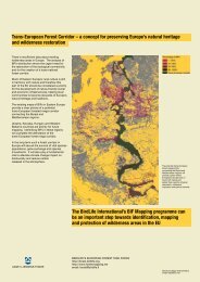
The major goals of this project were: (1) to identify all potential Biologically Important <strong>Forest</strong>s<br />
(BIFs) in Poland and Belarus on the basis of available sources of data; and (2) to map the areas<br />
with a high proportion of BIFs. In this way, the project creates a tool for assessment of the<br />
quality and representativeness of the region’s existing network of protected areas, and can form a<br />
basis for planning activities aiming at optimisation of both a national and cross-border system of<br />
forest protection and management.<br />
Although some of the data was concerned with individual forest stands, this project is focused on<br />
locating BIFs at the landscape scale, rather than single stands. The results of this project should<br />
therefore be considered and applied primarily at the landscape level. For example, the ecological<br />
requirements of many rare forest-dependent species such as the Capercaillie (Tetrao urogallus),<br />
the Black Stork (Ciconia nigra), woodpeckers and birds of prey that are taken into account in the<br />
criterion, concern areas much larger than single forest stands.<br />
The <strong>Belarusian</strong>-<strong>Polish</strong> <strong>Forest</strong> <strong>Mapping</strong> is part of a continuing initiative, which already includes<br />
seven European countries. The first to join the <strong>Forest</strong> <strong>Mapping</strong> Program were Lithuania, Latvia<br />
and Estonia. Their joint project, termed Baltic <strong>Forest</strong> <strong>Mapping</strong>, was initiated by BirdLife Finland<br />
and WWF Finland. The current module of the program was carried out in Poland and Belarus by<br />
the BirdLife European <strong>Forest</strong> Task Force in cooperation with its <strong>Polish</strong> and <strong>Belarusian</strong> partners.<br />
In 2007 the BIF <strong>Mapping</strong> project extended to Bulgaria and Romania as BRFM (Bulgarian-<br />
Romanian <strong>Forest</strong> <strong>Mapping</strong>).<br />
BIFs overlap legally protected areas, forests distinguished as “High Conservation Value<br />
<strong>Forest</strong>s”, following the toolkit developed by Pro<strong>Forest</strong> Ltd. (but without social criteria), forested<br />
parts of sites designated as Important Bird Areas or Important Plant Areas, Woodland Key<br />
Habitats, as well as forests identified on the basis of the project's specific criteria.<br />
1.2. High Conservation Value <strong>Forest</strong>s, Important Bird and Plant Areas, Woodland<br />
Key Habitats<br />
The concept of High Conservation Value <strong>Forest</strong>s was developed by the <strong>Forest</strong> Stewardship<br />
Council (FSC) in 1999. Identification of HCVFs is one of the key conditions of principles and<br />
criteria for sustainable forest management (Principle 9 of FSC Principles and Criteria - available<br />
from www.fsc.org). The FSC’s definition of HCVs encompasses exceptional or critical<br />
ecological attributes, ecosystem services and social functions as follows:<br />
• HCV 1 – <strong>Forest</strong> areas containing globally, regionally or nationally significant<br />
concentrations of biodiversity values.<br />
5


