
Create successful ePaper yourself
Turn your PDF publications into a flip-book with our unique Google optimized e-Paper software.
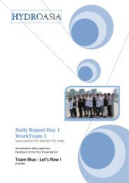
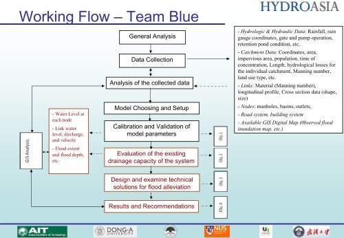
Working Flow – <strong>Team</strong> <strong>Blue</strong><br />
- Water Level at<br />
each node<br />
- Link water<br />
level, discharge,<br />
and velocity<br />
- Flood extent<br />
and flood depth,<br />
etc.<br />
General Analysis<br />
Data Collection<br />
Analysis of the collected data<br />
Model Choosing and Setup<br />
Calibration and Validation of<br />
model parameters<br />
Evaluation of the existing<br />
drainage capacity of the system<br />
- Hydrologic & Hydraulic Data: Rainfall, rain<br />
gauge coordinates, gate and pump operation,<br />
retention pond condition, etc.<br />
- Catchment Data: Coordinates, area,<br />
impervious area, population, time of<br />
concentration, Length, hydrological losses for<br />
the individual catchment, Manning number,<br />
land use type, etc.<br />
- Links: Material (Manning number),<br />
longitudinal profile, Cross section data (shape,<br />
size)<br />
- Nodes: manholes, basins, outlets,<br />
- Road system, building system<br />
- Available GIS Digital Map (0bserved flood<br />
inundation map, etc.)<br />
Design and examine technical<br />
solutions for flood alleviation<br />
Results and Recommendations