Download
Download
Download

Create successful ePaper yourself
Turn your PDF publications into a flip-book with our unique Google optimized e-Paper software.
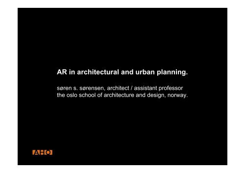
AR in architectural and urban planning.<br />
søren s. sørensen, architect / assistant professor<br />
the oslo school of architecture and design, norway.
AHO<br />
aho is an independent higher education institution within<br />
the Norwegian university system<br />
and one of the leading schools and research centres in<br />
the fields of architecture and urbanism in Scandinavia.
Architectural practice<br />
Urban planning and the design of large scale architectural<br />
projects today utilise traditional techniques as projections,<br />
perspectives, 2D data and 3D physical and digital models.<br />
These embody both the need for abstraction and<br />
interpretation and thus the subject matter is difficult to<br />
understand and can mislead those not trained in the field.
prevailing view on representation:<br />
...the notion or understanding<br />
that value-neutral representations as<br />
plan, section and details collectively<br />
constitutes the total idea ...
Current representation of the man-made environment:<br />
• Two dimensional: plans, sections, elevations<br />
• Three dimensional: sketches, perspectives, models, virtual reality.<br />
The limitation of these types of representations is that viewers are<br />
always positioned outside the representation, they remain spectators<br />
rather than participants.
- one still has the problem of understanding space<br />
and the scale of proposed projects.<br />
interactive digital models can give a solution to this...
Sensorama Simulator,<br />
US Patent #3,050,870, 1962<br />
1963: I. Sutherland's doctoral theses: Sketchpad.<br />
stereo HMD/ position tracking/ graphics engine.<br />
1966: T. Furness: display systems for pilots<br />
1967: Brooks: GROPE force feedback system<br />
1977: Sandin and Sayre: bendsensing glove<br />
1979: Raab et al: Polhemus tracking system<br />
1989: Jaron Lanier coins the term virtual reality<br />
1994: VR Society formed etc…
In a VR model all parts of a scene has to be digitally constructed,<br />
which requires extensive work for the making of the model and<br />
highly specified and expensive hardware for the regeneration of<br />
them.<br />
Orientation in a VR model is not intuitive, the feeling of presence is<br />
hard to achieve and the problem of scale is still not solved in<br />
screen based systems.<br />
That is, even though one moves through digital models that closely<br />
resembles a reality, it is experienced as a scale model on a screen.<br />
Advantage with VR-models is that they can be easily shared and<br />
distributed.
Augmented Reality is a further development of the technology<br />
and is understood as a combination of digital models and the<br />
physical world.<br />
An AR system generates a composite view with a combination of<br />
a virtual model or scene and the physical, real life setting in<br />
which the viewer is located.<br />
The technology has until recently been expensive, resource<br />
demanding and requiring advanced knowledge in the field.<br />
Due to these factors the use has been<br />
limited mainly to military use, medical<br />
research and other highly specialised<br />
applications
examples on research<br />
on AR in urban planning:
example 1:<br />
Augmented Urban Planning Workbench:<br />
Overlaying Drawings, Physical Models and Digital Simulation<br />
Tangible Media Group, MIT Media Laboratory<br />
Department of Urban Studies and Planning/Department of Architecture,<br />
MIT School of Architecture and Planning<br />
IEEE & ACM ISMAR 2002<br />
to solve the: "problem in the spatial and temporal separation between the varying<br />
forms of representation used in urban design"...<br />
they " propose an Augmented Reality Workbench ... that attempts to address this<br />
issue by integrating multiple forms of physical and digital representations.<br />
2D drawings, 3D physical models, and digital simulation are overlaid into a single<br />
information space in order to support the urban design process."
example 2:<br />
INTERACT’03<br />
ARTHUR: A Collaborative Augmented Environment for<br />
Architectural Design and Urban Planning<br />
Fraunhofer Institute for Applied Information Technology, Germany<br />
The Bartlett, University College London, Linie 4 Architekten, Germany<br />
Human-Computer Interaction <br />
.."real collaborative approach to architectural design and urban planning is often<br />
limited to early paper-based sketches.<br />
In order to overcome these limitations, we designed ... the ARTHUR system, an<br />
Augmented Reality enhanced round table to support complex design and planning<br />
decisions for architects. ... our approach does not try to replace the use of CAD systems<br />
but rather integrates them seamlessly into the collaborative AR environment."
aho and ife
aho and ife<br />
- AHO and IFE has a strategic agreement on cooperation.<br />
- common areas of interest between the two institutions<br />
regarding the use of virtual- and augmented reality in<br />
planning processes.<br />
- completed one preliminary VR project funded by the Norwegian<br />
Research Council;<br />
designing for the disabled: ”The use of Virtual Reality in<br />
planning”.
aho and ife<br />
AR projects:<br />
(syn)aesthetics;<br />
Diplomaproject by architectural student Halvor Høgset.<br />
church of St. Margareta;<br />
reconstruction of a mediaeval church north of oslo<br />
by means of augmented reality.<br />
ongoing development of research on the use of AR in architecture<br />
and planning of the built environment.
proof of concept 1<br />
ife, halden
proof of concept 2<br />
halvor høgset: diploma
proof of concept 3<br />
margareta church 2005
ar-lab, norway<br />
contributions:<br />
ife has developed augmented reality software and systems for<br />
use in the atomic energy and oil industries.<br />
aho has developed expertise in the area of visual representation<br />
applied to the built environment.
- AR has the potential of helping us to manage<br />
change in the man-made environment by<br />
improving the way in which we represent<br />
proposed architectural and urban change -