PERCEIVED RISK AND THE SITING OF A CONTROVERSIAL ...
PERCEIVED RISK AND THE SITING OF A CONTROVERSIAL ...
PERCEIVED RISK AND THE SITING OF A CONTROVERSIAL ...

Create successful ePaper yourself
Turn your PDF publications into a flip-book with our unique Google optimized e-Paper software.
5.5. Bull Hide Creek<br />
According to the Handbook of Texas Online, Bull Hide creek:<br />
rises three miles south of Woodway in south central McLennan County (at<br />
31 23’ N, 97°01’W) and runs southeast for 19 miles to its mouth on the Brazos<br />
River, four miles east of Golinda in Falls County (at 31 28’ N, 97°15’W). The<br />
stream in intermittent in its upper reaches and has springs, pools and steady flows<br />
south of the proposed plant site. It was named for a bull hide that was hung on a<br />
tree by a hunter in the late 1800’s. The creek crosses flat to rolling prairie with<br />
locally steep slopes, surfaced by expansive clays and clay loams that support<br />
juniper, oak, mesquite, and grasses in its upper and middle reaches and water<br />
tolerant hardwoods and conifers downstream (Texas State Historical Association,<br />
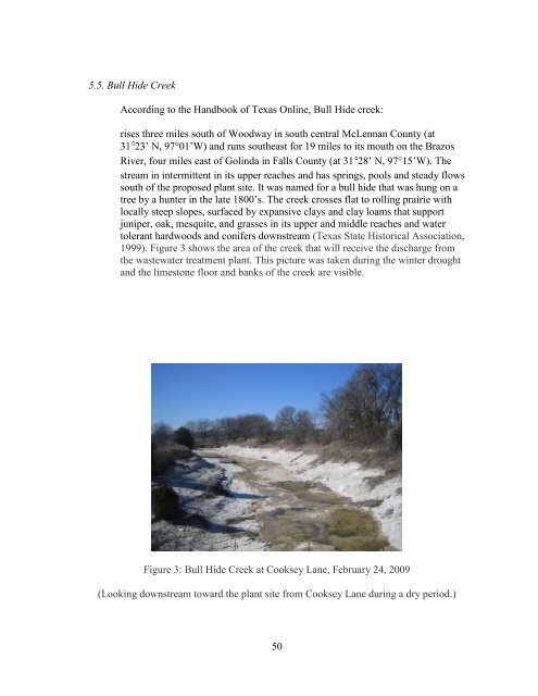
1999). Figure 3 shows the area of the creek that will receive the discharge from<br />
the wastewater treatment plant. This picture was taken during the winter drought<br />
and the limestone floor and banks of the creek are visible.<br />
Figure 3: Bull Hide Creek at Cooksey Lane, February 24, 2009<br />
(Looking downstream toward the plant site from Cooksey Lane during a dry period.)<br />
50