INDIAN NOTICES TO MARINERS - National Hydrographic Office
INDIAN NOTICES TO MARINERS - National Hydrographic Office
INDIAN NOTICES TO MARINERS - National Hydrographic Office
Create successful ePaper yourself
Turn your PDF publications into a flip-book with our unique Google optimized e-Paper software.
6. 1<br />
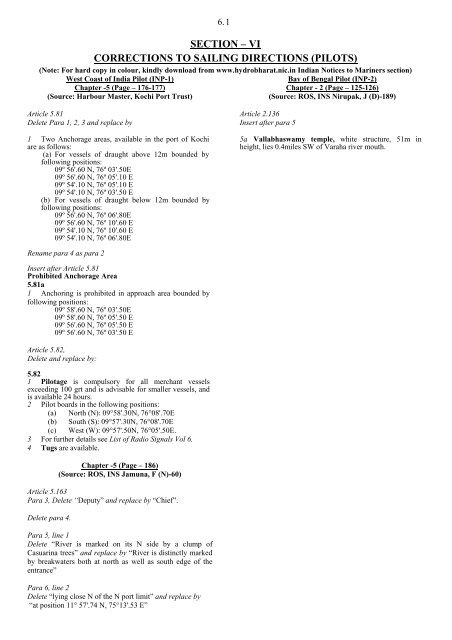
SECTION – VI<br />
CORRECTIONS <strong>TO</strong> SAILING DIRECTIONS (PILOTS)<br />
(Note: For hard copy in colour, kindly download from www.hydrobharat.nic.in Indian Notices to Mariners section)<br />
West Coast of India Pilot (INP-1)<br />
Bay of Bengal Pilot (INP-2)<br />
Chapter -5 (Page – 176-177)<br />
Chapter - 2 (Page – 125-126)<br />
(Source: Harbour Master, Kochi Port Trust)<br />
(Source: ROS, INS Nirupak, J (D)-189)<br />
Article 5.81<br />
Delete Para 1, 2, 3 and replace by<br />
1 Two Anchorage areas, available in the port of Kochi<br />
are as follows:<br />
(a) For vessels of draught above 12m bounded by<br />
following positions:<br />
09º 56'.60 N, 76º 03'.50E<br />
09º 56'.60 N, 76º 05'.10 E<br />
09º 54'.10 N, 76º 05'.10 E<br />
09º 54'.10 N, 76º 03'.50 E<br />
(b) For vessels of draught below 12m bounded by<br />
following positions:<br />
09º 56'.60 N, 76º 06'.80E<br />
09º 56'.60 N, 76º 10'.60 E<br />
09º 54'.10 N, 76º 10'.60 E<br />
09º 54'.10 N, 76º 06'.80E<br />
Article 2.136<br />
Insert after para 5<br />
5a Vallabhaswamy temple, white structure, 51m in<br />
height, lies 0.4miles SW of Varaha river mouth.<br />
Rename para 4 as para 2<br />
Insert after Article 5.81<br />
Prohibited Anchorage Area<br />
5.81a<br />
1 Anchoring is prohibited in approach area bounded by<br />
following positions:<br />
09º 58'.60 N, 76º 03'.50E<br />
09º 58'.60 N, 76º 05'.50 E<br />
09º 56'.60 N, 76º 05'.50 E<br />
09º 56'.60 N, 76º 03'.50 E<br />
Article 5.82,<br />
Delete and replace by:<br />
5.82<br />
1 Pilotage is compulsory for all merchant vessels<br />
exceeding 100 grt and is advisable for smaller vessels, and<br />
is available 24 hours.<br />
2 Pilot boards in the following positions:<br />
(a) North (N): 09°58'.30N, 76°08'.70E<br />
(b) South (S): 09°57'.30N, 76°08'.70E<br />
(c) West (W): 09°57'.50N, 76°05'.50E.<br />
3 For further details see List of Radio Signals Vol 6.<br />
4 Tugs are available.<br />
Chapter -5 (Page – 186)<br />
(Source: ROS, INS Jamuna, F (N)-60)<br />
Article 5.163<br />
Para 3, Delete “Deputy” and replace by “Chief”.<br />
Delete para 4.<br />
Para 5, line 1<br />
Delete “River is marked on its N side by a clump of<br />
Casuarina trees” and replace by “River is distinctly marked<br />
by breakwaters both at north as well as south edge of the<br />
entrance”<br />
Para 6, line 2<br />
Delete “lying close N of the N port limit” and replace by<br />
“at position 11° 57'.74 N, 75°13'.53 E”


