The Cayton and Flixton Carrs Wetland Project - Scarborough ...
The Cayton and Flixton Carrs Wetland Project - Scarborough ...
The Cayton and Flixton Carrs Wetland Project - Scarborough ...

You also want an ePaper? Increase the reach of your titles
YUMPU automatically turns print PDFs into web optimized ePapers that Google loves.
David Renwick, <strong>Project</strong> Officer, <strong>Cayton</strong> <strong>and</strong> <strong>Flixton</strong> <strong>Carrs</strong> Wetl<strong>and</strong> <strong>Project</strong>, 19/04/06<br />
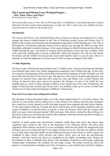
<strong>The</strong> <strong>Cayton</strong> <strong>and</strong> <strong>Flixton</strong> <strong>Carrs</strong> Wetl<strong>and</strong> <strong>Project</strong>…<br />
…Why, What, Where <strong>and</strong> When?<br />
By David Renwick, <strong>Project</strong> Officer<br />
This partnership project in the Vale of Pickering aims to rehabilitate a nationally-important wetl<strong>and</strong><br />
l<strong>and</strong>scape through sensitive farm management, to make the Vale a richer place for wildlife <strong>and</strong> more<br />
attractive <strong>and</strong> accessible for the benefit of all.<br />
Introduction<br />
<strong>The</strong> <strong>Cayton</strong> <strong>and</strong> <strong>Flixton</strong> <strong>Carrs</strong> Wetl<strong>and</strong> <strong>Project</strong> aims to help local farmers <strong>and</strong> l<strong>and</strong>owners to create,<br />
manage <strong>and</strong> restore wetl<strong>and</strong> habitats in the Vale of Pickering around <strong>Cayton</strong> <strong>and</strong> <strong>Flixton</strong> <strong>Carrs</strong>. It<br />
builds on the existing environmental <strong>and</strong> archaeological importance of this inspiring area. <strong>The</strong> Vale of<br />
Pickering has a fascinating l<strong>and</strong>scape history from its glacial past, through the effects of man, from<br />
Mesolithic settlement to modern drainage, to the current changes in British Farming <strong>and</strong> the effects on<br />
wildlife through the ages. <strong>The</strong> <strong>Project</strong> is working with local farmers to boost the area’s wildlife whilst<br />
at the same time helping them to secure a financially viable farm business, this will not only benefit<br />
the farmers <strong>and</strong> the wildlife but also provide much wider benefits which we can all enjoy. Here is a<br />
summary of what has happened so far <strong>and</strong> a taste of what we hope can happen in the future.<br />
A Chilly Beginning<br />
<strong>The</strong> last ice age or Pleistocene period lasted some 2.5 million years, with ice advancing <strong>and</strong> retreating<br />
across Britain many times over, finally disappearing completely some 10,000 years ago. At this time,<br />
now named as the beginning of the current Holocene period the l<strong>and</strong>scape of North Yorkshire was still<br />
recovering from the grips of the last ice age. <strong>The</strong> glaciers to the south of <strong>Scarborough</strong> deposited vast<br />
amounts of material (rock, s<strong>and</strong> <strong>and</strong> clay) along the coast <strong>and</strong> further west towards Staxton <strong>and</strong><br />
Ganton. In between these areas, known as moraines the drainage of water to the North Sea was<br />
impeded <strong>and</strong> so a series of lakes formed in hollows at the eastern end of the Vale of Pickering. <strong>The</strong><br />
largest of these has been termed Lake <strong>Flixton</strong>, but it was probably made up of a series of small lakes<br />
which sat in an inter-connected l<strong>and</strong>scape of different wetl<strong>and</strong> areas.<br />
Peat, Peat Everywhere but nothing left to Drink<br />
<strong>The</strong> shoreline of these post-glacial lakes was at the current approximate 23 or 24 metre contour. <strong>The</strong><br />
network of water bodies known collectively as Lake <strong>Flixton</strong> were shallow <strong>and</strong> from their formation<br />
they would have slowly started to in-fill with plant material from marginal <strong>and</strong> lake bottom habitats.<br />
As this plant material built up it formed into layers <strong>and</strong> because of the saturated conditions with low<br />
oxygen availability it could not decay as normal, so peat was formed, which built up in layers until<br />
little or no open water remained (around 7,000 years ago). Peat which is formed by this in-filling of a<br />
lake basin is known as lacustrine peat <strong>and</strong> the silty sediment of the lake bottom can still be found as a<br />
thick grey-white silty layer under the peat.<br />
Analysis of pollen grains <strong>and</strong> macrofossils contained within these peat layers has shown what<br />
vegetation types existed in the Vale at the beginning of the Holocene Period. <strong>The</strong> drier areas<br />
supported a birch (Betula) <strong>and</strong> hazel (Corylus) woodl<strong>and</strong>, whilst the lake itself was fringed with reed<br />
(Cladium mariscus) swamp <strong>and</strong> beds of saw-sedge (Cladium mariscus). <strong>The</strong> lake was shallow <strong>and</strong> the<br />
area of open water decreased rapidly into the Holocene leaving an area of peat on which a dense carr<br />
woodl<strong>and</strong> of alder (Alnus), birch (Betula) <strong>and</strong> willow (Salix) grew up from the mid-Holocene<br />
onwards, with drier mixed oak (Quercus) woodl<strong>and</strong> on the higher surrounding l<strong>and</strong>. Despite the<br />
development of these woodl<strong>and</strong>s areas much of the floodplain remained wet <strong>and</strong> marshy supporting<br />
wetl<strong>and</strong> plant communities like reedbed, fen <strong>and</strong> sedge swamp. <strong>The</strong> pollen record has shown the<br />
presence of wetl<strong>and</strong> plants including water lilies (Nymphaea), water-milfoil (Myriophyllum), bogbean<br />
Page 1 of 6
David Renwick, <strong>Project</strong> Officer, <strong>Cayton</strong> <strong>and</strong> <strong>Flixton</strong> <strong>Carrs</strong> Wetl<strong>and</strong> <strong>Project</strong>, 19/04/06<br />
(Menyanthes), pondweed (Potomogeton), bog mosses (Sphagnum), reedmace (Typha), valerian<br />
(Valerian), marsh marigold (Caltha palustris), meadow-sweet (Filipendula) <strong>and</strong> golden saxifrage<br />
(Chrysosplenium). Peat is very good at preserving a large seed bed, so it is highly likely that these <strong>and</strong><br />
other wetl<strong>and</strong> species are still contained in the present day seed bank.<br />
<strong>The</strong> Ascent of <strong>Cayton</strong> Man<br />
Not only was this amazing natural l<strong>and</strong>scape a haven for wildlife, but it was also a very important area<br />
for stone-age people. Pieces of worked flint were discovered by amateur archaeologists in the 1930s<br />
<strong>and</strong> 40s which led to excavations by Clarke in the 1950s of the internationally renowned Star Carr<br />
site. <strong>The</strong> site has been dated to some 9,600 years old <strong>and</strong> was situated on the edge of Lake <strong>Flixton</strong>,<br />
where a birch platform was constructed <strong>and</strong> occupied by hunter gatherers, who probably used the site<br />
as their base camp, migrating into the upl<strong>and</strong>s during the warmer summer months. Masses of flint<br />
tools <strong>and</strong> animal remains were found, including antler head-dresses suggesting a ritual use for the site.<br />
Quarry species included red deer (Cervus elaphus), roe deer (Capreolus capreolus), wild horse (Equus<br />
ferus), wild pig (Sus scrofa), aurochs (Bos primigenius) <strong>and</strong> various bird species. Interestingly there is<br />
no evidence that fish was exploited despite the high likelihood that the lakes in the area supported a<br />
large stock of fish. Other evidence has shown that the woodl<strong>and</strong>s as well as the wetl<strong>and</strong>s were<br />
exploited for their resources including food <strong>and</strong> building material <strong>and</strong> that the people also burned the<br />
reed (Phragmites australis) <strong>and</strong> sedge swamps (Cladium mariscus) near their camps, possibly to<br />
improve access.<br />
<strong>The</strong> excavations at Star Carr <strong>and</strong> various other subsequent studies have shown that the areas around<br />
the post-glacial Lake <strong>Flixton</strong> were important habitation sites for Neolithic <strong>and</strong> Mesolithic man, with a<br />
network of settlement all on the same lake edge contour level of 23 or 24 metres. This makes the<br />
current eastern <strong>and</strong> of the Vale of Pickering massively important in terms of its Mesolithic<br />
archaeology <strong>and</strong> for the paleo-environmental record contained within the peat profile.<br />
<strong>The</strong>re is also significant evidence of human history within the vale during the iron age, roman <strong>and</strong><br />
Anglo-Saxon periods, but during these periods the wetter areas were essentially left as ‘waste’ l<strong>and</strong><br />
with human settlement been concentrated on the higher l<strong>and</strong> at the valley edge.<br />
Drainage <strong>and</strong> all Napoleon’s Men<br />
It was not until the twelfth to fourteenth centuries that large scale drainage for agriculture occurred.<br />
This occurred when large areas of the Vale were colonised by the monasteries. <strong>The</strong>se groups drained<br />
l<strong>and</strong> for both arable <strong>and</strong> pastoral farming depending on the nature of the l<strong>and</strong> <strong>and</strong> often the monastery<br />
involved. For instance Rievaulx Abbey was well known for draining l<strong>and</strong> for arable farming, however<br />
this was much more prevalent at the western end of the vale, other abbeys, like Yedingham<br />
concentrated on pastoral farming. Two common forms of medieval l<strong>and</strong>-use preserved in place names<br />
to this day are ‘ings’ <strong>and</strong> ‘carrs’. Ings were l<strong>and</strong> which flooded occasionally <strong>and</strong> were used for hay<br />
production with grazing of the aftermath. Ings management sometimes involved the use of water<br />
control structures <strong>and</strong> drainage works to allow the l<strong>and</strong> to be dry when access was required for cutting.<br />
<strong>Carrs</strong> were areas of l<strong>and</strong> which flooded all winter long but could be used for grazing during the<br />
summer.<br />
On current day Ordnance Survey maps of the area around <strong>Flixton</strong> <strong>and</strong> <strong>Cayton</strong> <strong>Carrs</strong> the word carr is<br />
very common (e.g. Seamer Carr, Star Carr, Deepdale Carr, Osgodby Carr, Coulson’s Carr <strong>Cayton</strong><br />
Carr, Loder’s Carr, <strong>Flixton</strong> Carr, Folkton Carr, Staxton Carr), with occasional occurrences of the word<br />
ings (<strong>Flixton</strong> Ings, Seamer Ings, Irton Ings, Upper Ings), especially to the west of the A64. This points<br />
at a predominantly pastoral l<strong>and</strong>scape during the medieval period around <strong>Cayton</strong> <strong>and</strong> <strong>Flixton</strong>.<br />
Page 2 of 6
David Renwick, <strong>Project</strong> Officer, <strong>Cayton</strong> <strong>and</strong> <strong>Flixton</strong> <strong>Carrs</strong> Wetl<strong>and</strong> <strong>Project</strong>, 19/04/06<br />
<strong>The</strong> first large-scale drainage scheme was carried out following the passing of the Muston <strong>and</strong><br />
Yedingham Drainage Act of 1800 <strong>and</strong> involved straightening <strong>and</strong> realignment of large stretches of the<br />
Rivers Hertford <strong>and</strong> Derwent in the eastern Vale. Much of the work been undertaken by prisoners of<br />
war from the Napoleon’s armies. <strong>The</strong> new channels had a characteristic trapezoidal section with steep<br />
sides <strong>and</strong> raised banks, with a network of drainage ditches carrying water from surrounding farml<strong>and</strong><br />
into feeder ditches or ‘delphs’ which ran parallel to the main river. Water movement from these<br />
parallel ditches into the main river was controlled by a series of sluices. Following the initial 1800<br />
drainage act there were a series of subsequent drainage schemes in 1914, 1918, 1926 <strong>and</strong> 1930 (the<br />
L<strong>and</strong> Drainage Act which set up the internal drainage boards including the local Muston <strong>and</strong><br />
Yedingham Internal Drainage Board). L<strong>and</strong> drainage has continued at a continuous pace for the last<br />
two hundred years <strong>and</strong> has transformed the Vale from an extensive area of natural wetl<strong>and</strong> habitat to<br />
one of the most prosperous <strong>and</strong> fertile agricultural areas in the country, albeit at the expense of<br />
wildlife <strong>and</strong> natural habitats.<br />
What’s Left Today?<br />
Up until the 1970s good quality fen habitat <strong>and</strong> wet grassl<strong>and</strong> were still present in the vale around<br />
<strong>Flixton</strong> <strong>and</strong> <strong>Cayton</strong>. However the most recent drainage activities resulted in the loss of this habitat, so<br />
that now little good quality wetl<strong>and</strong> habitat remains. Since the post glacial lakes filled up naturally<br />
thous<strong>and</strong>s of years ago there is no natural open water in the vale, however there are many small farm<br />
ponds <strong>and</strong> artificial lakes such as those formed from gravel extraction (e.g. Burton Riggs). <strong>The</strong> system<br />
of rivers, streams <strong>and</strong> drainage ditches provide a much more extensive network of open water habitats,<br />
however many of these features around the <strong>Cayton</strong> <strong>and</strong> <strong>Flixton</strong> <strong>Carrs</strong> are degraded by intensive<br />
management, although providing green corridors for some species to disperse. Some have interesting<br />
relict flora in or along their banks, including water violet (Hottonia palustris), hop or cypress sedge<br />
(Carex pseudocyperus), opposite-leaved pondweed (Groenl<strong>and</strong>ia densa), meadow rue (Thalictrum<br />
flavum), purple loosestrife (Lythrum salicaria) <strong>and</strong> branched bur-reed (Sparganium erectum).<br />
Fen meadows <strong>and</strong> wet grassl<strong>and</strong>s were once common in the Vale <strong>and</strong> were a result of grazing of<br />
natural habitats. Although these habitats are semi-natural in nature, relying on human management for<br />
their maintenance they do have considerable wildlife value. <strong>The</strong>y have been greatly reduced in area<br />
due to the under drainage of fields <strong>and</strong> many remaining areas suffer from complete periodic drying<br />
during spring <strong>and</strong> summer months thus much reducing their value as wetl<strong>and</strong> habitats. In <strong>and</strong> around<br />
<strong>Cayton</strong> <strong>and</strong> <strong>Flixton</strong> <strong>Carrs</strong> there are still very small areas of fen meadow remaining in isolated<br />
locations as well as small areas of wet grassl<strong>and</strong>, but these are limited mostly to providing wet<br />
conditions in winter only <strong>and</strong> dry considerably in spring <strong>and</strong> summer. Those areas of wet grassl<strong>and</strong><br />
that do remain are often overly dominated by soft rush (Juncus effusus). <strong>The</strong>se problems of rush<br />
domination <strong>and</strong> seasonal drying make the wetl<strong>and</strong> habitats unsuitable for use by breeding waders<br />
making breeding wader numbers much reduced.<br />
Areas of wet woodl<strong>and</strong> are now rare in the wider Vale, however there are important areas of wet<br />
woodl<strong>and</strong> at <strong>Flixton</strong> Carr Plantation were downy birch (Betula pubescens), silver birch (B. pendula)<br />
alder (Alnus glutinosa) can be found with common reed (Phragmites australis) forming st<strong>and</strong>s in the<br />
under storey.<br />
Notable members of the fauna around <strong>Cayton</strong> <strong>and</strong> <strong>Flixton</strong> <strong>Carrs</strong> include kingfisher (Alcedo atthis),<br />
kestrel (Falco tinnunculus), yellow wagtail (Motacilla flava), barn owl (Tyto alba), little owl (Athene<br />
noctua), short (Asio flammeus) <strong>and</strong> long eared owl (A. otus), grey partridge (Perdix perdix), corn<br />
bunting (Miliaria cal<strong>and</strong>ra), tree sparrow (Passer montanus) teal (Anas crecca), over wintering marsh<br />
(Circus aeruginosus) <strong>and</strong> hen harrier (C. cyaneus), over wintering snipe (Gallinago gallinago),<br />
redshank (Tringa totanus) lapwing (Vanellus vanellus) <strong>and</strong> curlew (Numenius arquata). Mammals of<br />
note include sporadic water vole (Arvicola terrestris), otter (Lutra lutra) <strong>and</strong> brown hare (Lepus<br />
europaeus).<br />
Page 3 of 6
David Renwick, <strong>Project</strong> Officer, <strong>Cayton</strong> <strong>and</strong> <strong>Flixton</strong> <strong>Carrs</strong> Wetl<strong>and</strong> <strong>Project</strong>, 19/04/06<br />
<strong>The</strong> <strong>Cayton</strong> <strong>and</strong> <strong>Flixton</strong> <strong>Carrs</strong> Wetl<strong>and</strong> <strong>Project</strong> – What?<br />
Over the past 10 to 15 years, it has become more <strong>and</strong> more difficult for farmers in the project area to<br />
make a living from the l<strong>and</strong>. This is because of problems with the area's drainage system, peat<br />
compaction <strong>and</strong> increased rainfall, meaning the l<strong>and</strong> has become wetter - making harvesting crops<br />
difficult. <strong>The</strong>se problems could be made worse by climate change <strong>and</strong> global warming as rainfall<br />
levels are expected to increase <strong>and</strong> storms become more frequent. <strong>The</strong> recent changes to UK<br />
agriculture <strong>and</strong> the introduction of the new Environmental Stewardship Scheme have provided a<br />
possible alternative income for farmers, paying them to deliver environmental benefits. It is hoped that<br />
these schemes can be used to reverse the recent declines in farm wildlife, especially farml<strong>and</strong> plants<br />
<strong>and</strong> birds. <strong>The</strong> <strong>Project</strong> will help farmers to apply for the Higher Level Stewardship Scheme, which<br />
will then pay them to create <strong>and</strong> manage new wetl<strong>and</strong> habitats.<br />
<strong>The</strong> project was started by <strong>Scarborough</strong> Borough Council on a small piece of l<strong>and</strong> near Star Carr, the<br />
aim here was to create a small wetl<strong>and</strong> area, including scrapes <strong>and</strong> wet grassl<strong>and</strong>. However, when<br />
local farmers heard of these plans they also became interested in getting involved in the project. This<br />
led to a widening out of the project into surrounding farml<strong>and</strong> <strong>and</strong> a number of other organisations<br />
including the Environment Agency, English Nature, <strong>The</strong> Royal Society for the Protection of Birds<br />
(RSPB), the Rural Development Service <strong>and</strong> North Yorkshire County Council became involved.<br />
Along with <strong>Scarborough</strong> Borough Council <strong>and</strong> the local farmers these organisations now form the<br />
project partnership.<br />
<strong>The</strong> main aim of the <strong>Cayton</strong> <strong>and</strong> <strong>Flixton</strong> <strong>Carrs</strong> Wetl<strong>and</strong> <strong>Project</strong> is to restore floodplain habitats to the<br />
Vale of Pickering l<strong>and</strong>scape at <strong>Cayton</strong> <strong>and</strong> <strong>Flixton</strong> <strong>Carrs</strong> <strong>and</strong> the surrounding areas. <strong>The</strong> primary<br />
objectives of the <strong>Project</strong> include the following;<br />
• To create a range of valuable wetl<strong>and</strong> habitats<br />
• To provide an alternative to intensive agriculture<br />
• Alternative income for farmers<br />
• Contribute to local <strong>and</strong> national targets on nature conservation covered by local <strong>and</strong> UK<br />
biodiversity action plans<br />
• Contribute to conservation of nationally important archaeological <strong>and</strong> paleo-environmental<br />
deposits<br />
• Develop opportunities for wildlife based tourism<br />
• Improve flood storage<br />
<strong>The</strong> project aims to create a l<strong>and</strong>scape containing a mosaic of wetl<strong>and</strong> habitats of wet grassl<strong>and</strong>, pools,<br />
flushes, reedbeds <strong>and</strong> wet woodl<strong>and</strong>s, with extensive areas of wet grassl<strong>and</strong>s grazed by cattle, sheep<br />
<strong>and</strong> other livestock. A predominantly open l<strong>and</strong>scape, with soil conditions suitable for breeding<br />
waders such as redshank, snipe, curlews <strong>and</strong> lapwings with flocks of wintering ducks, waders <strong>and</strong><br />
geese on shallow flooded l<strong>and</strong> near the river. Watercourses will be rich in wildlife supporting water<br />
voles, otters, dragonflies <strong>and</strong> aquatic plants. We only want to create wetl<strong>and</strong> where it is sustainable,<br />
appropriate <strong>and</strong> site conditions allow us to do so. Where wetl<strong>and</strong> habitats can not be created we will<br />
look to benefit other wildlife as much as we can, especially farml<strong>and</strong> birds. <strong>The</strong> habitats will be<br />
managed through close working with the farming community to underst<strong>and</strong> <strong>and</strong> manage water levels<br />
in the project area. With traditional farming at its heart to maintain a functional, working farmed<br />
l<strong>and</strong>scape. <strong>The</strong> project is committed to making decisions in an open <strong>and</strong> inclusive way to ensure that it<br />
achieves environmental, social <strong>and</strong> economic gains.<br />
Page 4 of 6
David Renwick, <strong>Project</strong> Officer, <strong>Cayton</strong> <strong>and</strong> <strong>Flixton</strong> <strong>Carrs</strong> Wetl<strong>and</strong> <strong>Project</strong>, 19/04/06<br />
<strong>The</strong> <strong>Cayton</strong> <strong>and</strong> <strong>Flixton</strong> <strong>Carrs</strong> Wetl<strong>and</strong> <strong>Project</strong> – Where?<br />
<strong>The</strong> project area is situated some 3 km south of the outskirts of <strong>Scarborough</strong> <strong>and</strong> is bounded by the<br />
A64 York to <strong>Scarborough</strong> road on its western boundary, the Filey to Seamer railway line to the north,<br />
the A1039 Staxton to Folkton road to the south <strong>and</strong> by Carr Lane (the road linking <strong>Cayton</strong> <strong>and</strong><br />
Folkton) to the east. <strong>The</strong> project is situated at the eastern end of the Vale of Pickering on the peaty<br />
soils where post-glacial Lake <strong>Flixton</strong> used to be some 12,000 years ago. This 1,000-hectare area<br />
covers part of the River Hertford floodplain, an essentially flat <strong>and</strong> open l<strong>and</strong>scape. <strong>The</strong> area has been<br />
heavily drained for agriculture over the last 200 years. Although the project area is less than 3km from<br />
the North Sea, all of the area's water drains west through the Rivers Hertford <strong>and</strong> Derwent, eventually<br />
reaching the sea through the Humber Estuary.<br />
What are we doing <strong>and</strong> How?<br />
<strong>The</strong> work of the project so far has centred on gathering baseline data <strong>and</strong> survey information on the<br />
farms in the project area, to support Environmental Stewardship applications. This has included<br />
volunteer bird surveys involving the <strong>Scarborough</strong> Bird Group <strong>and</strong> <strong>The</strong> RSPB’s Volunteer <strong>and</strong> Farm<br />
Alliance Plus <strong>Project</strong>, a project aimed at benefiting farml<strong>and</strong> birds which have been in massive decline<br />
over recent decades. <strong>The</strong> project is also commissioning a series of other surveys including water vole,<br />
ditch vegetation <strong>and</strong> ditch invertebrates, so that we can get a baseline against which we can monitor<br />
change <strong>and</strong> success as the project progresses <strong>and</strong> we implement management practices on the ground.<br />
As well as the ecological surveys we have also been gathering data on the hydrology of the area. This<br />
has included monitoring the ground water levels using a series of dipwells (tubes in the ground which<br />
allow us to measure the water table depth) <strong>and</strong> gauge boards (scales in ditches to measure water<br />
depth). Along with LiDAR* data, which gives us a very accurate topographical map of the area, local<br />
rainfall data, information on the nature of the geology <strong>and</strong> substrate <strong>and</strong> on what flow of water enters<br />
<strong>and</strong> leaves the catchment of the project area we have built up a picture of how much water there is in<br />
the area <strong>and</strong> where are the best areas to create wetl<strong>and</strong> habitats. This feasibility work will also help us<br />
to plan where we will need to install water control structures such as sluices, bunds <strong>and</strong> peat plugs for<br />
ditches. <strong>The</strong>se structure will allow us to manipulate water levels to get the best outputs for wildlife<br />
<strong>and</strong> so that we can drop water levels if needed to carry out management.<br />
* This st<strong>and</strong>s for Light Detection <strong>and</strong> Ranging <strong>and</strong> involves a plane flying over the area firing a beam of light down which<br />
is bounced off the ground below <strong>and</strong> detected by a sensor in the plane, the height from plane to ground can then be<br />
calculated <strong>and</strong> by joining up a series of these points a map of the ground surface height built up.<br />
As the project aims to re-wet areas of l<strong>and</strong> to create these habitats we need to make sure that there are<br />
no detrimental effects on l<strong>and</strong> that is not within the project area, or that is not going to be subject to<br />
wetl<strong>and</strong> creation. This is especially important where it concerns productive l<strong>and</strong> which is still subject<br />
to agricultural production. <strong>The</strong>re can also be no detrimental effects on property or infrastructure<br />
including roads, railway lines, the Seamer Carr L<strong>and</strong>fill Site or any other important l<strong>and</strong> uses. To do<br />
this we have commissioned an Environmental Impact Assessment (EIA). This simply assesses the<br />
potential impacts of the wetl<strong>and</strong> creation on these l<strong>and</strong>-uses <strong>and</strong> suggests ways of minimising or<br />
avoiding any such impacts. <strong>The</strong> consultants have produced detailed computer models of the surface<br />
<strong>and</strong> groundwater systems of the project area using the hydrological data which has been collected to<br />
predict what will happen when water is raised on areas of l<strong>and</strong>.<br />
All of this background survey <strong>and</strong> monitoring work will contribute to Environmental Stewardship<br />
Applications for farmers within the project area <strong>and</strong> the Farm Environment Plans (FEPs) which are<br />
required to support these applications. FEPs essentially map the environmental <strong>and</strong> archaeological<br />
features on the farm <strong>and</strong> assess their importance <strong>and</strong> condition <strong>and</strong> then recommend management<br />
options in order to manage, restore or create the feature in question. <strong>The</strong> project has been working<br />
Page 5 of 6
David Renwick, <strong>Project</strong> Officer, <strong>Cayton</strong> <strong>and</strong> <strong>Flixton</strong> <strong>Carrs</strong> Wetl<strong>and</strong> <strong>Project</strong>, 19/04/06<br />
with local l<strong>and</strong>owners to develop their stewardship applications <strong>and</strong> we have already secured the first<br />
of these agreements. Over the next twelve months we will be working up a further four applications<br />
<strong>and</strong> liasing with other l<strong>and</strong>owners to see if they want to apply for the scheme.<br />
Raising the <strong>Project</strong> profile has also been important <strong>and</strong> to this effect a project logo, web-page,<br />
newsletter, vision statement <strong>and</strong> leaflet have been developed. We have also produced <strong>and</strong> released a<br />
press release which resulted in articles in a number of publications. Consultation with members of the<br />
public, local communities <strong>and</strong> interest groups is key <strong>and</strong> presentations have been made to local groups<br />
to raise the profile of the project. In the future we hope to engage more with volunteers in everything<br />
from survey work to practical habitat management.<br />
Conclusions<br />
<strong>The</strong> <strong>Cayton</strong> <strong>and</strong> <strong>Flixton</strong> <strong>Carrs</strong> Wetl<strong>and</strong> <strong>Project</strong> is a nationally important wetl<strong>and</strong> restoration project<br />
which aims to bring considerable environmental, social <strong>and</strong> economic benefit to the project area, the<br />
surrounding parts of the Vale of Pickering <strong>and</strong> beyond. By bringing different individuals, groups <strong>and</strong><br />
organisations to work together we will create a much enhanced l<strong>and</strong>scape. <strong>The</strong> project is<br />
multifunctional in that it provides multiple benefits across a wide range of areas <strong>and</strong> it is hoped that as<br />
it becomes more successful the project will grow to cover more of the Vale. <strong>The</strong> project has traditional<br />
farming at its heart <strong>and</strong> by harnessing this we will deliver massive environmental gains.<br />
For more Information<br />
Name:<br />
David Renwick, <strong>Project</strong> Officer<br />
Email:<br />
david.renwick@scarborough.gov.uk<br />
Tel: 01723 374079<br />
Fax: 01723 500259<br />
<strong>Project</strong> web-page: http://www.rspb.org.uk/engl<strong>and</strong>/north/farming/caytonflixton.asp<br />
Selected Bibliography<br />
Atherden, M. <strong>and</strong> Missin, B. (2001) <strong>The</strong> Vale of Pickering Wetl<strong>and</strong>s <strong>Project</strong>. In: Atherden, M. (Ed.)<br />
(2001) Wetl<strong>and</strong>s in the L<strong>and</strong>scape: Archaeology, Conservation, Heritage, PLACE, York.<br />
Clark, J.G.D. (1954) Excavations at Star Carr, Cambridge University Press, Cambridge.<br />
Crackles, E. (1990) Flora of the East Riding of Yorkshire, University of Hull, Hull.<br />
Menuge, N. (2001) A Guide to the Wetl<strong>and</strong> Heritage of the Vale of Pickering, PLACE, York.<br />
Morley, S. (Ed.) (1997) Vale of Pickering Natural Area Profile, English Nature North <strong>and</strong> East<br />
Yorkshire Team, York.<br />
North East Yorkshire Geology Trust (2005) Secrets in the L<strong>and</strong>scape – Burton Riggs Trail, North<br />
East Yorkshire Geology Trust, Whitby.<br />
Shaw, J.M. (2000) <strong>The</strong> Muston & Yedingham Drainage Board – Two Hundred Years 1800 –<br />
2000 A Short Account, <strong>The</strong> Muston & Yedingham Drainage Board, Pickering.<br />
Page 6 of 6