

Godey Creek Trail - Gold Country
Godey Creek Trail - Gold Country
Godey Creek Trail - Gold Country

Create successful ePaper yourself
Turn your PDF publications into a flip-book with our unique Google optimized e-Paper software.
Site Identification<br />
Nearest Community:<br />
Geocache Location:<br />
Merritt, BC<br />
N 49 48.831<br />
W120 56.479<br />
Code:GC3PANE<br />
Written and<br />
Researched by<br />
Doug Smith<br />
Rails and <strong>Trail</strong>s<br />
TCT <strong>Trail</strong><br />
Accuracy: 3 metres<br />
Overall terrain: 2.5<br />
Overall terrain difficulty: 2.5<br />
(1=easiest;5=hardest)<br />
Ownership: Crown Land<br />
Access and Restrictions:<br />
Letterbox Clues:<br />
Apply Sticker Here<br />
From the Coquihalla<br />
Highway, turn on Exit<br />
250 onto the Brodie<br />
Siding Road.<br />
From the Coquihalla<br />
Highway, turn on<br />
Exit 250 onto the<br />
Brodie Station Site,<br />
then cross the<br />
bridge and follow<br />
the rail line to a<br />
small grove of trees.<br />
For more information or to report a<br />
problem with this site please contact:<br />
<strong>Gold</strong> <strong>Country</strong> Communities Society<br />
PO. Box 933<br />
Cache <strong>Creek</strong>, BC.,<br />
V0K 1H0<br />
Tel: 1-877-453-9467<br />
email: info@exploregoldcountry.com<br />
For more site pages go to:<br />
www.goldtrail.com<br />
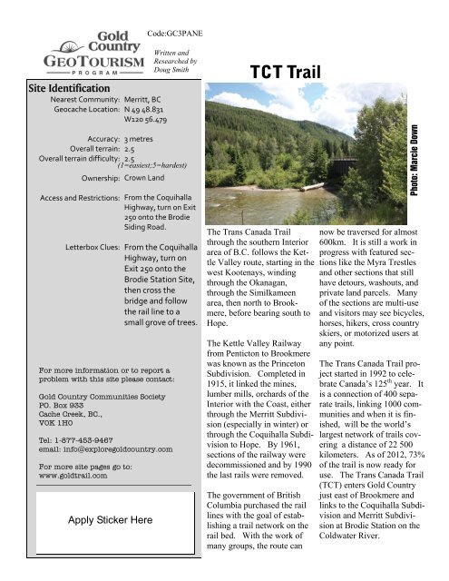
The Trans Canada <strong>Trail</strong><br />
through the southern Interior<br />
area of B.C. follows the Kettle<br />
Valley route, starting in the<br />
west Kootenays, winding<br />
through the Okanagan,<br />
through the Similkameen<br />
area, then north to Brookmere,<br />
before bearing south to<br />
Hope.<br />
The Kettle Valley Railway<br />
from Penticton to Brookmere<br />
was known as the Princeton<br />
Subdivision. Completed in<br />
1915, it linked the mines,<br />
lumber mills, orchards of the<br />
Interior with the Coast, either<br />
through the Merritt Subdivision<br />
(especially in winter) or<br />
through the Coquihalla Subdivision<br />
to Hope. By 1961,<br />
sections of the railway were<br />
decommissioned and by 1990<br />
the last rails were removed.<br />
The government of British<br />
Columbia purchased the rail<br />
lines with the goal of establishing<br />
a trail network on the<br />
rail bed. With the work of<br />
many groups, the route can<br />
Photo: Marcie Down<br />
now be traversed for almost<br />
600km. It is still a work in<br />
progress with featured sections<br />
like the Myra Trestles<br />
and other sections that still<br />
have detours, washouts, and<br />
private land parcels. Many<br />
of the sections are multi-use<br />
and visitors may see bicycles,<br />
horses, hikers, cross country<br />
skiers, or motorized users at<br />
any point.<br />
The Trans Canada <strong>Trail</strong> project<br />
started in 1992 to celebrate<br />
Canada’s 125 th year. It<br />
is a connection of 400 separate<br />
trails, linking 1000 communities<br />
and when it is finished,<br />
will be the world’s<br />
largest network of trails covering<br />
a distance of 22 500<br />
kilometers. As of 2012, 73%<br />
of the trail is now ready for<br />
use. The Trans Canada <strong>Trail</strong><br />
(TCT) enters <strong>Gold</strong> <strong>Country</strong><br />
just east of Brookmere and<br />
links to the Coquihalla Subdivision<br />
and Merritt Subdivision<br />
at Brodie Station on the<br />
Coldwater River.


