Damage to ShihKang Dam Inflicted by Faulting in the Sept. 1999 Chi ...
Damage to ShihKang Dam Inflicted by Faulting in the Sept. 1999 Chi ...
Damage to ShihKang Dam Inflicted by Faulting in the Sept. 1999 Chi ...

Create successful ePaper yourself
Turn your PDF publications into a flip-book with our unique Google optimized e-Paper software.
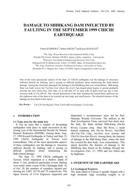
Seismic Fault Induced Failures, 143-154, 2001 January<br />
DAMAGE TO SHIHKANG DAM INFLICTED BY<br />
FAULTING IN THE SEPTEMBER <strong>1999</strong> CHICHI<br />
EARTHQUAKE<br />
Yoki<strong>to</strong> SUGIMURA 1 , Saburo MIURA 2 and Kazuo KONAGAI 3<br />
1 Dr., Eng., Water Resources Development Public Corp.<br />
(Kanda 936, Urawa, Saitama 338-0812, Japan, yoki<strong>to</strong>_sugimurawater.go.jp)<br />
2 Direc<strong>to</strong>r, Vice Head of Eng<strong>in</strong>eer<strong>in</strong>g Division, INA Corp.<br />
(Sekiguchi 44-10, Bunkyou-ku, Tokyo 112-8668, Japan, sb-miura@<strong>in</strong>a-eng.co.jp)<br />
3 Dr., Eng., Professor, Institute of Industrial Science, University of Tokyo<br />
(Komaba 4-6-1, Meguro-ku, Tokyo 153-8505, Japan, konagai@iis.u-<strong>to</strong>kyo.ac.jp)<br />
One of <strong>the</strong> most spectacular aspects of <strong>the</strong> <strong>Sept</strong>. 21 <strong>Chi</strong><strong>Chi</strong> earthquake was <strong>the</strong> damage <strong>to</strong> structures<br />
<strong>in</strong>flicted directly <strong>by</strong> fault<strong>in</strong>g, and is pos<strong>in</strong>g us difficult problems about m<strong>in</strong>imiz<strong>in</strong>g <strong>the</strong> fault-related<br />
damage. Among <strong>the</strong> structures damaged, <strong>the</strong> damage <strong>to</strong> <strong>the</strong> <strong>ShihKang</strong> dam was extraord<strong>in</strong>ary. Shih-Kang<br />
<strong>Dam</strong> was built across <strong>the</strong> Ta-<strong>Chi</strong>a river where <strong>the</strong> river’s fan-shaped pla<strong>in</strong> beg<strong>in</strong>s <strong>to</strong> spread gradually<br />
<strong>to</strong>wards <strong>the</strong> East Ch<strong>in</strong>a Sea. This dam, 25 m tall and 357 m long with 18 gates l<strong>in</strong>ed up, has a <strong>to</strong>tal<br />
concrete bulk of 141,300 m 3 . The vertical dislocation of <strong>the</strong> fault reach<strong>in</strong>g 9m caused three spillways on<br />
<strong>the</strong> rightmost side of <strong>the</strong> dam <strong>to</strong> be cracked up <strong>in</strong><strong>to</strong> large and small pieces. The detailed features of <strong>the</strong><br />
damage are described <strong>in</strong> this report.<br />
Key Words :<br />
<strong>Chi</strong>-<strong>Chi</strong> Earthquake, <strong>Dam</strong>, Fault-<strong>in</strong>flicted damage, Crack map<br />
1. INTRODUCTION<br />
1.1 Type area for <strong>the</strong> ma<strong>in</strong> text<br />
It was an irony that a number of devastat<strong>in</strong>g<br />
earthquakes <strong>to</strong>ok place <strong>in</strong> rapid succession <strong>in</strong> <strong>the</strong><br />
clos<strong>in</strong>g year of <strong>the</strong> International Decade for Natural<br />
Disaster Reduction (IDNDR). Among <strong>the</strong>m, Aug.<br />
17, <strong>1999</strong> Kocaeli Earthquake <strong>in</strong> Turkey and <strong>Sept</strong>. 21,<br />
<strong>1999</strong> <strong>Chi</strong><strong>Chi</strong> Earthquake <strong>in</strong> Taiwan were<br />
extraord<strong>in</strong>ary. One of <strong>the</strong> most spectacular aspects<br />
of <strong>the</strong>se earthquakes was <strong>the</strong> damage <strong>to</strong> structures<br />
<strong>in</strong>flicted directly <strong>by</strong> fault<strong>in</strong>g, and is pos<strong>in</strong>g us<br />
difficult problems about m<strong>in</strong>imiz<strong>in</strong>g <strong>the</strong><br />
fault-related damage.<br />
The <strong>Sept</strong>. 21, <strong>1999</strong> <strong>Chi</strong><strong>Chi</strong> earthquake <strong>in</strong><br />
Taiwan, which orig<strong>in</strong>ated at a shallow depth of<br />
about 11 km, produced spectacular reverse fault<strong>in</strong>g<br />
over nearly entire extent of <strong>the</strong> Chelungpu fault. As<br />
of Oct. 20, <strong>the</strong> numbers of casualties, <strong>in</strong>jured and<br />
miss<strong>in</strong>g are 2,405, 10,718 and 79, respectively. The<br />
Japan Society of Civil Eng<strong>in</strong>eers organized and<br />
dispatched a reconnaissance team led <strong>by</strong> Prof.<br />
Hamada, Waseda University. The authors, as <strong>the</strong><br />
<strong>Dam</strong> Investigation Team, surveyed four dams near<br />
<strong>the</strong> fault, <strong>the</strong> dams <strong>in</strong>clude Shih-Kang (Da-Jia<br />
River), Liyutan (J<strong>in</strong>gShan Shi River, a small<br />
branch empty<strong>in</strong>g <strong>in</strong><strong>to</strong> Da-An River), Suei-Sheh<br />
(Ru-Yue-Tan Lake, Juo-Suei river system) and<br />
<strong>Chi</strong>-<strong>Chi</strong> (Juo-Suei River). Among <strong>the</strong>m, <strong>the</strong> features<br />
of damage <strong>to</strong> <strong>the</strong> Shih-Kang <strong>Dam</strong>, where <strong>the</strong> fault<br />
has crossed <strong>the</strong> dam body, were extraord<strong>in</strong>ary. This<br />
report describes <strong>the</strong> features of damage <strong>to</strong> <strong>the</strong><br />
<strong>ShihKang</strong> dam based on <strong>the</strong> f<strong>in</strong>d<strong>in</strong>gs through <strong>the</strong><br />
<strong>in</strong>vestigation (Oct. 1-7, <strong>1999</strong>) and two follow-ups<br />
<strong>by</strong> Sugimura.<br />
2. OVERVIEW OF THE EARTHQUAKE<br />
2.1 Geological Features<br />
The ma<strong>in</strong> island of Taiwan is sp<strong>in</strong>dle-shaped with a<br />
high mounta<strong>in</strong> ridge extend<strong>in</strong>g roughly <strong>in</strong> its<br />
143
Fig. 11<br />
Chelungpu fault<br />
Figure 1 Tec<strong>to</strong>nic Structure around Taiwan<br />
(after Seno, <strong>1999</strong>)<br />
<br />
Figure 3 Faults <strong>in</strong> Taiwan<br />
(Central Geological Survey, 1998)<br />
<br />
Figure 2 Plate tec<strong>to</strong>nic of Taiwan<br />
(after Seno, <strong>1999</strong>)<br />
longitud<strong>in</strong>al north-south direction. The island is<br />
located right upon <strong>the</strong> wedge of <strong>the</strong> Philipp<strong>in</strong>e Sea<br />
(PS) plate, <strong>the</strong> wedge cutt<strong>in</strong>g deep <strong>in</strong><strong>to</strong> <strong>the</strong> Eurasian<br />
(EU) plate. The nor<strong>the</strong>rn side of <strong>the</strong> wedge subducts<br />
along <strong>the</strong> Ryukyu Trench beneath <strong>the</strong> EU plate,<br />
while <strong>the</strong> southwestern side of <strong>the</strong> wedge overrides<br />
<strong>the</strong> EU plate (Fig. 1). The collision of <strong>the</strong> two plates<br />
has led <strong>to</strong> <strong>the</strong> formation of <strong>the</strong> backbone ridge of <strong>the</strong><br />
island exceed<strong>in</strong>g 3000m elevation with a number of<br />
faults. The activated fault runs along <strong>the</strong> western<br />
edge of <strong>the</strong> accretionary prism accumulated along<br />
<strong>the</strong> subduction zone boundary (decollement) as<br />
illustrated <strong>in</strong> Figure 2 (after T. Seno, <strong>1999</strong>). The<br />
earthquake <strong>the</strong>refore may be categorized as a<br />
subduction zone earthquake. Figure 3 is taken from<br />
“An Introduction <strong>to</strong> <strong>the</strong> Active Faults of Taiwan”,<br />
Central Geological Survey (CGS), M<strong>in</strong>istry of<br />
Economic Affairs, Taiwan. The CGS has confirmed<br />
that 51 active and/or suspicious faults longer than 5<br />
km exist, and are classified as follows:<br />
(1) 1 st category active faults (9):<br />
a) activated at least once <strong>in</strong> <strong>the</strong> past 10,000 years,<br />
b) hav<strong>in</strong>g caused some damage <strong>to</strong> exist<strong>in</strong>g<br />
structures,<br />
c) responsible for earthquake occurrences,<br />
d) hav<strong>in</strong>g deformed alluvial soil deposits, and<br />
e) whose presences are clearly recognized from<br />
surface geological configurations.<br />
(2) 2 nd category active faults (15):<br />
a) activated at least once <strong>in</strong> <strong>the</strong> past 10,000 years,<br />
and<br />
b) hav<strong>in</strong>g deformed diluvial terraces.<br />
(3) Suspects (27):<br />
a) with ambiguous features <strong>in</strong> Quaternary<br />
configurations,<br />
b) with ambiguous features <strong>in</strong> laterite soils, and<br />
c) look<strong>in</strong>g alike but without any clear evidences.<br />
The earthquake, with a magnitude of 7.3 (Central<br />
Wea<strong>the</strong>r Bureau, CWB) <strong>to</strong>ok place at 1:47 AM,<br />
local time on 21, <strong>Sept</strong>., <strong>1999</strong>. The epicenter was<br />
located at latitude 23.85°N and longitude 120.81°E.<br />
Figure 4 shows <strong>the</strong> ma<strong>in</strong> shock and aftershocks.<br />
The earthquake that orig<strong>in</strong>ated at a shallow focal<br />
depth of 6.99 km produced spectacular reverse<br />
fault<strong>in</strong>g. The activated fault seems <strong>to</strong> have appeared<br />
exactly along <strong>the</strong> Chelungpu Fault, whose presence<br />
had been already recognized and classified <strong>in</strong><strong>to</strong> <strong>the</strong><br />
2 nd category of active faults. Hence, <strong>the</strong> activated<br />
fault, <strong>in</strong> this chapter hereafter, will be referred <strong>to</strong> as<br />
<strong>the</strong> Chelungpu Fault. The activated fault, however,<br />
144
Ta-An River<br />
Ta-<strong>Chi</strong>a River<br />
Tai-Chung<br />
<br />
Figure 4 Aftershocks distribution<br />
(http://wwweic.eri.u-<strong>to</strong>kyo.ac.jp/<strong>to</strong>pics/taiwan/yosh<br />
<strong>in</strong>2e.html)<br />
appeared branch<strong>in</strong>g east off <strong>the</strong> recognized trace of<br />
<strong>the</strong> Chelungpu <strong>in</strong> <strong>the</strong> vic<strong>in</strong>ity of Feng-Yuan City,<br />
and crossed <strong>the</strong> Shih-Kang area. When this area is<br />
zoomed <strong>in</strong> on, it is found that this branch also shoots<br />
fur<strong>the</strong>r th<strong>in</strong>ner separate branches out. Some details<br />
of this area will be given later on. Figure 5 shows<br />
dislocation vec<strong>to</strong>rs along <strong>the</strong> Chelungpu Fault<br />
(Otsuki, <strong>1999</strong>). The different diameters of gray<br />
circles show <strong>the</strong> extent of vertical offsets, and<br />
arrows represent net slips. The offsets, <strong>in</strong> general,<br />
<strong>in</strong>crease as we go north, and <strong>the</strong> maximum net offset<br />
of 13.5m is reached at Po<strong>in</strong>t 10, <strong>the</strong> second largest<br />
net offset of 11.1m at Po<strong>in</strong>t 12. Figure 6 shows<br />
elevation <strong>in</strong>crements measured over 7 km distance<br />
<strong>in</strong> Chunsh<strong>in</strong>h<strong>in</strong> <strong>to</strong>wn across <strong>the</strong> fault. The eastern<br />
side of <strong>the</strong> fault seems <strong>to</strong> have been cont<strong>in</strong>uously<br />
pushed up, <strong>the</strong> fact might be <strong>in</strong>terpreted as an early<br />
sign of <strong>the</strong> event.<br />
2.2 Seismic ground motions<br />
The Central Wea<strong>the</strong>r Bureau (CWB) is operat<strong>in</strong>g<br />
a rapid earthquake <strong>in</strong>formation release system. The<br />
motions of <strong>the</strong> ma<strong>in</strong> shock were recorded at more<br />
than 500 observation stations. Figure 7 shows peak<br />
values of three orthogonal components (NS, EW<br />
and UD) of accelerations recorded at some<br />
representative stations along both <strong>the</strong> Chelungpu<br />
Fault and <strong>the</strong> Shuangtung Fault; <strong>the</strong> op<strong>in</strong>ion was<br />
divided on <strong>the</strong> conjecture that <strong>the</strong> latter fault might<br />
have been activated. However, <strong>the</strong> rupture surface<br />
<strong>in</strong>ferred from aftershocks distribution does not seem<br />
<strong>to</strong> support <strong>the</strong> op<strong>in</strong>ion that <strong>the</strong> latter fault has<br />
slipped. At TCU129 close <strong>to</strong> <strong>the</strong> epicenter, 983.0<br />
cm/s 2 <strong>in</strong> EW, 610.7 cm/s 2 <strong>in</strong> EW and 335.0 cm/s 2 <strong>in</strong><br />
Cho-Shui<br />
River<br />
<strong>Chi</strong>-<strong>Chi</strong><br />
1 m <br />
N<br />
Epicenter<br />
9m<br />
11 m <br />
1m<br />
Net slipsVertical offsets<br />
Figure 5 Dislocations along Chelungpu fault<br />
(Otsuki and Yang, 2000)<br />
Elevation Changes (mm)<br />
<br />
<br />
<br />
<br />
<br />
<br />
<br />
<br />
Oct., '96 - Feb., '97<br />
Feb., '97 - Feb., '98<br />
Oct., '96 - Feb., '98<br />
Chelungpu faut<br />
<br />
<br />
Distance (Km)<br />
Figure 6 Elevation <strong>in</strong>crements measured over 7<br />
km distance <strong>in</strong> Chunsh<strong>in</strong>h<strong>in</strong> <strong>to</strong>wn<br />
<br />
145
Horizontal maximum acceleration (gal)<br />
<br />
<br />
<br />
Soil-based ground<br />
Foundation rock of dam site<br />
<br />
Epicentral distance (km)<br />
Figure 8 Attenuation of acceleration<br />
ß<br />
Figure 7 Observed peak values of orthogonal<br />
components of accelerations (NS, EW, UD)<br />
(Central Wea<strong>the</strong>r Bureau, Taiwan)<br />
Figure 9 Ta-<strong>Chi</strong>a River<br />
<br />
UD directions were reached. When <strong>the</strong> dynamic<br />
stability of dam is discussed, evaluation of <strong>the</strong><br />
attenuation of base rock motion with respect <strong>to</strong> <strong>the</strong><br />
distance is certa<strong>in</strong>ly a key issue. S<strong>in</strong>ce no<br />
seismometer was <strong>in</strong>stalled <strong>in</strong> <strong>the</strong> Shih-Kang <strong>Dam</strong>,<br />
<strong>the</strong> obta<strong>in</strong>ed accelerations will be of some help for<br />
us <strong>to</strong> go on <strong>to</strong> fur<strong>the</strong>r detailed discussions. Figure 8<br />
shows <strong>the</strong> peak values of acceleration observed on<br />
both rock outcrops and soil sediments <strong>to</strong>ge<strong>the</strong>r with<br />
those observed <strong>in</strong> <strong>the</strong> 1995 Kobe Earthquake; <strong>the</strong><br />
accelerations are plotted with respect <strong>to</strong> <strong>the</strong> distance<br />
from <strong>the</strong> nearest fault rupture plane. Among <strong>the</strong><br />
accelerations recorded <strong>in</strong> <strong>the</strong> <strong>Chi</strong><strong>Chi</strong> earthquake, <strong>the</strong><br />
peak value of 277 cm/s 2 was reached at <strong>the</strong> WuSheh<br />
dam; <strong>the</strong> peak absolute value of <strong>the</strong> resultant vec<strong>to</strong>r<br />
of <strong>the</strong> three orthogonal components. It is an<br />
empirical f<strong>in</strong>d<strong>in</strong>g, through long-term earthquake<br />
observations, that <strong>the</strong> maximum value of a resultant<br />
vec<strong>to</strong>r is often about 1.4 times as large as that of<br />
ei<strong>the</strong>r lateral component. Therefore, <strong>the</strong> peak value<br />
of one horizontal acceleration component is<br />
estimated <strong>to</strong> have reached about 194 cm/s 2 . The<br />
outcrop accelerations observed <strong>in</strong> <strong>the</strong> <strong>Chi</strong><strong>Chi</strong><br />
earthquake, when plotted on this figure, seem <strong>to</strong> fall<br />
<strong>in</strong> <strong>the</strong> possible range of scatter<strong>in</strong>g.<br />
3 DAMAGE TO SHIHKANG DAM<br />
3.1 General view<br />
Shih-Kang <strong>Dam</strong> was built across <strong>the</strong> Ta-<strong>Chi</strong>a river<br />
where <strong>the</strong> river’s fan-shaped pla<strong>in</strong> beg<strong>in</strong>s <strong>to</strong> spread<br />
gradually <strong>to</strong>wards <strong>the</strong> East Ch<strong>in</strong>a Sea (Figure 9).<br />
The dam site lies over a shallow sandy and gravelly<br />
soil deposit spread<strong>in</strong>g over a lam<strong>in</strong>ated mass of mud<br />
s<strong>to</strong>ne, silt s<strong>to</strong>ne and sand s<strong>to</strong>ne of <strong>the</strong> Pliocene<br />
Epoch, Tertiary Period. The construction of <strong>the</strong> dam<br />
began with <strong>the</strong> excavation of this shallow sandy and<br />
gravelly soil deposit down <strong>to</strong> <strong>the</strong> underly<strong>in</strong>g rock<br />
surface, and was completed <strong>in</strong> 1977.<br />
The Shih-Kang <strong>Dam</strong>, 25 m tall and 357 m long<br />
with 18 gates l<strong>in</strong>ed up, has a <strong>to</strong>tal concrete bulk of<br />
141,300 m 3 (Figure 10 “Plan”, “Elevation” and<br />
“general spillway cross-section”). The reservoir<br />
with a capacity of 3.38 million m 3 collects water<br />
from a catchment area of 1,061 km 2 <strong>in</strong> <strong>the</strong><br />
Chung-Yang Mounta<strong>in</strong>s, and provides a steady<br />
supply of water for irrigation, and etc. An <strong>in</strong>take<br />
tunnel on <strong>the</strong> left abutment of <strong>the</strong> dam leads <strong>the</strong><br />
water through a diluvial terrace down <strong>to</strong> <strong>the</strong><br />
Feng-Yuan water-treatment plant.<br />
146
2 sluices <br />
Intake gate<br />
Plan<br />
18 spillways<br />
Block<br />
number<br />
Sunken side<br />
Sunken side<br />
Most seriously damaged pier 2<br />
Elevation<br />
Orig<strong>in</strong>al ground surface<br />
shortly before<br />
earthquake<br />
Spillway<br />
The construction of <strong>the</strong> dam was preceded <strong>by</strong><br />
some necessary geological <strong>in</strong>vestigations. The<br />
con<strong>to</strong>urs <strong>in</strong> Figure 10 (above) describe <strong>the</strong><br />
configuration of <strong>the</strong> base rock of <strong>the</strong> Tertiary period<br />
overlaid with sands, gravels and o<strong>the</strong>r suspended<br />
matters that <strong>the</strong> Ta-<strong>Chi</strong>a river has carried over<br />
centuries. Figure 10 (middle) shows that <strong>the</strong> base<br />
rock surface is quite shallow <strong>in</strong> <strong>the</strong> middle of <strong>the</strong><br />
Figure 10 Shih-Kang <strong>Dam</strong><br />
river bed, 3 <strong>to</strong> 4 m below <strong>the</strong> soil surface, and<br />
reaches 10 <strong>to</strong> 13 m depths on both sides. These<br />
sedimentary base rocks of <strong>the</strong> Tertiary period can be<br />
recognized from <strong>the</strong>ir stratified feature. The strata of<br />
<strong>the</strong>se rocks run, <strong>in</strong> general, <strong>in</strong> about N40°E-40°S<br />
direction, and meet <strong>the</strong> dam axis at an angle of 60<br />
degrees. The strata planes have a dip of about 40<br />
degrees down <strong>to</strong>wards southwest. Hammer blows on<br />
147
Figure 11 Shih-Kang area<br />
<br />
<br />
<br />
<br />
<strong>the</strong>se rocks do not create any sharp sounds,<br />
suggest<strong>in</strong>g that <strong>the</strong> compressive strengths of <strong>the</strong><br />
rocks are some 100 kgf/cm 2 or less. When <strong>the</strong> base<br />
rocks were exposed after <strong>the</strong> excavation for<br />
construct<strong>in</strong>g this dam, no clear evidence of <strong>the</strong><br />
presence of a fault was found (Water Resources<br />
Bureau, M<strong>in</strong>istry of Economic Affairs, Taiwan).<br />
As has been mentioned, <strong>the</strong> activated fault<br />
appeared branch<strong>in</strong>g east off <strong>the</strong> recognized trace of<br />
<strong>the</strong> Chelungpu <strong>in</strong> <strong>the</strong> vic<strong>in</strong>ity of Feng-Yuan City,<br />
and crossed <strong>the</strong> Shih-Kang area. The complicated<br />
features of this fault emerge as <strong>the</strong> Shih-Kang area<br />
is zoomed <strong>in</strong> on. Figure 11 shows <strong>the</strong> offsets that<br />
<strong>the</strong> authors found dur<strong>in</strong>g <strong>the</strong>ir reconnaissance. In<br />
this figure, l<strong>in</strong>e A forms a part of <strong>the</strong> nor<strong>the</strong>ast<br />
extension of <strong>the</strong> Chelungpu Fault. L<strong>in</strong>e A crossed<br />
<strong>the</strong> Ta-<strong>Chi</strong>a river near <strong>the</strong> Bei-Fon bridge, where <strong>the</strong><br />
sou<strong>the</strong>ast side of <strong>the</strong> fault rose up <strong>by</strong> about 6 m with<br />
respect <strong>to</strong> <strong>the</strong> o<strong>the</strong>r side, caus<strong>in</strong>g a water fall <strong>to</strong><br />
appear (Pho<strong>to</strong> 1). This l<strong>in</strong>e, however dies out as it<br />
climbs <strong>the</strong> north mounta<strong>in</strong>side, and ano<strong>the</strong>r l<strong>in</strong>e, C,<br />
appears abruptly a couple of hundred meters south<br />
off l<strong>in</strong>e A. L<strong>in</strong>e C crossed <strong>the</strong> nor<strong>the</strong>rn end of <strong>the</strong><br />
Shih-Kang dam caus<strong>in</strong>g three spillways of <strong>the</strong><br />
Shih-Kang dam (No. 16-18) <strong>to</strong> be destroyed (Pho<strong>to</strong><br />
2). The Water Resources Bureau, M<strong>in</strong>istry of<br />
Economic Affairs, which ma<strong>in</strong>ta<strong>in</strong>s and operates<br />
this dam, <strong>to</strong>ok quick action of survey<strong>in</strong>g <strong>the</strong><br />
damaged dam site and its vic<strong>in</strong>ity for its retrofitt<strong>in</strong>g,<br />
and <strong>the</strong> elevations of a number of po<strong>in</strong>ts were<br />
measured. Among <strong>the</strong>m, two po<strong>in</strong>ts were put side <strong>by</strong><br />
side on <strong>the</strong> dam <strong>in</strong> such a way that l<strong>in</strong>e C runs<br />
exactly through <strong>the</strong> two po<strong>in</strong>ts, one on pier No. 15<br />
Pho<strong>to</strong> 1 Bei-Fong bridge and fault-created<br />
Waterfall<br />
Pho<strong>to</strong> 2 Broken spillways of Shih-Kang dam<br />
(Po<strong>in</strong>t a) and <strong>the</strong> o<strong>the</strong>r near gate No. 18 (Po<strong>in</strong>t b).<br />
Table 1 compares <strong>the</strong> elevations of <strong>the</strong>se two po<strong>in</strong>ts<br />
before and after <strong>the</strong> earthquake.<br />
<br />
148
Table 1 Elevations of Po<strong>in</strong>ts a and b<br />
(Water Resources Bureau, M<strong>in</strong>istry of Economic Affairs)<br />
(1) (2) (1) – (2)<br />
After EQ Before EQ<br />
Po<strong>in</strong>t a 283.05 m 272.00 m 11.05 m<br />
Po<strong>in</strong>t b 273.01 m 272.00 m 1.01 m<br />
<br />
Table 2 Elevations of Po<strong>in</strong>ts c and d<br />
(1) (2)<br />
After EQ Before EQ<br />
(1) – (2)<br />
Po<strong>in</strong>t c 262.36 m 256.24 m 6.12 m<br />
Po<strong>in</strong>t d 258.85 m 256.24 m 2.61 m<br />
<br />
From this table, it is clear that <strong>the</strong> south side of l<strong>in</strong>e<br />
C has risen up <strong>by</strong> about 10 m with respect <strong>to</strong> <strong>the</strong><br />
north side. The entire picture of fault l<strong>in</strong>e C,<br />
however, is not clear yet, because most of <strong>the</strong> l<strong>in</strong>e<br />
lies under water. The roughly estimated l<strong>in</strong>e, thus, is<br />
shown with <strong>the</strong> curved broken red l<strong>in</strong>e <strong>in</strong> Figure 11.<br />
The follow<strong>in</strong>g f<strong>in</strong>d<strong>in</strong>gs, however, allowed <strong>the</strong><br />
authors <strong>to</strong> draw <strong>the</strong> broken l<strong>in</strong>e.<br />
(1) The reservoir bed rose up <strong>in</strong> its south half (left<br />
side of <strong>the</strong> dam) slightly above <strong>the</strong> water level,<br />
whereas no clear marks show<strong>in</strong>g <strong>the</strong> vary<strong>in</strong>g water<br />
level can be found on <strong>the</strong> right shore slope of <strong>the</strong><br />
reservoir.<br />
(2) Just below <strong>the</strong> dam, <strong>the</strong> right riverbank subsided<br />
over 20 <strong>to</strong> 30 meters distance, and <strong>the</strong> trees beh<strong>in</strong>d<br />
<strong>the</strong> riverbank were deeply immersed <strong>in</strong> water that<br />
must have flowed <strong>in</strong> <strong>the</strong>re. The extension of this<br />
depressed configuration seems <strong>to</strong> climb up <strong>the</strong><br />
mounta<strong>in</strong>side.<br />
(3) A remarkable vertical offset of <strong>the</strong> road appeared<br />
on this extension.<br />
In addition <strong>to</strong> faults A and C, ano<strong>the</strong>r fault l<strong>in</strong>e, B,<br />
appeared on <strong>the</strong> south side of <strong>the</strong> Da-<strong>Chi</strong>a River. As<br />
a whole, <strong>the</strong> north side of l<strong>in</strong>e B rose up <strong>by</strong> several<br />
meters; that is <strong>to</strong> say, <strong>the</strong> entire area surrounded <strong>by</strong><br />
l<strong>in</strong>es A, B and C was pushed up <strong>to</strong> that noticeable<br />
extent. This l<strong>in</strong>e, B, crossed <strong>the</strong> <strong>in</strong>take tunnel of <strong>the</strong><br />
Shih-Kang <strong>Dam</strong>, shear<strong>in</strong>g <strong>the</strong> tunnel completely.<br />
Pho<strong>to</strong> 3 shows <strong>the</strong> tunnel dug out after <strong>the</strong><br />
earthquake. The tunnel has an oval cross-section,<br />
4.1 m and 3.8 m <strong>in</strong> upright and transverse diameters,<br />
respectively. The roof l<strong>in</strong>e, which is clearly<br />
recognized with <strong>the</strong> steel timbers meet<strong>in</strong>g <strong>to</strong>ge<strong>the</strong>r,<br />
was cut <strong>in</strong> half, show<strong>in</strong>g <strong>the</strong> extent of <strong>the</strong> dislocation<br />
which <strong>the</strong> tunnel experienced. At this site as well,<br />
<strong>the</strong> Water Resources Bureau measured <strong>the</strong><br />
elevations of some po<strong>in</strong>ts around <strong>the</strong> sheared tunnel.<br />
Table 2 shows <strong>the</strong> comparison of <strong>the</strong> elevations of<br />
two po<strong>in</strong>ts (Po<strong>in</strong>ts c and d) arranged side <strong>by</strong> side on<br />
both sides of <strong>the</strong> fault.<br />
Pho<strong>to</strong> 3 Sheared <strong>in</strong>take tunnel<br />
Pho<strong>to</strong> 4 Cracked tunnel wall<br />
Pho<strong>to</strong> 5 Intake gate wall<br />
<br />
149
Figure 12 Sketch of Shih-Kang dam from beh<strong>in</strong>d<br />
The vertical offset here is found <strong>to</strong> be about 3.5 m<br />
from <strong>the</strong> table, and judg<strong>in</strong>g from Pho<strong>to</strong> 3, right<br />
lateral slip seems <strong>to</strong> be about 3 m. All tunnel jo<strong>in</strong>ts<br />
cracked seriously (Pho<strong>to</strong> 4). Large and small pieces<br />
of concrete came off <strong>the</strong> tunnel wall, and <strong>the</strong> slack<br />
of <strong>the</strong> roof cable shows that <strong>the</strong> tunnel experienced a<br />
large axial force. The large axial force seem<strong>in</strong>gly<br />
punched out <strong>the</strong> <strong>in</strong>take gate wall <strong>by</strong> about 20 cm<br />
(Pho<strong>to</strong> 5).<br />
Fault B was also responsible for damm<strong>in</strong>g up <strong>the</strong><br />
Shyh-Suoei-Keh Shi River, a small branch of <strong>the</strong><br />
Ta-<strong>Chi</strong>a River. At this place, <strong>the</strong> north side of l<strong>in</strong>e B,<br />
a sedimentary rock mass rose up <strong>by</strong> about 4 m,<br />
dragg<strong>in</strong>g up a soft soil deposit of silt, sand and<br />
boulders, and thus, caus<strong>in</strong>g houses on it <strong>to</strong> tilt <strong>to</strong> <strong>the</strong><br />
south. A ditch was immediately dug through this<br />
sedimentary rock mass <strong>to</strong> let <strong>the</strong> dammed up water<br />
flow <strong>in</strong><strong>to</strong> <strong>the</strong> Ta-<strong>Chi</strong>a River.<br />
3.2 <strong><strong>Dam</strong>age</strong> <strong>to</strong> <strong>the</strong> dam body<br />
(1) Spillways immediately above <strong>the</strong> fault<br />
As has been briefly mentioned above, <strong>the</strong><br />
Shih-Kang <strong>Dam</strong> suffered serious damage mostly<br />
due <strong>to</strong> large dip-slip movement of fault l<strong>in</strong>e C. The<br />
north part of <strong>the</strong> dam between spillway #18 and <strong>the</strong><br />
right abutment was cracked up along construction<br />
jo<strong>in</strong>ts <strong>in</strong><strong>to</strong> several huge blocks, and a considerable<br />
amount of water leaked out through <strong>the</strong> cracks.<br />
Figure 12, a sketch of <strong>the</strong> dam made from beh<strong>in</strong>d,<br />
shows slightly tilted spillways #15 and #16, and<br />
seriously slant<strong>in</strong>g spillways #17 and #18, <strong>the</strong> latter<br />
deeply immersed <strong>in</strong> <strong>the</strong> water s<strong>to</strong>pped beh<strong>in</strong>d. These<br />
dislocated spillways allow us <strong>to</strong> figure out <strong>the</strong><br />
possible shape of dislocation that happened<br />
immediately beneath <strong>the</strong> dam. It is noted <strong>in</strong> this<br />
sketch that spillways #16 and #17 slant <strong>to</strong> <strong>the</strong> left<br />
and right, respectively, <strong>in</strong>dicat<strong>in</strong>g that <strong>the</strong> left side<br />
rock gradually rises <strong>to</strong>wards <strong>the</strong> upper end of <strong>the</strong><br />
fault-created steep scarp. Judg<strong>in</strong>g from <strong>the</strong><br />
dislocated alignment of <strong>the</strong> gates, <strong>the</strong> right-lateral<br />
dislocation of about 3 m is estimated <strong>to</strong> have<br />
reached.<br />
(2) Spillways and o<strong>the</strong>r structures off <strong>the</strong> fault<br />
The dam is made up of 21 blocks whose numbers<br />
are put <strong>in</strong> circles <strong>in</strong> Figure 10 (<strong>to</strong>p). A pier sticks<br />
upright <strong>in</strong> <strong>the</strong> middle of a block, and a pair of blocks<br />
put side <strong>by</strong> side forms a spillway or a sluice. As is<br />
illustrated <strong>in</strong> Figure 10 (bot<strong>to</strong>m), <strong>to</strong>tal 18 spillways<br />
are all equal <strong>in</strong> <strong>the</strong>ir cross-sections; 12.5m high and<br />
36m wide spread concrete bulk, and thus are quite<br />
stable aga<strong>in</strong>st earthquakes. There are two sluices on<br />
<strong>the</strong> left side of <strong>the</strong> dam<br />
The cracks on <strong>the</strong> spillways and aprons were<br />
closely mapped <strong>by</strong> Sugimura and Jyh 3) (Figure 14:<br />
1/100 scale plan of <strong>the</strong> entire dam body, Figures<br />
15-19: Cracks appear<strong>in</strong>g on piers ) Needless <strong>to</strong> say,<br />
cracks on such parts as those ly<strong>in</strong>g under water were<br />
excluded from <strong>the</strong>se figures. Those excluded<br />
<strong>in</strong>clude <strong>the</strong> upstream slopes of spillways beh<strong>in</strong>d<br />
gates, and spillways with <strong>the</strong>ir gates open. The<br />
seriously and/or completely destroyed spillways<br />
#16-18 were also excluded from this mapp<strong>in</strong>g.<br />
Figure 13 shows <strong>the</strong> distribution of cracks over<br />
<strong>the</strong> entire extent of <strong>the</strong> dam. Major cracks on<br />
spillways were found between spillways #6 and #16,<br />
namely on blocks - . In general, diagonal<br />
cracks were found on most damaged spillways, and<br />
transverse jo<strong>in</strong>ts between blocks were opened <strong>in</strong><br />
such a way that <strong>the</strong> open<strong>in</strong>gs on <strong>the</strong> upstream side<br />
were wider than those on <strong>the</strong> downstream side. The<br />
entire dam body thus seems <strong>to</strong> have been slightly<br />
warped <strong>to</strong>wards upstream side. Rock masses on both<br />
sides of a fault do not move as rigid bodies as was<br />
illustrated <strong>in</strong> <strong>the</strong> sketch (Figure 13). S<strong>in</strong>ce <strong>the</strong> dam<br />
was constructed directly upon <strong>the</strong> base sedimentary<br />
rock mass, <strong>the</strong> pattern of cracks on <strong>the</strong> dam body<br />
might <strong>in</strong>dicate how <strong>the</strong> base rock was deformed<br />
dur<strong>in</strong>g <strong>the</strong> earthquake.<br />
150
Figure 13 Crack map of Shih-Kang dam<br />
Diagonal cracks on blocks , , , , ,<br />
, and are reach<strong>in</strong>g piers, and <strong>the</strong> crack on<br />
Block is fur<strong>the</strong>r extend<strong>in</strong>g diagonally up<br />
through Pier 10 (See Pho<strong>to</strong> 6) The largest crack<br />
open<strong>in</strong>gs of 20 mm, 8mm and 40 mm are reached<br />
on Block , Pier 10 and <strong>the</strong> block jo<strong>in</strong>t between<br />
and , respectively. (See Figure 13).<br />
Cracks along horizontal construction jo<strong>in</strong>ts were<br />
found on four piers #9, #10, #15 (Fig. 14), #16 and<br />
#17. No major cracks were found on blocks more<br />
than 200 m away from fault C. In this less-damaged<br />
part also, Piers #1-#5 were found cracked. The<br />
cracks on Piers #1-#5, however, have some different<br />
features from those found on <strong>the</strong> piers closer <strong>to</strong> fault<br />
C. Some small fragments of concrete came off a<br />
jagged horizontal crack on <strong>the</strong> sluice-side wall of<br />
Pier #2 (Fig. 15), and <strong>the</strong> rupture surface <strong>in</strong>ferred<br />
from <strong>the</strong> cracks seems <strong>to</strong> run diagonally down<br />
through this pier <strong>to</strong> <strong>the</strong> o<strong>the</strong>r (spillway-side) wall of<br />
<strong>the</strong> pier. It is noted here that <strong>the</strong> concrete bulk of <strong>the</strong><br />
sluice is 2.5m higher than <strong>the</strong> next spill way.<br />
Upper construction jo<strong>in</strong>ts of Piers #3 and #4 were<br />
cracked as illustrated <strong>in</strong> Figure 16. A crack that<br />
developed diagonally up through Pier #1 is<br />
illustrated <strong>in</strong> Figure 17, whereas <strong>the</strong> crack found on<br />
Pier #5 seems <strong>to</strong> have developed upright from <strong>the</strong><br />
similar position.<br />
Simply supported RC bridges span all spillways<br />
and sluices. They all came off <strong>the</strong>ir bear<strong>in</strong>gs as<br />
shown <strong>in</strong> Pho<strong>to</strong>. 8.<br />
The cracks on <strong>the</strong> dam body caused 6 gates (5 for<br />
spillways and one for sluice) <strong>to</strong> be <strong>in</strong>operable. Pho<strong>to</strong><br />
11 shows a buckled gate plate.<br />
151
Figure 14 Cracks on Pier 14 Figure 15 Cracks on Pier 2<br />
Figure 16 Cracks on Pier 3 Figure 17 Cracks on Pier 1<br />
Pho<strong>to</strong> 6 Cracks extend<strong>in</strong>g diagonally up through<br />
Pier 10<br />
<br />
Pho<strong>to</strong> 7 Cracks on Pier 2<br />
152
4 SUMMARY<br />
The rupture of <strong>the</strong> Chelungpu Fault, which was<br />
orig<strong>in</strong>ated <strong>in</strong> <strong>the</strong> vic<strong>in</strong>ity of <strong>Chi</strong>-<strong>Chi</strong> <strong>to</strong>wn has<br />
traveled north across rivers flow<strong>in</strong>g from <strong>the</strong><br />
Taiwan’s central mounta<strong>in</strong> ridge <strong>in</strong><strong>to</strong> <strong>the</strong> East Ch<strong>in</strong>a<br />
Sea. This fault rupture changed its path quite<br />
abruptly <strong>to</strong>wards <strong>the</strong> east <strong>in</strong> <strong>the</strong> vic<strong>in</strong>ity of<br />
Feng-Yuan City, and ran across <strong>the</strong> Shih-Kang <strong>Dam</strong><br />
constructed at <strong>the</strong> lower reach of <strong>the</strong> Da-<strong>Chi</strong>a River.<br />
The features of damage <strong>to</strong> <strong>the</strong> Shih-Kang <strong>Dam</strong> were<br />
thus extraord<strong>in</strong>ary. The fault’s vertical dislocation,<br />
reach<strong>in</strong>g about 10 m at <strong>the</strong> nor<strong>the</strong>rn end of <strong>the</strong> dam,<br />
caused three spillways near <strong>the</strong> right abutment <strong>to</strong> be<br />
severely destroyed. Ano<strong>the</strong>r fault branch that<br />
appeared on <strong>the</strong> south side of <strong>the</strong> Da-<strong>Chi</strong>a River has<br />
crossed <strong>the</strong> <strong>in</strong>take tunnel of <strong>the</strong> Shih-Kang <strong>Dam</strong>,<br />
shear<strong>in</strong>g <strong>the</strong> tunnel completely. Compared with <strong>the</strong><br />
features which <strong>the</strong> fault dislocation was <strong>the</strong> most<br />
responsible for, <strong>the</strong> o<strong>the</strong>r dams near <strong>the</strong> fault were<br />
slightly damaged due <strong>to</strong> an <strong>in</strong>tense shake. The<br />
accelerations obta<strong>in</strong>ed from Liyutan <strong>Dam</strong> for<br />
example will be of some help for fur<strong>the</strong>r detail<br />
discussions.<br />
ACKNOWLEDGMENT: The authors<br />
acknowledge gratefully k<strong>in</strong>d helps for <strong>the</strong>ir<br />
reconnaissance offered <strong>by</strong> Dr. Lai Jihn-Sung,<br />
Professor Gwo-Fong L<strong>in</strong>, Professor Lee Tim-Hau,<br />
Hydraulic Research Institute, National Taiwan<br />
University, Professor Huang Ben Hung-D<strong>in</strong>,<br />
Department of Agricultural Eng<strong>in</strong>eer<strong>in</strong>g, National<br />
Taiwan University, and Professor Wang<br />
Ch<strong>in</strong>g-M<strong>in</strong>g, Graduate Institute of Environmental<br />
Education, National Taiwan Normal University.<br />
They have taken all <strong>the</strong> trouble <strong>in</strong> arrang<strong>in</strong>g for <strong>the</strong><br />
authors’ trip, and <strong>to</strong>ok <strong>the</strong> authors <strong>to</strong> <strong>the</strong> damaged<br />
dam sites. The authors are <strong>in</strong>debted <strong>to</strong> Mr. Yeh<br />
Chwen-Song, Deputy Direc<strong>to</strong>r, Central Water<br />
Resources Bureau, M<strong>in</strong>istry of Economic Affairs,<br />
and Professor Chen Cheng-Hs<strong>in</strong>g, President of <strong>the</strong><br />
<br />
<br />
Taiwan Geotechnical Society and also a Professor at<br />
<strong>the</strong> National Taiwan University, who have provided<br />
<strong>the</strong> authors with important data of <strong>the</strong> damaged<br />
dams and some pieces of <strong>in</strong>formation regard<strong>in</strong>g<br />
soil-related damage. The authors are also grateful <strong>to</strong><br />
Professor Steven Kramer, University of<br />
Wash<strong>in</strong>g<strong>to</strong>n, and Dr. Leslie Harder, Department of<br />
Water Resources, California, who, as members of<br />
US delegates, provided important <strong>in</strong>formation and<br />
constructive comments for future collaborations.<br />
REFERENCES<br />
Konagai, K., Nogami, T., Katsukawa, T., Suzuki, T. and<br />
Mikami, A. [1998a] “Real Time Control of Shak<strong>in</strong>g Table<br />
for Soil-Structure Interaction Simulation,”<br />
Jour. of<br />
Structural Mechanics and Earthquake Eng<strong>in</strong>eer<strong>in</strong>g, JSCE,<br />
598/I-44, 203-210.<br />
Konagai, K. [1998b] “Guide <strong>to</strong> TLEM,” program manual No. 5,<br />
Konagai Lab., IIS, Univ. of Tokyo.<br />
Nogami, T. and Konagai, K. [1988] “Time Doma<strong>in</strong> Flexual<br />
Response of Dynamically Loaded S<strong>in</strong>gle Piles,” Journal<br />
of Eng<strong>in</strong>eer<strong>in</strong>g Mechanics, ASCE, 114(9), 1512-1525.<br />
Novak, M., Nogami, T. and Aboul-Ella, F. [1978] “Dynamic<br />
Soil Reactions for Plane Stra<strong>in</strong> Case,” Proc., ASCE,<br />
104(EM4), 953-959.<br />
Randolph, M. F. [1981] “Response of Flexible Piles <strong>to</strong> Lateral<br />
Load<strong>in</strong>g,” Geotecnique, 31(2), 247-259.<br />
Tajimi, H. and Y. Shimomura [1976] “Dynamic Analysis of<br />
Soil-Structure Interaction <strong>by</strong> <strong>the</strong> Th<strong>in</strong> Layered Element<br />
Method,” Transactions of <strong>the</strong> Architechtual Institute of<br />
Japan, 243, 41-51.<br />
Velez, A., Gazetas, G., and Krishnan, R. [1983] “Lateral<br />
Dynamic Response of Constra<strong>in</strong>ed Head Piles,” Journal of<br />
Geotechnical Eng<strong>in</strong>eer<strong>in</strong>g, ASCE, 109(8).<br />
Poulos, H. G. [1968] “Analysis of <strong>the</strong> Settlement of Pile<br />
Groups,” Geotechnique, 18, 449-471.<br />
153
154