Book - Sustainable Aggregates
Book - Sustainable Aggregates
Book - Sustainable Aggregates

Create successful ePaper yourself
Turn your PDF publications into a flip-book with our unique Google optimized e-Paper software.
THE former coal mines of swannington and snibston 77<br />
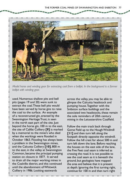
Model horse and winding gear for extracting coal from a bellpit. In the background is a former<br />
bellpit with winding gear.<br />
used. Numerous shallow pits and bell<br />
pits (pages 19 and 20) were sunk to<br />
extract the coal. These bell pits would<br />
have been served by horse gins to raise<br />
the coal to the surface. An example<br />
of a reconstructed gin, erected by the<br />
Swannington Heritage Trust, is seen<br />
in the north east part of the site. Just<br />
beyond the horse gin, 100 m to the east,<br />
the site of Califat Colliery [9] is marked<br />
by a memorial to the miners who died<br />
when the workings were flooded in<br />
October 1863. Flooding has always been<br />
a problem in the Swannington mines,<br />
and the Calcutta Colliery [10], 800 m<br />
to the east, in the valley at Swannington<br />
Common, became the principal pumping<br />
station on closure in 1877. It served<br />
to drain all the major working mines in<br />
the Coalville district, and this continued<br />
until the abandonment of Whitwick<br />
Colliery in 1986. Looking eastwards<br />
across the valley, you may be able to<br />
glimpse the Calcutta headstock and<br />
pumping house. Together with the<br />
Snibston surface buildings and the<br />
associated two headstocks, these remain<br />
the sole reminders of 20th century<br />
mining in the Leicestershire Coalfield.<br />
Follow the main track back through<br />
Gorse Field up to the Hough Windmill<br />
[11] and then turn left along the<br />
footpath directly opposite the windmill.<br />
Follow the hill crest for about 500 m and<br />
turn left down the lane. Before reaching<br />
the houses on the east side of the lane,<br />
the Five Feet coal seam is inferred as<br />
crossing the road. It is not possible to<br />
see the coal seam as it is beneath the<br />
ground, but geologists have mapped<br />
the area and believe that it is present<br />
at depth. Ignoring the first turning right,<br />
continue for 100 m and then turn right