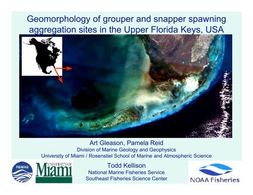
Geomorphology of grouper and snapper spawning aggregation ...
Geomorphology of grouper and snapper spawning aggregation ...
Geomorphology of grouper and snapper spawning aggregation ...
You also want an ePaper? Increase the reach of your titles
YUMPU automatically turns print PDFs into web optimized ePapers that Google loves.
<strong>Geomorphology</strong> <strong>of</strong> <strong>grouper</strong> <strong>and</strong> <strong>snapper</strong> <strong>spawning</strong><br />
<strong>aggregation</strong> sites in the Upper Florida Keys, USA<br />
Art Gleason, Pamela Reid<br />
Division <strong>of</strong> Marine Geology <strong>and</strong> Geophysics<br />
University <strong>of</strong> Miami / Rosenstiel School <strong>of</strong> Marine <strong>and</strong> Atmospheric Science<br />
Todd Kellison<br />
National Marine Fisheries Service<br />
Southeast Fisheries Science Center
Florida Keys National Marine Sanctuary<br />
(FKNMS)<br />
An innovative network <strong>of</strong> marine zoning<br />
includes 25 no-take areas<br />
FKNMS established 1990<br />
Dry Tortugas No-take area<br />
approved 2001<br />
23 No-take “SPAs” approved 1997
Black Grouper Census at Carysfort Reef<br />
Carysfort SPA (July 1997)`<br />
North Carysfort (emergent)<br />
South Carysfort (emergent)<br />
Mycteroperca bonaci<br />
(black <strong>grouper</strong>)<br />
1500 m<br />
Jiangang Luo photo<br />
Eklund et al. (2000)<br />
Depth 2-5 m 20 m 150 m
Black Grouper Census at Carysfort Reef<br />
Carysfort SPA (July 1997)<br />
Eklund et al. (2000)<br />
1500 m<br />
M. bonaci counts<br />
(all seasons 1997-2002)<br />
X 0<br />
1-10<br />
11-20<br />
21-30<br />
31-40<br />
40-70
Black Grouper Census at Carysfort Reef<br />
Carysfort SPA (July 1997)<br />
Eklund et al. (2000)<br />
1500 m<br />
M. bonaci counts<br />
(Jan & Dec 1998)<br />
X 0<br />
1-10<br />
11-20<br />
21-30<br />
31-40<br />
40-70
A Problem...
One reason for this: no habitat maps > 20 m.<br />
1 km<br />
1994 on: high<br />
abundance <strong>of</strong><br />
<strong>grouper</strong>s<br />
1998: 100 Black<br />
Groupers!<br />
1997: Carysfort SPA<br />
Airphoto Classification<br />
Hardbottom<br />
Seagrass<br />
Patch Reefs<br />
Bare Sediment
Lack <strong>of</strong> habitat data for deep / turbid water<br />
> 50% <strong>of</strong> FKNMS!
Acoustic survey (2003) with QTC-View V<br />
1 km
SPA border<br />
Modern (Holocene) Reef:<br />
too shallow to survey<br />
Carysfort survey results<br />
A<br />
30 m Outlier reef<br />
30 m ridge<br />
36 m ridge<br />
50 m Outlier reef<br />
Shaded relief from bathymetry<br />
Seabed type from echo shape<br />
Hardbottom (reef)<br />
Mixed rock/sediment<br />
Sediment<br />
B<br />
A<br />
30 m Outlier<br />
30 & 36 m ridges<br />
50 m Outlier<br />
Aggregation Site<br />
B
Carysfort survey results<br />
SPA border<br />
A<br />
Black <strong>grouper</strong> <strong>aggregation</strong> site<br />
On steepest part <strong>of</strong> 30 m outlier<br />
Inshore exposed 30, 36 m ridges<br />
Inshore exposed 50 m outlier<br />
Does this pattern hold for other<br />
<strong>aggregation</strong> sites in the Keys?<br />
B<br />
A<br />
Aggregation Site<br />
B
Historical <strong>aggregation</strong> sites<br />
Bear Cut:<br />
Gag <strong>grouper</strong><br />
Lutjanus analis (mutton <strong>snapper</strong>)<br />
Jiangang Luo photo<br />
Ocean Reef:<br />
Mutton Snapper<br />
Mycteroperca bonaci (black <strong>grouper</strong>)<br />
15 km<br />
Davis Reef<br />
Yellowtail Snapper<br />
Carysfort Reef:<br />
Black Grouper<br />
Watsons Reef:<br />
Black Grouper<br />
Yellowtail Snapper<br />
Mutton Snapper<br />
Jiangang Luo photo<br />
Lutjanus chrysurus (yellowtail <strong>snapper</strong>)<br />
Jiangang Luo photo
Watsons & Carysfort viewed together<br />
Black <strong>grouper</strong> & Yellowtail <strong>snapper</strong><br />
Offshore steepest part <strong>of</strong> 30 m outlier<br />
Upstream Watsons <strong>of</strong> exposed reef (new 36 m this ridge slide)<br />
Downstream <strong>of</strong> patch reefs<br />
Black <strong>grouper</strong> (from earlier slide)<br />
On steepest part <strong>of</strong> 30 m outlier<br />
Inshore Carysfort exposed (already 30, seen 36 earlier) m ridges<br />
Inshore exposed 50 m outlier<br />
30 m ridge<br />
30 m Outlier reef<br />
36 m ridge<br />
50 m Outlier reef<br />
Mutton Snapper: Offshore steepest part <strong>of</strong> 30 m outlier<br />
On partially exposed face <strong>of</strong> 50 m outlier<br />
12 km
Seabed type complements bathymetry<br />
Looks flat,<br />
but is really high-rugosity patch reefs<br />
Looks promising,<br />
but is really barren sediment slope<br />
12 km
SPA border<br />
Davis<br />
Yellowtail <strong>snapper</strong><br />
On steepest part <strong>of</strong> 30 m outlier<br />
Inshore <strong>of</strong> unexposed 30 m ridge, 50 m outlier<br />
30 m Outlier reef<br />
30 m ridge<br />
50 m Outlier reef
Ocean Reef<br />
Mutton <strong>snapper</strong><br />
Offshore steepest part <strong>of</strong> 30 m outlier<br />
On exposed 30 m ridge<br />
Inshore exposed 36 m ridge, 50 m outlier<br />
30 m Outlier reef<br />
30 m ridge<br />
36 m ridge<br />
50 m Outlier reef
Bear Cut<br />
Gag <strong>grouper</strong><br />
Offshore steep part <strong>of</strong> 30 m outlier<br />
Downstream unexposed 30 / 36 m ridge<br />
30 m Outlier reef<br />
30/36 m ridge (?)
Upper Keys Aggregation Sites Model<br />
Original Hypothesis (Based on Carysfort)<br />
Aggregation sites expected at a point meeting three conditions :<br />
1) On steepest part <strong>of</strong> 30 m outlier<br />
2) Inshore exposed 30, 36 m ridges<br />
3) Inshore exposed 50 m outlier<br />
30 m Outlier reef<br />
Side view<br />
(depth pr<strong>of</strong>ile)<br />
30 / 36 m ridges<br />
50 m Outlier reef<br />
Top view<br />
(depth contours)
Upper Keys Aggregation Sites Model<br />
Revised Model (Based on observations at additional Upper Keys sites)<br />
Aggregation sites expected within a b<strong>and</strong> meeting three conditions:<br />
1) On face or <strong>of</strong>fshore <strong>of</strong> steepest part <strong>of</strong> 30 m outlier<br />
2) Within 100 m (along shore) <strong>of</strong> exposed 30 / 36 m ridge<br />
3) On face <strong>of</strong> or inshore exposed 50 m outlier<br />
How well do sites fit the revised model?<br />
Site<br />
1<br />
2<br />
3<br />
Carysfort (Black)<br />
Y<br />
Y<br />
Y<br />
Watsons (Black <strong>and</strong> Yellowtail)<br />
Y<br />
Y<br />
Partial<br />
Davis (Yellowtail)<br />
Y<br />
N<br />
N<br />
Watsons (Mutton)<br />
Y<br />
Y<br />
Partial<br />
Ocean Reef (Mutton)<br />
Y<br />
Y<br />
Y<br />
Bear Cut (Gag)<br />
Y<br />
Maybe<br />
N
Relevance to Caribbean<br />
200 km<br />
5km
Macintyre 1972: Shelf edge reefs on 40m terrace<br />
Eastern Caribbean Isl<strong>and</strong>s<br />
Anguilla<br />
St. John<br />
Montserrat<br />
Barbados<br />
Grenadines<br />
On all plots: a) both axes in meters (vertical exaggeration = 10x)<br />
b) red line marks 50 m depth
Summary<br />
Outlier reefs are:<br />
• critical habitat in the Upper Fl Keys<br />
• critical habitat elsewhere (probably)<br />
• too deep to survey with imagery<br />
• possible to survey with acoustics (or lidar maybe)<br />
“Deep water” survey needed when considering MPA<br />
boundaries: We don’t want another Carysfort.<br />
Benefits <strong>of</strong> single beam<br />
• Inexpensive<br />
• Retrieves substrate type, not just bathymetry
Acknowledgements<br />
• Funding from NOAA CRCP <strong>and</strong> ONR<br />
• SPAG local knowledge from Roberto Torres<br />
• Diving <strong>and</strong> boat ops support: Dave McClellan,<br />
Mark Miller, Jack Javech, Leah Harman, Sean<br />
Cimulluca, Doug Harper, Joe Contillo, Heather<br />
Balchowsky, Jen Schull, Neil Baertlein<br />
• Anne-Marie Eklund initiated this project


