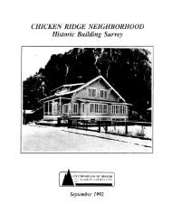
Alaska Coastal Airlines Hangar Historic Survey, September 2006
Alaska Coastal Airlines Hangar Historic Survey, September 2006
Alaska Coastal Airlines Hangar Historic Survey, September 2006

You also want an ePaper? Increase the reach of your titles
YUMPU automatically turns print PDFs into web optimized ePapers that Google loves.
CURRENT PHOTOGRAPHS LOCATION MAP<br />
The map on the following page indicates the location and direction of<br />
photographs taken to document the extant Merchant's Wharf building. Jason<br />
Bradford and Matt Majoros took the photos on July 5, <strong>2006</strong>.<br />
The map was overlaid on a modified version of the map titled, "Juneau<br />
Douglas Topographical Map." The City and Borough of Juneau Community<br />
Development Department originally produced the map in 1979.<br />
<strong>Historic</strong> Property Evaluation <strong>Alaska</strong> <strong>Coastal</strong> <strong>Airlines</strong> <strong>Hangar</strong> Page 37